

Metropolitan Melbourne Investigation - Victorian Environmental ...
Metropolitan Melbourne Investigation - Victorian Environmental ...
Metropolitan Melbourne Investigation - Victorian Environmental ...

Create successful ePaper yourself
Turn your PDF publications into a flip-book with our unique Google optimized e-Paper software.
3.2.2 Reserving Crown land with<br />
biodiversity values<br />
Maintaining natural values in areas outside conservation<br />
reserves or the protected area system can be more<br />
difficult in <strong>Melbourne</strong> than elsewhere because of the<br />
pressures on public land to accommodate a number of<br />
often incompatible uses. Indeed not all conservation can<br />
be undertaken on public land and private land will play<br />
an increasing role. Some apparently narrow public land<br />
connections between sites can also be greatly enhanced<br />
by complementary protection of natural values on<br />
adjoining private land. Examples of narrow biolinks include<br />
stream frontages, the coastline and government roads<br />
(both used and unused).<br />
Unreserved Crown land with remnant native vegetation<br />
should be reserved, particularly land that is not subject<br />
to government accepted LCC recommendations. The<br />
reservation purposes should, as far as possible, include<br />
the retention and protection of vegetation. The reservation<br />
purpose should also be amended for reserved Crown<br />
land with native vegetation, where the conservation of<br />
biodiversity is not the primary reservation purpose, so<br />
that retention and protection of native vegetation is a<br />
secondary purpose.<br />
RECOMMENDATION<br />
Other approaches to protecting biodiversity on public<br />
land include appropriate reservation and management<br />
of Crown land. Some reservation purposes mean<br />
that the land is dedicated to, and managed for,<br />
biodiversity conservation, thus making it part of the<br />
protected area system. Other reservation purposes are<br />
more general or have a primary purpose unrelated to<br />
biodiversity protection.<br />
Using Geographical Information System (GIS) mapping<br />
of DSE modelled data,* VEAC estimates that more than<br />
41,000 hectares of reserved Crown land and more<br />
than 5,400 hectares of unreserved Crown land within<br />
the investigation area has native vegetation. In the<br />
investigation area, about 485 hectares of unreserved<br />
Crown land with remnant native vegetation are outside of<br />
previous Land Conservation Council (LCC) investigation<br />
areas and consequently are not managed in accordance<br />
with any government accepted LCC recommendations.<br />
The figures for unreserved Crown land derived from the<br />
GIS mapping may be over-estimates given that some<br />
reserved Crown land areas such as stream frontages,<br />
some areas of coastline and some roads are often not<br />
shown as reserved in DSE’s Crown land database. Note<br />
also that some of the recommendations in chapter 7 of<br />
this report propose reserving currently unreserved Crown<br />
land with remnant native vegetation.<br />
R1<br />
Additional protection for Crown land with<br />
remnant native vegetation be provided by:<br />
(a) reserving unreserved Crown land for a<br />
purpose that includes the protection of its<br />
remnant native vegetation; and<br />
(b) amending the reservation purpose of<br />
reserved Crown land, where appropriate,<br />
to include the protection of its remnant<br />
native vegetation.<br />
Preventing habitat loss and improving the condition<br />
of native vegetation are more cost effective and<br />
have significantly better conservation outcomes<br />
than revegetation. 12 Given the high level of clearing<br />
in metropolitan <strong>Melbourne</strong>, VEAC considers that all<br />
Crown land with remnant native vegetation is important.<br />
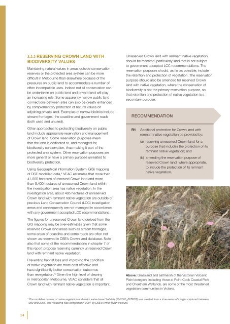
Above: Grassland and saltmarsh of the <strong>Victorian</strong> Volcanic<br />
Plain bioregion, including those at Point Cook Coastal Park<br />
and Cheetham Wetlands, are some of the most threatened<br />
vegetation communities in Victoria.<br />
* The modelled dataset of native vegetation and major water-based habitats (NV2005_EXTENT) was created from a time-series of images captured between<br />
1989 and 2005. The modelling was completed in 2007 by DSE’s Arthur Rylah Institute.<br />
24


