

Metropolitan Melbourne Investigation - Victorian Environmental ...
Metropolitan Melbourne Investigation - Victorian Environmental ...
Metropolitan Melbourne Investigation - Victorian Environmental ...

Create successful ePaper yourself
Turn your PDF publications into a flip-book with our unique Google optimized e-Paper software.
5.1 <strong>Melbourne</strong>’s public<br />
open space network<br />
The open space network includes local parks, gardens<br />
and sportsgrounds, the national and state parks that<br />
border the metropolitan area, metropolitan/regional parks<br />
including those along <strong>Melbourne</strong>’s major waterways,<br />
Port Phillip Bay and Western Port foreshores, streamside<br />
corridors, and the pathways and bicycle trails that link<br />
these spaces along road, rail and streamside corridors.<br />
Open space is managed by a range of organisations—<br />
generally public authorities, local councils and committees<br />
of management. Maps C and D in the rear pocket of this<br />
report show open space within the investigation area.<br />
Section 6.6 of the discussion paper included a description<br />
of <strong>Melbourne</strong>’s open space network in terms of ownership,<br />
categories of open space and distribution across<br />
municipalities in the investigation area. This information<br />
was derived from the analysis of data in VEAC’s open<br />
space inventory (see section 5.2 for more detail). The data<br />
and analysis have been updated since the release of the<br />
discussion paper based on further information received<br />
from public authorities, local councils and the community<br />
on the categorisation of a range of specific open space<br />
sites and other corrections (see appendix 4). Updated<br />
data on <strong>Melbourne</strong>’s population have also become<br />
available since the release of the discussion paper.<br />
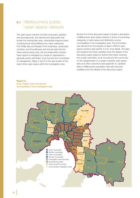
Figure 5.1<br />
Inner, middle, outer and growth<br />
municipalities in the investigation area<br />
WHITTLESEA<br />
HUME<br />
NILLUMBIK<br />
MELTON<br />
WYNDHAM<br />
BRIMBANK<br />
MOONEE<br />
VALLEY<br />
MORELAND DAREBIN<br />
BANYULE<br />
GLEN<br />
EIRA<br />
MANNINGHAM<br />
MARIBYRNONG<br />
YARRA<br />
BOROONDARA<br />
MAROONDAH<br />
MELBOURNE<br />
WHITEHORSE<br />
HOBSONS PORT<br />
STONNINGTON<br />
BAY<br />
PHILLIP<br />
MONASH<br />
KNOX<br />
A<br />
A<br />
A<br />
A<br />
BAYSIDE<br />
Inner municipality<br />
Middle municipality<br />
Outer municipality<br />
Growth municipality<br />
<strong>Investigation</strong> area boundary<br />
Municipal boundary<br />
Urban growth boundary<br />
A Land outside investigation area<br />
KINGSTON<br />
GREATER<br />
DANDENONG<br />
FRANKSTON<br />
CASEY<br />
CARDINIA<br />
34


