Flood Study Guideline Document - Townsville City Council
Flood Study Guideline Document - Townsville City Council
Flood Study Guideline Document - Townsville City Council

Create successful ePaper yourself
Turn your PDF publications into a flip-book with our unique Google optimized e-Paper software.
OWNSVILLE QLD 4810<br />
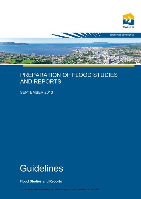
PREPARATION OF FLOOD STUDIES<br />
AND REPORTS<br />
SEPTEMBER 2010<br />
<strong>Guideline</strong>s<br />
<strong>Flood</strong> Studies and Reports<br />
103 WALKER STREET, TOWNSVILLE QLD 4810 ▪ PO BOX 1268, TOWNSVILLE QLD 4817
GUIDELINES<br />
FLOOD STUDIES AND REPORTS<br />
Quality Information<br />
Prepared for:<br />
Information<br />
Prepared by:<br />
Wesley Bailey<br />
<strong>Document</strong><br />
Preparation of <strong>Flood</strong> Studies and Reports - <strong>Guideline</strong>s<br />
DW ID<br />
Date 30/9/2010<br />
c:\documents and settings\wbb\dataworks\dataworks\working<br />
documents\4560759\flood study guideline -document final.doc<br />
Revision History<br />
Revision<br />
Revision<br />
Date<br />
Details<br />
Authorised<br />
Name/Position<br />
Signature<br />
1 30/9/2010 1 st Issue<br />
<strong>Townsville</strong> <strong>City</strong> <strong>Council</strong><br />
ABN 44 741 992 072<br />
103 Walker Street<br />
<strong>Townsville</strong> QLD 4810<br />
PO BOX 1268<br />
<strong>Townsville</strong> QLD 4810<br />
Telephone: 4727 9000<br />
Facsimile: 4727 9050<br />
Email:<br />
enquiries@townsville.qld.gov.au<br />
© TOWNSVILLE CITY COUNCIL 2010<br />
This document is and shall remain the property of TOWNSVILLE CITY COUNCIL. The document may only<br />
be used for the purposes for which it was commissioned and in accordance with the Terms of Engagement<br />
for the Commission. Unauthorised use of this document in any form whatsoever is prohibited.<br />
ABN >> 44 741 992 072
GUIDELINES<br />
FLOOD STUDIES AND REPORTS<br />
Table of Contents<br />
Foreword ..................................................................................................................... 4<br />
Glossary ...................................................................................................................... 5<br />
1.0 Introduction .....................................................................................................6<br />
2.0 Catchment Land Use....................................................................................... 7<br />
3.0 Hydrological Determination............................................................................8<br />
3.1 General ......................................................................................................... 8<br />
3.2 Hydrologic Method ........................................................................................ 8<br />
3.3 Catchment Parameters..................................................................................9<br />
3.4 Intensities.................................................................................................... 10<br />
3.5 Partial Area Effects...................................................................................... 10<br />
3.6 Calibration and Verification of Hydrological Models ..................................... 11<br />
3.7 Preparation of Reports ................................................................................ 11<br />
3.8 Catchment Maps ......................................................................................... 11<br />
4.0 Hydraulic Determination............................................................................... 12<br />
4.1 General ....................................................................................................... 12<br />
4.2 Hydraulic Method ........................................................................................ 12<br />
4.3 Topographic Data........................................................................................ 13<br />
4.4 Roughness Values ...................................................................................... 14<br />
4.5 Bridges and Culverts ................................................................................... 15<br />
4.6 Tailwater Conditions.................................................................................... 15<br />
4.7 Freeboard for Existing Areas....................................................................... 16<br />
4.8 Freeboard for New Development................................................................. 16<br />
4.9 Determination of Impacts of Development................................................... 17<br />
5.0 General Matters ............................................................................................. 19<br />
5.1 Presentation of Reports............................................................................... 19<br />
5.2 Time Required for Checking Studies ........................................................... 20<br />
5.3 As-Constructed Information......................................................................... 20<br />
5.4 Preference of Computer Models.................................................................. 20<br />
5.5 Copyright of Reports, Studies and Drawings ............................................... 20<br />
6.0 References..................................................................................................... 22<br />
ABN >> 44 741 992 072
GUIDELINES<br />
FLOOD STUDIES AND REPORTS<br />
Foreword<br />
These guidelines have been provided to allow technical professionals undertaking flood<br />
studies within <strong>Townsville</strong> <strong>City</strong> <strong>Council</strong> quick reference to methodologies, parameters<br />
and presentation standards that <strong>Townsville</strong> <strong>City</strong> <strong>Council</strong> expects. These guidelines do<br />
not remove the need for appropriate professional judgement to be used in the<br />
completion of flood studies. Suitably qualified and experienced technical professionals<br />
are still required to undertake these studies.<br />
These guidelines contain references and summaries of information within the planning<br />
scheme, planning scheme policies, codes, standard specifications and industry<br />
standard technical documents, and has had every effort made to ensure its accuracy at<br />
the time of publishing. It should be noted that it is the information within the Planning<br />
Scheme, Planning Scheme Policies and Codes that are enforceable and the<br />
information in this guideline is for information purposes only. The information has been<br />
provided for quick reference; however it is up to the flood study practitioner to ensure<br />
the validity of any referenced information. <strong>Council</strong> will make every effort to update this<br />
document when it is aware of changes in the referenced material.<br />
If there are any concerns with material provide within these guidelines please contact<br />
the <strong>Council</strong>’s Strategic Planning Unit.<br />
ABN >> 44 741 992 072
GUIDELINES<br />
FLOOD STUDIES AND REPORTS<br />
Glossary<br />
AEP<br />
ARI<br />
Annual Exceedance Probability<br />
Average Recurrence Interval<br />
ARR Australian Rainfall and Runoff (1998)<br />
DEM<br />
DFE<br />
DRAINS<br />
GSS<br />
HAT<br />
HEC-RAS<br />
ISIS<br />
LiDAR<br />
MHWS<br />
MIKE11<br />
MIKE21<br />
MIKE FLOOD<br />
MLWS<br />
QUDM<br />
RAFTS<br />
RORB<br />
SWMM<br />
TUFLOW<br />
URBS<br />
WBNM<br />
Digital Elevation Model<br />
Defined <strong>Flood</strong> Event (50 Year ARI in <strong>Townsville</strong>)<br />
Urban hydrology and hydraulics software<br />
Geospatial Solutions Section<br />
Highest Astronomical Tide<br />
Steady State One Dimensional Hydraulic Model<br />
Fully Dynamic One Dimensional Hydraulic Model<br />
Light Detection and Ranging (Aerail Laser Survey)<br />
Mean High Water Springs<br />
Fully Dynamic One Dimensional Hydraulic Model<br />
Fully Dynamic Two Dimensional Hydraulic Model<br />
Fully Dynamic Coupled One & Two Dimensional Hydraulic Model<br />
Mean Low Water Springs<br />
Queensland Urban Drainage Manual<br />
Runoff Routing Software<br />
Runoff Routing Software<br />
Fully Dynamic One Dimensional Hydraulic Model<br />
Fully Dynamic Coupled One & Two Dimensional Hydraulic Model<br />
Runoff Routing Software<br />
Runoff Routing Software<br />
ABN >> 44 741 992 072
GUIDELINES<br />
FLOOD STUDIES AND REPORTS<br />
1.0 Introduction<br />
The objective of carrying out flood studies in conjunction with development is:<br />
<br />
<br />
<br />
to determine the inundation levels of a watercourse;<br />
to establish a zone of inundation into which development should not proceed;<br />
and<br />
to determine any impacts on any watercourse, either upstream, adjacent to or<br />
downstream, created by the proposed change of land use in the catchment.<br />
Inundation level determination is required in order to satisfy appropriate <strong>Council</strong><br />
Planning Scheme requirements.<br />
An inundation study consists of the following parts:<br />
<br />
<br />
<br />
the hydrological determination to calculate the likely volume of water that<br />
results from the storm under consideration;<br />
the hydraulic determination to calculate the inundation levels and flow<br />
velocities that will most likely occur from the flow of water determined in the<br />
hydrological determination; and<br />
subsequent modelling to determine development impacts for the proposed<br />
development along with evaluation of works to mitigate the impacts of<br />
development.<br />
Inundation studies will be accepted based on approved inundation estimation<br />
calculation procedures and on observed historical records that can be quantified and<br />
related to an Average Recurrence Interval (ARI) by the use of the appropriate statistical<br />
flood frequency analysis procedure. It should be noted use of historical records may<br />
allow for determination inundation levels, however will not be able to quantify the<br />
impacts on flooding of a development. In general the only stream flow records of any<br />
length within the <strong>City</strong> are:<br />
<br />
<br />
<br />
<br />
<br />
<br />
<br />
<br />
Black River;<br />
Bohle River,<br />
Ross River,<br />
Alligator Creek;<br />
Bluewater Creek;<br />
Ross Creek;<br />
Louisa Creek; and<br />
Stuart Creek.<br />
For analysis purposes a specific storm event is nominated as the benchmark event or<br />
standard to which <strong>Council</strong> requires immunity against inundation for a development.<br />
That event is called the Defined <strong>Flood</strong> Event (DFE). The current DFE used as a<br />
benchmark for inundation or stormwater investigations and development assessment is<br />
the 50 Year ARI. The DFE was described in the <strong>City</strong> of Thuringowa Planning Scheme<br />
as the 50 year ARI event and in the <strong>Townsville</strong> <strong>City</strong> Plan as the 1 in 50 year flood. This<br />
event is also sometimes referred to as the 2% Average Exceedance Probability (AEP)<br />
event. It should be noted that floods other than the DFE may need to be modelled to<br />
fully assess the impact of development.<br />
ABN >> 44 741 992 072
GUIDELINES<br />
FLOOD STUDIES AND REPORTS<br />
2.0 Catchment Land Use<br />
Catchment land use is an important consideration for flood studies. The level of<br />
urbanisation within a catchment influences the volume of runoff and magnitude of peak<br />
discharges by:<br />
<br />
<br />
increasing the impervious fraction of the catchment which, reduces the volume<br />
of infiltration and increases the total volume of runoff; and<br />
decreasing the time to peak discharge due to construction of open drains and<br />
stormwater networks which concentrates flows and may increase the<br />
magnitude of peak discharges.<br />
The strategy for how stormwater infrastructure caters for changes in catchment land<br />
use is the responsibility of <strong>Council</strong>’s Infrastructure Planning Unit. The underlying<br />
principle of stormwater planning is that there should be no increase in flooding as a<br />
result of any works. Strategies for achieving the principle may include:<br />
<br />
<br />
<br />
mitigation of flows at the individual development;<br />
catchment wide approach to mitigation of flows; and/or<br />
allowance for additional flow capacity within flow paths.<br />
The strategy for accommodating flows will depend on existing land-uses within the<br />
catchment and the environmental value of the watercourse. In preparing a flood study,<br />
<strong>Council</strong> must be consulted to identify the proposed approach to flood mitigation<br />
within the catchment. The flood study may require assessment beyond the planning<br />
horizon in the current planning scheme, and make a determination of potential ultimate<br />
possible development or at least into the future for a period of 50 years, and even<br />
possibly 100 years.<br />
Individual developers will be responsible for mitigating the impacts of developing their<br />
site, in a manner that aligns with the catchment strategy. However, at all points in time<br />
the principle of no worsening of flood levels must be adopted. Any flood mitigation<br />
works in a catchment with a catchment wide approach to flood mitigation, contributions<br />
may be provided in lieu of works. From time to time <strong>Council</strong> may request the developer<br />
construct additional works to accommodate the catchment strategy. In this instance the<br />
developer may be entitled to credits for infrastructure charges.<br />
As a general principle, drains are an opportunity to have several functions including<br />
providing flood mitigation for an area, however for the rest of the time they can be quite<br />
an effective open space for the community.<br />
ABN >> 44 741 992 072
GUIDELINES<br />
FLOOD STUDIES AND REPORTS<br />
3.0 Hydrological Determination<br />
3.1 General<br />
The hydrological process that is to be used for determining the design flows for the<br />
hydraulic modelling is to be cognisant of the proposed land uses. When calibration is<br />
being undertaken based on historical events, then the model being calibrated is to be<br />
based on the land use at the time of the storm event under calibration.<br />
The choice of hydrologic method must be appropriate to the type of catchment and the<br />
required degree of accuracy. Simplified hydrologic methods such as the Rational<br />
Method should not be used whenever a full design hydrograph is required for flood<br />
mapping or to assess flood storage issues. Instead the more reliable runoff-routing<br />
techniques presented in publications such as Australian Rainfall & Runoff (ARR)<br />
should be adopted. Chapter 4 of the Queensland Urban Drainage Manual (QUDM)<br />
provides detailed guidance on the selection of an appropriate hydrologic method.<br />
3.2 Hydrologic Method<br />
The hydrologic method adopted for the required analysis should be appropriate to the<br />
type of catchment and the design problem being assessed. Designers should be aware<br />
of the limitations, for each of the methods.<br />
Approach When Appropriate Notes<br />
Rational Method Regular shaped catchment;<br />
An appropriate method<br />
Homogenous catchments (generally<br />
uniform land-use within the<br />
catchment);<br />
for calculating the time<br />
of concentration is<br />
essential to applying<br />
Storage or timing issues are not<br />
relevant;<br />
the Rational Method.<br />
Rural catchments smaller than<br />
25 km 2 ;<br />
Urban catchments smaller than<br />
5 km 2 ;<br />
Time of concentration is likely to be<br />
less than 30 minutes.<br />
Synthetic Unit<br />
Hydrograph Procedure<br />
<br />
<br />
<br />
Rural catchments;<br />
Larger flood events (~50 Year ARI)<br />
where overbank flows are developed;<br />
Rainfall can be assumed to be<br />
uniform across the catchment;<br />
Use of synthetic unit<br />
hydrograph procedures<br />
is not preferred and<br />
should preferably be<br />
undertaken by an<br />
experienced hydrologist<br />
with an extensive<br />
knowledge of the<br />
catchment<br />
Non-linear Runoff-<br />
Routing Models<br />
(RORB, RAFTS,<br />
WBNM, URBS)<br />
<br />
<br />
Rural and Urban catchments (Rural<br />
only for RORB and all others should<br />
be used with caution in urban areas);<br />
Storage or timing issues are relevant.<br />
<strong>Council</strong> uses RAFTS<br />
and has a preference<br />
for RAFTS as a nonlinear<br />
runoff-routing<br />
model.<br />
Models should be<br />
ABN >> 44 741 992 072
GUIDELINES<br />
FLOOD STUDIES AND REPORTS<br />
Approach When Appropriate Notes<br />
generally developed by<br />
suitably experienced<br />
practitioners, with<br />
appropriate verification<br />
/ calibration of the<br />
models.<br />
Time Area Runoff-<br />
Routing Models<br />
(DRAINS, ILSAX)<br />
<br />
<br />
Urban catchments with significant<br />
underground pipe network;<br />
Storage or timing issues are relevant.<br />
Models should be<br />
generally developed by<br />
suitably experienced<br />
practitioners, with<br />
appropriate verification<br />
/ calibration of the<br />
models.<br />
Any hydrologic method using emerging technologies needs to clearly demonstrate:<br />
<br />
<br />
<br />
the approach and the principles it employs;<br />
assumptions and limitations; and<br />
appropriate calibration or verification.<br />
3.3 Catchment Parameters<br />
Discussion on catchment parameters is required in particular:<br />
<br />
<br />
<br />
<br />
<br />
overall catchment area and sub-catchment areas;<br />
(sub-)catchment roughness and how the roughness or retardance was<br />
developed (may include a photographic record);<br />
fraction impervious and how values have been derived including reference to<br />
what date values represent;<br />
rainfall losses; and<br />
(sub-) catchment slopes and how these have been derived.<br />
All information used to define catchment parameters should be clearly referenced. A<br />
site assessment in the selection of some parameters is essential.<br />
Catchment Roughness<br />
Catchment roughness or surface retardance accounts for the influence of vegetation<br />
and surface roughness on the generation of flows from sub-catchments. Ideally values<br />
should be determined from calibration of the hydrological model to stream gauging.<br />
Values should be in the ranges presented below:<br />
Catchment Land Use<br />
Roughness Coefficient (n*)<br />
Urban Impervious Areas 0.010 – 0.030<br />
Bare Soil 0.010 – 0.050<br />
Sparse Vegetation 0.050 – 0.130<br />
Heavily Vegetated Areas 0.080 – 0.200<br />
Surface retardance values are also provided in the Aus-Spec Design <strong>Guideline</strong> D5 –<br />
Stormwater Drainage Design for individual surface types. Note that a sub-catchment<br />
may consist of numerous surface types that need to be accounted for in the<br />
specification of the catchment roughness.<br />
ABN >> 44 741 992 072
GUIDELINES<br />
FLOOD STUDIES AND REPORTS<br />
Rainfall Losses<br />
Rainfall losses account for rainfall which does not contribute to stormwater runoff<br />
because of infiltration and storage in surface depressions. Rainfall losses can vary from<br />
event to event and depend on antecedent rainfall conditions. Loss values for historical<br />
floods should be determined from calibration with loss values within the range of values<br />
as follows:<br />
Surface Type<br />
Pervious<br />
Loss Values<br />
Median initial loss 15 – 35 mm<br />
Median continuing loss – 2.5 mm/h<br />
Initial loss 0 – 140 mm<br />
Continuing loss 0.1 to 8 mm/h<br />
Impervious<br />
Initial loss 1mm<br />
Continuing Loss 0 mm/h<br />
It should also be noted that loss values will vary between design storms of different<br />
frequencies. Guidance on appropriate loss values for different ARI storms can be<br />
obtained by matching peak discharges with peak flows determined from flood<br />
frequency assessment.<br />
Sub-catchment slope<br />
Sub-catchment slope can be derived from topographic maps or survey. Slopes applied<br />
should be representative of the sub-catchment and the modeller should ensure:<br />
<br />
<br />
the appropriate slope schematisation is applied when assigning values (equal<br />
area slope, vectored slope, …); and<br />
limitations of slope within the hydrological calculation method (i.e. Laurensen’s<br />
method – minimum slope 0.3-0.5%, maximum slope 15%).<br />
3.4 Intensities<br />
Design Intensity-Frequency-Duration (IFD) Rainfall - IFD relationships shall be derived<br />
in accordance with Volume 1, Book II, of AR&R, 1998 for the particular catchment<br />
under consideration. The nine basic parameters read from Maps 1-9 in Volume 2 of<br />
AR&R shall be shown in the calculations submitted to <strong>Council</strong>.<br />
For simplicity <strong>Council</strong> has identified IFD relationships for 5 zones with the Local<br />
Government Area. These zones and the IFD relationships can be found in the<br />
<strong>Council</strong>’s Handbook for Drainage Design Criteria.<br />
3.5 Partial Area Effects<br />
If rational methods are being used then these should always be checked to ensure that<br />
flows of greater magnitude are not apparent for partial catchment areas with faster<br />
runoff characteristics. These partial areas should be checked with the higher<br />
intensities relating to the shorter times of concentration.<br />
Likewise when using hydrograph techniques (either runoff routing or unit-hydrograph<br />
procedures), a range of storms of different duration for the same ARI should be<br />
checked to ensure that the worst event for the ARI is calculated and adopted. It should<br />
ABN >> 44 741 992 072
GUIDELINES<br />
FLOOD STUDIES AND REPORTS<br />
be noted that a range of storm durations may be required to evaluate sites that cover<br />
longer reaches of watercourses or numerous watercourses.<br />
3.6 Calibration and Verification of Hydrological Models<br />
Calibration of results based on observed inundation events is desired. There are many<br />
pluviograph stations located within and adjacent to the <strong>City</strong>. Information from these is<br />
generally available from the Bureau of Meteorology or Department of Environment and<br />
Resource Management. Records from stream gauging stations will be required to<br />
match to hydrologic calculations and are generally available from Department of<br />
Environment and Resource Management.<br />
If observed data is not available to assist in the study, then it is suggested that the<br />
estimation of discharge flows from several methods will be considered with greater<br />
confidence in the result than the estimation of flows from one method alone.<br />
3.7 Preparation of Reports<br />
The method chosen should be adequately referenced and values derived should be<br />
substantiated by defining procedures used in their derivation. Where parameters are<br />
chosen or assumed, references and reasons should be supplied. The preferred<br />
method of setting out the hydrology is to describe in the text of the report the method to<br />
be used, and then to set the calculations out in a clear and concise table with sufficient<br />
data to enable quick verification of the results. The time of concentration or critical<br />
duration storm from the hydrological assessment should be clearly identified for areas<br />
relevant to the site.<br />
Where computer methods for calculation of flows are used, the text of the report should<br />
describe the method that is utilised by the computer programme. Parameters that have<br />
been chosen should be referenced with reasons stated for any assumptions. A figure<br />
should be used to clearly demonstrate the layout of the model. Output from software<br />
should be tailored to produce concise tabular results to enable quick verification of the<br />
results. Where recognised computer programmes are utilised, <strong>Council</strong> will require the<br />
electronic data files to be in acceptable format.<br />
Where insufficient data is supplied then delays will occur while studies are returned to<br />
enable the additional data to be provided.<br />
3.8 Catchment Maps<br />
Most hydrological techniques will require a catchment analysis and stream slope<br />
analysis. The catchment analysis should be presented on as large a scale map<br />
(smallest reduction ratio) as possible. Mapping and ortho photos at larger scales than<br />
topographical maps are available from the <strong>Council</strong>’s Geospatial Solutions Section<br />
(GSS) at reasonable fees. The following scales for catchment sizes are recommended<br />
for use, when maps are available:<br />
Scale<br />
Catchment Area<br />
1:1000 up to 0.5 sq. kms (50 ha)<br />
1:2000 up to 1.0 sq. kms (100ha)<br />
1:5000 up to 1.5 sq. kms (150ha)<br />
1:10000 up to 50 sq. kms (5000ha)<br />
ABN >> 44 741 992 072
GUIDELINES<br />
FLOOD STUDIES AND REPORTS<br />
1:25000 limited to 300 sq. kms per sheet.<br />
Maps should be well presented with catchments contained upon one sheet where<br />
possible. Standard size sheets should be used. Sub catchments should be boldly<br />
defined and the contours should be clearly defined to enable easy verification of the<br />
catchments in relation to the contours. Where sub catchments are not consistent with<br />
the contour information then reasons should be stated in the text and clearly labelled<br />
on the map. Good drafting standards should be maintained in the presentation of these<br />
maps.<br />
4.0 Hydraulic Determination<br />
4.1 General<br />
The hydraulic determination involves the calculation of flood levels and velocities for<br />
the flood flows from the hydrological determination. Book VII of Australian Rainfall and<br />
Runoff, “Aspects of Hydraulic Calculations” 1 sets out aspects of hydraulic calculations<br />
that can be utilised to determine the water levels for design discharges.<br />
Unless the channel consists of long lengths of uniform section and uniform flow, the<br />
Mannings equation cannot be used in its simple form. This equation describes flow in<br />
a uniform channel at non-varying steady state flow conditions.<br />
Section 1.10 of Book VII of Australian Rainfall and Runoff 1, adequately describes<br />
methods for flood level determination in gradually varied flow conditions. The method<br />
for hydraulic determination will be dependent on the hydraulic controls of the study<br />
area. In general it is appreciated that these methods will use computer applications.<br />
4.2 Hydraulic Method<br />
The hydraulic method adopted for the required analysis should be appropriate to the<br />
hydraulic controls of the study area and the design problem being assessed. Designers<br />
should be aware of the limitations, for each of the methods.<br />
Approach When Appropriate Notes<br />
Steady State – One-<br />
Dimensional<br />
Storage or timing issues are not<br />
relevant; and<br />
Generally only suitable<br />
for small site scale<br />
(HEC-RAS)<br />
Flows are one-dimensional, largely<br />
within a watercourse and the<br />
immediate overbank area.<br />
hydraulic determination.<br />
Fully Dynamic – One-<br />
Dimensional<br />
(MIKE11, ISIS, SWMM)<br />
<br />
<br />
Storage or timing issues are relevant;<br />
Flows are one-dimensional, largely<br />
within a watercourse and the<br />
immediate overbank area.<br />
Suitable for smaller<br />
one-dimensional<br />
watercourses. Provides<br />
stability advantages<br />
over 2D models for<br />
steeper areas.<br />
<strong>Council</strong> uses MIKE11<br />
and has a preference<br />
for MIKE11 as a fully<br />
dynamic – onedimensional<br />
model<br />
ABN >> 44 741 992 072
GUIDELINES<br />
FLOOD STUDIES AND REPORTS<br />
Fully Dynamic – Two<br />
Dimensional<br />
(MIKE21, TUFLOW)<br />
<br />
<br />
Storage or timing issues are relevant;<br />
Flows are two-dimensional,<br />
<strong>Flood</strong> maps are<br />
generally direct output<br />
from models.<br />
<strong>Council</strong> uses MIKE21<br />
and has a preference<br />
for MIKE21 as a fully<br />
dynamic – onedimensional<br />
model<br />
Fully Dynamic –<br />
Coupled One & Two<br />
Dimensional<br />
(MIKE FLOOD,<br />
TUFLOW)<br />
<br />
<br />
<br />
Storage or timing issues are relevant;<br />
Flows are combination of one and<br />
two-dimensional;<br />
Large areas need to be represented<br />
in combination with fine detail<br />
<strong>Council</strong> uses MIKE<br />
FLOOD and has a<br />
preference for MIKE<br />
FLOOD as a fully<br />
dynamic – onedimensional<br />
model<br />
4.3 Topographic Data<br />
Topographic data used for the hydraulic determination will be dependent on hydraulic<br />
method:<br />
<br />
<br />
One-dimensional models employ cross-sections along branches to represent<br />
the study area topography; and<br />
Two-dimensional models employ digital elevation models to represent the study<br />
area topography.<br />
The accuracy of the topographic data governs the accuracy of the hydraulic<br />
determination. The accuracy of the topographic data should be clearly stated.<br />
Cross-Sections<br />
Cross sections are required at representative locations along a stream reach and at<br />
locations where changes occur in discharge, slope, shape, or roughness, and at<br />
bridges, culverts or control structures such as weirs. Where abrupt changes occur,<br />
several cross sections should be used to describe the change in shape regardless of<br />
the distance between sections. Cross section spacing is also a function of stream size,<br />
slope and uniformity of cross section shape. For one-dimensional models, the crosssections<br />
should be wide enough so that the water surface is contained within the extent<br />
of the cross-sections. The accuracy of the hydraulic modelling will be dependent upon<br />
the spacing of cross sections and the accuracy of the cross-section survey.<br />
Digital Elevation Models<br />
Digital elevation models used for two-dimensional models should use a grid spacing<br />
fine enough to resolve watercourses within the study area. As a general rule, a<br />
watercourse should be represented by a minimum of 5 grid-cells across the width of<br />
the watercourse. Coupled models can be used as an alternative to maintain the<br />
resolution within the watercourse<br />
The digital elevation model should be orientated to minimise disturbance of flows by<br />
the grid cell orientation. Aligning grid cells with streets (often part of the major drainage<br />
system) helps to achieve an appropriate orientation.<br />
Digital elevation models are often captured from aerial surveying methods such as<br />
LiDAR or Photogrammetry. These methods can lose accuracy in areas of dense<br />
ABN >> 44 741 992 072
GUIDELINES<br />
FLOOD STUDIES AND REPORTS<br />
vegetation. It should be clearly demonstrated what steps (including ground survey)<br />
have been taken to improve the accuracy in areas potentially obscured by vegetation.<br />
4.4 Roughness Values<br />
Based on the procedure developed by Cowan (1956), stream roughness values are a<br />
combination of influences from:<br />
<br />
<br />
<br />
<br />
<br />
<br />
bed material;<br />
surface irregularities;<br />
variations in channel cross-section;<br />
obstructions;<br />
vegetation and flow conditions; and<br />
meandering.<br />
Different methods for hydraulic determination such as fully dynamic and fully dynamic<br />
two-dimensional modelling will account for some of these influences within the<br />
underlying digital elevation model or solution scheme of the model.<br />
Suggested ranges for roughness values based on the hydraulic method are provided<br />
below:<br />
Land Use<br />
Roughness Values (Manning’s n)<br />
1D Steady State 1D Fully Dynamic 2D Fully Dynamic<br />
Natural Watercourse 0.03 – 0.08 0.025 – 0.06 0.02 – 0.05<br />
Riparian Corridor 0.15 – 0.2 0.08 – 0.16 0.06 – 0.12<br />
Open Grassland 0.04 – 0.08 0.035 – 0.06 0.03 – 0.05<br />
Low Density Vegetation 0.06 – 0.12 0.045 – 0.08 0.04 – 0.06<br />
Medium Density Vegetation 0.08 – 0.18 0.06 – 0.1 0.05 – 0.08<br />
High Density Vegetation 0.1 – 0.25 0.08 – 0.15 0.06 – 0.12<br />
Roads 0.03 – 0.06 0.025 – 0.05 0.02 – 0.04<br />
Open Channels 0.03 – 0.05 0.025 – 0.05 0.02 – 0.04<br />
Rural Residential 0.06 – 0.1 0.05 – 0.08 0.04 – 0.07<br />
Urban Residential 0.06 – 0.15 0.05 – 0.12 0.04 – 0.1<br />
Parks 0.04 – 0.18 0.035 – 0.1 0.03 – 0.08<br />
Where possible, roughness values should be determined from calibration. Often<br />
calibration will not be possible and sensitivity analysis to variations in roughness should<br />
be undertaken.<br />
In the case of a one-dimensional model, roughness should be appropriately defined<br />
across the cross-sections based on the land–use. In the case of a two-dimensional<br />
model, roughness should be appropriately defined using a grid to represent the study<br />
area based on the land-use.<br />
When representing development, roughness values should only be changed to reflect<br />
the change in land-use resulting from the development. These changes need to be<br />
clearly identified and justified. In assigning roughness values within new drainage<br />
channels or areas impacted by flooding, there should be consideration given to the way<br />
regrowth can occur within these areas. Areas below Highest Astronomical Tide (HAT)<br />
are likely to have mangrove regrowth occur. In areas further upstream, regrowth by<br />
tea-tree is likely to occur and can create a significant impediment to flows. Also, most<br />
flood events within <strong>Townsville</strong> occur towards the end of the wet season (January to<br />
ABN >> 44 741 992 072
GUIDELINES<br />
FLOOD STUDIES AND REPORTS<br />
March), when earlier rain has enabled grass in drains to grow with minimal ability to<br />
mow. Roughness values within drainage corridors for development assessment should<br />
be adopted towards the higher end of the range of values to account for regrowth,<br />
which may have minimal maintenance.<br />
4.5 Bridges and Culverts<br />
Book VII, Sections 1.11 to 1.14 inclusive, in ARR provides useful information and<br />
references for the determination of afflux levels and water profiles at bridges and other<br />
structures.<br />
Head-losses across major drainage structures assessed within fully dynamic models,<br />
should be verified by hand-calculations or assessment with a steady state model.<br />
4.6 Tailwater Conditions<br />
Tailwater conditions for hydraulic models will be depend on the location of the<br />
downstream extent of the model. Tailwater conditions may be one of the following:<br />
<br />
<br />
<br />
<br />
sea levels for a coastal boundary;<br />
a gauged rating curve;<br />
flood levels from the same ARI flood based on a previously accepted flood<br />
study; or<br />
flood levels calculated from simplified means in the absence of other<br />
information (e.g. normal depth or critical depth).<br />
In using flood levels calculated from simplified means the method of calculation should<br />
be justified and sensitivity to input parameters should be evaluated. The downstream<br />
boundary should be located so that the boundary conditions do not influence results at<br />
the study site. Ensuring the boundary is sufficiently far enough downstream from the<br />
study site will reduce the impact on results at the site.<br />
Requirements for a couple of specific boundary conditions are discussed below.<br />
Coastal Boundaries<br />
When calibrating hydraulic models, tailwater conditions should be based on observed<br />
sea levels for the event. Sea-levels are monitored at the <strong>Townsville</strong> port, with the<br />
information available through the Bureau of Meteorology.<br />
To maintain the probability of the assessed flood event for design purposes, the<br />
tailwater condition adopted should not have a frequency of occurring any less than<br />
once a year. A fixed tailwater condition equal to the height of the Mean High Water<br />
Springs (MHWS) tide should be adopted. For storm events greater than 24 hours, a<br />
representative tidally varying water surface level between MHWS and Mean Low Water<br />
Springs (MLWS) can be adopted.<br />
ABN >> 44 741 992 072
GUIDELINES<br />
FLOOD STUDIES AND REPORTS<br />
As part of understanding the risk associated with sea level rise due to climate change,<br />
a sensitivity assessment in tailwater condition should be undertaken. The official<br />
projections of global sea rise from 1990 to 2100 are in the range from 0.09 to 0.88 m<br />
(IPCC 2001; CSIRO 2001) as summarised below:<br />
Range<br />
Sea Level Rise (m)<br />
Minimum 0.09<br />
Central 0.48<br />
Maximum 0.88<br />
The DFE should be assessed in combination with the maximum sea level rise applied<br />
to the MHWS level to evaluate the additional risk associated with climate change. The<br />
impacts of the sea level rise should be clearly discussed with any loss of freeboard<br />
identified.<br />
Backwater Effects in Tributaries from Larger Streams<br />
Where a smaller stream discharges into a larger stream, it will be most probable that<br />
the larger stream will experience more severe flooding for storms of longer duration<br />
and hence lesser intensity for the same average recurrence interval. The tributary is to<br />
be checked for a storm of the same duration and intensity as that causing the peak flow<br />
in the larger stream.<br />
The hydraulic assessment should assess the flooding for both the storm duration<br />
critical for the larger stream and the local tributary. <strong>Flood</strong> levels in the area will be<br />
based on the highest flood level determined from both storm durations. Peak velocities<br />
in the area will be based on the fastest velocity determined from both storm durations<br />
regardless of whether the storm duration that generates the fastest velocities produced<br />
the highest flood levels.<br />
It is acknowledged that runoff routing models combined with fully dynamic hydraulic<br />
models will adequately account for these processes.<br />
4.7 Freeboard for Existing Areas<br />
Within some existing urban areas, design criteria have changed over-time and has<br />
resulted in freeboard to existing buildings being less than is required in new<br />
development. To ensure the freeboard for existing areas is maintained, flooding for all<br />
standard ARI floods up to the DFE, must be examined as a minimum. The assessment<br />
should demonstrate that there is no increase in flooding in any ARI flood.<br />
4.8 Freeboard for New Development<br />
In general, development (particularly residential) is preferred to occur in areas outside<br />
inundation zones. This is to provide a sense of security and amenity for the public.<br />
However, not all people want to live in these inundation free ‘safer’ areas. Lifestyle<br />
choices include living outside the ‘standard’ urban inundation free locations. These<br />
other lifestyle areas include:<br />
<br />
<br />
<br />
living close to watercourses;<br />
living on larger lot sizes in non-urban areas;<br />
living in urban and non-urban areas developed within a previous inundation<br />
zone<br />
ABN >> 44 741 992 072
GUIDELINES<br />
FLOOD STUDIES AND REPORTS<br />
<br />
<br />
<br />
<br />
living in coastal townships or coastal residential areas<br />
living in areas where stormwater flow paths or outlets are limited or restricted<br />
living in areas where discharge of stormwater is against the natural topography<br />
living within naturally perched watercourse systems<br />
<strong>Council</strong> can choose to approve development outside inundation zones (which provides<br />
the greatest overall protection to the community) or can choose to approve<br />
development within an inundation zone subject to certain parameters and/or<br />
acceptable solutions. These parameters will be determined on a case by case basis<br />
but are likely to include:<br />
<br />
<br />
<br />
<br />
ensuring floor levels are suitably far above the DFE;<br />
providing a level of flood immunity for access routes to properties;<br />
ensuring flood levels are not increased as a result of the development; and<br />
ensuring development does not affect the integrity of watercourses.<br />
The new planning scheme, which is anticipated for completion by 2013 will provide a<br />
uniform approach to freeboard and minimum floor levels across the <strong>City</strong>.<br />
In the interim the freeboards and minimum lot levels from the previous two planning<br />
schemes should be adopted. Minimum lot levels are applied at low lying areas, close to<br />
the coast where inundation of lots is more likely from storm tide than flooding.<br />
Elsewhere, floor levels are dictated by a freeboard above the DFE.<br />
Values form the two planning schemes are:<br />
Planning Scheme Area Minimum Lot Level Floor Level Freeboard<br />
Thuringowa 3.9 m AHD* 450mm above Q50 flood level<br />
<strong>Townsville</strong> 3.25 m AHD 300mm above Q50 flood level<br />
* Note: minimum Lot level applies to areas impact by storm tide only<br />
4.9 Determination of Impacts of Development<br />
Developments have potential to cause significant adverse impacts on flooding due to:<br />
<br />
<br />
<br />
increasing the impervious fraction, reducing amount of infiltration and<br />
generating a larger volume of runoff;<br />
providing more efficient conveyance of flows through the site so that flows are<br />
concentrated faster at the downstream end of the site producing larger peak<br />
flows; and<br />
removing floodplain storage due to filling which reduces the natural flow<br />
attenuation of the floodplain and increases flood levels.<br />
It will be necessary to carry out studies of the catchment in the pre-developed state<br />
(base case) and the developed state to determine increased amounts of flow and flood<br />
levels. The pre-developed state should represent the state of development within the<br />
catchment and floodplain immediately prior to time of construction of the proposed<br />
works.<br />
In some cases the adverse impacts on flooding may preclude development unless<br />
appropriate flood mitigation measures within and beyond the subject site are proposed<br />
as part of the development. As a result of developments:<br />
<br />
flood levels should not increase beyond the accuracy of the method of hydraulic<br />
determination (generally 0.01 m) either upstream, downstream or adjacent to<br />
the site;<br />
ABN >> 44 741 992 072
GUIDELINES<br />
FLOOD STUDIES AND REPORTS<br />
<br />
<br />
there should be no significant change in flow patterns so that new flow paths on<br />
adjacent land are formed; and<br />
any changes in flow velocities should be shown to have minimal impact on<br />
erosion potential.<br />
Mitigation works such as levees or detention basins involving embankments, need to<br />
be shown to have a safe overtopping failure. Such works should be modelled for the<br />
Probable Maximum <strong>Flood</strong> (PMF) to demonstrate safe passage of these flows without<br />
catastrophic failure of embankments.<br />
Any mitigation measures recommended beyond the subject site will need to undergo<br />
the development assessment process including:<br />
<br />
<br />
<br />
clear identification of the land parcels impacted;<br />
development applications (material change of use, reconfiguration of a lot<br />
and/or operational works) - as required; and<br />
identification of maintenance measures including responsibilities and funding<br />
sources.<br />
Mitigation measures should generally be on the subject site unless prior discussions<br />
have been entered into with <strong>Council</strong> and there is an agreement for works outside of the<br />
subject site.<br />
ABN >> 44 741 992 072
GUIDELINES<br />
FLOOD STUDIES AND REPORTS<br />
5.0 General Matters<br />
5.1 Presentation of Reports<br />
As stated in the previous sections all reports and tabulations are to be printed on A4<br />
size sheets, and drawings presented on standard size sheets prepared using good<br />
drafting standards. The expected content of the reports is as discussed in Section 2, 3<br />
and 4 above. In summary the contents of a study report must include:<br />
Hydrology Section<br />
Catchment Map - large as possible;<br />
Report on procedure (brief), including hydrologic method, catchment<br />
characteristics, assumptions and discussions on results including critical<br />
duration /time of concentration as detailed in Section 3.0 above; and<br />
Calculations and/or model results - tabulated where possible and attached in<br />
appendix if significant in volume.<br />
Hydraulics Section<br />
Report on procedure including hydraulic method, stream/floodplain<br />
characteristics and assumptions as detailed in Section 4.0 above;<br />
Model Results – Clearly presented as maps and tabulated values.<br />
Stream <strong>Flood</strong> profile and bed profile of the study area.<br />
Drawings/figures of topographic data used for the model (Digital Elevation<br />
Model map or plan of cross-section locations and cross-sections with X and Z<br />
coordinates included);<br />
A plan containing the proposed works showing any filling and excavation<br />
associated with development; and<br />
Model results updated on the basis of including the development with the<br />
revised flood extents and impacts on flooding.<br />
General<br />
Discussion on sensitivity analysis for critical parameters (eg roughness,<br />
infiltration etc...)<br />
Discussion on accuracy of inundation mapping and the resulting required flood<br />
line (eg 50 year ARI),<br />
Recommendations as to methods of flood mitigation within the site.<br />
Recommendations as to method of flood mitigation beyond the site together<br />
with development approvals, construction proposal and funding proposals.<br />
Electronic data for both the hydrology and hydraulics in an agreed format<br />
(modelling platforms and GIS).<br />
Drawings should be bound into the report where sizes are A3 or A4. Larger drawings<br />
are to be appropriately folded and inserted in a pocket in the back cover.<br />
Recognition by the consultant, that the assignment of data to <strong>Council</strong>, and use of the<br />
studies by <strong>Council</strong>, for its sole use is a mandatory requirement before a study is<br />
commissioned and/or the results of any study will be accepted by <strong>Council</strong>.<br />
All studies, reports and submissions forwarded to council shall be prepared by, or at<br />
least certified by, a Registered Professional Engineer Queensland (RPEQ) who is<br />
ABN >> 44 741 992 072
GUIDELINES<br />
FLOOD STUDIES AND REPORTS<br />
registered in the specific area of engineering in which the study or report has been<br />
prepared. e.g. an RPEQ (Structural) shall not certify a stormwater report.<br />
5.2 Time Required for Checking Studies<br />
As inundation studies are generally comprehensive and complex in nature it is<br />
necessary to allow sufficient time for checking and approval by <strong>Council</strong> staff. A<br />
minimum lead time of four weeks is required for this purpose and the designers should<br />
plan their development programmes accordingly. Designers should ensure that all<br />
necessary information required for checking of calculations is presented to avoid<br />
unnecessary delays while studies are returned to have the necessary additional<br />
information appended to the report.<br />
<strong>Council</strong> will require request that model files used for the study are provided for the<br />
review. Models provided which are not in the preferred software listed in Section 5.4<br />
will attract longer periods of time for the review.<br />
5.3 As-Constructed Information<br />
Inundation studies are normally carried out assuming design ground surface level for<br />
channels and over bank areas. Where "As Constructed" information shows sufficient<br />
change to the designed surface level and chainage elements, then the inundation study<br />
may need to be updated to provide for the changes during construction.<br />
5.4 Preference of Computer Models<br />
It is acknowledge that where no modelling has been undertaken, then any modelling<br />
will provide a more accurate estimation of inundation levels than collated levels from<br />
observed inundation events.<br />
Modelling studies where the results have been calibrated using observed levels and<br />
measured rainfalls will be recognised as providing a more representative result for the<br />
study area.<br />
The hydrologic and hydraulic methods adopted should be suitable for purpose as<br />
indicated in Section 3.2 and 4.2. <strong>Townsville</strong> <strong>City</strong> <strong>Council</strong> has a preference for software<br />
that is run internally which includes:<br />
<br />
<br />
<br />
<br />
<br />
Non-linear Routing – XP-RAFTS;<br />
1D Steady State – HEC-RAS;<br />
1D Fully Dynamic – MIKE11;<br />
2D Fully Dynamic – MIKE21; and<br />
Coupled 1D/2D Fully Dynamic – MIKE FLOOD.<br />
5.5 Copyright of Reports, Studies and Drawings<br />
Prepared Directly for <strong>Council</strong><br />
It is acknowledged that intellectual capacity has been demonstrated in the preparation<br />
of the report. However, the report is prepared and based on accepted engineering<br />
fundamentals and principles. In addition, the practices adopted are those developed<br />
by the engineering profession through initiative and ingenuity and ratified through the<br />
ABN >> 44 741 992 072
GUIDELINES<br />
FLOOD STUDIES AND REPORTS<br />
professions recognised body “The Institution of Engineers, Australia” currently trading<br />
as “Engineers Australia”.<br />
All reports and studies (including drawings, tables, model files etc...) prepared for<br />
<strong>Council</strong> under direct commission will become the sole copyright of <strong>Council</strong>, and those<br />
reports will be used by <strong>Council</strong> in a manner that will provide the optimum benefit to the<br />
community. All reports adopted by <strong>Council</strong> will also be available for public and<br />
professional perusal on <strong>Council</strong>’s website.<br />
In any reference to the report, the author of the report will be acknowledged by <strong>Council</strong><br />
and should be acknowledged by any authorised third party user.<br />
Submitted as Part of a Development Application<br />
Submitted as part of a Development Application and adopted as supporting the<br />
application only<br />
When a technical report or study is submitted to council as part of a development<br />
application, this report/study along with all components of the submission, can be made<br />
available to the public as part of the notification stage. The report can be provided to<br />
anyone seeking the report during this stage and following the approval. Use of the<br />
report for any third party use will be at the complete risk of the third party. It should be<br />
noted that it will be only the approved report including any council requested<br />
amendments, which should be referred to in future.<br />
Submitted as part of a Development Application and adopted by <strong>Council</strong> as a<br />
benchmark report for future development or other purposes<br />
From time to time reports etc. submitted as part of a development application, or<br />
supporting an application, could provide a wider ‘regional’ significance and importance<br />
than just the development site for which they were prepared. <strong>Council</strong> may choose to<br />
open discussions with the developer to determine if obtaining all supporting digital and<br />
electronic data along with software input/output files would allow the option of adopting<br />
the report as a ‘benchmark’ report for <strong>Council</strong>. The decision as to whether a report has<br />
wider regional significance will be <strong>Council</strong>’s alone.<br />
Should this occur, <strong>Council</strong> may be prepared to consider some value contribution to the<br />
reports preparation, up to a designated limit of 50% of report preparation costs. The<br />
contribution may be possible in the form of a credit towards Stormwater Infrastructure<br />
Charges (Planning Scheme Policy Infrastructure Charges and/or Priority Infrastructure<br />
Plan Contributions) for current or future stages of development.<br />
Once these reports have been adopted by <strong>Council</strong> as a ‘benchmark’ report and<br />
contribution agreed upon, the report assumes the status as if the report was prepared<br />
by or for <strong>Council</strong>, and the copyright previously assigned by the author is released and<br />
the copyright provided to <strong>Council</strong>. <strong>Council</strong> can use the report to achieve optimal<br />
outcomes for the wider community.<br />
ABN >> 44 741 992 072
GUIDELINES<br />
FLOOD STUDIES AND REPORTS<br />
6.0 References<br />
<strong>City</strong> of Thuringowa (2007), <strong>City</strong> of Thuringowa Planning Scheme<br />
Cowan, W.L., (1956), Estimating hydraulic roughness coefficients:Agricultural<br />
Engineering, v. 37, no. 7, p. 473-475.<br />
CSIRO (2001) Climate change projections for Australia. Prepared by Climate Impact<br />
Group, CSIRO Div Atmospheric Research<br />
Department of Natural Resources and Water (2007), Queensland Urban Drainage<br />
Manual 2007,<br />
Engineers Australia (1998) Australian Rainfall and Runoff, A Guide to <strong>Flood</strong> Estimation,<br />
Engineers Australia (2006), Australian Run-off Quality – a guide to Water Sensitive<br />
Urban Design.<br />
GHD (2007) <strong>Townsville</strong> –Thuringowa Storm Tide <strong>Study</strong><br />
IPCC (2001) Climate change 2001 – synthesis report. Contribution of Working Groups<br />
I, II and III to the Third Assessment Report of the Intergovernmental Panel on Climate<br />
Change.<br />
<strong>Townsville</strong> <strong>City</strong> <strong>Council</strong> (2010) Queensland Aus-Spec #1, Development Specification<br />
Series for Construction and Design<br />
<strong>Townsville</strong> <strong>City</strong> <strong>Council</strong> (2010), <strong>Townsville</strong> <strong>City</strong> <strong>Council</strong> <strong>City</strong> Plan<br />
<strong>Townsville</strong> <strong>City</strong> <strong>Council</strong> (2010) Stormwater Drainage Design Handbook<br />
ABN >> 44 741 992 072