MEPA certificate - I-93 Tri-Town Interchange Project - Executive ...
MEPA certificate - I-93 Tri-Town Interchange Project - Executive ...
MEPA certificate - I-93 Tri-Town Interchange Project - Executive ...

Create successful ePaper yourself
Turn your PDF publications into a flip-book with our unique Google optimized e-Paper software.
@<br />
5 ~7 ,<br />
Akq g<br />
-, :-- z<br />
*04&,7,&'-<br />
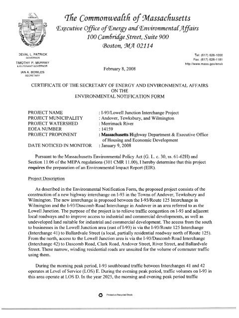
The ~ommonwealth of Massachusetts<br />
mecutive Ofice cf Energy adEnvironmentaLgflairs<br />
100 Cambridge Street, Suite 900<br />
Boston, 94' 02114<br />
DEVAL L. PATRICK<br />
GOVERNOR<br />
TIMOTHY P. MURRAY<br />
LIEUTENANT GOVERNOR<br />
IAN A. BOWLES<br />
SECRETARY<br />
February 8,2008<br />
Tel: (617) 626-1000<br />
Fax: (61 7) 626-1 181<br />
http://www.mass.gov/envir<br />
CERTIFICATE OF THE SECRETARY OF ENERGY AND ENVIRONMENTAL AFFAIRS<br />
ON THE<br />
ENVIRONMENTAL NOTIFICATION FORM<br />
PROJECT NAME<br />
: I-<strong>93</strong>1Lowell Junction <strong>Interchange</strong> <strong>Project</strong><br />
PROJECT MUNICIPALITY : Andover, Tewksbury, and Wilmington<br />
PROJECT WATERSHED : Merrimack River<br />
EOEA NUMBER : 14159<br />
PROJECT PROPONENT : Massachusetts Highway Department & <strong>Executive</strong> Office<br />
of Housing and Economic Development<br />
DATE NOTICED lN MONITOR : January 9,2008<br />
Pursuant to the Massachusetts Environmental Policy Act (G. L. c. 30, ss. 6 1 -62H) and<br />
Section 11.06 of the <strong>MEPA</strong> regulations (301 CMR 1 1.00), I hereby determine that this project<br />
requires the preparation of an Environmental Impact Report (EIR).<br />
Proiect Description<br />
As described in the Environmental Notification Form, the proposed project consists of the<br />
construction of a new highway interchange on 1-<strong>93</strong> in the <strong>Town</strong>s of Andover, Tewksbury and<br />
Wilmington. The new interchange is proposed between the I-<strong>93</strong>lRoute 125 <strong>Interchange</strong> in<br />
Wilmington and the I-<strong>93</strong>/Dascomb Road <strong>Interchange</strong> in Andover in an area referred to as the<br />
Lowell Junction. The purpose of the project is to relieve traffic congestion on 1-<strong>93</strong> and adjacent<br />
local roadways and to improve access to industrial and commercial developments, as well as<br />
undeveloped land suitable for industrial and commercial development. The access from the south<br />
to businesses in the Lowell Junction area (east of 1-<strong>93</strong>) is via the I-<strong>93</strong>/Route 125 <strong>Interchange</strong><br />
(<strong>Interchange</strong> 41) to Ballardvale Street (a local, partially residential roadway north of Route 125).<br />
From the north, access to the Lowell Junction area is via the I-<strong>93</strong>/Dascomb Road <strong>Interchange</strong><br />
(<strong>Interchange</strong> 42) to Dascomb Road, Clark Road, Andover Street, River Street, and Ballardvale<br />
Street. These narrow, winding residential roads are unsuited for the volume of commuter traffic<br />
using them.<br />
During the morning peak period, 1-<strong>93</strong> southbound traffic between <strong>Interchange</strong>s 4 1 and 42<br />
operates at Level of Service (LOS) E. During the evening peak period, traffic volumes on 1-<strong>93</strong> in<br />
this area operate at LOS D. In the year 2025, the morning and evening peak period traffic<br />
ps Printed on Recycled Stock
EEA #I4159 ENF Certificate February 8,2008<br />
volumes on 1-<strong>93</strong> are estimated to operate at LOS F. There is severe traffic congestion at the exit<br />
and entrance ramps of <strong>Interchange</strong>s 41 and 42 (LOS D and F respectively). MassHighway<br />
recently constructed an 1-<strong>93</strong> northbound entrance ramp from Route 125 westbound at<br />
<strong>Interchange</strong> 41. Other improvements proposed include the widening of Route 125 and improved<br />
signalization at the Route 125lBallardvale Street intersection.<br />
MassHighway and the Merrimack Valley Planning Commission (MVPC) have completed the<br />
Interstate <strong>93</strong> Corridor Study. An <strong>Interchange</strong> Justification Study (IJS) was also prepared to<br />
determine if a new interchange on 1-<strong>93</strong> is consistent with the Federal Highway Administration's<br />
(FHWA) criteria for allowing a new interchange. MassHighway established a Study Advisory<br />
Task Force as part of the IJS effort. The IJS effort reviewed ten alternatives, plus a No-Build<br />
Alternative. After the evaluation of interchange concepts, six of the nine build alternatives were<br />
eliminated from further consideration because of excessive environmental resource impacts,<br />
increased traffic on local roads, or costs. The IJS recommended that three Alternatives,<br />
Alternative 3, Alternative 4, and Alternative 9, should be studied further. Each of these<br />
alternatives proposed the widening of 1-<strong>93</strong> from three to four lanes in each direction between<br />
<strong>Interchange</strong>s 4 1 and 42.<br />
The project requires a mandatory EIR pursuant to Sections 1 1.03 (l)(a)(2), 1 1.03(3)(a)(l)(a),<br />
11.03(3)(a)(2), and 11.03(6)(a)(2) of the <strong>MEPA</strong> Regulations because it creates ten or more acres<br />
of impervious area, alters one or more acres of Bordering Vegetated Wetlands (BVW), requires<br />
a variance in accordance with the Wetlands Protection Act, and includes a new interchange on a<br />
completed limited access highway. The project will require a Section 401 Water Quality<br />
Certificate and a Variance in accordance with the Wetlands Protection Act from the Department<br />
of Environmental Protection (MassDEP). It might need a Superseding Order of Conditions fiom<br />
MassDEP if a local Order is appealed. The project must comply with the National Pollution<br />
Discharge Elimination System (NPDES) General Pennit from the United States Environmental<br />
Protection Agency (EPA) for stormwater discharges fiom a construction site. It will require an<br />
Environmental Impact Statement (EIS) under the National Environmental Policy Act (NEPA),<br />
and a Record of Decision from the Federal Highway Administration (FHWA). A Section 404<br />
Programmatic General Permit will be required from the U.S. Army Corps of Engineers. The<br />
project may need to obtain Orders of Conditions from the Andover, Tewksbury, and Wilmington<br />
Conservation Commissions. A Construction Dewatering Permit and a Notice of Construction &<br />
Demolition may be required from MassDEP. The project may have to undergo Section 106<br />
Review by the Massachusetts Historical Commission (MHC) and review under the<br />
Massachusetts Endangered Species Act (MESA) by the Natural Heritage and Endangered<br />
Species Program (NHESP). The proponent may be required to prepare a blast design plan<br />
pursuant to the Board of Fire Protection Regulations (577 CMR 13.09) for the proposed<br />
construction of roads. Because the project uses Commonwealth funds, <strong>MEPA</strong> jurisdiction is<br />
broad and extends to all aspects of the project that may cause significant damage to the<br />
environment.<br />
SCOPE<br />
The EIR should follow the general guidance for outline and content contained in Section<br />
1 1.07 of the <strong>MEPA</strong> regulations, as modified by this Certificate. It should contain a copy of this
EEA #I4159 ENF Certificate February 8,2008<br />
Certificate and a copy of each comment received. The proponent should circulate the EIR to<br />
those parties who commented on the ENF, to any state agencies from which the proponent will<br />
seek permits or approvals, and to any parties specified in section 1 1.16 of the <strong>MEPA</strong> regulations.<br />
Proiect Description<br />
The EIR should include a thorough description of the full project and all project elements<br />
and phases (including any future potential for additional development.) It should also include a<br />
brief description of each Federal, State and local permit or agency action required or potentially<br />
required for the project, and it should demonstrate that the project meets applicable performance<br />
standards. The EIR should contain sufficient information to allow the permitting agencies to<br />
understand the environmental consequences related to the project.<br />
GrowthRegional Planning<br />
While I recognize that each development project within the Lowell Junction Area must<br />
complete its own environmental review process, the EIR for the interchange project should<br />
identify the growth potential that the interchange alternatives would solidify. <strong>Executive</strong> Order<br />
385 (Planning for Growth) applies to this project because of the use of state funds. The EIR<br />
should discuss how the project complies with the provisions of the <strong>Executive</strong> Order, including<br />
consistency with local and regional planning.<br />
The EIR should identify the upwards of 700 acres of either landlocked or poorly accessed<br />
land in the Lowell Junction area and which alternative provides access. It should establish a<br />
Lowell Junction study area with specific borders agreed to by the communities and<br />
MassHighway. The EIR should identify the maximum zoning potential of this land, and discuss<br />
any local efforts to rezone portions of the area. A map should be provided showing the land use,<br />
and another figure should show ownership, town-owned property, open space, and conservation<br />
land in the Lowell Junction study area. The EIR should summarize the Unified Development<br />
Vision, which is being refined by the three town task force and how this fits into the overall<br />
Lowell Junction study area borders. It should provide any potential land use figures developed<br />
by the task force.<br />
The Merrimack Valley Economic Development Council (MVEDC) has estimated that these<br />
700 acres could potentially support up to 3.6 million square feet of development and perhaps as<br />
many as 12,000 new jobs. MassHighway should discuss the project within a larger regional<br />
planning context, and should, for example, include brief summaries of any regional studies of the<br />
1-<strong>93</strong> Corridor and growth within the Lowell Junction area. In addition, the EIR should identify<br />
other projects within the 1-<strong>93</strong> corridor what may induce additional growth within the Lowell<br />
Junction study area. The proponent should evaluate any proposals to widen 1-<strong>93</strong> in<br />
Massachusetts and in nearby New Hampshire and to improve commuter rail service.<br />
The Tewksbury Board of Selectmen identified the commercial development of 750,000 sf on<br />
the Simon parcel with Alternative 9. Another 700,000 sf of office, retail and housing would be<br />
developed by RJ Kelly on the east side of 1-<strong>93</strong> with Alternative 9. Alternatives 3 and 4<br />
substantially utilize these parcels (Simon and Kelly) for the transportation infrastructure leaving
EEA #I4159 ENF Certificate February 8,2008<br />
minimum economic development potential.<br />
Alternatives Analysis<br />
The EIR should analyze the following alternatives:<br />
No-Build Alternative;<br />
Alternative 3 with the potential for redevelopment of the adjacent lands as envisioned by<br />
the three communities;<br />
No <strong>Interchange</strong> Alternative that is designed to improve the remaining existing and<br />
projected transportation problems without adding a new interchange (e.g.; a bridge over<br />
the railroad tracks that would provide access to Wyeth via Ballardvale Street through the<br />
existing industrial park fiom Route 125, adding a lane to both directions of 1-<strong>93</strong>, and<br />
Dascomb Road improvements);<br />
Alternative 4 with the full-build out of 700 additional acres both east and west of 1-<strong>93</strong><br />
(between 1.7 and 3.6 million sf of mixed use space);<br />
Alternative 9 with the full build out of 700 additional acres both east and west of 1-<strong>93</strong><br />
(between 1.7 and 3.6 million sf of mixed use space); and<br />
Consensus Alternative Developed by the Proponents and the three communities and other<br />
interested parties that combines the best attributes of the above alternatives.<br />
The No-Build Alternative includes the widening of 1-<strong>93</strong> to four lanes in each direction north of<br />
the Wilmington/Tewksbury town line to the Dascomb Road <strong>Interchange</strong>; the construction of the<br />
Dascomb Road PWED Improvements; the extension of Burtt Road; the construction of the I-<br />
<strong>93</strong>Route 125/Ballardvale Street <strong>Interchange</strong> Improvements; and the construction of feasible<br />
intersection improvements at intersections in the Ballardvale area.<br />
The EIR should present the alternative roadway configurations for each of the interchange<br />
alternatives. It should describe the process and criteria by which the proposed alternatives were<br />
developed and summarize the alternatives already rejected by the proponent. The EIR should<br />
provide a comparative analysis that clearly shows the differences between the environmental<br />
impacts associated with each of the alternatives for all areas scoped by this Certificate. This<br />
comparative analysis should estimate the cost of each alternative, including the estimated land<br />
acquisition cost and the value of donated land proposed for Alternative 9. It should identify the<br />
cost of relocating the electrical substation and any other infrastructure that would be relocated.<br />
The amount of roadway built with Alternative 9 is described as "unreasonably circuitous". The<br />
EIR should estimate the increased miles driven, air pollution, and maintenance costs incurred<br />
from the construction of more roadway.<br />
As described elsewhere in this Certificate, the project requires a 401 Water Quality<br />
Certificate (401 WQC) from MassDEP, and may also require a Variance from MassDEP7s<br />
wetlands regulations. I note that MassDEP7s 401 WQC and wetlands variance review processes<br />
require an alternatives analysis that considers practicable alternatives to avoid, minimize, and<br />
mitigate impacts to wetlands resource areas. The EIR should provide an alternative analysis that<br />
complies with the requirements for MassDEP7s 401 WQC and wetlands variance review<br />
processes.
EEA #I4159 ENF Certificate February 8,2008<br />
The use of an at-grade temporary ramping system to 1-<strong>93</strong> would assist in the remediation of<br />
the Sutton Brook Disposal Area Superfund Site. This remediation currently calls for the<br />
utilization of over 16,000 truck trips on the local roadway system through the South Street<br />
residential neighborhood of Tewksbury. The <strong>Town</strong> of Tewksbury is opposed to a west side<br />
connection from 1-<strong>93</strong> to this local road network.<br />
Traffic<br />
The project is presented in the ENF as a project to relieve traffic congestion on 1-<strong>93</strong> and<br />
adjacent local roadways and to improve access to industrial and commercial developments, as<br />
well as undeveloped land suitable for industrial and commercial development in the Lowell<br />
Junction area.<br />
The project is at the early design stage and many design considerations for each of the<br />
proposed alternatives will continue to undergo evaluation (including environmental impacts,<br />
layout, intersection capacity, and signal placement) as design progresses. The EIR should be<br />
prepared in conformance with the EOEAIEOTC Guidelines for EIRIEIS Traffic Impact<br />
Assessment. The proponent should utilize the year 201 1 as the opening year analysis and year<br />
2025 as the future analysis year to be consistent with previous planning and prior federal<br />
documentation. The EIR should identify existing traffic conditions in the Lowell Junction study<br />
area. It should identify traffic conditions with each alternative. The EIR should include an<br />
updated Level-of-Service (LOS) analysis for the interchanges and the local roadway<br />
intersections located within the project area for the morning and evening peak hours during the<br />
year 201 1 and post construction (2025) including but not limited to:<br />
- I-<strong>93</strong>lRoute 125 (<strong>Interchange</strong> 4 1);<br />
- I-<strong>93</strong>Dascomb Road (<strong>Interchange</strong> 42);<br />
- Route 125/Ballardvale Street;<br />
- Ballardvale Streetmesearch Drive;<br />
- River StreeUAndover Street;<br />
- Andover StreeUClark Road;<br />
- Clark RoadDascomb Road;<br />
- Salem Streetmiddlesex Avenue;<br />
- Frontage Road/Dascomb Road; and<br />
- Ballardvale Commuter Rail driveways1Clark Road.<br />
I ask that MassHighway consult with Andover, Tewksbury, and Wilmington officials to<br />
identify any additional local intersections and roadway sections to include in the updated LOS<br />
analysis. The EIR should examine the feasibility of constructing a double cul-de-sac via Lowell<br />
Junction Road to reduce traffic volumes through the Ballardvale neighborhood. It should include<br />
a summary of average and 95th percentile vehicle queues for each intersection within the study<br />
area. It should also analyze weave and merge operations on 1-<strong>93</strong> ramps. It should include traffic<br />
projections from other future development proposals located in the vicinity of the proposed new<br />
1-<strong>93</strong> interchange project. The EIR should identify current roadway improvement projects located<br />
in these three communities that could impact traffic in these communities during construction of
EEA #I4159 ENF Certificate February 8,2008<br />
the proposed new interchange. The proponent should consult with town officials regarding other<br />
roadway improvement projects and development proposals in the area when developing future<br />
build area traffic scenarios. The EIR should discuss the proponent's coordination efforts with the<br />
local municipalities as they address regional and local traffic concerns within this area. It should<br />
address Tewksbury concerns regarding the Alternative 9 design that introduces traffic and<br />
connects to the west side road network at South Street. It should provide the most current<br />
information on the proposed construction dates for any roadway improvements in the area. The<br />
EIR should discuss the suitability of any proposed roadway widening, new roadway<br />
construction, and signage and signalization changes. It should discuss right-of-way (ROW)<br />
implications of possible widening and describe how such ROW'S would be acquired. The EIR<br />
should identi@ these improvements and their schedule for implementation. The EIR should<br />
include a discussion of the need for construction and post-construction traffic monitoring that<br />
may be required as part of project approvals and Section 61 Findings.<br />
Transportation Demand Management (TDM)<br />
As described in the ENF, the proponent has proposed transit improvements and a<br />
comprehensive Transportation Demand Management (TDM) plan that incorporates a number of<br />
measures designed to help increase regional mobility and reduce vehicle trip congestion in the<br />
project area including:<br />
- Enhance MBTA commuter rail service on the existing Haverhill Commuter Rail Linela new<br />
commuter rail station with a park and ride facility;<br />
- Consider the double tracking of the Haverhill Commuter Rail Line;<br />
- On-line carpooling and vanpooling sign-up program;<br />
- Expanded outreach and incentives for carpooling and vanpooling;<br />
- Formal park & ride program at Ballardvale Commuter Rail Station or at new commuter rail<br />
station;<br />
- Add peak and off-peak 1-<strong>93</strong> shuttle service serving employers in the Lowell Junction area;<br />
- Improved pedestrian, bike paths, and vehicle access at Ballardvale Commuter Rail Station or<br />
new commuter rail station;<br />
- Expanded marketing of transit;<br />
- Enhance the Junction Transportation Management Organization;<br />
- Improved static and electronic transit signage; and,<br />
- Continued participation with Transit Works, MBTA, MassRIDES and <strong>Executive</strong> Office of<br />
Transportation (EOT) to increase transit opportunities and the utilization of the Ballardvale<br />
Commuter Rail Station.<br />
The EIR should identify existing TDM measures ongoing in the Lowell Junction study area.<br />
It should identify the TDM measures proposed for each alternative. All project contractors<br />
should be required to participate in the proposed TDM plan. The TDM plan should describe any<br />
construction and post-construction monitoring necessary to ensure the success of the proposed<br />
transit improvements and TDM program.<br />
Transit
EEA #I4159 ENF Certificate February 8,2008<br />
The EIR should provide a map of public transit routes and shuttle bus service in the project<br />
area that currently connects to employers and the Ballardvale Commuter Rail Station or another<br />
nearby station and/or on the west side of 1-<strong>93</strong>. The proponent should work with local officials<br />
from Andover, Tewksbury, and Wilmington to identify bus connections and potential shuttle bus<br />
services from activity nodes and residential areas through the project area. The EIR should<br />
identify the transit improvements proposed with each alternative. It should list any construction<br />
and post-construction impacts to existing or proposed transit services with this project. The EIR<br />
should evaluate the feasibility of enhancing transit service as a component of the project. It<br />
should investigate a new Commuter Rail Station within the development area on the Haverhill<br />
Line with park and ride facilities, double tracking, and serviced by shuttle buses.<br />
Pedestrian and Bicycle Facilities<br />
The EIR should show where sidewalks and walking trails currently exist in a map of the<br />
Lowell Junction project area. It should identify the locations of any new proposed sidewalks and<br />
walking trails for each alternative. The EIR should identify how proposed sidewalks would<br />
connect to the existing sidewalks in the project area. It should identify any existing bicycle<br />
facilities in the study area. The EIR should show the proposed bicycle facility amenities with<br />
each alternative. It should investigate all bicycle path and hiking trail connections and<br />
opportunities in the project area and determine where there are any linkage possibilities with the<br />
project.<br />
Air Ouality/Greenhouse Gas (GHG) Policy<br />
The EIR should identify MassHighway's process to ensure the project conforms to the air<br />
quality State Implementation Plan. The construction period may cause increased congestion and<br />
increased vehicle emissions. MassHighway should identify and describe the greenhouse gas<br />
emissions associated with each alternative and identify measures to avoid, minimize and mitigate<br />
these emissions, particularly as that mitigation relates to TDM and construction period impacts.<br />
Because this is a state-funded project that requires a mandatory EIR, the project is subject to<br />
the EEA7s GHG Emissions Policy and Protocol. The EIR must demonstrate consistency with the<br />
analysis and mitigation provisions therein. This Policy is available on-line at<br />
http;//www.mass.~ov/envir/mepa/pdffiles/misc/GHG%20Policy%20F~AL.pdf.<br />
The EIR should quantify GHG emissions associated with the full-build out scenario that<br />
accompanies each interchange alternative. It should identify the total emissions of carbon<br />
dioxide (COz) associated with each alternative and evaluate measures to reduce GHG. The EIR<br />
should identify the additional GHG emissions that will be generated from vehicle congestion,<br />
which is projected to result from the no-build alternative, and compare it to the C02 generated by<br />
the alternatives that the proponents contend will reduce congestion, in order to make an informed<br />
choice of a Preferred Alternative. It should estimate the build-out scenarios on the accessible<br />
parcels for each alternative. Even at the conceptual stage, an estimation of GHG generation and<br />
potential mitigation options should be identified. The EIR should identify vehicle miles traveled<br />
(VMT) associated with the build out of each alternative.
EEA #I4159 ENF Certificate February 8,2008<br />
Wetlands<br />
According to the information provided in the ENF, the 3 15-acre interchange project site<br />
contains Bordering Vegetated Wetlands (BVW) and other wetland resource areas. Based on the<br />
proponent's analysis of existing aerial photographs and GIs maps, the project is estimated to<br />
impact between 2.9 and 6.0 acres of BVW. The EIR should identify the wetland resource areas<br />
within the Lowell Junction study area. It should identify the wetland resource area impacts for<br />
each alternative within the study area. In their comments, MassDEP has indicated that the project<br />
will require a 401 Water Quality Certificate (401 WQC) from MassDEP, and a Variance from<br />
full compliance with MassDEP7s wetlands regulations.<br />
The ENF does not contain sufficient information to accurately identify wetlands resource<br />
areas within the project area. All resource area boundaries, riverfront areas, applicable buffer<br />
zones, 100-year flood elevations, 500-year floodplains, vernal pools (both certified and<br />
potential), and public and private wellhead protection areas should be clearly delineated readable<br />
plans. Wetland resource areas, which have been delineated in the field should be surveyed,<br />
mapped, and located on the plans. Each wetland resource area and riverfront area should be<br />
characterized according to 3 10 CMR 10.00. The text should explain whether the local<br />
conservation commission has accepted the resource area boundaries and any disputed boundary<br />
should be identified. For each of the alternatives, the EIR should quantify the amount of direct<br />
wetland resource area alterations proposed, including shading of wetlands under bridges,<br />
removal or height reduction of tree and shrub canopy from forested wetlands (crown area, not<br />
basal area). The EIR should include tables specifying the amount of resource area impacts and<br />
the watershed for each alternative and within each town. Proposed activities including interim<br />
and permanent construction activities, constniction mitigation, erosion and sedimentation<br />
control, phased construction, and drainage discharges or overland flow into wetland areas, must<br />
be evaluated.<br />
The Commonwealth requires that all feasible means to avoid and reduce the extent of<br />
wetland alteration be considered and implemented. The EIR should examine alternatives that<br />
avoid impacts to wetland resource areas, their associated buffer zones, riverfront protection areas<br />
and 100-year flood plain areas. Where it has been demonstrated that impacts are unavoidable, the<br />
EIR should demonstrate that the impacts have been minimized, and that the project will be<br />
accomplished in a manner that is consistent with the Performance Standards of the Wetlands<br />
Regulations (3 10 CMR 10.00).<br />
The proponent should consider providing wetlands replication at a ratio of a minimum of 2:l<br />
for any unavoidable impacts to wetlands which is typically required for projects requiring a<br />
Variance. Any floodplain filled should be replaced equally, at each one-foot increment of<br />
elevation. The EIR must identify the proponent's plans for wetland restoration within the project<br />
area. For any amount of required wetlands replication, a detailed wetlands replication plan<br />
should be provided in the EIR, which, at a minimum, includes: replication location(s) delineated<br />
on plans at a scale no greater than one inch = 100 feet, elevations, typical cross sections, test pits<br />
or soil boring logs, groundwater elevations, the hydrology of areas to be altered and replicated,<br />
list of wetland plant species in the areas to be altered and the proposed wetland replication<br />
species, planned construction sequence, and a discussion of the required performance standards
EEA #I4159 ENF Certificate February 8,2008<br />
and monitoring.<br />
The Variance provisions are applicable to all alternatives in the ENF because wetlands<br />
impacts exceed those approvable under the performance standards in the wetlands regulations.<br />
The proponent may request a Variance directly from the Commissioner, with a copy to each<br />
conservation commission. The EIR should discuss the regulatory issues relating to whether the<br />
proponent will submit a single-request Variance for each alternative or separate Variances in<br />
each town. The EIR should be identifying cumulative wetland impacts from the development<br />
generated by each alternative. It should present a discussion and analysis of any Variances<br />
required for wetland impacts.<br />
Wildlife Habitat<br />
The EIR should prepare a Wildlife Habitat Study to identify impacts from each alternative<br />
within the study area. The proponent should consult with the Natural Heritage and Endangered<br />
Species Program (NHESP) regarding the Priority and Estimated Habitat for endangered species,<br />
and the EIR should identify the results of this consultation. NHESP has identified the following<br />
state-listed rare species in the vicinity of the project site: New Jersey Tea Inchworm, Frosted<br />
Elfin, Twilight Moth; and <strong>Tri</strong>angle Floater.<br />
The EIR should identify any wildlife connections proposed from the west side of 1-<strong>93</strong> to the<br />
east side; e.g. from the Sanborn Reservation to Andover Conservation Commission land in the<br />
East and passageways along both sides of the Shawsheen River.<br />
The most significant habitat areas should be identified in advance of finalizing the Preferred<br />
Alternative and in advance of making any zoning changes that could be required to facilitate the<br />
proposed development. The proponent and the key landowners should undertake habitat<br />
assessments and surveys across the entire potential Lowell Junction study area. The proponent<br />
and the landowners should conduct the necessary habitat surveys this spring, as recommended by<br />
the NHESP. They should consult with NHESP on the interchange alternatives before a Preferred<br />
Alternative is chosen. The EIR should summarize the results of the habitat surveys.<br />
Stormwater<br />
If the Preferred Alternative is not selected during the DEIR process, the proponent should<br />
provide a summary table of the drainage system design, impacts, and mitigation measures for<br />
each alternative. The EIR should include a detailed description of the proposed project's<br />
drainage system design, including a discussion of the alternatives considered along with their<br />
impacts. For each of the three proposed interchange alternatives, the EIR should identify any<br />
stormwater discharge points, existing stormwater management infrastructure, and describe any<br />
drainage impacts associated with required off-site roadway improvements. The EIR should<br />
identify the quantity and quality of flows. The rates of stormwater runoff should be analyzed for<br />
the 10,25 and 100-year storm events. It should also be demonstrated that the proposed drainage<br />
system would control storm flows at existing levels.<br />
The proponent should recharge treated stormwater runoff from roadways in order to retain as
EEA #I4159 ENF Certificate February 8,2008<br />
much as possible of the existing groundwater flows and drainage patterns. Groundwater recharge<br />
areas for stormwater infiltration should not be located within the Zone I of a public water supply.<br />
The EIR should indicate and discuss where the Dascomb Road, Ballardvale Street, Route 125,<br />
Burtt Road, and Routes 1-<strong>93</strong> drainage systems discharge in this area.<br />
The locations of existing and proposed detention basins and their distances from wetland<br />
resource areas, and the expected water quality of the effluent from the said basins should be<br />
evaluated. This analysis should address current and expected post-construction water quality<br />
(including winter deicing and sanding analyses) of the predicted final receiving water bodies.<br />
Sufficient mitigation measures must be incorporated to ensure that no downstream impacts will<br />
occur. The drainage analysis must insure that on- and off-site wetlands are not impacted by<br />
changes in stormwater runoff patterns.<br />
If the proponent ties into an existing municipal stormwater system or the MassHighway<br />
system, the EIR should clarify the permits required and if there will be a recharge deficit on-site.<br />
The proponent should provide calculations and supporting information sufficient to demonstrate<br />
that the design of the project's drainage system can accommodate stormwater flows during<br />
severe storm events without impacting adjacent BVW resources and land uses. The EIR should<br />
address the performance standards of MassDEP's Stormwater Management Policy. The EIR<br />
should demonstrate that the design of the drainage system for each of the proposed alternatives is<br />
consistent with this policy. It should also demonstrate that the stormwater management control<br />
plan minimizes runoff impacts to the Shawsheen River, and is in conformance with the NPDES<br />
Phase I1 Storm Water Permit Program.<br />
In the alternative, the EIR should explain why the proponent is proposing a drainage system<br />
design not recommended by MassDEP. The proponent should use the MassDEP Stormwater<br />
Management Handbook when addressing this issue. The EIR should also discuss consistency of<br />
the project with the provisions of the National Pollution Discharge Elimination System (NPDES)<br />
General Permit from the U.S. Environmental Protection Agency for stormwater discharges from<br />
construction sites. The EIR should include a detailed description of the proponent's plan to<br />
implement Best Management Practices (BMPs) to address the stormwater runoff generated from<br />
any portion of the proposed new 1-<strong>93</strong> interchange. This discussion of BMPs should include a<br />
draft Pollution Prevention Plan. In addition, a maintenance program for the drainage system will<br />
be needed to ensure its effectiveness. This maintenance program should outline the actual<br />
maintenance operations, sweeping schedule, responsible parties, and back-up systems. The<br />
proponent should commit to use a non-sodium based deicer on pavement surfaces within any<br />
watershed protection areas.<br />
Any dewatering of the construction site should include monitoring to ensure that there is no<br />
impact to the groundwater level. The EIR should outline the monitoring program of groundwater<br />
levels. It should summarize existing pre-construction groundwater conditions, and propose<br />
groundwater monitoring to address any impacts.<br />
Potable WaterIWastewater<br />
The EIR should explain any potential impacts from the proposed interchange alternatives on
EEA #I4159 ENF Certificate February 8,2008<br />
drinking water supplies. Specifically, MassDEP has indicated that the proponent's proposed<br />
construction activities may be located in close proximity to an Interim Wellhead Protection Area<br />
(IWPA) for a public drinking water supply for the <strong>Town</strong> of Wilmington. The EIR should respond<br />
to MassDEP's comments on the project and propose mitigation as appropriate.<br />
The EIR should estimate water consumption and wastewater generation that would be<br />
generated by development that is proposed with each of the alternatives by community. It should<br />
provide the source for the numbers (Title 5), the supply source for potable water, and public<br />
sewer or private wastewater system.<br />
Noise<br />
For each of the proposed interchange alternatives, the EIR should identify the sensitive noise<br />
receptors within the project area. If there are sensitive receptors identified, the proponent should<br />
identify existing and proposed noise levels during project construction and post-construction at<br />
these receptors using Federal noise standards for transportation projects. The EIR should provide<br />
an analysis of existing and proposed noise levels. It should identify any mitigation measures<br />
proposed to reduce noise impacts from the proposed project. This section of the EIR should<br />
include a detailed discussion of the proponent's proposed interim- and long-term noise<br />
abatement mitigation for the construction and post-construction of the proposed 1-<strong>93</strong><br />
interchange.<br />
Depending on the interchange alternative, the Jennies Way residential neighborhood in<br />
Tewksbury would be adjacent to a local access road, the southbound off-ramp for the new<br />
interchange, or the circulation loop road providing access to and from the southbound ramps.<br />
Alternatives 4 and 9 would impact residential areas along South Street in Tewksbury and Salem<br />
Street in Wilmington. The EIR should also estimate the potential increase in noise levels from<br />
the development of an additional 700 acres with the removal of significant tree cover from<br />
within the development area. Will the proposed Alternative 9 flyover increase noise pollution in<br />
adjacent neighborhoods such as Jennie's Way and the Ballardvale area<br />
The EIR should include an analysis of the visual impacts of the proposed project, including<br />
renderings for each of the proposed interchange alternatives. It should include a conceptuallevel<br />
landscaping plan and interchange and highway elevations from all sides. It should include a<br />
proposed lighting plan and identify any lighting impacts from roadways on adjacent<br />
neighborhoods and commercial and industrially-zoned areas. Because portions of the project site<br />
are adjacent to residential neighborhoods, the EIR should discuss how this project and each<br />
alternative would impact individual residential properties and residential neighborhoods in the<br />
area.<br />
Construction Period Impacts<br />
The project has potentially significant construction impacts, including extensive earth<br />
moving. The EIR should evaluate construction period impacts for each alternative, including
EEA #I4159 ENF Certificate February 8,2008<br />
impacts from earth moving and likely blasting, impacts to vegetation, potential impacts from<br />
erosion and sedimentation, traffic impacts on adjacent roadways, and impacts to adjacent land<br />
uses from all phases of the proposed project. It should address the need to incorporate<br />
construction and demolition (C&D) recycling measures into the proponent's construction plans.<br />
The proponent should require its contractors to retrofit diesel-powered equipment with emissions<br />
controls, such as particulate filters or traps, and use low-sulfur diesel fbel. The proponent should<br />
also commit to specific TDM measures that can be implemented during construction. The EIR<br />
should identify the amount of filling and soil removal, the number of truck trips, and the<br />
potential truck routes for each alternative.<br />
Hazardous Wastes<br />
The EIR should present a summary of the results of hazardous waste studies and remediation<br />
efforts undertaken in the Lowell Junction study area by the proponent to comply with the<br />
Massachusetts Contingency Plan, 3 10 CMR 40.0000. It should identify alternative access<br />
options for truck traffic generated by the Sutton Brook Disposal Area Superfiind SiteIRocco<br />
landfill in Tewksbury for each alternative.<br />
Mitigation<br />
The EIR should include a separate chapter on mitigation measures for the proposed<br />
alternatives. It should describe transportation demand management (TDM) measures to reduce<br />
single passenger automobile trips in the project area and encourage ridesharing by employees.<br />
The EIR should include the conceptual plans for roadway improvements with sufficient detail to<br />
verify the feasibility of constructing such improvements. The plans should show proposed lane<br />
widths and offsets, layout lines and jurisdictions, and the land uses (including access drives)<br />
adjacent to areas where improvements are proposed. The EIR should state whether land takings<br />
are necessary to implement proposed improvements and should identify the party responsible for<br />
such takings. It should also identify land donations by alternative which will provide improved<br />
access to development parcels.<br />
This chapter on mitigation should include Draft Section 61 Findings for all state permits.<br />
Any proposed traffic mitigation must conform to MassHighway standards, including but not<br />
limited to, lane, median and shoulder widths, bicycle lanes and sidewalks. The Draft Section 61<br />
Findings should contain a clear commitment to mitigation, an estimate of the individual costs of<br />
the proposed mitigation, and the identification of the parties responsible for implementing the<br />
mitigation. A schedule for the implementation of mitigation, based on the construction phases of<br />
the project, should also be included.<br />
Response to Comments<br />
In order to ensure that the issues raised by commenters are addressed, the EIR should include<br />
a Response to Comments section. This directive is not intended to enlarge the scope of the EIR<br />
beyond what has been expressly identified in this Certificate. Each comment letter should be<br />
reprinted in the EIR. I defer to the proponent as it develops the format for this section, but the<br />
Response to Comments section should provide clear answers to the questions raised. The EIR
EEA #I4159 ENF Certificate February 8,2008<br />
should present any additional narrative or quantitative analysis necessary to respond to the<br />
comments received.<br />
Circulation<br />
The EIR should be circulated in compliance with Section 1 1.16 of the <strong>MEPA</strong> regulations and<br />
copies should also be sent to the list of "comments received" below and to Andover, Tewksbury,<br />
and Wilmington municipal officials. A copy of the EIR should be made available for public<br />
review at the Andover, Tewksbury and Wilmington Public Librqries.<br />
February 8,2008<br />
Date<br />
Ian A. Bowles<br />
Comments Received:<br />
MassHighway, 1/8/08<br />
MassHighway, 111 5/08<br />
MassHighway, 111 6/08<br />
Tewksbury Board of Selectmen, 1/22/08<br />
JW South Street Realty Trust, 1/23/08<br />
R.J. Kelly Company, 1/23/08<br />
Bay Circuit Alliance, Inc., 1/23/08 Wyeth Biotech, 1/24/08<br />
The Junction Transportation Management Organization, 1/24/08<br />
Merrimack Valley Economic Development Council, 1/24/08<br />
JW South Street Realty Trust, 1/24/08<br />
Tewksbury Planning Board, 1/25/08<br />
Massachusetts Biotechnology Council, 1/25/08<br />
Shawsheen River Watershed Association, 1/27/08<br />
Susan Garth Stott, 1/27/08<br />
The Andover Village Improvement Society, 1/27/08<br />
Masswildlife, 1/28/08<br />
Andover Director of Planning, 1/28/08<br />
Massachusetts Taxpayers Foundation, 1/28/08<br />
David J. Wahr, 1/28/08<br />
U.S. Environmental Protection Agency, 1/28/08<br />
The League of Women Voters of AndoverINorth Andover, 1/28/08<br />
Foster's Pond Corporation, 1/28/08<br />
Residents of Andover's Olympic Village Development/c/o Kerry O'Kelly, 1/28/08<br />
Associated Industries of Massachusetts, 1/28/08<br />
MassDEPINERO, 1/29/08<br />
Mass Insight, 1/29/08
EEA #I4159<br />
ENI; Certificate<br />
February 8,2008<br />
NMCOG, 1/29/08<br />
Wilmington Board of Selectmen, 1/29/08<br />
Conservation Law Foundation, 1/29/08<br />
Andover Conservation Director, 1/29/08<br />
Merrimack Valley Planning Commission, 11/29/08<br />
Environmental league of Massachusetts, 1/29/08<br />
MAPC, 1/29/08<br />
The Andover Village Improvement Society, 1/29/08<br />
Suzanne M. Sullivan, 1/29/08<br />
Andover Board of Selectmen, 2/5/08