Public Information Transcripts - Whittier Bridge/I-95 Improvement ...
Public Information Transcripts - Whittier Bridge/I-95 Improvement ...
Public Information Transcripts - Whittier Bridge/I-95 Improvement ...

Create successful ePaper yourself
Turn your PDF publications into a flip-book with our unique Google optimized e-Paper software.
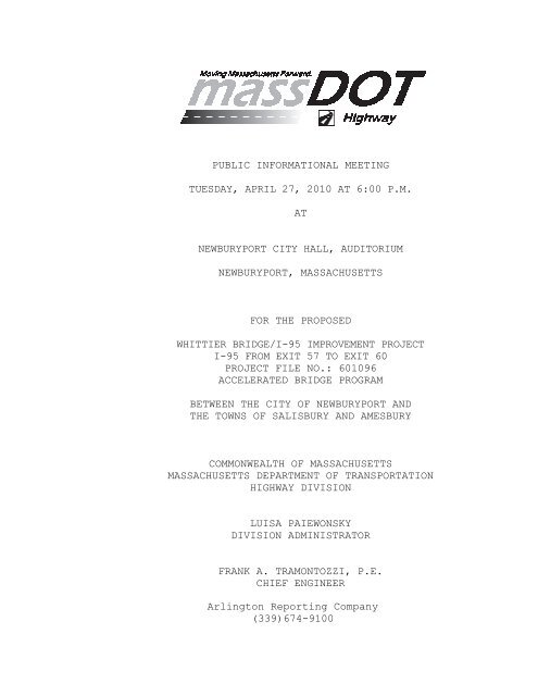
PUBLIC INFORMATIONAL MEETING<br />
TUESDAY, APRIL 27, 2010 AT 6:00 P.M.<br />
AT<br />
NEWBURYPORT CITY HALL, AUDITORIUM<br />
NEWBURYPORT, MASSACHUSETTS<br />
FOR THE PROPOSED<br />
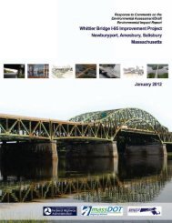
WHITTIER BRIDGE/I-<strong>95</strong> IMPROVEMENT PROJECT<br />
I-<strong>95</strong> FROM EXIT 57 TO EXIT 60<br />
PROJECT FILE NO.: 601096<br />
ACCELERATED BRIDGE PROGRAM<br />
BETWEEN THE CITY OF NEWBURYPORT AND<br />
THE TOWNS OF SALISBURY AND AMESBURY<br />
COMMONWEALTH OF MASSACHUSETTS<br />
MASSACHUSETTS DEPARTMENT OF TRANSPORTATION<br />
HIGHWAY DIVISION<br />
LUISA PAIEWONSKY<br />
DIVISION ADMINISTRATOR<br />
FRANK A. TRAMONTOZZI, P.E.<br />
CHIEF ENGINEER<br />
Arlington Reporting Company<br />
(339)674-9100
2<br />
PRESENTERS<br />
Michael O’Dowd, Project Manager, Accelerated <strong>Bridge</strong><br />
Program, MassDOT – Highway Division<br />
Michael Sheehan, Right of Way Bureau,<br />
MassDOT – Highway Division<br />
Joe Freeman, Environmental Engineer,<br />
Tetra Tech Rizzo<br />
Michael Bertoulin, VP, Principal Project Manager,<br />
Parsons Brinckerhoff<br />
SPEAKER INDEX<br />
Name<br />
Page<br />
Michael O’Dowd, Project Manager, 5, 7, 47, 49, 52,<br />
MassDOT - Highway Division 53, 54, 63, 64, 65,<br />
66, 67, 69, 70, 72,<br />
73, 74, 75, 76, 77,<br />
78, 79, 80, 81, 82,<br />
91, 92, 98, 99,<br />
101, 102, 103, 104,<br />
105, 106, 107, 108,<br />
109, 110, 111, 112<br />
Mayor Donna Holaday, 5, 64, 65<br />
Newburyport<br />
Michael Bertoulin, 10, 34, 66, 67, 68,<br />
Parsons Brinckerhoff 69, 71, 81, 92, 93,<br />
94, <strong>95</strong>, 96, 97, 98,<br />
99, 100, 101, 102,<br />
103, 108, 109, 110,<br />
111<br />
Joseph Freeman, 23, 27<br />
Tetra Tech Rizzo<br />
Arlington Reporting Company<br />
(339)674-9100
3<br />
Name<br />
SPEAKER INDEX<br />
Page<br />
Michael Sheehan, MassDOT 48, 104, 105, 111,<br />
Right of Way Bureau 112<br />
Councilor Ari Herzog, Newburyport 51, 52, 53, 54<br />
Karen Solstad, Planning Board, 54, 63<br />
Amesbury<br />
Kempton Webb 65, 66, 67, 68, 69<br />
Joe Fahey, Amesbury, Director 69, 70, 71, 73, 74,<br />
of Community and Economic Dev. 75, 92<br />
Jerry Klima, Selectman, Salisbury 75, 76, 77, 78<br />
Wayne David, 78, 79, 81, 82<br />
Eight Towns & the Bay<br />
Bill Harris, Newburyport, 82<br />
Chapter 91 Citizens Committee<br />
Doug Harrison 91, 92, 93, 94, <strong>95</strong>,<br />
96, 97, 98, 99, 100<br />
Stephen Murphy 98, 99, 100, 101,<br />
102<br />
Jay Harris 102, 103, 104<br />
Paul Sullivan 104, 105, 106<br />
Dave Russell, Newburyport 106, 107<br />
Harbor Commission<br />
Christine Cressey 107, 108, 109, 110,<br />
111, 112<br />
Arlington Reporting Company<br />
(339)674-9100
4<br />
Description<br />
EXHIBITS<br />
Page<br />
Sign-In Sheet 115-120<br />
Notice of <strong>Public</strong> Hearing/Brochure 121-134<br />
Arlington Reporting Company<br />
(339)674-9100
5<br />
1<br />
2<br />
P R O C E E D I N G S<br />
MODERATOR MICHAEL O’DOWD:<br />
Good<br />
3<br />
4<br />
5<br />
6<br />
7<br />
8<br />
9<br />
10<br />
11<br />
12<br />
13<br />
14<br />
15<br />
16<br />
17<br />
18<br />
19<br />
20<br />
21<br />
22<br />
23<br />
24<br />
evening, ladies and gentlemen. My name is Michael<br />
O’Dowd. I apologize for my tardiness tonight. I got<br />
tied up in traffic coming up from Boston, and the rain<br />
didn’t help matters either.<br />
So, we’re going to do a presentation<br />
tonight on the status, keep everybody apprised on the<br />
status of the project, where it stands, obviously the<br />
project being the <strong>Whittier</strong> <strong>Bridge</strong> Replacement and the<br />
add a lane to I-<strong>95</strong>. Many of you have attended past<br />
presentations that we’ve conducted over the last I<br />
guess going back as far as -- the last 12 months.<br />
March, I think, is when I first started on this<br />
project. So, a year ago we got started. We’ve made a<br />
number of advances in the design of this project.<br />
And, tonight is just another one of those meetings<br />
that we want to keep everybody up-to-date.<br />
Before I get into the presentation and<br />
the rest of the meeting, Mayor Holaday would like to<br />
make a couple of words.<br />
MAYOR DONNA HOLADAY: I just would like<br />
to thank you all for coming. This is an important<br />
series of meetings and I’m very pleased to see so many<br />
Arlington Reporting Company<br />
(339)674-9100
6<br />
1<br />
of you here.<br />
2<br />
3<br />
4<br />
5<br />
6<br />
7<br />
8<br />
9<br />
10<br />
11<br />
12<br />
13<br />
14<br />
15<br />
16<br />
17<br />
18<br />
19<br />
20<br />
21<br />
22<br />
23<br />
24<br />
I’d just like to get a sense of which<br />
communities are represented. Could you raise your<br />
hand if you’re from Newburyport Amesbury And,<br />
Salisbury A little light in Salisbury, but I think<br />
we have a good representation from all three<br />
communities.<br />
I’d like to represent City Councilor<br />
Ari Herzog from Newburyport is here. Are there any<br />
other public officials from local communities I should<br />
recognize<br />
Thank you. And you’ll notice in the<br />
back of your packet, too, there is a final page for<br />
comments, which I think are very, very important. If<br />
you don’t feel comfortable speaking out at the end of<br />
the presentation today, I think it would be important<br />
that you write your comments and send them in, and<br />
continue the active participation. This is a massive<br />
-- the largest bridge project that’s happening in our<br />
state. And I think the information from, you know,<br />
residents and the neighboring communities -- one thing<br />
that I can assure you is that Mayor Thatcher, and Neil<br />
Harrington, and myself have had several meetings and<br />
are coming together to form what we’re calling a<br />
Arlington Reporting Company<br />
(339)674-9100
7<br />
1<br />
2<br />
3<br />
4<br />
5<br />
6<br />
7<br />
8<br />
9<br />
10<br />
11<br />
12<br />
13<br />
14<br />
15<br />
16<br />
17<br />
18<br />
19<br />
20<br />
21<br />
22<br />
23<br />
24<br />
Community Host Advisory Committee, where we would like<br />
to have representation from all three communities<br />
working together with the planning project team. And<br />
we’ll be talking more about that. As opposed to<br />
working individually with each of the three<br />
communities, it makes sense that we unite as three<br />
communities because the environmental and economic<br />
impacts to the communities are shared concerns.<br />
And we will continue to keep the<br />
communities updated as we move forward and learn more<br />
about the bridge project.<br />
So, again, I thank you all for coming<br />
tonight. And, let’s get to the presentation.<br />
MODERATOR O’DOWD: Thank you very much,<br />
Mayor Holaday.<br />
So, let me do a quick introduction.<br />
Mike Bertoulin, who is with Parsons Brinckerhoff, he<br />
is the project manager for this project. Next to him<br />
is Mr. Joseph Freeman from Tetra Tech Rizzo who is<br />
responsible for, in concert with Parsons Brinckerhoff,<br />
developing all of the environmental documents,<br />
including the Environmental Impact Report and, also,<br />
the Environmental Assessment required by the MEPA<br />
process. Next to him is Mr. Michael Sheehan from our<br />
Arlington Reporting Company<br />
(339)674-9100
8<br />
1<br />
2<br />
3<br />
4<br />
5<br />
6<br />
7<br />
8<br />
9<br />
10<br />
11<br />
12<br />
13<br />
14<br />
15<br />
16<br />
17<br />
18<br />
19<br />
20<br />
21<br />
22<br />
23<br />
24<br />
Right of Way office at District 4. And, also,<br />
tonight, the transcriptionist from Arlington Typing<br />
and Mailing who will be making a complete verbatim<br />
transcript of tonight’s proceedings.<br />
And I would make mention of the fact<br />
that when we get to the question and answer session, I<br />
would ask that you please stand, state your name,<br />
spell your name for the record so that we’ll be able<br />
to keep a complete record of tonight’s meeting and<br />
discussions.<br />
One thing, and I don’t want to hold<br />
people up too long, I know that the Celtics are<br />
playing tonight. And you’re not going to want to miss<br />
the final game for this series, I hope.<br />
So, I’ll let Mike get right into it.<br />
But, one of the things I wanted to reiterate that<br />
Mayor Holaday just mentioned is the fact that we have<br />
received, and I thank you for it, a number of comment<br />
letters have been sent in subsequent to a number of<br />
the presentations that we’ve done. And, if you do not<br />
hear a response from me, I apologize. I get a lot of<br />
mail on a lot of projects that I’m managing right now.<br />
However, what I will say is that your comments don’t<br />
go unnoticed. Myself and my two colleagues that work<br />
Arlington Reporting Company<br />
(339)674-9100
9<br />
1<br />
2<br />
3<br />
4<br />
5<br />
6<br />
7<br />
8<br />
9<br />
10<br />
11<br />
12<br />
13<br />
14<br />
15<br />
16<br />
17<br />
18<br />
19<br />
20<br />
21<br />
22<br />
23<br />
24<br />
with me, we read each and every one of those. We<br />
review them. We go over those with the design team.<br />
The design team has also looked at all of them. They<br />
do get reflected in the documents that are being<br />
developed, the design documents and also the<br />
environmental documents. You will see responses to<br />
each and every one of your memos and your letters in<br />
those environmental documents as they are drafted and<br />
submitted out to the public for review and comment.<br />
Don’t hesitate to email me. My email<br />
address, I can make it available. Contact Stephanie<br />
Boundy, Stephanie at the rear of the room here. She<br />
is taking the attendance sheets. She has access to me<br />
at any and all times. If you have any questions,<br />
please don’t hesitate to contact her. I think her<br />
information is on the PowerPoint presentation tonight.<br />
And she can revert all of those questions up to me and<br />
I will answer them as quickly as I possibly can.<br />
So, we do find it important. We do<br />
want to hear. As Mayor Holaday says, we are looking<br />
forward to working with the three communities. Mayor<br />
Holaday has drafted a memo. It went into our<br />
Secretary of Transportation, Mr. Jeff Mullan. And he<br />
also wants to start to make a consensus agreement<br />
Arlington Reporting Company<br />
(339)674-9100
10<br />
1<br />
2<br />
3<br />
4<br />
5<br />
6<br />
amongst the community, realizing what the impact of<br />
this project may have on local businesses, abutters,<br />
residents, etc.<br />
So, one thing I do want to note for the<br />
transcription is this presentation of this meeting<br />
tonight was advertised in two of the local newspapers:<br />
7<br />
the Newburyport Daily News on April the 13 th<br />
and on<br />
8<br />
9<br />
10<br />
11<br />
12<br />
13<br />
14<br />
15<br />
16<br />
17<br />
18<br />
19<br />
20<br />
21<br />
22<br />
23<br />
24<br />
April the 20 th ; and it was also advertised in the<br />
Amesbury News on April the 16 th and April 23 rd , 2010.<br />
So, Michael, I’ll allow Mike to get on<br />
with his presentation.<br />
MICHAEL BERTOULIN: Thank you, Michael.<br />
I’ve got a number of slides that myself<br />
and Joe Freeman are going to run through tonight to<br />
bring you up-to-speed. If you’ve been to these<br />
presentations before, I’d say maybe 20 percent of the<br />
slides you will have seen before. The rest of them<br />
have been reworked, updated, with additional<br />
information and a lot of new information that is being<br />
provided tonight.<br />
So, given that, the team involved with<br />
this is Parsons Brinckerhoff and Tetra Tech Rizzo.<br />
We’re doing the vast majority of the work. We have a<br />
team of specialty subconsultants working for us for<br />
Arlington Reporting Company<br />
(339)674-9100
11<br />
1<br />
2<br />
3<br />
4<br />
5<br />
6<br />
7<br />
8<br />
9<br />
10<br />
11<br />
12<br />
13<br />
14<br />
15<br />
16<br />
17<br />
18<br />
19<br />
20<br />
21<br />
22<br />
23<br />
24<br />
various aspects of the project.<br />
The project description. The base<br />
project description is MassDOT is proposing to replace<br />
the current structurally deficient <strong>Whittier</strong> <strong>Bridge</strong> and<br />
improve I-<strong>95</strong> from Exit 57, which is the 113 exit in<br />
Newburyport, up to Exit 60, which is 286 to Salisbury.<br />
The existing bridge was built in 1<strong>95</strong>1<br />
as part of an original Route 1 relocation project. It<br />
predates the interstate system. The existing<br />
structure was originally designed for two lanes of<br />
traffic in each direction with a breakdown lane.<br />
Later, it got converted into three lanes as three<br />
lanes was required in the ‘70s when the other elements<br />
of the highway were being improved, and modified, and<br />
widened to the south and to the north.<br />
Now, it’s come to the point where the<br />
bridge is structurally deficient and it’s nearing the<br />
end of its economic life. It actually has a poor<br />
structural rating right now with excessive<br />
deterioration of this type of bridge, which suffers in<br />
northern climates due to deicing salts.<br />
It’s also an older -- what’s known as a<br />
non-redundant type structure where a critical failure<br />
with a main member could be a major problem for a<br />
Arlington Reporting Company<br />
(339)674-9100
12<br />
1<br />
2<br />
3<br />
4<br />
5<br />
6<br />
7<br />
8<br />
9<br />
10<br />
11<br />
12<br />
13<br />
14<br />
15<br />
16<br />
17<br />
18<br />
19<br />
20<br />
21<br />
22<br />
23<br />
24<br />
structure like this.<br />
Also, the highway geometry, it only has<br />
three lanes. The breakdown shoulders, there’s no<br />
high-speed shoulder. It doesn’t meet current codes.<br />
And, also, the highway itself between<br />
Exit 57 up through 59, which is where 4<strong>95</strong> is, is only<br />
three lanes where the rest of the highway was built at<br />
a later date and has the four-lane capacity. The<br />
elements from 57 to 59 basically have been waiting for<br />
replacement of the bridge. And you don’t take a<br />
bridge out of service earlier than you need to, but<br />
now has come the time for that.<br />
It is part of the state’s Accelerated<br />
<strong>Bridge</strong> Program. It is a $3 billion commitment over<br />
eight years to basically remove -- either repair or<br />
remove from service current bridges which are on the -<br />
- known as the Red List, which are the structurally<br />
deficient bridges within the state, and also to<br />
prevent additional bridges from becoming classified as<br />
structurally deficient.<br />
A little graphic running from<br />
Newburyport, Exit 57, up to our project limit, which<br />
is up to Exit 60. Basically, these get into the<br />
primary design issues.<br />
Arlington Reporting Company<br />
(339)674-9100
13<br />
1<br />
2<br />
3<br />
4<br />
5<br />
6<br />
7<br />
8<br />
9<br />
10<br />
11<br />
12<br />
13<br />
14<br />
15<br />
16<br />
17<br />
18<br />
19<br />
20<br />
21<br />
22<br />
23<br />
24<br />
The actual bridge crossing itself<br />
really drives the project from an overall alignment<br />
and what needs to be done. We have navigable channel<br />
issues and river hydraulics to deal with. We have the<br />
impact on the existing bridge during construction. We<br />
have right of way constraints and impacts potentially.<br />
Exit 58 in Salisbury, we’re looking to<br />
basically improve that with the on and off ramps on<br />
the highway portions, with deceleration/acceleration<br />
lanes to make that -- some improvements to bring that<br />
interchange up to more current standards. And, also,<br />
what we call the northern terminus, how we deal with<br />
that stretch between 59 and 60, which has a lot of<br />
weaving going on dealing with 4<strong>95</strong> coming onto and<br />
leaving the highway heading north and south.<br />
The purpose and need basically comes<br />
down to a couple of issues here. The existing bridge<br />
is structurally deficient. And, basically, the<br />
feasibility of rehabilitation is actually finishing up<br />
its review. And we, as a team, on the consultant<br />
side, have determined that it does not make practical<br />
sense nor economic sense to rehab the existing bridge.<br />
We also will be addressing the<br />
geometric deficiencies, as I have said, the shoulder<br />
Arlington Reporting Company<br />
(339)674-9100
14<br />
1<br />
2<br />
3<br />
4<br />
5<br />
6<br />
7<br />
8<br />
9<br />
10<br />
11<br />
12<br />
13<br />
14<br />
15<br />
16<br />
17<br />
18<br />
19<br />
20<br />
21<br />
22<br />
23<br />
24<br />
issues, lane count issues, within the whole project<br />
study area.<br />
Tonight’s agenda is basically to update<br />
you folks on the process. We’re going to address some<br />
of the prior meeting questions which came in writing.<br />
We addressed the questions verbally at the end. As<br />
the project manager, Michael O’Dowd, said, all of the<br />
questions as they come in will get addressed within<br />
the environmental documents which we’ll be filing<br />
later this year.<br />
We’ll bring you up-to-speed on where we<br />
are with the environmental documentation process, some<br />
of the engineering studies supporting the process, the<br />
environmental analysis of the impacts. And, also,<br />
we’ll talk about where we are with developing the<br />
environmental documents which are, for the federal<br />
side of it, called the NEPA Environmental Assessment<br />
Documents, and on the state side it’s the MEPA<br />
process, which is the Environmental Impact Report.<br />
We received a number of written<br />
questions. And a number of them were actually<br />
repeats. Some of the questions were some concerns<br />
about hydroplaning on the bridge, approaching the<br />
bridge, came up from a couple of folks. We have<br />
Arlington Reporting Company<br />
(339)674-9100
15<br />
1<br />
2<br />
3<br />
4<br />
5<br />
6<br />
7<br />
8<br />
9<br />
10<br />
11<br />
12<br />
13<br />
14<br />
15<br />
16<br />
17<br />
18<br />
19<br />
20<br />
21<br />
22<br />
23<br />
24<br />
bridge aesthetic questions and concerns. One<br />
individual actually -- and I’ll address this later on<br />
-- talked about why not a modified network tied arch,<br />
as we talk about some of the bridge options next time.<br />
I will address that later in the presentation. There<br />
were some letters of concerns of drainage issues in<br />
Amesbury; alternate transportation discussions;<br />
Newburyport water lines was a question which came in<br />
actually in a letter we received from the town as they<br />
currently go under I-<strong>95</strong>. And, also, there were a<br />
number of questions dealing with bridge noise and<br />
highway corridor noise.<br />
Again, as I go through, I will be<br />
addressing these as we move forward. And I’ll try to<br />
highlight where we are in terms of those questions.<br />
One of the issues was with the<br />
hydroplaning. It came up a couple of times when<br />
people northbound, as they approach the bridge. One<br />
thing the project will do, it will replace that<br />
section of highway. It will have improved drainage.<br />
And it also will help soften the curve as you approach<br />
the bridge. And there will be additional shoulder<br />
width to deal with some of those changes. And some of<br />
the hydroplaning issues actually are involved with<br />
Arlington Reporting Company<br />
(339)674-9100
16<br />
1<br />
2<br />
3<br />
4<br />
5<br />
6<br />
7<br />
8<br />
9<br />
10<br />
11<br />
12<br />
13<br />
14<br />
15<br />
16<br />
17<br />
18<br />
19<br />
20<br />
21<br />
22<br />
23<br />
24<br />
speed on the highway and should be controlled by the<br />
driver while they’re traveling.<br />
The rest of them, I think I have slides<br />
which actually address some of the issues as we go<br />
forward. So let me keep moving here.<br />
As we’ve been studying the<br />
environmental impacts, we have had to basically assess<br />
the current condition. And if you look from the<br />
southern limit down at the Newburyport Exit 57, across<br />
the river, 58, 59, and 60, the overall area is broken<br />
into five watersheds or drainage areas.<br />
Zone one is simply draining --<br />
collecting the water at the high point, roughly here,<br />
drains towards the river. Most of it actually in the<br />
highway is collected into a culvert system, which<br />
comes into the river through a 30-inch line.<br />
And, of course, over the river, the<br />
current bridge is designed with a scupper system where<br />
the water drains through the collectors and drops into<br />
the river.<br />
Zone three, from basically the highest<br />
point of being the railroad bridge, just north of the<br />
interchange, all of this area here. It makes its way<br />
back to the river either indirectly through some of<br />
Arlington Reporting Company<br />
(339)674-9100
17<br />
1<br />
2<br />
3<br />
4<br />
5<br />
6<br />
7<br />
8<br />
9<br />
10<br />
11<br />
12<br />
13<br />
14<br />
15<br />
16<br />
17<br />
18<br />
19<br />
20<br />
21<br />
22<br />
23<br />
24<br />
the wetlands over here, or some of it’s picked up by<br />
the 110 drainage system, goes further into the<br />
wetlands, eventually making it out into the Merrimack<br />
River.<br />
We have zone four, which is the largest<br />
area just north of the bridge, just about where<br />
Interchange 60 is split, midway between, and also<br />
where it’s picking up the large loop on 4<strong>95</strong>. This<br />
whole area eventually gets into what is known as<br />
Meader Brook, a tributary. It eventually makes its<br />
way out to the ocean.<br />
And the last little piece of watershed<br />
we have is this section up here near the project<br />
terminus in Salisbury. This area here empties into a<br />
drainage system, which eventually gets into Cain’s<br />
Brook, crosses the line into New Hampshire, and makes<br />
it out into the ocean.<br />
So, that’s the big picture. We need to<br />
understand the watersheds in order to deal with<br />
project drainage and deal with the drainage of the<br />
widened highway and the existing highway system.<br />
There were some questions associated<br />
with drainage issues in Amesbury, concerns in this<br />
area as well near Old Mill Road, and some concerns<br />
Arlington Reporting Company<br />
(339)674-9100
18<br />
1<br />
2<br />
3<br />
4<br />
5<br />
6<br />
7<br />
8<br />
9<br />
10<br />
11<br />
12<br />
13<br />
14<br />
15<br />
16<br />
17<br />
18<br />
19<br />
20<br />
21<br />
22<br />
23<br />
24<br />
Salisbury has had with the amount of drainage that<br />
makes it into the 110 system.<br />
This is the existing drainage system.<br />
And in terms of where the areas are picked up and<br />
broken out. What we intend on doing is making<br />
improvements in these areas to reallocate some of the<br />
existing water that’s on the highway, and all of the<br />
new water that’s collected in the widened section will<br />
be dealt with by the new drainage system.<br />
The new drainage system will have<br />
drainage basins. And these basins are actually<br />
designed for infiltration areas. So, it’s not like<br />
the older designs where we had these ponds that would<br />
sit there full of water. These are designed to<br />
actually collect water and bring in into these systems<br />
and not, you know, further load the existing brooks<br />
and streams and other drainage systems, but they’ll<br />
actually take the water and set up these basins to<br />
receive it. It will be there for a day or two as it<br />
actually is designed to seep into the ground.<br />
And one of the things that you’ll see<br />
later on this season, the next month or two, is we’ll<br />
be out there digging some test pits in locations like<br />
this, this, and this, to assess the soils in that area<br />
Arlington Reporting Company<br />
(339)674-9100
19<br />
1<br />
2<br />
3<br />
4<br />
5<br />
6<br />
7<br />
8<br />
9<br />
10<br />
11<br />
12<br />
13<br />
14<br />
15<br />
16<br />
17<br />
18<br />
19<br />
20<br />
21<br />
22<br />
23<br />
24<br />
to make sure it is the right drainable -- drain<br />
distribution that will accept that stormwater.<br />
So, we believe that through our<br />
enhanced drainage system -- and most of the issues<br />
have been in this area -- will be addressed with that<br />
philosophy which runs up and down the alignment, where<br />
the new drainage water will be dealt with through<br />
infiltration ponds and then some of them will be dealt<br />
with some treatment and ponds that will hold it and<br />
then disperse it into the systems for proper drainage.<br />
One of the things that we’re very aware<br />
of is the existing, you know, trails in the area.<br />
We’re aware of the existing bike trail, which<br />
terminates now roughly at Rabbit Road, an incomplete<br />
section under the old railroad bridges. I believe<br />
it’s due to a piece of missing land between this<br />
location and the shopping center on from the old<br />
alignment. We know that’s, you know, some issues that<br />
the town is looking at right now. What we could<br />
commit to do is make sure that the project, as we<br />
widen it, we will widen those bridges to accept<br />
potentially whatever future rail trail program is<br />
continued in that area.<br />
We’re also looking at down on the<br />
Arlington Reporting Company<br />
(339)674-9100
20<br />
1<br />
2<br />
3<br />
4<br />
5<br />
6<br />
7<br />
8<br />
9<br />
10<br />
11<br />
12<br />
13<br />
14<br />
15<br />
16<br />
17<br />
18<br />
19<br />
20<br />
21<br />
22<br />
23<br />
24<br />
Newburyport side about potentially a possible<br />
connection with the new abutment for walking as<br />
there’s a lot of informal trails in that area right<br />
now. Those are some things we’ll be working out with<br />
the town as we look at these issues.<br />
Also, the project, as we’ve said, will<br />
require Ferry Road <strong>Bridge</strong> to be replaced. And when<br />
the Ferry Road <strong>Bridge</strong> gets replaced, the new bridge<br />
will be wider. And that wider bridge will be able to<br />
take care of the on-bike road routes by allowing a few<br />
more feet of shoulder space to accept those -- the<br />
bicycles on the bridge in a safer manner.<br />
One of the issues that has come up is<br />
the Newburyport Water Department has wells on either<br />
side of the highway. The treatment plant is here and<br />
they actually have a surface water system which was<br />
recently activated.<br />
They have existing lines which run<br />
under the highway, which is this dashed line here.<br />
And the other line comes up this side. The two lines<br />
run down Ferry Road. As they go under the existing<br />
highway -- they were placed there when the project was<br />
built back in the ‘50s -- so those lines are near the<br />
end of their service so we’re looking at replacing<br />
Arlington Reporting Company<br />
(339)674-9100
21<br />
1<br />
2<br />
3<br />
4<br />
5<br />
6<br />
7<br />
8<br />
9<br />
10<br />
11<br />
12<br />
13<br />
14<br />
15<br />
16<br />
17<br />
18<br />
19<br />
20<br />
21<br />
22<br />
23<br />
24<br />
those and we’re looking at routing them near the<br />
abutment area and then up this road and across the<br />
newly replaced bridge to tie back in so that those<br />
lines will not be under the highway in the future and<br />
will be more easily accessible for maintenance<br />
purposes by the Newburyport Water Department.<br />
In addition, we potentially may be<br />
looking at a stormwater treatment area right near the<br />
limit of the right of way. This would be one of those<br />
detention areas that would eventually treat through<br />
pulling out the solids and grit, and then it would be<br />
drained back out in a system similar to what’s there<br />
today. And those are some of the discussions with the<br />
town.<br />
We’ve taken all of our data and<br />
reviewed it for the noise along the corridor. We<br />
basically have performed ambient noise regimens at 10<br />
sites along the corridor. That was done last summer.<br />
We’ve evaluated the traffic noise at 204 individual<br />
receptors. These are actually residences, or<br />
buildings, or businesses along the roughly four miles<br />
of alignment we have in our project study area. We<br />
identified, of those, 41 receptors that are impacted<br />
currently by noise. And we’re evaluating potential<br />
Arlington Reporting Company<br />
(339)674-9100
22<br />
1<br />
2<br />
3<br />
4<br />
5<br />
6<br />
7<br />
8<br />
9<br />
10<br />
11<br />
12<br />
13<br />
14<br />
15<br />
16<br />
17<br />
18<br />
19<br />
20<br />
21<br />
22<br />
23<br />
24<br />
noise mitigation measures per MassDOT’s costeffectiveness<br />
guidelines in dealing with those issues.<br />
And that has a lot more study to go through, but we<br />
are working on those concerns.<br />
There have been questions about what<br />
are we doing about the noise issues. I think<br />
specifically there was a question from a gentleman in<br />
Amesbury, I think on the Amesbury Point area, talking<br />
about the bridge noise. One thing about the bridge,<br />
the new bridge will not make the type of banging noise<br />
that you get there today. The new bridges are<br />
continuous span structures. They don’t have the open<br />
expansion joints in them that a pier by pier<br />
relationship, which actually picks up a lot of the<br />
noise, especially at night, of a heavy truck going<br />
down. So, we believe just the new structure itself<br />
will be quieter, never mind the other issues of<br />
dealing with the roadway noises.<br />
In terms of the environmental<br />
documentation, we’ve been looking at the affected<br />
environment of the study area, quantified and under<br />
development. We have engineering studies. We have<br />
environmental analysis that we’re working on, and also<br />
the environmental consequences of the proposed action.<br />
Arlington Reporting Company<br />
(339)674-9100
23<br />
1<br />
2<br />
3<br />
4<br />
5<br />
6<br />
7<br />
8<br />
9<br />
10<br />
11<br />
12<br />
13<br />
14<br />
15<br />
16<br />
17<br />
18<br />
19<br />
20<br />
21<br />
22<br />
23<br />
24<br />
I’m going to transition over to Joe<br />
Freeman to take the environmental side right now.<br />
JOSEPH FREEMAN: Thank you, Mike.<br />
As Mike said, we’ve been working very<br />
hard on preparing the environmental documentation. As<br />
part of the affected environment, all of these issues<br />
have been addressed. All of these will also be<br />
addressed in what we call our environmental<br />
consequences chapter of the documentation, which is<br />
where we assess the impacts of our preferred<br />
alternative and any other alternative.<br />
Part of that process is there’s some<br />
engineering that has to happen in order for us to be<br />
able to identify what those impacts are. And these<br />
are an example, a pretty good list, of many of the<br />
engineering studies that are currently underway. You<br />
know, the key ones, of course, the traffic modeling --<br />
what’s the traffic impacts of this new project; the<br />
noise analysis that Mike just talked about, including<br />
what can we do for mitigation of the noise impacts.<br />
As Mike said, we have identified 41 receptors, those<br />
are essentially houses along the entire corridor,<br />
where the noise, current noise, exceeds what they call<br />
the noise abatement criteria. And that requires us to<br />
Arlington Reporting Company<br />
(339)674-9100
24<br />
1<br />
2<br />
3<br />
4<br />
5<br />
6<br />
7<br />
8<br />
9<br />
10<br />
11<br />
12<br />
13<br />
14<br />
15<br />
16<br />
17<br />
18<br />
19<br />
20<br />
21<br />
22<br />
23<br />
24<br />
look at what, if any, are feasible mitigations to<br />
address those noise impacts.<br />
And, of course, we need to know a<br />
little bit more about what’s the highway going to look<br />
like. How wide is it Where is it going to be What<br />
is the bridge going to be What type of bridge,<br />
because that has an impact on the size of the piers in<br />
the river, which, of course, may increase or decrease<br />
the impact<br />
One of the keys, of course, is the<br />
rehabilitation assessment of the bridge. As Mike said<br />
earlier, we’ve concluded that it is just not<br />
technically or economically, or even from a safety<br />
perspective, feasible to rehabilitate the existing<br />
bridge. That information is currently under review,<br />
specifically by the Massachusetts Historical<br />
Commission under Section 106 of the National Historic<br />
Preservation Act, because we have an historic bridge,<br />
and we anticipate a finding from MHC in the very near<br />
future.<br />
It is sensitive infrastructure and<br />
there are some restrictions on what information can be<br />
shared with the public because it is sensitive<br />
information. It’s a critical infrastructure piece.<br />
Arlington Reporting Company<br />
(339)674-9100
25<br />
1<br />
2<br />
3<br />
4<br />
5<br />
6<br />
7<br />
8<br />
9<br />
10<br />
11<br />
12<br />
13<br />
14<br />
15<br />
16<br />
17<br />
18<br />
19<br />
20<br />
21<br />
22<br />
23<br />
24<br />
So, please understand if we can’t share all the<br />
excruciating details of that report.<br />
One of the other things, too, that<br />
affects how we design the new bridges and what the<br />
impacts of the project are is what are the impacts of<br />
the new bridge piers because there will be essentially<br />
six piers where there are currently only four now as a<br />
result of the new bridges; what are the impacts of<br />
those piers on the river; and the velocity of the<br />
tidal flow back and forth. This figure sort of<br />
illustrates a snapshot of the hydraulic study, which<br />
indicates where the current -- or where the deepest<br />
water is, which indicates the higher currents. That’s<br />
that orangish color on the Amesbury side.<br />
The other thing is having to address<br />
the navigation, make sure we don’t impact the<br />
navigation that exists in the river either during<br />
construction or after the new bridges are built.<br />
We’ve met with the Coast Guard on some initial<br />
coordination. I think it’s safe to say that they’re<br />
happy with the progress that we’ve made to date. And<br />
we’ve come away with an understanding of what we’re<br />
going to have to do in terms of future navigation<br />
aides -- navigational lights for both channels,<br />
Arlington Reporting Company<br />
(339)674-9100
26<br />
1<br />
2<br />
3<br />
4<br />
5<br />
6<br />
7<br />
8<br />
9<br />
10<br />
11<br />
12<br />
13<br />
14<br />
15<br />
16<br />
17<br />
18<br />
19<br />
20<br />
21<br />
22<br />
23<br />
24<br />
including that so-called steamboat channel on the<br />
Newburyport side or the south side. And since we’re<br />
going to be moving essentially -- well, we’re moving<br />
one of the existing piers which sort of marks the edge<br />
of some rocks along that channel, there will be some<br />
additional aides to mark the rocks which will not be<br />
now marked by the existing pier.<br />
We have to address safety. That’s<br />
important. And, as a result of the deficiencies in<br />
the roadway, we all know that there are peak hour<br />
congestion, particularly during the holiday weekends.<br />
The roadway geometry, all these issues have to be<br />
looked at: what are the lane widths, how can we<br />
maintain those or improve that if possible to meet the<br />
current standards; the shoulder widths, some of these<br />
are substandard. We’re going to look to increase<br />
those as we can; and look at any roadside obstacles<br />
along the side of the road, what can we do to improve<br />
that situation.<br />
Part of the traffic study is looking at<br />
the accidents. And this directly relates to the issue<br />
of safety. These illustrations show both the a.m. and<br />
p.m. accident locations. I know it’s kind of hard to<br />
see. But each one of those dots represents an area of<br />
Arlington Reporting Company<br />
(339)674-9100
27<br />
1<br />
2<br />
3<br />
4<br />
5<br />
6<br />
7<br />
8<br />
9<br />
10<br />
11<br />
12<br />
13<br />
14<br />
15<br />
16<br />
17<br />
18<br />
19<br />
20<br />
21<br />
22<br />
23<br />
24<br />
concern that relates to accidents. No surprise,<br />
they’re at many of the exits, Exit 57, 59, and 60 in<br />
particular, and on the bridge and the approaches to<br />
the bridge.<br />
No secret also that the traffic is<br />
increasing on the bridge, and on the approaches, and<br />
on the roadway.<br />
And, as Mike said earlier, we will be<br />
doing some ongoing studies starting in June: The<br />
borings, which relate to our geotechnical information<br />
for the design of new bridge piers on the land side --<br />
we did the ones in the river last year; new highways,<br />
you know, the highway alignment; as well as the<br />
stormwater management system.<br />
AUDIENCE: Excuse me. Could I ask you<br />
to speak up a little louder<br />
JOSEPH FREEMAN: Sure. Is this working<br />
at all here It’s not working at all I’m just going<br />
to shout then.<br />
It’s kind of hard to see, but this<br />
illustrates what a typical highway cross-section will<br />
be. We’ve got two sections because we’ve got the<br />
section of roadway from essentially the 4<strong>95</strong><br />
interchange up north, to around the Route 286<br />
Arlington Reporting Company<br />
(339)674-9100
28<br />
1<br />
2<br />
3<br />
4<br />
5<br />
6<br />
7<br />
8<br />
9<br />
10<br />
11<br />
12<br />
13<br />
14<br />
15<br />
16<br />
17<br />
18<br />
19<br />
20<br />
21<br />
22<br />
23<br />
24<br />
interchange. We’ve got to add some additional lanes<br />
there to address the issue of traffic coming on or<br />
leaving the highway.<br />
And this is essentially what it’s going<br />
to look like for the rest of the alignment.<br />
The bridge cross-section, four lanes on<br />
each bridge, a northbound bridge and a southbound<br />
bridge, where currently there’s only three lanes.<br />
We’re still looking at various types.<br />
I’m sure many of you saw the graphics at the last<br />
meeting we had in Amesbury. Those were also shown in<br />
the newspaper over the succeeding time period. But<br />
we’re also looking at not just the bridge on the<br />
river, but the bridges up and down the corridor from<br />
Evans Place all the way up the railroad bridges at<br />
Exit 58, all the way up. And, at Ferry Road we’re<br />
looking at various types because we’ve determined that<br />
because of the roadway realignment, the new northbound<br />
roadway realignment at that location, we need to<br />
replace that bridge.<br />
This shows you kind of what the phasing<br />
or typical phasing -- this is one of the phases Ferry<br />
Road <strong>Bridge</strong> replacement. The idea is to keep traffic<br />
open as best as possible while we construct the new<br />
Arlington Reporting Company<br />
(339)674-9100
29<br />
1<br />
2<br />
3<br />
4<br />
5<br />
6<br />
7<br />
8<br />
9<br />
10<br />
11<br />
12<br />
13<br />
14<br />
15<br />
16<br />
17<br />
18<br />
19<br />
20<br />
21<br />
22<br />
23<br />
24<br />
bridge in two phases.<br />
As I said, we’re hard at work looking<br />
at the environmental consequences of what we’re<br />
proposing to do. So we’re looking at not only<br />
preferred highway alignment, but what the consequences<br />
might be from other possible highway alignments. What<br />
we seem to be focusing on as a preferred alignment,<br />
widening the highway to the inside or on the median<br />
side, and focusing on it makes the most sense to have<br />
the bridge to the east, or downstream, of the existing<br />
bridge.<br />
There are four river types, or four<br />
river bridge types, F-O-U-R river bridge types on your<br />
study. There are the girder bridges, which is the<br />
plain vanilla bridge I’ll call it; the network tied<br />
arch; the single tower extradosed; and the single<br />
tower cable stay, like the Zakim <strong>Bridge</strong> over the<br />
Charles in Boston.<br />
The environmental consequences, of<br />
course, our study area is the same as our affected<br />
environment, from 57 all the way to Exit 60 in<br />
Salisbury. We’ve looked at a whole range of<br />
alternatives. Those of you who were with us last<br />
summer at the MEPA scoping meeting, or have followed<br />
Arlington Reporting Company<br />
(339)674-9100
30<br />
1<br />
2<br />
3<br />
4<br />
5<br />
6<br />
7<br />
8<br />
9<br />
10<br />
11<br />
12<br />
13<br />
14<br />
15<br />
16<br />
17<br />
18<br />
19<br />
20<br />
21<br />
22<br />
23<br />
24<br />
us through the Environmental Notification Form<br />
process, know that we had a whole host of alternatives<br />
that we’re required to look at. And we’ve done that<br />
through a multi-phase, a multipart screening process<br />
with the overall goal, of course, to avoid impacts<br />
wherever possible, and, where we can’t, to minimize<br />
those impacts and then identify what the mitigation is<br />
for the impacts that we can’t avoid.<br />
We’ve done a lot of work on wetland<br />
impacts. This is a piece of that. The largest piece,<br />
of course, is associated with the construction of the<br />
bridge in the river. There are wetland resources on<br />
both shores, on both banks, as well as the river<br />
themselves.<br />
Depending upon the bridge type, there<br />
are different impacts in the river. Some bridges have<br />
smaller piers, smaller footprint, less impact. This<br />
is a representation of the worst case, or the maximum<br />
impact. It shows both temporary impacts as well as<br />
permanent impacts. None of this is unmitigatable.<br />
None of these impacts trip any particular thresholds.<br />
We don’t foresee any requirement to have a variance<br />
from the State Wetlands Protection Act or even an<br />
individual permit from the U.S. Army Corps of<br />
Arlington Reporting Company<br />
(339)674-9100
31<br />
1<br />
2<br />
3<br />
4<br />
5<br />
6<br />
7<br />
8<br />
9<br />
10<br />
11<br />
12<br />
13<br />
14<br />
15<br />
16<br />
17<br />
18<br />
19<br />
20<br />
21<br />
22<br />
23<br />
24<br />
Engineers under the Federal Clean Water Act.<br />
There are some minor areas of<br />
additional impact at two locations in Salisbury along<br />
the new <strong>95</strong> northbound roadway -- both areas will total<br />
less than 4,000 square feet of bordering vegetated<br />
wetlands -- and, a minor area in Salisbury on the exit<br />
ramp to Exit 60 where we have a very minor impact from<br />
the construction of a retaining wall.<br />
We’re also looking at what are the<br />
shading impacts on the vegetation under the bridges.<br />
This is a representation of what that would be. It’s<br />
kind of hard to see. It’s even hard to see when you<br />
have it in front of you, to be honest with you. But<br />
the various shades of gray indicate the impacts to the<br />
bridge. The key here is we’re going to have a bridge<br />
that is higher above the vegetation or the shore line<br />
than the existing bridges. And there will also be a<br />
gap between the two bridges. So, what we’re<br />
projecting is a decrease in what we call severe<br />
shading. We know now there are areas under that<br />
existing bridge where there’s not a lot of vegetation.<br />
There’s no salt marsh, very sparse vegetation. That’s<br />
because the existing bridge is a deeper structure and<br />
it’s closer to the river. So, the shadows are deeper<br />
Arlington Reporting Company<br />
(339)674-9100
32<br />
1<br />
2<br />
3<br />
4<br />
5<br />
6<br />
7<br />
8<br />
9<br />
10<br />
11<br />
12<br />
13<br />
14<br />
15<br />
16<br />
17<br />
18<br />
19<br />
20<br />
21<br />
22<br />
23<br />
24<br />
and they’re there much of the day, if not all day.<br />
The newer bridges will be shallower<br />
structures. By that I mean they won’t be as deep, and<br />
they will be high. So, we won’t have any severe<br />
impacts. We will have an increased area of moderate<br />
impacts, four to five hours a day of areas that may be<br />
shaded.<br />
We’ll talk about the screening process.<br />
This is kind of a matrix that we’ve developed to help<br />
us. The categories, the rows, indicate all the<br />
criteria that we’re looking at. The columns along the<br />
top are the alternatives, both for the river crossing,<br />
or the bridge types, and alignments for the highways.<br />
And we’re busy filling that in with all our<br />
information to come up with our preferred alternative.<br />
I-<strong>95</strong>, again, there are two feasible<br />
alternatives for widening the highway to provide that<br />
four lanes in each direction from the current three.<br />
Do we widen to the inside, to the median -- as I said,<br />
that’s where we’re sort of coming down -- or we’ve<br />
also looked very closely at widening to the outside.<br />
We can do different things. We can do one to the<br />
inside -- we can do northbound inside, southbound<br />
outside, or vice versa. I mean there’s all kinds of<br />
Arlington Reporting Company<br />
(339)674-9100
33<br />
1<br />
2<br />
3<br />
4<br />
5<br />
6<br />
7<br />
8<br />
9<br />
10<br />
11<br />
12<br />
13<br />
14<br />
15<br />
16<br />
17<br />
18<br />
19<br />
20<br />
21<br />
22<br />
23<br />
24<br />
alternatives there.<br />
But, coming inside, we’ve got a very<br />
wide median. We can take advantage of that. If we<br />
come inside, we minimize the impacts to the Route 110<br />
ramp terminals. That means, you know, the beginnings<br />
and ends of it, we don’t touch the ramps. We don’t<br />
have to modify those ramps.<br />
That horizontal curve as you go north<br />
across 110 and head up to New Hampshire, it minimizes<br />
the negative impacts of that curve by going inside.<br />
And, also, the bridges located up to the north, where<br />
are those piers, there’s more room to work with the<br />
inside than there is to the outside. Plus, there’s a<br />
whole lot more wetlands to the outside of the existing<br />
roadway and there are none on the inside. So that’s a<br />
criteria, too.<br />
So, this kind of shows you what we’re<br />
talking about with the inside widening, with the new<br />
lanes in here, going from a 60-foot median to<br />
essentially a 36-foot median. So, all the work would<br />
be done inside. This is with wider shoulders on the<br />
highway to match the shoulders that are existing both<br />
north of here and south. It makes a much safer<br />
roadway.<br />
Arlington Reporting Company<br />
(339)674-9100
34<br />
1<br />
2<br />
3<br />
4<br />
5<br />
6<br />
7<br />
8<br />
9<br />
10<br />
11<br />
12<br />
13<br />
14<br />
15<br />
16<br />
17<br />
18<br />
19<br />
20<br />
21<br />
22<br />
23<br />
24<br />
And for the bridge crossing, the east<br />
alignment, we’ll show you some phasing diagrams of how<br />
that happens in a minute here. But, essentially,<br />
phase one, the construction of a new northbound -- the<br />
final -- the new northbound roadway, which will be<br />
constructed wide enough to handle all six lanes of<br />
traffic; move all the traffic onto the new bridge;<br />
take down the old bridge; and then build a new<br />
southbound bridge, which will be four lanes<br />
southbound.<br />
And, with that, I’ll turn it back to<br />
Mike Bertoulin. He can show you some representations<br />
of the phasing of that bridge.<br />
MICHAEL BERTOULIN: Thank you, Joe.<br />
I’m going to slowly go through the<br />
drawings we had scrolling. There basically were five<br />
of each view from the -- the first one basically from<br />
Newburyport looking across into Amesbury, from the<br />
northwest direction; and then there’s five views<br />
basically in Salisbury looking south/southwest over<br />
into Newburyport.<br />
So, this is the existing structure.<br />
This basically is the Newburyport Water Department<br />
land, Moseley Woods is roughly right about here.<br />
Arlington Reporting Company<br />
(339)674-9100
35<br />
1<br />
2<br />
3<br />
4<br />
5<br />
6<br />
7<br />
8<br />
9<br />
10<br />
11<br />
12<br />
13<br />
14<br />
15<br />
16<br />
17<br />
18<br />
19<br />
20<br />
21<br />
22<br />
23<br />
24<br />
South to north, the existing structure with three<br />
lanes running in each direction. With the east<br />
alignment option, what we would do -- and all of this<br />
is within the existing what we call right of way, land<br />
that is currently owned by the state of Massachusetts<br />
right now to perform this work. We would build a new<br />
structure adjacent to the existing structure, coming<br />
across the river. And one of the things you’ll<br />
notice, and Joe alluded to it also, is that the<br />
current structure has four piers in the water. And<br />
these white lines here mark the steamboat channel.<br />
And, also, this is the Army Corps channel which lines<br />
up with the Hines <strong>Bridge</strong>, the swing bridge, and this<br />
goes under the Chain <strong>Bridge</strong>.<br />
Currently, the existing bridge wraps<br />
the two channels. The high area is in the middle<br />
where basically the rock is actually exposed at<br />
extreme low water. What we’re doing is we’re<br />
combining pier number two and three into a single<br />
pier, so there’s going to be less piers in terms of<br />
the alignment. But because there’s two bridges in the<br />
final condition, there will be six piers in the water,<br />
which is why we have six piers as opposed to four.<br />
So, we will start building the new<br />
Arlington Reporting Company<br />
(339)674-9100
36<br />
1<br />
2<br />
3<br />
4<br />
5<br />
6<br />
7<br />
8<br />
9<br />
10<br />
11<br />
12<br />
13<br />
14<br />
15<br />
16<br />
17<br />
18<br />
19<br />
20<br />
21<br />
22<br />
23<br />
24<br />
bridge across. This is a representation of some<br />
activities. For the sake of the model, we did the<br />
simplest structure at this point in time, which is<br />
basically a girder bridge, showing basically some<br />
barges that would be in the water dealing with this<br />
type of work. Over here is the pier under<br />
construction on the northbound side.<br />
Then the completed highway for<br />
northbound. As you’ll see, we put northbound and<br />
southbound traffic on it. And, basically the existing<br />
configuration as it is today, which is the three lanes<br />
in each direction, the two very tight shoulder areas,<br />
which currently are two-foot. We have the two slight<br />
shoulder areas. And this is how the traffic will run<br />
until we are able to demolish the other bridge and<br />
then build the new southbound.<br />
So, you can see in this phase with the<br />
bridge open we can now demolish the existing<br />
structure. That portion in the middle will almost<br />
have to be disassembled in reverse manner of how it<br />
was built. The deck, which is below it, which is<br />
basically a swinging deck held by cables, that will be<br />
removed first. Then the arch will be disassembled<br />
from the centers out to the spans. And then each of<br />
Arlington Reporting Company<br />
(339)674-9100
37<br />
1<br />
2<br />
3<br />
4<br />
5<br />
6<br />
7<br />
8<br />
9<br />
10<br />
11<br />
12<br />
13<br />
14<br />
15<br />
16<br />
17<br />
18<br />
19<br />
20<br />
21<br />
22<br />
23<br />
24<br />
the individual trusses will be demolished along this<br />
process.<br />
Once the existing structure is out of<br />
the way, we will build a new structure, basically on<br />
the footprint of the existing. And, under this<br />
scenario, basically the western edge of southbound<br />
traffic is the existing edge that is there today.<br />
And once that traffic southbound is<br />
constructed, we take the southbound traffic, which is<br />
on here, and put it onto its new bridge, four lanes in<br />
each direction with a breakdown lane and a high-speed<br />
shoulder. And then we reconfigure the northbound side<br />
to where you get the four lanes in each direction on<br />
northbound. All while this is going on within the<br />
corridor, we also have widened the existing bridge at<br />
Exit 58 and we’ll be infilling the median area with<br />
structures so that we can build that bridge as well as<br />
the railroad bridges just north of that location. We<br />
will widen those structures. So, at project<br />
completion, the whole highway alignment will be able<br />
to be widened to the four lanes in each direction.<br />
And this is from the north/northwest<br />
vantage point, just a reverse of that view. Once<br />
again, we’ve got the steamboat channel, the Corps<br />
Arlington Reporting Company<br />
(339)674-9100
38<br />
1<br />
2<br />
3<br />
4<br />
5<br />
6<br />
7<br />
8<br />
9<br />
10<br />
11<br />
12<br />
13<br />
14<br />
15<br />
16<br />
17<br />
18<br />
19<br />
20<br />
21<br />
22<br />
23<br />
24<br />
channel. This is our existing condition. The<br />
equipment comes in, builds the new approaches, starts<br />
building the bridge across. The piers get built, of<br />
course, before the girders and bridge structure gets<br />
placed.<br />
Once traffic is open, as you can see,<br />
northbound and southbound on the same structure, we<br />
disassemble the center arch, which then allows us to<br />
take down the rest of the bridge on a span by span<br />
basis. We then start constructing the new span<br />
across, very similar to the other method. And then<br />
once the bridge is open, we see the traffic in the<br />
full lane configuration.<br />
Where we are right now is basically<br />
we’re zeroing in on the alignment that makes the most<br />
sense for this project, which is for the northern<br />
portion of the project is the inside widening, and for<br />
the southern portion of the project where the bridge<br />
area is is the east alignment, from the least amount<br />
of impact to existing resources within the right of<br />
way limits, and all of those items that Joe just<br />
talked about in that screening document as we’re<br />
moving things together. But this basically is a<br />
current trend in terms of where we are looking.<br />
Arlington Reporting Company<br />
(339)674-9100
39<br />
1<br />
2<br />
3<br />
4<br />
5<br />
6<br />
7<br />
8<br />
9<br />
10<br />
11<br />
12<br />
13<br />
14<br />
15<br />
16<br />
17<br />
18<br />
19<br />
20<br />
21<br />
22<br />
23<br />
24<br />
The next steps, we’ll finalize the<br />
preferred alignment alternatives and then we’ll also<br />
be looking at the preferred bridge alternative. The<br />
plan is, is when we file the documents in the fall, is<br />
that the project will be clearly defined in terms of<br />
the preferred alignment location as well as the<br />
preferred replacement bridge structure.<br />
This actually came from one of the<br />
questions. Someone wrote in. They had been doing<br />
their homework. They went to -- out on the web. And<br />
there’s a similar project to this. It’s the Lake<br />
Champlain <strong>Bridge</strong>. It’s the state of New York and<br />
Vermont DOT. That was the existing structure. In<br />
some ways, it has the same, you know, look and<br />
characteristics of the existing bridge here over the<br />
Merrimack. The ages were very similar, about 60 years<br />
old. What they found here is that this bridge was<br />
severely damaged in the piers. The bridge was so<br />
severely damaged when they went out to do some<br />
inspects that it was not safe for them to rehabilitate<br />
-- to even do some temporary short-term repairs. They<br />
had to do an emergency replacement of this bridge.<br />
And they actually did an explosive demolition because<br />
it wasn’t even safe to dismantle the structure. They<br />
Arlington Reporting Company<br />
(339)674-9100
40<br />
1<br />
2<br />
3<br />
4<br />
5<br />
6<br />
7<br />
8<br />
9<br />
10<br />
11<br />
12<br />
13<br />
14<br />
15<br />
16<br />
17<br />
18<br />
19<br />
20<br />
21<br />
22<br />
23<br />
24<br />
blew it up and dropped it into the lake.<br />
As you can see, they were evaluating<br />
different bridge types. And they’ve come up with<br />
this, which is known as the modified network arch. It<br />
has some similar lines to that structure, and it was<br />
deemed to be the preferred option. This is kind of a<br />
close-up of its rendered view. It has this unique<br />
feature of almost like a fulcrum arm. And that’s<br />
basically what it is in terms of a lever arm. And it<br />
works well for this location. The span lengths are<br />
very long. This is what we call the back span, or the<br />
approach span, to the bridge is very long so that when<br />
you look at my example here, basically a lever arm<br />
example, there’s this portion of the bridge from here<br />
to here that gets supported on this fulcrum. That<br />
weight needs to be counteracted by the weight of the<br />
structure to hold it back. And this structure is very<br />
graceful and works well. Unfortunately for us, our<br />
pier and abutment location, we have a relatively short<br />
back span. The math doesn’t work. It’s not an<br />
economical bridge.<br />
Our bridge, as supported, with the<br />
intention we’d have to fold it down. That’s not a<br />
desirable bridge design element. So, actually, we’ve<br />
Arlington Reporting Company<br />
(339)674-9100
41<br />
1<br />
2<br />
3<br />
4<br />
5<br />
6<br />
7<br />
8<br />
9<br />
10<br />
11<br />
12<br />
13<br />
14<br />
15<br />
16<br />
17<br />
18<br />
19<br />
20<br />
21<br />
22<br />
23<br />
24<br />
taken a look at this, but this bridge has been dropped<br />
from consideration, which is why we have the four<br />
bridges that we’re looking at.<br />
One of the other bridges we actually,<br />
you know, we talked about at our last meeting, was<br />
known as the double extradosed bridge, which is<br />
basically two piers. As we worked with this, and with<br />
the two channels that are out here, it’s become an<br />
awkward economical arrangement to make this bridge<br />
work. We’re dealing with what we call back span<br />
approaches. We can’t get to where this bridge<br />
structure actually makes sense for the siting. So,<br />
once again, this particular bridge structure has been<br />
dropped from consideration.<br />
We still have the single tower<br />
extradosed bridge, but the double tower one has been<br />
dropped from further consideration at this point in<br />
time, which gets us back to -- some of this is a<br />
repeat of what you saw last time if you were here in<br />
January -- well, if you were in Amesbury when we ran<br />
through it. And some of these pictures appeared in<br />
the newspaper, also. But some of the views have<br />
actually been improved a little bit through some<br />
additional model renditions.<br />
Arlington Reporting Company<br />
(339)674-9100
42<br />
1<br />
2<br />
3<br />
4<br />
5<br />
6<br />
7<br />
8<br />
9<br />
10<br />
11<br />
12<br />
13<br />
14<br />
15<br />
16<br />
17<br />
18<br />
19<br />
20<br />
21<br />
22<br />
23<br />
24<br />
So this is actually -- I’m going to<br />
show you the existing views and then I’ll show you the<br />
bridges in the view.<br />
This is the view from Amesbury looking<br />
at the existing bridge, basically looking east from<br />
the Amesbury shore.<br />
This is the existing view from Moseley<br />
Woods. There’s actually a little viewing area in<br />
Moseley Woods for those of you who are familiar and<br />
have gone there. There’s an outlook area and that’s<br />
looking at the existing bridge. All of these we<br />
replicated within the model views that I’m going to<br />
show you.<br />
And this is the Chain <strong>Bridge</strong>, you know,<br />
looking basically west from the Chain <strong>Bridge</strong>, what the<br />
existing bridge looks like today.<br />
So, the simple structure, the girder<br />
structure, which was the one that we had in our<br />
animation model that was running, would look like this<br />
from Amesbury. It would look like this from Moseley<br />
Woods, a fairly simple line. And it would look like<br />
this from the Chain <strong>Bridge</strong>. And that’s our box girder<br />
type bridge option.<br />
Here we have the proposed cable stay,<br />
Arlington Reporting Company<br />
(339)674-9100
43<br />
1<br />
2<br />
3<br />
4<br />
5<br />
6<br />
7<br />
8<br />
9<br />
10<br />
11<br />
12<br />
13<br />
14<br />
15<br />
16<br />
17<br />
18<br />
19<br />
20<br />
21<br />
22<br />
23<br />
24<br />
which has the tall towers that actually suspend and<br />
support the deck and hold it up from the tower. This<br />
also has the heaviest environmental impact to the<br />
river bottom. It has the biggest and largest piers,<br />
the size of the large piers that support these large<br />
towers and have to support the weight of the bridge.<br />
Most of the bridge weight is supported on the center<br />
pier, which is why this ends up being much larger.<br />
This is what that bridge structure<br />
would look like from Moseley Woods. And this is what<br />
it would look like from the Chain <strong>Bridge</strong>.<br />
Now, we have the single extradosed.<br />
Some people may think it’s a short cable stay bridge.<br />
Basically, it’s working off the same tower. But from<br />
a bridge standpoint, it works differently. It<br />
actually doesn’t pick up the whole deck. It’s<br />
basically picking up a portion of the deck in terms of<br />
with a lot of the load actually being taken into the<br />
structure through pre-stressing cables.<br />
This is what the structure would look<br />
like from the Newburyport Moseley Woods overlook.<br />
This is what it would look like from the Chain <strong>Bridge</strong>.<br />
Here’s the last bridge we’re looking<br />
at. This is actually known as a network tied arch.<br />
Arlington Reporting Company<br />
(339)674-9100
44<br />
1<br />
2<br />
3<br />
4<br />
5<br />
6<br />
7<br />
8<br />
9<br />
10<br />
11<br />
12<br />
13<br />
14<br />
15<br />
16<br />
17<br />
18<br />
19<br />
20<br />
21<br />
22<br />
23<br />
24<br />
It’s what we talked about before. It’s very similar<br />
to the modified arch that was chosen for the Lake<br />
Champlain <strong>Bridge</strong> except that at the pier locations the<br />
bridge actually comes right into the pier versus this<br />
cantilevered piece, which they had in New York on that<br />
bridge which is currently in design.<br />
So this is the view from Amesbury.<br />
This is the view from Moseley Woods. And this is the<br />
view that you get from the Chain <strong>Bridge</strong>. And this is<br />
actually -- we’re working on enhancing some of the<br />
models as we move forward. And this one actually has<br />
had some work and you’ll see all the cables that are<br />
in there which actually hold this bridge together.<br />
And that’s how it works. You see the structure of the<br />
bridge. It’s very similar if you’ve been down to<br />
Providence, the I-1<strong>95</strong> bridge that just opened up about<br />
two years ago. It’s very similar in nature to that<br />
structure.<br />
And then we’re looking at some details.<br />
And this is where our architect is basically working<br />
on some of the proposed bridge elements.<br />
This is what some of the piers would<br />
look like. This is actually just a -- this one,<br />
particularly, would be the network tied arch looking<br />
Arlington Reporting Company<br />
(339)674-9100
45<br />
1<br />
2<br />
3<br />
4<br />
5<br />
6<br />
7<br />
8<br />
9<br />
10<br />
11<br />
12<br />
13<br />
14<br />
15<br />
16<br />
17<br />
18<br />
19<br />
20<br />
21<br />
22<br />
23<br />
24<br />
at some interface issues, how the approach structures<br />
coming into it, how that would look for this<br />
particular bridge type.<br />
This is an extradosed bridge. He’s<br />
actually been playing a little bit more with some<br />
renderings, some detailing.<br />
One thing you may notice in this<br />
particular one, the bottom portion of the piers kind<br />
of replicate what is there now with the look and feel<br />
of the granite structure that’s there today. Then it<br />
moves into a more modern structure as it gets above<br />
the high water line.<br />
And then, basically, this is just a<br />
close-up of basically a study sketch. You know, it’s<br />
reverse view. But, basically, they’ve taken this and<br />
they’ve turned it into the adjacent model with some<br />
detailing on the pier and showing some relief on the<br />
structure. And these are some of the things we’re<br />
starting to take a look at as we’re getting into the<br />
bridge options.<br />
One of the big issues, when we finally<br />
get back with the group in July for the next quarterly<br />
meeting, this is one of the big issues we’ll be<br />
getting into with the bridges themselves.<br />
Arlington Reporting Company<br />
(339)674-9100
46<br />
1<br />
2<br />
3<br />
4<br />
5<br />
6<br />
7<br />
8<br />
9<br />
10<br />
11<br />
12<br />
13<br />
14<br />
15<br />
16<br />
17<br />
18<br />
19<br />
20<br />
21<br />
22<br />
23<br />
24<br />
So, in terms of where we are with the<br />
public process, this is our second quarterly meeting<br />
that we’ve had. We had our first one in January.<br />
Currently, we’ve committed to that meeting schedule.<br />
I believe it’s going to be worked in with some other<br />
process that the state is working on with the towns<br />
right now and we’ll be updating that.<br />
From an overall project schedule, we<br />
are still on schedule. This slide has not changed.<br />
So we are still on schedule to file our EA, our<br />
Environmental Assessment, and the Draft Environmental<br />
Impact Report in the fall of this year. And that will<br />
go out for public review.<br />
We will be meeting with the public at<br />
least in July and then again right about the time when<br />
it is out for that review. That process has a lot of<br />
written comments coming back as we move forward to the<br />
final process to move forward.<br />
The current schedule shows us filing<br />
the Final Environmental Impact Report in the spring of<br />
2011, looking at for our federal and state approvals<br />
by the summer of 2011.<br />
Running in parallel with that as we<br />
move forward, we’re working on the preliminary design<br />
Arlington Reporting Company<br />
(339)674-9100
47<br />
1<br />
2<br />
3<br />
4<br />
5<br />
6<br />
7<br />
8<br />
9<br />
10<br />
11<br />
12<br />
13<br />
14<br />
15<br />
16<br />
17<br />
18<br />
19<br />
20<br />
21<br />
22<br />
23<br />
24<br />
documents and advancing design of this project to keep<br />
it under the Accelerated <strong>Bridge</strong> Program so we can get<br />
this thing under construction as soon as possible.<br />
We will be advertising the design-build<br />
contract in the spring of 2012. Prior to that, about<br />
six months earlier, there will have started a<br />
selection of the contract teams. And this bridge is<br />
slated for design-build construction where you take<br />
the design to a certain level of development and then<br />
teams come in and present their qualifications to be<br />
able to handle the design as well as the construction,<br />
get qualified, and then to take the actual Request for<br />
Proposals portion of the contract and actually work up<br />
some of the design and come back with a hard dollar<br />
cost of what it would be to complete so the state can<br />
evaluate the technical proposal and the cost proposal<br />
and make the appropriate decision. And that would<br />
happen sometime in the fall of 2012, with construction<br />
starting probably around February of 2013, wrapping up<br />
end of June 2016.<br />
And, with that, I’ll turn it back over<br />
to Michael O’Dowd and we’ll take questions.<br />
MODERATOR O’DOWD: Thank you very much,<br />
Mike.<br />
Arlington Reporting Company<br />
(339)674-9100
48<br />
1<br />
2<br />
3<br />
4<br />
5<br />
6<br />
7<br />
8<br />
9<br />
10<br />
11<br />
12<br />
13<br />
14<br />
15<br />
16<br />
17<br />
18<br />
19<br />
20<br />
21<br />
22<br />
23<br />
24<br />
A couple of items I just wanted to<br />
mention. We’ve received a number of letters with good<br />
understanding that -- or great concern that there may<br />
be a number of right of way takings, temporary<br />
easements, acquisitions required as part of this<br />
project. Parsons Brinckerhoff will be developing the<br />
preliminary design as you see before us here.<br />
Although we’ve not identified any areas<br />
of permanent acquisitions, there may be some areas of<br />
temporary easements that will be required for the<br />
duration of construction. MassDOT will be the<br />
responsible party for acquiring those rights in<br />
lands, private or public. And, Mr. Sheehan, Michael<br />
Sheehan, will be describing for us how MassDOT goes<br />
about those efforts in acquiring the rights.<br />
MICHAEL SHEEHAN: Good evening. My<br />
name is Michael Sheehan and I represent the Right of<br />
Way Bureau of the Massachusetts Department of<br />
Transportation - Highway Division.<br />
The Right of Way Bureau is responsible<br />
for acquiring all of the necessary rights in private<br />
and public lands for the design, construction, and<br />
implementation of this project.<br />
Affected property owners will be<br />
Arlington Reporting Company<br />
(339)674-9100
49<br />
1<br />
2<br />
3<br />
4<br />
5<br />
6<br />
7<br />
8<br />
9<br />
10<br />
11<br />
12<br />
13<br />
14<br />
15<br />
16<br />
17<br />
18<br />
19<br />
20<br />
21<br />
22<br />
23<br />
24<br />
contacted by personnel from the Right of Way Bureau or<br />
consultants representing the Massachusetts Department<br />
of Transportation - Highway Division. The procedures<br />
used must comply with state and federal regulations<br />
governing the acquisition process.<br />
The current design plan indicates that<br />
a yet to be determined number of fee takings and<br />
permanent easements may be required. Other areas may<br />
also require temporary construction easements.<br />
Affected property owners’ rights are<br />
protected under Massachusetts General Laws, primarily<br />
Chapter 79. If a project is receiving federal funds,<br />
the property owners’ rights are further defined under<br />
Title III of the Real Property Acts of 1970 as<br />
amended.<br />
I will be happy to answer any general<br />
questions regarding the right of way activities during<br />
the open forum. Also, I will be available after the<br />
public hearing for any specific questions you may<br />
have.<br />
Thank you.<br />
MODERATOR O’DOWD: Thank you, Michael.<br />
So, as was mentioned, the Accelerated<br />
<strong>Bridge</strong> Program is the program by which this project<br />
Arlington Reporting Company<br />
(339)674-9100
50<br />
1<br />
2<br />
3<br />
4<br />
5<br />
6<br />
7<br />
8<br />
9<br />
10<br />
11<br />
12<br />
13<br />
14<br />
15<br />
16<br />
17<br />
18<br />
19<br />
20<br />
21<br />
22<br />
23<br />
24<br />
and a number of projects throughout the Commonwealth<br />
are being constructed. It is an eight-year program<br />
signed into law in 2008 by Governor Patrick. It will<br />
be completed in 2016, thereby requiring that all of<br />
the projects that had been slated for construction<br />
under this program to be completed, including the<br />
<strong>Whittier</strong> replacement. It is accelerated. The design<br />
process is accelerated and we anticipate that the<br />
construction process will be accelerated as well. All<br />
the more reason why MassDOT is choosing the designbuild<br />
delivery system for this particular project.<br />
Parsons Brinckerhoff develops the<br />
designs to a preliminary level, sufficient enough for<br />
us to be able to solicit proposals, request for<br />
qualifications from design-build teams. The<br />
contractor, teaming up with a designer of their<br />
choice, will develop the final designs consistent with<br />
the parameters that have been established during the<br />
preliminary design, and, going forward, developing the<br />
final design, submitting it to MassDOT on a regular<br />
basis for acceptance. It will allow a contractor to<br />
initiate construction sooner than it would if MassDOT<br />
were to take the design complete through final plan<br />
specifications, go through our normal advertising<br />
Arlington Reporting Company<br />
(339)674-9100
51<br />
1<br />
2<br />
3<br />
4<br />
5<br />
6<br />
7<br />
8<br />
9<br />
10<br />
11<br />
12<br />
13<br />
14<br />
15<br />
16<br />
17<br />
18<br />
19<br />
20<br />
21<br />
22<br />
23<br />
24<br />
basis, awarding a contract, and issuing a notice to<br />
proceed. So, we anticipate this being a faster,<br />
quicker, more efficient method of constructing these<br />
major projects.<br />
So, Parsons Brinckerhoff will be under<br />
contract to MassDOT to assist us in developing those<br />
design-build packages and procurements. However, they<br />
will not be able to participate in any final design<br />
associated with the contract.<br />
Let’s see. As Mike had mentioned, we<br />
are committed, and the schedule was placed up there on<br />
the board earlier, we are committed to working with<br />
the communities. As I mentioned earlier, we will be<br />
meeting on a quarterly basis. Any concerns that you<br />
have, we’d like to hear from you during the quarterly<br />
meetings.<br />
And, let’s get started with some<br />
questions and answers because I’m sure you’re here<br />
tonight so you -- one point I wanted to make, if there<br />
are any elected officials in the audience, I would<br />
like to give them the opportunity to speak first. Any<br />
elected officials Yes<br />
COUNCILOR ARI HERZOG: Ari Herzog,<br />
Newburyport City Councilor. I’ll give you my card.<br />
Arlington Reporting Company<br />
(339)674-9100
52<br />
1<br />
2<br />
3<br />
4<br />
5<br />
6<br />
7<br />
8<br />
9<br />
10<br />
11<br />
12<br />
13<br />
14<br />
15<br />
16<br />
17<br />
18<br />
19<br />
20<br />
21<br />
22<br />
23<br />
24<br />
Just two things. One, I’ve been<br />
attending all of these past couple of outreach<br />
meetings. I appreciate the team and the information<br />
you’re providing, as well as the information online,<br />
and reaching out to the media and the like.<br />
Looking at this schedule, are you -- is<br />
the plan to have these outreach meetings up to a<br />
certain point or would they continue throughout the<br />
process<br />
MODERATOR O’DOWD: We anticipate having<br />
these right through the process, the preliminary<br />
design, right up until the timeframe by which we will<br />
be soliciting responses from contracting teams,<br />
design-build entities. But we will also stipulate in<br />
the contract conditions that the construction office -<br />
- which the construction will still be managed by<br />
MassDOT, but that the construction office will be<br />
meeting on a regular basis with the communities to<br />
keep them apprised of some of the ongoing staging,<br />
traffic management scenarios, what the long-term<br />
outlook is, where the impacts may be, the whole<br />
phasing process, just to keep the public abreast of<br />
what’s going on.<br />
COUNCILOR ARI HERZOG: That would be<br />
Arlington Reporting Company<br />
(339)674-9100
53<br />
1<br />
2<br />
3<br />
4<br />
5<br />
6<br />
7<br />
8<br />
9<br />
10<br />
11<br />
12<br />
13<br />
14<br />
15<br />
16<br />
17<br />
18<br />
19<br />
20<br />
21<br />
22<br />
23<br />
24<br />
great. I appreciate that.<br />
Along with the information you’re<br />
putting on the <strong>Whittier</strong> <strong>Bridge</strong> website, it would be<br />
helpful if you could -- I see you’re putting up all<br />
the PowerPoint slides and so forth -- it would be<br />
great if you could also, I don’t know, maybe take some<br />
pictures when you’re out conducting field studies --<br />
and I understand the security implications -- and<br />
putting some pictures up so those of us who -- well,<br />
maybe sharing those pictures as well as your slide<br />
presentation, just so those of us who are not with you<br />
on those field studies can actually see what you’re<br />
doing and be part of the process.<br />
MODERATOR O’DOWD: Okay.<br />
COUNCILOR ARI HERZOG: Thank you.<br />
Also, in your design and continuing<br />
redesign of the different bridge proposals -- I know<br />
you eliminated some tonight -- has there been any<br />
continuing thought on including bicycle and/or<br />
pedestrian pathways across the river I know that’s<br />
something you were looking at, but have there been any<br />
thoughts on that or --<br />
MODERATOR O’DOWD: We have been looking<br />
at it. Initially, we’re not committed -- I can tell<br />
Arlington Reporting Company<br />
(339)674-9100
54<br />
1<br />
2<br />
3<br />
4<br />
5<br />
6<br />
7<br />
8<br />
9<br />
10<br />
11<br />
12<br />
13<br />
14<br />
15<br />
16<br />
17<br />
18<br />
19<br />
20<br />
21<br />
22<br />
23<br />
24<br />
you right now, we’re not committed to actually placing<br />
a bicycle accommodation on the main span of the bridge<br />
crossing the river. However, we are looking at other<br />
ways that we can improve bicycle connections in other<br />
corridors within the project, but not necessarily<br />
along I-<strong>95</strong>.<br />
COUNCILOR ARI HERZOG: Thank you.<br />
MODERATOR O’DOWD: Thank you.<br />
Any other elected officials<br />
KAREN SOLSTAD: My name is Karen<br />
Solstad. I’m from the Amesbury Planning Board. And I<br />
just --<br />
STENOGRAPHER: Excuse me. Could you<br />
spell your last name for the record<br />
KAREN SOLSTAD: S-O-L-S-T-A-D. The<br />
first name is Karen, K-A-R-E-N.<br />
I’m going to talk about the idea of the<br />
pedestrian-bike right of way over the new bridge.<br />
MODERATOR O’DOWD: Mm hum.<br />
KAREN SOLSTAD: The tremendous speakers<br />
at the last meeting about the <strong>Whittier</strong> <strong>Bridge</strong> project<br />
held at Amesbury Town Hall gave me a lot to think<br />
about and helped me totally reframe how I’ve been<br />
thinking about this project.<br />
Arlington Reporting Company<br />
(339)674-9100
55<br />
1<br />
2<br />
3<br />
4<br />
5<br />
6<br />
7<br />
8<br />
9<br />
10<br />
11<br />
12<br />
13<br />
14<br />
15<br />
16<br />
17<br />
18<br />
19<br />
20<br />
21<br />
22<br />
23<br />
24<br />
First, the traditional frame: Our<br />
interstate highway system is a legacy of the 1<strong>95</strong>0s.<br />
The highway system was designed to connect a<br />
geographically huge country. Geography and the<br />
natural environment were obstacles to be overcome,<br />
bypassed, and triumphed over.<br />
When Interstate <strong>95</strong> and 4<strong>95</strong> were<br />
designed and built, the Merrimack River, as well as<br />
many of our historic and mighty rivers all over the<br />
East Coast and Midwest, were nothing more than giant<br />
cesspools of industrial and city waste. I’ll date<br />
myself by recalling when major rivers in this country<br />
sometimes even caught fire from the pollution in them.<br />
The <strong>Whittier</strong> <strong>Bridge</strong> and the other<br />
bridges over the Merrimack River along 4<strong>95</strong> were<br />
designed and built in the era when the Merrimack was<br />
an industrial cesspool and was most likely viewed as<br />
only an impediment to be crossed over.<br />
How far we’ve come. Forty days (sic)<br />
after the first Earth Day, we have made tremendous<br />
strides. Waterways that were once considered<br />
hazardous to your health are now major recreation<br />
spots, sources of beauty, and desirable locations to<br />
both work and live. The Merrimack River is, for the<br />
Arlington Reporting Company<br />
(339)674-9100
56<br />
1<br />
2<br />
3<br />
4<br />
5<br />
6<br />
7<br />
8<br />
9<br />
10<br />
11<br />
12<br />
13<br />
14<br />
15<br />
16<br />
17<br />
18<br />
most part, now clean. And the Merrimack River Valley<br />
proudly graces images such as the National Park in<br />
Lowell, the restored mill buildings, and developing<br />
renaissance in Lawrence, the beauty of Moseley Woods,<br />
Deer Island, graceful historic neighborhoods such as<br />
Point Shore, Merrimack Court, and the Rocks Village,<br />
and restored downtown Newburyport with the popular<br />
boardwalk.<br />
People have returned to the river in<br />
droves. And perhaps the best vetting of the rivers<br />
are by the eagles and osprey who now feed and nest<br />
along the river. Wow! What a change. That’s why<br />
it’s so important that we reframe how we think about<br />
the <strong>Whittier</strong> <strong>Bridge</strong> and what we value for our<br />
communities for the next 50 years. To just replicate<br />
the bridge of the past, only wider and faster and<br />
safer, would be terribly shortsighted because by doing<br />
that we would only be repeating and continuing a<br />
19<br />
mindset entrenched in the mid-20 th<br />
century.<br />
20<br />
21<br />
22<br />
23<br />
24<br />
This is a bridge that we and our<br />
children and grandchildren will be living with for the<br />
next 50 to 75 years. I doubt that 60 years ago most<br />
people would have envisioned the Lower Merrimack River<br />
Valley as vibrant and transformed as it is today,<br />
Arlington Reporting Company<br />
(339)674-9100
57<br />
1<br />
2<br />
3<br />
4<br />
5<br />
6<br />
7<br />
8<br />
9<br />
10<br />
11<br />
12<br />
13<br />
14<br />
15<br />
16<br />
17<br />
18<br />
19<br />
20<br />
21<br />
22<br />
23<br />
24<br />
wonderful communities with thousands of commuters to<br />
the 128/4<strong>95</strong> area in Boston. When Rachel Carson wrote<br />
Silent Spring in the early ‘60s, and the bald eagle<br />
was in true danger of extinction, I think that if<br />
someone back then had peered into their crystal ball<br />
and saw an eagle festival in 2010, they may have<br />
thought it was a festival to honor the now extinct<br />
eagle. I don’t think they could have imaged February<br />
as a time for tourists to be flocking to this area to<br />
take van rides to spot dozens of eagles along the<br />
river.<br />
I’ve driven over the <strong>Whittier</strong> <strong>Bridge</strong><br />
every workday for nearly 20 of the past 25 years, and<br />
I still strain to look at the river as I drive over<br />
it. The view of Deer Island and the two bridges<br />
changes every day with the light and the weather. A<br />
few years ago I saw an eagle swoop up and then below<br />
the bridge as I was crossing. A regular commute was<br />
instantly transformed to pure magic. And being a<br />
supreme optimist, every winter morning I hope for<br />
another eagle.<br />
At the last meeting, a woman spoke<br />
about how much she values the views and the look of<br />
the current bridge. For me, it is a view from the<br />
Arlington Reporting Company<br />
(339)674-9100
58<br />
1<br />
2<br />
3<br />
4<br />
5<br />
6<br />
7<br />
8<br />
9<br />
10<br />
11<br />
12<br />
13<br />
14<br />
15<br />
16<br />
17<br />
bridge that matters. The <strong>Whittier</strong> <strong>Bridge</strong> offers one<br />
of the most spectacular and historic views of the<br />
Merrimack River. Upriver, the historic homes of the<br />
shipbuilders of the 1800s speak to a maritime history<br />
that built ships that were the cornerstone of American<br />
trade around the world. The dories in the Lowell Boat<br />
Shop allowed New England to prosper from the wealth of<br />
the historic fishing grounds of the Georges and Grand<br />
banks. In the distance, Powwow Hill, an ancient<br />
gathering place for Native Americans, dominates the<br />
landscape. Downriver, the Chain <strong>Bridge</strong> and Hines<br />
<strong>Bridge</strong> frame a pastoral landscape that starts to widen<br />
out to the first of the wide salt marshes that are the<br />
cornerstone of our complex coastal ecology.<br />
Wow! I would give my eyeteeth to have<br />
the opportunity to stop on the bridge to take in the<br />
view. So the new bridge design, should we just repeat<br />
18<br />
the mindset and the design of the mid-20 th<br />
century:<br />
19<br />
20<br />
21<br />
22<br />
23<br />
24<br />
faster, wider, bigger I would say a resounding no.<br />
Let’s step back a little further in<br />
time before the automobile was king. What are some of<br />
the iconic bridges that come to mind: the Brooklyn<br />
<strong>Bridge</strong>, the George Washington <strong>Bridge</strong>, the Golden Gate<br />
<strong>Bridge</strong>. They are spectacular bridges. More<br />
Arlington Reporting Company<br />
(339)674-9100
59<br />
1<br />
2<br />
3<br />
4<br />
5<br />
6<br />
7<br />
8<br />
9<br />
10<br />
11<br />
12<br />
13<br />
14<br />
15<br />
16<br />
17<br />
18<br />
19<br />
20<br />
21<br />
22<br />
23<br />
24<br />
importantly, they are bridges that were built for<br />
multimodal transportation, for cars, trolleys, trains,<br />
and, more importantly, for pedestrians. They are all<br />
important transportation links for their communities,<br />
but they are not one-dimensional links. They are not<br />
just for cars speeding at 70 miles an hour. They were<br />
all designed for pedestrians. And what a gift they<br />
offer those who take the time to walk or bike them.<br />
The GW and Brooklyn bridges offer stunning view of<br />
Manhattan. They connect the city dwellers with the<br />
geography of Manhattan the rivers, and they offer a<br />
respite from the tall canyons of the city by allowing<br />
the walker and biker to be momentarily suspended above<br />
the chaos of the city.<br />
Walking the Golden Gate gives a<br />
visceral feeling for the vastness of the San Francisco<br />
Bay and the peninsula that frames it. More recently,<br />
in 1980, the Interstate 84 <strong>Bridge</strong> over the Hudson<br />
River in Newburgh, New York, was expanding when a<br />
second structure was designed with a pedestrian right<br />
of way. The sidewalk is open dawn to dusk, is popular<br />
with hikers, joggers, and bicyclists, and has peak<br />
views south over the river to Storm King and other<br />
mountains, and is nicely designed for maximum<br />
Arlington Reporting Company<br />
(339)674-9100
60<br />
1<br />
2<br />
3<br />
4<br />
5<br />
6<br />
7<br />
8<br />
9<br />
10<br />
11<br />
12<br />
13<br />
14<br />
15<br />
16<br />
17<br />
18<br />
19<br />
20<br />
21<br />
22<br />
23<br />
24<br />
enjoyment of the view. It is the longest sidewalk<br />
across the Hudson River that allowed bicyclists and<br />
walkers.<br />
Closer to home, my college years had me<br />
heading down Route 2 and the Mohawk Trail at least<br />
twice a semester. About every third drive I’d try to<br />
stop at the French King <strong>Bridge</strong>, a beautiful bridge<br />
that spans the Connecticut River high above French<br />
King Forest. From a tourist site on the web, “For one<br />
of the most spectacular views in the north Quabbin<br />
area, and one of the best spots for all leaf peepers,<br />
stop and linger awhile at the French King <strong>Bridge</strong> by<br />
Route 2 that crosses the French King Gorge on the<br />
River.”<br />
So, back to our Merrimack River.<br />
<strong>Bridge</strong>s can quickly and safely get us across otherwise<br />
difficult obstacles, but, more importantly, bridges<br />
can allow us to transcend the confines of land and<br />
geography. They can suspend us, both figuratively and<br />
literally, between the two concrete shores and allow<br />
us to enjoy a new space and enjoy new views that<br />
transcend the shores.<br />
We have an opportunity here that will<br />
come only once. I ask the Mass Department of<br />
Arlington Reporting Company<br />
(339)674-9100
61<br />
1<br />
2<br />
3<br />
4<br />
5<br />
6<br />
7<br />
8<br />
9<br />
10<br />
11<br />
12<br />
13<br />
14<br />
15<br />
16<br />
17<br />
18<br />
19<br />
20<br />
21<br />
22<br />
23<br />
24<br />
Transportation, Secretary and CEO Jeff Mullan to live<br />
up to his words on the MassDOT website where he says,<br />
“Governor Patrick and MassDOT are investing federal<br />
stimulus American Recovery and Reinvestment Act funds<br />
in projects that create jobs for today and tomorrow<br />
all across Massachusetts. We are fixing roads and<br />
bridges, sparking long-term economic development, and<br />
improving transit, bicycling, and walking.” I will<br />
repeat his words. “Sparking long-term economic<br />
development, and improving transit, bicycling, and<br />
walking.”<br />
We have an opportunity to envision and<br />
create what may be a new relationship to the river, a<br />
new vision of the future of the Lower Merrimack<br />
Valley, and the relationship between Amesbury,<br />
Salisbury, and Newburyport, creating a pedestrian and<br />
bikeway on the new bridge that can link the rails and<br />
trails in Amesbury and Salisbury directly with Moseley<br />
Pines and with -- with Moseley Pines and with Maudslay<br />
State Park to be a legacy for our vision of the<br />
future, a pedestrian walkway that would allow eagle<br />
viewing high above the river, that would get visitors<br />
along the river to one of the most beautiful pastoral<br />
parks would be priceless.<br />
Arlington Reporting Company<br />
(339)674-9100
62<br />
1<br />
2<br />
3<br />
4<br />
5<br />
6<br />
7<br />
8<br />
9<br />
10<br />
11<br />
12<br />
13<br />
14<br />
15<br />
16<br />
17<br />
18<br />
19<br />
20<br />
21<br />
22<br />
23<br />
24<br />
I’m one of the tens of thousands of<br />
commuters that use the bridge every day. Without the<br />
bridge I doubt I would have spent over two decades<br />
commuting to jobs closer to Boston. The bridge needs<br />
to be fixed. I am grateful the state has put the<br />
bridge on the fast track, but we have -- before we<br />
have a tragedy like the collapsing bridge in<br />
Minneapolis a few years ago. But I don’t want us to<br />
let the idea of fast track leave us with a bridge plan<br />
that only repeats the mindsets of the 1<strong>95</strong>0s.<br />
The current bridge was designed and<br />
built when the Merrimack was an industrial cesspool to<br />
be avoided. I want us to reframe what the river and<br />
the <strong>Whittier</strong> <strong>Bridge</strong> mean. It is not only a speedway<br />
for Boston to New Hampshire and Maine commuters and<br />
trucks. It is a connection between our increasingly<br />
interdependent communities. I believe that a new<br />
bridge design that incorporates a pedestrian-bike<br />
walkway, that connects our communities, offers<br />
tourists a new different view of the river and<br />
ecosystem, and reconnects us to our river would be the<br />
best investment of our stimulus money.<br />
For various reasons, the rebuild of the<br />
Hines <strong>Bridge</strong> did not incorporate designs that would<br />
Arlington Reporting Company<br />
(339)674-9100
63<br />
1<br />
2<br />
3<br />
4<br />
5<br />
6<br />
7<br />
8<br />
9<br />
10<br />
11<br />
12<br />
13<br />
14<br />
15<br />
16<br />
17<br />
18<br />
19<br />
20<br />
21<br />
22<br />
23<br />
24<br />
facilitate or encourage eagle viewing, river viewing,<br />
or safe cycling. Don’t let the state shortchange us<br />
again. We will be living with the disruption of<br />
building a new bridge for quite a few years. The<br />
bridge and interstate slice through our communities.<br />
Truckers zooming from Boston to Maine should not be<br />
the only beneficiaries. Let’s go back to the future<br />
with a bridge that will reunite us with the river that<br />
is at the historic and emotional heart of our<br />
communities, and let us go back to the designs that<br />
truly incorporate multimodal transportation.<br />
Thank you.<br />
MODERATOR O’DOWD: Thank you very much.<br />
I don’t know if I can respond to it, but what I will<br />
say is that we have received a number of comment<br />
letters sharing the same sentiment that you just have,<br />
nothing to quite the same eloquence as you have. I<br />
want to thank you for it. And I would ask that you<br />
please submit that, if you don’t mind, to our Chief<br />
Engineer, Mr. Frank Tramontozzi, so that the Chief,<br />
our Administrator, and, also, Secretary Mullan are<br />
kept informed as to what the public sentiment is<br />
regarding this.<br />
KAREN SOLSTAD: Thanks.<br />
Arlington Reporting Company<br />
(339)674-9100
64<br />
1<br />
2<br />
3<br />
4<br />
5<br />
6<br />
7<br />
8<br />
9<br />
10<br />
11<br />
12<br />
13<br />
14<br />
15<br />
16<br />
17<br />
18<br />
19<br />
20<br />
21<br />
22<br />
23<br />
24<br />
MODERATOR O’DOWD: Thank you.<br />
Yes, Mayor Holaday<br />
MAYOR DONNA HOLADAY: Thank you.<br />
As I mentioned at the start of the<br />
meeting, Amesbury, Newburyport, and Salisbury have<br />
started ongoing meetings. We have a meeting with<br />
Secretary Mullan scheduled at the end of May. And we<br />
would really like to put together this host community<br />
team representing each of our communities in, again,<br />
ongoing regular meetings with the project team. And<br />
we feel that this is really important.<br />
A major question that I have for you is<br />
in the ENF that as filed, there was extensive factors<br />
that had to be looked at within all three communities.<br />
And, you know, in here you have it was filed in ’09<br />
and that there’s going to be a public review. What I<br />
wanted to know is that who knows our communities best<br />
but the people who live here, work here, you know,<br />
that use their environment, and will there be an<br />
opportunity before you complete this report that you<br />
will meet with our team and have us give you input and<br />
feedback on some of these factors that you talked<br />
about in terms of, you know, the wildlife, the<br />
wetlands, the watershed, the drainage I think that<br />
Arlington Reporting Company<br />
(339)674-9100
65<br />
1<br />
2<br />
3<br />
4<br />
5<br />
6<br />
7<br />
8<br />
9<br />
10<br />
11<br />
12<br />
13<br />
14<br />
15<br />
16<br />
17<br />
18<br />
19<br />
20<br />
21<br />
22<br />
23<br />
24<br />
it would be very important to have direct input from<br />
this team before you complete that report.<br />
MODERATOR O’DOWD: Mm hum. No, it<br />
sounds like a great opportunity, Mayor.<br />
I will get in touch with the Secretary,<br />
the Administrator, and the Chief to discuss with them<br />
your point of view and, also, the comments of the<br />
public here tonight. And we look forward to working<br />
with the communities and to hearing what your direct<br />
concerns are and how we can lessen the impacts of the<br />
construction on you as the community, and looking<br />
forward to, you know, another 75 years of a bridge<br />
crossing, a safe and efficient bridge crossing over<br />
the Merrimack.<br />
MAYOR DONNA HOLADAY: Thank you.<br />
MODERATOR O’DOWD: Yes, sir<br />
KEMPTON WEBB: My name is Kempton Webb,<br />
525 Main Street.<br />
The January meeting is the only one I<br />
missed I think. But I have the distinction of having<br />
one home that’s within sight of the Champlain <strong>Bridge</strong><br />
and one in sight of this bridge. And they took that<br />
one down in a hurry and are already building it.<br />
Am I correct in deducing that the plan<br />
Arlington Reporting Company<br />
(339)674-9100
66<br />
1<br />
2<br />
3<br />
4<br />
5<br />
6<br />
7<br />
8<br />
9<br />
10<br />
11<br />
12<br />
13<br />
14<br />
15<br />
16<br />
17<br />
18<br />
19<br />
20<br />
21<br />
22<br />
23<br />
24<br />
has already been settled to put the additional lane on<br />
the east side of the northbound lane<br />
MODERATOR O’DOWD: It’s not been<br />
settled. We’ve identified that as being a preferred<br />
alternative for environmental impacts and consequences<br />
reasons, but we’ve not made that as being a final<br />
determination.<br />
KEMPTON WEBB: Would you say in a<br />
nutshell that the basic reason, is it because it’s a<br />
straighter line than --<br />
MODERATOR O’DOWD: It does improve the<br />
geometry of the roadway dramatically.<br />
KEMPTON WEBB: Because we have four<br />
condominium units. And I’m in number two. And number<br />
four, I think his bedroom is closest of any human<br />
being to that road there. And have you got a map that<br />
shows the exact location of this<br />
MODERATOR O’DOWD: Do we have a map<br />
MICHAEL BERTOULIN: I don’t have --<br />
MODERATOR O’DOWD: That’s one of the<br />
concerns that we’ve had is identifying how close are<br />
we coming to that condominium complex.<br />
KEMPTON WEBB: Right. And is that land<br />
going to be taken<br />
Arlington Reporting Company<br />
(339)674-9100
67<br />
1<br />
2<br />
3<br />
4<br />
5<br />
6<br />
7<br />
8<br />
9<br />
10<br />
11<br />
12<br />
13<br />
14<br />
15<br />
16<br />
17<br />
18<br />
19<br />
20<br />
21<br />
22<br />
23<br />
24<br />
MODERATOR O’DOWD: No.<br />
MICHAEL BERTOULIN: The condominium<br />
project was built to within 15-foot of the edge of the<br />
right of way of the highway. It is very close.<br />
Actually, you can see -- it shows the ends condition<br />
and --<br />
KEMPTON WEBB: This is my house. And<br />
this is unit four.<br />
MICHAEL BERTOULIN: And, actually, this<br />
rubber wall that’s here --<br />
KEMPTON WEBB: Yeah.<br />
MICHAEL BERTOULIN: -- and that fence<br />
line, that’s actually the right of way line. That’s<br />
the state highway limit. It comes up to that fence<br />
line which is right there.<br />
KEMPTON WEBB: Okay. So there’s 15<br />
feet of it<br />
MICHAEL BERTOULIN: Well, the fence --<br />
the fence to the corner of the unit right here, that’s<br />
15 foot.<br />
KEMPTON WEBB: Okay. So you’re right<br />
on the edge.<br />
MICHAEL BERTOULIN: Well, as you can<br />
see, we’re not -- we’re pretty close. We’re about I<br />
Arlington Reporting Company<br />
(339)674-9100
68<br />
1<br />
2<br />
3<br />
4<br />
5<br />
6<br />
7<br />
8<br />
9<br />
10<br />
11<br />
12<br />
13<br />
14<br />
15<br />
16<br />
17<br />
18<br />
19<br />
20<br />
21<br />
22<br />
23<br />
24<br />
think 12-foot from the edge of it in terms of how<br />
close we are.<br />
KEMPTON WEBB: It looks like that’s the<br />
way it’s going to be.<br />
MICHAEL BERTOULIN: There’s -- from the<br />
highway alignment standpoint, if you look at the<br />
roads, as the roads were improved on either end and<br />
the long-term planning was put there, as you come<br />
across the bridge today, you go to this reverse curve<br />
to get up to where the highway is. So there’s a<br />
natural design inclination. That was basically the<br />
original thought process. But we have looked at other<br />
alignments and other things to do in this area.<br />
One of the limiting factors is that the<br />
spring, which has been inactive, is now an active<br />
water source. And there’s a limit that you cannot get<br />
closer. That actual limit, in terms of working<br />
closer, comes within 10-foot of the highway edge on<br />
this side. That’s one of our -- of our basically --<br />
as you pin the project in with constraints, that’s one<br />
of the planning constraints that we are dealing with<br />
as we’re evaluating different options.<br />
And, as Mr. O’Dowd says, right now<br />
there are a number of issues which line this up as<br />
Arlington Reporting Company<br />
(339)674-9100
69<br />
1<br />
2<br />
3<br />
4<br />
5<br />
6<br />
7<br />
8<br />
9<br />
10<br />
11<br />
12<br />
13<br />
14<br />
15<br />
16<br />
17<br />
18<br />
19<br />
20<br />
21<br />
22<br />
23<br />
24<br />
potentially the preferred alternative. We’re still<br />
doing some additional studies. The other things we’re<br />
doing is we’ve checking the hydraulics. We’ve<br />
completed our study in the river as one of the slides<br />
showed, in terms of the impacts of the piers in the<br />
water. I think we’re in good shape because we have<br />
stayed out beyond the existing piers. We actually<br />
take a line of piers out. But all those things are<br />
going into this overall process to help us make our<br />
selection.<br />
KEMPTON WEBB: Well, I hope the noise<br />
barriers are going to be an incredible design. The<br />
traffic is very close and we’re paying very close<br />
attention to what the noise barriers are like.<br />
MICHAEL BERTOULIN: Mm hum. As I said,<br />
this is early. And as we get into more of the issues,<br />
we’ll start to evaluate different things that can be<br />
done and different things that should be done in terms<br />
of how we deal with that.<br />
MODERATOR O’DOWD: Yes, sir<br />
JOE FAHEY: My name is Joe Fahey, F as<br />
in Frank, A-H-E-Y. I’m the director of --<br />
STENOGRAPHER: Could you respell that,<br />
please<br />
Arlington Reporting Company<br />
(339)674-9100
70<br />
1<br />
2<br />
JOE FAHEY: Fahey I thought I did.<br />
STENOGRAPHER: I’m sorry. I’m getting<br />
3<br />
an echo.<br />
4<br />
5<br />
6<br />
7<br />
8<br />
9<br />
10<br />
11<br />
12<br />
13<br />
14<br />
15<br />
16<br />
17<br />
18<br />
19<br />
20<br />
21<br />
22<br />
23<br />
24<br />
JOE FAHEY: F as in Frank, A-H-E-Y.<br />
I’m the Director of Community and Economic Development<br />
for Amesbury.<br />
I have one clarification to make on the<br />
letters and the issues that were brought up relative<br />
to the watershed and the drainage. The drainage area<br />
that’s being discussed is not the 58 Interchange and<br />
those drains to the west of the highway. There are<br />
areas that there are culverts coming out from the<br />
highway into that area. And that doesn’t seem to be<br />
addressed. And that was one of our concerns and<br />
that’s what the Town Engineer is concerned with. You<br />
haven’t identified that at all. That’s the drainage<br />
area that goes into what we call “the golden<br />
triangle,” the area between <strong>95</strong>, 4<strong>95</strong>, and 110.<br />
MODERATOR O’DOWD: Right. Mm hum.<br />
JOE FAHEY: It comes down onto 110,<br />
which you’re in the midst of improving. You’ve got<br />
drainage issues there.<br />
MODERATOR O’DOWD: Mm hum.<br />
JOE FAHEY: So it would be an area that<br />
Arlington Reporting Company<br />
(339)674-9100
71<br />
1<br />
2<br />
3<br />
4<br />
5<br />
6<br />
7<br />
8<br />
9<br />
10<br />
11<br />
12<br />
13<br />
14<br />
15<br />
16<br />
17<br />
18<br />
19<br />
20<br />
21<br />
22<br />
23<br />
24<br />
we would want you to look at much closer.<br />
The other clarification I wanted to<br />
make is it seems to me that when I’m hearing<br />
discussions on that interchange, you’re simply talking<br />
about improvements to the acceleration and<br />
deceleration lanes. There will be no change in the<br />
alignment of the ramps themselves. Is that correct<br />
MICHAEL BERTOULIN: Currently, as<br />
planned, it’s not part of the project. And we’re<br />
looking at making the appropriate safety improvements<br />
on the highway to the approaches of those ramps.<br />
JOE FAHEY: Okay. When you’re taking<br />
into consideration the design for this project, it is<br />
my understanding, and correct me if I’m wrong, is that<br />
you’re supposed to look at long-term development<br />
effects of what’s going to happen to the traffic needs<br />
in that area. And I’m wondering how they came into<br />
play. And, actually, it subsequently goes to the<br />
question of you mentioned that you completed your<br />
traffic impact studies within the area relatively.<br />
When do we have an opportunity to see that, what<br />
assumptions were made<br />
And I guess I’ll close with a final<br />
question is you mentioned, also, preparing and filing<br />
Arlington Reporting Company<br />
(339)674-9100
72<br />
1<br />
2<br />
3<br />
4<br />
5<br />
6<br />
7<br />
8<br />
9<br />
10<br />
11<br />
12<br />
13<br />
14<br />
15<br />
16<br />
17<br />
18<br />
19<br />
20<br />
21<br />
22<br />
23<br />
24<br />
a FONSI, which is basically a Finding of No<br />
Significant Impact. And that seems a little extreme<br />
to me. What is it you’re saying you’re not having any<br />
significant impact on<br />
MODERATOR O’DOWD: We don’t make the<br />
decision as to whether or not a finding of no<br />
significant impact is issued to us or granted to us.<br />
The Federal Highway Administration is the agency and<br />
they are a counterpart of ours in this project, as<br />
they are participating in the funding as well. They<br />
have directed us to file the environmental assessment.<br />
It is upon the filing of the environmental assessment,<br />
their review of it, and their making it available to<br />
the public, as to when they will be prepared to issue<br />
a finding on that. They issue to us a record of<br />
decision.<br />
You know, one decision could be a<br />
finding of no significant impact, which is what we<br />
strive to do. We try to find the alternatives, both<br />
the highway alignment alternatives and also the bridge<br />
alternatives, that have the least environmental<br />
impact. That’s all of the studies and all of the<br />
efforts that we’re putting into the early action or<br />
the early work right now is to find what those<br />
Arlington Reporting Company<br />
(339)674-9100
73<br />
1<br />
2<br />
3<br />
4<br />
5<br />
6<br />
7<br />
8<br />
9<br />
10<br />
11<br />
12<br />
13<br />
14<br />
15<br />
16<br />
17<br />
18<br />
19<br />
20<br />
21<br />
22<br />
23<br />
24<br />
alternatives are so that we can define them as being<br />
the preferred type going forward in the public<br />
documents.<br />
We don’t file the FONSI. The FONSI is<br />
something that would be granted to us through the<br />
Federal Highway Administration.<br />
JOE FAHEY: The ultimate goal is to<br />
have that finding of no significant impact though<br />
MODERATOR O’DOWD: That’s the goal.<br />
That’s the objective. Sure.<br />
JOE FAHEY: So it gets back to, it begs<br />
the question again of how do we see when that<br />
evaluation is made to determine that you feel strong<br />
enough that you can make the case for a FONSI<br />
MODERATOR O’DOWD: All of those<br />
documents are made available when we file the<br />
Environmental Assessment with the Federal Highway<br />
Administration and also when we file the Draft<br />
Environmental Impact Report. Both of those documents<br />
become available to the public for their review. And,<br />
included within those documents are traffic studies,<br />
the noise analysis, what we’re doing to mitigate<br />
noise, the traffic impacts, traffic management<br />
impacts, long-term future development of the roadway,<br />
Arlington Reporting Company<br />
(339)674-9100
74<br />
1<br />
2<br />
3<br />
4<br />
5<br />
6<br />
7<br />
8<br />
9<br />
10<br />
11<br />
12<br />
13<br />
14<br />
15<br />
16<br />
17<br />
18<br />
19<br />
20<br />
21<br />
22<br />
23<br />
24<br />
what is the projected growth, the background growth<br />
being used to project how much volume, how much<br />
capacity are we building for in the future. Those are<br />
all of the information that needs to be incorporated<br />
into the public documents. So that will be when the<br />
public is given an opportunity to fully review it and<br />
submit their comments. And they’ll be submitting<br />
their comments into the environmental -- Massachusetts<br />
environmental policy through the Office of<br />
Environmental Affairs, the Executive Office of<br />
Environmental Affairs, and also to the Federal Highway<br />
Administration. You’ll be able to respond in written<br />
format to both of those agencies based upon those<br />
documents that we make available for the public.<br />
JOE FAHEY: Okay. So, at that point we<br />
will be able to evaluate the decision about the -- the<br />
information that was put forth in terms of determining<br />
that there was -- the project is going to have very<br />
little impact on alternative roads let’s say in the<br />
area<br />
MODERATOR O’DOWD: That’s correct.<br />
Yes.<br />
JOE FAHEY: That’s when we’ll find the<br />
factual basis that you used to make that assumption<br />
Arlington Reporting Company<br />
(339)674-9100
75<br />
1<br />
2<br />
3<br />
4<br />
5<br />
6<br />
7<br />
8<br />
9<br />
10<br />
11<br />
12<br />
13<br />
14<br />
15<br />
16<br />
17<br />
18<br />
19<br />
20<br />
21<br />
22<br />
23<br />
24<br />
MODERATOR O’DOWD: Yes.<br />
JOE FAHEY: Thank you.<br />
MODERATOR O’DOWD: Thank you.<br />
In the back, sir<br />
SELECTMAN JERRY KLIMA: I’m Jerry<br />
Klima. I’m a Salisbury selectman and have spoken to<br />
you before.<br />
MODERATOR O’DOWD: Mm hum.<br />
SELECTMAN JERRY KLIMA: This roadway<br />
and reconstructing the bridge is obviously essential.<br />
And as it is nowadays, it serves people from, you<br />
know, Maine to Florida. It serves us, too, to some<br />
extent. But it has most of its impact, and your<br />
construction would have most of its impact, right<br />
here, obviously. And, you know, therefore, I think<br />
that the local needs -- we have our needs in terms of<br />
drainage, the watershed projections, etc. -- the local<br />
needs really need to be taken into account.<br />
MODERATOR O’DOWD: Mm hum.<br />
SELECTMAN JERRY KLIMA: And we have<br />
real transportation needs that are local that you<br />
could -- you have a real opportunity to take into<br />
account and to make better for the next 100 years.<br />
Just today, I think you showed this<br />
Arlington Reporting Company<br />
(339)674-9100
76<br />
1<br />
2<br />
3<br />
4<br />
5<br />
6<br />
7<br />
8<br />
9<br />
10<br />
11<br />
12<br />
13<br />
14<br />
15<br />
16<br />
17<br />
18<br />
19<br />
20<br />
21<br />
22<br />
23<br />
24<br />
picture before -- we, in the town, just connected our<br />
east-west rail trail to Rabbit Road. And we now have<br />
a wonderful trail that people can use. Amesbury has a<br />
trail that comes to Stop and Shop and is going to be a<br />
further extension after the hotel project. One<br />
opportunity you have is to connect those as part of<br />
this project. You have <strong>95</strong> and you have 110. And I<br />
urge you to think about that because it is a<br />
significant benefit that could come out of this<br />
project.<br />
Another one is the towns have been<br />
working on connecting both Newburyport and Salisbury<br />
to have now completed rail trails that MassHighway has<br />
done for us, which is wonderful. We’re joined with<br />
towns all the way to Danvers on the Border to Boston<br />
Trail.<br />
MODERATOR O’DOWD: Mm hum.<br />
SELECTMAN JERRY KLIMA: It just filed<br />
applications to Boxford, Georgetown, and Newbury, and<br />
link them all.<br />
You know, as you think about these --<br />
the developments that are going on here, both in terms<br />
of growth in general in this area and in terms of<br />
these alternate transportation networks, to leave this<br />
Arlington Reporting Company<br />
(339)674-9100
77<br />
1<br />
2<br />
3<br />
4<br />
5<br />
6<br />
7<br />
8<br />
9<br />
10<br />
11<br />
12<br />
13<br />
14<br />
15<br />
16<br />
17<br />
18<br />
19<br />
20<br />
21<br />
22<br />
23<br />
24<br />
bridge out of that and prevent people, for example,<br />
from commuting to the bus station and going to Boston<br />
from there, is not a decision that’s a wise one for<br />
the long-term. So, I really urge you to think harder<br />
about that.<br />
You know, I saw that the Secretary<br />
wrote a letter just the other day, said the policy is<br />
going to change. You have an opportunity to conform<br />
to this new policy and, you know, provide us with<br />
important links.<br />
We’re going to have big impacts on<br />
traffic and construction and the disruption to these<br />
communities for years with this project. And it would<br />
be a wonderful thing to think while we’re living with<br />
those disruptions to think that we’re going to get<br />
some benefits from it as well.<br />
MODERATOR O’DOWD: Thank you. I would<br />
ask that you submit those comments, Mr. Klima, and<br />
submit them into the Chief Engineer, but also bring<br />
them to the attention of the local elected officials.<br />
As Mayor Holaday pointed out, she is striving to<br />
coordinate all of the efforts for the three<br />
communities.<br />
SELECTMAN JERRY KLIMA: I know that.<br />
Arlington Reporting Company<br />
(339)674-9100
78<br />
1<br />
2<br />
3<br />
4<br />
5<br />
6<br />
7<br />
8<br />
9<br />
10<br />
11<br />
12<br />
13<br />
14<br />
15<br />
16<br />
17<br />
18<br />
19<br />
20<br />
21<br />
22<br />
23<br />
24<br />
MODERATOR O’DOWD: And I think that’s<br />
an opportunity to bring those --<br />
SELECTMAN JERRY KLIMA: You know, it’s<br />
under the recent developments. It would be ongoing.<br />
MODERATOR O’DOWD: No, that’s great.<br />
SELECTMAN JERRY KLIMA: And I think<br />
that they’re going to have impact, you know, for many<br />
years.<br />
MODERATOR O’DOWD: Mm hum.<br />
SELECTMAN JERRY KLIMA: And if you<br />
could make that network better, it would, you know,<br />
make people healthier.<br />
MODERATOR O’DOWD: Sure.<br />
SELECTMAN JERRY KLIMA: Save on gas.<br />
It would -- it would make for a better environment.<br />
And all you’re talking about is a little additional<br />
cost on the project.<br />
MODERATOR O’DOWD: Thank you.<br />
Yes, sir<br />
WAYNE DAVID: My name is Wayne David.<br />
I’m Salisbury’s designee to the Eight Towns and the<br />
Bay, which is a part of MassBay’s association. And I<br />
have some serious questions about this new proposal.<br />
Number one, I think what’s proposed is<br />
Arlington Reporting Company<br />
(339)674-9100
79<br />
1<br />
2<br />
3<br />
4<br />
5<br />
6<br />
7<br />
8<br />
9<br />
10<br />
11<br />
12<br />
13<br />
14<br />
15<br />
16<br />
17<br />
18<br />
19<br />
20<br />
21<br />
22<br />
23<br />
24<br />
being overbuilt. I see nothing wrong with three lanes<br />
in each direction the way it is now. I’ve been riding<br />
on that road for 60 years. And it’s not overburdened<br />
with traffic. The Mystic River <strong>Bridge</strong> has three lanes<br />
going in each direction. We don’t need another travel<br />
lane. We don’t need a breakdown lane on that bridge.<br />
And if you want to get a ruling of no<br />
significant impact, then I think you ought to stick to<br />
the three lanes in each direction. Four lanes aren’t<br />
needed. I think you need a dose of reality. The<br />
price of gasoline is going up. You’ve got projections<br />
of traffic into 2030. As I say, we need to take a<br />
good serious look at this. Gasoline in the next two<br />
or three years I feel is going to be $6.00 or $7.00 a<br />
gallon. We are not going to have the traffic for this<br />
so-called rebuild, the expansion of it to four lanes<br />
plus the breakdown lane. It’s very unrealistic. It’s<br />
not needed. And I think that if you’re going to stick<br />
with this, I think a full-blown environmental impact<br />
statement is in order. And I think it will come<br />
about.<br />
MODERATOR O’DOWD: Thank you.<br />
WAYNE DAVID: I just have seen no data<br />
to see where four travel lanes plus a breakdown lane<br />
Arlington Reporting Company<br />
(339)674-9100
80<br />
1<br />
is needed.<br />
2<br />
3<br />
4<br />
5<br />
6<br />
7<br />
8<br />
9<br />
10<br />
11<br />
12<br />
13<br />
14<br />
15<br />
16<br />
17<br />
18<br />
19<br />
20<br />
21<br />
22<br />
23<br />
24<br />
MODERATOR O’DOWD: All of that traffic<br />
data and all of the traffic information that we’ve<br />
investigated and established, created, at this point<br />
right now based upon the volumes, the capacities, the<br />
capacity that’s there versus the volumes today, and<br />
the projected volumes 20 years from now, will show the<br />
warranting of the additional travel lane.<br />
WAYNE DAVID: How can you project for<br />
20 years when, you know, you’re running out of a<br />
finite resource, gasoline We’re going to need<br />
alternative forms of transportation. It’s unrealistic<br />
to look at it this way. It’s totally unrealistic.<br />
Like I say, it’s my feeling that you need a full-blown<br />
environmental impact statement. There are too many<br />
unresolved issues.<br />
MODERATOR O’DOWD: Well, we will file<br />
the environmental assessment with Federal Highway<br />
Administration. And, Federal Highway Administration<br />
will then make the ruling or give us their decision.<br />
WAYNE DAVID: Well, the citizens, and<br />
people that have environmental issues with this, can<br />
file -- pursue a full-blown environmental impact<br />
statement. I think this whole project is unreasonable<br />
Arlington Reporting Company<br />
(339)674-9100
81<br />
1<br />
2<br />
3<br />
4<br />
5<br />
6<br />
7<br />
8<br />
9<br />
10<br />
11<br />
12<br />
13<br />
14<br />
15<br />
16<br />
17<br />
18<br />
19<br />
20<br />
21<br />
22<br />
23<br />
24<br />
as it’s proposed.<br />
MODERATOR O’DOWD: Mm hum.<br />
WAYNE DAVID: And no doubt that you<br />
need to replace the bridge. But I think three lanes<br />
in each direction is sufficient, more than sufficient.<br />
MODERATOR O’DOWD: Mm hum. Mm hum.<br />
WAYNE DAVID: I ride that road all the<br />
time. I see no traffic backups on it, no problems at<br />
all.<br />
MODERATOR O’DOWD: Okay.<br />
WAYNE DAVID: You did a study on the<br />
accidents and, you know, the traffic accidents in the<br />
area.<br />
MODERATOR O’DOWD: Mm hum.<br />
WAYNE DAVID: But, at the same time,<br />
you did no comparable studies with south of the area,<br />
Newburyport, 113, Scotland Road --<br />
MODERATOR O’DOWD: Mm hum.<br />
WAYNE DAVID: -- no studies done on the<br />
accidents there to compare it with.<br />
MICHAEL BERTOULIN: Well, when we did<br />
our -- when we did our accident study, we compared it<br />
to statewide averages. And we found out --<br />
WAYNE DAVID: That’s statewide. We’re<br />
Arlington Reporting Company<br />
(339)674-9100
82<br />
1<br />
2<br />
3<br />
4<br />
5<br />
6<br />
7<br />
8<br />
9<br />
10<br />
11<br />
12<br />
13<br />
14<br />
15<br />
16<br />
17<br />
18<br />
19<br />
20<br />
21<br />
22<br />
23<br />
24<br />
talking about this area.<br />
MODERATOR O’DOWD: Thank you. We’ll<br />
take your comments under consideration.<br />
WAYNE DAVID: Well, we’re going to<br />
pursue this further, the Eight Towns and the Bay.<br />
MODERATOR O’DOWD: Okay. Thank you.<br />
Yes, sir<br />
BILL HARRIS: Good evening. My name is<br />
Bill Harris. That’s H-A-R-R-I-S. I’m here on behalf<br />
of the Newburyport Chapter 91 Citizens Committee<br />
that’s interested in improved access to tide lands<br />
when tide lands are affected as they would be in this<br />
project. But, I’m more interested in working with<br />
this tri-community advisory committee because to the<br />
extent that we can coordinate what we do, we’re hoping<br />
to get better design, faster project completion, at<br />
lower project cost because this project is disruptive<br />
to the economy of these communities.<br />
So, I would first like to thank Mayor<br />
Holaday for proposing -- showing some progress with<br />
the three communities that have signed a memorandum of<br />
agreement to work together to work with you. And I<br />
would just point out, first, that you have authority<br />
under the 2008 and under the 2009 Accelerated <strong>Bridge</strong><br />
Arlington Reporting Company<br />
(339)674-9100
83<br />
1<br />
2<br />
3<br />
4<br />
5<br />
6<br />
7<br />
8<br />
9<br />
10<br />
11<br />
12<br />
13<br />
14<br />
15<br />
16<br />
17<br />
18<br />
19<br />
20<br />
21<br />
22<br />
23<br />
24<br />
Program Acts that were passed by the General Court to<br />
fund, if you want, a coordinator, maybe a halftime<br />
coordinator, for the three communities. But we don’t<br />
have any staff right now that is assigned to work on<br />
these projects. And all three communities are under<br />
budget stress, as I’m sure you know. So, you have the<br />
authority to -- that would help tremendously. That<br />
could help with permit expediting.<br />
And I would also suggest that this is<br />
to your advantage in terms of getting the best<br />
designs, identifying problems early and solving them,<br />
avoiding legal challenges, and bringing the project in<br />
below projected cost.<br />
And I would suggest -- and I have done<br />
environmental litigation before -- that this is a more<br />
complicated project than you are proposing suggesting<br />
with your FONSI goal. If you do a Google search of<br />
large bridges on I-<strong>95</strong> between Maine and Florida,<br />
you’ll find between 85 and 90 percent of them have had<br />
full environmental impact statements. Only the illinformed<br />
communities end up with a FONSI planning<br />
process. And that’s because these large projects with<br />
large bridges that so impact these communities really<br />
do have to serious environmental consequences. Let me<br />
Arlington Reporting Company<br />
(339)674-9100
84<br />
1<br />
2<br />
3<br />
4<br />
5<br />
6<br />
7<br />
8<br />
9<br />
10<br />
11<br />
12<br />
13<br />
14<br />
15<br />
16<br />
17<br />
18<br />
19<br />
20<br />
21<br />
22<br />
23<br />
24<br />
give you two which I think -- I’ll put things in<br />
writing later -- two I think you can -- so that you<br />
could and not end up having fully mitigated<br />
consequences.<br />
The first involves pile driving. I<br />
haven’t seen any reference in any of the hearings I’ve<br />
been to. There are excellent studies on pile driving<br />
for the San Francisco Bay <strong>Bridge</strong>. You can go online<br />
and find good references on that.<br />
In recent years, the high energy impact<br />
of pile driving has been better understood by marine<br />
biologists. They cause significant fish kills. The<br />
energy in the water causes -- affects migration<br />
patterns. A mitigation measure that’s been used and<br />
that you could use involves putting a bubble system<br />
around to try to reduce acoustical impact and damage.<br />
But that does not fully mitigate. So what you could<br />
do is work with state fisheries to monitor the<br />
sturgeon, and salmon, and any other species going<br />
upriver, and they do migrate past this bridge, and<br />
it’s a very important part of their protection and<br />
reproduction. And, to the extent that even when you<br />
do pile driving with the acoustical protection of the<br />
bubble system, that even then you may cause loss of<br />
Arlington Reporting Company<br />
(339)674-9100
85<br />
1<br />
2<br />
3<br />
4<br />
5<br />
6<br />
7<br />
8<br />
9<br />
10<br />
11<br />
12<br />
13<br />
14<br />
15<br />
16<br />
17<br />
18<br />
19<br />
20<br />
21<br />
22<br />
23<br />
24<br />
population and you may need to do some restocking, a<br />
relatively minor cost. That’s the kind of thing you<br />
can mitigate.<br />
A second aspect of the project you<br />
probably can mitigate as well would be the so-called<br />
Section 4F mitigation that the Secretary of<br />
Transportation has an obligation to consider. If you<br />
demolish an historic bridge, which you’re proposing to<br />
do -- this is a National Registry eligible bridge.<br />
Poetry was written about it. I provided documentation<br />
about that. And the local historical commissions will<br />
be considering that. But one suggestion I made was to<br />
take some of the granite, recycle it into a memorial<br />
area that could have poetry or other writings of John<br />
Greenleaf <strong>Whittier</strong>, so that we don’t lose the <strong>Whittier</strong><br />
connection, <strong>Whittier</strong> having been the symbol -- a great<br />
New England poet -- a symbol of the bridge that you’re<br />
proposing to demolish. And that could be within<br />
Moseley Pines, a city park, or Maudslay State Park.<br />
And there could be something on the Amesbury side if<br />
they’re interested. So, that could be partially<br />
mitigated as could if you had to have a larger imprint<br />
on the park system, the improvements in bicycle<br />
pathways and pedestrian pathways can provide Section<br />
Arlington Reporting Company<br />
(339)674-9100
86<br />
1<br />
4F mitigation.<br />
2<br />
3<br />
4<br />
5<br />
6<br />
7<br />
8<br />
9<br />
10<br />
11<br />
12<br />
13<br />
14<br />
15<br />
16<br />
17<br />
18<br />
19<br />
20<br />
21<br />
22<br />
23<br />
24<br />
Let me turn briefly to four aspects of<br />
this project I do not believe you can fully mitigate<br />
but, therefore, require a full Federal Environmental<br />
Impact Statement, which could produce some significant<br />
benefits because the federal government has the<br />
modeling to do work construction deconfliction. They<br />
do that at like Interstate 215 where you had several<br />
projects ongoing at once, as we have with Route 110,<br />
etc., and traffic signalization work that could reduce<br />
the congestion and reduce harm to our community.<br />
The first impact, which is required<br />
under state law, but also CDQ’s regulations, the<br />
greenhouse gas effects of fabricating and transporting<br />
and constructing basically a 10-lane bridge, and<br />
demolishing a six-lane bridge, and working on four<br />
other bridges, and widening a highway from three to<br />
four lanes in each direction, are really substantial<br />
and cannot be fully mitigated. The indirect effect,<br />
the population growth, which we saw between the two<br />
lanes each way in 1<strong>95</strong>4, the two lanes each way in<br />
1978, effectively four lanes -- roughly every two to<br />
two-and-a-half decades we get a lane widening. You<br />
end up with increased population, increased greenhouse<br />
Arlington Reporting Company<br />
(339)674-9100
87<br />
1<br />
2<br />
3<br />
4<br />
5<br />
6<br />
7<br />
8<br />
9<br />
10<br />
11<br />
12<br />
13<br />
14<br />
15<br />
16<br />
17<br />
18<br />
19<br />
20<br />
21<br />
22<br />
23<br />
24<br />
gas emissions, and the transportation sector has not<br />
improved the energy consumption. So I believe that’s<br />
one non-mitigatable effect of this project.<br />
The second is the demolition of an<br />
historic bridge. That is a non-mitigatable effect.<br />
You can partially mitigate, but that should require a<br />
full Federal Environmental Impact Statement.<br />
The third involves the possible<br />
irreversible preclusion of high-speed rail service.<br />
When the <strong>Whittier</strong> <strong>Bridge</strong> was designed in 1<strong>95</strong>0 to ’51,<br />
there was a coastal rail system, the Boston to Maine.<br />
It took people up and down the coast which has had now<br />
significant increases in population. The B&M Rail<br />
right of way is no longer available. It’s gone. The<br />
commuter train system starts in Newburyport. The fact<br />
is, if you look at high-speed rail in Europe, the<br />
French TBG system has a 45-foot-wide right of way.<br />
The Acela system of Amtrak works within 50 feet<br />
including maintenance. It’s true that the Desert<br />
Express proposed for Interstate 215 at DIR of 2009<br />
proposes a 60-foot right of way. But that’s probably<br />
not practical. But if you had -- if you put one lane<br />
to the inside for a protected 45 feet right of way,<br />
you would protect a track in each direction; that is<br />
Arlington Reporting Company<br />
(339)674-9100
88<br />
1<br />
2<br />
3<br />
4<br />
5<br />
6<br />
7<br />
8<br />
9<br />
10<br />
11<br />
12<br />
13<br />
14<br />
15<br />
16<br />
17<br />
18<br />
19<br />
20<br />
21<br />
22<br />
23<br />
24<br />
the only feasible way to have high-speed rail along<br />
the northern New England coast.<br />
You should note that the President’s<br />
initiative, which occurred after our last meeting in<br />
January, proposes that the Tampa-Orlando high-speed<br />
rail uses the existing interstate right of way; the<br />
Seattle-Portland one uses the existing interstate<br />
right of way. It’s the only practical way to have<br />
high-speed rail and it could be important to the<br />
economy of northern New England and our<br />
competitiveness to have that connection and to be able<br />
to have the regional transit connect to it either by<br />
rail or by other intermodal transit. And I believe<br />
that that is an irreversible harm. Basically, per<br />
passenger, high-speed rail uses a third the energy of<br />
an airplane, a commercial airplane, and a fifth the<br />
energy of a private passenger vehicle. So this is --<br />
so, precluding that option is a needless but<br />
irreversible harm if you design this system to<br />
eliminate high-speed rail options.<br />
Finally, the fourth non-mitigatable<br />
effect of this project involves so far the failure of<br />
MassDOT to be willing to consider, per a letter I<br />
received, planning to mitigate emergency evacuation in<br />
Arlington Reporting Company<br />
(339)674-9100
89<br />
1<br />
2<br />
3<br />
4<br />
5<br />
6<br />
7<br />
8<br />
9<br />
10<br />
11<br />
12<br />
13<br />
14<br />
15<br />
16<br />
17<br />
18<br />
19<br />
20<br />
21<br />
22<br />
23<br />
24<br />
the event of an accident or terrorist incident at the<br />
Seabrook nuclear facility. Note that in 1990, the<br />
governor of Massachusetts decided that the emergency<br />
evacuation plan for Seabrook was inadequate for the<br />
state of Massachusetts. We should not have that<br />
again. The fact is the federal government has --<br />
well, first, just to give you a case citation, Allen<br />
v. Boston Redevelopment Authority, 2007, Massachusetts<br />
Supreme Judicial Court. It found that even if the<br />
likelihood of an event is not high, that for an<br />
environmental impact statement, like in Massachusetts<br />
law, the agency must consider mitigating the disaster<br />
consequences. And that involved Boston University<br />
Medical School hosting pathogens such as anthrax in a<br />
medical lab.<br />
The Seabrook plant has been the target<br />
of terrorist planning. The 9/11 Commission<br />
declassified that fact. And we have Congressman<br />
Weldon of Pennsylvania who indicated a group of<br />
Pakistanis who were arrested in Canada have tried to<br />
plan for a Seabrook attack. So, this is not some<br />
theoretical problem. And if we’re dealing not with<br />
just an accident, but with people who are planning to<br />
cause us harm, they could, in fact, do that during<br />
Arlington Reporting Company<br />
(339)674-9100
90<br />
1<br />
2<br />
3<br />
4<br />
5<br />
6<br />
7<br />
8<br />
9<br />
10<br />
11<br />
12<br />
13<br />
14<br />
15<br />
16<br />
17<br />
18<br />
19<br />
20<br />
21<br />
22<br />
23<br />
24<br />
heavy beach weekends or when the wind is blowing on<br />
shore, not the prevailing offshore direction.<br />
So, if you do a full Federal<br />
Environmental Impact Statement, you will get<br />
assistance that is beyond the current capacity of the<br />
state for planning. In particular, the Defense Threat<br />
Reduction Agency, which does plume modeling, and is<br />
our national expert on that, does excellent work on<br />
that, would offer basically for free to the Federal<br />
Department of Transportation, through a civil support<br />
team -- and I can give you the name of the person.<br />
They’ve indicated that they do this. They would help<br />
the Federal Department of Transportation plan for<br />
phased evacuation because you may have a bridge that<br />
goes from six lanes down to four while you’re under<br />
construction most of the time before you get to 10<br />
lanes. So, ultimately, you’ll have more evacuation.<br />
But when you have equipment on the bridges, when<br />
you’re staging this bridge project, you are likely to<br />
have outages. And the studies from Florida and<br />
elsewhere show that contraflow during hurricane<br />
evacuations has been impaired by construction<br />
equipment that was left on interstate highways.<br />
So, I believe you would benefit, you<br />
Arlington Reporting Company<br />
(339)674-9100
91<br />
1<br />
2<br />
3<br />
4<br />
5<br />
6<br />
7<br />
8<br />
9<br />
10<br />
11<br />
12<br />
13<br />
14<br />
15<br />
16<br />
17<br />
18<br />
19<br />
20<br />
21<br />
22<br />
23<br />
24<br />
would truly benefit, by funding a local coordinator,<br />
so we can get this, and get the planning job done<br />
right on the bridge design, identify ways to mitigate<br />
traffic during construction, plan to cope with<br />
emergencies that could happen. We now have about six<br />
years with two years outage on the Hines <strong>Bridge</strong> and<br />
then up to four years on this bridge. So it’s three<br />
out of four before you have more capacity. So, I urge<br />
you to help fund somebody, maybe halftime, as a<br />
coordinator for the three communities because that way<br />
the local communities can work better with you and<br />
help you get this job done better, and less<br />
expensively, and, most important, so it does not harm<br />
our communities during the construction process.<br />
Thank you.<br />
MODERATOR O’DOWD: Thank you for your<br />
comments, sir.<br />
DOUG HARRISON: My name is Doug<br />
Harrison. I live at 3 Pine Hill Road, right at the<br />
corners of the bridge. And I have two questions<br />
actually.<br />
Are noise maintenance studies being<br />
done now Have -- do they go throughout the year or -<br />
-<br />
Arlington Reporting Company<br />
(339)674-9100
92<br />
1<br />
2<br />
3<br />
4<br />
5<br />
6<br />
7<br />
8<br />
9<br />
10<br />
11<br />
12<br />
13<br />
14<br />
15<br />
16<br />
17<br />
18<br />
19<br />
20<br />
21<br />
22<br />
23<br />
24<br />
MICHAEL BERTOULIN: We took the --<br />
acquired the data last summer. I think it was in<br />
August. And we monitored -- the equipment was set and<br />
monitored for a complete week. It picked up two<br />
weekends and the five weekdays.<br />
JOE FAHEY: Where was that<br />
MICHAEL BERTOULIN: It was at about 10<br />
locations along the corridor.<br />
MODERATOR O’DOWD: Right.<br />
MICHAEL BERTOULIN: The purpose of the<br />
monitoring is to serve as input into the model which<br />
we are required to use, which then generates the noise<br />
impact data. Okay And it takes into effect<br />
topography, the vegetation. So, it looks at things<br />
like worst case when leaves are off the trees. Okay<br />
DOUG HARRISON: Right. When the road’s<br />
wet.<br />
MICHAEL BERTOULIN: When the road’s<br />
wet.<br />
DOUG HARRISON: It’s amplified.<br />
MICHAEL BERTOULIN: Yes. When the<br />
roads are wet, you get a lot of high frequency noise<br />
because you can hear that tire whine from a long way<br />
away.<br />
Arlington Reporting Company<br />
(339)674-9100
93<br />
1<br />
2<br />
3<br />
4<br />
5<br />
6<br />
7<br />
8<br />
9<br />
10<br />
11<br />
12<br />
13<br />
14<br />
15<br />
16<br />
17<br />
18<br />
19<br />
20<br />
21<br />
22<br />
23<br />
24<br />
DOUG HARRISON: Yes.<br />
MICHAEL BERTOULIN: Clearly. What we<br />
look at is what we identify as the noisiest hour as<br />
far as the traffic goes. That’s not the peak hour of<br />
traffic.<br />
DOUG HARRISON: Right.<br />
MICHAEL BERTOULIN: Because that’s when<br />
the traffic is slowest and the noise is not the<br />
highest. So, it’s generally 3:00 in the afternoon,<br />
somewhere around that time, 3:00 to 4:00 is typically<br />
a time. And it does look at all those factors. It<br />
looks at all the factors. We look at the reflection<br />
off the roadway, off the river even. We considered<br />
all of those factors.<br />
DOUG HARRISON: I’ve lived there for 25<br />
years --<br />
MICHAEL BERTOULIN: Yes.<br />
DOUG HARRISON: -- and I can tell you<br />
every home along the southbound side of that nonaccess<br />
bridge, all the houses used to have bells for<br />
their phones outside, double bells, so you could hear<br />
the phone ringing inside. You can’t even use a radio<br />
outside when you’re doing yard work it’s so loud. And<br />
it’s twice as loud near the train.<br />
Arlington Reporting Company<br />
(339)674-9100
94<br />
1<br />
2<br />
3<br />
4<br />
5<br />
6<br />
7<br />
8<br />
9<br />
10<br />
11<br />
12<br />
13<br />
14<br />
15<br />
16<br />
17<br />
18<br />
19<br />
20<br />
21<br />
22<br />
23<br />
24<br />
The other thing, too, will you have any<br />
type of mapping that will show you where -- show us<br />
where those studies were taken<br />
MICHAEL BERTOULIN: Yes.<br />
DOUG HARRISON: That we can see<br />
MICHAEL BERTOULIN: Where the studies<br />
are taken, what the location of the noise impacted<br />
residences.<br />
DOUG HARRISON: Okay.<br />
MICHAEL BERTOULIN: That has been<br />
identified by the model and where we are looking at<br />
potential mitigation.<br />
DOUG HARRISON: Okay. Thank you.<br />
Second in my line of questioning was<br />
will the bridge be lit at night<br />
MICHAEL BERTOULIN: That’s one of the<br />
options is that besides highway lighting, there is an<br />
opportunity to do certain types of architectural<br />
lighting. And that would come out of the process of<br />
reviewing of the bridge. There’s actually<br />
opportunities to do a number of different things.<br />
With new LED type lighting, you can actually<br />
concentrate it. And some bridges highlight the piers<br />
in the water because that’s what people like. And<br />
Arlington Reporting Company<br />
(339)674-9100
<strong>95</strong><br />
1<br />
2<br />
3<br />
4<br />
5<br />
6<br />
7<br />
8<br />
9<br />
10<br />
11<br />
12<br />
13<br />
14<br />
15<br />
16<br />
17<br />
18<br />
19<br />
20<br />
21<br />
22<br />
23<br />
24<br />
some bridges highlight the frame of the bridge. And<br />
some bridges receive no architectural lighting and<br />
they just simply have the highway lighting that is on<br />
them.<br />
DOUG HARRISON: Yeah. I can see that<br />
in the renderings that are representative of the type<br />
of -- the Zakim type of cable system. But for the<br />
rendering of that real elegant just kind of linear<br />
bridge, I’m just curious to see in rendering what type<br />
of lighting you’d have on that.<br />
MICHAEL BERTOULIN: We’re early on in<br />
the process right now. As we get down to zeroing in<br />
on what we think will be the preferred option, we have<br />
an architect as part of our team. And he will review<br />
and start to take a look at certain things that make<br />
sense for, you know, the context of where it is. And<br />
those will be proposed and shown to the public, and<br />
for meetings like this as well as potentially<br />
throughout other meetings. And they’ll be clearly<br />
denoted in the documents when we file them later this<br />
year.<br />
DOUG HARRISON: Okay. And my last<br />
question for me, for Pine Hill Road, is I know the<br />
bridge is going to get wider on the Pine Hill <strong>Bridge</strong> -<br />
Arlington Reporting Company<br />
(339)674-9100
96<br />
1<br />
2<br />
3<br />
4<br />
5<br />
6<br />
7<br />
8<br />
9<br />
10<br />
11<br />
12<br />
13<br />
14<br />
15<br />
16<br />
17<br />
18<br />
19<br />
20<br />
21<br />
22<br />
23<br />
24<br />
- on the Pine Hill <strong>Bridge</strong> Road.<br />
MICHAEL BERTOULIN: Okay. You said you<br />
live adjacent to that<br />
DOUG HARRISON: Yes. I live at number<br />
3 and Dave lives at number one.<br />
MICHAEL BERTOULIN: Okay. Yes, it’s<br />
going to get a little wider. And it’s going to be a<br />
little offset from where it is today. The idea is to<br />
-- let me back up. Right here. The yellow is the<br />
existing outside edge.<br />
DOUG HARRISON: Yes.<br />
MICHAEL BERTOULIN: And this is heading<br />
north. And what the idea is, is to do this bridge as<br />
quickly as possible and also keep it open would be to<br />
set up one-way traffic on the existing bridge, light<br />
control at either end during the construction period.<br />
That will allow us to demolish half of the bridge. We<br />
can keep one lane open throughout the whole time with<br />
a signal at each -- you know, one-way traffic all the<br />
time. And then build a new bridge basically on the<br />
inside of the curb.<br />
You can see the existing right of way<br />
lines. These red lines are the existing right of way<br />
that’s there. So no land would be taken. The bottom<br />
Arlington Reporting Company<br />
(339)674-9100
97<br />
1<br />
2<br />
3<br />
4<br />
5<br />
6<br />
7<br />
8<br />
9<br />
10<br />
11<br />
12<br />
13<br />
14<br />
15<br />
16<br />
17<br />
18<br />
19<br />
20<br />
21<br />
22<br />
23<br />
24<br />
line at the end of the day is that roughly the current<br />
bridge edge is here, so you’re getting closer. Is<br />
this your home right here<br />
DOUG HARRISON: No, other side. The<br />
first and second homes.<br />
MICHAEL BERTOULIN: Okay. As you can<br />
see, by the time you get back over here, there’s very<br />
little change in where the layout is. As that curve<br />
comes around, it comes back in and meets, you know,<br />
the existing roadway.<br />
DOUG HARRISON: Very good. Now, I do<br />
not know, and I apologize that I haven’t been to other<br />
meetings, but is the state making any provision to<br />
pick up or to pre-design for any sewerage line that’s<br />
running under that bridge<br />
MICHAEL BERTOULIN: That has been<br />
requested. We talked about the existing waterlines<br />
going under the highway.<br />
DOUG HARRISON: Right.<br />
MICHAEL BERTOULIN: One of them comes -<br />
- is going to come across, proposed, at the abutments<br />
and into the water land where it is today, and pick up<br />
the line which runs into Newburyport. Another branch<br />
of it will come up and pick up the two lines that are<br />
Arlington Reporting Company<br />
(339)674-9100
98<br />
1<br />
here right now.<br />
2<br />
3<br />
4<br />
5<br />
6<br />
7<br />
8<br />
9<br />
10<br />
11<br />
12<br />
13<br />
14<br />
15<br />
16<br />
17<br />
18<br />
19<br />
20<br />
21<br />
22<br />
23<br />
24<br />
DOUG HARRISON: Right.<br />
MICHAEL BERTOULIN: And the other line<br />
is going to come across and -- and then the other line<br />
is going to come across the bridge and tie in here.<br />
And the Town has asked us to make provision for future<br />
sewer and we can easily accomplish that at this point<br />
in time into the bridge.<br />
DOUG HARRISON: I think Pine Hill Road<br />
is the only road in Newburyport without public<br />
sewerage.<br />
MICHAEL BERTOULIN: Well, I don’t know.<br />
But the Town specifically asked us to make that<br />
accommodation. If it’s a new bridge, they’ve asked us<br />
to make that accommodation. And that’s on the list of<br />
things that we’re going to accommodate into that new<br />
structure.<br />
DOUG HARRISON: Thank you.<br />
MODERATOR O’DOWD: You had a question<br />
STEPHEN MURPHY: Stephen Murphy. I<br />
live at 1 Pine Hill. Did you say there wasn’t going<br />
to be any property taken there<br />
MODERATOR O’DOWD: That’s correct.<br />
MICHAEL BERTOULIN: As you can see from<br />
Arlington Reporting Company<br />
(339)674-9100
99<br />
1<br />
2<br />
3<br />
4<br />
5<br />
6<br />
7<br />
8<br />
9<br />
10<br />
11<br />
12<br />
13<br />
14<br />
15<br />
16<br />
17<br />
18<br />
19<br />
20<br />
21<br />
22<br />
23<br />
24<br />
these red hash lines, that is the existing property.<br />
STEPHEN MURPHY: We’re on the other<br />
side of the street.<br />
MICHAEL BERTOULIN: Oh, the other side.<br />
Well, I was going to say that the existing red line is<br />
where the state owns property right now. So,<br />
basically, it’s all going to be built within the<br />
existing layout lines.<br />
STEPHEN MURPHY: Okay. My other<br />
question was, are there going to be sound barriers put<br />
up along the highway, like they’re doing at 128<br />
MODERATOR O’DOWD: That’s still being<br />
evaluated as part of the noise measures and the noise<br />
study that’s being conducted.<br />
STEPHEN MURPHY: The noise, like he<br />
said, is really unbearable. I mean we can’t even sit<br />
in our back yards on a weekend or an evening and<br />
actually have, you know, a quiet conversation.<br />
DOUG HARRISON: You can’t have a<br />
conversation.<br />
STEPHEN MURPHY: You can’t do it. It’s<br />
like impossible. So we were just curious if that is<br />
going to go up like they’re doing all along 128. They<br />
have a beautiful wall on either side of the highway to<br />
Arlington Reporting Company<br />
(339)674-9100
100<br />
1<br />
2<br />
3<br />
4<br />
5<br />
6<br />
7<br />
8<br />
9<br />
10<br />
11<br />
12<br />
13<br />
14<br />
15<br />
16<br />
17<br />
18<br />
19<br />
20<br />
21<br />
22<br />
23<br />
24<br />
keep the noise inside.<br />
DOUG HARRISON: We literally hear every<br />
expansion joint hit by every vehicle all the time.<br />
MICHAEL BERTOULIN: Well, the good<br />
thing -- that noise of the old style bridge where each<br />
span is -- it’s a five-span structure. The new<br />
structure will be a four-span continuous. So there<br />
won’t be all those joints to hit. It’s a newer<br />
bridge, newer design. It works better for corrosion<br />
and sound and, in this particular case, because the<br />
joints aren’t there. It’s a continuous roadway deck.<br />
STEPHEN MURPHY: So there is a plan to<br />
put the sound barrier walls up<br />
MICHAEL BERTOULIN: We have no plans in<br />
terms of what we’re doing on sound mitigation yet.<br />
You know, we’ve studied it. We’re in the evaluation<br />
process. And what you get out of the benefit of this,<br />
as we are moving along, we’re sharing where we are.<br />
And we haven’t gotten to the point where any decisions<br />
have been made on mitigation. And as we move to the<br />
summer and prepare to file the draft in September,<br />
when it’s called for right now, by then we will know<br />
where we are and what is being proposed at the draft<br />
phase which goes out for public comment. I think<br />
Arlington Reporting Company<br />
(339)674-9100
101<br />
1<br />
2<br />
3<br />
4<br />
5<br />
6<br />
7<br />
8<br />
9<br />
10<br />
11<br />
12<br />
13<br />
14<br />
15<br />
16<br />
17<br />
18<br />
19<br />
20<br />
21<br />
22<br />
23<br />
24<br />
there’s a 30-day public comment period while the<br />
documents are out there. That comes back. We<br />
evaluate the process. We may meet with parties and<br />
groups again to see how we can solve things.<br />
Decisions are made. They go into the final document,<br />
which goes out again for public comment. And that’s,<br />
hopefully, when we start getting decisions from the<br />
state and federal level coming towards us.<br />
STEPHEN MURPHY: Okay. Because it<br />
would be real nice to see that because at least we<br />
could, you know, sit out at night and have a<br />
conversation. Right now we can’t. So, it’s bringing<br />
the lane closer, so it’s --<br />
MODERATOR O’DOWD: It won’t be any<br />
closer.<br />
STEPHEN MURPHY: But you’re expanding<br />
the highway. You’re expanding the highway.<br />
MODERATOR O’DOWD: It will not be any<br />
closer. It will not be any closer.<br />
MICHAEL BERTOULIN: Actually, the<br />
highway, as you can see, as proposed right now, this<br />
edge of the highway --<br />
STEPHEN MURPHY: Yeah.<br />
MICHAEL BERTOULIN: -- the western<br />
Arlington Reporting Company<br />
(339)674-9100
102<br />
1<br />
2<br />
3<br />
4<br />
5<br />
6<br />
7<br />
8<br />
9<br />
10<br />
11<br />
12<br />
13<br />
14<br />
15<br />
16<br />
17<br />
18<br />
19<br />
20<br />
21<br />
22<br />
23<br />
24<br />
edge, will not change at all.<br />
STEPHEN MURPHY: But aren’t you going<br />
from three lanes to four lanes<br />
MICHAEL BERTOULIN: Right. But --<br />
MODERATOR O’DOWD: Inbound.<br />
MICHAEL BERTOULIN: But that transition<br />
section --<br />
STEPHEN MURPHY: The fourth lane on the<br />
bridge.<br />
MODERATOR O’DOWD: The fourth lane is<br />
inside towards the median. Correct.<br />
STEPHEN MURPHY: I apologize. My<br />
mistake.<br />
MICHAEL BERTOULIN: No. No problem.<br />
Actually, that’s -- on those two plans over against<br />
the wall, some of that detail of how the highway --<br />
STEPHEN MURPHY: This is my first<br />
meeting.<br />
MODERATOR O’DOWD: That’s fine. No<br />
problem. We’re glad you came.<br />
Yes, sir, over on the end there<br />
JAY HARRIS: Jay Harris, 42 Prospect<br />
Street in Newburyport.<br />
First, I wanted to thank you for<br />
Arlington Reporting Company<br />
(339)674-9100
103<br />
1<br />
2<br />
3<br />
4<br />
5<br />
6<br />
7<br />
8<br />
9<br />
10<br />
11<br />
12<br />
13<br />
14<br />
15<br />
16<br />
17<br />
18<br />
19<br />
20<br />
21<br />
22<br />
23<br />
24<br />
considering that modified tied arch design. I don’t<br />
know if you’ll go for it, but thank you just for<br />
thinking of it.<br />
I got here late so maybe I missed<br />
something. Did you say something about the<br />
feasibility rehabilitation report that you mentioned<br />
last time Did that come along any further or will<br />
there be such a report<br />
MICHAEL BERTOULIN: The team has --<br />
MODERATOR O’DOWD: There is a report.<br />
The feasibility -- the assessment of the<br />
rehabilitation, the feasibility of the rehabilitation<br />
of the existing bridge, the design team did submit to<br />
us a report. We’ve reviewed it. We have forwarded it<br />
to the Federal Highway Administration. But, not only<br />
that, we have also forwarded it to the State Historic<br />
Preservation Office for their review as well. The<br />
recommendation within that report, and it’s in a draft<br />
format right now, the recommendation of that report is<br />
that it’s not prudent or feasible to rehabilitate.<br />
JAY HARRIS: So when can the public see<br />
this report<br />
MODERATOR O’DOWD: It will be included<br />
within the environmental documents that are filed<br />
Arlington Reporting Company<br />
(339)674-9100
104<br />
1<br />
2<br />
3<br />
4<br />
5<br />
6<br />
7<br />
8<br />
9<br />
10<br />
11<br />
12<br />
13<br />
14<br />
15<br />
16<br />
17<br />
18<br />
19<br />
20<br />
21<br />
22<br />
23<br />
24<br />
later this summer or September, as Mike pointed out.<br />
JAY HARRIS: And my other question was,<br />
on the design options that are still on the table, is<br />
maintenance a consideration on any of those Are<br />
there any differences in maintenance requirements Is<br />
that something you --<br />
MODERATOR O’DOWD: Maintenance costs<br />
are always an impact on any structure that we<br />
evaluate. It’s one of the criteria, as Joe pointed<br />
out earlier, the screening matrices that’s developed,<br />
lifecycle costs. And one of the key elements for<br />
lifecycle costs are the maintenance, long-term<br />
maintenance costs, because those costs are being borne<br />
by not only the taxpayers, but by MassDOT as the<br />
responsible agency for the upkeep. So, that is one of<br />
the elements that’s looked at and considered.<br />
JAY HARRIS: Okay. Thank you.<br />
MODERATOR O’DOWD: Thank you, Mr.<br />
Harris.<br />
Yes, sir<br />
PAUL SULLIVAN: I’ve got a simple<br />
question. Paul Sullivan, Amesbury. What’s a<br />
temporary construction easement<br />
MICHAEL SHEEHAN: A temporary<br />
Arlington Reporting Company<br />
(339)674-9100
105<br />
1<br />
2<br />
3<br />
4<br />
5<br />
6<br />
7<br />
8<br />
9<br />
10<br />
11<br />
12<br />
13<br />
14<br />
15<br />
16<br />
17<br />
18<br />
19<br />
20<br />
21<br />
22<br />
23<br />
24<br />
construction easement is when we have to go onto<br />
private property or public property to do the work on<br />
the highway. For instance, if we’ve got to set a curb<br />
--<br />
PAUL SULLIVAN: Right.<br />
MICHAEL SHEEHAN: -- or pave the<br />
roadway, we might have to step onto your property to<br />
do that. And you’re compensated for that. And then<br />
they automatically expire at whatever the period may<br />
be, three to five years. And you are compensated for<br />
it.<br />
PAUL SULLIVAN: But there’s no taking<br />
MICHAEL SHEEHAN: It’s not a taking.<br />
PAUL SULLIVAN: It’s just for X amount<br />
of time or whatever<br />
MICHAEL SHEEHAN: It’s just for either<br />
three to five years --<br />
MODERATOR O’DOWD: Access. Yeah.<br />
MICHAEL SHEEHAN: Access on your land<br />
to do the work that we need to do on the highway. And<br />
then once it’s finished, it automatically expires.<br />
Right now we’ve been taking -- we were doing three<br />
years. Now, we pretty much take five years. You<br />
don’t have to do anything at all. And, like I said,<br />
Arlington Reporting Company<br />
(339)674-9100
106<br />
1<br />
2<br />
3<br />
4<br />
5<br />
6<br />
7<br />
8<br />
9<br />
10<br />
11<br />
12<br />
13<br />
14<br />
15<br />
16<br />
17<br />
18<br />
19<br />
20<br />
21<br />
22<br />
23<br />
24<br />
you are compensated for that.<br />
PAUL SULLIVAN: Thank you.<br />
MODERATOR O’DOWD: Yes, sir<br />
DAVE RUSSELL: Good evening. My name<br />
is Dave Russell, R-U-S-S-E-L-L. I’m here on behalf of<br />
the Newburyport Harbor Commission. I’m a member of<br />
that board.<br />
Because this project will directly<br />
impact the navigation of waterways within our<br />
jurisdiction, we wish to go on record as making two<br />
specific requests. First, we expect that all<br />
navigational waterways will be protected and preserved<br />
during the duration of the construction project;<br />
second, that the Army Corps of Engineers and the Coast<br />
Guard will be involved in the review and approval of<br />
any modifications to channel routes, locations, or<br />
markings which may affect the ability of boaters to<br />
navigate the river in either direction.<br />
That’s all I have. Thank you for the<br />
opportunity.<br />
MODERATOR O’DOWD: We are working<br />
closely -- all of our efforts right now are<br />
coordinated with the Army Corps of Engineers, but also<br />
with the U.S. Coast Guard. As recently as two to<br />
Arlington Reporting Company<br />
(339)674-9100
107<br />
1<br />
2<br />
3<br />
4<br />
5<br />
6<br />
7<br />
8<br />
9<br />
10<br />
11<br />
12<br />
13<br />
14<br />
15<br />
16<br />
17<br />
18<br />
19<br />
20<br />
21<br />
22<br />
23<br />
24<br />
three weeks ago, I personally sat down with the<br />
Commander of the Waterways for this region, and also<br />
from the <strong>Bridge</strong> Permitting Division in New York. So,<br />
they are informed. They were also submitted a copy of<br />
the, as Mr. Harris pointed out, the assessment, the<br />
rehabilitation report. So, we have to coordinate our<br />
efforts with them. They will be one of the regulatory<br />
agencies that are permitting all of the construction<br />
activity and the bridge itself before we actually go<br />
to construction.<br />
DAVE RUSSELL: And review, whichever<br />
level it takes to consider it, construction impacts on<br />
the waterway itself<br />
MODERATOR O’DOWD: Yes, it does. Yes.<br />
Short-term construction and also long-term impacts to<br />
the waterways. Yes.<br />
DAVE RUSSELL: Thank you.<br />
MODERATOR O’DOWD: You’re welcome.<br />
Yes, ma’am.<br />
CHRISTINE CRESSEY: My name is<br />
Christine Cressey, C-R-E-S-S-E-Y.<br />
STENOGRAPHER: Could you just one more<br />
time<br />
CHRISTINE CRESSEY: I’m sorry. C-R-E-<br />
Arlington Reporting Company<br />
(339)674-9100
108<br />
1<br />
2<br />
3<br />
4<br />
5<br />
6<br />
7<br />
8<br />
9<br />
10<br />
11<br />
12<br />
13<br />
14<br />
15<br />
16<br />
17<br />
18<br />
19<br />
20<br />
21<br />
22<br />
23<br />
24<br />
S-S-E-Y, S as in Sam.<br />
STENOGRAPHER: First name<br />
CHRISTINE CRESSEY: Christine.<br />
STENOGRAPHER: Thank you.<br />
CHRISTINE CRESSEY: I’m sort of new to<br />
the area and new to all this sort of thing, so I<br />
apologize if I’m a little nervous. Just some<br />
questions about the borings and drillings that you<br />
might be doing this summer.<br />
MODERATOR O’DOWD: Mm hum.<br />
CHRISTINE CRESSEY: I live at 21 Evans<br />
Place, which is right at the Evans Place <strong>Bridge</strong>. And<br />
if you’re doing like borings and drillings, will we be<br />
notified somehow when those will start or timeframes<br />
that they might be<br />
MICHAEL BERTOULIN: We just received<br />
the boring bids in. That came in Friday. We’re<br />
reviewing them to make a recommendation to the state<br />
to move forward.<br />
The borings, basically it’s a truck<br />
mounted drill rig. We basically, because of the<br />
topography in the area, we don’t have to go very deep.<br />
But, typically, we go down 25 about foot. We’ll<br />
basically go in with a coring machine at the proposed<br />
Arlington Reporting Company<br />
(339)674-9100
109<br />
1<br />
2<br />
3<br />
4<br />
5<br />
6<br />
7<br />
8<br />
9<br />
10<br />
11<br />
12<br />
13<br />
14<br />
15<br />
16<br />
17<br />
18<br />
19<br />
20<br />
21<br />
22<br />
23<br />
24<br />
locations of new foundation elements to basically<br />
verify what the substrate is in that area. And,<br />
typically, we’re able to get in and get out on an<br />
individual hole within a given day.<br />
CHRISTINE CRESSEY: Oh, okay.<br />
MICHAEL BERTOULIN: The work will be<br />
done during normal business days, you know, during the<br />
normal business days. That work will be happening<br />
sometime between June and August as we do a number of<br />
boring locations. And there will be some areas<br />
adjacent to the highway, all within the state’s right<br />
of way, that we will also be digging some of these<br />
test pits where basically on a one-day operation<br />
they’ll go in and dig a hole about eight by eight, by<br />
10- to 12-foot deep, to look at the soil type. And<br />
that actually gives us information required so we can<br />
set up the new drainage basins because the intent is<br />
to have most of these drainage basins be the<br />
infiltration type where it would actually take the<br />
water and recharge the ground water. And so we’ll be<br />
doing that in a number of locations.<br />
CHRISTINE CRESSEY: Will it post like<br />
on your website maybe when they’re doing those or --<br />
MODERATOR O’DOWD: Sure. We can put up<br />
Arlington Reporting Company<br />
(339)674-9100
110<br />
1<br />
2<br />
3<br />
4<br />
5<br />
6<br />
7<br />
8<br />
9<br />
10<br />
11<br />
12<br />
13<br />
14<br />
15<br />
16<br />
17<br />
18<br />
19<br />
20<br />
21<br />
22<br />
23<br />
24<br />
an information bulletin on that.<br />
MICHAEL BERTOULIN: Yeah. Yeah.<br />
CHRISTINE CRESSEY: That would be<br />
helpful.<br />
MODERATOR O’DOWD: Sure.<br />
CHRISTINE CRESSEY: I have young kids<br />
and I guess I’m just really overprotective of who’s<br />
wandering around or what’s going on.<br />
MODERATOR O’DOWD: I understand.<br />
CHRISTINE CRESSEY: You mentioned that<br />
the new bridge would be quieter with the expansion<br />
joints. Would that be true for the Evans <strong>Bridge</strong> as<br />
well Would it be a little quieter I recognize I<br />
bought a house along the highway. I’m certainly not -<br />
-<br />
MICHAEL BERTOULIN: As someone who<br />
travels on that bridge -- I’ve done it for 25 years<br />
now every day when I go to work -- that bridge, Evans<br />
<strong>Bridge</strong>, it’s in tough shape right now.<br />
CHRISTINE CRESSEY: Yeah.<br />
MICHAEL BERTOULIN: And they’ve done<br />
some recent emergency work overnight and repaired some<br />
things.<br />
CHRISTINE CRESSEY: That was our first<br />
Arlington Reporting Company<br />
(339)674-9100
111<br />
1<br />
2<br />
3<br />
4<br />
5<br />
6<br />
7<br />
8<br />
9<br />
10<br />
11<br />
12<br />
13<br />
14<br />
15<br />
16<br />
17<br />
18<br />
19<br />
20<br />
21<br />
22<br />
23<br />
24<br />
night in the house.<br />
MICHAEL BERTOULIN: And that’s been<br />
done on an emergency basis. Basically, the new<br />
structure won’t have any expansion joints in it. It<br />
will basically be a -- it won’t have any open joints.<br />
It’s still a small bridge, only about a 45-foot span.<br />
And, actually, it will be widened a little bit so that<br />
a sidewalk can be put underneath it also.<br />
CHRISTINE CRESSEY: And then just on<br />
the easements, thank you for explaining what a<br />
temporary easement was. That wasn’t a stupid<br />
question.<br />
MODERATOR O’DOWD: No, it wasn’t.<br />
CHRISTINE CRESSEY: When those happen,<br />
we’d be notified ahead of time<br />
MICHAEL SHEEHAN: Yeah, you’ll be<br />
contacted by a member from the Right of Way Bureau.<br />
And we’ll explain to you and we’ll show you actually a<br />
map of how your property is going to be affected on<br />
the temporary easement. And we’ll explain to you what<br />
your rights are under the Eminent Domain Laws of<br />
Massachusetts.<br />
CHRISTINE CRESSEY: And would we know<br />
who would maybe potentially be on the property when<br />
Arlington Reporting Company<br />
(339)674-9100
112<br />
1<br />
2<br />
3<br />
4<br />
5<br />
6<br />
7<br />
8<br />
9<br />
10<br />
11<br />
12<br />
13<br />
14<br />
15<br />
16<br />
17<br />
18<br />
19<br />
20<br />
21<br />
22<br />
23<br />
24<br />
they are on the property<br />
MICHAEL SHEEHAN: Well, after the right<br />
of way work, then it goes out to bid. And whoever the<br />
contractor is -- but all of the contractors are<br />
insured, bonded, background checked, everything like<br />
that, if that’s your -- I think that’s your question<br />
going to. Yeah, all of that is required in part of<br />
the bid process.<br />
CHRISTINE CRESSEY: Thank you very<br />
much. I appreciate it.<br />
MICHAEL SHEEHAN: Okay. Great.<br />
MODERATOR O’DOWD: Thank you. Any<br />
other questions<br />
I want to thank you all for coming out<br />
tonight. We do appreciate the time that you take out<br />
of your busy schedule to participate in these.<br />
We will work with the communities, as<br />
mentioned earlier, to try and mitigate, lessen, any of<br />
the impacts associated with the proposed construction.<br />
And we look forward to seeing you at the future<br />
meetings, the next one being scheduled for July.<br />
So, thank you very much for<br />
participating this evening. We look forward to seeing<br />
you in July.<br />
Arlington Reporting Company<br />
(339)674-9100
113<br />
1<br />
2<br />
3<br />
4<br />
5<br />
6<br />
7<br />
8<br />
9<br />
10<br />
11<br />
12<br />
13<br />
14<br />
15<br />
16<br />
17<br />
18<br />
19<br />
20<br />
21<br />
22<br />
23<br />
24<br />
(Whereupon, the proceedings were<br />
concluded at 8:24 p.m.)<br />
//<br />
//<br />
//<br />
//<br />
//<br />
//<br />
//<br />
//<br />
//<br />
//<br />
//<br />
//<br />
//<br />
//<br />
//<br />
//<br />
//<br />
//<br />
//<br />
//<br />
//<br />
//<br />
Arlington Reporting Company<br />
(339)674-9100
PUBLIC INFORMATIONAL MEETING<br />
TUESDAY, APRIL 27, 2010<br />
AT<br />
NEWBURYPORT CITY HALL, AUDITORIUM<br />
60 PLEASANT STREET<br />
NEWBURYPORT, MASSACHUSETTS<br />
6:00 – 8:00 PM<br />
FOR THE PROPOSED<br />
WHITTIER BRIDGE / I-<strong>95</strong> IMPROVEMENTS<br />
PROJECT<br />
I-<strong>95</strong> FROM EXIT 57 TO<br />
EXIT 60<br />
PROJECT 601096<br />
BETWEEN<br />
THE CITY OF NEWBURYPORT AND<br />
THE TOWNS OF SALISBURY<br />
AND AMESBURY<br />
COMMONWEALTH OF MASSACHUSETTS<br />
MASSACHUSETTS DEPARTMENT OF TRANSPORTATION<br />
LUISA PAIEWONSKY<br />
ADMINISTRATOR<br />
FRANK A. TRAMONTOZZI, P.E.<br />
CHIEF ENGINEER
Figure 1:<br />
Site Locus Plan<br />
Newburyport, Amesbury, and Salisbury Massachusetts
ProjectLocation<br />
<br />
Theprojectareaextends4milesalongtheI<strong>95</strong>corridorfromExit57(Route113/StoreyAvenue)inNewburyportto<br />
Exit60(StateRoute286/MainStreetoverpassandthetollroadoverpass)inSalisburyandincludesthe<strong>Whittier</strong><strong>Bridge</strong><br />
overtheMerrimackRiver(Figure1).The<strong>Whittier</strong><strong>Bridge</strong>/I<strong>95</strong><strong>Improvement</strong>Projectwilldirectlyaffectthetownsof<br />
Newburyport,AmesburyandSalisbury.<br />
<br />
Purpose<br />
<br />
ThepurposeoftheprojectistoreplacetheexistingsixlaneJohnGreenleaf<strong>Whittier</strong>Memorial<strong>Bridge</strong>overthe<br />
MerrimackRivertoremedystructuraldeficienciesandthefunctionalobsolescenceoftheexistingbridge.Theproject<br />
ispartoftheCommonwealth'sAccelerated<strong>Bridge</strong>ProgramtorepairandreplacebridgesthroughoutMassachusetts.<br />
Inaddition,tocomplywithcurrentInterstateHighwayDesignstandards,theexistingthreelanecrosssectionofI<strong>95</strong><br />
wouldbewidenedtoafourlanecrosssectionfromtheI<strong>95</strong>/Route113Interchange(Exist57)inNewburyporttoI<br />
4<strong>95</strong>(Exit60)inSalisbury.<br />
<br />
ExistingConditions<br />
<br />
Theexistingsevenspan<strong>Whittier</strong><strong>Bridge</strong>builtin1<strong>95</strong>4carriessixlanesoftraffic.Theexistingbridgeisinneedof<br />
extensiverepairstoremaininserviceandcannotberehabilitatedtoaccommodateaneightlanecrosssection.The<br />
bridgedoesnotprovidesufficientcapacityforcurrentandprojectedtrafficvolumes,isthelocationofanelevated<br />
numberofaccidents,andfailstomeetcurrentFHWAInterstateHighwayStandards.<br />
<br />
ScopeofWork<br />
<br />
MassDOThasselectedaconsultantteamledbyParsonsBrinckerhofftoprovidePreliminaryDesignServices,including<br />
abridgetypestudy,andEnvironmentalServices,includinganEnvironmentalNotificationForm(ENF),Environmental<br />
Assessment(EA),anEnvironmentalImpactReport(EIR)andenvironmentalpermits,leadingtothedevelopmentof<br />
preliminaryconstructiondocumentsandaRequestforProposal(RFP)packagefordesignbuildservices.<br />
<br />
The<strong>Whittier</strong><strong>Bridge</strong>/I<strong>95</strong>projectproposestoreplacetheexistingbridgewithanewstructureonaparallelalignment.<br />
Thenewstructurewillhavefourtravellanes,ahighspeedshoulderandabreakdownlaneineachdirection.The<br />
projectwillprovideadditionalI<strong>95</strong>lanecapacitytoaccommodateprojected20yeartrafficvolumesandimprove<br />
safety.ItalsoincludesthereplacementorreconstructionoffouradjacentbridgesalongI<strong>95</strong>inAmesburyand<br />
Newburyport.Inaddition,theroadwaywillbewidenedfromtheexistingsixlanestoeightlanesalongthe4mile<br />
projectalignmentfromExit57inNewburyporttoExit60inSalisbury.<br />
<br />
<strong>Bridge</strong>typesunderconsiderationforreplacementofthe<strong>Whittier</strong><strong>Bridge</strong>includenetworktiedarchbridge,extradosed<br />
bridge,cablestayedbridge,andboxgirderbridge.ArchitectsrenderingsofthesebridgetypesareshowninFigure2<br />
Figure5.<br />
<br />
EnvironmentalReview<br />
<br />
MassDOTiscommittedtotheperformanceofafullenvironmentalreviewprocessforthisprojectincompliancewith<br />
allapplicablestateandfederalregulations.Thereviewwillcombinestateandfederalenvironmentalreviewinajoint
process.TheEnvironmentalNotificationForm(ENF)wasfiledonJune1,2009,whichinitiatedthestatereview<br />
process.Currently,feasibleoptionsarebeingevaluatedbythestudyteamandthebeneficialandadverseeffects<br />
associatedwitheachoptionwillbedocumentedinaDraftandFinalEA/EIR.Aspartofthisreviewprocess,an<br />
extensiveandcomprehensivepublicparticipationprogramisbeingimplemented.Thisoutreachprogramwillkeepthe<br />
publicupdatedontheproject’sstatus,seekpublicinput,supporttheregulatoryprocess,andoffercoordinated<br />
meetingsforelectedandmunicipalofficials.<br />
<br />
Schedule<br />
<br />
ThedesignandconstructionoftheprojectimprovementswillbemanagedandoverseenbyMassDOT.Theprojectis<br />
scheduledtobeadvertisedinSpring2012.Constructionisexpectedtolastapproximately34yearsdependingonthe<br />
constructionmethodsused.MassDOTintendstoimplementinnovativedesignandconstructiontechniquesto<br />
expediteboththedesignandconstructionofthisproject.Theprojectcontractorwillberequiredtomaintainvehicular<br />
trafficoverthebridgeduringconstruction.<br />
<br />
Formoreinformation,pleasevisittheprojectwebsiteathttp://whittierbridge.mhd.state.ma.us/.Orifyouhave<br />
questionsorconcerns,pleasecontactStephanieBoundy,<strong>Public</strong>OutreachCoordinatorfortheAccelerated<strong>Bridge</strong><br />
Programat(617)9738049.
PROJECTFACTSHEET<br />
<br />
Location:TheprojectareaextendsalongtheI<strong>95</strong>corridorfromExit57(Route113/StoreyAvenue)inNewburyportto<br />
Exit60(StateRoute286/MainStreetoverpassandthetollroadoverpass)inSalisburyandincludesthe<strong>Whittier</strong><strong>Bridge</strong>,<br />
whichcarriesI<strong>95</strong>trafficovertheMerrimackRiver(Figure1).The<strong>Whittier</strong><strong>Bridge</strong>/I<strong>95</strong><strong>Improvement</strong>Projectwill<br />
directlyaffectthetownsofNewburyport,AmesburyandSalisbury.<br />
<br />
Role:The<strong>Whittier</strong><strong>Bridge</strong>isamajorcomponentoftheregionaltransportationinfrastructurecarryinganaverageof<br />
75000vehiclesperday.TheI<strong>95</strong>corridor,themajornorthsouthinterstatehighwayontheeasternseaboardofthe<br />
UnitedStates,servesasanimportantcommuterroutetoBostonfromtheNorthShoreareaofMassachusetts,New<br />
HampshireandsouthernMaine.<br />
<br />
ProjectHistory:The<strong>Whittier</strong><strong>Bridge</strong>wasoriginallydesignedtocarryonlytwolanesoftrafficineachdirectionwithfull<br />
breakdownlanes.Inthe1960s,itwasreconfiguredtothreelanesineachdirectionwithoutshoulders.Significant<br />
corrosionhasoccurredtostructuralelementsofthebridgeandthebridgeisconsideredtobebadlydeteriorated.<br />
MassDOThasbeencarryingoutstructuralrepairstothebridgeonaregularbasistomaintainthebridgeinasafe<br />
conditionuntilthebridgecanbereplaced.Ananalysisoftheexistingconditionof<strong>Whittier</strong><strong>Bridge</strong>concludedthatasa<br />
resultoftheextensivedeteriorationoftheexistingstructure,thetemporarynatureoftheneartermrepairs,andthe<br />
indeterminatenatureofmuchofthestructurethatrehabilitationofthebridgeisnotapracticaloption.<br />
<br />
ProjectFuture:MassDOTHighwayDivisionhasselectedaconsultantteamledbyParsonsBrinckerhofftoprovidea<br />
bridgetypestudy,25%designplans,anda25%designbuildprocurementpackageforthe<strong>Whittier</strong><strong>Bridge</strong>/I<strong>95</strong><br />
<strong>Improvement</strong>Project.TheexistingbridgeovertheMerrimackRiverwillbereplacedwithanewbridgeonaparallel<br />
alignmentwithintheexistingrightofway.Theprojectisexpectedtocost$285million.<br />
KeyDates:<br />
FinalEA/EIR:November2010<br />
25%Design:October2011<br />
DesignBuildProcurementPackage:May2012<br />
CompletionofConstruction:2016<br />
<br />
Process:Replacementofthe<strong>Whittier</strong><strong>Bridge</strong>isamajorcomponentinGovernorPatrick’sAccelerated<strong>Bridge</strong>program.<br />
MassDOTHighwayDivisioniscommittedtocompletingthisandotherbridgeprojectsintheshortestamountoftime<br />
possiblewiththeleastamountofdisruptiontolocalcommunitieswhilebeingenvironmentallyresponsible.Tospeed<br />
replacementofthe<strong>Whittier</strong><strong>Bridge</strong>,MassDOTHighwayDivisionisplanningtousedesign/buildmethodsandwill<br />
investigateinnovativeconstructiontechniques.<br />
<br />
CitizenInput:Yourinputtotheprojectissolicitedandappreciated.Whereverpossible,MassDOTHighwayDivisionwill<br />
integratecitizeninputintoitsdesignandconstructionofthe<strong>Whittier</strong><strong>Bridge</strong>/I<strong>95</strong><strong>Improvement</strong>Project.Therewillbe<br />
opportunitiesforyoutoofferyourthoughtsthroughouttheprocess.Formoreinformation,pleasevisittheproject<br />
websiteathttp://whittierbridge.mhd.state.ma.us/.Orifyouhavequestionsorconcerns,pleasecontactStephanie<br />
Boundy,<strong>Public</strong>OutreachCoordinatorfortheAccelerated<strong>Bridge</strong>Program,at(617)9738049orat<br />
Stephanie.Boundy@state.ma.us.<br />
.
Figure 2<br />
ARCHITECT’S RENDERING<br />
PROPOSED NETWORK ARCH BRIDGE<br />
ARCHITECT’S RENDERING
Figure 3<br />
PROPOSED EXTRADOSED BRIDGE
Figure 4<br />
ARCHITECT’S RENDERING<br />
PROPOSED CABLE STAYED BRIDGE
Figure 5<br />
ARCHITECT’S RENDERING<br />
PROPOSED GIRDER BRIDGE
COMMONWEALTH OF MASSACHUSETTSS<br />
MASSACHUSETTS DEPARTMENT OF TRANSPORTATION, HIGHWAY DIVISION<br />
WHITTIER<br />
BRIDGE / I-<strong>95</strong> IMPROVEMENT PROJECT<br />
PROJECT<br />
FILE NO. 601096<br />
NEWBURYPORT/AMESBURY/SALISBURY, MASSACHUSETTS<br />
This sheet is provided for your comments.<br />
Your input is solicited and appreciated.<br />
Please return your sheet, with comments, to a staff member at the meeting, or mail to<br />
Frank<br />
A. Tramontozzi, P.E., Chief Engineer, Attn: Shoukry Elnahal, P.E. Massachusettss<br />
Department of Transportation, Highway Division, 10 Park Plaza, Room 6500, Boston,<br />
Massachusetts 02116.<br />
The final date for<br />
receipt of written statements and exhibits will be ten (10) days after the<br />
<strong>Public</strong> <strong>Information</strong> Meeting.<br />
_______________________________________________________________________<br />
_______________________________________________________________________<br />
_______________________________________________________________________<br />
_______________________________________________________________________<br />
_______________________________________________________________________<br />
_______________________________________________________________________<br />
_______________________________________________________________________<br />
_______________________________________________________________________<br />
_______________________________________________________________________<br />
_______________________________________________________________________<br />
_______________________________________________________________________<br />
_______________________________________________________________________<br />
_______________________________________________________________________<br />
_______________________________________________________________________<br />
_______________________________________________________________________<br />
_______________________________________________________________________<br />
_______________________________________________________________________<br />
_______________________________________________________________________<br />
_______________________________________________________________________<br />
_______________________________________________________________________<br />
_______________________________________________________________________<br />
_______________________________________________________________________<br />
_______________________________________________________________________<br />
_______________________________________________________________________<br />
_______________________________________________________________________<br />
_______________________________________________________________________<br />
_______________________________________________________________________<br />
NAME_________<br />
_________________<br />
TITLE_________<br />
_________________<br />
ADDRESS_______<br />
_____________________<br />
ORGANIZATION__<br />
_____________________
PLEASE FOLD AND STAPLE<br />
……………………………………………………………………………………………………………………………….<br />
__________________________<br />
__________________________<br />
__________________________<br />
Frank A. Tramontozzi, P.E., Chief Engineer<br />
Attn: Shoukry Elnahal, P.E.<br />
MassDOT Highway Division<br />
10 Park Plaza, Room 6500<br />
Boston, MA 02116<br />
Re:<br />
<strong>Public</strong> <strong>Information</strong> Meeting<br />
<strong>Whittier</strong> <strong>Bridge</strong> / I-<strong>95</strong> <strong>Improvement</strong> Project<br />
Project File Number: 601096<br />
………………………………………………………………………………………………<br />
PLEASE FOLD AND STAPLE