Programmatic Section 4(f) - Whittier Bridge/I-95 Improvement Project
Programmatic Section 4(f) - Whittier Bridge/I-95 Improvement Project
Programmatic Section 4(f) - Whittier Bridge/I-95 Improvement Project
- No tags were found...

You also want an ePaper? Increase the reach of your titles
YUMPU automatically turns print PDFs into web optimized ePapers that Google loves.
<strong>Whittier</strong> <strong>Bridge</strong>/I-<strong>95</strong> <strong>Improvement</strong> <strong>Project</strong> EA/DEIR<br />
<strong>Programmatic</strong> <strong>Section</strong> 4(f) Evaluation<br />
Pursuant to <strong>Section</strong> 4(f) of the Department of Transportation Act of 1966, 49 USC 303 and 23 USC 138<br />
Replacement of John Greenleaf <strong>Whittier</strong> <strong>Bridge</strong> (A-07-016=N-11-017)<br />
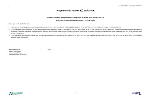
Based upon the attached information:<br />
<br />
<br />
<br />
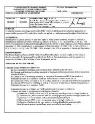
I have determined that the project meets the applicability criteria set forth in the PROGRAMMATIC SECTION 4(f) EVALUATION FOR FHWA PROJECTS THAT NECESSITATE THE USE OF HISTORIC BRIDGES.<br />
I have determined that all alternatives set forth in the Findings section of the PROGRAMMATIC SECTION 4(f) EVALUATION FOR FHWA PROJECTS THAT NECESSITATE THE USE OF HISTORIC BRIDGES have been evaluated and that there are<br />
no feasible and prudent alternatives to the replacement of John Greenleaf <strong>Whittier</strong> <strong>Bridge</strong> (A-07-016=N-11-017), which carries Interstate <strong>95</strong> over the Merrimack River between the City of Newburyport and the Town of Amesbury, Essex<br />
County, Massachusetts.<br />
I have determined that the project complies with the Measures to Minimize Harm section of the PROGRAMMATIC SECTION 4(f) EVALUATION FOR FHWA PROJECTS THAT NECESSITATE THE USE OF HISTORIC BRIDGES and assure that these<br />
measures will be implemented.<br />
Pamela Stephenson<br />
Division Administrator<br />
Massachusetts Division<br />
Federal Highway Administration<br />
Date<br />
i
<strong>Whittier</strong> <strong>Bridge</strong>/I-<strong>95</strong> <strong>Improvement</strong> <strong>Project</strong> EA/DEIR<br />
9.0 <strong>Programmatic</strong> <strong>Section</strong> 4(f)<br />
Evaluation<br />
9.1 INTRODUCTION<br />
The Massachusetts Department of Transportation – Highway Division<br />
(MassDOT) proposes to use federal funds to replace the John Greenleaf<br />
<strong>Whittier</strong> Memorial <strong>Bridge</strong> (A-07-016=N-11-017) (<strong>Whittier</strong> <strong>Bridge</strong>), which<br />
carries Interstate <strong>95</strong> (I-<strong>95</strong>) over the Merrimack River between the Town of<br />
Amesbury and the City of Newburyport, Massachusetts (Figure 9-1). The<br />
<strong>Whittier</strong> <strong>Bridge</strong> is a historic property that is eligible for individual listing in<br />
the National Register of Historic Places (National Register) as one of three<br />
bridges in Massachusetts identified on the Federal Highway<br />
Administration’s (FHWA) “Final List of Nationally and Exceptionally<br />
Significant Features of the Federal Interstate Highway System,” published<br />
in the Federal Register on December 19, 2006.<br />
9.1.1 Regional Context<br />
I-<strong>95</strong> is the major north-south interstate highway on the U.S. eastern<br />
seaboard extending from Miami, Florida to the Canadian border at<br />
Houlton, Maine. It is the longest north-south highway in the interstate<br />
system (approximately 1,925 miles) and connects more states—15—than<br />
any other interstate highway. I-<strong>95</strong> passes through and links several major<br />
metropolitan areas, including Miami, Florida; Washington, DC; Baltimore,<br />
Maryland; Philadelphia, Pennsylvania; New York, New York; and Boston,<br />
Massachusetts.<br />
In New England, I-<strong>95</strong> serves as a principal route directly linking five of the<br />
six New England states, and provides a connection to the maritime<br />
provinces of Canada, and the Trans-Canada Highway.<br />
In Massachusetts, I-<strong>95</strong> serves as both a major commuter route to New<br />
Hampshire and Maine, and to Boston from the North Shore area of<br />
Massachusetts, and as a recreational gateway to New Hampshire and<br />
southern Maine. As such, traffic volumes reflect both weekday and<br />
weekend traffic patterns. Summer weekend volumes, northbound on<br />
Saturday mornings and southbound on Sunday evenings (or Monday<br />
evening on three-day holiday weekends), are higher than normal weekday<br />
commuting volumes. Weekday peak periods coincide with Boston<br />
commuter travel patterns – southbound in the morning and northbound in<br />
the afternoon.<br />
FIGURE 9-1:<br />
LOCUS MAP<br />
9.1.2 Regional Interstate Geometry<br />
The current six-lane cross section of I-<strong>95</strong> from immediately south of<br />
<strong>Whittier</strong> <strong>Bridge</strong> north to Exit 57 does not match the eight-lane cross<br />
section existing immediately south and north of the project limits and does<br />
not meet the current American Association of State and Highway<br />
Transportation Officials (AASHTO) standards for consistency of the number<br />
of travel lanes.<br />
According to AASHTO’s Geometric Design of Highways and Streets, an<br />
important highway design principle is that the number of travel lanes<br />
should be consistent along any major route “... irrespective of changes in<br />
traffic volumes” to provide for safe travel conditions. The intent is that the<br />
basic number of lanes (in this case, eight lanes) should be established for a<br />
substantial length of freeway and should not be changed through pairs of<br />
interchanges irrespective of traffic volumes entering or leaving the<br />
highway at any one interchange. The latter situation does not provide for a<br />
consistent driving experience and does not provide for safe operating<br />
conditions. Figure 9-2 illustrates the general location of the six-lane<br />
segment of 1-<strong>95</strong> in relation to the adjoining eight-lane sections.<br />
9.1.3 Congestion<br />
Existing (2007) weekend peak-hour traffic volumes show unacceptable<br />
operating conditions in segments of the project corridor, particularly at the<br />
<strong>Whittier</strong> <strong>Bridge</strong> and its approaches and in the segment in between I-4<strong>95</strong><br />
and Route 286 at the northern end of the corridor.<br />
By 2030, weekend peak-hour traffic volumes within the six-lane I-<strong>95</strong><br />
project corridor are projected to result in unacceptable operating<br />
conditions and substandard levels of service (LOS) without additional<br />
capacity (widening to a consistent eight-lane cross section). Table 9-1 lists<br />
the segments of the project corridor and the existing (2007) and projected<br />
(2030) LOS.<br />
TABLE 9-1:<br />
EXISTING (2007) AND PROJECTED NO BUILD (2030) LEVEL OF<br />
SERVICE – CURRENT LANE CONFIGURATION<br />
I-<strong>95</strong> (northbound)<br />
Saturday AM<br />
I-<strong>95</strong> (southbound)<br />
Sunday PM<br />
Segment<br />
Existing<br />
(2007)<br />
No Build<br />
(2030)<br />
Existing<br />
(2007)<br />
No Build<br />
(2030)<br />
North of Route 113 B D B E<br />
<strong>Whittier</strong> <strong>Bridge</strong> D D D E<br />
Route 110 to I-4<strong>95</strong> C F C C<br />
I-4<strong>95</strong> to Route 286 D F D F<br />
I-<strong>95</strong> in the project corridor is classified as a rural interstate highway, and<br />
LOS C is the minimum acceptable design standard for this classification.<br />
For segments of the project corridor north of Route 113, with the<br />
exception of the I-<strong>95</strong> southbound segment between the I-<strong>95</strong> off-ramp to<br />
I-4<strong>95</strong> southbound and the Route 110 interchange, LOS is projected to<br />
degrade to LOS D or LOS F by 2030 without capacity improvements such as<br />
an additional travel lane in each direction.<br />
Peak-hour traffic operations on the <strong>Whittier</strong> <strong>Bridge</strong> exhibit LOS D<br />
conditions and the existing highway geometry on the bridge fails to meet<br />
current FHWA Interstate Highway Standards. The existing shoulders on the<br />
<strong>Whittier</strong> <strong>Bridge</strong> and approaches are substandard (any shoulder less than 6<br />
feet wide degrades the performance of the roadway segment). The<br />
existing bridge shoulders are less than 2 feet wide and because of<br />
substandard outside shoulder widths, there is a high occurrence of<br />
vehicles losing control and striking bridge supports or guardrails in areas<br />
where there is no breakdown lane.<br />
9-1
4 Lanes Northbound<br />
and Southbound<br />
MERRIMAC<br />
AMESBURY<br />
SALISBURY<br />
<strong>Project</strong> Limits<br />
3 Lanes Northbound<br />
and Southbound<br />
NEWBURYPORT<br />
WEST NEWBURY<br />
HAVERHILL<br />
NEWBURY<br />
GROVELAND<br />
GEORGETOWN<br />
ROWLEY<br />
4 Lanes Northbound<br />
and Southbound<br />
BOXFORD<br />
IPSWICH<br />
NORTH ANDOVER<br />
TOPSFIELD<br />
ESSEX<br />
ANDOVER<br />
HAMILTON<br />
GLOUCESTER<br />
MIDDLETON<br />
WENHAM<br />
NORTH READING<br />
DANVERS<br />
BEVERLY<br />
MANCHESTER<br />
READING<br />
LYNNFIELD<br />
PEABODY<br />
SALEM<br />
[<br />
WAKEFIELD<br />
SAUGUS<br />
LYNN<br />
MARBLEHEAD<br />
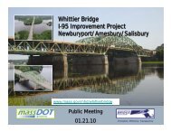
<strong>Whittier</strong> <strong>Bridge</strong>/I-<strong>95</strong> <strong>Improvement</strong> <strong>Project</strong><br />
Newburyport/Amesbury/Salisbury<br />
0 2<br />
Miles<br />
Base Map:<br />
Bing Airphoto<br />
DOT Roadway Inventory<br />
Existing I-<strong>95</strong><br />
Lane Configuration<br />
Figure 9-2
<strong>Whittier</strong> <strong>Bridge</strong>/I-<strong>95</strong> <strong>Improvement</strong> <strong>Project</strong> EA/DEIR<br />
Chapter 9.0: <strong>Programmatic</strong> <strong>Section</strong> 4(f) Evaluation<br />
9.1.4 Accidents<br />
As seen on Table 9-2, the accident rate along I-<strong>95</strong> within the project area is<br />
higher than the state average. In particular, there is a high occurrence of<br />
angle crashes along the project corridor. There are multiple locations on<br />
the corridor where vehicles entering and exiting the ramps for any<br />
destination must maneuver through multiple conflicting decision points in<br />
a short distance. Merging, weaving, and diverging occur at Route 286,<br />
I-4<strong>95</strong> and Route 110. The statewide average crash rate for 2007 (the most<br />
up-to-date data available from MassDOT) is 0.57 crashes per million<br />
vehicle miles traveled (VMT) for an urban interstate. Several sections of<br />
the I-<strong>95</strong> corridor in the project area exhibit higher crash rates than the<br />
statewide average. The <strong>Whittier</strong> <strong>Bridge</strong> northbound is located on the<br />
section of 1-<strong>95</strong> between Route 113 and Route 110. The crash rate for<br />
northbound traffic across the <strong>Whittier</strong> <strong>Bridge</strong> is 0.73 crashes per million<br />
VMT, which is 28 percent higher than the statewide average. Additionally,<br />
the crash rate for the merge and diverge section between Route 286 and<br />
1-4<strong>95</strong> on 1-<strong>95</strong> is above average with rates of 0.71 and 0.70 crashes per<br />
million VMT for northbound and southbound travel, respectively.<br />
9.2 PURPOSE AND NEED<br />
The MassDOT has determined there is a need to replace the existing I-<strong>95</strong><br />
six-lane <strong>Whittier</strong> <strong>Bridge</strong> over the Merrimack River to remedy the structural<br />
deficiencies and functional obsolescence of the existing bridge. It is not<br />
possible to rehabilitate or widen this bridge in compliance with the<br />
American Association of State Highway and Transportation Officials<br />
(AASHTO) standards; therefore, MassDOT has pursued the total<br />
replacement of the bridge.<br />
9.3 DESCRIPTION OF PROJECT<br />
The <strong>Whittier</strong> <strong>Bridge</strong> carries I-<strong>95</strong> over the Merrimack River between the City<br />
of Newburyport and the Town of Amesbury (see Figure 9-1). The proposed<br />
project would demolish and replace the <strong>Whittier</strong> <strong>Bridge</strong> (A-07-016=N-11-<br />
017) with a new bridge on a similar alignment within the existing interstate<br />
highway layout.<br />
The project also proposes to improve a 4.25 mile segment of the I-<strong>95</strong><br />
corridor by constructing an additional lane travel lane in each direction<br />
beginning south of the bridge at a point just north of Interchange 57 in<br />
Newburyport and extending north across the bridge through Amesbury<br />
and Salisbury, terminating just south of the New Hampshire state line. The<br />
project would also replace or repair 10 additional, non-historic interstate<br />
highway bridges along that segment of I-<strong>95</strong>.<br />
TABLE 9-2:<br />
CRASH RATE SUMMARY<br />
9.3.1 Existing Conditions<br />
The 1<strong>95</strong>1 <strong>Whittier</strong> Memorial <strong>Bridge</strong> is composed of a five-span, doublebarreled<br />
steel-riveted built-up truss superstructure with Warren-type truss<br />
webs. The main unit of the bridge is a double-barreled, three-span<br />
continuous steel truss whose arched through truss central span crosses the<br />
Army Corps of Engineers federal navigation channel of the Merrimack<br />
River.<br />
The <strong>Whittier</strong> <strong>Bridge</strong> was designed to carry two travel lanes in each<br />
direction with full breakdown lanes along the shoulders, matching the<br />
original configuration of the I-<strong>95</strong> roadway. Between 1967 and 1969,<br />
however, I-<strong>95</strong> was widened north of the bridge to provide three travel<br />
lanes in each direction to I-4<strong>95</strong> in Salisbury, and four travel lanes in each<br />
direction from I-4<strong>95</strong> north to the New Hampshire state line. Between 1973<br />
and 1977, I-<strong>95</strong> was widened south of the bridge to provide four travel<br />
lanes in each direction from Route 113 in Newburyport to US Route 1 in<br />
Location<br />
Direction<br />
Length<br />
(miles) Average Daily Traffic Number of Crashes Crash Rate<br />
Percent Higher than<br />
State Average<br />
Route 113 to Route 110 (eastbound off-ramp) Northbound 1.70 33,717 76 0.73 28%<br />
I-4<strong>95</strong> to Route 286 Northbound 0.54 44,236 31 0.71 24%<br />
Route 286 to I-4<strong>95</strong> Southbound 0.54 44,770 31 0.70 22%<br />
The purpose of the <strong>Whittier</strong> <strong>Bridge</strong>/I-<strong>95</strong> <strong>Improvement</strong> <strong>Project</strong> is to:<br />
<br />
<br />
<br />
<br />
Improve safety along I-<strong>95</strong> and the Merrimack River bridge crossing by<br />
providing geometric features in keeping more with the Highway Design<br />
Standards;<br />
Provide the infrastructure to support alternative (or non-motorized)<br />
modes of transportation within the project area;<br />
Reduce congestion and improve the flow of traffic on I-<strong>95</strong> through the<br />
project area; and<br />
Improve air quality by reducing congestion on I-<strong>95</strong> and offering<br />
alternative (or non-motorized) modes of transportation.<br />
Existing <strong>Whittier</strong> <strong>Bridge</strong><br />
9-3
<strong>Whittier</strong> <strong>Bridge</strong>/I-<strong>95</strong> <strong>Improvement</strong> <strong>Project</strong> EA/DEIR<br />
Chapter 9.0: <strong>Programmatic</strong> <strong>Section</strong> 4(f) Evaluation<br />
Danvers. In 1977, the cast-in-place reinforced concrete deck on the bridge<br />
was completely replaced and the roadway on the bridge was reconfigured<br />
to create three 12-foot travel lanes in each direction sandwiched between<br />
the limits of the existing trusses. Breakdown lanes on the bridge were<br />
eliminated at that time and concrete barriers were installed along the<br />
outer shoulders and the center median to protect the trusses and<br />
suspender cables from collisions.<br />
Current Condition of the <strong>Whittier</strong> <strong>Bridge</strong>. The <strong>Whittier</strong> <strong>Bridge</strong> is a steelriveted<br />
built-up truss bridge built in 1<strong>95</strong>1. Truss bridges comprise multiple<br />
non-redundant members. A failure of one member, in either tension or<br />
compression, could cause the bridge to collapse. As noted above, the<br />
bridge was originally designed to carry only two lanes of traffic in each<br />
direction with full breakdown lanes.<br />
In 1977, the bridge was reconfigured to three lanes without shoulders in<br />
each direction, and traffic volumes have increased the fatigue loading by<br />
50 percent. Steel members of the bridge already are exhibiting signs of<br />
distress that may be caused by fatigue. Numerous tack welds and<br />
associated cracks at several of the end connections of the floor beams to<br />
the main trusses appear to be fatigue related. The propagation of fatigue<br />
cracks in the webs of floor beams connections can be a serious matter, as<br />
the floor beams are considered fracture-critical non-redundant members.<br />
The presence of fatigue cracks on the interior faces of some gusset plates<br />
also is a major concern.<br />
MassDOT’s <strong>Bridge</strong> Inspection reports indicate that several gusset plates<br />
have also suffered corrosion loses. Disassembling riveted connections to<br />
replace gusset plates is a very difficult and expensive proposition which<br />
carries a great safety risk to construction crews. Pack rust that already has<br />
formed in gusset plate joints is difficult to arrest and can cause the plates<br />
to expand as they rust, leading to rivet failures. Gusset plate failure was<br />
cited as the cause of the catastrophic collapse of the I-35W <strong>Bridge</strong> over the<br />
Mississippi River in Minneapolis in August 2007.<br />
Significant corrosion has also occurred to structural elements of the<br />
bridge, including truss floor beams and stringers, bracing, wind chords, and<br />
gusset plates, with the most severe deterioration occurring to members<br />
exposed to deicing salts at the edges of the bridge and in the open<br />
medians between the northbound and southbound roadways.<br />
9.3.2 Proposed <strong>Project</strong><br />
The project proposes to replace the existing <strong>Whittier</strong> <strong>Bridge</strong> with a new<br />
bridge on a parallel alignment. MassDOT evaluated four bridge types: 1) a<br />
network tied-arch bridge with girder approaches; 2) a steel cable-stayed<br />
bridge; and 3) a single-tower concrete extradosed bridge; and 4) a steel<br />
single- and multi-box girder structure (Figure 9-3).<br />
FIGURE 9-3:<br />
BRIDGE TYPES<br />
Each proposed new bridge type would require constructing three piers in<br />
the river, and would carry four travel lanes northbound and southbound, a<br />
10-foot outside breakdown lane, and a 4-foot inside shoulder to match the<br />
proposed cross section of the reconstructed I-<strong>95</strong> approaches.<br />
MassDOT’s <strong>Bridge</strong> Type Study evaluated eight specific bridge design<br />
alternatives of the four general bridge types listed above. This evaluation<br />
included approximate estimates of construction costs as well as future<br />
inspection, maintenance, and life cycle costs. All design alternatives were<br />
developed and evaluated through a multi-disciplinary approach with due<br />
consideration to the existing condition, including safely maintaining the<br />
existing bridge structure while building the new bridges; roadway profiles<br />
and clearances; maintaining traffic and river navigation channels; river<br />
hydraulics; existing utilities; environmentally sensitive or cultural resource<br />
areas; presence of hazardous material; and right-of-way. The results of the<br />
evaluation of bridge designs concluded that the steel network tied arch<br />
with steel box girder approaches was the highest rated of the bridge types<br />
evaluated and has been selected as the preferred bridge type.<br />
The project would also improve a 4.25-mile segment of I-<strong>95</strong> in<br />
Newburyport, Amesbury, and Salisbury by widening the interstate highway<br />
from its current six-lane configuration to eight lanes with full breakdown<br />
lanes, from immediately north of the I-<strong>95</strong>/Route 113 Interchange in<br />
Newburyport to just north of the 1-4<strong>95</strong> connector ramp in Salisbury,<br />
matching the cross section of I-<strong>95</strong> north and south of the project area.<br />
Minor geometric improvements are proposed to the existing ramps within<br />
the highway layout at Interchange 58 (Route 110/Elm Street) in Amesbury.<br />
In addition, the new <strong>Whittier</strong> <strong>Bridge</strong> would include a Shared-Use Path,<br />
which would be 12-feet wide with two 2-foot shoulders. The path would<br />
be separated from the I-<strong>95</strong> northbound breakdown lane by a barrier<br />
topped with chain link fencing to provide safe conditions for pedestrians<br />
and cyclists on the path.<br />
All other existing highway bridges along I-<strong>95</strong> within the project area in<br />
Newburyport and Amesbury also would be replaced, reconstructed or<br />
modified to accommodate the proposed eight lanes of traffic on I-<strong>95</strong> and<br />
to meet current design standards as much as practicable. All of these other<br />
bridges were constructed from 1967 to 1977 and comprise steel stringer<br />
superstructures supported on reinforced concrete abutments and piers.<br />
These bridges are not subject to consideration as historic properties under<br />
<strong>Section</strong> 106 according to the Interstate Highway Exemption issued by the<br />
Advisory Council on Historic Preservation (ACHP). As a result, these bridges<br />
are not potential <strong>Section</strong> 4(f) resources.<br />
All work associated with this project would be undertaken within the<br />
existing highway layout. No permanent property takings are required.<br />
9.4 PROGRAMMATIC SECTION 4(f) APPLICABILITY<br />
<strong>Section</strong> 4(f) of the Department of Transportation (DOT) Act of 1966, as<br />
amended in 1983, specifies that:<br />
9-4
The Secretary of DOT may approve a transportation program or<br />
project requiring the use of publically owned land of a park,<br />
recreation area, of wildlife or waterfowl refuge, or land of a<br />
historic site of National, State, or local significance (as<br />
determined by the Federal, State, or local officials having<br />
jurisdiction over the park, recreation area, refuge, or site) only if:<br />
1. There is no feasible and prudent alternative to using that<br />
land; and<br />
2. The program or project includes all possible planning to<br />
minimize harm to the park, recreation area, wildlife or<br />
waterfowl refuge, or historic site resulting from the use.<br />
As part of administering this act, the FHWA developed a <strong>Programmatic</strong><br />
<strong>Section</strong> 4(f) Evaluation for certain federally assisted highway projects<br />
affecting bridges that are on or eligible for inclusion on the National<br />
Register. The criteria that must be met to apply this programmatic<br />
evaluation and the proposed project’s applicability are as follows:<br />
The bridge is to be replaced or rehabilitated with Federal<br />
funds.<br />
MassDOT proposes to use federal funds to replace the <strong>Whittier</strong> <strong>Bridge</strong>.<br />
The project will require the use of a historic bridge<br />
structure that is on or eligible for listing on the National<br />
Register of Historic Places.<br />
The <strong>Whittier</strong> <strong>Bridge</strong>, constructed in 1<strong>95</strong>1, is a historic property that is<br />
eligible for individual listing in the National Register as one of three bridges<br />
in Massachusetts identified on the FHWA’s “Final List of Nationally and<br />
Exceptionally Significant Features of the Federal Interstate Highway<br />
System,” as accepted by the ACHP and published in the Federal Register on<br />
December 19, 2006.<br />
The bridge is not a National Historic Landmark.<br />
<strong>Whittier</strong> <strong>Bridge</strong> is not listed as a National Historic Landmark.<br />
The FHWA District Administrator determines that the<br />
facts of the project match the sections of the<br />
<strong>Programmatic</strong> <strong>Section</strong> 4(f) Evaluation for FHWA <strong>Project</strong>s<br />
that Necessitate the Use of Historic <strong>Bridge</strong>s labeled<br />
Alternatives to Avoid <strong>Section</strong> 4(f) Property, Findings, and<br />
Mitigation.<br />
This document has been prepared in compliance with the requirements of<br />
the FHWA <strong>Programmatic</strong> <strong>Section</strong> 4(f) Evaluation for FHWA <strong>Project</strong>s that<br />
Necessitate the Use of Historic <strong>Bridge</strong>s. Among other alternatives<br />
considered, MassDOT considered the following alternatives:<br />
<br />
<br />
<br />
No Build<br />
Build a New Structure at a Different Location without Affecting the<br />
Historic Integrity of the Old <strong>Bridge</strong>.<br />
Rehabilitate the Historic <strong>Bridge</strong> without Affecting the Historic Integrity<br />
of the Structure.<br />
Agreement among the FHWA, the State Historic<br />
Preservation Officer (SHPO), and the Advisory Council on<br />
Historic Preservation (ACHP) has been reached through<br />
procedures pursuant to <strong>Section</strong> 106 of the NHPA.<br />
During 2009 and 2010, FHWA conducted historic and archeological studies<br />
in the project area and prepared appropriate <strong>Section</strong> 106 documentation<br />
describing the project’s unavoidable Adverse Effect on the National<br />
Register-eligible John Greenleaf <strong>Whittier</strong> Memorial <strong>Bridge</strong>, pursuant to<br />
<strong>Section</strong> 106 of the National Historic Preservation Act (NHPA). On August<br />
27, 2010, the Massachusetts State Historic Preservation Office (SHPO)/<br />
Massachusetts Historical Commission (MHC), in cooperation with the<br />
Advisory Council on Historic Preservation (ACHP), concurred with FHWA’s<br />
finding of Adverse Effect on the John Greenleaf <strong>Whittier</strong> Memorial <strong>Bridge</strong>.<br />
On March 2, 2011, a Memorandum of Agreement (MOA) was approved by<br />
<strong>Section</strong> 106 parties, including FHWA, MassDOT, ACHP, MHC, and<br />
representatives of the local governments of Amesbury, Newburyport, and<br />
Salisbury.<br />
The complete record of the <strong>Section</strong> 106 documentation is provided at the<br />
end of this chapter. Details of the MOA’s mitigation program are<br />
presented in <strong>Section</strong> 9.8, Measures to Minimize Harm.<br />
9.5 DESCRIPTION OF SECTION 4(f) RESOURCES<br />
This section provides information on the recreational and historic<br />
<strong>Section</strong> 4(f) resources within the project area. Historic resources are<br />
depicted on Figure 9-4 and recreational resources are depicted on<br />
Figure 9-5A and Figure 9-5B.<br />
9.5.1 Historic Resources<br />
The <strong>Whittier</strong> <strong>Bridge</strong> (A-07-016=N-11-017) (AME.927, NWB.930) carries<br />
I-<strong>95</strong> on a north-south axis over the Merrimack River in Amesbury and<br />
Newburyport. The bridge comprises a high-level, five-span, doublebarreled,<br />
steel-riveted built-up truss superstructure with Warren-type<br />
<strong>Whittier</strong> <strong>Bridge</strong>/I-<strong>95</strong> <strong>Improvement</strong> <strong>Project</strong> EA/DEIR<br />
Chapter 9.0: <strong>Programmatic</strong> <strong>Section</strong> 4(f) Evaluation<br />
truss webs. The structure is approximately 1,346 feet in length and 94 feet<br />
wide to the outside of the trusses and the bridge’s clearance over the<br />
navigation channel is approximately 55 feet at high tide. The bridge was<br />
constructed between 1<strong>95</strong>1 and 1<strong>95</strong>4 as part of the planned relocation of<br />
US Route 1 away from downtown Newburyport, but was added to the<br />
Interstate Highway System in 1<strong>95</strong>6 when this section of US Route 1<br />
became I-<strong>95</strong>. The main unit of the bridge is a double-barreled, five-span,<br />
continuous steel truss whose arched through-truss central span crosses<br />
the navigation channel of the Merrimack River. The arched through-truss<br />
transitions into deck trusses at the continuous-approach spans on either<br />
end of the arch. The highway decks on the central-arch span are<br />
suspended from the lower chords of the trusses by steel cables. Two,<br />
simple deck-truss approach spans link the main spans of the bridge to the<br />
southerly bank of the river<br />
The FHWA, Massachusetts SHPO, the ACHP, and MassDOT have<br />
determined the <strong>Whittier</strong> <strong>Bridge</strong> to be eligible for individual listing in the<br />
National Register as one of three bridges in Massachusetts on the FHWA’s<br />
“Final List of Nationally and Exceptionally Significant Features of the<br />
Federal Interstate Highway System,” as published in the Federal Register<br />
on December 19, 2006.<br />
There are no historic properties within or immediately adjacent to the<br />
project limits. The following properties are located along the Merrimack<br />
River near the project:<br />
<br />
<br />
Lowell’s Boat Shop on Main Street in Amesbury received National Park<br />
Service designation as a National Historic Landmark (NHL) in 1990. The<br />
boat shop consists of four attached buildings constructed in 1793,<br />
1806, 1860, and 1946. It is significant for its associations with Samuel<br />
Lowell who designed the dory type fishing boat and as an 18 th through<br />
20 th -century boat shop preserved on its waterfront site. The boat shop<br />
is located on the northern bank of the Merrimack River approximately<br />
0.5 mile upstream of the project area with panoramic views of the<br />
Merrimack River.<br />
The Salisbury Point Historic District (AME.C) located along Main Street<br />
on the northern bank of the Merrimack River between I-<strong>95</strong> and I-4<strong>95</strong><br />
was determined eligible for the National Register by the SHPO in 1993.<br />
The historic district primarily comprises residential and some<br />
commercial and religious properties constructed between the 18th<br />
and early 20th centuries that were associated with the shipbuilding<br />
and waterfront development.<br />
9-5
Legend<br />
<strong>Project</strong> Limits<br />
^_<br />
^_<br />
DOT Right of Way (Approx.)<br />
National Register-Eligible Properties<br />
FERN AVENUE<br />
CLINTON STREET<br />
BLACK RIVER ROAD<br />
Not Eligible for the National Register<br />
Approximate Location of Salisbury Point District<br />
Spofford Street Area<br />
CONGRE SS STRE ET<br />
LOCUST STREET<br />
UV 286<br />
LENA MAES WAY<br />
MAIN STREET<br />
TOLL ROAD<br />
JON STREET<br />
R STREET<br />
CE D AR STREET<br />
AMESBURY<br />
OAKLAND STREET<br />
OAK STREE T<br />
RIVER STREET<br />
PEARL STREET<br />
W ARREN AVENUE<br />
STOVERS COURT<br />
MADISON STREET<br />
COLLINS AVENUE<br />
BAY STREET<br />
AMIDON AVENUE<br />
MUNROE STREET<br />
GOSS AVE NUE<br />
MINGO ROAD<br />
JOY ROAD<br />
INTERSTATE 4<strong>95</strong><br />
MAIN STREET<br />
INTERSTATE <strong>95</strong><br />
RABBIT ROAD<br />
DELUCA DRIVE<br />
INTERSTATE 4<strong>95</strong><br />
CHERRY<br />
HILL<br />
MACY STREET<br />
^_<br />
<strong>Whittier</strong><br />
<strong>Bridge</strong><br />
Johnathan Eastman<br />
House<br />
^_<br />
^_<br />
Chain <strong>Bridge</strong><br />
20 Spofford St.<br />
^_<br />
UV<br />
§¨¦ 110<br />
4<strong>95</strong> Lowell's Boat Shop<br />
UV 113<br />
EVANS PLACE<br />
FERRY ROAD<br />
Smith's Chain <strong>Bridge</strong><br />
Filling Station #3<br />
Tavern and<br />
Toll House<br />
^_<br />
^_<br />
^_<br />
^_^_<br />
MERRILL STREET<br />
Spofford Street Area<br />
19 Spofford St.<br />
MOSELEY AVENUE<br />
FERRY ROAD<br />
STOREY AVENUE<br />
MERRIMACK STREET<br />
ELM STREET<br />
BAKER ROAD<br />
HIGH STREET<br />
JAK-LEN DRIVE<br />
MERRIMAC STREET<br />
HOYT S LANE<br />
MAIN STREET<br />
C URZON MILL ROAD<br />
PINE HILL ROAD<br />
§¨¦ <strong>95</strong><br />
§¨¦ <strong>95</strong><br />
SPRING LANE<br />
§¨¦ 4<strong>95</strong><br />
LAUREL STREET<br />
CLARKES R O AD<br />
ELMIRA AVENUE<br />
NOBEL STREET<br />
INTERSTATE <strong>95</strong><br />
OLD ELM STREET<br />
CUTTING DR IVE<br />
PLUMMER AVENUE<br />
MYRTLE AVEN UE<br />
JEFFERSON STREET<br />
ASHLAND STREET<br />
FORRESTER STREET<br />
PALIS DRIVE<br />
ELM STREET<br />
SALISBURY<br />
[<br />
NEWBURYPORT<br />
0 1,500<br />
Feet<br />
Base Map:<br />
MassGIS April 2008 Airphoto<br />
<strong>Whittier</strong> <strong>Bridge</strong>/I-<strong>95</strong> <strong>Improvement</strong> <strong>Project</strong><br />
Newburyport/Amesbury/Salisbury<br />
National Register-Eligible Properties<br />
Located within the Area<br />
of Potential Effect<br />
Figure 9-4
Legend<br />
<strong>Project</strong> Limits<br />
DOT Right of Way (Approx.)<br />
Existing Trails<br />
AMESBURY<br />
Open Space Lands<br />
DCR-State Parks & Recreation<br />
Municipal<br />
Land Trust<br />
LOMBA RD AVENUE<br />
KENDRICKS COURT<br />
INTERSTATE 4<strong>95</strong><br />
INTERSTATE 4<strong>95</strong><br />
MAIN S TREET<br />
ROCKY HILL ROAD<br />
LOWELL'S BOAT<br />
SHOP<br />
CLARKES ROA D<br />
MACY STREET<br />
Non-Profit<br />
Private<br />
Municipal-Water<br />
SWE TTS HILL<br />
MERRIMAC STREET<br />
CAPOLUPO<br />
9 SPRING LANE<br />
EVANS PLACE<br />
INTERSTATE <strong>95</strong><br />
MERRILL STREET<br />
OLD MERRILL STREET<br />
SALISBURY<br />
BEA CON S T REET<br />
PLEASANT VALLEY ROAD<br />
NEWBURYPORT<br />
MAUDSLAY STATE PARK<br />
CURZON MILL RO AD<br />
CHASE FARM<br />
§¨¦ 4<strong>95</strong> UV 113<br />
FERRY ROAD EXTENSION<br />
PINE HILL ROAD<br />
HALLISEY DRIVE<br />
SPRING LN WELL SITE<br />
§¨¦ <strong>95</strong><br />
SPRING LAN E<br />
FERRY ROAD<br />
LAUREL STREET<br />
SPRING LN<br />
WELL SITE<br />
BRIGG AVENUE<br />
FERRY RD<br />
WELL SITE<br />
EVERGREEN VALLEY GOLF COURSE<br />
MOSELEY WOODS PARK<br />
SPOFFORD STREET<br />
HART ROAD<br />
ST MARYS CEMETERY<br />
DEER ISLAND<br />
MERRIMACK STREET<br />
MOSELEY AVENUE<br />
ELMIRA AVENUE<br />
HARDING AVENUE<br />
FERRY ROAD<br />
NOBEL STREET<br />
ERIE AVENUE<br />
BELLEVUE CEMETERY<br />
97 CURZON<br />
MILL RD.<br />
WELCH RECREATION LAND<br />
§¨¦ 4<strong>95</strong> §¨¦ <strong>95</strong><br />
SAWYERS HILL CEMETERY<br />
CHERRY<br />
HILL<br />
PHILIP S DRIVE<br />
RYAN ROAD<br />
CHERRY<br />
HILL<br />
INTERSTATE <strong>95</strong><br />
STOREY AVENUE<br />
LOW STREET<br />
TOWN WELLFIELD<br />
WEST NEWBURY<br />
Woodman Park<br />
ARTICHOKE RIVER LAND<br />
[<br />
ARTICHOKE RIVER WATERSHED<br />
North Pasture<br />
0 1,000<br />
Feet<br />
Note: Open Space from<br />
MassGIS 2009 & TTR<br />
Trails from CRC & MVPC<br />
Base Map:<br />
MassGIS April 2008 Airphoto<br />
<strong>Whittier</strong> <strong>Bridge</strong>/I-<strong>95</strong> <strong>Improvement</strong> <strong>Project</strong><br />
Newburyport/Amesbury/Salisbury<br />
Open Space and Recreational<br />
Resources (Newburyport)<br />
Figure 9-5A
MINGO RO AD<br />
Legend<br />
<strong>Project</strong> Limits<br />
DOT Right of Way (Approx.)<br />
Amesbury Open Space Lands<br />
Private<br />
Municipal<br />
BLACK RIVER ROAD<br />
ELMWOOD STREET<br />
Salisbury Well Site<br />
LENA MAES WAY<br />
NonProfit<br />
FERN AVEN<br />
UE<br />
CONGRE SS STRE E T<br />
SALISBURY<br />
WATER CO.<br />
LOCUST STREET<br />
UV 286<br />
CAPTIAN'S<br />
CORNER<br />
TOLL ROAD<br />
MAIN STREET<br />
HIGH STREET<br />
CLINTON STREET<br />
WARRE N AVENUE<br />
STOVERS COURT<br />
AMESBURY GOLF &<br />
COUNTRY CLUB<br />
MAIN STREET<br />
RABBIT ROAD<br />
JOY ROAD<br />
OAKLAND STREET<br />
OAK STREET<br />
RIVER STR EET<br />
PEARL STREET<br />
HUNTINGTON AVENUE<br />
COLLINS AVENUE<br />
BAY STREET<br />
INTERSTATE 4<strong>95</strong><br />
MADISON STREET<br />
AMESBURY<br />
AMIDON AVENUE<br />
LAFAYETTE STREET EXT<br />
ROCKY HILL ROAD<br />
MACY STREET<br />
MUNROE STREET<br />
GOSS AVEN UE<br />
ELM STREET<br />
§¨¦ 4<strong>95</strong> §¨¦ <strong>95</strong><br />
PARCEL<br />
68-15<br />
INTERSTATE 4<strong>95</strong><br />
SALISBURY<br />
INTERSTATE <strong>95</strong><br />
INTERSTATE <strong>95</strong><br />
BAKER ROAD<br />
DELUCA DRIVE<br />
MAIN STREET<br />
SALISBURY POINT CEMETERY<br />
PARCELS<br />
79-56<br />
79-58<br />
80-26<br />
80-27<br />
OLD ELM STREET<br />
§¨¦ 4<strong>95</strong> UV 110<br />
ELM STREET<br />
LOWELL'S BOAT<br />
SHOP<br />
MERRILL STREET<br />
PARCEL<br />
92-2<br />
PARCEL<br />
91-1<br />
PARCEL<br />
91-2<br />
PARCEL<br />
91-4<br />
AMESBURY VISITOR<br />
CENTER<br />
EVANS PLACE<br />
NEWBURYPORT<br />
FERRY ROAD EXTENSION<br />
[<br />
§¨¦ <strong>95</strong><br />
0 1,200<br />
Feet<br />
Note: Open Space from<br />
MassGIS 2009 & Amesbury<br />
Base Map:<br />
MassGIS April 2008 Airphoto<br />
<strong>Whittier</strong> <strong>Bridge</strong>/I-<strong>95</strong> <strong>Improvement</strong> <strong>Project</strong><br />
Newburyport/Amesbury/Salisbury<br />
Open Space and Recreational<br />
Resources (Amesbury)<br />
Figure 9-5B
The Essex-Merrimack <strong>Bridge</strong>, also known as the Chain <strong>Bridge</strong> (A-07-<br />
014=N-11-010), is a National Register-eligible property located<br />
approximately 1,400 feet downstream from the <strong>Whittier</strong> <strong>Bridge</strong>.<br />
Constructed in 1909 as a single-span steel wire cable suspension<br />
bridge with monumental reinforced concrete towers with arched<br />
openings, the Essex-Merrimack <strong>Bridge</strong> carries Main Street over the<br />
Merrimack River between Newburyport and Deer Island in Amesbury.<br />
Smith’s Chain <strong>Bridge</strong> Filling Station No. 3 (AME.537), located<br />
approximately 700 feet northeast of <strong>Whittier</strong> <strong>Bridge</strong> at 520 Main<br />
Street in Amesbury, was determined eligible for the National Register<br />
by the SHPO in 1997. The building is a one-story, Craftsman-style<br />
bungalow with a cross-gable roof and projecting covered porch<br />
supported by square wood columns set on brick piers. This former gas<br />
station was constructed in 1938 by Nelson Smith and is significant for<br />
its associations with automobile history and as the only extant<br />
example of a 1930s gas station in Amesbury.<br />
The identification of historic resources included an uninventoried area<br />
south of the Essex-Merrimack <strong>Bridge</strong> along Spofford Street that may be<br />
eligible for listing in the National Register as a historic district. The<br />
Spofford Street area consists of approximately 12 residential buildings<br />
dating from the early to late-19th century, including examples in the<br />
Second Empire and Greek Revival styles, and turn-of-the-20th-century infill<br />
buildings. Views of the <strong>Whittier</strong> <strong>Bridge</strong> are limited from the Spofford Street<br />
area.<br />
Two inventoried individual historic resources near the project area are not<br />
eligible for inclusion in the National Register. The Tavern and Toll<br />
House/Harriet Prescott Spofford House (AME.300) on Deer Island in<br />
Amesbury immediately north of the Essex-Merrimack <strong>Bridge</strong> has a full view<br />
of the <strong>Whittier</strong> <strong>Bridge</strong>. The Spofford House, reportedly constructed in<br />
1792, is a 2½-story gambrel-roof, center-hall house with numerous<br />
twentieth-century alterations. The house was previously determined by<br />
MassDOT and the SHPO not to be eligible for individual listing. The<br />
Jonathan Eastman House (AME.305) at 297 Elm Street in Amesbury<br />
approximately 200 feet west of the on-ramp at Exit 58 that carries traffic<br />
from Route 110 (Macy Street) to southbound I-<strong>95</strong>. The two-story, five-bay,<br />
central-entrance house has two interior chimneys and is set on a dressed<br />
granite foundation. Reportedly constructed circa 1830, the house has<br />
elements of both the Federal and Greek Revival styles. Extensive 20thcentury<br />
alternations and conversion to commercial use have caused a loss<br />
of architectural integrity and the house does not meet the criteria for<br />
individual listing in the National Register.<br />
The other 10 highway bridges to be affected by the proposed project are<br />
exempt from <strong>Section</strong> 106 and <strong>Section</strong> 4(f) review under the terms of the<br />
2006 Interstate Highway System exemption (see Historic Reconnaissance<br />
Survey, PAL, Inc. (October 2009).<br />
9.5.2 Recreational Resources<br />
Publicly-owned recreational resources subject to <strong>Section</strong> 4(f) within the<br />
project area include the Maudslay State Park, and the Moseley Woods<br />
Park (see Figure 9-5A and Figure 9-5C).<br />
Maudslay State Park<br />
Maudslay State Park is a state-owned recreational area managed by the<br />
Massachusetts Department of Conservation and Recreation (DCR). The<br />
park, located at 74 Curzon Mill Road, Newburyport, is the former Moseley<br />
family estate on the Merrimack River. This park features 19th century<br />
gardens and plantings, rolling meadows, towering pines, and one of the<br />
largest naturally-occurring stands of mountain laurel in Massachusetts.<br />
Most breathtaking are the ornamental trees and masses of azaleas and<br />
rhododendrons that bloom in May and June. The park is known as an<br />
exquisite place for walking, biking, horseback riding and informal picnics.<br />
Moseley Woods Park<br />
Moseley Woods Park is a city-owned park located on the banks of the<br />
Merrimack on Merrimack Street in Newburyport. This park contains hiking<br />
trails, children’s playground, picnic area, and a pavilion featuring concerts<br />
in the summer.<br />
Conclusion<br />
There would be no impact to these parks from the construction of the<br />
Preferred Alternative; therefore, there is no <strong>Section</strong> 4(f) requirement for<br />
impacts to the parks.<br />
9.6 IMPACT ON SECTION 4(f) RESOURCES<br />
The proposed project would have an unavoidable Adverse Effect on the<br />
John Greenleaf <strong>Whittier</strong> <strong>Bridge</strong> (A-07-016=N-11-017), which is eligible for<br />
individual listing in the National Register, through the complete removal<br />
and replacement of the historic property.<br />
The MassDOT and FHWA have determined that the removal of the<br />
<strong>Whittier</strong> <strong>Bridge</strong> would not adversely affect the viewshed along the<br />
Merrimack River of the following three historic properties: National<br />
Historic Landmark Lowell’s Boat Shop in Amesbury, the National Registereligible<br />
Salisbury Point Historic District in Amesbury, or the Essex-<br />
Merrimack <strong>Bridge</strong> between Amesbury and Newburyport.<br />
<strong>Whittier</strong> <strong>Bridge</strong>/I-<strong>95</strong> <strong>Improvement</strong> <strong>Project</strong> EA/DEIR<br />
Chapter 9.0: <strong>Programmatic</strong> <strong>Section</strong> 4(f) Evaluation<br />
Archaeological studies conducted for the project identified three areas as<br />
having moderate to high potential for archaeological sites. Following an<br />
intensive level archeological survey of these three locations (utilizing the<br />
methodology approved by the Massachusetts State Archeologist under<br />
Permit #3144) MassDOT concluded that no potentially significant<br />
archaeological sites are present in the project area, and no further survey<br />
would be necessary. The SHPO concurred.<br />
9.7 ALTERNATIVES TO AVOID SECTION 4(f) RESOURCES<br />
In accordance with the <strong>Section</strong> 4(f) <strong>Programmatic</strong> Evaluation for FHWA<br />
<strong>Project</strong>s that Necessitate the Use of Historic <strong>Bridge</strong>, MassDOT examined<br />
alternatives that would avoid impacts to <strong>Section</strong> 4(f) resources. These<br />
alternatives included:<br />
<br />
<br />
<br />
<br />
The No Build Alternative;<br />
The Build a New Structure at a Different Location without Affecting the<br />
Historic Integrity of the Old <strong>Bridge</strong> Alternatives;<br />
The Rehabilitate the Historic <strong>Bridge</strong> without Affecting the Historic<br />
Integrity of the Structure Alternative; and<br />
The <strong>Bridge</strong> Replacement Alternative.<br />
The results of the analysis of each of these alternatives are presented<br />
below.<br />
9.7.1 The No Build Alternative<br />
The No Build Alternative would involve limited maintenance rather than<br />
replacing or rehabilitating the <strong>Whittier</strong> <strong>Bridge</strong> without constructing<br />
additional travel lanes or breakdown shoulders. The No Build Alternative<br />
would not meet the project’s Purpose and Need because this alternative<br />
would not improve safety and reduce congestion by providing additional<br />
travel lanes for an eight-lane cross-section in the project area. This<br />
alternative would also not meet current Interstate Highway design<br />
standards, reduce peak hour congestion, or address existing safety<br />
deficiencies in the project corridor. This alternative was dismissed because<br />
it would not satisfy the Purpose and Need of the project.<br />
9.7.2 The Build a New Structure at a Different Location without<br />
Affecting the Historic Integrity of the Old <strong>Bridge</strong> Alternatives<br />
MassDOT examined several alternatives for building a new structure at a<br />
different location without affecting the historic integrity of the old bridge.<br />
These alternatives generally involved a substantial realignment of I-<strong>95</strong><br />
(either east or west of the existing alignment) and a reconstruction of one<br />
9-9
<strong>Whittier</strong> <strong>Bridge</strong>/I-<strong>95</strong> <strong>Improvement</strong> <strong>Project</strong> EA/DEIR<br />
Chapter 9.0: <strong>Programmatic</strong> <strong>Section</strong> 4(f) Evaluation<br />
or more highway interchanges within the project area to enable the<br />
construction of a new bridge at a new location. These alternatives would<br />
have satisfied the project Purpose and Need (as described in <strong>Section</strong> 9.2)<br />
and would have been feasible, (i.e., it could have been constructed as a<br />
matter of sound engineering judgment).<br />
The Build a New Structure at a Different Location without Affecting the<br />
Historic Integrity of the Old <strong>Bridge</strong> Alternatives were examined early in the<br />
planning process. At that time, these alternatives were determined to be<br />
not prudent because they would have caused severe social, economic, and<br />
environmental impacts, would have caused severe disruption to<br />
established communities, and would have resulted in construction and<br />
right-of-way costs of extraordinary magnitude. As such, these alternatives<br />
were dismissed early in the project development process and are not<br />
described in Chapter 3, <strong>Project</strong> Alternatives.<br />
A more specific description of these alternatives and their environmental<br />
impacts is provided below.<br />
I-<strong>95</strong> Realignment to the East<br />
This alternative would have involved realigning I-<strong>95</strong> to the east from a<br />
point immediately north of the I-<strong>95</strong>/Route 113 Interchange in<br />
Newburyport to the I-<strong>95</strong>/Route 110 Interchange in Amesbury.<br />
This new alignment would have required using several recreational and<br />
historic <strong>Section</strong> 4(f) properties and would have had a substantial impact on<br />
privately owned recreation areas, and residential and commercial<br />
properties (see Figure 9-5A and Figure 9-5C)<br />
South of the Merrimack River, a realignment of I-<strong>95</strong> to the east in the<br />
project area would have required using land within the Moseley Woods<br />
Park (an active recreation area owned by the City of Newburyport). The<br />
alignment would also have required acquiring land from the Evergreen<br />
Valley Golf Course and numerous residential properties in the Laurel Street<br />
area of Newburyport.<br />
North of the Merrimack River, a realignment of the I-<strong>95</strong> to the east could<br />
have affected the National Register-eligible Smith’s Chain <strong>Bridge</strong> Filling<br />
Station #3 and commercial properties adjacent to Merrill Street in<br />
Amesbury. A realignment of I-<strong>95</strong> to the east could also have affected the<br />
adjacent Main Street <strong>Bridge</strong> over the Merrimack (Hines Memorial <strong>Bridge</strong>),<br />
which is undergoing a $31 million reconstruction.<br />
I-<strong>95</strong> Realignment to the West<br />
This alternative would have involved realigning I-<strong>95</strong> to the west from a<br />
point immediately north of the I-<strong>95</strong>/Route 113 Interchange in<br />
Newburyport to the I-<strong>95</strong>/I-4<strong>95</strong> Interchange in Amesbury.<br />
This alignment would have required using several recreational and historic<br />
<strong>Section</strong> 4(f) properties and would have substantially affected privatelyowned<br />
residential and commercial properties in Amesbury.<br />
South of the Merrimack River, a realignment of I-<strong>95</strong> to the west in this area<br />
would have required using land within the Maudslay State Park (a stateowned<br />
recreation area managed by the Massachusetts Department of<br />
Conservation and Recreation). The alignment would have been proximate<br />
or traversed a Massachusetts Department of Environmental Protection<br />
Zone I area that surrounds an active drinking water supply well (Well #1)<br />
for the City of Newburyport.<br />
North of the Merrimack River, a realignment of the I-<strong>95</strong> to the west could<br />
have affected the Lowell’s Boat Shop, a National Historic Landmark. A<br />
realignment of I-<strong>95</strong> to the west would also have affected numerous<br />
residential properties in the Evens Street/Clarks Road area of Amesbury<br />
and numerous commercial properties at the I-<strong>95</strong>/Route 110 Interchange.<br />
Overall, the Build a New Structure at a Different Location without Affecting<br />
the Historic Integrity of the Old <strong>Bridge</strong> Alternatives were dismissed.<br />
9.7.3 The Rehabilitation of the Historic <strong>Bridge</strong> without Affecting the<br />
Historic Integrity of the Structure Alternative<br />
MassDOT explored the Rehabilitation of the Existing <strong>Bridge</strong> without<br />
Affecting the Historic Integrity of the Structure Alternative in the I-<strong>95</strong> Over<br />
the Merrimack River, Feasibility Study – Rehabilitation of the John<br />
Greenleaf <strong>Whittier</strong> Memorial <strong>Bridge</strong> (Parsons Brinckerhoff, 2010).<br />
This assessment examined the feasibility of replacing all of the structural<br />
elements supporting the roadway surfaces including wire rope hangers,<br />
floor beams, stringers, deck, bracing and bracing gusset plates, and<br />
expansion joints. Other truss members and connections would be replaced<br />
or strengthened as needed, and seismic retrofit would be required,<br />
potentially involving replacing the piers. More details concerning the<br />
<strong>Bridge</strong> Rehabilitation Alternatives are provided in Chapter 3, <strong>Project</strong><br />
Alternatives.<br />
MassDOT determined that, because of the extensive deterioration of the<br />
existing structure, the temporary nature of the near-term repairs, and the<br />
indeterminate nature of much of the structure, that a complete lifeextending<br />
rehabilitation would be neither practical nor prudent. The<br />
existing bridge cannot be rehabilitated because of its original design<br />
details, which continue to be susceptible to environmental corrosion,<br />
leading to extensive deterioration, and indeterminate but anticipated<br />
damage caused by pack rust within built up plates and gusseted plate<br />
connections.<br />
Based on review of the costs of similar recent bridge rehabilitation projects<br />
in New England, and considering the extent of the deteriorated structural<br />
bridge elements that would need replacement, the cost of rehabilitating<br />
<strong>Whittier</strong> <strong>Bridge</strong> (including construction and subsequent demolition of a<br />
temporary detour bridge) would exceed the cost of constructing a<br />
replacement bridge by at least 20 percent; moreover, the rehabilitated<br />
bridge would remain functionally obsolete from a traffic standpoint since it<br />
would carry only three travel lanes in each direction, with no breakdown<br />
lanes.<br />
The Rehabilitation of the Historic <strong>Bridge</strong> without Affecting the Historic<br />
Integrity of the Structure Alternative would not satisfy the Purpose and<br />
Need of the project (as described in <strong>Section</strong> 9.2) because it would not<br />
provide a consistent eight-lane cross section and improved shoulders in<br />
the project area, would not reduce congestion and improve traffic flow on<br />
I-<strong>95</strong> through the project area, and would not provide a safe<br />
accommodation for alternative modes of transportation through and<br />
within the project area. Further, this alternative is not prudent because it<br />
would result in additional construction and maintenance costs of<br />
extraordinary magnitude. This alternative was dismissed.<br />
9.7.4 The <strong>Bridge</strong> Replacement Alternative<br />
MassDOT selected the Network Tied Arch for the structural type of the<br />
new permanent replacement bridge. The new eight-lane bridge would<br />
carry four travel lanes northbound and southbound and have a 10-foot<br />
outside breakdown lane and a 4-foot inside shoulder to match the<br />
proposed cross section of the reconstructed I-<strong>95</strong> approaches.<br />
This alternative also would include the improvement of a 4.25-mile<br />
segment of I-<strong>95</strong> in Newburyport, Amesbury, and Salisbury by widening the<br />
interstate highway from its current six-lane configuration to eight lanes<br />
with full breakdown lanes, from immediately north of the I-<strong>95</strong>/Route 113<br />
Interchange in Newburyport to just north of the 1-4<strong>95</strong> connector ramp in<br />
Salisbury, which would match the cross section of I-<strong>95</strong> north and south of<br />
the project area.<br />
In addition, the new <strong>Whittier</strong> <strong>Bridge</strong> would include a shared-use path,<br />
which would be 12-feet wide with two 2-foot shoulders. The path would<br />
be separated from the I-<strong>95</strong> northbound breakdown lane by a barrier<br />
9-10
topped with chain link fencing to provide safe conditions for pedestrians<br />
and cyclists on the path.<br />
This alternative would satisfy the Purpose and Need by providing an eightlane<br />
cross section through the project area, reducing congestion and<br />
improving traffic flow in the project area, and providing safe<br />
accommodation for alternative modes of transportation through and<br />
within the project area.<br />
While this alternative would require the demolition of the National<br />
Register-eligible <strong>Whittier</strong> Memorial <strong>Bridge</strong>, it is the only feasible and<br />
prudent alternative that would meet the Purpose and Need of the project.<br />
This alternative was selected as the Preferred Alternative.<br />
9.8 MEASURES TO MINIMIZE HARM<br />
MassDOT proposes to mitigate the adverse effect to the <strong>Whittier</strong> <strong>Bridge</strong><br />
through implementation of the measures agreed to by the <strong>Section</strong> 106<br />
parties (FHWA, MassDOT, ACHP, MHC, and representatives from<br />
Amesbury, Newburyport, and Salisbury) as described in the March 2, 2011,<br />
<strong>Section</strong> 106 MOA.<br />
In compliance with the <strong>Programmatic</strong> <strong>Section</strong> 4(f) for the Use of Historic<br />
<strong>Bridge</strong>s 1 , the NR-eligible <strong>Whittier</strong> <strong>Bridge</strong> will be advertised in local<br />
newspapers as available for an alternate use, provided a responsible party<br />
agrees to relocate and preserve the bridge.<br />
The mitigation measures contained in the <strong>Section</strong> 106 MOA are described<br />
below.<br />
Historic Recordation<br />
<br />
<br />
1<br />
MassDOT will prepare a written report similar to a Historic American<br />
Engineering Record “narrative format” report, describing the bridge<br />
and discussing its engineering, architectural, and historical significance<br />
at the local, state, and national levels. The report shall be copied onto<br />
archival-quality paper.<br />
MassDOT will prepare archival photographic documentation in the<br />
form of black and white prints made from medium format (2½" x 2½")<br />
and large format (4" x 5") negatives. All photographs shall be identified<br />
on the back in pencil, with no affixed labels, unmounted but sleeved in<br />
archival-quality, unbuffered envelopes, the contents of each envelope<br />
<strong>Programmatic</strong> <strong>Section</strong> 4(f) Evaluation and Approval for FHWA <strong>Project</strong>s that Necessitate<br />
the Use of Historic <strong>Bridge</strong>s, FHWA, July 5, 1983.<br />
<br />
<br />
<br />
<br />
<br />
identified and numbered in pencil on the envelope. The negatives shall<br />
be sleeved in appropriate archival-quality negative holders, which shall<br />
be suitably labeled. All photographs shall be keyed by number to a site<br />
plan printed on archival-quality paper. A list of photographic views<br />
printed on archival-quality paper also shall be included.<br />
Photographs will include, but will not be limited to aerial views of the<br />
existing bridge and its surroundings, views of the bridge’s elevations,<br />
deck, abutments, piers, and plaques, and context views showing the<br />
bridge in relation to its setting. Black and white prints also will be<br />
provided showing individual exterior views of the following structures<br />
and buildings: the Essex-Merrimack <strong>Bridge</strong> between Amesbury and<br />
Newburyport, the National Historic Landmark Lowell’s Boat Shop in<br />
Amesbury, as well as at least one streetscape view of the National<br />
Register-eligible Salisbury Point area in Amesbury. Views also shall be<br />
provided of the <strong>Whittier</strong> Memorial <strong>Bridge</strong> from the Salisbury Point<br />
area in Amesbury and from Moseley Pines Park in Newburyport.<br />
All photographic documentation described above will be completed<br />
prior to the commencement of any construction associated with the<br />
proposed bridge replacement project.<br />
MassDOT will include photocopies of selected pages from the original<br />
1<strong>95</strong>1 construction plans for the <strong>Whittier</strong> Memorial <strong>Bridge</strong>, including a<br />
site plan, elevations, and details. Photocopies will be printed on<br />
archival-quality 11" x 17" paper, which will be folded in half for<br />
storage.<br />
MassDOT will submit one original set of photographic documentation<br />
(with negatives) to the SHPO for subsequent transmittal to the<br />
Massachusetts State Archives and one original set of photos (without<br />
negatives) to each of the three local historical commissions for<br />
transmittal to appropriate local repositories. One set of all paper<br />
documentation described above will be enclosed in an archival-quality<br />
file folder and included with each set of photographic documentation.<br />
Each set of documentation, including photographs, will be enclosed in<br />
an archival-quality box.<br />
A reproducible compact disc containing all photographic and paper<br />
documentation shall be included with each set of archival<br />
documentation.<br />
Review of New Replacement <strong>Bridge</strong>s<br />
FHWA and MassDOT will afford the local historical commissions, the<br />
<strong>Whittier</strong> Working Group (WWG), and the SHPO the opportunity to review<br />
and comment on the sketch plans for the new replacement bridges, as<br />
those plans are developed.<br />
Salvage<br />
<strong>Whittier</strong> <strong>Bridge</strong>/I-<strong>95</strong> <strong>Improvement</strong> <strong>Project</strong> EA/DEIR<br />
Chapter 9.0: <strong>Programmatic</strong> <strong>Section</strong> 4(f) Evaluation<br />
FHWA and MassDOT will ensure that certain ornamental artifacts on the<br />
existing bridge are salvaged for reuse on the replacement bridges or along<br />
the shared-use path, specifically including the four porcelain state seals on<br />
the bridge portals, the four carved granite state seals on the bridge<br />
wingwalls, and the two bronze state seal medallions and the two bronze<br />
builder’s plaques on the bridge end posts. Other artifacts from the bridge<br />
also may be salvaged for reuse on the replacement bridge or along the<br />
shared-use path, as determined to be appropriate by FHWA and MassDOT<br />
in consultation with the SHPO, the local historical commissions, and the<br />
WWG.<br />
Interpretive Signage<br />
FHWA, with the assistance of MassDOT, shall ensure that interpretive<br />
signage shall be prepared, designed, fabricated, and installed at the<br />
overlooks along the shared-use path on the new bridge and abutments<br />
and at the trailheads and termini of the shared-use path. At a minimum,<br />
these signs shall address the following themes: 1) the life, works, and time<br />
of John Greenleaf <strong>Whittier</strong>; 2) a transportation history of the lower<br />
Merrimack River, including a discussion of the design of the existing John<br />
Greenleaf <strong>Whittier</strong> Memorial <strong>Bridge</strong>; and 3) the natural heritage of the<br />
crossing, including a discussion of native wildlife. The text, graphics, and<br />
design of the signs, additional thematic subjects, and the total number and<br />
locations of the signs shall be determined by FHWA and MassDOT in<br />
consultation with the local historical commissions, the WWG, and the<br />
SHPO.<br />
Paint Color<br />
FHWA and MassDOT will choose an appropriate paint color for the<br />
structural steel on the replacement bridge in consultation with the local<br />
historical commissions, the WWG, and the SHPO.<br />
Post-Review Discoveries<br />
If FHWA or MassDOT determines that the undertaking will affect a<br />
previously unidentified property that may be eligible for listing in the<br />
National Register of Historic Places, or will affect a known historic property<br />
in an unanticipated manner, the FHWA and MassDOT shall make<br />
reasonable efforts to avoid, minimize or mitigate adverse effects to such<br />
properties and determine actions that they can take to resolve adverse<br />
effects following the procedures in 36 CFR 800.13(b). In the event that a<br />
post-review discovery involves a property or properties that may have<br />
traditional cultural and religious significance to federally-recognized Indian<br />
tribes, FHWA, in coordination with MassDOT, shall consult with the<br />
appropriate Indian tribe(s) in accordance with the requirements of 36 CFR<br />
9-11
<strong>Whittier</strong> <strong>Bridge</strong>/I-<strong>95</strong> <strong>Improvement</strong> <strong>Project</strong> EA/DEIR<br />
Chapter 9.0: <strong>Programmatic</strong> <strong>Section</strong> 4(f) Evaluation<br />
800.13(b) and established procedures for <strong>Section</strong> 106 tribal consultation<br />
for Massachusetts. If pre-contact cultural resources are discovered or<br />
unanticipated effects on pre-contact period resources are found, FHWA, in<br />
coordination with MassDOT, will consult with the appropriate federallyrecognized<br />
Indian tribes in accordance with established procedures for<br />
<strong>Section</strong> 106 tribal consultation for Massachusetts.<br />
9.9 COORDINATION WITH PUBLIC OFFICIALS<br />
In compliance with <strong>Section</strong> 106 of the National Historic Preservation Act,<br />
MassDOT has coordinated with the FHWA, the Advisory Council on Historic<br />
Preservation (ACHP), the Massachusetts SHPO/MHC, the Native American<br />
tribes, the local historical commissions, and the WWG. The Massachusetts<br />
SHPO/MHC received and commented on the project’s ENF. Notification<br />
letters were sent to the Amesbury, Newburyport, and Salisbury historical<br />
commissions (each dated June 15, 2009) and to the Executive Director of<br />
the Massachusetts Commission on Indian Affairs, the Wampanoag Tribe of<br />
Gay Head (Aquinnah), and the Mashpee Tribe (each dated July 27, 2009).<br />
To date, only the Salisbury Historical Commission has provided any written<br />
comments or concerns.<br />
9.10 FINDINGS<br />
Based on the above considerations, there are no prudent and feasible<br />
alternatives to the use of the National Register-eligible John Greenleaf<br />
<strong>Whittier</strong> Memorial <strong>Bridge</strong>. The proposed action includes all possible<br />
planning to minimize harm to the bridge.<br />
MassDOT examined several avoidance alternatives, including the No Build<br />
Alternative, the Build a New Structure at a Different Location without<br />
Affecting the Historic Integrity of the Old <strong>Bridge</strong> Alternatives, and the<br />
Rehabilitate the Historic <strong>Bridge</strong> without Affecting the Historic Integrity of<br />
the Structure Alternative.<br />
The No Build Alternative would not meet the Purpose and Need because it<br />
would also not meet current Interstate Highway design standards, reduce<br />
peak hour congestion, or address existing safety deficiencies in the project<br />
corridor.<br />
MassDOT determined that building a new structure at a different location<br />
without affecting the historic integrity of the old bridge would satisfy the<br />
project’s Purpose and Need. However, this alternative would not be<br />
prudent because it would cause severe social, economic, and<br />
environmental impacts; would cause severe disruption to established<br />
communities; and would result in construction and right-of-way costs of<br />
extraordinary magnitude.<br />
MassDOT determined that rehabilitating the existing bridge would not<br />
meet the Purpose and Need of the project and would not be prudent<br />
because this alternative would retain unacceptable safety and operations<br />
problems at the bridge crossing and would result in additional construction<br />
and maintenance costs of extraordinary magnitude.<br />
MassDOT selected the <strong>Bridge</strong> Replacement Alternative. This alternative<br />
would satisfy the Purpose and Need by providing an eight-lane cross<br />
section through the project area, reducing congestion and improving<br />
traffic flow in the project area, and providing safe accommodation for<br />
alternative modes of transportation through and within the project area.<br />
While this alternative would require the demolition of the National<br />
Register-eligible <strong>Whittier</strong> Memorial <strong>Bridge</strong>, it would be the only feasible<br />
and prudent alternative that would meet the Purpose and Need.<br />
MassDOT will minimize the adverse effect of the John Greenleaf <strong>Whittier</strong><br />
<strong>Bridge</strong> (A-07-016=N-11-017) replacement through adherence with the<br />
mitigation measures outlined in the approved MOA between FHWA,<br />
MassDOT, ACHP, MHC, and the municipalities of Amesbury, Newburyport,<br />
and Salisbury.<br />
9-12