Final Environmental Impact Report - Whittier Bridge/I-95 ...
Final Environmental Impact Report - Whittier Bridge/I-95 ...
Final Environmental Impact Report - Whittier Bridge/I-95 ...
- No tags were found...

You also want an ePaper? Increase the reach of your titles
YUMPU automatically turns print PDFs into web optimized ePapers that Google loves.
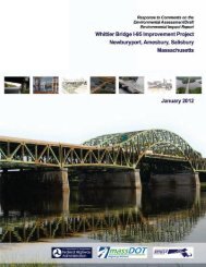
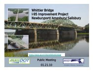
FINAL ENVIRONMENTAL IMPACT REPORT<br />
EEA # 14427<br />
<strong>Whittier</strong> <strong>Bridge</strong>/I-<strong>95</strong> Improvement Project<br />
Newburyport, Amesbury, Salisbury<br />
Massachusetts<br />
February 2012
<strong>Whittier</strong> <strong>Bridge</strong>/I-<strong>95</strong> Improvement Project FEIR<br />
Table of Contents<br />
Table of Contents<br />
DRAFT ENVIRONMENTAL IMPACT REPORT CERTIFICATE<br />
1.0 CHANGES SINCE THE DRAFT ENVIRONMENTAL IMPACT REPORT AND<br />
RESOLUTION OF ADDITIONAL ISSUES .................................................................................... 1-1<br />
1.1 Project Information ..................................................................................................................... 1-1<br />
1.2 Permits and Approvals Required ............................................................................................... 1-1<br />
1.3 Changes to the Project Since the EA/DEIR ............................................................................... 1-3<br />
1.4 Resolution of Additional Issues .................................................................................................. 1-5<br />
1.4.1 Project Phasing .................................................................................................................. 1-5<br />
1.4.2 Updated Wetlands Permitting Status ................................................................................. 1-5<br />
1.4.3 Wetlands Protection Measures During Construction ....................................................... 1-13<br />
1.4.4 Riverfront Area Mitgation and Restoration ....................................................................... 1-14<br />
1.4.5 Wetland Mitigation ............................................................................................................ 1-24<br />
1.4.6 Hydraulic Analysis and Floodplain Issues ........................................................................ 1-38<br />
1.4.7 Dredging ........................................................................................................................... 1-42<br />
1.4.8 Flooding Events During Construction............................................................................... 1-43<br />
1.4.9 Cofferdam Dewatering Protocol ....................................................................................... 1-45<br />
1.4.10 Chapter 91 Compliance ................................................................................................... 1-45<br />
1.4.11 Navigation Survey Results ............................................................................................... 1-56<br />
1.4.12 Public Benefit Determination ............................................................................................ 1-56<br />
1.4.13 Stormwater Management ................................................................................................. 1-59<br />
2.0 RESPONSE TO COMMENTS ON THE ENVIRONMENTAL ASESSMENT/DRAFT<br />
ENVIRONMENTAL IMPACT REPORT ......................................................................................... 2-1<br />
2.1 Massachusetts Executive Office of Energy and <strong>Environmental</strong> Affairs – MEPA DEIR<br />
Certificate ................................................................................................................................... 2-1<br />
2.2 Federal Agencies ..................................................................................................................... 2-10<br />
2.2.1 United States Coast Guard .............................................................................................. 2-10<br />
2.2.2 US <strong>Environmental</strong> Protection Agency Region 1 .............................................................. 2-11<br />
2.2.3 Essex National Heritage Commission .............................................................................. 2-12<br />
2.3 State Agencies ......................................................................................................................... 2-13<br />
2.3.1 Massachusetts Department of <strong>Environmental</strong> Protection ................................................ 2-13<br />
2.3.2 Massachusetts Natural Heritage and Endangered Species Program ............................. 2-31<br />
2.3.3 Massachusetts Division of Marine Fisheries .................................................................... 2-32<br />
2.3.4 Massachusetts Coastal Zone Management ..................................................................... 2-32<br />
2.3.5 Merrimack Valley Planning Commission .......................................................................... 2-34<br />
2.4 Municipalities ............................................................................................................................ 2-35<br />
2.4.1 City of Newburyport .......................................................................................................... 2-35<br />
2.4.2 City of Amesbury .............................................................................................................. 2-38<br />
2.4.3 Town of Salisbury ............................................................................................................. 2-43<br />
2.4.4 Jack Bailey, Amesbury Harbormaster .............................................................................. 2-47<br />
2.5 Non-Profit Organizations .......................................................................................................... 2-48<br />
2.5.1 Coastal Trails Coalition .................................................................................................... 2-48<br />
2.5.2 Foundation for Resilient Societies .................................................................................... 2-49<br />
2.5.3 WalkBoston ...................................................................................................................... 2-52<br />
2.6 Citizen Comments .................................................................................................................... 2-55<br />
2.6.1 Alphonse Sevigny............................................................................................................. 2-55<br />
2.6.2 Dallas Haines ................................................................................................................... 2-56<br />
2.6.3 Leonard Johnson.............................................................................................................. 2-57<br />
2.6.4 Jay Harris ......................................................................................................................... 2-58<br />
2.6.5 Anne Federici, <strong>Whittier</strong> Point Condominium Association ................................................. 2-61<br />
2.6.6 Nancy Boyd Webb............................................................................................................ 2-62<br />
2.6.7 Kathy Marshall .................................................................................................................. 2-63<br />
i
<strong>Whittier</strong> <strong>Bridge</strong>/I-<strong>95</strong> Improvement Project FEIR<br />
Table of Contents<br />
2.6.8 Cindy and Scott Taylor ..................................................................................................... 2-64<br />
2.6.9 Kempton E. Webb ............................................................................................................ 2-66<br />
2.6.10 Gary Peters ...................................................................................................................... 2-67<br />
2.6.11 Karen L. Amundsen ......................................................................................................... 2-69<br />
2.6.12 Gordon and Judith Marshall ............................................................................................. 2-70<br />
2.7 December 7, 2011 Public Meeting Comments ........................................................................ 2-70<br />
2.7.1 Bob Gilday – Amesbury Councillor .................................................................................. 2-70<br />
2.7.2 Dan King, Newburyport .................................................................................................... 2-71<br />
2.7.3 William Harris (Foundation for Resiliant Societies) .......................................................... 2-71<br />
2.7.4 Andrew Port, City of Newburyport .................................................................................... 2-71<br />
2.7.5 Al Savigny, Amesbury ...................................................................................................... 2-71<br />
2.7.6 Bill Rudolph, Amesbury .................................................................................................... 2-72<br />
2.7.7 Jay Harris ......................................................................................................................... 2-72<br />
2.7.8 Kempton Webb, Amesbury .............................................................................................. 2-72<br />
2.7.9 Bill Posner, Mass Bike Coalition ...................................................................................... 2-73<br />
2.7.10 Evan Karp, Newburyport .................................................................................................. 2-73<br />
2.7.11 Karen Amundsen, Amesbury ........................................................................................... 2-73<br />
2.7.12 Tom Horth, Newburyport – Coastal Trails Coalition ......................................................... 2-74<br />
2.7.13 Deb Carey, Amesbury – Coastal Trails Coalition ............................................................. 2-74<br />
3.0 MITIGATION AND COMMITMENTS ............................................................................................. 3-1<br />
3.1 Surficial Geology and Soils ........................................................................................................ 3-1<br />
3.2 Land Use and Visual Resources ................................................................................................ 3-1<br />
3.2.1 Land Use ............................................................................................................................ 3-1<br />
3.2.2 Visual Resources ............................................................................................................... 3-1<br />
3.3 Open Space and Recreation ...................................................................................................... 3-2<br />
3.4 Traffic and Safety ....................................................................................................................... 3-2<br />
3.4.1 Alternative Modes of Transportation - Shared-Use Path ................................................... 3-3<br />
3.4.2 Public Transportation/Transportation Demand Management (TDM)/Intelligent<br />
Transportation Systems (ITS) ............................................................................................ 3-3<br />
3.5 Air Quality ................................................................................................................................... 3-5<br />
3.6 Noise .......................................................................................................................................... 3-6<br />
3.7 Water Resources ....................................................................................................................... 3-7<br />
3.8 Fisheries ..................................................................................................................................... 3-8<br />
3.9 Wildlife ........................................................................................................................................ 3-9<br />
3.10 Jurisdictional Wetlands .............................................................................................................. 3-9<br />
3.10.1 Site Selection ..................................................................................................................... 3-9<br />
3.10.2 Existing Conditions at Wetland H Mitigation site .............................................................. 3-10<br />
3.10.3 Proposed Mitigation at Wetland H .................................................................................... 3-10<br />
3.11 Floodplains ............................................................................................................................... 3-10<br />
3.12 Historic and Archeological Resources ..................................................................................... 3-11<br />
3.12.1 Section 106 Consultation ................................................................................................. 3-11<br />
3.12.2 Memorandum of Agreement ............................................................................................ 3-11<br />
3.13 Oil and Hazardous Materials .................................................................................................... 3-13<br />
3.14 Navigation ................................................................................................................................ 3-14<br />
3.15 Construction Management ....................................................................................................... 3-14<br />
3.15.1 Mitigation Staging ............................................................................................................. 3-14<br />
3.15.2 Erosion and Sedimentation Control ................................................................................. 3-15<br />
3.15.3 Dust Control ..................................................................................................................... 3-16<br />
3.15.4 Construction Noise Mitigation Measures ......................................................................... 3-16<br />
3.16 MassDEP Draft Section 61 Finding.......................................................................................... 3-19<br />
3.16.1 Introduction ....................................................................................................................... 3-19<br />
3.16.2 Purpose and Need ........................................................................................................... 3-20<br />
3.16.3 The MEPA Review Process ............................................................................................. 3-20<br />
3.16.4 Avoidance and Minimization ............................................................................................ 3-20<br />
3.16.5 Chapter 91 Waterways – MassDEP................................................................................. 3-22<br />
ii
<strong>Whittier</strong> <strong>Bridge</strong>/I-<strong>95</strong> Improvement Project FEIR<br />
Table of Contents<br />
3.16.6 Section 401 Water Quality Certifications – MassDEP ..................................................... 3-24<br />
3.16.7 Findings/Commitments .................................................................................................... 3-27<br />
3.17 MassDOT Draft Section 61 Finding ......................................................................................... 3-28<br />
3.17.1 Introduction ....................................................................................................................... 3-28<br />
3.17.2 Purpose and Need ........................................................................................................... 3-28<br />
3.17.3 The MEPA Review Process ............................................................................................. 3-29<br />
3.17.4 Avoidance and Minimization ............................................................................................ 3-29<br />
3.17.5 Massachusetts Endangered Species Act – Massachusetts Natural Heritage &<br />
Endangered Species Program ......................................................................................... 3-33<br />
3.17.6 Historic Resources ........................................................................................................... 3-34<br />
3.17.7 Coastal Zone Management Consistency – Massachusetts Office of Coastal Zone<br />
Management .................................................................................................................... 3-36<br />
3.17.8 Mitigation Implementation Cost and Schedule ................................................................. 3-36<br />
3.17.9 Findings/Commitments .................................................................................................... 3-37<br />
3.18 Mitigation and Commitment Monitoring Plan ........................................................................... 3-39<br />
List of Tables<br />
Table 1-1: List of Permits and Approvals ............................................................................................ 1-1<br />
Table 1-2: Revised Wetland <strong>Impact</strong>s .................................................................................................. 1-3<br />
Table 1-3: Riverfront Area Mitigation – Newburyport ........................................................................ 1-20<br />
Table 1-4: Riverfront Area Mitigation – Amesbury ............................................................................ 1-22<br />
Table 1-5: Pertinent “Current Effective” HEC-2 Model Data .............................................................. 1-40<br />
Table 1-6: Pertinent Existing <strong>Bridge</strong> Geometric Parameters Incorporated In ―Pre-Project (Existing)<br />
Conditions‖ HEC-RAS Model ........................................................................................... 1-41<br />
Table 1-7: Pertinent Preferred <strong>Bridge</strong> Type Geometric Parameters Incorporated In ―Post-Project<br />
(Revised) Conditions‖ HEC-RAS Model........................................................................... 1-41<br />
Table 2-1: Stormwater Outfalls .......................................................................................................... 2-18<br />
Table 3-1: Construction Noise Limits ................................................................................................ 3-17<br />
List of Figures<br />
Figure 1-1: Design Refinement at Wetland 1 ....................................................................................... 1-4<br />
Figure 1-2: Project Phasing – Existing <strong>Bridge</strong> ...................................................................................... 1-6<br />
Figure 1-3: Project Phasing – Northbound <strong>Bridge</strong> Construction .......................................................... 1-7<br />
Figure 1-4: Project Phasing – Existing <strong>Bridge</strong> Demolition .................................................................... 1-8<br />
Figure 1-5: Project Phasing – Southbound <strong>Bridge</strong> Construction .......................................................... 1-9<br />
Figure 1-6: Project Phasing – <strong>Final</strong> Configuration .............................................................................. 1-10<br />
Figure 1-7: Riverfront Area <strong>Impact</strong>s – Newburyport ........................................................................... 1-21<br />
Figure 1-8: Riverfront Area <strong>Impact</strong>s – Amesbury ............................................................................... 1-23<br />
Figure 1-9: Wetland I and H <strong>Impact</strong>s - Wetland Mitigation Location .................................................. 1-27<br />
Figure 1-10: Wetland H Mitigation – Existing Conditions ..................................................................... 1-30<br />
Figure 1-11: Wetland H Mitigation – Grading Plan ............................................................................... 1-32<br />
Figure 1-12: Wetland H Mitigation – Profile .......................................................................................... 1-33<br />
Figure 1-13: Wetland H Mitigation – Planting Plan ............................................................................... 1-35<br />
Figure 1-14: Location of Dredging in the Merrimack River ................................................................... 1-44<br />
iii
<strong>Whittier</strong> <strong>Bridge</strong>/I-<strong>95</strong> Improvement Project FEIR<br />
Table of Contents<br />
Appendix A: <strong>Whittier</strong> <strong>Bridge</strong>/I‐<strong>95</strong> Improvement Project<br />
Stormwater Management System<br />
Operation and Maintenance Plan (O&M)<br />
and<br />
Long Term Pollution Prevention Plan (LTPPP)<br />
Appendix B: <strong>Whittier</strong> <strong>Bridge</strong>/I‐<strong>95</strong> Improvement Project<br />
Hydraulic Analysis Summary <strong>Report</strong><br />
Appendix C: Massachusetts Division of Marine Fisheries<br />
Correspondence dated December 9, 2011<br />
and<br />
National Marine Fisheries Service<br />
Correspondence dated November 29, 2011<br />
iv
Deval L. Patrick<br />
GOVERNOR<br />
rJJie Commonwea[tli of9vfassacliusetts<br />
t£~ecutive<br />
Office oft£nergg andt£nmronmenta[J1Lffairs<br />
100 Cambridge Street l Suite 900<br />
t]3oston l :MJI. 02114<br />
Timothy P. Murray<br />
LIEUTENANT<br />
GOVERNOR<br />
Richard K. Sullivan. Jr.<br />
SECRETARY<br />
Tel: (617) 626-1000<br />
Fax: (617) 626-1181<br />
http://www.mass.gov/envir<br />
December 30, 2011<br />
CERTIFICATE OF THE SECRETARY OF ENERGY AND ENVIRONMENTAL AFFAIRS<br />
ON THE<br />
DRAFT ENVIRONMENTAL IMPACT REPORT<br />
PROJECT NAME<br />
PROJECT MUNICIPALITY<br />
PROJECT WATERSHED<br />
EEANUMBER<br />
PROJECT PROPONENT<br />
DATE NOTICED IN MONITOR<br />
: <strong>Whittier</strong> <strong>Bridge</strong> 1-<strong>95</strong> Improvement Project<br />
: Newburyport, Amesbury, and Salisbury<br />
: Merrimack<br />
: 14427<br />
: Massachusetts Department ofTransportation<br />
: November 23, 2011<br />
Pursuant to the Massachusetts <strong>Environmental</strong> Policy Act (MEPA) (M.G.L. c. 30, ss. 61<br />
621) and Section 11.08 of the MEPA regulations (301 CMR 11.00), I hereby determine that the<br />
Draft <strong>Environmental</strong> <strong>Impact</strong> <strong>Report</strong> (DEIR) submitted on this project adequately and properly<br />
complies with MEPA and its implementing regulations. The Proponent should prepare a <strong>Final</strong><br />
<strong>Environmental</strong> <strong>Impact</strong> <strong>Report</strong> (FEIR) as detailed in the Scope below.<br />
Project Description<br />
As described in the DEIR, the proposed project involves the replacement ofthe existing<br />
structurally deficient six-lane John Greenleaf<strong>Whittier</strong> Memorial <strong>Bridge</strong> (<strong>Whittier</strong> <strong>Bridge</strong>) on<br />
Interstate <strong>95</strong> (1-<strong>95</strong>) over the Merrimack River. The project will include the construction of two<br />
new four-lane bridges and the widening of4.25 miles of1-<strong>95</strong> to eight lanes from north of the 1<br />
<strong>95</strong>1R0ute 113 Interchange to just north ofthe 1-4<strong>95</strong> entrance ramp in Newburyport, Amesbury,<br />
and Salisbury. The project proposes to add two lanes to 1-<strong>95</strong> and the bridge crossing to provide a<br />
consistent eight-lane configuration along the 1-<strong>95</strong> corridor within the project area. As stated in<br />
the DEIR, the purposes ofthe project are: to replace the structurally deficient bridge and provide
EEA#14427 DEIR Certificate December 30,2011<br />
for an improved bridge crossing that meets current Federal Highway Administration (FHWA)<br />
Interstate Highway design standards; to improve overall safety by reducing the incidence of<br />
accidents and reducing peak hour traffic backups with a consistent eight-lane configuration and<br />
full breakdown shoulder in each direction; and to improve local and regional air quality by<br />
reducing congestion and improving traffic flow. The project is part of the Commonwealth's<br />
Accelerated <strong>Bridge</strong> Program (ABP), which consists of the replacement, reconstruction or<br />
modification of the following seven additional bridges along the 1-<strong>95</strong> alignment to accommodate<br />
eight lanes of traffic on 1-<strong>95</strong> and meet the FHWA Interstate Highway design standards:<br />
• Pine HilllFerry Road <strong>Bridge</strong> over 1-<strong>95</strong> in Newburyport;<br />
• 1-<strong>95</strong> over Evans Place in Amesbury;<br />
• 1-<strong>95</strong> northbound and southbound over Route 110 (Elm Street) in Amesbury;<br />
• Two railroad bridges just north of Route 110 (Elm Street) in Amesbury; and<br />
• One railroad bridge on 1-<strong>95</strong> northbound on-ramp from Route 110.<br />
The <strong>Whittier</strong> <strong>Bridge</strong>/l-<strong>95</strong> Improvement Project is the most significant project that will be<br />
undertaken as part of that program.<br />
Project Changes Since Review of the <strong>Environmental</strong> Notification Form (ENF)<br />
According to the DEIR, changes to the proposed project since the filing of the ENF<br />
include:<br />
• Construction of a shared-use path paralleling the 1-<strong>95</strong> alignment;<br />
• Reduction in the amount of work required to the south of the Merrimack River in<br />
Newburyport - the Pine Hill RoadlFerry Road <strong>Bridge</strong> over 1-<strong>95</strong> will be reconstructed<br />
rather than rehabilitated resulting in a shorter length of highway that requires<br />
reconstruction; and<br />
• Direct and indirect impacts of the Preferred Alternative are not anticipated to meet or<br />
exceed any of the regulatory thresholds that would trigger the requirement of a Variance<br />
from the Wetlands Protection Act (WPA) Regulations at 310 CMR 10.00 as previously<br />
indicated in the ENF (and therefore, may not exceed the MEPA review threshold at 301<br />
CMR 11.03(3)(a)(2) for alteration requiring a variance in accordance with the WPA).<br />
The Massachusetts Department of Transportation (MassDOT) established the <strong>Whittier</strong><br />
Working Group (WWG) which serves as a conduit of information about the <strong>Whittier</strong> <strong>Bridge</strong><br />
project between MassDOT and the local communities and provides suggestions and<br />
recommendations to MassDOT about the project. The WWG is comprised of representatives<br />
from the communities of Newburyport, Amesbury, and Salisbury along with the Merrimack<br />
Valley Planning Commission.<br />
MEPA Jurisdiction and Permitting<br />
The project is undergoing MEPA review and is subject to preparation of a mandatory<br />
2
EEA#14427 DEIR Certificate December 30,2011<br />
<strong>Environmental</strong> <strong>Impact</strong> <strong>Report</strong> (EIR) pursuant to Sections 11.03(1)(a)(2), 11.03(3)(a)(2) and<br />
11.03(6)(a)(1)(b) of the MEPA regulations because it is a project being undertaken by a State<br />
Agency and because it will result in the creation of ten or more acres of impervious area, a<br />
potential alteration requiring a variance in accordance with the Wetlands Protection Act (WPA),<br />
and the widening of an existing roadway by one or more travel lanes for two or more miles. The<br />
project is also undergoing MEPA review pursuant to Section 11.03(10)(b)(1) because it involves<br />
the demolition of a historic structure listed in the Inventory of Historic and Archeological Assets<br />
of the Commonwealth.<br />
The project will require: Orders of Conditions from the Newburyport, Amesbury, and<br />
Salisbury Conservation Commissions (and, on appeal only, Superseding Orders of Conditions<br />
from the Massachusetts Department of <strong>Environmental</strong> Protection (MassDEP)); a Chapter 91<br />
Waterway License, a Section 401 Water Quality Certification (WQC), and possibly, a Variance<br />
from the provisions in the WPA from MassDEP; review under the Massachusetts Endangered<br />
Species Act (MESA) by the Natural Heritage and Endangered Species Program (NHESP);<br />
federal consistency review by the Massachusetts Office of Coastal Zone Management (CZM); a<br />
National Pollution Discharge Elimination System (NPDES) Construction General Permit from<br />
the United States <strong>Environmental</strong> Protection Agency (U.S. EPA) for stormwater discharges from<br />
a construction site; a Section 9 <strong>Bridge</strong> Permit from the United States Coast Guard; a Section 404<br />
Programmatic General Permit from the United States Army Corps of Engineers. A Construction<br />
Dewatering Permit and a Notice of Construction & Demolition may also be required from<br />
MassDEP. The project is subject to the EEAlMEPA Greenhouse Gas Emissions Policy and<br />
Protocol.<br />
The local conservation commissions have approved the wetland resource area boundaries<br />
within the project study area in separate Orders of Resource Area Delineation (ORAD). The<br />
project has undergone Section 106 Review by the Massachusetts Historical Commission (MHC),<br />
and MHC has determined that the project would result in an adverse effect.<br />
Because the project is being undertaken and financed by a State Agency, MEPA<br />
jurisdiction for this project is broad and extends to all aspects of the project that are likely,<br />
directly or indirectly, to cause Damage to the Environment, as defined in the MEPA regulations.<br />
The project is subject to review under the National <strong>Environmental</strong> Policy Act (NEPA). It<br />
will require an <strong>Environmental</strong> Assessment (EA) and a Record of Decision from FHWA.<br />
MassDOT has agreed to undergo ajoint review process, and accordingly, prepared a joint<br />
EA/DEIR. The DEIR indicates that public and agency coordination (public comment and review<br />
periods) will continue throughout the review of the EA/DEIR and the development of the FEIR<br />
to ensure coordinated and consistent review of this significant public project.<br />
3
EEA#14427<br />
DEIR Certificate<br />
December 30, 2011<br />
REVIEW OF THE DEIR<br />
Project Description<br />
The Draft EIR includes a detailed project description, project plans, illustrative<br />
renderings, analysis of baseline environmental conditions, an alternatives analysis, a greenhouse<br />
gas (GHG) analysis, an updated and revised traffic analysis and associated plans, an air quality<br />
analysis, identification of wetland resources and potential impacts, a stormwater management<br />
plan, a summary of environmental site assessments, a noise analysis and environmental<br />
mitigation commitments, Section 61 Findings, a list of required permits and regulatory review,<br />
and responses to comments received on the ENF.<br />
Alternatives Analysis<br />
As required by the Scope, the alternatives analysis identifies, describes and compares<br />
potential impacts for the following alternatives: No Build; seven Merrimack River Crossing<br />
Alternatives; and five Highway Widening Alternatives. The DEIR also evaluated four bridge<br />
design alternatives and alternative alignments for the proposed shared-use path.<br />
The No Build, River Crossing and Highway Widening Alternatives were screened by the<br />
following engineering and environmental criteria: purpose and need; highway configuration;<br />
bridge configuration; traffic; right-of-way (ROW); cost; construction; schedule; and<br />
environmental. The DEIR presents the analysis in a tabular format (Table 3-11) with supporting<br />
narrative and conceptual site plans. Following a thorough analysis of the alternatives, the<br />
combination of the New 8-Lane East <strong>Bridge</strong> River Crossing Alternative and the Inside Widening<br />
Alternative (Northern Terminus to Route 286) was identified as the Preferred Alternative. The<br />
analysis indicates that this Preferred Alternative best met the screening criteria of purpose and<br />
need, as well as highway configuration, traffic (capacity), bridge configuration (design<br />
standards, structural safety, maintenance and inspection, and life cycle/costs), construction<br />
(constructability), ROW, and environmental. The Preferred Alternative will provide a new<br />
bridge to the east of the existing bridge, to which all traffic will be temporarily relocated. The<br />
existing <strong>Whittier</strong> <strong>Bridge</strong> would then be demolished, and second new bridge will be constructed<br />
in its place. When construction is completed, the two new bridges will be configured to carry<br />
four lanes of traffic in each direction. Widening for the Preferred Alternative will begin at the<br />
Route 110 interchange and end at the Route 286 interchange and will include widening in both<br />
directions within the existing median.<br />
The alternatives analysis does not identify opportunities to minimize impervious area<br />
within the project corridor. The DEIR indicates that certain factors, such as land alteration,<br />
impervious area and parking were not included in the analysis as these factors were not deemed<br />
relevant to the screening of potential alternatives. The DEIR claims that minimization of<br />
impervious area for the new Merrimack River Crossing and 1-<strong>95</strong> Widening Alternatives is<br />
4
EEA#14427 DEIR Certificate December 30, 2011<br />
directly related to whether 1-<strong>95</strong> is widened to eight lanes or remains at six lanes within the<br />
project corridor. The DEIR further states that good highway design, ensuring public safety, and<br />
compliance with current FHWA standards requires additional impervious area for additional<br />
travel lanes and widened highway shoulders.<br />
Similarly, the bridge design alternatives were compared for engineering and<br />
environmental factors including: structural/redundancy; highway/profile impact; inspection and<br />
maintenance; schedule impacts; constructability; environmental; cost; aesthetics; and Section<br />
106 criteria. The evaluation concluded that the steel network tied-arch bridge with steel-box<br />
girder approaches was the highest rated of all the bridge types evaluated. The Preferred<br />
Alternative discussed and analyzed in the DEIR incorporates the construction of new network<br />
tied-arch bridges over the Merrimack River.<br />
In addition, the Preferred Alternative includes a shared-use path from the Exit 57 Parkand-Ride<br />
Lot in Newburyport, across the Merrimack River on the new 1-<strong>95</strong> northbound bridge,<br />
and continues north in Amesbury paralleling 1-<strong>95</strong> to a point south of Exit 58 in Amesbury where<br />
the path will split into two short legs. A Shared Use Path Feasibility Study included various<br />
alignment alternatives for the path, and included variations on the origination and destination<br />
points of the path, alternative east-to-west connections between Maudslay State Park and<br />
Moseley Woods, and four alternative Merrimack River crossing alternatives.<br />
Growth/Regional Planning<br />
The DEIR indicates that the project is consistent with relevant local and regional land use<br />
plans. The DEIR also address the project's consistency with the Commonwealth of<br />
Massachusetts' Sustainable Development Principles and Executive Order 385 (Planning for<br />
Growth). In addition, the DEIR describes how there is no significant impact to the 100-year<br />
floodplain or the regulatory floodway. In compliance with federal Executive Order 11988 (Flood<br />
Management), constructing the Preferred Alternative would avoid any long- and short-term<br />
adverse impacts to floodplain. In accordance with FHWA regulations on encroachments in<br />
floodplains, there would be no longitudinal and/or significant encroachments to the base (100<br />
year) floodplain, and no adverse effects to the base floodplain. The DEIR indicates that there is<br />
no practical alternative to constructing the new 1-<strong>95</strong> crossing with the 100-year floodplain. Any<br />
bridge crossing the Merrimack River would place piers and abutments within the 100-year<br />
floodplain.<br />
Land Use and Alteration<br />
Because the proposed bridge and roadway improvements would be located within the<br />
existing right-of-way (ROW), the Preferred Alternative would not have a direct impact on land<br />
use. Based on conceptual plans, the DEIR provides the following breakdown for land alteration<br />
associated with the proposed project:<br />
• New roadway (including breakdown/shoulder lanes): 14.3 acres<br />
• Stormwater drainage basins: 4.3 acres<br />
5
EEA#14427 DEIR Certificate December 30,2011<br />
• Roadway side slopes: 11.0 acres<br />
• Shared-use path: 2.5 acres<br />
The Preferred Alternative will require a total of approximately 32.2 acres of land<br />
alteration. Previously disturbed areas are located primarily along the relocated 1-<strong>95</strong> northbound<br />
roadway both north and south of the proposed 1-<strong>95</strong> northbound bridge. The relocation of 1-<strong>95</strong><br />
northbound to the east and the addition of the shared-use path adjacent to the 1-<strong>95</strong> northbound<br />
roadway would result in approximately 11.8 acres of alteration of previously unaltered land<br />
within the 1-<strong>95</strong> ROW between the Pine Hill/Ferry Road bridge in Newburyport to the Exit 58<br />
(Route 110) interchange in Amesbury. Additionally, the 4.3 acres of land alteration required for<br />
construction of the proposed stormwater basins will require alteration of land within the 1-<strong>95</strong><br />
ROW (with the exception of a small amount ofland within the Newburyport Water Department<br />
land south of the Merrimack River).<br />
Traffic<br />
The DEIR includes traffic analyses prepared in compliance with the EEAlEOTPW<br />
Guidelines for EIRIEA Traffic <strong>Impact</strong> Assessments. The DEIR identifies the study area,<br />
describes and analyzes existing conditions, and evaluates the project's impact on traffic<br />
operations. The DEIR includes traffic analyses for each alternative analyzed. It identifies<br />
improvements (mainly widening to a uniform 8-lane configuration) within the 1-<strong>95</strong> corridor to<br />
address traffic congestion. The study area includes approximately 3.6 miles of1-<strong>95</strong> northbound<br />
and southbound mainlines extending from north of Exit 57 (Route 113) to north of Exit 60<br />
(Route 286) and 11 associated on-and off-ramps. Due to funding constraints for the project, the<br />
study area includes only the 1-<strong>95</strong> mainline and intersections associated with interchanges in the<br />
study area.<br />
The DEIR includes a Level-of-Service (LOS) analysis for roadway links within the study<br />
area for the peak-hour conditions of summer Saturday AM northbound and Sunday PM<br />
southbound for existing conditions (2007) and for future (2030) Build and Preferred<br />
Alternatives. The DEIR indicates that the existing infrastructure is operating at a LOS C and D<br />
for all roadway links in the study area. The DEIR analyzed merge, diverge, and weave<br />
operations on 1-<strong>95</strong> and associated ramps.<br />
According to the DEIR, the No Build Alternative will have negative impacts on traffic<br />
flow for 2030 traffic projections. Northbound traffic flow will be LOS D or F for all segments<br />
and the segment from the 1-4<strong>95</strong> on-ramp to Route 286 will be over capacity, resulting in LOS F<br />
at the diverge to Route 286. The saturation on this link will influence not only the travel speeds<br />
between the ramps but will also cause approaching traffic to slow due to reduced speeds created<br />
by the 1-4<strong>95</strong> merge, creating longer travel times to traverse the study area (9.13 minutes). No<br />
Build southbound peak-hour traffic will be LOS F between Route 286 and 1-4<strong>95</strong>, LOS C<br />
between 1-4<strong>95</strong> and north of Route 110, and LOS E between north of Route 110 to north of Route<br />
113. The segment from Route 286 to 1-4<strong>95</strong> will be over capacity, resulting in LOS F for both the<br />
merge from Route 286 and diverge to 1-4<strong>95</strong>. The saturation on this link will influence not only<br />
the travel speeds between the ramps but will also cause southbound mainline traffic approaching<br />
6
EEA#I4427 DEIR Certificate December 30, 2011<br />
the Route 286 ramps to slow to an average speed of 30.36 miles per hour (mph) - below the<br />
posted speed limit of 65 mph. The travel time from the Route 286 overpass to the southern<br />
project limits will be 8.92 minutes.<br />
According to the DEIR, the Preferred Alternative will improve traffic flow for the 2030<br />
traffic projections, resulting in traffic conditions that are similar to or better than existing<br />
operations for the base year. Saturday AM northbound traffic between Route 113 (Exit 57) and 1<br />
4<strong>95</strong> will be LOS C, and between 1-4<strong>95</strong> and Route 286 will be LOS D. All segments ofthe study<br />
area would be below capacity and the merge and diverge between 1-4<strong>95</strong> and Route 286 would<br />
operate at an acceptable LOS. Speeds on all segments would improve and total travel time would<br />
improve to approximately 7 minutes. Sunday PM southbound traffic between Route 113 and 1<br />
4<strong>95</strong> will be LOS C and between 1-4<strong>95</strong> and Route 286 will be LOS D. All segments ofthe study<br />
area would be below capacity and the merge and diverge between Route 286 and 1-4<strong>95</strong> would<br />
operate at an acceptable LOS. The overall speeds on each link would improve and the total travel<br />
time from the Route 286 overpass to the southern project limits would be approximately 7.5<br />
minutes. Construction of an additional travel lane in each direction on 1-<strong>95</strong>, as well as the<br />
inclusion of a wider 4-foot inside shoulder and a full lO-foot breakdown lane throughout the<br />
project corridor would improve free-flow speed, and as a result would improve travel times,<br />
speeds, and reduce congestion throughout the project limits.<br />
The traffic impact analysis for the Preferred Alternative includes traffic projections from<br />
identified development proposals in the vicinity of the project. There will be no takings of<br />
additional land in order to construct the project - no expansion of the existing ROW will be<br />
required.<br />
MassDOT provided a summary of accident data from 2005-2007 for the study area. This<br />
data was supplemented with police reports from the Massachusetts State Police for accidents<br />
occurring in 2008 and 2009 on 1-<strong>95</strong> in the study area. The DEIR indicates that the <strong>Whittier</strong><br />
<strong>Bridge</strong> corridor has two apparent safety issues: 1) substandard existing shoulders on the bridge<br />
and approaches; and 2) high occurrence of angle crashes. The <strong>Whittier</strong> <strong>Bridge</strong> section between<br />
Routes 110 and 113 has a crash rate of 0.73 crashes per million vehicle miles for northbound<br />
travel exceeding the statewide average of 0.57 crashes per million vehicle miles. In addition, the<br />
merge and diverge between Route 286 and 1-4<strong>95</strong> on 1-<strong>95</strong> is above average with rates of 0.71 and<br />
0.70 crashes per million vehicle miles for northbound and southbound, respectively.<br />
Transportation Demand Management<br />
The DEIR includes a description of proposed Transportation Demand Management<br />
(TDM) improvements to reduce vehicle trips in the project area. MassDOT commits to the<br />
following measures:<br />
• Expand existing Park-and-Ride Lot in Newburyport (Exit 57) with the addition of 105<br />
new parking spaces;<br />
• Add signage along Routes 110 and 113 to promote alternative transportation options, in<br />
addition to existing signs on 1-<strong>95</strong>;<br />
7
EEA #14427 DEIR Certificate December 30, 2011<br />
• Implement Dynamic Message Signs (DMS) to promote the existing Park-and-Ride Lot in<br />
Newburyport (Exit 57) and carpooling during and after construction in addition to<br />
existing static roadside signs that direct patrons to Park-and-Ride Lots;<br />
• Implement incentives for Carpool Program to encourage ride sharing and use of highoccupancy<br />
vehicles (HOV) including discounts and carpool lanes;<br />
• Promote MassRIDES, a statewide ridesharing program developed to connect commuters<br />
to an array ofbus, vanpool, and carpool support services to encourage drivers to carpool<br />
and vanpool;<br />
• Implement a project website to post current transportation information;<br />
• Implement Intelligent Transportation Systems (ITS);<br />
• Permanent Traffic Data Collection - include upgrading the existing MassDOT permanent<br />
count station (Station #5087) on 1-<strong>95</strong> in Salisbury;<br />
• Provide Real-time Traveler Information - MassDOT, either through the project website or<br />
through the statewide 511 program.<br />
The contractor will be required to notify MassDOT and coordinate with Newburyport,<br />
Amesbury, and Salisbury for any exceptions to the standard work hours. The Merrimack River<br />
navigation channels will remain open to marine traffic for most of the construction period,<br />
except for temporary closures of short duration for the bridge construction. Directives of the U.S.<br />
Coast Guard (USCG) regarding navigational traffic will be followed, and the USCG and local<br />
harbormasters will be kept informed of all construction activity potentially affecting marine<br />
traffic.<br />
Transit<br />
The DEIR describes the commuter rail, commuter bus, and local bus services in the<br />
project area. MassDOT will continue to work with the Merrimack Valley Regional Transit<br />
Authority (MVRTA) to maintain existing bus service in the project area and ensure that service<br />
is not impacted by the project. Bus route 51 uses 1-<strong>95</strong> in the study area and will be maintained<br />
throughout the project duration. MVRTA received a grant to initiate a new flexible fixed bus<br />
route in Salisbury, Amesbury, and Newburyport and is in the midst of the designing the proposed<br />
route.<br />
In addition to local bus service, there are a number of commuter buses to Boston which<br />
use 1-<strong>95</strong> and stop at the Park-and-Ride Lot in Newburyport (Exit 57). MassDOT will continue to<br />
work with transit authorities to ensure that service is not disrupted during construction.<br />
Commuter rail service is also provided from the Newburyport Commuter Rail Station which is<br />
serviced by bus route 51.<br />
Pedestrian and Bicycle Facilities<br />
MassDOT has been responsive to the comments on the ENF that enumerated the benefits<br />
of expanding the region's alternative transportation network and improving pedestrian and<br />
bicycle connections in the project area. MassDOT's Preferred Alternative incorporates a shared-<br />
8
EEA#I4427 DEIR Certificate December 30, 2011<br />
use path as a means of providing increased transportation connectivity for alternative<br />
transportation modes as well as providing a connection to existing and planned<br />
bicycle/recreational trails within the project area. The DEIR describes the location and route of<br />
the proposed shared-use path and its interconnections with the existing recreation trail network<br />
in the project area.<br />
The path will originate at the Park-and-Ride Lot in Newburyport (Exit 57) at Route 113,<br />
south of the project limits and will run adjacent to the 1-<strong>95</strong> northbound roadway north from the<br />
Park-and-Ride Lot, cross the Merrimack River on the new 1- <strong>95</strong> northbound bridge, leave the 1<br />
<strong>95</strong> northbound roadway and run east to the intersection ofRoute 110 with Merrill Street and<br />
Rabbit Road in Salisbury. Improvements to the Route 110 intersection and widening of Rabbit<br />
Road north of the intersection are being constructed as part of the ongoing Route 110 Widening<br />
Project. The improvements to the intersection and Rabbit Road will serve to connect the<br />
proposed shared use-path with the existing Ghost Trail in Salisbury. Connections to Ferry Road<br />
in Newburyport and Old Merrill Road in Amesbury are also included in the proposed shared-use<br />
path, along with trailhead parking accommodations at the southern end of the path, at Ferry Road<br />
in Newburyport and at Old Merrill Street in Amesbury. The incorporation ofthe shared-use path<br />
is consistent with the United States Department ofTransportation (USDOT) Policy Statement on<br />
Bicycle and Pedestrian Accommodation Regulations and Recommendations (March 15, 2010)<br />
and MassDOT's GreenDOT Initiatives Policy.<br />
Inclusion of the shared-use path and other bicycle and pedestrian accommodations in the<br />
project area will: provide for the eventual hub connection to the Amesbury Riverwalk and Ghost<br />
Trail; provide connections to existing and planned trails; and improved access to and<br />
interconnections between Moseley Woods and Maudslay State Parks.<br />
Wetlands<br />
Notices of Intent (NOls) have been submitted to the Newburyport, Amesbury and<br />
Salisbury Conservation Commissions to conduct the proposed work located in wetland resource<br />
areas and buffer zones. The project requires Section 401 Water Quality Certification from<br />
MassDEP. The proposed project is estimated to directly impact (permanent and temporary) the<br />
following wetland resource areas:<br />
• approximately 4,960 sf of Bordering Vegetated Wetlands (BVW);<br />
• approximately 55,740 sfLand Under the Ocean (LUO)/Fish Run;<br />
• approximately 1,300 sf ofIsolated Vegetated Wetlands (IVW);<br />
• approximately 190 sfof Coastal Beach;<br />
• approximately 4,027 sf of Land Subject to Coastal Storm Flowage (LSCSF); and<br />
• approximately 98,809 sfof Riverfront Area.<br />
Wetland resource areas were characterized according to 310 CMR 10.00 and were<br />
mapped to show temporary and permanent impacts in the DEIR. The DEIR examined options<br />
that avoid impacts to wetland resource areas, their associated buffer zones, and the lOO-year<br />
9
EEA#l4427 DEIR Certificate December 30, 2011<br />
flood plain areas. The above impacted areas were considered unavoidable. The DEIR indicates<br />
that the impacts will be minimized, and that the project will be accomplished in a manner that is<br />
consistent with the Performance Standards ofthe Wetlands Regulations (310 CMR 10.00). It<br />
identified the location of nearby municipal water wells. All resource area boundaries, applicable<br />
buffer zones, and 100-year flood elevations were shown on a plan and the local conservation<br />
commissions have approved resource area delineations for the project.<br />
Two BVWs would be directly impacted by the proposed highway widening including<br />
Wetlands I and H in Amesbury (permanent alteration of 3,560 sf). MassDOT is proposing the<br />
replication of approximately 4,<strong>95</strong>0 sfby expanding Wetland Hand 1,500 sfby expanding<br />
Wetland 0 in Amesbury (mitigation ratio of 1.8: 1). For required wetlands replication, conceptual<br />
plans for compensatory wetlands mitigation at Wetlands H (Amesbury) and 0 (Salisbury) were<br />
provided in the DEIR.<br />
LUOlFish Run in Newburyport and Amesbury will be impacted by the construction of<br />
six new bridge piers and the installation of cofferdams for pier construction and demolition.<br />
MassDOT proposes to remove the four existing piers and will recover 11,500 sf of new river<br />
bottom resulting in a total net permanent loss of 5,600 sf of LUOlFish Run.<br />
Riverfront Area will be impacted on both sides of the Merrimack River in Newburyport<br />
and Amesbury as a result of fill associated with the proposed bridge abutments for the new<br />
bridges. MassDOT proposes mitigation through onsite restoration of existing degraded areas<br />
including the demolishing of the existing bridge abutment, building the new abutment 50-feet<br />
further inland, removing existing riprap, reclaiming and restoring median, and restoring the<br />
proposed slope through bioengineering.<br />
Waterways and Tidelands<br />
According to the DEIR, the construction of the Preferred Alternative will not result in<br />
permanent adverse impacts to existing navigation in the Merrimack River. The existing<br />
horizontal and vertical clearances for both the federal navigation channel (under the main span of<br />
the existing and proposed new bridges) will be maintained. For the locally-designated secondary<br />
channel (the "Steamboat" channel), the Preferred Alternative would maintain the existing<br />
vertical clearance and widen the existing horizontal clearance under the new bridges. Permanent<br />
navigational lighting will be installed on the new bridges and navigational aids will be installed<br />
in the Merrimack River to mark both navigation channels. Temporary construction impacts to<br />
navigation will be minimized through extensive coordination with local mariners, and staging<br />
and anchoring of construction equipment in areas of the river located outside of the navigational<br />
channels. Any closure of a navigation channel is anticipated to be of short duration and would be<br />
of only one channel, ensuring unimpeded navigation for the majority of vessels. The DEIR<br />
indicates that no dredging will be performed as part of this project.<br />
Stormwater Management<br />
10
EEA#14427 DEIR Certificate December 30,2011<br />
The DEIR includes a discussion of the proposed stormwater management system along<br />
the project corridor for the Preferred Alternative. The drainage system is designed to meet<br />
current standards for much of the 1-<strong>95</strong> alignment, and will improve peak rate attenuation and<br />
water quality over existing conditions. MassDOT has coordinated its proposed stormwater<br />
approach with MassDEP at several points during project development and will continue to work<br />
with MassDEP to develop a stormwater management system that fully complies with the<br />
Massachusetts Stormwater Standards. Recent meetings have highlighted project-specific policy<br />
considerations that MassDOT will address during the environmental permitting process.<br />
The DEIR addressed the performance standards of MassDEP's Stormwater Management<br />
Policy. It demonstrated that the design of the drainage system was consistent with this policy.<br />
The DEIR discussed the consistency of the project with the provisions of the National Pollution<br />
Discharge Elimination System (NPDES) General Permit from the U.S. <strong>Environmental</strong> Protection<br />
Agency for stormwater discharges from construction sites. The DEIR includes a draft<br />
Stormwater Pollution Prevention Plan (SWPPP) for compliance with the project's NPDES<br />
requirements.<br />
Rare Species<br />
The DEIR indicates that MassDOT has coordinated with NHESP, the Massachusetts<br />
Division of Marine Fisheries (DMF), and the National Marine Fisheries Service (NMFS)<br />
regarding potential project impacts to the sturgeon (Shortnose and Atlantic) population in the<br />
Merrimack River and the bald eagle nesting sites along the Merrimack River. MassDOT<br />
submitted an NOI for this project to NHESP for review of compliance with the WPA and MESA<br />
Regulations. According to the DEIR, the Preferred Alternative will require only the clearing of<br />
trees to the east of the existing bridge. The existing forested buffer between the highway and the<br />
existing eagle roosting areas west of the bridge will not be impacted. Nesting pairs of bald eagles<br />
are located both to the east and west of the 1-<strong>95</strong> ROW. Eagles are expected to acclimate to<br />
changes in noise conditions that will result from the new bridge design. NHESP may require<br />
monitoring of eagles during construction to gauge their response to noise. MassDOT is<br />
coordinating with NHESP on potential construction monitoring activities or mitigation that may<br />
be required.<br />
In a letter dated December 20, 2011, NHESP indicates that the proposed project will not<br />
cause adverse effects to the habitat of state-listed rare wildlife. In addition, NHESP does not<br />
anticipate that a Conservation and Management Permit will be required for the project and issued<br />
a conditional no "take" determination. If NMFS indicates that it will not require additional<br />
conditions for Shortnose Sturgeon, or elects not to comment, than the project will not constitute<br />
a "take" of this species. However, if NMFS requires conditions for the Shortnose Sturgeon, then<br />
all required conditions must be adhered to in order to avoid a "take" of this species. The DEIR<br />
indicates that subsequent to consultations between MassDOT and NMFS, NMFS concluded that<br />
no further consultation or conference is required for the Shortnose or Atlantic Sturgeon under the<br />
federal Endangered Species Act.<br />
Fisheries<br />
11
EEA#14427 DEIR Certificate December 30, 2011<br />
The Preferred Alternative will require construction in the river occurring within<br />
cofferdams, which control sediment disturbance and minimize suspended sediment transport.<br />
Limited pile driving is required and will be performed within cofferdams, thereby minimizing<br />
adverse acoustic effects. The Preferred Alternative would result in a permanent loss of 3,050<br />
square feet of Essential Fish Habitat (EFH) in the Merrimack River. The new river crossing<br />
would not impede fish passage or adversely affect fish, including the Shortnose and Atlantic<br />
sturgeon. In-water construction sequencing combined with the use of temporary cofferdams to<br />
facilitate construction ofnew piers or the removal of existing piers will further minimize<br />
disturbance. A qualified observer will be present during cofferdam construction to further ensure<br />
that there will be no adverse effects to sturgeon.<br />
MassDOT is coordinating with NMFS and DMF under the provisions of the Magnuson<br />
Stevens Fishery Conservation and Management Act and the Fish and Wildlife Coordination Act<br />
regarding potential impacts to EFH, and EFH and non-EFH species in the Merrimack River. The<br />
DEIR includes an updated EFH Assessment, which includes consideration of EFH species and<br />
non-EFH species and is under review by NMFS and DMF.<br />
According to the comments from DMF, a time-of-year (TOY) restriction may not be<br />
necessary to protect diadrodomous fish species within the Merrimack River if cofferdam<br />
installation can be staged to allow only one cofferdam at any time, thereby limiting impacts to<br />
five percent of the river width. If this condition cannot be met, DMF recommends a TOY<br />
restriction from March 1 to November 1 of each year. I note the strong support for the phased<br />
installation ofcofferdams limiting impacts to less than five percent by the U.S. EPA, CZM,<br />
MassDEP, and DMF in order to minimize potential impacts to fisheries resources.<br />
Wildlife<br />
The DEIR identifies habitat improvement activities including the restoration of salt<br />
marsh located at the stormwater outfall on the Newburyport shore of the Merrimack River. The<br />
DEIR claims that there are limited opportunities for habitat improvement with culvert<br />
enlargement, however in areas where 1-<strong>95</strong> would be relocated to the east, larger culverts would<br />
enable passage for small- to medium-sized animals. The majority of existing culverts along 1-<strong>95</strong><br />
will be retained and extended rather than replaced because culvert replacements under 1-<strong>95</strong><br />
would increase impacts to traffic and require additional construction. The Preferred Alternative<br />
w~)Uld widen the existing wildlife passage under the <strong>Whittier</strong> <strong>Bridge</strong> by relocating bridge<br />
abutments 50 feet farther back from the Merrimack River shoreline. MassDOT will investigate<br />
feasible methods to enhance wildlife habitat along the Merrimack River corridor, including<br />
installation ofbird nesting boxes, plantings with native species with food value for wildlife, and<br />
other methods that will not interfere with future maintenance of the new Merrimack River<br />
bridges. Proposed stormwater BMPs will be maintained by MassDOT to ensure proper<br />
functioning and to remove accumulated sediments as required. The sediment removal operations<br />
will ensure that invasive species will not become established long-term within the stormwater<br />
BMPs. A detailed landscaping plan, which will include native species, will be developed during<br />
final project design.<br />
12
EEA#I4427<br />
DEIR Certificate December 30,2011<br />
Water Supply<br />
In response to the Scope, MassDOT consulted with MassDEP on the status ofthe Zone A<br />
for Bartlett Spring Pond in Newburyport. According to the DEIR, MassDEP responded in<br />
writing that there is currently no 400-foot Zone A associated with Bartlett Spring Pond because<br />
it is not so listed in 314 CMR 4.00, and it was not approved by MassDEP after December 29,<br />
2006 in accordance with 314 CMR 4.06(3). However, MassDEP notes that the use of Bartlett<br />
Spring Pond as a public water supply (PWS) must be protected and maintained and that<br />
conditions that are reasonable to protect the pond as a drinking water source may be included in<br />
any permit approvals (e.g., strict compliance with stormwater standards.) MassDEP also notes<br />
that the pond may be listed as a PWS/Outstanding Resource Water (ORW) in the next revisions<br />
to 314 CMR 4.00 and that the current status may change. Ifit is listed as a Class AlORW, the<br />
provisions applicable to waters designated as PWSs and ORWs in 314 CMR 4.00, such as no<br />
discharge of dredged or fill material into wetlands or waters within 400-feet of the high water<br />
mark ofBartlett Spring Pond per 314 CMR 4.06(l)(d)(l) without a variance under 314 CMR<br />
9.00, would be applicable. Additionally, provisions in other regulations pertaining to ORWs<br />
and/or waters designated as PWSs may also apply.<br />
The Preferred Alternative does not change the location of the existing western edge of the<br />
1-<strong>95</strong> roadway and it will not create new impervious surfaces within 400 feet ofBartlett Spring<br />
Pond. As previously noted in the alternatives analysis, the widening of1-<strong>95</strong> southbound in this<br />
area will occur within the existing highway median. The proposed stormwater management<br />
system in Newburyport, like the existing stormwater collection system, will be a closed system<br />
ultimately discharging to the Merrimack River outside the drainage area ofBartlett Springs<br />
Pond.<br />
Hazardous Materials<br />
A review of environmental databases identified 33 Release Tracking Numbers (RTNs)<br />
within and proximate to the project area. Nine of these release sites are within the project<br />
boundaries. As required by the Scope, the DEIR discussed three contamination sites with<br />
REMOPS (Remedy Operation Status) status with respect to potential impacts and remediation<br />
within the project area. These RTNs include: 3-13812 in Amesbury (located within the project<br />
boundaries); 3-3360 in Newburyport (located outside the project boundaries); and 3-19369 in<br />
Salisbury (located outside the project boundaries).<br />
• RTN 3-13812: the potential exists for impacts to soil and groundwater within the<br />
project area, particularly if dewatering pumping is required during construction.<br />
• RTN 3-3360: based on the upgradient location of this site and the proximity to the<br />
project area, this release may impact groundwater in the project area.<br />
• RTN 3-19369: based on remedial actions conducted at the site, this release is not<br />
expected to affect the project area, unless significant dewatering pumping is<br />
required during construction.<br />
13
EEA#I4427 DEIR Certificate December 30, 2011<br />
In addition, RTN 3-28599 is listed as open and is in the process of Phase II investigations<br />
pursuant to the Massachusetts Contingency Plan (310 CMR 40.0000).<br />
MassDOT conducted a Phase I Initial Site Investigation for the project corridor<br />
identifying seven sites in Newburyport and Salisbury which may require soil sampling or<br />
remedial activities during construction of the Preferred Alternative. The DEIR indicates that no<br />
adverse impacts resulting from the Preferred Alternative were identified that would require<br />
special mitigation measures under the MCP. The No Build and Preferred Alternative will not<br />
affect listed hazardous waste sites as regulated under federal law.<br />
MassDOT will require the design/build contractor to:<br />
• monitor excavated soil during construction to ensure that soils requiring special<br />
handling are appropriately identified and managed;<br />
• handle and dispose of all hazardous material in accordance with state and federal<br />
laws, including the MCP; and<br />
• develop and implement a soil and groundwater management plan during<br />
construction.<br />
To facilitate the selection of soil and groundwater management and disposal options,<br />
MassDOT will complete an additional pre-characterization program for areas where construction<br />
and/or excavation activities may occur within the project boundaries.<br />
Historical and Archaeological Resources<br />
According to the DEIR, the State Historic Preservation Office (SHPO) has concurred in<br />
writing with the finding by FHWA and MassDOT that the proposed removal and replacement of<br />
the <strong>Whittier</strong> <strong>Bridge</strong> will have an unavoidable adverse effect on the National Register of Historic<br />
Places-eligible structure under Section 106 of the National Historic Preservation Act of 1966, as<br />
amended. As part of the alternatives analysis, MassDOT examined several bridge rehabilitation<br />
or reconstruction alternatives that might avoid, minimize, or mitigate the adverse effect and<br />
determined that rehabilitation or reconstruction of the existing bridge is not feasible.<br />
Extensive public outreach was conducted in 2010 as part of the Section 106 review<br />
process to ensure that the views of the local governments and the public were considered in the<br />
resolution of the adverse effect. FHWA and MassDOT have committed to implement mitigation<br />
measures in a Section 106 Memorandum of Agreement (MOA) with the federal Advisory<br />
Council on Historic Preservation (Council) and the SHPO that was fully executed on March 23,<br />
2011. The Chief Executive Officers of the three municipalities have also signed the MOA as<br />
concurring parties. The MOA incorporates stipulations that FHWA and MassDOT have agreed<br />
to conduct to minimize or mitigate the adverse effect including:<br />
• the preparation of archival recordation;<br />
14
EEA#I4427 DEIR Certificate December 30, 2011<br />
• the opportunity for local historical commissions, the WWG, and SHPO to review<br />
and comment on structural type, paint color, and sketch plans for the new<br />
replacement bridge;<br />
• reuse of salvaged ornamental artifacts from the existing bridge on the replacement<br />
bridge or all the trailheads of the shared-use path;<br />
• the use of interpretive signage along the shared-use path to address significant<br />
project area themes; and<br />
• the use of reasonable measures to avoid, minimize or mitigate adverse effects to<br />
previously unidentified historically, culturally and religiously significant<br />
properties and resources.<br />
In addition, the new replacement bridge (double-barrel network tied-arch superstructure)<br />
will partially mitigate the adverse effect associated with the removal of the existing National<br />
Register-eligible bridge because of its similarity in design characteristics, scale and location. The<br />
construction of the replacement bridge will have no adverse effects on any of the National<br />
Historic Landmark or National Register-eligible properties that are adjacent to or within the Area<br />
of Potential Effect (APE).<br />
Public Archaeological Laboratory, Inc. (PAL) conducted an intensive level survey in<br />
three areas along the project corridor that warranted archaeological testing. In an Intensive<br />
(Locational) Archaeological Survey report, PAL concluded that no potentially significant<br />
archaeological sites are present within these areas, and recommended that no further survey be<br />
conducted in the project area. MassDOT has determined that the project is unlikely to affect any<br />
potentially significant pre-contact or historic archaeological sites with the APE.<br />
Air Quality/Greenhouse Gas (GHG) Emissions<br />
MassDOT conducted air quality, microscale, and mesoscale analyses of the project area.<br />
The DEIR provided regional air quality emissions for existing (2007), and 2030 No Build and<br />
Build conditions. The DEIR includes a discussion of the Preferred Alternative's conformance to<br />
the purpose and requirements of the Commonwealth of Massachusetts State Implementation Plan<br />
(SIP). The project has been included in the Merrimack Valley Regional Metropolitan Planning<br />
Organization (MPO) FY 2011-2014 Transportation Improvement Program, and was included in<br />
the Merrimack Valley MPO's model used for the conformity analysis. The total emissions from<br />
this and other projects, when combined with results from the remainder of the Eastern<br />
Massachusetts Nonattainment Area, fell below the budget levels for volatile organic compounds<br />
(VOCs) and nitrous oxides (NOx) for all milestone years. Accordingly, the project - combined<br />
with all the other regionally significant projects - was found to be consistent with the motor<br />
vehicle emissions budget in the Massachusetts SIP, thereby meeting the requirements of the<br />
conformity regulations.<br />
The DEIR includes a GHG emissions analysis that calculates and compares GHG<br />
emissions associated with the existing conditions and future No Build and Build (Preferred)<br />
alternatives. The analysis indicates that the GHG emissions will increase in the future, as<br />
compared to existing conditions by 38,406 kilograms per day (kg/day) in carbon dioxide (C0 2 )<br />
15
EEA #14427 DEIR Certificate December 30,2011<br />
equivalents (C02eq). The difference between the Build and No Build estimates was below the<br />
detection limits and a comparative analysis was not warranted between the Build alternatives.<br />
Although the construction of the Preferred Alternative would result in increased emissions of<br />
CO2 in the project area compared to existing conditions, 2030 Build conditions for the Preferred<br />
Alternative will result in reduced vehicle queuing and delay in comparison to the 2030 No Build<br />
condition, thereby resulting in lesser emissions of CO2.<br />
The DEIR indicates that the added lanes do not provide additional capacity within the 1<br />
<strong>95</strong> corridor from Danvers to the New Hampshire border, but match the existing eight-lane 1-<strong>95</strong><br />
corridor. Because the project does not propose added capacity which might induce latent travel<br />
demand, the project is not anticipated to result in any significant mode shift away from<br />
commuter bus and rail service to private vehicles within the 1-<strong>95</strong> corridor.<br />
MassDOT prepared a qualitative assessment of the project's potential construction<br />
impacts. The assessment discusses how the project will provide benefits with regard to mobile<br />
source air toxics (MSAT) emissions. A FHWA analysis indicates that when vehicle miles<br />
traveled (VMT) decrease and vehicle hours traveled (VHT) increase, the amount ofMSAT<br />
emissions decreases. The DEIR determined that the emissions under the Preferred Alternative<br />
would decrease compared with the No Build Alternative because of increased speeds. In<br />
addition, because the majority of the existing traffic flow will be maintained through the project<br />
corridor during the construction period, no appreciable change in GHG emissions from existing<br />
conditions is anticipated during the construction period.<br />
MassDOT has committed to ensure that the construction period impacts of diesel<br />
emissions are mitigated to the maximum extent feasible. The DEIR outlines the construction<br />
period measures to reduce air quality impacts from congestion and idling. It identifies<br />
Transportation Demand Management (TDM) measures proposed including the construction of<br />
the shared-use path and addition of 100 new parking spaces at the park-and-ride lot in<br />
Newburyport. MassDOT also commits to maintaining its existing range of TDM measures<br />
including working with mass transit providers to ensure that bus transit will not be disrupted<br />
during the construction period.<br />
Construction and Demolition<br />
The DEIR includes a detailed Construction Management Plan. The DEIR presented a<br />
discussion on potential construction period impacts (including but not limited to noise, dust,<br />
wetlands, erosion and sedimentation, and traffic maintenance) and analyzed feasible measures<br />
that can avoid or eliminate these impacts. It provided information regarding the phasing of<br />
construction on the project site. MassDOT will minimize construction noise and enhance air<br />
quality by utilizing construction equipment that complies with noise and air standards. It also<br />
will employ a sedimentation and erosion control plan to improve stormwater quality in the<br />
project area. The DEIR includes a draft SWPPP that will be updated by the designlbuild<br />
contractor. The DEIR indicates that blasting is not anticipated for construction ofthe Preferred<br />
Alternative.<br />
16
EEA#I4427<br />
DEIR Certificate December 30,2011<br />
Noise<br />
The DEIR includes a traffic noise analysis based on FHWA noise assessment guidelines.<br />
The noise analysis identified as many as 259 sensitive noise receptors within the project area,<br />
and it assessed potential noise impacts from the project. MassDOT provided an analysis of noise<br />
levels during the loudest times of the day. It identified existing (2007) and proposed (2030)<br />
estimated noise levels at these receptors. Because the project area already accommodates a high<br />
level of vehicle traffic on 1-<strong>95</strong> and its interchanges, the model predictions indicate that none of<br />
the receptors are expected to be exposed to future traffic noise levels in excess of existing noise<br />
levels by greater than or equal to 10 decibels (dBA). Therefore, none of the 259 receptors are<br />
expected to be affected by a relative noise increase. However, 39 receptors are currently and are<br />
expected to continue to be exposed to future traffic noise levels in excess ofFHWA's and<br />
MassDOT's abatement criteria limits; consequently traffic noise mitigating measures are<br />
warranted for consideration and further evaluation. Subsequently, MassDOT investigated<br />
mitigation measures such as noise barriers to reduce sound impacts. It studied eight barrier<br />
locations, but determined that, based on MassDOT criteria, none of the barrier locations met its<br />
acoustical feasibility and cost-effectiveness criteria.<br />
VisuallAesthetics<br />
The DEIR includes a visual analysis which concludes that constructing the Preferred<br />
Alternative with the network tied-arch bridge design will have a negligible visual impact, with<br />
the exception of the <strong>Whittier</strong> Point condominium complex in Amesbury, located to the east of<br />
the realigned 1-<strong>95</strong> northbound roadway. The Preferred Alternative would relocate the 1-<strong>95</strong><br />
northbound roadway further to the east, within the 1-<strong>95</strong> ROW, but closer to the residences. This<br />
relocation necessitates the removal of mature vegetation currently located within the limits of the<br />
ROW adjacent to the condominium complex. Mitigation for this impact would include the<br />
construction of a visual barrier that will screen the view of the 1-<strong>95</strong> roadway north of the<br />
Merrimack River as seen from the <strong>Whittier</strong> Point condominiums. The fence would also be<br />
constructed to preclude snow and ice from winter road plowing operations hitting the<br />
condominium buildings. Plantings along the fence would further mitigate this visual impact.<br />
SCOPE<br />
MassDOT should prepare the FEIR in accordance with the general guidance for outline<br />
and content found in Section 11.07 of the MEPA regulations, as modified by this Scope. The<br />
FEIR should outline any changes in the project between the DEIR and FEIR. The FEIR should<br />
incorporate the following Scope in its entirety; otherwise, I reserve the right to require the<br />
Proponent to submit a Supplemental FEIR pursuant to Section 11.08(8)(b)(3) of the MEPA<br />
regulations.<br />
Project Description<br />
17
EEA#I4427 DEIR Certificate December 30, 2011<br />
The FEIR should identify any changes proposed to the project since the filing of the<br />
DEIR. It should include an update on State and local permitting. The Phasing of the project<br />
should be described in more detail, in particular, identification of which roadway improvements<br />
are associated with each phase and how permitting and mitigation will be managed within the<br />
context of phasing.<br />
Transportation<br />
As required by the Scope on the ENF, the FEIR should identify current roadway<br />
improvement projects in Newburyport, Amesbury, and Salisbury that could impact traffic flows<br />
during construction ofthe proposed improvements. The FEIR should discuss MassDOT's<br />
coordination efforts with the municipalities as they address regional and local traffic concerns<br />
within this area and should provide the most current information on the proposed construction<br />
dates for any roadway improvements in the area. The FEIR should address the comments from<br />
the City of Newburyport regarding impacts to local traffic at the intersection of Spofford Street,<br />
Moseley Avenue, and Merrimack Street.<br />
Pedestrian and Bicycle Facilities<br />
I commend MassDOT for the inclusion of the shared-use path as an integral component<br />
of the proposed project. It is an outstanding and valuable addition to the alternative<br />
transportation network in the Merrimack Valley. While comments regarding the inclusion of the<br />
shared-use path are generally supportive, I note that many commenters have indicated that the<br />
shared-use path could be further improved by connections to Main StreetJEvans Place in<br />
Amesbury and connections between the existing Ghost Trail in Salisbury and the Powwow<br />
Riverwalk Trail in Amesbury. MassDOT should ensure that the design of the shared-use path<br />
does not preclude future pedestrianlbicycle connections and access by the municipalities.<br />
The FEIR should describe how the project can further comply with the goals of the<br />
USDOT Policy Statement on Bicycle and Pedestrian Accommodation Regulations and<br />
Recommendations (March 15,2010) and MassDOT's GreenDOTInitiatives Policy and explore<br />
opportunities to work with stakeholders and commenters to investigate additional bicycle path<br />
and pedestrian connections and to identify additional commitments to improved connections as<br />
required by the Scope on the ENF.<br />
The FEIR should address the City of Newburyport's comments regarding an East-West<br />
Trail connection along the Merrimack River and consider the City's request for the allowance of<br />
a public Access Permit once construction of the project is complete.<br />
Wetlands<br />
I note the detailed comments from MassDEP regarding wetlands impacts and I expect<br />
these to be fully addressed in the FEIR. Many of the comments direct MassDOT to provide<br />
18
EEA#14427 DEIR Certificate December 30,2011<br />
additional information to the local conservation commissions for review. MassDOT should be<br />
responsive to this directive because it has already filed NOls and subsequently, local decisions<br />
may be issued in advance of the completion of MEPA review. In light of this fact, the FEIR<br />
should discuss the submission of any updated applications/information to the local conservation<br />
commissions or discuss how the project will be conditioned by the conservation commissions to<br />
comply with the applicable wetlands regulations.<br />
The FEIR should identify and delineate any additional wetlands impacts to occur since<br />
filing the DEIR. The FEIR should provide updates on any consultations with MassDEP<br />
regarding wetlands impacts and should address MassDEP's concerns that the project may require<br />
a Variance under the Wetlands Protection Act. MassDOT should continue to coordinate closely<br />
with MassDEP and the federal permitting agencies to develop appropriate mitigation strategies<br />
for any unavoidable impacts to wetland resource areas. According to comments from MassDEP,<br />
MassDOT has agreed, in the FEIR, to propose a construction access management system that<br />
will avoid problems that could lead to unpermitted wetland resource area alteration and<br />
environmental degradation. MassDOT has also agreed to confirm in the FEIR, the process it will<br />
adopt to ensure that access and staging areas will not impact resource areas, that contractors will<br />
be made explicitly aware of their compliance obligations under the WPA, and that an<br />
experienced <strong>Environmental</strong> Monitor will be hired for project construction oversight and<br />
contractor compliance training through the post-construction period. The FEIR should include<br />
details of the contractual and field oversight measures that MassDOT will undertake to ensure<br />
protection of wetland resource areas.<br />
The FEIR should identify how riverfront mitigation or restoration will comply with the<br />
WPA. The FEIR should include detailed plans of BVW replacement areas, including<br />
groundwater elevation information, in accordance with the MassDEP March 2002,<br />
Massachusetts Inland Replication Guidelines. The FEIR must identify the area and the amount<br />
of any floodplain (Bordering Land Subject to Flooding (BLSF)) impacted along the Merrimack<br />
River. The FEIR should clarify that project-related activities will be able to meet WPA standards<br />
for BLSF and FEMA requirements for floodplain. The FEIR should indicate that the local<br />
Conservation Commissions have been notified of any changes to resource area delineations and<br />
that ORADs have been appropriately modified to reflect these changes. The FEIR should clarify<br />
whether the project will require dredging as indicated in MassDEP' s comments. The FEIR<br />
should indicate if measures will be implemented to reduce impacts to resource areas as a result<br />
of flooding during the construction period.<br />
Waterways and Tidelands<br />
I note the comments from MassDEP which recommend that the project be classified as a<br />
water-dependent use project, based on the review of the alternatives and due to the fact that the<br />
structure cannot be reasonably relocated or operated away from tidal waters of the Merrimack<br />
River. The FEIR should describe consistency with Chapter 91 licensing requirements, as<br />
applicable. The FEIR should include information to support a Public Benefit Determination<br />
(PBD) pursuant to 301 CMR 13.02.<br />
19
EEA#14427 DEIR Certificate December 30,2011<br />
The FEIR should disclose the information that was submitted to MassDEP as part of the<br />
Chapter 91 License application in order to provide a more thorough and systematic investigation<br />
of Chapter 91-related impacts. The FEIR should outline how materials will be managed during<br />
demolition to prevent any navigational or environmental hazards within the waterway.<br />
Stormwater<br />
Comments from MassDEP enumerate its concerns that the "macro approach" for<br />
managing stormwater as established in MassDOT's Stormwater Handbook for Highways and<br />
<strong>Bridge</strong>s (2004) does not address new wetlands and Section 401 regulations promulgated in 2008<br />
regarding stormwater. I note that MassDOT concurs with this view and is in the process of<br />
updating its Stormwater Handbook to address stormwater compliance issues. MassDEP<br />
comments indicate that its review entails explicit modifications of the "macro approach"<br />
including but limited to the redevelopment and recharge provisions at 310 CMR 10.00 and 314<br />
CMR 9.00.<br />
The project corridor includes approximately 49.2 acres of impervious area. The proposed<br />
project will add approximately 15.2 acres of new impervious area for a total of 64.4 acres of<br />
impervious area (a 27 percent increase). MassDEP will treat 49.2 acres as redevelopment and<br />
15.2 acres as new development pursuant to 310 CMR 1O.05(6)(k)(7) and 314 CMR 9.06(6)(a)(7)<br />
towards meeting the stormwater regulatory standards. The FEIR should identify any changes to<br />
the stormwater management system. I expect that the FEIR will fully address the detailed<br />
comments provided by MassDEP regarding Stormwater Standards 1 through 10. The FEIR<br />
should discuss the submission of any updated applications/information to the local conservation<br />
commissions or discuss how the project will be conditioned by the conservation commissions to<br />
comply with the stormwater standards. MassDOT should continue consultation with MassDEP<br />
to ensure that the project fully complies with the stormwater provisions pursuant to 310 CMR<br />
10.00 and 314 CMR 9.00.<br />
Rare Species<br />
The FEIR should provide an update on consultations regarding rare species habitat with<br />
the local conservation commission, NHESP, and NMFS. The FEIR should confirm that the inwater<br />
work utilizing cofferdams will be installed one at a time. The FEIR should confirm that<br />
NHESP's conditional no-take determination is still valid subsequent to submission of any<br />
additional information or consultation. The FEIR should clarify the impacts, beneficial and<br />
adverse, to wildlife habitats under NHESP and MassDEP jurisdiction and discuss whether<br />
mitigation is required.<br />
Water Supply<br />
Comments from MassDEP confirm that Bartlett Spring Pond is an active PWS and that<br />
20
EEA#I4427 DEIR Certificate December 30, 2011<br />
the pond and its tributaries have Zone A protection (400 feet around the pond and 200 feet<br />
around the tributaries). Although the pond and its tributaries are not listed as Class NORWs, its<br />
existing use as a PWS warrants its protection and maintenance pursuant to the WPA. Stormwater<br />
discharges and BMPS must comply with applicable regulations. The FEIR should confirm the<br />
project's compliance with 310 CMR 10.00 and 314 CMR 9.00 as it relates to protection of<br />
Bartlett Spring Pond. Specifically, as recommended by MassDEP, the FEIR should demonstrate<br />
that the proposed pervious 12-foot-wide road proposed for construction in the 200-foot<br />
Riverfront Area to the Merrimack River (within the Zone A) complies with 310 CMR 22.20B<br />
and C, and with applicable stormwater regulatory standards specified at 310 CMR 1O.05(6)(k)(l<br />
10) and 314 CMR 9.06(6)(a)(l-1O). MassDOT intends to use the road for inspection and<br />
maintenance of the City of Newburyport's drinking water supply lines from the Bartlett Spring<br />
Treatment Plant.<br />
I have received a number of comments requesting that MassDOT provide mitigation from<br />
noise impacts to residential receptors. The FEIR should respond to these comments from<br />
receptors who will impacted by future noise conditions.<br />
Visual/Aesthetics<br />
The FEIR should evaluate the feasibility of increasing the height and extending the<br />
length of the existing articulated barrier adjacent to the Laurel Road neighborhood. I have<br />
received a number of comments requesting that MassDOT provide additional mitigation for<br />
visual impacts to residential neighborhoods. The FEIR should continue to evaluate measures to<br />
mitigate adverse impacts to visual resources.<br />
Mitigation<br />
The FEIR should include a separate chapter that identifies all mitigation measures. This<br />
chapter should also include revised and updated draft Section 61 Findings for each State Agency<br />
that will issue permits for the project. The draft Section 61 Findings should contain clear<br />
commitments to implement mitigation measures, estimate the individual costs of each proposed<br />
measure, identify the parties responsible for implementation, and include a schedule for<br />
implementation. MassDOT's Section 61 Finding should cover the remaining mitigation<br />
measures not covered in other Section 61 Findings. I suggest that MassDOT supply this<br />
information in a tabular format.<br />
Responses to Comments<br />
The FEIR should contain a copy of this Certificate and a copy of each comment letter<br />
received on the DEIR. In order to ensure that the issues raised by commenters are addressed, the<br />
FEIR should include responses to comments received to the extent they are within MEPA<br />
jurisdiction. This directive is not intended to and shall not be construed to enlarge the scope of<br />
the FEIR beyond what has been expressly identified in this Certificate. I recommend that<br />
21
EEA#14427 DEIR Certificate December 30, 2011<br />
MassDOT use either an indexed response to comments format, or else a direct narrative<br />
response. The FEIR should present any additional narrative or analysis necessary to respond to<br />
the comments received.<br />
Circulation<br />
The FEIR should be circulated in compliance with Section 11.16 ofthe MEPA<br />
regulations. Copies should be sent to those parties that submitted comments on the ENF, and to<br />
each federal, state and local agency from which the Proponent will seek permits or approvals. A<br />
copy of the FEIR should be made available for public review at the Newburyport, Amesbury,<br />
and Salisbury Public Libraries.<br />
Date<br />
tLf/-itii<br />
(;1' RicharK. SU livan Jr.<br />
Comments received:<br />
1112512011<br />
12/09/2011<br />
12/13/2011<br />
12/16/2011<br />
12/20/2011<br />
1212112011<br />
12/2112011<br />
12/2112011<br />
1212112011<br />
1212112011<br />
1212212011<br />
12/22/2011<br />
1212212011<br />
1212212011<br />
12122/2011<br />
1212212011<br />
12122/2011<br />
12122/2011<br />
1212212011<br />
12/23/2011<br />
1212312011<br />
1212312001<br />
1212412011<br />
1212712011<br />
1212712011<br />
Natural Heritage and Endangered Species Program<br />
Massachusetts Division of Marine Fisheries<br />
Dallas W. Haines, Amesbury<br />
Leonard W. Johnson, Amesbury<br />
Jay Harris, Newburyport<br />
Merrimack Valley Planning Commission<br />
Coastal Trails Coalition<br />
WalkBoston<br />
<strong>Whittier</strong> Point Condominium Association<br />
Nancy Boyd Webb, Amesbury<br />
Natural Heritage and Endangered Species Program (2)<br />
United States <strong>Environmental</strong> Protection Agency - New England Region<br />
Foundation for Resilient Societies<br />
Essex National Heritage Commission<br />
City ofAmesbury<br />
Kathy Marshall, Newburyport<br />
Cindy and Scott Taylor, Amesbury<br />
Kempton E. Webb, Amesbury<br />
Gary Peters, Weymouth<br />
Massachusetts Office of Coastal Zone Management<br />
City of Newburyport<br />
Town of Salisbury<br />
Karen L. Amundsen, Amesbury<br />
Massachusetts Department of<strong>Environmental</strong> Protection<br />
Town of Salisbury (2)<br />
22
EEA#I4427<br />
DEIR Certificate<br />
December 30, 2011<br />
1212712011<br />
12127/2011<br />
RKS/PPP/ppp<br />
Jay Harris, Newburyport (2)<br />
Gordon and Judith Marshall, Newburyport<br />
23
<strong>Whittier</strong> <strong>Bridge</strong>/I-<strong>95</strong> Improvement Project FEIR<br />
Chapter 1.0: Changes Since the Draft <strong>Environmental</strong> <strong>Impact</strong> <strong>Report</strong> and Resolution of Additional Issues<br />
1.0 Changes Since the Draft <strong>Environmental</strong> <strong>Impact</strong> <strong>Report</strong><br />
and Resolution of Additional Issues<br />
1.1 PROJECT INFORMATION<br />
Project Name: <strong>Whittier</strong> <strong>Bridge</strong>/I-<strong>95</strong> Improvement Project<br />
EOEA File No: 14427<br />
Project Location: Newburyport, Amesbury and Salisbury<br />
Project Proponent: Massachusetts Department of Transportation – Highway Division (MassDOT)<br />
This document serves as the <strong>Final</strong> <strong>Environmental</strong> <strong>Impact</strong> <strong>Report</strong> (FEIR) under the Massachusetts<br />
<strong>Environmental</strong> Policy Act (MEPA).<br />
This FEIR responds to the Certificate of the Secretary of Energy and <strong>Environmental</strong> Affairs on the<br />
<strong>Environmental</strong> Assessment/Draft <strong>Environmental</strong> <strong>Impact</strong> <strong>Report</strong> (EA/DEIR), issued on December 30,<br />
2011. The Secretary will publish notice of the availability of the FEIR in the <strong>Environmental</strong> Monitor<br />
and a 30-day public comment period will ensue upon the date of publication (March 7, 2012).<br />
Subsequently, the Secretary will issue a Certificate stating whether the FEIR ―adequately and<br />
properly complies with MEPA‖. A Secretarial finding that the FEIR adequately and properly complies<br />
with MEPA will conclude the MEPA review process for the project.<br />
1.2 PERMITS AND APPROVALS REQUIRED<br />
Since the filing of the EA/DEIR, MassDOT has initiated the environmental permitting process for the<br />
project. Table 1-1 lists the permits and approvals and the current status.<br />
Table 1-1:<br />
List of Permits and Approvals<br />
Permit/Approval<br />
National Pollutant Discharge Elimination System Massachusetts General<br />
Permit for Construction Stormwater Discharges under the Clean Water Act<br />
from the U.S. <strong>Environmental</strong> Protection Agency, Region 1<br />
Section 9 <strong>Bridge</strong> Permit under the Rivers and Harbors Act of 1899 from the<br />
U.S. Coast Guard to construct bridges and demolish the existing <strong>Whittier</strong><br />
<strong>Bridge</strong> over the Merrimack River<br />
U.S. Army Category 2 Massachusetts General Permit authorization under<br />
Section 404 of the Clean Water Act from the U.S. Army Corps of Engineers<br />
NEPA Approval from Federal Highway Administration<br />
Section 401 Water Quality Certification under the federal Clean Water Act<br />
from the Massachusetts Department of <strong>Environmental</strong> Protection (MassDEP)<br />
Chapter 91 Waterways License under Massachusetts General Laws Chapter<br />
91, the Public Waterways Act, from the MassDEP for construction of new<br />
bridges over the Merrimack River<br />
Federal Consistency Determination under the federal Coastal Zone<br />
Management Act from the Massachusetts Office of Coastal Zone Management<br />
Orders of Conditions under the Massachusetts Wetlands Protection Act from<br />
the Newburyport, Amesbury, and Salisbury Conservation Commissions<br />
Status<br />
Will be applied for prior to start of<br />
construction<br />
Application filed: August 29, 2011<br />
Anticipated Issuance: July 2012<br />
Application filed: November 15, 2011<br />
Anticipated Issuance: May 2012<br />
Finding of No Significant <strong>Impact</strong> (FONSI)<br />
issued January 20, 2012<br />
Application filed: December 6, 2011<br />
Anticipated Issuance: May 2012<br />
Application filed: November 15, 2011<br />
Anticipated Issuance: June 2012<br />
Application Filed: November 16, 2011<br />
Anticipated Issuance: July 2012<br />
Applications Filed: December 1, 2011<br />
Anticipated Issuance: March 2012<br />
1-1
<strong>Whittier</strong> <strong>Bridge</strong>/I-<strong>95</strong> Improvement Project FEIR<br />
Chapter 1.0: Changes Since the Draft <strong>Environmental</strong> <strong>Impact</strong> <strong>Report</strong> and Resolution of Additional Issues<br />
Table 1-1:<br />
List of Permits and Approvals (continued)<br />
Permit/Approval<br />
Federal and State Consultations<br />
Section 106 Consultation under the National Historic Preservation Act of<br />
1966with the Massachusetts Historic Commission (the State Historic<br />
Preservation Officer (SHPO)) and coordination with the Advisory Council on<br />
Historic Preservation on behalf of the FHWA. MassDOT consultation has also<br />
occurred with the local Historic Commissions in Newburyport, Amesbury, and<br />
Salisbury. A Section 106 Memorandum of Agreement (MOA) has been signed<br />
by all parties.<br />
Section 7 Consultation (informal) with the National Marine Fisheries Service<br />
(NMFS) under the Endangered Species Act of 1973. In a letter dated June 8,<br />
2011, NMFS stated: “Based on the analysis that any effects to shortnose<br />
sturgeon from the proposed action will be insignificant or discountable, NMFS is<br />
able to concur with the determination that the proposed reconstruction of the<br />
<strong>Whittier</strong> <strong>Bridge</strong> in Amesbury, Massachusetts is not likely to adversely affect any<br />
listed species under NMFS jurisdiction. Therefore, no further consultation<br />
pursuant to Section 7 of the ESA is required.” NMFS also concluded, with<br />
regards to the Atlantic sturgeon, that: “… all effects of the proposed action are<br />
likely to be insignificant and discountable and the proposed action is not likely<br />
to result in the injury or mortality of any Atlantic sturgeon, the action is not likely<br />
to appreciably reduce the survival and recovery of any DPS [distinct population<br />
segment] of Atlantic sturgeon and therefore it is not reasonable to anticipate<br />
that this action would be likely to jeopardize the continued existence of any<br />
DPS of Atlantic sturgeon. As such, no conference is necessary for Atlantic<br />
sturgeon.”<br />
Coordination with NMFS and Massachusetts Department of Marine<br />
Fisheries (DMF) under the provisions of the Magnuson-Stevens Fishery<br />
Conservation and Management Act (MSA) and the Fish and Wildlife<br />
Coordination Act regarding potential impacts to Essential Fish Habitat (EFH),<br />
and EFH and non-EFH species in the Merrimack River. NMFS indicated the<br />
following in a letter dated November 29, 2011: “We recommend pursuant to<br />
Section 305(b)(4)(A) of the MSA that you adopt the following EFH conservation<br />
recommendations: 1) All in-water work should take place within cofferdams as<br />
shown on the project plans. The installation of the cofferdams should only be<br />
conducted one at a time, to minimize noise and/or turbidity impacts. 2) From<br />
April 1 through June 30 of any year, at least one of the channels should remain<br />
unobstructed at all times to minimize impacts to Atlantic salmon migration. 3)<br />
From April 1 through June 30 of any year, an observer should be present onsite<br />
at the time of the installation of the cofferdams. If Atlantic salmon or other<br />
anadromous species are observed in the work area, the in-water work should<br />
be delayed until they have passed through. Prior to cofferdam installation,<br />
MassDOT should submit an observer plan to us for approval.<br />
Status<br />
Complete. MOA signed March 23, 2011<br />
Complete. NMFS determination letter<br />
issued June 8, 2011<br />
Complete. NMFS correspondence dated<br />
November 29, 2011. DMF letter dated<br />
December 9, 2011.<br />
As noted in the correspondence from the MA DMF dated December 9, 2011<br />
(subsequent to the publishing of the EA/DEIR): “If the project avoids<br />
simultaneous installation of multiple cofferdams, Marine Fisheries does not<br />
recommend any time of year restrictions on the construction process.”<br />
1-2
<strong>Whittier</strong> <strong>Bridge</strong>/I-<strong>95</strong> Improvement Project FEIR<br />
Chapter 1.0: Changes Since the Draft <strong>Environmental</strong> <strong>Impact</strong> <strong>Report</strong> and Resolution of Additional Issues<br />
1.3 CHANGES TO THE PROJECT SINCE THE EA/DEIR<br />
There have been several project design refinements since the <strong>Environmental</strong> Assessment/Draft<br />
<strong>Environmental</strong> <strong>Impact</strong> <strong>Report</strong> was published in November 2011, mostly resulting from project design<br />
progression and in response to changes requested by permitting agencies.<br />
The only substantive change to the <strong>Whittier</strong> <strong>Bridge</strong>/I-<strong>95</strong> Improvement Project (project) since the filing<br />
of the EA/DEIR is the elimination of the permanent impact to the isolated wetland, Wetland 1,<br />
located adjacent to the I-<strong>95</strong> northbound Exit 60 off-ramp in Salisbury at the northern project limits.<br />
The wetland would have been affected by toe-of-slope fill for a proposed ramp realignment, a safety<br />
improvement intended to provide a longer deceleration lane prior to the exit ramp. The Preferred<br />
Alternative design included in the EA/DEIR resulted in 1,150 square feet of permanent impact to this<br />
federal-jurisdictional wetland. A refinement of the design of the exit ramp has resulted in the<br />
elimination of the impact to Wetland 1. Figure 1-1 illustrates the design refinement which has<br />
eliminated the impact to Wetland 1.<br />
As a result of the completion of further design analysis for the proposed improvements to the<br />
stormwater management system, temporary wetland impacts to Wetland M for construction of<br />
detention basin 7A have been increased from 150 to 240 square feet in Salisbury. The basin is<br />
located to the west of I-<strong>95</strong> immediately south of the I-4<strong>95</strong> northbound overpass. Temporary<br />
alteration of Wetland M is assumed to be required for purposes of construction access and<br />
installation of inlet and outlet pipes for the detention basin. The impact areas will be restored after<br />
the completion of construction activities. Revised impacts to federal and state jurisdictional wetland<br />
resources are listed in Table 1-2.<br />
Table 1-2:<br />
Revised Wetland <strong>Impact</strong>s<br />
<strong>Impact</strong> Type<br />
State Resource Wetland <strong>Impact</strong><br />
Permanent Temporary Total<br />
BVW<br />
I Retaining Wall 1,800 0 1,800<br />
H Retaining Wall 1,760 1,400 3,160<br />
Total BVW 3,560 1,400 4,960<br />
New <strong>Bridge</strong> Piers 17,100 10,290 35,030<br />
Land Under the Ocean/ Fish Merrimack<br />
Removal of Old <strong>Bridge</strong> Piers 11,500 9,020 11,500<br />
Run<br />
River<br />
Temporary <strong>Bridge</strong> Supports 0 9,210 9,210<br />
Total LUO/Fish Run 5,600 28,520 55,740<br />
Alteration of Undisturbed Riverfront<br />
6,540 4,770 11,310<br />
Riverfront Area<br />
Land Subject to Coastal<br />
Storm Flowage<br />
Merrimack<br />
River<br />
Wetland I<br />
Area<br />
Alteration of Previously Developed<br />
Riverfront Area<br />
19,614 27,240 46,854<br />
Alteration of Existing Degraded<br />
Riverfront Area<br />
39,385 0 39,385<br />
Total Riverfront Area 65,539 32,010 97,549<br />
Retaining Wall<br />
1,230<br />
(1,500 cf)*<br />
0<br />
1,230<br />
(1,500 cf)<br />
South Bank<br />
Temporary Work Area and <strong>Bridge</strong><br />
Support<br />
0 1,885 1,885<br />
North Bank Temporary Work Area 0 912 912<br />
Total LSCSF 1,230 2,797 4,027<br />
Coastal Beach North Bank Temporary <strong>Bridge</strong> Support 0 190 190<br />
Total Coastal Beach 0 190 190<br />
Isolated Vegetated Wetland M Temporary Excavation 0 240 240<br />
Total IVW 0 240 240<br />
*Cubic feet of flood storage within Land Subject to Coastal Storm Flowage<br />
1-3
<strong>Whittier</strong> <strong>Bridge</strong>/I-<strong>95</strong> Improvement Project FEIR<br />
Chapter 1.0: Changes Since the Draft <strong>Environmental</strong> <strong>Impact</strong> <strong>Report</strong> and Resolution of Additional Issues<br />
Figure 1-1: Design Refinement at Wetland 1<br />
1-4
<strong>Whittier</strong> <strong>Bridge</strong>/I-<strong>95</strong> Improvement Project FEIR<br />
Chapter 1.0: Changes Since the Draft <strong>Environmental</strong> <strong>Impact</strong> <strong>Report</strong> and Resolution of Additional Issues<br />
1.4 RESOLUTION OF ADDITIONAL ISSUES<br />
This section includes additional information as requested by the DEIR Certificate or certain comment<br />
letters received on the EA/DEIR. Issues include those noted by MassDEP in their comment letter on<br />
the EA/DEIR, and issues which require additional information not presented in the EA/DEIR.<br />
1.4.1 Project Phasing<br />
The DEIR Certificate requested that additional information on project phasing be included in the<br />
FEIR. Detailed construction phasing figures were included in the EA/DEIR (Figures 5-17A through<br />
5-17G (18 sheets) in section 5.18), which addressed the specific phasing for construction of the<br />
highway improvements for the project. No change to the phasing presented in the EA/DEIR is<br />
anticipated at this time although, in the completion of final design for the project by the design/build<br />
contractor, a slightly different construction sequence for specific elements of the project may be<br />
developed.<br />
Additional information on the sequencing of the construction of the new I-<strong>95</strong> Merrimack River bridges<br />
is presented below. The sequencing assumes the construction of a new I-<strong>95</strong> northbound bridge,<br />
wide enough to accommodate all six lanes of I-<strong>95</strong> traffic, as the first phase of bridge construction.<br />
Once the I-<strong>95</strong> northbound bridge is complete, all I-<strong>95</strong> traffic will be diverted to the new bridge. The<br />
second phase of construction of the Merrimack River crossing entails the demolition of the existing<br />
<strong>Whittier</strong> <strong>Bridge</strong>. Once the existing bridge is demolished, the third phase of Merrimack River crossing<br />
construction will be initiated with the construction of the new I-<strong>95</strong> southbound bridge on the<br />
alignment of the existing bridge. Following completion of the southbound bridge, I-<strong>95</strong> southbound<br />
traffic will be routed onto the new southbound bridge, and the northbound bridge will be reconfigured<br />
to the final I-<strong>95</strong> northbound four-lane configuration with the Shared-Use Path along the eastern edge<br />
of the bridge. Figure 1-2 through Figure 1-6 illustrate the staging plan for the construction of the new<br />
Merrimack River bridges.<br />
1.4.2 Updated Wetlands Permitting Status<br />
The DEIR Certificate requested that MassDOT ―discuss the submission of any updated<br />
applications/information to the local conservation commissions or discuss how the project will be<br />
conditioned by the conservation commissions to comply with the applicable wetlands regulations.‖<br />
As noted in Table 1-1, Notices of Intent (NOI) applications were submitted to the Newburyport,<br />
Amesbury and Salisbury Conservation Commissions on December 1, 2011. Public hearings have<br />
been closed in Newburyport and Amesbury and still in progress in Salisbury.<br />
In response to local concerns from the conservation commissions on the complexity of the project<br />
and the accelerated application review schedule for the project, MassDOT engaged the services of<br />
an independent engineering consultant to serve as a peer reviewer of the NOI applications for the<br />
three commissions.<br />
MassDOT has been consulting closely with the peer review consultant and has prepared<br />
supplemental information to address the comments of the peer review consultant. The following<br />
paragraphs briefly describe the supplemental information provided to the commissions in response<br />
to the peer review comments, as well as information requests from the individual commissions.<br />
MassDOT anticipates that each conservation commission will include special conditions in their<br />
respective Orders of Conditions to be issued for the project. As noted in Table 1-1, the Orders of<br />
Conditions are anticipated to be issued in March of 2012.<br />
1-5
<strong>Whittier</strong> <strong>Bridge</strong>/I-<strong>95</strong> Improvement Project FEIR<br />
Chapter 1.0: Changes Since the Draft <strong>Environmental</strong> <strong>Impact</strong> <strong>Report</strong> and Resolution of Additional Issues<br />
Figure 1-2:<br />
Project Phasing – Existing <strong>Bridge</strong><br />
1-6
<strong>Whittier</strong> <strong>Bridge</strong>/I-<strong>95</strong> Improvement Project FEIR<br />
Chapter 1.0: Changes Since the Draft <strong>Environmental</strong> <strong>Impact</strong> <strong>Report</strong> and Resolution of Additional Issues<br />
Figure 1-3:<br />
Project Phasing – Northbound <strong>Bridge</strong> Construction<br />
1-7
<strong>Whittier</strong> <strong>Bridge</strong>/I-<strong>95</strong> Improvement Project FEIR<br />
Chapter 1.0: Changes Since the Draft <strong>Environmental</strong> <strong>Impact</strong> <strong>Report</strong> and Resolution of Additional Issues<br />
Figure 1-4:<br />
Project Phasing – Existing <strong>Bridge</strong> Demolition<br />
1-8
<strong>Whittier</strong> <strong>Bridge</strong>/I-<strong>95</strong> Improvement Project FEIR<br />
Chapter 1.0: Changes Since the Draft <strong>Environmental</strong> <strong>Impact</strong> <strong>Report</strong> and Resolution of Additional Issues<br />
Figure 1-5:<br />
Project Phasing – Southbound <strong>Bridge</strong> Construction<br />
1-9
<strong>Whittier</strong> <strong>Bridge</strong>/I-<strong>95</strong> Improvement Project FEIR<br />
Chapter 1.0: Changes Since the Draft <strong>Environmental</strong> <strong>Impact</strong> <strong>Report</strong> and Resolution of Additional Issues<br />
Figure 1-6:<br />
Project Phasing – <strong>Final</strong> Configuration<br />
1-10
<strong>Whittier</strong> <strong>Bridge</strong>/I-<strong>95</strong> Improvement Project FEIR<br />
Chapter 1.0: Changes Since the Draft <strong>Environmental</strong> <strong>Impact</strong> <strong>Report</strong> and Resolution of Additional Issues<br />
A bulleted listing of additional information submitted to date to the conservation commissions is<br />
presented below.<br />
Project Wide<br />
Numerous NOI and stormwater plan revisions were submitted which applied on a project-wide basis<br />
to all three communities:<br />
Plan entitled ―Compliance with New Development Recharge Requirements‖ dated January 23,<br />
2012 provided to demonstrate percentage of site diverted to a recharge BMP;<br />
<br />
<br />
<br />
<br />
<br />
<br />
Plan entitled ―New Development Recharge Calculations‖ dated January 16, 2012 provided to<br />
demonstrate calculations for required recharge for new development for each soil type;<br />
Typical MassDOT drainage details (Infiltration Basin, Wet Basin, Detention Basin, Sediment<br />
Forebay, and Check Dams) submitted;<br />
Numerous Notice of Intent plan revisions including additional details on sedimentation and<br />
erosion control during construction and delineation of allowable work areas in the vicinity of<br />
wetland resources along the corridor;<br />
Revised ―Subsurface Test Pit Plans‖ dated January 25, 2012 (4 sheets total) depicting additional<br />
test pit locations;<br />
Numerous stormwater management plan revisions;<br />
Additional typical highway sections;<br />
―New Development Recharge Calculations‖ dated January 16, 2012;<br />
―Rip Rap Apron Sizing Summary‖ dated January 16, 2012;<br />
<br />
Revised Stormwater <strong>Report</strong> Figure 9 (revised scale); and<br />
Revised ―Water Quality Volume Calculations‖ dated January 16, 2012 for Infiltration Basin 4,<br />
Infiltration Basin 5, Infiltration Basin 6 and Wet Basin 7A.<br />
MassDOT also submitted a project-specific Operation and Maintenance Plan and Long Term<br />
Pollution Prevention Plan (Appendix A) to each conservation commission to demonstrate<br />
compliance with stormwater performance standard 9.<br />
Additional supplemental information has been provided individually to each of the conservation<br />
commissions in response to specific questions raised by the individual commission or the peer<br />
review consultant on behalf of the commission. The following listings detail the specific information<br />
provided to each commission.<br />
Newburyport Conservation Commission<br />
Supplemental information provided to Newburyport included the following plans and information:<br />
<br />
<br />
The NOI was revised to provide additional description of Wetland B in general and the resource<br />
characterization information in the ANRAD was included;<br />
The impacts to riverfront area were modified slightly and the plans for restoration of riverfront<br />
areas were developed; and<br />
1-11
<strong>Whittier</strong> <strong>Bridge</strong>/I-<strong>95</strong> Improvement Project FEIR<br />
Chapter 1.0: Changes Since the Draft <strong>Environmental</strong> <strong>Impact</strong> <strong>Report</strong> and Resolution of Additional Issues<br />
<br />
The salt marsh enhancement and planting plan in the area below the existing stormwater outfall<br />
to the Merrimack River was revised. The revisions provide for recovery of the salt marsh in the<br />
area between two existing patches of salt marsh.<br />
Additional information and minor revision related to the stormwater management system was also<br />
provided, including:<br />
- Information on additional proposed subsurface explorations based on peer review<br />
comments;<br />
- Incorporation of a groundwater monitoring well adjacent to Infiltration Basin 1;<br />
- Incorporation of signage to inform emergency personnel on the location of drainage<br />
infrastructure;<br />
- Incorporation of traps in catch basins; and<br />
- The location of the proposed outfall to the Merrimack River was relocated approximately 30<br />
feet west in response to concerns on potential indirect impacts to salt marsh.<br />
Amesbury Conservation Commission<br />
Supplemental information provided to Amesbury included a memo detailing project impacts and<br />
mitigation for the portion of project tributary to the area referred to as the Golden Triangle and:<br />
<br />
<br />
Information on additional proposed subsurface explorations in response to peer review<br />
comments;<br />
Additional information in response to peer review comments, including:<br />
- Information on additional proposed subsurface explorations;<br />
- Revising the design of Infiltration Basin 4 and 5 to provide a four foot separation between the<br />
bottom of the basins and the estimated seasonal high groundwater level;<br />
- A rip-rap apron was added to the proposed outlet at station 232+50 RT;<br />
- Drawdown calculations were provided for Infiltration Basin 4 and Infiltration Basin 5;<br />
- Pre- vs. post-runoff rates were provided for Design Point 4 and Design Point 5;<br />
<br />
<br />
<br />
Cross sections were provided for Infiltration Basin 3; and<br />
Design point 3 StormCAD layout map were relabeled.<br />
Details for riverfront area restoration were developed.<br />
Additional information was provided on the proposed wetland mitigation area adjacent to Wetland H.<br />
The NOI application was revised to provide additional descriptions of impacted Wetlands H, I and M,<br />
and their impact areas specifically re-stating information previously presented in the ANRAD. The<br />
design of the Wetland H compensatory wetland mitigation area was enhanced including the<br />
submittal of hydrologic information based on field observations and the locations of three monitoring<br />
wells to be installed shortly to collect water level data for the 2012 full growing season. Soil pit data<br />
was provided for the adjacent Wetland H, and for existing upland areas at the mitigation site. The<br />
existing vegetation in the vicinity of the mitigation area was described in the supplemental<br />
information, and additional grading and planting detail for the replication area was provided. <strong>Final</strong>ly,<br />
the proposed access for construction was developed.<br />
1-12
<strong>Whittier</strong> <strong>Bridge</strong>/I-<strong>95</strong> Improvement Project FEIR<br />
Chapter 1.0: Changes Since the Draft <strong>Environmental</strong> <strong>Impact</strong> <strong>Report</strong> and Resolution of Additional Issues<br />
Salisbury Conservation Commission<br />
Supplemental information provided to Salisbury included minor revisions to the stormwater<br />
management system based on peer review comments, including the following revisions:<br />
HydroCAD calculations for proposed conditions for Design Points, 4, 5, 6, 7, 8 and 9;<br />
Drawdown calculations for Infiltration Basins 6 and 9;<br />
Pre- vs. post-development runoff rates for Design Points 6 and 9;<br />
<br />
<br />
The data log for test pit TP-11; and<br />
A sketch showing the proposed Low <strong>Impact</strong> Development credits in the vicinity of Cains Brook.<br />
In addition to the elimination of impacts to Wetland 1 as described on page 1-3, supplemental<br />
information on potential wetland impacts in Salisbury was limited to clarification of wetland labels on<br />
the NOI plans and the deletion of the proposed wetland mitigation area in Wetland O. No impacts to<br />
wetland resources which are jurisdictional under the Wetlands Protection Act will occur in the Town<br />
of Salisbury.<br />
1.4.3 Wetlands Protection Measures During Construction<br />
The DEIR Certificate requested that MassDOT ―…include details of the contractual and field<br />
oversight measures that MassDOT will undertake to ensure protection of wetland resource areas.‖<br />
MassDOT has committed to several measures that address concerns related to protection of<br />
wetland resources along the project alignment during construction. First, MassDOT will clearly<br />
delineate the limits of work areas in the field prior to the start of construction activities. Temporary<br />
fencing will be installed adjacent to compost filter tubes in areas adjacent to wetlands in order to<br />
demarcate the limit of work and protect wetland resources outside the limit of work. Permanent<br />
fencing will be installed adjacent to the proposed retaining wall at Wetland I in Amesbury to delineate<br />
the work area and control future maintenance access. Temporary signs will be installed along the<br />
fence to indicate no work or alteration is allowed behind the fence. Notes have been included<br />
throughout the NOI plans indicating that the contractor shall not work in, alter, or disturb any<br />
unauthorized resource areas. The locations of the fencing have been included on the wetlands NOI<br />
plans submitted to the conservation commissions, and the plans will become part of the construction<br />
documents for the project. The contractor will be informed of the presence of the temporary fencing<br />
during pre-construction briefings so that all contractor personnel are aware of the existence and<br />
purpose of the fencing.<br />
MassDOT‘s contractor will engage the services of a qualified environmental monitor who will report<br />
to the MassDOT Resident Engineer during construction to monitor the progress of the work and<br />
ensure compliance with environmental permit conditions and construction plans.<br />
In Amesbury, because of the need to keep alterations of Bordering Vegetated Wetlands I and H<br />
remain below the 5,000 square foot threshold beyond which a Variance from the Wetlands<br />
Protection Act is required, a more permanent chain link fence will be installed to delineate the edge<br />
of the work zone in the wetlands. No work or alterations will be allowed beyond the fencing. The<br />
location of the chain link fencing is also indicated on the NOI plans and will become part of the<br />
construction documents for the project.<br />
1-13
<strong>Whittier</strong> <strong>Bridge</strong>/I-<strong>95</strong> Improvement Project FEIR<br />
Chapter 1.0: Changes Since the Draft <strong>Environmental</strong> <strong>Impact</strong> <strong>Report</strong> and Resolution of Additional Issues<br />
Sedimentation and erosion control plans will be developed and implemented by the contractor and<br />
monitored by the MassDOT Resident Engineer and the environmental monitor. Compost filter tubes<br />
will be installed at the bases of both the temporary fencing and chain link fence at the edge of the<br />
work zone adjacent to wetland resource areas. The locations of the compost filter tubes are also<br />
indicated on the NOI plans.<br />
MassDOT anticipates the design/build contractor to utilize upland areas within the state highway<br />
layout for staging or lay down areas. If the contractor chooses to create staging areas outside of the<br />
state highway layout, the contractor must delineate all wetland resource areas adjacent to such<br />
staging areas, and must isolate said wetland resource areas from staging areas with orange snow<br />
fence, compost filter tubes and limit of work signage. The contract documents will include language<br />
that there will not be any wetland impacts beyond those permitted within the applicable<br />
environmental permits; such applies to the entire project area, including any staging areas the<br />
contractor may choose.<br />
1.4.4 Riverfront Area Mitgation and Restoration<br />
The DEIR Certificate requested that MassDOT ―…identify how Riverfront Area (RFA) mitigation or<br />
restoration will comply with the Wetlands Protection Act.‖ The EA/DEIR described the RFA impacts<br />
in Newburyport and Amesbury adjacent to the Merrimack River resulting from the construction of the<br />
new Merrimack River bridges.<br />
In Newburyport and Amesbury, there will be alteration to undisturbed RFA, existing degraded RFA,<br />
and previously developed RFA. Alterations to RFA include impacts due to construction of the I-<strong>95</strong><br />
northbound and southbound bridge abutments, grading, temporary construction access, the<br />
construction of a utility access path in Newburyport, and new pavement. The project will result in an<br />
overall improvement to the RFA by demolishing the existing abutments, building the new abutments<br />
approximately 50 feet behind the existing abutments, removing existing riprap, and restoring the<br />
approximate 80-foot slope with slope protection covered by soil, seed and plantings to create a<br />
natural riverfront corridor which connects water supply land on either side of I-<strong>95</strong>.<br />
Performance standards for RFA are included in the Wetlands Regulations at 310 CMR 10.58(4) and<br />
(5). Compliance with the RFA performance standards in Newburyport and Amesbury is described<br />
below.<br />
In Newburyport, the total amount of 200-foot RFA on the project site (MassDOT State Highway<br />
Layout and Newburyport Water Department parcels) is 356,000 square feet. Alterations to<br />
undisturbed RFA due to grading, construction access, and a proposed gravel access path will be<br />
4,770 square feet (temporary) and 1,060 square feet (permanent), and cumulatively are below 10<br />
percent of the RFA on the lot (310 CMR 10.58(4)(d)(1)). Alteration to existing degraded RFA will be<br />
22,925 square feet due to reconstruction of existing pavement, retaining walls, and bridge<br />
abutments, and does not require mitigation (310 CMR 10.58(5)). Temporary alteration to previously<br />
developed RFA (engineered side slopes; previously graded areas) due to grading and construction<br />
access for the construction of new bridge abutments, wingwalls and pavement will be 15,590 square<br />
feet and mitigated at a 1:1 ratio on-site and ―in kind.‖ Permanent alteration to previously developed<br />
RFA due to construction of new bridge abutments, wingwalls and pavement totals 13,614 square<br />
feet, and will require mitigation for those impacts that alter over 10 percent of the RFA on the site<br />
(310 CMR 10.58(5)(e)).<br />
1-14
<strong>Whittier</strong> <strong>Bridge</strong>/I-<strong>95</strong> Improvement Project FEIR<br />
Chapter 1.0: Changes Since the Draft <strong>Environmental</strong> <strong>Impact</strong> <strong>Report</strong> and Resolution of Additional Issues<br />
In Amesbury, the total amount of 200-foot RFA on the project site is 64,000 square feet. Alteration to<br />
undisturbed RFA due to the proposed bridge abutment, retaining walls, and pavement will be 5,480<br />
square feet (permanent), and cumulatively is below 10 percent of the RFA on the lot (310 CMR<br />
10.58(4)(d)(1). Alteration to existing degraded RFA will be 16,460 square feet due to reconstruction<br />
of existing pavement, retaining walls, and bridge abutments, and does not require mitigation (310<br />
CMR 10.58(5). Temporary alteration to previously developed RFA (engineered side slopes;<br />
previously graded areas) due to grading and construction access for the construction of new bridge<br />
abutments, wingwalls and pavement will be 11,650 square feet and mitigated at a 1:1 ratio on-site<br />
and ―in kind.‖ Permanent alteration to previously developed RFA due to construction of new bridge<br />
abutments, wingwalls and pavement totals 6,000 square feet (permanent), and will require mitigation<br />
for those impacts that alter over 10 percent of the RFA on the site (310 CMR 10.58(5)(e)).<br />
The following performance standards, listed under 310 CMR 10.58(4) and (5) apply to Riverfront<br />
Area:<br />
(4) General Performance Standard. Where the presumption set forth in 310 CMR 10.58(3) is not<br />
overcome, the applicant shall prove by a preponderance of the evidence that there are no<br />
practicable and substantially equivalent economic alternatives to the proposed project with less<br />
adverse effects on the interests identified in M.G.L. c.131 § 40 and that the work, including proposed<br />
mitigation, will have no significant adverse impact on the riverfront area to protect the interests<br />
identified in M.G.L. c. 131 § 40. In the event that the presumption is partially overcome, the issuing<br />
authority shall make a written determination setting forth its grounds in the Order of Conditions and<br />
the partial rebuttal shall be taken into account in the application of 310 CMR 10.58 (4)(d)1.a. and c.;<br />
the issuing authority shall impose conditions in the Order that contribute to the protection of interests<br />
for which the riverfront area is significant.<br />
(a) Protection of Other Resource Areas. The work shall meet the performance standards for<br />
all other resource areas within the riverfront area, as identified in 310 CMR 10.30 (coastal<br />
bank), 10.32 (salt marsh), 10.55 (Bordering Vegetated Wetland), and 10.57 (Land Subject to<br />
Flooding).<br />
The project will meet the performance standards for all other resource areas within the RFA. The<br />
other resource areas included within the RFA are: Land Subject to Coastal Storm Flowage;<br />
Bordering Vegetated Wetland; Salt Marsh; and Coastal Beach and Coastal Bank.<br />
(b) Protection of Rare Species. No project may be permitted within the riverfront area which<br />
will have any adverse effect on specified habitat sites of rare wetland or upland, vertebrate or<br />
invertebrate species, as identified by the procedures established under 310 CMR 10.59 or<br />
10.37, or which will have any adverse effect on vernal pool habitat certified prior to the filing<br />
of the Notice of Intent.<br />
The project will not permanently adversely affect rare species habitat, and temporary impacts to rare<br />
species will be minimized. No vernal pool habitat is located within the project area.<br />
(c) Practicable and Substantially Equivalent Economic Alternatives. There must be no<br />
practicable and substantially equivalent economic alternative to the proposed project with<br />
less adverse effects on the interests identified in M.G.L. c. 131 § 40.<br />
1-15
<strong>Whittier</strong> <strong>Bridge</strong>/I-<strong>95</strong> Improvement Project FEIR<br />
Chapter 1.0: Changes Since the Draft <strong>Environmental</strong> <strong>Impact</strong> <strong>Report</strong> and Resolution of Additional Issues<br />
Since the project is primarily a necessary bridge replacement over the Merrimack River, there are no<br />
practicable and substantially equivalent economic alternatives to the proposed project with less<br />
adverse effects on the interests identified in M.G.L. c. 131 § 40.<br />
(d) No Significant Adverse <strong>Impact</strong>. The work, including proposed mitigation measures, must<br />
have no significant adverse impact on the riverfront area to protect the interests identified in<br />
M.G.L. c. 131, § 40.<br />
The project will not have a significant adverse impact on the capacity of the riverfront area to protect<br />
the interests identified in M.G.L. c. 131, § 40. For salt marsh in the RFA, the project will result in no<br />
direct impacts, and indirect impacts due to shading are not anticipated to alter community structure<br />
and density or result in the loss of wetland functions and values.<br />
1. Within 200 foot riverfront areas, the issuing authority may allow the alteration of up to 5000<br />
square feet or 10% of the riverfront area within the lot, whichever is greater, on a lot recorded<br />
on or before October 6, 1997 or lots recorded after October 6, 1997 subject to the restrictions<br />
of 310 CMR 10.58(4)(c)2.b.vi., or up to 10% of the riverfront area within a lot recorded after<br />
October 6, 1997, provided that:<br />
a. At a minimum, a 100 foot wide area of undisturbed vegetation is provided. This area shall<br />
extend from mean annual high-water along the river unless another location would better<br />
protect the interests identified in M.G.L. c. 131 § 40. If there is not a 100 foot wide area of<br />
undisturbed vegetation within the riverfront area, existing vegetative cover shall be preserved<br />
or extended to the maximum extent feasible to approximate a 100 foot wide corridor of<br />
natural vegetation. Replication and compensatory storage required to meet other resource<br />
area performance standards are allowed within this area; structural stormwater management<br />
measures may be allowed only when there is no practicable alternative. Temporary impacts<br />
where necessary for installation of linear site-related utilities are allowed, provided the area is<br />
restored to its natural conditions. Proposed work which does not meet the requirement of<br />
310 CMR 10.58(4)(d)1.a. may be allowed only if an applicant demonstrates by a<br />
preponderance of evidence from a competent source that an area of undisturbed vegetation<br />
with an overall average width of 100 feet will provide equivalent protection of the riverfront<br />
area, or that a partial rebuttal of the presumptions of significance is sufficient to justify a<br />
lesser area of undisturbed vegetation;<br />
Under existing conditions in Newburyport there is roughly 30 feet of riprap side slope from the face<br />
of the abutment down to the river bank. Vegetation within the existing 30-foot corridor is very sparse<br />
due to the existing riprap slope. This disturbed condition will be enhanced by building the proposed<br />
abutment approximately 50 feet behind the existing abutment (to be demolished), and restoring the<br />
approximate 80-foot slope with slope protection covered by soil, seed and plantings to create a<br />
natural riverfront corridor. Existing vegetation cover within the inner 100-foot RFA will be preserved<br />
or extended to the maximum extent feasible. The post construction condition will result in an 80 foot<br />
side slope with natural vegetation, and consequently there will be a net environmental benefit to the<br />
RFA.<br />
In Amesbury, upland vegetation under the existing bridge will be enhanced through building the<br />
proposed abutment approximately 50 feet behind the existing abutment (to be demolished), and<br />
restoring the approximate 70-foot slope with slope protection covered by soil, seed and plantings to<br />
create a natural riverfront corridor. Existing vegetation cover within the inner 100-foot RFA will be<br />
1-16
<strong>Whittier</strong> <strong>Bridge</strong>/I-<strong>95</strong> Improvement Project FEIR<br />
Chapter 1.0: Changes Since the Draft <strong>Environmental</strong> <strong>Impact</strong> <strong>Report</strong> and Resolution of Additional Issues<br />
preserved or extended to the maximum extent feasible. The post construction condition will result in<br />
a 70-foot side slope with natural vegetation, and consequently there will be a net environmental<br />
benefit to the RFA. No direct impacts will occur to the wetlands under the Amesbury end of the<br />
bridge.<br />
b. Stormwater is managed according to standards established by the Department in its<br />
Stormwater Policy.<br />
The project will comply with stormwater management requirements.<br />
c. Proposed work does not impair the capacity of the riverfront area to provide important<br />
wildlife habitat functions. Work shall not result in an impairment of the capacity to provide<br />
vernal pool habitat identified by evidence from a competent source, but not yet certified. For<br />
work within an undeveloped riverfront area which exceeds 5,000 square feet, the issuing<br />
authority may require a wildlife habitat evaluation study under 310 CMR 10.60.<br />
By constructing the new abutments behind the existing abutments, the project will maintain and<br />
enhance the corridors that currently allow wildlife to cross under the bridge on both the southern and<br />
northern banks of the Merrimack River. All temporarily impacted RFA will be restored in place. The<br />
939 square feet of alteration requiring mitigation in Newburyport will be addressed with 12,200<br />
square feet of on-site restoration of existing degraded areas. The RFA in this area contains several<br />
weedy non-native species, including Norway maple (Acer platanoides), oriental bittersweet<br />
(Celastrus orbiculatus), and Japanese barberry (Berberis thunbergii). The proposed impacts to the<br />
low-quality habitat present in this area will have little to no effect on overall wildlife habitat quality.<br />
In Amesbury, the 6,000 square feet of alteration requiring mitigation will be addressed with 11,800<br />
square feet of on-site restoration of existing degraded areas. The RFA in this area contains a mix of<br />
natives and non-native species, including Norway maple (Acer platanoides), privet (Ligustrum sp.),<br />
and oriental bittersweet (Celastrus orbiculatus). The proposed impacts to the low-quality habitat<br />
present in this area will have little to no effect on overall wildlife habitat quality.<br />
d. Proposed work shall not impair groundwater or surface water quality by incorporating<br />
erosion and sedimentation controls and other measures to attenuate nonpoint source<br />
pollution.<br />
The project will not impair groundwater or surface water quality. The design/build contractor will<br />
incorporate erosion and sedimentation controls during construction to minimize impacts to resource<br />
areas. An environmental monitor will inspect erosion and sedimentation control weekly and after<br />
significant rain events.<br />
(5) Redevelopment Within Previously Developed Riverfront Areas; Restoration and Mitigation.<br />
Notwithstanding the provisions of 310 CMR 10.58(4)(c) and (d), the issuing authority may allow work<br />
to redevelop a previously developed riverfront area, provided the proposed work improves existing<br />
conditions. Redevelopment means replacement, rehabilitation or expansion of existing structures,<br />
improvement of existing roads, or reuse of degraded or previously developed areas. A previously<br />
developed riverfront area contains areas degraded prior to August 7, 1996 by impervious surfaces<br />
from existing structures or pavement, absence of topsoil, junkyards, or abandoned dumping<br />
grounds. Work to redevelop previously developed riverfront areas shall conform to the following<br />
criteria:<br />
1-17
<strong>Whittier</strong> <strong>Bridge</strong>/I-<strong>95</strong> Improvement Project FEIR<br />
Chapter 1.0: Changes Since the Draft <strong>Environmental</strong> <strong>Impact</strong> <strong>Report</strong> and Resolution of Additional Issues<br />
(a) At a minimum, proposed work shall result in an improvement over existing conditions of<br />
the capacity of the riverfront area to protect the interests identified in M.G.L. c. 131 § 40.<br />
When a lot is previously developed but no portion of the riverfront area is degraded, the<br />
requirements of 310 CMR 10.58(4) shall be met.<br />
Construction of the new I-<strong>95</strong> southbound bridge abutments will qualify as Redevelopment Within<br />
Previously Developed Riverfront. In accordance with 310 CMR 10.58(5), the proposed<br />
redevelopment will improve the capacity of the riverfront area to protect the interests identified in<br />
M.G.L. c. 131 § 40. To offset impacts to RFA, 12,200 square feet of existing degraded RFA in<br />
Newburyport will be restored. The existing 30 foot riprap slope will be enlarged to an 80 foot slope,<br />
and enhanced with slope protection covered by soil, seed and plantings to enhance RFA ecosystem<br />
functions and provide a natural corridor for wildlife passage.<br />
In Amesbury, 11,800 square feet of existing degraded RFA will be restored. The existing 20- foot<br />
upland slope will be enlarged to an 70-foot slope, and enhanced with slope protection covered by<br />
soil, seed and plantings to enhance RFA ecosystem functions and provide a natural corridor for<br />
wildlife passage.<br />
(b) Stormwater management is provided according to standards established by the<br />
Department.<br />
Stormwater management will be provided in accordance with 310 CMR 10.58(5)(b).<br />
(c) Within 200 foot riverfront areas, proposed work shall not be located closer to the river<br />
than existing conditions or 100 feet, whichever is less, or not closer than existing conditions<br />
within 25 foot riverfront areas, except in accordance with 310 CMR 10.58(5)(f) or (g).<br />
The proposed abutments will be located 50 feet farther from the river than under existing conditions.<br />
(d) Proposed work, including expansion of existing structures, shall be located outside the<br />
riverfront area or toward the riverfront area boundary and away from the river, except in<br />
accordance with 310 CMR 10.58(5)(f) or (g).<br />
The proposed abutments will be located 50 feet farther from the river than the existing abutments.<br />
(e) The area of proposed work shall not exceed the amount of degraded area, provided that<br />
the proposed work may alter up to 10% if the degraded area is less than 10% of the<br />
riverfront area, except in accordance with 310 CMR 10.58(5)(f) or (g).<br />
In Newburyport, the permanent alteration to previously developed RFA will cumulatively result in<br />
alteration of over 10 percent of the RFA; therefore, the additional 939 square feet of alteration<br />
requiring mitigation will be mitigated through 12,200 square feet of on-site restoration of existing<br />
degraded areas (in accordance with 310 CMR 10.58(5)(f)).<br />
In Amesbury, the permanent alteration to previously developed RFA will cumulatively result in<br />
alteration of over 10 percent of the RFA; therefore, the additional 6,000 square feet of alteration<br />
requiring mitigation will be mitigated with 11,800 square feet of on-site restoration of existing<br />
degraded areas (in accordance with 310 CMR 10.58(5)(f)).<br />
1-18
<strong>Whittier</strong> <strong>Bridge</strong>/I-<strong>95</strong> Improvement Project FEIR<br />
Chapter 1.0: Changes Since the Draft <strong>Environmental</strong> <strong>Impact</strong> <strong>Report</strong> and Resolution of Additional Issues<br />
(f) When an applicant proposes restoration on-site of degraded riverfront area, alteration may<br />
be allowed notwithstanding the criteria of 310 CMR 10.58(5)(c), (d), and (e) at a ratio in<br />
square feet of at least 1:1 of restored area to area of alteration not conforming to the criteria.<br />
Areas immediately along the river shall be selected for restoration. Alteration not conforming<br />
to the criteria shall begin at the riverfront area boundary. Restoration shall include:<br />
1. removal of all debris, but retaining any trees or other mature vegetation;<br />
2. grading to a topography which reduces runoff and increases infiltration;<br />
3. coverage by topsoil at a depth consistent with natural conditions at the site; and<br />
4. seeding and planting with an erosion control seed mixture, followed by plantings of<br />
herbaceous and woody species appropriate to the site.<br />
Restoration will be performed in accordance with 310 CMR 10.58(5)(f) as described in<br />
(Newburyport) and Table 1-4 (Amesbury). The existing degraded condition will be enhanced by<br />
building the proposed abutment approximately 50 feet behind the existing abutment (to be<br />
demolished), and restoring the approximate 80-foot slope with slope protection covered by soil, seed<br />
and plantings to create a natural riverfront corridor. Existing vegetation cover within the inner 100-<br />
foot RFA will be preserved or extended to the maximum extent feasible. The post construction<br />
condition will result in an 80 foot side slope with natural vegetation in Newburyport, and a 70 foot<br />
side slope with natural vegetation in Amesbury and consequently there will be a net environmental<br />
benefit to the RFA.<br />
(g) When an applicant proposes mitigation either on-site or in the riverfront area within the<br />
same general area of the river basin, alteration may be allowed notwithstanding the criteria<br />
of 310 CMR 10.58(5)(c), (d), or (e) at a ratio in square feet of at least 2:1 of mitigation area to<br />
area of alteration not conforming to the criteria or an equivalent level of environmental<br />
protection where square footage is not a relevant measure. Alteration not conforming to the<br />
criteria shall begin at the riverfront area boundary. Mitigation may include off-site restoration<br />
of riverfront areas, conservation restrictions under M.G.L. c. 184, §§ 31 to 33 to preserve<br />
undisturbed riverfront areas that could be otherwise altered under 310 CMR 10.00, the<br />
purchase of development rights within the riverfront area, the restoration of bordering<br />
vegetated wetland, projects to remedy an existing adverse impact on the interests identified<br />
in M.G.L. c. 131, § 40 for which the applicant is not legally responsible, or similar activities<br />
undertaken voluntarily by the applicant which will support a determination by the issuing<br />
authority of no significant adverse impact. Preference shall be given to potential mitigation<br />
projects, if any, identified in a River Basin Plan approved by the Secretary of the Executive<br />
Office of <strong>Environmental</strong> Affairs.<br />
On-site restoration is proposed as described in<br />
(Newburyport) and Table 1-4 (Amesbury) and as described above.<br />
(h) The issuing authority shall include a continuing condition in the Certificate of Compliance<br />
for projects under 310 CMR 10.58(5)(f) or (g) prohibiting further alteration within the<br />
restoration or mitigation area, except as may be required to maintain the area in its restored<br />
or mitigated condition. Prior to requesting the issuance of the Certificate of Compliance, the<br />
1-19
<strong>Whittier</strong> <strong>Bridge</strong>/I-<strong>95</strong> Improvement Project FEIR<br />
Chapter 1.0: Changes Since the Draft <strong>Environmental</strong> <strong>Impact</strong> <strong>Report</strong> and Resolution of Additional Issues<br />
Table 1-3:<br />
Riverfront Area Mitigation – Newburyport<br />
Existing<br />
<strong>Impact</strong> Estimates<br />
(sf)<br />
Area of Riverfront on Site 356,000<br />
<strong>Impact</strong>ed<br />
Areas (sf)<br />
Areas<br />
Subject to<br />
RFA<br />
Mitigation<br />
(sf)<br />
Existing Degraded 22,925 N/A<br />
Previously Developed<br />
(Engineered Sideslopes) 13,614 13,614<br />
Undisturbed 1,060 N/A<br />
Total 37,599 13,614<br />
Temporary <strong>Impact</strong>ed<br />
Riverfront (Undisturbed) 4,770 N/A<br />
Mitigation Rationale<br />
Mitigation not required for redevelopment of<br />
Existing Degraded areas.<br />
Previously Developed areas (i.e. Engineered<br />
Side Slopes / Previously Graded Areas) may<br />
require mitigation under 310 CMR 10.58(5)(e)<br />
Does not require mitigation under 310 CMR<br />
10.58(4)(d)1, though undisturbed impacts<br />
cannot cumulatively exceed 10% of RFA on the<br />
lot.<br />
Does not require mitigation under 310 CMR<br />
10.58(4)(d)1, though undisturbed impacts<br />
cannot cumulatively exceed 10% of RFA on the<br />
lot. The 4,770 s.f. of temporary impacts will be<br />
mitigated through "in kind" or in situ restoration.<br />
Temporary <strong>Impact</strong>ed<br />
* Temporary <strong>Impact</strong>s will be mitigated through<br />
Riverfront (Previously<br />
"in kind" or in situ restoration, and are therefore<br />
Developed) 15,590 * not included in the mitigation calculation below.<br />
Overall Total 57,<strong>95</strong>9 0 Includes permanent and temporary impacts<br />
Mitigation Calculations<br />
10% of total RFA 35,600<br />
Existing Degraded 22,925<br />
Difference between 10% of<br />
site and Existing Degraded<br />
= additional allowed<br />
alteration without mitigation 12,675<br />
Area Of Permanent<br />
Previously Developed<br />
<strong>Impact</strong>s 13,614<br />
Required Mitigation under<br />
310 CMR 10.58(e) 939<br />
Proposed Restoration<br />
Area for Permanent<br />
<strong>Impact</strong>s 12,200<br />
Proposed Restoration for<br />
Temporary <strong>Impact</strong>s 20,360<br />
Total Mitigation 32,560<br />
Note: Refer to Figure 1-7 for locations of impacted and restored areas.<br />
Proposed <strong>Impact</strong>s to permanent and temporary<br />
Undisturbed RFA must not exceed 35,600 s.f.<br />
under 310 CMR 10.58(4)(d)1. (project 29,770<br />
s.f. below threshold).<br />
The proposed work may alter up to 10% if the<br />
degraded area is less than 10% of the riverfront<br />
area on the site; 310 CMR 10.58(5)(e).<br />
The redevelopment work may impact up to<br />
12,675 s.f. without requiring Mitigation; 310<br />
CMR 10.58(5)(e).<br />
Difference between <strong>Impact</strong>s to Previously<br />
Developed RA (13,614) and additional area to<br />
achieve 10% degraded RA (12,675).<br />
Mitigation provided at an approximate 5:1 ratio<br />
for permanent impacts through restoration of<br />
existing degraded areas.<br />
Mitigation provided at 1:1 ratio for temporary<br />
impacts (15,590 s.f + 4,770 s.f.)<br />
Permanent <strong>Impact</strong> Mitigation + Temporary<br />
<strong>Impact</strong> Mitigation.<br />
1-20
<strong>Whittier</strong> <strong>Bridge</strong>/I-<strong>95</strong> Improvement Project FEIR<br />
Chapter 1.0: Changes Since the Draft <strong>Environmental</strong> <strong>Impact</strong> <strong>Report</strong> and Resolution of Additional Issues<br />
Figure 1-7: Riverfront Area <strong>Impact</strong>s – Newburyport<br />
1-21
<strong>Whittier</strong> <strong>Bridge</strong>/I-<strong>95</strong> Improvement Project FEIR<br />
Chapter 1.0: Changes Since the Draft <strong>Environmental</strong> <strong>Impact</strong> <strong>Report</strong> and Resolution of Additional Issues<br />
Table 1-4:<br />
Riverfront Area Mitigation – Amesbury<br />
Areas Subject<br />
to RFA<br />
Mitigation (sf)<br />
<strong>Impact</strong> Estimates<br />
Existing<br />
(sf)<br />
<strong>Impact</strong>ed<br />
Areas (sf)<br />
Mitigation Rationale<br />
Area of Riverfront on Site 64,000<br />
Mitigation not required for redevelopment<br />
Existing Degraded 16,460 N/A of Existing Degraded areas.<br />
Previously Developed areas (i.e.<br />
Engineered Side Slopes / Previously<br />
Previously Developed<br />
Graded Areas) may require mitigation<br />
(Engineered Sideslopes) 6,000 6,000 under 310 CMR 10.58(5)(e)<br />
Does not require mitigation under 310 CMR<br />
10.58(4)(d)1, though undisturbed impacts<br />
cannot cumulatively exceed 10% of RFA<br />
Undisturbed 5,480 N/A on the lot.<br />
Total 27,940 6,000 Permanent impacts<br />
Does not require mitigation under 310 CMR<br />
10.58(4)(d)1, though undisturbed impacts<br />
Temporary <strong>Impact</strong>ed Riverfront<br />
cannot cumulatively exceed 10% of RFA<br />
(Undisturbed) 0 N/A on the lot.<br />
*Temporary <strong>Impact</strong>s will be mitigated<br />
through "in kind" or in situ restoration, and<br />
Temporary <strong>Impact</strong>ed Riverfront<br />
(Previously Developed) 11,650 *<br />
therefore not included in the mitigation<br />
calculation below.<br />
Overall Total 39,590 6,000 Includes permanent and temporary impacts<br />
Mitigation Calculations<br />
10% of total RFA 6,400<br />
Existing Degraded 16,460<br />
Difference between 10% of site<br />
and Existing Degraded = additional<br />
allowed alteration without<br />
mitigation -10,060<br />
Area Of Permanent Previously<br />
Developed <strong>Impact</strong>s 6,000<br />
Required Mitigation under 310<br />
CMR 10.58(e) 6,000<br />
Proposed Restoration Area for<br />
Permanent <strong>Impact</strong>s 11,800<br />
Proposed Restoration Area for<br />
Temporary <strong>Impact</strong>s 11,650<br />
Total Mitigation 23,450<br />
Note: Refer to Figure 1-8 for locations of impacted and restored areas.<br />
Proposed <strong>Impact</strong>s to Undisturbed RFA<br />
must not exceed 6,400 s.f. under 310 CMR<br />
10.58(4)(d)1. (project is 920 s.f. below<br />
threshold).<br />
The proposed work may alter up to 10% if<br />
the degraded area is less than 10% of the<br />
riverfront area on the site; 310 CMR<br />
10.58(5)(e).<br />
The existing degraded area is over 10% of<br />
the Riverfront Area on the site, therefore no<br />
additional alteration is allowed unless<br />
mitigated for; 310 CMR 10.58(5)(e).<br />
Area requiring mitigation<br />
Mitigation provided at an approximate 2:1<br />
ratio for permanent impacts through<br />
restoration of existing degraded areas.<br />
Mitigation provided at 1:1 ratio for<br />
temporary impacts.<br />
Permanent <strong>Impact</strong> Mitigation + Temporary<br />
<strong>Impact</strong> Mitigation.<br />
1-22
<strong>Whittier</strong> <strong>Bridge</strong>/I-<strong>95</strong> Improvement Project FEIR<br />
Chapter 1.0: Changes Since the Draft <strong>Environmental</strong> <strong>Impact</strong> <strong>Report</strong> and Resolution of Additional Issues<br />
Figure 1-8: Riverfront Area <strong>Impact</strong>s – Amesbury<br />
1-23
<strong>Whittier</strong> <strong>Bridge</strong>/I-<strong>95</strong> Improvement Project FEIR<br />
Chapter 1.0: Changes Since the Draft <strong>Environmental</strong> <strong>Impact</strong> <strong>Report</strong> and Resolution of Additional Issues<br />
applicant shall demonstrate the restoration or mitigation has been successfully completed for<br />
at least two growing seasons.<br />
MassDOT will monitor the RFA mitigation and restoration for two growing seasons following the<br />
completion of the mitigation and restoration work.<br />
RFA mitigation in Newburyport is summarized in Table 1-3 and in Table 1-4 for Amesbury. RFA<br />
impacts in Newburyport are illustrated on Figure 1-7 and for Amesbury in Figure 1-8.<br />
Meader Brook in Salisbury also has a 200-foot RFA, but because the existing culvert under I-<strong>95</strong> is<br />
greater than 200 feet in length, the RFA starts and ends at the culvert headwalls. The highway<br />
widening in this vicinity would not affect the RFA; therefore, no impacts would occur.<br />
1.4.5 Wetland Mitigation<br />
The project will result in 4,960 square feet of direct impacts to jurisdictional wetlands (Wetlands I and<br />
H) in Amesbury, including 3,560 square feet of permanent impact. To mitigate for permanent<br />
impacts, the Bordering Vegetated Wetland (BVW) replication proposed in Amesbury will consist of<br />
expanding Wetland H by excavating approximately 4,960 square feet of upland near its northern end<br />
within the ROW, establishing grades to match the grades in Wetland H and planting with a variety of<br />
wetland species, including Black Chokeberry, Highbush Blueberry, Winterberry and Grey Dogwood.<br />
Temporary impacts to Wetland H (1,400 square feet), as well as to Isolated Vegetated Wetland M<br />
(240 square feet in Salisbury), will be mitigated at each wetland location by restoring to preconstruction<br />
grades and stabilizing substrates with a seed mix of annual rye and native wetland<br />
species.<br />
Site Selection<br />
The WPA requires compensation for impacts to BVW after all avoidance and minimization measures<br />
have been taken (310 CMR 10.55(4)(b)). Because permanent BVW impacts for the project are less<br />
than 5,000 square feet, site selection was guided by the following criteria as listed in the DEP‘s<br />
Massachusetts Inland Replication Guidelines (2002):<br />
1. Surface area must be equal to the lost area;<br />
2. The replication area must have similar ground water and surface elevation as the lost area;<br />
3. The replication area must have a similar location relative to the bank as the lost area;<br />
4. The replication area must have an unrestricted hydraulic connection to the same water body<br />
or waterway as the lost area; and<br />
5. The location of the replication area must be in the same general area as the lost wetland.<br />
The search for a replication site was confined to the MassDOT ROW within Amesbury to facilitate<br />
access and to provide compensation close to, and similar to, the impact areas.<br />
After reviewing field notes, aerial photography and project-specific topography, several sites were<br />
identified as having the potential to provide suitable restoration opportunities. These included the<br />
south end of Wetland G, two sites at the north end of Wetland H, and Wetland J. The four sites were<br />
investigated with the following findings:<br />
1-24
<strong>Whittier</strong> <strong>Bridge</strong>/I-<strong>95</strong> Improvement Project FEIR<br />
Chapter 1.0: Changes Since the Draft <strong>Environmental</strong> <strong>Impact</strong> <strong>Report</strong> and Resolution of Additional Issues<br />
<br />
<br />
<br />
<br />
Wetland G. Wetland G is part of a large wetland complex located west of I-<strong>95</strong> and south of the<br />
on-ramp to I-<strong>95</strong> southbound from Route 110. This site occurs at the southern end of Wetland G<br />
near wetland flags G-1 to G-5. This portion of the wetland is forested with relatively mature red<br />
maple (Acer rubrum), with soil piles within the wetland providing evidence of former disturbance.<br />
The potential creation area includes an area of gentle slopes surrounded by steeper slopes.<br />
Areas of ledge have been mapped immediately south of this site. All uplands in this vicinity are<br />
dominated by mature second-growth forest.<br />
Wetland H, Site 1. This site occurs adjacent to the north end of the large wetland associated<br />
with Wetland H near flags 10-12 to 10-16. The wetland to the south of the site is emergent,<br />
dominated with invasive species (common reed [Phragmites australis] and purple loosestrife<br />
[Lythrum salicaria]), with soils indicating saturated or flooded conditions. The drainage adjacent<br />
to the highway is forested, partially paved, and provides drainage from a smaller wetland to the<br />
north and stormwater flows from I-<strong>95</strong>. The potential creation area consists of a steep, sandy<br />
slope with a mix of trees, saplings, and grasses, attesting to dry conditions and relatively recent<br />
disturbance.<br />
Wetland H, Site 2. This site occurs north of Wetland H, Site 1 along the ROW near wetland flags<br />
H-2 to 10-6. The wetland is dominated by emergent and shrub species, many of which are<br />
invasives, primarily common reed, purple loosestrife, and bush honeysuckle (Lonicera cf<br />
morrowii). This wetland was relatively dry at the time of the site visit, suggesting hydrology is<br />
provided by a combination of stormwater flows from I-<strong>95</strong> and periodic high groundwater levels.<br />
The adjacent upland on the east side has gentle grades in second-growth deciduous forest that<br />
could be pulled back to create additional wetland.<br />
Wetland J. Wetland J is located west of I-<strong>95</strong> and north of Exit 58 (Route 110), and consists of a<br />
predominantly forested wetland complex that drains to the west. Mature red maple dominates<br />
within the wetland, and a mix of mesic forest species dominates the adjacent upland. Within the<br />
ROW occur several gentle slopes adjacent to the wetland boundary which potentially could be<br />
graded to create wetland. Field observations indicate that a shallow water table supports most of<br />
this wetland; therefore it is likely that adequate hydrology exists for wetland creation along the<br />
edge of Wetland J.<br />
After review, the list of potential mitigation sites was prioritized according to the potential of each site<br />
to support additional wetland, the existing conditions of the upland, and the likelihood that the site<br />
could provide replication for the wetland impacts from the project.<br />
The Wetland G site has mature forest in both the upland and wetland. Given the suburban setting of<br />
the region, this was viewed as less desirable for mitigation than a disturbed site. Wetland G also has<br />
a strong potential for ledge to occur within the creation area, which would greatly complicate grading.<br />
The Wetland H, Site 1 has an early successional community with adequate hydrology in the adjacent<br />
wetland, both of which are attributes conducive to wetland creation. Its proximity to the Wetland H<br />
impact area is also beneficial. The presence of invasive species in the adjacent wetland located on<br />
private property and the large amount of fill to be removed are limitations to use of this site.<br />
The Wetland H, Site 2 has gentle grades and is adjacent to a shrub and emergent wetland, both of<br />
which are desirable, but it is higher in elevation and likely has marginal hydrology, which could<br />
complicate successful wetland creation at this site.<br />
1-25
<strong>Whittier</strong> <strong>Bridge</strong>/I-<strong>95</strong> Improvement Project FEIR<br />
Chapter 1.0: Changes Since the Draft <strong>Environmental</strong> <strong>Impact</strong> <strong>Report</strong> and Resolution of Additional Issues<br />
The Wetland J site is in mature forest adjacent to mature forested wetland, and disturbance of these<br />
types of habitat is undesirable. This wetland also drains west into a different subwatershed than<br />
either of the project impact areas. Additionally, at the north end, the construction of Stormwater<br />
Basin 5 will occur in the area most suitable for wetland creation.<br />
After review of these sites, Wetland H, Site 1 was selected as having the highest potential for<br />
success, and the fewest adverse impacts to the surrounding habitats. Its setting is also best able to<br />
meet criteria 1 through 5 in the Inland Wetland Replication Guidelines summarized at the beginning<br />
of this section. Figure 1-9 illustrates the location of the selected mitigation area in relation to<br />
Wetlands H and I.<br />
Existing Conditions at Wetland H Mitigation Site<br />
The existing upland in the proposed mitigation area (Wetland H, Site 1) consists of a relatively<br />
disturbed steep sandy slope leading down to the wetland. The canopy is open and patchy, and<br />
contains mostly small trees and saplings with grasses and early successional shrubs in the<br />
understory. The bank ranges from 20 to 25 feet above the surface of the wetland. Considerable<br />
trash was observed in the upland near the mitigation site.<br />
Vegetation<br />
Plant species observed on the sideslope and top of the sand bank include trees and saplings of<br />
sugar maple (Acer saccharum), red maple, Red and black oak (Quercus rubra and Q. velutina), and<br />
white pine (Pinus strobus); saplings and/or shrubs of staghorn sumac (Rhus hirta), eastern red cedar<br />
(Juniperus virginiana), gray birch (Betula populifolia), and black cherry (Prunus serotina); vines of<br />
poison ivy (Toxicodendron radicans); and an herbaceous layer containing little bluestem<br />
(Schizachyrium scoparium)and other grasses, poison ivy, rose (Rosa sp.), black raspberry (Rubus<br />
occidentalis) , goldenrods (Solidago spp.), dewberry (Rubus cf flagellaris), bedstraw (Galium sp.),<br />
and celandine (Chelidonium majus). A few butternut (Juglans cinerea or hybrid) trees were observed<br />
growing along the edge of the wetland east of the proposed mitigation area. Evidence of disease<br />
(i.e., dead branches and fungus) was observed on some of these trees. Relatively few invasive<br />
plants were encountered in the mitigation area and adjacent upland. The percent cover of invasives<br />
was estimated to be less than 5%. The invasives observed include scattered shrubs of bush<br />
honeysuckle, a few scattered saplings of black locust (Robinia pseudoacacia), vines of oriental<br />
bittersweet (Celastrus orbiculatus), and sparse shrubs of Norway maple (Acer platanoides) and<br />
glossy buckthorn (Frangula alnus).<br />
Immediately south of the proposed mitigation area is a large area of emergent wetland dominated by<br />
stands of the invasive common reed. Purple loosestrife and goldenrod are also present in this marsh<br />
area outside of the common reed stands. The estimated cover of invasives in the area of this<br />
wetland adjacent to the mitigation site is close to 100 percent.<br />
A man-made swale is located west of the mitigation area and extends roughly north-south and<br />
parallel to the highway. The swale receives flow from a small area of mostly emergent wetland at the<br />
northern end of Wetland H and directs it to the south into the emergent marsh located south of the<br />
mitigation area. The swale is mostly paved. During the site visit it was observed to be dry in the<br />
middle (and surrounded mostly by upland vegetation) and wet at its northern and southern ends<br />
where it connects to wetland. Vegetation observed along the edges of the swale include trees and/or<br />
saplings of green ash (Fraxinus pennsylvanica), black oak, white pine, eastern red cedar, and<br />
Scotch pine (Pinus sylvestris); vines of poison ivy; and shrubs of red maple, green ash, and bush<br />
honeysuckle. At its southern end, the swale is bordered by common reed, silky dogwood (Cornus<br />
1-26
WETLAND E<br />
WETLAND F<br />
WETLAND G<br />
WETLAND 11<br />
WETLAND I<br />
1,800 SF TOTAL BORDERING VEGETATED<br />
WETLAND PERMANENT IMPACT<br />
WETLAND H<br />
1,400 SF BORDERING VEGETATED<br />
WETLAND TEMPORARY IMPACT<br />
(TO BE RESTORED ON-SITE)<br />
WETLAND H<br />
1,760 SF BORDERING VEGETATED WETLAND<br />
PERMANENT IMPACT<br />
WETLAND H<br />
MITIGATION AREA = 4,960 SF<br />
* WETLAND HATCH LIMITS FOR<br />
PRESENTATION ONLY<br />
LEGEND<br />
EXISTING HIGHWAY/ROADWAY<br />
PROPOSED ROADWAY<br />
PROPOSED SHARED USE PATH<br />
BVW<br />
ISOLATED WETLAND<br />
0<br />
40<br />
HOR. SCALE IN FEET<br />
100<br />
200<br />
<strong>Whittier</strong> <strong>Bridge</strong>/I-<strong>95</strong> Improvement Project<br />
Newburyport/Amesbury/Salisbury<br />
Wetland I and H <strong>Impact</strong>s<br />
Wetland Mitigation Location<br />
Figure 1-9
<strong>Whittier</strong> <strong>Bridge</strong>/I-<strong>95</strong> Improvement Project FEIR<br />
Chapter 1.0: Changes Since the Draft <strong>Environmental</strong> <strong>Impact</strong> <strong>Report</strong> and Resolution of Additional Issues<br />
This Page is Intentionally Blank<br />
1-28
<strong>Whittier</strong> <strong>Bridge</strong>/I-<strong>95</strong> Improvement Project FEIR<br />
Chapter 1.0: Changes Since the Draft <strong>Environmental</strong> <strong>Impact</strong> <strong>Report</strong> and Resolution of Additional Issues<br />
amomum), and green ash. The percent cover of invasives in the vicinity of the swale was estimated<br />
to be
<strong>Whittier</strong><br />
<strong>Bridge</strong>/I-<strong>95</strong> Improvement Project FEIR<br />
Chapter 1.0: Changes Since the Draft <strong>Environmental</strong> <strong>Impact</strong> <strong>Report</strong><br />
and Resolution of Additional Issues<br />
Figure 1-10: Wetland H Mitigation – Existing Conditions<br />
1-30
<strong>Whittier</strong> <strong>Bridge</strong>/I-<strong>95</strong> Improvement Project FEIR<br />
Chapter 1.0: Changes Since the Draft <strong>Environmental</strong> <strong>Impact</strong> <strong>Report</strong> and Resolution of Additional Issues<br />
forested wetland adjacent to the existing marsh by planting young saplings and shrubs, and seeding<br />
to establish a dense herbaceous layer.<br />
This wetland replication will replace the lost acreage at Wetlands I and H at an approximately 1:1<br />
ratio and will replace the lost principle functions of Floodflow Alteration, Sediment/Toxicant Retention<br />
and Nutrient Removal. Functions gained by the wetland replication will include flood storage,<br />
sediment/toxicant retention, nutrient transformation/retention, and wildlife habitat. The functional<br />
quality for wildlife habitat of the replication wetland will be limited by the disturbed nature of the<br />
existing wetland caused by the dominance by invasive species (common reed and purple<br />
loosestrife) and the developed upland surrounding most of the area.<br />
Hydrology<br />
The hydrology of Wetland H relies on a mix of groundwater, surface flow from Wetland G and runoff<br />
from the adjacent uplands, including stormwater flows from I-<strong>95</strong>. Observations of the soil profiles at<br />
Soil Pits 3 and 4 in the existing wetland were used to estimate the hydrologic regime in the proposed<br />
mitigation site. Soil Pit 3 appears to have saturation to the surface for extended periods of time and<br />
routine saturation within the upper foot of the soil profile. Soil Pit 4, located at the toe of slope,<br />
indicated seasonal high water occurs at a depth of approximately 8 inches, with permanent<br />
saturation indicated by a gleyed matrix beginning at 14 inches depth. These water levels suggest<br />
that grades set to the toe of slope (approximately 28 feet elevation) will provide a hydrologic regime<br />
suitable for supporting a forested wetland, with seasonal high water within 1 foot of the soil surface.<br />
Three long-term monitoring wells/piezometers will be installed in March 2012 in the mitigation site as<br />
shown on Figure 1-11 following the US Army Corps of Engineers monitoring well installation<br />
protocol. Water level data will be collected weekly beginning in early April through the end of June,<br />
and biweekly through the end of October 2012. These data will be used to corroborate water level<br />
estimates implied by Soil Pits 3 and 4 in the adjacent wetland. Any necessary minor adjustments to<br />
the grading plan as a result of the long-term water level monitoring will be made in final design by<br />
the design/build contractor.<br />
Grading and Soils<br />
The proposed grading plan is shown on Figure 1-11 and a profile of the mitigation area is shown on<br />
Figure 1-12. The toe of slope will be pulled back approximately 50 feet to elevation 28. Excavated<br />
material will be removed from the site and reused within the <strong>Whittier</strong>/I-<strong>95</strong> project as suitable. Any soil<br />
stockpiling will occur within designated work areas for the project, and will be properly contained to<br />
prevent sedimentation into surrounding areas. The butternut tree shown on the grading plan to the<br />
east of the replication area will be left undisturbed, with minimal grading disturbance to its rooting<br />
zone to provide partial shade for the planted woody species.<br />
Approximately 1 foot of topsoil will be placed over subgrades in the wetland. The existing loamy<br />
sand subsoils appear to be suitable in texture to support the wetland topsoil, although this should be<br />
confirmed during the boring to install the monitoring well in the existing upland. The wetland topsoil<br />
will consist of a fertile, friable sandy loam similar to the soils in nearby forested wetlands, with a<br />
minimum 20% organic matter content by dry weight. The upland topsoil will be a sandy loam placed<br />
to a minimum depth of 6 inches, with a minimum 3% organic matter content by weight. The existing<br />
upland topsoil should be inspected for suitability for stockpiling and re-use after completion of the<br />
wetland replication.<br />
1-31
<strong>Whittier</strong><br />
<strong>Bridge</strong>/I-<strong>95</strong> Improvement Project FEIR<br />
Chapter 1.0: Changes Since the Draft <strong>Environmental</strong> <strong>Impact</strong> <strong>Report</strong><br />
and Resolution of Additional Issues<br />
Figure 1-11: Wetland H Mitigation – Grading Plan<br />
1-32
<strong>Whittier</strong> <strong>Bridge</strong>/I-<strong>95</strong> Improvement Project FEIR<br />
Chapter 1.0: Changes Since the Draft <strong>Environmental</strong> <strong>Impact</strong> <strong>Report</strong> and Resolution of Additional Issues<br />
Figure 1-12: Wetland H Mitigation – Profile<br />
1-33
Planting and Seeding<br />
<strong>Whittier</strong> <strong>Bridge</strong>/I-<strong>95</strong> Improvement Project FEIR<br />
Chapter 1.0: Changes Since the Draft <strong>Environmental</strong> <strong>Impact</strong> <strong>Report</strong> and Resolution of Additional Issues<br />
Wetland plantings will consist of woody species prevalent in nearby forested wetlands (red maple,<br />
green ash, gray birch, black chokeberry [Photinia melanocarpa], highbush blueberry, silky dogwood<br />
[Cornus racemosa] and winterberry) (Figure 1-13). Woody plantings will be relatively dense (15 feet<br />
on center for trees, and 8 feet on center for shrubs) to establish a cover as soon as possible to<br />
inhibit invasive species colonization. A wetland seed mix of early successional grasses and sedges<br />
will be applied to stabilize the soils and to discourage invasive species colonization.<br />
The steep slope of the upland will be reduced to a 3:1 slope, with steeper sideslopes near the edges<br />
of the berm, and stabilized with a native conservation seed mix. Upland tree and shrub species will<br />
be planted on the upland slope to further stabilize the slope and hasten reestablishment of early<br />
successional forest. The species recommended, including gray birch, staghorn sumac (Rhus<br />
typhina), American hazelnut (Corylus americana), bayberry (Myrica pennsylvanica) and sweet fern<br />
(Comptonia peregrina), all occur in the project area and will likely succeed on the site. It is expected<br />
that additional woody upland species will naturally recolonize the upland slope. The portion of the<br />
sideslope that falls within 10 feet of the proposed Shared-Use Path will be seeded only to stabilize<br />
the slope until the construction of the Shared-Use Path occurs.<br />
Construction Access, Sequencing and Schedule<br />
Construction of the wetland replication site will occur under close supervision of an experienced<br />
Wetland Mitigation Specialist (environmental monitor), who will provide weekly site inspections at a<br />
minimum, and be present for the initial stages of major components of the work. These include, at a<br />
minimum: establishment of erosion controls prior to soil disturbance; inspection of proposed topsoil<br />
for suitability and lack of invasive species; approval of subgrades and final grades prior to planting<br />
and seeding; inspection of nursery stock prior to installation, planting and seeding; and removal of<br />
erosion controls at project completion.<br />
Construction site access to the Wetland H mitigation site will be obtained from the intersection of<br />
Merrill Road and Elm Street (Route 110) via a temporary road that will be located mostly within the<br />
alignment of the proposed Shared-Use Path. The Shared-Use Path will be constructed after<br />
completion of the wetland replication area. All erosion control measures proposed for the affected<br />
section of the Shared-Use Path will be installed in the initial construction stage of the wetland<br />
replication area. During excavation of the wetland, grades will be maintained to prevent runoff from<br />
disturbed substrates draining untreated into the wetland. Management techniques will include<br />
multiple erosion control fences and starting excavation from the back of the site to reduce direct<br />
runoff into the wetland.<br />
Sequencing of construction at the Wetland H mitigation site will occur as follows:<br />
<br />
<br />
<br />
<br />
<br />
<br />
Have wetland mitigation specialist approve topsoil composition and source, and nursery material;<br />
Clear temporary construction access road of trees and establish erosion controls as necessary,<br />
following route of Shared-Use Path where possible;<br />
Prepare substrate surface as necessary to support equipment for construction;<br />
Protect site from access by motorized recreational vehicles;<br />
Install compost filter tubes, including orange snow fence around perimeter of grading area for<br />
erosion and sedimentation control;<br />
Clear mitigation site of woody material;<br />
1-34
<strong>Whittier</strong> <strong>Bridge</strong>/I-<strong>95</strong> Improvement Project FEIR<br />
Chapter 1.0: Changes Since the Draft <strong>Environmental</strong> <strong>Impact</strong> <strong>Report</strong> and Resolution of<br />
Additional Issues<br />
Figure 1-13: Wetland H Mitigation – Planting Plan<br />
1-35
<strong>Whittier</strong> <strong>Bridge</strong>/I-<strong>95</strong> Improvement Project FEIR<br />
Chapter 1.0: Changes Since the Draft <strong>Environmental</strong> <strong>Impact</strong> <strong>Report</strong> and Resolution of Additional Issues<br />
<br />
<br />
<br />
<br />
<br />
<br />
<br />
<br />
<br />
<br />
<br />
Begin excavation at upland edge and dispose of excavate in specified off-site location(s) and<br />
stabilize;<br />
Maintain natural berm or compost filter tube between exposed soil face and wetland to minimize<br />
risk of storm runoff and sedimentation into wetland;<br />
Have wetland mitigation specialist verify subgrades;<br />
Apply topsoil to wetland and upland slope as specified;<br />
Have wetland mitigation specialist verify final grades;<br />
Plant woody species in wetland and upland as specified, including mulch and fertilizer, under<br />
supervision of wetland mitigation specialist;<br />
Seed wetland and upland, including tackifier on upland slope, as specified;<br />
Have wetland mitigation specialist approve final site conditions;<br />
Remove access road and stabilize substrates;<br />
Develop as-built plans; and<br />
Begin long-term monitoring.<br />
Construction of the Wetland H mitigation site will occur in the first full year of project construction<br />
(2013). Construction timing will be based on the planting schedule so that excavation occurs just<br />
prior to a suitable planting window.<br />
Invasives Management<br />
The MassDOT standard Invasive Species Control Plan (MassDOT 2011) will be implemented to<br />
control invasive species at the Wetland H mitigation area. The plan will be finalized by the<br />
design/build contractor prior to construction and submitted for approval to the Amesbury<br />
Conservation Commission. Control of invasive species, primarily common reed and purple<br />
loosestrife, will be an important component of this replication effort because of the close proximity of<br />
seed sources for both species, and rhizomatic growth from common reed, which is prevalent in the<br />
adjacent wetland located on private land, To control the introduction of invasive species onto the site<br />
until the young trees become tall enough to begin shading the understory, every effort will be made<br />
including frequent inspections, chemical treatment of common reed, and hand pulling purple<br />
loosestrife. Soils containing invasives shall be removed from the site and disposed of according to<br />
MassDEP and MassDOT guidelines. The invasive species management plan will be implemented<br />
during the monitoring period and control will be implemented by an experienced licensed<br />
Massachusetts commercial applicator(s).<br />
Erosion and Sedimentation Control<br />
Erosion and sedimentation control will be implemented prior to construction of the mitigation area.<br />
Temporary erosion control structures will be maintained throughout construction according to best<br />
management practices of the MassDEP and MassDOT (Franklin, Hampden, Hampshire<br />
Conservation Districts 2003 and MassDOT 2006). Soils shall be stabilized with mulch and temporary<br />
seeding, with a tackifier used during hydroseeding to ensure seed placement. Runoff will be<br />
controlled along all areas of exposed soils.<br />
Twelve-inch diameter compost filter tubes (CFT) will be used for erosion control fencing. Orange<br />
snow fencing will be staked downgradient of the CFT to clearly demarcate the limit of work to<br />
prevent disturbance to unauthorized resource areas. Triple CFTs are proposed in areas greater than<br />
3:1 slope, and in areas warranting increased erosion control based on site conditions as determined<br />
1-36
<strong>Whittier</strong> <strong>Bridge</strong>/I-<strong>95</strong> Improvement Project FEIR<br />
Chapter 1.0: Changes Since the Draft <strong>Environmental</strong> <strong>Impact</strong> <strong>Report</strong> and Resolution of Additional Issues<br />
by the contractor and the environmental monitor (i.e., adjacent to at areas of stockpiling, areas<br />
adjacent to sensitive/large watersheds, areas immediately adjacent to excavation, grading or<br />
clearing areas, etc.). Once the site has stabilized, and at the direction of the wetland mitigation<br />
specialist, the CFTs will be ruptured and the compost material will be spread across the site to a<br />
depth of less than 6 inches. All other erosion control devices and structures will be removed from the<br />
site for proper disposal.<br />
Monitoring<br />
A long-term monitoring program will be implemented to ensure that the replicated portion of Wetland<br />
H achieves the performance standards specified in the MassDEP Inland Wetland Replication<br />
Guidelines.<br />
The environmental monitor, who is a qualified professional in wetland science, will conduct on-site<br />
monitoring of the mitigation site. The environmental monitor will inspect the site frequently (monthly<br />
and after storm events) during the calendar year after construction for erosion or other site damage.<br />
During the first calendar year after planting, the design/build contractor is responsible for<br />
maintenance such as seed coverage, replacement of dead plants and repair of any other damage.<br />
The site will be monitored for a minimum of two full growing seasons after completion of construction<br />
and planting of the mitigation site. Monitoring will take place twice each year, in spring and late<br />
summer/early fall, and reports will be submitted to MassDEP and the Amesbury Conservation<br />
Commission. The first annual monitoring event will occur during the spring of the first growing<br />
season after planting, and will overlap with the plant warranty period. Sampling parameters will<br />
include vegetation species composition, cover, and vigor; groundwater and surface water levels; and<br />
observations of wildlife use.<br />
A review of vegetation development and regulatory compliance will be conducted the first growing<br />
season after planting and for the remaining monitoring period. The restoration plan is designed to<br />
keep long-term management needs to a minimum once vegetation is well established. During the<br />
monitoring period, problems or deviations from the design will be noted and corrective measures<br />
implemented. Any problems encountered will be rectified as soon as practicable. In particular, the<br />
site will be inspected for signs of erosion, herbivory, invasive species, and other vegetation<br />
deficiencies. Serious problems would require contingency actions, and would be discussed with<br />
regulators.<br />
Monitoring will follow the MassDEP Inland Wetland Replication Guidelines. Regulatory guidance<br />
goals include a 75% reestablishment standard, which may include volunteer hydrophytic species as<br />
well as plantings and seeding. Monitoring of invasive species will be conducted and the MassDOT<br />
Invasives Species Management Plan will be implemented to prevent invasives from becoming<br />
established. The final monitoring report will include a final as-built plan, site conditions including site<br />
stability; and mitigation site function relative to the functions impacted.<br />
Contingency Plan<br />
A contingency plan will be developed if the mitigation site does not develop according to the<br />
mitigation plan. Unanticipated activities that could affect mitigation site success include: insufficient<br />
hydrology to support hydrophytic vegetation; mortality of vegetation; storm water runoff from I-<strong>95</strong><br />
impacting site development through deposition of sediment; and contaminants from a highway spill<br />
impacting site. The contractor will assess potential remediation actions including regrading to<br />
address insufficient hydrology; replacement plantings; and conducting remediation after a spill.<br />
1-37
<strong>Whittier</strong> <strong>Bridge</strong>/I-<strong>95</strong> Improvement Project FEIR<br />
Chapter 1.0: Changes Since the Draft <strong>Environmental</strong> <strong>Impact</strong> <strong>Report</strong> and Resolution of Additional Issues<br />
In the event the preparation of a contingency plan is required, this document will be submitted to the<br />
Amesbury Conservation Commission and other regulatory agencies for review and approval prior to<br />
implementation.<br />
1.4.6 Hydraulic Analysis and Floodplain Issues<br />
The DEIR Certificate requested that the FEIR include an analysis of the project‘s compliance with<br />
the Federal Emergency Management Agency (FEMA) requirements for work within the floodplain.<br />
A technical evaluation of the project‘s probable impact on the Merrimack River base (100-Year) flood<br />
elevation profile and regulatory floodway delineation as determined within the 2012 Essex County<br />
Flood Insurance Study (FIS) 1 was performed. An Executive Summary and brief narrative sections<br />
discussing general project base floodplain regulatory compliance requirements, engineering<br />
methods employed in this evaluation, and pertinent analytical results of the same follow directly.<br />
Introduction<br />
The purpose of this evaluation is to quantitatively determine the probable impact of project<br />
implementation on the Merrimack River‘s existing National Flood Insurance Program (NFIP) base<br />
flood elevation (BFE) profile and regulatory floodway delineation in proximity to the <strong>Whittier</strong> <strong>Bridge</strong><br />
crossing location. This evaluation was performed in a manner consistent with current Federal<br />
Highway Administration (FHWA) and FEMA base floodplain coordination guidelines 2,3 . The results of<br />
this evaluation are critical to establishing whether or not project implementation will necessitate<br />
revision of existing Merrimack River NFIP base floodplain mapping products, and the degree to<br />
which this project complies with Executive Order 11988 (EO 11988), Floodplain Management 4 .<br />
Project Base (100-year) Floodplain Regulatory Compliance Requirements<br />
The existing <strong>Whittier</strong> <strong>Bridge</strong> (<strong>Bridge</strong> No. A-07-016=N-11-007) crosses a reach of the Merrimack<br />
River with a NFIP Zone AE Special Flood Hazard Area (SFHA) coding and a regulatory floodway<br />
delineated within the mapped base (100-Year) floodplain limits. This NFIP SFHA designation means<br />
that the river‘s BFE profile, and the horizontal limits of the regulatory floodway, have been<br />
determined by application of detailed hydrologic/hydraulic engineering methods and are presented<br />
within the affected communities Flood Insurance Study (FIS) and Flood Insurance Rate Map (FIRM)<br />
mapping. The Merrimack River‘s NFIP BFE profile at the <strong>Whittier</strong> <strong>Bridge</strong> crossing is shown on Flood<br />
Profile Sheet 81P (Attachment 1) of the 2012 Essex County FIS. The limits of the river‘s local<br />
regulatory floodway delineation are listed in Table 12, Floodway Data of that FIS, and illustrated on<br />
Essex County Digital Flood Insurance Rate Map (DFIRM) Number 25009C0108F.<br />
The proposed <strong>Whittier</strong> <strong>Bridge</strong>/I-<strong>95</strong> Improvement Project is a federally funded action, with the FHWA<br />
acting as the lead federal agency. As such, the project must comply with the terms of the National<br />
<strong>Environmental</strong> Policy Act (NEPA). Because of the existing bridge‘s location relative to the Merrimack<br />
River‘s NFIP base floodplain, FHWA regulations require that MassDOT demonstrate the project‘s<br />
compliance with EO 11988 as part of the NEPA review process.<br />
1<br />
2<br />
3<br />
4<br />
Essex County Flood Insurance Study (FIS), July 2012.<br />
Federal Emergency Management Agency, The National Flood Insurance Program and Related Regulations,<br />
Code of Federal Regulations (CFR) Title 44, Parts 59, 60, 65, and 70 (44 CFR Parts 59, 60, 65, and 70).<br />
Federal Highway Administration (FHWA), Procedures for Coordinating Highway Encroachments on Floodplains<br />
with the Federal Emergency Management Agency, 23 CFR, Section 650.115, September 1992.<br />
Executive Order 11988 - Floodplain Management, May 24, 1977.<br />
1-38
<strong>Whittier</strong> <strong>Bridge</strong>/I-<strong>95</strong> Improvement Project FEIR<br />
Chapter 1.0: Changes Since the Draft <strong>Environmental</strong> <strong>Impact</strong> <strong>Report</strong> and Resolution of Additional Issues<br />
The basic EO 11988 compliance requirement for this project is that the new <strong>Whittier</strong> <strong>Bridge</strong>, when<br />
constructed, will conform to applicable NFIP base floodplain development performance standards.<br />
Because the existing bridge crosses a waterway with both a computed BFE profile and regulatory<br />
floodway delineation, there are two critical NFIP development performance standards that project<br />
activities must meet. Construction of the new <strong>Whittier</strong> <strong>Bridge</strong> cannot either result in any increases to<br />
the Merrimack River‘s existing BFE profile, or necessitate alteration to the river‘s existing regulatory<br />
floodway delineation, at any point within the affected communities. If implementation of the new<br />
bridge will not meet both of the above requirements, NFIP regulations (and, by direct extension, the<br />
terms of EO 11988) require that MassDOT file a pre-construction Conditional Letter of Map Revision<br />
(CLOMR) with FEMA pursuant to revision of the river‘s currently effective base floodplain mapping<br />
products.<br />
Engineering Methods<br />
Base Flood Hydrologic Analysis<br />
Peak base (100-year) flood discharges for the Merrimack River used in this evaluation were adopted<br />
from the Essex County FIS and are presented in Table 1-5.<br />
The following five step procedure was followed to determine the probable impact of the <strong>Whittier</strong><br />
<strong>Bridge</strong> Project on the Merrimack River‘s existing NFIP BFE profile and regulatory floodway<br />
delineation. This procedure is consistent with FHWA and FEMA base floodplain encroachment<br />
review guidelines set forth in References 9 (44 CFR Part 65) and 10 (23 CFR Part 650.115).<br />
1. A ―hard‖ copy of the input file for the USACE HEC-2 Water Surface Profile Model developed to<br />
determine the Merrimack River currently effective BFE profile and regulatory floodway delineation<br />
in Newburyport was secured from the FEMA NFIP Engineering Library in Alexandra, VA. This<br />
―Currently Effective‖ HEC-2 model was completed in 1977 by the USACE New England District<br />
during the Newburyport FIS. The river reach considered in the model was about 28,200 feet long,<br />
extending from a point located about 13,100 feet downstream of the I-<strong>95</strong> crossing to the<br />
Newburyport/West Newbury corporate limit. The model itself consists of seven river cross<br />
sections linked along a linear river channel alignment. The USACE apparently intended that this<br />
model serve as a means of simulating the occurrence of the flood of March 1936 over the study<br />
river reach. So, its river cross section grid was deliberately assembled so as to reflect built and<br />
natural environmental conditions along the banks of river just prior to that flood event.<br />
Consequently the model did not incorporate any cross sections surveyed at the location of<br />
bridges and other shoreline structures constructed after 1936 (including the existing <strong>Whittier</strong><br />
<strong>Bridge</strong>). Pertinent ―Current Effective‖ HEC-2 model configuration data are presented in Table 1-5.<br />
2. The entire content of the effective Merrimack River HEC-2 model input file was manually<br />
programmed into a contemporary, Windows-based water surface profile modeling application, the<br />
USACE HEC-RAS (River Analysis System) Version 4.1. The resulting HEC-RAS model was then<br />
calibrated so as to reproduce the river‘s BFE profile as shown on Flood Profile Sheet 81P of the<br />
Essex County FIS within 0.1 feet, and thus constitute a ―Duplicate Effective‖ Merrimack River<br />
hydraulic model.<br />
3. The ―Duplicate Effective‖ HEC-RAS model was then modified to reflect current local topographic<br />
and built environment conditions with the existing <strong>Whittier</strong> <strong>Bridge</strong> in place and thereby yield a<br />
―Pre-Project (Existing) Conditions‖ HEC-RAS model. This process involved first inserting two river<br />
cross sections (one acquired just upstream and another acquired just downstream of the existing<br />
bridge waterway opening) at present bridge crossing location into the duplicate effective model‘s<br />
cross section grid. (The insertion point of these cross sections was located about 590 feet<br />
1-39
<strong>Whittier</strong> <strong>Bridge</strong>/I-<strong>95</strong> Improvement Project FEIR<br />
Chapter 1.0: Changes Since the Draft <strong>Environmental</strong> <strong>Impact</strong> <strong>Report</strong> and Resolution of Additional Issues<br />
upstream of Cross Section A as shown on Essex County FIS Flood Profile Sheet 81P.) The<br />
geometric configuration of the existing 5-span bridge was then ―superimposed‖ between them.<br />
The geometric configuration of the existing bridge was derived directly from the structure‘s 1<strong>95</strong>1<br />
construction plan set 5 .<br />
Note: The MassDOT Hydraulic Section is indebted to Applied Coastal Research and Engineering<br />
(ACRE) personnel (the project tidal hydrodynamic analysis consultant) for providing upstream and<br />
downstream bridge cross sections ―cut‖ from the detailed bathymetric bottom TIN (Triangular<br />
Irregular Network) they developed in support of the project RMA2 hydrodynamic model.<br />
4. A ―Post-Project (Revised) Conditions‖ HEC-RAS model was in turn developed by modifying the<br />
―Pre-Project (Existing) Conditions‖ model to reflect construction of a new <strong>Whittier</strong> <strong>Bridge</strong> and its<br />
associated approach roadways. This step involved substituting the geometric configuration of the<br />
proposed bridge type for that of the existing <strong>Whittier</strong> <strong>Bridge</strong>. Pertinent existing and proposed<br />
bridge geometric configuration parameters incorporated in the ―Pre-Project (Existing) Conditions‖<br />
and Post-Project (Revised) Conditions‖ HEC-RAS models are presented in Table 1-6 and Table<br />
1-7.<br />
5. Base flood simulations were run for all three hydraulic models described above. The results of<br />
these simulations were then tabulated and compared to quantify the subject project‘s potential<br />
impact on the Merrimack River‘s currently effective BFE profile and thereby establish the degree<br />
to which the project will meet applicable NFIP Base floodplain development performance<br />
standards- and comply with EO 11988. Pertinent computational results are presented in Table 4<br />
in Appendix B.<br />
Table 1-5:<br />
Pertinent “Current Effective” HEC-2 Model Data<br />
Parameter<br />
Attributes<br />
Model Reach Length<br />
28,200 Feet<br />
Ave Channel Length Between Cross Sections<br />
4,700 Feet<br />
No of Model Cross Sections 7<br />
Ave. Cross Section Length<br />
1,820 Feet<br />
Manning’s N Channel (All Cross Sections) 0.04<br />
Manning’s N Overbanks (All Cross Sections 0.075<br />
Coefficient Of Contraction (All Cross Sections 0.3<br />
Coefficient Of Expansion (All Cross Sections) 0.4<br />
Upstream Water Surface Boundary Condition<br />
13.6 Feet, NGVD<br />
Downstream Water Surface Boundary Condition 8.7 Feet, NGVD (10-Year Tidal Flood Elevation, Newburyport, MA)<br />
Upstream Peak Discharge Flow Input<br />
115,000 Cubic Feet Per Second<br />
Conclusions<br />
As shown in Table 1-7, insertion of the two existing <strong>Whittier</strong> <strong>Bridge</strong> cross sections into the ―Duplicate<br />
Effective‖ HEC-RAS model resulted in 0.1 to 0.2 foot increase in the river‘s BFE profile upstream of<br />
the I-<strong>95</strong> crossing location. This result is reasonable and indicates that, most likely, the total energy<br />
head loss a 100-year flood event will sustain as it passes through the existing bridge waterway<br />
opening is relatively minor.<br />
5<br />
MassDOT Construction Plans, Br. No. A-07-016=N-11-017, January 1<strong>95</strong>1.<br />
1-40
<strong>Whittier</strong> <strong>Bridge</strong>/I-<strong>95</strong> Improvement Project FEIR<br />
Chapter 1.0: Changes Since the Draft <strong>Environmental</strong> <strong>Impact</strong> <strong>Report</strong> and Resolution of Additional Issues<br />
Table 1-6:<br />
Pertinent Existing <strong>Bridge</strong> Geometric Parameters Incorporated In “Pre-Project<br />
(Existing) Conditions” HEC-RAS Model<br />
Parameter<br />
Attributes<br />
Total Clear Span Length<br />
1,144 Feet<br />
No. of Spans 5<br />
Span Length Distribution<br />
Span 5 North<br />
198 Feet<br />
Span 4<br />
308 Feet<br />
Span 3<br />
198 Feet<br />
Span 2<br />
220 Feet<br />
Span 1 South<br />
220 Feet<br />
Superstructure Depth<br />
Span 5 North<br />
31.4 Feet<br />
Span 4<br />
6.5 Feet<br />
Span 3<br />
31.4 Feet<br />
Span 2<br />
31.4 Feet<br />
Span 1 South<br />
31.4 Feet<br />
Superstructure Deck Width, Perpendicular To Current<br />
110 Feet<br />
No. of Piers 4<br />
Pier 4 (North) 12.0<br />
Pier 3 12.0<br />
Pier 2 10.5<br />
Pier 1 (South) 10.5<br />
Pier Length, Parallel To Current (All)<br />
110 Feet<br />
Table 1-7:<br />
Pertinent Preferred <strong>Bridge</strong> Type Geometric Parameters Incorporated In “Post-Project<br />
(Revised) Conditions” HEC-RAS Model<br />
Parameter<br />
Attributes<br />
Total Clear Span Length<br />
1,300 Feet<br />
No. of Spans 4<br />
Span Length Distribution<br />
Span 4 North<br />
250 Feet<br />
Span 3<br />
480 Feet<br />
Span 2<br />
285 Feet<br />
Span 1 South<br />
285 Feet<br />
Superstructure Depth<br />
Span 4 North<br />
10.0 Feet<br />
Span 3<br />
6.5 Feet<br />
Span 2<br />
10.0 Feet<br />
Span 1 South<br />
10.0 Feet<br />
Superstructure Deck Width, Perpendicular To Current<br />
185 Feet (Combined NB and SB Roadways)<br />
No. of Piers 3<br />
Pier 3 (North)<br />
11.0 Feet<br />
Pier 2<br />
11.0 Feet<br />
Pier 1 (South)<br />
11.0 Feet<br />
Pier Length, Parallel To Current (All)<br />
185 Feet<br />
1-41
<strong>Whittier</strong> <strong>Bridge</strong>/I-<strong>95</strong> Improvement Project FEIR<br />
Chapter 1.0: Changes Since the Draft <strong>Environmental</strong> <strong>Impact</strong> <strong>Report</strong> and Resolution of Additional Issues<br />
The content of Table 1-7 also shows that BFE profiles computed with the ―Pre-Project (Existing)<br />
Conditions‖ and ―Post-Project (Revised) Conditions‖ HEC-RAS models are virtually identical. This<br />
result directly infers that the construction of the preferred replacement bridge type will meet<br />
applicable NFIP base floodplain development performance standards and thereby assure overall<br />
project compliance with the terms of EO 11988. This result also directly infers that implementation of<br />
this alternative will not necessitate further project coordination with FEMA pursuant to revising<br />
existing NFIP base floodplain mapping products for the Merrimack River.<br />
In compliance with Executive Order 11988, construction of the project would avoid any long- and<br />
short-term adverse impacts to floodplains. In accordance with FHWA regulations on encroachments<br />
in floodplains (23 CFR Part 650, Subpart A - Location and Hydraulic Design of Encroachments on<br />
Flood Plains), there would be no longitudinal and/or significant encroachments to the base (100-<br />
year) floodplain, and no adverse effects to the base floodplain.<br />
In accordance with the provisions of Massachusetts Executive Order 149, there is no practical<br />
alternative to constructing the new I-<strong>95</strong> crossing within the 100-year floodplain. Any bridge crossing<br />
the Merrimack River would place piers and abutments within the 100-year floodplain. Consistent with<br />
the FEMA floodplain management criteria, the additional volume of fill placed within the 100-year<br />
floodplain would not result measurably affect the floodplain or the passage of floodwaters within the<br />
regulatory floodway.<br />
1.4.7 Dredging<br />
The DEIR Certificate requests MassDOT to clarify whether dredging will be required for the project.<br />
Demolition of the existing <strong>Whittier</strong> <strong>Bridge</strong> and construction of the new bridges will require dredging of<br />
a total of 7,150 cubic yards of material within Land Under the Ocean. Dredging is associated with the<br />
installation of cofferdams around the six new permanent piers during construction, around each of<br />
the four existing <strong>Whittier</strong> <strong>Bridge</strong> piers during demolition, and/or construction of two temporary<br />
support structures during construction of the I-<strong>95</strong> northbound bridge. The dredging activities will be<br />
conducted entirely within cofferdams to be installed around the locations of existing bridge piers and<br />
temporary and permanent piers for the new bridges. The area of proposed dredging equals<br />
approximately 45,620 square feet. Dredging is expected to be conducted with a clamshell excavator<br />
located on a barge moored or spudded adjacent to the cofferdam. Dredged material will be allowed<br />
to drain much of the entrained water within the confines of the cofferdam before the material is<br />
deposited on a barge for transport to an intermediate facility which will be identified by the selected<br />
design/build contractor. No open water disposal or side casting of dredged material will be allowed.<br />
The limit of the proposed dredging activities, which is limited to the cofferdam locations, is shown on<br />
Figure 1-14.<br />
A MassDEP-approved sampling program was conducted on October 20 and 21, 2011. Five split<br />
spoon samples were collected from the Merrimack River in the vicinity of the <strong>Whittier</strong> <strong>Bridge</strong>. The<br />
collection of a sixth sample, Boring B-6, was attempted but was unsuccessful due to a very hard<br />
river bottom. The locations of the samples are shown on Figure 1-14.<br />
The analytical results were compared to Massachusetts Landfill Criteria listed in DEP Policy WSC-<br />
COMM-97-001 Reuse and Disposal of Soils and Sediments and Massachusetts Landfills, and also<br />
the criteria in DEP Policy COMM-94-007 Dredged Sediment Reuse and Disposal. The total<br />
concentration of semi volatile organic compounds (SVOCs) detected in Boring B-2 was 100.9<br />
milligrams per kilogram (mg/kg), exceeding both the unlined and lined landfill reuse criteria of 100<br />
1-42
<strong>Whittier</strong> <strong>Bridge</strong>/I-<strong>95</strong> Improvement Project FEIR<br />
Chapter 1.0: Changes Since the Draft <strong>Environmental</strong> <strong>Impact</strong> <strong>Report</strong> and Resolution of Additional Issues<br />
mg/kg in the above referenced policies. Based on this result, the sediment represented by sample B-<br />
2 would not be suitable for reuse at an unlined or lined landfill. The most likely disposal option for<br />
dredged sediment not suitable for in-state reuse due to SVOCs is disposal at an out-of-state facility<br />
such as Waste Management of New Hampshire Turnkey Landfill. Its physical properties would likely<br />
not make it suitable for other reuse options such as asphalt batching.<br />
Wood was detected in the tip of the sampling spoon at location B-2. The SVOCs detected in this<br />
sample may be due to the presence of treated wood or other debris. Further sampling in the vicinity<br />
of location B-2 could be used to further characterize sediment in this area, and may provide<br />
additional information regarding SVOC concentration in the sediment. Further characterization may<br />
reduce the amount of sediment characterized as not suitable for in-state reuse, and/or provide more<br />
information regarding whether treated wood or other debris may be a partial source of the detected<br />
SVOCs.<br />
Two compounds detected in the sample from Boring B-2 exceed the RCS-1 reportable<br />
concentrations. These compounds are the polycyclic aromatic hydrocarbons (PAHs) benzo(a)pyrene<br />
and dibenzo(a,h)anthracene. Because the material sampled is river bottom sediment and not soil,<br />
the reportable concentrations in the MCP do not apply. The PAHs may be present in the sediment<br />
because of run-off from the roadway, because of the presence of treated wood or wood ash, or from<br />
other sources. Wood debris was observed in the split spoon sampler.<br />
Because of the presence of contaminants above RCS-1 concentrations, the sediment from location<br />
B-2 may not be suitable for unrestricted reuse. In contrast, the sediment from locations B-1, B-3, B-<br />
4, and B-5 appears suitable for reuse at a Massachusetts unlined landfill. Additional sampling and<br />
testing may be required to satisfy the requirements of the receiving facility.<br />
1.4.8 Flooding Events During Construction<br />
The DEIR Certificate and the comment letter from the MassDEP requested that MassDOT<br />
investigate whether there are contingency measures that could be implemented to reduce impacts to<br />
resource areas as a result of flooding during the construction period.<br />
MassDOT does not believe that special contingency measures will be required during the<br />
construction of the new bridges in order to address potential impacts to wetland resource areas. The<br />
construction sequencing and design of the project minimizes the impact and risk of increased<br />
flooding during construction and demolition by limiting the number of cofferdams within the river and<br />
optimizing the design of the cofferdams to minimize to the extent practicable flooding impacts. The<br />
use of cofferdams will be sequenced between the construction of the I-<strong>95</strong> northbound and<br />
southbound bridges to minimize the number of cofferdams present within the river at any time.<br />
1. During construction of the new I-<strong>95</strong> northbound bridge, the cofferdams will be limited to the<br />
area of the foundations of the new bridge piers with Piers 1 and 3 being in line with existing<br />
Piers 1 (southerly) and 4 (northerly) on the existing <strong>Whittier</strong> <strong>Bridge</strong>. Pier 2 for the new I-<strong>95</strong><br />
northbound bridge will be located on the high rock outcropping between existing Piers 2 and<br />
3. The rock outcropping is located outside of the main and steamboat channels; thus the<br />
location of the new Pier 2 will minimize hydraulic impacts.<br />
1-43
<strong>Whittier</strong><br />
<strong>Bridge</strong>/I-<strong>95</strong> Improvement Project FEIR<br />
Chapter 1.0: Changes Since the Draft <strong>Environmental</strong> <strong>Impact</strong> <strong>Report</strong><br />
and Resolution of Additional Issues<br />
Figure 1-14: Location of Dredging in the Merrimack River<br />
1-44
<strong>Whittier</strong> <strong>Bridge</strong>/I-<strong>95</strong> Improvement Project FEIR<br />
Chapter 1.0: Changes Since the Draft <strong>Environmental</strong> <strong>Impact</strong> <strong>Report</strong> and Resolution of Additional Issues<br />
2. During demolition of the existing bridge, the new northbound bridge will be cleared and<br />
cofferdams limited in demolition of the existing bridge piers.<br />
3. During construction of the new I-<strong>95</strong> southbound bridge, Pier 1 will be constructed on top of<br />
the existing Pier 1 and will utilize the same cofferdam used for demolition of the existing<br />
piers. The demolition cofferdams for Piers 2, 3 and 4 will be removed prior to construction of<br />
new Piers 2 and 3.<br />
4. The cofferdams will be designed to be overtopped and reduce flow impedance during<br />
periods of high river flow. The crest of the cofferdams are at elevation 6.1 feet NAVD88<br />
which is two feet above Mean High Water and 1.3 feet below the 10-Year Return Period<br />
Flood (7.4 feet NAVD88). This will allow high water events and return period flood events to<br />
pass with minimal flow obstructions during construction.<br />
5. The foundation designs for the new piers along with the footprints for the cofferdams have<br />
been optimized to lessen the hydraulics impacts to the river during construction. The<br />
cofferdams will be tightly positioned around the pier‘s footings to minimize flow obstruction<br />
and backwater effects. The optimization of the pier design resulted in no effect on the<br />
existing National Flood Insurance Program (NFIP) base flood elevation (BFE) profile and<br />
regulatory floodway delineations at the bridge.<br />
6. The new bridge abutments have also been designed and repositioned to lessen their<br />
encroachment along the river banks. The abutments will be positioned 50 feet further<br />
landward along the north and south sides of the Merrimack River.<br />
1.4.9 Cofferdam Dewatering Protocol<br />
The DEIR Certificate and the MassDEP comment letter requested that a protocol for daily<br />
dewatering discharges to the Merrimack River from the cofferdams be developed in order to limit<br />
turbidity impacts to the Merrimack River fishery and to avoid discharge of lead or asbestos in the<br />
dewatering effluent.<br />
MassDOT will require that the design/build contractor develop a cofferdam dewatering protocol to<br />
control the discharge of water from the cofferdams. The protocol will address the clarity and turbidity<br />
of water being discharged into the river. The protocol will ensure that all discharge water passes<br />
through a sedimentation tank and that the tank effluent will be monitored to ensure discharges into<br />
the river remain clear will not create a visible plume. In general, the cofferdam water should be able<br />
to pass directly through the properly sized sedimentation tank into the river until the water level is<br />
lowered to within three feet of the bottom of the cofferdam. At that time, additional measures such as<br />
use of lower volume pumps or intermittent pumping would be used so that previously settled solids<br />
would not be placed into suspension and discharged into the river.<br />
During the final drawdown to three feet from the bottom of the cofferdam, the discharge effluent<br />
would be directed to a sedimentation tank with appropriate baffles and/or increased settling time to<br />
capture sediment prior to discharge to the river. The final six inches of discharge water would be<br />
directed to a localized sump using a low volume pump within the cofferdams to collect sediment prior<br />
to discharge into the sedimentation tank and subsequently to the river.<br />
1.4.10 Chapter 91 Compliance<br />
The DEIR Certificate and the MassDEP comment letter requested that the information submitted in<br />
the Chapter 91 License application be included in the FEIR. This section includes information on the<br />
1-45
<strong>Whittier</strong> <strong>Bridge</strong>/I-<strong>95</strong> Improvement Project FEIR<br />
Chapter 1.0: Changes Since the Draft <strong>Environmental</strong> <strong>Impact</strong> <strong>Report</strong> and Resolution of Additional Issues<br />
project‘s compliance with the Chapter 91 regulatory performance standards. MassDOT submitted<br />
the Chapter 91 License application to MassDOT on November 15, 2011.<br />
In accordance with the provisions of 310 CMR 9.12 (Determination of Water Dependency), the new<br />
I-<strong>95</strong> bridges over the Merrimack River are defined as an ―infrastructure crossing facility‖ at 310 CMR<br />
9.02: ―any infrastructure facility which is a bridge, tunnel, pipeline, aqueduct, conduit, cable, or wire,<br />
including associated piers, bulkheads, culverts, or other vertical support structures, which is located<br />
over or under the water and which connects existing or new infrastructure facilities located on the<br />
opposite banks of the waterway.‖ As the project includes the construction of new bridges on an<br />
existing interstate highway, the project is expected to be determined to be a water-dependent use<br />
project under section 9.12(2) of the Waterways Regulations. Section 9.12(2) states that MassDEP<br />
―will determine a use to be water-dependent upon a finding that said use requires direct access to or<br />
location in tidal or inland waters, and therefore cannot be located away from said waters.‖<br />
As noted in the regulations at 310 CMR 9.12(2)(d), MassDEP may find that the bridges, as<br />
infrastructure crossing facilities, are water-dependent only if the Secretary of Energy and<br />
<strong>Environmental</strong> Affairs determines that the bridges cannot be located away from the Merrimack River<br />
after a comprehensive review of alternatives or other information analyzing measures that can be<br />
taken to avoid or minimize adverse impacts on the environment in accordance with MEPA.<br />
Compliance with Performance Standards<br />
The project is consistent with the Licensing Requirements set forth in 301 CMR 9.31 as follows:<br />
310 CMR 9.31: Summary of License and Permit Requirements<br />
No license or permit shall be issued by the Department for any project subject to 310 CMR 9.03<br />
through 310 CMR 9.05 and 310 CMR 9.09 unless said project complies with the Basic Requirements<br />
in 310 CMR 9.31(1)(a) through (i). The project is consistent with the basic requirements listed as<br />
demonstrated in the following discussion.<br />
310 CMR 9.31(2) Proper Public Purpose Requirement. DEP shall presume that this standard is met<br />
for a water-dependent use project. MassDOT expects that the Secretary of Energy and<br />
<strong>Environmental</strong> Affairs will determine the project to be water-dependent.<br />
310 CMR 9.32: Categorical Restrictions on Fill and Structures<br />
310 CMR 9.32(1) Categorical Restrictions on Fill and Structures (1)(a).<br />
310 CMR 9.32(1)(a). Tidelands (inside Areas of Critical <strong>Environmental</strong> Concern and<br />
Designated Port Areas (DPA)) and<br />
310 CMR 9.32(1)(b). Tidelands within DPAs.<br />
Not applicable - The project site is not located within an ACEC or DPA.<br />
Pond.<br />
310 CMR 9.32(1)(c). Great Ponds - Not applicable- The project site is not located on a Great<br />
310 CMR 9.32(1)(d). Non-tidal rivers and streams (outside ACECs) - Not applicable - In the<br />
project location, the Merrimack River is tidally influenced.<br />
1-46
<strong>Whittier</strong> <strong>Bridge</strong>/I-<strong>95</strong> Improvement Project FEIR<br />
Chapter 1.0: Changes Since the Draft <strong>Environmental</strong> <strong>Impact</strong> <strong>Report</strong> and Resolution of Additional Issues<br />
310 CMR 9.32(1)(e). Areas of Critical <strong>Environmental</strong> Concern - Not applicable - The project<br />
site is not located within an ACEC.<br />
310 CMR 9.31(2) Proper Public Purpose Requirement<br />
310 CMR 9.31(2) (a) Water Dependent Use Projects -The project provides greater benefit than<br />
detriment to the rights of the public and it is assumed that the project meets the standards for proper<br />
public purpose as a water dependent use project. MassDOT has asked that the Secretary of Energy<br />
and <strong>Environmental</strong> Affairs make a determination that the project cannot be reasonably located away<br />
from tidelands and that it is a water-dependent project. The Department shall presume 310 CMR<br />
9.31(2) is met if the project is a water-dependent use project.<br />
310 CMR 9.32(2) - Measures taken to Avoid, Minimize and Mitigate Encroachment - The potential<br />
environmental impacts of the project have been characterized and quantified in the EA/DEIR.<br />
Throughout the planning and environmental review process, MassDOT has been working to develop<br />
measures to mitigate significant impacts of the project. With the mitigation proposed and carried out<br />
in cooperation with state agencies, MassDOT finds that all feasible means and measures have been<br />
adopted to avoid, minimize and mitigate impacts on the environment.<br />
310 CMR 9.33: <strong>Environmental</strong> Protection Standards<br />
310 CMR 9.33 (1) - Complies with the applicable regulatory programs of the Commonwealth,<br />
according to the provisions of 310 CRM 9.33;<br />
310 CMR 9.33 (1)(a) MEPA - In June 2009, MassDOT prepared and filed an <strong>Environmental</strong><br />
Notification Form (ENF), initiating the MEPA review process for the project. The ENF presented a<br />
series of build and rehabilitation alternatives as well as the No Build Alternative. At the time of the<br />
ENF filing, a Preferred Alternative had not been selected for the project. On July 10, 2009, the<br />
Secretary of Energy and <strong>Environmental</strong> Affairs issued a Certificate on the ENF, requiring the<br />
preparation of a Draft <strong>Environmental</strong> <strong>Impact</strong> <strong>Report</strong> (DEIR) for the project. Similarly, on May 18,<br />
2009, the FHWA determined that an <strong>Environmental</strong> Assessment (EA) should be prepared for the<br />
project under the National <strong>Environmental</strong> Policy Act (NEPA). Accordingly, a combined EA/DEIR was<br />
released by FHWA and filed with MEPA in November 2011. The Secretary of EOEEA issued a<br />
Certificate on the DEIR on December 30, 2011, finding that the EA/DEIR ―adequately and properly<br />
complies with MEPA.‖ The FHWA issued a Finding of No Significant <strong>Impact</strong> (FONSI) on January 20,<br />
2012.<br />
310 CMR 9.33 (1)(b) Massachusetts Wetlands Protection Act The project is subject to the<br />
Massachusetts Wetlands Protection Act (WPA) and Notices of Intent were filed under the<br />
Massachusetts Wetlands Protection Act with the Newburyport, Amesbury, and Salisbury<br />
Conservation Commissions on December 1, 2011. The issuance of the Orders of Conditions is<br />
pending completion of the public hearings and application review processes.<br />
310 CMR 9.33 (1)(c) Wetlands Restrictions There are no known wetland restrictions on the<br />
wetland resources to be impacted within the project area.<br />
310 CMR 9.33 (1)(d) ACECs The project is not located within an Area of Critical<br />
<strong>Environmental</strong> Concern.<br />
310 CMR 9.33 (1)(e) Clean Water Act<br />
1-47
<strong>Whittier</strong> <strong>Bridge</strong>/I-<strong>95</strong> Improvement Project FEIR<br />
Chapter 1.0: Changes Since the Draft <strong>Environmental</strong> <strong>Impact</strong> <strong>Report</strong> and Resolution of Additional Issues<br />
314 CMR 3.00 - Surface Water Discharge Permit. The project is subject to the EPA National<br />
Pollutant Discharge Elimination System Construction General Permit (NPDES) for construction<br />
activities. The Notice of Intent will be filed with the EPA prior to the start of construction.<br />
314 CMR 5.00 - Ground Water Discharge Permit. The project does not require a permit under this<br />
regulation.<br />
314 CMR 7.00 - Sewer Extension/Connection, The project does not require a permit under this<br />
regulation.<br />
310 CMR 9.00 - Water Quality Certification. The project requires a Water Quality Certification for the<br />
Discharge of Fill Material (BRPWW 07) and for dredging (BRPWW10). A consolidated application<br />
was filed with MassDEP on December 6, 2011; permit issuance is pending.<br />
310 CMR 15.00 - Subsurface Sewage Disposal. The project does not require a permit under this<br />
regulation.<br />
310 CMR 9.33 (1)(f) Ocean Sanctuaries Act . The Merrimack River is not within a designated<br />
Ocean Sanctuary.<br />
310 CMR 9.33 (1)(g) Marine Fisheries Laws. There are two fish species with special status<br />
known to use the project area, the shortnose sturgeon and the Atlantic sturgeon. The shortnose<br />
sturgeon is listed as endangered by the Massachusetts Natural Heritage and Endangered Species<br />
Program (NHESP) and the National Marine Fisheries Service (NMFS). The Atlantic sturgeon is also<br />
listed as endangered by the NHESP and as a candidate for listing by the NMFS. Due to the<br />
presence of these species an informal Section 7 consultation regarding potential impacts and impact<br />
avoidance measures with the National Marine Fisheries Service (NMFS) under the federal<br />
Endangered Species Act (ESA) has been conducted.<br />
The Division of Marine Fisheries has determined, in their consultation under the Essential Fish<br />
Habitat requirements of the Magnuson-Stevens Fishery Conservation and Management Act and the<br />
Fish and Wildlife Conservation Act, in a letter dated December 9, 2011, that if the project avoids the<br />
simultaneous installation of cofferdams, no time of year restrictions are required. In a previous letter<br />
dated November 29, 2011, the National Marine Fisheries Service, in fulfillment of their<br />
responsibilities under the laws referenced above, recommended that all work shall take place in<br />
cofferdams; cofferdams must be installed one at a time; if work is performed between April 1 and<br />
June 30 of any year, at least one channel must remain open at all times and an observer must be<br />
present during cofferdam installation. MassDOT has committed to implementing the NMFS<br />
recommendations.<br />
area.<br />
310 CMR 9.33 (1)(h) Scenic Rivers Act There are no designated Scenic Rivers in the project<br />
310 CMR 9.33 (1)(i) Massachusetts Historical Commission. The project will result in impacts<br />
to the John Greenleaf <strong>Whittier</strong> Memorial <strong>Bridge</strong>, a historic resource under Section 106 of the<br />
National Historic Preservation Act of 1966, as amended.<br />
FHWA, the Advisory Council, and the State Historic Preservation Officer have executed a Section<br />
106 MOA, with MassDOT as an invited signatory, to ensure that FHWA and MassDOT will carry out<br />
certain measures to minimize or mitigate the adverse effect caused by the removal and replacement<br />
1-48
<strong>Whittier</strong> <strong>Bridge</strong>/I-<strong>95</strong> Improvement Project FEIR<br />
Chapter 1.0: Changes Since the Draft <strong>Environmental</strong> <strong>Impact</strong> <strong>Report</strong> and Resolution of Additional Issues<br />
of the National Register-eligible <strong>Whittier</strong> Memorial <strong>Bridge</strong>. The Chief Executive Officers of the three<br />
municipalities have signed the MOA as concurring parties. The MOA was fully executed on March<br />
23, 2011.<br />
310 CMR 9.33 (1)(j) Mineral Resources Act Not applicable to bridge replacement project.<br />
310 CMR 9.33 (1)(k) Massachusetts Drinking Water Act - According to MassGIS, the study<br />
area is within or adjacent to medium-yield aquifers. The northern terminus of the study area is<br />
coincident with the southern edge of a medium-yield aquifer associated with the Salisbury Water<br />
Supply Company‘s wells. The medium-yield aquifer associated with the Newburyport Water<br />
Department well located west of I-<strong>95</strong> encroaches into the I-<strong>95</strong> ROW.<br />
Bartlett Spring Pond serves as a surface water supply for Newburyport Water Department and is<br />
located off Spring Lane about 400 feet west of the existing I-<strong>95</strong> southbound travel lanes. MassDOT<br />
has consulted with MassDEP on the status of the Outstanding Resource Water (ORW) associated<br />
with Bartlett Spring Pond. MassDEP, in an email dated April 6, 2011, stated that Bartlett Spring Pond<br />
is not currently a Class A ORW ―…since it is not so listed in 314 CMR 4.00, and it was not approved<br />
by DEP after December 29, 2006 in accordance with 314 CMR 4.06(3).‖<br />
Widening of the I-<strong>95</strong> southbound roadway would occur more than 400-feet from Bartlett Springs<br />
Pond. The widening would occur entirely within the existing highway median where there are no<br />
wetlands or surface waters; and the existing western edge of I-<strong>95</strong> southbound would not be altered.<br />
As previously noted, all stormwater runoff from the existing and proposed roadway would be<br />
captured within a closed stormwater drainage system and diverted away from Bartlett Springs Pond.<br />
I-<strong>95</strong> crosses the Zone II of groundwater wells for Newburyport near the southern terminus of the<br />
project. I-<strong>95</strong> also crosses the Zone II of Salisbury‘s groundwater wells near Exits 59 and 60.<br />
Transportation-related spills could affect these public water supplies.<br />
The approximately 1.5 acres of increased impervious surface within the Zone II of Newburyport wells<br />
#1 and #2, as well as the 0.3 acres of increased impervious surface within the Zone II of Salisbury<br />
wells #5 and #6, represents a small percentage of impervious area within the Zone IIs.<br />
Increases in roadway surfaces would also add de-icing operations during cold weather seasons. Deicing<br />
materials, primarily sodium chloride and calcium chloride, are water soluble and generally are<br />
not removed from runoff through standard Best Management Practices (BMPs). The drainage<br />
system located within Newburyport water supply zones would be a closed system that discharges to<br />
the Merrimack River, which is brackish; therefore, no water quality impacts to the Newburyport water<br />
supply as a result of the application of additional de-icing materials is anticipated, and no waterquality<br />
impacts to the Merrimack River are anticipated.<br />
The response to comment DEP-16 details a series of BMPs for winter maintenance to be<br />
investigated by MassDOT and implemented in the Cains Brook watershed. The BMPs include the<br />
following:<br />
1. Provide annual snow and ice training to the MassDOT personnel working in this area. The<br />
training will include a component that will describe the environmental setting and public water<br />
supply. In addition, MassDOT will perform a tailgate training session to reinforce similar<br />
1-49
<strong>Whittier</strong> <strong>Bridge</strong>/I-<strong>95</strong> Improvement Project FEIR<br />
Chapter 1.0: Changes Since the Draft <strong>Environmental</strong> <strong>Impact</strong> <strong>Report</strong> and Resolution of Additional Issues<br />
topics to the hired vendors working in this area. Municipal employees will also be invited to<br />
attend;<br />
2. Review the salt spreader routes for this area to ensure there are no overlaps. A preliminary<br />
review of this area indicates that there are no overlaps. MassDOT is aware that New<br />
Hampshire snow and ice equipment travels over the border to Route 286 to turn around and<br />
head north. Contact with cognizant NH personnel have assured us that they are not applying<br />
material on MassDOT roadways;<br />
3. Use corrosion-inhibited liquid Magnesium Chloride for highway pre-treatment and prewetting.<br />
Use of liquid deicers in an anti-icing manner reduce overall salt application by<br />
working more effectively than dry salt alone, allow the roadway to clean-up quicker during a<br />
storm event, and result in less bounce and scatter of road salt.<br />
4. Use closed loop controllers to spread a consistent, uniform application rate of material<br />
independent of truck speed. Controllers are capable of collecting data including speed,<br />
direction and application rate. MassDOT snow and ice operations utilize four spreaders on I-<br />
<strong>95</strong> and two separate trucks to address all of the ramps within this section. All of the<br />
equipment is outfitted with closed loop controllers. The designated used for liquid application<br />
is outfitted similarly.<br />
5. Conduct calibration checks of all spreader equipment working in this area to ensure they are<br />
applying material at the maximum prescribed rate of 240 pounds per lane mile, and 20 and 8<br />
gallons per lane mile for pre-treating and pre-wetting liquid application, respectively.<br />
6. Institute a post storm data collection and analysis to check material usage. Excessive use of<br />
materials will be explored further and will be addressed if the situation warrants.<br />
310 CMR 9.33(1)(l) Underwater Archaeological Resources - The Board of Underwater<br />
Archaeological Resources (BUAR) was notified in conjunction with the Section 106 process on July<br />
28, 2011. The BUAR did not express any concerns regarding the project‘s impacts on underwater<br />
archaeological resources in the Merrimack River in the project vicinity.<br />
310 CMR 9.33 (1)(m) Hazardous Waste Management - In accordance with the MassDOT<br />
specifications for Oil and Hazardous Materials, the design/build contractor will be required to monitor<br />
excavated soils during construction to ensure that any soils encountered that could require special<br />
handling will be identified and properly managed.<br />
All hazardous materials will be handled and disposed of in accordance with state and federal laws,<br />
including the Massachusetts Contingency Plan. A soil and groundwater management plan will be<br />
developed and implemented by the design/build contractor during construction. An additional precharacterization<br />
program for areas where construction and/or excavation activities may occur within<br />
the project limits of work will be completed by MassDOT prior to issuing final bid documents for the<br />
design-build contract. This additional data will provide information on current soil and groundwater<br />
conditions at the site and will be used to develop soil and groundwater management and disposal<br />
options.<br />
310 CMR 9.33 (1)(n) Solid Waste Disposal - Solid waste generated during demolition and<br />
construction will be handled and disposed of at a permitted solid waste management facility;<br />
recycled; or beneficially used for purposes that may not qualify as recycling or composting.<br />
1-50
<strong>Whittier</strong> <strong>Bridge</strong>/I-<strong>95</strong> Improvement Project FEIR<br />
Chapter 1.0: Changes Since the Draft <strong>Environmental</strong> <strong>Impact</strong> <strong>Report</strong> and Resolution of Additional Issues<br />
310 CMR 9.33 (1)(o) Air Pollution Act - The mesoscale air quality analysis performed for the<br />
project demonstrates that it would not adversely affect air quality; the improvement in traffic level of<br />
service projected for the project would lead to improved air quality. The project conforms to the<br />
Commonwealth of Massachusetts State Implementation Plan to achieve attainment of the 8-hour<br />
National Ambient Air Quality Standards for ozone. No adverse impacts to air quality were identified;<br />
therefore, no mitigation measures will be required.<br />
310 CMR 9.33 (1)(p) State Highway Curb Cuts. The project does not require a state highway<br />
curb cut permit.<br />
310 CMR 9.33 (1)(r) Regional land use control statutes (Cape Cod Commission etc.). There<br />
are no regional land use control statues governing the project.<br />
310 CMR 9.33(2) - State or regional agency authority/approval, This standard is not applicable.<br />
310 CMR 9.33(3) - <strong>Final</strong> Order of Conditions. The project is subject to permitting under the Wetlands<br />
Protection Act and Notices of Intent were filed with the Newburyport, Amesbury and Salisbury<br />
Conservation Commissions on December 1, 2011. Orders of Conditions are pending completion of<br />
the public hearings and application reviews.<br />
310 CMR 9.33(4) MOUs. FHWA, the Advisory Council, and the State Historic Preservation Officer<br />
have executed a Section 106 MOA, with MassDOT as an invited signatory, to ensure that FHWA<br />
and MassDOT will carry out certain measures to minimize or mitigate the adverse effect caused by<br />
the removal and replacement of the National Register-eligible <strong>Whittier</strong> Memorial <strong>Bridge</strong>. The Chief<br />
Executive Officers of the three municipalities have signed the MOA as concurring parties. The MOA<br />
was fully executed on March 23, 2011.<br />
310 CMR 9.34: Conformance with Municipal Zoning and Harbor Plans<br />
310 CMR 9.34 - Conforms to applicable provisions of a municipal harbor plan, if any, and local<br />
zoning law, according to the provisions of 310 CMR 9.34;<br />
310 CMR 9.34(1) - Zoning Law - Not applicable – MassDOT is a state agency and is not subject to<br />
local zoning.<br />
310 CMR 9.34(2) - Municipal Harbor Plan - The City of Newburyport prepared a Harbor<br />
Management Plan, revised dated November 1989. The Town of Amesbury does not have a Harbor<br />
Plan. The Newburyport Harbor plan cites the following: need for aids to navigation in the Merrimack<br />
River and the fact that the federal channel constrains the size of vessels which can navigate the<br />
area. It also cites the following: investigate the possibility of redesignating the federal channel so that<br />
it will align with the actual navigable channel; encourage and increase public access and create a<br />
riverwalk along the Merrimack; increase and enhance water- related use of the Maudsley State Park;<br />
and consider the use of dredged material for beach nourishment.<br />
The new bridge will include aids to navigation in the form of lighting and channel markers. The<br />
federal channel does not align with the navigable channel because of the presence of shallow<br />
bedrock. In order to align the federal channel with the actual channel, blasting and additional<br />
dredging would be required.<br />
1-51
<strong>Whittier</strong> <strong>Bridge</strong>/I-<strong>95</strong> Improvement Project FEIR<br />
Chapter 1.0: Changes Since the Draft <strong>Environmental</strong> <strong>Impact</strong> <strong>Report</strong> and Resolution of Additional Issues<br />
The inclusion of the Shared-Use Path will increase access to public parks and recreation resources<br />
in the project area, including Maudsley State Park and Moseley Woods in Newburyport.<br />
A DEP-approved sampling program was conducted on October 20 and 21, 2011. Based on the<br />
results of the chemical testing, and the fact that the dredged material is from a riverine environment,<br />
MassDOT does not believe that the dredged material will be suitable for beach nourishment.<br />
310 CMR 9.35: Standards to Preserve Water-Related Public Rights - Complies with applicable<br />
standards governing the preservation of water-related public rights, according to the provisions of<br />
310 CMR 9.35;<br />
310 CMR 9.35 (1) General: preservation of rights held by the Commonwealth in trust for public use<br />
of tidelands for lawful purposes; preservation of public rights of access.<br />
The project will not interfere with the rights held by the Commonwealth in trust for benefit of the<br />
public.<br />
310 CMR 9.35(2) - Public Rights Applicable to all Waterways<br />
310 CMR 9.35(2)(a) Navigation. The project will not interfere with public rights of navigation.<br />
The new Merrimack River crossing includes three sets of piers for each bridge structure, totaling six<br />
piers in the waterway for the northbound and southbound structures. There will be four spans or<br />
openings beneath both bridges, with the existing navigable federal and steamboat channels<br />
maintained for marine traffic. The bridge piers for both structures will be constructed in the same<br />
east-west alignment. The permanent bridge structures will increase vertical and horizontal clearance<br />
and there will be no adverse impacts to navigation. Appropriate channel markers and navigational<br />
lighting will provide permanent navigation safety features.<br />
310 CMR 9.35(2)(b) - Free Passage Over and Through Water The rights to float on, swim<br />
in or move freely within the water column of the Merrimack River will be maintained and the project<br />
will not impede free passage over and through the water.<br />
310 CMR 9.35(2)(c) - Access to Town Landings - There are no town landings within the<br />
vicinity of the project.<br />
310 CMR 9.35(3) Public Rights Applicable to Tidelands and Great Ponds<br />
310 CMR 9.35(3)(a) - Fishing and Fowling - The project will not pose a substantial obstacle<br />
to the public‘s ability to fish or fowl in the project vicinity or interfere with traditional fishing or fowling<br />
locations used by the public.<br />
310 CMR 9.35(3)(b) - On-Foot Passage – The project will not interfere with public passage<br />
and useage of tidelands.<br />
310 CMR 9.35(4) Compensation for Interference with Public Rights in Commonwealth Tidelands and<br />
Great Ponds. Not applicable. The project does not include the private use of Commonwealth<br />
Tidelands. All structures built in conjunction with the project will be public.<br />
310 CMR 9.35(5) Management of Areas Accessible to the Public. There will be no change in the<br />
management of areas accessible to the public.<br />
1-52
<strong>Whittier</strong> <strong>Bridge</strong>/I-<strong>95</strong> Improvement Project FEIR<br />
Chapter 1.0: Changes Since the Draft <strong>Environmental</strong> <strong>Impact</strong> <strong>Report</strong> and Resolution of Additional Issues<br />
310 CMR 9.35(6) Limitation on Liability. Not applicable.<br />
310 CMR 9.36 Standards to Protect Water-Dependent Uses<br />
310 CMR 9.36 (1) - General - preserve the availability and suitability of tidelands in use for water<br />
dependent purposes. The project will not interfere with the use of tidelands for water dependent<br />
purposes.<br />
310 CMR 9.36 (2) - Private Access to Littoral or Riparian Property. Not applicable<br />
310 CMR 9.36(3) - No disruption to water-dependent use in operation. The project will not result in<br />
the displacement of any water dependent uses on the Merrimack River<br />
310 CMR 9.36(4) No displacement of water-dependent use that has occurred within five years.<br />
Phased construction of the northbound and southbound bridge structures would minimize adverse<br />
effects to river navigation. In-water work will occupy only part of the river at one time, maintaining the<br />
channels for navigation. Channel closures or restrictions on river traffic would be communicated in<br />
advance, enabling river users to accommodate their schedules without undue interruption. Additional<br />
tugs may be needed to assist vessels through areas of reduced clearances, especially during times<br />
of high volume of marine traffic (e.g., summer months).<br />
The Merrimack River navigation channels will remain open to marine traffic for most of the<br />
construction period, except for temporary closures of short duration for the bridge construction. Such<br />
times are expected to include floating the proposed bridge spans over the channels into place and<br />
dismantling the existing bridge superstructure over the navigation channels. Directives of the U.S.<br />
Coast Guard (USCG) regarding navigational traffic will be followed, including local notice to<br />
mariners. The USCG and local harbormasters will be kept informed of all construction activity<br />
potentially affecting marine traffic.<br />
310 CMR 9.36 (5) No fill or structures which pre-empt water-dependent industrial uses within a DPA.<br />
Not applicable.<br />
310 CMR 9.37 Engineering and Construction Standards<br />
310 CMR 9.37(1) Complies with applicable standards governing engineering and construction of<br />
structures, according to the provisions of 310 CMR 9.37:<br />
310 CMR 9.37(1) (a) Designed and constructed as certified by a Professional Engineer - The<br />
project was designed in accordance with standard engineering practices and project plans are<br />
stamped by various professional engineering disciplines (structural, civil) as applicable to the design<br />
type.<br />
310 CMR 9.37(1)(b) Compliance with applicable state requirements for construction in flood<br />
plains (per state building code) and will not impose an unreasonable threat to public safety -<br />
Although the bridge replacement project is located within the 100-year flood zone and floodway of<br />
the Merrimack River, the new bridge, similar to the existing bridge, will not impose a threat to public<br />
safety in terms of flooding.<br />
310 CMR 9.37(1)(c ) Does not unreasonably restrict the ability to dredge any channels - The<br />
U.S. Army Corps of Engineers maintains the federal navigation channel. MassDOT has coordinated<br />
1-53
<strong>Whittier</strong> <strong>Bridge</strong>/I-<strong>95</strong> Improvement Project FEIR<br />
Chapter 1.0: Changes Since the Draft <strong>Environmental</strong> <strong>Impact</strong> <strong>Report</strong> and Resolution of Additional Issues<br />
with the U.S. Army Corps of Engineers and will comply with the special conditions related to<br />
protection of the federal navigation channel to be included in the Massachusetts General Permit<br />
authorization for the project.<br />
310 CMR 9.37(2) Flood zone requirements<br />
310 CMR 9.37(2)(a) Projects within coastal high hazard areas Not applicable - The project is<br />
not located within a coastal high hazard area.<br />
310 CMR 9.37(2)(b) New buildings for non-water dependent use Not applicable – the project<br />
does not include new buildings.<br />
310 CMR 9.37(3) Projects with coastal or shoreline engineering structures Not applicable – The<br />
project does not include engineered structures such as seawalls, bulkheads, revetments or<br />
breakwaters.<br />
310 CMR 9.37(4) Buried Pipeline and Conduits The project does not include any buried pipelines or<br />
conduits. Supporting utilities will be hung from the bridge and will not interfere with navigation.<br />
310 CMR 9.38: Use Standards for Recreational Boating Facilities. Not Applicable<br />
310 CMR 9.39: Standards for Marinas, Boatyards, and Boat Ramps. Not Applicable<br />
310 CMR 9.40: Standards For Dredging and Dredged Material Disposal - Complies with applicable<br />
standards governing dredging and disposal of dredged materials, according to the provisions of 310<br />
CMR 9.40.<br />
310 CMR 9.40(1) Limitations on dredging and disposal - the project shall not include any dredging of<br />
channels, mooring basins, or turnaround basins to a mean low water depth greater than 20 feet. Not<br />
applicable. The project does not include navigational dredging.<br />
310 CMR 9.40 (2) Resource Protection Requirements<br />
310 CMR 9.40(2)(a) - Design and timing of dredging and dredged material disposal activity<br />
shall be such as to avoid interference with anadromous/catadromous fish runs. No such activity shall<br />
occur in such areas between March 15 and June 15 of any year, except upon determination by<br />
Division of Marine Fisheries that such activity will not obstruct or hinder the passage of fish. The<br />
Division of Marine Fisheries has determined, in their consultation under the Essential Fish Habitat<br />
requirements of the Magnuson-Stevens Fishery Conservation and Management Act and the Fish<br />
and Wildlife Conservation Act, in a letter dated December 9, 2011, that if the project avoids the<br />
simultaneous installation of cofferdams, no time of year restrictions are required. In a previous letter<br />
dated November 29, 2011, the National Marine Fisheries Service, in fulfillment of their<br />
responsibilities under the laws referenced above, recommended that all work shall take place in<br />
cofferdams; cofferdams must be installed one at a time; if work is performed between April 1 and<br />
June 30 of any year, at least one channel must remain open at all times and an observer must be<br />
present during cofferdam installation. MassDOT has committed to implementing the NMFS<br />
recommendations.<br />
310 CMR 9.40(2)(b) Design and timing of dredging and dredged material disposal activity<br />
shall be such as to minimize adverse impacts on shellfish beds, fishery resources and submerged<br />
1-54
<strong>Whittier</strong> <strong>Bridge</strong>/I-<strong>95</strong> Improvement Project FEIR<br />
Chapter 1.0: Changes Since the Draft <strong>Environmental</strong> <strong>Impact</strong> <strong>Report</strong> and Resolution of Additional Issues<br />
aquatic vegetation. There are no shellfish beds or submerged aquatic vegetation in the project<br />
vicinity. As outlined above, potential impacts to fishery resources will be minimized through the<br />
implementation of measures outlined in the NMFS recommendations.<br />
310 CMR 9.40(3) Operational Requirements for Dredging. Not Applicable. The project does not<br />
include navigational dredging.<br />
310 CMR 9.40(4) Operational Requirements for Dredged Material Disposal<br />
310 CMR 9.40(4)(a) Where determined to be reasonable by the Department, clean<br />
dredged material shall be disposed of in a manner that serves the purpose of beach<br />
nourishment, in accordance with the following provisions:<br />
310 CMR 9.40(4)(a)(1) In the case of publicly- funded dredging projects, such material shall<br />
be placed on publicly-owned beaches. Based on the results of the chemical testing, and the fact that<br />
the dredged material is from a riverine environment, MassDOT does not believe that the dredged<br />
material will be suitable for beach nourishment. The identification of the disposal location will be the<br />
responsibility of the design/build contractor to be selected for project construction. MassDOT will<br />
include special provisions in the contract documents to ensure proper handling and disposal of the<br />
dredged material.<br />
310 CMR 9.40(4)(b) Open Ocean Disposal The option of open ocean disposal is not<br />
proposed with the project. Based on the sample results, some of the sediment appears suitable for<br />
reuse at a Massachusetts unlined landfill. Additional sampling and testing may be required to satisfy<br />
the requirements of the receiving facility; sediment may be also reused on the project site.<br />
310 CMR 9.40(5) Supervision of Dredging and Disposal Activity<br />
310 CMR 9.40(5)(a) Inform the Department in writing at least three days before<br />
commencing any authorized dredging or dredged material disposal. MassDOT will notify the<br />
Department three days prior to the commencement of dredging or dredged material disposal.<br />
310 CMR 9.40(5)(b) Licensee or permittee shall provide shall provide a dredging inspector<br />
approved by the Department, who shall accompany the dredged material while in transit and<br />
during discharges, either upon the scows containing the dredged material or upon the boat<br />
towing them, for the following activities:<br />
310 CMR 9.40(5)(b)1 Off shore - Not applicable, no offshore disposal is proposed.<br />
310 CMR 9.40(5)(b)2 Onshore more than 10,000 cubic yards - Not applicable, the total<br />
amount of dredge is approximately 7,500 cubic yards.<br />
310 CMR 9.40(5)(b)3 Disposal of materials defined by the Department as potentially<br />
degrading or hazardous - Disposal of dredged material will be in full compliance with<br />
applicable laws and regulations.<br />
310 CMR 9.40(5)(c) The name, address, and qualifications of the dredging inspector shall be<br />
submitted to the Department as part of the license requirement for approval. MassDOT will provide<br />
the name, address and qualifications of the dredging inspector prior to the issuance of the license.<br />
1-55
<strong>Whittier</strong> <strong>Bridge</strong>/I-<strong>95</strong> Improvement Project FEIR<br />
Chapter 1.0: Changes Since the Draft <strong>Environmental</strong> <strong>Impact</strong> <strong>Report</strong> and Resolution of Additional Issues<br />
310 CMR 9.40(5)(d) Within 30 days after the completion of dredging, a report shall be submitted<br />
to the Department certified by the dredging inspector, including daily logs of the dredging operation<br />
indicating the volume of dredged material, point of origin, point of destination, and other appropriate<br />
information. The qualified dredging inspector will provide copies including daily logs of the dredging<br />
operation indicating the volume of dredged material, point of origin, point of destination, and other<br />
appropriate information to the Department within 30 days after the completion of dredging.<br />
310 CMR 9.51: Conservation of Capacity for Water-Dependent Use – Not Applicable<br />
310 CMR 9.52: Utilization of Shoreline for Water-Dependent Purposes – Not Applicable<br />
310 CMR 9.53: Activation of Commonwealth Tidelands for Public Use – Not Applicable<br />
310 CMR 9.54: Consistency with Coastal Zone Management Policies<br />
(i) Does not deny access to its services and facilities to any person in a discriminatory manner,<br />
as determined in accordance with the constitution of the Commonwealth of Massachusetts, of the<br />
United States of America, or with any statute, regulation, or executive order governing the prevention<br />
of discrimination.<br />
As public facilities, MassDOT state highway facilities are open to any member of the motoring public.<br />
1.4.11 Navigation Survey Results<br />
MassDOT has solicited information from the harbormasters of the municipalities bordering the<br />
Merrimack River, from the Atlantic Ocean to the head of navigation in Haverhill. To date, responses<br />
from the harbormasters in Newburyport and Amesbury have been received.<br />
Both survey forms indicate that the Merrimack River in the vicinity of the <strong>Whittier</strong> <strong>Bridge</strong> supports a<br />
large and active recreational boating community. The Amesbury harbormaster indicates that<br />
approximately 1,000 private watercraft use the river upstream of the <strong>Whittier</strong> <strong>Bridge</strong> and that there<br />
are seven marinas, 3 to 4 private and commercial boat ramps and many private docks and<br />
moorings. In Newburyport, the harbormaster indicates that there is one active boat ramp located<br />
next to an active marina.<br />
Both harbormasters indicate that boats 21 feet in length or greater navigate under the bridge. Both<br />
harbormasters also indicate that commercial boating exists on the river, though the number of<br />
commercial boats is low (approximately 25 boats per week). Recreational fishing for striped bass<br />
also occurs in the vicinity of the <strong>Whittier</strong> <strong>Bridge</strong>.<br />
1.4.12 Public Benefit Determination<br />
Information in Support of a Public Benefit Determination<br />
The DEIR Certificate noted that MassDEP recommended that the project be classified as a waterdependent<br />
use project, based on the review of the alternatives and due to the fact that the structure<br />
cannot be reasonably relocated or operated away from tidal waters of the Merrimack River. The<br />
DEIR Certificate also noted that the FEIR should include information to support a Public Benefit<br />
Determination pursuant to 301 CMR 13.02.<br />
MassDOT requests that the Secretary of Energy and <strong>Environmental</strong> Affairs find the project is a<br />
water-dependent use because it requires direct access to or location in the Merrimack River and<br />
1-56
<strong>Whittier</strong> <strong>Bridge</strong>/I-<strong>95</strong> Improvement Project FEIR<br />
Chapter 1.0: Changes Since the Draft <strong>Environmental</strong> <strong>Impact</strong> <strong>Report</strong> and Resolution of Additional Issues<br />
cannot be located away from the waterway. The project is subject to a Mandatory Public Benefit<br />
review because an ENF was filed after November 15, 2007, and is required to file an EIR, and is<br />
completely or partially located in tidelands or landlocked tidelands.<br />
In accordance with 301 CMR 13.03, projects undergoing a Mandatory Public Benefit Review must<br />
provide the following detailed information describing the:<br />
<br />
<br />
<br />
<br />
Nature of the tidelands affected by the project and the public benefit of the project, (including<br />
purpose and effect);<br />
<strong>Impact</strong> on abutters and surrounding community;<br />
Enhancement to the property; and<br />
Benefits to the public trust rights in tidelands or other associated rights, including but not limited<br />
to: benefits provided through previously obtained municipal permits, community activities on the<br />
site, environmental protection and preservation, public health and safety, and the general<br />
welfare.<br />
Nature of Tidelands Affected by the Project<br />
The Merrimack River is the largest river in the eastern part of Massachusetts. The river is tidally<br />
influenced from the mouth for approximately 22 miles upstream to Haverhill. Salt water intrudes up<br />
the river from approximately 5 miles (location of <strong>Whittier</strong> <strong>Bridge</strong>) to 11 miles, depending on the tide.<br />
Salinity is further affected by river flow, which is high in the spring when runoff from snowmelt is<br />
high, and low in the summer during dry months. In the project location, there is a high volume of<br />
seasonal boating traffic including canoes, kayaks, s power boats, large recreational vessels and<br />
commercial charters. The river is used mainly by recreational and power boats with 6-foot draft at<br />
high tide up to Haverhill and about 12-foot draft at high tide to Newburyport.<br />
Work within Chapter 91 jurisdiction is limited to the demolition of the existing <strong>Whittier</strong> <strong>Bridge</strong> and the<br />
construction of the two I-<strong>95</strong> parallel bridges across the Merrimack River in Newburyport and<br />
Amesbury. The existing <strong>Whittier</strong> <strong>Bridge</strong> abutments will be demolished and a total of six new piers will<br />
be constructed within the river. <strong>Bridge</strong> abutments, two on each bank, will be constructed 50 feet<br />
further inland and outside of Chapter 91 jurisdiction. Dredging activities within the Merrimack River to<br />
enable the demolition of the existing bridge piers and the construction of the new bridge piers is also<br />
included.<br />
Public Benefit of the Project, including Purpose and Effect<br />
The public need to replace the existing bridge and improve the I-<strong>95</strong> corridor provides greater benefit<br />
than detriment to public rights in tidelands. MassDOT has determined there is a need to replace the<br />
existing I-<strong>95</strong> six-lane <strong>Whittier</strong> <strong>Bridge</strong> over the Merrimack River to remedy the structural deficiencies<br />
and functional obsolescence of the existing bridge. In addition, MassDOT has determined that there<br />
is a need to improve the existing three-lane cross section of I-<strong>95</strong> to address existing safety issues<br />
and capacity deficiencies from immediately north of the I-<strong>95</strong>/Route 113 Interchange (Exit 57) in<br />
Newburyport, through Amesbury, to just north of the I-4<strong>95</strong> northbound entrance ramp to I-<strong>95</strong> in<br />
Salisbury (Exit 59), a distance of approximately 4.25 miles.<br />
The new Merrimack River crossing includes three sets of piers for each bridge structure, totaling six<br />
piers in the waterway for the northbound and southbound structures. There will be four spans or<br />
openings beneath both bridges, with the existing navigable federal and steamboat channels<br />
1-57
<strong>Whittier</strong> <strong>Bridge</strong>/I-<strong>95</strong> Improvement Project FEIR<br />
Chapter 1.0: Changes Since the Draft <strong>Environmental</strong> <strong>Impact</strong> <strong>Report</strong> and Resolution of Additional Issues<br />
maintained for marine traffic. The bridge piers for both structures will be constructed in the same<br />
east-west alignment. The permanent bridge structures will increase vertical and horizontal clearance<br />
and there will be no adverse impacts to navigation.<br />
The project incorporates a Shared-Use Path as a means of providing increased transportation<br />
connectivity for alternative transportation modes and a connection to existing and planned<br />
bicycle/recreational trails within the project area. The Shared-Use Path will make a significant<br />
advancement in the Merrimack Valley region bicycle/trail network with connections to the Exit 57<br />
Park-and-Ride lot in Newburyport through to the Ghost Trail in Salisbury (which connects to U.S.<br />
Route 1):<br />
<br />
<br />
<br />
Providing for the eventual hub connection to the Amesbury Powwow Riverwalk and Salisbury<br />
Point Ghost Trail;<br />
Providing connections to existing and planned trails; and<br />
Improving access to and interconnections between Moseley Woods and Maudslay State Park<br />
and other regional recreational resources.<br />
The incorporation of the Shared-Use Path will be consistent with the USDOT Policy Statement on<br />
Bicycle and Pedestrian Accommodation Regulations and Recommendations (March 15, 2010) and<br />
MassDOT‘s GreenDOT initiatives policy. The cost to construct the path is estimated as $8.5 million.<br />
<strong>Impact</strong> on Abutters and Surrounding Community<br />
The project will improve an existing interstate highway and the surrounding developed area. No<br />
community changes will be associated with the project. The communities will gain an improved<br />
roadway with an additional lane of traffic and the construction of a Shared-Use Path for alternative<br />
modes of transportation. The project will improve regional mobility, improve safety by reducing the<br />
potential for crashes and fatalities, and shift through traffic from minor arterials and collector roads<br />
back onto the interstate. Since the project will be constructed entirely within the state highway<br />
layout, there will be no direct impact to any abutters.<br />
Enhancement to the Property<br />
In addition to providing a new 75-year bridge with adequate capacity for future traffic volumes, the<br />
project incorporates a Shared-Use Path as a means of providing increased transportation<br />
connectivity for alternative transportation modes and providing a connection to existing and planned<br />
bicycle/recreational trails within the project area. The Shared-Use Path will make a significant<br />
advancement in the Merrimack Valley region bicycle/trail network with connections to the Exit 57<br />
Park-and-Ride lot in Newburyport through to the Ghost Trail in Salisbury (which connects to U.S.<br />
Route 1):<br />
<br />
<br />
<br />
Providing for the eventual hub connection to the Amesbury Powwow Riverwalk and Salisbury<br />
Point Ghost Trail;<br />
Providing connections to existing and planned trails; and<br />
Improving access to and interconnections between Moseley Woods and Maudslay State Park<br />
and other regional recreational resources.<br />
1-58
<strong>Whittier</strong> <strong>Bridge</strong>/I-<strong>95</strong> Improvement Project FEIR<br />
Chapter 1.0: Changes Since the Draft <strong>Environmental</strong> <strong>Impact</strong> <strong>Report</strong> and Resolution of Additional Issues<br />
The incorporation of the Shared-Use Path will be consistent with the USDOT Policy Statement on<br />
Bicycle and Pedestrian Accommodation Regulations and Recommendations (March 15, 2010) and<br />
MassDOT‘s GreenDOT initiatives policy.<br />
Benefits to the Public Trust Rights in Tidelands or Other Associated Rights<br />
The project design includes three sets of piers for each bridge structure, totaling six piers in the<br />
Merrimack River for the northbound and southbound structures. There would be four spans or<br />
openings beneath both bridges, with the existing navigable federal and steamboat channels<br />
maintained for marine traffic. The bridge piers for both structures will be constructed in the same<br />
east-west alignment. The distance between the existing piers within the federal channel is<br />
approximately 280 feet, while distance between the proposed piers will provide a wider 360-foot<br />
opening beneath the bridge. Similarly for the steamboat channel, the opening will increase from<br />
approximately 200 feet between the piers to a width of 360 feet.<br />
1.4.13 Stormwater Management<br />
Minor revisions have been incorporated into the proposed stormwater management system as a<br />
result of the coordination with MassDEP and in response to the various comments received during<br />
the wetlands permitting process. Additional documentation has been provided to the conservation<br />
commissions to demonstrate how the new development components of the project comply with the<br />
stormwater performance standards. Supporting information has also been provided to demonstrate<br />
how the redevelopment components of the project comply to the maximum extent practicable and<br />
improve existing conditions.<br />
MassDOT has also submitted additional documentation which demonstrates how the project<br />
qualifies for Low <strong>Impact</strong> Development (LID) disconnection credits for a small portion of the project in<br />
Salisbury.<br />
Additional recharge and detention provisions have been incorporated into the design for the portion<br />
of the project that is tributary to land in Amesbury referred to as the Golden Triangle.<br />
The bottom elevation of proposed recharge basins have been raised to provide the required<br />
separation distances between estimated seasonal high groundwater and the bottom of the basins.<br />
Check dams have been incorporated into the design of the water quality swales to induce additional<br />
recharge.<br />
<strong>Final</strong>ly, MassDOT has prepared and submitted to the conservation commissions a project-specific<br />
Operation and Maintenance Plan (O&M) and Long Term Pollution Prevention Plan (LTPPP). A copy<br />
of the document is included in Appendix A.<br />
1-59
<strong>Whittier</strong> <strong>Bridge</strong>/I-<strong>95</strong> Improvement Project FEIR<br />
Chapter 2.0: Response to Comments on the <strong>Environmental</strong> Assessment/Draft <strong>Environmental</strong> <strong>Impact</strong> <strong>Report</strong><br />
2.0 Response to Comments on the <strong>Environmental</strong><br />
Asessment/Draft <strong>Environmental</strong> <strong>Impact</strong> <strong>Report</strong><br />
This section of the FEIR includes responses to all comments received on the EA/DEIR. Also<br />
included are responses to the issues raised in the Certificate of the Secretary of Energy and<br />
<strong>Environmental</strong> Affairs (DEIR Certificate), dated December 30, 2011.<br />
2.1 MASSACHUSETTS EXECUTIVE OFFICE OF ENERGY AND ENVIRONMENTAL<br />
AFFAIRS – MEPA DEIR CERTIFICATE<br />
The EEA issued the DEIR Certificate on December 30, 2011, including a finding that the EA/DEIR<br />
―adequately and properly complies‖ with MEPA.<br />
EEA-1: The FEIR should identify any changes proposed to the project since the filing of the EA/DEIR. It should<br />
include an update on State and local permitting. The Phasing of the project should be described in more detail, in<br />
particular, identification of which roadway improvements are associated with each phase and how permitting and<br />
mitigation will be managed within the context of phasing.<br />
Response: The only substantive change to the project since the filing of the EA/DEIR is the<br />
elimination of the permanent impact to the isolated wetland, Wetland 1, located adjacent to the I-<strong>95</strong><br />
northbound Exit 60 off-ramp in Salisbury at the northern project limits. The wetland would have been<br />
affected by toe-of-slope fill for a proposed ramp realignment, a safety improvement intended to<br />
provide a longer deceleration lane prior to the exit ramp. The Preferred Alternative design included in<br />
the EA/DEIR resulted in 1,150 square feet of permanent impact to this federal-jurisdictional wetland.<br />
A refinement of the design of the exit ramp has resulted in the elimination of the impact to Wetland 1.<br />
Figure 1-1 in section 1-3 illustrates the change in the ramp design.<br />
Project phasing plans were included in section 5.18.1 of the EA/DEIR and detailed the phasing of<br />
the I-<strong>95</strong> roadway improvements. Section 1.3 includes additional information of the phasing of the<br />
Merrimack River crossing portion of the project. Additional information on phasing of mitigation<br />
measures is included in Chapter 3.<br />
All permits for the project will be obtained by MassDOT prior to project construction. An update on<br />
the status of the environmental permitting for the project is provided in section 1.2 in Chapter 1.<br />
EEA-2: As required by the Scope on the ENF, the FEIR should identify current roadway improvement projects in<br />
Newburyport, Amesbury, and Salisbury that could impact traffic flows during construction of the proposed<br />
improvements. The FEIR should discuss MassDOT's coordination efforts with the municipalities as they address<br />
regional and local traffic concerns within this area and should provide the most current information on the proposed<br />
construction dates for any roadway improvements in the area.<br />
Response: MassDOT has continued to coordinate with the three communities through regular<br />
meetings of the <strong>Whittier</strong> Working Group (WWG). The WWG will continue to meet regularly through<br />
the design/build portion of the project to ensure that the regional and local concerns are addressed.<br />
2-1
<strong>Whittier</strong> <strong>Bridge</strong>/I-<strong>95</strong> Improvement Project FEIR<br />
Chapter 2.0: Response to Comments on the <strong>Environmental</strong> Assessment/Draft <strong>Environmental</strong> <strong>Impact</strong> <strong>Report</strong><br />
The Route 150 Improvement project in Amesbury is currently scheduled for an advertisement date of<br />
November 1, 2014 and scheduled for construction in 2015.<br />
The Route 110 widening project in Amesbury is currently scheduled for completion in the summer of<br />
2012 and will be completed before construction of the project begins.<br />
The Hines <strong>Bridge</strong> in Amesbury is anticipated for completion in the first week of July 2012 and will be<br />
completed before construction of the project begins.<br />
EEA-3: The FEIR should address the comments from the City of Newburyport regarding impacts to local traffic at the<br />
intersection of Spofford Street, Moseley Avenue, and Merrimack Street.<br />
Response: The project will have no effects on the intersection of Spofford Street, Moseley Avenue,<br />
and Merrimack Street. Traffic diversions are expected to be minimal as six lanes of traffic on I-<strong>95</strong> will<br />
be maintained throughout construction, with minimal periods of off-peak or nighttime lane closures<br />
for brief periods to allow for limited construction activities (e.g., completion of traffic crossovers,<br />
bridge demolition or construction activities, etc.) The ongoing Hines <strong>Bridge</strong> project is scheduled to be<br />
completed in the summer of 2012 as noted above.<br />
The proposed construction of a roundabout at the referenced intersection is beyond the scope of the<br />
project. The City of Newburyport may continue to develop the project through normal project funding<br />
sources with TIP funding for the roundabout improvements at the Spofford Street, Moseley Avenue<br />
and Merrimack Street intersection.<br />
EEA-4: MassDOT should ensure that the design of the Shared-Use Path does not preclude future bicycle/pedestrian<br />
connections and access by the municipalities.<br />
Response: The design of the Shared-Use Path will not preclude future bicycle/pedestrian<br />
connections and access by the municipalities.<br />
EEA-4A: The FEIR should describe how the project can further comply with the goals of the USDOT Policy<br />
Statement on Bicycle and Pedestrian Accommodation Regulations and Recommendations (March 15, 2010) and<br />
MassDOT's GreenDOT Initiatives Policy…<br />
Response: The incorporation of the Shared-Use Path into the project meets the goals of the<br />
USDOT Policy Statement on Bicycle and Pedestrian Accommodation Regulations and<br />
Recommendations (March 15, 2010) to ―incorporate safe and convenient walking and bicycling<br />
facilities into transportation projects‖ and ―to improve opportunities for walking and bicycling.‖ The<br />
project meets the requirements of the GreenDOT Initiatives Policy to include accommodation of<br />
pedestrians and bicycles.<br />
EEA-4B: …and explore opportunities to work with stakeholders and commenters to investigate additional bicycle<br />
path and pedestrian connections and to identify additional commitments to improved connections as required by the<br />
Scope on the ENF.<br />
2-2
<strong>Whittier</strong> <strong>Bridge</strong>/I-<strong>95</strong> Improvement Project FEIR<br />
Chapter 2.0: Response to Comments on the <strong>Environmental</strong> Assessment/Draft <strong>Environmental</strong> <strong>Impact</strong> <strong>Report</strong><br />
Response: After considering a number of connections with the local roadway and bicycle network,<br />
three points were determined to be feasible and reasonable. In addition, Amesbury has requested<br />
consideration of an additional access point to the Shared-Use Path in the vicinity of the existing<br />
Visitor Information Center at 520 Main Street. The visitor center, the former Smith‘s Chain <strong>Bridge</strong><br />
Filling Station No. 3, has been determined by the State Historic Preservation Officer to be eligible for<br />
individual listing in the National Register of Historic Places. As such, any construction on its lot or<br />
modifications of the building would trigger review under Section 106 of the National Historic<br />
Preservation Act and would require modification of the project‘s Section 106 Memorandum of<br />
Agreement. If determined to be an adverse impact under Section 106, Section 4(f) would be<br />
triggered. Additionally, the limited space available at the 520 Main Street location and the difference<br />
in elevation between the visitor center parcel and the Shared-Use Path (approximately 40-feet)<br />
would make the connection infeasible, require a large ramp structure with grades in excess of<br />
handicapped accessibility requirements and result in additional wetland impacts to Wetland I,<br />
located behind the visitor center building. Additional wetland impacts in excess of 40 square feet at<br />
Wetland I would result in the need for a Variance from the Wetlands Protection Act for the project.<br />
The timeline for a Variance would push the project outside of the Accelerated <strong>Bridge</strong> Program<br />
funding schedule.<br />
EEA-5: The FEIR should address the City of Newburyport's comments regarding an East-West Trail connection<br />
along the Merrimack River and consider the City's request for the allowance of a public Access Permit once<br />
construction of the project is complete.<br />
Response: Two potential east-to-west connections between Moseley Woods and Maudslay State<br />
Park in Newburyport were examined: an on-road connection along Pine Hill Road and Ferry Road<br />
across the Pine Hill/Ferry Road bridge being replaced by the project, and a connection under the<br />
new I-<strong>95</strong> bridges along the Merrimack River shoreline on the Newburyport Water Department land.<br />
The Merrimack River shoreline option was dismissed because of potential wetland impacts, the<br />
presence of Bartlett Springs Pond (an active drinking water reservoir to the west of I-<strong>95</strong>), the<br />
regulations against work unless it is for water supply purposes, and the need for extensive grading to<br />
the east of I-<strong>95</strong> to ensure that the path would meet accessibility standards. East-west connectivity for<br />
alternative transportation modes will be available along the new Pine Hill/Ferry Road <strong>Bridge</strong>, which<br />
will include widened shoulders and sidewalks. MassDOT does not expect there to be any issues with<br />
public access under the bridge along a city connection project. Thus, it is premature to determine the<br />
type of access permit that will be required.<br />
EEA-6: … the FEIR should discuss the submission of any updated applications/information to the local conservation<br />
commissions or discuss how the project will be conditioned by the conservation commissions to comply with the<br />
applicable wetlands regulations.<br />
Response: MassDOT has submitted Notices of Intent to the three conservation commissions and is<br />
currently in the public hearing process with each of the three commissions. MassDOT has been<br />
requested to provide additional information on mitigation for riverfront area impacts, stormwater<br />
management, and wetland mitigation design details and will provide this information to the<br />
conservation commissions. Section 1.4.2 includes an update on additional information given to the<br />
commissions. The anticipated conclusion of the wetlands permitting process is in March 2012. It is<br />
2-3
<strong>Whittier</strong> <strong>Bridge</strong>/I-<strong>95</strong> Improvement Project FEIR<br />
Chapter 2.0: Response to Comments on the <strong>Environmental</strong> Assessment/Draft <strong>Environmental</strong> <strong>Impact</strong> <strong>Report</strong><br />
anticipated that the conservation commissions will include conditions to ensure compliance with the<br />
wetlands regulations. As of this writing, no conditions have been disclosed by the commissions.<br />
EEA-7: The FEIR should identify and delineate any additional wetlands impacts to occur since filing the DEIR. The<br />
FEIR should provide updates on any consultations with MassDEP regarding wetlands impacts and should address<br />
MassDEP's concerns that the project may require a Variance under the Wetlands Protection Act.<br />
Response: No additional impacts to jurisdictional wetland resources beyond those described in the<br />
DEIR will occur. In fact, the wetland impacts of the project have been reduced through the redesign<br />
of the proposed realignment of the I-<strong>95</strong> Northbound Exit 60 off-ramp to the Route 1 Connector in<br />
Salisbury and the elimination of the 1,150 square feet of permanent impact to Wetland 1 that would<br />
have resulted from the previous design of the realigned off-ramp. Wetland 1 is an isolated wetland<br />
which is not jurisdictional under the Massachusetts Wetlands Protection Act.<br />
MassDOT has continued its coordination with MassDEP on wetland impacts and stormwater<br />
management system design. MassDEP‘s comments are addressed in the response to comment<br />
EEA-8 below. MassDOT will continue to work through any issues until the project is in full<br />
compliance with the applicable regulations.<br />
EEA-8: MassDOT should continue to coordinate closely with MassDEP and the federal permitting agencies to<br />
develop appropriate mitigation strategies for any unavoidable impacts to wetland resource areas. According to<br />
comments from MassDEP, MassDOT has agreed, in the FEIR, to propose a construction access management<br />
system that will avoid problems that could lead to unpermitted wetland resource area alteration and environmental<br />
degradation. MassDOT has also agreed to confirm in the FEIR, the process it will adopt to ensure that access and<br />
staging areas will not impact resource areas, that contractors will be made explicitly aware of their compliance<br />
obligations under the WPA, and that an experienced environmental monitor will be hired for project construction<br />
oversight and contractor compliance training through the post-construction period. The FEIR should include details of<br />
the contractual and field oversight measures that MassDOT will undertake to ensure protection of wetland resource<br />
areas. MassDOT is continuing coordination with MassDEP and the federal permitting agencies and is finalizing<br />
mitigation strategies for unavoidable impacts to wetland resource areas.<br />
Response: The methods to be used to clearly delineate and ensure protection of wetland resources<br />
in the field have been developed and are described in section 1.4.3. As noted in the comment, a<br />
construction management access system will be developed and will be implemented by the<br />
design/build contractor. The contract specifications will explicitly require that the contractor ensure<br />
no impacts to wetland resource areas beyond those approved by permitting authorities. The contract<br />
documents and plans will include language to ensure the contractor will not work in, alter, impact or<br />
disturb any wetland resource areas other than those areas of proposed impacts as designated and<br />
depicted within the applicable permit applications and permitted by the regulatory agencies.<br />
Unpermitted wetland impacts will be avoided through worker isolation techniques including<br />
permanent and temporary chain link fence, temporary orange snow fence, compost filter tubes, and<br />
limit of work signage. All wetlands will be re-flagged, in accordance with previously issued Orders of<br />
Resource Area Delineations (ORADs), prior to the start of work. Compost filter tubes, fencing and<br />
signage will delineate the permitted work areas.<br />
2-4
<strong>Whittier</strong> <strong>Bridge</strong>/I-<strong>95</strong> Improvement Project FEIR<br />
Chapter 2.0: Response to Comments on the <strong>Environmental</strong> Assessment/Draft <strong>Environmental</strong> <strong>Impact</strong> <strong>Report</strong><br />
MassDOT has committed to the hiring of an experienced environmental monitor for the construction<br />
of the project.<br />
MassDOT anticipates the design/build contractor to utilize upland areas within the state highway<br />
layout for staging or lay down areas. If the contractor chooses to create staging areas outside of the<br />
state highway layout, the contractor must delineate all wetland resource areas adjacent to such<br />
staging areas, and must isolate said wetland resource areas from staging areas with orange snow<br />
fence, compost filter tubes, and limit of work signage. The contract documents will include language<br />
that there will not be any wetland resource area impacts beyond those permitted within the<br />
applicable environmental permits; such applies to the entire project area, including any staging areas<br />
the contractor may choose.<br />
EEA-9: The FEIR should identify how riverfront mitigation or restoration will comply with the WPA.<br />
Response: MassDOT has documented compliance with the applicable performance standards of<br />
310 CMR 10.58(4) and (5) within the Notices of Intent submitted to the municipalities of Amesbury<br />
and Newburyport. This information has been included in section 1.4.4 and has been submitted to the<br />
Newburyport and Amesbury conservation commissions. The project will restore all temporary<br />
impacts on site, and will provide mitigation at a ratio of at least 1:1 for those impacts to previously<br />
developed RFA not conforming to the criteria of 310 CMR 10.58(5)(c), (d), and (e), in accordance<br />
with 310 CMR 10.58(5)(f). Restoration and mitigation will consist of loam, seed, and shrub and tree<br />
plantings within the RFA.<br />
EEA-10: The FEIR should include detailed plans of BVW replacement areas, including groundwater elevation<br />
information, in accordance with the MassDEP March 2002 Massachusetts Inland Replication Guidelines.<br />
Response: In accordance with the DEP guidance document, MassDOT has collected additional<br />
details on the proposed BVW mitigation area to supplement the Amesbury NOI filing. The<br />
information is included in section 1.4.5. Groundwater elevations will be monitored throughout 2012<br />
and will be considered in the development of the final wetland mitigation construction plans by the<br />
design/build contractor.<br />
EEA-11: The FEIR must identify the area and the amount of any floodplain (Bordering Land Subject to Flooding<br />
(BLSF)) impacted along the Merrimack River. The FEIR should clarify that project-related activities will be able to<br />
meet WPA standards for BLSF and FEMA requirements for floodplain.<br />
Response: The Newburyport and Amesbury Conservation Commissions reviewed and approved<br />
Abbreviated Notices of Resource Area Delineations and issued ORADs with the floodplain in the<br />
vicinity of the bridge classified as Land Subject to Coastal Storm Flowage. MassDEP has confirmed<br />
that the ORADs are valid. Thus, there are no impacts to BLSF along the Merrimack River.<br />
Project-related demolition of the four piers associated with the existing <strong>Whittier</strong> <strong>Bridge</strong> and<br />
construction of the six piers (three pairs of in-line piers) associated with the new twin bridges could<br />
potentially impact the Merrimack River‘s existing local National Flood Insurance Program Base (100-<br />
year) Flood Elevation profile and Regulatory Floodway delineation. However, the proposed bridge<br />
2-5
<strong>Whittier</strong> <strong>Bridge</strong>/I-<strong>95</strong> Improvement Project FEIR<br />
Chapter 2.0: Response to Comments on the <strong>Environmental</strong> Assessment/Draft <strong>Environmental</strong> <strong>Impact</strong> <strong>Report</strong><br />
design increases the limiting hydraulic cross-sectional area within the Regulatory Floodway by<br />
reducing the number of piers at a given section within the Merrimack River from four to three.<br />
The findings of the hydraulic analysis are included in section 1.4.6. Insertion of the two existing<br />
<strong>Whittier</strong> <strong>Bridge</strong> cross sections into the ―Duplicate Effective‖ HEC-RAS model resulted in 0.1 to 0.2<br />
foot increase in the river‘s Base Flood Elevation (BFE) profile upstream of the I-<strong>95</strong> crossing location.<br />
This result is reasonable and indicates that, most likely, the total energy head loss a 100-year flood<br />
event will sustain as it passes through the existing bridge waterway opening is relatively minor.<br />
The BFE profiles computed with the ―Pre-Project (Existing) Conditions‖ and ―Post-Project (Revised)<br />
Conditions‖ HEC-RAS models are virtually identical. This result directly infers that the construction of<br />
the preferred replacement bridge type will meet applicable NFIP base floodplain development<br />
performance standards and thereby assure overall project compliance with the terms of EO 11988.<br />
This result also directly infers that implementation of this alternative will not necessitate further<br />
project coordination with FEMA pursuant to revising existing NFIP base floodplain mapping products<br />
for the Merrimack River.<br />
The final bridge hydraulic analysis is included in Appendix B.<br />
EEA-12: The FEIR should indicate that the local Conservation Commissions have been notified of any changes to<br />
resource area delineations and that ORADs have been appropriately modified to reflect these changes.<br />
Response: MassDEP has confirmed that the ORADs issued for the project remain valid and there<br />
have been no changes to resource area delineations.<br />
EEA-13: The FEIR should clarify whether the project will require dredging as indicated in MassDEP's comments.<br />
Response: Dredging and excavation will be required in order to construct the new Merrimack River<br />
bridges. Section 1.4.7 includes information included in the Section 401 Water Quality Certification on<br />
dredging location, volume, and characterization.<br />
EEA-14: The FEIR should indicate if measures will be implemented to reduce impacts to resource areas as a result<br />
of flooding during the construction period.<br />
Response: Section 1.4.8 includes information on procedures to be included in the design/build<br />
contract to be followed in the event of flooding events during construction.<br />
EEA-15: The FEIR should describe consistency with Chapter 91 licensing requirements, as applicable. The FEIR<br />
should include information to support a Public Benefit Determination (PBD) pursuant to 301 CMR 13.02.<br />
Response: Section 1.4.10 includes a description of the project‘s compliance with the applicable<br />
performance standards of the Waterways Regulations and also includes the requested public benefit<br />
review, per 301 CMR 13.03(1): ―describing the nature of the tidelands affected by the project and the<br />
public benefit of the project, including the purpose and effect of the project, the impact on abutters<br />
2-6
<strong>Whittier</strong> <strong>Bridge</strong>/I-<strong>95</strong> Improvement Project FEIR<br />
Chapter 2.0: Response to Comments on the <strong>Environmental</strong> Assessment/Draft <strong>Environmental</strong> <strong>Impact</strong> <strong>Report</strong><br />
and the surrounding community, enhancement to the property, benefits to the public trust rights in<br />
tidelands or other associated rights, including but not limited to, benefits provided through previously<br />
obtained municipal permits, community activities on the site, environmental protection and<br />
preservation, public health and safety, and the general welfare.‖<br />
EEA-16: The FEIR should disclose the information that was submitted to MassDEP as part of the Chapter 91<br />
License application in order to provide a more thorough and systematic investigation of Chapter 91-related impacts.<br />
The FEIR should outline how materials will be managed during demolition to prevent any navigational or<br />
environmental hazards within the waterway.<br />
Response: Section 1.4.10 includes information submitted to MassDEP as part of the Chapter 91<br />
License Application. It includes further information on the demolition of the existing bridge and<br />
construction of the new bridges and measures to prevent navigational or environmental hazards in<br />
the Merrimack River during construction.<br />
EEA-17: The FEIR should identify any changes to the stormwater management system. I expect that the FEIR will<br />
fully address the detailed comments provided by MassDEP regarding Stormwater Standards 1 through 10.<br />
Response: The revisions to the stormwater management system resulting from coordination with<br />
DEP and the conservation commissions are described in section 1.4.2 and section 1.4.13.<br />
EEA-18: The FEIR should discuss the submission of any updated applications/information to the local conservation<br />
commissions or discuss how the project will be conditioned by the conservation commissions to comply with the<br />
stormwater standards.<br />
Response: The requested information is included in section 1.4.2.<br />
EEA-19: The FEIR should provide an update on consultations regarding rare species habitat with the local<br />
conservation commission, NHESP, and NMFS.<br />
Response: According to NHESP comments dated December 21, 2011 on the wetlands Notices of<br />
Intent, the project will not cause adverse effects to the habitat of state-listed rare wildlife (310 CMR<br />
10.58(4)(b) and 10.59). MassDOT has confirmed with NHESP that the previously issued no-take<br />
determination is still valid for the project. Consultations with the DMF and NMFS have been<br />
completed, and MassDOT has agreed to comply with DMF and NMFS conservation<br />
recommendations.<br />
NMFS indicated the following in a letter dated June 8, 2011: ―Based on the analysis that any effects<br />
to shortnose sturgeon from the proposed action will be insignificant or discountable, NMFS is able to<br />
concur with the determination that the proposed reconstruction of the <strong>Whittier</strong> <strong>Bridge</strong> in Amesbury,<br />
Massachusetts is not likely to adversely affect any listed species under NMFS jurisdiction.‖<br />
EEA-20: The FEIR should confirm that the in-water work utilizing cofferdams will be installed one at a time.<br />
2-7
<strong>Whittier</strong> <strong>Bridge</strong>/I-<strong>95</strong> Improvement Project FEIR<br />
Chapter 2.0: Response to Comments on the <strong>Environmental</strong> Assessment/Draft <strong>Environmental</strong> <strong>Impact</strong> <strong>Report</strong><br />
Response: MassDOT has committed to construction procedures which will limit the installation or<br />
removal of temporary cofferdams to a single location at any one time. The cofferdam restriction was<br />
included in a letter from NMFS, dated November 29, 2011, which included the following Essential<br />
Fish Habitat conservation recommendations:<br />
1. All in-water work should take place within cofferdams as shown on the project plans. The<br />
installation of the cofferdams should only be conducted one at a time, to minimize noise<br />
and/or turbidity impacts.<br />
2. From April 1 through June 30 of any year, at least one of the channels should remain<br />
unobstructed at all times to minimize impacts to Atlantic salmon migration.<br />
3. From April 1 through June 30 of any year, an observer should be present on-site at the time<br />
of the installation of the cofferdams. If Atlantic salmon or other anadromous species are<br />
observed in the work area, the in-water work should be delayed until they have passed<br />
through. Prior to cofferdam installation, MassDOT should submit an observer plan to us for<br />
approval.<br />
MassDOT has committed to compliance with these conditions as outlined by NMFS.<br />
EEA-21: The FEIR should confirm that NHESP's conditional no-take determination is still valid subsequent to<br />
submission of any additional information or consultation.<br />
Response: MassDOT has confirmed with NHESP that the previously issued no-take determination<br />
is still valid for the project.<br />
EEA-22: The FEIR should clarify the impacts, beneficial and adverse, to wildlife habitats under NHESP and<br />
MassDEP jurisdiction and discuss whether mitigation is required.<br />
Response: It was mistakenly stated in the EA/DEIR that existing culverts under I-<strong>95</strong> would be<br />
enlarged as a result of construction activities. It has been determined that no existing culverts would<br />
be enlarged for the project; highway widening activities north of the Route 110 interchange will be<br />
restricted to the median and will not require modification of existing culverts. One culvert, located<br />
between the Merrimack River and Route 110 in Amesbury will be lengthened to accommodate the<br />
relocation of I-<strong>95</strong> northbound.<br />
There are no impacts to wildlife habitat by the project, so no mitigation is required. Wildlife habitat<br />
enhancement includes widening the existing wildlife passage under the <strong>Whittier</strong> <strong>Bridge</strong> by relocating<br />
bridge abutments farther back from the Merrimack River shoreline, providing an enlarged corridor<br />
within the Riverfront Area along the river banks, and consequently promoting wildlife connectivity<br />
between areas east and west of I-<strong>95</strong>, an important wildlife corridor.<br />
EEA-23: The FEIR should confirm the project's compliance with 310 CMR 10.00 and 314 CMR 9.00 as it relates to<br />
protection of Bartlett Spring Pond. Specifically, as recommended by MassDEP, the FEIR should demonstrate that the<br />
proposed pervious 12-foot-wide road proposed for construction in the 200-foot Riverfront Area to the Merrimack River<br />
2-8
<strong>Whittier</strong> <strong>Bridge</strong>/I-<strong>95</strong> Improvement Project FEIR<br />
Chapter 2.0: Response to Comments on the <strong>Environmental</strong> Assessment/Draft <strong>Environmental</strong> <strong>Impact</strong> <strong>Report</strong><br />
(within the Zone A) complies with 310 CMR 22.20B and C, and with applicable stormwater regulatory standards<br />
specified at 310 CMR 10.05(6)(k)(l10) and 314 CMR 9.06(6)(a)(l-10). MassDOT intends to use the road for<br />
inspection and maintenance of the City of Newburyport's drinking water supply lines from the Bartlett Spring<br />
Treatment Plant.<br />
Response: The existing City of Newburyport drinking water lines would be impacted by the project<br />
and require relocation. The gravel utility road within the RFA will follow the route of the relocated<br />
water supply lines from the water treatment plant at Bartlett Spring Pond and will be used solely by<br />
the water department for maintenance and inspection of the relocated water lines. No public vehicles<br />
will be allowed to use the roadway and very minimal water department traffic is anticipated, on the<br />
order of several trips per month on average.<br />
The provisions of the Drinking Water Regulations at 310 CMR 22.20C(2)(l) prohibit within the Zone A<br />
of Bartlett Springs Pond ―land uses that result in the rendering impervious of more than 15%, or<br />
more than 20% with artificial recharge, or 2500 square feet of any lot, whichever is greater.‖ The<br />
proposed access road will be comprised of either crushed stone or open course gravel and is not<br />
considered to be an impervious surface, thus meeting that standard and applicable stormwater<br />
standards.<br />
EEA-24: I have received a number of comments requesting that MassDOT provide mitigation from noise impacts to<br />
residential receptors. The FEIR should respond to these comments from receptors who will impacted by future noise<br />
conditions.<br />
Response: The traffic-noise mitigation analysis was completed in accordance with updated FHWA<br />
and MassDOT policy. The Traffic Noise Model was used to evaluate the noise reduction<br />
performance and cost-effectiveness of numerous candidate noise barriers. Although a number of<br />
receptors have been identified as impacted by existing and future noise conditions, no noise barriers<br />
can be justified as being ―feasible‖ and ―reasonable‖ in accordance with the MassDOT policy; not<br />
enough receptors benefit from the noise reduction to meet the ―per benefitted receptor‖ cost basis.<br />
Consequently, noise barriers will not be included in the project.<br />
EEA-25: The FEIR should evaluate the feasibility of increasing the height and extending the length of the existing<br />
articulated barrier adjacent to the Laurel Road neighborhood.<br />
Response: Two receptors on Laurel Road were impacted by existing and future traffic noise.<br />
Dozens of alternatives for a noise barrier in the Laurel Road area were evaluated (Noise Barrier No.<br />
2). The optimal barrier height and length for noise reduction resulted in a cost effectiveness index<br />
(CEI) twice the acceptable CEI limit. An inadequate shorter length barrier built on top of the existing<br />
barrier (i.e., less expensive) was also evaluated, but the CEI value still exceeded the limit. Therefore,<br />
in accordance with the MassDOT Noise Policy, a longer and taller noise barrier in this location is not<br />
feasible and reasonable and cannot be constructed for the project. The project will relocate the<br />
existing articulated noise barrier within the limits of the I-<strong>95</strong> ROW in order to accommodate the<br />
construction of the Shared-Use Path.<br />
2-9
<strong>Whittier</strong> <strong>Bridge</strong>/I-<strong>95</strong> Improvement Project FEIR<br />
Chapter 2.0: Response to Comments on the <strong>Environmental</strong> Assessment/Draft <strong>Environmental</strong> <strong>Impact</strong> <strong>Report</strong><br />
EEA-26: I have received a number of comments requesting that MassDOT provide additional mitigation for visual<br />
impacts to residential neighborhoods. The FEIR should continue to evaluate measures to mitigate adverse impacts to<br />
visual resources.<br />
Response: The EA/DEIR analysis concluded that overall visual impacts of the project will be minor.<br />
A major visual impact to the existing <strong>Whittier</strong> Point Condominiums, located east of the I-<strong>95</strong><br />
northbound roadway in Amesbury, was identified and mitigation measures to minimize the impact<br />
will be implemented. MassDOT will reconstruct the existing stone retaining wall with mechanically<br />
stabilized earth (MSE) components, construct a jersey barrier topped with a snow fence and provide<br />
vegetative screening and landscaping to mitigate the visual impact.<br />
MassDOT is developing landscaping plans as part of the 25% design plans for the project.<br />
EEA-27: The FEIR should include a separate chapter that identifies all mitigation measures. This chapter should also<br />
include revised and updated draft Section 61 Findings for each State Agency that will issue permits for the project.<br />
The draft Section 61 Findings should contain clear commitments to implement mitigation measures, estimate the<br />
individual costs of each proposed measure, identify the parties responsible for implementation, and include a<br />
schedule for implementation. MassDOT's Section 61 Finding should cover the remaining mitigation measures not<br />
covered in other Section 61 Findings. I suggest that MassDOT supply this information in a tabular format.<br />
Response: Chapter 3 includes updated mitigation information along with updated draft Section 61<br />
Findings.<br />
EEA-28: The FEIR should contain a copy of this Certificate and a copy of each comment letter received on the DEIR.<br />
In order to ensure that the issues raised by commenters are addressed, the FEIR should include responses to<br />
comments received to the extent they are within MEPA jurisdiction. … I recommend that MassDOT use either an<br />
indexed response to comments format, or else a direct narrative response. The FEIR should present any additional<br />
narrative or analysis necessary to respond to the comments received.<br />
Response: A copy of the DEIR Certificate is included at the beginning of the FEIR. Direct narrative<br />
responses to the certificate and the comments received on the DEIR are included in this chapter.<br />
Additional narrative and analysis required to respond to individual comments, as noted in the<br />
responses, is included in Chapter 1.<br />
2.2 FEDERAL AGENCIES<br />
2.2.1 United States Coast Guard<br />
The USCG submitted a comment letter dated December 28, 2011.<br />
USCG-1: Reference to inclusion of a protective fender system is made at various places in the EA. (page 5-64,<br />
Section 5.17.2 and Page 6-15, Section 6.14) However, discussion with MassDOT project personnel as well as project<br />
consultants have revealed that no fender system is included in the proposed construction and presently the Coast<br />
Guard does not plan on requiring fender protective system.<br />
2-10
<strong>Whittier</strong> <strong>Bridge</strong>/I-<strong>95</strong> Improvement Project FEIR<br />
Chapter 2.0: Response to Comments on the <strong>Environmental</strong> Assessment/Draft <strong>Environmental</strong> <strong>Impact</strong> <strong>Report</strong><br />
Response: The EA/DEIR described a potential fender system in the event that discussions with the<br />
US Coast Guard resulted in a requirement that the fender system be included in the design of the<br />
new bridges. MassDOT concurs that a fender system is not required for the proposed bridges and<br />
the bridge permit and Chapter 91 License application plans were submitted without the fender<br />
system.<br />
USCG-2: It should be noted that the contractor's plan and schedule for work in the waterway must be reviewed and<br />
approved by the Coast Guard well in advance of commencement of work. Requests for approval of any anticipated<br />
channel closures must be submitted to the Coast Guard at least 90 days prior to commencement.<br />
Response: The comment is noted. MassDOT will include contract specifications which will require<br />
the design/build contractor to comply with all advanced notification requirements for channel<br />
closures.<br />
USCG-3: Although the ongoing work at the downstream Hines (Deer Island) swing bridge is scheduled to be<br />
completed prior to commencement of the <strong>Whittier</strong> <strong>Bridge</strong> construction, the possibility of delays at Hines always<br />
exists. Therefore, the construction team should be prepared to coordinate construction plans and schedules if<br />
necessary.<br />
Response: The currently scheduled completion date for the Hines <strong>Bridge</strong> is July 2012. The earliest<br />
anticipated date for the start of construction for the <strong>Whittier</strong> <strong>Bridge</strong> project is early 2013. In the event<br />
of unanticipated and significant delays in the completion of the Hines <strong>Bridge</strong> project, MassDOT will<br />
work closely with the contractors to coordinate construction plans and schedules to avoid or<br />
minimize impacts to navigation in the Merrimack River.<br />
USCG-4: Limits of demolition of existing substructural elements will be dictated by Corps of Engineers and Coast<br />
Guard requirements.<br />
Response: The comment is noted. MassDOT will ensure that the demolition procedures and<br />
methods will follow the Army Corps and Coast Guard requirements.<br />
USCG-5: While the existing vertical clearances under the <strong>Whittier</strong> bridge are proposed to be maintained there is no<br />
indication that future navigation can be accommodated by those clearances. If this is so, a reasoned extrapolation to<br />
future navigation should be shown.<br />
Response: Section 1.4.10 includes supplemental information on future navigation in the Merrimack<br />
River, including the results of a navigation survey of local harbormasters. The next upstream fixed<br />
bridge on the Merrimack River is the Bates <strong>Bridge</strong> between Groveland and Haverhill with a vertical<br />
clearance of 13 feet.<br />
2.2.2 US <strong>Environmental</strong> Protection Agency Region 1<br />
The US <strong>Environmental</strong> Protection Agency Region 1 submitted a comment letter dated December 22,<br />
2011.<br />
EPA-1: The EA/DEIR explains that six new piers will be required in the Merrimack River for the bridge replacement<br />
project. The phased construction and demolition techniques described in the EA/DEIR, including the use of<br />
2-11
<strong>Whittier</strong> <strong>Bridge</strong>/I-<strong>95</strong> Improvement Project FEIR<br />
Chapter 2.0: Response to Comments on the <strong>Environmental</strong> Assessment/Draft <strong>Environmental</strong> <strong>Impact</strong> <strong>Report</strong><br />
cofferdams around existing and proposed bridge piers, are designed to prevent impacts to the river and to allow<br />
traffic to continue to flow during construction. We support these construction controls and recommend that FHWA<br />
and MassDOT condition the in-water cofferdam construction work to be consistent with time of year (TOY)<br />
restrictions and other recommendations from the Massachusetts Division of Marine Fisheries and the National<br />
Marine Fisheries Service.<br />
Response: The comment is noted. Consultations with the DMF and NMFS have been completed,<br />
and MassDOT has agreed to comply with DMF and NMFS conservation recommendations.<br />
As noted in the correspondence from the MA DMF dated December 9, 2011 (subsequent to the<br />
publishing of the EA/DEIR): ―If the project avoids simultaneous installation of multiple cofferdams,<br />
Marine Fisheries does not recommend any time of year (TOY) restrictions on the construction<br />
process.‖ NMFS indicated the following in a letter dated June 8, 2011: ―Based on the analysis that<br />
any effects to shortnose sturgeon from the proposed action will be insignificant or discountable,<br />
NMFS is able to concur with the determination that the proposed reconstruction of the <strong>Whittier</strong><br />
<strong>Bridge</strong> in Amesbury, Massachusetts is not likely to adversely affect any listed species under NMFS<br />
jurisdiction.‖<br />
MassDOT has committed to DMF and NMFS conservation recommendations, including limiting the<br />
installation or removal of cofferdams within the river to one at a time; therefore, no TOY restrictions<br />
are required for the project.<br />
2.2.3 Essex National Heritage Commission<br />
The Essex National Heritage Commission submitted a comment letter dated December 21, 2011.<br />
ENHC-1: Our review of the EA/DEIR identified two important actions that would significantly strengthen the integrity<br />
and utility of the proposed Shared-Use Path. The first entails providing a connection between the path and Main<br />
Street in Amesbury. Doing so will greatly increase the path's use by Amesbury residents as well as the myriad of<br />
cyclists who already access the region's upriver communities via Main Street.<br />
Response: Providing a connection from the Shared-Use Path to Main Street near the visitor center<br />
would be very difficult to permit and, therefore, is not included in the project. But such a connection<br />
would not be precluded by the project. The visitor center, the former Smith‘s Chain <strong>Bridge</strong> Filling<br />
Station No. 3, has been determined by the State Historic Preservation Officer to be eligible for<br />
individual listing in the National Register of Historic Places. As such, any construction on its lot or<br />
modifications of the building would trigger review under Section 106 of the National Historic<br />
Preservation Act and would require modification of the project‘s Section 106 Memorandum of<br />
Agreement. If determined to be an adverse impact under Section 106, Section 4(f) would be<br />
triggered. Additionally, due to the limited space available at the 520 Main Street location and the<br />
difference in elevation between the visitor center parcel and the Shared-Use Path (approximately 40<br />
feet), a connection would not be feasible, would require a large ramp structure with grades in excess<br />
of handicapped accessibility requirements and would result in additional wetland impacts to Wetland<br />
I, located behind the visitor center building. Additional wetland impacts in excess of 40 square feet at<br />
Wetland I would result in the need for wetlands Variance for the project, the timeline for which would<br />
push the project outside of the Accelerated <strong>Bridge</strong> Program funding schedule.<br />
2-12
<strong>Whittier</strong> <strong>Bridge</strong>/I-<strong>95</strong> Improvement Project FEIR<br />
Chapter 2.0: Response to Comments on the <strong>Environmental</strong> Assessment/Draft <strong>Environmental</strong> <strong>Impact</strong> <strong>Report</strong><br />
ENHC-2: The second action would facilitate development of a vital connection between two existing shared use<br />
paths: Salisbury's Ghost Trail and Amesbury's Riverwalk. By acquiring the short railroad right-of-way beneath the<br />
Interstate <strong>95</strong> underpasses MassDOT could make the single most important contribution to the trail project's success.<br />
Response: MassDOT has determined that the requested acquisition of the former railroad ROW<br />
under I-<strong>95</strong> to enable a future connection between the Powow River trail in Amesbury and the Ghost<br />
Trail in Salisbury is beyond the scope of the <strong>Whittier</strong> <strong>Bridge</strong> project. The proposed widening and<br />
reconstruction of the I-<strong>95</strong> bridges over the railroad ROW will not impede future development of a<br />
connection between Powow River and Ghost trails. The connection of the Powow River and Ghost<br />
Trails is an independent project that can be subsequently pursued by the municipalities through a<br />
regular project development process. It would not be precluded by this project.<br />
2.3 STATE AGENCIES<br />
2.3.1 Massachusetts Department of <strong>Environmental</strong> Protection<br />
The Massachusetts Department of <strong>Environmental</strong> Protection submitted a comment letter dated<br />
December 28, 2011.<br />
DEP-1: MassDOT indicated that a Variance from Wetlands Regulations would not be needed as direct impacts<br />
proposed to BVW are less than 5,000 square feet in any one municipality (see Chapter 8, page 8-19, MassDEP-4)<br />
and no direct impact is proposed to salt marsh. However, the information submitted was not sufficient for MassDEP<br />
to conclude that the stormwater regulatory standards specified in the Wetland and Water Quality Certification<br />
regulations at 310 CMR 1O.05(6)(k) and 314 CMR 9.06(6)(a), respectively, have been met.<br />
Response: MassDOT and MassDEP have agreed to work through the issues until the project is in<br />
full compliance with applicable regulations.<br />
DEP-1A: The project proposes impacts that are near but do not exceed size thresholds that would require a Variance<br />
from the Commissioner for alterations to resource areas. In Amesbury, bordering vegetated wetland impacts<br />
proposed are 4,960 square feet, while projects impacting greater than 5,000 square feet require a Variance.<br />
MassDOT and MassDEP agree that it is imperative to ensure that there are no inadvertent impacts to wetland<br />
resource areas during construction beyond those currently proposed. For example, due to design/build nature of this<br />
project, the contractor may find it necessary to require access through the salt marsh to reconstruct the existing<br />
bridge and build the new bridge, either through a temporary road or boats. All practical measures must be taken to<br />
avoid and minimize impacts to wetland resource areas.<br />
Response: MassDOT concurs with the comment. The design/build contractor will be required to<br />
fully comply with all environmental permitting approvals and conditions and also comply with all<br />
environmental laws and regulations. The limits of work will be clearly demarcated in the field with<br />
compost filter tubes, temporary signs, and orange snow fence or chain link fence. No alterations to<br />
salt marsh are required to construct the project. The limits of existing salt marsh will be clearly<br />
delineated in the field and no alterations or disturbance will be allowed.<br />
DEP-2: In the FEIR MassDOT has agreed to propose a management system that will avoid problems that could lead<br />
to unpermitted wetland resource area alteration and environmental degradation that is difficult and costly to restore.<br />
As part of that commitment, MassDOT will confirm in the FEIR the process it will adopt to ensure that access and<br />
2-13
<strong>Whittier</strong> <strong>Bridge</strong>/I-<strong>95</strong> Improvement Project FEIR<br />
Chapter 2.0: Response to Comments on the <strong>Environmental</strong> Assessment/Draft <strong>Environmental</strong> <strong>Impact</strong> <strong>Report</strong><br />
staging areas will not impact resource areas, that contractors will be made explicitly aware of their compliance<br />
obligations under the wetlands regulations and the conservation commission orders, and that an environmental<br />
monitor who is experienced in erosion and sediment control management, wetland replacement, and other mitigation<br />
techniques will be hired for project construction oversight through post construction monitoring period.<br />
Response: The methods to be used to clearly delineate and ensure protection of wetland resources<br />
in the field are included in section 1.4.3. As noted in the comment, MassDOT will require that the<br />
contractor develop and implement a construction management access system. The response to<br />
comment DEP-2A below includes additional information on controlling the contractor‘s access to the<br />
site.<br />
MassDOT will hire an experienced environmental monitor for the construction of the project.<br />
DEP-2A: MassDEP is also concerned that another potential unanticipated impact to wetland resource areas<br />
immediately adjacent to Route I-<strong>95</strong> project area is that the contractor may by necessity need to locate work yards or<br />
lay down areas. Depending on the amount of additional impact that may be required to site work yards or lay down<br />
areas which MassDEP agrees are necessary to further the project, it is possible that the total amount of resource<br />
area impacts could exceed the amount allowed under the wetland regulation's performance standards. To avoid this<br />
possibility, MassDEP requested that the work yard/lay down locations be identified in the DEIR. Subsequent to the<br />
filing of the DEIR, MassDOT provided to MassDEP a summary of the contractual and field oversight measures it will<br />
institute to ensure that any areas outside of the plan approved work areas that the contractor proposes to utilize will<br />
be appropriately delineated and controlled to prevent impacts to wetland resource areas. Details of those measures<br />
should be provided in the FEIR.<br />
Response: Section 1.4.3 describes the measures MassDOT will require the design/build contractor<br />
to implement to ensure protection of wetland resource areas outside the approved work area to<br />
avoid unpermitted wetland impacts.<br />
MassDOT anticipates the design/build contractor to utilize upland areas within the state highway<br />
layout for staging or lay down areas. If the contractor chooses to create staging areas outside of the<br />
state highway layout, the contractor must delineate all wetland resource areas adjacent to such<br />
staging areas, and must isolate said wetland resource areas from staging areas with orange snow<br />
fence, compost filter tubes and limit of work signage. The contract documents will include language<br />
that there will not be any wetland impacts beyond those permitted within the applicable<br />
environmental permits; such applies to the entire project area, including any staging areas the<br />
contractor may choose.<br />
DEP-3: As MassDOT is pursuing issuance of the wetlands authorizations from conservation commissions prior to<br />
completion of the MEPA process, the Orders of Conditions issued by the three conservation commissions may need<br />
to incorporate these impact avoidance measures in the Order of Conditions.<br />
Response: MassDOT has incorporated the avoidance measures described in the response to<br />
comment DEP-2A above into revised NOI plans which have been submitted to the conservation<br />
commissions.<br />
DEP-4: MassDEP recommends MassDOT consult with local stakeholders including Merrimack River Watershed<br />
Council and Eight Towns and A Bay in devising appropriate mitigation or restoration for impacts to riverfront area as<br />
well as other wetland resource areas. However, all mitigation must meet the Wetland Protection Act performance<br />
2-14
<strong>Whittier</strong> <strong>Bridge</strong>/I-<strong>95</strong> Improvement Project FEIR<br />
Chapter 2.0: Response to Comments on the <strong>Environmental</strong> Assessment/Draft <strong>Environmental</strong> <strong>Impact</strong> <strong>Report</strong><br />
standards for the specific resource area impacted. As part of the NOI review, MassDOT will need to specify the<br />
riverfront area mitigation or restoration to be provided on a square footage basis. Local conservation commissions<br />
will need to apply the restoration standard at 310 CMR 10.58(5)(1), and the stormwater management standards<br />
established at 310 CMR 10.58(5)(b) as part of its Riverfront Area findings.<br />
Response: <strong>Impact</strong>s to RFA in Newburyport and Amesbury and BVW in Amesbury will be<br />
appropriately mitigated in full compliance with the Wetlands Protection Act. Section 1.4.4 includes<br />
updated information on the RFA mitigation and restoration measures.<br />
DEP-5: The proponent is obligated to provide detailed plans of BVW replacement areas to the issuing authority,<br />
including groundwater elevation information conducted in accordance with the MassDEP March 2002,<br />
Massachusetts Inland Replication Guidelines, to demonstrate that the site could support the proposed Replacement<br />
Area designs.<br />
Response: MassDOT has submitted additional details to the Amesbury Conservation Commission<br />
on the proposed BVW mitigation area to supplement the Amesbury NOI filing. The wetland<br />
mitigation plan has been revised to incorporate the revisions. The revised wetland mitigation plan is<br />
described in section 1.4.5. Groundwater elevations will be monitored throughout 2012 and will be<br />
used to develop the final wetland mitigation construction plans by the design/build contractor.<br />
DEP-5A: It is MassDEP's experience that leaving the details of replacement area design to construction is not<br />
adequate to ensure a successful replacement area.<br />
Response: The design of the wetland mitigation area has been advanced. Details on the proposed<br />
mitigation site are included in section 1.4.5<br />
DEP-6: While Bartlett Spring Pond and its tributaries are not currently listed in the tables of the Surface Water Quality<br />
Standards (314 CMR 4.06 (5) as a Class A/Outstanding Resource Water (ORW), pursuant to 314 CMR 4.04(1),<br />
Antidegradation Provisions, its existing use as a public drinking water supply and the level of water quality necessary<br />
to protect the existing uses must be protected and maintained because protection of public water supply is an interest<br />
of the Wetlands Protection Act. Stormwater regulatory standard 6 (310 CMR 10.05(6)(k)(6) and 314 CMR<br />
9.06(6)(a)(6) prohibiting stormwater discharges to Zone A must also be met. Further, no stormwater BMPs are<br />
allowed within the Zone A unless essential to operation of a public water supply.<br />
Response: The existing western edge of the I-<strong>95</strong> southbound roadway will remain in its current<br />
location and the project will not result in additional impervious surface within 400 feet of Bartlett<br />
Spring Pond. The widening of I-<strong>95</strong> southbound in this area will be within the existing highway<br />
median. The proposed stormwater management system in Newburyport, like the existing stormwater<br />
collection system, will be a closed system ultimately discharging to the Merrimack River outside the<br />
Zone A of Bartlett Springs Pond. No portion of the drainage system or any stormwater BMPs will be<br />
located within the Zone A.<br />
DEP-6A: The FEIR should demonstrate that the road complies with 310 CMR 22.20B and C provisions, and with the<br />
applicable stormwater regulatory standards specified at 310 CMR 10.05(6)(k)(I-10) and 314 CMR 9.06(6)(a)(1-10).<br />
Even if the proposed road is to be constructed from gravel, the following regulations apply: 310 CMR 10.05(6)(k)(1),<br />
(2), (4 - source control provision),(6), (8), (9), and (10).<br />
2-15
<strong>Whittier</strong> <strong>Bridge</strong>/I-<strong>95</strong> Improvement Project FEIR<br />
Chapter 2.0: Response to Comments on the <strong>Environmental</strong> Assessment/Draft <strong>Environmental</strong> <strong>Impact</strong> <strong>Report</strong><br />
Response: The City of Newburyport‘s existing drinking water lines would be impacted by the project<br />
and require relocation. The road will follow the route of the relocated water supply lines from the<br />
water treatment plant at Bartlett Spring Pond and will be used solely by the water department for<br />
maintenance and inspection of the relocated water lines. No public vehicles will be allowed to use<br />
the roadway and very minimal water department traffic is anticipated, on the order of several trips<br />
per month on average.<br />
The provisions of the Drinking Water Regulations at 310 CMR 22.20C(2)(l) prohibit within the Zone A<br />
of Bartlett Springs Pond ―land uses that result in the rendering impervious of more than 15%, or<br />
more than 20% with artificial recharge, or 2500 square feet of any lot, whichever is greater.‖ The<br />
proposed access road will be comprised of either crushed stone or open course gravel and is not<br />
considered to be an impervious surface, thus meeting the standard.<br />
DEP-7: The Merrimack River reach that passes under the <strong>Whittier</strong> <strong>Bridge</strong> is designated by FEMA as a Floodway.<br />
Floodways are designated on reaches subject to inland flood processes, not coastal flooding. Any work in FEMA's<br />
Floodway and MassDEP Bordering Land Subject to Flooding (BLSF) must result in no increase in vertical or<br />
horizontal extent of flooding up to and including the 100-year flood pursuant to 44 CFR Section 60.3(d)(3) and 310<br />
CMR 10.57. Discussions between MassDEP and MassDOT indicate that there will be a reduction in the crosssectional<br />
area of the bridge abutments within the floodway which will result in compliance with the standards for<br />
BLSF and FEMA requirements. It is MassDEP's understanding that compliance with the FEMA requirements will be<br />
reviewed by Federal agencies. MassDEP recommends that MassDOT use the FEIR to clarify that the project related<br />
activities will be able meet this performance standard and FEMA regulatory requirements.<br />
Response: The Newburyport and Amesbury Conservation Commissions reviewed and approved<br />
Abbreviated Notices of Resource Area Delineations and issued ORADs with the floodplain in the<br />
vicinity of the bridge classified as Land Subject to Coastal Storm. MassDEP has confirmed that the<br />
ORADs are valid. Thus, there are no impacts to BLSF along the Merrimack River.<br />
Project-related demolition of the four piers associated with the existing <strong>Whittier</strong> <strong>Bridge</strong> and<br />
construction of the six piers associated with the new bridge could potentially impact the Merrimack<br />
River‘s existing local National Flood Insurance Program Base (100-year) Flood Elevation profile and<br />
Regulatory Floodway delineation.<br />
To address this concern, a tidal hydrodynamic model of the Lower Merrimack River, developed as a<br />
means of providing preliminary bridge foundation design parameters, has been used to complete a<br />
detailed hydraulic/scour safety analysis for the selected bridge alternative. This evaluation includes<br />
assessments of the proposed bridge‘s overall riverine and tidal flood conveyance capacity, potential<br />
impacts of project implementation on mapped National Flood insurance Program (NFIP) assets,<br />
100- and 500-year flood scour potential along the proposed abutment and pier foundations, and the<br />
temporary hydrodynamic impacts of bridge construction activities. A summary report of this final<br />
bridge hydraulic analysis is included in Appendix B. A brief summary of the findings of the analysis<br />
are included in section 1.4.6. This report includes a clear and concise assessment of the degree to<br />
which the project when implemented will meet applicable NFIP Base (100-year) floodplain<br />
development performance standards.<br />
DEP-8: MassDEP recommends that the FEIR clarify the impacts, beneficial and adverse, to wildlife habitats under<br />
NHESP and MassDEP jurisdiction and confirm that mitigation is not recommended.<br />
2-16
<strong>Whittier</strong> <strong>Bridge</strong>/I-<strong>95</strong> Improvement Project FEIR<br />
Chapter 2.0: Response to Comments on the <strong>Environmental</strong> Assessment/Draft <strong>Environmental</strong> <strong>Impact</strong> <strong>Report</strong><br />
Response: It was mistakenly stated in the EA/DEIR that existing culverts under I-<strong>95</strong> would be<br />
enlarged as a result of construction activities. It has been determined that no existing culverts will be<br />
enlarged for the project; highway widening activities north of the Route 110 interchange will be<br />
restricted to the median and will not require modification of existing culverts. One culvert, located<br />
between the Merrimack River and Route 110 in Amesbury, will be lengthened to accommodate the<br />
relocation of I-<strong>95</strong> northbound.<br />
There are no impacts to wildlife habitat by the project, so no mitigation is required. Wildlife habitat<br />
enhancement includes widening the existing wildlife passage under the <strong>Whittier</strong> <strong>Bridge</strong> by relocating<br />
bridge abutments farther back from the Merrimack River shoreline, providing an enlarged corridor<br />
within the RFA along the river banks, and consequently promoting wildlife connectivity between<br />
areas east and west of I-<strong>95</strong>, an important wildlife corridor.<br />
DEP-9: The last recorded major floods in the Merrimack River occurred in April 2007 and April 2010, so flooding<br />
during the 42-month in-water work period is a likely possibility that needs to be anticipated and planned for in<br />
advance of proposed work. As part of its ongoing technical assistance meetings, MassDEP will discuss with<br />
MassDOT whether there are contingency measures that could be implemented to reduce impacts to resource areas<br />
as a result of flooding during the construction period. If reasonable measures are available, MassDEP would<br />
recommend that MassDOT propose them in the FEIR. A protocol for daily dewatering discharges to the Merrimack<br />
River from the coffer dams also needs to be developed in advance, to limit turbidity impact from dewater to fishery<br />
and avoid discharge of lead or asbestos in the dewater.<br />
Response: Section 1.4.8 includes information on procedures to be included in the design/build<br />
contract to be followed in the event of flooding events during construction. Section 1.4.9 includes a<br />
draft protocol for dewatering discharges from the cofferdams to limit turbidity impacts and avoid<br />
discharge of lead or asbestos in the dewatering discharges.<br />
DEP-10: Standard 1: no new untreated discharges or erosion to waters/wetlands (310 CMR 10.05(6)(k)(1) and 314<br />
CMR 9.06(6)(a)(1): The DEIR indicated 50 separate outfalls plus an unspecified number of bridge scuppers are<br />
proposed to discharge stormwater runoff from redevelopment and new development sections of the roadway and<br />
bridges. [MassDEP has concurred with MassDOT that it is infeasible for the <strong>Whittier</strong> <strong>Bridge</strong> to incorporate stormwater<br />
treatment for the discharges from the bridges' scuppers into the Merrimack River. Therefore, references in [the DEP<br />
comments] to stormwater treatment do not include this stormwater source.] The DEIR did not identify whether<br />
stormwater treatment is to be provided at each outfall location. As the conservation commissions will hold public<br />
hearings and may issue decisions in advance of completion of the MEPA process, MassDOT needs to provide a<br />
table to each commission for each new outfall (including relocated outfall) and existing outfall to be retained, that<br />
describes the TSS treatment to be provided at each new outfall and level of treatment to the maximum extent<br />
practicable for each outfall to be retained.<br />
2-17
<strong>Whittier</strong> <strong>Bridge</strong>/I-<strong>95</strong> Improvement Project FEIR<br />
Chapter 2.0: Response to Comments on the <strong>Environmental</strong> Assessment/Draft <strong>Environmental</strong> <strong>Impact</strong> <strong>Report</strong><br />
Table 2-1:<br />
Stormwater Outfalls<br />
Description of<br />
Discharge<br />
Newburyport<br />
Proposed 12"<br />
1 Connection - Inf Basin<br />
11<br />
Baseline<br />
Station<br />
Reference<br />
ST 112+50<br />
Right<br />
Nearest Down<br />
Gradient<br />
Resource Area<br />
2 Proposed 42" Outfall ST 161 Left Merrimack River<br />
3 Existing 36" Outfall<br />
ST 161+25<br />
Right<br />
Comments<br />
I-<strong>95</strong> Drainage Treatment provided in Basin 11 and swale<br />
Merrimack River<br />
Discharge contains a mix of existing and proposed<br />
flows. Portion of flow includes treatment provided in<br />
BMP-1, and treatment provided in Deep Sump CB's.<br />
Outfall will be removed<br />
Amesbury<br />
1<br />
Proposed 12" Outfall<br />
from Inf Basin 2<br />
ST 11+25 Left Wetland E Treatment provided in Basin<br />
2 Existing 12" Outfall ST 11 Left Wetland E Outfall will be removed<br />
3 Existing 12" Outfall ST 12+50 Left Wetland E<br />
Existing outfall to remain, BVW located immediately<br />
adjacent to discharge. Deep Sump CB incorporated<br />
upgradient<br />
4 Proposed 18" Outfall ST 13 Right Wetland I<br />
Discharge contains a mix of existing and proposed<br />
flows. Portion of flow includes treatment provided in<br />
median swale, Inf Trench 2B and Deep Sump CB's.<br />
5 Existing 12" Outfall ST 13 Right Wetland I Outfall will be removed<br />
6 Existing 12" Outfall ST 15 Right Wetland I Outfall will be removed<br />
7 Existing 12" Outfall<br />
ST 18+25<br />
Right<br />
Wetland I<br />
Outfall will be removed<br />
8 Existing 12" Outfall ST 18+25 Left Wetland F<br />
Existing outfall to remain, Deep Sump CB<br />
incorporated upgradient.<br />
9 Existing Conc Swale ST 23+50 Left Wetland G<br />
Existing outfall to remain, treatment provided in<br />
Swale, discharge adjacent to BVW<br />
10 Existing 18" Outfall<br />
ST24+50<br />
Right<br />
Wetland G Treatment provided in Swale<br />
11 Existing 12" Outfall ST 26 Left Wetland G<br />
Existing outfall to remain, BVW located immediately<br />
adjacent to discharge.<br />
12 Existing 12" Outfall ST 29+50 Left Wetland G<br />
Existing outfall to remain, BVW located immediately<br />
adjacent to discharge.<br />
13 Existing 12" Outfall ST 30+50 Left Wetland G<br />
Existing outfall to remain, BVW located immediately<br />
adjacent to discharge.<br />
14 Existing 12" Outfall ST 31+25 Left Wetland G<br />
Existing outfall to remain, BVW located immediately<br />
adjacent to discharge.<br />
15 Existing Conc Swale ST 27 Right Wetland H Outfall will be removed<br />
16 Proposed 36" Outfall ST 27 Right Wetland H<br />
17 Existing 12" Outfall<br />
18 Existing 12" Outfall<br />
19 Proposed 12" Outfall<br />
ST 29+50<br />
Right<br />
ST 32+75<br />
Right<br />
ST 32+50<br />
Right<br />
Wetland H<br />
Wetland H<br />
Wetland H<br />
Discharge contains a mix of existing and proposed<br />
flows. Treatment provided in BMP 3, treatment<br />
provided in Deep Sump CB's<br />
Existing drainage pattern to remain, BVW<br />
immediately adjacent to roadway<br />
Outfall will be abandoned<br />
Treatment provided in deep sump CB's<br />
2-18
<strong>Whittier</strong> <strong>Bridge</strong>/I-<strong>95</strong> Improvement Project FEIR<br />
Chapter 2.0: Response to Comments on the <strong>Environmental</strong> Assessment/Draft <strong>Environmental</strong> <strong>Impact</strong> <strong>Report</strong><br />
Table 2-1:<br />
Stormwater Outfalls (continued)<br />
Description of<br />
Discharge<br />
Baseline<br />
Station<br />
Reference<br />
Nearest Down<br />
Gradient<br />
Resource Area<br />
Comments<br />
Amesbury (cont’d)<br />
20 Existing 12" Outfall ST 35 Right Wetland H Outfall will be abandoned<br />
21 Existing 12" Outfall<br />
ST 38+50<br />
Right<br />
Wetland H Outfall will be abandoned<br />
22 Proposed 12" Outfall ST 37+75 Left<br />
IVW 11 /<br />
Wetland H<br />
Treatment provided in swale and Inf Trench 3C<br />
23 Proposed 15" Outfall ST 40 Left<br />
IVW 11 /<br />
Treatment provided in swale and Inf Trench 3D<br />
Wetland H<br />
24 Existing 12" Outfall ST 43 Left<br />
IVW 11 /<br />
Wetland H<br />
25 Proposed 12" Outfall ST 40 Right Wetland H Treatment provided in deep sump CB<br />
26 Existing 12" Outfall<br />
ST 41+50<br />
Right<br />
Wetland H Treatment provided in deep sump CB<br />
27<br />
28<br />
29<br />
Existing 12" Connection<br />
(SB)<br />
Existing 12" Connection<br />
(NB)<br />
Proposed 18"<br />
Connection - BMP 4<br />
ST 45+75 Left<br />
ST 45+75<br />
Right<br />
ST 45+75<br />
Right<br />
Rt 110 Drainage<br />
30 Existing 12" Outfall ST 55 Right Wetland N<br />
31 Existing 12" Outfall<br />
ST 56+25<br />
Right<br />
Existing drainage pattern to remain, approx 600 feet<br />
of sheet flow.<br />
Portion of existing flow to remain, majority of flow is<br />
diverted to Basin 4.<br />
Rt 110 Drainage Connection is abandoned, flow diverted into Basin 4<br />
Rt 110 Drainage Treatment provided in Basin 4<br />
Wetland N<br />
32 Existing 10" Outfall ST 56 Left Wetland J<br />
Existing outfall to remain, BVW located immediately<br />
adjacent to discharge.<br />
Existing outfall to remain, BVW located immediately<br />
adjacent to discharge.<br />
Existing outfall to remain, BVW located immediately<br />
adjacent to discharge.<br />
33 Proposed 12" Outfall ST 57+50 Left Wetland J Treatment provided in Basin 5<br />
34 Existing 12" Outfall ST 60+50 Left Wetland J Outfall will be removed<br />
Salisbury<br />
1<br />
Proposed 12" Outfall<br />
from Inf Basin 6<br />
ST 3 Left Wetland K Treatment provided in Basin<br />
2 Existing 12" Outfall ST 2 Left Wetland K Outfall will be removed<br />
3 Existing 12" Outfall ST 7 Left Wetland K Outfall will be abandoned<br />
4<br />
Sheet flow from west ST 3 to ST 14<br />
Existing drainage pattern to remain, BVW<br />
Wetland K<br />
side of SB<br />
Left<br />
immediately adjacent to roadway<br />
5<br />
Sheet flow to Swale on ST 3 To ST 27 Wetland O / OQ Existing drainage pattern to remain, existing swale<br />
east side of NB<br />
Right<br />
/ Q<br />
classified as BVW<br />
6<br />
Sheet flow on west side ST 14 to ST Isolated Wetland Existing drainage pattern to remain, Isolated BVW<br />
of SB<br />
26 Left<br />
M<br />
immediately adjacent to roadway<br />
7<br />
Sheet flow on west side ST 28 to ST<br />
Existing drainage pattern to remain, BVW<br />
Wetland L<br />
of SB<br />
33 Left<br />
immediately adjacent to roadway<br />
8 Existing 12" Outfall<br />
ST 31+50<br />
Existing outfall will be diverted into proposed Wet<br />
Wetland R<br />
Right<br />
Basin 7B<br />
9<br />
24" Outfall from Wet<br />
Basin 7B<br />
ST 32 Right Wetland R Treatment provided in Basin<br />
2-19
<strong>Whittier</strong> <strong>Bridge</strong>/I-<strong>95</strong> Improvement Project FEIR<br />
Chapter 2.0: Response to Comments on the <strong>Environmental</strong> Assessment/Draft <strong>Environmental</strong> <strong>Impact</strong> <strong>Report</strong><br />
Table 2-1:<br />
Stormwater Outfalls (continued)<br />
Description of<br />
Discharge<br />
Salisbury (cont’d)<br />
Sheet flow on west side<br />
7<br />
of SB<br />
8 Existing 12" Outfall<br />
9<br />
24" Outfall from Wet<br />
Basin 7B<br />
10 Existing 48" Outfall<br />
Baseline<br />
Station<br />
Reference<br />
ST 28 to ST<br />
33 Left<br />
ST 31+50<br />
Right<br />
Nearest Down<br />
Gradient<br />
Resource Area<br />
Wetland L<br />
Wetland R<br />
Comments<br />
Existing drainage pattern to remain, BVW<br />
immediately adjacent to roadway<br />
Existing outfall will be diverted into proposed Wet<br />
Basin 7B<br />
ST 32 Right Wetland R Treatment provided in Basin<br />
ST 34+50<br />
Right<br />
Wetland R<br />
11 Existing 24" Outfall ST 40 Right Wetland R<br />
12 Proposed 15" Outfall<br />
13<br />
Sheet flow on east side<br />
of NB<br />
ST 42+50<br />
Right<br />
ST 33 To ST<br />
52 Right<br />
Wetland R<br />
Wetland R<br />
14 Existing 12" Outfall ST 45 Right Wetland R<br />
15 Existing 18" Outfall<br />
16 Existing 12" Outfall<br />
17 Existing 24" Outfall<br />
18 Existing 12" Outfall<br />
ST 47+50<br />
Right<br />
ST 47+49<br />
Right<br />
ST 49+75<br />
Right<br />
ST 49+80<br />
Right<br />
Wetland R<br />
Wetland R<br />
Wetland R<br />
Wetland R<br />
19 Existing 24" Outfall ST 52 Right Wetland R<br />
20 Existing 12" Outfall<br />
21<br />
Sheet flow on west side<br />
of SB<br />
ST 52+50<br />
Right<br />
ST 39 to ST<br />
52 Left<br />
Wetland R<br />
Wetland X<br />
22 Existing 12" Outfall ST 47+50 Left Wetland X<br />
23 Existing 12" Outfall ST 49+75 Left Wetland X<br />
24<br />
25<br />
Sheet flow on west side<br />
of SB<br />
Sheet flow on east side<br />
of NB<br />
26 Existing 15" Outfall<br />
ST 52 to ST<br />
62 Left<br />
ST 55 to ST<br />
68 Right<br />
ST 60+25<br />
Right<br />
Wetland W<br />
Wetland S<br />
Wetland S<br />
27 Existing 48" Outfall ST 67 Right Wetland S<br />
Discharge contains a mix of existing and proposed<br />
flows. Portion of flow includes storm water discharges<br />
from Wet Basin 7A and treatment provided in median<br />
swale.<br />
Discharge contains a mix of existing and proposed<br />
flows. Portion of flow includes treatment provided in<br />
median swale.<br />
Treatment provided in Median Swale and Sed<br />
Forebay<br />
Existing drainage pattern to remain, BVW<br />
immediately adjacent to roadway<br />
Existing outfall to remain, BVW located immediately<br />
adjacent to discharge.<br />
Treatment provided in Median Swale<br />
Existing outfall to remain, BVW located immediately<br />
adjacent to discharge.<br />
Treatment provided in Median Swale<br />
Existing outfall to remain, BVW located immediately<br />
adjacent to discharge.<br />
Discharge contains a mix of existing and proposed<br />
flows. Portion of flow includes treatment provided in<br />
median swale.<br />
Discharge Point is immediately up gradient of BVW<br />
Existing drainage pattern to remain, BVW<br />
immediately adjacent to roadway<br />
Existing outfall to remain, BVW located immediately<br />
adjacent to discharge.<br />
Existing outfall to remain, BVW located immediately<br />
adjacent to discharge.<br />
Existing drainage pattern to remain, BVW<br />
immediately adjacent to roadway<br />
Existing drainage pattern to remain, BVW<br />
immediately adjacent to roadway<br />
Discharge contains a mix of existing and proposed<br />
flows. Portion of flow includes treatment provided in<br />
median swale.<br />
Discharge contains a mix of existing and proposed<br />
flows. Portion of flow includes treatment provided in<br />
BMP 9, and treatment provided in median swale.<br />
2-20
<strong>Whittier</strong> <strong>Bridge</strong>/I-<strong>95</strong> Improvement Project FEIR<br />
Chapter 2.0: Response to Comments on the <strong>Environmental</strong> Assessment/Draft <strong>Environmental</strong> <strong>Impact</strong> <strong>Report</strong><br />
Table 2-1:<br />
Stormwater Outfalls (continued)<br />
Description of<br />
Discharge<br />
Salisbury (cont’d)<br />
Sheet flow on east side<br />
28<br />
of NB<br />
Sheet flow on west side<br />
29<br />
of SB<br />
Baseline<br />
Station<br />
Reference<br />
ST 68 to ST<br />
72 Right<br />
ST 85 to ST<br />
<strong>95</strong> Left<br />
Nearest Down<br />
Gradient<br />
Resource Area<br />
Isolated Wetland<br />
U<br />
Wetland 5<br />
30 Existing 48" Outfall ST 105 Right Wetland 2<br />
Notes: Refer to Stormwater Management Plans dated November 16, 2011 (Revised through February 2012)<br />
(Excludes discharges from the proposed bridge scuppers associated with <strong>Whittier</strong> <strong>Bridge</strong>)<br />
Comments<br />
Existing drainage pattern to remain, BVW<br />
immediately adjacent to roadway<br />
Existing drainage pattern to remain, BVW<br />
immediately adjacent to roadway<br />
Discharge contains a mix of existing and proposed<br />
flows. Portion of flow includes treatment provided in<br />
median swale and deep sump CB's.<br />
Response: MassDOT has submitted a table (Table 2-1) to each conservation commission that<br />
identifies every stormwater discharge within the project limits. The proposed TSS removal rates for<br />
every subcatchment area and resultant level of TSS removal achieved at each resource area with a<br />
distinction between New Development and Redevelopment has also been tabulated and included in<br />
the Stormwater <strong>Report</strong>.<br />
DEP-11: While the 80% TSS removal rate requirement may be met using the macro-approach, all new<br />
discharge points must receive at least some level of TSS treatment to comply with 310 CMR<br />
10.05(6)(k)(I) and 314 CMR 9.06(6)(a)(l) and disproportionate impact to any one receiving wetland<br />
or water must be avoided for both redevelopment and new development drainage.<br />
Response: All proposed discharge points will receive at least some level of TSS treatment, with the<br />
exception of bridge scuppers as discussed in the previous DEP comment. The proposed stormwater<br />
management system has been designed such that at least 80% TSS removal will be achieved for<br />
the new development portion of the project as evaluated at each resources area. This methodology<br />
was specifically incorporated into the design in an effort to avoid disproportionate impacts to any<br />
individual resource area. Additional treatment measures are incorporated for redevelopment portions<br />
of the project to the maximum extent practicable and improve existing conditions.<br />
DEP-12: The Merrimack River is designated as a shellfish growing area (where taking of shellfish is currently<br />
prohibited) on easterly side of the <strong>Whittier</strong> <strong>Bridge</strong>. As such, the Merrimack River is a critical area for purposes of<br />
stormwater discharges pursuant to 310 CMR 10.05(6)(k)(6) and 314 CMR 9.06(6)(a)(6). MassDOT should explore<br />
opportunities to increase stormwater treatment from landside drainage directed to the Merrimack River to comply with<br />
310 CMR 10.05(6)(k)(6) and 314 CMR 9.06(6)(a)(6) requirements. All headwalls, splash pads, aprons, or preformed<br />
scour holes for stormwater management may not be located in land under water, bordering vegetated wetlands, or<br />
salt marsh pursuant to wetland regulations at 310 CMR 10.05(6)(k).<br />
Response: The proposed stormwater management system for this section of the project includes a<br />
proposed infiltration basin located on the east side of I-<strong>95</strong> in Newburyport. The proposed basin will<br />
provide water quality treatment for a portion of the projects total discharges to the Merrimack River,<br />
which has been identified as immediately upstream of the shellfish growing area. The proposed<br />
infiltration basin will be sized to include an equivalent amount of water quality volume that represents<br />
at least 1-inch of water quality treatment for the New Development portion of the project tributary to<br />
2-21
<strong>Whittier</strong> <strong>Bridge</strong>/I-<strong>95</strong> Improvement Project FEIR<br />
Chapter 2.0: Response to Comments on the <strong>Environmental</strong> Assessment/Draft <strong>Environmental</strong> <strong>Impact</strong> <strong>Report</strong><br />
the Merrimack River. Additional treatment for the redevelopment portion of the project will be<br />
incorporated to the maximum extent practicable.<br />
No headwalls, splash pads, aprons, or preformed scour holes will be located in land under water,<br />
bordering vegetated wetlands, or salt marsh.<br />
DEP-13: Standard 2 – Peak Rate Control. Peak rate control was evaluated using the macro-approach. As there are<br />
50 separate outfalls, plus stormwater discharges from bridge scuppers, the conservation commissions will need to<br />
evaluate whether selection of the design points avoids disproportionate impacts to anyone wetland or water. No peak<br />
rate control was proposed for 100-year storm to Merrimack River. An evaluation needs to be submitted to the<br />
Newburyport and Amesbury Conservation Commissions that documents that no increased off-site flooding will result<br />
from not attenuating the 100-year storm runoff from the Merrimack River bridges.<br />
Response: The largest storm events that have occurred through an 87-year period were in April<br />
2007 and April 2010. These events indicated that the actual flow rate in the Merrimack River<br />
adjusted for the <strong>Whittier</strong> <strong>Bridge</strong> was on the order of 132,000 cubic feet per second. The incremental<br />
increase in flow rate as a result of the 100-year storm would represent less than 0.01% of this total<br />
flow rate in the Merrimack River. Furthermore, due to the overall size of the Merrimack River<br />
Watershed and the resultant time of concentration for the peak discharge to reach the <strong>Whittier</strong><br />
<strong>Bridge</strong>, attenuating the 100-year storm would not provide any benefit to downstream properties.<br />
Extended detention of the 100-year storm could be counterproductive as the delayed discharge<br />
could introduce stormwater runoff into the river at a point in time that that is closer to its peak; under<br />
this scenario, it would be more advantageous to divert the runoff into the river in advance of its peak.<br />
Consequently, not attenuating the 100-year storm will not increase the potential for off-site flooding<br />
to downstream properties. This information has been submitted to the conservation commissions.<br />
DEP-14: The stormwater recharge standard in MassDEP Stormwater Handbook Volume 1, Chapter 1, Footnote 8,<br />
allows recharge using the macro approach for MassDOT highway and bridge projects, provided recharge is directed<br />
to the same sub-watershed. MassDEP generally interprets sub-watershed to be first order systems. MassDEP<br />
identified 9 first order sub-watersheds within the 4.25-mile long project route where no recharge is proposed,<br />
however recharge was proposed within at least the third order watersheds. The first order systems are classified as<br />
vulnerable wetlands, along with vernal pools and public drinking water supplies. MassDEP met with MassDOT to<br />
discuss and requested additional information, and that information is under development. While recharge credit from<br />
extended detention and wet basins is not appropriate as was indicated in the Stormwater <strong>Report</strong>, MassDOT<br />
consultants indicated proposed swales potentially may be able to be redesigned with check dams to enhance<br />
infiltration. As MassDOT has already filed NOIs with the Newburyport, Amesbury, and Salisbury conservation<br />
commission in advance of completing the MEPA process, MassDEP requests that MassDOT update their<br />
applications, or that the conservation commissions condition the project accordingly. MassDEP request that the<br />
Secretary require that MassDOT address this issue within the scope of their FEIR or in the permit process.<br />
Response: MassDOT has incorporated additional provisions into the stormwater management<br />
design such that some level of recharge will be provided within the nine sub-watersheds identified by<br />
MassDEP. As discussed in coordination meetings with MassDEP, the quantity of recharge that could<br />
be provided within these nine locations is limited by either the physical site characteristics, proximity<br />
to adjacent resource areas, or environmental concerns. A water quality swale will run in parallel with<br />
the highway alignment for the majority of the project limits. Check dams will be included in the<br />
design of the median water quality swale to facilitate additional recharge. This information has been<br />
provided to the conservation commissions with each NOI filing.<br />
2-22
<strong>Whittier</strong> <strong>Bridge</strong>/I-<strong>95</strong> Improvement Project FEIR<br />
Chapter 2.0: Response to Comments on the <strong>Environmental</strong> Assessment/Draft <strong>Environmental</strong> <strong>Impact</strong> <strong>Report</strong><br />
DEP-15: For infiltration basin and trench sizing, MassDOT will need to submit information to conservation<br />
commissions and MassDEP that runoff from at least 65% of the catchment's impervious cover is directed to the<br />
recharge practices. This needs to be considered on a catchment basis to each recharge practice in order to ensure<br />
that sufficient runoff volume is directed to the recharge practices to achieve the annual recharge target.<br />
Redevelopment components need to meet this requirement to maximum extent practicable and improve existing<br />
conditions.<br />
Response: Calculations and graphics have been provided to each conservation commission in<br />
support of the NOI applications to demonstrate that at least 65% of the new development portion of<br />
the project has been diverted to the proposed recharge BMPs. Recharge BMPs for the<br />
redevelopment portion of the project have been incorporated to the maximum extent practicable.<br />
DEP-16: MassDEP agreed to allow MassDOT to use the macro-approach to achieve compliance with stormwater<br />
standards in recognition of their efforts to improve quality of runoff from state highways, including reduced road<br />
salting in watersheds where public drinking water supplies are located. As reduction of winter deicers to roads within<br />
public drinking water areas was a consideration for allowing use of the macro-approach, MassDEP requests that the<br />
Secretary require MassDOT to evaluate the application of road deicers at the reduced rates in the all public drinking<br />
water watersheds located along the 4.25 mile project route, Stormwater recharge within Zone II is specifically<br />
required, by both MassDEP Drinking Water (3 10 CMR 22.21(2)(b)(7)) and Wetland (310 CMR I0.05(6)(k)(6))<br />
regulations.<br />
Response: As a general practice, MassDOT continues to update snow and ice material procedures<br />
from a cost savings and efficiency perspective as well as to be better environmental stewards. Over<br />
the past few years, a number of technologies and practices have been implemented to help achieve<br />
the aforementioned goals. These technologies and practices, briefly described here, will be used in<br />
these watersheds to address the concern with salt application.<br />
MassDOT acknowledges that it will be necessary to provide sufficient deicer material on roadways to<br />
provide reasonably safe roads to the traveling public, while at the same time improving stormwater<br />
runoff and infiltration for recharge to the public water supply areas. An evaluation of our winter<br />
maintenance practices can have the overall benefit of reducing salt application for comparable storm<br />
events. It should be noted that the Zone II for the Salisbury wells overlaps the northern project limits<br />
by approximately 1,500 feet. A review and modification of the road salt application will be aimed at<br />
the salt spreader routes covering the entire project limit, which includes a number of municipal wells.<br />
This approach is different from formally designating a reduced salt zone which adds sand to the<br />
deicer and which, per MassDOT‘s Standard Operating Procedure, is based on review of scientific<br />
data. MassDOT has been striving to reduce sand use for a variety of reasons including its inability to<br />
work as a deicer or provide traction on high speed roads, its environmental impact, and the costs<br />
associated with handling and disposal. A copy of MassDOT‘s Standard Operating Procedure for<br />
considering municipal wells for a reduced salt zone can be viewed at:<br />
http://www.mhd.state.ma.us/downloads/environ/ENV-01-30-1-000.pdf.<br />
In lieu of a designated reduced salt zone along this section of I-<strong>95</strong>, MassDOT will review and<br />
implement the following best management practices for winter maintenance:<br />
a) Provide annual snow and ice training to the MassDOT personnel working in this area. The<br />
training will include a component that will describe the environmental setting and public water<br />
2-23
<strong>Whittier</strong> <strong>Bridge</strong>/I-<strong>95</strong> Improvement Project FEIR<br />
Chapter 2.0: Response to Comments on the <strong>Environmental</strong> Assessment/Draft <strong>Environmental</strong> <strong>Impact</strong> <strong>Report</strong><br />
supply. In addition, MassDOT will perform a tailgate training session to reinforce similar<br />
topics to the hired vendors working in this area. Municipal employees will also be invited to<br />
attend.<br />
b) Review the salt spreader routes for this area to ensure there are no overlaps. A preliminary<br />
review of this area indicates that there are no overlaps. MassDOT is aware that New<br />
Hampshire snow and ice equipment travels over the border to Route 286 to turn around and<br />
head north. Contact with cognizant NH personnel has assured us that they are not applying<br />
material on MassDOT roadways.<br />
c) Use corrosion-inhibited liquid Magnesium Chloride for highway pre-treatment and prewetting.<br />
Liquid deicers used in an anti-icing manner reduce overall salt application by<br />
working more effectively than dry salt alone, allow the roadway to clean-up quicker during a<br />
storm event, and result in less bounce and scatter of road salt.<br />
d) Use closed loop controllers to spread a consistent, uniform application rate of material<br />
independent of truck speed. These controllers are capable of collecting data including speed,<br />
direction, and application rate. MassDOT snow and ice operations utilize four spreaders on I-<br />
<strong>95</strong> and two separate trucks to address all of the ramps within this section. All of the<br />
equipment is outfitted with closed loop controllers. The designated truck used for liquid<br />
application is outfitted similarly.<br />
e) Conduct calibration checks of all spreader equipment working in this area to ensure they are<br />
applying material at the maximum prescribed rate of 240 pounds per lane mile, and 20 and 8<br />
gallons per lane mile for pre-treating and pre-wetting liquid application, respectively.<br />
f) Institute a post storm data collection and analysis to check material usage. Excessive use of<br />
materials will be explored further and will be addressed if the situation warrants.<br />
MassDOT recognizes the challenges of maintaining a high-speed, high-volume interstate highway<br />
and will evaluate salt application with a goal of balancing public safety and environmental<br />
stewardship.<br />
DEP-17: Using the macro approach compliance may not be achieved in each town, but may instead be achieved in<br />
the adjacent town for the cross-boundary watershed. In these instances, MassDEP recommends that each town be<br />
provided a demonstration that the standard is being met, even if the compliance occurs in the adjacent town. Tables<br />
6 to 9 (Stormwater <strong>Report</strong>) will need to be broken out by town or watershed basis as appropriate, for the<br />
conservation commissions to properly consider. It would be helpful to depict the tabular information in plan format by<br />
color coding, due to its complexity.<br />
Response: The comment is noted, specifically as it relates to achieving compliance in an adjacent<br />
town for a cross boundary watershed.<br />
Tables 6 to 9 in the Stormwater <strong>Report</strong> represent a summary of the TSS removal rates achieved at<br />
each resource area. MassDOT has also submitted detailed tables and calculations identifying the<br />
TSS removal rates achieved for every proposed sub-catchment area based on the various treatment<br />
trains proposed within that sub-catchment to each conservation commission.<br />
2-24
<strong>Whittier</strong> <strong>Bridge</strong>/I-<strong>95</strong> Improvement Project FEIR<br />
Chapter 2.0: Response to Comments on the <strong>Environmental</strong> Assessment/Draft <strong>Environmental</strong> <strong>Impact</strong> <strong>Report</strong><br />
MassDOT has also provided each conservation commission with an independent peer review of the<br />
Notice of Intent applications.<br />
DEP-18: Tables 6 to 9 list a number of wetlands where no stormwater treatment appears to be proposed for<br />
redevelopment drainage. In application of the macro-approach, which provide stormwater standards may be met on<br />
sub-watershed basis versus at each separate discharge outlet, disproportionate impacts to any one wetland must still<br />
be avoided. For example, drop inlet structures may be able to be converted to deep sump catch basins to provide at<br />
least some level of TSS treatment to avoid disproportionate impacts to any one wetland.<br />
Response: The comment is noted. MassDOT has provided supplemental information to the<br />
conservation commissions to demonstrate compliance with the standard as described in<br />
section 1.4.2.<br />
DEP-19: Additionally, Tables 6 to 9 should be reviewed to ensure MassDOT is properly credited with treatment to<br />
wetlands it appear to be proposing but may not have taken credit for. MassDOT will need to document to each<br />
conservation commission that the redevelopment drainage within their town boundaries meet the TSS standard<br />
through exercise of macro-approach to maximum extent practicable and improve existing condition.<br />
Response: The comment is noted. MassDOT has provided sufficient information to the conservation<br />
commissions to demonstrate compliance with the standard as discussed in Comment DEP-10 and<br />
DEP-17.<br />
DEP-20: MassDOT has indicated to MassDEP that there are no discharges in the Zone II in Newburyport, limited<br />
recharge in the Zone II of Salisbury, no discharge or treatment in the Newburyport Zone A, and no direct discharge,<br />
other than from scuppers, into the Merrimack River. This information should be confirmed in the FEIR.<br />
Response: As noted in the comment, there are no stormwater discharges located in the Zone II in<br />
Newburyport, limited recharge in the Zone II in Salisbury, no discharge or treatment in the<br />
Newburyport Zone A and no direct discharge other than scuppers into the Merrimack River.<br />
DEP-21: Design of Wet Basin 9A in conjunction with Infiltration 9B needs to be reviewed further to ensure wet basin<br />
treatment is not short circuited.<br />
Response: The comment is noted. MassDOT has provided this information to the Salisbury<br />
Conservation Commission.<br />
DEP-21A: A long term pollution prevention plan (LTPP) needs to be provided to each conservation commission as<br />
part of meeting stormwater standard 4 (310 CMR 10.05(6)(k)(4)(a) and 314 CMR 9.06(6)(a)(4)(a)). The LTPP needs<br />
to identify source control activities to be implemented. The LTPP needs to be specific to the <strong>Whittier</strong> <strong>Bridge</strong> project. A<br />
generic state-wide plan is not sufficient to serve as the LTPP.<br />
Response: MassDOT has prepared a project-specific LTPP and submitted it to the conservation<br />
commissions as part of the wetlands permitting process. The LTPP is attached as Appendix A. In<br />
general, LTPP measures and related maintenance activities will be conducted consistent with the<br />
MassDOT NPDES Stormwater MS4 Permit, and the measures outlined in MassDOT‘s Stormwater<br />
Management Plan (SWMP). LTTP measures identified in the document include the following: litter<br />
2-25
<strong>Whittier</strong> <strong>Bridge</strong>/I-<strong>95</strong> Improvement Project FEIR<br />
Chapter 2.0: Response to Comments on the <strong>Environmental</strong> Assessment/Draft <strong>Environmental</strong> <strong>Impact</strong> <strong>Report</strong><br />
pick‐up; routine inspection and maintenance of stormwater BMPs; spill prevention and response;<br />
maintenance of landscaped areas; snow and ice management; and prohibition of illicit discharges.<br />
DEP-22: …documentation needs to be submitted to conservation commissions indicating 1-inch water quality volume<br />
is proposed for runoff from new development portion, and to maximum extent practicable and improve existing<br />
conditions for runoff from redevelopment portion of the project. This needs to be broken out on town-by-town basis as<br />
3 separate NOIs were filed. Containment and control measures need to be proposed to isolate the stormwater<br />
drainage system in the event of an emergency spill or other unexpected event for locales within or that drain to<br />
critical areas. The containment and control measures should be specifically identified to the conservation<br />
commissions so that they may be conditioned.<br />
Response: MassDOT has provided supplemental information that demonstrates compliance to the<br />
conservation commissions.<br />
Highway improvement projects by their very nature offer positive benefits relative to spill prevention.<br />
These benefits are not typical of other types of development projects. Most highway improvement<br />
projects are designed to increase safety, and provide for efficient movement of traffic. Thus, many<br />
highway improvement projects contribute significantly to the prevention of spills. The following are<br />
examples of proposed improvements that would provide direct benefits in the prevention of spills:<br />
1. Improve curve alignments to enhance drivability and sight distances;<br />
2. Increase useable shoulder width to provide for access of emergency personnel to facilitate<br />
their use of containment equipment as well as enhanced vehicle recovery area;<br />
3. Correct existing drainage problems and thus prevent hydroplaning and winter icing<br />
conditions;<br />
4. Add ―rumble strips‖ where appropriate to combat driver fatigue;<br />
5. Use standard catch basin inlets and other standard practices in the design, so that<br />
emergency response personnel are readily familiar with these features when they encounter<br />
them in the field, and can use standard response practices and equipment; and<br />
6. Provide a drainage atlas to the local responders (fire and water departments). The plans or<br />
descriptive data should indicate provide a concise list of the locations, sizes, and types of<br />
catch basins, storm drains, culverts, drainage outlets, and other drainage facilities, as<br />
appropriate. This information can assist the emergency response personnel in locating<br />
drainage facilities in their development of response plans and training programs.<br />
7. Mark outfalls in critical areas. The intent of these indicators is to assist the spill response<br />
teams in identifying storm drain system features in the field.<br />
Structures with integral shut-off or containment mechanisms are not recommended, because of the<br />
following:<br />
1. Trained responders must be responsible for the management of spills. The unmanaged<br />
detention of certain spills (e.g., volatile materials) can result in serious public safety hazards.<br />
2-26
<strong>Whittier</strong> <strong>Bridge</strong>/I-<strong>95</strong> Improvement Project FEIR<br />
Chapter 2.0: Response to Comments on the <strong>Environmental</strong> Assessment/Draft <strong>Environmental</strong> <strong>Impact</strong> <strong>Report</strong><br />
Shut-off devices can be problematic, because they may be operated by personnel who are<br />
not trained in spill response, potentially resulting in extremely unsafe conditions. Also, the<br />
devices are subject to vandalism, weather-related corrosion, and mechanical malfunction<br />
resulting from prolonged exposure and non-use, so that they may not be reliable in a spill<br />
event.<br />
2. ―First Responders‖ are anticipated to be trained in the management of a broad array of types<br />
of spills, which would include the use of specialized equipment and materials brought to the<br />
spill site for controlling and cleaning up spills. However, these first responders may not have<br />
specific knowledge of the location, functional condition, and operating procedures for shut-off<br />
mechanisms that are located at a particular site, and may therefore not be able to use them<br />
in a timely and effective manner. Note that state and local highway department personnel are<br />
not generally first responders to spill events.<br />
3. Shut-down devices can only be effective if the spill occurs within the component of the<br />
drainage system to which they are attached. The effectiveness of any one containment<br />
device is limited, because many events resulting in spills (e.g., truck rollovers) occur off the<br />
pavement, and outside of the contributing area of the drainage system. It is not possible to<br />
design and construct road improvements so that every spill will be captured by the drainage<br />
system.<br />
DEP-23: A construction period erosion control and pollution prevention plan (CP/PP) is required to be submitted as<br />
part of the Wetlands NOI and 401 submissions. While MassDEP allows the CP/PP to be submitted prior to land<br />
disturbance for projects such as this one that must obtain a Construction General Permit from EPA, certain details<br />
must be provided in advance of wetlands permitting so issuing authorities can reasonably judge the extent of wetland<br />
resource areas and buffer zones where work is to occur.<br />
Response: MassDOT has included preliminary construction period erosion control and pollution<br />
prevention details in the NOI applications. The anticipated construction staging and the proposed inwater<br />
work was described by MassDOT during the NOI public hearings to each of the commissions.<br />
The NOI plans clearly identify the limit of work which will be demarcated in the field by various<br />
means including compost filter tubes or an orange construction fence, chain link fence and/or ―No<br />
Work or Disturbance in Wetland‖ signage. The limit of work was designed to specifically include the<br />
expected access locations to facilitate construction equipment. It is expected that the contractor will<br />
be utilizing the entire limit of work not only to install the proposed project components, but to use a<br />
laydown, staging and access. The contractor will not be allowed to extend the limit of work into a<br />
wetland resource area since the sediment control measures and/or fence will limit the operation of<br />
equipment beyond these measures.<br />
MassDOT will meet with the contractor to review the expected construction sequencing, potential<br />
locations for staging and access within the work limits shown, and work towards minimizing and<br />
consolidating access, staging and stockpile locations. MassDOT will submit the detailed construction<br />
period erosion control and pollution prevention plans to each of the commissions for review and<br />
approval at least sixty (60) days prior to the start of land disturbance. With the exception of access to<br />
the south and north bound approaches in the river, all temporary and permanent work zones will be<br />
2-27
<strong>Whittier</strong> <strong>Bridge</strong>/I-<strong>95</strong> Improvement Project FEIR<br />
Chapter 2.0: Response to Comments on the <strong>Environmental</strong> Assessment/Draft <strong>Environmental</strong> <strong>Impact</strong> <strong>Report</strong><br />
limited to the established work limit. All areas temporarily disturbed will be restored according to<br />
MassDOT specifications for permanent seeding and/or appropriate permanently stabilized ground<br />
cover.<br />
DEP-24: Further, for wetlands and 401 permitting, although the final CP/PP may be provided to conservation<br />
commissions for review and approval prior to land disturbance, at least a conceptual level CP/PP can and should be<br />
provided to the 3 commissions and MassDEP. The conceptual level CP/PP can be reviewed to ensure it contains<br />
adequate controls to prevent unintended alteration to wetland resource areas and discloses all work projected to<br />
occur in each buffer zone, including work yards/lay down areas, so that the work may be appropriately conditioned. In<br />
addition, the conceptual level CP/PP will serve as a guide to the design-build contractor in preparing the final CP/PP.<br />
Because the wetland impacts are being considered on a town-by-town basis, the CP/PP will need to be specific to<br />
each town. If the final CP/PP is not submitted prior to the close of the wetland public hearings, the final CP/PP will<br />
need to be conditioned to be submitted and administratively approved by the commissions prior to land disturbance.<br />
The design-build contractor needs to be made aware that the commissions will need to be granted adequate time to<br />
review the CP/PP after it is submitted, and commissions may require changes to the CP/PP as part of their<br />
administrative approval.<br />
Response: The demarcation of the work limits are clearly defined on the NOI plans and include<br />
compost filter tubes or an orange construction fence, chain link fence and/or ―No Work or<br />
Disturbance in Wetland‖ signage. The installation of these measures at the limit of work will eliminate<br />
the possibility of the contractor operating equipment in the adjacent resource areas. The level of<br />
information provided in the NOI was intended to provide the contractor with established work limits,<br />
perimeter sediment control measures and specific details of erosion and sediment practices which<br />
the contractor must use as the basis for the CP/PP.<br />
The design/build contractor will develop a CP/PP which meets the requirements of the EPA<br />
Construction General Permit and the Orders of Conditions. The newly reissued EPA Construction<br />
General Permit (February 15, 2012) will require a 30-day waiting period from the time that EPA<br />
acknowledges receipt of the Notice of Intent. As such, the CP/PP will be provided to each<br />
Commission at least 60 (sixty) days prior to the start of land disturbance in order for any updates to<br />
be made to the CP/PP in support of the NOI filing with the EPA.<br />
DEP-24A: Standard 9 –Operation and Maintenance Plan (310 CMR 10.05(6)(k)(9) and 314 CMR 9.06(6)(a)(9): A<br />
Long Term Operation and Maintenance (O/M) Plan specific to the stormwater control practices proposed in the 4.25<br />
mile project area is required. A generic state-wide plan is not acceptable to meet regulatory requirements. The O/M<br />
Plan must be provided to the 3 conservation commissions. The Long Term O/M Plan must meet 6 specific<br />
requirements specified in MassDEP Stormwater Handbook in Volume 1, Chapter 1, including an on-going<br />
maintenance log to be made available to MassDEP and conservation commissions and making provision inspections<br />
by MassDEP and conservation commissions upon request.<br />
Response: MassDOT has prepared a project-specific Operation and Maintenance (O&M) Plan and<br />
submitted it to the conservation commissions as part of the wetlands permitting process. Appendix A<br />
includes the O&M Plan. In general, long term O&M activities will be conducted consistent with the<br />
MassDOT NPDES Stormwater MS4 Permit, and the measures outlined in MassDOT‘s SWMP. The<br />
MassDOT District 4 office will be responsible for the maintenance of the roadway facilities and<br />
associated stormwater management features, in accordance with MassDOT standards.<br />
2-28
<strong>Whittier</strong> <strong>Bridge</strong>/I-<strong>95</strong> Improvement Project FEIR<br />
Chapter 2.0: Response to Comments on the <strong>Environmental</strong> Assessment/Draft <strong>Environmental</strong> <strong>Impact</strong> <strong>Report</strong><br />
The stormwater management system for the project consists of the following components: deep<br />
sump catch basins; water quality swales; sediment forebays; infiltration basins; wet basins; and<br />
infiltration trenches. Maintenance of these components will be conducted in accordance with<br />
MassDOT standard maintenance practices and inspected on an annual basis.<br />
If inspection indicates the need for major repairs of structural surfaces, the inspector will contact the<br />
MassDOT District 4 maintenance supervisor to initiate procedures to effect repairs in accordance<br />
with MassDOT standard construction practices.<br />
DEP-25: Standard 10 – Illicit Discharges: MassDOT committed to a construction phase evaluation of illicit discharges<br />
during one of the meetings with MassDEP. There appears to be potential for illicit discharge to MassDOT land in<br />
Salisbury, from the septic system of industrial building located east of I-<strong>95</strong> North Bound that drains through swale to<br />
Wetland I. This needs to be addressed as well as any other potential illicit discharges through permitting process with<br />
the commissions.<br />
Response: MassDOT has submitted information to the conservation commissions to address any<br />
potential illicit discharges to the I-<strong>95</strong> stormwater management system.<br />
There are no known or proposed illicit discharges within the project limits. MassDOT District 4 staff<br />
investigated the referenced potential illicit discharge location in Salisbury and confirmed that no such<br />
illicit discharge exists. Should any illicit discharges be identified during the course of construction<br />
they shall be reported to the Resident Engineer or MassDOT District 4 <strong>Environmental</strong> Engineer to<br />
determine the source and potential for resolution through MassDOT‘s Illicit Discharge Detection and<br />
Elimination (IDDE) program. Additionally, in areas of the project where there are off-site or existing<br />
municipal local drainage connections to the existing highway system, investigations shall be<br />
conducted to determine if potential illicit discharges exist. These investigations shall include, but are<br />
not limited to, the observation of outfalls for dry weather flows or evidence of surface water<br />
contamination by non-stormwater discharges.<br />
DEP-26: MassDOT submitted Water Quality Certification applications for dredging (BRP WW 07) of the Merrimack<br />
River and filling (BRP WW 10). Because the project is a design-build, most of the issues related to 314 CMR 9.00 will<br />
be addressed as "contractor submittal subject to review and approval of the Department" during the permitting<br />
process. Adherence to DMF requirements in lieu of TOY restrictions is imperative to avoid dredging impacts to<br />
fisheries.<br />
Response: The comment is noted. MassDOT has committed to the requirements of Mass DMF<br />
December 9, 2011 letter. The letter is included in Appendix C.<br />
DEP-27: Pursuant to the Waterways Regulations at 310 CMR 9.12(2)(d), when an EIR is submitted, MassDEP shall<br />
find an infrastructure crossing facility to be water-dependent only if the Secretary has made that determination.<br />
MassDEP recommends that the project be classified as a "water-dependent" use project, based on its review of the<br />
project alternatives and due to the fact that the structure cannot be reasonably relocated or operated away from tidal<br />
waters of the Merrimack River.<br />
Response: The comment is noted.<br />
DEP-28: The project will span two navigation channels, the Main, or Federal, Navigation Channel and the Steamboat<br />
Channel. As described on p 1-13, and as further corroborated by the review of the plans and sections provided<br />
2-29
<strong>Whittier</strong> <strong>Bridge</strong>/I-<strong>95</strong> Improvement Project FEIR<br />
Chapter 2.0: Response to Comments on the <strong>Environmental</strong> Assessment/Draft <strong>Environmental</strong> <strong>Impact</strong> <strong>Report</strong><br />
therein, the proposed project will neither diminish the existing navigational clearances nor the widths of those<br />
channels. Staging of work, demolition of the existing structure, and construction of the new infrastructure crossing<br />
may close one channel for limited time periods, during which MassDOT must notify in a timely manner the United<br />
States Coast Guard for publication in the Notice to Mariners, as well as any recreational and commercial boating<br />
facilities in the project area, harbormasters of affected municipalities. As may be necessary, MassDOT shall also<br />
provide channel closure notification to local newspapers and radio stations broadcasting in the project area.<br />
Response: The comment is noted. MassDOT will require the design/build contractor to comply with<br />
all relevant channel closure notification requirements.<br />
DEP-29: In reviewing the temporary and permanent C.91-related impacts of this project, MassDEP's comments were<br />
informed by MassDOT's chapter 91 license application, which contained a more detailed analysis of the work<br />
scheduling, construction staging, and navigational impacts of the project. MassDEP recommends that MassDOT<br />
disclose that information in the FEIR, as it provides a more thorough and systematic investigation of the C.91-related<br />
impacts.<br />
Response: The information from the Chapter 91 license application is included in section 1.4.10.<br />
DEP-30: During demolition of the existing superstructure precautions should be taken to prevent any material from<br />
entering the Merrimack River. Any material that does enter the waterway should immediately be removed so as not<br />
to create a navigational or environmental hazard within the waterway. Work equipment will be situated outside of the<br />
navigational channels. If there are dedicated anchorage areas for work barges and other vessels during various<br />
construction stages, these areas should delineated by navigational markers.<br />
Response: The comment is noted. MassDOT will require the design/build contractor to comply with<br />
all relevant requirements to maintain clearance through the navigation channels. There will be short<br />
periods of time when a maximum of one channel will be blocked due to span construction, barge<br />
placement, etc. Contract specifications will require that the contractor remove any material or debris<br />
within the channels as soon as possible. MassDOT will also require the contractor to locate any work<br />
equipment outside of the navigational channels and to delineate with navigational markers any work<br />
areas for barges and other vessels.<br />
DEP-31: In the event that either Newburyport or Amesbury develops future plans for pedestrian/bike access along the<br />
shoreline of the Merrimack River, MassDEP recommends that MassDOT coordinate with the municipalities to ensure<br />
that such future access would not be precluded by the project.<br />
Response: MassDOT will coordinate with Amesbury and Newburyport in the event that either<br />
Newburyport or Amesbury develops future plans for pedestrian/bike access along the shoreline of<br />
the Merrimack River.<br />
DEP-32: The ENF Certificate required that the DEIR confirm that the project would be subject to the SIP and reduce<br />
GHG emissions through reduced traffic congestion. It further directed that the GHG emission analysis calculate and<br />
compare emissions associated with current and future no-build alternatives for each of the <strong>Bridge</strong> replacement and<br />
rehabilitation alternatives. The DEIR documented that the project has been included in the Merrimack Valley<br />
Metropolitan Planning Program and the emissions analysis demonstrated that the pollutant levels were below the<br />
budget limits for NOx and VOCs in the SIP and meet conformity requirements. The DEIR also documents the air<br />
quality construction mitigation measures MassDOT is committed to ensure its contractors implement in order reduce<br />
control diesel emissions and dust.<br />
2-30
<strong>Whittier</strong> <strong>Bridge</strong>/I-<strong>95</strong> Improvement Project FEIR<br />
Chapter 2.0: Response to Comments on the <strong>Environmental</strong> Assessment/Draft <strong>Environmental</strong> <strong>Impact</strong> <strong>Report</strong><br />
Response: The comment is noted.<br />
DEP-33: The results of the GHG analysis indicate an increase of 38,406 kg/day in C02eq between existing conditions<br />
and both build and the no build alternative. The report concludes that while the traffic analysis shows a reduction in<br />
queuing and delay, the C02 emissions' differential between these scenarios is below the detection limit.<br />
Consequently, it was not necessary for the proponent to conduct a comparative analysis among the build<br />
alternatives. MassDOT notes that the project does not add additional capacity but creates conformity between a<br />
section of the roadway and the existing lane configuration to its north and south, which accounts for its negligible<br />
impact on GHG emissions and mode shifts.<br />
Response: The comment is noted.<br />
DEP-34: Although not quantifiable in terms of GHG tons reduced, the project will incorporate TDM measures that<br />
support reductions in VMT including constructing a Shared-Use Path on the <strong>Whittier</strong> <strong>Bridge</strong> that will connect the<br />
Salisbury Ghost bike trail with the Newburyport park and ride lot that is also being expanded by over 100 new parking<br />
spaces. MassDOT also commits to maintaining its existing range of TDM measures including working with mass<br />
transit providers to ensure that bus transit will not be disrupted during the construction period.<br />
Response: The comment is noted. The park and ride expansion at Exit 57 in Newburyport was<br />
completed in 2011.<br />
2.3.2 Massachusetts Natural Heritage and Endangered Species Program<br />
The NHESP submitted a comment letter dated November 25, 2011.<br />
NHESP-1: The project falls within Priority and Estimated Habitat for the Shortnose Sturgeon (Endangered), Atlantic<br />
Sturgeon (Endangered), and Bald Eagle (Endangered). MassDOT has been in early coordination with our office<br />
regarding the permitting of the project pursuant to the Massachusetts Endangered Species Act 321 CMR 10.00<br />
(MESA). The project requires a direct filing with NHESP for compliance with MESA and its implementing regulations.<br />
The Proponent must submit any NOI for this project for review in compliance with the Wetland Regulations (WPA)<br />
and MESA. Once these filing have been submitted, the NHESP can issue a formal determination pursuant to WPA<br />
and MESA.<br />
Response: The Notices of Intent for the project have been submitted to the conservation<br />
commissions in Newburyport, Amesbury and Salisbury with copies provided to the NHESP as of<br />
December 1, 2011.<br />
NHESP also submitted a copy of the correspondence to the three conservation commissions on the<br />
NOI applications, dated December 21, 2011.<br />
NHESP-2: The NHESP finds that this project, as currently proposed, will not cause adverse effects to the habitat of<br />
state-listed rare wildlife (310 CMR10.58(4)(b) and 10.59).<br />
Response: The comment is noted.<br />
NHESP-3: The NHESP notes that the project may require coordination with NMFS and compliance with their<br />
conditions to avoid impacting the Shortnose Sturgeon. If NMFS has indicated that it will not require additional<br />
conditions for Shortnose Sturgeon, or elected not to comment, this project will not constitute a "take" of these species<br />
(321 CMR 10.18(2)(a). If NMFS has required conditions for the Shortnose Sturgeon, then, all required conditions<br />
must be adhered to in order to avoid a "take" of these species (321 CMR 10.18(2)(a). If project plans change, the<br />
applicant must contact the NHESP prior to any work for further guidance.<br />
2-31
<strong>Whittier</strong> <strong>Bridge</strong>/I-<strong>95</strong> Improvement Project FEIR<br />
Chapter 2.0: Response to Comments on the <strong>Environmental</strong> Assessment/Draft <strong>Environmental</strong> <strong>Impact</strong> <strong>Report</strong><br />
Response: NMFS indicated the following in a letter dated June 8, 2011: ―Based on the analysis that<br />
any effects to shortnose sturgeon from the proposed action will be insignificant or discountable,<br />
NMFS is able to concur with the determination that the proposed reconstruction of the <strong>Whittier</strong><br />
<strong>Bridge</strong> in Amesbury, Massachusetts is not likely to adversely affect any listed species under NMFS<br />
jurisdiction.‖<br />
2.3.3 Massachusetts Division of Marine Fisheries<br />
The DMF submitted a letter dated December 9, 2011.<br />
DMF-1: Marine Fisheries previously recommended in a letter dated September 8, 2011 that the installation and<br />
removal of the cofferdams occur outside of the March 1 to November 1 time-of-year (TOY) restriction period. This<br />
recommendation was designed to ensure safe passage for a variety of diadromous fish species including American<br />
shad (Alosa sapidissima), Atlantic sturgeon (Acipenser oxyrinchus oxyrinchus), and shortnose sturgeon (Acipenser<br />
brevirostrum). Based on additional project information, cofferdam installation will be staged to reduce impact by only<br />
installing a single cofferdam at any given time. By avoiding simultaneous installation of multiple cofferdams, this<br />
project design would limit the area of impact to less than 5% of the river width at any given time. This staging<br />
approach combined with the nature of the river bottom at the project site (predominantly bedrock) should allow for<br />
safe passage of diadromous fishes during the construction process. If the project avoids simultaneous installation of<br />
multiple cofferdams, Marine Fisheries does not recommend any TOY restrictions on the construction process.<br />
Response: As noted in the comment, MassDOT has committed to construction procedures which<br />
will limit the installation or removal of temporary cofferdams to a single location at any one time.<br />
2.3.4 Massachusetts Coastal Zone Management<br />
Massachusetts Coastal Zone Management (MCZM) submitted a letter dated December 21, 2011.<br />
CZM-1: Based on the information included in the DEIR, it appears that the Preferred Alternative limits impacts to<br />
resource areas such that it may not require a variance from the Wetlands Protection Act as discussed in the ENF and<br />
may restore an area of salt marsh that is currently impacted by a stormwater outlet.<br />
Response: The comment is noted. Construction of the project will not require a Variance from the<br />
Wetlands Protection Act or Wetland Regulations. No alterations to salt marsh are required to<br />
construct the project. The relocation of the existing stormwater outfall, the placement of suitable<br />
substrate and the installation of a biodegradable mat planted with salt marsh vegetation is proposed<br />
to be provided as an enhancement for the salt marsh to re-establish itself.<br />
CZM-2: Resource Area <strong>Impact</strong>s - CZM notes that the flood zones, resource areas, and resource impact estimates<br />
included in the DEIR appear to be based on available GIS overlays, not actual delineations. While these mapping<br />
tools are adequate to generally characterize these features, use of appropriate FEMA flood maps, field delineation of<br />
resource boundaries, and quantification of impacted resources and associated mitigation will be required as the<br />
project proceeds through permitting.<br />
Response: The wetland resource areas were delineated in the field, mapped on the project<br />
topographic survey plans and the delineations accepted by the conservation commissions through<br />
the issuance of ORADs. Current FEMA flood insurance rate maps and flood studies were consulted<br />
for 100-year floodplain and floodway elevations and boundaries and located on the topographic<br />
mapping. All mapping of resources and impact assessments in the EA/DEIR is based on the field<br />
delineations and mapping.<br />
2-32
<strong>Whittier</strong> <strong>Bridge</strong>/I-<strong>95</strong> Improvement Project FEIR<br />
Chapter 2.0: Response to Comments on the <strong>Environmental</strong> Assessment/Draft <strong>Environmental</strong> <strong>Impact</strong> <strong>Report</strong><br />
CZM-3: According to the DEIR, MassDOT has been coordinating review with the Natural Heritage and Endangered<br />
Species Program and the National Marine Fisheries Service to address potential impacts to rare species, Essential<br />
Fish Habitat (EFH), and non-EFH species in the Merrimack. According to the DEIR, the preferred alternative will not<br />
result in impacts to these resources. CZM recommends that MassDOT continue to consult with these agencies<br />
throughout the permitting process to assure these habitat impacts are minimized. According to the Massachusetts<br />
Division of Marine Fisheries (DMF), a time-of-year (TOY) restriction may not be necessary to protect diadromous fish<br />
species within the Merrimack River if cofferdam installation can be staged to allow only one cofferdam to be installed<br />
at any one time, thereby limiting impacts to 5% of the river width at a given time. If this condition cannot be met, DMF<br />
recommends a TOY of March 1 to November 1. CZM advises that the proponent continue to consult with DMF<br />
throughout permitting and construction to assure that in-water work impacts are minimized.<br />
Response: MassDOT has continued coordination with NHESP and NMFS on the potential impacts<br />
to rare species. As noted in the EA/DEIR, MassDOT initiated an informal consultation with NMFS<br />
under Section 7 of the Endangered Species Act. In a letter dated June 8, 2011, NMFS stated:<br />
―Based on the analysis that any effects to shortnose sturgeon from the proposed action will be<br />
insignificant or discountable, NMFS is able to concur with the determination that the proposed<br />
reconstruction of the <strong>Whittier</strong> <strong>Bridge</strong> in Amesbury, Massachusetts is not likely to adversely affect any<br />
listed species under NMFS jurisdiction. Therefore, no further consultation pursuant to Section 7 of<br />
the ESA is required.‖ According to NHESP comments dated December 21, 2011 on the wetlands<br />
Notices of Intent, the project will not cause adverse effects to the habitat of state-listed rare wildlife<br />
(310 CMR 10.58(4)(b) and 10.59). MassDOT has confirmed with NHESP that the previously issued<br />
no-take determination is still valid for the project. Consultations with the DMF and NMFS have been<br />
completed, and MassDOT has agreed to comply with DMF and NMFS conservation<br />
recommendations.<br />
The Division of Marine Fisheries has determined, in their consultation under the Essential Fish<br />
Habitat requirements of the Magnuson-Stevens Fishery Conservation and Management Act and the<br />
Fish and Wildlife Conservation Act, in a letter dated December 9, 2011, that if the project avoids the<br />
simultaneous installation of cofferdams, no time of year restrictions are required. In a previous letter<br />
dated November 29, 2011, the National Marine Fisheries Service, in fulfillment of their<br />
responsibilities under the laws referenced above, recommended that all work shall take place in<br />
cofferdams; cofferdams must be installed one at a time; if work is performed between April 1 and<br />
June 30 of any year, at least one channel must remain open at all times and an observer must be<br />
present during cofferdam installation.<br />
MassDOT has committed to construction procedures which will limit the installation or removal of<br />
temporary cofferdams to a single location at any one time.<br />
If project plans change during final design or construction, DMF will be consulted to assure that inwater<br />
work impacts are minimized.<br />
CZM-4: The DEIR states that major stormwater management improvements will be constructed to achieve<br />
compliance with stormwater standards where the highway layout is relocated or expanded. Most of the existing<br />
stormwater discharges would remain in current condition, with only some of these discharges improved or relocated.<br />
CZM recommends that MassDOT consider designing and implementing improvements to existing stormwater<br />
management discharges wherever feasible as part of this major redevelopment project. As stated in the DEIR, CZM<br />
recommends that MassDOT continue to coordinate with state agencies in development of a stormwater management<br />
system that fully complies with the Massachusetts Stormwater Standards.<br />
2-33
<strong>Whittier</strong> <strong>Bridge</strong>/I-<strong>95</strong> Improvement Project FEIR<br />
Chapter 2.0: Response to Comments on the <strong>Environmental</strong> Assessment/Draft <strong>Environmental</strong> <strong>Impact</strong> <strong>Report</strong><br />
Response: The project will comply with the stormwater management standards as identified in the<br />
2008 MassDEP Stormwater Handbook, with further guidance provided in the 2004 MassDOT<br />
Stormwater Handbook for Highways and <strong>Bridge</strong>s. The project contains a mix of new development<br />
and redevelopment. New development components will comply with all of the performance<br />
standards. Redevelopment components will meet the performance standards to the ―maximum<br />
extent practicable,‖ and result in an improvement over existing conditions. The MassDOT 2004<br />
Stormwater Handbook for Highways and <strong>Bridge</strong>s outlines a ―macro‖ approach to stormwater<br />
management specifically for roadway projects because of their linear nature. The macro approach<br />
evaluates the entire drainage system within the study area as a whole rather than at individual<br />
outlets. Under this approach, the designer/engineer treats the highway segment under study in<br />
relationship to its overall drainage area, with overall impacts analyzed and addressed. All outlets<br />
(existing and proposed) have been evaluated to determine the highest level of treatment that could<br />
practicably be incorporated into the design, given the project constraints.<br />
2.3.5 Merrimack Valley Planning Commission<br />
The Merrimack Valley Planning Commission (MVPC) submitted a letter dated December 19, 2011.<br />
MVPC-1: First, environmental mitigation such as wetlands replication and invasive species control on site has<br />
marginal if any real improvement on the habitat quality along the river. We encourage MassDOT to persuade<br />
environmental regulatory agencies to allow them to direct their mitigation efforts toward larger scale projects in the<br />
watershed in the vicinity of the project, in this case the Great Marsh, in order to have more impactful results. There is<br />
significant multi-stakeholder Task Force; involvement in coastal wetland restoration and invasive species control in<br />
the nearby Merrimack River estuary that would benefit greatly from MassDOT resources. The results of such an<br />
effort would far exceed the improvements projected by the cumulative local mitigation activities.<br />
Response: The comment is noted. MassDOT‘s proposed wetland mitigation is consistent with the<br />
applicable regulatory performance standards in the Wetlands Regulations for replication of BVW.<br />
MassDOT has finalized mitigation area design after coordination with the conservation commissions.<br />
We understand that there is an upcoming project to restore a portion of the Great Marsh in<br />
Salisbury, though MassDOT‘s involvement in this project is unlikely due to the Massachusetts<br />
Wetlands Regulations requirement to provide on-site mitigation. It is important to note that no BVW<br />
will be impacted in Salisbury or Newburyport, and consequently, BVW mitigation is not proposed in<br />
these municipalities. BVW will be impacted and mitigated for in Amesbury.<br />
MVPC-2: Second, the proposed non-motorized trail will provide tremendous connections to the bicycle/pedestrian<br />
network being built by the three communities and access points are invaluable to those connections. The City of<br />
Amesbury has discussed the possibility of pursuing an additional access point to the trail from Main Street in the<br />
future and we ask that this be taken into consideration during the design of the bridge.<br />
Response: Amesbury has requested consideration of an additional access point to the Shared-Use<br />
Path in the vicinity of the existing Visitor Information Center at 520 Main Street. The visitor center,<br />
the former Smith‘s Chain <strong>Bridge</strong> Filling Station No. 3, has been determined by the State Historic<br />
Preservation Officer to be eligible for individual listing in the National Register of Historic Places. As<br />
such, any construction on its lot or modifications of the building would trigger review under Section<br />
106 of the National Historic Preservation Act and would require modification of the project‘s Section<br />
106 Memorandum of Agreement. If determined to be an adverse impact under Section 106, Section<br />
4(f) would be triggered. Additionally, the limited space available at the 520 Main Street location and<br />
2-34
<strong>Whittier</strong> <strong>Bridge</strong>/I-<strong>95</strong> Improvement Project FEIR<br />
Chapter 2.0: Response to Comments on the <strong>Environmental</strong> Assessment/Draft <strong>Environmental</strong> <strong>Impact</strong> <strong>Report</strong><br />
the difference in elevation between the visitor center parcel and the Shared-Use Path (approximately<br />
40-feet) would make the connection infeasible, require a large ramp structure with grades in excess<br />
of handicapped accessibility requirements and result in additional wetland impacts to Wetland I,<br />
located behind the visitor center building. Additional wetland impacts in excess of 40 square feet at<br />
Wetland I would result in the need for a Variance from the Wetlands Protection Act for the project.<br />
The timeline for a Variance would push the project outside of the Accelerated <strong>Bridge</strong> Program<br />
funding schedule.<br />
MVPC-3: <strong>Final</strong>ly, we realize that MassDOT is not interested in pursuing control of the former railroad right-of-way that<br />
passes under I-<strong>95</strong> as part of this particular project. However, this is a critical connection for the trail network. It will<br />
provide the only possible safe connection between the Powow Riverwalk in Amesbury and both the <strong>Whittier</strong> <strong>Bridge</strong><br />
trail (through the connection via Rabbit Road) and the Ghost Trail in Salisbury. Loss of this connection would force<br />
bicyclists and pedestrians onto the busy Route 110 corridor and through its interchange with Interstate <strong>95</strong>. While we<br />
recognize that the state does not seek to provide this connection as part of this project, steps should be taken to<br />
ensure that the planned improvements do not impair this connection being made in future.<br />
Response: The proposed project will not impede future development of a connection between the<br />
Powow Riverwalk and Ghost Trail.<br />
2.4 MUNICIPALITIES<br />
Comment letters were received from the municipalities of Newburyport, Amesbury, and Salisbury, as<br />
well as the Salisbury Harbormaster.<br />
2.4.1 City of Newburyport<br />
The City of Newburyport submitted a detailed letter dated December 23, 2011. Due to the length of<br />
the individual comments in the letter, the substance of the individual comments have been noted<br />
below. The full text of the letter, annotated with the comment numbering, is included at the end of<br />
this chapter.<br />
NEW-1: Hines <strong>Bridge</strong> Construction Schedule, Spofford Roundabout & <strong>Impact</strong>s to Local Traffic - (completion of the<br />
adjacent intersection improvements between Spofford Street, Moseley Ave, and Merrimac Street.)<br />
Response: No traffic diversions will occur during the construction of the project. Six lanes of traffic<br />
on I-<strong>95</strong> will be maintained throughout construction, with minimal periods of off-peak or nighttime lane<br />
closures for brief periods to allow for limited construction activities (e.g., completion of traffic<br />
crossovers, bridge demolition, or construction activities, etc.) The ongoing Hines <strong>Bridge</strong> project is<br />
scheduled to be completed in July 2012.<br />
NEW-1A: <strong>Impact</strong>s to local traffic which will be directed at times across the Hines <strong>Bridge</strong>.<br />
Response: Since there will be no traffic diversions and essentially no impact on local traffic<br />
conditions, no mitigation is required.<br />
NEW-1B: Funding for mitigation.<br />
2-35
<strong>Whittier</strong> <strong>Bridge</strong>/I-<strong>95</strong> Improvement Project FEIR<br />
Chapter 2.0: Response to Comments on the <strong>Environmental</strong> Assessment/Draft <strong>Environmental</strong> <strong>Impact</strong> <strong>Report</strong><br />
Response: As noted in the previous response, since there will be no impacts, no mitigation is<br />
required. The proposed construction of a roundabout at the referenced intersection is beyond the<br />
scope of the project. The City of Newburyport may continue to develop the project through normal<br />
project funding sources with TIP funding for the roundabout improvements at the Spofford Street,<br />
Moseley Avenue, and Merrimack Street intersection.<br />
NEW-2: The Massachusetts Department of Transportation anticipates using a portion of the City's land between Ferry<br />
Road, Moseley Woods Park and the Merrimac River for construction of a stormwater drainage basin. This work must<br />
be coordinated with the City of Newburyport Department of Public Services and Water Commission. We recommend<br />
an immediate dialogue regarding the exact metes and bounds of land expected to be used.<br />
Response: MassDOT is coordinating with the City of Newburyport regarding the proposed<br />
stormwater detention basin and the specifics of an easement for the basin. All MassDOT ROW<br />
activities are governed by the federal Uniform Relocation Assistance and Real Property Acquisition<br />
Policies Act of 1970, as amended (Uniform Act).<br />
NEW-3: (Ferry Road parking lot for SUP…) we have declined to request or approve the incorporation of this element<br />
in the project. Again, these funds may be better spent now addressing the traffic and safety issues at the Spofford,<br />
Moseley and Merrimac intersection in light of increased demand across the Hines <strong>Bridge</strong> during long-term bridge<br />
construction.<br />
Response: The comment regarding the Ferry Road parking lot is noted. The project will have no<br />
effects on the intersection – no traffic diversions will occur during the construction of the project. Six<br />
lanes of traffic on I-<strong>95</strong> will be maintained throughout construction, with minimal periods of off-peak or<br />
nighttime lane closures for brief periods to allow for limited construction activities (e.g., completion of<br />
traffic crossovers, bridge demolition or construction activities, etc.). The ongoing Hines <strong>Bridge</strong><br />
project is scheduled to be completed in July 2012.<br />
The proposed construction of a roundabout at the referenced intersection is beyond the scope of the<br />
project. The City of Newburyport may continue to develop the project through normal project funding<br />
sources with TIP funding for the roundabout improvements at the Spofford Street, Moseley Avenue,<br />
and Merrimack Street intersection.<br />
NEW-4: (Laurel Road wall) … we believe that the length of the existing wall should be extended both north (toward<br />
the Ferry Road bridge) and south toward the end of the Laurel Road cul-de-sac and the Evergreen Valley Golf<br />
Course. While we understand MassDOT's assertion that these homes ("receptors") do not meet the technical<br />
threshold for a full-scale "sound barrier" we do not feel that simply relocating the existing wall is sufficient. Extension<br />
of the existing wall will provide more a more adequate barrier (screening) for the neighborhood. Additionally, we<br />
expect that MassDOT will make every effort possible to increase the height of the final wall through a significant new<br />
footing. Since MassDOT must already relocate and reconstruct the footings of this wall to allow regrading to occur,<br />
the relative cost increase for extending the wall and increasing its overall height should be minimal. We are<br />
concerned that the most recent plans for this project do not include either an increase in length or height for this wall.<br />
Response: Two receptors on Laurel Road were impacted by existing and future traffic noise.<br />
Dozens of alternatives for a noise barrier in the Laurel Road area were evaluated (Noise Barrier No.<br />
2). The optimal barrier height and length for noise reduction resulted in a cost effectiveness index<br />
(CEI) twice the acceptable CEI limit. An inadequate shorter length barrier built on top of the existing<br />
barrier (i.e., less expensive) was also evaluated, but the CEI value still exceeded the limit. Therefore,<br />
2-36
<strong>Whittier</strong> <strong>Bridge</strong>/I-<strong>95</strong> Improvement Project FEIR<br />
Chapter 2.0: Response to Comments on the <strong>Environmental</strong> Assessment/Draft <strong>Environmental</strong> <strong>Impact</strong> <strong>Report</strong><br />
in accordance with the MassDOT Noise Policy, a lengthened and taller noise barrier in this location<br />
is not feasible and reasonable and cannot be constructed for the project.<br />
The existing noise barrier in this area will be relocated within the I-<strong>95</strong> ROW to enable the<br />
construction of the Shared-Use Path.<br />
NEW-5: (Shared-Use Path) A number of those attending the public hearings for this project earlier this year have the<br />
misconception that this element of the project could be eliminated, allowing the cost of this portion of the project to be<br />
spent elsewhere. We suggest that MassDOT make greater effort to explain the mandates expressed in MassDOT<br />
and US DOT policies (referenced above) and that adherence to these policies are tied back to the federal and state<br />
funding for this and future projects undertaken by MassDOT.<br />
Response: The comment is noted.<br />
NEW-6: (Shared-Use Path) We expect that MassDOT will continue to consult with the City of Newburyport, Town of<br />
Amesbury and Town of Salisbury in order to appropriately integrate these trailheads and related amenities at each<br />
site, including signage, bollards, fencing, landscaping, and safe transition to adjacent uses, such as parking and<br />
roads.<br />
Response: The comment is noted. MassDOT will continue to coordinate with the municipalities<br />
throughout the remainder of the design and construction process through the regular meetings with<br />
the <strong>Whittier</strong> Working Group. As noted in the Section 106 Memorandum of Agreement, FHWA and<br />
MassDOT will ensure that certain ornamental artifacts on the existing bridge are salvaged for reuse<br />
on the replacement bridges or along the Shared-Use Path. These ornamental artifacts include the<br />
four porcelain state seals on the bridge portals, the four carved granite state seals on the bridge<br />
wingwalls, and the two bronze state seal medallions and the two bronze builder‘s plaques on the<br />
bridge end posts. Other artifacts from the bridge may also be salvaged for reuse on the replacement<br />
bridge or along the Shared-Use Path, as determined to be appropriate by FHWA and MassDOT in<br />
consultation with the State Historic Preservation Officer, the local historical commissions, and the<br />
<strong>Whittier</strong> Working Group.<br />
NEW-7: (Shared-Use Path design) While we understand the need to keep this Shared-Use Path relatively close to<br />
the Northbound Lane (within the Right-of-Way and away from resource areas), we ask that MassDOT consider the<br />
incorporation of berms, fencing and or vegetative barriers (trees and shrubs) which will soften the impact to trailusers<br />
from being directly adjacent to I-<strong>95</strong>. Concrete Jersey Barriers and a chain-link fence may be both inadequate<br />
and inappropriate, given that the path itself will be used by pedestrians and cyclists. That said, we recognize that this<br />
stretch of the Shared-Use Path is long and do not anticipate that every section of the path can accommodate the<br />
width or cost of additional screening. We ask that MassDOT seriously consider alternative fencing and barriers which<br />
would provide a "softer" and less industrial aesthetic for trail users.<br />
Response: MassDOT will continue to advance the design of the Shared-Use Path in the further<br />
development of the project plans and will investigate all feasible options for landscaping<br />
improvements to improve the user experience along the path. It is noted, however, that the cross<br />
section of the bridge itself is very limited and safety is paramount, thus jersey barriers are required in<br />
order to provide safe operating conditions for path users.<br />
NEW-8: (Utility Relocations) The MassDOT project team has been responsive to the City's concerns regarding the<br />
relocation of city utilities under I-<strong>95</strong> and around the proposed new abutment between Spring Lane and Ferry Road.<br />
The plans also include the relocation of existing utilities so that they can be easily accessed adjacent to the<br />
2-37
<strong>Whittier</strong> <strong>Bridge</strong>/I-<strong>95</strong> Improvement Project FEIR<br />
Chapter 2.0: Response to Comments on the <strong>Environmental</strong> Assessment/Draft <strong>Environmental</strong> <strong>Impact</strong> <strong>Report</strong><br />
Merrimack under the I-<strong>95</strong> abutment. The most recent plans include a gravel maintenance drive for these utilities<br />
under the new <strong>Whittier</strong> <strong>Bridge</strong> abutments. We expect that MassDOT and the selected design-build team will continue<br />
to maintain an open dialogue with our City Engineer and address any additional concerns which arise in final design<br />
and construction.<br />
Response: The comment is noted. MassDOT met with the Newburyport City Engineer on January<br />
11, 2012 to continue coordination on this issue. As previously stated, MassDOT has committed to<br />
regular and ongoing meetings of the <strong>Whittier</strong> Working Group throughout the design and construction<br />
periods to address issues and concerns as they occur.<br />
NEW-9: (E-W Trail) However, we believe MassDOT should commit in writing to prior verbal assurances that a public<br />
Access Permit will be allowed by MassDOT once construction of the project is complete. Easements, Licenses,<br />
and/or Right-of-Way plans should be developed and executed accordingly. A similar pedestrian access already exists<br />
under the Route 1 <strong>Bridge</strong> abutment in downtown Newburyport.<br />
Response: When the City of Newburyport develops appropriate plans for an east-west trail under<br />
the <strong>Whittier</strong> <strong>Bridge</strong>, MassDOT can discuss appropriate access documentation.<br />
NEW-10: It is our understanding that MassDOT will be constructing a replacement bridge with a Network Tied Arch<br />
style structure, rather than the Box Girder or Cable Stay design. We believe the Network Tied Arch will result in a<br />
structure that has the most continuity with historical design elements and the articulation necessary for aesthetic<br />
appeal to both vehicular and pedestrian traffic. As such, we support the selection of this bridge type.<br />
Response: The comment is noted.<br />
2.4.2 City of Amesbury<br />
The City of Amesbury submitted a comment letter dated December 22, 2011.<br />
Amesbury-1: (Golden Triangle flooding) The City of Amesbury has informed MassDOT and representatives of the<br />
Accelerated <strong>Bridge</strong> Program that the area bounded by I-4<strong>95</strong>, I-<strong>95</strong> and Route 110, referred to as the Golden Triangle,<br />
is of critical importance to Amesbury’s future development. … Although the EA/DEIR indicates that all peak flows will<br />
be attenuated by stormwater management best management practices (BMPs) for the area, significant flooding<br />
concerns exists at 289 Elm Street as well as the vacant properties downstream of the culvert due to the 25%-30%<br />
increase in the volume of water from the additional impervious area within the I-<strong>95</strong> corridor. The city requests a<br />
review of this watershed; this would include reviews of the capacities at all of the downstream structures (Elm Street,<br />
Macy Street, and Rocky Hill Road) and include all possible watershed areas that direct water to this area from the<br />
east side of the I-<strong>95</strong> corridor that was previously not accounted for in the MassDOT Notice of Intent submitted for the<br />
temporary repairs to the 289 Elm Street culvert. … The City of Amesbury and the Commonwealth of Massachusetts<br />
have invested millions of dollars in the infrastructure of Elm Street and Route 110 including upgrading the culverts at<br />
these locations in the last ten years. The design of these culverts did not incorporate additional flow from an<br />
expanded I-<strong>95</strong>.<br />
Response: MassDOT District 4 has prepared a drainage analysis of the culverts at Elm Street and<br />
Rocky Hill Road as a separate project from the <strong>Whittier</strong> <strong>Bridge</strong> project and has evaluated mitigation<br />
measures to address Amesbury‘s concerns.<br />
MassDOT District 4 has submitted three separate Requests for Determination of Applicability (RDA)<br />
for the cleaning of the drainage system and swales in this area. The RDAs will be reviewed by the<br />
2-38
<strong>Whittier</strong> <strong>Bridge</strong>/I-<strong>95</strong> Improvement Project FEIR<br />
Chapter 2.0: Response to Comments on the <strong>Environmental</strong> Assessment/Draft <strong>Environmental</strong> <strong>Impact</strong> <strong>Report</strong><br />
Amesbury Conservation Commission on March 19, 2012. If the commission votes to issue Negative<br />
Determinations, the District would be able to perform that work within a month of receiving the<br />
Negative Determinations. The timing may change due to site conditions but will be performed this<br />
spring.<br />
Amesbury-1A: Any expansion or improvements to I-<strong>95</strong> must not impact the area as it is a statedesignated<br />
40R priority development site. Of particular concern are drainage impacts to the existing<br />
wetlands in the Golden Triangle.<br />
Response: The comment is noted. The response to comment Amesbury-1B below describes the<br />
potential impacts of increased stormwater runoff from I-<strong>95</strong> to the Golden Triangle.<br />
Amesbury-1B: The city had been informed by MassDOT that drainage from the I-<strong>95</strong> corridor (Exit 58 in Amesbury to<br />
the intersection of I-4<strong>95</strong> and I-<strong>95</strong> in Salisbury) drained into wetlands in Salisbury, thereby alleviating Amesbury’s<br />
concerns regarding any impacts of the proposed project to Amesbury residents and the Golden triangle. However,<br />
the EA/DEIR indicates that most, if not all, of the drainage from I-<strong>95</strong> in the aforementioned area runs into land in<br />
Amesbury though a constricted pipe and stone box culvert at Rocky Hill Road and then down to the confluence of the<br />
Powow and Merrimack Rivers.<br />
Response: MassDOT provided additional information to the Salisbury Conservation Commission in<br />
January 2012 to address the concerns expressed by the town in their comments on the EA/DEIR.<br />
The information is summarized below.<br />
The project will result in the incremental increase of approximately 1.0 acre of pavement tributary to<br />
the Golden Triangle, and ultimately tributary to an existing culvert located in the vicinity of 289 Elm<br />
Street. Stormwater improvements proposed as part of the project include Infiltration Basin 5 and<br />
Infiltration Basin 6. These stormwater BMPs will provide water quality treatment, groundwater<br />
recharge, and peak rate attenuation for surface water runoff generated from the ―new development‖<br />
portion of the project in addition to portions of the ―existing development‖ portion of the project,<br />
consistent with the Stormwater Management Standards of the Wetlands Protection Act.<br />
Based on the stormwater analysis completed to date which includes revisions that have been<br />
incorporated into the design based on comments received from the Salisbury peer review consultant<br />
for the conservation commission, the following mitigation will be achieved for the Golden Triangle,<br />
and consequently the southern culvert located at 289 Elm Street.<br />
1. Post development peak runoff rates will be less than existing peak runoff rates for all storms<br />
analyzed. This refers to design points DP-5 and DP-6, these stormwater discharges<br />
ultimately converge within the limits of the Golden Triangle in a location up gradient of the<br />
southern culvert located near #289 Elm Street.<br />
2. Based on the recharge volumes proposed, post development runoff volumes will:<br />
a. Result in a 35% decrease in runoff volume for a 1-inch storm event;<br />
b. Approximate existing condition runoff volumes for a 2 year storm even; and<br />
c. Result in an increase of approximately 4,343 CF for the 100-year storm event.<br />
2-39
<strong>Whittier</strong> <strong>Bridge</strong>/I-<strong>95</strong> Improvement Project FEIR<br />
Chapter 2.0: Response to Comments on the <strong>Environmental</strong> Assessment/Draft <strong>Environmental</strong> <strong>Impact</strong> <strong>Report</strong><br />
3. The incremental increase in runoff volume for the 100-year storm event represents<br />
approximately 0.12% (4,343 CF / 3,672,000 CF) of the total volume of stormwater tributary to<br />
the culvert located at 289 Elm Street. Although we have calculated an increase in runoff<br />
volume of 4,343 CF, the total amount of attenuation has been conservatively modeled at<br />
13,530 CF for this storm event.<br />
In summary, the project will comply with the DEP Stormwater Management Standards and will not<br />
result in an increase to off-site flooding as a result of peak discharges from the 2, 10, or 100‐ year<br />
storm events.<br />
Amesbury-2: The city requests that the applicant provide additional information on possible impacts to the wet<br />
meadow from the increase of the pre-development watershed water volume to the post development watershed<br />
water volume and the subsequent decrease of peak flow to this area. The change in duration and quantity of flooding<br />
over time could have a detrimental effect on the conditions of the wet meadow.<br />
Response: MassDOT notes that the proposed stormwater management system is designed to<br />
address the impacts of the project within the limits of the I-<strong>95</strong> ROW and the regulatory requirements<br />
of the stormwater performance standards as contained in the Wetlands Protection Act. Compliance<br />
with the stormwater performance standards is designed to ensure minimal impacts to existing<br />
hydrology along the ROW. MassDOT has no information on the location, size, or hydrology of the<br />
referenced wet meadow, located outside of the ROW.<br />
Amesbury-3: While the storm water management plan will attenuate the peak runoff flows for the drainage system<br />
that runs through the Golden Triangle area, will the addition to the overall volume of water within the watershed, due<br />
to the increased duration of the water flow, be significant enough to cause a shift in the characteristics of the existing<br />
intermittent stream<br />
Response: MassDOT notes that the proposed stormwater management system is designed to<br />
address the impacts of the project within the limits of the I-<strong>95</strong> ROW and the regulatory requirements<br />
of the stormwater performance standards as contained in the Wetlands Protection Act. Compliance<br />
with the stormwater performance standards is designed to ensure minimal impacts to existing<br />
hydrology along the ROW. MassDOT has no information on the location, watershed or hydrology of<br />
the referenced intermittent stream, located outside of the ROW. Existing topographic mapping does<br />
not show an intermittent stream in the area. The Golden Triangle report prepared for the city by<br />
VHB, Inc. indicates that the stream nearest I-<strong>95</strong> is largely perennial with a minimal length designated<br />
as intermittent.<br />
MassDOT supplied additional information to the Amesbury Conservation Commission in January<br />
2012 which concluded that no adverse effects to the Golden Triangle would occur. See the<br />
response to Amesbury-1B above for additional information.<br />
Amesbury-4: Within the DEIR, the applicant indicates that two storm water basins (Basins 3A and 3B) are to be<br />
constructed directly behind Martignetti Enterprises, Inc., at 32 Merrill Street Extension. The ground surface behind<br />
the building appears to be sloping down from I-<strong>95</strong> to the back of the existing building. Basin 3B is proposed to be an<br />
extended detention basin and Basin 3A is proposed to be an infiltration basin. Has the applicant given thought as to<br />
what effects these basins may have on the Martignetti property during construction and with the operation and<br />
maintenance of the basins Given that the area is shallow to bedrock they are likely to be detrimentally impacted by<br />
the increased groundwater.<br />
2-40
<strong>Whittier</strong> <strong>Bridge</strong>/I-<strong>95</strong> Improvement Project FEIR<br />
Chapter 2.0: Response to Comments on the <strong>Environmental</strong> Assessment/Draft <strong>Environmental</strong> <strong>Impact</strong> <strong>Report</strong><br />
Response: This comment has been investigated. The stormwater improvements proposed within<br />
the SHLO, west of the Martignetti parcel will include a sediment forebay, detention basin (3B), and<br />
infiltration basin (3A). Access for construction of the basins will be from the SHLO to the west.<br />
Access for the operation and maintenance of the basins will be served through the Shared-<br />
Use_Path. The existing topography of the SHLO for this portion of the project varies in elevation<br />
between EL=57 to EL=40. As further described below, a majority of the relocated NB roadway and<br />
adjacent stormwater facilities will require a significant earth excavation and will primarily be<br />
constructed at an elevation that is much lower than the subject property.<br />
The sediment forebay proposed at station 221+75 will require an earth excavation of approximately<br />
15 feet (bottom of forebay EL=42 vs existing grade EL=57). Removal of large boulders and bedrock<br />
is anticipated for the construction of the forebay and adjacent NB roadway. The elevation of the<br />
Matignetti property is approximately EL=50 at this location resulting in a proposed forebay that is<br />
approximately 8 feet lower in elevation than the subject property.<br />
The detention basin proposed between ST 222 and ST 224+50 will require an earth excavation of<br />
approximately 10 feet for a majority of the basin, and an excavation of 15 feet at its southern limits<br />
adjacent to the interface with the forebay. The bottom of the proposed basin is EL=39 whereas the<br />
adjacent subject property ranges in elevation between EL=46 to EL=48, resulting in a basin bottom<br />
that will be atleast 7 feet below the subject. The primary purpose of the detention basin is provide for<br />
the temporary storage of stormwater during large storm events. It is intended to drain completely<br />
through an outlet control structure within 24 hours of any major storm event. It is anticipated that the<br />
installation of the detention basin will require the removal of rock and or shallow bedrock. Under the<br />
scenario of existing shallow bedrock at this location, consequently a strong potential for a perched<br />
water table; removal of the bedrock under this condition to the elevations previously described would<br />
likely result in the lowering of the groundwater table in the immediate vicinity.<br />
The infiltration basin that is proposed between ST 225 and ST 226 will require an earth excavation of<br />
10 feet at its southern limits to an earth excavation of 2 feet at its northern limits. The bottom of the<br />
proposed infiltration basin is EL=37.5, the adjacent subject property ranges in elevation between<br />
EL=45 to EL=47. The basin bottom is proposed at least 7.5 feet below the subject. The primary<br />
purpose of the infiltration basin is to provide water quality treatment and groundwater recharge<br />
consistent with the stormwater management performance standards. The basin is designed to stage<br />
up with approximately 2.2 feet of stormwater for precipitation events that contain at least ½ inch of<br />
rainfall. Based on the subsurface explorations that have been completed to date, we understand that<br />
the seasonal high groundwater at this location is approximately 2 feet below the basin.<br />
Conservatively speaking, assuming that the groundwater mound as a result of the proposed<br />
infiltration basin reaches an elevation EL=39.7 in a uniform direction around the basin, the mound<br />
would be 5 feet lower in elevation than the surface elevations of the adjacent subject. The public<br />
records available through the municipal website indicted that the building does not have a full cellar<br />
foundation which leads us to conclude that even under a worst case mound scenario the impacts to<br />
the groundwater condition should not have a negative impact to the subject.<br />
The stormwater improvements proposed as part of the project should be constructed in a manner as<br />
to not impact adjacent properties. The conclusions drawn in this response are based on a<br />
combination of limited subsurface explorations, existing survey, and assumptions previously stated.<br />
2-41
<strong>Whittier</strong> <strong>Bridge</strong>/I-<strong>95</strong> Improvement Project FEIR<br />
Chapter 2.0: Response to Comments on the <strong>Environmental</strong> Assessment/Draft <strong>Environmental</strong> <strong>Impact</strong> <strong>Report</strong><br />
Should field conditions encountered during the construction of the proposed basins indicate<br />
otherwise, additional provisions will be incorporated into the project to limit impacts to the subject.<br />
These provisions shall include but are not limited to the installation of subdrains at locations deemed<br />
necessary to control the flow and elevations of groundwater at the limits of the SHLO.<br />
Amesbury-5: The DEIR indicates that there will be a Wetlands Mitigation Area constructed in the upland area just<br />
north of Wetland H (located just south of the Salisbury off-ramp to Route 110-Exit 58). The excavated 4,<strong>95</strong>0 SF of<br />
soil appears to create a significant slope adjacent to the location where the Shared Use Path starts to veer off to the<br />
Old Merrill Street access point and also where the modifications to the existing Exit 58 off-ramp are proposed. The<br />
city requests that the applicant review the slope soil conditions for possible stability issues during and after<br />
construction, whether or not the mitigation area is going to provide additional storm water storage, and what effects<br />
this mitigation/storage area will have no impact on the abutting private property.<br />
Response: Section 1.4.5 provides additional details on the proposed BVW mitigation area. This<br />
information has been provided to the Amesbury Conservation Commission.<br />
Amesbury-6: The DEIR indicates that Wetland I may be hydraulically linked to a larger wetland system on the east<br />
side of Merrill Street, however no apparent connection was observed (Page 4-47 of DEIR). The wetland to the east of<br />
Merrill Street is tidally influenced and if the two wetlands are connected are there any other precautions that need to<br />
be taken to protect the wetland, the retaining walls to be constructed, or to maintain the wetlands after construction<br />
Response: MassDOT District 4 recently located the referenced culverts and confirmed that the<br />
culvert connects Wetland I with the larger wetland system to the east of Merrill Street. As noted, this<br />
area is tidally influenced and the FEMA flood insurance rate map for the area indicates: ―Flooding<br />
Effects from Merrimack River‖ for this wetland. Construction of the proposed retaining wall will not be<br />
affected by the existence of the wetland. As the existing culvert under Merrill Street will not be<br />
affected by project construction and the existing hydrology will not change, there is no anticipated<br />
effect on the wetland.<br />
Amesbury-7: The operations and maintenance of the proposed stormwater system is a significant concern to the city<br />
as most of the storm water basins and outlets appear to be difficult to access from areas other than the highway<br />
itself. Has an appropriate Stormwater Operation and Maintenance Manual been developed for the entire project and<br />
will they be provided to the abutting communities<br />
Response: MassDOT prepared a project-specific O&M Plan and submitted it to the conservation<br />
commissions as part of the wetlands permitting process. Section 1.4.12 includes information on the<br />
O&M Plan. In general, long-term pollution prevention and related maintenance activities will be<br />
conducted consistent with the MassDOT NPDES Stormwater MS4 Permit, and the measures<br />
outlined in MassDOT‘s SWMP. The stormwater management system covered by this O&MPlan<br />
consists of the following components: deep sump catch basins; water quality swales; sediment<br />
forebays; infiltration basins; wet basins; and infiltration trenches. Maintenance of these components<br />
will be conducted in accordance with MassDOT standard maintenance practices on an annual basis.<br />
If inspection indicates the need for major repairs of structural surfaces, procedures to effect repairs<br />
in accordance with MassDOT standard construction practices will be initiated.<br />
Amesbury-8: In the DEIR, MassDOT indicates that the Route 150-Hillside and Sparhawk Roadway Reconstruction<br />
Project, the Hines <strong>Bridge</strong> and Route 110 Widening Projects are to be completed prior to the commencement of<br />
construction on the <strong>Whittier</strong> <strong>Bridge</strong>. MassDOT has not provided to the city project completion timelines for the Route<br />
2-42
<strong>Whittier</strong> <strong>Bridge</strong>/I-<strong>95</strong> Improvement Project FEIR<br />
Chapter 2.0: Response to Comments on the <strong>Environmental</strong> Assessment/Draft <strong>Environmental</strong> <strong>Impact</strong> <strong>Report</strong><br />
110 Widening and the Hines <strong>Bridge</strong> Construction. Additionally, the Reconstruction of Route 150-Hillside and<br />
Sparhawk Streets has been shifted in the Merrimack Valley Planning Commission Transportation Improvement<br />
Program and is scheduled for construction in 2015. Knowing that the <strong>Whittier</strong> <strong>Bridge</strong> project needs to be completed<br />
by the end of 2016, has MassDOT reviewed the traffic impacts that could arise if these other projects are not<br />
completed in a timely manner<br />
Response: The Route 150 Improvement project is currently scheduled for an advertisement date of<br />
November 1, 2014 and scheduled for construction in 2015.<br />
The currently scheduled completion date for the Hines <strong>Bridge</strong> is July 2012. The Route 110 widening<br />
project is currently scheduled for completion in the summer of 2012.<br />
If these projects are delayed, MassDOT will address the issue at that time. However, with no traffic<br />
diversions from the project, no real effect on traffic is expected.<br />
Amesbury-9: The DEIR indicates there will be no offsite traffic impacts on neighboring roadways or arterials and that<br />
all traffic will remain within the existing corridor. The DEIR references the use of signage to direct motorists to<br />
roadway detours during construction, indicating that traffic may be diverted to other routes. It is a concern that traffic<br />
will seek alternate routes resulting from backups during construction as speeds are reduced in the construction zones<br />
and drivers must make lane shifts as the project construction is phased. This could cause traffic impacts to other<br />
roads such as Route 110 in Amesbury and Salisbury and Route 1 in Newburyport and Salisbury.<br />
Response: No traffic diversions are anticipated during the construction of the <strong>Whittier</strong> <strong>Bridge</strong><br />
project. MassDOT is committed to maintaining traffic flow through the project corridor throughout the<br />
construction period. No lane closures except limited closures during late night/early morning hours to<br />
accommodate lane crossovers during various phases of construction or for specific bridge<br />
reconstruction/ rehabilitation activities will be required to construct the project. Six lanes of traffic will<br />
be maintained throughout the project corridor; no significant traffic diversions are anticipated.<br />
2.4.3 Town of Salisbury<br />
The Town of Salisbury submitted two comment letters, one dated December 23, 2011 and the<br />
second dated December 27, 2011.<br />
Salisbury-1: The Draft EIR identifies the Main Street/Evans Place connection and the Amesbury Visitors Center<br />
adjacent to I-<strong>95</strong> as one of the existing transportation and recreation nodes to be connected to the Shared Use Path,<br />
but the Draft EIR does not contain any investigation of the feasibility of making the connection either via a spiral<br />
pedestrian ramp, a stairway or some other acceptable solution. Any of these alternatives could easily be<br />
accomplished from municipally-owned property directly adjacent to the Shared Use Path. This is a vital connection<br />
that would give convenient and safe pedestrian and bicycle access to the Shared Use Path from the Amesbury<br />
Visitors Center adjacent to I-<strong>95</strong> and from Main Street and all of downtown Amesbury. It would also serve a much<br />
wider regional need as numerous bicyclists travel the scenic roadways along the Merrimack River from communities<br />
west of Amesbury and would be able to access the Shared Use Path from this location.<br />
We think that some sort of pedestrian access connection is the best solution at this location because it would provide<br />
convenient access~ for the elderly and handicapped from the Amesbury Visitors Center to overlooks on the <strong>Whittier</strong><br />
<strong>Bridge</strong>. It would also provide a safe and convenient route for Amesbury bicycle commuters heading to and from the<br />
Route 113 Park & Ride or jobs in Newburyport.<br />
2-43
<strong>Whittier</strong> <strong>Bridge</strong>/I-<strong>95</strong> Improvement Project FEIR<br />
Chapter 2.0: Response to Comments on the <strong>Environmental</strong> Assessment/Draft <strong>Environmental</strong> <strong>Impact</strong> <strong>Report</strong><br />
Please see the enclosed picture of a spiral pedestrian/bicycle ramp on 1-394 in Minnesota. This ramp connects a<br />
lower level pathway to an elevated Shared-Use Path along an interstate highway. This is the same situation as the<br />
proposed connection to Main Street/Evans Place. We request that you require MassDOT to install a spiral pedestrian<br />
ramp or an alternative acceptable pedestrian access solution at this location.<br />
Response: Located at 520 Main Street in Amesbury, adjacent to I-<strong>95</strong>, the visitor center building is<br />
the former Smith‘s Chain <strong>Bridge</strong> Filling Station No. 3. This location has been determined by the<br />
State Historic Preservation Officer to be eligible for individual listing in the National Register of<br />
Historic Places. As such, any construction on its lot or modifications of the building would trigger<br />
review under Section 106 of the National Historic Preservation Act and would require modification of<br />
the project‘s Section 106 Memorandum of Agreement. If determined to be an adverse impact under<br />
Section 106, Section 4(f) would be triggered. Additionally, the limited space available at the 520<br />
Main Street location and the difference in elevation between the visitor center parcel and the<br />
Shared-Use Path (approximately 40 feet) would make a connection infeasible, require a large ramp<br />
structure with grades in excess of handicapped accessibility requirements, and result in additional<br />
wetland impacts to Wetland I, located behind the visitor center building. Additional wetland impacts<br />
in excess of 40 square feet at Wetland I would result in the need for wetlands Variance for the<br />
project, the timeline for which would push the project outside of the Accelerated <strong>Bridge</strong> Program<br />
funding schedule.<br />
Salisbury-1A: However, the currently proposed design of the Shared-Use Path falls short in two important respects:<br />
(1) it fails to provide a direct connection from the Shared-Use Path to Main Street/Evans Place in Amesbury and the<br />
Amesbury Visitors Center; and<br />
(2) it fails to provide a safe off-road connection between Salisbury and Amesbury that would facilitate connecting<br />
Salisbury’s Ghost Trail and Amesbury’s Riverwalk, which are part of the Coastal Trails Network, a rapidly developing<br />
30-mile alternative transportation network in the Lower Merrimack Valley.<br />
Response: See the response to comment Salisbury-1 above regarding access to Main Street/Evans<br />
Place. MassDOT has determined that the requested acquisition of the former railroad ROW under I-<br />
<strong>95</strong> to enable a future connection between the Powow River trail (which provides access to the<br />
Amesbury Riverwalk) in Amesbury and the Ghost Trail in Salisbury is beyond the scope of the<br />
<strong>Whittier</strong> <strong>Bridge</strong> project. The proposed widening and reconstruction of the I-<strong>95</strong> bridges over the<br />
railroad ROW will not impede future development of a connection between Powow River and Ghost<br />
trails. The connection of the Powow River and Ghost Trails is an independent project that can be<br />
subsequently pursued by the municipalities through a regular project development process. It would<br />
not be precluded by this project.<br />
Salisbury-1B: These failures are in conflict with the USDOT Policy Statement on Bicycle and Pedestrian<br />
Accommodations Regulations and Recommendations that requires MassDOT to provide “safe, convenient and<br />
interconnected transportation networks.”<br />
Response: The US DOT Policy Statement is as follows: ―The DOT policy is to incorporate safe and<br />
convenient walking and bicycle facilities into transportation projects.‖ This has been accomplished<br />
with the addition of the Shared-Use Path.<br />
2-44
<strong>Whittier</strong> <strong>Bridge</strong>/I-<strong>95</strong> Improvement Project FEIR<br />
Chapter 2.0: Response to Comments on the <strong>Environmental</strong> Assessment/Draft <strong>Environmental</strong> <strong>Impact</strong> <strong>Report</strong><br />
Salisbury-1C: Further, the proposed design does not meet the requirements of the Certificate of the Secretary of<br />
Energy and <strong>Environmental</strong> Affairs on the <strong>Environmental</strong> Notification Form for the project that required the Draft EIR<br />
to:<br />
(1) “investigate the feasibility of providing additional bicycle path and pedestrian connections” (EEA-16); and<br />
(2) “identify additional commitments to improved connections” (EEA-16).<br />
Response: Compared with existing conditions, the Shared-Use Path does provide additional bike<br />
path and pedestrian connections.<br />
Salisbury-1D: (3) “demonstrate …how this project will advance public safety interests” (EEA-21).<br />
Response: The reference to public safety interests in the comment was contained in a portion of the<br />
Certificate of the ENF. There, the reference to public safety was in the context of avoiding or<br />
minimizing direct impacts to wetland resources and any ORWs along the project corridor in the<br />
context of the project requiring a variance from the Wetlands Protection Act or the Section 401<br />
Water Quality Certificate Regulations. The reference to public safety interests was not related to the<br />
construction of the Shared-Use Path as is suggested in the comment from the Town of Salisbury.<br />
The construction of the Shared-Use Path will provide safe operating conditions for pedestrians and<br />
bicyclists along the I-<strong>95</strong> corridor.<br />
Salisbury-2: The Draft EIR does not include any commitment to improve the connection between Salisbury's Ghost<br />
Trail and Amesbury. … MassDOT's representatives stated informally in <strong>Whittier</strong> Working Group meetings that the<br />
agency would provide assistance in making this connection, but no official commitment has been made to date.<br />
Committing to acquire a short section of the old railroad right of way as part of the <strong>Whittier</strong> <strong>Bridge</strong> I-<strong>95</strong> Improvement<br />
Project would open the door to the trail connection and permit the two towns to proceed with its design. Owning the<br />
right of way under the I-<strong>95</strong> overpasses also would facilitate MassDOT's reconstruction of the overpasses during the<br />
project and as well as long-term maintenance of the underpasses. We request that you require MassDOT to acquire<br />
an appropriate section of the railroad right of way as part of the project.<br />
Response: MassDOT has determined that the requested acquisition of the former railroad ROW<br />
under I-<strong>95</strong> to enable a future connection between the Powow River trail in Amesbury and the Ghost<br />
Trail in Salisbury is beyond the scope of the <strong>Whittier</strong> <strong>Bridge</strong> project. The proposed widening and<br />
reconstruction of the I-<strong>95</strong> bridges over the railroad ROW will not impede future development of a<br />
connection between Powow River and Ghost trails. The connection of the Powow River and Ghost<br />
Trails is an independent project that can be subsequently pursued by the municipalities through<br />
regular project development process. It would not be precluded by this project<br />
As noted in the DEIR, MassDOT has recently completed improvements to the intersection of Merrill<br />
Street and Rabbit Road with Route 110 (Elm Street) in Amesbury. A pedestrian crossing and a<br />
pedestrian phase for the traffic circle and widening of Rabbit Road to incorporate a 5-foot-wide<br />
shoulder for bicycle accommodation will meet the current termination of the Salisbury Point Ghost<br />
Trail north of the intersection. The intersection improvements and Rabbit Road widening will link the<br />
proposed shared use path to the Ghost Trail.<br />
2-45
<strong>Whittier</strong> <strong>Bridge</strong>/I-<strong>95</strong> Improvement Project FEIR<br />
Chapter 2.0: Response to Comments on the <strong>Environmental</strong> Assessment/Draft <strong>Environmental</strong> <strong>Impact</strong> <strong>Report</strong><br />
Salisbury-3: Storm water drainage. The Town's primary concern involves the potential impact of the Project on storm<br />
water drainage on or near the intersection of I-<strong>95</strong> and Route 110 (Elm Street) in Salisbury. We strongly believe that<br />
drainage calculations for storm water runoff in this area need to be verified so that this run off does not undermine<br />
existing roadway infrastructure and negatively affect the business community along Route 110.<br />
Response: See the response to comment Salisbury-4 below.<br />
Salisbury-4: In addition, we are concerned about the effects of this untreated run off on the quality of water in the<br />
Merrimack River. According to the EA/DEIR. (p. 5-53), the Preferred Alternative for storm water drainage systems<br />
associated with the Project in this area will involve the construction of "major storm water management<br />
improvements" in compliance with storm water management standards. The Town requests that the FEIR requires<br />
that these improvements be constructed so as to not worsen an already problematic drainage situation in the vicinity<br />
of what is identified as Wetland No.7 [see Figure 5-15 (2 of 4)], which exists along the east side of Rabbit Road,<br />
drains under Rte. 110 and flows in a southwesterly direction toward the Merrimack River, with an outfall behind the<br />
Crossroads Plaza business complex. A large sinkhole developed on the property of a local business in recent years<br />
due to this drainage situation, resulting in a tense situation between the property owner, the Town and the State. The<br />
sinkhole was repaired, but the repair has failed and the sinkhole has appeared again. The Town urges that the storm<br />
water management improvements in this area (see also Figure 4-26B) mitigate existing conditions to the largest<br />
extent possible, but at the very least ensure that a bad situation is not made worse.<br />
Response: Information on the efforts of MassDOT District 4 was included in the EA/DEIR in<br />
response to previous comments by the Town of Salisbury (Response to comments Salisbury-5 and<br />
6, page 8-29). As noted, MassDOT is aware of this situation and is addressing a long-term solution<br />
separate from the <strong>Whittier</strong> <strong>Bridge</strong>/I-<strong>95</strong> Improvement Project. Note that the proposed stormwater<br />
management system for the portion of I-<strong>95</strong> which drains to this location will reduce the volume of<br />
stormwater runoff from I-<strong>95</strong> to this outfall. At the time of writing of the DEIR, MassDOT District 4 was<br />
awaiting a Certificate of Compliance (COC) from MassDEP for the work performed on the south side<br />
of Route 110, and the Town of Salisbury will be notified by MassDOT District 4 once the COC is<br />
received and prior to starting the final stage of work. MassDOT is continuing coordination with the<br />
Town of Salisbury on stormwater management topics through the Notice of Intent process with the<br />
conservation commission.<br />
Salisbury-5: The Town also requests that the FEIR require that the Project comply with all applicable regulations<br />
relative to drainage and protection of water quality in the Town's watershed district. As is noted on Page 4-38 of the<br />
EA/DEIR., " ... the northern portion of the study area is within Zone II areas for two wells located east of I-<strong>95</strong> and just<br />
north of the study area. Both of the wells are located in an aquifer with a high vulnerability due to the absence of<br />
hydrologic barriers that could prevent contaminant migration." (see also Figure 4-20B) The Town requests that<br />
special attention be paid during construction to erosion controls in our watershed areas to prevent pollution and<br />
possible contamination of our water supply.<br />
Response: The response to comment DEP-16 details a series of BMPs for winter maintenance to be<br />
investigated by MassDOT and implemented in the Cains Brook watershed. The BMPs include the<br />
following:<br />
1. Provide annual snow and ice training to the MassDOT personnel working in this area. The<br />
training will include a component that will describe the environmental setting and public water<br />
supply. In addition, MassDOT will perform a tailgate training session to reinforce similar<br />
topics to the hired vendors working in this area. Municipal employees will also be invited to<br />
attend;<br />
2-46
<strong>Whittier</strong> <strong>Bridge</strong>/I-<strong>95</strong> Improvement Project FEIR<br />
Chapter 2.0: Response to Comments on the <strong>Environmental</strong> Assessment/Draft <strong>Environmental</strong> <strong>Impact</strong> <strong>Report</strong><br />
2. Review the salt spreader routes for this area to ensure there are no overlaps. A preliminary<br />
review of this area indicates that there are no overlaps. MassDOT is aware that New<br />
Hampshire snow and ice equipment travels over the border to Route 286 to turn around and<br />
head north. Contact with cognizant NH personnel have assured us that they are not applying<br />
material on MassDOT roadways;<br />
3. Use corrosion-inhibited liquid Magnesium Chloride for highway pre-treatment and prewetting.<br />
Use of liquid deicers in an anti-icing manner reduce overall salt application by<br />
working more effectively than dry salt alone, allow the roadway to clean-up quicker during a<br />
storm event, and result in less bounce and scatter of road salt.<br />
4. Use closed loop controllers to spread a consistent, uniform application rate of material<br />
independent of truck speed. Controllers are capable of collecting data including speed,<br />
direction and application rate. MassDOT snow and ice operations utilize four spreaders on I-<br />
<strong>95</strong> and two separate trucks to address all of the ramps within this section. All of the<br />
equipment is outfitted with closed loop controllers. The designated used for liquid application<br />
is outfitted similarly.<br />
5. Conduct calibration checks of all spreader equipment working in this area to ensure they are<br />
applying material at the maximum prescribed rate of 240 pounds per lane mile, and 20 and 8<br />
gallons per lane mile for pre-treating and pre-wetting liquid application, respectively.<br />
6. Institute a post storm data collection and analysis to check material usage. Excessive use of<br />
materials will be explored further and will be addressed if the situation warrants.<br />
Salisbury-6: <strong>Final</strong>ly, the Town requests that two other items of interest to us be included within the scope of the<br />
Project, as it is likely that the Project will involve the last major reconstruction of I-<strong>95</strong> in several years:<br />
1) Verification of the location of an existing water main beneath I-<strong>95</strong>, along the intersection with Main Street, and<br />
2) Installation of two new 2-inch replacement conduits for fire alarm cables under I-<strong>95</strong> at the intersection with Main<br />
Street, with connection to existing utility poles on either side of the Main Street bridge. The town is encouraged to<br />
coordinate the details of these requests with MassDOT for consideration of implementing this work into final<br />
design/construction details.<br />
Response: The town is encouraged to coordinate the details of these requests with MassDOT for<br />
consideration of implementing this work into final design/construction details.<br />
2.4.4 Jack Bailey, Amesbury Harbormaster<br />
Mr. Bailey, the Amesbury Harbormaster, submitted an undated ―tweet‖ to the MassDOT Twitter page<br />
during the EA/DEIR comment period.<br />
JB-1: I'm very concerned with the two navigational channels running under the bridge. With three piers instead of<br />
four, the channels aren't in the middle of the spans and will require more navigational markers showing the<br />
obstructions.<br />
Response: The comment is noted. MassDOT recognizes the concerns expressed by the Amesbury<br />
Harbormaster. The US Coast Guard <strong>Bridge</strong> Permit and MassDEP Chapter 91 License applications<br />
include proposed navigational lighting and obstruction marking measures to ensure that the<br />
channels are adequately marked. MassDOT will install any required navigational markers in the<br />
Merrimack River.<br />
2-47
<strong>Whittier</strong> <strong>Bridge</strong>/I-<strong>95</strong> Improvement Project FEIR<br />
Chapter 2.0: Response to Comments on the <strong>Environmental</strong> Assessment/Draft <strong>Environmental</strong> <strong>Impact</strong> <strong>Report</strong><br />
2.5 NON-PROFIT ORGANIZATIONS<br />
2.5.1 Coastal Trails Coalition<br />
The Coastal Trails Coalition (CTC) submitted a letter dated December 20, 2011.<br />
CTC-1: The Shared-Use Path will be an outstanding addition to the alternative transportation network in the lower<br />
Merrimack Valley. However, the current design leaves out two vital connections that are needed to make the Shared-<br />
Use Path complete and fully functional. First, there is no connection between the Shared-Use Path and Main<br />
Street/Evans Place in Amesbury and the Amesbury Visitors Center right next to I-<strong>95</strong>. Second, there is no connection<br />
between Salisbury's Ghost Trail and Amesbury.<br />
The connection to Main Street/Evans Place is needed to permit pedestrians and bicyclists to get to the Shared-Use<br />
Path from Amesbury's riverside neighborhoods, from downtown and from towns west of Amesbury. It would facilitate<br />
commuting to the Route 113 Park & Ride and would also permit users to park at the Amesbury Visitors Center next<br />
to I-<strong>95</strong> and walk or bike a short distance to the river crossing. The connection could easily be made on municipallyowned<br />
property that lies adjacent to the Shared-Use Path and to I-<strong>95</strong> by using a spiral pedestrian/bicycle ramp<br />
similar to that used on I-394 in Minnesota (see picture enclosed) or an equivalent pedestrian/bicycle facility.<br />
The Secretary's Certificate on the <strong>Environmental</strong> Notification Form for the project required the Draft EIR to<br />
"investigate the feasibility of providing additional bicycle path and pedestrian connections" (EEA-16) and to "identify<br />
additional commitments to improved connections" (EEA-17). The Draft EIR did not include any investigation of the<br />
feasibility of making this vital connection. We request that you require MassDOT to make this vital pedestrian/ bicycle<br />
connection as part of the project. The project considered a number of potential connections from the Shared-Use<br />
Path to the vicinity of the existing Visitor Information Center at 520 Main Street. The visitor center building is the<br />
former Smith’s Chain <strong>Bridge</strong> Filling Station No. 3 and has been determined by the State Historic Preservation Officer<br />
to be eligible for individual listing in the National Register. As such, any construction on its lot or modifications of the<br />
building would trigger review under Section 106 of the National Historic Preservation Act and would require<br />
modification of the project’s Section 106 Memorandum of Agreement. If determined to be an adverse impact under<br />
Section 106, Section 4(f) would be triggered. Additionally, the limited space available at the 520 Main Street location<br />
and the difference in elevation between the visitor center parcel and the shared use path (approximately 40-feet)<br />
would make a connection infeasible, would require a large ramp structure with grades in excess of handicapped<br />
accessibility requirements and result in additional wetland impacts to Wetland I, located behind the visitor center<br />
building. Additional wetland impacts in excess of 40 square feet at Wetland I would result in the need for wetlands<br />
Variance for the project, whose timeline would push the project outside of the Accelerated <strong>Bridge</strong> Program funding<br />
schedule.<br />
Response: Several comment letters have requested consideration of an additional access point to<br />
the Shared-Use Path in the vicinity of the existing Visitor Information Center at 520 Main Street. The<br />
visitor center, the former Smith‘s Chain <strong>Bridge</strong> Filling Station No. 3, has been determined by the<br />
State Historic Preservation Officer to be eligible for individual listing in the National Register of<br />
Historic Places. As such, any construction on its lot or modifications of the building would trigger<br />
review under Section 106 of the National Historic Preservation Act and would require modification of<br />
the project‘s Section 106 Memorandum of Agreement. If determined to be an adverse impact under<br />
Section 106, Section 4(f) would be triggered. Additionally, the limited space available at the 520<br />
Main Street location and the difference in elevation between the visitor center parcel and the<br />
Shared-Use Path (approximately 40-feet) would make the connection infeasible, require a large<br />
ramp structure with grades in excess of handicapped accessibility requirements and result in<br />
additional wetland impacts to Wetland I, located behind the visitor center building. Additional wetland<br />
2-48
<strong>Whittier</strong> <strong>Bridge</strong>/I-<strong>95</strong> Improvement Project FEIR<br />
Chapter 2.0: Response to Comments on the <strong>Environmental</strong> Assessment/Draft <strong>Environmental</strong> <strong>Impact</strong> <strong>Report</strong><br />
impacts in excess of 40 square feet at Wetland I would result in the need for a Variance from the<br />
Wetlands Protection Act for the project. The timeline for a Variance would push the project outside of<br />
the Accelerated <strong>Bridge</strong> Program funding schedule.<br />
MassDOT has determined that the requested acquisition of the former railroad ROW under I-<strong>95</strong> to<br />
enable a future connection between the Powow River trail in Amesbury and the Ghost Trail in<br />
Salisbury is beyond the scope of the <strong>Whittier</strong> <strong>Bridge</strong> project. The proposed widening and<br />
reconstruction of the I-<strong>95</strong> bridges over the railroad ROW will not impede future development of a<br />
connection between Powow River and Ghost trails. The connection of the Powow River and Ghost<br />
Trails is an independent project that can be subsequently pursued by the municipalities through<br />
regular project development process. It would not be precluded by this project.<br />
CTC-2: The connection between Salisbury's Ghost Trail and Amesbury is critical to public safety. The Ghost Trail<br />
now terminates only a few yards from I-<strong>95</strong> and the Salisbury/Amesbury town line. The connection can be made easily<br />
by using the three abandoned railroad underpasses beneath I-<strong>95</strong> that are part of the same abandoned railroad line<br />
as is used by Salisbury's Ghost Trail and Amesbury's Riverwalk. The connection would allow people walking or<br />
bicycling between Salisbury and Amesbury and those using the Ghost Trail and Amesbury's Riverwalk to do so<br />
safely by avoiding two extremely dangerous crossings of the I-<strong>95</strong> ramps on Route 110. The connection was shown in<br />
Drawings C-10 and C-11 of the project's Shared Use Path Feasibility Study.<br />
Unfortunately, the railroad right of way beneath the I-<strong>95</strong> underpasses was sold to a private party years ago. We<br />
request that you require MassDOT to acquire a segment of the right of way beneath and near the underpasses that<br />
would permit making the connection shown in the Feasibility Study. This would permit Amesbury and Salisbury to<br />
design and construct the connection. Owning this segment of the right of way would also facilitate widening the<br />
highway over the underpasses which is part of the project as well as MassDOT's long-term maintenance of the<br />
highway and the underpasses.<br />
Response: MassDOT has determined that the requested acquisition of the former railroad ROW<br />
under I-<strong>95</strong> to enable a future connection between the Powow River trail in Amesbury and the Ghost<br />
Trail in Salisbury is beyond the scope of the <strong>Whittier</strong> <strong>Bridge</strong> project. The proposed widening and<br />
reconstruction of the I-<strong>95</strong> bridges over the railroad ROW will not impede future development of a<br />
connection between Powow River and Ghost Trails by Amesbury and Salisbury. The connection of<br />
the Powow River and Ghost Trails is an independent project that can be subsequently pursued by<br />
the municipalities through regular project development process. It would not be precluded by this<br />
project.<br />
2.5.2 Foundation for Resilient Societies<br />
The Foundation for Resilient Societies (FRS) submitted a letter dated December 21, 2011.<br />
FRS-1: The <strong>Whittier</strong> <strong>Bridge</strong> Replacement Project involves the addition of four lanes northbound (plus shoulder), then<br />
the building of additional lanes southbound. When this Project is completed circa the year 2016, the replacement<br />
<strong>Whittier</strong> <strong>Bridge</strong> will increase the capacity of Interstate <strong>95</strong> as one of the region's primary emergency evacuation<br />
corridors. With contraflow evacuations, using shoulders as well as travel lanes, there could ultimately be at least 9 of<br />
10 lanes available for contraflow evacuation in an emergency. This is at least a 50 percent increase from the present<br />
flow constriction at the <strong>Whittier</strong> <strong>Bridge</strong>, six lanes without operable shoulder lanes.<br />
Response: The comment is noted.<br />
2-49
<strong>Whittier</strong> <strong>Bridge</strong>/I-<strong>95</strong> Improvement Project FEIR<br />
Chapter 2.0: Response to Comments on the <strong>Environmental</strong> Assessment/Draft <strong>Environmental</strong> <strong>Impact</strong> <strong>Report</strong><br />
FRS-2: Because of the extended construction period, encompassing years 2013 through 2016, mitigation measures<br />
are essential throughout the construction period so that, if an emergency required coastal region evacuation, whether<br />
due to an accident at Seabrook Station, a hurricane, or other emergency, the existing six lanes for contraflow<br />
evacuation would be reliably available.<br />
Response: The comment is noted.<br />
FRS-3: Roughly coincident with the period of <strong>Whittier</strong> <strong>Bridge</strong> replacement and I-<strong>95</strong> widening in northeastern<br />
Massachusetts, years 2013 through 2016, the epicycle of solar geomagnetic storms, roughly 10.5 years per cycle, is<br />
expected to peak in the year 2013. Over the 50 year period 1<strong>95</strong>8 -2008, as monitored by the U.S. Geological Survey,<br />
the highest magnitude solar storms tend to occur near the solar maxima, in this cycle May 2013, or in the several<br />
years around this peak.<br />
Response: The comment is noted.<br />
FRS-4: Solar geomagnetic storms place at risk the reliability of the U.S. electric grid, including the power required to<br />
operate Seabrook Station and to provide make up water to cool spent fuel within pools at Seabrook Station, New<br />
Hampshire.<br />
Response: The comment is noted.<br />
FRS-5: The Foundation for Resilient Societies has petitioned the U.S. Nuclear Regulatory Commission to augment<br />
on-station backup power systems at all 104 U.S. licensed nuclear power reactors. … The Foundation has also<br />
proposed specific cost-effective measures to reduce the risks of zirconium fires that could release significant<br />
radioactive particles from Seabrook Station if backup power designed to operate through geomagnetic storms is not<br />
available to operate water pumps to cool spent nuclear fuel. The Foundation has also proposed backup power to<br />
better assure operation of hydrogen recombination equipment, to prevent explosions affecting reactor containment<br />
systems as occurred at Fukushima Dai-ichi, Japan in March 2011.<br />
Response: The comment is noted.<br />
FRS-6: The U.S. Department of Transportation and the Massachusetts Department of Transportation cannot<br />
prudently assume that the risks of an accident affecting the Seabrook Nuclear Station No.1 would be nonconsequential<br />
during the concurrent reconstruction of the Interstate <strong>95</strong> John Greenleaf <strong>Whittier</strong> <strong>Bridge</strong> (2013-2016),<br />
and the period of peak risks for solar geomagnetic storms, 2012-2016.<br />
Response: The comment is noted.<br />
FRS-7: At a public hearing on the environmental mitigation of the John Greenleaf <strong>Whittier</strong> <strong>Bridge</strong> Replacement<br />
Project / Interstate <strong>95</strong> Widening Project held in Amesbury, Massachusetts on December 7, 2011, <strong>Whittier</strong> <strong>Bridge</strong><br />
Project Managers indicated a plan to utilize Staging Areas North and South of the Merrimack River and to minimize<br />
the closure of existing I-<strong>95</strong> lanes or the placement of construction-related equipment on the existing <strong>Whittier</strong> <strong>Bridge</strong><br />
driving lanes or the other to-be-reconstructed I-<strong>95</strong> bridges during the four years of construction, years 2013 through<br />
2016.<br />
Response: The comment correctly notes that potential construction staging areas were discussed at<br />
the public meeting in Amesbury on December 7, 2011. However, the comment fails to note that<br />
MassDOT also stated that the majority of the construction work required for the project will be<br />
completed ―off line,‖ or outside the existing travel lanes of I-<strong>95</strong>. The staged construction of the new<br />
<strong>Whittier</strong> <strong>Bridge</strong> structures will be completed without the need for staging of construction equipment in<br />
2-50
<strong>Whittier</strong> <strong>Bridge</strong>/I-<strong>95</strong> Improvement Project FEIR<br />
Chapter 2.0: Response to Comments on the <strong>Environmental</strong> Assessment/Draft <strong>Environmental</strong> <strong>Impact</strong> <strong>Report</strong><br />
travel lanes. The realignment of I-<strong>95</strong> northbound and the construction of the new I-<strong>95</strong> northbound<br />
bridge will be completed without the need to occupy the existing I-<strong>95</strong> northbound lanes. Once all I-<strong>95</strong><br />
traffic is moved to the new I-<strong>95</strong> northbound bridge, the demolition of the existing bridge and<br />
construction of the new I-<strong>95</strong> southbound bridge can likewise be completed without the need to<br />
occupy travel lanes in I-<strong>95</strong>.<br />
FRS-8: Nevertheless, it is reasonably foreseeable that there will be extensive lane closures on the existing I-<strong>95</strong><br />
corridor, on the <strong>Whittier</strong> <strong>Bridge</strong>, and four other I-<strong>95</strong> bridges being reconstructed within this Project during a four year<br />
interval. Lane closures may be planned during times of day (or night) during which high traffic density is not<br />
anticipated. However, the exact time of day (or night) of severe geomagnetic induced currents, loss of extra high<br />
voltage transformers (with above average risks of blackouts in New Hampshire and the Northeast), or declaration of<br />
a Seabrook Station evacuation emergency cannot be reliably anticipated.<br />
Response: It is incorrect that ―extensive lane closures‖ will occur during the project construction<br />
period. As clearly described in the DEIR (Section 5.18 ), and as stated in numerous public meetings<br />
over the past two years, six travel lanes will be maintained during peak hours of travel at all times<br />
and for the majority of the time during other hours. Minimal periods (several hours or overnight) of<br />
lane closures may be required on an infrequent basis in order to complete traffic lane crossovers or<br />
for the removal or installation of bridge components. As the commenter notes, MassDOT cannot<br />
reasonably plan the construction of a major, time-sensitive construction project such as the <strong>Whittier</strong><br />
<strong>Bridge</strong> project and anticipate the unlikely occurrences cited in the comment.<br />
FRS-9: Studies on the efficacy of emergency evacuations anticipating hurricanes in Florida, Louisiana, Mississippi<br />
and Texas since the year 1998 demonstrate that one of the primary impediments to reliable regional evacuation<br />
involves the abandonment of construction equipment and the blockage of lanes on interstate highways. These<br />
interstate highways are relied upon as emergency evacuation corridors for contraflow evacuations during<br />
emergencies. It is essential that highway and bridge contractors and their employees, and subcontractors and their<br />
employees, receive training in the reliable clearance of all closed Interstate <strong>95</strong> lanes, the removal of all obstructing<br />
equipment, and the reopening of all Interstate <strong>95</strong> lanes so they are effective as emergency evacuation corridors<br />
throughout this Project.<br />
Response: The comment is noted. As is routinely done in the event of emergency situations on the<br />
highway, State Police will ensure that the travel lanes are cleared of any obstructions to ensure the<br />
full capacity of the highway is available.<br />
FRS-10: In the event of a sustained regional electric blackout, without on-station electric power capabilities beyond<br />
those now existing at Seabrook Station, there is an increased risk of zirconium fires with radioactive material<br />
dispersals that depend upon variable wind patterns. The risks of a severe geomagnetic storm that would be likely to<br />
affect the North American electric grid are roughly one percent per year. Without improved on station capabilities to<br />
protect spent fuel pools, the risk of zirconium fires at Seabrook Station are estimated to be approximately 2 percent<br />
over the 10.5 year solar geomagnetic storm cycle. A substantial component of this risk is projected to occur in the<br />
four years of <strong>Whittier</strong> <strong>Bridge</strong> and I-<strong>95</strong> reconstruction in the years 2013-2016, a period projected to involve above<br />
average solar geomagnetic disturbances.<br />
Response: The comment is noted.<br />
2-51
<strong>Whittier</strong> <strong>Bridge</strong>/I-<strong>95</strong> Improvement Project FEIR<br />
Chapter 2.0: Response to Comments on the <strong>Environmental</strong> Assessment/Draft <strong>Environmental</strong> <strong>Impact</strong> <strong>Report</strong><br />
FRS-11: The U.S. Department of Transportation and the Massachusetts Department of Transportation have a legal<br />
obligation to assess low probability high consequence accidents affecting the quality of the human environment as<br />
part of the <strong>Whittier</strong> <strong>Bridge</strong> and Interstate <strong>95</strong> Modernization Project.<br />
Response: The comment is noted.<br />
FRS-12: The <strong>Final</strong> (federal) <strong>Environmental</strong> Assessment for the <strong>Whittier</strong> <strong>Bridge</strong> and I-<strong>95</strong> Modernization Project, and<br />
the <strong>Final</strong> (state) <strong>Environmental</strong> <strong>Impact</strong> <strong>Report</strong> for this Project should identify specific mitigation measures that will be<br />
proposed by lead agencies to reduce low probability / high consequence loss of any or all lanes of I-<strong>95</strong> as an<br />
evacuation corridor, including (A) training to protect evacuation corridor lanes and operability, to be provided to all<br />
contractors and sub-contractors and their employees; (B) evaluation of plans for Staging Areas and positioning and<br />
removal of equipment from I-<strong>95</strong> travel lanes and on-ramps, to protect the I-<strong>95</strong> evacuation corridor; and (C) positive<br />
financial , incentives for employee training for all contractors and sub-contractors whose work might block or prevent<br />
timely clearance of all I-<strong>95</strong> lanes to serve as an evacuation corridor during construction of the <strong>Whittier</strong> <strong>Bridge</strong>, other<br />
bridges, and I-<strong>95</strong> lanes.<br />
Response: In the event of emergency situations on the highway, State Police will ensure that the<br />
travel lanes are cleared of any obstructions to ensure the full capacity of the highway is available.<br />
The locations of staging areas will be approved by MassDOT prior to construction.<br />
2.5.3 WalkBoston<br />
WalkBoston submitted a comment letter dated December 22, 2011.<br />
WB-1: Pedestrian use of the bridge will be determined in part by available parking. The existing Route 113 commuter<br />
lot is the only area currently proposed for walkers to park. The center of the bridge is about 5,000 feet from this lot, so<br />
a round trip walk to the viewpoint would total nearly 2 miles. This can be quite formidable for an average person or<br />
family with kids.<br />
Response: Parking will also be provided near the northern end of the Shared-Use Path, at a trail<br />
head connection to be provided on Old Merrill Street in Amesbury.<br />
WB-2: Additional parking at Route 110 is also fairly far for walkers. Parking is not currently planned, but it could be<br />
added at the Route 110 end of this trail- a location where walkers can access the center of the bridge in about 3,500<br />
feet, or 1/2 miles for the round trip.<br />
Response: As noted in the response to the previous comment, parking will be provided near the<br />
northern end of the Shared-Use Path, at a trail head connection to be provided on Old Merrill Street<br />
in Amesbury.<br />
WB-3: Eliminating parking at Ferry Road is not helpful for walkers. The proposed trail on-ramp at Ferry Road is 2,000<br />
feet from the center of the <strong>Whittier</strong> <strong>Bridge</strong> - an attractive distance for walkers. Providing a parking area along Ferry<br />
Road would attract walkers.<br />
Response: The elimination of parking at the Ferry Road connection was made at the request of the<br />
City of Newburyport and the residents of the adjacent Laurel Road neighborhood.<br />
WB-4: A parking area exists in Amesbury, but is inaccessible to the trail. The existing Amesbury Visitor Center at 505<br />
Main Street is a potential site for parking, only 1,000 feet from the center of the bridge, but no physical connection to<br />
2-52
<strong>Whittier</strong> <strong>Bridge</strong>/I-<strong>95</strong> Improvement Project FEIR<br />
Chapter 2.0: Response to Comments on the <strong>Environmental</strong> Assessment/Draft <strong>Environmental</strong> <strong>Impact</strong> <strong>Report</strong><br />
the trail is currently proposed at that location. A physical connection should be considered to provide access to an<br />
existing rest area and because publicly-owned land adjacent to I-<strong>95</strong> is available to construct such a connection.<br />
Response: The project considered a number of potential connections from the Shared-Use Path to<br />
the vicinity of the existing Visitor Information Center at 520 Main Street. The visitor center, the former<br />
Smith‘s Chain <strong>Bridge</strong> Filling Station No. 3, has been determined by the State Historic Preservation<br />
Officer to be eligible for individual listing in the National Register of Historic Places. As such, any<br />
construction on its lot or modifications of the building would trigger review under Section 106 of the<br />
National Historic Preservation Act and would require modification of the project‘s Section 106<br />
Memorandum of Agreement. If determined to be an adverse impact under Section 106, Section 4(f)<br />
would be triggered. Additionally, the limited space available at the 520 Main Street location and the<br />
difference in elevation between the visitor center parcel and the Shared-Use Path (approximately 40<br />
feet) would make the connection infeasible, require a large ramp structure with grades in excess of<br />
handicapped accessibility requirements, and result in additional wetland impacts to Wetland I,<br />
located behind the visitor center building. Additional wetland impacts in excess of 40 square feet at<br />
Wetland I would result in the need for wetlands Variance for the project, the timeline for which would<br />
push the project outside of the Accelerated <strong>Bridge</strong> Program funding schedule.<br />
WB-5: Some amenities will be necessary for walkers on long walking routes. It would be appropriate to provide<br />
benches along the walk routes. The existing Amesbury Visitor Center at 505 Main Street would be a logical place for<br />
visitor services and restrooms, and is fortunately very close to the center of the bridge.<br />
Response: MassDOT will continue to coordinate with the three municipalities for the design of the<br />
Shared-Use Path and the location of amenities along the path, including benches or other<br />
opportunities for rest and observation. Three overlooks are planned on the new I-<strong>95</strong> northbound<br />
bridge. Picnic benches will be provided at the trailhead at the southern end of the path and at the<br />
interconnection points at Ferry Road in Newburyport and Old Merrill Street in Amesbury. It is<br />
anticipated that the final design of the path will incorporate benches at intervals along the path. As<br />
noted in the previous response, modification to the existing Visitor Information Center building would<br />
trigger additional compliance requirements under Section 106 of the National Historic Preservation<br />
Act, which might push the project outside of the Accelerated <strong>Bridge</strong> Program funding schedule.<br />
WB-6: A new trail access ramp could be connected directly to Merrill Street and the Amesbury Visitor Center. This<br />
ramp would connect directly with existing rest facilities and a parking area, both of which would benefit walkers. The<br />
Amesbury Visitor Center, only 1,000 feet from the center of the bridge, could become a new focus for walkers,<br />
cyclists and all visitors. The ramp could be a loop from the trail to the ground, as was done on the Maryland side of<br />
the Woodrow Wilson <strong>Bridge</strong> on the Washington Beltway (I-4<strong>95</strong>).<br />
Response: As noted above, there is limited space available to construct such a connection without<br />
impacting either the wetlands behind the Visitor Information Center or the Visitor Information Center<br />
property itself. Either would result in additional permitting, which might push the project outside of<br />
the Accelerated <strong>Bridge</strong> Program funding schedule.<br />
WB-7: The Merrill Street alignment provides direct access to Salisbury and Amesbury trails. From the Amesbury<br />
Visitor Center to Route 110 and Rabbit Road (the Merrill Street extension), Merrill Street could serve as the route of<br />
the shared use path, as it provides a straight alignment to connect with both the existing Ghost Trail in Salisbury and<br />
the potential connection into the Amesbury Riverwalk Trail. Sidewalks are already in place along the full length of the<br />
west side of Merrill Road and the part of Rabbit Road that leads to the Ghost Trail.<br />
2-53
<strong>Whittier</strong> <strong>Bridge</strong>/I-<strong>95</strong> Improvement Project FEIR<br />
Chapter 2.0: Response to Comments on the <strong>Environmental</strong> Assessment/Draft <strong>Environmental</strong> <strong>Impact</strong> <strong>Report</strong><br />
Response: The alignment along Merrill Street referenced in the comment was considered as a<br />
possible route for the Shared-Use Path during the preparation of a feasibility study for the path. It<br />
was eliminated from further consideration because of the difficulties in providing direct access to the<br />
Merrimack River crossing portion of the path along the new I-<strong>95</strong> northbound bridge and the desire to<br />
provide an off-road path for pedestrians and bicyclists.<br />
MassDOT recently completed improvements to the intersection of Merrill Street and Rabbit Road<br />
with Route 110 (Elm Street) in Amesbury. A pedestrian crossing and a pedestrian phase for the<br />
traffic circle and widening of Rabbit Road to incorporate a 5-foot-wide shoulder for bicycle<br />
accommodation will meet the current termination of the Salisbury Point Ghost Trail north of the<br />
intersection. The intersection improvements and Rabbit Road widening will link the proposed<br />
Shared-Use Path to the Ghost Trail.<br />
WB-8: Possible route modifications. If the portion of the <strong>Whittier</strong> <strong>Bridge</strong> Trail between Main Street and Route 110<br />
were not constructed directly alongside vehicular traffic on the bridge, but was diverted by construction of a ramp to<br />
the Amesbury Visitor Center and to Merrill Street, would there be cost savings and access benefits The cost of the<br />
new ramp from I-<strong>95</strong> to Merrill Street may be offset by the elimination of the walkway directly alongside the<br />
expressway between Main Street and Route 110. Cost savings may also result from eliminating the parking area at<br />
Ferry Road and the special measures required to avoid existing wetlands (such as the bridge of the shared use path)<br />
installed to avoid impacts near the NB off-ramp to Route 110 (or to mitigate their loss through replacement such as<br />
Wetland H). Added together, these savings might be sufficient to build the Merrill Street pedestrian/ bicycle access<br />
ramp.<br />
Response: MassDOT has not examined potential cost implications of the scenario suggested in the<br />
comment. As noted in the response to previous comments, cost is not the determining factor in a<br />
decision not to provide a Merrill Street pedestrian access ramp.<br />
WB-9: New riverfront trail connections should be included in plans for the <strong>Whittier</strong> <strong>Bridge</strong>. On the south side of the<br />
bridge, the existing network of riverfront trails is incomplete for walkers, hikers and joggers. All planning for regional<br />
trails includes a connection between segments of the existing 2.0 miles of Merrimack River Trail already in use. This<br />
riverfront connection can only be made directly underneath the <strong>Whittier</strong> <strong>Bridge</strong> on the Newburyport side and<br />
MassDOT should not preclude it by the bridge design.<br />
Response: The Merrimack River shoreline option was not included in the project because of<br />
potential wetland impacts, the presence of Bartlett Springs Pond, (an active drinking water reservoir<br />
to the west of I-<strong>95</strong>), the regulations against work unless it is for water supply purposes, and the need<br />
for extensive grading to the east of I-<strong>95</strong> to ensure that the path would meet accessibility standards.<br />
East-west connectivity for alternative transportation modes will be available along the new Pine<br />
Hill/Ferry Road <strong>Bridge</strong>, which will include widened shoulders and sidewalks. The design of the<br />
replacement bridges will not preclude a future connection under the bridge. The abutments for the<br />
new bridges will be located 50-feet further inland than the existing bridge abutment and adequate<br />
room will be available for a future city connection project.<br />
WB-10: I-<strong>95</strong> currently prevents connection of two existing trails. The existing Ghost Trail in Salisbury and the<br />
Riverwalk Trail in Amesbury are not connected, though they should be. Both end at or near I-<strong>95</strong>, but the connection<br />
beneath the highway cannot currently be made because there is a short length of privately-owned property directly<br />
beneath the highway. The construction process of widening these highway bridges may involve use of this property.<br />
It would be highly desirable if the state were to procure the land for the construction process of rebuilding and<br />
2-54
<strong>Whittier</strong> <strong>Bridge</strong>/I-<strong>95</strong> Improvement Project FEIR<br />
Chapter 2.0: Response to Comments on the <strong>Environmental</strong> Assessment/Draft <strong>Environmental</strong> <strong>Impact</strong> <strong>Report</strong><br />
widening the railroad bridge. When road construction is completed, the land should be made available for municipal<br />
trail use.<br />
Response: MassDOT has determined that the requested acquisition of the former railroad ROW<br />
under I-<strong>95</strong> to enable a future connection between the Powow River trail in Amesbury and the Ghost<br />
Trail in Salisbury is beyond the scope of the <strong>Whittier</strong> <strong>Bridge</strong> project. The proposed widening and<br />
reconstruction of the I-<strong>95</strong> bridges over the railroad ROW will not impede future development of a<br />
connection between Powow River and Ghost trails. The connection of the Powow River and Ghost<br />
Trails is an independent project that can be subsequently pursued by the municipalities through<br />
regular project development process. It would not be precluded by this project.<br />
2.6 CITIZEN COMMENTS<br />
Comment letters were also received from several individual citizens in the project area.<br />
2.6.1 Alphonse Sevigny<br />
Mr. Alphonse Sevigny submitted a letter dated December 11, 2011.<br />
AS-1: The following comments are submitted in support of the project subject to clarification of the Stormwater<br />
<strong>Report</strong> dated November 16, 2011 and stormwater being discharged into the area between I-<strong>95</strong> and I-4<strong>95</strong> in<br />
Amesbury and Salisbury, Massachusetts. This area is in the limit of work and is shown on your project locus plan as<br />
Design Point-5 and Design Point-6 and possibly others. This water flows by means of the Harrison Fowler Brook into<br />
and beyond the referenced 289 Elm Street and referenced 100 Macy Street (State culverts) and into the Powow<br />
River. I'm only referencing the 155 acre watershed but the 135 acre watershed flows by another culvert on Elm<br />
Street. It should be noted that time or other may have changed flow patterns for this combined 290 acre watershed.<br />
Response: The comment is noted.<br />
AS-2: I am in support of the project and have some concerns. This project may be holding back MassDOT Notice of<br />
Intent # 002-1044 for the Elm Street culvert improvement due to Amesbury Conservation Commission concerns and<br />
others. Concerns due to possible additional flow into the project locus shown on your Locus Plan. The area [of] DP5<br />
and DP6 is shown and others below.<br />
Response: The areas referenced in the comment are located outside the limits of the I-<strong>95</strong> ROW and<br />
are beyond the scope of the project.<br />
MassDOT District 4 has prepared a drainage analysis of the culverts at Elm Street and Rocky Hill<br />
Road as a separate project from the <strong>Whittier</strong> <strong>Bridge</strong> project and has evaluated mitigation measures<br />
to address Amesbury‘s concerns.<br />
MassDOT District 4 has submitted three separate Requests for Determination of Applicability (RDA)<br />
for the cleaning of the drainage system and swales in this area. The RDAs will be reviewed by the<br />
Amesbury Conservation Commission on March 19, 2012. If the commission votes to issue Negative<br />
Determinations, the District would be able to perform that work within a month of receiving the<br />
Negative Determination. The timing may change due to site conditions but will be performed this<br />
spring.<br />
2-55
<strong>Whittier</strong> <strong>Bridge</strong>/I-<strong>95</strong> Improvement Project FEIR<br />
Chapter 2.0: Response to Comments on the <strong>Environmental</strong> Assessment/Draft <strong>Environmental</strong> <strong>Impact</strong> <strong>Report</strong><br />
MassDOT notes that the proposed stormwater management system is designed to address the<br />
impacts of the project within the limits of the I-<strong>95</strong> ROW and the regulatory requirements of the<br />
stormwater performance standards as contained in the Wetlands Protection Act. Compliance with<br />
the stormwater performance standards is designed to ensure minimal impacts to existing hydrology<br />
outside the ROW.<br />
AS-3: The plan shows Meader Brook but does not show the Harrison Fowler Brook flow, Elm Street and Macy Street<br />
culverts and flow to Powow River etc.<br />
Response: The areas referenced in the comment are located outside the limits of the I-<strong>95</strong> ROW and<br />
are beyond the scope of the project. MassDOT notes that the proposed stormwater management<br />
system is designed to address the impacts of the project within the limits of the I-<strong>95</strong> ROW and the<br />
regulatory requirements of the stormwater performance standards as contained in the Wetlands<br />
Regulations. Compliance with the stormwater performance standards is designed to ensure minimal<br />
impacts to existing hydrology outside the ROW.<br />
2.6.2 Dallas Haines<br />
Dallas Haines submitted a letter dated December 13, 2011.<br />
Haines-1: With average speeds of 80 miles per hour and the use of cell phones and inattentiveness prevailing,<br />
putting pedestrians and bicyclists close to high speed traffic is a very questionable concept in my view. There is<br />
already a bicycle and pedestrian path close by at the Chain <strong>Bridge</strong>, as it used to be known, now I believe known as<br />
the Hines <strong>Bridge</strong>, where traffic passes at a far more reasonable 30 miles per hour or so, and a far safer means of<br />
pedestrians and bicyclists crossing the Merrimac River. And it is not the only bridge in this area. Not far downstream,<br />
to the east, is the Route 1 bridge. The bicyclists would, I'm sure, be perfectly happy continuing to take the Chain<br />
<strong>Bridge</strong> which is in a more scenic area. It is difficult to comprehend pedestrians or bicyclists being invited to cross the<br />
river right next to high speed traffic when another route already exists that does not entail high speed traffic. Although<br />
the Chain <strong>Bridge</strong> is under reconstruction it will be back in service soon, long before the Rt. <strong>95</strong> bridge is reconstructed.<br />
Response: The comment is noted. MassDOT has committed to construct a safe Shared-Use Path<br />
as part of the project. It should be noted that the Shared-Use Path will be physically separated from<br />
the I-<strong>95</strong> northbound travel lanes by a full width breakdown lane and shoulder with a concrete jersey<br />
barrier topped with a chain link fence. There are currently no bicycle lanes provided on the Chain<br />
and Hines <strong>Bridge</strong>s.<br />
Haines-2: Furthermore, I have to assume that the cost of incorporating this additional pedestrian and bicycle path is a<br />
significant additional cost, which of course the taxpayers must incur. On the cost front, we are in an economic crisis,<br />
but even if we weren't, the government has no business spending taxpayers' hard earned money on items that are<br />
not genuinely needed or warranted. Adding a pedestrian and bicycle path is an example of such an expense, as I see<br />
it. I fail to see the benefit to the public at large that would warrant this additional expenditure under these<br />
circumstances.<br />
Response: The comment is noted. As noted in the responses to previous comments, the decision to<br />
incorporate the Shared-Use Path into the project is in full compliance with the provisions of the<br />
USDOT Policy Statement on Bicycle and Pedestrian Accommodation Regulations and<br />
Recommendations (March 15, 2010) and MassDOT's GreenDOT Initiatives Policy. The estimated<br />
cost of the Shared-Use Path (approximately $3 million) is 1% of the estimated total project cost of<br />
nearly $300 million.<br />
2-56
<strong>Whittier</strong> <strong>Bridge</strong>/I-<strong>95</strong> Improvement Project FEIR<br />
Chapter 2.0: Response to Comments on the <strong>Environmental</strong> Assessment/Draft <strong>Environmental</strong> <strong>Impact</strong> <strong>Report</strong><br />
2.6.3 Leonard Johnson<br />
Leonard Johnson submitted a letter dated December 16, 2011.<br />
LJ-1: NOISE: It is not clear why Site 4 (525 Main Street, Amesbury) and Site 5 (508 Main Street, Amesbury) were<br />
eliminated as "Candidate Barriers" in the <strong>Environmental</strong> Assessment <strong>Report</strong>. Table 5-18 at page 5-25 measured 79<br />
and 77 decibels at Sites 4 and 5, respectively. Are these two critical locations were feasible and reasonable Would<br />
they have met the DOT's cost-effectiveness criteria<br />
Response: Although the loudest hour (5:00 pm to 6:00 pm) at Site 4 (525 Main Street, Unit #4) was<br />
measured at 68 dBA, future conditions which include the addition of the Shared-Use Path, a full<br />
breakdown lane and shoulder, and jersey barriers between the I-<strong>95</strong> northbound lanes and the<br />
Shared-Use Path and a snow fence on top of a jersey barrier on top of the retaining wall adjacent to<br />
the property are projected to result in a slight reduction of noise levels to 63 dBA in the loudest hour.<br />
The loudest hour at Site 5 (9:00 am to 10:00 am) was measured at 69 dBA. Future noise levels are<br />
anticipated to be 62 dBA Leq(h) at Site 5, a reduction due primarily to the shift of the I-<strong>95</strong> northbound<br />
travel lanes to the east, farther from the site. These levels would be below the threshold of 66 dBA<br />
for consideration of a noise barrier.<br />
Table 5-18 provides, as noted, validation information. The locations of the noise meter at the location<br />
closest to <strong>Whittier</strong> Point (Site 4) and Hawkswood Estates (Site 5) for the validation exercise were<br />
within the I-<strong>95</strong> ROW. In comparison, the measured and predicted noise levels above are at the<br />
receptor location itself, some distance from the highway. Noise lessens as a function of distance<br />
from the source, thus the projected levels are lower.<br />
LJ-2: NOISE: the residents of Hawkswood, Evans Place and the Salisbury Point area in Amesbury will suffer<br />
considerable traffic noise. Would the Department consider planting an evergreen screen (perhaps cedar, spruce)<br />
from the Hawkswood area north to the Route 110 interchange along I-<strong>95</strong> South to absorb and diffuse the<br />
considerable traffic noise<br />
Response: MassDOT is developing landscaping plans as part of the design process for the project.<br />
The requested landscaping will be evaluated as part of the design.<br />
LJ-3: LIGHTING: Ambient Light Mitigation: Although there are light poles on the median strip of the <strong>Whittier</strong> <strong>Bridge</strong>,<br />
the lights not lit. Since there is no lighting on <strong>Whittier</strong> <strong>Bridge</strong>, there is no light pollution coming from the bridge area. It<br />
is unclear from the <strong>Environmental</strong> <strong>Impact</strong> <strong>Report</strong> what type of light fixtures will be used within the Project Limits.<br />
Figure 5-13G (Night Time Lighting) appears to show "cobra" type lights. Is the Night Time Lighting limited to the new<br />
bridge What are their height, location and number How will ambient light be mitigated to <strong>Whittier</strong> Point<br />
Condominiums Hawkswood Estate Condominiums Main Street and Evans Place<br />
Response: MassDOT will reestablish the existing highway lighting in the project area. The current<br />
highway lights in the project area are largely non-operable. Figure 8-1 in Chapter 8 of the EA/DEIR<br />
illustrated the location and type of highway lighting throughout the project area. Existing highway<br />
lighting on the approaches to and on the <strong>Whittier</strong> <strong>Bridge</strong> and in the I-<strong>95</strong>/I-4<strong>95</strong> interchange area will<br />
be repaired or replaced. Lights in the area of the <strong>Whittier</strong> Point and Hawkswood Estates<br />
Condominiums and Main Street/Evans Place will be installed in the highway median and are<br />
intended to replace existing highway lights, many of which are not currently operating.<br />
2-57
<strong>Whittier</strong> <strong>Bridge</strong>/I-<strong>95</strong> Improvement Project FEIR<br />
Chapter 2.0: Response to Comments on the <strong>Environmental</strong> Assessment/Draft <strong>Environmental</strong> <strong>Impact</strong> <strong>Report</strong><br />
New highway lights will be installed along I-<strong>95</strong> in the area from the Main Street/Evans Place<br />
overpass in Amesbury through the Exit 58 (Route 110) interchange. New highway lights will also be<br />
installed along I-<strong>95</strong> southbound in the area of the on-ramp from Route 286 and along I-<strong>95</strong><br />
northbound in the vicinity of the Route 286 off-ramp and on-ramp. The height and number of the<br />
lights will be determined in the final design of the project. Actual heights will be similar to existing<br />
lights along the corridor.<br />
No adverse lighting impacts to adjacent locations are anticipated.<br />
2.6.4 Jay Harris<br />
Jay Harris submitted two comment letters, the first dated December 20, 2011 and the second dated<br />
December 27, 2011.<br />
JH-1: Safety: The EA/DEIR claims (p. 4-27) that two interchanges within the projected work area were on the state's<br />
top 1,000 list from 13 years ago. (NOT THE BRIDGE ITSELF) Is this the best the department could come up with I<br />
notice that no part of the area is on the current list of the state's top 200 dangerous locations.<br />
Response: The reason that none of the study area is listed on the current list of Top 200 Crash<br />
Locations is because that report pertains solely to intersection locations (and not interstates) in an<br />
effort to improve safety on local roadways. The last time that MassDOT issued a report that included<br />
all locations (both interstates and intersections) was the 1997-1999 report referenced in the<br />
EA/DEIR. This report was referenced in order to provide a perspective for locations in the area that<br />
may warrant further considerations for safety improvements during the highway design process.<br />
JH-2: Shoulders: The lack of adequate shoulders is mentioned as a safety concern. Indeed the crash rate (.73) on<br />
the northbound section from Route 113 to Route 110 is 28% higher than the statewide average for interstate<br />
highways. However traveling southbound the rate is 38% LOWER (.35) (Table 4-10) As the shoulders are the same,<br />
clearly something else is responsible for the crash rate. In any case the rate is lower than the statewide average for<br />
all roads, either urban (2.12) or rural (.86).<br />
Response: The American Association of State Highway and Transportation Officials (AASHTO)<br />
Geometric Design of Highways and Streets (2004) recommends a shoulder width of at least 10 feet<br />
on heavily traveled, high-speed highways to accommodate the width of a vehicle to be clear of the<br />
traveled way. Shoulders on the existing <strong>Whittier</strong> <strong>Bridge</strong> are less than two feet (in both the<br />
northbound and southbound directions). A variety of factors attribute to the cause of the crashes<br />
(both driver errors and roadway features), but the northbound crashes in particular are driven by a<br />
combination of factors: traveling downgrade; the presence of an inside curve; and the dropping of a<br />
travel lane and then narrowing left and right shoulders to two feet. These conditions provide the<br />
driver with several roadway geometry changes over a half mile transition. As drivers enter the<br />
bridge, they have very limited recovery room to react to vehicles and roadways hazards. This limited<br />
recovery room is responsible for the preponderance of accidents involving sideswipes and barrier<br />
impacts. Providing improved roadway geometry with a consistent number of lanes and consistent<br />
shoulder widths that meet design standards will provide additional recovery space for drivers<br />
between the traveled way and median or outside barriers, resulting in a reduction in accidents.<br />
JH-3: Congestion: The proposed, wider bridge would reduce peak travel time across the span from 34.1 seconds to<br />
30.6 seconds in 2030. (Table 3-2) This savings of 3.5 seconds at peak weekend travel times hardly seems worth the<br />
2-58
<strong>Whittier</strong> <strong>Bridge</strong>/I-<strong>95</strong> Improvement Project FEIR<br />
Chapter 2.0: Response to Comments on the <strong>Environmental</strong> Assessment/Draft <strong>Environmental</strong> <strong>Impact</strong> <strong>Report</strong><br />
projected $300 M price tag, especially given that most of that peak traffic will come to a full stop shortly after it<br />
crosses the state line and reaches the Hampton Tolls. As to the projected 'D' Level of Service for the 'No Build'<br />
solution (Table 3-3), that doesn't seem to be a problem for the section of I-<strong>95</strong> between I-4<strong>95</strong> and Rt. 286 which would<br />
still be at Level 'D' even after spending $300M (p. 5-19).<br />
Response: The $300 million project cost is driven by the need to replace the structurally deficient<br />
<strong>Whittier</strong> <strong>Bridge</strong>. Since MassDOT is making the investment to replace the bridge based on structural<br />
deficiencies, the new bridge will be designed to accommodate future (2035) traffic volumes. The<br />
MassDOT Highway Design Manual describes the minimum design level of service (LOS) for Urban<br />
and Suburban Freeways to be LOS ―C‖, and therefore the new <strong>Whittier</strong> <strong>Bridge</strong> was designed with<br />
eight lanes to meet the LOS ―C‖ criteria for both I-<strong>95</strong> northbound and southbound based on future<br />
(2035) traffic projections. Additionally, Open Road Tolling (ORT) lanes at the Hampton Tolls in New<br />
Hampshire provides four ORT lanes which allow vehicles with an E-Z Pass transponder to travel at<br />
highway speeds through the tolls, reducing congestion at the tolls.<br />
JH-4: N-S Corridor: Neither of the bridges immediately to the north or south of the <strong>Whittier</strong> handles more than six<br />
travel lanes. The Tobin <strong>Bridge</strong> also carries three lanes in each direction with no shoulders, while the Piscataqua to<br />
the north carries three lanes with shoulders.<br />
Response: The current six-lane cross section of I-<strong>95</strong> from immediately south of the Merrimack River<br />
to Exit 59 in Salisbury does not match the eight-lane cross section existing immediately south (from<br />
Danvers to Newburyport) and north (from the I-4<strong>95</strong> interchange to the New Hampshire state line) of<br />
the project limits and does not meet the current AASHTO standards for consistency in the number of<br />
travel lanes. An important highway design principle is that the number of travel lanes be consistent<br />
along any major route ―irrespective of changes in traffic volumes‖ to provide for safe travel<br />
conditions. The intent is that the basic number of lanes (in this case, eight lanes) should be<br />
established for a substantial length of freeway and should not be changed through pairs of<br />
interchanges irrespective of traffic volumes entering or leaving the highway at any one interchange.<br />
The MassDOT Highway Design Manual describes the minimum design level of service for Urban<br />
and Suburban Freeways to be LOS ‗C‘, and therefore the new <strong>Whittier</strong> <strong>Bridge</strong> was designed with<br />
eight lanes to meet the LOS ‗C‘ criteria for both I-<strong>95</strong> northbound and southbound based on future<br />
(2035) traffic projections.<br />
JH-4A: Nevertheless, the DOT's contention that making the necessary repairs to the existing structure would<br />
necessitate building a temporary bridge during construction and would thereby make that approach economically<br />
unfeasible seems to be a convincing argument (p.5-49). I share the concerns of the Historic Preservation Office, but I<br />
agree that building a temporary bridge is not a practical alternative. My only reservation is that your analysis and<br />
conclusion can only reasonably be evaluated by another engineer and I am not sure that anyone in either the<br />
commonwealth's legislative or executive branches with the appropriate qualifications has reviewed the report.<br />
Response: As with any major project, a value/engineering (V/E) study was conducted for the project<br />
by a qualified, independent engineering firm. The V/E study report supported the conclusions of the<br />
design team as to the condition of the existing bridge and the need to construct a new replacement<br />
bridge.<br />
JH-5: As a layman, I am struck by the different approaches taken by the DOT toward the <strong>Whittier</strong> compared to the<br />
Corps of Engineers toward the Sagamore <strong>Bridge</strong>. One can't help but wonder why a bridge of essentially the same<br />
2-59
<strong>Whittier</strong> <strong>Bridge</strong>/I-<strong>95</strong> Improvement Project FEIR<br />
Chapter 2.0: Response to Comments on the <strong>Environmental</strong> Assessment/Draft <strong>Environmental</strong> <strong>Impact</strong> <strong>Report</strong><br />
design, with spans twice the length of the <strong>Whittier</strong> and trusses proportionally larger, seventeen years older, subject to<br />
the same, if not worse weather conditions, is still functioning smoothly and is well-maintained, while the <strong>Whittier</strong> is<br />
undoubtedly in need of a major overhaul or , replacement. WHY IS IT THAT THE SAGAMORE WAS<br />
REHABILITATED IN THE 1980'S, INCLUDING DECK AND CABLE REPLACEMENT, FOR $20 MILLION, CLOSING<br />
ONE LANE AT A TIME, WHILE THE DOT CLAIMS THIS IS IMPOSSIBLE FOR THE WHITTIER<br />
Response: Although similar, the environmental winter conditions are very different for the <strong>Whittier</strong><br />
<strong>Bridge</strong> and the Sagamore <strong>Bridge</strong> over the Cape Cod Canal. The weather on Cape Cod is relatively<br />
more temperate then the Merrimack Valley, and this requires less deicing salts which are<br />
problematic for the lattice built-up truss members. During the winter months the <strong>Whittier</strong> <strong>Bridge</strong><br />
experiences almost daily freeze and thaw cycles, while the Sagamore <strong>Bridge</strong> experiences far fewer<br />
freeze and thaw cycles. In addition, I-<strong>95</strong> has a higher operating speed and a higher volume of truck<br />
traffic than US Route 6 over the Sagamore <strong>Bridge</strong>. All of these issues contribute to the deterioration<br />
of the structure resulting in the structural obsolescence of the <strong>Whittier</strong> <strong>Bridge</strong>. The <strong>Whittier</strong> <strong>Bridge</strong><br />
underwent a complete deck replacement in the 1970s when traffic volumes were much lower and a<br />
lane could be taken out of service to perform this work. Hanger modifications were made in the late<br />
1990s to further extend the life of the structure. The structural problems with the <strong>Whittier</strong> <strong>Bridge</strong> go<br />
beyond the need for deck replacement and include deterioration to the arches with widespread pack<br />
rust occurring at the riveted connections which increases the long-term structural risk to the<br />
structure. Structurally non-redundant bridges like the <strong>Whittier</strong> <strong>Bridge</strong> require a more conservative<br />
engineering approach since the tragedy of the I-35W bridge collapse in Minneapolis in 2007.<br />
JH-6: Secondly, the Sagamore comparison begs the obvious question which the DOT should also address: How is it<br />
that between the yearly inspection process and the Department's budget and maintenance procedures the <strong>Whittier</strong><br />
ended up in the decrepit condition it is in today The DOT's own inspection reports claim they have no idea when the<br />
bridge was last painted. Is this really possible (Neighbors don't recall it being painted since the early 1970's.)<br />
Shouldn't the DOT be looking for 'lessons learned' here so we don't end up in the same situation down the road with<br />
a new bridge Obviously, if the bridge had been properly maintained all these years, this discussion wouldn't even be<br />
taking place.<br />
Response: MassDOT‘s bridge and structural engineers for the project have determined that the<br />
<strong>Whittier</strong> <strong>Bridge</strong> cannot be safely rehabilitated.<br />
The <strong>Whittier</strong> <strong>Bridge</strong> is a steel-riveted built-up truss bridge built in 1<strong>95</strong>1. Truss bridges comprise<br />
multiple non-redundant members. A failure of one member, in either tension or compression, could<br />
cause the bridge to collapse. The bridge was originally designed to carry only two lanes of traffic in<br />
each direction with full breakdown lanes. In the 1960s, it was reconfigured to three lanes without<br />
shoulders in each direction, and traffic volumes have increased the fatigue loading by 50 percent.<br />
Significant corrosion has also occurred to structural elements of the bridge, including truss floor<br />
beams and stringers, bracing, wind chords, and gusset plates, with the most severe deterioration<br />
occurring to members exposed to deicing salts at the edges of the bridge and in the open medians<br />
between the northbound and southbound roadways. Substantial recent repairs have been completed<br />
to maintain the bridge in a safe condition for existing traffic and to ensure public safety. However,<br />
these repairs are temporary and address only the immediate load-carrying needs of the bridge; they<br />
neither provide permanent repairs nor do they address long-term fatigue-life considerations.<br />
Because of the extensive deterioration of the existing structure, the temporary nature of the near-<br />
2-60
<strong>Whittier</strong> <strong>Bridge</strong>/I-<strong>95</strong> Improvement Project FEIR<br />
Chapter 2.0: Response to Comments on the <strong>Environmental</strong> Assessment/Draft <strong>Environmental</strong> <strong>Impact</strong> <strong>Report</strong><br />
term repairs, and the indeterminate nature of much of the structure, rehabilitation is considered<br />
impracticable and uneconomic for the following reasons:<br />
1) The original design details, such as the gusset plates, are susceptible to environmental<br />
corrosion, which leads to extensive deterioration and indeterminate but anticipated damage<br />
caused by pack rust within built up plates and gusseted plate connections.<br />
2) Based on costs of similar recent bridge rehabilitation projects in New England and<br />
considering the deteriorated structural bridge elements that need replacement, the cost of<br />
rehabilitating the <strong>Whittier</strong> <strong>Bridge</strong> (including construction and subsequent demolition of a<br />
temporary detour bridge) would greatly exceed the cost of constructing a replacement bridge<br />
built to modern standards.<br />
JH-7: Should the DOT construct a replacement for the <strong>Whittier</strong> <strong>Bridge</strong>, I would suggest considering alternatives to the<br />
green color so prevalent on our highways. Putting aside the 'historic' nature of green, you might also look at Cor-ten<br />
steel which, although it causes staining, has definite maintenance advantages over paint. Even if Cor-ten is<br />
eliminated, a color resembling that might be a refreshing change from 'DOT green.'<br />
Response: MassDOT has not made a final decision on the paint color for the new <strong>Whittier</strong> <strong>Bridge</strong> at<br />
this time.<br />
2.6.5 Anne Federici, <strong>Whittier</strong> Point Condominium Association<br />
Anne Federici, President of the <strong>Whittier</strong> Point Condominium Association submitted a letter dated<br />
December 21, 2011.<br />
WPCA-1: Safety - we have already been exposed to dangerous situations both on this bridge and highway through<br />
serious accidents on the highway. If that road is closer, accidents; dangerous chemical spills; chemicals for ice and<br />
snow; noise volumes all create serious threats to residents in the condo complex including three young children<br />
under 6 and senior citizens.<br />
Response: The <strong>Whittier</strong> Point Condominium Association sent a detailed letter to MassDOT in<br />
February, 2011. Their letter is included in Section 8.5.12 of the EA/DEIR with responses.<br />
Although the relocated I-<strong>95</strong> northbound roadway will be closer to the property, it will be separated<br />
from the traffic lanes by the following: a full 10-foot breakdown lane; a jersey barrier between the<br />
breakdown lanes and the 16-foot wide shared use path, and a snow fence on top of a jersey barrier<br />
on top of the retaining wall adjacent to the property (extending 12-feet high above the level of the<br />
road). MassDOT believes that the design of the project will result in safe operating conditions along<br />
I-<strong>95</strong>.<br />
WPCA-2: Aesthetic devaluation - our properties retain value because of our natural environment for birds, eagles,<br />
animals and fish. This new bridge will disrupt this environment and the construction may impact forever this setting.<br />
Having a bridge almost directly in front of our condos destroys this visual setting. The project will not result in adverse<br />
long-term impacts to the natural environment of the area, following temporary construction period impacts.<br />
Response: It should be noted that the new I-<strong>95</strong> northbound bridge, although closer to the property<br />
than the existing bridge, will be constructed entirely within the existing 1<strong>95</strong>1 state highway layout.<br />
2-61
<strong>Whittier</strong> <strong>Bridge</strong>/I-<strong>95</strong> Improvement Project FEIR<br />
Chapter 2.0: Response to Comments on the <strong>Environmental</strong> Assessment/Draft <strong>Environmental</strong> <strong>Impact</strong> <strong>Report</strong><br />
MassDOT recognizes that the relocation of the I-<strong>95</strong> northbound roadway and the elimination of the<br />
vegetation currently existing between the roadway and the condominium property will result in an<br />
impact to the existing visual character at the property. Consequently, MassDOT will reconstruct the<br />
existing stone retaining wall and construct a jersey barrier topped with a snow fence and provide<br />
vegetative screening and landscaping to mitigate the visual impact. The new retaining wall, jersey<br />
barrier, and fence will be no closer than the existing retaining wall at the eastern edge of the I-<strong>95</strong><br />
ROW.<br />
WPCA-3: Construction impact - the environmental study sights the need for some temporary right of way that will be<br />
necessary on our property and we expect a barge will be placed in front of our property disturbing our dock and the<br />
ability to enjoy our boating access. Our driveway is only one way in and out. Risk of disturbance to access to our<br />
houses or driveway is a concern. Also any blasting necessary would cause foundation and septic system<br />
disturbances that would cause serious financial implications and potential monitoring in each of our units that will<br />
cause expense to the project and possible lawsuits if there is a problem.<br />
Response: Barges will be staged in the middle of the Merrimack River and outside of any navigation<br />
channels and will not interfere with access to any nearby docks or piers. No blasting will be required<br />
for the project.<br />
Access to the property will be maintained at all times.<br />
WPCA-4: These are just a few concerns not to mention, the misery the residents will need to endure for three years<br />
during construction, noise and devastation. The proposed barrier wall will be right up against the condo building and<br />
will be exceedingly unattractive reducing the future value of our properties.<br />
We have a unique situation here with only five impacted families - four condos and one home. It is also unique that all<br />
of us are willing to give up our homes at reasonable buyout values to the state without argument or disagreement.<br />
We have put together an extensive proposal for use of this property as staging area for building the bridge but more<br />
importantly for post construction providing a valuable park and boat landing for the City of Amesbury and for the<br />
State of Massachusetts.<br />
I believe that those of you who are responsible for this project would be negligent in wanting to cause serious threats<br />
to five families during and after construction of this bridge when there is a cost effective, win - win solution for<br />
everyone. We do not want to be adversaries with the Department of Transportation and the state but you will force us<br />
to protect ourselves and our properties through legal and public media means if you do not consider our proposal.<br />
Response: The comment is noted.<br />
2.6.6 Nancy Boyd Webb<br />
Nancy Boyd Webb submitted a comment letter dated December 21, 2011.<br />
NBW-1: The noise issue involves not only AFTER the project is complete, but also during the construction process.<br />
We have had a sample of what will occur when there was dredging and pounding for the Hines <strong>Bridge</strong>. The loud<br />
racket from this typically begins at 7 am and continues erratically during the 6 days of the week. I heard someone say<br />
at the meeting that there would be some nighttime construction when the lanes would be reduced. HOW MUCH<br />
NIGHT CONSTRUCTION IS ANTICIPATED Our 4 Units are occupied by people who need their rest because of<br />
age and health considerations. Pounding and bright lights at night will be a serious deterrent to sleep for the 3<br />
children under 6 years of age, and the 3 seniors over 70 years who reside at the <strong>Whittier</strong> Point condos. Others will<br />
also be affected. It is impossible to believe that the 'SNOW BARRIER' as described and pictured in the presentation<br />
2-62
<strong>Whittier</strong> <strong>Bridge</strong>/I-<strong>95</strong> Improvement Project FEIR<br />
Chapter 2.0: Response to Comments on the <strong>Environmental</strong> Assessment/Draft <strong>Environmental</strong> <strong>Impact</strong> <strong>Report</strong><br />
would block out enough sound to permit the residents to carry out their usual activities without great stress. There are<br />
serious health and welfare issues here.<br />
Response: Minimal periods of off-peak or nighttime lane closures for brief periods to allow for<br />
limited construction activities (e.g., completion of traffic crossovers, bridge demolition or construction<br />
activities, etc.) will occur. No overnight construction activities are currently planned for the project.<br />
The design/build contractor will be required to prepare a Construction Management Plan (CMP)<br />
describing project activities and their schedule and sequencing, site access and truck routing, and<br />
BMPs that will be used to avoid and minimize adverse environmental impacts. The CMP will address<br />
potential construction period impacts (including, but not limited to, land disturbance, noise, vibration,<br />
dust, odor, nuisance, vehicle emissions, construction and demolition debris, and construction-related<br />
traffic) and analyze and outline feasible measures that can be implemented to eliminate or minimize<br />
these impacts.<br />
NBW-2: The Possibility of Serious Accidents is very real. In the last year we know of 2 very bad accidents that were<br />
publicized in the newspaper. One involved a car flipping over the bridge barrier and ending up in the Merrimack<br />
River. The second accident we know about involved a young driver who flipped off the highway near the Evans<br />
bridge. Either of these tragedies COULD HAVE OCCURRED WITHIN THE WHITTIER POINT PROPERTY. It's only<br />
a matter of time.<br />
Response: The comment is noted. The construction of the project will be in accordance with the<br />
current standards for safe highway construction as dictated by federal standards.<br />
Although the relocated I-<strong>95</strong> northbound roadway will be closer to the property, it will be separated<br />
from the travel lanes by the following: a full 10-foot breakdown lane; a jersey barrier between the<br />
breakdown lanes and the 16-foot wide shared use path, and a snow fence on top of a jersey barrier<br />
on top of the retaining wall adjacent to the property (extending 12-feet high above the level of the<br />
road). MassDOT believes that the design of the project will result in safe operating conditions along<br />
I-<strong>95</strong>.<br />
NBW-3: There has been a proposal to sell <strong>Whittier</strong> Point and convert it into a nature viewing locale. Although I really<br />
don't want to leave, I know that it will be hell to live here during the 4 year construction period. I'm sure that as<br />
planners you all are familiar with what the future holds for the residents of <strong>Whittier</strong> Point. Please do whatever you can<br />
to facilitate our sale of this property so that we do not have to live in daily chaos for 4 years. If the sale goes thru in a<br />
timely manner then there would be no need to concern yourselves with the issues raised here.<br />
Response: The comment is noted.<br />
2.6.7 Kathy Marshall<br />
Kathy Marshall submitted a letter dated December 22, 2011.<br />
KM-1: I am a resident of Pine Hill Road, Newburyport, Massachusetts. I am stating my strong desire and need for<br />
sound barriers on this project. With the addition of the <strong>Whittier</strong> Trail and new travel lanes it is imperative to include<br />
sound barriers in this project.<br />
The increase in traffic that this project will create adds to the need for sound barriers.<br />
2-63
<strong>Whittier</strong> <strong>Bridge</strong>/I-<strong>95</strong> Improvement Project FEIR<br />
Chapter 2.0: Response to Comments on the <strong>Environmental</strong> Assessment/Draft <strong>Environmental</strong> <strong>Impact</strong> <strong>Report</strong><br />
Response: The highway noise analysis performed for the EA/DEIR in accordance with state and<br />
federal policy concluded that noise barriers are not warranted for this project.<br />
2.6.8 Cindy and Scott Taylor<br />
Cindy and Scott Taylor submitted a letter dated December 21, 2011.<br />
CST-1: Unfortunately for ourselves and the other residents of <strong>Whittier</strong> Point, the proposed widening of I-<strong>95</strong> will impact<br />
the east side of the bridge, bringing the interstate within 15 feet of our property, an alarmingly close distance. As the<br />
owners of the unit closest to the interstate, this is of particular concern to us. We currently have a beautiful property<br />
but the noise and safety concerns that have arisen due to this impending project make staying here during and after<br />
the construction untenable.<br />
Response: The commenters are residents of the <strong>Whittier</strong> Point Condominiums at 525 Main Street in<br />
Amesbury. MassDOT concurs that the relocation of I-<strong>95</strong> northbound to the east of the current<br />
alignment will result in the new northbound bridge, Shared-Use Path and I-<strong>95</strong> northbound roadway<br />
being located closer to the <strong>Whittier</strong> Point Condominium property. It is important to note, however,<br />
that the relocation of the highway is being accomplished entirely within the existing I-<strong>95</strong> ROW<br />
established in 1<strong>95</strong>1. The existing <strong>Whittier</strong> Point Condominium building was constructed subsequent<br />
to the establishment of the ROW and, as stated in the comment, is within 15 feet of the ROW at its<br />
closest (western) point.<br />
Although the loudest hour (5:00 pm to 6:00 pm) at Site 4 (525 Main Street, Unit #4) was measured at<br />
68 dBA, future conditions which include the addition of the Shared-Use Path, a full breakdown lane<br />
and shoulder, jersey barriers between the I-<strong>95</strong> northbound lanes, the Shared-Use Path, and a snow<br />
fence on top of a jersey barrier on top of the retaining wall adjacent to the property are projected to<br />
result in a slight reduction of noise levels to 63 dBA in the loudest hour. This would be below the<br />
threshold of 66 dBA for consideration of a noise barrier.<br />
MassDOT will construct a large snow fence along the edge of the ROW adjacent to the <strong>Whittier</strong><br />
Point Condominiums, as described in section 3.2. This fence will provide an adequate measure of<br />
safety to the property, preventing damage to the building from snow and ice clearing operations<br />
along the highway. Jersey barriers and a snow fence extending 12-feet above the roadway will be<br />
installed along the eastern edge of the relocated roadway and will ensure safe traffic operations<br />
during construction when the I-<strong>95</strong> northbound traffic will be running along the eastern edge of the<br />
ROW. After project completion in a safe configuration, northbound traffic will be separated from the<br />
edge of the ROW by a full 10-foot breakdown lane, the jersey barrier and fence between the<br />
roadway and the 14-foot shared use path, and the jersey barrier and the snow fence along the<br />
eastern edge of the shared use path.<br />
CST-2: We are concerned about the quality of our home life during construction, given the likely noise and pounding<br />
that is anticipated not only during the day but also occasionally at night. We have three young children and this kind<br />
of disruption to their lives is simply not acceptable. We are quite concerned about the long term effects on them of<br />
the constant noise etc. As you are probably aware, the Hines <strong>Bridge</strong> (to the east of our property a short way) is<br />
currently under construction. This bridge is not as close to our property as the <strong>Whittier</strong> <strong>Bridge</strong> and we are keenly<br />
aware of the construction noise from this project. It’s unimaginable how disruptive the <strong>Whittier</strong> <strong>Bridge</strong> will be to our<br />
lives. We are aware that barriers have been proposed for this project, but it’s hard to fathom that these would be<br />
sufficient barriers for the residents of <strong>Whittier</strong> Point.<br />
2-64
<strong>Whittier</strong> <strong>Bridge</strong>/I-<strong>95</strong> Improvement Project FEIR<br />
Chapter 2.0: Response to Comments on the <strong>Environmental</strong> Assessment/Draft <strong>Environmental</strong> <strong>Impact</strong> <strong>Report</strong><br />
Response: The EA/DEIR included a comprehensive construction noise analysis (Section 5.18.3,<br />
page 5-85). As noted in the EA/DEIR analysis, the results indicate that construction noise levels are<br />
expected to comply with criteria guidelines during occasional nighttime activities, but may exceed<br />
criteria guidelines during the daytime for receptors at <strong>Whittier</strong> Point Condominiums (an estimated<br />
exceedence of 3 dBA above the daytime limit of 75 dBA) due to the expected use of pile drivers to<br />
set new bridge piers in the Merrimack River. MassDOT will require that particularly noisy activities<br />
such as pile driving, hoe ramming, rock drilling, and pneumatic tools operate only during the<br />
daytime. Blasting is not anticipated for the project.<br />
The barrier referenced in the comment is the snow fence described in the response to comment<br />
CST-1 above. Note that this barrier is not intended to mitigate for traffic or construction noise<br />
impacts and is not designed as a noise barrier.<br />
CST-3: In addition to the noise, we have serious concerns about the impact of the construction on our home (e.g., the<br />
physical structure itself). With so much disruption of the earth around our home, it is likely that our physical structure<br />
will experience negative side effects. This worries us for the safety of our children. In addition, with numerous<br />
construction vehicles, changing traffic patterns, and a highway very close to our home, we are quite concerned about<br />
the possibility of accidents that could quite literally end up on our project, both during and after construction. Once the<br />
project begins, our children will no longer be able to play outside as they do now. The safety concerns are simply too<br />
frightening.<br />
Response: A Traffic Management Safety Plan that supports the suggested sequence of operations<br />
for the preferred alignment and bridge alternative will be developed as part of the preliminary design<br />
for the project. The construction contract specifications will require that the design/build contractor<br />
further develop a comprehensive work zone safety program, including other best practices related to<br />
work zone safety. MassDOT is committed to maintaining work zone safety consistent with Work<br />
Zone Safety Guidelines and national standards.<br />
In the event of an incident during construction, MassDOT will implement the necessary mitigation<br />
measures to respond to the severity and duration of the incident. For example, if a longer term<br />
response (one or more days) is required, measures such as updates to the project web site, notices<br />
to the travelers information service (Mass511), and variable message signs along I-<strong>95</strong> before the<br />
work area would inform travelers of the roadway conditions and provide information on alternate<br />
routes (if applicable) or other relevant information so that delays can be minimized. For shorter term<br />
incidents, MassDOT personnel will work with the local and State Police to manage the incident<br />
appropriately.<br />
All MassDOT contracts include standard specifications that include requirements that fuel and<br />
chemicals are properly stored in designated areas that will be located away from sensitive resources<br />
and abutting residential areas. Provisions for proper cleanup and disposal of any spills are required<br />
under the standard contract specifications.<br />
With regards to potential vehicle accidents or rollovers during construction, a detailed Traffic<br />
Management Plan (TMP) will be developed and approved by MassDOT. As previously noted, and as<br />
stated on numerous occasions in public meetings, three lanes of traffic in each direction will be<br />
provided throughout construction. Lane widths (11-feet on the bridge and 12-feet on the highway)<br />
and shoulder widths (2-feet on the bridge to 4-feet on the highway) will match existing conditions<br />
2-65
<strong>Whittier</strong> <strong>Bridge</strong>/I-<strong>95</strong> Improvement Project FEIR<br />
Chapter 2.0: Response to Comments on the <strong>Environmental</strong> Assessment/Draft <strong>Environmental</strong> <strong>Impact</strong> <strong>Report</strong><br />
throughout the work area and will be maintained on all temporary alignments during construction.<br />
Traffic crossovers will be designed to provide safe operating conditions at posted speeds.<br />
Construction of the new bridges and the realigned and widened I-<strong>95</strong> alignment will occur outside the<br />
existing travelled way. Specific provisions to be included in the TMP include measures such as<br />
advanced signage prior to the work zone, traffic controls (lights, cones, variable message signs),<br />
detailed public information, (including Smart Routes traveler reports, press releases, information on<br />
the project website), and the presence of police details and roadway traffic flaggers within the work<br />
zone. MassDOT believes safe operating conditions will be provided for all traffic.<br />
Project construction will be completed within the limits of the existing I-<strong>95</strong> ROW and will not intrude<br />
on the <strong>Whittier</strong> Point Condominium property. One exception is the need to access the property to<br />
construct a new retaining wall on the eastern edge of the I-<strong>95</strong> ROW. Temporary construction<br />
easements would be required for construction of the wall. These easements will be finalized after the<br />
completion of the environmental review process, and in advance of construction. This activity will be<br />
limited in duration and will be closely coordinated with the condominium association to minimize<br />
adverse impacts. A MassDOT ROW representative will assess the impacts and contact property<br />
owners directly once the impacts are determined. All MassDOT ROW activities are governed by the<br />
federal Uniform Relocation Assistance and Real Property Acquisition Policies Act of 1970, as<br />
amended (Uniform Act).<br />
As described in the response to Comment CST-1 above, MassDOT will construct a large snow fence<br />
along the edge of the ROW adjacent to the <strong>Whittier</strong> Point Condominiums, as described in section 6.2<br />
of the DEIR. This fence will provide an adequate measure of safety to the property, preventing<br />
damage to the building from snow and ice clearing operations along the highway. Jersey barriers<br />
and a snow fence extending 12-feet above the roadway will be installed along the eastern edge of<br />
the relocated roadway and will ensure safe traffic operations during construction when the I-<strong>95</strong><br />
northbound traffic will be running along the eastern edge of the ROW. After project completion in a<br />
safe configuration, northbound traffic will be separated from the edge of the ROW be a full 10-foot<br />
breakdown lane, the jersey barrier and fence between the roadway and the 16-foot Shared-Use<br />
Path, and the jersey barrier and the snow fence along the eastern edge of the shared use path.<br />
CST-4: There are five families who will be most affected by the changes to the <strong>Whittier</strong> <strong>Bridge</strong>, and we have put forth<br />
a proposal to sell our properties, allowing them to be used by the project team during construction and potentially<br />
ultimately be developed as a park or other public venue. We have put forth this proposal because of the untenable<br />
situation we are facing with the bridge project. There are many benefits for the project itself, as well as for the<br />
residents most affected by this project. We ask that you please do whatever you can to facilitate the sale of our<br />
properties so that we do not have to experience the negative side effects of the construction and so that the project<br />
can continue unimpeded.<br />
Response: The comment is noted.<br />
2.6.9 Kempton E. Webb<br />
Kempton E. Webb submitted a letter dated December 22, 2011.<br />
KW-1: The discussion of permanent and temporary easements on p. 3-29 stresses that de jury “no fee takings would<br />
be required for this alternative" (the Preferred <strong>Bridge</strong> Design Alternative). Our point is that MassDOT, by locating the<br />
2-66
<strong>Whittier</strong> <strong>Bridge</strong>/I-<strong>95</strong> Improvement Project FEIR<br />
Chapter 2.0: Response to Comments on the <strong>Environmental</strong> Assessment/Draft <strong>Environmental</strong> <strong>Impact</strong> <strong>Report</strong><br />
ROW 15 feet from our property, with all the horrible effects of their project, is de facto taking our property and<br />
therefore making our living conditions unbearable, especially during the 4 year construction period.<br />
Response: The I-<strong>95</strong> ROW directly borders the <strong>Whittier</strong> Point Condominium property; the<br />
condominium building was constructed within 15-feet of the 1<strong>95</strong>1 state highway layout. The<br />
design/build contractor will be required to prepare a Construction Management Plan (CMP)<br />
describing project activities and their schedule and sequencing, site access and truck routing, and<br />
BMPs that will be used to avoid and minimize adverse environmental impacts. The CMP will address<br />
potential construction period impacts (including, but not limited to, land disturbance, noise, vibration,<br />
dust, odor, nuisance, vehicle emissions, construction and demolition debris, and construction-related<br />
traffic) and analyze and outline feasible measures that can be implemented to eliminate or minimize<br />
these impacts. The construction period is scheduled to occur starting in early 2013 and will be<br />
completed by the end of September 2016.<br />
KW-2: …the EIR report does not include a sound recording of the noises of actual construction which are listed in<br />
detail on page 5-88. Under section 5.18.3 on that page we learn that the daytime work interval extends from 7 am to<br />
10 pm! The report also states that “blasting is not anticipated for this project.” Elsewhere in the report are many<br />
statements about mitigation being required, as if that solves the problem.<br />
Response: The comment is noted. Construction noise levels are expected to comply with criteria<br />
guidelines during limited nighttime activities (e.g., final work to enable traffic crossovers), but may<br />
exceed criteria guidelines during the daytime for receptors at <strong>Whittier</strong> Point Condominiums (an<br />
estimated exceedence of 3 dBA above the daytime limit of 75 dBA) due to the expected use of pile<br />
drivers to set new bridge piers in the Merrimack River. Noise threshold levels are reduced for the<br />
overnight hours. MassDOT will require that particularly noisy activities, such as pile driving, hoe<br />
ramming, rock drilling, and pneumatic tools to operate only during the day. Blasting is not anticipated<br />
for the project.<br />
KW-3: I was surprised to note the distance of the new ROW from the edge of the <strong>Whittier</strong> point property as 150 feet<br />
on page 4-1, and as 15 feet on page 5-8!<br />
Response: MassDOT regrets the inadvertent typographical error. The correct distance to the<br />
building from the edge of the ROW is 15 feet.<br />
KW-4: A general problem concerns the cartographic integrity of numerous maps in the report. For example, Figure 3-<br />
6 does not include key features in the Legend, namely ROW boundaries, Wetlands, etc. In Figure 5-8E the Legends'<br />
yellow dashed line showing the ROW is invisible.<br />
Response: MassDOT regrets any errors contained in the EA/DEIR.<br />
2.6.10 Gary Peters<br />
Gary Peters submitted a letter dated December 22, 2011.<br />
GP-1: The EA/DEIR identifies two fish species that enjoy special status, the short nose sturgeon and the Atlantic<br />
Sturgeon. Also, anadromous fish migrate up the river to spawn. Blueback Herring have shown a steady decline.<br />
When they were counted at the Essex Dam, they found 51 in1996, 24,576 in 2000 and 517 in 2010. This species is<br />
being proposed as endangered. Shad and Rainbow Smelt spawn in the Merrimack and are sensitive to silting, noise<br />
2-67
<strong>Whittier</strong> <strong>Bridge</strong>/I-<strong>95</strong> Improvement Project FEIR<br />
Chapter 2.0: Response to Comments on the <strong>Environmental</strong> Assessment/Draft <strong>Environmental</strong> <strong>Impact</strong> <strong>Report</strong><br />
and vibration. I would ask you to require the recommended time of year (TOY) restrictions be utilized, as detailed by<br />
species in the Mass Division of Fisheries Technical <strong>Report</strong> TR-47. This document does a good job of showing the<br />
appropriate environmental windows. There are fish restoration programs underway and we want to eliminate ANY<br />
potential threats to them and the TOY restrictions will help.<br />
Response: As noted in the correspondence from the MA DMF dated December 9, 2011<br />
(subsequent to the publishing of the EA/DEIR): ―If the project avoids simultaneous installation of<br />
multiple cofferdams, Marine Fisheries does not recommend any TOY restrictions on the construction<br />
process.‖ NMFS indicated the following in a letter dated June 8, 2011: ―Based on the analysis that<br />
any effects to shortnose sturgeon from the proposed action will be insignificant or discountable,<br />
NMFS is able to concur with the determination that the proposed reconstruction of the <strong>Whittier</strong><br />
<strong>Bridge</strong> in Amesbury, Massachusetts is not likely to adversely affect any listed species under NMFS<br />
jurisdiction.‖ A copy of the DMF correspondence is included in Appendix C.<br />
MassDOT has committed to DMF and NMFS conservation recommendations, including limiting the<br />
installation or removal of cofferdams within the river to one at a time; therefore, no TOY restrictions<br />
are required for the project.<br />
GP-2: Noise from construction needs to be addressed early in your process. This is a joint filing (MEPA/NEPA) and<br />
the two have distinctly different methods of dealing with this issue. MassDEP relies on L90 numbers, while the<br />
Federal- Agencies rely on Leq numbers. This will lead to very confusing comparisons. DEP uses a 10 db L90<br />
maximum over baseline to establish enforcement actions. MassDOT claims they are, not subject to this or any<br />
oversight and will control noise through a noise policy through the contractors. My feeling is that this approach does<br />
not work and puts an unfair burden and potential health hazards on the sensitive receptors adjacent to the project.<br />
MEPA can and should use hard upper limit numbers to protect the Public Health of the affected neighbors in the<br />
FEIR. MEPA should also clarify any jurisdictional disputes regarding enforcement on nuisance noise between DEP,<br />
FHWA, and MassDOT. When all is said and done a clear concise enforcement policy regarding nuisance noise<br />
should be in the FEIR.<br />
Response: The analyses of highway noise and construction noise for the project show full<br />
compliance with existing regulations and policies. MassDOT will require the design/build contractor<br />
to submit a noise control plan for review and approval. The noise control plan will be implemented to<br />
minimize noise during construction. Noise monitoring will be required to document compliance with<br />
the noise monitoring plan. Predicted or measured noise levels that exceed or approach the<br />
recommended construction noise limits will be addressed. The construction noise limits specified in<br />
the construction noise mitigation analysis are in fact referenced to L 10 limits.<br />
The DEP regulation pertains to ―construction and demolition equipment… which may be fitted and<br />
accommodated with equipment… to suppress sound or may be operated in a manner so as to<br />
suppress sound.‖ 310 CMR 7.10(2). (Emphasis added.) Moreover, one of the statutes that<br />
authorizes the DEP noise regulation, Chapter 111, Section 142B of the General Laws, provides: ―this<br />
section shall not operate to abrogate any of the powers and duties, as defined by general or special<br />
law, of any agency or political subdivision of the commonwealth.‖ MassDOT has a duty to replace<br />
structurally deficient bridges, including the <strong>Whittier</strong> <strong>Bridge</strong>, under St. 2008, c. 233, An Act Financing<br />
An Accelerated Structurally-Deficient <strong>Bridge</strong> Improvement Program.<br />
2-68
<strong>Whittier</strong> <strong>Bridge</strong>/I-<strong>95</strong> Improvement Project FEIR<br />
Chapter 2.0: Response to Comments on the <strong>Environmental</strong> Assessment/Draft <strong>Environmental</strong> <strong>Impact</strong> <strong>Report</strong><br />
2.6.11 Karen L. Amundsen<br />
Karen L. Amundsen submitted a letter dated December 24, 2011.<br />
KA-1: Unfortunately, the increase of traffic flow due to popularity of I-<strong>95</strong> as a major passageway for commercial<br />
vehicles plus the expansion will now result in more noise, more pollution, and significant disruption of opportunities to<br />
enjoy many outdoor activities. I feel that the barriers proposed are more to protect from land erosion, not for sound<br />
protection.<br />
Response: Future highway noise conditions at 525 Main Street in Amesbury are expected to produce<br />
slightly lower traffic noise levels with the addition of the snow fence and jersey barrier on top of the<br />
retaining wall. Consequently, the worst-case future predicted traffic noise levels using the FHWA‘s<br />
TNM model are only 63 dBA Leq(h). Thus, the property is not impacted because the noise levels at<br />
this location are expected to remain below the threshold level of 66 dBA Leq(h).<br />
KA-2: When construction begins, I fear that our buildings will show signs of significant stress fractures and settling of<br />
the land. The significant monies spent thus far to maintain and improve the appearance will be for naught. It is<br />
obvious that this will result in a significant negative impact on the value of our real estate.<br />
Response: Vibration monitoring will be performed during construction with the placement of<br />
seismographs to measure pre-construction background levels and those occurring during<br />
construction. Pre- and post-construction inspections, vibration monitoring and protective vibration<br />
limits included in the construction specifications are measures to be used to mitigate impacts on<br />
neighboring properties. During construction, the contractor will be required to monitor for vibration<br />
impacts at nearby locations. Post-construction, the new roadway will be designed to accommodate<br />
the anticipated traffic type and volumes and will not create additional vibration. However, as with all<br />
matters of concern to abutters to the state highway, the MassDOT District office is available for<br />
concerns such as these and others.<br />
KA-3: I would like to ask you to address where your dump trucks, wire lathing machines, cement trucks, vans,<br />
personal vehicles, etc. will be stored on a daily basis during this construction period How will your workers get from<br />
their cars to the worksite every day Will they be walking and driving through our residential areas, adding to this<br />
already unsatisfactory lifestyle<br />
Response: MassDOT will require the design/build contractor to identify staging area locations along<br />
the project alignment for approval prior to construction. The nature of the project construction allows<br />
for use of closed sections of the I-<strong>95</strong> roadway for staging. In addition, the majority of the new bridge<br />
construction will be performed from barges to be located in the Merrimack River.<br />
KA-4: There has been an offer to consider a purchase these 5 residences which has a lot of merit. It has been said<br />
that there was no room in the budget for a land acquisition; however, if you consider that this represents only 1/10 of<br />
1% of the $280 Million already approved for the project, I feel that it is money well spent. The land could be used as a<br />
staging area for all of the construction vehicles. This would be significantly easier than dealing with barges as it is<br />
presently proposed. Tying up on a very tricky tidal river, especially during inclement weather, is not easy. The<br />
Merrimack River has massive ice floes in the winter and it will be difficult to keep the barges in place, or were you<br />
planning to attach them to our land Upon completion of the project, the land could then be offered to the Town of<br />
Amesbury for purchase.<br />
Response: The comment is noted.<br />
2-69
<strong>Whittier</strong> <strong>Bridge</strong>/I-<strong>95</strong> Improvement Project FEIR<br />
Chapter 2.0: Response to Comments on the <strong>Environmental</strong> Assessment/Draft <strong>Environmental</strong> <strong>Impact</strong> <strong>Report</strong><br />
2.6.12 Gordon and Judith Marshall<br />
Gordon and Judith Marshall submitted a letter dated December 18, 2011.<br />
GJM-1: Due to illness we were unable to attend the December 7, 2011 public informational meeting on the <strong>Whittier</strong><br />
<strong>Bridge</strong>/I-<strong>95</strong> Project. We would like to address our concern regarding no sound barriers in this project. As residents of<br />
Pine Hill Road, the south side of the I-<strong>95</strong> project, since 1969 we have seen a tremendous increase in the noise level<br />
due to the increase in traffic. This will only continue to rise with the adding of the additional lanes. We feel that this<br />
side deserves some sound barriers since in the 1970's when the I-<strong>95</strong> highway and the Ferry Road overpass was<br />
changed we were denied the sound barriers at that time.<br />
Response: The traffic noise mitigation analysis for the project was completed in accordance with<br />
updated FHWA and MassDOT policy. The Traffic Noise Model was used to evaluate the noise<br />
reduction performance and cost-effectiveness of numerous candidate noise barriers. Although a<br />
number of receptors have been identified as impacted by existing and future noise conditions, no<br />
noise barriers can be justified as being ―feasible‖ and ―reasonable‖ in accordance with the MassDOT<br />
policy; not enough receptors benefit from the noise reduction to meet the ―per benefitted receptor‖<br />
cost basis. Consequently, noise barriers will not be included in the project.<br />
2.7 DECEMBER 7, 2011 PUBLIC MEETING COMMENTS<br />
Several oral comments were received at a December 7, 2011 Public Meeting on the EA/DEIR, held<br />
at the Amesbury Middle School.<br />
2.7.1 Bob Gilday – Amesbury Councillor<br />
BG-1: I'm Bob Gilday, Councilor District 1 where most of this work in Amesbury is going to be taking place. I was<br />
wondering if you could elaborate a little bit more about the <strong>Whittier</strong> point Condominiums. I know you showed that wall<br />
there. It's going to be a real inconvenience for the residents there. Could you elaborate more, you know, what could<br />
be prevented for noise, pollution, sand, dirt, anything Can you really elaborate more on that, please<br />
Response: As noted in the responses to previous comments, the construction of the wall (snow<br />
fence) on top of the new retaining wall to be constructed along the eastern edge of the I-<strong>95</strong> ROW will<br />
provide protection to the condominium property from snow removal operations. Measures will be<br />
implemented during construction to minimize fugitive dust emissions along the construction corridor.<br />
A detailed construction noise mitigation plan will be developed. MassDOT will require the<br />
design/build contractor to submit a noise control plan for review and approval. The noise control plan<br />
will be implemented to minimize noise during construction. Noise monitoring will be required to<br />
document compliance with the noise monitoring plan. Predicted or measured noise levels that<br />
exceed or approach recommended construction noise limits will be mitigated.<br />
To the extent construction induced vibrations will occur, it is anticipated that the vibration will travel<br />
and dissipate through all subsurface mediums whether it be rock or soil. Vibration monitoring will be<br />
performed during construction with the placement of seismographs to measure pre-construction<br />
background levels and those occurring during construction. Pre- and post-construction inspections,<br />
vibration monitoring and protective vibration limits included in the construction specifications are<br />
measures to be used to mitigate impacts on neighboring properties. During construction, the<br />
2-70
<strong>Whittier</strong> <strong>Bridge</strong>/I-<strong>95</strong> Improvement Project FEIR<br />
Chapter 2.0: Response to Comments on the <strong>Environmental</strong> Assessment/Draft <strong>Environmental</strong> <strong>Impact</strong> <strong>Report</strong><br />
contractor will be required to monitor for vibration impacts at nearby locations. Post-construction, the<br />
new roadway will be designed to accommodate the anticipated traffic type and volumes and will not<br />
create additional vibration. However, as with all matters of concern to abutters to the state highway,<br />
the MassDOT District office is available for concerns such as these and others.<br />
2.7.2 Dan King, Newburyport<br />
Mr. Dan King, of Laurel Road, Newburyport submitted a comment.<br />
DK-1: In your presentation you mentioned that the area doesn't warrant sound intervention. In previous meetings<br />
there was talk of reusing the sound barrier that exists there now. Additionally the sound barriers are bermed, the land<br />
area is bermed which gives us most of the sound protection, and by putting the shared trail on it, obviously it's going<br />
to bring it back even further to the east and take out a green area that's between our houses and the highway. So<br />
what is the plan for sound mitigation There's talk of reusing the sound barrier but that's not being mentioned at all.<br />
I'm just trying to get a handle on what is going to happen. As a secondary benefit it will offer some security to the<br />
neighborhood, too, from the strangers on the shared path.<br />
Response: The existing articulated noise barrier adjacent to the Laurel Road neighborhood will be<br />
relocated to the east of its current location. The relocation is required in order to construct the<br />
Shared-Use Path in this area. The relocated wall will be reinstalled at the same height above grade<br />
as the existing wall.<br />
2.7.3 William Harris (Foundation for Resiliant Societies)<br />
Mr. William Harris of the Foundation for Resilient Societies presented his comments which were later<br />
submitted as written comments. See the responses to the written comments submitted December<br />
22, 2011 in section 2.5.2 above.<br />
2.7.4 Andrew Port, City of Newburyport<br />
Mr. Andrew Port of the City of Newburyport presented his comments which were later submitted as<br />
written comments. See the responses to the written comments submitted December 23, 2011 in<br />
section 2.4.1 above.<br />
2.7.5 Al Savigny, Amesbury<br />
AS-1: I have a few comments. It deals with the stormwater management. And reasonably, Mass. Highway put in for a<br />
notice of intent to modify a culvert in Amesbury, bring it up to date. And at that meeting with the Conservation<br />
Commission, other concerns were brought up such as the water flow putting in from Salisbury coming into area DP5<br />
and DP6 which is about (inaudible) street in Amesbury, Mass., and so the concerns are -- will we be greater than<br />
they are right now because Conservation will be looking at that and it could hold back this project which they've been<br />
working on for a couple of years, and I'm very concerned about that. We show other brooks on your plan but we do<br />
not show the Harrison (inaudible) Brook which is the main brook that comes down and takes care of 155 acres and<br />
flows through two culverts which we've been having problems with and flooding the area, and also the other culvert<br />
that crosses under Macy Street. So we have some concern. We'd like to somehow get those addressed so that we<br />
won't hold back this permit because I think it's really needed because a person is getting flooded and it's a safety<br />
hazard. We'd like to take care of that.<br />
Response: The comment is noted. The work referenced is beyond the scope of the project as it is<br />
located outsider of the I-<strong>95</strong> ROW. MassDOT District 4 has prepared a drainage analysis of the<br />
culverts at Elm Street and Rocky Hill Road as a separate project from the <strong>Whittier</strong> <strong>Bridge</strong> project and<br />
2-71
<strong>Whittier</strong> <strong>Bridge</strong>/I-<strong>95</strong> Improvement Project FEIR<br />
Chapter 2.0: Response to Comments on the <strong>Environmental</strong> Assessment/Draft <strong>Environmental</strong> <strong>Impact</strong> <strong>Report</strong><br />
is evaluating mitigation measures to address Amesbury‘s concerns. An NOI has been submitted to<br />
the Amesbury Conservation Commission and is currently under review.<br />
AS-2: Do they take care of fallen trees and so forth that fall across the brook and impede the flow The area needs to<br />
be cleaned up in that culvert area and I wonder if your hydraulic studies don't take that consideration into play In<br />
other words, you can check the plant growth and the tree growth and all that particular stuff, but you really should be<br />
considering some obstructions along the way in the brooks.<br />
Response: As noted above, the work referenced is beyond the scope of the project as it is located<br />
outsider of the I-<strong>95</strong> ROW. MassDOT District 4 has prepared a drainage analysis of the culverts at<br />
Elm Street and Rocky Hill Road as a separate project from the <strong>Whittier</strong> <strong>Bridge</strong> project and is<br />
evaluating mitigation measures to address Amesbury‘s concerns. A Notice of Intent application has<br />
been submitted to the Amesbury Conservation Commission and is currently under review.<br />
2.7.6 Bill Rudolph, Amesbury<br />
BR-1: I live on Deer Island. And my first question is can you tell me how much closer the north span of this new<br />
bridge is going to come to the island or how wide it's going to be aside of what is there now We're thinking of the<br />
sound. And I realize sound barriers can't be put on the bridge but we've got a lot of noise now and we want to know<br />
how much we're more we're going to be getting.<br />
Response: The construction of the new bridge will result in modern components and expansion<br />
joints which will be substantially quieter than the existing bridge which was constructed in 1<strong>95</strong>1. The<br />
new I-<strong>95</strong> northbound bridge will be located approximately 93 feet closer to Deer Island than the<br />
current bridge.<br />
BR-2: My second thought is – and probably, I'm sure this has been addressed, but the present bridge has -- for<br />
stormwater run-off it just goes directly into the river. In fact, a year or so ago when there was a gasoline truck that<br />
turned over near the Newburyport exit, that gasoline was in the river in probably minutes. What is the new situation<br />
for stormwater run-off for the gasoline and oil that goes onto the roads Has that been addressed<br />
Response: An improved stormwater management system will be constructed as part of the project,<br />
including detention and infiltration basins to collect and treat stormwater on the approaches to the<br />
<strong>Whittier</strong> <strong>Bridge</strong>. The system on the Newburyport approach will be a closed system similar to the<br />
existing system.<br />
2.7.7 Jay Harris<br />
Mr. Jay Harris presented his comments which were later submitted as written comments. See the<br />
responses to the written comments submitted December 27, 2011 in section 2.6.4 above.<br />
2.7.8 Kempton Webb, Amesbury<br />
Mr. Kempton Webb of Amesbury presented oral comments in addition to written comments<br />
submitted December 22, 2011 and included in section 2.6.9 above.<br />
KW-5: You show the barrier anticipated for the future and on the -- I would say the Laurel Road side of the bridge it<br />
shows a sloping -- a slope to the top of the barrier there. It looks much higher than the one opposite <strong>Whittier</strong> Point<br />
and I just wonder if you could tell us how high those barriers are from the road surface Shouldn't there be some<br />
congruence in terms of a horizontal<br />
2-72
<strong>Whittier</strong> <strong>Bridge</strong>/I-<strong>95</strong> Improvement Project FEIR<br />
Chapter 2.0: Response to Comments on the <strong>Environmental</strong> Assessment/Draft <strong>Environmental</strong> <strong>Impact</strong> <strong>Report</strong><br />
Response: The ―barriers‖ referenced in the comment are actually retaining walls constructed for the<br />
connection between the Shared-Use Path and Ferry Road in Newburyport. They are not noise<br />
barriers and are not intended to match the elevation of the snow fence along the I-<strong>95</strong> northbound<br />
roadway adjacent to the <strong>Whittier</strong> Point condominiums in Amesbury.<br />
2.7.9 Bill Posner, Mass Bike Coalition<br />
MBC-1: Supports the project.<br />
Response: The comment is noted.<br />
2.7.10 Evan Karp, Newburyport<br />
EK-1: It was mentioned that the (Pine Hill/Ferry Road) bridge is moving back to where it was in the seventies or<br />
something. I was just curious what that was, just curious how it affects my house.<br />
Response: The relocated bridge will be constructed entirely within the existing highway layout and<br />
will not intrude on Mr. Karp‘s property. As noted, the bridge will be relocated to its previous<br />
alignment.<br />
2.7.11 Karen Amundsen, Amesbury<br />
KA-1: I reside at <strong>Whittier</strong> Point and I just wanted to mention that presently the construction with the Hines <strong>Bridge</strong>, or<br />
as you call it the Chain <strong>Bridge</strong>, for over a year now it's been -- I haven't had the need for an alarm clock for six days a<br />
week. And also, it sounds as if there's not going to be a need until the 2016. But at any rate, aside from that I'd like to<br />
ask your -- how are your plans for the storage of the equipment and the -- during the construction Because the<br />
abundance -- now, if you look at the present with the small -- the small bridge, you know, small construction with the<br />
Hines <strong>Bridge</strong> but yet there's an abundance of construction vehicles all over the place, lots of lots of things, and now I<br />
see -- this is small in comparison to what we're going to be faced with and I'd like to know what your plans are and<br />
where you're going to put all of the construction materials and debris and so forth.<br />
Response: MassDOT will require the design/build contractor to identify staging area locations along<br />
the project alignment for approval prior to construction. The nature of the project construction allows<br />
for use of closed sections of the I-<strong>95</strong> roadway for staging. In addition, the majority of the new bridge<br />
construction will be performed from barges to be located in the Merrimack River.<br />
KA-2: In addition to the -- well, that's primarily my concern as well as on a pure personal side I'd like for you to<br />
address the migration patterns with regards to the wildlife, the bald eagles because that's a very popular area to<br />
come to view the bald eagles which we will no longer enjoy.<br />
Response: MassDOT has coordinated with the Massachusetts Natural Heritage and Endangered<br />
Species program on the potential impacts of the project on wildlife habitat in the project area. As<br />
noted in the NHESP letter to the conservation commissions of December 2, 2011, ―NHESP finds that<br />
this project, as currently proposed, will not cause adverse effects to the habitat of state-listed rare<br />
wildlife‖ including the Bald Eagle.<br />
Construction of the new <strong>Whittier</strong> <strong>Bridge</strong>s will result in the relocation of the bridge abutments 50 feet<br />
inland on both banks of the Merrimack River, providing an enhanced wildlife corridor along the river.<br />
2-73
<strong>Whittier</strong> <strong>Bridge</strong>/I-<strong>95</strong> Improvement Project FEIR<br />
Chapter 2.0: Response to Comments on the <strong>Environmental</strong> Assessment/Draft <strong>Environmental</strong> <strong>Impact</strong> <strong>Report</strong><br />
The Shared-Use Path segment on the I-<strong>95</strong> northbound bridge will include ―viewing areas‖ where<br />
path users will be able to enjoy views of the river corridor, including observation of Bald Eagles in the<br />
area.<br />
2.7.12 Tom Horth, Newburyport – Coastal Trails Coalition<br />
Tom Horth, Newburyport – Coastal Trails Coalition<br />
TH-1: We’d like to congratulate you in including the shared use path. This is going to be an incredible amenity to our<br />
area and eventually to general bicycle transportation up and down the east coast.<br />
Response: The comment is noted.<br />
TH-2: We'd also like to reinforce and support the points that Andy Port made about Newburyport, and in particular we<br />
very strongly support the building of a better sound barrier for the Laurel Road people. They really deserve it. And<br />
frankly, Mass. Highway's standards in this regard are inadequate.<br />
Response: The project will relocate the existing articulated noise barrier within the limits of the I-<strong>95</strong><br />
ROW in order to accommodate the construction of the shared use path.<br />
TH-3: <strong>Final</strong>ly, I'd like to make sure that you – at least when you re-build the old bridge over the old railroad north of<br />
the northern end, that you don't do anything that would make it more difficult to connect the Ghost Trail to the Powow<br />
Riverwalk in the future.<br />
Response: The proposed widening and reconstruction of the I-<strong>95</strong> bridges over the railroad ROW will<br />
not impede future development of a connection between Powow River and Ghost trails.<br />
2.7.13 Deb Carey, Amesbury – Coastal Trails Coalition<br />
DC-1: I would like to express my personal concern, the concern of many people I spoke with about the connection of<br />
Evans Place. I understand and sympathize with the fact that there is more than a little difficulty in making any<br />
connection there given the requirements of ADA, and also I understand there's also some wetlands in that area, and<br />
to get this built you need to get it built fast.<br />
Response: The comment refers to the requested connection from Main Street/Evans Place to the<br />
Shared-Use Path in the vicinity of the existing Visitor Information Center at 520 Main Street. The<br />
visitor center, the former Smith‘s Chain <strong>Bridge</strong> Filling Station No. 3, has been determined by the<br />
State Historic Preservation Officer to be eligible for individual listing in the National Register of<br />
Historic Places. As such, any construction on its lot or modifications of the building would trigger<br />
review under Section 106 of the National Historic Preservation Act and would require modification of<br />
the project‘s Section 106 Memorandum of Agreement. If determined to be an adverse impact under<br />
Section 106, Section 4(f) would be triggered. Additionally, the limited space available at the 520<br />
Main Street location and the difference in elevation between the visitor center parcel and the<br />
Shared-Use Path (approximately 40 feet) would make the connection infeasible, require a large<br />
ramp structure with grades in excess of handicapped accessibility requirements, and result in<br />
additional wetland impacts to Wetland I, located behind the visitor center building. Additional wetland<br />
impacts in excess of 40 square feet at Wetland I would result in the need for wetlands Variance for<br />
the project, the timeline for which would push the project outside of the Accelerated <strong>Bridge</strong> Program<br />
funding schedule.<br />
2-74
<strong>Whittier</strong> <strong>Bridge</strong>/I-<strong>95</strong> Improvement Project FEIR<br />
Chapter 2.0: Response to Comments on the <strong>Environmental</strong> Assessment/Draft <strong>Environmental</strong> <strong>Impact</strong> <strong>Report</strong><br />
DC-2: And I also want to second Tom's motion about the rebuilding of the former train bridge.<br />
Response: As noted in the response to comment EEA-4 above, MassDOT has determined that the<br />
requested acquisition of the former railroad ROW under I-<strong>95</strong> to enable a future connection between<br />
the Powow River trail in Amesbury and the Ghost Trail in Salisbury is beyond the scope of the<br />
<strong>Whittier</strong> <strong>Bridge</strong> project. The proposed widening and reconstruction of the I-<strong>95</strong> bridges over the<br />
railroad ROW will not impede future development of a connection between Powow River and Ghost<br />
trails. The connection of the Powow River and Ghost Trails is an independent project that can be<br />
subsequently pursued by the municipalities through regular project development process and would<br />
not be precluded by this project.<br />
2-75
Deval L. Patrick<br />
GOVERNOR<br />
rJJie Commonwea[tli of9vfassacliusetts<br />
t£~ecutive<br />
Office oft£nergg andt£nmronmenta[J1Lffairs<br />
100 Cambridge Street l Suite 900<br />
t]3oston l :MJI. 02114<br />
Timothy P. Murray<br />
LIEUTENANT<br />
GOVERNOR<br />
Richard K. Sullivan. Jr.<br />
SECRETARY<br />
Tel: (617) 626-1000<br />
Fax: (617) 626-1181<br />
http://www.mass.gov/envir<br />
December 30, 2011<br />
CERTIFICATE OF THE SECRETARY OF ENERGY AND ENVIRONMENTAL AFFAIRS<br />
ON THE<br />
DRAFT ENVIRONMENTAL IMPACT REPORT<br />
PROJECT NAME<br />
PROJECT MUNICIPALITY<br />
PROJECT WATERSHED<br />
EEANUMBER<br />
PROJECT PROPONENT<br />
DATE NOTICED IN MONITOR<br />
: <strong>Whittier</strong> <strong>Bridge</strong> 1-<strong>95</strong> Improvement Project<br />
: Newburyport, Amesbury, and Salisbury<br />
: Merrimack<br />
: 14427<br />
: Massachusetts Department ofTransportation<br />
: November 23, 2011<br />
Pursuant to the Massachusetts <strong>Environmental</strong> Policy Act (MEPA) (M.G.L. c. 30, ss. 61<br />
621) and Section 11.08 of the MEPA regulations (301 CMR 11.00), I hereby determine that the<br />
Draft <strong>Environmental</strong> <strong>Impact</strong> <strong>Report</strong> (DEIR) submitted on this project adequately and properly<br />
complies with MEPA and its implementing regulations. The Proponent should prepare a <strong>Final</strong><br />
<strong>Environmental</strong> <strong>Impact</strong> <strong>Report</strong> (FEIR) as detailed in the Scope below.<br />
Project Description<br />
As described in the DEIR, the proposed project involves the replacement ofthe existing<br />
structurally deficient six-lane John Greenleaf<strong>Whittier</strong> Memorial <strong>Bridge</strong> (<strong>Whittier</strong> <strong>Bridge</strong>) on<br />
Interstate <strong>95</strong> (1-<strong>95</strong>) over the Merrimack River. The project will include the construction of two<br />
new four-lane bridges and the widening of4.25 miles of1-<strong>95</strong> to eight lanes from north of the 1<br />
<strong>95</strong>1R0ute 113 Interchange to just north ofthe 1-4<strong>95</strong> entrance ramp in Newburyport, Amesbury,<br />
and Salisbury. The project proposes to add two lanes to 1-<strong>95</strong> and the bridge crossing to provide a<br />
consistent eight-lane configuration along the 1-<strong>95</strong> corridor within the project area. As stated in<br />
the DEIR, the purposes ofthe project are: to replace the structurally deficient bridge and provide
EEA#14427 DEIR Certificate December 30,2011<br />
for an improved bridge crossing that meets current Federal Highway Administration (FHWA)<br />
Interstate Highway design standards; to improve overall safety by reducing the incidence of<br />
accidents and reducing peak hour traffic backups with a consistent eight-lane configuration and<br />
full breakdown shoulder in each direction; and to improve local and regional air quality by<br />
reducing congestion and improving traffic flow. The project is part of the Commonwealth's<br />
Accelerated <strong>Bridge</strong> Program (ABP), which consists of the replacement, reconstruction or<br />
modification of the following seven additional bridges along the 1-<strong>95</strong> alignment to accommodate<br />
eight lanes of traffic on 1-<strong>95</strong> and meet the FHWA Interstate Highway design standards:<br />
• Pine HilllFerry Road <strong>Bridge</strong> over 1-<strong>95</strong> in Newburyport;<br />
• 1-<strong>95</strong> over Evans Place in Amesbury;<br />
• 1-<strong>95</strong> northbound and southbound over Route 110 (Elm Street) in Amesbury;<br />
• Two railroad bridges just north of Route 110 (Elm Street) in Amesbury; and<br />
• One railroad bridge on 1-<strong>95</strong> northbound on-ramp from Route 110.<br />
The <strong>Whittier</strong> <strong>Bridge</strong>/l-<strong>95</strong> Improvement Project is the most significant project that will be<br />
undertaken as part of that program.<br />
Project Changes Since Review of the <strong>Environmental</strong> Notification Form (ENF)<br />
According to the DEIR, changes to the proposed project since the filing of the ENF<br />
include:<br />
• Construction of a shared-use path paralleling the 1-<strong>95</strong> alignment;<br />
• Reduction in the amount of work required to the south of the Merrimack River in<br />
Newburyport - the Pine Hill RoadlFerry Road <strong>Bridge</strong> over 1-<strong>95</strong> will be reconstructed<br />
rather than rehabilitated resulting in a shorter length of highway that requires<br />
reconstruction; and<br />
• Direct and indirect impacts of the Preferred Alternative are not anticipated to meet or<br />
exceed any of the regulatory thresholds that would trigger the requirement of a Variance<br />
from the Wetlands Protection Act (WPA) Regulations at 310 CMR 10.00 as previously<br />
indicated in the ENF (and therefore, may not exceed the MEPA review threshold at 301<br />
CMR 11.03(3)(a)(2) for alteration requiring a variance in accordance with the WPA).<br />
The Massachusetts Department of Transportation (MassDOT) established the <strong>Whittier</strong><br />
Working Group (WWG) which serves as a conduit of information about the <strong>Whittier</strong> <strong>Bridge</strong><br />
project between MassDOT and the local communities and provides suggestions and<br />
recommendations to MassDOT about the project. The WWG is comprised of representatives<br />
from the communities of Newburyport, Amesbury, and Salisbury along with the Merrimack<br />
Valley Planning Commission.<br />
MEPA Jurisdiction and Permitting<br />
The project is undergoing MEPA review and is subject to preparation of a mandatory<br />
2
EEA#14427 DEIR Certificate December 30,2011<br />
<strong>Environmental</strong> <strong>Impact</strong> <strong>Report</strong> (EIR) pursuant to Sections 11.03(1)(a)(2), 11.03(3)(a)(2) and<br />
11.03(6)(a)(1)(b) of the MEPA regulations because it is a project being undertaken by a State<br />
Agency and because it will result in the creation of ten or more acres of impervious area, a<br />
potential alteration requiring a variance in accordance with the Wetlands Protection Act (WPA),<br />
and the widening of an existing roadway by one or more travel lanes for two or more miles. The<br />
project is also undergoing MEPA review pursuant to Section 11.03(10)(b)(1) because it involves<br />
the demolition of a historic structure listed in the Inventory of Historic and Archeological Assets<br />
of the Commonwealth.<br />
The project will require: Orders of Conditions from the Newburyport, Amesbury, and<br />
Salisbury Conservation Commissions (and, on appeal only, Superseding Orders of Conditions<br />
from the Massachusetts Department of <strong>Environmental</strong> Protection (MassDEP)); a Chapter 91<br />
Waterway License, a Section 401 Water Quality Certification (WQC), and possibly, a Variance<br />
from the provisions in the WPA from MassDEP; review under the Massachusetts Endangered<br />
Species Act (MESA) by the Natural Heritage and Endangered Species Program (NHESP);<br />
federal consistency review by the Massachusetts Office of Coastal Zone Management (CZM); a<br />
National Pollution Discharge Elimination System (NPDES) Construction General Permit from<br />
the United States <strong>Environmental</strong> Protection Agency (U.S. EPA) for stormwater discharges from<br />
a construction site; a Section 9 <strong>Bridge</strong> Permit from the United States Coast Guard; a Section 404<br />
Programmatic General Permit from the United States Army Corps of Engineers. A Construction<br />
Dewatering Permit and a Notice of Construction & Demolition may also be required from<br />
MassDEP. The project is subject to the EEAlMEPA Greenhouse Gas Emissions Policy and<br />
Protocol.<br />
The local conservation commissions have approved the wetland resource area boundaries<br />
within the project study area in separate Orders of Resource Area Delineation (ORAD). The<br />
project has undergone Section 106 Review by the Massachusetts Historical Commission (MHC),<br />
and MHC has determined that the project would result in an adverse effect.<br />
Because the project is being undertaken and financed by a State Agency, MEPA<br />
jurisdiction for this project is broad and extends to all aspects of the project that are likely,<br />
directly or indirectly, to cause Damage to the Environment, as defined in the MEPA regulations.<br />
The project is subject to review under the National <strong>Environmental</strong> Policy Act (NEPA). It<br />
will require an <strong>Environmental</strong> Assessment (EA) and a Record of Decision from FHWA.<br />
MassDOT has agreed to undergo ajoint review process, and accordingly, prepared a joint<br />
EA/DEIR. The DEIR indicates that public and agency coordination (public comment and review<br />
periods) will continue throughout the review of the EA/DEIR and the development of the FEIR<br />
to ensure coordinated and consistent review of this significant public project.<br />
3
EEA#14427<br />
DEIR Certificate<br />
December 30, 2011<br />
REVIEW OF THE DEIR<br />
Project Description<br />
The Draft EIR includes a detailed project description, project plans, illustrative<br />
renderings, analysis of baseline environmental conditions, an alternatives analysis, a greenhouse<br />
gas (GHG) analysis, an updated and revised traffic analysis and associated plans, an air quality<br />
analysis, identification of wetland resources and potential impacts, a stormwater management<br />
plan, a summary of environmental site assessments, a noise analysis and environmental<br />
mitigation commitments, Section 61 Findings, a list of required permits and regulatory review,<br />
and responses to comments received on the ENF.<br />
Alternatives Analysis<br />
As required by the Scope, the alternatives analysis identifies, describes and compares<br />
potential impacts for the following alternatives: No Build; seven Merrimack River Crossing<br />
Alternatives; and five Highway Widening Alternatives. The DEIR also evaluated four bridge<br />
design alternatives and alternative alignments for the proposed shared-use path.<br />
The No Build, River Crossing and Highway Widening Alternatives were screened by the<br />
following engineering and environmental criteria: purpose and need; highway configuration;<br />
bridge configuration; traffic; right-of-way (ROW); cost; construction; schedule; and<br />
environmental. The DEIR presents the analysis in a tabular format (Table 3-11) with supporting<br />
narrative and conceptual site plans. Following a thorough analysis of the alternatives, the<br />
combination of the New 8-Lane East <strong>Bridge</strong> River Crossing Alternative and the Inside Widening<br />
Alternative (Northern Terminus to Route 286) was identified as the Preferred Alternative. The<br />
analysis indicates that this Preferred Alternative best met the screening criteria of purpose and<br />
need, as well as highway configuration, traffic (capacity), bridge configuration (design<br />
standards, structural safety, maintenance and inspection, and life cycle/costs), construction<br />
(constructability), ROW, and environmental. The Preferred Alternative will provide a new<br />
bridge to the east of the existing bridge, to which all traffic will be temporarily relocated. The<br />
existing <strong>Whittier</strong> <strong>Bridge</strong> would then be demolished, and second new bridge will be constructed<br />
in its place. When construction is completed, the two new bridges will be configured to carry<br />
four lanes of traffic in each direction. Widening for the Preferred Alternative will begin at the<br />
Route 110 interchange and end at the Route 286 interchange and will include widening in both<br />
directions within the existing median.<br />
The alternatives analysis does not identify opportunities to minimize impervious area<br />
within the project corridor. The DEIR indicates that certain factors, such as land alteration,<br />
impervious area and parking were not included in the analysis as these factors were not deemed<br />
relevant to the screening of potential alternatives. The DEIR claims that minimization of<br />
impervious area for the new Merrimack River Crossing and 1-<strong>95</strong> Widening Alternatives is<br />
4
EEA#14427 DEIR Certificate December 30, 2011<br />
directly related to whether 1-<strong>95</strong> is widened to eight lanes or remains at six lanes within the<br />
project corridor. The DEIR further states that good highway design, ensuring public safety, and<br />
compliance with current FHWA standards requires additional impervious area for additional<br />
travel lanes and widened highway shoulders.<br />
Similarly, the bridge design alternatives were compared for engineering and<br />
environmental factors including: structural/redundancy; highway/profile impact; inspection and<br />
maintenance; schedule impacts; constructability; environmental; cost; aesthetics; and Section<br />
106 criteria. The evaluation concluded that the steel network tied-arch bridge with steel-box<br />
girder approaches was the highest rated of all the bridge types evaluated. The Preferred<br />
Alternative discussed and analyzed in the DEIR incorporates the construction of new network<br />
tied-arch bridges over the Merrimack River.<br />
In addition, the Preferred Alternative includes a shared-use path from the Exit 57 Parkand-Ride<br />
Lot in Newburyport, across the Merrimack River on the new 1-<strong>95</strong> northbound bridge,<br />
and continues north in Amesbury paralleling 1-<strong>95</strong> to a point south of Exit 58 in Amesbury where<br />
the path will split into two short legs. A Shared Use Path Feasibility Study included various<br />
alignment alternatives for the path, and included variations on the origination and destination<br />
points of the path, alternative east-to-west connections between Maudslay State Park and<br />
Moseley Woods, and four alternative Merrimack River crossing alternatives.<br />
Growth/Regional Planning<br />
The DEIR indicates that the project is consistent with relevant local and regional land use<br />
plans. The DEIR also address the project's consistency with the Commonwealth of<br />
Massachusetts' Sustainable Development Principles and Executive Order 385 (Planning for<br />
Growth). In addition, the DEIR describes how there is no significant impact to the 100-year<br />
floodplain or the regulatory floodway. In compliance with federal Executive Order 11988 (Flood<br />
Management), constructing the Preferred Alternative would avoid any long- and short-term<br />
adverse impacts to floodplain. In accordance with FHWA regulations on encroachments in<br />
floodplains, there would be no longitudinal and/or significant encroachments to the base (100<br />
year) floodplain, and no adverse effects to the base floodplain. The DEIR indicates that there is<br />
no practical alternative to constructing the new 1-<strong>95</strong> crossing with the 100-year floodplain. Any<br />
bridge crossing the Merrimack River would place piers and abutments within the 100-year<br />
floodplain.<br />
Land Use and Alteration<br />
Because the proposed bridge and roadway improvements would be located within the<br />
existing right-of-way (ROW), the Preferred Alternative would not have a direct impact on land<br />
use. Based on conceptual plans, the DEIR provides the following breakdown for land alteration<br />
associated with the proposed project:<br />
• New roadway (including breakdown/shoulder lanes): 14.3 acres<br />
• Stormwater drainage basins: 4.3 acres<br />
5
EEA#14427 DEIR Certificate December 30,2011<br />
• Roadway side slopes: 11.0 acres<br />
• Shared-use path: 2.5 acres<br />
The Preferred Alternative will require a total of approximately 32.2 acres of land<br />
alteration. Previously disturbed areas are located primarily along the relocated 1-<strong>95</strong> northbound<br />
roadway both north and south of the proposed 1-<strong>95</strong> northbound bridge. The relocation of 1-<strong>95</strong><br />
northbound to the east and the addition of the shared-use path adjacent to the 1-<strong>95</strong> northbound<br />
roadway would result in approximately 11.8 acres of alteration of previously unaltered land<br />
within the 1-<strong>95</strong> ROW between the Pine Hill/Ferry Road bridge in Newburyport to the Exit 58<br />
(Route 110) interchange in Amesbury. Additionally, the 4.3 acres of land alteration required for<br />
construction of the proposed stormwater basins will require alteration of land within the 1-<strong>95</strong><br />
ROW (with the exception of a small amount ofland within the Newburyport Water Department<br />
land south of the Merrimack River).<br />
Traffic<br />
The DEIR includes traffic analyses prepared in compliance with the EEAlEOTPW<br />
Guidelines for EIRIEA Traffic <strong>Impact</strong> Assessments. The DEIR identifies the study area,<br />
describes and analyzes existing conditions, and evaluates the project's impact on traffic<br />
operations. The DEIR includes traffic analyses for each alternative analyzed. It identifies<br />
improvements (mainly widening to a uniform 8-lane configuration) within the 1-<strong>95</strong> corridor to<br />
address traffic congestion. The study area includes approximately 3.6 miles of1-<strong>95</strong> northbound<br />
and southbound mainlines extending from north of Exit 57 (Route 113) to north of Exit 60<br />
(Route 286) and 11 associated on-and off-ramps. Due to funding constraints for the project, the<br />
study area includes only the 1-<strong>95</strong> mainline and intersections associated with interchanges in the<br />
study area.<br />
The DEIR includes a Level-of-Service (LOS) analysis for roadway links within the study<br />
area for the peak-hour conditions of summer Saturday AM northbound and Sunday PM<br />
southbound for existing conditions (2007) and for future (2030) Build and Preferred<br />
Alternatives. The DEIR indicates that the existing infrastructure is operating at a LOS C and D<br />
for all roadway links in the study area. The DEIR analyzed merge, diverge, and weave<br />
operations on 1-<strong>95</strong> and associated ramps.<br />
According to the DEIR, the No Build Alternative will have negative impacts on traffic<br />
flow for 2030 traffic projections. Northbound traffic flow will be LOS D or F for all segments<br />
and the segment from the 1-4<strong>95</strong> on-ramp to Route 286 will be over capacity, resulting in LOS F<br />
at the diverge to Route 286. The saturation on this link will influence not only the travel speeds<br />
between the ramps but will also cause approaching traffic to slow due to reduced speeds created<br />
by the 1-4<strong>95</strong> merge, creating longer travel times to traverse the study area (9.13 minutes). No<br />
Build southbound peak-hour traffic will be LOS F between Route 286 and 1-4<strong>95</strong>, LOS C<br />
between 1-4<strong>95</strong> and north of Route 110, and LOS E between north of Route 110 to north of Route<br />
113. The segment from Route 286 to 1-4<strong>95</strong> will be over capacity, resulting in LOS F for both the<br />
merge from Route 286 and diverge to 1-4<strong>95</strong>. The saturation on this link will influence not only<br />
the travel speeds between the ramps but will also cause southbound mainline traffic approaching<br />
6
EEA#I4427 DEIR Certificate December 30, 2011<br />
the Route 286 ramps to slow to an average speed of 30.36 miles per hour (mph) - below the<br />
posted speed limit of 65 mph. The travel time from the Route 286 overpass to the southern<br />
project limits will be 8.92 minutes.<br />
According to the DEIR, the Preferred Alternative will improve traffic flow for the 2030<br />
traffic projections, resulting in traffic conditions that are similar to or better than existing<br />
operations for the base year. Saturday AM northbound traffic between Route 113 (Exit 57) and 1<br />
4<strong>95</strong> will be LOS C, and between 1-4<strong>95</strong> and Route 286 will be LOS D. All segments ofthe study<br />
area would be below capacity and the merge and diverge between 1-4<strong>95</strong> and Route 286 would<br />
operate at an acceptable LOS. Speeds on all segments would improve and total travel time would<br />
improve to approximately 7 minutes. Sunday PM southbound traffic between Route 113 and 1<br />
4<strong>95</strong> will be LOS C and between 1-4<strong>95</strong> and Route 286 will be LOS D. All segments ofthe study<br />
area would be below capacity and the merge and diverge between Route 286 and 1-4<strong>95</strong> would<br />
operate at an acceptable LOS. The overall speeds on each link would improve and the total travel<br />
time from the Route 286 overpass to the southern project limits would be approximately 7.5<br />
minutes. Construction of an additional travel lane in each direction on 1-<strong>95</strong>, as well as the<br />
inclusion of a wider 4-foot inside shoulder and a full lO-foot breakdown lane throughout the<br />
project corridor would improve free-flow speed, and as a result would improve travel times,<br />
speeds, and reduce congestion throughout the project limits.<br />
The traffic impact analysis for the Preferred Alternative includes traffic projections from<br />
identified development proposals in the vicinity of the project. There will be no takings of<br />
additional land in order to construct the project - no expansion of the existing ROW will be<br />
required.<br />
MassDOT provided a summary of accident data from 2005-2007 for the study area. This<br />
data was supplemented with police reports from the Massachusetts State Police for accidents<br />
occurring in 2008 and 2009 on 1-<strong>95</strong> in the study area. The DEIR indicates that the <strong>Whittier</strong><br />
<strong>Bridge</strong> corridor has two apparent safety issues: 1) substandard existing shoulders on the bridge<br />
and approaches; and 2) high occurrence of angle crashes. The <strong>Whittier</strong> <strong>Bridge</strong> section between<br />
Routes 110 and 113 has a crash rate of 0.73 crashes per million vehicle miles for northbound<br />
travel exceeding the statewide average of 0.57 crashes per million vehicle miles. In addition, the<br />
merge and diverge between Route 286 and 1-4<strong>95</strong> on 1-<strong>95</strong> is above average with rates of 0.71 and<br />
0.70 crashes per million vehicle miles for northbound and southbound, respectively.<br />
Transportation Demand Management<br />
The DEIR includes a description of proposed Transportation Demand Management<br />
(TDM) improvements to reduce vehicle trips in the project area. MassDOT commits to the<br />
following measures:<br />
• Expand existing Park-and-Ride Lot in Newburyport (Exit 57) with the addition of 105<br />
new parking spaces;<br />
• Add signage along Routes 110 and 113 to promote alternative transportation options, in<br />
addition to existing signs on 1-<strong>95</strong>;<br />
7
EEA #14427 DEIR Certificate December 30, 2011<br />
• Implement Dynamic Message Signs (DMS) to promote the existing Park-and-Ride Lot in<br />
Newburyport (Exit 57) and carpooling during and after construction in addition to<br />
existing static roadside signs that direct patrons to Park-and-Ride Lots;<br />
• Implement incentives for Carpool Program to encourage ride sharing and use of highoccupancy<br />
vehicles (HOV) including discounts and carpool lanes;<br />
• Promote MassRIDES, a statewide ridesharing program developed to connect commuters<br />
to an array ofbus, vanpool, and carpool support services to encourage drivers to carpool<br />
and vanpool;<br />
• Implement a project website to post current transportation information;<br />
• Implement Intelligent Transportation Systems (ITS);<br />
• Permanent Traffic Data Collection - include upgrading the existing MassDOT permanent<br />
count station (Station #5087) on 1-<strong>95</strong> in Salisbury;<br />
• Provide Real-time Traveler Information - MassDOT, either through the project website or<br />
through the statewide 511 program.<br />
The contractor will be required to notify MassDOT and coordinate with Newburyport,<br />
Amesbury, and Salisbury for any exceptions to the standard work hours. The Merrimack River<br />
navigation channels will remain open to marine traffic for most of the construction period,<br />
except for temporary closures of short duration for the bridge construction. Directives of the U.S.<br />
Coast Guard (USCG) regarding navigational traffic will be followed, and the USCG and local<br />
harbormasters will be kept informed of all construction activity potentially affecting marine<br />
traffic.<br />
Transit<br />
The DEIR describes the commuter rail, commuter bus, and local bus services in the<br />
project area. MassDOT will continue to work with the Merrimack Valley Regional Transit<br />
Authority (MVRTA) to maintain existing bus service in the project area and ensure that service<br />
is not impacted by the project. Bus route 51 uses 1-<strong>95</strong> in the study area and will be maintained<br />
throughout the project duration. MVRTA received a grant to initiate a new flexible fixed bus<br />
route in Salisbury, Amesbury, and Newburyport and is in the midst of the designing the proposed<br />
route.<br />
In addition to local bus service, there are a number of commuter buses to Boston which<br />
use 1-<strong>95</strong> and stop at the Park-and-Ride Lot in Newburyport (Exit 57). MassDOT will continue to<br />
work with transit authorities to ensure that service is not disrupted during construction.<br />
Commuter rail service is also provided from the Newburyport Commuter Rail Station which is<br />
serviced by bus route 51.<br />
Pedestrian and Bicycle Facilities<br />
MassDOT has been responsive to the comments on the ENF that enumerated the benefits<br />
of expanding the region's alternative transportation network and improving pedestrian and<br />
bicycle connections in the project area. MassDOT's Preferred Alternative incorporates a shared-<br />
8
EEA#I4427 DEIR Certificate December 30, 2011<br />
use path as a means of providing increased transportation connectivity for alternative<br />
transportation modes as well as providing a connection to existing and planned<br />
bicycle/recreational trails within the project area. The DEIR describes the location and route of<br />
the proposed shared-use path and its interconnections with the existing recreation trail network<br />
in the project area.<br />
The path will originate at the Park-and-Ride Lot in Newburyport (Exit 57) at Route 113,<br />
south of the project limits and will run adjacent to the 1-<strong>95</strong> northbound roadway north from the<br />
Park-and-Ride Lot, cross the Merrimack River on the new 1- <strong>95</strong> northbound bridge, leave the 1<br />
<strong>95</strong> northbound roadway and run east to the intersection ofRoute 110 with Merrill Street and<br />
Rabbit Road in Salisbury. Improvements to the Route 110 intersection and widening of Rabbit<br />
Road north of the intersection are being constructed as part of the ongoing Route 110 Widening<br />
Project. The improvements to the intersection and Rabbit Road will serve to connect the<br />
proposed shared use-path with the existing Ghost Trail in Salisbury. Connections to Ferry Road<br />
in Newburyport and Old Merrill Road in Amesbury are also included in the proposed shared-use<br />
path, along with trailhead parking accommodations at the southern end of the path, at Ferry Road<br />
in Newburyport and at Old Merrill Street in Amesbury. The incorporation ofthe shared-use path<br />
is consistent with the United States Department ofTransportation (USDOT) Policy Statement on<br />
Bicycle and Pedestrian Accommodation Regulations and Recommendations (March 15, 2010)<br />
and MassDOT's GreenDOT Initiatives Policy.<br />
Inclusion of the shared-use path and other bicycle and pedestrian accommodations in the<br />
project area will: provide for the eventual hub connection to the Amesbury Riverwalk and Ghost<br />
Trail; provide connections to existing and planned trails; and improved access to and<br />
interconnections between Moseley Woods and Maudslay State Parks.<br />
Wetlands<br />
Notices of Intent (NOls) have been submitted to the Newburyport, Amesbury and<br />
Salisbury Conservation Commissions to conduct the proposed work located in wetland resource<br />
areas and buffer zones. The project requires Section 401 Water Quality Certification from<br />
MassDEP. The proposed project is estimated to directly impact (permanent and temporary) the<br />
following wetland resource areas:<br />
• approximately 4,960 sf of Bordering Vegetated Wetlands (BVW);<br />
• approximately 55,740 sfLand Under the Ocean (LUO)/Fish Run;<br />
• approximately 1,300 sf ofIsolated Vegetated Wetlands (IVW);<br />
• approximately 190 sfof Coastal Beach;<br />
• approximately 4,027 sf of Land Subject to Coastal Storm Flowage (LSCSF); and<br />
• approximately 98,809 sfof Riverfront Area.<br />
Wetland resource areas were characterized according to 310 CMR 10.00 and were<br />
mapped to show temporary and permanent impacts in the DEIR. The DEIR examined options<br />
that avoid impacts to wetland resource areas, their associated buffer zones, and the lOO-year<br />
9
EEA#l4427 DEIR Certificate December 30, 2011<br />
flood plain areas. The above impacted areas were considered unavoidable. The DEIR indicates<br />
that the impacts will be minimized, and that the project will be accomplished in a manner that is<br />
consistent with the Performance Standards ofthe Wetlands Regulations (310 CMR 10.00). It<br />
identified the location of nearby municipal water wells. All resource area boundaries, applicable<br />
buffer zones, and 100-year flood elevations were shown on a plan and the local conservation<br />
commissions have approved resource area delineations for the project.<br />
Two BVWs would be directly impacted by the proposed highway widening including<br />
Wetlands I and H in Amesbury (permanent alteration of 3,560 sf). MassDOT is proposing the<br />
replication of approximately 4,<strong>95</strong>0 sfby expanding Wetland Hand 1,500 sfby expanding<br />
Wetland 0 in Amesbury (mitigation ratio of 1.8: 1). For required wetlands replication, conceptual<br />
plans for compensatory wetlands mitigation at Wetlands H (Amesbury) and 0 (Salisbury) were<br />
provided in the DEIR.<br />
LUOlFish Run in Newburyport and Amesbury will be impacted by the construction of<br />
six new bridge piers and the installation of cofferdams for pier construction and demolition.<br />
MassDOT proposes to remove the four existing piers and will recover 11,500 sf of new river<br />
bottom resulting in a total net permanent loss of 5,600 sf of LUOlFish Run.<br />
Riverfront Area will be impacted on both sides of the Merrimack River in Newburyport<br />
and Amesbury as a result of fill associated with the proposed bridge abutments for the new<br />
bridges. MassDOT proposes mitigation through onsite restoration of existing degraded areas<br />
including the demolishing of the existing bridge abutment, building the new abutment 50-feet<br />
further inland, removing existing riprap, reclaiming and restoring median, and restoring the<br />
proposed slope through bioengineering.<br />
Waterways and Tidelands<br />
According to the DEIR, the construction of the Preferred Alternative will not result in<br />
permanent adverse impacts to existing navigation in the Merrimack River. The existing<br />
horizontal and vertical clearances for both the federal navigation channel (under the main span of<br />
the existing and proposed new bridges) will be maintained. For the locally-designated secondary<br />
channel (the "Steamboat" channel), the Preferred Alternative would maintain the existing<br />
vertical clearance and widen the existing horizontal clearance under the new bridges. Permanent<br />
navigational lighting will be installed on the new bridges and navigational aids will be installed<br />
in the Merrimack River to mark both navigation channels. Temporary construction impacts to<br />
navigation will be minimized through extensive coordination with local mariners, and staging<br />
and anchoring of construction equipment in areas of the river located outside of the navigational<br />
channels. Any closure of a navigation channel is anticipated to be of short duration and would be<br />
of only one channel, ensuring unimpeded navigation for the majority of vessels. The DEIR<br />
indicates that no dredging will be performed as part of this project.<br />
Stormwater Management<br />
10
EEA#14427 DEIR Certificate December 30,2011<br />
The DEIR includes a discussion of the proposed stormwater management system along<br />
the project corridor for the Preferred Alternative. The drainage system is designed to meet<br />
current standards for much of the 1-<strong>95</strong> alignment, and will improve peak rate attenuation and<br />
water quality over existing conditions. MassDOT has coordinated its proposed stormwater<br />
approach with MassDEP at several points during project development and will continue to work<br />
with MassDEP to develop a stormwater management system that fully complies with the<br />
Massachusetts Stormwater Standards. Recent meetings have highlighted project-specific policy<br />
considerations that MassDOT will address during the environmental permitting process.<br />
The DEIR addressed the performance standards of MassDEP's Stormwater Management<br />
Policy. It demonstrated that the design of the drainage system was consistent with this policy.<br />
The DEIR discussed the consistency of the project with the provisions of the National Pollution<br />
Discharge Elimination System (NPDES) General Permit from the U.S. <strong>Environmental</strong> Protection<br />
Agency for stormwater discharges from construction sites. The DEIR includes a draft<br />
Stormwater Pollution Prevention Plan (SWPPP) for compliance with the project's NPDES<br />
requirements.<br />
Rare Species<br />
The DEIR indicates that MassDOT has coordinated with NHESP, the Massachusetts<br />
Division of Marine Fisheries (DMF), and the National Marine Fisheries Service (NMFS)<br />
regarding potential project impacts to the sturgeon (Shortnose and Atlantic) population in the<br />
Merrimack River and the bald eagle nesting sites along the Merrimack River. MassDOT<br />
submitted an NOI for this project to NHESP for review of compliance with the WPA and MESA<br />
Regulations. According to the DEIR, the Preferred Alternative will require only the clearing of<br />
trees to the east of the existing bridge. The existing forested buffer between the highway and the<br />
existing eagle roosting areas west of the bridge will not be impacted. Nesting pairs of bald eagles<br />
are located both to the east and west of the 1-<strong>95</strong> ROW. Eagles are expected to acclimate to<br />
changes in noise conditions that will result from the new bridge design. NHESP may require<br />
monitoring of eagles during construction to gauge their response to noise. MassDOT is<br />
coordinating with NHESP on potential construction monitoring activities or mitigation that may<br />
be required.<br />
In a letter dated December 20, 2011, NHESP indicates that the proposed project will not<br />
cause adverse effects to the habitat of state-listed rare wildlife. In addition, NHESP does not<br />
anticipate that a Conservation and Management Permit will be required for the project and issued<br />
a conditional no "take" determination. If NMFS indicates that it will not require additional<br />
conditions for Shortnose Sturgeon, or elects not to comment, than the project will not constitute<br />
a "take" of this species. However, if NMFS requires conditions for the Shortnose Sturgeon, then<br />
all required conditions must be adhered to in order to avoid a "take" of this species. The DEIR<br />
indicates that subsequent to consultations between MassDOT and NMFS, NMFS concluded that<br />
no further consultation or conference is required for the Shortnose or Atlantic Sturgeon under the<br />
federal Endangered Species Act.<br />
Fisheries<br />
11
EEA#14427 DEIR Certificate December 30, 2011<br />
The Preferred Alternative will require construction in the river occurring within<br />
cofferdams, which control sediment disturbance and minimize suspended sediment transport.<br />
Limited pile driving is required and will be performed within cofferdams, thereby minimizing<br />
adverse acoustic effects. The Preferred Alternative would result in a permanent loss of 3,050<br />
square feet of Essential Fish Habitat (EFH) in the Merrimack River. The new river crossing<br />
would not impede fish passage or adversely affect fish, including the Shortnose and Atlantic<br />
sturgeon. In-water construction sequencing combined with the use of temporary cofferdams to<br />
facilitate construction ofnew piers or the removal of existing piers will further minimize<br />
disturbance. A qualified observer will be present during cofferdam construction to further ensure<br />
that there will be no adverse effects to sturgeon.<br />
MassDOT is coordinating with NMFS and DMF under the provisions of the Magnuson<br />
Stevens Fishery Conservation and Management Act and the Fish and Wildlife Coordination Act<br />
regarding potential impacts to EFH, and EFH and non-EFH species in the Merrimack River. The<br />
DEIR includes an updated EFH Assessment, which includes consideration of EFH species and<br />
non-EFH species and is under review by NMFS and DMF.<br />
According to the comments from DMF, a time-of-year (TOY) restriction may not be<br />
necessary to protect diadrodomous fish species within the Merrimack River if cofferdam<br />
installation can be staged to allow only one cofferdam at any time, thereby limiting impacts to<br />
five percent of the river width. If this condition cannot be met, DMF recommends a TOY<br />
restriction from March 1 to November 1 of each year. I note the strong support for the phased<br />
installation ofcofferdams limiting impacts to less than five percent by the U.S. EPA, CZM,<br />
MassDEP, and DMF in order to minimize potential impacts to fisheries resources.<br />
Wildlife<br />
The DEIR identifies habitat improvement activities including the restoration of salt<br />
marsh located at the stormwater outfall on the Newburyport shore of the Merrimack River. The<br />
DEIR claims that there are limited opportunities for habitat improvement with culvert<br />
enlargement, however in areas where 1-<strong>95</strong> would be relocated to the east, larger culverts would<br />
enable passage for small- to medium-sized animals. The majority of existing culverts along 1-<strong>95</strong><br />
will be retained and extended rather than replaced because culvert replacements under 1-<strong>95</strong><br />
would increase impacts to traffic and require additional construction. The Preferred Alternative<br />
w~)Uld widen the existing wildlife passage under the <strong>Whittier</strong> <strong>Bridge</strong> by relocating bridge<br />
abutments 50 feet farther back from the Merrimack River shoreline. MassDOT will investigate<br />
feasible methods to enhance wildlife habitat along the Merrimack River corridor, including<br />
installation ofbird nesting boxes, plantings with native species with food value for wildlife, and<br />
other methods that will not interfere with future maintenance of the new Merrimack River<br />
bridges. Proposed stormwater BMPs will be maintained by MassDOT to ensure proper<br />
functioning and to remove accumulated sediments as required. The sediment removal operations<br />
will ensure that invasive species will not become established long-term within the stormwater<br />
BMPs. A detailed landscaping plan, which will include native species, will be developed during<br />
final project design.<br />
12
EEA#I4427<br />
DEIR Certificate December 30,2011<br />
Water Supply<br />
In response to the Scope, MassDOT consulted with MassDEP on the status ofthe Zone A<br />
for Bartlett Spring Pond in Newburyport. According to the DEIR, MassDEP responded in<br />
writing that there is currently no 400-foot Zone A associated with Bartlett Spring Pond because<br />
it is not so listed in 314 CMR 4.00, and it was not approved by MassDEP after December 29,<br />
2006 in accordance with 314 CMR 4.06(3). However, MassDEP notes that the use of Bartlett<br />
Spring Pond as a public water supply (PWS) must be protected and maintained and that<br />
conditions that are reasonable to protect the pond as a drinking water source may be included in<br />
any permit approvals (e.g., strict compliance with stormwater standards.) MassDEP also notes<br />
that the pond may be listed as a PWS/Outstanding Resource Water (ORW) in the next revisions<br />
to 314 CMR 4.00 and that the current status may change. Ifit is listed as a Class AlORW, the<br />
provisions applicable to waters designated as PWSs and ORWs in 314 CMR 4.00, such as no<br />
discharge of dredged or fill material into wetlands or waters within 400-feet of the high water<br />
mark ofBartlett Spring Pond per 314 CMR 4.06(l)(d)(l) without a variance under 314 CMR<br />
9.00, would be applicable. Additionally, provisions in other regulations pertaining to ORWs<br />
and/or waters designated as PWSs may also apply.<br />
The Preferred Alternative does not change the location of the existing western edge of the<br />
1-<strong>95</strong> roadway and it will not create new impervious surfaces within 400 feet ofBartlett Spring<br />
Pond. As previously noted in the alternatives analysis, the widening of1-<strong>95</strong> southbound in this<br />
area will occur within the existing highway median. The proposed stormwater management<br />
system in Newburyport, like the existing stormwater collection system, will be a closed system<br />
ultimately discharging to the Merrimack River outside the drainage area ofBartlett Springs<br />
Pond.<br />
Hazardous Materials<br />
A review of environmental databases identified 33 Release Tracking Numbers (RTNs)<br />
within and proximate to the project area. Nine of these release sites are within the project<br />
boundaries. As required by the Scope, the DEIR discussed three contamination sites with<br />
REMOPS (Remedy Operation Status) status with respect to potential impacts and remediation<br />
within the project area. These RTNs include: 3-13812 in Amesbury (located within the project<br />
boundaries); 3-3360 in Newburyport (located outside the project boundaries); and 3-19369 in<br />
Salisbury (located outside the project boundaries).<br />
• RTN 3-13812: the potential exists for impacts to soil and groundwater within the<br />
project area, particularly if dewatering pumping is required during construction.<br />
• RTN 3-3360: based on the upgradient location of this site and the proximity to the<br />
project area, this release may impact groundwater in the project area.<br />
• RTN 3-19369: based on remedial actions conducted at the site, this release is not<br />
expected to affect the project area, unless significant dewatering pumping is<br />
required during construction.<br />
13
EEA#I4427 DEIR Certificate December 30, 2011<br />
In addition, RTN 3-28599 is listed as open and is in the process of Phase II investigations<br />
pursuant to the Massachusetts Contingency Plan (310 CMR 40.0000).<br />
MassDOT conducted a Phase I Initial Site Investigation for the project corridor<br />
identifying seven sites in Newburyport and Salisbury which may require soil sampling or<br />
remedial activities during construction of the Preferred Alternative. The DEIR indicates that no<br />
adverse impacts resulting from the Preferred Alternative were identified that would require<br />
special mitigation measures under the MCP. The No Build and Preferred Alternative will not<br />
affect listed hazardous waste sites as regulated under federal law.<br />
MassDOT will require the design/build contractor to:<br />
• monitor excavated soil during construction to ensure that soils requiring special<br />
handling are appropriately identified and managed;<br />
• handle and dispose of all hazardous material in accordance with state and federal<br />
laws, including the MCP; and<br />
• develop and implement a soil and groundwater management plan during<br />
construction.<br />
To facilitate the selection of soil and groundwater management and disposal options,<br />
MassDOT will complete an additional pre-characterization program for areas where construction<br />
and/or excavation activities may occur within the project boundaries.<br />
Historical and Archaeological Resources<br />
According to the DEIR, the State Historic Preservation Office (SHPO) has concurred in<br />
writing with the finding by FHWA and MassDOT that the proposed removal and replacement of<br />
the <strong>Whittier</strong> <strong>Bridge</strong> will have an unavoidable adverse effect on the National Register of Historic<br />
Places-eligible structure under Section 106 of the National Historic Preservation Act of 1966, as<br />
amended. As part of the alternatives analysis, MassDOT examined several bridge rehabilitation<br />
or reconstruction alternatives that might avoid, minimize, or mitigate the adverse effect and<br />
determined that rehabilitation or reconstruction of the existing bridge is not feasible.<br />
Extensive public outreach was conducted in 2010 as part of the Section 106 review<br />
process to ensure that the views of the local governments and the public were considered in the<br />
resolution of the adverse effect. FHWA and MassDOT have committed to implement mitigation<br />
measures in a Section 106 Memorandum of Agreement (MOA) with the federal Advisory<br />
Council on Historic Preservation (Council) and the SHPO that was fully executed on March 23,<br />
2011. The Chief Executive Officers of the three municipalities have also signed the MOA as<br />
concurring parties. The MOA incorporates stipulations that FHWA and MassDOT have agreed<br />
to conduct to minimize or mitigate the adverse effect including:<br />
• the preparation of archival recordation;<br />
14
EEA#I4427 DEIR Certificate December 30, 2011<br />
• the opportunity for local historical commissions, the WWG, and SHPO to review<br />
and comment on structural type, paint color, and sketch plans for the new<br />
replacement bridge;<br />
• reuse of salvaged ornamental artifacts from the existing bridge on the replacement<br />
bridge or all the trailheads of the shared-use path;<br />
• the use of interpretive signage along the shared-use path to address significant<br />
project area themes; and<br />
• the use of reasonable measures to avoid, minimize or mitigate adverse effects to<br />
previously unidentified historically, culturally and religiously significant<br />
properties and resources.<br />
In addition, the new replacement bridge (double-barrel network tied-arch superstructure)<br />
will partially mitigate the adverse effect associated with the removal of the existing National<br />
Register-eligible bridge because of its similarity in design characteristics, scale and location. The<br />
construction of the replacement bridge will have no adverse effects on any of the National<br />
Historic Landmark or National Register-eligible properties that are adjacent to or within the Area<br />
of Potential Effect (APE).<br />
Public Archaeological Laboratory, Inc. (PAL) conducted an intensive level survey in<br />
three areas along the project corridor that warranted archaeological testing. In an Intensive<br />
(Locational) Archaeological Survey report, PAL concluded that no potentially significant<br />
archaeological sites are present within these areas, and recommended that no further survey be<br />
conducted in the project area. MassDOT has determined that the project is unlikely to affect any<br />
potentially significant pre-contact or historic archaeological sites with the APE.<br />
Air Quality/Greenhouse Gas (GHG) Emissions<br />
MassDOT conducted air quality, microscale, and mesoscale analyses of the project area.<br />
The DEIR provided regional air quality emissions for existing (2007), and 2030 No Build and<br />
Build conditions. The DEIR includes a discussion of the Preferred Alternative's conformance to<br />
the purpose and requirements of the Commonwealth of Massachusetts State Implementation Plan<br />
(SIP). The project has been included in the Merrimack Valley Regional Metropolitan Planning<br />
Organization (MPO) FY 2011-2014 Transportation Improvement Program, and was included in<br />
the Merrimack Valley MPO's model used for the conformity analysis. The total emissions from<br />
this and other projects, when combined with results from the remainder of the Eastern<br />
Massachusetts Nonattainment Area, fell below the budget levels for volatile organic compounds<br />
(VOCs) and nitrous oxides (NOx) for all milestone years. Accordingly, the project - combined<br />
with all the other regionally significant projects - was found to be consistent with the motor<br />
vehicle emissions budget in the Massachusetts SIP, thereby meeting the requirements of the<br />
conformity regulations.<br />
The DEIR includes a GHG emissions analysis that calculates and compares GHG<br />
emissions associated with the existing conditions and future No Build and Build (Preferred)<br />
alternatives. The analysis indicates that the GHG emissions will increase in the future, as<br />
compared to existing conditions by 38,406 kilograms per day (kg/day) in carbon dioxide (C0 2 )<br />
15
EEA #14427 DEIR Certificate December 30,2011<br />
equivalents (C02eq). The difference between the Build and No Build estimates was below the<br />
detection limits and a comparative analysis was not warranted between the Build alternatives.<br />
Although the construction of the Preferred Alternative would result in increased emissions of<br />
CO2 in the project area compared to existing conditions, 2030 Build conditions for the Preferred<br />
Alternative will result in reduced vehicle queuing and delay in comparison to the 2030 No Build<br />
condition, thereby resulting in lesser emissions of CO2.<br />
The DEIR indicates that the added lanes do not provide additional capacity within the 1<br />
<strong>95</strong> corridor from Danvers to the New Hampshire border, but match the existing eight-lane 1-<strong>95</strong><br />
corridor. Because the project does not propose added capacity which might induce latent travel<br />
demand, the project is not anticipated to result in any significant mode shift away from<br />
commuter bus and rail service to private vehicles within the 1-<strong>95</strong> corridor.<br />
MassDOT prepared a qualitative assessment of the project's potential construction<br />
impacts. The assessment discusses how the project will provide benefits with regard to mobile<br />
source air toxics (MSAT) emissions. A FHWA analysis indicates that when vehicle miles<br />
traveled (VMT) decrease and vehicle hours traveled (VHT) increase, the amount ofMSAT<br />
emissions decreases. The DEIR determined that the emissions under the Preferred Alternative<br />
would decrease compared with the No Build Alternative because of increased speeds. In<br />
addition, because the majority of the existing traffic flow will be maintained through the project<br />
corridor during the construction period, no appreciable change in GHG emissions from existing<br />
conditions is anticipated during the construction period.<br />
MassDOT has committed to ensure that the construction period impacts of diesel<br />
emissions are mitigated to the maximum extent feasible. The DEIR outlines the construction<br />
period measures to reduce air quality impacts from congestion and idling. It identifies<br />
Transportation Demand Management (TDM) measures proposed including the construction of<br />
the shared-use path and addition of 100 new parking spaces at the park-and-ride lot in<br />
Newburyport. MassDOT also commits to maintaining its existing range of TDM measures<br />
including working with mass transit providers to ensure that bus transit will not be disrupted<br />
during the construction period.<br />
Construction and Demolition<br />
The DEIR includes a detailed Construction Management Plan. The DEIR presented a<br />
discussion on potential construction period impacts (including but not limited to noise, dust,<br />
wetlands, erosion and sedimentation, and traffic maintenance) and analyzed feasible measures<br />
that can avoid or eliminate these impacts. It provided information regarding the phasing of<br />
construction on the project site. MassDOT will minimize construction noise and enhance air<br />
quality by utilizing construction equipment that complies with noise and air standards. It also<br />
will employ a sedimentation and erosion control plan to improve stormwater quality in the<br />
project area. The DEIR includes a draft SWPPP that will be updated by the designlbuild<br />
contractor. The DEIR indicates that blasting is not anticipated for construction ofthe Preferred<br />
Alternative.<br />
16
EEA#I4427<br />
DEIR Certificate December 30,2011<br />
Noise<br />
The DEIR includes a traffic noise analysis based on FHWA noise assessment guidelines.<br />
The noise analysis identified as many as 259 sensitive noise receptors within the project area,<br />
and it assessed potential noise impacts from the project. MassDOT provided an analysis of noise<br />
levels during the loudest times of the day. It identified existing (2007) and proposed (2030)<br />
estimated noise levels at these receptors. Because the project area already accommodates a high<br />
level of vehicle traffic on 1-<strong>95</strong> and its interchanges, the model predictions indicate that none of<br />
the receptors are expected to be exposed to future traffic noise levels in excess of existing noise<br />
levels by greater than or equal to 10 decibels (dBA). Therefore, none of the 259 receptors are<br />
expected to be affected by a relative noise increase. However, 39 receptors are currently and are<br />
expected to continue to be exposed to future traffic noise levels in excess ofFHWA's and<br />
MassDOT's abatement criteria limits; consequently traffic noise mitigating measures are<br />
warranted for consideration and further evaluation. Subsequently, MassDOT investigated<br />
mitigation measures such as noise barriers to reduce sound impacts. It studied eight barrier<br />
locations, but determined that, based on MassDOT criteria, none of the barrier locations met its<br />
acoustical feasibility and cost-effectiveness criteria.<br />
VisuallAesthetics<br />
The DEIR includes a visual analysis which concludes that constructing the Preferred<br />
Alternative with the network tied-arch bridge design will have a negligible visual impact, with<br />
the exception of the <strong>Whittier</strong> Point condominium complex in Amesbury, located to the east of<br />
the realigned 1-<strong>95</strong> northbound roadway. The Preferred Alternative would relocate the 1-<strong>95</strong><br />
northbound roadway further to the east, within the 1-<strong>95</strong> ROW, but closer to the residences. This<br />
relocation necessitates the removal of mature vegetation currently located within the limits of the<br />
ROW adjacent to the condominium complex. Mitigation for this impact would include the<br />
construction of a visual barrier that will screen the view of the 1-<strong>95</strong> roadway north of the<br />
Merrimack River as seen from the <strong>Whittier</strong> Point condominiums. The fence would also be<br />
constructed to preclude snow and ice from winter road plowing operations hitting the<br />
condominium buildings. Plantings along the fence would further mitigate this visual impact.<br />
SCOPE<br />
MassDOT should prepare the FEIR in accordance with the general guidance for outline<br />
and content found in Section 11.07 of the MEPA regulations, as modified by this Scope. The<br />
FEIR should outline any changes in the project between the DEIR and FEIR. The FEIR should<br />
incorporate the following Scope in its entirety; otherwise, I reserve the right to require the<br />
Proponent to submit a Supplemental FEIR pursuant to Section 11.08(8)(b)(3) of the MEPA<br />
regulations.<br />
Project Description<br />
17
EEA#I4427 DEIR Certificate December 30, 2011<br />
The FEIR should identify any changes proposed to the project since the filing of the<br />
DEIR. It should include an update on State and local permitting. The Phasing of the project<br />
should be described in more detail, in particular, identification of which roadway improvements<br />
are associated with each phase and how permitting and mitigation will be managed within the<br />
context of phasing.<br />
Transportation<br />
As required by the Scope on the ENF, the FEIR should identify current roadway<br />
improvement projects in Newburyport, Amesbury, and Salisbury that could impact traffic flows<br />
during construction ofthe proposed improvements. The FEIR should discuss MassDOT's<br />
coordination efforts with the municipalities as they address regional and local traffic concerns<br />
within this area and should provide the most current information on the proposed construction<br />
dates for any roadway improvements in the area. The FEIR should address the comments from<br />
the City of Newburyport regarding impacts to local traffic at the intersection of Spofford Street,<br />
Moseley Avenue, and Merrimack Street.<br />
Pedestrian and Bicycle Facilities<br />
I commend MassDOT for the inclusion of the shared-use path as an integral component<br />
of the proposed project. It is an outstanding and valuable addition to the alternative<br />
transportation network in the Merrimack Valley. While comments regarding the inclusion of the<br />
shared-use path are generally supportive, I note that many commenters have indicated that the<br />
shared-use path could be further improved by connections to Main StreetJEvans Place in<br />
Amesbury and connections between the existing Ghost Trail in Salisbury and the Powwow<br />
Riverwalk Trail in Amesbury. MassDOT should ensure that the design of the shared-use path<br />
does not preclude future pedestrianlbicycle connections and access by the municipalities.<br />
The FEIR should describe how the project can further comply with the goals of the<br />
USDOT Policy Statement on Bicycle and Pedestrian Accommodation Regulations and<br />
Recommendations (March 15,2010) and MassDOT's GreenDOTInitiatives Policy and explore<br />
opportunities to work with stakeholders and commenters to investigate additional bicycle path<br />
and pedestrian connections and to identify additional commitments to improved connections as<br />
required by the Scope on the ENF.<br />
The FEIR should address the City of Newburyport's comments regarding an East-West<br />
Trail connection along the Merrimack River and consider the City's request for the allowance of<br />
a public Access Permit once construction of the project is complete.<br />
Wetlands<br />
I note the detailed comments from MassDEP regarding wetlands impacts and I expect<br />
these to be fully addressed in the FEIR. Many of the comments direct MassDOT to provide<br />
18
EEA#14427 DEIR Certificate December 30,2011<br />
additional information to the local conservation commissions for review. MassDOT should be<br />
responsive to this directive because it has already filed NOls and subsequently, local decisions<br />
may be issued in advance of the completion of MEPA review. In light of this fact, the FEIR<br />
should discuss the submission of any updated applications/information to the local conservation<br />
commissions or discuss how the project will be conditioned by the conservation commissions to<br />
comply with the applicable wetlands regulations.<br />
The FEIR should identify and delineate any additional wetlands impacts to occur since<br />
filing the DEIR. The FEIR should provide updates on any consultations with MassDEP<br />
regarding wetlands impacts and should address MassDEP's concerns that the project may require<br />
a Variance under the Wetlands Protection Act. MassDOT should continue to coordinate closely<br />
with MassDEP and the federal permitting agencies to develop appropriate mitigation strategies<br />
for any unavoidable impacts to wetland resource areas. According to comments from MassDEP,<br />
MassDOT has agreed, in the FEIR, to propose a construction access management system that<br />
will avoid problems that could lead to unpermitted wetland resource area alteration and<br />
environmental degradation. MassDOT has also agreed to confirm in the FEIR, the process it will<br />
adopt to ensure that access and staging areas will not impact resource areas, that contractors will<br />
be made explicitly aware of their compliance obligations under the WPA, and that an<br />
experienced <strong>Environmental</strong> Monitor will be hired for project construction oversight and<br />
contractor compliance training through the post-construction period. The FEIR should include<br />
details of the contractual and field oversight measures that MassDOT will undertake to ensure<br />
protection of wetland resource areas.<br />
The FEIR should identify how riverfront mitigation or restoration will comply with the<br />
WPA. The FEIR should include detailed plans of BVW replacement areas, including<br />
groundwater elevation information, in accordance with the MassDEP March 2002,<br />
Massachusetts Inland Replication Guidelines. The FEIR must identify the area and the amount<br />
of any floodplain (Bordering Land Subject to Flooding (BLSF)) impacted along the Merrimack<br />
River. The FEIR should clarify that project-related activities will be able to meet WPA standards<br />
for BLSF and FEMA requirements for floodplain. The FEIR should indicate that the local<br />
Conservation Commissions have been notified of any changes to resource area delineations and<br />
that ORADs have been appropriately modified to reflect these changes. The FEIR should clarify<br />
whether the project will require dredging as indicated in MassDEP' s comments. The FEIR<br />
should indicate if measures will be implemented to reduce impacts to resource areas as a result<br />
of flooding during the construction period.<br />
Waterways and Tidelands<br />
I note the comments from MassDEP which recommend that the project be classified as a<br />
water-dependent use project, based on the review of the alternatives and due to the fact that the<br />
structure cannot be reasonably relocated or operated away from tidal waters of the Merrimack<br />
River. The FEIR should describe consistency with Chapter 91 licensing requirements, as<br />
applicable. The FEIR should include information to support a Public Benefit Determination<br />
(PBD) pursuant to 301 CMR 13.02.<br />
19
EEA#14427 DEIR Certificate December 30,2011<br />
The FEIR should disclose the information that was submitted to MassDEP as part of the<br />
Chapter 91 License application in order to provide a more thorough and systematic investigation<br />
of Chapter 91-related impacts. The FEIR should outline how materials will be managed during<br />
demolition to prevent any navigational or environmental hazards within the waterway.<br />
Stormwater<br />
Comments from MassDEP enumerate its concerns that the "macro approach" for<br />
managing stormwater as established in MassDOT's Stormwater Handbook for Highways and<br />
<strong>Bridge</strong>s (2004) does not address new wetlands and Section 401 regulations promulgated in 2008<br />
regarding stormwater. I note that MassDOT concurs with this view and is in the process of<br />
updating its Stormwater Handbook to address stormwater compliance issues. MassDEP<br />
comments indicate that its review entails explicit modifications of the "macro approach"<br />
including but limited to the redevelopment and recharge provisions at 310 CMR 10.00 and 314<br />
CMR 9.00.<br />
The project corridor includes approximately 49.2 acres of impervious area. The proposed<br />
project will add approximately 15.2 acres of new impervious area for a total of 64.4 acres of<br />
impervious area (a 27 percent increase). MassDEP will treat 49.2 acres as redevelopment and<br />
15.2 acres as new development pursuant to 310 CMR 1O.05(6)(k)(7) and 314 CMR 9.06(6)(a)(7)<br />
towards meeting the stormwater regulatory standards. The FEIR should identify any changes to<br />
the stormwater management system. I expect that the FEIR will fully address the detailed<br />
comments provided by MassDEP regarding Stormwater Standards 1 through 10. The FEIR<br />
should discuss the submission of any updated applications/information to the local conservation<br />
commissions or discuss how the project will be conditioned by the conservation commissions to<br />
comply with the stormwater standards. MassDOT should continue consultation with MassDEP<br />
to ensure that the project fully complies with the stormwater provisions pursuant to 310 CMR<br />
10.00 and 314 CMR 9.00.<br />
Rare Species<br />
The FEIR should provide an update on consultations regarding rare species habitat with<br />
the local conservation commission, NHESP, and NMFS. The FEIR should confirm that the inwater<br />
work utilizing cofferdams will be installed one at a time. The FEIR should confirm that<br />
NHESP's conditional no-take determination is still valid subsequent to submission of any<br />
additional information or consultation. The FEIR should clarify the impacts, beneficial and<br />
adverse, to wildlife habitats under NHESP and MassDEP jurisdiction and discuss whether<br />
mitigation is required.<br />
Water Supply<br />
Comments from MassDEP confirm that Bartlett Spring Pond is an active PWS and that<br />
20
EEA#I4427 DEIR Certificate December 30, 2011<br />
the pond and its tributaries have Zone A protection (400 feet around the pond and 200 feet<br />
around the tributaries). Although the pond and its tributaries are not listed as Class NORWs, its<br />
existing use as a PWS warrants its protection and maintenance pursuant to the WPA. Stormwater<br />
discharges and BMPS must comply with applicable regulations. The FEIR should confirm the<br />
project's compliance with 310 CMR 10.00 and 314 CMR 9.00 as it relates to protection of<br />
Bartlett Spring Pond. Specifically, as recommended by MassDEP, the FEIR should demonstrate<br />
that the proposed pervious 12-foot-wide road proposed for construction in the 200-foot<br />
Riverfront Area to the Merrimack River (within the Zone A) complies with 310 CMR 22.20B<br />
and C, and with applicable stormwater regulatory standards specified at 310 CMR 1O.05(6)(k)(l<br />
10) and 314 CMR 9.06(6)(a)(l-1O). MassDOT intends to use the road for inspection and<br />
maintenance of the City of Newburyport's drinking water supply lines from the Bartlett Spring<br />
Treatment Plant.<br />
I have received a number of comments requesting that MassDOT provide mitigation from<br />
noise impacts to residential receptors. The FEIR should respond to these comments from<br />
receptors who will impacted by future noise conditions.<br />
Visual/Aesthetics<br />
The FEIR should evaluate the feasibility of increasing the height and extending the<br />
length of the existing articulated barrier adjacent to the Laurel Road neighborhood. I have<br />
received a number of comments requesting that MassDOT provide additional mitigation for<br />
visual impacts to residential neighborhoods. The FEIR should continue to evaluate measures to<br />
mitigate adverse impacts to visual resources.<br />
Mitigation<br />
The FEIR should include a separate chapter that identifies all mitigation measures. This<br />
chapter should also include revised and updated draft Section 61 Findings for each State Agency<br />
that will issue permits for the project. The draft Section 61 Findings should contain clear<br />
commitments to implement mitigation measures, estimate the individual costs of each proposed<br />
measure, identify the parties responsible for implementation, and include a schedule for<br />
implementation. MassDOT's Section 61 Finding should cover the remaining mitigation<br />
measures not covered in other Section 61 Findings. I suggest that MassDOT supply this<br />
information in a tabular format.<br />
Responses to Comments<br />
The FEIR should contain a copy of this Certificate and a copy of each comment letter<br />
received on the DEIR. In order to ensure that the issues raised by commenters are addressed, the<br />
FEIR should include responses to comments received to the extent they are within MEPA<br />
jurisdiction. This directive is not intended to and shall not be construed to enlarge the scope of<br />
the FEIR beyond what has been expressly identified in this Certificate. I recommend that<br />
21
EEA#14427 DEIR Certificate December 30, 2011<br />
MassDOT use either an indexed response to comments format, or else a direct narrative<br />
response. The FEIR should present any additional narrative or analysis necessary to respond to<br />
the comments received.<br />
Circulation<br />
The FEIR should be circulated in compliance with Section 11.16 ofthe MEPA<br />
regulations. Copies should be sent to those parties that submitted comments on the ENF, and to<br />
each federal, state and local agency from which the Proponent will seek permits or approvals. A<br />
copy of the FEIR should be made available for public review at the Newburyport, Amesbury,<br />
and Salisbury Public Libraries.<br />
Date<br />
tLf/-itii<br />
(;1' RicharK. SU livan Jr.<br />
Comments received:<br />
1112512011<br />
12/09/2011<br />
12/13/2011<br />
12/16/2011<br />
12/20/2011<br />
1212112011<br />
12/2112011<br />
12/2112011<br />
1212112011<br />
1212112011<br />
1212212011<br />
12/22/2011<br />
1212212011<br />
1212212011<br />
12122/2011<br />
1212212011<br />
12122/2011<br />
12122/2011<br />
1212212011<br />
12/23/2011<br />
1212312011<br />
1212312001<br />
1212412011<br />
1212712011<br />
1212712011<br />
Natural Heritage and Endangered Species Program<br />
Massachusetts Division of Marine Fisheries<br />
Dallas W. Haines, Amesbury<br />
Leonard W. Johnson, Amesbury<br />
Jay Harris, Newburyport<br />
Merrimack Valley Planning Commission<br />
Coastal Trails Coalition<br />
WalkBoston<br />
<strong>Whittier</strong> Point Condominium Association<br />
Nancy Boyd Webb, Amesbury<br />
Natural Heritage and Endangered Species Program (2)<br />
United States <strong>Environmental</strong> Protection Agency - New England Region<br />
Foundation for Resilient Societies<br />
Essex National Heritage Commission<br />
City ofAmesbury<br />
Kathy Marshall, Newburyport<br />
Cindy and Scott Taylor, Amesbury<br />
Kempton E. Webb, Amesbury<br />
Gary Peters, Weymouth<br />
Massachusetts Office of Coastal Zone Management<br />
City of Newburyport<br />
Town of Salisbury<br />
Karen L. Amundsen, Amesbury<br />
Massachusetts Department of<strong>Environmental</strong> Protection<br />
Town of Salisbury (2)<br />
22
EEA#I4427<br />
DEIR Certificate<br />
December 30, 2011<br />
1212712011<br />
12127/2011<br />
RKS/PPP/ppp<br />
Jay Harris, Newburyport (2)<br />
Gordon and Judith Marshall, Newburyport<br />
23
U.S. Department o~.<br />
Homeland Security .<br />
United States<br />
Coast Guard<br />
Commander<br />
First Coast Guard District<br />
One South Street<br />
Battery Park Bldg.<br />
New York, NY 10004<br />
Staff Symbol: dpb<br />
Phone: (212) 668-7165<br />
Fax: (212) 668-7967<br />
16591!5.9/H<br />
Merrimack RiverlMAI<br />
December 28, 2011<br />
Ms Pamela A. Stephenson<br />
Division Administrator<br />
Federal Highway Administration<br />
55 Broadway, loth Floor<br />
Cambridge, MA 02142<br />
Mr. Richard K. Sullivan Jr.<br />
Secretary, EOE&EA<br />
100 Cambridge St<br />
Suite 900<br />
Boston, MA 02114<br />
Mr. Thomas Broderick<br />
Acting Chief Engineer<br />
MassDOT<br />
Ten Park Plaza<br />
Boston, MA 02116-3973<br />
AIT: James Cerbone<br />
Dear Ms. Stephenson and Messrs Sullivan and Broderick:<br />
The Coast Guard has completed its review of the EAlDEIR for the <strong>Whittier</strong> <strong>Bridge</strong>/I-<strong>95</strong><br />
Improvement Project. We have found the document to be generally well written and<br />
comprehensive. We offer the following comments:<br />
a. Reference to inclusion of a protective fender system is made at various places in the EA.<br />
(page 5-64, Section 5.17.2 and Page 6-15, Section 6.14) However, discussion with<br />
MassDOT project personnel as well as project consultants have revealed that no fender<br />
system is included in the proposed construction and presently the Coast Guard does not<br />
plan on requiring fender protective system.<br />
b. It should be noted that the contractor's plan and schedule for work in the waterway must<br />
be reviewed and approved by the Coast Guard well in advance ofcommencement of work.<br />
Requests for approval of any anticipated channel closures must be submitted to the Coast<br />
Guard at least 90 days prior to commencement.<br />
c. Although the ongoing work at the downstream Hines (Deer Island) swing bridge is<br />
scheduled to be completed prior to commencement of the <strong>Whittier</strong> <strong>Bridge</strong> construction,<br />
the possibility of delays at Hines always exists. Therefore, the construction team should be<br />
prepared to coordinate construction plans and schedules if necessary.<br />
d. Limits of demolition of existing substructural elements will be dictated by Corps of<br />
Engineers and Coast Guard requirements.<br />
e. While the existing vertical clearances under the <strong>Whittier</strong> bridge are proposed to be<br />
maintained there is no indication that future navigation can be accommodated by those<br />
clearances. Ifthis is so, a reasoned extrapolation to future navigation should be shown.
Thank you for the opportunity to comment on this project. If you have any questions please<br />
contact the undersigned or Mr. Chris Bisignano, project manager, at 212 668-7994.<br />
copy: Kevin Walsh, MassDOT<br />
Allen Garneau, COMDT 5511<br />
LCDR Scott White, Sector Boston<br />
s~~erelYt1l'<br />
Gary ssof<br />
<strong>Bridge</strong> rogram M ger<br />
First Coast Guard District<br />
By direction of the District Commander<br />
2
UNITED STATES ENVIRONMENTAL PROTECTION AGENCY<br />
REGION 1<br />
5 POST OFFICE SQUARE. SUITE 100<br />
BOSTON, MA 02109-3912<br />
December 22, 2011<br />
OFFICE OF THE<br />
REGIONAL ADMINtSTRATOR<br />
Pamela A. Stephenson, Division Administrator<br />
Federal Highway Administration<br />
55 Broadway, lOth Floor<br />
Cambridge, MA 02142<br />
Attn: Damaris Santiago<br />
Re: <strong>Environmental</strong> AssessmentlDraft <strong>Environmental</strong> <strong>Impact</strong> <strong>Report</strong> (EAlDEIR) for the<br />
Proposed <strong>Whittier</strong> <strong>Bridge</strong>lI-<strong>95</strong>Improvement Project in Newburyport, Amesbury and<br />
Salisbury,~assachusetts<br />
Dear Ms. Stephenson:<br />
The <strong>Environmental</strong> Protection Agency-New' England Region (EPA)has reviewed the<br />
Federal Highway Administration's (FHWA) EAlDEIR for the Proposed <strong>Whittier</strong><br />
<strong>Bridge</strong>lI-<strong>95</strong> Improvement Project in Newburyport,i\.mesbury and Salisbury,<br />
Massachusetts. We submit the following comments on the EAJDEIR in accordance with<br />
our responsibilities under the National <strong>Environmental</strong> Policy Act (NEPA) and Section<br />
309 ofthe Clean Air Act.<br />
The EAJDEIR evaluates the effects ofthe no-actionaltemative, and a range of<br />
alternatives to replace the existing <strong>Whittier</strong> B.ridge and widen portions of1-<strong>95</strong>. The<br />
EA/DEIR concludes that the proposed project will not result in significant impacts to the<br />
environment and includes a description ofmeasures that will be implemented to reduce<br />
impacts. EPA has no objection to the project as proposed. We offer the following<br />
recommendation for consideration as the EAIEIR is finalized and a preferred alternative<br />
is advanced.<br />
The EAJDEIR explains that six new piers will be required in the Merrimack River for the<br />
bridge replacement project. The phased construction and demolition techniques<br />
described in the EAlDEIR, including the use ofcofferdams around existing and proposed<br />
bridge piers, are designed to prevent impacts to the river and to anow traffic to continue<br />
to flow during construction. We support these construction controls and recommend that<br />
FHWA and MassDOT condition the in-water cofferdam construction work to be<br />
consistent with time ofyear restrictions. and other recommendations from the<br />
Massachusetts Division ofMarine Fisheries and the National Marine Fisheries Service.<br />
lntem$t Addrass (VRL) • http://www.epagovlregion1<br />
ReeycledIRaeycl.ble .Prtntedw!th Vegetabt. Ofl Based Inks on Recycled Paper(Minimum 30% Postconsumer)
Thank you for the opportunity to comment on the EAIDEIR. Please contact me at 617<br />
918-1025 'with any comments or questions.<br />
Sincerely,<br />
~~<br />
Timothy L. Timmennann<br />
Associate Director<br />
Office of<strong>Environmental</strong> Review<br />
cc:<br />
Richard K. Sullivan, Secretary<br />
Executive Office ofEnergy and <strong>Environmental</strong> Affairs<br />
100 Cambridge·Street, Suite 900, 9 th Floor<br />
Boston, MA 02114<br />
Thomas F. Broderick, P.E.<br />
Acting ChiefEngineer<br />
MassDOT-Highway Division<br />
10 Park Plaza<br />
Boston, MA 02116-3973<br />
Attn: James Cerbone
ESSEX NATIONAL HERITAGE COMMISSION<br />
221 Essex Street· Suite 41· Salem, MA 01970<br />
978.740.0444 te1- 978.744.6473<br />
www.essexheritage.org<br />
December 21,2011<br />
Pamela S. Stephenson, Division Administrator<br />
Federal Highway Administration<br />
55 Broadway, 10th Floor<br />
Cambridge, MA 02142<br />
Attention: Damaris Santiago<br />
~fcnVfl<br />
DEC 222011<br />
M[P~<br />
Richard K. Sullivan, Jr., Secretary<br />
Massachusetts <strong>Environmental</strong> Policy Act Office<br />
100 Cambridge Street, 9th Floor<br />
Boston, MA 02114<br />
Attention: Purvi Patel<br />
Re:<br />
<strong>Environmental</strong> Assessment/Draft <strong>Environmental</strong> <strong>Impact</strong> <strong>Report</strong><br />
<strong>Whittier</strong> <strong>Bridge</strong>/I-<strong>95</strong> Improvement Project<br />
Dear Administrator Stephenson and Secretary Sullivan:<br />
On behalfofthe Essex National Heritage Commission, I thank you for the opportunity to provide<br />
comments on the <strong>Environmental</strong> Assessment/Draft <strong>Environmental</strong> <strong>Impact</strong> <strong>Report</strong> for the<br />
<strong>Whittier</strong> <strong>Bridge</strong> 1-<strong>95</strong> Improvement Project released for review on November 9,2011.<br />
Designated by the U.S. Congress in 1996 as the management entity ofthe Essex National<br />
Heritage Area (Essex County), the mission ofEssex Heritage is to preserve and promote the<br />
historic, natural, and cultural reSources ofthe Area. Accordingly, the organization has long<br />
advocated on behalfofthe region's alternative transportation network as viable means of<br />
experiencing the region and sustaining its livability. In particular, we have participated in the<br />
development ofthe Coastal Trails Network, the emerging 30-mile system ofinterconnected onand<br />
off-road trails linking the communities ofAmesbury, Newbury, Newburyport and Salisbury.<br />
The Essex National Heritage Commission strongly supports inclusion ofa shared use path as part<br />
ofthe <strong>Whittier</strong> <strong>Bridge</strong>/I-<strong>95</strong> Improvement Project. The path over the Merrimack River will create<br />
a safe and highly desirable new element ofthe Coastal Trails Network, one providing direct<br />
bicycle and pedestrian access to the Amesbury, Newburyport, Salisbury, as well as the greater<br />
lower Merrimack Valley.<br />
Our review ofthe EA/DEIR identified two important actions that would significantly strengthen<br />
the integrity and utility ofthe proposed shared use path. The first entails providing a connection<br />
between the path and Main Street in Amesbury. Doing so will greatly increase the path's use by<br />
Amesbury residents as well as the myriad ofcyclists who already access the region's upriver<br />
communities via Main Street.
ESSEX NATIONAL HERITAGE COMMISSION<br />
221 Essex Street· Suite 41· Salem, MA 01970<br />
978.740.0444 tel- 978.744.6473<br />
www.essexheritage.org<br />
<strong>Environmental</strong> AssessmentlDraft <strong>Environmental</strong> <strong>Impact</strong> <strong>Report</strong><br />
<strong>Whittier</strong> <strong>Bridge</strong>/I-<strong>95</strong> Improvement Project<br />
Page Two<br />
The second action would facilitate development ofa vital connection between two existing<br />
shared use paths: Salisbury's Ghost Trail and Amesbury's Riverwalk. By acquiring the short<br />
railroad right-of-way beneath the Interstate <strong>95</strong> underpasses MassDOT could make the single<br />
most important contribution to the trail project's success.<br />
In closing, we respectfully request that MassDOT be required to incorporate these two actions<br />
into its plans for the <strong>Whittier</strong> <strong>Bridge</strong>/I-<strong>95</strong> Improvement Project. We see both as being consistent<br />
with the bicycle and pedestrian objectives clearly expressed in federal and state transportation<br />
policies. Moreover, they present a once in a lifetime opportunity to fulfill the promise ofa truly<br />
diverse and inclusive transportation system.<br />
Sincerely,<br />
Bill Steelman<br />
Director ofHeritage Development<br />
cc:<br />
Thomas F. Broderick, P.E., MassDOT
Commonwealth of Massachusetts<br />
Executive Office of Energy & <strong>Environmental</strong> Affairs<br />
Department of <strong>Environmental</strong> Protection<br />
.One Winter Street Boston, MA 02108' 617-292-5500<br />
DEVAl L PATRICK<br />
Governor<br />
TIMOTHY P. MlJRRt\Y<br />
Ligutensnt Governor<br />
RICHARD K SULLIVAN JR<br />
Secretary<br />
KENNETH L KiMMELL<br />
Commissioner<br />
December 23, 2011<br />
Richard K. Sullivan Jr., Secretary<br />
Executive Office of<br />
Energy & <strong>Environmental</strong> Affairs<br />
100 Cambridge Street<br />
Boston MA, 02114<br />
RE: <strong>Whittier</strong> <strong>Bridge</strong>lI-<strong>95</strong> Improvement<br />
Project<br />
Newburyport, Amesbury and Salisbury<br />
EEA# 14427<br />
Pamela S. Stephenson, Division Administrator<br />
U.S. Department ofTransportation<br />
Federal Highway Division<br />
65 Broadway<br />
Cambridge MA.<br />
02142<br />
Dear Secretary Sullivan and Administrator Stephenson:<br />
The Massachusetts Department of<strong>Environmental</strong> Protection (MassDEP) has reviewed the Draft<br />
<strong>Environmental</strong> <strong>Impact</strong> <strong>Report</strong>l<strong>Environmental</strong> Assessment (DEIR1EIS) submitted by the<br />
Massachusetts Department ofTransportation (MassDOT) in SUppOlt ofits proposal to replace the<br />
existing 1-<strong>95</strong> <strong>Whittier</strong> Memorial <strong>Bridge</strong> over the Me11'imack River and add two lanes to 1-<strong>95</strong> within<br />
the existing highway median for a distance ofapproximately 4.25 miles from NewbUlyport through<br />
to SalisbUlY (project). The addition oflanes will provide a consistent eight-lane configuration on the<br />
1-<strong>95</strong> con'idor within the project study area. In addition to the <strong>Whittier</strong> <strong>Bridge</strong> replacement, seven<br />
additional bridges will also be widened, rehabilitated or replaced to accommodate the roadway<br />
expansion and improve the existing infrastructure.<br />
The project is designed to improve safety along 1-<strong>95</strong> and the <strong>Whittier</strong> <strong>Bridge</strong>, which is in need of<br />
extensive repairs and cannot be rehabilitated, provide infi'astructure to the SUppOlt altemative modes<br />
oftranspOltation, including a shared use path, reduce congestion and improve traffic flow thereby<br />
addressing motorists' safety where the roadway configmation in the project area is currently<br />
reduced from four to three lanes.<br />
This information is available in alternate format. Cali Michelle Waters-Ekanem, Diversity Director, at 617·292·5751. 100# 1-866-539-7622 or 1·617-574·6868<br />
MassDEP Website: www.mass.gov/dep<br />
Printed on Recycled Paper
In the period leading up to the submission ofthe DEIR, MassDEP and the MassDOT team have<br />
consulted on several occasions and MassDOT has provided additional information subsequent to<br />
the filing ofDEIR in order to clarify how the project will conform to MassDEP's regulatOlY<br />
requirements. MassDEP and MassDOT's will continue to collaborate in order to comprehensively<br />
address the environmental impacts ofthe project while keeping the project on schedule.<br />
Wetlands<br />
Need for a Variance<br />
MassDEP's review regarding potential impact to wetlands and waters was conducted at<br />
conceptual level appropriate for MEPA process and not detailed permit level review. Notices of<br />
Intent (NOIs) have been submitted to Newburyport, Amesbury and Salisbury conservation<br />
commissions to conduct the proposed work located in wetland resource areas and buffer zones.<br />
MassDOT indicated that a Vilriance from Wetlands Regulations would not be needed as direct<br />
impacts proposed to BVW are less than 5,000 square feet in anyone municipality (see Chapter 8,<br />
page 8·19, MassDEP·4) and no direct impact is proposed to salt marsh. However, the<br />
information submitted was not sufficient for MassDEP to conclude that the stormwater<br />
regulatory standards specified in the Wetland and Water Quality Celiification regulations at 310<br />
CMR 1O.05(6)(k) and 314 CMR 9.06(6)(a), respectively, have been met. MassDEP has met and<br />
exchanged information with MassDOT multiple times to resolve this issue. MassDEP and<br />
MassDOT will continue to work through the issues until the project is in full compliance with<br />
applicable regulations.<br />
Resource Area Disturbance Threshold<br />
The project proposes impacts that are near but do not exceed size thresholds that would require a<br />
Variance from the Commissioner for alterations to resource areas. In Amesbury, bordering<br />
vegetated wetland impacts proposed are 4,960 square feet, while projects impacting greater than<br />
5,000 square feet require a Variance. MassDOT and MassDEP agree that it is imperative to<br />
ensure that there are no inadvertent impacts to wetland resource areas during construction<br />
beyond those currently proposed. For example, due to design·build nature ofthis project, the<br />
contractor may find it necessary to require access through the salt marsh to reconstruct the<br />
existing bridge and build the new bridge, either through a temporary road or boats. All practical<br />
measures must be taken to avoid and minimize impacts to wetland resource areas. In the FEIR<br />
MassDOT has agreed to propose a management system that will avoid problems that could lead<br />
to unpermitted wetland resource area alteration and environmental degradation that is difficult<br />
and costly to restore. As pmi ofthat commitment, MassDOT will confirm in the FEIR the<br />
process it will adopt to ensure that access and staging areas will not impact resource areas, that<br />
contractors will be made explicitly aware oftheir compliallce obligations under the wetland<br />
regulations and the conservation commission orders, and that an <strong>Environmental</strong> Monitor who is<br />
experienced in erosion and sedimentation control management, wetland replacement, and other<br />
mitigation techniques will be hired for project construction oversight and contractor compliance<br />
training through the post construction monitoring period. MassDEP is also concemed that<br />
another potential unanticipated impact to'wetland resource areas immediately adjacent to Route<br />
1.<strong>95</strong> project area is that the contractor may by necessity need to locate work yards or lay down<br />
areas. Depending on the amount ofadditional impact that may be required to site work yards or<br />
lay down areas which MassDEP agrees are necessary to further the project, it is possible that the<br />
2
total amOl,mt ofresomce area impacts could exceed the amount allowed under the wetland<br />
regulation's performance standards. To avoid this possibility, MassDEP requested that the work<br />
yard/lay down locations be identified in the DEIR. Subsequent to the filing ofthe DEIR,<br />
MassDOT provided to MassDEP a summary ofthe contractual and field oversight measures it<br />
will institute to ensure that any areas outside ofthe plan approved work areas that the contractor<br />
proposes to utilize will be appropriately delineated and controlled to prevent impacts to wetland<br />
resomces areas.. Details ofthose measures should be provided in the FEIR. As MassDOT is<br />
pursuing issuance ofthe wetlands authorizations from conservation commissions prior to<br />
completion ofthe MEPA process, the Orders ofConditions issued by the three conservation<br />
commissions may need to incorporate these impact avoidance measures in the Order of<br />
Conditions.<br />
Riverfront Area<br />
The project will involve redevelopment within previously developed riverfront areas (310 CMR<br />
10.58(5». Specifically, the project will alter approximately 23,000 square feet in Amesbury and<br />
approximately 36,000 square feet in Newburyport ofundisturbed and previously developed<br />
(engineered side-slopes and previously graded areas) riverfront area along the Menimack River<br />
for which mitigation must be provided. The project will move existing abutments 50-feet back<br />
from the river, remove riprap and restore the median and an 80' slope with bioengineering<br />
teclmiques. This will result in an improvement over existing conditions (10.58(5)(a». Mitigation<br />
will also include in-situ restoration oftemporary impacts, and on-site restoration ofexisting<br />
degraded areas at a ratio ofapproximately 1: 1 in accordance with 10.58(5)(1). Additional<br />
degraded riverfront area will also be altered. MassDEP recommends MassDOT consult with<br />
local stakeholders including Merrimack River Watershed Council and Eight Towns and A Bay in<br />
devising appropriate mitigation or restoration for impacts to riverfront area as well as other<br />
wetland resource areas. However, all mitigation must meet the Wetland Protection Act<br />
performance standards for the specific resource area impacted. As part ofthe NO! review,<br />
MassDOT will need to specify the riverfront area mitigation or restoration to be provided on a<br />
square footage basis. Local conservation commissions will need to apply the restoration<br />
standard at 310 CMR 10.58(5)(1), and the stormwater management standards established at 310<br />
CMR I0.58(5)(b) as part ofits Riverfront Area findings.<br />
Bordering Vegetated Wetland Replacement Areas<br />
The proponent is obligated to provide detailed plans ofBVW replacement areas to the issuing<br />
authority, including groundwater elevation information conducted in accordance with the<br />
MassDEP March 2002, Massachusetts Inland Replication Guidelines, to demonstrate that the<br />
site could support the proposed Replacement Area designs. As described in MassDEP's<br />
guidelines, the hydrology at the replacement site is critical in controlling the plant community<br />
that develops, and many ofthe ecological functions ofthe site. Further, inadequate hydrology is<br />
often a result ofinadequate evaluation ofthe replacement site before construction, particularly<br />
when replication sites depending on ground water are not excavated deeply enough to provide<br />
water in adequate quantity and at appropriate seasons. Conversely, establishing wetland<br />
vegetation in a replacement area may be compromised and fail when the site is over-excavated<br />
resulting in excess standing water. Failure ofreplacement wetlands can also occur as a result of<br />
inadequate soils which are critical in providing substrate for plants and supporting wildlife<br />
habitat. It is MassDEP's experience that leaving the details ofreplacement area design to<br />
3
construction is not adequate to ensure a successful replacement area. Monitoring must be<br />
required by the issuing authority until the site meets the performance standards set forth in 310<br />
CMR 10.55.<br />
Bartlett Spring Pond Public Drinking Water Supply<br />
The City ofNewburyport Bartlett Spring Pond is an active Public Water Supply approved by<br />
MassDEP on January 1, 1990. The pond and all its tributaries have Zone A protection (400 feet<br />
around the pond and 200 feet around the tributaries) pursuant to 310 CMR 22.20B and C. While<br />
Bartlett Spring Pond and its tributaries are not cUiTently listed in the tables ofthe Surface Water<br />
Quality Standards (314 CMR 4.06 (5» as a Class A/Outstanding Resource Water (ORW),<br />
pursuant to 314 CMR 4.04(1), Antidegradation Provisions, its existing use as a public drinking<br />
water supply and the level ofwater quality necessary to protect the existing uses must be<br />
protected and maintained because protection ofpublic water supply is an interest ofthe Wetlands<br />
Protection Act. Stormwater regulatory standard 6 (310 CMR 10.05(6)(k)(6) and 314 CMR<br />
9.06(6)(a)(6» prohibiting stormwater discharges to Zone A must also be met. Further, no<br />
stormwater BMPs are allowed within the Zone A unless essential to operation ofa public water<br />
supply.<br />
A 12-foot wide road is proposed to be constmcted in the 200-foot Riverfront Area to the<br />
Merrimack River within the Zone A. This road was not proposed in the ENF, so MassDEP did<br />
not previously comment on it. MassDOT has subsequently explained that the road is intended<br />
solely to serve for inspection and maintenance ofthe City ofNewburyport's drinking water<br />
supply lines from the Bartlett Spring treatment plant. The road will be constructed ofpervious<br />
material. The FEIR should demonstrate that the road complies with 310 CMR 22.20B and C<br />
provisions, and with the applicable stormwater regulatory standards specified at 310 CMR<br />
1O.05(6)(k)(I-10) and 314 CMR 9.06(6)(a)(1-10). Even ifthe proposed road is to be constructed<br />
from gravel, the following regulations apply: 310 CMR 1O.05(6)(k)(1), (2), (4 - source control<br />
provision),(6), (8), (9), and (10).<br />
Classification ofWetland Resource Areas<br />
Bordering Land Subject to Flooding (BLSF)<br />
The Merrimack River reach that passes under the <strong>Whittier</strong> <strong>Bridge</strong> is designated by FEMA as a<br />
Floodway. Floodways are designated on reaches subject to inland flood processes, not coastal<br />
flooding. Any work in FEMA's Floodway and MassDEP BLSF must result in no increase in<br />
vertical or horizontal extent offlooding up to and including the 100-year flood pursuant to 44<br />
CFR Section 60.3(d)(3) and 310 CMR 10.57. Discussions between MassDEP and MassDOT<br />
indicate that there will be a reduction in the cross-sectional area ofthe bridge abutments within<br />
the floodway which will result in compliance with the standards for BLSF and FEMA<br />
requirements. It is MassDEP's understanding that compliance with the FEMA requirements will<br />
be reviewed by Federal agencies. MassDEP recommends that MassDOT use the FEIR to clarify<br />
that the project related activities will be able meet this performance standard and FEMA<br />
regulatory requirements.<br />
Stream and Wetland Crossings<br />
4
Wildlife Habitat<br />
MassDOT has indicated that only one stream crossing will be modified during project<br />
constmction. Roadway design at all other stream crossings will expand into the median strip at<br />
locations where the stream is already culverted through the entire cross-section ofthe roadway,<br />
and therefore, will not modify existing culverts. Only the cross-section between Wetland F and<br />
Wetland I, will be modified, and this location appears to be an equalizer pipe between wetlands,<br />
rather than a stream permitting fish and wildlife passage. Therefore, it appears that stream<br />
crossing standards will not apply to the project.<br />
The DEIR indicated that additional wildlife c01l'idors will be created under the <strong>Whittier</strong> <strong>Bridge</strong><br />
and potentially through the expansion ofunder-roadway culverts, but there would be minor<br />
permanent impacts as a result ofexpansions into the existing right ofway. The DEIR also noted<br />
a potential concern for the temporary disruption ofeagle roosting habitat during the construction<br />
period. Subsequent to the filing ofthe DEIR and as a result ofconsultation with NHESP,<br />
MassDOT has obtained information that, except as provided below, no construction related<br />
mitigation is required. MassDEP recommends that the FEIR clarify the impacts, beneficial and<br />
adverse, to wildlife habitats under NHESP and MassDEP jurisdiction and confirm that mitigation<br />
is not recommended.<br />
Fish Run<br />
Cofferdams are proposed to be installed and subaqueous material in the amount of7,670 cubic<br />
yards is proposed to be dredged in a fish run in Mell'imack River located in City ofNewburyport<br />
and Town ofAmesbury in association with the construction ofthe bridge. The DEIR indicates<br />
Shortnose sturgeon and Atlantic sturgeon utilize the fish run as well as other fish species. 310<br />
CMR 10.35 provides that no project shall have an adverse effect on fish runs and or on specified<br />
habitat sites ofrare vertebrates or invertebrate species. Both sturgeon are listed as endangered by<br />
the Commonwealth's NHESP. Consultation between MassDOT and the National Marine<br />
Fisheries Service resulted in NMFS opinion that construction in the Mell'imack River will not<br />
adversely affect any listed species. In a letter dated December 9, 2011, the<br />
Massachusetts Division ofMarine Fisheries (MDMF) indicated that it had reviewed the project<br />
plans with respect to impacts to marine fisheries and concluded that MassDOT's proposal to only<br />
install a single cofferdam at any given time would limit the area ofimpact to less than 5% ofthe<br />
river width which would allow for safe passage offish during construction. It futiher concluded<br />
that a time ofyear restriction was not necessary ifsimultaneous installations ofmultiple<br />
cofferdams were avoided. MassDEP recommends that MDMF's recommendations be<br />
incorporated into the applicable Orders ofConditions as well as a mitigation measure required by<br />
MEPA.<br />
The last recorded major floods in the Merrimack River occurred in Apri12007 and April 2010,<br />
so flooding during the 42-month in-water work period is a likely possibility that needs to be<br />
anticipated and planned for in advance ofproposed work. As part ofits ongoing technical<br />
assistance meetings, MassDEP will discuss with MassDOT whether there are contingency<br />
measures that could be implemented to reduce impacts to resource areas as a result offlooding<br />
during the construction period. Ifreasonable measures are available, MassDEP would<br />
recommend that MassDOT propose them in the FEIR. A protocol for daily dewatering<br />
discharges to the Merrimack River from the coffer dams also needs to be developed in advance,<br />
5
to limit turbidity impact from dewater to fishery and avoid discharge oflead or asbestos in the<br />
dewater (see MassDEP comment-6, DEIR Chapter 8, page 8-19).<br />
Stormwater<br />
DEP's review includes MassDOT's Stormwater <strong>Report</strong> dated November 16, 2011 including<br />
Appendix J and Pavement Disconnection addendum dated November 28, 2011. The DEIR<br />
indicates MassDEP endorsed MassDOT's use ofStorlnwater Handbook/or Highways and<br />
<strong>Bridge</strong>s published by the then MassHighway in 2004, including use ofthe so-called "macroapproach".<br />
MassDEP and MassDOT concur that the "macro approach" does not address new<br />
wetlands and 401 regulations promulgated in 2008 regarding stormwater. For example, the 2008<br />
regulations amended the redevelopment provisions, and now require stormwater recharge to be<br />
addressed on sub-watershed basis when using "macro approach" and require elimination ofillicit<br />
discharges to waters ofthe Commonwealth (ground and surface waters, including wetlands) <br />
Accordingly, while the "macro approach" will be applied to this review, it is with the mutual<br />
understanding that the "macro approach" was explicitly modified by MassDEP, including but not<br />
limited to the redevelopment (310 CMR 10.05(6)(k)(7) and 314 CMR 9.06(6)(a)(7)) and<br />
recharge (310 CMR 10.05(6)(k)(3) and 314 CMR 9.06(6)(a)(3)) provisions. Fmiher, MassDEP<br />
has historically interpreted Stormwater Standard No.1 (310 CMR 10.05(6)(k)(1) and 314 CMR<br />
9.06(6)(a)(l) as not allowing any new direct untreated stormwater discharges to wetlands and<br />
waters, regardless ofthe applicability ofthe "macro-approach." MassDOT is in the process of<br />
updating its Stormwater Handbook to address these and other stormwater compliance issues.<br />
Existing conditions contain 49.2 acres ofimpervious road and bridge surface. Approximately<br />
15.2 acres ofnew impervious road and bridge surface is proposed (64.4 acres impervious total);<br />
a 27% increase in impervious area. Accordingly, 49.2 areas will be treated as redevelopment and<br />
15.2 acres as new development pursuant to 310 CMR 10.05(6)(k)(7) and 314 CMR 9.06(6)(a)(7)<br />
towards meeting the stormwater regulatory standards. Wetland regulation 310 CMR<br />
10.05(6)(k)(7) and 401 regulation 314 CMR 9.06(6)(a)(7) were amended in 2008 to require<br />
redevelopment projects to meet the following stormwater regulatory standards to the maximum<br />
extent practicable: 2 (peak rate attenuation), 3 (recharge) and pretreatment and structural<br />
stormwater best management practice requirements ofstandards 4 (water quality treatment), 5<br />
(land uses with higher potential pollutant loads), and 6 (critical areas). Existing stonnwater<br />
discharges are required to comply with stormwater regulatory standm'd 1 (no new untreated<br />
discharges and no erosion to waters ofthe Commonwealth) to the maximum extent practicable.<br />
Redevelopment projects are required to fully meet the following standards: 4 (long term<br />
pollution prevention plan), 5 (source control/pollution prevention), 8 (erosion control plan and<br />
implementation), 9 (operation and maintenance plan and implementation) and 10 (eliminate<br />
illicit discharges).<br />
Standard1-no new untreated discharges 01' erosion to waters/wetlands (310 CMR<br />
1O.05(6)(k)(1) and 314 CMR 9.06(6)(a)(1): The DEIR indicated 50 separate outfalls plus an<br />
unspecified number ofbridge scuppers are proposed to discharge stormwater runoff from<br />
redevelopment and new development sections ofthe roadway and bridges1. The DEIR did not<br />
1 MassDEP has concurred with MassDOT that it is infeasible for the <strong>Whittier</strong> <strong>Bridge</strong> to incorporate stormwater<br />
treatment for the discharges from the bridges' scuppers into the Merrimack River. Therefore, references in this<br />
document to stonnwater treatment do not include this stormwater source.<br />
6
identify whether stormwater treatment is to be provided at each outfall location. As the<br />
conservation commissions will hold public hearings and may issue decisions in advance of<br />
completion ofthe MEPA process, MassDOT needs to provide a table to each commission for<br />
each new outfall (including relocated outfall) and existing outfall to be retained, that describes<br />
the TSS treatment to be provided at each new outfall and level oftreatment to the maximum<br />
extent practicable for each outfall to be retained. While the 80% TSS removal rate requirement<br />
may be met using the macro-approach, all new discharge points must receive at least some level<br />
ofTSS treatment to comply with 310 CMR 1O.05(6)(k)(I) and 314 CMR 9.06(6)(a)(l) and<br />
disproportionate impact to anyone receiving wetland or water must be avoided for both<br />
redevelopment and new development drainage. The Merrimack River is designated as a shellfish<br />
growing area (where taking ofshellfish is currently prohibited) on easterly side ofthe <strong>Whittier</strong><br />
<strong>Bridge</strong>. As such, the Merrimack River is a critical area for purposes ofstormwater discharges<br />
pursuant to 310 CMR 10.05(6)(k)(6) and 314 CMR 9.06(6)(a)(6). MassDOT should explore<br />
opportunities to increase stormwater treatment from landside drainage directed to the Merrimack<br />
River to comply with 310 CMR 10.05(6)(k)(6) and 314 CMR 9.06(6)(a)(6) requirements.<br />
All headwalls, splash pads, aprons, or preformed scour holes for stormwater management may<br />
not be located in land under water, bordering vegetated wetlands, or salt marsh pursuant to<br />
wetland regulations at 310 CMR 10.05(6)(k).<br />
Standard 2 - peakrate control (310 CMR 10.05(6)(k)(2) and 314 CMR 9.06(6)(a)(2): Peak rate<br />
control was evaluated using the macro-approach. As there are 50 separate outfalls, plus<br />
stOlIDwater discharges from bridge scuppers, the conservation commissions will need to evaluate<br />
whether selection ofthe design points avoids disproportionate impacts to anyone wetland or<br />
water. No peak rate control was proposed for 100-year stOlID to Merrimack River. An<br />
evaluation needs to be submitted to the Newburyport and Amesbury Conservation Commissions<br />
that documents that no increased off-site flooding will result from not attenuating the 100-year<br />
storm runofffrom the Merrimack River bridges.<br />
Standard 3 -recharge (310 CMR 1O.05(6)(k)(3) and 314 CMR 9.06(6)(a)(3): MassDOT<br />
provided a series ofinfiltration basins, infiltration trenches, and use ofthe LID disconnection<br />
credit to provide storrnwater recharge. The storrnwater recharge standard in MassDEP<br />
Stormwater Handbook Volume 1, Chapter 1, Footnote 8, allows recharge using the macroapproach<br />
for MassDOT highway and bridge projects, provided recharge is directed to the same<br />
sub-watershed. MassDEP generally interprets sub-watershed to be first order systems. MassDEP<br />
identified 9 first order sub-watersheds within the 4.25-mile long project route where no recharge<br />
is proposed, however recharge was proposed within at least the third order watersheds. The first<br />
order systems are classified as vulnerable wetlands, along with vernal pools and public drinking<br />
water supplies. MassDEP met with MassDOT to discuss and requested additional information,<br />
and that information is under development. While recharge credit from extended detention and<br />
wet basins is not appropriate as was indicated in the Stormwater <strong>Report</strong>, MassDOT consultants<br />
indicated proposed swales potentially may be able to be redesigned with check dams to enhance<br />
infiltration. As MassDOT has already filed NOIs with the Newburyport, Amesbury, and<br />
Salisbury conservation commission in advance ofcompleting the MEPA process, MassDEP<br />
requests that MassDOT update their applications, or that the conservation commissions condition<br />
the project accordingly. MassDEP request that the Secretary require that MassDOT address this<br />
issue within the scope oftheir FEIR or in the permit process.<br />
7
For infiltration basin and trench sizing, MassDOT will need to submit information to<br />
conservation commissions and MassDEP that runofffrom at least 65% ofthe catchment's<br />
impervious cover is directed to the recharge practices. This needs to be considered on a<br />
catchment basis to each recharge practice in order to ensure that sufficient runoffvolume is<br />
directed to the recharge practices to achieve the annual recharge target. Redevelopment<br />
components need to meet this requirement to maximum extent practicable and improve existing<br />
conditions.<br />
Stormwater recharge to watersheds containing public drinking water supplies was raised as an<br />
issue. Concem was voiced in the DEIR that stormwater recharge should not occur in public<br />
drinking water watersheds to prevent road salt contamination. MassDOT indicated to MassDEP<br />
that winter deicers are applied at the full application rate in Cain's Brook watershed in Salisbury<br />
at northern project end. It was represented that full deicer rate was being applied to public<br />
drinking water watershed because the Town of Salisbury has not been provided NaCI sampling<br />
results to MassDOT. MassDEP agreed to allow MassDOT to use the macro-approach to achieve<br />
compliance with stormwater standards in recognition oftheir efforts to improve quality ofrunoff<br />
from state highways, including reduced road salting in watersheds where public drinking water<br />
supplies are located. As reduction ofwinter de-iciers to roads within public drinking water<br />
areas was a consideration for allowing use ofthe macro-approach, MassDEP requests that the<br />
Secretary require MassDOT to evaluate the application ofroad deicers at the reduced rates in the<br />
all public drinking water watersheds located along the 4.25 mile project route, Stormwater<br />
recharge within Zone II is specifically required, by both MassDEP Drinking Water (3 10 CMR<br />
22.21(2)(b)(7)) and Wetland (310 CMR IO.05(6)(k)(6)) regulations.<br />
Standard 4 -TSS treatment (310 ClvJR 1O.05(6)(k)(4) and 314 ClvJR 9.06(6)(a)(4): MassDOT<br />
identified which portions ofthe project qualify for redevelopment and which pOliions are new<br />
development for purposes ofthe stormwater standards (Tables 6 to 9 in StOlmwater Repoli).<br />
Wetland impacts are being considered a watershed basis, but some small watersheds cross town<br />
boundaries. Using the macro approach compliance may not be achieved in each town, but may<br />
instead be achieved in the adjacent town for the cross-boundary watershed. In these instances,<br />
MassDEP recommends that each town be provided a demonstration that the standard is being<br />
met, even ifthe compliance occurs in the adjacent toWn. Table 6 to 9 will need to be broken out<br />
by town or watershed basis as appropriate, for the conservation commissions to properly<br />
consider. It would be helpful to depict the tabular information in plan fOlmat by color coding,<br />
due to its complexity. Tables 6 to 9 list a number ofwetlands where no stormwater treatment<br />
appears to be proposed for redevelopment drainage. In application ofthe macro-approach,<br />
which provide stormwater standards may be met on sub-watershed basis versus at each separate<br />
discharge outlet, disproportionate impacts to anyone wetland must still be avoided. For<br />
example, drop inlet structures may be able to be converted to deep sump catch basins to provide<br />
at least some level ofTSS treatment to avoid dispropoliionate impacts to anyone wetland.<br />
Additionally, Tables 6 to 9 should be reviewed to ensure MassDOT is properly credited with<br />
treatment to wetlands it appear to be proposing but may not have taken credit for. MassDOT<br />
will need to document to each conservation commission that the redevelopment drainage within<br />
their town boundaries meet the TSS standard through exercise ofmacro-approach to maximum<br />
extent practicable and improve existing condition. MassDOT has indicated to MassDEP that<br />
8
there are no discharges in the Zone II in Newburyport, limited recharge in the Zone II of<br />
Salisbury, no discharge or treatment in the Newburyport Zone A, and no direct discharge, other<br />
than from scuppers, into the Merrimack River. This information should be confirmed in the<br />
FEIR. Design of Wet Basin 9A in conjunction with Infiltration 9B needs to be reviewed further<br />
to ensure wet basin treatment is not short circuited.<br />
A long telID pollution prevention plan (LTPP) needs to be provided to each conservation<br />
commission as part ofmeeting stormwater standard 4 (310 CMR 10.05(6)(k)(4)(a) and 314 CMR<br />
9.06(6)(a)(4)(a)). The LTPP needs to identify source control activities to be implemented. The<br />
LTPP needs to be specific to the <strong>Whittier</strong> <strong>Bridge</strong> project. A generic state-wide plan is not<br />
sufficient to serve as the LTPP.<br />
Standard 6 -Critical Areas (310 CMR 1O.05(6)(k)(6) and 314 O,IR 9.06(6)(a)(6): As indicated<br />
above, documentation needs to be submitted to conservation commissions indicating I'inch<br />
water quality volume is proposed for runoff from new development portion, and to maximum<br />
extent practicable and improve existing conditions for runoff from redevelopment portion ofthe<br />
project. This needs to be broken out on town-by-town basis as 3 separate NOIs were filed.<br />
Containment and control measures need to be proposed to isolate the stormwater drainage<br />
system in the event ofan emergency spill or other unexpected event for locates within or that<br />
drain to critical areas. The containment and control measures should be specifically identified to<br />
the conservation commissions so that they may be conditioned.<br />
Standard 8 -Construction Period Plan (310 CMR 1O.05(6)(k)(8) and 314 O\;fR 9.06(6)(a)(8): A<br />
constmction period erosion control and pollution prevention plan (CP/PP) is required to be<br />
submitted as pati ofthe Wetlands NOI and 401 submissions. While MassDEP allows the CP/pP<br />
to be submitted prior to land disturbance for projects such as this one that must obtain a<br />
Construction General Permit from EPA, celiain details must be provided in advance ofwetlands<br />
permitting so issuing authorities can reasonably judge the extent ofwetland resource areas atld<br />
buffer zones where work is to occur. Further, for wetlands and 40I permitting, although the final<br />
CP/PP may be provided to conservation commissions for review and approval prior to land<br />
disturbance, at least a conceptual level CP/PP can and should be provided to the 3 commissions<br />
and MassDEP. The conceptual level CP/pP can be reviewed to ensure it contains adequate<br />
controls to prevent unintended alteration to wetland resource areas and discloses all work<br />
projected to occur in each buffer zone, including work yards/lay down areas, so that the work<br />
may be appropriately conditioned. In addition, the conceptual level CP/pP will serve as a guide<br />
to the design-build contractor in preparing the final CP/PP. Because the wetland impacts are<br />
being considered on a town-by-town basis, the CP/PP will need to be specific to each town. If<br />
the final CP/pP is not submitted prior to the close ofthe wetland public hearings, the final CP/PP<br />
will need to be conditioned to be submitted and administratively approved by the commissions<br />
prior to land disturbance. The design-build contractor needs to be made aware that the<br />
commissions will need to be granted adequate time to review the CP/pP after it is submitted, and<br />
commissions may require changes to the CP/PP as pati oftheir administrative approval.<br />
Standard 9 -Operation and Maintenance Plan(31 0 CMR 10. 05(6)(k)(9) and 314 CMR<br />
9.06(6)(a)(9): A Long Term Operation and Maintenance (OIM) Plan specific to the stormwater<br />
control practices proposed in the 4.25 mile project area is required. A generic state-wide plan is<br />
9
not acceptable to meet regulatory requirements. The OIM Plan must be provided to the 3<br />
conservation commissions. The Long Term OIM Plan must meet 6 specific requirements<br />
specified in MassDEP Stormwater Handbook in Volume I, Chapter I, including an on-going<br />
maintenance log to be made available to MassDEP and conservation commissions and making<br />
provision inspections by MassDEP and conservation commissions upon request. .<br />
Standard 10 - Illicit Discharges to Storm Drainage System (310 CJ',IR 1O.05(6)(k)(1O) and 314<br />
CMR 9. 06(6)(a)(1 0)): MassDOT committed to a construction phase evaluation ofillicit<br />
discharges during one ofthe meetings with MassDEP. There appears to be potential for illicit<br />
discharge to MassDOT land in Salisbury, from the septic system ofindustrial building located<br />
east ofI-<strong>95</strong> North Bound that drains through swale to Wetland I. This needs to be addressed as<br />
well as any other potential illicit discharges through pelmitting process with the commissions.<br />
401 Water Quality Certification<br />
MassDOT submitted Water Quality Certification applications for dredging (ERP WW 07) ofthe<br />
Merrimack River and filling (BRP WW 10). Because the project is a design-build, most ofthe<br />
issues related to 314 CMR 9.00 will be addressed as "contractor submittal subject to review and<br />
approval ofthe Department" during the permitting process. Adherence to MDMF requirements<br />
in lieu ofTOY restrictions is imperative to avoid dredging impacts to fisheries.<br />
Watenvays<br />
Water Dependency<br />
Pursuant to the Waterways Regulations at 310 CMR 9.l2(2)(d), when an EIR is submitted,<br />
MassDEP shall find an infrastructure crossing facility to be water-dependent only ifthe<br />
Secretary has made that determination. MassDEP recommends that the project be classified as a<br />
"water-dependent" use project, based on its review ofthe project alternatives and due to the fact<br />
that the structure cannot be reasonably relocated or operated away from tidal waters ofthe<br />
. Merrimack River.<br />
Navigation<br />
The project will span two navigation channels, the Main, or Federal, Navigation Channel and the<br />
Steamboat Channel. As described on p 1-13, and as further corroborated by the review ofthe<br />
plans and sections provided therein, the proposed project will neither diminish the existing<br />
navigational clearances nor the widths ofthose channels. Staging ofwork, demolition ofthe<br />
existing structure, and construction ofthe new infrastructure crossing may close one channel for<br />
limited time periods, during which MassDOT must notify in a timely manner the United States<br />
Coast Guard for publication in the Notice to Mariners, as well as any recreational and<br />
commercial boating facilities in the project area, harbormasters ofaffected mnnicipalities. As<br />
may be necessary, MassDOT shall also provide channel closure notification to local newspapers<br />
and radio stations broadcasting in the project area.<br />
In reviewing the temporary and permanent c.91-related impacts ofthis project, MassDEP's<br />
comments were informed by MassDOT's chapter 91 license application, which contained a more<br />
detailed analysis ofthe work scheduling, construction staging, and navigational impacts ofthe<br />
10
project. MassDEP recommends that MassDOT disclose that infOlmation in the FEIR, as it<br />
provides a more thorough and systematic investigation ofthe c.9l-related impacts.<br />
During demolition ofthe existing superstructure precautions should be taken to prevent any<br />
material from entering the Merrimack River. Any material that does enter the waterway should<br />
immediately be removed so as not to create a navigational or environmental hazard within the<br />
waterway. Work equipment will be situated outside ofthe navigational channels. Ifthere are<br />
dedicated anchorage areas for work barges and other vessels during various construction stages,<br />
these areas should delineated by navigational markers.<br />
Public Access<br />
MassDEP commends MassDOT for integrating a shared-use path with overlooks for pedestrians<br />
and bicyclists that will extend a needed network ofnon-motorized access from the Newburyport<br />
Park and Ride facility nOlih to Rte. 110 in Amesbury and Salisbury. In the event that either<br />
Newburyport or Amesbury develops future plans for pedestrian/bike access along the shoreline<br />
ofthe Merrimack River, MassDEP recommends that MassDOT coordinate with the<br />
municipalities to ensure that such future access would not be precluded by the project.<br />
Waterways Application Status<br />
The Department has received an application and will assign a file number and issue a public<br />
notice upon receipt ofthe Secretary's Certificate on the FEIR.<br />
Air Quality and Greenhouse Gas<br />
The ENF Certificate required that the DEIR confirm that the project would be subject to the SIP<br />
and reduce GHG emissions through reduced traffic congestion. It further directed that the GHG<br />
emission analysis calculate and compare emissions associated with current and future no-build<br />
alternatives for each ofthe <strong>Bridge</strong> replacement and rehabilitation alternatives. The DEIR<br />
documented that the project has been included in the Men'imack Valley Metropolitan Planning<br />
Program and the emissions analysis demonstrated that the pollutant levels were below the budget<br />
limits for NOx and VOCs in the SIP and meet conformity requirements. The DEIR also<br />
documents the air quality construction mitigation measures MassDOT is committed to ensure its<br />
contractors implement in order reduce control diesel emissions and dust.<br />
The results ofthe GHG analysis indicate an increase of38,406 kg/day in C02eq between existing<br />
conditions and both build and the no build alternative. The report concludes that while the traffic<br />
analysis shows a reduction in queuing and delay, the C02 emissions' differential between these<br />
scenarios is below the detection limit. Consequently, it was not necessary for the proponent to<br />
conduct a comparative analysis among the build alternatives. MassDOT notes that the project<br />
does not add additional capacity but creates conformity between a section ofthe roadway and the<br />
existing lane configuration to its nOlih and south, which accounts for its negligible impact on<br />
GHG emissions and mode shifts.<br />
Although not quantifiable in terms ofGHG tons reduced, the project will incorporate TDM<br />
measures that suppOli reductions in VMT including constructing a shared use path on the<br />
. <strong>Whittier</strong> <strong>Bridge</strong> that will connect the Salisbury Ghost bike trail with the Newburyport park and<br />
11
ide lot that is also being expanded by over 100 new parking spaces. MassDOT also connnits to<br />
maintaining its existing range ofTDM measures including working with mass transit providers<br />
to ensure that bus transit will not be disrupted during the construction period.<br />
MassDEP appreciates the opportunity to comment on this project. Please contact Phil Weinberg,<br />
philip.weinberg@state.ma.us, 617-292-5972, ifyou have any questions regarding the connnents.<br />
Sincerely,<br />
~~~<br />
Associate Commissioner<br />
CC:<br />
Amesbury Conservation Commission<br />
Newburyport Conservation Commission<br />
Salisbury Conservation Connnission<br />
Diane MaddenlKevin Walsh-MassDOT<br />
Rachel Freed-NERO<br />
Lealdon Langley<br />
12
Patel, Purvi {.E_E_A.. } _<br />
From:<br />
Sent:<br />
To:<br />
Cc:<br />
. Subject:<br />
Paulson, David (FWE)<br />
Friday, November 25, 2011 10:46 AM<br />
Patel, Purvi (EEA)<br />
Coman, Amy (FWE)<br />
Whitier <strong>Bridge</strong> 1-<strong>95</strong> Improvement Project Draft EIR #14427<br />
November 25, 2011<br />
Secretary Richard K. Sullivan, Jr<br />
Executive Office of <strong>Environmental</strong> Affairs<br />
Attention: MEPA Office<br />
Purvi Patel, EEA #14427<br />
100 Cambridge St, Suite 900<br />
Boston, MA 02114<br />
Project Name: Whitier <strong>Bridge</strong> 1-<strong>95</strong> Improvement Project<br />
Proponent: MassDOT Highway Division and Federal Highway Administration<br />
Location:<br />
Newburyport, Amesbury, Salisbury over the Merrimack River.<br />
EEA #: 14427<br />
Document Reviewed: Whitier <strong>Bridge</strong> 1-<strong>95</strong> Improvement Project Draft EIR<br />
Dear Secretary Sullivan, Jr:<br />
The Natural Heritage & Endangered Species Program (NHESP) of the Massachusetts Division of Fisheries & Wildlife<br />
has reviewed the Whitier <strong>Bridge</strong> 1-<strong>95</strong> Improvement Project Draft EIR. At this time, the NHESP would like to offer the<br />
following comments regarding state-listed rare species and their habitats.<br />
The project falls within Priority and Estimated Habitat for the Shortnose Sturgeon (Endangered), Atlantic Sturgeon<br />
(Endangered), and Bald Eagle (Endangered). MassDOT has been in early coordination with our office regarding the<br />
permitting of the project pursuant to the Massachusetts Endangered Species Act 321 CMR 10.00 (MESA). The project<br />
requires a direct filing with NHESP for compliance with MESA and its implementing regulations. The Proponent must<br />
submit any NOI for this project for review in compliance with the Wetland Regulations (WPA) and MESA. Once these<br />
filing have been submitted, the NHESP can issue a formal determination pursuant to WPA and MESA.<br />
We appreciate the opportunity to comment on this project. Please contact David J. Paulson of our office with any<br />
questions about this letter at (508) 389-6366 or david.paulson@state.ma.us.<br />
David Paulson, M.S.<br />
Endangered Species Review Biologist<br />
Natural Heritage and Endangered Specie~ Program<br />
Massachusetts Division of Fisheries and Wildlife<br />
Office: 508-389-6366<br />
Fax: 508-389-7892<br />
1
MassWi/d/ile<br />
December 20, 2011<br />
Commonwealth ofMassachusetts<br />
Diwilion of<br />
filhewiel & Wildlife<br />
EMAJLEb<br />
P"Ec,. 22. 2Di~<br />
Wayne F. MacCallum, Director<br />
Timothy Dexter<br />
Massachusetts Highway Department<br />
10 Park Plaza<br />
Boston, MA 02116<br />
Town of Amesbury Conservation Commission<br />
5 School Street<br />
Amesbury, MA 01913<br />
Newburyport Conservation Commission<br />
City Hall<br />
60 Pleasant Street<br />
Newburyport MA 01<strong>95</strong>0<br />
RE:<br />
Applicant<br />
Project Location:<br />
Project Description:<br />
DEP Wetlands File No.:<br />
NHESP Tracking No.<br />
Timothy Dexter, Massachusetts Highway Department<br />
<strong>Whittier</strong> <strong>Bridge</strong>/I-<strong>95</strong> Improvement Project, Amesbury<br />
<strong>Whittier</strong> <strong>Bridge</strong>/I-<strong>95</strong> Improvement Project<br />
Unassigned<br />
08-25969<br />
Dear Commissioners:<br />
The applicant listed above has submitted a Notice of Intent (NO!) with project plans (dated December<br />
2011) to the Natural Heritage & Endangered Species Program (NHESP) for compliance with the<br />
Massachusetts Wetlands Protection Act Regulations (310 CMR 10.58(4)(b) and 10.59). The NHESP has<br />
also received supporting documentation for review pursuant to the MA Endangered Species Act<br />
(MESA) (MGL c131A) and its implementing regulations (321 CMR 10.00).<br />
The materials included with the NOI describe the <strong>Whittier</strong> <strong>Bridge</strong>/I-<strong>95</strong> Improvement Project. Based<br />
upon a review of the information that was provided and the information contained in our database, the<br />
NHESP has determined that the northernmost portion of this project occurs within the mapped habitat<br />
of the following species:.<br />
Scientific name<br />
Acipenser brevirostrum<br />
Haliaeetus leucocephalus<br />
Acipenser oxyrinchus<br />
.<br />
Common Name<br />
Shortnose Sturgeon*<br />
Bald Eagle<br />
Atlantic Sturgeon<br />
Taxonomic Group<br />
Fish<br />
Bird<br />
Fish<br />
State Status<br />
Endangered*<br />
Endangered<br />
Endangered<br />
www.masswildlife.org<br />
Division ofFisheries and Wildlife<br />
Field Headquarters, One Rabbit Hill Road, Westborough, MA 01581 (508) 792-7270 Fax (508) 792-7275<br />
An Agency ofthe Department ofFisheries. Wildlift & <strong>Environmental</strong> Law Enforcement
NHESP file No. 08-25969, December 2011, Page 2 0[2<br />
These species are protected under the MESA. *The Shortnose Sturgeon is also federally-protected as an<br />
"Endangered" species pursuant to the United States Endangered Species Act (ESAi 50 CFR 17.11)<br />
administered by the United States Fish & Wildlife Service (USFWS) and the National Marine Fisheries<br />
Service (NMFS). The Atlantic Sturgeon, Shortnose Sturgeon and the Bald Eagle are primarily<br />
associated with the Merrimack River.<br />
WETLANDS PROTECTION ACT (WPA)<br />
The NHESP finds that this project, as currently proposed, will not cause adverse effects to the habitat<br />
of state-listed rare wildlife (310 CMR 10.58(4)(b) and 10.59).<br />
MASSACHUSETTS ENDANGERED SPECIES ACT (MESA)<br />
The NHESP notes that the project may require coordination with NMFS and compliance with their<br />
conditions to avoid impacting the Shortnose Sturgeon. If NMFS has indicated that it will not require<br />
additional conditions for Shortnose Sturgeon, or elected not to comment, this project will not constitute<br />
a "take" of these species (321 CMR 10.18(2)(a». If NMFS has required conditions for the Shortnose<br />
Sturgeon, then, all required conditions must be adhered to in order to avoid a "take" of these species (321<br />
CMR 10.18(2)(a». If project plans change, the applicant must contact the NHESP prior to any work for<br />
further guidance.<br />
The NHESP notes that any activity not included in the current filing (e.g., expansion of the scope of the<br />
project, change in work-plan or timing, installation of additional structures, soil or vegetation<br />
disturbance outside lawfully developed and maintained lawn or landscaped areas) and located within<br />
Priority Habitat may require an additional filing with the NHESP for review if not otherwise exempt. If<br />
no physical work is commenced on the above proposed project within five-years from the date of<br />
issuance of this letter or there is a material change in the plans that were submitted to the NHESP,<br />
updated information and/or plans must be sent to the NHESP for review prior to any work. Please do<br />
not hesitate to contact David J. Paulson, Endangered Species Review Biologist, at (508) 389-6366<br />
(david.paulson@state.ma.us) with any questions or comments you may have.<br />
Sincerely,<br />
7L-uld<br />
Thomas W. French, Ph.D.<br />
Assistant Director<br />
cc:<br />
Sarah Allen, Normandeau Associates<br />
DEP - Northeastern Regional Office
Patel, Purvi {_E_EA .... } _<br />
From:<br />
Sent:<br />
To:<br />
Cc:<br />
Subject:<br />
Attachments:<br />
Davis, Shannon (FWE)<br />
Friday, December 09, 2011 3:23 PM<br />
Patel, Purvi (EEA)<br />
Logan, John (FWE); 'Lou.chiarella@noaa.gov'; Chin, Ken (DEP); Standish, Derek (DEP);<br />
Boeri, Robert (EEA); 'reiner.ed@epa.gov'; Evans, Tay (FWE); Ford, Kathryn (FWE); Chase,<br />
Brad (FWE); Sheppard, John (FWE); Manfredi, Vincent (FWE); Ostrikis, Katelyn (FWE);<br />
Petitpas, Christian (FWE); Lehan, Richard (FWE)<br />
EEA# 14427<br />
MassDOT (<strong>Whittier</strong> <strong>Bridge</strong>) to MEPA 12-9-11.pdf<br />
Hi,<br />
Please see the attached MarineFisheries comment letter regarding <strong>Whittier</strong> bridge replacement in the Town of<br />
Amesbury and Newburyport. Thank you.<br />
-Shannon<br />
Shannon L. Davis<br />
Program Coordinator<br />
MA Division of Marine Fisheries<br />
251 Causeway Street, Ste. 400<br />
Boston, MA 02114<br />
617-626-1621<br />
617-626-1509 FAX<br />
Shannon.daviS®state.ma.us<br />
1
Paul J. Diodati<br />
Director<br />
Cotntnonwealth ofMassachusetts<br />
Division of Marine Fisheries<br />
251 Causeway Street, Suite 400<br />
Boston, Massachusetts 02114<br />
(617)626-1520<br />
fax (617)626-1509<br />
CMA'L'E't><br />
December 9, 2011 ~<br />
Richard K. Sullivan, Jr.<br />
Secretary, Executive Office ofEnergy and <strong>Environmental</strong> Affairs<br />
MEPAOffice<br />
100 Cambridge Street, Suite 900<br />
Boston, MA 02114<br />
ATIN: MEPA Office<br />
Deval Patrick<br />
Governor<br />
. Timothy P. Murray<br />
Lt. GovenlOr<br />
Richard K. Sullivan, Jr.<br />
Secrefmy<br />
Mary B. Gritnn<br />
Commissioner<br />
Re: EEA# 14427<br />
Dear Secretary Sullivan:<br />
The Division ofMarine Fisheries (MarineFisheries) has reviewed the <strong>Environmental</strong><br />
Assessment/Draft <strong>Environmental</strong> <strong>Impact</strong> <strong>Report</strong> (EA/DEIR) for the <strong>Whittier</strong> <strong>Bridge</strong> Replacement<br />
Project on the Merrimack River in the Town ofAmesbury and City ofNewburyport.<br />
MarineFisheries has reviewed project plans with respect to potential impacts to marine fisheries<br />
resources and habitat. The proposed project consists ofthe replacement ofthe existing <strong>Whittier</strong><br />
<strong>Bridge</strong> with two independent parallel bridges. In-water work will occur within cofferdams.<br />
This section ofthe Merrimack River provides passage and foraging habitat for a variety of<br />
diadromous fish species including alewife (Alosa pseudoharengus), blueback herring (Alosa<br />
aestivalis), American eel (Anguilla rostrata), American shad (Alosa sapidissima), rainbow smelt<br />
(Osmerus mordax),whit e perch (Morone americana), lamprey (Petromyzon marinus), gizzard<br />
shad (Dorosoma cepedianum), Atlantic sturgeon (Acipenser oxyrinchus oxyrinchus), and<br />
shortnose sturgeon (Acipenser brevirostrum). The Merrimack River also provides habitat for<br />
hatchery-raised smolts, juveniles, and retired adult broodstock ofAtlantic salmon (Salmo salar)<br />
[1]. Sections ofthe project area also contain salt marsh, an important habitat for a variety offish<br />
and invertebrate species [2].<br />
MarineFisheries offers the following comments for your consideration:<br />
• MarineFisheries previously recommended in a letter dated September.8, 2011 that the<br />
installation and removal ofthe cofferdams occur outside ofthe March 1 to November 1<br />
time-of-year (TOY) restriction perIod. This recommendation was designed to ensure safe<br />
passage for a variety ofdiadromous· fish species including American shad (Alosa<br />
sapidissima), Atlantic sturgeon (Acipenser oxyrinchus oxyrinchus), and shortnose sturgeon<br />
(Acipenser brevirostrum). Based on additional project information, cofferdam installation<br />
will be staged to reduce impact by only installing a single cofferdam at any given time. By<br />
avoiding simultaneous installation ofmultiple cofferdams, this project design would limit<br />
the area ofimpact to less than 5 % ofthe river width at any given time. This staging<br />
approach combined with the nature ofthe river bottom at the project site (predominantly<br />
bedrock) should allow for safe passage ofdiadromous fishes during the construction
process. Ifthe project avoids simultaneous installation ofmultiple cofferdams,<br />
MarineFisheries does not recommend any TOY restrictions on the construction process.<br />
Questions regarding this review may be directed to John Logan in our New Bedford office at<br />
(508) 990-2860 ext. 141.<br />
Sincerely,<br />
~~<br />
Paul J. Diodati<br />
Director<br />
cc:<br />
Amesbury Conservation Commission<br />
Newburyport Conservation Commission<br />
Lou Chiarella, NMFS<br />
Ken Chin, Derek Standish, DEP<br />
Robert Boeri, CZM<br />
Ed Reiner, EPA<br />
Tay Evans, Kathryn Ford, Brad Chase, John Sheppard, Vincent Manfredi, Kate Ostrikis, Christian Petitpas,<br />
DMF<br />
I<br />
Richard Lehan, DFG<br />
References<br />
1. Evans NT, Ford KH, Chase BC, Sheppard J (2011) Recommended Time ofYear Restrictions (TOYs) for Coastal<br />
Alteration Projects to Protect Marine Fisheries Resources in Massachusetts. Massachusetts Division of<br />
Marine Fisheries Technical <strong>Report</strong>, TR-47.<br />
2. Boesch DF, Turner RE (1984) Dependence offishery species on salt marshes: the role offood and refuge Estuaries<br />
7: 460-468.<br />
PD/JL/sd
Patel, Purvi (2l<br />
_<br />
From:<br />
Sent:<br />
To:<br />
Cc:<br />
Subject:<br />
Attachments:<br />
Boeri, Robert (EEA)<br />
Friday, December 23,2011 1:10 PM<br />
Patel, Purvi (EEA)<br />
Glenn, Kathryn (EEA); Freed, Rachel (DEP); Baker, Nancy (DEP); Slagle, David (DEP);<br />
valerie.gingrich@state.ma.us; Burtner, Jason (EEA); McKenna, Steve (EEA); Janik, David<br />
(DEP); Feeney, Eileen (FWE); Evans, Tay (FWE); Logan, John (FWE); Davis, Shannon<br />
'(FWE); Chin, Ken (DEP); Bordonaro, Patrice (EEA)<br />
CZM MEPA Review Comments -EEA 14427 - <strong>Whittier</strong> bridge Improvement Project<br />
Neburyport, Amesbury, Salisbury<br />
Whittie <strong>Bridge</strong> DEIR 12-21-11 - signed. pdf<br />
Purvi,<br />
Attached you will find eZM's MEPA review comments for the above-referenced project. Please feel free to contact me<br />
should you have any questions.<br />
Regards,<br />
Bob Boeri<br />
I Robert L. Boeri I Project Review Coordinator I The Massachusetts Office of Coastal Zone Management I 251 Causeway St.)<br />
Suite 800 I Boston, MA 02114-2136 I<br />
telephone: 617.626.1050 I fax: 617.626.1240 I email: Robert.Boeri@state.ma.us<br />
1
THE COMMONWEALTH OF MASSACHUSETTS<br />
EXECUTIVE OFFICE OF ENERGY AND ENVIRONMENTAL AFFAIRS<br />
OFFICE OF COASTAL ZONE MANAGEMENT<br />
251 Causeway Street, Suite 800, Boston, MA 02114-2136<br />
(617) 626-1200 FAX: (617) 626-1240<br />
MEMORANDUM<br />
TO:<br />
ATTN:<br />
FROM:<br />
DATE:<br />
RE:<br />
Ian Bowles, Secretary, EEA<br />
Purvi Patel, MEPA Unit<br />
~::'~:~~~l~irector,CZM ~jlIII.'"_:...-~•.•~""~."~"""."-;.·.f"-"""-<br />
EEA 14427-<strong>Whittier</strong> <strong>Bridge</strong> 1-<strong>95</strong> Improvement Project; Newburyport, Amesbury,<br />
Salisbury<br />
_<br />
The Massachusetts Office of Coastal Zone Management (CZM) has completed its review 'of<br />
the above-referenced Draft <strong>Environmental</strong> <strong>Impact</strong> <strong>Report</strong> (DEIR), noticed in the <strong>Environmental</strong><br />
Monitor dated November 23, 2011. CZM requests that the issues described below be addressed<br />
within the final <strong>Environmental</strong> <strong>Impact</strong> <strong>Report</strong> (FEIR) or during permitting, as appropriate.<br />
Project Description<br />
The proposed project includes replacement of the existing 1-<strong>95</strong> six-lane John Greenleaf<br />
<strong>Whittier</strong> Memorial <strong>Bridge</strong> over the Merrimack River with an 8-lane bridge span. The project also<br />
includes widening the highway from six to eight lanes for a distance of approximately 4.25 miles,<br />
from the area immediately north ofthe I-<strong>95</strong>/Route 133 interchange in Newburyport to just north of<br />
the 1-4<strong>95</strong> entrance ramp to 1-<strong>95</strong> in Salisbury. In addition, 8 bridges and overpasses within the<br />
project area are proposed to be widened, rehabilitated or replaced as necessary to accommodate the<br />
widened 1-<strong>95</strong> roadway and improve the condition of these structures. The DEIR examines 7<br />
possible river crossing alternatives, and 5 highway widening alternatives. Based on the analysis<br />
presented in the DEIR, the preferred river crossing alternative will provide a new bridge to the east<br />
of the existing bridge, on to which all traffic would be temporarily relocated. The existing <strong>Whittier</strong><br />
<strong>Bridge</strong> would then be demolished, and a second new bridge would be constructed in its place.<br />
When construction is completed, the two new bridges would be configured to accommodate four<br />
lanes of traffic northbound and four lanes of traffic southbound. This alternative will also<br />
incorporate a "shared-use path" designed to accommodate pedestrian and bicycle traffic, which will<br />
originate in Newburyport, cross the Merrimack River on the proposed 1-<strong>95</strong> northbound bridge, and<br />
continue north into Amesbury. The preferred highway widening alternative would begin at the<br />
Route 110 interchange and end at the Route 286 interchange, and would widen the northbound and<br />
southbound highway within the existing median.<br />
Comments<br />
The DEIR demonstrates sign.ificant Massachusetts Department of Transportation<br />
(MassDOl) coordination with local, state and federal stakeholders since the issuance of the<br />
Secretary's Certificate on the <strong>Environmental</strong> Notification Form in July 2009 and addresses many of<br />
CZM's concerns. Details of implementation will be important considerations as the project<br />
proceeds to permitting.<br />
DEVAL L PATRICK GOVERNOR TIMOTHY P. MURRAY UEUTENANT GOVERNOR RICHARD K. SUWVAN JR. SECRETARY BRUCE K. CARUSLE DIRECTOR<br />
WWW. mass .goVlczm
Resource Area <strong>Impact</strong>s<br />
Based on the information included in the DEIR, it appears that the preferred altemative<br />
limits impacts to resource areas such that it may not require a variance from the Wetlands Protection<br />
Act as discussed in the ENF and may restore an area of salt marsh that is currently impacted by a<br />
stormwater outlet. CZM notes that the flood zones, resource areas, and resource impact estimates<br />
included in the DEIR appear to be based on available GIS overlays, not actual delineations. While<br />
these mapping tools are adequate to generally characterize these features, use of appropriate FEMA<br />
flood maps, field delineation of resource boundaries, and quantification of impacted resources and<br />
associated mitigation will be required as the project proceeds through permitting.<br />
Endangered Species Management<br />
According to the DEIR, MassDOT has been coordinating review with the Natural Heritage<br />
and Endangered Species Program and the National Marine Fisheries Service to address potential<br />
impacts to rare species, Essential Fish Habitat (EFH), and non-EFH species in the Merrimack.<br />
According to the DEIR, the preferred altemative will not result in impacts to these resources. CZ~<br />
recommends that MassDOT continue to consult with these agencies throughout the permitting<br />
process to assure these habitat impacts are minimized. According to the Massachusetts Division of<br />
Marine Fisheries (D1Y.£F), a time-of-year (TOY) restriction may not be necessary to protect<br />
diadromous fish species within the Merrimack River if cofferdam installation can be staged to allow<br />
only one cofferdam to be installed at anyone time, thereby limiting impacts to 50/0 of the river width<br />
at a given time. If this condition cannot be met, DMF recommends a TOY of March 1 to<br />
November 1. CZM advises that the proponent continue to consult with DMF throughout<br />
permitting and construction to assure that in-water work impacts are minimized.<br />
Stormwater Management/ Wat~rQuality<br />
The DEIR states that major stormwater management improvements will be constructed to<br />
achieve compliance with stormwater standards where the highway layout is relocated or expanded.<br />
Most of the existing stormwater discharges would remain in current condition, with only some of<br />
these discharges improved or relocated. CZM recommends that MassDOT consider designing and<br />
implementing improvements to existing stormwater management discharges wherever feasible as<br />
part of this major redevelopment project. As stated in the DEIR, CZM recommends that<br />
MassDOT continue to coordinate with state agencies in development of a stormwater management<br />
system that fully complies with the Massachusetts Stormwater Standards.<br />
The proposed project is subject to CZM federal consistency review, and therefore must be<br />
found to be consistent with CZM's enforceableprogram policies. For further information on this<br />
process, please contact Bob Boeri, Project Review Coordinator, at 617-626-1050 or visit the CZM<br />
web site at www.state.ma.us/czm/fcr.htm.<br />
BKC/kg/bb<br />
cc:<br />
Kathryn Glenn<br />
CZM North Shore Regional Coordinator<br />
Rachel Freed, Acting Section Chief<br />
Northeast Regional Office; MA DEP<br />
NancyB~er .<br />
Northeast Regional Office, MADEP<br />
David Slagle,<br />
MA DEP Wetlands and Waterways
imack Valley<br />
ning Commission<br />
plan * develop *promote<br />
December 19, 2011<br />
Richard K Sullivan, Jr.<br />
Secretary<br />
EOEEA<br />
100 Cambridge St., Suite 900, 9 th Floor<br />
Boston, MA 02114<br />
Attn: MEPA Office, EEA #14427<br />
Dear Mr. Sullivan,<br />
The Merrimack Valley Planning Commission appreciates the opportunity to comment on the <strong>Environmental</strong><br />
Assessment/Draft <strong>Environmental</strong> <strong>Impact</strong> <strong>Report</strong> (EAlDEIR) for the <strong>Whittier</strong> <strong>Bridge</strong>/I-<strong>95</strong> Improvement Project located in our<br />
member communities of Newburyport, Amesbury and Salisbury. Overall, we are in agreement with the preferred<br />
alternative and have only a few comments:<br />
First, environmental mitigation such as wetlands replication and invasive species control on site has marginal if any real<br />
improvement on the habitat quality along the river. We encourage MassDOT to persuade environmental regulatoryMVPC1<br />
agencies to allow them to direct their mitigation efforts toward larger scale projects in the watershed in the vicinity of the<br />
project,inthiscase the Great Marsh, in order to have more impactful results. There is significant multi-stakeholder Task<br />
Force;involvement in coastal wetland restoration and invasive species control in the nearby Merrimack River estuary that<br />
would benefit greatly from MassDOT resources. The results of such an effort would far exceed the improvements<br />
projected by the cumulative local mitigation activities. .<br />
Second, the proposed non-motorized trail will provide tremendous connections to the bicycle/pedestrian network being<br />
built by the three communities and access points are invaluable to those connections. The City of Amesbury has<br />
discussed the possibility of pursuing an additional access point to the trail from Main Street in the future and we ask that<br />
this be taken into consideration during the design of the bridge.<br />
<strong>Final</strong>ly, we realize that MassDOT is not interested in pursuing control of the former railroad right-of-way that passes under<br />
1-<strong>95</strong> as part of this particular project. However, this is a critical connection for the trail network. It will provide the only<br />
possible safe connection between the Powow Riverwalk in Amesbury and both the <strong>Whittier</strong> <strong>Bridge</strong> trail (through the<br />
connection via Rabbit Road) and the Ghost Trail in Salisbury. Loss of this connection would force bicyclists and<br />
pedestrians onto the busy Route 110 corridor and through its interchange with Interstate <strong>95</strong>. While we recognize that the<br />
state does not seek to provide this connection as part of this project, steps should be taken to ensure that the planned<br />
improvements do not impair this connection being made in future.<br />
Again, we thank you for this opportunity to comment. If you have any question, please do not hesitate to contact me.<br />
teIY'~<br />
Dennis· A. DiZogli<br />
E·xecutive Directo<br />
160 Main Street, Haverhill, Mf\. 01830 phone· 978.374.0519 • fax· 978.372.4890<br />
Serving the communities of:<br />
Amesbury Andover Boxford Georgetown Groveland Haverhill Lawrence Merrimac Methuen<br />
Newbury Newburyport North Andover Rowley Salisbury \Vest Newbury
<strong>Whittier</strong> <strong>Bridge</strong>ll..gS Improvement Projget - Newburyport, Amesbury, Salisbury<br />
December 23 n1 , 2011<br />
PageS 017<br />
Path. Newburyport's own Clipper City Rail Trail and Harborwalk, a similar shared-use path<br />
has been welcomed by the community, and a Phase II extension of this trail system is being<br />
developed at this time. .<br />
A number of those attending the public hearings for this project earlier this year have the<br />
misconception that this element of the project could be eliminated, allowing the cost of this<br />
portion of the project to be spent elsewhere. We suggest that MassDOT make greater effort<br />
to explain the mandates expressed in MassDOT and US· DOT policies (referenced above)<br />
and that adherence to these policies are tied back to ·the federal and state funding for this and<br />
Mure projects undertaken by MassDOT.<br />
~JQ.J.~5'"<br />
Design of the Shared-Use Path and Related Am~nities<br />
The DEIR and Shared-Use Path Feasibility Study suggest various design elements whi~h<br />
would improve the Shared-Use Path as a pedestrian element and which would prevent it from<br />
being merely an afterthought within the· overall bridge-replacement project. Several<br />
illustrations depict overlooks at the center of the proposed new bridge, and at each abutment<br />
(three In total). Several other illustrations suggest welcOming amenities and design elements<br />
at each access point to the proposed Shared-Use Path. We expect. that MassDOT will<br />
continue to consult with the City bf Newburyport, Town of Amesbury and Town of Salisbury in NEW-6<br />
order to ~ppropriately int~rate these trailheads and ~elated amenities at each site, including<br />
signage, bollards, fencing, landscaping, and safetransitibn to adjacent uses, su·ch as parking<br />
and roads.<br />
We are pleased to see that·the recommended path alignment within the City of Newburyport<br />
will extend from the <strong>Whittier</strong> <strong>Bridge</strong> itself to the Park-and-Ride Facility adjacent to 1-<strong>95</strong> and<br />
Storey Avenue (113, Exit 57). While we understand the need to keep this Shared-Use. Path<br />
relatively close to the Northbound Lane (within the Right-of-Way and away from resource<br />
areas), we ask that MassDOT consider the incorporation of berms, fencing and or vegetative NEW-7<br />
barriers (trees and shrubs) which· will soften the impact to trail-users from being directly<br />
adjacent to 1-<strong>95</strong>. Concrete Jersey Barriers and a chain-link fence may be both inadequate<br />
and inappropriate, given that the path -itself will be used by pedestrians and cyclists.. That<br />
said, we recognize that this stretch of the Shared-Use Path is long and do not anticipate that<br />
every section of the path can accommodate the width or cost of additional screening. We ask<br />
that MassDOT seriously consider alternative fencing and barriers· Which would .provide a<br />
"softer" and less industrial aesthetic for trail users.<br />
Utility·Relocations<br />
The MassDOT project team has been responsive to the City's concerns regarding the<br />
.relocation of citY utilities under 1-<strong>95</strong> and around the proposed neW abutment between Spring NEW-8<br />
Lane and Ferry Road. The plans also include the relocation of existing utilities so that they<br />
can be easily accessed adjacent to the Merrimack under the 1-<strong>95</strong> abutment. The most recent<br />
.plans include a gravel maintenance drive for these utilities under the new <strong>Whittier</strong> <strong>Bridge</strong>
Mayor Thatcher w. Kezer III<br />
Town Hall, 62 Friend Street<br />
Amesbury, MA 01913-2884<br />
Amesbu<br />
(978) 388-8121<br />
Fax: (978) 388-6727<br />
mayor@amesburyma.gov<br />
December 22, 2011<br />
Ms. Pamela S. Stephenson, Division Administrator<br />
Federal Highway Administration<br />
55 Broadway, 10 th Floor<br />
Cambridge, MA 02142<br />
Re:<br />
<strong>Whittier</strong> <strong>Bridge</strong> <strong>Environmental</strong> Assessment (EA) - Draft <strong>Environmental</strong> <strong>Impact</strong> <strong>Report</strong><br />
(DEIR)<br />
The City ofAmesbury has completed an initial review ofthe <strong>Environmental</strong> Assessment (EA) <br />
Draft <strong>Environmental</strong> <strong>Impact</strong> <strong>Report</strong> (DEIR) for the <strong>Whittier</strong> <strong>Bridge</strong> 1-<strong>95</strong> Improvement Project<br />
proposed by MassDOT and the Federal Highway Administration and has the following<br />
comments:<br />
1. The City ofAmesbury has informed MassDOT and representatives ofthe Accelerated <strong>Bridge</strong><br />
Program that the area bounded by 1-4<strong>95</strong>, 1-<strong>95</strong>, and Route 110, referred to as the Golden<br />
Triangle, is of critical importance to Amesbury's future development. Any expansion or<br />
improvements to 1-<strong>95</strong> must not impact that area as it is a state designated 40R priority<br />
development site. Ofparticular concern are drainage impacts to the existing wetlands in the<br />
Golden Triangle. The city had been informed by MassDOT that drainage from the 1-<strong>95</strong><br />
corridor (Exit 58 in Amesbury to the intersection of1-4<strong>95</strong> and 1-<strong>95</strong> in Salisbury) drained into<br />
wetlands in Salisbury, thereby alleviating Amesbury's concerns regarding any impacts ofthe<br />
proposed project to Amesbury residents and the Golden Triangle. However, the DEIR<br />
indicates that most, ifnot all, ofthe drainage from 1-<strong>95</strong> in the aforementioned area runs into<br />
land in Amesbury through a constricted pipe and stone box culvert at 289 Elm Street, through<br />
a constricted box culvert at Macy Street (Route 110), through a culvert at Rocky Hill Road<br />
and then down to the confluence ofthe Powow and Merrimack Rivers. Although the DEIR<br />
indicates that all peak flows will be attenuated by Stormwater Management BMP's for the<br />
area, significant flooding concerns exists at 289 Elm Street as well as the vacant properties<br />
downstream of the culvert due to the 250/0-30% increase in the volume of water from the<br />
additional impervious area within tlie 1-<strong>95</strong> corridor. The city requests a review of this<br />
watershed; this would include reviews of the capacities at all of the downstream structures<br />
(Elm Street, Macy Street, and Rocky Hill Road) and include all possible watershed areas that<br />
direct water to this area from the east side of the 1-<strong>95</strong> corridor that was previously not<br />
accounted for in the MassDOT NOI submitted for the temporary repairs to the 289 Elm
Street Culvert. The City of Amesbury and the Commonwealth of Massachusetts have<br />
invested millions of dollars in the infrastructure of Elm Street and Route 110 including<br />
upgrading ofculverts at these locations in the last ten years. The design ofthese culverts did<br />
not incorporate additional flow from an expanded 1-<strong>95</strong>.<br />
2. Massachusetts Department of <strong>Environmental</strong> Protection (MADEP) has indicated to the<br />
Amesbury Conservation Commission that a significant wet meadow is present within the<br />
Golden Triangle area adjacent to the 1-<strong>95</strong> corridor between Exit 58 (Route 110) and the<br />
Intersection of 1-4<strong>95</strong> and 1-<strong>95</strong>. The city requests that the applicant provide additional<br />
information on possible impacts to the wet meadow from the increase ofthe pre-development<br />
watershed water volume to the post development watershed water volume and the subsequent<br />
decrease ofpeak flow to this area. The change in duration and quantity offlooding over time<br />
could have a detrimental effect on the conditions of the wet meadow. <strong>Report</strong>edly, MADEP<br />
has indicated that this type of wet meadow is becoming increasingly rare within the<br />
Commonwealth. , ,<br />
3. While the storm water management plan will attenuate the peak runoff flows for the drainage<br />
system that runs through the Golden Triangle area, will the addition to the overall volume of<br />
water within the watershed, due to the increased duration of the water flow, be significant<br />
enough to cause a shift in the characteristics of the existing intermittent stream If the<br />
volume ofwater were to cause the intermittent stream to be reclassified as a perennial stream,<br />
then the Golden Triangle area would become significantly less viable for development<br />
potential.<br />
4. Within the DEIR, the applicant indicates that two storm water basins (Basins 3A and 3B) are<br />
to be constructed directly behind Martignetti Enterprises, Inc., at 32 Merrill Street Extension.<br />
The ground surface behind the building appears to be sloping down from 1-<strong>95</strong> to the back of<br />
the existing building. Basin 3B is proposed to be an extended detention basin and Basin 3A<br />
is proposed to be an infiltration basin. Has the applicant given thought as to what effects<br />
these basins may have on the Martignetti property during construction and with the operation<br />
and maintenance of the basins Given that the area is shallow to bedrock they are likely to<br />
be detrimentally impacted by the increased groundwater.<br />
5. The DEIR indicates that there will be a Wetlands Mitigation Area constructed in the upland<br />
area just north ofWetlands H (located just south ofthe Salisbury off-ramp to Route Ilo-Exit<br />
58). The excavated 4,<strong>95</strong>0 SF of soil appears to create a significant slope adjacent to the<br />
location where the Shared Use Path starts to veer off to the Old Merrill Street access point<br />
and also where the modifications to the existing Exit 58 off-ramp are proposed. The city<br />
requests that the applicant review the slope soil conditions for possible stability issues during<br />
and after construction, whether or not the mitigation area is going to provide additional storm<br />
water storage, and what effects this mitigation/storage area will have (ifany) on the abutting<br />
private property.<br />
6. The DEIR indicates that Wetland I may be hydraulically linked to a larger wetland system on<br />
the east side of Merrill Street, however no apparent connection was observed (Page 4-47 of<br />
DEIR). The wetland to the east ofMerrill Street is tidally influenced and ifthe two wetlands
are connected are there any other precautions that need to be taken to protect the wetland, the<br />
retaining walls to be constructed, or to maintain the wetlands after construction<br />
7. The operations and maintenance of the proposed stormwater system is a significant concern<br />
to the city as most ofthe storm water basins and outlets appear to be difficult to access from<br />
areas other than the highway itself. Has an appropriate Stormwater Operation and<br />
Maintenance Manual been developed for the entire project and will they be provided to the<br />
abutting communities<br />
8. In the DEIR, MassDOT indicates that the Route 15O-Hillside and Sparhawk Roadway<br />
Reconstruction Project, the Hines <strong>Bridge</strong> and Route 110 Widening Projects are to be<br />
completed prior to the commencement ofconstruction on the <strong>Whittier</strong> <strong>Bridge</strong>. MassDOT has<br />
not provided to the city project completion timelines for the Route 110 Widening and the<br />
Hines <strong>Bridge</strong> Construction. Additionally, the Reconstruction of Route 15O-Hillside and<br />
Sparhawk Streets has been shifted in the Merrimack Valley Planning Commissitm<br />
Transportation Improvement Program and is scheduled for construction in 2015. Knowing<br />
that the <strong>Whittier</strong> <strong>Bridge</strong> project needs to be completed by the end of 2016, has MassDOT<br />
reviewed the traffic impacts that could arise if these other projects are not completed in a<br />
timely manner<br />
9. The DEIR indicates there will be no offsite traffic impacts on neighboring roadways or<br />
arterials and that all traffic will remain within the existing corridor. The DEIR references the<br />
use of signage to direct motorists to roadway detours during construction, indicating that<br />
traffic may be diverted to other routes. It is a concern that traffic will seek alternate routes<br />
resulting from backups during construction as speeds are reduced in the construction zones<br />
and drivers must make lane shifts as the project construction is phased. This could cause<br />
traffic impacts to other roads such as Route 110 in Amesbury and Salisbury and Route 1 in<br />
Newburyport and Salisbury.<br />
Thank you for your consideration ofthese matters.<br />
~ iN'.r--;;;-<br />
Thatcher W. Kezer III<br />
Mayor<br />
Enclosure
Patel. Purvi~<br />
_<br />
From:<br />
Sent:<br />
To:<br />
Subject:<br />
Attachments:<br />
Neil Harrington [nharrington.@salisburyma.gov]<br />
Friday, December 23,2011 4:51 PM<br />
Patel, Purvi (EEA)<br />
FW:<br />
20111223164024510.pdf; MassDOT<strong>Whittier</strong> <strong>Bridge</strong> Comments on Draft EIR 12-11.doc<br />
The attached letter and additional comment document have been sent today via U~S.<br />
Secretary Sullivan.<br />
Mail to<br />
Neil Harrington<br />
Salisbury Town Manager<br />
-----Original Message-----<br />
From: ricoh mp3S00@salisburyma.gov [mailto:ricoh mp3S00@salisburyma.govl<br />
Sent: Friday, December 23, 2011 4:40 PM<br />
To: Neil<br />
Subject:<br />
This E-mail was sent from "ricohmp3S00" (Aficio MP<br />
3S00).<br />
Scan Date: 12.23.2011 16:40:24 (-0S00)<br />
Queries to: ricoh mp3S00@salisburyma.gov<br />
1
Revised 12/19/11<br />
Town ofSalisbury's Comments on the<br />
<strong>Environmental</strong> Assessment/Draft <strong>Environmental</strong> <strong>Impact</strong> <strong>Report</strong><br />
<strong>Whittier</strong> <strong>Bridge</strong> 1-<strong>95</strong> Improvement Project<br />
eMAtL.eb..<br />
)2}1.. 3L2011<br />
~<br />
The project proposal includes construction ofa Shared Use Path across the new <strong>Whittier</strong><br />
<strong>Bridge</strong> that would extend from the Route 113 Park and Ride in Newburyport to Route<br />
110 in Salisbury. It would include connections to Ferry Road in Newburyport and to Old<br />
Merrill Street in Amesbury.<br />
The new Shared Use Path will be a wonderful enhancement to the alternative<br />
transportation network in the Lower Merrimack Valley. It will provide a safe connection<br />
across the Merrimack River and greatly facilitate bicycle and pedestrian access to the<br />
Route 113 Park & Ride from Newburyport, Amesbury and Salisbury. It will also provide<br />
safe and convenient access to Maudslay State Park from Amesbury and Salisbury.<br />
However, the currently proposed design ofthe Shared Use Path falls short in two<br />
important respects:<br />
(1) it fails to provide a direct connection from the Shared Use Path to Main<br />
StreetlEvans Place in Amesbury and the Amesbury Visitors Center, and<br />
(2) it fails to provide a safe off-road connection between Salisbury and Amesbury<br />
that would facilitate connecting Salisbury's Ghost Trail and Amesbury's<br />
Riverwalk which are part ofthe Coastal Trails Network, a rapidly developing<br />
30-mile alternative transportation network in the Lower Merrimack Valley.<br />
(See enclosed Coastal Trails Network Map.)<br />
These failures are in conflict with the USDOT Policy Statement on Bicycle and<br />
Pedestrian Accommodations Regulations and Recommendations that requires MassDOT<br />
to provide "safe, convenient and interconnected transportation networks." Further, the<br />
proposed design does not meet the requirements ofthe Certificate issued by the Secretary<br />
ofEnergy and <strong>Environmental</strong> Affairs on the <strong>Environmental</strong> Notification Form for the<br />
project that required the Draft EIR to:<br />
(1) "investigate the feasibility ofproviding additional bicycle path and pedestrian<br />
connections" (EEA-16);<br />
(2) "identify additional commitments to improved connections" (EEA-17); and<br />
(3) "demonstrate ... how this project will advance public safety interests" (EEA<br />
21).<br />
Main StreetlEvans Place Connection<br />
On page 3-55 the Draft EIR identifies the Main StreetlEvans Place connection and the<br />
Amesbury Visitors Center adjacent to 1-<strong>95</strong> as one ofthe existing transportation and<br />
recreation nodes to be connected to the·Shared Use Path, but the Draft EIR does not<br />
contain any investigation ofthe feasibility ofmaking the connection either via a spiral<br />
pedestrian ramp, a stairway or some other acceptable solution. Any ofthese alternatives<br />
could easily be accomplished from municipally-owned property directly adjacent to the<br />
Shared Use Path. This is a vital connection that would give convenient and safe<br />
1
Revised 12/19/11<br />
pedestrian and bicycle access to the Shared Use Path from the Amesbury Visitors Center<br />
adjacent to 1-<strong>95</strong> and from Main Street and allofdowntown Amesbury. It would also<br />
serve a much wider regional need as numerous bicyclists travel the scenic roadways<br />
along the Merrimack River from communities west ofAmesbury and would be able to<br />
access the Shared Use Path from this location.<br />
Main StreetlEvans Place which crosses under 1-<strong>95</strong> is the closest potential public access<br />
point to the Shared Use Path's crossing over the Merrimack River. The river crossing<br />
will provide sensational views, eagle viewing and a series ofinterpretive signs for<br />
visitors. It is especially important to have public access to the Shared Use Path at this<br />
location because the next closest path connection at Ferry Road in Newburyport will not<br />
have a parking area. Without convenient public access points (with public parking) the<br />
usefulness ofthe Shared Use Path as part ofthe regional alternative transportation<br />
network will be severely compromised. We think that some sort ofpedestrian access<br />
connection is the best solution at this location because it would provide convenient acces~<br />
for the elderly and handicapped from the Amesbury Visitors Center to overlooks on the<br />
<strong>Whittier</strong> <strong>Bridge</strong>. It would also provide a safe and convenient route for Amesbury bicycle<br />
commuters heading to and from the Route 113 Park & Ride or jobs in Newburyport.<br />
Please see the enclosed picture ofa spiral pedestrian/bicycle ramp on 1-394 in Minnesota.<br />
This ramp connects a lower level pathway to an elevated shared use path along an<br />
interstate highway. This is the same'situation as the proposed connection to Main<br />
StreetlEvans Place. We request that you require MassDOT to install a spiral pedestrian<br />
ramp or an alternative acceptable pedestrian access solution at this location.<br />
Ghost TraillAmesbury Connection<br />
The Draft EIR does not include any commitment to improve the connection between<br />
Salisbury's Ghost Trail and Amesbury. A proposed route for this connection was<br />
identified in Drawings C-I0 and C-l1 ofthe Project's Shared Use Path Feasibility Study.<br />
(See drawings enclosed.) MassDOT could easily and inexpensively acquire the old<br />
privately-owned railroad right ofway beneath the 1-<strong>95</strong> overpasses as part ofthe <strong>Whittier</strong><br />
<strong>Bridge</strong> 1-<strong>95</strong> Improvement Project. This would permit the Towns ofAmesbury and<br />
Salisbury to design a safe and short off-road connection between the Ghost Trail in<br />
Salisbury and Old Elm Street in Amesbury. The off-road connection would allow people<br />
walking or bicycling between Amesbury and Salisbury to avoid two highly dangerous<br />
pedestrian and bicycle crossings ofthe 1-<strong>95</strong> ramps to and from Route 110.<br />
MassDOT's representatives stated informally in <strong>Whittier</strong> Working Group meetings that<br />
the agency would provide assistance in making this connection, but no official<br />
commitment has been made to date. Committing to acquire a short section ofthe old<br />
railroad right ofway as part ofthe <strong>Whittier</strong> <strong>Bridge</strong> 1-<strong>95</strong> Improvement Project would open<br />
the door to the trail connection and permit the two towns to proceed with its design.<br />
Owning the right ofway under the 1-<strong>95</strong>' ~verpasses also would facilitate MassDOT's<br />
reconstruction ofthe overpasses during the project and as well as long-term maintenance<br />
ofthe underpasses. We request that you require MassDOT to acquire an appropriate<br />
section ofthe railroad right ofway as part ofthe project.<br />
'<br />
2
Neil J. Harrington<br />
Town Manager<br />
Town ofSalisbury<br />
5 Beach Road<br />
Salisbury, Massachusetts 01<strong>95</strong>2<br />
pP<br />
LA'TE.:<br />
CD (v\1V\-eN 1<br />
~<br />
December 23, 2011<br />
RECEiVED<br />
Secretary Richard K. Sullivan, Jr.<br />
Executive Office ofEnergy & <strong>Environmental</strong> Affairs<br />
Attn: MEPA Office<br />
Purvi Patel, MEMA Analyst, EEA No. 14427<br />
100 Cambridge Street, Suite 900<br />
Boston, MA 02114<br />
DEC 2 7 Z(}!1<br />
J\I1EPA<br />
Re: <strong>Whittier</strong> <strong>Bridge</strong>lI-<strong>95</strong> Improvement Project - Newburyport, Amesbury, Salisbury<br />
<strong>Environmental</strong> Assessment/Draft <strong>Environmental</strong> <strong>Impact</strong> <strong>Report</strong> (DEIR.)<br />
Dear Secretary Sullivan:<br />
The Town ofSalisbury is a strong supporter ofthe <strong>Whittier</strong> <strong>Bridge</strong>lI-<strong>95</strong> Improvement Project<br />
("the Project") and has been an active participant in several months worth of meetings of the<br />
<strong>Whittier</strong> Working Group, which includes representation from the local communities of<br />
Salisbury, Newburyport and Amesbury, as well as officials from MassDOT and the Project<br />
Manager, Parsons Brinkerhoff: and the Merrimack Valley Planning Commission.<br />
The Town understands that a project of this scope and complexity involves stakeholders<br />
representing several constituencies from multiple communities, and that the environmental<br />
impacts need to be carefully identified and mitigated in a variety ofways. We are hopeful that<br />
our comments will be given careful consideration prior to the issuance ofa <strong>Final</strong> <strong>Environmental</strong><br />
<strong>Impact</strong> <strong>Report</strong> (FEIR) and the granting ofa MEPA Certificate.<br />
The Town of Salisbury's comments on the <strong>Environmental</strong> Assessment/Draft <strong>Environmental</strong><br />
<strong>Impact</strong> <strong>Report</strong> (EA/DEIR) for the Project revolve primarily around two areas of concern: (a)<br />
storm water drainage and (b) the shared-use path.<br />
a) Storm water drainage<br />
The Town's primary concern involves the potential impact ofthe Project on storm water<br />
drainage on or near the intersection of1-<strong>95</strong> and Route 110 (Elm Street) in Salisbury. We<br />
strongly believe that drainage calculations for storm water runoff in this area need to be<br />
verified so that this run off does not undermine existing roadway infrastructure and<br />
negatively affect the business community along Rte. 110. In addition, we are concerned<br />
about the effects ofthis untreated run offon the quality ofwater in the Merrimack River.<br />
(978) 465-2310 Fax: (978) 462-4176 a-mail: nharrington@salisburyma.gov
Secretary Richard K. Sullivan, Jr.<br />
December 23, 2011<br />
Page two<br />
According to the EAlDEIR. (p. 5-53), the preferred alternative for storm water drainage<br />
systems associated with the Project in this area will involve the construction of "major<br />
storm water management improvements" in compliance with storm water management<br />
standards. The Town requests that the FEIR. requires that these improvements be<br />
constructed so as to not worsen an already problematic drainage situation in the vicinity<br />
ofwhat is identified as Wetland No.7 [see Figure 5-15 (2 of4)], which exists along the<br />
east side of Rabbit Road, drains under Rte. 110 and flows in a southwesterly direction<br />
toward the Merrimack River, with an outfall behind the Crossroads Plaza business<br />
complex. A large sinkhole developed on the property of a local business in recent years<br />
due to this drainage situation, resulting in a tense situation between the property owner,<br />
the Town and the State. The sinkhole was repaired, but the repair has failed and the<br />
sinkhole has appeared again. The Town urges that the storm water management<br />
improvements in this area (see also Figure 4-26B) mitigate existing conditions to the<br />
largest extent possible, but at the very least ensure that a bad situation is not made worse.<br />
The Town also requests that the FEIR. require that the Project comply with all applicable<br />
regulations relative to drainage and protection ofwater quality in the Town's watershed<br />
district. As is noted on Page 4-38 ofthe EAlDEIR., "...the northern portion ofthe study<br />
area is within Zone IT areas for two wells located east of1-<strong>95</strong> and just north ofthe study<br />
area. Both of the wells are located in an aquifer with a high vulnerability due to the<br />
absence of hydrologic barriers that could prevent contaminant migration." (see also<br />
Figure 4-208) The Town requests that special attention be paid during construction to<br />
erosion controls in our watershed areas to prevent pollution and possible contamination<br />
ofour water supply.<br />
b) Shared Use Path<br />
The Town's comments in this area are more extensive and are included in a separate<br />
document (enclosed), along with accompanying illustrations.<br />
<strong>Final</strong>ly, the Town requests that two other items of interest to us be included within the scope<br />
ofthe Project, as it is likely that the Project will involve the last major reconstruction of1-<strong>95</strong> in<br />
several years:<br />
1) Verification ofthe loeation ofan existing water main beneath 1-<strong>95</strong>, along the intersection<br />
with Main Street, and<br />
2) Installation of two new 2-inch replacement conduits for fire alarm cables under 1-<strong>95</strong> at<br />
the intersection with Main Street, with connection to existing utility poles on either side<br />
ofthe Main Street bridge.
Secretary Richard K. Sullivan, Jr.<br />
December 23,2011<br />
Page three<br />
Thank you for the opportunity to comment on this Project. The Town is hopeful that MEPA<br />
will incorporate our concerns into the FEIR. and final Certificate. We look forward to continuing<br />
our participation in the <strong>Whittier</strong> Working Group and to assisting wherever possible in helping to<br />
bring this vital Project to completion.<br />
Sincerely,<br />
&c;,7~<br />
Neil 1. Hanington ~<br />
Town Manager<br />
cc: Board ofSelectmen<br />
Donald Levesque, DPW Director<br />
Michelle Rowden, Conservation Agent<br />
Senator Steven A Baddour<br />
Representative Michael A Costello<br />
Congressman John F. Tierney<br />
Pamela Stephenson, FHADivision Administrator<br />
Thomas F. Broderick, MassDOT Acting ChiefEngineer<br />
Michael O'Dowd, Project Manager, MassDOT (via email)<br />
<strong>Whittier</strong> Working Group communities (via email)<br />
Dennis DiZoglio, MVPC (via email)
Jack Bailey, Amesbury Harbormaster (Undated comment from MassDOT Twitter<br />
account)<br />
I'm very concerned with the two navigational channels running under the bridge. With<br />
three piers instead of four, the channels aren’t in the middle of the spans and will<br />
require more navigational markers showing the obstructions.
Coastal Trails<br />
Coalition<br />
December 20, 2011<br />
Coastallf=ails Coalition<br />
www.coastaltrails.org<br />
iJr A n ._<br />
Ur ( ~. i"0f)"<br />
..... , .... A !~!Jlj<br />
Pamela S. Stephenson, Division Administrator<br />
Federal Highway Administration<br />
55 Broadway, 10 th FIoor<br />
Cambridge, MA 02142<br />
Attn. Damaris Santiago<br />
Richard K Sullivan, Jr., Secretary<br />
Mass <strong>Environmental</strong> Policy Act<br />
(MEPA) Office<br />
100 Cambridge Street, 9 th Floor<br />
Boston, MA 02114<br />
Attn. Purvi Patel<br />
Dear Madam and Sir,<br />
Coastal Trails Coalition (CTC) appreciates the opportunity to submit comments on the 1<br />
<strong>Environmental</strong> AssessmentlDraft <strong>Environmental</strong> <strong>Impact</strong> <strong>Report</strong> for the <strong>Whittier</strong> <strong>Bridge</strong> 1<br />
<strong>95</strong> Improvement Project. CTC is a non-profit charitable corporation composed of<br />
citizens and communities in the lower Merrimack Valley whose mission is to advocate<br />
for and support development ofthe Coastal Trails Network The Coastal Trails Network<br />
is a 30 + mile system ofinterconnected bicycle and pedestrian rail trails and bicycle<br />
routes that is enhancing regional recreation, conservation, nature education, and tourism<br />
opportunities in Amesbury, Newbury, Newburyport and Salisbury.<br />
CTC strongly supports development ofa shared use path on the new <strong>Whittier</strong> <strong>Bridge</strong>.<br />
The new path will provide safe way for pedestrians and bicyclists to cross the Merrimack<br />
River and will give direct access to the Route 113 Park & Ride facility from large parts of<br />
Newburyport as well as from Amesbury and Salisbury. By connecting to other parts of<br />
the Coastal Trails Network it will facilitate safe pedestrian and bicycle transportation<br />
throughout the area and provide safe and convenient access to Maudslay State Park from<br />
Amesbury and Salisbury.<br />
The shared use path will be an outstanding addition to the alternative transportation<br />
network in the lower Merrimack Valley. However, the current design leaves out two<br />
vital connections that are needed to make the shared use path complete and fully<br />
functional. First, there is no connection between the shared use path and Main<br />
Street/Evans Place in Amesbury and the Amesbury Visitors Center right next to 1-<strong>95</strong>.<br />
Second, there is no connection between Salisbury's Ghost Trail and Amesbury.<br />
The connection to Main Street/Evans Place is needed to permit pedestrians and bicyclists<br />
to get to the shared use path from Amesbury's riverside neighborhoods, from downtown<br />
and from towns west ofAmesbury. It would facilitate commuting to the Route 113 Park<br />
& Ride and would also permit users to park at the Amesbury Visitors Center next to 1-<strong>95</strong><br />
and walk or bike a short distance to the river crossing. The connection could easily be<br />
made on municipally-owned property that lies adjacent to the shared use path and to 1-<strong>95</strong><br />
by using a spiral pedestrian/bicycle ramp similar to that used on 1-394 in Minnesota (see<br />
picture enclosed) or an equivalent pedestrian/bicycle facility.<br />
P. O. Box 1016, Newburyport, MA 01<strong>95</strong>0
The Secretary's Certificate on the <strong>Environmental</strong> Notification Form for the project<br />
required the Draft EIR to "investigate the feasibility ofproviding additional bicycle path<br />
and pedestrian connections" (EEA-I6) and to "identify additional commitments to<br />
improved connections" (EEA-I7). The Draft EIR did not include any investigation ofthe<br />
feasibility ofmaking this vital connection. We request that you require MassDOT to<br />
make this vital pedestrian/bicycle connection as part ofthe project.<br />
The connection between Salisbury's Ghost Trail and Amesbury is critical to public<br />
safety. The Ghost Trail now terminates only a few yards from 1-<strong>95</strong> and the<br />
Salisbury/Amesbury town line. The connection can be made easily by using the three<br />
abandoned railroad underpasses beneath 1-<strong>95</strong> that are part ofthe same abandoned railroad<br />
line as is used by Salisbury's Ghost Trail and Amesbury's Riverwalk. The connection<br />
would allow people walking or bicycling between Salisbury and Amesbury and those<br />
using the Ghost Trail and Amesbury's Riverwalk to do so safely by avoiding two<br />
extremely dangerous crossings ofthe 1-<strong>95</strong> ramps on Route 110. The connection was<br />
shown in Drawings C-IO and C-Il ofthe project's Shared Use Path Feasibility Study.<br />
Unfortunately, the railroad right ofway beneath the 1-<strong>95</strong> underpasses was sold to a<br />
private party years ago. We request that you require MassDOT to acquire a segment of<br />
the right ofway beneath and near the underpasses that would permit making the<br />
connection shown in the Feasibility Study. This would permit Amesbury and Salisbury<br />
to design and construct the connection. Owning this segment ofthe right ofway would<br />
also facilitate widening the highway over the underpasses which is part ofthe project as<br />
well as MassDOT's long-term maintenance ofthe highway and the underpasses.<br />
CTC earnestly requests your assistance in making these vital trail connections. They will<br />
greatly enhanc blic safety and convenience and are critical to realizing the full<br />
potentia the shar d use path.<br />
cc. Thomas F. Broderick, P.E., Acting ChiefEngineer, MassDOT Highway Division<br />
Senator Stephen Baddour<br />
Representative Michael Costello<br />
Mayor Thatcher Kezer, Amesbury<br />
Mayor Donna Holaday, Newburyport<br />
Town Manager Neil Harrington, Salisbury
Patel. Purvi~<br />
_<br />
From:<br />
Sent:<br />
To:<br />
Cc:<br />
Subject:<br />
Attachments:<br />
thomasp@resilientsocieties.org<br />
Thursday, December 22, 2011 11 :41 AM<br />
dsantiago@dot.gov; Patel, Purvi (EEA); james.cerbone@dot.state.ma.us<br />
wm.r.harris@gmail.com<br />
Comments on the <strong>Whittier</strong> <strong>Bridge</strong>ll-<strong>95</strong> Improvement Project<br />
Foundation Comments on U.S.<br />
_DOT_and=Mass_DOT-='whittier_<strong>Bridge</strong>_Replacement_&_1-<strong>95</strong>_Widening_Project_<strong>Final</strong>. pdf<br />
via electronic mail<br />
Pamela S. Stephenson, Division Administrator<br />
Federal Highway Administration<br />
55 Broadway, 10th Floor<br />
Cambridge, MA 02142<br />
Attn: Damaris Santiago<br />
Richard K. Sullivan, Jr. Secretary<br />
Massachusetts <strong>Environmental</strong> Policy Act (MEPA) Office<br />
100 Cambridge Street, 9th Floor<br />
Boston, MA 02114<br />
Attn: Purvi Patel<br />
Thomas F. Broderick, P.E., Acting Chief Engineer<br />
Mass DOT Highway Division<br />
10 Park Plaza<br />
Boston, MA 02116<br />
Attn: James Cerbone<br />
Ms. Stephenson, Mr. Sullivan, and Mr. Broderick:<br />
Attached please find our comments on the <strong>Whittier</strong> <strong>Bridge</strong>/l-<strong>95</strong> Improvement Project.<br />
Thomas Popik<br />
Director<br />
Foundation for Resilient Societies<br />
1
COl\1MENTS BY THE<br />
·FOU·NDATION FOR RESlLIEoNT SOCIETIES<br />
ON WHITTIER. BRIDGE /1-<strong>95</strong> IMPROVEMENT PROJECT<br />
.PROJECT FILE NO. 601096<br />
Submitted December 21, 2011<br />
PROTECTING EVACUATION CORRIDORS DURING CONCURRENT<br />
WHITTIER BRIDGE AND OTHER BRIDGE REPLACEMENTS<br />
AND<br />
ELEVATED RISKS OF SOLAR GEOMAGNETIC STORMS<br />
IN THE PERIOD 2013 - 2016<br />
COMMENT SUMMARY<br />
Studies on the efficacy of emergency evacuations anticipating hurricanes since the year 1998<br />
demonstrate that one of the primary impediments to reliable regional evacuation involves the<br />
abandonment of construction equipment and the blockage of lanes on Interstate Highways. These<br />
interstate highways are relied upon as emergency evacuation corridors for contraflow evacuations during<br />
emergencies.<br />
The Project to replace the <strong>Whittier</strong> <strong>Bridge</strong> and four other Interstate <strong>95</strong> bridges south of the New<br />
Hampshire border is scheduled for years 2013-2016. This is a period with above average risks of solar<br />
geomagnetic storms and related-risks to Seabrook Nuclear Station. Ifaugmented on-site backUp electric<br />
power and protections for an extra high voltage transformer are not installed at Seabrook Station before a<br />
severe solar geomagnetic storm, there will be an elevated risk of mandatory regional evacuation along<br />
Interstate <strong>95</strong>. It is essential that highway and bridge contractors, their employees, and subcontractors<br />
and their employees receive training in the reliable clearance of construction-related lane closures,<br />
including removal of all obstructing equipment, and reopening of all Interstate <strong>95</strong> lanes so they are<br />
effective as emergency evacuation corridors.<br />
1
1. The <strong>Whittier</strong> <strong>Bridge</strong> Replacement Project involves the addition of four lanes northbound (plus<br />
shoulder), then the building of additional lanes southbound. When this Project is completed circa the<br />
year 2016, the replacement <strong>Whittier</strong> <strong>Bridge</strong> will increase the capacity of Interstate <strong>95</strong> as one ofthe<br />
region's primary emergency evacuation corridors. With contraflow evacuations, using shoulders as well<br />
as travel lanes, there could ultimately be at least 9 of 10 lanes available for contraflow evacuation in an<br />
emergency. This is at least a 50 percent increase from the present flow constriction at the <strong>Whittier</strong><br />
<strong>Bridge</strong>, six lanes without operable shoulder lanes.<br />
2. Because of the extended construction period, encompassing years 2013 through 2016, mitigation<br />
measures are essential throughout the construction period so that, if an emergency required coastal<br />
region evacuation, whether due to an accident at Seabrook Station, a hurricane, or other emergency,<br />
the existing six lanes for contraflow evacuation would be reliably available.<br />
3. Roughly coincident with the period of <strong>Whittier</strong> <strong>Bridge</strong> replacement and 1-<strong>95</strong> widening in northeastern<br />
Massachusetts, years 2013 through 2016, the epicycle of solar geomagnetic storms, roughly 10.5 years<br />
per cycle, is expected to peak in the year 2013. Over the 50 year period 1<strong>95</strong>8 -2008, as monitored by<br />
the U.S. Geological Survey, the highest magnitude solar storms tend to occur near the solar maxima, in<br />
this cycle May 2013, or in the several years around this peak. 1<br />
4. Solar geomagnetic storms place at risk the reliability of the U.S. electric grid, including the power<br />
required to operate Seabrook Station and to provide make up water to cool spent fuel within pools at<br />
Seabrook Station, New Hampshire. 2<br />
5. The Foundation for Resilient Societies has petitioned the U.S. Nuclear Regulatory Commission to<br />
augment on-station backup power systems at all 104 U.S. licensed nuclear power reactors. See Petition<br />
cited in footnote 2.<br />
The Foundation has also proposed specific cost-effective measures to reduce the<br />
risks of zirconium fires that could release significant radioactive particles from Seabrook Station if<br />
backup power designed to operate through geomagnetic storms is not available to operate water<br />
pumps to cool spent nuclear fuel.<br />
The Foundation has also proposed backup power to better assure<br />
operation of hydrogen recombination equipment, to prevent explosions affecting reactor containment<br />
systems as occu.rred at Fukushima Dai-ichi, Japan in March 2011. See Comments on Seabrook Draft<br />
Supplemental EIS, October 26,2011. 3<br />
1 Comments of William R. Harris and Thomas S. Popik, Submitted for the Foundation for Resilient Societies,<br />
<strong>Environmental</strong> and Financial Benefits of Includrng Additkmal Severe Accident Mitigation Measure<br />
Analyses...Regarding Seabrook Station Licensing Renewal..... 27 pp., Nuclear Regulatory Commission Docket NRC<br />
2010-0206, October 26, 2011, at p. 12, citing J. J. Love and J. L. Gannon, "Revised Dst and the epicycles of magnetic<br />
disturbance: 1<strong>95</strong>8-2007," in NRC ADAMS Document ML 1304A055.<br />
2 See Thomas S. Popik, for the Foundation for Resilient Societies, Petition for Rulemaking PRM-50-96 (to. Assure<br />
Long-Term Cooling and Water Makeup of Spent Fuel), NRC Docket PRM-50-96, filed March 15,2011, in NRC<br />
ADAMS Document ML 110750145.<br />
3 See Seabrook Station Relicensing Comments, per footnote 1.<br />
2
6. The U.S. Department of Transportation and the Massachusetts Department of Transportation cannot<br />
prudently assume that the risks of an accident affecting the Seabrook Nuclear Station No.1 would be<br />
non-consequential during the concurrent reconstruction of the Interstate <strong>95</strong> John Greenleaf <strong>Whittier</strong><br />
<strong>Bridge</strong> (2013-2016), and the period of peak risks for solar geomagnetic storms, 2012-2016.<br />
7. At a public hearing on the environmental mitigation of the John Greenleaf <strong>Whittier</strong> <strong>Bridge</strong><br />
Replacement Project / Interstate <strong>95</strong> Widening Project held in Amesbury, Massachusetts on December 7,<br />
2011, <strong>Whittier</strong> <strong>Bridge</strong> Project Managers indicated a plan to utilize Staging Areas North and South of the<br />
Merrimack River and to minimize the closure of existing 1-<strong>95</strong> lanes or the placement of constructionrelated<br />
equipment on the existing <strong>Whittier</strong> <strong>Bridge</strong> driving lanes or the other to-be-reconstructed 1-<strong>95</strong><br />
bridges during the four years of construction, years 2013 through2016.<br />
8. Nevertheless, it is reasonably foreseeable that there will be extensive lane closures on the existing 1<br />
<strong>95</strong> corridor, on the <strong>Whittier</strong> <strong>Bridge</strong>, and four other 1-<strong>95</strong> bridges being reconstructed within this Projed<br />
during a four year interval. Lane closures may be planned during times of day (or night) during which<br />
high traffic density is not anticipated. However, the exact time of day (or night) of severe geomagnetic<br />
induced currents, loss of extra high voltage transformers (with above average risks of blackouts in New<br />
Hampshire and the Northeast), or declaration of a Seabrook Station evacuation emergency cannot be<br />
reliably anticipated.<br />
9. Studies on the efficacy of emergency evacuations anticipating hurricanes in Florida, Louisiana,<br />
Mississippi and Texas since the year 1998 demonstrate that one ofthe primary impediments to reliable<br />
regional evacuation involves the abandonment of construction equipment and the blockage of lanes on<br />
interstate highways. 4<br />
These interstate highways are relied upon as emergency evacuation corridors<br />
for contraflow evacuations during emergencies.<br />
It is essential that highway and bridge contractors and<br />
their employees, and subcontractors and their employees, receive training in the reliable clearance of all<br />
closed Interstate <strong>95</strong> lanes, the removal of all obstructing equipment, and the reopening of all Interstate<br />
<strong>95</strong> lanes so they are effective as emergency evacuation corridors throughout this Project. 5<br />
10. In the event of a sustained regional electric blackout, without on-station electric power capabilities<br />
beyond those now existing at Seabrook Station, there is an increased risk of zirconium fires with<br />
radioactive material dispersals that depend upon variable wind patterns.<br />
The risks of a severe<br />
geomagnetic storm that would be likely to affect the North American electric grid are roughly one<br />
percent per year. 6 Without improved on station capabilities to protect spent fuel pools, the risk of<br />
zirconium fires at Seabrook Station are estimated to be approximately 2 percent over the 10.5 year solar<br />
geomagnetic storm cycle. 2 A substantial component of this risk is projected to occur in the four years of<br />
4. See a set of publications on U.S. Emergency Transportation Operations at U.S. Department ofTransportation,<br />
FHWA: http://ops.fhwa.dot.gov!publications!p.ublications.htm#eto.<br />
5 Paul Brian Wolshon, Transportation's role in emergency evacuation and reentry. Washington, D.C. National<br />
Research Council, Transportation Research Board, NCHRP Synthesis 392,2009, Section on "Work Zones on<br />
Evacuation Routes," pp. 28-29, at: http://onlinepubs.trb.org/onlinepubs/nchrp/nchrp syn 392.pdf.<br />
6 "Electromagnetic Pulse: Effects on the U.S. Power Grid/' Oak Ridge National Laboratory, October 2010<br />
3
<strong>Whittier</strong> <strong>Bridge</strong> and 1-<strong>95</strong> reconstruction in the years 2013-2016, a period projected to involve aboveaverage<br />
solar geomagnetic disturbances.<br />
11. The u.s. Department of Transportation and the Massachusetts Department of Transportation have<br />
a legal obligation to assess low probability high consequence accidents affecting the quality of the<br />
human environment as part of the <strong>Whittier</strong> <strong>Bridge</strong> and Interstate <strong>95</strong> Modernization Project. 7<br />
12. The <strong>Final</strong> (federal) <strong>Environmental</strong> Assessment for the <strong>Whittier</strong> <strong>Bridge</strong> and 1-<strong>95</strong> Modernization<br />
Project, and the <strong>Final</strong> (state) <strong>Environmental</strong> <strong>Impact</strong> <strong>Report</strong> for this Project should identify specific<br />
mitigation measures that will be proposed by lead agencies to reduce low probability / high<br />
consequence loss of any or all lanes of 1-<strong>95</strong> as an evacuation corridor, including (A) training to protect<br />
evacuation corridor lanes and operability, to be provided to all contractors and sub-contractors and<br />
their employees; (B) evaluation of plans for Staging Areas and positioning and removal of equipment<br />
from 1-<strong>95</strong> travel lanes and on-ramps, to protect the 1-<strong>95</strong> evacuation corridor; and (C) positive financial , ,<br />
incentives for employee training for all contractors and sub-contractors whose work might block or<br />
prevent timely clearance of all 1-<strong>95</strong> lanes to serve as an evacuation corridor during reconstruction of the<br />
<strong>Whittier</strong> <strong>Bridge</strong>, ot~er bridges, and 1-<strong>95</strong> lanes.<br />
Submitted by William R. Harris, for the<br />
FOUNDATION FOR RESILIENT SOCIETIES<br />
52 Technology Way<br />
Nashua, NH 03060<br />
www.resilientsocieties.org<br />
7 See case citations in footnote 1, <strong>Environmental</strong> and Financial Benefits of Including Additional Severe Accident<br />
Mitigation Measure Analyses... Regarding Seabrook Station Licensing Renewals. at page 7.<br />
4
December 22, 2011<br />
Pamela Stephenson<br />
Division Administrator<br />
Federal Highway Administration<br />
55 Broadway, 10 th floor<br />
Cambridge, MA 02142<br />
Richard K. Sullivan, Secretary<br />
Mass. <strong>Environmental</strong> Policy Act<br />
100 Cambridge St. 9 th floor<br />
Boston, MA 02114<br />
RE:<br />
<strong>Whittier</strong> <strong>Bridge</strong>, 1-<strong>95</strong> Project<br />
<strong>Environmental</strong> Assessmentand Draft <strong>Environmental</strong> <strong>Impact</strong> <strong>Report</strong><br />
Amesbury, Newburyport and Salisbury, MA<br />
WalkBoston is the Commonwealth's leading advocate for pedestrians and safe walking. We work<br />
throughout the state encouraging walking, advocating for pedestrian improvements and working<br />
for design improvements. We have worked with over 65 communities throughout the state,<br />
helping residents and local government with pedestrian issues, safe routes to school, and safer<br />
street crossings. To contribute positively to the planning process we have contacted and worked<br />
with people in each ofthe three communities affected by the <strong>Whittier</strong> <strong>Bridge</strong> project: Salisbury,<br />
Amesbury and Newburyport.<br />
The state has made walking and pedestrian facilities a major organizing feature ofthe<br />
<strong>Whittier</strong> <strong>Bridge</strong> 1-<strong>95</strong> Project, and should be highly commended for having the foresight in<br />
planning to accommodate so many users. The shared-use path on the bridge will be an<br />
extraordinary accomplishment for all of us.<br />
The details of this worthy project reflect many goals of pedestrians and the local communities,<br />
and must thus be analyzed thoroughly as the project moves forward. We suggest further analysis<br />
and consideration of the additional issues described below. The issues are important because by<br />
this project is one ofthe most significant to be constructed by the state that will include a new<br />
generation of facilities for pedestrians and bicyclists.<br />
We welcome the project and hope that it will serve walkers well by encouraging walking, creating<br />
a safe route for pedestrians, and contributing to public health because of the opportunities it<br />
offers.<br />
Background<br />
The bridge links two areas attractive to walkers. North of the Merrimack River most of the land is<br />
privately owned and, along Main Street in Amesbury at the 1-<strong>95</strong> bridge, it lies within the Salisbury<br />
Point Historic District. The wooded vacant parcels along Merrill Street help give the roadway its<br />
MAKING OUR COMMUNITIES MORE WALKABLE<br />
Old City Hall I 45 School Street I Boston MA 02108 I T: 617.367.9255 I F: 617.367.9285 I info@walkboston.org I www.walkboston.org
forested and open character, though they are not publicly protected from development. Further<br />
north, lengthy walking trails exist in both Amesbury (he Riverwalk) and Salisbury (the Ghost<br />
Trail), although a connection between them does not exist. South of the river there are 650 acres<br />
with 2.8 miles of protected land along the river, between the Chain <strong>Bridge</strong>/Merrimac St. and the<br />
Artichoke River. Fully 2.0 miles ofthe Merrimack River Trail is already in use immediately adjacent<br />
to the river.<br />
Anetwork of sidewalks already exists on many of the roadways on both sides of the river. On the<br />
north, Merrill Street and Rabbit Road have continuous sidewalks along one side that connect<br />
from Salisbury's Ghost Trail to Main Street, the older bridges over the river and Spofford Street in<br />
Newburyport. South of the river, sidewalks along Spofford Street link into the Moseley Woods<br />
Park walking trails and connect with Merrimac Street, which provides sidewalk and trail links to<br />
the center of Newburyport and to the commuter rail station.<br />
The center ofthe bridge will be the goal for most walkers. The view from the midpoint is 1<br />
extremely beautiful, looking down the river toward the sea, with the ancient Chain <strong>Bridge</strong>, an old<br />
house and the tiny Deer Island dominating the near view, backed by unspoiled wooded riverbank.<br />
It's an extraordinary sight - unique and very worth a walk. Most walkers will want to go to this<br />
point to enjoy the view from the bridge and overlooks with benches would be desirable.<br />
Awalker's abilities are very different from a cyclist's. Cyclists tend to bike relatively long<br />
distances. There are many long-distance walkers, too, but most pedestrians are looking for<br />
recreational loop walking routes and may want to walk shorter distances than bicyclists would<br />
use. A 30-minute walk would cover about 1.5 miles at an average pace. Since most walkers will<br />
be coming to the <strong>Whittier</strong> <strong>Bridge</strong> Trail by car, the distance between the bridge and a parking lot is<br />
important to consider to promote the use ofthe new trail by walkers.<br />
Issues to consider as the planning and design of the project continues<br />
1. Pedestrian use of the bridge will be determined in part by available parking. The existing<br />
Rte 113 commuter lot is the only area currently proposed for walkers to park. The center ofthe<br />
bridge is about 5,000 feet from this lot, so a round trip walk to the viewpoint would total<br />
nearly 2 miles. This can be quite formidable for an average person or family with kids.<br />
2. Additional parking at Rte 110 is also fairly far for walkers. Parking is not currently planned,<br />
but it could be added at the Rte 110 end of this trail- a location where walkers can access the<br />
center ofthe bridge in about 3,500 feet, or 1'h miles for the round trip.<br />
3. Eliminating parking at Ferry Road is not helpful for walkers. The proposed trail on-ramp at<br />
Ferry Road is 2,000 feet from the center ofthe <strong>Whittier</strong> <strong>Bridge</strong> - an attractive distance for<br />
walkers. Providing a parking area along Ferry Road would attract walkers.<br />
4. A parking area exists in Amesbury, but is inaccessible to the trail. The existing Amesbury<br />
Visitor Center at 505 Main Street is a potential site for parking, only 1,000 feet from the center<br />
ofthe bridge, but no physical con.nection to the trail is currently proposed at that location. A<br />
physical connection should be considered to provide access to an existing rest area and<br />
because publicly-owned land adjacent to 1-<strong>95</strong> is available to construct such a connection.<br />
2
5. Some amenities will be necessary for walkers on long walking routes. It would be<br />
appropriate to provide benches along the walk routes. The existing Amesbury Visitor Center<br />
at 505 Main Street would be a logical place for visitor services and restrooms, and is<br />
fortunately very close to the center ofthe bridge.<br />
6. A new trail access ramp could be connected directly to Merrill Street and the Amesbury<br />
Visitor Center. This ramp would connect directly with existing rest facilities and a parking<br />
area, both ofwhich would benefit walkers. The Amesbury Visitor Center, only 1,000 feet from<br />
the center ofthe bridge, could become a new focus for walkers, cyclists and all visitors. The<br />
ramp could be a loop from the trail to the ground, as was done on the Maryland side ofthe<br />
Woodrow Wilson <strong>Bridge</strong> on the Washington Beltway (1-4<strong>95</strong>.)<br />
7. The Merrill Street alignment provides direct access to Salisbury and Amesbury trails. From<br />
the Amesbury Visitor Center to Rte 110 and Rabbit Road (the Merrill Street extension), Merrill<br />
Street could serve as the route of the shared-use path, as it provides a straight alignme~t'to<br />
connect with both the existing Ghost Trail in Salisbury and the potential connection into the<br />
Amesbury Riverwalk Trail. Sidewalks are already in place along the full length of the west side<br />
of Merrill Road and the part of Rabbit Road that leads to the Ghost Trail.<br />
8. Possible route modifications. Ifthe portion of the <strong>Whittier</strong> <strong>Bridge</strong> Trail between Main Street<br />
and Rte 110 were not constructed directly alongside vehicular traffic on the bridge, but was<br />
diverted by construction of a ramp to the Amesbury Visitor Center and to Merrill Street, would<br />
there be cost savings and access benefits The cost ofthe new ramp from 1-<strong>95</strong> to Merrill<br />
Street may be offset by the elimination ofthe walkway directly alongside the expressway<br />
between Main Street and Rte 110. Cost savings may also result from eliminating the parking<br />
area at Ferry Road and the special measures required to avoid existing wetlands (such as the<br />
bridge ofthe shared-use path) installed to avoid impacts near the NB off-ramp to Rte 110 (or<br />
to mitigate their loss through replacement such as Wetland H). Added together, these savings<br />
might be sufficient to build the Merrill Street pedestrian/bicycle access ramp.<br />
9. New riverfront trail connections should be included in plans for the <strong>Whittier</strong> <strong>Bridge</strong>. On the<br />
south side ofthe bridge, the existing network of riverfront trails is incomplete for walkers,<br />
hikers and joggers. All planning for regional trails includes a connection between segments of<br />
the existing 2.0 miles of Merrimack River Trail already in use. This riverfront connection can<br />
only be made directly underneath the <strong>Whittier</strong> <strong>Bridge</strong> on the Newburyport side and MassDOT<br />
should not preclude it by the bridge design.<br />
10. 1-<strong>95</strong> currently prevents connection oftwo existing trails. The existing Ghost Trail in Salisbury<br />
and the Riverwalk Trail in Amesbury are not connected, though they should be. Both end at or<br />
near 1-<strong>95</strong>, but the connection beneath the highway cannot currently be made because there is<br />
a short length of privately-owned property directly beneath the highway. The construction<br />
process of widening these highway bridges may involve use ofthis property. It would be<br />
highly desirable ifthe state wer~ to procure the land for the construction process of<br />
rebuilding and widening the railroad bridge. When road construction iscompleted, the land<br />
should be made available for municipal trail use.<br />
3
Thank you for the opportunity to comment on this important project. We think that it can be made<br />
into a very attractive spot for walking, and that convenient access points not too far from the<br />
midpoint ofthe bridge will allow it to serve as an important new pedestrian amenity for<br />
Massachusetts.<br />
Sincerely,<br />
Wendy Landman<br />
Executive Director<br />
Robert Sloane<br />
Senior Planner<br />
cc:<br />
Joe Fahey, Amesbury<br />
Jerry Klima, Salisbury<br />
Geordie Vining, Newburyport<br />
4
Dallas W. Haines III<br />
Attorney at Law<br />
Admitted to<br />
Mass. & Maine Courts<br />
D<br />
r r'. ! -.}<br />
C. L J,;<br />
~••.'<br />
.,-;/<br />
110 Haverhill Road, Suite 521<br />
Amesbury, Mass. 01913-2408<br />
978.388.4646<br />
Fax 978.388.2939<br />
Dec. 9,2011<br />
Ms. Pamela S. Stephenson<br />
Div. Administrator<br />
Attn. Damaris Santiago<br />
Fed. Highway Admin.<br />
55 Broadway, 10 th Fl.<br />
Cambridge, MA 02142<br />
! ,<br />
RE:<br />
Rt. <strong>95</strong> <strong>Whittier</strong> <strong>Bridge</strong> replacement / Newburyport - Salisbury<br />
Dear Ms. Stephenson:<br />
I have been following the articles in the local paper regarding the design ofthe<br />
new <strong>Whittier</strong> <strong>Bridge</strong>. Unfortunately I could not make either ofthe two public meetings<br />
that were reported in the local paper.<br />
The component ofthe bridge design that provides for pedestrian and bicycling<br />
traffic to cross the river via this bridge intrigues me. It intrigues me for two reasons <br />
public safety and added cost.<br />
With average speeds of80 miles per hour and the use ofcell phones and<br />
inattentiveness prevailing, putting pedestrians and bicyclists close to high speed traffic is<br />
a very questionable concept in my view. There is already a bicycle and pedestrian path<br />
close by at the Chain <strong>Bridge</strong>, as it used to be known, now I believe known as the Hines<br />
<strong>Bridge</strong>, where traffic passes at a far more reasonable 30 miles per hour or so, and a far<br />
safer means ofpedestrians and bicyclists crossing the Merrimac River. And it is not the<br />
only bridge in this area. Not far downstream, to the east, is the Route 1 bridge.· The<br />
bicyclists would, I'm sure, be perfectly happy continuing to take the Chain <strong>Bridge</strong> which<br />
is in a more scenic area. It is difficult to comprehend pedestrians or bicyclists being<br />
invited to cross the river right next to high speed traffic when another route already exists<br />
that does not entail high speed traffic. Although the Chain <strong>Bridge</strong> is under reconstruction<br />
it will be back in service soon, long before the Rt. <strong>95</strong> bridge is reconstructed.<br />
Furthermore, I have to assume that the cost ofincorporating this additional<br />
pedestrian and bicycle path is a significant additional cost, which ofcourse the taxpayers<br />
must incur.
On the cost front, we are in an economic crisis, but even ifwe weren't, the<br />
government has no business spending taxpayers' hard earned money on items that are not<br />
genuinely needed or warranted. Adding a pedestrian and bicycle path is an example of<br />
such an expense, as I see it. I fail to see the benefit to the public at large that would<br />
warrant this additional expenditure under these circumstances.<br />
I suspect the federal government largess will just roll on and continue with its<br />
plan in this regard but it strikes me as ill advised.<br />
Respectfully,<br />
DWH/mc<br />
Cc Richard K. Sullivan Jr. and Purvi Patel, :rv.1EPA<br />
Thomas F. Broderick, P.E., Mass DOT<br />
Dallas Haines
LEONARD W. JOHNSON, 488 Main Street, Amesbury, MA 01918<br />
lwjcmj@verizon.net<br />
Ms. Pamela S. Stephenson, Division Administrator<br />
Federal Highway Administration<br />
55 Broadway, lei' Floor<br />
Cambridge, MA 02142<br />
Attn: Damaris Santiago<br />
December 8, 2011<br />
RECE'VEC~<br />
i.,' C (" -j e '7(nl<br />
UL." J. l{J .-<br />
Wi EPA.<br />
Re: <strong>Whittier</strong> <strong>Bridge</strong>, <strong>Environmental</strong> Assessment/Draft <strong>Environmental</strong> <strong>Impact</strong> <strong>Report</strong>. Project #601096<br />
To whom it may concern:<br />
1. NOISE: It is not clear why Site 4 (525 Main Street, Amesbury) and Site 5 (50S Main Street, Amesbury) were<br />
eliminated as "Candidate Barriers" in the <strong>Environmental</strong> Assessment <strong>Report</strong>. Table 5-18 atpage 5-25 i<br />
measured 79 and 77 decibels at Sites 4 and 5, respectively. Are these two critical locations werefeasible and<br />
reasonable Would they have met the DOT's cost-eJfectiveness criteria<br />
2. NOISE: the residents ofHawkswood, Evans Place and the Salisbury Point area in Amesbury will suffer<br />
considerable trajfic noise.<br />
Would the Department consider planting an evergreen screen (perhaps cedar, spruce)from the Hawkswood area<br />
north to the Route 110 interchange along<br />
1-<strong>95</strong> South to absorb and diffuse the considerable trajfic noise<br />
3. LIGHTING:Ambient LightMitigation: Although there are lightpoles on the median strip ofthe <strong>Whittier</strong><br />
<strong>Bridge</strong>, the lights not lit. Since there is no lighting on <strong>Whittier</strong> <strong>Bridge</strong>, there is no light pollution comingfrom<br />
the bridge area. It is unclearfrom the <strong>Environmental</strong> <strong>Impact</strong> <strong>Report</strong> what type oflightfixtures will be used<br />
within the Project Lim'its. Figure 5-lSG (Night Time Lighting) appears to show «cobra" type lights. Is the<br />
Night Time Lighting limited to the new bridge What are their height, location and number How will<br />
ambient light be mitigated to <strong>Whittier</strong> Point Condominiums Hawkswood Estate Condominiums Main<br />
Street and Evans Place<br />
4. Please keep me on your distribution list.<br />
Cc:<br />
Richard K. Sullivan, Secretary<br />
Massachusetts <strong>Environmental</strong> Policy Act (MEPA) Office<br />
100 Cambridge Street, fil' Floor<br />
Boston, MA 02116<br />
Attn: Purvi Patel<br />
Thomas F Broderick, PE, Acting ChiejEngz'neer<br />
MassDOT Highway Division<br />
10 Park Plaza<br />
Boston, MA 02116<br />
Attn: James Cerbone
42 Prospect Street<br />
Newburyport, Mass. 01<strong>95</strong>0<br />
December 16, 2011<br />
Thomas Broderick, P.E.<br />
MassDOT, Highway Division<br />
10 Park Plaza<br />
Boston, Mass. 02116<br />
Attn: James Cerbone<br />
Re: <strong>Whittier</strong> <strong>Bridge</strong><br />
AtECEIVED<br />
DEC 2 0 2011<br />
MEPA<br />
Mr. Broderick:<br />
,<br />
I have been following the <strong>Whittier</strong> <strong>Bridge</strong> project for over two years now and although ' ,<br />
the recently released Draft EIR is certainly thorough, I found the case for a new bridge<br />
less than compelling on several counts.<br />
1) Safety: The report claims (p. 4-27) that two interchanges within the projected work<br />
area were on the state's top 1000 list from 13 years ago. (NOT THE BRIDGE IT<br />
SELF) Is this the best the department could come up with I notice that no part of<br />
the area is on the current list of the state's top 200 dangerous locations.<br />
2) Shoulders: The lack ofadequate shoulders is mentioned as a safety concern. Indeed<br />
the crash rate (.73) on the northbound section from Rt. 113 to Rt. 110 is 28% higher<br />
than the statewide average for interstate highways. However traveling southbound<br />
the rate is 38% LOWER (.35). (Table 4-10) As the shoulders are the same, clearly<br />
something else is responsible for the crash rate. In any case the rate is lower than<br />
the statewide average for all roads, either urban (2.12) or rural (.86).<br />
3) Congestion: The proposed, wider bridge would reduce peak travel time across the<br />
span from 34.1 seconds to 30.6 seconds in 2030. (Table 3-2) This savings of3.5<br />
seconds at peak weekend travel times hardly seems worth the projected $300 M<br />
price tag, especially given that most ofthat peak traffic will come to a full stop<br />
shortly after it crosses the state line and reaches the Hampton Tolls. As to the projected<br />
'D' Level of Service for the 'No Build' solution (Table 3-3), that doesn't seem<br />
to be a problem for the section of1-<strong>95</strong> between 1-4<strong>95</strong> and Rt. 286 which would still<br />
be at Level 'D' even after spending $300M (p. 5-19).<br />
4) N-S Corridor: Neither ofthe bridges immediately to the north or south ofthe <strong>Whittier</strong><br />
handles more than six travell~es. The Tobin <strong>Bridge</strong> also carries three lanes in<br />
each direction with no shoulders, while the Piscataqua to the north carries three<br />
lanes with shoulders.<br />
Nevertheless, the DOT's contention that making the necessary repairs to the existing
structure would necessitate building a temporary bridge during construction and would<br />
thereby make that approach economically unfeasible seems to be a convincing argument.<br />
(p.5-49) I share the concerns ofthe Historic Preservation Office, but I agree that building<br />
a temporary bridge is not a practical alternative. My only reservation is that your analysis<br />
and conclusion can only reasonably be evaluated by another engineer and I am not sure<br />
that anyone in either the commonwealth's legislative or executive branches with the appropriate<br />
qualifications has reviewed the report.<br />
As a layman, I am struck by the different approaches taken by the DOT toward the<br />
<strong>Whittier</strong> compared to the Corps ofEngineers toward the Sagamore <strong>Bridge</strong>. One can't<br />
help but wonder why a bridge ofessentiaUy the same design, with spans twice the<br />
length ofthe <strong>Whittier</strong> and trusses proportionally larger, seventeen years older, subject<br />
to the same, ifnot worse weather conditions, is still functioning smoothly and is<br />
well-maintained, while the <strong>Whittier</strong> is undoubtedly in need ofa major overhaul or ,<br />
replacement. WHY IS IT THAT THE SAGAMORE WAS REHABILITATED IN .<br />
THE 1980'S, INCLUDING DECK AND CABLE REPLACEMENT, FOR $20 MIL<br />
LION, CLOSING ONE LANE AT A TIME, WHILE THE DOT CLAIMS TillS IS<br />
IMPOSSmLE FOR THE WIllTTIER<br />
As I mentioned above, the DOT's report can only be intelligently reviewed by an engineer,<br />
and I believe this is imperative. I would hope that the state could arrange for a<br />
panel of'independent' engineers (hopefully including someone from the Corps who is<br />
familiar with the Sagamore and Bourne <strong>Bridge</strong>s) to confIrm the report's conclusions.<br />
Secondly, the Sagamore comparison begs the obvious question which the DOT should<br />
also address:. How is it that between the yearly inspection process and the Dept's<br />
budget and maintenance procedures the <strong>Whittier</strong> ended up in the decrepit condition<br />
it is in today The DOT's own inspection reports claim they have no idea when the<br />
bridge was last painted. Is this really possible (Neighbors don't recall it being painted<br />
since the early 1970's.) Shouldn't the DOT be looking for 'lessons learned' here so we<br />
don't end up in the same situation down the road with a new bridge Obviously, ifthe<br />
bridge had been properly maintained all these years, this discussion wouldn't even<br />
be taking place.<br />
Considering the size ofthe project, the loss ofa historic structure, and the huge infrastructure<br />
needs throughout the state, I hope the <strong>Environmental</strong> AssessmentlDraft EIR<br />
will get the professional review it deserves.
12-~:TII ~~..<br />
MASSACHUSETTSHIGHWAYDEPARTMENT<br />
ISTRUCTURES INSPECTION FIELD REPORT<br />
ROUTINE & SPECIAL MEMBER INSPECTION<br />
PAGE 1 OF 65'<br />
BR. DEPT. NO.<br />
A-07-016=N-11-017<br />
ClTYIfOWN<br />
AMESBURY=NEWBURVPORT "<br />
07-FACII,.ITY CARRIED<br />
I <strong>95</strong><br />
06-FEATURES INTERSECI'ED<br />
WATER MERRIMACK RIVER'<br />
43-STRUCfURE TYPE.<br />
Steel Truss - Thru<br />
-DECK<br />
0<br />
l07-DECKTYPE .<br />
Concrete Cast-in-Place<br />
. .<br />
DEF<br />
1.Wearing surface 7 M-P<br />
2.Deck Condition 4 s-p<br />
3.Stay in place forms 6 M-P<br />
4.Curbs<br />
N<br />
5.Median 4 s-p<br />
6.Sidewalks 5 M-P<br />
7.Parapets 4 s-p<br />
a.Railing 4 s-p<br />
9.Anti Missile Fence<br />
i0.Drainage System 5 M-P<br />
i1.Lighting Standards 6 M-P<br />
i2.Utilities 6 M-P<br />
13.Deck Joints 4 s-p<br />
i4.Catwalk 4 s-p<br />
N<br />
15. N<br />
16. N<br />
CURBREVEAL<br />
(In millimeters)<br />
E<br />
W<br />
0 0<br />
8. Appr. pavement condition 7<br />
b. Appr. Roadway SeWement 8<br />
c. Appr. Sidewalk SeWement N<br />
8.-STRUCIURENO.<br />
. A07016-2V1-MHD~NBI<br />
MEMORJALNAMFJLOCALNAME<br />
WHITTIER BRIDGE<br />
26-FUNCTIONAL a.ASS<br />
Urban Interstate<br />
22-0WNER 21-MAINTAINER<br />
State Highway State Highway<br />
Agency Agency<br />
WEATHER TEMP. (air)<br />
Sunny 30°C<br />
l1li&<br />
SUPERSTRUCTURE<br />
i.Stringers<br />
2.Floorbeams<br />
3.Roor System Bracing<br />
4.Girders or Beams<br />
5.Trusses - General<br />
4<br />
4<br />
5<br />
5<br />
5<br />
a. UpperChords 6<br />
b. LowerChords 5<br />
c. Web Members 6'<br />
d. Lateral Bracing 4<br />
e. SwayBracIngs 5<br />
f. Portals 7<br />
g• .End Posts 6' .<br />
6.Pin & Hangers .6<br />
7.Conn Pit's, Gussets & Angles<br />
a.Cover Plates<br />
9.Bearing Devices<br />
5<br />
5<br />
5<br />
.10. Diap~ragms/Cross<br />
11.Rivets & Bolts<br />
Frames 6<br />
5'<br />
12.Welds<br />
5<br />
-8<br />
ll-Kilo. POINT 41-STATUS 9O-ROUfINE INSP. DATE<br />
138~786 A:OPEN AUG 25, 2007<br />
27-YRBUll.T 106-YRREBUll..T YRREHAB'D (NON 106)<br />
1<strong>95</strong>4 0900 2003<br />
DIST. BRIDGE INSPECTION ENGINEER.<br />
D. J. Consentino<br />
TEAM LEADER P. Keeping PROJ MGR HNTB Corporation<br />
TEAM MEMBERS .<br />
C. SEMAN; W. USEVICH, C. SEMAN, C. SEMAN,<br />
M-P<br />
M-P<br />
s-p<br />
s-p<br />
M-P<br />
M-P<br />
M-P<br />
M-P<br />
~~;: .~!.~iS:·o! ~ij~~._~··f~i~:,:{::"X::' _6<br />
a. Pedestals N N<br />
b.Cas N 6<br />
c. Columns N N<br />
d. SternslWebslPIerwalls 7 6<br />
e. PoInting 6 6<br />
f. Footin 6 H<br />
g.PIles H H<br />
h. Scour 6 7<br />
I. Settlement 7 a<br />
DEF • Pile Caps N N<br />
• Piles N N<br />
c. Diagonal BracIng N N<br />
d. Horizontal Bracing N N<br />
e. Fasteners N N<br />
N<br />
N<br />
N<br />
N<br />
N<br />
M-P.<br />
M-P<br />
M-P<br />
M-P<br />
M-P<br />
M-P<br />
d.-<br />
N<br />
~==;;;;;;;;=====;;;;;;;;=;:",:;;;;;;==~ LOAD·DEFLECTION:·<br />
f'~Jl1i~~}~;:~ (YIN) EJ None (X ) Minor (<br />
Please explain<br />
) Moderate ( -) Severe (<br />
DEF LOAD VIBRATION: Please explaIn<br />
§<br />
None ( ) Minor(X ) Moderate ( ) Severe (<br />
a._C_o_n_diti_.o_n_o_fw_el_ds__--I1--!8--i ~-<br />
b. Condition ofBolts AnyFracture Critical Member: (YIN)' r-;l<br />
t-<br />
c. Condition ofSigns 1":1 ~<br />
Any Cracks: (YIN) ~<br />
UNDERMINING (YIN) IfYES please explain N<br />
COLLISION DAMAGE:<br />
None(X .) Minor ( ) Moderate ( ) S~re (<br />
SCOUR:<br />
Please explain<br />
None (X ) Minor ( l Moderate ( ) Sever~ (<br />
1-60 (Dive Repo,o: 0' 1-60 (ThIs <strong>Report</strong>): ~<br />
93B-U/W(DIVE) ~nsp I 09/06/2005 I<br />
X=UNKNOWN N=NOT APPLICABLE H=HIDDENIINACCESSIBLE R=REMOVED
Sagamore <strong>Bridge</strong> (US 6)<br />
12/15/11 8:21 PM<br />
Beach, Cape Cod.<br />
A NEW SAGAMORE BRIDGE FOR A WIDER CANAL: In 1928, Congress directed the Army<br />
Corps of Engineers to widen and deepen the Cape Cod Canal. The Corps also was charged<br />
with rebuilding the two highway bridges and one railroad bridge connecting Cape Cod with the<br />
U.S. mainland. On September 6, 1933, the Public Works Administration (PWA) authorized the<br />
financing and construction of the three bridges under emergency legislation signed by<br />
President Franklin Roosevelt Work on the bridges began three months later.<br />
Like the Bourne <strong>Bridge</strong>, its twin two and one-half miles to the west, the Sagamore <strong>Bridge</strong> was<br />
built as a steel-arch span providing 616 feet of clearance between piers and a 135-foot vertical<br />
clearance. This accommodation for larger ships - and particularly Naval vessels - was critical.<br />
The Corps also accommodated the growing vehicular traffic of the 1930's by providing four<br />
lanes, double the vehicular capacity of the original Sagamore <strong>Bridge</strong>. Along with the elimination<br />
of the need for bridge openings, the new four-lane fixed span reduced travel times drastically<br />
over the old two-lane bascule span. The main difference between the Sagamore and Bourne<br />
bridges is that the Sagamore <strong>Bridge</strong> had a shorter approach. It measures 1,408 feet from end<br />
to end, 976 feet shorter than the Bourne <strong>Bridge</strong>.<br />
The Sagamore and Bourne bridges were dedicated and opened to traffic on June 22, 1935. Its<br />
companion, the B " S awar e as e " ilt during 1934"<br />
from th rlcan Institute of Steel Con",,«,-~,n<br />
Kates<br />
www.hamptoninncapecod.com<br />
Anchor In Cape Cod<br />
Hotel<br />
The only Waterfront<br />
Hotel right on Hyannis<br />
Harbor<br />
www·anchorin.com<br />
Nantucket Real<br />
Estate<br />
Buying or Selling, or<br />
need a Rental Give us a<br />
call,we can help<br />
www.iordanre.com<br />
Cape Cod Luxury<br />
Homes<br />
Luxury Fractional<br />
Second Homes Own a<br />
vacation home on Cape<br />
Cod. 1<br />
www.CapeCodderResort.com/c...<br />
rding to the Massachusetts Department ofTransportation , agamore<br />
<strong>Bridge</strong>' . , per ay DT}, a volume that often doubles on<br />
summer weekends. The bridge remains under the maintenance jurisdiction of the Corps.<br />
Missing Plug-in<br />
This 2006 photo shows the northbound lanes of the Sagamore <strong>Bridge</strong> (US 6) approaching the<br />
main steel-arch span. Note the lack of a pedestrian walkway on the bridge. (Photo by Steve<br />
Anderson.)<br />
http://www.bostonroads.com/crossings1sagamorel<br />
Page 2 of4
Patel. Purvi~<br />
_<br />
From:<br />
Sent:<br />
To:<br />
Cc:<br />
Subject:<br />
Attachments:<br />
afederici@comcast.net<br />
Wednesday, December 21, 2011 7:39 PM<br />
dsantiago@dot.gov; james.cerbone@dot.state.ma.us; Patel, Purvi (EEA);<br />
pamela.stephenson@dot.gov<br />
nancyboydwebb@aol.com; staylor_bbc@yahoo.com; perkinsax@hotmail.com; leon.friedman1<br />
@verizon.net; cindy_taylor@abtassoc.com<br />
<strong>Whittier</strong> <strong>Bridge</strong> 1-<strong>95</strong> Improvement Project MEPA EEA #14427<br />
<strong>Whittier</strong> <strong>Bridge</strong> Route <strong>95</strong> Project.docx<br />
Pamela A Stephenson<br />
Division Administrator<br />
Federal Highway Administration<br />
Attention: Damaris Santiago;<br />
Thomas F. Broderick, P.E., Acting Chief Engineer<br />
MassDOT Highway Division<br />
Attention: James Cerbone;<br />
, ,<br />
Richard K. Sullivan, Jr., Secretary<br />
Massachusetts <strong>Environmental</strong> Policy Act (MEPA) Office<br />
Attention: Purvi Patel;<br />
Attached please find a letter of concern regarding the <strong>Whittier</strong> <strong>Bridge</strong>/l-<strong>95</strong> Improvement Project (EEA<br />
#14427) from the President of the <strong>Whittier</strong> Point Condominium Association.<br />
We appreciate your serious consideration of our concerns,<br />
Ann Federici<br />
President, <strong>Whittier</strong> Point Condominium Association<br />
1
December 21, 2011<br />
To Responsible Parties for the Rt. <strong>95</strong> <strong>Whittier</strong> <strong>Bridge</strong> Project:<br />
RE: MEPA Office EEA #14427<br />
I am the President of the <strong>Whittier</strong> Point Condo Association in Amesbury. I own one of the units in the<br />
complex as my second home. I am also a senior executive at a $3 billion company responsible for 8,000<br />
employees. Prior to this decision to build a new bridge, this property was a quiet, visually appealing<br />
place to live and enjoy the natural water and land environment. Based on those facts, I made a<br />
significant investment in this property and our property values have maintained their value based on<br />
this unique setting.<br />
With the extensive knowledge of the impact of this bridge that is repeatedly sighted in the<br />
environmental study on our property, I would like to voice my serious concerns and suggest a solut~o~<br />
that will not only serve the residents of <strong>Whittier</strong> Point but also the town of Amesbury, the state of<br />
Massachusetts and MOOT in the building of this new bridge.<br />
The residents' concerns fall into multiple categories and they are all listed in the comments sent to the<br />
environmental impact study. I will highlight just a few. Our proposal and these issues are all found in<br />
the <strong>Environmental</strong> Assessment <strong>Impact</strong> <strong>Report</strong> dated November 2011.<br />
1. Safety - we have already been exposed to dangerous situations both on this bridge and<br />
highway through serious accidents on the highway. Ifthat road is closer, accidents; dangerous<br />
chemical spills; chemicals for ice and snow; noise volumes all create serious threats to residents<br />
in the condo complex including three young children under 6 and senior citizens.<br />
2. Aesthetic devaluation - our properties retain value because of our natural environment for<br />
birds, eagles, animals and fish. This new bridge will disrupt this environment and the<br />
construction may impact forever this setting. Having a bridge almost directly in front of our<br />
condos destroys this visual setting.<br />
3. Construction impact - the environmental study sights the need for some temporary right of way<br />
that will be necessary on our property and we expect a barge will be placed in front of our<br />
property disturbing our dock and the ability to enjoy our boating access. Our driveway is only<br />
one way in and out. Risk of disturbance to access to our houses or driveway is a concern. Also<br />
any blasting necessary would cause foundation and septic system disturbances that would cause<br />
serious financial implications and potential monitoring in each of our units that will cause<br />
expense to the project and possible lawsuits if there is a problem.<br />
These are just a few concerns not to mention, the misery the residents will need to endure for three<br />
,<br />
years during construction, noise and devasfati~n. The proposed barrier wall will be right up against the<br />
condo building and will be exceedingly unattractive reducing the future value of our properties.<br />
We have a unique situation here with only five impacted families - four condos and one home. It is also<br />
unique that all of us are willing to give up our homes at reasonable buyout values to the state without
argument or disagreement. We have put together an extensive proposal for use of this property as<br />
staging area for building the bridge but more importantly for post construction providing a valuable park<br />
and boat landing for the City of Amesbury and for the State of Massachusetts.<br />
I believe that those of you who are responsible for this project would be negligent in wanting to cause<br />
serious threats to five families during and after construction of this bridge when there is a cost effective,<br />
win - win solution for everyone. We do not want to be adversaries with the department of<br />
transportation and the state but you will force us to protect ourselves and our properties through legal<br />
and public media means if you do not consider our proposal.<br />
All we are asking is fairness and working together to come to an agreeable solution. Rachel Webb has<br />
been our primary liaison to the city and state. I can be reached at 313-580-8198 or at afederici<br />
@comcast.net if further communication is necessary. All the residents, including myself, are willing to<br />
meet with any of you to help resolve this issue.<br />
, ,<br />
Again,<br />
Easy access to build the bridge<br />
Fairness to residents<br />
Post construction public park and asset to town and state<br />
Willing parties to work to resolution instead of antagonistic and unhappy impacted residents<br />
It is in your hands, to decide to take the best path and do the right thing.<br />
Respectfully<br />
Ann F. Federici<br />
President, <strong>Whittier</strong> Condominium Association
Nancy Boyd Webb, DSW, BCD, RPT-S<br />
Distinguished Professor ofSocial Work Emerita<br />
Fordham University Graduate School ofSocial Service<br />
[H] 525 Main St. #2 Amesbury, MA 01913 978-0388-6916<br />
TO:<br />
Pamela S. Stephensen, Division Administrator<br />
Federal Highway Administration<br />
Richard K Sullivan. Jr., Secretary<br />
Massachusetts Envrronmental Policy Act Office (MEPA)<br />
Thomas F. Broderick, P. E., Acting ChiefEngineer<br />
MassDOT Highway Division ; ,1 ') t'l fi I<br />
cf!'"<br />
FROM: Nancy Boyd Webb, <strong>Whittier</strong> Point Abutter~;.f:,;'~IJt)f.-l·-'<br />
r Date: December 8, 2011<br />
RE: <strong>Whittier</strong> <strong>Bridge</strong>/I-<strong>95</strong> Improvement Project v<br />
•••••••••••••••••••••••••••••••••••••••••••••••••••••••••••••••••••••••••<br />
I am responding to the invitation for comments on the <strong>Environmental</strong> Assessment /Draft <strong>Environmental</strong><br />
<strong>Impact</strong> <strong>Report</strong> that was announced in the Press and in the public meeting on December 7 th •<br />
I attended the meeting and took careful note ofall the proposed changes that will be made for the purpose<br />
ofreplacing the <strong>Whittier</strong> <strong>Bridge</strong>.<br />
Unfortunately the bridge replacement also involves widening of1-<strong>95</strong>, with all ofthe alterations to be made<br />
on the East side that directly abuts the 4 condo units of<strong>Whittier</strong> Point in which I live. Because the changes<br />
will bring the highway 15 feet from our property, I and my neighbors are understandably very concerned<br />
about the impact ofnoise, pollution, and possible destruction in the case ofaccidents on 1-<strong>95</strong>.<br />
The noise issue involves not only AFTER the project is complete, but also during the construction<br />
process. We have had a sample ofwhat will occur when there was dredging and pounding for the Hines<br />
<strong>Bridge</strong>. The loud racket from this typically begins at 7 am and continues erratically during the 6 days of<br />
the week. I heard someone say at the meeting that there would be some nighttime construction when the<br />
lanes would be reduced. HOW MUCH NIGHT CONSTRUCTION IS ANTICIPATED Our 4 Units<br />
are occupied by people who need their rest because ofage and health considerations. Pounding and bright<br />
lights at night will be a serious deterrent to sleep for the 3 children under 6 years ofage, and the 3 seniors<br />
over 70 years who reside at the <strong>Whittier</strong> Point condos. Others will also be affected. It is impossible to<br />
believe that the 'SNOW BARRIER' as described and pictured in the presentation would block out enough<br />
sound to permit the residents to carry out their usual activities without great stress.. There are serious<br />
health and welfare issues here.<br />
The Possibility ofSerious Accidents is very real. In the last year we know of2 very bad accidents that<br />
were publicized in the newspaper. One involved a car flipping over the bridge barrier and ending up in the<br />
Merrimack River. The second accident we know about involved a young driver who flipped offthe<br />
highway near the Evans bridge. Either ofthese tragedies COULD HAVB OCCURRED WITIllN THE<br />
WIDTTIER POINT PROPERTY. It's only a matter oftime.<br />
I LOVE my home, but I no longer feel safe there, and it will get worse and worse with the addition of<br />
numerous construction vehicles, cars and trucks speeding to get around them, and the frustration ofdrivers<br />
who don't like to wait in long lines.<br />
'<br />
There has been a proposal to sell <strong>Whittier</strong> Point and convert it into a nature viewing locale. Although I<br />
really don't want to leave, I know that it will be hell to live here during the 4 year construction period. I'm<br />
sure that as planners you all are familiar with what the future holds for the residents of<strong>Whittier</strong> Point.<br />
Please do whatever you can to facilitate our sale ofthis property so that we do not have to live in daily<br />
chaos for 4 years. Ifthe sale goes thru in a timely manner then there would be no need to concern<br />
yourselves with the issues raised here.
Patel. Purvi (.... E_EA .... ) _<br />
From:<br />
Sent:<br />
To:<br />
Cc:<br />
Subject:<br />
Cerbone, James (DOT) [james.cerbone@dot.state.maous]<br />
Thursday, December 22,2011 9:16 AM<br />
Damaris.Santiago@dot.gov; Patel, Purvi (EEA)<br />
Madden, Diane (DOT); O'Dowd, Michael (DOT); Pavao, Jr., Joseph (DOT); Fallon, John<br />
(DOT); 'bertoulin@pbworld.com'; Freeman, Joe<br />
FW: commentfor the <strong>Whittier</strong> <strong>Bridge</strong> <strong>95</strong> Improvement project<br />
Hi Damaris/Purvi,<br />
It appears this comment was sent via e-mail only.<br />
Thanks,<br />
Jim<br />
f/4IIIUp. ~<br />
Project Manager - <strong>Environmental</strong> Services<br />
MassDOT Highway Division<br />
10 Park Plaza - Room 4260<br />
Boston, MA 02116<br />
617.973.7529 .<br />
E: Iames.Cerbone@state.ma.us<br />
ww\'V.massdot.state.ma.us/Highway<br />
1 ,<br />
From: kmarshaIl8712@comcast.net [mailto:kmarshaIl8712@comcast.net]<br />
sent: Wednesday, December 21,2011 8:36 PM<br />
To: Boundy, Stephanie (DOT)<br />
Cc: Cerbone, James (DOT)<br />
Subject: commentfor the <strong>Whittier</strong> <strong>Bridge</strong> <strong>95</strong> Improvement project<br />
This email is a result of viewing the EAlDEIR for the replacement of the <strong>Whittier</strong> bridge and the·<br />
highway improvements. I am a resident of Pine Hill Road Newburyport, Mass. I am stating my<br />
strong desire and need for sound barriers on this project. With the addition of the <strong>Whittier</strong> Trail and<br />
new travel lanes it is imperative to .include sound barriers in this project.<br />
The increase in traffic that this project will create adds to the need for sound barriers. Please<br />
consider this request and understand the importance of the barriers to the residents who live very<br />
close to this construction project. Our way of living will be impacted and the sound barriers could<br />
assist with the positive style of living.<br />
Thank you for your time.<br />
Kathy Marshall<br />
Residend of Newburyport, Mass<br />
If you there are other members of your staff that should be recieiving public comment, please<br />
forward.<br />
1
Patel. Purvi (EEA)<br />
From:<br />
Sent:<br />
To:<br />
Cc:<br />
Subject:<br />
Attachments:<br />
Cindy Taylor [Cindy_Taylor@abtassoc.com]<br />
Thursday, December 22,2011 11 :07 AM<br />
dsantiago@dot.gov; James.Cerbone@state.ma.us; Patel, Purvi (EEA);<br />
pamela.stephenson@dot.gov<br />
Nancy Webb; Ann Federici (afederici@comcast.net); "Scott Taylor"; perkinsax@hotmail.com;<br />
leon.friedman1@verizon.net<br />
<strong>Whittier</strong> <strong>Bridge</strong> Route <strong>95</strong> Project<br />
Taylor memo re <strong>Whittier</strong> <strong>Bridge</strong>.docx<br />
_<br />
To:<br />
Pamela A Stephenson<br />
Division Administrator<br />
Federal Highway Administration<br />
Attention: Damaris Santiago;<br />
Thomas F. Broderick, P.E., Acting Chief Engineer<br />
MassDOT Highway Division<br />
Attention: James Cerbone;<br />
.Richard K. Sullivan, Jr., Secretary<br />
Massachusetts <strong>Environmental</strong> Policy Act (MEPA) Office<br />
Attention: Purvi Patel;<br />
Please find the attached letter concern regarding the <strong>Whittier</strong> <strong>Bridge</strong>/l-<strong>95</strong> Improvement Project (EEA #14427).<br />
Cindy Taylor, Ph.D. I Principal Associate I Abt Associates<br />
. 0: 617.520.35051 F: 617.386.83691 www.abtassociates.com<br />
This message may contain privileged and confidential information intended solely for the addressee. Please do not read,<br />
disseminate or copy it unless you are the intended recipient. If this message has been received in error, we kindly ask that<br />
you notify the sender immediately by return email and delete all copies of the message from your system. Thank you.<br />
1
TO:<br />
Pamela S. Stephensen, Division Administrator<br />
Federal Highway Administration<br />
Richard K Sullivan. Jr., Secretary<br />
Massachusetts <strong>Environmental</strong> Policy Act Office (MEPA)<br />
Thomas F. Broderick, P. E., Acting ChiefEngineer<br />
MassDOT Highway Division<br />
FROM: Cindy and Scott Taylor, 525 Main Street (<strong>Whittier</strong> Point), Amesbury, <strong>Whittier</strong> Point Abutters<br />
Date: December 21, 2011<br />
RE: <strong>Whittier</strong> <strong>Bridge</strong>/I-<strong>95</strong> Improvement Project<br />
•••••••••••••••••••••••••••••••••••••••••••••••••••••••••••••••••••••••••••••••<br />
We are responding to the invitation for comments on the <strong>Environmental</strong> Assessment /Draft <strong>Environmental</strong> <strong>Impact</strong><br />
<strong>Report</strong> that was announced in the Press and in the public meeting on December 7 th • We have reviewed the <strong>Report</strong><br />
and have several concerns about the proposed project and its impact on our property and quality oflife.<br />
Unfortunately for ourselves and the other residents of<strong>Whittier</strong> Point, the proposed widening of1-<strong>95</strong> will impactl the<br />
east side ofthe bridge, bringing the interstate within 15 feet ofour property, an alanningly close distance. As the<br />
owners ofthe unit closest to the interstate, this is ofparticular concern to us. We currently have a beautiful property<br />
but the noise and safety concerns that have arisen due to this impending project make staying here during and after<br />
the construction untenable.<br />
We are concerned about the quality ofour home life during construction, given the likely noise and pounding that is<br />
anticipated not only during the day but also occasionally at night. We have three young children and this kind of<br />
disruption to their lives is simply not acceptable. We are quite concerned about the long term effects on them ofthe<br />
constant noise etc. As you are probably aware, the Hines <strong>Bridge</strong> (to the east ofour property a short way) is<br />
currently under construction. This bridge is not as close to our property as the <strong>Whittier</strong> <strong>Bridge</strong> and we are·keenly<br />
aware ofthe construction noise from this project. It's unimaginable how disruptive the <strong>Whittier</strong> <strong>Bridge</strong> will be to<br />
our lives. We are aware that barriers have been proposed for this project, but it's hard to fathom that these would be<br />
sufficient barriers for the residents of<strong>Whittier</strong> Point.<br />
In addition to the noise, we have serious concerns about the impact ofthe construction on our home (e.g. the<br />
physical structure itself). With so much disruption ofthe earth around our home, it is likely that our physical<br />
structure will experience negative side effects. This worries us for the safety ofour children. In addition, with<br />
numerous construction vehicles, changing traffic patterns, and a highway very close to our home, we are quite<br />
concerned about the possibility ofaccidents that could quite literally end up on our project, both during and after<br />
construction. Once the project begins, our children will no longer beable to play outside as they do now. The<br />
safety concerns are simply too frightening.<br />
There are five families who will be most affected by the changes to the <strong>Whittier</strong> <strong>Bridge</strong>, and we have put forth a<br />
proposal to sell our properties, allowing them to be used by the project team during construction and potentially<br />
ultimately be developed as a park or other public venue. We have put forth this proposal because ofthe untenable<br />
situation we are facing with the bridge project. There are many benefits for the project itself, as well as for the<br />
residents most affected by this project. We ask that you please do whatever you can to facilitate the sale ofour<br />
properties so that we do not have to experience the negative side effects ofthe construction and so that the project<br />
can continue unimpeded.<br />
Thank you for your attention to this very import~t.matter.
Kempton E. Webb, PhD<br />
525 Main ST. #2<br />
Amesbury, MA 01913<br />
Relevant Background:<br />
'Emeritus Professor & Chair, Dept. ofGeography, Columbia University [1961-90]<br />
AB Harvard '53; Major: Geology(seismology, engineering geology]<br />
MA, PhD Geography, Syracuse University '55, '58<br />
Trustee, <strong>Whittier</strong> Point Condo Association, Amesbury, MA<br />
Former, or current owner/renter ofwaterfront properties in Vermont (Lake Champlain,<br />
40 years), N. Tarrytown, NY (Hudson River, 18 years), Clearwater Beach, FL (Gulfof<br />
Mexico, 40 years) and Amesbury, MA (Merrimac River, 8 years)<br />
The massive <strong>Whittier</strong> <strong>Bridge</strong> 1-<strong>95</strong> Project EIR-Draft report presents a biased point of<br />
view which does not adequately reflect the opinions ofthe most negatively impacted 13 1 ,<br />
residents of<strong>Whittier</strong> Point.<br />
1. A cynic sees a $285 million behemoth which produces deafening noises, seismic<br />
shocks/vibrations, diesel exhausts and bright lights 24 hours a day by being<br />
located <strong>95</strong> feet from the bedroom of3 little girls under 6 years ofage. This<br />
nightmare will go on for 1400 days and nights (4 years, from 2013 - 2016).<br />
2. The discussion ofpermanent and temporary easements on p. 3-29 stresses that<br />
de jury 'no fee takings would be required for this alternative" (the Preferred<br />
<strong>Bridge</strong> Design Alternative). Our point is that MA Dot, by locating the ROW 15<br />
feet from our property, with all the horrible effects oftheir project, is de facto<br />
taking our property and therefore making our living conditions unbearable,<br />
especially during the 4 year construction period.<br />
3. It is a pity that the EIR report does not include a'sound recording ofthe noises of<br />
actual construction which are listed in detail on page 5-88. Under section 5.18.3<br />
on that page we learn that the daytime work interval extends from '<br />
7 am to 10 pm! The report also states that" blasting is not anticipated for the<br />
project". Elsewhere in the report are many statements about mitigation being<br />
attempted, as ifthat solves the problem.<br />
4. I was not able to absorb the entire report with the diligence which I used in over<br />
200 doctoral dissertation defenses at Columbia University, but I was surprised to note the<br />
distance ofthe new ROW from the edge ofthe <strong>Whittier</strong> point property as 150 feet on<br />
page 4-1, and as 15 feet on page 5~8! I hope carelessness and not professional<br />
incompetence was not the cause.<br />
5. A general problem concerns the cartographic integrity ofnumerous maps in the<br />
report. For example, Figure 3-6 does not include key features in the Legend, namely<br />
ROW boundaries, Wetlands, etc. In Figure 5-8E the Legends' yellow dashed line<br />
showing the ROW is invisible.<br />
6. The draft report, impressive and admirable in many ways, needs some serious<br />
cartographic oversight and some serious copyediting. Information is referred to but<br />
missing.<br />
<strong>Final</strong>ly we hope that an amicable solution to the problems ofimpacts upon <strong>Whittier</strong> Point<br />
can be reached thru ongoing discussions with Amesbury and other governmental entities.
Patel, Purvi ~ ...... _<br />
From:<br />
Sent:<br />
To:<br />
Subject:<br />
Gary Peters [gpoptical@hotmail.com]<br />
Thursday, December 22, 2011 4:26 PM<br />
Patel, Purvi (EEA)<br />
#14427 <strong>Whittier</strong> <strong>Bridge</strong>/l-<strong>95</strong> Improvement Project Comments to DEIR<br />
Hello Purvi,<br />
It was nice speaking with today. Here are a few comments regarding the <strong>Whittier</strong> <strong>Bridge</strong> Replacement Program.<br />
The EA/DEIR identifies two fish species that enjoy special status, the short nose sturgeon and the Atlantic Sturgeon. Also,<br />
anadromous fish migrate up the river to spawn. Blueback Herring have shown a steady decline. When they were counted<br />
at the Essex Dam, they found 51 in1996, 24,576 in 2000 and 517 in 2010. This species is being proposed as endangered.<br />
Shad and Rainbow Smelt spawn in the Merrimack and are sensitive to silting, noise and vibration.<br />
I would ask you to require the recommended TOY restrictions be utilized, as detailed by species in the Mass Division of<br />
Fisheries Technical <strong>Report</strong> TR-47. This document does a good job of showing the appropriate environmental Windows.<br />
There are fish restoration programs underway and we want to eliminate ANY potential threats to them and the TOY<br />
restrictions will help.<br />
Noise from construction needs to be addressed early in your process. This is a joint filing (MEPA/NEPA) and the two have<br />
distinctly different methods of dealing with this issue.<br />
MassDEP relies on L90 numbers, while the Federal- Agencies rely on Leq numbers. This will lead to very confusing<br />
comparisons. DEP uses a 10 db L90 maximum over baseline to establish enforcement actions. MassDOT claims they are,<br />
not subject to this or any oversight and will control noise through a noise policy through the contractors.<br />
My feeling is that this approach does not work and puts an unfair burden and potential health hazards on the sensitive<br />
receptors adjacent to the project. -<br />
MEPA can and should use hard upper limit numbers to protect the Public Health of the affected neighbors in the<br />
FEIR. MEPA should also clarify any juristictional disputes regarding enforcement on nuisance noise between DEP,FHWA,<br />
and MassDOT. When all is said and done a clear concise enforcement policy regarding nuisance nose should be in the<br />
FEIR.<br />
Did you receive any DRAFT DOCUMENTS to support the positions of MassDOT regarding this bridge replacement as it<br />
relates to environmental impacts If, so may I get copies on disk.<br />
Regards,<br />
Gary Peters BS, RS, REHS<br />
34 Bluff Road<br />
Weymouth, MA 02191<br />
1
Patel, Purvi (_E_E_A.. '<br />
From:<br />
Sent:<br />
To:<br />
Subject:<br />
Attachments:<br />
Li-1T£<br />
CDMM£NI~<br />
_<br />
Karen Amundsen [amundsenkaren@hotmail.com]<br />
Saturday, December 24, 2011 2:25 AM<br />
dsantiago@dot.gov; james.cerbone@dot.state.ma.us; Patel, Purvi (EEA);<br />
pamela.stephenson@dot.gov; afederici@comcast.net; perkinsax@hotmail.com; Leon<br />
Friedman; nancyboydwebb@aol.com; cindy_taylor@abtassociates.com; Karen Amundsen<br />
<strong>Whittier</strong> <strong>Bridge</strong> Improvement Project 1-<strong>95</strong>(EEA #14427).<br />
<strong>Whittier</strong> <strong>Bridge</strong> 1-<strong>95</strong> Improvement Project.docx<br />
1
TO:<br />
Pamela S. Stephenson, Division Administrator<br />
Federal Highway Administration<br />
Richard K Sullivan. Jr., Secretary<br />
Massachusetts <strong>Environmental</strong> Policy Act Office (MEPA)<br />
Thomas F. Broderick, P. E., Acting ChiefEngineer<br />
Mass DOT Highway Division<br />
FROM: Karen L. Amundsen, 525 Main Street Unit #l(<strong>Whittier</strong> Point), Amesbury, <strong>Whittier</strong> Point Abutters<br />
Date: December 23, 2011<br />
RE: <strong>Whittier</strong> <strong>Bridge</strong>/I-<strong>95</strong> Improvement Project<br />
•••••••••••••••••••••••••••••••••••••••••••••••••••••••••••••••••••••••••••••••<br />
I am responding to the invitation for comments on the <strong>Environmental</strong> Assessment /Draft <strong>Environmental</strong> <strong>Impact</strong><br />
<strong>Report</strong> that was announced in the Press and in the public meeting on December 7 th •<br />
I am an original owner and have resided at <strong>Whittier</strong> Point since its creation 20 years ago. Living here has been, until<br />
recently, a source ofgreat enjoyment. I have been fortunate to see the ever changing aspects ofthe tidal Merriniack<br />
River, derived pleasures from the close proximity ofviewing wildlife such as the Bald Eagles and Hawks as well as<br />
Falcons at close range.\. Unfortunately, the increase oftraffic flow due to popularity of1-<strong>95</strong> as a major passageway<br />
for commercial vehicles plus the expansion will now result in more noise, more pollution, and significant disruption<br />
ofopportunities to enjoy many outdoor activities. I feel that the barriers proposed are more to protect from land<br />
erosion, not for sound protection.<br />
When construction begins, I fear that our buildings will show signs ofsignificant stress fractures and settling ofthe.<br />
land. The significant monies spent thus far to maintain and improve the appearance will be for naught. It is obvious<br />
that this will result in a significant negative impact on the value ofour real estate.<br />
I would like to ask you to address where your dump trucks, wire lathing machines, cement trucks, vans, personal<br />
vehicles, etc will be stored on a daily basis during this construction period How will your workers get from their<br />
cars to the worksite every day Will they be walking and driving through our residential areas, adding to this<br />
already unsatisfactory lifestyle .<br />
There has been an offer to consider a purchase these 5 residences which has a lot ofmerit. It has been said that there<br />
was no room in the budget for a land acquisition; however, ifyou consider that this represents only 1110 of 1% of<br />
the 280 Million Dollars already approved for the project, I feel that it is money well spent. The land could be used as<br />
a staging area for all ofthe construction vehicles. This would be significantly easier than dealing with barges as it is<br />
presently proposed. Tying up on a very tricky tidal river, especially during inclement weather is not easy. The<br />
Merrimack River has massive ice floes in the winter and will be· difficult to keep the barges in place, or were you<br />
planning to attach them to our land Upon completion ofthe project, the land could then be offered to the Town of<br />
Amesbury for purchase. It could be used as an expansion ofthe Amesbury Welcome Center, a parking area, dock<br />
for marina or hop offpoint for kayaks, and recreation area for birders, nature lovers looking up further into Point<br />
Shore on the right, or Newburyport to the left. This parcel looks directly across to Mosley Park, another good area<br />
for viewing wildlife.<br />
Thank you for your consideration.
42 Prospect Street<br />
Newburyport, Mass. 01<strong>95</strong>0<br />
December 23,2011<br />
Thomas Broderick, P.E.<br />
MassDOT, Highway Division<br />
10 Park Plaza<br />
Boston, Mass. 02116<br />
Attn: James Cerbone<br />
Re: <strong>Whittier</strong> <strong>Bridge</strong><br />
Mr. Broderick:<br />
Should the DOT construct a replacement for the <strong>Whittier</strong> <strong>Bridge</strong>, I would suggest considering<br />
alternatives to the green color so prevalent on our highways. Putting aside the<br />
'historic' nature ofgreen, you might also look at Cor-ten steel which, although it causes<br />
staining, has definite maintenance advantages over paint. Even if Cor-ten is eliminated,<br />
a color resembling that might be a refreshing change from 'DOT green.'
PUBLIC MEETING<br />
WEDNESDAY, DECEMBER 7, 2011 AT 7:00 PM<br />
AT<br />
AMESBURY MIDDLE SCHOOL<br />
PERFORMANCE CENTER<br />
220 MAIN STREET<br />
AMESBURY, MASSACHUSETTS<br />
FOR THE PROPOSED<br />
WHITTIER BRIDGE/I-<strong>95</strong> IMPROVEMENT PROJECT<br />
I-<strong>95</strong> FROM EXIT 57 TO EXIT 60<br />
Project No. 601096<br />
IN THE CITIES OF AMESBURY AND NEWBURYPORT AND<br />
THE TOWN OF SALISBURY<br />
COMMONWEALTH OF MASSACHUSETTS<br />
MASSACHUSETTS DEPARTMENT OF TRANSPORTATION<br />
HIGHWAY DIVISION<br />
FRANK DEPAOLA, P.E.<br />
HIGHWAY ADMINISTRATOR<br />
THOMAS F. BRODERICK, P.E.<br />
ACTING CHIEF ENGINEER
2<br />
PRESENTERS<br />
Joseph Pavao, Moderator, Project Management<br />
Section, Accelerated <strong>Bridge</strong> Program, MassDOT,<br />
Highway Division<br />
Michael Bertoulis<br />
Joseph Freeman, Tetra Tech Rizzo<br />
Joe Sakelos, Arlington Typing & Mailing<br />
SPEAKER INDEX<br />
Name<br />
Page<br />
Joseph Pavao, Moderator 4, 42, 59, 72, 78,<br />
80<br />
Michael Bertoulis 6, 29, 43-45, 49,<br />
60-70, 72-75<br />
Joseph Freeman 22, 73, 77<br />
Robert Gilday 42, 44<br />
Dan King 44, 45<br />
William Harris 46<br />
Andy Port 50<br />
Al Sabreavy 59, 61<br />
Bill Rudolph 62, 63, 65<br />
Jay Harris 65, 66, 67<br />
Kempton Webb 68, 69, 70<br />
Bill Posner 71<br />
Evan Karp 72, 73, 74<br />
ATM, Inc<br />
339-674-9100
3<br />
SPEAKER INDEX<br />
Name<br />
Page<br />
Karen Emerson 74<br />
Tom Horth 75<br />
Deb Carey 78<br />
EXHIBITS<br />
Description<br />
Page<br />
Notice of public hearing/<br />
brochure 83<br />
Sign-in sheet 84-93<br />
Public Comments 94<br />
ATM, Inc<br />
339-674-9100
4<br />
1<br />
P R O C E E D I N G S<br />
2<br />
3<br />
4<br />
5<br />
6<br />
7<br />
8<br />
9<br />
10<br />
11<br />
12<br />
13<br />
14<br />
15<br />
16<br />
17<br />
18<br />
19<br />
20<br />
21<br />
22<br />
23<br />
24<br />
MR. PAVAO: I think we're going to get started if<br />
everyone could take their seats I thank everybody<br />
for coming out tonight. I know the weather isn't the<br />
greatest to travel. Just for those of you that didn't<br />
sign in on the way in, if you could sign in on the way<br />
out, that'd be great. We try to keep a record of<br />
everybody who is in attendance tonight.<br />
Can everybody hear me in the back Perfect.<br />
Tonight's meeting is a public meeting on the<br />
environmental documents that were advertised for<br />
public comment. They were advertised in the<br />
Newburyport Daily News and the Amesbury News on<br />
November twenty-fifth and December second. There were<br />
also advertised in the Boston Globe and the Boston<br />
Herald on November twenty-third and November<br />
thirtieth.<br />
My name is Joe Pavao. I work with Mass. DOT's<br />
highway division out of 10 Park Plaza, Boston. I work<br />
specifically in the accelerated bridge program. For<br />
those of you that have not attended prior public<br />
information meetings and public hearings, the<br />
accelerated bridge program is an eight-year program.<br />
It was signed into law by our Governor back in 2008.<br />
ATM, Inc<br />
339-674-9100
5<br />
1<br />
2<br />
3<br />
4<br />
5<br />
6<br />
7<br />
8<br />
9<br />
10<br />
11<br />
12<br />
13<br />
14<br />
15<br />
16<br />
17<br />
18<br />
19<br />
20<br />
21<br />
22<br />
23<br />
24<br />
As part of that program, approximately three billion<br />
dollars was allocated for the repair, rehabilitation<br />
and replacement of structurally deficient bridges of<br />
structurally deficient bridges throughout the<br />
Commonwealth.<br />
The <strong>Whittier</strong> <strong>Bridge</strong> project is currently<br />
programmed at about 285 million dollars. So just to<br />
put that in perspective, out of three billion dollars,<br />
we've got one project that's almost 10 percent of the<br />
entire program. So this is a very significant project<br />
for Mass. DOT and the Commonwealth. As of October<br />
this also became a very significant project for the<br />
federal government. The Obama administration selected<br />
this project as one of 14 projects to be expedited<br />
under the federal reviews for all of the federal<br />
permits that are required under this project. Mass.<br />
DOT is also going to be accelerating the permit<br />
reviews at the state level to coincide with the<br />
federal approvals.<br />
So the purpose of tonight's meeting, as I<br />
mentioned earlier, this is a meeting tonight to<br />
solicit comment and answer questions on the<br />
environmental documents. The document that was<br />
published is an environmental assessment slash draft<br />
ATM, Inc<br />
339-674-9100
6<br />
1<br />
2<br />
3<br />
4<br />
5<br />
6<br />
7<br />
8<br />
9<br />
10<br />
11<br />
12<br />
13<br />
14<br />
15<br />
16<br />
17<br />
18<br />
19<br />
20<br />
21<br />
22<br />
23<br />
24<br />
<strong>Environmental</strong> <strong>Impact</strong> <strong>Report</strong>. Federal highway<br />
recommended to Mass. DOT at the time that we combine<br />
the two documents under the NEPA process which is the<br />
environmental assessment, and under the MEPA process,<br />
the Massachusetts <strong>Environmental</strong> Protection Act, the<br />
<strong>Environmental</strong> <strong>Impact</strong> <strong>Report</strong>. So we combined those<br />
into one document, we published those for public<br />
comment, and we're going to be seeking your comments<br />
tonight.<br />
So with that said, I'm going to turn it over to<br />
Mike Bertoulis who is going to do an overview of the<br />
project, and also with him is Joe Freeman in the front<br />
here who is going to be going over the chapters in the<br />
document just to provide an overview, and then we're<br />
going to open it up to questions an answers. So if<br />
you could just hold all your comments and questions<br />
until the end of the presentation, that'd be great.<br />
MR. BERTOULIS: Thank you, Joe. I just want to<br />
get into the presentation. I've been running a loop<br />
of one of our engineered models in terms of what it<br />
would look like to drive northbound on the new<br />
structure.<br />
And we started all of our public meetings with<br />
this slide in terms of the existing structure as we<br />
ATM, Inc<br />
339-674-9100
7<br />
1<br />
2<br />
3<br />
4<br />
5<br />
6<br />
7<br />
8<br />
9<br />
10<br />
11<br />
12<br />
13<br />
14<br />
15<br />
16<br />
17<br />
18<br />
19<br />
20<br />
21<br />
22<br />
23<br />
24<br />
move forward, we have made certain selections and<br />
they're out there in the environmental review right<br />
now. But this is actually the view of looking up<br />
river of the new proposed structure which is a network<br />
arch.<br />
Now, from project description, Mass. DOT proposes<br />
to replace the current structurally deficient John<br />
Greenleaf <strong>Whittier</strong> <strong>Bridge</strong> and improve I-<strong>95</strong> from Exit<br />
57, Route 113, through Exit 59, which is I-4<strong>95</strong>, to<br />
Exit 60, which is the 286 exit to Salisbury.<br />
The 1<strong>95</strong>1 built <strong>Whittier</strong> <strong>Bridge</strong> mainspan is a<br />
double barrel three-span continuous riveted steel<br />
through-truss. What we found through various studies<br />
and documented also in the environmental documents is<br />
that it is structurally deficient. It's nearing the<br />
end of its economic life, and it was determined that<br />
it could not be rehabilitated or worked into any of<br />
our design options. The highway also upholds an older<br />
design standard. It's geometrically deficient in this<br />
four-mile corridor and it also has some substandard<br />
acceleration, deceleration lanes and some geometry.<br />
As Joe mentioned, it's part of the Mass. DOT<br />
accelerated bridge program where they commit three<br />
billion dollars to spend over an eight-year period.<br />
ATM, Inc<br />
339-674-9100
8<br />
1<br />
2<br />
3<br />
4<br />
5<br />
6<br />
7<br />
8<br />
9<br />
10<br />
11<br />
12<br />
13<br />
14<br />
15<br />
16<br />
17<br />
18<br />
19<br />
20<br />
21<br />
22<br />
23<br />
24<br />
The goal was to reduce the number of structurally<br />
deficient bridges, repair or remove the current<br />
deficient bridges, and prevent additional bridges from<br />
becoming classified as structurally deficient.<br />
We're going to go through this process. And we right<br />
now have found a per-bridge crossing and alignment<br />
alternative, and the environmental process has<br />
documented this. Again, it will be presented and is<br />
being presented in the combined NEPA MEPA process and<br />
we are holding the public review today. On the 30-day<br />
public review, we're right about in the middle of it.<br />
Comments are due December twenty-third. After the<br />
comments come in, they'll be reviewed, dispositioned<br />
and answered appropriately and we'll be looking for<br />
filing the final EIR, and that will be out for review<br />
sometime in March through April of 2012 where it will<br />
be getting a NEPA decision sometime in the spring as<br />
well as ending up with a MEPA certificate sometime<br />
late spring on this project.<br />
Today's agenda. We're going to go through a<br />
presentation of the preferred bridge crossing and the<br />
preferred highway alignment and we'll also do a<br />
summary of the combined environmental document which<br />
Joe Freeman, from Tetra Tech Rizzo, will do. And then<br />
ATM, Inc<br />
339-674-9100
9<br />
1<br />
2<br />
3<br />
4<br />
5<br />
6<br />
7<br />
8<br />
9<br />
10<br />
11<br />
12<br />
13<br />
14<br />
15<br />
16<br />
17<br />
18<br />
19<br />
20<br />
21<br />
22<br />
23<br />
24<br />
we have some models, and one of the models was running<br />
in a loop. Project visualization we'll do at the end,<br />
which actually a lot of the graphics that you saw up<br />
front are part of the visualization presentation.<br />
Just to, you know, focus in in terms of what<br />
we're doing here, the <strong>Whittier</strong> <strong>Bridge</strong> in terms of<br />
(inaudible) background was built in 1<strong>95</strong>1. It was<br />
built part of the 20-mile Route 1 relocating project<br />
and it was to meet with the Route 1 down in the<br />
Danvers area, pretty much on a straight line to<br />
coincide and match up with New Hampshire Turnpike at<br />
the state line. Up until this project was built,<br />
Route 1 ran close to the route that it does today, and<br />
the toll road in Salisbury was the connection to the<br />
New Hampshire Turnpike. It was built, it was a modern<br />
post World War II four-lane throughway as constructed,<br />
and then it was completed in 1<strong>95</strong>4, and in 1<strong>95</strong>6 when<br />
the interstate system came into being, it was<br />
basically rebadged as I-<strong>95</strong>. Route 1 returned to the<br />
current alignment along the coast as it is today.<br />
In 1969, 4<strong>95</strong> was tied in in the interchange up at<br />
4<strong>95</strong> at the interchange 58, and also it went to an<br />
eight-lane section from 4<strong>95</strong> up to the New Hampshire<br />
border. In the 1970s, the lower 16 miles of I-<strong>95</strong> went<br />
ATM, Inc<br />
339-674-9100
10<br />
1<br />
2<br />
3<br />
4<br />
5<br />
6<br />
7<br />
8<br />
9<br />
10<br />
11<br />
12<br />
13<br />
14<br />
15<br />
16<br />
17<br />
18<br />
19<br />
20<br />
21<br />
22<br />
23<br />
24<br />
through an environmental review and it was built out<br />
to the current eight-lane configuration through Exit<br />
57 which is in Newburyport at which time you come out<br />
of that exit near the Park and Ride, then you --<br />
quickly after you pass under the Pine Hill Road<br />
bridge, you drop from four to three lanes in each<br />
direction, then as you approach the bridge you lose<br />
the shoulders and it gets into a configuration that<br />
the bridge is in today. The bridge originally was<br />
built two lanes each direction with a breakdown lane<br />
but during the seventies when this work was being<br />
done, the bridge still had structural life left in it<br />
so it was just reconfigured to get the three lanes<br />
across to the total of six, and there were very<br />
limited changes made to the alignment between that<br />
point in time into the 4<strong>95</strong> work that had been done in<br />
the late sixties.<br />
So that portion of highway actually is of an<br />
older design, older standards which is why some of the<br />
ramps and the acceleration, deceleration areas feel a<br />
little differently while driving in that area.<br />
So we're going to -- for the purpose and need<br />
standpoint, the purpose of this project is driven by<br />
safety as far as the bridges and roadway geometry,<br />
ATM, Inc<br />
339-674-9100
11<br />
1<br />
2<br />
3<br />
4<br />
5<br />
6<br />
7<br />
8<br />
9<br />
10<br />
11<br />
12<br />
13<br />
14<br />
15<br />
16<br />
17<br />
18<br />
19<br />
20<br />
21<br />
22<br />
23<br />
24<br />
driven by accident numbers and also primarily the poor<br />
structural rating of the <strong>Whittier</strong> <strong>Bridge</strong>. It came a<br />
time for the <strong>Whittier</strong> <strong>Bridge</strong> to be replaced. That<br />
also became a time to now bring up the rest of the<br />
highway to the appropriate standards that match in on<br />
either end of the bridge.<br />
So the purpose is to improve the safety, provide<br />
a bridge crossing to meeting current standards,<br />
improve traffic flow. Also we're looking at the out<br />
design here of 2030. Improve air quality by reducing<br />
the build-up of congestion which would happen over<br />
I-<strong>95</strong> and support alternative or non-motorized modes of<br />
transportation.<br />
So from a project summary standpoint, as I<br />
discussed, starts down here in Newburyport. As you<br />
come over the curve you lose the four lanes down to<br />
three, you get to the very tight configuration across<br />
the bridge. Those of you who have been to the<br />
presentations before, are reviewing the documents,<br />
there's actually a cluster of accidents around that<br />
(inaudible) and transition point onto the bridge.<br />
That's one of the major safety improvements with the<br />
new alignment, new structure which will have<br />
shoulders.<br />
ATM, Inc<br />
339-674-9100
12<br />
1<br />
2<br />
3<br />
4<br />
5<br />
6<br />
7<br />
8<br />
9<br />
10<br />
11<br />
12<br />
13<br />
14<br />
15<br />
16<br />
17<br />
18<br />
19<br />
20<br />
21<br />
22<br />
23<br />
24<br />
The Pine Hill <strong>Bridge</strong> will be rebuilt, <strong>Whittier</strong><br />
<strong>Bridge</strong> will be rebuilt, the Evans Place <strong>Bridge</strong> will be<br />
rebuilt -- that's a 4<strong>95</strong> structure -- and will be<br />
widening out the bridges over Route 110 and the Exit<br />
58 area, both the highway bridge and the bridges over<br />
the railroad because we are preserving the corridor<br />
for the future tie-in of the Powow Trail into the<br />
Salisbury Ghost Trail network.<br />
One other element we're doing, we found the<br />
opportunity to basically create a north south crossing<br />
for the shared use path, that being our alternate<br />
transportation connection. Some of the views up top<br />
represent what it looks like at the -- potentially at<br />
the Park and Ride, also at the other head of trail<br />
location up off Old Merrill Street, and then basically<br />
an opportunity for an overlook on the bridge itself.<br />
So that is -- I just ran through the bridges that<br />
we're looking at. We have two I-<strong>95</strong> bridges that we're<br />
replacing. We have two I-<strong>95</strong> bridges, both southbound<br />
and northbound, that we're widening, and then one<br />
bridge over which is the Pine Hill <strong>Bridge</strong>.<br />
This graphic, you'll see more of it when I do the<br />
visualization, is a good snapshot. It shows you one<br />
of the driving issues that we have for the bridge and<br />
ATM, Inc<br />
339-674-9100
13<br />
1<br />
2<br />
3<br />
4<br />
5<br />
6<br />
7<br />
8<br />
9<br />
10<br />
11<br />
12<br />
13<br />
14<br />
15<br />
16<br />
17<br />
18<br />
19<br />
20<br />
21<br />
22<br />
23<br />
24<br />
we call this the east alignment when we looked at the<br />
different options. Within the 300-foot right of way<br />
that the state owns, the current bridge was on the<br />
center of it so we had enough room to build a new<br />
northbound bridge, actually build it a little bit<br />
wider than it needed to be in its final configuration<br />
for traffic, and you can take all six lanes of the<br />
existing -- that are out there existing today and put<br />
them on the new northbound bridge in a temporary<br />
configuration. What this allowed us to do is<br />
basically clean up the construction of this project<br />
and also only have one demolition phase versus<br />
multiple demolition phase of a structure which is very<br />
problematic to do a partial demolition on. So we get<br />
all the traffic off, we maintain the ride and lanes in<br />
the exact configuration that it has today during the<br />
construction period, and that will support our ability<br />
to take down the existing bridge and then build a<br />
final (inaudible) which I'll get into when I do the<br />
visualization.<br />
This graphic here shows looking north. And<br />
virtually all -- I think all the slides I have<br />
basically as we go from south to north along the<br />
project limits. This slide right here looking north<br />
ATM, Inc<br />
339-674-9100
14<br />
1<br />
2<br />
3<br />
4<br />
5<br />
6<br />
7<br />
8<br />
9<br />
10<br />
11<br />
12<br />
13<br />
14<br />
15<br />
16<br />
17<br />
18<br />
19<br />
20<br />
21<br />
22<br />
23<br />
24<br />
off in this direction is Pile Hill coming over <strong>95</strong>.<br />
The existing bridge -- the original bridge was built<br />
where we're going to put the new bridge back. So when<br />
it was originally built in the fifties and actually<br />
rebuilt again in the seventies, this corridor has<br />
remained as the bridge has gone back and forth, and<br />
what we're going to do is for the existing bridge,<br />
we're going to operate that with one-way traffic, do a<br />
partial demolition one way with the traffic signals<br />
and then we'll build the whole new bridge snugged up<br />
into that radius and really put the bridge back where<br />
it was in the seventies as we build the new bridge.<br />
The new bridge will have sidewalks on it like it<br />
does today, but also be five-foot wider on each side<br />
to allow for a bike lane for future tie-in to other<br />
projects that may be coming into the city. There was<br />
a long-term desire for us to do that and that's what's<br />
being done.<br />
Up in the Salisbury Amesbury area, these are the<br />
bridges that are being widened. They fall in line<br />
with the decision to widen the highway from this point<br />
on as an interior widening while the other widening is<br />
really being accomplished on the eastern edge of the<br />
right of way when holding the existing western edge of<br />
ATM, Inc<br />
339-674-9100
15<br />
1<br />
2<br />
3<br />
4<br />
5<br />
6<br />
7<br />
8<br />
9<br />
10<br />
11<br />
12<br />
13<br />
14<br />
15<br />
16<br />
17<br />
18<br />
19<br />
20<br />
21<br />
22<br />
23<br />
24<br />
the highway. So we'll be widening in the medians of<br />
the highway bridge over 110 as well as the railroad<br />
bridge over 110. We did this to -- one of the primary<br />
reasons was to reduce the environmental impacts to the<br />
bordering vegetated wetlands. And also some of the<br />
bridges in this area like 4<strong>95</strong> are of an older style,<br />
that the piers run right behind the guardrails, and we<br />
actually did a widening to the outside. Besides the<br />
environmental impacts, there would be more bridges<br />
that would have to be rebuilt.<br />
So when the widening -- looking up basically from<br />
mid-point of the project which is right around Route<br />
110, with the existing three lanes with the four-foot<br />
shoulder, we're now going to build out the interior<br />
lanes still with the four-foot shoulder and a full<br />
breakdown lane and basically fill in some of the wide<br />
median and swale there and there'll now be a barrier,<br />
a guardrail barrier on one of the sides because it's<br />
dropped below the minimum distance that we can have<br />
without having a guardrail there and meet current<br />
standards.<br />
And this should be review for a number of you<br />
that have been here before. We have looked at<br />
basically five different bridge types for the main<br />
ATM, Inc<br />
339-674-9100
16<br />
1<br />
2<br />
3<br />
4<br />
5<br />
6<br />
7<br />
8<br />
9<br />
10<br />
11<br />
12<br />
13<br />
14<br />
15<br />
16<br />
17<br />
18<br />
19<br />
20<br />
21<br />
22<br />
23<br />
24<br />
crossing. Basically we've been looking at<br />
conventional bridges, steel girder boxes, both steel<br />
and concrete, a network tied arch, which is the one<br />
which wound up becoming preferred, a signal tower<br />
extradosed bridge, and a signal tower cable stay.<br />
This view is from the Chain <strong>Bridge</strong> looking out at the<br />
existing. And we have a number of views. We're just<br />
going to run through this one vantage point for this<br />
series of slides. This was basically a conventional<br />
built bridge pretty much applied for any of the looks<br />
that you'd get from visual impact from girder or<br />
boxes. This is the extradosed bridge. Excuse me.<br />
This is the cable stay bridge. This is the extradosed<br />
bridge. Pretty much the same pier configurations with<br />
some minor variations that were noticed with these<br />
projects.<br />
One of the things that you will have noticed is<br />
that the existing bridge has four piers in the water<br />
and the new bridge only has three. We basically have<br />
combined the middle two piers into one. Those of you<br />
that are familiar with the river, there's a high rock<br />
in between the two channels that are out there and<br />
we've located that pier on the high rock as well as<br />
we've pulled the abutments back about 50 foot to the<br />
ATM, Inc<br />
339-674-9100
17<br />
1<br />
2<br />
3<br />
4<br />
5<br />
6<br />
7<br />
8<br />
9<br />
10<br />
11<br />
12<br />
13<br />
14<br />
15<br />
16<br />
17<br />
18<br />
19<br />
20<br />
21<br />
22<br />
23<br />
24<br />
north and 50 foot to the south.<br />
And this is the actual proposed network arch that<br />
we looked at as a schematic model at the time. That<br />
gives you the <strong>Whittier</strong> crossing, today's version, and<br />
the preferred crossing alternative, what it will look<br />
like. One of the things that became important with<br />
the <strong>Whittier</strong> <strong>Bridge</strong> was dealing with a Section 106<br />
historic coordination effort throughout the documents.<br />
We coordinated with the historic commissions with the<br />
three towns as well as the state.<br />
And there were certain things about the existing<br />
bridges that people had grown to appreciate. One of<br />
them was the historic great seals of the state on the<br />
(inaudible) beams, which is why in our model view we<br />
actually are going to take those and have the<br />
contractor when they build, to take them down,<br />
refurbish them and reinstall them on the new bridges.<br />
There are other old artifacts like what's known as a<br />
builder's plaque. This actually has information of<br />
the engineers and contractors involved with the<br />
project. There's actually two of them and they will<br />
be placed along the project. Some of them will be<br />
placed along the shared use path so people will be<br />
able to see those and get to them where today they<br />
ATM, Inc<br />
339-674-9100
18<br />
1<br />
2<br />
3<br />
4<br />
5<br />
6<br />
7<br />
8<br />
9<br />
10<br />
11<br />
12<br />
13<br />
14<br />
15<br />
16<br />
17<br />
18<br />
19<br />
20<br />
21<br />
22<br />
23<br />
24<br />
can't.<br />
What most people don't realize is that on either<br />
side of the abutments there are these eight foot<br />
diameter great seals of the state and there's four of<br />
them. And we're actually going to take those which<br />
come out of the abutment walls of the existing bridge<br />
and those are going to be distributed along the shared<br />
use path and there will be one of these at each of the<br />
called heads of trail locations where you can get onto<br />
the path from the street network.<br />
Once again this is also -- on each corner of the<br />
bridge is basically the abutment date and also the<br />
great seal is out there and those will be reused also.<br />
One of the things we also looked at is many<br />
people, you know, have an affinity for the types of<br />
piers that were out there. The back edge, this view<br />
is actually taken looking into -- from Amesbury shore<br />
into Newburyport. The back edge has a -- is a sharper<br />
angle which is actually meant to break up the ice.<br />
And weather being a variable as it is up here, last<br />
winter we had a lot of ice in the river and a lot of<br />
it was getting broken up. If winter keeps going like<br />
it's starting, we may not have the ice out there at<br />
all this year. We're looking at -- we incorporated<br />
ATM, Inc<br />
339-674-9100
19<br />
1<br />
2<br />
3<br />
4<br />
5<br />
6<br />
7<br />
8<br />
9<br />
10<br />
11<br />
12<br />
13<br />
14<br />
15<br />
16<br />
17<br />
18<br />
19<br />
20<br />
21<br />
22<br />
23<br />
24<br />
some of that look and feel into the new bridge piers.<br />
There also were some ramp safety improvements,<br />
and there were two improvements made at Exit 58, the<br />
Salisbury Amesbury exits. The first one on I-<strong>95</strong><br />
northbound to Route 110 east has a design speed right<br />
now due to limited deceleration lane of 25; we've been<br />
able to improve that to 35 miles an hour by pulling<br />
back what's known as the departure nose. Likewise, on<br />
the exit from northbound to Route 1 west, we've been<br />
able to increase the design speed of that ramp from 20<br />
to 25. And on Exit 60 up at 286, we've been able to<br />
increase that, flatten out the curve and pull that<br />
deceleration back to increase the design speed from 25<br />
to 35. Those -- all three of those are significant<br />
safety improvements.<br />
This graphic right here shows you the approach<br />
coming up to the ramp from north to east. This also<br />
shows you the shared use path as it runs along the<br />
edge of the highway separated by a barrier coming down<br />
and meeting on 110. This view right here shows you up<br />
at Exit 60 we're modifying the existing radius,<br />
flattening it out and also pulling the nose back in<br />
this shaded area to increase the distance for<br />
deceleration up there by a couple hundred foot which<br />
ATM, Inc<br />
339-674-9100
20<br />
1<br />
2<br />
3<br />
4<br />
5<br />
6<br />
7<br />
8<br />
9<br />
10<br />
11<br />
12<br />
13<br />
14<br />
15<br />
16<br />
17<br />
18<br />
19<br />
20<br />
21<br />
22<br />
23<br />
24<br />
is why we've been able to deal with the design speed<br />
change up there to make it a safer ramp also.<br />
In terms of the alternative transportation, this<br />
project as it was noted last year, this is the first<br />
interstate bridge in Massachusetts to have a shared<br />
use path on it. It's been done throughout the country<br />
quite a bit over the past 10 to 15 years and it's made<br />
itself into New England a little bit with some<br />
projects in New Hampshire and Maine and also<br />
Connecticut, but this is the first one that's on an<br />
interstate bridge in Massachusetts. And one of the<br />
reasons that it became an opportunity was how we were<br />
staging the project as well as also the driven issues<br />
coming from the community and the people that wanted<br />
it. This actually ties into the Coastal Trail<br />
network. And this was a key link that they were<br />
looking for for bicycles to tie into existing systems,<br />
trail systems that they had throughout Amesbury,<br />
Salisbury and Newburyport. The transportation<br />
network, it ties right into the Park and Ride in<br />
Newburyport. It will get people across the bridge in<br />
a local exit to Merrill Road and also we'll get people<br />
right up to 110 where there's some recent improvements<br />
in the 110 Rabbit Road area which will allow it to<br />
ATM, Inc<br />
339-674-9100
21<br />
1<br />
2<br />
3<br />
4<br />
5<br />
6<br />
7<br />
8<br />
9<br />
10<br />
11<br />
12<br />
13<br />
14<br />
15<br />
16<br />
17<br />
18<br />
19<br />
20<br />
21<br />
22<br />
23<br />
24<br />
connect to the Ghost Trail and also support for later<br />
extension of the Powow Trail.<br />
This view shows you what -- conceptually we're<br />
working with some designs now of what it could look<br />
like in the Park and Ride, a collection place. There<br />
will be some guide signs. That's one of those<br />
historic elements that was placed there to denote the<br />
head of the trail. This basically is what the typical<br />
environment will be like. It's a, you know, a 42-inch<br />
concrete barrier with a two and a half foot fence to<br />
keep debris from becoming a problem for people using<br />
the path, but also because you can see through it, it<br />
provides a sense of security that people are not<br />
isolated and feeling a -- getting a tunnel effect<br />
while being on the path.<br />
This actually is another one of our projects.<br />
This is actually the Woodrow Wilson <strong>Bridge</strong> project in<br />
DC. It's a very successful shared use path on I-<strong>95</strong> in<br />
DC. This actually is a picture of one of the<br />
overlooks. We thought it could be appropriate up<br />
here. We took that and played with it a little bit,<br />
thought it could be incorporated in an overlook on the<br />
bridge. Since we would base the design further and<br />
modeled it, this is what we think it could look like<br />
ATM, Inc<br />
339-674-9100
22<br />
1<br />
2<br />
3<br />
4<br />
5<br />
6<br />
7<br />
8<br />
9<br />
10<br />
11<br />
12<br />
13<br />
14<br />
15<br />
16<br />
17<br />
18<br />
19<br />
20<br />
21<br />
22<br />
23<br />
24<br />
right now.<br />
This is the shared use path head of trail up in<br />
Amesbury tying into Old Merrill Road. In the<br />
background it's basically the ramp coming off of <strong>95</strong> to<br />
Route 110 east.<br />
I'm going to turn it over to Joe Freeman. He's going<br />
to walk through the environmental process and I'll<br />
pick it up at the end and run through some of the<br />
modelling we did.<br />
MR. FREEMAN: Thank you, Mike. The heart of any<br />
environmental process, any environmental assessment,<br />
<strong>Environmental</strong> <strong>Impact</strong> <strong>Report</strong> is an alternatives<br />
analysis. As Mike said earlier, we did look at<br />
alternative bridge and highway alignment alternatives.<br />
We screened those alternatives for a series of<br />
environmental and engineering criteria. Our result<br />
was our -- what we call our preferred alternative<br />
which is the eight-lane bridge across the Merrimack<br />
River to the east with the inside widening of I-<strong>95</strong><br />
north of 110 up to past 4<strong>95</strong> up towards Exit 60 in the<br />
inside, in the median, and including the shared use<br />
path from the park and ride at Exit 57 up to the Route<br />
110 intersection. That alternative best met some of<br />
our engineering and environmental criteria including<br />
ATM, Inc<br />
339-674-9100
23<br />
1<br />
2<br />
3<br />
4<br />
5<br />
6<br />
7<br />
8<br />
9<br />
10<br />
11<br />
12<br />
13<br />
14<br />
15<br />
16<br />
17<br />
18<br />
19<br />
20<br />
21<br />
22<br />
23<br />
24<br />
purpose and need of the project, which Mike talked<br />
about earlier, the configuration of the highway,<br />
traffic, the configuration of the bridge, the<br />
construction impacts, right of way impacts, and<br />
various environmental criteria.<br />
We also looked at the affected environment.<br />
What's out there now along the highway corridor This<br />
is key to an environmental study because it provides<br />
you with a baseline against which you assess the<br />
potential impacts of your project. And we studied a<br />
whole series of criteria and subject areas from<br />
topography, land use, visual resources, open space,<br />
traffic, safety, air quality, noise, water resources,<br />
fisheries impacts in the Merrimack River, wildlife,<br />
the wetlands along the corridor, flood plains,<br />
historic and archaeological resources, not just the<br />
bridge itself but other features in the area, whether<br />
there's any oil and hazardous materials that exist<br />
along the corridor, impact on existing utilities,<br />
stormwater, what's the economic impact of the project,<br />
and impact on navigation in the Merrimack River.<br />
We have a very detailed environmental<br />
consequences chapter. That's the environmental<br />
impacts of our preferred alternative and our no-build<br />
ATM, Inc<br />
339-674-9100
24<br />
1<br />
2<br />
3<br />
4<br />
5<br />
6<br />
7<br />
8<br />
9<br />
10<br />
11<br />
12<br />
13<br />
14<br />
15<br />
16<br />
17<br />
18<br />
19<br />
20<br />
21<br />
22<br />
23<br />
24<br />
or what if we did nothing alternative. We looked at<br />
both impacts during the construction period as well as<br />
in the future. For example, 2030 is our year that we<br />
looked at what the future impacts for highway noise<br />
and traffic. What is the extent of both permanent and<br />
temporary impacts Not just permanent and temporary,<br />
but secondary impacts. Will the project engender<br />
impacts in a wider area How about cumulative impacts<br />
against when you compare the impacts of this project<br />
with other projects in the area<br />
Where we can't avoid an impact, we look to<br />
minimize that. And that's the key. And where we<br />
can't avoid those impacts we have to propose some<br />
mitigation. So our mitigation chapter includes those<br />
measures that the department has committed to to build<br />
this project. The visual impacts, overall minor, but<br />
at one location we will have a fence to screen the new<br />
highway; that's the <strong>Whittier</strong> Point Condominiums just<br />
to the north of the river on the Amesbury side, on the<br />
east side.<br />
Traffic noise. We did a very detailed assessment<br />
of the feasibility of noise barriers. They are not<br />
warranted for this project per the terms of the Mass.<br />
DOT policy. We do recognize that there will be some<br />
ATM, Inc<br />
339-674-9100
25<br />
1<br />
2<br />
3<br />
4<br />
5<br />
6<br />
7<br />
8<br />
9<br />
10<br />
11<br />
12<br />
13<br />
14<br />
15<br />
16<br />
17<br />
18<br />
19<br />
20<br />
21<br />
22<br />
23<br />
24<br />
noise during the construction period and we have<br />
prepared detailed specifications in the contract to<br />
minimize those impacts as much as possible.<br />
For water quality along the entire corridor,<br />
there will be an improved stormwater management system<br />
which will result in much better water quality than<br />
exists now. There are a lot of fish in the river. We<br />
know that. Some of them are endangered species.<br />
We've done an extensive series of coordination with<br />
federal and state resource agencies which resulted in<br />
some pretty detailed specifications on work in the<br />
water as we build that to protect those fish.<br />
Historic resources. Of course the bridge is an<br />
historic bridge. There is a memorandum of agreement<br />
under Section 106 of the National Historic<br />
Preservation Act which has been signed by all the<br />
signatories including each of the three towns. We are<br />
going to document the existing bridge. That's the<br />
archival documentation. And as Mike said, re-use some<br />
of the elements of the bridge that make it special,<br />
that make it historic, particularly along the shared<br />
use path.<br />
Oil and hazardous materials. We will have again,<br />
detailed specifications for how to handle any<br />
ATM, Inc<br />
339-674-9100
26<br />
1<br />
2<br />
3<br />
4<br />
5<br />
6<br />
7<br />
8<br />
9<br />
10<br />
11<br />
12<br />
13<br />
14<br />
15<br />
16<br />
17<br />
18<br />
19<br />
20<br />
21<br />
22<br />
23<br />
24<br />
contaminated soils which we may encounter.<br />
Navigation in the river. It's a very important issue<br />
that we've detailed in or will be required to maintain<br />
navigation in the river at all times. We are<br />
coordinating both with the Department of <strong>Environmental</strong><br />
Protection on the state side and the US Coast Guard to<br />
ensure that that happens.<br />
And during construction, the detailed staging has<br />
been developed. The intent of that is to minimize<br />
impacts along the corridor. As Mike said, traffic<br />
management is a big part. We will have six lanes of<br />
traffic at all times during construction. So we don't<br />
anticipate having to divert any traffic anywhere.<br />
That will stay on I-<strong>95</strong>.<br />
We have to address our compliance with state and<br />
federal law as part of the environmental process and<br />
we need a whole list of permits. Here's's list of<br />
what we've already applied for these permits: As I<br />
said, a permit from the US Coast Guard for the<br />
construction of the bridge over the Merrimack. A<br />
permit from the US Army Corp. Of Engineers under the<br />
Federal Clean Water Act. This is for the wetland<br />
impacts along the corridor. The section 106 MOA. We<br />
need a -- what's called a consistency determination<br />
ATM, Inc<br />
339-674-9100
27<br />
1<br />
2<br />
3<br />
4<br />
5<br />
6<br />
7<br />
8<br />
9<br />
10<br />
11<br />
12<br />
13<br />
14<br />
15<br />
16<br />
17<br />
18<br />
19<br />
20<br />
21<br />
22<br />
23<br />
24<br />
from the Massachusetts CZM office. We have<br />
coordinated both with the National Marine Fisheries<br />
Service and US Fish and Wildlife Service on the<br />
Endangered Species Act and essential fish habitat<br />
issues. State side we need what's called a water<br />
quality certification from Mass. DEP, a Chapter 91 or<br />
waterways license for the construction of the bridge<br />
from DEP. We have filed notices of intent to obtain<br />
orders of conditions from each of the three towns<br />
under the Mass. Wetlands Protection Act. And again,<br />
endangered species coordination with the Massachusetts<br />
Natural Heritage and endangered species program.<br />
The document also contains a very detailed<br />
comments and coordination chapter. As the slide says,<br />
NEPA and MEPA certainly encourage early and continuous<br />
public agency involvement. This is yet another of a<br />
long series of meetings that we had. All of our<br />
meetings are documented in this chapter. The document<br />
also -- this chapter also includes detailed responses<br />
to any comments that we've received on any of the MEPA<br />
documents including the <strong>Environmental</strong> Notification<br />
Form which was filed in 2009 and any subsequent public<br />
and agency comments that were received at any of the<br />
meetings we've had since that time. We summarized our<br />
ATM, Inc<br />
339-674-9100
28<br />
1<br />
2<br />
3<br />
4<br />
5<br />
6<br />
7<br />
8<br />
9<br />
10<br />
11<br />
12<br />
13<br />
14<br />
15<br />
16<br />
17<br />
18<br />
19<br />
20<br />
21<br />
22<br />
23<br />
24<br />
involvement activities and every piece of paper we've<br />
gotten on this project, a comment is included.<br />
Our next steps, that's the purposes of this<br />
meeting, too, to remind people to if you have comments<br />
on the EA or DEIR document, they're due on December<br />
twenty-third. It's a legal requirement. There are<br />
copies available in each of the three libraries, so if<br />
you would like a see a copy, that's a good place to<br />
see them. Once the comments are received by MEPA,<br />
they will issue what's called a certificate on that<br />
document which will outline the additional steps we<br />
need to take to comply with MEPA. We'll have to<br />
prepare a final EIR, and we're on schedule to file<br />
that in the month of February with public comment<br />
during March and April of next year.<br />
On the federal side, the NEPA side, federal<br />
highway will make a decision as to what the final<br />
documentation requirements are, and MEPA will issue a<br />
certificate on the FEIR after there's a public review<br />
of that FEIR.<br />
We have an ongoing public process. We're going<br />
to continue public involvement throughout the process,<br />
and our next major public hearing is on the design<br />
documents in the spring of next year.<br />
ATM, Inc<br />
339-674-9100
29<br />
1<br />
2<br />
3<br />
4<br />
5<br />
6<br />
7<br />
8<br />
9<br />
10<br />
11<br />
12<br />
13<br />
14<br />
15<br />
16<br />
17<br />
18<br />
19<br />
20<br />
21<br />
22<br />
23<br />
24<br />
So at this point, Mike I'll turn it over to Mike.<br />
MR. BERTOULIS: Thanks, Joe. So in terms of our<br />
key dates in terms of where we are, we started this<br />
whole process back in November of 2008 with the<br />
environmental study of the (inaudible) data<br />
acquisition, field studies, research, and some concept<br />
engineering to support the environmental documents.<br />
We started a public outreach in March of 2009 with a<br />
series of meetings with the towns' officials, followed<br />
by we filed the <strong>Environmental</strong> Notification Form and<br />
held our first overall public meeting in June first of<br />
2009. We've had a series of quarterly meetings<br />
between then and now bringing the public up to date<br />
and speed where we were incrementally as we moved<br />
through the process.<br />
As we stated, tonight is a public meeting and in<br />
support of the review process which started on<br />
November twenty-third, the filing, release of the<br />
environmental document, closing -- public comment<br />
closing on December twenty-third, this month. We hope<br />
to be in a position to file the final <strong>Environmental</strong><br />
<strong>Impact</strong> <strong>Report</strong> the end of February, 2012. We're<br />
looking for our MEPA and NEPA approvals, both federal<br />
and state approvals by April of 2012.<br />
ATM, Inc<br />
339-674-9100
30<br />
1<br />
2<br />
3<br />
4<br />
5<br />
6<br />
7<br />
8<br />
9<br />
10<br />
11<br />
12<br />
13<br />
14<br />
15<br />
16<br />
17<br />
18<br />
19<br />
20<br />
21<br />
22<br />
23<br />
24<br />
And one thing I didn't mention earlier is that,<br />
you know, this project will be using a design build<br />
procurement process, so we'll be bringing the project<br />
documents to about a 25 percent completion level with<br />
all the permits. A design build firm with an<br />
engineering element will compete for this project.<br />
And that process will start in April of 2012 but there<br />
will be a public hearing on the design documents in<br />
the spring of 2012. And as the procurement process<br />
runs through the spring, summer and then basically the<br />
(inaudible) responses for the request for proposals<br />
and pricing through the fall, that will come in, be<br />
evaluated, and awarded by the end of the year 2012<br />
with the construction start in the spring of 2013.<br />
What I'm going to do now is move into the project<br />
visualization phase. We have some of the modelling.<br />
Some of it you've seen some excerpts of some of the<br />
still shots and also with that loop. We'll do that.<br />
And there's also a walk-through and then we'll go<br />
ahead and take questions.<br />
I've just got to start another element here.<br />
Okay. I'm going to take us to what we call our view<br />
port. First, we have various views in terms of what<br />
the project will -- still loading the software.<br />
ATM, Inc<br />
339-674-9100
31<br />
1<br />
2<br />
3<br />
4<br />
5<br />
6<br />
7<br />
8<br />
9<br />
10<br />
11<br />
12<br />
13<br />
14<br />
15<br />
16<br />
17<br />
18<br />
19<br />
20<br />
21<br />
22<br />
23<br />
24<br />
Sorry. This is the view from Moseley Woods of the<br />
existing bridge. This is down near the covered eating<br />
area within the park. The next view shows you the<br />
modelled image of what the new structure will look<br />
like. Another view from the shore just before the<br />
chain bridge. It actually is a still shot looking<br />
straight up the Federal Channel. The Federal Channel<br />
will also have navigation lights on it as well as the<br />
Steamboat Channel which is the southern channel within<br />
the river; the split channel being the Steamboat and<br />
this being the Federal Channel.<br />
We have another similar view looking from the<br />
chain bridge. This is the view of what the new bridge<br />
will look like.<br />
We have a view over at the <strong>Whittier</strong> Point<br />
Condominium area. This is actually today what this<br />
looks like. This fence line is actually the edge of<br />
the state-owned right of way. There's a rubble wall<br />
at the top of the wall coming into the project line.<br />
Just from a -- just, you know, pay attention to the<br />
tree and the light (inaudible) that's right here and<br />
also the vehicle.<br />
As the project moves east, basically there will<br />
be a wall built on the right of way. It's on the<br />
ATM, Inc<br />
339-674-9100
32<br />
1<br />
2<br />
3<br />
4<br />
5<br />
6<br />
7<br />
8<br />
9<br />
10<br />
11<br />
12<br />
13<br />
14<br />
15<br />
16<br />
17<br />
18<br />
19<br />
20<br />
21<br />
22<br />
23<br />
24<br />
state right of way. Actually, this is where the wall<br />
used to be. And conceptually, the wall will have some<br />
sense of an architectural treatment on it. There will<br />
be a planting zone. The actual highway element is up<br />
here with the barrier with a sturdy snow fence because<br />
the first phase, you can see the final phase looks<br />
like a cut-away, but the first phase the shared use<br />
path is not here and vehicle traffic is right here.<br />
And so there's a 42-inch highway barrier out here and<br />
also a debris barrier to prevent any snow from snow<br />
operations from getting, you know, thrown over the<br />
wall. And that'll protect this particular residence.<br />
It's a very stout wall and will perform that function<br />
very well.<br />
This is the southbound view coming from Salisbury<br />
from the north, you know, looking across the bridge<br />
with the great seals of the state. There's another<br />
residence nearby, Hawkswood Estates. This is the view<br />
down near the point that we have today. This edge of<br />
the highway, the western edge of the southbound<br />
highway will stay exactly like it is. As the highway<br />
gets widened, the northbound is actually pushed hard<br />
to the east. The existing bridge comes out; the new<br />
bridge is built on top of it. It is wider than the<br />
ATM, Inc<br />
339-674-9100
33<br />
1<br />
2<br />
3<br />
4<br />
5<br />
6<br />
7<br />
8<br />
9<br />
10<br />
11<br />
12<br />
13<br />
14<br />
15<br />
16<br />
17<br />
18<br />
19<br />
20<br />
21<br />
22<br />
23<br />
24<br />
existing, but the western edge of the highway is held<br />
so the widened section goes to the area between the<br />
northbound and southbound. And this is what the view<br />
of the new bridge will look like in that area.<br />
And this is the view which was playing the whole<br />
time. It's a loop which was playing the whole time.<br />
I'll let it cycle through it once and take it all the<br />
way across the bridge. Here you're back on the<br />
Amesbury shore. There's that wall off to the right.<br />
This is going across Evans Place. And it'll stop here<br />
and it will re-load.<br />
So coming up, you can see the shared use path.<br />
There's people along there. That wall coming down is<br />
actually for a local connection from Pine Hill Road<br />
which comes down and joins. There's like a highway on<br />
ramp. There's an on ramp from the shared use path.<br />
People will be traversing across. There are three<br />
overlooks. First overlook is on the Newburyport<br />
abutment. They're conceptually all the same design<br />
right now.<br />
There will be a series of interpretive panels<br />
along the shared use path talking about the history of<br />
the area. Basically we're talking about the history<br />
of the crossing. It has three themes: History of the<br />
ATM, Inc<br />
339-674-9100
34<br />
1<br />
2<br />
3<br />
4<br />
5<br />
6<br />
7<br />
8<br />
9<br />
10<br />
11<br />
12<br />
13<br />
14<br />
15<br />
16<br />
17<br />
18<br />
19<br />
20<br />
21<br />
22<br />
23<br />
24<br />
crossing, history of the man, John Greenleaf <strong>Whittier</strong><br />
who the bridge was named for, and also the history of<br />
the river itself. There will be a series of<br />
interpretive panels along here. And on the ones<br />
associated with the crossing, there most likely will<br />
be some elements of the bridge. You have one of the<br />
complex details or per se -- or one the riveted<br />
connections will be on display so people can see how<br />
old bridges -- old, relatively speaking, from the<br />
1<strong>95</strong>0s when it changed, 1<strong>95</strong>0s before the bridges were<br />
riveted structures, and so one of those will be there<br />
with some explanation panels explaining the old<br />
construction type.<br />
There's also an interpretive -- an overlook just<br />
before the arch. That's coming up right here.<br />
Naturally the arch is framed with the two overlooks.<br />
So there's two overlooks out on the bridge and there's<br />
actually one on the -- one on the southern approach in<br />
Newburyport. And that falls in place with the<br />
original design of this bridge, is that actually on<br />
the southern shore right near where the bridge is<br />
being widened, there used to be a parking area there.<br />
There was originally a cantilevered sidewalk on this<br />
bridge. It was a scenic overlook. People could get<br />
ATM, Inc<br />
339-674-9100
35<br />
1<br />
2<br />
3<br />
4<br />
5<br />
6<br />
7<br />
8<br />
9<br />
10<br />
11<br />
12<br />
13<br />
14<br />
15<br />
16<br />
17<br />
18<br />
19<br />
20<br />
21<br />
22<br />
23<br />
24<br />
out. And as designed in fifties, you could get out<br />
and park there, you could go out on the sidewalk and<br />
look. When the project was -- highway was built in<br />
the seventies and widened to the four lanes and the<br />
shoulders went away, the parking lot was removed and<br />
also the old sidewalk which had fallen into disrepair<br />
was removed at that point in time.<br />
This brings you across to the area where the --<br />
that stout barrier is in place adjacent to <strong>Whittier</strong><br />
Point. Coming up on the Evans Place bridge, I-<strong>95</strong> over<br />
Evans Place. And we're coming to the end of this loop<br />
and we'll turn this off.<br />
There are a series of slides which you've seen a<br />
couple of them. We have two perspective points. If<br />
you came across some of the slides, they were all from<br />
the Newburyport shore and we also have some from<br />
Amesbury but I'll just run through them very quickly.<br />
This shows you the bridge in it's existing<br />
condition. This shows you as we're building adjacent<br />
to the existing bridge and what we're building. All<br />
three lanes on each direction are operational. As you<br />
can see, there's three piers in the water. The<br />
coloring shows you relatively speaking the depth of<br />
the water. The water in this area is shallow. The<br />
ATM, Inc<br />
339-674-9100
36<br />
1<br />
2<br />
3<br />
4<br />
5<br />
6<br />
7<br />
8<br />
9<br />
10<br />
11<br />
12<br />
13<br />
14<br />
15<br />
16<br />
17<br />
18<br />
19<br />
20<br />
21<br />
22<br />
23<br />
24<br />
bridge, kind of the extension of the islands in the<br />
river like the adjacent Deer Island which runs up in<br />
this area.<br />
In terms of the permitting, there is the Army<br />
Corp. Channel, the Federal Navigation Channel which<br />
comes up, aligns with the Hines <strong>Bridge</strong>. We'll be<br />
placing navigation lights on the -- either side of the<br />
bridge structures. Naturally the Federal Channel ends<br />
up in this area. In addition, it was built -- it was<br />
created and mapped and marked later but it wasn't<br />
there originally when the bridge was built in the<br />
fifties but the local community created a channel to<br />
the south for boaters who didn't want to have to deal<br />
with the Hines <strong>Bridge</strong> who couldn't get under the Chain<br />
<strong>Bridge</strong>. This became the preferred route for most the<br />
boating activities, the Steamboat Channel. That'll<br />
also now receive navigation lighting on that<br />
structure. There isn't any right now but the new<br />
structure will have navigation marking that channel<br />
very clearly.<br />
In the documents which are going forward with the<br />
Coast Guard, we're showing a construction area for the<br />
contractors to utilize between the channels as well as<br />
on the western side as well as barge lay down storage<br />
ATM, Inc<br />
339-674-9100
37<br />
1<br />
2<br />
3<br />
4<br />
5<br />
6<br />
7<br />
8<br />
9<br />
10<br />
11<br />
12<br />
13<br />
14<br />
15<br />
16<br />
17<br />
18<br />
19<br />
20<br />
21<br />
22<br />
23<br />
24<br />
up along and adjacent to the Army Corp. Channel.<br />
The bridge -- one of the interesting things is<br />
that the network arch bridge, one of our concepts<br />
could very well be built out on the barges and<br />
completed over the course of construction, while the<br />
construction was going on, then it can be jacked up,<br />
brought into place. And because the river is tidal,<br />
it would nominally afford a six-foot tide to bring it<br />
into position and let the lowering tide set it on the<br />
pier, and it can be placed in this fashion.<br />
It's very similar to how a bridge like this design --<br />
those of you who are familiar with I-1<strong>95</strong> in<br />
Providence, that's a network arch bridge. That bridge<br />
was actually built about 10 miles away on land,<br />
transferred to barges and then raised up and lowered<br />
with jacks onto the existing piers. That was done<br />
about five years ago now.<br />
This shows you the completion of the northbound<br />
bridge being operated in it's interim condition. As<br />
you can see, we have the three lanes of traffic. That<br />
allows us to deconstruct the original bridge. Now,<br />
it's very specific. The original arch really needs to<br />
be deconstructed in reverse order how it was built in<br />
the first place, so the suspended roadway deck will be<br />
ATM, Inc<br />
339-674-9100
38<br />
1<br />
2<br />
3<br />
4<br />
5<br />
6<br />
7<br />
8<br />
9<br />
10<br />
11<br />
12<br />
13<br />
14<br />
15<br />
16<br />
17<br />
18<br />
19<br />
20<br />
21<br />
22<br />
23<br />
24<br />
removed. They'll start in the middle and work their<br />
way out. As they get the arch down then they can use<br />
more conventional methods in removing most of the<br />
roadway decks and the truss beams for the approach<br />
structures.<br />
Once the bridge is out of the way and we hold<br />
that edge -- that edge right there is the same edge of<br />
the old bridge. The wideness comes in towards the<br />
east, so we hold that western limit. We build the new<br />
bridge over the old location of the original bridge<br />
although it has three piers versus the four piers, and<br />
the abutments are now 50 foot further back on either<br />
side of the river. We build out at the same time the<br />
network arch is being built out between the two<br />
channels. It's brought into position again, placed,<br />
at which time when the roadway is complete -- and all<br />
the schedule of this project is driven by the<br />
scheduled and sequence of the bridges here. There's<br />
more than enough time to build the northern parts,<br />
which the two local bridges have to be built at the<br />
same time. When this bridge is being built, the new<br />
northbound is being built. When the existing bridge<br />
is being demolished, the existing Evans Place <strong>Bridge</strong><br />
is being demolished. When the new bridge is being<br />
ATM, Inc<br />
339-674-9100
39<br />
1<br />
2<br />
3<br />
4<br />
5<br />
6<br />
7<br />
8<br />
9<br />
10<br />
11<br />
12<br />
13<br />
14<br />
15<br />
16<br />
17<br />
18<br />
19<br />
20<br />
21<br />
22<br />
23<br />
24<br />
built, the Evans Place will be being built, the<br />
southbound.<br />
So the first thing that would happen is that we<br />
move southbound over for the first time onto the new<br />
bridge and that'll be sometime in 2016, at which time<br />
the three lanes of traffic which have been constrained<br />
on the new bridge, the middle barrier will be removed,<br />
the traffic will be moved over, the barrier will be<br />
replaced to create the shared use path which is at the<br />
edge of the breakdown lane, at which time this bridge<br />
can then go from three lanes northbound to four lanes<br />
northbound. That'll take a couple of months to do so<br />
we won't get four lanes northbound until a couple of<br />
months after you get the four lanes southbound.<br />
I'll just run you through these pictures real<br />
quick. Same thing, but I'm not going to have any<br />
descriptions this time. Same thing, from a different<br />
vantage point over in Amesbury looking southwest.<br />
So basically demolition starts, traffic is over<br />
in the temporary condition, build out the bridge,<br />
place the truss. Traffic -- southbound traffic is<br />
moving, you have to reconfigure northbound and then<br />
you'll end up with the final condition that we have<br />
with the shared use path, the overlooks along the edge<br />
ATM, Inc<br />
339-674-9100
40<br />
1<br />
2<br />
3<br />
4<br />
5<br />
6<br />
7<br />
8<br />
9<br />
10<br />
11<br />
12<br />
13<br />
14<br />
15<br />
16<br />
17<br />
18<br />
19<br />
20<br />
21<br />
22<br />
23<br />
24<br />
of the bridge.<br />
I've got one more model. This takes just a<br />
little bit of time to load up. This actually gets you<br />
onto the shared use path and the ability to move<br />
around the site and get a look at this bridge from<br />
various perspectives. It goes through a start-up<br />
routine. It's almost like a video game starting up<br />
but then I'll be able to take control and then show<br />
you some different perspectives.<br />
So you're coming up the bridge in a Coast Guard<br />
Zodiac boat right now. Under the Chain <strong>Bridge</strong>. This<br />
is giving you an aerial perspective. So this<br />
basically shows you from different locations of, you<br />
know, basically what the bridge looks like. And this<br />
control is -- I'm under water right now. It's very<br />
sensitive. This is not my normal computer. I had to<br />
get one which has more power.<br />
You'll look at it from different perspectives.<br />
What I really have this for you is basically to show<br />
you the walk demonstration. This gets you out onto<br />
the shared use path. It has the ability to walk.<br />
This is an example of what one of these interpretive<br />
panels can look like as you're looking out over the<br />
river. From barrier to barrier it's 14-foot. The<br />
ATM, Inc<br />
339-674-9100
41<br />
1<br />
2<br />
3<br />
4<br />
5<br />
6<br />
7<br />
8<br />
9<br />
10<br />
11<br />
12<br />
13<br />
14<br />
15<br />
16<br />
17<br />
18<br />
19<br />
20<br />
21<br />
22<br />
23<br />
24<br />
shared use path nominally is 10-foot wide but it has<br />
two-foot shoulders within it so it's actually 14-foot<br />
wide. It is wide enough so that if anything happened,<br />
someone needed assistance, an ambulance could drive<br />
down the shared use path to assist. The path -- this<br />
is a 42-inch high concrete barrier and because it's<br />
being used for bicycles, you need to protect the 54<br />
inches so this pipe brings up the rail to 54 inches.<br />
And that's done for safety.<br />
As we're headed down towards Newburyport, this is<br />
the other overlook. This is the other overlook, the<br />
island in the background. Here's the overlook on the<br />
Newburyport shore.<br />
So that wraps up the presentation portion<br />
tonight. So I think we're -- you know, we're here to<br />
address questions and hopefully give you answers. And<br />
on the next slide, for written comments, the<br />
information on this sheet here shows you the comments<br />
can come in to those various individuals. Federal<br />
highway and the state will take them via e-mail. The<br />
Massachusetts <strong>Environmental</strong> Policy Protection Act,<br />
those need to be mailed; they're not set up to receive<br />
them by e-mail now. So there's some contact<br />
information for you. You can reference the project<br />
ATM, Inc<br />
339-674-9100
42<br />
1<br />
2<br />
3<br />
4<br />
5<br />
6<br />
7<br />
8<br />
9<br />
10<br />
11<br />
12<br />
13<br />
14<br />
15<br />
16<br />
17<br />
18<br />
19<br />
20<br />
21<br />
22<br />
23<br />
24<br />
but also you can reference it by the number which is<br />
EAE number 14427. Written comments need to be in by<br />
the twenty-third.<br />
So we'll be happy to take any comments. We'd<br />
like you to come up and speak to the microphone. That<br />
way we can record the comments and hopefully that way<br />
everyone else can listen also.<br />
MR. PAVAO: Thanks, Mike. I just want to<br />
reiterate as I mentioned earlier, the purpose of<br />
tonight's meeting is to solicit comments on the<br />
environmental document. Before we open it up to the<br />
general public, are there any elected officials that<br />
would like to speak or comment or ask questions<br />
tonight Yes, sir<br />
MR. GILDAY: Can I come up<br />
MR. PAVAO: Sure. Yeah. If you want to speak,<br />
please come up to the mike because we have a<br />
stenographer here from Arlington Mailing and Typing.<br />
MR. GILDAY: I'm Bob Gilday, Councilor District 1<br />
where most of this work in Amesbury is going to be<br />
taking place. I was wondering if you could elaborate<br />
a little bit more about the <strong>Whittier</strong> point<br />
Condominiums. I know you showed that wall there.<br />
It's going to be a real inconvenience for the<br />
ATM, Inc<br />
339-674-9100
43<br />
1<br />
2<br />
3<br />
4<br />
5<br />
6<br />
7<br />
8<br />
9<br />
10<br />
11<br />
12<br />
13<br />
14<br />
15<br />
16<br />
17<br />
18<br />
19<br />
20<br />
21<br />
22<br />
23<br />
24<br />
residents there. Could you elaborate more, you know,<br />
what could be prevented for noise, pollution, sand,<br />
dirt, anything Can you really elaborate more on<br />
that, please<br />
MR. BERTOULIS: We're working on our right of way<br />
plans right now. They'll be available. We're working<br />
on our right of way plans right now and they'll be<br />
ready for the state to review later this month,<br />
sometime early next year on any areas that will have a<br />
right of way impact. And the good thing about this<br />
project is we do not look at any permanent land<br />
takings although there are a few locations where<br />
they'll need construction period easements and the<br />
<strong>Whittier</strong> Point Condo area is one of them, they'll<br />
build that wall. So there will be some specific<br />
meetings with those land owners, I believe it's an<br />
association of the land owners, the four units there,<br />
plus I believe the house on the street. So they'll be<br />
contacted, coordinated with. There will be<br />
appropriate controls put in place to make sure through<br />
the construction period easements, you know, what will<br />
be required, what are the conditions, you know, how<br />
they can make sure that the people who live there can<br />
live there, you know, and maintain their protection in<br />
ATM, Inc<br />
339-674-9100
44<br />
1<br />
2<br />
3<br />
4<br />
5<br />
6<br />
7<br />
8<br />
9<br />
10<br />
11<br />
12<br />
13<br />
14<br />
15<br />
16<br />
17<br />
18<br />
19<br />
20<br />
21<br />
22<br />
23<br />
24<br />
terms of, you know, equipment, debris and with the<br />
appropriate environmental controls. But you know, for<br />
that group that will happen sometime early next year<br />
when they need to go out and have those discussions.<br />
MR. GILDAY: Thank you.<br />
MR. KING: Dan King, Laurel Road. In your<br />
presentation you mentioned that the area doesn't<br />
warrant sound intervention. In previous meetings<br />
there was talk of reusing the sound barrier that<br />
exists there now. Additionally the sound barriers are<br />
bermed, the land area is bermed which gives us most of<br />
the sound protection, and by putting the shared trail<br />
on it, obviously it's going to bring it back even<br />
further to the east and take out a green area that's<br />
between our houses and the highway. So what is the<br />
plan for sound mitigation There's talk of reusing<br />
the sound barrier but that's not being mentioned at<br />
all. I'm just trying to get a handle on what is going<br />
to happen.<br />
MR. BERTOULIS: That's a good question. The<br />
project from the economic model that gets run in terms<br />
of how much it costs for a foot of wall to deal with<br />
the protection that it gives, it doesn't -- the<br />
project area does not meet the requirements to<br />
ATM, Inc<br />
339-674-9100
45<br />
1<br />
2<br />
3<br />
4<br />
5<br />
6<br />
7<br />
8<br />
9<br />
10<br />
11<br />
12<br />
13<br />
14<br />
15<br />
16<br />
17<br />
18<br />
19<br />
20<br />
21<br />
22<br />
23<br />
24<br />
substantiate that, but where walls exist today -- and<br />
there is a wall along the area parallel with Laurel<br />
Road -- that wall is going to be relocated so that the<br />
value and protection of that wall at a minimum won't<br />
be impacted, and it potentially has some opportunities<br />
as the final engineering of that goes through to get a<br />
little bit more protection out of that wall by the<br />
elevation that it'll be placed at. Those details are<br />
still being worked on.<br />
And as we move forward -- but yeah, the wall will<br />
be relocated. Because that wasn't mentioned tonight,<br />
it's not going away. The current plan is to relocate<br />
that wall, push it further back because as the roadway<br />
moves within the alignment and with the shared use<br />
path there, it'll push this wall closer to the edge of<br />
the right of way but it will keep the appropriate<br />
distance from the wall to the sound generator which is<br />
the traffic, to optimize its best placement, to give<br />
the best amount of protection from a structure like<br />
that.<br />
MR. KING: As a secondary benefit it will offer<br />
some security to the neighborhood, too, from the<br />
strangers on the shared path.<br />
MR. BERTOULIS: We've taken place with some of<br />
ATM, Inc<br />
339-674-9100
46<br />
1<br />
2<br />
3<br />
4<br />
5<br />
6<br />
7<br />
8<br />
9<br />
10<br />
11<br />
12<br />
13<br />
14<br />
15<br />
16<br />
17<br />
18<br />
19<br />
20<br />
21<br />
22<br />
23<br />
24<br />
those discussions with the folks there and the wall --<br />
as I said, it's going to be relocated so the wall will<br />
still be there.<br />
MR. KING: Thanks.<br />
MR. HARRIS: My name is William Harris. I am<br />
here tonight for a Foundation for Resilient Societies,<br />
which is a New Hampshire non-profit. I live in<br />
Newburyport and I'm commenting and will provide<br />
detailed comments before your deadline in writing,<br />
about mitigation during your project.<br />
This project, it's accelerated and we're pleased it is<br />
being accelerated and I commend you for the<br />
environmental planning you've done so far which I<br />
think has been outstanding. But because this project<br />
is going to proceed over such a long period of time,<br />
roughly four years, 2013 through 2016, it's important<br />
that you mitigate environmental risks that may occur<br />
during the construction phase, and the most important<br />
from my perspective is the risk that you will be doing<br />
construction across two significant emergency<br />
evacuation corridors. One is the <strong>Whittier</strong> <strong>Bridge</strong>, six<br />
lanes, someday it could evacuate effectively 10 lanes<br />
in counterflow traffic if you count the shoulders.<br />
But during construction, even though you will have six<br />
ATM, Inc<br />
339-674-9100
47<br />
1<br />
2<br />
3<br />
4<br />
5<br />
6<br />
7<br />
8<br />
9<br />
10<br />
11<br />
12<br />
13<br />
14<br />
15<br />
16<br />
17<br />
18<br />
19<br />
20<br />
21<br />
22<br />
23<br />
24<br />
lanes, if you do stage anything from the bridge, if<br />
you ever take a lane that you're using for -- and have<br />
construction equipment on it, there is a risk if<br />
there's an evacuation from the Seabrook nuclear plant<br />
that the counterflow traffic will be limited from six<br />
lanes to five lanes or even potentially fewer.<br />
So the main comment -- and at the same time Route<br />
110, though it's not this project, the work on Route<br />
110 is going on concurrently and that connects to 4<strong>95</strong>,<br />
another evacuation corridor. And during this period,<br />
the highest risk to the Seabrook plant, a risk towards<br />
a magnitude higher than all the other plants of<br />
earthquake and tsunami, et cetera, involves the<br />
geomagnetic storm. And there's a 10 and a half year<br />
cycle that will peak in May, 2013 And the US<br />
geological survey shows that the risks of a nature<br />
geomagnetic storm tend to occur in the several years<br />
after. So 2013 through 2015 is the maximum risk<br />
period for geomagnetic storm, which could result --<br />
this is roughly a three percent risk -- of a severe<br />
geomagnetic storm in the period 2013 to '16 when you<br />
are doing your work.<br />
So if that happens there's a lower probability of<br />
loss of outside power and (inaudible) fire (inaudible)<br />
ATM, Inc<br />
339-674-9100
48<br />
1<br />
2<br />
3<br />
4<br />
5<br />
6<br />
7<br />
8<br />
9<br />
10<br />
11<br />
12<br />
13<br />
14<br />
15<br />
16<br />
17<br />
18<br />
19<br />
20<br />
21<br />
22<br />
23<br />
24<br />
which may be mitigated by the Nuclear Regulatory<br />
Commission. Their final <strong>Environmental</strong> <strong>Impact</strong><br />
Statement is being done in the summer of 2012 so it<br />
will follow the orders, and they may in fact reduce<br />
some of the risks. But I would commend to you the<br />
studies of the National Academy of Engineering and<br />
other studies that show that if you have, for all your<br />
contractors, training to remove equipment from all<br />
four lanes of I-<strong>95</strong>, especially at the bridge where you<br />
have the bottleneck, and if you give financial bonuses<br />
to have employees who take the training course, and<br />
they're certified to have taken it, and penalties for<br />
any contractor who would leave equipment blocking a<br />
lane of evacuation during an emergency, you could save<br />
thousands of lives.<br />
And it's a low probably event but you have a duty<br />
under NEPA and MEPA to consider low probability<br />
high-consequence events that could cost thousands of<br />
lives lost and tens of thousands injured.<br />
So these are mitigation measures entirely within<br />
the control of Mass. DOT. This will be your<br />
department and your contractors and I strongly urge<br />
you to plan for the training to be sure there are not<br />
lanes that are left obstructed as has happened during<br />
ATM, Inc<br />
339-674-9100
49<br />
1<br />
2<br />
3<br />
4<br />
5<br />
6<br />
7<br />
8<br />
9<br />
10<br />
11<br />
12<br />
13<br />
14<br />
15<br />
16<br />
17<br />
18<br />
19<br />
20<br />
21<br />
22<br />
23<br />
24<br />
hurricanes in Florida and Louisiana and Mississippi<br />
and Texas. So this is something within your control.<br />
It's a low-probability risk, but it's important.<br />
Thank you.<br />
MR. BERTOULIS: Thank you. And I do suggest, you<br />
know, you articulate that in writing. I think just in<br />
general, the project will be maintaining the three<br />
lanes that are out there whenever there are peak flows<br />
of traffic. There are a certain few phases when like<br />
during what we call the build-out of the crossover<br />
when the transitioning over a couple nights there will<br />
be some night work, but any of that work could very<br />
quickly be pulled off the road as required. Within<br />
the normal contracts of Mass. DOT puts out, there's a<br />
number of requirements in there for a contractor to<br />
have to get off the road when told whether it's due to<br />
an emergency or whether it's due to certain highway<br />
weekend schedules, so they have the ability to manage<br />
that and that can be done very effectively and has<br />
been done very effectively.<br />
But in terms of the lane count that's out there,<br />
the good thing about this project and one of the key<br />
reasons for the east build of the bridge is that we<br />
are able to maintain lane count during construction<br />
ATM, Inc<br />
339-674-9100
50<br />
1<br />
2<br />
3<br />
4<br />
5<br />
6<br />
7<br />
8<br />
9<br />
10<br />
11<br />
12<br />
13<br />
14<br />
15<br />
16<br />
17<br />
18<br />
19<br />
20<br />
21<br />
22<br />
23<br />
24<br />
that's out there today except for some off-peak hour<br />
work that will begin with some transitions. And also<br />
potentially when we're dealing with the demolition of<br />
the existing bridge, we'll pull people back away from<br />
the edge when the demolition is going on and probably<br />
from like 11:00 to 5:00 in the morning drop to a<br />
single lane in the interstate when there's demolition<br />
going adjacent to the southbound side. But besides<br />
that, we fully expect to have all lanes open and the<br />
contractors are not going to be allowed to be parking<br />
equipment on the highway or even in shoulders. It'll<br />
all be off in the work zones. That's just a<br />
maintenance and traffic issue. But we look forward to<br />
seeing your full comments.<br />
MR. PORT: Hi. For the record, my name is Andy<br />
Port. I am the planning director for the City of<br />
Newburyport. I'm here to speak on behalf of Mayor<br />
Holaday who apologizes, she could not be here this<br />
evening but did want to read a couple of comments into<br />
the record. We will be submitting a letter on behalf<br />
of the city in response to the DEIR, but a few points<br />
I just wanted to make this evening.<br />
Local approvals are required. <strong>Whittier</strong> <strong>Bridge</strong><br />
I-<strong>95</strong> improvement project is currently in local<br />
ATM, Inc<br />
339-674-9100
51<br />
1<br />
2<br />
3<br />
4<br />
5<br />
6<br />
7<br />
8<br />
9<br />
10<br />
11<br />
12<br />
13<br />
14<br />
15<br />
16<br />
17<br />
18<br />
19<br />
20<br />
21<br />
22<br />
23<br />
24<br />
permitting through the Newburyport Conservation<br />
Commission for work adjacent to wetlands and wetlands<br />
resource areas associated with the Merrimack River.<br />
The Commission's public hearing on this project will<br />
begin December twentieth and is expected to continue<br />
into January, 2012 in order to address issues related<br />
to resource area impacts and stormwater management.<br />
In addition, the Massachusetts Department of<br />
Transportation anticipates using a portion of the<br />
City's land between Ferry Road, Moseley Woods Park and<br />
the Merrimack River for construction of the stormwater<br />
and detention basin. This work must be coordinated<br />
with the City of Newburyport Department of Public<br />
Services and Water Commission and we recommend an<br />
immediate dialogue regarding the exact metes and<br />
bounds of the land expected to be used.<br />
The Hines <strong>Bridge</strong> construction schedule, Spofford<br />
roundabout and impacts to local traffic. Our first<br />
and primary concern regarding the project as presently<br />
presented is the impact of local traffic which will be<br />
deferred at times between the Hines <strong>Bridge</strong> between<br />
Newburyport, Amesbury and Salisbury. While traffic<br />
will continue to flow across the bridge during<br />
construction, the impact can still be felt. As you<br />
ATM, Inc<br />
339-674-9100
52<br />
1<br />
2<br />
3<br />
4<br />
5<br />
6<br />
7<br />
8<br />
9<br />
10<br />
11<br />
12<br />
13<br />
14<br />
15<br />
16<br />
17<br />
18<br />
19<br />
20<br />
21<br />
22<br />
23<br />
24<br />
may know, the small bridge supporting a significant<br />
amount of traffic, the Hines <strong>Bridge</strong>, between the three<br />
upon communities and the region. For over a year now<br />
the Hines <strong>Bridge</strong> has been closed for reconstruction.<br />
This Mass. DOT project is expected to be substantially<br />
complete by summer 2012, only six months away.<br />
During the past year or more we can have been<br />
advocating for the completion of the adjacent<br />
intersection improvement between Spofford Street,<br />
Moseley Ave. and Merrimack Street. Traffic counts and<br />
vehicular movements at this sprawling intersection are<br />
higher than average in the region. This intersection<br />
is a priority for our regional planning agencies, the<br />
Merrimack Valley Planning Commission and the Merrimack<br />
Valley NPO.<br />
When bids for the Hines <strong>Bridge</strong> project came in<br />
well below the estimated budget, additional funds with<br />
us readily available, Mass. DOT refused to complete<br />
these intersection improvements either through a<br />
change order for the project or as a separate<br />
contract. At the suggestion of state agencies, we<br />
pursued a grant from MassWorks Infrastructure Program<br />
which has goals and criteria directly aligned with<br />
this type of project particularly as associated<br />
ATM, Inc<br />
339-674-9100
53<br />
1<br />
2<br />
3<br />
4<br />
5<br />
6<br />
7<br />
8<br />
9<br />
10<br />
11<br />
12<br />
13<br />
14<br />
15<br />
16<br />
17<br />
18<br />
19<br />
20<br />
21<br />
22<br />
23<br />
24<br />
traffic will benefit businesses and economic<br />
development in the three communities including a<br />
significant quantity of traffic heading towards<br />
downtown Newburyport.<br />
Again we were unsuccessful in convincing state<br />
officials that this project should be funded ahead of<br />
other projects especially in light of the Hines <strong>Bridge</strong><br />
work already under way. This funding requested for<br />
this project, under one million dollars, is not a<br />
significant request for mitigation for either of these<br />
two projects which will continue to have sustained<br />
impacts for local and regional traffic patterns. The<br />
city has spent significant local funds to fully design<br />
the roundabout project and address capacity and safety<br />
issues at the intersection.<br />
Mass. DOT's suggestion that the proposed shared<br />
use path is substantial and significant mitigation for<br />
local impacts for the <strong>Whittier</strong> <strong>Bridge</strong> project does not<br />
acknowledge that both federal and state policy<br />
directives now require the inclusion of these elements<br />
in the baseline for projects of this kind in the<br />
effort to make transportation projects more<br />
substantial in general.<br />
Proposed Ferry Road access and parking area. The<br />
ATM, Inc<br />
339-674-9100
54<br />
1<br />
2<br />
3<br />
4<br />
5<br />
6<br />
7<br />
8<br />
9<br />
10<br />
11<br />
12<br />
13<br />
14<br />
15<br />
16<br />
17<br />
18<br />
19<br />
20<br />
21<br />
22<br />
23<br />
24<br />
alignment of I-<strong>95</strong> through Newburyport allows for only<br />
a few public access points along the proposed shared<br />
use path at existing streets and/or trail section<br />
connections. Given the physical and regulatory<br />
constraints along the Merrimack River, the most<br />
reasonable location for a (inaudible) connection to<br />
the trail between the Park and Ride facility and the<br />
<strong>Whittier</strong> <strong>Bridge</strong> is the Ferry Road.<br />
Mass. DOT represented us and provided renderings<br />
of this pedestrian access point and have inquired as<br />
to what concerns and/or recommendations the City has<br />
with respect to the design of this trailhead. Mass.<br />
DOT has generously offered to construct a small<br />
parking area at this location to accommodate trail<br />
users. However, in order to address resident concerns<br />
regarding this parking area, we have declined to<br />
request or approve the incorporation of this element<br />
in the project. Again, these funds may be better<br />
spent now in addressing traffic and safety issues at<br />
the Spofford, Moseley and Merrimack intersection and<br />
might have increased demand across the Hines <strong>Bridge</strong><br />
during long-term bridge construction.<br />
Visual screening and fences adjacent to Laurel<br />
Road neighborhood. This was a comment I think that<br />
ATM, Inc<br />
339-674-9100
55<br />
1<br />
2<br />
3<br />
4<br />
5<br />
6<br />
7<br />
8<br />
9<br />
10<br />
11<br />
12<br />
13<br />
14<br />
15<br />
16<br />
17<br />
18<br />
19<br />
20<br />
21<br />
22<br />
23<br />
24<br />
was mentioned briefly earlier. Over the past year,<br />
one of the major concerns on the Newburyport side has<br />
been the issue of barriers and screening for the<br />
Laurel Road neighborhood which is in close proximity<br />
to I-<strong>95</strong>. It is our understanding that Mass. DOT<br />
proposes to do earthwork and grading in this area and<br />
relocate existing articulated barrier walls so that as<br />
to provide better protection to the neighborhood, or<br />
the same protection as it currently does.<br />
We have made several visits to this area and<br />
after discussing with residents and Mass. DOT<br />
representatives, we believe that the length of the<br />
existing wall should be extended both north towards<br />
Ferry Road <strong>Bridge</strong> and south toward the end of the<br />
cul-de-sac and the Evergreen Valley Golf Course.<br />
While we understand Mass. DOT's assertion that these<br />
homes as receptors do not meet the technical threshold<br />
for a full-scale sound barrier, we do not feel that<br />
simply relocating the existing wall is sufficient.<br />
Extension of the existing wall will provide a more<br />
adequate sound barrier screening for the neighborhood.<br />
Additionally, we expect that Mass. DOT will make<br />
every effort possible to increase the height of the<br />
wall through a significant new footing. Since Mass.<br />
ATM, Inc<br />
339-674-9100
56<br />
1<br />
2<br />
3<br />
4<br />
5<br />
6<br />
7<br />
8<br />
9<br />
10<br />
11<br />
12<br />
13<br />
14<br />
15<br />
16<br />
17<br />
18<br />
19<br />
20<br />
21<br />
22<br />
23<br />
24<br />
DOT has already had the obligation to relocate and<br />
reconstruct the footings of this wall to allow<br />
regrading to occur, the relative cost of increasing<br />
the height of the wall should be minimal. We are<br />
concerned that the most recent plans of this project<br />
do not include either an increase in length or height<br />
of this wall.<br />
The importance of the shared use path. We are<br />
pleased that Mass. DOT has taken the time to devote<br />
resources in evaluating alternatives for incorporating<br />
a shared use path as part of the <strong>Whittier</strong> <strong>Bridge</strong> I-<strong>95</strong><br />
improvement project. We consider the shared use path<br />
be an essential design element with the new project<br />
and I am delighted to sees its inclusion. We also<br />
recognize that this is a milestone for Mass. DOT in<br />
approving both amenities and alternative modes of<br />
transportation for our citizens. It is our<br />
understanding that Mass. DOT is committed to this<br />
alternative transportation element in the overall<br />
project scale. This new recreational amenity and<br />
alternative transportation mode will be considerable<br />
benefit to the City of Newburyport and surrounding<br />
communities. We appreciate that the inclusion of this<br />
element in the project is a significant leap forward<br />
ATM, Inc<br />
339-674-9100
57<br />
1<br />
2<br />
3<br />
4<br />
5<br />
6<br />
7<br />
8<br />
9<br />
10<br />
11<br />
12<br />
13<br />
14<br />
15<br />
16<br />
17<br />
18<br />
19<br />
20<br />
21<br />
22<br />
23<br />
24<br />
for the Commonwealth's creation of alternative<br />
transportation modes which will decrease our<br />
dependence on gasoline and the automobile itself as a<br />
full source of transportation.<br />
We recognize that there are several outstanding<br />
concerns to address as expressed by some of abutters<br />
to I-<strong>95</strong>. We share and support their concerns for<br />
neighborhood screening and noise mitigation. However,<br />
we also believe that the community-wide benefits of<br />
this path outweigh the perception that some of us<br />
express that the project will have negative impact<br />
with regard to public safety. There is much support<br />
in Newburyport for this project including the shared<br />
use path. Newburyport's Clipper City Rail Trail and<br />
Harbor Walk, a similar shared use path, has been<br />
welcomed by the community and a phase two extension of<br />
this trail system is being developed at this time.<br />
Our final comment I think is regarded for the<br />
east west connection along the Merrimack River.<br />
Early in our discussions with Mass. DOT for through<br />
the <strong>Whittier</strong> Working Group we have expressed the<br />
desire to have an east west trail connection along the<br />
Merrimack River shoreline between Moseley Woods and<br />
Maudslay State Park. The proposal setback a river --<br />
ATM, Inc<br />
339-674-9100
58<br />
1<br />
2<br />
3<br />
4<br />
5<br />
6<br />
7<br />
8<br />
9<br />
10<br />
11<br />
12<br />
13<br />
14<br />
15<br />
16<br />
17<br />
18<br />
19<br />
20<br />
21<br />
22<br />
23<br />
24<br />
of bridge abutments in this area will allow the<br />
important multi-use trail connection where I-<strong>95</strong><br />
presently presents a barrier to alternative<br />
transportation. Demolition, regrading, relocation of<br />
utilities, installation of a gravel access road and<br />
construction of new bridge abutments will require<br />
disturbance in the subject area. As such, the<br />
addition of a path underneath the abutment will<br />
require relatively little work in this area.<br />
After many discussions with Mass. DOT<br />
representatives, we understand that creating a<br />
permitting issue makes it difficult to incorporate<br />
this element in the project undertaken directly by<br />
Mass. DOT. However, we believe that Mass. DOT should<br />
commit in writing to prior verbal assurances that a<br />
public access permit will be allowed by Mass. DOT once<br />
the construction of the project is complete.<br />
Easements, licenses and/or right of way plans should<br />
be developed and executed accordingly. A similar<br />
pedestrian access already exists underneath the Route<br />
1 bridge abutment in downtown Newburyport. A<br />
commitment to this logical access under the Route 1<br />
for the <strong>Whittier</strong> <strong>Bridge</strong> will allow the City to invest<br />
time and resources in design of the construction of an<br />
ATM, Inc<br />
339-674-9100
59<br />
1<br />
2<br />
3<br />
4<br />
5<br />
6<br />
7<br />
8<br />
9<br />
10<br />
11<br />
12<br />
13<br />
14<br />
15<br />
16<br />
17<br />
18<br />
19<br />
20<br />
21<br />
22<br />
23<br />
24<br />
east west pedestrian connection based on the final<br />
conditions left by the bridge contractor.<br />
Again, I would like to thank the Mass. DOT team<br />
and their consultants for all the time that they've<br />
taken with us, with Mayor Holaday and myself and the<br />
rest of our team to address all the concerns of each<br />
community. We greatly appreciate that as well as what<br />
you've put together here this evening and all the<br />
renderings and so forth that you've done for the<br />
shared use path the other elements of the project.<br />
Thank you.<br />
MR. PAVAO: Thank you, Andy. That's quite a<br />
list. At one point or another over the past year<br />
we've sat down and gone over almost all of those<br />
points so I'm not going to sit and answer all of those<br />
but I do encourage you to submit those as part of your<br />
comments for the document, so thank you for that.<br />
Yes, sir<br />
MR. SABREAVY: Al Sabreavy from Amesbury, Mass.<br />
I have a few comments. It deals with the stormwater<br />
management. And reasonably, Mass. Highway put in for<br />
a notice of intent to modify a culvert in Amesbury,<br />
bring it up to date. And at that meeting with the<br />
Conservation Commission, other concerns were brought<br />
ATM, Inc<br />
339-674-9100
60<br />
1<br />
2<br />
3<br />
4<br />
5<br />
6<br />
7<br />
8<br />
9<br />
10<br />
11<br />
12<br />
13<br />
14<br />
15<br />
16<br />
17<br />
18<br />
19<br />
20<br />
21<br />
22<br />
23<br />
24<br />
up such as the water flow putting in from Salisbury<br />
coming into area DP5 and DP6 which is about<br />
(inaudible) street in Amesbury, Mass., and so the<br />
concerns are -- will we be greater than they are right<br />
now because Conservation will be looking at that and<br />
it could hold back this project which they've been<br />
working on for a couple of years, and I'm very<br />
concerned about that. We show other brooks on your<br />
plan but we do not show the Harrison (inaudible) Brook<br />
which is the main brook that comes down and takes care<br />
of 155 acres and flows through two culverts which<br />
we've been having problems with and flooding the area,<br />
and also the other culvert that crosses under Macy<br />
Street. So we have some concern. We'd like to<br />
somehow get those addressed so that we won't hold back<br />
this permit because I think it's really needed because<br />
a person is getting flooded and it's a safety hazard.<br />
We'd like to take care of that.<br />
So I will send in the information for you and I'd<br />
like to have you look at it. If you can somehow have<br />
somebody jump on the band wagon so that we can get<br />
this other permit going, we'd appreciate it.<br />
MR. BERTOULIS: We are aware of the work going on<br />
on Elm Street to remove the current restriction in the<br />
ATM, Inc<br />
339-674-9100
61<br />
1<br />
2<br />
3<br />
4<br />
5<br />
6<br />
7<br />
8<br />
9<br />
10<br />
11<br />
12<br />
13<br />
14<br />
15<br />
16<br />
17<br />
18<br />
19<br />
20<br />
21<br />
22<br />
23<br />
24<br />
culvert. And as far as the detention ponds, in terms<br />
of the new design, numbers five and six, they've been<br />
designed to basically hold the peak rates and contain<br />
that flow so it doesn't add to any of the peak rates<br />
which are entering the parcel which would eventually<br />
go to the culvert. So from a peak rate standpoint,<br />
we're fine. I think when we get the written<br />
documentation in, the specific questions, we'll have<br />
our team take another look at it, but I'm basing on<br />
what we know of that project and what we've done to<br />
date, we think the peak rates are checked because of<br />
the two new detention ponds which -- five and six, as<br />
you mentioned, which are part of the <strong>Whittier</strong> project.<br />
MR. SABREAVY: Do they take care of fallen trees<br />
and so forth that fall across the brook and impede the<br />
flow The area needs to be cleaned up in that culvert<br />
area and I wonder if your hydraulic studies don't take<br />
that consideration into play In other words, you can<br />
check the plant growth and the tree growth and all<br />
that particular stuff, but you really should be<br />
considering some obstructions along the way in the<br />
brooks.<br />
MR. BERTOULIS: You know, I'm not the person<br />
running the model but I had a brief discussion with<br />
ATM, Inc<br />
339-674-9100
62<br />
1<br />
2<br />
3<br />
4<br />
5<br />
6<br />
7<br />
8<br />
9<br />
10<br />
11<br />
12<br />
13<br />
14<br />
15<br />
16<br />
17<br />
18<br />
19<br />
20<br />
21<br />
22<br />
23<br />
24<br />
our folks a little bit about it today. They run the<br />
model based upon the conditions that they're aware of.<br />
Now, trees falling over brooks and private property,<br />
whatever, elsewhere, there's no way to model those<br />
types. That's just general maintenance that needs to<br />
take place of the drainage shed by the actual owners<br />
and elements of it.<br />
But you know, get us in your written comments<br />
and, you know, we'll make sure that we address them<br />
and go back and double check some things in terms of<br />
our responses.<br />
MR. SABREAVY: Thank you very much.<br />
MR. BERTOULIS: Thank you for your question.<br />
MR. RUDOLPH: Bill Rudolph, Amesbury, Mass. I<br />
live on Deer Island. And my first question is can you<br />
tell me how much closer the north span of this new<br />
bridge is going to come to the island or how wide it's<br />
going to be aside of what is there now We're<br />
thinking of the sound. And I realize sound barriers<br />
can't be put on the bridge but we've got a lot of<br />
noise now and we want to know how much we're more<br />
we're going to be getting.<br />
MR. BERTOULIS: The one thing, is it's a 60<br />
year-old bridge and they there have been problems on<br />
ATM, Inc<br />
339-674-9100
63<br />
1<br />
2<br />
3<br />
4<br />
5<br />
6<br />
7<br />
8<br />
9<br />
10<br />
11<br />
12<br />
13<br />
14<br />
15<br />
16<br />
17<br />
18<br />
19<br />
20<br />
21<br />
22<br />
23<br />
24<br />
the expansion bridge before, all of that banging,<br />
clanking, especially at night, that's the old<br />
structure having problems that it is today.<br />
Fortunately the modern structure out there, just by<br />
being a modern structure in terms of the expansion<br />
joints on it, on the roadway deck, it'll be a lot<br />
quieter.<br />
The rough out to out dimension of the new<br />
structure is about 88 feet, I believe. It's going to<br />
be built five-foot off of the existing bridge. It'll<br />
be a five-foot construction clearance, it'll be built,<br />
and it's being built out to the edge of that 300 foot<br />
right of way that exists.<br />
MR. RUDOLPH: So it'll be 80 feet closer,<br />
actually.<br />
MR. BERTOULIS: You could call it 88 plus that<br />
five, so 93.<br />
MR. RUDOLPH: Okay. My second thought is -- and<br />
probably, I'm sure this has been addressed, but the<br />
present bridge has -- for stormwater run-off it just<br />
goes directly into the river. In fact, a year or so<br />
ago when there was a gasoline truck that turned over<br />
near the Newburyport exit, that gasoline was in the<br />
river in probably minutes.<br />
ATM, Inc<br />
339-674-9100
64<br />
1<br />
2<br />
3<br />
4<br />
5<br />
6<br />
7<br />
8<br />
9<br />
10<br />
11<br />
12<br />
13<br />
14<br />
15<br />
16<br />
17<br />
18<br />
19<br />
20<br />
21<br />
22<br />
23<br />
24<br />
What is the new situation for stormwater run-off for<br />
the gasoline and oil that goes onto the roads Has<br />
that been addressed<br />
MR. BERTOULIS: Luckily the existing design was<br />
put in in the seventies is a closed pipe system which<br />
collects the water, and it wasn't going into detention<br />
ponds or what they call recharge ponds along the<br />
alignment because it's tied. It bisects the<br />
Newburyport Water Department land. So it did capture<br />
that flow quickly, put it in the system and luckily<br />
where it was gasoline, gasoline basically did get<br />
discharged in the river and very quickly, you know,<br />
dissipated and evaporated for nominal conditions. So<br />
it was an action, they put disbursements down. In the<br />
places within the swale areas on the side of the road<br />
they did dig and remove that material which contained<br />
some local contamination.<br />
Overall that system way of dealing with it was<br />
actually the best for that area, which we checked with<br />
the water supply. And we're putting a similar system<br />
back in. We're also going to be collecting the<br />
scuffers, flows along the bridge and they'll be<br />
localized and so there will be some discharge points<br />
at the piers and then some of the bridge flow will be<br />
ATM, Inc<br />
339-674-9100
65<br />
1<br />
2<br />
3<br />
4<br />
5<br />
6<br />
7<br />
8<br />
9<br />
10<br />
11<br />
12<br />
13<br />
14<br />
15<br />
16<br />
17<br />
18<br />
19<br />
20<br />
21<br />
22<br />
23<br />
24<br />
brought back to the shore which will be tied into that<br />
pipe system which would then go into a new outfall.<br />
There's a single combined outfall adjacent -- just<br />
east of the Newburyport abutment. That's being<br />
relocated because the new bridge is going right there<br />
and it'll actually be relocated about 100 and so odd<br />
feet upriver and it will avoid some -- a small zone of<br />
saltmarsh grass that's there. The saltmarsh grass<br />
will actually thrive better with the relocation of<br />
that outfall.<br />
MR. RUDOLPH: So the actual run-off on the bridge<br />
itself will not be going directly into the river<br />
MR. BERTOULIS: It's not going to drop at every<br />
location. It's going to be collected. It's going to<br />
be piped. At the two piers in the river, some will be<br />
directly contained and at the river itself will go in<br />
directly. The portions closer to the ends or the<br />
abutment areas will be brought back and go into the<br />
collection system which then goes into an outfall<br />
which goes into the river. But each scuffer is not<br />
going to just drain directly down.<br />
MR. RUDOLPH: Okay.<br />
MR. HARRIS: Jay Harris. Newburyport. I have a<br />
quick question. There is a paragraph in the written<br />
ATM, Inc<br />
339-674-9100
66<br />
1<br />
2<br />
3<br />
4<br />
5<br />
6<br />
7<br />
8<br />
9<br />
10<br />
11<br />
12<br />
13<br />
14<br />
15<br />
16<br />
17<br />
18<br />
19<br />
20<br />
21<br />
22<br />
23<br />
24<br />
report about the color of the bridge. And I know<br />
green seems to be your favorite color at the highway<br />
department but the report mentioned three or four<br />
public agencies that would get a vote on the color.<br />
And I was wondering if you're going to consider corten<br />
steel as an option both for color and for maintenance.<br />
MR. BERTOULIS: Right now we're working on some<br />
of the final details. In terms of some of the<br />
process, there's been a desire to have a look and feel<br />
of the old bridge. And, you know, the look and feel<br />
of that circa 1<strong>95</strong>0s bridge is that DOT green. And the<br />
concept right now is we're looking at basically making<br />
it that color. The corten steel has other issues<br />
associated with it. It has staining issues. It's not<br />
reflective of the era of what the desire was for the<br />
look and feel aspects of the bridge, so I think right<br />
now we're looking towards a painting system of, you<br />
know, a high-performance paint which can basically<br />
last 20, 25 years before it requires a touch-up and<br />
repainting. That's the current trend, although we<br />
haven't completed the design yet and if you have some<br />
comments, Mr. Harris, we'll take them and respond<br />
accordingly.<br />
MR. HARRIS: Is that just the highway department<br />
ATM, Inc<br />
339-674-9100
67<br />
1<br />
2<br />
3<br />
4<br />
5<br />
6<br />
7<br />
8<br />
9<br />
10<br />
11<br />
12<br />
13<br />
14<br />
15<br />
16<br />
17<br />
18<br />
19<br />
20<br />
21<br />
22<br />
23<br />
24<br />
opinion or is that the opinion of the three or four<br />
agencies that were listed that got a vote on that<br />
MR. BERTOULIS: You're talking about the<br />
historic -- the three town historic commissions and<br />
the states which signed off the memorandum of<br />
agreement Is that what you mean<br />
MR. HARRIS: There was a paragraph about paints<br />
and it mentioned specific government agencies that<br />
would have to sign off on the color.<br />
MR. BERTOULIS: Yeah, that's basically working<br />
with the historical commissions. And some of the<br />
ideas are reusing some of the elements. One of the<br />
themes of reusing the great seals, people had an<br />
affinity for those that were having the same look and<br />
feel type bridge which is a network arch, which is<br />
really a modern version of what's out there today. In<br />
general, from some of those discussions the feeling<br />
was people thought it should be -- you know, represent<br />
the historical color that it had been. Whenever we<br />
got feedback, you know, it was that. We didn't<br />
really -- there wasn't too much discussion of other<br />
alternatives in terms of look. People had an opinion,<br />
seemed to kind of want it more to preserve what they<br />
had.<br />
ATM, Inc<br />
339-674-9100
68<br />
1<br />
2<br />
3<br />
4<br />
5<br />
6<br />
7<br />
8<br />
9<br />
10<br />
11<br />
12<br />
13<br />
14<br />
15<br />
16<br />
17<br />
18<br />
19<br />
20<br />
21<br />
22<br />
23<br />
24<br />
MR. HARRIS: Okay. Thank you.<br />
MR. BERTOULIS: Thank you.<br />
MR. WEBB: I'm Kempton Webb of <strong>Whittier</strong> Point. A<br />
lot of the questions have been focused on the noise<br />
barriers and reinforcing this of course is the fact<br />
that the shifting toward the east side only, not the<br />
west, puts <strong>Whittier</strong> Point really as the point of major<br />
impact of this project. We are in fact the closest<br />
abutter. And it's somewhat ironic that in the report<br />
there is a description of <strong>Whittier</strong> Point being as much<br />
as 150 feet from the right of way. At another point<br />
it said 15 feet. I hope that that will be corrected.<br />
In the visual presentation, I'm wondering, you<br />
show the barrier anticipated for the future and on<br />
the -- I would say the Laurel Road side of the bridge<br />
it shows a sloping -- a slope to the top of the<br />
barrier there. It looks much higher than the one<br />
opposite <strong>Whittier</strong> Point and I just wonder if you could<br />
tell us how high those barriers are from the road<br />
surface Shouldn't there be some congruence in terms<br />
of a horizontal<br />
MR. BERTOULIS: Mr. Webb, are you talking about<br />
one of the model pictures I had there of the cutaway<br />
MR. WEBB: Yeah.<br />
ATM, Inc<br />
339-674-9100
69<br />
1<br />
2<br />
3<br />
4<br />
5<br />
6<br />
7<br />
8<br />
9<br />
10<br />
11<br />
12<br />
13<br />
14<br />
15<br />
16<br />
17<br />
18<br />
19<br />
20<br />
21<br />
22<br />
23<br />
24<br />
MR. BERTOULIS: Okay. Let me -- it'll just take<br />
me about 30 seconds to get that back. I have to open<br />
up another application. And roughly from the edge of<br />
the home to the fence, the edge of right of way is<br />
roughly 15 foot if I remember correctly<br />
MR. WEBB: Right.<br />
MR. BERTOULIS: You're talking about this right<br />
here<br />
MR. WEBB: Yeah.<br />
MR. BERTOULIS: That's a 42-inch, you know,<br />
highway barrier. The current barriers out there are<br />
32; the new modern design is 42 inches. In addition,<br />
where this area will be vehicles traveling on it for<br />
the first potentially two winters in terms of how the<br />
schedule works out, the idea is that this needs to<br />
protect, you know, basically the plowing operations<br />
from basically having the snow be flung into the<br />
property which has to be contained.<br />
So this wall, the top of the wall height is<br />
roughly about 12-foot. From the walking surface up to<br />
the top of the wall is roughly about 12-foot. That's<br />
basically, you know, to protect during that earlier<br />
construction period and it can provide other benefits<br />
besides just, you know, just capturing the debris at<br />
ATM, Inc<br />
339-674-9100
70<br />
1<br />
2<br />
3<br />
4<br />
5<br />
6<br />
7<br />
8<br />
9<br />
10<br />
11<br />
12<br />
13<br />
14<br />
15<br />
16<br />
17<br />
18<br />
19<br />
20<br />
21<br />
22<br />
23<br />
24<br />
the same time.<br />
MR. WEBB: Off the top of your head do you know<br />
how high the wall is closer to the -- you know, the<br />
start of the wall on the other side of the river It<br />
looked like it's considerably higher.<br />
MR. BERTOULIS: The roadway in this area is about<br />
six foot higher when it touches down than it is today.<br />
By the time it gets up to Evans Place, it meets the<br />
existing grade and that's part of the design in terms<br />
of moving the high point of the bridge to basically<br />
get it in the middle of the arch and for drainage<br />
purposes and how the whole area works. And that's<br />
part of the design.<br />
MR. WEBB: I was referring to opposite Laurel<br />
Road, the Laurel Street.<br />
MR. BERTOULIS: Oh, that other wall that comes<br />
down<br />
MR. WEBB: Yeah. It looks like it slopes down.<br />
MR. BERTOULIS: That is basically -- and it was<br />
Mr. Port from Newburyport addressed it. The shared<br />
use path, there's also a connection point besides at<br />
the Park and Ride at Pine Ferry Road area from the<br />
Upland area. It's like an on ramp from the street<br />
surface getting to the shared use path. Now, it is<br />
ATM, Inc<br />
339-674-9100
71<br />
1<br />
2<br />
3<br />
4<br />
5<br />
6<br />
7<br />
8<br />
9<br />
10<br />
11<br />
12<br />
13<br />
14<br />
15<br />
16<br />
17<br />
18<br />
19<br />
20<br />
21<br />
22<br />
23<br />
24<br />
very long. One of the issues here is a shared use<br />
path needs to meet appropriate grades for Americans<br />
with Disabilities Act, so basically all these are very<br />
low -- low gradients to allow people of any ability to<br />
be able to get out and walk on them and enjoy them.<br />
MR. WEBB: Well, I do know that sound refracts;<br />
it doesn't go in a straight line. And as high as<br />
these barriers are, I have serious doubts as to how<br />
much impact they're really going to have on the sound.<br />
Okay.<br />
MR. PAVAO: Yes, sir.<br />
MR. POSNER: Thank you. My name is Bill Posner.<br />
I'm a member of the board of the Massachusetts Bicycle<br />
Coalition, it's Mass. Bike, and we will be submitting<br />
written comments with respect to the EADEIR. I'm also<br />
a member of a local cycling club, North Shore<br />
Cyclists. First of all, I would like to thank Mass.<br />
DOT for demonstrating its commitment to cycling and<br />
walking as well as its commitment to the Healthy<br />
Transportation Compact and the Green Dot policy. I'd<br />
also like to thank the Towns of Amesbury, Salisbury<br />
and the City of Newburyport for recognizing the<br />
economic and recreational benefits of cycling and<br />
walking as well as their support for the inclusion of<br />
ATM, Inc<br />
339-674-9100
72<br />
1<br />
2<br />
3<br />
4<br />
5<br />
6<br />
7<br />
8<br />
9<br />
10<br />
11<br />
12<br />
13<br />
14<br />
15<br />
16<br />
17<br />
18<br />
19<br />
20<br />
21<br />
22<br />
23<br />
24<br />
the shared use path as what we consider to be a<br />
signature design element in this proposal.<br />
Our very brief comment is that we are very much<br />
in support of this project and we appreciate Mass.<br />
DOT's consistent support for cycling and walking.<br />
Thank you.<br />
MR. PAVAO: Thank you for your comments. Yes,<br />
sir.<br />
MR. KARP: Hi. Evan Karp from Newburyport. I<br />
live alongside the Pine Road, Ferry Road <strong>Bridge</strong> there.<br />
It was mentioned that the bridge is moving back to<br />
where it was in the seventies or something. I was<br />
just curious what that was, just curious how it<br />
affects my house.<br />
MR. BERTOULIS: The right of way that's out there<br />
today, it will work within the existing right of way.<br />
What's going to happen there, I have a slide which<br />
would show it, but basically, you know, the existing<br />
bridge today is on a radius, and what's going to<br />
happen first thing out there is that the traffic on<br />
the existing bridge is going to be restricted to a<br />
one-lane (inaudible) operated by signals and that will<br />
allow one half of the bridge to be demolished.<br />
That'll be the southern inside radius. That lane will<br />
ATM, Inc<br />
339-674-9100
73<br />
1<br />
2<br />
3<br />
4<br />
5<br />
6<br />
7<br />
8<br />
9<br />
10<br />
11<br />
12<br />
13<br />
14<br />
15<br />
16<br />
17<br />
18<br />
19<br />
20<br />
21<br />
22<br />
23<br />
24<br />
be removed and it'll be operated as a one-lane bridge.<br />
That will allow the new bridge to be built right<br />
within and snugged up into that radius of the existing<br />
bridge, but it's being built south of the existing<br />
bridge edge. That puts it back virtually where it was<br />
before it was rebuilt in the seventies to the current<br />
condition that it is today.<br />
The -- we stayed well within the existing right<br />
of way. And I'm not sure which home. Are you on the<br />
east side or the west side<br />
MR. KARP: I guess it's east on Ferry Road.<br />
MR. BERTOULIS: Okay. The coming in, some of the<br />
opening area in front of your home right now, the road<br />
will shift. It's all on state land. There is --<br />
there are no right of way takings required of your<br />
property to make this work.<br />
MR. KARP: How do I find out where that right of<br />
way ends<br />
MR. FREEMAN: We're going to be completing the<br />
right of way plans at the end of this month. Once we<br />
get the right of way plans complete and approved<br />
within the department then we'll have -- a right of<br />
way agent will contact you and go over right of way.<br />
MR. KARP: Okay.<br />
ATM, Inc<br />
339-674-9100
74<br />
1<br />
2<br />
3<br />
4<br />
5<br />
6<br />
7<br />
8<br />
9<br />
10<br />
11<br />
12<br />
13<br />
14<br />
15<br />
16<br />
17<br />
18<br />
19<br />
20<br />
21<br />
22<br />
23<br />
24<br />
MR. BERTOULIS: The graphic which I had in my<br />
Power Point presentation, that's in the environmental<br />
documents that's out there right now and it does show<br />
the limit of the right of way land and which actually<br />
ties into the edge of right of way is basically your<br />
front property line.<br />
MR. KARP: Right like where the sidewalk is<br />
MR. BERTOULIS: That's actually -- the sidewalk<br />
shows the curb line but the land behind that sidewalk<br />
is still part of the right of way that's owned by --<br />
as you get within the state right of way for the<br />
highway where they overlap, that's either town land or<br />
state land but it's not private land. It's where the<br />
road used to be.<br />
MR. KARP: Okay. Thanks.<br />
MS. EMERSON: Good evening. My name is Karen<br />
Emerson and I reside at <strong>Whittier</strong> Point and I just<br />
wanted to mention that presently the construction with<br />
the Hines <strong>Bridge</strong>, or as you call it the Chain <strong>Bridge</strong>,<br />
for over a year now it's been -- I haven't had the<br />
need for an alarm clock for six days a week. And<br />
also, it sounds as if there's not going to be a need<br />
until the 2016.<br />
But at any rate, aside from that I'd like to ask<br />
ATM, Inc<br />
339-674-9100
75<br />
1<br />
2<br />
3<br />
4<br />
5<br />
6<br />
7<br />
8<br />
9<br />
10<br />
11<br />
12<br />
13<br />
14<br />
15<br />
16<br />
17<br />
18<br />
19<br />
20<br />
21<br />
22<br />
23<br />
24<br />
your -- how are your plans for the storage of the<br />
equipment and the -- during the construction Because<br />
the abundance -- now, if you look at the present with<br />
the small -- the small bridge, you know, small<br />
construction with the Hines <strong>Bridge</strong> but yet there's an<br />
abundance of construction vehicles all over the place,<br />
lots of lots of things, and now I see -- this is small<br />
in comparison to what we're going to be faced with and<br />
I'd like to know what your plans are and where you're<br />
going to put all of the construction materials and<br />
debris and so forth.<br />
In addition to the -- well, that's primarily my<br />
concern as well as on a pure personal side I'd like<br />
for you to address the migration patterns with regards<br />
to the wildlife, the bald eagles because that's a very<br />
popular area to come to view the bald eagles which we<br />
will no longer enjoy.<br />
MR. BERTOULIS: The environmental documents does<br />
address the endangered species and it does address the<br />
bald eagles and it's -- also the peregrine falcons<br />
which are out there, and the project is not seen as<br />
having any impact on them.<br />
This project is a lot larger but it's also much<br />
different than the Hines <strong>Bridge</strong>. The Hines <strong>Bridge</strong><br />
ATM, Inc<br />
339-674-9100
76<br />
1<br />
2<br />
3<br />
4<br />
5<br />
6<br />
7<br />
8<br />
9<br />
10<br />
11<br />
12<br />
13<br />
14<br />
15<br />
16<br />
17<br />
18<br />
19<br />
20<br />
21<br />
22<br />
23<br />
24<br />
is -- you know, it's constrained but with two local<br />
approaches, they had to get the project on the<br />
Newburyport side or the Amesbury side. The state has<br />
a 300-foot wide right of way of which they have a<br />
highway on right now and they're going to be building<br />
within their right of way, there will be access points<br />
along the right of way driving up the highway for the<br />
vehicles to come on. There will be some local work on<br />
Evans Place as the new bridge gets built for the<br />
highway for the northbound and the traffic gets<br />
shifted, and also that retaining wall that you see in<br />
that graphic. There will be work out in the river<br />
building the first bridge, but you know, basically the<br />
bridge, virtually all those materials will most likely<br />
from any economic model we've looked at, that will be<br />
barge traffic that will be coming up river. Concrete<br />
trucks will be delivering concrete but they'll be<br />
approaching from the highway side and pumping the<br />
concrete either for pier construction or for, you<br />
know, placing it on the concrete decks.<br />
You know, I think we have the appropriate noise<br />
restrictions and specifications within the documents<br />
to deal with that. You know, unless of course the new<br />
northbound bridge gets built, it'll be the demolition<br />
ATM, Inc<br />
339-674-9100
77<br />
1<br />
2<br />
3<br />
4<br />
5<br />
6<br />
7<br />
8<br />
9<br />
10<br />
11<br />
12<br />
13<br />
14<br />
15<br />
16<br />
17<br />
18<br />
19<br />
20<br />
21<br />
22<br />
23<br />
24<br />
on the other side will be going on, and of course the<br />
new build-out. But basically the closed road you have<br />
right now, I don't see -- it'll have different impacts<br />
in terms of how they get built because of the access<br />
from the main highway.<br />
MR. FREEMAN: I just want to add one more thing.<br />
Regarding the staging, we don't dictate where the<br />
contractor is going to stage. This is a design-build<br />
contract. One of the first things that they're going<br />
to have to do is come up with the staging plan and an<br />
access plan. They're going to need to acquire<br />
property on their own and tell us where they're going<br />
to stage all their equipment for our approval. So we<br />
don't dictate that on the plans. The contractor will<br />
be required to tell us how they're going to build the<br />
project and stage this. So until we see that from<br />
them, we can't be specific.<br />
As Mike's doing, he's kind of guessing at what<br />
they're going to do based on the nature of the project<br />
but that's something that the contractor will tell us<br />
and we'll have to approve it.<br />
MR. HORTH: Tom Horth from Newburyport. Member<br />
of the board, Coastal Trails Coalition. First of all,<br />
we'd like to congratulate you in including the shared<br />
ATM, Inc<br />
339-674-9100
78<br />
1<br />
2<br />
3<br />
4<br />
5<br />
6<br />
7<br />
8<br />
9<br />
10<br />
11<br />
12<br />
13<br />
14<br />
15<br />
16<br />
17<br />
18<br />
19<br />
20<br />
21<br />
22<br />
23<br />
24<br />
use path. This is going to be an incredible amenity<br />
to our area and eventually to general bicycle<br />
transportation up and down the east coast. We'd also<br />
like to reinforce and support the points that Andy<br />
Port made about Newburyport, and in particular we very<br />
strongly support the building of a better sound<br />
barrier for the Laurel Lane people. They really<br />
deserve it. And frankly, Mass. Highway's standards in<br />
this regard are inadequate.<br />
<strong>Final</strong>ly, I'd like to make sure that you -- at<br />
least when you re-build the old bridge over the old<br />
railroad north of the northern end, that you don't do<br />
anything that would make it more difficult to connect<br />
the Ghost Trail to the Powow Riverwalk in the future.<br />
Thank you.<br />
MR. PAVAO: Thank you for your comments, and<br />
we'll continue to work with the towns. Anyone else<br />
One more.<br />
MS. CAREY: Hi, I'm Deb Carey from Amesbury. I'm<br />
a member of the Coastal Trails Coalition; actually,<br />
one of the founding members. The Coastal Trails<br />
Coalition started in Amesbury, started with the Powow<br />
Riverwalk. It was the first piece of the trail system<br />
to be built using former -- it used to be called Mass.<br />
ATM, Inc<br />
339-674-9100
79<br />
1<br />
2<br />
3<br />
4<br />
5<br />
6<br />
7<br />
8<br />
9<br />
10<br />
11<br />
12<br />
13<br />
14<br />
15<br />
16<br />
17<br />
18<br />
19<br />
20<br />
21<br />
22<br />
23<br />
24<br />
Highway, now it's called Department of Transportation.<br />
I want to second Tom Horth's comments with regards to<br />
thanking you for the shared use path which we know is<br />
so important getting across this river.<br />
I would like to express my personal concern, the<br />
concern of many people I spoke with about the<br />
connection of Evans Place. I understand and<br />
sympathize with the fact that there is more than a<br />
little difficulty in making any connection there given<br />
the requirements of ADA, and also I understand there's<br />
also some wetlands in that area, and to get this built<br />
you need to get it built fast.<br />
At the same time I do know that many, many, many<br />
cyclists love to cycle along the Merrimack, and the<br />
fact that they're going to have to go up as far as<br />
they have to go, which I recognize they do because of<br />
the slope, to get on the trail to cross the bridge<br />
will be some -- something of a detriment to them.<br />
Nevertheless, I am very happy for that. And I also<br />
want to second Tom's motion about the rebuilding of<br />
the former -- train bridge. That connection, right<br />
underneath that on the highway, <strong>95</strong>, I wasn't around<br />
when <strong>95</strong> was built. I wasn't here. I was around, but<br />
I wasn't here. And I don't understand why Mass.<br />
ATM, Inc<br />
339-674-9100
80<br />
1<br />
2<br />
3<br />
4<br />
5<br />
6<br />
7<br />
8<br />
9<br />
10<br />
11<br />
12<br />
13<br />
14<br />
15<br />
16<br />
17<br />
18<br />
19<br />
20<br />
21<br />
22<br />
23<br />
24<br />
Highway doesn't take that right of way when they had<br />
the chance to get it. It is the only safe way to<br />
connect from the Amesbury Riverwalk to the Ghost<br />
Trail. It is the only safe link. Now you're even<br />
increasing the speed on the off ramps. For safety<br />
purposes, I understand, but it's not safe to bicycle<br />
cross those on off ramps on <strong>95</strong>. It's just not safe.<br />
And we know that we have a lot of work to do to<br />
make a process to get a right of way a design for that<br />
right of way, to get funding to purchase it or to<br />
build a path along it, but we also know that it is the<br />
only safe way to get from one side, the Salisbury<br />
Ghost Trail to the Amesbury Riverwalk. And I want to<br />
just express to you my -- I guess the word would be<br />
frustration because I wasn't part of the conversation<br />
and I know it's all negotiated. I recognize that. My<br />
continued frustration with that critical link, there<br />
are only two critical links to the system: The first<br />
is getting across the river, which you solved for us,<br />
and the second is making that link under <strong>95</strong>. So thank<br />
you.<br />
MR. PAVAO: Thank you. Anyone else<br />
I think that's going to conclude. Just a couple<br />
reminders. If you didn't sign in on the way in, we<br />
ATM, Inc<br />
339-674-9100
81<br />
1<br />
2<br />
3<br />
4<br />
5<br />
6<br />
7<br />
8<br />
would appreciate you signing in on the way out so we<br />
can have an accurate record of who is in attendance<br />
tonight. And also I just want to encourage everybody<br />
to submit comments in writing. That is the purpose of<br />
tonight's public meeting is to solicit comments on<br />
these environmental documents. So we appreciate the<br />
verbal comments. Please submit your comments in<br />
writing. Thank you.<br />
ATM, Inc<br />
339-674-9100
82<br />
1<br />
C E R T I F I C A T E<br />
2<br />
3<br />
4<br />
5<br />
6<br />
7<br />
8<br />
I, Sharon G. Saalfield, do hereby certify that the<br />
foregoing record is a true and accurate transcription<br />
of the proceedings in the above-captioned matter to<br />
the best of my skill and ability.<br />
9<br />
10<br />
11<br />
12<br />
13<br />
14<br />
15<br />
16<br />
17<br />
18<br />
19<br />
Sharon G. Saalfield<br />
20<br />
21<br />
22<br />
23<br />
**ALL NAMES NOT PROVIDED WERE SPELLED PHONETICALLY TO<br />
THE BEST OF MY ABILITY<br />
ATM, Inc<br />
339-674-9100
<strong>Whittier</strong> <strong>Bridge</strong>/I-<strong>95</strong> Improvement Project FEIR<br />
Chapter 3.0: Mitigation and Commitments<br />
3.0 Mitigation and Commitments<br />
Mitigation measures have been developed to mitigate the adverse impacts of the project. This<br />
chapter lists both the specific measures meant to mitigate unavoidable environmental impacts, and<br />
additional mitigation measures that MassDOT has agreed to implement in coordination with the<br />
three communities of Newburyport, Amesbury, and Salisbury.<br />
3.1 SURFICIAL GEOLOGY AND SOILS<br />
The project will not result in adverse impacts to geology and soils in the project area; therefore, no<br />
mitigation measures would be required. MassDOT will require that the design/build contractor<br />
develop and implement specific erosion and sedimentation and fugitive-dust emission-control<br />
measures during construction to ensure that impacts are avoided.<br />
Erosion and sediment control techniques that will be employed during construction and earth-moving<br />
phases of the work include installation and maintenance of hay bale barriers, silt fence barriers, and<br />
catch basin protection with temporary catch basin filters. The contractor will be responsible for<br />
implementing and maintaining each of these controls, all of which will be described in the Storm<br />
Water Pollution Prevention Plan (SWPPP) for the project.<br />
3.2 LAND USE AND VISUAL RESOURCES<br />
3.2.1 Land Use<br />
Since the proposed bridge and roadway improvements would be located within the existing ROW,<br />
the project would not have a direct impact on land use.<br />
3.2.2 Visual Resources<br />
The visual analysis in Section 5.3 of the EA/DEIR concludes that, overall, constructing the project<br />
with the network tied arch bridge design would have a negligible visual impact within the project<br />
corridor. An exception to this would be at the <strong>Whittier</strong> Point condominium complex in Amesbury,<br />
located to the east of the realigned I-<strong>95</strong> northbound roadway. Constructing the project with a new I-<br />
<strong>95</strong> northbound bridge to the east of existing I-<strong>95</strong> northbound would require removing mature<br />
vegetation currently located within the limits of the I-<strong>95</strong> ROW adjacent to the condominium complex.<br />
The project would relocate the I-<strong>95</strong> northbound roadway further to the east, within the I-<strong>95</strong> ROW, but<br />
closer to the condominiums. Removing the mature vegetation would be a major visual impact to the<br />
condominium residents.<br />
To mitigate this impact to the greatest extent practicable, MassDOT will construct a visual barrier<br />
that will screen the view of the I-<strong>95</strong> roadway north of the Merrimack River as seen from the <strong>Whittier</strong><br />
Point condominiums. Snowplows on interstate highways can throw snow and ice a considerable<br />
distance. The proximity of the roadway to the condominium building would require constructing a<br />
fence to preclude snow and ice from winter road plowing operations hitting the condominium<br />
building. The fencing will restrict the throw of the snow and ice to the immediate vicinity of the<br />
roadway and will avoid impacts to adjacent structures or roadways.<br />
3-1
<strong>Whittier</strong> <strong>Bridge</strong>/I-<strong>95</strong> Improvement Project FEIR<br />
Chapter 3.0: Mitigation and Commitments<br />
The visual impact of the fence will be mitigated with plantings (e.g., climbing vines) on the side<br />
facing the condominium complex to soften the blank wall of the fence. An example of the potential<br />
landscaping improvements is shown on Figures 3-1 through 3-3.<br />
The network tied arch bridge, the bridge type most closely replicating the look of the existing <strong>Whittier</strong><br />
<strong>Bridge</strong>, will minimize the negligible visual impacts at the Merrimack River crossing.<br />
3.3 OPEN SPACE AND RECREATION<br />
The project will not result in adverse impacts to open space and recreation areas along the project<br />
alignment. Temporary construction-period noise impacts could result at open space and recreation<br />
areas. Potential construction-noise mitigation measures are described in section 3.15.4.<br />
As part of mitigating the demolition of the National Register of Historic Places-eligible <strong>Whittier</strong> <strong>Bridge</strong><br />
and as specified in the Section 106 Memorandum of Agreement, the Federal Highway<br />
Administration (FHWA) and MassDOT have committed to preserving certain historic elements of the<br />
existing bridge and incorporating these elements into interpretive features of the Shared-Use Path.<br />
The intent of the preservation activities is to celebrate the life of John Greenleaf <strong>Whittier</strong>, the history<br />
of the existing <strong>Whittier</strong> <strong>Bridge</strong>, and the natural environment of the Merrimack River. Decorative<br />
elements from the bridge, including the builder‘s plaques and the carved granite Massachusetts<br />
state seals located on both shorelines, would be incorporated into interpretive panels located at path<br />
trailheads or at one or more of the three scenic overlooks to be located immediately south of, midspan,<br />
and on the northern end of the new I-<strong>95</strong> northbound bridge.<br />
The Shared-Use Path along the I-<strong>95</strong> ROW would create the first recreational path constructed on<br />
interstate highway ROW in Massachusetts and represents MassDOT‘s commitment to embrace the<br />
recommended actions outlined in the U.S. Department of Transportation (USDOT) Policy Statement<br />
on Bicycle and Pedestrian Accommodation Regulations and Recommendations (March 15, 2010)<br />
and MassDOT‘s GreenDOT Initiatives Policy. The three communities will be responsible for<br />
maintenance activities along the Shared-Use Path, as discussed during the <strong>Whittier</strong> Working Group<br />
meetings with representatives of the three communities.<br />
3.4 TRAFFIC AND SAFETY<br />
The project would result in greatly improved levels of service for the study area roadways, and would<br />
alleviate existing safety problems.<br />
The contractor will be required to submit a Traffic Maintenance Plan to MassDOT for review and<br />
approval. This plan will be coordinated with engineering, planning, police, and fire departments, and<br />
emergency medical services in Newburyport, Amesbury, and Salisbury.<br />
Electronic variable message signs will be used to inform motorists of construction activity and<br />
suggest detours when required. The signs will be sited to provide early notification to travelers so<br />
that alternate routes could be sought.<br />
3-2
<strong>Whittier</strong> <strong>Bridge</strong>/I-<strong>95</strong> Improvement Project FEIR<br />
Chapter 3.0: Mitigation and Commitments<br />
3.4.1 Alternative Modes of Transportation - Shared-Use Path<br />
With the construction of the <strong>Whittier</strong> <strong>Bridge</strong> Shared-Use Path and the interconnection to the existing<br />
Salisbury Ghost Trail, a continuous connection from Route 1 in Salisbury south to the park-and-ride<br />
lot at Exit 57 in Newburyport would be created. This would also enhance connectivity to existing<br />
parks, including Moseley Woods and Maudslay State Park in Newburyport, and would provide a safe<br />
and efficient crossing of the Merrimack River for alternative modes of transportation.<br />
3.4.2 Public Transportation/Transportation Demand Management (TDM)/Intelligent<br />
Transportation Systems (ITS)<br />
Introduction<br />
The goal of the proposed public transportation, TDM, and ITS plan is to reduce total traffic volume<br />
on the roadway within the project limits, both during and after construction for peak and off-peak<br />
commuting hours. The plan uses a variety of approaches to meet the needs of the long-established<br />
tourist and commuting behavior of this corridor. The program focuses on ideas that will assist in<br />
reducing personal vehicle demand in the project area.<br />
Public Transportation<br />
Work with Local Transit Agencies<br />
MassDOT will continue to work with the Merrimack Valley Regional Transit Authority (MVRTA) to<br />
maintain existing bus service in the project area that provides regional connections. Route 51<br />
currently provides access to Newburyport, Amesbury, Merrimac, NECC, and Haverhill areas on both<br />
weekdays and weekends, and meets existing demands in the region. This route uses I-<strong>95</strong> in the<br />
study area and will be maintained throughout the project duration. MassDOT will work with MVRTA<br />
to ensure that buses maintain existing schedules and that transfer times are not impacted by the<br />
project.<br />
Additionally, MVRTA received a Job Access and Reverse Commute (JARC) Program Grant from the<br />
Federal Transit Administration to initiate a new flexible fixed bus route in Salisbury, Amesbury, and<br />
Newburyport. Currently, the Town of Salisbury does not receive any fixed bus service, and MVRTA<br />
has to prioritize rides for their Ring and Ride on-demand service because it is oversubscribed. This<br />
new service will provide both on-demand and fixed bus service adjacent to the study area, including<br />
Routes 110 and 113, to help build ridership in the region. The proposed route is currently under<br />
design based on the origins and destinations of the current Ring and Ride clients.<br />
Commuter Transit<br />
In addition to local bus access, existing commuter bus services use I-<strong>95</strong> to travel between New<br />
Hampshire and Boston, MA, via the Newburyport Park-and-Ride facility. Commuting options from<br />
the lot include C&J Trailways, The Coach Company, and Greyhound. C&J Trailways operates both<br />
weekend and weekday service, while The Coach Company operates only during weekday peak<br />
hours. MassDOT will continue to work with the transit authorities to ensure that the services continue<br />
with the construction of the bridge and roadway widening.<br />
Commuter rail service is also provided from the Newburyport Commuter Rail Station. The station<br />
has 814 parking spaces, including 24 accessible spaces, which have an average weekday<br />
availability of 75 percent. Additionally, there are 22 bicycle spaces and the MVRTA Bus Route 51<br />
provides service to the station. MassDOT will work with MVRTA to ensure that buses maintain<br />
existing schedules and that transfer times are not impacted by the project.<br />
3-3
Transportation Demand Management<br />
Expand Park-and-Ride Capacity in the Project Area<br />
<strong>Whittier</strong> <strong>Bridge</strong>/I-<strong>95</strong> Improvement Project FEIR<br />
Chapter 3.0: Mitigation and Commitments<br />
Although it is outside the project area, an existing park-and-ride facility exists in Newburyport at Exit<br />
57, which influences traffic in the study area. Currently, there are 510 parking spaces with an<br />
average 100 percent occupancy on both weekday and weekends. There are existing bike racks and<br />
bus shelters at the facility. MassDOT has completed expansion of the park-and-ride facility with the<br />
addition of 105 parking spaces and resurfacing the existing lot.<br />
Promote Alternative Transportation Options with Signage<br />
Alternative modes of transportation will be promoted as part of the project. Variable Message Signs<br />
used for construction will be used to promote park-and-ride lots and carpooling during and after<br />
construction in addition to existing static roadside signs that direct patrons to park-and-ride lots. In<br />
addition to signs on I-<strong>95</strong>, signage will be added along Routes 110 and 113 to promote alternative<br />
transportation options.<br />
Carpooling and Vanpooling<br />
MassDOT has an annual Carpool Program to encourage ride sharing and the use of high-occupancy<br />
vehicles (HOV). As an incentive, they offer a discount to commuters who travel with three or more<br />
people in their private vehicle and use the Massachusetts Turnpike or the Sumner/Ted Williams<br />
Tunnels. Carpool registrants receive a discount on the regular price of daily tolls as long as three or<br />
more passengers are in the vehicle.<br />
In addition to toll discounts, the I-93 North of Boston Carpool Lane was developed to encourage<br />
ridesharing and to improve the flow of traffic during weekday morning and afternoon commutes. The<br />
2-mile southbound HOV lane runs between Medford and Boston. Vehicles with two or occupants or<br />
motorcycles can use this lane.<br />
MassRIDES, a statewide ridesharing program, was developed to connect commuters to an array of<br />
bus, vanpool, and carpool support services. MassDOT will promote this program to encourage<br />
drivers to carpool and vanpool.<br />
Project Website<br />
The project website will be used to provide current information to users. Website information will<br />
include current construction-related activities information, including detours, work schedules, and<br />
road closures.<br />
Intelligent Transportation Systems<br />
Permanent Traffic Data Collection<br />
The project will include upgrading the existing MassDOT permanent count station. Station #5087, on<br />
I-<strong>95</strong> in Salisbury at the Amesbury Town Line (north of Route 110 Ramps), will need to be upgraded<br />
to count traffic on the interstate due to roadway widening.<br />
Real-time Traveler Information<br />
As with any construction project, there may be minor delays to drivers traveling through the area,<br />
including those on buses. MassDOT, either through the project website or through the statewide 511<br />
program, will evaluate the need to provide real-time traffic information during the construction of the<br />
project.<br />
3-4
<strong>Whittier</strong> <strong>Bridge</strong>/I-<strong>95</strong> Improvement Project FEIR<br />
Chapter 3.0: Mitigation and Commitments<br />
The contractor will be required to notify MassDOT and coordinate with Newburyport, Amesbury, and<br />
Salisbury for any exceptions to the standard work hours.<br />
The Merrimack River navigation channels will remain open to marine traffic for most of the<br />
construction period, except for temporary closures of short duration for the bridge construction. Such<br />
times are expected to include floating the proposed bridge spans over the channels into place and<br />
dismantling the existing bridge superstructure over the navigation channels. Directives of the U.S.<br />
Coast Guard (USCG) regarding navigational traffic will be followed as well as local notices to<br />
mariners. The USCG and local harbormasters will be kept informed of all construction activity<br />
potentially affecting marine traffic.<br />
3.5 AIR QUALITY<br />
The mesoscale air quality analysis described in Section 5.6 demonstrates that the project would not<br />
adversely affect air quality—the improvement in traffic level of service projected for the project would<br />
lead to improved air quality. The project conforms to the Commonwealth of Massachusetts State<br />
Implementation Plan to achieve attainment of the 8-hour National Ambient Air Quality Standards for<br />
ozone. No adverse impacts to air quality were identified; therefore, no mitigation measures will be<br />
required.<br />
Emissions would be generated during the construction phase of the proposed project. Emissions<br />
from diesel-fuel burning equipment and dust generated by earth-moving operations would be the<br />
primary sources of these emissions that could affect air quality levels at nearby sensitive land uses.<br />
To mitigate the potential impacts of these emissions, control measures will be employed during the<br />
project‘s construction phase. Emission reduction measures will include:<br />
<br />
<br />
<br />
<br />
<br />
Using low-emitting diesel-fueled equipment or retrofitting of heavy duty diesel-fueled construction<br />
equipment with diesel oxidation catalysts or diesel particulate filters;<br />
Using electric compressors, welders, and pumps; and locating operations of large emission<br />
sources, such as excavators and earth-moving equipment, as far from sensitive land uses as<br />
possible;<br />
Wetting exposed soil, covering trucks, and other dust sources;<br />
All diesel-powered non-road construction equipment and vehicles greater than 50 brake<br />
horsepower will have engines that meet the U.S. <strong>Environmental</strong> Protection Agency (EPA)<br />
particulate matter emission standards in effect for non-road diesel engines for the applicable<br />
engine power group; or emission control technology verified by the EPA or the California Air<br />
Resources Board (CARB) for use with ―non-road engines;‖ or emission control technology<br />
verified by EPA or CARB for use with ―on-road engines‖ provided that such equipment is<br />
operated with diesel fuel that has not more that 15 parts per million sulfur content; or emission<br />
control technology certified by manufacturers to meet or exceed emission reductions provided by<br />
either ‖on-road‖ or ―non-road‖ emission control technology verified by EPA or CARB; and<br />
Limiting truck idling to 5 minutes maximum in compliance with Massachusetts General Law<br />
(MGL) Chapter 90, Section 16A and the Massachusetts Department of <strong>Environmental</strong> Protection<br />
(MassDEP) idling reduction regulation (310 CMR 7.11(1)(b)).<br />
3-5
<strong>Whittier</strong> <strong>Bridge</strong>/I-<strong>95</strong> Improvement Project FEIR<br />
Chapter 3.0: Mitigation and Commitments<br />
MGL Chapter 111 Part 7.01B regulates dust emissions under construction activities. In order to<br />
comply with the PM 10 and PM 2.5 standards, and to reduce nuisance dust, the contractors will be<br />
required to keep dust down at all times including non-working hours, weekends, and holidays.<br />
Dust control measures are described in the MassDOT – Highway Department Standard<br />
Specifications for Highways and <strong>Bridge</strong>s Manual. These requirements are intended to control<br />
excessive nuisance dust and their use on this project will include one or more of the following<br />
measures:<br />
<br />
<br />
<br />
<br />
<br />
<br />
Using wet dust suppression, alone or with approved binding agents;<br />
Using calcium chloride instead of wet suppression when freezing conditions exist;<br />
Using wind-screen fabric or solid-wood barriers around the perimeter of construction site;<br />
Using wheel-wash stations or crushed stone at construction ingress/egress areas;<br />
Covering active stockpiles with plastic tarps, and seeding or using approved soil stabilizers on<br />
inactive stockpiles; and<br />
Covering dump trucks during material transport on public roadways.<br />
A specification on air quality will be incorporated into contract documents to ensure compliance with<br />
the provisions of MGL Chapter 111 Section 142A, ―Pollution or Contamination of Atmosphere:<br />
Prevention; Regulations; Violations; Enforcement,‖ and the MassDEP Code of Massachusetts<br />
Regulations (CMR) 310 CMR 7.09, ―Dust, Odor, Construction and Demolition.‖<br />
Implementation of these emission-control measures will serve to reduce emissions to avoid<br />
potentially adverse public health impacts.<br />
3.6 NOISE<br />
The traffic noise analysis performed in accordance with FHWA and MassDOT‘s 2011 Policy and<br />
procedures predicted that as many as 39 residential, commercial and park area receptors within the<br />
project‘s study area would be exposed to future traffic noise levels in excess of applicable abatement<br />
criteria limits. Traffic noise mitigation measures would therefore be warranted for consideration and<br />
further evaluation.<br />
Since this project is classified as a Type I highway project, FHWA and MassDOT noise abatement<br />
criteria and funding for mitigation would be applicable. FHWA policy recognizes five different<br />
potential means of mitigating traffic noise; however, the only option requiring quantitative evaluation<br />
is that of noise barriers. Other mitigation measures, such as highway realignments, traffic vehicle<br />
type or speed restrictions, and soundproofing for buildings are typically not evaluated unless<br />
required by special circumstances.<br />
A traffic-noise mitigation analysis was completed in accordance with updated FHWA and MassDOT<br />
policy. The TNM was used to evaluate the noise reduction performance and cost-effectiveness of<br />
numerous candidate noise barriers. Although a number of receptors have been identified as<br />
impacted by future noise conditions, no noise barriers can be justified as being both ―feasible‖ and<br />
―reasonable.‖ Not enough receptors benefit from the noise reduction to sufficiently distribute the cost<br />
of a barrier; consequently, noise barriers are not recommended for further consideration.<br />
3-6
<strong>Whittier</strong> <strong>Bridge</strong>/I-<strong>95</strong> Improvement Project FEIR<br />
Chapter 3.0: Mitigation and Commitments<br />
3.7 WATER RESOURCES<br />
Areas of soils would be exposed during construction and could erode into, and cause sedimentation<br />
of, adjacent water bodies and wetlands if controls are not established. The control of soil erosion and<br />
sedimentation from the site during construction would be based on the regulations, guidelines, and<br />
conditions set forth by the EPA in its <strong>Final</strong> Notice of the National Pollutant Discharge Elimination<br />
System (NPDES) General Permit for Stormwater Discharges from Construction Sites. The MassDEP<br />
stormwater management standards will also be used as a guideline.<br />
Storm Water Pollution Prevention Plan. Controls during construction will be incorporated in a<br />
SWPPP that complies with the NPDES requirements for construction. An SWPPP will be prepared<br />
for the project prior to initiating earth-disturbing activities. The SWPPP will establish the project‘s<br />
approach to controlling water pollution during construction and would list structural and nonstructural<br />
Best Management Practices (BMPs) that will be employed to control stormwater pollution<br />
associated with construction. The SWPPP will also identify stormwater control measures remaining<br />
after the construction is complete. Control methods such as minimizing areas of disturbance,<br />
maintaining existing vegetated areas, and employing non-structural and structural stabilization<br />
methods will be included. BMPs will include, but not be limited to, seeding, mulching, geotextiles,<br />
bonded fiber matrices, permanent vegetative cover, turf reinforcement mats, bioengineering,<br />
armoring, outlet stabilization, vehicle sediment tracking, dewatering, dust control, management of<br />
hazardous materials and stockpiling. Velocity dissipation methods such as surface roughening,<br />
diversion swales, check dams, earth dikes, and level spreaders will also be included as appropriate.<br />
Measures for sediment capture techniques such as hay bales, silt fences, sedimentation basins,<br />
deep sump catch basins and water quality inlets, filter berms, and sediment tanks will be detailed as<br />
applicable. <strong>Final</strong>ly, the SWPPP will clearly outline training, inspection, and reporting responsibilities.<br />
The SWPPP is conceptual at this stage of design. A final SWPPP will be prepared by the<br />
design/build contractor before the start of project construction and final details may vary somewhat<br />
from the draft SWPPP included in this report.<br />
An engineered stormwater management system will be constructed for the project. This system will<br />
improve water quality for stormwater discharges to the Merrimack River, Meader Brook, and other<br />
project-area surface waters compared to No Build conditions. The proposed stormwater<br />
management includes:<br />
<br />
<br />
<br />
<br />
<br />
<br />
<br />
Eight infiltration basins;<br />
One wet basin;<br />
Two extended detention basins;<br />
An outlet control structure installed over existing drainage located in the Route 110 Loop Ramp;<br />
Eleven sediment forebays (one per basin);<br />
Water quality swales (in the median where space is available); and<br />
Deep sump catch basins.<br />
No adverse impacts to water quality are anticipated and no post-construction mitigation measures<br />
would be required.<br />
3-7
<strong>Whittier</strong> <strong>Bridge</strong>/I-<strong>95</strong> Improvement Project FEIR<br />
Chapter 3.0: Mitigation and Commitments<br />
3.8 FISHERIES<br />
The project would result in a permanent loss of 3,050 square feet of Essential Fish Habitat (EFH) in<br />
the Merrimack River, which is minor compared to the overall amount of EFH in the river. The new<br />
river crossing would not impede fish passage or adversely affect fish, including the state- and<br />
federal-listed endangered shortnose sturgeon and state-listed Atlantic sturgeon.<br />
Based on the listing status of the two sturgeon species, an informal Section 7 consultation regarding<br />
potential impacts and impact avoidance measures with National Marine Fisheries Service (NMFS)<br />
under the federal Endangered Species Act has been completed. MassDOT is coordinating with<br />
NMFS and has requested a ―No Effect‖ determination with no time of year restrictions. In a letter<br />
dated June 8, 2011, NMFS stated: ―Based on the analysis that any effects to shortnose sturgeon<br />
from the proposed action will be insignificant or discountable, NMFS is able to concur with the<br />
determination that the proposed reconstruction of the <strong>Whittier</strong> <strong>Bridge</strong> in Amesbury, Massachusetts is<br />
not likely to adversely affect any listed species under NMFS jurisdiction. Therefore, no further<br />
consultation pursuant to Section 7 of the ESA is required.‖ NMFS also concluded, with regards to the<br />
Atlantic sturgeon, that: ―… all effects of the proposed action are likely to be insignificant and<br />
discountable and the proposed action is not likely to result in the injury or mortality of any Atlantic<br />
sturgeon, the action is not likely to appreciably reduce the survival and recovery of any DPS [distinct<br />
population segment] of Atlantic sturgeon and therefore it is not reasonable to anticipate that this<br />
action would be likely to jeopardize the continued existence of any DPS of Atlantic sturgeon. As<br />
such, no conference is necessary for Atlantic sturgeon. The FHWA authorized MassDOT to consult<br />
directly with the NMFS as its non-federal representative in a letter dated September 8, 2009.<br />
NMFS indicated the following in a letter dated November 29, 2011: ―We recommend pursuant to<br />
Section 305(b)(4)(A) of the MSA that you adopt the following EFH conservation recommendations:<br />
1) All in-water work should take place within cofferdams as shown on the project plans. The<br />
installation of the cofferdams should only be conducted one at a time, to minimize noise and/or<br />
turbidity impacts. 2) From April 1 through June 30 of any year, at least one of the channels should<br />
remain unobstructed at all times to minimize impacts to Atlantic salmon migration. 3) From April 1<br />
through June 30 of any year, an observer should be present on-site at the time of the installation of<br />
the cofferdams. If Atlantic salmon or other anadromous species are observed in the work area, the<br />
in-water work should be delayed until they have passed through. Prior to cofferdam installation,<br />
MassDOT should submit an observer plan to us for approval.‖ As noted in the correspondence from<br />
the MA DMF dated December 9, 2011 (subsequent to the publishing of the EA/DEIR): ―If the project<br />
avoids simultaneous installation of multiple cofferdams, Marine Fisheries does not recommend any<br />
time of year restrictions on the construction process.‖<br />
The construction of the project would occur approximately 13 miles from upstream spawning<br />
grounds near Haverhill, and construction in the river would occur within cofferdams, which would<br />
contain sediment disturbance and minimize suspended sediment transport; therefore, project<br />
construction would have no effect on sturgeon spawning grounds. No blasting would be needed for<br />
this project. Furthermore, only limited pile driving would be required and would be performed within<br />
cofferdams, which would minimize adverse acoustic effects; therefore, there would be no adverse<br />
acoustic effects on shortnose sturgeon. No dredging would be performed as part of this project.<br />
The primary use by shortnose sturgeon of the <strong>Whittier</strong> <strong>Bridge</strong> area of the Merrimack River is for<br />
upstream/downstream passage. The ability of shortnose sturgeon to transit the project site would not<br />
be adversely affected considering the 1,000-foot-wide expanse of the river and the limited reduction<br />
3-8
<strong>Whittier</strong> <strong>Bridge</strong>/I-<strong>95</strong> Improvement Project FEIR<br />
Chapter 3.0: Mitigation and Commitments<br />
in river cross section during construction. In-water construction sequencing combined with the use of<br />
temporary cofferdams to facilitate construction of new piers or the removal of existing piers will<br />
further minimize disturbance. Use of a qualified observer during cofferdam construction will further<br />
ensure that there would be no adverse effects to shortnose sturgeon.<br />
3.9 WILDLIFE<br />
No impacts to threatened and endangered species are anticipated, except for minor, temporary<br />
noise impacts related to constructing the bridge. Existing nesting pairs of bald eagles are located<br />
both to the east and west of the I-<strong>95</strong> ROW. NHESP, in a letter in review of the NOI applications to<br />
the conservation commission, stated ―…this project, as currently proposed, will not cause adverse<br />
effects to the habitat of state-listed rare wildlife.‖<br />
The project will widen the existing wildlife passage under the <strong>Whittier</strong> <strong>Bridge</strong> by relocating bridge<br />
abutments farther back from the Merrimack River shoreline. MassDOT will investigate feasible<br />
methods to enhance wildlife habitat along the Merrimack River corridor, including installation of<br />
plantings with native species with food value for wildlife, and other feasible methods that will not<br />
interfere with future maintenance of the new Merrimack River bridges.<br />
3.10 JURISDICTIONAL WETLANDS<br />
The project will result in 4,960 square feet (temporary and permanent) of direct impacts to<br />
jurisdictional wetlands (Wetlands I and H) in Amesbury. To mitigate for impacts, the Bordering<br />
Vegetated Wetland (BVW) replication concept in Amesbury will consist of expanding Wetland H by<br />
excavating approximately 4,960 square feet of upland near its northern end within the ROW.<br />
Temporary impacts (1,400 square feet) to Wetland H (Amesbury), as well as to Isolated Vegetated<br />
Wetland M (Salisbury), will be mitigated at each wetland location by restoring to pre-construction<br />
grades and stabilizing substrates with a seed mix of annual rye and native wetland species.<br />
3.10.1 Site Selection<br />
As noted in Section 1.4.5, Wetland H site 1 was selected as having the highest potential for success,<br />
and the fewest adverse impacts to the surrounding habitats. Its setting is also best able to meet<br />
criteria 1 through 5 in the MassDEP Inland Wetland Replication Guidelines summarized in Section<br />
1.4.5.<br />
This site occurs adjacent to the north end of the large wetland associated with Wetland. The wetland<br />
to the south of the site is emergent, dominated with invasive species (common reed [Phragmites<br />
australis] and purple loosestrife [Lythrum salicaria]), with soils indicating saturated or flooded<br />
conditions. The drainage adjacent to the highway is forested, partially paved, and provides drainage<br />
from a smaller wetland to the north and stormwater flows from I-<strong>95</strong>. The wetland creation area<br />
consists of a steep, sandy slope with a mix of trees, saplings, and grasses, attesting to dry<br />
conditions and relatively recent disturbance.<br />
3-9
3.10.2 Existing Conditions at Wetland H Mitigation site<br />
<strong>Whittier</strong> <strong>Bridge</strong>/I-<strong>95</strong> Improvement Project FEIR<br />
Chapter 3.0: Mitigation and Commitments<br />
The existing upland in the proposed mitigation area (Wetland H, Site 1) consists of a relatively<br />
disturbed steep sandy slope leading down to the wetland. The canopy is open and patchy, and<br />
contains mostly small trees and saplings with grasses and early successional shrubs in the<br />
understory. The bank ranges from 20-25 feet above the surface of the wetland. Considerable trash<br />
was observed in the upland near the mitigation site. The existing conditions on the site are shown on<br />
Sheet 1 (map pocket at end of chapter). Section 1.4.5 includes information on the existing<br />
conditions at the mitigation site.<br />
3.10.3 Proposed Mitigation at Wetland H<br />
The proposed mitigation at Wetland H will include excavating the existing upland slope to<br />
approximately the 28-foot contour. The goal in the proposed wetland replication will be to establish<br />
forested wetland adjacent to the existing marsh by planting young saplings and shrubs, and seeding<br />
to establish a dense herbaceous layer.<br />
This wetland replication will replace the lost acreage at Wetlands I and H at an approximately 1:1<br />
ratio and will replace the lost principal functions of Floodflow Alteration, Sediment/Toxicant Retention<br />
and Nutrient Removal. Functions gained by the wetland replication will include flood storage,<br />
sediment/toxicant retention, nutrient transformation/retention, and wildlife habitat. The functional<br />
quality for wildlife habitat of the replication wetland will be limited by the disturbed nature of the<br />
existing wetland caused by the dominance by invasive species (common reed and purple<br />
loosestrife) and the developed upland surrounding most of the area. Detailed information on the<br />
mitigation design is included in section 1.4.5. Full size copies of the mitigation site plans are<br />
included in map pockets at the end of this chapter.<br />
3.11 FLOODPLAINS<br />
The project will not result in a measureable impact to the 100-year floodplain or the Regulatory<br />
Floodway in the Merrimack River; therefore, no mitigation measures are proposed.<br />
Hydraulic modeling of the proposed <strong>Whittier</strong> <strong>Bridge</strong> cross sections into the ―Duplicate Effective‖<br />
HEC-RAS model resulted in 0.1 to 0.2 foot increase in the Merrimack River Base Flood Elevation<br />
profile upstream of the I-<strong>95</strong> crossing location. This result is reasonable and indicates that, most<br />
likely, the total energy head loss a 100-year flood event will sustain as it passes through the existing<br />
bridge waterway opening is relatively minor.<br />
Base Flood Elevation profiles computed with the ―Pre-Project (Existing) Conditions‖ and ―Post-<br />
Project (Revised) Conditions‖ HEC-RAS models are virtually identical. This result directly infers that<br />
the construction of the preferred replacement bridge type will meet applicable NFIP base floodplain<br />
development performance standards and thereby assure overall project compliance with the terms<br />
of EO 11988. This result also directly infers that implementation of this alternative will not<br />
necessitate further project coordination with FEMA pursuant to revising existing NFIP base<br />
floodplain mapping products for the Merrimack River.<br />
3-10
<strong>Whittier</strong> <strong>Bridge</strong>/I-<strong>95</strong> Improvement Project FEIR<br />
Chapter 3.0: Mitigation and Commitments<br />
3.12 HISTORIC AND ARCHEOLOGICAL RESOURCES<br />
The FHWA has determined that the proposed removal and replacement of the <strong>Whittier</strong> Memorial<br />
<strong>Bridge</strong> will have an unavoidable adverse effect on that National Register-eligible structure under<br />
Section 106 of the National Historic Preservation Act of 1966, as amended. The regulations<br />
governing Section 106 require the lead federal agency for a federal undertaking to "seek ways to<br />
avoid, minimize, or mitigate adverse effects" in consultation with the Advisory Council on Historic<br />
Preservation, the State Historic Preservation Officer, any appropriate Tribal Historic Preservation<br />
Officer (THPO), and other consulting parties. If those parties agree on how the adverse effects will<br />
be resolved then they should execute a memorandum of agreement (MOA) [36 CFR 800.6(b)(2)]. A<br />
fully executed MOA ―evidences the agency official‘s compliance with Section 106 ... and shall govern<br />
the undertaking‖ [36 CFR 800.6(c)].<br />
3.12.1 Section 106 Consultation<br />
FHWA and MassDOT undertook an extensive public outreach process in 2010 to ensure that the<br />
views of the consulting parties, the local governments, and the public were considered in the<br />
resolution of the adverse effect. This outreach included numerous public informational meetings,<br />
presentations to the historical commissions of Amesbury, Newburyport, and Salisbury, and biweekly<br />
meetings with the <strong>Whittier</strong> Working Group (WWG) comprised of the CEOs of the three municipalities<br />
and other members appointed by the CEOs. The WWG serves as a conduit of information about the<br />
<strong>Whittier</strong> <strong>Bridge</strong> project between MassDOT and the local communities and provides suggestions and<br />
recommendations to MassDOT about the project, including the Section 106 process. MassDOT and<br />
FHWA also met with representatives from the Council and the SHPO in company with the Mayor of<br />
Newburyport at the <strong>Whittier</strong> <strong>Bridge</strong> on August 20, 2010. No THPOs had responded to FHWA‘s<br />
request for comments on this project.<br />
All Section 106 consulting parties concurred with FHWA and MassDOT‘s determination that the<br />
National Register-eligible <strong>Whittier</strong> Memorial <strong>Bridge</strong> is structurally deficient and functionally obsolete<br />
and must be replaced with a new bridge. All consulting parties also expressed overwhelming support<br />
for MassDOT‘s preferred alternative: a double-barrel network tied-arch superstructure with steel<br />
girder approach spans constructed within the existing interstate highway layout on a parallel<br />
alignment to the existing bridge. The proposed design of the replacement bridge will partially<br />
mitigate the adverse effect associated with the removal of the existing National Register-eligible<br />
bridge by providing a new context-sensitive monumental gateway structure at this important crossing<br />
of the Merrimack River near the state‘s northern border.<br />
3.12.2 Memorandum of Agreement<br />
FHWA, the Council, and the SHPO have executed a Section 106 MOA, with MassDOT as an invited<br />
signatory, to ensure that FHWA and MassDOT will carry out certain measures to minimize or<br />
mitigate the adverse effect caused by the removal and replacement of the National Register-eligible<br />
<strong>Whittier</strong> Memorial <strong>Bridge</strong>. The Chief Executive Officers of the three municipalities have signed the<br />
MOA as concurring parties. The MOA was fully executed on March 23, 2011.<br />
Under the terms of the MOA, FHWA and MassDOT have agreed to carry out the following<br />
stipulations:<br />
<br />
MassDOT will prepare archival recordation of the National Register-eligible <strong>Whittier</strong> Memorial<br />
<strong>Bridge</strong> that will include the following:<br />
3-11
<strong>Whittier</strong> <strong>Bridge</strong>/I-<strong>95</strong> Improvement Project FEIR<br />
Chapter 3.0: Mitigation and Commitments<br />
- A written historical narrative similar to a Historic American Engineering Record ―narrative<br />
format‖ report, describing the bridge and discussing its engineering, architectural, and<br />
historical significance at the local, state, and national levels.<br />
- Archival quality photographic documentation of the bridge and its surroundings in the form of<br />
black and white prints made from medium format (2½" x 2½") and large format (4" x 5")<br />
negatives. Photographs will include views of the bridge‘s elevations, deck, abutments, piers,<br />
and plaques, and context views showing the bridge in relation to its setting. Black and white<br />
prints also will be provided showing individual exterior views of the following structures and<br />
buildings: the National Register-eligible Essex-Merrimack <strong>Bridge</strong> between Amesbury and<br />
Newburyport, the National Historic Landmark Lowell‘s Boat Shop in Amesbury, and the<br />
National Register-eligible Smith‘s Chain <strong>Bridge</strong> Filling Station No. 3 in Amesbury, as well as<br />
at least one streetscape view of the National Register-eligible Salisbury Point area in<br />
Amesbury. Views also will be provided of the <strong>Whittier</strong> Memorial <strong>Bridge</strong> from the Salisbury<br />
Point area in Amesbury and from Moseley Pines Park in Newburyport.<br />
- Photocopies of selected pages from the original 1<strong>95</strong>1 construction plans for the <strong>Whittier</strong><br />
Memorial <strong>Bridge</strong>, including a site plan, elevations, and details.<br />
- The original archival materials, including photographic negatives, will be submitted to the<br />
SHPO for transfer to the State Archives. Sets of archival quality copies, without photographic<br />
negatives, will be submitted to each of the three historical commissions of Amesbury,<br />
Newburyport, and Salisbury for transmittal to appropriate local repositories.<br />
<br />
<br />
<br />
<br />
FHWA and MassDOT will afford the local historical commissions, the WWG, and the SHPO the<br />
opportunity to review and comment on the structural type and the sketch plans for the new<br />
replacement bridge, as those plans are developed.<br />
FHWA and MassDOT will ensure that certain ornamental artifacts on the existing bridge are<br />
salvaged for reuse on the replacement bridge or at the trailheads of the Shared-Use Path;<br />
specifically including the four porcelain state seals on the bridge portals, the four carved granite<br />
state seals on the bridge wingwalls, and the two bronze state seal medallions and the two<br />
bronze builder‘s plaques on the bridge end posts. Other artifacts from the bridge also may be<br />
salvaged for reuse on the replacement bridge or along the Shared-Use Path, as determined to<br />
be appropriate by FHWA and MassDOT in consultation with the SHPO, the local historical<br />
commissions, and the WWG.<br />
FHWA, with the assistance of MassDOT, will ensure that interpretive signage will be prepared,<br />
designed, fabricated, and installed at the overlooks along the Shared-Use Path on the new<br />
bridge and abutments and at the trailheads and termini of the Shared-Use Path. At a minimum,<br />
these signs will address the following themes: (1) the life, works, and time of John Greenleaf<br />
<strong>Whittier</strong>; (2) a transportation history of the lower Merrimack River, including a discussion of the<br />
design of the existing John Greenleaf <strong>Whittier</strong> Memorial <strong>Bridge</strong>; and (3) the natural heritage of<br />
the crossing, including a discussion of native wildlife. The text, graphics, and design of the signs,<br />
additional thematic subjects, and the total number and locations of the signs will be determined<br />
by FHWA and MassDOT in consultation with the SHPO, the Council, the local historical<br />
commissions, and the WWG.<br />
FHWA and MassDOT will choose an appropriate paint color for the structural steel on the<br />
replacement bridge in consultation with the SHPO, the Council, the local historical commissions,<br />
and the WWG.<br />
3-12
<strong>Whittier</strong> <strong>Bridge</strong>/I-<strong>95</strong> Improvement Project FEIR<br />
Chapter 3.0: Mitigation and Commitments<br />
<br />
If FHWA or MassDOT determines that the undertaking will affect a previously unidentified<br />
property that may be eligible for listing in the National Register of Historic Places, or will affect a<br />
known historic property in an unanticipated manner, the FHWA and MassDOT will make<br />
reasonable efforts to avoid, minimize, or mitigate adverse effects to such properties and<br />
determine actions that they can take to resolve adverse effects following the procedures in 36<br />
CFR 800.13(b). In the event that a post-review discovery involves a property or properties that<br />
may have traditional cultural and religious significance to federally recognized Indian tribes,<br />
FHWA, in coordination with MassDOT, will consult with the appropriate Indian tribe(s) in<br />
accordance with the requirements of 36 CFR 800.13(b) and established procedures for Section<br />
106 tribal consultation for Massachusetts. If pre-contact cultural resources are discovered or<br />
unanticipated effects on pre-contact period resources are found, FHWA, in coordination with<br />
MassDOT, will consult with the appropriate federally recognized Indian tribes in accordance with<br />
established procedures for Section 106 tribal consultation for Massachusetts.<br />
3.13 OIL AND HAZARDOUS MATERIALS<br />
No adverse impacts resulting from the project were identified that would require special mitigation<br />
measures under the Massachusetts Contingency Plan (MCP). In accordance with the MassDOT<br />
specifications for Oil and Hazardous Materials, the design/build contractor will be required to monitor<br />
excavated soils during construction to ensure that any soils encountered that could require special<br />
handling will be identified and properly managed. (A copy of the specifications is included in<br />
Appendix G of the EA/DEIR.)<br />
All hazardous materials will be handled and disposed of in accordance with state and federal laws,<br />
including the MCP. A soil and groundwater management plan will be developed and implemented by<br />
the design/build contractor during construction. An additional pre-characterization program for areas<br />
where construction and/or excavation activities may occur within the project limits of work will be<br />
completed by MassDOT prior to issuing final bid documents for the design-build contract. This<br />
additional data will provide information on current soil and groundwater conditions at the site and will<br />
be used to develop soil and groundwater management and disposal options.<br />
No asbestos or asbestos-containing material is known to exist along the project alignment. The<br />
design/build contractor will be required to comply with MassDOT specifications for proper removal of<br />
bridge components coated with lead-based paint. These specifications require specific protective<br />
measures for land and water during paint removal operations. For activities over land (and wetland<br />
resources), an approved impervious covering must be placed on the ground under the work and<br />
decontamination areas and under waste containers. In the event that it is not practical to place<br />
tarpaulins directly on the ground, shielding devices must be supported by suitable frame works to<br />
prevent falling contaminants from escaping. Specific language for the protection of water below the<br />
bridge requires the contractor to take all necessary precautions to prevent debris due to paint related<br />
activities from entering the water. Any notification and clean-up procedures required to abate lead<br />
contamination in sediments or water shall be the responsibility of the contractor. The contractor must<br />
protect all drains to prevent debris from entering the storm sewer system. The contractor shall<br />
provide water booms, a method for anchoring the water booms and a procedure for removing the<br />
debris that inadvertently enters the water.<br />
3-13
<strong>Whittier</strong> <strong>Bridge</strong>/I-<strong>95</strong> Improvement Project FEIR<br />
Chapter 3.0: Mitigation and Commitments<br />
3.14 NAVIGATION<br />
The project would maintain existing vertical clearance and widen horizontal clearance in the<br />
navigation channels in the Merrimack River. Additional navigation buoys will be placed to mark the<br />
edges of the ―Steamboat Channel‖ as determined by the USCG. Additional mitigation measures are<br />
not proposed.<br />
During construction of the new bridge crossing, there would be barges, falsework, work platforms,<br />
staging, and/or cofferdams placed or constructed in the waterway in conjunction with building the<br />
permanent bridge structures and demolishing the existing bridge. The type of temporary system will<br />
be determined by the final design of the substructure and superstructure; however, the project<br />
specifications will include provisions that the contractor must follow to ensure that navigation<br />
beneath the bridges will be maintained, except for those circumstances where limited closures will<br />
occur for public safety purposes. The directives will include staging plans showing zones where<br />
barges and equipment will be allowed to operate during each phase of construction and demolition;<br />
locations where equipment could be moored or stored while not in use; provisions for temporary aids<br />
to navigation including temporary lighting, establishing temporary routes for marine traffic; and, most<br />
importantly, timely notices to mariners throughout the construction and demolition duration. The<br />
contractor will be required to prepare a navigation plan for review and approval by the USCG, U.S.<br />
Army Corps of Engineers (USACE), harbormasters, boating community, and other marine interests.<br />
The plan will address methods to minimize impacts to all mariners, management of vessel traffic,<br />
and overall safety issues.<br />
Temporary closures of the waterway could be required for safety reasons; however, since there are<br />
two channels, it is anticipated that the contractor will be able to maintain one channel at all times<br />
during construction and demolition. If there are instances when both channels must be temporarily<br />
closed for safety purposes or the channel that can accommodate only a larger vessel is closed,<br />
mariners will be informed in advance by the USCG through the weekly updates and monthly<br />
publication of the ―Local Notice to Mariners.‖ The notice provides detailed information, including the<br />
nature of the work, work location coordinates, closing schedule, and contact information. In addition,<br />
broadcasts of temporary closures will be made in advance over the VHF marine radio. Temporarily<br />
suspending marine traffic for public safety reasons could be warranted during barge operations<br />
where sections or spans will be lifted and/or steel components will be hoisted or lowered into place.<br />
There would be temporary impacts to navigation during construction resulting from placing and<br />
operating temporary equipment within the waterway. <strong>Impact</strong>s to navigation will be minimized to the<br />
greatest extent possible through implementing a variety of measures intended to notify and provide<br />
as much information as possible to the marine community in advance of any work that could<br />
preclude and/or temporarily affect navigation.<br />
3.15 CONSTRUCTION MANAGEMENT<br />
3.15.1 Mitigation Staging<br />
The work will be staged, to the most practicable extent, to have mitigation measures in place before<br />
the activity creating the disturbance commences. Erosion and sedimentation controls will be installed<br />
prior to earthwork disturbance. Portions of the proposed sedimentation forebays and basins will be<br />
graded to allow at least limited operation as these areas become available. Connections with the<br />
existing drainage systems will be made to these facilities if hydraulically feasible at that time.<br />
3-14
<strong>Whittier</strong> <strong>Bridge</strong>/I-<strong>95</strong> Improvement Project FEIR<br />
Chapter 3.0: Mitigation and Commitments<br />
Sections of the proposed and altered existing drainage systems will be connected as they are<br />
completed.<br />
Mitigation will be implemented in the following general sequence:<br />
<br />
<br />
<br />
<br />
<br />
Install erosion and sedimentation controls – interchange and wetland mitigation site;<br />
Establish equipment wash off areas at equipment and material lay down sites;<br />
Construct wetland mitigation site, coordinated with the rate of wetland affected on-site and the<br />
need for embankment material construction;<br />
Construct stormwater sedimentation forebays and recharge basins to the extent feasible and<br />
expand to final condition as soon as practicable; and<br />
Construct embankment grading and noise walls as construction becomes feasible, by location.<br />
To mitigate traffic impacts, work that requires lane closures that cause unacceptable travel delay will<br />
be conducted at night. The goal will be to minimize nighttime construction as much as possible.<br />
3.15.2 Erosion and Sedimentation Control<br />
Erosion and sedimentation controls will be employed to minimize the transport of sediment into the<br />
existing drainage system and adjacent resource areas during the initial earthwork and subsequent<br />
construction phases of the project. All erosion and sedimentation control measures will be installed<br />
prior to excavation or disturbance and will be maintained throughout construction. The work will be<br />
sequenced to minimize the extent of land disturbed at any one time.<br />
Erosion control techniques proposed could include compost filter tubes, catch basin filters and inlet<br />
sediment traps, temporary diversion drainpipes and sandbags, and stone check dams. A detailed<br />
description of each technique is discussed below. During the growing season, slope stabilization will<br />
be achieved by applying topsoil followed by seeding and mulching as soon as final grades are<br />
achieved. Organic mulching or jute netting could be used to stabilize slopes completed outside of the<br />
growing season. Permanent drainage structures and treatments will be constructed as soon as<br />
possible.<br />
Controls during construction will be incorporated in a SWPPP that complies with the NPDES<br />
requirements for construction. A SWPPP will be prepared for the project prior to initiating earthdisturbing<br />
activities and provided to the conservation commissions in Newburyport, Amesbury, and<br />
Salisbury through the wetlands permitting process. The plan will include consideration of the<br />
following measures:<br />
<br />
Compost Filter Tubes. Compost filter tubes (CFTs) will be placed to trap sediment transported<br />
by runoff before it reaches the drainage system or leaves the construction site. Triple CFTs are<br />
proposed in areas greater than 3:1 slope, and in areas warranting increased erosion control<br />
based on site conditions as determined by the contractor and the environmental monitor.<br />
Compost filter tubes may also be backed up by sedimentation fences in areas where high runoff<br />
velocities or high sediment loads are expected, at the discretion of the contractor and the<br />
environmental monitor. This semi-permeable barrier made of a synthetic porous fabric will<br />
provide additional protection. The sedimentation fence and compost filter tube barrier will be<br />
replaced as determined by periodic field inspection. Compost filter tubes will be staked into the<br />
3-15
<strong>Whittier</strong> <strong>Bridge</strong>/I-<strong>95</strong> Improvement Project FEIR<br />
Chapter 3.0: Mitigation and Commitments<br />
<br />
<br />
<br />
<br />
<br />
earth and reset as necessary. Compost filter tubes and sedimentation fence will be maintained<br />
and cleaned until all slopes are stabilized with permanent growth.<br />
Catch Basin Filters and Inlet Sedimentation Traps. Catch basin filters will be placed in<br />
existing catch basins, as practical, prior to commencement of construction and in new catch<br />
basins as they are installed. Filters will remain in place and will be maintained until all surfaces<br />
over which contributing runoff flows are fully stabilized. Hay bale sediment traps will be installed<br />
at all locations deemed appropriate and will be maintained and cleaned until all slopes are<br />
stabilized with permanent growth. Catch basin drain manholes and storm drainpipes will be<br />
cleaned of all sediment and debris after completing construction. Sediment collected in<br />
structures will be disposed of properly.<br />
Temporary Diversion Drainpipes and Sandbags. Diversion pipes that intercept and divert<br />
channel flow or pipe flow from work areas will be placed as necessary during construction.<br />
These installations will be expected at most outlet locations as work is conducted to extend<br />
existing outfalls, reconstruct and stabilize drainage channels, and construct new headwalls.<br />
Sandbags will be placed to direct flow to and from the temporary pipes. Temporary diversions<br />
will remain in place until the work in their immediate vicinity is completed.<br />
Stone Check Dams. Temporary check dams will be placed in channels to retain runoff for a<br />
sufficient time to allow suspended soil particles to settle. These temporary installations will be<br />
located as appropriate within temporary drainage swales or permanent drainage channels.<br />
Points of discharge will also be stabilized with stone to minimize erosion. The upstream side of<br />
check dams will be cleaned periodically and the sediment removed and properly disposed.<br />
Slope Stabilization. The area of disturbed land exposed at any one time will be minimized as<br />
much as practicable. A layer of plantable soil and a temporary seed and mulch application will be<br />
placed on disturbed slopes exposed for extended periods. All disturbed areas will be stabilized<br />
with permanent ground cover as soon as possible.<br />
Maintenance Program of Structural Pollutant Controls. During construction, the sediment<br />
and erosion control structures will be inspected regularly. Silt will be removed from hay bales if<br />
the silt depth becomes excessive. Damaged and deteriorated erosion control measures will be<br />
repaired immediately after identification. The underside of the hay bales will be kept in close<br />
contact with the earth and reset as necessary. Erosion control measures will remain in place until<br />
all construction is completed and all disturbed earth is stabilized.<br />
3.15.3 Dust Control<br />
Dust suppression and dust control measures will be employed during excavation and construction so<br />
that no visible dust emissions leave the work sites for the duration of the work. The primary<br />
suppression methods will include applying water to site soil. No salts or other wetting agents will be<br />
used. In evaluating the effectiveness of dust control measures for a particular activity, weather<br />
conditions such as wind speed and direction will be considered. The use of wind and/or construction<br />
fence, blasting mats and gravel or paving at entrance/exit drives, parking areas, and transit paths will<br />
minimize dust generation and transport.<br />
3.15.4 Construction Noise Mitigation Measures<br />
MassDOT will require the design/build contractor to submit a noise control plan for review and<br />
approval. The noise control plan will be implemented to minimize noise during construction. Noise<br />
monitoring will be required to document compliance with the noise monitoring plan. Predicted or<br />
3-16
<strong>Whittier</strong> <strong>Bridge</strong>/I-<strong>95</strong> Improvement Project FEIR<br />
Chapter 3.0: Mitigation and Commitments<br />
measured noise levels that exceed or approach the recommended construction noise limits shown in<br />
Table 3-1 will be mitigated.<br />
Table 3-1:<br />
Construction Noise Limits<br />
Existing Noise Level (L10,dBA) Noise Limit (L10,dBA)<br />
Site<br />
Receptor Address<br />
Daytime Nighttime Daytime Nighttime<br />
1 8 Curzondale Court 68 64 75 69<br />
2 93 Clipper Way (Village at Newburyport) 63 61 75 66<br />
3 16 Laurel Road 67 63 75 68<br />
4 525 Main Street #4 (<strong>Whittier</strong> Point Condos) 68 64 75 69<br />
5 503 Main Street #18 (Hawkswood Estates) 68 64 75 69<br />
6 57 Old Merrill Street 63 59 75 64<br />
7 47 Rabbit Road 78 74 83 77<br />
8 25 Lena Maes Way 69 66 75 71<br />
9 24 Locust Street 73 68 78 73<br />
10 4 Natowich Way 68 65 75 70<br />
Noise mitigation measures to reduce construction noise will include both general and task-specific<br />
control measures. General ―best practice‖ noise control measures will be employed whenever<br />
possible to reduce noise at its source, along the pathway, or at the receptor location directly.<br />
Examples of best practice mitigation options include:<br />
<br />
<br />
<br />
Source Controls<br />
- Time Constraints – prohibiting work during sensitive nighttime hours;<br />
- Scheduling – performing noisy work during less sensitive time periods;<br />
- Equipment Restrictions – restricting the type of equipment used;<br />
- Emission Restrictions – specifying stringent noise emission limits;<br />
- Substitute Methods – using quieter methods/equipment when possible;<br />
- Exhaust Mufflers – ensuring all pieces of equipment have quality mufflers installed;<br />
- Lubrication and Maintenance – maintaining equipment to ensure quieter devices;<br />
- Reduced Power Operation – using equipment of only necessary size and power;<br />
- Limit Equipment On-Site – having only necessary equipment on-site; and<br />
- Noise Compliance Monitoring – performing community noise monitoring for compliance.<br />
Pathway Controls<br />
- Enclosures – encasing localized and stationary noise sources; and<br />
- Increased Distance – performing noisy activities farther away from receptors.<br />
Receptor Controls<br />
- Community Participation – involving affected resident through open dialog; and<br />
- Noise Complaint Process – creating the ability to log and respond to noise complaints.<br />
3-17
<strong>Whittier</strong> <strong>Bridge</strong>/I-<strong>95</strong> Improvement Project FEIR<br />
Chapter 3.0: Mitigation and Commitments<br />
Task-specific noise mitigation measures that could attenuate pile driving noise will include: (1) the<br />
use of hydraulic ―push piles‖ provided that ground resistance conditions allow their use; (2) preaugering<br />
pile holes to loosen the substrata; (3) the use of hard rubber pile cushions; or (4) the use or<br />
a collapsible bellows system to enclose the piles as they are being driven into the ground. MassDOT<br />
will develop a Construction Noise Control Specification specifically for this project and include it in<br />
the contractor‘s bid documents and contract.<br />
3-18
<strong>Whittier</strong> <strong>Bridge</strong>/I-<strong>95</strong> Improvement Project FEIR<br />
Chapter 3.0: Mitigation and Commitments<br />
3.16 MASSDEP DRAFT SECTION 61 FINDING<br />
This proposed Section 61 Finding is submitted in support of the EA/DEIR describing the <strong>Whittier</strong><br />
<strong>Bridge</strong>/ I-<strong>95</strong> Improvement Project related to MassDEP permit actions.<br />
Project Name: <strong>Whittier</strong> <strong>Bridge</strong> I-<strong>95</strong> Improvement Project<br />
Project Location: Newburyport, Amesbury and Salisbury<br />
Project Proponent: Massachusetts Department of Transportation - Highway Division<br />
EOEA Number: 14427<br />
3.16.1 Introduction<br />
MassDOT proposes to replace the existing I-<strong>95</strong> six-lane John Greenleaf <strong>Whittier</strong> <strong>Bridge</strong>/I-<strong>95</strong><br />
Improvement Memorial <strong>Bridge</strong> (<strong>Whittier</strong> <strong>Bridge</strong>) over the Merrimack River. The project is located in<br />
Newburyport, Amesbury, and Salisbury, Massachusetts.<br />
The need to improve I-<strong>95</strong> north of Boston has been recognized since the 1960s. Originally<br />
constructed between 1<strong>95</strong>1 and 1<strong>95</strong>4, the ―Relocated US 1‖ was built to provide expressway service<br />
from Boston and its northern suburbs connecting to the New Hampshire turnpike and the Maine<br />
turnpike, both of which were constructed in the late 1940s. The four-lane expressway (two lanes in<br />
each direction) was constructed from Danvers to immediately south of the New Hampshire state line<br />
in Salisbury.<br />
From 1967 to 1969, I-<strong>95</strong> was widened to provide six lanes of traffic from Danvers over the<br />
Merrimack River north to I-4<strong>95</strong> in Salisbury, and eight lanes of traffic from I-4<strong>95</strong> north to the<br />
Massachusetts-New Hampshire border. The four <strong>Whittier</strong> <strong>Bridge</strong> traffic lanes were reconfigured to<br />
three 12-foot travel lanes and two 2-foot shoulders in each direction. The reconstructed I-<strong>95</strong> was<br />
designed to handle the traffic loads of the newly completed I-4<strong>95</strong>, as well as the then-proposed<br />
expansion of the New Hampshire Turnpike (I-<strong>95</strong>). From 1973 to 1977, I-<strong>95</strong> was widened further to<br />
provide eight lanes of traffic from south of the Merrimack River south to U.S. Route 1 in Danvers.<br />
Since opening to traffic in 1<strong>95</strong>1, the <strong>Whittier</strong> <strong>Bridge</strong> has undergone major rehabilitation on two<br />
occasions. In 1977, the original reinforced concrete roadway deck was replaced and concrete traffic<br />
barriers were installed along the curb lines. In 1991, the original bearings were replaced.<br />
Since 2003, MassDOT has been carrying out structural repairs to the bridge on a regular basis. The<br />
repairs have been temporary/short-term fixes on an ―as needed‖ basis to maintain the bridge in a<br />
safe condition until the bridge can be replaced. These repairs have been driven by the results of<br />
bridge inspection and load rating reports provided by engineering consultants hired by MassDOT.<br />
The 2003 repairs included installing vertical steel rods to supplement the existing deteriorated wire<br />
rope hangers, repairing corroded floorbeams and stringers, and repairing bracing members.<br />
Strengthening steel plates are currently being installed to reinforce several heavily corroded<br />
floorbeam and stringer ends in response to low load ratings. The gusset plates (typical structural<br />
elements of a truss bridge) are load rated in accordance with the February 2009 FHWA Gusset Plate<br />
Load Rating Guidance, which was issued following the catastrophic collapse of the I-35W truss<br />
bridge in Minneapolis, Minnesota on August 1, 2007.<br />
3-19
<strong>Whittier</strong> <strong>Bridge</strong>/I-<strong>95</strong> Improvement Project FEIR<br />
Chapter 3.0: Mitigation and Commitments<br />
3.16.2 Purpose and Need<br />
The replacement of the existing <strong>Whittier</strong> <strong>Bridge</strong> with a pair of new bridges will remedy the structural<br />
deficiencies and functional obsolescence of the existing bridge. In addition, MassDOT will widen the<br />
existing three-lane cross section of I-<strong>95</strong> within the existing highway median to a consistent four-lane<br />
cross section from immediately north of the I-<strong>95</strong>/Route 113 Interchange (Exit 57) in Newburyport,<br />
through Amesbury, to just north of the I-4<strong>95</strong> northbound entrance ramp to I-<strong>95</strong> in Salisbury (Exit<br />
59)—a distance of approximately 4.25 miles.<br />
The purpose of the <strong>Whittier</strong> <strong>Bridge</strong>/I-<strong>95</strong> Improvement Project is to:<br />
<br />
<br />
<br />
<br />
Improve safety along I-<strong>95</strong> and the Merrimack River bridge crossing by providing geometric<br />
features in keeping more with the Highway Design Standards;<br />
Provide the infrastructure to support alternative (or non-motorized) modes of transportation<br />
within the project area;<br />
Reduce congestion and improve the flow of traffic on I-<strong>95</strong> through the project area; and<br />
Improve air quality by reducing congestion on I-<strong>95</strong> and offering alternative (or non-motorized)<br />
modes of transportation.<br />
3.16.3 The MEPA Review Process<br />
In June 2009, MassDOT prepared and filed an <strong>Environmental</strong> Notification Form (ENF) with the<br />
Massachusetts <strong>Environmental</strong> Policy Act (MEPA) office of the Executive Office of Energy and<br />
<strong>Environmental</strong> Affairs (EEA), initiating the MEPA review process for the project. The ENF presented<br />
a series of build and rehabilitation alternatives. At the time of the ENF filing, a Preferred Alternative<br />
had not been selected for the project. On July 10, 2009, the Secretary of EEA issued a Certificate on<br />
the ENF, requiring that a Draft <strong>Environmental</strong> <strong>Impact</strong> <strong>Report</strong> (DEIR) be prepared for the proposed<br />
project. Similarly, on May 18, 2009, the FHWA determined that an <strong>Environmental</strong> Assessment (EA)<br />
should be prepared for the project to assess NEPA requirements. Accordingly, a combined<br />
document, an EA/DEIR, was prepared and filed with FHWA and MEPA. A FONSI was issued by the<br />
FHWA on the EA on January 20, 2012.<br />
The project is included in the Accelerated <strong>Bridge</strong> Program (ABP), which was enacted by the<br />
Massachusetts Legislature and signed into law by Massachusetts Governor Deval Patrick in August<br />
2008.<br />
3.16.4 Avoidance and Minimization<br />
Numerous alternatives to the current Project design were screened for engineering, environmental,<br />
and cost factors. Alternatives analyzed included highway widening and Merrimack River crossing<br />
alignment alternatives, alternative designs for the proposed replacement Merrimack River bridges,<br />
and alternative alignments and routes for the proposed Shared-Use Path.<br />
River Crossing Alternatives<br />
<br />
Progressive Alternative: This alternative would replace the existing <strong>Whittier</strong> <strong>Bridge</strong> with a new<br />
eight-lane bridge to be constructed in several stages of construction.<br />
<br />
Rehabilitation Alternative: This alternative would involve extensive rehabilitation of the existing<br />
<strong>Whittier</strong> <strong>Bridge</strong> without widening of the bridge for additional travel lanes.<br />
3-20
<strong>Whittier</strong> <strong>Bridge</strong>/I-<strong>95</strong> Improvement Project FEIR<br />
Chapter 3.0: Mitigation and Commitments<br />
<br />
<br />
<br />
<br />
<br />
Retrofit with Adjacent Structure Alternative: This alternative would be similar to the Rehabilitation<br />
Alternative with the addition of a temporary bridge to carry traffic during construction. No<br />
additional travel lanes would be constructed.<br />
New 6-Lane <strong>Bridge</strong> Alternative: This alternative would provide two new bridges, which would<br />
carry three lanes of traffic northbound and three lanes of traffic southbound, and the existing<br />
bridge would be demolished.<br />
New 8-Lane East – West <strong>Bridge</strong> Alternative: Under this alternative, two new four-lane bridges<br />
would be constructed to the east and west of the existing bridge. Traffic would then be<br />
transferred to the new bridges, and the existing bridge would be demolished.<br />
New 8-Lane East <strong>Bridge</strong> Alternative: This alternative would provide a new bridge to the east of<br />
the existing bridge, to which all traffic would be temporarily relocated. The existing <strong>Whittier</strong><br />
<strong>Bridge</strong> would then be demolished, and a second new bridge would be constructed in its place.<br />
When construction is completed, the two new bridges would be configured to carry four lanes of<br />
traffic northbound and four lanes of traffic southbound.<br />
New 8-Lane West <strong>Bridge</strong> Alternative: This alternative is similar to the previous alternative, except<br />
a new bridge would be constructed to the west of the existing bridge.<br />
Highway Widening Alternatives<br />
<br />
Inside Highway Widening Alternative (Northern Terminus to Route 286): This alternative would<br />
begin at the Route 110 interchange and end at the Route 286 interchange. The alternative would<br />
widen the northbound and southbound barrels within the existing median.<br />
<br />
<br />
<br />
<br />
Outside Highway Widening Alternative (Northern Terminus to Route 286): This alternative would<br />
begin at the Route 110 interchange and end at the Route 286 interchange. This alternative<br />
would widen the northbound and southbound barrels to the outside of the existing highway.<br />
Inside Northbound/Outside Southbound Highway Widening Alternative (Northern Terminus to<br />
Route 286): This alternative would begin at the Route 110 interchange and end at the Route 286<br />
interchange. This alternative would widen the northbound barrel into the existing median and<br />
widen the southbound barrel to the outside of the existing highway.<br />
Outside Northbound/Inside Southbound Highway Widening Alternative (Northern Terminus to<br />
Route 286): This alternative would also begin at the Route 110 interchange and end at the Route<br />
286 interchange. This alternative would widen the northbound barrel to the outside of the<br />
existing highway and widen the southbound barrel into the existing median.<br />
Northern Terminus to Route 110 Highway Widening Alternative: This alternative would involve<br />
widening both the northbound and southbound barrels with a fourth lane to the outside of the<br />
existing highway between Route 110 and I-<strong>95</strong>.<br />
Evaluation Criteria<br />
The following engineering and environmental criteria were developed to screen the Merrimack River<br />
crossing and highway widening alternatives:<br />
<br />
<br />
Purpose and Need (how each alternative met the Purpose and Need);<br />
Highway Configuration (including horizontal alignment, vertical alignment and impacts to<br />
existing infrastructure);<br />
3-21
<strong>Whittier</strong> <strong>Bridge</strong>/I-<strong>95</strong> Improvement Project FEIR<br />
Chapter 3.0: Mitigation and Commitments<br />
<strong>Bridge</strong> Configuration (including design standards/complexities, structural safety,<br />
constructability, context sensitive structures, maintenance and inspection and life cycle/cost);<br />
<br />
<br />
<br />
<br />
<br />
<br />
Traffic (including travel time, level of service, and capacity);<br />
Right-of-Way (including fee taking, permanent easement and temporary/construction<br />
easement);<br />
Cost (the relative cost differences of each alternative considering constructability, site access,<br />
construction staging ease/restraints, traffic management, ease of demolition, and schedule<br />
impact because of extended construction);<br />
Construction (including utility relocation, constructability/demolition of existing structures, and<br />
maintenance of traffic during construction);<br />
Schedule (the relative difference between alternatives for the estimated construction schedule<br />
duration of each alternative); and<br />
<strong>Environmental</strong> (including stormwater [ability of each alternative to meet MassDEP stormwater<br />
performance standards], drinking water quality [the degree of impact on local drinking water<br />
supply protection areas], wetlands [total estimated impact to wetland resource areas within the<br />
project area], visual/viewpoints [the level of visual impact], historic [potential impact on the<br />
historic <strong>Whittier</strong> <strong>Bridge</strong>] and navigation [potential impacts to navigation on the Merrimack River]).<br />
After a thorough evaluation of the river crossing and highway widening alternatives, the New 8-Lane<br />
East <strong>Bridge</strong> River Crossing Alternative and the Inside Widening Highway Alternative (Northern<br />
Terminus to Route 286) were identified as the Preferred Alternative. This alternative best met the<br />
purpose and need, as well as highway configuration, traffic (capacity), bridge configuration (design<br />
standards, structural safety, maintenance and inspection, and life cycle/costs), construction<br />
(constructability), ROW, and environmental criteria.<br />
3.16.5 Chapter 91 Waterways – MassDEP<br />
Construction Term Navigation<br />
During construction of the new bridge crossing, there would be barges, falsework, work platforms,<br />
staging, and/or cofferdams constructed in the waterway in conjunction with constructing the<br />
permanent bridge structures and demolishing the existing bridge. The type of temporary system will<br />
be determined by the final design of the substructure and superstructure; however, the project<br />
specifications will include provisions that the contractor must follow to ensure that navigation<br />
beneath the bridges will be maintained, except for those circumstances where limited closures will<br />
occur for public safety purposes. The directives will include: staging plans showing zones where<br />
barges and equipment will be allowed to operate during each phase of construction and demolition;<br />
locations where equipment could be moored or stored while not in use; provisions for temporary aids<br />
to navigation, including temporary lighting; establishing temporary routes for marine traffic; and, most<br />
importantly, timely notices to mariners throughout the construction and demolition duration. The<br />
contractor will be required to prepare a navigation plan for review and approval by the USCG,<br />
USACE, harbormasters, boating community, and other marine interests. The plan will address<br />
methods to minimize impacts to all mariners, management of vessel traffic and overall safety issues.<br />
Temporary closures of the waterway could be required for safety reasons; however, since there are<br />
two channels, it is anticipated that the contractor will be able to maintain one channel at all times<br />
during construction and demolition. If there are instances when both channels must be temporarily<br />
closed for safety purposes or the channel that can only accommodate a larger vessel is closed, the<br />
3-22
<strong>Whittier</strong> <strong>Bridge</strong>/I-<strong>95</strong> Improvement Project FEIR<br />
Chapter 3.0: Mitigation and Commitments<br />
mariner will be informed in advance by the USCG through the weekly updates and monthly<br />
publication of the ―Local Notice to Mariners.‖<br />
The notice provides detailed information, including the nature of the work, work location coordinates,<br />
closing schedule, and contact information. In addition to notifying mariners in advance in the notice,<br />
broadcasts of temporary closures will be made in advance over the VHF marine radio. Temporarily<br />
suspending marine traffic for public safety reasons could be warranted during barge operations<br />
where sections or spans will be lifted and/or steel components will be hoisted or lowered into place.<br />
There would be temporary impacts to navigation during construction resulting from placing and<br />
operating temporary equipment within the waterway. <strong>Impact</strong>s to navigation will be minimized (to the<br />
greatest extent possible) through implementing a variety of measures intended to notify and provide<br />
as much information as possible to the marine community in advance of any work that could<br />
preclude and/or temporarily affect navigation.<br />
Long Term Navigation<br />
Construction of the project would not result in permanent adverse impacts to existing navigation in<br />
the Merrimack River. The existing horizontal and vertical clearances for both the federal navigation<br />
channel (under the main span of the existing and proposed new bridges) will be maintained. For the<br />
locally-designated secondary channel (the ―steamboat‖ channel), the project will maintain the<br />
existing vertical clearance and widen the existing horizontal clearance under the new bridges.<br />
Permanent navigational lighting will be installed on the new bridges and navigational aids will be<br />
installed in the Merrimack River to mark both navigation channels.<br />
The existing <strong>Whittier</strong> <strong>Bridge</strong> includes four piers within the waterway and five spans or openings<br />
beneath the bridge. There are two navigation channels under the bridge, namely the north (primary)<br />
and south (secondary) channels, which maintain vertical clearances of 56 feet and 32 feet,<br />
respectively. The north channel is mapped and maintained by the USACE as a 150-foot-wide federal<br />
channel (herein referred to as federal channel) with a 7-foot channel depth. The maintained<br />
horizontal channel width is a minimum of 150 feet along the entire length of the Merrimack River.<br />
The project design includes three sets of piers for each bridge structure, totaling six piers in the<br />
waterway for the northbound and southbound structures. There would be four spans or openings<br />
beneath both bridges, with the two existing navigable federal and steamboat channels maintained<br />
for marine traffic. The bridge piers for both structures will be constructed in the same east-west<br />
alignment. The distance between the existing piers within the federal channel is approximately 280<br />
feet, while distance between the proposed piers will provide a wider 360-foot opening beneath the<br />
bridge. Similarly for the steamboat channel, the opening will increase from approximately 200 feet<br />
between the piers to a width of 360 feet.<br />
The project would not reduce existing vertical or horizontal clearance in the navigation channels in<br />
the Merrimack River. Appropriate navigational lighting will be integrated into the bridge design to<br />
provide permanent navigation safety features. Additional navigation buoys will be placed to mark the<br />
edges of the steamboat channel as determined by the USCG.<br />
Public Access /Mitigation<br />
The project incorporates a Shared-Use Path as a means of providing increased transportation<br />
connectivity for alternative transportation modes as well as providing a connection to existing and<br />
planned bicycle/recreational trails within the project area. The Shared-Use Path will make a<br />
significant advancement in the Merrimack Valley region bicycle/trail network with connections to the<br />
3-23
<strong>Whittier</strong> <strong>Bridge</strong>/I-<strong>95</strong> Improvement Project FEIR<br />
Chapter 3.0: Mitigation and Commitments<br />
Exit 57 Newburyport Park-and-Ride lot through to the Ghost Trail in Salisbury (which connects to<br />
U.S. Route 1):<br />
<br />
<br />
<br />
Providing for the eventual hub connection to the Amesbury Powow Riverwalk and Salisbury<br />
Point Ghost Trail;<br />
Providing connections to existing and planned trails; and<br />
Improving access to and interconnections between Moseley Woods and Maudslay State Park<br />
and other regional recreational resources.<br />
The incorporation of the Shared-Use Path will be consistent with the USDOT Policy Statement on<br />
Bicycle and Pedestrian Accommodation Regulations and Recommendations (March 15, 2010) and<br />
MassDOT‘s GreenDOT initiatives policy. The Shared-Use Path will be constructed during all<br />
construction stages since it is directly related to the I-<strong>95</strong> northbound bridge and roadway approach<br />
sequencing. Cost to construct the path is expected to be $8.5 million.<br />
Schedule and Cost<br />
Permanent lighting, fendering, and a navigation buoy will be constructed during the last phase of the<br />
project when bridge work is complete. Temporary aids to navigation during in-water work (42<br />
months) will be used as needed. The cost to provide temporary and permanent navigation aids is<br />
expected to be $100,000.<br />
3.16.6 Section 401 Water Quality Certifications – MassDEP<br />
A combined Water Quality Certification Application for the project was prepared to include: Major<br />
Project Certification for dredging and disposal of more than 5,000 cubic yards of material within the<br />
Merrimack River (BRP WW07); a Major Project Certification for the discharge of more than 5,000<br />
square feet of fill within Land Under Ocean of the Merrimack River; and three vegetated wetlands<br />
(Series H, I and M) north of the river (BRP WW10).<br />
Summary of Dredging Activities (BRPWW07)<br />
Dredging is associated with the installation of cofferdams around the six new permanent piers during<br />
construction, around each of the four existing <strong>Whittier</strong> <strong>Bridge</strong> piers during demolition and from<br />
construction of two temporary support structures during construction of the I-<strong>95</strong> northbound bridge.<br />
Approximately 7,150 cubic yards of material will be dredged within Land Under the Ocean (LUO) of<br />
the Merrimack River. Dredging activities are limited to the Merrimack River and will include the entire<br />
area within the cofferdams (45,620 square feet); it does not include the removal of the existing piers<br />
(10,130 square feet outside of new pier footprints), which will be considered restoration of LUO.<br />
Work within the cofferdams, outside of the footprint of the existing and proposed piers, is considered<br />
a temporary alteration to LUO and totals 28,520 square feet. Cofferdams will be constructed at each<br />
proposed pier location to provide work access and allow work to be performed in the ―dry.‖<br />
Avoidance and Minimization<br />
Measures to minimize the suspension of solids during dredging will include conducting all dredging<br />
activities within water tight sheet pile cofferdams. Dredging will be conducted with a clamshell<br />
excavator located on a barge moored or spudded adjacent to the cofferdam. Dredged material will<br />
be allowed to drain much of the entrained water within the confines of the cofferdam before the<br />
material is deposited on a barge for transport to an intermediate facility. No open water disposal or<br />
3-24
<strong>Whittier</strong> <strong>Bridge</strong>/I-<strong>95</strong> Improvement Project FEIR<br />
Chapter 3.0: Mitigation and Commitments<br />
side casting of dredged material is proposed. The barge will be surrounded with silt curtains<br />
suspended from a floating boom to minimize the spread of any sediment runoff from the barge.<br />
Mitigation Measures<br />
Mitigation measures will be performed during demolition and construction activities to minimize the<br />
impacts to water quality during the in-water portion of the work associated with the construction of<br />
new bridge piers and removal of the existing piers. Cofferdams will be installed to enclose existing<br />
and new bridge piers to eliminate impacts from resuspended sediments in the water column.<br />
Locations for the disposal of dredged material will be the responsibility of the of the design/build<br />
contractor to be selected for project construction. MassDOT will include special provisions in the<br />
contract documents to ensure proper handling and disposal of the dredged material<br />
The cost of the cofferdams is estimated at $7.5 million.<br />
Summary of Discharge of Fill Material (BRPWW10)<br />
The project will result in the discharge of approximately 22,300 square feet of fill material to LUO and<br />
vegetated wetlands. Approximately 17,100 square feet of fill will be discharged within LUO of the<br />
Merrimack River for the placement of the six new piers.<br />
The remaining 5,200 square feet of fill within vegetated wetlands north of the Merrimack River is<br />
associated with highway widening and drain line installation. Of the 5,200 square feet, approximately<br />
1,640 square feet will be temporary alterations associated with a work zone/construction access to<br />
build a retaining wall at Wetland H and drain line crossings at Wetland M. The remaining 3,560<br />
square feet of permanent alterations will result from the highway widening at Wetlands H and I.<br />
Temporary alterations to LUO in the Merrimack River will be approximately 28,520 square feet<br />
(excluding the footprint of the existing and proposed piers) from the installation of cofferdams around<br />
the six new permanent piers during construction, around each of the four existing <strong>Whittier</strong> <strong>Bridge</strong><br />
piers during demolition and from construction of two (2) temporary support piers during construction<br />
of the I-<strong>95</strong> northbound bridge.<br />
Avoidance and Minimization<br />
Where possible, the introduction of retaining walls was used to minimize the extent of fill.<br />
Mitigation<br />
Temporary impacts to Bordering Vegetated Wetland H (Amesbury), as well as to Isolated Vegetated<br />
Wetland M (Salisbury), will be mitigated on site at each wetland location by in-situ restoration. To<br />
mitigate for permanent impacts to vegetated wetlands H and I (3,560 square feet), the replication<br />
concept in Amesbury will consist of expanding Wetland H by excavating approximately 4,960 square<br />
feet of upland at its northern end within the right of way.<br />
The removal of the existing piers within the Merrimack River will restore approximately 10,130<br />
square feet of LUO.<br />
For work occurring in upland areas, erosion and sediment controls will be employed to minimize the<br />
transport of sediment into the existing drainage system and adjacent resource areas during<br />
construction. The BMPs to manage storm water and control the discharge of pollutants will be<br />
3-25
<strong>Whittier</strong> <strong>Bridge</strong>/I-<strong>95</strong> Improvement Project FEIR<br />
Chapter 3.0: Mitigation and Commitments<br />
provided through the implementation of the SWPPP to be prepared in accordance with the EPA<br />
Construction General Permit.<br />
The wetland mitigation in Amesbury and Salisbury will be performed in conjunction with the widening<br />
of the I-<strong>95</strong> corridor, during the initial project stages. The cost associated with the mitigation is<br />
expected to be $135,000.<br />
Summary of Fisheries <strong>Impact</strong>s<br />
There are two fish species with special status known to use the project area, the shortnose sturgeon<br />
and the Atlantic sturgeon. Due to the presence of these species a Section 7 consultation regarding<br />
potential impacts and impact avoidance measures with the National Marine Fisheries Service<br />
(NMFS) under the federal Endangered Species Act (ESA) has been conducted. There may be some<br />
temporary impacts related to construction noise and activity and MassDOT has coordinated with<br />
NMFS and the Massachusetts Division of Marine Fisheries (DMF) in their review of the proposed<br />
demolition, construction and dredging activities.<br />
Fisheries Mitigation<br />
DMF has determined, in a letter dated December 9, 2011, that if the project avoids the simultaneous<br />
installation of cofferdams, no time of year restrictions are required.<br />
MassDOT has coordinated extensively with NMF Northeast Region to implement conservation<br />
recommendations within essential fish habitat and anadromous fish runs within the Merrimack River<br />
in the project vicinity. As such, MassDOT has accepted NMFs recommendations as follows:<br />
<br />
<br />
<br />
All in water work will take place within cofferdams. Installation of cofferdams will only be<br />
conducted one at a time to minimize noise and/or turbidity impacts.<br />
From April 1 through June 30 of any year, at least one of the two navigation channels will remain<br />
unobstructed at all times to minimize impacts to the Atlantic salmon migration.<br />
From April 1 through June 30 of any year, an observer will be present on-site at the time of the<br />
installation of cofferdams. If the Atlantic salmon or other anadromous species are observed in<br />
the work area, the in-water work (i.e., cofferdam installation) will be delayed until they have<br />
passed through. Prior to the commencement of any cofferdam installation, MassDOT will submit<br />
an observer plan to NMFS for approval.<br />
Schedule and Cost<br />
The overall construction duration is expected to be 48 months, including a 42-month in-water work<br />
period for demolition and construction. Construction is scheduled to begin in 2013 and end in 2016.<br />
It is expected that the removal of all existing bridge components will begin in November 2014 and be<br />
completed within 24 months by November 2016.<br />
For the new structures, the in-water work will include installing piles, piers, and footings; in-water<br />
demolition activities will require removing the existing bridge piers. The removal of the existing<br />
<strong>Whittier</strong> <strong>Bridge</strong> will occur during the second phase of construction when the new northbound bridge<br />
is complete and all I-<strong>95</strong> traffic is shifted to the new bridge.<br />
The cost of the cofferdams and observer is estimated at $7.5 million.<br />
3-26
<strong>Whittier</strong> <strong>Bridge</strong>/I-<strong>95</strong> Improvement Project FEIR<br />
Chapter 3.0: Mitigation and Commitments<br />
Responsible Parties<br />
MassDOT will be fully responsible for the implementation of the all mitigation commitments<br />
associated with the <strong>Whittier</strong> <strong>Bridge</strong>/I-<strong>95</strong> Improvement Project.<br />
3.16.7 Findings/Commitments<br />
The Department finds that the foregoing describes the environmental impacts associated with the<br />
Chapter 91 License and the Section 401 Water Quality Certification of the <strong>Whittier</strong> <strong>Bridge</strong>/I-<strong>95</strong><br />
Improvement Project and that, with the implementation of the mitigation measures described above,<br />
all feasible means and measures will have been taken to avoid or minimize adverse impacts to the<br />
environment.<br />
The potential environmental impacts of the <strong>Whittier</strong> <strong>Bridge</strong>/I-<strong>95</strong> Improvement Project have been<br />
characterized and quantified in the 2010 <strong>Environmental</strong> Assessment/Draft <strong>Environmental</strong> <strong>Impact</strong><br />
<strong>Report</strong> and the 2012 <strong>Final</strong> <strong>Environmental</strong> <strong>Impact</strong> <strong>Report</strong>, which are incorporated by reference into<br />
this Section 61 Finding. Throughout the planning and environmental review process, MassDOT has<br />
been working to develop measures to mitigate significant impacts of the project. With the mitigation<br />
proposed and carried out in cooperation with state agencies, the Department finds that all feasible<br />
means and measures have been adopted to minimize and mitigate impacts on the environment.<br />
MassDOT is committed to implementing the mitigation measures set forth in conjunction with the<br />
<strong>Whittier</strong>/I-<strong>95</strong> Improvement Project.<br />
Kenneth L. Kimmell<br />
Commissioner<br />
Department of <strong>Environmental</strong> Protection<br />
3-27
<strong>Whittier</strong> <strong>Bridge</strong>/I-<strong>95</strong> Improvement Project FEIR<br />
Chapter 3.0: Mitigation and Commitments<br />
3.17 MASSDOT DRAFT SECTION 61 FINDING<br />
This section includes a draft MassDOT Section 61 Finding as required under the provisions of MGL<br />
Chapter 30, Section 61 and the MEPA Regulations at 301 CMR 11.07.<br />
3.17.1 Introduction<br />
MassDOT proposes to replace the existing I-<strong>95</strong> six-lane John Greenleaf <strong>Whittier</strong> <strong>Bridge</strong>/I-<strong>95</strong><br />
Improvement Memorial <strong>Bridge</strong> (<strong>Whittier</strong> <strong>Bridge</strong>) over the Merrimack River. The project is located in<br />
Newburyport, Amesbury, and Salisbury, Massachusetts.<br />
The need to improve I-<strong>95</strong> north of Boston has been recognized since the 1960s. Originally<br />
constructed between 1<strong>95</strong>1 and 1<strong>95</strong>4, the ―Relocated US 1‖ was built to provide expressway service<br />
from Boston and its northern suburbs connecting to the New Hampshire turnpike and the Maine<br />
turnpike, both of which were constructed in the late 1940s. The four-lane expressway (two lanes in<br />
each direction) was constructed from Danvers to immediately south of the New Hampshire state line<br />
in Salisbury.<br />
From 1967 to 1969, I-<strong>95</strong> was widened to provide six lanes of traffic from Danvers over the<br />
Merrimack River north to I-4<strong>95</strong> in Salisbury, and eight lanes of traffic from I-4<strong>95</strong> north to the<br />
Massachusetts-New Hampshire border. The four <strong>Whittier</strong> <strong>Bridge</strong> traffic lanes were reconfigured to<br />
three 12-foot travel lanes and two 2-foot shoulders in each direction. The reconstructed I-<strong>95</strong> was<br />
designed to handle the traffic loads of the newly completed I-4<strong>95</strong>, as well as the then-proposed<br />
expansion of the New Hampshire Turnpike (I-<strong>95</strong>). From 1973 to 1977, I-<strong>95</strong> was widened further to<br />
provide eight lanes of traffic from south of the Merrimack River south to U.S. Route 1 in Danvers.<br />
Since opening to traffic in 1<strong>95</strong>1, the <strong>Whittier</strong> <strong>Bridge</strong> has undergone major rehabilitation on two<br />
occasions. In 1977, the original reinforced concrete roadway deck was replaced and concrete traffic<br />
barriers were installed along the curb lines. In 1991, the original bearings were replaced.<br />
Since 2003, MassDOT has been carrying out structural repairs to the bridge on a regular basis. The<br />
repairs have been temporary/short-term fixes on an ―as needed‖ basis to maintain the bridge in a<br />
safe condition until the bridge can be replaced. These repairs have been driven by the results of<br />
bridge inspection and load rating reports provided by engineering consultants hired by MassDOT.<br />
The 2003 repairs included installing vertical steel rods to supplement the existing deteriorated wire<br />
rope hangers, repairing corroded floorbeams and stringers, and repairing bracing members.<br />
Strengthening steel plates are currently being installed to reinforce several heavily corroded<br />
floorbeam and stringer ends in response to low load ratings. The gusset plates (typical structural<br />
elements of a truss bridge) are load rated in accordance with the February 2009 FHWA Gusset Plate<br />
Load Rating Guidance, which was issued following the catastrophic collapse of the I-35W truss<br />
bridge in Minneapolis, Minnesota on August 1, 2007.<br />
3.17.2 Purpose and Need<br />
The replacement of the existing <strong>Whittier</strong> <strong>Bridge</strong> with a pair of new bridges will remedy the structural<br />
deficiencies and functional obsolescence of the existing bridge. In addition, MassDOT will widen the<br />
existing three-lane cross section of I-<strong>95</strong> within the existing highway median to a consistent four-lane<br />
cross section from immediately north of the I-<strong>95</strong>/Route 113 Interchange (Exit 57) in Newburyport,<br />
3-28
<strong>Whittier</strong> <strong>Bridge</strong>/I-<strong>95</strong> Improvement Project FEIR<br />
Chapter 3.0: Mitigation and Commitments<br />
through Amesbury, to just north of the I-4<strong>95</strong> northbound entrance ramp to I-<strong>95</strong> in Salisbury (Exit<br />
59)—a distance of approximately 4.25 miles.<br />
The purpose of the <strong>Whittier</strong> <strong>Bridge</strong>/I-<strong>95</strong> Improvement Project is to:<br />
<br />
<br />
<br />
<br />
Improve safety along I-<strong>95</strong> and the Merrimack River bridge crossing by providing geometric<br />
features in keeping more with the Highway Design Standards;<br />
Provide the infrastructure to support alternative (or non-motorized) modes of transportation<br />
within the project area;<br />
Reduce congestion and improve the flow of traffic on I-<strong>95</strong> through the project area; and<br />
Improve air quality by reducing congestion on I-<strong>95</strong> and offering alternative (or non-motorized)<br />
modes of transportation.<br />
3.17.3 The MEPA Review Process<br />
In June 2009, MassDOT prepared and filed an <strong>Environmental</strong> Notification Form (ENF) with the<br />
Massachusetts <strong>Environmental</strong> Policy Act (MEPA) office of the Executive Office of Energy and<br />
<strong>Environmental</strong> Affairs (EEA), initiating the MEPA review process for the project. The ENF presented<br />
a series of build and rehabilitation alternatives. At the time of the ENF filing, a Preferred Alternative<br />
had not been selected for the project. On July 10, 2009, the Secretary of EEA issued a Certificate on<br />
the ENF, requiring that a Draft <strong>Environmental</strong> <strong>Impact</strong> <strong>Report</strong> (DEIR) be prepared for the proposed<br />
project. Similarly, on May 18, 2009, the FHWA determined that an <strong>Environmental</strong> Assessment (EA)<br />
should be prepared for the project to assess NEPA requirements. Accordingly, a combined<br />
document, an EA/DEIR, was prepared and filed with FHWA and MEPA. A FONSI was issued by the<br />
FHWA on the EA on January 20, 2012.<br />
The project is included in the Accelerated <strong>Bridge</strong> Program (ABP), which was enacted by the<br />
Massachusetts Legislature and signed into law by Massachusetts Governor Deval Patrick in August<br />
2008.<br />
3.17.4 Avoidance and Minimization<br />
Numerous alternatives to the current Project design were screened for engineering, environmental,<br />
and cost factors. Alternatives analyzed included highway widening and Merrimack River crossing<br />
alignment alternatives, alternative designs for the proposed replacement Merrimack River bridges,<br />
and alternative alignments and routes for the proposed Shared-Use Path.<br />
River Crossing Alternatives<br />
<br />
Progressive Alternative: This alternative would replace the existing <strong>Whittier</strong> <strong>Bridge</strong> with a new<br />
eight-lane bridge to be constructed in several stages of construction.<br />
<br />
<br />
Rehabilitation Alternative: This alternative would involve extensive rehabilitation of the existing<br />
<strong>Whittier</strong> <strong>Bridge</strong> without widening of the bridge for additional travel lanes.<br />
Retrofit with Adjacent Structure Alternative: This alternative would be similar to the Rehabilitation<br />
Alternative with the addition of a temporary bridge to carry traffic during construction. No<br />
additional travel lanes would be constructed.<br />
3-29
<strong>Whittier</strong> <strong>Bridge</strong>/I-<strong>95</strong> Improvement Project FEIR<br />
Chapter 3.0: Mitigation and Commitments<br />
<br />
<br />
<br />
<br />
New 6-Lane <strong>Bridge</strong> Alternative: This alternative would provide two new bridges, which would<br />
carry three lanes of traffic northbound and three lanes of traffic southbound, and the existing<br />
bridge would be demolished.<br />
New 8-Lane East – West <strong>Bridge</strong> Alternative: Under this alternative, two new four-lane bridges<br />
would be constructed to the east and west of the existing bridge. Traffic would then be<br />
transferred to the new bridges, and the existing bridge would be demolished.<br />
New 8-Lane East <strong>Bridge</strong> Alternative: This alternative would provide a new bridge to the east of<br />
the existing bridge, to which all traffic would be temporarily relocated. The existing <strong>Whittier</strong><br />
<strong>Bridge</strong> would then be demolished, and a second new bridge would be constructed in its place.<br />
When construction is completed, the two new bridges would be configured to carry four lanes of<br />
traffic northbound and four lanes of traffic southbound.<br />
New 8-Lane West <strong>Bridge</strong> Alternative: This alternative is similar to the previous alternative, except<br />
a new bridge would be constructed to the west of the existing bridge.<br />
Highway Widening Alternatives<br />
<br />
Inside Highway Widening Alternative (Northern Terminus to Route 286): This alternative would<br />
begin at the Route 110 interchange and end at the Route 286 interchange. The alternative would<br />
widen the northbound and southbound barrels within the existing median.<br />
<br />
<br />
<br />
<br />
Outside Highway Widening Alternative (Northern Terminus to Route 286): This alternative would<br />
begin at the Route 110 interchange and end at the Route 286 interchange. This alternative<br />
would widen the northbound and southbound barrels to the outside of the existing highway.<br />
Inside Northbound/Outside Southbound Highway Widening Alternative (Northern Terminus to<br />
Route 286): This alternative would begin at the Route 110 interchange and end at the Route 286<br />
interchange. This alternative would widen the northbound barrel into the existing median and<br />
widen the southbound barrel to the outside of the existing highway.<br />
Outside Northbound/Inside Southbound Highway Widening Alternative (Northern Terminus to<br />
Route 286): This alternative would also begin at the Route 110 interchange and end at the Route<br />
286 interchange. This alternative would widen the northbound barrel to the outside of the<br />
existing highway and widen the southbound barrel into the existing median.<br />
Northern Terminus to Route 110 Highway Widening Alternative: This alternative would involve<br />
widening both the northbound and southbound barrels with a fourth lane to the outside of the<br />
existing highway between Route 110 and I-<strong>95</strong>.<br />
Evaluation Criteria<br />
The following engineering and environmental criteria were developed to screen the Merrimack River<br />
crossing and highway widening alternatives:<br />
<br />
<br />
Purpose and Need (how each alternative met the Purpose and Need);<br />
Highway Configuration (including horizontal alignment, vertical alignment and impacts to<br />
existing infrastructure);<br />
<strong>Bridge</strong> Configuration (including design standards/complexities, structural safety,<br />
constructability, context sensitive structures, maintenance and inspection and life cycle/cost);<br />
<br />
Traffic (including travel time, level of service, and capacity);<br />
3-30
<strong>Whittier</strong> <strong>Bridge</strong>/I-<strong>95</strong> Improvement Project FEIR<br />
Chapter 3.0: Mitigation and Commitments<br />
<br />
<br />
<br />
<br />
<br />
Right-of-Way (including fee taking, permanent easement and temporary/construction<br />
easement);<br />
Cost (the relative cost differences of each alternative considering constructability, site access,<br />
construction staging ease/restraints, traffic management, ease of demolition, and schedule<br />
impact because of extended construction);<br />
Construction (including utility relocation, constructability/demolition of existing structures, and<br />
maintenance of traffic during construction);<br />
Schedule (the relative difference between alternatives for the estimated construction schedule<br />
duration of each alternative); and<br />
<strong>Environmental</strong> (including stormwater [ability of each alternative to meet MassDEP stormwater<br />
performance standards], drinking water quality [the degree of impact on local drinking water<br />
supply protection areas], wetlands [total estimated impact to wetland resource areas within the<br />
project area], visual/viewpoints [the level of visual impact], historic [potential impact on the<br />
historic <strong>Whittier</strong> <strong>Bridge</strong>] and navigation [potential impacts to navigation on the Merrimack River]).<br />
After a thorough evaluation of the river crossing and highway widening alternatives, the New 8-Lane<br />
East <strong>Bridge</strong> River Crossing Alternative and the Inside Widening Highway Alternative (Northern<br />
Terminus to Route 286) were identified as the Preferred Alternative. This alternative best met the<br />
purpose and need, as well as highway configuration, traffic (capacity), bridge configuration (design<br />
standards, structural safety, maintenance and inspection, and life cycle/costs), construction<br />
(constructability), ROW, and environmental criteria.<br />
<strong>Impact</strong>s and Mitigation<br />
Two Bordering Vegetated Wetlands (BVW) would be directly affected by the proposed highway<br />
widening including Wetlands I and H in Amesbury. Total permanent impacts will be 3,560 square<br />
feet of BVW and total temporary impacts will be 1,400 square feet. BVW replication for permanent<br />
impacts will consist of expanding Wetland H in Amesbury by excavating approximately 4,960 square<br />
feet of upland at its northern end within the ROW. The proposed mitigation ratio for permanent<br />
impacts is 1.4:1 which exceeds the 1:1 ratio mandated under the Massachusetts Wetlands<br />
Regulations at 310 CMR 10.54(4)(b). Temporary impacts to BVW, as well as temporary impacts to<br />
isolated vegetated wetlands, will be mitigated by restoration of the impacted area after construction<br />
activities are completed.<br />
Isolated Vegetated Wetland (IVW): One IVW, Wetland M in Salisbury, will be temporarily impacted<br />
by the construction of detention basin 7A. Total temporary impacts are estimated at 240 square<br />
feet. The basin is located to the west of I-<strong>95</strong> immediately south of the I-4<strong>95</strong> northbound overpass.<br />
Temporary alteration of Wetland M is assumed to be required for purposes of construction access<br />
and installation of inlet and outlet pipes for the detention basin. The impact areas will be restored<br />
after the completion of construction activities.<br />
Land Under Ocean (LUO): Construction of six piers for the proposed I-<strong>95</strong> bridges would result in<br />
permanent and temporary impacts to LUO in the Merrimack River in Newburyport and Amesbury.<br />
The permanent impacts will be offset in part by removal of the four existing bridge piers and<br />
restoration of the river bottom. The new bridges would alter 17,100 square feet of river bottom<br />
habitat under state jurisdiction as Land Under the Ocean and Banks of or Land Under the Ocean,<br />
Ponds, Streams, Rivers, Lakes or Creeks that Underlie an Anadromous/Catadromous Fish Run. An<br />
additional 28,520 square feet of temporary impact to river bottom (LUO) would result from the<br />
3-31
<strong>Whittier</strong> <strong>Bridge</strong>/I-<strong>95</strong> Improvement Project FEIR<br />
Chapter 3.0: Mitigation and Commitments<br />
installation of cofferdams around the six new permanent piers during construction, around each of<br />
the four existing <strong>Whittier</strong> <strong>Bridge</strong> piers during demolition, and from construction of up to three<br />
temporary support structures during construction of the I-<strong>95</strong> northbound bridge. Approximately<br />
10,130 square feet of new river bottom (LUO) habitat will be restored when the existing piers are<br />
removed down to the substrate (a portion of the new southern pier for the I-<strong>95</strong> southbound bridge<br />
overlaps the existing southern pier for the existing <strong>Whittier</strong> <strong>Bridge</strong>). The net permanent loss of Land<br />
Under the Ocean is 5,600 square feet (17,100 square feet for new piers – 11,500 square feet for<br />
existing piers).<br />
Riverfront Area (RFA) would be affected on both sides of the Merrimack River in Newburyport and<br />
Amesbury. The impact would consist of fill associated with the proposed bridge abutments for the I-<br />
<strong>95</strong> northbound and southbound bridges.<br />
Temporarily impacted RFA in Newburyport will be mitigated though 20,360 square feet of in situ<br />
restoration. The permanent alteration to previously developed RFA will cumulatively result in<br />
alteration of over 10 percent of the RFA (310 CMR 10.58(5)(e)); therefore, the additional 939 square<br />
feet of alteration requiring mitigation will be mitigated through 12,200 square feet on-site restoration<br />
of existing degraded areas (in accordance with 310 CMR 10.58(5)(f)). The mitigation in Newburyport<br />
will consist of demolishing the existing <strong>Whittier</strong> <strong>Bridge</strong> abutment, building the new abutment<br />
approximately 50 feet behind the existing abutment, removing existing riprap, reclaiming and<br />
restoring median, and restoring the proposed approximate 80-foot slope with slope protection<br />
covered by soil, seed and plantings to create a natural riverfront corridor.<br />
Temporarily impacted RFA adjacent to the Merrimack River in Amesbury will also be mitigated<br />
though 11,650 square feet of in situ restoration. The permanent alteration to previously developed<br />
RFA will cumulatively result in alteration over 10 percent of the RFA (310 CMR 10.58(5)(e));<br />
therefore, the additional 6,000 square feet of alteration requiring mitigation will be mitigated with<br />
11,800 square feet of on-site restoration of existing degraded areas (in accordance with 310 CMR<br />
10.58(5)(f)). The mitigation in Amesbury will consist of demolishing the existing <strong>Whittier</strong> <strong>Bridge</strong><br />
abutment, building the new abutment approximately 50 feet behind the existing abutment, removing<br />
existing riprap, reclaiming and restoring median, and restoring the proposed approximate 80-foot<br />
slope with slope protection covered by soil, seed and plantings to create a natural riverfront corridor.<br />
An area of Land Subject to Coastal Storm Flowage (LSCSF) on the south bank of the Merrimack<br />
River in Newburyport would be temporarily affected by installation of temporary I-<strong>95</strong> northbound<br />
bridge support and a temporary work zone on the south bank. An additional area of LSCSF located<br />
within Wetland I in Amesbury would be affected by construction of a highway retaining wall.<br />
Additional temporary impacts to a small area of LSCSF on the north bank in Amesbury would result<br />
from the construction of a temporary support during construction of the I-<strong>95</strong> northbound bridge. The<br />
total impact to LSCSF from these activities is 2,797 square feet. The project will not result in a<br />
measureable impact to the 100-year floodplain or the Regulatory Floodway in the Merrimack River;<br />
therefore, no mitigation measures are proposed.<br />
Coastal Beach: Construction of one of the proposed temporary bridge supports on the Amesbury<br />
shoreline would temporarily affect approximately 190 square feet of Coastal Beach. The temporary<br />
supports would be in place for up to six months, and then removed and the area restored.<br />
3-32
<strong>Whittier</strong> <strong>Bridge</strong>/I-<strong>95</strong> Improvement Project FEIR<br />
Chapter 3.0: Mitigation and Commitments<br />
3.17.5 Massachusetts Endangered Species Act – Massachusetts Natural Heritage &<br />
Endangered Species Program<br />
The only terrestrial species with special status known to be present in the project area is the bald<br />
eagle, which is listed as endangered by the Massachusetts NHESP. Although the bald eagle was<br />
recently delisted by the U.S. Fish and Wildlife Service (USFWS), it does remain protected under the<br />
Migratory Bird Treaty Act and the Bald and Golden Eagle Protection Act. Based on its state and<br />
federal status, a consultation regarding potential impacts and impact avoidance measures will be<br />
required with NHESP, but not with USFWS. No impacts to threatened and endangered species are<br />
anticipated, except for temporary noise impacts related to constructing the bridge.<br />
There are two fish species with special status known to use the project area including the shortnose<br />
sturgeon (Acipenser brevirostrum) and the Atlantic sturgeon (Acipenser oxyrhynchus. There may be<br />
some temporary impacts related to construction noise and activity, which will be minimized with<br />
appropriate permit conditions developed in concert with the USFWS, NMFS, and DMF. Based on the<br />
listing status of the two sturgeon species, an informal Section 7 consultation regarding potential<br />
impacts and impact avoidance measures with NMFS under the federal Endangered Species Act has<br />
been completed. In a letter dated June 8, 2011, NMFS stated: ―Based on the analysis that any<br />
effects to shortnose sturgeon from the proposed action will be insignificant or discountable, NMFS is<br />
able to concur with the determination that the proposed reconstruction of the <strong>Whittier</strong> <strong>Bridge</strong> in<br />
Amesbury, Massachusetts is not likely to adversely affect any listed species under NMFS<br />
jurisdiction. Therefore, no further consultation pursuant to Section 7 of the ESA is required.‖ NMFS<br />
also concluded, with regards to the Atlantic sturgeon, that: ―… all effects of the proposed action are<br />
likely to be insignificant and discountable and the proposed action is not likely to result in the injury<br />
or mortality of any Atlantic sturgeon, the action is not likely to appreciably reduce the survival and<br />
recovery of any DPS [distinct population segment] of Atlantic sturgeon and therefore it is not<br />
reasonable to anticipate that this action would be likely to jeopardize the continued existence of any<br />
DPS of Atlantic sturgeon. As such, no conference is necessary for Atlantic sturgeon.‖<br />
The FHWA authorized MassDOT to consult directly with the NMFS as its non-federal representative<br />
in a letter dated September 8, 2009.<br />
MassDOT has also completed coordination with the Massachusetts Department of Marine Fisheries<br />
(DMF) under the provisions of the Magnuson-Stevens Fishery Conservation and Management Act<br />
and the Fish and Wildlife Coordination Act regarding potential impacts to Essential Fish Habitat<br />
(EFH), and EFH and non-EFH species in the Merrimack River. NMFS indicated the following in a<br />
letter dated November 29, 2011: ―We recommend pursuant to Section 305(b)(4)(A) of the MSA that<br />
you adopt the following EFH conservation recommendations: 1) All in-water work should take place<br />
within cofferdams as shown on the project plans. The installation of the cofferdams should only be<br />
conducted one at a time, to minimize noise and/or turbidity impacts. 2) From April 1 through June 30<br />
of any year, at least one of the channels should remain unobstructed at all times to minimize impacts<br />
to Atlantic salmon migration. 3) From April 1 through June 30 of any year, an observer should be<br />
present on-site at the time of the installation of the cofferdams. If Atlantic salmon or other<br />
anadromous species are observed in the work area, the in-water work should be delayed until they<br />
have passed through. Prior to cofferdam installation, MassDOT should submit an observer plan to us<br />
for approval.‖ As noted in the correspondence from the MA DMF dated December 9, 2011<br />
(subsequent to the publishing of the EA/DEIR): ―If the project avoids simultaneous installation of<br />
multiple cofferdams, Marine Fisheries does not recommend any time of year restrictions on the<br />
construction process.‖<br />
3-33
3.17.6 Historic Resources<br />
<strong>Whittier</strong> <strong>Bridge</strong>/I-<strong>95</strong> Improvement Project FEIR<br />
Chapter 3.0: Mitigation and Commitments<br />
The MassDOT Cultural Resources Unit has identified the Area of Potential Effects (APE) for the<br />
Section 106 review of the <strong>Whittier</strong> <strong>Bridge</strong> replacement project as comprising the following:<br />
<br />
The <strong>Whittier</strong> <strong>Bridge</strong>;<br />
A 4.25 mile segment of I-<strong>95</strong> beginning south of the bridge at a point just north of Interchange 57<br />
in Newburyport, extending north across the bridge through Amesbury and Salisbury, and<br />
terminating just south of the New Hampshire state line;<br />
<br />
<br />
All properties that abut that segment of the I-<strong>95</strong> corridor; and<br />
All properties along the north and south banks of the Merrimack River within view of the <strong>Whittier</strong><br />
Memorial <strong>Bridge</strong>.<br />
To identify historic properties within the APE, Cultural Resources Unit staff has considered an<br />
extensive Historic Resources Reconnaissance Survey (PAL 2009a), and also has relied on several<br />
visits to the project area, aerial photographs, and reviews of the National Register of Historic Places<br />
and the Inventory of Historic and Archaeological Assets of the Commonwealth maintained by the<br />
Massachusetts Historic Commission.<br />
A review of the National Register revealed no listed properties within or immediately adjacent to the<br />
project limits. The NHL Lowell‘s Boat Shop on Main Street in Amesbury, however, is located along<br />
the northerly bank of the Merrimack River approximately ½ mile upstream of the project area within<br />
view of the <strong>Whittier</strong> <strong>Bridge</strong>. The National Park Service designated Lowell‘s Boat Shop as an NHL in<br />
1990 for its association with Simeon Lowell, who designed the dory type fishing boat, and as an<br />
example of an 18th-through-20th century boat shop preserved on its original waterfront site. Lowell‘s<br />
Boat Shop faces south onto a panoramic view of the Merrimack River. The two southerly deck truss<br />
approach spans of the <strong>Whittier</strong> <strong>Bridge</strong> are in full view from Lowell‘s Boat Shop. The top of the arch<br />
truss span also is visible as it rises above Salisbury Point over a modern riverside condominium<br />
complex.<br />
The National Register-eligible Essex-Merrimack <strong>Bridge</strong> (A-07-014=N-11-010), also known as the<br />
Chain <strong>Bridge</strong>, is located approximately 1,400 feet downstream from the <strong>Whittier</strong> <strong>Bridge</strong>.<br />
Demolishing the historic John Greenleaf <strong>Whittier</strong> Memorial <strong>Bridge</strong>, a property determined eligible for<br />
listing in the National Register and the State Register, would have a negative impact on the bridge<br />
because of the complete removal of a historic property and would constitute a finding of adverse<br />
effect. Demolishing the bridge and constructing a replacement bridge would also have an impact<br />
(primarily visual) on one NHL (Lowell‘s Boat Shop, Amesbury), one State- and National-Registereligible<br />
historic district (Spofford Street – Deer Island Area, Amesbury and Newburyport), as well as<br />
two State- and National-Register-eligible properties (Essex-Merrimac <strong>Bridge</strong>-Chain <strong>Bridge</strong>,<br />
Amesbury and Newburyport, and Smith‘s Chain <strong>Bridge</strong> Filling Station No. 3, Amesbury).<br />
MassDOT proposes to mitigate the adverse effect to the <strong>Whittier</strong> <strong>Bridge</strong> through implementation of<br />
the measures agreed to by the Section 106 parties (FHWA, MassDOT, ACHP, MHC, and<br />
representatives from Amesbury, Newburyport, and Salisbury) as described in the March 2, 2011<br />
Section 106 Memorandum of Agreement. These measures are described below:<br />
3-34
<strong>Whittier</strong> <strong>Bridge</strong>/I-<strong>95</strong> Improvement Project FEIR<br />
Chapter 3.0: Mitigation and Commitments<br />
Historic Recordation<br />
<br />
MassDOT will prepare a written report similar to a Historic American Engineering Record<br />
―narrative format‖ report, describing the bridge and discussing its engineering, architectural, and<br />
historical significance at the local, state, and national levels. The report shall be copied onto<br />
archival-quality paper.<br />
<br />
<br />
<br />
<br />
<br />
<br />
MassDOT will prepare archival photographic documentation in the form of black and white prints<br />
made from medium format (2½" x 2½") and large format (4" x 5") negatives. All photographs<br />
shall be identified on the back in pencil, with no affixed labels, unmounted but sleeved in<br />
archival-quality, unbuffered envelopes, the contents of each envelope identified and numbered in<br />
pencil on the envelope. The negatives shall be sleeved in appropriate archival-quality negative<br />
holders, which shall be suitably labeled. All photographs shall be keyed by number to a site plan<br />
printed on archival-quality paper. A list of photographic views printed on archival-quality paper<br />
also shall be included.<br />
Photographs will include, but will not be limited to aerial views of the existing bridge and its<br />
surroundings, views of the bridge‘s elevations, deck, abutments, piers, and plaques, and context<br />
views showing the bridge in relation to its setting. Black and white prints also will be provided<br />
showing individual exterior views of the following structures and buildings: the Essex-Merrimack<br />
<strong>Bridge</strong> between Amesbury and Newburyport, the National Historic Landmark Lowell‘s Boat Shop<br />
in Amesbury, as well as at least one streetscape view of the National Register-eligible Salisbury<br />
Point area in Amesbury. Views also shall be provided of the <strong>Whittier</strong> Memorial <strong>Bridge</strong> from the<br />
Salisbury Point area in Amesbury and from Moseley Pines Park in Newburyport.<br />
All photographic documentation described above will be completed prior to the commencement<br />
of any construction associated with the proposed bridge replacement project.<br />
MassDOT will include photocopies of selected pages from the original 1<strong>95</strong>1 construction plans<br />
for the <strong>Whittier</strong> Memorial <strong>Bridge</strong>, including a site plan, elevations, and details. Photocopies will<br />
be printed on archival-quality 11" x 17" paper, which will be folded in half for storage.<br />
MassDOT will submit one original set of photographic documentation (with negatives) to the<br />
SHPO for subsequent transmittal to the Massachusetts State Archives and one original set of<br />
photos (without negatives) to each of the three local historical commissions for transmittal to<br />
appropriate local repositories. One set of all paper documentation described above will be<br />
enclosed in an archival-quality file folder and included with each set of photographic<br />
documentation. Each set of documentation, including photographs, will be enclosed in an<br />
archival-quality box.<br />
A reproducible compact disc containing all photographic and paper documentation shall be<br />
included with each set of archival documentation.<br />
Review of New Replacement <strong>Bridge</strong>s<br />
FHWA and MassDOT will afford the local historical commissions, the <strong>Whittier</strong> Working Group<br />
(WWG), and the SHPO the opportunity to review and comment on the sketch plans for the new<br />
replacement bridges, as those plans are developed.<br />
Salvage<br />
FHWA and MassDOT will ensure that certain ornamental artifacts on the existing bridge are<br />
salvaged for reuse on the replacement bridges or along the shared-use path, specifically including<br />
the four porcelain state seals on the bridge portals, the four carved granite state seals on the bridge<br />
3-35
<strong>Whittier</strong> <strong>Bridge</strong>/I-<strong>95</strong> Improvement Project FEIR<br />
Chapter 3.0: Mitigation and Commitments<br />
wingwalls, and the two bronze state seal medallions and the two bronze builder‘s plaques on the<br />
bridge end posts. Other artifacts from the bridge also may be salvaged for reuse on the replacement<br />
bridge or along the shared-use path, as determined to be appropriate by FHWA and MassDOT in<br />
consultation with the SHPO, the local historical commissions, and the WWG.<br />
Interpretive Signage<br />
FHWA, with the assistance of MassDOT, shall ensure that interpretive signage shall be prepared,<br />
designed, fabricated, and installed at the overlooks along the shared-use path on the new bridge<br />
and abutments and at the trailheads and termini of the shared-use path. At a minimum, these signs<br />
shall address the following themes: 1) the life, works, and time of John Greenleaf <strong>Whittier</strong>; 2) a<br />
transportation history of the lower Merrimack River, including a discussion of the design of the<br />
existing John Greenleaf <strong>Whittier</strong> Memorial <strong>Bridge</strong>; and 3) the natural heritage of the crossing,<br />
including a discussion of native wildlife. The text, graphics, and design of the signs, additional<br />
thematic subjects, and the total number and locations of the signs shall be determined by FHWA and<br />
MassDOT in consultation with the local historical commissions, the WWG, and the SHPO.<br />
Paint Color<br />
FHWA and MassDOT will choose an appropriate paint color for the structural steel on the<br />
replacement bridge in consultation with the local historical commissions, the WWG, and the SHPO.<br />
Post-Review Discoveries<br />
If FHWA or MassDOT determines that the undertaking will affect a previously unidentified property<br />
that may be eligible for listing in the National Register of Historic Places, or will affect a known<br />
historic property in an unanticipated manner, the FHWA and MassDOT shall make reasonable<br />
efforts to avoid, minimize or mitigate adverse effects to such properties and determine actions that<br />
they can take to resolve adverse effects following the procedures in 36 CFR 800.13(b). In the event<br />
that a post-review discovery involves a property or properties that may have traditional cultural and<br />
religious significance to federally-recognized Indian tribes, FHWA, in coordination with MassDOT,<br />
shall consult with the appropriate Indian tribe(s) in accordance with the requirements of 36 CFR<br />
800.13(b) and established procedures for Section 106 tribal consultation for Massachusetts. If precontact<br />
cultural resources are discovered or unanticipated effects on pre-contact period resources<br />
are found, FHWA, in coordination with MassDOT, will consult with the appropriate federallyrecognized<br />
Indian tribes in accordance with established procedures for Section 106 tribal<br />
consultation for Massachusetts.<br />
3.17.7 Coastal Zone Management Consistency – Massachusetts Office of Coastal Zone<br />
Management<br />
The project was designed to be consistent with the applicable program policies and management<br />
principles of the Massachusetts Office of Coastal Zone Management program, and no mitigation is<br />
proposed.<br />
3.17.8 Mitigation Implementation Cost and Schedule<br />
Wetlands<br />
BVW mitigation in Amesbury and Salisbury will be performed in conjunction with the widening of the<br />
I-<strong>95</strong> corridor, during the initial project stages. The cost associated with the mitigation is expected to<br />
be $135,000.<br />
3-36
<strong>Whittier</strong> <strong>Bridge</strong>/I-<strong>95</strong> Improvement Project FEIR<br />
Chapter 3.0: Mitigation and Commitments<br />
Riverfront Area mitigation in Newburyport and Amesbury will be performed in conjunction with the<br />
construction of the I-<strong>95</strong> southbound bridge during later project stages. As the mitigation for RFA<br />
impacts is closely tied to construction of the new bridges, mitigation costs are largely inseparable<br />
from project construction costs.<br />
Salt Marsh Enhancement on the south bank of the Merrimack River<br />
Although there will be no alterations to existing salt marsh located along the Merrimack River at the<br />
bridge crossing, the proposed relocation of the existing 36-inch stormwater outfall on the<br />
Newburyport (south) shore will enable MassDOT to propose an enhancement of the existing<br />
degraded salt marsh at the existing outfall. MassDOT has decided to include this resource<br />
enhancement measure as part of the project. The relocation of the existing stormwater outfall, the<br />
placement of suitable substrate and the installation of a biodegradable mat planted with salt marsh<br />
vegetation will allow the salt marsh to re-establish itself.<br />
Historic Resources<br />
Preconstruction mitigation measures will include the historic recordation, including a narrative report,<br />
similar to a Historic American Engineering Record ―narrative format‖ describing the bridge and<br />
discussing its engineering, architectural, and historical significance at the local, state, and national<br />
levels.<br />
Archival photographic documentation will be completed prior to the commencement of any<br />
construction associated with the proposed bridge replacement project.<br />
Photographic views will include, at minimum, aerial views of the existing bridge and its surrounding<br />
views of the bridge‘s elevations, deck, abutment, piers, and plaques, and context views showing the<br />
bridge in relationship to its setting. Black and white prints will also be provided showing individual<br />
exterior views of the following structures and the aforementioned buildings.<br />
During construction, certain ornamental artifacts on the existing bridge will be salvaged for reuse on<br />
the replacement bridges or along the shared-use path, specifically including the four porcelain state<br />
seals on the bridge portals, the four carved granite state seals on the bridge wingwalls, and the two<br />
bronze state seal medallions and the two bronze builder‘s plaques on the bridge end posts.<br />
Responsible Parties<br />
MassDOT will be fully responsible for the implementation of the all mitigation commitments<br />
associated with the <strong>Whittier</strong> <strong>Bridge</strong>/I-<strong>95</strong> Improvement Project.<br />
3.17.9 Findings/Commitments<br />
The Department finds that the foregoing describes the environmental impacts associated with the<br />
Chapter 91 License and the Section 401 Water Quality Certification of the <strong>Whittier</strong> <strong>Bridge</strong>/I-<strong>95</strong><br />
Improvement Project and that, with the implementation of the mitigation measures described above,<br />
all feasible means and measures will have been taken to avoid or minimize adverse impacts to the<br />
environment.<br />
The potential environmental impacts of the <strong>Whittier</strong> <strong>Bridge</strong>/I-<strong>95</strong> Improvement Project have been<br />
characterized and quantified in the 2010 <strong>Environmental</strong> Assessment/Draft <strong>Environmental</strong> <strong>Impact</strong><br />
<strong>Report</strong> and the 2012 <strong>Final</strong> <strong>Environmental</strong> <strong>Impact</strong> <strong>Report</strong>, which are incorporated by reference into<br />
this Section 61 Finding. Throughout the planning and environmental review process, MassDOT has<br />
3-37
<strong>Whittier</strong> <strong>Bridge</strong>/I-<strong>95</strong> Improvement Project FEIR<br />
Chapter 3.0: Mitigation and Commitments<br />
been working to develop measures to mitigate significant impacts of the project. With the mitigation<br />
proposed and carried out in cooperation with state agencies, the Department finds that all feasible<br />
means and measures have been adopted to minimize and mitigate impacts on the environment.<br />
MassDOT is committed to implementing the mitigation measures set forth in conjunction with the<br />
<strong>Whittier</strong>/I-<strong>95</strong> Improvement Project.<br />
Richard A. Davey<br />
Secretary of Transportation<br />
Massachusetts Department of<br />
Transportation<br />
3-38
<strong>Whittier</strong> <strong>Bridge</strong>/I-<strong>95</strong> Improvement Project FEIR<br />
Chapter 3.0: Mitigation and Commitments<br />
3.18 MITIGATION AND COMMITMENT MONITORING PLAN<br />
<strong>Environmental</strong> commitments are established via the following documents: NEPA/MEPA documents<br />
(EA/EIR); Memorandum of Agreement (MOA) under Section 106 with the State Historic Preservation<br />
Officer and Advisory Council on Historic Preservation and the three towns as concurring parties;<br />
Section 7 consultation under the Endangered Species Act and Essential Fish Habitat consultation<br />
under the Magnuson-Stevens Act with NMFS and corresponding coordination with DMF; and<br />
permits from federal (USACE, USCG, USEPA), state (MDEP, MCZM) and local (Conservation<br />
Commissions) regulatory agencies. Effective implementation of environmental commitments<br />
requires established procedures for communicating and tracking these for compliance through the<br />
construction, operations, and maintenance phases. Commitments are tracked using a spreadsheet<br />
created and maintained by MassDOT, which contains a comprehensive record of the environmental<br />
commitments. The spreadsheet is organized by topic to enable key word searches to retrieve reports<br />
by subject area tied back to the specific source documents. It includes responsible party, status, and<br />
action date for each commitment.<br />
Key roles in tracking and reporting environmental compliance during the construction phase are<br />
played by the environmental monitor and the MassDOT Resident Engineer (RE) and the Manager of<br />
<strong>Environmental</strong> Compliance for Construction. The environmental monitor‘s qualifications must be<br />
submitted to the Manager of <strong>Environmental</strong> Compliance for Construction (ECM) for review and<br />
approval prior to the start of construction. The environmental monitor is responsible for directly<br />
overseeing compliance with environmental commitments and reporting information back to the RE<br />
and ECM. The environmental monitor reports directly to the RE as well as the ECM. This requires<br />
weekly contact with Resident Engineers and construction contractors. The environmental monitor is<br />
familiar with commitments from the NEPA/MEPA documents and permits. The environmental<br />
monitor meets frequently with the Resident Engineer throughout the construction phase. The<br />
Resident Engineer has direct authority to supervise the construction contractor and therefore any<br />
communication and site inspection reporting by the environmental monitor goes through the<br />
Resident Engineer. Therefore, a reporting protocol is established from the pre-construction phase<br />
documenting each inspection including protocols for violations such as spills or illegal discharges.<br />
In the event of an unanticipated field condition, the environmental monitor will assist in expediting<br />
corrective action based on best management practices spelled out in the commitments and contract<br />
documents. In such cases, the environmental monitor advises the action to the Resident Engineer.<br />
The Resident Engineer is responsible for informing the appropriate MassDOT staff and regulatory<br />
agencies. In certain cases, this scenario could lead to stop work orders issued by the Resident<br />
Engineer.<br />
Documentation of field inspection reports by the environmental monitor will be sent electronically to<br />
the RE and the ECM and incorporated into reports issued monthly, which serve to update the<br />
commitment tracking spreadsheet.<br />
3-39
<strong>Whittier</strong> <strong>Bridge</strong>/I-<strong>95</strong> Improvement Project FEIR<br />
Appendices<br />
Appendix A<br />
<strong>Whittier</strong> <strong>Bridge</strong>/I‐<strong>95</strong> Improvement Project<br />
Stormwater Management System<br />
Operation and Maintenance Plan (O&M)<br />
and<br />
Long Term Pollution Prevention Plan (LTPPP)
<strong>Whittier</strong> <strong>Bridge</strong>/I‐<strong>95</strong> Improvement Project<br />
Stormwater Management System<br />
Operation and Maintenance Plan (O&M)<br />
and<br />
Long Term Pollution Prevention Plan (LTPPP)<br />
January 2012<br />
This Stormwater Management System Operation and Maintenance Plan provides for the<br />
inspection and maintenance of structural Best Management Practices (BMPs) and for measures<br />
to prevent pollution associated with the <strong>Whittier</strong> <strong>Bridge</strong>/I-<strong>95</strong> Improvement Project in the<br />
municipalities of Amesbury, Newburyport, and Salisbury.<br />
This document has been prepared in accordance with the requirements of the Stormwater<br />
Regulations included in the Massachusetts Wetlands Protection Act Regulations (310 CMR 10).<br />
Responsible Party<br />
MassDOT District 4 office will be responsible for the maintenance of the roadway facilities and<br />
associated stormwater management features, in accordance with MassDOT standards.<br />
If the municipality is the responsible party, add the following:<br />
Questions or concerns regarding maintenance activities may also be addressed to MassDOT<br />
through its District 4 office, or in the event of emergency at the 24 Hour Transportation<br />
Operation Center:<br />
District [4] Office:<br />
519 Appleton St.<br />
Arlington, MA 02476<br />
Phone: (781) 641‐8300<br />
Fax: (781) 646‐5115<br />
24 Hour MassDOT Contact Information:<br />
24 Hour Transportation Operation Center<br />
1‐800‐227‐0608<br />
Page | 1
Maintenance Measures<br />
The stormwater management system covered by this Operation and Maintenance Plan consists<br />
of the following components:<br />
• Deep Sump Catch Basins<br />
• Water Quality Swales<br />
• Sediment Forebay<br />
• Infiltration Basin<br />
• Wet Basins<br />
• Infiltration Trenches<br />
Maintenance of these components will be conducted in accordance with MassDOT standard<br />
maintenance practices, as noted in the attached Operation and Maintenance table summarizing<br />
the pertinent inspection and maintenance activities.<br />
If inspection indicates the need for major repairs of structural surfaces, the inspector should<br />
contact the District 4 maintenance supervisor to initiate procedures to effect repairs in<br />
accordance with MassDOT standard construction practices.<br />
Practices for Long Term Pollution Prevention<br />
In general, long term pollution prevention and related maintenance activities will be conducted<br />
consistent with MassDOT Highway Division’s NPDES Stormwater MS4 Permit, and the measures<br />
outlined in MassDOT’s Stormwater Management Plan (SWMP). Information about the permit<br />
and the SWMP are available at the following web‐site:<br />
http://www.mhd.state.ma.us/default.asppgid=content/environ/envNPDES&sid=about<br />
For the facilities covered by this Operation and Maintenance Plan, long term pollution<br />
prevention includes the following measures:<br />
Litter Pick‐up<br />
MassDOT will conduct litter pick‐up from the stormwater management facilities in conjunction<br />
with routine road maintenance activities.<br />
Routine Inspection and Maintenance of Stormwater BMPs<br />
MassDOT will conduct inspection and maintenance of the stormwater management practices in<br />
accordance with the guidelines discussed above.<br />
Page | 2
Spill Prevention and Response<br />
MassDOT will implement response procedures for releases of significant materials such as fuels,<br />
oils, or chemical materials onto the ground or other areas that could reasonably be expected to<br />
discharge to surface or groundwater.<br />
• <strong>Report</strong>able quantities will immediately be reported to the applicable Federal, State, and<br />
local agencies as required by law. The applicable MassDOT District office should also be<br />
notified.<br />
• Applicable containment and cleanup procedures will be performed immediately.<br />
<strong>Impact</strong>ed material collected during the response must be removed promptly and<br />
disposed of in accordance with Federal, State, and local requirements. A licensed<br />
emergency response contractor may be required to assist in cleanup of releases<br />
depending on the amount of the release and the ability of the responsible party to<br />
perform the required response.<br />
• <strong>Report</strong>able quantities of chemical, fuels, or oils are established under the Clean Water<br />
Act and enforced through DEP.<br />
Maintenance of Landscaped Areas<br />
Routine mowing should be conducted according to standard MassDOT practices. As indicated in<br />
the attached O&M table, embankments designed to impound water should be mowed as<br />
required to prevent establishment of woody vegetation.<br />
MassDOT shall minimize use of fertilizers, herbicides, and pesticides for the maintenance of<br />
facilities covered by this plan. Any use of fertilizers, herbicides, or pesticides shall be reviewed<br />
and approved by the applicable MassDOT District <strong>Environmental</strong> Engineer prior to application.<br />
Local Conservation Commission review may also be required.<br />
Snow and Ice Management<br />
Snow and Ice Management shall be conducted consistent with the practices outlined in the<br />
<strong>Environmental</strong> Status and Planning <strong>Report</strong> (ESPR, formerly known as the Snow and Ice Control<br />
Generic <strong>Environmental</strong> <strong>Impact</strong> <strong>Report</strong> or GEIR.<br />
Prohibition of Illicit Discharges<br />
The DEP Stormwater Management Standards prohibit illicit discharges to the storm water<br />
management system. Illicit discharges are discharges that do not entirely consist of stormwater,<br />
except for certain specified non‐stormwater discharges.<br />
Discharges from the following activities are not considered illicit discharges:<br />
firefighting<br />
foundation drains<br />
water line flushing<br />
footing drains<br />
landscape irrigation<br />
individual resident car washing<br />
uncontaminated groundwater<br />
flows from riparian habitats and wetlands<br />
potable water sources<br />
dechlorinated water from swimming pools<br />
water used to clean residential buildings water used for street washing<br />
without detergents<br />
air conditioning condensation<br />
Page | 3
If a potential illicit discharge to the facilities covered by this plan is detected (e.g., dry weather<br />
flows at any pipe outlet, evidence of contamination of surface water discharge by nonstormwater<br />
sources), the MassDOT District Maintenance Engineer or <strong>Environmental</strong> Engineer<br />
shall be notified for assistance in determining the nature and source of the discharge, and for<br />
resolution through MassDOT’s IDDE program.<br />
Page | 4
Appendix: Best Management Practices: Operation & Maintenance Measures<br />
Best Management<br />
Practice<br />
Sweep Mow Inspect Clean Repair Notes<br />
Deep Sump Catch Basins NA NA<br />
Annually<br />
(after<br />
snow<br />
melt)<br />
• As Needed Based on<br />
Inspection (ANI)<br />
• Litter and debris<br />
clogging inlet grate<br />
or curb inlet opening<br />
ANI<br />
Water Quality Swales<br />
Sediment Forebay<br />
Infiltration Basin<br />
Wet Basins<br />
Infiltration Trench<br />
NA<br />
Mow<br />
swales as<br />
needed<br />
Annually<br />
NA NA Annually ANI ANI<br />
NA<br />
NA<br />
NA<br />
Mow side<br />
slopes<br />
annually as<br />
needed<br />
Mow side<br />
slopes<br />
annually as<br />
needed<br />
Side slopes<br />
annually<br />
Annually<br />
Annually<br />
ANI ANI Wet swales may/may not<br />
need to be mowed<br />
depending on type of<br />
vegetation.<br />
ANI ANI<br />
ANI ANI<br />
Annually ANI ANI<br />
Page | 5
<strong>Whittier</strong> <strong>Bridge</strong>/I-<strong>95</strong> Improvement Project FEIR<br />
Appendices<br />
Appendix B<br />
<strong>Whittier</strong> <strong>Bridge</strong>/I‐<strong>95</strong> Improvement Project<br />
Hydraulic Analysis Summary <strong>Report</strong>
The Commonwealth Of Massachusetts<br />
Massachusetts Department of Transportation<br />
Highway Division<br />
Interoffice Memorandum<br />
To:<br />
Through:<br />
From:<br />
Thomas Donald, P.E., Director of Project Development<br />
Alex Bardow, P.E., State <strong>Bridge</strong> Engineer<br />
Richard Murphy, P.E., Hydraulic Engineer<br />
Date: February 8, 2012<br />
Subject: Amesbury/Newburyport: Br. No. A-07-016= N-11-017, BIN 2V1,<br />
Route I-<strong>95</strong>/Merrimack River, <strong>Whittier</strong> <strong>Bridge</strong> Replacement Project,<br />
Merrimack River Base Flood Elevation Profile and Regulatory Floodway <strong>Impact</strong><br />
Evaluation, Project File No. 601096<br />
At the request of the MassDOT manager of the subject project, I have performed a<br />
technical evaluation of the project’s probable impact on the Merrimack River’s base (100-Year)<br />
flood elevation profile and regulatory floodway delineation as determined within the 2012 Essex<br />
County Flood Insurance Study (FIS) (Reference 1) . An Executive Summary and brief narrative<br />
sections discussing general project base floodplain regulatory compliance requirements,<br />
engineering methods employed in this evaluation, and pertinent analytical results of the same<br />
follow directly.<br />
Executive Summary<br />
The purpose of this evaluation is to quantitatively determine the probable impact of<br />
project implementation on the Merrimack River’s existing National Flood Insurance Program<br />
(NFIP) base flood elevation (BFE) profile and regulatory floodway delineation in proximity to<br />
the <strong>Whittier</strong> <strong>Bridge</strong> crossing location. This evaluation was performed in a manner consistent<br />
with current Federal Highway Administration (FHWA) and Federal Emergency Management<br />
Agency (FEMA) base floodplain coordination guidelines (see References 9 and 10). The results<br />
of this evaluation are critical to establishing whether or not project implementation will<br />
necessitate revision of existing Merrimack River NFIP base floodplain mapping products, and<br />
the degree to which this project complies with Executive Order 11988 (EO 11988), Floodplain<br />
Management (see Reference 8).<br />
Project Base (100-year) Floodplain Regulatory Compliance Requirements<br />
The existing <strong>Whittier</strong> <strong>Bridge</strong> (Br. No. A-07-016=N-11-007) crosses a reach of the<br />
Merrimack River with a NFIP Zone AE Special Flood Hazard Area (SFHA) coding and a<br />
regulatory floodway delineated within the mapped base (100-Year) floodplain limits. This NFIP<br />
SFHA designation means that the river’s BFE profile- and the horizontal limits of it’s regulatory<br />
floodway – have been determined by application of detailed hydrologic/hydraulic engineering<br />
methods- and are presented within the affected Communities Flood Insurance Study (FIS) and<br />
Flood Insurance Rate (FIRM) mapping. The Merrimack River’s NFIP BFE profile at the <strong>Whittier</strong><br />
<strong>Bridge</strong> crossing is shown on Flood Profile Sheet 81P (see Attachment 1) of the 2012 Essex<br />
County FIS. The limits of the river’s local regulatory floodway delineation are listed in Table 12,<br />
Floodway Data of that FIS, and illustrated on Essex County Digital Flood Insurance Rate Map<br />
(DFIRM) Number 25009C0108F.<br />
The proposed <strong>Whittier</strong> <strong>Bridge</strong> Replacement Project is a federally funded action, with<br />
the FHWA acting as the lead federal agency. As such, the project must comply with the terms<br />
of the National <strong>Environmental</strong> Policy Act (NEPA). Because of the existing bridge’s location
elative to the Merrimack River’s NFIP base floodplain- NEPA regulations require that MassDOT<br />
demonstrate the project’s compliance with EO 11988 as part of the project NEPA review<br />
process.<br />
The basic EO 11988 compliance requirement for this project is that the new <strong>Whittier</strong><br />
<strong>Bridge</strong>, when constructed, will conform to applicable NFIP base floodplain development<br />
performance standards. Because the existing bridge crosses a waterway with both a computed<br />
BFE profile and a regulatory floodway delineation, there are two critical NFIP development<br />
performance standards that project activities must meet- construction of the new <strong>Whittier</strong><br />
<strong>Bridge</strong> cannot neither result in any increases to the Merrimack River’s existing BFE profile, nor<br />
necessitate alteration to the river’s existing regulatory floodway delineation, at any point<br />
within the affected communities. If implementation of the new bridge will not meet both of the<br />
above, NFIP regulations ( and, by direct extension, the terms of EO 11988) require that<br />
MassDOT file a pre-construction Conditional Letter of Map Revision (CLOMR) with FEMA<br />
pursuant to revision of the river’s currently effective base floodplain mapping products.<br />
Engineering Methods<br />
Base Flood Hydrologic Analysis<br />
Peak base (100-year) flood discharges for the Merrimack River used in this evaluation<br />
were adopted from the Essex County FIS and are presented in Table 1. See Reference 1 for<br />
computational procedures.<br />
Base flood Hydraulic Analyses<br />
The following five step procedure as followed to determine the probable impact of the<br />
<strong>Whittier</strong> <strong>Bridge</strong> Project on the Merrimack River’s existing NFIP BFE profile and regulatory<br />
floodway delineation. This procedure is consistent with FHWA and FEMA base floodplain<br />
encroachment review guidelines set forth in References 9 (44 CFR Part 65) and 10 (23 CFR. Part<br />
650.115).<br />
1. A “hard” copy of the input file for the USACOE HEC-2 Water Surface Profile Model developed<br />
to determine the Merrimack River currently effective BFE profile and regulatory floodway<br />
delineation in Newburyport was secured from the FEMA NFIP Engineering Library in<br />
Alexandra, VA. This “Currently Effective” HEC-2 model was complied in 1977 by the USACOE<br />
NED during the Newburyport FIS. The river reach considered in the model was about 28,200<br />
feet long- extending from a point located about 13,100 ft downstream of the I-<strong>95</strong> crossing- to<br />
the Newburyport/ West Newbury Corporate Limit. The model itself consists of seven river cross<br />
sections linked along a linear river channel alignment. The USACOE apparently intended that<br />
this model serve as a means of simulating the occurrence of the Flood of March 1936 over the<br />
study river reach. So, it’s river cross section grid was deliberately assembled so as to reflect<br />
built and natural environmental conditions along the banks of river just prior to that flood<br />
event. Consequently the model did not incorporate any cross sections surveyed at the location<br />
of bridges and other shoreline structures constructed after 1936 (including the existing<br />
<strong>Whittier</strong> <strong>Bridge</strong>). Pertinent “Current Effective” HEC-2 model configuration data are presented<br />
in Appendix 1, Table 1.<br />
2. The entire content of the effective Merrimack River HEC-2 model input file was manually<br />
programmed into a contemporary, windows-based water surface profile modeling application -<br />
USACOE HEC-RAS (River Analysis System) Version 4.1. The resulting HEC-RAS model was then<br />
calibrated so as to reproduce the river’s BFE profile as shown on Flood Profile Sheet 81P of the<br />
Essex County FIS within 0.1 feet - and thus constitute a “Duplicate Effective” Merrimack River<br />
hydraulic model.<br />
3. The “Duplicate Effective” HEC-RAS model was then modified to reflect current local<br />
topographic and built environment conditions with the existing <strong>Whittier</strong> <strong>Bridge</strong> in place-and<br />
thereby yield a “Pre-Project (Existing) Conditions” HEC-RAS model. This process involved first<br />
inserting two river cross sections (one acquired just upstream and another acquired just
downstream of the existing bridge waterway opening) at present bridge crossing location into<br />
the duplicate effective model’s cross section grid. (The insertion point of these cross sections<br />
was located about 590 feet upstream of Cross Section A as shown on attached Essex County<br />
FIS Flood Profile Sheet 81P.) The geometric configuration of the existing 5-span bridge was<br />
then “superimposed” between them. The geometric configuration of the existing bridge was<br />
derived directly from the structure’s 1<strong>95</strong>1 construction plan set (Reference 3).<br />
Note: The MassDOT Hydraulic Section is indebted to Applied Coastal Research and Engineering<br />
(ACRE) personnel (the project tidal hydrodynamic analysis consultant) for providing upstream<br />
and downstream bridge cross sections “cut” from the detailed bathymetric bottom TIN<br />
(Triangular Irregular Network) they developed in support of the project RMA2 hydrodynamic<br />
model.<br />
4. A “Post-Project (Revised) Conditions” HEC-RAS model was in turn developed by modifying<br />
the “Pre-Project (Existing) Conditions” model reflect construction of a new <strong>Whittier</strong> <strong>Bridge</strong> and<br />
it’s associated approach roadways. This step involved substituting the geometric configuration<br />
of the presently preferred bridge type (Alternate 4, as presented in the September 2010<br />
Project <strong>Bridge</strong> Type Study <strong>Report</strong>, Reference 4) for that of the existing <strong>Whittier</strong> <strong>Bridge</strong>.<br />
Pertinent existing and proposed bridge geometric configuration parameters incorporated in the<br />
“Pre-Project (Existing) Conditions” and Post-Project (Revised) Conditions” HEC-RAS models<br />
are presented in Appendix 1, Tables 2 and 3.<br />
5. Base flood simulations were run for all three hydraulic models described above. The results<br />
of these simulations were then tabulated and compared to quantify the subject project’s<br />
potential impact on the Merrimack River’s currently effective BFE profile. and thereby establish<br />
the degree to which the project will meet applicable NFIP Base floodplain development<br />
performance standards- and comply with EO 11988. Pertinent computational results are<br />
presented in Table 4.<br />
Conclusions and Recommendations<br />
Conclusions<br />
1. As shown in Table 3, insertion of the two existing <strong>Whittier</strong> <strong>Bridge</strong> cross sections into the<br />
“Duplicate Effective” HEC-RAS model resulted in 0.1- 0.2 foot increase in the river’s BFE profile<br />
upstream of I-<strong>95</strong> crossing location. This result is reasonable- and indicates that, most likely, the<br />
total energy head loss a 100-year flood event will sustain as it passes through the existing bridge<br />
waterway opening is relatively minor.<br />
2. The content of Table 3 also shows that BFE profiles computed with the “Pre-Project (Existing)<br />
Conditions” and “Post-Project (Revised) Conditions” HEC-RAS models are virtually identical.<br />
This result directly infers that the presently preferred replacement bridge type, if constructed,<br />
will meet applicable NFIP base floodplain development performance standards- and thereby<br />
assure overall project compliance with the terms of EO 11988. This result also directly infers that<br />
implementation of this alternative will not necessitate further project coordination with FEMA<br />
pursuant to revising existing NFIP base floodplain mapping products for the Merrimack River.<br />
Recommendations<br />
1. MassDOT should provide the FEMA Region 1office a digital copy of the new <strong>Whittier</strong> <strong>Bridge</strong>’s<br />
as-built plan set, as well as digital copies of the project hydrodynamic (RMA2) model and it’s<br />
supporting bathometric survey database, within six months after construction of the new bridge<br />
is complete. Since application this information could significantly expedite any future FEMA effort<br />
to update the Merrimack River’s currently effective BFE profile, making this submission will<br />
constitute a defacto project benefit in support of the safety and economic sustainability of built<br />
land uses along the entire length of Merrimack River’s lower reach.
If you have questions, comments, or concerns regarding the content of this<br />
memorandum, please contact me directly at 617-973-7558 or<br />
richard.g.murphy@DOT.state.ma.us.<br />
RM<br />
Cc: Michael O’Dowd., P.E., ABP Project Manager
Appendix 1 – Tables 1, 2, and 3<br />
Table 1. Pertinent “Current Effective” HEC-2 Model Data<br />
Parameter<br />
Attributes<br />
Model Reach Length<br />
28,200 Feet<br />
Ave Channel Length Between 4700 Feet<br />
Cross Sections<br />
No Of Model Cross Sections 7<br />
Ave. Cross Section Length<br />
1820 Feet<br />
Manning’s N Channel (All Cross 0.04<br />
Sections)<br />
Manning’s N Overbanks (All Cross 0.075<br />
Sections<br />
Coefficient Of Contraction (All 0.3<br />
Cross Sections<br />
Coefficient Of Expansion (All 0.4<br />
Cross Sections)<br />
Upstream Water Surface<br />
13.6 Feet, NGVD<br />
Boundary Condition<br />
Downstream Water Surface 8.7 Feet, NGVD (10-Year Tidal<br />
Boundary Condition<br />
Flood Elevation, Newburyport, MA)<br />
Upstream Peak Discharge Flow 115,000 Cubic Feet Per Second<br />
Input<br />
Table 2. Pertinent Existing <strong>Bridge</strong> Geometric Parameters Incorporated In “Pre-<br />
Project (Existing) Conditions” HEC-RAS Model<br />
Parameter<br />
Attributes<br />
Total Clear Span Length<br />
1144 Feet<br />
No. Of Spans 5<br />
Span Length Distribution<br />
Span 5 North<br />
198 Feet<br />
Span 4<br />
308 Feet<br />
Span 3<br />
198 Feet<br />
Span 2<br />
220 Feet<br />
Span 1 South<br />
220eet<br />
Superstructure Depth<br />
Span 5 North<br />
31.4 Feet<br />
Span 4<br />
6.5 Feet<br />
Span 3<br />
31.4 Feet<br />
Span 2<br />
31.4 Feet<br />
Span 1 South<br />
31.4 Feet<br />
Superstructure Deck Width,<br />
110 Feet<br />
Perpendicular To Current<br />
No. of Piers 4<br />
Pier 4 (North) 12.0<br />
Pier 3 12.0<br />
Pier 2 10.5<br />
Pier 1 (South) 10.5<br />
Pier Length, Parallel To Current (All) 110 feet
Table 3. Pertinent Preferred <strong>Bridge</strong> Type Geometric Parameters Incorporated In “Post-Project<br />
(Revised) Conditions” HEC-RAS Model<br />
Parameter<br />
Attributes<br />
Total Clear Span Length<br />
1300 Feet<br />
No. Of Spans 4<br />
Span Length Distribution<br />
Span 4 North<br />
250 Feet<br />
Span 3<br />
480 Feet<br />
Span 2<br />
285 Feet<br />
Span 1 South<br />
285 Feet<br />
Superstructure Depth<br />
Span 4 North<br />
10.0 Feet<br />
Span 3<br />
6.5 Feet<br />
Span 2<br />
10.0 Feet<br />
Span 1 South<br />
10.0 Feet<br />
Superstructure Deck Width,<br />
185 Feet (Combined NB and SB Roadways)<br />
Perpendicular To Current<br />
No. of Piers 3<br />
Pier 3 (North)<br />
11.0 Feet<br />
Pier 2<br />
11.0 Feet<br />
Pier 1 (South)<br />
11.0 Feet<br />
Pier Length, Parallel To Current (All) 185 feet
Table 4. Summary of Model Simulation Results<br />
HEC-RAS Model<br />
"Current Effective"<br />
"Pre-Project (Existing) Conditions"<br />
"Post -Project (Revised) Conditions"<br />
Simulation Q Total Model Section W.S. Elev Vel Chnl Model Section W.S. Elev Vel Chnl Model Section W.S. Elev Vel Chnl<br />
ID<br />
CFS FT, NGVD FT/S FT, NGVD FT/S FT, NGVD FT/S<br />
10-YR 61000 SECTION 7 9.1 2.1 SECTION 7 9.2 2.1 SECTION 7 9.2 2.1<br />
50-YR 92000 12 2.7 12.1 2.7 12.1 2.7<br />
100-YR 115000 13.7 3.1 13.8 3.1 13.8 3.1<br />
500-YR 172000 17.5 3.9 17.7 3.8 17.7 3.8<br />
1936 177650 17.7 4 17.9 3.9 17.9 3.9<br />
10-YR 61000 SECTION 6 8.4 2.9 SECTION 6 8.5 2.9 SECTION 6 8.5 2.9<br />
50-YR 92000 NFIP FLOODWAY 11.1 3.8 NFIP FLOODWAY 11.2 3.8 NFIP FLOODWAY 11.2 3.8<br />
100-YR 115000 SECTION C 12.5 4.5 SECTION C 12.7 4.5 SECTION C 12.7 4.5<br />
500-YR 172000 15.8 5.8 16.1 5.8 16.1 5.8<br />
1936 177650 16 6 16.3 5.9 16.3 5.9<br />
10-YR 61000 SECTION 5 7.9 2.5 SECTION 5 8 2.5 SECTION 5 8 2.5<br />
50-YR 92000 NFIP FLOODWAY 10.2 3.4 NFIP FLOODWAY 10.3 3.4 NFIP FLOODWAY 10.3 3.4<br />
100-YR 115000 SECTION B 11.3 4.1 SECTION B 11.5 4.1 SECTION B 11.5 4.1<br />
500-YR 172000 14.1 5.5 14.4 5.5 14.4 5.5<br />
1936 177650 14.2 5.7 14.5 5.6 14.5 5.6<br />
10-YR 61000 NA SECTION 4.4 7.6 3.2 SECTION 4.4 7.6 3.1<br />
50-YR 92000 A07016=N11017 9.8 4.3 A07016=N11017 9.8 4.3<br />
100-YR 115000 U/S BRIDGE 10.8 5.2 U/S BRIDGE 10.8 5.1<br />
500-YR 172000 13.1 7.1 13.1 7<br />
1936 177650 13.1 7.3 13.1 7.2<br />
A07016=N11017 1<strong>95</strong>1 AS-<br />
NA SECTION 4.35<br />
BUILT<br />
SECTION 4.35<br />
A07016=N11017 2012<br />
PROPOSED ALTERNATE 4<br />
10-YR 61000 NA SECTION 4.3 7.6 3.2 SECTION 4.3 7.6 3.1<br />
50-YR 92000 A07016=N11017 9.7 4.3 A07016=N11017 9.7 4.3<br />
100-YR 115000 D/S BRIDGE 10.7 5.2 D/S BRIDGE 10.7 5.1<br />
500-YR 172000 13 7.1 13 7<br />
1936 177650 13 7.3 13 7.2<br />
10-YR 61000 SECTION 4 7.6 2.7 SECTION 4 7.6 2.7 SECTION 4 7.6 2.7<br />
50-YR 92000 NFIP FLOODWAY 9.6 3.7 NFIP FLOODWAY 9.6 3.7 NFIP FLOODWAY 9.6 3.7<br />
100-YR 115000 SECTION A 10.6 4.4 SECTION A 10.6 4.4 SECTION A 10.6 4.4<br />
500-YR 172000 12.9 6.1 12.9 6.1 12.9 6.1<br />
1936 177650 12.9 6.3 12.9 6.3 12.9 6.3<br />
10-YR 61000 SECTION 3 7.3 2.1 SECTION 3 7.3 2.1 SECTION 3 7.3 2.1<br />
50-YR 92000 9.2 2.9 9.2 2.9 9.2 2.9<br />
100-YR 115000 9.9 3.5 9.9 3.5 9.9 3.5<br />
500-YR 172000 11.7 4.9 11.7 4.9 11.7 4.9<br />
1936 177650 11.6 5 11.6 5 11.6 5<br />
10-YR 61000 SECTION 2 6.9 2 SECTION 2 6.9 2 SECTION 2 6.9 2<br />
50-YR 92000 8.5 2.8 8.5 2.8 8.5 2.8<br />
100-YR 115000 9.1 3.4 9.1 3.4 9.1 3.4<br />
500-YR 172000 10.1 4.8 10.1 4.8 10.1 4.8<br />
1936 177650 9.9 5 9.9 5 9.9 5<br />
10-YR 61000 SECTION 1 6.8 2.5 SECTION 1 6.8 2.5 SECTION 1 6.8 2.5<br />
50-YR 92000 8.3 3.6 8.3 3.6 8.3 3.6<br />
100-YR 115000 8.7 4.5 8.7 4.5 8.7 4.5<br />
500-YR 172000 9.3 6.5 9.3 6.5 9.3 6.5<br />
1936 177650 9 6.8 9 6.8 9 6.8
Appendix 2<br />
References<br />
Primary information sources for this report are listed below.<br />
Reference No.<br />
Title<br />
1 Essex County Flood Insurance Study (FIS), July 2012 .<br />
2 Newburyport FIS, April 1977.<br />
3 MassDOT Construction Plans, Br. No. A-07-016=N-11-017, January 1<strong>95</strong>1.<br />
4 Parsons Brinckerhoff (on behalf of MassDOT), I-<strong>95</strong> / <strong>Whittier</strong> <strong>Bridge</strong> Replacement Type<br />
Study <strong>Report</strong> , September, 2010.<br />
5 Applied Coastal Research and Engineering, Inc (on behalf of MassDOT), Draft<br />
Technical <strong>Report</strong>, <strong>Whittier</strong> <strong>Bridge</strong>, Merrimack River, Massachusetts , April 2010<br />
6 U.S. Army Corps of Engineers (COE), Hydrologic Engineering Center, HEC-RAS River<br />
Analysis System, Version 4.1, January 2010.<br />
7 US Army Corps of Engineers (COE), Hydrologic Engineering Center, Water Surface<br />
Profile Computer Program, HEC-2, September 1982.<br />
8 Executive Order 11988--Floodplain Management, May 24, 1977.<br />
9 Federal Emergency Management Agency, The National Flood Insurance Program and<br />
Related Regulations, Code of Federal Regulations (CFR) Title 44, Parts 59, 60, 65, and 70<br />
(44 CFR Parts 59, 60, 65, and 70).<br />
10 Federal Highway Administration (FHWA), Procedures For Coordinating<br />
Highway Encroachments On Floodplains With The Federal Emergency<br />
Management Agency, 23 CFR, Section 650.115, September 1992.<br />
11 Federal Highway Administration (FHWA), , Location and Hydraulic Design<br />
of Encroachments on Flood Plains, 23 FR 650.101, November 1979.
<strong>Whittier</strong> <strong>Bridge</strong>/I-<strong>95</strong> Improvement Project FEIR<br />
Appendices<br />
Appendix C<br />
Massachusetts Division of Marine Fisheries<br />
Correspondence dated December 9, 2011<br />
and<br />
National Marine Fisheries Service<br />
Correspondence dated November 29, 2011
Paul J. Diodati<br />
Director<br />
December 9, 2011<br />
Commonwealth of Massachusetts<br />
Division of Marine Fisheries<br />
251 Causeway Street, Suite 400<br />
Boston, Massachusetts 02114<br />
(617)626-1520<br />
fax (617)626-1509<br />
Mr. Kevin Kotelly<br />
US Army Corps of Engineers<br />
696 Virginia Road<br />
Concord, MA 01742<br />
Re: NAE-2009-361<br />
Dear Mr. Kotelly:<br />
The Division of Marine Fisheries (MarineFisheries) has reviewed the GP Cat II Application for<br />
the <strong>Whittier</strong> <strong>Bridge</strong> Replacement Project on the Merrimack River in the Town of Amesbury and<br />
City of Newburyport. MarineFisheries has reviewed project plans with respect to potential<br />
impacts to marine fisheries resources and habitat. The proposed project consists of the<br />
replacement of the existing <strong>Whittier</strong> <strong>Bridge</strong> with two independent parallel bridges. In-water work<br />
will occur within cofferdams.<br />
This section of the Merrimack River provides passage and foraging habitat for a variety of<br />
diadromous fish species including alewife (Alosa pseudoharengus), blueback herring (Alosa<br />
aestivalis), American eel (Anguilla rostrata), American shad (Alosa sapidissima), rainbow smelt<br />
(Osmerus mordax), white perch (Morone americana), lamprey (Petromyzon marinus), gizzard<br />
shad (Dorosoma cepedianum), Atlantic sturgeon (Acipenser oxyrinchus oxyrinchus), and<br />
shortnose sturgeon (Acipenser brevirostrum). The Merrimack River also provides habitat for<br />
hatchery-raised smolts, juveniles, and retired adult broodstock of Atlantic salmon (Salmo salar)<br />
[1]. Sections of the project area also contain salt marsh, an important habitat for a variety of fish<br />
and invertebrate species [2].<br />
MarineFisheries offers the following comments for your consideration:<br />
Deval Patrick<br />
Governor<br />
Timothy P. Murray<br />
Lt. Governor<br />
Richard K. Sullivan, Jr.<br />
Secretary<br />
Mary B. Griffin<br />
Commissioner<br />
• MarineFisheries previously recommended in a letter dated September 8, 2011 that the<br />
installation and removal of the cofferdams occur outside of the March 1 to November 1<br />
time-of-year (TOY) restriction period. This recommendation was designed to ensure safe<br />
passage for a variety of diadromous fish species including American shad (Alosa<br />
sapidissima), Atlantic sturgeon (Acipenser oxyrinchus oxyrinchus), and shortnose sturgeon<br />
(Acipenser brevirostrum). Based on additional project information, cofferdam installation<br />
will be staged to reduce impact by only installing a single cofferdam at any given time. By<br />
avoiding simultaneous installation of multiple cofferdams, this project design would limit<br />
the area of impact to less than 5 % of the river width at any given time. This staging<br />
approach combined with the nature of the river bottom at the project site (predominantly<br />
bedrock) should allow for safe passage of diadromous fishes during the construction
process. If the project avoids simultaneous installation of multiple cofferdams,<br />
MarineFisheries does not recommend any TOY restrictions on the construction process.<br />
Questions regarding this review may be directed to John Logan in our New Bedford office at<br />
(508) 990-2860 ext. 141.<br />
Sincerely,<br />
Paul J. Diodati<br />
Director<br />
cc:<br />
Amesbury Conservation Commission<br />
Newburyport Conservation Commission<br />
Lou Chiarella, NMFS<br />
Ken Chin, Derek Standish, DEP<br />
Robert Boeri, CZM<br />
Ed Reiner, EPA<br />
Tay Evans, Kathryn Ford, Brad Chase, John Sheppard, Vincent Manfredi, Kate Ostrikis, Christian Petitpas,<br />
DMF<br />
Richard Lehan, DFG<br />
References<br />
1. Evans NT, Ford KH, Chase BC, Sheppard J (2011) Recommended Time of Year Restrictions (TOYs) for Coastal<br />
Alteration Projects to Protect Marine Fisheries Resources in Massachusetts. Massachusetts Division of<br />
Marine Fisheries Technical <strong>Report</strong>, TR-47.<br />
2. Boesch DF, Turner RE (1984) Dependence of fishery species on salt marshes: the role of food and refuge Estuaries<br />
7: 460-468.<br />
PD/JL/sd
UNITED STATES DEPARTMENT OF COMMERCE<br />
National Oceanic and Atmospheric AdmInistration<br />
NATIONAL MARINE FISHERIES SERVICE<br />
NORTHEAST REGION<br />
55 Great Republic Drive<br />
Gloucester. MA 01930-2276<br />
Pamela S. Stephenson<br />
Division Administrator<br />
Federal Highway Administration<br />
Massachusetts District<br />
55 Broadway, lOth Floor<br />
Cambridge, MA 02142<br />
- NOV 2 9 011<br />
Re:<br />
HDA-MA, replacement of the <strong>Whittier</strong> <strong>Bridge</strong> across the Merrimack River,<br />
Newburyport and Amesbury, MA<br />
Dear Ms. Stephenson:<br />
NOAA's National Marine Fisheries Service (NMFS) has reviewed the essential fish habitat<br />
(EFH) assessment, dated November 7, 2011, prepared by the Massachusetts Department of<br />
Transportation (MassDOT) for the replacement of the <strong>Whittier</strong> <strong>Bridge</strong> over the Merrimack River<br />
between Newburyport and Amesbury, Massachusetts. A new bridge, with a separate structure<br />
for the north and south travel lanes, is proposed to replace the existing structurally deficient,<br />
functionally obsolete bridge. The new bridge will be wider to accommodate an additional travel<br />
lane in both directions, as well as a pedestrian and bike lane, and is designed with the abutments<br />
located further upland on the river bank, minimizing river encroachment and removal of<br />
vegetation. The replacement activities include the construction of two parallel bridges, each of<br />
which are approximately 1,300 linear feet and are supported by three piers, for a total of six new<br />
piers. New permanent impacts total approximately 17,100 square feet (sf), resulting in a net loss<br />
of approximately 5,600 sfof river bottom habitat, once the existing four piers are removed.<br />
Construction and demolition of the piers are proposed within cofferdams and the temporary<br />
impacts from the placement of cofferdams and temporary piers totals approximately 26,960 sf.<br />
Compensatory mitigation for unavoidable temporary and permanent impacts is not proposed.<br />
The Magnuson-Stevens Fishery Conservation and Management Act (MSA) and the Fish and<br />
Wildlife Coordination Act (FWCA) require federal agencies to consult with one another on<br />
projects such as this. Insofar as a project involves EFH, as this project does, this process is<br />
guided by the requirements of our EFH regulation at 50 CFR 600.920, which mandates the<br />
preparation of EFH assessments and generally outlines each agency's obligations in this<br />
consultation procedure. We offer the following comments and recommendations on this project<br />
pursuant to the above referenced regulatory process.<br />
General Comments<br />
The Merrimack River is a productive system that supports numerous important living estuarine<br />
and riverine resources such as Atlantic salmon and serves as a migratory corridor for a variety of
anadromous fish including American shad, alewife and blueback herring. These species also<br />
serve as prey for a number of federally managed species and are considered a component of EFH<br />
pursuant to the MSA. The Merrimack River also contains the federally endangered Shortnose<br />
sturgeon and Section 7 consultation for the proposed activity has already been completed<br />
pursuant to the Endangered Species Act. In addition to impacts associated with habitat loss<br />
through temporary and permanent fill, we are concerned that the physical placement of<br />
construction equipment and associated noise and turbidity could impact EFH and other trust<br />
resources within the Merrimack River through the disruption of fish during the spawning and<br />
migration seasons.<br />
The proposed bridge replacement activities include the construction of the new northbound<br />
structure, removal of the existing deteriorated bridge and construction of the new southbound<br />
structure. The construction and removal of the bridge piers will be conducted within<br />
cofferdams. The cofferdams surrounding the northernmost piers will be driven into the gravel<br />
and sand substrate and the cofferdams surrounding the southern piers will be anchored and<br />
pinned to the ledge outcrop present in this area. There are two main channels within the<br />
Merrimack River at the project site, which are separated by a rock ledge outcrop that is partially<br />
exposed during low water periods.<br />
The installation of the piers and the driving ofthe cofferdam can generate intense underwater<br />
sound pressure waves that may adversely affect EFH. Sound pressure waves have been shown<br />
to injure and kill fish through rupturing of the swimbladder and internal hemorrhaging (CalTrans<br />
2001). Temporary or permanent hearing loss may also result from loud underwater sounds<br />
which can lead to reduced fitness, and therefore may increase vulnerability to predators and result<br />
in reduced success in locating prey, inability to communicate or inability to sense their physical<br />
environment (ICF Jones & Stokes and Illingworth and Rodkin, Inc. 2009). The use of best<br />
management practices including the use of vibratory hammers and construction phasing may<br />
minimize such impacts.<br />
Sediment plumes may be produced around the cofferdams during installation; however, the<br />
southern cofferdams will be installed by cutting to the shape of the rock substrate and grouting in<br />
place. The sediments in the area ofthe northern cofferdams mostly consist ofgravel and sand,<br />
although there is a layer of silty material in the vicinity of Pier 3. Silty sediments can lead to<br />
greater turbidity impacts than coarser materials which tend to settle more rapidly. High turbidity<br />
can impact fish species through greater expenditure of energy, gill tissue damage and mortality<br />
(Johnson et al. 2008, Newcombe and Jensen 1996). Elevated suspended sediments have also<br />
been shown to disrupt the schooling behavior of migratory fish (Wildish and Power 1985;<br />
Chiasson 1993). Sub-lethal effects to estuarine fishes can include decreased feeding, impacts<br />
from lowered oxygen levels, as well as impacts on gills and associated respiratory impacts<br />
(Wilber and Clarke 2001). Due to the high flow and tidal currents present in the Merrimack<br />
River, combined with the use of best management practices during the installation of the<br />
cofferdams turbidity impacts may be minimized.
Essential Fish Habitat Conservation Recommendations<br />
The Merrimack River is designated as EFH under the MSA for a variety of federally managed<br />
species including Atlantic salmon, winter flounder, pollock and Atlantic mackerel. As described<br />
above, the proposed project would adversely affect EFH by filling subtidal habitats and<br />
disrupting fish during the upstream migration period. We recommend pursuant to Section<br />
305(b)(4)(A) of the MSA that you adopt the following EFH conservation recommendations:<br />
I) All in-water work should take place within cofferdams as shown on the project plans.<br />
The installation of the cofferdams should only be conductedone at a time, to minimize<br />
noise and/or turbidity impacts.<br />
2) From April I through June 30 of any year, at least one of the channels should remain<br />
unobstructed at all times to minimize impacts to Atlantic salmon migration.<br />
3) From April I through June 30 of any year, an observer should be present on-site at the<br />
time of the installation of the cofferdams. If Atlantic salmon or other anadromous<br />
species are observed in the work area, the in-water work should be delayed until they<br />
have passed through. Prior to cofferdam installation, MassDOT should submit an<br />
observer plan to us for approval.<br />
Please note that Section 305(b)(4)(B) of the MSA requires you to provide us with a detailed<br />
written response to these EFH conservation recommendations, including a description of adopted<br />
measures for avoiding, mitigating or offsetting the impact of the project on EFH. In the case of<br />
a response that is inconsistent with our recommendations, Section 305(b)(4)(B) of the MSA also<br />
indicates that you must explain your reasons for not following our recommendations. Included<br />
in such reasoning would be the scientific justification for any disagreements with us over the<br />
anticipated effects of the proposed action and the measures needed to avoid, minimize, mitigate<br />
or offset such effects pursuant to 50 CFR 600.920(k).<br />
Please also note that a distinct and further EFH consultation must be reinitiated pursuant to 50<br />
CFR 600.920(1) if new information becomes available or the project is revised in such a manner<br />
that affects the basis for the above EFH conservation recommendations.<br />
Fish and Wildlife Coordination Act Recommendations<br />
In addition to the EFH provisions of the MSA, the FWCA requires federal agencies to consult<br />
with resource agencies regarding activities that impact fish and wildlife resources. As<br />
mentioned above, the Merrimack River is an important migratory corridor for anadromous fish<br />
including alewife, blueback herring and American shad, which spawn in the upper reaches of the<br />
watershed. Anadromous fish can be adversely affected by noise, turbidity and physical<br />
obstructions which may disrupt passage, particularly during spring and fall migrations.<br />
With the implementation of the above conservation recommendations to incorporate best<br />
management practices during the bridge replacement activities, impacts to anadromous fish will<br />
also be minimized.
Conclusions<br />
In summary, we recommend that all in-water work take place within cofferdams and that only<br />
one cofferdam be installed at a time. In addition, we recommend that from April I through June<br />
30 of any year, at least one channel remain unobstructed at all times and that an observer be<br />
present during the installation of cofferdams. If anadromous fish are observed in the work area<br />
during that period, in-water work should be delayed until they have passed to minimize impacts<br />
to Atlantic salmon and other anadromous species during the upstream migration period. An<br />
observer plan should be submitted to us for approval prior to the installation of the cofferdams.<br />
We look forward to your response to our EFH conservation recommendations and FWCA<br />
recommendations on this project. Should you have any questions about this matter, please<br />
contact Jenna Pirrotta at (978) 675-2176.<br />
Sincerely,<br />
Peter Colosi<br />
Assistant Regional Administrator<br />
for Habitat Conservation<br />
cc: Julie Crocker, NMFS PRO<br />
Christopher Bisignano, USCG<br />
Timothy Dexter, MassDOT<br />
Kevin Kotelly, USACE<br />
John Logan, MA DMF<br />
Damaris Santiago, FHWA
References<br />
CalTrans. 2001. San Francisco-Oakland Bay <strong>Bridge</strong> East Span seismic safety project, pile<br />
installation demonstration project, fisheries impact assessment. Sacramento (CA):<br />
California Department of Transportation. 59 p.<br />
Chiasson, A.G. 1993. The effects of suspended sediment on rainbow smelt (Osmerus mordax): a<br />
laboratory investigation. Can. J. Zool. 71 :2419-2424.<br />
lCF Jones & Stokes and Illingworth and Rodkin, Inc. 2009. Technical guidance for assessment<br />
and mitigation of the hydroacoustic effects of pile driving on fish. Prepared for California<br />
Department of Transportation. Sacramento, CA. 298 p.<br />
Johnson, M.R., Boelke, c., Chiarella, L.A., Colosi, P.D., Greene, K., Lellis-Dibble, K.,<br />
Ludeman, H., Ludwig, M., McDermott, S., Ortiz, J., Rusanowsky, D., Scott, M., Smith, J.<br />
2008. <strong>Impact</strong>s to marine fisheries habitat from nonfishing activities in the northeastern<br />
United States. NOAA Technical Memorandum NMFS-NE-209. Woods Hole, MA. 328 p.<br />
Newcombe, c.P. and Jensen, O.T. 1996. Channel suspended sediment and fisheries: a synthesis<br />
for quantitative assessment of risk and impact. North American Journal ofFisheries<br />
Management 16(4):693-727.<br />
Wilber DH, Clarke DG. 2001. Biological effects of suspended sediments: a review of suspended<br />
sediment impacts on fish and shellfish with relation to dredging activities in estuaries.<br />
North American Journal of Fisheries Management 21(4):855-75.<br />
Wildish, DJ. and Power, J. 1985. Avoidance of suspended sediment by smelt as determined by a<br />
new "single fish" behavioral bioassay. Bull. Environ. Contam. Toxicol. 34: 770-774