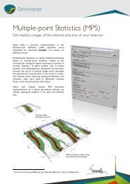
to download the full white paper - Geovariances
to download the full white paper - Geovariances
to download the full white paper - Geovariances

You also want an ePaper? Increase the reach of your titles
YUMPU automatically turns print PDFs into web optimized ePapers that Google loves.
fur<strong>the</strong>r work <strong>to</strong> define or mitigate <strong>the</strong> potential impact of high<br />
variability on planned mine production.<br />
Through DHSA, use<br />
your data <strong>to</strong><br />
understand, inform<br />
and support your<br />
resource classification<br />
decisions.<br />
The use of a geostatistical method, where <strong>the</strong> classification of a<br />
resource is driven by <strong>the</strong> actual in situ variability of <strong>the</strong> given<br />
resource, is strongly recommended as best practice for <strong>the</strong><br />
industry (Ber<strong>to</strong>li et al, 2012).<br />
Benefits<br />
The principal benefit of DHSA is gained from using your data and<br />
its characteristics <strong>to</strong> develop site-specific resource classification<br />
recommendations.<br />
DHSA is repeatable and objective, which can be crucial as projects<br />
progress and drilling is updated.<br />
Experience shows that DHSA spacing recommendations for<br />
resource classifications can differ significantly from <strong>the</strong> Coal<br />
Guidelines.<br />
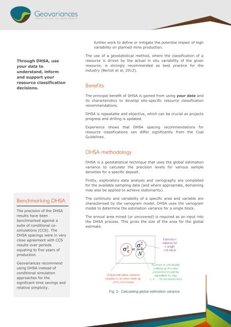
DHSA methodology<br />
DHSA is a geostatistical technique that uses <strong>the</strong> global estimation<br />
variance <strong>to</strong> calculate <strong>the</strong> precision levels for various sample<br />
densities for a specific deposit.<br />
Firstly, explora<strong>to</strong>ry data analysis and variography are completed<br />
for <strong>the</strong> available sampling data (and where appropriate, domaining<br />
may also be applied <strong>to</strong> achieve stationarity).<br />
Benchmarking DHSA<br />
The precision of <strong>the</strong> DHSA<br />
results have been<br />
benchmarked against a<br />
suite of conditional cosimulations<br />
(CCS). The<br />
DHSA spacings were in very<br />
close agreement with CCS<br />
results over periods<br />
equating <strong>to</strong> five years of<br />
production.<br />
<strong>Geovariances</strong> recommend<br />
using DHSA instead of<br />
conditional simulation<br />
approaches for <strong>the</strong><br />
significant time savings and<br />
relative simplicity.<br />
The continuity and variability of a specific area and variable are<br />
characterised by <strong>the</strong> variogram model. DHSA uses <strong>the</strong> variogram<br />
model <strong>to</strong> determine <strong>the</strong> estimation variance for a single block.<br />
The annual area mined (or uncovered) is required as an input in<strong>to</strong><br />
<strong>the</strong> DHSA process. This gives <strong>the</strong> size of <strong>the</strong> area for <strong>the</strong> global<br />
estimate.<br />
Fig. 2 - Calculating global estimation variance