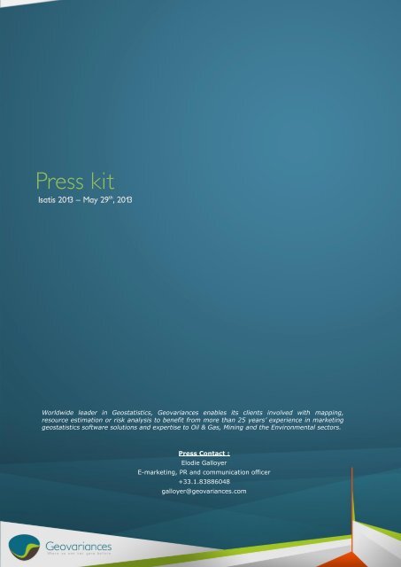
Isatis 2013 - Press Kit - Geovariances
Isatis 2013 - Press Kit - Geovariances
Isatis 2013 - Press Kit - Geovariances
- No tags were found...

Create successful ePaper yourself
Turn your PDF publications into a flip-book with our unique Google optimized e-Paper software.
<strong>Press</strong> kit<strong>Isatis</strong> <strong>2013</strong> – May 29 th , <strong>2013</strong>Worldwide leader in Geostatistics, <strong>Geovariances</strong> enables its clients involved with mapping,resource estimation or risk analysis to benefit from more than 25 years’ experience in marketinggeostatistics software solutions and expertise to Oil & Gas, Mining and the Environmental sectors.<strong>Press</strong> Contact :Elodie GalloyerE-marketing, PR and communication officer+33.1.83886048galloyer@geovariances.comElodie Galloyer e-marketing, PR and communication officer+33.1.83886048 - galloyer@geovariances.com1
A. Summary of the press kitA. Summary of the press kit ................................................................................................................ 2B. <strong>Press</strong> release ................................................................................................................................ 3C. Where to find <strong>Isatis</strong>? ....................................................................................................................... 4D. <strong>Isatis</strong> technical features .................................................................................................................. 5E. What <strong>Isatis</strong> users say about the software .......................................................................................... 6F. <strong>Geovariances</strong> key points .................................................................................................................. 7G. <strong>Geovariances</strong> vision ........................................................................................................................ 8H. Priority targets and a few customer references ................................................................................... 9I. Organization chart ........................................................................................................................ 10Elodie Galloyer e-marketing, PR and communication officer+33.1.83886048 - galloyer@geovariances.com2
B. <strong>Press</strong> releaseAvon, May 18 th , <strong>2013</strong> – <strong>Isatis</strong> <strong>2013</strong> new release, easier to use thanks to integrating workflows, anda new entirely automatic workflow for time-lapse seismic processing called MAAFK.<strong>Geovariances</strong> announces the release of <strong>Isatis</strong> <strong>2013</strong>, the new version of its software known in the Mining andOil & Gas industries as the most complete solution in Geostatistics.<strong>Isatis</strong> <strong>2013</strong> includes a new feature specially designed for time lapse seismic data processing called MAAFK –Multiple Acquisition Automatic Factorial Kriging. The version also facilitates software usage by offeringintegrated workflows guiding the user directly to the expected results.MAAFK is an efficient, automatic, full process for extracting the common features or the differences betweentwo seismic vintages or for removing the noise and artifacts affecting their acquisition.“MAAFK is an exciting new feature of <strong>Isatis</strong> which implements geostatistical data filtering techniques.”<strong>Geovariances</strong> Software Development Manager François Geoffroy says. “It offers many valuable applicationssuch as 4D seismic processing to estimate the common velocity cube, to assess measurement repeatability orto enhance the 4D signature. It can also be used for data reduction or data merging.” François Geffroy adds.The other noteworthy development is the workflows which have been made available in <strong>Isatis</strong> <strong>2013</strong> to provideguidelines for standard geostatistical processing such as kriging and stochastic simulations. Additionalworkflows are to be developed for seismic data filtering and depth conversion. The user can also build and saveits own workflows which help him to save time in further similar studies.“Using <strong>Isatis</strong>, you can do nearly everything you want; you can build your workspace from A to Z.” LaurentWagner, ISATIS product manager says. “Indeed, <strong>Isatis</strong> is a huge toolbox for resource estimation and we wantedto make it easier to handle by new users, but also to raise awareness of all the software capabilities – and theyare huge! -. This is why we have introduced workflows in <strong>Isatis</strong> to help users better master the software. Thisway, they can go through the different geostatistical processing steps quickly to the expected results.” LaurentWagner adds.<strong>Isatis</strong> <strong>2013</strong> offers many other improvements including software performances. More info is to be found athttp://www.geovariances.com/en/software-releases-isatis-<strong>2013</strong>-facilitates-your-job-ar993.<strong>Geovariances</strong> consultants will present and make demos of <strong>Isatis</strong> <strong>2013</strong> at EAGE, from 10 th to 13 th June <strong>2013</strong> inLondon, United Kingdom booth n°124.www.geovariances.comElodie Galloyer e-marketing, PR and communication officer+33.1.83886048 - galloyer@geovariances.com3
C. Where to find <strong>Isatis</strong>?<strong>Geovariances</strong> consultants are to present <strong>Isatis</strong> at: EAGE <strong>2013</strong> – London, United Kingdom – June 10 th – 13 th , <strong>2013</strong> SBgF – Rio de Janeiro, Brazil – August 26 th – 29 th , <strong>2013</strong>Elodie Galloyer e-marketing, PR and communication officer+33.1.83886048 - galloyer@geovariances.com4
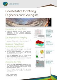
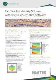
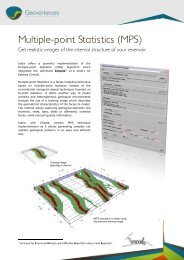
D. <strong>Isatis</strong> technical featuresState-of-the art and industry benchmark for geostatistical software packagesComprehensive geostatistical package:oooooThe reference in geostatistics for more than 20 years.Exclusive range of proven and robust geostatistical algorithms:• Interactive exploratory data analysis and automatic variogram modeling.• Standard linear geostatistics for estimation and mapping.• Numerous methods for stochastic simulations applied to uncertainty assessment (i.e.Turning Bands, SGS) and facies modeling (i.e. SIS, Plurigaussian, MPS).• Advanced geostatistics (non-linear geostatistics, multivariate techniques) for improvedmineral resource estimation.Automatic procedures for model updating and easy reproduction of workflows.Full storage of workflows and input parameters for auditing.Integration with mainstream reservoir modeling packages (i.e. SKUA-Gocad, Petrel, the RML,RMS)<strong>Isatis</strong> includes a wealth of various statistical and geostatistical applications. Learn more about themat http://www.geovariances.com/en/isatis-ru324.One-of-a-kind cutting-edge technology:ooooDevelopment and implementation by specialists whose expertise is based on +25 years’experience in geostatistics and software development.In continuous innovation thanks to consortiums or research programs in partnership withrenowned international public or private companies (more info on the current consortiums athttp://www.geovariances.com/en/scientific-innovation-ru320).Exclusive R&D agreement with Mines ParisTech Geostatistics Group, geostatistics discipline birthplace.Agreement with Ephesia Consult for the implementation of their Impala library (optimizedmultiple-points statistics simulation) in <strong>Isatis</strong>.Used by the Oil & Gas industry leaders:ooo+ 4000 users over the world.Used by the Top Oil & Gas Companies: ConocoPhillips, GDF Suez, Petrobras, Saudi Aramco,Shell, Statoil, Suncor, Total.Used by consulting and services companies (including Beicip-Franlab, CGG, Earthworks,Halliburton, TNO) .Applied for:ooooooSeismic data QC and filtering.Depth conversion.Geological facies modeling.Reservoir characterization.Volumetrics.Spill point analysis.Elodie Galloyer e-marketing, PR and communication officer+33.1.83886048 - galloyer@geovariances.com5
E. What <strong>Isatis</strong> users say about the software“<strong>Isatis</strong> has proven to be the most effective commercial tool of any I have used for multi-variate dataanalysis, mapping and modeling over the last 16 years of my career.”David Garner, Principal Geomodeler at Statoil, Canada“Best Geostatistical toolbox on earth! I’ve been using <strong>Isatis</strong> since 1995, and have been affilitated with theParis School of Mines before that. You can’t beat the reliability and the varity of the tools and methodsavailable to solve litterally any spatial problem. It’s great to use in conjuction with lager commercial earthmodeling packages, or simply on its own. ”Jeffrey Yarus, Senior Manager of Earth and Reservoir Modeling at Landmark Graphics Corporation, the USA“I am using <strong>Isatis</strong> for resource estimation. This is the most powerful geostatistical package, used by mostof the consultants. Using <strong>Isatis</strong> is simple for geostatistitians.”Marat Abzalov, Exploration Manager at Rio Tinto Exploration, Australia“<strong>Isatis</strong>, in our experience, is by far the most powerful software solution for variography.”Ted Coupland, Director and Principal Geostatistician at Cube Consulting, Australia“I did the 9 month course in Geostatistics at Fontainebleau and one of the biggest revelations there is the factthat when variables are correlated one can be used to krige the other. It is called multivariate kriging.<strong>Geovariances</strong> is the marketer of <strong>Isatis</strong> and it can do so much more – there is no other software on theplanet to touch it.”Ashley Brown, Director, Reserves at Inmet Mining, CanadaElodie Galloyer e-marketing, PR and communication officer+33.1.83886048 - galloyer@geovariances.com6
F. <strong>Geovariances</strong> key pointsWorld leader in GeostatisticsFrench independent software vendor specialized in geostatisticsooooFounded in 1986 by three engineers from the Geosciences Research Department/GeostatisticsGroup at Mines ParisTech.Developer and exclusive vendor of two software packages:• ISATIS, the industry benchmark software for Geostatistics for more than 20 years,• KARTOTRAK, integrated software solution for contaminated site characterization.Training provider in geostatistics.Consulting service provider related to mineral resource estimation, oil reservoir modeling,contamination mapping and characterization, etc.Real know-how and professional expertise in geostatisticsoooMore than 25 years of experience in applying geostatistics to address mine exploration, oil/gasexploration or environmental issues (i.e. contaminated site characterization).Versatile team of highly qualified geologists, mining engineers and geostatisticians withworldwide experience.Regular contributions to international industry, academic conferences and professional journals.Committed to fully support the industry’s needs by constantly improving its softwareproducts and technology:o Continuous investment in research and development through research consortium orpartnerships with research leaders in their respective industries:• Mines ParisTech for the development of ISATIS,• CEA for the development of KARTOTRAK,• Ephesia Consult for the implementation of their Impala library in ISATISo Responsible for the implementation of many significant technical advances over the past 25year.LocationoooHeadquarter based in Avon-Fontainebleau.Local office in Brisbane (Australia).Local representation in São Paulo (Brazil). Key figures :o Number of employees : +40o Turnover : +5 M€o International turnover : 4 M€oo+500 company customers over the world+4000 software users over the worldElodie Galloyer e-marketing, PR and communication officer+33.1.83886048 - galloyer@geovariances.com7
G. <strong>Geovariances</strong> visionTo offer our customers the leading-edge technologies in geostatisticsBased on a research and partnership strategyWhile independent software vendor, <strong>Geovariances</strong> invests in R&D via consortiums and partnerships withresearch centers world leaders in Geostatistics or their respective industries, to provide even moreinnovative solutions and closer to the needs of its customers.To provide the most complete solution in geostatisticsTo answer any kind of expectations, from the beginner to the expert in geostatisticsWith its highly qualified human resources in geostatistics, mathematics, geology and software development,<strong>Geovariances</strong> can offer the expertise industrials, consultancies or local authorities (who need to applygeostatistics in response to their specific problems) expect.The service as a priority<strong>Geovariances</strong> is well aware of the strategic challenge conducted studies or software computing results meanfor its customers. The company builds on its partners’ and own expertise to answer its clients’ challengesand to provide solutions on which they can rely confidently. That is why <strong>Geovariances</strong> is committed to offerquality and accuracy to the users of its software packages.Whether its customers encounter a technical problem or they need to be guided in the software use,<strong>Geovariances</strong>’ aim is that software users come back to their productive task as quickly as possible.<strong>Geovariances</strong> Technical Support, consisting of specialists, is in direct contact with the users to respondquickly their questions and is committed to keep in touch with them as much as they need. That is why<strong>Geovariances</strong> Technical Support is recognized and praised by all its beneficiaries.To be the first geostatistics sponsorAnd develop new marketsGeostatistics is essential in a world where needs in raw material are constantly growing and naturalresources everyday scarcer and deeper and complex to extract, and where environmental risk controlsbecome compulsory. As well as to better estimate resources or to better characterize pollution, geostatisticsenables an improved risk assessment. Geostatistics is the essential tool for a better waste management anda better cost control.So that everyone can benefit from geostatistics added value, <strong>Geovariances</strong> offers a large portfolio ingeostatistics training and helps everyone who need to go further in their projects by offering specificmentoring services.<strong>Geovariances</strong>’ aim is to maintain its leadership in geostatistics after more than 25 years’ experienceworldwide.Elodie Galloyer e-marketing, PR and communication officer+33.1.83886048 - galloyer@geovariances.com8
H. Priority targets and a few customer referencesPriority targetsOil & Gas companies, services and consulting companies, geologists, geophysicists and geostatisticians.Some customer referencesooooooooooSHELLTOTALSAUDI ARAMCOSTATOILPETROBRASCHESAPEAKECONOCOPHILLIPSGDF SUEZCGG VERITASSUNCORElodie Galloyer e-marketing, PR and communication officer+33.1.83886048 - galloyer@geovariances.com9
I. Organization chartYves TouffaitCEOOlivier Bertoli<strong>Geovariances</strong>’ Australia ManagerJean-PaulRouxSales &MarketingManagerNicolasJeannéeConsulting &TrainingManager -Petroleum &EnvironmentalSectorOlivier BertoliConsulting andTrainingManager –Mining SectorFrançoisGeffroySoftwareDevelopmentManagerValérie BuhotHRAdministrativeand FinancialManagerElodie Galloyer e-marketing, PR and communication officer+33.1.83886048 - galloyer@geovariances.com10