North Eastern Waikato Community Plan - Waikato District Council
North Eastern Waikato Community Plan - Waikato District Council
North Eastern Waikato Community Plan - Waikato District Council

You also want an ePaper? Increase the reach of your titles
YUMPU automatically turns print PDFs into web optimized ePapers that Google loves.
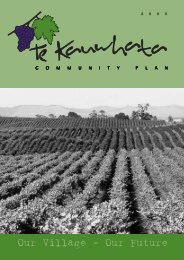
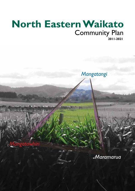
<strong>North</strong> <strong>Eastern</strong> <strong>Waikato</strong><br />
<strong>Community</strong> <strong>Plan</strong><br />
2011-2021<br />
Mangatangi<br />
Mangatawhiri<br />
Maramarua
The NEW area<br />
<strong>North</strong> <strong>Eastern</strong> <strong>Waikato</strong> <strong>Community</strong> <strong>Plan</strong> 2011-2021 3
Vision<br />
Close caring communities with pride and spirit<br />
A safe haven with an eye towards the future<br />
Preserving our heritage and remembering our past<br />
A commitment to our youth as they are our future<br />
A place where people grow<br />
A place where resource-based businesses are supported and can thrive<br />
4
Key Statistics<br />
These figures are based on Census 2006 data held by Statistics New Zealand.<br />
Maramarua<br />
Mangatangi<br />
Mangatawhiri<br />
<strong>Waikato</strong> <strong>District</strong><br />
New Zealand<br />
Population 1029 297 747 43,959 4,027,947<br />
Percentage aged<br />
under 15 years<br />
Percentage aged<br />
over 65 years<br />
20.99% 28.28% 26.10% 25.50% 21.54%<br />
7.28% 7.07% 9.24% 10.00% 12.30%<br />
Private dwellings 366 99 258 15,090 1,471,746<br />
Ethnicity –<br />
Percentage of<br />
Maori<br />
Post school<br />
qualifications<br />
Unemployment<br />
rate<br />
13.90% 16.16% 7.23% 25.85% 14.65%<br />
29.12% 29.58% 31.52% 44.80% 46.18%<br />
1.74% 4.69% 3.11% 3.54% 3.37%<br />
Median income $26,700 $23,200 $33,100 $25,700.00 $24,400.00<br />
<strong>North</strong> <strong>Eastern</strong> <strong>Waikato</strong> <strong>Community</strong> <strong>Plan</strong> 2011-2021 5
Maramarua history<br />
Maramarua is a small village located in the middle of everywhere. It lies on<br />
State Highway Two - connecting Auckland to Tauranga and the Coromandel -<br />
and in the northern reaches of the <strong>Waikato</strong> <strong>District</strong>. If you tell someone you<br />
come from Maramarua, the general response is, “Where’s that”, until you<br />
remind them of our local icons; The Red Fox Tavern, The Pink Pig Cafe and the<br />
Maramarua Golf Course, which most people seem to know.<br />
There is some<br />
confusion over<br />
where the name<br />
‘Maramarua’<br />
comes from. One<br />
legend tells of<br />
a Maaori chief,<br />
who visited the<br />
lake (which no<br />
longer exists) one<br />
night. He saw a<br />
secondary moon<br />
reflected on the<br />
lake’s calm, crystal water. Startled, he shouted “Maramarua!” Hence the name<br />
of the location became famous for its two moons: Marama – moon, Rua – two.<br />
A second legend tells of two old Maaori Chieftains called Mara, who were<br />
brothers. These men were much loved by their people and when they died, the<br />
place where they had lived was called Maramarua in their<br />
memory.<br />
6<br />
Waikarakia was the major Maaori settlement in the area,<br />
with the direct descendants of Tamatira Totaia who came<br />
from Omahu, near Thames. Descendants of this family<br />
still live in the area and their ancestors are buried at the<br />
Waikarakia Cemetery, a registered family burial ground.
The first European settlers came to Maramarua in approximately 1869 and<br />
named the area Bridgewater, a name which only lasted a few years. Families<br />
were encouraged into the area and over the years Maramarua and the<br />
surrounding districts<br />
grew. The telephone was<br />
connected to the area in<br />
1917 and the power in<br />
1933. The main road was<br />
upgraded and the school,<br />
post office, community<br />
hall and Plunket rooms<br />
were established. Tea<br />
rooms and a butchery<br />
also serviced the local<br />
people.<br />
Three local industries have been the backbone of Maramarua. Coal mining<br />
and farming were established in the early 1870s, and the Maramarua Forest<br />
was planted in 1927 which led to the Maramarua Mill opening in the early<br />
1950s. These industries have, to a large extent, dictated the highs and lows<br />
of the population of Maramarua as whole villages were created to house the<br />
many workers. In 2011 mining and farming continue in the area, joined by<br />
a diverse range of other industries including piggeries, poultry farms, cafes,<br />
transport haulage, explosives, vets, service stations, quarries, orchards, clothing<br />
manufacturing, drilling, apiary and our iconic tavern.<br />
Maramarua is a strong<br />
community with a wide<br />
range of clubs and<br />
associations. The Lions and<br />
Women’s Institute both<br />
have a strong presence.<br />
The community is well<br />
looked after with the<br />
Maramarua Volunteer Rural<br />
Fire Force and St John First<br />
Response Unit, both based<br />
by the <strong>Community</strong> Hall.<br />
<strong>North</strong> <strong>Eastern</strong> <strong>Waikato</strong> <strong>Community</strong> <strong>Plan</strong> 2011-2021 7
Maramarua School provides a focus point for the community and is supported<br />
by the Maramarua-Kopuku Playcentre.<br />
Sport is also well represented by the rugby club, golf club, squash club, karate,<br />
indoor bowls and teams and individuals representing and playing hockey,<br />
netball, horse riding, rowing, cycling and using the gym based at the Rugby Club.<br />
The Maramarua Forest regularly hosts car rallies and moto-cross rides.<br />
Maramarua is also well known for the hunt club, which started in 1932. The<br />
Maramarua Hunt is still a renowned event on the hunting calendar, providing<br />
another iconic event for our village.<br />
Maramarua really is in the middle of everywhere. Living here it’s central<br />
to Hamilton and Auckland, Thames and Pukekohe, Te Kauwhata, Matamata<br />
and Kaiaua. It’s a wonderful little<br />
community that has a very caring<br />
heart. There’s something here for<br />
everyone, and our residents, both<br />
long term and more recent come<br />
together for the good of the area.<br />
We look forward to the future and<br />
watching our village continue to<br />
grow.<br />
M. Holtham<br />
8
Mangatangi history<br />
Mangatangi<br />
‘Rippling Stream’<br />
or ‘Babbling<br />
Brook’ that is its<br />
literal meaning.<br />
Mangatangi<br />
is a farming<br />
community<br />
bounded on the<br />
north by the<br />
southern Hunua<br />
Ranges, along the south-east by what was known as the Miranda Government<br />
Block, while the west bounds Mangatawhiri and Maramarua.<br />
Pre- European occupation of our district by Maaori was extensive albeit<br />
sporadic. The marae or meeting house, ‘Tamaoho’ at Mangatangi has been in<br />
operation for 100 years. The marae has continued to develop and recently a<br />
whare kai (or dining room)has been built. The annual Pokai Day is held on 12<br />
October each year.<br />
There are some very good Pa sites around the area namely Tui Pa on<br />
Roulston’s farm and others on Vining’s, Taylor’s and Vollebregt’s. Our wellknown<br />
Porcupine Hill or Whatarua did have some excellent store pits.<br />
We also have three redoubts, the Miranda, Esk and Surrey. These fortifications<br />
were built to stop Maaori infiltrating behind the lines after the <strong>Waikato</strong> land<br />
wars in the 1860’s.<br />
Prior to the 1900’s sawmillers came into the district and started cutting kauri<br />
from the virgin bush. 1915 saw the end of the kauri era but gum diggers were<br />
still around. There was also a flaxmill in operation.<br />
<strong>North</strong> <strong>Eastern</strong> <strong>Waikato</strong> <strong>Community</strong> <strong>Plan</strong> 2011-2021 9
Land was first taken up in the Mangatangi district in the 1860’s by the Field-<br />
Porter family, an area of 10,000 acres. Early 1870’s saw this land divided up.<br />
The Vining Bros arrived in 1871 after purchasing 3000 acres. Another block<br />
of over 2000 was sold to the Waller family. Mangatangi was still deemed to be<br />
out in the backblocks until the arrival of Mr George Stubbs and two partners<br />
who purchased 7,000 acres from local iwi and formed the Mangatangi Land<br />
Company. This was the start of organised development in Mangatangi. The land<br />
was divided into farming blocks, which were ring-fenced, with a house, a shed<br />
and a portion of grass.<br />
From 1918 settlers started arriving to take up their land. Each milked a few<br />
cows by hand and slowly increased their stock, farming and prices were going<br />
well but the Post War boom was over, prices fell and Mangatangi succumbed to<br />
the slump days. Times started to improve for them only to have the depression<br />
of 1930s on their hands and like everyone else in the country, those that were<br />
able to weather this period were able to carry on, while others left their land.<br />
It was said that people gained a very real sense of values and understanding<br />
during this time.<br />
A school was soon needed for the families of these settlers and one was<br />
opened in Dec 1919<br />
with 13 pupils. Today it is<br />
the largest school in our<br />
area with a steady roll of<br />
over 100 pupils catering<br />
for many varied activities.<br />
The school is the centre<br />
of the community and<br />
still has the tradition of<br />
calf and lamb day, which<br />
is well supported, by the<br />
district.<br />
10<br />
Between 1931-35 most of the roads had been metalled and some farmers and<br />
relief gangs provided the labour. Up to this time dairying was the only industry<br />
but sheep farming was introduced. In the 1930s the government Small Farm
Settlement Scheme came into being and the bigger blocks of land were divided<br />
up, meaning more farmers were settled on the land.<br />
The population growth provided impetus for a store and a garage. These were<br />
set up in 1936. Electricity came to the district in 1931 and this helped to<br />
improve the lives of the folk on the land. Gone were the candles, the smelly<br />
kerosene lamps and petrol engines for the milking sheds.<br />
The war years came again and many of the men were sent overseas while<br />
others joined the Home Guard to defend the home front.<br />
Trucking businesses for carrying stock, general goods and lime from Miranda<br />
were set up in the early 1930s. Mr Josh de Jongh’s depot was situated on the<br />
Kaiaua Road<br />
and another<br />
truck depot<br />
started by<br />
Mr Pippin<br />
was down<br />
at the<br />
Mangatangi,<br />
Monument<br />
Rd and<br />
Miranda<br />
junction.<br />
1952-53 saw a few changes. The Mangatangi Garage was sold to Mr J Davis and<br />
Bell-Booths took over the store. Mr Norm Frederiksen took over the school<br />
bus run and setup an engineering business.<br />
The earliest Post Office and telephone exchange was situated in Bentley’s<br />
house before a Post Office was built beside the hall around 1931. The<br />
telephone was operated from Hartmaan’s house on Monument Rd for<br />
some time before an exchange was built beside the Fire Station and became<br />
Automatic in 1950s. Rural Delivery came in 1936.<br />
<strong>North</strong> <strong>Eastern</strong> <strong>Waikato</strong> <strong>Community</strong> <strong>Plan</strong> 2011-2021 11
The first hall was built in 1940<br />
and in 1960 a new hall was built<br />
incorporating a Plunket Room<br />
and a Library.<br />
Montana came into the area in<br />
1968 and planted 450 acres of<br />
grapevines. The vines succumbed<br />
to the phylloxera and they closed<br />
the operation in 1984 and sold off the land. Many of the locals were employed<br />
by Montana particularly during the harvest season.<br />
In 1972 we saw the formation of the Mangatangi Fire Party, progressing to a full<br />
fire brigade and is an important facility throughout our area. The Mangatangi<br />
Dam, which provides water for the Auckland area, was opened in1977 and this<br />
lovely area is worth a visit.<br />
12
Tennis has always been strong<br />
in Mangatangi since the courts<br />
were first built in 1948-49. Today<br />
we have three Astroturf courts<br />
adjacent to the school and they<br />
are used for hockey and netball<br />
practice. Mangatangi Tennis Club<br />
survives today with junior teams<br />
in interclub competitions.<br />
The Kaiaua-Miranda Play Centre was formerly situated at Miranda but in May<br />
2004 a new Play Centre was opened at Mangatangi and caters for all preschoolers<br />
in the area. Church had always been held in the hall but in July 2010<br />
the congregation moved into their lovely building, the Christian Crossroads<br />
Centre.<br />
Over the years farming methods have altered and diversification came in the<br />
1980s, where we saw goat farming, rabbits, ostriches and horticulture including<br />
squash, onions and maize and bull farming introduced, but cattle and dairying<br />
are now the dominant farming pursuits. We have many lifestyle blocks and<br />
residents commute to Auckland and other urban centres to work.<br />
Today Mangatangi is still a predominantly a rural settlement, proud of its past<br />
achievements and will continue to prosper.<br />
Compiled by Kath Banks<br />
<strong>North</strong> <strong>Eastern</strong> <strong>Waikato</strong> <strong>Community</strong> <strong>Plan</strong> 2011-2021 13
Mangatawhiri history<br />
Mangatawhiri is a farming district located 62kilometres south of Auckland on<br />
the old Thames-Paeroa highway. Mangatawhiri translates as ‘the stream where<br />
the tawhiri tree grows’, and refers to the boundary between Maaori and<br />
Pakeha at the time of the land wars in 1863. General Cameron crossed the<br />
river in 1863 and declared war upon the <strong>Waikato</strong> tribes.<br />
At the conclusion of the wars, land in this area was balloted for. Access to<br />
Mangatawhiri was along Valley Road, the settlers came over the hills from<br />
Drury via a track known as Happy Valley Road and now called Paparimu<br />
Road. The highway was not built until after the turn of the century and has<br />
just undergone change in 2010. With the realignment of State Highway 2,<br />
Mangatawhiri has been bypassed but still remains as an alternative route to the<br />
firth of Thames, and Coromandel.<br />
The first white settler, Robert John Lyons, took up land on March 12, 1867,<br />
with his wife Margaret and son William. James Lyons now farms the family<br />
farm on Lyons Road and operates part of the sheep and beef farm as an<br />
organic dairy farm. The Lyons were soon followed by other families. These<br />
included the Reeds, whose Crown grant in August, 1867, was registered in<br />
1868, and the Popes in the same year. Pope’s Lagoon is known to many duck<br />
shooters and is on the original Pope property. Aloe Reed married Charles<br />
Pope and the family are in their seventh generation of farming today in the<br />
district.<br />
The Keith, Mabey, McPherson, Pendergrast, Appleby, Twining, McIlroy, Motion,<br />
Caie and Parker families were all settled in the valley before the turn of the<br />
19th century.<br />
One of the first homesteads built of locally sourced pit sawn kauri in 1875 cost<br />
189 pounds and the timber for its 2000 sq. ft area weighed 40 pounds. Several<br />
other houses were built of timber taken from the valley.<br />
14
In the early 1890s one of the last Maaori war canoes was made from a<br />
kahikatea tree growing in the valley at a place known as Canoe Corner. Until<br />
1980, Seacraft milled kauri trees from the surrounding bush in the valley and<br />
used these to make pleasure craft. Up until 2010, pine was milled at Twining<br />
Road and the timber was supplied to build Haines Hunter boats.<br />
Much hard work was required by the settlers to clear the land and build roads.<br />
Many helped with road construction taking the metal from the Mangatawhiri<br />
River. Flax milling was an early industry, replaced by dairying and sheep as<br />
pastures were developed.<br />
After the turn of the 19th century a dairy factory was built by the settlers on<br />
Keith’s property and later moved to the new one on McKenzie’s farm. Today,<br />
however milk is taken out of the valley by tanker. A lot of the sheep farms in<br />
Mangatawhiri have now converted to dairying and the size of the average dairy<br />
farm in Mangatawhiri has increased through farm amalgamations. Mangatawhiri<br />
has its own organic dairy factory where Green Valley Milk processes milk<br />
on-site to sell throughout the country. Marphona Farms is the largest organic<br />
dairy farm in Australasia holding AsureQuality full organic certification. Their<br />
Mangatawhiri farm also houses the dairy factory to produce top quality Green<br />
Valley milk products. There are also several farms supplying organic milk to<br />
Fonterra and milk is also supplied to Open Country Cheese dairy company.<br />
<strong>North</strong> <strong>Eastern</strong> <strong>Waikato</strong> <strong>Community</strong> <strong>Plan</strong> 2011-2021 15
The fertiliser bulk store Altum formally Summit Quinphos is situated on the<br />
new Mangatawhiri Road and supplies fertiliser to the local farmers. Twining<br />
Nurseries is located on Twining Road and supplies grown hedging in metre<br />
long bags to New Zealand markets.<br />
Among the other early occupations were timber felling and gum digging, a<br />
marked contrast to todays industry of organic milk production, dairy farming<br />
engineering, chicken farming and hatching, and nursery growing.<br />
The valley is served with a daily mail delivery from Pokeno. The nearest town<br />
to Mangatawhiri is Pukekohe where many of the residents go to shop and<br />
work. A number of the smaller farms in Mangatawhiri have been cut into<br />
smaller lifestyle blocks. Many of these residents commute to Auckland to work,<br />
and enjoy a rural lifestyle in Mangatawhiri.<br />
16<br />
The first school was held in the Lyons’ homestead. As the population grew, Mr<br />
Robert J. Lyons gave land on the Valley Road corner for the school. The school
was moved across the river by traction<br />
engine to its present site on McKenzie<br />
Road in 1925. A new school was built in<br />
1962 and is a strong focus point for the<br />
community today. The school celebrated<br />
its 125 year reunion in 2003 and a book on<br />
the history of Mangatawhiri School and its<br />
district was written by Donnelle Hamilton.<br />
The Mangatawhiri Hall was burnt down by<br />
a mystery fire in 1961 and was rebuilt in<br />
1962. 2012 will mark 50 years of the hall’s<br />
popular existence. The preschool is held<br />
in the hall three times a week and has a<br />
thriving roll. Many other groups also use the<br />
hall for their events.<br />
When people ask for directions to Mangatawhiri, the locals will often use The<br />
Mangatawhiri Castle as a point of reference, well known for its large icecreams.<br />
The castle was built by Mr Banner<br />
around the original Mangatawhiri Store of<br />
1934. It features pictures of Snow White and<br />
the seven dwarfs on the outside and medieval<br />
paintings on the inside of the turrets. Today<br />
with the bypass of the highway, the castle has<br />
closed down. The petrol station opposite is<br />
now a dairy servicing the local area.<br />
Mangatawhiri has undergone change over the years and the new by-pass<br />
has challenged the area. However Mangatawhiri will maintain its strong<br />
community spirit, a legacy of its rural roots.<br />
Excerpts have been taken from the Mangatawhiri Valley Centennial<br />
Celebrations booklet of 1967 for parts of this writing.<br />
S Young<br />
<strong>North</strong> <strong>Eastern</strong> <strong>Waikato</strong> <strong>Community</strong> <strong>Plan</strong> 2011-2021 17
A plan for <strong>North</strong><br />
<strong>Eastern</strong> <strong>Waikato</strong><br />
What will this plan achieve<br />
Your <strong>North</strong> <strong>Eastern</strong> <strong>Waikato</strong> <strong>Community</strong> <strong>Plan</strong> is the vehicle for<br />
community discussion, on which future outcomes for the area can be<br />
determined.<br />
The views expressed here will be taken into account when <strong>Waikato</strong><br />
<strong>District</strong> <strong>Council</strong> undertakes more detailed consultation on specific<br />
topics.<br />
It is important to remember, this is not a council plan.<br />
Your community plan is a collection of ideas for action. It is a priority<br />
list of desired works and activities that have been identified.<br />
As well as focusing community debate and getting people involved in<br />
the future of their community, the plan will help influence <strong>Waikato</strong><br />
<strong>District</strong> <strong>Council</strong>’s programme of works during its annual and longterm<br />
planning processes.<br />
A number of the issues raised are not the council’s responsibility but<br />
the council will work with the community and the <strong>North</strong> <strong>Eastern</strong><br />
<strong>Waikato</strong> <strong>Community</strong> Committee to advocate and facilitate the<br />
process.<br />
18
Link to <strong>Community</strong> Outcomes<br />
Under the Local Government Act 2002, <strong>Council</strong>s are required to facilitate<br />
the identification of, and report on the achievement towards <strong>Community</strong><br />
Outcomes for their residents. Having consulted with the <strong>Waikato</strong> <strong>District</strong><br />
community, the following <strong>Community</strong> Outcomes have been identified:<br />
Accessible<br />
<strong>Waikato</strong><br />
Sustainable<br />
<strong>Waikato</strong><br />
Thriving<br />
<strong>Waikato</strong><br />
Healthy<br />
<strong>Waikato</strong><br />
Safe<br />
<strong>Waikato</strong><br />
A district where the community’s access to<br />
infrastructure, transport and technology meets its needs.<br />
A district where growth is effectively managed and<br />
natural resources are protected, developed and<br />
enhanced for future generations.<br />
A district that prides itself on economic excellence and<br />
where heritage and culture are protected and celebrated.<br />
A district with services and activities that promote a<br />
healthy community.<br />
A district where people feel safe and supported within<br />
their communities.<br />
<strong>North</strong> <strong>Eastern</strong> <strong>Waikato</strong> <strong>Community</strong> <strong>Plan</strong> 2011-2021 19
Key Issues and Projects<br />
The following key issues and projects are consistent with the <strong>Council</strong>’s five <strong>Community</strong><br />
Outcomes. Following the public consultation and based on the feedback we received the<br />
<strong>North</strong> <strong>Eastern</strong> <strong>Waikato</strong> <strong>Community</strong> Committee will prioritise the issues and projects.<br />
Specific issues and projects<br />
The <strong>North</strong> <strong>Eastern</strong> <strong>Waikato</strong> <strong>Community</strong> Committee has identified<br />
the following key issues and projects:<br />
Environment - links to Sustainable , Healthy and Safe <strong>Waikato</strong>:<br />
• Clean culverts and drains<br />
• Address flooding issues<br />
• Clean all waterways<br />
• Beautification – more planting and maintenance<br />
• Green waste facility<br />
Road safety - links to Accessible and Safe <strong>Waikato</strong>:<br />
• The schools need<br />
improved signage for<br />
warning of proximity and<br />
to reduce speed<br />
20<br />
• Improve road, safety and<br />
visibility near the schools
• Safe pedestrian crossing near the schools<br />
• Bus shelters for school children<br />
• Maintain tidy roadsides<br />
• Upgrade street lighting<br />
• Upgrade and maintain footpaths<br />
• Main road in Maramarua from Mobil Garage to the Red Fox<br />
• Seal Fire Station car park<br />
• Improved parking area at community halls<br />
• Review speed limits in and around the area<br />
• Review road safety due to increasing traffic levels<br />
• Traffic calming measures need to be put in place to control traffic movement<br />
and speed<br />
• Liaise with the Police to monitor speeds<br />
• Install emergency traffic control<br />
• Improve visibility on Monument Road/State Highway 2 intersection due to<br />
obstructions of signage<br />
• ‘No parking’ sign at top of Maxwell Road opposite the Pink Pig.<br />
<strong>North</strong> <strong>Eastern</strong> <strong>Waikato</strong> <strong>Community</strong> <strong>Plan</strong> 2011-2021 21
Transport/Roading - links to Accessible, Safe, Sustainable and Thriving<br />
<strong>Waikato</strong>:<br />
• Communication and consultation with New Zealand Transport Agency on<br />
future development<br />
• Widen road and trim trees at Garage Services<br />
• Roadsides need to be regularly mown<br />
• Tarseal Ferndale Road and other metal roads<br />
• Upgrade kerb and channel<br />
• ‘No engine braking’ signs at both ends of Maramarua<br />
• Check and repair<br />
all bridges and<br />
culverts<br />
• On/off ramps<br />
around the<br />
expressways<br />
• Welcome signage<br />
• Full diamond at the intersections - Monument Road and Maxwell Road<br />
• Development of Maxwell Road / State Highway 2 intersection<br />
• Median strip along the whole of the 70kph zone and the zone to be extended<br />
• Investigate warning signs for side roads<br />
22
Recreation Facilities - links to Healthy, Accesible and Thriving <strong>Waikato</strong>:<br />
• Create walkways in future developments<br />
• Public park on State Highway Two<br />
• Playground<br />
• Picnic/barbeque area<br />
• Skateboard ramp<br />
• Minigolf<br />
• Toilets<br />
• Upgrade rest areas<br />
• Upgrade and maintain the swimming pool for the community<br />
• New library service<br />
• Upgrade rugby club facilities<br />
<strong>North</strong> <strong>Eastern</strong> <strong>Waikato</strong> <strong>Community</strong> <strong>Plan</strong> 2011-2021 23
Social - links to Sustainable, Healthy and Safe <strong>Waikato</strong>:<br />
• Ensure general upkeep and tidiness of the area<br />
• Address any graffiti problems.<br />
<strong>Community</strong> Development - links to Sustainable, Thriving, Healthy,<br />
Accesible and Safe <strong>Waikato</strong>:<br />
• Support and development of local businesses<br />
• Consultant to assess further business potential<br />
• Improved service centre<br />
• Protection of existing resource based business from incompatible land uses and<br />
land use activities<br />
• Update the History<br />
• Promote the area and look at the development of community events<br />
• Recognition of the heritage of the area including cultural significance<br />
• Work with Solid Energy for end result for the mine<br />
• Update of Civil Defence plans for the area<br />
• Support emergency services<br />
• The council to support social agencies which benefit the community<br />
• Liaise with Glen Coal Energy Ltd. regarding platforms in wetlands<br />
24
Subdivision - links to Accesible, Thriving and Sustainable <strong>Waikato</strong>:<br />
• Structure <strong>Plan</strong> in place for future subdivision<br />
• Improved zoning<br />
• Work with New Zealand Transport Agency to support growth<br />
<strong>North</strong> <strong>Eastern</strong> <strong>Waikato</strong> <strong>Community</strong> <strong>Plan</strong> 2011-2021 25
Where to From Here<br />
The next steps<br />
This community plan was developed by the <strong>North</strong> <strong>Eastern</strong> <strong>Waikato</strong><br />
<strong>Community</strong> Committee and is their aspiration for the future. It does not<br />
reflect the <strong>Waikato</strong> <strong>District</strong> <strong>Council</strong>’s priorities or funding availability.<br />
The committee will continue to work with the council to communicate any<br />
issues and advance on approved projects.<br />
Please contact <strong>North</strong> <strong>Eastern</strong> <strong>Waikato</strong> <strong>Community</strong> Committee or<br />
<strong>Waikato</strong> <strong>District</strong> <strong>Council</strong> if you would like further information.<br />
26
<strong>North</strong> <strong>Eastern</strong> <strong>Waikato</strong> <strong>Community</strong> <strong>Plan</strong> 2011-2021 27
Ngaruawahia <strong>District</strong> Office<br />
15 Galileo Street<br />
Telephone: 07 824 8633<br />
Fax: 07 824 8091<br />
Huntly Area Office<br />
142 Main Street<br />
Telephone: 07 828 7551<br />
Raglan Area Office<br />
7 Bow Street<br />
Telephone: 07 825 8129<br />
Tuakau Area Office<br />
2 Dominion Road<br />
Telephone: 0800 492 452<br />
<strong>Waikato</strong> <strong>District</strong> <strong>Council</strong><br />
Postal Address:<br />
Private Bag 544<br />
Ngaruawahia<br />
NEW ZEALAND<br />
28<br />
0800 492 452<br />
www.waikatodistrict.govt.nz