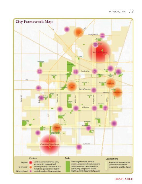
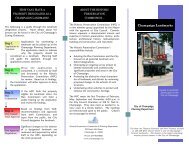
12 CHAMPAIGN TOMORROW - COMPREHENSIVE PLAN <strong>Plan</strong>ning Framework An effective plan for the growth <strong>of</strong> the <strong>City</strong> must integrate both land use and transportation issues. Recognizing this, the <strong>City</strong>’s Transportation Master <strong>Plan</strong>, ‘<strong>Champaign</strong> Moving Forward’ brought forth the idea <strong>of</strong> an urban pattern <strong>of</strong> connected neighborhoods and nodes for the <strong>City</strong>. This idea also forms the basis for our comprehensive plan. <strong>The</strong> <strong>City</strong> Framework Map illustrates this concept - a community comprised <strong>of</strong> a series <strong>of</strong> well-located commercial centers surrounded by neighborhoods, connected by a multi-modal road network for easy access by walking, biking, automobile or transit. This pattern integrates how we build our transportation system with how we use our land. By locating housing close to shopping and jobs, we reduce commute distances thus promoting a community in which most daily shopping and service needs can be met within or near each neighborhood. Each <strong>of</strong> the elements in this system <strong>of</strong> neighborhoods, centers and connections is described below in greater detail: NEIGHBORHOODS: Neighborhoods provide housing <strong>of</strong> various types, affordability and densities for people and families at different stages <strong>of</strong> their life. Neighborhoods are walkable and in close proximity to amenities such as parks, schools, convenience shopping, transit connections etc. SYSTEM OF CENTERS: Commercial centers range in size and development intensity by the quantity <strong>of</strong> people they serve. <strong>The</strong> different levels in the hierarchy serve different requirements, ranging from daily needs to shopping for non-essential and luxury goods. <strong>The</strong> comprehensive plan envisions a hierarchy <strong>of</strong> centers distributed throughout the city, as described in the illustration below. <strong>The</strong> Future Land Use Map builds upon this idea for commercial centers surrounded by neighborhoods. CONNECTIONS: Connections are multi-modal corridors complete with sufficient capacity and facilities for all modes <strong>of</strong> transportation including walking, biking, using the automobile or transit. Centers Regional - <strong>The</strong> Regional Center serves not only the population <strong>of</strong> the city but attracts customers from the surrounding region as well. A mall containing national retailers, big box stores, large format grocery stores, restaurants etc. characterize the kind <strong>of</strong> uses present in a regional center. Community – <strong>The</strong> Community Center is a bigger commercial center that caters to the needs <strong>of</strong> the entire community and may include uses such as restaurants, <strong>of</strong>fi ces, bowling alleys, copy and printing businesses, small retail stores, a grocery store etc. Community Commercial Centers are few in number, present at key locations in the city including downtown and campustown. Neighborhood – <strong>The</strong> Neighborhood Commercial Center serves the day-to-day needs <strong>of</strong> the immediate neighborhoods around it. A pharmacy, a small clinic, a corner restaurant or a drycleaner’s shop are the kind <strong>of</strong> uses one may see in such neighborhood centers. <strong>The</strong> neighborhood centers cater to a small population shed and are therefore greater in number and distributed throughout the city. DRAFT 2-10-11
INTRODUCTION 13 DRAFT 2-10-11