

Download PDF - Anchor Environmental
Download PDF - Anchor Environmental
Download PDF - Anchor Environmental

Create successful ePaper yourself
Turn your PDF publications into a flip-book with our unique Google optimized e-Paper software.
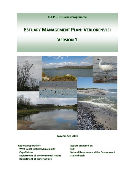
C.A.P.E. Estuaries Programme<br />
ESTUARY MANAGEMENT PLAN: VERLORENVLEI<br />
VERSION 1<br />
November 2010<br />
Report prepared for:<br />
West Coast District Municipality<br />
CapeNature<br />
Department of <strong>Environmental</strong> Affairs<br />
Department of Water Affairs<br />
Report prepared by:<br />
CSIR<br />
Natural Resources and the Environment<br />
Stellenbosch
This report was compiled by:<br />
CSIR<br />
Natural Resources and the Environment<br />
PO Box 320<br />
Stellenbosch<br />
7599<br />
Tel:+27 21 888-2400<br />
Fax:+27 21 888-2693<br />
Email: lvnieker@csir.co.za<br />
This report should be referenced as:<br />
CSIR (2010) Estuary Management Plan: Verlorenvlei (Version 1). Report prepared for the C.A.P.E.<br />
Estuaries Programme. CSIR Report CSIR/NRE/CO/ER/2010/0066/B. Stellenbosch.<br />
COPYRIGHT<br />
© CSIR 2010<br />
This document is copyright under the Berne Convention. In terms of the Copyright Act, Act No. 98 of<br />
1978, no part of this book/document may be reproduced or transmitted in any form or by any<br />
means, electronic or mechanical, including photocopying, recording or by any information storage<br />
and retrieval system, without permission in writing from the CSIR.<br />
Cover Photos: P Huizinga and P Morant
Verlorenvlei Estuary Management Plan<br />
Content<br />
Content<br />
Content ..................................................................................................................................................... i<br />
Abbreviations and Acronyms .................................................................................................................. iii<br />
Acknowledgements ................................................................................................................................. iv<br />
Related Documents ................................................................................................................................. vi<br />
INTRODUCTION ............................................................................................................................ 1<br />
PART 1: SITUATION ASSESSMENT (AUDITING) ........................................................................... 1-1<br />
1.1 SUMMARY OF PROBLEMS AND IMPACTS ....................................................................................... 1-2<br />
2.2 SUMMARY OF LEGISLATION AND RESPONSIBILITIES ......................................................................... 1-4<br />
2.3 SUMMARY OF EXISTING REPONSES .............................................................................................. 1-5<br />
1.4 FUTURE SITUATION ASSESSMENTS (AUDITING) .............................................................................. 1-6<br />
PART 2: RESOURCE OBJECTIVES & ZONING ............................................................................... 2-7<br />
2.1 VISION STATEMENT ................................................................................................................... 2-8<br />
2.2 STRATEGIC OBJECTIVES FOR VERLORENVLEI ................................................................................... 2-8<br />
2.3 OVERVIEW OF MANAGEMENT STRATEGIES & ACTIONS ................................................................... 2-9<br />
2.4 ESTUARY ZONING PLAN .......................................................................................................... 2-12<br />
2.5 OPERATIONAL SPECIFICATIONS (TARGETS) FOR VERLORENVLEI ....................................................... 2-14<br />
2.5.1 Ecological Targets for Verlorenvlei ................................................................................. 2-15<br />
2.5.2 Heritage Targets for Verlorenvlei ................................................................................... 2-16<br />
2.5.3 Socio-economic Targets for Verlorenvlei ........................................................................ 2-16<br />
2.6 OVERVIEW OF EXISTING MONITORING PROGRAMMES .................................................................. 2-16<br />
PART 3: DETAILED IMPLEMENTATION PLANS ............................................................................ 3-1<br />
3.1 CONSERVATION (LINKING TO RAMSAR CONVENTION) ..................................................................... 3-2<br />
3.1.1 Targets & Critical limits .................................................................................................... 3-2<br />
3.1.2 Management Strategies & Actions .................................................................................. 3-2<br />
3.1.3 Detailed Management Action Plans for Priority Actions.................................................. 3-4<br />
3.1.4 Monitoring Plans .............................................................................................................. 3-4<br />
3.2 LIVING RESOURCES MANAGEMENT .............................................................................................. 3-5<br />
3.2.1 Targets & Critical Limits ................................................................................................... 3-5<br />
3.2.2 Management Strategies and Actions ............................................................................... 3-5<br />
3.2.3 Detailed Management Action Plans for Priority Actions.................................................. 3-6<br />
3.2.4 Monitoring Plans .............................................................................................................. 3-7<br />
3.3 WATER QUANTITY & QUALITY (INCLUDING WASTE & WASTEWATER MANAGEMENT) ........................... 3-1<br />
3.3.1 Targets & Critical Limits ................................................................................................... 3-1<br />
3.3.2 Management Strategies and Actions ............................................................................... 3-1<br />
3.3.3 Detailed Management Action Plans for Priority Actions.................................................. 3-3<br />
3.3.4 Monitoring Plans .............................................................................................................. 3-3<br />
Page i
Verlorenvlei Estuary Management Plan<br />
Content<br />
3.4 AGRICULTURE ........................................................................................................................... 3-4<br />
3.4.1 Targets & Critical Limits ................................................................................................... 3-4<br />
3.4.2 Management Strategies and Actions ............................................................................... 3-4<br />
3.4.4 Detailed Management Action Plans for Priority Actions.................................................. 3-5<br />
3.4.5 Monitoring Plans .............................................................................................................. 3-5<br />
3.5 TOWN AND TOURISM DEVELOPMENT ........................................................................................... 3-1<br />
3.5.1 Targets & Critical Limits ................................................................................................... 3-1<br />
3.5.2 Management Strategies and Actions ............................................................................... 3-1<br />
3.5.3 Detailed Management Action Plans for Priority Actions.................................................. 3-2<br />
3.5.4 Monitoring Plans .............................................................................................................. 3-2<br />
6. INSTITUTIONAL ARRANGEMENTS AND EMPOWERMENT ....................................................................... 3-1<br />
3.6.1 Targets & Critical limits .................................................................................................... 3-1<br />
3.6.2 Management Strategies and Actions ............................................................................... 3-1<br />
3.6.3 Detailed Management Action Plans for Priority Actions.................................................. 3-2<br />
3.6.4 Monitoring Plans .............................................................................................................. 3-2<br />
3.7 LAW ENFORCEMENT AND COMPLIANCE ........................................................................................ 3-1<br />
3.7.1 Targets & Critical Limits ................................................................................................... 3-1<br />
3.7.2 Management Strategies and Actions ............................................................................... 3-1<br />
3.7.3 Detailed Management Action Plans for Priority Actions.................................................. 3-2<br />
3.7.4 Monitoring Plans .............................................................................................................. 3-3<br />
3.8 FUNDING SOURCES AND OPPORTUNITIES ...................................................................................... 3-4<br />
3.8.1 Targets & Critical Limits ................................................................................................... 3-4<br />
3.8.2 Management Strategies and Actions ............................................................................... 3-4<br />
3.8.3 Detailed Management Action Plans for Priority Actions.................................................. 3-4<br />
3.8.4 Monitoring Plans .............................................................................................................. 3-5<br />
3.9 INNOVATIVE OPPORTUNITIES FOR JOB CREATION ........................................................................... 3-1<br />
3.9.1 Targets & Critical Limits ................................................................................................... 3-1<br />
3.9.2 Management Strategies and Actions ............................................................................... 3-1<br />
3.9.3 Detailed Management Action Plans for Priority Actions.................................................. 3-2<br />
3.9.4 Monitoring Plans .............................................................................................................. 3-2<br />
PART 4: VERLORENVLEI ESTUARY FORUM ................................................................................. 4-1<br />
PART 5: APPENDICES ................................................................................................................. 5-1<br />
5.1 FUTURE MONITORING REQUIREMENTS FOR VERLORENVLEI ............................................................. 5-2<br />
Page ii
Verlorenvlei Estuary Management Plan<br />
Abbreviations and Acronyms<br />
Abbreviations and Acronyms<br />
C.A.P.E. Cape Action Plan for the People and the Environment<br />
CapeNature Western Cape Nature Conservation Board<br />
CFR Cape Floristic Region<br />
CMA Catchment Management Agency<br />
CMS Catchment Management Strategies<br />
DEA Department of <strong>Environmental</strong> Affairs<br />
DAFF Department of Agriculture, Forestry and Fisheries<br />
DWA Department of Water Affairs<br />
EFR Ecological Flow Requirement<br />
EMP Estuarine Management Plan<br />
GEF Global <strong>Environmental</strong> Facility<br />
ICM Integrated Catchment Management<br />
ICZM Integrated Coastal Zone Management<br />
IDP Integrated Development Plan<br />
LUM Land Use Management<br />
MAP Management Action Plans<br />
MCM Branch: Marine and Coastal Management, Department of <strong>Environmental</strong> Affairs<br />
and Tourism<br />
MLRA Marine Living Resources Act (No. 18 of 1998)<br />
NEMA National <strong>Environmental</strong> Management Act (No. 107 of 1998)<br />
NEMP National Estuarine Management Protocol<br />
NGO Non-governmental Organisation<br />
NWA National Water Act (No. 36 of 1998)<br />
NWRS National Water Resources Strategies<br />
RDM Resource Directed Measures<br />
RQO Resource Quality Objectives<br />
SDF Spatial Development Framework<br />
WSDP Water Services Development Plan<br />
WUA Water User Association<br />
Page iii
Verlorenvlei Estuary Management Plan<br />
Acknowledgements<br />
Acknowledgements<br />
Technical Team:<br />
L van Niekerk (CSIR, Project Leader)<br />
S Taljaard (CSIR)<br />
C Petersen (CSIR)<br />
Dr S Lamberth (DAFF)<br />
L Barwell (CSIR)<br />
P de Villiers (CapeNature)<br />
Key Stakeholders:<br />
Felicity Strange<br />
Nick Taylor<br />
Bennie van der Merwe<br />
Philippa Huntly<br />
Jimmy Walsh<br />
Keith Harrison<br />
Charles Malherbe<br />
Cylda Rwexwama<br />
Priscilla Sobebwe<br />
S.C. Newman<br />
Jevon Kotze<br />
Nontisasa Tonjeni<br />
Ayanda Matoti<br />
Sandisiwe Sono<br />
Paul Herselman<br />
Sean Ranger<br />
Francois van Heerden<br />
Johan Burger<br />
Adrie Steinberg<br />
Paul Jones<br />
Diteboho Ramongolo<br />
Marius Kieck<br />
Albert Robertson<br />
Cyril Walker<br />
David Heyns<br />
Andrew Louw<br />
John Simons<br />
Nicolhas Nero<br />
Zain Jumat<br />
Francois van Lotsenborgh<br />
Nelisa Nama<br />
N J Basson<br />
Jan van Zyl<br />
Elna van Zyl<br />
Jacobus Louw<br />
Friends of Verlorenvlei<br />
Friends of Verlorenvlei<br />
Krom Antonie Conservancy & WUA/Verlorenvlei Coalition<br />
WESSA/ Verlorenvlei Coalition<br />
West Coast Biosphere/Bird Life SA<br />
West Coast Bird Club/ C.W.C.B and BLSA<br />
West Coast District Municipality<br />
Lukhanyo Ago. Project<br />
Elands Bay Community Organisation<br />
Elands Bay Community<br />
Cederberg Municipality<br />
Western Cape DEADP: CMV<br />
Oceans and Coast, DEA<br />
Oceans and Coast, DEA<br />
WC Department of Agriculture S.R.M - Landcare<br />
Ranger Consulting P.S.A , Biodiversity and Potatoes/Rooibos<br />
DWA:O/D<br />
CapeNature<br />
CapeNature<br />
EBEDAG<br />
DAFF<br />
CapeNature/Working for Wetlands<br />
Vensterklip<br />
Visserman<br />
Engelbrecht Primêr<br />
Engelbrecht Primêr<br />
Gemeenskap<br />
Gemeenskap<br />
Western Cape :DEADP<br />
Boer<br />
DEA<br />
Voorsitter: Engelbrecht Primêr Beheerliggaam<br />
Boer<br />
Eienaar Grootdrif<br />
Eienaar Nuwerus<br />
Page iv
Verlorenvlei Estuary Management Plan<br />
Acknowledgements<br />
Manie Schreuder<br />
Freda Kotze<br />
Johnny Kotze<br />
JP v d Westhuizen<br />
Shagon Carelse<br />
Sandra Prinsloo<br />
Sanddrif<br />
EBRA Tourism<br />
EBRA Tourism<br />
Cederberg Municipality<br />
DEADP:CMU<br />
EBEDAG<br />
Page v
Verlorenvlei Estuary Management Plan<br />
Related Documents<br />
Related Documents<br />
1<br />
2<br />
Development of the Estuarine Management Plan for Verlorenvlei: Situation<br />
Assessment (CSIR, 2009b)<br />
Development of the Estuarine Management Plan for Verlorenvlei: Draft Estuary<br />
Management Plan (Version 1) (this document)<br />
Page vi
Verlorenvlei Estuary Management Plan<br />
Introduction<br />
1.<br />
Introduction<br />
1
Verlorenvlei Estuary Management Plan<br />
Introduction<br />
The C.A.P.E. Estuaries Programme was developed to ensure the conservation and sustainable<br />
utilisation of the estuarine biodiversity in the Cape Floristic Region (CFR).<br />
The purpose of this study is to initiate the development and implementation of an Estuary<br />
Management Plan (EMP) for Verlorenvlei based on a generic framework for estuarine management<br />
plan that was developed by the C.A.P.E. Estuaries Programme (CSIR, 2007). The framework was<br />
revised in 2009, following the outcome of an EMP review workshop (CSIR, 2009a).<br />
The proposed generic EMP for estuaries identifies 7 distinct components in the process of<br />
developing ansd implementing an EMP (Figure 1):<br />
• Situation Assessment and Evaluation;<br />
• The setting of a Vision and Strategic objectives;<br />
• The evaluation of Management Strategies to achieve the vision and objectives;<br />
• The preparation of an Estuary Zoning Plan (EZP) and the establishment of<br />
Operational Specifications ;<br />
• The identification of Management Action Plans (MAPs);<br />
• The Implementation of the MAPs; and<br />
• Monitoring.<br />
Figure 1: The generic framework for the development and implementation of EMPs<br />
2
Verlorenvlei Estuary Management Plan<br />
Introduction<br />
The Terms of Reference for the development of the EMP for Verlorenvlei required that the following<br />
aspects be addressed:<br />
• Phase 1: Field visit to assess the current status and health of Verlorenvlei and preparation<br />
of a Situation Assessment;<br />
• Phase 2: Draft Estuary Management Plan - Setting the Vision, Objectives, Management<br />
Strategies and Management Action Plans for the Verlorenvlei Estuary (including an Estuary<br />
Zoning Plan) and designing a monitoring and evaluation programme.<br />
The Situation Assessment (Phase 1) was prepared based on available information and the insights<br />
developed during site visits and stakeholder workshops (CSIR, 2009b). The Situation Assessment<br />
included the following:<br />
• Legal requirements relevant to Verlorenvlei Estuary;<br />
• The biophysical environment;<br />
• Requirements stipulated in existing management strategies;<br />
• The socio-economic environment;<br />
• Conservation planning or Ramsar management strategies;<br />
• Exploitation of living resources (fishing); and<br />
• Provide detail on gaps in the knowledgebase and future research needs.<br />
This 2 nd phase provides the draft EMP for the Verlorenvlei. The plan is organized into the three main<br />
phases identified in the generic EMP framework (Figure 1), namely:<br />
• Part 1: Situation Assessment (Auditing));<br />
• Part 2: Resource Objectives & Zoning;<br />
• Part 3: Detailed Implementation Plans.<br />
Part 4 contains the roles and responsibilities of the Verlorenvlei Estuary Forum, while Part 5 contains<br />
the Appendices to this document.<br />
This Verlorenvlei EMP, including all its supporting documentation, should be viewed as a “living” document<br />
to which stakeholders are continuously contributing and refining through implementation.<br />
Important to note is that the EMP for Verlorenvlei is NOT an isolated plan! To be effective and sustainable<br />
the EMP must be embedded in overarching national, regional and local plans. For example, at the local level<br />
the Verlorenvlei EMP must be embedded in the local Integrated Development Plan (IDP) and the Spatial<br />
Development Framework (SDF).<br />
Also, this EMP is not a “new” management initiative, it merely aims to provide a structured approach<br />
through which to integrate and optimize the numerous (often sectorally-based) management initiatives<br />
already being implemented (or should be implemented) in the area under different legal mandates.<br />
3
Verlorenvlei Estuary Management Plan<br />
Introduction<br />
The following references are referred to in this Document:<br />
CSIR 2007. C.A.P.E. Estuaries Programme. Proposed generic framework of estuarine management<br />
plans. Version 1. Report submitted to the C.A.P.E. Estuaries Programme. 43 pp.<br />
(http://fred.csir.co.za/extra/project/CAPE_Estuaries/)<br />
CSIR 2009. C.A.P.E. Estuaries Programme. Proposed generic framework for estuary management<br />
plans. Version 1.1. Report submitted to the C.A.P.E. Estuaries Programme. CSIR Report No.<br />
CSIR/NRE/CO/ER/2009/0128/A. Stellenbosch. 46 pp.<br />
CSIR 2009b. Development of the Verlorenvlei estuarine management plan: Situation assessment.<br />
Report prepared for the C.A.P.E. Estuaries Programme. CSIR Report No.<br />
CSIR/NRE/CO/ER/2009/0153/B. 117 pp. Stellenbosch.<br />
Department of Water Affairs and Forestry (DWAF) 1995. South African water quality guidelines for<br />
coastal marine waters. Volume 1. Natural Environment. Pretoria.<br />
Turpie, JK and Clark, BM 2007. Development of a conservation plan for temperate South African<br />
estuaries on the basis of biodiversity importance, ecosystem health and economic costs and<br />
benefits. <strong>Anchor</strong> <strong>Environmental</strong> Consulting report prepared for C.A.P.E. Regional Estuarine<br />
Management Programme.<br />
4
Verlorenvlei Estuary Management Plan<br />
Part 1: Situation Assessment (Auditing)<br />
2.<br />
Part 1:<br />
Situation Assessment (Auditing)<br />
Page 1-1
Verlorenvlei Estuary Management Plan<br />
Part 1: Situation Assessment (Auditing)<br />
1.1 Summary of Problems and Impacts<br />
Through stakeholder consultation, as part of the Situation Assessment (CSIR, 2009b), 16 key<br />
activities have been identified as threatening (or potentially threatening) to the ecosystem services<br />
provided by Verlorenvlei. The following section provides a brief description of these key activities:<br />
• Veld fires in and around Verlorenvlei lead to soil erosion and increased sedimentation. This can<br />
be particularly problematic at Verlorenvlei as it has a constricted outlet that prevents sediment<br />
scouring during floods leading to an accumulation of sediments in the system.<br />
• Road Infrastructure refers to the roads and embankments in the floodplain and the crossings<br />
and culverts that transverse it. The roads and embankments stabilize the course of the vlei and<br />
often create a different substrate character compared with the natural situation. The numerous<br />
crossings and culverts (e.g. road bridge to Elandsbay, crossings to Grootdrift and Redelinghuys,<br />
informal crossings near mouth and railway bridge) cutting across the system frequently restrict<br />
its flow, stabilizes its course and leads to increased reed growth. The construction of informal<br />
crossings near the mouth and at the railway bridge has led to the destruction of habitat and<br />
disturbance of bird life.<br />
• Riparian Infrastructure refers to all infrastructure in the floodplain of the system. Of particular<br />
concern are the low-lying properties near the mouth of the system, i.e. along the estuarine<br />
channel. There are numerous examples along the coast where this type of urban creep starts<br />
putting pressure on local authorities to manage the water level in a system artificially. An<br />
additional concern is the many fences that span the floodplain that restrict access and result in<br />
overgrazing in the areas where animals are kept. This causes changes in the species<br />
composition of the floodplain vegetation.<br />
• In-stream infrastructure refers to jetties and pumphouses that could have a localized influence<br />
on circulation patterns in the vlei.<br />
• Recreational activities include non-consumptive activities such as boating and swimming that<br />
may have a limited localized disturbance impact on the birdlife. Windsurfing, however, results in<br />
a high disturbance impact on the avifauna.<br />
• Open-cast Mining of tungsten and molybdenum of is being proposed in the upper catchment of<br />
Verlorenvlei at Metonshoek. This mining development is likely to need significant freshwater<br />
supplies, hold significant risk for the sense of place in the area and can potentially cause<br />
pollution of the freshwater supplies flowing into Verlorenvlei.<br />
• Artificial breaching of the mouth is rumoured to be undertaken as a result of the backflooding<br />
of the floodplain (grazing land) in the upper vlei. Artificial breaching can lead to loss of water<br />
column habitat and a reduction in estuarine productivity.<br />
• Agriculture: Crop production and livestock grazing in the catchment results in increased soil<br />
erosion and related sedimentation. This in turn is linked to increased reed growth in the upper<br />
reaches and a decrease in water clarity. Crop production is also linked to agricultural return flow<br />
carrying leached fertilizer (nutrients) and agrochemicals, a decrease in freshwater input and loss<br />
of riparian habitat.<br />
• Water abstraction refers to sumps, river, groundwater and direct abstraction which collectively<br />
cause a significant reduction in the inflow of freshwater to Verlorenvlei. This in turn has<br />
decreased the average water level in the vlei, prevented regular natural breachings of the<br />
mouth and increased isolation of the system from the sea. Reduced water levels and flushing in<br />
turn has led to increased reed growth and blooms (blue green algae or parrot’s feather).<br />
Page 1-2
Verlorenvlei Estuary Management Plan<br />
Part 1: Situation Assessment (Auditing)<br />
• Alien vegetation infestation in the catchment of Verlorenvlei has contributed significantly to a<br />
decrease in surface and groundwater flow to the system.<br />
• Wastewater disposal includes the disposal of non-reticulated sewage, washings from fishing<br />
boat and discharging of wastewater from a local pig farm. In appropriate disposal of waste<br />
water leads to nutrient enrichment and microbial contamination.<br />
• Solid waste disposal especially leachate and litter from the municipal waste dump, which is<br />
situated within a few hundred metres of the vlei, can lead to microbial contamination, toxic<br />
substances entering the system or enrichment. Solid litter can lead to the entrapment of biota<br />
and reduction in the aesthetic value of the vlei. Dumping of building rubble in unauthorized<br />
sites (e.g. on the “Island”) can lead to the loss of habitat and a decrease in aesthetic value.<br />
• Agricultural return flow carrying leached fertilizers causes nutrient enrichment, which in turn<br />
leads to the blue-green algal blooms or extensive growth of parrot’s feather. A relatively recent<br />
phenomenon is the occurrence of avian botulism in wading birds, also linked to poor water<br />
quality.<br />
• Harvesting of reeds and sedges can lead to reduction in the abundance of plant species. While<br />
the burning of reeds and sedges can lead to an increase in sedimentation and changes in the<br />
nutrient cycle of the vlei.<br />
• Gill netting refers to the targeting of indigenous estuarine dependant and associated fish<br />
species for local consumption. Gillnetting leads to recruitment failure of estuarine associated<br />
species (including over-exploited species such as white steenbras) and results in a decrease of<br />
the system’s nursery value. It also may enable alien fish species to become established.<br />
• Introduction of alien fish species has caused the displacement of indigenous species.<br />
• Agriculture: Livestock grazing of riparian zone reduces the vegetation cover which, in turn,<br />
allows greater amounts of sediment to be washed into the vlei during heavy rains. In addition<br />
over-grazing this will also lead to changes in the species composition/abundance of the<br />
vegetation around the system.<br />
• Alien vegetation infestation in the floodplain leads to changes in the species composition<br />
(biodiversity loss) and reduction in water level.<br />
The locations of existing activities are mapped in Figures 1.1 to 1.3 as follows:<br />
Activities relating to water and land-use in Verlorenvlei (Figure 1.1a - c)<br />
Activities relating to water quantity and quality in Verlorenvlei (Figure 1.2a - c )<br />
Activities relating to living resources in Verlorenvlei (Figure 1.3a - c)<br />
The different activities contribute to an array of problems and associated environmental impacts and<br />
socio-economic consequences, when managed inappropriately, as illustrated in Error! Reference<br />
source not found. and Table 1.2. From these tables it is clear that there are no one-to-one linkages<br />
between the activities, problems and impacts – several activities can contribute to one or more<br />
problems which, in turn, can contribute to more than one impact, and vice versa.<br />
Page 1-3
Verlorenvlei Estuary Management Plan<br />
Part 1: Situation Assessment (Auditing)<br />
Figure 1.1a: Activities relating to water and land-use in Verlorenvlei (lower estuary)<br />
Page 1-4
Verlorenvlei Estuary Management Plan<br />
Part 1: Situation Assessment (Auditing)<br />
Figure 1.1b: Activities relating to water and land-use in Verlorenvlei (middle reaches of lake area)<br />
Page 1-5
Verlorenvlei Estuary Management Plan<br />
Part 1: Situation Assessment (Auditing)<br />
Figure 1.1c: Activities relating to water and land-use in Verlorenvlei (upper reaches of lake area)<br />
Page 1-6
Verlorenvlei Estuary Management Plan<br />
Part 1: Situation Assessment (Auditing)<br />
Figure 1.2a: Activities relating to water quantity and quality in Verlorenvlei (lower estuary)<br />
Page 1-7
Verlorenvlei Estuary Management Plan<br />
Part 1: Situation Assessment (Auditing)<br />
Figure 1.2b: Activities relating to water quantity and quality in Verlorenvlei (middle reaches of lake area)<br />
Page 1-8
Verlorenvlei Estuary Management Plan<br />
Part 1: Situation Assessment (Auditing)<br />
Figure 1.2c: Activities relating to water quantity and quality in Verlorenvlei (upper<br />
reaches of lake area)<br />
Page 1-9
Verlorenvlei Estuary Management Plan<br />
Part 1: Situation Assessment (Auditing)<br />
Figure 1.3a: Activities relating to living resources in Verlorenvlei (lower estuary)<br />
Page 1-10
Verlorenvlei Estuary Management Plan<br />
Part 1: Situation Assessment (Auditing)<br />
Figure 1.3b: Activities relating to living resources in Verlorenvlei (middle reaches of lake area)<br />
Page 1-11
Verlorenvlei Estuary Management Plan<br />
Part 1: Situation Assessment (Auditing)<br />
Figure 1.3c: Activities relating to living resources in Verlorenvlei (upper reaches of lake area)<br />
Page 1-1
Living Resources<br />
Water Quantity & Quality<br />
Land-use & Infrastructure Development<br />
CATEGORY<br />
Siltation<br />
Physical habitat<br />
alteration/ destruction<br />
Alteration of salinity<br />
regime<br />
Eutrophication<br />
Toxic chemical pollution<br />
Microbial contamination<br />
Littering<br />
Suspended solids<br />
Direct Alteration of<br />
biomass/species<br />
Verlorenvlei Estuary Management Plan<br />
Part 1: Situation Assessment (Auditing)<br />
Table 1.1: An overview of key activities and linkages to potential environmental problems if<br />
managed inappropriately<br />
PROBLEM<br />
ACTIVITY<br />
Alien vegetation infestation in flood<br />
plain <br />
Veld fires <br />
Road Infrastructure (including roads,<br />
crossings, culverts) <br />
Riparian Infrastructure (including<br />
fences, bird hides, low-lying<br />
developments)<br />
In-stream infrastructure (e.g. jetties,<br />
pumphouses) <br />
<br />
Recreational activities (boating,<br />
windsurfing, swimming) <br />
Mining (Tungsten/Molybdenum) <br />
Artificial breaching <br />
Agriculture: Crop production &<br />
Livestock in catchment <br />
Water abstraction (river, groundwater,<br />
direct abstraction, sumps) <br />
Alien vegetation infestation in<br />
catchment causing flow reduction <br />
Wastewater disposal (non-reticulated<br />
sewage, boat washing, effluent from<br />
pig farm ())<br />
Solid waste disposal (building rubble,<br />
leaches and litter from municipal<br />
dump)<br />
<br />
<br />
Agricultural return flow <br />
Harvesting and burning of reeds and<br />
sedges <br />
Gill netting of indigenous fish species <br />
Introduction of alien fish species <br />
Agriculture: Livestock grazing of<br />
riparian zone <br />
Page 1-2
Siltation<br />
Physical habitat<br />
alteration/destruction<br />
Alteration of salinity regime<br />
Eutrophication<br />
Toxic chemical pollution<br />
Microbial contamination<br />
Littering<br />
High Suspended solids<br />
Direct Alteration of<br />
biomass/species<br />
Verlorenvlei Estuary Management Plan<br />
Part 1: Situation Assessment (Auditing)<br />
Table 1.2: <strong>Environmental</strong> impacts and socio-economic consequences potentially associated with<br />
specific problems<br />
PROBLEM<br />
ENVIRONMENTAL IMPACTS AND<br />
SOCIO-ECONOMIC CONSEQUENCES<br />
ENVIRONMENTAL IMPACTS<br />
Modification/loss in species composition <br />
Smothering of benthic communities <br />
Entanglement of organisms (e.g. birds)<br />
Chronic effects on biota <br />
Mortality (acute effects) on biota <br />
Opportunistic/Nuisance/Harmful algal blooms <br />
Anoxic conditions <br />
Pathogenic infections in biota <br />
PUBLIC HEALTH & SAFETY<br />
Human health and safety risks through<br />
recreational activities<br />
<br />
Human health risk through ingestion of<br />
contaminated seafood<br />
<br />
FOOD SECURITY & POVERTY<br />
Loss in quality of seafood products <br />
Loss of fisheries resources and revenue <br />
OTHER SOCIO-ECONOMIC IMPACT<br />
Loss of aesthetic value (e.g. for tourism) <br />
Loss of coastal real estate, public facilities and<br />
recreational potential<br />
<br />
<br />
Page 1-3
Water Quantity & Quality<br />
Land-use & Infrastructure Development<br />
CATEGORY<br />
Verlorenvlei Estuary Management Plan<br />
Part 1: Situation Assessment (Auditing)<br />
1.2 Summary of Legislation and Responsibilities<br />
As part of the Situation Assessment (CSIR, 2009b), an array of existing Acts (both national and<br />
provincial) governs the activities were identified as posing threats to the ecosystems services<br />
provided by Verlorenvlei. A summary of relevant Acts and responsible departments/authorities<br />
pertaining to the different activities is provided in Table 1.3.<br />
Table 1.3: Summary of relevant legislation and responsible departments/authorities pertaining to<br />
identified activities in Verlorenvlei<br />
ACTIVITY<br />
RELEVANT LEGISLATION<br />
RESPONSIBLE DEPARTMENT/<br />
AUTHORITY<br />
Alien infestation<br />
Veld fires<br />
Road Infrastructure<br />
Riparian Infrastructure<br />
In-stream infrastructure<br />
Recreational activities<br />
Mining<br />
Nationla Water Act (NWA) 1998<br />
Conservation of Agricultural Resources Act<br />
(CARA) 1983<br />
Biodiversity Act 2004<br />
CARA 1983<br />
Biodiversity Act 2004<br />
Municipal systems Act 2000<br />
Integrated Development Plans (IDPs)<br />
Municipal Systems Act 2000<br />
IDPs<br />
NWA 1998<br />
Integrated Coastal Management Act (ICMA) 2008<br />
Municipal Systems Act 2000<br />
NWA 1998<br />
Marine Living Resources Act (MLRA) 1998<br />
Provincial Conservation Ordinances<br />
Mineral and Petroleum Resources Development<br />
Act 2002<br />
Dept of Water Affairs (DWA)<br />
Dept of Agriculture, Forestry and<br />
Fisheries (DAFF)<br />
Dept of <strong>Environmental</strong> Affairs<br />
(DEA)<br />
DAFF<br />
DEA<br />
Dept. Provincial and Local<br />
Government<br />
Local Authorities<br />
Dept. Provincial and Local<br />
Government<br />
Local Authorities<br />
DWA<br />
DEA:MCM<br />
Dept. Provincial and Local<br />
Government/<br />
Local Authorities<br />
DWA<br />
DEA: MCM<br />
CapeNature<br />
Dept of Mining (DM)<br />
Artificial breaching NWA 1998/ICMA 2008 DWA/DEA:MCM<br />
Agriculture: Crop<br />
production and<br />
livestock<br />
Water abstraction<br />
Wastewater disposal<br />
Solid waste disposal<br />
Agricultural return flow<br />
NWA 1998<br />
CARA 1983<br />
NWA 1998<br />
Water Services Act<br />
IDP<br />
NWA 1998/ Water Services Act<br />
ICMA 2008<br />
IDP<br />
ICMA 2008/ NEMA 1998<br />
National Waste Management Bill<br />
Solid Waste Management By-laws ()<br />
NWA 1998<br />
CARA 1983<br />
DWA<br />
DAFF<br />
DWA<br />
Local Authorities<br />
DWA<br />
DEA:MCM<br />
Local authority<br />
DWA<br />
Local Authorities<br />
DWA<br />
DAFF<br />
Page 1-4
Land-use & Infrastructure Development<br />
CATEGORY<br />
Ecological Impact<br />
Severity<br />
Socio-Economic<br />
Impact Severity<br />
Legislation<br />
Management<br />
Responses<br />
Living Resources<br />
CATEGORY<br />
Verlorenvlei Estuary Management Plan<br />
Part 1: Situation Assessment (Auditing)<br />
ACTIVITY<br />
RELEVANT LEGISLATION<br />
RESPONSIBLE DEPARTMENT/<br />
AUTHORITY<br />
Harvesting and burning<br />
of reeds and sedges<br />
CARA 1983<br />
MLRA 1998<br />
DAFF<br />
DEA: MCM<br />
Gill netting<br />
Introduction of alien<br />
fish species<br />
Agriculture: Livestock<br />
grazing in flood plain<br />
MLRA 1998<br />
Provincial Conservation Ordinances<br />
MLRA 1998<br />
Provincial Conservation Ordinances<br />
CARA 1983<br />
MLRA 1998<br />
DEA: MCM<br />
CapeNature<br />
DEA: MCM<br />
CapeNature<br />
DAFF<br />
DEA: MCM<br />
1.3 Summary of Existing Reponses<br />
As part of the Situation Assessment (CSIR, 2009b), it was identified that many instances activities<br />
that pose a threat to the ecological and socio-economic ecosystem services provided by Verlorenvlei<br />
are governed by specific legislation. Also, there are a number of existing management actions or<br />
responses aimed at mitigating or minimising such threats. A summary of the estimated severity of<br />
the impacts, as well as the status of existing legislation and management initiatives pertaining to<br />
specific activities is provided in Table 1.4. Note that this is not an absolute rating but rather a<br />
qualitative evaluation to enable prioritization of management actions.<br />
Table 1.4: Summary of (negative) impacts on Verlorenvlei (depicted as H= high; M = medium; L =<br />
low) and the status of existing legislation and management initiatives (G = good; F = fair; P = poor)<br />
pertaining to identified activities<br />
“IMPACT”<br />
“RESPONSE”<br />
ACTIVITY<br />
Agriculture: Crop production H L F F<br />
Alien infestation M L F G<br />
Veld fires L L G F<br />
Road Infrastructure L L F F<br />
Riparian Infrastructure M L G F<br />
In-stream infrastructure L L F F<br />
Recreational activities L L F G<br />
Page 1-5
Living Resources<br />
Water<br />
Quantity &<br />
Quality<br />
CATEGORY<br />
Ecological Impact<br />
Severity<br />
Socio-Economic<br />
Impact Severity<br />
Legislation<br />
Management<br />
Responses<br />
Verlorenvlei Estuary Management Plan<br />
Part 1: Situation Assessment (Auditing)<br />
“IMPACT”<br />
“RESPONSE”<br />
ACTIVITY<br />
Mining (proposed) H H P F/P<br />
Artificial breaching H L F P<br />
Solid waste disposal L L G P<br />
Water abstraction H H G P<br />
Wastewater disposal (non-reticulated sewage & wash<br />
water from boats)<br />
M M F P<br />
Harvesting and burning of reeds and sedges M L F P<br />
Gill netting H M G F/P<br />
Introduction of alien fish species H M G P<br />
Agriculture: Livestock H L F P<br />
1.4 Future Situation Assessments (Auditing)<br />
Once the EMP is being implemented, the Situation Assessment (this Auditing phase) will constitute<br />
the review process during which the outcomes of the EMP (and associated monitoring programmes)<br />
are used to prepare Annual Assessment Reports, or five-yearly State-of-the-Estuary Reports, to<br />
inform management on the consequences and effectiveness of the process.<br />
Page 1-6
Verlorenvlei Estuary Management Plan<br />
Part 2: Resource Objectives & Zoning<br />
Part 2: Resource Objectives &<br />
Zoning<br />
Page 2-7
Ecological<br />
Verlorenvlei Estuary Management Plan<br />
Part 2: Resource Objectives & Zoning<br />
Part 2 provides details on the following:<br />
Vision Statement for Verlorenvlei;<br />
Strategic Objectives for Verlorenvlei;<br />
Overview of Management Strategies & Actions;<br />
Estuary Zoning Plan;<br />
Operational Specification (Targets) for Verlorenvlei; and<br />
Overview of existing Monitoring Programmes.<br />
2.1 Vision Statement<br />
The Vision statement for Verlorenvlei was discussed at the Stakeholder Workshop held in September<br />
2009 in Elands Bay. Participants were asked to propose vision statements for the area. Based on<br />
the feed-back received from the participants following Vision Statement is proposed for<br />
Verlorenvlei:<br />
From catchment-to-coast we are an integrated and empowered community, providing a fair<br />
standard of living to all, while protecting and proudly sharing the cultural, historical, archeological<br />
and natural values of Verlorenvlei.<br />
2.2 Strategic Objectives for Verlorenvlei<br />
While the vision is an inspirational, higher-level statement of strategic intent, strategic objectives<br />
answer the question: “How will you know when you have achieved the Vision and by when”<br />
Strategic objectives can typically be grouped into three broad categories, namely those addressing<br />
(a) Ecological, (b) Heritage and (c) Socio-economic values. Distilling from the Verlorenvlei EMP<br />
Vision, Strategic Objectives are required for the following:<br />
<br />
Ecological: “protecting natural value”;<br />
Heritage: “protecting cultural, historical, archeological values”; and<br />
<br />
Socio-economic: “Integrated and empowered community”;<br />
“Fair standard of living for all”; and<br />
“sharing values”.<br />
The Strategic Objectives for Verlorenvlei were a discussion point at the Stakeholder Workshop held<br />
in September 2009 in Elands Bay. Based on the feed-back received from the participants the<br />
following Strategic Objectives are proposed for Verlorenvlei:<br />
STRATEGIC OBJECTIVE<br />
BY<br />
WHEN<br />
The Verlorenvlei ecosystem receives formal protection status under the Protected<br />
Areas Act 2004<br />
2012<br />
Further degradation (negative trajectory) of Verlorenvlei ecosystem is halted 2015<br />
Ecological health of ecosystem is improved to Category C/B (moderately modified)<br />
Ecological health of ecosystem is improved to Category A/B (near natural)<br />
2017<br />
2025<br />
Page 2-8
Socio-economic<br />
Heritage<br />
Verlorenvlei Estuary Management Plan<br />
Part 2: Resource Objectives & Zoning<br />
STRATEGIC OBJECTIVE<br />
BY<br />
WHEN<br />
The cultural, historical and archeological sites in and around Verlorenvlei receives<br />
official protection status (e.g. Protected Areas Act, National Heritage Act)<br />
2015<br />
The Estuary Forum is constituted, including functional Technical Working Groups /Subcommittees<br />
( “integrated & empowered community”)<br />
2011<br />
The community (farmers, fishers, residents, commercial concerns, NGOs, authorities,<br />
etc) functions in an integrated, cooperative manner through a trusting and fully<br />
representative Estuary Forum (“integrated & empowered community”)<br />
2013<br />
A sustainable tourism market is established for the area, utilizing the diverse range of<br />
values offered by Verlorenvlei (“sharing values” and “valued visitors”)<br />
2012<br />
Unemployment (and associated poverty) in the Verlorenvlei area is reduced through<br />
innovative job creation initiatives, e.g. tourism, fisheries, food security, etc (“fair<br />
standard of living”)<br />
2015<br />
Provisional completion dates for the strategic objectives, as indicated above, need to be firmed up at<br />
follow-up stakeholder workshops.<br />
2.3 Overview of Management Strategies & Actions<br />
When setting Management Strategies the following question should be answered “What do we need<br />
to do to achieve or maintain the strategic objectives” or “What is preventing us from achieving the<br />
vision and strategic objectives”<br />
Based on the feed-back received from participants at the Stakeholder Workshop held in Eland Bay<br />
(September 2009), the following “Issue Packages” (or key sectors) for which management strategies<br />
had to be defined were apparent:<br />
<br />
<br />
<br />
<br />
<br />
<br />
<br />
<br />
Conservation;<br />
Living Resource management;<br />
Water quantity and quality (including waste and wastewater management);<br />
Agriculture;<br />
Town and tourism development;<br />
Improved integration and collaboration among role players (institutional arrangements &<br />
empowerment);<br />
Law enforcement and compliance;<br />
Funding sources and opportunities; and<br />
Page 2-9
Verlorenvlei Estuary Management Plan<br />
Part 2: Resource Objectives & Zoning<br />
<br />
Innovative opportunities for job creation (e.g. including tourism opportunities).<br />
The preparation of Management Strategies is the responsibility of the EF, in particular TWGs or<br />
liaison teams. In the following sections Management Strategies for the listed issues are proposed,<br />
partly based on the feed-back received from participants at the Stakeholder Workshop held in<br />
September 2009 in Elands Bay. However, these strategies need to be re-visited and refined by the<br />
designated TWGs once established (see Part 4).<br />
A range of actions has been proposed categorized into 9 issues packages or sectors. A summary of<br />
these actions are provided below.<br />
ISSUE<br />
PACKAGE/SECTOR<br />
1 Conservation<br />
2<br />
3<br />
Living resources<br />
management<br />
Water quantity<br />
and quality<br />
(including waste<br />
and wastewater<br />
management)<br />
4 Agriculture<br />
5<br />
Town and tourism<br />
development<br />
ACTION<br />
ACTION 1.1: Reinforce Ramsar status of Verlorenvlei through<br />
promulgation as a Formally Protected Area<br />
ACTION 1.2: Adopt a formal conservation zoning plan for Verlorenvlei (as<br />
part of the estuary zoning plan) and ensure that local IDP/SDF is aligned<br />
with this plan and that plan is incorporated in IDP/SDF, linked to other<br />
formal initiatives<br />
ACTION 1.3: Obtain formal protection of the heritage areas in and around<br />
Verlorenvlei<br />
ACTION 1.4: Prepare and implement a rehabilitation and restoration<br />
programme for Verlorenvlei<br />
ACTION 1.5: Develop and implement a climate change adaptation plan for<br />
Verlorenvlei (in response to changes in freshwater flow, sea level rise, etc)<br />
ACTION 2.1: Eradicate alien fish in Verlorenvlei<br />
ACTION 2.2: Eradicate alien vegetation in Verlorenvlei through Working for<br />
Wetlands programme<br />
ACTION 2.3: Investigate deterioration of fish health in Verlorenvlei<br />
ACTION 2.4: Investigate the occurrence of avian botulism in wading bird<br />
population of Verlorenvlei<br />
ACTION 2.5: Investigate the viability of fishing competitions (for alien fish)<br />
and aquaculture in Verlorenvlei<br />
ACTION 3.1: Determine the Ecological water requirements of Verlorenvlei<br />
at a comprehensive level<br />
ACTION 3.2: Develop and implement a water resource utilization plan<br />
(including registration & licensing)<br />
ACTION 3.3: Prepare and implement a mouth management protocol (to<br />
improve connection with the sea)<br />
ACTION 3.4: Address sanitation and sewage treatment facilities in<br />
Redelinghuys & Elandsbaai<br />
ACTION 3.5: Appropriately manage solid waste dump sites along<br />
Verlorenvlei<br />
ACTION 3.6: Investigate impact of water abstraction on groundwater in<br />
Verlorenvlei<br />
ACTION 3.7: Investigate the link between nutrient dynamics and algal<br />
blooms in Verlorenvlei<br />
ACTION 3.8: Design and implement a water quality monitoring programme<br />
for Verlorenvlei<br />
ACTION 4.1: Develop and implement agricultural best practice specifically<br />
to reduce nutrient enriched return flow and sediment erosion (e.g. through<br />
Biodiversity and Potatoes/Rooibos Initiatives)<br />
ACTION 4.2: Develop and implement protocol for reed management in<br />
Verlorenvlei (addressing excessive growth, harvesting e.g. for thatching<br />
and burning)<br />
ACTION 4.3: Manage and control salt marsh grazing in Verlorenvlei<br />
ACTION 5.1: Remove or upgrade of road crossings through Working for<br />
Wetlands programme<br />
ACTION 5.2: Ensure appropriate development in and around Verlorenvlei<br />
PRIORITY<br />
High<br />
High<br />
Medium<br />
High<br />
Medium<br />
High<br />
High<br />
High<br />
High<br />
Medium<br />
High<br />
High<br />
High<br />
High<br />
High<br />
High<br />
High<br />
Medium<br />
High<br />
High<br />
High<br />
High<br />
High<br />
Page 2-10
Verlorenvlei Estuary Management Plan<br />
Part 2: Resource Objectives & Zoning<br />
6<br />
7<br />
8<br />
9<br />
ISSUE<br />
PACKAGE/SECTOR<br />
Law enforcement<br />
and compliance<br />
Institutional<br />
arrangements &<br />
empowerment<br />
Funding sources<br />
and opportunities<br />
Innovative<br />
opportunities for<br />
job creation<br />
through IDP/SDF<br />
ACTION<br />
ACTION 5.3: Increase and improve access (e.g. for birding) in Verlorenvlei<br />
ACTION 6.1: Sign a MoU (CapeNature and DAFF) to increase compliance<br />
capacity and formalize agreement on the removal of gillnetting<br />
ACTION 6.2: Increase environmental law enforcement and compliance<br />
capacity with respect to pollution (e.g. from waste and wastewater and<br />
agricultural return flows)<br />
ACTION 6.3: Increase environmental law enforcement and compliance<br />
capacity with respect to water quantity (abstractions)<br />
ACTION 6.4: Increase environmental law enforcement and compliance<br />
with respect to infra-structure development and land-use<br />
ACTION 6.5: Develop a safety and security plan for the Verlorenvlei area<br />
(e.g. “Buurtwag”)<br />
ACTION 7.1: Establish the Verlorenvlei Estuary Forum, comprising broader<br />
representation from relevant government authorities and the community,<br />
TWGs (or liaison teams) and a chair person. To give formal status to the<br />
forum a constitution must be drafted and approved.<br />
ACTION 7.2: Develop and deploy a human resource plan for<br />
implementation of Verlorenvlei EMP<br />
ACTION 7.3: Develop and deploy an education and awareness programme<br />
for Verlorenvlei<br />
ACTION 8.1: Prepare a financial plan for the implementation of the<br />
Verlorenvlei EMP<br />
ACTION 9.1: Investigate en deploy job opportunities for communities in<br />
the Verlorenvlei area linked to tourism (e.g. guides for hiking trails/boat<br />
trip)<br />
ACTION 9.2: Investigate and deploy hydroponics programme in the area to<br />
increase food security<br />
PRIORITY<br />
High<br />
High<br />
High<br />
High<br />
High<br />
Medium<br />
High<br />
High<br />
High<br />
High<br />
High<br />
High<br />
The prioritisation of actions needs to be undertaken by the Estuary Forum, in consultation with<br />
stakeholders and will be pursued at the next stakeholder workshop. Factors to consider in the<br />
selection of priority actions are, for example:<br />
<br />
<br />
Severity of ecological or socio-economic impact in relation to the vision and strategic objectives<br />
Availability of resources, both financial and human resources.<br />
Detailed implementation plans for each for the issue packages or key sectors, including the<br />
Management Action Plans for priority actions are contained in Part 2: Detailed Implementation<br />
Plans.<br />
Page 2-11
Verlorenvlei Estuary Management Plan<br />
Part 2: Resource Objectives & Zoning<br />
2.4 Estuary Zoning Plan<br />
The Estuary Zoning Plan (EZP) provides a means of geographically transposing the aims of the<br />
Strategic Objectives and Management Strategies for a particular estuary, where applicable.<br />
The following needs to be demarcated on an EZP:<br />
<br />
<br />
<br />
<br />
Geographical boundaries (core and secondary boundaries) of the estuary also indicating<br />
important habitat (e.g. open water, main channel and flood plains);<br />
Areas of ecological (Ramsar boundaries; sensitive ecosystems), heritage (archeological,<br />
historical and cultural sites) and socio-economic (fisheries; recreation areas; bird watching<br />
sites) value;<br />
Zones depicting the areas where certain types of activities/developments will be allowed<br />
or where certain activities/developments will not be allowed (i.e. the traditional estuary<br />
zonation map)<br />
Approved existing and future developments/activities within the secondary boundary of the<br />
estuary.<br />
Figure 2.1 demarcates the geographical boundaries (including the proposed secondary boundaries)<br />
of the Verlorenvlei Estuary for the purposes of this EMP. Areas of ecological value are indicated by<br />
the red estuary flood plain boundary. These represent areas of high sensitivity. Areas indicated in<br />
orange and yellow demarcate the secondary boundary of the plan. Orange zones are more sensitive<br />
to development and activities than areas indicated in yellow. All activities with<br />
In Figures 1.1 to 1.3 (Part 1) the location of existing activities within the Verlorenvlei Estuary have<br />
been mapped. However, several of the existing activities are incompatible with the zoning proposed<br />
above. It is therefore important the Estuary Forum re-assess this situation in order to produce a<br />
map that will depict the approved existing and future developments/activities within the secondary<br />
boundary.<br />
Page 2-12
Verlorenvlei Estuary Management Plan<br />
Part 2: Resource Objectives & Zoning<br />
Figure 2.1: Demarcation of the boundaries of the Verlorenvlei EMP<br />
Page 2-13
Verlorenvlei Estuary Management Plan<br />
Part 2: Resource Objectives & Zoning<br />
Within the estuary the following proposed zoning applies:<br />
ZONES<br />
(Figure 2.1)<br />
Primary Boundary<br />
(Red zone -<br />
Floodplain)<br />
Secondary<br />
Boundary – Orange<br />
Zone<br />
Secondary<br />
Boundary – Yellow<br />
Zone<br />
ALLOWED<br />
Swimming<br />
Birding<br />
Canoeing<br />
Line fishing<br />
Light Grazing<br />
Light grazing<br />
Development<br />
Recreational areas<br />
Recreational areas<br />
Grazing<br />
Farming<br />
Development<br />
PROPOSED ACTIVITIES<br />
PROHIBITED OR CONTROLLED<br />
Gilnetting<br />
Speed boating<br />
Driving through the flood plain<br />
Farming<br />
Sumps<br />
Discharges<br />
Solid waste dumping<br />
Farming<br />
Solid waste dumping<br />
Solid waste dumping<br />
2.5 Operational Specifications (Targets) for Verlorenvlei<br />
Operational specifications include the measureable targets (or thresholds of potential concern)<br />
applicable to areas of ecological, heritage and socio-economic value of the estuarine environment<br />
(as highlighted in the strategic Objectives). These are addressed in this section as follows:<br />
<br />
Ecological targets for Verlorenvlei;<br />
<br />
<br />
Heritage targets for Verlorenvlei; and<br />
Socio-economic targets for Verlorenvlei.<br />
Thresholds of potential concern (TPC) are defined as measurable end points related to specific<br />
abiotic or biotic indicators that if reached, prompt management action. In essence, thresholds of<br />
potential concern should be defined such that they provide early warning signals of potential non<br />
compliance to ecological specifications. This concept implies that the indicators (or monitoring<br />
activities) selected as part of a long term monitoring programme need to include biotic and abiotic<br />
components that are particularly sensitive to ecological changes associated with changes in river<br />
inflow into the system.<br />
Page 2-14
Verlorenvlei Estuary Management Plan<br />
Part 2: Resource Objectives & Zoning<br />
The EZP, together with the Operational Specifications, is the “Blueprint” against which any existing<br />
or future initiative, development or activity in the estuary is measured. MAPs and environmental<br />
impact assessment (EIA) studies are required to use the “Blueprint” to derive targets and limits,<br />
rather than each developing their own, which may be inconsistent or conflicting.<br />
While the overarching EZP provide comprehensive geographical information covering all the<br />
aspects, it may be more appropriate to extract the relevant information from the comprehensive<br />
plan and to produce “customised EZP” for the different MAPs. For example, compliance officers in<br />
municipalities may be more interested in a map that highlights the zones where certain types of<br />
activities/developments will be allowed/not allowed (e.g. the traditional EZP), while tourism<br />
concerns may be more interested in the demarcation of areas of ecological and heritage value.<br />
2.5.1 Ecological Targets for Verlorenvlei<br />
The following ecological specifications for Verlorenvlei, and the associated thresholds of potential<br />
concerns (TPCs), are representative of an Ecological Category C/B. The specifications and the<br />
associated TPCs are based on a desktop health assessment of Verlorenvlei and needs to be refined<br />
during an intermediate ecological water requirement study executed by an estuarine specialist<br />
consultant team. Such teams are usually appointed by Department of Water Affairs, Resource<br />
Directed Measures Directorate.<br />
COMPONENT<br />
Water Quality<br />
Hydro-dynamics<br />
ECOLOGICAL SPECIFICATION<br />
Salinity distribution not to exceed TPCs for fish, invertebrates,<br />
macrophytes and microalgae (see below)<br />
Dissolved oxygen not to exceed TPCs for biota (see below)<br />
Turbidity levels in Verlorenvlei should not detrimentally<br />
impact biota i.t.o. reduced visibility or smother of benthic<br />
communities<br />
Inorganic nutrient concentrations in Verlorenvlei should result<br />
in excessive algal or reed growth<br />
Toxic substance concentrations in Verlorenvlei not to cause<br />
detrimental impact on biota<br />
Maintain a flow regime to create the required habitat for<br />
birds, fish, macrophytes, microalgae and water quality (see<br />
below)<br />
THRESHOLD OF POTENTIAL<br />
CONCERN (PCs)<br />
Salinity concentrations in the<br />
estuary exceed 35 PSU<br />
Salinity concentrations in the<br />
Verlorenvlei exceed 10 PSU<br />
Dissolved oxygen<br />
concentrations in Verlorenvlei<br />
decrease below 4 mg/l<br />
Average suspended solid<br />
concentrations in river inflow<br />
increase by more than 10% of<br />
present conc's (to be<br />
determined asap)<br />
Average DIN concentrations in<br />
river inflow exceed 300 ug/l<br />
Average DIP concentrations in<br />
river inflow exceed 50 ug/l<br />
Toxic substance concentrations<br />
(e.g. trace metals) in river<br />
inflow and the water column of<br />
Verlorenvlei exceed South<br />
African Water Quality<br />
guidelines for coastal marine<br />
waters (DWAF 1995)<br />
Page 2-15
Verlorenvlei Estuary Management Plan<br />
Part 2: Resource Objectives & Zoning<br />
COMPONENT<br />
Sediment<br />
dynamics<br />
Phytoplankton<br />
Benthic microalgae<br />
Macrophytes<br />
Invertebrates<br />
Fish<br />
Birds<br />
ECOLOGICAL SPECIFICATION<br />
Flood regime to maintain the sediment distribution patterns<br />
and aquatic habitat (instream physical habitat) so as not to<br />
exceed TPCs for biota (see below)<br />
Changes in sediment grain size distribution patterns not to<br />
exceed TPCs in benthic invertebrates (see below)<br />
Maintain low phytoplankton biomass.<br />
Maintain microalgal group diversity as measured for the<br />
baseline survey.<br />
Maintain high subtidal bentehic microalgal biomass during the<br />
closed mouth phase .<br />
Maintain the distribution of plant community types.<br />
Prevent excessive filamentous macroalgal growth.<br />
Ensure the long-term persistence of salt marsh species.<br />
Prevent hypersaline sediment and groundwater conditions in<br />
the salt marsh.<br />
Retain the following fish assemblages in the estuary (based on<br />
abundance):<br />
Estuarine species (10-20 %);<br />
Estuarine associated marine species (80-90 %); and<br />
Indigenous freshwater species (1 %).<br />
All numerically dominant species are represented by 0+<br />
juveniles.<br />
Retain regular representation of waders, gulls, and terns, and<br />
overall waterbird species richness of seven or more species.<br />
THRESHOLD OF POTENTIAL<br />
CONCERN (PCs)<br />
Area covered should be less<br />
than 50 % of the open water<br />
surface area.<br />
Decline in salt marsh species.<br />
Sediment electrical conductivity<br />
should be approximately 30 mS<br />
and similar to groundwater<br />
values.<br />
Level of estuarine species<br />
increases above 60 % of total<br />
abundance.<br />
Level of estuary associated<br />
marine species drops below 60<br />
% of total abundance.<br />
Alien Lepomis macrochirus and<br />
Micropterus spp. dominate in<br />
the upper reaches.<br />
Absence of 0+ juveniles of any<br />
of the dominant fish species.<br />
Waders or terns are absent<br />
from the estuary for five<br />
consecutive counts.<br />
2.5.2 Heritage Targets for Verlorenvlei<br />
To be included in later version of EMP once zoning plan has been approved by the Estuary Forum<br />
Executive team in consultation forum representatives.<br />
2.5.3 Socio-economic Targets for Verlorenvlei<br />
To be included in later version of EMP once zoning plan has been approved by the Estuary Forum<br />
Executive team in consultation forum representatives.<br />
2.6 Overview of Existing Monitoring Programmes<br />
There is very little baseline ecological information available on Verlorenvlei. It is of the utmost<br />
importance to develop an in-depth understanding of how the ecology functions. Current monitoring<br />
initiatives include:<br />
Page 2-16
Verlorenvlei Estuary Management Plan<br />
Part 2: Resource Objectives & Zoning<br />
<br />
DWA Water level recorder: The DWA has a permanent water level recorder in Verlorenvlei that<br />
monitors its water levels continuously. It is of the utmost importance that this monitoring<br />
continues.<br />
Co-ordinated Waterbirds Counts (CWAC): The Coordinated Waterbird Counts (CWAC) was<br />
launched in 1992. The objective of CWAC is to monitor South Africa's waterbird populations and<br />
the conditions of the wetlands which are important for waterbirds. This is being done by means<br />
of a programme of regular mid-summer and mid-winter censuses at a large number of South<br />
African wetlands and estuaries, at regular six-monthly intervals. CWAC currently monitors over<br />
350 wetlands around the country.<br />
This project was initiated by the then Ramsar Working Group of the Department of<br />
<strong>Environmental</strong> Affairs in part-fulfilment of South Africa's commitment to the Ramsar<br />
Convention. CWAC also contributes its data to the African Waterbird Census, a programme<br />
coordinated by Wetlands International and based at the African headquarters of Wetlands<br />
International in Senegal.<br />
Sites registered with CWAC have their waterbirds censused every six months, in midsummer<br />
and midwinter. The permissible periods are mid-January to mid-February, and July, respectively.<br />
Where ideally all counts should be carried out on the same day, in practice it is necessary to<br />
provide a wider time period to accommodate volunteers and organizations. Methods of<br />
counting are standardize for a site in terms of area covered and manner in which counters are<br />
deployed. Counters are provided with information sheets, which advise on how to count<br />
efficiently and avoid double-counting and misidentification. Observers are also requested to<br />
monitor their sites by fixed-point photography at two-year intervals. This is to establish longterm<br />
variability in physical changes at wetlands.<br />
Counts are submitted on a standard form, which also requests details on weather and threats<br />
currently having an impact on the wetland and birds. This is then directly entered into the<br />
computer. Feed back on each seasonal count are provided by means of a newsletter which is<br />
distributed shortly before the next count, together with a computer output of previous count<br />
and a blank form.<br />
In 1999, the TOTAL CWAC Report (Taylor et. al. 1999) was published. It provides a useful<br />
summary of all counts made between the start of the project and 1997.<br />
Monitoring requirements for Verlorenvlei, as identified in the Situation Assessment (CSIR, 2009b),<br />
are summarised in Part 5: Appendices, Appendix 5.1.<br />
Specific monitoring plans linked to each of the issue packages or sectors are contained in Part B:<br />
Detailed Implementation Plans.<br />
Page 2-17
Verlorenvlei Estuary Management Plan<br />
Part 3: Detailed Implementation Plans<br />
Part 3:<br />
Detailed Implementation Plans<br />
Page 3-1
Verlorenvlei Estuary Management Plan<br />
Part 3: Detailed Implementation Plans<br />
Part 3 contains the detailed Management Strategies, Management Action Plans and Monitoring<br />
Plans for the different work packages or sectors. The work packages are:<br />
• Conservation;<br />
• Living Resource management;<br />
• Water quantity and quality;<br />
• Agriculture;<br />
• Town and tourism development;<br />
• Improved integration and collaboration among role players;<br />
• Law enforcement and compliance;<br />
• Funding sources and opportunities; and<br />
• Innovative opportunities for job creation (e.g. including tourism opportunities).<br />
3.1 Conservation (linking to Ramsar Convention)<br />
3.1.1 Targets & Critical limits<br />
Operational specifications refer to the measureable targets or critical limits applicable to<br />
activities/developments or activity/development zones in and around the estuary.<br />
As part of the development of a regional conservation plan for the cool and warm temperate<br />
estuaries Turpie and Clark (2007) recommended that the Verlorenvlei form part of the set of<br />
estuaries that needs to be protected to meet biodiversity targets in South Africa. The conservation<br />
plan stipulates that 50% of the terrestrial marginal area be included as a no-development area and<br />
that the Recommended Ecological Water Requirement Category be a B or C, summarized as follows:<br />
RECOMMENDATION<br />
Extent of sanctuary protection<br />
Half<br />
Extent of undeveloped margin 50%<br />
Minimum water requirement (ecological category)<br />
B or C<br />
VALUE<br />
3.1.2 Management Strategies & Actions<br />
The following actions or issues, specifically related to conservation have been identified at the<br />
Situation Assessment and Stakeholder Workshop held in Eland Bay (September 2009):<br />
<br />
<br />
<br />
<br />
<br />
Conservation of biodiversity through declaration of a formal Protected Area (under<br />
Protected Areas Act) and Continued compliance to Ramsar status requirements and<br />
bringing the importance of Ramsar to the fore;<br />
Increase protection through zoning and formal planning in and around Verlorenvlei and link<br />
this with other formal initiatives, e.g. IDP, SDF, Stewardship programme;<br />
Conserve and formally protect the cultural heritage of the area;<br />
Halt further degradation of Verlorenvlei system and institute restoration/rehabilitation<br />
were appropriate; and<br />
Adaptation to climate change needs to be ensured through better water resources planning<br />
and agricultural best practice.<br />
Page 3-2
Verlorenvlei Estuary Management Plan<br />
Part 3: Detailed Implementation Plans<br />
<br />
ACTION 1.1: Reinforce Ramsar status of Verlorenvlei through promulgation as a Formally Protected Area<br />
Related Strategic<br />
Objective/s<br />
The Verlorenvlei ecosystem receives formal protection status<br />
Relevant legislation National <strong>Environmental</strong> Management: Protected Areas Act (No 57 of 2003)<br />
Responsible agent<br />
Department of <strong>Environmental</strong> Affairs<br />
CapeNature (including Stewardship programme and Conservancy)<br />
Estimated Budget R100 million<br />
Timeframe<br />
Within 2- 5 years<br />
Priority<br />
High<br />
ACTION 1.2: Adopt a formal conservation zoning plan for Verlorenvlei (as part of the estuary zoning plan)<br />
and ensure that local IDP/SDF is aligned with this plan and that plan is incorporated in IDP/SDF, linked to<br />
other formal initiatives<br />
Related Strategic<br />
Objective/s<br />
The Verlorenvlei ecosystem receives formal protection status<br />
Relevant legislation National <strong>Environmental</strong> Management: Protected Areas Act (No 57 of 2003)<br />
Responsible agent<br />
Department of <strong>Environmental</strong> Affairs<br />
CapeNature (including Stewardship programme, Conservancy)<br />
Estimated Budget R100 000<br />
Timeframe<br />
1 – 2 years<br />
Priority<br />
High<br />
ACTION 1.3: Obtain formal protection of the heritage areas in and around Verlorenvlei<br />
Related Strategic<br />
Objective/s<br />
Relevant legislation<br />
Responsible agent<br />
Estimated Budget R200 000<br />
Timeframe<br />
2 – 5 years<br />
Priority<br />
Medium<br />
The cultural, historical and archeological site in and around Verlorenvlei receives<br />
official protection status<br />
National Heritage Resources Act (No 25 of 1999)<br />
National <strong>Environmental</strong> Management: Protected Areas Act (No 57 of 2003)<br />
Department of <strong>Environmental</strong> Affairs<br />
South African Heritage Association (with in put from UCT)<br />
ACTION 1.4: Prepare and implement a rehabilitation and restoration programme for Verlorenvlei<br />
Related Strategic<br />
Objective/s<br />
Relevant legislation<br />
Responsible agent<br />
Estimated Budget<br />
Timeframe<br />
Priority<br />
Ecological health of ecosystem is improved<br />
Further degradation (negative trajectory) of Verlorenvlei ecosystem is halted<br />
Water Act (No 36 of 1998)<br />
Conservation of Agricultural Resources Act (No 43 of 1983)<br />
National <strong>Environmental</strong> Management: Protected Areas Act (No 57 of 2003)<br />
Department of Water Affairs<br />
Department of Agriculture, Forestry and Fisheries<br />
Department of <strong>Environmental</strong> Affairs<br />
R1 000 000/a (include other biodiversity initiatives)<br />
Ongoing<br />
High<br />
ACTION 1.5: Develop and implement a climate change adaptation plan for Verlorenvlei (in response to<br />
changes in freshwater flow, sea level rise, etc)<br />
Related Strategic<br />
Objective/s<br />
Further degradation (negative trajectory) of Verlorenvlei ecosystem is halted<br />
Ecological health of ecosystem is improved<br />
Page 3-3
Verlorenvlei Estuary Management Plan<br />
Part 3: Detailed Implementation Plans<br />
Water Act (No 36 of 1998)<br />
Relevant legislation Conservation of Agricultural Resources Act (No 43 of 1983)<br />
National <strong>Environmental</strong> Management: Protected Areas Act (No 57 of 2003)<br />
Department of Water Affairs<br />
Responsible agent Department of Agriculture, Forestry and Fisheries<br />
Department of <strong>Environmental</strong> Affairs CapeNature<br />
Estimated Budget -<br />
Timeframe<br />
2 – 5 years<br />
Priority<br />
Medium<br />
3.1.3 Detailed Management Action Plans for Priority Actions<br />
Once the priority actions have been identified, the appointed Technical Working Groups (or liaison<br />
teams) will be required to prepare detailed management action plans for these actions. A template<br />
for the preparation of MAPs is as follows:<br />
ACTION ……<br />
Requirements stipulated in policy<br />
and legislation<br />
Available methods, protocols and<br />
best practice-guides<br />
Operational Specifications/<br />
Links to EZP<br />
Detailed work plan<br />
Scheduling<br />
Responsibilities<br />
Monitoring plan<br />
Human Resource Plan<br />
Financial Resource Plan<br />
………………………<br />
3.1.4 Monitoring Plans<br />
Give some indication of the type of monitoring to be included within this sector<br />
Page 3-4
Verlorenvlei Estuary Management Plan<br />
Part 3: Detailed Implementation Plans<br />
3.2 Living Resources Management<br />
3.2.1 Targets & Critical Limits<br />
Operational specifications refer to the measureable targets or critical limits applicable to<br />
activities/developments or activity/development zones in and around the estuary.<br />
To be included in later version of EMP by the Estuary Forum Executive team<br />
3.2.2 Management Strategies and Actions<br />
The following actions or issues, specifically related to living resources have been identified in the<br />
Situation Assessment and at the Stakeholder Workshop held in Eland Bay (September 2009):<br />
<br />
<br />
<br />
<br />
<br />
<br />
Need to eradicate/control alien fish (possibly through an experimental fishery using large<br />
mesh nets that target introduced species while collapsed stock are protected);<br />
Removal of alien vegetation (from water and land);<br />
General concern for fish health as some fish have large legions on them at the end of<br />
summer (could be parasites or blue green algae);<br />
Need to understand the extent and severity of the occurrence avian botulism in wading bird<br />
population of Verlorenvlei. A better understanding is required of the vectors that are causing<br />
it - enriched sediment, low water levels, poor water quality;<br />
Need to know if it is viable to have fishing competitions (for alien fish) in Verlorenvlei; and<br />
Alternative livelihood strategies such as aquaculture (yellow tail market in Japan) and<br />
subsistence fishing farms could investigated, but should be approached with care as it holds<br />
a high risk for the ecology in nearly permanently closed systems such as Verlorenvlei, e.g.<br />
pathogens, diseases, algal blooms.<br />
ACTION 2.1: Eradicate alien fish in Verlorenvlei<br />
Related Strategic<br />
Objective/s<br />
Ecological health of ecosystem is improved<br />
Further degradation (negative trajectory) of Verlorenvlei ecosystem is halted<br />
Relevant legislation Marine Living Resource Act (No 18 of 1998)<br />
Department of Agriculture, Forestry and Fisheries (formerly MCM)<br />
Responsible agent<br />
CapeNature<br />
WWF<br />
Private parties<br />
Estimated Budget R10 million<br />
Timeframe Within 3 Years (2010 – 2012)<br />
Priority<br />
High<br />
ACTION 2.2: Eradicate alien vegetation in Verlorenvlei through Working for Wetlands programme<br />
Related Strategic<br />
Objective/s<br />
Ecological health of ecosystem is improved<br />
Further degradation (negative trajectory) of Verlorenvlei ecosystem is halted<br />
Relevant legislation Conservation of Agricultural Resources Act (No 43 of 1983)<br />
Department of <strong>Environmental</strong> Affairs<br />
Responsible agent Department of Water Affairs<br />
CapeNature<br />
Page 3-5
Verlorenvlei Estuary Management Plan<br />
Part 3: Detailed Implementation Plans<br />
Estimated Budget<br />
Timeframe<br />
Priority<br />
R5 million<br />
On going<br />
High<br />
ACTION 2.3: Investigate deterioration of fish health in Verlorenvlei<br />
Related Strategic<br />
Objective/s<br />
Ecological health of ecosystem is improved<br />
Further degradation (negative trajectory) of Verlorenvlei ecosystem is halted<br />
Relevant legislation Marine Living Resources Act (No 18 of 1998)<br />
Responsible agent Department of Agriculture, Forestry and Fisheries<br />
Estimated Budget R150 000<br />
Timeframe<br />
1 – 2 years<br />
Priority<br />
Medium<br />
ACTION 2.4: Investigate the occurrence of avian botulism in wading bird population of Verlorenvlei<br />
Related Strategic<br />
Objective/s<br />
Relevant legislation<br />
Responsible agent<br />
Estimated Budget R150 000<br />
Timeframe<br />
1 – 2 years<br />
Priority<br />
High<br />
Ecological health of ecosystem is improved<br />
Further degradation (negative trajectory) of Verlorenvlei ecosystem is halted<br />
Marine Living Resources Act (No 17 of 1998)<br />
Conservation of Agricultural Resources Act (No 43 of 1983)<br />
Department of Agriculture, Forestry and Fisheries<br />
CapeNature<br />
Department of Water Affairs and Environment<br />
ACTION 2.5: Investigate the viability of aquaculture and fishing competitions in Verlorenvlei<br />
Related Strategic<br />
Objective/s<br />
Relevant legislation<br />
Responsible agent<br />
Estimated Budget R100 000<br />
Timeframe<br />
1 year<br />
Priority<br />
Medium<br />
Unemployment in the Verlorenvlei area is reduced to less than 10% through<br />
innovative job creation initiatives<br />
Marine Living Resources Act (No 17 of 1998)<br />
Conservation of Agricultural Resources Act (No 43 of 1983)<br />
Department of Agriculture, Forestry and Fisheries<br />
3.2.3 Detailed Management Action Plans for Priority Actions<br />
Once the priority actions have been identified, the appointed Technical Working Groups (or liaison<br />
teams) will be required to prepare detailed management action plans for these actions. A template<br />
for the preparation of MAPs is as follows:<br />
ACTION ……<br />
Requirements stipulated in policy<br />
and legislation<br />
Available methods, protocols and<br />
best practice-guides<br />
Operational Specifications/<br />
Links to EZP<br />
Detailed work plan<br />
Scheduling<br />
Responsibilities<br />
Monitoring plan<br />
………………………<br />
Page 3-6
Verlorenvlei Estuary Management Plan<br />
Part 3: Detailed Implementation Plans<br />
Human Resource Plan<br />
Financial Resource Plan<br />
3.2.4 Monitoring Plans<br />
Give some indication of the type of monitoring to be included within this sector<br />
Page 3-7
Verlorenvlei Estuary Management Plan<br />
Part 3: Detailed Implementation Plans<br />
3.3 Water Quantity & Quality (including waste & wastewater<br />
management)<br />
3.3.1 Targets & Critical Limits<br />
Operational specifications refer to the measureable targets or critical limits applicable to<br />
activities/developments or activity/development zones in and around the estuary.<br />
To be included in later version of EMP by the Estuary Forum Executive team<br />
3.3.2 Management Strategies and Actions<br />
The following actions or issues, specifically related to water quantity and quality have been<br />
identified at the Stakeholder Workshop held in Eland Bay (September 2009):<br />
Determination of the Ecological Water Requirements and associated ecological<br />
specifications (including funding & capacity to implement this “Reserve” of freshwater);<br />
<br />
<br />
<br />
<br />
<br />
<br />
<br />
There is limited water in the region, there is thus a need to manage water resource demand<br />
and utilization;<br />
Mouth management is required to enhance nursery value through improved connection<br />
with marine environment, i.e. more open mouth conditions and removal of obstructions<br />
and to prevent artificial breaching of mouth when high water levels cause inundation of<br />
grazing land or properties;<br />
Inadequate sewage treatment (Redelinghuys & Elandsbaai) need to be address;<br />
Solid waste (e.g. municipal dump site) need to be well managed;<br />
Need to understand impact of abstraction (over abstraction/inappropriate use) on<br />
groundwater;<br />
Understand the link between pollution (i.e. nutrients) and blooms (e.g. blue green algae or<br />
parrot grass blooms); and<br />
Need to instigate a baseline water quality monitoring programme.<br />
ACTION 3.1: Determine the Ecological water requirements of Verlorenvlei at a comprehensive level<br />
Related Strategic<br />
Objective/s<br />
Further degradation (negative trajectory) of Verlorenvlei ecosystem is halted<br />
Ecological health of ecosystem is improved<br />
Relevant legislation National Water Act (No 36 of 1998)<br />
Responsible agent Department of Water Affairs<br />
Estimated Budget R1.5 million<br />
Timeframe Within 3 years (2010 – 2012)<br />
Priority<br />
High<br />
Page 3-1
Verlorenvlei Estuary Management Plan<br />
Part 3: Detailed Implementation Plans<br />
ACTION 3.2: Develop and implement a water resource utilization plan (including registration & licensing)<br />
Related Strategic<br />
Objective/s<br />
Further degradation (negative trajectory) of Verlorenvlei ecosystem is halted<br />
Ecological health of ecosystem is improved<br />
Relevant legislation National Water Act (No 36 of 1998)<br />
Responsible agent Department of Water Affairs<br />
Estimated Budget R 10 million (partly done, existing users already registered)<br />
Timeframe 10 years (2010 – 2019)<br />
Priority<br />
High<br />
ACTION 3.3: Prepare and implement a mouth management protocol (to improve connection with the sea)<br />
Related Strategic<br />
Objective/s<br />
Relevant legislation<br />
Responsible agent<br />
Estimated Budget<br />
Ecological health of ecosystem is improved<br />
Further degradation (negative trajectory) of Verlorenvlei ecosystem is halted<br />
Marine Living Resources Act (No 18 of 1998)<br />
National Water Act (No 36 of 1998)<br />
National <strong>Environmental</strong> Management: ICM Act (No 24 of 2008)<br />
Department of Agriculture, Forestry and Fisheries<br />
Department of Water Affairs<br />
CapeNature<br />
Municipalities<br />
R1.5 million (e.g. inserting replacing larger culverts)<br />
Timeframe Within 2 years (2010 - 2011)<br />
Priority<br />
High<br />
ACTION 3.4: Address sanitation and sewage treatment facilities in Redelinghuys & Elandsbaai<br />
Related Strategic<br />
Objective/s<br />
Further degradation (negative trajectory) of Verlorenvlei ecosystem is halted<br />
Ecological health of ecosystem is improved<br />
Relevant legislation National Water Act (No 36 of 1998)<br />
Responsible agent<br />
Department of Water Affairs<br />
Municipality<br />
Estimated Budget <br />
Timeframe Within 5 years (2010 – 2014)<br />
Priority<br />
High<br />
ACTION 3.5: Appropriately manage solid waste dump sites along Verlorenvlei<br />
Related Strategic<br />
Objective/s<br />
Further degradation (negative trajectory) of Verlorenvlei ecosystem is halted<br />
Ecological health of ecosystem is improved<br />
Relevant legislation National <strong>Environmental</strong> Management: Waste Act (No 59 of 2008)<br />
Responsible agent<br />
Department of <strong>Environmental</strong> Affairs<br />
Local municipality<br />
Estimated Budget <br />
Timeframe<br />
1 year<br />
Priority<br />
High<br />
ACTION 3.6: Investigate impact of water abstraction on groundwater in Verlorenvlei<br />
Related Strategic<br />
Objective/s<br />
Further degradation (negative trajectory) of Verlorenvlei ecosystem is halted<br />
Ecological health of ecosystem is improved<br />
Relevant legislation National Water Act (No 36 of 1998)<br />
Responsible agent Department of Water Affairs<br />
Estimated Budget R 5 000 000<br />
Timeframe<br />
2 - 3 years<br />
Page 3-2
Verlorenvlei Estuary Management Plan<br />
Part 3: Detailed Implementation Plans<br />
Priority<br />
High<br />
ACTION 3.7: Investigate the link between nutrient dynamics and algal blooms in Verlorenvlei<br />
Related Strategic<br />
Objective/s<br />
Further degradation (negative trajectory) of Verlorenvlei ecosystem is halted<br />
Ecological health of ecosystem is improved<br />
Relevant legislation National Water Act (No 36 of 1998)<br />
Responsible agent Department of Water Affairs<br />
Estimated Budget R150 000<br />
Timeframe<br />
1 – 2 years<br />
Priority<br />
High<br />
ACTION 3.8: Design and implement a water quality monitoring programme for Verlorenvlei<br />
Related Strategic<br />
Objective/s<br />
Further degradation (negative trajectory) of Verlorenvlei ecosystem is halted<br />
Ecological health of ecosystem is improved<br />
Relevant legislation National Water Act (No 36 of 1998)<br />
Responsible agent Department of Water Affairs<br />
Estimated Budget Budget will depend on parameters included<br />
Timeframe Within 5 years (2010 – 2014)<br />
Priority<br />
Medium<br />
3.3.3 Detailed Management Action Plans for Priority Actions<br />
Once the priority actions have been identified, the appointed Technical Working Groups (or liaison<br />
teams) will be required to prepare detailed management action plans for these actions. A template<br />
for the preparation of MAPs is as follows:<br />
ACTION ……<br />
Requirements stipulated in policy<br />
and legislation<br />
Available methods, protocols and<br />
best practice-guides<br />
Operational Specifications/<br />
Links to EZP<br />
Detailed work plan<br />
Scheduling<br />
Responsibilities<br />
Monitoring plan<br />
Human Resource Plan<br />
Financial Resource Plan<br />
………………………<br />
3.3.4 Monitoring Plans<br />
Give some indication of the type of monitoring to be included within this sector<br />
Page 3-3
Verlorenvlei Estuary Management Plan<br />
Part 3: Detailed Implementation Plans<br />
3.4 Agriculture<br />
3.4.1 Targets & Critical Limits<br />
Operational specifications refer to the measureable targets or critical limits applicable to<br />
activities/developments or activity/development zones in and around the estuary.<br />
To be included in later version of EMP by the Estuary Forum Executive team<br />
3.4.2 Management Strategies and Actions<br />
The following actions or issues, specifically related to land- and water use have been identified at the<br />
Stakeholder Workshop held in Eland Bay (September 2009):<br />
<br />
<br />
<br />
Agriculture Best Practice (e.g. Biodiversity and Potato and Rooibos Initiatives) needs to<br />
be supported by all farmers in region. Agricultural return flow (enriched through overapplication<br />
of fertilizers) and increase turbidity in Verlorenvlei as a result of siltation<br />
should be addressed through agricultural best practice agricultural best practice.<br />
Overgrazing of natural areas in and around the system (e.g. goats, pigs and cattle) causing<br />
siltation should be addressed through agricultural best practice. Lack of cover crops<br />
causing increased sediment input into the vlei – water and wind erosion should be<br />
addressed through agricultural best practice;<br />
Harvesting and burning of reeds and sedges need to be controlled. The burning of reeds<br />
reduces buffer capacity and disturbs nutrient processes. Increased reed growth (result of<br />
sedimentation, pollution, lower water levels and obstruction to flow) needs to be halted<br />
and if possible reversed. The harvesting of reeds could potentially help control reed<br />
growth, but it needs to be investigated as reeds are also acting as nutrient “traps” that<br />
help control blue-green algal blooms; and<br />
Grazing of salt mashes which leads to reduction in detritus (food) to Verlorenvlei and a<br />
loss of riparian buffer capacity against sedimentation needs to be address.<br />
ACTION 4.1: Develop and implement agricultural best practice specifically to reduce nutrient enriched<br />
return flow and sediment erosion (e.g. through Biodiversity and Potatoes/Rooibos Initiatives)<br />
Related Strategic<br />
Objective/s<br />
Relevant legislation<br />
Responsible agent<br />
Estimated Budget R1000 0000<br />
Timeframe<br />
On going<br />
Priority<br />
High<br />
Further degradation (negative trajectory) of Verlorenvlei ecosystem is halted<br />
Ecological health of ecosystem is improved<br />
Conservation of Agricultural Resources Act (No 43 of 1983)<br />
National Water Act (No 36 of 1998)<br />
Department of Agriculture, Forestry and Fisheries<br />
Department of Water Affairs<br />
Page 3-4
Verlorenvlei Estuary Management Plan<br />
Part 3: Detailed Implementation Plans<br />
ACTION 4.2: Develop and implement protocol for reed management in Verlorenvlei (addressing excessive<br />
growth, harvesting (e.g. for thatching) and burning)<br />
Related Strategic<br />
Objective/s<br />
Relevant legislation<br />
Responsible agent<br />
Estimated Budget<br />
Timeframe<br />
Priority<br />
Ecological health of ecosystem is improved<br />
Further degradation (negative trajectory) of Verlorenvlei ecosystem is halted<br />
Water Act (No 36 of 1998)<br />
Conservation of Agricultural Resources Act (No 43 of 1983)<br />
Department of Water Affairs<br />
Department of Agriculture, Forestry and Fisheries<br />
R 10 million<br />
Initiate within next 5 years, then ongoing<br />
High<br />
ACTION 4.3: Manage and control salt marsh grazing in Verlorenvlei<br />
Related Strategic<br />
Objective/s<br />
Relevant legislation<br />
Responsible agent<br />
Estimated Budget <br />
Timeframe<br />
On going<br />
Priority<br />
High/medium/low<br />
Ecological health of ecosystem is improved<br />
Further degradation (negative trajectory) of Verlorenvlei ecosystem is halted<br />
Water Act (No 36 of 1998)<br />
Conservation of Agricultural Resources Act (No 43 of 1983)<br />
Department of Water Affairs<br />
Department of Agriculture, Forestry and Fisheries<br />
3.4.3 Detailed Management Action Plans for Priority Actions<br />
Once the priority actions have been identified, the appointed Technical Working Groups (or liaison<br />
teams) will be required to prepare detailed management action plans for these actions. A template<br />
for the preparation of MAPs is as follows:<br />
ACTION ……<br />
Requirements stipulated in policy<br />
and legislation<br />
Available methods, protocols and<br />
best practice-guides<br />
Operational Specifications/<br />
Links to EZP<br />
Detailed work plan<br />
Scheduling<br />
Responsibilities<br />
Monitoring plan<br />
Human Resource Plan<br />
Financial Resource Plan<br />
………………………<br />
3.4.4 Monitoring Plans<br />
Give some indication of the type of monitoring to be included within this sector<br />
Page 3-5
Verlorenvlei Estuary Management Plan<br />
Part 3: Detailed Implementation Plans<br />
3.5 Town and Tourism Development<br />
3.5.1 Targets & Critical Limits<br />
Operational specifications refer to the measureable targets or critical limits applicable to<br />
activities/developments or activity/development zones in and around the estuary.<br />
To be included in later version of EMP by the Estuary Forum Executive team<br />
3.5.2 Management Strategies and Actions<br />
The following actions or issues, specifically related to land- and water use have been identified at the<br />
Stakeholder Workshop held in Eland Bay (September 2009):<br />
<br />
<br />
<br />
Removal or upgrading of numerous crossings (e.g. road bridge – more pipelines & road<br />
access at Grootdrift);<br />
Inappropriate development (e.g. unsustainable development within 5 m contour too<br />
close to estuary and lake) needs to be managed through the IDP and SDF of District and<br />
Local municipality. Detailed short-, medium- & long-term development planning for area<br />
for inclusion in IDPs, SDFs, Water Resources Plans, Living Resource Plans and Agricultural<br />
resource plans; and GCBC Planning, including appropriate infrastructure for tourism and<br />
hospitality industry; and<br />
Access to the wetland (e.g. for birding) needs to be improved – access limited/prevented<br />
through fencing.<br />
ACTION 5.1: Remove or upgrade of road crossings through Working for Wetlands programme<br />
Related Strategic<br />
Objective/s<br />
Relevant legislation<br />
Responsible agent<br />
Estimated Budget R2 000 000<br />
Timeframe<br />
3 years<br />
Priority<br />
High<br />
Further degradation (negative trajectory) of Verlorenvlei ecosystem is halted<br />
Ecological health of ecosystem is improved<br />
National <strong>Environmental</strong> Management: ICM Act (No 24 of 2008)<br />
Local Government: Municipal Systems Act (No 32 of 2000)<br />
Department of <strong>Environmental</strong> Affairs<br />
Municipality<br />
ACTION 5.2: Ensure appropriate development in and around Verlorenvlei through IDP/SDF<br />
Related Strategic<br />
Objective/s<br />
Relevant legislation<br />
Responsible agent<br />
Estimated Budget -<br />
Timeframe<br />
5 years<br />
Priority<br />
High<br />
Further degradation (negative trajectory) of Verlorenvlei ecosystem is halted<br />
Ecological health of ecosystem is improved<br />
A sustainable tourism market is established for the area based on a sound tourism<br />
marketing plan, utilizing the diverse range of values offered by Verlorenvlei<br />
National <strong>Environmental</strong> Management: Integrated Coastal Management Act (No 24 of<br />
2008)<br />
Local Government: Municipal Systems Act (No 32 of 2000)<br />
Municipality<br />
Page 3-1
Verlorenvlei Estuary Management Plan<br />
Part 3: Detailed Implementation Plans<br />
ACTION 5.3: Increase and improve access (e.g. for birding) in Verlorenvlei<br />
Related Strategic<br />
Objective/s<br />
Relevant legislation<br />
Responsible agent<br />
Estimated Budget R 1 000 000<br />
Timeframe<br />
1 – 3 years<br />
Priority<br />
High<br />
Further degradation (negative trajectory) of Verlorenvlei ecosystem is halted<br />
A sustainable tourism market is established for the area based on a sound tourism<br />
marketing plan, utilizing the diverse range of values offered by Verlorenvlei<br />
National <strong>Environmental</strong> Management: Integrated Coastal Management Act (No 24 of<br />
2008)<br />
Department of <strong>Environmental</strong> Affairs/CapeNature<br />
3.5.3 Detailed Management Action Plans for Priority Actions<br />
Once the priority actions have been identified, the appointed Technical Working Groups (or liaison<br />
teams) will be required to prepare detailed management action plans for these actions. A template<br />
for the preparation of MAPs is as follows:<br />
ACTION ……<br />
Requirements stipulated in policy<br />
and legislation<br />
Available methods, protocols and<br />
best practice-guides<br />
Operational Specifications/<br />
Links to EZP<br />
Detailed work plan<br />
Scheduling<br />
Responsibilities<br />
Monitoring plan<br />
Human Resource Plan<br />
Financial Resource Plan<br />
………………………<br />
3.5.4 Monitoring Plans<br />
Give some indication of the type of monitoring to be included within this sector<br />
Page 3-2
Verlorenvlei Estuary Management Plan<br />
Part 3: Detailed Implementation Plans<br />
3.6 Institutional Arrangements and Empowerment<br />
3.6.1 Targets & Critical limits<br />
Operational specifications refer to the measureable targets or critical limits applicable to<br />
activities/developments or activity/development zones in and around the estuary.<br />
To be included in later version of EMP by the Estuary Forum Executive team<br />
3.6.2 Management Strategies and Actions<br />
The following actions or issues, specifically related to Integration & Collaboration among Role<br />
Players have been identified at the Stakeholder Workshop held in Eland Bay (September 2009):<br />
<br />
<br />
<br />
<br />
Need to develop capacity to implement the EMP among the role players, including the<br />
human resources to manage estuary;<br />
Need to identify a Champion;<br />
Foster continuity in implementation and refinement of EMP, i.e. efficiently, effectively,<br />
continuously;<br />
Need buy-in from all levels of government departments/authorities;<br />
Fragmented and overlapping management roles/responsibilities/mandates need<br />
clarification;<br />
<br />
<br />
<br />
<br />
Need to overcome geographical isolation: Verlorenvlei is far from decision-making centers<br />
and central business districts;<br />
The EMP must link with IDPs of local and district municipality, e.g. in terms of tourism; and<br />
The EMP needs to balance ecological concerns with community and social development;<br />
and<br />
The community is fragmented and uninformed – The entire community needs to be<br />
involved as this will generate buy-in from locals. This will require good coordination of the<br />
Estuary Forum. Education of the fragmented community (all parties) in respect of the<br />
urgency of the EMP is needed to save the vlei.<br />
ACTION 6.1: Establish the Verlorenvlei Estuary Forum, comprising representation from relevant<br />
government authorities and the community, TWGs (or liaison teams) and a chair person. To give formal<br />
status to the forum a constitution must be drafted and approved.<br />
Related Strategic<br />
Objective/s<br />
The Estuary Forum is constituted, including functional Technical Working Groups<br />
/liaison teams.<br />
The community (farmers, fishers, residents, commercial concerns, NGOs, authorities,<br />
etc) functions in an integrated, cooperative manner through a trusting and fully<br />
representative Estuary Forum<br />
Relevant legislation National <strong>Environmental</strong> Management: ICM Act (No 24 of 2008)<br />
Responsible agent All parties<br />
Estimated Budget R 100 000<br />
Timeframe<br />
1 year<br />
Page 3-1
Verlorenvlei Estuary Management Plan<br />
Part 3: Detailed Implementation Plans<br />
Priority<br />
High<br />
ACTION 6.2: Develop and deploy a human resource plan for implementation of Verlorenvlei EMP<br />
Related Strategic<br />
Objective/s<br />
The Estuary Forum is constituted, including functional Technical Working Groups<br />
/liaison teams.<br />
The community (farmers, fishers, residents, commercial concerns, NGOs, authorities,<br />
etc) functions in an integrated, cooperative manner through a trusting and fully<br />
representative Estuary Forum.<br />
Relevant legislation National <strong>Environmental</strong> Management: ICM Act (No 24 of 2008)<br />
Estuary Forum together with government departments (DEA, DWA, DAFF, District and<br />
Responsible agent local municipality) and other institutions (e.g. CapeNature) and community of the<br />
area.<br />
Estimated Budget R300 000<br />
Timeframe<br />
1 – 2 year<br />
Priority<br />
High<br />
ACTION 6.3: Develop and deploy an education and awareness programme for Verlorenvlei<br />
Related Strategic<br />
Objective/s<br />
The community (farmers, fishers, residents, commercial concerns, NGOs, authorities,<br />
etc) functions in an integrated, cooperative manner through a trusting and fully<br />
representative Estuary Forum<br />
Relevant legislation National <strong>Environmental</strong> Management: ICM Act (No 24 of 2008)<br />
Responsible agent<br />
Estuary Forum together with government departments (DEA, DWA, DAFF, District and<br />
local municipality) and other institutions (e.g. CapeNature) and community of the area<br />
Estimated Budget R100 000<br />
Timeframe<br />
1 – 2 year<br />
Priority<br />
Medium<br />
3.6.3 Detailed Management Action Plans for Priority Actions<br />
Once the priority actions have been identified, the appointed Technical Working Groups (or liaison<br />
teams) will be required to prepare detailed management action plans for these actions. A template<br />
for the preparation of MAPs is as follows:<br />
ACTION ……<br />
Requirements stipulated in policy<br />
and legislation<br />
Available methods, protocols and<br />
best practice-guides<br />
Operational Specifications/<br />
Links to EZP<br />
Detailed work plan<br />
Scheduling<br />
Responsibilities<br />
Monitoring plan<br />
Human Resource Plan<br />
Financial Resource Plan<br />
………………………<br />
3.6.4 Monitoring Plans<br />
Give some indication of the type of monitoring to be included within this sector<br />
Page 3-2
Verlorenvlei Estuary Management Plan<br />
Part 3: Detailed Implementation Plans<br />
3.7 Law Enforcement and Compliance<br />
3.7.1 Targets & Critical Limits<br />
Operational specifications refer to the measureable targets or critical limits applicable to<br />
activities/developments or activity/development zones in and around the estuary.<br />
To be included in later version of EMP by the Estuary Forum Executive team<br />
3.7.2 Management Strategies and Actions<br />
The following actions or issues, specifically related to law enforcement and compliance have been<br />
identified in the Situation Assessment and at the Stakeholder Workshop held in Eland Bay<br />
(September 2009):<br />
<br />
<br />
<br />
<br />
<br />
Increase capacity for law enforcement/compliance to manage and control fishing pressure<br />
and illegal fishing (i.e. removal of gill netting) in Verlorenvlei. Gill netting compromises the<br />
nursery function and relevant authorities (CapeNature and DAFF) have agreed to not renew<br />
licenses to riparian owners in future;<br />
Increase capacity law enforcement/compliance with respect to pollution from agricultural<br />
activities in the catchment (e.g. polluted agricultural return flows) and town and tourism<br />
development (waste and wastewater);<br />
Increase capacity law enforcement/compliance with respect to water abstraction; and<br />
Increase capacity law enforcement/compliance with respect to infrastructure development<br />
and land-use adjacent to estuary; and<br />
Need to address safety and security in the area as crime is on the increase (related to lack of<br />
jobs as farming only provides livelihoods for 6 months of the year).<br />
ACTION 7.1: No renewal of gillnetting licenses and sign a MoU (CapeNature and DAFF) to increase<br />
compliance capacity<br />
Related Strategic<br />
Objective/s<br />
Ecological health of ecosystem is improved<br />
Further degradation (negative trajectory) of Verlorenvlei ecosystem is halted<br />
Relevant legislation Marine Living Resources Act (No 18 of 1998)<br />
Responsible agent<br />
Department of Agriculture, Forestry and Fisheries (DAFF)<br />
CapeNature & appointed conservancy rangers<br />
Estimated Budget R 300 000 per annum (co-funded through MoU with DAFF)<br />
Timeframe Within 1 year (2010)<br />
Priority<br />
High<br />
ACTION 7.2: Increase environmental law enforcement and compliance capacity with respect to pollution<br />
(e.g. from waste and wastewater and agricultural return flows)<br />
Related Strategic<br />
Objective/s<br />
Relevant legislation<br />
Responsible agent<br />
Further degradation (negative trajectory) of Verlorenvlei ecosystem is halted<br />
Ecological health of ecosystem is improved<br />
National Water Act (No 36 of 1998)<br />
Conservation of Agricultural Resources Act (No 43 of 1983)<br />
Department of Water Affairs<br />
Department of Agriculture, Forestry and Fisheries<br />
Page 3-1
Verlorenvlei Estuary Management Plan<br />
Part 3: Detailed Implementation Plans<br />
Estimated Budget -<br />
Timeframe<br />
1 year<br />
Priority<br />
High<br />
ACTION 7.3: Increase environmental law enforcement and compliance capacity with respect to water<br />
quantity (abstractions)<br />
Related Strategic<br />
Objective/s<br />
Further degradation (negative trajectory) of Verlorenvlei ecosystem is halted<br />
Ecological health of ecosystem is improved<br />
Relevant legislation National Water Act (No 36 of 1998)<br />
Responsible agent Department of Water Affairs<br />
Estimated Budget -<br />
Timeframe<br />
1 year<br />
Priority<br />
High<br />
ACTION 7.4: Increase environmental law enforcement and compliance with respect to infra-structure<br />
development and land-use<br />
Related Strategic<br />
Objective/s<br />
Relevant legislation<br />
Responsible agent<br />
Estimated Budget R300 000<br />
Timeframe<br />
1 – 2 years<br />
Priority<br />
High<br />
Further degradation (negative trajectory) of Verlorenvlei ecosystem is halted<br />
Ecological health of ecosystem is improved<br />
Local Government: Municipal Systems Act (No 32 of 2000)<br />
National <strong>Environmental</strong> Management: Integrated Coastal Management Act (No 24 of<br />
2008)<br />
Conservation of Agricultural Resources Act (No 43 of 1983)<br />
Municipality<br />
Department of Environment Affairs/CapeNature<br />
Department of Agriculture, Forestry and Fisheries<br />
ACTION 3.5: Develop a safety and security plan for the Verlorenvlei area (e.g. “Buurtwag”)<br />
Related Strategic<br />
Objective/s<br />
The community (farmers, fishers, residents, commercial concerns, NGOs, authorities,<br />
etc) functions in an integrated, cooperative manner through a trusting and fully<br />
representative Estuary Forum<br />
Relevant legislation<br />
Responsible agent South African Police and community<br />
Estimated Budget -<br />
Timeframe<br />
1 – 2 years<br />
Priority<br />
High<br />
3.7.3 Detailed Management Action Plans for Priority Actions<br />
Once the priority actions have been identified, the appointed Technical Working Groups (or liaison<br />
teams) will be required to prepare detailed management action plans for these actions. A template<br />
for the preparation of MAPs is as follows:<br />
ACTION ……<br />
Requirements stipulated in policy<br />
and legislation<br />
Available methods, protocols and<br />
best practice-guides<br />
Operational Specifications/<br />
Links to EZP<br />
………………………<br />
Page 3-2
Verlorenvlei Estuary Management Plan<br />
Part 3: Detailed Implementation Plans<br />
Detailed work plan<br />
Scheduling<br />
Responsibilities<br />
Monitoring plan<br />
Human Resource Plan<br />
Financial Resource Plan<br />
3.7.4 Monitoring Plans<br />
Give some indication of the type of monitoring to be included within this sector<br />
Page 3-3
Verlorenvlei Estuary Management Plan<br />
Part 3: Detailed Implementation Plans<br />
3.8 Funding Sources and Opportunities<br />
3.8.1 Targets & Critical Limits<br />
Operational specifications refer to the measureable targets or critical limits applicable to<br />
activities/developments or activity/development zones in and around the estuary.<br />
To be included in later version of EMP by the Estuary Forum Executive team<br />
3.8.2 Management Strategies and Actions<br />
The following actions or issues, specifically related to funding sources and opportunities have been<br />
identified at the Stakeholder Workshop held in Eland Bay (September 2009):<br />
<br />
Generate/source funding to implement the EMP. Financing (funding and budgets) need to<br />
be in the short- and the long-term, e.g. Biosphere funded local community projects.<br />
In order to address the above issues the following actions are proposed:<br />
ACTION 8.1: Prepare a financial plan for the implementation of the Verlorenvlei EMP<br />
Related Strategic<br />
Objective/s<br />
Cross-cutting to all objectives<br />
National <strong>Environmental</strong> Management: ICM Act (No 24 of 2008)<br />
Relevant legislation<br />
Local Government: Municipal Systems Act (No 32 of 2000)<br />
National water Act (No 36 of 1998)<br />
Conservation of Agricultural Resources Act (No 43 of 1983)<br />
Responsible agent<br />
Estuary Forum together with government departments (DEA, DWA, DAFF, District and<br />
local municipality) and other institutions (e.g. CapeNature) and business in the area<br />
Estimated Budget R50 000<br />
Timeframe<br />
1 year<br />
Priority<br />
High<br />
3.8.3 Detailed Management Action Plans for Priority Actions<br />
Once the priority actions have been identified, the appointed Technical Working Groups (or liaison<br />
teams) will be required to prepare detailed management action plans for these actions. A template<br />
for the preparation of MAPs is as follows:<br />
ACTION ……<br />
Requirements stipulated in policy<br />
and legislation<br />
Available methods, protocols and<br />
best practice-guides<br />
Operational Specifications/<br />
Links to EZP<br />
Detailed work plan<br />
Scheduling<br />
Responsibilities<br />
Monitoring plan<br />
Human Resource Plan<br />
Financial Resource Plan<br />
………………………<br />
Page 3-4
Verlorenvlei Estuary Management Plan<br />
Part 3: Detailed Implementation Plans<br />
3.8.4 Monitoring Plans<br />
Give some indication of the type of monitoring to be included within this sector<br />
Page 3-5
Verlorenvlei Estuary Management Plan<br />
Part 3: Detailed Implementation Plans<br />
3.9 Innovative Opportunities for Job Creation<br />
3.9.1 Targets & Critical Limits<br />
Operational specifications refer to the measureable targets or critical limits applicable to<br />
activities/developments or activity/development zones in and around the estuary.<br />
To be included in later version of EMP by the Estuary Forum Executive team<br />
3.9.2 Management Strategies and Actions<br />
the following actions or issues, specifically related to land- and water use have been identified in the<br />
Situation Assessment and at the Stakeholder Workshop held in Eland Bay (September 2009):<br />
<br />
<br />
Investigate job creation associated with the management of the system, for example,<br />
enhance tourism as and avenue for job creation (an IDP objective) and that ensures<br />
equity for all local communities in Verlorenvlei region; and<br />
Investigate poverty alleviation initiatives and local community projects, e.g. hydroponics<br />
for increase food security.<br />
ACTION 9.1: Investigate en develop job opportunities for communities in the Verlorenvlei area linked to<br />
tourism (e.g. guides for canoeing, hiking trail, bird trail, horse-riding, fishing, surfing and donkey-cart rides.)<br />
Job creation initiatives include: catering (in a house in the community, take-aways); processing and selling of<br />
living resources (alien fish, licensed crayfish-selling to licensed buyers), creation of contemporary crafts<br />
(sewing, clothes-making, artworks) and reviving and demonstrating old skills (heritage values) ( e.g. handaxe<br />
making to weaving).<br />
Related Strategic<br />
Objective/s<br />
Relevant legislation<br />
Responsible agent<br />
Estimated Budget R2 000 000<br />
Timeframe<br />
1 year<br />
Priority<br />
High<br />
Unemployment in the Verlorenvlei area is reduced through innovative job creation<br />
initiatives<br />
Local Government: Municipal Systems Act (No 32 of 2000)<br />
Tourism Act (No 72 of 1993, as amended in 1996 & 2000)<br />
Local and District Municipality<br />
Department of Tourism<br />
ACTION 9.2: Investigate and deploy hydroponics programme in the area to increase food security<br />
Related Strategic<br />
Objective/s<br />
Unemployment in the Verlorenvlei area is reduced through innovative job creation<br />
initiatives.<br />
Relevant legislation Conservation of Agricultural Resources Act (No 43 of 1983)<br />
Responsible agent Department of Agriculture, Forestry and Fisheries<br />
Estimated Budget R 5 000 000<br />
Timeframe<br />
5 years<br />
Priority<br />
High<br />
ACTION 9.3: Develop unused primary school as a suitable venue for a range of activities, including a<br />
museum of the area, a wetlands museum and interpretive centre and a training centre for supporting the<br />
establishment of work opportunities in the community.<br />
Related Strategic<br />
Objective/s<br />
Unemployment in the Verlorenvlei area is reduced through innovative job creation<br />
initiatives<br />
Relevant legislation Conservation of Agricultural Resources Act (No 43 of 1983)<br />
Page 3-1
Verlorenvlei Estuary Management Plan<br />
Part 3: Detailed Implementation Plans<br />
Responsible agent Department of Agriculture, Forestry and Fisheries<br />
Estimated Budget R 1 000 000<br />
Timeframe<br />
2 - 3 years<br />
Priority<br />
Medium<br />
3.9.3 Detailed Management Action Plans for Priority Actions<br />
Once the priority actions have been identified, the appointed Technical Working Groups (or liaison<br />
teams) will be required to prepare detailed management action plans for these actions. A template<br />
for the preparation of MAPs is as follows:<br />
ACTION ……<br />
Requirements stipulated in policy<br />
and legislation<br />
Available methods, protocols and<br />
best practice-guides<br />
Operational Specifications/<br />
Links to EZP<br />
Detailed work plan<br />
Scheduling<br />
Responsibilities<br />
Monitoring plan<br />
Human Resource Plan<br />
Financial Resource Plan<br />
………………………<br />
3.9.4 Monitoring Plans<br />
Provide some indication of the type of monitoring to be included within this sector<br />
Page 3-2
Verlorenvlei Estuary Management Plan<br />
Part 4: Verlorenvlei Estuary Forum<br />
Part 4:<br />
Verlorenvlei Estuary Forum<br />
Page 4-1
Verlorenvlei Estuary Management Plan<br />
Part 4: Verlorenvlei Estuary Forum<br />
The Verlorenvlei Estuary Forum is the body ultimately responsible for the implementation of the<br />
EMP (Figure 4.1).<br />
Executive Team<br />
Chairperson<br />
Technical Working Groups<br />
Estuary Forum Representatives<br />
Figure 4.1: Schematic illustration of a proposed Estuary Forum to develop and<br />
implement Estuary Management Plans in South Africa<br />
An Estuary Forum still needs to be established for Verlorenvlei. The Estuary Forum must be<br />
representative of all relevant government authorities and interest groups in the Verlorenvlei region.<br />
Where local forums - dealing with either estuarine or other matters of local interest - already exist,<br />
those forums must be considered (e.g. Friends of Verlorenvlei, Verlorenvlei Coalition).<br />
The following people participated in stakeholder workshops and are potential members of a<br />
Verlorenvlei Estuary Forum:<br />
NAME ORGANISATION TEL E-MAIL<br />
S.C. Newman Elands Bay Community 0795793755<br />
Felicity Strange<br />
Nick Taylor<br />
Bennie van der Merwe<br />
Friends of Verlorenvlei<br />
Friends of Verlorenvlei<br />
Krom Antonie Conservancy &<br />
WUA/Verlorenvlei Coalition<br />
0229721431/<br />
0824147654<br />
0229721431/<br />
0824436364<br />
0834604066/<br />
0229421782<br />
vleiratdesign@gmail.com<br />
tingum@telkomsa.net<br />
namaquas@intekom.co.za<br />
Cylda Rwexwama Lukhanyo Ago. Project 08434374486 -<br />
Jimmy Walsh West Coast Biosphere/Bird Life SA 0227721673 hilltopcottage@telkomsa.net<br />
Keith Harrison West Coast Bird Club/ C.W.C.B and BLSA 0227133026 keithbharrson@lando.co.za<br />
Charles Malherbe West Coast District Municipality 0224338400 cjmalherbe@wcdm.co.za<br />
Priscilla Sobebwe Elands Bay Community Organisation 0780136469 -<br />
Philippa Huntly WESSA/ Verlorenvlei Coalition 0217011397 philippa@wessa.co.za<br />
Jevon Kotze<br />
Nontisasa Tonjeni<br />
Cederberg Municipality<br />
Western Cape DEADP: CMV<br />
0222407980/<br />
0791933973<br />
0214832566/<br />
0825862340<br />
jevonk@cederbergraad.co.za<br />
ntonjeni@pgwc.gov.za<br />
Ayanda Matoti Oceans & Coasts (National DEA) 0214023478 amatoti@deat.gov.za<br />
Sandisiwe Sono Oceans & Coasts (National DEA) 0214023634 ssono@deat.gov.za<br />
Paul Herselman<br />
WC Department of Agriculture S.R.M -<br />
Landcare<br />
021 8085098 paulh@elsenburg.com<br />
Page 4-2
Verlorenvlei Estuary Management Plan<br />
Part 4: Verlorenvlei Estuary Forum<br />
NAME ORGANISATION TEL E-MAIL<br />
Sean Ranger Ranger Consulting P.S.A 0832948776 Sean.ranger@gmail.com<br />
Francois van Heerden<br />
DWA:O/D<br />
0274822233/<br />
0828073539<br />
vheerdf@dwaf.gov.za<br />
Johan Burger CapeNature 022 9312900 jburger@capenature.co.za<br />
Adrie Steinberg CapeNature 0229312900 adrie@gcbc.co.za<br />
Paul Jones EBEDAG 0824923527<br />
paul@elandsbayguesthouse.co.z<br />
a<br />
Diteboho Ramongolo DAFF 0219489278 ditebohoR@daff.gov.za<br />
Steven Lamberth DAFF 021 402 3159 StephenL@daff.gov.za<br />
However, the importance of introducing the Verlorenvlei EMP to other management initiatives –<br />
ultimately the role of the Estuary Forum - in the area, e.g. the Annual Review of the IDP of the<br />
Cederberg Municipality, was stressed. Until such time as the Estuary Forum is officially established,<br />
workshop participants agreed that representatives of the local communities should attend the other<br />
management initiatives to ensure that the EMP and its aims are communicated from the outset.<br />
To be effective from an operational perspective, the EF also needs to establish an Executive team<br />
directly responsible for the implementation of the plan. An Executive team typically consists of:<br />
<br />
A chairperson, to be elected by the forum and to take the lead in the development and<br />
implementation of the EMP.<br />
<br />
Technical Working Groups (TWGs) or Sub-committees for each of the key issues packages<br />
identified by stakeholders (see below).<br />
Initially it was envisaged that TWGs would be established at the September 2009 Stakeholder<br />
Workshop, but stakeholders were of the opinion that participation at that workshop were not fully<br />
representative of all the local communities. Some of the authorities were also not adequately<br />
represented. It was therefore considered inappropriate to establish the EF or TWGs at this point and<br />
that this had to be done at a later stage.<br />
The following technical working groups (or liaison teams) have been proposed (Felicity Strange, pers.<br />
comm.):<br />
<br />
<br />
<br />
<br />
<br />
<br />
Agriculture liaison team (must include 2 farmers as a minimum);<br />
Enforcement liaison team, consisting of staff from municipality and relevant authorities with<br />
executive powers (ensuring law enforcement);<br />
Conservation, living resources and land use liaison team;<br />
Water quantity and quality liaison team;<br />
Enterprise and entrepreneurial liaison team; and<br />
Empowerment liaison team.<br />
A 3rd Stakeholder workshop will establishing the EF and the TWGs to ensure that responsible<br />
authorities and local communities take ownership of the EMP, a crucial element towards achieving<br />
the vision and strategic objectives of this plan, now and in future.<br />
Page 4-3
Verlorenvlei Estuary Management Plan<br />
Part 5: Appendices<br />
Part 5: Appendices<br />
Page 5-1
Verlorenvlei Estuary Management Plan<br />
Part 5: Appendices<br />
5.1 Future Monitoring Requirements for Verlorenvlei<br />
There is very little baseline ecological information available on Verlorenvlei. It is of the utmost<br />
importance to develop an in-depth understanding of how the ecology functions. The following<br />
abiotic and biotic components need to surveyed and monitored.<br />
Abiotic components that need to be addressed are:<br />
<br />
<br />
<br />
<br />
Hydrology<br />
Sediment dynamics<br />
Hydrodynamics<br />
Water Quality.<br />
Biotic components that need to be addressed are:<br />
<br />
<br />
<br />
<br />
<br />
Microalgae<br />
Macrophytes<br />
Invertebrates (including zooplankton, benthic invertebrates and macrocrustaceans)<br />
Fish (ichthyofaua)<br />
Birds (avifauna).<br />
The situation assessment highlighted significant uncertainties regarding the interaction between<br />
water chemistry and biota (e.g. microalgae, macrophytes and fish). These components should be<br />
investigated in detail and monitoring initiated as speedily as possible.<br />
Water Geochemistry (especially nutrients)<br />
The following samples should be collected in Verlorenvlei:<br />
•Salinity and temperature profiles (also required for hydrodynamics)<br />
•System variables (pH, DO, turbidity, suspended solids)<br />
•Inorganic nutrients (nitrate/nitrite, ammonia, reactive phosphate and reactive silicate)<br />
Salinity and temperature data must be collected at 0.5 m depth intervals, while other water quality<br />
parameters are collected in surface and bottom waters.<br />
In addition the following water quality parameters should also be collected from the inflowing river<br />
water: System variables (pH, DO, turbidity, suspended solids, TDS and temperature), nutrients<br />
(inorganic nitrogen [nitrite, nitrate and ammonia], reactive phosphate and silicate) and toxic<br />
substances should be measured.<br />
The water quality of the near-shore marine waters can be obtained form available literature.<br />
Page 5-2
Verlorenvlei Estuary Management Plan<br />
Part 5: Appendices<br />
Sampling should be conducted at sstations distributed geographically along the entire estuary at<br />
fixed intervals. A rough estimate for setting the distance between stations is to divide the length of<br />
the estuary by 10 (i.e. if an estuary is 12 km long, the distance between stations should be about 1-2<br />
km). Typically a representative number of stations for large estuaries are between 10 and 15.<br />
Sampling stations should also be selected along cross sections. During each sampling survey, water<br />
quality samples must also be taken in the river and in the near-shore marine waters (i.e. the water<br />
sources).<br />
Microalgae<br />
Phytoplankton: To estimate phytoplankton biomass, collect duplicate samples for chlorophyll a at<br />
the surface and 0.5 m depth intervals. Use a spectrophotometer for sample analysis before and<br />
after acidification. Do cell counts (at 400 x magnification) on dominant phytoplankton species to<br />
establish species distribution and composition, i.e. green algae, flagellates, dinoflagellates, diatoms<br />
and blue-green algae. .<br />
Benthic microalgae: Collect intertidal and subtidal benthic samples for chlorophyll a (biomass)<br />
analysis. Collect 5 samples at each station. Analyse samples using a recognised technique, e.g.<br />
HPLC.<br />
Record the relative abundance of dominant algal groups, i.e. green algae, dinoflagellates,<br />
diatoms and blue-green algae and identify the dominant species.<br />
At each station also measure:<br />
Water salinity and inorganic nutrients<br />
Sediment particle size distribution and organic content<br />
Light penetration PAR or Secchi disk).<br />
Sampling should be conducted at 10 to 15 stations selected geographically along the entire length of<br />
the estuary, covering the different salinity zone. Stations should preferably be set at fixed intervals.<br />
A rough estimate for setting the distance between stations is to divide the length of the estuary by<br />
10 (i.e. if an estuary is 30 km long, the distance between stations should be about 3 km).<br />
Macrophytes<br />
The following information needs to be captured from recent and any available historical aerial<br />
photographs and ortho-photographs covering the entire estuary as defined by the geographical<br />
boundaries:<br />
Number of different habitats (plant community types;<br />
Area covered by each plant habitat;<br />
Historical change in area covered by plant habitat;<br />
Extent of anthropogenic impacts (agriculture, flood plain development).<br />
Field data need to be collected for ground truthing of aerial photographs:<br />
Number of different plant habitats (plant community types;<br />
Area covered by each plant habitat;<br />
Species list for each plant habitat;and<br />
Page 5-3
Verlorenvlei Estuary Management Plan<br />
Part 5: Appendices<br />
<br />
Extent of anthropogenic impacts such as grazing, trampling, alien vegetation, boating, bait<br />
digging.<br />
Permanent transects (sampling stations) need to be set up for long term monitoring of changes in<br />
plant habitats:<br />
Transects set up along an elevation gradient; and<br />
Record percentage cover of each plant species in duplicate quadrats (1 m2) along transect.<br />
Along each transect (minimum of 4) the following data need to be collected:<br />
Elevation profile and water level,<br />
Water column salinity and turbidity, and<br />
Sediment salinity, moisture content and sediment composition.<br />
It is also recommended that shallow boreholes be augured in to measure depth to water table and<br />
ground water salinity. The surveys should be conducted during summner and repeated every two<br />
years after implementation, followed by a summer survey every 3 years thereafter (where aerial<br />
photographs are available for intermediate years these should also be analyzed).<br />
Invertebrates<br />
Zooplankton: Collect quantitative samples after dark. Sampling should be done at mid-water level,<br />
i.e. not at the surface. Two net trawls (WP 2 – 200 micron mesh) representing two replicate samples<br />
should be taken at each station. The net should be pulled for three minutes per station (10.0 -12.0<br />
m3 of water) at 0.5 knots diagonally across the estuary at each site. Record the abundance (density<br />
per volume) of each species in each trawl and average the results over the two replicates for each<br />
station. At each station phytoplankton samples (i.e. water column sample) and benthic microalgae<br />
samples need to be collected for chlorophyll-a analyses.<br />
Benthic invertebrates: Collect (subtidal) samples using a Zabalocki-type Eckman grab sampler with<br />
six to nine randomly placed grabs (replicates) at each station. Collect intertidal samples at spring<br />
low tide using a core sampler with a minimum diameter of 150 mm and depth of 250 mm, with six to<br />
nine replicates at each site along the transect. Grab/core sample should then be placed in a 500-<br />
micron sieve bag and the contents gently sifted so as to remove fine particles. Animals and any<br />
other relatively coarse material are then stored in formalin for identification in the laboratory. At<br />
least six replicates are required per station. For intertidal benthic invertebrates (in estuary) that are<br />
not well quantified by core sampling (e.g. mud prawns, sand prawns, some crabs), count overall<br />
density for each species in 0.25m2 minimum quadrat areas, with five replicates at each station. The<br />
following must be completed at each site:<br />
<br />
Identify fauna to the lowest taxon possible.<br />
Record animal density and species abundance (animals per m 2 ).<br />
<br />
Record the presence of Zostera or other macrophytes at the site.<br />
At each station, sediment samples need to be collected for particle size analysis (250 ml) and organic<br />
content (250 ml) using standard techniques. Other parameters that must be measured at each site<br />
Page 5-4
Verlorenvlei Estuary Management Plan<br />
Part 5: Appendices<br />
are temperature, salinity, oxygen, conductivity, turbidity, chlorophyll-a and pH.<br />
should be taken at the surface, 0.5 m, 1.0 m from the surface and thereafter at<br />
intervals.<br />
Measurements<br />
1.0 m depth<br />
Macrocrustaceans: Quantitative sampling for macrocrustaceans should be conducted during neap<br />
tides (mid to high tide), at the same stations used for zooplankton. Use a benthic sled (80 cm x 80<br />
cm, with a 500 micron mesh) attached to a flow meter to collect the sample; tow for 30 metres<br />
diagonally across the estuary. Take two samples at each station. Set two prawn/crab traps per<br />
station overnight (more applicable to sub-tropical areas). Identify fauna to the lowest taxon possible.<br />
Record the number of species and determine densities for each species.<br />
A sampling station is defined as a specific location in the system (at a specific ‘distance from the<br />
mouth’) from where a number of replicates are collected. Sampling stations (when the mouth is<br />
open) must take into account the salinity zones characteristic of a particular estuary, which typically<br />
include:<br />
Fresh (river water)<br />
0 – 10 ppt.<br />
10 – 20 ppt.<br />
20 – 35 ppt.<br />
These zones should be indicated on a map and within each of the salinity zones, the following<br />
habitat representatives need to be sampled:<br />
Submerged macrophytes.<br />
Soft sediments (sand, muddy sand and fine mud), hard (rocky areas) and organic rich areas.<br />
Benthic invertebrate stations must also include intertidal bird feeding areas.<br />
As a guideline ten to 15 stations should be selected. These should be located geographically along<br />
the entire length of the estuary, covering the salinity zones and habitat types as described above.<br />
This may vary depending on the diversity of habitats in the estuary. Stations should preferably be<br />
set at fixed intervals or positions. A rough estimate for setting the distance between stations is to<br />
divide the length of the estuary by ten.<br />
Subtidal invertebrates. Seasonal surveys over a period of two years. Sampling must incorporate an<br />
Open mouth phase.<br />
Zooplankton, benthic invertebrates and macrocrustaceans. Seasonal surveys over a period of two<br />
years. It is important that samples be taken during a state of the estuary (determined by the extent<br />
of saline intrusion and the state of the mouth) that is representative of the particular season that<br />
sampling is taking place. Sampling must incorporate an Open mouth phase.<br />
Fish<br />
Seine nets: A suitable net would be a 30 m X 2.0 m X 15 mm multifilament bar mesh in the wings<br />
and a 5 mm bar mesh in the purse. Seine nets should be 30 m long and 2.0 m in depth. The cod end<br />
(bag and purse) and the wings 5.0 m to either side should be 5.0 mm bar mesh, whereas the<br />
remaining 15 m of each wing may be 15 mm bar mesh. This is required to adequately sample ‘faster<br />
Page 5-5
Verlorenvlei Estuary Management Plan<br />
Part 5: Appendices<br />
moving’ species. The net should be weighted such that it sinks below the surface when set in water<br />
deeper than 2.0 m (i.e. the distance between the lead and cork lines). A light net makes it more<br />
difficult to obtain a representative sample from weed and sandy areas, e.g. flatfish species tend to<br />
burrow in the sand and escape under a light seine.<br />
Gill nets: Monofilament gill nets should comprise at least three different mesh sizes between 40 -<br />
150 mm stretch mesh. Monofilament gill nets should comprise at least four nets (or panels) of<br />
which one net comprises 44, 48, 51 and 54 mm mesh, and an additional three nets made in the<br />
range 75 - 150 mm stretched mesh (e.g. 75, 100 and 145 mm stretched mesh). If time permits<br />
either fyke nets or longlines should be used to sample eels in the upper reaches of the estuary and<br />
Dam.<br />
At each sampling station the following data need to be recorded:<br />
Species present.<br />
Number of each species.<br />
Size frequency distributions in total length.<br />
The system needs to be sampled from the mouth to the Redelingshuys approximately 11 km<br />
upstream. Stations (seine samples) should be spaced at 500 m intervals for the first two km and<br />
thereafter at one km intervals. A standard practice could be to divide the estuary length by ten.<br />
If possible, especially if Verlorenvlei mouth is open, sampling stations must be representative of the<br />
salinity zones, including:<br />
Fresh (lake water)<br />
0 – 10 ppt.<br />
10 – 20 ppt.<br />
20 – 30 ppt.<br />
30 –35 ppt. (at least one station should be in this range). It has been found that this salinity<br />
range supports a substantially different species composition than that found, for example in<br />
the range 20-30 ppt.<br />
Within each salinity zone, the following habitat representatives should be sampled:<br />
Submerged macrophytes (e.g. Zostera beds).<br />
Sandy/muddy/rocky areas (representing different food sources).<br />
Near or in saltmarsh area.<br />
Samples should be taken seasonally (i.e. each quarter during spring, summer, autumn and winter)<br />
over one year. The temporal scale needs to address recruitment patterns as well as species<br />
distribution within habitats in different seasons. Also, at the time of sampling, the state of the<br />
estuary must be representative of the season in which samples are collected, as indicated by the<br />
extent of saline intrusion and the state of the mouth. At least one survey must be conducted in a<br />
open phase.<br />
Page 5-6


