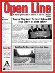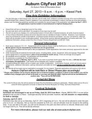
North College Street Historic District Interactive Map - City of Auburn
North College Street Historic District Interactive Map - City of Auburn
North College Street Historic District Interactive Map - City of Auburn

Create successful ePaper yourself
Turn your PDF publications into a flip-book with our unique Google optimized e-Paper software.
Inventory <strong>of</strong> October 19, 1978 (prior to National Register designation, Old Main and Church <strong>Street</strong><br />
<strong>Historic</strong> <strong>District</strong>) Note: all <strong>of</strong> the properties in the <strong>North</strong> <strong>College</strong> <strong>Historic</strong> <strong>District</strong> lie within the<br />
boundaries <strong>of</strong> the Old Main and Church <strong>Street</strong> <strong>District</strong> which is slightly larger than the locally<br />
designated <strong>North</strong> <strong>College</strong> <strong>Historic</strong> district. The National Register district includes several additional<br />
properties along Bragg Avenue, Warrior Court, the West side <strong>of</strong> Gay <strong>Street</strong> and an additional property<br />
on Gay street south <strong>of</strong> the railroad tracks.<br />
The Old Main and Church <strong>Street</strong> Architectural-<strong>Historic</strong> <strong>District</strong>, containing some seventeen<br />
architecturally and historically significant buildings, is bonded by a pr<strong>of</strong>usion <strong>of</strong> planting and<br />
trees, and a commonality <strong>of</strong> scale and material – wood painted white. Dating from the midnineteenth<br />
century, these structures reflect significant periods <strong>of</strong> <strong>Auburn</strong>’s development. There<br />
is a variety <strong>of</strong> buildings in the district. These are united by the contrast created by the<br />
juxtaposition <strong>of</strong> the solidity <strong>of</strong> the severe Greek Revival structures and the diversity <strong>of</strong> the wellarticulated<br />
multigabled “Victorian” buildings.<br />
The Old Main and Church <strong>Street</strong> <strong>District</strong> has a dual significance — architectural and historic.<br />
<strong>Historic</strong>ally, the district is important for its association with the development <strong>of</strong> <strong>Auburn</strong> from<br />
the agrarian days <strong>of</strong> the Creek Indians and early planters to the present day educational and<br />
economic community. Since the mid-nineteenth century the University has been a significant<br />
influence in the economic and educational growth <strong>of</strong> the Southeast. The district housed many <strong>of</strong><br />
the school’s early leaders, as well as other persons whose contributions to the state, region, and<br />
nation have been historically important. The architectural character <strong>of</strong> the district reflects and<br />
juxtaposes the taste and life style <strong>of</strong> distinct groups <strong>of</strong> people who, at different periods in the<br />
town’s growth comprised a significant portion <strong>of</strong> its cultural and economic base. The buildings<br />
were constructed between 1848 and 1927; within a single century the economic power base <strong>of</strong><br />
the community shifted from the strict authoritarian structure <strong>of</strong> the plantation period, so closely<br />
reflected in the severe and simple lines <strong>of</strong> the Greek Revival style, to the post-Civil War breakup<br />
<strong>of</strong> the old economic and social system represented by the fragmentation characteristic <strong>of</strong> the<br />
Victorian style.<br />
<strong>Auburn</strong>, Alabama, was originally land owned by the Creek Indian Nation. The Creeks ceded<br />
their land to the federal government in 1832. Indians were allowed to claim tracts <strong>of</strong> land; these<br />
tracts were later obtained by the white settlers, and the town <strong>of</strong> <strong>Auburn</strong> was incorporated in<br />
1836.<br />
<strong>Auburn</strong> was the site <strong>of</strong> a pair <strong>of</strong> nineteenth century academies for Sons and daughters <strong>of</strong> area<br />
planters and religious leaders. In 1856 the East Alabama Male <strong>College</strong> (now <strong>Auburn</strong> University)<br />
was established in <strong>Auburn</strong> as one <strong>of</strong> the first colleges chartered by the state <strong>of</strong> Alabama. The<br />
school became the state’s land grant college in 1872 (at that time it was renamed the<br />
Agricultural and Mechanical <strong>College</strong> <strong>of</strong> Alabama). The college assisted in making the state’s<br />
languishing agriculture more pr<strong>of</strong>itable and thus played a very significant role in resuscitating<br />
the state’s economy, which had been all but destroyed by the Civil War. Closely associated with<br />
the development <strong>of</strong> the University were those academic leaders and their students who lived in<br />
the area now designated the Old Main and Church <strong>Street</strong> Architectural- <strong>Historic</strong> <strong>District</strong>.<br />
The Old Main and Church <strong>Street</strong> <strong>District</strong> contains some 52 structures, the bulk <strong>of</strong> which date<br />
from 1847 to 1927 and which are significant both architecturally and historically. The<br />
juxtaposition <strong>of</strong> the Greek Revival and Victorian structures reflects <strong>Auburn</strong>’s transition from an<br />
elitist plantation population to an educational and commercial economy <strong>of</strong> the post-bellum<br />
years. A large number <strong>of</strong> modest early 20th century residences lie within the boundaries and<br />
signify the emergence <strong>of</strong> a strong middle class. Three <strong>of</strong> the earlier<br />
(Continued on next page)<br />
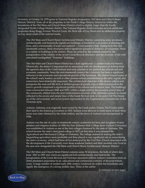
Back to <strong>Map</strong>