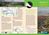
Ellesmere Extravaganza - Shropshire Walking
Ellesmere Extravaganza - Shropshire Walking
Ellesmere Extravaganza - Shropshire Walking

You also want an ePaper? Increase the reach of your titles
YUMPU automatically turns print PDFs into web optimized ePapers that Google loves.
4 Turn left into the Nature Reserve. Follow the stoned path for short<br />
distance then turn right up the earthen path through trees. Leave the<br />
reserve closing the wooden gate behind you.<br />
5 Turn left along the quiet lane to a kissing gate on the right with a<br />
signpost directing you to the visitor centre.<br />
6 Go through the gate and head towards the picnic tables.<br />
Some geologists think the Mere has a clay bottom that keeps the water in. If<br />
you punched a hole in it, all the water could drain away.<br />
7<br />
At the furthest picnic table drop down to the tarmac path, leading<br />
you to a kissing gate. Cross the road to the visitor centre using the<br />
crossing.<br />
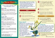
Discover<br />
<strong>Shropshire</strong><br />
<strong>Ellesmere</strong><br />
<strong>Extravaganza</strong><br />
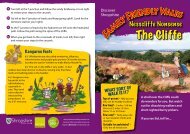
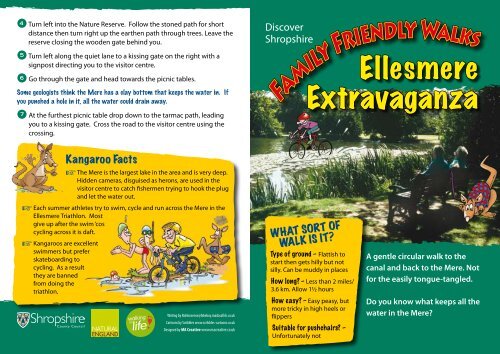
Kangaroo Facts<br />
☞ The Mere is the largest lake in the area and is very deep.<br />
Hidden cameras, disguised as herons, are used in the<br />
visitor centre to catch fishermen trying to hook the plug<br />
and let the water out.<br />
☞ Each summer athletes try to swim, cycle and run across the Mere in the<br />
<strong>Ellesmere</strong> Triathlon. Most<br />
give up after the swim ‘cos<br />
cycling across it is daft.<br />
☞ Kangaroos are excellent<br />
swimmers but prefer<br />
skateboarding to<br />
cycling. As a result<br />
they are banned<br />
from doing the<br />
triathlon.<br />
Writing by NoNonsense@bikeboy.madasafish.co.uk<br />
Cartoons by Scribbles www.scribbles-cartoons.co.uk<br />
Designed by MA Creative www.macreative.co.uk<br />
WHAT SORT OF<br />
WALK IS IT<br />
Type of ground – Flattish to<br />
start then gets hilly but not<br />
silly. Can be muddy in places<br />
How long – Less than 2 miles/<br />
3.6 km. Allow 1½ hours<br />
How easy – Easy peasy, but<br />
more tricky in high heels or<br />
flippers<br />
Suitable for pushchairs –<br />
Unfortunately not<br />
A gentle circular walk to the<br />
canal and back to the Mere. Not<br />
for the easily tongue-tangled.<br />
Do you know what keeps all the<br />
water in the Mere
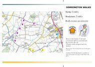
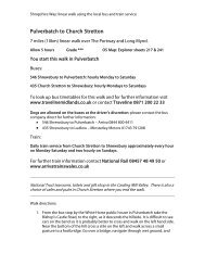
Finding the start<br />
Start at the Mere Visitor Centre,<br />
<strong>Ellesmere</strong>. There is ample pay<br />
and display parking nearby.<br />
<strong>Ellesmere</strong> is thought to have been<br />
named by the Saxons who called<br />
it ‘Aelsmere’ or ‘great lake.’<br />
Imaginative lot the Saxons.<br />
Start 1 With the Mere<br />
on your left, walk back along the road passing the Moors<br />
car park. Cross the grass at the far end of the car park<br />
B5068<br />
where you will see a finger post that directs you to canal<br />
ELSON<br />
towpath. Cross over the road, taking care as this road is<br />
busy.<br />
S C OTLAN D<br />
GRANGE ROAD<br />
R OAD<br />
The Moors is all that’s left of a big bog that had been here since the end of the last<br />
Ice Age. Two hundred years ago the canal builders cut through and drained it. They<br />
dumped the soil in the Mere to make Eleanor’s Island.<br />
2<br />
Follow the path<br />
to the <strong>Shropshire</strong><br />
Union Canal and<br />
turn right along the<br />
tow path.<br />
This bit of the <strong>Shropshire</strong><br />
Union Canal is called the<br />
Llangollen Branch. It links to<br />
the Montgomery Canal and<br />
runs into Wales. It takes<br />
years of practice to say<br />
Llangollen. The double L sounds like ‘chl.’ Try saying it without drowning in dribble<br />
(chlan-gochlen).<br />
3<br />
Leave the canal and turn right along the path signposted ‘Visitor<br />
Centre, Car Parks, The Mere.’ Follow the path over the boardwalk.<br />
H<br />
I<br />
STREET<br />
G H S T R E E T<br />
DIKSMUIDE DRIVE<br />
A528<br />
A495<br />
C R O S S<br />
S T R E E T<br />
TALBOT S T R E E T<br />
ST J O H N ’ S H I LL<br />
BIRCH<br />
Canal Wharf<br />
Dismantled Railway<br />
Playground<br />
R O A D<br />
PINFOLD LANE<br />
SWAN HILL<br />
Church<br />
I L L<br />
H<br />
CHU R C H<br />
S ANDY LANE<br />
Marina<br />
Cremorne<br />
Gardens<br />
CHURCH STR EET<br />
Motte &<br />
Bailey<br />
Castle<br />
Field<br />
<strong>Shropshire</strong> Wildlife Trust<br />
Nature Reserve<br />
SHROPSHIRE UNIO N C A N A L<br />
Crown Copyright. All rights reserved. <strong>Shropshire</strong> County Council 100019801. 2008<br />
Towpath<br />
The Mere<br />
Mere Visitor Centre<br />
START<br />
The Boat House<br />
Picnic<br />
A495<br />
Mereside Farm<br />
The Crimps<br />
Toilets<br />
Boat House<br />
Moors Car Park<br />
To explore more of <strong>Shropshire</strong>’s landscape and to find out more about its people, nature and history go to www.discovershropshire.org.uk