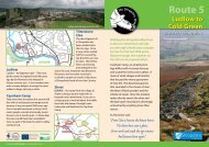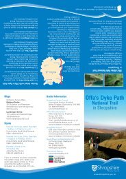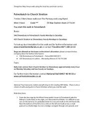
473KB - Shropshire Walking
473KB - Shropshire Walking
473KB - Shropshire Walking

Create successful ePaper yourself
Turn your PDF publications into a flip-book with our unique Google optimized e-Paper software.
D<br />
E<br />
F<br />
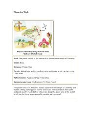
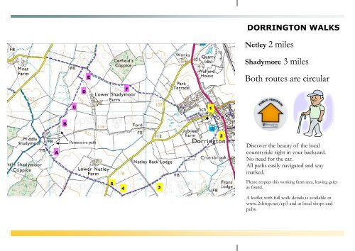
DORRINGTON WALKS<br />
Netley 2 miles<br />
Shadymore 3 miles<br />
Both routes are circular<br />
C<br />
1<br />
B<br />
2<br />
A<br />
Permissive path<br />
Discover the beauty of the local<br />
countryside right in your backyard.<br />
No need for the car.<br />
All paths easily navigated and way<br />
marked.<br />
5<br />
4<br />
3<br />
Please respect this working farm area, leaving gates<br />
as found.<br />
A leaflet with full walk details is available at<br />
www.2shrop.net/cp3 and at local shops and<br />
pubs.
Netley walk 2 miles<br />
1. Start by Dorrington church and<br />
walk back towards the A49. Follow<br />
the path on the right 20yds before<br />
you get the main road.<br />
2. Go through the kissing gates, on<br />
reaching the Horseshoes Pub turn<br />
right over stile into field.<br />
3. Follow the way marker signs:<br />
<br />
<br />
<br />
<br />
<br />
Diagonally over first field<br />
Around hedge of next two fields<br />
Over next well marked field to<br />
gate<br />
Over hedge stile into Netley Hall<br />
access road.<br />
And go straight over this private<br />
road.<br />
4. Go straight over this field to a stile<br />
with lots of way marks. Turn right<br />
and proceed 80yds to the<br />
Picklescott Road.<br />
If you want to extend the walk to<br />
Shadymoor, then follow the<br />
instructions opposite.<br />
Otherwise....<br />
5. Return to Dorrington along this<br />
road.<br />
A lovely 2 mile walk!<br />
Shadymoor walk 3 miles including<br />
first part of Netley walk — numbers 1 to 4<br />
opposite<br />
A. Cross over the Picklescott road<br />
instead of turning right. Pass over 4<br />
fields, following the yellow way<br />
markers. Just before a stream please<br />
go through a gate on the right<br />
marked with a ‘permissive path’<br />
marker. (Middle Shadymoor Farm<br />
would prefer the use of the<br />
permissive path rather than going<br />
through the farm. Routes to Moat<br />
and Upper Shadymoor farms are still<br />
straight on, fording the stream.)<br />
B. Go diagonally across the field over 2<br />
stiles crossing the farm access road<br />
(Not a public right of way)<br />
C. Keep the fence on your left. Ignore<br />
the footpath bridge, go straight on.<br />
D. Follow the way marks over the next<br />
2 fields to a four-way footpath sign.<br />
E. Following the farm track initially by<br />
turn right and then along the hedge.<br />
F. Now look ahead and head for<br />
Dorrington Church, (you can see the<br />
spire from here).<br />
This leaflet was produced by the<br />
Condover Parish Paths Partnership<br />
Group.<br />
The Condover Parish Paths Partnership<br />
group are volunteers working<br />
under the direction of the Parish<br />
Council and <strong>Shropshire</strong> Council to<br />
maintain and improve footpaths in<br />
the area. The area consists of the parishes<br />
of Condover, Dorrington, Ryton<br />
and Stapleton.<br />
You can contact us by the following<br />
methods...<br />
Telephone the group co-ordinator<br />
Russell Collard, 01743 718194<br />
E-mail him:<br />
russellcollard101@hotmail.com<br />
Why not visit our web site for more<br />
details and for more walk descriptions<br />
and leaflets you can download and<br />
print for free.<br />
www.2shrop.net/cp3