Full Feasibility Study Report - Far North District Council
Full Feasibility Study Report - Far North District Council
Full Feasibility Study Report - Far North District Council

You also want an ePaper? Increase the reach of your titles
YUMPU automatically turns print PDFs into web optimized ePapers that Google loves.
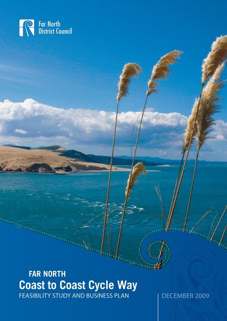
Coast to Coast Cycle Way<br />
FAR NORTH<br />
FEASIBILITY STUDY AND BUSINESS PLAN DECEMBER 2009
Table of Contents<br />
1.0 Executive Summary . . . . . 4<br />
2.0 Introduction . . . . . . 7<br />
3.0 The Experience . . . . . 8<br />
FEASIBILITY STUDY<br />
4.0 Engineering Introduction . . . . 12<br />
5.0 Engineering Methodology . . . . 13<br />
6.0 Trail Specification . . . . . 14<br />
7.0 Route Description and Land Ownership . . 16<br />
8.0 Major Structures and Works . . . . 20<br />
9.0 Statutory Approvals and Assessment of Effects . 22<br />
10.0 Construction and Maintenance . . . 23<br />
11.0 Design and Construction Cost Estimates . . 25<br />
12.0 Community Consultation . . . . 26<br />
13.0 Telecommunications . . . . . 28<br />
BUSINESS PLAN<br />
14.0 Project Plan . . . . . . 30<br />
15.0 Project Schedule . . . . . 33<br />
16.0 Marketing Strategy . . . . . 34<br />
17.0 Organisation Plan . . . . . 43<br />
17.1 Organisational Structure . . . 43<br />
17.2 Key Roles and Responsibilities . . 43<br />
18.0 Contracting and Procurement Plan . . . 44<br />
19.0 Consultation and Stakeholder Management . . 45<br />
20.0 Quality Assurance Plan . . . . 48<br />
21.0 Funding Sources . . . . . 49<br />
22.0 Risk Management . . . . . 50<br />
23.0 Benefit Realisations . . . . . 51<br />
23.1 Cost and Benefits Summary . . . 55<br />
24.0 Governance Structure and Partnerships . . 58<br />
25.0 Significant issues to be resolved . . . 60<br />
26.0 Community Support . . . . . 61<br />
27.0 Appendices . . . . . . 62
1.0 Executive Summary<br />
This document lays out a ‘once in a lifetime’ opportunity for central government to substantially<br />
contribute to the social and economic and cultural well‐being of the <strong>Far</strong> <strong>North</strong>. Not often does such<br />
an opportunity present itself, where government can fund the development of a tourist asset and in<br />
doing so:<br />
• make a significant contribution to the economic development in an area of New Zealand<br />
which is generally classified as being in the lower socio economic category<br />
• empower the local communities (being at least being 50% Maori) to work together with<br />
<strong>Council</strong> to create ongoing local employment and income<br />
• deliver a unique visitor experience for both overseas visitors and New Zealanders alike in<br />
terms of the rich cultural values of the <strong>North</strong> and the undisputed significance of the area in<br />
New Zealand history<br />
whilst at the same time being a highly efficient and sustainable return on funds invested.<br />
1. Creating a fantastic visitor experience<br />
The <strong>Far</strong> <strong>North</strong> 85.6 km coast to coast cycleway will be different to other cycleways in New<br />
Zealand. <strong>North</strong>land is known as ‘the birthplace of our nation’ and it is steeped in history and<br />
natural beauty. The cycleway will be world‐class, delivering:<br />
- stunning and varied natural scenery, marketed east coast to west coast;<br />
- stories of the area, its history and personal Maori cultural experiences;<br />
- welcoming and willing communities;<br />
- an assortment of quality accommodation, from backpackers to luxury;<br />
- consistent signage, clear information and interpretation; and<br />
- an experience that will last a life time.<br />
One of the highlights and unique features will be a trail of Pou<br />
Pou, which progressively tells a story along the cycleway. These<br />
carved wooden statues (made from local trees) bring to life the<br />
stories of the landscapes and the local people. As cyclists pedal<br />
alongside lakes and through the countryside they have the<br />
opportunity to discover and meet with locals, families and<br />
communities and learn about the customs and traditions of<br />
Ngapuhi, New Zealand’s largest confederation of tribal groups.<br />
(Concept drawing only.)<br />
2. Community support<br />
Community support for this project is wide and encompassing. It has captured the imagination of<br />
local people (from all backgrounds) and there is great enthusiasm to see the track built. The<br />
cycleway has become a catalyst to better connect communities and open further dialogue. The<br />
<strong>Council</strong>, Western and Eastern Community Boards are champions of this project and are keen to<br />
support its development in whatever way they can.<br />
4
3. Agreement of landowners<br />
The trail traverses through private land (Okaihau – Horeke), a rail corridor managed by Ontrack<br />
and in places, the roading system.<br />
Agreement in principle has been received from the key private landowners affected by the<br />
proposed route. There are a couple of minor sections where the landowner is still considering<br />
the idea, however, as there are alternative options this would not compromise the overall<br />
cycleway project.<br />
There are 27 lease/license holders along the rail corridor. All parties have been communicated<br />
with. There will need to be further discussion about easement arrangements, once it has been<br />
confirmed how these will be handled. Ontrack fully support the concept and acknowledge that<br />
the cycleway would have preference. There is a willingness to achieve mutually beneficial<br />
arrangements with current land users.<br />
Use of the roading system does not raise any serious issues.<br />
It should be noted that the He Whakaputanga o te Rangatiratanga o Niu Tireni Waitangi Tribunal<br />
Hearings commence in March 2010. There are claims over the rail corridor. No land will change<br />
hands as a result of the cycleway and it is anticipated that any negotiations would continue in the<br />
usual way.<br />
4. Ownership and Economic Viability<br />
It is proposed that the track will ultimately be owned by <strong>Council</strong> and be managed by a <strong>Council</strong><br />
Owned Charitable Trust. The <strong>Council</strong> will initially lead development of the track and once a<br />
Governance Group is in place, they will take on the responsibility of asset management, strategic<br />
direction and upkeep. Commercial operator/s would be contracted to maintain and operate the<br />
track.<br />
A website, developed in association with other cycleways, would provide information and a<br />
booking system, maintained with 5% of gross income. Projected operating costs and income<br />
show the Governance Group operating with a profit within four years.<br />
The national cycleway concept began as a means to improve economic circumstances and the<br />
economic benefits, particularly for <strong>Far</strong> <strong>North</strong> Maori, are encouraging. About 75 people would be<br />
employed directly in the development of the track with about 20 – 30 of these people being<br />
Work and Income clients. Once the track is opened a minimum of 50 jobs will be created within<br />
the first year.<br />
Accumulative cash flow directly from the cycleway into the community over five years is<br />
estimated to be $28m inclusive of GST.<br />
Private Enterprise/<strong>Far</strong> <strong>North</strong> Community Development Economic Investment<br />
ITEM<br />
AMOUNT<br />
Cycleway construction $13,000,000<br />
Development of hospitality facilities (over 5 years) $1,500,000<br />
Construction of accommodation (over 5 years) $3,750,000<br />
Cyclist spend (over five years) $24,639,880<br />
Trail maintenance (over five years) $634,375<br />
Total direct spend (exclusive of GST) $43,524,255<br />
5
5. Funding of the cycleway development<br />
It is imperative that the entire cycleway be built (not just the 14 kilometres of ‘Quick Start’ from<br />
Okaihau to Kaikohe) to ensure that the <strong>Far</strong> <strong>North</strong> reaps the many potential benefits. There are<br />
currently severe budget restraints within the <strong>Far</strong> <strong>North</strong> <strong>District</strong> <strong>Council</strong> and limited access to<br />
funding avenues in the <strong>Far</strong> <strong>North</strong>. To achieve full track development 100% government<br />
investment will be required. Ongoing costs can be met locally and the initial investment from<br />
central government is expected to be a one off grant.<br />
The cycleway is not marketable unless it runs coast to coast and includes at least one night’s stay<br />
in between. It would be irresponsible to start a project without the guarantee of being able to<br />
complete it. Building the track in stages is not feasible as the two day ride is not marketable<br />
until completed.<br />
The total investment to construct the cycleway is estimated to be $13,219,847m.<br />
This is broken down as follows:<br />
Overall project management $60,000<br />
Design and construction of Kawakawa to Horeke $9,671,016<br />
Vintage Railway upgrade $3,298,831<br />
Pou Pou construction $150,000<br />
Community Consultation $20,000<br />
Other consultants $20,000<br />
TOTAL $13,219,847<br />
The <strong>Far</strong> <strong>North</strong> is a district rich in people, culture and history, however, parts of the whole struggle to<br />
make their way forward. Central government has provided an opportunity for small communities to<br />
enjoy rich rewards and many social benefits through the opportunity to create an outstanding visitor<br />
experience via the national cycleway concept.<br />
This is a worthwhile investment. Local people (and <strong>Council</strong>) are ready and willing to get on with it in<br />
the interests of helping themselves and encouraging their rural communities to prosper. With<br />
Government support, a coast to coast cycleway can be a reality and will help get the <strong>Far</strong> <strong>North</strong><br />
cycling in the right direction.<br />
6
2.0 Introduction<br />
The <strong>Far</strong> <strong>North</strong> <strong>District</strong> <strong>Council</strong> (FNDC) is delighted to be involved in this ‘quick start’ project and to<br />
have led the feasibility process on behalf of its communities. It believes that the potential benefits<br />
are significant and that the development of the cycleway will be a catalyst for other opportunities to<br />
further enrich the area. A number of economically challenged smaller rural communities are<br />
positioned to enjoy some wonderful benefits when the entire route is developed.<br />
<strong>Council</strong> has indicated strong support in principle and recognises the positive impacts this project<br />
would have on local communities. However, in order to meet government timeframes, <strong>Council</strong> has<br />
not formally considered this project. Subject to further discussion with Government in the New<br />
Year, this would be achieved in early 2010.<br />
The contract was received by <strong>Council</strong> in mid October 2009 and work was formally commenced on<br />
developing the feasibility study. On request from central government, <strong>Council</strong> has additionally<br />
included a high level business plan. Both follow the Stage Two guidelines. The two guidelines have<br />
a number of similar information requests. To save repetition, this report has been split into two key<br />
sections, the feasibility study and the business plan. Where information crosses both sections it has<br />
been covered in the most appropriate area, e.g. ‘Assessment of Economic Costs and Benefits’<br />
requested in the feasibility study is now covered in Benefit Realisations in the business plan.<br />
The business plan has been developed at a high level and outlines a suggested process for<br />
developing and operating the cycleway. Initially the business plan will need to be further scoped<br />
and then implemented by the <strong>Far</strong> <strong>North</strong> <strong>District</strong> <strong>Council</strong> as it proceeds in developing the track. On<br />
formation of a Governance Group, the business plan will then become the responsibility of this<br />
group and they will then need to fine tune it once they have clarified their strategic direction.<br />
The <strong>Far</strong> <strong>North</strong> Coast to Coast Cycleway was identified by Prime Minister John Key as one of the<br />
seven initial National Cycleway ‘quick start’ projects, at the Local Government NZ annual conference<br />
in Christchurch in July 2009. This feasibility study looks at linking the two coasts, the port of Opua in<br />
the east to Horeke, a settlement in the inner harbour of the Hokianga. The ‘quick start’ section of<br />
the project is along a rail corridor linking Kaikohe and Okaihau. It has become quite clear that to<br />
enjoy the many benefits of the cycleway, the entire route will need to be built.<br />
The earlier interest in the use of the rail formation for walking and riding evolved from the Western<br />
Community Board seeking to open the length between Kaikohe and Okaihau and with casual users<br />
between Moerewa and Kawakawa (championed by the Eastern Community Board). These Boards<br />
have been working on developing these walking tracks for approximately 18 months, prior to the<br />
government announcement.<br />
The Coast to Coast Cycleway has a total distance of 85.6km, comprising 71.8km of cycle track plus<br />
the 11.5km rail journey to Opua and walkway. Approximately 47 kilometres of this proposed route<br />
is on a railway corridor, under government ownership and managed by Ontrack. The balance of the<br />
route is either under the Bay of Islands Vintage Rail or runs through private land and on public road.<br />
The feasibility study has been co‐ordinated by a Project Manager under the leadership of the<br />
<strong>Council</strong>. A number of sub contractors were brought onboard to complete the different<br />
requirements needed to provide a comprehensive report. Please see Appendix One for<br />
acknowledgements.<br />
7
3.0 The Cycling Experience<br />
DAY ONE<br />
The journey begins in the picturesque<br />
community of Opua (once a port). The end of<br />
the railway can still be seen on the wharf.<br />
From here you meander your way to the train<br />
terminus (to be built) and catch the steam<br />
train to Kawakawa, where you can visit the<br />
quirky Hundertwasser toilets and enjoy a good<br />
cup of coffee.<br />
From Kawakawa, you bike through some beautiful rural<br />
landscapes, enjoying peaceful vistas and interacting with<br />
nature. The area is steeped in history and offers a<br />
variety of backdrops, from bustling towns to farm land<br />
and native bush.<br />
The Kaikohe area will host the overnight stay. There is a<br />
range of accommodation and hospitality outlets,<br />
including historic B&B’s, Marae and hotels/motels.<br />
8
DAY TWO<br />
After enjoying a hearty breakfast, the day begins with a<br />
gentle journey from Kaikohe, through a tunnel and<br />
alongside Lake Omapere to the historic village of Okaihau.<br />
The area is once again steeped in history and there are<br />
many wonderful stories to be told about the lake.<br />
Travelling down through the stunning Utakura Valley you arrive<br />
at Horeke on the west coast. Here you can enjoy the afternoon<br />
from the Horeke Tavern balcony with a cold beer, then either<br />
catch a lift back to your car or board a boat to the south<br />
Hokianga and take the opportunity to view Tane Mahuta.<br />
9
OTHER PLACES OF INTEREST<br />
(Photos courtesy of Destination <strong>North</strong>land, Taiamai Tours & Jenny Atkins)<br />
10
<strong>Feasibility</strong><br />
<strong>Study</strong><br />
11
4.0 Engineering Introduction<br />
Local engineers, Haigh Workman, along with Thomson Survey Ltd, tendered and were awarded the<br />
contract to complete the engineering, surveying and planning requirements of the feasibility study.<br />
Seven specialist technical reports were written for the <strong>Feasibility</strong> <strong>Study</strong>/Business Plan <strong>Report</strong>. Two<br />
of these technical reports have been absorbed into this lead document. The balance accompanies<br />
this document. Following is a list of the detailed information provided in the specialist technical<br />
reports. All of these documents will refer to the book of plans (Plan Book) which provides a visual<br />
presentation of the information contained in the technical reports.<br />
The Technical <strong>Report</strong>s (TR) cover:<br />
• TR 1 Summary <strong>Report</strong><br />
Absorbed in lead document.<br />
• TR 2 Route Selection and Trail Formation Construction:<br />
This report details track surface and construction type, road crossing points, fences and<br />
gates, land requirements and conditions, construction method, and a schedule of estimated<br />
costs.<br />
• TR 3 Bridges and minor Track Structures:<br />
<strong>Report</strong> detailing where and what type of bridges and track support structures are required,<br />
with cost estimates.<br />
• TR 4 Consultation Strategy:<br />
Absorbed in lead document.<br />
• TR 5 Planners <strong>Report</strong> & AEE:<br />
This report identifies consents required under RMA and the approach to be taken for<br />
resource consenting. It provides an Assessment of Environmental Effects for use in<br />
subsequent resource consent applications.<br />
• TR 6 Ecological Assessment:<br />
A terrestrial ecology assessment of the proposed route alignment, with greater emphasis on<br />
the sections where new formation is required (Okaihau to Horeke) and areas where there<br />
may be more sensitive ecology.<br />
• TR 7 Toilets & Shelters:<br />
<strong>Report</strong> detailing the locations and types of toilets and shelters required, with estimated<br />
costs.<br />
• TR8 – Archaeological Assessment:<br />
<strong>Report</strong> with greater emphasis on the sections where new formation is required (Okaihau to<br />
Horeke).<br />
12
5.0 Engineering Methodology<br />
The base route information for this study was provided to the engineers by:<br />
- FNDC (aerial photo maps and landowner information),<br />
- Ontrack,<br />
- Bay of Islands Vintage Rail Trust.<br />
The proposed route is in two key sections:<br />
1. Old Railway corridor (Opua to Okaihau)<br />
The entire rail formation route was inspected on foot and filmed from a helicopter.<br />
At the site walkover, assessment was made of;<br />
- the state of the track formation,<br />
- culverts and bridges,<br />
- access from public roads,<br />
- existing facilities,<br />
- typical fencing and vegetation cover.<br />
From those assessments and filming the engineers were able to develop construction/rehabilitation<br />
requirements and costs. GPS waypoints were taken along the route.<br />
2. “Greenfield” section (Okaihau to Horeke)<br />
The assessment looked at options for the Horeke ‐ Utakura Valley area, which were suggested by a<br />
number of landowners. All options north and east of the Horeke Road ‐ Cook Road intersection<br />
were abandoned after preliminary helicopter and on‐road assessment because of slope, length and<br />
unstable ground. Some options for the western escarpment to the Okaihau volcanic plateau were<br />
eliminated after site inspections and landowner consultation.<br />
The final preferred route resulted from a series of site visits, reviews of helicopter video film,<br />
discussions with landowners and desk top studies by appropriate technical staff. Reference was<br />
made to “Quickmap” and “Google Earth” information.<br />
Selection was made on the basis of gradient, ease of construction, land tenure and ambiance.<br />
13
6.0 Trail Specification<br />
At this stage of the track investigation, the trail surface is to follow the DoC developed “Track<br />
Construction and Maintenance Guidelines” (July 2008), which is considered to be a useful guidance<br />
document.<br />
The trail grade for the proposed <strong>Far</strong> <strong>North</strong> Cycleway is Grade 1 – 2. There is a steep area of 100m<br />
that is 20% or 12 o . This is one of the reasons why the cycleway will be promoted to ride east to<br />
west, as it means you will travel down the hill.<br />
The track types following are preferred by the Ministry of Tourism and are illustrated in the Plan<br />
Book as follows:<br />
Trail Type<br />
Type 1<br />
Type 2<br />
Type 3<br />
Type 4<br />
Type 5<br />
Type 6<br />
Type 7<br />
Details<br />
Trail on existing road (either sealed or unsealed)<br />
Trail on former railway embankment in good condition<br />
Trail on former railway with surface deterioration<br />
Trail on weak sub‐grade (such as soft clay, peat, deep river silt)<br />
Trail over weak, swampy ground<br />
Trail cut into side‐sloping ground<br />
Roadside berm or shoulder of highway<br />
The pavement structure is to comprise;<br />
- confirmation of stability/strength of the base,<br />
- 150mm compacted GAP 40 basecourse,<br />
- 50 mm compacted GAP 20 surface layer.<br />
Track width is generally 2.5 metres minimum, reducing a little for timber deck stretches and for<br />
short distances across more difficult country.<br />
Recommended car parking areas are indicated on the route plans and shown in more detail in the<br />
Plan Book. They will typically require vegetation removal, a minimum of 150mm compacted base<br />
course, AP20 surfacing and edge drainage.<br />
Toilets and shelters are indicated at not greater than 1.0 hour intervals.<br />
Safety barriers (hand rails) on raised structures, are to be 1.4m high.<br />
Technical <strong>Report</strong> 2 refers to several published track construction standards and describes the<br />
desirable geometric (width, gradient) guidelines adopted here.<br />
The following diagram provides a cross section of the cycleway.<br />
14
7.0 Route Description and Land Ownership<br />
The Technical <strong>Report</strong>s 2 and 5 and Plan Book provide full details of route description and land<br />
ownership details. This should be referred to in that it meets all requirements of the <strong>Feasibility</strong><br />
<strong>Study</strong> guidelines. Following is a summary of the key information.<br />
OVERVIEW OF PROPOSED ROUTE<br />
ROUTE INFORMATION<br />
<strong>Far</strong> <strong>North</strong> <strong>District</strong> <strong>Council</strong> provided aerial photography (digitally) including contours and property<br />
boundaries covering the entire area.<br />
The entire proposed route is laid out on those aerial photographs in the accompanying Plan Book.<br />
The aerial photo plans show:<br />
- The route, with distance marks<br />
- Bridges (numbered by section and distance)<br />
- Tunnels<br />
- Property boundaries<br />
- Road crossings<br />
- Access points<br />
- Parking areas<br />
- Toilets<br />
- Shelters<br />
- Property owners.
ROUTE DESCRIPTION<br />
The proposed 85.6km route is from Opua to Horeke and has been split into four sections. The route<br />
goes through six smaller communities; Opua, Kawakawa, Moerewa, Kaikohe, Okaihau and Horeke.<br />
As outlined, Technical <strong>Report</strong> 2 ‘Route Selection and Track Formation’ details proposed track<br />
alignment. That report and the accompanying Plan Book are best read in conjunction with one<br />
another.<br />
The report identifies several generic types of cycleway construction based primarily on the existing<br />
use of the ground that the trail is expected to cover. The Plan Book indicates where the different<br />
types of cycleway lay using distance marks. Identifying generic trail types allows a useful cost<br />
estimate to be developed that would otherwise need to wait for a detailed engineering assessment.<br />
The report provides a narrative description of the preferred route and the rationale for selecting<br />
some alignments ahead of others. As well as the GPS distance information, the description provides<br />
a useful in‐field guide to the groups undertaking any further investigation and construction.<br />
Locations with car parking for normal cycle access to the track are identified. These are mainly at<br />
the two ends and the three intermediate segment points. Also identified are a number of locations<br />
where the cycleway touches public road between remote sections, where cycles can join or leave<br />
the cycleway – e.g. to be picked up with a damaged cycle or if caught in inclement weather.<br />
Points where the trail crosses public roads are also identified, and design solutions are suggested<br />
based on safety aspects and traffic flows. It will be important, further into the development process,<br />
to continue liaison with FNDC roading managers concerning the issues and constraints that arise<br />
where the cycleway crosses or runs alongside public roads within the road reserve. At this stage<br />
they are aware of the points of conflict and will need to approve provisions for safe crossing.<br />
The route is very picturesque and over the journey, visitors will enjoy a landscape that never<br />
remains the same for long. Starting and finishing at inner harbours on the contrasting east and west<br />
coasts, sights will include rural farming country (where the only noise will be that of the wildlife and<br />
the wind in the trees) to bustling small towns. Local Marae, a Pou Pou trail, the world famous<br />
Hundertwasser toilets and many sites of historical and cultural significance, such as old rail<br />
formations will be visible.<br />
The route goes through a macadamia nut farm, pine and native forests, alongside wetlands and<br />
rivers and past the <strong>Far</strong> <strong>North</strong>’s largest lake, Lake Omapere, an area of special significance to Maori.<br />
The trail will conclude going down through the Utakura Valley to Horeke – a very special place,<br />
relatively untouched and tranquil.<br />
BAY OF ISLANDS VINTAGE RAILWAY TRUST<br />
The train trip from Opua to Kawakawa is seen as an integral part of the cycleway. It provides a link<br />
to ensure the cycleway runs coast to coast and also provides a unique element to the journey. The<br />
railway is historically significant and dates back to the discovery of coal in Kawakawa in 1864. A<br />
bridge was built at Derrick Landing in 1881 and is still the oldest curved wooden bridge in the <strong>North</strong><br />
Island and possibly one of the oldest such bridges still functioning in the world. The iconic steam<br />
engine ‘Gabriel’ is the only engine remaining in the world of the five that were built.<br />
17
Opua – Kawakawa, 11.52km<br />
This part of the trail utilises the Bay of Islands Vintage Railway which would transport cyclists (and<br />
their bikes) between Opua and Kawakawa.<br />
Initially the trail would begin with a 1200m walk from the Opua wharf (end of the train track) to a,<br />
yet to be built, train terminus at Colenso Triangle. The journey from Opua to Kawakawa crosses 12<br />
bridges and goes through one tunnel. The track itself is currently live for 4km. Work is required to<br />
open the remaining 6.3km.<br />
Opua was a bustling port and is now a quaint, seaside community with a number of shops, a cafe,<br />
yacht club, marina, boatyard and marine industrial area.<br />
Kawakawa – Kaikohe, 33.78km<br />
This part of the route mainly follows the railway corridor and includes the townships of Kawakawa<br />
(train, Hundertwasser toilets and an ever increasing arts centre), Moerewa and Kaikohe. Maori<br />
community presence is strong and there is a good sense of community pride. All three communities<br />
will benefit from increased economic outcomes.<br />
Aside from the three townships, the majority of this route will be through farm land and forests. An<br />
operational train station is at Otiria.<br />
Kaikohe – Okaihau, 14.97km<br />
This section follows the last section of the railway corridor and includes one tunnel, ending near a<br />
second tunnel in Okaihau. The route goes around the bottom of Hone Heke Memorial and winds its<br />
way through farm land, past Lake Omapere, arriving in the small town of Okaihau.<br />
Okaihau – Horeke, 25.33km<br />
This section runs through private and public land. There are a number of Marae and it is a strong<br />
farming area. The route takes in a macadamia orchard, runs along the Waiharakeke stream and<br />
finishes at the inner Hokianga harbour. Boardwalks need to be developed and the route will run<br />
along the road corridor, next to the sealed/unsealed road. A mangrove experience is also included.<br />
PROPERTY INFORMATION<br />
Horeke – Okaihau<br />
A schedule of owners where a legal easement will be required is outlined in Technical <strong>Report</strong> 5 and<br />
also in the Plan Book. For privacy reasons we have not listed them in this main report (as it will be<br />
seen by the public). All key landowners have given consent in principle. There is a small section<br />
where the track may cross Maori land and a hui needs to be held to confirm access. However, there<br />
are no foreseen concerns as it can be moved beside the main road. There are two points where the<br />
track skirts through or runs down besides a river with riparian rights and informal discussions have<br />
been held and with landowners. Once again there are no major concerns here as there are<br />
alternative routes. Costs have been included for surveying, legal costs and compensation for land to<br />
establish the easements.<br />
18
Okaihau – Kawakawa<br />
There are 27 lease/license holders along the Ontrack rail corridor. Communications have been sent<br />
to all affected landowners, a number of discussions have been held with individual parties and<br />
landowner meetings. Formal negotiations have not being entered into at this time as clarification<br />
from Ontrack is required as to how the land may be leased and managed in the future. There are<br />
currently three options.<br />
It should be noted that every effort will be made to reach a mutually beneficial agreement with<br />
current lease/license holders. However, should there be any issues during the design phase,<br />
Ontrack has confirmed that favour will rest with the cycleway project.<br />
Kawakawa – Opua<br />
This section is leased by the Bay of Islands Vintage Railway Trust. They are fully supportive of the<br />
project. See Appendix Two.<br />
CONSULTATION<br />
Please see Section 12.0, page 24 for consultation details.<br />
TRAIL CONCLUSIONS AND RECOMMENDATIONS<br />
Ultimately, construction of the track elements of the <strong>Far</strong> <strong>North</strong> Coast to Coast Cycleway are not<br />
particularly challenging from an engineering perspective, with the exception of the section from<br />
Okaihau down into the Utakura Stream Valley.<br />
The overall challenge for the formation construction is to provide and transport gravel to the sites<br />
economically, place it and compact it to specification with minimal environmental damage affect.<br />
Some elements of the track alignment, particularly between Okaihau and Horeke, are still being<br />
refined as consultation progresses and it is recommended that the investigation continue along<br />
these lines. Once alignment is fixed, easements, consents, consultation and costing can be<br />
undertaken with more certainty.<br />
Once landowner approvals, easements, consents and concessions are granted, and NZ Rail (as the<br />
requiring authority under the <strong>District</strong> Plan designation) approval is obtained, trail development can<br />
proceed quite easily.<br />
19
8.0 Major Structures and Works<br />
Technical <strong>Report</strong>s 2, 3 and 7 provide detailed information on major structures. Key points<br />
follow.<br />
TRACK FORMATION<br />
For the length of the existing rail corridor, the works comprise;<br />
- clearing vegetation,<br />
- repairing soft areas,<br />
- overlaying compacted basecourse and<br />
- smoothing compacted running course.<br />
For the new section between Okaihau and Horeke, the work involves,<br />
- road edge treatment/widening,<br />
- construction of timber cycleway,<br />
- earthwork formation of new track across pastoral land,<br />
- fencing, gates, stock‐gates.<br />
Total earthworks proposed are 63,628 m 3 .<br />
BRIDGES AND STRUCTURES<br />
The ‘Bridges and minor Structures’ Technical <strong>Report</strong> 3 identifies the engineering standards to which<br />
the cycleway structures need to conform, in keeping with the Otago Central Rail Trail and others. A<br />
schedule of the generic type of structure to be used, similar to that developed by MWH for the<br />
Round the Mountain Trail, is described and the report also describes the costing method for each<br />
type of structure for this preliminary stage, based on experience with a range of bridge projects,<br />
with modifying factors based on knowledge of this project and its terrain etc.<br />
Overall, the structural work is expected to include;<br />
- bridge refurbishment (17 bridges) mostly repainting steel beams and building new decks &<br />
safety rails,<br />
- new timber or steel bridges (12 bridges),<br />
- 440m of raised board walk with safety barriers.<br />
- tunnel repairs (Opua)<br />
- amenity lighting at the tunnel (Kaikohe)<br />
Several culverts and modifications to two existing public road vehicle bridges are also required to<br />
accommodate cyclists. Most structures will be designed to carry a quad‐bike type vehicle, with<br />
driver and load, to allow for access for construction and maintenance. It appears that no bridges will<br />
be required to carry quarry trucks for aggregate delivery, provided sufficient access points and truck<br />
turning bays can be formed at convenient intervals.<br />
In accordance with the brief for this feasibility report, detailed engineering assessment of each<br />
bridge has not been undertaken, but field data has been collected to enable us to provide an<br />
appropriate level of accuracy for cost estimations.<br />
The main field of uncertainty is the condition of existing structures and foundations particularly<br />
along the old railway corridor, where all bridges have deteriorated to some extent and many have<br />
had decking and even beams removed. A detailed assessment will be required at the next stage.<br />
Building consents will be required for every bridge for decks and safety barrier construction.<br />
20
Approximately 70% of the costs will be within the 40km section of disused track between Otiria and<br />
Mangakahia Road. The remaining 30% is associated with two bridges between Kaikohe and Okaihau<br />
and for new bridges and culverts down the Utakura Valley and across the flats to Horeke.<br />
TOILETS<br />
The wastewater report details proposed toilet locations and types based on expected wastewater<br />
volume, locations, ground conditions and terrain. In summary it is anticipated that six new toilets<br />
will need to be installed along the route, and this is in addition to the seven toilets already<br />
established and operating in townships along the trail.<br />
At the early stages of the cycleway development, it is anticipated that all the new toilets developed<br />
will need to be waterless – these are either containment or pit toilets, depending primarily on likely<br />
degree of use and the surrounding soils and terrain. As the trail develops over time, and other<br />
facilities such as cafes are established, these waterless units will be replaced by flush toilets<br />
operating with a septic tank or secondary treatment plant.<br />
SHELTERS<br />
Shelters should be located at approximately 5km intervals. While the weather is not commonly very<br />
cold, it can change to heavy rainfall quite quickly, so providing shelter becomes appropriate. Where<br />
suitable, we have indicated shelter positions near to the toilet locations. The recommended<br />
locations are listed in Section 3.1 of the Toilet & Shelters <strong>Report</strong> and are shown in the Plan Book.<br />
CAR AND BIKE PARKS<br />
The main car parks (with bike parking) will be at Opua, Kawakawa and Horeke. Minor car parks will<br />
be at Kaikohe and Okaihau.<br />
Opua<br />
- Casual street side parking in township<br />
- Opportunity for secure parking via commercial operator<br />
- Metalled parking area is proposed for the Train terminus at Colenso Corner.<br />
Kawakawa<br />
- Some roadside parking at the railway station<br />
- An area can be set aside near the station for a commercial operator<br />
Horeke<br />
- Wharf/hotel parking area<br />
- Community hall parking area<br />
- Opportunity to develop secure parking via commercial operator<br />
Kaikohe<br />
- Plenty of casual parking<br />
- A metalled carpark could be formed<br />
Okaihau<br />
- Adequate casual parking available.<br />
21
9.0 Statutory Approvals and Assessment of Effects<br />
A thorough investigation has taken place to ensure that all statutory requirements are allowed for.<br />
The very comprehensive Technical <strong>Report</strong> 5 – ‘Planners <strong>Report</strong> and AEE” deals with Resource<br />
Consent requirements and Assessment of Environmental Effects (AEE), with reference to<br />
consultation undertaken for Resource Consent purposes.<br />
Consents are required from the <strong>Far</strong> <strong>North</strong> <strong>District</strong> <strong>Council</strong>, <strong>North</strong>land Regional <strong>Council</strong>, and<br />
authorities from the New Zealand Historic Places Trust, to establish, operate and maintain the<br />
proposed cycleway. Overall the proposed development is a non‐complying activity, which will need<br />
to be notified.<br />
The study includes an assessment of environmental effects that draws on Technical <strong>Report</strong>s 6<br />
(Ecological assessments) prepared by NZ Environmental and Technical <strong>Report</strong> 8 (Archaeological)<br />
prepared by <strong>North</strong>ern Archaeology.<br />
These series of reports are submitted in a form that, with minor modifications, will be suitable for<br />
submission with the necessary consent application documents.<br />
Building Consent will be required for all bridge “construction”, including for new timber decks to be<br />
put onto existing strong steel beams on the old rail bridges.<br />
Timber platform track will require building consents where it is higher than 1.0m from the ground or<br />
water. A very conservative approach needs to be taken with the provision of safety rails on all<br />
raised structures.<br />
In conclusion the report states that:<br />
- The relevant provisions of the FNDC <strong>District</strong> Plan, the NRC Regional Coastal Plan, the<br />
Regional Water and Soil Plan and Regional Policy Statement, the RMA and HPA can be<br />
adequately addressed; and<br />
- With the proposed mitigation measures defined in conditions of these consents, the adverse<br />
effects of the cycleway development will be “no more than minor”<br />
22
10.0 Construction and Maintenance<br />
CONSTRUCTION REQUIREMENTS<br />
The coast to coast cycleway track construction components are a feasible engineering proposition<br />
and in most locations, are not particularly challenging.<br />
Physical track construction is dependent upon other processes, e.g. gravel extraction from the<br />
Utakura Stream (which NRC advise is a permitted activity within strict rules), building consents for<br />
bridges and raised timber cycleway.<br />
Gravel sources, estimated volume required 25,000m 3 , will be required to upgrade the old rail<br />
formation, to construct the new cycleway for the western section and for ongoing maintenance. It<br />
will be preferable to utilise sources close to the trail to minimise transport costs. Sources of suitable<br />
material types have been identified nearby.<br />
It will be appropriate to plan a detailed construction methodology, so that the trail can be<br />
constructed, and so that equipment can access the gravel sources and cycleway site economically,<br />
with minimal environmental impact.<br />
The work will be a sequence of:<br />
- Vegetation clearance<br />
- Drainage improvement<br />
- Strengthening weak areas<br />
- Basecourse laying and compaction<br />
- Bridge support structure maintenance<br />
- New bridge decks and safety barriers<br />
- Surface metalling and compaction<br />
- Fences, gates, cattle‐stops<br />
- Toilets, shelters and signage<br />
- Placement of Pou Pou<br />
For the Okaihau – Horeke section, the sequence will probably comprise of:<br />
- Temporary fencing<br />
- Vegetation clearance<br />
- Drainage<br />
- Excavation and filling for shape<br />
- Basecourse and compaction<br />
- New bridges and raised timber cycleway structures<br />
- Surface metalling and compaction<br />
- Fences, gates and cattle stops<br />
- Toilets, shelters and signage<br />
- Placement of Pou Pou<br />
23
MAINTENANCE<br />
There will be ongoing track maintenance after the initial track clearing, formation and development.<br />
It will be necessary to carry out annual weed spraying of the track surface and preventative<br />
measures to ensure the eradication of noxious and nuisance weeds such as gorse and broom. These<br />
types of plants may begin to encroach on the track from adjacent land. The intensity of effort<br />
required will diminish with time and existing infestations come under control.<br />
After storm conditions, there will be a need to make storm repairs to both the track surface and the<br />
clearing of any debris left on the track from broken tree branches or fallen trees. Track wash outs,<br />
scouring or surface damage will require repair or redressing to provide a suitable surface again.<br />
As the formed track begins to ‘bed down’ from cyclist use, there will be areas that need to be<br />
addressed due to soft conditions, drainage issues or settlement. Short lengths of patch metalling of<br />
these areas will be required to reinstate the track to the desired surface.<br />
Fences, gates, cattle‐stops and signage will also require maintenance effort with age, weather, stock,<br />
vehicle and vandalism damage.<br />
It is very difficult to place an accurate costing against this, as it is an unknown quantity, but a<br />
provisional value per kilometre is included for this purpose, based on experience elsewhere.<br />
Based on around 80km of cycle trail (71.8km), we recommend a figure of $120,000 per annum be<br />
set aside for track maintenance. This covers all regular inspections, toilet cleaning, rubbish removal,<br />
weed control, sign maintenance and maintenance of the cycleway surface.<br />
In terms of maintenance of bridges and structures, we recommend a figure of $15,000 (note<br />
different amount to engineer’s report) be set aside for maintenance and inspections of bridges and<br />
structures. The cyclic renewal cost of bridges should be set aside at round $10,000 (note different<br />
amount to engineers report) per annum.<br />
24
11.0 Design and Construction Cost Estimates<br />
OVERALL TRAIL CONSTRUCTION COSTS<br />
Overall the track formation elements of the trail are expected to cost in the region of $13 million<br />
(excluding GST).<br />
A summary of construction costs are shown in the following table. A further breakdown can be<br />
found in the appendices of Technical <strong>Report</strong> 5.<br />
Summary of Construction Costs<br />
Section 1<br />
Horeke –<br />
Okaihau<br />
Section 2<br />
Okaihau –<br />
Kaikohe<br />
Section 3<br />
Kaikohe –<br />
Kawakawa<br />
Section 4<br />
Kawakawa<br />
– Opua Total<br />
Track length (m) 24450 m 14950 m 32400 m 11500 m 83300 m<br />
Track construction $2,205,400 $660,250 $1,704,660 $821,600 $5,391,910<br />
Fencing, etc $323,200 $93,800 $372,050 $789,050<br />
Land $256,500 $90,000 $346,500<br />
Bridges $638,000 $58,000 $603,000 $1,175,000 $2,474,000<br />
Other: Terminus Section 4 $440,000 $440,000<br />
Parking $20,000 $20,000 $40,000 $20,000 $100,000<br />
Toilets $60,000 $20,000 $80,000 $20,000 $180,000<br />
Signage $20,000 $10,000 $20,000 $50,000<br />
Consents/survey/design/<br />
supervision/ project<br />
management (11%) $359,326 $94,826 $310,168 $272,426 $1,036,746<br />
Subtotal $3,882,426 $1,046,876 $3,129,878 $2,749,026 $10,808,206<br />
Contingency 20% $776,485 $209,375 $625,976 $549,805 $2,161,641<br />
Total (excl GST) $4,658,911 $1,256,251 $3,755,854 $3,298,831 $12,969,847<br />
25
12.0 Consultation<br />
<strong>Council</strong> ran a relatively thorough consultation process and is pleased with the outcomes of this initial<br />
work. Consultation will need to be continued in the New Year. Some hui were unable to be staged<br />
prior to Christmas, due to tight timeframes and the need to allow time for people to process the<br />
idea. Consultation will need to be a key focus in stage two.<br />
A Communications Plan was prepared at the commencement of the feasibility study. Key<br />
stakeholders were identified and a communications schedule was developed.<br />
There has been a number of communications with potentially affected and neighbouring<br />
landowners. This included providing an overview of the project, outlining aims and gaining<br />
permission to access land for site visits. Initial discussions have taken place with all potentially<br />
affected landowners where we are looking to gain long term access. Where appropriate a ‘consent<br />
in principle’ has been obtained. This consent confirms that the landowner is open to further<br />
discussion/negotiation to creating a legal easement through their land. See Section 7.0, page 16 for<br />
further detail.<br />
Feedback has also been encouraged from the general public, through public meetings. Both the<br />
public and potentially affected landowners have raised good ideas and valid concerns. The project<br />
team have been able to address many of these issues and feed this back to the community, via<br />
public meetings and individual discussions.<br />
This has had some very positive impacts and some individuals who were at first against the idea are<br />
now quite positive. As an example, land owners were very concerned around an increase in local<br />
crime should the track be opened to the public. It has since been proposed that ‘guardians’ be on<br />
the track 24/7 for the first season while the track ‘beds in’. This is not only a positive way to<br />
discourage mischief but also provides employment opportunities.<br />
Other concerns identified were: stock access, predators (dogs), privacy loss, Tapu areas, Maori land,<br />
rubbish, etc. The majority of these concerns can be mitigated through track design.<br />
Communications have also been held with key agencies, at a local, regional and national level.<br />
Work has included letters, meetings and presentations. Support is strong and these groups are keen<br />
to continue to be involved and assist the project, where appropriate.<br />
A number of meetings have been held with local interest groups/individuals who are really keen to<br />
see the cycleway progress. They are excited at the prospect of developing the route and believe it<br />
will be a real asset to the area, having positive impacts both socially and economically. It is felt that<br />
it will be a catalyst for other opportunities being developed, e.g. further off road cycling routes,<br />
increase in business opportunities and bringing a new type of visitor to the area.<br />
The following table outlines the type of communications achieved. Please see section 19, page 24<br />
for the stage two communication plan.<br />
26
COMMUNICATIONS ACHIEVED<br />
Item<br />
Website<br />
Press Releases<br />
Tangata Whenua<br />
Affected private<br />
landowners<br />
Neighbouring private land<br />
owners<br />
Ontrack lease/license<br />
holders<br />
Bay of Islands Vintage<br />
Railway Trust<br />
Communication with key<br />
agencies<br />
Mayor Wayne Brown<br />
Public meetings<br />
Local stakeholder<br />
discussions/meetings<br />
Statutory consultation<br />
Detail<br />
www.findc.govt.nz, updated regularly<br />
Two sent out to media (newspaper, radio), good coverage received<br />
- Meeting with Te Runanga A Iwi O Ngapuhi management<br />
- Presentation to ‘Ngāpuhi ki Hauauru’ Takiwa (motion to support<br />
concept and work with Te Runanga A Iwi O Ngapuhi)<br />
- Meeting with Mr Ron Wihongi and family<br />
- Meeting with the Maihi Memorial Park Charitable Trust Inc<br />
- Letters sent to potentially affected private land owners<br />
- One group meeting<br />
- Individual discussions to discuss land use and seek consent in<br />
principle<br />
- Approximately 300 letters sent to out in the Kawakawa – Okaihau<br />
area<br />
- Just under 100 letters sent out in the Okaihau – Horeke area<br />
- Introductory letters sent to lease/license holders<br />
- Two meetings held (Moerewa and Okaihau)<br />
- Some individual meetings<br />
- A number of discussions re inclusion in cycleway route<br />
- Very supportive of concept (see Appendix Three for letter of<br />
support)<br />
- Department of Conservation, Bay of Islands office<br />
- Department of Conservation, Area Manager, Otago, DoC (Otago Rail<br />
Trail)<br />
- Destination <strong>North</strong>land<br />
- Enterprise <strong>North</strong>land<br />
- <strong>Far</strong> <strong>North</strong> Holdings Ltd<br />
- Historic Places Trust, regional branch<br />
- New Zealand Police, Area Commander<br />
- <strong>North</strong>land Regional <strong>Council</strong><br />
- Ontrack, central government<br />
- Te Puni Kōkiri<br />
- Work & Income NZ<br />
Letter ‐ introduction to project and encouragement to support, sent<br />
to key stakeholders<br />
- Public information evenings (Okaihau and Moerewa)<br />
- Followed by public workshops (Kawakawa and Kaikohe)<br />
- Bay of Islands Walkways Trust<br />
- Striders Multi Sports Club (Kerikeri)<br />
- Graham Brown (cycling enthusiast)<br />
- <strong>North</strong>land Tourism Development Group<br />
- All business associations along route<br />
The relevant statutory bodies, government departments and<br />
organisations, district plan, and regional plan defined<br />
parties consulted include: <strong>North</strong>land Regional <strong>Council</strong>, <strong>Far</strong> <strong>North</strong><br />
<strong>District</strong> <strong>Council</strong>, NZ Railways Corporation/Ontrack, NZ Historic Places<br />
Trust, DoC, NZTA, Tangata Whenua, <strong>Far</strong> <strong>North</strong> Holdings Ltd, private<br />
landowners (Horeke section) and participants Opua. Please see<br />
Technical <strong>Report</strong> 5 for full details.<br />
27
13.0 Telecommunications<br />
Overall, the proposed route has good cell phone coverage. Telecom and Vodafone reception differs<br />
in some areas, with the advantage if one does not work the other one generally does (such as the<br />
back of Kaikohe). There are a few spots along the cycleway where coverage is poor (Ngapipito Road,<br />
Otiria, the Kaikohe Air‐field, Hillcrest Road and the Utakura Valley). Negotiations will be required<br />
with network providers to improve coverage when the cycleway is built.<br />
The areas that lack good coverage are in rural settings, where current demand for such services is<br />
low. However, a successful cycleway will change this dynamic and should provide a commercial<br />
reason for investments in upgrades to the network. All sector start points are adjacent to Telecom<br />
land lines.<br />
Short term strategy: Install a two way radio system in areas where reception is poor to mitigate<br />
potential concerns to track users.<br />
Medium term strategy: Work with providers to improve network coverage along the cycleway.<br />
28
Business Plan<br />
29
14.0 Project Plan<br />
INTRODUCTION<br />
The following project plan is a key control document for the trail construction aspect of the project.<br />
It provides a picture of how the project is going to work. It enables the project manager to<br />
implement a planned and controlled environment that can be monitored and maintained<br />
throughout the life of the cycleway track development.<br />
Namely the following assumptions are made with the project plan:<br />
The project<br />
- may be implemented as a series of smaller projects and procured as a large number of small<br />
contracts;<br />
- may be implemented over a number of years as funding becomes available;<br />
- for economies of scale, large portions of the project may be implemented as one large<br />
contract.<br />
It has been assumed, due to the diverse nature of work, that procurement will not be as one<br />
contract. For example, the contractor for construction of the railway track will most likely be the<br />
Bay Of Islands Vintage Railway Trust (BOIVRT) as they occupy the corridor and supply free labour.<br />
The BOIVRT has no interest in undertaking bulk earthworks.<br />
It is considered therefore, that the most likely scenario for procurement of work will be a number of<br />
contracts of smaller sensible sized portions that local contractors are able to price on.<br />
Within this structure, bulk supply of materials may be sought separately; for example, the supply of<br />
cattle stops for the whole project, the supply of gates, pre‐fabrication of cycle bridges, toilets and<br />
signage supply.<br />
WORK PACKAGES<br />
Work should be undertaken as follows:<br />
Project Structure: The overall cost of the project has been estimated at around $13 million plus GST.<br />
The following contracts are suggested.<br />
Section 1 ‐ Horeke to Okaihau<br />
Wetland section (Ch1500‐3000): A contract for construction of the cycleway through the mangroves.<br />
Will contain the board walks and contractors should be familiar with the use of geotextiles and<br />
construction on boardwalks.<br />
Carparking: could be included in the above contract.<br />
Toilets: Toilets should for the most part be recognised as public, and part of the cycleway<br />
infrastructure. A contract for toilets that would cover the entire route should be let.<br />
Construction along Horeke Road between Rangiahua Road and Mangataraire Road (Ch 3000‐10300):<br />
Comprises a new cycle track alongside the carriageway for exclusive use of cyclists to provide some<br />
separation from vehicles and dust. Includes roadside work with the wetland section, which may<br />
30
preclude some of the local contractors. Horeke has high unemployment and this portion of work<br />
would be suited to employment of the local workforce and would provide local ownership.<br />
Mangataraire Road to Harrison Road (Ch 10300 – 12900): Work through private property. Would<br />
suit local contractors with medium sized equipment (12 tonne diggers). Contractor needs to be<br />
sensitive to the needs of the farmers.<br />
Harrison Road to Imms Road (Ch 12900 – 17600): Work through private property. Would suit local<br />
contractors with large sized equipment (20 tonne diggers), possibly some blasting. Contractor needs<br />
to be sensitive to the needs of the adjoining landowners. The track construction could possibly be<br />
combined with the above section of work. A separate contract will most likely be let for<br />
construction of the three bridges within this section.<br />
Imms Road to Settlers Road (Ch 17600 – 21500): Work through private property. Would suit local<br />
contractors with medium sized equipment (12 tonne diggers). Includes two bridges. Contractor<br />
needs to be sensitive to the needs of the property owners.<br />
Settlers Road to Okaihau (Ch 21500 – 24450): Comprises a new cycle track alongside the carriageway<br />
for exclusive use of cyclists. We expect that the community would like to be involved with<br />
construction of this section of work, donations of plant and labour, etc.<br />
Signage: A separate contract is expected for supply. Signage is expected to cover the entire length<br />
Horeke to Opua. A separate contract could cover all erection of signage.<br />
Fencing: Could be offered to adjacent landowners or leaseholders where the track passes through<br />
occupied property, otherwise by several packaged sections.<br />
Section 2 ‐ Okaihau to Kaikohe<br />
Railway Corridor (Ch 0 – 14800): Work is almost all contained within the rail corridor and could be<br />
let as one contract. Includes clearing, track formation, surfacing and drainage.<br />
Bridges: Includes one new bridge and one bridge refurbishment as a separate contract.<br />
Fencing: Expect that some of the fencing will be given to adjoining landowners, and some included<br />
in the above contract.<br />
Carparking: could be included in the above contract.<br />
Toilets: Toilets should for the most part be recognised as public, and part of the cycleway<br />
infrastructure. A contract for toilets that would cover the entire route should be let.<br />
Section 3 ‐ Kaikohe to Kawakawa<br />
Railway Corridor (Ch 0 – 32400): Civil work is almost all contained within the rail corridor and could<br />
be let as one contract. Includes clearing, formation, track, and culverts, and minor drainage.<br />
Bridging: There are fifteen bridges that are new or need refurbishment. A separate contractor<br />
would be required for the five new bridges (circa $350,000).<br />
Fencing: Expect that some of the fencing will be given to adjoining landowners, and some included<br />
in the above contract.<br />
31
Carparking: could be included in the above contract or let separately with other amenity work.<br />
Toilets: Toilets should for the most part be recognised as public, and part of the cycle way<br />
infrastructure. A contract for toilets that would cover the entire route should be let.<br />
Landscaping: Will be included in the associate track contracts, carpark, or toilet contracts.<br />
Section 4 ‐ Kawakawa to Opua<br />
Railway Corridor (Ch 4200 – 11800): Involves mostly track and heavy bridge maintenance, much of<br />
which will be undertaken by the railway trust for the cost of materials only.<br />
Separate contracts will be required for:<br />
Bridging contracts – of the six bridges requiring work, four are too big for the BOIVRT to<br />
accommodate ranging between circa $20,000 and a 35 span bridge at $700,000.<br />
Tunnel slip repair work and reclamation work – most likely a separate contractor to undertake this<br />
work as a cut to fill operation. Includes some drainage work and landscaping.<br />
Tunnel headwalls and repairs – may involve rock anchors, and concrete work, specific design and a<br />
separate contractor for this.<br />
State Highway widening and turning bay – a roading contractor for this work.<br />
Walking/Cycle track construction – could possibly be the roading contractor or let as a separate<br />
contract.<br />
PROJECT CONTROL<br />
A copy of the project plan will be provided by the Trail Construction Project Manager to the funders,<br />
assumed at the time of writing to be the <strong>Far</strong> <strong>North</strong> <strong>District</strong> <strong>Council</strong> and the Ministry of Tourism.<br />
The project plan, programme projections and cost forecasts will be updated monthly by each<br />
Contractor and Engineer, and given to the Trail Construction Project Manager to update overall<br />
project forecasts and delivery.<br />
STAKEHOLDERS AND DISSEMINATION OF INFORMATION<br />
Key personnel expected to be named in the quality plan with contact numbers are:<br />
- The Project Manger<br />
- Engineer<br />
- Site Supervisor<br />
- Contractor<br />
- Foreman<br />
The key stakeholders for monthly reporting are:<br />
- <strong>Far</strong> <strong>North</strong> <strong>District</strong> <strong>Council</strong> – Overall progress, financial forecasts.<br />
32
15.0 Project Schedule<br />
A draft schedule of works follows for the trail construction aspect of the project.<br />
33
16.0 Marketing Strategy<br />
INTRODUCTION<br />
The Cycleway will be a fantastic addition to the activities already available in the area. It will be<br />
unique amongst other cycleways in New Zealand, offering an extraordinary visitor experience in an<br />
area steeped in history, culture, natural beauty and warm, friendly people. Special features include:<br />
- A coast to coast journey – from the east coast to the west coast of New Zealand ;<br />
- The development of a Pou Pou trail along the cycleway (a series of carved Maori statues);<br />
- Immense historic significance in the area, i.e. Kupe’s arrival to New Zealand was in the<br />
Hokianga. European first arrival was in the Bay of Islands. The signing of the Treaty of<br />
Waitangi in the Bay of Islands ‐ the second signing in the Hokianga;<br />
- The inclusion of New Zealand’s oldest operating railway;<br />
- A trail that meanders through peaceful rural backdrops to bustling small towns, from wind<br />
swept harbours to lush native forests;<br />
- Opportunities to experience traditional Maori culture, including visiting Marae in the heart of<br />
Ngapuhi country;<br />
- The immense beauty of native flora and fauna, rivers and mountains;<br />
- Complementary activities at the beginning or on conclusion of the ride, such as walks and<br />
boat trips; and<br />
- The willingness of the local people to deliver value through authentic experiences providing<br />
life long memories.<br />
Due to the route design, the cycleway will be marketed from east to west (Opua to Horeke), being<br />
the easiest route to travel. People will have the option of cycling west to east, noting that short<br />
parts of the first 30 odd kilometres will be more difficult.<br />
Branding for the cycleway needs to be developed. This would include naming the trail and ensuring<br />
consistent messaging and product protection. The importance of working alongside other cycleways<br />
in New Zealand is recognised. There is a need to have a collective approach to help promote and<br />
support the New Zealand cycleway experience.<br />
The <strong>Far</strong> <strong>North</strong> coast to coast cycleway will provide a world class cycling experience through:<br />
- stunning and varied natural scenery;<br />
- an area steeped in history and Maori culture;<br />
- welcoming and willing communities;<br />
- an assortment of quality accommodation, from backpackers to luxury<br />
- consistent signage, clear information and interpretation; and<br />
- an experience that will last a life time.<br />
34
MARKET ASSESSMENT<br />
The cycleway will meet the needs of the target group through providing a Grade 1 – 2 experience<br />
and also having appropriate supporting facilities and services. These include:<br />
Attribute<br />
Domestic airport<br />
Road transport<br />
Accommodation<br />
Hospitality<br />
Comment<br />
Serviced commercially by Air New Zealand and Salt Air, up to six arrival<br />
flights per day.<br />
Self drive, plus a range of hire vehicles and coach travel available.<br />
Access follows State Highway One.<br />
The Bay of Islands offers a full range of accommodation. There is motel/<br />
hotel accommodation available in Kaikohe. The south Hokianga also<br />
offers a range of quality accommodation. Accommodation will need to<br />
be developed in the long term in Horeke.<br />
There is a range of food and beverage outlets along the trail, including<br />
some excellent cafes. There is a pub in Horeke that will be able to meet<br />
requirements.<br />
Iconic attractions - Waitangi Treaty Grounds<br />
- Kemp House and the Stone Store<br />
- Tane Mahuta<br />
- Hundertwasser toilets<br />
- Waimate <strong>North</strong> Mission House<br />
- Mangungu Mission Station<br />
Other activities<br />
The <strong>Far</strong> <strong>North</strong> is an iconic destination, offering a vast range of visitor<br />
experiences, particularly water based from boat trips to fishing tours.<br />
Waka tours, history tours, scenic trips and shopping also feature. The<br />
Ngawha natural mineral healing pools will provide a welcome retreat.<br />
Scenery<br />
Stunning natural scenery<br />
History<br />
Birth place of New Zealand as we know it today<br />
The following table outlines the National Cycleway expectations for a Grade 2 trail and how the <strong>Far</strong><br />
<strong>North</strong> cycleway meets or exceeds this expectation.<br />
National Cycleway – Grade 2<br />
Description: Some gentle climbs, smooth trail.<br />
Suitable for beginner riders, the trail is<br />
predictable with no surprises. Social component<br />
with riders able to ride side by side at times,<br />
over large sections of trail.<br />
Gradient: 0 – 4 degrees for 96% of trail on any<br />
one day, maximum 6 degrees, and not more<br />
than 4 degree gradient fro no longer than 200m<br />
at a time. If the track is ridden predominantly in<br />
one direction then the downhill can be steeper.<br />
Width: Between 0.9m and 1.5m for single trail<br />
and minimum 2.2m for double trail sections.<br />
Surface: Compacted/stabilised base course, with<br />
maximum top course aggregate of 30mm.<br />
Local characteristics<br />
Meets requirements and is safe to ride. There is<br />
a 2km piece of track that averages 5.4% (about 3<br />
degrees), however, cyclists will be travelling<br />
downhill.<br />
Track promoted east to west as a portion of the<br />
track west of Okaihau is steeper than 4 degrees<br />
(see above).<br />
Trail intended to be 2.5m wide, unless physical<br />
circumstances prevent this.<br />
50mm completed GAP 20 surface layer<br />
35
Traffic Volume: Where public roads are used, a<br />
maximum of 200 vehicles<br />
Watercourses: Watercourses bridged, except for<br />
fords with less than 100mm of water in normal<br />
flow which can be easily ridden.<br />
Bridge Width: Minimum bridge width 1.2m<br />
(structurally able to carry ATV quad bike for<br />
servicing).<br />
Obstacles: Some rocks/roots/ruts that can either<br />
be avoided, or are less than 50mm high. No<br />
stiles. Cattle stops should be minimum 1.2m<br />
wide.<br />
Length: 4‐5 hours/day (30‐50km)<br />
Barriers/Guard rails: Areas such as bluffs or<br />
bridges where a fall would result in death or<br />
significant harm require hand rails.<br />
Where track runs on or beside existing public<br />
road, traffic numbers are currently less than 150<br />
per day, will increase by 20‐30 per day, with<br />
cycleway access.<br />
No fords, all watercourses bridged<br />
2m internal width<br />
No stiles, stop‐gates will be required for busy<br />
public roads. Track surface gravel.<br />
Length is approximately 40kms a day<br />
1.4m guard rails, no bluffs<br />
MARKET DEMAND<br />
Current market demand for cycling holidays in New Zealand<br />
Currently, three quarters of cycle tourists are domestic and one quarter international. There is<br />
strong growth potential if this new iconic cycle trail is marketed collectively and strongly from the<br />
start.<br />
Domestic cycle tourists:<br />
Numbers: 219,000 YE Dec 2008<br />
Participation in cycling activities by domestic<br />
tourists has increased by 67% in the last 5<br />
years (source Domestic Tourism Survey)<br />
Largest share of all domestic cycle tourists:<br />
from all over NZ, size in proportion to<br />
area/city: Auckland, Canterbury, Otago and<br />
Wellington<br />
International cycle tourists:<br />
Numbers: 51,000 YE March 2009<br />
Participation in cycling activities by<br />
international cycling tourists has decreased<br />
by 23% in the last 5 years. This is likely to be<br />
influenced by New Zealand’s poor road<br />
safety reputation.<br />
(source: International Visitor Survey)<br />
Largest share of all international cycle<br />
tourists: UK (24%), Australia (23%) and USA<br />
(11%).<br />
International tourists with the highest<br />
likelihood to participate in a cycling activity<br />
came from Switzerland (10%), the<br />
Netherlands (9%), Ireland (8%), Germany<br />
(7%) and the UK (5%).<br />
36
TOURISM GROWTH FORECASTS<br />
New Zealand Tourism forecasts<br />
Growth forecasts for the main cycle markets to New Zealand are listed below.<br />
The average annual forecasted growth rate for the main cycling markets up to 2015 is:<br />
Australia: 3.1%<br />
UK: 0.3%<br />
US: 1.3%<br />
Switzerland: 2.9%<br />
Netherlands: 2.9%<br />
Germany: 2.0%<br />
(Source: New Zealand Tourism Forecasts 2009‐2015)<br />
<strong>North</strong>land domestic and international markets<br />
The domestic market currently contributes 73% to <strong>North</strong>land visitor nights. 63% of those domestic<br />
visitors are from Auckland. (Ministry of Tourism, 2008 NZ regional tourism results)<br />
The second biggest market for <strong>North</strong>land (after the domestic/Auckland market) is Australia,<br />
followed by the UK, US and Europe.<br />
Annual spread of <strong>North</strong>land guest nights (Commercial Accommodation Monitor, Stats NZ)<br />
Domestic<br />
International<br />
January 08 242,040 113,450<br />
February 08 95,690 107,010<br />
March 08 99,160 96,250<br />
April 08 77,980 56,310<br />
May 08 55,870 33,890<br />
June 08 42,750 25,560<br />
July 08 47,740 22,760<br />
August 08 41,520 17,730<br />
September 08 50,900 33,120<br />
October 08 69,230 45,600<br />
November 08 55,190 70,030<br />
December 08 118,350 77,850<br />
Total 996,420 699,560<br />
Note: These numbers do not include visitors that stay with friends and family. Including these<br />
numbers, it is estimated that the above figures are double.<br />
37
GROWTH FORECAST FOR FAR NORTH COAST TO COAST CYCLEWAY<br />
Domestic & International Year 1 Year 2 Year 3 Year 4 Year 5<br />
Total multi‐night users 4000 7000 9200 12000 15000<br />
Total day cyclists 4000 7000 9200 12000 15000<br />
Total Users 8000 14000 18400 24000 30000<br />
TARGET AUDIENCE<br />
The domestic market will initially be targeted, with the aim to grow the international market over<br />
the next five years. The Cycleway research and figures from the Otago Rail Trail show the<br />
importance of the Auckland market. Auckland is already <strong>North</strong>land’s largest market (approximately<br />
three hours from the Bay of Islands). The <strong>Far</strong> <strong>North</strong> Cycleway provides an opportunity to grow this<br />
Auckland market.<br />
The <strong>Far</strong> <strong>North</strong> is already renowned for its large range of water based activities, however, it has very<br />
few land based adventures. There are currently no multi‐day land activities in <strong>North</strong>land, like the<br />
walking tracks in the South Island. The development of this cycleway would provide the opportunity<br />
to attract a new and different market sector and would enhance the current experiences available.<br />
The secondary marketing emphasis would be on the Australian market. Australia is <strong>North</strong>land’s<br />
largest international market. Destination <strong>North</strong>land is currently positioning <strong>North</strong>land as a short<br />
break holiday (four ‐ seven days) in this market. There are opportunities to package the cycleway<br />
with current additional product, e.g. an overnight cruise after your ride.<br />
TARGET MARKET SEGMENTS<br />
- Families with children (most growth potential, NZ Cycleway Market Research)<br />
- 40 + age group. Larger and soft core end of the market, who do not want to contend with<br />
the traffic and are more focused on the social aspect. (NZ Cycleway Market Research)<br />
MARKETING QUESTIONNAIRE (LOCAL RESEARCH)<br />
A marketing questionnaire was sent out to local business associations and distributed through their<br />
networks. 20 completed questionnaires were returned. The key findings are:<br />
- 100% thought the cycleway was a good idea, with varying reasons. The key reasons being<br />
an increase in tourism opportunities and positive economic impacts;<br />
- The key or unique selling feature was history and the natural/scenic environment;<br />
- The two key visitor requirements were seen as accommodation and food and beverage. It<br />
was also felt that these were the immediate business opportunities;<br />
- Secondary impacts from cycleway use rated highest in the service and other tourist activities<br />
area;<br />
- Domestic branding ‐ coast to coast followed by history scored highest;<br />
- International branding – history followed by cultural experience;<br />
- 10 year impact – top four were increased tourism, thriving communities, high patronage and<br />
cycleway extended;<br />
- Mixed response to ensuring sustainability – top two comments were individual business<br />
responsibility and rating; and<br />
- Top two training requirements were marketing and hospitality.<br />
38
SWOT ANALYSIS<br />
Strengths<br />
Weaknesses<br />
• Coordinated approach from the start<br />
• Attractive to visitors in the shoulder season<br />
• New destinational product for the <strong>Far</strong> <strong>North</strong><br />
• Marketing support from major tourism operators<br />
and Destination <strong>North</strong>land<br />
• Sustainable product: enhances clean & green<br />
image<br />
• Current accommodation availability<br />
• Attracts repeat visitors<br />
• Bay of Islands as a starting point<br />
• Hokianga as a finishing point<br />
• Able to comfortably link into other activities<br />
• Business development opportunities<br />
• Growing the market to the <strong>Far</strong> <strong>North</strong><br />
• Currently insufficient accommodation<br />
at end of trail<br />
• Operators on the trail have limited<br />
connections with tourism trade<br />
(inbound operators and wholesalers)<br />
• Need to up‐skill potential local<br />
providers<br />
• Some crime risk<br />
Opportunities<br />
Threats<br />
• Attract more visitors in the shoulder and low<br />
seasons<br />
• Strong recognisable brand.<br />
• Create set of marketing tools for tourism trade,<br />
operators, RTO’s etc.<br />
• Develop tools for RTO’s and Tourism New Zealand<br />
to market the Trail and ongoing market research<br />
• Develop a detailed marketing action plan<br />
• Development of events around the trail<br />
• Development of products and packages for<br />
different markets/target groups and distribution<br />
through existing and new databases<br />
• Future investment in more services around the<br />
cycle trail such as bike hire, accommodation, etc.<br />
• The demand for a new exciting product that will<br />
further develop community pride<br />
• Not being able to obtain funding<br />
• Lack of operator support for joint<br />
approach<br />
• Inability to cope with potential fast<br />
growth and demand<br />
• Lack of ongoing coordination/ product<br />
development<br />
• Competing destinations<br />
• Competition from other Cycle Trails all<br />
being introduced to the market at<br />
similar times<br />
• Criminal incident<br />
• Economic recovery not going as<br />
forecast<br />
KEYS TO SUCCESS<br />
• Ability to obtain government funding<br />
• Strong branding from the start<br />
• Support from RTO’s and Tourism New Zealand<br />
• Coordination of and cooperation between operators<br />
• Ongoing marketing support from operators<br />
• Quality service delivery by operator/s<br />
• Coordination of marketing activities (ongoing) – one stop shop<br />
39
MEETING DEMANDS<br />
The whole experience is important (NZ Cycleway Market Research Sep 2009)<br />
“The overall experience is critical to providing a quality cycle tourism product, and this goes beyond<br />
the trail itself to include accommodation, services, facilities and other complementary activities.”<br />
The Maori culture and heritage theme is a strong element of the experiences the <strong>Far</strong> <strong>North</strong> cycleway<br />
offers. With the early arrivals of the whalers, sealers and missionaries, the signing of the Treaty of<br />
Waitangi in the Bay of Islands and the second signing in the Hokianga, there are a lot of stories to be<br />
told along the <strong>Far</strong> <strong>North</strong> Cycleway. The old railway track was built on the ancient pathways and<br />
trails the Maori used to travel from East to West from coast to coast. The same trails were used<br />
later by the missionaries.<br />
Mehemea e hara koe no Rahiri he mea waewae wha<br />
(If you cannot trace your lineage to Rahiri then you must be born of a creature with more than two legs).<br />
The Ngapuhi are a proud tribe. All of the chiefly lines of Ngapuhi trace descent through Rahiri and<br />
his two sons, Uenuku and Kaharau. The Mana of the descendants of Uenuku extends from the Bay<br />
of Islands to the heart of the mid north Kaikohe, whilst the Mana of the descendants of Kaharau<br />
extends from the Kaikohe through to the Hokianga. As a result of these genealogies it is commonly<br />
agreed that Rahiri is now the eponymous ancestor of the Ngapuhi nation. The geothermal area of<br />
Taiamai and Kaikohe is commonly referred to as Te Puu O Te Wheke – the heart of the octopus ‐<br />
likening Ngapuhi to a giant octopus, whose arms extend throughout the land.<br />
A Pou Pou (large carved statue) trail is to be developed along the <strong>Far</strong> <strong>North</strong> cycleway. There is a Pou<br />
Pou already in Opua. It is suggested that there be eight Pou Pou (eight arms of the octopus)<br />
connecting both coasts, with the heart in Kaikohe. The Pou Pou will promote story telling. Ancient<br />
stories of ancient histories, embracing all cultures and weaving together the past, the present and<br />
the future.<br />
The culture, coast to coast and heritage element will be evident in the accommodation, food and<br />
activities available: e.g. waka tours and marae stays, colonial B&B, mobile hangi, Tuna Café in<br />
Moerewa, steam train from Opua to Kawakawa. There is an opportunity to develop or enhance<br />
cultural activities, accommodation and heritage sites along the trail.<br />
One of <strong>North</strong>land’s unique selling points is the Twin Coast Discovery Highway. The <strong>Far</strong> <strong>North</strong><br />
Cycleway will connect the two coasts; there will be a non motorised travel corridor between the Bay<br />
of Islands and the Hokianga. There is a well established tourism industry in the Bay of Islands, and a<br />
smaller but well established tourism industry in the Hokianga. The trail will open up opportunities<br />
for land based activities along the corridor, e.g. transport, bike hireage, guided services, other<br />
adventures, etc.<br />
The Bay of Islands Walkways Trust is developing a free walking track which should be completed<br />
within the next year. The track links Okiato (a ferry ride from Opua) and Russell (a very historic<br />
town). Features:<br />
- Access to coastal, wetland, mature bush and boardwalk mangrove vistas<br />
- Access to rare bird habitats<br />
- Closely passing historic sites and traversing a thermal spring<br />
- Already widely used by locals and school groups<br />
- Adoptive interest by locals in accessing hitherto inaccessible land tracts, and willingly joining<br />
the community‐spirited maintenance sessions<br />
40
- Enthusiastically explored by visitors; some pioneering complete round‐the‐Bay walks<br />
There is also a great walk from Opua to Paihia, which can easily be continued to Waitangi.<br />
OPPORTUNITIES<br />
This cycleway would be a catalyst for other activities to be developed. Including:<br />
- A cycleway (more advanced) from Waitangi, through the forest to Kerikeri and the Stone<br />
Store basin, an area rich in history and home to New Zealand’s oldest building.<br />
- A boat trip (or waka journey) connecting Horeke to Omapere at the mouth of the Hokianga<br />
harbour<br />
- Other cycleways in the <strong>Far</strong> <strong>North</strong>, an idea is one from Cape Reinga down the west coast to<br />
Kohukohu, where it could then link in with the coast to coast cycleway.<br />
PROMOTION ACTIVITIES<br />
Short Term<br />
Branding Exercise<br />
Develop and protect a brand that will identify the <strong>Far</strong> <strong>North</strong> cycleway as a unique riding experience.<br />
(Will look to run a community competition to name the trail).<br />
Web ‐ cycleway website<br />
The most important marketing and selling tool is the <strong>Far</strong> <strong>North</strong> Cycleway website. Development of<br />
the website is expensive and discussion has been undertaken with Mike Barnett with the idea of<br />
developing a joint website. It is felt that there needs to be a national website, with links to the<br />
different cycleways around New Zealand. A live booking engine should be used, and all transport,<br />
activities and accommodation bookings go though the cycle trail website. Operators would pay<br />
commission.<br />
Trade marketing<br />
Develop packages that can be booked both online (cycle trail website), and through trade partners<br />
(travel sellers, e.g. I‐Sites, travel agents and travel wholesalers)<br />
Package variety<br />
From all inclusive packages, such as bike hire, accommodation, food and transport, to just transport<br />
back to your car.<br />
Themed packages, examples:<br />
- Heritage package ‐ staying at a colonial B&B, history booklet/commentary (by guide or<br />
downloadable onto iPod/iphone).<br />
- Indulgence package, e.g. spa/massage treatments included, 5 star accommodation and a top<br />
chef.<br />
- Copthorne Bay of Islands to Copthorne Hokianga.<br />
41
Consumer marketing<br />
- Competitions on website: win an indulgence cycle package, photo competition<br />
- Brochure: downloadable from website. Also New Zealand wide distribution<br />
- Cycle way passport/voucher book<br />
Public relations<br />
- Supply themed editorial and media releases to targeted New Zealand and Australian media<br />
- Pitch story ideas to targeted media (e.g. Wilderness magazine)<br />
- Participate in Tourism NZ’s and Destination <strong>North</strong>land’s international media programme<br />
Destination <strong>North</strong>land<br />
Work closely with Destination <strong>North</strong>land (DNL) and leverage off their domestic and international<br />
marketing activities. Keep DNL up to date with stories, packages, etc, that they can market and<br />
distribute to their trade and media contacts.<br />
Other Industry Partners<br />
Look at opportunities to partner with large tourism operators, e.g. <strong>Full</strong>ers GreatSights, Explore NZ<br />
Rugby World Cup<br />
The timing of the opening of the Cycleway could coincide with the beginning of the 2011 Rugby<br />
World cup. A big national event is planned at Waitangi in September 2011, and the Cycleway could<br />
leverage the opportunity of media and VIP’s in <strong>North</strong>land at the time.<br />
LONG TERM<br />
Review the marketing plan and update as needed. Key items will be to grow the international<br />
market and look at opportunities to encourage the domestic market to return.<br />
With permission, segments of this strategy have been taken from the ‘Round the Mountain’<br />
marketing plan.<br />
42
17.0 Organisation Plan<br />
Following is an overview of the proposed development structure. Once formed the Governance<br />
Group will take responsibility for the track, ongoing maintenance, branding and management of<br />
commercial contracts. Please see section 24, page 56 for an overview of this process.<br />
17.1 ORGANISATIONAL STRUCTURE<br />
FAR NORTH DISTRICT<br />
COUNCIL<br />
PROJECT MANAGER<br />
OVERALL<br />
PROJECT MANAGER<br />
CYCLEWAY CONSTRUCTION<br />
ESTABLISHMENT OF<br />
GOVERNANCE STRUCTURE<br />
CONSULTATION &<br />
COMMUNICATIONS<br />
CONTRACTORS<br />
IMPLEMENTATION<br />
PROJECT MANAGER<br />
CENTRAL<br />
GOVERNMENT<br />
LIAISON<br />
COMMERCIAL<br />
OPERATOR/S<br />
PLANS<br />
IMPLEMENTATION<br />
17.2 KEY ROLES AND RESPONSIBILITIES<br />
Position<br />
Key role<br />
<strong>Far</strong> <strong>North</strong> <strong>District</strong> <strong>Council</strong> - Contract with Ministry of Tourism<br />
Project Manager – overall - Manages main contract implementation<br />
Project Manager – Construction - Manages specifications (statutory & route design)<br />
- Construction contract and implementation<br />
- All planning requirements for implementation<br />
- Maximises employment opportunities<br />
Contractors - Delivers contracting requirements (engineering, surveying,<br />
legal, construction, etc)<br />
Governance Structure - Set up <strong>Council</strong> Organisation Charitable Trust<br />
- Take on track management<br />
- Set strategic direction<br />
- Develop website<br />
- Appoint contractor/s for commercial operation<br />
Implementation Project Manager - Fixed term position<br />
- Implements Governance group requirements<br />
43
18.0 Contracting and Procurement<br />
The <strong>Far</strong> <strong>North</strong> <strong>District</strong> <strong>Council</strong> has a robust contracting and procurement process. Please see<br />
Appendix Three for the current policy ‘2104 – Procuring Goods & Services’. A new procurement<br />
policy has been developed and is currently being consulted on.<br />
Initially contracting and procurement will be the responsibility of the coast to coast project team,<br />
under the leadership of <strong>Council</strong>. This team will follow standard <strong>Council</strong> processes. Once the<br />
Governance Group is operational, these processes may be reviewed.<br />
In brief:<br />
The key process for contracting and procurement is as follows:<br />
1 Planning Identify the needs, plan for these and research the market<br />
2 Go to market Identify potential contractors (particularly local) and clarify options<br />
3 Evaluation Compare options and decide which one best suits requirements<br />
4 Award Appoint selected contracts (subject to appropriate approvals)<br />
5 Performance Make sure contractor/s deliver what they are contracted to do<br />
Quotations are required as follows:<br />
- Up to $5,000 Three quotations, written or verbal (needs to be documented)<br />
- $5,001 ‐ $20,000 Three written quotations and referred to as a Request for Prices<br />
- Over $20,001 Goes to tender<br />
Tendering authorities are:<br />
- Contracts having a total value of not more than $100,000 may, after consideration of the<br />
Tender Evaluation <strong>Report</strong>, be awarded by three <strong>Council</strong> personnel, one of whom must be<br />
the General Manager.<br />
- Contracts having a total value of between $100,000 and $1,000,000 may, after<br />
consideration of the Tender Evaluation <strong>Report</strong>, be awarded by the Operations Committee<br />
(including Chief Executive).<br />
- Contracts having a total value of more than $1,000,000 may, after consideration of the<br />
Tender Evaluation <strong>Report</strong>, be awarded by the <strong>District</strong> <strong>Council</strong>.<br />
Contracts would be awarded following due process and would be drawn up by appropriate<br />
personnel within the <strong>Council</strong> staffing structure, including a review by the legal team where required.<br />
Contracts would only be awarded on confirmation of sufficient funds.<br />
44
19.0 Consultation and Stakeholder Management<br />
PURPOSE<br />
COMMUNICATION PLAN<br />
To plan and manage communications around the second stage (design and implementation) of the<br />
development of the <strong>Far</strong> <strong>North</strong> cycleway.<br />
SCOPE<br />
This plan covers the internal and external communications required to keep key stakeholders<br />
informed and involved in the process.<br />
STRATEGIC LINKAGES<br />
Ministry of Tourism<br />
KEY STAKEHOLDERS/AUDIENCES<br />
- Affected communities (Hokianga through mid north to Opua)<br />
- Bay of Islands Railway Trust<br />
- Department of Conservation<br />
- Destination <strong>North</strong>land<br />
- Enterprise <strong>North</strong>land<br />
- Eastern and Western Community Boards<br />
- <strong>Far</strong> <strong>North</strong> <strong>District</strong> <strong>Council</strong><br />
- Iwi (in particular – Ngapuhi and Ngati Hine)<br />
- Affected land owners (directly affected and neighbours)<br />
- <strong>North</strong>land Regional <strong>Council</strong><br />
- NZ Historic Places Trust<br />
- Ontrack<br />
- Other central government agencies<br />
- Te Puni Kokiri<br />
- Work & Income<br />
BACKGROUND<br />
The <strong>Far</strong> <strong>North</strong> cycleway was identified as one of seven ‘Early Start’ projects and is part of the<br />
broader national cycleway concept. The cycleway concept came from the National Employment<br />
Summit and was identified as a “near term and high priority” project. The concept is being<br />
championed by the Prime Minister, John Key.<br />
In December 2009, the <strong>Far</strong> <strong>North</strong> <strong>District</strong> <strong>Council</strong> completed a feasibility study to look at the viability<br />
of developing a cycleway from Opua to Horeke. The feasibility study stated:<br />
- The development of a cycleway was viable;<br />
- The community at large were supportive of the idea;<br />
- A completed track could bring approximately $30m over five years; and<br />
- <strong>Full</strong> funding would be required to complete the track.<br />
45
KEY DATES<br />
- Confirmation of central government funding for stage two (tbc)<br />
- Commencement of stage two – design and implementation (tbc)<br />
- Confirmation of consents (tbc)<br />
- Governance group set up (tbc)<br />
- Commencement of track development (tbc)<br />
- Commercial operator appointed<br />
- Completion of track and open for business (tbc)<br />
COMMUNICATION OBJECTIVES<br />
The objectives of the communications plan are to:<br />
- Inform the general public of stage two, its aims and progress<br />
- Inform key stakeholders of the process and how they can have input<br />
- Involve adjacent landowners and other directly affected parties in the process<br />
- Inform Elected members of the process, how to get involved and where they should have<br />
input<br />
OPPORTUNITIES<br />
RISKS<br />
This is an opportunity to:<br />
- Promote the economic, cultural and social benefits<br />
- Promote <strong>Council</strong> as a champion of recreational activity for locals and visitors alike<br />
- Promote <strong>Council</strong> as a champion of economic enterprise<br />
- Bring communities closer together<br />
- Provide a forum for dialogue and better understanding between <strong>Council</strong> and affected<br />
communities<br />
- Land ownership issues (including Treaty of Waitangi claims)<br />
- Wrong messages circulating generated from ‘hear say’ and fear<br />
- Raising community expectations about impact without understanding the inputs/ change of<br />
thinking required to benefit<br />
- Discovery of cultural/historic items<br />
- Timing restrictions<br />
- Resistance from adjoining land owners<br />
STRATEGIC APPROACH AND POSITIONING<br />
- The aim is to firstly provide employment opportunities, initially through design and<br />
construction and ongoing through maintenance and tourism opportunities. Secondly to<br />
develop a high quality tourism asset, that will deliver a world‐class visitor experience for<br />
both domestic and international users, while increase economic benefits to the area<br />
- Initial communications will be by way of media releases, public meetings and the website<br />
- As stage two evolves, there will be a need to continue consultation. This will include<br />
meetings with key stakeholders, further public meetings, hui and individual meetings with<br />
affected parties where appropriate. A separate consultation plan will be prepared<br />
- Communications will encompass continued media releases and use of the website<br />
- Statements will focus on outcomes, the process, addressing concerns and how people can<br />
be involved<br />
46
KEY MESSAGES<br />
- Funding has been approved in principle to develop the track<br />
- Championed by Prime Minister John Key and the Ministry of Tourism<br />
- FNDC supports the project and is leading the work<br />
- Benefits are potentially significant;<br />
- Increase in short to long term employment opportunities<br />
- Increase in training opportunities, with a focus on young people<br />
- Positive social and economic impacts (including encouraging community connectedness)<br />
- Growth in business opportunities<br />
- Added value for tourism<br />
- Attract a new type of tourist to the area<br />
- Development of a Pou Pou trail<br />
- Protection of heritage<br />
- Acknowledgement of funding sources and recognition that funding would not be released<br />
until all consent requirements are met<br />
- Focus is on track design, consenting, land ownership, governance group and commercial<br />
operation<br />
- Work opportunities will focus on local suppliers<br />
- Encourage open and honest communications<br />
- Governance group will be local and ‘own’ track (not land)<br />
- <strong>Council</strong> will communicate with affected communities to work through track design<br />
- The project reinforces key council aspirations and values, namely that “The <strong>Far</strong> <strong>North</strong> is a<br />
great place to live and <strong>Council</strong> wants to help its people prosper” and “We welcome<br />
development that doesn’t harm the environment” and “We welcome opportunities for<br />
investment in our <strong>District</strong>”.<br />
RESPONSIBILITIES<br />
Communications would be managed by the Project Manager of the stage two development, with<br />
support from the <strong>Far</strong> <strong>North</strong> <strong>District</strong> <strong>Council</strong>’s Communications Manager.<br />
ACTIVITIES<br />
Activity Timing Target Audience<br />
Media releases Regular updates (bi‐monthly) General public<br />
Website Already operational, ongoing General public<br />
Hui Ongoing Local Maori<br />
Public meetings<br />
Four presentations over the<br />
development period<br />
Interested parties<br />
Individual landowner<br />
meetings/mail outs<br />
POSSIBLE PRODUCTS/BUDGET<br />
Ongoing in design stage, updating once<br />
consented<br />
What<br />
Costs<br />
Media releases<br />
Nil<br />
Web promotion (council website)<br />
Nil<br />
Direct mail outs to affected parties<br />
Nil<br />
Radio advertising of public meetings<br />
Nil (community notice‐boards)<br />
Newspaper advertising for public meetings tbc<br />
Consultation (public meetings, hui, etc) $20,000<br />
Affected landowners<br />
47
20.0 Quality Assurance Plan<br />
A quality assurance plan will need to be developed and will be required from the successful<br />
contractors, consultants and project managers by <strong>Council</strong> and the Ministry of Tourism.<br />
Many of the contractors undertaking the work “joe farmer contractor” are not expected to be<br />
familiar with a high level of documentation, and quality assurance measures may have to be<br />
undertaken by the engineer.<br />
The quality Control Plan is expected to be a live document updated as the project progresses and<br />
issues arise.<br />
Please see Appendix Four for a sample quality plan and control plan, provided courtesy of United<br />
Civil Construction.<br />
48
21.0 Funding Sources<br />
It is recognised that the full route, from coast to coast, needs to be developed to a Trail Grade 1 ‐2<br />
standard (NZ Cycleway Market Research Sep 2009) to achieve the potential economic benefits.<br />
<strong>Full</strong> funding of $13,219,847m is sought from central government to achieve this.<br />
In summary, this amount is made up of:<br />
Overall project management $60,000<br />
Design and construction of Kawakawa to Horeke $9,671,016<br />
Vintage Railway upgrade $3,298,831<br />
Pou Pou construction $150,000<br />
Community Consultation $20,000<br />
Other consultants $20,000<br />
TOTAL $13,219,847<br />
The <strong>Far</strong> <strong>North</strong>, overall, is one of the more economically challenged districts in New Zealand. Many<br />
communities have decile ratings. There is higher than average unemployment and limited full time<br />
job opportunities. However, it is a resilient district and what it lacks in financial wealth it makes up<br />
for in spirit. The <strong>Council</strong> is currently experiencing severe budget restraints and is not in a position to<br />
invest in track development.<br />
The <strong>Far</strong> <strong>North</strong> has limited funding avenues. There is one large community trust, the ASB Community<br />
Trust, which covers <strong>North</strong>land (including Auckland). The process for applying for substantial funding<br />
(anything over $50k) through this Trust would see the submission of an Expression of Interest by 1<br />
February 2010. Should this be accepted, there is then a one year process to follow before funding is<br />
confirmed or denied. One of the requirements would be that ‘our’ portion of funding is already<br />
committed.<br />
There is also a number of national based organisations that may be able to offer financial assistance,<br />
however, this is in smaller amounts and may be more suitable to assist with the overheads/future<br />
development of the cycleway rather than the initial development.<br />
Assistance from <strong>Council</strong> in the operating costs is a consideration but would need to go through due<br />
process (such as formal agreement from <strong>Council</strong>).<br />
Work and Income New Zealand have three current schemes that the project would look to utilise,<br />
firstly during the construction and secondly, providing security. The three schemes are:<br />
- Jobs Ops (track construction)<br />
- Community Max (track construction)<br />
- Taskforce Green (on track security once opened)<br />
49
22.0 Risk Management<br />
A Risk Management Strategy has not been developed at this feasibility stage. It will be a contractual<br />
requirement of the Cycleway Construction Project Manager’s position.<br />
Ownership for mitigating and monitoring risk will ultimately be that of the overall Project Manager,<br />
working alongside the Cycleway Construction Project Manager. Communication mechanisms are<br />
identified in the Communications Plan (see page 44)<br />
Key risks, assumptions and constraints which may have an impact on the time for implementation<br />
and the costs have been identified and are summarised below. Generally, the risks associated with<br />
each component of this project are covered in the specific engineering reports.<br />
• Time taken to secure the necessary land access and easement agreements (including surveying<br />
and legal processes) may affect the overall timeline.<br />
• Resource consent application process timing and potential requests for further information may<br />
impact on project timing.<br />
• Costs are only estimated at this stage, based on generic track and structure types identified<br />
from limited time in the field.<br />
• Cyclic renewal and annual maintenance costs are expected to start after the year of<br />
construction i.e. are not included in the $13 million construction costs. These are allowed for in<br />
the Governance Group’s costings.<br />
• It is assumed that the “numbers of users” information as discussed with Mike Barnett is<br />
reasonable; particularly in relation to toilet usage.<br />
• The detailed requirements of FNDC roading managers with regard to the road crossings and<br />
cycleway alignment adjacent to public roads will evolve further. Generally, they will be averse<br />
to the cycle trail on a widened shoulder, preferring an exclusive and separated path. This may<br />
add some expense as it will require the shifting of drainage channels.<br />
• One or more landowners may still be expecting some deviations around their properties rather<br />
than direct use of the old rail embankment (such as Ngapipito area) or drainage embankments<br />
for various reasons. These options will need to be investigated individually.<br />
• The consultation process, particularly in the broader forum, may raise some issues which have<br />
time or cost impacts.<br />
• There are Waitangi Treaty claims over parts of the proposed route, particularly the railway<br />
corridor. Hearings commence in March 2010. As land ownership would not change hands<br />
when the cycleway is built, any negotiations would continue with current landowners, i.e.<br />
central government in this case.<br />
50
23.0 Benefits Realisations<br />
INTRODUCTION<br />
The benefit realisations of constructing and operating a cycleway here in the <strong>Far</strong> <strong>North</strong> are very<br />
exciting. Particularly so in that the proposed route travels through a number of small rural<br />
communities that have social and economic challenges. Higher than average unemployment,<br />
limited work opportunities and disempowerment have impacted on many of these communities and<br />
some now struggle to enjoy a reasonable standard of living.<br />
The district has a population of less than 58,000 and this is spread out over a number of mainly rural<br />
communities (communities range from 1,000 – 6,000 people). There is no one central business<br />
district, with the east coast growing faster than the more stable, smaller populations in the west<br />
coast.<br />
The <strong>Far</strong> <strong>North</strong> is a great place to live, work and invest. <strong>Council</strong> actively promotes the area as a place<br />
to enjoy the best of both worlds; for you, your family and your business (www.farnorthnz.com).<br />
Parts of the district are already renowned as a ‘must do’ tourist destination, particularly the Bay of<br />
Islands, where the scenery, history and general holiday feel have attracted millions of visitors over<br />
the decades. A key feature of the area is the Waitangi Treaty Grounds, where the signing of the<br />
Treaty of Waitangi took place in 1840. Note: there is a possibility that the official opening of the<br />
2011 Rugby World Cup will be held at the Grounds.<br />
The opening of the cycleway will attract a new type of visitor to the <strong>Far</strong> <strong>North</strong> and bring them into<br />
communities that currently do not enjoy the many benefits of a prosperous tourism environment.<br />
The <strong>Far</strong> <strong>North</strong> does not currently have any land based overnight activities, so the cycleway would be<br />
a welcome addition to tourist activities and would complement the options already available.<br />
The cycleway will be promoted as an east to west journey, meaning people will travel from an area<br />
that already has good tourism infrastructure (the Bay of Islands) to a part of the district with very<br />
limited tourist infrastructure, Horeke. There are some excellent products in the south Hokianga<br />
(Opononi/Omapere) and there will be commercial opportunity to develop accommodation in<br />
Horeke and further grow facilities and services in the whole Hokianga area.<br />
The social benefits are also impressive. Currently riding bikes on the <strong>Far</strong> <strong>North</strong> roading system is<br />
quite simply dangerous. Roads are generally narrow, many unsealed and there are a large number<br />
of trucks. The cycleway will link towns and as an example, students will be able to ride to school<br />
without the fear of being run over. There are limited social activities available in the area and this<br />
would provide an opportunity for free family outings. Getting on your bike rather than in a car is<br />
good for the environment as well as your health.<br />
It is planned to involve communities in the development of the cycleway, which will promote<br />
community pride. Already the cycleway concept has brought communities together to discuss and<br />
debate the many opportunities. This encourages connectedness, something the <strong>Far</strong> <strong>North</strong> needs to<br />
promote more of.<br />
In summary, this cycleway must be developed. It is seen as a one in 50 year opportunity where full<br />
government investment will provide a number of significant benefits to communities that often miss<br />
out, due to their isolation, size and simply being placed in the ‘too hard’ basket.<br />
Please find following detail on some of the key business opportunities, costs and benefits.<br />
51
ESTIMATED PATRONAGE ON TRACK BY YEAR 5<br />
3000<br />
2500<br />
2000<br />
1500<br />
1000<br />
500<br />
0<br />
Jul Aug Sep Oct Nov Dec Jan Feb Mar Apr May Jun<br />
Multi‐night users<br />
EMPLOYMENT OPPORTUNITIES<br />
Employment opportunities as a direct result of this project are initially around design and<br />
construction and then long term through tourism activities.<br />
It is understood (source Mike Barnett & Associates) that:<br />
The employment ratio during track construction equals one full‐time employee per $250,000 of<br />
track constructions, i.e., $13 million of track equals 52 full time employees over a six month period.<br />
It is envisioned that there will be a requirement of a further 20 – 30 positions needed for clearing,<br />
planting and general labouring. It is foreseen that this labour will be sourced from Work and Income<br />
New Zealand. Over six months the minimum potential investment is:<br />
25 employees at $12.50 per hour, 45 hours per week for six months $365,625<br />
Together, this would see an additional 77 positions created as a direct result of construction.<br />
Long term benefits through accommodation and hospitality along the cycleway route amounts to<br />
one full‐time employee required per $100,000 of gross turnover. Gross turnover over five years for<br />
accommodation and hospitality is estimated to be just under $10m, so 98 full time positions.<br />
Additionally, employment of 24/7 security for the first seven months of operation would see 30 to<br />
40 people employed full time over this period (210 days, three shifts a day, 10 people per shift).<br />
Carving of the Pou Pou will also provide a source for local labour, with a budget of $150,000 being<br />
allowed for the construction of eight Pou Pou by local Hapu.<br />
Training requirements<br />
It was quickly identified that there would be a need to upskill some current and many potential<br />
commercial operators along the route. Consultation confirmed this need. Excluding the Bay of<br />
Islands and south Hokianga areas, there are limited tourism operators. It is very important that<br />
support is provided to these communities (the ones that need the economic benefits) so that they<br />
are in a position to prosper individually and as a whole.<br />
Currently there is fully funded training/coaching available for small to medium sized businesses<br />
through the Enterprise Training Scheme. This programme is currently being reviewed and is unlikely<br />
to exist next year. The replacement programme is likely to see a coupon (or subsidy) system<br />
introduced post July 2010. It is intended that a proposal be developed to present to the consortium<br />
that would manage this new scheme looking at tailoring training specifically for this project.<br />
52
ACCOMMODATION REQUIREMENTS<br />
Initially accommodation requirements are met in the Bay of Islands and Kaikohe area (the likely<br />
overnight stay area).<br />
By year five, based on projected visitor numbers there will be a requirement for additional beds over<br />
the peak periods in the western ward.<br />
Projected Bed Nights by Year Five (based on 15,000 multi‐night users)<br />
2000<br />
1500<br />
1000<br />
500<br />
1st night<br />
2nd night<br />
0<br />
Jul Aug Sep Oct Nov Dec Jan Feb Mar Apr May Jun<br />
The Bay of Islands has current capacity to meet these requirements. However, Kaikohe will need to<br />
upgrade current accommodation and build additional beds. Approximately 30 will be needed in<br />
Kaikohe. Horeke will need to build accommodation. In the interim, cyclists have the choice or either<br />
returning to their car or staying somewhere near by. By year five it is estimated that the township<br />
will require 30 ‐ 40 beds, allowing for those that may travel on to the south Hokianga, where current<br />
accommodation levels will meet demands.<br />
IMPACTS ON CURRENT BUSINESS<br />
As the cycleway journeys through a number of economically challenged communities, economic<br />
impacts through increased visitor numbers has great potential. Current eating establishments along<br />
the track should be able to meet demands, with cafes in Opua, Kawakawa, Moerewa, Kaikohe and<br />
Okaihau. The Horeke Tavern, overlooking at the Hokianga Harbour at the conclusion of the ride, will<br />
be a wonderful place to sit and enjoy the satisfaction of completing the cycleway.<br />
As the track develops, it is expected that establishments will evolve to meet the demands of the<br />
users and in doing so, invest in their infrastructure and staffing.<br />
PRIVATE ENTERPRISE/FAR NORTH COMMUNITY DEVELOPMENT INVESTMENT ESTIMATE<br />
ITEM<br />
AMOUNT<br />
Cycleway construction $13,000,000<br />
Development of hospitality facilities (over 5 years) $1,500,000<br />
Construction of accommodation (over 5 years) $3,750,000<br />
Cyclist spend (over five years) $24,639,880<br />
Trail maintenance (over five years) $634,375<br />
Total direct spend (exclusive of GST) $43,524,255<br />
53
NEW BUSINESS OPPORTUNITIES<br />
Greater Hokianga<br />
Horeke<br />
Okaihau & environs<br />
Kaikohe & environs<br />
Moerewa<br />
Kawakawa<br />
Opua<br />
Greater Bay of<br />
Islands¹(Russell,<br />
Paihia, Waitangi)<br />
Estimated additional<br />
direct full time<br />
equivalent employees<br />
of businesses at year 5<br />
Accommodation Attractors/Activities Food & beverage Support services & amenity Transport<br />
• increased shoulder • grow kayaking operation • increased patronage • new bike hireage/services new water taxi<br />
occupancy<br />
• guided tours<br />
• new guiding<br />
increased ferry patronage<br />
Tours/services/interpretation<br />
• new establishments<br />
• new/enhanced<br />
establishments<br />
• increased occupancy<br />
• new/enhanced<br />
establishments<br />
• increased occupancy<br />
• new cultural experience product<br />
• new horse trekking<br />
• new/enhanced cultural<br />
experience product<br />
• Enhanced health & recreation<br />
facilities<br />
• develop/enhanced heritage sites<br />
• new/enhanced cultural<br />
experience product<br />
• new/enhanced heritage sites<br />
• enhanced health & recreation<br />
facilities<br />
• new/enhanced<br />
establishments<br />
• new/enhanced<br />
establishments<br />
• increased patronage<br />
• new/enhanced<br />
establishments<br />
increased patronage<br />
• new bike hireage/services<br />
• new vehicle storage & security<br />
• new guiding<br />
tours/services/interpretation<br />
• new guiding<br />
tours/services/interpretation<br />
• new bike hireage/services<br />
• new guiding<br />
tours/services/interpretation<br />
• new cycleway maintenance<br />
services<br />
• • new cultural experience product • increased patronage • new guiding<br />
tours/services/interpretation<br />
• new/enhanced • new cultural experience product • new/enhanced • new bike hireage/services<br />
establishments • grow horse trekking<br />
establishments • new vehicle storage & security<br />
• increased occupancy • develop/enhanced heritage sites • increased patronage • new guiding<br />
• new waka experience<br />
tours/services/interpretation<br />
• new/enhanced<br />
establishments<br />
• increased occupancy<br />
• increased shoulder<br />
occupancy<br />
• new cultural experience product<br />
• develop/enhanced heritage sites<br />
• new/enhanced<br />
establishments<br />
• increased patronage<br />
• new vehicle storage & security<br />
Transfers back to Opua<br />
grow/enhanced steam<br />
railway experience<br />
grow/enhanced steam<br />
railway experience<br />
increased ferry patronage<br />
• increased patronage • increased bike hireage/services new transit to/from<br />
Opua/Kawakawa<br />
Accommodation Attractors/Activities Food & beverage Support services & amenity Transport<br />
10 20 25 20 10
23.1 COSTS AND BENEFITS SUMMARY<br />
POTENTIAL PRIMARY BENEFITS TO COMMUNITY<br />
The following table provides a projected spend as a direct result of cycleway usage.<br />
Price Year 1 Year 2 Year 3 Year 4 Year 5<br />
Cycle numbers riding the total length 2011/12 2012/13 2013/14 2014/15 2015/16<br />
Cycle hire customers 35% 1330 2310 3045 3955 4987<br />
FIT own bike customers 2470 4290 5655 7345 9262<br />
International customers (as a % of total riders) 2% 3% 4% 7% 10%<br />
Total Guided 200 400 500 700 1000<br />
Total Multi-night Users 4000 7000 9200 12000 15000<br />
Total Day Cyclists 4000 7000 9200 12000 15000<br />
Total Users 8000 14000 18400 24000 30000<br />
`<br />
Guided Tours 200 400 500 700 1000<br />
(3 day 2 night guided tour price) 1,100 $220,000 $440,000 $550,000 $770,000 $1,100,000<br />
Day Cyclist 4000 7000 9200 12000 15000<br />
Average spend per day 40 $160,000 $280,000 $368,000 $480,000 $600,000<br />
Vintage Train<br />
75% of multi-night users, excludes guided 20 $57,000 $99,000 $130,500 $169,500 $210,000<br />
Meals<br />
2 days multi day cyclist, excludes guided 150 $570,000 $990,000 $1,305,000 $1,695,000 $2,100,000<br />
Bike Hire<br />
Bike hire 40% x 2 days @ $45 per day 90 $136,800 $237,600 $313,200 $406,800 $512,964<br />
Bus transport<br />
1 bag 40% of cyclist $15 per day, 2 days 30 $45,600 $79,200 $104,400 $135,600 $168,000<br />
Multi day cyclists using bus transport 70% 2660 4620 6090 7910 9,974<br />
Bus Horeke to Kawakawa/ Opua 60% 35 $55,860 $97,020 $127,890 $166,110 $209,454<br />
Bus Hokianga Harbour to Kawakawa/ Opua<br />
40% 45 $47,880 $83,160 $109,620 $142,380 $179,532<br />
Accommodation<br />
2 day (allowing 1 night stay) 80% 50 $152,000 $264,000 $348,000 $452,000 $560,000<br />
Extra bed night before/after ride (75% of 80%) 50 $114,000 $198,000 $261,000 $339,000 $420,000<br />
Hokianga Harbour cruise<br />
Boat - Horeke to Hokianga 40% 45 $68,400 $118,800 $156,600 $203,400 $252,000<br />
Travel to and from Cycle Trail<br />
Vehicle travel average kilometres 500 x .70 350<br />
3 PAX per car 80% @ 116 $373,333 $653,333 $858,667 $1,120,000 $1,400,000<br />
Air Travel average 20% @ 438 $350,400 $613,200 $805,920 $1,051,200 $1,314,000<br />
TOTAL DIRECT ECONOMIC BENEFIT $2,351,273 $4,153,313 $5,438,797 $7,130,990 $9,025,950<br />
ACCUMULATIVE CASHFLOW INCL GST $2,410,813 $6,564,126 $12,002,923 $19,133,913 $28,159,863
FORECAST DEVELOPMENT COSTS<br />
To fully construct the track, while further developing the business plan and meeting consultation<br />
requirements, the estimated costs are (including contingencies):<br />
Overall project management $60,000<br />
Design and construction of Kawakawa to Horeke $9,671,016<br />
Vintage Railway upgrade $3,298,831<br />
Pou Pou construction $150,000<br />
Community Consultation $20,000<br />
Other consultants $20,000<br />
TOTAL $13,219,847<br />
GST exclusive<br />
FORECAST GOVERNANCE GROUP ‐ INCOME AND COSTS<br />
The Governance Group should be making a profit by year 4 and paid off its deficit by year 5.<br />
Governance<br />
Year 1 Year 2 Year 3 Year 4 Year 5<br />
Directors Fees - Chair only 12,000 12,000 12,000 12,000 12,000<br />
Expenses & Travel $100 per<br />
month/Director (Excl <strong>Council</strong> staff) 4,800 4,800 4,800 4,800 4,800<br />
Website development, maintenance etc 50,000 1,000 1,000 1,000 1,000<br />
Initial and ongoing branding costs 30,000 1,000 1,000 1,000 1,000<br />
Accounting 5,000 3,000 3,500 4,000 4,500<br />
Audit 2,500 2,500 2,500 2,500 2,500<br />
Insurance (Public Liability) 500 500 500 500 500<br />
Legal 10,000 1,000 1,000 1,000 1,000<br />
Total Governance Costs 114,800 25,800 26,300 26,800 27,300<br />
Operational<br />
Implementation Manager 35,000<br />
Security wages + 8% hols 2% ACC, 7<br />
months 46,585<br />
Uniforms 1,320<br />
Toilet Cleaning 6 @ $2k pa, meet half<br />
costs (commercial balance) 6,000 6,000 6,000 6,000 6,000<br />
Track maintenance 40,000 120,000 120,000 120,000 120,000<br />
Bridge and structure maintenance 25,000 25,000 25,000 25,000<br />
Depreciation 10,000 10,000 10,000 10,000 10,000<br />
Total Operational costs 138,905 161,000 161,000 161,000 161,000<br />
Local input (such as <strong>Council</strong>) 100,000 50,000 50,000 50,000 50,000<br />
Events- net 0 3,000 6,000 7,500 9,000<br />
Funded Sources eg Pub Charity 30,000 30,000 30,000 30,000 30,000<br />
WINZ Subsidy 42,350<br />
Income 5% Commission 39,891 71,857 93,387 123,768 161,306<br />
Total Income + funding support 212,241 154,857 179,387 211,268 250,306<br />
Deficit 41,464 31,943 7,913 -23,468 -62,006<br />
Accumulative Deficit 41,464 73,407 81,320 57,852 -4,154<br />
56
FORECAST COMMISSION MODEL<br />
It is proposed that a central website be developed for bookings of activities on the cycleway. This<br />
website would be managed by the Governance Group and operated by a commercial contractor/s.<br />
Any bookings taken over the website would be subject to a 5% commission. This commission would<br />
be directed to the Governance Group and used for maintenance on the track.<br />
The following table outlines where potential commission could be sourced.<br />
Year 1 Year 2 Year 3 Year 4 Year 5<br />
Cycle numbers riding the total length 2011/12 2012/13 2013/14 2014/15 2015/16<br />
Cycle hire customers 35% 1330 2310 3045 3955 4987<br />
FIT own bike customers 2470 4290 5655 7345 9262<br />
International customers (as a % of total riders) 2% 3% 4% 7% 10%<br />
Total Guided 200 400 500 700 1000<br />
Total Multi-night Users 4000 7000 9200 12000 15000<br />
Total Day Cyclists 4000 7000 9200 12000 15000<br />
Total Users 8000 14000 18400 24000 30000<br />
Guided Tours 200 400 500 700 1000<br />
(3 day 2 night guided tour price) 1100 $220,000 $440,000 $550,000 $770,000 $1,100,000<br />
Commission 5% 11000 22000 27500 38500 55000<br />
Vintage Train Ride 20 $57,000 $99,000 $130,500 $169,500 $210,000<br />
75% of multi-night users 5% $2,850 $4,950 $6,525 $8,475 $10,500<br />
Bike Hire<br />
Bike hire 40% x 2 days @ 90 $136,800 $237,600 $313,200 $406,800 $512,964<br />
Commission 5% 6840 11880 15660 20340 25648.2<br />
Bus transport<br />
1 bag 40% of cyclist $15 per day, 2 days 30 $45,600 $79,200 $104,400 $135,600 $170,988<br />
Multi day cyclists using bus transport 70% 30 2660 4620 6090 7910 9974<br />
Bus Horeke to Kawakawa/ Opua 35 $55,860 $97,020 $127,890 $166,110 $209,460<br />
Bus Hokianga Harbour to Kawakawa/ Opua 45 $47,880 $83,160 $109,620 $142,380 $179,537<br />
Commission 5% 7467 12969 17096 22205 27999<br />
Accommodation<br />
2 day (allowing 1 night stay) 80% 50 $152,000 $264,000 $348,000 $452,000 $569,960<br />
Extra bed night before/after ride (75% of 80%) 50 $114,000 $198,000 $261,000 $339,000 $420,000<br />
Hokianga Harbour cruise<br />
Boat Horeke to Hokianga 40% 45 $68,400 $118,800 $156,600 $203,400 $256,482<br />
Commission 5% 16720 29040 38280 49720 62322.1<br />
Total commissionable income $897,540 $1,616,780 $2,101,210 $2,784,790 $3,629,392<br />
Commission 5% 44,877 80,839 105,061 139,240 181,470<br />
Exclusive of GST 39,891 71,857 93,387 123,768 161,306<br />
Accumulative commission excluding GST 39,891 111,748 205,135 328,903 490,209<br />
57
24.0 Governance Structure and Partnerships<br />
It is proposed that the <strong>Council</strong> set up a ‘<strong>Council</strong> Owned’ Charitable Trust (CO). The likely scenario<br />
would see the Trust set up with a direct line to the <strong>Council</strong> or alternatively there is a possibility of<br />
the Trust being set up with a direct line to <strong>Council</strong>’s own Commercial subsidiary namely <strong>Far</strong> <strong>North</strong><br />
Holdings Limited. This subsidiary has an asset base of approx $40m and its present activities,<br />
including property, airports, marine etc, means that it already has significant relationships with<br />
tourism operators.<br />
Research and discussions have taken place and it is felt that this model will best serve the<br />
requirements of the operation, in that it has <strong>Council</strong> input but also allows for community to be<br />
actively involved and to have ownership. <strong>Council</strong> will own the exclusive rights to the access of the<br />
cycleway route and own the associated infrastructure e.g. bridges, pathway etc as well as the web<br />
site. The Trust structure would then run under a clear business model with the Directors being<br />
strategic thinkers who have a proven background in either business or community development.<br />
The appointment of a ‘commercial’ chair from the tourism industry is also seen as key to success.<br />
A process is to be developed, showing how positions will be appointed and how the Governance<br />
Group is to operate.<br />
KEY RESPONSIBILITIES<br />
<strong>Council</strong><br />
- Hold legal access/easement of public/private land, registered on the freehold title where<br />
possible but not to hold any land itself (to be negotiated with Ontrack in due course)<br />
- Exclusive rights to access the land and ownership of the track, its structures and the<br />
business<br />
- Own the website<br />
- Form Charitable Trust (non‐rateable/non‐taxable)<br />
Trust Governance Group<br />
- The Trust to be responsible for strategic direction and upkeep<br />
- Manage any assets necessary for the running of the cycleway<br />
- Employ a fixed term project person to implement strategy<br />
- Let contract for commercial operation and ongoing maintenance.<br />
Commercial Operator<br />
- Commercial operator to be contracted to the Governance Group to run business and employ<br />
staff for such ventures as bike hire, guides, transfers, etc<br />
- The Trust to define ambit of contract to be used<br />
- Operate website<br />
- Undertake day‐to‐day operation, hire staff to carry out such tasks as marketing,<br />
maintenance, repair & upkeep, e.g. of track, toilets and recreation areas<br />
- Commercial operator to report directly to the Trust<br />
- Commercial operator to pay a commission proportion to the Trust (5%) or employ someone<br />
for this purpose<br />
58
5% commission<br />
KEY PARTNERS FOR THE GOVERNANCE GROUP<br />
- Bay of Islands Railway Trust<br />
- Affected landowners<br />
- Tangata Whenua<br />
- Ontrack<br />
- <strong>Far</strong> <strong>North</strong> <strong>District</strong> <strong>Council</strong><br />
- New Zealand Transport Agency<br />
- Department of Conservation<br />
- Ministry of Social Development<br />
59
25.0 Significant Issues to be Resolved Prior to Construction<br />
ISSUE<br />
Landowner<br />
agreements<br />
Consent schedule<br />
Waitangi Treaty Claims<br />
Funding<br />
MITIGATION<br />
- Work alongside affected landowners<br />
- Agree on mutually beneficial outcomes<br />
- Open negations and fair compensation<br />
- Not seen as a major concern<br />
- Ensure good planning and open processes<br />
- Good communication and concerns resolved before<br />
applications<br />
- Thoroughly prepared consent applications<br />
- Clearly state that land does not change ownership<br />
- Open discussions, through hui<br />
- Promote opportunities of cycleway for locals<br />
- Work alongside central government to achieve full funding<br />
- <strong>Council</strong> to have final say as to future development (if part<br />
funds available)<br />
60
26.0 Community Support<br />
There is wide community support to develop this cycleway. It is a project that has captured the<br />
imagination of local people (from all backgrounds) and there is great enthusiasm to see the track<br />
built. Both the Western and Eastern Community Boards have been championing this idea, initially as<br />
a walkway until the government initiative was announced. All business associations along the<br />
cycleway have been spoken with and are proactive in their support for this initiative.<br />
A number of organisations are already looking at ways in which they can look to provide support in<br />
making the project a success. Two examples are:<br />
- The Kaikohe (Rau Marama) Community Trust have received a grant to set up a ‘cycleway<br />
shop front /base camp’ for the next twelve months. This will be a venue which will provide<br />
information and also a place to discuss ideas.<br />
- The Kaikohe and <strong>District</strong> Historical and Mechanical Trust (Kaikohe Pioneer Village) are<br />
currently reviewing their operation and have made the following plans:<br />
1. By opening the grounds ‘free of charge’ to visitors to the complex, it allows the cycleway patrons<br />
to utilise the restroom and cafe facilities, whether they wish to visit the museum or recreational<br />
facilities on site or not;<br />
2. By offering secure cycle storage on site, the complex will enable the cycleway patrons to partake<br />
of other organised activities in the Kaikohe environs.<br />
3. Kaikohe Heritage plans to develop an interactive display on the history of the railway and we<br />
suggest that this is done in conjunction with the Cycleway team as a ‘ride‐through’ exhibit.<br />
4. The complex will be an ideal ‘meeting point’ for 3rd party operators providing accommodation or<br />
transport services to cycleway patrons<br />
Following is a list of organisations that have formally supported this project. A selected number of<br />
letters are attached as appendices.<br />
Organisation Type Attached<br />
‘Ngāpuhi ki Hauauru’ Takiwa<br />
Motion to support<br />
Bay of Islands Vintage Railway Trust Written Appendix 2<br />
Bay of Islands Walkways Trust Written Appendix 5<br />
Department of Conservation<br />
Verbal<br />
Destination <strong>North</strong>land Written Appendix 5<br />
Eastern Community Board<br />
Motion to support<br />
<strong>Far</strong> <strong>North</strong> Holdings Ltd Written Appendix 5<br />
Historic Places Trust<br />
Written<br />
Hokianga Tourism Association Written Appendix 5<br />
Intercity Group (NZ) Ltd<br />
Written<br />
Kaikohe Business Association<br />
Written<br />
Kaikohe (Rau Marama) Community Trust Written<br />
Kawakawa Business Association<br />
Verbal<br />
Maihi Memorial Park Charitable Trust Inc Written<br />
Ngapuhi Asset Holding Company Ltd<br />
Written<br />
<strong>North</strong>land Regional <strong>Council</strong><br />
Verbal<br />
<strong>North</strong>land Tourism Development Group<br />
Verbal<br />
<strong>North</strong>ern Media Group<br />
Written<br />
Okaihau Community Association Written Appendix 5<br />
Ontrack Written Appendix 5<br />
Paihia Business Association<br />
Written<br />
Striders Multi Sports Club<br />
Verbal<br />
Western Community Board<br />
Motion to support<br />
Work & Income New Zealand<br />
Verbal (Regional Commissioner)<br />
61
APPENDICES<br />
62
APPENDIX ONE<br />
Acknowledgements<br />
<strong>Council</strong> wishes to acknowledge and thank the following individuals and organisations for<br />
their efforts in preparing this document.<br />
- Ministry of Tourism - <strong>Far</strong> <strong>North</strong> <strong>District</strong> <strong>Council</strong> & staff<br />
- Angus Davidson - Anthony Toia – artist<br />
- Western (Kaikohe/Hokianga)<br />
Community Board<br />
- Eastern (Bay of<br />
Islands/Whangaroa) Community<br />
Board<br />
- Adrienne Tari – community report<br />
writer<br />
- Eating the Elephant – Project<br />
Management<br />
- Historic Places Trust - Department of Conservation<br />
- Haigh Workman – Consulting<br />
Engineers<br />
- Thomson Survey – Planning and<br />
Survey<br />
- Enterprise <strong>North</strong>land - Destination <strong>North</strong>land<br />
- Mike Barnett & Associates - Bay of Islands Vintage Rail Trust<br />
- Hone Mihaka – cultural advisor - Jenny Atkins – Photographer<br />
- The mid north community - Creative Edge – Graphic Design<br />
- Affected landowners - Tracy Dalton<br />
- Local business operators - John Schollum<br />
63
APPENDIX TWO<br />
P. O. Box 142, Kawakawa www.bayofislandsvintagerailway.org.nz<br />
Bay Of Islands Vintage Railway and the Coast to Coast Cycleway<br />
To Whom It May Concern:<br />
The following is provided as a Letter of Support to the proposal to include the Bay Of Islands Vintage<br />
Railway section between Kawakawa and Opua as a key and unique component of the Coast To Coast<br />
Cycleway.<br />
Rationale for the proposal:<br />
• The proposal to enable cyclists to ride the vintage train and to have their cycles carried over<br />
this very historic section on a specially‐designated railway car would provide a totally unique<br />
and very attractive alternative to any other cycleway in the national system.<br />
• The economic benefits to the area through the coast to coast completion would be very<br />
considerable<br />
• Utilising the railway corridor between Kawakawa and Opua is the most cost‐effective way by<br />
which the Cycleway can traverse the area to the east coast beyond Kawakawa. However ‐<br />
‣ the railway corridor between Kawakawa and Opua cannot be used by cyclists as it<br />
used by a functioning railway, and such use would thus contravene the Railway<br />
Corridor Act.<br />
‣ it is not possible to provide a cycle path beside the railway lines as the 13km stretch<br />
includes 14 bridges and an 80m‐long tunnel.<br />
• There is potential to extend the cycling experience beyond Opua to the Russell peninsula or<br />
to Paihia – all with great historic and scenic attractions to visitors, thus expanding the<br />
promotional opportunities and economic advantages.<br />
Economic and Social Advantages of the Proposal:<br />
• Extending the Cycleway through to Opua not only completes the Coast to Coast vision, it<br />
also enables a further 1 – 2 day stay in the area with its flow‐on economic advantages for<br />
service industries.<br />
64
• The full completion of this Cycleway will provide something unique and affordable for<br />
families, enhance the heritage understanding of New Zealanders, provide a special<br />
environmental journey, add variety to the national Cycleway development, increase tourist<br />
numbers, increase employment opportunities, and foster pride and social good‐health in a<br />
generally economically‐deprived area.<br />
• The Trust is working with local iwi, DOC, Historic Places Trust, Kawakawa Business<br />
Association, and <strong>Far</strong> <strong>North</strong> <strong>District</strong> <strong>Council</strong> to ensure the development is fully acceptable to<br />
all current and potential stakeholders, and that the maximum economic, social and<br />
environmental opportunities are realised.<br />
• The Trust will assist towards development costs, be self‐sufficient, and provide full<br />
sustainability.<br />
Historic Significance of the Bay Of Islands Vintage Railway<br />
• The history of the Railway dates back to the discovery of coal in Kawakawa in 1864.<br />
• A wooden tramway with a 4’8 ½’ gauge was built at Derrick Landing, Taumarere, using<br />
horses to enable coal to be transported to the Kawakawa River for loading into barges to<br />
Opua.<br />
• The tramway was replaced by the present line in 1867, and was the first railway to be<br />
opened in the <strong>North</strong> Island.<br />
• To extend the line beyond Derrick Landing, the Kawakawa River bridge was built in 1881 and<br />
is the oldest curved wooden bridge in the <strong>North</strong> Island, and possibly one of the oldest such<br />
bridges still functioning in the world.<br />
• The extension of the railway to Opua was completed in 1884, and this led to the<br />
development of Opua as a major outlet for coal, and also frozen meat, milk products and<br />
flax, and to the consequent increased development of the Bay Of Islands.<br />
• The present Railway Station dates back to a re‐building programme in 1911, after the first<br />
station was destroyed by fire, and is registered by the Rail Heritage Trust as having<br />
significant historic importance and heritage value.<br />
• The iconic steam engine “Gabriel” is the only engine remaining in the world of the 5 that<br />
were built by Peckett and Son in Bristol in 1927, and is of genuine vintage value.<br />
Other Key Features of the Vintage Railway<br />
• The Railway is under the control of the Bay Of Islands Vintage Railway Trust, a fully<br />
registered Charitable Trust which is authorised to carry on a rail service as per Transport<br />
Licensing Act 1948 and with effect from 1 July 2003, being the commencement date of<br />
License No. 0214131.<br />
• Vision Statement for the Trust: To restore and operate a vintage steam railway experience<br />
between Kawakawa and Opua.<br />
• Since July 2003 and due to huge community support, absolute determination by the Trust, a<br />
large number of volunteers, programmes with Ministry of Social Development, Work and<br />
Income New Zealand and <strong>North</strong>Tec, and substantial donors the Trust has had colossal<br />
achievements including:<br />
‣ restoration of the Kawakawa Railway Station and its use as a café and museum<br />
‣ extension and repair of the old Engine Shed to enable all engines to be housed, and<br />
the restoration of 2 diesel locomotives, 3 work jiggers, 3 carriages, and the pride of<br />
the railway – “Gabriel”<br />
‣ construction of a very large new Maintenance Shed that houses the 6 carriages in<br />
need of restoration together with a fully equipped Workshop, classroom, office,<br />
kitchen and Board Room.<br />
65
‣ partnership with <strong>North</strong>Tec for trade training programmes for relevant job training<br />
and future employment opportunities, together with currently 3 Community Max<br />
teams for track and carriage restoration work. 2 carriages currently under<br />
restoration.<br />
‣ complete re‐configuration of the railway yards at Kawakawa to include fully<br />
realigned tracks, water tower, turntable, coal bunkering facilities, jigger shed, and<br />
landscaping<br />
‣ restoration of 5 km of track, including 8 bridges and culverts, between Kawakawa<br />
and Taumarere, and regular running of trains over this section<br />
‣ near completion of the of the small but significant station at Taumarere together<br />
with new tracks, BBQ and picnic facilities, landscaping, new platform etc to provide<br />
a delightful destination for picnics and corporate events<br />
‣ planning in association with <strong>Far</strong> <strong>North</strong> <strong>District</strong> <strong>Council</strong> and local iwi to develop a<br />
dedicated terminus at Opua which will provide ample bus and car parking, toilets,<br />
ticketing, space for cycle storage/repair, access to a new wharf, etc.<br />
• Another unique feature is that the railway runs down the centre of the main street of<br />
Kawakawa, which is also a State Highway, and that Kawakawa also boasts the famed<br />
Hundertwasser Toilets.<br />
In Summary:<br />
• The proposal provides a unique element to the Coast To Coast Cycleway.<br />
• The historic significance of the Railway adds a major and very attractive dimension both for<br />
New Zealanders and overseas tourists.<br />
• The Trust has already demonstrated a huge and successful commitment to the economic<br />
and social development of the region. The proposed Cycleway involvement will clearly<br />
enhance that development while providing unique enjoyment to participants.<br />
• By demonstrating genuine partnership with local and central government, iwi, DOC, HPT and<br />
the community the Trust is providing a significant model for local economic development.<br />
• The proposal provides the most cost‐effective means of completing the Coast To Coast<br />
Cycleway.<br />
Frank Leadley, QSM, MA<br />
Bay Of Islands Vintage Railway Trust<br />
66
APPENDIX THREE<br />
FAR NORTH DISTRICT COUNCIL<br />
POLICY # 2104 – PROCURING GOODS & SERVICES<br />
Date issued: 23 November 1998<br />
Amended: 22 March 2001<br />
Amended: 13 June 2002<br />
Amended: 28 August 2008<br />
1 BACKGROUND<br />
Due to the diversity of items likely to be contracted for and supplied to both the <strong>District</strong><br />
Office and <strong>Council</strong>'s agencies, it is essential that firm and clear policies, guidelines and<br />
controls are formulated and maintained for the procurement of goods and services.<br />
The objectives in reviewing policy and procedure are to create:<br />
• A system that has a minimum of bureaucracy;<br />
• A system that facilitates rather than stifles delegated authority to staff;<br />
• A system that gives control to senior management allowing them to consider large<br />
expenditure items, before they happen<br />
• A system that encourages purchases to be made from <strong>Far</strong> <strong>North</strong> providers while<br />
at the same time achieving the goals outlined below.<br />
2 GOAL(S)<br />
<strong>Council</strong>'s goals in co-ordinating and managing the procuring of goods and services are to:<br />
• maximise citizen and ratepayer benefit from public funds committed;<br />
• protect the organisation in a businesslike manner;<br />
• conform with statutory provisions; and<br />
• Support the <strong>Far</strong> <strong>North</strong> economy by encouraging purchases from <strong>Far</strong> <strong>North</strong><br />
businesses<br />
3 POLICY STATEMENT(S)<br />
• To ensure that funds for the facilitation and delivery of services are used<br />
effectively through the buying of necessary goods and services.<br />
• To ensure that funds are not used to subsidise any particular private enterprise<br />
or other supplier.<br />
• To ensure that all potential suppliers have reasonable access to <strong>Council</strong><br />
purchasing through a public advertising policy.<br />
• To encourage competitive pricing.<br />
• Transfund New Zealand funded work shall be procured in accordance with<br />
Transfund New Zealand Competitive Pricing Procedure requirements and<br />
<strong>Council</strong>'s procurement policies and procedures.<br />
• To recognise service and warranty benefits and provisions of local support, and<br />
"buy local" where prices are competitive.<br />
• To ensure that <strong>Council</strong> supplies are obtained under the most favourable<br />
conditions by co-ordinating the sourcing and purchase of supplies.<br />
67
APPENDIX FOUR<br />
68
Bay of Islands Walkways Trust<br />
Wairoro Park , PO Box 53<br />
Russell, 0242<br />
Email: wairoro.park@clear.net.nz .Phone 09 403 7255<br />
Overview:<br />
The Bay of Islands Walkways Trust (BOIWT) was established in March 2005 and is<br />
registered with IRD and the Charities Commission. The Trust’s mission is to implement<br />
the construction of off-road walking tracks. The primary objective is the construction<br />
of an off-road walking track from Okiato to Russell, a distance of 6km.<br />
To date, some 4 km has been constructed, and funding has been secured for the<br />
balance of the off-road track. Completion of off-road tack construction is expected<br />
within one year.<br />
Funding sources are several, with substantial grants from ASB Community Trust and<br />
Lotteries Grants Board. Activities are enthusiastically supported by local bodies,<br />
tourism and hospitality businesses, and a growing list of ”friends” and volunteers.<br />
Track information and route maps are provided in detail at www.boiwalkways.co.nz<br />
Current Benefits:<br />
An alternative traffic-free route to Russell.<br />
Access to coastal, wetland, mature bush and boardwalked mangrove vistas.<br />
Access to rare bird habitats.<br />
Closely passing historic sites and traversing a thermal spring.<br />
Already widely used by locals and school groups.<br />
Adoptive interest by locals in accessing hitherto in-accessible land tracts, and willingly<br />
joining the community-spirited maintenance sessions.<br />
Enthusiastically explored by visitors; some pioneering complete round-the-Bay walks.<br />
78
Potential Benefits:<br />
Integration into the Government-supported coast-to-coast link between Horeke and<br />
Russell.<br />
Providing the link along terrain which is deemed non-viable for a cycle track, and<br />
utilizing a near-completion successful walkway link<br />
Activity tourism expansion from coast-to-coast, linking into the inner Bay of Islands<br />
facilities, resulting in many additional visitor nights for the Russell area.<br />
Enhancing the attraction of the Cycleway project and benefits.<br />
Roger Dane<br />
Chairman, BOIWT, 23 Nov.09.<br />
79
21 December 2009<br />
To Hon John Key, Prime Minister, Minister of Tourism<br />
This letter is to show support to the ‘Coast to Coast Cycleway’. The <strong>Far</strong> <strong>North</strong> Coast to<br />
Coast Cycleway will be unique amongst other cycleways in New Zealand, offering an<br />
extraordinary visitor experience in an area seeped in history, natural beauty and warm,<br />
friendly people.<br />
The Coast to Coast Cycleway will link the east coast (Bay of Islands) to the west coast<br />
(Hokianga). Both areas are historically significant: Maori first arrival to New Zealand was<br />
in the Hokianga. European first arrival was in the Bay of Islands. The signing of the<br />
Treaty of Waitangi was in the Bay of Islands, the second signing in the Hokianga. The<br />
<strong>Far</strong> <strong>North</strong> Cycleway will connect the two coasts; there will be a non motorised travel<br />
corridor between the Bay of Islands and the Hokianga. There is a well established<br />
tourism industry in the Bay of Islands, and a smaller but well established tourism industry<br />
in the Hokianga. The trail will open up economic opportunities along the corridor, e.g.<br />
accommodation, food, transport, bike hireage, guided services, etc.<br />
Destination <strong>North</strong>land is very keen to give marketing support to the Coast to Coast<br />
Cycleway, as we see the cycleway as a very exiting new product, which will provide an<br />
opportunity to grow the Auckland market. The <strong>Far</strong> <strong>North</strong> is already renowned for its large<br />
range of water based activities; however, it has very few land based activities. There are<br />
currently no multi day land activities in <strong>North</strong>land, like the walking tracks in the South<br />
Island. The development of this cycleway would provide the opportunity to attract a new<br />
and different market sector and would enhance the current experiences available.<br />
The secondary marketing emphasis would be on the Australian market. Australia is<br />
<strong>North</strong>land’s largest international market. Destination <strong>North</strong>land is currently positioning<br />
<strong>North</strong>land as a short break holiday (four - seven days) in this market. There are<br />
opportunities to package the cycleway with current additional product, e.g. an overnight<br />
cruise after your ride.<br />
The Coast to Coast Cycleway will also attract more visitors in the shoulder and low<br />
seasons (this is the case with e.g. the Otago Central Rail Trail)<br />
Please feel free to contact me if you have questions or if you need any other information.<br />
Kind regards<br />
Nineke Metz<br />
International Marketing Destination <strong>North</strong>land<br />
PO Box 365, Paihia 0247<br />
Phone 09 402 7683, mobile 027 242 5913<br />
Email Nineke@northlandnz.com<br />
www.northlandnz.com<br />
80