Systems Engineering - ATI
Systems Engineering - ATI
Systems Engineering - ATI
You also want an ePaper? Increase the reach of your titles
YUMPU automatically turns print PDFs into web optimized ePapers that Google loves.
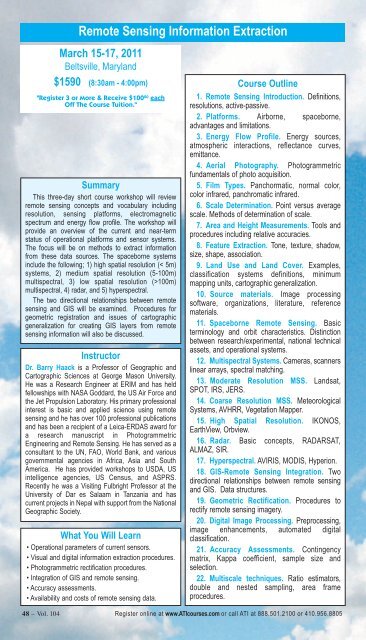
Remote Sensing Information Extraction<br />
March 15-17, 2011<br />
Beltsville, Maryland<br />
$1590 (8:30am - 4:00pm)<br />
"Register 3 or More & Receive $100 00 each<br />
Off The Course Tuition."<br />
Summary<br />
This three-day short course workshop will review<br />
remote sensing concepts and vocabulary including<br />
resolution, sensing platforms, electromagnetic<br />
spectrum and energy flow profile. The workshop will<br />
provide an overview of the current and near-term<br />
status of operational platforms and sensor systems.<br />
The focus will be on methods to extract information<br />
from these data sources. The spaceborne systems<br />
include the following; 1) high spatial resolution (< 5m)<br />
systems, 2) medium spatial resolution (5-100m)<br />
multispectral, 3) low spatial resolution (>100m)<br />
multispectral, 4) radar, and 5) hyperspectral.<br />
The two directional relationships between remote<br />
sensing and GIS will be examined. Procedures for<br />
geometric registration and issues of cartographic<br />
generalization for creating GIS layers from remote<br />
sensing information will also be discussed.<br />
Instructor<br />
Dr. Barry Haack is a Professor of Geographic and<br />
Cartographic Sciences at George Mason University.<br />
He was a Research Engineer at ERIM and has held<br />
fellowships with NASA Goddard, the US Air Force and<br />
the Jet Propulsion Laboratory. His primary professional<br />
interest is basic and applied science using remote<br />
sensing and he has over 100 professional publications<br />
and has been a recipient of a Leica-ERDAS award for<br />
a research manuscript in Photogrammetric<br />
<strong>Engineering</strong> and Remote Sensing. He has served as a<br />
consultant to the UN, FAO, World Bank, and various<br />
governmental agencies in Africa, Asia and South<br />
America. He has provided workshops to USDA, US<br />
intelligence agencies, US Census, and ASPRS.<br />
Recently he was a Visiting Fulbright Professor at the<br />
University of Dar es Salaam in Tanzania and has<br />
current projects in Nepal with support from the National<br />
Geographic Society.<br />
What You Will Learn<br />
• Operational parameters of current sensors.<br />
• Visual and digital information extraction procedures.<br />
• Photogrammetric rectification procedures.<br />
• Integration of GIS and remote sensing.<br />
• Accuracy assessments.<br />
• Availability and costs of remote sensing data.<br />
Course Outline<br />
1. Remote Sensing Introduction. Definitions,<br />
resolutions, active-passive.<br />
2. Platforms. Airborne, spaceborne,<br />
advantages and limitations.<br />
3. Energy Flow Profile. Energy sources,<br />
atmospheric interactions, reflectance curves,<br />
emittance.<br />
4. Aerial Photography. Photogrammetric<br />
fundamentals of photo acquisition.<br />
5. Film Types. Panchormatic, normal color,<br />
color infrared, panchromatic infrared.<br />
6. Scale Determination. Point versus average<br />
scale. Methods of determination of scale.<br />
7. Area and Height Measurements. Tools and<br />
procedures including relative accuracies.<br />
8. Feature Extraction. Tone, texture, shadow,<br />
size, shape, association.<br />
9. Land Use and Land Cover. Examples,<br />
classification systems definitions, minimum<br />
mapping units, cartographic generalization.<br />
10. Source materials. Image processing<br />
software, organizations, literature, reference<br />
materials.<br />
11. Spaceborne Remote Sensing. Basic<br />
terminology and orbit characteristics. Distinction<br />
between research/experimental, national technical<br />
assets, and operational systems.<br />
12. Multispectral <strong>Systems</strong>. Cameras, scanners<br />
linear arrays, spectral matching.<br />
13. Moderate Resolution MSS. Landsat,<br />
SPOT, IRS, JERS.<br />
14. Coarse Resolution MSS. Meteorological<br />
<strong>Systems</strong>, AVHRR, Vegetation Mapper.<br />
15. High Spatial Resolution. IKONOS,<br />
EarthView, Orbview.<br />
16. Radar. Basic concepts, RADARSAT,<br />
ALMAZ, SIR.<br />
17. Hyperspectral. AVIRIS, MODIS, Hyperion.<br />
18. GIS-Remote Sensing Integration. Two<br />
directional relationships between remote sensing<br />
and GIS. Data structures.<br />
19. Geometric Rectification. Procedures to<br />
rectify remote sensing imagery.<br />
20. Digital Image Processing. Preprocessing,<br />
image enhancements, automated digital<br />
classification.<br />
21. Accuracy Assessments. Contingency<br />
matrix, Kappa coefficient, sample size and<br />
selection.<br />
22. Multiscale techniques. Ratio estimators,<br />
double and nested sampling, area frame<br />
procedures.<br />
48 – Vol. 104 Register online at www.<strong>ATI</strong>courses.com or call <strong>ATI</strong> at 888.501.2100 or 410.956.8805


