Rapid survey of the birds of the Atewa Range Forest Reserve, Ghana
Rapid survey of the birds of the Atewa Range Forest Reserve, Ghana
Rapid survey of the birds of the Atewa Range Forest Reserve, Ghana
- No tags were found...
Create successful ePaper yourself
Turn your PDF publications into a flip-book with our unique Google optimized e-Paper software.
Gazetteer<br />
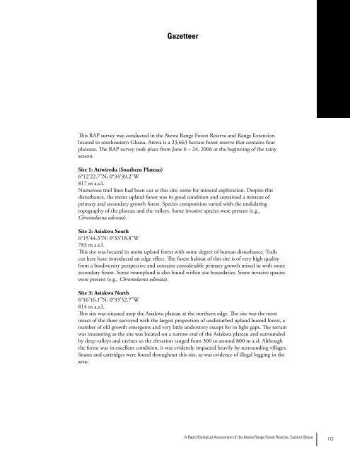
This RAP <strong>survey</strong> was conducted in <strong>the</strong> <strong>Atewa</strong> <strong>Range</strong> <strong>Forest</strong> <strong>Reserve</strong> and <strong>Range</strong> Extension<br />
located in sou<strong>the</strong>astern <strong>Ghana</strong>. <strong>Atewa</strong> is a 23,663 hectare forest reserve that contains four<br />
plateaus. The RAP <strong>survey</strong> took place from June 6 – 24, 2006 at <strong>the</strong> beginning <strong>of</strong> <strong>the</strong> rainy<br />
season.<br />
Site 1: Atiwiredu (Sou<strong>the</strong>rn Plateau)<br />
6°12’22.7”N; 0°34’39.2”W<br />
817 m a.s.l.<br />
Numerous trail lines had been cut at this site, some for mineral exploration. Despite this<br />
disturbance, <strong>the</strong> moist upland forest was in good condition and contained a mixture <strong>of</strong><br />
primary and secondary growth forest. Species composition varied with <strong>the</strong> undulating<br />
topography <strong>of</strong> <strong>the</strong> plateau and <strong>the</strong> valleys. Some invasive species were present (e.g.,<br />
Chromolaena odorata).<br />
Site 2: Asiakwa South<br />
6°15’44.3”N; 0°33’18.8”W<br />
783 m a.s.l.<br />
This site was located in moist upland forest with some degree <strong>of</strong> human disturbance. Trails<br />
cut here have introduced an edge effect. The forest habitat <strong>of</strong> this site is <strong>of</strong> very high quality<br />
from a biodiversity perspective and contains considerable primary growth mixed in with some<br />
secondary forest. Some swampland is also found within site boundaries. Some invasive species<br />
were present (e.g., Chromolaena odorata).<br />
Site 3: Asiakwa North<br />
6°16’16.1”N; 0°33’52.7”W<br />
814 m a.s.l.<br />
This site was situated atop <strong>the</strong> Asiakwa plateau at <strong>the</strong> nor<strong>the</strong>rn edge. The site was <strong>the</strong> most<br />
intact <strong>of</strong> <strong>the</strong> three <strong>survey</strong>ed with <strong>the</strong> largest proportion <strong>of</strong> undisturbed upland humid forest, a<br />
number <strong>of</strong> old growth emergents and very little understory except for in light gaps. The terrain<br />
was interesting as <strong>the</strong> site was located on a narrow end <strong>of</strong> <strong>the</strong> Asiakwa plateau and surrounded<br />
by deep valleys and ravines so <strong>the</strong> elevation ranged from 300 to around 800 m a.sl. Although<br />
<strong>the</strong> forest was in excellent condition, it was evidently impacted heavily by surrounding villages.<br />
Snares and cartridges were found throughout this site, as was evidence <strong>of</strong> illegal logging in <strong>the</strong><br />
area.<br />
A <strong>Rapid</strong> Biological Assessment <strong>of</strong> <strong>the</strong> <strong>Atewa</strong> <strong>Range</strong> <strong>Forest</strong> <strong>Reserve</strong>, Eastern <strong>Ghana</strong><br />
113


