Using Multi-Objective Management to Reduce Flood Losses in Your
Using Multi-Objective Management to Reduce Flood Losses in Your
Using Multi-Objective Management to Reduce Flood Losses in Your

Create successful ePaper yourself
Turn your PDF publications into a flip-book with our unique Google optimized e-Paper software.
This guidebook was prepared under grant number X 823852-01-0 <strong>in</strong> cooperation with the<br />
U.S. Environmental Protection Agency. The op<strong>in</strong>ions expressed here<strong>in</strong> are those of the<br />
authors and may not necessarily represent those of the EPA or the federal government.<br />
This guidebook is a general <strong>in</strong>troduction <strong>to</strong> multi-objective management and the plann<strong>in</strong>g<br />
process that helps a community select the flood loss reduction measures most suitable for its<br />
situation. To determ<strong>in</strong>e the best measures for specific sites, a community should obta<strong>in</strong><br />
additional guidance from eng<strong>in</strong>eers, planners, emergency managers, and other professionals<br />
experienced <strong>in</strong> flood loss reduction.<br />
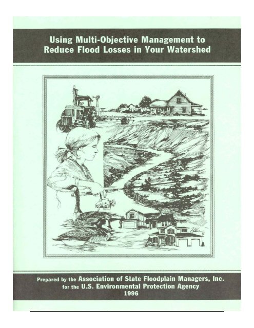
Cover art by Bob Fletcher, Arvada, Colorado
<strong>Us<strong>in</strong>g</strong> <strong>Multi</strong>-<strong>Objective</strong> <strong>Management</strong> <strong>to</strong><br />
<strong>Reduce</strong> <strong>Flood</strong> <strong>Losses</strong> <strong>in</strong> <strong>Your</strong> Watershed<br />
Prepared by the<br />
Association of State <strong>Flood</strong>pla<strong>in</strong> Managers<br />
Under a grant from the<br />
U.S. Environmental Protection Agency<br />
1996
Contents<br />
Acknowledgments.................................................................................................................... iv<br />
Executive Summary ...................................................................................................................v<br />
1. Introduction............................................................................................................................1<br />
So You Have a <strong>Flood</strong> Problem.........................................................................................1<br />
What is M-O-M ..............................................................................................................1<br />
Why use M-O-M.............................................................................................................2<br />
How <strong>to</strong> Use This Guide ....................................................................................................3<br />
2. Understand<strong>in</strong>g <strong>Your</strong> Watershed.............................................................................................5<br />
River<strong>in</strong>e <strong>Flood</strong><strong>in</strong>g.............................................................................................................5<br />
Coastal <strong>Flood</strong><strong>in</strong>g...............................................................................................................8<br />
Other <strong>Flood</strong> Hazards.........................................................................................................9<br />
What Information Do You Need ..................................................................................10<br />
3. <strong>Flood</strong> Loss Reduction Measures..........................................................................................13<br />
Prevention.......................................................................................................................13<br />
Property Protection.........................................................................................................19<br />
Emergency Services .......................................................................................................21<br />
Structural Projects...........................................................................................................23<br />
4. M-O-M Opportunities..........................................................................................................25<br />
Recreation.......................................................................................................................25<br />
Fish and Wildlife ............................................................................................................27<br />
Water Supply ..................................................................................................................29<br />
Water Quality .................................................................................................................31<br />
Urban Redevelopment ....................................................................................................32<br />
Economic Development .................................................................................................33<br />
Hous<strong>in</strong>g Improvement ....................................................................................................34<br />
Agriculture......................................................................................................................36<br />
His<strong>to</strong>ric Preservation ......................................................................................................38<br />
Education........................................................................................................................39<br />
Transportation and Infrastructure ...................................................................................42<br />
5. Prepar<strong>in</strong>g a M-O-M Plan .....................................................................................................45<br />
Organize..........................................................................................................................45<br />
Involve Other Local People............................................................................................47<br />
Involve Agencies and Organizations..............................................................................48<br />
Def<strong>in</strong>e the Problems .......................................................................................................50<br />
Agree on Goals and <strong>Objective</strong>s ......................................................................................52<br />
Review Alternatives and Select the Best Ones...............................................................53<br />
Prepare a Written Document ..........................................................................................55<br />
Get Public and Official Acceptance ...............................................................................56<br />
Implement and Follow Through.....................................................................................57<br />
Appendix A. National Agencies and Organizations ............................................................. A-1<br />
Appendix B. References .......................................................................................................B-1<br />
Appendix C. Terms and Acronyms........................................................................................C-1<br />
iii
Acknowledgments<br />
This guidebook was prepared by the Association of State <strong>Flood</strong>pla<strong>in</strong> Managers under a grant<br />
from the U.S. Environmental Protection Agency’s Wetlands Division.<br />
Project Officer: Jori Wesley, U.S. Environmental Protection Agency, Wash<strong>in</strong>g<strong>to</strong>n, D.C.<br />
Project Manager: Jerry Loutha<strong>in</strong>, Olympia, Wash<strong>in</strong>g<strong>to</strong>n<br />
Pr<strong>in</strong>cipal Author: French Wetmore, French & Associates, Park Forest, Ill<strong>in</strong>ois<br />
Technical edit<strong>in</strong>g and production: Jacquelyn L. Monday, Lakewood, Colorado<br />
Cover design and artwork: Bob Fletcher, Arvada, Colorado<br />
The guidebook could not have been developed without the technical <strong>in</strong>put and assistance of<br />
many experts <strong>in</strong> floodpla<strong>in</strong>, watershed, and multi-objective management. The follow<strong>in</strong>g<br />
people acted as project advisors:<br />
Richard Alexander, Department of Hous<strong>in</strong>g and Urban Development, Wash<strong>in</strong>g<strong>to</strong>n, D.C.<br />
Robert Bartels, Consoer Townsend Envirodyne, Chicago, Ill<strong>in</strong>ois<br />
Chris Brown, Recreation Resources, National Park Service, Wash<strong>in</strong>g<strong>to</strong>n, D.C.<br />
David Conrad, National Wildlife Federation, Wash<strong>in</strong>g<strong>to</strong>n, D.C.<br />
Bob Cox, Federal Emergency <strong>Management</strong> Agency, Denver, Colorado<br />
Mike Houck, Audubon Society of Portland, Portland, Oregon<br />
Jon Kusler, Association of State Wetland Managers, Berne, New York<br />
Larry Larson, Association of State <strong>Flood</strong>pla<strong>in</strong> Managers, Madison, Wiscons<strong>in</strong><br />
David McK<strong>in</strong>nie, Office of Ocean and Coastal Resources <strong>Management</strong>, Silver Spr<strong>in</strong>g, MD<br />
John McShane, Federal Emergency <strong>Management</strong> Agency, Wash<strong>in</strong>g<strong>to</strong>n, D.C.<br />
Jeanne Melanson, Natural Resources Conservation Service, Wash<strong>in</strong>g<strong>to</strong>n, D.C.<br />
Ann Pat<strong>to</strong>n, Public Works Department, Tulsa, Oklahoma<br />
Clancy Philipsborn, The Mitigation Assistance Corporation, Boulder, Colorado<br />
Doug Plasencia, Kimley-Horn & Associates, Phoenix, Arizona<br />
Don Porter, Waverly, Tennessee<br />
Jim Schwab, American Plann<strong>in</strong>g Association, Chicago, Ill<strong>in</strong>ois<br />
Holly S<strong>to</strong>erker, Upper Mississippi River Bas<strong>in</strong> Association, St. Paul, M<strong>in</strong>nesota<br />
Evelyn Swimmer, National Park Service, Philadelphia, Pennsylvania<br />
Gene Whitaker, National Wetlands Conservation Alliance, Wash<strong>in</strong>g<strong>to</strong>n, D.C.<br />
James Wright, The FPM Group, Seymour, Tennessee<br />
Ken Zwickl, U.S. Army Corps of Eng<strong>in</strong>eers, Wash<strong>in</strong>g<strong>to</strong>n, D.C.<br />
The illustrations on pages 28, 41, and 43 are repr<strong>in</strong>ted from A Casebook <strong>in</strong> Manag<strong>in</strong>g Rivers<br />
for <strong>Multi</strong>ple Uses, prepared <strong>in</strong> 1991 by the Association of State Wetland Managers, the<br />
Association of State <strong>Flood</strong>pla<strong>in</strong> Managers, and the National Park Service. The illustrations on<br />
pages 5, 7, and 51 were done by Bob Fletcher.<br />
iv
Executive Summary<br />
This guidebook was written for citizens and local officials who have a flood problem<br />
but have not yet found a solution. It capitalizes on the realization that the traditional,<br />
s<strong>in</strong>gle-issue approach <strong>to</strong> flood protection has not always been efficient or effective,<br />
and can take years <strong>to</strong> implement. Furthermore, people pursu<strong>in</strong>g s<strong>in</strong>gle issues-like<br />
flood control-have often found themselves compet<strong>in</strong>g with other local <strong>in</strong>terests and<br />
may <strong>in</strong>crease related problems or create new ones.<br />
This guidebook expla<strong>in</strong>s a proven approach <strong>to</strong> reduce flood losses and<br />
simultaneously address other community concerns. The approach is called “multiobjective<br />
management” or “M-O-M.” It succeeds because it coord<strong>in</strong>ates flood loss<br />
reduction with other community needs and goals <strong>to</strong> develop a stronger, more<br />
comprehensive program.<br />
There is noth<strong>in</strong>g magical about the multi-objective management approach. The<br />
basic idea is <strong>to</strong> get <strong>to</strong>gether everyone with a concern or problem that has the potential<br />
<strong>to</strong> affect or be affected by the flood problem. It requires communication between<br />
different parties and it capitalizes on the technical and f<strong>in</strong>ancial help that is already<br />
available from government agencies and private organizations.<br />
There are six basic guidel<strong>in</strong>es <strong>to</strong> the M-O-M approach:<br />
• Keep your effort locally based.<br />
• Understand your flood problem and its relationship <strong>to</strong> the watershed.<br />
• Th<strong>in</strong>k broadly about possible solutions <strong>to</strong> reduce flood losses.<br />
• Coord<strong>in</strong>ate flood loss reduction with other community needs, plans,<br />
and activities.<br />
• Obta<strong>in</strong> expert advice and assistance.<br />
• Build a partnership by develop<strong>in</strong>g a plan.<br />
There are four basic strategies for reduc<strong>in</strong>g flood losses, and each<br />
<strong>in</strong>corporates different measures that are appropriate for different conditions.<br />
• Prevention measures like plann<strong>in</strong>g, land acquisition, and regulations help<br />
modify development on floodpla<strong>in</strong>s and watersheds <strong>to</strong> reduce susceptibility <strong>to</strong><br />
flood damage. Preventive measures are usually adm<strong>in</strong>istered by the build<strong>in</strong>g,<br />
zon<strong>in</strong>g, plann<strong>in</strong>g, and/or code enforcement offices of your local government.<br />
• Property protection measures are usually undertaken by property owners<br />
themselves. They <strong>in</strong>clude elevat<strong>in</strong>g a build<strong>in</strong>g, build<strong>in</strong>g small barriers,<br />
floodproof<strong>in</strong>g, rais<strong>in</strong>g utilities, and buy<strong>in</strong>g <strong>in</strong>surance.<br />
• Emergency services m<strong>in</strong>imize the impact of a flood that is already happen<strong>in</strong>g.<br />
They are the responsibility of city or county emergency management staff and<br />
the opera<strong>to</strong>rs of major or critical facilities. They <strong>in</strong>clude warn<strong>in</strong>gs and<br />
emergency response.<br />
• Structural projects keep flood waters away from an area with a levee,<br />
reservoir, or other measure that controls the flow of water. Structural projects<br />
are usually designed by eng<strong>in</strong>eers and managed by public works staff.<br />
v
The floodpla<strong>in</strong> is not just a hazardous area. The floodpla<strong>in</strong>, the watershed,<br />
wetlands, and other flood-related areas have many different uses, most of them<br />
beneficial <strong>to</strong> the community. The multi-objective management approach br<strong>in</strong>gs<br />
<strong>to</strong>gether the people and groups that have <strong>in</strong>terests related <strong>to</strong> all these water-related<br />
uses. It helps reduce conflicts and <strong>in</strong>crease the opportunities for mutual support. <strong>Your</strong><br />
flood loss reduction measures become <strong>to</strong>ols <strong>to</strong> meet other objectives, <strong>to</strong>o. By ally<strong>in</strong>g<br />
yourself with these other <strong>in</strong>terests, you ga<strong>in</strong> longer-last<strong>in</strong>g, broader support for your<br />
common concerns.<br />
The number and types of special <strong>in</strong>terest groups and opportunities for<br />
cooperation will vary from community <strong>to</strong> community. The more common ones,<br />
covered <strong>in</strong> this guidebook, are:<br />
• Recreation ● Hous<strong>in</strong>g improvement<br />
• Fish and wildlife ● Agriculture<br />
• Water supply ● His<strong>to</strong>ric preservation<br />
• Water quality ● Education<br />
• Urban redevelopment ● Transportation and <strong>in</strong>frastructure.<br />
• Economic development<br />
There are literally hundreds of government agencies and programs, private clubs and<br />
other organizations, bus<strong>in</strong>esses, and <strong>in</strong>dividuals that can provide advice, assistance, and<br />
fund<strong>in</strong>g for flood loss reduction when it is comb<strong>in</strong>ed with other activities. Some of them are:<br />
local, state, and federal agencies for parks, environmental protection, recreation, economic<br />
development, hous<strong>in</strong>g, eng<strong>in</strong>eer<strong>in</strong>g, conservation, plann<strong>in</strong>g, community affairs, or natural<br />
resources; neighborhood associations; conservation and outdoor groups (Izaak Wal<strong>to</strong>n<br />
League, Audubon Society, Boy and Girl Scouts, Ducks Unlimited, Trout Unlimited, The<br />
Nature Conservancy, The Land Trust Alliance); recreational bus<strong>in</strong>esses (mar<strong>in</strong>as, sport<strong>in</strong>g<br />
goods s<strong>to</strong>res); local water departments and private water companies; farmers dependent on<br />
irrigation; <strong>in</strong>dustries and economic developers; chambers of commerce and bus<strong>in</strong>ess or<br />
manufacturers’ organizations; garden clubs; Urban Land Institute; and the National<br />
Community Development Association.<br />
A proper plann<strong>in</strong>g process is the key <strong>to</strong> determ<strong>in</strong><strong>in</strong>g what is best for your community<br />
and build<strong>in</strong>g consensus for what should be done. Plann<strong>in</strong>g is educational and it br<strong>in</strong>gs people<br />
<strong>to</strong>gether. And many state and federal programs require a plan as a prerequisite <strong>to</strong> provid<strong>in</strong>g<br />
you with assistance. Fund<strong>in</strong>g organizations want <strong>to</strong> know how their money fits <strong>in</strong><strong>to</strong> the<br />
community’s goals. These are the basic steps for multi- objective plann<strong>in</strong>g:<br />
(1) Get organized.<br />
(2) Involve other local people and groups.<br />
(3) Contact agencies and organizations that have an <strong>in</strong>terest or can<br />
provide advice and/or assistance.<br />
(4) Def<strong>in</strong>e the community problems.<br />
(5) Agree on goals and objectives for community plann<strong>in</strong>g and action.<br />
(6) Review alternatives <strong>to</strong> reduce flood losses and meet other needs.<br />
(7) Prepare a written document.<br />
(8) Get public and official acceptance of the plan.<br />
(9) Implement and follow through on the steps specified <strong>in</strong> the plan.<br />
Success s<strong>to</strong>ries <strong>in</strong> this guidebook give examples of how other communities have used the<br />
M-O-M approach. Additional <strong>in</strong>formation can be found by contact<strong>in</strong>g the agencies and<br />
organizations noted <strong>in</strong> Appendix A or by check<strong>in</strong>g the references <strong>in</strong> Appendix B.<br />
vi
Chapter 1<br />
Introduction<br />
This guidebook is a general <strong>in</strong>troduction <strong>to</strong> multi-objective management and the<br />
plann<strong>in</strong>g process that helps a community develop a flood loss reduction strategy most<br />
appropriate for its situation. It is for citizens and local officials who have a flood<br />
problem but have not yet found a solution.<br />
So You Have a <strong>Flood</strong> Problem<br />
A flood problem simply means that you are gett<strong>in</strong>g <strong>to</strong>o much water where you don’t<br />
want it. Because water does not respect property l<strong>in</strong>es or city limits, <strong>in</strong> most cases the<br />
solutions <strong>to</strong> your flood problem will <strong>in</strong>volve not just the people who suffered damage<br />
most recently, but rather the whole neighborhood, the entire community, and even the<br />
rest of the watershed.<br />
It’s hard <strong>to</strong> f<strong>in</strong>d a solution <strong>to</strong> a flood problem if you’re us<strong>in</strong>g a s<strong>in</strong>gle-m<strong>in</strong>ded<br />
approach. You may be the only one who cares about flood<strong>in</strong>g, but you’re certa<strong>in</strong>ly<br />
not the only person talk<strong>in</strong>g <strong>to</strong> City Hall about a problem or want<strong>in</strong>g <strong>to</strong> improve your<br />
neighborhood. There are other <strong>in</strong>terests out there and if everyone focuses only on<br />
their own concerns, you are all really compet<strong>in</strong>g with each other.<br />
This guidebook shows you a proven approach <strong>to</strong> reduce flood losses and<br />
simultaneously address other community concerns. It is called “multi-objective<br />
management” or “M-O-M.” It succeeds because with it you build alliances with other<br />
<strong>in</strong>terest groups <strong>in</strong> your area, use f<strong>in</strong>ancial and other resources that already exist, and<br />
look at the whole watershed that affects your flood<strong>in</strong>g problem.<br />
In the end you will have coord<strong>in</strong>ated flood loss reduction with some of the<br />
other goals and needs of your community. <strong>Your</strong> solutions <strong>to</strong> flood<strong>in</strong>g will be more<br />
effective, more sensitive <strong>to</strong> the environment, have broader support, be part of a more<br />
comprehensive program, and accomplish more than one objective.<br />
What is M-O-M<br />
There is noth<strong>in</strong>g magical about the multi-objective management approach. The basic<br />
idea is <strong>to</strong> get <strong>to</strong>gether everyone with a concern or problem that has the potential <strong>to</strong><br />
affect or be affected by the flood problem. It requires communication between<br />
different parties and it capitalizes on the help that is offered by government agencies<br />
and private organizations.<br />
There are six basic guidel<strong>in</strong>es <strong>to</strong> the M-O-M approach:<br />
(1) Keep your effort locally based. <strong>Your</strong> solutions must be acceptable <strong>to</strong> you,<br />
your neighbors, and others <strong>in</strong> the area. They must fit <strong>in</strong> with other local<br />
concerns and goals.<br />
(2) Understand your flood problem and its relation <strong>to</strong> the watershed. <strong>Your</strong><br />
problem is not isolated. Neither is it limited <strong>to</strong> your stream or your<br />
1
neighborhood. If you th<strong>in</strong>k <strong>in</strong> terms of the whole watershed (where the<br />
water comes from and where it goes), you will come up with more<br />
possible solutions and they will not cause problems for someone else.<br />
Chapter 2 covers understand<strong>in</strong>g your flood problem and watershed.<br />
(3) Th<strong>in</strong>k broadly about possible solutions <strong>to</strong> reduce your flood problem.<br />
There are more ways <strong>to</strong> do th<strong>in</strong>gs than conventional wisdom may suggest.<br />
Don’t get locked <strong>in</strong><strong>to</strong> want<strong>in</strong>g a floodwall or other s<strong>in</strong>gle-purpose project<br />
without first check<strong>in</strong>g out all the alternatives. The basic ways of reduc<strong>in</strong>g<br />
flood losses are <strong>in</strong>troduced <strong>in</strong> Chapter 3.<br />
(4) Identify the other community concerns and goals that could have a<br />
bear<strong>in</strong>g on the flood problem. Get people who are <strong>in</strong>terested <strong>in</strong> those<br />
other concerns <strong>to</strong> meet with you. Together, bra<strong>in</strong>s<strong>to</strong>rm the possible<br />
solutions that can reach more than one of your objectives. Chapter 4<br />
discusses some of the issues (and the people and organizations beh<strong>in</strong>d<br />
them) that could be coord<strong>in</strong>ated with flood loss reduction. Chapter 5<br />
describes ways <strong>to</strong> help you and the others reach agreement and work<br />
<strong>to</strong>gether.<br />
(5) Obta<strong>in</strong> expert advice and assistance from government agencies and<br />
private organizations. F<strong>in</strong>d out what f<strong>in</strong>ancial assistance and advice are<br />
available. Don’t put all your eggs <strong>in</strong> one basket and wait for that big<br />
“cure-all “project that may never be funded. There are literally hundreds<br />
of programs out there, you just have <strong>to</strong> pick them. The more commonly<br />
used ones are identified <strong>in</strong> Chapters 3 and 4. Their national contacts are<br />
listed <strong>in</strong> Appendix A.<br />
(6) Build a partnership among all the private and public groups and<br />
<strong>in</strong>dividuals you can enlist <strong>to</strong> work on the objectives. More m<strong>in</strong>ds and<br />
hands mean that better ideas will result, people will be more likely <strong>to</strong><br />
follow through, and there will be more people <strong>to</strong> do the work. It will help<br />
if you follow a systematic process <strong>to</strong> develop a M-O-M plan. Prepar<strong>in</strong>g a<br />
written plan helps keep you all organized, clarifies your solutions, and<br />
formalizes everyone’s participation. The plann<strong>in</strong>g process is described <strong>in</strong><br />
Chapter 5.<br />
Why Use M-O-M<br />
If you have a flood problem, you may ask “Why bother with this M-O-M stuff<br />
Why not just s<strong>to</strong>p the flood<strong>in</strong>g” This is not as easy as it sounds, especially if you<br />
are on a large river or the ocean. Structures <strong>to</strong> “s<strong>to</strong>p” or control the floods can be<br />
very expensive <strong>to</strong> build and ma<strong>in</strong>ta<strong>in</strong>; take a long time <strong>to</strong> plan, fund, and build;<br />
and can cost more than the value of the property they would protect. They may<br />
adversely affect other properties, the environment, and other people’s plans for the<br />
area. As shown by the Mississippi River flood of 1993, they don’t always work,<br />
especially if a flood is larger than was anticipated.<br />
2
If you have only one objective−“s<strong>to</strong>p the<br />
flood<strong>in</strong>g”−you may spend a lot of time and<br />
money on your one problem and you may create<br />
more problems for other people. You will be<br />
compet<strong>in</strong>g with other communities that want funds<br />
for expensive structural projects. You will even be<br />
compet<strong>in</strong>g with others <strong>in</strong> your own community<br />
who have different goals <strong>in</strong> m<strong>in</strong>d. The M-O-M<br />
approach helps you take charge of your future by<br />
look<strong>in</strong>g at all the th<strong>in</strong>gs your community needs<br />
and see<strong>in</strong>g how they can be comb<strong>in</strong>ed with<br />
possible ways <strong>to</strong> reduce flood losses. You do not<br />
put all your eggs <strong>in</strong> one basket, you are less<br />
dependent on outside agencies, and you have more<br />
sources of fund<strong>in</strong>g and technical advice.<br />
With M-O-M, you jo<strong>in</strong> forces with other<br />
people who are just as devoted <strong>to</strong> their goals−be<br />
they parks and recreation, economic development,<br />
<strong>to</strong>urism, or environmental education. You can all<br />
reach your objectives <strong>in</strong> a cheaper, faster, and less<br />
disruptive manner by us<strong>in</strong>g M-O-M. The M-O-M<br />
approach results <strong>in</strong> more permanent, less<br />
expensive flood loss reduction than try<strong>in</strong>g <strong>to</strong><br />
control the natural forces that cause floods.<br />
One reason the M-O-M approach gets such<br />
good results is that, with M-O-M, you treat the<br />
river’s floodpla<strong>in</strong> and its watershed as a resource.<br />
The floodpla<strong>in</strong> need not be just a place with a<br />
flood hazard, it is also an area that is important <strong>to</strong><br />
your community and <strong>to</strong> plant and animal life. The<br />
M-O-M process makes sure that flood projects<br />
don’t underm<strong>in</strong>e other community objectives and<br />
the need <strong>to</strong> protect the natural environment.<br />
AN EXAMPLE OF THE<br />
M-O-M APPROACH<br />
You want farmers and subdivisions<br />
<strong>in</strong> the watershed <strong>to</strong> reduce the<br />
amount of runoff that goes <strong>to</strong> your<br />
stream. The Soil and Water<br />
Conservation District wants<br />
agricultural practices that reduce<br />
erosion and soil loss. An<br />
environmental group wants more<br />
wetlands preserved from<br />
development. And the parks<br />
department needs more open space<br />
<strong>to</strong> serve a grow<strong>in</strong>g population.<br />
These other <strong>in</strong>terests can help<br />
you: The farm<strong>in</strong>g practices promoted<br />
by the Soil and Water<br />
Conservation District will reduce<br />
runoff and sedimentation. Wetlands<br />
s<strong>to</strong>re water before it reaches the<br />
stream. The most productive wetlands<br />
and watershed s<strong>to</strong>rage areas<br />
can make very attractive and<br />
<strong>in</strong>terest<strong>in</strong>g parks and provide water<br />
quality benefits.<br />
By identify<strong>in</strong>g the concerns of<br />
others, you can f<strong>in</strong>d opportunities<br />
for the different groups <strong>to</strong> work <strong>to</strong>gether.<br />
You may not have the same<br />
goals, but you have common<br />
<strong>in</strong>terests that can support each<br />
other.<br />
Take the case of Kampsville, a <strong>to</strong>wn of 400 residents on the Ill<strong>in</strong>ois River<br />
(see box, next page). Its residents could have cont<strong>in</strong>ued <strong>to</strong> endure flood<strong>in</strong>g, waited<br />
for a flood control project that would not be built, or looked for alternative ways<br />
<strong>to</strong> reduce flood losses. They chose the third option, and it paid off dur<strong>in</strong>g the<br />
1993 flood.<br />
How <strong>to</strong> Use This Guide<br />
This guidebook is an overview of the multi-objective management approach as it<br />
relates <strong>to</strong> flood loss reduction. Chapters 2−5 cover the M-O-M approach <strong>in</strong><br />
chronological order.<br />
<br />
Chapter 2 is about understand<strong>in</strong>g your watershed and how your<br />
flood problem fits <strong>in</strong><strong>to</strong> it.<br />
3
A M-O-M<br />
Success<br />
S<strong>to</strong>ry<br />
After the <strong>to</strong>wn was flooded <strong>in</strong> 1979 and aga<strong>in</strong> <strong>in</strong> 1982,<br />
Kampsville, Ill<strong>in</strong>ois, residents and local officials decided they<br />
wanted <strong>to</strong> do someth<strong>in</strong>g about this recurr<strong>in</strong>g problem. They<br />
knew that they were not go<strong>in</strong>g <strong>to</strong> s<strong>to</strong>p the Ill<strong>in</strong>ois River from<br />
flood<strong>in</strong>g and that <strong>to</strong> build a levee large enough would require<br />
remov<strong>in</strong>g many of the build<strong>in</strong>gs they wanted <strong>to</strong> protect.<br />
Therefore, they began a systematic plann<strong>in</strong>g process <strong>to</strong><br />
review alternative ways <strong>to</strong> reduce flood losses. One of the<br />
first th<strong>in</strong>gs they did was ask for help. The state floodpla<strong>in</strong> management agency<br />
provided them with staff support. Dur<strong>in</strong>g a series of plann<strong>in</strong>g meet<strong>in</strong>gs, other<br />
agencies were <strong>in</strong>vited <strong>to</strong> expla<strong>in</strong> their ideas and tell how they could help.<br />
It soon became apparent that the best solution was <strong>to</strong> purchase and relocate<br />
the worst-hit build<strong>in</strong>gs. Because this would leave the <strong>to</strong>wn with a large open<br />
area, folks started talk<strong>in</strong>g about what they would do with it. They were also<br />
concerned that they would lose some bus<strong>in</strong>esses when the flood-prone properties<br />
were bought out. Dur<strong>in</strong>g this process, they realized that they had <strong>to</strong> th<strong>in</strong>k about<br />
more than just flood<strong>in</strong>g; they had <strong>to</strong> consider the future of their village and its<br />
economic base.<br />
After that, they expanded their plann<strong>in</strong>g process <strong>to</strong> encompass other goals,<br />
<strong>in</strong>clud<strong>in</strong>g redevelop<strong>in</strong>g the acquired area, design<strong>in</strong>g a park, and build<strong>in</strong>g a base<br />
for <strong>to</strong>urism. The Village started sponsor<strong>in</strong>g recreation activities, <strong>in</strong>clud<strong>in</strong>g an<br />
annual celebration that br<strong>in</strong>gs <strong>in</strong> hundreds of people. They now view the<br />
riverfront as a resource, not a problem area.<br />
Kampsville received over $1 million <strong>to</strong> buy 50 properties and convert flooded<br />
and dilapidated build<strong>in</strong>gs <strong>to</strong> open space. The money was also used <strong>to</strong> elevate<br />
some build<strong>in</strong>gs that were not flooded very deeply, <strong>to</strong> floodproof the water<br />
treatment plant, and <strong>to</strong> relocate the fire station. A new ferry land<strong>in</strong>g and allweather<br />
access <strong>in</strong><strong>to</strong> <strong>to</strong>wn were also built. In all, f<strong>in</strong>ancial assistance was<br />
provided by three state agencies, two federal agencies, and the Village’s largest<br />
employer.<br />
Although it <strong>to</strong>ok almost 10 years <strong>to</strong> plan, fund, and complete, Kampsville’s<br />
approach paid off dur<strong>in</strong>g the 1993 Midwest flood. The <strong>to</strong>wn suffered some<br />
damage because flood waters exceeded the 100-year flood elevation. But<br />
Kampsville did not make the news because its damage was relatively m<strong>in</strong>or<br />
compared <strong>to</strong> that of its neighbors.<br />
Chapter 3 covers the variety of flood loss reduction measures you<br />
will want <strong>to</strong> consider.<br />
Chapter 4 lists some other problems or needs your community may<br />
have and expla<strong>in</strong>s how they can relate <strong>to</strong> the watershed, your flood<br />
problem, or the solutions <strong>to</strong> your flood problem.<br />
Chapter 5 describes a process that uses a formal partnership <strong>to</strong><br />
prepare a plan <strong>to</strong> achieve your and others’ goals.<br />
Throughout this guide there are references <strong>to</strong> government agencies and private<br />
organizations that can help you prepare or implement a M-O-M program. Their<br />
local offices can often be found <strong>in</strong> your phone book. Their national offices are<br />
listed <strong>in</strong> Appendix A. Remember, one of the key parts of the M-O-M approach is<br />
<strong>to</strong> ask for help−these programs are designed <strong>to</strong> provide that help. Appendix B<br />
lists references that can help you and your plann<strong>in</strong>g partners. Appendix C def<strong>in</strong>es<br />
some common terms and acronyms used by flood specialists.<br />
4
Chapter 2<br />
Understand<strong>in</strong>g <strong>Your</strong> Watershed<br />
There are many types of flood problems. You could have overbank flood<strong>in</strong>g from<br />
large rivers, coastal flood<strong>in</strong>g dur<strong>in</strong>g s<strong>to</strong>rms and hurricanes, flash flood<strong>in</strong>g on<br />
small streams, basement flood<strong>in</strong>g from sewer backups, or a comb<strong>in</strong>ation of those.<br />
The first step <strong>in</strong> tackl<strong>in</strong>g your flood problem is understand<strong>in</strong>g what causes it.<br />
To beg<strong>in</strong>, it is important <strong>to</strong> note that flood<strong>in</strong>g is a natural occurrence.<br />
Rivers, lakes, and salt-water bodies have always overflowed their normal beds <strong>to</strong><br />
<strong>in</strong>undate the nearby land. The land adjacent <strong>to</strong> these bodies of water is called the<br />
floodpla<strong>in</strong>.<br />
<strong>Flood</strong>pla<strong>in</strong> lands look dry most of the time, but nature <strong>in</strong>tends that they be<br />
covered with water periodically. As long as we can live with this, there will be no<br />
problems. <strong>Flood</strong> problems arise when we <strong>in</strong>terfere with the natural process of<br />
river<strong>in</strong>e, coastal, and other types of flood<strong>in</strong>g.<br />
River<strong>in</strong>e <strong>Flood</strong><strong>in</strong>g<br />
River<strong>in</strong>e flood<strong>in</strong>g simply means flood<strong>in</strong>g of a river, stream, or other channel. To<br />
understand river<strong>in</strong>e flood<strong>in</strong>g, you need <strong>to</strong> be aware of your watershed.<br />
The watershed<br />
A watershed is the area that dra<strong>in</strong>s <strong>to</strong> a lake, stream, or other body of water. It is<br />
also called a bas<strong>in</strong> or catchment area.<br />
The boundary of a watershed is a ridge or divide. The divide is the high<br />
ground and the river or lake is the lowest ground. Ra<strong>in</strong> and snowmelt flow from<br />
the divide <strong>to</strong> the receiv<strong>in</strong>g stream.<br />
A WATERSHED BOUNDARY<br />
5
Watersheds vary <strong>in</strong> size. They can be divided <strong>in</strong><strong>to</strong> smaller subwatersheds.<br />
The important th<strong>in</strong>g is that the stream and its watershed are connected. What<br />
happens <strong>in</strong> the watershed−even <strong>in</strong> the higher elevations up near the divide –<br />
affects th<strong>in</strong>gs both <strong>in</strong> the low-ly<strong>in</strong>g lands near the stream or lake and also<br />
farther downstream.<br />
The floodpla<strong>in</strong><br />
The size of a river depends on how much water it collects from the watershed.<br />
Most of the time, a river stays with<strong>in</strong> its banks. However, after heavy s<strong>to</strong>rms or<br />
snowmelt, the extra amount of water can be <strong>to</strong>o much for the channel, caus<strong>in</strong>g it<br />
<strong>to</strong> overflow on<strong>to</strong> normally dry land.<br />
A floodpla<strong>in</strong> can be def<strong>in</strong>ed accord<strong>in</strong>g <strong>to</strong> the frequency of the flood<strong>in</strong>g that<br />
WHAT ARE THE ODDS OF A<br />
100-YEAR FLOOD<br />
The term “100-year flood” has caused much<br />
confusion for people not familiar with statistics.<br />
Another way of look<strong>in</strong>g at it is <strong>to</strong> th<strong>in</strong>k of the<br />
Odds that a 100-year flood will happen<br />
sometime dur<strong>in</strong>g the life of a 30-year mortgage<br />
(26% chance).<br />
Chance of <strong>Flood</strong><strong>in</strong>g over a Period of Years<br />
Time<br />
<strong>Flood</strong> Size<br />
Period 10-year 25-year 50-year 100-year<br />
1 year 10% 4% 2% 1%<br />
10 years 65% 34% 18% 10%<br />
20 years 88% 56% 33% 18%<br />
30 years 96% 71% 45% 26%<br />
50 years 99% 87% 64% 39%<br />
Even these numbers do not convey the true<br />
flood risk because they focus on the larger,<br />
less frequent, floods. If a house is low<br />
enough, it may be subject <strong>to</strong> the 10- or<br />
25-year flood. Dur<strong>in</strong>g the proverbial 30-year<br />
mortgage, it may have a 26% chance of be<strong>in</strong>g<br />
hit by the 100-year flood, but the odds are<br />
96% (nearly guaranteed) that it will be hit by<br />
a 10-year flood. Compare those odds <strong>to</strong> the<br />
only 5% chance that the house will catch fire<br />
dur<strong>in</strong>g the same 30-year mortgage.<br />
covers it. An area that is flooded every<br />
year (a 1-year floodpla<strong>in</strong>) is smaller than<br />
the floodpla<strong>in</strong> that is <strong>in</strong>undated less<br />
frequently (a 15-year, 75-year, or even<br />
larger floodpla<strong>in</strong>).<br />
The base flood−The national<br />
standard for floodpla<strong>in</strong> management is the<br />
base or one percent chance floodpla<strong>in</strong>.<br />
This is the floodpla<strong>in</strong> that has at least one<br />
chance <strong>in</strong> 100 of be<strong>in</strong>g flooded <strong>in</strong> any<br />
given year. It is also called the 100-year<br />
floodpla<strong>in</strong>. This is the area shown on the<br />
<strong>Flood</strong> Insurance Rate Map (FIRM) for<br />
your <strong>to</strong>wn issued by the Federal<br />
Emergency <strong>Management</strong> Agency.<br />
The term “100-year flood “ has<br />
caused a lot of confusion. Some folks<br />
th<strong>in</strong>k hat it will only happen once <strong>in</strong> 100<br />
years, but that is def<strong>in</strong>itely not true.<br />
Instead, “100-year flood “ is a statistical<br />
term that refers <strong>to</strong> the odds of a flood of<br />
that size happen<strong>in</strong>g <strong>in</strong> any given year (see<br />
box). It is possible <strong>to</strong> have 100-year floods<br />
two years <strong>in</strong> a row.<br />
The floodway−Another term you<br />
will see is floodway. This is the river<br />
channel and the overbank area near the<br />
channel that carry the deeper and fastermov<strong>in</strong>g<br />
flood waters. Some maps show a<br />
regula<strong>to</strong>ry floodway, an area where construction regulations require special<br />
provisions <strong>to</strong> account for this extra hazard.<br />
<strong>Flood</strong> problems<br />
As noted above, flood<strong>in</strong>g is a natural occurrence but flood problems are the result<br />
of human development. <strong>Flood</strong>s may be acts of God, but flood damage results from<br />
human actions. <strong>Flood</strong> problems result from:<br />
6
Inappropriate development <strong>in</strong> the floodpla<strong>in</strong> (e.g., build<strong>in</strong>gs <strong>to</strong>o low,<br />
<strong>to</strong>o close <strong>to</strong> the channel, or block<strong>in</strong>g flood flows),<br />
Development <strong>in</strong> the watershed that <strong>in</strong>creases flood flows and creates a<br />
larger floodpla<strong>in</strong>, or<br />
A comb<strong>in</strong>ation of these two.<br />
Here is a typical example of how river<strong>in</strong>e flood problems develop: A watershed of<br />
10 square miles dra<strong>in</strong>s <strong>to</strong> Small Creek. The watershed orig<strong>in</strong>ally had many natural<br />
depressions and wetlands that<br />
s<strong>to</strong>red ra<strong>in</strong> and snowmelt.<br />
THE FLOODPLAIN OF SMALL CREEK, 1950<br />
For the last 1,000<br />
years, the creek has flooded<br />
periodically on<strong>to</strong> the floodpla<strong>in</strong>.<br />
When the area was first<br />
settled, the floodpla<strong>in</strong> was only<br />
used for farm<strong>in</strong>g−the farmers<br />
would lose a crop every 20 <strong>to</strong><br />
30 years due <strong>to</strong> a flood.<br />
Dur<strong>in</strong>g the 1950s and<br />
1960s the area began <strong>to</strong> be<br />
developed as suburban<br />
subdivisions grew out from an<br />
expand<strong>in</strong>g metropolitan area.<br />
Bridges were built across<br />
Small Creek, but their<br />
open<strong>in</strong>gs were only large enough <strong>to</strong> carry the 10-year flood. The channel was<br />
moved and straightened <strong>to</strong> make way for development.<br />
The people who had owned the land s<strong>in</strong>ce the 1940s had not seen any<br />
floods. There was a general sense that dry land would stay dry, so parts of the<br />
floodpla<strong>in</strong> were converted from farm<strong>in</strong>g <strong>to</strong> residential and commercial uses. Parts<br />
of the floodpla<strong>in</strong> were built on, us<strong>in</strong>g normal construction practices. The first<br />
floors were only a foot above ground level.<br />
The watershed was<br />
gradually chang<strong>in</strong>g. Lands that<br />
were once forests and farm<br />
fields were covered with<br />
streets and build<strong>in</strong>gs. Less ra<strong>in</strong><br />
water and snowmelt could soak<br />
<strong>in</strong><strong>to</strong> the ground, so more of it<br />
ran off <strong>in</strong><strong>to</strong> the stream.<br />
To get the extra surface<br />
water away from the build<strong>in</strong>gs,<br />
the developers built s<strong>to</strong>rm<br />
sewers and dra<strong>in</strong>age ditches.<br />
The wetlands were dra<strong>in</strong>ed or<br />
filled <strong>to</strong> allow more build<strong>in</strong>gs<br />
or larger farms. Now more<br />
THE FLOODPLAIN OF SMALL CREEK, 1990<br />
7
water is runn<strong>in</strong>g off the land <strong>in</strong><strong>to</strong> Small Creek and human development helps it get<br />
there even faster.<br />
The amount of water that used <strong>to</strong> come downstream once every 20 or 30<br />
years now comes down about every 10 years. Because of the build<strong>in</strong>gs, roads, and<br />
small bridge open<strong>in</strong>gs, there is less room <strong>in</strong> the floodpla<strong>in</strong> <strong>to</strong> carry the extra<br />
water. <strong>Flood</strong> waters rise higher, cover a larger area, and flood farmlands, roads,<br />
utilities, build<strong>in</strong>gs, and other development that had never been flooded before.<br />
In addition, the channel banks are exposed <strong>to</strong> faster-mov<strong>in</strong>g waters and<br />
have become more susceptible <strong>to</strong> erosion. Higher flood waters runn<strong>in</strong>g across bare<br />
construction sites and tilled farm lands cause more erosion and carry sediment <strong>in</strong><strong>to</strong><br />
the streams and lakes.<br />
Pollutants from lawn fertilizers, pesticides, farm chemicals, street surfaces,<br />
and <strong>in</strong>dustrial areas are also delivered <strong>to</strong> the rivers and lakes. Many beneficial<br />
plants and animals are harmed or exterm<strong>in</strong>ated by these pollutants and sediments.<br />
The orig<strong>in</strong>al species are be<strong>in</strong>g replaced by different ones that may not be desirable<br />
or beneficial <strong>to</strong> the rivers, lakes, or environment.<br />
It can be seen that there is a close relationship between natural flood<strong>in</strong>g,<br />
development <strong>in</strong> the floodpla<strong>in</strong>, and what happens <strong>in</strong> the rest of the watershed. As<br />
a general rule, the smaller the watershed, the more quickly it reacts <strong>to</strong> changes.<br />
As one experienced floodpla<strong>in</strong> manager has put it, “You don’t solve flood<br />
problems by work<strong>in</strong>g at the bot<strong>to</strong>m of the hill.” You must look at the whole<br />
picture−where the water comes from and where it goes.<br />
Coastal <strong>Flood</strong><strong>in</strong>g<br />
Areas along the seashore or lakeshores are prone <strong>to</strong> coastal flood<strong>in</strong>g and erosion.<br />
Coastal flood<strong>in</strong>g happens dur<strong>in</strong>g s<strong>to</strong>rms that drive water on<strong>to</strong> adjacent land. These<br />
can be hurricanes, “nor’easters,” or tropical s<strong>to</strong>rms, but even a severe w<strong>in</strong>ter<br />
s<strong>to</strong>rm or thunders<strong>to</strong>rm can cause flood<strong>in</strong>g.<br />
<strong>Flood</strong><strong>in</strong>g<br />
Coastal flood<strong>in</strong>g or s<strong>to</strong>rm surge is caused by high water from w<strong>in</strong>d and the air<br />
pressure differences that accompany a s<strong>to</strong>rm. A s<strong>to</strong>rm surge is not a tidal wave or<br />
sudden rush of water; it is more of a gradual <strong>in</strong>crease <strong>in</strong> water level. While this<br />
may sound harmless, a surge can be as high as 20 feet above normal water levels,<br />
flood<strong>in</strong>g normally dry areas far <strong>in</strong>land. Most of the damage and deaths caused by<br />
a hurricane are the result of flood<strong>in</strong>g, not high w<strong>in</strong>ds.<br />
Like communities with river<strong>in</strong>e flood<strong>in</strong>g, most coastal communities<br />
have a <strong>Flood</strong> Insurance Rate Map that shows their base floodpla<strong>in</strong>s. The maps<br />
also show the parts of the floodpla<strong>in</strong> subject <strong>to</strong> high damage potential from waves,<br />
known as velocity zones.<br />
Another form of coastal flood<strong>in</strong>g may or may not be shown on the<br />
map. A tsunami is a wave that is caused by an earthquake under the ocean.<br />
Tsunamis are not tidal waves nor are they related <strong>to</strong> s<strong>to</strong>rms, because they can<br />
happen on a clear day as a result of seismic activity hundreds of miles away. They<br />
can produce flood levels far above the mapped base floodpla<strong>in</strong>. In this country,<br />
they are most common on the Pacific coast, especially <strong>in</strong> Alaska, Hawaii, and the<br />
Northwest.<br />
8
Erosion<br />
The problem of coastal flood<strong>in</strong>g can be made worse by erosion. Along sandy<br />
coastl<strong>in</strong>es, the dunes and open beaches provide natural protection by caus<strong>in</strong>g the<br />
waves <strong>to</strong> break close <strong>to</strong> shore, away from development. But these natural<br />
protective features can be worn down by erosion, expos<strong>in</strong>g areas farther <strong>in</strong>land <strong>to</strong><br />
s<strong>to</strong>rm damage.<br />
Erosion causes its own damage when it undercuts the foundations under<br />
build<strong>in</strong>gs. Structures above the base floodpla<strong>in</strong> can be damaged dur<strong>in</strong>g or after a<br />
s<strong>to</strong>rm when the underly<strong>in</strong>g sand is washed away, remov<strong>in</strong>g the support for the<br />
foundations.<br />
Damage from coastal flood<strong>in</strong>g and erosion<br />
Under natural conditions, coastal flood<strong>in</strong>g and erosion cause little or no permanent<br />
damage. Plant life res<strong>to</strong>res itself after a s<strong>to</strong>rm. Sandy areas, such as barrier<br />
islands, move back and forth as the water and w<strong>in</strong>d move the sand. Coastal dunes<br />
and barrier islands migrate naturally and rebuild themselves from s<strong>to</strong>rm <strong>to</strong> s<strong>to</strong>rm.<br />
The problem arises when people build on coastal floodpla<strong>in</strong>s, putt<strong>in</strong>g<br />
property and lives <strong>in</strong> the path of s<strong>to</strong>rm surges and the natural erosion process.<br />
People want the sand <strong>to</strong> stay still so it will protect their build<strong>in</strong>gs from damage.<br />
Structures, like seawalls, that are <strong>in</strong>tended <strong>to</strong> protect build<strong>in</strong>gs from water and<br />
erosion, can make th<strong>in</strong>gs worse by concentrat<strong>in</strong>g the water forces <strong>in</strong> front of the<br />
wall or by transferr<strong>in</strong>g the problem <strong>to</strong> the properties at the end of the structure.<br />
Damage from coastal flood<strong>in</strong>g is <strong>in</strong>creas<strong>in</strong>g just as river<strong>in</strong>e flood damage<br />
is. This is primarily because of the great <strong>in</strong>crease <strong>in</strong> coastal development over the<br />
last 40 years: there are more and bigger structures built close <strong>to</strong> the shore. In<br />
some areas, erosion has left these structures closer <strong>to</strong> the flood hazard than they<br />
used <strong>to</strong> be.<br />
Other <strong>Flood</strong> Hazards<br />
River<strong>in</strong>e and coastal flood<strong>in</strong>g are the two most common flood hazards. Most<br />
scientific studies of a community’s flood risk del<strong>in</strong>eate the anticipated extent of a<br />
flood of a certa<strong>in</strong> frequency, and describe its hazards <strong>in</strong> terms of depth and<br />
velocity of the flood water. Some types of flood<strong>in</strong>g have additional hazards, such<br />
as sediment loads that can reroute stream channels. These additional hazards<br />
<strong>in</strong>clude:<br />
Sheet flow−In places where there are no def<strong>in</strong>ed channels, the flood<br />
water spreads out over a large area at a uniform depth.<br />
Pond<strong>in</strong>g−In flat areas, runoff collects or ponds <strong>in</strong> depressions and<br />
cannot dra<strong>in</strong> out. <strong>Flood</strong> waters must <strong>in</strong>filtrate slowly <strong>in</strong><strong>to</strong> the soil,<br />
evaporate, or be pumped out.<br />
Closed bas<strong>in</strong> lake flood<strong>in</strong>g−This occurs on lakes with either no outlet<br />
or a relatively small one. Seasonal <strong>in</strong>creases <strong>in</strong> ra<strong>in</strong>fall cause the lake<br />
level <strong>to</strong> rise faster than it can dra<strong>in</strong>. The water may stay at flood stage<br />
for weeks, months, or years.<br />
9
Flash flood<strong>in</strong>g−This is flood<strong>in</strong>g that occurs <strong>in</strong> a short period of time.<br />
It is most common when <strong>in</strong>tense local ra<strong>in</strong>s fall on areas with steep<br />
slopes or on built-up areas where impervious surfaces, gutters, and<br />
s<strong>to</strong>rm sewers speed up the flow of runoff.<br />
Alluvial fans−In mounta<strong>in</strong>ous areas, high velocity flood flows pick up<br />
sediment as they move downhill. At the base of the valley the slope<br />
flattens out. The flood waters slow and spread out, as <strong>in</strong> sheet flow,<br />
and drop the sediment over a wide fan-shaped area.<br />
Ice jams−Ice jam floods occur when warm weather and ra<strong>in</strong> break up<br />
frozen rivers. The broken ice floats downriver until it hits bot<strong>to</strong>m at a<br />
shallow spot or is blocked by an obstruction, such as a bridge. An ice<br />
dam forms and blocks the channel, caus<strong>in</strong>g flood<strong>in</strong>g upstream.<br />
Moveable bed streams−These are most common <strong>in</strong> the arid West,<br />
where steep slopes and lack of vegetation result <strong>in</strong> a lot of erosion.<br />
Dur<strong>in</strong>g a flood, a channel may be eroded more deeply or it may<br />
become filled with sediment and move <strong>to</strong> a different location.<br />
Sewer backup−Dur<strong>in</strong>g heavy ra<strong>in</strong>s, s<strong>to</strong>rmwater may overload a<br />
community’s sanitary or s<strong>to</strong>rm sewer system. If the water levels <strong>in</strong> the<br />
receiv<strong>in</strong>g streams are high, the s<strong>to</strong>rm sewers can’t dra<strong>in</strong>. The water<br />
will back up <strong>in</strong> the system, usually <strong>in</strong><strong>to</strong> basements and other low-ly<strong>in</strong>g<br />
areas.<br />
Just as with river<strong>in</strong>e and coastal flood<strong>in</strong>g, flood problems arise when development<br />
does not take these special hazards <strong>in</strong><strong>to</strong> account. An additional concern is that<br />
many flood hazard maps and flood loss reduction programs, such as build<strong>in</strong>g<br />
codes, do not reflect the additional danger and damage potential that accompany<br />
these other types of flood<strong>in</strong>g.<br />
To F<strong>in</strong>d Out More > > For more <strong>in</strong>formation on these “special” hazards,<br />
see Reduc<strong>in</strong>g <strong>Flood</strong> <strong>Losses</strong> <strong>in</strong> High Risk <strong>Flood</strong> Hazard Areas and CRS<br />
Commentary Supplement for Special Hazards Credit (see Appendix B).<br />
What Information Do You Need<br />
It is important <strong>to</strong> remember that every flood is different. The next flood could be<br />
worse than the floods you have already experienced. If you want protection from<br />
flood damage, don’t th<strong>in</strong>k only <strong>in</strong> terms of the last flood or the worst one you or<br />
your neighbors remember. You will need <strong>to</strong> collect some <strong>in</strong>formation on the actual<br />
risk of flood<strong>in</strong>g <strong>in</strong> the future.<br />
The floodpla<strong>in</strong> and flood levels<br />
Most regula<strong>to</strong>ry programs deal with the base flood. As discussed earlier, this is a<br />
statistical concept that takes <strong>in</strong><strong>to</strong> account both the severity of a flood and the<br />
likelihood of it occurr<strong>in</strong>g. Most of the nation’s base floodpla<strong>in</strong>s have been mapped<br />
10
y the Federal Emergency <strong>Management</strong> Agency on <strong>Flood</strong> Insurance Rate Maps or<br />
“FIRMs.”<br />
If you want <strong>to</strong> know what parts of your community are at risk of be<strong>in</strong>g<br />
flooded, your community’s FIRM will show the base floodpla<strong>in</strong> for larger<br />
watersheds. You can see the FIRM at your local build<strong>in</strong>g, plann<strong>in</strong>g, or zon<strong>in</strong>g<br />
office. The maps do not <strong>in</strong>clude the floodpla<strong>in</strong>s from<br />
smaller watersheds, such as those that dra<strong>in</strong> less than<br />
one square mile.<br />
In some cases, you should use a higher standard<br />
than the base flood. For example, if your community<br />
suffered a flood that was bigger than the mapped base<br />
flood, you should use the higher flood levels <strong>in</strong> your<br />
plann<strong>in</strong>g. (The highest flood recorded<br />
is called the flood of record.)<br />
In addition, facilities whose operation is critical<br />
<strong>to</strong> human health and safety, such as a<br />
hospital, fire station, power substation, or hazardous<br />
materials s<strong>to</strong>rage yard, should be protected from the<br />
500-year flood or the flood of record, whichever is<br />
larger. Most FIRMs show the 500-year floodpla<strong>in</strong>.<br />
Other flood data<br />
After you f<strong>in</strong>d out what areas would be affected by a<br />
flood, and how high the flood waters are predicted<br />
<strong>to</strong> be, you should also look for this <strong>in</strong>formation:<br />
A map of your watershed,<br />
Areas that have been flooded repeatedly,<br />
The amount of warn<strong>in</strong>g time that can be<br />
expected,<br />
How long the flood-prone area will stay<br />
under water (duration),<br />
Velocities, sediment, debris, and other perils that may accompany a<br />
flood,<br />
Whether there are any flood protection projects underway, and<br />
Other hazards that affect the area, such as earthquakes, wildfire, or<br />
releases from nearby chemical plants.<br />
To F<strong>in</strong>d Out More > > The best source of local flood data may be your<br />
municipal or county eng<strong>in</strong>eer. This office or the local permit office should have<br />
the community’s <strong>Flood</strong> Insurance Rate Map and its accompany<strong>in</strong>g <strong>Flood</strong> Insurance<br />
Study. They also should have copies of other studies that have been done on the<br />
local flood hazard. The municipal or county office may be the only place for data<br />
on flood<strong>in</strong>g from watersheds that are <strong>to</strong>o small <strong>to</strong> be mapped by a state or federal<br />
agency.<br />
Other possible sources of <strong>in</strong>formation about your flood problem are:<br />
• State <strong>Flood</strong> Insurance Coord<strong>in</strong>a<strong>to</strong>r (see Appendix A),<br />
• State natural resources or water resources agency,<br />
YOUR COMMUNITY’S FIRM<br />
The base floodpla<strong>in</strong> is shown as<br />
The “Special <strong>Flood</strong> Hazard Area”<br />
on the <strong>Flood</strong> Insurance Rate Map<br />
(FIRM) provided <strong>to</strong> your<br />
community by the Federal<br />
Emergency <strong>Management</strong> Agency.<br />
The base floodpla<strong>in</strong> is designated<br />
as an A Zone. In coastal areas,<br />
the base floodpla<strong>in</strong> with a wave<br />
hazard is designated as a V Zone.<br />
The 500-year floodpla<strong>in</strong> is<br />
shown as a B Zone and areas<br />
above the 500-year flood level are<br />
shown as C Zones. On newer<br />
maps, the B and C zones are<br />
called X zones.<br />
Even though it is designated<br />
as a B, C, or X Zone, an area still<br />
may be subject <strong>to</strong> local dra<strong>in</strong>age<br />
problems or flood<strong>in</strong>g from streams<br />
or ditches not mapped on the<br />
FIRM.<br />
11
12<br />
• Regional plann<strong>in</strong>g, sanitary, dra<strong>in</strong>age, or water management<br />
districts,<br />
• County emergency manager,<br />
• County or state highway or transportation department,<br />
• U.S. Department of Agriculture’s Natural Resources Conservation<br />
Service, which is usually co-located with your local soil and water<br />
conservation district (check the government list<strong>in</strong>gs <strong>in</strong> the phone<br />
book for your county seat),<br />
• U.S. Army Corps of Eng<strong>in</strong>eers, and<br />
• The geography, eng<strong>in</strong>eer<strong>in</strong>g, or natural sciences department or<br />
library of your local university.
Chapter 3<br />
<strong>Flood</strong> Loss Reduction Measures<br />
There is more than one way <strong>to</strong> reduce flood losses. One of the key <strong>in</strong>gredients <strong>in</strong><br />
multi-objective management is <strong>to</strong> review all possible options before arriv<strong>in</strong>g at a<br />
solution. This chapter reviews the techniques that are available (usually called<br />
“measures”) <strong>to</strong> help reduce flood losses. It also lists the agencies and<br />
organizations that can help you with each one. The next chapter shows how other<br />
<strong>in</strong>terest groups can support these measures.<br />
There are four basic strategies for reduc<strong>in</strong>g flood losses. Each strategy<br />
<strong>in</strong>corporates different measures that are appropriate for different conditions. In<br />
many communities, a different person may be responsible for each strategy. Each<br />
strategy is covered <strong>in</strong> a separate section of this chapter:<br />
Prevention measures keep flood problems from gett<strong>in</strong>g worse. Plann<strong>in</strong>g,<br />
land acquisition, and regulations help modify development on floodpla<strong>in</strong>s<br />
and watersheds <strong>to</strong> reduce their susceptibility <strong>to</strong> flood damage. Preventive<br />
measures are usually adm<strong>in</strong>istered by the build<strong>in</strong>g, zon<strong>in</strong>g, plann<strong>in</strong>g,<br />
and/or code enforcement offices of your local government.<br />
Property protection measures are usually undertaken by property owners<br />
themselves.<br />
Emergency services m<strong>in</strong>imize the impact of a flood that is already<br />
happen<strong>in</strong>g. These measures are the responsibility of city or county<br />
emergency management staff and the owners or opera<strong>to</strong>rs of major or<br />
critical facilities.<br />
Structural projects keep flood waters away from an area with a levee,<br />
reservoir, or other measure that controls the flow of water. Structural<br />
projects are usually designed by eng<strong>in</strong>eers and managed or ma<strong>in</strong>ta<strong>in</strong>ed by<br />
public works staff.<br />
Prevention<br />
Preventive measures are <strong>in</strong>tended <strong>to</strong> keep a flood problem from occurr<strong>in</strong>g or<br />
gett<strong>in</strong>g worse. They ensure that future development does not <strong>in</strong>crease flood<br />
damage. They <strong>in</strong>clude:<br />
Plann<strong>in</strong>g and zon<strong>in</strong>g<br />
Open space preservation<br />
<strong>Flood</strong>pla<strong>in</strong> development regulations<br />
Watershed management<br />
Wetlands protection<br />
Dra<strong>in</strong>age system ma<strong>in</strong>tenance<br />
Real estate disclosure laws or policies.<br />
13
Plann<strong>in</strong>g and zon<strong>in</strong>g<br />
Comprehensive plans and land use plans specify how a community should be<br />
developed (and where development should not occur). Through these plans, uses<br />
of the land can be tailored <strong>to</strong> match the land’s hazards. For example, flood hazard<br />
areas can be reserved for parks, golf courses, backyards, wildlife refuges, natural<br />
areas, or similar uses that are compatible with the natural flood<strong>in</strong>g process.<br />
Plans like these usually have limited authority. They reflect what the<br />
community would like <strong>to</strong> see happen. But they can be powerful because they<br />
shape the character of other local measures, such as capital improvement<br />
programs, zon<strong>in</strong>g ord<strong>in</strong>ances, and subdivision rules.<br />
A community’s capital improvement program identifies where major public<br />
expenditures will be made over the next 5 <strong>to</strong> 20 years. Capital expenditures may<br />
<strong>in</strong>clude acquir<strong>in</strong>g land for public uses, such as parkland, wetlands, or natural<br />
areas, and extension or improvement of roads and utilities. These publicly funded<br />
projects should not aggravate flood<strong>in</strong>g. In fact, they can reduce<br />
For more<br />
<strong>in</strong>formation on the<br />
agencies and<br />
organizations,<br />
check the<br />
M.O.M. Resource<br />
Direc<strong>to</strong>ry or see<br />
Appendix A. See<br />
Appendix B for<br />
more <strong>in</strong>formation<br />
on the references<br />
listed.<br />
flood<strong>in</strong>g by, for example, enlarg<strong>in</strong>g a culvert open<strong>in</strong>g while a<br />
road is be<strong>in</strong>g repaired.<br />
A zon<strong>in</strong>g ord<strong>in</strong>ance regulates development by divid<strong>in</strong>g the<br />
community <strong>in</strong><strong>to</strong> zones or districts and sett<strong>in</strong>g development criteria<br />
for each district. The floodpla<strong>in</strong> can be designated as one or more<br />
separate zon<strong>in</strong>g districts <strong>in</strong> which development is prohibited or<br />
allowed only if it is not susceptible <strong>to</strong> flood damage. Some<br />
districts that are appropriate for floodpla<strong>in</strong>s are those designated<br />
for public use, conservation, agriculture, and cluster or planned<br />
unit developments that keep build<strong>in</strong>gs out of the floodpla<strong>in</strong>,<br />
wetlands, and other risky or sensitive areas.<br />
To F<strong>in</strong>d Out More > > Technical advice about plann<strong>in</strong>g<br />
and zon<strong>in</strong>g can also be found at your local, regional, or state<br />
plann<strong>in</strong>g agencies. The American Plann<strong>in</strong>g Association and its<br />
state chapters can provide technical assistance <strong>to</strong> its members.<br />
Open space preservation<br />
Keep<strong>in</strong>g the floodpla<strong>in</strong> free from development is the surest way <strong>to</strong> prevent flood<br />
damage. Open space preservation should not be limited <strong>to</strong> floodpla<strong>in</strong>s, because<br />
some sites <strong>in</strong> the watershed (but outside the floodpla<strong>in</strong>) may be crucial <strong>to</strong><br />
controll<strong>in</strong>g runoff that adds <strong>to</strong> the flood problem. Areas that need <strong>to</strong> be preserved<br />
<strong>in</strong> a natural state should be listed <strong>in</strong> land use and capital improvement plans.<br />
Exist<strong>in</strong>g undeveloped areas can be preserved as open space through zon<strong>in</strong>g<br />
ord<strong>in</strong>ances. Lands that ought <strong>to</strong> be set aside as open space but are already be<strong>in</strong>g<br />
put <strong>to</strong> other uses can be converted <strong>to</strong> public ownership (acquisition) or <strong>to</strong> public<br />
use (easement). Once the land is owned by the county, municipality, or state,<br />
build<strong>in</strong>gs and other development subject <strong>to</strong> flood damage can be removed or<br />
prohibited. With an easement, a private owner is free <strong>to</strong> develop and use the<br />
property, but agrees <strong>to</strong> not build on the flood-prone part or the part set aside <strong>in</strong><br />
the easement. In exchange, property taxes are reduced or a payment is made.<br />
Open space lands and easements do not always have <strong>to</strong> be purchased<br />
outright. Developers can be required <strong>to</strong> dedicate land <strong>to</strong> the public for a park<br />
and/or <strong>to</strong> provide easements for flood flow, dra<strong>in</strong>age, or ma<strong>in</strong>tenance. These are<br />
usually l<strong>in</strong>ear parcels along property l<strong>in</strong>es or channels. Ma<strong>in</strong>tenance easements<br />
14
also can be provided by streamside property owners <strong>in</strong> return for a community<br />
channel ma<strong>in</strong>tenance program.<br />
After the 1993 Midwest floods, easements were used on a large scale.<br />
Federal programs funded the purchase of flood easements <strong>to</strong> reserve areas for uses<br />
that are not affected by flood<strong>in</strong>g−graz<strong>in</strong>g, wildlife habitat, and hunt<strong>in</strong>g clubs.<br />
To F<strong>in</strong>d Out More > > Technical advice about preserv<strong>in</strong>g open space can<br />
be found at the local, regional, or state plann<strong>in</strong>g, parks, conservation, and<br />
recreation agencies. The Land Trust Alliance or local or regional land trust<br />
organizations can help, <strong>to</strong>o.<br />
<strong>Flood</strong>pla<strong>in</strong> development regulations<br />
Zon<strong>in</strong>g and open space preservation work <strong>to</strong> keep damage-prone development out<br />
of hazardous or sensitive areas. <strong>Flood</strong>pla<strong>in</strong> development regulations impose<br />
construction standards on what is allowed <strong>to</strong> be built <strong>in</strong> the floodpla<strong>in</strong>. They<br />
protect build<strong>in</strong>gs, roads, and other projects from flood damage and also prevent<br />
the development from aggravat<strong>in</strong>g the flood problem. The three most common<br />
types of floodpla<strong>in</strong> regulations are subdivision ord<strong>in</strong>ances, build<strong>in</strong>g codes, and<br />
“stand-alone” floodpla<strong>in</strong> ord<strong>in</strong>ances.<br />
Subdivision regulations−Subdivision regulations govern how land will be<br />
subdivided <strong>in</strong><strong>to</strong> <strong>in</strong>dividual lots, often requir<strong>in</strong>g that every lot have a buildable area<br />
above the flood level. These regulations set construction and location standards for<br />
the <strong>in</strong>frastructure built by the developer, <strong>in</strong>clud<strong>in</strong>g roads, sidewalks, utility l<strong>in</strong>es,<br />
s<strong>to</strong>rm sewers, s<strong>to</strong>rmwater retention or detention bas<strong>in</strong>s, and dra<strong>in</strong>ageways. These<br />
standards, especially the s<strong>to</strong>rmwater and dra<strong>in</strong>age requirements, should require the<br />
subdivider <strong>to</strong> account for local dra<strong>in</strong>age and flood<strong>in</strong>g hazards.<br />
Build<strong>in</strong>g codes−<strong>Flood</strong> protection standards for all new and improved or<br />
repaired build<strong>in</strong>gs can be <strong>in</strong>corporated <strong>in</strong><strong>to</strong> the local build<strong>in</strong>g code. They should<br />
<strong>in</strong>clude criteria <strong>to</strong> ensure that the foundation will withstand flood forces and that<br />
all portions of the build<strong>in</strong>g subject <strong>to</strong> damage are above, or otherwise protected<br />
from, flood<strong>in</strong>g.<br />
<strong>Flood</strong>pla<strong>in</strong> ord<strong>in</strong>ances−Most communities with a flood problem<br />
participate <strong>in</strong> the National <strong>Flood</strong> Insurance Program (NFIP). The NFIP sets<br />
m<strong>in</strong>imum requirements for the communities’ subdivision regulations and build<strong>in</strong>g<br />
codes. Sometimes these are spelled out <strong>in</strong> a separate ord<strong>in</strong>ance. The NFIP<br />
m<strong>in</strong>imum requirements are summarized <strong>in</strong> the box on the next page. Remember,<br />
many states, regions, and communities have additional regula<strong>to</strong>ry standards.<br />
To F<strong>in</strong>d Out More > > Technical advice about floodpla<strong>in</strong> regulations can be<br />
found at local, regional, or state plann<strong>in</strong>g agencies, the Federal Emergency<br />
<strong>Management</strong> Agency, and the State NFIP Coord<strong>in</strong>a<strong>to</strong>r’s office.<br />
Watershed management<br />
Several measures can help reduce the runoff of s<strong>to</strong>rmwater and snowmelt<br />
throughout the watershed.<br />
Retention and detention regulations−Usually part of a subdivision<br />
ord<strong>in</strong>ance, these regulations require developers <strong>to</strong> build retention or detention<br />
bas<strong>in</strong>s <strong>to</strong> m<strong>in</strong>imize the <strong>in</strong>creases <strong>in</strong> runoff caused by new impervious surfaces and<br />
new dra<strong>in</strong>age systems. A typical requirement is that no development may allow<br />
s<strong>to</strong>rmwater <strong>to</strong> leave the property at a rate higher than it did before the parcel was<br />
developed.<br />
15
MINIMUM NATIONAL FLOODPLAIN REGULATION REQUIREMENTS<br />
The National <strong>Flood</strong> Insurance Program is adm<strong>in</strong>istered by the Federal Emergency <strong>Management</strong><br />
Agency. As a condition of mak<strong>in</strong>g flood <strong>in</strong>surance available for their residents, communities that<br />
participate <strong>in</strong> the program agree <strong>to</strong> regulate new construction <strong>in</strong> the base floodpla<strong>in</strong>.<br />
There are four major floodpla<strong>in</strong> requirements; additional regulations may be set by state or local law.<br />
o<br />
o<br />
o<br />
o<br />
All development <strong>in</strong> the base floodpla<strong>in</strong> must have a permit from the community.<br />
“Development” is def<strong>in</strong>ed as any human-made change <strong>to</strong> the land, <strong>in</strong>clud<strong>in</strong>g new build<strong>in</strong>gs,<br />
improvements <strong>to</strong> build<strong>in</strong>gs, fill<strong>in</strong>g, grad<strong>in</strong>g, m<strong>in</strong><strong>in</strong>g, dredg<strong>in</strong>g, etc.<br />
Development should not be allowed <strong>in</strong> floodway. The floodway is the channel and central<br />
portion of the floodpla<strong>in</strong> that is needed <strong>to</strong> convey the base flood. It is usually the most<br />
hazardous area of a river<strong>in</strong>e floodpla<strong>in</strong> and the most sensitive <strong>to</strong> development. At a m<strong>in</strong>imum,<br />
no development <strong>in</strong> the floodway can cause an obstruction <strong>to</strong> flood flows. An eng<strong>in</strong>eer<strong>in</strong>g<br />
study is usually needed <strong>to</strong> see if this will happen.<br />
New build<strong>in</strong>gs may be built <strong>in</strong> the floodpla<strong>in</strong>, but they must be protected from damage by the<br />
base flood. The lowest floors of residential build<strong>in</strong>gs must be elevated <strong>to</strong> or above the base<br />
flood elevation. Nonresidential build<strong>in</strong>gs must be elevated or floodproofed. Because of the<br />
restrictions described above, build<strong>in</strong>gs that are built <strong>in</strong> the floodpla<strong>in</strong> are usually located<br />
outside the floodway.<br />
When an addition, improvement, or repair of damage <strong>to</strong> an exist<strong>in</strong>g build<strong>in</strong>g is valued at more<br />
than 50% of the value of the orig<strong>in</strong>al build<strong>in</strong>g, than it is considered a substantial improvement.<br />
A substantial improvement is treated as a new build<strong>in</strong>g.<br />
Communities are encouraged <strong>to</strong> adopt local ord<strong>in</strong>ances that are more comprehensive or provide more<br />
protection than the state or federal criteria. This is especially important <strong>in</strong> areas with older maps that<br />
may not reflect the current hazard. Stricter standards could <strong>in</strong>clude prohibit<strong>in</strong>g certa<strong>in</strong> damage-prone<br />
uses from the floodway or requir<strong>in</strong>g structures <strong>to</strong> be elevated one or more feet above the base flood<br />
elevation.<br />
Watershed planners can identify the most effective location for a detention<br />
or retention bas<strong>in</strong>. The community then can require developers <strong>to</strong> contribute funds<br />
for a regional bas<strong>in</strong> <strong>in</strong> lieu of construct<strong>in</strong>g on-site detention. Some state and<br />
regional agencies have s<strong>to</strong>rmwater standards that all communities and developers<br />
must follow. In some places, s<strong>to</strong>rmwater projects are funded with utility or user<br />
fees. Each property <strong>in</strong> the watershed pays accord<strong>in</strong>g <strong>to</strong> the amount of runoff it<br />
generates.<br />
Best management practices−Best management practices (BMPs) reduce<br />
nonpo<strong>in</strong>t source pollutants that enter the waterways. Nonpo<strong>in</strong>t source pollutants<br />
are those carried by s<strong>to</strong>rmwater. They <strong>in</strong>clude lawn fertilizers, pesticides, farm<br />
chemicals, and oils from street surfaces and <strong>in</strong>dustrial areas.<br />
Many measures that combat nonpo<strong>in</strong>t source pollution also yield flood<br />
protection benefits. For example, one of the most important nonpo<strong>in</strong>t source<br />
16
pollutants is sediment. When soil is eroded, sediment accumulates <strong>in</strong> downstream<br />
waterways, settl<strong>in</strong>g out where the river slows down, such as where it enters a<br />
lake. Sedimentation will gradually fill <strong>in</strong> channels and lakes, reduc<strong>in</strong>g their ability<br />
<strong>to</strong> carry or s<strong>to</strong>re flood waters.<br />
BMPs reduce erosion and sedimentation by two techniques: m<strong>in</strong>imiz<strong>in</strong>g<br />
erosion with vegetation, and captur<strong>in</strong>g sediment before it leaves a site. Slow<strong>in</strong>g<br />
runoff on its way <strong>to</strong> a dra<strong>in</strong>age channel <strong>in</strong>creases <strong>in</strong>filtration <strong>in</strong><strong>to</strong> the soil and<br />
m<strong>in</strong>imizes the loss of <strong>to</strong>psoil from erosion and the result<strong>in</strong>g sedimentation. Runoff<br />
can be slowed down with vegetation, terraces, con<strong>to</strong>ur strip farm<strong>in</strong>g, no-till farm<br />
practices, and impoundments (sediment bas<strong>in</strong>s, farm ponds, wetlands, etc.).<br />
BMPs can also be <strong>in</strong>corporated <strong>in</strong><strong>to</strong> retention and detention bas<strong>in</strong>s,<br />
dra<strong>in</strong>ageways, and other parts of new developments. They clean s<strong>to</strong>rmwater runoff<br />
by filter<strong>in</strong>g it or lett<strong>in</strong>g pollutants settle <strong>to</strong> the bot<strong>to</strong>m of a bas<strong>in</strong> before it is<br />
dra<strong>in</strong>ed.<br />
Because of the need <strong>to</strong> improve the water quality <strong>in</strong> our rivers and lakes,<br />
several state and federal laws mandate the use of best management practices for<br />
new developments and various land uses. Specific BMPs and structural measures<br />
may be required on <strong>in</strong>dustrial sites, m<strong>in</strong>ed lands, construction sites, farms,<br />
forested areas, and <strong>in</strong>tensively used public lands.<br />
To F<strong>in</strong>d Out More > > Local and regional s<strong>to</strong>rmwater or sanitary agencies<br />
can give you <strong>in</strong>formation about s<strong>to</strong>rmwater management. Soil and Water<br />
Conservation Districts and their Natural Resources Conservation Service staff have<br />
both the expertise <strong>in</strong> watershed measures and the contacts with watershed<br />
landowners. State environmental protection or natural resources agencies can<br />
provide guidance on best management practices. Know <strong>Your</strong> Watershed is another<br />
group that can help.<br />
Wetlands protection<br />
Wetlands is the collective term for marshes, swamps, bogs, and similar<br />
areas found <strong>in</strong> flat vegetated areas, <strong>in</strong> depressions <strong>in</strong> the landscape, and between<br />
dry land and water along the edges of streams, rivers, lakes, and coastl<strong>in</strong>es.<br />
Wetlands filter runoff and adjacent surface waters <strong>to</strong> protect the quality of lakes,<br />
bays, and rivers, and protect many of our sources of dr<strong>in</strong>k<strong>in</strong>g water. They can<br />
s<strong>to</strong>re large amounts of flood waters, slow<strong>in</strong>g and reduc<strong>in</strong>g downstream flows.<br />
They can protect shorel<strong>in</strong>es from erosion. Wetlands serve as a source of many<br />
commercially and recreationally valuable species of fish, shellfish, and wildlife.<br />
Section 404 of the Clean Water Act regulates the discharge of dredged and<br />
fill material <strong>in</strong><strong>to</strong> waters of the United States, <strong>in</strong>clud<strong>in</strong>g wetlands. For purposes of<br />
the regula<strong>to</strong>ry program for Section 404, wetlands are def<strong>in</strong>ed as areas that are<br />
<strong>in</strong>undated or saturated by surface or ground water at a frequency and duration<br />
sufficient <strong>to</strong> support, and that under normal circumstances do support, a<br />
prevalence of vegetation typically adapted for life <strong>in</strong> saturated soil conditions.<br />
Activities <strong>in</strong> waters of the United States that are regulated under this program<br />
<strong>in</strong>clude fill for development, water resource projects (such as dams and levees),<br />
<strong>in</strong>frastructure development (such as highways), and conversion of wetlands <strong>to</strong><br />
uplands for farm<strong>in</strong>g and forestry.<br />
The Section 404 program is jo<strong>in</strong>tly adm<strong>in</strong>istered by the U.S. Army Corps<br />
of Eng<strong>in</strong>eers and the U.S. Environmental Protection Agency. The Corps<br />
adm<strong>in</strong>isters the day-<strong>to</strong>-day program, <strong>in</strong>clud<strong>in</strong>g permit decisions. The EPA<br />
develops and <strong>in</strong>terprets the environmental criteria used <strong>in</strong> evaluat<strong>in</strong>g Section 404<br />
17
permit applications. These environmental criteria are known as the Section<br />
404(b)(1) guidel<strong>in</strong>es. The U.S. Fish and Wildlife Service, the National Mar<strong>in</strong>e<br />
Fisheries Service, and the state resource agencies have important advisory roles.<br />
Under a Memorandum of Agreement, the U.S. Department of Agriculture’s<br />
Natural Resources Conservation Service is the lead federal agency for mak<strong>in</strong>g<br />
wetlands determ<strong>in</strong>ations on agricultural lands.<br />
Many states and some communities also have their own wetland protection<br />
programs. Local programs can fill the gaps <strong>in</strong> the federal or state regulations,<br />
particularly for smaller wetlands and unregulated activities.<br />
To F<strong>in</strong>d Out More > > City and county permit and eng<strong>in</strong>eer<strong>in</strong>g offices;<br />
state, county, and regional s<strong>to</strong>rmwater agencies; the state natural resources<br />
agency; the U.S. Fish and Wildlife Service; the U.S. Environmental Protection<br />
Agency; the Natural Resources Conservation Service; and the U.S. Army Corps<br />
of Eng<strong>in</strong>eers can provide <strong>in</strong>formation about wetlands protection. You can get<br />
copies of the U.S. Environmental Protection Agency’s Wetlands Fact Sheets and<br />
other help by call<strong>in</strong>g the EPA Wetlands Information Hotl<strong>in</strong>e at (800) 832-7828.<br />
Dra<strong>in</strong>age system ma<strong>in</strong>tenance<br />
Ongo<strong>in</strong>g ma<strong>in</strong>tenance programs are needed <strong>to</strong> clean out channels and detention<br />
bas<strong>in</strong>s blocked by overgrowth or debris. The work is usually done by a public<br />
works or dra<strong>in</strong>age district crew. These activities normally do not affect the shape<br />
of the channel or bas<strong>in</strong>, but they do affect how well it performs.<br />
Many people do not realize the consequences their actions have on the<br />
dra<strong>in</strong>age system. They may, for example, fill <strong>in</strong> the ditch <strong>in</strong> their front yard, not<br />
realiz<strong>in</strong>g that it is needed <strong>to</strong> dra<strong>in</strong> street runoff. They may not understand how<br />
regrad<strong>in</strong>g their yard, fill<strong>in</strong>g a wetland, or dump<strong>in</strong>g leaves or branches <strong>in</strong><strong>to</strong> a<br />
stream or ditch can cause problems both big and small.<br />
A dra<strong>in</strong>age system ma<strong>in</strong>tenance program should, therefore, <strong>in</strong>clude<br />
regulations prevent<strong>in</strong>g regrad<strong>in</strong>g, fill<strong>in</strong>g, dump<strong>in</strong>g <strong>in</strong>, or alter<strong>in</strong>g watercourses or<br />
s<strong>to</strong>rage bas<strong>in</strong>s. Public <strong>in</strong>formation materials should be available <strong>to</strong> expla<strong>in</strong> the<br />
reasons for the rules as well as the penalties. Regular <strong>in</strong>spections <strong>to</strong> catch<br />
violations also should be scheduled.<br />
To F<strong>in</strong>d Out More > > Agencies that can provide technical advice about<br />
dra<strong>in</strong>age system ma<strong>in</strong>tenance <strong>in</strong>clude local dra<strong>in</strong>age districts, the state natural or<br />
water resource agency, the U.S. Army Corps of Eng<strong>in</strong>eers, and the Natural<br />
Resources Conservation Service.<br />
Real estate disclosure<br />
After a flood, people often say they would have taken steps <strong>to</strong> protect themselves<br />
if only they had known they had purchased a flood-prone property. All federally<br />
regulated lend<strong>in</strong>g <strong>in</strong>stitutions must tell people who apply for a mortgage or other<br />
loan whether or not the build<strong>in</strong>g that secures the loan lies <strong>in</strong> a floodpla<strong>in</strong> as shown<br />
on the <strong>Flood</strong> Insurance Rate Map.<br />
Because the deadl<strong>in</strong>e for meet<strong>in</strong>g this requirement is only five days before<br />
clos<strong>in</strong>g, often the applicants are already committed <strong>to</strong> purchas<strong>in</strong>g the property<br />
when they first learn of the flood hazard. State laws and local practices by real<br />
estate boards can overcome this deficiency and advise newcomers about the hazard<br />
earlier. They may also require disclosure of past flood<strong>in</strong>g or sewer problems,<br />
regardless of whether the property is <strong>in</strong> a mapped floodpla<strong>in</strong>.<br />
18
To F<strong>in</strong>d Out More > > The Federal Emergency <strong>Management</strong> Agency can<br />
expla<strong>in</strong> the details of the federal disclosure requirement on lenders. <strong>Your</strong> local<br />
Board of Real<strong>to</strong>rs® or state real estate regula<strong>to</strong>ry agency can expla<strong>in</strong> your state<br />
laws and local practices.<br />
Property Protection<br />
Property protection measures reduce a build<strong>in</strong>g’s susceptibility <strong>to</strong> flood damage.<br />
They are often <strong>in</strong>expensive for the community because they are implemented by or<br />
cost-shared with property owners. In many cases the build<strong>in</strong>gs’ appearance or use<br />
is unaffected, so these measures are particularly appropriate for his<strong>to</strong>rical sites and<br />
landmarks. These measures <strong>in</strong>clude:<br />
Relocation and acquisition<br />
<strong>Flood</strong>proof<strong>in</strong>g<br />
Insurance<br />
Community programs.<br />
Relocation and acquisition<br />
Mov<strong>in</strong>g a build<strong>in</strong>g <strong>to</strong> higher ground is the surest and safest way <strong>to</strong> protect it from<br />
flood<strong>in</strong>g. This is especially true <strong>in</strong> the floodway and areas subject <strong>to</strong> erosion, ice<br />
jams, flash flood<strong>in</strong>g, deep water, or other special hazard. Relocat<strong>in</strong>g a build<strong>in</strong>g is<br />
also preferred for large lots with portions outside the floodpla<strong>in</strong> or <strong>in</strong> cases <strong>in</strong><br />
which the owner has another flood-free lot available.<br />
Acquisition of flood-prone property is undertaken by a government<br />
agency, so the cost is not borne by the property owner. After any structures are<br />
removed, the land is usually converted <strong>to</strong> public use, such as a park, or allowed <strong>to</strong><br />
revert <strong>to</strong> natural conditions. There are a variety of fund<strong>in</strong>g programs that can<br />
support a local acquisition project (over 8,000 homes were acquired or relocated<br />
by the Federal Emergency <strong>Management</strong> Agency after the 1993 Midwest flood).<br />
To F<strong>in</strong>d Out More > > The Corps of Eng<strong>in</strong>eers has <strong>in</strong>formation on<br />
relocation techniques. The Federal Emergency <strong>Management</strong> Agency and your<br />
State NFIP Coord<strong>in</strong>a<strong>to</strong>r can provide advice on fund<strong>in</strong>g for acquisition programs.<br />
<strong>Flood</strong>proof<strong>in</strong>g<br />
If a build<strong>in</strong>g cannot be removed from harm’s way, it can often be protected on<br />
site. In areas subject <strong>to</strong> slow-mov<strong>in</strong>g, shallow flood<strong>in</strong>g, build<strong>in</strong>gs can be elevated<br />
or barriers can be constructed <strong>to</strong> block the water’s approach <strong>to</strong> the build<strong>in</strong>g. These<br />
techniques have the advantage of be<strong>in</strong>g less disruptive <strong>to</strong> the neighborhood.<br />
It must be remembered, however, that dur<strong>in</strong>g a flood, a floodproofed<br />
build<strong>in</strong>g may be isolated and without utilities and therefore unusable, even though<br />
it has not been damaged. The streets, utilities, and other <strong>in</strong>frastructure that serve<br />
the property will still be exposed <strong>to</strong> flood damage. This is also a risk <strong>to</strong> any<br />
occupants who may try <strong>to</strong> get <strong>in</strong> and out of the build<strong>in</strong>g dur<strong>in</strong>g a flood.<br />
Elevation−Rais<strong>in</strong>g a house above the flood level is the best on-site<br />
property protection method. Water flows under the build<strong>in</strong>g, caus<strong>in</strong>g little or no<br />
damage <strong>to</strong> the structure or its contents. Another alternative is <strong>to</strong> raise the build<strong>in</strong>g<br />
and place fill under it before the build<strong>in</strong>g is lowered back down.<br />
19
Barriers−Levees, floodwalls, and berms keep flood waters from reach<strong>in</strong>g<br />
a build<strong>in</strong>g. They are useful only <strong>in</strong> areas subject <strong>to</strong> shallow flood<strong>in</strong>g. They can<br />
surround the entire build<strong>in</strong>g, tie <strong>in</strong><strong>to</strong> high ground, or be as small as a low<br />
floodwall built around an exterior stairwell <strong>to</strong> a basement.<br />
Care must be taken <strong>in</strong> locat<strong>in</strong>g barriers. They must be placed so as not <strong>to</strong><br />
create flood<strong>in</strong>g or dra<strong>in</strong>age problems on neighbor<strong>in</strong>g properties. All barriers must<br />
be kept out of regula<strong>to</strong>ry floodways.<br />
Dry floodproof<strong>in</strong>g−A dry floodproofed build<strong>in</strong>g is sealed aga<strong>in</strong>st flood<br />
waters. All areas below the flood protection level are made watertight. Walls are<br />
coated with waterproof<strong>in</strong>g compounds or plastic sheet<strong>in</strong>g. Open<strong>in</strong>gs like doors,<br />
w<strong>in</strong>dows, sewer l<strong>in</strong>es, and vents are closed, either permanently, with removable<br />
shields, or with sandbags. The flood protection level should be no more than 2 or<br />
3 feet above the <strong>to</strong>p of the foundation because the build<strong>in</strong>g’s walls and floors<br />
cannot withstand the pressure of deeper water.<br />
Wet floodproof<strong>in</strong>g−This approach is usually a last resort. <strong>Flood</strong> waters<br />
are <strong>in</strong>tentionally allowed <strong>in</strong><strong>to</strong> the build<strong>in</strong>g <strong>to</strong> m<strong>in</strong>imize water pressure on the<br />
structure. Wet floodproof<strong>in</strong>g can <strong>in</strong>clude mov<strong>in</strong>g a few valuable items <strong>to</strong> a higher<br />
place or completely rebuild<strong>in</strong>g the floodable area.<br />
Wet floodproof<strong>in</strong>g has an advantage over other approaches: no matter how<br />
little is done, flood damage will be reduced. Thousands of dollars <strong>in</strong> damage can<br />
be avoided just by mov<strong>in</strong>g furniture and appliances out of the flood-prone area.<br />
Sewer backup protection−Houses with downspouts, foot<strong>in</strong>g dra<strong>in</strong> tile,<br />
and/or a sump pump connected <strong>to</strong> the sanitary sewer service may be <strong>in</strong>undated<br />
when heavy ra<strong>in</strong>s overload the system. If the local code allows, these should be<br />
disconnected. Ra<strong>in</strong> and groundwater should be directed out on<strong>to</strong> the ground, away<br />
from the build<strong>in</strong>g.<br />
Overloaded sewers can be prevented from back<strong>in</strong>g up <strong>in</strong><strong>to</strong> a home by<br />
us<strong>in</strong>g a variety of alterations <strong>to</strong> plumb<strong>in</strong>g, <strong>in</strong>clud<strong>in</strong>g a floor dra<strong>in</strong> plug, a floor<br />
dra<strong>in</strong> standpipe, an overhead sewer, or a backup valve.<br />
To F<strong>in</strong>d Out More > > The State NFIP Coord<strong>in</strong>a<strong>to</strong>r and the Corps of<br />
Eng<strong>in</strong>eers have more <strong>in</strong>formation on elevation, barriers, and floodproof<strong>in</strong>g.<br />
Insurance<br />
Insurance has the advantage that, as long as the policy is <strong>in</strong> force, property losses<br />
will be m<strong>in</strong>imized, and no human <strong>in</strong>tervention is needed for it <strong>to</strong> work. Although<br />
most homeowner’s <strong>in</strong>surance policies do not cover flood damage, there are two<br />
ways an owner can <strong>in</strong>sure his or her build<strong>in</strong>g: through the National <strong>Flood</strong><br />
Insurance Program or by purchas<strong>in</strong>g basement flood<strong>in</strong>g <strong>in</strong>surance.<br />
National flood <strong>in</strong>surance−A community must jo<strong>in</strong> the National <strong>Flood</strong><br />
Insurance Program (NFIP) before its residents can buy flood <strong>in</strong>surance. Community<br />
participation allows local <strong>in</strong>surance agents <strong>to</strong> sell a separate flood <strong>in</strong>surance<br />
policy under rules and rates set by the Federal Emergency <strong>Management</strong> Agency.<br />
Rates do not change after claims are paid; they are set on a national basis.<br />
Basement flood<strong>in</strong>g <strong>in</strong>surance−Policies under the NFIP can cover seepage<br />
and sewer backup as long as there is a general condition of flood<strong>in</strong>g <strong>in</strong> the area<br />
that was the proximate cause of the basement’s gett<strong>in</strong>g wet. Several private<br />
<strong>in</strong>surance companies offer coverage for damage <strong>in</strong>curred if a sump pump fails or a<br />
sewer l<strong>in</strong>e backs up. Most of them exclude damage from surface flood<strong>in</strong>g that<br />
would be covered by the NFIP. Each company has different amounts of coverage,<br />
exclusions, deductibles, and arrangements.<br />
20
To F<strong>in</strong>d Out More > > Local <strong>in</strong>surance agents have <strong>in</strong>formation on both the<br />
NFIP and private <strong>in</strong>surance. You can also contact your State NFIP Coord<strong>in</strong>a<strong>to</strong>r<br />
(see Appendix A) or call the NFIP’s <strong>to</strong>ll-free number, 800-611-6123.<br />
Community programs<br />
Property owners usually implement their own property protection measures.<br />
However, communities can provide three k<strong>in</strong>ds of help and encouragement.<br />
Information−A community can <strong>in</strong>form residents about flood hazards and<br />
loss reduction techniques. This can be done with references <strong>in</strong> the public library,<br />
elementary and high school programs, park lectures and education programs,<br />
outreach projects, cable television shows, notices <strong>in</strong> public build<strong>in</strong>gs, booths at<br />
shopp<strong>in</strong>g centers, distribution of handbooks and videos, and public meet<strong>in</strong>gs.<br />
Technical assistance−In one-on-one sessions with property owners,<br />
community officials can provide advice and <strong>in</strong>formation on such matters as<br />
identify<strong>in</strong>g flood hazards at the site, correct<strong>in</strong>g local dra<strong>in</strong>age problems,<br />
floodproof<strong>in</strong>g, deal<strong>in</strong>g with contrac<strong>to</strong>rs, and fund<strong>in</strong>g.<br />
F<strong>in</strong>ancial assistance−Some communities have provided f<strong>in</strong>ancial assistance<br />
for property protection measures <strong>in</strong> the form of low-<strong>in</strong>terest loans, rebates,<br />
and grants. Some have fully funded the design and implementation of property<br />
protection projects, especially if they are shown <strong>to</strong> be more economical than other<br />
flood protection measures. The local staff can also provide <strong>in</strong>formation on<br />
f<strong>in</strong>ancial assistance available from state and federal programs.<br />
To F<strong>in</strong>d Out More > > The State NFIP Coord<strong>in</strong>a<strong>to</strong>r, the Federal<br />
Emergency <strong>Management</strong> Agency, and the Corps of Eng<strong>in</strong>eers can often provide<br />
advice and examples of community programs <strong>in</strong> your area. Ideas on <strong>in</strong>formation<br />
programs can be found <strong>in</strong> CRS Credit for Outreach Projects. Guidance on<br />
f<strong>in</strong>ancial assistance is covered <strong>in</strong> Local <strong>Flood</strong> Proof<strong>in</strong>g Programs.<br />
Emergency Services<br />
Emergency services protect people dur<strong>in</strong>g and after a flood. Most counties and<br />
many cities have emergency management offices <strong>to</strong> coord<strong>in</strong>ate warn<strong>in</strong>g, response,<br />
and recovery dur<strong>in</strong>g a disaster. Emergency services measures <strong>in</strong>clude:<br />
<strong>Flood</strong> warn<strong>in</strong>g<br />
<strong>Flood</strong> response<br />
Post-flood activities.<br />
<strong>Flood</strong> warn<strong>in</strong>g<br />
The first step <strong>in</strong> respond<strong>in</strong>g <strong>to</strong> a flood emergency is know<strong>in</strong>g that one is com<strong>in</strong>g.<br />
A flood threat recognition system provides early warn<strong>in</strong>g <strong>to</strong> emergency managers.<br />
On large rivers and <strong>in</strong> coastal areas, the flood threat recognition work is done by<br />
the National Weather Service. Communities on smaller rivers must develop their<br />
own systems with their own ra<strong>in</strong> and river gauges.<br />
Once the system tells the emergency manager that a flood is com<strong>in</strong>g, the<br />
next step is <strong>to</strong> notify the public and staff <strong>in</strong> other agencies and critical facilities<br />
21
WATCHES AND WARNINGS<br />
Most flood warn<strong>in</strong>g<br />
programs have two levels of<br />
notification:<br />
<strong>Flood</strong> watch−Conditions are<br />
right for flood<strong>in</strong>g.<br />
<strong>Flood</strong> warn<strong>in</strong>g−A flood has<br />
started or is expected <strong>to</strong><br />
occur.<br />
The National Weather<br />
Service may issue a “flash<br />
flood watch” for urban<br />
areas. This means the<br />
amount of ra<strong>in</strong> expected will<br />
cause pond<strong>in</strong>g and other<br />
flood<strong>in</strong>g on small streams <strong>in</strong><br />
urbanized watersheds.<br />
that a flood is imm<strong>in</strong>ent. The earlier and the more<br />
accurate the warn<strong>in</strong>g, the greater the number of people<br />
who can take protective action.<br />
A flood warn<strong>in</strong>g may be dissem<strong>in</strong>ated via<br />
sirens, radio, television, cable television, mobile public<br />
address systems, telephone trees, and even door-<strong>to</strong>door<br />
contact. <strong>Multi</strong>ple or redundant systems are most<br />
effective: if people do not hear one warn<strong>in</strong>g, they may<br />
still get the message from another part of the system.<br />
To F<strong>in</strong>d Out More > > Obta<strong>in</strong> <strong>in</strong>formation<br />
about warn<strong>in</strong>gs from the local, county, and state<br />
emergency management offices and the National<br />
Weather Service.<br />
<strong>Flood</strong> response<br />
After people are notified of a flood threat, the next step<br />
is <strong>to</strong> respond with actions <strong>to</strong> prevent or reduce damage<br />
or <strong>in</strong>jury. Such actions (and the responsible parties)<br />
could be:<br />
<br />
<br />
<br />
<br />
<br />
<br />
<br />
<br />
Activat<strong>in</strong>g the emergency operations center<br />
(emergency manager)<br />
Sandbagg<strong>in</strong>g certa<strong>in</strong> areas (public works or road department)<br />
Clos<strong>in</strong>g streets or bridges (police or sheriff’s department)<br />
Shutt<strong>in</strong>g off power <strong>to</strong> threatened areas (utility company)<br />
Releas<strong>in</strong>g children from school (school district)<br />
Order<strong>in</strong>g an evacuation (mayor)<br />
Open<strong>in</strong>g evacuation shelters (churches, schools, or the Red Cross)<br />
Moni<strong>to</strong>r<strong>in</strong>g water levels (eng<strong>in</strong>eer)<br />
Guard<strong>in</strong>g sandbag walls and other protection measures (police).<br />
A flood response or emergency action plan is the best way <strong>to</strong> ensure that all bases<br />
are covered and that the response activities are appropriate for the flood expected.<br />
The plan is developed <strong>in</strong> coord<strong>in</strong>ation with the agencies or offices that will be<br />
responsible for carry<strong>in</strong>g it out.<br />
Most critical facilities should have their own emergency response plans.<br />
Critical facilities fall <strong>in</strong><strong>to</strong> two categories: (1) build<strong>in</strong>gs or sites vital <strong>to</strong> the flood<br />
response effort, such as emergency operations centers and police and fire stations,<br />
and (2) build<strong>in</strong>gs or sites that, if flooded, would create secondary disasters, such<br />
as hazardous materials facilities and nurs<strong>in</strong>g homes.<br />
To F<strong>in</strong>d Out More > > Assistance on flood response is available from the<br />
local, county, and state emergency management or civil defense offices and the<br />
local chapter of the American Red Cross.<br />
Post-flood activities<br />
The flood response plan should identify appropriate measures <strong>to</strong> take after the<br />
flood. They would <strong>in</strong>clude such measures as:<br />
Patroll<strong>in</strong>g evacuated areas <strong>to</strong> prevent loot<strong>in</strong>g<br />
Provid<strong>in</strong>g safe dr<strong>in</strong>k<strong>in</strong>g water<br />
22
Vacc<strong>in</strong>at<strong>in</strong>g residents for tetanus<br />
Clear<strong>in</strong>g streets<br />
Clean<strong>in</strong>g up debris and garbage.<br />
The plan also should identify which agencies will be responsible for carry<strong>in</strong>g out<br />
these measures. Usually they are the police, sheriff, or public health authorities.<br />
To F<strong>in</strong>d Out More > > Obta<strong>in</strong> assistance and <strong>in</strong>formation about post-flood<br />
activities from local, county, and state emergency management offices.<br />
Structural Projects<br />
Structural projects are used <strong>to</strong> prevent flood waters from reach<strong>in</strong>g properties.<br />
These measures are “structural” because they require build<strong>in</strong>g structures <strong>to</strong> control<br />
the flow of water. They can be grouped <strong>in</strong><strong>to</strong> three types:<br />
Levees and floodwalls<br />
Reservoirs and diversions<br />
Channel and dra<strong>in</strong>age modifications.<br />
Most structural projects are very expensive. They have other shortcom<strong>in</strong>gs, <strong>to</strong>o:<br />
They disturb the land and disrupt natural water flows, often destroy<strong>in</strong>g<br />
habitats.<br />
They require regular ma<strong>in</strong>tenance that, if neglected, can have<br />
disastrous consequences.<br />
They are built <strong>to</strong> a certa<strong>in</strong> flood protection level that can be exceeded<br />
by larger floods, caus<strong>in</strong>g extensive damage.<br />
They can create a false sense of security, because people protected by<br />
a structure often believe that no flood can ever reach them.<br />
Levees and floodwalls<br />
Probably the best known structural measure is a barrier of either earth (levee) or<br />
steel or concrete (floodwall) erected between the watercourse and the property <strong>to</strong><br />
be protected. Levees need considerable room <strong>to</strong> fit between the river and the area<br />
<strong>to</strong> be protected. If space is a constra<strong>in</strong>t, more expensive floodwalls are used.<br />
Levees and floodwalls should be set back out of the floodway so they will<br />
not push flood waters on<strong>to</strong> other properties. Their design also should compensate<br />
for the flood s<strong>to</strong>rage they will displace and for access through or over the barrier.<br />
To F<strong>in</strong>d Out More > > The U.S. Army Corps of Eng<strong>in</strong>eers, the Natural<br />
Resources Conservation Service, and state natural or water resources agencies can<br />
provide <strong>in</strong>formation on construction criteria and fund<strong>in</strong>g assistance.<br />
Reservoirs and diversions<br />
Reservoirs and diversions control upstream water <strong>to</strong> reduce the amount that<br />
reaches an area at one time. A reservoir holds high flows beh<strong>in</strong>d a dam or <strong>in</strong> a<br />
23
s<strong>to</strong>rage bas<strong>in</strong>. After a flood peaks, water is released or pumped out at a rate that<br />
can be handled downstream. Reservoirs are most efficient <strong>in</strong> deep valleys with<br />
more room <strong>to</strong> s<strong>to</strong>re water, or on smaller rivers where there is less water <strong>to</strong> s<strong>to</strong>re.<br />
A diversion is a new channel, overflow weir, or tunnel that sends flood<br />
waters <strong>to</strong> a different location, thereby reduc<strong>in</strong>g flood<strong>in</strong>g along a watercourse.<br />
Dur<strong>in</strong>g normal flows, the water stays <strong>in</strong> the old channel. Dur<strong>in</strong>g flood flows, the<br />
stream spills over <strong>to</strong> the diversion channel or tunnel, which carries the excess<br />
water <strong>to</strong> a lake or another river.<br />
Reservoirs and diversions should be implemented after a thorough<br />
watershed analysis that identifies the most effective and efficient location for one<br />
or more structures and <strong>to</strong> ensure that they will not <strong>in</strong>crease flood<strong>in</strong>g somewhere<br />
else. Because they <strong>in</strong>volve more than one community and are so expensive, they<br />
are typically implemented with the help of state or federal agencies, such as the<br />
U.S. Army Corps of Eng<strong>in</strong>eers or the Natural Resources Conservation Service.<br />
To F<strong>in</strong>d Out More > > The U.S. Army Corps of Eng<strong>in</strong>eers, the Natural<br />
Resources Conservation Service, and state natural or water resources agencies can<br />
provide <strong>in</strong>formation on construction criteria and fund<strong>in</strong>g assistance. In western<br />
states, the Bureau of Reclamation can help.<br />
Channel and dra<strong>in</strong>age modifications<br />
When the conveyance of a channel, dra<strong>in</strong>age ditch, or s<strong>to</strong>rm sewer is <strong>in</strong>creased,<br />
more water can be carried away. However, care must be taken <strong>to</strong> not <strong>in</strong>crease a<br />
flood<strong>in</strong>g problem downstream.<br />
Channel modifications <strong>in</strong>clude mak<strong>in</strong>g a channel wider, deeper,<br />
smoother, or straighter. Some smaller channels can be l<strong>in</strong>ed with concrete or even<br />
enclosed <strong>in</strong> underground pipes.<br />
Dredg<strong>in</strong>g is one form of channel modification. It is often <strong>to</strong>o expensive <strong>to</strong><br />
be practical because the dredged material must be disposed of somewhere and the<br />
stream will usually fill back up with sediment <strong>in</strong> a few years. Dredg<strong>in</strong>g is usually<br />
undertaken only on larger rivers <strong>to</strong> ma<strong>in</strong>ta<strong>in</strong> a navigation channel.<br />
Dra<strong>in</strong>age modifications <strong>in</strong>clude human-made ditches and s<strong>to</strong>rm sewers<br />
that help dra<strong>in</strong> areas where the surface dra<strong>in</strong>age system is <strong>in</strong>adequate or where<br />
underground dra<strong>in</strong>ageways are safer or more attractive than above-ground ones.<br />
Dra<strong>in</strong>age and s<strong>to</strong>rm sewer projects usually are designed <strong>to</strong> carry the runoff from<br />
smaller, more frequent s<strong>to</strong>rms. They are particularly appropriate for depressions<br />
and low spots that will not dra<strong>in</strong> naturally.<br />
S<strong>to</strong>rm sewer improvements can <strong>in</strong>crease the sewer’s capacity or prevent<br />
overload<strong>in</strong>g from flood<strong>in</strong>g <strong>in</strong> certa<strong>in</strong> areas. These measures <strong>in</strong>clude <strong>in</strong>stall<strong>in</strong>g new<br />
sewers, enlarg<strong>in</strong>g pipes, modify<strong>in</strong>g s<strong>to</strong>rm sewer <strong>in</strong>lets, and prevent<strong>in</strong>g back flow.<br />
Street modifications may help because streets <strong>in</strong> many developments are<br />
used as part of the dra<strong>in</strong>age system <strong>to</strong> convey runoff <strong>to</strong> a receiv<strong>in</strong>g sewer, ditch,<br />
or stream. Streets can also be designed <strong>to</strong> s<strong>to</strong>re water from larger, less frequent<br />
s<strong>to</strong>rms. Allow<strong>in</strong>g water <strong>to</strong> stand <strong>in</strong> the streets and then dra<strong>in</strong><strong>in</strong>g them slowly can<br />
be more effective and less expensive than build<strong>in</strong>g bigger sewers and ditches.<br />
To F<strong>in</strong>d Out More > > The U.S. Army Corps of Eng<strong>in</strong>eers and the Natural<br />
Resources Conservation Service can provide <strong>in</strong>formation on projects for larger<br />
channels. Public works departments and eng<strong>in</strong>eers are the best sources of<br />
<strong>in</strong>formation on local dra<strong>in</strong>age and sewer projects.<br />
24
Chapter 4<br />
M-O-M Opportunities<br />
A person concerned with a flood problem is apt <strong>to</strong> look at the floodpla<strong>in</strong> only as a<br />
hazardous area−a place <strong>to</strong> avoid. However, the floodpla<strong>in</strong>, the watershed,<br />
wetlands, and other flood-related areas can have many different uses, most of<br />
them beneficial <strong>to</strong> the community. Where you may see a stream as a nuisance, a<br />
developer may see a recreational asset or an amenity that can <strong>in</strong>crease the value of<br />
a subdivision. A fisherman may see a resource that should be set aside for people<br />
<strong>to</strong> enjoy.<br />
The multi-objective management approach br<strong>in</strong>gs these <strong>in</strong>terests <strong>to</strong>gether <strong>to</strong><br />
reduce conflicts and <strong>in</strong>crease the opportunities for mutual support. <strong>Your</strong> flood loss<br />
reduction measure may also be a <strong>to</strong>ol that will meet other objectives.<br />
Other groups have one advantage over those promot<strong>in</strong>g flood loss<br />
reduction: their concerns usually last year-round. While <strong>in</strong>terest <strong>in</strong> flood<strong>in</strong>g often<br />
wanes as time passes and memories of the flood fade, there is always <strong>in</strong>terest <strong>in</strong><br />
economic development or improv<strong>in</strong>g recreation. By ally<strong>in</strong>g yourself with these<br />
other <strong>in</strong>terests, you ga<strong>in</strong> longer-last<strong>in</strong>g support for your common concerns.<br />
The number and types of <strong>in</strong>terest groups and opportunities will vary from<br />
community <strong>to</strong> community. This chapter reviews the ones that are most likely <strong>to</strong><br />
affect a flood problem:<br />
Recreation<br />
Fish and wildlife<br />
Water supply<br />
Water quality<br />
Urban redevelopment<br />
Economic development<br />
Hous<strong>in</strong>g improvement<br />
Agriculture<br />
His<strong>to</strong>ric preservation<br />
Education<br />
Transportation and <strong>in</strong>frastructure.<br />
Recreation<br />
Often the best recreational land lies <strong>in</strong> the floodpla<strong>in</strong>. Boat<strong>in</strong>g, fish<strong>in</strong>g, and other<br />
waterfront activities need <strong>to</strong> be on or near the river, lake, or other source of<br />
flood<strong>in</strong>g. Hunters as well as fishermen understand that their game supply depends<br />
on wetlands, rivers, lakes, or other floodpla<strong>in</strong> or watershed features that can also<br />
be important <strong>to</strong> s<strong>to</strong>r<strong>in</strong>g or convey<strong>in</strong>g runoff and flood waters.<br />
Hik<strong>in</strong>g and bik<strong>in</strong>g trails are more attractive and <strong>in</strong>terest<strong>in</strong>g when they<br />
follow a stream or shorel<strong>in</strong>e. People enjoy<strong>in</strong>g more passive recreation, such as<br />
picnick<strong>in</strong>g, stroll<strong>in</strong>g, bird watch<strong>in</strong>g, and just pla<strong>in</strong> sightsee<strong>in</strong>g, want the views and<br />
variety of terra<strong>in</strong> that a waterfront sett<strong>in</strong>g provides.<br />
25
Opportunities<br />
The follow<strong>in</strong>g list gives examples of how some flood loss reduction measures<br />
(discussed <strong>in</strong> Chapter 3) can also provide opportunities for recreation:<br />
Plann<strong>in</strong>g and zon<strong>in</strong>g−Certa<strong>in</strong> areas <strong>in</strong> the watershed and the floodpla<strong>in</strong><br />
can be set aside for outdoor recreation. This has the effect of leav<strong>in</strong>g the<br />
drier areas available for more damage-prone types of development. It also<br />
helps avoid adverse impacts on s<strong>to</strong>rmwater runoff and flood<strong>in</strong>g that can be<br />
caused by development <strong>in</strong> flood-prone or sensitive areas.<br />
For more<br />
<strong>in</strong>formation on<br />
the agencies<br />
and<br />
organizations<br />
mentioned,<br />
check the<br />
M.O.M.<br />
Resource<br />
Direc<strong>to</strong>ry or<br />
other sources<br />
listed <strong>in</strong><br />
Appendix A.<br />
Open space preservation−Acquir<strong>in</strong>g recreational sites and<br />
develop<strong>in</strong>g greenways along streams and around lakes prevents<br />
hazard-prone development on those sites and can preserve<br />
watershed s<strong>to</strong>rage areas.<br />
Relocation and acquisition−Clear<strong>in</strong>g damage-prone properties<br />
can expand exist<strong>in</strong>g parks.<br />
Community programs−Public <strong>in</strong>formation programs can<br />
comb<strong>in</strong>e descriptions of recreation and flood loss reduction<br />
programs and expla<strong>in</strong> how they are <strong>in</strong>terrelated.<br />
Reservoirs and diversions−A lake or s<strong>to</strong>rage bas<strong>in</strong> may be a<br />
recreational asset. Many bas<strong>in</strong>s are located <strong>in</strong> parks and serve<br />
as aesthetic amenities, fish<strong>in</strong>g areas, boat<strong>in</strong>g sites, and ice<br />
skat<strong>in</strong>g r<strong>in</strong>ks.<br />
Channel and dra<strong>in</strong>age modifications−A channel improvement project<br />
can <strong>in</strong>corporate a trail or greenway that can also be used by<br />
ma<strong>in</strong>tenance vehicles.<br />
Related <strong>in</strong>terests<br />
The follow<strong>in</strong>g <strong>in</strong>terests often have concerns l<strong>in</strong>ked <strong>to</strong> recreation. They are<br />
discussed elsewhere <strong>in</strong> this chapter.<br />
Fish and wildlife<br />
Water supply<br />
Water quality<br />
Education<br />
His<strong>to</strong>ric preservation<br />
Transportation and <strong>in</strong>frastructure (trails, bikeways).<br />
Advice and assistance<br />
These agencies and organizations can provide advice and/or assistance on a<br />
recreational program. They could also support flood loss reduction measures.<br />
Local and state park, recreation, or conservation agencies<br />
National Park Service<br />
26
The Nature Conservancy<br />
The Land Trust Alliance<br />
Neighborhood associations<br />
Conservation and outdoor groups (e.g., Izaak Wal<strong>to</strong>n League,<br />
Audubon Society, Boy and Girl Scouts)<br />
Hunt<strong>in</strong>g and fish<strong>in</strong>g organizations (e.g., Ducks Unlimited, Trout<br />
Unlimited)<br />
Recreational bus<strong>in</strong>esses (e.g., mar<strong>in</strong>as, sport<strong>in</strong>g goods s<strong>to</strong>res).<br />
Fish and Wildlife<br />
Preserv<strong>in</strong>g open space and res<strong>to</strong>r<strong>in</strong>g wetlands are prime goals of supporters of fish<br />
and wildlife. Sett<strong>in</strong>g development back from streams, wetlands, and shorel<strong>in</strong>es<br />
protects important habitats and keeps damage-prone activities out of the most<br />
hazardous parts of the floodpla<strong>in</strong>.<br />
Fish and wildlife <strong>in</strong>terest groups are very concerned about water quality<br />
and quantity. Watershed management practices that improve the quality of<br />
s<strong>to</strong>rmwater runoff can also control the amount of the runoff. Erosion management<br />
means cleaner water downstream and less sediment <strong>to</strong> fill <strong>in</strong> channels. Fish and<br />
wildlife advocates are also concerned about m<strong>in</strong>imum flows that are needed for<br />
fish and other aquatic animals.<br />
Opportunities<br />
The follow<strong>in</strong>g are ways <strong>to</strong> protect fish and wildlife habitats and simultaneously<br />
reduce flood losses:<br />
Plann<strong>in</strong>g and zon<strong>in</strong>g−Sett<strong>in</strong>g aside appropriate areas for habitats <strong>in</strong> the<br />
floodpla<strong>in</strong> and the rest of the watershed can reduce the adverse impacts of<br />
development on s<strong>to</strong>rmwater runoff and flood<strong>in</strong>g.<br />
Open space preservation−Acquir<strong>in</strong>g wetlands and other natural areas and<br />
requir<strong>in</strong>g setbacks along streams and around lakes prevent hazard-prone<br />
development and can also preserve places for watershed s<strong>to</strong>rage.<br />
Watershed management−S<strong>to</strong>rmwater detention bas<strong>in</strong>s, best management<br />
practices, erosion and sediment control measures, con<strong>to</strong>ur plow<strong>in</strong>g, and<br />
no-till farm<strong>in</strong>g all enhance water quality and reduce runoff. With careful<br />
design and management, these measures can enhance natural flows.<br />
Wetlands protection−Wetlands are vital habitats for many species and<br />
can be very effective and <strong>in</strong>expensive s<strong>to</strong>rage bas<strong>in</strong>s.<br />
Dra<strong>in</strong>age system ma<strong>in</strong>tenance−Often the most effective and least<br />
expensive dra<strong>in</strong>ageway is a natural one rather than a human-made ditch<br />
that must be constantly ma<strong>in</strong>ta<strong>in</strong>ed.<br />
27
A M-O-M<br />
Success<br />
S<strong>to</strong>ry<br />
In 1969, residents of Little<strong>to</strong>n, Colorado, were <strong>to</strong>ld that the South Platte<br />
River would be channelized <strong>to</strong> reduce flood<strong>in</strong>g. They were concerned<br />
that the project would destroy a natural area. The residents mounted a<br />
public <strong>in</strong>formation campaign and ga<strong>in</strong>ed the support of local newspapers<br />
and environmental groups.<br />
The residents also <strong>in</strong>itiated and passed a $400,000 bond issue <strong>to</strong> buy<br />
the land for a park. The city got match<strong>in</strong>g open space acquisition grants from two federal<br />
programs. The Corps of Eng<strong>in</strong>eers provided support with funds earmarked for the<br />
channelization project.<br />
A gravel company was allowed <strong>to</strong><br />
cont<strong>in</strong>ue its operations on part of<br />
the site. Seven ponds formed by<br />
gravel excavation were eventually<br />
reworked <strong>to</strong> be natural ponds and<br />
were s<strong>to</strong>cked with fish. A private<br />
group, Trout Unlimited, helped<br />
res<strong>to</strong>re the habitat.<br />
South Platte Park is now a<br />
625-acre natural area along 2.5<br />
miles of the river. It can absorb<br />
and s<strong>to</strong>re flood waters more<br />
efficiently than the channelization<br />
project would have.<br />
South Platte Park is the<br />
largest rema<strong>in</strong><strong>in</strong>g example of the<br />
South Platte River ecosystem. It is<br />
home <strong>to</strong> 60 species of plants, six<br />
times the number normally found<br />
<strong>in</strong> an urban Colorado wetland. It is<br />
now a class I cold-water fishery,<br />
home <strong>to</strong> wildlife, and a rest<strong>in</strong>g<br />
area for migrat<strong>in</strong>g birds and bald<br />
eagles. The park has nature trails<br />
and paths that connect <strong>to</strong> the 45-<br />
mile South Platte Greenway that<br />
runs through the Denver area.<br />
There is a nature center and<br />
educational programs are<br />
conducted by the schools for<br />
students and adults. This flood<br />
loss reduction project has protected<br />
a hazardous area from<br />
development. At the same time,<br />
the community has ga<strong>in</strong>ed an<br />
<strong>in</strong>valuable resource for recreation,<br />
education, and fish and wildlife<br />
habitat.<br />
28
Community programs−Public <strong>in</strong>formation programs can address both<br />
the flood hazards and the natural and beneficial functions of floodpla<strong>in</strong>s;<br />
this can encourage citizens and students <strong>to</strong> protect these sensitive areas.<br />
Reservoirs and diversions−A lake or s<strong>to</strong>rage bas<strong>in</strong> could support a<br />
hatchery and riparian wildlife.<br />
Related <strong>in</strong>terests<br />
The follow<strong>in</strong>g <strong>in</strong>terests often have concerns that can be l<strong>in</strong>ked <strong>to</strong> protect<strong>in</strong>g fish<br />
and wildlife and their habitats. They are discussed elsewhere <strong>in</strong> this chapter.<br />
Recreation<br />
Water supply<br />
Water quality<br />
His<strong>to</strong>ric preservation<br />
Education.<br />
Advice and assistance<br />
The follow<strong>in</strong>g agencies and organizations can provide advice and/or assistance on<br />
protect<strong>in</strong>g and res<strong>to</strong>r<strong>in</strong>g fish and wildlife habitats. They could also support flood<br />
loss reduction measures.<br />
State fish and wildlife agencies<br />
U.S. Fish and Wildlife Service<br />
U.S. and state environmental protection agencies<br />
Natural Resources Conservation Service<br />
U.S. Army Corps of Eng<strong>in</strong>eers<br />
Local and state park, recreation, or conservation agencies<br />
Soil and Water Conservation District<br />
Conservation and outdoor groups (e.g., Izaak Wal<strong>to</strong>n League,<br />
Audubon Society, Boy and Girl Scouts)<br />
Hunt<strong>in</strong>g and fish<strong>in</strong>g organizations (e.g., Ducks Unlimited)<br />
Recreational bus<strong>in</strong>esses (e.g., mar<strong>in</strong>as, sport<strong>in</strong>g goods s<strong>to</strong>res)<br />
Wetlands Information Hotl<strong>in</strong>e.<br />
Water Supply<br />
Many communities’ water supplies are drawn from the same river or lake that is<br />
flood<strong>in</strong>g you. Water supply is also important <strong>to</strong> farmers who irrigate their fields.<br />
Everyone has an <strong>in</strong>terest <strong>in</strong> see<strong>in</strong>g the water managed properly: they want <strong>to</strong> be<br />
sure there is enough of it and you don’t want <strong>to</strong>o much.<br />
Opportunities<br />
Here are some examples of how people concerned with water supply and those<br />
want<strong>in</strong>g flood losses reduced can reach compatible goals:<br />
29
Plann<strong>in</strong>g and zon<strong>in</strong>g−Guid<strong>in</strong>g higher density development <strong>to</strong> areas that<br />
can best be provided with water service may direct the development <strong>to</strong><br />
flood-free areas.<br />
Open space preservation−Wetlands and open floodpla<strong>in</strong>s can help<br />
recharge groundwater supplies.<br />
Watershed management−Water supply agencies are concerned about<br />
the quality of runoff that enters their rivers and reservoirs. They often<br />
have special legislation or zon<strong>in</strong>g restrictions on development <strong>in</strong> the<br />
watersheds that dra<strong>in</strong> <strong>to</strong> their reservoirs. Such regulations can be<br />
coord<strong>in</strong>ated with regulations that manage the quantity of runoff.<br />
Community programs -Some communities have extensive public<br />
<strong>in</strong>formation programs <strong>to</strong> promote water conservation. These same<br />
programs can also address the flood hazards and the natural and beneficial<br />
functions of floodpla<strong>in</strong>s.<br />
<strong>Flood</strong> warn<strong>in</strong>g -Water supply agencies may have their own gaug<strong>in</strong>g<br />
systems that can provide early notice of flood<strong>in</strong>g.<br />
Reservoirs and diversions -Reservoirs often serve several purposes:<br />
flood control, recreation, and water supply.<br />
Related <strong>in</strong>terests<br />
The follow<strong>in</strong>g <strong>in</strong>terests often have concerns that can be l<strong>in</strong>ked <strong>to</strong> protect<strong>in</strong>g water<br />
supplies. They are discussed elsewhere <strong>in</strong> this chapter.<br />
Recreation<br />
Water quality<br />
Economic development<br />
Agriculture<br />
Education<br />
Transportation and <strong>in</strong>frastructure.<br />
Advice and assistance<br />
The follow<strong>in</strong>g agencies and organizations can provide advice and/or assistance on<br />
protect<strong>in</strong>g water supply. They could also support flood loss reduction measures.<br />
State natural resource agencies<br />
U.S. Army Corps of Eng<strong>in</strong>eers<br />
U.S. and state environmental protection agencies<br />
Natural Resources Conservation Service<br />
Soil and Water Conservation District<br />
Community water departments and private water companies<br />
Farmers dependent on irrigation<br />
Industries and economic developers.<br />
30
Water Quality<br />
The environmental benefits of clean water are well known. Recreation, fish and<br />
wildlife, and water supply <strong>in</strong>terests are all concerned about the quality of the<br />
water they depend on. As with flood loss reduction, there is more than one way <strong>to</strong><br />
improve water quality. For example, the cost of treat<strong>in</strong>g public dr<strong>in</strong>k<strong>in</strong>g water can<br />
be significantly reduced by controll<strong>in</strong>g watershed development <strong>to</strong> keep runoff as<br />
clean as possible. New York City saved over $8 billion <strong>in</strong> new treatment facilities<br />
by manag<strong>in</strong>g the rivers that feed its reservoirs.<br />
Opportunities<br />
The follow<strong>in</strong>g are examples of how people concerned with water quality can help<br />
support flood loss reduction and vice versa:<br />
Watershed management−Best management practices can readily comb<strong>in</strong>e<br />
water quantity and water quality objectives. A detention bas<strong>in</strong> can s<strong>to</strong>re<br />
peak flows and let the pollutants settle out at the same time.<br />
Wetlands protection−Wetlands naturally filter and s<strong>to</strong>re surface waters,<br />
mak<strong>in</strong>g them cleaner as well as reduc<strong>in</strong>g peak flows. Water leav<strong>in</strong>g a wetland<br />
is cleaner than the water that enters it.<br />
Community programs−Many organizations have public education<br />
programs about protect<strong>in</strong>g water quality. These programs can easily <strong>in</strong>clude<br />
<strong>in</strong>formation about flood hazards and the natural and beneficial<br />
functions of floodpla<strong>in</strong>s.<br />
Related <strong>in</strong>terests<br />
The follow<strong>in</strong>g <strong>in</strong>terests often have concerns that can be l<strong>in</strong>ked <strong>to</strong> protect<strong>in</strong>g water<br />
quality. They are discussed elsewhere <strong>in</strong> this chapter.<br />
Recreation<br />
Fish and wildlife<br />
Water supply<br />
Agriculture<br />
Education.<br />
Advice and assistance<br />
The follow<strong>in</strong>g agencies and organizations can provide advice and/or assistance on<br />
protect<strong>in</strong>g water supply. They could also support flood loss reduction measures.<br />
State natural resource agencies<br />
U.S. and state environmental protection agencies<br />
Natural Resources Conservation Service<br />
Soil and Water Conservation District<br />
Community water departments and private water companies<br />
Farmers dependent upon irrigation.<br />
31
Urban Redevelopment<br />
<strong>Flood</strong>pla<strong>in</strong>s and waterfronts often co<strong>in</strong>cide with areas that are dilapidated or <strong>in</strong><br />
need of renewal or redevelopment. As warehouses and waterfront bus<strong>in</strong>esses close<br />
or repetitive flood<strong>in</strong>g eats away at homes, build<strong>in</strong>gs deteriorate and are<br />
abandoned. It has been said that the floodpla<strong>in</strong> of <strong>to</strong>day is the slum of the future.<br />
Many communities have city departments and neighborhood organizations<br />
dedicated <strong>to</strong> prevent<strong>in</strong>g or revers<strong>in</strong>g this trend. Other organizations address<br />
community beautification. They mobilize volunteers <strong>to</strong> clean up, plant flowers,<br />
moni<strong>to</strong>r property ma<strong>in</strong>tenance, and otherwise improve the appearance of the<br />
community. They often give awards for well-kept yards or improved build<strong>in</strong>g<br />
ma<strong>in</strong>tenance.<br />
Opportunities<br />
The follow<strong>in</strong>g are examples of ways <strong>in</strong> which people concerned with<br />
redevelopment of blighted areas, urban renewal, and beautification could comb<strong>in</strong>e<br />
their efforts with flood loss reduction measures discussed <strong>in</strong> Chapter 3:<br />
Plann<strong>in</strong>g and zon<strong>in</strong>g−Land use plans and zon<strong>in</strong>g regulations can redirect<br />
development, for example, allow<strong>in</strong>g a vacant warehouse district <strong>to</strong> be<br />
converted <strong>to</strong> a multi-family hous<strong>in</strong>g area that reserves the high hazard<br />
waterfront for open space for the new residents.<br />
Development regulations and dra<strong>in</strong>age system ma<strong>in</strong>tenance−People<br />
concerned with property ma<strong>in</strong>tenance and dump<strong>in</strong>g can help moni<strong>to</strong>r<br />
compliance with floodpla<strong>in</strong>, construction, and dump<strong>in</strong>g regulations as well.<br />
Relocation and acquisition−Clear<strong>in</strong>g away dilapidated build<strong>in</strong>gs directly<br />
supports both urban renewal and flood protection.<br />
<strong>Flood</strong>proof<strong>in</strong>g−Elevat<strong>in</strong>g or otherwise floodproof<strong>in</strong>g build<strong>in</strong>gs can<br />
prevent their cont<strong>in</strong>ued deterioration. Often the same fund<strong>in</strong>g program can<br />
support both redevelopment and flood protection if floodproof<strong>in</strong>g is<br />
considered part of br<strong>in</strong>g<strong>in</strong>g a build<strong>in</strong>g up <strong>to</strong> a safe and sanitary condition.<br />
Community programs−Local assistance programs and fund<strong>in</strong>g for<br />
property improvement can also cover <strong>in</strong>surance, floodproof<strong>in</strong>g, and even<br />
relocation costs.<br />
Related <strong>in</strong>terests<br />
The follow<strong>in</strong>g <strong>in</strong>terests often have concerns that can be l<strong>in</strong>ked <strong>to</strong> redevelopment,<br />
urban renewal, and community beautification. They are discussed elsewhere <strong>in</strong><br />
this chapter.<br />
Economic development<br />
Hous<strong>in</strong>g improvement<br />
His<strong>to</strong>ric preservation<br />
Transportation and <strong>in</strong>frastructure.<br />
32
Advice and assistance<br />
The follow<strong>in</strong>g agencies and organizations can provide advice and/or assistance on<br />
redevelopment, urban renewal, and community beautification. They could also<br />
support flood loss reduction measures.<br />
State community affairs and economic development agencies<br />
State plann<strong>in</strong>g offices<br />
U.S. Department of Hous<strong>in</strong>g and Urban Development<br />
Economic development agencies<br />
Hous<strong>in</strong>g authorities<br />
Community development and plann<strong>in</strong>g offices<br />
Chambers of commerce and bus<strong>in</strong>ess or manufacturers’ organizations<br />
Neighborhood organizations<br />
Garden clubs, beautification groups<br />
Urban Land Institute, National Community Development Association.<br />
Economic Development<br />
Some of the strongest community concerns are those that relate <strong>to</strong> the local<br />
economy: jobs, bus<strong>in</strong>ess survival and expansion, tax base, and viability of the<br />
down<strong>to</strong>wn. In some communities, the economic base was built on the waterfront.<br />
In other communities, the waterfront has potential for economic development of<br />
bus<strong>in</strong>esses like shipp<strong>in</strong>g, mar<strong>in</strong>as, restaurants, and resorts.<br />
Sometimes, economic development is seen as contrary <strong>to</strong> good floodpla<strong>in</strong><br />
management. Many people believe the best floodpla<strong>in</strong> is an empty one. However,<br />
with adequate safeguards <strong>to</strong> protect aga<strong>in</strong>st flood damage and <strong>to</strong> preserve natural<br />
floodpla<strong>in</strong> functions, economic development can be very supportive of a flood loss<br />
reduction program.<br />
A floodpla<strong>in</strong> that attracts people can also have signs and educational<br />
materials that tell them about the flood hazard and benefits of good floodpla<strong>in</strong><br />
management. They will see that the area is worth their attention and will become<br />
concerned about protect<strong>in</strong>g it. Another benefit of economic development is that the<br />
developers may help fund other flood loss reduction activities, such as a warn<strong>in</strong>g<br />
program or wetlands preservation.<br />
Opportunities<br />
The follow<strong>in</strong>g are examples of ways <strong>in</strong> which economic development and<br />
waterfront revitalization could support some of the flood loss reduction measures<br />
discussed <strong>in</strong> Chapter 3:<br />
Plann<strong>in</strong>g and zon<strong>in</strong>g−Land use plans and zon<strong>in</strong>g regulations can prevent<br />
<strong>in</strong>appropriate floodpla<strong>in</strong> development, such as <strong>in</strong>dustries that handle<br />
hazardous materials.<br />
Open space preservation−Waterfront renewal is most successful when<br />
plans <strong>in</strong>clude recreation, greenways, and economic development. Open<br />
space can support adjo<strong>in</strong><strong>in</strong>g bus<strong>in</strong>esses like shops and restaurants with<br />
33
views, picnic facilities, and playgrounds. Tourism is furthered by<br />
waterfront parks, trails, nature preserves, and similar appropriate<br />
floodpla<strong>in</strong> uses.<br />
Relocation and acquisition−Acquir<strong>in</strong>g run-down areas can clear the way<br />
for economic redevelopment.<br />
<strong>Flood</strong>proof<strong>in</strong>g−Elevat<strong>in</strong>g or otherwise protect<strong>in</strong>g build<strong>in</strong>gs from flood<br />
damage can reduce bus<strong>in</strong>ess down time dur<strong>in</strong>g and after floods, thereby<br />
reduc<strong>in</strong>g disaster assistance payments, unemployment compensation, and<br />
bankruptcies.<br />
Related <strong>in</strong>terests<br />
The follow<strong>in</strong>g <strong>in</strong>terests often have concerns that can be l<strong>in</strong>ked <strong>to</strong> economic<br />
development and waterfront revitalization. They are discussed elsewhere <strong>in</strong> this<br />
chapter.<br />
Recreation<br />
Water supply<br />
Urban redevelopment<br />
Transportation and <strong>in</strong>frastructure.<br />
Advice and assistance<br />
The follow<strong>in</strong>g agencies and organizations can provide advice and/or assistance on<br />
economic development and waterfront revitalization. They could also support<br />
flood loss reduction measures.<br />
State economic development agencies and <strong>to</strong>urism offices<br />
State plann<strong>in</strong>g offices<br />
U.S. Economic Development Adm<strong>in</strong>istration<br />
Community development and plann<strong>in</strong>g offices<br />
Economic development and job tra<strong>in</strong><strong>in</strong>g agencies<br />
Chambers of commerce and bus<strong>in</strong>ess or manufacturers’ organizations<br />
Recreational bus<strong>in</strong>esses (e.g., mar<strong>in</strong>as, sport<strong>in</strong>g goods s<strong>to</strong>res,<br />
restaurants, hotels)<br />
Water-dependent bus<strong>in</strong>esses, barge opera<strong>to</strong>rs, warehousers<br />
Utility companies, railroads, and others that serve bus<strong>in</strong>ess and<br />
<strong>in</strong>dustry<br />
Urban Land Institute, National Community Development Association.<br />
Hous<strong>in</strong>g Improvement<br />
Every community has homes and every homeowner and renter wants a better<br />
place <strong>to</strong> live. Therefore, there are many people who support hous<strong>in</strong>g<br />
improvement activities that range from ma<strong>in</strong>tenance code enforcement, f<strong>in</strong>ancial<br />
assistance <strong>to</strong> lower-<strong>in</strong>come residents, public hous<strong>in</strong>g, and technical and f<strong>in</strong>ancial<br />
assistance <strong>to</strong> ma<strong>in</strong>ta<strong>in</strong> or upgrade build<strong>in</strong>gs.<br />
34
Opportunities<br />
The follow<strong>in</strong>g are examples of ways that those <strong>in</strong>terested <strong>in</strong> hous<strong>in</strong>g improvement<br />
could support some of the flood loss reduction measures discussed <strong>in</strong> Chapter 3:<br />
Open space preservation−Recreation areas are desirable additions <strong>to</strong> a<br />
residential neighborhood and can enhance property values.<br />
Real estate disclosure−If they are advised of the hazard, newcomers can<br />
prepare, buy flood <strong>in</strong>surance, and retrofit their homes before a flood occurs.<br />
Relocation and acquisition−Relocat<strong>in</strong>g a family away from a hazardous<br />
area and a deteriorat<strong>in</strong>g build<strong>in</strong>g is one of the best hous<strong>in</strong>g improvement<br />
activities possible.<br />
<strong>Flood</strong>proof<strong>in</strong>g−Elevat<strong>in</strong>g or floodproof<strong>in</strong>g a home is a home<br />
improvement project. For example, by elevat<strong>in</strong>g a house eight feet, the<br />
owner gets a new garage and s<strong>to</strong>rage area on the lower level.<br />
Insurance−Well-<strong>in</strong>sured flood victims have used their claims payments,<br />
their own labor, and/or additional funds <strong>to</strong> replace flood-damaged items<br />
with new and better ones.<br />
A M-O-M<br />
Success<br />
S<strong>to</strong>ry<br />
Frankfort, Kentucky, developed a flood hazard mitigation<br />
plan <strong>to</strong> cover areas that were not scheduled <strong>to</strong> be<br />
protected by a planned floodwall. The areas <strong>in</strong>cluded<br />
residential, commercial, and <strong>in</strong>dustrial uses as well as<br />
his<strong>to</strong>ric build<strong>in</strong>gs. A task force was formed <strong>in</strong> 1991 with<br />
representatives from each of the affected neighborhoods<br />
and advisors from state and local agencies.<br />
The city has s<strong>in</strong>ce implemented most of the task force’s recommendations.<br />
The high-velocity floodway has been cleared. A loan program has helped<br />
residents f<strong>in</strong>ance floodproof<strong>in</strong>g projects. Support<strong>in</strong>g agencies <strong>in</strong>cluded the<br />
Federal Emergency <strong>Management</strong> Agency, the Department of Hous<strong>in</strong>g and<br />
Urban Development, the Kentucky Hous<strong>in</strong>g Corporation, Frankfort Hous<strong>in</strong>g<br />
Redevelopment, Inc., and Habitat for Humanity. The last three groups help<br />
obta<strong>in</strong> replacement hous<strong>in</strong>g for those whose properties were bought out.<br />
“Sp<strong>in</strong>-off benefits” from this project that were not related <strong>to</strong> the orig<strong>in</strong>al flood<br />
problem <strong>in</strong>clude:<br />
o <strong>in</strong>creased open space and recreation opportunities,<br />
o improved hous<strong>in</strong>g for those relocated from substandard homes,<br />
o improvements <strong>to</strong> non-flood-prone houses that were purchased and<br />
brought up <strong>to</strong> standard as replacement homes,<br />
o tra<strong>in</strong><strong>in</strong>g of the youths who helped rehabilitate replacement homes,<br />
and<br />
o an <strong>in</strong>crease <strong>in</strong> the property values of the surround<strong>in</strong>g area.<br />
35
Community programs−Local guidance and fund<strong>in</strong>g for hous<strong>in</strong>g<br />
ma<strong>in</strong>tenance and property improvement can also address floodproof<strong>in</strong>g,<br />
flood <strong>in</strong>surance, and other ways <strong>to</strong> protect the owner physically and<br />
f<strong>in</strong>ancially.<br />
Related <strong>in</strong>terests<br />
The follow<strong>in</strong>g <strong>in</strong>terests often have concerns that can be l<strong>in</strong>ked <strong>to</strong> hous<strong>in</strong>g<br />
ma<strong>in</strong>tenance and improvement. They are discussed elsewhere <strong>in</strong> this chapter.<br />
Recreation<br />
Urban redevelopment<br />
Economic development<br />
Education<br />
Transportation and <strong>in</strong>frastructure.<br />
Advice and assistance<br />
The follow<strong>in</strong>g agencies and organizations can provide advice and/or assistance on<br />
hous<strong>in</strong>g ma<strong>in</strong>tenance and improvement. They could also support flood loss<br />
reduction measures.<br />
U.S. Department of Hous<strong>in</strong>g and Urban Development<br />
State hous<strong>in</strong>g and plann<strong>in</strong>g agencies<br />
Local hous<strong>in</strong>g authorities<br />
Community development, plann<strong>in</strong>g, and code enforcement offices<br />
Neighborhood associations<br />
Home improvement s<strong>to</strong>res and contrac<strong>to</strong>rs<br />
Urban Land Institute, National Community Development Association.<br />
Agriculture<br />
Agricultural <strong>in</strong>terests <strong>in</strong>clude farmers, agribus<strong>in</strong>ess, and rural communities that<br />
have farm<strong>in</strong>g, forestry, or ranch<strong>in</strong>g as their economic base. Their livelihoods are<br />
dependent on the land, the water, and the weather, so what happens <strong>in</strong> the<br />
watersheds and floodpla<strong>in</strong>s is important <strong>to</strong> them. Comprehensive resource plann<strong>in</strong>g<br />
that balances economic and environmental concerns would be well received by the<br />
agricultural community and benefit all <strong>in</strong>terest groups.<br />
Poor or <strong>in</strong>appropriate farm<strong>in</strong>g, ranch<strong>in</strong>g, and forestry operations can have<br />
as adverse an effect on runoff and flood<strong>in</strong>g as urban development. Clear cutt<strong>in</strong>g,<br />
overgraz<strong>in</strong>g, and poor farm<strong>in</strong>g and tillage patterns can contribute greatly <strong>to</strong><br />
erosion and downstream sedimentation. Dra<strong>in</strong>age modifications may <strong>in</strong>crease<br />
runoff volumes. Many floodpla<strong>in</strong>s have been constricted by levees built <strong>to</strong> give<br />
farmers more “dry” and productive years. Lives<strong>to</strong>ck waste and farm chemicals<br />
add pollutants <strong>to</strong> rivers and lakes.<br />
36
Opportunities<br />
The follow<strong>in</strong>g are examples of ways that agricultural <strong>in</strong>terests can comb<strong>in</strong>e their<br />
activities with some of the flood loss reduction measures discussed <strong>in</strong> Chapter 3:<br />
Plann<strong>in</strong>g and zon<strong>in</strong>g−<strong>Flood</strong>pla<strong>in</strong>s often conta<strong>in</strong> very rich farmland. They<br />
can be preserved as farms with appropriate land use plans and zon<strong>in</strong>g<br />
regulations.<br />
Open space preservation−In some states, preserv<strong>in</strong>g farmland is<br />
encouraged by property tax credits. Landowners can be paid from the<br />
Wetland Reserve Program <strong>to</strong> protect wetlands.<br />
Watershed management−Runoff loads are reduced, water quality (and<br />
irrigation supplies) are improved, and erosion and land loss are m<strong>in</strong>imized<br />
through best management practices that reduce runoff from croplands, feed<br />
lots, and timbered areas; erosion and sediment control measures; con<strong>to</strong>ur<br />
strip farm<strong>in</strong>g; impoundment systems; farm ponds; and no-till farm<strong>in</strong>g.<br />
Dra<strong>in</strong>age system ma<strong>in</strong>tenance−In flat areas, especially on the prairie and<br />
<strong>in</strong> deltas, good dra<strong>in</strong>age of farm land is essential <strong>to</strong> make it productive.<br />
Ma<strong>in</strong>ta<strong>in</strong><strong>in</strong>g the dra<strong>in</strong>age system benefits both farmers and those concerned<br />
with flood<strong>in</strong>g.<br />
A M-O-M<br />
Success<br />
S<strong>to</strong>ry<br />
Agricultural development <strong>in</strong> the Upper St. John’s River bas<strong>in</strong><br />
<strong>in</strong> northeast Florida had reshaped the land s<strong>in</strong>ce 1900. The<br />
his<strong>to</strong>ric floodpla<strong>in</strong> had been shrunk by levees built <strong>to</strong> provide<br />
dry land for crops. Over 62% of the river’s headwater<br />
marshes had been destroyed.<br />
The St. Johns River Water <strong>Management</strong> District worked with<br />
the U.S. Army Corps of Eng<strong>in</strong>eers <strong>to</strong> devise a flood control plan that was also<br />
environmentally sensitive. They called the approach “semi-structural,” mean<strong>in</strong>g that<br />
it relies less on artificial controls and more on the function of the natural river<br />
floodpla<strong>in</strong> <strong>to</strong> s<strong>to</strong>re and manage floodwaters.<br />
Levees, spillways, and water control structures were built, but a large part of the<br />
water is s<strong>to</strong>red <strong>in</strong> four marsh conservation areas. There are also several small<br />
reservoir s<strong>to</strong>rage areas built on former farmland. The reservoirs are relatively deep<br />
because the farmland had subsided due <strong>to</strong> groundwater pump<strong>in</strong>g.<br />
The system is managed <strong>to</strong> provide flood protection, agricultural, and environmental<br />
benefits. After heavy ra<strong>in</strong>s, the system s<strong>to</strong>res excess water and lets it out slowly,<br />
protect<strong>in</strong>g downstream areas from flood<strong>in</strong>g. This approach also prevents high fresh<br />
water loads from damag<strong>in</strong>g the shell fishery <strong>in</strong> the Indian River Lagoon.<br />
The effluent from farm field and lives<strong>to</strong>ck pastures is segregated from the<br />
floodpla<strong>in</strong> and reused for farm irrigation and freeze protection. In all, there are more<br />
than 125,000 acres of prist<strong>in</strong>e and res<strong>to</strong>red freshwater marshes, which help clean<br />
the river water. They also provide habitat for fish and wildlife which, <strong>in</strong> turn,<br />
provides recreational opportunities.<br />
37
Reservoirs and diversions−The lake or s<strong>to</strong>rage bas<strong>in</strong> may provide water<br />
for irrigation.<br />
Related <strong>in</strong>terests<br />
The follow<strong>in</strong>g <strong>in</strong>terests often have concerns that can be l<strong>in</strong>ked <strong>to</strong> agricultural<br />
matters. They are discussed elsewhere <strong>in</strong> this chapter.<br />
Fish and wildlife<br />
Water supply<br />
Water quality<br />
Economic development<br />
Transportation and <strong>in</strong>frastructure.<br />
Advice and assistance<br />
The follow<strong>in</strong>g agencies and organizations can provide advice and/or assistance on<br />
matters of farm<strong>in</strong>g, forestry, and ranch<strong>in</strong>g. They could also support flood loss<br />
reduction measures.<br />
State agriculture departments<br />
U.S. Department of Agriculture<br />
Soil and Water Conservation District<br />
Farm organizations (e.g., Farm Bureau, Future Farmers of America)<br />
Agricultural bus<strong>in</strong>esses (e.g., chemical and seed companies)<br />
National Association of State Foresters.<br />
His<strong>to</strong>ric Preservation<br />
His<strong>to</strong>ric features <strong>in</strong>clude build<strong>in</strong>gs, museums, archeological sites, his<strong>to</strong>ric<br />
landscapes, and collections. Sometimes they are identified by his<strong>to</strong>ric preservation<br />
agencies or local organizations. Sometimes there are enough of them <strong>in</strong> a<br />
concentrated area <strong>to</strong> constitute a designated his<strong>to</strong>ric district.<br />
These features are irreplaceable. Most people responsible for their<br />
preservation or res<strong>to</strong>ration recognize that if they were hit by a flood or other<br />
disaster a valuable community and educational asset would be destroyed. Even<br />
“m<strong>in</strong>or problems” such as a flooded basement, high humidity, salt water, or loss<br />
of power can severely damage delicate or aged materials. Therefore, it is not<br />
uncommon for these features <strong>to</strong> have their own flood emergency plans.<br />
His<strong>to</strong>ric preservation personnel may also be concerned about the use of<br />
traditional structural measures. Reservoirs can flood his<strong>to</strong>ric or archeological sites.<br />
Levees and channel modifications can disrupt vistas. Accord<strong>in</strong>gly, people<br />
concerned with his<strong>to</strong>ric features are natural allies for those look<strong>in</strong>g at a variety of<br />
ways <strong>to</strong> reduce flood losses.<br />
Opportunities<br />
The follow<strong>in</strong>g are examples of ways that those <strong>in</strong>terested <strong>in</strong> his<strong>to</strong>ric preservation<br />
can support some of the flood loss reduction measures discussed <strong>in</strong> Chapter 3:<br />
38
Relocation and acquisition−Clear<strong>in</strong>g neighbor<strong>in</strong>g properties can improve<br />
the surround<strong>in</strong>gs of an his<strong>to</strong>ric site and even make it more closely<br />
resemble its orig<strong>in</strong>al condition. Sometimes an archeological or his<strong>to</strong>ric<br />
<strong>in</strong>ven<strong>to</strong>ry should be done before the site is redeveloped<br />
<strong>Flood</strong>proof<strong>in</strong>g−<strong>Flood</strong>proof<strong>in</strong>g an his<strong>to</strong>ric build<strong>in</strong>g is sometimes the only<br />
way <strong>to</strong> protect it without disrupt<strong>in</strong>g its appearance or sett<strong>in</strong>g.<br />
Community programs−Public <strong>in</strong>formation programs can cover the<br />
his<strong>to</strong>ry of flood<strong>in</strong>g and its impact on the site’s or the community’s past.<br />
<strong>Flood</strong> warn<strong>in</strong>g−Early warn<strong>in</strong>g may provide lead time <strong>to</strong> move collections<br />
and take other steps <strong>to</strong> protect his<strong>to</strong>ric features.<br />
Related <strong>in</strong>terests<br />
The follow<strong>in</strong>g <strong>in</strong>terests often have concerns that can be l<strong>in</strong>ked <strong>to</strong> his<strong>to</strong>ric<br />
preservation. They are discussed elsewhere <strong>in</strong> this chapter.<br />
Recreation<br />
Urban renewal<br />
Economic development<br />
Education.<br />
Advice and assistance<br />
The follow<strong>in</strong>g agencies and organizations can provide advice and/or assistance on<br />
his<strong>to</strong>ric preservation. They could also support flood loss reduction measures.<br />
State his<strong>to</strong>ric preservation office<br />
U.S. Department of the Interior, Preservation Assistance Division<br />
State and local his<strong>to</strong>rical societies<br />
Museums<br />
School and university his<strong>to</strong>ry departments<br />
Community development and plann<strong>in</strong>g.<br />
Education<br />
A community’s most important asset is its children−the future generations who<br />
will <strong>in</strong>herit the resources, <strong>in</strong>frastructure, and development left <strong>to</strong> them. They will<br />
be fac<strong>in</strong>g the same natural forces that cause periodic flood<strong>in</strong>g. The watersheds and<br />
floodpla<strong>in</strong>s will be theirs <strong>to</strong> farm, build on, and care for.<br />
Therefore, it is important that <strong>to</strong>day’s children know about flood<strong>in</strong>g, the<br />
forces that cause it, the fac<strong>to</strong>rs that cause flood problems, and the wisdom of<br />
protect<strong>in</strong>g the natural and beneficial functions of watersheds and floodpla<strong>in</strong>s.<br />
After economic development, education and schools are probably the most<br />
important issue <strong>in</strong> any community. Parent-teacher organizations are one of the<br />
strongest “grass roots” groups that reach out <strong>to</strong> many residents and have many<br />
active participants. They can be very useful <strong>in</strong> spread<strong>in</strong>g the word and ga<strong>in</strong><strong>in</strong>g<br />
39
support for a M-O-M plan that <strong>in</strong>cludes both education and flood loss reduction<br />
elements.<br />
Education is not limited <strong>to</strong> children. Adults, especially decision makers,<br />
elected officials, and those active <strong>in</strong> land development, benefit from a deeper<br />
knowledge of flood problems, their causes, and solutions. Closely allied <strong>to</strong><br />
educational <strong>in</strong>terests are those <strong>in</strong>volved <strong>in</strong> public <strong>in</strong>formation and research.<br />
Opportunities<br />
The follow<strong>in</strong>g are examples of ways that those <strong>in</strong>terested <strong>in</strong> education, schools,<br />
public <strong>in</strong>formation, and research could support flood loss reduction:<br />
Open space preservation−Many parks and preserves provide<br />
opportunities for <strong>in</strong>formational displays, nature and educational centers,<br />
<strong>in</strong>terpretive trails, and field work for research, study, or class projects.<br />
Acquisition and relocation−Schools may be <strong>in</strong>terested <strong>in</strong> convert<strong>in</strong>g<br />
adjacent floodpla<strong>in</strong> properties <strong>in</strong><strong>to</strong> athletic fields or park<strong>in</strong>g areas.<br />
Community programs−Some of the most effective public awareness<br />
projects <strong>in</strong>clude school programs. Parents are more likely <strong>to</strong> read what<br />
their children br<strong>in</strong>g home than <strong>in</strong>formational materials that may look like<br />
junk mail. <strong>Flood</strong>pla<strong>in</strong>s and wetlands have been used effectively as outdoor<br />
classrooms.<br />
<strong>Flood</strong> warn<strong>in</strong>g and response−Schools are required <strong>to</strong> have emergency<br />
drills. They can <strong>in</strong>clude flood warn<strong>in</strong>g and safety <strong>in</strong>formation.<br />
Related <strong>in</strong>terests<br />
The follow<strong>in</strong>g <strong>in</strong>terests often have concerns that can be l<strong>in</strong>ked <strong>to</strong> education. They<br />
are discussed elsewhere <strong>in</strong> this chapter.<br />
Recreation<br />
Fish and wildlife habitats<br />
Hous<strong>in</strong>g improvement<br />
His<strong>to</strong>ric preservation.<br />
Advice and assistance<br />
The follow<strong>in</strong>g agencies and organizations can provide advice and/or assistance on<br />
education, schools, public <strong>in</strong>formation, and research. They could also support<br />
flood loss reduction measures.<br />
State education, conservation, and recreation agencies<br />
U.S. Department of Education<br />
Local school districts, science teachers<br />
Municipal and county public <strong>in</strong>formation officers, emergency managers<br />
Parent-teacher organizations, teachers’ unions/associations<br />
40
A M-O-M<br />
Success<br />
S<strong>to</strong>ry<br />
The Wildcat and San Pablo Creeks flow through Contra<br />
floodpla<strong>in</strong>s were developed <strong>to</strong> house the labor forces that<br />
served the nearby shipbuild<strong>in</strong>g <strong>in</strong>dustry dur<strong>in</strong>g World War<br />
II. Proposed flood control plans <strong>to</strong> modify the creeks’<br />
channels were turned down by the residents and others<br />
because they were <strong>to</strong>o expensive, would destroy riparian<br />
habitat, and had no recreational or other community benefits.<br />
1982 SELECTED PLAN (ORIGINAL)<br />
A coalition was formed <strong>to</strong> prepare alternative plans. The coalition <strong>in</strong>cluded a<br />
neighborhoods coord<strong>in</strong>at<strong>in</strong>g council, environmental groups, and a parks<br />
committee. A consensus plan was developed with support from the county<br />
government and staff support from state and federal conservation and<br />
recreation agencies.<br />
The consensus plan <strong>in</strong>corporated natural channel geometry <strong>in</strong> the same area<br />
that had been reserved for the channel modifications, protection of wetlands<br />
from sediment loads, and res<strong>to</strong>ration of riparian vegetation. A low flow<br />
channel is ma<strong>in</strong>ta<strong>in</strong>ed us<strong>in</strong>g natural features and m<strong>in</strong>imal human <strong>in</strong>tervention.<br />
1986 CONSENSUS PLAN (FINAL)<br />
The channel and its floodpla<strong>in</strong> provide recreational and educational<br />
opportunities with trails and recreation areas. A nature study area was<br />
established at an elementary school that is located along Wildcat Creek.<br />
The plan was promoted as serv<strong>in</strong>g the multiple objectives of flood control,<br />
marsh res<strong>to</strong>ration, educational opportunities, and environmental enhancement.<br />
While the earlier s<strong>in</strong>gle-purpose channel project could not be funded, this plan<br />
was implemented with $2.5 million from the local park district, the U.S. Army<br />
Corps of Eng<strong>in</strong>eers, and three different state agencies. The M-O-M approach<br />
paid off after work<strong>in</strong>g on flood control alternatives had been at an impasse for<br />
29 years.<br />
41
Conservation organizations (Audubon Society, Izaak Wal<strong>to</strong>n League)<br />
Natural Resources Conservation Service<br />
Youth organizations (Boy and Girl Scouts, YMCA)<br />
Museums<br />
University and private research organizations<br />
Media: television, radio, newspapers<br />
National Project WET (Water Education for Teachers).<br />
Transportation and Infrastructure<br />
Many older communities <strong>in</strong> this country were settled on the floodpla<strong>in</strong> because of<br />
the transportation advantages. Seaports, harbors, wharves, and dock<strong>in</strong>g facilities<br />
all require locat<strong>in</strong>g valuable development on or next <strong>to</strong> the source of flood<strong>in</strong>g.<br />
Other development followed nearby and transportation systems were built <strong>to</strong> serve<br />
it all.<br />
Railroads and roads were built <strong>in</strong> the floodpla<strong>in</strong> because it provided<br />
vacant, flat land that facilitated right-of-way acquisition and construction. In<br />
mounta<strong>in</strong>ous areas, the river valleys provided the only access through rugged<br />
terra<strong>in</strong>. While railroads and roads are particularly exposed <strong>to</strong> flood damage, they<br />
can also be responsible for many local flood<strong>in</strong>g problems where their fill and<br />
bridge open<strong>in</strong>gs disrupt dra<strong>in</strong>age systems or obstruct flood flows.<br />
Other parts of a community’s <strong>in</strong>frastructure face deterioration that can be<br />
accelerated by flood<strong>in</strong>g. Water, gas, and power l<strong>in</strong>es can be exposed and broken<br />
by flood<strong>in</strong>g and scour<strong>in</strong>g. Sewer l<strong>in</strong>es get overloaded as new development adds <strong>to</strong><br />
the runoff. Sometimes the organic soils found <strong>in</strong> floodpla<strong>in</strong>s and wetlands facilitate<br />
the movement and breakage of the l<strong>in</strong>es.<br />
Communities are now faced with roads and utility l<strong>in</strong>es that need<br />
improvement and upgrad<strong>in</strong>g. Many times, people do not want simple<br />
replacements. They want the concrete highways removed from block<strong>in</strong>g their<br />
waterfront vistas, larger water and sewer l<strong>in</strong>es, and alternative facilities like<br />
bikeways and trails.<br />
Transportation concerns <strong>in</strong>clude water transportation. Many structural<br />
projects, especially dams, must account for boat traffic. Even nonstructural<br />
projects can improve navigation (see the next success s<strong>to</strong>ry).<br />
Opportunities<br />
The follow<strong>in</strong>g are examples of ways <strong>in</strong> which water and land transportation,<br />
public works, and utility <strong>in</strong>terests can support some of the flood loss reduction<br />
measures discussed <strong>in</strong> Chapter 3:<br />
Open space preservation−Parks, preserves, and l<strong>in</strong>ear greenways can<br />
<strong>in</strong>corporate hik<strong>in</strong>g and bik<strong>in</strong>g trails. These alternative transportation corridors<br />
can relieve the hazards of pedestrians and bicycles on heavily traveled streets<br />
and also reduce air pollution.<br />
Dra<strong>in</strong>age system ma<strong>in</strong>tenance−Keep<strong>in</strong>g bridges, culverts, and overhead<br />
utility l<strong>in</strong>es clear of debris will lengthen their life expectancy and m<strong>in</strong>imize<br />
their obstruction of flood flows.<br />
42
A M-O-M<br />
Success<br />
S<strong>to</strong>ry<br />
The Kissimmee River <strong>in</strong> Florida had been channelized <strong>in</strong> the 1960s.<br />
Over 80% of the floodpla<strong>in</strong>’s wetlands were dra<strong>in</strong>ed, filled, or<br />
converted <strong>to</strong> canals. Boats could travel dur<strong>in</strong>g low flows because<br />
dams kept water levels up. However, they could only go through the<br />
locks dur<strong>in</strong>g daylight.<br />
The U.S. Army Corps of Eng<strong>in</strong>eers worked with state and local<br />
committees <strong>to</strong> res<strong>to</strong>re the floodpla<strong>in</strong> <strong>to</strong> someth<strong>in</strong>g closer <strong>to</strong> its orig<strong>in</strong>al<br />
condition. Nearly 2/3 of the orig<strong>in</strong>al wetlands will be res<strong>to</strong>red and the<br />
entire system that serves the Everglades will be improved.<br />
The flood protection part of their plan <strong>in</strong>volved purchas<strong>in</strong>g floodpla<strong>in</strong> properties and<br />
convert<strong>in</strong>g them <strong>to</strong> open space. Over 53,000 acres will eventually be purchased or reserved<br />
through flood flowage easements. Over 70,000 acres will be able <strong>to</strong> flood naturally, s<strong>to</strong>r<strong>in</strong>g<br />
flood waters and reduc<strong>in</strong>g flows downstream.<br />
The canal is be<strong>in</strong>g backfilled <strong>in</strong> segments <strong>to</strong> res<strong>to</strong>re the river’s natural flow pattern.<br />
Although boats cannot travel dur<strong>in</strong>g low flows, they no longer need <strong>to</strong> rely on the locks.<br />
When there is enough water (90% of the year), they are free <strong>to</strong> move 24 hours a day.<br />
43
Relocation and acquisition−Remov<strong>in</strong>g build<strong>in</strong>gs from the floodpla<strong>in</strong><br />
elim<strong>in</strong>ates the need for the flood-prone roads and utilities that serve them.<br />
<strong>Flood</strong>proof<strong>in</strong>g−Keep<strong>in</strong>g flood waters out of build<strong>in</strong>gs protects sanitary<br />
sewers from <strong>in</strong>flow.<br />
Related <strong>in</strong>terests<br />
The follow<strong>in</strong>g <strong>in</strong>terests often have concerns that can be l<strong>in</strong>ked <strong>to</strong> water and land<br />
transportation, public works, and utility <strong>in</strong>terests. They are discussed elsewhere <strong>in</strong><br />
this chapter.<br />
Recreation (boat<strong>in</strong>g, trails)<br />
Water supply<br />
Urban redevelopment<br />
Economic development.<br />
Advice and assistance<br />
The follow<strong>in</strong>g agencies and organizations can provide advice and/or assistance on<br />
transportation and <strong>in</strong>frastructure. They could also support flood loss reduction<br />
measures.<br />
State transportation and highway agencies<br />
State plann<strong>in</strong>g offices<br />
U.S. Department of Transportation<br />
U.S. Department of Hous<strong>in</strong>g and Urban Development<br />
Local public works, streets, water, and sewer departments<br />
Utility companies, regional or metropolitan sanitary districts<br />
Community development, economic development, and plann<strong>in</strong>g offices<br />
Transportation companies (truckers, railroads, barge opera<strong>to</strong>rs).<br />
44
Chapter 5<br />
Prepar<strong>in</strong>g a M-O-M Plan<br />
A multi-objective management plan is a written statement of the facts, a review of<br />
alternatives, and recommendations on how <strong>to</strong> meet community goals and<br />
objectives. Anyone can prepare a plan−a report with recommendations of what<br />
should be done. But only by follow<strong>in</strong>g a proper plann<strong>in</strong>g process can you<br />
determ<strong>in</strong>e what is best for your community and get everyone <strong>to</strong> agree on what<br />
<strong>to</strong> do.<br />
The process is the key. You may not need <strong>to</strong> produce a fancy document or<br />
follow every step <strong>in</strong> detail. However, keep <strong>in</strong> m<strong>in</strong>d the overall process, which<br />
follows the head<strong>in</strong>gs for the sections <strong>in</strong> this chapter:<br />
Organize<br />
Involve other local people<br />
Involve agencies and organizations<br />
Def<strong>in</strong>e the problems<br />
Agree on goals and objectives<br />
Review alternatives and select the best ones<br />
Prepare a written document<br />
Get public and official acceptance<br />
Implement and follow through.<br />
Although the ma<strong>in</strong> objective <strong>in</strong> prepar<strong>in</strong>g a plan is <strong>to</strong> formalize your work, there<br />
are other benefits, <strong>to</strong>o. It is educational, because participants learn more about<br />
their own and others’ concerns and learn about the techniques and measures that<br />
can improve your community.<br />
In addition, plann<strong>in</strong>g br<strong>in</strong>gs people <strong>to</strong>gether. The act of work<strong>in</strong>g<br />
cooperatively <strong>to</strong> produce the document gives the participants “ownership” <strong>in</strong> the<br />
product. Many people will want <strong>to</strong> see that what they worked on actually gets<br />
implemented.<br />
F<strong>in</strong>ally, many state and federal programs require a plan as a prerequisite <strong>to</strong><br />
provid<strong>in</strong>g you with assistance. Fund<strong>in</strong>g organizations want <strong>to</strong> know how their<br />
money fits <strong>in</strong><strong>to</strong> what the community wants <strong>to</strong> do. They also want <strong>to</strong> know how<br />
their share can “leverage” more action by other people or groups. The written<br />
plan expla<strong>in</strong>s what you’re do<strong>in</strong>g and shows others how much you’re do<strong>in</strong>g for<br />
yourselves.<br />
Organize<br />
The most efficient way <strong>to</strong> get people <strong>to</strong> work <strong>to</strong>gether is <strong>to</strong> be organized.<br />
Organiz<strong>in</strong>g gives each participant a specific responsibility, so the workload is<br />
distributed and carried out by those who are or will become experts <strong>in</strong> certa<strong>in</strong><br />
<strong>to</strong>pics.<br />
Organiz<strong>in</strong>g can be done <strong>in</strong>formally by simply talk<strong>in</strong>g <strong>to</strong> the same people on<br />
a regular basis. However, a more formal organization can be more productive,<br />
especially as the issues expand and become more complex.<br />
45
WHY ORGANIZE<br />
A GROUP<br />
The participants <strong>in</strong> an<br />
organized group will<br />
recognize that they are<br />
<strong>in</strong>volved and will be<br />
more will<strong>in</strong>g <strong>to</strong> commit<br />
themselves <strong>to</strong> the<br />
process.<br />
The typical approach is <strong>to</strong> create a plann<strong>in</strong>g<br />
committee. This can be a self-appo<strong>in</strong>ted group of<br />
<strong>in</strong>dividual citizens; an organization created by your local<br />
government; another exist<strong>in</strong>g organization, like a<br />
neighborhood association; or part of a local comprehensive<br />
or community development plann<strong>in</strong>g effort.<br />
Gett<strong>in</strong>g started<br />
As long as there is more than one person <strong>in</strong>terested <strong>in</strong><br />
follow<strong>in</strong>g the M-O-M approach <strong>to</strong> reduce flood damage,<br />
there is a reason <strong>to</strong> get organized. Often, only one active<br />
Each participant can do and vocal person can get the ball roll<strong>in</strong>g. The key is <strong>to</strong><br />
some of the work, have people recognize that by work<strong>in</strong>g <strong>to</strong>gether, you<br />
especially data gather- have a better chance of reach<strong>in</strong>g everyone’s goals.<br />
<strong>in</strong>g, thereby reduc<strong>in</strong>g<br />
If you are a person who wants <strong>to</strong> see the process<br />
the overall cost.<br />
beg<strong>in</strong>, you should talk <strong>to</strong> others. Once you have 10−20<br />
A group or committee people who are will<strong>in</strong>g <strong>to</strong> support you, you should<br />
is an effective forum discuss gett<strong>in</strong>g more formally organized. If the others<br />
for discuss<strong>in</strong>g alterna- agree, start with your elected representatives on the city<br />
tives, debat<strong>in</strong>g goals council or <strong>to</strong>wn or county board.<br />
and objectives, and<br />
Even though you may view your city or county<br />
match<strong>in</strong>g the technical government as part of the problem, it can pay off <strong>to</strong><br />
requirements of a<br />
work with them and have a plann<strong>in</strong>g committee with<br />
program <strong>to</strong> your local<br />
situation.<br />
official government recognition. If your elected<br />
representatives realize that there is a flood problem and<br />
An organized approach that there are alternatives for solv<strong>in</strong>g it, they should<br />
gives participants a support you.<br />
feel<strong>in</strong>g of “ownership”<br />
Be<strong>in</strong>g an official committee appo<strong>in</strong>ted by your<br />
of the plan and its local government not only gives legitimacy <strong>to</strong> your work,<br />
recommendations,<br />
which helps build public<br />
but also can give you some needed staff and office support.<br />
support for it.<br />
State and federal agencies are more likely <strong>to</strong> respond <strong>to</strong><br />
requests for help from a representative of a local<br />
Committee members government (<strong>in</strong> fact, some agencies can only<br />
form a constituency respond <strong>to</strong> a government request).<br />
that will have a stake <strong>in</strong><br />
<strong>Your</strong> problem may extend beyond your<br />
ensur<strong>in</strong>g that the plan<br />
community’s corporate limits. You may need <strong>to</strong> <strong>in</strong>volve<br />
is implemented.<br />
several cities or counties. In that case, one group can<br />
take the lead and ask other entities <strong>to</strong> appo<strong>in</strong>t<br />
representatives. Check with an agency that covers the<br />
entire watershed or affected area, such as the county, a multi-county plann<strong>in</strong>g<br />
commission, or a water management district.<br />
If you f<strong>in</strong>d that you are just about the only person who cares and you<br />
cannot raise support from others, you may want <strong>to</strong> consider jo<strong>in</strong><strong>in</strong>g another<br />
plann<strong>in</strong>g body. For example, you may be more productive work<strong>in</strong>g on a<br />
recreation board or land use plann<strong>in</strong>g committee. Instead of those <strong>in</strong>terest groups<br />
com<strong>in</strong>g <strong>to</strong> your committee, you can take your concerns <strong>to</strong> them. <strong>Multi</strong>-objective<br />
management does not mean you have <strong>to</strong> manage a flood group. It means that other<br />
groups <strong>in</strong>corporate flood<strong>in</strong>g <strong>in</strong><strong>to</strong> their concerns, <strong>to</strong>o.<br />
46
Runn<strong>in</strong>g the committee<br />
A committee needs a chairperson. If the committee is created by the local<br />
government or another organization, the creat<strong>in</strong>g body will probably select the<br />
chair. A self-appo<strong>in</strong>ted committee can elect its own chair.<br />
The leader should be chosen for his or her ability <strong>to</strong> get<br />
people <strong>to</strong> work <strong>to</strong>gether and get th<strong>in</strong>gs done.<br />
The committee probably will need subcommittees so<br />
participants can spend more time on details that do not need<br />
<strong>to</strong> be discussed dur<strong>in</strong>g the meet<strong>in</strong>gs of the ma<strong>in</strong> committee.<br />
Usually the chair is given the power <strong>to</strong> name subcommittees<br />
and appo<strong>in</strong>t their members. Determ<strong>in</strong><strong>in</strong>g who has a vote<br />
usually is not necessary, because most issues are decided by<br />
consensus.<br />
Schedule meet<strong>in</strong>gs <strong>to</strong> <strong>in</strong>clude as many people as<br />
often as possible. One key threat <strong>to</strong> the process is that it<br />
starts <strong>to</strong> drag and become bor<strong>in</strong>g. N<strong>in</strong>e months of monthly<br />
meet<strong>in</strong>gs with noth<strong>in</strong>g <strong>to</strong> show but a draft piece of paper can<br />
discourage many committee members. Ma<strong>in</strong>ta<strong>in</strong><strong>in</strong>g<br />
momentum throughout the process is important.<br />
Field trips, for example, are both divert<strong>in</strong>g and<br />
CONSENSUS<br />
One of your goals is<br />
<strong>to</strong> have the various<br />
groups reach consensus<br />
on procedures,<br />
goals, and<br />
issues. Consensus<br />
does not mean<br />
majority vote. It<br />
means a general<br />
agreement or someth<strong>in</strong>g<br />
“everyone can<br />
live with.”<br />
educational. They allow committee members <strong>to</strong> see the problems and examples of<br />
solutions first hand. Dest<strong>in</strong>ations may <strong>in</strong>clude floodproof<strong>in</strong>g sites, reservoirs,<br />
emergency operations centers, res<strong>to</strong>red wetlands, and similar sites <strong>to</strong> give<br />
participants a first-hand view of how the flood loss reduction measures work.<br />
Such field trips often change skeptical m<strong>in</strong>ds.<br />
Involve Other Local People<br />
<strong>Your</strong> flood program will have <strong>to</strong> fit local needs. The only way <strong>to</strong> be sure that it<br />
does is <strong>to</strong> <strong>in</strong>volve other local <strong>in</strong>terest groups so their needs are recognized and<br />
built <strong>in</strong><strong>to</strong> the process and plan. <strong>Multi</strong>-objective management means gett<strong>in</strong>g people<br />
<strong>to</strong> support each other’s programs. If they are not <strong>in</strong>volved <strong>in</strong> your work, other<br />
folks will be compet<strong>in</strong>g with you for scarce resources. They will be try<strong>in</strong>g <strong>to</strong> get<br />
their own s<strong>in</strong>gle-purpose projects funded. It is better for everyone if you become<br />
allies <strong>in</strong> support of mutual objectives.<br />
The plann<strong>in</strong>g process will succeed only if the<br />
right people are <strong>in</strong>volved. Two groups of people are<br />
important: those affected by the issues (see below) and<br />
the technical staff of the agencies and organizations<br />
<strong>in</strong>volved <strong>in</strong> the solutions (see the next section). Those<br />
affected <strong>in</strong>clude:<br />
Owners and renters of flood-prone homes<br />
Homeowner or neighborhood organizations<br />
Managers of flood-prone bus<strong>in</strong>esses, power<br />
stations, schools, etc.<br />
Farmers and others who affect runoff<br />
conditions <strong>in</strong> the watershed<br />
BENEFITS OF<br />
INVOLVING OTHER<br />
INTEREST GROUPS<br />
o More local needs met<br />
o Stronger local support<br />
o A more realistic f<strong>in</strong>al plan<br />
o Fewer misunderstand<strong>in</strong>gs<br />
o A shared workload<br />
47
“River watchers,” “Friends of the ________ River,” and members of<br />
similar organizations<br />
Land developers, real estate agents, lenders, and others who affect the<br />
future of the floodpla<strong>in</strong> and watershed lands<br />
Local watershed councils or associations<br />
People <strong>in</strong>terested <strong>in</strong> other related causes, e.g., representatives of the<br />
agencies and organizations listed at the end of each section of<br />
Chapter 4.<br />
Remember, “<strong>in</strong>volvement” doesn’t mean that these people just sit on a committee<br />
or that they are expected <strong>to</strong> always support what the chair proposes. A good<br />
leader will make sure everyone is heard. You need them <strong>to</strong> make sure that<br />
committee proposals will be acceptable <strong>to</strong> their constituencies. These people have<br />
their own concerns and flood<strong>in</strong>g may not be one of their ma<strong>in</strong> ones. They should<br />
not be viewed as a burden but as people who can help you design a broader, more<br />
effective program and also provide support for it. There are many ways for them<br />
<strong>to</strong> participate:<br />
They can serve on or send a representative <strong>to</strong> the plann<strong>in</strong>g committee.<br />
You can <strong>in</strong>vite them <strong>to</strong> those meet<strong>in</strong>gs that address the issues that are most<br />
important <strong>to</strong> them.<br />
You can distribute a questionnaire or host a workshop <strong>to</strong> gather their<br />
<strong>in</strong>put.<br />
You can conduct a “waterfront day” or a demonstration project <strong>to</strong> attract<br />
public attention and raise awareness and <strong>in</strong>terest.<br />
They can be kept abreast of what’s go<strong>in</strong>g on through a newsletter or<br />
presentations at their own groups’ meet<strong>in</strong>gs.<br />
They may simply want <strong>to</strong> have a chance <strong>to</strong> review the draft plan.<br />
The level of other people’s <strong>in</strong>volvement depends on how much time they have<br />
available and how much the issues affect them. One of the most important th<strong>in</strong>gs<br />
is that they are asked <strong>to</strong> participate, that they are offered a chance <strong>to</strong> have a say <strong>in</strong><br />
your plann<strong>in</strong>g work.<br />
Involve Agencies and Organizations<br />
There are two reasons <strong>to</strong> <strong>in</strong>volve government agencies and private organizations <strong>in</strong><br />
your plann<strong>in</strong>g efforts. First, they may be do<strong>in</strong>g or plann<strong>in</strong>g someth<strong>in</strong>g that can<br />
affect flood damage or some of your community’s other concerns. You want <strong>to</strong><br />
avoid conflict<strong>in</strong>g with a government program or duplicat<strong>in</strong>g the work of another<br />
organization. State, regional, and federal agencies may be do<strong>in</strong>g flood control or<br />
watershed plann<strong>in</strong>g. Although they probably won’t <strong>in</strong>corporate all of your<br />
community’s concerns <strong>in</strong> their project, it is likely that they will do a thorough<br />
evaluation of flood control alternatives. That can save you a lot of work.<br />
The second reason <strong>to</strong> <strong>in</strong>volve outside agencies and organizations is <strong>to</strong> see<br />
if they can help. Help may be <strong>in</strong> the form of flood hazard data, technical<br />
<strong>in</strong>formation, guidance on regula<strong>to</strong>ry requirements, advice and assistance <strong>in</strong> the<br />
plann<strong>in</strong>g process, carry<strong>in</strong>g out a specific measure, and/or f<strong>in</strong>ancial assistance <strong>to</strong><br />
help you implement a recommended project.<br />
48
F<strong>in</strong>d<strong>in</strong>g the right organizations<br />
At a m<strong>in</strong>imum, your committee should contact the plann<strong>in</strong>g or eng<strong>in</strong>eer<strong>in</strong>g offices<br />
<strong>in</strong> the cities, villages, <strong>to</strong>wns, and county governments <strong>in</strong> your watershed. F<strong>in</strong>d out<br />
who is the most appropriate local official for flood-related matters and talk <strong>to</strong> that<br />
person. F<strong>in</strong>d out how <strong>in</strong>terested they are <strong>in</strong> flood<strong>in</strong>g issues and what they are<br />
do<strong>in</strong>g.<br />
Most of your recommended activities will be carried out at the community<br />
level, so the staff who will be responsible for implement<strong>in</strong>g the plan should be<br />
<strong>in</strong>volved <strong>in</strong> develop<strong>in</strong>g it. Which personnel <strong>to</strong><br />
<strong>in</strong>volve depends on the community’s<br />
organization and the measures that will likely<br />
be reviewed and/or selected dur<strong>in</strong>g the plann<strong>in</strong>g<br />
process.<br />
Other flood-related agencies and<br />
organizations <strong>in</strong>clude:<br />
The local build<strong>in</strong>g department that<br />
issues permits for floodpla<strong>in</strong> and<br />
watershed construction<br />
The soil and water conservation district<br />
The U.S. Department of Agriculture<br />
agencies that work with watershed<br />
property owners (e.g., the Natural<br />
Resources Conservation and the<br />
Cooperative Extension services)<br />
Regional or metropolitan water, sewer,<br />
or sanitary districts<br />
The city or county emergency<br />
management or civil defense agency<br />
The state natural resources or water<br />
resources agency<br />
Local watershed councils or associations<br />
The district office of the U.S. Army<br />
Corps of Eng<strong>in</strong>eers.<br />
Check <strong>in</strong> the “To F<strong>in</strong>d Out More” section under<br />
each flood loss reduction measure <strong>in</strong> Chapter 3<br />
<strong>to</strong> f<strong>in</strong>d additional agencies <strong>to</strong> contact. <strong>Your</strong><br />
committee should also contact the agencies and<br />
organizations listed at the end of each section<br />
IDENTIFYING<br />
AGENCIES AND PROGRAMS<br />
More references and contacts <strong>in</strong><br />
floodpla<strong>in</strong> management agencies and<br />
programs can be obta<strong>in</strong>ed through<br />
your State NFIP Coord<strong>in</strong>a<strong>to</strong>r (see<br />
Appendix A), the Association of State<br />
<strong>Flood</strong>pla<strong>in</strong> Managers ((608) 274-<br />
0123)) and the <strong>Flood</strong>pla<strong>in</strong> <strong>Management</strong><br />
Resource Center ((303) 492-6818)).<br />
An excellent source of <strong>in</strong>formation<br />
is the M.O.M. Resource Direc<strong>to</strong>ry<br />
prepared jo<strong>in</strong>tly by the Federal<br />
Emergency <strong>Management</strong> Agency and<br />
the National Park Service. It is a<br />
computer program that lists over 300<br />
government and private programs. It is<br />
easy <strong>to</strong> <strong>in</strong>stall and use. The software is<br />
designed <strong>to</strong> run <strong>in</strong> W<strong>in</strong>dows and is<br />
available free from:<br />
Rivers, Trails and Conservation<br />
Assistance<br />
National Park Service<br />
P.O. Box 25287 IMFA-RM-S<br />
Denver, CO 80225-0287<br />
(303) 969-2781 fax: 303-987-6676<br />
Assistance on wetlands issues can be<br />
obta<strong>in</strong>ed by call<strong>in</strong>g the USEPA<br />
Wetlands Information Hotl<strong>in</strong>e at (800)<br />
832-7828.<br />
<strong>in</strong> Chapter 4. For example, your committee may designate a representative from a<br />
parent-teacher organization <strong>to</strong> be the liaison with the school district and youth<br />
organizations.<br />
Reach<strong>in</strong>g the right offices<br />
It can be hard <strong>to</strong> f<strong>in</strong>d the right people, especially if they are <strong>in</strong> a big agency or<br />
organization. Start with your local offices and ask who their contacts are <strong>in</strong> the<br />
regional, state, and federal agencies.<br />
49
You can check the government pages <strong>in</strong> the telephone book and the names<br />
of private organizations <strong>in</strong> the white or yellow pages. If you can’t f<strong>in</strong>d the right<br />
office, use the list of national offices <strong>in</strong> Appendix A. You may have <strong>to</strong> call<br />
Wash<strong>in</strong>g<strong>to</strong>n, but they can tell you the location and phone number of the office of<br />
their agency closest <strong>to</strong> you.<br />
You can expect <strong>to</strong> have <strong>to</strong> expla<strong>in</strong> your situation several times and be<br />
routed <strong>to</strong> different people. When possible, obta<strong>in</strong> the name as well as the<br />
telephone number of someone <strong>in</strong> the office you are referred <strong>to</strong>. Above all, be<br />
patient, follow leads, and l<strong>in</strong>e up alternative sources <strong>to</strong> talk <strong>to</strong>.<br />
For example, if you want <strong>to</strong> know more about the rules for construction <strong>in</strong><br />
wetlands, check the section of this guidebook on “wetlands protection” <strong>in</strong> Chapter<br />
3. It notes that more <strong>in</strong>formation can be obta<strong>in</strong>ed from local permit and<br />
eng<strong>in</strong>eer<strong>in</strong>g offices. Those folks can tell you who <strong>to</strong> contact <strong>in</strong> a s<strong>to</strong>rmwater<br />
management agency or the Corps of Eng<strong>in</strong>eers.<br />
M-O-M plann<strong>in</strong>g assistance<br />
The agencies and organizations listed <strong>in</strong> each section of this guidebook can tell<br />
you about the more common assistance programs. And each one can give you<br />
leads <strong>to</strong> more programs.<br />
Help <strong>in</strong> organiz<strong>in</strong>g and conduct<strong>in</strong>g the M-O-M plann<strong>in</strong>g may be available<br />
from a local, regional, or state plann<strong>in</strong>g agency or a private organization. The<br />
National Park Service’s Rivers, Trails and Conservation Assistance Program<br />
provides staff support for local plann<strong>in</strong>g under certa<strong>in</strong> conditions. If they can’t<br />
help with the whole th<strong>in</strong>g, they may be able <strong>to</strong> help with some tricky parts, like<br />
provid<strong>in</strong>g a facilita<strong>to</strong>r for an all-day community <strong>in</strong>put workshop.<br />
Another source of assistance is a private consultant. Plann<strong>in</strong>g and<br />
eng<strong>in</strong>eer<strong>in</strong>g firms usually have personnel skilled <strong>in</strong> the various flood loss reduction<br />
measures and the plann<strong>in</strong>g process.<br />
Def<strong>in</strong>e the Problems<br />
The “problem” <strong>to</strong> be addressed by your plan is not just the flood problem. It<br />
<strong>in</strong>cludes all the concerns raised by the other groups <strong>in</strong>volved <strong>in</strong> your effort.<br />
Gett<strong>in</strong>g everyone <strong>to</strong> agree on a problem statement is the first step <strong>in</strong> gett<strong>in</strong>g them<br />
<strong>to</strong> agree on goals and solutions.<br />
The flood problem<br />
First, identify your plann<strong>in</strong>g area. Is it your immediate neighborhood, the whole<br />
city, or everyth<strong>in</strong>g <strong>in</strong> the watershed There should be a written description of the<br />
location and types of flood<strong>in</strong>g that occur <strong>in</strong> your area.<br />
The flood data listed <strong>in</strong> Chapter 2 should be sufficient for plann<strong>in</strong>g<br />
purposes. Most of what is needed is available <strong>in</strong> exist<strong>in</strong>g studies, so you probably<br />
don’t need <strong>to</strong> conduct studies <strong>to</strong> develop new flood maps or data.<br />
However, if people get wet, they consider it flood<strong>in</strong>g and they’ll want you<br />
<strong>to</strong> address it. Therefore, this step should review flood<strong>in</strong>g from small ditches,<br />
flood<strong>in</strong>g <strong>in</strong> depressional areas, and sanitary or s<strong>to</strong>rm sewer backup that isn’t<br />
shown on your <strong>Flood</strong> Insurance Rate Map or covered <strong>in</strong> exist<strong>in</strong>g eng<strong>in</strong>eer<strong>in</strong>g<br />
studies.<br />
50
How much time and effort is spent on collect<strong>in</strong>g data depends on the time<br />
and resources available. However, the plann<strong>in</strong>g process should not be delayed<br />
while wait<strong>in</strong>g for more data just so you can develop a highly detailed problem<br />
description. It’s more important <strong>to</strong> get mov<strong>in</strong>g.<br />
The problem description<br />
should <strong>in</strong>clude a map or maps of<br />
EXAMPLE FLOOD PROBLEM MAP<br />
the area of concern, which can be<br />
updated as more <strong>in</strong>formation<br />
comes <strong>in</strong>. It should also have a<br />
discussion of the impacts of<br />
flood<strong>in</strong>g. The follow<strong>in</strong>g should be<br />
mentioned:<br />
The number, types, and<br />
locations of build<strong>in</strong>gs<br />
affected by the base flood<br />
The type of damage<br />
expected (are the<br />
build<strong>in</strong>gs washed away or<br />
do they just get wet)<br />
Roads, bridges, and<br />
transportation facilities<br />
closed dur<strong>in</strong>g a flood<br />
Critical facilities affected<br />
(e.g., hospitals damaged<br />
or isolated)<br />
Areas of repetitive<br />
flood<strong>in</strong>g<br />
<strong>Flood</strong> protection measures<br />
<strong>in</strong> effect or under<br />
construction<br />
What happened <strong>in</strong> past floods<br />
Undeveloped areas and wetlands that can provide “natural and beneficial<br />
functions.”<br />
Other hazards<br />
A good plan should <strong>in</strong>tegrate consideration of other hazards besides flood<strong>in</strong>g.<br />
They can be natural hazards, such as hurricanes, earthquakes, <strong>to</strong>rnados, ice<br />
s<strong>to</strong>rms, drought, and wildfire; and “technological” hazards, such as releases from<br />
nuclear power plants and hazardous materials spills.<br />
Most of these hazards are not site specific. However, some technological<br />
hazard sites may be <strong>in</strong> the floodpla<strong>in</strong>. When they are flooded, the danger and<br />
damage caused by a flood is greatly <strong>in</strong>creased. The local and county emergency<br />
management office has more <strong>in</strong>formation on these hazards and what is be<strong>in</strong>g done<br />
<strong>to</strong> protect people from them.<br />
51
<strong>Your</strong> written problem<br />
statement may<br />
devote just as much<br />
space <strong>to</strong> each of the<br />
other concerns as it<br />
does <strong>to</strong> flood<strong>in</strong>g. To<br />
be a true multiobjective<br />
approach,<br />
you may have <strong>to</strong><br />
suppress your desire<br />
<strong>to</strong> make flood<strong>in</strong>g the<br />
number-one concern.<br />
Other concerns<br />
A M-O-M plan needs <strong>to</strong> discuss the other objectives besides<br />
protection from natural hazards. Dur<strong>in</strong>g this phase of the<br />
plann<strong>in</strong>g process, you should be <strong>in</strong>volv<strong>in</strong>g representatives of<br />
the other <strong>in</strong>terests discussed <strong>in</strong> Chapter 4. Some of them may<br />
already have written problem statements or plans that they can<br />
give you.<br />
A f<strong>in</strong>al <strong>to</strong>pic that should be addressed is the future.<br />
<strong>Your</strong> problem def<strong>in</strong>ition should review expected changes <strong>to</strong> the<br />
watershed and floodpla<strong>in</strong>, especially the development potential<br />
of vacant land. It should also note the trends for redevelop<strong>in</strong>g<br />
flood-prone areas.<br />
Agree on Goals and <strong>Objective</strong>s<br />
Up <strong>to</strong> now, the plann<strong>in</strong>g work has been relatively noncontroversial. You have<br />
been talk<strong>in</strong>g <strong>to</strong> agencies and organizations and collect<strong>in</strong>g and record<strong>in</strong>g facts. Now<br />
comes the <strong>to</strong>ugh part−gett<strong>in</strong>g people <strong>to</strong> agree on what should be done.<br />
Goals and objectives<br />
Goals are general statements of direction, such as “reduce flood damage <strong>to</strong><br />
exist<strong>in</strong>g build<strong>in</strong>gs” or “improve recreational opportunities.” <strong>Objective</strong>s are more<br />
specific targets. Examples of objectives that support these two goals could be<br />
“acquire and relocate the homes on Small Creek between 1 ST and 3 RD Avenues”<br />
and “double the number of boat slips so more people can use the lake.”<br />
Community goals and objectives and other potentially controversial issues<br />
may already have been resolved if the community has prepared other plans <strong>in</strong> the<br />
past. But it is more likely that you will need <strong>to</strong> identify and clarify everyone’s<br />
concerns and goals so you can all agree on the word<strong>in</strong>g of your statements of the<br />
goals and objectives.<br />
Reach<strong>in</strong>g agreement<br />
It is often fairly easy <strong>to</strong> reach agreement on overall goals, but it is not unusual <strong>to</strong><br />
take a long time <strong>to</strong> reach consensus on specific objectives as they relate <strong>to</strong><br />
particular areas of the community or <strong>in</strong>dividual properties. However, the time<br />
spent is well worth it, because this is vital <strong>to</strong> ga<strong>in</strong><strong>in</strong>g everyone’s agreement and<br />
cooperation.<br />
It helps if goals are positive statements, someth<strong>in</strong>g people can work for,<br />
rather than negative statements about the community’s deficiencies. Where<br />
possible, settle on goals and objectives that support more than one <strong>in</strong>terest, e.g.,<br />
“implement erosion reduction measures <strong>to</strong> susta<strong>in</strong> farmland, improve water<br />
quality, and reduce sedimentation <strong>in</strong> stream channels.”<br />
Generally, “agreement” means consensus or someth<strong>in</strong>g everyone can live<br />
with. You should strive for unanimous support or at least agreement that no one<br />
will oppose a goal or objective. Short of that, you have <strong>to</strong> judge for yourself if<br />
you must settle for a decision by majority vote on a particularly contentious issue.<br />
52
You probably will have a good feel for whether agree<strong>in</strong>g on goals and<br />
objectives will be difficult. If it does not appear <strong>to</strong> be <strong>to</strong>o divisive, try this simple<br />
approach:<br />
1. Have everyone write their goals and objectives down.<br />
2. Post them for all <strong>to</strong> see, comb<strong>in</strong><strong>in</strong>g those that are the same or similar.<br />
3. Restate them <strong>in</strong> summary form, us<strong>in</strong>g positive statements.<br />
4. Identify those that everyone can agree on.<br />
5. Discuss what problems people have with the ones that are left.<br />
6. See if agreement can be reached if some words are changed.<br />
If this approach doesn’t work, you have two options: either drop the more detailed<br />
statements and get consensus on the general goals or <strong>in</strong>vite an experienced<br />
facilita<strong>to</strong>r <strong>to</strong> help you move through a formal process of consensus build<strong>in</strong>g. You<br />
may want <strong>to</strong> l<strong>in</strong>e up a facilita<strong>to</strong>r <strong>in</strong> advance so you don’t lose your momentum or<br />
waste time argu<strong>in</strong>g over details.<br />
A tra<strong>in</strong>ed facilita<strong>to</strong>r can be very helpful. As a neutral outsider, he or she<br />
can be trusted by everyone <strong>to</strong> give all <strong>in</strong>terests a chance <strong>to</strong> be heard. Facilita<strong>to</strong>rs<br />
also know numerous exercises and other ways <strong>to</strong> identify common concerns and<br />
m<strong>in</strong>imize differences. They are skilled at separat<strong>in</strong>g issues and <strong>in</strong>terests from<br />
discussions of people and positions. They can build an atmosphere <strong>in</strong> which give<br />
and take is easier and productive.<br />
To F<strong>in</strong>d Out More > > See also the Guides for Watershed Partnerships<br />
Series’ booklets, Build<strong>in</strong>g Local Partnerships, Lead<strong>in</strong>g and Communicat<strong>in</strong>g, and<br />
Manag<strong>in</strong>g Conflict for additional guidance on build<strong>in</strong>g consensus.<br />
Review Alternatives and Select the Best Ones<br />
As shown <strong>in</strong> Chapters 3 and 4, many different measures can be brought <strong>to</strong> bear on<br />
the flood problem and help meet other goals. Many of them are <strong>in</strong>expensive and<br />
easy <strong>to</strong> implement. The M-O-M approach won’t work unless you exam<strong>in</strong>e all of<br />
the possible alternatives.<br />
How <strong>to</strong> review<br />
The section head<strong>in</strong>gs <strong>in</strong> Chapter 3 can be used as a checklist <strong>to</strong> ensure that<br />
everyth<strong>in</strong>g is considered. No measure should be discarded until you are sure you<br />
understand what is <strong>in</strong>volved. Although some measures may be quickly elim<strong>in</strong>ated<br />
as <strong>in</strong>appropriate, most deserve careful consideration, especially <strong>to</strong> make sure<br />
everyone understands how they work and what their costs and benefits will be.<br />
You and your fellow planners should systematically review each possible<br />
measure. Reject a measure only if you answer “no” <strong>to</strong> one or more of these<br />
questions:<br />
Is the measure technically appropriate for the flood hazard<br />
Does it support any of your goals and objectives<br />
Do its benefits equal or exceed its cost<br />
Is it affordable<br />
Do you know where the money will come from<br />
53
Will it comply with all local, state, and federal regulations<br />
Does it have a beneficial or at least neutral impact on the environment<br />
In some cases, answers will not be readily available−especially when a large<br />
structural project is be<strong>in</strong>g considered. Questions about technical matters or the<br />
details of agency programs should be directed <strong>to</strong> experts from the agencies or<br />
organizations.<br />
Fund<strong>in</strong>g<br />
Money is often the most important issue <strong>in</strong> review<strong>in</strong>g alternatives. Two questions<br />
arise: “Is the project worth the expense” and “Where can we get the money”<br />
Questions about the value of benefits ga<strong>in</strong> significance as the cost goes up.<br />
In these cases, you may need an additional, more detailed analysis before you can<br />
recommend someth<strong>in</strong>g. <strong>Your</strong> plan could recommend conduct<strong>in</strong>g a benefit-cost<br />
analysis before decid<strong>in</strong>g on a project or you could condition your recommendation<br />
on the availability of fund<strong>in</strong>g.<br />
Two documents about compar<strong>in</strong>g benefits and costs are the Corps’ <strong>Flood</strong><br />
Proof<strong>in</strong>g−How <strong>to</strong> Evaluate <strong>Your</strong> Options and the Federal Emergency <strong>Management</strong><br />
Agency’s computer software Benefit/Cost Analysis of Hazard Mitigation Projects.<br />
The latter is not only helpful, but also the Federal Emergency <strong>Management</strong><br />
Agency uses it <strong>to</strong> determ<strong>in</strong>e if a project should be funded under several of its<br />
programs. Remember that an economic review of benefits and costs or a system<br />
used by one agency should not be the sole determ<strong>in</strong>ant of whether a project is<br />
right for your situation.<br />
Sources of fund<strong>in</strong>g<br />
Where can you get the money This is where agencies and organizations can be of<br />
great assistance. There are literally hundreds of public and private programs that<br />
can help pay for worthy projects. They usually have several prerequisites, such as<br />
a written plan, a budget, and an explanation of the benefits−items that should be<br />
part of your M-O-M plan anyway.<br />
Start by talk<strong>in</strong>g <strong>to</strong> the agencies listed at the end of each section <strong>in</strong> Chapters<br />
3 and 4 and check<strong>in</strong>g the M.O.M. Resource Direc<strong>to</strong>ry. One project can be funded<br />
by several different parties, each of which is serv<strong>in</strong>g one or more goals. Often,<br />
they can fund only a part of the project and they give precedence <strong>to</strong> those projects<br />
that have other sources of fund<strong>in</strong>g. In other words, they want their money <strong>to</strong> go<br />
furthest, so they will support multi-objective projects. Every M-O-M Success<br />
S<strong>to</strong>ry <strong>in</strong> this guidebook was partially funded by several different outside sources.<br />
Don’t forget local sources. Bus<strong>in</strong>esses and organizations will frequently<br />
support projects that benefit their cus<strong>to</strong>mers, employees, or members or that make<br />
for good advertis<strong>in</strong>g. Lots of projects can be direct f<strong>in</strong>ancial benefits. For<br />
example, why should a bus<strong>in</strong>ess build a lunch room for its staff if it can have a<br />
picnic area across the street<br />
And don’t forget “<strong>in</strong>-k<strong>in</strong>d services.” You may not need cash <strong>to</strong> get some<br />
th<strong>in</strong>gs done. Instead of pay<strong>in</strong>g for park ma<strong>in</strong>tenance, why not have a service<br />
organization ma<strong>in</strong>ta<strong>in</strong> the area with volunteers Often, <strong>in</strong>-k<strong>in</strong>d services can be<br />
counted <strong>to</strong>ward the local share needed <strong>to</strong> match an outside source of funds.<br />
54
Go for a balanced program<br />
The M-O-M approach ensures balance <strong>in</strong> tackl<strong>in</strong>g flood and other community<br />
problems. It should not be considered an excuse <strong>to</strong> justify someone’s favorite<br />
project. Nor should you put all your eggs <strong>in</strong> one basket, such as a major structural<br />
project, and then wait years for it <strong>to</strong> be built. The odds are good that the area will<br />
be flooded before the project is completed.<br />
Although most attention is usually focused on reduc<strong>in</strong>g flood losses <strong>to</strong><br />
exist<strong>in</strong>g development, deal<strong>in</strong>g with future development and preserv<strong>in</strong>g natural<br />
areas pays off <strong>in</strong> the long run and prevents small problems from becom<strong>in</strong>g bigger<br />
ones. A balanced program with measures from each of the four flood loss<br />
reduction strategies (described <strong>in</strong> Chapter 3) will help <strong>to</strong> protect exist<strong>in</strong>g<br />
development, manage new development, and protect natural and beneficial<br />
floodpla<strong>in</strong> functions.<br />
<strong>Your</strong> first priority should be <strong>to</strong> develop a plan<br />
that meets your community’s needs, not one designed<br />
just <strong>to</strong> obta<strong>in</strong> funds or meet the requirements of only<br />
one state or federal agency. This can be difficult,<br />
because some grant programs encourage certa<strong>in</strong><br />
measures. For example, after a flood there is a strong<br />
tendency <strong>to</strong> develop a mitigation plan because one is<br />
required <strong>to</strong> receive acquisition fund<strong>in</strong>g. With only one<br />
goal <strong>in</strong> m<strong>in</strong>d, such plans tend <strong>to</strong> focus on acquir<strong>in</strong>g<br />
the worst hit areas and ignore other opportunities.<br />
EXAMPLE PLAN<br />
ORGANIZATION<br />
1. Introduction<br />
a. Why there is a plan<br />
b. How it was prepared<br />
c. Who was <strong>in</strong>volved<br />
2. Problem description<br />
a. <strong>Flood</strong><strong>in</strong>g<br />
b. Recreation needs<br />
c. Fish and wildlife<br />
d. etc...<br />
Prepare a Written Document<br />
Only after assess<strong>in</strong>g the problem, sett<strong>in</strong>g goals and<br />
objectives, and review<strong>in</strong>g all the possible solutions,<br />
can you beg<strong>in</strong> <strong>to</strong> select the most appropriate actions.<br />
This selection process culm<strong>in</strong>ates <strong>in</strong> the written<br />
plan−a series of recommendations detail<strong>in</strong>g what will<br />
be done, by whom, and when.<br />
The plan can be <strong>in</strong> almost any format.<br />
However, at a m<strong>in</strong>imum, it should <strong>in</strong>clude three<br />
th<strong>in</strong>gs:<br />
A description of how the plan was<br />
prepared−This helps readers (and potential<br />
fund<strong>in</strong>g agencies) understand the background<br />
and rationale for the plan and how public <strong>in</strong>put<br />
was obta<strong>in</strong>ed.<br />
Recommendations for action−The plan<br />
should clearly identify what will be done, by<br />
whom, by when, and how it will be f<strong>in</strong>anced.<br />
It can be a list of projects and project<br />
assignments−the more specific, the better.<br />
3. Goals and <strong>Objective</strong>s<br />
4. Alternative measures<br />
5. Recommended measures<br />
a. Measure #1<br />
• Description<br />
• <strong>Objective</strong>s supported<br />
• Who is responsible<br />
• When it must be done<br />
• Who can help<br />
• Budget<br />
b. Measure #2<br />
• Description<br />
• <strong>Objective</strong>s supported<br />
• Who is responsible<br />
• etc.<br />
6. Implementation and<br />
evaluation<br />
a. Adoption<br />
b. Implementation schedule<br />
c. Moni<strong>to</strong>r<strong>in</strong>g<br />
d. Evaluation and revision<br />
55
A budget−The plan should expla<strong>in</strong> how its recommendations will be<br />
f<strong>in</strong>anced. It should note those recommendations (like policies and public<br />
<strong>in</strong>formation activities) that can be implemented as part of a community’s or<br />
organization’s normal operations without special fund<strong>in</strong>g.<br />
Get Public and Official Acceptance<br />
You may see the need for another park, but the neighbors at the proposed site<br />
may object <strong>to</strong> hav<strong>in</strong>g children play<strong>in</strong>g so close <strong>to</strong> their homes. An acquisition<br />
project may threaten <strong>to</strong> dismantle a neighborhood. A plan <strong>to</strong> convert grassy back<br />
yards <strong>in</strong><strong>to</strong> effective but ugly concrete ditches may br<strong>in</strong>g protests by the score.<br />
Gett<strong>in</strong>g public acceptance is vital <strong>to</strong> reduce conflicts and build support for the<br />
plan’s recommendations.<br />
The draft plan should be made available for review by the residents and<br />
bus<strong>in</strong>esses who will be affected, appropriate community departments, <strong>in</strong>terested<br />
organizations, state and federal agencies, and neighbor<strong>in</strong>g communities.<br />
Public meet<strong>in</strong>g<br />
After people have had several weeks <strong>to</strong> digest the plan, a public meet<strong>in</strong>g or<br />
workshop should be held. A public meet<strong>in</strong>g is a requirement for many fund<strong>in</strong>g<br />
programs.<br />
In prepar<strong>in</strong>g for a public meet<strong>in</strong>g, adequate notice of the date, time, and<br />
place must be given, and <strong>in</strong>formation about the plan should be distributed well <strong>in</strong><br />
advance. The best notice is a flyer, brochure, or other announcement with a<br />
summary of the plan delivered <strong>to</strong> all potentially affected parties. The notice should<br />
tell people where they can obta<strong>in</strong> a copy of the draft plan for review before the<br />
meet<strong>in</strong>g.<br />
A public meet<strong>in</strong>g is not the same as a public hear<strong>in</strong>g. State or local laws<br />
usually require a public hear<strong>in</strong>g when a community is consider<strong>in</strong>g adopt<strong>in</strong>g or<br />
amend<strong>in</strong>g a land use plan or zon<strong>in</strong>g ord<strong>in</strong>ance. There are specific legal<br />
requirements for notify<strong>in</strong>g the public and conduct<strong>in</strong>g such a hear<strong>in</strong>g. These legal<br />
requirements need not be met for M-O-M plans <strong>in</strong> most communities, although <strong>to</strong><br />
be certa<strong>in</strong>, you should check with your at<strong>to</strong>rney.<br />
Official acceptance<br />
After the meet<strong>in</strong>g, the plann<strong>in</strong>g committee should make appropriate changes <strong>to</strong> the<br />
plan. To have a real impact, the plan should be adopted by the appropriate<br />
govern<strong>in</strong>g board(s). This may be the city council of the one city affected or it may<br />
be several city, <strong>to</strong>wn, and county boards.<br />
What counts is which governments are needed <strong>to</strong> implement the<br />
recommendations. For example, a plan with recommendations on watershed<br />
management could go <strong>to</strong> the soil and water conservation district for a vote of<br />
adoption or support.<br />
It always helps <strong>to</strong> get support from other entities. If plann<strong>in</strong>g committee<br />
members were selected <strong>to</strong> represent a particular <strong>in</strong>terest or organization, those<br />
organizations should pass a resolution or otherwise officially support the plan.<br />
The city council will probably act more favorably <strong>to</strong>wards a plan that has<br />
written support from the chamber of commerce and neighborhood organizations.<br />
56
In big cities and counties, you may need <strong>to</strong> circulate the plan for approval from<br />
various department heads before it goes <strong>to</strong> the govern<strong>in</strong>g board. A plan that needs<br />
Federal Emergency <strong>Management</strong> Agency fund<strong>in</strong>g should have a letter of support<br />
from the state emergency management agency and/or the State NFIP Coord<strong>in</strong>a<strong>to</strong>r.<br />
Implement and Follow Through<br />
Adoption by the various governments is not the last step <strong>in</strong> the M-O-M approach.<br />
You will probably have <strong>to</strong> do some moni<strong>to</strong>r<strong>in</strong>g and follow up <strong>to</strong> ensure that it is<br />
implemented.<br />
Implementation<br />
The key <strong>to</strong> success is that all the people responsible for the various<br />
recommendations understand what is expected of them and are will<strong>in</strong>g <strong>to</strong> work<br />
<strong>to</strong>ward their implementation. Thus, it is helpful <strong>to</strong> have people likely <strong>to</strong> be<br />
<strong>in</strong>volved <strong>in</strong> implementation−such as representatives of local departments and other<br />
agencies−participate <strong>in</strong> the plann<strong>in</strong>g process. It would help greatly if the plan (or<br />
the govern<strong>in</strong>g board’s resolution of adoption) clearly identified a person<br />
responsible for each recommendation.<br />
It also helps <strong>to</strong> associate the recommendations with the plans and activities<br />
of the implement<strong>in</strong>g agency or organization. For example, people responsible for<br />
specific recommendations could have the duties <strong>in</strong>cluded <strong>in</strong> their job descriptions<br />
or annual performance plans.<br />
It is a good idea for the plan <strong>to</strong> identify some highly visible but<br />
<strong>in</strong>expensive projects that can be done quickly. This helps reassure the public and<br />
the plann<strong>in</strong>g committee participants that someth<strong>in</strong>g is be<strong>in</strong>g done. Examples are<br />
locally funded projects (because they usually get done the quickest), such as a<br />
stream cleanup or distribution of public <strong>in</strong>formation materials.<br />
Moni<strong>to</strong>r<strong>in</strong>g<br />
No plan is perfect. As implementation proceeds, flaws will be discovered and<br />
changes will be needed. <strong>Your</strong> plan should have a formal process <strong>to</strong> measure<br />
progress, assess how th<strong>in</strong>gs are proceed<strong>in</strong>g, and recommend needed changes.<br />
Those responsible for implement<strong>in</strong>g the various recommendations probably<br />
have many other jobs <strong>to</strong> do. A moni<strong>to</strong>r<strong>in</strong>g system helps ensure that they don’t<br />
forget their assignments or fall beh<strong>in</strong>d <strong>in</strong> work<strong>in</strong>g on them. It can be as simple as<br />
a checklist kept by the person designated as responsible for the plan, or a more<br />
formal report<strong>in</strong>g system <strong>to</strong> a higher authority, such as the govern<strong>in</strong>g board or an<br />
oversight committee.<br />
The Community Rat<strong>in</strong>g System<br />
The Community Rat<strong>in</strong>g System (CRS) can help moni<strong>to</strong>r local flood loss reduction<br />
programs and encourage communities <strong>to</strong> keep implement<strong>in</strong>g them over the years.<br />
It is adm<strong>in</strong>istered by the Federal Emergency <strong>Management</strong> Agency under the<br />
National <strong>Flood</strong> Insurance Program. The flood <strong>in</strong>surance premium rates are<br />
reduced for properties <strong>in</strong> a CRS community based on the floodpla<strong>in</strong> management<br />
activities the community implements.<br />
57
The CRS encourages local governments <strong>to</strong> start new programs <strong>in</strong> areas<br />
such as public <strong>in</strong>formation, technical assistance <strong>to</strong> property owners, open space<br />
preservation, higher regula<strong>to</strong>ry standards, s<strong>to</strong>rmwater management, acquisition<br />
and relocation, and flood warn<strong>in</strong>g. Their work is moni<strong>to</strong>red by the Federal<br />
Emergency <strong>Management</strong> Agency. If the activity is forgotten or modified, the<br />
agency advises the local officials that the CRS classification is threatened and their<br />
residents’ <strong>in</strong>surance premiums could go up. This usually is sufficient <strong>to</strong> get the<br />
activities go<strong>in</strong>g aga<strong>in</strong>.<br />
Evaluation<br />
Even with full implementation, the plan should be evaluated <strong>in</strong> light of progress<br />
and chang<strong>in</strong>g conditions. <strong>Your</strong> plann<strong>in</strong>g committee could meet periodically <strong>to</strong><br />
review progress and submit its<br />
BEING PREPARED<br />
A good example of flexible<br />
implementation is Pla<strong>in</strong>field, Ill<strong>in</strong>ois.<br />
In 1990, a <strong>to</strong>rnado destroyed 20<br />
build<strong>in</strong>gs <strong>in</strong> the village’s floodway.<br />
Federal disaster assistance and<br />
state flood protection funds were<br />
made available <strong>to</strong> buy the properties<br />
and convert the damaged floodway<br />
lands <strong>in</strong><strong>to</strong> open space.<br />
recommendations <strong>to</strong> the agencies and<br />
organizations responsible for implementation.<br />
Although a M-O-M plan will usually<br />
produce the best and most efficient program, a<br />
community should be ready <strong>to</strong> act fast <strong>to</strong> take<br />
advantage of opportunities provided by<br />
disasters, extra end-of-the-year money, changes<br />
<strong>in</strong> one of the non-flood concerns, or heightened<br />
public <strong>in</strong>terest due <strong>to</strong> flood<strong>in</strong>g elsewhere. There<br />
may be a chance <strong>to</strong> effect major changes<br />
quickly.<br />
58
Appendix A<br />
National Agencies and Organizations<br />
This appendix lists the national offices of selected agencies and organizations that<br />
can help on various aspects of multi-objective management. In most cases, you<br />
should contact the local or state office.<br />
An excellent <strong>in</strong>itial source of <strong>in</strong>formation is the M.O.M. Resource<br />
Direc<strong>to</strong>ry prepared jo<strong>in</strong>tly by the Federal Emergency <strong>Management</strong> Agency and the<br />
National Park Service. It is a computer program that lists over 300 government<br />
and private programs. It is easy <strong>to</strong> <strong>in</strong>stall and use. The software is designed <strong>to</strong> run<br />
<strong>in</strong> W<strong>in</strong>dows® and is available free from<br />
Rivers, Trails and Conservation Assistance<br />
National Park Service<br />
P.O. Box 25287 IMFA-RM-S<br />
Denver, CO 80225-0287<br />
(303) 969-2781 fax: 303-987-6676<br />
State <strong>Flood</strong>pla<strong>in</strong> <strong>Management</strong> Agencies<br />
The State Coord<strong>in</strong>at<strong>in</strong>g Office for the National <strong>Flood</strong> Insurance Program is the<br />
recommended first po<strong>in</strong>t of contact for more <strong>in</strong>formation or assistance on<br />
floodpla<strong>in</strong> management programs.<br />
Note <strong>to</strong> readers of the 2005 Adobe Acrobat version of this manual.<br />
The list of state floodpla<strong>in</strong> management and federal agencies <strong>in</strong> the<br />
orig<strong>in</strong>al text was prepared <strong>in</strong> 1996. It is recommended that more<br />
recent website direc<strong>to</strong>ries be used, such as the ASFPM list of state<br />
contacts, which can be found at www.floods.org<br />
Additional advice about useful documents and ideas of whom <strong>to</strong> contact <strong>in</strong> floodpla<strong>in</strong><br />
management agencies and programs are available from the Association<br />
of State <strong>Flood</strong>pla<strong>in</strong> Managers at (608) 274-0123.<br />
Assistance on wetlands issues can be obta<strong>in</strong>ed by call<strong>in</strong>g the U.S. Environmental<br />
Protection Agency Wetlands Information Hotl<strong>in</strong>e at 800-832-7828.<br />
A-1
Note <strong>to</strong> readers of the 2005 Adobe Acrobat version of this manual.<br />
The list of state floodpla<strong>in</strong> management and federal agencies <strong>in</strong> the<br />
orig<strong>in</strong>al text was prepared <strong>in</strong> 1996. It is recommended that more<br />
recent website direc<strong>to</strong>ries be used, such as the ASFPM list of state<br />
contacts, which can be found at www.floods.org<br />
Federal Agencies<br />
Army Corps of Eng<strong>in</strong>eers (202) 272-0169<br />
Bureau of Reclamation (303) 236-4200 x552<br />
Consolidated Farm Service Agency (formerly ASCS) (202) 720-3760<br />
Environmental Protection Agency (202) 260-7963<br />
Federal Emergency <strong>Management</strong> Agency (202) 646-2717<br />
Fish and Wildlife Service (703) 358-1700<br />
National Oceanic and Atmospheric Adm<strong>in</strong>istration (301) 713-3109 x162<br />
National Park Service (202) 343-3780<br />
National Trust for His<strong>to</strong>ric Preservation (202) 673-4000<br />
National Weather Service (301) 713-1658<br />
Natural Resources Conservation Service (formerly SCS) (202) 720-3760<br />
Tennessee Valley Authority (615) 632-6065<br />
Private Organizations<br />
American Plann<strong>in</strong>g Association (312) 431-9100<br />
American Rivers (202) 547-6900<br />
Association of State <strong>Flood</strong>pla<strong>in</strong> Managers (608) 274-0123<br />
Association of Wetland Managers (518) 872-1804<br />
Coalition <strong>to</strong> Res<strong>to</strong>re Urban Waters [call the Izaak Wal<strong>to</strong>n League at<br />
(301) 548-0150 and ask for the CRUW <strong>to</strong> get the number of the nearest office]<br />
Ducks Unlimited (313) 332-0441<br />
Izaak Wal<strong>to</strong>n League, Save Our Streams Program (301) 548-0150 or<br />
800-BUG-IWLA<br />
Know <strong>Your</strong> Watershed (317) 494-9555<br />
Land Trust Alliance (202) 638-4725<br />
National Association of Conservation Districts (202) 547-6223<br />
National Audubon Society, Wetlands Campaign (202) 861-2242<br />
National Community Development Association (202) 293-7587<br />
National Coord<strong>in</strong>at<strong>in</strong>g Council on Emergency <strong>Management</strong> (703) 538-1795<br />
National Project WET (Water Education for Teachers) (406) 994-5392<br />
National Recreation and Parks Association (719) 632-7031<br />
National Wildlife Federation (202) 797-6697<br />
Natural Hazards Research Information Center (303) 492-6818<br />
River Network (503) 241-3506<br />
Riverwatch Network (800) 639-8108<br />
The American Greenways Program (703) 525-6300<br />
The Nature Conservancy (703) 841-5300<br />
Trout Unlimited (703) 522-0200<br />
Urban Land Institute (202) 624-7137<br />
A-2
Appendix B<br />
References<br />
These general references can help you f<strong>in</strong>d out more on particular multi-objective<br />
management <strong>to</strong>pics. You should first check those documents published by your<br />
state or regional agencies.<br />
Most of these publications are available free by call<strong>in</strong>g the telephone<br />
number listed.<br />
before a title means that it is recommended as an <strong>in</strong>troduc<strong>to</strong>ry reference<br />
for the <strong>to</strong>pic.<br />
Guides for Local <strong>Flood</strong> Loss Reduction Plann<strong>in</strong>g<br />
<strong>Flood</strong>s, <strong>Flood</strong>pla<strong>in</strong>s, and Folks: A Casebook <strong>in</strong> Manag<strong>in</strong>g Rivers for <strong>Multi</strong>ple<br />
Uses. National Park Service, 1996. (202) 343-3780.<br />
Address<strong>in</strong>g your Community’s <strong>Flood</strong> Problems: A Guide for Elected Officials.<br />
Association of State <strong>Flood</strong>pla<strong>in</strong> Managers and the Federal Interagency <strong>Flood</strong>pla<strong>in</strong><br />
<strong>Management</strong> Task Force, 1996. (608) 274-0123.<br />
A <strong>Multi</strong>-<strong>Objective</strong> Plann<strong>in</strong>g Process for Mitigat<strong>in</strong>g Natural Hazards, Federal<br />
Emergency <strong>Management</strong> Agency and the National Park Service, 1995.<br />
(303) 235-4830 or (303) 969-2850.<br />
A Guide for Develop<strong>in</strong>g A Pre-<strong>Flood</strong> Hazard Mitigation Plan for California<br />
Communities. California Department of Water Resources, 1985. (916) 324-3938.<br />
Benefit/Cost Analysis of Hazard Mitigation Projects. Federal Emergency<br />
<strong>Management</strong> Agency, 1995. (computer software with <strong>in</strong>structions).<br />
(800) 480-2520.<br />
Community <strong>Flood</strong> Mitigation Plann<strong>in</strong>g Guidebook. Wiscons<strong>in</strong> Department of<br />
Natural Resources, 1995. (608) 266-0161.<br />
Comprehensive Plann<strong>in</strong>g for <strong>Flood</strong> Hazard <strong>Management</strong>. Wash<strong>in</strong>g<strong>to</strong>n Department<br />
of Ecology, 1991. (360) 407-6796.<br />
CRS Coord<strong>in</strong>a<strong>to</strong>r’s Manual, Example Plans, and other Community Rat<strong>in</strong>g System<br />
guidance. Federal Emergency <strong>Management</strong> Agency, 1995. (212) 229-3672.<br />
<strong>Flood</strong> Proof<strong>in</strong>g: How <strong>to</strong> Evaluate <strong>Your</strong> Options. U.S. Army Corps of Eng<strong>in</strong>eers,<br />
1994. (202) 761-0169.<br />
<strong>Flood</strong> Hazard Mitigation. Ill<strong>in</strong>ois Department of Natural Resources, Office of<br />
Water Resources, 1988. (217) 782-3862.<br />
<strong>Flood</strong> Hazard Mitigation Handbook. Bruce Menerey and Kirst<strong>in</strong> K<strong>in</strong>zley,<br />
Michigan Department of Natural Resources, 1988. (517) 335-3182.<br />
B-1
<strong>Flood</strong> Hazard Mitigation <strong>in</strong> Northeastern Ill<strong>in</strong>ois, a Guidebook for Local<br />
Officials. Northeastern Ill<strong>in</strong>ois Plann<strong>in</strong>g Commission, 1995. (312) 454-0400.<br />
<strong>Flood</strong> Damage Prevention Handbook. Pennsylvania Department of Community<br />
Affairs, 1983. (717) 787-7403.<br />
Help<strong>in</strong>g Small Towns Adopt Programs for Nonstructural <strong>Flood</strong> Hazard Mitigation.<br />
French Wetmore and Larry Johns<strong>to</strong>n, Association of State <strong>Flood</strong>pla<strong>in</strong> Managers,<br />
1987. (608) 274-0123.<br />
Local <strong>Flood</strong> Proof<strong>in</strong>g Programs. U.S. Army Corps of Eng<strong>in</strong>eers, 1994.<br />
(202) 761-0169.<br />
Watershed Plann<strong>in</strong>g<br />
Clean Water <strong>in</strong> <strong>Your</strong> Watershed: A Citizen’s Guide <strong>to</strong> Watershed Protection.<br />
Terrene Institute, 1993. (202) 833-8317.<br />
Del<strong>in</strong>eat<strong>in</strong>g Watersheds−A First Step <strong>to</strong>wards Effective <strong>Management</strong> (brochure).<br />
U.S. Environmental Protection Agency, SCS/FWS, Terrene Institute, 1993.<br />
(202) 833-8317.<br />
Guides for Watershed Partnerships, a series of short guides put out by the Know<br />
<strong>Your</strong> Watershed Program. (317) 494-9555.<br />
A Watershed Approach <strong>to</strong> Urban Runoff: Handbook for Decisionmakers. Terrene<br />
Institute and U.S. Environmental Protection Agency, 1996. (202) 833-8317.<br />
Wetlands, Water Quality, and Habitat Protection<br />
Conserv<strong>in</strong>g <strong>Your</strong> Valuable <strong>Flood</strong>pla<strong>in</strong> Resources (brochure). Tennessee Valley<br />
Authority, 1990. (615) 632-4792.<br />
Environmental Plann<strong>in</strong>g for Small Communities, A Guide for Local Decision-<br />
Makers. U.S. Environmental Protection Agency EPA/625/R-94/009, 1994.<br />
(202) 260-7166.<br />
Environmental Considerations <strong>in</strong> Comprehensive Plann<strong>in</strong>g. Northeastern Ill<strong>in</strong>ois<br />
Plann<strong>in</strong>g Commission, 1994. (312) 454-0400.<br />
Environmental <strong>Management</strong>: A Guide for Town Officials. Ma<strong>in</strong>e Department of<br />
Environmental Protection, 1992. (207) 289-7688.<br />
Manag<strong>in</strong>g Natural Resources: A Plann<strong>in</strong>g Guide. Tennessee Conservation League,<br />
1994.<br />
Our National Wetland Heritage: A Protection Guidebook. Jon Kusler,<br />
Environmental Law Institute, 1983. (512) 872-1804.<br />
Protect<strong>in</strong>g <strong>Flood</strong>pla<strong>in</strong> Resources, A Guidebook for Communities. FEMA 268.<br />
Federal Interagency <strong>Flood</strong>pla<strong>in</strong> <strong>Management</strong> Task Force, 1995. (800) 480-2520.<br />
B-2
Protect<strong>in</strong>g Coastal and Wetlands Resources, A Guide for Local Governments. U.S.<br />
Environmental Protection Agency EPA 842-R-92-002, 1992. (202) 260-7166.<br />
Recogniz<strong>in</strong>g Wetlands (brochure). U.S. Army Corps of Eng<strong>in</strong>eers, 1987. Contact<br />
your local Corps of Eng<strong>in</strong>eers District Office.<br />
Wetlands and Water Quality: A Citizen’s Handbook for Protect<strong>in</strong>g Wetlands.<br />
Gerald Paulson, Lake Michigan Federation, 1990.<br />
Greenways and River Corridors<br />
A Casebook <strong>in</strong> Manag<strong>in</strong>g Rivers for <strong>Multi</strong>ple Uses. Association of State<br />
<strong>Flood</strong>pla<strong>in</strong> Managers, Association of State Wetland Managers, and National Park<br />
Service, 1991. (202) 343-3775.<br />
Economic Impacts of Protect<strong>in</strong>g Rivers, Trails & Greenway Corridors. National<br />
Park Service, 1991. (202) 343-3780.<br />
Greenways: A Guide <strong>to</strong> Plann<strong>in</strong>g, Design, and Development. Lor<strong>in</strong>g LaB.<br />
Schwarz, Edi<strong>to</strong>r, The Conservation Fund, 1993. (703) 525-6300.<br />
How Greenways Work: A Handbook on Ecology. Jonathan Labaree, National Park<br />
Service, 1992. (202) 343-3780.<br />
How <strong>to</strong> Save a River: A Handbook for Citizen Action. David Boll<strong>in</strong>g, River<br />
Network, 1994. (503) 241-3506.<br />
Riverwork Book, National Park Service, 1988. (202) 343-3780.<br />
Agricultural Protection<br />
Common Groundwork: A Practical Guide <strong>to</strong> Protect<strong>in</strong>g Rural and Urban Land.<br />
Western Reserve Resources Council and Institute for Environmental Education,<br />
1993. (800) 484-7949.<br />
Plann<strong>in</strong>g and Zon<strong>in</strong>g for Farmland Protection: A Community Based Approach.<br />
American Farmland Trust, 1987. (202) 659-5170.<br />
Economic Development and Protection of Bus<strong>in</strong>ess and Industry<br />
Cooperative <strong>Flood</strong> Loss Reduction: A Technical Manual for Communities and<br />
Industry. <strong>Flood</strong> Loss Reduction Associates, 1981. (717) 787-7403.<br />
Disaster Mitigation Guide for Bus<strong>in</strong>ess & Industry. Federal Emergency<br />
<strong>Management</strong> Agency, 1990. (800) 480-2520.<br />
Reduc<strong>in</strong>g Commercial and Industrial <strong>Flood</strong> <strong>Losses</strong>. William Kvaternik,<br />
Pennsylvania Department of Community Affairs, 1984. (717) 787-7403.<br />
His<strong>to</strong>ric Preservation<br />
Protect<strong>in</strong>g the Past from Natural Disasters. Carl L. Nelson, National Trust for<br />
His<strong>to</strong>ric Preservation, 1991. (202) 673-4000.<br />
B-3
Safeguard<strong>in</strong>g <strong>Your</strong> His<strong>to</strong>ric Site: Basic Preparedness and Recovery Measures for<br />
Natural Disasters. Sarah James, Federal Emergency <strong>Management</strong> Agency<br />
Region I, 1993. (800) 480-2520.<br />
Sav<strong>in</strong>g Place, A Guide and Report Card for Protect<strong>in</strong>g Community Character.<br />
Philip B. Herr, National Trust for His<strong>to</strong>ric Preservation, 1991. (202) 673-4000.<br />
Coastal <strong>Flood</strong><strong>in</strong>g<br />
Coastal <strong>Management</strong> Solutions <strong>to</strong> Natural Hazards. National Oceanic and<br />
Atmospheric Adm<strong>in</strong>istration, Technical Assistance Bullet<strong>in</strong> #103, 1990.<br />
(202) 673-5158.<br />
Coastal S<strong>to</strong>rm Hazard Mitigation. New Jersey Department of Environmental<br />
Protection and Federal Emergency <strong>Management</strong> Agency, 1985. (609) 292-8262.<br />
Reduc<strong>in</strong>g Hurricane & Coastal S<strong>to</strong>rm Hazards through Growth <strong>Management</strong>: A<br />
Guidebook for North Carol<strong>in</strong>a Coastal Localities. Brower, Beatley & Blatt,<br />
University of North Carol<strong>in</strong>a and Federal Emergency <strong>Management</strong> Agency, 1987.<br />
(919) 733-3867.<br />
Strik<strong>in</strong>g a Balance: A Guide <strong>to</strong> Coastal Processes & Beach <strong>Management</strong> <strong>in</strong><br />
Delaware. Delaware Dept of Natural Resources and Environmental Control, 1985.<br />
(302) 736-4764.<br />
Special <strong>Flood</strong> Hazards<br />
Alluvial Fans: Hazards & <strong>Management</strong>. Federal Emergency <strong>Management</strong> Agency,<br />
1989. (800) 480-2520.<br />
CRS Commentary Supplement for Special Hazards Credit. Federal Emergency<br />
<strong>Management</strong> Agency, 1995. (212) 229-3672.<br />
Reduc<strong>in</strong>g <strong>Losses</strong> <strong>in</strong> High Risk <strong>Flood</strong> Hazard Areas: A Guidebook For Local<br />
Officials. Association of State <strong>Flood</strong>pla<strong>in</strong> Managers and Federal Emergency<br />
<strong>Management</strong> Agency, 1987. (608) 274-0123.<br />
Utah Natural Hazards Handbook. Utah Division of Comprehensive Emergency<br />
<strong>Management</strong>, 1991. (801) 538-3400.<br />
Other References<br />
Shar<strong>in</strong>g the Challenge: <strong>Flood</strong>pla<strong>in</strong> <strong>Management</strong> <strong>in</strong><strong>to</strong> the 21st Century. Interagency<br />
<strong>Flood</strong>pla<strong>in</strong> <strong>Management</strong> Review Committee, 1994. (800) 480-2520.<br />
<strong>Flood</strong>pla<strong>in</strong> <strong>Management</strong> <strong>in</strong> the United States: An Assessment Report. L.R.<br />
Johns<strong>to</strong>n Associates for the Federal Interagency <strong>Flood</strong>pla<strong>in</strong> <strong>Management</strong> Task<br />
Force, 1992. (800) 480-2520.<br />
A Unified National Program for <strong>Flood</strong>pla<strong>in</strong> <strong>Management</strong>. Federal Interagency<br />
<strong>Flood</strong>pla<strong>in</strong> <strong>Management</strong> Task Force, 1994. (800) 480-2520.<br />
B-4
Appendix C<br />
Terms and Acronyms<br />
100-year flood: See “base flood.”<br />
Section 404: (1) Section of the Clean Water Act that establishes a program <strong>to</strong><br />
regulate the discharge of dredged and fill material <strong>in</strong><strong>to</strong> waters of the United States,<br />
<strong>in</strong>clud<strong>in</strong>g wetlands.<br />
Section 404: (2) The Federal Emergency <strong>Management</strong> Agency’s Hazard<br />
Mitigation Grant Program, authorized by Section 404 of the Stafford Act.<br />
ASCS: Agricultural Stabilization and Conservation Service, the old name for the<br />
U.S. Department of Agriculture’s Consolidated Farm Service Agency.<br />
ASFPM: Association of State <strong>Flood</strong>pla<strong>in</strong> Managers.<br />
Base flood: The flood hav<strong>in</strong>g a 1% chance of be<strong>in</strong>g equaled or exceeded <strong>in</strong> any<br />
given year, also known as the “100-year” or “1% chance” flood. The base flood<br />
is a statistical concept used <strong>to</strong> ensure that all properties are protected <strong>to</strong> the same<br />
degree aga<strong>in</strong>st flood<strong>in</strong>g.<br />
Bas<strong>in</strong>: See “watershed.”<br />
Best management practices: Pollution controls for nonpo<strong>in</strong>t source pollution.<br />
The controls can <strong>in</strong>clude structural, vegetative, or management systems <strong>to</strong> prevent<br />
water pollution orig<strong>in</strong>at<strong>in</strong>g from human activity.<br />
BFE: Base flood elevation. The elevation of the crest of the base or 100-year<br />
flood.<br />
BMP: Best management practice.<br />
Carry<strong>in</strong>g capacity: The level of use or extent of modification an environmental<br />
or human-made system may bear without experienc<strong>in</strong>g unacceptable deterioration<br />
or degradation.<br />
CDBG: Community Development Block Grant adm<strong>in</strong>istered by the Department<br />
of Hous<strong>in</strong>g and Urban Development and state, county, or municipal hous<strong>in</strong>g or<br />
community development agencies.<br />
Coastal high hazard flood<strong>in</strong>g: A condition of flood<strong>in</strong>g subject <strong>to</strong> high velocity<br />
waters, <strong>in</strong>clud<strong>in</strong>g, but not limited <strong>to</strong>, hurricane wave wash or tsunamis. Coastal<br />
high hazard flood<strong>in</strong>g is mapped as a velocity zone on a <strong>Flood</strong> Insurance Rate<br />
Map. Coastal flood<strong>in</strong>g without the high velocity hazard is mapped as a Zone A.<br />
Coastal barrier: Offshore formations of sand ly<strong>in</strong>g generally parallel <strong>to</strong> ma<strong>in</strong>land<br />
coastl<strong>in</strong>es. They may be connected <strong>to</strong> the ma<strong>in</strong>land or they may be spits or<br />
islands.<br />
C-1
COBRA: The Coastal Barrier Resources Act adm<strong>in</strong>istered by NOAA. COBRA<br />
places development restrictions on identified coastal barriers.<br />
Community: A term used by the Federal Emergency <strong>Management</strong> Agency <strong>to</strong><br />
designate local governments eligible <strong>to</strong> participate <strong>in</strong> the National <strong>Flood</strong> Insurance<br />
Program. A local government can be a “community” if the state enabl<strong>in</strong>g<br />
legislation gives it the authority <strong>to</strong> regulate land use and development. It usually<br />
<strong>in</strong>cludes cities, villages, <strong>to</strong>wnships, boroughs, Indian tribes, and counties (usually<br />
for their un<strong>in</strong>corporated areas only).<br />
Con<strong>to</strong>ur: A l<strong>in</strong>e of equal elevation on a <strong>to</strong>pographic (con<strong>to</strong>ur) map.<br />
Critical facilities: Build<strong>in</strong>gs or locations vital <strong>to</strong> the flood response effort, such<br />
as a police station or hospital, and build<strong>in</strong>gs or locations that if flooded would<br />
create secondary disasters, such as hazardous materials facilities.<br />
CRS: Community Rat<strong>in</strong>g System of the National <strong>Flood</strong> Insurance Program.<br />
Datum: A reference surface used <strong>to</strong> ensure that all elevation records are properly<br />
related. Many communities have their own datum, which was developed before<br />
there was a national standard. The current national datum is the National Geodetic<br />
Vertical Datum (NGVD), which is <strong>in</strong> relation <strong>to</strong> mean sea level. It is be<strong>in</strong>g<br />
replaced by the North American Vertical Datum (NAVD).<br />
Discharge: The amount of water that passes a po<strong>in</strong>t <strong>in</strong> a given period of time.<br />
Rate of discharge is usually measured <strong>in</strong> cubic feet per second (cfs).<br />
Divide: The boundary of a watershed. The divide is the high ground and the<br />
river or lake is the lowest ground. Ra<strong>in</strong> and snowmelt flow from the divide <strong>to</strong> the<br />
receiv<strong>in</strong>g stream or lake.<br />
Dra<strong>in</strong>age area: The <strong>to</strong>tal land area of a watershed, measured <strong>in</strong> acres or square<br />
miles.<br />
Dra<strong>in</strong>age bas<strong>in</strong>: See “watershed.”<br />
Dredg<strong>in</strong>g: Remov<strong>in</strong>g the sediment or sand from a stream channel, lake, or ocean<br />
<strong>to</strong> provide sufficient depth for navigation or <strong>to</strong> obta<strong>in</strong> material for construction or<br />
beach nourishment.<br />
EDA: U.S. Department of Commerce, Economic Development Adm<strong>in</strong>istration.<br />
EPA: The U.S. Environmental Protection Agency.<br />
Encroachment: An activity or development project with<strong>in</strong> a floodway that results<br />
<strong>in</strong> an obstruction <strong>to</strong> flood flows and/or an <strong>in</strong>crease <strong>in</strong> flood levels.<br />
Environmental assessment: An exam<strong>in</strong>ation of the positive and adverse impacts<br />
on the environment of a proposed project.<br />
C-2
Environmental impact statement: A detailed environmental analysis and<br />
documentation of a proposed project when the project is expected <strong>to</strong> have a<br />
significant effect on the quality of the human environment or the area’s ecology.<br />
Erosion: The process of the gradual wear<strong>in</strong>g away of land masses.<br />
FEMA: Federal Emergency <strong>Management</strong> Agency.<br />
Fetch: The horizontal distance (<strong>in</strong> the direction of the w<strong>in</strong>d) over which the w<strong>in</strong>d<br />
generates waves or creates a w<strong>in</strong>d setup.<br />
FIRM: <strong>Flood</strong> Insurance Rate Map.<br />
<strong>Flood</strong> Insurance Rate Map: An official map of a community, on which the<br />
Federal Insurance Adm<strong>in</strong>istration has del<strong>in</strong>eated both the Special <strong>Flood</strong> Hazard<br />
Areas and the risk premium zones applicable <strong>to</strong> the community. Most FIRMs<br />
<strong>in</strong>clude base flood elevations for some or all of a community’s floodpla<strong>in</strong>s.<br />
<strong>Flood</strong> Insurance Study: A report published by the Federal Insurance<br />
Adm<strong>in</strong>istration for a community <strong>in</strong> conjunction with the community’s <strong>Flood</strong><br />
Insurance Rate Map. The study conta<strong>in</strong>s such background data as the base flood<br />
discharges and water surface elevations that were used <strong>to</strong> prepare the FIRM. In<br />
most cases, a community FIRM with base flood elevations will have a<br />
correspond<strong>in</strong>g flood <strong>in</strong>surance study.<br />
<strong>Flood</strong> fr<strong>in</strong>ge: The portion of the floodpla<strong>in</strong> ly<strong>in</strong>g on either side of the floodway.<br />
<strong>Flood</strong> Hazard Boundary Map: The first floodpla<strong>in</strong> map prepared for a<br />
community for the National <strong>Flood</strong> Insurance Program. In most communities, this<br />
map has been replaced by the <strong>Flood</strong> Insurance Rate Map.<br />
<strong>Flood</strong>proof<strong>in</strong>g: Protective measures added <strong>to</strong> or <strong>in</strong>corporated <strong>in</strong> a build<strong>in</strong>g that is<br />
not elevated above the base flood elevation <strong>to</strong> prevent or m<strong>in</strong>imize flood damage.<br />
“Dry floodproof<strong>in</strong>g” measures are designed <strong>to</strong> keep water from enter<strong>in</strong>g a<br />
build<strong>in</strong>g. “Wet floodproof<strong>in</strong>g” measures m<strong>in</strong>imize damage <strong>to</strong> a structure and its<br />
contents from water that is allowed <strong>in</strong><strong>to</strong> a build<strong>in</strong>g.<br />
<strong>Flood</strong>way: The channel of a river and the portion of the overbank floodpla<strong>in</strong> that<br />
carries most of the base flood. The floodway must be kept open so that floods can<br />
proceed downstream and not be obstructed or diverted on<strong>to</strong> other properties.<br />
Freeboard: A marg<strong>in</strong> of safety added <strong>to</strong> the base flood elevation <strong>to</strong> account for<br />
waves, debris, miscalculations, or lack of data.<br />
Greenway: A l<strong>in</strong>ear open space established along a corridor, such as a riverfront,<br />
canal, or railroad right of way.<br />
Gro<strong>in</strong>: A structure built out from a beach, river bank, or shorel<strong>in</strong>e <strong>to</strong> direct<br />
water flow and/or reduce shorel<strong>in</strong>e erosion.<br />
C-3
Habitat Evaluation Procedure: A method developed by the U.S. Fish and<br />
Wildlife Service that evaluates the suitability of wetlands and other habitat types<br />
for fish and wildlife species.<br />
HEP: Habitat Evaluation Procedure.<br />
HUD: U.S. Department of Hous<strong>in</strong>g and Urban Development.<br />
Human <strong>in</strong>tervention: A person must be present at the flood-prone site <strong>to</strong> close<br />
an open<strong>in</strong>g or <strong>in</strong>stall or operate a protection device so that the measure will<br />
prevent flood damage.<br />
Hydraulics: The science deal<strong>in</strong>g with the mechanical properties of liquids; it<br />
describes the pattern and rate of water movement.<br />
Hydrology: The science deal<strong>in</strong>g with the waters of the earth. A flood discharge<br />
is developed by a hydrologic study.<br />
Jetty: A structure built perpendicular <strong>to</strong> the shorel<strong>in</strong>e at <strong>in</strong>lets <strong>to</strong> prevent lit<strong>to</strong>ral<br />
drift from fill<strong>in</strong>g the <strong>in</strong>let and <strong>to</strong> provide protection for navigation.<br />
Lit<strong>to</strong>ral: Of or perta<strong>in</strong><strong>in</strong>g <strong>to</strong> the shore, especially of the sea.<br />
Lit<strong>to</strong>ral drift: The movement of sand by lit<strong>to</strong>ral (longshore) currents <strong>in</strong> a<br />
direction generally parallel <strong>to</strong> the beach along the shore.<br />
Mean high water: The average height of the maximum elevation reached by each<br />
ris<strong>in</strong>g tide over a specific 19-year period.<br />
Mean low water: The average height of the m<strong>in</strong>imum elevation reached by each<br />
fall<strong>in</strong>g tide over a specific 19-year period. All depth measurements <strong>in</strong> coastal<br />
waters and all depths shown on navigation charts are referenced <strong>to</strong> MLW.<br />
Mean sea level: The arithmetic mean of hourly heights observed over a specific<br />
19-year period.<br />
Mitigation: (1) Any action taken <strong>to</strong> permanently elim<strong>in</strong>ate or reduce the longterm<br />
risk <strong>to</strong> human life and property and the negative impacts on natural and<br />
cultural resources that can be caused by natural and technological hazards. (2) An<br />
action that compensates for the impact of development on a wetland.<br />
NAVD: North American Vertical Datum (see “datum”).<br />
NFIP: National <strong>Flood</strong> Insurance Program adm<strong>in</strong>istered by the Federal Emergency<br />
<strong>Management</strong> Agency’s Federal Insurance Adm<strong>in</strong>istration.<br />
NGVD: National Geodetic Vertical Datum of 1929, the national datum used by<br />
the National <strong>Flood</strong> Insurance Program. NGVD is based on mean sea level. It was<br />
known formerly as the “Mean Sea Level Datum of 1929 (MSL).”<br />
C-4
No net loss: A term used <strong>in</strong> wetlands protection and res<strong>to</strong>ration programs <strong>to</strong><br />
signify the <strong>in</strong>tent <strong>to</strong> reduce the cumulative impact of wetland losses. No net loss<br />
determ<strong>in</strong>ations may be based on acreage and/or the functional value of wetlands.<br />
NOAA: U.S. Department of Commerce, National Oceanic and Atmospheric<br />
Adm<strong>in</strong>istration.<br />
Nonpo<strong>in</strong>t source pollution: Water pollution that orig<strong>in</strong>ates from diffuse sources,<br />
such as ra<strong>in</strong>fall runoff or snowmelt.<br />
Nonstructural measures: Techniques, such as regulations, acquisition, and<br />
floodproof<strong>in</strong>g, that modify susceptibility <strong>to</strong> flood<strong>in</strong>g, as opposed <strong>to</strong> structural<br />
methods that modify flood<strong>in</strong>g, like dams and levees.<br />
Noreaster or Northeaster: On the U.S. East Coast, a s<strong>to</strong>rm whose<br />
counterclockwise w<strong>in</strong>ds approach the shore from the northeast.<br />
NPDES: The National Pollutant Discharge Elim<strong>in</strong>ation System, a program<br />
managed by the U.S. Environmental Protection Agency <strong>to</strong> improve water quality.<br />
Larger bus<strong>in</strong>esses must work <strong>to</strong> improve the quality of s<strong>to</strong>rmwater runoff <strong>in</strong> order<br />
<strong>to</strong> get NPDES permits.<br />
NPS: U.S. Department of the Interior, National Park Service<br />
NRCS: U.S. Department of Agriculture, Natural Resources Conservation<br />
Service.<br />
NWS: National Weather Service.<br />
One percent chance flood: See “base flood.”<br />
Po<strong>in</strong>t source pollution: Water pollution that is discharged from a discrete<br />
location, such as a pipe, tank, pit, or ditch.<br />
Pond<strong>in</strong>g: A flood<strong>in</strong>g condition <strong>in</strong> flat areas caused when ra<strong>in</strong> runoff dra<strong>in</strong>s <strong>to</strong> a<br />
location that has no ready outlet. Pond<strong>in</strong>g water usually stands until it evaporates,<br />
seeps <strong>in</strong><strong>to</strong> the ground, or is pumped out.<br />
Post-FIRM: Constructed after the date of the community’s <strong>Flood</strong> Insurance Rate<br />
Map.<br />
Pre-FIRM: Constructed before the date of the community’s <strong>Flood</strong> Insurance Rate<br />
Map.<br />
Repetitive loss structure: A build<strong>in</strong>g that has <strong>in</strong>curred two or more losses of<br />
more than $1,000 over a specified period of time, usually over the last 10 years.<br />
Retrofitt<strong>in</strong>g: Techniques, such as floodproof<strong>in</strong>g, elevation, construction of small<br />
levees, and other modifications, made <strong>to</strong> an exist<strong>in</strong>g build<strong>in</strong>g or its yard <strong>to</strong> protect<br />
it from flood damage.<br />
C-5
Rip rap: Large rocks placed along a bank or shorel<strong>in</strong>e <strong>to</strong> protect it from erosion.<br />
Riparian ecosystem: A dist<strong>in</strong>ct association of flora, fauna, and soil occurr<strong>in</strong>g<br />
along a river, stream, or other body of water and dependent upon high water<br />
tables and occasional flood<strong>in</strong>g <strong>to</strong> ma<strong>in</strong>ta<strong>in</strong> its viability. These areas often exhibit<br />
high biological productivity and species diversity.<br />
River<strong>in</strong>e: Of or produced by a river. River<strong>in</strong>e floodpla<strong>in</strong>s have readily<br />
identifiable channels. <strong>Flood</strong>way maps can only be prepared for river<strong>in</strong>e<br />
floodpla<strong>in</strong>s.<br />
Sand dunes: Naturally occurr<strong>in</strong>g accumulations of sand that form ridges or<br />
mounds landward of a beach.<br />
SBA: U.S. Small Bus<strong>in</strong>ess Adm<strong>in</strong>istration.<br />
SCS: Soil Conservation Service, the old name for the U.S. Department of<br />
Agriculture’s Natural Resources Conservation Service.<br />
Sensitive area: An area def<strong>in</strong>ed by state or local regulations as deserv<strong>in</strong>g special<br />
protection because of its unique natural features or its value as habitat for a wide<br />
range of species of flora and fauna. A sensitive area is subject <strong>to</strong> more restrictive<br />
development regulations than other floodpla<strong>in</strong>s or wetlands.<br />
SFHA: Special <strong>Flood</strong> Hazard Area.<br />
Sheet flow: A condition of flood<strong>in</strong>g where there is mov<strong>in</strong>g water but no<br />
identifiable channel. <strong>Flood</strong><strong>in</strong>g depths are usually shallow (less than 3 feet). Sheet<br />
flow may have a high velocity, as on alluvial fans.<br />
SHMO: State hazard mitigation officer, usually <strong>in</strong> the state emergency<br />
management agency.<br />
SHPO: State his<strong>to</strong>ric preservation officer <strong>in</strong> the state his<strong>to</strong>ric preservation<br />
agency.<br />
Special <strong>Flood</strong> Hazard Area (SFHA): The base floodpla<strong>in</strong> del<strong>in</strong>eated on a <strong>Flood</strong><br />
Insurance Rate Map. The SFHA is mapped as a Zone A (see def<strong>in</strong>ition). In<br />
coastal situations, Zone V (see def<strong>in</strong>ition) is also a part of the SFHA. The SFHA<br />
may or may not encompass all of a community’s flood problems.<br />
Standard project flood: A very large, low-frequency flood used as the standard<br />
for design<strong>in</strong>g major flood control structures.<br />
Structural measures: <strong>Flood</strong> control techniques that modify flood flows.<br />
Examples are dams, reservoirs, levees, channel alterations, and diversions.<br />
Surcharge: An <strong>in</strong>crease <strong>in</strong> flood elevation due <strong>to</strong> an obstruction of the floodpla<strong>in</strong><br />
that has reduced its conveyance capacity. <strong>Flood</strong>way boundaries are usually set<br />
based on a specified surcharge that is allowed <strong>to</strong> be caused by new development <strong>in</strong><br />
the floodpla<strong>in</strong>.<br />
C-6
TDR: Transfer of development rights.<br />
Tsunami: Sea waves of seismic orig<strong>in</strong>.<br />
Typhoon: Pacific Ocean hurricane.<br />
USACE: U.S. Army Corps of Eng<strong>in</strong>eers.<br />
USGS: U.S. Geological Survey.<br />
Watershed: All of the area that dra<strong>in</strong>s <strong>to</strong> a particular stream or lake. It is also<br />
called a bas<strong>in</strong> or catchment area.<br />
Wetlands: The collective term for marshes, swamps, bogs, and similar areas<br />
found <strong>in</strong> flat vegetated areas, <strong>in</strong> depressions <strong>in</strong> the landscape, and between dry<br />
land and water along the edges of streams, rivers, lakes, and coastl<strong>in</strong>es.<br />
Zone A: The Special <strong>Flood</strong> Hazard Area (except coastal V Zones) shown on a<br />
community’s <strong>Flood</strong> Insurance Rate Map.<br />
Zone B: Area of moderate flood hazard depicted on a community’s <strong>Flood</strong><br />
Insurance Rate Map, usually between the limits of the base and 500-year floods.<br />
B Zones are also used <strong>to</strong> designate base floodpla<strong>in</strong>s of little hazard, such as those<br />
with average flood depths of less than 1 foot.<br />
Zone C: Area of m<strong>in</strong>imal flood hazard, usually depicted on a community’s <strong>Flood</strong><br />
Insurance Rate Map as above the 500-year flood level. C Zones may have<br />
flood<strong>in</strong>g that does not meet the criteria <strong>to</strong> be mapped as a Special <strong>Flood</strong> Hazard<br />
Area, especially pond<strong>in</strong>g and local dra<strong>in</strong>age problems.<br />
Zone D: Area of undeterm<strong>in</strong>ed but possible flood hazard depicted on a community’s<br />
<strong>Flood</strong> Insurance Rate Map.<br />
Zone V: The Special <strong>Flood</strong> Hazard Area subject <strong>to</strong> coastal high hazard flood<strong>in</strong>g<br />
depicted on a community’s <strong>Flood</strong> Insurance Rate Map.<br />
Zone X: Newer <strong>Flood</strong> Insurance Rate Maps show Zones B and C (see above) as<br />
Zone X.<br />
C-7