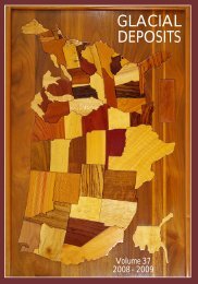
Glacial Deposits.indd - Department of Geography - Geology - Illinois ...
Glacial Deposits.indd - Department of Geography - Geology - Illinois ...
Glacial Deposits.indd - Department of Geography - Geology - Illinois ...

Create successful ePaper yourself
Turn your PDF publications into a flip-book with our unique Google optimized e-Paper software.
EARTHSCOPE: UNLOCKING THE SECRETS OF<br />
THE NORTH AMERICAN CONTINENT<br />
By Robert S. Nelson<br />
I<br />
llinois State University is one <strong>of</strong> almost 100 schools participating in EarthScope. EarthScope<br />
is the largest continental geology project ever funded by the National Science Foundation<br />
(NSF), in partnership with the United States Geological Survey, and with the collaboration <strong>of</strong><br />
UNVACO Inc., Incorporated Research Institutions for Seismology (lRIS), Stanford University,<br />
and NASA. Its goal is to explore the geologic structure and evolution <strong>of</strong> the North American<br />
continent and understand the processes controlling earthquakes and volcanoes. EarthScope<br />
will look into Earth and reveal the inner workings <strong>of</strong> the planet much like the Hubble Telescope<br />
is revealing the early history <strong>of</strong> the universe.<br />
EarthScope began in 2003 with a five-year (2003-2008) budget <strong>of</strong> about $200,000,000 from the<br />
NSF Major Research Equipment and Facility Construction Account to construct four facilities<br />
(the infrastructure for major research thrusts). (1) The San Andreas Fault Observatory at Depth<br />
(SAFOD) is an instrumented borehole through the San Andreas Fault, just north <strong>of</strong> Parkfield,<br />
California. The tight seismometer and strain meter grids at Parkfield and SAFOD, make this part<br />
<strong>of</strong> the San Andreas Fault the most instrumented fault segment on the planet. (2) The Advanced<br />
National Seismic System consists <strong>of</strong> broad band seismometers located on a 350 kilometer grid.<br />
I was contracted by the United States Geological Survey to locate an appropriate location for<br />
one <strong>of</strong> these stations in 2005. Station HDIL was constructed in 2006 at Mackinaw River State<br />
Fish and Wildlife Area about 20 miles west <strong>of</strong> the <strong>Illinois</strong> State campus. Seismic data from this<br />
station go by satellite telemetry every 15 seconds to the United States Geological Survey<br />
Albuquerque Seismological Laboratory. I remain the local contact for the station. (3) The Plate<br />
Boundary Observatory consists <strong>of</strong> 875 ultrahigh resolution global positioning system stations.<br />
Each station’s position is continuously determined and reported by satellite telemetry to<br />
UNAVCO in Boulder, Colorado. Station HDIL is also part <strong>of</strong> the Plate Boundary Observatory.<br />
Data since the station went on line in 2006 indicate that the station is moving south 60 o west at a<br />
velocity <strong>of</strong> roughly 1.5 mm/y and is going down about 5.07 mm/y. The horizontal motion is<br />
consistent with the general counterclockwise rotation <strong>of</strong> the North American Tectonic Plate.<br />
There are two major hypotheses for the vertical motion: post-glacial isostatic adjustment or<br />
collapse <strong>of</strong> the aquifer beneath the station as water is withdrawn in seeps and springs in the<br />
valleys on either side <strong>of</strong> the station. (4) The USArray consists <strong>of</strong> 400 high quality broad band<br />
seismometers deployed on a 75 kilometer grid. These were first deployed in California, Oregon,<br />
and Washington along the coast in 2006 (the 100 th anniversary <strong>of</strong> the San Francisco<br />
Earthquake). Each seismometer remains in place for about two years and then is moved to a<br />
new location, just east in the grid. In this fashion the USArray is rolling across the United States.<br />
The actual location for the USArray stations in <strong>Illinois</strong> will be determined this summer and<br />
installed next year for the 200 th anniversary <strong>of</strong> the New Madrid Earthquakes. In 2014 the<br />
USArray moves to Alaska for the 50 th anniversary <strong>of</strong> the 1964 Alaska Earthquake (the second<br />
largest recorded earthquake).<br />
In addition to the science, EarthScope has an education and outreach component. We obtained<br />
a major Math and Science Partnership Grant from the U.S. <strong>Department</strong> <strong>of</strong> Education through<br />
the <strong>Illinois</strong> State Board <strong>of</strong> Education to conduct <strong>Illinois</strong> EarthScope, a workshop for teachers. A<br />
pilot two-week workshop was conducted for 18 teachers in late July and early August 2009 with<br />
follow-up weekend sessions in November and January. In addition to hearing presentations by<br />
Drs. Dunn, Malone, and Nelson and Mr. Shields and participating in field trips led by Drs.<br />
2