CallForBidsNF00-1 - Jeanne d'Arc, South Whale, Magdalen Basins
CallForBidsNF00-1 - Jeanne d'Arc, South Whale, Magdalen Basins
CallForBidsNF00-1 - Jeanne d'Arc, South Whale, Magdalen Basins

You also want an ePaper? Increase the reach of your titles
YUMPU automatically turns print PDFs into web optimized ePapers that Google loves.
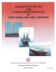
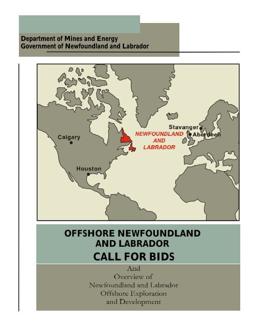
Department of Mines and Energy<br />
Government of Newfoundland and Labrador<br />
OFFSHORE NEWFOUNDLAND<br />
AND LABRADOR<br />
CALL FOR BIDS
GOVERNMENT OF<br />
NEWFOUNDLAND<br />
AND LABRADOR<br />
Department of<br />
Mines and Energy<br />
SIGNIFICANT DISCOVERIES<br />
OFFSHORE GRAND BANKS<br />
47<br />
JEANNE D’ARC BASIN<br />
SOUTH<br />
TEMPEST<br />
TRAVE<br />
NORTH<br />
DANA<br />
NAUTILUS<br />
HIBERNIA<br />
EAST<br />
RANKIN<br />
MARA<br />
WEST BEN NEVIS<br />
HEBRON<br />
TERRA<br />
NOVA<br />
KINGS<br />
COVE<br />
SOUTH MARA<br />
NORTH BEN<br />
NEVIS<br />
BEN NEVIS<br />
FORTUNE<br />
WEST BONNE BAY<br />
SPRINGDALE<br />
WHITE ROSE<br />
GAS<br />
OIL<br />
0 25 50 km<br />
49 48<br />
ST. JOHN’S<br />
WHITE ROSE<br />
HIBERNIA<br />
TERRA NOVA<br />
0 100 200 km<br />
NOTE: For illustrative purposes only<br />
After: C-NOPB
Department of Mines and Energy<br />
Offshore Newfoundland and Labrador<br />
Call for Bids NF00-1<br />
GOVERNMENT OF<br />
NEWFOUNDLAND<br />
AND LABRADOR<br />
August, 2000<br />
FOREWORD<br />
The purpose of this report is to provide information on offshore<br />
petroleum exploration and development opportunities in the Province of<br />
Newfoundland. General information is provided on the overall business<br />
climate, petroleum related infrastructure and geology, along with specific<br />
information on 14 land parcels being offered in a Call for Bids closing<br />
December 11, 2000.<br />
TABLE OF CONTENTS<br />
Introduction 2<br />
Section 1 - Strategic Location 4<br />
Section 2 - Industrial Infrastructure:<br />
A Brief Introduction 6<br />
Section 3 - Geological Framework 10<br />
Section 4 - Requests for Bids Parcels 19<br />
Section 5 - How to Make a Bid 35<br />
Section 6 - Fiscal Regimes and Taxation 36<br />
Section 7 - Related Web Links 38<br />
Section 8 - Bibliography, Endnotes and<br />
Acknowledgments 39<br />
Appendix A - Released Geological and<br />
Geophysical Reports 40
INTRODUCTION<br />
Page 2<br />
Hibernia Gravity<br />
Based Structure<br />
(GBS)<br />
The C-NOPB<br />
has recently<br />
upgraded its<br />
Hibernia reserve<br />
estimate from<br />
666 million to<br />
884 million<br />
barrels<br />
recoverable oil.<br />
The East Coast of<br />
Canada, including<br />
offshore Nova Scotia and<br />
offshore Newfoundland<br />
and Labrador, has<br />
recently come to<br />
prominence as a major<br />
new territory for<br />
petroleum exploration<br />
and development.<br />
The Hibernia field, in 80<br />
metres of water on the<br />
Grand Banks of<br />
Newfoundland, began<br />
production with a gravity<br />
based structure in 1997,<br />
and is currently<br />
producing about 150,000<br />
barrels of oil per day.<br />
The Terra Nova field,<br />
located 35-km southeast<br />
of Hibernia, will be<br />
brought onstream next<br />
year using a floating<br />
production system that is<br />
expected to produce<br />
more than 115,000<br />
barrels of oil per day at<br />
startup.<br />
Husky Oil recently<br />
announced a<br />
development proposal to<br />
produce 75,000 to<br />
100,000 bopd from the<br />
White Rose field by late<br />
2003 and Chevron is<br />
currently studying the<br />
possibility of developing<br />
the Hebron/Ben Nevis<br />
fields.To date, 127<br />
exploration wells, 29<br />
delineation wells and 37<br />
development wells have<br />
been drilled and resulted<br />
in the discovery of<br />
recoverable resources of<br />
2.1 billion barrels of oil,<br />
9.3 tcf of gas and 413<br />
million barrels of natural<br />
Terra Nova Floating Production<br />
Storage and Offloading Facility<br />
gas liquids. The<br />
international petroleum<br />
industry, along with local<br />
companies and research<br />
institutions, have<br />
Finding costs for<br />
the Grand Banks<br />
are less than US<br />
$1.00.<br />
successfully adapted<br />
technologies developed in<br />
the North Sea, Gulf of<br />
Mexico and elsewhere to<br />
meet the challenges of the<br />
northwest Atlantic<br />
environment, in a manner<br />
that allows for safe and<br />
profitable access to the<br />
area’s considerable<br />
petroleum resources.<br />
Finding costs for the<br />
Grand Banks are less<br />
1<br />
than US $1.00 and<br />
extraction costs for the<br />
Terra Nova field are<br />
estimated at US$ 7.50<br />
based on a reserve of 370<br />
2<br />
million barrels . Petro-<br />
Canada estimates that an<br />
undrilled fault block in<br />
the field may contain an<br />
additional 100 million<br />
barrels. More detail on<br />
discovered resources and<br />
geological framework is<br />
provided in Section 3.
INTRODUCTION<br />
Page 3<br />
Fourteen parcels of land totaling 2.2 million hectares are offered in<br />
the Call for Bids NF00-1 that closes December 11, 2000.<br />
Snorri<br />
GOVERNMENT OF<br />
NEWFOUNDLAND<br />
AND LABRADOR<br />
Department of<br />
Mines and Energy<br />
Petroleum Rights<br />
Newfoundland and Labrador<br />
May 2000<br />
Hopedale<br />
North Bjarni<br />
Bjarni<br />
EL 1048<br />
EL 1049<br />
EL 1050<br />
Gudrid<br />
EL 1051<br />
Goose Bay<br />
LABRADOR<br />
Cartwright<br />
Hibernia<br />
EL 1027<br />
EL 1046<br />
EL 1036<br />
EL 1033<br />
EL 1034<br />
EL 1046<br />
EL 1023<br />
EL 1032<br />
1<br />
EL 1022<br />
EL 1047<br />
EL 1045<br />
EL 1043<br />
2<br />
EL 1044<br />
White<br />
Rose<br />
EL 1042<br />
EL 1041<br />
EL 1039<br />
EL 1040<br />
EL 1052<br />
EL 1025<br />
3<br />
Terra Nova<br />
EL 1026<br />
QUEBEC<br />
4<br />
5<br />
6<br />
7<br />
NEWFOUNDLAND<br />
St. John’s<br />
FRENCH EXCLUSIVE<br />
ECONOMIC ZONE<br />
EXPLORATORY<br />
PERMITS<br />
NOTE: For illustrative purposes only<br />
Newfoundland Petroleum Rights
Section 1<br />
STRATEGIC LOCATION<br />
Page 4<br />
Whatever your<br />
markets, you<br />
can easily<br />
access them<br />
from<br />
Newfoundland<br />
and Labrador.<br />
Our trading<br />
patterns with<br />
Europe and<br />
North America<br />
have developed<br />
modern and<br />
extensive air,<br />
land and water<br />
infrastructure.<br />
Being the easternmost land mass of<br />
the North American continent, the<br />
Province of Newfoundland has held a<br />
strategic position throughout its 500<br />
years of settlement by Europeans.<br />
With its rich fishing grounds and<br />
location at the gateway to North<br />
America, the area was coveted by the<br />
European powers and ultimately<br />
became the first installment in the<br />
British Empire. The importance of<br />
Newfoundland and Labrador’s<br />
location was recognized repeatedly<br />
Cities<br />
Vancouver, Canada<br />
London, England<br />
New York, U.S.A.<br />
Boston, U.S.A<br />
Toronto, Canada<br />
Approx. Flying Times From Newfoundland<br />
0.0 2.0 4.0 6.0 8.0 10.0<br />
Flying Time in Hours<br />
in the twentieth century with the<br />
establishment of major American and<br />
Canadian military bases. Today, as a<br />
province of Canada, Newfoundland<br />
continues to capitalize on its location<br />
as it expands its economy beyond the<br />
traditional industries into the high tech<br />
world of offshore petroleum<br />
exploration and development.<br />
Figure 1.1<br />
Approximate<br />
flying times from<br />
Newfoundland<br />
London, England<br />
Approximate Marine Shipping Days<br />
Figure 1.2<br />
Cities<br />
Miami, U.S.A<br />
Norfolk, U.S.A.<br />
Boston, U.S.A<br />
Montreal, Canada<br />
Halifax, Canada<br />
0 2 4 6 8 10 12<br />
Marine Shipping (Days)<br />
Approximate<br />
marine shipping<br />
days from<br />
Newfoundland<br />
Approx. Trucking Time to Market<br />
Houston, U.S.A.<br />
Figure 1.3<br />
Cities<br />
Miami, U.S.A<br />
New York, U.S.A.<br />
Toronto, Canada<br />
Halifax, Canada<br />
0.0 2.0 4.0 6.0 8.0<br />
Trucking Time (days)<br />
Approximate<br />
trucking days<br />
from<br />
Newfoundland
Page 5<br />
STRATEGIC LOCATION<br />
The Hibernia<br />
discovery well was<br />
the sixtieth to be<br />
drilled offshore<br />
Newfoundland and<br />
Labrador. Since<br />
that discovery an<br />
average of 30<br />
million barrels<br />
have been found<br />
per exploration<br />
well.<br />
Figure 1.4<br />
WHY EXPLORE IN NEWFOUNDLAND<br />
⇒<br />
⇒<br />
⇒<br />
⇒<br />
⇒<br />
⇒<br />
Large undrilled structures in proven areas<br />
Proximal to major markets<br />
High production rates and recovery factors<br />
High quality sweet crude<br />
Plenty of unlicenced land in prospective areas<br />
Stable political climate
Section 2<br />
INDUSTRIAL INFRASTRUCTURE<br />
A BRIEF INTRODUCTION<br />
Page 6<br />
Cartwright<br />
Goose Bay<br />
LABRADOR<br />
QUEBEC<br />
QUE<br />
LAB<br />
Come-by-Chance<br />
Oil Refinery<br />
Whiffen Head<br />
Bull Arm<br />
GBS Construction Site<br />
Topsides Fabrication<br />
Facility<br />
St. Anthony<br />
Marystown<br />
Harbour<br />
Shipyard<br />
Rig Repair Facility<br />
St. John’s<br />
Capital City<br />
Port-aux-Basques<br />
Corner Brook<br />
Stephenville<br />
Deer Lake<br />
Gander<br />
NEWFOUNDLAND<br />
Miquelon<br />
St. Pierre<br />
Come-by-Chance<br />
Marystown<br />
LEGEND<br />
Airport<br />
Major Port<br />
International Airport<br />
Bull Arm<br />
Whiffen Head<br />
Argentia<br />
St. John’s<br />
Hibernia<br />
Terra Nova<br />
White Rose<br />
Figure 2.1<br />
Industrial Infrastructure Map of<br />
Newfoundland and Labrador continues to expand its industrial<br />
infrastructure to meet the needs of the<br />
petroleum industry.
Page 7<br />
INDUSTRIAL INFRASTRUCTURE<br />
A BRIEF INTRODUCTION<br />
St. John’s and Surrounding Areas<br />
According to a<br />
1997 KPMG study,<br />
St. John’s is the<br />
most cost-effective<br />
city to do business<br />
of 42 cities in 7<br />
countries.<br />
Figure 2.2<br />
St. John’s Waterfront<br />
Population of 174,051 (1996 Census)<br />
⇒<br />
⇒<br />
⇒<br />
⇒<br />
⇒<br />
⇒<br />
⇒<br />
Supply base for support services to the offshore oil and gas industry<br />
Helibase that provides passenger handling facilities, aviation fuel,<br />
pre-operational technical support, first response personnel and<br />
equipment, and airport terminal and maintenance/repair facilities.<br />
Subsea component fabrication facilities for fabrication of subsea<br />
templates and manifold systems.<br />
Services such as directional drilling, cementing, well completion,<br />
electrical wireline, perforating and pumping, reservoir management<br />
and data acquisition companies.<br />
According to a 1997 KPMG study, St. John’s is the most costeffective<br />
city to do business of 42 cities in 7 countries.<br />
The St. John's metropolitan area offers a variety of cost-effective<br />
industrial and office space. Prime industrial space is located in fully<br />
serviced industrial parks and you'll find Class A office space in<br />
downtown towers.<br />
Major administrative, research and training facilities, including:<br />
Memorial University<br />
College of the North Atlantic<br />
Centre for Cold Ocean Resources Engineering<br />
Institute for Marine Dynamics<br />
Marine Institute<br />
Figure 2.3<br />
Institute for Marine<br />
Dynamics
INFRASTRUCTURE<br />
Bull Arm<br />
Page 8<br />
Figure 2.4<br />
Hibernia Tow<br />
Out<br />
From the<br />
Whiffen Head<br />
Storage facility<br />
Grand Banks<br />
crude has ready<br />
access to the<br />
North American<br />
Market.<br />
Figure 2.5<br />
Bull Arm Construction Site<br />
Bull Arm was the fabrication and construction site for the 1.2 million tonne<br />
offshore oil drilling and production platform for the Hibernia oil field. The $470<br />
million site was also used to fabricate topsides modules for the Terra Nova FPSO<br />
vessel. The Terra Nova FPSO arrived at Bull Arm on May 12, 2000 for<br />
installation of the topsides modules, hook-up and commissioning.<br />
Whiffen Head<br />
Figure 2.6<br />
Newfoundland Transshipment Terminal Berth<br />
The Newfoundland Transshipment Terminal facility has 3 tanks each with<br />
500,000 barrels of storage capacity. It is currently constructing additional storage<br />
tanks for Terra Nova production and has the capacity to expand as offshore<br />
production levels increase. The expansion is expected to be completed by<br />
October 2000.
Page 9<br />
INFRASTRUCTURE<br />
North Atlantic Oil Refinery<br />
Figure 2.7<br />
North Atlantic Oil Refinery<br />
Located at the head of Placentia Bay, the North Atlantic Refining Ltd. oil<br />
refinery has a rated capacity of 105,000 barrels of oil per day and crude and<br />
product storage for over 7 million barrels. In addition, the deep-water<br />
facility is capable of receiving ultra large crude carriers in excess of 300,000<br />
dwt directly at the dock.<br />
Marystown<br />
In cities, towns<br />
and communities<br />
across<br />
Newfoundland,<br />
numerous<br />
companies have<br />
been established<br />
to meet the needs<br />
of offshore<br />
projects. Access to<br />
ancillary support,<br />
education<br />
infrastructure and<br />
a diversified labor<br />
force make this<br />
province an<br />
attractive and<br />
competitive site for<br />
your business.<br />
Figure 2.8<br />
Friede Goldman Facility at Marystown<br />
The Friede Goldman shipyard is capable of completing a wide variety of<br />
construction, fabrication and engineering requirements for offshore,<br />
shipbuilding, ship repair and general industrial work. The facility can also<br />
accommodate refitting, conversion, upgrading and maintenance as well as<br />
repairs to marine systems and oil rigs.
Section 3<br />
GEOLOGICAL FRAMEWORK<br />
Mesozoic <strong>Basins</strong> of the North Atlantic<br />
Page 10<br />
More than 26 billion barrels<br />
of oil and 63 tcf of natural gas<br />
have been produced from the<br />
Mesozoic basins of the North<br />
Atlantic. The primary<br />
producing reservoirs thus far<br />
have been the Lower<br />
Cretaceous, Jurassic and<br />
Tertiary sandstones of the<br />
British and Norwegian North<br />
Sea, but since November,<br />
1997 major production has<br />
been achieved from the<br />
Lower Cretaceous reservoirs<br />
on the west side of the<br />
Atlantic - at the Hibernia<br />
field. Although the distinction<br />
of first oil production in the<br />
northwest Atlantic goes to the<br />
Cohasset/Panuke field<br />
offshore Nova Scotia, which<br />
produced about 43 million<br />
barrels, Hibernia is the first<br />
giant field to be developed<br />
and is currently producing at<br />
150,000 bopd from only 9<br />
production wells.<br />
Figure 3.1 illustrates the<br />
parallel ancestry of the North<br />
Sea and offshore<br />
Newfoundland and Labrador<br />
basins, both of which were<br />
formed by the separation of<br />
Europe and Northwest Africa<br />
from North America by the<br />
continental drift that<br />
commenced in the<br />
Triassic/Early Jurassic.<br />
To date more than 2600<br />
exploration wells have been<br />
drilled in the North Sea and<br />
have proven resources of<br />
more than 55 billion barrels<br />
3<br />
of oil and 200 tcf of gas .<br />
Only 127 exploration wells<br />
FUNDY<br />
200 km<br />
CANADA<br />
SCOTIAN<br />
NEWFOUNDLAND<br />
ORPHEUS<br />
WHALE<br />
GREENLAND<br />
JEANNE<br />
D’ARC<br />
DOUKKALA<br />
ESSAOUIRA<br />
MOROCCO<br />
AGADIR<br />
AAIUN TARTAYA<br />
SOUSS<br />
Predrift rift basins of the North Atlantic margins.<br />
After: A. J. Tankard<br />
have been drilled Offshore<br />
Newfoundland and Labrador,<br />
by which some 2.1 billion<br />
barrels of oil and 9.3 tcf of<br />
natural gas have been<br />
4<br />
discovered . Studies of<br />
undiscovered oil resources in<br />
the Newfoundland and<br />
Labrador offshore area have<br />
focused primarily on the<br />
Northern Grand Banks and<br />
ROCKALL<br />
PORCUPINE<br />
ORPHAN<br />
FLEMISH<br />
PASS<br />
IRE<br />
GALICIA<br />
MARGIN<br />
U.K.<br />
Basque - Cantabrian<br />
Lusitanian<br />
BARENTS<br />
SEA<br />
MORAY<br />
FIRTH<br />
IBERIA<br />
NORWAY<br />
CENTRAL GRABEN<br />
NORTH<br />
SEA<br />
FRANCE<br />
Figure 3.1<br />
have resulted in estimates<br />
ranging from 6 to 12 billion<br />
barrels recoverable. The<br />
undiscovered gas resource for<br />
the offshore area is about 60<br />
5<br />
trillion cubic feet .
-53°00'<br />
-48°00'<br />
0<br />
100KM<br />
BRUNSWICK<br />
NEW<br />
CAP<br />
QUEBEC<br />
DSDP 1<br />
QUEBEC<br />
-53°00'<br />
Page 11<br />
GEOLOGICAL FRAMEWORK<br />
NEWFOUNDLANDFRACTUREZONE<br />
AVALONUPLIFT<br />
APROXIMATEOCEAṈCONTINENTBOUNDARY<br />
Figure 3.2<br />
Exploration is occurring in the Mesozoic <strong>Basins</strong> of the Grand Banks and Scotian Shelf as well as in<br />
the Paleozoic <strong>Basins</strong> of Western Newfoundland and throughout Eastern Canada. Lands are being<br />
offered in the Mesozoic and Paleozoic <strong>Basins</strong> in Call for Bids NF 00-1.<br />
-5 8°0 0'<br />
-63°0'<br />
-68°0'<br />
41°0'<br />
51°00'<br />
49°00'<br />
47°00'<br />
45°00'<br />
43°00'<br />
41°00'<br />
-43°00'<br />
APPROXIMATE OCEAN - CONTINENT<br />
YARMOUTH<br />
ARCH<br />
SHELBURNE SUBBASIN<br />
BOUNDARY<br />
SCOTIAN BASIN<br />
43°0'<br />
M O N TA G N A IS<br />
S TR U C T U R E<br />
SABLE<br />
SUBBASIN<br />
(201my)<br />
SHELBURNE DYKE<br />
LAHAVE<br />
PLATFORM<br />
APPROXIMATE OCEAN-CONTINENT BOUNDARY<br />
45°0'<br />
BAY OF FUNDY GRABEN<br />
COBEQUID FAULT<br />
C H E D A B U C T O F A U L T<br />
S C A T A R IE<br />
O R P H E U S G R A B E N<br />
C A N S O R ID G E<br />
WHALE BANK<br />
HIGH<br />
SOUTH WHALE BASIN<br />
LAURENTIANSUBBASIN<br />
NOVA SCOTIA<br />
HORSESHOE BASIN<br />
VIRGIN RIDGE<br />
WHALE BASIN<br />
USA<br />
After: C-NOPB<br />
NEWFOUNDLAND SEAMOUNTS<br />
BURIN PLATFORM<br />
R ID G E<br />
ṖẸỊ<br />
FLEMISH PASS<br />
BASIN<br />
JEANNE D'ARC BASIN<br />
(SOUTHERN)<br />
ST.JOHN'S<br />
FLEMISH<br />
47°0'<br />
CUMBERLANDMAGNETICBELT<br />
NEW FOUNDLAND<br />
<br />
SYDN EY<br />
B ASIN<br />
20m<br />
MAGDALEN BASIN<br />
20m<br />
BAY SUBBASIN<br />
ST.GEORGE’S<br />
A N T IC O S T I B A S IN<br />
49°0'<br />
KNOLL<br />
ORPHAN<br />
EAST NEWFOUNDLAND/ORPHAN BASIN<br />
ST. ANTHONY<br />
BASIN<br />
51°0'<br />
LAḄ<br />
-63°0'<br />
-58°0'<br />
CHARLIE GIBBS FRACTURE ZONE<br />
- L O CATIO N<br />
- S U SP EN D ED WE L L<br />
- A BA N DO N ED WE LL<br />
- A BA N DO N ED OIL SH OW<br />
- A BA N DO N ED OIL WE LL<br />
- S US P EN D ED OIL WE LL<br />
- A BA N DO NE D O IL A N D G AS WE L L<br />
- S US PE N DE D O IL A N D G AS WE L L<br />
- AB A ND O NE D G A S W EL L<br />
-48°00'<br />
-43°00'<br />
-68°0'<br />
CALL FOR BIDS NF 00-1 LAND SALE PARCELS<br />
LEGEND<br />
M ES OZ O IC B AS IN<br />
C AR B ON IFE R OU S B AS IN<br />
PA L EO Z OIC BA SIN<br />
C-NO PB Call for Bids NF00-1
GEOLOGICAL FRAMEWORK<br />
Figures 3.3 and 3.4 illustrate the<br />
primary reservoirs and structural<br />
style of the <strong>Jeanne</strong> d’Arc and the<br />
Flemish Pass basins. To date the<br />
key reservoirs are the Lower<br />
Cretaceous Ben Nevis/Avalon and<br />
Hibernia sandstones and the Late<br />
Jurassic <strong>Jeanne</strong> d’Arc sandstones.<br />
As in the North Sea the source<br />
rock is a regional Kimmeridgian<br />
shale with total organic carbon in<br />
the neighborhood of 4.5% and a<br />
hydrogen index in the range of five<br />
hundred to seven hundred,<br />
indicating a 6highly oil prone<br />
source rock .<br />
The <strong>Jeanne</strong> d’Arc basin is home to<br />
all of the large oil fields discovered<br />
to date, including Hibernia, Terra<br />
Nova, Hebron and White Rose.<br />
Based on current developments<br />
(Hibernia and Terra Nova), this<br />
basin will be producing about<br />
300,000 barrels per day by March<br />
of 2001, and if development<br />
proceeds as expected at White<br />
Rose and Hebron, could be<br />
producing more than 500,000 bopd<br />
by mid-decade. In the meantime<br />
new seismic data continues to<br />
refine the geologic picture and<br />
identify new targets, exploratory<br />
drilling continues, and recent land<br />
sales have recorded record bids .<br />
Three parcels in this years Request<br />
for Bids are located in the <strong>Jeanne</strong><br />
d’Arc Basin (Figure 3.4).<br />
The Hibernia B-16-1 well<br />
set a Canadian daily flow<br />
rate record in 1998 when<br />
it tested at 56,000 barrels<br />
of oil per day from the<br />
Hibernia Sandstone<br />
Reservoir.<br />
VAN HINTE 1976 USGS 1980<br />
VAN EYSINGA<br />
1978<br />
AGE<br />
ma.<br />
50<br />
100<br />
150<br />
200<br />
Q<br />
GEOCHRONOLOGIC<br />
SCALE<br />
JURASSIC CRETACEOUS TERTIARY<br />
TRIASSIC<br />
PL.<br />
EOCENE OLIGO. MIOCENE<br />
PAL.<br />
LATE EARLY MIDDLE LATE EARLY<br />
LATE<br />
NEOCOM. SENONIAN<br />
TURONIAN<br />
CENOMANIAN<br />
ALBIAN<br />
APTIAN<br />
BARREMIAN<br />
HAUT.<br />
VAL.<br />
BERR.<br />
TITHONIAN<br />
KIMMERIDGIAN<br />
OXFORDIAN<br />
CALLOVIAN<br />
BATHONIAN<br />
BAJOCIAN<br />
AALENIAN<br />
TOARCIAN<br />
PLIENS.<br />
SINEMURIAN<br />
HATTANGIAN<br />
RHAETIAN<br />
NORIAN<br />
CARNIAN<br />
PALEOZOIC<br />
MAAS.<br />
CAMPANIAN<br />
SANTONIAN<br />
S TO SW<br />
CONIACIAN OTTER BAY MBR.<br />
LITHOLOGIES<br />
SANDSTONE<br />
SHALE<br />
RED BEDS<br />
LIMESTONE<br />
DOLOMITE<br />
<strong>Jeanne</strong> d’Arc Basin<br />
FOX HARBOUR MBR.<br />
BANQUEREAU<br />
FORMATIONS<br />
DAWSON CANYON<br />
Figure 3.3<br />
NAUTILUS<br />
AVALON<br />
'A' MARKER MBR.<br />
WHITEROSE<br />
CATALINA MBR.<br />
'B' MARKER MBR.<br />
HIBERNIA<br />
UPPER ZONE<br />
LOWER ZONE<br />
FORTUNE BAY<br />
JEANNE D'ARC<br />
RANKIN<br />
WHALE MBR.<br />
GAMBO MBR.<br />
EGRET MBR.<br />
VOYAGER<br />
ARGO<br />
HALITE<br />
PORCELANEOUS<br />
MUDSTONE<br />
PETREL MBR.<br />
EURYDICE<br />
PORCELANEOUS<br />
MUDSTONE<br />
METASEDIMENTS<br />
BASALT<br />
LAURENTIAN<br />
PORT AU PORT MBR.<br />
IROQUOIS<br />
BEN NEVIS<br />
SOUTH MARA MBR.<br />
ACCESSORIES<br />
SANDY<br />
SILTY<br />
DOWNING<br />
COBBLES, PEBBLES<br />
ARGILLACEOUS<br />
COALY<br />
MARLY<br />
ORGANIC-RICH<br />
C<br />
N TO NE<br />
C<br />
WYANDOT MBR.<br />
TECTONIC<br />
FRAMEWORK<br />
UNCONFORMITY<br />
POST<br />
SYN<br />
ONSET WARP<br />
POST<br />
SYN<br />
ONSET WARP<br />
POST<br />
SYN<br />
RIFT<br />
UNCONFORMITY<br />
RIFT<br />
UNCONFORMITY<br />
RIFT<br />
UNCONFORMITY<br />
RIFT<br />
UNCONFORMITY<br />
RIFT<br />
UNCONFORMITY<br />
RIFT<br />
UNCONFORMITY<br />
Page 12<br />
OROGENIC<br />
EVENTS<br />
EUROPE-<br />
N. AMERICA<br />
BREAK-UP<br />
AUSTRIAN<br />
OROGENY<br />
IBERIA-<br />
GRAND BANKS<br />
BREAK-UP<br />
LATE<br />
KIMMERIAN<br />
OROGENY<br />
AFRICA-<br />
N. AMERICA<br />
BREAK-UP<br />
EARLY<br />
KIMMERIAN<br />
OROGENY<br />
JEANNE D’ARC BASIN<br />
LITHOSTRATIGRAPHY<br />
DATE: 12-03-1990<br />
The primary reservoirs of the <strong>Jeanne</strong> d’Arc basin<br />
are the Lower Cretaceous Avalon/Ben Nevis and<br />
Hibernia Sands, and the Late Jurassic <strong>Jeanne</strong> d’Arc<br />
Sands. The key source rock is the Kimmeridgian<br />
aged Egret Member.
EGRET<br />
Page 13<br />
GEOLOGICAL FRAMEWORK<br />
0.0<br />
A<br />
SW<br />
GEOLOGICAL CROSS-SECTION ACROSS<br />
JEANNE D’ARC BASIN<br />
A<br />
NE<br />
Fox Harbour SS<br />
1.0<br />
O tter Bay<br />
<strong>South</strong> Mara SS<br />
TERTIARY<br />
Time (seconds)<br />
2.0<br />
3.0<br />
Hibernia<br />
SS<br />
Avalon/Ben<br />
Nevis SS<br />
UPPER CRETACEOUS<br />
Petrel Limestone<br />
<strong>South</strong><br />
Tempest<br />
<strong>Jeanne</strong> d’Arc SS<br />
4.0<br />
Voyager SS<br />
JURASSIC<br />
LOWER<br />
CRETACEOUS<br />
5.0<br />
Simplified schematic cross section based on seismic line 6313.85 (after Sinclair, 1994)<br />
-50°00'<br />
-48°00'<br />
OFFSHORE ATLANTIC CANADA BASINS<br />
-47°00'<br />
-48°00'<br />
NORTH CENTRAL RIDGE<br />
LEGEND<br />
- LOCATION<br />
- SUSPENDED WELL<br />
- ABANDONED WELL<br />
- ABANDONED OIL SHOW<br />
- ABANDONED OIL WELL<br />
- SUSPENDED OIL WELL<br />
EASTERN RIDGE<br />
- ABANDONED OIL AND GAS WELL<br />
- SUSPENDED OIL AND GAS WELL<br />
0 50KM<br />
-46°00'<br />
-50°00'<br />
After: C-NOPB<br />
- ABANDONED GAS WELL<br />
MESOZOIC BASIN<br />
CARBONIFEROUS BASIN<br />
PALEOZOIC BASIN<br />
C-NOPB Call for Bids NF99-1<br />
BONAVISTA PLATFORM<br />
-61°00'<br />
MURRE FAULT<br />
A<br />
FAULT<br />
3<br />
1<br />
JEANNE D'ARCBASIN<br />
A<br />
2<br />
200 m<br />
CENTRAL RIDGE<br />
VOYAGER FAULT<br />
MORGIANA UPLIFT<br />
PYRAMID HIGH<br />
ANSONGRABEN<br />
VESTA HIGH<br />
-46°00'<br />
-47°00'<br />
Figure 3.4
Page 14<br />
OCEAN-CONTINENT<br />
BOUNDARY<br />
APROXIMATE<br />
<strong>South</strong>ern Grand Banks Basin<br />
BONITION<br />
CARSON<br />
SALAR<br />
BASIN<br />
F LE M IS H<br />
RIDGECOMPLEX<br />
BA S IN<br />
JE A N N E D 'A R C B A S IN<br />
HORSESHOEBASIN<br />
CORIDORFRENCH<br />
BAY ST. GEORGE<br />
SUBBASIN<br />
SṪJOHN'S<br />
SYDNEY<br />
BASIN<br />
W HALE<br />
BASIN<br />
AVALON<br />
UPLIFT<br />
BURIN PLATFORM<br />
CANSO RIDGE<br />
LAURENTIAN SUBBASIN<br />
S O U T H W H A L E B A S IN<br />
NEWFOUNDLAND<br />
FRACTURE ZONE<br />
200KM<br />
0<br />
Modified after: Canada-Newfoundland Offshore Petroleum Board and Geological Survey of Canada<br />
Figure 3.5
Page 15<br />
GEOLOGICAL FRAMEWORK<br />
Carson/Bonnition Basin<br />
B<br />
B<br />
PALEO -VALLEY<br />
LARGE TILTED<br />
FAULT BLOCKS<br />
Seismic Line 83-2704<br />
Courtesy of Geological Survey of Canada<br />
Figure 3.6<br />
This seismic located in the Bonnition Basin shows possible turbidites in the<br />
Lower Tertiary and Lower Cretaceous<br />
Parcels four to seven of Request for Bids NF 00-1 are located within the Carson/Bonnition Basin. The<br />
basin contains only 4 wells, all of which are located along an elevated terrace on its northwest margin.<br />
The Bonnition H-32 and the St. George J-55 wells encountered Lower Cretaceous and Jurassic sandstones,<br />
and Bonnition had gas shows in the Lower Cretaceous Missisauga sandstones. No source rock has been<br />
identified by the limited drilling but the basin deepens considerably to the southeast, presenting the<br />
possibility of thick shale sequences. Seismic line 83-2704 indicates the presence of a large paleo-valley<br />
(figure 3.6) approximately six km wide and 900 meters deep, suggesting a major river system that could<br />
have brought considerable amounts of sand to the area. Seismic also shows large basement ridge<br />
structures running parallel to and outboard of the ancient seacoast, that could have provided the restricted<br />
marine conditions that favor the development of source rock. Play concepts include Cretaceous and<br />
Jurassic fault blocks, stratigraphic subcrops and Cretaceous and Tertiary turbidites.
GEOLOGICAL FRAMEWORK<br />
PALEOZOIC MESOZOIC CENOZOIC<br />
CARBONIFEROUS TR. JURASSIC CRETACEOUS<br />
TERTIARY<br />
DEV.<br />
NEOG<br />
PALOEGENE<br />
SENONIAN<br />
M<br />
E<br />
L<br />
M<br />
L<br />
E<br />
L<br />
M<br />
OXFORDIAN<br />
CALLOVIAN<br />
BAJOCIAN<br />
BAJOCIAN<br />
TOARCIAN<br />
PLIENSBACHIAN<br />
SINEMURIAN<br />
HETTANGIAN<br />
RHAETIAN<br />
STEPHANIAN<br />
WESTPHALIAN<br />
NAMURIAN<br />
VISEAN<br />
TOURNAISIAN<br />
FAMENNIAN<br />
FRASNIAN<br />
GIVETIAN<br />
CANYON FM.<br />
VERRILL<br />
<br />
ABENAKI<br />
FM.<br />
MIC MAC<br />
FM.<br />
MOHAWK FM.<br />
IROQOUIS FM.<br />
ARGO FM.<br />
EURYDICE FM.<br />
ABENAKI<br />
FM<br />
SHALE<br />
IROQUOIS FM.<br />
ARGO FM.<br />
EURYDICE FM.<br />
UNNAMED<br />
PICTOU<br />
CUMBERLAND GPS.<br />
RIVERDALE-<br />
CANSO GPS.<br />
WINDSOR GP.<br />
HORTON GP.<br />
BASEMENT COMPLEX<br />
SHALE<br />
UPPER CARB<br />
LR. SHALE<br />
ARGO FM.<br />
MIC<br />
MAC<br />
FM.<br />
Comparative stratigraphy of Scotian Shelf,<br />
<strong>South</strong>ern Grand Banks and Northern Grand<br />
Banks.<br />
<br />
CANYON FM.<br />
VERRILL<br />
<br />
MIC<br />
MAC<br />
FM.<br />
<br />
SOUTH MARA<br />
<br />
<br />
SOUTH<br />
TEMPEST<br />
After Northcor Energy Report 1984 & MacLean and Wade, 1990<br />
MISSISAUGA FM.<br />
CANYON FM.<br />
VERRILL<br />
<br />
TRANSGRESSIVE<br />
REGRESSIVE<br />
INTERMEDIATE DRIFTING<br />
TRANSGRESSIVE<br />
RIFT<br />
TECTONIC<br />
SEDIMENT<br />
STAGES<br />
LATE DRIFTING<br />
EARLY DRIFTING<br />
VALLEY<br />
PRE-RIFT<br />
Page 16<br />
<strong>South</strong> <strong>Whale</strong> Subbasin<br />
The <strong>South</strong> <strong>Whale</strong> Subbasin was the first to be drilled offshore Newfoundland and Labrador. Fourteen<br />
wells were drilled between 1966 and 1974 and one well ( Narwhal F-99) was drilled in 1987. In this first<br />
phase of Grand Banks exploration the companies primarily targeted the salt piercement features<br />
involving the Lower Jurrassic Argo Salt. It appears, however, that the Argo salt movement may have<br />
postdated the migration of hydrocarbons and no discoveries were made. There were several oil and gas<br />
shows in the <strong>South</strong> <strong>Whale</strong> Subbasin but a source rock has yet to be identified by the limited drilling.<br />
However, given that the <strong>South</strong> <strong>Whale</strong> Subbasin lies on trend with the Scotian Basin which has a rich gasprone<br />
source rock in the Upper Jurassic Verill Canyon Shales, there is a very good chance of similar age<br />
source rocks in the deeper parts of the <strong>South</strong> <strong>Whale</strong>. It is also possible that the Egret Member, that has<br />
sourced the oil and gas discoveries<br />
Figure 3.7<br />
of the <strong>Jeanne</strong> d’Arc Basin may be<br />
AGE<br />
SCOTIAN SOUTHERN NORTHERN present in this area. Although<br />
SHELF GRAND BANKS GRAND BANKS similarities to the Scotian Basin<br />
Q<br />
PLIOCENE<br />
suggests that the area may be gas<br />
MIOCENE<br />
prone, large basement ridges<br />
BANQUEREAU BANQUEREAU BANQUEREAU<br />
(observed on seismic data) that run<br />
OLIGOCENE<br />
FORMATION FORMATION FORMATION parallel to the shelf may have<br />
EOCENE<br />
provided the restricted marine<br />
conditions that favor the<br />
PALEOCENE<br />
development of oil-prone source<br />
MAASTRICHTIAN<br />
FOX HARBOUR<br />
CAMPANIAN WYANDOT FM.<br />
DAWSON DAWSON CANYON rocks. These ridges appear to have<br />
SANTONIAN<br />
DAWSON CANYON<br />
CANYON FORMATION<br />
CONIACIAN FORMATION<br />
FORMATION<br />
been the base for carbonate banks<br />
OTTER BAY<br />
TURONIAN<br />
PETREL MBR<br />
PETREL MBR<br />
PETREL MBR<br />
L<br />
that grew within the Jurassic. These<br />
CENOMANIAN SHORT- SABLE M. LOGAN SHORT- EIDER<br />
BEN<br />
NAUTILUS<br />
ALBIAN LAND<br />
CANYON LAND<br />
NEVIS<br />
SHALE<br />
SHALE NASKAPI M. FM. SHALE<br />
banks, interpreted on the basis of<br />
APTIAN<br />
AVALON<br />
BARREMIAN<br />
seismic character, may have<br />
E<br />
MISSISAUGA<br />
HAUTERIVIAN MISSISSAUGA<br />
FORMATION<br />
CATALINA<br />
VALANGINIAN FORMATION<br />
porosity development creating the<br />
HIBERNIA<br />
BERRIASIAN<br />
opportunity for structural /<br />
TITHONIAN<br />
JEANNE D’ARC<br />
L KIMMERIDGIAN<br />
stratigraphic plays.<br />
The <strong>South</strong> <strong>Whale</strong> Subbasin<br />
contains the equivalent of the<br />
Micmac and Mississauga<br />
sandstones that have been key<br />
producers in the Scotian Basin.<br />
Seismic data indicates the presence<br />
of an Upper Jurassic reef front, that<br />
is known to contain thick porous<br />
intervals on the Scotian Shelf, but<br />
which has never been drilled<br />
offshore Newfoundland. Pan-<br />
Canadian Petroleum recently<br />
announced a major gas discovery<br />
within such a reef front offshore<br />
Nova Scotia. This “Deep Panuke”<br />
discovery was tested by two wells,<br />
both of which tested in excess of 50<br />
million cubic feet per-day with the<br />
flow rates limited by equipment.
GEOLOGICAL FRAMEWORK<br />
The presence of petroleum in Western<br />
Newfoundland has been recognized in surface<br />
seeps and shallow drilling since the late 1800's.<br />
The first modern exploration effort - using<br />
seismic to select a well location - was carried out<br />
by Hunt Oil and Pan Canadian in 1994-95 and<br />
resulted in the Hunt/Pan Canadian Port au Port<br />
#1 discovery. This well encountered four zones of<br />
good reservoir quality in the Cambro-Ordivician<br />
platform. The two lower zones were wet, but the<br />
upper two zones flowed oil at rates of 1528 and<br />
1742 b/d respectively. Although follow up<br />
drilling at four other locations failed to make<br />
additional discoveries, the Port au Port #1 well<br />
proved the presence of a viable petroleum system<br />
in the area. Released seismic data show that large<br />
undrilled prospects remain to be tested<br />
throughout the offshore and onshore areas of<br />
western Newfoundland.<br />
GOVERNMENT OF<br />
NEWFOUNDLAND<br />
AND LABRADOR<br />
Department of<br />
Mines and Energy<br />
Generalized Stratigraphic Sections<br />
Western Newfoundland<br />
Western Newfoundland<br />
GOVERNMENT OF<br />
NEWFOUNDLAND<br />
AND LABRADOR<br />
Department of<br />
Mines and Energy<br />
Port au Port #1<br />
Discovery<br />
Well<br />
LABRADOR<br />
QUEBEC<br />
ANTICOSTI<br />
BASIN<br />
GULF OF<br />
ST. LAWRENCE<br />
OS<br />
Hydrocarbon Shows<br />
Western Newfoundland<br />
NFLD<br />
OS<br />
GEOLOGY:<br />
LABRADOR<br />
STRAIT OF BELLE ISLE<br />
Show<br />
SEEPS:<br />
OTHER:<br />
OS<br />
ATLANTIC<br />
OCEAN<br />
(Oil, Gas,Oil & Gas)<br />
Oil<br />
Bitumen<br />
Oil Shales<br />
Carboniferous / Silurian<br />
Post Flysch Sequence<br />
Allocthon<br />
Shelf-Flysch<br />
Precambrian Basement<br />
0 50 100 km<br />
Page 17<br />
AUTOCHTHONOUS<br />
STRATA<br />
METRES<br />
0<br />
500<br />
1000<br />
SILURIAN<br />
ORDOVICIAN<br />
CAMBRIAN<br />
PE<br />
After: James et al, 1988<br />
CLAM<br />
BANK<br />
LONG<br />
POINT GROUP<br />
MAINLAND<br />
SANDSTONE<br />
GOOSE TICKLE<br />
TABLE HEAD<br />
GROUP<br />
ST. GEORGE<br />
GROUP<br />
PORT AU PORT<br />
GROUP<br />
LABRADOR<br />
GROUP<br />
GRENVILLE BASEMENT<br />
U/C<br />
METRES<br />
0<br />
500<br />
U/C - UNCONFORMITY<br />
ALLOCHTHONOUS<br />
LOWER ORDOVICIAN<br />
CAMBRIAN ORDOVICIAN<br />
Figure 3.8<br />
SUITE<br />
PILLOW LAVAS<br />
SHEETED DIKES<br />
&<br />
BRECCIAS<br />
CUMULATES<br />
MOHO<br />
MANTLE<br />
METAMORPHIC AUREOLE<br />
MELANGE<br />
LOWER HEAD<br />
FORMATION<br />
COW<br />
HEAD<br />
GROUP<br />
CURLING<br />
GROUP<br />
MELANGE<br />
8 km<br />
Figure 3.9<br />
In Western Newfoundland and offshore in the<br />
Gulf of St. Lawrence, a Cambro-Ordovician<br />
carbonate platform overlies Paleozoic clastic<br />
sediments of the Labrador Group and crystalline<br />
basement. The Ordovician carbonates and clastics<br />
are locally overlain by Carboniferous clastic and<br />
carbonate sediments. Reservoir quality rocks<br />
have been identified in both the Cambro-<br />
Ordovician and the Carboniferous. The tectonic<br />
history of the area is complex. In the late<br />
Ordovician subsidence reactivated faulting,<br />
initiated during a period of extension in the<br />
Cambrian, produced normal faults in the<br />
carbonate platform. Later, compression brought<br />
the onset of thrusting and reverse faulting of the<br />
carbonate platform and older formations. Strike<br />
slip faulting along the Cabot Fault Zone led to the<br />
creation of Carboniferous pull apart basins.
M is s is s ip p ia n<br />
Late<br />
GEOLOGICAL FRAMEWORK<br />
Western Newfoundland<br />
Page 18<br />
GOVERNMENT OF<br />
NEWFOUNDLAND<br />
AND LABRADOR<br />
Department of<br />
Mines and Energy<br />
S chem atic C ross-Section<br />
S t. G eorge’s B ay<br />
C<br />
150<br />
Anticosti Basin<br />
500<br />
St. George’s Bay<br />
A-36<br />
1000<br />
1500<br />
Bay St. George Subbasin<br />
2000<br />
C<br />
2500<br />
2000<br />
4000<br />
6000<br />
CARBONIFEROUS<br />
SILURIAN/ DEVONIAN<br />
LONG POINT GRP.<br />
BASEMENT<br />
Round Head<br />
Fault<br />
Mainland<br />
Fault<br />
POSSIBLE ANGUILLE or<br />
CAMBRO-ORD. or BASEMENT<br />
CODROY GRP.<br />
BASEMENT<br />
Windsor<br />
Salt<br />
DEPTH (m)<br />
8000<br />
10 000<br />
CAMBRO- ORDOVICIAN<br />
CARBONATE PLATFORM<br />
0 10 KM<br />
BASED ON SEISMIC LINE ZXL-130<br />
Figure 3.10<br />
-61°00'<br />
-49°00'<br />
LEGEND<br />
- LOCATION<br />
- SUSPENDED WELL<br />
- ABANDONED WELL<br />
- ABANDONED OIL SHOW<br />
- ABANDONED OIL WELL<br />
- SUSPENDED OIL WELL<br />
- ABANDONED OIL AND GAS WELL<br />
- SUSPENDED OIL AND GAS WELL<br />
- ABANDONED GAS WELL<br />
MESOZOIC BASIN<br />
CARBONIFEROUS BASIN<br />
PALEOZOIC BASIN<br />
C-NOPB Call for Bids NF00-1<br />
0 50<br />
-47°00'<br />
-61°00'<br />
After: C-NOPB<br />
Western Newfoundland Offshore <strong>Basins</strong><br />
KM<br />
C<br />
C<br />
Figure 3.11<br />
-58°00'<br />
-49°00'<br />
-47°00'<br />
-58°00'<br />
Visean<br />
Nam. Pennsylvanian<br />
Westphalian<br />
Horton Windsor<br />
Canso Riversdale Cumberland<br />
Anguille Group<br />
Codroy Group Barachois Group<br />
Dev. Tournaisian<br />
Pictou<br />
E<br />
D<br />
C<br />
B<br />
A<br />
S<br />
<br />
Searston Formation<br />
(2500m)<br />
Overfall<br />
Brook<br />
(345m)<br />
Woody<br />
Cape<br />
(690m)<br />
SW Anguille<br />
Mtns-Codroy<br />
Valley<br />
<br />
Jeffrey’s Village<br />
Member<br />
Kennels Brook<br />
Formation<br />
(1000-3200m)<br />
Mollichignick Member<br />
Snake’s Bight<br />
Formation<br />
Robinsons<br />
River Formation<br />
Basement Unknown<br />
Northern<br />
Anguille<br />
Mountains<br />
St. George’s<br />
Bay Lowlands<br />
Upper coal- bearing sequence<br />
(1500-1600m)<br />
CL<br />
Highlands Member<br />
(1000-1300m)<br />
Jeffrey’s Village<br />
Member<br />
(1400-2100m)<br />
Codroy Road Formation<br />
(145-244m)<br />
Ship Cove Formation (2-25m)<br />
Spout Falls<br />
Fischell’s Brook member.<br />
(200m)<br />
Formation<br />
Friar’s Cove (780-2250m)<br />
Formation<br />
Oil shows<br />
(500-1300m)<br />
Onlap onto<br />
Precambrian<br />
basement<br />
(785-1000m)<br />
Carboniferous Stratigraphy<br />
Bay St. George Area<br />
(2275m)<br />
(1500-1600m)<br />
<br />
<br />
Lacustrine<br />
source rock<br />
Port au Port<br />
Stephenville<br />
Blanche Brook<br />
coal beds<br />
No age constraints<br />
Brow Pond Lentil<br />
(Thickness unknown)<br />
Onlap onto<br />
L.Paleozoic<br />
karst terrain<br />
ROCK TYPES<br />
Conglomerate<br />
Sandstone<br />
Shale<br />
Limestone<br />
Salt<br />
Reef<br />
N<br />
Figure 3.12<br />
After: Knight, 1992<br />
Cross section II’ illustrates the transition from the Bay St. George Carboniferous<br />
subbasin into the Anticosti Basin. It is unknown if the carbonate platform is<br />
preserved beneath the Carboniferous in Bay St. George.
Section 4<br />
Page 19<br />
Request For Bids Parcels<br />
This section provides a detailed description of each land sale parcel. The maps provided show the<br />
location of the land parcels and the released seismic data on those parcels. Hard copies and interpretive<br />
reports based on these data are available from the Canada-Newfoundland Offshore Petroleum Board for<br />
the cost of reproduction. For the purposes of this report representative seismic sections that show the<br />
general geology and recognizable play types have been selected. The seismic data quality varies with<br />
area and data vintage. For example there is very little released data on parcel fourteen. What data is<br />
available is on poor quality microfiche and seriously degraded by multiple.<br />
Recent Landsale Results<br />
Year<br />
1995<br />
1996<br />
1997<br />
1998<br />
1999<br />
Total<br />
Number<br />
of Parcels<br />
Bid<br />
1<br />
8<br />
7<br />
13<br />
5<br />
34<br />
Bids ($Can<br />
Millions)<br />
95.8<br />
126.1<br />
97.0<br />
175.2<br />
192.3<br />
686.4<br />
Conversion rate: $CAN1.00~ $US .70<br />
Table 4.1
TWO -WAY TIME (seconds)<br />
Parcel 1<br />
Page 20<br />
Request For Bids Parcels<br />
PARCEL 1<br />
SW<br />
0<br />
kilometres<br />
5 10 15 20 25<br />
0.0<br />
TERTIARY<br />
1.0<br />
1.0<br />
NE<br />
0.0<br />
2.0<br />
Petrel<br />
Base Of<br />
Teritary Fan<br />
2.0<br />
3.0<br />
UPPER CRETACEOUS<br />
“A” Marker<br />
Albian UNCF.<br />
(Top Ben Nevis)<br />
3.0<br />
4.0<br />
LOWER CRETACEOUS<br />
Hibernia SS Level<br />
“B” Marker<br />
4.0<br />
5.0<br />
JURASSIC<br />
Tithonian UNCF.<br />
5.0<br />
Note: Program # 8620-S014-008E<br />
SEISMIC LINE 83-5068<br />
Adolphus D-50<br />
Trave E-87<br />
0<br />
Mara M-54<br />
<strong>South</strong> Mara C-13<br />
Mara E-30<br />
Botwood G-89<br />
Hebron I-13<br />
North Ben<br />
Nevis P-93<br />
North Ben<br />
Nevis M-61<br />
West Ben<br />
Nevis B-75<br />
Brent’s Cove I-30<br />
G-90<br />
C-09<br />
H-99<br />
K-18 L-98<br />
K-08<br />
K-17<br />
K-07 I-97<br />
King’s Cove<br />
A-26<br />
Beothuk M-05<br />
10 km<br />
E-79<br />
# 1<br />
Fortune G-57<br />
J-49<br />
N -22<br />
Ben Nevis I-45<br />
Ben Nevis L-55<br />
West Bonne<br />
Bay C-23 Bonne Bay<br />
North Trinity H-71 C-73<br />
Terra Nova<br />
Field<br />
L-61<br />
Springdale M-29<br />
Voyager J-18<br />
N-30<br />
# 2<br />
H-20<br />
E-09<br />
L-08<br />
A-17<br />
A-90<br />
Amethyst F-20<br />
Archer K-19<br />
Location: <strong>Jeanne</strong> d’Arc Basin<br />
Parcel Area: 33,957 hectares<br />
Water depth: 100 m<br />
Released Seismic Data : 2213.16 km<br />
Data Vintages: 1966 –1990<br />
Play Types:<br />
- Base of Tertiary fans and<br />
turbidites<br />
- Cretaceous and Jurassic sands in<br />
tilted fault blocks<br />
This parcel is surrounded on three sides by<br />
significant discoveries that contain oil and gas in<br />
primarily Lower Cretaceous and Upper Jurassic<br />
sands. The section shows some potential leads from<br />
faulting in the Lower Cretaceous and Jurassic as<br />
well as a gentle roll over of the Jurassic to Upper<br />
Cretaceous section. Very little drilling has targeted<br />
Lower Tertiary fans but the Mara M-54 well tested<br />
620 bopd from such a fan and White Rose L-61<br />
tested 12 mmcf/d from an equivalent age sand.
Parcel 2<br />
Page 21<br />
Request For Bids Parcels<br />
PARCEL 2<br />
SW<br />
FORTUNE G-57<br />
0 5 10 15 20 25<br />
kilometres<br />
0.0<br />
NE<br />
0.0<br />
O<br />
47 00’<br />
TWO- WAY TIME(seconds)<br />
O<br />
-48 40’<br />
1.0<br />
2.0<br />
3.0<br />
4.0<br />
5.0<br />
Adolphus D-50<br />
Petrel<br />
Ben Nevis<br />
UPPER CRETACEOUS<br />
LOWER CRETACEOUS<br />
Tithonian UNCF.<br />
Note: Program # 8620-S014-008E<br />
SEISMIC LINE 83-5032<br />
“A” Marker<br />
JURASSIC<br />
O<br />
-47 40’<br />
O<br />
47 00’<br />
TERTIARY<br />
Hibernia SS<br />
Level<br />
Amethyst/Archer<br />
Structure 4km To<br />
The North<br />
1.0<br />
2.0<br />
3.0<br />
4.0<br />
5.0<br />
Trave E-87<br />
Mara M-54<br />
<strong>South</strong> Mara C-13<br />
0<br />
Mara E-30<br />
Botwood G-89<br />
Hebron I-13<br />
North Ben<br />
Nevis P-93<br />
North Ben<br />
Nevis M-61<br />
West Ben<br />
Nevis B-75<br />
Brent’s Cove I-30<br />
G-90<br />
C-09<br />
H-99<br />
K-18 L-98<br />
K-08<br />
K-17<br />
K-07 I-97<br />
King’s Cove<br />
A-26<br />
E-79<br />
Beothuk M-05<br />
10 km<br />
# 1<br />
Ben Nevis I-45<br />
Ben Nevis L-55<br />
West Bonne<br />
Bay C-23<br />
North Trinity H-71<br />
Terra Nova<br />
Field<br />
L-61<br />
Fortune G-57<br />
Springdale M-29<br />
J-49<br />
Bonne Bay<br />
C-73<br />
Voyager J-18<br />
N -22<br />
N-30<br />
# 2<br />
H-20<br />
E-09<br />
L-08<br />
A-17<br />
A-90<br />
Amethyst F-20<br />
Archer K-19<br />
RELEASED SEISMIC DATA (POST 1980)<br />
and WELL LOCATIONS<br />
CARSON BONNITION BASIN,<br />
OFFSHORE NEWFOUNDLAND<br />
UTM 22 Projection (NAD 83)<br />
T. Bennett<br />
4-Apr-2000<br />
Location: <strong>Jeanne</strong> d’Arc Basin<br />
Parcel Area: 24,467 hectares<br />
Water depth: 100 m<br />
Released Seismic Data: 3573.57 km<br />
Data Vintages: 1966 –1990<br />
Play Types:<br />
The parcel lies along the western edge of the Ridge<br />
Complex with the White Rose field to the north and<br />
the Fortune G-57 significant discovery near the<br />
centre of the parcel. The section shows extensive<br />
faulting with a roll over feature up dip from the<br />
Fortune well. Jurassic and Lower Cretaceous faults<br />
appear to be locally de-coupled presenting the<br />
possibility of independent trapping at the two levels.<br />
O<br />
-47 40’<br />
O<br />
46 20’<br />
- Cretaceous and Jurassic sands in tilted<br />
fault blocks<br />
- Pinch out of Avalon sands<br />
against the Aptian unconformity<br />
- Deep, older faulted structures in the<br />
Jurassic
Parcel 3<br />
Request For Bids Parcels<br />
PARCEL 3<br />
GAMBO N-70<br />
W<br />
0 5<br />
(1km south) 10<br />
kilometres<br />
0.0<br />
Page 22<br />
E<br />
0.0<br />
U. CRET. CHANNEL<br />
TERTIARY<br />
TWO-WAY TIME(seconds)<br />
1.0<br />
2.0<br />
Aptian Uncf.<br />
Otter Bay Member<br />
LOWER CRETACEOUS<br />
<strong>Jeanne</strong> d’Arc<br />
Sandstones<br />
JURASSIC<br />
Top Ben Nevis<br />
Formation<br />
Hibernia SS<br />
“B” Marker<br />
Tithonian Uncf.<br />
<strong>Whale</strong> member<br />
1.0<br />
2.0<br />
3.0<br />
Iroquois<br />
3.0<br />
O<br />
46 30’<br />
O<br />
-49 00’<br />
0<br />
Egret N-46<br />
4.0<br />
Egret K-36<br />
Port au Port J-97<br />
Gambo N-70<br />
10 km<br />
NOTE: Program # 8620-S014-008E<br />
SEISMIC LINE 83-4972<br />
King’s Cove A-26<br />
# 3<br />
K-18<br />
C-09<br />
H-99<br />
K-08<br />
L-98<br />
K-17 K-07 I-97<br />
G-90<br />
E-79<br />
Terra Nova<br />
Field<br />
Beothuk M-05<br />
<strong>South</strong> Brook N-30<br />
O<br />
-48 20’<br />
O<br />
46 30’<br />
Location: <strong>Jeanne</strong> d’Arc Basin<br />
Parcel Area: 19,248 hectares<br />
Water depth: 100 m<br />
Released Seismic Data: 1305.86 km<br />
Data Vintages: 1966 –1990<br />
4.0<br />
Play Types: - Cretaceous and Jurassic sands in tilted fault<br />
blocks<br />
- Pinch out of Avalon sands against the Aptian<br />
unconformity<br />
- - <strong>Jeanne</strong> d’Arc channel sands in stratigraphic<br />
traps<br />
O<br />
-49 00’<br />
Cormorant N-83<br />
RELEASED SEISMIC DATA (POST 1980)<br />
and WELL LOCATIONS<br />
CARSON BONNITION BASIN,<br />
OFFSHORE NEWFOUNDLAND<br />
UTM 22 Projection (NAD 83)<br />
T. Bennett<br />
4-Apr-2000<br />
O<br />
-48 20’<br />
O<br />
46 15’<br />
This parcel lies adjacent to <strong>South</strong> Brook N-20 which recovered<br />
minor amounts of oil and gas from the <strong>South</strong> Mara, Ben Nevis<br />
and Hibernia Sandstones. The Gambo N-70 well in the centre<br />
of the parcel encountered 30 metres of conglomerate at the<br />
<strong>Jeanne</strong> d’Arc level but the Port au Port J-97 well encountered<br />
no <strong>Jeanne</strong> d’Arc. The seismic section indicates potential<br />
stratigraphic plays at the <strong>Jeanne</strong> d’Arc and Upper Cretaceous<br />
levels as well as potential fault traps.
4610’<br />
O<br />
45 0’<br />
O<br />
Parcel Parcel 4<br />
Request For Bids Parcels<br />
Page<br />
Page<br />
23<br />
23<br />
O<br />
-47 00’<br />
O<br />
-47 00’<br />
# 5<br />
# 7<br />
# 4<br />
# 6<br />
O<br />
-49 00’<br />
O<br />
46 10’<br />
Cormorant N-83<br />
Location: Carson / Bonnition Basin<br />
Parcel Area: 215,875 hectares<br />
Water depth: 100 - >1000 m<br />
Released Seismic Data: 2677.12 km<br />
Data Vintages: 1966 –1985<br />
Play Types: -<br />
Cretaceous and Base of<br />
Tertiary sands infilling a<br />
broad, ‘paleo-valley’<br />
- Cretaceous and Jurassic<br />
sands in tilted fault blocks<br />
This block includes the Bonnition H-32 and St. George<br />
J-55 wells, both of which were drilled on an elevated<br />
terrace on the western side of the Bonnition Basin. The<br />
Jurassic and Cretaceous section is thinner on this terrace<br />
with less development of reservoir quality sediments.<br />
The Bonnition well encountered gas shows while<br />
drilling. To the east of the terrace the basin deepens<br />
considerably. The seismic line shows a thick Lower<br />
Cretaceous and Jurassic with fault blocks resembling the<br />
successful “Trans-basin Fault Trend” of the <strong>Jeanne</strong><br />
<strong>d'Arc</strong> Basin. The line also shows a deep, wide canyon<br />
that cut through the L. Cretaceous and into the Jurassic.<br />
This “paleo valley” was filled by Upper Cretaceous and<br />
Tertiary sediments and could contain thick channel<br />
sands and fan deposits. Additionally, the river system<br />
that created the valley would have delivered<br />
considerable sand to the area.<br />
St. George J-55<br />
Skua E-41<br />
20 km<br />
O<br />
45 00’<br />
O<br />
-49 00’<br />
0<br />
RELEASED SEISMIC DATA (POST 1980)<br />
and WELL LOCATIONS<br />
CARSON BONNITION BASIN,<br />
OFFSHORE NEWFOUNDLAND<br />
UTM 22 Projection (NAD 83)<br />
T. Bennett<br />
4-Apr-2000
4610’<br />
O<br />
450’<br />
O<br />
O<br />
Parcel 5<br />
Request For Bids Parcels<br />
Page 24<br />
Location: Carson / Bonnition Basin<br />
Parcel Area: 215,875 hectares<br />
Water depth: >1000 m<br />
Released Seismic Data: 2920.01 km<br />
Data Vintages: 1966 –1983<br />
Play Types:<br />
- Base of Tertiary fans and<br />
turbidites<br />
- Cretaceous and Jurassic<br />
sands in tilted fault blocks<br />
This line shows a basement high to the<br />
north and west with little or no overlying<br />
Jurassic or Cretaceous sediments. Thick<br />
Tertiary sediment in the southeastern<br />
portion of the parcel may contain turbidite<br />
deposits at the base of the slope break.<br />
Below these features, a deep seated fault<br />
block may contain Lower Cretaceous and<br />
Jurassic sections.<br />
O<br />
-47 00’<br />
O<br />
-47 00’<br />
# 5<br />
# 7<br />
# 4<br />
# 6<br />
O<br />
-49 00’<br />
O<br />
46 10’<br />
Cormorant N-83<br />
RELEASED SEISMIC DATA (POST 1980)<br />
and WELL LOCATIONS<br />
CARSON BONNITION BASIN,<br />
OFFSHORE NEWFOUNDLAND<br />
UTM 22 Projection (NAD 83)<br />
St. George J-55<br />
Skua E-41<br />
20 km<br />
T. Bennett<br />
4-Apr-2000<br />
-49 00’<br />
0
Parcel 6<br />
Page 25<br />
Request For Bids Parcels<br />
NW<br />
0.0<br />
1.0<br />
2.0<br />
3.0<br />
4.0<br />
5.0<br />
6.0<br />
7.0<br />
0<br />
kilometres<br />
10<br />
20<br />
30 40 50<br />
60<br />
SE<br />
0.0<br />
1.0<br />
2.0<br />
3.0<br />
4.0<br />
5.0<br />
6.0<br />
TWO-WA TIME(seco s)<br />
Y n<br />
BASEMENT<br />
Salt<br />
Iroquois <br />
PARCEL 6<br />
Base of Tertiary Fan<br />
JURASSIC<br />
Seabed<br />
Basement<br />
Ridge<br />
TERTIARY<br />
Upper Cretaceous<br />
Subcrop<br />
CRETACEOUS<br />
7.0<br />
O<br />
-47 00’<br />
O<br />
-49 00’<br />
Note: Program # 8620-S014-008E<br />
SEISMIC LINE 83-2642<br />
O<br />
46 10’<br />
# 6<br />
# 4<br />
# 7<br />
# 5<br />
0<br />
Cormorant N-83<br />
Skua E-41<br />
St. George J-55<br />
20 km<br />
RELEASED SEISMIC DATA (POST 1980)<br />
and WELL LOCATIONS<br />
CARSON BONNITION BASIN,<br />
OFFSHORE NEWFOUNDLAND<br />
UTM 22 Projection (NAD 83)<br />
T. Bennett<br />
4-Apr-2000<br />
Location: Carson / Bonnition Basin<br />
Parcel Area: 188,420 hectares<br />
Water depth: 100 - >1000 m<br />
Released Seismic Data: 2063.28 km<br />
Data Vintages: 1971 –1985<br />
Play Types:<br />
- Base of Tertiary fans and turbidites<br />
- Cretaceous and Jurassic sands in tilted<br />
fault blocks<br />
- Pinch out of Jurassic sands and<br />
carbonates against the Base of Tertiary<br />
unconformity and over the basement<br />
high on the NW end of the line<br />
This line clearly shows the high terrace<br />
along the western part of the Carson Basin<br />
dropping off to the east where a thick<br />
Jurassic section is preserved. No Lower<br />
Cretaceous has been interpreted to be<br />
present in this part of the Carson Basin.<br />
The Jurassic section has been deformed by<br />
salt movement resulting in steeply dipping<br />
beds that terminate against the base of<br />
Tertiary unconformity providing the<br />
opportunity for stratigraphic traps.<br />
Overlying the Jurassic section, fans and<br />
turbidite deposits are interpreted in the<br />
Lower Tertiary. To the east of the basement<br />
ridge, tilted fault blocks provide the<br />
opportunity for structural traps within the<br />
Jurassic.
4610’<br />
O<br />
O<br />
O<br />
450’<br />
O<br />
Parcel 7<br />
Request For Bids Parcels<br />
Page 26<br />
PARCEL 7<br />
O<br />
-47 00’<br />
O<br />
-49 00’<br />
46 10’<br />
Location: Carson / Bonnition Basin<br />
Parcel Area: 188,420 hectares<br />
Water depth: >1000 m<br />
Released Seismic Data: 853.55 km<br />
Data Vintages: 1971 –1985<br />
Cormorant N-83 This parcel lies in the deep water<br />
portion of the Bonnition basin, to<br />
the southeast of a large basement<br />
ridge. A deep structure contains<br />
Jurassic and Cretaceous sediments<br />
draped over a basement high.<br />
Overlying this structure are large<br />
mound-like features within the<br />
Tertiary and Cretaceous sections<br />
that are interpreted to be<br />
turbidites.<br />
Skua E-41<br />
St. George J-55<br />
# 6<br />
# 4<br />
# 7<br />
# 5<br />
Play Types:<br />
- Base of Tertiary and<br />
Cretaceous fans and<br />
turbidites<br />
- Cretaceous and Jurassic<br />
sands in tilted fault blocks<br />
O<br />
-49 00’<br />
O<br />
-47 00’<br />
0<br />
20 km<br />
45 00’<br />
RELEASED SEISMIC DATA (POST 1980)<br />
and WELL LOCATIONS<br />
CARSON BONNITION BASIN,<br />
OFFSHORE NEWFOUNDLAND<br />
UTM 22 Projection (NAD 83)<br />
T. Bennett<br />
4-Apr-2000
O<br />
-52 0’<br />
O 43 0’<br />
Parcel 8<br />
Request For Bids Parcels<br />
Page 27<br />
PARCEL 8<br />
O<br />
-5200’<br />
RazorbilF-54<br />
GanetO-54<br />
O<br />
45 00’<br />
PetrelĀ62 Merganser I-60<br />
#8<br />
#9<br />
#10<br />
#1<br />
O<br />
44 00’<br />
#12 #13<br />
Kittiwake P-11<br />
Puffin B-90<br />
Narwhal F-99<br />
Tern A-68 Shearwater J-20<br />
Malard<br />
M-45<br />
0<br />
20 km<br />
Brant P-87<br />
Gull F-72<br />
Heron H-73<br />
Tors Cove<br />
D-52<br />
Heron<br />
J-72<br />
RELEASED SEISMIC DATA (POST 1980)<br />
and WELL LOCATIONS<br />
CARSON BONNITION BASIN,<br />
OFFSHORE NEWFOUNDLAND<br />
UTM 22 Projection (NAD 83)<br />
T. Bennett<br />
4-Apr-2000<br />
Carbonate<br />
Bank<br />
Location: <strong>South</strong> <strong>Whale</strong> Basin<br />
Parcel Area: 220,140 hectares<br />
Water depth: 100 m<br />
Released Seismic Data: 6787.59 km<br />
Data Vintages: 1964 –1985<br />
Play Types:<br />
- Drape of Cretaceous sands over<br />
Jurassic fault blocks and salt cored<br />
structures<br />
- Cretaceous and Jurassic sands in tilted<br />
fault blocks or over salt cored structures<br />
- Faulted Jurassic structures below salt<br />
diapirs<br />
- Prograding Jurassic sands in<br />
stratigraphic traps pinched out against<br />
the Base of Cretaceous unconformity<br />
- Jurassic carbonate bank porosity in<br />
structural and stratigraphic traps<br />
Thick sections of reservoir quality sands were<br />
encountered at the Mississauga level in the two wells<br />
drilled on this parcel. Kittiwake P-11 was drilled adjacent<br />
to a salt dome which would appear to have had very late<br />
movement as it breaches the sea bed. Puffin B-90 tested a<br />
fault play which it appears was not sealed across the<br />
fault. Potential plays exist where gentle roll overs can be<br />
mapped at the Mississauga - as evident between<br />
kilometres 5 and 15. Jurassic carbonates draped over<br />
Windsor salt and subbcropping against the Base of<br />
Cretaceous unconformity may provide deeper targets.
Parcel 9<br />
Request For Bids Parcels<br />
Page 28<br />
TWO-WAY TIME(seconds)<br />
kilometres<br />
Mississauga Sandstone<br />
Level
Parcel 10<br />
Parcel 10<br />
Request For Bids Parcels<br />
Request For Bids Parcels<br />
Page 29<br />
Page 29
Parcels 9 & 10<br />
Request For Bids Parcels<br />
PARCEL 9<br />
Page 30<br />
Location: <strong>South</strong> <strong>Whale</strong> Basin<br />
Parcel Area: 220,140 hectares<br />
Water depth: 100 m<br />
Released Seismic Data: 5314.97 km<br />
Data Vintages: 1964 –1985<br />
Play Types: - Drape of Cretaceous sands over Jurassic fault blocks and salt cored structures<br />
- Cretaceous and Jurassic sands in tilted fault blocks or over salt cored structures<br />
- Jurassic faulted structures below salt diapirs<br />
- Prograding Jurassic sands in stratigraphic traps pinched out against the Base of<br />
Cretaceous unconformity<br />
- Jurassic carbonate bank porosity in structural and stratigraphic traps<br />
The nearest wells to this parcel are Petrel A-82 and<br />
Merganser I-80. Both were drilled on salt features and both<br />
had oil staining in the Jurassic cap rock (Iroquois). Seismic<br />
line 83-1940 shows a possible carbonate bank with overlying<br />
prograding sand sequences that may provide structural /<br />
stratigraphic plays within the Jurassic section. A large, gentle<br />
rollover feature within the Cretaceous section, including the<br />
Mississauga Sandstone Formation, exists between kilometres<br />
40 and 55. A strike line through this feature shows at least 50<br />
ms of closure along strike.<br />
O<br />
-55 00’<br />
O<br />
45 00’<br />
Kittiwake P-11<br />
Puffin B-90<br />
# 8<br />
Petrel A-62<br />
Gannet O-54<br />
# 9<br />
Razorbill F-54<br />
Merganser I-60<br />
O<br />
-52 00’<br />
O<br />
45 00’<br />
PARCEL 10<br />
The Tern A-68 well drilled a salt diapir and encountered<br />
reservoir quality Mississauga sands but was a dry hole.<br />
The Narwhal F-99 well drilled a basement high with poor<br />
sand development in the overlying Lower Cretaceous and<br />
Jurassic sections. The southwest portion of line 83-1940<br />
indicates a large, basement fault with considerable structural<br />
relief within a thick Jurassic section. The Mississauga<br />
Formation is gently draped over the structure providing a<br />
potentially large trap within a thick Lower Cretaceous<br />
section. Water depth variations will require careful depth<br />
imaging to define potential target locations.<br />
O<br />
44 00’<br />
0<br />
Narwhal F-99<br />
20 km<br />
Tern A-68 Shearwater J-20<br />
# 10<br />
# 11<br />
Brant P-87<br />
Gull F-72<br />
Heron H-73<br />
# 12 # 13<br />
Tors Cove<br />
D-52<br />
Heron<br />
J-72<br />
Mallard<br />
M-45<br />
RELEASED SEISMIC DATA (POST 1980)<br />
and WELL LOCATIONS<br />
CARSON BONNITION BASIN,<br />
OFFSHORE NEWFOUNDLAND<br />
UTM 22 Projection (NAD 83)<br />
O<br />
44 00’<br />
T. Bennett<br />
4-Apr-2000<br />
Location: <strong>South</strong> <strong>Whale</strong> Basin<br />
Parcel Area: 221,400 hectares<br />
Water depth: 200 – 1000 m<br />
Released Seismic Data: 3599.08 km<br />
Data Vintages: 1964 –1985<br />
O<br />
43 00’<br />
O<br />
-55 00’<br />
O<br />
-52 00’<br />
O<br />
43 00’<br />
Play Types: - Drape of Cretaceous sands over Jurassic fault blocks and salt cored structures<br />
- Cretaceous and Jurassic sands in tilted fault blocks or over salt cored structures<br />
- Jurassic faulted structures below salt diapirs
O<br />
-5200’<br />
O 43 0’<br />
Parcel 11<br />
Request For Bids Parcels<br />
Page 31<br />
Seismic line 82-93 shows broad gentle<br />
drape of the Mississauga Formation<br />
over a tilted Jurassic fault block,<br />
providing both Cretaceous and<br />
Jurassic targets at the same location.<br />
The Shearwater J-20 well drilled a<br />
salt diapir without penetrating the<br />
Lower Cretaceous. The Gull F-72 and<br />
Tors Cove D-52 wells also drilled the<br />
top of a salt diapir but both had gas<br />
shows in the Eocene. The Brant P-87<br />
well targeted a “bright spot” that<br />
turned out to be Lower Cretaceous<br />
basalt.<br />
O<br />
-5200’<br />
RazorbilF-54<br />
GanetŌ54<br />
O<br />
45 00’<br />
PetrelA-62 Merganser I-60<br />
#8<br />
#9<br />
#10<br />
#1<br />
O<br />
44 00’<br />
#12 #13<br />
Kittiwake P-11<br />
Puffin B-90<br />
Narwhal F-99<br />
Tern A-68 Shearwater J-20<br />
Malard<br />
M-45<br />
0<br />
20 km<br />
Gull F-72<br />
Brant P-87<br />
Heron H-73<br />
Tors Cove<br />
D-52<br />
Heron<br />
J-72<br />
RELEASED SEISMIC DATA (POST 1980)<br />
and WELL LOCATIONS<br />
CARSON BONNITION BASIN,<br />
OFFSHORE NEWFOUNDLAND<br />
UTM 22 Projection (NAD 83)<br />
T. Bennett<br />
4-Apr-2000<br />
Location: <strong>South</strong> <strong>Whale</strong> Basin<br />
Parcel Area: 221,400 hectares<br />
Water depth: 100 - 200 m<br />
Released Seismic Data: 5491.87 km<br />
Data Vintages: 1964 –1985<br />
Play Types:<br />
- Drape of Cretaceous sands over Jurassic<br />
fault blocks and salt cored structures<br />
- Cretaceous and Jurassic sands in tilted fault<br />
blocks or over salt cored structures<br />
- Prograding Jurassic sands in stratigraphic<br />
traps pinched out against the Base of<br />
Cretaceous unconformity
O<br />
-5 0’<br />
0 0’<br />
-52 0’<br />
O43 0’<br />
O<br />
0’<br />
Parcel 12<br />
Request For Bids Parcels<br />
Page 32<br />
SW<br />
0 5<br />
10 15<br />
20<br />
NE<br />
kilometres<br />
0<br />
0<br />
1<br />
2<br />
3<br />
4<br />
5<br />
TERTIARY<br />
Possible Turbidites<br />
PARCEL12<br />
Reef<br />
Front <br />
JURASSIC<br />
Seabed<br />
1<br />
2<br />
3<br />
4<br />
TWO-WA TIME(seco Y<br />
s) n d<br />
5<br />
6<br />
PRE-JURASSIC<br />
6<br />
7<br />
CRETACEOUS<br />
Note: Program # 8620-H006-004E<br />
SEISMIC LINE HM82-97/2<br />
7<br />
O<br />
-52 00’<br />
O<br />
45 00’<br />
0’<br />
#8<br />
#10<br />
GanetO-54<br />
PetrelA-62 Merganser I-60<br />
#9<br />
Kittiwake P-11<br />
Puffin B-90<br />
#1<br />
Narwhal F-99<br />
Tern A-68 Shearwater J-20<br />
Brant P-87<br />
Gull F-72<br />
Tors Cove<br />
D-52<br />
#12 #13<br />
RazorbilF-54<br />
Malard<br />
M-45<br />
0<br />
20 km<br />
Heron H-73<br />
Heron<br />
J-72<br />
RELEASED SEISMIC DATA (POST 1980)<br />
and WELL LOCATIONS<br />
CARSON BONNITION BASIN,<br />
OFFSHORE NEWFOUNDLAND<br />
UTM 22 Projection (NAD 83)<br />
T. Bennett<br />
4-Apr-2000<br />
O<br />
44 00’<br />
Location:<br />
Parcel Area:<br />
Water depth:<br />
<strong>South</strong> <strong>Whale</strong> Basin<br />
222,630 hectares<br />
~2000 m<br />
1311.48 km<br />
1971 –1985<br />
Released Seismic Data:<br />
Data Vintages:<br />
Play Types:<br />
- Drape of Cretaceous sands over Jurassic<br />
fault blocks and salt cored structures<br />
- Cretaceous and Jurassic sands in tilted fault<br />
blocks or over salt cored structures<br />
- Jurassic faulted structures below salt diapirs<br />
- Prograding Jurassic sands in stratigraphic<br />
traps pinched out against the Base of<br />
Cretaceous unconformity<br />
- Jurassic carbonate bank porosity in<br />
structural and stratigraphic traps<br />
- Jurrasic reef front play<br />
This parcel, which is mostly in deep water,<br />
shows two interesting features. The first is a<br />
possible reef front that has also been<br />
observed on seismic on the western side of<br />
the subbasin. The reef interpretation at this<br />
location is complicated by the rapid water<br />
depth change above it which has degraded the<br />
imaging of the section and caused spurious<br />
migration artifacts. Nevertheless, a general<br />
thickening of the Upper Jurassic section<br />
supports the reef front interpretation. To the<br />
southwest of the reef front, two large mounds<br />
could represent turbidites within the<br />
Cretaceous section.<br />
O<br />
5500’
-5 2 0 0 ’<br />
O<br />
430’<br />
O<br />
Parcel 13<br />
Request For Bids Parcels<br />
Page 33<br />
0.0<br />
1.0<br />
2.0<br />
3.0<br />
0 5 10 15 20 25 30 35 40 45 50 55 60<br />
kilometres<br />
Possible Turbidite<br />
Mound<br />
Mississauga SS Level<br />
PARCEL 13<br />
TERTIARY<br />
JURASSIC<br />
UPPER CRETACEOUS<br />
Salt<br />
Tors Cove<br />
D-52<br />
0.0<br />
1.0<br />
2.0<br />
3.0<br />
NE<br />
W O - A TIME(seconds)<br />
Y<br />
SWT<br />
4.0<br />
Reef Front<br />
4.0<br />
5.0<br />
PRE-JURASSIC<br />
5.0<br />
6.0<br />
6.0<br />
O<br />
-5200’<br />
Note: Program #8624-N010-001E<br />
SEISMIC LINE M83-14<br />
O<br />
45 00’<br />
#8<br />
#10<br />
GanetŌ54<br />
PetrelĀ62 Merganser I-60<br />
#9<br />
Kittiwake P-11<br />
Puffin B-90<br />
#1<br />
Narwhal F-99<br />
Tern A-68 Shearwater J-20<br />
Brant P-87<br />
Gull F-72<br />
Tors Cove<br />
D-52<br />
O<br />
44 00’<br />
#12 #13<br />
RazorbilF-54<br />
Malard<br />
M-45<br />
0<br />
20 km<br />
Note: Program # 8624-N010-001E<br />
SEISMIC LINE M83-14<br />
Heron H-73<br />
Heron<br />
J-72<br />
RELEASED SEISMIC DATA (POST 1980)<br />
and WELL LOCATIONS<br />
CARSON BONNITION BASIN,<br />
OFFSHORE NEWFOUNDLAND<br />
UTM 22 Projection (NAD 83)<br />
Location: <strong>South</strong> <strong>Whale</strong> Basin<br />
Parcel Area: 222,630 hectares<br />
Water depth: 100 – 1000 m<br />
Released Seismic Data: 2686.12 km<br />
Data Vintages : 1964 –1985<br />
Play Types:<br />
- Drape of Cretaceous sands over Jurassic fault<br />
blocks and salt cored structures<br />
- Cretaceous and Jurassic sands in tilted fault<br />
blocks or over salt cored structures<br />
- Prograding Jurassic sands in stratigraphic<br />
traps pinched out against the Base of<br />
Cretaceous unconformity<br />
- Jurassic carbonate bank porosity in structural<br />
and stratigraphic traps<br />
- Jurrasic reef front play<br />
This line has a broad, gentle rollover<br />
at the Mississauga Sandstone level<br />
southwest of the Tors Cove D-52 salt<br />
diapir. Further southwest, the reef<br />
front seen on line HM82-97/2 is also<br />
interpreted to be present. <strong>South</strong>west<br />
of the reef, two large mounds within<br />
the Cretaceous could be turbidite<br />
deposits. The Heron J-72 and H-73<br />
wells were also drilled on a salt<br />
diapir. The J-72 well which was<br />
drilled on the flank of the diapir drill<br />
stem tested 22 barrels of heavy oil<br />
from in a fractured zone within the<br />
Petrel limestone.<br />
T. Bennett<br />
4-Apr-2000<br />
O<br />
-55 00’
L o n g R a n g e A -0 9<br />
Parcel 14<br />
Page 34<br />
Request For Bids Parcels<br />
SW PARCEL 14<br />
NE<br />
0<br />
0.0 3.0 6.0 9.0<br />
0.0<br />
1.0<br />
Seabed<br />
CARBONIFEROUS<br />
0.0<br />
1.0<br />
2.0<br />
Windsor Salt and<br />
PRE-Carboniferous<br />
Poor Quality<br />
Microfiche<br />
Original<br />
2.0<br />
3.0<br />
3.0<br />
4.0<br />
kilometres<br />
4.0<br />
TWO-WAYTIME(seconds)<br />
5.0<br />
5.0<br />
Note: Program # 8620-T007-005E<br />
Seismic Line P-18<br />
10 Km<br />
Call For Bids No. NF00-1 Parcel<br />
This parcel is located at the northeast corner of the<br />
Carboniferous, <strong>Magdalen</strong> basin. Although the data quality<br />
is poor because of strong water bottom multiple<br />
interference and poor quality microfiche originals, internal<br />
reflections indicate the presence of a thick sedimentary<br />
package. It is unclear from the poor quality data whether<br />
the Cambro-Ordovician section is preserved at depth. The<br />
nearest well is St. Georges Bay A-36 , at the boundary<br />
Long Point M-16<br />
EL#1028<br />
ShoalPointK-39<br />
Man O War I-42<br />
Port au Port #1<br />
St. George’s Bay A-36<br />
between the Anticosti Basin and Bay St. George Subbasin,<br />
which encountered a thin Carboniferous section overlying<br />
Ordovician clastics and the carbonate platform. Seismic<br />
line P-18 shows a potential closure within the lower-<br />
Carboniferous. Several reflections are seen to subcrops<br />
#14<br />
EL#1053<br />
Anguille H-98<br />
against the “green” reflector suggesting it may represent an<br />
unconformity with associated stratigraphic trapping<br />
potential. The nearest Magdelen Basin well, Brion Island<br />
#1 , ~100 km to the southwest, is reported to have<br />
encountered oil stained Westphalian B sands.<br />
-6030' O -5930'<br />
O<br />
RELEASED SEISMIC DATA (POST 1980)<br />
and WELL LOCATIONS<br />
CARSON BONNITION BASIN,<br />
OFFSHORE NEWFOUNDLAND<br />
UTM 22 Projection (NAD 83)<br />
T. Bennett<br />
Flat Bay #1<br />
4-Apr-2000<br />
O<br />
-58 30’<br />
Location: Western Newfoundland –<br />
<strong>Magdalen</strong>Basin<br />
Parcel Area: 31,068 hectares<br />
Water depth: 400 - 600 m<br />
Released Seismic Data: 79.44 km<br />
Data Vintages: 1969 –1973<br />
Play Types: - Carboniferous sands<br />
over salt cored anticline<br />
- Pinchouts in Lower-<br />
Carboniferous<br />
- Structure within the<br />
Cambro-Ordovician<br />
carbonate bank, if<br />
present
Section 5<br />
HOW TO MAKE A BID<br />
Page 35<br />
Administration<br />
The Canada-Newfoundland Offshore Petroleum Board (C-NOPB) administers offshore petroleum<br />
exploration and development on behalf of the Government of Canada and the Government of<br />
Newfoundland and Labrador<br />
How to Make a Bid<br />
The 2000 C-NOPB Call for Bids closes at 4:00 p.m. on December 11, 2000. There is only one basis for<br />
selecting successful bids: the total amount of money the bidder commits to spend on exploration of the<br />
respective parcel during the first five years of the licence. The minimum amount that can be bid on any<br />
parcel in the <strong>Jeanne</strong> d’Arc Basin, Carson/Bonnition and <strong>South</strong> <strong>Whale</strong> Basin is CAN $1 million *. The<br />
minimum amount that can be bid on parcel #14 on the West Coast of Newfoundland is CAN $250<br />
thousand. If a bid is successful, an exploration licence will be issued for a term of nine years. A well<br />
must be drilled during the first five years of a licence to qualify for extension into the final four years.<br />
For further information, please contact:<br />
H.H. Stanley Chairman<br />
and CEO Tel: (709)<br />
778-1456<br />
D. Angus Taylor Manager,<br />
Legal and Land Tel: (709)<br />
778-1458<br />
Or visit the C-NOPB website<br />
www.cnopb.nfnet.com<br />
* $1 CAN ~ $.70 US
Section 6<br />
FISCAL REGIMES AND TAXATION<br />
Royalty Structure<br />
Page 36<br />
An independent<br />
consultant has<br />
advised that the<br />
regime is<br />
competitive on<br />
a worldwide<br />
basis, ranking in<br />
the top half<br />
when compared<br />
with other<br />
national and<br />
international<br />
regimes.<br />
Generic Offshore Royalty Regime<br />
until earliest of:<br />
(i) 20% of reserves<br />
(ii) 50 million barrels<br />
(mmbls)<br />
Basic Royalty<br />
1%<br />
(i) 100 mmbls cumulative<br />
2.5%<br />
next 100 mmbls 5%<br />
thereafter 7.5%<br />
Net Royalty<br />
Tier 1<br />
Rate 20%<br />
Tier 2<br />
Rate 10%<br />
* LTGBR - Long Term Government of<br />
Canada Bond Rate<br />
The royalty is comprised of a<br />
basic royalty component and<br />
a net royalty component. The<br />
basic royalty component is an<br />
ad valorem type royalty<br />
applied to the value of<br />
petroleum production. The<br />
net royalty is profit-based<br />
and, consequently, is a<br />
progressive royalty. An<br />
independent consultant has<br />
advised that the regime is<br />
competitive on a worldwide<br />
basis, ranking in the top half<br />
when compared with other<br />
national and international<br />
regimes.<br />
The Basic Royalty is payable<br />
from the very first barrel of<br />
oil produced from a<br />
petroleum project and is<br />
payable on each and every<br />
barrel produced thereafter.<br />
The Basic Royalty rate<br />
applicable is phased in as<br />
certain levels of production<br />
are achieved (see table). If the<br />
project achieves Simple<br />
Payout prior to 100 million<br />
barrels of production the<br />
Basic Royalty rate<br />
automatically increases to<br />
five percent.<br />
Net Royalty commences to be payable upon the occurrence of Net Royalty<br />
Payout. When costs are recovered and the Tier 1 Return Allowance is achieved,<br />
the Tier 1 Net Royalty rate becomes applicable. The Basic Royalty paid is<br />
applied as a credit against any Tier 1 Net Royalty payable and, as a result,<br />
royalties payable for any particular period would be the greater of the Basic<br />
Royalty or the Tier 1 Net Royalty.<br />
When the Tier 2 Return Allowance is achieved, the Tier 2 Net Royalty rate<br />
becomes applicable. The Tier 2 Royalty is in addition to any other royalties<br />
payable.
Page 37<br />
FISCAL REGIMES AND TAXATION<br />
Taxation<br />
Competitive Tax Environment<br />
The federal and provincial governments tax companies operating in<br />
Newfoundland and Labrador on the basis of net income. Municipalities tax<br />
business property and/or asset value. Provincial tax relief is available to<br />
qualifying companies under the Economic Diversification and Growth<br />
Enterprises Program (EDGE). There are other business assistance programs<br />
and generous training partnerships.<br />
The EDGE program<br />
offers attractive tax<br />
concessions that<br />
are among the<br />
most<br />
generous in North<br />
America.<br />
The EDGE Program<br />
Your new or expanding company may qualify for EDGE status should you<br />
choose to locate in Newfoundland and Labrador. EDGE is a program that<br />
includes attractive tax concessions (and other incentives) that are among some<br />
of the most generous being offered in North America. If a company is making<br />
a minimum capital investment of $300,000 or has incremental sales of<br />
$500,000 and can create ten new local jobs, it may qualify for: A ten year tax<br />
holiday from provincial corporate income tax, health and post-secondary<br />
education tax, and municipal tax (in participating municipalities); A further<br />
5-year period, over which these taxes will be phased in at a rate of 20% of the<br />
basic rate annually.<br />
Provincial Taxes and Premiums<br />
In Canada, businesses pay corporate income tax at<br />
both the Federal and Provincial level, health and<br />
post-secondary education tax, and workers<br />
compensation premiums.<br />
The Federal Corporate income tax rates are:<br />
- 28% (large corporations)<br />
- 21% (manufacturing corporations)<br />
- 12 % (small business rate)<br />
Companies must also contribute to two employee<br />
benefit programs: Employment Insurance and the<br />
Canada Pension Plan. Employers must deduct<br />
premiums for each of these programs from their<br />
employees' pay and make employer contributions.<br />
20<br />
15<br />
10<br />
5<br />
0<br />
Mtg.<br />
Other<br />
Provincial Corporate Tax Rates<br />
Non-Mtg.<br />
Mtg.<br />
Small<br />
Business<br />
Figure 6.1<br />
A comparison of<br />
Newfoundland’s<br />
provincial<br />
corporate tax rates<br />
with other eastern<br />
Canadian<br />
provinces.<br />
Non-Mtg.<br />
Newfoundland<br />
Nova Scotia<br />
New Brunswick<br />
Prince Edward Island<br />
Ontario<br />
Harmonized Sales Tax (HST)<br />
Newfoundland and Labrador's Provincial Sales Tax (PST) and Canada's national Goods and Services tax<br />
(GST) are combined to form the 15% Harmonized Sales Tax (HST). It is applied to the same goods and<br />
services as the GST. By allowing full input tax credits to businesses, goods and services (produced within<br />
this province) will be more competitive in both local and global markets. Harmonization of these taxes<br />
reduces the administrative burden of tax on business.<br />
Municipal Taxes<br />
Local governments provide a wide range of municipal services and form a tax base from one or both of<br />
property tax and business occupancy tax. While property tax rates vary across municipalities, rates are<br />
still well below national averages. In addition, the EDGE program allows municipal governments to grant<br />
qualifying companies a ten-year tax holiday from property tax followed by a 5-year phase-in.
Section 7<br />
GOVERNMENT OF<br />
NEWFOUNDLAND<br />
AND LABRADOR<br />
RELATED WEB LINKS<br />
Industrial Infrastructure<br />
Page 38<br />
Department of Mines and Energy<br />
For further information, please<br />
contact;<br />
Gary Calahan<br />
Director of Communications<br />
Phone: (729) 729-4890<br />
Fax: (709) 729-2871<br />
Email: gcalahan@mail.gov.nf.ca<br />
City of St. John’s<br />
www.city.st-johns.nf.ca<br />
City of Corner Brook<br />
www.city.corner-brook.nf.ca<br />
City of Mt. Pearl<br />
www.mtpearl.nf.ca<br />
Capital Coast<br />
www.entnet.nf.ca/capital-coast<br />
Bull Arm Construction Site<br />
www.bullarm.com/<br />
Friede Goldman Facility at Marystown www.enterprise.newcomm.net/fgn/<br />
Fiscal Regimes and Taxation<br />
Economic Diversification and Growth Enterprises Program (EDGE)<br />
www.success.nfld.net/business/programs.html<br />
Harmonized Sales Tax (HST)<br />
www.gov.nf.ca/fin/hst/hstmain.htm<br />
Worker’s Compensation Commission www.wcc.nf.ca<br />
Employment Insurance<br />
www.hrdc-drhc.gc.ca/ei/common/home.shtml<br />
Human Resources Development Canada www.hrdc-drhc.gc.ca<br />
We’re on the<br />
web!<br />
www.gov.nf.ca/<br />
mines&en<br />
The document is also<br />
accessible at the Department<br />
of Mines and Energy website<br />
Http://www.gov.nf.ca/mines<br />
&en/<br />
Education and Training<br />
Memorial University<br />
www.mun.ca<br />
Marine Institute<br />
www.ifmt.nf.ca<br />
College of the North Atlantic<br />
www.northatlantic.nf.ca<br />
Centre for Cold Ocean Resources Engineering www.mun.ca/research/publications/centres/ccore.html<br />
Institute for Marine Dynamics<br />
www.mun.ca/recruit/virtour/imd.html<br />
Boards, Organizations and Companies<br />
Canada Newfoundland Offshore Petroleum Board www.cnopb.nfnet.com<br />
Newfoundland Offshore Industries Association www.noia.nf.ca<br />
Terra Nova Project<br />
www.terranovaproject.com<br />
Hibernia Management Development Corp. www.hibernia.ca
Section 8 Page 39<br />
Bibliography, Endnotes and Acknowledgments<br />
Reports and Papers Utilized Preparing this Document<br />
1. Canada-Newfoundland Offshore Petroleum Board. Annual Report 1999-2000.<br />
2. Canada-Newfoundland Offshore Petroleum Board. Schedule of Wells - Newfoundland Offshore Area.<br />
3. Canada-Newfoundland Offshore Petroleum Board Released Geological and Geophysical Reports:<br />
Czarnecki, M. “Evaluation of Carson, Bonnition and <strong>South</strong> Flemish Pass <strong>Basins</strong>”, 1994<br />
McIntyre, J. and Sinclair, I. K, “Geophysical and Geological Assessment of the Ridge Complex”, 1994<br />
Sherwin, D, “Geology and Hydrocarbon Potential of the <strong>South</strong>ern Grand Banks”, 1990<br />
Sinclair, I. K, “Review of Western Newfoundland Geology”, 1990<br />
4. DeSilva, N. R. “Sedimentary <strong>Basins</strong> and Petroleum Systems Offshore Newfoundland and Labrador.” Petroleum Geology of Northwest<br />
Europe: Proceedings of the 5th Conference, 1999<br />
5. DeSilva, N. R. “Submarine Fans on the Northeastern Grand Banks, Offshore Newfoundland”, Submarine Fans and Turbidite Systems,<br />
The Fifteenth Annual Research Conference of the Society of Economic Paleontologists and Mineralogists Foundation, 1994<br />
6. Harvey, P. J. and MacDonald, D. J, “Seismic Modeling of Porosity Within the Jurassic Aged Carbonate Bank”, Canadian Journal of<br />
Exploration Geophysics, Vol. 26, Nos 1 & 2, Dec. 1990<br />
7. Keen, M. J. and G. L Williams, eds. Geology of the Continental Margin of Eastern Canada. Geological Survey of Canada, 1990.<br />
8. Kerr and Associates, “Geology and Petroleum Potential of the Western and Eastern Grand Banks” (2 Parts), a special report to industry,<br />
1985 (available at the C-NOPB Library, St. John’s, NFLD.)<br />
9. Sinclair, I. K. “Tectonic Control on Sedimentary Evolution of Three North Atlantic Borderland Mesozoic <strong>Basins</strong>” European Association<br />
of Petroleum Geoscientists & Engineers (EAPG) Annual Conference, 7-11 June, 1993.<br />
Endnotes<br />
1. Bruce, Gary C., Vice President Offshore Development and Operations, Petro-Canada, Hibernia and Terra Nova: The Beginning of an<br />
Industry, 1998<br />
2. Bruce, Hibernia and Terra Nova.<br />
3. North Sea oil and gas reserves estimates were compiled from the following sources:<br />
- The Oil & Gas Journal, International Petroleum Encyclopedia 1998, Pennwell Publishing<br />
- The Norwegian Petroleum Directorate website, “The Petroleum Resources of the Norwegian Continental Shelf”.<br />
- The UK’s Department of Trade and Industry, The Brown Book.<br />
4. Reserve and Discovered Resource figures from Canada-Newfoundland Offshore Petroleum Board, Annual Report.<br />
5. Undiscovered Resource figures were taken from the following sources:<br />
- Proctor, Geological Survey of Canada Report, 1984<br />
- Drummond, East Coast Gas– The Big Picture, 1998.<br />
- Williamson et al., A Hydrocarbon Charge Model of the Hibernia Drainage Area, <strong>Jeanne</strong> d’Arc Basin, Offshore Newfoundland, 1999.<br />
6. M. G. Fowler and K.D. McAlpine “Egret Member: A Prolific Kimmeridgian Source Rock from Offshore Eastern Canada”, in B.J Katz,<br />
(ed) Petroleum Source Rocks, (Berlin: Springer-Verlag, 1993).<br />
Acknowledgments<br />
This report was prepared by the Petroleum Resource Development Division of the Department of Mines and Energy. Seismic sections and<br />
several figures were provided by the Canada-Newfoundland Offshore Petroleum Board (C-NOPB) and the Geological Survey of Canada<br />
(GSC). Seismic interpretations were provided with certain lines received from the C-NOPB and the GSC and additional interpretation was<br />
carried out by geophysical consultant Ian Atkinson. Phonse Fagan coordinated the project and edited the final report. Dave Hawkins provided<br />
a critical review. Photographs were provided by: Hibernia Management and Development Company (HMDC), Terra Nova Alliance,<br />
Memorial University of Newfoundland, the City of St. John’s and the Department of Industry Trade and Technology. Special thanks are also<br />
extended to: Neil DeSilva, Trevor Bennett and Lewis Manuel of the CNOPB and Corinna Basha and Lisa Clarke of the Department of Mines<br />
& Energy.
APPENDIX A - RELEASED GEOLOGICAL AND<br />
GEOPHYSICAL REPORTS<br />
Page 40<br />
Parcel 1 Parcel 3<br />
Program Number Completion Date Line Segment<br />
8620-C055-001E 12-Jul-83 1.58 km<br />
8620-G005-001P 11-May-71 24.81 km<br />
8620-G005-011P 15-May-80 11.19 km<br />
8620-J008-003E 23-Sep-82 36.53 km<br />
8620-M003-004E 15-Sep-66 18.51 km<br />
8620-M003-005E 25-Sep-67 53.6 km<br />
8620-M003-017E 28-Jul-73 17.55 km<br />
8620-S014-008E 07-Mar-83 387.38 km<br />
8624-C055-001E 17-Sep-82 18.4 km<br />
8624-G005-001P 19-May-82 28.21 km<br />
8624-G005-002P 05-Aug-82 18.55 km<br />
8624-G005-009P 22-Apr-84 117.47 km<br />
8624-H006-001E 14-Jul-81 41.09 km<br />
8624-H006-006E 23-Oct-84 158.33 km<br />
8624-H006-009E 23-Oct-84 101.87 km<br />
8624-M003-003E 09-Oct-71 9.59 km<br />
8624-M003-005E 25-Jun-71 135.68 km<br />
8624-M003-013E 30-Aug-72 37.76 km<br />
8624-M003-026E 22-Jul-75 55.34 km<br />
8624-M003-031E 10-Nov-78 26.88 km<br />
8624-M003-032E 30-Aug-79 36.57 km<br />
8624-M003-034E 29-Nov-79 75.72 km<br />
8624-M003-037E 15-Dec-80 26.58 km<br />
8624-M003-038E 08-Jun-81 104.89 km<br />
8624-M003-039E 15-Oct-81 32.99 km<br />
8624-M003-046E 09-Jun-82 114. km<br />
8624-M003-048E 26-Aug-83 88.29 km<br />
8624-M003-050E 08-Jul-84 88.58 km<br />
8624-P028-081E 24-Nov-85 12.08 km<br />
8924-S006-001E 25-Aug-90 333.17 km<br />
Approximate total for parcel #1<br />
Parcel 2<br />
Program Number Completion Date Line Segment<br />
8620-C055-001E 12-Jul-83 98.38 km<br />
8620-G005-001P 11-May-71 19.26 km<br />
8620-J001-010E 13-Oct-80 1.5 km<br />
8620-J008-003E 23-Sep-82 63.75 km<br />
8620-M003-004E 15-Sep-66 38.05 km<br />
8620-M003-005E 25-Sep-67 30.53 km<br />
8620-M003-017E 28-Jul-73 31.4 km<br />
8620-M003-021E 25-Jul-74 1.22 km<br />
8620-S014-008E 07-Mar-83 402.31 km<br />
8624-C055-001E 17-Sep-82 58.75 km<br />
8624-G005-001P 19-May-82 39.3 km<br />
8624-G005-002P 05-Aug-82 21.48 km<br />
8624-G005-009P 22-Apr-84 85.22 km<br />
8624-H006-009E 23-Oct-84 202.73 km<br />
8624-M003-005E 25-Jun-71 104.85 km<br />
8624-M003-013E 30-Aug-72 25.97 km<br />
8624-M003-026E 22-Jul-75 .35 km<br />
8624-M003-031E 10-Nov-78 4.88 km<br />
8624-M003-032E 30-Aug-79 77.44 km<br />
8624-M003-034E 29-Nov-79 23.51 km<br />
8624-M003-037E 15-Dec-80 40.7 km<br />
8624-M003-038E 08-Jun-81 157.32 km<br />
8624-M003-039E 15-Oct-81 38.33 km<br />
8624-M003-046E 09-Jun-82 169.99 km<br />
8624-M003-048E 26-Aug-83 135.8 km<br />
8624-P003-001E 16-Dec-81 14.9 km<br />
8924-J001-001E 08-Jul-90 1685.65 km<br />
Approximate total for parcel #2<br />
2213.16 km<br />
3573.57 km<br />
Program Number Completion Date Line Segment<br />
8620-A004-003E 27-Aug-65 19.41 km<br />
8620-A004-004E 31-Aug-67 12.06 km<br />
8620-A004-006E 08-Jan-73 35.34 km<br />
8620-C055-001E 12-Jul-83 45.8 km<br />
8620-G005-001P 11-May-71 2.46 km<br />
8620-G005-011P 15-May-80 2.76 km<br />
8620-J001-010E 13-Oct-80 16.78 km<br />
8620-J008-003E 23-Sep-82 5.5 km<br />
8620-M003-004E 15-Sep-66 11.93 km<br />
8620-M003-005E 25-Sep-67 1.38 km<br />
8620-M003-017E 28-Jul-73 .32 km<br />
8620-S014-008E 07-Mar-83 149.47 km<br />
8624-A004-003E 10-Dec-68 44.1 km<br />
8624-A004-005E 15-Sep-69 27.18 km<br />
8624-A004-017E 11-Sep-74 21.13 km<br />
8624-C004-005E 14-Sep-80 69.57 km<br />
8624-C004-008E 14-Jul-81 84.22 km<br />
8624-G005-001P 19-May-82 27.86 km<br />
8624-G005-002P 05-Aug-82 12.78 km<br />
8624-G005-009P 22-Apr-84 40.39 km<br />
8624-H006-001E 14-Jul-81 234.75 km<br />
8624-M003-003E 09-Oct-71 5.81 km<br />
8624-M003-005E 25-Jun-71 35.7 km<br />
8624-P028-004E 06-May-80 79.02 km<br />
8624-P028-014E 18-Jan-81 24.92 km<br />
8624-P028-017E 13-Nov-81 39.51 km<br />
8624-P028-047E 07-Nov-82 1.5 km<br />
8624-P028-058E 20-Sep-83 29.28 km<br />
8624-P028-070E 12-Jun-84 24.95 km<br />
8624-S018-001P 05-Aug-84 143.55 km<br />
8924-P028-002E 26-Aug-90 14.83 km<br />
8926-P028-001E 27-May-88 36.87 km<br />
8926-P028-002E 06-Oct-88 4.77 km<br />
Approximate total for parcel #3<br />
Parcel 4<br />
1305.86 km<br />
Program Number Completion Date Line Segment<br />
8620-C020-003E 29-Oct-71 91.38 km<br />
8620-G005-011P 15-May-80 51.43 km<br />
8620-J008-003E 23-Sep-82 34.3 km<br />
8620-M003-004E 15-Sep-66 28.13 km<br />
8620-M003-017E 28-Jul-73 272.43 km<br />
8620-S014-008E 07-Mar-83 196.09 km<br />
8624-A004-003E 10-Dec-68 26.11 km<br />
8624-A004-005E 15-Sep-69 7.72 km<br />
8624-A011-002E 18-Sep-72 62.4 km<br />
8624-C055-001E 17-Sep-82 77.98 km<br />
8624-G001-001E 24-Nov-80 10.83 km<br />
8624-G005-001P 19-May-82 62.32 km<br />
8624-G005-002P 05-Aug-82 103.14 km<br />
8624-G005-009P 22-Apr-84 396.11 km<br />
8624-H006-001E 14-Jul-81 350.5 km<br />
8624-J001-002E 10-Mar-81 117.1 km<br />
8624-M003-003E 09-Oct-71 14.98 km<br />
8624-M003-005E 25-Jun-71 222.29 km<br />
8624-M003-013E 30-Aug-72 26.3 km<br />
8624-M003-038E 08-Jun-81 17.5 km<br />
8624-P003-001E 16-Dec-81 181.28 km<br />
8624-P028-006E 02-Apr-81 25.94 km<br />
8624-P028-039E 07-Apr-82 39.71 km<br />
8624-P028-040E 07-Apr-82 27.28 km<br />
8624-P028-061E 23-Sep-83 208.93 km<br />
8624-P028-076E 24-Jun-85 24.96 km<br />
Approximate total for parcel #4<br />
2677.12 km
Appendix A<br />
Parcel 5<br />
Program Number Completion Date Line Segment<br />
8620-C006-001E 11-Jan-71 55.51 km<br />
8620-C020-003E 29-Oct-71 32.5 km<br />
8620-G005-001P 11-May-71 75.4 km<br />
8620-G005-011P 15-May-80 33.06 km<br />
8620-M003-004E 15-Sep-66 37.55 km<br />
8620-M003-017E 28-Jul-73 137.4 km<br />
8620-S014-008E 07-Mar-83 71.99 km<br />
8624-A004-008E 06-Sep-71 40.7 km<br />
8624-C055-001E 17-Sep-82 17.45 km<br />
8624-G005-001P 19-May-82 100.6 km<br />
8624-G005-002P 05-Aug-82 243.67 km<br />
8624-G005-009P 22-Apr-84 440.73 km<br />
8624-H006-001E 14-Jul-81 277.19 km<br />
8624-J001-002E 10-Mar-81 133.46 km<br />
8624-M003-003E 09-Oct-71 15.14 km<br />
8624-M003-005E 25-Jun-71 56.06 km<br />
8624-M003-013E 30-Aug-72 10.81 km<br />
8624-M003-038E 08-Jun-81 1.63 km<br />
8624-P003-001E 16-Dec-81 149.25 km<br />
8624-P028-006E 02-Apr-81 182.82 km<br />
8624-P028-021E 25-Aug-81 16.07 km<br />
8624-P028-022E 25-Aug-81 92.32 km<br />
8624-P028-040E 07-Apr-82 315.31 km<br />
8624-P028-061E 23-Sep-83 383.41 km<br />
Approximate total for parcel #5<br />
Parcel 6<br />
2920.01 km<br />
Program Number Completion Date Line Segment<br />
8620-C020-003E 29-Oct-71 93.42 km<br />
8620-G005-001P 11-May-71 78.94 km<br />
8620-G005-011P 15-May-80 2.81 km<br />
8620-M003-017E 28-Jul-73 11.41 km<br />
8620-S014-008E 07-Mar-83 444.15 km<br />
8620-T007-008E 26-Nov-73 72.03 km<br />
8624-A004-011E 09-Aug-72 2.35 km<br />
8624-A011-002E 18-Sep-72 51.22 km<br />
8624-C055-001E 17-Sep-82 72.18 km<br />
8624-C055-002E 08-Mar-82 48.57 km<br />
8624-G005-002P 05-Aug-82 147.29 km<br />
8624-G005-009P 22-Apr-84 236.68 km<br />
8624-H006-001E 14-Jul-81 293.63 km<br />
8624-J001-002E 10-Mar-81 164.24 km<br />
8624-P003-001E 16-Dec-81 59.89 km<br />
8624-P028-006E 02-Apr-81 .1 km<br />
8624-P028-040E 07-Apr-82 4.56 km<br />
8624-P028-076E 24-Jun-85 112.83 km<br />
8624-T007-017E 10-Jul-77 166.99 km<br />
Approximate total for parcel #6<br />
Parcel 7<br />
2063.28 km<br />
Program Number Completion Date Line Segment<br />
8620-C006-001E 11-Jan-71 4.83 km<br />
8620-G005-001P 11-May-71 40.6 km<br />
8620-G005-004P 12-Feb-72 29.43 km<br />
8620-G005-011P 15-May-80 5.22 km<br />
8620-S014-008E 07-Mar-83 130.6 km<br />
8620-T007-008E 26-Nov-73 26.87 km<br />
8624-C055-002E 08-Mar-82 4.85 km<br />
8624-G005-002P 05-Aug-82 157.37 km<br />
8624-G005-009P 22-Apr-84 28.85 km<br />
8624-H006-001E 14-Jul-81 37.76 km<br />
8624-J001-002E 10-Mar-81 4.74 km<br />
8624-P003-001E 16-Dec-81 8.37 km<br />
8624-P028-006E 02-Apr-81 100.47 km<br />
8624-P028-022E 25-Aug-81 130.91 km<br />
8624-P028-040E 07-Apr-82 8.51 km<br />
8624-P028-061E 23-Sep-83 89.09 km<br />
8624-P028-076E 24-Jun-85 20. km<br />
8624-T007-017E 10-Jul-77 25.06 km<br />
Parcel 8<br />
Program Number Completion Date Line Segment<br />
8620-A004-001E 20-Nov-64 384.28 km<br />
8620-A004-003E 27-Aug-65 1648.8 km<br />
8620-A004-004E 31-Aug-67 492.34 km<br />
8620-A004-006E 08-Jan-73 39.85 km<br />
8620-G005-001P 11-May-71 109.91 km<br />
8620-G005-004P 12-Feb-72 62.59 km<br />
8620-H006-004E 23-May-82 365. km<br />
8620-S014-010E 06-Sep-83 654.95 km<br />
8624-A004-003E 10-Dec-68 166.26 km<br />
8624-A004-006E 10-Jan-70 228.18 km<br />
8624-A004-011E 09-Aug-72 31.18 km<br />
8624-A004-017E 11-Sep-74 322.88 km<br />
8624-A025-001E 27-Sep-81 103.51 km<br />
8624-A025-002E 27-Sep-81 123.33 km<br />
8624-D001-002P 12-Jan-70 43.01 km<br />
8624-D001-003P 20-Dec-70 120.84 km<br />
8624-H006-003E 14-Nov-81 259.66 km<br />
8624-H007-013E 08-Apr-81 184.44 km<br />
8624-N010-001E 26-Nov-83 154.56 km<br />
8624-N010-002E 27-Jun-84 93.03 km<br />
8624-P028-007E 25-Feb-81 77.24 km<br />
8624-P028-023E 11-Jan-81 471.85 km<br />
8624-P028-032E 19-Jul-82 18.34 km<br />
8624-P028-066E 10-Oct-83 384.94 km<br />
8624-P028-078E 25-Sep-85 199.15 km<br />
8624-P028-081E 24-Nov-85 47.48 km<br />
Approximate total for parcel #8<br />
Parcel 9<br />
6787.59 km<br />
Program Number Completion Date Line Segment<br />
8620-A004-001E 20-Nov-64 193.31 km<br />
8620-A004-003E 27-Aug-65 1343.49 km<br />
8620-A004-004E 31-Aug-67 584.28 km<br />
8620-A004-006E 08-Jan-73 161.7 km<br />
8620-G005-001P 11-May-71 38.05 km<br />
8620-G005-004P 12-Feb-72 129.05 km<br />
8620-H006-004E 23-May-82 783.04 km<br />
8620-M003-005E 25-Sep-67 18.25 km<br />
8620-S014-010E 06-Sep-83 219.18 km<br />
8624-A004-003E 10-Dec-68 137.08 km<br />
8624-A004-006E 10-Jan-70 189.37 km<br />
8624-A004-011E 09-Aug-72 111.74 km<br />
8624-A004-017E 11-Sep-74 41.88 km<br />
8624-A025-001E 27-Sep-81 41.14 km<br />
8624-D001-003P 20-Dec-70 2.96 km<br />
8624-G005-003P 19-Dec-82 72.22 km<br />
8624-H006-003E 14-Nov-81 223.09 km<br />
8624-H007-013E 08-Apr-81 23.74 km<br />
8624-N010-001E 26-Nov-83 50.59 km<br />
8624-P028-023E 11-Jan-81 558.09 km<br />
8624-P028-066E 10-Oct-83 19.98 km<br />
8624-P028-077E 15-Jul-85 25.85 km<br />
8624-P028-078E 25-Sep-85 334.12 km<br />
8624-P028-081E 24-Nov-85 12.77 km<br />
Approximate total for parcel #9<br />
5314.97 km<br />
Page 41<br />
Approximate total for parcel #7<br />
853.53 km
Appendix A<br />
Page 42<br />
Parcel 10 Parcel 12<br />
Program Number Completion Date Line Segment<br />
8620-A004-001E 20-Nov-64 46.78 km<br />
8620-A004-003E 27-Aug-65 110.52 km<br />
8620-A004-004E 31-Aug-67 196.04 km<br />
8620-A004-006E 08-Jan-73 24.81 km<br />
8620-G005-001P 11-May-71 54.8 km<br />
8620-G005-004P 12-Feb-72 89.52 km<br />
8620-H006-004E 23-May-82 152.94 km<br />
8620-J001-001E 14-Oct-72 2.14 km<br />
8620-S014-010E 06-Sep-83 334.53 km<br />
8624-A004-003E 10-Dec-68 3.83 km<br />
8624-A004-006E 10-Jan-70 239.12 km<br />
8624-A004-011E 09-Aug-72 217.42 km<br />
8624-A004-017E 11-Sep-74 111.61 km<br />
8624-A025-001E 27-Sep-81 36.87 km<br />
8624-A025-002E 27-Sep-81 1.79 km<br />
8624-D001-003P 20-Dec-70 73.01 km<br />
8624-G005-003P 19-Dec-82 52.02 km<br />
8624-H006-003E 14-Nov-81 268.45 km<br />
8624-H007-013E 08-Apr-81 41.85 km<br />
8624-N010-001E 26-Nov-83 382.16 km<br />
8624-N010-002E 27-Jun-84 468.11 km<br />
8624-P028-007E 25-Feb-81 76.5 km<br />
8624-P028-023E 11-Jan-81 420.48 km<br />
8624-P028-024E 16-Nov-81 10.76 km<br />
8624-P028-066E 10-Oct-83 26.38 km<br />
8624-P028-078E 25-Sep-85 44.12 km<br />
8624-P028-081E 24-Nov-85 37.46 km<br />
8624-T007-018E 10-May-77 2.09 km<br />
8624-T021-005E 18-Apr-81 3.14 km<br />
8624-T021-009E 21-Jul-83 69.87 km<br />
Approximate total for parcel #10<br />
Parcel 11<br />
3599.08 km<br />
Program Number Completion Date Line Segment<br />
8620-A004-001E 20-Nov-64 200.86 km<br />
8620-A004-003E 27-Aug-65 1226.19 km<br />
8620-A004-004E 31-Aug-67 394.22 km<br />
8620-A004-006E 08-Jan-73 284.31 km<br />
8620-G005-001P 11-May-71 53.65 km<br />
8620-G005-004P 12-Feb-72 40.13 km<br />
8620-H006-004E 23-May-82 746.79 km<br />
8620-M003-005E 25-Sep-67 58.38 km<br />
8620-S014-010E 06-Sep-83 334.46 km<br />
8624-A004-003E 10-Dec-68 59.14 km<br />
8624-A004-006E 10-Jan-70 314.45 km<br />
8624-A004-011E 09-Aug-72 93.51 km<br />
8624-A004-012E 10-Jan-72 23.13 km<br />
8624-A004-017E 11-Sep-74 195.17 km<br />
8624-A025-001E 27-Sep-81 108.38 km<br />
8624-D001-003P 20-Dec-70 94.47 km<br />
8624-G005-003P 19-Dec-82 83.48 km<br />
8624-H006-003E 14-Nov-81 196.97 km<br />
8624-H007-013E 08-Apr-81 110.37 km<br />
8624-N010-001E 26-Nov-83 174.21 km<br />
8624-P028-007E 25-Feb-81 33.83 km<br />
8624-P028-023E 11-Jan-81 463.68 km<br />
8624-P028-078E 25-Sep-85 202.1 km<br />
Approximate total for parcel #11<br />
5491.87 km<br />
Program Number Completion Date Line Segment<br />
8620-G005-001P 11-May-71 19.27 km<br />
8620-G005-004P 12-Feb-72 60.22 km<br />
8620-H006-004E 23-May-82 71.31 km<br />
8620-J001-001E 14-Oct-72 104.04 km<br />
8620-J001-002E 10-Jan-73 24.95 km<br />
8620-S014-010E 06-Sep-83 18.4 km<br />
8624-A004-011E 09-Aug-72 55.39 km<br />
8624-A004-017E 11-Sep-74 .9 km<br />
8624-A025-001E 27-Sep-81 .73 km<br />
8624-D001-003P 20-Dec-70 63.4 km<br />
8624-G005-003P 19-Dec-82 81.93 km<br />
8624-H006-003E 14-Nov-81 1.28 km<br />
8624-N010-001E 26-Nov-83 352.54 km<br />
8624-N010-002E 27-Jun-84 190.3 km<br />
8624-P028-007E 25-Feb-81 168.77 km<br />
8624-P028-023E 11-Jan-81 11.68 km<br />
8624-P028-024E 16-Nov-81 77.36 km<br />
8624-P028-078E 25-Sep-85 9. km<br />
Approximate total for parcel #12<br />
Parcel 13<br />
1311.48 km<br />
Program Number Completion Date Line Segment<br />
8620-A004-001E 20-Nov-64 53.34 km<br />
8620-A004-003E 27-Aug-65 435.38 km<br />
8620-A004-004E 31-Aug-67 373.37 km<br />
8620-A004-006E 08-Jan-73 58.17 km<br />
8620-G005-001P 11-May-71 127.05 km<br />
8620-G005-004P 12-Feb-72 41.87 km<br />
8620-H006-004E 23-May-82 239.24 km<br />
8620-M003-005E 25-Sep-67 37.89 km<br />
8620-S014-010E 06-Sep-83 111.2 km<br />
8624-A004-003E 10-Dec-68 44.31 km<br />
8624-A004-006E 10-Jan-70 87.67 km<br />
8624-A004-011E 09-Aug-72 216.85 km<br />
8624-A004-012E 10-Jan-72 38.88 km<br />
8624-A004-017E 11-Sep-74 9.5 km<br />
8624-A025-001E 27-Sep-81 23.81 km<br />
8624-D001-003P 20-Dec-70 25.06 km<br />
8624-G005-003P 19-Dec-82 40.59 km<br />
8624-H006-003E 14-Nov-81 62.04 km<br />
8624-N010-001E 26-Nov-83 319.87 km<br />
8624-N010-002E 27-Jun-84 152.7 km<br />
8624-P028-007E 25-Feb-81 104.31 km<br />
8624-P028-023E 11-Jan-81 8.93 km<br />
8624-P028-078E 25-Sep-85 74.1 km<br />
Approximate total for parcel #13<br />
Parcel 14<br />
2686.12 km<br />
Program Number Completion Date Line Segment<br />
8620-T007-005E 29-Jul-71 29.99 km<br />
8620-T007-007E 22-Aug-73 17.4 km<br />
8624-C015-001P 14-Oct-69 22.07 km<br />
8624-T007-006E 14-Nov-70 9.98 km<br />
Approximate total for parcel #14<br />
79.44 km
HIBERNIA 1<br />
1<br />
TERRA NOVA<br />
HEBRON<br />
WHITE ROSE<br />
WEST BEN NEVIS<br />
MARA<br />
BEN NEVIS<br />
NORTH BEN NEVIS<br />
SPRINGDALE<br />
NAUTILUS<br />
KING'S COVE<br />
SOUTH TEMPEST<br />
EAST RANKIN<br />
FORTUNE<br />
SOUTH MARA<br />
NORTH DANA<br />
TRAVE<br />
WEST BONNE BAY<br />
884<br />
406<br />
325<br />
274<br />
34<br />
23<br />
55<br />
18<br />
14<br />
13<br />
10<br />
8<br />
7<br />
6<br />
4<br />
0<br />
0<br />
36<br />
1375<br />
269<br />
2091<br />
315<br />
116<br />
238<br />
144<br />
472<br />
30<br />
-<br />
145<br />
14<br />
77<br />
30<br />
4<br />
8<br />
11<br />
1<br />
-<br />
NORTH BJARNI<br />
GUDRID<br />
BJARNI<br />
HOPEDALE<br />
SNORRI<br />
0<br />
0<br />
0<br />
0<br />
0<br />
2247<br />
924<br />
863<br />
105<br />
105<br />
82<br />
6<br />
31<br />
2<br />
2<br />
Source: C-NOPB website<br />
“Reserves” are those volumes of hydrocarbons, proven by drilling, testing and interpretation of geological, geophysical and engineering data that are<br />
considered to be recoverable using current technology and under present and anticipated economic conditions. Hibernia and Terra Nova are<br />
classified as reserves.
GOVERNMENT OF<br />
NEWFOUNDLAND<br />
AND LABRADOR<br />
Http://www.gov.nf.ca/mines&en/