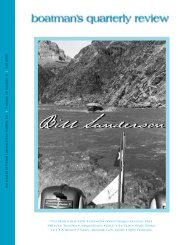
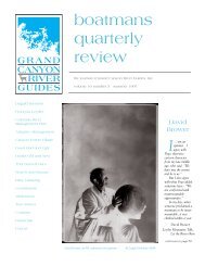
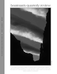
boatman's quarterly review - Grand Canyon River Guides
boatman's quarterly review - Grand Canyon River Guides
boatman's quarterly review - Grand Canyon River Guides

You also want an ePaper? Increase the reach of your titles
YUMPU automatically turns print PDFs into web optimized ePapers that Google loves.
whirlpools forming where there were none; boats being<br />
sucked down until water sometimes flows over the tubes<br />
then after a bit being released as the maelstrom disappears<br />
as quickly as it forms. Looking downstream I can<br />
see the heads of people in the next boat, but that’s all as<br />
they’re caught in a sucky; there’s a three-foot vertical<br />
differential. All the while the water is moving downstream<br />
at ten to twelve miles per hour with no eddy.<br />
Sockdolager, Grapevine, and Horn Creek are totally<br />
gone; 83-mile, Zoraster, and all the smaller ones will<br />
disappear for years.<br />
Its late afternoon when we reach Granite Falls, and<br />
we scout again from the boats as we float over the tops<br />
of the tamarisk forest at Monument camp.<br />
We finally pull in on the right at 94-mile, camping<br />
high. A Moki rowing trip is camped on the left, and a<br />
small private trip with one of Randy Fabrese’s “Ouzels”<br />
camps with us. A 70-mile day with no flips—not bad.<br />
July 4th, again up at daybreak. Although we’re<br />
seasoned now, there’s a bit more tension in the air, for<br />
we are soon to be at river mile 98 and we’ll get to see<br />
what all the fuss is about first hand.<br />
The roar of Crystal is always stupendous, but today<br />
it’s on another scale. The hole looks bigger than it did<br />
on the nightly news. More correctly themed a hydraulic<br />
jump, it has moved down from where the original hole<br />
was. It has grown in magnitude so much because the<br />
energy forming it is from all the water in the tongue<br />
converging at that point and has no place to go but up.<br />
The far right side run is exciting but uneventful as<br />
there is enough water over there. At the bottom there is<br />
almost a pool, if you will, formed by the tamarisk downstream,<br />
and it’s a perfect spot to pull in. I reach the pool<br />
behind the tamarisk and am captured by the “Sirens of<br />
Crystal,” and the river takes me out to the eddy line<br />
juxtaposed from the hole. Curt Smith snaps a picture of<br />
the boat, (Jerry Mallet is in the bow), and makes a<br />
million bucks, I guess.<br />
Its about 9:00 July 4th, 1983. The flow is later to be<br />
stated at 92,000 cfs. Being mesmerized by the upper part<br />
of Crystal, no attention was paid to the lower two-thirds,<br />
and after floating by the hole reality sets in. Huge tail<br />
waves all the way down, any one of which could flip a<br />
rowboat. I don’t feel so smart right now, but everything<br />
goes fine for everyone. At the bottom of Crystal an<br />
upside down motor-rig is tied up on the right: a product<br />
of the initial encounter when the river got up into the<br />
70,000 cfs.<br />
At Bass we pull in to chat with Wilderness World.<br />
We all have a special gleam in our eyes as though we’re<br />
on some kind of, well, psychotropic drug—but this time<br />
its old fashioned adrenaline. Everyone we encounter<br />
looked the same way. The river has imparted an energy<br />
to us that can’t be described in words, only felt. The<br />
rocks above Waltenburg form another huge boil and the<br />
Ouzel with the private trip tagging along with us flips in<br />
it, but is righted quickly. The water is cranking and in<br />
no time we are just above Elves. We see another flipped<br />
motor-rig pulled in on the left—another statement of<br />
the power of Crystal at this stage.<br />
Randy’s Rock is covered and the water is flowing<br />
over the top of Bedrock with plenty of room on the right<br />
to avoid it. Deubendorff hints of a rapid but nothing<br />
more.<br />
At Granite Narrows the word from the old timers is<br />
this is a rough spot and it proves to be. Just after the<br />
entry there’s a powerful surge from left to right that<br />
smashes our boats into the right wall. It’s unavoidable.<br />
Downriver we go fast and furious. We pull into the<br />
eddy at Olo and could step off the boat in the mouth of<br />
the canyon. Fern Glen, mile 168, becomes our third<br />
night’s camp. 74 miles this day with two scouts and<br />
knocking off two huge rapids, again, not bad for a day’s<br />
work.<br />
In the morning I notice a little wet sand; the river<br />
has peaked and is inching down. Just inches though.<br />
Not a word has been mentioned about Lava. Old<br />
habits die hard and we pull in on the right. Although<br />
the left side would be a better scout, the right side<br />
provides a wonderful view of this magnificent stretch of<br />
water. What was normally the rapid is now a beautiful<br />
tongue racing down to a vortex of water formed by a<br />
titanic lateral coming off what was the black rock. It’s<br />
way under with laterals feeding from the right. Below us<br />
the large lava rock that pushed boats out when running<br />
the right side is a huge pour over. The rock two hundred<br />
yards down stream on the right from where the falls<br />
normally end now forms a large lateral that has to be<br />
avoided as well.<br />
Providing we can bust the lateral on the left to avoid<br />
both laterals downstream and then get right below them<br />
to stay off the wall, we should be okay. To this point<br />
however, we’ve not had great success in getting over<br />
laterals of this size. The theory works in practice and the<br />
runs are great. We pull in below lower Lava and gaze<br />
back up at what we’ve just run. The beauty of Lava at<br />
that level is etched in my brain; so much water flowing<br />
down it, such a beautiful sight to see. We push off and<br />
continue down stream. The Tapeats gorge below<br />
Pumpkin Springs has now disappeared and the river is<br />
lapping on a sandstone bench. It is a great wide river<br />
that turns the corner at mile 209 covering the entire<br />
island, racing breakneck downstream. In a short time we<br />
are nearing the take-out at Diamond Creek, wondering<br />
if we can make the pull-in. Unfortunately we can, and<br />
again, about 4:30 July 5th, 1983 we take-out, ending our<br />
three-day <strong>Grand</strong> <strong>Canyon</strong> trip.<br />
Steve Nicholson<br />
boatman’s <strong>quarterly</strong> <strong>review</strong> page 25