Upper Hurunui Photo Album
Upper Hurunui Photo Album
Upper Hurunui Photo Album

You also want an ePaper? Increase the reach of your titles
YUMPU automatically turns print PDFs into web optimized ePapers that Google loves.
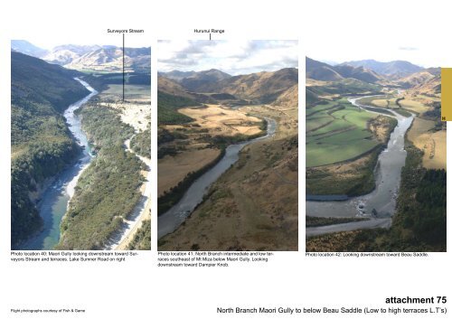
Surveyors Stream<br />
<strong>Hurunui</strong> Range<br />
H<br />
<strong>Photo</strong> location 40: Maori Gully looking downstream toward Surveyors<br />
Stream and terraces. Lake Sumner Road on right<br />
<strong>Photo</strong> location 41: North Branch intermediate and low terraces<br />
southeast of Mt Miza below Maori Gully. Looking<br />
downstream toward Dampier Knob.<br />
<strong>Photo</strong> location 42: Looking downstream toward Beau Saddle.<br />
Flight photographs courtesy of Fish & Game<br />
attachment 75<br />
North Branch Maori Gully to below Beau Saddle (Low to high terraces L.T’s)