Upper Hurunui Photo Album
Upper Hurunui Photo Album
Upper Hurunui Photo Album

Create successful ePaper yourself
Turn your PDF publications into a flip-book with our unique Google optimized e-Paper software.
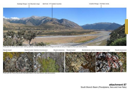
Studleigh Range - H13 Mountain range Bell Knoll - H7 Isolated mountain. Crawford Range - H19 Main divide.<br />
H<br />
<strong>Photo</strong> point 50: South Branch basin looking upstream. Fluvial channelled island in foreground hosts an array of indigenous flora (see below photos).<br />
Raoulia haastii Raoulia hookeri Epilobium brunnescens Raoulia subsericea Raoulia hookeri<br />
Muehlenbeckia axilliaris Epilobium melanocaulin<br />
Raoulia tenuiculusis<br />
<strong>Photo</strong> point 49: Flora of the fluvial channelled island in the South Branch (see above photo)<br />
attachment 87<br />
South Branch Basin (Floodplains, fans and river flats)