Agenda - City of College Station Council Agendas
Agenda - City of College Station Council Agendas
Agenda - City of College Station Council Agendas

Create successful ePaper yourself
Turn your PDF publications into a flip-book with our unique Google optimized e-Paper software.
Mayor<br />
Ben White<br />
Mayor Pro Tem<br />
Ron Gay<br />
<strong>City</strong> Manager<br />
Glenn Brown<br />
<strong>Council</strong>members<br />
John Crompton<br />
James Massey<br />
Lynn McIlhaney<br />
Chris Scotti<br />
David Ruesink<br />
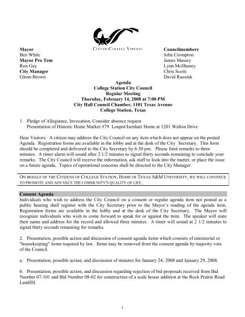
<strong>Agenda</strong><br />
<strong>College</strong> <strong>Station</strong> <strong>City</strong> <strong>Council</strong><br />
Regular Meeting<br />
Thursday, February 14, 2008 at 7:00 PM<br />
<strong>City</strong> Hall <strong>Council</strong> Chamber, 1101 Texas Avenue<br />
<strong>College</strong> <strong>Station</strong>, Texas<br />
1. Pledge <strong>of</strong> Allegiance, Invocation, Consider absence request<br />
Presentation <strong>of</strong> Historic Home Marker #79 Loupot/Isenhart Home at 1201 Walton Drive<br />
Hear Visitors: A citizen may address the <strong>City</strong> <strong>Council</strong> on any item which does not appear on the posted<br />
<strong>Agenda</strong>. Registration forms are available in the lobby and at the desk <strong>of</strong> the <strong>City</strong> Secretary. This form<br />
should be completed and delivered to the <strong>City</strong> Secretary by 6:30 pm. Please limit remarks to three<br />
minutes. A timer alarm will sound after 2 1/2 minutes to signal thirty seconds remaining to conclude your<br />
remarks. The <strong>City</strong> <strong>Council</strong> will receive the information, ask staff to look into the matter, or place the issue<br />
on a future agenda. Topics <strong>of</strong> operational concerns shall be directed to the <strong>City</strong> Manager.<br />
ON BEHALF OF THE CITIZENS OF COLLEGE STATION, HOME OF TEXAS A&M UNIVERSITY, WE WILL CONTINUE<br />
TO PROMOTE AND ADVANCE THE COMMUNITY'S QUALITY OF LIFE.<br />
Consent <strong>Agenda</strong><br />
Individuals who wish to address the <strong>City</strong> <strong>Council</strong> on a consent or regular agenda item not posted as a<br />
public hearing shall register with the <strong>City</strong> Secretary prior to the Mayor’s reading <strong>of</strong> the agenda item.<br />
Registration forms are available in the lobby and at the desk <strong>of</strong> the <strong>City</strong> Secretary. The Mayor will<br />
recognize individuals who wish to come forward to speak for or against the item. The speaker will state<br />
their name and address for the record and allowed three minutes. A timer will sound at 2 1/2 minutes to<br />
signal thirty seconds remaining for remarks.<br />
2. Presentation, possible action and discussion <strong>of</strong> consent agenda items which consists <strong>of</strong> ministerial or<br />
"housekeeping" items required by law. Items may be removed from the consent agenda by majority vote<br />
<strong>of</strong> the <strong>Council</strong>.<br />
a. Presentation, possible action, and discussion <strong>of</strong> minutes for January 24, 2008 and January 29, 2008.<br />
b. Presentation, possible action, and discussion regarding rejection <strong>of</strong> bid proposals received from Bid<br />
Number 07-101 and Bid Number 08-02 for construction <strong>of</strong> a scale house addition at the Rock Prairie Road<br />
Landfill.<br />
1
<strong>City</strong> <strong>Council</strong> Regular Meeting Page 2<br />
Thursday, February 14, 2008<br />
c. Presentation, possible action and discussion <strong>of</strong> the assessment <strong>of</strong> fees for certain services provided by<br />
the Fire Department.<br />
d. Presentation, possible action and discussion regarding a proposed First Amendment to the<br />
Development Agreement with Lonestar – <strong>College</strong> <strong>Station</strong> Golf Academy, Ltd.<br />
e. Presentation, possible action, and discussion regarding a development agreement to improve access to<br />
the Central <strong>Station</strong> shopping center and to generally improve traffic flow in the immediate area.<br />
f. Presentation, possible action, and discussion on an Advance Funding Agreement (AFA) with the Texas<br />
Department <strong>of</strong> Transportation (TxDOT) in a total amount <strong>of</strong> $223,268 to improve access to the Central<br />
<strong>Station</strong> shopping center and to improve general traffic flow in the immediate area.<br />
g. Presentation, discussion and possible action on a resolution approving a modification and extension <strong>of</strong><br />
the Note for the loan <strong>of</strong> HOME Investment Partnership (HOME) Program funds for the Santour Court<br />
Housing Tax Credit development; and authorization for the Mayor to sign the resolution.<br />
h. Presentation, possible action, and discussion on consideration <strong>of</strong> an ordinance amending Chapter 10,<br />
“Traffic Code,” Section 2(N) <strong>of</strong> the Code <strong>of</strong> Ordinances <strong>of</strong> the <strong>City</strong> <strong>of</strong> <strong>College</strong> <strong>Station</strong> to prohibit u-turns<br />
for northbound traffic on Texas Avenue at the intersection <strong>of</strong> Harvey Road.<br />
i. Presentation possible action and discussion <strong>of</strong> a resolution authorizing the Mayor to execute an<br />
Advance Funding Agreement (AFA) with THE TEXAS DEPARTMENT OF TRANSPORTATION<br />
(TxDOT) to provide funds for the acquisition <strong>of</strong> property for the widening <strong>of</strong> FM 60.<br />
j. Presentation, discussion and possible action, regarding a Semi-Annual Report for Impact Fee 03-02<br />
known as Steeplechase Sewer Impact Fee.<br />
k. Presentation, discussion and possible action, regarding a Resolution setting a public hearing to update<br />
Impact Fees 92-01, 97-01, 97-02B, and 99-01.<br />
l. Presentation, possible action, and discussion <strong>of</strong> a resolution <strong>of</strong> the <strong>City</strong> <strong>Council</strong> <strong>of</strong> the <strong>City</strong> <strong>of</strong> <strong>College</strong><br />
<strong>Station</strong>, Texas, amending Resolution No. 4-25-96-3-B describing the use <strong>of</strong> funds that are in the<br />
endowment fund created for the <strong>College</strong> <strong>Station</strong> Cemetery, and providing an effective date.<br />
m. Presentation, possible action, and discussion <strong>of</strong> a Resolution <strong>of</strong> the <strong>City</strong> <strong>Council</strong> <strong>of</strong> <strong>College</strong> <strong>Station</strong>,<br />
Texas, establishing an Endowment Fund for the Memorial Cemetery <strong>of</strong> <strong>College</strong> <strong>Station</strong>.<br />
n. Presentation, possible action, and discussion <strong>of</strong> revisions to Code <strong>of</strong> Ordinances, Chapter 1, "General<br />
Provisions", Section 29, "<strong>College</strong> <strong>Station</strong> Cemetery Rules and Regulations.<br />
o. Presentation, possible action, and discussion <strong>of</strong> an ordinance approving a Licensing Agreement with<br />
Texas A&M University regarding the use <strong>of</strong> trademarked items and indicia for use with the Aggie Field <strong>of</strong><br />
Honor.<br />
2
<strong>City</strong> <strong>Council</strong> Regular Meeting Page 3<br />
Thursday, February 14, 2008<br />
p. Presentation, possible action, and discussion to approve a revised Needs Resolution authorizing the<br />
purchase or condemnation <strong>of</strong> property, water rights, right-<strong>of</strong>-way and easement interest in certain<br />
properties for the Groundwater Wells 8, 9, and 10 Project.<br />
Regular <strong>Agenda</strong><br />
Individuals who wish to address the <strong>City</strong> <strong>Council</strong> on a regular agenda item not posted as a public<br />
hearing shall register with the <strong>City</strong> Secretary prior to the Mayor’s reading <strong>of</strong> the agenda item. The Mayor<br />
will recognize you to come forward to speak for or against the item. The speaker will state their name and<br />
address for the record and allowed three minutes. A timer will sound at 2 1/2 minutes to signal thirty<br />
seconds remaining for remarks.<br />
Individuals who wish to address the <strong>City</strong> <strong>Council</strong> on an item posted as a public hearing shall register with<br />
the <strong>City</strong> Secretary prior to the Mayor’s announcement to open the public hearing. The Mayor will<br />
recognize individuals who wish to come forward to speak for or against the item. The speaker will state<br />
their name and address for the record and allowed three minutes. A timer alarm will sound at 2 1/2<br />
minutes to signal thirty seconds remaining to conclude remarks. After a public hearing is closed, there<br />
shall be no additional public comments. If <strong>Council</strong> needs additional information from the general public,<br />
some limited comments may be allowed at the discretion <strong>of</strong> the Mayor.<br />
If an individual does not wish to address the <strong>City</strong> <strong>Council</strong>, but still wishes to be recorded in the <strong>of</strong>ficial<br />
minutes as being in support or opposition to an agenda item, the individual may complete the registration<br />
form provided in the lobby by providing the name, address, and comments about a city related subject.<br />
These comments will be referred to the <strong>City</strong> <strong>Council</strong> and <strong>City</strong> Manager.<br />
1. Public hearing, presentation, possible action, and discussion on an amendment to the<br />
Comprehensive Plan - Land Use Plan from Regional Retail and Residential Attached to Redevelopment for<br />
0.95 acres located at 317 and 321 Redmond Drive.<br />
2. Public hearing, presentation, possible action, and discussion on a rezoning from C-1 General<br />
Commercial, P-MUD Planned Mixed Use District, and A-O Agricultural Open to P-MUD Planned Mixed<br />
Use District and A-O Agricultural Open for 4.905 acres located at 1502 Texas Avenue South and 317 &<br />
321 Redmond Drive.<br />
3. Presentation, public hearing, possible action and discussion <strong>of</strong> an ordinance amending Chapter 10<br />
“Traffic Code”, to remove parking along Patricia Street and a section <strong>of</strong> Lodge Street.<br />
4. Presentation, possible action and discussion <strong>of</strong> an ordinance amending Chapter 10 “Traffic Code”,<br />
to make Patricia Street one way from Lodge to <strong>College</strong> Main.<br />
5. Presentation, possible action and discussion <strong>of</strong> the design <strong>of</strong> the Church Avenue Phase II Project.<br />
6. Public hearing, presentation, possible action, and discussion approving an ordinance vacating and<br />
abandoning 0.292 acre <strong>of</strong> public utility easement, which is located on Lot One <strong>of</strong> The Woodlands <strong>of</strong><br />
<strong>College</strong> <strong>Station</strong> Subdivision according to the plat recorded in Volume 7420, Pages 255, 256 and 257 <strong>of</strong> the<br />
Deed Records <strong>of</strong> Brazos County, Texas.<br />
3
<strong>City</strong> <strong>Council</strong> Regular Meeting Page 4<br />
Thursday, February 14, 2008<br />
7. Public hearing, presentation, possible action, and discussion approving an ordinance vacating and<br />
abandoning 0.586 acre <strong>of</strong> public drainage easement, which is located on Lot 2, Block One <strong>of</strong> the Wheeler<br />
Subdivision, Phase Two according to the plat recorded in Volume 3490, Page 269 <strong>of</strong> the Deed Records <strong>of</strong><br />
Brazos County, Texas.<br />
8. Presentation, possible action, and discussion <strong>of</strong> appointments to Library Board and Zoning Board <strong>of</strong><br />
Adjustments.<br />
9. Adjourn.<br />
If litigation issues arise to the posted subject matter <strong>of</strong> this <strong>Council</strong> Meeting an executive session will be<br />
held.<br />
APPROVED:<br />
________________________________<br />
<strong>City</strong> Manager<br />
Notice is hereby given that a Regular Meeting <strong>of</strong> the <strong>City</strong> <strong>Council</strong> <strong>of</strong> the <strong>City</strong> <strong>of</strong> <strong>College</strong> <strong>Station</strong>, Texas<br />
will be held on the Thursday, February 14, 2008 at 7:00 PM at the <strong>City</strong> Hall <strong>Council</strong> Chambers, 1101<br />
Texas Avenue, <strong>College</strong> <strong>Station</strong>, Texas. The following subjects will be discussed, to wit: See <strong>Agenda</strong>.<br />
Posted the 11 th day <strong>of</strong> February, 2008 at 2:30 pm.<br />
E-Signed by Connie Hooks<br />
VERIFY authenticity with ApproveIt<br />
<strong>City</strong> Secretary<br />
________________________________<br />
I, the undersigned, do hereby certify that the above Notice <strong>of</strong> Meeting <strong>of</strong> the Governing Body <strong>of</strong> the <strong>City</strong> <strong>of</strong><br />
<strong>College</strong> <strong>Station</strong>, Texas, is a true and correct copy <strong>of</strong> said Notice and that I posted a true and correct copy <strong>of</strong><br />
said notice on the bulletin board at <strong>City</strong> Hall, 1101 Texas Avenue, in <strong>College</strong> <strong>Station</strong>, Texas, and the <strong>City</strong>’s<br />
website, www.cstx.gov . The <strong>Agenda</strong> and Notice are readily accessible to the general public at all times.<br />
Said Notice and <strong>Agenda</strong> were posted on February 11, 2008 at 2:30 pm and remained so posted<br />
continuously for at least 72 hours proceeding the scheduled time <strong>of</strong> said meeting.<br />
This public notice was removed from the <strong>of</strong>ficial posting board at the <strong>College</strong> <strong>Station</strong> <strong>City</strong> Hall on the<br />
following date and time: __________________________ by ________________________.<br />
Dated this _____day <strong>of</strong> ________________, 2008.<br />
By______________________________________<br />
Subscribed and sworn to before me on this the _____day <strong>of</strong> ________________, 2008.<br />
______________________________<br />
Notary Public – Brazos County, Texas<br />
My commission expires: ___________<br />
4
<strong>City</strong> <strong>Council</strong> Regular Meeting Page 5<br />
Thursday, February 14, 2008<br />
The building is wheelchair accessible. Handicap parking spaces are available. Any request for sign<br />
interpretive service must be made 48 hours before the meeting. To make arrangements call (979) 764-3517<br />
or (TDD) 1-800-735-2989. <strong>Agenda</strong>s may be viewed on www.cstx.gov . <strong>Council</strong> meetings are broadcast<br />
live on Cable Access Channel 19.<br />
5
Mayor<br />
Ben White<br />
Mayor Pro Tem<br />
Ron Gay<br />
<strong>City</strong> Manager<br />
Glenn Brown<br />
<strong>Council</strong> members<br />
John Crompton<br />
James Massey<br />
Lynn McIlhaney<br />
Chris Scotti<br />
David Ruesink<br />
Draft Minutes<br />
<strong>City</strong> <strong>Council</strong> Workshop Meeting<br />
Thursday January 24, 2008 at 3:00 p.m.<br />
<strong>City</strong> Hall <strong>Council</strong> Chambers, 1101 Texas Avenue<br />
<strong>College</strong> <strong>Station</strong>, Texas<br />
COUNCIL MEMBERS PRESENT: Mayor White, Mayor Pro Tem Gay, <strong>Council</strong><br />
members Crompton, Massey, Scotti, Ruesink<br />
COUNCIL MEMBER ABSENT: McIlhaney<br />
STAFF PRESENT: <strong>City</strong> Manager Brown, <strong>City</strong> Attorney Cargill Jr., <strong>City</strong> Secretary<br />
Hooks, Assistant <strong>City</strong> Secretary Casares, Management Team.<br />
Mayor White called the meeting to order at 3:00 pm.<br />
Workshop <strong>Agenda</strong> Item No. 1 -- Presentation, possible action, and discussion on<br />
items listed on the consent agenda.<br />
No items where removed for discussion.<br />
Workshop <strong>Agenda</strong> Item No. 2 -- Presentation, possible action and discussion <strong>of</strong><br />
TxDOT projects in the area.<br />
Introduced by Mark Smith, Director <strong>of</strong> Public Works.<br />
Brian Wood and Kim Soucek presented an overview <strong>of</strong> TxDOT projects in the <strong>College</strong><br />
<strong>Station</strong> area.<br />
No formal action taken.<br />
Workshop <strong>Agenda</strong> Item No. 3. -- Presentation, possible action, and discusstion<br />
regarding water conservation policy and strategies.<br />
Introduced by Dave Coleman, Water Services Director.<br />
6
<strong>Council</strong> Workshop Meeting Minutes 1-24-08 Page 2<br />
Mr. Coleman and Jennifer Nations provided a briefing regarding potential water<br />
conservation measures that could be implemented.<br />
<strong>Council</strong> concurred with the implementation <strong>of</strong> a water conservation program.<br />
Workshop <strong>Agenda</strong> Item No. 4 -- Presentation, possible action, and discussion<br />
regarding the <strong>City</strong> renewal procedures for annual contracts and multi-year<br />
agreements.<br />
Introduced by Cheryl Turney, Assistant Finance Director.<br />
Mrs. Turney presented a summary <strong>of</strong> the <strong>City</strong>’s current renewal procedures for annual<br />
contracts and other multi-year agreements.<br />
No formal action taken<br />
Workshop <strong>Agenda</strong> Item No 5 -- Presentation, possible action, and discussion<br />
regarding possible items to be discussed at the <strong>City</strong> <strong>Council</strong>’s Mini-Retreat on<br />
March 5.<br />
Introduced by <strong>City</strong> Manager Glenn Brown.<br />
<strong>City</strong> Manager Brown presented the following Retreat <strong>Agenda</strong> Items:<br />
1. Implementation <strong>of</strong> <strong>Council</strong>’s strategic plan through Departmental Business Plans<br />
2. Visioning Exercise<br />
3. <strong>City</strong> Center / Town Center Planning Exercise<br />
4. Follow up on Departmental Focus Items identified at last summer’s <strong>Council</strong><br />
Retreat<br />
After a brief discussion <strong>Council</strong> concurred with having a retreat on Items 1 and 4.<br />
Workshop <strong>Agenda</strong> Item No. 6 -- Presentation, possible action, and discussion<br />
regarding an update on the status <strong>of</strong> the Comprehensive Plan update.<br />
Introduced by Bob Cowell, Director <strong>of</strong> Planning and Development Services.<br />
Mr. Cowell presented the update on the status <strong>of</strong> the Comprehensive Plan update. CPAC<br />
has completed the first phase <strong>of</strong> the update.<br />
No formal action taken<br />
Workshop <strong>Agenda</strong> Item No. 7 -- Presentation, possible action, and discussion to<br />
award Contract 08-099 to HDR Engineers, Inc. in the amount <strong>of</strong> $203,300 to update<br />
the water and wastewater system master plans.<br />
7
<strong>Council</strong> Workshop Meeting Minutes 1-24-08 Page 3<br />
Introduced by David Coleman, Director <strong>of</strong> Water Services.<br />
Mr. Coleman, Director <strong>of</strong> Water Services presented an update on the water and<br />
wastewater system master plan. The master plans need to be updated to ensure our<br />
systems are in compliance with TCEQ regulations.<br />
After a brief discussion no formal action was taken<br />
Workshop <strong>Agenda</strong> Item No. 8 -- <strong>Council</strong> Calendar<br />
January 28 Evaluations <strong>of</strong> <strong>City</strong> Manager, <strong>City</strong> Attorney, <strong>City</strong> Secretary, <strong>City</strong> Hall,<br />
6:00 pm<br />
January 29 Special Meeting Public Hearing on Annexation, <strong>Council</strong> Chambers 7:00<br />
pm<br />
January 30 CIP Community Meeting, Pebble Creek Elementary Cafeteria, 7:00 pm<br />
February 4 Neighborhood Integrity Meeting Conference Center 9:00 am – 5:00 pm<br />
February 11 First Day to file for <strong>City</strong> <strong>Council</strong> positions<br />
<strong>Council</strong> reviewed their upcoming events<br />
Workshop <strong>Agenda</strong> Item No. 9 -- Presentation, possible action, and discussion on<br />
future agenda items: A <strong>Council</strong> Member may inquire about a subject for which<br />
notice has not been given. A statement <strong>of</strong> specific factual information or the<br />
recitation <strong>of</strong> existing policy may be given. Any deliberation shall be limited to a<br />
proposal to place the subject on an agenda for a subsequent meeting.<br />
<strong>Council</strong> member Crompton requested an agenda item regarding the evaluations <strong>of</strong> the<br />
effectiveness <strong>of</strong> standard landscaping, and to meet with Planning and Zoning<br />
Commission in a regular agenda meeting. <strong>Council</strong> member Massey seconded the motion,<br />
which carried unanimously, 6-0<br />
<strong>Council</strong> member Massey requested an agenda item regarding the follow-up <strong>of</strong> the<br />
building <strong>of</strong> the new elementary school south <strong>of</strong> Cypress Cove and the construction <strong>of</strong><br />
Eagle Drive. <strong>Council</strong> discussed and agreed on meeting with the Transportation<br />
Department first and have the <strong>City</strong> Manager look into it.<br />
Workshop <strong>Agenda</strong> Item No. 10 -- Discussion, review and possible action regarding<br />
the following meetings: Arts <strong>Council</strong> Subcommittee <strong>of</strong> the <strong>Council</strong>, Audit<br />
Committee, Brazos County Health Dept., Brazos Valley <strong>Council</strong> <strong>of</strong> Governments,<br />
Cemetery Committee, Design Review Board, Historic Preservation Committee,<br />
Interfaith Dialogue Association, Intergovernmental Committee, Joint Relief<br />
Funding Review Committee, Library Committee, Metropolitan Planning<br />
Organization, Outside Agency Funding Review, Parks and Recreation Board,<br />
Planning and Zoning Commission, Sister <strong>City</strong> Association, TAMU Student Senate,<br />
Research Valley Partnership, Regional Transportation Committee for <strong>Council</strong> <strong>of</strong><br />
Governments, Transportation Committee, Wolf Pen Creek Oversight Committee,<br />
8
<strong>Council</strong> Workshop Meeting Minutes 1-24-08 Page 4<br />
Wolf Pen Creek TIF Board, Zoning Board <strong>of</strong> Adjustments (Notice <strong>of</strong> <strong>Agenda</strong>s<br />
posted on <strong>City</strong> Hall bulletin board).<br />
<strong>Council</strong> member Scotti reported new updates with the Research Valley Partnership and<br />
the TIPS ground breaking.<br />
<strong>Council</strong> member Gay briefly discussed the recent meeting held by the <strong>City</strong>’s<br />
Transportation Committee meeting and I69 report.<br />
<strong>Council</strong> member Massey reported briefly on the January 22, 2008 meeting with the<br />
Intergovernmental Committee.<br />
Mayor White briefly reported on the Metropolitan Planning Organization meeting.<br />
Workshop <strong>Agenda</strong> Item No. 11 -- Executive Session:<br />
At 5:17 pm, Mayor White announced in open session that the <strong>City</strong> <strong>Council</strong> would<br />
convene into executive session pursuant to Sections 551.071 and 551.086 <strong>of</strong> the Open<br />
Meetings Act, to seek the advice <strong>of</strong> our attorney with respect to pending and<br />
contemplated litigation, and economic development negotiations.<br />
Consultation with Attorney {Gov’t Code Section 551.071}; The <strong>City</strong> <strong>Council</strong> may seek<br />
advice from its attorney regarding a pending and contemplated litigation subject or<br />
settlement <strong>of</strong>fer or attorney-client privileged information. Litigation is an ongoing<br />
process and questions may arise as to a litigation tactic or settlement <strong>of</strong>fer, which needs<br />
to be discussed with the <strong>City</strong> <strong>Council</strong>. Upon occasion the <strong>City</strong> <strong>Council</strong> may need<br />
information from its attorney as to the status <strong>of</strong> a pending or contemplated litigation<br />
subject or settlement <strong>of</strong>fer or attorney-client privileged information. After executive<br />
session discussion, any final action or vote taken will be in public. The following<br />
subject(s) may be discussed:<br />
Application with TCEQ in Westside/Highway 60 area, near Brushy Water Supply<br />
Corporation.<br />
Civil Action No. H-04-4558, U.S. District Court, Southern District <strong>of</strong> Texas, Houston<br />
Division, <strong>College</strong> <strong>Station</strong> v. U.S. Dept. <strong>of</strong> Agriculture, etc., and Wellborn Special Utility<br />
District.<br />
Cause No. GN-502012, Travis County, TMPA v. PUC (<strong>College</strong> <strong>Station</strong> filed Intervention<br />
7/6/05)<br />
Sewer CCN request.<br />
Legal aspects <strong>of</strong> Water Well and possible purchase <strong>of</strong> or lease <strong>of</strong> another water site.<br />
Civil Action No. H-04-3876, U.S. District Court, Southern District <strong>of</strong> Texas, Houston<br />
Division, JK Development v. <strong>College</strong> <strong>Station</strong>.<br />
Cause No. 06-002318-CV-272, 272 nd Judicial District Court, Brazos County, Texas,<br />
Taylor Kingsley v. <strong>City</strong> <strong>of</strong> <strong>College</strong> <strong>Station</strong>, Texas and Does 1 through 10, inclusive.<br />
Cause No. 485-CC, County Court at Law No. 1, Brazos County, Texas, <strong>City</strong> <strong>of</strong> <strong>College</strong><br />
<strong>Station</strong> v. David Allen Weber, et al.<br />
9
<strong>Council</strong> Workshop Meeting Minutes 1-24-08 Page 5<br />
Bed & Banks Water Rights Discharge Permits for <strong>College</strong> <strong>Station</strong> and Bryan<br />
Cause No. 07-001241-CV-361, 361 st Judicial District Court, Brazos County, Texas<br />
Gregory A. & Agnes A. Ricks v. <strong>City</strong> <strong>of</strong> <strong>College</strong> <strong>Station</strong><br />
Water CCN request<br />
Competitive Matter {Gov’t Code Section 551.086}; possible action The <strong>City</strong> <strong>Council</strong><br />
may deliberate, vote, or take final action on a competitive matter in closed session. The<br />
<strong>City</strong> <strong>Council</strong> must make a good faith determination, by majority vote <strong>of</strong> the <strong>City</strong> <strong>Council</strong>,<br />
that the matter is a Competitive Matter. A “Competitive Matter” is a utility-related matter<br />
that the <strong>City</strong> <strong>Council</strong> determines is related to the <strong>City</strong> <strong>of</strong> <strong>College</strong> <strong>Station</strong>’s Electric Utility<br />
Competitive Activity, including commercial information, which if disclosed would give<br />
advantage to competitors or prospective competitors. The following is a general<br />
representation <strong>of</strong> the subject(s) to be considered as a competitive matter.<br />
a. Marketing and Strategy Plans for <strong>College</strong> <strong>Station</strong> Electric Utilities<br />
Workshop <strong>Agenda</strong> Item No. 12 -- Action on executive session, or any workshop<br />
agenda item not completed or discussed in today’s workshop meeting will be<br />
discussed in tonight’s Regular Meeting if necessary.<br />
Action on executive session, or any workshop agenda item not completed or discussed in<br />
today’s workshop meeting will be discussed in tonight’s Regular Meeting if necessary.<br />
<strong>Council</strong> concluded the executive session at 6:29 pm. No action was taken.<br />
<strong>Council</strong> recessed for dinner.<br />
Workshop <strong>Agenda</strong> Item No. 13 -- Adjourn<br />
The meeting concluded at 6:30 pm.<br />
PASSED and APPROVED this 14 th day <strong>of</strong> February, 2008.<br />
APPROVED:<br />
ATTEST<br />
________________________________<br />
Mayor Ben White<br />
__________________________________<br />
<strong>City</strong> Secretary, Connie Hooks<br />
10
Mayor<br />
<strong>Council</strong> members<br />
Ben White<br />
John Crompton<br />
Mayor Pro Tem<br />
James Massey<br />
Ron Gay<br />
Lynn McIlhaney<br />
<strong>City</strong> Manager<br />
Chris Scotti<br />
Glenn Brown<br />
David Ruesink<br />
______________________________________________________________________<br />
Draft Minutes<br />
<strong>City</strong> <strong>Council</strong> Regular Meeting<br />
Thursday, January 24, 2008 at 7:00 p.m.<br />
<strong>City</strong> Hall <strong>Council</strong> Chambers, 1101 Texas Avenue<br />
<strong>College</strong> <strong>Station</strong>, Texas<br />
COUNCIL MEMBERS PRESENT: Mayor White, Mayor Pro Tem Gay, <strong>Council</strong> members<br />
Crompton, Massey, Scotti, Ruesink<br />
COUNCIL MEMBER ABSENT: McIlhaney<br />
STAFF PRESENT: <strong>City</strong> Manager Brown, <strong>City</strong> Attorney Cargill Jr., <strong>City</strong> Secretary Hooks,<br />
Assistant <strong>City</strong> Secretary Casares, Management Team<br />
Regular <strong>Agenda</strong> Item No. 1 -- Pledge <strong>of</strong> Allegiance, Invocation Hear visitors.<br />
Mayor White called the meeting to order at 7:00 p.m. He led the audience in the Pledge <strong>of</strong><br />
Allegiance. Fire Chief R.B. Alley provided the invocation.<br />
Hear Visitors<br />
Charlotte Slack, 2301 Ferguson Cir., addressed the <strong>Council</strong> regarding development proposals for<br />
the undeveloped land at the corner <strong>of</strong> Rock Prairie and Highway 6.<br />
Lupe Reyes, 1402 Stonebridge Ct., expressed his appreciation to the <strong>City</strong> Staff and urged a<br />
meeting with the developer pertaining to development <strong>of</strong> Rock Prairie Road and Highway 6.<br />
Joan Perry, a <strong>College</strong> <strong>Station</strong> resident also commented about the impact <strong>of</strong> development at this<br />
intersection.<br />
Consent <strong>Agenda</strong><br />
Mayor Pro Tem Gay moved to approve Consent <strong>Agenda</strong> Items 2a-2q as presented. <strong>Council</strong><br />
member Massey seconded the motion, which carried 6-0.<br />
FOR: Crompton, Massey, Gay, White, Scotti, and Ruesink<br />
AGAINST: None<br />
11
<strong>College</strong> <strong>Station</strong> Regular Meeting Minutes 1-24-08 Page 2<br />
ABSENT: McIlhaney<br />
Regular <strong>Agenda</strong> Item No. 1 -- Presentation, possible action, and discussion regarding a<br />
recommendation to rename Central Park in <strong>College</strong> <strong>Station</strong> to “Stephen C. Beachy Central<br />
Park”.<br />
Sharon Colson, former Chairman <strong>of</strong> the Parks and Recreation Advisory Board presented the<br />
recommendation by the Parks Board to rename Central Park to ““Stephen C. Beachy Central<br />
Park” inn recognition <strong>of</strong> his outstanding achievements and dedication during his twenty-nine<br />
years <strong>of</strong> service with the Parks and Recreation Department.<br />
<strong>Council</strong> member Crompton moved to rename Central Park in <strong>College</strong> <strong>Station</strong> to “Stephen C.<br />
Beachy Central Park.” <strong>Council</strong> member Massey seconded the motion which carried 6-0.<br />
FOR: Ruesink, Gay, White, Scotti, Crompton, and Massey<br />
AGAINST: None<br />
ABSENT: McIlhaney<br />
Regular <strong>Agenda</strong> Item No. 2 -- Public hearing, presentation, possible action, and discussion<br />
regarding the service plan for six areas identified for annexation under the exempt status.<br />
Lance Simms, Assistant Director <strong>of</strong> Planning and Development presented information on the six<br />
areas in the annexation service plan.<br />
Residents <strong>of</strong> areas affected by the annexation proposal conveyed numerous concerns about the<br />
impact on their well being if the <strong>City</strong> continues to proceed with annexing their properties.<br />
Gary Shaffer – 19191 Hwy 6 South, Area 5<br />
Ginger Melton – 1425 Peach Creek, Area 5<br />
Edsel Jones – 828 Pine Valley, Area 3, 4, & 5<br />
Jerome Becker – 15203 Post Oak Bend, Area 4<br />
Gwendolyn Hattaway – 15165 FM 2154 (Wellborn), Area 4<br />
Julie Fowler – 1722 Heath, speaking on the behalf <strong>of</strong> all six areas<br />
Shelia Keelan – 145 Oak Leaf, Area 2<br />
Gayle Butterfield – 112 Ridge Craft, Area 4<br />
Sherri Eads – 133 Ridge Bend, Area 3<br />
Lois Rockwell – 128 Oak Run, Area 3<br />
Billy Hoppers – 101 Oak Creek, Area 3<br />
Don Jones – 804 Berry Creek<br />
Kim Kaminski – 106 Ridge Craft, Area 4<br />
Chrisine Kaunas – 4348 Ledgstone Trail, Area 4<br />
Dorey Evans – 4420 Ledgestone, Area 4<br />
Michael Schurtt – 4445 Ledgestone, Area 4<br />
Cynthia Robinson – 4850 Greens Prairie Trail, Area 4<br />
Karen Hall – 5918 Hwy 21 East, how <strong>College</strong> <strong>Station</strong> has been handling annexation<br />
Jim Gray – 18845 State Hwy 6, area 5<br />
12
<strong>College</strong> <strong>Station</strong> Regular Meeting Minutes 1-24-08 Page 3<br />
Mayor White closed the public hearing. <strong>Council</strong> recessed for a short break at 9:07 pm.<br />
Regular <strong>Agenda</strong> Item No. 3 -- Public hearing, presentation, possible action, and discussion<br />
on a Rezoning from R-1 Single-Family Residential to PDD Planned Development District<br />
and A-O Agricultural-Open for 3.67 acres located at 124 Morgans Lane, generally located<br />
at Morgans Lane and the future Dartmouth Street extension.<br />
Crissy Hartl, Staff Planner presented a staff report. The Planning and Zoning Commission<br />
approved the proposed rezoning. Staff recommended denial <strong>of</strong> the request.<br />
Mayor White opened the public hearing. The following individuals <strong>of</strong>fered support to the<br />
rezoning request.<br />
Mary Joe Hurley expressed support <strong>of</strong> the rezoning<br />
Client, 2333 Harvey Mitchell South expressed the support <strong>of</strong> the rezoning.<br />
Mayor White closed the public hearing.<br />
Mayor Pro Tem Gay moved to approve Ordinance No. 3037 rezoning from R-1 Single-Family<br />
Residential to PDD Planned Development District and A-O Agricultural-Open from 3.67 acres<br />
located at 124 Morgans Lane, generally located at Morgans Lane and the future Dartmouth<br />
Street extension. <strong>Council</strong> member Crompton seconded the motion which carried 6-0.<br />
FOR: White, Gay, Crompton, Massey, Scotti, Ruesink<br />
AGAINST: None<br />
ABSENT: McIlhaney<br />
Regular <strong>Agenda</strong> Item No. 4 -- Presentation, public hearing, discussion, and possible action<br />
on consideration <strong>of</strong> an ordinance amending Chapter 10, “Traffic Code,” to restrict parking<br />
on the west side <strong>of</strong> Holik Street between Anna Street and Park Place.<br />
Troy Rother, Transportation Planner described the proposed ordinance amending Chapter 10,<br />
“Traffic Code,” to restrict parking on the west side <strong>of</strong> Holik Street.<br />
Mayor White opened the public hearing. No one spoke. Mayor White closed the public hearing.<br />
Mayor Pro Tem Gay moved to approve Ordinance No. 3038 amending Chapter 10, “Traffic<br />
Code,” to restrict parking on the west side <strong>of</strong> Holik Street. <strong>Council</strong> member Massey seconded<br />
the motion which carried 6-0.<br />
FOR: Gay, Massey, Crompton, Scotti, White, Ruesink<br />
AGAINST: None<br />
ABSENT: McIlhaney<br />
13
<strong>College</strong> <strong>Station</strong> Regular Meeting Minutes 1-24-08 Page 4<br />
Regular <strong>Agenda</strong> Item No. 5 -- Presentation, public hearing, discussion, and possible action<br />
on consideration <strong>of</strong> and ordinance amending Chapter10, “Traffic Code,” to restrict<br />
parking on the north side <strong>of</strong> Redmond Drive between Lenert Circle and Rosemary Lane<br />
and on the west side <strong>of</strong> Rosemary Lane between Redmond Drive and Milliff Road.<br />
Troy Rother, Transportation Planner described the proposed ordinance amending Chapter 10,<br />
“Traffic Code”, to restrict parking on the north side <strong>of</strong> Redmond Drive.<br />
Mayor White opened the public hearing. No one spoke. Mayor White closed the public hearing.<br />
<strong>Council</strong> member Massey moved to approve Ordinance No. 3039 amending Chapter 10, “Traffic<br />
Code,” to restrict parking on the north side <strong>of</strong> Redmond Drive. <strong>Council</strong> member Gay seconded<br />
the motion which carried unanimously, 6-0.<br />
FOR: Massey, Ruesink, White, Scotti, Gay, Crompton<br />
AGAINST: None<br />
ABSENT: Against<br />
Regular <strong>Agenda</strong> Item No. 6 -- Presentation, public hearing, possible action, and discussion<br />
on consideration <strong>of</strong> an ordinance amending Chapter 10, “Traffic Code,” to restrict parking<br />
on the north side <strong>of</strong> University Oaks Boulevard beginning 505 feet east <strong>of</strong> George Bush<br />
Drive East and extending 560 feet east.<br />
Troy Rother, <strong>City</strong> Engineer presented to the <strong>Council</strong> an ordinance amending Chapter 10, “Traffic<br />
Code,” to restrict parking on the north side <strong>of</strong> University Oaks Boulevard beginning 505 feet east<br />
<strong>of</strong> George Bush Drive East and extending 560 feet east.<br />
Mayor White opened the public hearing. No one spoke. Mayor White closed the public hearing.<br />
Mayor Pro Tem Gay moved to approve Ordinance No. 3040 amending Chapter 10, “Traffic<br />
Code,” to restrict parking on the north side <strong>of</strong> University Oaks Boulevard beginning 505 feet east<br />
<strong>of</strong> George Bush Drive East and extending 560 feet east. <strong>Council</strong> member Ruesink seconded the<br />
motion which carried 6-0.<br />
FOR: Gay, Ruesink, Massey, White, Scotti, Crompton<br />
AGAINST: None<br />
ABSENT: McIlhaney<br />
Regular <strong>Agenda</strong> Item No. 7 -- Public hearing, possible action, and discussion on an<br />
ordinance Budget Amendment #1 amending ordinance number 2999 which will amend the<br />
budget for the 2007-2008 Fiscal Year and authorizing amended expenditures in the amount<br />
<strong>of</strong> $1,059,823.<br />
Jeff Kersten, Chief Financial Officer presented a brief discussion on a proposed budget<br />
amendment to increase appropriations in the 2007-2008 budget is $1,059.823.<br />
14
<strong>College</strong> <strong>Station</strong> Regular Meeting Minutes 1-24-08 Page 5<br />
Mayor White opened the public hearing. No one spoke. Mayor White closed the public hearing.<br />
Mayor Pro Tem Gay moved to approve Ordinance No. 3041 amending the budget for the 2007-<br />
2008 Fiscal Year and authorizing amended expenditures in the amount $1,059,823. <strong>Council</strong><br />
member Scotti seconded the motion which carried 6-0.<br />
FOR: Gay, Scotti, Crompton, White, Massey, Ruesink<br />
AGAINST: None<br />
ABSENT: McIlhaney<br />
Regular <strong>Agenda</strong> Item No. 8 -- Presentation, public hearing, discussion and possible action,<br />
regarding an Oil and Gas Operations Permit for the Smith-Mohawk Unit, Well #1 Re-<br />
Entry as requested by the operator, Ogden Resources, Ltd. Of Bryan, Texas.<br />
Alan Gibbs, <strong>City</strong> Engineer presented to the <strong>Council</strong> a Resolution authorizing an oil and gas<br />
permit for the Smith-Mohawk Unit, Well #1.<br />
Mayor White opened the public hearing.<br />
Mary Jo Hurley representing Odgen Resources expressed support <strong>of</strong> the Resolution in regards to<br />
the Oil and Gas Operation Permit for the Smith-Mohawk Unit, Well #1.<br />
Mayor White closed the public hearing.<br />
Mayor Pro Tem Gay moved to approve Resolution No. 1-24-08-8 authorizing the Oil and Gas<br />
Operation Permit for the Smith-Mohawk Unit, Well #1. <strong>Council</strong> member Massey seconded the<br />
motion which carried 6-0.<br />
FOR: Massey, Gay, Crompton, Ruesink, White, Scotti<br />
AGAINST: None<br />
ABSENT: McIlhaney<br />
Regular <strong>Agenda</strong> Item No. 9 -- Presentation, public hearing, possible action, and discussion<br />
regarding an ordinance approving the Settlement Agreement between ACSC and Atmos<br />
regarding the Company’s Statement <strong>of</strong> Intent to increase rates and to approve tariffs that<br />
implement the terms <strong>of</strong> the Settlement Agreement.<br />
Hayden Migl, Assistant to the <strong>City</strong> Manager described the ordinance approving the Settlement<br />
Agreement between ACSC and Atmos regarding the Company’s Statement <strong>of</strong> Intent to increase<br />
rates and to approve tariffs that implement the terms <strong>of</strong> the Settlement Agreement.<br />
Mayor White opened the public hearing.<br />
Ken Fogel, representative from Atmos briefly explained the ordinance and rate changes.<br />
Mayor White closed the public hearing.<br />
15
<strong>College</strong> <strong>Station</strong> Regular Meeting Minutes 1-24-08 Page 6<br />
Mayor Pro Tem Gay moved to approve Ordinance No. 3042 authorizing the Settlement<br />
Agreement between the Atmos’ cities steering committee and Atmos Energy Corp., Mid-Tex<br />
division regarding the company’s statement <strong>of</strong> intent to change gas rates. <strong>Council</strong> member Scotti<br />
seconded the motion which carried 6-0.<br />
FOR: White, Scotti, Gay, Crompton, Ruesink, Massey<br />
AGAINST: None<br />
ABSENT: McIlhaney<br />
Regular <strong>Agenda</strong> Item No. 10 -- Presentation, possible action and discussion regarding<br />
approval <strong>of</strong> an annual contract with either Knife River or Brazos Valley Services for Item<br />
1 the Installation <strong>of</strong> Hot Mix Asphalt Concrete and Item 2 – MC-30/AEP Emulsified<br />
Asphalt after a tie-breaker has been administered to determine the award <strong>of</strong> the bid. The<br />
approval <strong>of</strong> a contract with Brazos Valley Services for Item 3 – the purchase <strong>of</strong> RC-2<br />
Winter Patch Asphalt is recommended at a cost not to exceed$7,500.00.<br />
Cheryl Turney, Assistant Finance Director presented the bids for the Annual Blanket Purchase<br />
Order for the Installation <strong>of</strong> Hot Mix Asphalt Concrete. Bids were received from Brazos Valley<br />
Services, Knife River and Big Creek Construction. The bid documents state that “Item 1 and<br />
Item 2 will be awarded together, based on total low bid for both items.” Both Knife River and<br />
Brazos Valley Services submitted the low bids <strong>of</strong> $632,250.00 for the two items. Big Creek<br />
Construction submitted a bid that was higher. Brazos Valley Services submitted the low bid for<br />
Item 3.<br />
A tie breaker was administered through a lottery system to award the bid in the event <strong>of</strong> identical<br />
low submittals. Staff recommended the contract for Item 1 and Item 2 be awarded to the vendor<br />
selected in the tie breaker. Staff also recommended the contract for Item 3 be awarded to the low<br />
bidder, Brazos Valley Services. Ty Elliott was selected to draw the winning bid resulting in the<br />
selection <strong>of</strong> Brazos Valley Services.<br />
Mayor Pro Tem Gay moved to approve the award <strong>of</strong> bid to Brazos Valley Services for Item 1,<br />
the Installation <strong>of</strong> Hot Mix Asphalt Concrete, Item 2, MC-30/AEP Emulsified Asphalt, and Item<br />
3, the purchase <strong>of</strong> RC-2 Winter Patch Asphalt. <strong>Council</strong> member Scotti seconded the motion<br />
which carried 6-0.<br />
FOR: Scotti, Gay, White, Massy, Crompton, Ruesink<br />
AGAINST: None<br />
ABSENT: McIlhaney<br />
Regular <strong>Agenda</strong> Item No. 11 -- Presentation, possible action, and discussion regarding a<br />
nomination to the Board <strong>of</strong> Managers <strong>of</strong> the Brazos County Emergency Communications<br />
District.<br />
Glenn Brown presented to the <strong>Council</strong> the staff recommendation for nomination <strong>of</strong> Fire Chief<br />
R.B Alley as a member on the Board <strong>of</strong> Managers <strong>of</strong> the Brazos County Emergency<br />
Communication District for a two year term.<br />
16
<strong>College</strong> <strong>Station</strong> Regular Meeting Minutes 1-24-08 Page 7<br />
<strong>Council</strong> member Massey moved to appoint Fire Chief R.B. Alley to serve a two year term on the<br />
Board <strong>of</strong> Managers <strong>of</strong> the Brazos County Emergency Communication District. Mayor Pro Tem<br />
Gay seconded the motion which carried 6-0.<br />
FOR: Massey, White, Ruesink, Crompton, Scotti, Gay<br />
AGAINST: None<br />
ABSENT: McIlhaney<br />
Regular <strong>Agenda</strong> Item No. 12 -- Presentation, possible action, and discussion on the<br />
acceptance <strong>of</strong> a tax freeze petition certified by the <strong>City</strong> Secretary.<br />
Connie Hooks, <strong>City</strong> Secretary introduced the completion <strong>of</strong> the verification process <strong>of</strong> an<br />
initiative petition for the <strong>City</strong> <strong>Council</strong> to call an election to freeze the ad valorem taxes on the<br />
residential homestead <strong>of</strong> the disabled and persons 65 years <strong>of</strong> age or older and their spouses.<br />
<strong>Council</strong> member Massey moved to accept the petition to call an election to freeze the ad valorem<br />
taxes on the residential homestead <strong>of</strong> the disable and persons 65 <strong>of</strong> age or older and their<br />
spouses. Mayor Pro Tem Gay seconded the motion which carried unanimously, 6-0.<br />
FOR: Ruesink, Scotti, White, Massey, Gay, Crompton<br />
AGAINST: None<br />
ABSENT: McIlhaney<br />
Regular <strong>Agenda</strong> Item No. 13 -- Presentation, possible action, and discussion on the charter<br />
amendment petition certified by the <strong>City</strong> Secretary.<br />
Connie Hooks, <strong>City</strong> Secretary introduced the completion <strong>of</strong> the verification process on a petition<br />
“for the <strong>City</strong> <strong>Council</strong> to call an election to amend the <strong>City</strong> Charter to replace <strong>City</strong> Charter Article<br />
X, Section 85, Form <strong>of</strong> Petitions: Committee <strong>of</strong> Petitioners with additional wording to authorize<br />
registered <strong>College</strong> <strong>Station</strong> voters to circulate and witness individual petition papers. The<br />
ordinance will include the authorization for mail petitions without a notary requirement.”<br />
Dick Birdwell spoke on the petition he filed.<br />
<strong>City</strong> <strong>Council</strong> directed staff to present data and options within other <strong>City</strong> Charter related to this<br />
subject and present to <strong>Council</strong> within a month. No formal action was taken.<br />
Regular <strong>Agenda</strong> Item No. 14 -- Adjourn<br />
Hearing no objections, Mayor White adjourned the workshop and regular meetings at 10:24 p.m.<br />
on Thursday, January 24, 2008.<br />
PASSED and APPROVED this 14 th day <strong>of</strong> February, 2008.<br />
17
<strong>College</strong> <strong>Station</strong> Regular Meeting Minutes 1-24-08 Page 8<br />
ATTEST:<br />
____________________________________<br />
<strong>City</strong> Secretary, Connie Hooks<br />
APPROVED:<br />
___________________________________<br />
Mayor White<br />
18
Mayor<br />
<strong>Council</strong> members<br />
Ben White<br />
John Crompton<br />
Mayor Pro Tem<br />
James Massey<br />
Ron Gay<br />
Lynn McIlhaney<br />
<strong>City</strong> Manager<br />
Chris Scotti<br />
Glenn Brown<br />
David Ruesink<br />
_______________________________________________________________________<br />
Draft Minutes<br />
<strong>City</strong> <strong>Council</strong> Special Meeting<br />
Thursday, January 29, 2008 at 7:00 p.m.<br />
<strong>City</strong> Hall <strong>Council</strong> Chambers, 1101 Texas Avenue<br />
<strong>College</strong> <strong>Station</strong>, Texas<br />
COUNCIL MEMBERS PRESENT: Mayor White, Mayor Pro Tem Gay, <strong>Council</strong> members<br />
Crompton, Massey, Scotti, Ruesink, McIlhaney<br />
STAFF PRESENT: <strong>City</strong> Manager Brown, <strong>City</strong> Attorney Cargill Jr., <strong>City</strong> Secretary Hooks,<br />
Assistant <strong>City</strong> Secretary Casares, Management Team<br />
Special <strong>Agenda</strong> Item No. 1 – Call meeting to order.<br />
Mayor White called meeting to order at 7:00 pm.<br />
Special <strong>Agenda</strong> Item No. 2 Public hearing, presentation, possible action, and discussion<br />
regarding the service plan for six areas identified for annexation under the exempt<br />
status.<br />
Lance Simms, Assistant Director <strong>of</strong> Planning and Development Services presented important<br />
data pertaining to the proposed annexation plan.<br />
Crissy Hartl, Staff Planner presented information on area 2. Pete Caler from the Brazos<br />
Valley Solid Waste Management Agency presented information about the water service<br />
delivery following annexation <strong>of</strong> the areas proposed in the service plan.<br />
Mayor White opened the public hearing at 7:28 pm.<br />
Citizens expressed their concerns about the proposed annexation <strong>of</strong> their properties.<br />
Jim Gray-18845 Hwy 6 South, area 5<br />
Gary Shaffer-19191 Hwy 6 South, area 5<br />
Hardy Cullen-101 Ridge Walk, area 3<br />
Mike Wilson-15833 Flagstone Ct. area 4<br />
Phillip Ross-1414 Peach Creek Cut <strong>of</strong>f, area 5<br />
19
Minutes <strong>City</strong> <strong>Council</strong> Special Meeting 1-29-08 Page 2<br />
Briana Morrison-162 Ridgeway, area 2<br />
Beverly Robinson-15800 Flagstone Ct., area 4<br />
Kenneth Morgan-138 Sunset Trail, area 3<br />
Julie Fowler-1722 Heath Dr., several areas<br />
William Bassichis-1501 Wolf<br />
Gwendolyn Hattaway-15165 FM 2154 Wellborn, area 4<br />
Ed Thomas 1422 Buggy-Ln. area 6<br />
Karen Hall-1518 Hwy 6, Bryan<br />
Judy Roebuck-109 Ridge Loop, area 3<br />
Don Jones-804 Berry Creek<br />
Gary Hines-15412 Post Oak Bend area 4<br />
Carl Hattaway-15165 Wellborn Rd. area 4<br />
James Clissold-115 Ridge Oak, area 3<br />
Lois Rockwell-128 Oak Run, Area 3<br />
Kyle Smith-4940 Greens Prairie Trail. area 4<br />
Chris Kaunas-4348 Ledgestone Trail, Area 4<br />
Eric Schulte-15045 FM 2154 Wellborn, area 4<br />
Roy Robinson-4850 Greens Praire Trail, area 4<br />
Perez Hernandez lives in area 4 & Parents live in area 5<br />
Citizens expressed their concerns through written comments.<br />
Judy & Tim Foster-4646 Greens Prairie Tr., area 4<br />
Cynthia Robinson-4850 Greens Prairie Tr. area 4<br />
Mayor White closed the public hearing.<br />
Mayor Pro Tem Gay acknowledged to the audience that he was not in support <strong>of</strong> annexing<br />
Areas 3, 4, and 5.<br />
No formal action was taken.<br />
Special <strong>Agenda</strong> Item No. 3-- Adjourn.<br />
<strong>Council</strong> member Massey moved to adjourn the meeting at 8:58 pm, Tuesday, January 29,<br />
2008. Mayor Pro Tem Gay seconded the motion which carried 7-0<br />
PASSED and APPROVED this 14 th day <strong>of</strong> February, 2008.<br />
ATTEST:<br />
___________________________________<br />
<strong>City</strong> Secretary, Connie Hooks<br />
APPROVED:<br />
____________________________________<br />
Mayor Ben White<br />
20
February 14, 2008<br />
Consent <strong>Agenda</strong> Item 2b<br />
BVSWMA Scalehouse Addition Rejection <strong>of</strong> Bids<br />
To:<br />
From:<br />
Glenn Brown, <strong>City</strong> Manager<br />
Mark Smith, Director <strong>of</strong> Public Works<br />
<strong>Agenda</strong> Caption: Presentation, possible action, and discussion regarding rejection <strong>of</strong> bid<br />
proposals received from Bid Number 07-101 and Bid Number 08-02 for construction <strong>of</strong> a<br />
scalehouse addition at the Rock Prairie Road Landfill.<br />
Recommendation(s): Staff recommends rejection <strong>of</strong> bids for the BVSWMA Scalehouse<br />
Addition Construction Project.<br />
Summary: This project was for an addition to the existing scalehouse and entrance<br />
ramps for the installation <strong>of</strong> a third scale. The addition was to enhance traffic flow, allow for<br />
more efficient customer transactions, and also provide for a backup unit if a scale is out <strong>of</strong><br />
service for repair. On July 7, 2007, one bid was received in response to bid number 07-<br />
101. The bid was well above available funding. Following the bid opening, the architect<br />
reconfigured the project to lower the construction costs. The project was re-bid and on<br />
October 31, 2007, four bids were received. Again, the low bidder was well above available<br />
funding. A review <strong>of</strong> the individual components <strong>of</strong> the bids did not indicate specific areas <strong>of</strong><br />
unexpected costs but rather an overall escalation <strong>of</strong> construction costs over all trades.<br />
The remaining operational life <strong>of</strong> the Rock Prairie Road Facility, combined with the high<br />
costs, led staff to reevaluate the cost benefit <strong>of</strong> the project and identify other means to<br />
improve transaction efficiencies. Staff intends to replace one scale that is prone to frequent<br />
downtime and repairs with a scale purchased from Cardinal Scale Manufacturing. In<br />
addition, a RF Tag system upgrade for the automated scale will be installed. These<br />
modifications to the weigh station equipment will provide for faster transaction handling and<br />
will help to reduce the bottleneck that occurs during peak operating hours. These upgrades<br />
will be transferred and utilized at the Twin Oaks Facility in January 2010.<br />
Budget & Financial Summary: Design fees for the project were $6,000. Funds for the<br />
upgrades are budgeted and available in the BVSWMA Fund.<br />
Attachments:<br />
1. Bid Tabulation 07-101<br />
2. Bid Tabulation 08-02<br />
21
<strong>City</strong> <strong>of</strong> <strong>College</strong> <strong>Station</strong><br />
Bid Tabulation<br />
7/17/2007<br />
BVSWMA New Scalehouse Addition<br />
BID: 07-101<br />
Unit<br />
Quan. Meas.<br />
Description<br />
1 Lump BVSWMA New Scalehouse Addition Base Bid<br />
1 Each Alternate #1 - Additional PTAC Unit<br />
1 Lump Total Base Bid with Alternate #1<br />
Dudley Construction<br />
<strong>College</strong> <strong>Station</strong>, TX<br />
Contact: Mark Dudley<br />
GRAND TOTAL<br />
$124,500.00<br />
$2,725.00<br />
$127,225.00<br />
Calendar Days for Completion<br />
Certification <strong>of</strong> Bid<br />
Addendum Acknowledged<br />
Bid Bond<br />
Deviations/Conditions<br />
90<br />
Y<br />
N/A<br />
Y<br />
N<br />
22<br />
Page 1 <strong>of</strong> 1
<strong>City</strong> <strong>of</strong> <strong>College</strong> <strong>Station</strong><br />
Bid Tabulation<br />
10/31/2007<br />
BVSWMA New Scalehouse Addition<br />
BID: 08-02<br />
Unit<br />
Quan. Meas.<br />
Description<br />
1 Lump BVSWMA New Scalehouse Addition Base Bid<br />
Orion Construction CLM Construction Dudley Construction Marek Brothers<br />
Bryan, TX Bryan, TX <strong>College</strong> <strong>Station</strong>, TX <strong>College</strong> <strong>Station</strong>, TX<br />
Contact: John Gale Contact: Clint McLure Contact: Mark Dudley Contact: Joe Marek<br />
GRAND TOTAL<br />
$106,400.00<br />
GRAND TOTAL<br />
$114,000.00<br />
GRAND TOTAL<br />
$117,000.00<br />
GRAND TOTAL<br />
$121,740.00<br />
Calendar Days for Completion<br />
Certification <strong>of</strong> Bid<br />
Addendum Acknowledged<br />
Bid Bond<br />
Deviations/Conditions<br />
105<br />
Y<br />
Y-2<br />
Y<br />
N<br />
100<br />
Y<br />
Y-2<br />
Y<br />
N<br />
120<br />
Y<br />
Y-2<br />
Y<br />
N<br />
90<br />
Y<br />
Y-2<br />
Y<br />
N<br />
23<br />
Page 1 <strong>of</strong> 1
February 14, 2008<br />
Consent <strong>Agenda</strong> 2c<br />
Fire Department Fees Update<br />
To:<br />
From:<br />
Glenn Brown, <strong>City</strong> Manager<br />
Robert Alley, Fire Chief<br />
<strong>Agenda</strong> Caption: Presentation, possible action and discussion <strong>of</strong> the assessment <strong>of</strong><br />
fees for certain services provided by the Fire Department.<br />
Recommendation(s):<br />
Staff recommends approval <strong>of</strong> the resolution.<br />
Summary: The <strong>College</strong> <strong>Station</strong> Fire Department currently conducts fire inspection<br />
tests for fire alarm and fire protection systems for certain occupancies such as day<br />
care centers, foster homes, health care facilities, restaurants, apartments, hotels<br />
and other commercial businesses throughout the city. Inspection tests are also<br />
conducted on distribution systems such as natural gas, fuel tanks, fuel lines and fire<br />
sprinkler systems. The fire department also provides transportation for emergency<br />
medical services from inside the city limits and outside <strong>of</strong> the city limits. During the<br />
Alternative Revenue review process it was determined that these fees needed to be<br />
increased to meet the increased cost <strong>of</strong> providing this service. The <strong>City</strong> <strong>of</strong> Bryan has<br />
increased their fees to be in alignment with this resolution. Notice <strong>of</strong> the increases<br />
has been given to the effected contractors, there have been no negative comments<br />
received. This resolution updates Resolution 09-09-2003-11.11 which was approved<br />
on September 11 th 2003.<br />
Budget & Financial Summary: Fees collected will be used to continue to provide<br />
these services within the approved fire department budget. In FY 07 approximately<br />
$850,000 was collected for the Fire Department fees. These proposed fee changes<br />
are projected to increase revenues by $380,000.<br />
Attachments:<br />
Resolution<br />
Fire Department fee breakdown<br />
24
RESOLUTION NO. __________<br />
A RESOLUTION OF THE CITY OF COLLEGE STATION, TEXAS, PRESCRIBING AN<br />
ASSESSMENT FOR CERTAIN SERVICES PROVIDED BY THE FIRE DEPARTMENT,<br />
PURSUANT TO CHAPTER 14, SECTIONS 1 AND 3, OF THE CODE OF ORDINANCES OF<br />
THE CITY OF COLLEGE STATION, AND PROVIDING FOR AN EFFECTIVE DATE.<br />
WHEREAS, Chapter 14, Sections 1 and 3, <strong>of</strong> the <strong>City</strong> <strong>of</strong> <strong>College</strong> <strong>Station</strong> Code <strong>of</strong> Ordinances<br />
provides that certain services provided by the <strong>City</strong> <strong>of</strong> <strong>College</strong> <strong>Station</strong> Fire Department may be<br />
assessed and collected from the recipients <strong>of</strong> those services; and<br />
WHEREAS, the <strong>City</strong> <strong>Council</strong> <strong>of</strong> the <strong>City</strong> <strong>of</strong> <strong>College</strong> <strong>Station</strong> has determined that certain services<br />
provided by the <strong>City</strong> <strong>of</strong> <strong>College</strong> <strong>Station</strong> Fire Department shall be assessed and collected from the<br />
recipients <strong>of</strong> those services as set forth in the fee schedule attached as Exhibit “A”; now,<br />
therefore,<br />
BE IT RESOLVED BY THE CITY COUNCIL OF THE CITY OF COLLEGE STATION<br />
THAT:<br />
PART 1:<br />
PART 2:<br />
Pursuant to the provisions <strong>of</strong> Chapter 14, Sections 1 and 3, <strong>of</strong> the <strong>City</strong> <strong>of</strong> <strong>College</strong><br />
<strong>Station</strong> Code <strong>of</strong> Ordinances, fees shall be assessed and collected from the<br />
recipients <strong>of</strong> certain services provided by the Fire Department as set out in the<br />
attached Exhibit “A”.<br />
That this Resolution shall be effective from and after its date <strong>of</strong> passage.<br />
PASSED AND APPROVED this _______ day <strong>of</strong> ________________________________, 2008.<br />
ATTEST:<br />
APPROVED:<br />
________________________________<br />
<strong>City</strong> Secretary<br />
___________________________________<br />
Mayor<br />
APPROVED:<br />
E-Signed by Mary Ann Powell<br />
VERIFY authenticity with ApproveIt<br />
_<br />
<strong>City</strong> Attorney<br />
________<br />
25
RESOLUTION NO. _______________ Page 2<br />
EXHIBIT “A”<br />
The following services provided by the <strong>City</strong> <strong>of</strong> <strong>College</strong> <strong>Station</strong> Fire Department shall be paid for<br />
by the recipient <strong>of</strong> those services, the fees for which shall be as follows:<br />
Mileage charges for Fire Prevention activities outside <strong>College</strong> <strong>Station</strong> <strong>City</strong> Limits will be<br />
in accordance with current city policy and may change from time to time.<br />
A. Requests for incident reports prepared by the Fire Department: $4.00 per copy.<br />
B. Fire Department inspections <strong>of</strong> day care center: $50.00 per inspection. All tests<br />
conducted outside the city limits shall be charged at this rate times 1.5 plus mileage<br />
plus $20.00 for travel time.<br />
C. Fire Department inspections <strong>of</strong> foster home: $30.00 per inspection. All tests<br />
outside the city limits shall be charged at this rate times 1.5 plus mileage plus<br />
$20.00 for travel time.<br />
D. Fire Department inspections <strong>of</strong> health care facility: $150.00 per inspection. Fire<br />
Depatment inspections <strong>of</strong> Hospitals: $250.00. All tests conducted outside the city<br />
limits shall be charged this same rate times 1.5 plus mileage plus $20.00 for travel<br />
time.<br />
E. Automatic hood tests performed by the Fire Department: $50.00 per inspection.<br />
All tests conducted outside the city limits shall be charged at this rate times 1.5<br />
plus mileage plus $20.00 travel time.<br />
F. Fire Department inspections <strong>of</strong> automatic fire alarm systems: $100.00 up to 25<br />
devices plus $100.00 per 100 devices or fraction there<strong>of</strong> in excess <strong>of</strong> 25 devices<br />
that include, horns, strobes, horn strobe combinations, tamper and flow switches,<br />
smoke/heat detectors and alarm panels/remote annunicators. All tests conducted<br />
outside the city limits shall be charged at this rate times 1.5 plus mileage plus<br />
$20.00 for travel time.<br />
G. Fire Department testing <strong>of</strong> Underground Fire Lines: $100.00 per inspection. All<br />
tests conducted outside the city limits shall be charged at this rate times 1.5 plus<br />
mileage plus $20.00 for travel time.<br />
H. Fuel tank testing performed by the Fire Department: $100.00 per inspection. All<br />
tests conducted outside city limits shall be charged at this rate times 1.5 plus<br />
mileage plus $20.00 travel time.<br />
26
RESOLUTION NO. _______________ Page 3<br />
I. Fuel line leak testing performed by the Fire Department: $100.00 per inspection.<br />
All tests conducted outside the city limits shall be charged at this rate times 1.5<br />
plus mileage plus $20.00 for travel time.<br />
J. Fire sprinkler system testing performed by the Fire Department: $125.00 per<br />
system up to 100 sprinklers plus $50.00 per 100 sprinklers or fraction there<strong>of</strong> in<br />
excess <strong>of</strong> 100. All tests outside the city limits shall be charged at this rate times<br />
1.5 plus mileage plus $20.00 for travel time.<br />
K. The provision <strong>of</strong> Emergency Medical Services without transportation shall be<br />
provided without charge within the corporate limits <strong>of</strong> the <strong>City</strong> <strong>of</strong> <strong>College</strong> <strong>Station</strong>.<br />
L. The provision <strong>of</strong> Emergency Medical Services with transportation from a location<br />
within the corporate limits <strong>of</strong> <strong>College</strong> <strong>Station</strong> to a location within Brazos County<br />
shall be $650.00 base fee plus $10.00 per loaded mile.<br />
M. The provision <strong>of</strong> Emergency Medical Services with transportation from a location<br />
outside the corporate limits shall be charged at $650.00 plus $12.00 per loaded<br />
mile.<br />
N. The provision <strong>of</strong> Emergency Medical Services without transportation at a location<br />
outside the corporate limits <strong>of</strong> the <strong>City</strong> <strong>of</strong> <strong>College</strong> <strong>Station</strong> shall be charged at<br />
$100.00.<br />
O. The provision <strong>of</strong> Emergency Medical Services to a location outside <strong>of</strong> Brazos<br />
County shall be charged at $650.00 per individual transported plus $12.00 per<br />
loaded mile.<br />
27
Fire Department Fees update<br />
Service 2003 Current 2008 Proposed<br />
Report Copy $4.00 $4.00<br />
Day care Inspection $30.00 per Inspection $50.00 per Inspection<br />
Foster Home Inspection $30.00 per Inspection<br />
$30.00 per Inspection<br />
Health Care Facility $50.00 per Inspection $150.00 per Inspection<br />
Hospital Inspection $50.00 per Inspection $250.00 per Inspection<br />
Automatic hood tests $30.00 per Inspection $50.00 per Inspection<br />
Automatic Fire Alarms $30.00 per device to 25 $50.00 per device to 25<br />
($50.00 per 100 devices ($100.00 per 100 devices<br />
in excess <strong>of</strong> 25 devices) in excess <strong>of</strong> 25 devices)<br />
Underground Fire Lines $30.00 per Inspection<br />
$100.00 per Inspection<br />
Fuel Tank Inspection $50.00 per Inspection $100.00 per Inspection<br />
Fuel Line testing $50.00 per Inspection $100.00 per Inspection<br />
Fire Sprinkler System $50.00 per system up $125.00 per system<br />
to 100 sprinklers plus to 100 sprinklers plus<br />
$50.00 per 100 sprinklers $50.00 per 100<br />
in excess <strong>of</strong> 100 sprinklers. Sprinklers in excess <strong>of</strong><br />
100 sprinklers.<br />
EMS without transport No Cost No Cost<br />
(inside city limits)<br />
EMS transport $450.00 base fee $650.00 base fee<br />
(inside city limits) plus $7.50 per loaded plus $10.00 per<br />
mile<br />
loaded mile.<br />
28
Service 2003 Current 2008 Proposed<br />
Page 2<br />
EMS transport $450.00 base fee $650.00 base fee<br />
(outside city limits) plus $7.50 per loaded plus $12.00 per<br />
mile.<br />
loaded mile.<br />
EMS without transport $100.00 base fee<br />
(outside city limits)<br />
$100.00 base fee<br />
EMS transport outside $450.00 base fee $650.00 base fee<br />
Brazos County per plus $9.00 per loaded plus $12.00 per loaded<br />
Individual mile. mile.<br />
29
February 14, 2008<br />
Consent <strong>Agenda</strong> Item 2d<br />
Approval <strong>of</strong> a First Amendment to the Development Agreement with<br />
Lonestar – <strong>College</strong> <strong>Station</strong> Golf Academy, Ltd<br />
To:<br />
From:<br />
Glenn Brown, <strong>City</strong> Manager<br />
David Gwin, Director <strong>of</strong> Economic and Community Development<br />
<strong>Agenda</strong> Caption: Presentation, possible action and discussion regarding a proposed First<br />
Amendment to the Development Agreement with Lonestar – <strong>College</strong> <strong>Station</strong> Golf Academy,<br />
Ltd.<br />
Recommendation(s): Staff recommends approval <strong>of</strong> the proposed First Amendment<br />
to the Development Agreement as attached.<br />
Summary: On December 14, 2007, the <strong>City</strong> <strong>Council</strong> approved a Development Agreement<br />
with Lonestar- <strong>College</strong> <strong>Station</strong> Golf Academy, Ltd preparing the way for the development <strong>of</strong><br />
8.64 acres (Lots 2A & 2B) located along the frontage road <strong>of</strong> Earl Rudder Freeway and just<br />
North <strong>of</strong> Horse Haven Lane. Further, one <strong>of</strong> the two lots released for development by this<br />
action became the Gander Mountain development.<br />
Under the existing Development Agreement, the owner was allowed to divide the subject<br />
property into three lots, i.e. 2A, AB and 2C (see attached Final Plat), and defer the<br />
dedication <strong>of</strong> right-<strong>of</strong>-way and construction <strong>of</strong> Appomattox Drive and the other<br />
infrastructure until such time as only Lot 2C was developed. Lots 2A and 2B were released<br />
for development.<br />
The current owner has recently arranged to sell Lot 2C to TDG Management L.P., thus<br />
triggering this proposed First Amendment to the Development Agreement. The amendment<br />
and assignment <strong>of</strong> the development agreement and the development <strong>of</strong> Lot 2C will result in<br />
the dedication and construction <strong>of</strong> Appomattox Drive and other infrastructure as identified in<br />
the current agreement. Further, this First Amendment will require the new owner to<br />
provide a financial guarantee to insure that the infrastructure is ultimately constructed if he<br />
or she fails to construct them per the provisions <strong>of</strong> the new agreement.<br />
Budget & Financial Summary: There are no direct costs to the <strong>City</strong> by entering into this<br />
Development Agreement. Instead, the developer has provided a financial guarantee that<br />
the identified infrastructure will be constructed upon development <strong>of</strong> the property.<br />
Attachments:<br />
Final Plat <strong>of</strong> Horse Haven Estates<br />
First Amendment to the Lonestar – <strong>College</strong> <strong>Station</strong> Golf Academy Development Agreement<br />
Location Map<br />
30
Location Map<br />
32
February 14, 2008<br />
Consent <strong>Agenda</strong> Item 2e<br />
Development Agreement Regarding Access Improvements to Central <strong>Station</strong><br />
To:<br />
From:<br />
Glenn Brown, <strong>City</strong> Manager<br />
David Gwin, Director <strong>of</strong> Economic and Community Development<br />
<strong>Agenda</strong> Caption: Presentation, possible action, and discussion regarding a development<br />
agreement to improve access to the Central <strong>Station</strong> shopping center and to generally<br />
improve traffic flow in the immediate area.<br />
Recommendation(s):<br />
attached.<br />
Staff recommends approval <strong>of</strong> the development agreement as<br />
Summary: This item has been prepared in response to <strong>Council</strong> direction at the<br />
September 27, 2007 Workshop Meeting <strong>of</strong> the <strong>City</strong> <strong>Council</strong>.<br />
As part <strong>of</strong> the Texas Avenue widening project, Texas Department <strong>of</strong> Transportation (TxDOT)<br />
plans to install a raised median along much <strong>of</strong> Texas Avenue to better manage access,<br />
improve safety, and enhance mobility along the entire corridor. Limited median openings<br />
will be provided at all signalized locations, as well as several other locations required to<br />
maintain this access.<br />
With the redevelopment <strong>of</strong> the Culpepper Plaza Shopping Center (now Central <strong>Station</strong>) and<br />
the planned installation <strong>of</strong> the raised median along the applicable section <strong>of</strong> Texas Avenue,<br />
there is likely to be significant traffic buildup on Harvey Road at the Texas Avenue signal.<br />
Centro Properties, the owner <strong>of</strong> the shopping center, approached the <strong>City</strong> and TxDot about<br />
the possibility <strong>of</strong> several improvements to safely improve access to the center and to<br />
generally improve traffic flow in the immediate area.<br />
As approved, the recommended improvements will add a directional left-turn opening in the<br />
planned raised median on Texas Avenue and an additional travel lane on Harvey Road. This<br />
will help to alleviate traffic buildup along Harvey Road, which is currently the likely path for<br />
travelers southbound on Texas Avenue to access the Central <strong>Station</strong> shopping center.<br />
Budget & Financial Summary: The total cost <strong>of</strong> the project is $223,268. Of that<br />
amount, the <strong>City</strong> <strong>of</strong> <strong>College</strong> <strong>Station</strong> will pay no more than $92,891. Centro Properties will<br />
pay $121,661 and any overages related to these improvements. TxDOT will pay $8,716,<br />
which is the difference between the Development Agreement total amount and the<br />
established project costs assumed by Centro Properties and the <strong>City</strong>.<br />
Attachments:<br />
Development Agreement<br />
Exhibit A – Improvements<br />
Exhibit B – Advanced Funding Agreement<br />
Exhibit C – Engineer’s Estimate<br />
38
EXHIBIT B CSJ: 0050-01-060<br />
District: 17 (Bryan)<br />
Code Chart 64: 09050 (<strong>College</strong> <strong>Station</strong>)<br />
Project: STP 2004(390)<br />
THE STATE OF TEXAS §<br />
THE COUNTY OF TRAVIS §<br />
ADVANCE FUNDING AGREEMENT FOR VOLUNTARY<br />
LOCAL GOVERNMENT CONTRIBUTIONS<br />
TO TRANSPORTATION IMPROVEMENT<br />
PROJECTS WITH NO REQUIRED MATCH<br />
THIS AGREEMENT IS MADE BY AND BETWEEN the State <strong>of</strong> Texas, acting by and through the<br />
Texas Department <strong>of</strong> Transportation, hereinafter called the “State”, and the <strong>City</strong> <strong>of</strong> <strong>College</strong> <strong>Station</strong>,<br />
acting by and through its duly authorized <strong>of</strong>ficials, hereinafter called the “Local Government.”<br />
WITNESSETH<br />
WHEREAS, Transportation Code, Chapters 201, 221, 227, and 361, authorize the State to lay out,<br />
construct, maintain, and operate a system <strong>of</strong> streets, roads, and highways that comprise the State<br />
Highway System; and,<br />
WHEREAS, Government Code, Chapter 791, and Transportation Code, §201.209 and Chapter 221,<br />
authorize the State to contract with municipalities and political subdivisions; and,<br />
WHEREAS, Commission Minute Order Numbers 001111, 108087, 108410, 108812 and 109460<br />
authorize the State to undertake and complete a highway improvement generally described as the<br />
widening <strong>of</strong> a non-freeway facility consisting <strong>of</strong> grading, structures, concrete pavement, signals and<br />
illumination; and,<br />
WHEREAS, the Local Government has requested that the State allow the Local Government to<br />
participate in said improvement by funding that portion <strong>of</strong> the improvement described as the<br />
installation <strong>of</strong> opticom and enforcement lights, and the construction <strong>of</strong> an additional travel lane on SH<br />
30 (Harvey Road) and the construction <strong>of</strong> a directional left-turn opening in the proposed raised<br />
median on BS 6-R (Texas Avenue). These elements will be added to the existing contract in order to<br />
provide added left turns to the commercial development on the northeast corner <strong>of</strong> this intersection,<br />
hereinafter called the “Project"; and,<br />
WHEREAS, the State has determined that such participation is in the best interest <strong>of</strong> the citizens <strong>of</strong><br />
the State;<br />
NOW, THEREFORE, in consideration <strong>of</strong> the premises and <strong>of</strong> the mutual covenants and agreements<br />
<strong>of</strong> the parties hereto, to be by them respectively kept and performed as hereinafter set forth, the<br />
State and the Local Government do agree as follows:<br />
AGREEMENT<br />
Article 1. Time Period Covered<br />
This agreement becomes effective when signed by the last party whose signing makes the<br />
agreement fully executed, and the State and the Local Government will consider it to be in full force<br />
and effect until the Project described herein has been completed and accepted by all parties or<br />
unless terminated, as hereinafter provided.<br />
AFA-AFA_VolTIP Revised 12/10/07<br />
40
EXHIBIT B CSJ: 0050-01-060<br />
District: 17 (Bryan)<br />
Code Chart 64: 09050 (<strong>College</strong> <strong>Station</strong>)<br />
Project: STP 2004(390)<br />
Page 1 <strong>of</strong> 6<br />
Article 2. Project Funding and Work Responsibilities<br />
The State will authorize the performance <strong>of</strong> only those Project items <strong>of</strong> work which the Local<br />
Government has requested and has agreed to pay for as described in Attachment A, Payment<br />
Provision and Work Responsibilities, which is attached to and made a part <strong>of</strong> this contract.<br />
In addition to identifying those items <strong>of</strong> work paid for by payments to the State, Attachment A,<br />
Payment Provision and Work Responsibilities, also specifies those Project items <strong>of</strong> work that are the<br />
responsibility <strong>of</strong> the Local Government and will be carried out and completed by the Local<br />
Government at no cost to the State.<br />
This work will be added by change order to the existing highway improvement project referenced<br />
above. The State will provide the Local Government with a detailed estimate <strong>of</strong> the engineering and<br />
construction costs to be incurred. Prior to the State authorizing the contractor to begin this work, the<br />
State must receive the Local Government’s payment for its financial participation in the total cost <strong>of</strong><br />
the Project.<br />
Whenever funds are paid by the Local Government to the State under this Agreement, the Local<br />
Government shall remit a check or warrant made payable to the "Texas Department <strong>of</strong><br />
Transportation Trust Fund." The check or warrant shall be deposited by the State in an escrow<br />
account to be managed by the State. Funds in the escrow account may only be applied by the State<br />
to the Project.<br />
Article 3. Right <strong>of</strong> Access<br />
If the Local Government is the owner <strong>of</strong> any part <strong>of</strong> the Project site, the Local Government shall<br />
permit the State or its authorized representative access to the site to perform any activities required<br />
to execute the work.<br />
Article 4. Adjustments Outside the Project Site<br />
The Local Government will provide for all necessary right-<strong>of</strong>-way and utility adjustments needed for<br />
performance <strong>of</strong> the work on sites not owned or to be acquired by the State.<br />
Article 5. Responsibilities <strong>of</strong> the Parties<br />
The State and the Local Government agree that neither party is an agent, servant, or employee <strong>of</strong><br />
the other party and each party agrees it is responsible for its individual acts and deeds as well as the<br />
acts and deeds <strong>of</strong> its contractors, employees, representatives, and agents.<br />
Article 6. Document and Information Exchange<br />
The Local Government agrees to electronically deliver to the State all general notes, specifications,<br />
contract provision requirements and related documentation in a Micros<strong>of</strong>t® Word or similar<br />
document.<br />
If requested by the State, the Local Government will use the State's document template. The Local<br />
Government shall also provide a detailed construction time estimate including types <strong>of</strong> activities and<br />
AFA-AFA_VolTIP Revised 12/10/07<br />
41
EXHIBIT B CSJ: 0050-01-060<br />
District: 17 (Bryan)<br />
Code Chart 64: 09050 (<strong>College</strong> <strong>Station</strong>)<br />
Project: STP 2004(390)<br />
month in the format required by the State. This requirement applies whether the local government<br />
creates the documents with its own forces or by hiring a consultant or pr<strong>of</strong>essional provider.<br />
Page 2 <strong>of</strong> 6<br />
Article 7. Interest<br />
The State will not pay interest on funds provided by the Local Government. Funds provided by the<br />
Local Government will be deposited into, and retained in, the State Treasury.<br />
Article 8. Inspection and Conduct <strong>of</strong> Work<br />
Unless otherwise specifically stated in Attachment A, Payment Provision and Work Responsibilities,<br />
to this contract, the State will supervise and inspect all work performed hereunder and provide such<br />
engineering inspection and testing services as may be required to ensure that the Project is<br />
accomplished in accordance with the approved plans and specifications. All correspondence and<br />
instructions to the contractor performing the work will be the sole responsibility <strong>of</strong> the State. Unless<br />
otherwise specifically stated in Attachment A to this contract, all work will be performed in<br />
accordance with the Standard Specifications for Construction and Maintenance <strong>of</strong> Highways, Streets,<br />
and Bridges adopted by the State and incorporated herein by reference, or special specifications<br />
approved by the State.<br />
Article 9. Increased Costs<br />
In the event it is determined that the funding provided by the Local Government will be insufficient to<br />
cover the State's cost for performance <strong>of</strong> the Local Government's requested work, the Local<br />
Government will pay to the State the additional funds necessary to cover the anticipated additional<br />
cost. The State shall send the Local Government a written notification stating the amount <strong>of</strong><br />
additional funding needed and stating the reasons for the needed additional funds. The Local<br />
Government shall pay the funds to the State within 45 days <strong>of</strong> the written notification, unless<br />
otherwise agreed to by all parties to this agreement. If the Local Government cannot pay the<br />
additional funds, this contract shall be mutually terminated in accord with Article 11 - Termination. If<br />
this is a fixed price agreement as specified in Attachment A, Payment Provision and Work<br />
Responsibilities, this provision shall only apply in the event changed site conditions are discovered<br />
or as mutually agreed upon by the State and the Local Government.<br />
If any existing or future local ordinances, commissioners court orders, rules, policies, or other<br />
directives, including but not limited to outdoor advertising billboards and storm water drainage facility<br />
requirements, are more restrictive than State or Federal Regulations, or if any other locally proposed<br />
changes, including but not limited to plats or replats, result in increased costs, then any increased<br />
costs associated with the ordinances or changes will be paid by the local government. The cost <strong>of</strong><br />
providing right <strong>of</strong> way acquired by the State shall mean the total expenses in acquiring the property<br />
interests either through negotiations or eminent domain proceedings, including but not limited to<br />
expenses related to relocation, removal, and adjustment <strong>of</strong> eligible utilities.<br />
Article 10. Maintenance<br />
Upon completion <strong>of</strong> the Project, the State will assume responsibility for the maintenance <strong>of</strong> the<br />
completed Project unless otherwise specified in Attachment A to this agreement.<br />
AFA-AFA_VolTIP Revised 12/10/07<br />
42
EXHIBIT B CSJ: 0050-01-060<br />
District: 17 (Bryan)<br />
Code Chart 64: 09050 (<strong>College</strong> <strong>Station</strong>)<br />
Project: STP 2004(390)<br />
Page 3 <strong>of</strong> 6<br />
Article 11. Termination<br />
This agreement may be terminated in the following manner:<br />
♦ by mutual written agreement and consent <strong>of</strong> both parties;<br />
♦ by either party upon the failure <strong>of</strong> the other party to fulfill the obligations set forth herein;<br />
♦ by the State if it determines that the performance <strong>of</strong> the Project is not in the best interest <strong>of</strong> the<br />
State.<br />
♦ by the Local Government if the cost for completion <strong>of</strong> the Project exceeds the amount for such<br />
Project as described in Attachment A.<br />
If the agreement is terminated in accordance with the above provisions, the Local Government will<br />
be responsible for the payment <strong>of</strong> Project costs incurred by the State on behalf <strong>of</strong> the Local<br />
Government up to the time <strong>of</strong> termination.<br />
♦ Upon completion <strong>of</strong> the Project, the State will perform an audit <strong>of</strong> the Project costs. Any funds<br />
due to the Local Government, the State, or the Federal Government will be promptly paid by<br />
the owing party.<br />
Article 12. Notices<br />
All notices to either party by the other required under this agreement shall be delivered personally or<br />
sent by certified or U.S. mail, postage prepaid or sent by electronic mail, (electronic notice being<br />
permitted to the extent permitted by law but only after a separate written consent <strong>of</strong> the parties),<br />
addressed to such party at the following addresses:<br />
Local Government:<br />
Mr. Glenn Brown<br />
<strong>City</strong> Manager, <strong>City</strong> <strong>of</strong> <strong>College</strong> <strong>Station</strong><br />
P.O. Box 9960<br />
<strong>College</strong> <strong>Station</strong>, Texas 77842-9960<br />
State:<br />
Mr. Bryan Alan Wood, P.E.<br />
Bryan District Engineer<br />
1300 North Texas Avenue<br />
Bryan, Texas 77803-2760<br />
All notices shall be deemed given on the date so delivered or so deposited in the mail, unless<br />
otherwise provided herein. Either party may change the above address by sending written notice <strong>of</strong><br />
the change to the other party. Either party may request in writing that such notices shall be delivered<br />
personally or by certified U.S. mail and such request shall be honored and carried out by the other<br />
party.<br />
Article 13. Sole Agreement<br />
In the event the terms <strong>of</strong> the agreement are in conflict with the provisions <strong>of</strong> any other existing<br />
agreements between the Local Government and the State, the latest agreement shall take<br />
precedence over the other agreements in matters related to the Project.<br />
AFA-AFA_VolTIP Revised 12/10/07<br />
43
EXHIBIT B CSJ: 0050-01-060<br />
District: 17 (Bryan)<br />
Code Chart 64: 09050 (<strong>College</strong> <strong>Station</strong>)<br />
Project: STP 2004(390)<br />
Article 14. Successors and Assigns<br />
The State and the Local Government each binds itself, its successors, executors, assigns, and<br />
administrators to the other party to this agreement and to the successors, executors, assigns, and<br />
administrators <strong>of</strong> such other party in respect to all covenants <strong>of</strong> this agreement.<br />
Page 4 <strong>of</strong> 6<br />
Article 15. Amendments<br />
By mutual written consent <strong>of</strong> the parties, this contract may be amended prior to its expiration.<br />
Article 16. State Auditor<br />
The state auditor may conduct an audit or investigation <strong>of</strong> any entity receiving funds from the state<br />
directly under the contract or indirectly through a subcontract under the contract. Acceptance <strong>of</strong><br />
funds directly under the contract or indirectly through a subcontract under this contract acts as<br />
acceptance <strong>of</strong> the authority <strong>of</strong> the state auditor, under the direction <strong>of</strong> the legislative audit committee,<br />
to conduct an audit or investigation in connection with those funds. An entity that is the subject <strong>of</strong> an<br />
audit or investigation must provide the state auditor with access to any information the state auditor<br />
considers relevant to the investigation or audit.<br />
Article 17. Insurance<br />
If this agreement authorizes the Local Government or its contractor to perform any work on State<br />
right <strong>of</strong> way, before beginning work the entity performing the work shall provide the State with a fully<br />
executed copy <strong>of</strong> the State's Form 1560 Certificate <strong>of</strong> Insurance verifying the existence <strong>of</strong> coverage<br />
in the amounts and types specified on the Certificate <strong>of</strong> Insurance for all persons and entities<br />
working on State right <strong>of</strong> way. This coverage shall be maintained until all work on the State right <strong>of</strong><br />
way is complete. If coverage is not maintained, all work on State right <strong>of</strong> way shall cease<br />
immediately, and the State may recover damages and all costs <strong>of</strong> completing the work.<br />
Article 18. Signatory Warranty<br />
The signatories to this agreement warrant that each has the authority to enter into this agreement on<br />
behalf <strong>of</strong> the party they represent.<br />
AFA-AFA_VolTIP Revised 12/10/07<br />
44
EXHIBIT B CSJ: 0050-01-060<br />
District: 17 (Bryan)<br />
Code Chart 64: 09050 (<strong>College</strong> <strong>Station</strong>)<br />
Project: STP 2004(390)<br />
Page 5 <strong>of</strong> 6<br />
IN WITNESS WHEREOF, THE STATE AND THE LOCAL GOVERNMENT have executed duplicate<br />
counterparts to effectuate this agreement.<br />
THE STATE OF TEXAS<br />
Executed for the Executive Director and approved for the Texas Transportation Commission for the<br />
purpose and effect <strong>of</strong> activating and/or carrying out the orders, established policies or work programs<br />
heret<strong>of</strong>ore approved and authorized by the Texas Transportation Commission.<br />
By_________________________________<br />
District Engineer<br />
Date__________________________<br />
THE LOCAL GOVERNMENT<br />
Name <strong>of</strong> the Local Government <strong>City</strong> <strong>of</strong> <strong>College</strong> <strong>Station</strong><br />
By_________________________________<br />
Date__________________________<br />
Typed or Printed Name and Title Ben White, Mayor, <strong>City</strong> <strong>of</strong> <strong>College</strong> <strong>Station</strong><br />
ATTEST:<br />
Connie Hooks, <strong>City</strong> Secretary<br />
Date: ______________<br />
APPROVED:<br />
<strong>City</strong> Manager<br />
Date: ______________<br />
<strong>City</strong> Attorney<br />
AFA-AFA_VolTIP Revised 12/10/07<br />
45
EXHIBIT B CSJ: 0050-01-060<br />
District: 17 (Bryan)<br />
Code Chart 64: 09050 (<strong>College</strong> <strong>Station</strong>)<br />
Project: STP 2004(390)<br />
Date: ______________<br />
Chief Financial Officer<br />
Date: ______________<br />
Page 6 <strong>of</strong> 6<br />
ATTACHMENT A<br />
Payment Provision and Work Responsibilities<br />
The Local Government requested an additional travel lane on SH 30 (Harvey Road) and the<br />
placement <strong>of</strong> a directional left-turn opening in the proposed raised median on BS 6-R (Texas<br />
Avenue) be constructed in order to provide added left turns to the commercial development on the<br />
northeast corner <strong>of</strong> this intersection. This work will be constructed as part <strong>of</strong> the BS 6-R (Texas<br />
Avenue) widening project. As part <strong>of</strong> the work described above, the Local Government will furnish to<br />
the State the Opticom and Red Light Indicator equipment to be installed as part <strong>of</strong> this Project. The<br />
cost <strong>of</strong> installing this equipment will be shared equally by the Local Government and the State. The<br />
Local Government’s total estimated participation in this Project is $214,552 and includes construction<br />
items, construction engineering and contingencies. The Local Government and State have<br />
estimated the project to be as follows:<br />
Estimated Project Budget<br />
Description<br />
Construction Cost for<br />
SH 30 Widening<br />
Total<br />
Estimated<br />
Cost<br />
Federal<br />
Participation<br />
State<br />
Participation<br />
Local<br />
Participation<br />
% Cost % Cost % Cost<br />
ESTIMATED CONSTRUCTION COSTS<br />
$150,310 0% $0 0% $0 100% $150,310<br />
Construction Cost for<br />
BS 6-R Median Break<br />
$5,218 0% $0 0% $0 100% $5,218<br />
AFA-AFA_VolTIP Revised 12/10/07<br />
46
EXHIBIT B CSJ: 0050-01-060<br />
District: 17 (Bryan)<br />
Code Chart 64: 09050 (<strong>College</strong> <strong>Station</strong>)<br />
Project: STP 2004(390)<br />
Description<br />
Total<br />
Estimated<br />
Cost<br />
Federal<br />
Participation<br />
State<br />
Participation<br />
Local<br />
Participation<br />
Construction Cost for<br />
BS 6-R Deceleration<br />
Lane<br />
$28,253 0% $0 0% $0 100% $28,253<br />
Installation <strong>of</strong> Opticom<br />
and Red Light Indicator<br />
Equipment (furnished by<br />
the Local Government<br />
with the installation costs<br />
shared equally between<br />
the Local Government<br />
and the State<br />
TOTAL ESTIMATED<br />
CONSTRUCTION COST<br />
Direct State Costs<br />
(includes construction<br />
engineering and<br />
contingencies estimated<br />
at 12 percent <strong>of</strong><br />
construction cost)<br />
Indirect State Costs (no<br />
local participation<br />
required except for<br />
service projects)<br />
$15,565 40% $6,226 10% $1,556 50% $7,783<br />
$199,346 n/a $6,226 n/a $1,556 n/a $191,564<br />
$23,922 n/a $0 n/a $934* n/a $22,988<br />
N/A 0% N/A 0% N/A 0% N/A<br />
TOTAL ESTIMATED COST $223,268 $6,226 $2,490 $214,552<br />
* Calculated based on 12% <strong>of</strong> the combined total federal and state estimated construction cost.<br />
It is further understood that the State will include only those construction items for the improvements<br />
as requested and required by the Local Government. This is an estimate only; final participation<br />
amounts will be based on actual charges to the Project.<br />
The State and the Local Government shall be responsible for the maintenance <strong>of</strong> the state highway<br />
system after completion <strong>of</strong> the Project in accordance with the Municipal Maintenance Agreement in<br />
effect at the time the maintenance is required.<br />
AFA-AFA_VolTIP Revised 12/10/07<br />
47
EXHIBIT B CSJ: 0050-01-060<br />
District: 17 (Bryan)<br />
Code Chart 64: 09050 (<strong>College</strong> <strong>Station</strong>)<br />
Project: STP 2004(390)<br />
AFA-AFA_VolTIP Revised 12/10/07<br />
48
EXHIBIT C: ENGINEER’S ESTIMATE<br />
Description<br />
Total<br />
Estimated<br />
Cost<br />
Fed/State<br />
Participation<br />
<strong>City</strong><br />
Participation<br />
Developer<br />
Participation<br />
% Cost % Cost % Cost<br />
Construction Cost for<br />
SH 30 Widening<br />
$150,310 0% $0 50% $75,155 50% $75,155<br />
Construction Cost for<br />
BS 6-R Median Break<br />
$5,218 0% $0 0% $0 100% $5,218<br />
Construction Cost for<br />
BS 6-R Deceleration<br />
Lane<br />
$28,253 0% $0 0% $0 100% $28,253<br />
Installation <strong>of</strong> Opticom<br />
and Red Light Indicator<br />
Equipment (furnished by<br />
the Local Government<br />
with the installation costs<br />
shared equally between<br />
the Local Government<br />
and the State<br />
$15,565 50% $7,782 50% $7,783 0% $0<br />
Direct State Costs<br />
(includes construction<br />
engineering and<br />
contingencies estimated<br />
at 12 percent <strong>of</strong><br />
construction cost)<br />
TOTAL ESTIMATED<br />
COST<br />
$23,922 0% $934 n/a $9,019 n/a $13,035<br />
$223,268 $8,716 $92,891 $121,661<br />
49
February 14, 2008<br />
Consent <strong>Agenda</strong> Item 2f<br />
Advanced Funding Agreement with TxDOT for Roadway<br />
Improvements to Harvey Road and Texas Avenue<br />
To:<br />
From:<br />
Glenn Brown, <strong>City</strong> Manager<br />
David Gwin, Director <strong>of</strong> Economic and Community Development<br />
<strong>Agenda</strong> Caption: Presentation, possible action, and discussion on an Advance Funding<br />
Agreement (AFA) with the Texas Department <strong>of</strong> Transportation (TxDOT) in a total amount <strong>of</strong><br />
$223,268 to improve access to the Central <strong>Station</strong> shopping center and to improve general<br />
traffic flow in the immediate area.<br />
Recommendation(s): Contingent upon the approval <strong>of</strong> the associated Development<br />
Agreement (also on this same agenda), staff recommends approval <strong>of</strong> the AFA in the<br />
amount <strong>of</strong> $223,268 as attached. The <strong>City</strong>’s actual portion <strong>of</strong> this amount is an amount not<br />
to exceed $92,891.<br />
Summary: With the redevelopment <strong>of</strong> the Culpepper Plaza Shopping Center (now<br />
Central <strong>Station</strong>) and the planned installation <strong>of</strong> the raised median along the applicable<br />
section <strong>of</strong> Texas Avenue, there is likely to be significant traffic buildup on Harvey Road at<br />
the Texas Avenue signal. Centro Properties, the owner <strong>of</strong> the shopping center, approached<br />
the <strong>City</strong> and TxDOT about the possibility <strong>of</strong> several improvements to safely improve access<br />
to the center and to generally improve traffic flow in the immediate area.<br />
As identified in the attached AFA, the recommended improvements will add a directional<br />
left-turn opening in the planned raised median on Texas Avenue and an additional travel<br />
lane on Harvey Road. This will help to alleviate traffic buildup along Harvey Road, which is<br />
currently the likely path for travelers southbound on Texas Avenue to access the Central<br />
<strong>Station</strong> shopping center.<br />
This item is part <strong>of</strong> a project prepared in response to <strong>Council</strong> direction at the September 27,<br />
2007 Workshop Meeting <strong>of</strong> the <strong>City</strong> <strong>Council</strong>. The other component, the Development<br />
Agreement, is a necessary antecedent to this Advanced Funding Agreement.<br />
Budget & Financial Summary: The total cost <strong>of</strong> these enhancements is $223,268. The<br />
total amount to be paid via “Local Participation,” i.e. by the <strong>City</strong> <strong>of</strong> <strong>College</strong> <strong>Station</strong> and<br />
Developer, is $214,552. However, the <strong>City</strong> <strong>of</strong> <strong>College</strong> <strong>Station</strong> is only responsible for<br />
providing $92,891 <strong>of</strong> that $214,552. State law requires the entire “Local Participation”<br />
payment come from the <strong>City</strong>; therefore the Developer will provide the remaining $121,661<br />
to the <strong>City</strong> prior to the <strong>City</strong>’s payment <strong>of</strong> the entire amount to the State.<br />
Attachments:<br />
Advanced Funding Agreement<br />
Map <strong>of</strong> Improvements<br />
50
THE STATE OF TEXAS §<br />
CSJ: 0050-01-060<br />
District: 17 (Bryan)<br />
Code Chart 64: 09050 (<strong>College</strong> <strong>Station</strong>)<br />
Project: STP 2004(390)<br />
THE COUNTY OF TRAVIS §<br />
ADVANCE FUNDING AGREEMENT FOR VOLUNTARY<br />
LOCAL GOVERNMENT CONTRIBUTIONS<br />
TO TRANSPORTATION IMPROVEMENT<br />
PROJECTS WITH NO REQUIRED MATCH<br />
THIS AGREEMENT IS MADE BY AND BETWEEN the State <strong>of</strong> Texas, acting by and through the<br />
Texas Department <strong>of</strong> Transportation, hereinafter called the “State”, and the <strong>City</strong> <strong>of</strong> <strong>College</strong> <strong>Station</strong>,<br />
acting by and through its duly authorized <strong>of</strong>ficials, hereinafter called the “Local Government.”<br />
WITNESSETH<br />
WHEREAS, Transportation Code, Chapters 201, 221, 227, and 361, authorize the State to lay out,<br />
construct, maintain, and operate a system <strong>of</strong> streets, roads, and highways that comprise the State<br />
Highway System; and,<br />
WHEREAS, Government Code, Chapter 791, and Transportation Code, §201.209 and Chapter 221,<br />
authorize the State to contract with municipalities and political subdivisions; and,<br />
WHEREAS, Commission Minute Order Numbers 001111, 108087, 108410, 108812 and 109460<br />
authorize the State to undertake and complete a highway improvement generally described as the<br />
widening <strong>of</strong> a non-freeway facility consisting <strong>of</strong> grading, structures, concrete pavement, signals and<br />
illumination; and,<br />
WHEREAS, the Local Government has requested that the State allow the Local Government to<br />
participate in said improvement by funding that portion <strong>of</strong> the improvement described as the<br />
installation <strong>of</strong> opticom and enforcement lights, and the construction <strong>of</strong> an additional travel lane on SH<br />
30 (Harvey Road) and the construction <strong>of</strong> a directional left-turn opening in the proposed raised<br />
median on BS 6-R (Texas Avenue). These elements will be added to the existing contract in order to<br />
provide added left turns to the commercial development on the northeast corner <strong>of</strong> this intersection,<br />
hereinafter called the “Project"; and,<br />
WHEREAS, the State has determined that such participation is in the best interest <strong>of</strong> the citizens <strong>of</strong><br />
the State;<br />
NOW, THEREFORE, in consideration <strong>of</strong> the premises and <strong>of</strong> the mutual covenants and agreements<br />
<strong>of</strong> the parties hereto, to be by them respectively kept and performed as hereinafter set forth, the<br />
State and the Local Government do agree as follows:<br />
AGREEMENT<br />
Article 1. Time Period Covered<br />
This agreement becomes effective when signed by the last party whose signing makes the<br />
agreement fully executed, and the State and the Local Government will consider it to be in full force<br />
and effect until the Project described herein has been completed and accepted by all parties or<br />
unless terminated, as hereinafter provided.<br />
AFA-AFA_VolTIP Revised 12/10/07<br />
51
CSJ: 0050-01-060<br />
District: 17 (Bryan)<br />
Code Chart 64: 09050 (<strong>College</strong> <strong>Station</strong>)<br />
Project: STP 2004(390)<br />
Page 1 <strong>of</strong> 6<br />
Article 2. Project Funding and Work Responsibilities<br />
The State will authorize the performance <strong>of</strong> only those Project items <strong>of</strong> work which the Local<br />
Government has requested and has agreed to pay for as described in Attachment A, Payment<br />
Provision and Work Responsibilities, which is attached to and made a part <strong>of</strong> this contract.<br />
In addition to identifying those items <strong>of</strong> work paid for by payments to the State, Attachment A,<br />
Payment Provision and Work Responsibilities, also specifies those Project items <strong>of</strong> work that are the<br />
responsibility <strong>of</strong> the Local Government and will be carried out and completed by the Local<br />
Government at no cost to the State.<br />
This work will be added by change order to the existing highway improvement project referenced<br />
above. The State will provide the Local Government with a detailed estimate <strong>of</strong> the engineering and<br />
construction costs to be incurred. Prior to the State authorizing the contractor to begin this work, the<br />
State must receive the Local Government’s payment for its financial participation in the total cost <strong>of</strong><br />
the Project.<br />
Whenever funds are paid by the Local Government to the State under this Agreement, the Local<br />
Government shall remit a check or warrant made payable to the "Texas Department <strong>of</strong><br />
Transportation Trust Fund." The check or warrant shall be deposited by the State in an escrow<br />
account to be managed by the State. Funds in the escrow account may only be applied by the State<br />
to the Project.<br />
Article 3. Right <strong>of</strong> Access<br />
If the Local Government is the owner <strong>of</strong> any part <strong>of</strong> the Project site, the Local Government shall<br />
permit the State or its authorized representative access to the site to perform any activities required<br />
to execute the work.<br />
Article 4. Adjustments Outside the Project Site<br />
The Local Government will provide for all necessary right-<strong>of</strong>-way and utility adjustments needed for<br />
performance <strong>of</strong> the work on sites not owned or to be acquired by the State.<br />
Article 5. Responsibilities <strong>of</strong> the Parties<br />
The State and the Local Government agree that neither party is an agent, servant, or employee <strong>of</strong><br />
the other party and each party agrees it is responsible for its individual acts and deeds as well as the<br />
acts and deeds <strong>of</strong> its contractors, employees, representatives, and agents.<br />
Article 6. Document and Information Exchange<br />
The Local Government agrees to electronically deliver to the State all general notes, specifications,<br />
contract provision requirements and related documentation in a Micros<strong>of</strong>t® Word or similar<br />
document.<br />
If requested by the State, the Local Government will use the State's document template. The Local<br />
Government shall also provide a detailed construction time estimate including types <strong>of</strong> activities and<br />
AFA-AFA_VolTIP Revised 12/10/07<br />
52
CSJ: 0050-01-060<br />
District: 17 (Bryan)<br />
Code Chart 64: 09050 (<strong>College</strong> <strong>Station</strong>)<br />
Project: STP 2004(390)<br />
month in the format required by the State. This requirement applies whether the local government<br />
creates the documents with its own forces or by hiring a consultant or pr<strong>of</strong>essional provider.<br />
Page 2 <strong>of</strong> 6<br />
Article 7. Interest<br />
The State will not pay interest on funds provided by the Local Government. Funds provided by the<br />
Local Government will be deposited into, and retained in, the State Treasury.<br />
Article 8. Inspection and Conduct <strong>of</strong> Work<br />
Unless otherwise specifically stated in Attachment A, Payment Provision and Work Responsibilities,<br />
to this contract, the State will supervise and inspect all work performed hereunder and provide such<br />
engineering inspection and testing services as may be required to ensure that the Project is<br />
accomplished in accordance with the approved plans and specifications. All correspondence and<br />
instructions to the contractor performing the work will be the sole responsibility <strong>of</strong> the State. Unless<br />
otherwise specifically stated in Attachment A to this contract, all work will be performed in<br />
accordance with the Standard Specifications for Construction and Maintenance <strong>of</strong> Highways, Streets,<br />
and Bridges adopted by the State and incorporated herein by reference, or special specifications<br />
approved by the State.<br />
Article 9. Increased Costs<br />
In the event it is determined that the funding provided by the Local Government will be insufficient to<br />
cover the State's cost for performance <strong>of</strong> the Local Government's requested work, the Local<br />
Government will pay to the State the additional funds necessary to cover the anticipated additional<br />
cost. The State shall send the Local Government a written notification stating the amount <strong>of</strong><br />
additional funding needed and stating the reasons for the needed additional funds. The Local<br />
Government shall pay the funds to the State within 45 days <strong>of</strong> the written notification, unless<br />
otherwise agreed to by all parties to this agreement. If the Local Government cannot pay the<br />
additional funds, this contract shall be mutually terminated in accord with Article 11 - Termination. If<br />
this is a fixed price agreement as specified in Attachment A, Payment Provision and Work<br />
Responsibilities, this provision shall only apply in the event changed site conditions are discovered<br />
or as mutually agreed upon by the State and the Local Government.<br />
If any existing or future local ordinances, commissioners court orders, rules, policies, or other<br />
directives, including but not limited to outdoor advertising billboards and storm water drainage facility<br />
requirements, are more restrictive than State or Federal Regulations, or if any other locally proposed<br />
changes, including but not limited to plats or replats, result in increased costs, then any increased<br />
costs associated with the ordinances or changes will be paid by the local government. The cost <strong>of</strong><br />
providing right <strong>of</strong> way acquired by the State shall mean the total expenses in acquiring the property<br />
interests either through negotiations or eminent domain proceedings, including but not limited to<br />
expenses related to relocation, removal, and adjustment <strong>of</strong> eligible utilities.<br />
Article 10. Maintenance<br />
Upon completion <strong>of</strong> the Project, the State will assume responsibility for the maintenance <strong>of</strong> the<br />
completed Project unless otherwise specified in Attachment A to this agreement.<br />
AFA-AFA_VolTIP Revised 12/10/07<br />
53
CSJ: 0050-01-060<br />
District: 17 (Bryan)<br />
Code Chart 64: 09050 (<strong>College</strong> <strong>Station</strong>)<br />
Project: STP 2004(390)<br />
Page 3 <strong>of</strong> 6<br />
Article 11. Termination<br />
This agreement may be terminated in the following manner:<br />
♦ by mutual written agreement and consent <strong>of</strong> both parties;<br />
♦ by either party upon the failure <strong>of</strong> the other party to fulfill the obligations set forth herein;<br />
♦ by the State if it determines that the performance <strong>of</strong> the Project is not in the best interest <strong>of</strong> the<br />
State.<br />
♦ by the Local Government if the cost for completion <strong>of</strong> the Project exceeds the amount for such<br />
Project as described in Attachment A.<br />
If the agreement is terminated in accordance with the above provisions, the Local Government will<br />
be responsible for the payment <strong>of</strong> Project costs incurred by the State on behalf <strong>of</strong> the Local<br />
Government up to the time <strong>of</strong> termination.<br />
♦ Upon completion <strong>of</strong> the Project, the State will perform an audit <strong>of</strong> the Project costs. Any funds<br />
due to the Local Government, the State, or the Federal Government will be promptly paid by<br />
the owing party.<br />
Article 12. Notices<br />
All notices to either party by the other required under this agreement shall be delivered personally or<br />
sent by certified or U.S. mail, postage prepaid or sent by electronic mail, (electronic notice being<br />
permitted to the extent permitted by law but only after a separate written consent <strong>of</strong> the parties),<br />
addressed to such party at the following addresses:<br />
Local Government:<br />
Mr. Glenn Brown<br />
<strong>City</strong> Manager, <strong>City</strong> <strong>of</strong> <strong>College</strong> <strong>Station</strong><br />
P.O. Box 9960<br />
<strong>College</strong> <strong>Station</strong>, Texas 77842-9960<br />
State:<br />
Mr. Bryan Alan Wood, P.E.<br />
Bryan District Engineer<br />
1300 North Texas Avenue<br />
Bryan, Texas 77803-2760<br />
All notices shall be deemed given on the date so delivered or so deposited in the mail, unless<br />
otherwise provided herein. Either party may change the above address by sending written notice <strong>of</strong><br />
the change to the other party. Either party may request in writing that such notices shall be delivered<br />
personally or by certified U.S. mail and such request shall be honored and carried out by the other<br />
party.<br />
Article 13. Sole Agreement<br />
In the event the terms <strong>of</strong> the agreement are in conflict with the provisions <strong>of</strong> any other existing<br />
agreements between the Local Government and the State, the latest agreement shall take<br />
precedence over the other agreements in matters related to the Project.<br />
AFA-AFA_VolTIP Revised 12/10/07<br />
54
CSJ: 0050-01-060<br />
District: 17 (Bryan)<br />
Code Chart 64: 09050 (<strong>College</strong> <strong>Station</strong>)<br />
Project: STP 2004(390)<br />
Article 14. Successors and Assigns<br />
The State and the Local Government each binds itself, its successors, executors, assigns, and<br />
administrators to the other party to this agreement and to the successors, executors, assigns, and<br />
administrators <strong>of</strong> such other party in respect to all covenants <strong>of</strong> this agreement.<br />
Page 4 <strong>of</strong> 6<br />
Article 15. Amendments<br />
By mutual written consent <strong>of</strong> the parties, this contract may be amended prior to its expiration.<br />
Article 16. State Auditor<br />
The state auditor may conduct an audit or investigation <strong>of</strong> any entity receiving funds from the state<br />
directly under the contract or indirectly through a subcontract under the contract. Acceptance <strong>of</strong><br />
funds directly under the contract or indirectly through a subcontract under this contract acts as<br />
acceptance <strong>of</strong> the authority <strong>of</strong> the state auditor, under the direction <strong>of</strong> the legislative audit committee,<br />
to conduct an audit or investigation in connection with those funds. An entity that is the subject <strong>of</strong> an<br />
audit or investigation must provide the state auditor with access to any information the state auditor<br />
considers relevant to the investigation or audit.<br />
Article 17. Insurance<br />
If this agreement authorizes the Local Government or its contractor to perform any work on State<br />
right <strong>of</strong> way, before beginning work the entity performing the work shall provide the State with a fully<br />
executed copy <strong>of</strong> the State's Form 1560 Certificate <strong>of</strong> Insurance verifying the existence <strong>of</strong> coverage<br />
in the amounts and types specified on the Certificate <strong>of</strong> Insurance for all persons and entities<br />
working on State right <strong>of</strong> way. This coverage shall be maintained until all work on the State right <strong>of</strong><br />
way is complete. If coverage is not maintained, all work on State right <strong>of</strong> way shall cease<br />
immediately, and the State may recover damages and all costs <strong>of</strong> completing the work.<br />
Article 18. Signatory Warranty<br />
The signatories to this agreement warrant that each has the authority to enter into this agreement on<br />
behalf <strong>of</strong> the party they represent.<br />
AFA-AFA_VolTIP Revised 12/10/07<br />
55
CSJ: 0050-01-060<br />
District: 17 (Bryan)<br />
Code Chart 64: 09050 (<strong>College</strong> <strong>Station</strong>)<br />
Project: STP 2004(390)<br />
Page 5 <strong>of</strong> 6<br />
IN WITNESS WHEREOF, THE STATE AND THE LOCAL GOVERNMENT have executed duplicate<br />
counterparts to effectuate this agreement.<br />
THE STATE OF TEXAS<br />
Executed for the Executive Director and approved for the Texas Transportation Commission for the<br />
purpose and effect <strong>of</strong> activating and/or carrying out the orders, established policies or work programs<br />
heret<strong>of</strong>ore approved and authorized by the Texas Transportation Commission.<br />
By_________________________________<br />
District Engineer<br />
Date__________________________<br />
THE LOCAL GOVERNMENT<br />
Name <strong>of</strong> the Local Government <strong>City</strong> <strong>of</strong> <strong>College</strong> <strong>Station</strong><br />
By_________________________________<br />
Date__________________________<br />
Typed or Printed Name and Title Ben White, Mayor, <strong>City</strong> <strong>of</strong> <strong>College</strong> <strong>Station</strong><br />
ATTEST:<br />
Connie Hooks, <strong>City</strong> Secretary<br />
Date: ______________<br />
APPROVED:<br />
<strong>City</strong> Manager<br />
Date: ______________<br />
<strong>City</strong> Attorney<br />
Date: ______________<br />
AFA-AFA_VolTIP Revised 12/10/07<br />
56
CSJ: 0050-01-060<br />
District: 17 (Bryan)<br />
Code Chart 64: 09050 (<strong>College</strong> <strong>Station</strong>)<br />
Project: STP 2004(390)<br />
Chief Financial Officer<br />
Date: ______________<br />
Page 6 <strong>of</strong> 6<br />
ATTACHMENT A<br />
Payment Provision and Work Responsibilities<br />
The Local Government requested an additional travel lane on SH 30 (Harvey Road) and the<br />
placement <strong>of</strong> a directional left-turn opening in the proposed raised median on BS 6-R (Texas<br />
Avenue) be constructed in order to provide added left turns to the commercial development on the<br />
northeast corner <strong>of</strong> this intersection. This work will be constructed as part <strong>of</strong> the BS 6-R (Texas<br />
Avenue) widening project. As part <strong>of</strong> the work described above, the Local Government will furnish to<br />
the State the Opticom and Red Light Indicator equipment to be installed as part <strong>of</strong> this Project. The<br />
cost <strong>of</strong> installing this equipment will be shared equally by the Local Government and the State. The<br />
Local Government’s total estimated participation in this Project is $214,552 and includes construction<br />
items, construction engineering and contingencies. The Local Government and State have<br />
estimated the project to be as follows:<br />
Estimated Project Budget<br />
Description<br />
Construction Cost for<br />
SH 30 Widening<br />
Total<br />
Estimated<br />
Cost<br />
Federal<br />
Participation<br />
State<br />
Participation<br />
Local<br />
Participation<br />
% Cost % Cost % Cost<br />
ESTIMATED CONSTRUCTION COSTS<br />
$150,310 0% $0 0% $0 100% $150,310<br />
Construction Cost for<br />
BS 6-R Median Break<br />
$5,218 0% $0 0% $0 100% $5,218<br />
AFA-AFA_VolTIP Revised 12/10/07<br />
57
CSJ: 0050-01-060<br />
District: 17 (Bryan)<br />
Code Chart 64: 09050 (<strong>College</strong> <strong>Station</strong>)<br />
Project: STP 2004(390)<br />
Description<br />
Total<br />
Estimated<br />
Cost<br />
Federal<br />
Participation<br />
State<br />
Participation<br />
Local<br />
Participation<br />
Construction Cost for<br />
BS 6-R Deceleration<br />
Lane<br />
$28,253 0% $0 0% $0 100% $28,253<br />
Installation <strong>of</strong> Opticom<br />
and Red Light Indicator<br />
Equipment (furnished by<br />
the Local Government<br />
with the installation costs<br />
shared equally between<br />
the Local Government<br />
and the State<br />
TOTAL ESTIMATED<br />
CONSTRUCTION COST<br />
Direct State Costs<br />
(includes construction<br />
engineering and<br />
contingencies estimated<br />
at 12 percent <strong>of</strong><br />
construction cost)<br />
Indirect State Costs (no<br />
local participation<br />
required except for<br />
service projects)<br />
$15,565 40% $6,226 10% $1,556 50% $7,783<br />
$199,346 n/a $6,226 n/a $1,556 n/a $191,564<br />
$23,922 n/a $0 n/a $934* n/a $22,988<br />
N/A 0% N/A 0% N/A 0% N/A<br />
TOTAL ESTIMATED COST $223,268 $6,226 $2,490 $214,552<br />
* Calculated based on 12% <strong>of</strong> the combined total federal and state estimated construction cost.<br />
It is further understood that the State will include only those construction items for the improvements<br />
as requested and required by the Local Government. This is an estimate only; final participation<br />
amounts will be based on actual charges to the Project.<br />
The State and the Local Government shall be responsible for the maintenance <strong>of</strong> the state highway<br />
system after completion <strong>of</strong> the Project in accordance with the Municipal Maintenance Agreement in<br />
effect at the time the maintenance is required.<br />
AFA-AFA_VolTIP Revised 12/10/07<br />
58
CSJ: 0050-01-060<br />
District: 17 (Bryan)<br />
Code Chart 64: 09050 (<strong>College</strong> <strong>Station</strong>)<br />
Project: STP 2004(390)<br />
AFA-AFA_VolTIP Revised 12/10/07<br />
59
Map <strong>of</strong> Improvements<br />
60
February 14, 2008<br />
Consent <strong>Agenda</strong> 2g<br />
Modification <strong>of</strong> the Note for the Santour Court Affordable Housing Development<br />
To:<br />
From:<br />
Glenn Brown, <strong>City</strong> Manager<br />
David Gwin, Director <strong>of</strong> Economic and Community Development<br />
<strong>Agenda</strong> Caption: Presentation, discussion and possible action on a resolution approving a<br />
modification and extension <strong>of</strong> the Note for the loan <strong>of</strong> HOME Investment Partnership<br />
(HOME) Program funds for the Santour Court Housing Tax Credit development; and<br />
authorization for the Mayor to sign the resolution.<br />
Recommendation(s): Staff recommends approval <strong>of</strong> the Modification and Extension <strong>of</strong><br />
Note Agreement, which will modify the existing Note by changing the interest due from<br />
0.0% to 4.3%, or the applicable federal rate at the time the loan is funded for the first<br />
fifteen (15) years <strong>of</strong> the loan.<br />
Summary: On September 13, 2007 the <strong>City</strong> <strong>Council</strong> unanimously approved a resolution<br />
(#09-13-2007-2k) approving a contract for the loan <strong>of</strong> $500,000 in HOME Investment<br />
Partnership Grant funds (Contract #08-016) for the Santour Court Housing Tax Credit<br />
development. This proposed residential development was submitted in response to RFP<br />
#07-06. The development is to be located on Santour Court, south <strong>of</strong> Eagle Avenue<br />
between Renee Lane and Lienz Lane, in Edelweiss Gartens Phase 7 Subdivision. The<br />
developer is Mr. Emanuel Glockzin <strong>of</strong> Homestead Development Group, Ltd., acting on behalf<br />
<strong>of</strong> Santour Court, Ltd. The development consists <strong>of</strong> sixteen (16) four-bedroom, brick, singlefamily,<br />
affordable rental homes financed with Housing Tax Credits, private loan funds,<br />
developer equity, and the <strong>City</strong>’s HOME Investment Partnership Program funds.<br />
The original agreement specified that the loan was a zero percent (0%)-interest loan for a<br />
period <strong>of</strong> 40 years. In an effort to be consistent with all applicable Housing Tax Credit<br />
funding requirements, the developer has requested a modification to the note allowing for it<br />
to bear interest at a rate <strong>of</strong> 4.3%, or the applicable federal rate at the time the loan is<br />
funded, compounded annually until 2025. Principal and interest payments will be due on<br />
December 31, 2047, with an option to extend the maturity date for twelve more years, with<br />
additional interest.<br />
Budget & Financial Summary: The funding from the <strong>City</strong>'s HOME Investment Partnership<br />
Grant is $500,000, structured as a long-term loan and repaid to the <strong>City</strong> at the end <strong>of</strong> the<br />
40-year Housing Tax Credit affordability period. Funding was approved by the <strong>City</strong> <strong>Council</strong><br />
in the Fiscal Year 2007-2008 Community Development One-Year Plan <strong>of</strong> Action and Budget.<br />
This note amendment will result in expected total proceeds to the <strong>City</strong> <strong>of</strong> $1,022,829 at<br />
maturity; $500,000 in principal, and $522,829 in interest.<br />
Attachments:<br />
1 Resolution<br />
2 Modification and Extension <strong>of</strong> Note Agreement<br />
61
RESOLUTION NO.<br />
A RESOLUTION OF THE CITY OF COLLEGE STATION, TEXAS, APPROVING A MODIFICATION<br />
AND EXTENSION OF NOTE AGREEMENT FOR THE LOAN OF HOME INVESTMENT PARTNERSHIP<br />
PROGRAM FUNDS TO SANTOUR COURT, LTD.<br />
WHEREAS, the <strong>City</strong> <strong>of</strong> <strong>College</strong> <strong>Station</strong> received a request from Santour Court, Ltd., an affordable rental<br />
housing development, to modify the Note for the loan <strong>of</strong> Home Investment Partnership Grant funds; and<br />
WHEREAS, Santour Court, Ltd. has received an award from the Texas Department <strong>of</strong> Housing and Community<br />
Affairs for a tax credit allocation for the year 2007; and<br />
WHEREAS, The <strong>City</strong> <strong>Council</strong> previously unanimously approved a resolution (# 9-13-2007-2k) for this specific<br />
affordable housing development on September 13, 2007; and<br />
WHEREAS, the construction <strong>of</strong> affordable rental housing is in accordance with the <strong>City</strong> <strong>of</strong> <strong>College</strong> <strong>Station</strong><br />
2005-2009 Consolidated Plan which demonstrates a need for this type development; now, therefore,<br />
BE IT RESOLVED BY THE CITY COUNCIL OF THE CITY OF COLLEGE STATION, TEXAS:<br />
PART 1: That the <strong>City</strong> <strong>Council</strong> hereby approves the Modification and Extension <strong>of</strong> Note Agreement with<br />
Santour Court, Ltd., modifying the original Note from 0% interest to 4.3% interest rate, or the<br />
Applicable Federal Rate at the time <strong>of</strong> funding <strong>of</strong> the Loan, and providing for the possibility <strong>of</strong><br />
extending the loan term.<br />
PART 2: It is found and determined that the meeting at which this Resolution passed was open to the public as<br />
required, and that public notice <strong>of</strong> the time, place, and purpose <strong>of</strong> said meeting was given as required<br />
by the Open Meetings Act.<br />
PART 3: That this resolution shall take effect immediately from and after its passage.<br />
ADOPTED this day <strong>of</strong> , A.D. 2008.<br />
ATTEST:<br />
APPROVED<br />
CONNIE HOOKS, <strong>City</strong> Secretary<br />
BEN WHITE, Mayor<br />
APPROVED:<br />
<strong>City</strong> Attorney<br />
62
February 14, 2008<br />
Consent <strong>Agenda</strong> Item 2h<br />
U-turn Prohibitions at the Texas Avenue and Harvey Road intersection<br />
To:<br />
From:<br />
Glenn Brown, <strong>City</strong> Manager<br />
Mark Smith, Director <strong>of</strong> Public Works<br />
<strong>Agenda</strong> Caption: Presentation, possible action, and discussion on consideration<br />
<strong>of</strong> an ordinance amending Chapter 10, “Traffic Code,” Section 2(N) <strong>of</strong> the Code <strong>of</strong><br />
Ordinances <strong>of</strong> the <strong>City</strong> <strong>of</strong> <strong>College</strong> <strong>Station</strong> to prohibit u-turns for northbound traffic on<br />
Texas Avenue at the intersection <strong>of</strong> Harvey Road.<br />
Recommendation(s):<br />
Staff recommends approval <strong>of</strong> the ordinance.<br />
Summary: This item will amend Chapter 10, “Traffic Code,” by prohibiting u-turns<br />
for northbound traffic on Texas Avenue at the intersection <strong>of</strong> Harvey Road.<br />
Currently, the Texas Department <strong>of</strong> Transportation has restricted u-turns for<br />
northbound Texas Avenue traffic at the Harvey Road intersection to improve safety.<br />
The intersection was not designed with a left turn lane to separate the u-turning<br />
traffic from the through traffic, nor was a separate left turn signal installed.<br />
Without the restriction, vehicles will attempt a u-turn from the inside through lane.<br />
As this vehicle waits for an acceptable opening in southbound traffic, the queue <strong>of</strong><br />
cars behind him will increase, resulting in an increased potential <strong>of</strong> a rear-end<br />
collision.<br />
The Police Department had problems with this intersection until TxDOT installed the<br />
NO UTURN signs. The signs prohibiting u-turns will be removed by TxDOT once the<br />
construction <strong>of</strong> Texas Avenue is complete.<br />
Budget & Financial Summary: The “No U-turn” signs are planned operation and<br />
maintenance expenses accounted for in the Public Works Traffic Operation budget.<br />
Attachments:<br />
1. Ordinance<br />
2. Location map<br />
70
ORDINANCE NO. _____<br />
AN ORDINANCE AMENDING CHAPTER 10, “TRAFFIC CODE”, OF THE CODE OF<br />
ORDINANCES OF THE CITY OF COLLEGE STATION, TEXAS, BY AMENDING<br />
SECTION TWO, SUB-SECTION N “U-TURN PROHIBITIONS” TO INCLUDE<br />
NORTHBOUND U-TURNS ON TEXAS AVENUE AT THE INTERSECTION OF HARVEY<br />
ROAD; PROVIDING A SEVERABILITY CLAUSE; DECLARING A PENALTY; AND<br />
PROVIDING AN EFFECTIVE DATE.<br />
BE IT ORDAINED BY THE CITY COUNCIL OF THE CITY OF COLLEGE STATION,<br />
TEXAS:<br />
PART 1:<br />
PART 2:<br />
PART 3:<br />
That Chapter 10, “Traffic Code”, <strong>of</strong> the Code <strong>of</strong> Ordinances <strong>of</strong> the <strong>City</strong> <strong>of</strong><br />
<strong>College</strong> <strong>Station</strong>, Texas, be amended as set out in Exhibit “A”, attached hereto and<br />
made a part <strong>of</strong> this ordinance for all purposes.<br />
That if any provisions <strong>of</strong> any section <strong>of</strong> this ordinance shall be held to be void or<br />
unconstitutional, such holding shall in no way effect the validity <strong>of</strong> the remaining<br />
provisions or sections <strong>of</strong> this ordinance, which shall remain in full force and<br />
effect.<br />
That any person, firm, or corporation violating any <strong>of</strong> the provisions <strong>of</strong> this<br />
chapter shall be deemed guilty <strong>of</strong> a misdemeanor, and upon conviction there<strong>of</strong><br />
shall be punishable by a fine <strong>of</strong> not less than Twenty-five Dollars ($25.00) nor<br />
more than Two Hundred Dollars ($200.00). Each day such violation shall<br />
continue or be permitted to continue, shall be deemed a separate <strong>of</strong>fense. Said<br />
Ordinance, being a penal ordinance, becomes effective ten (10) days after its date<br />
<strong>of</strong> passage by the <strong>City</strong> <strong>Council</strong>, as provided by Section 35 <strong>of</strong> the Charter <strong>of</strong> the<br />
<strong>City</strong> <strong>of</strong> <strong>College</strong> <strong>Station</strong>.<br />
PASSED, ADOPTED and APPROVED this ______ day <strong>of</strong> _______________, 2008.<br />
APPROVED:<br />
ATTEST:<br />
____________________________________<br />
MAYOR<br />
_______________________________<br />
<strong>City</strong> Secretary<br />
APPROVED:<br />
E-Signed by Angela M. DeLuca<br />
VERIFY authenticity with ApproveIt<br />
_______________________________<br />
<strong>City</strong> Attorney<br />
O/group/legal/ordinance/amendmentform.doc<br />
71
ORDINANCE NO.__________________ Page 2<br />
EXHIBIT “A”<br />
That Traffic Control Device Inventory - Schedule XI as referenced in Chapter 10, “Traffic<br />
Code”, Section 2 “Traffic Control Devices”, sub-section N “U-Turn Prohibitions” is hereby<br />
amended to include the following:<br />
“Texas Avenue – NO U-TURNS on northbound Texas Avenue at the intersection <strong>of</strong> Harvey<br />
Road.”<br />
c\c:\docume~1\chooks~1.cst\locals~1\temp\ordinance.doc<br />
2/9/08<br />
72
Proposed U-Turn Restriction<br />
Ê<br />
Texas Avenue<br />
73<br />
U-Turn Restriction<br />
0 65 130<br />
Feet
February 14, 2008<br />
Consent <strong>Agenda</strong> Item 2i<br />
University Widening AFA<br />
To:<br />
From:<br />
Glenn Brown, <strong>City</strong> Manager<br />
Mark Smith, Director <strong>of</strong> Public Works<br />
<strong>Agenda</strong> Caption: Presentation possible action and discussion <strong>of</strong> a resolution authorizing<br />
the Mayor to execute an Advance Funding Agreement (AFA) with THE TEXAS DEPARTMENT<br />
OF TRANSPORTATION (TxDOT) to provide funds for the acquisition <strong>of</strong> property for the<br />
widening <strong>of</strong> FM 60.<br />
Recommendation(s): Staff recommends that <strong>Council</strong> approve the resolution and that the<br />
AFA be executed.<br />
Summary: TxDOT has requested that the <strong>City</strong> enter into a contractual agreement and<br />
acquire Right <strong>of</strong> Way for the highway project to widen FM 60 (University Drive) from SH 6 to<br />
FM 158 in <strong>College</strong> <strong>Station</strong>. The agreement has the <strong>City</strong> paying 10% <strong>of</strong> the costs <strong>of</strong> right-<strong>of</strong>way<br />
and utility relocations needed for the highway widening project. The estimated amount<br />
<strong>of</strong> the <strong>City</strong>’s share is $484,200.00.<br />
The widening <strong>of</strong> this section <strong>of</strong> University Drive has been identified as a high priority project<br />
by the <strong>City</strong> and the project is on the MPO’s priority project list. The <strong>City</strong>’s approval <strong>of</strong> this<br />
agreement will allow TxDOT to begin design and to begin the right-<strong>of</strong>-way purchase<br />
process.<br />
Budget & Financial Summary: In 2002, $247,000 <strong>of</strong> debt was issued in for the design <strong>of</strong><br />
the widening <strong>of</strong> University Drive. At that time, the <strong>City</strong> was going to design and TxDOT was<br />
going to construct the project. We are now recommending that the $247,000 that was<br />
previously issued for the design <strong>of</strong> University Drive Widening be used toward the ROW<br />
payment (TxDOT will now be designing the project). An additional $253,000 will be needed<br />
and we recommend that this be included on a future FY08 budget amendment. These<br />
additional funds will come from the Streets Capital Projects Fund balance.<br />
Attachments:<br />
1. Resolution<br />
2. Advance Funding Agreement<br />
74
RESOLUTION NO. ____________<br />
A RESOLUTION OF THE CITY COUNCIL OF THE CITY OF COLLEGE STATION,<br />
TEXAS, AUTHORIZING THE MAYOR TO EXECUTE AN AGREEMENT WITH THE<br />
TEXAS DEPARTMENT OF TRANSPORTATION TO PROVIDE FUNDS FOR THE<br />
ACQUISITION OF PROPERTY FOR THE WIDENING OF FM 60.<br />
WHEREAS, the Texas Department <strong>of</strong> Transportation has requested that the <strong>City</strong> <strong>of</strong> <strong>College</strong><br />
<strong>Station</strong> (<strong>City</strong>) enter into a contractual agreement and acquire Right <strong>of</strong> Way for the highway<br />
project on FM 60 (University Drive) from SH 6 to FM 158 in <strong>College</strong> <strong>Station</strong>; and<br />
WHEREAS, the <strong>City</strong> <strong>Council</strong> <strong>of</strong> the <strong>City</strong> <strong>of</strong> <strong>College</strong> <strong>Station</strong>, Texas, desires to voluntarily<br />
contribute to the State funds equal to ten (10) percent <strong>of</strong> the cost <strong>of</strong> the said Right <strong>of</strong> Way for<br />
the proper development and construction <strong>of</strong> the project; and<br />
WHEREAS, the completion <strong>of</strong> the improvement to FM 60 (University Drive) is crucial to the<br />
enhancement <strong>of</strong> circulation and safety; now, therefore,<br />
BE IT RESOLVED BY THE CITY COUNCIL OF THE CITY OF COLLEGE STATION,<br />
TEXAS:<br />
PART 1:<br />
PART 2:<br />
PART 3:<br />
PART 4:<br />
That the <strong>City</strong> <strong>Council</strong> hereby accepts responsibility for ten (10) percent <strong>of</strong> the<br />
cost <strong>of</strong> said Right <strong>of</strong> Way which is currently estimated at $484,200.00 for the<br />
improvement <strong>of</strong> FM 60 (University Drive) from SH 6 to FM 158 in <strong>College</strong><br />
<strong>Station</strong>.<br />
That the Texas Department <strong>of</strong> Transportation will be responsible for acquiring<br />
all property required for the project in accordance with policies <strong>of</strong> the Texas<br />
Department <strong>of</strong> Transportation and with applicable Federal and State laws<br />
governing the acquisition <strong>of</strong> real property.<br />
That the <strong>City</strong> <strong>Council</strong> hereby authorizes the Mayor to execute an agreement with<br />
the Texas Department <strong>of</strong> Transportation on behalf <strong>of</strong> the <strong>City</strong> <strong>of</strong> <strong>College</strong><br />
<strong>Station</strong>.<br />
That this resolution shall take effect immediately from and after its passage.<br />
ADOPTED this _______ day <strong>of</strong> ________________________, A.D. 2008.<br />
ATTEST:<br />
APPROVED:<br />
______________________________<br />
<strong>City</strong> Secretary<br />
_________________________________<br />
Mayor<br />
APPROVED:<br />
E-Signed by Carla A. Robinson<br />
VERIFY authenticity with ApproveIt<br />
_______________________________<br />
<strong>City</strong> Attorney<br />
C:\DOCUME~1\CHOOKS~1.CST\LOCALS~1\Temp\Resolution .doc<br />
75
February 14, 2008<br />
Consent <strong>Agenda</strong> 2j<br />
Semi-Annual Report – Impact Fee 03-02<br />
To:<br />
From:<br />
Glenn Brown, <strong>City</strong> Manager<br />
Mark Smith, Director <strong>of</strong> Public Works<br />
<strong>Agenda</strong> Caption: Presentation, discussion and possible action, regarding a Semi-Annual<br />
Report for Impact Fee 03-02 known as Steeplechase Sewer Impact Fee.<br />
Recommendation(s):<br />
for Impact Fee 03-02.<br />
Staff recommends acknowledgment <strong>of</strong> the Semi-Annual Report<br />
Summary: The <strong>City</strong> <strong>of</strong> <strong>College</strong> <strong>Station</strong> Ordinance Chapter 15, Impact Fees, designates<br />
the Planning and Zoning Commission as the Advisory Committee for review, advisement,<br />
and monitoring <strong>of</strong> proposed and existing impact fees. In accordance with Local Government<br />
Code 395.058(c)(4), the Advisory Committee considered the following update data and<br />
acted to report directing staff to forward to <strong>City</strong> <strong>Council</strong>.<br />
Currently the <strong>City</strong> <strong>of</strong> <strong>College</strong> <strong>Station</strong> has five impact fees in existence. As noted in the<br />
subject, this Semi-Annual Report addresses one <strong>of</strong> the five impact fees. The remaining four<br />
impact fees are addressed under separate, future 5-Year Update Report. The following is a<br />
status report for the subject impact fee:<br />
03-02 Sanitary Sewer (Steeplechase) (715 acres) $300.00/LUE<br />
This fee was initially implemented in June 2003 @ $300.00/LUE and has not been revised.<br />
This CIP was constructed in two phases <strong>of</strong> sanitary sewer line construction in compliance<br />
with the proposed construction in the original report establishing the fee. Phase one<br />
crossed Wellborn Road and terminated at Old Wellborn Road consisting <strong>of</strong> 2,347 linear feet<br />
<strong>of</strong> 18 inch sewer line with a construction cost <strong>of</strong> $296,642. Phase two continued the line<br />
along Old Wellborn Road and terminated across RPR West. Phase two consisted <strong>of</strong> 6,281<br />
linear feet <strong>of</strong> 12 inch line and 2,062 linear feet <strong>of</strong> 18 inch line for a construction cost <strong>of</strong><br />
$529,088 and a land cost <strong>of</strong> $87,133. The design cost for the combined phases was<br />
$148,023. The total actual cost was $1,091,886 which was less than the original report<br />
estimated at $1,596,137. A 5-Year Update Report is due this year which would appear to<br />
reduce this fee if the Land Use Assumptions are not significantly changed for this service<br />
area. To date the original Land Use Assumptions (attached) have not changed and remain<br />
valid. There has been minimal development in this impact fee area since implementation<br />
and only $1200.00 in associated fees have been collected.<br />
Budget & Financial Summary: N/A<br />
Attachment:<br />
1. Proposed Land Use Map<br />
78
February 14, 2008<br />
Consent <strong>Agenda</strong> Item 2k<br />
Resolution Setting a Public Hearing – Impact Fees 92-01, 97-01, 97-02B, and 99-01<br />
To:<br />
From:<br />
Glenn Brown, <strong>City</strong> Manager<br />
Mark Smith, Director <strong>of</strong> Public Works<br />
<strong>Agenda</strong> Caption: Presentation, discussion and possible action, regarding a Resolution<br />
setting a public hearing to update Impact Fees 92-01, 97-01, 97-02B, and 99-01.<br />
Recommendation(s):<br />
Staff recommends approval <strong>of</strong> Resolution.<br />
Summary: The <strong>City</strong> <strong>of</strong> <strong>College</strong> <strong>Station</strong> Ordinance Chapter 15, Impact Fees, designates the<br />
Planning and Zoning Commission as the Advisory Committee for review, advisement, and<br />
monitoring <strong>of</strong> proposed and existing impact fees. In accordance with Local Government<br />
Code 395.047, 395.049, and 395.052, the Advisory Committee met on January 17 th ,<br />
confirmed the need to update the subject impact fees, and request <strong>City</strong> <strong>Council</strong> to set a<br />
public hearing for March 27 th <strong>City</strong> <strong>Council</strong> Meeting. A 5-yr update report will be provided for<br />
the March 27 th <strong>Council</strong> Meeting.<br />
This item is an administrative requirement for our current project specific impact fees. Staff<br />
is reviewing the possibility <strong>of</strong> a “city wide” impact fee and will be presenting that in the<br />
context <strong>of</strong> our comprehensive plan revision.<br />
Budget & Financial Summary: N/A<br />
Attachment:<br />
1. Resolution<br />
80
RESOLUTION NO.________________<br />
A RESOLUTION OF THE CITY COUNCIL OF THE CITY OF COLLEGE<br />
STATION, TEXAS, AUTHORIZING THE CITY OF COLLEGE STATION,<br />
TEXAS TO CALL FOR A PUBLIC HEARING ON AMENDMENT OF WATER<br />
AND WASTEWATER IMPACT FEES.<br />
WHEREAS, the <strong>City</strong> <strong>of</strong> <strong>College</strong> <strong>Station</strong> has implemented impact fees in accordance with<br />
Chapter 395 <strong>of</strong> the Texas Local Government Code; and<br />
WHEREAS, the Impact Fee Advisory Committee acted on January 17, 2008, confirming<br />
the need to update the subject impact fees, and requests <strong>City</strong> <strong>Council</strong> to set a public<br />
hearing; now, therefore,<br />
BE IT ORDAINED BY THE CITY COUNCIL OF THE CITY OF COLLEGE STATION,<br />
TEXAS:<br />
PART 1:<br />
The <strong>City</strong> <strong>Council</strong> <strong>of</strong> the <strong>City</strong> <strong>of</strong> <strong>College</strong> <strong>Station</strong>, Texas hereby adopts by<br />
resolution a call for a public hearing to be held during the regular <strong>Council</strong><br />
session on March 27th, 2008, at 7:00 p.m. in the <strong>City</strong> <strong>Council</strong> Chambers at<br />
1101 Texas Avenue, <strong>College</strong> <strong>Station</strong>, Texas. The purpose <strong>of</strong> this public<br />
hearing is to receive public comment concerning the amendment <strong>of</strong> land use<br />
assumptions and a capital improvements plan and the imposition <strong>of</strong> impact<br />
fees for the water and sewer utilities. Public notice <strong>of</strong> such hearing will be<br />
made at least 30 days in advance <strong>of</strong> the hearing according to legal criteria set<br />
forth in Chapter 395.055 <strong>of</strong> the TEXAS LOCAL GOVERNMENT CODE.<br />
ADOPTED this ______________ day <strong>of</strong> ______________________________, A.D. 2008.<br />
ATTEST:<br />
APPROVED:<br />
____________________________<br />
<strong>City</strong> Secretary<br />
_______________________________<br />
MAYOR<br />
APPROVED:<br />
E-Signed by Carla A. Robinson<br />
VERIFY authenticity with ApproveIt<br />
____________________________<br />
<strong>City</strong> Attorney<br />
81
February 14, 2008<br />
Consent <strong>Agenda</strong> 2L<br />
Amending Resolution No. 4-25-96-3-B<br />
To:<br />
From:<br />
Glenn Brown, <strong>City</strong> Manager<br />
Warren Struss, Interim Director Parks and Recreation Department<br />
<strong>Agenda</strong> Caption: A Resolution <strong>of</strong> the <strong>City</strong> <strong>Council</strong> <strong>of</strong> the <strong>City</strong> <strong>of</strong> <strong>College</strong> <strong>Station</strong>, Texas, amending<br />
Resolution No. 4-25-96-3-B describing the use <strong>of</strong> funds that are in the endowment fund created for the<br />
<strong>College</strong> <strong>Station</strong> Cemetery, and providing an effective date.<br />
Recommendation(s): Staff recommends approval <strong>of</strong> this resolution amending Resolution No. 4-25-96-3-<br />
B. In addition, this resolution was considered by the Cemetery Advisory Committee during the February<br />
5, 2008 meeting. The Cemetery Advisory Committee made a recommendation to the <strong>College</strong> <strong>Station</strong> <strong>City</strong><br />
<strong>Council</strong> for approval <strong>of</strong> the resolution as presented. This recommendation was a 6 to 0 vote, with 6 <strong>of</strong> 9<br />
members present.<br />
Summary: Resolution No. 4-25-96-3-B established an Endowment Fund for the <strong>College</strong> <strong>Station</strong><br />
Cemetery located at 2580 Texas Avenue South. During the development <strong>of</strong> a staff recommendation for a<br />
fund for the new Memorial Cemetery <strong>of</strong> <strong>College</strong> <strong>Station</strong>, Resolution No. 4-25-96-3-B was reviewed and it<br />
was determined that some language needed to be altered.<br />
State statutes require that money placed in an Endowment Fund for a cemetery can only be utilized for<br />
that cemetery. This amending resolution deletes the existing wording <strong>of</strong> Section C, Sub-Section 4 <strong>of</strong><br />
Resolution 4-25-96-3-B, and replaces the deleted language with acceptable wording.<br />
Budget & Financial Summary: None<br />
Attachments:<br />
1) Resolution No. 4-25-96-3-B<br />
2) Amending Resolution No.<br />
82
NO. 4-25-96-3-B<br />
A RESOLUTION ESTABLISHING AN ENDOWMENT TO PROVIDE A MEANS BY<br />
WHICH THE CITY OF COLLEGE STATION MAY ACCEPT MONETARY OR OTHER<br />
GIFTS THAT MAY BE USED TO FUND THE FUTURE CARE, MAINTENANCE,<br />
OPERATIONS, AND IMPROVEMENTS TO THE CITY OF COLLEGE STATION<br />
CEMETERY, AND PROVIDING AN EFFECTIVE DATE.<br />
WHEREAS, it is the position <strong>of</strong> the <strong>City</strong> <strong>Council</strong> <strong>of</strong> the <strong>City</strong> <strong>of</strong> <strong>College</strong> <strong>Station</strong>, Texas,<br />
that there is pride and sentiment accorded to the <strong>City</strong> <strong>of</strong> <strong>College</strong> <strong>Station</strong> Cemetery,<br />
2580 Texas Avenue South, <strong>College</strong> <strong>Station</strong>, Texas (Cemetery) that affords an opportunity<br />
to establish an endowment that will help to support the existing Cemetery; and<br />
WHEREAS, it is believed that other priorities <strong>of</strong> the community could result in a reduced<br />
commitment to the care and maintenance <strong>of</strong> the Cemetery at such time as when all<br />
plots and individual lots in said Cemetery are sold and in use as internment; and<br />
WHEREAS, it is believed that establishing a reliable future funding through an endowment<br />
that receives gifts that will provide a corpus that may be used to produce income<br />
and such income may be used for future care, maintenance, operations, and improvements<br />
<strong>of</strong> the Cemetery;<br />
NOW, THEREFORE, BE IT RESOLVED BY THE CITY COUNCIL OF THE CITY OF<br />
COLLEGE STATION, TEXAS, THAT:<br />
The <strong>City</strong> <strong>of</strong> <strong>College</strong> <strong>Station</strong>, Texas designate a fund as the <strong>City</strong> <strong>of</strong> <strong>College</strong> <strong>Station</strong><br />
Cemetery Endowment Fund (hereinafter referred to as Cemetery Fund) from which<br />
earnings may be used for the future care, maintenance, operations, and improvements<br />
to the <strong>City</strong> <strong>of</strong> <strong>College</strong> <strong>Station</strong> Cemetery.<br />
A. That the Cemetery Fund receive resources from the following as they become<br />
available:<br />
1. all assets and liabilities included in the existing cemetery fund;<br />
2. all proceeds from the sale <strong>of</strong> lots;<br />
3. gifts <strong>of</strong> money or other valuable assets given to provide a corpus that will<br />
provide investment earnings;<br />
4. investment earnings or direct earnings <strong>of</strong> all assets <strong>of</strong> the Cemetery Fund;<br />
and<br />
5. gifts <strong>of</strong> money or other valuable assets may be accepted to pay for specific<br />
items or projects in the Cemetery as included in the Cemetery Master Plan as<br />
approved by the Cemetery Board and as amended from time to time; and<br />
any excess remaining from the specific project shall remain a part <strong>of</strong> the<br />
corpus <strong>of</strong> the fund.<br />
B. That the Cemetery Committee <strong>of</strong> the <strong>City</strong> <strong>of</strong> <strong>College</strong> <strong>Station</strong> be empowered by the<br />
<strong>City</strong> <strong>Council</strong> <strong>of</strong> the <strong>City</strong> <strong>of</strong> <strong>College</strong> <strong>Station</strong>, Texas to develop and implement a<br />
83
RESOLUTION NO. 4-25-96-3-B_______ Page 2<br />
program to seek contributions to provide a corpus <strong>of</strong> funds and other assets that<br />
will provide earnings that may be used for the future care, maintenance, operations,<br />
and improvements for the Cemetery. Such program shall begin on or about<br />
January 1, 1996.<br />
C. That only the investment earnings <strong>of</strong> the Cemetery Fund for the current fiscal year<br />
and gifts in accordance with A. 5 above shall be available for appropriation and<br />
expenditures under the following circumstances:<br />
1. Beginning in the <strong>City</strong>'s fiscal year 1999-2000 or earlier (see C.3), the <strong>City</strong><br />
prepare a budget annually showing available resources and appropriations <strong>of</strong><br />
those resources as a part <strong>of</strong> the normal operations <strong>of</strong> the <strong>City</strong>.<br />
2. Expenditures from the Cemetery Fund shall be made for future care, maintenance,<br />
operations, and improvements <strong>of</strong> the entire Cemetery.<br />
3. No expenditures <strong>of</strong> investment income should occur within the first five (5)<br />
years <strong>of</strong> the Cemetery Fund's existence or until annual proceeds are<br />
projected to reach at least fifty percent (50%) <strong>of</strong> projected annual operating<br />
and maintenance costs for the Cemetery Division, whichever comes first, and<br />
excepting gifts that are made in order to pay for specific items as included in<br />
the Cemetery Master Plan.<br />
4. Income <strong>of</strong> the fund shall not be used except for the support <strong>of</strong> the Cemetery<br />
and to reimburse the <strong>City</strong> for expenditures made in support <strong>of</strong> the Cemetery<br />
and for accounting for the Cemetery Fund unless such earnings exceed what<br />
is necessary for those purposes, in which case the excess funds may be<br />
used for similar expenditures at another cemetery owned and operated by<br />
the <strong>City</strong> <strong>of</strong> <strong>College</strong> <strong>Station</strong>, Texas.<br />
D. Investments <strong>of</strong> all resources available to the fund shall conform to the investment<br />
policy <strong>of</strong> the <strong>City</strong> <strong>of</strong> <strong>College</strong> <strong>Station</strong>, Texas, as approved by the <strong>City</strong> <strong>Council</strong> and<br />
as amended from time to time.<br />
E. The Cemetery Committee <strong>of</strong> the <strong>City</strong> <strong>of</strong> <strong>College</strong> <strong>Station</strong>, Texas, shall have the<br />
authority to review and to approve or deny acceptance <strong>of</strong> gifts for the Cemetery<br />
Fund in accordance with the uses <strong>of</strong> resources as indicated in this resolution as<br />
approved and amended.<br />
PASSED AND APPROVED THIS 25TH DAY OF APRIL, 1996.<br />
APPROVED:<br />
ATTEST:<br />
_________________________________<br />
LARRY RINGER, Mayor<br />
____________________________<br />
CONNIE HOOKS, <strong>City</strong> Secretary<br />
84
RESOLUTION NO. ____________________<br />
A RESOLUTION OF THE CITY COUNCIL OF THE CITY OF COLLEGE STATION,<br />
TEXAS, AMENDING RESOLUTION NO. 4-25-96-3-B, DESCRIBING THE USE OF FUNDS<br />
THAT ARE IN THE ENDOWMENT CREATED FOR THE CITY OF COLLEGE STATION<br />
CEMETERY, AND PROVIDING AN EFFECTIVE DATE.<br />
WHEREAS, on April 25, 1996, the <strong>City</strong> <strong>of</strong> <strong>College</strong> <strong>Station</strong>, Texas, adopted Resolution No. 4-25-<br />
96-3-B establishing an endowment fund to provide a means by which the <strong>City</strong> <strong>of</strong> <strong>College</strong> <strong>Station</strong><br />
may accept monetary or other gifts that may be used to fund the future care, maintenance,<br />
operations, and improvements to the <strong>City</strong> <strong>of</strong> <strong>College</strong> <strong>Station</strong> Cemetery; and<br />
WHEREAS, it has been determined to clarify and update the purposes for which the monies in<br />
said endowment may be expended; now, therefore,<br />
BE IT RESOLVED BY THE CITY COUNCIL OF THE CITY OF COLLEGE STATION,<br />
TEXAS:<br />
PART 1:<br />
PART 2:<br />
PART 3:<br />
PART 4:<br />
That the <strong>City</strong> <strong>Council</strong> <strong>of</strong> the <strong>City</strong> <strong>of</strong> <strong>College</strong> <strong>Station</strong>, Texas, hereby <strong>of</strong>ficially<br />
amends Resolution No. 4-25-96-3-B by deleting subsection 4 <strong>of</strong> section C there<strong>of</strong><br />
and substituting therefore a new subsection 4 <strong>of</strong> section C to read as set forth in<br />
Exhibit “A” attached hereto.<br />
That all <strong>of</strong> the terms, conditions, determinations and authorizations in Resolution<br />
No. 4-25-96-3-B shall remain in full force and effect except that the Resolution<br />
shall be amended to substitute the new subsection 4 <strong>of</strong> section C as set out in<br />
Exhibit “A.”<br />
That if any provisions <strong>of</strong> any section <strong>of</strong> this resolution shall be held to be void or<br />
unconstitutional, such holding shall in no way effect the validity <strong>of</strong> the remaining<br />
provisions or sections <strong>of</strong> this resolution, which shall remain in full force and effect.<br />
That this resolution shall take effect immediately from and after its passage.<br />
PASSED and APPROVED this ________ day <strong>of</strong> ___________________________, 2008.<br />
ATTEST:<br />
APPROVED:<br />
______________________________<br />
<strong>City</strong> Secretary<br />
____________________________________<br />
Mayor<br />
APPROVED:<br />
E-Signed by Mary Ann Powell<br />
VERIFY authenticity with ApproveIt<br />
______________________________<br />
<strong>City</strong> Attorney<br />
C:\DOCUME~1\CHOOKS~1.CST\LOCALS~1\Temp\Amended resolution .doc<br />
85
RESOLUTION NO. ________________ Page 2<br />
EXHIBIT “A”<br />
That Subsection 4 <strong>of</strong> Section C <strong>of</strong> Resolution No. 4-25-96-3-B approved by the <strong>City</strong> <strong>of</strong> <strong>College</strong><br />
<strong>Station</strong>, Texas, is hereby amended by amending said subsection as set out hereafter to read as<br />
follows:<br />
“4. The income or revenue <strong>of</strong> the fund shall be used for the maintenance and care<br />
in a first-class condition <strong>of</strong> the grave, lot, or burial place for which the funds<br />
are donated, except that if the income or revenue is more than the amount<br />
necessary to faithfully accomplish this, the funds may be used to beautify the<br />
entire cemetery generally.”<br />
C:\DOCUME~1\CHOOKS~1.CST\LOCALS~1\Temp\Amended resolution .doc<br />
86
February 14, 2008<br />
Consent <strong>Agenda</strong> Item 2m<br />
Resolution Establishing a Fund for the Memorial Cemetery <strong>of</strong> <strong>College</strong> <strong>Station</strong><br />
To:<br />
From:<br />
Glenn Brown, <strong>City</strong> Manager<br />
Warren Struss, Interim Director Parks and Recreation Department<br />
<strong>Agenda</strong> Caption: A Resolution <strong>of</strong> the <strong>City</strong> <strong>Council</strong> <strong>of</strong> <strong>College</strong> <strong>Station</strong>, Texas, establishing an<br />
Endowment Fund for the Memorial Cemetery <strong>of</strong> <strong>College</strong> <strong>Station</strong><br />
Recommendation(s): Staff recommends approval <strong>of</strong> the resolution establishing the fund for the<br />
Memorial Cemetery <strong>of</strong> <strong>College</strong> <strong>Station</strong> as presented. In addition, this resolution was considered by the<br />
Cemetery Advisory Committee during the February 5, 2008 meeting. The Cemetery Advisory Committee<br />
made a recommendation to the <strong>College</strong> <strong>Station</strong> <strong>City</strong> <strong>Council</strong> for approval <strong>of</strong> the resolution as presented.<br />
This recommendation was a 6 to 0 vote, with 6 <strong>of</strong> 9 members present.<br />
Summary: This resolution will establish an Endowment Fund for the Memorial Cemetery <strong>of</strong> <strong>College</strong><br />
<strong>Station</strong> similar to the Endowment fund established for the <strong>College</strong> <strong>Station</strong> Cemetery.<br />
Budget & Financial Summary: A portion <strong>of</strong> the sale <strong>of</strong> each space within the Memorial Cemetery <strong>of</strong><br />
<strong>College</strong> <strong>Station</strong> will be placed in an Endowment Fund for that cemetery site. The intent <strong>of</strong> the fund is to<br />
grow with deposits from space sales and interest to provide for the annual Operation & Maintenance<br />
costs <strong>of</strong> the facility. Additional information on use <strong>of</strong> space sale proceeds will be forthcoming with the<br />
resolution established space pricing for the Memorial Cemetery.<br />
Attachments:<br />
1) Resolution No.<br />
87
RESOLUTION NO. ____________________<br />
A RESOLUTION OF THE CITY COUNCIL OF THE CITY OF COLLEGE STATION,<br />
TEXAS, ESTABLISHING AN ENDOWMENT FUND FOR THE MEMORIAL CEMETERY<br />
OF COLLEGE STATION FOR THE FUTURE CARE, MAINTENANCE, OPERATIONS,<br />
AND IMPROVEMENTS TO SUCH CEMETERY, AND ESTABLISHING AN EFFECTIVE<br />
DATE.<br />
WHEREAS, the <strong>City</strong> <strong>of</strong> <strong>College</strong> <strong>Station</strong>, Texas, owns and has within its boundaries a tract known<br />
as the Memorial Cemetery <strong>of</strong> <strong>College</strong> <strong>Station</strong> located at 3800 Raymond Stotzer Parkway, a plat<br />
<strong>of</strong> which is filed in the Deed <strong>of</strong> Records in Brazos County, Texas; and<br />
WHEREAS, it is desired to ensure the care and maintenance <strong>of</strong> the Memorial Cemetery <strong>of</strong><br />
<strong>College</strong> <strong>Station</strong> at such time as when plots and individual lots in said Cemetery are sold and used<br />
for internment; and<br />
WHEREAS, it is believed that establishing an endowment fund to accept gifts will provide a<br />
corpus that can be used to produce income to help in the future care, maintenance, operations,<br />
and improvements to the Memorial Cemetery <strong>of</strong> <strong>College</strong> <strong>Station</strong>; now therefore<br />
BE IT RESOLVED BY THE CITY OF COLLEGE STATION, TEXAS:<br />
PART 1:<br />
That the <strong>City</strong> <strong>of</strong> <strong>College</strong> <strong>Station</strong>, Texas designate a fund to be known as the Memorial<br />
Cemetery <strong>of</strong> <strong>College</strong> <strong>Station</strong> Endowment Fund (hereinafter referred to as Memorial<br />
Cemetery Fund) from which earnings may be used for the future care, maintenance,<br />
operations, and improvements to the Memorial Cemetery <strong>of</strong> <strong>College</strong> <strong>Station</strong> as set forth in<br />
this resolution.<br />
A. That the Memorial Cemetery Fund receive resources from the following as they<br />
become available:<br />
1. all assets and liabilities included in the Memorial Cemetery Fund;<br />
2. 33% <strong>of</strong> the proceeds from the sale <strong>of</strong> lots;<br />
3. gifts <strong>of</strong> money or other valuable assets given to provide a corpus that will<br />
provide investment earnings;<br />
4. investment earnings or direct earnings <strong>of</strong> all assets <strong>of</strong> the Memorial<br />
Cemetery Fund; and<br />
5. gifts <strong>of</strong> money or other valuable assets to pay for specific items or projects<br />
in the Memorial Cemetery consistent with the Approved Memorial Cemetery<br />
Master Plan as may be amended from time to time; and any excess<br />
remaining from a specific project shall remain a part <strong>of</strong> the corpus <strong>of</strong> the<br />
fund.<br />
B. That the Cemetery Committee <strong>of</strong> the <strong>City</strong> <strong>of</strong> <strong>College</strong> <strong>Station</strong> be empowered by the<br />
<strong>City</strong> <strong>Council</strong> <strong>of</strong> the <strong>City</strong> <strong>of</strong> <strong>College</strong> <strong>Station</strong>, Texas, to develop and implement a<br />
program to seek contributions to provide a corpus <strong>of</strong> funds and other assets that will<br />
provide earnings to be used for the future care, maintenance, operations, and<br />
improvements for the Memorial Cemetery <strong>of</strong> <strong>College</strong> <strong>Station</strong>.<br />
C:\DOCUME~1\CHOOKS~1.CST\LOCALS~1\Temp\Cemetery New Endowment Resolution .doc<br />
88
RESOLUTION NO. ________________ Page 2<br />
C. That 33% <strong>of</strong> the revenues from sale <strong>of</strong> lots, 100% <strong>of</strong> all investment earnings <strong>of</strong> the<br />
Memorial Cemetery Fund for the current fiscal year and gifts in accordance with A.<br />
5 above shall be available for appropriation and expenditures under the following<br />
circumstances:<br />
1. Beginning in the <strong>City</strong>'s fiscal year 2008-2009 or earlier, the <strong>City</strong> prepare a<br />
budget annually showing available resources and appropriations <strong>of</strong> those<br />
resources as a part <strong>of</strong> the normal operations <strong>of</strong> the <strong>City</strong>; and<br />
2. The income or revenue <strong>of</strong> the fund shall be used for the maintenance and care<br />
in a first-class condition <strong>of</strong> the grave, lot, or burial place for which the funds<br />
are donated, except that if the income or revenue is more than the amount<br />
necessary to faithfully accomplish this, the funds may be used to beautify the<br />
entire cemetery generally.<br />
D. That the Cemetery Committee <strong>of</strong> the <strong>City</strong> <strong>of</strong> <strong>College</strong> <strong>Station</strong>, Texas, shall have the<br />
authority to review and to approve or deny acceptance <strong>of</strong> gifts for the Memorial<br />
Cemetery Fund in accordance with the uses <strong>of</strong> resources as indicated in this<br />
resolution as approved and amended.<br />
E. That the <strong>City</strong> <strong>of</strong> <strong>College</strong> <strong>Station</strong>, Texas, shall act as trustee for the Memorial<br />
Cemetery Fund in accordance with applicable state law including Chapter 713<br />
Texas Health and Safety Code; and shall maintain such fund as required therein.<br />
PART 2:<br />
PART 3:<br />
That if any provisions <strong>of</strong> any section <strong>of</strong> this resolution shall be held to be void or<br />
unconstitutional, such holding shall in no way effect the validity <strong>of</strong> the remaining<br />
provisions or sections <strong>of</strong> this resolution, which shall remain in full force and effect.<br />
That this resolution shall take effect immediately from and after its passage.<br />
PASSED and APPROVED this ________ day <strong>of</strong> ___________________________, 2008.<br />
ATTEST:<br />
APPROVED:<br />
______________________________<br />
<strong>City</strong> Secretary<br />
____________________________________<br />
Mayor<br />
APPROVED:<br />
E-Signed by Mary Ann Powell<br />
VERIFY authenticity with ApproveIt<br />
____________________________<br />
<strong>City</strong> Attorney<br />
89
RESOLUTION NO. ________________ Page 3<br />
90
February 14, 2008<br />
Consent <strong>Agenda</strong> Item 2n<br />
Revisions to <strong>College</strong> <strong>Station</strong>, Texas, Code <strong>of</strong> Ordinances, Chapter 1, “GENERAL PROVISIONS”,<br />
Section 29, “COLLEGE STATION CEMETERY RULES AND REGULATIONS”<br />
To:<br />
From:<br />
Glenn Brown, <strong>City</strong> Manager<br />
Warren Struss, Interim Director Parks and Recreation Department<br />
<strong>Agenda</strong> Caption: Revisions to <strong>College</strong> <strong>Station</strong>, Texas, Code <strong>of</strong> Ordinances, Chapter 1, "GENERAL<br />
PROVISIONS", Section 29, "COLLEGE STATION CEMETERY RULES AND REGULATIONS"<br />
Recommendation(s): Staff recommends approval <strong>of</strong> the revisions and additions to <strong>College</strong> <strong>Station</strong>,<br />
Texas, Code <strong>of</strong> Ordinances, Chapter 1 "GENERAL PROVISIONS", Section 29, "COLLEGE STATION CEMETERY<br />
RULES AND REGULATIONS" as presented. In addition, these revisions and additions were considered by the<br />
Cemetery Advisory Committee during the December 11, 2007 meeting. The Cemetery Advisory<br />
Committee made a recommendation to the <strong>College</strong> <strong>Station</strong> <strong>City</strong> <strong>Council</strong> for approval <strong>of</strong> the ordinance<br />
changes as presented. This recommendation was a 7 to 0 vote, with 7 <strong>of</strong> 9 members present.<br />
Summary: Development <strong>of</strong> the Memorial Cemetery <strong>of</strong> <strong>College</strong> <strong>Station</strong> requires establishment <strong>of</strong><br />
appropriate rules and regulations for the facility. The inclusion <strong>of</strong> the Aggie Field <strong>of</strong> Honor within the<br />
facility also requires the establishment <strong>of</strong> certain items to assist in creating the desired aesthetics <strong>of</strong> this<br />
site.<br />
The proposed amending ordinance was developed to update the existing ordinance with minor<br />
housekeeping items, removal <strong>of</strong> some unnecessary items, and to include the new Memorial Cemetery <strong>of</strong><br />
<strong>College</strong> <strong>Station</strong>.<br />
Budget & Financial Summary: None<br />
Attachments:<br />
1) <strong>College</strong> <strong>Station</strong>, Texas, Code <strong>of</strong> Ordinances, Chapter 1 "GENERAL PROVISIONS", Section 29 "COLLEGE<br />
STATION CEMETERY RULES AND REGULATIONS"<br />
2) Amending Ordinance No.<br />
3) Supporting documentation on proposed changes<br />
91
SECTION 29: COLLEGE STATION CEMETERY RULES AND REGULATIONS<br />
A. GENERAL<br />
(1) The <strong>College</strong> <strong>Station</strong> Cemetery is set apart for the burial <strong>of</strong> the residents <strong>of</strong> this<br />
community subject to the rules established in this ordinance, the <strong>City</strong> <strong>of</strong> <strong>College</strong><br />
<strong>Station</strong> Code <strong>of</strong> Ordinances, and any applicable federal or state laws.<br />
(2) All spaces in the cemetery owned and operated by the <strong>City</strong> <strong>of</strong> <strong>College</strong> <strong>Station</strong> are<br />
conveyed to the purchaser by warranty deed for the purpose <strong>of</strong> burial only. The<br />
rights <strong>of</strong> the purchaser therein are subject to such rules and ordinances as may<br />
be enacted or amended, from time to time, by the <strong>City</strong> <strong>Council</strong> <strong>of</strong> the <strong>City</strong> <strong>of</strong><br />
<strong>College</strong> <strong>Station</strong>.<br />
(3) The rules and regulations herein contained are designed for the protection <strong>of</strong> the<br />
rights <strong>of</strong> all space owners. The rules adopted have been determined to be<br />
reasonably necessary and incidental to achieve the aforestated objectives.<br />
(4) The cemetery area, consisting <strong>of</strong> approximately eighteen (18) acres, is divided<br />
into sections, with bounding streets and property lines. All sections are further<br />
divided into lots. Lots generally contain eight (8) spaces.<br />
(Ordinance No. 2178 <strong>of</strong> April 25, 1996)<br />
(5) The Shiloh and Salem portions <strong>of</strong> the <strong>College</strong> <strong>Station</strong> cemetery are closed to<br />
future burials except in those spaces which are clearly identified as available by<br />
the Cemetery Sexton. The term “clearly identifiable” means by headstones,<br />
curbing, or other physical and visual indicators or demarcations. If a family<br />
member is interred, and space in the proximity is available, the Cemetery Sexton<br />
may allow the space to be used. If an available space is not locatable, then other<br />
alternate locations will have to be sought other than the Shiloh and Salem<br />
portions <strong>of</strong> the cemetery.<br />
(Ordinance No. 2504 <strong>of</strong> August 9, 2001)<br />
B. ADMINISTRATION<br />
All administrative matters pertaining to the operation <strong>of</strong> the cemetery shall be under the<br />
direction <strong>of</strong> the <strong>City</strong> Manager or his delegate. The Cemetery Committee appointed by the<br />
<strong>City</strong> <strong>Council</strong> shall work with the <strong>City</strong> Manager or his delegate and advise the <strong>City</strong><br />
<strong>Council</strong>.<br />
C. CEMETERY CARE<br />
(1) The <strong>City</strong> <strong>of</strong> <strong>College</strong> <strong>Station</strong> shall provide for the continuing care, maintenance,<br />
operation, and improvements to the cemetery. In general, this shall include:<br />
road maintenance, mowing, pruning, landscaping or removal <strong>of</strong> plant material ,<br />
policing <strong>of</strong> the grounds, pest control, leveling <strong>of</strong> monuments, and such other<br />
maintenance as may be necessary to keep the cemetery presentable at all times.<br />
(2) Cemetery care does not include the purchase, erection, repair, or replacement <strong>of</strong><br />
monuments, headstones, markers, or any other item on a space.<br />
D. HOURS OF OPERATION<br />
The Cemetery shall be open Monday through Saturday from 8:00 AM to sundown, and<br />
Sunday from 6:00 AM to sundown.<br />
(Ordinance No. 2178 <strong>of</strong> April 25, 1996)<br />
E. PURCHASE OPTIONS<br />
(1) Standard Space: A standard space is 5’ x 10’; herein referred to as a space.<br />
92
(2) Babyland and Section O: Infant spaces are 4’ x 5’; herein referred to as a space.<br />
(3) Cremate only spaces: Designated cremate only spaces in Section LR are 2.5’ x<br />
2.5’; herein referred to as a space.<br />
(4) Price: The price <strong>of</strong> all spaces shall be established by resolution <strong>of</strong> the <strong>City</strong><br />
<strong>Council</strong>, and amended as necessary, upon recommendation <strong>of</strong> the Cemetery<br />
Committee.<br />
(5) Purchasers are limited to one space per each interment, except that two<br />
cremates shall be allowed in a single standard space. Combinations <strong>of</strong> casket<br />
burials and cremates shall not be allowed in a single standard space. There<br />
shall be only one cremate remain burial per designated cremate space in Section<br />
LR.<br />
(Ordinance No. 2504 <strong>of</strong> August 9, 2001)<br />
F. RESALE OPTIONS<br />
(1) The sale, transfer or assignment <strong>of</strong> any space in the municipal cemetery by any<br />
owner or purchaser shall not be binding upon the city until:<br />
(a)<br />
(b)<br />
it has been approved in writing by the <strong>City</strong> Manager or his delegate, and<br />
the space is reconveyed by the city through the reissuance <strong>of</strong> a warranty<br />
deed to the new owner or purchaser.<br />
G. RECORDS<br />
Records giving full data on all interments shall be kept in the <strong>City</strong> files, and shall be open<br />
to authorized persons. The data is to include the section, lot, and grave location; and the<br />
name, age, and the date <strong>of</strong> interment <strong>of</strong> each grave occupant.<br />
H. PLANTING AND OTHER DECORATIONS IN THE CEMETERY<br />
(1) Grass, flowers, shrubs, trees, or other types <strong>of</strong> vegetation shall be planted only<br />
by or at the direction <strong>of</strong> the <strong>City</strong> Manager or his delegate in accordance with a<br />
landscape plan for the entire cemetery. Plantings by individuals are prohibited<br />
and shall be removed by the <strong>City</strong>.<br />
(2) The <strong>City</strong> shall establish grass on spaces after an appropriate amount <strong>of</strong> time has<br />
elapsed since burial to allow for settling. During this time the <strong>City</strong> shall establish<br />
the final grade to match the surrounding area.<br />
(3) Plantings <strong>of</strong> trees, shrubs or flowers on grave spaces that existed prior to<br />
adoption <strong>of</strong> Ordinance No. 1959 on June 11, 1992, which were specifically<br />
grandfathered with the adoption <strong>of</strong> that ordinance, shall continue to be grandfathered.<br />
These plantings may be removed by the <strong>City</strong> whenever they become<br />
unsightly, or as necessary to provide access to grave spaces. Replacement <strong>of</strong><br />
grandfathered plantings that have been removed shall not be allowed.<br />
(4) The placing <strong>of</strong> potted plants, cut flowers, baskets, floral pieces, funeral designs,<br />
decorations, and all other objects <strong>of</strong> a temporary nature is permitted adjacent to<br />
the monument only. The digging <strong>of</strong> holes for the placement <strong>of</strong> potted plants and<br />
baskets is prohibited.<br />
(5) The <strong>City</strong> Manager or his delegate shall have the right to remove all flowers,<br />
potted plants, wreaths, baskets, floral pieces, funeral designs, decorations and<br />
all other objects <strong>of</strong> a temporary nature when they become withered, unsightly, or<br />
an obstruction to maintenance.<br />
(6) No artificial flowers shall be permitted in, on, or around grave spaces.<br />
93
(7) The <strong>City</strong> Manager or his delegate is empowered to and may enter upon any<br />
space within the cemetery and remove anything that may have been erected or<br />
placed thereon contrary to the provisions <strong>of</strong> this section, and may remove any<br />
dead or damaged tree, shrub or vine.<br />
I. CEMETERY ENDOWMENT FUND<br />
A memorial option is available to individuals through the Cemetery Endowment Fund<br />
established by the <strong>City</strong> <strong>of</strong> <strong>College</strong> <strong>Station</strong> in Resolution No. 4-25-96-3-B. Money donated<br />
to this fund shall be used for the maintenance <strong>of</strong> the cemetery grounds and for landscape<br />
improvements as approved in the master landscape plan.<br />
J. COPINGS, HEDGES, FENCES, ETC.<br />
(1) No copings, hedges, fences, exposed vaults, walls, or other enclosures shall be<br />
permitted in, on, or around any space and shall be removed in accordance with<br />
Subsection N herein.<br />
(2) Coverings and ledgers shall only be permitted upon the approval <strong>of</strong> the Cemetery<br />
Committee. For the purpose <strong>of</strong> this ordinance, a covering means any material<br />
other than turf that may be placed over the grave. A ledger is any stone,<br />
monument, or marker that may be placed in such a way as to cover the grave<br />
space.<br />
K. MONUMENTS, HEADSTONES, AND MARKERS<br />
(1) Monuments shall mean those markers placed on the head line <strong>of</strong> a space or<br />
spaces. Foot markers shall mean markers placed on the foot line <strong>of</strong> the space.<br />
(2) Monuments for single standard grave spaces shall not exceed thirty inches (30")<br />
in height; forty-eight inches (48") in length; or sixteen inches (16") in width.<br />
These maximum dimensions shall also pertain to any design that incorporates a<br />
base. If a base is included, it can be set flush with ground level or must have a<br />
minimum <strong>of</strong> four inches (4") above ground level. The back <strong>of</strong> the monument shall<br />
be set on the head line <strong>of</strong> the space and equi-distant from the side boundaries,<br />
and the monument shall be located on undisturbed ground. No more than one<br />
monument shall be permitted per single space.<br />
(3) Family or double monuments can only be placed on a minimum <strong>of</strong> two standard<br />
spaces, provided that such a monument shall not exceed thirty inches (30") in<br />
height; seventy-two inches (72") in length; or sixteen inches (16") in width. These<br />
maximum dimensions shall also pertain to any design that incorporates a base.<br />
If a base is included, it can be set flush with ground level or must have a minimum<br />
<strong>of</strong> four inches (4") above ground level. The back <strong>of</strong> the monument shall be<br />
set on the head line <strong>of</strong> the space and equi-distant from the side boundaries, and<br />
the monument shall be located on undisturbed ground.<br />
(4) Monuments for single baby spaces (Babyland and Section O only) shall not<br />
exceed twenty-two inches (22") in height; twenty-four inches (24") in length; or<br />
twelve inches (12") in width. These maximum dimensions shall also pertain to<br />
any design that incorporates a base. If a base is included, it can be set flush with<br />
ground level or must have a minimum <strong>of</strong> three inches (3") above ground level.<br />
The back <strong>of</strong> the monument shall be set on the head line <strong>of</strong> the space and equidistant<br />
from the side boundaries, and the monument shall be located on undisturbed<br />
ground. No more than one monument shall be permitted per single<br />
space.<br />
(5) Foot markers shall be set on the foot line <strong>of</strong> the space, and shall not exceed<br />
twenty-eight inches (28") in length nor sixteen inches (16") in width. Flat foot<br />
markers shall be set flush with the ground; slanted foot markers shall not exceed<br />
eight inches (8") in height. Only one foot marker per space shall be allowed.<br />
(6) Corner markers shall not exceed eight inches (8") by eight inches (8") and must<br />
be set flush with the ground.<br />
94
(7) Any ornaments or vases incorporated into any monument or foot marker design<br />
must be permanently affixed to the monument or marker and shall not extend<br />
beyond the maximum dimensions allowed for the monument or foot marker.<br />
(Ordinance No. 2178 <strong>of</strong> April 25, 1996)<br />
(8) Monuments for the designated cremate only spaces in Section LR shall not<br />
exceed twenty-eight inches (28”) in length nor sixteen inches (16”) in width, and<br />
shall be set flush with the ground. The back <strong>of</strong> the monument shall be set on the<br />
head line <strong>of</strong> the space and equidistant from the side boundaries. There shall be<br />
only one monument per designated cremate only space and no other markers<br />
shall be allowed.<br />
(Ordinance No. 2504 <strong>of</strong> August 9, 2001)<br />
L. MAUSOLEUMS<br />
Mausoleums shall be permitted only in Sections F, G, M, and J. The locations, size, and<br />
design must be approved by the Cemetery Committee and must be issued a permit by<br />
the <strong>City</strong> Manager or his delegate.<br />
M. RULES ENFORCEMENT<br />
(1) The <strong>City</strong> Manager or his delegate shall determine whether specifications and<br />
dimensions <strong>of</strong> each monument, headstone and/or marker proposed for the<br />
<strong>College</strong> <strong>Station</strong> cemetery fall within the scope <strong>of</strong> the approved regulations as well<br />
as whether other objects placed on grave spaces or throughout the cemetery<br />
comply with these rules.<br />
(2) No monument, headstone, and/or marker may be set in the cemetery without the<br />
prior approval <strong>of</strong> the <strong>City</strong> Manager or his delegate and issuance <strong>of</strong> a permit. A<br />
permit request form may be obtained from the <strong>City</strong> Secretary's <strong>of</strong>fice or the<br />
Cemetery Sexton's <strong>of</strong>fice. All permit requests must include appropriate drawings<br />
and dimensions for each requested marker. Any monument, headstone and/or<br />
marker set in violation <strong>of</strong> the regulations <strong>of</strong> this ordinance shall be subject to<br />
removal by the <strong>City</strong> <strong>of</strong> <strong>College</strong> <strong>Station</strong> pursuant to Subsection N. The removal<br />
and replacement <strong>of</strong> same shall be in compliance with this ordinance and shall be<br />
the responsibility <strong>of</strong> the property owner upon approval by the <strong>City</strong> Manager or his<br />
delegate and/or the issuance <strong>of</strong> a permit.<br />
(3) No mausoleum may be set in the cemetery without approval by the Cemetery<br />
Committee and issuance <strong>of</strong> a permit by the <strong>City</strong> Manager or his delegate.<br />
(4) Any requests for variances to these rules and regulations shall be presented to<br />
the Cemetery Committee. Appeals from decisions <strong>of</strong> the Cemetery Committee<br />
shall be to the <strong>City</strong> <strong>Council</strong>. Appeals must be in writing and submitted to the<br />
<strong>of</strong>fice <strong>of</strong> the <strong>City</strong> Secretary within ten (10) days <strong>of</strong> the issuance <strong>of</strong> the Cemetery<br />
Committee's decision. The <strong>City</strong> Secretary's <strong>of</strong>fice shall schedule a hearing <strong>of</strong> the<br />
appeal before the <strong>Council</strong> within thirty (30) days from receipt <strong>of</strong> the letter <strong>of</strong><br />
appeal.<br />
N. RULE INFRACTION PROCEDURES<br />
(1) Whenever the <strong>City</strong> Manager or his delegate determines that there has been an<br />
infraction <strong>of</strong> the rules as stated in Subsections J, K, L or M herein, the procedures<br />
listed below shall be followed:<br />
(a)<br />
(b)<br />
Record and document infractions <strong>of</strong> the ordinance.<br />
Notify space owners <strong>of</strong> the infraction along with options available for<br />
correction by regular mail.<br />
95
(c) Allow fourteen (14) days from the date the notice was mailed for<br />
compliance or appeal to the Cemetery Committee.<br />
(d)<br />
Removal <strong>of</strong> the items that constitute the infraction by the space owner or<br />
the <strong>City</strong>.”<br />
(Ordinance No. 2178 <strong>of</strong> April 25, 1996)<br />
O. REQUEST TO ESTABLISH CEMETERIES, CREMATORIES OR MAUSOLEUMS<br />
WITHIN THE CITY LIMITS<br />
1. Cemeteries, crematories and mausoleums, because <strong>of</strong> their similarity to park use<br />
shall be treated as a park use and shall be a permitted use in any zoning district<br />
within the <strong>City</strong> <strong>of</strong> <strong>College</strong> <strong>Station</strong> subject to approval by the <strong>College</strong> <strong>Station</strong> <strong>City</strong><br />
<strong>Council</strong>.<br />
2. An application to establish a cemetery, crematory or mausoleum may be made<br />
by any non-pr<strong>of</strong>it corporation. This application shall include the following:<br />
(a)<br />
(b)<br />
(c)<br />
(d)<br />
Name, address and telephone number <strong>of</strong> the applicant<br />
Name, address and telephone number <strong>of</strong> the applicant's<br />
authorized agent, if any<br />
Property location (street address) and legal description<br />
A sworn affidavit, executed by the applicant or applicant's<br />
authorized agent, stating that:<br />
(1) The proposed establishment or use <strong>of</strong> the property as a<br />
cemetery, crematory or mausoleum will be in compliance<br />
with all applicable codes and ordinances <strong>of</strong> the <strong>City</strong> <strong>of</strong><br />
<strong>College</strong> <strong>Station</strong>.<br />
(2) The proposed establishment or use <strong>of</strong> the property as a<br />
cemetery, crematory or mausoleum will be in<br />
accordance with all applicable state and local laws and<br />
regulations, including but not limited to Chapters 711<br />
and 712 <strong>of</strong> the Texas Health and Safety Code.<br />
(3) The proposed establishment or use <strong>of</strong> the property as a<br />
cemetery, crematory or mausoleum will not adversely<br />
affect the public health, safety or welfare.<br />
(4) Above ground crypts shall be floodpro<strong>of</strong>ed and<br />
restrained in such a manner as to resist flotation and<br />
lateral movement.<br />
(5) Upright headstones shall be restrained in such a manner<br />
to resist lateral movement produced by floodwaters.<br />
(6) Below ground vaults shall be secured in such a manner<br />
to prevent flotation from ground water pressure. Vault<br />
lids shall be attached in such a manner to prevent<br />
separation.<br />
3. In addition, the application shall include a site plan showing the following:<br />
(a)<br />
(b)<br />
(c)<br />
(d)<br />
(e)<br />
Site layout<br />
Internal circulation<br />
Site access (ingress and egress)<br />
Interment areas<br />
Any planned improvements, including but not limited to,<br />
structures, landscaping, irrigation, walkways, parking areas,<br />
maintenance shops, chapels etc.<br />
4. Any applicant, as a condition <strong>of</strong> granting this application, shall protect, indemnify<br />
and hold harmless the <strong>City</strong> <strong>of</strong> <strong>College</strong> <strong>Station</strong>, it's <strong>of</strong>ficers and employees against<br />
all claims, suits, causes <strong>of</strong> action in any way arising out <strong>of</strong> the granting <strong>of</strong> this<br />
application, directly or indirectly. This provision is not intended to create and<br />
shall not create liability for the benefit <strong>of</strong> third parties, but is solely for the benefit<br />
<strong>of</strong> the <strong>City</strong> <strong>of</strong> <strong>College</strong> <strong>Station</strong>, its <strong>of</strong>ficers and employees.<br />
96
Upon commencement <strong>of</strong> any suit or proceeding at law or in equity against the<br />
<strong>City</strong> <strong>of</strong> <strong>College</strong> <strong>Station</strong>, its' <strong>of</strong>ficers and employees related to the application<br />
granted herein, the <strong>City</strong> shall give the applicant reasonable notice <strong>of</strong> such suit or<br />
proceeding, whereupon the applicant shall provide a defense to such suit or<br />
suits, including any and all appellate proceedings brought in connection<br />
therewith, and pay any judgment or costs that may be rendered against the <strong>City</strong><br />
<strong>of</strong> <strong>College</strong> <strong>Station</strong>, its <strong>of</strong>ficers and employees by reason <strong>of</strong> said suit.<br />
Upon failure <strong>of</strong> applicant to comply with the defense <strong>of</strong> the suit, after reasonable<br />
notice to applicant by the <strong>City</strong>, the <strong>City</strong> <strong>of</strong> <strong>College</strong> <strong>Station</strong> shall have the right to<br />
defend the same and in addition to being reimbursed for any such judgment that<br />
may be rendered against the <strong>City</strong> <strong>of</strong> <strong>College</strong> <strong>Station</strong>, is <strong>of</strong>ficers and employees,<br />
together with all court costs incurred therein, the applicant shall reimburse the<br />
<strong>City</strong> for attorney's fees, including any attorney employed by the <strong>City</strong> <strong>of</strong> <strong>College</strong><br />
<strong>Station</strong> in such case or cases, as well as all expenses, fees, or costs incurred by<br />
the <strong>City</strong> by reason <strong>of</strong> undertaking the defense <strong>of</strong> such suit or suits, whether such<br />
suit or suits are successfully defended, settled, compromised or fully adjudicated<br />
against the <strong>City</strong>, its <strong>of</strong>ficers and employees.<br />
In the event the <strong>City</strong> <strong>of</strong> <strong>College</strong> <strong>Station</strong> is compelled to undertake the defense <strong>of</strong><br />
any suit by reason <strong>of</strong> the applicant's failure to perform as provided herein, the<br />
<strong>City</strong> <strong>of</strong> <strong>College</strong> <strong>Station</strong> shall have the full right and authority to make or enter into<br />
any settlement or compromise <strong>of</strong> such adjudication as the governing body shall<br />
deem is in the best interest <strong>of</strong> the <strong>City</strong>, including the cancellation <strong>of</strong> applicant's<br />
approved application for cemetery, crematory or mausoleum, without prior<br />
approval or consent <strong>of</strong> the applicant. Such right <strong>of</strong> cancellation shall terminate<br />
upon the first interment at a cemetery, crematory or mausoleum where an<br />
application had been granted pursuant to this ordinance.<br />
In defense <strong>of</strong> any litigation, the <strong>City</strong> <strong>of</strong> <strong>College</strong> <strong>Station</strong> shall require the applicant<br />
to present on the <strong>City</strong>'s, its <strong>of</strong>ficers and employees' behalf, and in the <strong>City</strong>'s<br />
name, any and all defenses that are available, including but not limited to<br />
sovereign and qualified immunity.<br />
5. In order for any application to be approved, the <strong>City</strong> <strong>Council</strong> <strong>of</strong> the <strong>City</strong> <strong>of</strong> <strong>College</strong><br />
<strong>Station</strong> shall find that the use <strong>of</strong> the proposed property does not adversely affect<br />
public health, safety and welfare and the property is located in an area with<br />
limited urban growth potential.<br />
6. No application shall be accepted after December 1, 2001.<br />
(Ordinance No. 2506 <strong>of</strong> August 9, 2001)<br />
97
ORDINANCE NO. ________________<br />
AN ORDINANCE AMENDING CHAPTER 1, “GENERAL PROVISIONS” OF THE CODE<br />
OF ORDINANCES OF THE CITY OF COLLEGE STATION, TEXAS, BY AMENDING<br />
SECTION 29 PERTAINING TO CITY CEMETERIES RULES AND REGULATIONS AS<br />
SET OUT BELOW; PROVIDING A SEVERABILITY CLAUSE; DECLARING A PENALTY;<br />
AND PROVIDING AN EFFECTIVE DATE.<br />
BE IT ORDAINED BY THE CITY COUNCIL OF THE CITY OF COLLEGE STATION,<br />
TEXAS:<br />
PART 1:<br />
PART 2:<br />
PART 3:<br />
That Chapter 1, “General Provisions”, <strong>of</strong> the Code <strong>of</strong> Ordinances <strong>of</strong> the <strong>City</strong> <strong>of</strong><br />
<strong>College</strong> <strong>Station</strong>, Texas, be amended as set out in Exhibit “A”, attached hereto and<br />
made a part <strong>of</strong> this ordinance for all purposes.<br />
That if any provisions <strong>of</strong> any section <strong>of</strong> this ordinance shall be held to be void or<br />
unconstitutional, such holding shall in no way effect the validity <strong>of</strong> the remaining<br />
provisions or sections <strong>of</strong> this ordinance, which shall remain in full force and effect.<br />
That any person, firm, or corporation violating any <strong>of</strong> the provisions <strong>of</strong> this chapter<br />
shall be deemed guilty <strong>of</strong> a misdemeanor, and upon conviction there<strong>of</strong> shall be<br />
punishable by a fine <strong>of</strong> not less than Twenty-five Dollars ($25.00) nor more than<br />
Five Hundred Dollars ($500.00). Each day such violation shall continue or be<br />
permitted to continue, shall be deemed a separate <strong>of</strong>fense. Said Ordinance, being a<br />
penal ordinance, becomes effective ten (10) days after its date <strong>of</strong> passage by the<br />
<strong>City</strong> <strong>Council</strong>, as provided by Section 35 <strong>of</strong> the Charter <strong>of</strong> the <strong>City</strong> <strong>of</strong> <strong>College</strong><br />
<strong>Station</strong>.<br />
PASSED, ADOPTED and APPROVED this ________ day <strong>of</strong> ______________________, 2008.<br />
APPROVED:<br />
ATTEST:<br />
__________________________________________<br />
Mayor<br />
______________________________<br />
<strong>City</strong> Secretary<br />
APPROVED:<br />
E-Signed by Mary Ann Powell<br />
VERIFY authenticity with ApproveIt<br />
_______________________________<br />
<strong>City</strong> Attorney<br />
C:\DOCUME~1\CHOOKS~1.CST\LOCALS~1\Temp\Cemetery Rules.DOC2/9/20083:14:31 98<br />
PM
ORDINANCE NO.__________________ Page 2<br />
EXHIBIT “A”<br />
I.<br />
That Chapter 1, “GENERAL PROVISIONS”, Section 29, “COLLEGE STATION CEMETERY RULES AND<br />
REGULATIONS”, is hereby amended to read as follows:<br />
“SECTION 29: CITY CEMETERIES RULES AND REGULATIONS<br />
A. GENERAL<br />
(1) “<strong>City</strong> Cemeteries” shall refer to the <strong>College</strong> <strong>Station</strong> Cemetery and the Memorial<br />
Cemetery <strong>of</strong> <strong>College</strong> <strong>Station</strong>, including the Aggie Field <strong>of</strong> Honor. <strong>College</strong> <strong>Station</strong><br />
Cemetery consists <strong>of</strong> approximately eighteen (18) acres located at 2530 Texas<br />
Avenue South. Memorial Cemetery <strong>of</strong> <strong>College</strong> <strong>Station</strong> consists <strong>of</strong> approximately<br />
fifty-six (56) acres located at 3800 Raymond Stotzer Parkway.<br />
(2) <strong>City</strong> Cemeteries are set apart for the interment <strong>of</strong> human remains subject to the<br />
rules established in this ordinance, the <strong>City</strong> <strong>of</strong> <strong>College</strong> <strong>Station</strong> Code <strong>of</strong> Ordinances,<br />
and any applicable federal or state laws. Availability <strong>of</strong> spaces in the Aggie Field<br />
<strong>of</strong> Honor sections within the Memorial Cemetery <strong>of</strong> <strong>College</strong> <strong>Station</strong> is not<br />
restricted but is designed to be desirous to students, former students, faculty, staff,<br />
their families, and friends <strong>of</strong> Texas A&M University.<br />
(3) All spaces in the <strong>City</strong> Cemeteries owned and operated by the <strong>City</strong> <strong>of</strong> <strong>College</strong><br />
<strong>Station</strong> are conveyed to the purchaser by warranty deed for the purpose <strong>of</strong> burial<br />
only. The rights <strong>of</strong> the purchaser therein are subject to such rules and ordinances<br />
as may be enacted or amended, from time to time, by the <strong>City</strong> <strong>Council</strong> <strong>of</strong> the <strong>City</strong><br />
<strong>of</strong> <strong>College</strong> <strong>Station</strong>.<br />
(4) The rules and regulations herein contained are designed for the protection <strong>of</strong> the<br />
rights <strong>of</strong> all space owners. The rules adopted have been determined to be<br />
reasonably necessary and incidental to achieve the aforestated objectives.<br />
(5) The <strong>City</strong> Cemeteries shall be generally platted into sections, blocks, lots, and<br />
spaces by the <strong>City</strong> Manager or his delegate, who shall prepare, maintain and keep<br />
in the <strong>City</strong> Sexton’s <strong>of</strong>fice a plat <strong>of</strong> the <strong>City</strong> Cemeteries.<br />
(6) The Shiloh and Salem portions <strong>of</strong> the <strong>College</strong> <strong>Station</strong> Cemetery are closed to<br />
future burials except in those spaces which are clearly identified as available by the<br />
Cemetery Sexton. The term “clearly identifiable” means by headstones, curbing,<br />
or other physical and visual indicators or demarcations. If a family member is<br />
interred, and space in the proximity is available, the Cemetery Sexton may allow<br />
the space to be used. If an available space is not locatable, then other alternate<br />
locations will have to be sought other than the Shiloh and Salem portions <strong>of</strong> the<br />
cemetery.<br />
c\c:\docume~1\chooks~1.cst\locals~1\temp\cemetery rules.doc<br />
2/9/08<br />
99
ORDINANCE NO.__________________ Page 3<br />
B. ADMINISTRATION<br />
All administrative matters pertaining to the operation <strong>of</strong> the <strong>City</strong> Cemeteries shall be under<br />
the direction <strong>of</strong> the <strong>City</strong> Manager or his delegate. The Cemetery Committee appointed by<br />
the <strong>City</strong> <strong>Council</strong> shall work with the <strong>City</strong> Manager or his delegate and advise the <strong>City</strong><br />
<strong>Council</strong>.<br />
C. CEMETERY CARE<br />
(1) The <strong>City</strong> <strong>of</strong> <strong>College</strong> <strong>Station</strong> shall provide for the continuing care, maintenance,<br />
operation, and improvements to the <strong>City</strong> Cemeteries. In general, this shall include:<br />
road maintenance, mowing, pruning, landscaping or removal <strong>of</strong> plant material ,<br />
policing <strong>of</strong> the grounds, pest control, leveling <strong>of</strong> monuments, and such other<br />
maintenance as may be necessary to keep the <strong>City</strong> Cemeteries presentable at all<br />
times.<br />
(2) Cemetery care does not include the purchase, erection, repair, or replacement <strong>of</strong><br />
monuments, headstones, markers, or any other item on a space.<br />
D. HOURS OF OPERATION<br />
The <strong>City</strong> Cemeteries shall be open Monday through Saturday from 8:00 AM to sundown,<br />
and Sunday from 6:00 AM to sundown.<br />
E. PURCHASE OPTIONS<br />
(1) Standard Space:<br />
<strong>College</strong> <strong>Station</strong> Cemetery: A standard space is 5' x 10';<br />
Memorial Cemetery <strong>of</strong> <strong>College</strong> <strong>Station</strong>: A standard space is 4' x 9'.<br />
(2) Infant Space:<br />
<strong>College</strong> <strong>Station</strong> Cemetery: Babyland and Section O: Infant spaces are 4' x 5';<br />
Memorial Cemetery <strong>of</strong> <strong>College</strong> <strong>Station</strong>: Infant spaces are 4' x 4.5'.<br />
(3) Cremate only spaces:<br />
<strong>College</strong> <strong>Station</strong> Cemetery: Designated cremate only spaces in Section LR are 2.5'<br />
x 2.5'.<br />
(4) Columbarium Niches:<br />
Memorial Cemetery <strong>of</strong> <strong>College</strong> <strong>Station</strong>: 12 inches x 12 inches x 12 inches.<br />
(5) Price: The price <strong>of</strong> all spaces in the <strong>City</strong> Cemeteries shall be established by<br />
resolution <strong>of</strong> the <strong>City</strong> <strong>Council</strong>, and amended as necessary, upon recommendation<br />
<strong>of</strong> the Cemetery Committee.<br />
(6) Purchasers are limited to a maximum <strong>of</strong> twenty (20) spaces per family.<br />
c\c:\docume~1\chooks~1.cst\locals~1\temp\cemetery rules.doc<br />
2/9/08<br />
100
ORDINANCE NO.__________________ Page 4<br />
(7) Purchasers are limited to one space per each casket interment. The interment <strong>of</strong><br />
two cremains shall be allowed in a single standard space. Combinations <strong>of</strong> casket<br />
burials and cremates shall be allowed in a single standard space provided that the<br />
cremains are interred towards the headline <strong>of</strong> the space. A maximum <strong>of</strong> one (1)<br />
cremate burial shall be allowed per designated cremate space in Section LR <strong>of</strong> the<br />
<strong>College</strong> <strong>Station</strong> Cemetery. A maximum <strong>of</strong> one (1) cremate shall be allowed per<br />
columbarium niche in the Memorial Cemetery <strong>of</strong> <strong>College</strong> <strong>Station</strong>.<br />
F. RESALE OPTIONS<br />
(1) The sale, transfer or assignment <strong>of</strong> any space in the <strong>City</strong> Cemeteries by any owner<br />
or purchaser shall not be binding upon the <strong>City</strong> until:<br />
(a)<br />
(b)<br />
(c)<br />
A written request from the current owner detailing the sale, transfer, or<br />
assignment <strong>of</strong> spaces is received by the <strong>City</strong>, and<br />
It has been approved in writing by the <strong>City</strong> Manager or his delegate, and<br />
The space is reconveyed by the city through the reissuance <strong>of</strong> a warranty<br />
deed to the new owner or purchaser.<br />
G. RECORDS<br />
Records giving full data on all interments shall be kept in the <strong>City</strong> files, and shall be open<br />
to authorized persons. The data is to include the section, lot, and grave location; and the<br />
name, age, and the date <strong>of</strong> interment <strong>of</strong> each grave occupant.<br />
H. PLANTING AND OTHER DECORATIONS IN CITY CEMETERIES<br />
(1) Grass, flowers, shrubs, trees, or other types <strong>of</strong> vegetation shall be planted only by<br />
or at the direction <strong>of</strong> the <strong>City</strong> Manager or his delegate in accordance with a<br />
landscape plan for the entire cemetery. Plantings by individuals are prohibited and<br />
shall be removed by the <strong>City</strong>.<br />
(2) The <strong>City</strong> shall establish grass on spaces after an appropriate amount <strong>of</strong> time has<br />
elapsed since burial to allow for settling. During this time the <strong>City</strong> shall establish<br />
the final grade to match the surrounding area.<br />
(3) Plantings <strong>of</strong> trees, shrubs or flowers on grave spaces at the <strong>College</strong> <strong>Station</strong><br />
Cemetery that existed prior to adoption <strong>of</strong> Ordinance No. 1959 on June 11, 1992,<br />
which were specifically grandfathered with the adoption <strong>of</strong> that ordinance, shall<br />
continue to be grandfathered. These plantings may be removed by the <strong>City</strong><br />
whenever they become unsightly, or as necessary to provide access to grave<br />
spaces. Replacement <strong>of</strong> grandfathered plantings that have been removed shall not<br />
be allowed.<br />
(4) The placing <strong>of</strong> potted plants, cut flowers, baskets, floral pieces, funeral designs,<br />
decorations, and all other objects <strong>of</strong> a temporary nature is permitted adjacent to<br />
the monument only, and on the owner's space(s) only. Items <strong>of</strong> this nature shall<br />
only be allowed for a reasonable time after the interment in that space.<br />
c\c:\docume~1\chooks~1.cst\locals~1\temp\cemetery rules.doc<br />
2/9/08<br />
101
ORDINANCE NO.__________________ Page 5<br />
Determination <strong>of</strong> a reasonable amount <strong>of</strong> time shall be determined by the <strong>City</strong><br />
Manager or his delegate. The digging <strong>of</strong> holes for the placement <strong>of</strong> potted plants<br />
and baskets is prohibited.<br />
(5) The <strong>City</strong> Manager or his delegate shall have the right to remove all flowers, potted<br />
plants, wreaths, baskets, floral pieces, funeral designs, decorations and all other<br />
objects <strong>of</strong> a temporary nature when they become withered, unsightly, a safety<br />
concern, or an obstruction to maintenance.<br />
(6) No artificial flowers shall be permitted in, on, or around grave spaces.<br />
(7) The <strong>City</strong> Manager or his delegate is empowered to and may enter upon any space<br />
within the <strong>City</strong> Cemeteries and remove anything that may have been erected or<br />
placed thereon contrary to the provisions <strong>of</strong> this section, and may remove any dead<br />
or damaged tree, shrub or vine.<br />
I. COPINGS, HEDGES, FENCES, ETC.<br />
(1) No copings, coverings, ledgers, hedges, fences, exposed vaults, walls, or other<br />
enclosures shall be permitted in, on, or around any space; except that coverings<br />
and ledgers shall be permitted only in the <strong>College</strong> <strong>Station</strong> Cemetery upon the<br />
approval <strong>of</strong> the Cemetery Committee.<br />
(2) For the purpose <strong>of</strong> this ordinance, copings are materials placed above grade to<br />
define the grave space(s). A covering means any material other than turf that may<br />
be placed over the grave. A ledger is any stone, monument, or marker that may be<br />
placed in such a way as to cover the grave space.<br />
J. MONUMENTS, HEADSTONES, AND MARKERS IN THE COLLEGE STATION<br />
CEMETERY<br />
(1) Monuments shall mean those markers placed on the head line <strong>of</strong> a space or spaces.<br />
Foot markers shall mean markers placed on the foot line <strong>of</strong> the space.<br />
(2) Monuments for single standard grave spaces shall not exceed thirty inches (30") in<br />
height; forty-eight inches (48") in length; or sixteen inches (16") in width. These<br />
maximum dimensions shall also pertain to any design that incorporates a base. If a<br />
base is included, it shall be set flush with ground level or must have a minimum <strong>of</strong><br />
four inches (4") above ground level. The back <strong>of</strong> the monument shall be set on the<br />
head line <strong>of</strong> the space and equi-distant from the side boundaries, and the<br />
monument shall be located on undisturbed ground. No more than one monument<br />
shall be permitted per single space.<br />
(3) Family or double monuments can only be placed on a minimum <strong>of</strong> two standard<br />
spaces, provided that such a monument shall not exceed thirty inches (30") in<br />
height; seventy-two inches (72") in length; or sixteen inches (16") in width. These<br />
maximum dimensions shall also pertain to any design that incorporates a base. If a<br />
base is included, it shall be set flush with ground level or must have a minimum <strong>of</strong><br />
four inches (4") above ground level. The back <strong>of</strong> the monument shall be set on the<br />
head line <strong>of</strong> the space and equi-distant from the side boundaries, and the<br />
monument shall be located on undisturbed ground.<br />
c\c:\docume~1\chooks~1.cst\locals~1\temp\cemetery rules.doc<br />
2/9/08<br />
102
ORDINANCE NO.__________________ Page 6<br />
(4) Monuments for single baby spaces (Babyland and Section O only) shall not exceed<br />
twenty-two inches (22") in height; twenty-four inches (24") in length; or twelve<br />
inches (12") in width. These maximum dimensions shall also pertain to any design<br />
that incorporates a base. If a base is included, it shall be set flush with ground<br />
level or must have a minimum <strong>of</strong> three inches (3") above ground level. The back <strong>of</strong><br />
the monument shall be set on the head line <strong>of</strong> the space and equi-distant from the<br />
side boundaries, and the monument shall be located on undisturbed ground. There<br />
shall be only one monument per infant space and no other markers shall be<br />
allowed.<br />
(5) Foot markers shall be set on the foot line <strong>of</strong> the space, and shall not exceed<br />
twenty-eight inches (28") in length or sixteen inches (16") in width. Flat foot<br />
markers shall be set flush with the ground; slanted foot markers shall not exceed<br />
eight inches (8") in height. Only one foot marker per space shall be allowed.<br />
(6) Corner markers shall not exceed eight inches (8") by eight inches (8") and must be<br />
set flush with the ground.<br />
(7) Any additional items incorporated into any monument or foot marker design shall<br />
be permanently affixed to the monument or marker and shall not extend beyond the<br />
maximum dimensions allowed for the monument or foot marker.<br />
(8) Single monuments for the designated cremate only spaces in Section LR shall not<br />
exceed twenty-eight inches (28") in length or sixteen inches (16") in width, and<br />
shall be set flush with the ground or up to a maximum <strong>of</strong> two inches (2") above<br />
ground level. The back <strong>of</strong> the monument shall be set on the head line <strong>of</strong> the space<br />
and equidistant from the side boundaries. There shall be only one monument per<br />
designated cremate only space and no other markers shall be allowed.<br />
(9) Family or double monuments for the designated cremate only spaces in Section LR<br />
shall not exceed fifty-four inches (54") in length or sixteen inches (16") in width.<br />
The monument shall be set flush with the ground or up to a maximum <strong>of</strong> two<br />
inches (2") above ground level. The back <strong>of</strong> the monument shall be set on the<br />
head line <strong>of</strong> the space and equidistant from the side boundaries. There shall be<br />
only one double monument per two designated cremate only spaces and no other<br />
markers shall be allowed.<br />
K. MONUMENTS, HEADSTONES, AND MARKERS IN THE MEMORIAL<br />
CEMETERY OF COLLEGE STATION<br />
(1) Monuments shall mean those markers placed on the head line <strong>of</strong> a space or spaces.<br />
Foot markers shall mean markers placed on the foot line <strong>of</strong> the space.<br />
(2) Municipal Sections:<br />
(a)<br />
Monuments for single standard grave spaces shall not exceed thirty inches<br />
(30") in height; thirty-six inches (36") in length; or sixteen inches (16") in<br />
width. These maximum dimensions shall also pertain to any design that<br />
incorporates a base. If a base is included, it shall be set flush with ground<br />
level or must have a minimum <strong>of</strong> four inches (4") above ground level. The<br />
c\c:\docume~1\chooks~1.cst\locals~1\temp\cemetery rules.doc<br />
2/9/08<br />
103
ORDINANCE NO.__________________ Page 7<br />
back <strong>of</strong> the monument shall be set on the head line <strong>of</strong> the space and equidistant<br />
from the side boundaries, and the monument shall be located on<br />
undisturbed ground. No more than one monument shall be permitted per<br />
single space.<br />
(b)<br />
(c)<br />
(d)<br />
(e)<br />
(f)<br />
(g)<br />
Family or double monuments can only be placed on a minimum <strong>of</strong> two<br />
standard spaces, provided that such a monument shall not exceed thirty<br />
inches (30") in height; seventy-two inches (72") in length; or sixteen inches<br />
(16") in width. These maximum dimensions shall also pertain to any design<br />
that incorporates a base. If a base is included, it shall be set flush with<br />
ground level or must have a minimum <strong>of</strong> four inches (4") above ground<br />
level. The back <strong>of</strong> the monument shall be set on the head line <strong>of</strong> the space<br />
and equi-distant from the side boundaries, and the monument shall be<br />
located on undisturbed ground.<br />
Monuments for single infant spaces shall not exceed twenty-two inches<br />
(22") in height; twenty-four inches (24") in length; or twelve inches (12")<br />
in width. These maximum dimensions shall also pertain to any design that<br />
incorporates a base. If a base is included, it shall be set flush with ground<br />
level or must have a minimum <strong>of</strong> three inches (3") above ground level. The<br />
back <strong>of</strong> the monument shall be set on the head line <strong>of</strong> the space and equidistant<br />
from the side boundaries, and the monument shall be located on<br />
undisturbed ground. There shall be only one monument per infant space<br />
and no other markers shall be allowed.<br />
Foot markers shall be set on the foot line <strong>of</strong> the space, and shall not exceed<br />
twenty-eight inches (28") in length or sixteen inches (16") in width. Flat<br />
foot markers shall be set flush with the ground; slanted foot markers shall<br />
not exceed eight inches (8") in height. Only one foot marker per standard<br />
space shall be allowed.<br />
Corner markers shall not exceed eight inches (8") by eight inches (8") and<br />
shall be set flush with the ground.<br />
Any additional items incorporated into any monument or foot marker<br />
design shall be permanently affixed to the monument or marker and shall<br />
not extend beyond the maximum dimensions allowed for the monument or<br />
foot marker.<br />
Niche coverings for the columbarium shall be supplied by the <strong>City</strong>, and<br />
there shall be no substitutions <strong>of</strong> material. The niche covering shall have<br />
no more than one (1) attached item, such as bronze emblems, and these<br />
items shall not extend more that one inch (1") from the face <strong>of</strong> the niche<br />
covering, and shall not extend beyond the edges <strong>of</strong> the niche covering.<br />
(3) Aggie Field <strong>of</strong> Honor Sections:<br />
(a)<br />
The only allowed monument for single standard grave spaces shall be an<br />
upright (tablet and base) design and shall be set so that the overall height is<br />
thirty inches (30") above grade. The monument tablet shall be twenty-six<br />
inches (26") in height; thirty inches (30") in length; and six inches (6") in<br />
c\c:\docume~1\chooks~1.cst\locals~1\temp\cemetery rules.doc<br />
2/9/08<br />
104
ORDINANCE NO.__________________ Page 8<br />
width. The tablet sides shall be perpendicular to the ground, and the top<br />
shall be flat. The tablet sides and top shall have a polished finish. The<br />
monument base shall be thirty-six inches (36") in length, and twelve inches<br />
(12") in width. The base shall be set so that the top <strong>of</strong> the base is four<br />
inches (4") above grade. The base shall be rectangular in shape with<br />
polished sides and top. The back <strong>of</strong> the monument base shall be set on the<br />
head line <strong>of</strong> the space and equi-distant from the side boundaries. The<br />
monument tablet shall be set on the base equi-distant left to right and front<br />
to back. The monument shall be located on undisturbed ground. The<br />
monument shall be grey granite. No more than one monument shall be<br />
permitted per single space.<br />
(b)<br />
(c)<br />
Family or double monuments shall only be placed on a minimum <strong>of</strong> two<br />
standard spaces. Family or double monuments shall be an upright (tablet<br />
and base) design and shall be set so that the overall height is thirty inches<br />
(30") above grade. The monument tablet shall be twenty-six inches (26")<br />
in height; sixty inches (60") in length; and six inches (6") in width. The<br />
tablet sides shall be perpendicular to the ground, and the top shall be flat.<br />
The tablet sides and top shall have a polished finish. The monument base<br />
shall be seventy-two inches (72") in length, and twelve inches (12") in<br />
width. The base shall be set so that the top <strong>of</strong> the base is four inches (4")<br />
above grade. The base shall be rectangular in shape with polished sides<br />
and top. The back <strong>of</strong> the monument base shall be set on the head line <strong>of</strong><br />
the space and equi-distant from the side boundaries. The monument tablet<br />
shall be set on the base equi-distant left to right and front to back. The<br />
monument shall be located on undisturbed ground. The monument shall be<br />
grey granite.<br />
For all monuments and foot marker designs the names and dates shall be in<br />
black lettering. Carving, sandblasting and black detailing is allowed for all<br />
other engravings. There shall be no color engravings.<br />
For monuments, the face <strong>of</strong> the tablet shall have no more than two (2)<br />
attached items, such as bronze emblems, and these items shall not extend<br />
more that two inches (2") from the face <strong>of</strong> the tablet, and shall not extend<br />
beyond the edges <strong>of</strong> the tablet. Engravings and ornamentation on the face<br />
<strong>of</strong> the tablet shall not extend on to the sides, top, or back <strong>of</strong> the tablet or<br />
base. The only allowed ornamentation on the back <strong>of</strong> the tablet shall be the<br />
surname <strong>of</strong> the interred and the lettering shall not exceed three inches (3")<br />
in height.<br />
Foot markers shall only have names, dates, and engravings on the face <strong>of</strong><br />
the marker and these elements shall not extend to the sides <strong>of</strong> the foot<br />
marker.<br />
(d)<br />
Foot markers may be set on the foot line <strong>of</strong> the space, and shall not exceed<br />
twenty-eight inches (28") in length or sixteen inches (16") in depth. All<br />
foot markers shall be set flush with the ground. Only one foot marker per<br />
space shall be allowed. Foot markers shall be either grey granite or bronze<br />
or a combination <strong>of</strong> the two.<br />
c\c:\docume~1\chooks~1.cst\locals~1\temp\cemetery rules.doc<br />
2/9/08<br />
105
ORDINANCE NO.__________________ Page 9<br />
(e)<br />
(f)<br />
(g)<br />
There shall be no additional items incorporated into monuments or foot<br />
markers in the Aggie Field <strong>of</strong> Honor sections.<br />
There shall be no corner markers in the Aggie Field <strong>of</strong> Honor sections.<br />
Niche coverings for the columbarium shall be supplied by the <strong>City</strong>, and<br />
there shall be no substitutions <strong>of</strong> material. Names and dates shall be in<br />
black lettering. Sandblasting and black detailing is allowed for all other<br />
engravings. There shall be no color engravings. The niche covering shall<br />
have no more than one (1) attached item, such as bronze emblems, and<br />
these items shall not extend more that one inch (1") from the face <strong>of</strong> the<br />
niche covering, and shall not extend beyond the edges <strong>of</strong> the niche<br />
covering.<br />
L. MAUSOLEUMS<br />
In the <strong>College</strong> <strong>Station</strong> Cemetery, mausoleums shall be permitted only in Sections F, G, M,<br />
and J. The locations, size, and design must be approved by the Cemetery Committee and<br />
must be issued a permit by the <strong>City</strong> Manager or his delegate.<br />
Mausoleums are not permitted in the Memorial Cemetery <strong>of</strong> <strong>College</strong> <strong>Station</strong>.<br />
M. RULES ENFORCEMENT<br />
(1) No monument, headstone, or marker may be set in the <strong>City</strong> Cemeteries without the<br />
prior approval <strong>of</strong> the <strong>City</strong> Manager or his delegate and issuance <strong>of</strong> a permit. A<br />
permit request form may be obtained from the Cemetery Sexton or the Parks and<br />
Recreation Department.<br />
All permit requests shall include renderings with size dimensions, names, dates,<br />
engravings, and any other ornamentation for each requested monument, foot<br />
marker, corner marker, or niche covering. If the <strong>City</strong> Manager or his delegate<br />
denies the permit, the applicant may appeal the decision to the Cemetery<br />
Committee.<br />
Any monument, headstone or marker set in violation <strong>of</strong> this ordinance shall be<br />
subject to removal by the <strong>City</strong> <strong>of</strong> <strong>College</strong> <strong>Station</strong> as provided below.<br />
(2) Any requests for variances to this ordinance shall be presented to the Cemetery<br />
Committee. Appeals from decisions <strong>of</strong> the Cemetery Committee shall be to the<br />
<strong>City</strong> <strong>Council</strong>. Appeals must be in writing and submitted to the <strong>of</strong>fice <strong>of</strong> the <strong>City</strong><br />
Secretary within ten (10) days <strong>of</strong> the issuance <strong>of</strong> the Cemetery Committee's<br />
decision. The <strong>City</strong> Secretary's <strong>of</strong>fice shall schedule a hearing <strong>of</strong> the appeal before<br />
the <strong>Council</strong> within thirty (30) days from receipt <strong>of</strong> the written request for appeal.<br />
(3) Whenever the <strong>City</strong> Manager or his delegate determines that a violation <strong>of</strong> this<br />
ordinance has occurred, the <strong>City</strong> shall:<br />
(a)<br />
Record and document the violation(s).<br />
c\c:\docume~1\chooks~1.cst\locals~1\temp\cemetery rules.doc<br />
2/9/08<br />
106
ORDINANCE NO.__________________ Page 10<br />
(b)<br />
(c)<br />
(d)<br />
Notify space owners in writing by regular mail to the last known address<br />
for the space owner, <strong>of</strong> the violation(s).<br />
Allow fourteen (14) days from the date the notice was mailed for<br />
compliance or appeal to the Cemetery Committee.<br />
If the space owner(s) neither comply with the ordinance nor request an<br />
appeal, the <strong>City</strong> may remedy the violation.”<br />
c\c:\docume~1\chooks~1.cst\locals~1\temp\cemetery rules.doc<br />
2/9/08<br />
107
Supporting Information on the Proposed Changes to the<br />
<strong>College</strong> <strong>Station</strong> Code <strong>of</strong> Ordinances, Chapter 1 “GENERAL PROVISIONS”, Section 29, “COLLEGE<br />
STATION CEMETERY RULES AND REGULATIONS”<br />
Changes to the existing Chapter 1/ Section 29:<br />
1. Deleted wording in Sub-Section A, #2 regarding grave spaces available for 'burial <strong>of</strong> residents'<br />
2. Added #1.a to Sub-Section F<br />
3. Sub-Section H, #4:<br />
-Added the phrase 'on owner's space'<br />
-Added 'Items <strong>of</strong> this nature shall only be allowed for a reasonable time after the interment in that<br />
space. Determination <strong>of</strong> a reasonable amount <strong>of</strong> time shall be determined by the <strong>City</strong> Manager or his<br />
delegate'<br />
4. Deleted Sub-Section I: Cemetery Endowment Fund<br />
5. Cleaned up and combined Sub-Section M: Rules Enforcement; and Sub-Section N: Rules Infraction<br />
Procedures<br />
6. Deleted Section O: Request to Establish Cemeteries<br />
7. Sub-Section K: Monuments, Headstones, and Markers<br />
-Changed wording on bases to include the word 'shall'<br />
Changes to Chapter 1/ Section 29 to incorporate the Memorial Cemetery <strong>of</strong> <strong>College</strong> <strong>Station</strong>:<br />
1. Added #1 to Sub-Section A<br />
2. Sub-Section E<br />
-Established space sizes and utilization for the Memorial Cemetery<br />
3. Sub-Section K<br />
-Established marker sizes for the Memorial Cemetery<br />
4. House keeping items:<br />
-Made numerous changes from singular to plural references<br />
- Deletion <strong>of</strong> previous ordinance revision #'s and dates<br />
-Formatting changes<br />
108
February 14, 2008<br />
Consent <strong>Agenda</strong> Item 2o<br />
An Ordinance Approving a Licensing Agreement with Texas A&M University Regarding<br />
Trademarked Items and Indicia for use with the Aggie Field <strong>of</strong> Honor<br />
To:<br />
From:<br />
Glenn Brown, <strong>City</strong> Manager<br />
Warren Struss, Interim Director Parks and Recreation Department<br />
<strong>Agenda</strong> Caption: An Ordinance approving a Licensing Agreement with Texas A&M University regarding<br />
the use <strong>of</strong> trademarked items and indicia for use with the Aggie Field <strong>of</strong> Honor.<br />
Recommendation(s): Staff recommends approval <strong>of</strong> the ordinance containing the Licensing Agreement<br />
with Texas A&M University as presented. In addition, this ordinance was considered by the Cemetery<br />
Advisory Committee during the February 5, 2008 meeting. The Cemetery Advisory Committee made a<br />
recommendation to the <strong>College</strong> <strong>Station</strong> <strong>City</strong> <strong>Council</strong> for approval <strong>of</strong> the ordinance as presented. This<br />
recommendation was a 6 to 0 vote, with 6 <strong>of</strong> 9 members present.<br />
Summary: Due to the inclusion <strong>of</strong> certain registered and trademarked aesthetic items within the project,<br />
a Licensing Agreement must be completed between the <strong>City</strong> <strong>of</strong> <strong>College</strong> <strong>Station</strong> and Texas A&M<br />
University.<br />
Budget & Financial Summary: None<br />
Attachments:<br />
1) Ordinance No.<br />
2) License Agreement with Texas A&M University<br />
109
ORDINANCE NO._______________<br />
AN ORDINANCE OF THE CITY COUNCIL OF THE CITY OF COLLEGE STATION,<br />
TEXAS, APPROVING A LICENSE AGREEMENT BETWEEN THE CITY OF<br />
COLLEGE STATION AND TEXAS A&M UNIVERSITY FOR THE USE OF ONE OR<br />
MORE OF THE UNIVERSITY’S LICENSED MARKS FOR THE AGGIE FIELD OF<br />
HONOR PORTION OF THE MEMORIAL CEMETERY OF COLLEGE STATION.<br />
WHEREAS, the <strong>City</strong> <strong>of</strong> <strong>College</strong> <strong>Station</strong> (“<strong>City</strong>”) is developing a portion <strong>of</strong> the Memorial<br />
Cemetery <strong>of</strong> <strong>College</strong> <strong>Station</strong> as the Aggie Field <strong>of</strong> Honor; and<br />
WHEREAS, in conjunction with this use the <strong>City</strong> desires to enter into a License Agreement with<br />
Texas A&M University to use one or more <strong>of</strong> the University’s licensed marks as part <strong>of</strong> the<br />
Aggie Field <strong>of</strong> Honor component <strong>of</strong> the cemetery; now, therefore,<br />
BE IT ORDAINED BY THE CITY COUNCIL OF THE CITY OF COLLEGE STATION,<br />
TEXAS:<br />
PART 1:<br />
PART 2:<br />
That the <strong>City</strong> <strong>Council</strong> hereby finds it to be in the best interests <strong>of</strong> its<br />
citizens to enter into that one certain License Agreement with Texas A&M<br />
University for the use <strong>of</strong> one or more <strong>of</strong> its university licensed marks for<br />
the Aggie Field <strong>of</strong> Honor portion <strong>of</strong> the Memorial Cemetery <strong>of</strong> <strong>College</strong><br />
<strong>Station</strong> and marketing relating thereto. A copy <strong>of</strong> said License Agreement<br />
is attached as Exhibit “A” and incorporated herein by reference.<br />
That this ordinance shall take effect immediately from and after its passage.<br />
ADOPTED this day <strong>of</strong> , A.D. 2008.<br />
ATTEST:<br />
APPROVED:<br />
<strong>City</strong> Secretary<br />
MAYOR<br />
APPROVED:<br />
E-Signed by Mary Ann Powell<br />
VERIFY authenticity with ApproveIt<br />
<strong>City</strong> Attorney<br />
110
ORDINANCE NO. ________________ Page 2<br />
EXHIBIT “A”<br />
C:\DOCUME~1\CHOOKS~1.CST\LOCALS~1\Temp\Ordinance.doc2/9/20083:14:51 PM<br />
111
LICENSE AGREEMENT<br />
This License Agreement (“License Agreement”) is entered between the parties hereto,<br />
who agree as follows in consideration <strong>of</strong> the mutual promises contained herein:<br />
1. PARTIES<br />
1.1 Texas A&M University (hereinafter “LICENSOR”) is an institution <strong>of</strong> higher<br />
education existing under the laws <strong>of</strong> the State <strong>of</strong> Texas, having an address <strong>of</strong> 1180 TAMU,<br />
<strong>College</strong> <strong>Station</strong>, Texas 78743-1180.<br />
1.2 The <strong>City</strong> <strong>of</strong> <strong>College</strong> <strong>Station</strong>, Texas (hereinafter “LICENSEE”) is a home-rule<br />
municipality under the laws <strong>of</strong> the State <strong>of</strong> Texas, having an address <strong>of</strong> P.O. Box 9960, <strong>College</strong><br />
<strong>Station</strong>, Texas 77842.<br />
1.3 The LICENSOR and LICENSEE are the parties to this License Agreement.<br />
2. BACKGROUND<br />
2.1 LICENSOR and LICENSEE are parties to a Real Estate Contract dated May 24,<br />
2006 (the “Real Estate Contract”), pursuant to which LICENSOR granted and conveyed to<br />
LICENSEE by Special Warranty Deed dated July 31, 2006 (the “Deed”), recorded in the Real<br />
Property Records <strong>of</strong> Brazos County, Texas, certain real property in Brazos County, Texas, for<br />
use as a municipal cemetery (the “Municipal Cemetery”).<br />
2.2 The Real Estate Contract and the Deed provided, among other things, that a<br />
portion <strong>of</strong> the Municipal Cemetery would be used as an “Aggie Field <strong>of</strong> Honor” for the interment<br />
<strong>of</strong> students, former students and faculty <strong>of</strong> Texas A&M University, their families and other<br />
friends <strong>of</strong> the university, in accordance with rules adopted by LICENSEE.<br />
2.3 The Real Estate Contract and Deed further provided, among other things, that<br />
LICENSOR would grant to LICENSEE by separate agreement, exclusively in connection with<br />
the “Aggie Field <strong>of</strong> Honor,” a non-exclusive license (i) to use “Aggie” in the name “Aggie Field<br />
<strong>of</strong> Honor,” and (ii) to use such other protected names, logos, trademarks, and other identifying<br />
marks as the parties may agree upon, without cost to LICENSEE.<br />
2.4 LICENSEE recognizes the goodwill appurtenant to the use and/or ownership <strong>of</strong> the<br />
protected names, logos, trademarks and other identifying marks and desires to obtain a license to<br />
utilize them in connection with the “Aggie Field <strong>of</strong> Honor”. LICENSOR is willing to grant such<br />
a license under the terms and conditions <strong>of</strong> this License Agreement.<br />
1<br />
Prepared by Assistant General Counsel<br />
<strong>College</strong> <strong>Station</strong> Municipal Cemetery<br />
Legal Files 2005-0010322<br />
012208-TVC<br />
112
3. DEFINITIONS<br />
3.1 MARKS includes names, trademarks and service marks.<br />
3.2 LICENSE means the license set forth in this License Agreement.<br />
3.3 LICENSED MARKS means those MARKS identified in Attachment A.<br />
3.4 LICENSED USE means the right (i) to use “Aggie” in the name “Aggie Field <strong>of</strong><br />
Honor”, and (ii) to use any <strong>of</strong> the LICENSED MARKS in Attachment A solely in connection<br />
with the Municipal Cemetery, and subject to the terms and conditions <strong>of</strong> this License Agreement.<br />
3.5 TERRITORY means that portion <strong>of</strong> the Municipal Cemetery required by the<br />
Deed to be used by LICENSEE as an “Aggie Field <strong>of</strong> Honor” consisting <strong>of</strong> not less than twenty<br />
(20) acres.<br />
3.6 EFFECTIVE DATE means the last date on which both parties have signed this<br />
License Agreement.<br />
3.7 TERM means the effective period <strong>of</strong> this License Agreement, which shall<br />
commence on the EFFECTIVE DATE and shall continue for so long as LICENSEE complies<br />
with the restrictive covenants contained in the Deed.<br />
3.8 QUALITY is more specifically defined in Section 10.1 here<strong>of</strong>.<br />
4. LICENSE GRANT<br />
4.1 Subject to the terms and conditions <strong>of</strong> this License Agreement, LICENSOR grants<br />
to LICENSEE:<br />
(a) the non-exclusive right and license to utilize the “ATM” Mark (see Attachment<br />
A) in the TERRITORY solely in connection with the LICENSED USE during the TERM<br />
here<strong>of</strong>, at the location and in the manner shown on Attachment C (monumental concrete<br />
form),<br />
(b) the non-exclusive right and license to use the “ATM” Mark (see Attachment A)<br />
as incorporated into the “Aggie Field <strong>of</strong> Honor” Mark (see Attachment B) in the TERRITORY<br />
solely in connection with the LICENSED USE during the TERM here<strong>of</strong>, at the locations and in<br />
the manner shown on Attachment C,<br />
(c) the non-exclusive right and license to use the “ATM” Mark (see Attachment A)<br />
as part <strong>of</strong> the “Aggie Field <strong>of</strong> Honor” Mark (see Attachment B) in media intended for general<br />
distribution or on promotional materials distributed outside the TERRITORY, and<br />
2<br />
Prepared by Assistant General Counsel<br />
<strong>College</strong> <strong>Station</strong> Municipal Cemetery<br />
Legal Files 2005-0010322<br />
012208-TVC<br />
113
(d) the non-exclusive right and license to use the “Muster” Mark (see Attachment A)<br />
in the TERRITORY solely in connection with the LICENSED USE during the TERM here<strong>of</strong>, at<br />
the locations and in the manner shown on Attachment C.<br />
4.2 Attachment C is the approved plan for the use <strong>of</strong> the LICENSED MARKS in the<br />
TERRITORY.<br />
4.3 Notwithstanding the foregoing, LICENSEE may use photographic, real images <strong>of</strong><br />
actual improvements in the Aggie Field <strong>of</strong> Honor in media intended for general distribution or on<br />
promotional materials distributed outside the TERRITORY.<br />
5. CONSIDERATION<br />
This LICENSE is granted pursuant to the terms <strong>of</strong> the Real Estate Contract and the Deed<br />
and no further consideration shall be payable by LICENSEE to LICENSOR.<br />
6. TERMINATION<br />
6.1 LICENSEE may terminate the LICENSE granted under this License Agreement<br />
at any time without cause after serving upon LICENSOR one (1) month’s Notice <strong>of</strong> Intent to<br />
Terminate. In such event, the LICENSE granted under this License Agreement shall be<br />
automatically terminated one (1) month after service by LICENSEE <strong>of</strong> the Notice <strong>of</strong> Intent to<br />
Terminate.<br />
6.2 Unless sooner terminated pursuant to the provisions <strong>of</strong> this License Agreement,<br />
the LICENSE granted under this License Agreement shall remain in effect throughout the TERM<br />
described in Section 3.7 above.<br />
7. EFFECT OF EXPIRATION OR TERMINATION<br />
7.1 Upon expiration or termination <strong>of</strong> this License Agreement, all licensed rights<br />
granted to LICENSEE hereunder shall cease, and LICENSEE will refrain from further use <strong>of</strong> the<br />
LICENSED MARKS, or any mark or name confusingly similar to the LICENSED MARKS, in<br />
connection with the Municipal Cemetery.<br />
7.2 Upon expiration or termination <strong>of</strong> this License Agreement, LICENSEE shall not<br />
operate the Municipal Cemetery in any manner that would falsely suggest to the public that this<br />
License Agreement is still in force.<br />
8. PERSONAL LICENSE<br />
8.1 The LICENSE granted to LICENSEE is personal, and no rights hereunder may be<br />
transferred by LICENSEE without the express written approval <strong>of</strong> LICENSOR.<br />
8.2 LICENSEE shall grant no sublicenses under this License Agreement.<br />
3<br />
Prepared by Assistant General Counsel<br />
<strong>College</strong> <strong>Station</strong> Municipal Cemetery<br />
Legal Files 2005-0010322<br />
012208-TVC<br />
114
9. GOODWILL IN LICENSED MARKS<br />
9.1 LICENSEE agrees that the LICENSED MARKS have goodwill in the minds <strong>of</strong><br />
the consuming public. LICENSEE agrees that such goodwill should be protected and enhanced<br />
and, toward this end, LICENSEE shall not during the TERM or thereafter:<br />
(a)<br />
(b)<br />
(c)<br />
MARKS.<br />
attack LICENSOR’s ownership <strong>of</strong> the LICENSED MARKS;<br />
<strong>of</strong>fer for sale any merchandise bearing any <strong>of</strong> the LICENSED MARKS; or<br />
apply to register or maintain any application or registration <strong>of</strong> the LICENSED<br />
9.2 A1l use by LICENSEE <strong>of</strong> the LICENSED MARKS inures to the benefit <strong>of</strong><br />
LICENSOR.<br />
9.3 In order to facilitate protection <strong>of</strong> the “Aggie Field <strong>of</strong> Honor” Mark in print<br />
media intended for general public distribution and in any promotional materials, LICENSEE<br />
agrees to provide to LICENSOR for pre-approval such print media and promotional materials in<br />
accordance with Section 10.2.<br />
9.4 LICENSEE agrees to cooperate with LICENSOR in the enforcement <strong>of</strong> rights in<br />
the LICENSED MARKS against others by providing LICENSOR with notice <strong>of</strong> unauthorized<br />
uses <strong>of</strong> which LICENSEE becomes aware, and by cooperating, at LICENSOR’s expense, in any<br />
actions against alleged infringers within the TERRITORY.<br />
10. QUALITY CONTROL<br />
10.1 LICENSEE shall use the LICENSED MARKS in a manner that will foster the<br />
goodwill associated with them. LICENSEE acknowledges that if any signs, displays, boundary<br />
markers or monuments installed or used by LICENSEE in connection with the Municipal<br />
Cemetery, and particularly the Aggie Field <strong>of</strong> Honor, were <strong>of</strong> inferior quality in design, material<br />
or workmanship, the substantial goodwill which LICENSOR possesses in the MARKS would be<br />
impaired. Accordingly, LICENSEE agrees that all such uses shall be <strong>of</strong> quality workmanship and<br />
design and shall be maintained in that state at all times.<br />
10.2 To assist LICENSOR in controlling the manner <strong>of</strong> use <strong>of</strong> the “Aggie Field <strong>of</strong><br />
Honor” Mark (which incorporates LICENSOR’S “ATM” Mark), outside the TERRITORY as<br />
permitted in Section 4, and in controlling the quality <strong>of</strong> any such usage, LICENSEE shall, before<br />
it uses the “Aggie Field <strong>of</strong> Honor” Mark in any media intended for general distribution or on<br />
promotional materials furnish to LICENSOR, free <strong>of</strong> cost, for its approval, a sample <strong>of</strong> each such<br />
use <strong>of</strong> the “Aggie Field <strong>of</strong> Honor” Mark. The samples required in this Section shall be provided<br />
to LICENSOR by mailing, emailing, or shipping them, postage or shipping costs prepaid, to:<br />
4<br />
Prepared by Assistant General Counsel<br />
<strong>College</strong> <strong>Station</strong> Municipal Cemetery<br />
Legal Files 2005-0010322<br />
012208-TVC<br />
115
Chief Marketing Officer<br />
Texas A&M University<br />
1180 TAMU<br />
<strong>College</strong> <strong>Station</strong>, Texas 77843-1180<br />
LICENSOR shall have five (5) business days from receipt <strong>of</strong> each new sample <strong>of</strong> use in<br />
connection with the “Aggie Field <strong>of</strong> Honor” Mark in which to reject the sample. In absence <strong>of</strong><br />
rejection, or upon earlier written acceptance, the sample shall be deemed as accepted as an<br />
example <strong>of</strong> the quality for that use <strong>of</strong> the “Aggie Field <strong>of</strong> Honor” Mark. LICENSOR’s preapproval<br />
shall not be unreasonably withheld (by way <strong>of</strong> example, and not limitation <strong>of</strong> possible<br />
grounds for withholding approval, it shall be granted unless LICENSEE’s contemplated use is in<br />
poor taste or has a negative impact on LICENSOR’s image). Once a proposed use has been<br />
approved, it may be used thereafter throughout the TERM without additional approval.<br />
11. MARKING<br />
11.1 LICENSEE agrees that it will use the LICENSED MARKS in a manner as<br />
specified from time to time in writing by LICENSOR to indicate the rights <strong>of</strong> LICENSOR in the<br />
LICENSED MARKS, including registration status <strong>of</strong> the LICENSED MARKS and that the<br />
LICENSED MARKS are used pursuant to license.<br />
(a) The “ATM” Mark incorporated into the “Aggie Field <strong>of</strong> Honor” Mark must<br />
include the registration symbol “®”.<br />
(b) The following attribution statement must be included in a conspicuous manner<br />
and in a prominent place (for example on a plaque) on or near the large “ATM” Mark in the<br />
central circle shown on the right-hand side <strong>of</strong> the plan attached as Attachment C: “The “ATM”<br />
trademark is a trademark <strong>of</strong> Texas A&M University and its use is pursuant to a license<br />
agreement with the university.”<br />
(c) Following registration by LICENSOR, LICENSOR may require the following<br />
attribution statement be placed in a conspicuous manner on a plaque or sign in proximity to the<br />
“Muster” Mark: “The “Muster” trademark is a trademark <strong>of</strong> Texas A&M University and its use<br />
is pursuant to a license agreement with the university.”<br />
11.2 If LICENSEE uses the “Aggie Field <strong>of</strong> Honor” Mark on its website, it will use<br />
the trademark notice (“®”) and will make the Attribution Statement described in Section 11.1<br />
above in a small, legible font footnote or bottom-<strong>of</strong>-page disclosure. The disclosure will appear<br />
on any page where the “Aggie Field <strong>of</strong> Honor” Mark is a significant feature and on the legal<br />
disclosure/disclaimer page <strong>of</strong> the website. The “Aggie Field <strong>of</strong> Honor” Mark is considered to be<br />
a “significant feature” if it is used in a manner that distinguishes it from other printed<br />
information on the page, such as by differing larger font, larger size, or color). If the “Aggie<br />
Field <strong>of</strong> Honor” Mark is used in text on the website, no trademark notice or footnote disclosure is<br />
required, but the “Aggie Field <strong>of</strong> Honor” Mark will be set <strong>of</strong>f in quotation marks or in all caps.<br />
5<br />
Prepared by Assistant General Counsel<br />
<strong>College</strong> <strong>Station</strong> Municipal Cemetery<br />
Legal Files 2005-0010322<br />
012208-TVC<br />
116
11.3 If LICENSEE uses the “Aggie Field <strong>of</strong> Honor” Mark on print media intended for<br />
general distribution or in any promotional materials, LICENSEE will use the trademark notice<br />
(“®“) on the “ATM” Mark.<br />
12. INDEMNITY/HOLD HARMLESS<br />
12.1 LICENSEE agrees that it is wholly responsible for the LICENSED USE in<br />
connection with the Municipal Cemetery.<br />
12.2 To the extent permitted by the Constitution and laws <strong>of</strong> the State <strong>of</strong> Texas,<br />
LICENSEE indemnifies and holds harmless LICENSOR and the <strong>of</strong>ficers, employees, attorneys,<br />
and agents there<strong>of</strong>, from any claims, demands, causes <strong>of</strong> action, and damages, including<br />
reasonable attorney’s fees, caused by or arising out <strong>of</strong> use by LICENSEE <strong>of</strong> any LICENSED<br />
MARK, including without limitation, claims or actions for patent or copyright infringement.<br />
12.3 To the extent permitted by the Constitution and laws <strong>of</strong> the State <strong>of</strong> Texas,<br />
LICENSOR indemnifies and holds harmless LICENSEE and the <strong>of</strong>ficers, employees, attorneys,<br />
and agents there<strong>of</strong>, from any claims, demands, causes <strong>of</strong> action, and damages, including<br />
reasonable attorney’s fees, caused by or arising out <strong>of</strong> use by LICENSOR <strong>of</strong> any LICENSED<br />
MARK, including without limitation, claims or actions for patent or copyright infringement.<br />
13. NOT1CES/ OPPORTUNITY FOR CURE<br />
13.1 Except as provided in Section 6, all notices or demands required to be made or<br />
permitted under this License Agreement shall be in writing or via email and shall be deemed<br />
served when received by the following individuals:<br />
If to the LICENSEE:<br />
with a copy to:<br />
If to LICENSOR:<br />
<strong>City</strong> Manager<br />
<strong>City</strong> <strong>of</strong> <strong>College</strong> <strong>Station</strong><br />
1101 Texas Avenue<br />
P. O. Box 9960<br />
<strong>College</strong> <strong>Station</strong>, Texas 77842<br />
<strong>City</strong> Attorney<br />
1101 Texas Avenue<br />
<strong>College</strong> <strong>Station</strong>, Texas 77840<br />
Chief Marketing Officer<br />
Texas A&M University<br />
1180 TAMU<br />
<strong>College</strong> <strong>Station</strong>, Texas 77843-1180<br />
6<br />
Prepared by Assistant General Counsel<br />
<strong>College</strong> <strong>Station</strong> Municipal Cemetery<br />
Legal Files 2005-0010322<br />
012208-TVC<br />
117
with a copy to:<br />
Office <strong>of</strong> General Counsel<br />
The Texas A&M University System<br />
Texas A&M System Building, Suite 2079<br />
200 Technology Way<br />
<strong>College</strong> <strong>Station</strong>, Texas 77840<br />
or to such other address as either party may from time to time designate in writing.<br />
13.2 Opportunity for Cure/Mediation. If either party believes that the other party is in<br />
default or material violation <strong>of</strong> this License Agreement, such party shall provide notice in writing<br />
to the other party specifying the alleged violation within thirty (30) days <strong>of</strong> gaining actual<br />
knowledge <strong>of</strong> the alleged violation and specify a reasonable means for curing such violation.<br />
Failure to give notice <strong>of</strong> an alleged violation shall not constitute waiver <strong>of</strong> that violation unless<br />
the <strong>of</strong>fended party has actual knowledge <strong>of</strong> the alleged violation. Moreover, waiver with regard<br />
to one violation shall not constitute waiver <strong>of</strong> subsequent violations.<br />
The allegedly <strong>of</strong>fending party shall use its best efforts to cure the perceived violation as<br />
soon as possible, but will, in any event, immediately (within five (5) business days <strong>of</strong> receipt <strong>of</strong><br />
notice) contest the alleged violation as provided below or cure the alleged violation within no<br />
more than twenty (20) days <strong>of</strong> receipt <strong>of</strong> notice. If the allegedly <strong>of</strong>fending party opts to contest<br />
the allegation <strong>of</strong> a violation, it shall provide notice <strong>of</strong> its disagreement with the alleged violation<br />
within five (5) business days <strong>of</strong> receipt <strong>of</strong> notice <strong>of</strong> the alleged violation and explain the grounds<br />
for such disagreement. Similarly, if cure is attempted and the allegedly <strong>of</strong>fended party does not<br />
believe that the cure is sufficient, the allegedly <strong>of</strong>fended party shall provide notice <strong>of</strong> the<br />
insufficiency <strong>of</strong> cure within five (5) business days <strong>of</strong> determining that cure was, in its opinion,<br />
insufficient.<br />
The parties’ designees identified in Section 13.1 or other representatives identified under<br />
Section 9.3 agree to confer by telephone or in person within ten (10) business days <strong>of</strong> the sending<br />
<strong>of</strong> either a notices <strong>of</strong> disagreement or a notice <strong>of</strong> the insufficiency to cure to attempt to resolve<br />
the disagreement. If the parties are unable to reach agreement regarding resolution <strong>of</strong> the alleged<br />
violation within said ten (10) business days, then the parties agree to participate in mediation<br />
concerning the alleged violation within forty-five (45) days <strong>of</strong> the date <strong>of</strong> sending <strong>of</strong> the notice <strong>of</strong><br />
disagreement with the allegation <strong>of</strong> violation or <strong>of</strong> the notice <strong>of</strong> insufficiency <strong>of</strong> cure, as the case<br />
shall be. The mediation shall be conducted before a mediator mutually agreed to by the parties. If<br />
the parties are unable to agree upon a single mediator, each party shall select a neutral mediator,<br />
and the mediation shall be conducted before the two selected mediators as neutral co-mediators.<br />
If the parties are unable to agree upon the time and/or place for the mediation, it shall be<br />
determined by the mediator(s). The above time periods may be extended by agreement <strong>of</strong> the<br />
parties. The parties shall share evenly the costs <strong>of</strong> the mediator(s). Neither party shall file suit<br />
without first providing the above-required notice and opportunity for cure. While the parties<br />
agree to be generally guided by the mediation process, if no agreement is reached in mediation,<br />
the allegedly <strong>of</strong>fended party may pursue whatever claims or remedies it believes are available to<br />
it under this License Agreement; the other party may assert whatever defenses it believes are<br />
available to it, and both parties reserve all <strong>of</strong> their rights under this License Agreement.<br />
7<br />
Prepared by Assistant General Counsel<br />
<strong>College</strong> <strong>Station</strong> Municipal Cemetery<br />
Legal Files 2005-0010322<br />
012208-TVC<br />
118
14. STATUS OF PARTIES<br />
This License Agreement is not intended to create, and shall not he interpreted or<br />
construed as creating, a partnership, joint venture, franchise, agency, employment, master and<br />
servant, or similar relationship between LICENSOR and LICENSEE, and no representation to<br />
the contrary shall be binding upon LICENSOR.<br />
15. BINDING EFFECT<br />
This License Agreement shall be binding upon and inure to the benefit <strong>of</strong> LICENSOR<br />
and LICENSEE and, subject to Section 8.1 above, their respective successors and assigns.<br />
16. LAW GOVERNING<br />
THIS LICENSE AGREEMENT SHALL FOR ALL PURPOSES BE GOVERNED BY<br />
AND INTERPRETED AND ENFORCED IN ACCORDANCE WITH THE LAWS OF THE<br />
STATE OF TEXAS.<br />
17. MISCELLANEOUS<br />
17.1 The provisions <strong>of</strong> this License Agreement are severable, and if any provision<br />
shall be held illegal, invalid, or unenforceable, such holding shall not affect the legality, validity,<br />
or enforceability <strong>of</strong> any other provision. Any such illegal, invalid, or unenforceable provision<br />
shall be deemed stricken as if it had never been contained in this License Agreement, but all<br />
other provisions shall continue in full force and effect.<br />
17.2 This License Agreement may not be amended, modified, or rescinded except by a<br />
written agreement executed by LICENSOR and LICENSEE.<br />
EXECUTED in duplicate originals this day <strong>of</strong> , 2008, by<br />
LICENSOR.<br />
TEXAS A&M UNIVERSITY<br />
By:<br />
______________________________<br />
ELSA MURANO<br />
President<br />
8<br />
Prepared by Assistant General Counsel<br />
<strong>College</strong> <strong>Station</strong> Municipal Cemetery<br />
Legal Files 2005-0010322<br />
012208-TVC<br />
119
RECOMMEND APPROVAL:<br />
JASON D. COOK<br />
Vice President for Marketing and Communications<br />
Texas A&M University<br />
STEVEN B. MOORE<br />
Chief Marketing Officer<br />
Texas A&M University<br />
APPROVED AS TO FORM:<br />
TIMOTHY V. COFFEY<br />
Assistant General Counsel<br />
Office <strong>of</strong> General Counsel<br />
The Texas A&M University System<br />
EXECUTED in duplicate originals this day <strong>of</strong> , 2008, by<br />
LICENSEE.<br />
CITY OF COLLEGE STATION<br />
By:<br />
______________________________<br />
BEN WHITE<br />
Mayor<br />
9<br />
Prepared by Assistant General Counsel<br />
<strong>College</strong> <strong>Station</strong> Municipal Cemetery<br />
Legal Files 2005-0010322<br />
012208-TVC<br />
120
ATTEST:<br />
<strong>City</strong> Secretary<br />
APPROVED:<br />
______________________________<br />
<strong>City</strong> Manager<br />
______________________________<br />
Chief Financial Officer<br />
_______________________________<br />
<strong>City</strong> Attorney<br />
10<br />
Prepared by Assistant General Counsel<br />
<strong>College</strong> <strong>Station</strong> Municipal Cemetery<br />
Legal Files 2005-0010322<br />
012208-TVC<br />
121
122
123
124
125
126
127
128
February 14, 2008<br />
Consent <strong>Agenda</strong> Item 2p<br />
Property for Groundwater Wells 8, 9, and 10<br />
To:<br />
From:<br />
Glenn Brown, <strong>City</strong> Manager<br />
David Coleman, Director <strong>of</strong> Water Services Department<br />
<strong>Agenda</strong> Caption: Presentation, possible action, and discussion to approve an amended<br />
Needs Resolution authorizing the purchase or condemnation <strong>of</strong> property, water rights, right<strong>of</strong>-way<br />
and easement interest in certain properties for the Groundwater Wells 8, 9, and 10<br />
Project.<br />
Recommendation: Staff recommends approval <strong>of</strong> the amended Needs Resolution.<br />
Summary: <strong>City</strong> <strong>Council</strong> approved an amended Needs Resolution on April 26, 2007<br />
identifying additional properties for the purchase <strong>of</strong> land or water rights sufficient for water<br />
wells 8, 9, and 10. The purpose <strong>of</strong> this Project is to meet the <strong>City</strong>’s future water demand<br />
through approximately 2020, at the present population growth rate and usage. This land<br />
purchase is required, since the Brazos Valley Groundwater Conservation District rules<br />
require owners <strong>of</strong> all new public water supply wells (producing 3,000 gallons per minute<br />
from the Simsboro aquifer) to own 649 acres <strong>of</strong> land or water rights for each well, with the<br />
land being contiguous and reasonably reflecting the cone <strong>of</strong> depression <strong>of</strong> each well.<br />
Since April, 26, 2007, discussions with land owners in this area made us aware <strong>of</strong> three<br />
properties in Robertson County that were available for purchase that will make ideal well<br />
sites. The <strong>Council</strong> approved real estate contracts with the property owners on September<br />
27, 2007. This amended Needs Resolution will authorize the <strong>City</strong> to complete the purchase<br />
<strong>of</strong> these three tracts.<br />
The attached map shows the revised properties that are recommended for purchase to drill<br />
groundwater wells. The properties are located in both Brazos and Robertson Counties, for<br />
optimal water quality and quantity, plus are as near our existing wells as possible, to<br />
facilitate connection to our well-field water collection system.<br />
Budget & Financial Summary: Funds are available and budgeted in the Water Budget<br />
and future Bond sales.<br />
Attachments:<br />
Resolution<br />
Map<br />
129
130
131
132
133
134
135
136
137
138
February 14, 2008<br />
Regular <strong>Agenda</strong> Item 1<br />
317 & 321 Redmond Drive Comprehensive Plan Amendment<br />
To:<br />
From:<br />
Glenn Brown, <strong>City</strong> Manager<br />
Bob Cowell, AICP, Director <strong>of</strong> Planning & Development Services<br />
<strong>Agenda</strong> Caption: Public hearing, presentation, possible action, and discussion on an<br />
amendment to the Comprehensive Plan - Land Use Plan from Regional Retail and Residential<br />
Attached to Redevelopment for 0.95 acres located at 317 and 321 Redmond Drive.<br />
Recommendation(s): The Planning & Zoning Commission heard this item on January 17, 2008<br />
and recommended approval <strong>of</strong> the request with a 6-0 vote. Staff recommended approval <strong>of</strong> the<br />
Land Use Plan amendment.<br />
Summary: The subject request was analyzed by staff as follows:<br />
1. Changed or changing conditions in the subject area or the <strong>City</strong>: The applicant has<br />
requested to amend the Land Use Plan to reflect the subject properties as Redevelopment<br />
in order to include them as part <strong>of</strong> the redevelopment <strong>of</strong> the adjacent Ramda Inn property<br />
into a mixed-use development. The Ramada Inn property was rezoned to Planned Mixed<br />
Use District (P-MUD) in July 2007. In association with the proposed development, the <strong>City</strong><br />
<strong>Council</strong> also approved street modifications in December 2007. Redmond Drive will be<br />
closed at the point it crosses the Wolf Pen Creek tributary between the Meridian Apartments<br />
and the Redmond Terrace neighborhood. Milliff Road will also be converted to one-way<br />
from Rosemary Lane out <strong>of</strong> the neighborhood to the rear <strong>of</strong> the commercial property while<br />
the remaining portion <strong>of</strong> Milliff Road out to Texas Avenue will remain open to two-way traffic.<br />
The Comprehensive Plan defines Redevelopment as "currently developed areas which will<br />
experience redevelopment as a result <strong>of</strong> increased land value.” The subject properties were<br />
previously developed as a gas station and self-service car wash. The structures on these<br />
sites have been demolished and the property has been placed on the market for sale.<br />
The property to the north <strong>of</strong> the Ramada Inn site across Milliff Road, is designated on the<br />
Land Use Plan as Regional Retail and Floodplain & Streams and was redeveloped in 2003<br />
from the Redmond Terrace shopping center to Texas Avenue Crossing. The property to the<br />
east, across Texas Avenue, is designated as Redevelopment and was redeveloped as<br />
Central <strong>Station</strong> shopping center (formerly Culpepper Plaza) in 2007.<br />
2. Compatibility with the remainder <strong>of</strong> the Comprehensive Plan: The current Regional<br />
Retail and Residential Attached designations are not consistent with the proposed Planned<br />
Mixed-Use District (P-MUD) zoning. Generally, mixed-use developments and P-MUD<br />
zoning are appropriate in areas shown as either Planned Development or Redevelopment<br />
on the Land Use Plan, depending on specific site characteristics. In this case, Staff believes<br />
that Redevelopment is the more appropriate designation.<br />
The Comprehensive Plan states that "redevelopment will occur as mixed use developments<br />
as described (below). Mixed-use redevelopment areas are projected for areas close to the<br />
University, such as Northgate." Mixed-Use is defined as "areas which encourage mixing <strong>of</strong><br />
139
compatible land uses such as retail/commercial, <strong>of</strong>fice, parks, multi-family, and attached<br />
single-family. These uses are developed together in a manner that allows interaction<br />
between the uses and that allows each use to support the other uses. The residential uses<br />
provide the patrons for the <strong>of</strong>fice and commercial uses. The layout <strong>of</strong> these land uses must<br />
take into consideration pedestrian linkages, landscape buffers between the uses, shared<br />
site improvements and vehicular circulation. The success <strong>of</strong> these mixed use areas is<br />
directly related to the sensitive master planning <strong>of</strong> the site layout."<br />
The subject properties are located adjacent to Texas Avenue, a Major Arterial on the <strong>City</strong>’s<br />
Thoroughfare Plan, and Redmond Drive a local street. The properties also have cross<br />
access to the adjacent Ramada Inn site.<br />
Budget & Financial Summary: N/A<br />
Attachments:<br />
1. Small Area Map (SAM) and Aerial<br />
2. Draft Planning and Zoning Commission Meeting Minutes, January 17, 2008<br />
3. Land Use Plan Amendment Map<br />
4. Comprehensive Plan Amendment Supporting Information<br />
5. Ordinance<br />
140
141
142
MINUTES<br />
PLANNING AND ZONING COMMISSION<br />
Regular Meeting<br />
Thursday, January 17, 2008<br />
at 7:00 p.m.<br />
<strong>City</strong> Hall <strong>Council</strong> Chambers<br />
1101 Texas Avenue<br />
<strong>College</strong> <strong>Station</strong>, Texas<br />
COMMISSIONERS PRESENT: Chairman John Nichols, Bill Davis, Harold Strong, Derek<br />
Dictson, Glenn Schroeder and Noel Bauman<br />
COMMISSIONERS ABSENT:<br />
Marsha Sanford<br />
CITY COUNCIL MEMBERS PRESENT:<br />
None<br />
CITY STAFF PRESENT: Senior Planner Lindsay Boyer, Staff Planners Jason Schubert and<br />
Matt Robinson, Graduate Civil Engineer Josh Norton, Acting Development Engineer Carol<br />
Cotter, <strong>City</strong> Engineer Alan Gibbs, Director Bob Cowell, Assistant Director Lance Simms,<br />
Planning Administrator Molly Hitchcock, First Assistant <strong>City</strong> Attorney Carla Robinson, Action<br />
Center Representative Kerry Mullins and Staff Assistant Brittany Caldwell<br />
1. Call Meeting to Order.<br />
Chairman Nichols called the meeting to order at 7:05 p.m.<br />
5. Public hearing, presentation, possible action, and discussion on an amendment to the<br />
Comprehensive Plan - Land Use Plan from Regional Retail and Residential Attached to<br />
Redevelopment for 0.95 acres located at 317 and 321 Redmond Drive. Case #07-<br />
00500306 (JS)<br />
This item was presented with the rezoning.<br />
6. Public hearing, presentation, possible action, and discussion on a rezoning from C-1<br />
General Commercial, P-MUD Planned Mixed Use District, and A-O Agricultural Open<br />
to P-MUD Planned Mixed Use District and A-O Agricultural Open for 4.905 acres<br />
located at 1502 Texas Avenue South and 317 & 321 Redmond Drive. Case #07-<br />
00500305 (JS)<br />
Jason Schubert, Staff Planner, presented the comprehensive plan amendment and<br />
rezoning. He recommended approval <strong>of</strong> the comprehensive plan amendment, and<br />
recommended approval <strong>of</strong> the rezoning should the comprehensive plan amendment be<br />
approved.<br />
January 17, 2008 P&Z Regular Meeting 143 Minutes Page 1 <strong>of</strong> 2
Commissioner Bauman asked if there would be traffic pattern changes with this<br />
development. Mr. Schubert stated that a Traffic Impact Analysis (TIA) was not required<br />
with the proposal, but that there would most likely be minimal change.<br />
Commissioner Dictson asked if Millif Road would be signalized. Director Cowell stated<br />
that there would only be a median opening.<br />
Veronica Morgan, 511 University Drive, stated that this project would be good for<br />
<strong>College</strong> <strong>Station</strong>.<br />
Commissioner Davis motioned to recommend approval <strong>of</strong> the comprehensive plan<br />
amendment. Commissioner Strong seconded the motion, motion passed (6-0).<br />
Commissioner Davis motioned to recommend approval <strong>of</strong> the rezoning.<br />
Commissioner Strong seconded the motion, motion passed (6-0).<br />
10. Adjourn.<br />
Commissioner Bauman motioned to adjourn the meeting. Commissioner Davis<br />
seconded the motion, motioned passed (6-0).<br />
Meeting adjourned at 9:40 p.m.<br />
January 17, 2008 P&Z Regular Meeting 144 Minutes Page 2 <strong>of</strong> 2
145
146
147
148
149
150
February 14, 2008<br />
Regular <strong>Agenda</strong> Item 2<br />
1502 Texas Ave S and 317 & 321 Redmond Dr Rezoning<br />
To:<br />
From:<br />
Glenn Brown, <strong>City</strong> Manager<br />
Bob Cowell, AICP, Director <strong>of</strong> Planning & Development Services<br />
<strong>Agenda</strong> Caption: Public hearing, presentation, possible action, and discussion on a<br />
rezoning from C-1 General Commercial, P-MUD Planned Mixed Use District, and A-O<br />
Agricultural Open to P-MUD Planned Mixed Use District and A-O Agricultural Open for 4.905<br />
acres located at 1502 Texas Avenue South and 317 & 321 Redmond Drive.<br />
Recommendation(s): The Planning & Zoning Commission heard this item on January 17,<br />
2008 and recommended approval <strong>of</strong> the request with a 6-0 vote. Staff recommended<br />
approval <strong>of</strong> the rezoning request.<br />
Summary: The subject request was analyzed by staff as follows:<br />
1. Consistency with the Comprehensive Plan: A Comprehensive Plan Amendment to<br />
the Redevelopment land use designation was approved by <strong>City</strong> <strong>Council</strong> in July 2007 for<br />
the Ramada Inn site. The applicant has proposed a Comprehensive Plan Amendment for<br />
remaining portion <strong>of</strong> the subject property, seeking to change the Land Use Plan<br />
designation from Retail Regional and Residential Attached to Redevelopment. If<br />
approved, that change will allow this rezoning request to be considered.<br />
2. Compatibility with the present zoning and conforming uses <strong>of</strong> nearby property<br />
and with the character <strong>of</strong> the neighborhood: The properties to the north and south<br />
<strong>of</strong> the subject property along Texas Avenue are currently zoned and developed as<br />
commercial properties. Jack In The Box is to the north adjacent to the Ramada Inn, the<br />
Texas Avenue Crossing shopping center is across Milliff Road to the north and JJ’s Liquor<br />
is located across Redmond Drive to the south. The properties to the west are zoned R-6<br />
and R-1 and are respectively developed as the Meridian Apartments and single family<br />
homes within the Redmond Terrace Subdivision. The proposed zoning request retains<br />
an A-O Agricultural Open area adjacent to the single family homes. The proposed range<br />
in building heights will not exceed 150 feet which will ensure the proposed buildings will<br />
meet the single family protection height restrictions imposed by the Unified<br />
Development Ordinance. In addition, the <strong>City</strong> <strong>Council</strong> also approved street modifications<br />
in December 2007 in order to mitigate the potentially affects <strong>of</strong> additional traffic through<br />
the adjacent Redmond Terrace neighborhood. These modifications include the closure<br />
<strong>of</strong> Redmond Drive at the point it crosses the Wolf Pen Creek tributary between the<br />
Meridian Apartments and the Redmond Terrace neighborhood. Milliff Road will also be<br />
converted to one-way from Rosemary Lane out <strong>of</strong> the neighborhood to rear <strong>of</strong> the<br />
commercial property while the remaining portion <strong>of</strong> Milliff Road out to Texas Avenue will<br />
remain open to two-way traffic.<br />
154
3. Suitability <strong>of</strong> the property affected by the amendment for uses permitted by the<br />
district that would be made applicable by the proposed amendment: The subject<br />
property is suitable for the proposed zoning district due in part to its access and visibility<br />
from Texas Avenue, a Major Arterial on the <strong>City</strong>’s Thoroughfare Plan. In addition the<br />
proposed mixed-use development is in close proximity to Texas A&M University and<br />
would be complimentary to the other commercial development in the area.<br />
4. Suitability <strong>of</strong> the property affected by the amendment for uses permitted by the<br />
district applicable to the property at the time <strong>of</strong> the proposed amendment: A<br />
portion <strong>of</strong> the request is the Ramada Inn site that has already been zoned P-MUD and A-<br />
O. This request adds the adjacent C-1, General Commercial, property to the south to<br />
the P-MUD district. Being less than one acre in area and with limited depth, the existing<br />
C-1 property is only minimally adequate for its current zoning. The applicant states that<br />
a previous attempt to redevelop the property was only able to incorporate a 4,600<br />
square-foot restaurant. By incorporating these lots into the larger P-MUD district, the<br />
applicant has been able to yield more than an additional 5,000 square feet <strong>of</strong><br />
commercial space than that proposal. Furthermore, by consolidating these properties,<br />
the sites can be planned together in a better fashion than if done independently.<br />
5. Marketability <strong>of</strong> the property affected by the amendment for uses permitted by<br />
the district applicable to the property at the time <strong>of</strong> the proposed amendment:<br />
The owner <strong>of</strong> the lots known as 317 & 321 Redmond Drive has the properties for sale<br />
and this request seeks to incorporate those lots into the proposed mixed-use<br />
development on the adjacent property. Having these properties included as part <strong>of</strong> the<br />
request will allow them to redevelop more easily and with a potential higher intensity.<br />
6. Availability <strong>of</strong> water, wastewater, stormwater, and transportation facilities<br />
generally suitable and adequate for the proposed use: There is existing water and<br />
sanitary sewer lines located on the subject property. The subject property has<br />
approximately 550 feet <strong>of</strong> frontage on Texas Avenue, a Major Arterial, and<br />
approximately 220 feet <strong>of</strong> frontage on Redmond Drive and 280 feet <strong>of</strong> frontage on Milliff<br />
Road, both local streets.<br />
Specific information related to the Concept Plan and the Unified Development Ordinance<br />
Review Criteria has been included as an attachment.<br />
Budget & Financial Summary: N/A<br />
Attachments:<br />
1. Small Area Map (SAM) and Aerial<br />
2. Draft Planning and Zoning Commission Meeting Minutes, January 17, 2008<br />
3. Rezoning Supporting Information<br />
4. Copy <strong>of</strong> Concept Plan<br />
5. Concept Plan Details and UDO Review Criteria<br />
6. Ordinance<br />
155
156
157
MINUTES<br />
PLANNING AND ZONING COMMISSION<br />
Regular Meeting<br />
Thursday, January 17, 2008<br />
at 7:00 p.m.<br />
<strong>City</strong> Hall <strong>Council</strong> Chambers<br />
1101 Texas Avenue<br />
<strong>College</strong> <strong>Station</strong>, Texas<br />
COMMISSIONERS PRESENT: Chairman John Nichols, Bill Davis, Harold Strong, Derek<br />
Dictson, Glenn Schroeder and Noel Bauman<br />
COMMISSIONERS ABSENT:<br />
Marsha Sanford<br />
CITY COUNCIL MEMBERS PRESENT:<br />
None<br />
CITY STAFF PRESENT: Senior Planner Lindsay Boyer, Staff Planners Jason Schubert and<br />
Matt Robinson, Graduate Civil Engineer Josh Norton, Acting Development Engineer Carol<br />
Cotter, <strong>City</strong> Engineer Alan Gibbs, Director Bob Cowell, Assistant Director Lance Simms,<br />
Planning Administrator Molly Hitchcock, First Assistant <strong>City</strong> Attorney Carla Robinson, Action<br />
Center Representative Kerry Mullins and Staff Assistant Brittany Caldwell<br />
1. Call Meeting to Order.<br />
Chairman Nichols called the meeting to order at 7:05 p.m.<br />
5. Public hearing, presentation, possible action, and discussion on an amendment to the<br />
Comprehensive Plan - Land Use Plan from Regional Retail and Residential Attached to<br />
Redevelopment for 0.95 acres located at 317 and 321 Redmond Drive. Case #07-<br />
00500306 (JS)<br />
This item was presented with the rezoning.<br />
6. Public hearing, presentation, possible action, and discussion on a rezoning from C-1<br />
General Commercial, P-MUD Planned Mixed Use District, and A-O Agricultural Open<br />
to P-MUD Planned Mixed Use District and A-O Agricultural Open for 4.905 acres<br />
located at 1502 Texas Avenue South and 317 & 321 Redmond Drive. Case #07-<br />
00500305 (JS)<br />
Jason Schubert, Staff Planner, presented the comprehensive plan amendment and<br />
rezoning. He recommended approval <strong>of</strong> the comprehensive plan amendment, and<br />
recommended approval <strong>of</strong> the rezoning should the comprehensive plan amendment be<br />
approved.<br />
January 17, 2008 P&Z Regular Meeting 158 Minutes Page 1 <strong>of</strong> 2
Commissioner Bauman asked if there would be traffic pattern changes with this<br />
development. Mr. Schubert stated that a Traffic Impact Analysis (TIA) was not required<br />
with the proposal, but that there would most likely be minimal change.<br />
Commissioner Dictson asked if Millif Road would be signalized. Director Cowell stated<br />
that there would only be a median opening.<br />
Veronica Morgan, 511 University Drive, stated that this project would be good for<br />
<strong>College</strong> <strong>Station</strong>.<br />
Commissioner Davis motioned to recommend approval <strong>of</strong> the comprehensive plan<br />
amendment. Commissioner Strong seconded the motion, motion passed (6-0).<br />
Commissioner Davis motioned to recommend approval <strong>of</strong> the rezoning.<br />
Commissioner Strong seconded the motion, motion passed (6-0).<br />
10. Adjourn.<br />
Commissioner Bauman motioned to adjourn the meeting. Commissioner Davis<br />
seconded the motion, motioned passed (6-0).<br />
Meeting adjourned at 9:40 p.m.<br />
January 17, 2008 P&Z Regular Meeting 159 Minutes Page 2 <strong>of</strong> 2
160
161
162
163
164
Details <strong>of</strong> Concept Plan: The Concept Plan is intended to be more conceptual in nature<br />
and has not been reviewed for overall site plan compliance.<br />
A Concept Plan was approved with a rezoning request for the existing Ramada Inn<br />
property in July 2007. The proposed Concept Plan expands the area <strong>of</strong> the mixed use<br />
district and extends the structure across the common property line between the Ramada<br />
Inn property and the Redmond Drive properties.<br />
A Planned Mixed Use District requires that at least 20% residential and 20% nonresidential<br />
uses are provided. The applicant has proposed approximately 80% <strong>of</strong><br />
residential uses and approximately 20% non-residential uses. Only retail and other<br />
commercial uses are proposed on the ground floor with dormitory and multi-family units<br />
on the floors above them. Given the additional land area provided with this request, the<br />
applicant approximates the commercial area to increase from about 37,000 square feet<br />
with the original request to about 48,000 square feet. With the removal <strong>of</strong> residential<br />
units from ground floor <strong>of</strong> the existing hotel tower and with the consolidation <strong>of</strong> some<br />
other residential units, the number <strong>of</strong> residential units has been reduced from the<br />
applicant’s initial submittal <strong>of</strong> approximately 274 units with 504 beds to approximately<br />
232 units with 332 beds. The exact area <strong>of</strong> each use will be reviewed and evaluated<br />
with the site plan and building permit applications based on the use percentages cited<br />
above.<br />
The applicant has also requested bulk and dimension variations from the Non-<br />
Residential Architectural Standards “POD” parking, driveway spacing, and detention<br />
requirements. Staff has determined that the POD parking variation is not necessary with<br />
the proposed parking layout. Also, it appears that the redevelopment project proposes<br />
less impervious cover on the site than currently exists. If so detention would not be<br />
required, though this will be verified through a Drainage Report submitted at the time <strong>of</strong><br />
redevelopment.<br />
The Concept Plan shows the Texas Avenue driveway being relocated further to the<br />
south than proposed on the initial Concept Plan. Since the first Concept Plan was<br />
approved, an additional median break is being added to Texas Avenue in the form <strong>of</strong> a<br />
hooded turn lane for south-bound traffic to enter Central <strong>Station</strong> shopping center. For<br />
safety purposes, Staff requested the development’s driveway be relocated so that traffic<br />
exiting the site would not be able to cut directly across Texas Avenue and enter that turn<br />
lane. The applicant is requesting a dimensional variation to driveway spacing since the<br />
proposed driveway does not meet minimum driveway spacing standards. Staff supports<br />
this meritorious modification as a total <strong>of</strong> four driveways for the Ramada Inn and former<br />
gas station properties are being consolidated to one. Though the driveway may need to<br />
move slightly back to the north for further spacing from Redmond Drive, the final location<br />
<strong>of</strong> the driveway will be determined through a TxDOT Driveway Permit.<br />
Review Criteria: The Unified Development Ordinances provides the following review<br />
criteria for PDD and P-MUD Concept Plans:<br />
1. The proposal will constitute an environment <strong>of</strong> sustained stability and<br />
will be in harmony with the character <strong>of</strong> the surrounding area;<br />
2. The proposal is in conformity with the policies, goals, and objectives <strong>of</strong><br />
the Comprehensive Plan, and any subsequently adopted Plans, and<br />
165
will be consistent with the intent and purpose <strong>of</strong> this Section;<br />
3. The proposal is compatible with existing or permitted uses on abutting<br />
sites and will not adversely affect adjacent development;<br />
4. Every dwelling unit need not front on a public street but shall have<br />
access to a public street directly or via a court, walkway, public area, or<br />
area owned by a homeowners association;<br />
5. The development includes provision <strong>of</strong> adequate public improvements,<br />
including, but not limited to, parks, schools, and other public facilities;<br />
6. The development will not be detrimental to the public health, safety,<br />
welfare, or materially injurious to properties or improvements in the<br />
vicinity; and<br />
7. The development will not adversely affect the safety and convenience<br />
<strong>of</strong> vehicular, bicycle, or pedestrian circulation in the vicinity, including<br />
traffic reasonably expected to be generated by the proposed use and<br />
other uses reasonably anticipated in the area considering existing<br />
zoning and land uses in the area.<br />
166
February 14, 2008<br />
Regular <strong>Agenda</strong> Item 3<br />
Patricia and Lodge Parking Removal<br />
To:<br />
From:<br />
Glenn Brown, <strong>City</strong> Manager<br />
Mark Smith, Director <strong>of</strong> Public Works<br />
<strong>Agenda</strong> Caption: Presentation, public hearing, possible action and discussion <strong>of</strong> an<br />
ordinance amending Chapter 10 “Traffic Code”, to remove parking along Patricia Street and<br />
a section <strong>of</strong> Lodge Street.<br />
Recommendation(s): Staff recommends approval <strong>of</strong> the ordinance amendment.<br />
Summary: This ordinance works in conjunction with the one-way operation ordinance.<br />
With the abandonment <strong>of</strong> the section <strong>of</strong> Lodge Street between Patricia Street and Church<br />
Avenue, emergency vehicles and sanitation vehicles entering the area on Lodge will exit to<br />
<strong>College</strong> Main by using Patricia Street. Patricia Street is 15 feet wide and Lodge Street is 26<br />
feet wide with metered parking on both sides reducing the travel lane to 12 feet. Any<br />
parked cars along Patricia or on Lodge near the intersection with Patricia will block the<br />
access for these emergency and sanitation vehicles. This action only removes 3 parking<br />
spaces.<br />
Budget & Financial Summary: The “NO PARKING” signs are planned operation and<br />
maintenance expenses accounted for in the Public Works Traffic Operation budget.<br />
Attachments:<br />
1. Ordinance<br />
2. Project Location Map<br />
174
ORDINANCE NO. __________<br />
AN ORDINANCE AMENDING CHAPTER 10, “TRAFFIC CODE”, OF THE CODE OF<br />
ORDINANCES OF THE CITY OF COLLEGE STATION, TEXAS, BY AMENDING<br />
SECTION 4E “NO PARKING” TO INCLUDE PROHIBITING PARKING ON PATRICIA<br />
STREET BEGINNING AT ITS INTERSECTION WITH COLLEGE MAIN AND ENDING AT<br />
ITS INTERSECTION WITH LODGE STREET AND PROHIBITING PARKING ON THE<br />
EAST SIDE OF LODGE STREET BEGINNING AT ITS INTERSECTION WITH PATRICIA<br />
STREET AND EXTENDING 50 SOUTH AND ON THE WEST SIDE OF LODGE STREET<br />
BEGINNING AT ITS INTERSECTION WITH PATRICIA STREET AND EXTENDING 65<br />
FEET SOUTH; PROVIDING A SEVERABILITY CLAUSE; DECLARING A PENALTY;<br />
AND PROVIDING AN EFFECTIVE DATE.<br />
BE IT ORDAINED BY THE CITY COUNCIL OF THE CITY OF COLLEGE STATION,<br />
TEXAS:<br />
PART 1:<br />
PART 2:<br />
PART 3:<br />
That Chapter 10, “Traffic Code”, <strong>of</strong> the Code <strong>of</strong> Ordinances <strong>of</strong> the <strong>City</strong> <strong>of</strong> <strong>College</strong><br />
<strong>Station</strong>, Texas, be amended as set out in Exhibit “A”, attached hereto and made a<br />
part <strong>of</strong> this ordinance for all purposes.<br />
That if any provisions <strong>of</strong> any section <strong>of</strong> this ordinance shall be held to be void or<br />
unconstitutional, such holding shall in no way effect the validity <strong>of</strong> the remaining<br />
provisions or sections <strong>of</strong> this ordinance, which shall remain in full force and effect.<br />
That any person, firm, or corporation violating any <strong>of</strong> the provisions <strong>of</strong> this chapter<br />
shall be deemed liable for a civil <strong>of</strong>fense and/or guilty <strong>of</strong> a Class C misdemeanor,<br />
and, upon a finding <strong>of</strong> liability there<strong>of</strong>, shall be punished by a civil penalty <strong>of</strong> not<br />
less than One Dollar ($1.00) nor more than Two Thousand Dollars ($2,000.00), or<br />
upon conviction there<strong>of</strong>, shall be punished by a fine <strong>of</strong> not less than Twenty-five<br />
Dollars ($25.00) nor more than Five Hundred Dollars ($500.00). Said Ordinance<br />
becomes effective ten (10) days after date <strong>of</strong> passage by the <strong>City</strong> <strong>Council</strong>, as<br />
provided by Section 35 <strong>of</strong> the Charter <strong>of</strong> the <strong>City</strong> <strong>of</strong> <strong>College</strong> <strong>Station</strong>.<br />
PASSED, ADOPTED and APPROVED this ______ day <strong>of</strong> _______________, 2008.<br />
APPROVED:<br />
ATTEST:<br />
____________________________________<br />
MAYOR<br />
_______________________________<br />
<strong>City</strong> Secretary<br />
O/group/legal/ordinance/amendmentform.doc<br />
Rev. 2/07<br />
175
ORDINANCE NO.__________________ Page 2<br />
APPROVED:<br />
E-Signed by Angela M. DeLuca<br />
VERIFY authenticity with ApproveIt<br />
_______________________________<br />
<strong>City</strong> Attorney<br />
c:\docume~1\chooks~1.cst\locals~1\temp\ordinance.doc<br />
Rev. 2/07<br />
176
ORDINANCE NO.__________________ Page 3<br />
EXHIBIT “A”<br />
That the Traffic Control Device Inventory – Schedule XII (dated February 22, 2007) as<br />
referenced in Chapter 10, “Traffic Code”, Section 4, “Administrative Adjudication <strong>of</strong> Parking<br />
Violations,” Sub-section E “No Parking” is hereby amended to include the following:<br />
“Patricia Street – NO PARKING on both sides <strong>of</strong> Patricia Street from its intersection with<br />
<strong>College</strong> Main to its intersection with Lodge Street.<br />
Lodge Street – NO PARKING on the east side <strong>of</strong> Lodge Street beginning at its<br />
intersection with Patricia Street and extending 50 feet south, and NO PARKING on the<br />
west side <strong>of</strong> Lodge Street beginning at its intersection with Patricia Street and extending<br />
65 feet south.”<br />
c:\docume~1\chooks~1.cst\locals~1\temp\ordinance.doc<br />
Rev. 2/07<br />
177
CHURCH AVE<br />
Abandoned section<br />
TAUBER ST<br />
Proposed Parking Restriction<br />
LODGE ST<br />
Existing Parking Restriction<br />
PATRICIA ST<br />
UNIVERSITY DR<br />
COLLEGE MAIN<br />
Ê<br />
Patricia Street and Lodge Street<br />
178<br />
Parking Removal<br />
0 25 50<br />
Feet
February 14, 2008<br />
Regular <strong>Agenda</strong> Item 4<br />
Patricia Street One Way<br />
To:<br />
From:<br />
Glenn Brown, <strong>City</strong> Manager<br />
Mark Smith, Director <strong>of</strong> Public Works<br />
<strong>Agenda</strong> Caption: Presentation, possible action and discussion <strong>of</strong> an ordinance amending<br />
Chapter 10 “Traffic Code”, to make Patricia Street one way from Lodge to <strong>College</strong> Main.<br />
Recommendation(s): Staff recommends approval <strong>of</strong> the ordinance amendment.<br />
Summary: The current operation for Lodge Street and Patricia Street is one-way<br />
northbound and one-way eastbound respectively. However, the recent abandonment <strong>of</strong><br />
Lodge Street between Patricia Street and Church Avenue to the A&M Methodist Church has<br />
resulted in two city streets dead ending into each other and the only legal vehicular outlet is<br />
through the abandoned Lodge Street ROW. Since the A&M Methodist Church could prohibit<br />
motor vehicles from accessing this northern section <strong>of</strong> Lodge Street, this ordinance is being<br />
sent to the <strong>City</strong> <strong>Council</strong> to reverse the operation <strong>of</strong> Patricia from one-way eastbound to oneway<br />
westbound. This will allow vehicles to enter at Lodge Street and exit the area from<br />
Patricia Street.<br />
With the passage <strong>of</strong> this ordinance, devices and signage are planned for installation at the<br />
Lodge Street and Patricia Street intersection directing the northbound Lodge Street traffic<br />
onto Patricia Street, which will provide for continuous traffic flow from University Drive to<br />
<strong>College</strong> Main.<br />
Budget & Financial Summary: The “ONE WAY” signs are planned operation and<br />
maintenance expenses accounted for in the Public Works Traffic Operation budget.<br />
Attachments:<br />
1. Ordinance<br />
2. Project Location Map<br />
179
ORDINANCE NO. __________<br />
AN ORDINANCE AMENDING CHAPTER 10, “TRAFFIC CODE”, OF THE CODE OF<br />
ORDINANCES OF THE CITY OF COLLEGE STATION, TEXAS, BY AMENDING<br />
SECTION TWO “TRAFFIC CONTROL DEVICES”, SUB-SECTION J “ONE-WAY<br />
STREETS AND ALLEYWAYS” TO INCLUDE PATRICIA STREET; PROVIDING A<br />
SEVERABILITY CLAUSE; DECLARING A PENALTY; AND PROVIDING AN<br />
EFFECTIVE DATE.<br />
BE IT ORDAINED BY THE CITY COUNCIL OF THE CITY OF COLLEGE STATION,<br />
TEXAS:<br />
PART 1:<br />
PART 2:<br />
PART 3:<br />
That Chapter 10, “Traffic Code”, <strong>of</strong> the Code <strong>of</strong> Ordinances <strong>of</strong> the <strong>City</strong> <strong>of</strong><br />
<strong>College</strong> <strong>Station</strong>, Texas, be amended as set out in Exhibit “A”, attached hereto and<br />
made a part <strong>of</strong> this ordinance for all purposes.<br />
That if any provisions <strong>of</strong> any section <strong>of</strong> this ordinance shall be held to be void or<br />
unconstitutional, such holding shall in no way effect the validity <strong>of</strong> the remaining<br />
provisions or sections <strong>of</strong> this ordinance, which shall remain in full force and<br />
effect.<br />
That any person, firm, or corporation violating any <strong>of</strong> the provisions <strong>of</strong> this<br />
chapter shall be deemed guilty <strong>of</strong> a misdemeanor, and upon conviction there<strong>of</strong><br />
shall be punishable by a fine <strong>of</strong> not less than Twenty-five Dollars ($25.00) nor<br />
more than Two Hundred Dollars ($200.00). Each day such violation shall<br />
continue or be permitted to continue, shall be deemed a separate <strong>of</strong>fense. Said<br />
Ordinance, being a penal ordinance, becomes effective May 14, 2008.<br />
PASSED, ADOPTED and APPROVED this ______ day <strong>of</strong> ________________________, 2008.<br />
APPROVED:<br />
ATTEST:<br />
____________________________________<br />
MAYOR<br />
_______________________________<br />
<strong>City</strong> Secretary<br />
APPROVED:<br />
E-Signed by Angela M. DeLuca<br />
VERIFY authenticity with ApproveIt<br />
_______________________________<br />
<strong>City</strong> Attorney<br />
O/group/legal/ordinance/amendmentform.doc<br />
Rev. 2/07<br />
180
ORDINANCE NO.__________________ Page 2<br />
EXHIBIT “A”<br />
That the Traffic Control Device Inventory – Schedule VII as referenced in Chapter 10, “Traffic<br />
Code”, Section 2, “Traffic Control Devices,” Sub-section J, “One Way Streets and Alleyways” is<br />
hereby amended to include the following:<br />
“Patricia Street beginning at its intersection with <strong>College</strong> Main and ending at its<br />
intersection with Lodge Street to be one-way westbound.”<br />
c:\docume~1\chooks~1.cst\locals~1\temp\ordinance.doc<br />
Rev. 2/07<br />
181
¯°³´<br />
CHURCH AVE<br />
Abandoned section<br />
TAUBER ST<br />
¯°³´<br />
PATRICIA ST<br />
Proposed Operation<br />
LODGE ST<br />
COLLEGE MAIN<br />
UNIVERSITY DR<br />
Ê<br />
Patricia<br />
0 25 50<br />
Feet<br />
Street ONE WAY Operation<br />
182
February 14, 2008<br />
Regular <strong>Agenda</strong> Item 5<br />
Church Avenue Phase II Design<br />
To:<br />
From:<br />
Glenn Brown, <strong>City</strong> Manager<br />
Mark Smith, Director <strong>of</strong> Public Works<br />
<strong>Agenda</strong> Caption: Presentation, possible action and discussion <strong>of</strong> the design <strong>of</strong> the Church<br />
Avenue Phase II Project.<br />
Recommendation(s): Staff recommends approval <strong>of</strong> the design <strong>of</strong> the Church Avenue<br />
Phase II Project.<br />
Summary: At the meeting on December 4, 2007 <strong>Council</strong> directed staff to present the<br />
design <strong>of</strong> roadway projects to <strong>Council</strong> prior to advertising for bids. Staff will present the<br />
design and address any questions.<br />
Budget & Financial Summary: The budget for the Church Avenue Phase II Project is<br />
$1,841,489.00 ($1,687,063.00 2003 General Obligation Bond Funds, $103,313.00 Waste<br />
Water Utility Funds, and $51,113.00 Water Utility Funds).<br />
Attachments:<br />
1. Project Location Map<br />
183
184
February 14, 2008<br />
Regular <strong>Agenda</strong> Item 6<br />
1725 Harvey Mitchell – Public Utility Easement Abandonment<br />
To:<br />
From:<br />
Glenn Brown, <strong>City</strong> Manager<br />
Mark Smith, Director <strong>of</strong> Public Works<br />
<strong>Agenda</strong> Caption: Public Hearing, presentation, possible action, and discussion approving<br />
an ordinance vacating and abandoning 0.292 acre <strong>of</strong> public utility easement, which is<br />
located on Lot One <strong>of</strong> The Woodlands <strong>of</strong> <strong>College</strong> <strong>Station</strong> Subdivision according to the plat<br />
recorded in Volume 7420, Pages 255, 256 and 257 <strong>of</strong> the Deed Records <strong>of</strong> Brazos County,<br />
Texas.<br />
Recommendation(s):<br />
Staff recommends approval <strong>of</strong> the ordinance.<br />
Summary: The easement proposed to be abandoned is a 0.292 acre public utility<br />
easement, which is located on Lot One <strong>of</strong> The Woodlands <strong>of</strong> <strong>College</strong> <strong>Station</strong> Subdivision.<br />
There is no public infrastructure in this easement to be abandoned.<br />
Budget & Financial Summary:<br />
N/A<br />
Attachments:<br />
1. Exhibit 1 - Vicinity Map<br />
2. Exhibit 2 - Ordinance<br />
3. Exhibit 3 - Ordinance Exhibit "A"<br />
4. Exhibit 4 - Application for Abandonment<br />
185
186
ORDINANCE NO. _________________<br />
AN ORDINANCE MAKING CERTAIN AFFIRMATIVE FINDINGS AND<br />
VACATING AND ABANDONING A 0.292 ACRE PORTION OF THE FIFTEEN<br />
FOOT WIDTH PUBLIC UTILITY EASEMENT, SAID PORTION LYING ON LOT<br />
ONE OF THE WOODLANDS OF COLLEGE STATION SUBDIVISION,<br />
ACCORDING TO THE PLAT RECORDED IN VOLUME 7420, PAGES 255, 256<br />
AND 257 OF THE OFFICIAL RECORDS OF BRAZOS COUNTY, TEXAS.<br />
WHEREAS, the <strong>City</strong> <strong>of</strong> <strong>College</strong> <strong>Station</strong>, Texas, has received an application for the<br />
vacation and abandonment <strong>of</strong> a portion <strong>of</strong> the Fifteen Foot Width Public Utility<br />
Easement, said portion lying on Lot One <strong>of</strong> the Woodlands <strong>of</strong> <strong>College</strong> <strong>Station</strong><br />
Subdivision, according to the plat recorded in Volume 7420, Pages 255, 256 and 257, <strong>of</strong><br />
the Official Records <strong>of</strong> Brazos County, Texas, as described in Exhibit "A" attached<br />
hereto (such portion hereinafter referred to as the “Easement”); and<br />
WHEREAS, in order for the Easement to be vacated and abandoned by the <strong>City</strong> <strong>Council</strong><br />
<strong>of</strong> the <strong>City</strong> <strong>of</strong> <strong>College</strong> <strong>Station</strong>, Texas, the <strong>City</strong> <strong>Council</strong> must make certain affirmative<br />
findings; now therefore,<br />
BE IT ORDAINED BY THE CITY COUNCIL OF THE CITY OF COLLEGE<br />
STATION, TEXAS:<br />
PART 1:<br />
That after opening and closing a public hearing, the <strong>City</strong> <strong>Council</strong> finds the<br />
following pertaining to the vacating and abandoning <strong>of</strong> the Easement<br />
described in Exhibit "A" attached hereto and made a part <strong>of</strong> this ordinance<br />
for all purposes.<br />
1. Abandonment <strong>of</strong> the Easement will not result in property that does<br />
not have access to public roadways or utilities.<br />
2. There is no public need or use for the Easement.<br />
3. There is no anticipated future public need or use for the Easement.<br />
4. Abandonment <strong>of</strong> the Easement will not impact access for all public<br />
utilities to serve current and future customers.<br />
PART 2:<br />
That the Easement as described in Exhibit “A” be abandoned and vacated<br />
by the <strong>City</strong>.<br />
C:\DOCUME~1\CHOOKS~1.CST\LOCALS~1\Temp\Ordinance.doc<br />
187
ORDINANCE NO. __________________ Page 2<br />
PASSED, ADOPTED and APPROVED this _______ day <strong>of</strong> _________________, 2008.<br />
APPROVED:<br />
____________________________________<br />
Mayor<br />
ATTEST:<br />
______________________________<br />
CONNIE HOOKS, <strong>City</strong> Secretary<br />
APPROVED:<br />
E-Signed by Carla A. Robinson<br />
VERIFY authenticity with ApproveIt<br />
______________________________<br />
<strong>City</strong> Attorney<br />
C:\DOCUME~1\CHOOKS~1.CST\LOCALS~1\Temp\Ordinance.doc<br />
188
ABANDONMENT OF EASEMENT<br />
CRAWFORD BURNETT SURVEY, A-7<br />
BRAZOS COUNTY. TEXAS<br />
Fieldnotes to that certain easement over and across a 73.45 acre tract described in a<br />
Deed from 0. D. Butler Management Company et al to Woodlands <strong>of</strong> <strong>College</strong> <strong>Station</strong><br />
LP, <strong>of</strong> record in Volume 7051, Page 158 <strong>of</strong> the Real Property Records <strong>of</strong> Brazos County,<br />
Texas (RPRBCT), being a portion <strong>of</strong> the Access and Utility Easement described in a<br />
conveyance from 0. D. Butler Family Partnership, LTE to <strong>City</strong> <strong>of</strong> <strong>College</strong> <strong>Station</strong>, Texas<br />
<strong>of</strong> record in Volume 3482, Page 230 RPRBCT and being described as follows:<br />
BEGINNING at a point in the said Access and Utility Easement located N 73" 55' 28" W<br />
34.92 feet from an existing sanitary sewer manhole. Said point is located N 63" 40' 23"<br />
W 450.58 feet from a 112-inch iron rod found for the most southeastern corner <strong>of</strong> the said<br />
73.45 acre tract in the northwesterly right <strong>of</strong> way <strong>of</strong> FM Highway No. 2818;<br />
THENCE S 89" 03' 17" E 38.31 feet to a point in a northeasterly line <strong>of</strong> the said Access<br />
and Utility Easement;<br />
THENCE N 73" 55' 28" W 367.36 feet along the northeasterly line <strong>of</strong> the said Access<br />
and Utility Easement to a point for corner;<br />
THENCE S 71" 43' 27" W 340.1 1 feet along a northwesterly line <strong>of</strong> the said Access and<br />
Utility Easement to a point forcorner;<br />
THENCE S 89" 12' 53" E 30.62 feet to a point in the center <strong>of</strong> the said Access and Utility<br />
Easement. From said point an existing sanitary sewer manhole bears N 71" 43' 27" E<br />
32.87 feet;<br />
THENCE N 88" 40' 0 2 E 34.31 feet to a point in a southeasterly line <strong>of</strong> the said Access<br />
and Utility Easement;<br />
THENCE N 71" 43' 27" E 272.16 feet along a southeasterly line <strong>of</strong> the said Access and<br />
Utility Easement to a point for corner;<br />
THENCE S 73" 55' 28" E 293.67 feet along a southwesterly line <strong>of</strong> the said Access and<br />
Utility Easement to a point for corner;<br />
THENCE N 87" 56' 09" E 32.12 feet to the PLACE OF BEGINNING, and containing<br />
0.292 acre, more or less.<br />
This description was prepared from a survey made on the ground under my supervision.<br />
GOODWIN'LASITER, INC.<br />
November 12,2007<br />
Page 1 <strong>of</strong> 1<br />
189<br />
I:\dovetail\65 1221 .easmtabandon.doc
\<br />
\<br />
WOODLANDS OF COLLEGE STATION, LP<br />
CALLED 73.45 ACRES<br />
VOLUME 7051, PAGE 158<br />
\<br />
\<br />
EXISTING MANHOLE<br />
EXISTING MANHOLE<br />
-- -- - ---<br />
S 8S0t2'53" E<br />
30.62'<br />
\<br />
D PROFESSIONAL LAND SURVEYOR<br />
GOODWIN-LASITER, INC.<br />
ENGINEERS - ARCHITECTS<br />
SURVEYORS<br />
1509 EMERALD PKW.. SUITE 101 COUECE STATION. TEXAS 77845 '(979) 696-6767 'ctsx ~winlaaitu.com<br />
1609 2 CHESTNUT ST.. SUITE 20% LUFKIN. TEXAS 75901 (936) 637-4900 sdmin goodwinlositu.com<br />
02007 ALL RIGHTS RESERVED BY GOOOWN-LASITER. INC. UNAUTHORIZED USE OR REPROOUCllON<br />
IS PROHIBITED WTHOUT WRITTEN CONSENT FROM GOOOWN-USITER. INC.<br />
MY( BI: rppyom? SM JOB Num<br />
D: \651\651221\651221 A.dwg [ESMT ABANDONMENT] November 26, 2007 - 9: 21 am 11/;707 I CRK GGB 1"=100' 651221<br />
190
CITY OF COLLEGE STATION<br />
i<br />
I'LI~IIIII~ & Urrwlop~nrnf<br />
PLZ Case No. *?-22 Y<br />
Date Submitted:<br />
q-35a7<br />
Snwicn<br />
d: q.0<br />
ABANDONMENT OF PUBLIC K U ~<br />
ROW-OF-WAYIEASEMENT APPLICATION<br />
MINIMUM SUBMITTAL REQUIREMENTS<br />
$300 Abandonment <strong>of</strong> Public Right-<strong>of</strong>-way (ROW) / Easement application fee.<br />
'f A completed copy <strong>of</strong> the attached Abandonment <strong>of</strong> Public ROW / Easement application.<br />
All exhibits processed (except for Exhibit No. 4, which will be processed by staff).<br />
! I/<br />
A copy <strong>of</strong> a recent (within 90 days) deed or title insurance policy showing the names <strong>of</strong><br />
the owners, or, an older deed or title with a Nothing Further Certificate.<br />
I/ For unplatted property, a signed, sealed and dated metes and bounds description and a<br />
'<br />
diagram <strong>of</strong> the property showing the location <strong>of</strong> the abandonment.<br />
For platted property, a copy <strong>of</strong> the plat showing the lot, block, subdivision, and recording<br />
information.<br />
/ Corporate or partnership owners must furnish a copy <strong>of</strong> a corporate resolution or other<br />
pro<strong>of</strong> <strong>of</strong> authority to sign on behalf <strong>of</strong> the corporation, partnership, or joint venture.<br />
ADDRESS 1725 Harvey Mitchell Parkway, Colle~e <strong>Station</strong>, TX 77840<br />
LEGAL DESCRIPTION<br />
Attached<br />
APPLICANT (Primary Contact for the Project):<br />
Name J o s e n h v ~ t a i<br />
1 W l m n t<br />
Street Address 1550 Timothy Rd.. Suite 201<br />
city Athens State GA Zip Code 30606<br />
Phone Number 7061357-9100 ext. 3207<br />
PROPERTY OWNER'S INFORMATION (if different from above):<br />
Name bodlands <strong>of</strong> <strong>College</strong> <strong>Station</strong>, L.P.<br />
Street Address 1550 Timothy Rd.. Suite 201<br />
Fax Number<br />
w a n i e s . cor<br />
E-Mail i ohnsan(athedovetailc0mpanies. car!<br />
<strong>City</strong> Athens State r4, Zip Code 30606<br />
Phone Number 670 /357-910007<br />
Fax Number<br />
The applicant has prepared this application and certifies that the facts stated herein and exhibits<br />
attached hereto are true and correct.<br />
WOODLANDS OF CO , L.P.<br />
BY: W<br />
its<br />
STATION GP, LLC,<br />
By:<br />
Thomas W. Scott, Member<br />
Date<br />
O!, 'LO, 07<br />
191<br />
Page 1 <strong>of</strong> 8
7. Such public right-<strong>of</strong>-wayieasement should be abandoned because:<br />
A new sanitary sewer easemnt was created by the Plat <strong>of</strong> The<br />
kodlands <strong>of</strong> <strong>College</strong> <strong>Station</strong> to replace the easement be in^. abandmed.<br />
8. Such public right-<strong>of</strong>-wayleasement has been and is being used as follows:<br />
The easeriient is not currentlv beine: used.<br />
I swear that all <strong>of</strong> the information contained in this application is true and correct to the<br />
best <strong>of</strong> my knowledge and belief.<br />
WOODLANDS OF COLLEG N, L.P.<br />
BY: WOODLANDS OF E STATION GP, LLC,<br />
its general partner<br />
By:<br />
Thomas W. Scott. Member<br />
Address: 1550 Timothy R& Suite 201<br />
Athens, Georgia 30606<br />
Phone: 7061357-91 00<br />
THE STATE OF GEORGIA 5<br />
B{~llccL;<br />
COUNTY OF GMWE 5<br />
(ACKNOWLEDGMENT)<br />
C<br />
This instrument was acknowledged before me on the 20% day <strong>of</strong> LXB~CM be{ ,2007,<br />
W. Scott, Ill and David R. Mulkey, sole Members <strong>of</strong><br />
WOODLANDS OF COLLEGE STATION, L.P., a<br />
by Thomas<br />
192
Application for Abandonment <strong>of</strong><br />
a Public Right-<strong>of</strong>-WayIEasement<br />
Located: 1725 1J. Harvev Mitchell Pkwv.. Colle~e <strong>Station</strong>, a( 77840<br />
EXHIBIT NO. 1<br />
Attached are two sealed copies <strong>of</strong> the metes and bounds descri tion (dividin the area<br />
in half) <strong>of</strong> the public right-<strong>of</strong>-wayleasement situated in The bJood ~~nds <strong>of</strong> Co ege <strong>Station</strong>, LP<br />
AdditionISubdivision to the <strong>City</strong> <strong>of</strong> <strong>College</strong> <strong>Station</strong>, Brazos County, Texas, sought to be<br />
abandoned.<br />
P<br />
ii<br />
193<br />
Page 4 <strong>of</strong> 8
ABANDONMENT OF EASEMENT<br />
CRAWFORD BURNETT SURVEY, A-7<br />
BRAZOS COUNTY. TEXAS<br />
Fieldnotes to that certain easement over and across a 73.45 acre tract described in a<br />
Deed from 0. D. Butler Management Company et al to Woodlands <strong>of</strong> <strong>College</strong> <strong>Station</strong><br />
LP, <strong>of</strong> record in Volume 7051, Page 158 <strong>of</strong> the Real Property Records <strong>of</strong> Brazos County,<br />
Texas (RPRBCT), being a portion <strong>of</strong> the Access and Utility Easement described in a<br />
conveyance from 0. D. Butler Family Partnership, LTE to <strong>City</strong> <strong>of</strong> <strong>College</strong> <strong>Station</strong>, Texas<br />
<strong>of</strong> record in Volume 3482, Page 230 RPRBCT and being described as follows:<br />
BEGINNING at a point in the said Access and Utility Easement located N 73" 55' 28" W<br />
34.92 feet from an existing sanitary sewer manhole. Said point is located N 63" 40' 23"<br />
W 450.58 feet from a 112-inch iron rod found for the most southeastern corner <strong>of</strong> the said<br />
73.45 acre tract in the northwesterly right <strong>of</strong> way <strong>of</strong> FM Highway No. 2818;<br />
THENCE S 89" 03' 17" E 38.31 feet to a point in a northeasterly line <strong>of</strong> the said Access<br />
and Utility Easement;<br />
THENCE N 73" 55' 28" W 367.36 feet along the northeasterly line <strong>of</strong> the said Access<br />
and Utility Easement to a point for corner;<br />
THENCE S 71" 43' 27" W 340.1 1 feet along a northwesterly line <strong>of</strong> the said Access and<br />
Utility Easement to a point forcorner;<br />
THENCE S 89" 12' 53" E 30.62 feet to a point in the center <strong>of</strong> the said Access and Utility<br />
Easement. From said point an existing sanitary sewer manhole bears N 71" 43' 27" E<br />
32.87 feet;<br />
THENCE N 88" 40' 0 2 E 34.31 feet to a point in a southeasterly line <strong>of</strong> the said Access<br />
and Utility Easement;<br />
THENCE N 71" 43' 27" E 272.16 feet along a southeasterly line <strong>of</strong> the said Access and<br />
Utility Easement to a point for corner;<br />
THENCE S 73" 55' 28" E 293.67 feet along a southwesterly line <strong>of</strong> the said Access and<br />
Utility Easement to a point for corner;<br />
THENCE N 87" 56' 09" E 32.12 feet to the PLACE OF BEGINNING, and containing<br />
0.292 acre, more or less.<br />
This description was prepared from a survey made on the ground under my supervision.<br />
GOODWIN'LASITER, INC.<br />
November 12,2007<br />
Page 1 <strong>of</strong> 1<br />
194<br />
I:\dovetail\65 1221 .easmtabandon.doc
Application for Abandonment <strong>of</strong><br />
a Public Right-<strong>of</strong>-WaylEasement<br />
Located: 1725 M. Harvey Nitchell m., <strong>College</strong> <strong>Station</strong>, TX 77840<br />
EXHIBIT NO. 2<br />
Attached are two copies <strong>of</strong> a plat or detailed sketch <strong>of</strong> the public right-<strong>of</strong>-wayleasement<br />
sought to be abandoned in the above-mentioned application, showing the surrounding<br />
area to the nearest streets in all directions, abutting lots, the block or blocks in which the<br />
portion <strong>of</strong> the public right-<strong>of</strong>-wayleasement sought to be vacated is situated, and the<br />
addition or subdivision in which the portion <strong>of</strong> the public right-<strong>of</strong>-wayleasement sought<br />
to be abandoned is situated. Also, the names <strong>of</strong> record owners <strong>of</strong> the abutting lots are<br />
shown.<br />
195<br />
Page 5 <strong>of</strong> 8
\<br />
\<br />
WOODLANDS OF COLLEGE STATION, LP<br />
CALLED 73.45 ACRES<br />
VOLUME 7051, PAGE 158<br />
\<br />
\<br />
EXISTING MANHOLE<br />
EXISTING MANHOLE<br />
-- -- - ---<br />
S 8S0t2'53" E<br />
30.62'<br />
\<br />
D PROFESSIONAL LAND SURVEYOR<br />
GOODWIN-LASITER, INC.<br />
ENGINEERS - ARCHITECTS<br />
SURVEYORS<br />
1509 EMERALD PKW.. SUITE 101 COUECE STATION. TEXAS 77845 '(979) 696-6767 'ctsx ~winlaaitu.com<br />
1609 2 CHESTNUT ST.. SUITE 20% LUFKIN. TEXAS 75901 (936) 637-4900 sdmin goodwinlositu.com<br />
02007 ALL RIGHTS RESERVED BY GOOOWN-LASITER. INC. UNAUTHORIZED USE OR REPROOUCllON<br />
IS PROHIBITED WTHOUT WRITTEN CONSENT FROM GOOOWN-USITER. INC.<br />
MY( BI: rppyom? SM JOB Num<br />
D: \651\651221\651221 A.dwg [ESMT ABANDONMENT] November 26, 2007 - 9: 21 am 11/;707 I CRK GGB 1"=100' 651221<br />
196
Applioation for Abandonment <strong>of</strong><br />
a Public Right-<strong>of</strong>-WayIEasement<br />
Lacated: 1'25 rn M f m<br />
Q.*lr.O#7 A-a<br />
tiv.<br />
Ch--~,+<br />
,ttwrDrr rro. o<br />
BY:<br />
Title<br />
VERIZON TELEPHONE COMPANY<br />
MWiJ flruwaw,<br />
M-<br />
BY: .<br />
Title<br />
SUDDENLINK COMMUNICATIONS<br />
Title ..<br />
BRYAN T WS UTILITIES<br />
BY:<br />
Title<br />
197
ABANDONMENT OF EASEMENT<br />
CRAWFORD BURNElT SURVEY, A-7<br />
BRAZOS COUNTY, TEXAS<br />
Fieldnolea Lo Ll~al ~~~rlcrir~ eascrrrlerlt over and across a 73.45 acre tract described<br />
-<br />
in a<br />
n--~ L- n n n.-a-- aa..--a.-...4 e*+..,.*~~ -4 -1 4. IW-.I-.J- e-i~-~. cad:-..<br />
I n. -r,,,, 4 :,\#,I., vncr, n-,- ~ r -:AL- n ---I I-L-~--L.. n ----- I- - ~ ----- n<br />
-.-4:.<br />
I WACI~ \nrnDb I 1, WIII~ a ~ILIUII UI 111e wsti ~IIU UIIIIL~ caw~~ie~lt U~SGIIWU 111 d<br />
conveyance frnm 0 l3 RlNer Family Partnership, I TF tn Cii nf Cnllqc? Statinn, Te~m<br />
af roaord in Volume 3AB9, b=q+ 930 P.PP.QCT and boind doctrikod ac follewc:<br />
az a polnl In me sala ~ccess ana urtlny kasetnenr locarea N /uaa so' xu-<br />
BCI-IIPJNIIY~<br />
5-.+= h r null8 -81 rnl-u~tn aal1tral.y 6-1 ~tti~~tl~vlv. 0~10 #JVIII& IV IVWIPU 1-4 00- .IV' 29"<br />
s - v 4eo-eo r--& r. .... - 4.- !-.-I. :.-...-4 t-.....I r-. 11.- ...-- b ---LI.---L-... --...-. -r &I.- -#.I<br />
7.1 A5 sere tnet in +he nhrthwd~riv rioht nf wsy nf FhA Uioh~arsy Nn 9AlR:<br />
THENCE S 8 9O 03' 17" E 38.31 feet to a point in a northeasterly line <strong>of</strong> the said Access<br />
and Utility Easement;<br />
THENCE N 73" 55' 28" W 367.36 feet alnnn the nnrtheast~rlv line nf the said Arr~sw<br />
..... 11 llilil~ P-..- .........I...<br />
-. ....<br />
I.., a.. ....... u.<br />
THENCE S 71' 43' 27" W 340.11 feet along a northwesterly line <strong>of</strong> the said Access and<br />
Utility C~nmrrr?t tna point liir WI-I I~I,<br />
Y<br />
. , . . ............... .-<br />
-8 I b :+V.;-L -2 uv I L a> L aU.YL I--b IY YVII Ib II I b1IW SWLIbWI YI blIW Ld1U CK-WLb -1IY WUIIbY<br />
32.87 feet;<br />
mFNCF hl 7?o A?' 97' F 979.4F: f& alnng l+hn=ctnrly Iinn nf thn c=iA Am-cc -nr(<br />
WOll'Cy LQJGMQnT I0 O PVIIlk 10f UUI I ICil ,<br />
'Iht~ct N 87O 56' 09" E 32.12 feet to the PLACE OF BEGINNING, and containing<br />
0.292 acre, more or less.<br />
This description was prepared from a survey made on the ground under my supervision.<br />
GOODWIN'US ITER, INC.<br />
Gary G. Brown, R.P.L.S. No. 4654<br />
Lufkin, Texas November 12,2007<br />
C;Wocuments and SeIdngs\bc<br />
Page I <strong>of</strong> l<br />
198<br />
.....<br />
let<br />
~iles\0~K20\65 12fl.easmLbanhon I .doc
Application for Abandonment <strong>of</strong><br />
EXHIBIT NO. 3<br />
The undersigned public utility companies, using or entitled to use, under the terms and<br />
provisions <strong>of</strong> our respective franchises with the <strong>City</strong> <strong>of</strong> <strong>College</strong> <strong>Station</strong>, that portion <strong>of</strong><br />
the public right-<strong>of</strong>-waylutility easement sought to be abandoned in the Application for<br />
Abandonment above referred to, do hereby consent to the abandonment <strong>of</strong> the<br />
described portion there<strong>of</strong>.<br />
ATMOS ENERGY<br />
Title<br />
t<br />
VERIZON TELEPHONE COMPANY<br />
BY:<br />
Ti<br />
SUDDENLINK COMMUNICATIONS<br />
BY:<br />
Title<br />
BRYAN TEXAS UTILITIES<br />
BY:<br />
Title<br />
199
Application for Abandonment <strong>of</strong><br />
a Public Rlght~f-WayIEasement<br />
Located:<br />
3<br />
The undenl ned public utility companies, ualng or entitled to urn, under the terns and<br />
provisions o our respedve franchises with the Clty <strong>of</strong> <strong>College</strong> <strong>Station</strong>, that potlion <strong>of</strong><br />
the public right-<strong>of</strong>-waylutility easement sought to be abandoned in the Appllfatlon for<br />
Abandonment above referred to, do hereby consent to the abandonment <strong>of</strong> the<br />
described portlon there<strong>of</strong>.<br />
ATMOS ENERGY<br />
BY:<br />
Tltle<br />
VERlZON TELEPHONE COMPANY<br />
BY:<br />
Title .<br />
SUDDENLINK COMMUNICATIONS B<br />
BRYAN TWAS UTILITIES<br />
BY:<br />
Title<br />
200
Application for Abandonmnt d<br />
a Public Rightsf-WaylEasemsnt -<br />
9<br />
EXHIBFT NO, 3<br />
The undersi rrsd pubtle utllify companies, using or enfitfed to use, under tha terms and<br />
provisions o our respective franchises with the <strong>City</strong> <strong>of</strong> <strong>College</strong> <strong>Station</strong>. that portion <strong>of</strong><br />
the public right&-wayiutility easement sought to be abandoned in the Application for<br />
Abandonment above referred to, do hereby consent to the abandonment <strong>of</strong> the<br />
described portion there<strong>of</strong>.<br />
ATMOS ENERGY<br />
BY:<br />
Tifle -<br />
WRLLON TELEPHONE COMPANY<br />
BY:<br />
SUDDENLINK COMMUNICATIONS<br />
BY;<br />
fltb<br />
201
10/18/2007 15:08 FAX 979 764 3452 COLLEGE STATION PUB.UTL.<br />
-<br />
Application for Abandonment <strong>of</strong><br />
a Public Right<strong>of</strong>-WayJEasement<br />
Located: 1725 N. Harvley Mitchell Play., ' <strong>College</strong> ~tatim, TX 77840<br />
EXHIBIT NO. 4<br />
The undersigned, <strong>City</strong> staff <strong>of</strong> the <strong>City</strong> <strong>of</strong> <strong>College</strong> <strong>Station</strong>, certify that they have carefully<br />
considered the Application for Abandonment <strong>of</strong> the public rightsf-wayleasement<br />
referred to above from the standpoint <strong>of</strong> <strong>City</strong> <strong>of</strong> <strong>College</strong> <strong>Station</strong> ordinances and with<br />
res ect to present and future needs <strong>of</strong> the <strong>City</strong> <strong>of</strong> <strong>College</strong> <strong>Station</strong> and see no objection<br />
to t R e requested abandonment from the <strong>City</strong>'s standpoint.<br />
<strong>City</strong> <strong>of</strong> <strong>College</strong> <strong>Station</strong><br />
<strong>City</strong> o~~ollege <strong>Station</strong><br />
hre Marshal<br />
<strong>City</strong> <strong>of</strong> <strong>College</strong> <strong>Station</strong><br />
Page 7 <strong>of</strong> 8<br />
202
A<br />
a "k<br />
icatiwr for Abandonment <strong>of</strong><br />
ublc Right-<strong>of</strong>-Way/Easement<br />
Located: 1725 N. Harvep. Mitchell Haw., ' Calle* Statim, TX 77840<br />
r<br />
EXHIBIT NO. 4<br />
The undersigned, Ci staff d the CRy af <strong>College</strong> <strong>Station</strong>, certify that they have carefully<br />
considered the App ication for Abandonment <strong>of</strong> the public right-<strong>of</strong>-wayleasement<br />
referred to above from the standpoint <strong>of</strong> <strong>City</strong> <strong>of</strong> <strong>College</strong> <strong>Station</strong> ordinances and with<br />
re ect to present and future needs <strong>of</strong> the <strong>City</strong> <strong>of</strong> <strong>College</strong> <strong>Station</strong> and see no objection<br />
to % e requested abandonment from the <strong>City</strong>'s standpoint.<br />
<strong>City</strong> tn ineer<br />
<strong>City</strong> <strong>of</strong> b Uege <strong>Station</strong><br />
~iiy Bui'dlnEmcial <strong>of</strong> ohge <strong>Station</strong><br />
zm$ <strong>City</strong> <strong>College</strong> Oflicial<br />
<strong>Station</strong><br />
<strong>City</strong> <strong>of</strong> <strong>College</strong> <strong>Station</strong><br />
klectric Uepartment<br />
<strong>City</strong> <strong>of</strong> <strong>College</strong> <strong>Station</strong><br />
Water ServSces Department<br />
<strong>City</strong> <strong>of</strong> <strong>College</strong> <strong>Station</strong><br />
Page 7 <strong>of</strong> 8<br />
203
Application for Abandonment <strong>of</strong><br />
a Public Right-<strong>of</strong>-WaylEasement<br />
Located:<br />
1725 N. b e y<br />
Mitchell pk~.<br />
CO~] - st~t inn. TX 77840<br />
EXHIBIT NO. 5<br />
The undersigned, owners <strong>of</strong> property abutting upon that portion <strong>of</strong> the public right-<strong>of</strong>wayleasement<br />
named and described in the Application for Abandonment <strong>of</strong> a Public<br />
Right-<strong>of</strong>-WayIEasement referred to above, do hereby consent to such abandonment.<br />
NAME:<br />
ADDRESS:<br />
N/A<br />
NAME:<br />
ADDRESS:<br />
NAME:<br />
ADDRESS:<br />
NAME:<br />
ADDRESS:<br />
204<br />
Page 8 <strong>of</strong> 8
February 14, 2008<br />
Regular <strong>Agenda</strong> Item 7<br />
1200 University Drive - Easement Abandonment<br />
To:<br />
From:<br />
Glenn Brown, <strong>City</strong> Manager<br />
Mark Smith, Director <strong>of</strong> Public Works<br />
<strong>Agenda</strong> Caption: Public Hearing, presentation, possible action, and discussion approving<br />
an ordinance vacating and abandoning 0.586 acre <strong>of</strong> public drainage easement, which is<br />
located on Lot 2, Block One <strong>of</strong> the Wheeler Subdivision, Phase Two according to the plat<br />
recorded in Volume 3490, Page 269 <strong>of</strong> the Deed Records <strong>of</strong> Brazos County, Texas.<br />
Recommendation(s):<br />
Staff recommends approval <strong>of</strong> the ordinance.<br />
Summary: The easement proposed to be abandoned is a 0.586 acre public drainage<br />
easement, which is located on Lot 2, Block One <strong>of</strong> the Wheeler Subdivision, Phase Two.<br />
There is no public infrastructure in this easement to be abandoned.<br />
Budget & Financial Summary:<br />
N/A<br />
Attachments:<br />
1. Exhibit 1 - Vicinity Map<br />
2. Exhibit 2 - Ordinance<br />
3. Exhibit 3 - Ordinance Exhibit "A"<br />
4. Exhibit 4 - Application for Abandonment<br />
205
206
ORDINANCE NO. _________________<br />
AN ORDINANCE MAKING CERTAIN AFFIRMATIVE FINDINGS AND VACATING<br />
AND ABANDONING A 0.586 ACRE PORTION OF THE VARIABLE WIDTH PUBLIC<br />
DRAINAGE EASEMENT, SAID PORTION LYING ALONG LOT 2, BLOCK 1, OF<br />
THE WHEELER SUBDIVISION, PHASE TWO, ACCORDING TO THE PLAT<br />
RECORDED IN VOLUME 3490, PAGE 269 OF THE OFFICIAL RECORDS OF<br />
BRAZOS COUNTY, TEXAS.<br />
WHEREAS, the <strong>City</strong> <strong>of</strong> <strong>College</strong> <strong>Station</strong>, Texas, has received an application for the<br />
vacation and abandonment <strong>of</strong> a portion <strong>of</strong> the variable Width Public Drainage Easement,<br />
said portion lying along Lot 2, Block 1, <strong>of</strong> the Wheeler Subdivision, Phase Two, according<br />
to the plat recorded in Volume 3490, Page 269, <strong>of</strong> the Official Records <strong>of</strong> Brazos County,<br />
Texas, as described in Exhibit "A" attached hereto (such portion hereinafter referred to as<br />
the “Easement”); and<br />
WHEREAS, in order for the Easement to be vacated and abandoned by the <strong>City</strong> <strong>Council</strong> <strong>of</strong><br />
the <strong>City</strong> <strong>of</strong> <strong>College</strong> <strong>Station</strong>, Texas, the <strong>City</strong> <strong>Council</strong> must make certain affirmative<br />
findings; now therefore,<br />
BE IT ORDAINED BY THE CITY COUNCIL OF THE CITY OF COLLEGE STATION,<br />
TEXAS:<br />
PART 1:<br />
That after opening and closing a public hearing, the <strong>City</strong> <strong>Council</strong> finds the<br />
following pertaining to the vacating and abandoning <strong>of</strong> the Easement<br />
described in Exhibit "A" attached hereto and made a part <strong>of</strong> this ordinance<br />
for all purposes.<br />
1. Abandonment <strong>of</strong> the Easement will not result in property that does<br />
not have access to public roadways or utilities.<br />
2. There is no public need or use for the Easement.<br />
3. There is no anticipated future public need or use for the Easement.<br />
4. Abandonment <strong>of</strong> the Easement will not impact access for all public<br />
utilities to serve current and future customers.<br />
PART 2:<br />
That the Easement as described in Exhibit “A” be abandoned and vacated<br />
by the <strong>City</strong>.<br />
C:\DOCUME~1\CHOOKS~1.CST\LOCALS~1\Temp\Ordinance .doc<br />
207
ORDINANCE NO. __________________ Page 2<br />
PASSED, ADOPTED and APPROVED this _______ day <strong>of</strong> _________________, 2008.<br />
APPROVED:<br />
____________________________________<br />
MAYOR<br />
ATTEST:<br />
______________________________<br />
<strong>City</strong> Secretary<br />
APPROVED:<br />
E-Signed by Carla A. Robinson<br />
VERIFY authenticity with ApproveIt<br />
______________________________<br />
<strong>City</strong> Attorney<br />
C:\DOCUME~1\CHOOKS~1.CST\LOCALS~1\Temp\Ordinance .doc<br />
208
FIELD NOTES<br />
0.586 OF ONE ACRE<br />
OUT OF A CALLED<br />
6.07 ACRE TRACT<br />
DESIGNATED AS LOT TWO, BLOCK ONE<br />
WHEELER SUBDIVISION<br />
VOLUME 3490, PAGE 269<br />
RICHARD CARTER SURVEY, A-8<br />
COLLEGE STATION, TEXAS<br />
March 1,2007<br />
All that certain lot, tract or parcel <strong>of</strong> land being 0.586 <strong>of</strong> one acre <strong>of</strong> land situated in the<br />
RICHARD CARTER SURVEY, Abstract No. 8, Brazos County, Texas and being a part <strong>of</strong> a<br />
Called 6.07 Acre Tract designated as Lot Two, Block One <strong>of</strong> the Wheeler Subdivision according<br />
to the Final Plat recorded in Volume 3490, Page 269 <strong>of</strong> the Official Records <strong>of</strong> Brazos County,<br />
Texas, said 0.586 <strong>of</strong> one acre tract <strong>of</strong> land being more particularly described by metes and<br />
bounds as follows:<br />
BEGINNING at a 518" lron Rod Found for the most westerly comer, said corner being the most<br />
westerly corner <strong>of</strong> said Lot Two, Block One <strong>of</strong> the Wheeler Subdivision and being the most<br />
southerly corner <strong>of</strong> Lot 1 R, Block One <strong>of</strong> said Wheeler Subdivision, said corner being located in<br />
the northeast line <strong>of</strong> Lot One, Block One <strong>of</strong> One Lincoln Place <strong>of</strong> record in Volume 690, Page<br />
175;<br />
THENCE N 57 " 19 ' 55 " E, along the common line between said Lot Two, Block One and Lot<br />
1 R, Block One <strong>of</strong> Wheeler Subdivision at a distance <strong>of</strong> 316.52 feet, passing a W" lron Rod with<br />
Cap Found for an interior corner <strong>of</strong> said Lot Two, Block One, Wheeler Subdivision, and<br />
continuing for a total distance <strong>of</strong> 336.97 feet to a point for angle point;<br />
THENCE N 14 " 56 ' 37 " El a distance <strong>of</strong> 54.92 feet to a point for the most northerly corner, a<br />
W" Iron Rod Found for the most northerly corner <strong>of</strong> said Lot Two, Block One <strong>of</strong> Wheeler<br />
Subdivision bears N 45 " 59 ' 28 " E a distance <strong>of</strong> 322.52 feet;<br />
THENCE S 75 " 03 ' 23 " El a distance <strong>of</strong> 74.60 feet to a point for the most easterly corner;<br />
THENCE S 14 " 56 ' 37 " W, a distance <strong>of</strong> 62.19 feet to a point for angle point;<br />
THENCE S 57 " 19 ' 55 " W, a distance <strong>of</strong> 368.23 feet to a point for the most southerly corner,<br />
said corner being located in the southwest line <strong>of</strong> said Lot Two, Block One <strong>of</strong> Wheeler<br />
Subdivision and the northeast line <strong>of</strong> said Lot One, Block One <strong>of</strong> One Lincoln Place;<br />
THENCE N 45 " 29 ' 30 " W, along the common line between said Lot Two, Block One <strong>of</strong><br />
Wheeler Subdivision and said Lot One, Block One <strong>of</strong> One Lincoln Place a distance <strong>of</strong> 61.53 feet<br />
to the PLACE OF BEGINNING AND CONTAINING AN AREA OF 0.586 ACRES OF LAND,<br />
MORE OR LESS, according to survey performed during January 2007 under the supervision <strong>of</strong><br />
H. Curtis Strong, Registered Pr<strong>of</strong>essional Land Surveyor No. 4961. North orientation is based<br />
on rotating the southwest line <strong>of</strong> said Lot Two, Block One, Wheeler Subdivision to Plat Calls in<br />
Volume 3490, Page 269.<br />
209
- n<br />
UNIVERSITY DRIVE I .M. 60<br />
(VARIABLE HnDM RIGHT-OF-WAY)<br />
-----<br />
N 14' 56' 37" E<br />
I<br />
I<br />
SCALE: 1" = 100'<br />
s 75' 03' 33" E<br />
WHEELER SUBDIVISION, PHASE TWO<br />
BLOCK 1. LOT 2<br />
CAM0 6.07 ACRES<br />
(WLUME 3490. PACE 269)<br />
PROPFRM I INF & CURM DATA<br />
UNE<br />
DISTANCE<br />
I.D. BEARING (FT)<br />
L1 S 16' 47' 19" E 17.36<br />
L2 N 7Y 13' 19' E 19.41<br />
L3 N 67'44' 10" E 15.05'<br />
L4 S 17' 33' 41" E 22.90'<br />
CURE<br />
RADIUS<br />
1.D. CHORD BEARING (FT) DELTA<br />
C1 S 61' 47' 00" E-35.35' 25.00 89'59'22"<br />
LOT 2, BLOCK 1<br />
WHEELER SUBDIVISION, PHASE 2<br />
COI,LEGE STATION. 'PISXAS 77842<br />
EMAII, eavnKimcng~nnrrnrn COLLEGE STATION, TEXAS DRAWN BY: AJB<br />
OFFICE. (979) 600.0329<br />
FAX . RME NO. 197-0268 CHK BY: RAM X-2<br />
(979) fiwoo~~ 210
For Office ,Use Only<br />
P&Z Case NO. CJ i 3$!)<br />
Date Submitted: f 1 '<br />
ABANDONMENT OF PUBLIC<br />
ROW-OF-WAYIEASEMENT APPLICATION<br />
I<br />
MINIMUM SUBMITTAL REQUIREMENTS<br />
d<br />
5<br />
$300 Abandonment <strong>of</strong> Public Right-<strong>of</strong>-Way (ROW) / Easement application fee.<br />
A completed copy <strong>of</strong> the attached Abandonment <strong>of</strong> Public ROW / Easement applicatio .<br />
All exhibits processed (except for Exhibit No. 4, which will be processed by staft).<br />
7 I<br />
-/ A copy <strong>of</strong> a recent (within 90 days) deed or title insurance policy showing the names <strong>of</strong><br />
, the owners, or, an older deed or title with a Nothing Further Certificate. I<br />
a For unpiatted property, a signed, sealed and dated metes and bounds description<br />
diagram <strong>of</strong> the property showing the location <strong>of</strong> the abandonment.<br />
,<br />
J For platted property, a copy <strong>of</strong> the plat showing the lot, block, subdivision, and<br />
information.<br />
ADDRESS<br />
Corporate or partnership owners must furnish a copy <strong>of</strong> a corporate resolution or othe<br />
pro<strong>of</strong> <strong>of</strong> authority to sign on behalf <strong>of</strong> the corporation, partnership, or joint venture.<br />
-0 UA~IVESI~~ k. EK,<br />
LEGAL DEscRmoN LOT z,. DLW 4 SEBDIPS~K. PH. z (h.<br />
34v4 k.2~)<br />
I<br />
city &EGG %TIM state TA. Zip Code 77Md<br />
PROPERTY OWNER'S INFORMATION (if different from above):<br />
7?Zww E-Mail<br />
Name f l ~EW ~ ~<br />
k3eGR. &&So&<br />
Street Address 1'719 HLTU~<br />
<strong>City</strong> &S~DN state Z?. Zip Code 77006<br />
Phone Number i713) 355' 5355 - FaxNumber (713) 355- /DBZ<br />
1<br />
The applicant has prepared this application and certifes that the facts dated herein and exh<br />
attached hereto aie' the and correct.<br />
I ,<br />
\a-<br />
17 -07<br />
Signature <strong>of</strong> Owner . Date !<br />
[<br />
211
APPLICATI'ON FOR<br />
THE ABANDONMENT OF A<br />
PUBLIC RIGHT-OF-WAYIEASEMENT<br />
Date:<br />
OCYWB~~. I o? 2-7<br />
Location <strong>of</strong> Right-<strong>of</strong>-WaylEasement to be Abandoned:<br />
Property Owner's Name & Address: mh. , /&. '30 RWAA G ~ E<br />
Property Owner's Phone Number. (713) g55 - 5355 -<br />
I<br />
i<br />
TO THE MAYOR AND CITY COUNCIL OF THE CITY OF COLLEGE STATION:<br />
The undersigned hereby makes application for the abandonment <strong>of</strong> that portion <strong>of</strong> /he<br />
above right-<strong>of</strong>-way particularly described in Exhibit No. 1, attached. In support <strong>of</strong> this<br />
application, the undersigned represents and warrants the following:<br />
I<br />
1. The undersigned will hold the <strong>City</strong> <strong>of</strong> <strong>College</strong> <strong>Station</strong> harmless, and indemni4<br />
P<br />
it<br />
against all suits, costs, expenses, and damages that may arise or grow ou <strong>of</strong><br />
such abandonment.<br />
2. Attached, ... marked Exhibit No. 1, are two sealed metes and bounds descriptidns<br />
<strong>of</strong> the area sought to be abandoned, prepared b$ a<br />
Registered Public Surveyor.<br />
I<br />
3. Attached, marked Exhibit No. 2, are two copies <strong>of</strong> a plat or detailed sketch <strong>of</strong> that<br />
portion <strong>of</strong> the public right-<strong>of</strong>-wayleasement sought to be abandoned and the<br />
surrounding area to the nearest streets in all directions, showing the abutting tots<br />
and block, and the subdivision in which the above described right <strong>of</strong>wayleasement<br />
is situated, together with the record owners <strong>of</strong> such lots. 7 I<br />
4. Attached, marked Exhibit No. 3, is the consent <strong>of</strong> all public utilities to the ab<br />
donment.<br />
. 5. Attached, marked Exhibit No. 4, is the consent <strong>of</strong> the <strong>City</strong> <strong>of</strong> <strong>College</strong> <strong>Station</strong><br />
to the abandonment.<br />
6. Attached, marked Exhibit No. 5, is the consent <strong>of</strong> all the abutting prop, rty<br />
owners, except the following: (if none, so state)<br />
!<br />
Q<br />
I<br />
1 Page <strong>of</strong> 8<br />
212
. .<br />
-<br />
fly<br />
--<br />
-.<br />
- -<br />
7. Such public right-<strong>of</strong>-wayteasement should be abandoned because:<br />
8. Such public right-<strong>of</strong>-wayleasement has been and is being used as follows:<br />
1<br />
I<br />
. - - - I<br />
- I swear thst all <strong>of</strong> the information contained inthis application is true and correct to dhe<br />
best <strong>of</strong> my knowledge and belief.<br />
Owneh Name: M & b~w. WHEELE&~<br />
Owner's Address: 1 4/4 @#&&<br />
Y<br />
&cc @OR AM-<br />
Owner's Phone Number: 613) N S SS - 3555<br />
i<br />
!<br />
i<br />
-. .~. . .<br />
STATE OF TEXAS,<br />
COUN~<br />
OF &$@%<br />
1<br />
-1<br />
ACKNOWLEDGMENT<br />
pbscibed and sworn to mre me, a Nota<br />
op fl5lzJ.d<br />
-- . -<br />
Puqic, this ?77k)L dai <strong>of</strong><br />
,2002.by, AE~EW &PEEK. ( 1<br />
NotaQ Public in and for<br />
the State <strong>of</strong> Texas.<br />
I<br />
Page 3 <strong>of</strong> 8<br />
213
Application for Abandonment <strong>of</strong><br />
a Public Right-<strong>of</strong>-WayJEasement<br />
EXHIBIT NO. 1<br />
Attached are two sealed copies <strong>of</strong> the metes and bounds descr' tion ( ividing the area<br />
in half) <strong>of</strong> the public right-<strong>of</strong>-wayleasement situated in bTZ, !&%I. WHEE<br />
AdditionISubdivisio~ to the <strong>City</strong> <strong>of</strong> <strong>College</strong> <strong>Station</strong>, Brazos Cdunty, TexaS, sought t%<br />
abandoned.<br />
Page 4 <strong>of</strong> 8<br />
214
FIELD NOTES<br />
0.586 OF ONE ACRE<br />
OUT OF A CALLED<br />
6.07 ACRE TRACT<br />
DESIGNATED AS LOT TWO, BLOCK ONE<br />
WHEELER SUBDIVISION<br />
VOLUME 3490, PAGE 269<br />
RICHARD CARTER SURVEY, A-8<br />
COLLEGE STATION, TEXAS<br />
March 1,2007<br />
All that certain lot, tract or parcel <strong>of</strong> land being 0.586 <strong>of</strong> one acre <strong>of</strong> land situated in the<br />
RICHARD CARTER SURVEY, Abstract No. 8, Brazos County, Texas and being a part <strong>of</strong> a<br />
Called 6.07 Acre Tract designated as Lot Two, Block One <strong>of</strong> the Wheeler Subdivision according<br />
to the Final Plat recorded in Volume 3490, Page 269 <strong>of</strong> the Official Records <strong>of</strong> Brazos County,<br />
Texas, said 0.586 <strong>of</strong> one acre tract <strong>of</strong> land being more particularly described by metes and<br />
bounds as follows:<br />
BEGINNING at a 518" lron Rod Found for the most westerly comer, said corner being the most<br />
westerly corner <strong>of</strong> said Lot Two, Block One <strong>of</strong> the Wheeler Subdivision and being the most<br />
southerly corner <strong>of</strong> Lot 1 R, Block One <strong>of</strong> said Wheeler Subdivision, said corner being located in<br />
the northeast line <strong>of</strong> Lot One, Block One <strong>of</strong> One Lincoln Place <strong>of</strong> record in Volume 690, Page<br />
175;<br />
THENCE N 57 " 19 ' 55 " E, along the common line between said Lot Two, Block One and Lot<br />
1 R, Block One <strong>of</strong> Wheeler Subdivision at a distance <strong>of</strong> 316.52 feet, passing a W" lron Rod with<br />
Cap Found for an interior corner <strong>of</strong> said Lot Two, Block One, Wheeler Subdivision, and<br />
continuing for a total distance <strong>of</strong> 336.97 feet to a point for angle point;<br />
THENCE N 14 " 56 ' 37 " El a distance <strong>of</strong> 54.92 feet to a point for the most northerly corner, a<br />
W" Iron Rod Found for the most northerly corner <strong>of</strong> said Lot Two, Block One <strong>of</strong> Wheeler<br />
Subdivision bears N 45 " 59 ' 28 " E a distance <strong>of</strong> 322.52 feet;<br />
THENCE S 75 " 03 ' 23 " El a distance <strong>of</strong> 74.60 feet to a point for the most easterly corner;<br />
THENCE S 14 " 56 ' 37 " W, a distance <strong>of</strong> 62.19 feet to a point for angle point;<br />
THENCE S 57 " 19 ' 55 " W, a distance <strong>of</strong> 368.23 feet to a point for the most southerly corner,<br />
said corner being located in the southwest line <strong>of</strong> said Lot Two, Block One <strong>of</strong> Wheeler<br />
Subdivision and the northeast line <strong>of</strong> said Lot One, Block One <strong>of</strong> One Lincoln Place;<br />
THENCE N 45 " 29 ' 30 " W, along the common line between said Lot Two, Block One <strong>of</strong><br />
Wheeler Subdivision and said Lot One, Block One <strong>of</strong> One Lincoln Place a distance <strong>of</strong> 61.53 feet<br />
to the PLACE OF BEGINNING AND CONTAINING AN AREA OF 0.586 ACRES OF LAND,<br />
MORE OR LESS, according to survey performed during January 2007 under the supervision <strong>of</strong><br />
H. Curtis Strong, Registered Pr<strong>of</strong>essional Land Surveyor No. 4961. North orientation is based<br />
on rotating the southwest line <strong>of</strong> said Lot Two, Block One, Wheeler Subdivision to Plat Calls in<br />
Volume 3490, Page 269.<br />
215
Application for Abandonment <strong>of</strong><br />
a Public Right-<strong>of</strong>-WaylEasement<br />
Located: 0-<br />
586 nc &EIWWT (?#Q<br />
2%) od &z &DU<br />
1, UHW~Q<br />
%&&~DJ,<br />
EXHIBIT NO. 2<br />
Attached are two copies <strong>of</strong> a plat or detailed sketch <strong>of</strong> the public right-<strong>of</strong>-wayleasement<br />
sought to be abandoned in the above-mentioned application, showing the surrounding<br />
area to the nearest streets in all directions, abutting lots, the block or blocks in which the<br />
portion <strong>of</strong> the public right-<strong>of</strong>-wayleasement sought to be vacated is situated, and the<br />
addition or subdivision in which the portion <strong>of</strong> the public right-<strong>of</strong>-wayleasement sought<br />
to be abandoned is situated. Also, the names <strong>of</strong> record owners <strong>of</strong> the abutting lots are<br />
shown.<br />
Page 5 <strong>of</strong> 8<br />
216
- n<br />
UNIVERSITY DRIVE I .M. 60<br />
(VARIABLE HnDM RIGHT-OF-WAY)<br />
-----<br />
N 14' 56' 37" E<br />
I<br />
I<br />
SCALE: 1" = 100'<br />
s 75' 03' 33" E<br />
WHEELER SUBDIVISION, PHASE TWO<br />
BLOCK 1. LOT 2<br />
CAM0 6.07 ACRES<br />
(WLUME 3490. PACE 269)<br />
PROPFRM I INF & CURM DATA<br />
UNE<br />
DISTANCE<br />
I.D. BEARING (FT)<br />
L1 S 16' 47' 19" E 17.36<br />
L2 N 7Y 13' 19' E 19.41<br />
L3 N 67'44' 10" E 15.05'<br />
L4 S 17' 33' 41" E 22.90'<br />
CURE<br />
RADIUS<br />
1.D. CHORD BEARING (FT) DELTA<br />
C1 S 61' 47' 00" E-35.35' 25.00 89'59'22"<br />
LOT 2, BLOCK 1<br />
WHEELER SUBDIVISION, PHASE 2<br />
COI,LEGE STATION. 'PISXAS 77842<br />
EMAII, eavnKimcng~nnrrnrn COLLEGE STATION, TEXAS DRAWN BY: AJB<br />
OFFICE. (979) 600.0329<br />
FAX . RME NO. 197-0268 CHK BY: RAM X-2<br />
(979) fiwoo~~ 217
Application for Abandonment <strong>of</strong><br />
a Public Right-<strong>of</strong>-WaylEasement<br />
0~ LR 2, &X.R F GiaB %&DAAs,~.<br />
/<br />
EXHIBIT NO. 3<br />
The undersigned public utility companies, using or entitled to use, under the terms and<br />
provisions <strong>of</strong> our respective franchises with the <strong>City</strong> <strong>of</strong> <strong>College</strong> <strong>Station</strong>, that portion <strong>of</strong><br />
the public right-<strong>of</strong>-waylutility easement sought to be abandoned in the Application for<br />
Abandonment above referred to, do hereby consent to the abandonment <strong>of</strong> the<br />
described portion there<strong>of</strong>.<br />
ATMOS ENERGY<br />
VERlZON TELEPHONE COMPANY<br />
SUDDENLINK COMMUNICATIONS<br />
Title P/amf h~ha-lcr<br />
Page 6 <strong>of</strong> 8<br />
218
11/15/2007 08:OO FAX 979 764 3452 COLLEGE STAT1 ON PUB. UTL.<br />
Application for Abandonment <strong>of</strong><br />
a Public Rightaf-WayEasement<br />
r~ LbTZ ~LDLY~wH~%~ S&B&O,S,N<br />
The undersigned, <strong>City</strong> staff <strong>of</strong> the <strong>City</strong> <strong>of</strong> <strong>College</strong> <strong>Station</strong>, certify that they have carefully<br />
considered the Application for Abandonment <strong>of</strong> the public right-<strong>of</strong>-wayleasement<br />
referred to above from the standpoint <strong>of</strong> <strong>City</strong> <strong>of</strong> <strong>College</strong> <strong>Station</strong> ordinances and with<br />
respect to present and future needs <strong>of</strong> the <strong>City</strong> <strong>of</strong> <strong>College</strong> <strong>Station</strong> and see no objection<br />
to the requested abandonment from the <strong>City</strong>'s standpoint.<br />
9<br />
Zmin Qfficial \<br />
<strong>City</strong> o <strong>College</strong> <strong>Station</strong><br />
Fire Marshal<br />
<strong>City</strong> <strong>of</strong> CoRege <strong>Station</strong><br />
w<br />
<strong>City</strong> <strong>of</strong> <strong>College</strong> <strong>Station</strong><br />
w<br />
219
11/13/07 TUE 15:26 FAX 979 764 3403 CS FIRE DEPT.<br />
Application for Abandonment <strong>of</strong><br />
a Public Right-<strong>of</strong>-WayEasement<br />
au ,&% gLbL~$r
11/14/2007 10:09 FAX 979 764 3452 COLLEGE STATION PUB.UTL.<br />
Application for Abandonment <strong>of</strong><br />
a Public Right-<strong>of</strong>-WaylEasement<br />
0.4 t&?, &OL~$WH~% %BP/~J/~/M<br />
EXHIBIT NO. 4<br />
The undersigned, <strong>City</strong> staff <strong>of</strong> the <strong>City</strong> <strong>of</strong> <strong>College</strong> <strong>Station</strong>, certify that they have carefully<br />
considered the Application for Abandonment <strong>of</strong> the public right-<strong>of</strong>-wayleasement<br />
referred to above from the standpoint <strong>of</strong> <strong>City</strong> <strong>of</strong> <strong>College</strong> <strong>Station</strong> ordinances and with<br />
respect to present and future needs <strong>of</strong> the <strong>City</strong> <strong>of</strong> <strong>College</strong> <strong>Station</strong> and see no objection<br />
to the requested abandonment from the <strong>City</strong>'s standpoint.<br />
<strong>City</strong> Engineer<br />
<strong>City</strong> <strong>of</strong> <strong>College</strong> <strong>Station</strong><br />
Building Official<br />
<strong>City</strong> <strong>of</strong> <strong>College</strong> <strong>Station</strong><br />
zoning Official<br />
<strong>City</strong> <strong>of</strong> <strong>College</strong> <strong>Station</strong><br />
Fire Marshal<br />
<strong>City</strong> <strong>of</strong> <strong>College</strong> <strong>Station</strong><br />
Electn'c Department<br />
<strong>City</strong> <strong>of</strong> <strong>College</strong> <strong>Station</strong><br />
Page 7 <strong>of</strong> 8 .<br />
221
Application for Abandonment <strong>of</strong><br />
a Public Right-<strong>of</strong>-WaylEasement<br />
EXHIBIT NO. 5<br />
The undersigned, owners <strong>of</strong> properly abutting upon that portion <strong>of</strong> the public right-<strong>of</strong>wayleasement<br />
named and described in the Application for Abandonment <strong>of</strong> a Public<br />
Right-<strong>of</strong>-WayIEasement referred to above, do hereby consent to such abandonment.<br />
NAME:<br />
ADDRESS:<br />
NAME:<br />
ADDRESS:<br />
NAME:<br />
ADDRESS:<br />
NAME:<br />
ADDRESS:<br />
Page 8 <strong>of</strong> 8<br />
222
February 14, 2008<br />
Regular <strong>Agenda</strong> 8<br />
Library Board and Zoning Board <strong>of</strong> Adjustment Appointments<br />
To:<br />
From:<br />
Glenn Brown, <strong>City</strong> Manager<br />
Connie Hooks, <strong>City</strong> Secretary<br />
<strong>Agenda</strong> Caption: Presentation, possible action, and discussion regarding appointments<br />
to the Bryan <strong>College</strong> <strong>Station</strong> Library Board and the <strong>College</strong> <strong>Station</strong> Zoning Board <strong>of</strong><br />
Adjustments.<br />
This item is on the agenda for <strong>City</strong> <strong>Council</strong> to appoint three <strong>College</strong> <strong>Station</strong> representatives<br />
on the Joint Library Board and one alternate member to the Zoning Board <strong>of</strong> Adjustments.<br />
Attachments:<br />
Membership list<br />
Library Board and Zoning Board <strong>of</strong> Adjustment<br />
Applications ZBA<br />
Applications Library (Delivered separately by email)<br />
223
Bryan + <strong>College</strong> <strong>Station</strong> Public Library System<br />
Library Advisory Board 2/8/2008<br />
Bryan Name Address Telephone Appointment Expiration<br />
Place 2 Carroll Johnson 700 E. 21st Street 822-3553 3/1/2005 12/31/2005<br />
Bryan, Texas 77803 1/1/2006 12/31/2007<br />
bcarrollj2003@yahoo.com<br />
Place 4 Helen Kunz 7101 Oak Forest Drive 774-7595 1/1/2008 12/31/2009<br />
Bryan, TX 77808<br />
Place 6 Sonia Gangotena 3803 Sunnybrook 846-3451 (h) 1/1/2007 12/31/2008<br />
Bryan, TX 77803<br />
mgangotena@blinn.edu<br />
Place 8 James Bradford 1534 Bennett 775-5448 (h) 1/1/2003 12/31/2004<br />
Bryan, TX 77802 845-7165 (w) 1/1/2005 12/31/2006<br />
jcbradford@tamu.edu 1/1/2007 12/31/2008<br />
<strong>College</strong> <strong>Station</strong> Name Address Telephone Appointment Expiration<br />
Place 1 Larry Ringer 4717 St. Andrews 690-7047 (h) Jan-98 Jan-00<br />
President <strong>College</strong> <strong>Station</strong>, TX 77845 Jan-00 Jan-02<br />
ringer@stat.tamu.edu Jan-02 Jan-04<br />
Jan-04 Jan-06<br />
Jan-06 Jan-08<br />
Place 3 Mary Fran Troy 1002 Rose Circle 696-2614 (h) Jan-06 Jan-08<br />
<strong>College</strong> <strong>Station</strong>, TX 77840 845-0579 (w)<br />
mftroy@tamu.edu<br />
Place 5 Katherine Edwards 313 Pershing 696-4281 (h) Jul-05 Jan-07<br />
<strong>College</strong> <strong>Station</strong>, TX 77840 845-6293 (w) Jan-07 Jan-09<br />
kedwards@tamu.edu<br />
Place 7<br />
vacant<br />
224
Bryan + <strong>College</strong> <strong>Station</strong><br />
Public Library Advisory Board<br />
Absentee Report - 2006-2007<br />
<strong>College</strong> <strong>Station</strong> Members<br />
17-Jan-06 21-Mar-06 16-May-06 18-Jul-06 19-Sep-06 14-Nov-06<br />
Larry Ringer P P P P A P<br />
Katherine Edwards P P P P P P<br />
Mary Fran Troy P P P A P P<br />
14-Feb-07 20-Mar-07 15-May-07 17-Jul-07 18-Sep-07 13-Nov-07<br />
Larry Ringer P P P P P P<br />
Katherine Edwards P P A P P P<br />
Mary Fran Troy P P P A P P<br />
225
Zoning Board <strong>of</strong> Adjustments<br />
(5 members,<br />
3 alternates)<br />
Name<br />
Jay Goss, Chair<br />
6/08<br />
Joshua Benn<br />
6/09<br />
Original Address<br />
Appt.<br />
2000 306 Lee<br />
<strong>College</strong> <strong>Station</strong> 77840<br />
2004 4420 Edinburgh<br />
<strong>College</strong> <strong>Station</strong> 77845<br />
Staff Liaison:<br />
Lance Simms<br />
Phone<br />
764-6950 (H)<br />
268-4343 (W)<br />
268-5323 (F)<br />
690-1628 (H)<br />
846-4726 (W)<br />
John Richards<br />
6/08<br />
2000 1210 Munson<br />
<strong>College</strong> <strong>Station</strong> 77840<br />
696-6095 (H)<br />
Denise Whisenant<br />
6/08<br />
2005 2512 Sumter Dr.<br />
<strong>College</strong> <strong>Station</strong> 77845<br />
485-0788 (H)<br />
458-4773 (W)<br />
Donald Braune<br />
6/09<br />
2004 300 Stoney Hills Ct.<br />
<strong>College</strong> <strong>Station</strong> 77845<br />
690-6215 (H)<br />
Thomas Mather<br />
6/08<br />
(alternate)<br />
Vacancy (alternate)<br />
2006 3303 Fredrick<br />
<strong>College</strong> <strong>Station</strong><br />
680-1109 (H)<br />
458-1130 (W)<br />
Duties and Responsibilities<br />
Hears and decides appeals for interpretations, special exceptions, and variances to the terms<br />
<strong>of</strong> the zoning ordinance as well as use permits. Other duties are outlined in the ordinances<br />
and statutes from which it is created.<br />
Membership<br />
226
Each member shall be a resident and qualified voter <strong>of</strong> the <strong>City</strong> <strong>of</strong> <strong>College</strong> <strong>Station</strong>.<br />
Members shall serve for two-year terms.<br />
Meetings<br />
Meetings are held the first and third Tuesday <strong>of</strong> each month at 7:00 p.m. in <strong>Council</strong><br />
Chambers.<br />
Authority<br />
Local Government Code 211.008 (V.T.C.S.) and <strong>City</strong> Ordinance No. 1638 adopted March<br />
13, 1986.<br />
227
228
From:<br />
To:<br />
Date:<br />
Subject:<br />
"<strong>City</strong> <strong>of</strong> <strong>College</strong> <strong>Station</strong> -" <br />
<br />
2/1/2008 9:25:54 PM<br />
Response to Apply For A Citizen Committee<br />
Form Name: Date Submitted: 2/1/2008 9:21:34 PM<br />
Apply For A Citizen Committee<br />
Name: Robert Hunter<br />
Home Address: 1011 Lyceum Court<br />
Telephone: 979-268-2000<br />
Fax:<br />
E-mail: hunter@oldhamgoodwin.com<br />
<strong>College</strong> <strong>Station</strong> Resident for ____ years: 10<br />
Subdivision: University Preserve<br />
Voter Registration Number:<br />
Business Owner: Yes<br />
Business Name: The Oldham Goodwin Group, LLC<br />
Occupation: Commercial Real Estate/ Development<br />
Work Address: 809 University Drive East Ste. 101 A<br />
Work Telephone: 979-268-2000<br />
Work Fax:<br />
Work E-mail: hunter@oldhamgoodwin.com<br />
Education: Bachelor <strong>of</strong> Science Economics Texas ATM University<br />
Position Sought (No. 1 being most preferable and No. 3 being least<br />
preferable): Design Review Board, Zoning Board <strong>of</strong> Adjustments,<br />
If you currently serve on any other committees, boards or commissions,<br />
please list them here: Design Review Board<br />
Please list any experience or interest that qualifies you to serve in<br />
the position desired:<br />
In compliance with Chapter 552, Government Code (Public Information<br />
Act), information related to the applicant's home address, home<br />
telephone number, and e-mail address shall be made available to the<br />
public, unless the applicant chooses not to release the information.<br />
Release information?: Yes<br />
CC:<br />
, <br />
229
From:<br />
To:<br />
Date:<br />
Subject:<br />
Susan Manna<br />
Becky Nugent; Connie Hooks<br />
1/22/2008 8:31:27 AM<br />
Fwd: Response to Apply For A Citizen Committee<br />
>>> "<strong>City</strong> <strong>of</strong> <strong>College</strong> <strong>Station</strong> -" 1/18/2008 4:02<br />
PM >>><br />
Form Name: Date Submitted: 1/18/2008 3:59:13 PM<br />
Apply For A Citizen Committee<br />
Name: Jason Downs<br />
Home Address: 1215 mullins ct.<br />
Telephone: 9796909397<br />
Fax:<br />
E-mail: odie_holly@hotmail.com<br />
<strong>College</strong> <strong>Station</strong> Resident for ____ years: 2years<br />
Subdivision: alexandria<br />
Voter Registration Number:<br />
Business Owner: No<br />
Business Name:<br />
Occupation: manager<br />
Work Address: 475-a graham rd.<br />
Work Telephone: 9796909191<br />
Work Fax:<br />
Work E-mail: jdowns@ewing1.com<br />
Education:<br />
Position Sought (No. 1 being most preferable and No. 3 being least<br />
preferable): Parks and Recreation Board, Planning and Zoning Commission,<br />
Zoning Board <strong>of</strong> Adjustments<br />
If you currently serve on any other committees, boards or commissions,<br />
please list them here:<br />
Please list any experience or interest that qualifies you to serve in<br />
the position desired:<br />
In compliance with Chapter 552, Government Code (Public Information<br />
Act), information related to the applicant's home address, home<br />
telephone number, and e-mail address shall be made available to the<br />
public, unless the applicant chooses not to release the information.<br />
Release information?: Yes<br />
230