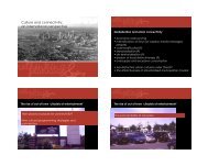
URBAN MORPHOLOGY - urban-design-group.org.uk
URBAN MORPHOLOGY - urban-design-group.org.uk
URBAN MORPHOLOGY - urban-design-group.org.uk

You also want an ePaper? Increase the reach of your titles
YUMPU automatically turns print PDFs into web optimized ePapers that Google loves.
understand, as the different segments of lines between junctions<br />
often work rather differently. It is also important to take account<br />
of the fact that different cities have very different geometrical<br />
patterns, varying from the more grid-like to the more <strong>org</strong>anic.<br />
To deal with all of these issues, a new syntactic model has<br />
been developed. It is still based on the line network, but its<br />
basic unit is the line segment between junctions. This not only<br />
allows a much finer scale of configurational analysis, but also<br />
makes possible different types of analyses based on different<br />
ways of defining the distance between one segment and another:<br />
metric distance (how far is it from point A to point B?), fewest<br />
turns distance (how many turns does the route require, so how<br />
complex does it seem?) and least angle distance (how much<br />
turning does the route require in terms of total deflection from a<br />
straight line?). These different analyses capture different ways of<br />
representing <strong>urban</strong> complexity.<br />
Research using this new model is ongoing, but it is already<br />
proving powerful in the analysis of changing land use patterns<br />
at the most micro-scale of the city. The model is being used to<br />
develop movement models that work at a finer scale than linebased<br />
analysis, and it is also helping to illuminate the role that<br />
metric, geometric and topological factors play in the way that the<br />
network of city space itself shapes movement. Important new<br />
results in this area will be announced in the near future – and<br />
they may come as a surprise to some.<br />
TOPIC<br />
INTERNALISING CONFIGURATION: SPATIAL AGENTS<br />
The final development to be described here – EVAS spatial agents<br />
– evolved from the VGA methods used on many public space<br />
projects, including the recent re<strong>design</strong> of Trafalgar Square.<br />
EVAS creates virtual environments (based on maps or<br />
architectural drawings) and then populates them with virtual<br />
pedestrian ‘agents’ who have a limited form of forward-facing<br />
vision. As these agents move around, they use ‘perception-action’<br />
rules to dictate their movement behaviour – for example, they<br />
can be attracted by specific objects that come into their field of<br />
view. If the environment changes (to simulate a new <strong>design</strong>, for<br />
example), EVAS demonstrates how the patterns of movement<br />
might change in response. The decision rules themselves can also<br />
be modified and tested.<br />
Although other agent-based modelling techniques have been<br />
around for some time, none have attempted exactly what EVAS<br />
does. In truth, most have a similar general aim: to simulate<br />
complex social processes that are difficult, costly, or simply<br />
impossible to observe directly. In addition, there are several<br />
agent-based technologies presently in use that model human<br />
movement. However, these techniques tend to focus on either<br />
the macrodynamics of population movement, or, at the other<br />
extreme, the microdynamics of very specific scenarios, such as<br />
escaping a fire or behaviour within a crowd.<br />
Virtually no models consider free-will behaviour in <strong>urban</strong><br />
areas or large public buildings. Agent modelling in such<br />
scenarios has largely been avoided because, at these intermediate<br />
levels, what people can see on a journey plays an important role<br />
in what they do, and endowing agents with vision can be very<br />
computationally taxing.<br />
EVAS overcomes this technical limitation by using the VGA<br />
technique of pre-computing what can be seen from any given<br />
location within an environment. When it comes to running<br />
agents through the model, they simply consult a database and<br />
retrieve the information about what they can see from the<br />
location they currently occupy. This allows rapid simulation<br />
of complex environments where computation times would<br />
otherwise be prohibitive.<br />
As mentioned above, the Walkability Index seems to clearly<br />
indicate that the locations and densities of land uses have an effect<br />
on movement, but these in turn can be shown to be systematically<br />
related to configuration. Agent simulations allow more precise<br />
Above top Significant factors influencing pedestrian movement in the area around<br />
Harrods in Knightsbridge as identified by the Walkability Index.<br />
Above Pedestrian movement forecast map of same area with proposed new link<br />
between Knightsbridge and Hyde Park, incorporating likely effects of layout/<br />
configuration and other significant factors. Forecast levels for each segment are<br />
represented on a colour scale, highest levels red and lowest levels blue.<br />
investigation of how all these factors interact. At the same time, it<br />
represents an attempt to get closer to the individual experience of<br />
using space, specifically targeting the old problem of whether human<br />
movement is more influenced by configuration or attraction.<br />
Space syntax has never been<br />
merely a set of techniques for<br />
solving <strong>design</strong> problems<br />
SUMMARY<br />
This account of recent space syntax work should illustrate some<br />
of the interesting and powerful new capabilities that are being<br />
developed.<br />
Space syntax has never been merely a set of techniques for<br />
solving <strong>design</strong> problems. Instead, it is a way of researching the<br />
relationship between the way cities are structured and the way<br />
they function. It has a long history of highlighting cultural<br />
differences between cities, but increasingly it is able to identify<br />
what cities have in common – and so it is helping to build a more<br />
general theory of the city, one that especially illuminates the<br />
relation between micro and macro scales.<br />
Whether acknowledged or not, <strong>urban</strong> <strong>design</strong> is always<br />
influenced by how planners and <strong>design</strong>ers understand cities on<br />
a theoretical level. The most important aspect of cities is that<br />
they are always to some degree self-<strong>org</strong>anising. Space syntax<br />
contributes to an understanding of how cities evolve naturally,<br />
an understanding upon which future planning and <strong>urban</strong> <strong>design</strong><br />
will depend.<br />
Bill Hillier is a professor at the Bartlett, UCL, and a director of Space Syntax<br />
Limited. Chris Stutz is an associate director of Space Syntax Limited. The authors<br />
would like to acknowledge the help of Alan Penn, Alasdair Turner, Noah Raford, Tim<br />
Stonor and Alain Chiaradia in preparing this article.<br />
Urban Design | Winter 2005 | Issue 93 | 33