URBAN MORPHOLOGY - urban-design-group.org.uk
URBAN MORPHOLOGY - urban-design-group.org.uk
URBAN MORPHOLOGY - urban-design-group.org.uk

Create successful ePaper yourself
Turn your PDF publications into a flip-book with our unique Google optimized e-Paper software.
TOPIC<br />
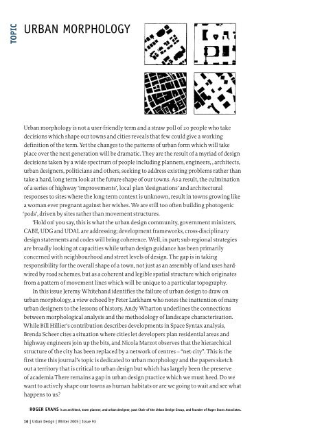
<strong>URBAN</strong> <strong>MORPHOLOGY</strong><br />
Urban morphology is not a user-friendly term and a straw poll of 20 people who take<br />
decisions which shape our towns and cities reveals that few could give a working<br />
definition of the term. Yet the changes to the patterns of <strong>urban</strong> form which will take<br />
place over the next generation will be dramatic. They are the result of a myriad of <strong>design</strong><br />
decisions taken by a wide spectrum of people including planners, engineers, , architects,<br />
<strong>urban</strong> <strong>design</strong>ers, politicians and others, seeking to address existing problems rather than<br />
take a hard, long term look at the future shape of our towns. As a result, the culmination<br />
of a series of highway ‘improvements’, local plan ‘<strong>design</strong>ations’ and architectural<br />
responses to sites where the long term context is unknown, result in towns growing like<br />
a woman ever pregnant against her wishes. We are still too often building photogenic<br />
‘pods’, driven by sites rather than movement structures.<br />
‘Hold on’ you say, this is what the <strong>urban</strong> <strong>design</strong> community, government ministers,<br />
CABE, UDG and UDAL are addressing; development frameworks, cross-disciplinary<br />
<strong>design</strong> statements and codes will bring coherence. Well, in part; sub-regional strategies<br />
are broadly looking at capacities while <strong>urban</strong> <strong>design</strong> guidance has been primarily<br />
concerned with neighbourhood and street levels of <strong>design</strong>. The gap is in taking<br />
responsibility for the overall shape of a town, not just as an assembly of land uses hardwired<br />
by road schemes, but as a coherent and legible spatial structure which originates<br />
from a pattern of movement lines which will be unique to a particular topography.<br />
In this issue Jeremy Whitehand identifies the failure of <strong>urban</strong> <strong>design</strong> to draw on<br />
<strong>urban</strong> morphology, a view echoed by Peter Larkham who notes the inattention of many<br />
<strong>urban</strong> <strong>design</strong>ers to the lessons of history. Andy Wharton underlines the connections<br />
between morphological analysis and the methodology of landscape characterisation.<br />
While Bill Hillier’s contribution describes developments in Space Syntax analysis,<br />
Brenda Scheer cites a situation where cities let developers plan residential areas and<br />
highway engineers join up the bits, and Nicola Marzot observes that the hierarchical<br />
structure of the city has been replaced by a network of centres – “net-city”. This is the<br />
first time this journal’s topic is dedicated to <strong>urban</strong> morphology and the papers sketch<br />
out a territory that is critical to <strong>urban</strong> <strong>design</strong> but which has largely been the preserve<br />
of academia There remains a gap in <strong>urban</strong> <strong>design</strong> practice which we must heed. Do we<br />
want to actively shape our towns as human habitats or are we going to wait and see what<br />
happens to us?<br />
ROGER EVANS is an architect, town planner, and <strong>urban</strong> <strong>design</strong>er, past Chair of the Urban Design Group, and founder of Roger Evans Associates.<br />
16 | Urban Design | Winter 2005 | Issue 93
THE HANDLING CHARACTERISTICS OF <strong>URBAN</strong> FORM<br />
Karl Kropf considers the essential elements of <strong>urban</strong> structure<br />
TOPIC<br />
The terms <strong>urban</strong> fabric, <strong>urban</strong> tissue and<br />
<strong>urban</strong> grain are very suggestive. They hint<br />
at both the tangible substance of a town<br />
and the intricacies of pattern. It is too easy,<br />
however, to leave them as just a metaphor,<br />
a fine cover to an empty book. Urban fabric<br />
is not similar to a piece of cloth, it is a<br />
kind of material with its own properties.<br />
The fertile direction for the analogy<br />
lies in the recognition that the internal<br />
structure of a material has a fundamental<br />
bearing on how it behaves under stress<br />
or when it is manipulated. Different<br />
materials have their own distinct ‘handling<br />
characteristics’.<br />
Those with skill and experience<br />
understand that a material has a bias. It<br />
has strengths and weaknesses, limits and<br />
potentials depending on the way it is cut or<br />
joined and the forces or stresses applied to it, in<br />
relation to the bias of its internal structure.<br />
The primary concern of <strong>urban</strong><br />
morphology is the structure of <strong>urban</strong><br />
form. So, if an understanding of internal<br />
structure is essential to successful<br />
‘manipulation’ of a material, <strong>urban</strong><br />
morphology is essential to <strong>urban</strong>ism and<br />
<strong>urban</strong> <strong>design</strong>.<br />
The figurative and impressionistic<br />
use of terms such as <strong>urban</strong> fabric and<br />
grain only hint at the idea of structure.<br />
But the structure of <strong>urban</strong> form (or<br />
spatial configuration, take your pick) is<br />
pervasive and, perhaps more importantly,<br />
there are different kinds of structure<br />
with different characteristics at different<br />
scales. Individual buildings, at one level<br />
of scale, do not have the same handling<br />
characteristics as a street, at another, or a<br />
town as a whole at yet another.<br />
The generic structure of <strong>urban</strong> form is<br />
a hierarchy of levels related part to whole.<br />
That is to say, one of the characteristics of<br />
<strong>urban</strong> form is that it divides into distinct<br />
levels. The patterns found at different<br />
levels such as street/block, plot series,<br />
plot, building, cell and structure are not<br />
interchangeable and the long term success<br />
of a <strong>design</strong> depends on understanding<br />
not only the differences but also the<br />
relationships between levels. The levels are<br />
interdependent.<br />
Nor is attention to such questions of<br />
structure merely a formalistic diversion.<br />
The structure of <strong>urban</strong> form is the product<br />
of a social/cultural process and the<br />
structures at different levels correspond<br />
to distinct cultural habits, from the more<br />
generic such as paths to the progressively<br />
more particular: nucleated settlements,<br />
property ownership by land parcel,<br />
detached houses, conservatories or light<br />
steel frame construction.<br />
And while the generic structure of levels remains relatively<br />
constant across cultures, there is immense variation of specific<br />
structures (both between and within cultures) corresponding to<br />
differences in social habits.<br />
At this point it is common to infer that <strong>urban</strong> morphology is<br />
essentially equivalent to <strong>urban</strong> history. If that is the case, then<br />
structural engineering and materials science are nothing more<br />
then a branch of the history of technology.<br />
The only way to begin to understand the handling<br />
characteristics of a material is to examine and experiment with<br />
it, test it to destruction. The results of experiments can only<br />
be gathered after the fact. Understanding (and the ability to<br />
predict) can only ever improve in hindsight. In this context, the<br />
built environment is a vast record of previous experiments. This<br />
line of thinking suggests that we need to experiment to improve<br />
our understanding but that we can only really improve if we<br />
pay attention to the results.<br />
The identification of the generic structure of levels of scale<br />
and variation in specific structures as products of cultural habits<br />
becomes a powerful critical tool. A morphological critique is<br />
necessarily a cultural critique (although the links to human<br />
habits may be more or less explicit).<br />
Why, for example, despite volumes of <strong>urban</strong> <strong>design</strong> guidance<br />
promoting permeability, is it so rare to find new development<br />
that fully integrates main routes between settlements or roads<br />
directly linking main routes (radials and counter-radials)?<br />
In most cases the location of the site for development and<br />
restrictions imposed on access from routes with relatively<br />
high volumes of traffic means new development is effectively<br />
creating pods, loops and cul-de-sacs when seen at a higher level<br />
of scale. The connected routes that may be achieved within<br />
the site still only lead back to one, maybe two routes. Even the<br />
areas of connected streets remain visually as impenetrable<br />
and confusing as classic cul-de-sac tree layouts due to the over<br />
reliance on T-junctions and ninety degree speed reduction<br />
bends to achieve what is laughingly called ‘natural’ traffic<br />
calming.<br />
What ideas and habits generate these forms? Not<br />
surprisingly, as human habits, they are sometimes irrational<br />
and contradictory. Word and deed do not correspond.<br />
The idea of generic<br />
and specific structure<br />
goes beyond the<br />
superficial analogy of<br />
‘grain’ to articulate<br />
the complexity and<br />
diversity of a town at<br />
different levels of scale<br />
corresponding to a range<br />
of human habits.<br />
Urban Design | Winter 2005 | Issue 93 | 17
TOPIC<br />
Left Thorley Lane, Bishop’s Stortford: morphological<br />
knock on effects of speed reduction bends. The<br />
geometry of the roads makes it impossible to<br />
achieve a common orientation of buildings and<br />
through visibility.<br />
Above Speed reduction bends result in a view down the<br />
main street that is terminated by a ‘corner’ gable<br />
and the backs of houses facing another street.<br />
The generic structure of<br />
<strong>urban</strong> form is a hierarchy of levels<br />
related part to whole<br />
Everyone demonises the car for global warming, profligate<br />
energy use, congestion, pollution, noise, cluttering the public<br />
realm, speeding and other safety hazards but its always everyone<br />
else’s car. People want the convenience of driving but don’t want<br />
to see any other car, certainly not down their street. It is a form of<br />
behaviour that has many attributes in common with addiction:<br />
increasing use with a refusal to acknowledge the level of use and<br />
its consequences.<br />
There are other habits that perpetuate pod developments with<br />
illegible street networks: lack of investment in public transport,<br />
lack of imagination and will to solve the challenge of integrating<br />
different modes of movement in the same space, continued<br />
application of received ideas and assumptions in highway <strong>design</strong><br />
(limited access motorways as the ideal), a planning process<br />
that is fundamentally reactive, allocating land for development<br />
by default, the abdication of public bodies in the <strong>design</strong> of the<br />
public realm.<br />
But the root habit is the aggregate of public behaviour.<br />
By their purchasing preferences for large vehicles (to stay<br />
safe), sub<strong>urban</strong> houses (to live on a quiet street) and out of<br />
town shopping (to avoid town centre congestion), people are<br />
expressing a dislike for the wider implications of the car. But<br />
those very choices increase the use of the car. The hangover cure<br />
is the hair of the dog that bit you: more of the same.<br />
Two aspects of car use in particular show extremely clear<br />
signs of addictive behaviour: the level of use and speeding. The<br />
more you get the more you want. Give people the space and they<br />
will use it to drive ever more and bigger cars at ever higher speed<br />
(fuelled, as it were, by a no less pathological motor industry - a<br />
clear example of co-dependence).<br />
Current wisdom identifies the cause of the problem in the<br />
physical arrangement of the highway. Straight wide roads induce<br />
increased use and speed so the cure is to change the roads. Streets<br />
are deliberately pinched and contorted to physically restrict<br />
speed and convenience.<br />
But physical restraint is notoriously ineffective in curbing<br />
compulsive or addictive behaviour. Car use and speeding are<br />
social and behavioural problems not environmental problems.<br />
Physical restraint may work as part of a package of measures but<br />
a more important step is for all individuals to acknowledge the<br />
extent to which their own behaviour is ruining their lives.<br />
And aside from being ineffective as a cure, physical restraint is<br />
indiscriminate. Everyone must suffer the<br />
cure whether they need it or not.<br />
Tellingly, neither is the cure<br />
applied everywhere. Underlining the<br />
social nature of the problem, those<br />
administering the medicine are complicit<br />
in the behaviour being treated. Essentially<br />
they tell us to behave ourselves in front of<br />
the neighbours but just around the corner<br />
they sell us the fix that keeps us addicted.<br />
If you’re a good junkie and go quietly<br />
down that residential street they’ll give<br />
you a great rush inducing hit out on the<br />
ring road.<br />
More damaging still, the attempt<br />
to reduce car use and speed with the<br />
layout of roads ignores the consequences<br />
for other aspects of <strong>urban</strong> form, which<br />
is to say, the structure, character and<br />
usability of the places in which we live.<br />
It is a prime example of single issue<br />
<strong>urban</strong>ism. All resources of a particular<br />
<strong>group</strong> are directed at one problem.<br />
There is no appreciation of the handling<br />
characteristics of the material being<br />
distorted. No attention is paid to the<br />
knock on effects, either on the overall<br />
structure, legibility and visual hierarchy<br />
of the town as a whole, the streets or<br />
the possible arrangement of plot series,<br />
individual plots and buildings relative to<br />
the street.<br />
The damage it does is enormous and,<br />
for all intents and purposes, irreversible.<br />
More effective and, in the long<br />
run, more successful <strong>urban</strong>ism and<br />
<strong>urban</strong> <strong>design</strong> will only come from a<br />
better understanding of <strong>urban</strong> form<br />
as a material with a range of handling<br />
characteristics. Urban morphology is not<br />
a formalistic diversion. It is at the root of<br />
<strong>urban</strong>ism and <strong>urban</strong> <strong>design</strong>.<br />
Karl Kropf is Director of Spatial Planning and<br />
Research at Roger Evans Associates. He is also a<br />
member of the Urban Morphology Research Group<br />
at the University of Birmingham and Associate<br />
Editor of Urban Morphology.<br />
18 | Urban Design | Winter 2005 | Issue 93
<strong>URBAN</strong> <strong>MORPHOLOGY</strong>, <strong>URBAN</strong> LANDSCAPE AND<br />
FRINGE BELTS<br />
JWR Whitehand advocates a greater role for morphology in <strong>urban</strong> <strong>design</strong><br />
TOPIC<br />
A visitor from another planet, schooled in logic but ignorant of<br />
the behaviour of earthly folk, might have imagined that <strong>urban</strong><br />
morphology would be one of the basic disciplines of which<br />
<strong>urban</strong> <strong>design</strong> was an applied discipline. Urban morphology is,<br />
after all, the study of <strong>urban</strong> form, and an important part of <strong>urban</strong><br />
<strong>design</strong> is the creation of <strong>urban</strong> form. It is reasonable that the<br />
discipline that has as its central purpose the understanding of<br />
<strong>urban</strong> form should contribute to both the theory and practice<br />
of <strong>design</strong>ing that form. Parallels with the relationships between<br />
biosciences and medicine, and indeed more widely between basic<br />
and applied sciences come to mind.<br />
The reality is different. In the English-speaking world cases<br />
in which <strong>urban</strong> <strong>design</strong> draws upon <strong>urban</strong> morphology are<br />
rarities. One such in Great Britain is the prize-winning Stratford<br />
upon Avon District Design Guide about which the judges<br />
of the Countryside Agency Award for Planning Rural Areas<br />
and Communities commented that it uses ‘a morphological<br />
approach’. This particular <strong>design</strong> guide was largely produced by<br />
a PhD graduate whose thesis was on <strong>urban</strong> morphology (Kropf,<br />
1993). Furthermore, the thesis bridged the divide between <strong>urban</strong><br />
morphology and <strong>urban</strong> <strong>design</strong>. In doing so it made one of those<br />
all too rare crossings of the boundary between the disciplines of<br />
geography and architecture - a boundary, indeed a barrier, in both<br />
education and research, that has a strength practically worldwide<br />
View north across Birmingham’s Edwardian fringe belt, c1995. The city centre is in<br />
the top right-hand corner, and the <strong>urban</strong> fringe some seven kilometres behind the<br />
camera. Reproduced with the permission of the Calthorpe Estate<br />
that has no rational basis. That divide<br />
provides much of the explanation for the<br />
weakness of the relationship between the<br />
study of <strong>urban</strong> form on the one hand and<br />
the <strong>design</strong> of that form on the other.<br />
<strong>URBAN</strong> LANDSCAPE MANAGEMENT<br />
Although the need for a close relation<br />
between knowledge of <strong>urban</strong> form<br />
and its application in <strong>urban</strong> <strong>design</strong><br />
may be self-evident, what matters for<br />
practical purposes is the nature and<br />
application of this relationship in actual<br />
towns and cities. Fortunately, in spite<br />
of interdisciplinary myopia, to use Ivor<br />
Samuels’ apposite term (Samuels, 2003),<br />
evidence of the potential value of <strong>urban</strong><br />
morphology in the armoury of <strong>urban</strong><br />
<strong>design</strong>ers is to hand. Although not well<br />
known among <strong>urban</strong> <strong>design</strong>ers, <strong>urban</strong><br />
Urban Design | Winter 2005 | Issue 93 | 19
TOPIC<br />
morphologists have been addressing<br />
issues pertinent to <strong>urban</strong> <strong>design</strong> for over<br />
half a century. This has been evident<br />
not least within the small but lively<br />
field of what <strong>urban</strong> morphologists<br />
sometimes refer to as <strong>urban</strong> landscape (or<br />
townscape) management.<br />
The origins of <strong>urban</strong> landscape<br />
management are intimately connected<br />
to the nature and development of an<br />
important part of <strong>urban</strong> morphology<br />
itself (Conzen, 1966). That part is<br />
concerned with tracing how the physical<br />
configurations of cities have developed<br />
over time. The ways of doing this became<br />
increasingly refined in the course of<br />
the 20th century. By the middle of that<br />
century the implications of the patterns<br />
recognised and explanations offered<br />
were being considered in relation to<br />
prescriptions of <strong>urban</strong> form, particularly<br />
townscape conservation (Conzen, 1958).<br />
An important basis for <strong>urban</strong> landscape<br />
management was the <strong>urban</strong> landscape<br />
units (or morphological regions)<br />
identified from systematic survey and<br />
analysis of the historical development of<br />
towns and cities. As a purely descriptive<br />
activity (<strong>urban</strong> morphography) this had<br />
been discredited in the German-speaking<br />
world in the inter-war years. But, linked<br />
to the social, economic and cultural<br />
forces driving the development of <strong>urban</strong><br />
areas, systematic surveying and mapping<br />
of ground plans, building types, and land<br />
and building use became fundamental to<br />
the recognition of <strong>urban</strong> landscape units.<br />
Such recognition became, in the postwar<br />
period, a method of characterising<br />
the various parts of towns at different<br />
scales of analysis, from the individual<br />
building to entire settlements (Conzen,<br />
1960). The delineation of unitary areas<br />
not only distinguished historical types of<br />
development but provided an important<br />
template with which to assess future<br />
development (Conzen, 1975). Presaging<br />
British conservation areas by nearly a<br />
decade and English Heritage Extensive<br />
Urban Surveys by nearly half a century,<br />
they offered an important method of<br />
assessing and delimiting ‘character areas’<br />
in a way that connected them to the rest<br />
of the <strong>urban</strong> area. For <strong>design</strong> purposes<br />
they had particular value within existing<br />
<strong>urban</strong> areas but there were lessons too for<br />
the <strong>design</strong> of entirely new areas.<br />
A PLANNING PHILOSOPHY<br />
An especially important aspect of this<br />
mid-20th-century work was the links it<br />
established between developing forms<br />
on the ground and long and mediumterm<br />
historical changes, such as the<br />
adoption of innovations in transport<br />
and fluctuations in house building. In<br />
particular there was recognition that the<br />
physical character of <strong>urban</strong> areas was the<br />
embodiment of great variations over time in the form of <strong>urban</strong><br />
extensions and the incidence and type of change within existing<br />
<strong>urban</strong> areas. With this recognition came a planning philosophy:<br />
a philosophy grounded in the belief that to experience <strong>urban</strong><br />
landscapes as historico-geographical phenomena was an<br />
important means of benefiting from the successes and failures of<br />
past societies in their attempts to shape their built environments.<br />
The <strong>urban</strong> landscape as a vast reservoir of experiences passed<br />
down by previous societies became recognised as an educative<br />
source and therefore not lightly expendable but something to<br />
be assessed, learned from, sometimes conserved and, not least,<br />
used to inform the creation of new <strong>urban</strong> landscapes. Especial<br />
attention was devoted to the way in which particular parts of<br />
the <strong>urban</strong> landscape had taken on different degrees and types<br />
of historical expressiveness. These differences were embodied<br />
in the <strong>urban</strong> landscape units that <strong>urban</strong> morphologists were<br />
recognising.<br />
Attention is devoted largely to<br />
individual buildings, sites<br />
and monuments, or small areas<br />
of special interest<br />
EXEMPLIFYING <strong>URBAN</strong> LANDSCAPE UNITS<br />
One type of <strong>urban</strong> landscape unit that has become widely<br />
recognised in many different culture areas is the ‘<strong>urban</strong> fringe<br />
belt’ (commonly shortened to ‘fringe belt’). While all <strong>urban</strong><br />
landscape units are in detail unique, they have recurrent features.<br />
The fringe belt is no exception, and its wide significance for the<br />
understanding and management of <strong>urban</strong> landscapes makes it a<br />
good illustration of both <strong>urban</strong> morphological thinking and the<br />
potential of that thinking as a contribution to <strong>urban</strong> <strong>design</strong>.<br />
A fringe belt is a product of the very large variations over<br />
time in the speed of extension of towns and cities. It comes into<br />
existence during a period of very slow <strong>urban</strong> extension, often<br />
owing to a house-building slump (and associated reductions in<br />
land values) or a topographical or other geographical obstacle<br />
to housing development. Such a long pause in the outward<br />
extension of an <strong>urban</strong> area tends to be associated with the<br />
formation of a distinctive zone encircling the built-up area.<br />
This is later embedded within the <strong>urban</strong> area and becomes a<br />
significant element in its historico-geographical structuring.<br />
THE CHARACTERISTICS OF FRINGE BELTS<br />
The characteristics of fringe belts include (a) a sparse road<br />
network, with a low incidence of radial roads (ie running across<br />
the fringe belt), and hence constituting a barrier zone to vehicles,<br />
although, those radial roads that do exist (being historical arterial<br />
roads leading out of the city) tend to be heavily used; (b) large,<br />
often well-vegetated plots, frequently containing institutional,<br />
sometimes ‘landmark’, buildings of architectural note; and<br />
(c) the fact that they form a boundary between historically and<br />
morphologically distinct areas (Whitehand and Morton, 2004).<br />
They are heterogeneous in ground plans, building forms, and<br />
land and building use. Public utilities, parks, recreational areas<br />
and allotment gardens are characteristic of their medley of land<br />
uses (Whitehand and Morton, 2003).<br />
Among the most striking fringe belts are those that formed<br />
around medieval towns, especially associated with town walls,<br />
and, in Great Britain in particular, those that came into existence<br />
at the end of the 19th century and the beginning of the 20th<br />
century, especially during the slump in the house building<br />
between roughly 1908 and 1925. The latter, often referred<br />
to as Edwardian fringe belts in England, today separate two<br />
physically contrasting housing zones: that of the late-Victorian<br />
20 | Urban Design | Winter 2005 | Issue 93
and Edwardian period, characterised by<br />
‘bye-law’ terraced houses, and that of the<br />
inter-war period, characterised by semidetached<br />
houses with ‘universal’ plans.<br />
Along much of its length an Edwardian<br />
fringe belt provides, internal to the city, a<br />
‘green belt’ between these two zones.<br />
A fringe belt is a product<br />
of the very large variations<br />
over time in the speed of<br />
extension of towns and cities<br />
TOPIC<br />
HISTORICO-GEOGRAPHICAL STRUCTURE<br />
AND DESIGN<br />
Since fringe belts are both ecologically<br />
significant (Hopkins, 2004) and, most<br />
importantly, articulate the historicogeographical<br />
structure of towns and cities,<br />
they merit much more consideration<br />
than they have received in planning<br />
and <strong>urban</strong> <strong>design</strong>. Their significance for<br />
environmental awareness is inseparable<br />
from their historical development.<br />
They provide practical geographical<br />
orientation by providing a sense of<br />
position within or on the edge of the city,<br />
but at a deeper level of appreciation they<br />
provide a historico-geographical frame<br />
of reference within which the phases<br />
of development, and physical forms,<br />
of previous societies are related to the<br />
physical configurations of present cities.<br />
There is much more to an appreciation<br />
of this role than the recognition of<br />
individual sites of historical and<br />
architectural significance. To recognise<br />
the structuring of an <strong>urban</strong> area in terms<br />
of fringe belts and intervening residential<br />
zones is to take a more holistic culturalenvironmental<br />
view of cities: the many<br />
individual features that make up the<br />
<strong>urban</strong> scene take on added cultural<br />
significance from the way in which<br />
they relate to one another and combine<br />
to form historically composite <strong>urban</strong><br />
landscapes.<br />
The fact that little attempt has been<br />
made to explore fringe belts in relation<br />
to plan making and development<br />
control exemplifies the neglect of <strong>urban</strong><br />
landscape units in <strong>urban</strong> planning, as<br />
distinct from their place in the study<br />
of <strong>urban</strong> landscape development. In<br />
Great Britain this does not reflect a lack<br />
of interest in history among planners<br />
and others with responsibility for the<br />
built environment - the <strong>design</strong>ation of<br />
conservation areas, listed buildings and<br />
parks and gardens of special historic<br />
interest, for example, belies such an<br />
explanation. More significant is the<br />
lack of awareness of the wider historicogeographical<br />
structure of cities. Among<br />
those with a custodial concern for the<br />
built environment, attention is devoted<br />
largely to individual buildings, sites and<br />
monuments, or small areas of special<br />
interest: the emphasis is on individual<br />
features or small areas, rather than the<br />
historico-geographical structuring of<br />
entire cities or sizeable parts of cities.<br />
This deficiency is very evident in UK<br />
governmental publications on historical environments (see,<br />
for example, Department for Culture, Media and Sport, 2001).<br />
Paradoxically, fringe belts survive within <strong>urban</strong> areas as physical<br />
entities redolent of the history of cities, but local plans, and<br />
central government policy documents, including those on<br />
historical environments, scarcely mention them.<br />
TIME OF HOPE<br />
Although the lack of synergy between <strong>urban</strong> morphology and<br />
<strong>urban</strong> <strong>design</strong> extends much more widely than the British case<br />
focused on here, fortunately linkage between these two fields<br />
has been developing more fruitfully in several other countries,<br />
notably over recent decades in Italy and France. This has been<br />
helped by the stronger presence in these countries of <strong>urban</strong><br />
morphology within architecture. In the English- speaking world<br />
the bridge between architecture and geography, and, related to<br />
it, that between <strong>urban</strong> morphology and <strong>urban</strong> <strong>design</strong>, has with<br />
only a few exceptions been too weak to withstand more than<br />
very minor traffic. Yet both the logical and empirical bases for<br />
the link are evident. Furthermore, within Great Britain there has,<br />
over the last decade or more, been increasing interest beyond<br />
academe, for example within English Heritage, in mapping the<br />
‘character’ of areas. This interest must surely lead, sooner or later,<br />
to strengthening the bridge between <strong>urban</strong> morphology and<br />
<strong>urban</strong> <strong>design</strong>. Let it be sooner.<br />
JWR Whitehand, School of Geography, Earth and Environmental Sciences, University<br />
of Birmingham<br />
REFERENCES<br />
Conzen, MRG (1958), ‘The growth and character of Whitby’, in Daysh,<br />
GHJ (ed) A survey of Whitby, Shakespeare Head Press, Eton, 49-89<br />
Conzen, MRG (1960), Alnwick, Northumberland: a study<br />
in town-plan analysis, Ge<strong>org</strong>e Philip, London<br />
Conzen, MRG (1966), ‘Historical townscapes in Britain: a problem in applied<br />
geography’, in House, JW (ed.) Northern geographical essays in honour of GHJ<br />
Daysh, University of Newcastle upon Tyne, Newcastle upon Tyne, 56-78<br />
Conzen, MRG (1975), ‘Geography and townscape conservation’, in<br />
Uhlig H and Lienau, C (eds) Anglo-German Symposium in Applied<br />
Geography, Giessen-Würzburg-München, Lenz, Giessen, 95-102<br />
Department for Culture, Media and Sport (2001) The historic environment: a<br />
force for our future, Department for Culture, Media and Sport, London<br />
Hopkins, MIW (2004), ‘Using fringe belts to examine the<br />
relationships between <strong>urban</strong> morphology and <strong>urban</strong> ecology’,<br />
unpublished PhD thesis, University of Birmingham<br />
Kropf, KS (1993), ‘An enquiry into the definition of built form in <strong>urban</strong><br />
morphology’, unpublished PhD thesis, University of Birmingham<br />
Samuels, I (2003), ‘The death and life of the <strong>urban</strong> block’, unpublished<br />
Christmas lecture to the Urban Design Group, London, 3 December 2003<br />
Whitehand, JWR and Morton NJ ‘Fringe belts and the recycling<br />
of <strong>urban</strong> land: an academic concept and planning practice’,<br />
Environment and Planning B: Planning and Design 30, 819-839<br />
Whitehand, JWR and Morton, NJ (2004) ‘Urban morphology<br />
and planning: the case of fringe belts’, Cities 21, 275-289<br />
Urban Design | Winter 2005 | Issue 93 | 21
TOPIC<br />
UNDERSTANDING <strong>URBAN</strong> FORM?<br />
Peter Larkham discusses practical applications of morphological<br />
analysis to planning and <strong>urban</strong> <strong>design</strong><br />
Above Bullring,<br />
Birmingham<br />
It has rightly been suggested that<br />
knowledge of <strong>urban</strong> form (<strong>urban</strong><br />
morphology equals the study of <strong>urban</strong><br />
form) is one of the essential things an<br />
<strong>urban</strong> <strong>design</strong>er should know about<br />
(Moudon, 1992). It is a part of the broader<br />
picture; an approach to conceptualising<br />
the complexity of physical form. Moudon<br />
states that ‘to build up actual knowledge<br />
in <strong>urban</strong> <strong>design</strong>, one should not look for<br />
the correct approach or theory, but should<br />
instead compile and assess all the research<br />
that adds to what the <strong>urban</strong> <strong>design</strong>er must<br />
be familiar with’.<br />
This is more than merely abstract<br />
knowledge. Understanding the physical<br />
complexities of various scales, from<br />
individual buildings, plots, street-blocks,<br />
and the street patterns that make up the<br />
structure of towns helps us to understand<br />
the ways in which towns have grown and<br />
developed. The qualities of place are often<br />
ascribed, to a considerable extent, to such<br />
physical characteristics as size, scale, and<br />
relative proportions of various elements.<br />
This knowledge helps us to appraise what<br />
is successful and unsuccessful. It may also<br />
– but this is contentious for some <strong>design</strong>ers<br />
at both architectural and <strong>urban</strong> scales<br />
– provide <strong>design</strong> cues for future forms.<br />
Yet, over the past two decades, the<br />
study of <strong>urban</strong> form has become much<br />
more than the study of form itself. Recent research has examined<br />
the processes that have shaped form: the agents and agencies of<br />
change. More elusive, but also important in many contexts, are<br />
the factors leading to non-change, especially in conserved <strong>urban</strong><br />
landscapes.<br />
A significant <strong>design</strong>-related question is the extent to which<br />
features persist in the <strong>urban</strong> landscape. Obviously, a certain<br />
amount of change can be ‘catastrophic’ in its cause or in its<br />
rapidity and extent. Change after natural or man-made disaster<br />
is one element; although some might argue that the extent<br />
of redevelopment in the post-war period, especially in those<br />
towns not suffering bomb damage, was also a disaster. It was an<br />
awareness of hostile reactions to this type of change that caused<br />
Francis Tibbalds (1988) to suggest that we should not build too<br />
much in one place at one time (one of his ‘ten commandments’<br />
of <strong>urban</strong> <strong>design</strong>).<br />
On the other hand, morphological studies in a wide range of<br />
locations and contexts have shown that there is an inevitability<br />
about <strong>urban</strong> change; it occurs everywhere at some scale and<br />
time. This is, to borrow a geological metaphor, ‘gradualistic’<br />
change. It may respond to changing fashion, for example the fad<br />
for conservatories; to changing needs, for example the fitting<br />
of central heating or structures and spaces to cope with motor<br />
vehicles. At an <strong>urban</strong> scale, think of the 19th-century trend for<br />
<strong>urban</strong> parks, or the 20th-century requirement for ‘civic centres’.<br />
We should also consider the natural and finite life-cycle of<br />
structures and building materials. Where we <strong>design</strong>ate an area<br />
or building as worthy of retention and conservation, there is (in<br />
the developed West at least) an implication that such places and<br />
structures will become insulated from this life cycle. And yet,<br />
even in such places, there is still pressure for change (Larkham,<br />
1996). Over the span of decades (three and a half decades since<br />
22 | Urban Design | Winter 2005 | Issue 93
the earliest conservation areas in the UK),<br />
the amount of individually small-scale<br />
and incremental change in some areas<br />
has caused a few conservation officers<br />
to question whether areas should be de<strong>design</strong>ated,<br />
such has been the change to<br />
their character.<br />
Carried further, morphological<br />
studies have also tended to show that<br />
there is a hierarchy of change within<br />
<strong>urban</strong> features. Buildings can change<br />
fastest, from alterations to complete<br />
demolition and replacement, in reaction<br />
to changing use requirements including<br />
an owner’s desire to personalise a house.<br />
So we have very few surviving medieval<br />
buildings, more Ge<strong>org</strong>ian, many more<br />
Victorian, and so on. Plot patterns can<br />
change, by wholesale redevelopment but<br />
more commonly through subdivision<br />
and amalgamation, often associated<br />
with changing ownership. Yet, in many<br />
UK towns, there are perceptible traces<br />
of medieval plot patterns still persisting,<br />
and still influencing new development<br />
especially through traditional frontage<br />
widths (typically 33 feet). Most resistant<br />
to change is the street network, and<br />
so again we have towns whose basic<br />
structure remains recognisably Roman<br />
or medieval; even though in most cases,<br />
individual streets have been straightened<br />
or widened. Nowadays, the investment in<br />
underground infrastructure beneath our<br />
streets helps to fossilise this pattern still<br />
further.<br />
Change to these apparently innately<br />
conservative street patterns does occur,<br />
but even catastrophes such as the Great<br />
Fire of London and the wartime blitzes<br />
resulted – directly – in surprisingly<br />
little change. Developing technology<br />
has done far more, particularly with<br />
strategies to cope with the rising volume<br />
of motor vehicles, including the fashion<br />
for ring roads. Yet, in a number of recent<br />
cases, <strong>urban</strong> <strong>design</strong>ers have suggested<br />
the reinstatement of long-vanished<br />
(often medieval) road alignments.<br />
Whilst this does have some grounding<br />
in <strong>urban</strong> history, does it really address<br />
contemporary needs?<br />
COMPARISONS: BREADTH OF<br />
KNOWLEDGE<br />
One of the weaknesses of <strong>urban</strong><br />
morphology has been that there are few<br />
genuine comparative studies, particularly<br />
across national boundaries. Few of us<br />
have the linguistic ability to follow the<br />
professional literature in more than<br />
two languages. Yet there is much in<br />
<strong>urban</strong> form and process that transcends<br />
current national boundaries, and a wider<br />
understanding would be potentially<br />
useful. Where is the traditional boundary<br />
between the narrow, deep burgage plot<br />
and house typical of north-western<br />
Europe, versus the courtyard plan common in Mediterranean<br />
and eastern countries? And what are the implications of migrant<br />
communities wishing to import <strong>urban</strong> and architectural forms<br />
familiar to them, representing their traditional culture? Too often<br />
these are felt to be ‘alien’ in the <strong>urban</strong> landscape (as, it could be<br />
said, were the structures and <strong>urban</strong> forms imposed by colonial<br />
conquerors).<br />
One of the very few comparative studies of contemporary<br />
cities has been carried out for Seoul, Tokyo, Paris, London, New<br />
York and Los Angeles, by members of the International Seminar<br />
on Urban Form. Funded by the Seoul Development Institute, it<br />
sought to show how Seoul, as an extremely fast-growing capital<br />
city, compared in form and process with other ‘world cities’. A<br />
series of residential and commercial areas, each 500m square,<br />
was examined for each city. The residential areas were selected to<br />
represent similar social characteristics, and to be representative<br />
of significant formative phases in the city’s development.<br />
This study clearly showed very substantial differences in the<br />
scale and physical form of development in these cities. Yet there<br />
are also many features in common. The substantial proportion of<br />
the built area given over to roads and pavements; the issues of car<br />
parking in most residential areas; the uniformity of large expanses<br />
of <strong>urban</strong> fabric developed at one period; yet the lack of conscious<br />
‘<strong>design</strong>’ at many levels, can be appreciated. We can see the physical<br />
results of various controlling mechanisms (planning systems,<br />
legal constraints, etc). The next stage is to distil the practical<br />
applications: not ‘do’ and ‘don’t’, but ‘this is what can happen if...’.<br />
It is virtually certain that not all<br />
<strong>design</strong>ated conservation areas have<br />
fully-developed character appraisals<br />
FORM AND CHARACTER<br />
On another level entirely, <strong>urban</strong> form is obviously a major<br />
constituent of ‘character’, that rather elusive concept so<br />
important in much conservation planning and <strong>design</strong>, but also<br />
with much wider relevance in non-protected areas. Although<br />
there is guidance in the UK on character appraisal, it is virtually<br />
certain that not all <strong>design</strong>ated conservation areas have fullydeveloped<br />
character appraisals, and non-<strong>design</strong>ated areas have<br />
far patchier coverage despite the brave suggestion by Tony Hall<br />
(1996) that this should be widespread and should underpin<br />
development control decision-making and <strong>urban</strong> landscape<br />
management.<br />
Stratford upon Avon District Council produced an innovative<br />
district <strong>design</strong> guide based on a detailed morphologicallyinformed<br />
approach (2001). Building on analysis of precedents<br />
within each area of the district, detailed advice is offered at scales<br />
from settlement, street, open space, plot, building and material.<br />
This is independent of land use: the advice could be used for a<br />
broad range of development types. Nor is it prescriptive in terms<br />
of architectural style. Although complex, it was possible to convey<br />
this message convincingly to both local politicians and public.<br />
In reality, however, even detailed character appraisals based<br />
on morphological analysis at the level of individual plots and<br />
buildings can founder at the stage of an individual planning<br />
appeal. Will the Stratford guidance survive this test? Developers<br />
are increasingly proposing high-density development, to the<br />
densities proposed in PPG3 (30-50/ha), within residential areas<br />
which, although of distinct character, are not protected by<br />
conservation area <strong>design</strong>ation. The result is very often that the<br />
development goes ahead. In my own, albeit limited, experience,<br />
a developer can disregard a detailed morphological character<br />
appraisal, relying instead on general statements about the<br />
TOPIC<br />
Urban Design | Winter 2005 | Issue 93 | 23
TOPIC<br />
Left Bullring, Birmingham<br />
Right City Centre Building Footprints<br />
500 x 500m square<br />
‘residential character’ of this entire<br />
sub<strong>urban</strong> district; and base statements<br />
of the ‘high quality’ of the proposed<br />
development upon its conformity with<br />
PPG3’s density standards.<br />
In one recent Birmingham example,<br />
the inspector found that “there would<br />
be a marked change in character and<br />
appearance” if 14 houses and a block<br />
of apartments were built on sub<strong>urban</strong><br />
back gardens, but that this would be<br />
acceptable: views into the site would not<br />
be “readily appreciated by passers-by”,<br />
the demolition of a house would not<br />
form a “significant variation” in character<br />
or appearance. Yet “the character<br />
and appearance of the area would<br />
be materially harmed” by more such<br />
proposals (where is the threshold?), and<br />
the inspector made no comment on the<br />
quality of the proposed new development<br />
itself, save that it would be “very different<br />
in character and appearance from that of<br />
the existing housing”, and such “backland<br />
development will often be at variance<br />
with the precise established nature<br />
of existing areas” (Appeal APP/P4605/<br />
A/03/1120919).<br />
WHY BOTHER ABOUT <strong>MORPHOLOGY</strong>?<br />
Some of our most significant <strong>urban</strong><br />
problems of the last century have<br />
arisen in cases where new <strong>urban</strong> and<br />
architectural forms have been developed<br />
at speed and to a large scale, but with<br />
little or no reference to existing <strong>urban</strong><br />
form and context. This includes the great<br />
swaths of modernist post-war <strong>urban</strong><br />
redevelopment, criticised by so many<br />
commentators, and the tower block,<br />
many of which are now being demolished<br />
in the name of <strong>urban</strong> regeneration.<br />
Conversely, there are places now<br />
recognised as being of high quality that<br />
also paid little heed to their predecessors: Ge<strong>org</strong>ian Bath and Edinburgh, for example. Yet<br />
many of these were <strong>urban</strong> extensions, rather than remodelling of existing built-up areas.<br />
A broad knowledge of local and regional <strong>urban</strong> forms – a larger scale than the<br />
vernacular architectural detail so often recommended – and their analysis in terms of<br />
identifying those features that produce high-quality <strong>urban</strong> environments seems useful<br />
in the light of much of the 20-century experience. A wider sensitivity to national and<br />
international comparisons can assist in this respect, although one could query why<br />
Siena and other Italian hill towns reappear uncritically in so many <strong>urban</strong> <strong>design</strong> texts.<br />
In post-Enlightenment Western thought, concepts of originality and authenticity<br />
have become significant, and this can be seen most particularly for <strong>urban</strong> <strong>design</strong>ers in<br />
terms of conservation – its spread, and the growth of <strong>design</strong> guidance paying lip service<br />
to respect for original character and appearance. Again, can we learn from practice<br />
elsewhere? The approach in Japan and other Eastern countries to respecting character<br />
and <strong>design</strong> does not extend to veneration of the original fabric, while the <strong>urban</strong> tradition<br />
in the Near and Middle East has a very different approach to valuing and using tradition<br />
and authenticity.<br />
THE NEED FOR A BROADER AND LONGER-TERM PERSPECTIVE<br />
None of this detailed and broad knowledge will be of any use if it is disregarded at the<br />
highest level of policy-making, and at the most contested level of implementation,<br />
through appeals and legal challenges, which rest upon quasi-judicial processes and<br />
interpretations of the precise meaning of the words of statute and guidance. In creating<br />
high-quality places, is a broad and long-term perspective on successful <strong>urban</strong> forms less<br />
important than political ‘guidance’? Morphological detail can certainly fall at the hurdle<br />
of PPG3’s density guidance. This is a major challenge for <strong>urban</strong> <strong>design</strong>: not in <strong>design</strong>ing<br />
entire new towns, but in producing what can be widely accepted as high-quality <strong>design</strong><br />
at the local level, in the re-shaping of the existing <strong>urban</strong> fabric, in identifying, retaining<br />
and reinforcing the best qualities of past <strong>urban</strong> forms, and in persuading owners and<br />
occupiers of the rationale for, and quality of, new <strong>design</strong>s. Otherwise, the blunt tool of<br />
‘guidance’ and the current official approach will fail to convince those who use and live<br />
in our new <strong>urban</strong> environments, and we may be <strong>design</strong>ing and building the slums of the<br />
next generation.<br />
And, moreover, we should be learning from past forms. Birmingham’s new Bull Ring<br />
may well be a vibrant and popular shopping destination but, as Joe Holyoak reminds<br />
us, it is “too inflexible, too monocultural, too narrowly defined, too contained within its<br />
own boundaries, to be an effective part of a city centre... In this, its makers are repeating<br />
the fundamental mistakes made by Laing in the 1960s, but this time on a bigger scale”.<br />
Let us put the lessons of <strong>urban</strong> history and <strong>urban</strong> form back into <strong>urban</strong> <strong>design</strong>, to<br />
help create the high-quality, vibrant, places we all know are needed.<br />
Professor Peter Larkham is an <strong>urban</strong> geographer and is currently Director of Research for the School of Planning<br />
and Housing, University of Central England.<br />
24 | Urban Design | Winter 2005 | Issue 93
WHO MADE THIS BIG MESS?<br />
Brenda Scheer tries to pin the blame for the morphological<br />
disaster that is the American strip<br />
TOPIC<br />
I’m driving down a calm subdivision road<br />
in any American <strong>urban</strong>ised area (hard<br />
to call them cities, really). Sprawl has its<br />
loveliness: the precise patterns of houses<br />
of similar size, surrounded by a patch of<br />
lawn, facing a street that may soon be lined<br />
with trees. The space between houses is<br />
a regular rhythm, as is the curb cut and<br />
pavement of the driveway and even the<br />
doors of the garages. Although we can<br />
demonise it, it is not hard to see why<br />
Americans adore their own little piece of<br />
castle, tucked into a neat, orderly plot.<br />
But, let’s keep driving, to the dirty little<br />
aesthetic underbelly of the cosy suburb<br />
– the strip. All we need do is leave the<br />
shady acres sign in the rear view mirror,<br />
drive to the main road, and we encounter<br />
a completely different world – chaotic,<br />
charmless and without the redemption<br />
of landscape or private domain. Here, no<br />
visible order prevails. Here is the hated<br />
symbol of sprawl, excess, corporate greed<br />
embodied in a world of shopping centres,<br />
fast food chains, downtrodden oriental<br />
buffets, gas stations, signs, parking lots,<br />
and roads without benefit of a curb, much<br />
less a tree.<br />
A CANCER<br />
Well, having studied it for years, I can<br />
describe it the way a doctor might be able<br />
to describe a cancer – it has a definitive<br />
form that is almost as predictable as<br />
the quiet subdivisions around it. Its<br />
form has subtly changed over the past 50 years since its earliest<br />
versions, but the elements are the same: single storey buildings<br />
in a wide variety of sizes and shapes placed on lots with widely<br />
varied lot widths and depths. All the buildings face one wide<br />
street, although they may address it at an angle. Many lots have<br />
front and back buildings, with the smaller ones in the front<br />
only slightly blocking the view to the rear shops. Parking lots<br />
are everywhere, paving fills in almost every available surface,<br />
except for pathetic landscape islands. Signs dominate the<br />
architecture and the streetscape. The condition of the street is<br />
typically deplorable: weeds, trash, gravel, streetlights, curb cuts<br />
all signalling neglect.<br />
THE CULPRITS<br />
Who made this big mess? Although we universally deplore it<br />
we can’t seem to pin the blame on anyone at all. Sometimes it<br />
feels like we can’t even explain it, like a mysterious cancer that<br />
just appears along a previously uninfected country road. Its not<br />
like we don’t know any better, of course, we have new <strong>urban</strong>ist<br />
models of retail nodes, and even older existing neighbourhood<br />
business districts to help us visualise a different way that<br />
commercial and residential areas could work together.<br />
Why don’t we plan differently, even in circumstances where<br />
we have virgin farmland ready to be developed? Lets see if we<br />
can make the blame for this mess stick to various suspects by<br />
imagining a country road ripe for development, right before<br />
the onslaught of sprawl. First, the planners zoned all the land<br />
along the arterial for commercial use, with minimal setbacks<br />
and a height limit. The land NOT along the street was zoned<br />
exclusively for residential—mostly single family. Planners<br />
assumed that the arterial, the major access route, would have too<br />
much traffic on it to comfortably accommodate residential uses,<br />
so commercial or institutional was their only option. Politically,<br />
they had to zone the entire street that way, even though it would<br />
take a long time for it to develop continuous commercial activity.<br />
Black and white clutter:<br />
competing signs, lack<br />
of sidewalks and unclear<br />
street edge typical of<br />
commercial strips<br />
Urban Design | Winter 2005 | Issue 93 | 25
TOPIC<br />
There is no need to<br />
create orderly<br />
streets and<br />
subdivisions, since<br />
the single arterial<br />
serves everyone best<br />
At the same time, planners gave<br />
approval to subdivisions that were<br />
formally a series of dead end streets:<br />
400 families all forced to come and go<br />
through one or two intersections on the<br />
single arterial. Internal streets are eerily<br />
quiet and calm without through traffic,<br />
just the way families want them. For the<br />
sake of protecting these family property<br />
values, no non-residential development is<br />
allowed, rarely even schools or churches,<br />
much less convenience stores.<br />
The residential developers who<br />
planned the subdivision pulled housing<br />
lots hundreds of feet back from the main<br />
road because they thought the road<br />
would be a nuisance with so much traffic<br />
and commercial development on it.<br />
Their actions anticipate the high-traffic<br />
commercial cancer, but they also serve to<br />
create it by insisting that all subdivision<br />
traffic be funnelled to the arterial rather<br />
than connecting neighbourhoods<br />
with smaller streets. The arterial gets<br />
immediately clogged with traffic.<br />
Commercial developers take one look<br />
at this traffic and see dollar signs. They<br />
begin to hunt down potential tenants,<br />
who will see the traffic as lifeblood for a business. The arterial<br />
hits a predetermined level of traffic and a McDonald’s springs up<br />
and then a supermarket, and three drugstores, each an island to<br />
itself, built on a single piece of land that happens (by historical<br />
accident or by subdividing) to be the right size. Soon, larger<br />
stores are built, or a shopping centre with multiple tenants. Signs<br />
spin out of control. Traffic zooms, forcing the good people of<br />
the nearby subdivisions to curse as they take their only route to<br />
home. The cancer has, inevitably, taken hold again.<br />
RESISTANCE TO CHANGE<br />
At every step along the way are legions of invisible forces and<br />
assumptions that move the process inexorably forward. There<br />
is a huge, national, built-in resistance that fights every change<br />
that needs to be made in these areas to replan or re<strong>design</strong> them as<br />
humane places.<br />
The land ownership pattern is one example. A simple look at<br />
the land subdivision along the strip shows a fragmented pattern<br />
of different sizes and shapes, the result of farms and houses<br />
along the country road. This fragmented pattern originally<br />
existed in the nearby residential subdivisions, too, but land there<br />
had to be aggregated and re-divided before roads and lots were<br />
planned, usually by a single actor. In the retail strip, there is no<br />
fundamental need for adjoining property owners to coordinate,<br />
much less to aggregate and subdivide. The variety of lots sizes<br />
suits a widely varying series of use types – if you have a small<br />
lot, you can build a gas station, with a larger lot, and you can<br />
have a grocery store. There is no need to create orderly streets<br />
and subdivisions, since the single arterial serves everyone best<br />
because it carries all the lifeblood traffic.<br />
Then there is planning, that is, the profession of planning in<br />
the USA, which has a very limited set of standard tools. It is no<br />
longer customary or possible to ‘lay out’ a broad area with streets<br />
and blocks that will be developed into new neighbourhoods<br />
and town centres, unless you happen to own the entire area<br />
in question. Cities don’t plan their own streets: residential<br />
developers plan the subdivision layout (residential only)<br />
and highway engineers plan the arterial and larger system,<br />
usually based on the simple expansion of earlier farm roads.<br />
Planning for areas of fragmented ownership really involves two<br />
major regulatory games: zoning and residential subdivision<br />
26 | Urban Design | Winter 2005 | Issue 93
Left The typical big mess looks the same in every<br />
American suburb<br />
Opposite page The disorderly, wildly scaled<br />
environment along the main arterial contrasts with<br />
orderly nearby subdivisions. Cincinnati, Ohio 1994<br />
TOPIC<br />
Parking needs to be<br />
shoved to the back,<br />
so pedestrians can<br />
have a presence on<br />
the street<br />
approval. Zoning has very minimal consequences for physical<br />
development, mostly controlling land use (in America, an<br />
economic term rather than typological one) and setbacks or<br />
land cover. Subdivision approval depends on conformance with<br />
standard street widths and utilities and rarely is the evaluation<br />
of the plan itself a question. While both of these could be used to<br />
develop friendlier and better-<strong>design</strong>ed areas, they usually are not.<br />
In any case, both are ill-fitted tools for <strong>urban</strong> <strong>design</strong>.<br />
Current commercial types are another resistant force.<br />
Today’s stores are completely out of scale with the idealised<br />
neighbourhood business district. Even the most minimal<br />
grocery stores have a footprint that would overwhelm a walking<br />
district, which demands a comfortable distance between stores.<br />
Parking needs to be shoved to the back, so pedestrians can have<br />
a presence on the street – with large and deep stores, customers<br />
have to enter from the rear (isn’t this really just a backwards strip<br />
centre?) or walk more than 100 feet from the edge of parking<br />
along the wall of a large store. Drive-in banks and fast food,<br />
gas stations, tire centres, auto dealers, and huge home centre<br />
stores also have no place in the idealized village because these<br />
typologies demand a car dominant culture.<br />
The large size of stores and their consolidation into<br />
unrelenting corporate formulas is the result of economies of<br />
scale, distribution systems and fierce competition. Of course the<br />
larger commercial typologies are only the beginning - the large<br />
grocery store eventually gives way to the super, mega, giga-store.<br />
When neighbourhood business districts were contained within<br />
neighbourhoods, there were one or two of them occurring about<br />
every square mile. Their catchment areas were small, and the<br />
scale of retail square footage was small, about 50-70,000 square<br />
feet altogether for many small stores. Traffic coming to and fro<br />
was neighbourhood traffic, some of it on foot, making it not a bad<br />
next-door neighbour, even for a single-family house. Now, that<br />
amount of retail footage, much more efficiently laid out, can be<br />
found in a single large drug store, which naturally has to serve a<br />
much larger catchment area, which means more people and more<br />
traffic. Move up a scale to the super-centre, itself more than four<br />
times the size of a single neighbourhood business district and<br />
pulling from many miles. Even more traffic and huge parking and<br />
delivery systems make it a miserable neighbour, and it demands a<br />
high-volume street, not a little neighbourhood street.<br />
The demand for retail locations with<br />
high volumes of traffic has gone hand<br />
in hand with the development of the<br />
pattern of development in the suburbs<br />
that funnels all local traffic in a sector<br />
into one arterial, by means of the lack of<br />
connection between subdivisions. The<br />
resulting quiet streets of the housing are<br />
thus a contributor to the cancer itself.<br />
It turns out to be much easier to<br />
make the fundamental changes in the<br />
residential fabric that new <strong>urban</strong>ism<br />
and smart growth advocates suggest<br />
(smaller lots, connected streets, alleyways,<br />
housing type mix) than to tackle the<br />
problem of commercial strips. One can<br />
even build small commercial villages<br />
within these idealised neighbourhoods,<br />
but these cannot displace the strip itself.<br />
Fundamental international distribution<br />
systems, an entire real estate finance<br />
industry, huge international corporations,<br />
an ingrained expectation about the<br />
role of planners, common real estate<br />
development typologies, and even the nice<br />
people on their cul-de-sacs will continue<br />
to overwhelm the ideal. The big mess will<br />
continue.<br />
Brenda Scheer is the Dean of the College of<br />
Architecture and Planning at the University of Utah.<br />
She is a planner and an architect.<br />
Urban Design | Winter 2005 | Issue 93 | 27
TOPIC<br />
LANDSCAPE AS A ‘RURAL-<strong>URBAN</strong>’ CONTINUUM<br />
Andy Wharton describes the role of morphological analysis in the work<br />
of the Countryside Agency<br />
Above Regeneration of Queen Square Bristol Photo © Bristol City Council<br />
Right View of St Thomas, Redcliffe<br />
Photo © Bristol City Council<br />
Far right Worstall Crags Photo © Countryside Agency - Simon Warner<br />
There are obvious parallels between countryside character<br />
assessment and the understanding of <strong>urban</strong> morphology in<br />
towns and cities. What ties the two processes together is the<br />
broader concept of landscape. ‘Landscape’ really exists as a<br />
continuum across both rural and <strong>urban</strong> areas and can act a<br />
focus and catalyst for managing change. This paper provides a<br />
brief background to the agency’s landscape character work and<br />
begins to explore how the two processes might work together,<br />
to help inform the visioning, planning and <strong>design</strong> of more<br />
multifunctional and sustainable environments, particularly at<br />
the rural-<strong>urban</strong> fringe.<br />
LANDSCAPE AS AN IDEA<br />
‘Landscape’ is a term that is powerful because it invokes, in a<br />
single word, a wide range of meanings 1 . Whilst landscape is<br />
often associated in a countryside context, in a purest sense,<br />
landscape has no start or end points – for me it is a concept that<br />
drives through and continues across the ‘boundaries’ that may<br />
be perceived to define <strong>urban</strong> and rural environments. Landscape<br />
is a ‘thing’ that means different things to different people. And<br />
whether you are strolling in the rolling hills of the mid-Devon<br />
countryside or sat drinking coffee in Dam Square admiring the<br />
great sense of space, it is a concept that runs through all our<br />
lives and contributes enormously to our quality of life. It is not<br />
just the backdrop to our lives. Landscape can influence our<br />
behaviour, our values, our movement and over time fosters a<br />
sense of belonging to a particular place – rural, village, town or<br />
city. Landscape is a concept you can build ideas around, use as a<br />
common spatial reference point for discussion and a vehicle or<br />
springboard for debate about future change.<br />
The Countryside Agency takes an extensive and<br />
comprehensive interpretation of landscape. This view<br />
encompasses both natural and cultural aspects of land, seeking<br />
to understand how they interrelate and interact. Whilst our<br />
work is predominantly concerned with the landscapes of the<br />
rural environment, the agency has a long history and a strong<br />
appreciation of landscape and the interconnections with larger<br />
towns and cities and how they function. For example, England’s<br />
Community Forests over the past decade have been pioneering<br />
and implementing the idea of multi-functional landscapes and<br />
bringing green infrastructure into the fringes and hearts of<br />
<strong>urban</strong> areas. Community led village and town <strong>design</strong> statements<br />
originated from a desire to extend and embed a landscape<br />
approach to the way development in smaller settlements are<br />
planned and <strong>design</strong>ed. Both initiatives have widely encouraged<br />
rural communities to use their local knowledge to describe how<br />
their settlements and building materials have been shaped and<br />
influenced by the landscape. Our Doorstep Greens initiative has<br />
enabled many communities at the <strong>urban</strong> fringe to reinvigorate<br />
or create new spaces. We also have help to develop and promote<br />
concept statements 2 – a planning tool for helping to achieve<br />
higher quality development. More recently, we have been<br />
engaging in and influencing the development of growth areas<br />
as part of the Government’s Sustainable Communities Plan. All<br />
these have an underlying theme of landscape and landscape<br />
character as the driving force behind them.<br />
UNDERSTANDING LANDSCAPE CHARACTER<br />
As individuals we often place higher value upon some<br />
landscapes than others, owing to personal preferences or deep<br />
connections to particular places. As a nation we express these<br />
values formally through our decisions to <strong>design</strong>ate nationally<br />
significant landscapes. But all landscapes have particular<br />
characteristics that differentiate them, and which give them<br />
unique identity and value. It is from this philosophy that the<br />
countryside character approach and a national framework for<br />
finer-grain landscape characterisation in England evolved in the<br />
early 1990s. The former Countryside Commission joined with<br />
English Nature and English Heritage to develop joint character<br />
profiles, which shaped the ‘Character Map of England’, and eight<br />
28 | Urban Design | Winter 2005 | Issue 93
All landscapes<br />
have particular<br />
characteristics<br />
that differentiate<br />
them, and which<br />
give them unique<br />
identity and value<br />
are essentially trying to understand and pinpoint how a rural<br />
or <strong>urban</strong> landscape, space, settlement or street has evolved and<br />
what defines its key characteristics and strengths. Both can<br />
provide a baseline of evidence or statement of current character<br />
and condition and both are usually undertaken as a precursor to<br />
developing policies, strategies, action plans or <strong>design</strong> principles<br />
for the future development, conservation or management of an<br />
area or neighbourhood.<br />
Both processes are concerned with the idea of ‘landscape’<br />
as a medium for guiding future action. The ‘holistic’ or broad<br />
landscape idea is one that recognises that different rural and<br />
<strong>urban</strong> landscapes and characteristics exist because of the interrelationship<br />
and interconnection between social, economic<br />
and environmental factors. By looking at this from another<br />
perspective; landscape should be expressed as the common<br />
thread or ‘glue’ that helps to integrate social, economic and<br />
environment needs together, at the same time.<br />
TOPIC<br />
regional countryside character volumes 3 . This approach provides<br />
a systematic way of understanding all landscapes, not just those<br />
<strong>design</strong>ated for their national significance.<br />
The process of characterisation allows landscapes to be<br />
understood, explained, and described in a transparent and<br />
robust way and can aid and inform policies and guidance for<br />
resource, planning, <strong>design</strong> and change management. Landscape<br />
characterisation conveys the multi-faceted and complex intricacy<br />
of landscape that is often hidden within visual appearance.<br />
Characterisation involves assessing the physical components<br />
of landscape alongside socio-economic and cultural influences.<br />
It also works with the way landscapes change over time,<br />
acknowledging the changing influences of people’s activities and<br />
the implications of economic development. The key strength<br />
of landscape character assessment 4 is the way it objectively<br />
disaggregates aspects of landscape that when put together we<br />
describe as overall character.<br />
Landscape characterisation is also a vital foundation in<br />
the visioning, planning and sustainable development of<br />
communities and the landscapes in which they live. Of particular<br />
value is the way it allows for the integration of a wide range<br />
of objectively observed data in holistic statements about all<br />
landscapes: only by having a holistic overview of the character<br />
and function of landscapes can we develop tailored policies and<br />
actions for management and development that accurately reflect<br />
our aspirations and priorities.<br />
A LANDSCAPE CONTINUUM?<br />
Urban morphological analysis and the methodology of landscape<br />
characterisation in many ways share much in common.<br />
Both are concerned with assessing and understanding form,<br />
function, cultural influences and ‘time-depth’ (an appreciation<br />
of the historical influences that has shaped the land or built<br />
environment). Whilst the language used to describe components<br />
and their spatial arrangement may slightly differ, both processes<br />
IMPROVING THE QUALITY OF THE RURAL-<strong>URBAN</strong> FRINGE<br />
Earlier this year the Countryside Agency and Groundwork<br />
launched a consultation vision statement for the rural-<strong>urban</strong><br />
fringe 5 . The crux of the vision is based upon the principle of<br />
achieving landscape multi-functionality and using the existing<br />
statutory planning frameworks to help coordinate, implement<br />
and deliver the vision.<br />
Across the country rural and <strong>urban</strong> local authorities and local<br />
strategic partnerships are busy preparing their local development<br />
frameworks and community strategies. Local development<br />
frameworks, replacing local development plans, are meant to<br />
set out the spatial planning dimension of community strategies.<br />
Community strategies provide the overarching ‘community’<br />
vision for the area – the two need be intrinsically linked, but how?<br />
Whilst most community strategies will include chapters on the<br />
‘green’ environment, very few appear to delve further into visions<br />
and objectives for rural and <strong>urban</strong> landscapes. Perhaps a greater<br />
inclusion of the broad concept of landscape in rural and <strong>urban</strong><br />
areas within community strategies could provide the necessary<br />
spatial ‘hook’ that local development frameworks can draw<br />
inspiration and direction from.<br />
This approach could be particularly effective in the rural<strong>urban</strong><br />
fringe, where landscape character assessment and <strong>urban</strong><br />
morphological analysis can be applied in tandem to help convert<br />
the rather nebulous broad landscape concept into a clearer,<br />
more objective language, understood by communities, and<br />
subsequently used to inform and shape area action plans for<br />
conservation or change. Whilst not groundbreaking in itself,<br />
the process of engaging people and raising awareness of their<br />
rural-<strong>urban</strong> fringe landscapes at the community strategy level<br />
could serve to bring about a wider appreciation of how the<br />
improvement and success of the landscape environment is a<br />
vital component to a better quality of life and to the achievement<br />
of sustainable development.<br />
Andy Wharton, Positive Planning team, Living Landscapes, The Countryside Agency<br />
REFERENCES<br />
1. E Penning-Rowsell and D Lowenthal (eds): Landscape<br />
Meanings and Values. Allen & Unwin, London, 1986<br />
2. Concept statements and Local Development Documents – Practical guidance for<br />
local planning authorities CA149, The Countryside Agency, Cheltenham, 2003<br />
3. Countryside Character Regional Reports, Volumes 1-8,<br />
Countryside Commission, Cheltenham, 1997-1999<br />
4. Landscape Character Assessment: Guidance for England and Scotland,<br />
Countryside Agency/Scottish Natural Heritage, 2002<br />
5. Unlocking the potential of the rural-<strong>urban</strong> fringe, Consultation document,<br />
The Countryside Agency & Groundwork, Cheltenham, 2004<br />
Urban Design | Winter 2005 | Issue 93 | 29
TOPIC<br />
THE ITALIAN APPROACH: PREMISES,<br />
DEVELOPMENTS AND PROSPECTS<br />
Nicola Marzot discusses the importance of building type in<br />
<strong>urban</strong> <strong>design</strong> practice<br />
In Italy, the application of the concept of<br />
building type in <strong>urban</strong> <strong>design</strong> practice<br />
has been systematically affected by the<br />
overwhelming importance placed on<br />
the culture of historic centres. From its<br />
theoretical inception in the early 1960s,<br />
morphogenetic analysis of the historic<br />
core was used as a source of <strong>design</strong><br />
guidance helpful to current practice.<br />
The aim was to draw a contrast with<br />
the lack of ‘<strong>urban</strong>ity’ of peripheral areas<br />
produced by applying the principles of the<br />
Modern Movement: functional zoning;<br />
social segregation by role and income;<br />
low densities; ‘universal’ building types;<br />
dissolution of both traditional patterns of<br />
public space and structural relations with<br />
the existing <strong>urban</strong> settlement.<br />
As opposed to the ‘anonymous<br />
uniformity’ induced by the widespread<br />
industrial interpretation of <strong>urban</strong><br />
morphology, the notion of the ‘genius<br />
loci’ was seized as a basis for summarising<br />
a commonly shared aspiration to new<br />
ideals: a strong integration of different<br />
functions and social classes; high<br />
density to avoid wasteful use of land<br />
and to intensify individual relations; the<br />
creation of continuous <strong>urban</strong> blocks by<br />
mutual arrangement of building types;<br />
the recovery of a close relation between<br />
building features and <strong>urban</strong> voids; the<br />
reuse and transformation of existing<br />
types, updating them to accommodate<br />
new needs, and more attention in general<br />
focused on deriving operative suggestions<br />
for new building features from the past.<br />
VARIOUS APPROACHES<br />
With this renewed interest in <strong>urban</strong> history, the concept of building type became<br />
deeply rooted in the past, even if its character and meaning seemed to change with<br />
the methodological interpretation of the different authors involved. For Gianfranco<br />
Caniggia 1 , one of the most notable, along with the wider ‘Muratorian school’, the<br />
building type was to be considered a ‘collective project’, the result of widely shared<br />
cultural values deeply rooted in local traditions. In addition it was conceived as the<br />
temporary result of a never-ending process of transformation of existing buildings,<br />
progressively updated to new social and technical needs, leading to a dense and<br />
strongly layered architecture, a view abandoned by the abstract approach of the<br />
Modern Movement. To an extent, Giulio Carlo Argan 2 and Pier Luigi Cervellati 3<br />
accepted Caniggia’s point of view, recognising the historical process implicit in the<br />
building type. But once it was applied, for example, in the plan for Bologna’s historic<br />
centre, they denied the possibility of using it as the starting point for more complex<br />
arrangements derived from a systematic transformation of previous types.<br />
Aldo Rossi 4 , on the contrary, aimed at joining traditional <strong>urban</strong> form with that<br />
theorised by international Rationalism. According to him the building type was<br />
conceived as a constant and archetypal configuration which persists through<br />
space and time as a <strong>design</strong> tool. Consequently architecture became the historical<br />
interpretation of its permanence and stability. While the hypotheses expressed by<br />
Caniggia and Argan were mainly applied to conservation programmes in historical<br />
centres, that proposed by Rossi and further developed by, among the others, Carlo<br />
Aymonino, Guido Canella and Gian Ugo Polesello, was taken as a reference point<br />
for new <strong>urban</strong> developments over the ’70s and the ’80s. This led progressively to<br />
the identification of the building type, in the Italian debate, as a matter that seemed<br />
unchangeable and independent of the different methods used.<br />
The ideological framework inherited from the debate over historical centres was<br />
not, however, homogeneous. Caniggia, Argan and Cervellati believed in the city as<br />
a unique and <strong>org</strong>anic totality, on which time acted according to recurrent laws. The<br />
development of <strong>urban</strong> form is characterised by the dialectic between residential<br />
areas and institutional building, expressions of the same typological substance.<br />
Rossi, on the contrary, assumed the city is a sort of patchwork made of different<br />
features, called the ‘città per parti’, obtained by progressively adding new parts to the<br />
already existing ones, which altered the meaning of the city by changing its previous<br />
configuration. In addition he distinguished the behaviour of institutional buildings,<br />
called ‘elementi primari’ from that of ordinary buildings, the ‘aree residenza’. While<br />
the former reveal formal stability, the latter undergo continuous transformation<br />
producing informal but not comparable arrangements. Both views do, however,<br />
admit that the city is, and had always been, the result of the dialectic between<br />
‘centres’ and ‘peripheries’ and reveal a close relationship between <strong>urban</strong> morphology<br />
and building typology. This statement, in fact, could be simultaneously confirmed by<br />
the development of the traditional and the modern city.<br />
But the transition from the industrial to the post-industrial economy has entirely<br />
modified this framework and <strong>urban</strong> <strong>design</strong> practice in the 1990s was quick to record<br />
new <strong>urban</strong> phenomena. In Italy, Bernardo Secchi 5 was the first to theorise the concept<br />
of ‘città diffusa’ (<strong>urban</strong> sprawl). According to him we have to replace the idea of<br />
the modern metropolis with that of a totally discontinuous <strong>urban</strong>ised territory.<br />
Paradoxically, the Russian dis<strong>urban</strong>istic avant-guarde proposals - to bring ‘<strong>urban</strong>ity’<br />
into the countryside and blur the traditional distinction between the city and the open<br />
landscape - was not realised by the socialist economy, but by the emerging capitalist<br />
system. The massive improvement of territorial infrastructure, intended to enhance<br />
the efficiency of goods transport around an ever larger commercial market, has<br />
resulted in the almost uniform diffusion across the territory of the ordinary buildings<br />
necessary for production and trading, with an attendant change in their dimensions<br />
and mutual interrelations. This phenomenon has further led the spontaneous<br />
‘backbone’ to settle into unexpected locations, both residential areas and centres of<br />
leisure activity, which continue to transform the same concept of <strong>urban</strong> living. The<br />
average scale of these new settlements is totally different in comparison to traditional<br />
and modern ones and proportional in size to the global economy.<br />
30 | Urban Design | Winter 2005 | Issue 93
Every single <strong>urban</strong> feature<br />
should therefore be viewed<br />
according to its inner logic<br />
TOPIC<br />
Opposite page Carlo Aymonino, ROMA-EST proposal for<br />
the XV Milan’s Triennale, 1973. The ‘città per parti’<br />
concept as an analytical method and project model:<br />
the city is defined as a bricolage of well known<br />
architecture.<br />
Above Hans Kollhoff, project for an analogous city, 1976.<br />
A collage of well known architectural typology is<br />
assumed as a possible model for redefining the modern<br />
<strong>urban</strong> space.<br />
Left A proposal of the ‘net–city’, 1988: OMA/Rem<br />
Koolhaas first sketches for Euralille, the new city as an<br />
arrangement of autonomous fragments.<br />
In this new framework, the concept of building type is no<br />
longer capable of meeting new needs, mainly expressed by the<br />
‘generic city’, theorised by Rem Koolhaas 6 . The main cause seems<br />
to be the desire for flexibility and continuous transformation<br />
expressed by the new economy. The hierarchical structure<br />
of the city has been replaced by a network of centres located<br />
into the most profitable nodes within it, in order to intensify<br />
and multiply mutual connection. Because the configurations<br />
of the ‘net-city’ are always changing in close relation to the<br />
development of the market, the buildings are as anonymous<br />
as possible and tend to isolate each other in order to freely and<br />
rapidly meet new needs. Once again, as with functionalism,<br />
the architecture refuses to be ‘representative’ of shared values,<br />
making itself a matter of language, and aiming to offer itself<br />
simply as a working tool for programmatic purposes.<br />
If and when architecture aspires to express contemporary<br />
values in <strong>urban</strong> <strong>design</strong> practice, we notice recurrent strategies:<br />
to blur into infrastructural iconicity, emphasising the role<br />
of mobility in current <strong>urban</strong> culture; to create of an artificial<br />
landscape merged into the natural one, expressing the endless<br />
widening of the traditional city boundaries; to compete with<br />
<strong>urban</strong> centres and become a self-sufficient small town, artificially<br />
replacing the scale of traditional patterns of public space, erased<br />
by <strong>urban</strong> sprawl. By admitting only a partial focus on reality,<br />
all of these, however, inevitably avoid the complexity of the<br />
current <strong>urban</strong> landscape where traditional <strong>urban</strong> nuclei, modern<br />
peripheries, fragments of productive farmland, territorial<br />
infrastructures, productive settlements and wastelands coexist<br />
close to each other to produce something which, in its entirety,<br />
reminds us of the idea of a ‘collage city’, as defined by Colin Rowe<br />
and Fred Koetter 7 , even if shown at a wider scale than the original.<br />
This ‘realistic’ framework opens up new perspectives to the<br />
possible application of the concept of building type in <strong>urban</strong><br />
<strong>design</strong> strategies. The global economy has in fact accelerated the<br />
perception of differences as a matter of identity for the new city,<br />
bringing together into a new kind of unity territorial features<br />
which previously belonged to autonomous scales and purposes.<br />
It therefore no longer seems possible to define a unique solution<br />
and to pursue an ideological approach to the new <strong>urban</strong>ised<br />
territories. On the contrary it seems helpful for <strong>design</strong> practice<br />
to work on specific fragments. Every single <strong>urban</strong> feature should<br />
therefore be viewed according to its inner logic, implying a<br />
systematic deconstruction of its principles which are individual<br />
and cannot be generalised. This approach will inevitably lead<br />
us to recognise the internal differences which lie at the heart of<br />
every single feature and accept them as the conscious result of a<br />
choice, showing the historical heterogeneity of the city centres,<br />
the modern periphery, the rural landscape, the productive<br />
settlement and the ‘net-city’ itself 8 and confirming the strong<br />
relationship between <strong>urban</strong> morphology and building typology<br />
in a ‘weak’ but important way.<br />
Nicola Marzot is an architect teaching in the Faculty of Architecture at the<br />
University of Ferrara and on the editorial board of Paesaggio Urbano.<br />
REFERENCE<br />
1. Caniggia Gianfranco, Maffei Gian Luigi, Lettura<br />
dell’edilizia di base, Venezia, Marsilio Editori, 1979<br />
2. Argan Giulio Carlo, Progetto e destino, Milano, Il Saggiatore, 1965<br />
3. Cervellati Pier Luigi (edited by), La nuova cultura<br />
della città, Milano, Mondadori, 1977<br />
4. Rossi Aldo, L’architettura della città, Padova, Marsilio Editori, 1966<br />
5. Secchi Bernardo, Un progetto per l’<strong>urban</strong>istica, Torino, Einaudi, 1989<br />
6. Koolhaas Rem, S,M,L,XL, New York, The Monacelli Press, 1995<br />
7. Rowe Colin, Koetter Fred, Collage City, Cambridge,<br />
Massachusetts Institute of Technology, 1978<br />
8. This work of research is already started in Italy. The previous results<br />
can be found in Marzot Nicola, “The paradox of Castel Maggiore. A<br />
Planned city without any prescription about <strong>urban</strong> form”, in Petruccioli<br />
Attilio, Stella Michele, Strappa Giuseppe (edited by), The Planned city?,<br />
Bari, Uniongrafica Corticelli Editrice, 2003, Volume I, pp 159-165<br />
Urban Design | Winter 2005 | Issue 93 | 31
TOPIC<br />
NEW METHODS IN SPACE SYNTAX<br />
Bill Hillier and Chris Stutz recount the latest developments<br />
in their research<br />
Left Site in Milan showing spatial agent analysis.<br />
Spaces are represented on a colour scale according<br />
to the number of times they were traversed by<br />
moving virtual agents during the analysis: most in<br />
red and least in blue.<br />
Above Central London area: degree to which each<br />
segment of street lies on least-angle-change routes<br />
from all points to all others. Segments in red are<br />
part of the most routes, segments in blue part of<br />
the least.<br />
Space syntax is a way of researching cities to understand how<br />
social and economic processes shape space over time. To use the<br />
current jargon, it is a way of looking at cities as self-<strong>org</strong>anising<br />
systems.<br />
The best-known aspect of space syntax is probably its set of<br />
methods for analysing patterns of space – or spatial configuration<br />
– in the built environment. These methods both uncover spatial<br />
structures in cities and relate them to the way people move, stop,<br />
and interact. Space syntax methods also help project the mid- and<br />
long-term effects of <strong>design</strong> and planning decisions, and therefore<br />
allow <strong>design</strong>ers and planners to work with social and economic<br />
processes rather than against them.<br />
A number of these methods have been successfully used for<br />
some time, including axial analysis, (for analysing the network of<br />
streets and walkways cities) and ‘visibility graph analysis’ or VGA<br />
(for analysing patterns of visual fields in public spaces). However,<br />
new types of analysis are constantly emerging from the work of<br />
the Space Syntax Laboratory, University College London, and its<br />
commercial partner, Space Syntax Limited. This article briefly<br />
describes some of those developments.<br />
COMPLEMENTING CONFIGURATION: THE WALKABILITY INDEX<br />
To hold that spatial configuration strongly influences movement,<br />
as space syntax theory does, is not to say that configuration<br />
determines everything about movement or that its effects<br />
are equally powerful in all places. In some cases, the effect<br />
of configuration is weaker than in others, so that additional<br />
information is required before movement patterns can be<br />
understood or the outcomes of <strong>design</strong> decisions forecast. This<br />
additional information is related to such factors as transport<br />
nodes, land use, building frontage, infrastructural elements,<br />
major attractors or generators, and aesthetic features.<br />
These other factors can now be linked to configurational<br />
models through a recently developed technique known as<br />
the Walkability Index. The Walkability Index is based on the<br />
statistical methodology of multiple regression analysis, or MRA.<br />
MRA methods empirically analyse data in order to determine<br />
the impact of each factor serving as an input variable to the<br />
movement model. MRA models can provide insight on questions<br />
relating to pedestrian movement patterns by highlighting the<br />
relative importance of, for example, local integration (the key<br />
configurational measure for influencing movement) compared<br />
to building height, transport nodes or active frontages.<br />
Also, changing the value of different input variables – such<br />
as those relating to the width of a walkway, for example,<br />
or the amount of active frontage – can help in forecasting<br />
the movement patterns that would likely result. In fact,<br />
combinations of factors can be analysed and modified, allowing<br />
for a robust methodology.<br />
The Walkability Index is particularly useful in areas<br />
where insensitive intervention has put spatial configuration,<br />
movement and land use out of sync, such as at the Elephant<br />
& Castle in London (the evolving masterplan for which is<br />
greatly informed by space syntax analysis). In fact, the need for<br />
a technique like this serves as a reminder that the agreement<br />
between grid configuration, movement, and land use is the<br />
product of the well-formed city, where all three have evolved<br />
together. It is probably the main reason why traditional cities<br />
are admired as much as they are. This does not mean that cities<br />
must be <strong>design</strong>ed in the same way they were in the past, but it<br />
does mean they should be <strong>design</strong>ed in the light of what is known<br />
about the ways in which collections of buildings and other <strong>urban</strong><br />
elements can become living cities.<br />
CONFIGURATION AT A FINER SCALE: SEGMENT ANALYSIS<br />
One of the great advantages of space syntax is that it analyses<br />
space at the micro and macro scale of the city at once. For some<br />
time, the line has been the main unit of <strong>urban</strong> analysis (reflecting<br />
the simple fact that city space is essentially a network of linear<br />
spaces). However, it is not the finest scale that we need to<br />
32 | Urban Design | Winter 2005 | Issue 93
understand, as the different segments of lines between junctions<br />
often work rather differently. It is also important to take account<br />
of the fact that different cities have very different geometrical<br />
patterns, varying from the more grid-like to the more <strong>org</strong>anic.<br />
To deal with all of these issues, a new syntactic model has<br />
been developed. It is still based on the line network, but its<br />
basic unit is the line segment between junctions. This not only<br />
allows a much finer scale of configurational analysis, but also<br />
makes possible different types of analyses based on different<br />
ways of defining the distance between one segment and another:<br />
metric distance (how far is it from point A to point B?), fewest<br />
turns distance (how many turns does the route require, so how<br />
complex does it seem?) and least angle distance (how much<br />
turning does the route require in terms of total deflection from a<br />
straight line?). These different analyses capture different ways of<br />
representing <strong>urban</strong> complexity.<br />
Research using this new model is ongoing, but it is already<br />
proving powerful in the analysis of changing land use patterns<br />
at the most micro-scale of the city. The model is being used to<br />
develop movement models that work at a finer scale than linebased<br />
analysis, and it is also helping to illuminate the role that<br />
metric, geometric and topological factors play in the way that the<br />
network of city space itself shapes movement. Important new<br />
results in this area will be announced in the near future – and<br />
they may come as a surprise to some.<br />
TOPIC<br />
INTERNALISING CONFIGURATION: SPATIAL AGENTS<br />
The final development to be described here – EVAS spatial agents<br />
– evolved from the VGA methods used on many public space<br />
projects, including the recent re<strong>design</strong> of Trafalgar Square.<br />
EVAS creates virtual environments (based on maps or<br />
architectural drawings) and then populates them with virtual<br />
pedestrian ‘agents’ who have a limited form of forward-facing<br />
vision. As these agents move around, they use ‘perception-action’<br />
rules to dictate their movement behaviour – for example, they<br />
can be attracted by specific objects that come into their field of<br />
view. If the environment changes (to simulate a new <strong>design</strong>, for<br />
example), EVAS demonstrates how the patterns of movement<br />
might change in response. The decision rules themselves can also<br />
be modified and tested.<br />
Although other agent-based modelling techniques have been<br />
around for some time, none have attempted exactly what EVAS<br />
does. In truth, most have a similar general aim: to simulate<br />
complex social processes that are difficult, costly, or simply<br />
impossible to observe directly. In addition, there are several<br />
agent-based technologies presently in use that model human<br />
movement. However, these techniques tend to focus on either<br />
the macrodynamics of population movement, or, at the other<br />
extreme, the microdynamics of very specific scenarios, such as<br />
escaping a fire or behaviour within a crowd.<br />
Virtually no models consider free-will behaviour in <strong>urban</strong><br />
areas or large public buildings. Agent modelling in such<br />
scenarios has largely been avoided because, at these intermediate<br />
levels, what people can see on a journey plays an important role<br />
in what they do, and endowing agents with vision can be very<br />
computationally taxing.<br />
EVAS overcomes this technical limitation by using the VGA<br />
technique of pre-computing what can be seen from any given<br />
location within an environment. When it comes to running<br />
agents through the model, they simply consult a database and<br />
retrieve the information about what they can see from the<br />
location they currently occupy. This allows rapid simulation<br />
of complex environments where computation times would<br />
otherwise be prohibitive.<br />
As mentioned above, the Walkability Index seems to clearly<br />
indicate that the locations and densities of land uses have an effect<br />
on movement, but these in turn can be shown to be systematically<br />
related to configuration. Agent simulations allow more precise<br />
Above top Significant factors influencing pedestrian movement in the area around<br />
Harrods in Knightsbridge as identified by the Walkability Index.<br />
Above Pedestrian movement forecast map of same area with proposed new link<br />
between Knightsbridge and Hyde Park, incorporating likely effects of layout/<br />
configuration and other significant factors. Forecast levels for each segment are<br />
represented on a colour scale, highest levels red and lowest levels blue.<br />
investigation of how all these factors interact. At the same time, it<br />
represents an attempt to get closer to the individual experience of<br />
using space, specifically targeting the old problem of whether human<br />
movement is more influenced by configuration or attraction.<br />
Space syntax has never been<br />
merely a set of techniques for<br />
solving <strong>design</strong> problems<br />
SUMMARY<br />
This account of recent space syntax work should illustrate some<br />
of the interesting and powerful new capabilities that are being<br />
developed.<br />
Space syntax has never been merely a set of techniques for<br />
solving <strong>design</strong> problems. Instead, it is a way of researching the<br />
relationship between the way cities are structured and the way<br />
they function. It has a long history of highlighting cultural<br />
differences between cities, but increasingly it is able to identify<br />
what cities have in common – and so it is helping to build a more<br />
general theory of the city, one that especially illuminates the<br />
relation between micro and macro scales.<br />
Whether acknowledged or not, <strong>urban</strong> <strong>design</strong> is always<br />
influenced by how planners and <strong>design</strong>ers understand cities on<br />
a theoretical level. The most important aspect of cities is that<br />
they are always to some degree self-<strong>org</strong>anising. Space syntax<br />
contributes to an understanding of how cities evolve naturally,<br />
an understanding upon which future planning and <strong>urban</strong> <strong>design</strong><br />
will depend.<br />
Bill Hillier is a professor at the Bartlett, UCL, and a director of Space Syntax<br />
Limited. Chris Stutz is an associate director of Space Syntax Limited. The authors<br />
would like to acknowledge the help of Alan Penn, Alasdair Turner, Noah Raford, Tim<br />
Stonor and Alain Chiaradia in preparing this article.<br />
Urban Design | Winter 2005 | Issue 93 | 33