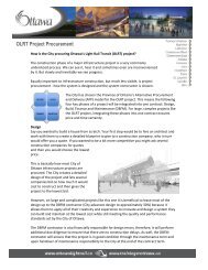
Transportation Master Plan - Ottawa Confederation Line
Transportation Master Plan - Ottawa Confederation Line
Transportation Master Plan - Ottawa Confederation Line

Create successful ePaper yourself
Turn your PDF publications into a flip-book with our unique Google optimized e-Paper software.
EXECUTIVE SUMMARY<br />
Introduction<br />
The <strong>Transportation</strong> <strong>Master</strong> <strong>Plan</strong> identifies the transportation facilities and services that the City of<br />
<strong>Ottawa</strong> will implement to serve a projected population of 1.14 million people by 2031. It sets<br />
direction for the City’s day-to-day transportation programs, and provides a basis for budget<br />
planning. It supports the <strong>Ottawa</strong> 20/20 growth management strategy and the City’s Official <strong>Plan</strong>,<br />
which guides the City’s physical development.<br />
This plan will come to life through mechanisms such as long-range financial plans, mid-range<br />
implementation plans, annual budgets, program development, area and corridor transportation<br />
studies, design or practice guidelines, and Community Design <strong>Plan</strong>s. The need to update this plan<br />
will be reviewed in conjunction with a similar assessment of the City’s Official <strong>Plan</strong>, which is<br />
required every five years. Over the intervening time period, readers seeking a current statement of<br />
City transportation policies must consult the record of Council decisions in addition to this plan.<br />
Current and Future Conditions<br />
<strong>Transportation</strong> system overview. <strong>Ottawa</strong>’s transportation system includes walking and cycling<br />
facilities, conventional and specialized bus services, Transitway and O-Train rapid transit lines, a<br />
road network and parking facilities. City-owned transportation facilities are complemented by<br />
freeways owned by the Province of Ontario, and by roads, interprovincial bridges and multi-use<br />
pathways owned by the federal government. There are also international and general aviation<br />
airports, intercity rail and bus stations, two ferries and a freight yard.<br />
Current travel patterns. During the morning peak hour in 2005 (origin destination survey),<br />
about 62% of <strong>Ottawa</strong> residents traveled by automobile compared to about 21% by transit, 9% by<br />
walking, 2% by cycling and 6% by other modes. Transit ridership has seen continuous growth<br />
since 1996, and <strong>Ottawa</strong> residents take transit, on average, 100 times annually—more than<br />
residents in any city of comparable size in North America. While average household auto<br />
ownership increased by 10% from 1995 to 2005, the number of daily trips per person declined<br />
slightly<br />
Future travel patterns. Population and employment are expected to grow by about 30% and<br />
35% respectively by 2031, with urban communities outside the Greenbelt projected to<br />
accommodate 68% of new residents and 42% of new jobs. As a result, the overall demand for<br />
morning peak hour person-trips on <strong>Ottawa</strong>’s transportation system will grow by 38%. In view of<br />
this growth, this plan strives to minimize the future need for new and widened roads while<br />
avoiding levels of congestion that would have unacceptable implications for <strong>Ottawa</strong>’s quality of<br />
life. It sets an ambitious transit modal split objective for 2031 of carrying 30% of motorized<br />
person-trips in the morning peak hour, a rate significantly greater than the 23% figure observed in<br />
2005. Transit will carry 51% of motorized person-trips to and from <strong>Ottawa</strong>’s Inner Urban Area<br />
TRANSPORTATION MASTER PLAN<br />
NOVEMBER 2008<br />
Page iii