- Page 1 and 2: ArcGIS ® Engine Developer Guide Ar
- Page 3 and 4: Contents CHAPTER 1: INTRODUCING ARC
- Page 5 and 6: 1 Introducing ArcGIS Engine ESRI ®
- Page 7 and 8: ARCGIS 9 OVERVIEW ArcGIS Server Arc
- Page 9 and 10: ARCGIS 9 OVERVIEW ArcGIS Engine and
- Page 11 and 12: OVERVIEW OF ARCGIS ENGINE Chapter 3
- Page 13 and 14: OVERVIEW OF A RCGIS ENGINE The Stre
- Page 15 and 16: WHO CAN USE ARCGIS ENGINE? authored
- Page 17 and 18: ARCGIS ENGINE CAPABILITIES SPATIAL
- Page 19 and 20: ARCGIS ENGINE CAPABILITIES NETWORK
- Page 21 and 22: GETTING STARTED Throughout most of
- Page 23 and 24: USING THIS BOOK This book, ArcGIS E
- Page 25: DEVELOPER RESOURCES ESRI DEVELOPER
- Page 28 and 29: ARCGIS SOFTWARE ARCHITECTURE For a
- Page 30 and 31: ARCGIS SOFTWARE ARCHITECTURE ESRI h
- Page 32 and 33: ARCGIS SOFTWARE ARCHITECTURE Althou
- Page 34 and 35: ARCGIS APPLICATION PROGRAMMING INTE
- Page 36 and 37: ARCGIS ENGINE LIBRARIES Carto Conta
- Page 38 and 39: ARCGIS ENGINE LIBRARIES cluded in t
- Page 40 and 41: ARCGIS ENGINE LIBRARIES 22 Spatial-
- Page 42 and 43: ARCGIS ENGINE LIBRARIES NETWORKANAL
- Page 45 and 46: 3 Developing with ArcGIS controls A
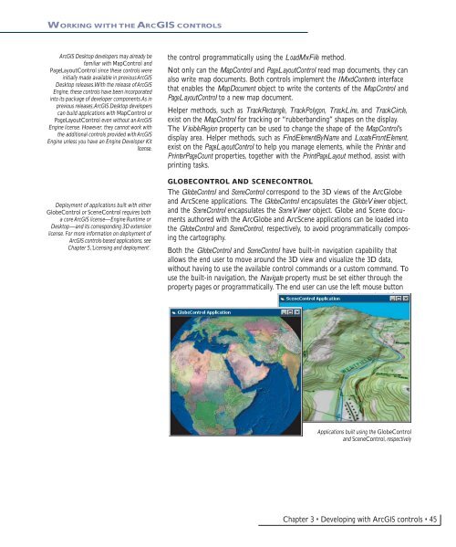
- Page 47: WORKING WITH THE ARCGIS CONTROLS me
- Page 51 and 52: WORKING WITH THE ARCGIS CONTROLS If
- Page 53 and 54: WORKING WITH THE ARCGIS CONTROLS Li
- Page 55 and 56: BUILDING APPLICATIONS WITH THE ARCG
- Page 57 and 58: BUILDING APPLICATIONS WITH THE ARCG
- Page 59: BUILDING APPLICATIONS WITH THE ARCG
- Page 62 and 63: THE MICROSOFT COMPONENT OBJECT MODE
- Page 64 and 65: THE MICROSOFT COMPONENT OBJECT MODE
- Page 66 and 67: THE MICROSOFT COMPONENT OBJECT MODE
- Page 68 and 69: THE MICROSOFT COMPONENT OBJECT MODE
- Page 70 and 71: THE MICROSOFT COMPONENT OBJECT MODE
- Page 72 and 73: THE MICROSOFT COMPONENT OBJECT MODE
- Page 74 and 75: DEVELOPING WITH ARCOBJECTS ArcGIS a
- Page 76 and 77: DEVELOPING WITH A RCOBJECTS Accessi
- Page 78 and 79: DEVELOPING WITH A RCOBJECTS As an e
- Page 80 and 81: DEVELOPING WITH A RCOBJECTS COM App
- Page 82 and 83: DEVELOPING WITH A RCOBJECTS The Cus
- Page 84 and 85: THE V ISUAL BASIC 6 ENVIRONMENT Use
- Page 86 and 87: THE V ISUAL BASIC 6 ENVIRONMENT Whi
- Page 88 and 89: THE V ISUAL BASIC 6 ENVIRONMENT Pri
- Page 90 and 91: THE V ISUAL BASIC 6 ENVIRONMENT Tha
- Page 92 and 93: THE V ISUAL BASIC 6 ENVIRONMENT per
- Page 94 and 95: THE V ISUAL BASIC 6 ENVIRONMENT If
- Page 96 and 97: THE V ISUAL BASIC 6 DEVELOPMENT ENV
- Page 98 and 99:
THE V ISUAL BASIC 6 DEVELOPMENT ENV
- Page 100 and 101:
THE V ISUAL BASIC 6 DEVELOPMENT ENV
- Page 102 and 103:
THE V ISUAL BASIC 6 DEVELOPMENT ENV
- Page 104 and 105:
VISUAL C++ IXxxImpl CComXxxThreadMo
- Page 106 and 107:
VISUAL C++ Linking ATL code One of
- Page 108 and 109:
VISUAL C++ removal would result in
- Page 110 and 111:
VISUAL C++ switches are used to cha
- Page 112 and 113:
VISUAL C++ 4. To create the noncrea
- Page 114 and 115:
VISUAL C++ Grimes, Richard, Reilly
- Page 116 and 117:
VISUAL C++ IFooPtr ipFoo; HRESULT h
- Page 118 and 119:
VISUAL C++ expected. It is better t
- Page 120 and 121:
VISUAL C++ Here are some suggestion
- Page 122 and 123:
VISUAL C++ Symbol d, i Format signe
- Page 124 and 125:
VISUAL C++ Loading the following sh
- Page 126 and 127:
VISUAL C++ #import "C:\Program File
- Page 128 and 129:
VISUAL C++ Make sure dialog boxes t
- Page 130 and 131:
VISUAL C++ Creating an MFC dialog b
- Page 132 and 133:
VISUAL C++ This environment does no
- Page 134 and 135:
VISUAL C++ Connection point mechani
- Page 136 and 137:
VISUAL C++ The following issues wit
- Page 138 and 139:
VISUAL C++ { } DECLARE_REGISTRY_RES
- Page 140 and 141:
VISUAL C++ 5. Clicking OK will modi
- Page 142 and 143:
VISUAL C++ delete[] pvars; // Clean
- Page 144 and 145:
VISUAL C++ // Create dialog class o
- Page 146 and 147:
.NET APPLICATION PROGRAMMING INTERF
- Page 148 and 149:
.NET APPLICATION PROGRAMMING INTERF
- Page 150 and 151:
.NET APPLICATION PROGRAMMING INTERF
- Page 152 and 153:
.NET APPLICATION PROGRAMMING INTERF
- Page 154 and 155:
.NET APPLICATION PROGRAMMING INTERF
- Page 156 and 157:
.NET APPLICATION PROGRAMMING INTERF
- Page 158 and 159:
.NET APPLICATION PROGRAMMING INTERF
- Page 160 and 161:
.NET APPLICATION PROGRAMMING INTERF
- Page 162 and 163:
.NET APPLICATION PROGRAMMING INTERF
- Page 164 and 165:
.NET APPLICATION PROGRAMMING INTERF
- Page 166 and 167:
.NET APPLICATION PROGRAMMING INTERF
- Page 168 and 169:
.NET APPLICATION PROGRAMMING INTERF
- Page 170 and 171:
.NET APPLICATION PROGRAMMING INTERF
- Page 172 and 173:
.NET APPLICATION PROGRAMMING INTERF
- Page 174 and 175:
.NET APPLICATION PROGRAMMING INTERF
- Page 176 and 177:
.NET APPLICATION PROGRAMMING INTERF
- Page 178 and 179:
.NET APPLICATION PROGRAMMING INTERF
- Page 180 and 181:
.NET APPLICATION PROGRAMMING INTERF
- Page 182 and 183:
.NET APPLICATION PROGRAMMING INTERF
- Page 184 and 185:
.NET APPLICATION PROGRAMMING INTERF
- Page 186 and 187:
JAVA APPLICATION PROGRAMMING INTERF
- Page 188 and 189:
JAVA APPLICATION PROGRAMMING INTERF
- Page 190 and 191:
JAVA APPLICATION PROGRAMMING INTERF
- Page 192 and 193:
JAVA APPLICATION PROGRAMMING INTERF
- Page 194 and 195:
JAVA APPLICATION PROGRAMMING INTERF
- Page 196 and 197:
JAVA APPLICATION PROGRAMMING INTERF
- Page 198 and 199:
JAVA APPLICATION PROGRAMMING INTERF
- Page 200 and 201:
JAVA APPLICATION PROGRAMMING INTERF
- Page 202 and 203:
C++ APPLICATION PROGRAMMING INTERFA
- Page 204 and 205:
C++ APPLICATION PROGRAMMING INTERFA
- Page 206 and 207:
C++ APPLICATION PROGRAMMING INTERFA
- Page 208 and 209:
C++ APPLICATION PROGRAMMING INTERFA
- Page 210 and 211:
C++ APPLICATION PROGRAMMING INTERFA
- Page 212 and 213:
C++ APPLICATION PROGRAMMING INTERFA
- Page 214 and 215:
C++ APPLICATION PROGRAMMING INTERFA
- Page 216 and 217:
C++ APPLICATION PROGRAMMING INTERFA
- Page 218 and 219:
C++ APPLICATION PROGRAMMING INTERFA
- Page 220 and 221:
C++ APPLICATION PROGRAMMING INTERFA
- Page 222 and 223:
C++ APPLICATION PROGRAMMING INTERFA
- Page 224 and 225:
C++ APPLICATION PROGRAMMING INTERFA
- Page 226 and 227:
C++ APPLICATION PROGRAMMING INTERFA
- Page 228 and 229:
C++ APPLICATION PROGRAMMING INTERFA
- Page 230 and 231:
C++ APPLICATION PROGRAMMING INTERFA
- Page 232 and 233:
C++ APPLICATION PROGRAMMING INTERFA
- Page 234 and 235:
C++ APPLICATION PROGRAMMING INTERFA
- Page 236 and 237:
C++ APPLICATION PROGRAMMING INTERFA
- Page 238 and 239:
C++ APPLICATION PROGRAMMING INTERFA
- Page 240 and 241:
C++ APPLICATION PROGRAMMING INTERFA
- Page 242 and 243:
C++ APPLICATION PROGRAMMING INTERFA
- Page 244 and 245:
C++ APPLICATION PROGRAMMING INTERFA
- Page 246 and 247:
C++ APPLICATION PROGRAMMING INTERFA
- Page 248 and 249:
C++ APPLICATION PROGRAMMING INTERFA
- Page 250 and 251:
C++ APPLICATION PROGRAMMING INTERFA
- Page 252 and 253:
C++ APPLICATION PROGRAMMING INTERFA
- Page 254 and 255:
C++ APPLICATION PROGRAMMING INTERFA
- Page 257 and 258:
5 Licensing and deployment Developm
- Page 259 and 260:
ARCGIS LICENSING OPTIONS PRODUCT LI
- Page 261 and 262:
ARCGIS LICENSING OPTIONS ArcGIS Eng
- Page 263 and 264:
ARCGIS ENGINE DEVELOPER KIT At the
- Page 265 and 266:
APPLICATION DEVELOPMENT AND LICENSE
- Page 267 and 268:
APPLICATION DEVELOPMENT AND LICENSE
- Page 269 and 270:
APPLICATION DEVELOPMENT AND LICENSE
- Page 271 and 272:
APPLICATION DEVELOPMENT AND LICENSE
- Page 273 and 274:
APPLICATION DEVELOPMENT AND LICENSE
- Page 275 and 276:
APPLICATION DEVELOPMENT AND LICENSE
- Page 277 and 278:
APPLICATION DEVELOPMENT AND LICENSE
- Page 279 and 280:
TESTING WITH ARCGIS ENGINE RUNTIME
- Page 281 and 282:
DEPLOYMENT To successfully deploy c
- Page 283 and 284:
DEPLOYMENT 3. You or your client in
- Page 285 and 286:
6 Developer scenarios Throughout th
- Page 287 and 288:
BUILDING APPLICATIONS WITH ACTIVEX
- Page 289 and 290:
BUILDING APPLICATIONS WITH ACTIVEX
- Page 291 and 292:
BUILDING APPLICATIONS WITH ACTIVEX
- Page 293 and 294:
BUILDING APPLICATIONS WITH ACTIVEX
- Page 295 and 296:
BUILDING APPLICATIONS WITH ACTIVEX
- Page 297 and 298:
BUILDING APPLICATIONS WITH ACTIVEX
- Page 299 and 300:
BUILDING APPLICATIONS WITH ACTIVEX
- Page 301 and 302:
BUILDING APPLICATIONS WITH ACTIVEX
- Page 303 and 304:
BUILDING APPLICATIONS WITH ACTIVEX
- Page 305 and 306:
BUILDING APPLICATIONS WITH ACTIVEX
- Page 307 and 308:
BUILDING APPLICATIONS WITH ACTIVEX
- Page 309 and 310:
BUILDING APPLICATIONS WITH VISUAL J
- Page 311 and 312:
BUILDING APPLICATIONS WITH VISUAL J
- Page 313 and 314:
BUILDING APPLICATIONS WITH VISUAL J
- Page 315 and 316:
BUILDING APPLICATIONS WITH VISUAL J
- Page 317 and 318:
BUILDING APPLICATIONS WITH VISUAL J
- Page 319 and 320:
BUILDING APPLICATIONS WITH VISUAL J
- Page 321 and 322:
BUILDING APPLICATIONS WITH VISUAL J
- Page 323 and 324:
BUILDING APPLICATIONS WITH VISUAL J
- Page 325 and 326:
BUILDING APPLICATIONS WITH VISUAL J
- Page 327 and 328:
BUILDING APPLICATIONS WITH VISUAL J
- Page 329 and 330:
BUILDING APPLICATIONS WITH VISUAL J
- Page 331 and 332:
BUILDING APPLICATIONS WITH VISUAL J
- Page 333 and 334:
BUILDING APPLICATIONS WITH VISUAL J
- Page 335 and 336:
BUILDING APPLICATIONS WITH WINDOWS
- Page 337 and 338:
BUILDING APPLICATIONS WITH WINDOWS
- Page 339 and 340:
BUILDING APPLICATIONS WITH WINDOWS
- Page 341 and 342:
BUILDING APPLICATIONS WITH WINDOWS
- Page 343 and 344:
BUILDING APPLICATIONS WITH WINDOWS
- Page 345 and 346:
BUILDING APPLICATIONS WITH WINDOWS
- Page 347 and 348:
BUILDING APPLICATIONS WITH WINDOWS
- Page 349 and 350:
BUILDING APPLICATIONS WITH WINDOWS
- Page 351 and 352:
BUILDING APPLICATIONS WITH WINDOWS
- Page 353 and 354:
BUILDING APPLICATIONS WITH WINDOWS
- Page 355 and 356:
BUILDING APPLICATIONS WITH WINDOWS
- Page 357 and 358:
BUILDING APPLICATIONS WITH WINDOWS
- Page 359 and 360:
BUILDING APPLICATIONS WITH WINDOWS
- Page 361 and 362:
BUILDING APPLICATIONS WITH C++ AND
- Page 363 and 364:
BUILDING APPLICATIONS WITH C++ AND
- Page 365 and 366:
BUILDING APPLICATIONS WITH C++ AND
- Page 367 and 368:
BUILDING APPLICATIONS WITH C++ AND
- Page 369 and 370:
BUILDING APPLICATIONS WITH C++ AND
- Page 371 and 372:
BUILDING APPLICATIONS WITH C++ AND
- Page 373 and 374:
BUILDING APPLICATIONS WITH C++ AND
- Page 375 and 376:
BUILDING APPLICATIONS WITH C++ AND
- Page 377 and 378:
BUILDING APPLICATIONS WITH C++ AND
- Page 379 and 380:
BUILDING APPLICATIONS WITH C++ AND
- Page 381 and 382:
BUILDING APPLICATIONS WITH C++ AND
- Page 383 and 384:
BUILDING APPLICATIONS WITH C++ AND
- Page 385 and 386:
BUILDING APPLICATIONS WITH C++ AND
- Page 387 and 388:
BUILDING APPLICATIONS WITH C++ AND
- Page 389 and 390:
BUILDING APPLICATIONS WITH C++ AND
- Page 391 and 392:
BUILDING APPLICATIONS WITH C++ AND
- Page 393 and 394:
BUILDING APPLICATIONS WITH C++ AND
- Page 395 and 396:
BUILDING APPLICATIONS WITH C++ AND
- Page 397 and 398:
BUILDING APPLICATIONS WITH C++ AND
- Page 399 and 400:
BUILDING APPLICATIONS WITH C++ AND
- Page 401 and 402:
BUILDING APPLICATIONS WITH C++ AND
- Page 403 and 404:
BUILDING APPLICATIONS WITH C++ AND
- Page 405 and 406:
BUILDING APPLICATIONS WITH C++ AND
- Page 407 and 408:
BUILDING APPLICATIONS WITH C++ AND
- Page 409 and 410:
BUILDING APPLICATIONS WITH C++ AND
- Page 411 and 412:
BUILDING APPLICATIONS WITH C++ AND
- Page 413 and 414:
BUILDING A COMMAND-LINE JAVA APPLIC
- Page 415 and 416:
BUILDING A COMMAND-LINE JAVA APPLIC
- Page 417 and 418:
BUILDING A COMMAND-LINE JAVA APPLIC
- Page 419 and 420:
BUILDING A COMMAND-LINE JAVA APPLIC
- Page 421 and 422:
BUILDING A COMMAND-LINE JAVA APPLIC
- Page 423 and 424:
BUILDING A COMMAND-LINE JAVA APPLIC
- Page 425 and 426:
BUILDING A COMMAND-LINE JAVA APPLIC
- Page 427 and 428:
BUILDING A COMMAND-LINE JAVA APPLIC
- Page 429 and 430:
BUILDING A COMMAND-LINE JAVA APPLIC
- Page 431 and 432:
BUILDING A COMMAND-LINE C++ APPLICA
- Page 433 and 434:
BUILDING A COMMAND-LINE C++ APPLICA
- Page 435 and 436:
BUILDING A COMMAND-LINE C++ APPLICA
- Page 437 and 438:
BUILDING A COMMAND-LINE C++ APPLICA
- Page 439 and 440:
BUILDING A COMMAND-LINE C++ APPLICA
- Page 441 and 442:
BUILDING A COMMAND-LINE C++ APPLICA
- Page 443 and 444:
BUILDING A COMMAND-LINE C++ APPLICA
- Page 445 and 446:
A Reading the object model diagrams
- Page 447 and 448:
CLASSES AND RELATIONSHIPS There are
- Page 449 and 450:
CLASSES AND RELATIONSHIPS N-ary ass
- Page 451 and 452:
INTERFACES AND MEMBERS error messag
- Page 453:
PUTTING IT TOGETHER—AN EXAMPLE IW
- Page 456 and 457:
ARCGIS SOFTWARE DEVELOPER KIT The A
- Page 458 and 459:
ARCGIS SOFTWARE DEVELOPER KIT • E
- Page 461 and 462:
C Conver erting personal geodatabas
- Page 463 and 464:
CONVERTING DATA FOR USE WITH THE GI
- Page 465 and 466:
CONVERTING DATA FOR USE WITH THE GI
- Page 467 and 468:
D Installing ArcGIS Engine Runtime
- Page 469 and 470:
INSTALLING ARCGIS ENGINE RUNTIME ON
- Page 471 and 472:
INSTALLING ARCGIS ENGINE RUNTIME ON
- Page 473 and 474:
INSTALLING ARCGIS ENGINE RUNTIME ON
- Page 475 and 476:
INSTALLING ARCGIS ENGINE RUNTIME ON
- Page 477 and 478:
INSTALLING ARCGIS ENGINE RUNTIME ON
- Page 479 and 480:
INSTALLING ARCGIS ENGINE RUNTIME ON
- Page 481 and 482:
INSTALLING ARCGIS ENGINE RUNTIME ON
- Page 483 and 484:
INSTALLING ARCGIS ENGINE RUNTIME ON
- Page 485 and 486:
INSTALLING ARCGIS ENGINE RUNTIME ON
- Page 487 and 488:
INSTALLING ARCGIS ENGINE RUNTIME ON
- Page 489 and 490:
INSTALLING ARCGIS ENGINE RUNTIME ON
- Page 491 and 492:
INSTALLING ARCGIS ENGINE RUNTIME ON
- Page 493 and 494:
INSTALLING ARCGIS ENGINE RUNTIME ON
- Page 495 and 496:
E Glossary The following is a gloss
- Page 497 and 498:
GLOSSARY ASP.NET assembly associati
- Page 499 and 500:
GLOSSARY composition computer-aided
- Page 501 and 502:
GLOSSARY FGDC framework GDB GDI Geo
- Page 503 and 504:
GLOSSARY JSF JSP JSTL late binding
- Page 505 and 506:
GLOSSARY the EXE in which they are
- Page 507 and 508:
GLOSSARY server account server cont
- Page 509 and 510:
GLOSSARY URL usage time utility COM
- Page 511 and 512:
A Index Abstract class 61 defined 4
- Page 513 and 514:
Building applications with ActiveX
- Page 515 and 516:
debugging defined 495 Deeply statef
- Page 517 and 518:
IIS 143 ILineSymbol interface 292,
- Page 519 and 520:
OLE automation. See Microsoft Compo
- Page 521 and 522:
SXD defined 504 Synchronization def
- Page 523:
XSLT defined 506 Index • 519


