Southwell CA Appraisal.pdf - Newark and Sherwood District Council
Southwell CA Appraisal.pdf - Newark and Sherwood District Council
Southwell CA Appraisal.pdf - Newark and Sherwood District Council

Create successful ePaper yourself
Turn your PDF publications into a flip-book with our unique Google optimized e-Paper software.
Document Passport<br />
Title:<br />
Status:<br />
Summary:<br />
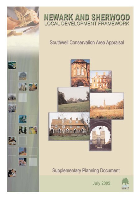
<strong>Newark</strong> & <strong>Sherwood</strong> Local Development Framework;<br />
<strong>Southwell</strong> Conservation Area <strong>Appraisal</strong><br />
Supplementary Planning Document (SPD)<br />
This document sets out the <strong>Council</strong>’s appraisal of the character <strong>and</strong><br />
appearance of the conservation area of <strong>Southwell</strong><br />
Date of Approval: 18 th July 2005<br />
Route of Approval: Cabinet, 18 th July 2005<br />
Consultation Summary:<br />
The <strong>Council</strong> undertook consultation with stakeholders, including English Heritage, the Government<br />
Office of the East Midl<strong>and</strong>s, Parish <strong>Council</strong>, amenity groups <strong>and</strong> local residents.<br />
The overriding theme of responses to the Draft SPD was supportive - there were several minor<br />
corrections <strong>and</strong> map amendments <strong>and</strong> an overriding theme was the desire to strengthen the<br />
statement of no subdivision of the large prebendal plots. Certain elements of the <strong>Appraisal</strong> have<br />
been re-written in order to comply with the requirements of the Town <strong>and</strong> Country Planning (Local<br />
Development) (Engl<strong>and</strong>) Regulations 2004 - this primarily included a re-write of the Sustainability<br />
<strong>Appraisal</strong>. A list of the comments received <strong>and</strong> how these have been addressed is available within<br />
the Statement of Consultation Responses <strong>and</strong> Sustainability Issues in relation to this document on<br />
the <strong>Council</strong>’s website.<br />
Document Availability:<br />
Copies of the SPD <strong>and</strong> the Statement of Consultation Responses <strong>and</strong> Sustainability Issues are<br />
available at Kelham Hall Planning Reception (open between 8.30 <strong>and</strong> 5.15pm Monday to Thursday<br />
(closing at 4.45pm on Friday) <strong>and</strong> on the <strong>Council</strong>’s website:<br />
www.newark-sherwooddc.gov.uk/planningpolicy<br />
Please note: This document is available in alternative formats on request<br />
M Evans Dip TP (Dist) MRTPI<br />
Head of Planning Services<br />
<strong>Newark</strong> & <strong>Sherwood</strong> <strong>District</strong> <strong>Council</strong><br />
Kelham Hall<br />
<strong>Newark</strong><br />
Nottinghamshire NG23 5QX<br />
i
Contents<br />
List of maps<br />
Map 1 – Map of <strong>Southwell</strong> Conservation Area<br />
Page<br />
iii<br />
iv<br />
Status of the <strong>Appraisal</strong> 1<br />
Introduction 1<br />
<strong>Southwell</strong> Conservation Area 1<br />
Location <strong>and</strong> Population 2<br />
Origins <strong>and</strong> Development of <strong>Southwell</strong> 2<br />
L<strong>and</strong>scape Setting 3<br />
Statutory Designations 4<br />
<strong>Southwell</strong> Tithe Map 7<br />
Character Areas 8<br />
The Minster <strong>and</strong> Prebendage 9<br />
Town Centre 19<br />
The Burgage 29<br />
Easthorpe 38<br />
Westgate 47<br />
Westhorpe 56<br />
Conclusions <strong>and</strong> Strategic Summary 65<br />
Bibliography 67<br />
Sustainability <strong>Appraisal</strong> 68<br />
ii
List of Maps<br />
Map<br />
Title<br />
Page<br />
Number<br />
1 Map of <strong>Southwell</strong> Conservation Area showing the character zones iv<br />
2 <strong>Southwell</strong> Tithe Map 7<br />
3 The Minster – Buildings 9<br />
4 The Minster – Topographical Features 10<br />
5 Town Centre – Buildings 19<br />
6 Town Centre – Topographical Features 20<br />
7 Burgage – Buildings 29<br />
8 Burgage – Topographical Features 30<br />
9 Easthorpe – Buildings 38<br />
10 Easthorpe – Topographical Features 39<br />
11 Westgate – Buildings 47<br />
12 Westgate – Topographical Features 48<br />
13 Westhorpe – Buildings 56<br />
14 Westhorpe – Topographical Features 57<br />
iii
Burgage<br />
Town Centre<br />
Westhorpe<br />
Westgate<br />
Minster<br />
Easthorpe<br />
Map 1 - Character Areas of<br />
<strong>Southwell</strong> Conservation Area<br />
Character area boundary<br />
This map is reproduced from the Ordnance Survey material with the permission of Ordnance Survey on behalf of the Controller of Her Majesty's Stationery Office © Crown Copyright.<br />
Unauthorised reproduction infringes Crown Copyright <strong>and</strong> may lead to prosecution or civil proceedings. <strong>Newark</strong> <strong>and</strong> <strong>Sherwood</strong> <strong>District</strong> <strong>Council</strong>. Licence 100018606, 2005.<br />
Scale 1:8000
SOUTHWELL CONSERVATION AREA APPRAISAL<br />
Status of the <strong>Appraisal</strong><br />
This document is an assessment of the special interest, character <strong>and</strong> appearance of <strong>Southwell</strong><br />
Conservation Area. It will be used to provide a basis for making decisions about future<br />
development <strong>and</strong> for formulating policies for the preservation <strong>and</strong> enhancement of the area.<br />
This report relates to several policies in the <strong>Newark</strong> <strong>and</strong> <strong>Sherwood</strong> <strong>District</strong> <strong>Council</strong> Local Plan<br />
(Adopted March 1999), which are given in Appendix A.<br />
This report, following consultation, has been adopted by the <strong>District</strong> <strong>Council</strong> as a Supplementary<br />
Planning Document.<br />
Introduction<br />
The Planning (Listed Buildings <strong>and</strong> Conservation Areas) Act 1990 requires all Local Authorities<br />
to determine which parts of their areas are of special architectural or historic interest <strong>and</strong> to<br />
designate them as conservation areas. Designation requires that special regard be taken to preserve<br />
or enhance their character <strong>and</strong> appearance.<br />
It is the quality of areas, as well as individual buildings that is important. There are many factors<br />
that contribute to the character of the conservation area:<br />
• The historic layout of property, boundaries <strong>and</strong> thoroughfares<br />
• A particular mix of uses<br />
• Vistas along streets <strong>and</strong> between buildings<br />
• Characteristic materials<br />
• Appropriate scaling <strong>and</strong> detailing of buildings<br />
• Traditional shop fronts<br />
• Quality street furniture <strong>and</strong> hard <strong>and</strong> soft surfaces.<br />
• Trees <strong>and</strong> open spaces.<br />
This conservation area assessment seeks to highlight these qualities in <strong>Southwell</strong> as a framework<br />
against which decisions about future development can be made.<br />
<strong>Southwell</strong> Conservation Area<br />
Easthorpe<br />
1
<strong>Southwell</strong> is famous for its Minster church, which is the cathedral church of Nottinghamshire.<br />
Although it has a very large church, it is a very small town <strong>and</strong> <strong>Southwell</strong> has the distinction of<br />
being the smallest cathedral town in Engl<strong>and</strong>. The Minster is complemented by a high quality <strong>and</strong><br />
remarkably unspoilt townscape. The town received formal recognition by the <strong>Council</strong> for British<br />
Archaeology as being a town of ‘outst<strong>and</strong>ing historic quality’ <strong>and</strong> is one of only four such towns<br />
in Nottinghamshire.<br />
<strong>Southwell</strong> is an important local tourist spot <strong>and</strong> attracts 62.5% of <strong>Newark</strong> <strong>and</strong> <strong>Sherwood</strong>’s Cultural<br />
visitors (A Cultural Heritage Service Plan for <strong>Newark</strong> <strong>and</strong> <strong>Sherwood</strong>, 2003 – 2012).<br />
<strong>Southwell</strong> was first designated as a conservation area in 1968 <strong>and</strong> extended in 1970 <strong>and</strong> 1993. The<br />
boundary has been drawn to include the Minster Church, the historic commercial centre of King<br />
Street <strong>and</strong> Queen Street, the Burgage <strong>and</strong> the former hamlets of Easthorpe <strong>and</strong> Westhorpe.<br />
The most important features contributing to its designation as a conservation area are the presence<br />
of the Minster church, its well-preserved historic layout, the high proportion of listed buildings<br />
<strong>and</strong> unlisted buildings of quality, its strong character areas <strong>and</strong> its attractive l<strong>and</strong>scape setting.<br />
Location <strong>and</strong> Population<br />
<strong>Southwell</strong> is a rural town remote from any large centres of population. It is 7 miles from <strong>Newark</strong>,<br />
14 miles from Nottingham <strong>and</strong> 22 miles from Lincoln. The town lies on the A612, which passes<br />
through the conservation area <strong>and</strong> links Nottingham with <strong>Newark</strong>.<br />
<strong>Southwell</strong>’s main importance as a town is derived from the presence of the Minster. It was largely<br />
by-passed by the industrial revolution, was never on any established lines of communication <strong>and</strong><br />
never had a significant market. The centre of the town is mainly Georgian <strong>and</strong> remained relatively<br />
unchanged until recent expansion surrounded the historic core with C20 housing.<br />
There is a population of 6555 (2001) living within the Parish <strong>and</strong> today <strong>Southwell</strong> is<br />
predominantly a dormitory town <strong>and</strong> becoming increasingly important as a tourist destination.<br />
Origins <strong>and</strong> Development of <strong>Southwell</strong><br />
The earliest certain archaeological evidence of settlement in the town is of a large Roman villa,<br />
located to the east of the present Minster, which appears to have been occupied well into the C4.<br />
This is now designated as a Scheduled Ancient Monument.<br />
The medieval period is represented by archaeological finds <strong>and</strong> also by the first documentary<br />
evidence of <strong>Southwell</strong>. A charter of 956 survives, albeit only a C14 copy, in which King Eadwig<br />
granted <strong>Southwell</strong> to Archbishop Osketyl who is believed to have established or reformed the<br />
church. This charter refers to <strong>Southwell</strong> as ‘Sudwelle’ meaning ‘south spring’. The actual site of<br />
the south well has been identified at the junction of Fiskerton Road <strong>and</strong> Spring Hill. <strong>Southwell</strong><br />
also appears in the Domesday Book of 1086.<br />
2
It is likely that the Minster is on the site of this early church but the existing building is thought to<br />
have been started between 1109-14. At this time the status of the Minster was raised to Mother<br />
Church of all Nottinghamshire. On the formation of the <strong>Southwell</strong> Diocese in 1884, the Minster<br />
became a Cathedral.<br />
The Church had a unique system of administration in the form of a collegiate body of secular<br />
canons that administered the affairs of the Minster Chapter. The canons were supported by income<br />
from endowments of property <strong>and</strong> tithes known as prebends. As a result the canons were known as<br />
prebendaries. Each prebendary had a house in <strong>Southwell</strong> named after the village from which their<br />
revenues were derived (except Halloghton Prebendary which had its prebendal house at Manor<br />
Farm in Halloughton). These houses were set in large plots in Church Street <strong>and</strong> Westgate <strong>and</strong><br />
many of their large gardens are still evident. The collegiate body lasted until 1840 when an Act<br />
suspended future appointments to prebends <strong>and</strong> was extinguished altogether with the death of the<br />
last prebendary in1873. This collegiate foundation was larger <strong>and</strong> lasted longer than any other in<br />
the country.<br />
Very little is known about medieval Easthorpe <strong>and</strong> Westhorpe. The names of Easthorpe <strong>and</strong><br />
Westhorpe date from the occupation by the Danes in the C9 <strong>and</strong> C10, “torp” being the<br />
Sc<strong>and</strong>inavian for an outlying hamlet near a large settlement. They were agricultural in character.<br />
Easthorpe being closer merged with the town of <strong>Southwell</strong> first. Westhorpe only merged when the<br />
straggle of C18 <strong>and</strong> C19 development along Westgate was consolidated in the C20.<br />
Records from the C16-C18 show the continued development of <strong>Southwell</strong> around the Burgage,<br />
King Street, Queen Street, Westgate <strong>and</strong> Church Street. The <strong>Southwell</strong> tithe map of 1841 (see map<br />
2) shows this historic layout <strong>and</strong> it is this core that is the basis of the conservation area.<br />
While not predominantly an industrial town <strong>Southwell</strong> does have an industrial heritage. <strong>Southwell</strong><br />
was an important area for hop growing in the 1700s <strong>and</strong> 1800s – mainly along the banks of the<br />
River Greet. There were many malthouses in <strong>Southwell</strong> <strong>and</strong> the Maltings <strong>and</strong> Brewmaster’s House<br />
on <strong>Newark</strong> Road, erected 1825, are testimony to this industry, although at one time most of<br />
<strong>Southwell</strong>’s inns had their own brewing facilities. Greet Lily Flour Mill, built 1851 but remodelled<br />
following two disastrous fires, still survives <strong>and</strong> close to <strong>Southwell</strong> is Maythorne, an industrial<br />
hamlet built by the River Greet. The complex comprises a series of mills <strong>and</strong> cottages, probably<br />
first used for cotton spinning but certainly later for silk. Lace also featured in <strong>Southwell</strong> <strong>and</strong> the<br />
once the House of Correction ceased to be used in 1880 the building was used as a lace factory.<br />
The making of lace was also carried out on a domestic scale in framework knitters’ workshops, as<br />
seen in many other Nottinghamshire towns <strong>and</strong> villages.<br />
The levels of post C18 development were low in <strong>Southwell</strong> <strong>and</strong> this helps to account for the small<br />
size of the town. It was not until the mid C20 that major growth took place again with several<br />
residential areas developing around the historic core.<br />
There are still many unanswered questions <strong>and</strong> gaps in our knowledge about the development of<br />
<strong>Southwell</strong> <strong>and</strong> it is likely that archaeological investigation will be required whenever new<br />
development is proposed.<br />
L<strong>and</strong>scape Setting<br />
The l<strong>and</strong>scape setting of <strong>Southwell</strong> makes an important contribution to its character. It is set<br />
within an undulating l<strong>and</strong>form that is well wooded - large swathes are identified as Mature<br />
3
L<strong>and</strong>scape Areas in the <strong>Newark</strong> <strong>and</strong> <strong>Sherwood</strong> Local Plan. This gives <strong>Southwell</strong> an enclosed <strong>and</strong><br />
intimate atmosphere.<br />
The Minster from Crink Lane<br />
The central area of Nottinghamshire in which <strong>Southwell</strong> is located is a plateau, fissured by<br />
streams. The fissures are known as “dumbles” <strong>and</strong> it is generally on the south facing slopes of<br />
these that settlements are located. <strong>Southwell</strong> is typical <strong>and</strong> it sits on the south-facing slope of<br />
Westhorpe Dumble/ Potwell Dyke.<br />
Development has extended in an east-west direction to include the subsidiary settlements of<br />
Westhorpe <strong>and</strong> Easthorpe so that the town now generally occupies the valleys of the dumble <strong>and</strong><br />
the River Greet <strong>and</strong> the wooded ridge of higher ground between them. To the north <strong>and</strong> south<br />
there are undeveloped slopes <strong>and</strong> these form the rural, unspoilt backdrop to <strong>Southwell</strong>. The change<br />
between town <strong>and</strong> country is well defined.<br />
The town is approached on all sides from higher ground <strong>and</strong> from the ridges there are panoramic<br />
views into <strong>Southwell</strong> with superb long distance glimpses of the spire of Holy Trinity Church <strong>and</strong><br />
the Minster, which is floodlit at night.<br />
The l<strong>and</strong>scape setting also contains an extensive network of footpaths <strong>and</strong> bridleways, which link<br />
the countryside with the town <strong>and</strong> the conservation area.<br />
Summary<br />
• New development should not break the strong boundaries between the built up area <strong>and</strong> the<br />
surrounding countryside.<br />
• Vistas of the Minster <strong>and</strong> Holy Trinity church should be protected.<br />
• The natural corridors formed by the dumble <strong>and</strong> the river Greet should be protected.<br />
Statutory Designations<br />
Listed Buildings<br />
A listed building is one recognised by the government as being of special architectural or historic<br />
interest, as specified by the Planning (Listed Buildings <strong>and</strong> Conservation Areas) Act 1990. Listing<br />
is made at three levels of importance Grade I, the most important, Grade II* <strong>and</strong> Grade II. Listed<br />
building consent is required before any alterations, extensions or demolitions can be made to a<br />
listed building which might affect its character.<br />
4
In <strong>Southwell</strong> Conservation Area the list comprises the following numbers of buildings<br />
Grade Number Address<br />
Grade 1 2 • Bishops Manor <strong>and</strong> remains of Bishop’s Palace, Bishop’s Drive<br />
• Minster Church of St Mary the Virgin <strong>and</strong> Chapter House, Church<br />
Street<br />
Grade II* 4 • Cranfield House <strong>and</strong> adjoining garden walls, Church Street<br />
• The Residence <strong>and</strong> Vicars Court <strong>and</strong> adjacent walls, Church Stree<br />
• The Sararcen’s Head Hotel, Market Place<br />
• Gateway <strong>and</strong> flanking walls at Minster Churchyard, Westgate<br />
Grade II 202<br />
A table of listed buildings appears at the end of each character area section <strong>and</strong> can be seen on<br />
maps 3,5,7,9,11 <strong>and</strong> 13. Listed building legislation may also apply to what are called curtilage<br />
listed buildings, which are normally buildings with an historic association with the main listed<br />
building.<br />
The listed buildings marked on the maps are the principal listed buildings as noted on the statutory<br />
list, but because of their qualities some of the curtilage listed buildings may also be marked on the<br />
maps as buildings of local interest.<br />
Scheduled Ancient Monuments<br />
Certain nationally important archaeological sites <strong>and</strong> monuments enjoy special protection as<br />
Scheduled Ancient Monuments under the Ancient Monuments <strong>and</strong> Archaeological Areas Act<br />
1979. This protection ensures that the case for preservation is fully considered should there be any<br />
proposals for development or other work that might damage the monument. Any proposals are<br />
subject to Scheduled Ancient Monument Consent, administered by the Secretary of State. There<br />
would normally be a presumption in favour of the physical preservation of the monument.<br />
In <strong>Southwell</strong> there are two Scheduled Ancient Monuments,<br />
The Archbishop’s Palace<br />
The Roman Villa<br />
The Scheduled Ancient Monuments are marked on map 3.<br />
Conservation Areas<br />
Conservation areas were introduced through the Civic Amenities Act in 1967 <strong>and</strong> the current<br />
legislation is The Planning (Listed Buildings <strong>and</strong> Conservation Areas) Act 1990. Unlike listed<br />
buildings that are a national designation, conservation areas are designated locally.<br />
Designation brings certain duties to Local Authorities as follows<br />
• Local Authorities should formulate proposals from time to time for the preservation <strong>and</strong><br />
enhancement of conservation areas.<br />
• In exercising their planning powers, Local Authorities should pay special attention to the<br />
desirability of preserving or enhancing the character or appearance of conservation areas.<br />
Policies within the Local Plan guide decisions within conservation areas.<br />
5
• Local Authorities are able to carry out urgent works to preserve unlisted buildings in a<br />
conservation area.<br />
There are also certain planning controls that relate specifically to conservation areas,<br />
• Permitted development rights are more restrictive in conservation areas than in areas outside<br />
them.<br />
• There are additional controls over demolition in conservation areas. Consent to demolish is<br />
called Conservation Area Consent <strong>and</strong> must be applied for through the <strong>District</strong> <strong>Council</strong>.<br />
• Anyone proposing to carry out any works to a tree that is in a conservation area must give at<br />
least 6 weeks written notice to the <strong>District</strong> <strong>Council</strong>.<br />
• New development should be designed to respect <strong>and</strong> enhance its surroundings <strong>and</strong> complement<br />
the area.<br />
The boundary of the <strong>Southwell</strong> Conservation Area is marked on map 1. A number of boundary<br />
changes are proposed. One is in the Burgage character area <strong>and</strong> involves the removal of the south<br />
east end of Manor Drive from the conservation area. This is a modern development <strong>and</strong> the<br />
previous boundary was based on old property plots. The other suggested amendment is in the<br />
Westhorpe character area <strong>and</strong> involves extending the southern boundary slightly to run along the<br />
footpath <strong>and</strong> track here. This provides a more precise boundary for the area <strong>and</strong> includes this area<br />
of greenery <strong>and</strong> the footpath, from which attractive views are gained across to the Minster.<br />
Additional Statutory Controls<br />
<strong>Southwell</strong> is part of the <strong>District</strong> wide Area of Special Advertisement Control (other town centres<br />
are exempt, but <strong>Southwell</strong> is not). Areas of Special Advertisement Control are areas specifically<br />
designated by the planning authority because they consider that its scenic, historical, architectural<br />
or cultural features are so significant that a stricter degree of advertisement control is justified in<br />
order to conserve visual amenity within the area.<br />
The Secretary of State approves areas of Special Advertisement Consent. The main consequence<br />
for advertisements that can be displayed with deemed consent in an Area of Special Control is that<br />
there are stricter limits on permitted height <strong>and</strong> size of the advertisement than elsewhere. For<br />
further details please contact Planning Services at <strong>Newark</strong> <strong>and</strong> <strong>Sherwood</strong> <strong>District</strong> <strong>Council</strong>.<br />
6
Map 2 - Tithe Map of <strong>Southwell</strong> - 1841<br />
Scale: not to scale
CHARACTER AREAS<br />
<strong>Southwell</strong> Conservation Area can be divided into six character areas <strong>and</strong> it is a feature of these<br />
character areas that they are very distinct, with little blurring of their boundaries. The assessment<br />
deals with each of these in turn.<br />
Each character area has its own maps identifying important buildings <strong>and</strong> topographical features.<br />
These have been identified because they contribute most strongly to the character <strong>and</strong> appearance<br />
of the conservation area. The exclusion of any such item from this list does not necessarily<br />
indicate that it has no contribution to make to the character of <strong>Southwell</strong> Conservation Area<br />
<strong>and</strong> all applications will be treated on their own merits.<br />
The Minster <strong>and</strong> Prebendage<br />
Town Centre<br />
The Burgage<br />
Easthorpe<br />
Westgate<br />
Westhorpe<br />
8
WOLSEY CLOSE<br />
School<br />
GP<br />
Trebeck<br />
Hall<br />
Infants <strong>and</strong> Junior School<br />
1<br />
QUEEN STREET<br />
BM 41.32m<br />
40.8m<br />
Hardwicke<br />
House<br />
Sacrista<br />
4<br />
Passage<br />
22<br />
Holly Mount<br />
17<br />
Church<br />
Cott<br />
The Stables<br />
38.1m<br />
The<br />
Coach<br />
Hall<br />
Hall<br />
9<br />
PO<br />
4<br />
2<br />
18<br />
7<br />
Sheppard's<br />
Saracen's<br />
Hotel<br />
18<br />
Bank<br />
Yard<br />
37.2m<br />
BM 37.66m<br />
BM 39.83m<br />
39.0m<br />
Chambers<br />
Rampton<br />
Prebend<br />
40.5m<br />
Dunham<br />
BM 36.14m<br />
31.7m<br />
WESTGATE<br />
10<br />
5a<br />
1<br />
3<br />
Posts<br />
Hotel<br />
8<br />
6 8<br />
MARKET PLACE<br />
Waterloo<br />
Bull Yard<br />
17<br />
4<br />
6a<br />
Crown<br />
1<br />
1<br />
Hotel<br />
7<br />
Bank<br />
13<br />
2 4a<br />
8<br />
Arcade<br />
Bank<br />
15<br />
19<br />
16 18<br />
9<br />
21<br />
20<br />
25b<br />
28<br />
27c<br />
25<br />
13<br />
29<br />
PC<br />
44<br />
48<br />
54<br />
Willoughby House<br />
Kirkl<strong>and</strong> House<br />
23<br />
17<br />
Car Park<br />
Car Park<br />
58a<br />
58 62<br />
56<br />
60<br />
21<br />
60a<br />
42.7m<br />
Paddock<br />
The<br />
House<br />
25<br />
27<br />
66<br />
2<br />
13 to 18<br />
6 to 11<br />
33a<br />
29<br />
33<br />
31<br />
21 to 24<br />
Close<br />
1 to 4<br />
4 6<br />
8<br />
Normanton<br />
Mews<br />
BM 44.58m<br />
Themis<br />
Burgage<br />
Court<br />
Earthwork<br />
Court<br />
44.5m<br />
Becher's Walk<br />
Becher's<br />
Hill House Lodge<br />
Hill House Cottage<br />
43.3m<br />
BM 38.56m<br />
Hill House<br />
Garden Lodge<br />
SOUTHWELL<br />
Path (um)<br />
Walnut House<br />
37.5m<br />
Shady Lane<br />
33.8m<br />
Orchard<br />
W<strong>and</strong>'s<br />
Cottage<br />
4<br />
15<br />
Archway<br />
Cottages<br />
50<br />
WESTGATE MEWS<br />
7<br />
12<br />
14<br />
2<br />
49<br />
7<br />
48 44<br />
LB<br />
10<br />
Forge Place<br />
3<br />
4<br />
5<br />
LOWES WONG<br />
40<br />
3<br />
45 41<br />
Police<br />
House<br />
Lees Field<br />
8<br />
DUNHAM CLOSE<br />
1<br />
32<br />
40.1m<br />
2<br />
24<br />
1<br />
35<br />
28<br />
22<br />
PH<br />
28 26<br />
33<br />
26<br />
1<br />
BM 41.61m<br />
31a<br />
37<br />
15<br />
31<br />
17<br />
School<br />
35.3m<br />
1a<br />
2Oa<br />
20<br />
33.3m<br />
18<br />
41.4m<br />
TCB<br />
El Sub<br />
PCs<br />
War Memorial<br />
Recreation<br />
8 7<br />
Wesley<br />
Garage<br />
12<br />
23a<br />
23<br />
10<br />
Stonewell<br />
Baptist<br />
21 19<br />
17<br />
21a<br />
15a<br />
A 612<br />
Baptist Church<br />
Gables<br />
15<br />
11<br />
Park House<br />
9a<br />
1<br />
9<br />
Cromwell<br />
Lodge<br />
Orchard<br />
End<br />
Playground<br />
Trebeck<br />
BISHOP'S DRIVE<br />
Popely's Piece<br />
The<br />
Retreat<br />
Seven Limes<br />
Tennis Courts<br />
PC<br />
War Memorial Recreation Ground<br />
Pond<br />
Bowling Green<br />
St Marys Minster<br />
Bishop's Manor<br />
Bishop's Palace<br />
Hall<br />
Pavilion<br />
FB<br />
Ward Bdy<br />
Vicars'<br />
ROMAN BUILDING<br />
Car Park<br />
Playground<br />
4<br />
5<br />
2<br />
Squire's Pond<br />
3<br />
1<br />
(site of)<br />
Nature Reserve<br />
Path<br />
30.2m<br />
The Minster School<br />
Cemetery<br />
Monument<br />
29.61m El<br />
Sub<br />
Sta<br />
Pond<br />
Potwell Dyke<br />
South Muskham<br />
28.3m<br />
5<br />
The Old Rectory<br />
FB<br />
Path (um)<br />
WAKELING CLOSE<br />
9<br />
39<br />
41<br />
BM 27.91m<br />
2<br />
1<br />
43<br />
FIELD<br />
27.4m<br />
54<br />
3 1<br />
Path (um)<br />
12<br />
33<br />
El Sub Sta<br />
21<br />
The Original<br />
Bramley Apple<br />
Tree<br />
This map is reproduced from the Ordnance Survey material with the permission of Ordnance Survey on behalf of the Controller of Her Majesty's Stationery Office © Crown Copyright.<br />
Unauthorised reproduction infringes Crown Copyright <strong>and</strong> may lead to prosecution or civil proceedings. <strong>Newark</strong> <strong>and</strong> <strong>Sherwood</strong> <strong>District</strong> <strong>Council</strong>. Licence 100018606, 2004.<br />
FB<br />
26<br />
14<br />
49a<br />
56<br />
PALACE VIEW<br />
7<br />
17<br />
1<br />
21<br />
63<br />
55<br />
65<br />
14<br />
62<br />
10<br />
69<br />
64<br />
13<br />
2<br />
FARTHINGATE<br />
10<br />
9<br />
77<br />
7<br />
4<br />
23<br />
2<br />
79<br />
Map 3 - Minster & Prebendage<br />
Buildings<br />
Character area boundary<br />
Significant walls, listed <strong>and</strong> unlisted<br />
Listed Buildings<br />
Grade<br />
I<br />
II<br />
II*<br />
Unlisted Buildings of local interest<br />
Scheduled Ancient Monuments<br />
Scale1:2,500
WOLSEY CLOSE<br />
School<br />
GP<br />
Trebeck<br />
Hall<br />
Infants <strong>and</strong> Junior School<br />
1<br />
QUEEN STREET<br />
BM 41.32m<br />
40.8m<br />
Hardwicke<br />
House<br />
Sacrista<br />
4<br />
Passage<br />
22<br />
Holly Mount<br />
17<br />
Church<br />
Cott<br />
The Stables<br />
38.1m<br />
The<br />
Coach<br />
Hall<br />
Hall<br />
9<br />
PO<br />
4<br />
2<br />
18<br />
7<br />
Sheppard's<br />
Saracen's<br />
Hotel<br />
18<br />
Bank<br />
Yard<br />
37.2m<br />
BM 37.66m<br />
BM 39.83m<br />
39.0m<br />
Chambers<br />
Rampton<br />
Prebend<br />
40.5m<br />
Dunham<br />
BM 36.14m<br />
31.7m<br />
WESTGATE<br />
10<br />
5a<br />
1<br />
3<br />
Posts<br />
Hotel<br />
8<br />
6 8<br />
MARKET PLACE<br />
Waterloo<br />
Bull Yard<br />
17<br />
4<br />
6a<br />
Crown<br />
1<br />
1<br />
Hotel<br />
7<br />
Bank<br />
15<br />
13<br />
2 4a<br />
8<br />
Arcade<br />
17<br />
16 18<br />
21<br />
20<br />
25b<br />
24<br />
37.2m<br />
26<br />
27c<br />
25<br />
29<br />
Bank PC<br />
13<br />
48<br />
54<br />
42.7m<br />
Car Park<br />
Paddock<br />
The<br />
Coach<br />
Willoughby House<br />
Kirkl<strong>and</strong> House<br />
23<br />
17<br />
Car Park<br />
58a<br />
58 62<br />
56<br />
60<br />
21<br />
60a<br />
25<br />
27<br />
66<br />
2<br />
13 to 18<br />
6 to 11<br />
33a<br />
29<br />
33<br />
31<br />
21 to 24<br />
Close<br />
1 to 4<br />
4 6<br />
8<br />
Normanton<br />
Mews<br />
BM 44.58m<br />
Themis<br />
Burgage<br />
Court<br />
Earthwork<br />
Court<br />
44.5m<br />
Becher's Walk<br />
Becher's<br />
Hill House Lodge<br />
Hill House Cottage<br />
43.3m<br />
BM 38.56m<br />
Hill House<br />
Garden Lodge<br />
SOUTHWELL<br />
Path (um)<br />
Walnut House<br />
37.5m<br />
Shady Lane<br />
33.8m<br />
W<strong>and</strong>'s<br />
Cottage<br />
Archway<br />
Cottages<br />
40.2m<br />
4<br />
15<br />
Orchard<br />
50<br />
WESTGATE MEWS<br />
14<br />
2<br />
49<br />
7<br />
48 44<br />
LB<br />
10<br />
Forge Place<br />
3<br />
4<br />
5<br />
LOWES WONG<br />
40<br />
3<br />
45 41<br />
Police<br />
House<br />
Lees Field<br />
8<br />
DUNHAM CLOSE<br />
1<br />
32<br />
40.1m<br />
2<br />
24<br />
1<br />
35<br />
28<br />
22<br />
PH<br />
28 26<br />
33<br />
26<br />
1<br />
BM 41.61m<br />
31a<br />
37<br />
15<br />
31<br />
17<br />
School<br />
35.3m<br />
1a<br />
2Oa<br />
20<br />
33.3m<br />
18<br />
41.4m<br />
TCB<br />
El Sub<br />
PCs<br />
War Memorial<br />
Recreation<br />
8 7<br />
Wesley<br />
Garage<br />
12<br />
23a<br />
23<br />
10<br />
Stonewell<br />
Baptist<br />
21 19<br />
17<br />
21a<br />
15a<br />
A 612<br />
Baptist Church<br />
Gables<br />
15<br />
11<br />
Park House<br />
9a<br />
1<br />
9<br />
Cromwell<br />
Lodge<br />
Orchard<br />
End<br />
Playground<br />
Trebeck<br />
BISHOP'S DRIVE<br />
Popely's Piece<br />
The<br />
Retreat<br />
Seven Limes<br />
Tennis Courts<br />
PC<br />
War Memorial Recreation Ground<br />
Pond<br />
Bowling Green<br />
St Marys Minster<br />
Bishop's Manor<br />
Bishop's Palace<br />
Hall<br />
Pavilion<br />
FB<br />
Ward Bdy<br />
Vicars'<br />
ROMAN BUILDING<br />
Car Park<br />
Playground<br />
4<br />
5<br />
2<br />
Squire's Pond<br />
3<br />
1<br />
(site of)<br />
Nature Reserve<br />
Path<br />
30.2m<br />
The Minster School<br />
Cemetery<br />
Monument<br />
29.61m El<br />
Sub<br />
Sta<br />
Potwell Dyke<br />
South Muskham<br />
28.3m<br />
5<br />
The Old Rectory<br />
FB<br />
Path (um)<br />
WAKELING CLOSE<br />
9<br />
39<br />
41<br />
BM 27.91m<br />
3<br />
43<br />
FIELD<br />
27.4m<br />
54<br />
1<br />
33<br />
El Sub Sta<br />
21<br />
The Original<br />
Bramley Apple<br />
Tree<br />
This map is reproduced from the Ordnance Survey material with the permission of Ordnance Survey on behalf of the Controller of Her Majesty's Stationery Office © Crown Copyright.<br />
Unauthorised reproduction infringes Crown Copyright <strong>and</strong> may lead to prosecution or civil proceedings. <strong>Newark</strong> <strong>and</strong> <strong>Sherwood</strong> <strong>District</strong> <strong>Council</strong>. Licence 100018606, 2004.<br />
Pond<br />
FB<br />
2<br />
Path (um)<br />
1<br />
26<br />
12<br />
14<br />
49a<br />
56<br />
PALACE VIEW<br />
7<br />
17<br />
1<br />
21<br />
63<br />
55<br />
65<br />
14<br />
62<br />
10<br />
69<br />
64<br />
13<br />
2<br />
FARTHINGATE<br />
10<br />
9<br />
77<br />
7<br />
23<br />
2<br />
4<br />
79<br />
Map 4 - Minster & Prebendage<br />
Topographical Features<br />
Character area boundary<br />
Focal points<br />
Views<br />
Footpaths<br />
Traditional surfaces<br />
Areas of important open space<br />
Significant groups of trees <strong>and</strong> hedges<br />
Scale1:2,500
THE MINSTER AND PREBENDAGE<br />
Church Street, Westgate <strong>and</strong> Bishops Drive.<br />
Layout<br />
There are, broadly speaking, three main elements within the Minster area;<br />
• The Minster, its churchyard <strong>and</strong> associated buildings<br />
• The Prebendal plots<br />
• The Medieval Park.<br />
1. <strong>Southwell</strong> Minster, the Churchyard <strong>and</strong> Associated Buildings<br />
The Minster has always had a dominating influence throughout<br />
the history of the town. It is a fine <strong>and</strong> intact example of a<br />
Norman <strong>and</strong> Early English gr<strong>and</strong> church. The development of<br />
the Minster eventually led to it acquiring cathedral status in 1884<br />
when the <strong>Southwell</strong> Diocese was formed. A great deal of the<br />
very special character of <strong>Southwell</strong> stems from the fact that it has<br />
a very large church for a very small town.<br />
The Minster is surrounded by a walled churchyard, which<br />
provides an open space at the centre of the town. The buildings<br />
on the north west corner including the Crown Inn are assumed to<br />
be encroachments into this open space.<br />
The Minster<br />
The Archbishop of York established a residence at <strong>Southwell</strong> to the immediate south of the Minster.<br />
No evidence of this early building remain, however, there are ruins of a rebuilt palace dating from the<br />
late C14 <strong>and</strong> C15 which was largely destroyed in the Civil War. The present Bishop's Manor, home of<br />
the Bishop of <strong>Southwell</strong>, was built in 1907 within the ruins of the Archbishop’s Palace. The remains of<br />
the Palace are now a Scheduled Ancient Monument. This is one of two Scheduled Ancient Monuments<br />
within the Minster area. The other is the Roman Villa site, located to the east of the Minster, which is<br />
the earliest evidence of a settlement in the town.<br />
2. The Prebendage Layout<br />
There are quite a significant number of large houses in<br />
the Minster character area, most of which are prebendal<br />
houses, or their replacements, set within their own<br />
grounds. These were the residences of the prebendaries<br />
(secular canons) who were supported by income from<br />
endowments of properties <strong>and</strong> tithes known as<br />
prebends. By the end of the C13, sixteen prebends <strong>and</strong><br />
prebendal houses had been established. There are now<br />
only nine remaining <strong>and</strong> none is the original building<br />
although parts of the originals have been incorporated<br />
into the fabric of some of the new.<br />
Cranfield House<br />
11
The most remarkable feature of the layout was<br />
that the prebendal houses stood detached<br />
Prebendal Houses <strong>and</strong> plots<br />
within their own large grounds rather than in a<br />
(traced from Norman Summers)<br />
precinct or defensive walled enclosure. The<br />
prebendal plots have similarities with burgage<br />
plots found in the layout of medieval towns but<br />
whilst the shape <strong>and</strong> proportions are similar, the<br />
prebendal plots are considerably larger. Access<br />
was provided to the rear. The plots on Church<br />
Street would have originally extended to<br />
Burgage Lane. Those on Westgate extended to<br />
a line marked today by a public footpath. On a<br />
similar note it is likely that the churchyard<br />
originally occupied the whole block defined by Church Street <strong>and</strong> Westgate.<br />
3. The Medieval Deer Park<br />
The Minster has a backdrop of open space to the south, which is formed from the remnants of a former<br />
deer park. This was once known as Little Park or New Park <strong>and</strong> was in existence in the 1330’s. The<br />
deer park stretched southwards from the Archbishops Palace to Crink Lane <strong>and</strong> from Park Lane in the<br />
west to Crink Lane’s Park Farm in the west. It has been suggested that Park Farm on Crink Lane could<br />
have been the parker’s house. The area that was covered by the former deer park includes the two<br />
present school sites on Church Street <strong>and</strong> on Nottingham Road <strong>and</strong> also some of the modern<br />
development on Farthingate. The area is now predominately open space <strong>and</strong> used for recreation.<br />
Summary<br />
• The established layout of this area of large houses set within their own extensive grounds should<br />
be retained.<br />
• It is important that the surviving prebendal plots are not sub-divided <strong>and</strong> not developed. These<br />
are important to the historic layout of the town <strong>and</strong> provide the setting to the town’s most<br />
important listed buildings.<br />
• The openness of the area that was once the former Medieval Deer Park should be retained <strong>and</strong><br />
development should not be permitted that would affect its open character.<br />
12
Buildings<br />
The number of listed buildings <strong>and</strong> unlisted buildings of local character in this area is high. Buildings<br />
tend to be large, well proportioned <strong>and</strong> individually designed. Most have brick boundary walls.<br />
13 Church Street Cranfield House Normanton Prebend<br />
Of the sixteen original prebendal houses, nine survive in the form of a house <strong>and</strong> plot. The table below<br />
highlights their new name, if they survive, <strong>and</strong> those that no longer exist.<br />
Prebendal Houses <strong>and</strong> Plots<br />
No. Old Name<br />
Present Name<br />
1 Oxton II No longer existing<br />
2 Altera Prebenda de Oxton (Oxton I) Cranfield House, Church Street<br />
3 Sacrist or Sextons Prebend Sacrista Prebend, 4 Westgate<br />
4 Woodborough Woodborough, 31 Church Street<br />
5 Norwell Overhall 9-11 Church Street<br />
6 Palace Hall in Norwell or Norwell Palishall 13 Church Street <strong>and</strong> adjacent car park<br />
7 3 rd Prebend in Norwell No longer existing<br />
8 Dunham Dunham House, 8 Westgate<br />
9 North Muskham North Muskham, 23 Church Street<br />
10 South Muskham South Muskham, Church Street<br />
11 Halton als Halloughton No longer existing (was in village of<br />
Halloughton)<br />
12 Beckingham No longer existing<br />
13 Normanton Prebend Normanton Prebend<br />
14 Eaton No longer existing<br />
15 Rampton, 6 Westgate Rampton, 6 Westgate<br />
16 North Leverton No longer existing<br />
The prebendal house of Oxton II (the Red Prebend) was demolished as recently as the early 1970s<br />
to make way for extensions to the Saracen’s Head Hotel. The present buildings are mostly<br />
replacements on the same sites, dating from the late C18. Most of the original houses would have<br />
been timber framed <strong>and</strong> fragments of the earlier buildings survive in some of these later buildings.<br />
There are some re-used roof timbers at Dunham House <strong>and</strong> some evidence of an earlier stone<br />
building at Norwell Overhall (9-11 Church Street). Unfortunately the roof at South Muskham<br />
Prebend was destroyed by fire in September 2001 <strong>and</strong> was the best example a crown post roof in<br />
Nottinghamshire. The roof structure has now been restored.<br />
13
The contrast between the cramped <strong>and</strong> congested nature of the commercial area along King <strong>and</strong><br />
Queen Streets <strong>and</strong> the spacious layout of the former prebendal mansions in their large gardens<br />
spread along Church Street <strong>and</strong> Westgate is a fundamental component of the town’s special<br />
character.<br />
A chantry priests’ house in the form of a quadrangle<br />
with a courtyard garden was built in the churchyard,<br />
to the northwest of the Minster, for the chantry priests<br />
to live “in common”. Its date of construction is<br />
uncertain but it is known that the first chantry was<br />
endowed in 1241. Chantries were abolished in 1547<br />
<strong>and</strong> the building continued in use as a lodging house<br />
for the clergy <strong>and</strong> for a short time, afforded<br />
accommodation for the Collegiate Grammar School.<br />
The chantry priests’ house was demolished in 1819 to<br />
provide a site for a new Grammar School building<br />
The former<br />
Grammar School<br />
(now used as the Minster Centre). The buildings to the west of the former Grammar School,<br />
including the Crown Inn on the corner, are assumed to be encroachments into the northwest<br />
corner of the churchyard.<br />
The Minster School buildings on Church Street comprise a group that does not enhance the<br />
conservation area. Serious consideration has been given to a sensitive redevelopment of the site<br />
for housing.<br />
Summary<br />
• Retain the high quality of buildings <strong>and</strong> materials in this area.<br />
• The sensitive redevelopment of the Minster School site will enhance both the<br />
Church Street frontage <strong>and</strong> the views from the footpath network to the south. The<br />
usual conservation <strong>and</strong> archaeological considerations will apply.<br />
Spaces, L<strong>and</strong>scape, Boundaries <strong>and</strong> Floorscape<br />
There are a number of important open spaces within<br />
the Minster area. These include the Minster<br />
Churchyard, the prebendal plots <strong>and</strong> settings of the<br />
large houses in this area <strong>and</strong> also the former<br />
medieval deer park area (to the south of the Minster<br />
<strong>and</strong> Bishops Manor), which includes the War<br />
Memorial Recreation Ground. The area around the<br />
Minster Churchyard <strong>and</strong> extending south to cover<br />
The Minster Churchyard<br />
the school grounds <strong>and</strong> recreation grounds is<br />
identified as a ‘Green Wedge’ in the Local Plan.<br />
The policy of the <strong>Southwell</strong> Green Wedge states that ‘planning permission will not be granted<br />
for development that damages, intrudes into, or detracts from, the open character of this area.<br />
The Minster is a prominent l<strong>and</strong>mark within the town <strong>and</strong> can be seen for miles around. It is<br />
important to retain these views of the Minster within the l<strong>and</strong>scape <strong>and</strong> views of other<br />
l<strong>and</strong>marks, such as Holy Trinity Church spire <strong>and</strong> views of prominent listed <strong>and</strong> unlisted<br />
14
uildings. The recreation ground, in particular, has good views of both the Minster <strong>and</strong> of the<br />
spire of Holy Trinity Church.<br />
There are many groups of important trees within this area. Those of particular note include an<br />
avenue of trees along the footpath to the south west of the war memorial at the end of Bishops<br />
Drive <strong>and</strong> the area around Squire’s Pond.<br />
Brick boundary walls are particularly important within this area <strong>and</strong> many of them are listed.<br />
They make a significant contribution to the quality of the public realm.<br />
In terms of floorscape the predominant areas of quality traditional Yorkstone exist in <strong>and</strong><br />
around the Minster Churchyard, alongside the Trebeck Memorial Hall <strong>and</strong> certain paths around<br />
the Prebendal houses. There are also examples of granite setts <strong>and</strong> gravel. This character area is<br />
the most significant for traditional floorscape materials in the conservation area.<br />
Summary<br />
Church Street<br />
• It is important to keep all the areas of important open space free from development, retain<br />
their open character <strong>and</strong> prevent them from being divided up. As most of the prebendal<br />
houses are listed any proposals to subdivide plots will be subject to formal planning<br />
processes.<br />
• Strive to retain important views, trees, walls <strong>and</strong> gates within the conservation area.<br />
• Any future surfacing schemes in the public realm should be made up of high quality<br />
traditional materials, such as Yorkstone <strong>and</strong> granite setts.<br />
• The design <strong>and</strong> layout of The Minster School site on Church Street impinges upon the<br />
character of the area. Reasons for this includes size, shape <strong>and</strong> massing in comparison to<br />
the nearby prebendal houses. Sensitive redevelopment of the site will be a major<br />
enhancement of the appearance <strong>and</strong> character of the area <strong>and</strong> there is a strong need to<br />
enhance views of the Minster in any potential redevelopment of the site.<br />
• The use of poor building materials has a detrimental effect on the character of the area.<br />
15
THE MINSTER AREA - LISTED BUILDINGS<br />
STREET BUILDING GRADE<br />
CHURCH STREET Gateways <strong>and</strong> boundary wall at Minster Church II<br />
Yard adjacent to Church Street<br />
9 Church Street (Now Natwest Bank) II<br />
Minster Lodge, 11 Church Street<br />
II<br />
13 Church Street <strong>and</strong> adjacent garden walls II<br />
Willoughby House, 21 Church Street<br />
North Muskham Prebend, 23 Church Street <strong>and</strong><br />
attached boundary wall <strong>and</strong> Kirkl<strong>and</strong> House<br />
Cranfield House <strong>and</strong> garden walls (No. 25 Church<br />
Street)<br />
Ashleigh, 31 Church Street <strong>and</strong> attached garden<br />
walls<br />
II<br />
II<br />
II*<br />
II<br />
41 Church Street <strong>and</strong> garden boundary wall II<br />
The Minster<br />
Normanton Prebend <strong>and</strong> attached garden walls<br />
The Old Grammar School (now Minster Centre)<br />
South Muskham Prebend<br />
Cottage adjoining stable <strong>and</strong> carriage house 25<br />
metres east of South Muskham Prebend<br />
The Old Rectory<br />
The Residence, Vicars Court <strong>and</strong> adjoining<br />
boundary walls<br />
Potwell Dyke Bridge<br />
I<br />
II<br />
II<br />
II<br />
II<br />
II<br />
II*<br />
II<br />
WESTGATE 1 Westgate II<br />
2 Westgate II<br />
4 Westgate II<br />
Boundary Wall at Sacrista Prebend, 4 Westgate<br />
II<br />
16
WESTGATE (cont.) Gateway <strong>and</strong> flanking walls at Minster II*<br />
Churchyard<br />
5-7 Westgate II<br />
BISHOPS DRIVE<br />
Rampton Prebend, 6 Westgate<br />
Boundary Wall at Rampton Prebend, 6 Westgate<br />
Westlodge, 9 Westgate <strong>and</strong> boundary wall <strong>and</strong><br />
gate piers<br />
Dunham House, 8 Westgate<br />
Boundary Wall to Dunham House, 8 Westgate<br />
Summerhouse to rear of Dunham House,<br />
The Bishops Manor <strong>and</strong> remains of the Bishops<br />
Palace, Bishops Drive.<br />
II<br />
II<br />
II<br />
II<br />
II<br />
II<br />
I<br />
17
THE MINSTER AREA - UNLISTED BUILDINGS OF LO<strong>CA</strong>L INTEREST<br />
STREET<br />
BUILDING<br />
CHURCH STREET The Coach House to the rear of 23<br />
27<br />
33<br />
Minster Shop <strong>and</strong> Refectory<br />
Building to east of Old Rectory<br />
WESTGATE 3<br />
Buildings to rear of Rampton Prebend<br />
Building to rear of Sacrista Prebend<br />
K6 telephone box in front of Dunham Prebend<br />
BISHOPS DRIVE<br />
The War Memorial Gates<br />
Building in north west corner of recreation<br />
ground<br />
Trebeck Memorial Hall<br />
18
6<br />
54<br />
1<br />
50<br />
19<br />
46<br />
6<br />
49<br />
11<br />
31<br />
38<br />
26<br />
34.0m<br />
58<br />
63 51<br />
Health Centre<br />
Ormesby<br />
Merrycoin<br />
Powers<br />
41<br />
43<br />
El Sub Sta<br />
32<br />
49a<br />
42<br />
APPLETREE<br />
1<br />
18<br />
El Sub Sta<br />
9<br />
2<br />
MONCKTON<br />
1<br />
DRIVE<br />
11<br />
10<br />
19<br />
16<br />
Builder's<br />
Garden<br />
Peelers<br />
19<br />
12<br />
14<br />
17<br />
17<br />
12<br />
14<br />
Zennor<br />
Denholme<br />
Cottage<br />
40.6m<br />
Presbytery<br />
of Victories<br />
WOLSEY CLOSE<br />
WOLSEY CLOSE<br />
El Sub Sta<br />
1<br />
17<br />
15<br />
15<br />
School<br />
39.11m<br />
7<br />
6<br />
39.4m<br />
Lowes Wong<br />
Infants <strong>and</strong> Junior School<br />
9<br />
10<br />
14<br />
2<br />
12<br />
1<br />
68<br />
73<br />
10<br />
Bungalow<br />
41.3m<br />
GP<br />
8<br />
LOWES WONG<br />
2a<br />
2<br />
Trebeck<br />
4b<br />
4a<br />
32<br />
Tel Ex<br />
34<br />
1<br />
CR<br />
3<br />
QUEEN STREET<br />
Dunham<br />
House<br />
9<br />
Tel Ex<br />
40.8m<br />
Hardwicke<br />
House<br />
Sacrista<br />
TCB<br />
THE ROPEWALK<br />
Ward Bdy<br />
4<br />
BM 41.32m<br />
8<br />
Rampton<br />
Prebend<br />
El Sub<br />
Passage<br />
TCB<br />
1<br />
11<br />
20<br />
22<br />
PRIVATE<br />
Willows<br />
QUEEN STREET<br />
1<br />
17<br />
4<br />
9a<br />
The<br />
Church<br />
Holly Mount<br />
White<br />
Hall<br />
9<br />
9<br />
Hall<br />
The Stables<br />
38.1m<br />
PO<br />
House<br />
16<br />
9<br />
WESTGATE<br />
6<br />
Cottage<br />
18<br />
40.5m<br />
Orchard<br />
Sheppard's<br />
Saracen's<br />
2<br />
7<br />
18<br />
7<br />
3<br />
2<br />
1<br />
Hotel<br />
5<br />
1<br />
Bank<br />
8<br />
5a<br />
Posts<br />
8<br />
10<br />
MARKET PLACE<br />
Crown<br />
LEEKS<br />
Waterloo<br />
Yard<br />
Bull Yard<br />
6a<br />
6 8<br />
23<br />
10 4<br />
1<br />
3<br />
12<br />
14<br />
El Sub Sta<br />
37.2m<br />
1<br />
BM 37.66m<br />
Hotel<br />
10<br />
Hotel<br />
1<br />
Chambers<br />
KINGS COURT<br />
Hotel<br />
2 4<br />
15<br />
7<br />
3 to 7<br />
18<br />
13<br />
KING STREET<br />
Bank<br />
8<br />
BM 36.14m<br />
1<br />
31 to 38<br />
Arcade<br />
17<br />
Bank<br />
20<br />
9<br />
23 to 30<br />
37.2m<br />
6<br />
25b<br />
21<br />
24<br />
28<br />
10<br />
3<br />
1<br />
MANOR<br />
7 to 14<br />
15 to 22<br />
27c<br />
27b<br />
2<br />
25a<br />
13<br />
39<br />
36<br />
40 to 47<br />
29<br />
St Marys Minster<br />
48 to 55<br />
PC<br />
39.0m<br />
BM 39.83m<br />
44<br />
48<br />
Car Park<br />
Willoughby House<br />
17<br />
PH<br />
21<br />
Kirkl<strong>and</strong> House<br />
23<br />
56<br />
Car Park<br />
20<br />
51<br />
58a<br />
11<br />
Car Park<br />
58<br />
55<br />
57<br />
60<br />
62<br />
60a<br />
Coach<br />
House<br />
25<br />
31.7m<br />
5<br />
63 71<br />
27<br />
Vicars'<br />
2<br />
30<br />
KING STREET<br />
4<br />
15<br />
17<br />
81a<br />
66<br />
31<br />
Commercial<br />
81<br />
41.1m<br />
Liby<br />
Garage<br />
17 to 20<br />
6 to 11<br />
CHURCH STREET<br />
3<br />
1<br />
2<br />
85<br />
29<br />
House<br />
33a<br />
Burgage Manor Cottage<br />
1<br />
30.2m<br />
42.7m<br />
Paddock<br />
BM 44.58m<br />
BURGAGE LANE<br />
21 to 24<br />
Close<br />
33<br />
Burgage<br />
1 to 4<br />
The<br />
Normanton<br />
Cott<br />
Grenwood<br />
Manor<br />
4<br />
8<br />
6<br />
The Grey<br />
Themis<br />
Earthwork<br />
Pp<br />
Chestnut<br />
Hollydene<br />
The Burgage<br />
This map is reproduced from the Ordnance Survey material with the permission of Ordnance Survey on behalf of the Controller of Her Majesty's Stationery Office © Crown Copyright.<br />
Unauthorised reproduction infringes Crown Copyright <strong>and</strong> may lead to prosecution or civil proceedings. <strong>Newark</strong> <strong>and</strong> <strong>Sherwood</strong> <strong>District</strong> <strong>Council</strong>. Licence 100018606, 2004.<br />
Garage<br />
Mews<br />
Court<br />
Map 5 - Town Centre<br />
Buildings<br />
Character area boundary<br />
Significant walls, listed <strong>and</strong> unlisted<br />
Listed Buildings<br />
Grade<br />
II<br />
II*<br />
Unlisted buildings of local lnterest<br />
Scale1:2,000
6<br />
1<br />
3<br />
50<br />
19<br />
46<br />
6<br />
Ormesby<br />
49a<br />
49<br />
54<br />
El Sub Sta<br />
11<br />
MONCKTON<br />
31<br />
38<br />
19<br />
26<br />
34.0m<br />
58<br />
63 51<br />
Merrycoin<br />
Powers<br />
Court<br />
El Sub Sta<br />
41<br />
43<br />
32<br />
42<br />
APPLETREE<br />
1<br />
18<br />
9<br />
2<br />
1<br />
DRIVE<br />
11<br />
10<br />
19<br />
16<br />
Builder's<br />
Garden<br />
MANOR<br />
14<br />
15<br />
68<br />
2<br />
12<br />
14<br />
73<br />
6<br />
10<br />
10<br />
CLOSE<br />
11<br />
15<br />
17<br />
Burgage Manor Cottage<br />
17<br />
17<br />
Presbytery<br />
El Sub Sta<br />
Zennor<br />
40.6m<br />
of Victories<br />
1<br />
WOLSEY CLOSE<br />
17<br />
WOLSEY CLOSE<br />
15<br />
BM<br />
39.11m<br />
7<br />
Cottage<br />
6<br />
School<br />
41.3m<br />
39.4m<br />
Lowes Wong<br />
Infants <strong>and</strong> Junior School<br />
LOWES WONG<br />
9<br />
10<br />
2<br />
12<br />
1<br />
10<br />
2a<br />
Bungalow<br />
GP<br />
Trebeck<br />
8<br />
2<br />
Hall<br />
4b<br />
4a<br />
32<br />
34<br />
Tel Ex<br />
1<br />
CR<br />
3<br />
BM 41.32m<br />
ED Bdy<br />
Sacrista<br />
Prebend<br />
Dunham<br />
TCB<br />
4<br />
Ward Bdy<br />
40.8m<br />
Hardwicke<br />
CR<br />
House<br />
Tel Ex<br />
THE ROPEWALK<br />
ED Bdy<br />
8<br />
QUEEN ST<br />
Rampton<br />
CP<br />
TCB<br />
El Sub<br />
20<br />
1<br />
The<br />
A 612<br />
22<br />
Passage<br />
1<br />
PRIVATE<br />
9a<br />
Willows<br />
13 15<br />
4<br />
Holly Mount<br />
The<br />
Church<br />
CP<br />
White<br />
Orchard<br />
Cottage<br />
Cott<br />
The Stables<br />
Hall<br />
WESTGATE<br />
9<br />
9<br />
38.1m<br />
9<br />
PO<br />
House<br />
ED Bdy<br />
Hall<br />
18<br />
Sheppard's<br />
Saracen's<br />
Head<br />
2<br />
7<br />
18<br />
1<br />
40.5m<br />
Waterloo<br />
10<br />
5<br />
1<br />
5a<br />
1<br />
3<br />
8<br />
MARKET PLACE<br />
Posts<br />
6 8<br />
Bank<br />
8<br />
10<br />
Crown<br />
12<br />
LEEKS<br />
23<br />
6a<br />
Yard<br />
Bull Yard<br />
4<br />
14<br />
El Sub Sta<br />
House<br />
Hotel<br />
2 4<br />
KING STREET<br />
3 to 7<br />
BM 37.66m<br />
1<br />
1<br />
Chambers<br />
18<br />
Portl<strong>and</strong><br />
Hotel<br />
7<br />
a<br />
Bank<br />
8<br />
8<br />
31 to 38<br />
Arcade<br />
15<br />
13<br />
1<br />
19<br />
16 18<br />
20<br />
6<br />
23 to 30<br />
25b<br />
21<br />
BM 36.14m<br />
15 to 22<br />
37.2m<br />
7 to 14<br />
27c<br />
27b<br />
25a<br />
25<br />
13<br />
39<br />
36<br />
40 to 47<br />
27 29<br />
48 to 55<br />
48<br />
44<br />
PC<br />
Willoughby House<br />
Kirkl<strong>and</strong> House<br />
St Marys Minster<br />
39.0m<br />
23<br />
17<br />
56<br />
Car Park<br />
21<br />
20<br />
Car Park<br />
Kirkl<strong>and</strong> Lodge<br />
58a<br />
31.7m<br />
Vicars'<br />
Centre<br />
Liby<br />
55<br />
47 49 57 63 71 77<br />
58<br />
60<br />
Garage<br />
62<br />
60a<br />
The<br />
Coach<br />
House<br />
5<br />
30<br />
KING STREET<br />
25<br />
81a<br />
66<br />
31<br />
81<br />
Health<br />
Garage<br />
85<br />
13 to 18<br />
6 to 11<br />
Burgage<br />
Cottage<br />
41.1m 42.7m<br />
29<br />
33a<br />
CHURCH STREET<br />
This map is reproduced from the Ordnance Survey material with the permission of Ordnance Survey on behalf of the Controller of Her Majesty's Stationery Office © Crown Copyright.<br />
Unauthorised reproduction infringes Crown Copyright <strong>and</strong> may lead to prosecution or civil proceedings. <strong>Newark</strong> <strong>and</strong> <strong>Sherwood</strong> <strong>District</strong> <strong>Council</strong>. Licence 100018606, 2005.<br />
Hotel<br />
15<br />
9<br />
Bank<br />
54<br />
Car Park<br />
4<br />
2<br />
27<br />
3<br />
1<br />
2<br />
Burgage<br />
1<br />
21 to 24<br />
Close<br />
1 to 4<br />
Burgage<br />
Paddock<br />
33<br />
The Grey<br />
Normanton<br />
Prebend<br />
30.2m<br />
Cott<br />
Grenwood<br />
Manor<br />
BM 44.58m<br />
BURGAGE LANE<br />
Themis<br />
House<br />
Villa<br />
Pp<br />
The Burgage<br />
8<br />
Mews<br />
Earthwork<br />
Map 6 - Town Centre<br />
Topographical Features<br />
Scale 1:2000<br />
Character area boundary<br />
Focal points<br />
Views<br />
Footpaths<br />
Traditional surfaces<br />
Significant open spaces<br />
Significant groups of trees <strong>and</strong> hedges
TOWN CENTRE<br />
Church Street, Halam Road, King Street, Kirklington Road, Market Place, The Ropewalk,<br />
Queen Street, Sheppards Row<br />
Layout<br />
This area forms the commercial centre of the town <strong>and</strong> is characterised by a tightly knit urban<br />
form. Buildings are densely packed on narrow plots because the extensive use of l<strong>and</strong> for<br />
church properties left little space for secular town centre buildings. These narrow plots are<br />
evident today, particularly on the north side of King<br />
King Street<br />
Street where Bull Yard, Waterloo Yard <strong>and</strong> Portl<strong>and</strong><br />
Arcade are typical. They are characterised by the<br />
principal building facing the street, with smaller<br />
buildings built behind at right angles. The principal<br />
building has an archway to allow access to the ones at<br />
the rear. The yards are not evident on the south side of<br />
King Street as the space here was even more<br />
constrained by the Prebendal plots opposite the Minster<br />
Church.<br />
The town suffered transport problems, which are typical of a compact <strong>and</strong> busy commercial<br />
historic core. Its central streets were narrow <strong>and</strong> frequently congested with a series of pinch<br />
points that caused conflict between vehicles <strong>and</strong> pedestrians.<br />
The recently implemented scheme in the town centre included a one way system for King<br />
Street <strong>and</strong> Queen Street with loading, disabled <strong>and</strong> limited waiting bays to try <strong>and</strong> strike a<br />
balance between the needs of all road users, <strong>and</strong> to make for a more attractive <strong>and</strong> safer<br />
environment for pedestrians within the limited available space.<br />
<strong>Southwell</strong> never developed a thriving market <strong>and</strong> the area that is assumed to have been the<br />
market place on the south side of King Street was built upon, possibly in the Middle Ages. The<br />
road called Market Place surrounding the crossroads is not thought to be the original site<br />
although a small market was here in the late C18 th <strong>and</strong> early C19 th . The current market is held<br />
on a gap site in the King Street frontage.<br />
Queen Street leads from the town centre <strong>and</strong> is<br />
transitional in character. Commercial property stops quite<br />
abruptly at the end of Bull Yard, which is dense in<br />
layout, thereafter the road is residential with buildings<br />
widely dispersed. In this area large houses with large<br />
gardens, such as at 32 Queen Street, The Hollies <strong>and</strong> St<br />
Mary’s House, are prominent. The large gardens with<br />
trees, the houses <strong>and</strong> the boundary walls are all important<br />
to the conservation area character.<br />
Summary<br />
King Street,<br />
Market Place<br />
• In any future development proposals a high density form of development is appropriate for<br />
the commercial centre.<br />
• The distinct change in character along Queen Street should be maintained.<br />
21
Buildings<br />
The great majority of the existing buildings date<br />
from 1750-1850 <strong>and</strong> tend to be more vernacular in<br />
character than architecturally outst<strong>and</strong>ing. Most are<br />
listed or are considered to make a positive<br />
contribution to the conservation area. Of particular<br />
importance is the Saracen’s Head which is a rare,<br />
high quality, timber framed building dating from<br />
circa 1460 <strong>and</strong> is a l<strong>and</strong>mark building terminating<br />
the view from Church Street.<br />
The buildings exhibit a variety of heights, rooflines <strong>and</strong><br />
fenestration <strong>and</strong> a mix of stucco <strong>and</strong> red brick, slate <strong>and</strong><br />
pantile <strong>and</strong> styles range from Georgian to Victorian.<br />
The Saracens Head<br />
Queen Street<br />
The rear elevations of buildings in this area are<br />
sometimes prominent <strong>and</strong> important. Views from the<br />
yards, rear car parks <strong>and</strong> across the Minster grounds<br />
pick up these areas. Chimneys, roof profiles, rear<br />
staircases, ventilation units, extensions must all be<br />
considered for their impact on these views.<br />
Shop fronts make a major contribution to the character of the town centre <strong>and</strong> their attraction<br />
lies in their traditional appearance. It is important to reinforce this character by attention to<br />
detailed design <strong>and</strong> materials. The most important elements are;<br />
• The framing of the shop front with columns,<br />
piers or pilasters<br />
• A vertical emphasis to the windows<br />
• Traditional materials, usually painted timber<br />
• Colour that should harmonise with the street<br />
• Signs that are painted in a traditional style<br />
• Sensitively designed <strong>and</strong> located internal<br />
security shutters if necessary<br />
• One hanging sign, of traditional appearance if<br />
necessary (illuminated if needed)<br />
Traditional shop front on King Street<br />
Summary<br />
• The visual impact <strong>and</strong> importance of views of the rear elevations should always be<br />
considered in any development proposals.<br />
• Reference should be made to the <strong>Newark</strong> <strong>and</strong> <strong>Sherwood</strong> <strong>District</strong> <strong>Council</strong> Shopfront Design<br />
Guide for detailed guidance on all aspects of shopfront design <strong>and</strong> signage.<br />
22
Spaces, L<strong>and</strong>scape <strong>and</strong> Boundary Features<br />
The major open space in this tightly built urban form<br />
is the King Street Market Place, which is a gap site in<br />
the street frontage. Recent environmental<br />
improvements have given the site definition <strong>and</strong><br />
character <strong>and</strong> it makes a positive contribution to the<br />
street. However, a greater sense of enclosure would<br />
benefit the space particularly to the rear.<br />
Market Place, King Street<br />
The yards behind the street frontages are tightly knit <strong>and</strong> are attractive spaces. They have an<br />
intimate character with shops <strong>and</strong> houses on either side.<br />
There are fine examples of traditional materials beneath the arch on Waterloo Yard <strong>and</strong> in Bull<br />
Yard. If further yards are developed the use of traditional materials would positively enhance<br />
the areas.<br />
Many spaces are also enclosed by historic walls, as in Queen Street, <strong>and</strong> it is important that<br />
these remain <strong>and</strong> are properly maintained.<br />
There are several footpaths amongst the buildings that provide good pedestrian routes. Little<br />
attention has been given to their appearance or to the safety of their users. They are a valuable<br />
resource adding to the interest <strong>and</strong> vitality of the town centre <strong>and</strong> could be enhanced further.<br />
Trees <strong>and</strong> soft l<strong>and</strong>scape are not particular features<br />
of this area, which is generally built up. However<br />
specimen trees in the King Street Market Place <strong>and</strong><br />
at the junction of King Street with Queen Street do<br />
act as focal points. Also of importance are the trees<br />
<strong>and</strong> gardens in the larger houses, which soften <strong>and</strong><br />
contrast with the buildings <strong>and</strong> make a positive<br />
contribution to the conservation area. Outside the<br />
area, trees in Dunham, Rampton <strong>and</strong> Sacrista<br />
Prebends form a strong backdrop to the town<br />
centre.<br />
Junction of King<br />
Street <strong>and</strong> Queen<br />
Street<br />
Street furniture <strong>and</strong> road <strong>and</strong> pavement surfaces have developed over a number of years<br />
resulting in too great a variety of materials. Generally surfaces are also of poor quality <strong>and</strong> in<br />
poor condition. The spaces between buildings detract considerably from the high quality of the<br />
architecture. However, improvements have been undertaken on King Street <strong>and</strong> Queen Street<br />
with the introduction of Yorkstone paving for the one-way system.<br />
Summary<br />
• King Street Market Place would benefit from some form of enclosure particularly at the<br />
rear where this will make a significant improvement to the townscape quality.<br />
• The rear yards are generally attractive spaces <strong>and</strong> if the opportunity arises for further<br />
regeneration this could further enhance the attractiveness of the area as a whole.<br />
23
TOWN CENTRE - LISTED BUILDINGS<br />
STREET BUILDING GRADE<br />
CHURCH STREET 3 – 7 Catherines II<br />
HALAM ROAD<br />
2 The Cottage & attached<br />
boundary wall<br />
II<br />
KING STREET 1 II<br />
2,4, 6, Lloyd’s Chemists II<br />
3 II<br />
5 II<br />
7 II<br />
8 II<br />
10 II<br />
12 II<br />
15 & 15a II<br />
20 & 22 II<br />
24 & 26 Gossips coffee shop II<br />
25, 25a, 25b, 27 A – C II<br />
29 (including 31) II<br />
36 & 38 II<br />
46 – 52 II<br />
49 <strong>and</strong> 51 II<br />
54 II<br />
56 II<br />
58 II<br />
58a & 60<br />
II<br />
62 II<br />
KING STREET (cont.) 63 II<br />
24
64, 64a, 66 II<br />
71 & 73 II<br />
81 & 83 II<br />
85 & 85a II<br />
Admiral Rodney Hotel<br />
Wheatsheaf Inn<br />
II<br />
II<br />
KIRKLINGTON ROAD 1 & attached boundary wall II<br />
Former Sunday School<br />
II<br />
MARKET PLACE Gascoines II<br />
1, 1a, 3 II<br />
6, Mills the Newsagents II<br />
13 & 15 II<br />
16 & 18 II<br />
17 II<br />
Crown Hotel<br />
Saracen’s Head Hotel<br />
Milestone to left of carriage<br />
arch at Saracen’s Head<br />
II<br />
II<br />
*<br />
II<br />
PREBEND PASSAGE <strong>Southwell</strong> Methodist Church II<br />
QUEEN STREET 2 & 4 II<br />
9 St Margaret’s & attached<br />
boundary wall <strong>and</strong> railings<br />
11, 13 & 15 The Post Office &<br />
adjoining shop<br />
II<br />
II<br />
32 The Hollies II<br />
Boundary wall <strong>and</strong> railings at II<br />
The Hollies<br />
QUEEN STREET (cont.) Gascoines Sale room II<br />
25
Hardwick House II<br />
Boundary wall <strong>and</strong> gate at<br />
Hardwick House<br />
II<br />
SHEPPARD’S ROW 4 II<br />
26
TOWN CENTRE - UNLISTED BUILDINGS OF LO<strong>CA</strong>L INTEREST<br />
STREET<br />
BUILDING<br />
HALAM ROAD 4, 6<br />
Denholme Cottage<br />
KING STREET 14,16 & 18<br />
17 & 19<br />
Wall behind 21<br />
28,30,32,34<br />
40,42,44<br />
75 & 77<br />
Building in car park<br />
Portl<strong>and</strong> Arcade<br />
Waterloo Yard<br />
Bull Yard<br />
KIRKLINGTON ROAD<br />
5 York Cottage<br />
6 Vine Cottage<br />
9 Pinfold Cottage<br />
12 School Cottage<br />
15 Appletree Cottage<br />
PREBEND PASSAGE<br />
THE ROPEWALK<br />
Wall along north side<br />
1 <strong>and</strong> attached wall<br />
QUEEN STREET 5<br />
6-8<br />
13 <strong>and</strong> building to rear<br />
10,12,14,16,18,20<br />
QUEEN STREET (cont.)<br />
Wall at Maryl<strong>and</strong><br />
22 & adjoining wall<br />
27
SHEPPARDS ROW 6-8<br />
W.I. hall <strong>and</strong> passage wall<br />
28
7<br />
54<br />
10<br />
53<br />
2 4<br />
CR<br />
15<br />
House<br />
Hotel<br />
Hotel<br />
BM 36.14m<br />
El Sub Sta<br />
KINGS COURT<br />
7<br />
3 to 7<br />
18<br />
a<br />
Bank<br />
57<br />
8<br />
18<br />
13<br />
Chambers<br />
58<br />
9<br />
Arcade<br />
Bank<br />
1<br />
31 to 38<br />
19<br />
20<br />
16 18<br />
9<br />
67<br />
MANOR<br />
MONCKTON<br />
CLOSE<br />
7 to 14<br />
15 to 22 40 to 47<br />
23 to 30<br />
26<br />
6<br />
65 71 73<br />
10<br />
3<br />
BM 39.83m<br />
24<br />
69<br />
1<br />
70<br />
2<br />
27c<br />
27b<br />
13<br />
39<br />
57<br />
29<br />
Willoughby House<br />
1<br />
PC<br />
St Marys Minster<br />
56<br />
27.1m<br />
El<br />
Sub Sta<br />
DRIVE<br />
48 to 55<br />
48<br />
Teresa Court<br />
39.0m<br />
17<br />
Issues<br />
LB<br />
KING STREET<br />
Car Park<br />
The<br />
Coach<br />
Kirkl<strong>and</strong> House<br />
23<br />
53<br />
28<br />
11<br />
56<br />
54<br />
36<br />
20<br />
10<br />
58a<br />
Car Park<br />
4<br />
2<br />
1<br />
51<br />
23<br />
11<br />
31.7m<br />
5<br />
Vicars'<br />
BM 27.41m<br />
27.4m<br />
BYRON GARDENS<br />
55<br />
3<br />
47<br />
Car Park<br />
51<br />
60<br />
42<br />
60a<br />
25<br />
52<br />
62<br />
2<br />
19<br />
15<br />
30<br />
Garage<br />
27<br />
Orchard<br />
17 15<br />
41.1m 42.7m<br />
Liby<br />
Cottage<br />
Burgage Manor Cottage<br />
81a<br />
Commercial<br />
66<br />
31<br />
1<br />
31<br />
2<br />
16<br />
11<br />
Garage<br />
17 to 20<br />
6 to 11<br />
29<br />
4a<br />
Haywards<br />
30.2m<br />
Four Winds<br />
Silverglade<br />
Manor<br />
21 to 24<br />
Close<br />
1 to 4<br />
27.7m<br />
Wengen<br />
Normanton<br />
Prebend<br />
Builder's<br />
Burgage<br />
Paddock<br />
33a<br />
1<br />
33<br />
40<br />
Cott<br />
42.7m<br />
1<br />
Cottage<br />
Grenwood<br />
4 6<br />
8<br />
The Grey<br />
Creg-Na Baa<br />
Treyarnon<br />
32<br />
House<br />
Mews<br />
2<br />
Garden<br />
Pp<br />
Themis<br />
War<br />
Meml<br />
BM 44.58m<br />
Burgage<br />
Court<br />
Earthwork<br />
7<br />
1<br />
Rhydd<br />
Peelers<br />
Chestnut<br />
11<br />
2<br />
Hollydene<br />
The Burgage<br />
Court<br />
14<br />
ARCHERS FIELD<br />
44.5m<br />
Becher's Walk<br />
20<br />
28.7m<br />
Depot<br />
34.1m<br />
BM 37.21m<br />
Pol Sta<br />
<strong>and</strong><br />
LB<br />
37.2m<br />
BURGAGE<br />
Becher's<br />
Walk<br />
1a<br />
28<br />
8<br />
43.3m<br />
DOVER STREET<br />
Elmfield<br />
Burgage Green<br />
Elmfield House<br />
BM 38.56m<br />
Garden Lodge<br />
Brewmaster's<br />
30.2m<br />
Coach House<br />
Hill House Lodge<br />
Hill House Cottage<br />
39<br />
36<br />
1<br />
18<br />
2<br />
2<br />
22<br />
30<br />
11<br />
8<br />
28<br />
4<br />
Burgage<br />
36<br />
2<br />
SOUTHWELL<br />
Hill House<br />
Path (um)<br />
25<br />
14<br />
The Old<br />
House<br />
29.0m<br />
37.5m<br />
Drain<br />
2<br />
CHATHAM STREET<br />
11a<br />
1<br />
1<br />
2<br />
Cedar View<br />
29.6m<br />
Shady Lane<br />
33.8m<br />
The Original<br />
Bramley Apple<br />
Tree<br />
1<br />
9<br />
14<br />
4<br />
MILL PARK<br />
3<br />
<strong>CA</strong>NON'S<br />
FB<br />
Ward Bdy<br />
Inn<br />
24.7m<br />
STATION ROAD<br />
Sub<br />
BM 27.72m<br />
27.1m<br />
Holbrook House<br />
Easter Skene<br />
Walnut House<br />
79<br />
17<br />
2<br />
19<br />
13<br />
23<br />
1<br />
16<br />
14<br />
Stone Stacks<br />
Lower Burgage<br />
Inglenook<br />
Beechdale<br />
HEYWOOD CL<br />
BM 24.25m<br />
DORNOCH AVENUE<br />
21<br />
Hall<br />
Cedar Lodge<br />
BURGAGE LANE<br />
19<br />
22<br />
NEWARK ROAD<br />
2<br />
FB<br />
Garage<br />
13<br />
18<br />
Childrens House<br />
1<br />
22<br />
20<br />
8<br />
Station<br />
Rutl<strong>and</strong><br />
1<br />
25.3m<br />
25.9m<br />
FB<br />
32<br />
25<br />
34<br />
Fire<br />
33<br />
New<br />
Willows<br />
Potwell Close<br />
RIVERSIDE<br />
Jonric<br />
Brookl<strong>and</strong>s<br />
30<br />
11<br />
15<br />
30<br />
11<br />
1<br />
Path (um)<br />
Path<br />
1<br />
10<br />
42<br />
5<br />
16<br />
40<br />
MEADOW VIEW<br />
Penryn<br />
Hadfield<br />
Brook<br />
28<br />
46<br />
BURGAGE LANE<br />
Earthwork<br />
19<br />
11<br />
105<br />
85a<br />
22<br />
Field<br />
18<br />
19<br />
GREET<br />
24.4m<br />
PARK<br />
The Bungalow<br />
107<br />
12<br />
21<br />
2<br />
10<br />
MARRISON<br />
95<br />
8<br />
2<br />
117<br />
55<br />
TEMPLEMANS WAY<br />
9<br />
1<br />
121<br />
EASTHORPE<br />
Potwell<br />
61<br />
24<br />
64<br />
16<br />
Dyke<br />
WAY<br />
67<br />
NEWARK ROAD<br />
133<br />
68<br />
72<br />
15<br />
14<br />
141<br />
Pipe Line<br />
31 Path (um)<br />
14<br />
MEADOW<br />
CHIMES<br />
32<br />
CREW LANE<br />
PALMERS COURT<br />
This map is reproduced from the Ordnance Survey material with the permission of Ordnance Survey on behalf of the Controller of Her Majesty's Stationery Office © Crown Copyright.<br />
Unauthorised reproduction infringes Crown Copyright <strong>and</strong> may lead to prosecution or civil proceedings. <strong>Newark</strong> <strong>and</strong> <strong>Sherwood</strong> <strong>District</strong> <strong>Council</strong>. Licence 100018606, 2004.<br />
12<br />
1<br />
19<br />
12<br />
5<br />
16 to 21<br />
14<br />
12<br />
18<br />
12<br />
11<br />
FB<br />
1<br />
8<br />
Pipe Line<br />
24.1m<br />
2<br />
6<br />
3<br />
2<br />
Map 7 - Burgage<br />
Buildings<br />
Grade<br />
Character area boundary<br />
Significant walls, listed <strong>and</strong> unlisted<br />
II<br />
Unlisted Buildings of local interest<br />
Scale1:2,750
7<br />
1<br />
12<br />
23<br />
53a<br />
El Sub Sta<br />
House<br />
Yard<br />
4<br />
6a<br />
1<br />
37.2m<br />
54<br />
1<br />
Hotel<br />
10<br />
CLOSE<br />
Hotel<br />
Hotel<br />
3 to 7<br />
ED & Ward Bdy<br />
CR<br />
18<br />
Portl<strong>and</strong><br />
2 4<br />
15<br />
7<br />
18<br />
Bank<br />
8<br />
a<br />
Chambers<br />
31 to 38<br />
Arcade<br />
13<br />
58<br />
67<br />
65<br />
El Sub Sta<br />
9<br />
14<br />
1<br />
17<br />
9<br />
6<br />
7 to 14<br />
48 to 55<br />
15 to 22 40 to 47<br />
23 to 30<br />
16 18<br />
10<br />
25b<br />
1<br />
Bank<br />
37.2m<br />
BM 36.14m<br />
69<br />
1<br />
2<br />
70<br />
71<br />
39<br />
27c<br />
73<br />
MONCKTON<br />
2<br />
MANOR<br />
25a<br />
13<br />
36<br />
57<br />
29<br />
48<br />
44<br />
PC<br />
1<br />
Car Park<br />
LOWER<br />
DRIVE<br />
Willoughby House<br />
Kirkl<strong>and</strong> House<br />
St Marys Minster<br />
Teresa Court<br />
39.0m<br />
17<br />
11<br />
53<br />
56<br />
54<br />
20<br />
Kirkl<strong>and</strong> Lodge<br />
Issues<br />
Car Park<br />
49<br />
10<br />
58a<br />
Car Park<br />
23<br />
28<br />
21<br />
36<br />
Garage<br />
58<br />
51 47<br />
23<br />
55<br />
5763<br />
62<br />
31.7m<br />
5<br />
1 2 3<br />
42<br />
60a<br />
19<br />
Vicars'<br />
Orchard<br />
Cottage<br />
66<br />
The<br />
Coach<br />
4<br />
11<br />
27<br />
27.4m<br />
31<br />
17 15<br />
16<br />
Centre<br />
81a<br />
BM 27.41m<br />
BYRON GARDENS<br />
25<br />
2<br />
15<br />
30<br />
31<br />
3<br />
1<br />
Liby<br />
Health<br />
Garage<br />
41.1m<br />
2<br />
11<br />
17 to 20<br />
6 to 11<br />
29<br />
Haywards<br />
Four Winds<br />
Burgage Manor Cottage<br />
Burgage<br />
1<br />
42.7m<br />
21 to 24<br />
Close<br />
1 to 4<br />
Paddock<br />
33a<br />
33<br />
40<br />
Silverglade<br />
Cottage<br />
27.7m<br />
Grenwood<br />
The Grey<br />
Treyarnon<br />
Builder's<br />
Themis<br />
Villa<br />
Normanton<br />
Prebend<br />
CHURCH STREET<br />
The<br />
Cott<br />
Wengen<br />
1<br />
Manor<br />
4 6<br />
8<br />
32<br />
Peelers<br />
Magistrates Court<br />
Hollydene<br />
House<br />
Mews<br />
2<br />
Pp<br />
Burgage<br />
Court<br />
Earthwork<br />
7<br />
1<br />
Rhydd<br />
11<br />
ARCHERS FIELD<br />
Garden<br />
2<br />
14<br />
BURGAGE<br />
War<br />
Meml<br />
The Burgage<br />
BM 44.58m<br />
Court<br />
15<br />
20<br />
44.5m<br />
Becher's Walk<br />
Depot<br />
Pol Sta<br />
Coach House<br />
Burgage<br />
Hill<br />
ElmfieldCott<br />
Becher's<br />
28<br />
8<br />
1a<br />
1<br />
18<br />
28.7m<br />
1<br />
2<br />
22<br />
Burgage Green<br />
The Old Police House<br />
The Old<br />
Elmfield House<br />
Hill House Cottage<br />
39<br />
2<br />
43.3m<br />
30<br />
11<br />
DOVER STREET<br />
8<br />
28<br />
4<br />
Garden Lodge<br />
36<br />
2<br />
30.2m<br />
SOUTHWELL<br />
Path (um)<br />
25<br />
Hill House Lodge<br />
BM 38.56m<br />
Hill House<br />
14<br />
11a<br />
Brewmaster's<br />
29.0m<br />
37.5m<br />
MILL PARK<br />
Drain<br />
CHATHAM STREET<br />
1<br />
1<br />
9<br />
14<br />
29.6m<br />
4<br />
2<br />
3<br />
<strong>CA</strong>NON'S<br />
Walnut House<br />
Shady Lane<br />
Bramley Apple<br />
FB<br />
Childrens House<br />
Inn<br />
19 23<br />
STATION ROAD<br />
1<br />
16<br />
El<br />
Sub<br />
Sta<br />
21<br />
22<br />
BM 27.72m<br />
27.1m<br />
Holbrook House<br />
Hall<br />
Easter Skene<br />
Lower Burgage<br />
Beechdale<br />
BM 24.25m<br />
13<br />
DORNOCH AVENUE<br />
14<br />
NEWARK ROAD<br />
Stone Stacks<br />
Cedar Lodge<br />
The<br />
(Nursery School)<br />
34<br />
Station<br />
25.3m<br />
33.8m 25.9m<br />
BURGAGE LANE<br />
Inglenook<br />
2<br />
HEYWOOD CL<br />
Rutl<strong>and</strong><br />
12<br />
1<br />
FB<br />
32<br />
25<br />
11<br />
15<br />
30<br />
Brig<br />
Willows<br />
Brookl<strong>and</strong>s<br />
Potwell Close<br />
11<br />
1<br />
RIVERSIDE<br />
New<br />
Jonric<br />
Path<br />
10<br />
19<br />
40<br />
Penryn<br />
Brook<br />
46<br />
MEADOW VIEW<br />
Hadfield<br />
BURGAGE LANE<br />
This map is reproduced from the Ordnance Survey material with the permission of Ordnance Survey on behalf of the Controller of Her Majesty's Stationery Office © Crown Copyright.<br />
Unauthorised reproduction infringes Crown Copyright <strong>and</strong> may lead to prosecution or civil proceedings. <strong>Newark</strong> <strong>and</strong> <strong>Sherwood</strong> <strong>District</strong> <strong>Council</strong>. Licence 100018606, 2005.<br />
2<br />
1<br />
17<br />
2<br />
13<br />
Garage<br />
18<br />
1<br />
22<br />
20<br />
33<br />
30<br />
Path (um)<br />
5<br />
16<br />
42<br />
11<br />
28<br />
105<br />
22<br />
Field<br />
18<br />
19<br />
Kerr<br />
24.4m<br />
107<br />
12<br />
21<br />
2<br />
1<br />
PARK<br />
MARRISON<br />
The Bungalow<br />
10<br />
TEMPLEMANS WAY<br />
95<br />
8<br />
117<br />
55<br />
2<br />
19<br />
9<br />
1<br />
121<br />
Potwell<br />
24<br />
64<br />
61<br />
31<br />
16<br />
133<br />
68<br />
EASTHORPE<br />
12<br />
72<br />
5<br />
14<br />
Dyke<br />
WAY<br />
67<br />
NEWARK ROAD<br />
141<br />
12<br />
Pipe Line<br />
CHIMES<br />
PALMERS COURT<br />
15<br />
14<br />
14<br />
16 to 21<br />
11<br />
18<br />
FB<br />
12<br />
321<br />
1<br />
Map 8 - Burgage<br />
Topographical Features<br />
Scale 1:2750<br />
Character area boundary<br />
Focal points<br />
Views<br />
Footpaths<br />
Traditional surfaces<br />
Significant open spaces<br />
Significant groups of trees <strong>and</strong> hedges
THE BURGAGE<br />
Burgage Green, Burgage Lane, Lower Kirklington Road, Station Road<br />
Layout<br />
The Burgage area is the surviving remnant of Burgage Manor,<br />
which was a separate Manor within the parish of <strong>Southwell</strong>. It<br />
was agricultural in character in contrast to the urban Prebendage<br />
<strong>and</strong> today the contrast between the tightly built commercial area<br />
of King Street <strong>and</strong> the more open character of the Burgage is<br />
very marked.<br />
Burgage Green itself is an attractive area of informal open space<br />
sloping down to <strong>Newark</strong> Road. The main traffic <strong>and</strong> pedestrian<br />
routes through the town bisect it <strong>and</strong> some architecturally<br />
significant buildings overlook it.<br />
Burgage Lane was formerly called Back Lane <strong>and</strong> served the<br />
backs of the Prebendal houses on Church Street providing access<br />
to the fields behind. Fields still remain on the south side of<br />
Burgage Lane <strong>and</strong> it is a feature of the conservation area that<br />
grazing is still continued in the heart of the town.<br />
Burgage Green<br />
Burgage Lane<br />
Although there are some superb listed buildings in The Burgage,<br />
it is still the park like setting that remains the dominant feature.<br />
Both the modern <strong>and</strong> historic development pattern has been<br />
characterised by large houses in large plots <strong>and</strong> many dwellings<br />
are obscured from open view behind attractive green boundaries.<br />
Station Road is quite separate from The Burgage but it is the<br />
main approach to the conservation area from the north. It is a<br />
C19 extension to the town leading towards the former railway<br />
line <strong>and</strong> station. The regular rail passenger service ceased in 1959 but retained goods traffic<br />
until 1964. The western part of the former railway line is now used as the <strong>Southwell</strong> Trail. The<br />
trail forms the northern boundary of the built area of modern <strong>Southwell</strong>.<br />
Beyond the former railway line is the river Greet that<br />
provided power for Greet Lily Mill, which st<strong>and</strong>s<br />
adjacent to it. This former flour mill has now been<br />
converted to residential use. Although unlisted, it is a<br />
l<strong>and</strong>mark building defining the entrance to the<br />
conservation area <strong>and</strong> appearing in wider views.<br />
Greet Lilly Mill<br />
Summary<br />
• The distinct boundary between the commercial<br />
area of King Street <strong>and</strong> the Burgage should be maintained.<br />
• The open fields to the south of Burgage Lane should remain undeveloped.<br />
• Any proposals to increase density by further development in large plots should be resisted.<br />
31
• A change in the boundary of the conservation area is proposed. This involves the removal<br />
of the south east end of Manor Drive from the conservation area. This is a modern<br />
development <strong>and</strong> the previous boundary was based on old property plots.<br />
Buildings<br />
The Burgage Area together with the Prebendage has<br />
some of the most elegant Georgian buildings in<br />
<strong>Southwell</strong>. Burgage House, The Burgage, Elmfield<br />
House, Burgage Manor, Burgage Lodge <strong>and</strong> Hill<br />
House all occupy superb sites around Burgage<br />
Green or at the top of Burgage Lane. They all have<br />
classical features <strong>and</strong> all are listed. Of particular<br />
note for its historic association with the poet Byron<br />
is Burgage Manor. Lord Byron came to stay<br />
frequently with his mother when she rented the<br />
house 1803-1808.<br />
Burgage<br />
Manor<br />
The Burgage is also the site of the former House of Correction. The first House of Correction<br />
was built as a prison in 1611. The gateway <strong>and</strong> adjacent house, the former workshop <strong>and</strong> the<br />
enclosing walls represent the second rebuilding in 1807. It closed as a House of Correction in<br />
1880 <strong>and</strong> has since been used for a lace factory <strong>and</strong> now by Rainbows as a distribution depot.<br />
The former workshop, gateway <strong>and</strong> adjoining house are listed buildings <strong>and</strong> by virtue of being<br />
in their curtilage, so are other buildings <strong>and</strong> the wall surrounding the site.<br />
Elsewhere buildings date from the Victorian era through to the C20 <strong>and</strong> are varied. There is no<br />
style that can be said to be typical but buildings do tend to be grouped by age.<br />
The Victorian era <strong>and</strong> the early C20 is represented by several<br />
buildings around Burgage Green including the former<br />
Magistrates Court (now the Town <strong>Council</strong> offices), the<br />
former Governor’s House, the Old Police House <strong>and</strong> the<br />
dwellings on Station Road. They are characterised by<br />
decorative brickwork particularly at eaves level <strong>and</strong> stone<br />
dressings around windows <strong>and</strong> doors.<br />
The post war C20 houses are of little architectural quality but<br />
the very low density of development has helped to maintain<br />
the semi-rural character.<br />
Generally all the buildings in the Burgage area are of good<br />
quality <strong>and</strong> more recent development has had no adverse Former Governor’s House<br />
impact. The only exception to this is the modern flat roof<br />
building on the northern corner of Burgage Green <strong>and</strong><br />
opportunities to re-develop the site (as marked by the word ‘Depot’ on Burgage Green on Map<br />
7) ideally in association with the House of Correction site, should be taken.<br />
Summary<br />
• The very high quality of buildings <strong>and</strong> spaces in this area must be maintained.<br />
32
• Any new development should compliment the existing buildings in the area <strong>and</strong><br />
respect the established character of the site.<br />
• L<strong>and</strong>scape treatment should be an integral element of all new development<br />
• Redevelopment of the House of Correction site is encouraged provided the setting of<br />
the listed buildings <strong>and</strong> the character of the Burgage is respected.<br />
Spaces, L<strong>and</strong>scape <strong>and</strong> Boundary Features<br />
In the Burgage area, buildings are set within a<br />
mature, park like setting <strong>and</strong> so spaces are<br />
characterised by grass <strong>and</strong> trees. The balance<br />
between ‘greenscape’ here in relation to the<br />
buildings must be maintained. The contrast<br />
between this area <strong>and</strong> the tightly built, urban form<br />
of King Street is striking.<br />
The most prominent area of open space is Burgage Green<br />
Burgage Green itself. It is an attractive grassed<br />
open space with fine mature trees. It has a natural appearance with no formal planted areas <strong>and</strong><br />
traditionally no boundary fences. However, protecting edges from damage by parked cars is a<br />
problem.<br />
The largest area of open space is between<br />
Burgage Lane <strong>and</strong> Potwell Dyke <strong>and</strong> is special for<br />
being so rural in character <strong>and</strong> yet in the heart<br />
of the town. It is an unexpected area of grazing<br />
l<strong>and</strong> that has peaceful rural qualities. Enclosed on<br />
all sides by thick hedges <strong>and</strong> trees, it is hidden<br />
from view except from the footpaths that cross it.<br />
Some of the best views of the Minster from<br />
within the town are here. It is an area that should<br />
be protected from any development <strong>and</strong> care<br />
taken if development is proposed in peripheral areas.<br />
Open space between Burgage<br />
Lane <strong>and</strong> Potwell Dyke<br />
Footpaths are a major feature of the Burgage area <strong>and</strong> provide well-used routes between The<br />
Burgage <strong>and</strong> Easthorpe. They offer attractive <strong>and</strong> peaceful ways through the conservation area.<br />
Walls in the Burgage area are very prominent <strong>and</strong><br />
form the boundaries of most of the properties on<br />
Burgage Green <strong>and</strong> Burgage Lane. Traditionally<br />
they are usually quite substantial <strong>and</strong> are<br />
constructed of brick with brick copings. They<br />
have a distinctly flowing shape as they follow the<br />
slope of the ground. The only Victorian letterbox<br />
in <strong>Southwell</strong> is inserted into the wall on the north<br />
side of Burgage Green.<br />
Walls within the Burgage Area<br />
Road <strong>and</strong> footpath surfaces are generally poor <strong>and</strong> there is a lack of traditional materials. The<br />
short stretch of Yorkstone paving in front of the property “The Burgage” assumes greater<br />
importance because of the lack of it elsewhere.<br />
33
Trees are significant in this area for defining boundaries <strong>and</strong> as specimens on Burgage Green.<br />
They are particularly important along <strong>Newark</strong> Road, Potwell Dyke <strong>and</strong> Burgage Lane where<br />
they form a strong visual barrier <strong>and</strong> define the edge of the character area.<br />
Summary<br />
• Burgage Green should be retained as open parkl<strong>and</strong> <strong>and</strong> not used for development.<br />
• The parkl<strong>and</strong> feel must remain dominant to buildings in the Burgage Green/Burgage<br />
Lane area.<br />
• The area of l<strong>and</strong> between Burgage Lane <strong>and</strong> Potwell Dyke should not be developed.<br />
• The distinctive detail of boundary walls in the area should be respected. All boundary<br />
walls are important in the context of the conservation area <strong>and</strong> their maintenance<br />
should be encouraged.<br />
• Visually important groups of trees on <strong>Newark</strong> Road, Potwell Dyke <strong>and</strong> Burgage Lane<br />
should be protected.<br />
• Footpaths could be enhanced with improved surface treatment <strong>and</strong> suitable lighting.<br />
Public footpaths across open fields should remain natural <strong>and</strong> unlit.<br />
• Lighting columns are of a st<strong>and</strong>ard modern design <strong>and</strong> could be more sympathetic to<br />
the traditional character of the area.<br />
• Overhead wires detract <strong>and</strong> opportunities should be taken to re-locate them<br />
underground.<br />
• The grass verges around Burgage Green are vulnerable to damage by parked vehicles<br />
<strong>and</strong> if the opportunity arises a suitable scheme to alleviate the problem should be<br />
considered.<br />
34
THE BURGAGE - LISTED BUILDINGS<br />
STREET BUILDING GRADE<br />
BURGAGE GREEN Burgage Cottage II<br />
Burgage Hill Cottage <strong>and</strong><br />
Boundary Wall <strong>and</strong> Gate Piers<br />
Burgage House <strong>and</strong> boundary<br />
walls<br />
II<br />
II<br />
Burgage Manor <strong>and</strong> boundary wall II<br />
War memorial<br />
Elmfield house <strong>and</strong> attached<br />
garden walls<br />
Former workshops at former<br />
House of Correction<br />
Gateway to former House of<br />
Correction <strong>and</strong> adjoining house to<br />
left<br />
Police Station <strong>and</strong> Courthouse<br />
The Burgage<br />
Brick garden walls to north, east<br />
<strong>and</strong> south of The Burgage<br />
The Burgage Cottage<br />
Water Pump 5m NW of The<br />
Burgage<br />
The Grey House<br />
The Old Police House<br />
II<br />
II<br />
II<br />
II<br />
II<br />
II<br />
II<br />
II<br />
II<br />
II<br />
II<br />
BURGAGE LANE Burgage Court II<br />
Hill House<br />
Boundary Wall <strong>and</strong> gate piers at<br />
Hill House<br />
II<br />
II<br />
LOWER KIRKLINGTON<br />
Boundary wall at the former II<br />
35
ROAD<br />
House of Correction<br />
1, The Brewmasters House II<br />
STATION ROAD Station House II<br />
36
THE BURGAGE - UNLISTED BUILDINGS OF LO<strong>CA</strong>L INTEREST<br />
STREET<br />
BURGAGE GREEN<br />
BUILDING<br />
House SW of former workshops at former House of<br />
Correction<br />
Wall at House of Correction<br />
The Old Coach House<br />
Garden Cottage <strong>and</strong> building to north west<br />
Outbuilding to rear of police station<br />
BURGAGE LANE<br />
2 “The Old Forge”<br />
LOWER<br />
ROAD<br />
KIRKLINGTON<br />
Burgage Mews <strong>and</strong> Themis Villas <strong>and</strong> boundary wall<br />
Wall at Burgage Court<br />
Hill House Cottage <strong>and</strong> Hill House Lodge <strong>and</strong><br />
boundary wall<br />
Wall at Bechers Walk/Hill House<br />
Buildings opposite 25 Burgage Lane<br />
No’s 2,4,8<br />
STATION ROAD<br />
The Newcastle Arms Public House<br />
Greet Lily Mill<br />
No. 1-3<br />
37
26<br />
39<br />
Prebend<br />
28.3m<br />
El<br />
Sta The Old Rectory<br />
FB<br />
FB<br />
Path (um)<br />
BM 27.91m<br />
SOUTHWELL<br />
41<br />
HARVEY'S<br />
43<br />
FIELD<br />
Path (um)<br />
27.4m<br />
54<br />
49a<br />
3<br />
1<br />
Path (um)<br />
49<br />
53<br />
FB<br />
The Original<br />
Bramley Apple<br />
Tree<br />
PH<br />
PALACE VIEW<br />
7<br />
56<br />
1<br />
4<br />
63<br />
55<br />
65<br />
62<br />
64<br />
69<br />
10<br />
14<br />
21<br />
13<br />
2<br />
FARTHINGATE<br />
9<br />
4<br />
77<br />
2<br />
79<br />
FARTHINGATE CLOSE<br />
81<br />
7<br />
1<br />
LB<br />
TCB<br />
1<br />
13<br />
1<br />
26.8m<br />
2<br />
10<br />
12<br />
Inglenook<br />
Beechdale<br />
11<br />
18<br />
19<br />
13<br />
23b<br />
21<br />
25<br />
29<br />
20a<br />
20<br />
31<br />
22<br />
37<br />
Badgers<br />
FB<br />
28 30 34<br />
Easthorpe<br />
41<br />
Path (um)<br />
Potwell Close<br />
27.53m<br />
Easthorpe<br />
House<br />
Tennis Court<br />
30<br />
The Old<br />
Spr<br />
11<br />
49<br />
53<br />
Path<br />
1<br />
55<br />
47 57 61<br />
29.9m<br />
10<br />
85<br />
19<br />
16<br />
67<br />
2<br />
71<br />
69<br />
PH<br />
MS<br />
28<br />
105<br />
85a<br />
85b<br />
79<br />
26.8m<br />
87a<br />
1<br />
19<br />
107<br />
25.8m<br />
28<br />
87<br />
26<br />
COTTAMS CLOSE<br />
Spring<br />
Lodge<br />
24<br />
TEMPLEMANS WAY<br />
91<br />
95<br />
18<br />
117<br />
BM 25.84m<br />
1<br />
2<br />
EASTHORPE<br />
Depot<br />
9<br />
15<br />
Springfield<br />
Hall<br />
BRAMLEY CLOSE<br />
Playground<br />
MET<strong>CA</strong>LFE CLOSE<br />
23<br />
6<br />
3<br />
121<br />
66<br />
5<br />
64<br />
14<br />
133<br />
68<br />
72<br />
20<br />
17<br />
15<br />
1<br />
14<br />
141<br />
12<br />
PALMERS COURT<br />
23<br />
16 to 21<br />
11<br />
7<br />
13<br />
1<br />
Path<br />
2<br />
6<br />
CREW LANE<br />
Path<br />
West View<br />
12<br />
16<br />
Works<br />
Depot<br />
10<br />
FISKERTON ROAD<br />
33<br />
5<br />
2<br />
1<br />
WAKELING CLOSE<br />
El Sub Sta<br />
21<br />
23<br />
Path (um)<br />
Track<br />
Issues<br />
49<br />
BM 38.18m<br />
61<br />
38.4m<br />
71<br />
75<br />
Map 9 - Easthorpe<br />
Buildings<br />
Character area boundary<br />
9<br />
12<br />
14<br />
17<br />
Br<strong>and</strong>reth<br />
SPRING HILL<br />
Grade<br />
Significant walls, listed <strong>and</strong> unlisted<br />
II<br />
This map is reproduced from the Ordnance Survey material with the permission of Ordnance Survey on behalf of the Controller of Her Majesty's Stationery Office © Crown Copyright.<br />
Unauthorised reproduction infringes Crown Copyright <strong>and</strong> may lead to prosecution or civil proceedings. <strong>Newark</strong> <strong>and</strong> <strong>Sherwood</strong> <strong>District</strong> <strong>Council</strong>. Licence 100018606, 2004.<br />
Unlisted Buildings of local interest<br />
Scale1:2,000
17<br />
141<br />
West View<br />
El<br />
Sta<br />
FB<br />
39<br />
Prebend<br />
28.3m<br />
The Old Rectory<br />
FB<br />
Path (um)<br />
SOUTHWELL<br />
41<br />
43<br />
BM 27.91m<br />
Path (um)<br />
54<br />
3<br />
1<br />
Path<br />
FIELD<br />
27.4m<br />
53<br />
49a<br />
PALACE VIEW<br />
FB<br />
The Original<br />
Bramley Apple<br />
Tree<br />
7<br />
PH<br />
56 62<br />
1<br />
4<br />
63<br />
55<br />
65<br />
64<br />
69<br />
14<br />
10<br />
13<br />
2<br />
FARTHINGATE<br />
9<br />
4<br />
77<br />
2<br />
79<br />
7<br />
1<br />
FARTHINGATE CLOSE<br />
81<br />
1<br />
LB 26.8m<br />
TCB<br />
10<br />
12<br />
Inglenook<br />
Beechdale<br />
11<br />
18<br />
21<br />
19<br />
13<br />
23b<br />
25<br />
29<br />
20a<br />
20<br />
31<br />
Easthorpe<br />
37<br />
FB<br />
22 28 30 34<br />
Badgers<br />
Court<br />
41<br />
Tennis Court<br />
30<br />
Potwell Close<br />
26.8m<br />
BM<br />
27.53m<br />
Easthorpe<br />
House<br />
Spr<br />
11<br />
49<br />
53<br />
1<br />
55<br />
Path<br />
47 57 61<br />
The Old<br />
10<br />
16<br />
85<br />
19<br />
2<br />
67<br />
29.9m<br />
71<br />
PH<br />
69<br />
MS<br />
28<br />
105<br />
85a<br />
85b<br />
79<br />
19<br />
87a<br />
1<br />
107<br />
25.8m<br />
28<br />
87<br />
26<br />
24<br />
91<br />
95<br />
18<br />
117<br />
BM 25.84m<br />
1<br />
2<br />
COTTAMS CLOSE<br />
9<br />
15<br />
6<br />
121<br />
66<br />
64<br />
EASTHORPE<br />
Playground<br />
133<br />
68<br />
72<br />
Hall<br />
BRAMLEY CLOSE<br />
MET<strong>CA</strong>LFE CLOSE<br />
23<br />
Depot<br />
3<br />
5<br />
14<br />
20<br />
17<br />
15<br />
1<br />
14<br />
PALMERS COURT<br />
23<br />
12<br />
16 to 21<br />
11<br />
7<br />
13<br />
1<br />
Path (um)<br />
2<br />
6<br />
Path<br />
CREW LANE<br />
12<br />
Works<br />
Depot<br />
13<br />
Spring<br />
26<br />
33<br />
21<br />
10<br />
Springfield<br />
Map 10 - Easthorpe<br />
Topographical Features<br />
5<br />
WAKELING CLOSE<br />
9<br />
2<br />
1<br />
El Sub Sta<br />
21<br />
23<br />
Path (um)<br />
Track<br />
FISKERTON ROAD<br />
Issues<br />
49<br />
BM 38.18m<br />
61<br />
71<br />
75<br />
38.4m<br />
Character area boundary<br />
Focal points<br />
Views<br />
Footpaths<br />
Traditional surfaces<br />
SPRING HILL<br />
12<br />
14<br />
Br<strong>and</strong>reth<br />
Significant open spaces<br />
Significant groups of trees <strong>and</strong> hedges<br />
This map is reproduced from the Ordnance Survey material with the permission of Ordnance Survey on behalf of the Controller of Her Majesty's Stationery Office © Crown Copyright.<br />
Unauthorised reproduction infringes Crown Copyright <strong>and</strong> may lead to prosecution or civil proceedings. <strong>Newark</strong> <strong>and</strong> <strong>Sherwood</strong> <strong>District</strong> <strong>Council</strong>. Licence 100018606, 2005.<br />
Scale 1:2000
EASTHORPE<br />
Church Street, Easthorpe, Fiskerton Road, Palace View <strong>and</strong> Harvey’s Field.<br />
Layout<br />
The once agricultural hamlet of Easthorpe has, on<br />
the whole, lost its original rural character <strong>and</strong> has<br />
developed into a tight urban form along the narrow<br />
street. A particular characteristic of this area is the<br />
development of narrow fronted, three storey former<br />
farmhouses. Some of these are sited close together.<br />
They contribute, along with their three <strong>and</strong> two<br />
storey neighbours, to the townscape <strong>and</strong> create a<br />
generally enclosed feeling except in the vicinity of<br />
Farthingate where it joins the main street.<br />
Easthorpe towards<br />
the Minster<br />
In other places properties are set back slightly from<br />
the road with a small garden area in front. Although<br />
the predominant layout is linear along the road<br />
itself, in places there are building ranges set behind<br />
those immediately adjacent to the road, as can be<br />
seen at 10 Easthorpe. There are also some terraces<br />
that extend back from the roadside blocks, for<br />
example those at 65 Church Street <strong>and</strong> at 21/23<br />
Easthorpe.<br />
23 Easthorpe<br />
Complimenting the tight urban form along Church<br />
Street <strong>and</strong> Easthorpe there are two large country<br />
houses with large gardens. These are Easthorpe<br />
House <strong>and</strong> Easthorpe Court (also known as<br />
Easthorpe Lodge). The former is a good stuccoed,<br />
Regency House with a shallow hipped roof. Its<br />
boundary walls are a prominent <strong>and</strong> important<br />
feature of the conservation area as is the adjacent<br />
woodl<strong>and</strong> planting belt. Easthorpe Court is a little<br />
earlier but was altered <strong>and</strong> extended in the early<br />
nineteenth century.<br />
Easthorpe House<br />
The traditional tight knit character of Easthorpe is unfortunately diluted by the Farthingate<br />
estate, a large cul-de-sac of bungalows with a wide splayed junction to Church Street that was<br />
built in the 1960s. This estate is excluded from the conservation area.<br />
Summary<br />
• There are two different types of urban form recognisable in this area. Firstly, the tight<br />
urban form of Church Street <strong>and</strong> Easthorpe, <strong>and</strong> secondly, the large country houses within<br />
their large gardens.<br />
• Wide splayed junctions, as demonstrated by the cul-de-sac Farthingate, should be avoided<br />
within <strong>and</strong> on the edge of the conservation area, as the character <strong>and</strong> townscape of the<br />
conservation area will be affected.<br />
40
Buildings<br />
The majority of buildings date from the late eighteenth <strong>and</strong> early nineteenth century. There are<br />
equal numbers of listed buildings to unlisted buildings in this part of the conservation area.<br />
Many of the buildings in this area are constructed of the prevalent building materials, which<br />
are brick with either slate or pantile roofs. Some have slate to the front, street-facing, slope <strong>and</strong><br />
pantiles on the back slope. This is illustrated at 67a, 69 <strong>and</strong> 71 Church Street. In the past, slate<br />
became fashionable <strong>and</strong> in some cases owners could not afford to cover both slopes of the roof<br />
but just had their most prominent one slated. Unfortunately, non-traditional materials such as<br />
concrete tiles, have also been used in this area.<br />
Buildings of particular importance are the three storey former<br />
farmhouses that can be seen gable end onto the road most of which<br />
have a semicircular window. At 22 Easthorpe the window is a<br />
complete original ‘Diocletian’ (or Thermal) window as it has two<br />
vertical divisions.<br />
There is no church within this area but there is one shop, at 21<br />
Church Street. One early nineteenth century building, which has a<br />
small-paned shop front, is 64 Church Street. Other traditional shop<br />
fronts can be seen at 65 <strong>and</strong> 77 Church Street although these are all<br />
now residential.<br />
22 Easthorpe<br />
There are a number of details that are characteristic of the area.<br />
These include red brick, red pantiles, hipped roofs, small paned casement windows, vertical<br />
sliding sash windows <strong>and</strong> Yorkshire sliding sash windows, six <strong>and</strong> four panelled doors with<br />
traditional mouldings <strong>and</strong> ogee boot scrapers.<br />
Easthorpe is built on poor alluvial clays <strong>and</strong> there<br />
are some spectacular examples of subsidence as<br />
seen at 28/30 Easthorpe.<br />
28/30 Easthorpe<br />
The erosion of the character of the conservation<br />
area can be seen through the use of UPVC windows<br />
<strong>and</strong> the use of new bricks that do not match older<br />
bricks in terms of colour, texture etc.<br />
Summary<br />
• Appropriate natural materials should be used for any new development within this part of<br />
the conservation area<br />
Spaces, L<strong>and</strong>scape <strong>and</strong> Boundary Features<br />
There are paddocks <strong>and</strong> fields to the south that are included within the conservation area to<br />
conserve the setting of the area. These are important spaces that show how close to the<br />
countryside the village’s buildings are. To the north of Easthorpe, one of these areas extends<br />
along the dyke from 53 Church Street to Shady Lane. Another extends to the east of Inglenook<br />
41
along the Dyke to the conservation area boundary <strong>and</strong> south into gardens of properties along<br />
Easthorpe. To the south of the road important areas of open space include those to the south<br />
<strong>and</strong> south east of Easthorpe Court (also known as Easthorpe Lodge). There are a number of<br />
important views within this part of the conservation area of the Minster, Easthorpe Court <strong>and</strong><br />
other large houses.<br />
The proposed <strong>Southwell</strong> by-pass will have a major impact on open spaces to the south <strong>and</strong><br />
there will be a particular conflict on the Fiskerton Road frontage. A review of this part of the<br />
by-pass would be welcomed.<br />
There are a number of important areas of trees in<br />
the area. These include those that line the banks of<br />
Potwell Dyke, those that run along Fiskerton Road<br />
<strong>and</strong> those located within the grounds of Easthorpe<br />
Court, Easthorpe House <strong>and</strong> the Old Coach House.<br />
There are also many trees within garden areas<br />
including a particularly important one, the original<br />
‘Bramley Apple Tree’, which is located in the back<br />
Potwell Dyke Bridge<br />
garden of number 75 Easthorpe. (NB. The tree was<br />
originally in the garden of 73 which calls itself “Bramley Tree Cottage” but a boundary change<br />
included it in the garden of no. 75). There is also a magnificent beech tree at “Greyfriars”<br />
visible from the street.<br />
Brick <strong>and</strong> stone boundary walls within this area are<br />
important. Of particular note within the townscape<br />
are those around Easthorpe House <strong>and</strong> to the south<br />
along Fiskerton Road, the wall at Easthorpe Court<br />
<strong>and</strong> those fronting the highway along Church Street<br />
<strong>and</strong> Easthorpe.<br />
Boundary walls to<br />
Easthorpe House<br />
It can be noted that there are a number of boundary<br />
walls along Easthorpe <strong>and</strong> Church Street that are<br />
constructed of non traditional materials, e.g. concrete <strong>and</strong> timber, which have replaced brick<br />
walls with, in some cases, railing tops. The loss of these elements has led to the erosion of the<br />
character of the area.<br />
Generally there are few different types of traditional surfacing. Granite setts can be seen at the<br />
entrance of Easthorpe House <strong>and</strong> gravel surfacing has been used for in many driveways of this<br />
area.<br />
Summary<br />
• The open areas that provide the setting of the conservation area should not be developed.<br />
• Important open spaces within the conservation area <strong>and</strong> important areas of trees should be<br />
protected from development.<br />
• The route of the proposed by-pass should be reviewed where it crosses Fiskerton road<br />
because of the possible adverse impact on this part of the conservation area.<br />
• Retain <strong>and</strong> encourage use of traditional surface treatments that are typical of the area.<br />
• Church Street <strong>and</strong> Easthorpe has a very narrow carriageway in places. There is generally<br />
too much traffic travelling along this route <strong>and</strong> too many cars parked along the road.<br />
42
• Farthingate, although outside the conservation area, has a detrimental visual effect on the<br />
character of the area.<br />
• In some cases poorly matching bricks have been used on new buildings that are not in<br />
keeping with the character of the area.<br />
43
EASTHORPE - LISTED BUILDINGS<br />
STREET BUILDING GRADE<br />
CHURCH<br />
43 Bridge House II<br />
STREET<br />
45 II<br />
47 II<br />
49 II<br />
56 II<br />
58 II<br />
62 II<br />
64 II<br />
65 II<br />
69 <strong>and</strong> adjoining wall II<br />
Apiary House (No. 71) <strong>and</strong> attached<br />
boundary wall<br />
II<br />
EASTHORPE 2 II<br />
9 <strong>and</strong> 11 II<br />
Boundary Wall <strong>and</strong> gates at Easthorpe<br />
Lodge<br />
Stable <strong>and</strong> Potting Sheds 5m north of<br />
Easthorpe Lodge<br />
Well head 70m northeast of Easthorpe<br />
Lodge<br />
Easthorpe Lodge <strong>and</strong> Easthorpe<br />
Court, 20<br />
23A<br />
II<br />
II<br />
II<br />
II<br />
II<br />
24 II<br />
25 II<br />
26 <strong>and</strong> 28 II<br />
27 <strong>and</strong> 29 II<br />
44
EASTHORPE<br />
(cont.)<br />
31 II<br />
32 II<br />
34 II<br />
35 II<br />
39 <strong>and</strong> adjoining boundary wall II<br />
41 II<br />
43 II<br />
45 II<br />
47 <strong>and</strong> 47A II<br />
67 II<br />
Easthorpe House<br />
Boundary Wall <strong>and</strong> Gate Piers at<br />
Easthorpe House<br />
II<br />
II<br />
45
EASTHORPE - UNLISTED BUILDINGS OF LO<strong>CA</strong>L INTEREST<br />
STREET<br />
BUILDING<br />
CHURCH STREET 55, 57, 59, 61 <strong>and</strong> 63<br />
67<br />
67A<br />
73<br />
75<br />
77<br />
PALACE VIEW 1, 4, 5<br />
EASTHORPE 1, 3, 5, 7<br />
10<br />
23B, 19, 17, 15, 13<br />
22<br />
30<br />
Building to the rear of 39<br />
49<br />
53, 55<br />
57, 59, 61<br />
69<br />
FISKERTON ROAD<br />
Cart shed adjacent to Road opposite Cottams<br />
Close<br />
49-75<br />
46
Map 11 - Westgate<br />
Buildings<br />
Listed Buildings<br />
Grade<br />
Character area boundary<br />
Significant walls, listed <strong>and</strong> unlisted<br />
II<br />
Unlisted Buildings of local interest<br />
This map is reproduced from the Ordnance Survey material with the permission of Ordnance Survey on behalf of the Controller of Her Majesty's Stationery Office © Crown Copyright.<br />
Unauthorised reproduction infringes Crown Copyright <strong>and</strong> may lead to prosecution or civil proceedings. <strong>Newark</strong> <strong>and</strong> <strong>Sherwood</strong> <strong>District</strong> <strong>Council</strong>. Licence 100018606, 2005.<br />
Scale 1:3000
11<br />
1<br />
32<br />
28a<br />
1<br />
1a<br />
69a<br />
16<br />
14<br />
19<br />
12<br />
2<br />
15<br />
1<br />
2<br />
27<br />
ALLENBY ROAD<br />
8<br />
22<br />
PLACE<br />
10<br />
2<br />
CLOSE<br />
1<br />
12<br />
10<br />
46.5m<br />
48.1m<br />
26<br />
24<br />
47.1m<br />
22<br />
18<br />
41.8m<br />
11 7<br />
9<br />
29<br />
5<br />
The Dumbles<br />
The Old<br />
Vicarage<br />
(Elderly<br />
Vicarage<br />
(PH)<br />
14<br />
12<br />
1<br />
FB<br />
12a<br />
Paddocks<br />
41.3m<br />
Path (um)<br />
Shelter<br />
12<br />
3<br />
15<br />
Cottage<br />
10<br />
Path (um)<br />
139<br />
New Lodge<br />
FB<br />
1<br />
2<br />
VI<strong>CA</strong>RAGE ROAD<br />
8<br />
LB<br />
2<br />
31<br />
148<br />
16<br />
29<br />
15<br />
33<br />
EASTFIELD COURT<br />
44<br />
HIGH TOWN<br />
TRINITY ROAD<br />
2<br />
1<br />
36<br />
5<br />
7<br />
3<br />
15<br />
11<br />
19<br />
25<br />
LANDSEER CLOSE<br />
18<br />
5<br />
35<br />
6a 28<br />
Chilterns<br />
Anstruther<br />
Sub Sta<br />
The Cottage<br />
Potwell Dyke<br />
Ingleborough<br />
98 96<br />
Spinney<br />
Bracken<br />
Hill<br />
Harleythorne<br />
1 to 8<br />
<strong>Southwell</strong><br />
Trinity<br />
Holy Trinity<br />
El<br />
Sub<br />
Sta<br />
to<br />
5 to 8 1 to 4<br />
21<br />
9 to 12<br />
Archway<br />
Orchard<br />
Place<br />
17 to 20<br />
Infants <strong>and</strong> Junior School<br />
Cottages<br />
TCB<br />
40.0m 106b<br />
40.1m<br />
131<br />
142<br />
125<br />
8<br />
2<br />
MICKLEBARROW<br />
140a<br />
140<br />
CLOSE<br />
1<br />
1<br />
123<br />
21<br />
3<br />
138<br />
1a<br />
22<br />
12<br />
MAY HILL<br />
26<br />
LANDSEER ROAD<br />
136<br />
20<br />
8<br />
119<br />
28<br />
2<br />
48<br />
40.0m<br />
12<br />
30<br />
2<br />
24<br />
115<br />
25<br />
50<br />
28<br />
The New<br />
124a<br />
126<br />
113<br />
1<br />
3<br />
29<br />
10<br />
27<br />
35<br />
41<br />
32<br />
Midway<br />
16<br />
Henleaze<br />
118<br />
19<br />
17<br />
40<br />
114<br />
112<br />
15<br />
15<br />
23<br />
103<br />
35a<br />
53<br />
8<br />
16<br />
37 39<br />
11a<br />
HONING DRIVE<br />
101a<br />
34<br />
104<br />
Asheville<br />
13<br />
24<br />
HILLCREST<br />
11<br />
ASH TREE CLOSE<br />
1<br />
2<br />
106<br />
100<br />
40.9m<br />
95<br />
91 83<br />
75a<br />
75b<br />
HALLOUGHTON ROAD<br />
WOODLAND VIEW<br />
Caldene<br />
77<br />
90<br />
30<br />
Woodside<br />
Tanyard<br />
Tanyard FB<br />
Tanyard Farm<br />
39a<br />
1<br />
Thornbury<br />
FB<br />
11<br />
81<br />
BM 37.27m<br />
65<br />
38<br />
26<br />
Path (um)<br />
21<br />
HILLSIDE DRIVE<br />
2<br />
65a<br />
65b<br />
AVENUE<br />
Hekla<br />
20<br />
10<br />
8078<br />
74<br />
67<br />
42<br />
75<br />
COGHILL COURT<br />
71<br />
FB<br />
15<br />
27<br />
Tops<br />
1<br />
Path (um)<br />
69<br />
10<br />
Terrace<br />
66<br />
14<br />
28<br />
19 17<br />
11<br />
52a<br />
WANDS<br />
May's Yard<br />
57<br />
61<br />
1<br />
52<br />
17<br />
50a<br />
55<br />
15<br />
1<br />
40.2m<br />
1<br />
Cinema<br />
NOTTINGHAM ROAD<br />
4<br />
50<br />
Path (um)<br />
Path (um)<br />
7<br />
12<br />
W<strong>and</strong>'s<br />
4<br />
49<br />
7<br />
2<br />
4844<br />
10<br />
45 41<br />
Forge Place<br />
3<br />
4<br />
5<br />
LOWES WONG<br />
DUNHAM CLOSE<br />
40<br />
Police<br />
House<br />
Lees Field<br />
ED Bdy<br />
3<br />
1<br />
32<br />
2<br />
24<br />
CR<br />
8<br />
1<br />
28<br />
1<br />
PH<br />
37<br />
26<br />
Sacrista<br />
Prebend<br />
2Oa<br />
20<br />
BM 41.61m<br />
31a<br />
31<br />
28<br />
26<br />
1<br />
15<br />
1a<br />
41.4m<br />
The Old<br />
Stonewell<br />
Baptist<br />
El Sub<br />
Baptist Church<br />
Gables<br />
A 612<br />
War Memorial<br />
35.3m<br />
Recreation<br />
22<br />
17<br />
33.3m<br />
18<br />
7<br />
Wesley<br />
Garage<br />
Dunham<br />
12<br />
23<br />
10<br />
21<br />
23a<br />
Rampton<br />
PCs<br />
19<br />
21a<br />
CP<br />
15a<br />
15<br />
Park House<br />
30.4m Sub Sta Park<br />
Cottage<br />
Passage<br />
9a<br />
1<br />
4<br />
Church<br />
Popely's Piece<br />
Head<br />
Hotel<br />
Hall<br />
WESTGATE<br />
9<br />
Cromwell<br />
Orchard<br />
Lodge<br />
The<br />
Retreat<br />
Seven Limes<br />
Playground<br />
40.5m<br />
End<br />
3<br />
5a<br />
Crown<br />
Bank<br />
MARKET PLACE<br />
Bowling Green<br />
Memorial<br />
Pond<br />
6 8<br />
Map 12 - Westgate<br />
Topographical Features<br />
Character area boundary<br />
Focal points<br />
Views<br />
Footpaths<br />
Birchlea<br />
Track<br />
Holroyd<br />
Posts<br />
Leisure<br />
Minster<br />
Traditional surfaces<br />
Significant open spaces<br />
Significant groups of trees <strong>and</strong> hedges<br />
Springfield<br />
This map is reproduced from the Ordnance Survey material with the permission of Ordnance Survey on behalf of the Controller of Her Majesty's Stationery Office © Crown Copyright.<br />
Unauthorised reproduction infringes Crown Copyright <strong>and</strong> may lead to prosecution or civil proceedings. <strong>Newark</strong> <strong>and</strong> <strong>Sherwood</strong> <strong>District</strong> <strong>Council</strong>. Licence 100018606, 2005.<br />
Scale 1:3000
WESTGATE<br />
Nottingham Road, Westgate, Westhorpe<br />
Layout<br />
Westgate is the road that links <strong>Southwell</strong> with the former hamlet of Westhorpe <strong>and</strong> is<br />
essentially a ribbon of residential development. The conservation area boundary is drawn<br />
relatively tightly along the road, particularly on the north side, to exclude the swathe of C20<br />
suburban housing immediately behind it.<br />
In terms of historic character, Westgate’s character<br />
changes around the Holy Trinity Church. The<br />
<strong>Southwell</strong> side is of high quality with a very large<br />
number of listed <strong>and</strong> unlisted buildings of<br />
architectural quality. The street has long runs of<br />
continuous frontages <strong>and</strong> where gaps occur, they<br />
are only small. Buildings are mostly at the back<br />
edge of the pavement with the more imposing<br />
houses set slightly back in marginally larger breaks.<br />
Westgate towards<br />
<strong>Southwell</strong><br />
On the Westhorpe side of Holy Trinity, the pattern changes with a more dispersed layout <strong>and</strong><br />
fewer buildings of any significant merit. Here there is a mix of C20 century development with<br />
no architectural unity or any regard for its historic context. Here more than anywhere else in<br />
the conservation area is the potential to improve the<br />
physical appearance of the environment.<br />
Westgate from Westhorpe<br />
Nottingham Road joins Westgate on the south side. It<br />
was historically known as Moor Lane <strong>and</strong> was<br />
developed with C18 <strong>and</strong> C19 properties on its east<br />
side. In contrast, the west side has only been<br />
developed in the C20. The first workhouse in<br />
<strong>Southwell</strong> is on Nottingham Road <strong>and</strong> is now the<br />
Baptist Church.<br />
Buildings<br />
Westgate displays the most eclectic mix of<br />
buildings in the conservation area ranging from<br />
prestigious listed buildings near the Minster to<br />
plainer C20 buildings towards Westhorpe. It would<br />
be appropriate to continue this mix but with high<br />
quality modern building that would make a positive<br />
contribution. A notable example of such a building<br />
is 2 Nottingham Road which is an environmentally<br />
friendly house incorporating energy efficient<br />
technologies but which also sits well in the street<br />
scene.<br />
2 Nottingham Road<br />
49
Nottingham Road has less potential for<br />
improvement, the east side already has a high<br />
proportion of listed <strong>and</strong> locally important buildings<br />
<strong>and</strong> the west side is fully developed with C20<br />
dwellings.<br />
Building materials as well as styles are variable in<br />
this area. Buildings are predominantly brick but<br />
Variety of building<br />
there are also several rendered or painted buildings<br />
materials, Westgate<br />
<strong>and</strong> roofing materials include slate, pantile <strong>and</strong><br />
plain tiles. All would be appropriate for any new buildings or larger scale development.<br />
The most outst<strong>and</strong>ing building in Westgate is Holy<br />
Trinity Church. Together with the Minster it is<br />
prominent in views into the area. The Local Plan<br />
shows a site adjacent to Holy Trinity on its South<br />
East boundary as housing l<strong>and</strong> (H2Sn). Any<br />
proposed development here should take advantage<br />
of this unique location by creating a layout that<br />
ensures that glimpses of the church <strong>and</strong> its tower<br />
are maintained. Development here should also not<br />
intrude too closely on Potwell Dyke <strong>and</strong> should<br />
retain the important hedgerow boundaries here.<br />
There is an important group of unlisted buildings<br />
surrounding the Nottingham Road junction, which<br />
frames the junction <strong>and</strong> provides a strong urban<br />
form. This group has a cohesive appearance <strong>and</strong><br />
makes a positive contribution to the conservation<br />
area on an important corner.<br />
Holy Trinity Church<br />
Corner of Nottingham Road<br />
Generally Westgate has several examples of<br />
inappropriate “improvements” to old buildings such<br />
as replacement windows, unsympathetic extensions<br />
<strong>and</strong> the use of concrete roof tiles. This can be damaging not just to the character <strong>and</strong><br />
appearance of the individual building but the cumulative effect is to detract from the quality of<br />
the conservation area.<br />
A common feature of many of the houses is the boot scraper. Some are in better condition than<br />
Westgate/ Nottingham Road junction<br />
others. They are generally made of stone.<br />
Summary<br />
• Any new building should be of high design quality <strong>and</strong> make a positive contribution to the<br />
area’s character.<br />
• Building styles <strong>and</strong> materials can reflect the variety found in this character area<br />
• The inherent character of buildings should be retained when improvements or extensions<br />
are undertaken.<br />
• Views of Holy Trinity Church as a l<strong>and</strong>mark feature in the wider l<strong>and</strong>scape should be<br />
maintained when considering any development proposals in the town.<br />
50
• The layout of the Local Plan housing site to the south of Holy Trinity Church should<br />
embrace the opportunity to protect the views of the church.<br />
Spaces, L<strong>and</strong>scape <strong>and</strong> Boundary Features<br />
Formal open space is not generally a feature of the Westgate<br />
area where the layout is one of ribbon development along the<br />
road. Within this general pattern, there is a small enclave of<br />
open space <strong>and</strong> trees around Holy Trinity Church <strong>and</strong> a<br />
larger area to the south east of the church, which is currently<br />
allocated for housing the Local Plan.<br />
Westhorpe Dumble<br />
Westhorpe Dumble/Potwell Dyke (it changes its name along<br />
Westgate) provides an important natural corridor through the<br />
area. A combination of water, trees <strong>and</strong> bushes provides the<br />
natural character of the dumble. The water course is very<br />
deep though the volume of water is usually quite low.<br />
Buildings are mostly at some distance away. It is important<br />
to maintain this natural feature <strong>and</strong> its setting <strong>and</strong> not allow<br />
building too close to it.<br />
There are few significant trees along Westgate <strong>and</strong><br />
the loss of any of them would be detrimental to the<br />
appearance of the conservation area. There is a<br />
particularly good group of mature trees around the<br />
Old Vicarage.<br />
Walls <strong>and</strong> buildings frame Westgate from Holy<br />
Trinity Church into <strong>Southwell</strong> <strong>and</strong> provide a strong<br />
built form. From Holy Trinity to Westhorpe there are<br />
a variety of boundary treatments. Greater definition<br />
of boundaries either built or natural would enhance<br />
the conservation area.<br />
Trees at The Old Vicarage<br />
Summary<br />
• Natural features should be protected <strong>and</strong> where appropriate, enhanced.<br />
• The natural corridor of Westhorpe Dumble/Potwell Dyke should be protected from<br />
encroachment by development to protect its historic l<strong>and</strong>scape value <strong>and</strong> its flora <strong>and</strong><br />
fauna.<br />
• Greater attention to the definition of boundaries particularly from Holy Trinity Church to<br />
Westhorpe would enhance the streetscene.<br />
51
WESTGATE - LISTED BUILDINGS<br />
STREET BUILDING GRADE<br />
NOTTINGHAM ROAD 9 II<br />
11,13 II<br />
15 II<br />
Park House<br />
Boundary wall & railings at<br />
<strong>Southwell</strong> Baptist Chapel<br />
<strong>Southwell</strong> Baptist Chapel <strong>and</strong><br />
adjoining house<br />
Wesley Manse<br />
II<br />
II<br />
II<br />
II<br />
WESTGATE 10 II<br />
11 II<br />
13, Cromwell House II<br />
14 II<br />
15 II<br />
16, Pathway House II<br />
17, Kelham House II<br />
18 II<br />
19 II<br />
20 II<br />
21 Stenton House II<br />
23 Clyde House II<br />
23 Ornamental Garden Arch II<br />
23a<br />
II<br />
25 Westgate House II<br />
WESTGATE (cont.) 26 The Reindeer Public House II<br />
52
27 – 29 II<br />
28 Park View House II<br />
Boundary wall at 28 & 32<br />
II<br />
31 Regency House II<br />
31a Norwell House<br />
II<br />
32 II<br />
33 Norwell Cottage II<br />
40 II<br />
42 II<br />
44 II<br />
50 Westby House & boundary wall II<br />
Orangery 10m north of 50a<br />
II<br />
55 II<br />
57 Trinity House II<br />
60, 62 & 66 II<br />
69 & 71 II<br />
75 II<br />
WESTGATE (contd.) 81 & 81a II<br />
84 II<br />
102 Honing House II<br />
Boundary wall <strong>and</strong> gatepiers at<br />
Honing House<br />
II<br />
1 – 4 Archway Cottages II<br />
Church of Holy Trinity <strong>and</strong> attached<br />
boundary wall<br />
II<br />
WESTHORPE 1 Westhorpe Lodge II<br />
53
WESTGATE - UNLISTED BUILDINGS OF LO<strong>CA</strong>L INTEREST<br />
STREET<br />
NOTTINGHAM<br />
ROAD<br />
BUILDING<br />
1,3,5,7<br />
2<br />
17<br />
The Old School House<br />
1-8 Park Terrace <strong>and</strong> associated buildings<br />
Wall at the Gables<br />
Wall at Park House<br />
Outbuildings at Park House<br />
Park Cottage<br />
WESTGATE<br />
(north side)<br />
Buildings west of 10<br />
20a<br />
22,24<br />
Buildings to rear of 26<br />
30<br />
34,36,38<br />
48 Allwoods Discount Store<br />
52<br />
Buildings to west of 52<br />
68, 70<br />
74<br />
76<br />
78 Bromley House <strong>and</strong> railings<br />
86, 90 The Winters Tale<br />
WESTGATE 96, 98<br />
54
(north side)<br />
100 Centenary House <strong>and</strong> wall<br />
108 St Mary’s House<br />
110<br />
114, 116,118,124 <strong>and</strong> wall<br />
142<br />
(south side) 35<br />
144,146 <strong>and</strong> wall<br />
The Old Vicarage<br />
K6 telephone box on the corner of West Gate <strong>and</strong> Holy<br />
Trinity Road<br />
41 <strong>and</strong> adjoining wall & outbuildings<br />
45,47<br />
51-53<br />
1-5 Trinity Place<br />
Holy Trinity School<br />
77<br />
83-101<br />
Wall at 111/113<br />
123 <strong>and</strong> railing<br />
139 Orchard Cottage, adjoining wall <strong>and</strong> buildings to the<br />
north west<br />
WESTHORPE<br />
22 <strong>and</strong> attached shop<br />
5<br />
The Dumbles Public House<br />
The Cottage <strong>and</strong> adjoining walls <strong>and</strong> outbuildings<br />
55
17<br />
11<br />
Pond<br />
60.4m<br />
OXTON ROAD<br />
GP<br />
Cottage<br />
Longwood<br />
Ridge<br />
Sunbury<br />
Cottage<br />
B 6386<br />
Path<br />
Buckl<strong>and</strong><br />
Buckthorpe<br />
Back Lane<br />
24<br />
Path (um)<br />
BM 49.51m<br />
15<br />
1<br />
ALLENBY ROAD<br />
48.1m<br />
22<br />
26<br />
24<br />
29<br />
47.1m<br />
67.5m<br />
Drain<br />
LEACHCROFT HILL<br />
Pinfold<br />
BM 64.45m<br />
44.8m<br />
Pond<br />
Pond<br />
Hall<br />
Farm<br />
Long Barn<br />
BM 44.83m<br />
Woodvale<br />
Westhorpe<br />
44.9m<br />
84 78<br />
80<br />
The Elms<br />
Garden House<br />
Elms Barn<br />
Drain<br />
1<br />
Cott<br />
Home Farm<br />
45.2m<br />
4<br />
House<br />
97<br />
WESTHORPE<br />
Yew Tree<br />
Woodl<strong>and</strong><br />
El<br />
Sub Sta<br />
Holly<br />
WESTHORPE Cottage<br />
BM 43.92m<br />
61<br />
65 63<br />
67<br />
66<br />
Path (um)<br />
Westhorpe House<br />
54<br />
45.1m<br />
59<br />
Drain<br />
Path (um)<br />
Buckl<strong>and</strong><br />
52<br />
52<br />
57<br />
50<br />
46<br />
Drain<br />
55<br />
44<br />
42<br />
OXTON ROAD<br />
Calverts<br />
49<br />
38<br />
Calvert's<br />
41.6m<br />
37<br />
12<br />
28<br />
5<br />
1<br />
WARRANDS<br />
2<br />
MARKET<br />
Sunnyside<br />
21<br />
23<br />
10<br />
8<br />
2<br />
CLOSE<br />
1<br />
12<br />
10<br />
22<br />
Vicarage<br />
41.8m<br />
11<br />
9<br />
7<br />
5<br />
Path (um)<br />
Path (um)<br />
47.5m<br />
Westhorpe Dumble<br />
41<br />
THE HOLME<br />
Cottage<br />
4547<br />
25<br />
Farthings<br />
Little Portion<br />
Dumble<br />
House<br />
Greenfields<br />
FB<br />
Tanglewood<br />
Cottage<br />
BATH LANE<br />
Bath<br />
Westhorpe<br />
Dumble<br />
Track<br />
BM 41.96m<br />
Path (um)<br />
Path (um)<br />
Map 13 - Westhorpe<br />
Buildings<br />
Grade<br />
Character area boundary<br />
Significant walls, listed <strong>and</strong> unlisted<br />
II<br />
Path (um)<br />
This map is reproduced from the Ordnance Survey material with the permission of Ordnance Survey on behalf of the Controller of Her Majesty's Stationery Office © Crown Copyright.<br />
Unauthorised reproduction infringes Crown Copyright <strong>and</strong> may lead to prosecution or civil proceedings. <strong>Newark</strong> <strong>and</strong> <strong>Sherwood</strong> <strong>District</strong> <strong>Council</strong>. Licence 100018606, 2004.<br />
Unlisted Buildings of local interest<br />
Scale1:2,500
17<br />
11<br />
SAVERSICK LANE<br />
67.5m<br />
Drain<br />
Pond<br />
OXTON ROAD<br />
LEACHCROFT HILL<br />
Pinfold<br />
BM 64.45m<br />
Pond<br />
Hall<br />
Farm<br />
44.8m<br />
Pond<br />
COOKS LANE<br />
60.4m<br />
Sunbury<br />
Cottage<br />
GP<br />
Westhorpe<br />
Long Barn<br />
BM 44.83m<br />
Path (um)<br />
84<br />
80<br />
Woodvale<br />
78<br />
44.9m<br />
The Elms<br />
47.5m<br />
Garden House<br />
Elms Barn<br />
Drain<br />
Longwood<br />
Cottage<br />
Ridge<br />
El<br />
Sub Sta<br />
Path (um)<br />
1<br />
Cott<br />
Home Farm<br />
45.2m<br />
4<br />
Home Farm<br />
WESTHORPE<br />
Yew Tree<br />
Woodl<strong>and</strong><br />
BM 43.92m<br />
61<br />
65 63<br />
67<br />
B 6386<br />
Westhorpe House<br />
Path<br />
66<br />
54<br />
45.1m<br />
Buckl<strong>and</strong><br />
Buckthorpe<br />
BM 49.51m<br />
Calverts<br />
Calvert's<br />
41.6m<br />
WARRANDS<br />
Holly<br />
WESTHORPE Cottage<br />
FB<br />
Path (um)<br />
59<br />
Drain<br />
Path (um)<br />
Buckl<strong>and</strong><br />
House<br />
52<br />
52<br />
50<br />
46<br />
57 55<br />
Drain<br />
44<br />
Back Lane<br />
42<br />
24<br />
49<br />
38<br />
Path (um)<br />
OXTON ROAD<br />
37<br />
12<br />
28<br />
5<br />
1<br />
ALLENBY ROAD<br />
2 8<br />
MARKET<br />
Sunnyside<br />
CLOSE<br />
Westhorpe Dumble<br />
15<br />
1<br />
2<br />
27<br />
23<br />
10<br />
1<br />
10<br />
46.5m<br />
48.1m<br />
12 22<br />
26<br />
24<br />
47.1m<br />
22<br />
41.8m<br />
29<br />
11 7<br />
9 5<br />
The Dumbles<br />
Vicarage<br />
41.3m<br />
(PH)<br />
14<br />
The<br />
12a<br />
VI<strong>CA</strong>RAGE ROAD<br />
12<br />
1<br />
Paddocks<br />
New Lodge<br />
Path (um)<br />
41<br />
THE HOLME<br />
Cottage<br />
45<br />
25<br />
Farthings<br />
Little Portion<br />
Dumble<br />
House<br />
Greenfields<br />
FB<br />
Tanglewood<br />
Path (um)<br />
Cottage<br />
BATH LANE<br />
Bath<br />
Westhorpe<br />
Dumble<br />
Track<br />
BM 41.96m<br />
Path (um)<br />
Map 14 - Westhorpe<br />
Topographical Features<br />
Character area boundary<br />
Focal points<br />
Views<br />
Path (um)<br />
Footpaths<br />
Areas of important open space<br />
This map is reproduced from the Ordnance Survey material with the permission of Ordnance Survey on behalf of the Controller of Her Majesty's Stationery Office © Crown Copyright.<br />
Unauthorised reproduction infringes Crown Copyright <strong>and</strong> may lead to prosecution or civil proceedings. <strong>Newark</strong> <strong>and</strong> <strong>Sherwood</strong> <strong>District</strong> <strong>Council</strong>. Licence 100018606, 2004.<br />
Significant groups of trees <strong>and</strong> hedges<br />
Scale1:2,750
WESTHORPE<br />
Bath Lane, Leachcroft Hill, The Holme, Oxton Road, Westhorpe<br />
Westhorpe is regarded in the Local Plan as countryside <strong>and</strong> any new development is strictly<br />
controlled. As a result Westhorpe has retained its rural charm in contrast to the dominant urban<br />
form of the majority of <strong>Southwell</strong>. It presents a pleasant combination of mellow brick buildings<br />
<strong>and</strong> roadside walls, large specimen trees <strong>and</strong> smaller areas of casual woodl<strong>and</strong>, open fields,<br />
hedgerows <strong>and</strong> pleasant gardens. These qualities warrant firm protection from inappropriate<br />
disturbance.<br />
Layout<br />
The character area begins at the junction of<br />
Westhorpe with Oxton Road <strong>and</strong> the row of houses<br />
called Sunnyside. This is not the geographical extent<br />
of Westhorpe, which continues for a short distance<br />
towards <strong>Southwell</strong> <strong>and</strong> is included in the Westgate<br />
character area.<br />
Sunnyside<br />
Westhorpe is typical of many of the villages <strong>and</strong><br />
hamlets of central Nottinghamshire in that it is located on the south facing slope of a dumble,<br />
in this case Westhorpe Dumble, which forms its southern boundary.<br />
The layout is a simple one. Westhorpe is essentially a single road along which the majority of<br />
buildings are located with a further small grouping around the area called The Holme. The<br />
road serves only Westhorpe <strong>and</strong> so unlike the rest of the conservation area, there is no through<br />
traffic. This greatly contributes to its quiet <strong>and</strong> peaceful character.<br />
Behind the buildings there is an undulating<br />
backdrop of farml<strong>and</strong> with small fields <strong>and</strong><br />
paddocks surrounded by hedges. These greatly<br />
contribute to the rural quality of Westhorpe <strong>and</strong> set<br />
it apart from the rest of <strong>Southwell</strong>.<br />
23 & 24<br />
Westhorpe<br />
Buildings are dispersed at low density but are<br />
nevertheless prominent in the street because the<br />
majority of them are sited at the back edge of pavement <strong>and</strong> many are positioned at 90 0 to the<br />
road. Despite buildings being well dispersed along Westhorpe, there is little open space<br />
perceived in the street scene mainly because buildings are sited on the road frontage <strong>and</strong> are<br />
linked by boundary walls. The only exception is the paddock to the east of Home Farmhouse<br />
<strong>and</strong> as an open break this is very important.<br />
At the western end of Westhorpe, Bath Lane leads to St Catherine’s well, which was a<br />
pilgrimage site until the mid C16. The view when walking up Bath Lane with open fields to<br />
either side is unaltered over many centuries <strong>and</strong> is historically important.<br />
There is no central focus to Westhorpe such as a church or any other local facilities.<br />
58
Summary<br />
• The <strong>Newark</strong> <strong>and</strong> <strong>Sherwood</strong> Local Plan shows Westhorpe being outside the settlement area<br />
for <strong>Southwell</strong> <strong>and</strong> as such there is a presumption against new development.<br />
• A change in the boundary conservation area is proposed. This involves the extension of the<br />
southern boundary to run along the track <strong>and</strong> footpath. This provides a more concise<br />
boundary for the area <strong>and</strong> includes these paths, from which impressive views of the Minster<br />
are gained.<br />
Buildings<br />
Westhorpe has a high proportion of traditional buildings most of which are listed or have an<br />
important contribution to make towards the character <strong>and</strong> appearance of the conservation area.<br />
They are characterised by their generally modest scale <strong>and</strong> their use of consistent building<br />
materials, which are normally brick <strong>and</strong> pantile.<br />
There are no buildings of higher listing than Grade II <strong>and</strong> few with any formal architectural<br />
pretensions. Westhorpe Hall is the only building on the gr<strong>and</strong> scale <strong>and</strong> this is set in its own<br />
grounds <strong>and</strong> does not address the street.<br />
There are several former farms <strong>and</strong> cottages but there are no longer any working farms. There<br />
have been several conversions of barns to residential use where the key has been to retain the<br />
barn-like appearance.<br />
A number of modern buildings of suburban character, designed with no respect for the<br />
character area, were developed in paddocks <strong>and</strong> orchards in the twenty years prior to the<br />
designation of the conservation area. Fortunately these have been few in number <strong>and</strong> with<br />
natural growth <strong>and</strong> maturing planting schemes they have been assimilated into the older part of<br />
the village. The real damage has been done to the conservation area where new buildings have<br />
been clustered in a modern suburban format such as at Warr<strong>and</strong>s Close.<br />
Summary<br />
• Any proposed alterations or extensions to<br />
existing buildings should reflect the scale, form<br />
<strong>and</strong> massing of the building <strong>and</strong> respect design<br />
detail of the original building.<br />
Spaces, L<strong>and</strong>scape <strong>and</strong> Boundary Features<br />
An important feature of Westhorpe is its l<strong>and</strong>scape<br />
setting <strong>and</strong> the fact that open space encloses<br />
Westhorpe so that it is not visible in the wider<br />
l<strong>and</strong>scape. The effect can best be seen from the<br />
Oxton Road where there is no view at all of any<br />
buildings along Westhorpe even though the Cedar<br />
tree at Westhorpe Hall can be seen.<br />
All around the built form of Westhorpe are fields<br />
Westhorpe from Oxton Road<br />
The Holme<br />
59
<strong>and</strong> hedgerows <strong>and</strong> the pattern has changed very little from that shown on the <strong>Southwell</strong> tithe<br />
map of 1841 (see map 2). This is a significant feature of Westhorpe. There is in addition<br />
evidence of ridge <strong>and</strong> furrow <strong>and</strong> medieval croft layouts running up to the Oxton road that are<br />
significant as an historic reference. The field east of Dumble House also shows ridge <strong>and</strong><br />
furrow.<br />
In fact, all areas of open space including small paddocks, casual woodl<strong>and</strong> <strong>and</strong> gardens<br />
contribute to the special rural character of Westhorpe <strong>and</strong> should be protected from<br />
inappropriate changes.<br />
The most distinctive l<strong>and</strong>scape feature is Westhorpe Dumble. The dumble is a stream which<br />
has formed a deep wide channel in the clay that is quite out of proportion to the amount of<br />
water normally carried. It is also heavily wooded <strong>and</strong> makes a strong boundary feature on the<br />
edge of the conservation area.<br />
Elsewhere boundaries are formed by Oxton Road <strong>and</strong> Bath Lane <strong>and</strong> all are heavily wooded.<br />
Trees as boundary features <strong>and</strong> within the general l<strong>and</strong>scape are very important. Wildflower<br />
grass verges also contribute to the rural feeling of Westhorpe.<br />
Boundary walls in Westhorpe present striking features <strong>and</strong> contribute significantly to the<br />
conservation area with long stretches linking the buildings along the roadside. The wall at<br />
Westhorpe Hall is listed in its own right. The loss of any of these walls would be detrimental to<br />
the conservation area.<br />
There is a pair of unlisted stone gate piers at the junction of Oxton Road <strong>and</strong> Leachcroft Hill at<br />
the entrance to a field. They mark the original entrance to Westhorpe Hall <strong>and</strong> they should be<br />
repaired <strong>and</strong> retained in their original position.<br />
Lighting columns are a mixture of traditional <strong>and</strong> modern. Traditional detailing throughout<br />
would be welcomed if replacements are ever considered.<br />
Summary<br />
• Retain the slope between Westhorpe <strong>and</strong> Oxton Road as an undeveloped area.<br />
• Protect all areas of open space including paddocks, casual woodl<strong>and</strong> <strong>and</strong> gardens from<br />
inappropriate changes.<br />
• Retain the historic field boundaries shown on the Tithe map (map 2).<br />
• Protect the heavily wooded boundary of the conservation area.<br />
• Seek to avoid further alien suburban residential development that does not respect the plan<br />
form, or ‘grain’, of the village character<br />
60
WESTHORPE - LISTED BUILDINGS<br />
STREET BUILDING GRADE<br />
BATH LANE Bath Cottage II<br />
Barns 50m NE of Bath Cottage<br />
II<br />
WESTHORPE Westhorpe Lodge, 1 Westhorpe II<br />
Westhorpe Hall<br />
Gatepiers <strong>and</strong> walls to Westhorpe<br />
Hall<br />
Sunnyside, 4/8 Westhorpe<br />
II<br />
II<br />
II<br />
24 & 28 Westhorpe II<br />
27/29 Westhorpe II<br />
31 Westhorpe II<br />
33 Westhorpe II<br />
Calverts Farmhouse, 34<br />
Westhorpe<br />
II<br />
35 Westhorpe II<br />
36/38 Westhorpe II<br />
40/42 Westhorpe II<br />
40/42 Outbuildings <strong>and</strong> Pump II<br />
46,48,50 Westhorpe II<br />
54 Westhorpe, Westhorpe House II<br />
56 Westhorpe II<br />
58 Westhorpe II<br />
Barn & adjoining Stable opposite<br />
78(Elms Barn)<br />
II<br />
80 Westhorpe, Hall Farmhouse II<br />
61
WESTHORPE<br />
(cont.)<br />
82/84 Westhorpe II<br />
Home Farm Cottage<br />
II<br />
Home Farmhouse<br />
The Elms<br />
II<br />
II<br />
62
WESTHORPE - UNLISTED BUILDINGS OF LO<strong>CA</strong>L INTEREST<br />
STREET<br />
LEACHCROFT HILL<br />
BUILDING<br />
The Pinfold <strong>and</strong> building to the rear<br />
Stone piers at Farm Gates<br />
THE HOLME 41<br />
Dumble Cottage<br />
45 & 47<br />
25<br />
Dumble House<br />
Holly Cottage <strong>and</strong> outbuilding<br />
OXTON ROAD<br />
Back Lane Cottage<br />
Buckl<strong>and</strong> Cottage<br />
Sunbury Cottage<br />
Lilac Cottage<br />
WESTHORPE (south side)<br />
21 &23 Westhorpe<br />
49 Manton Cottages <strong>and</strong> adjoining wall<br />
61 Westhorpe & outbuildings<br />
Yew Tree Cottage, adjoining wall <strong>and</strong><br />
outbuilding<br />
97 Westhorpe<br />
Elms Barn wall <strong>and</strong> pigeoncote (listed<br />
building)<br />
Woodvale Cairns<br />
WESTHORPE (north side)<br />
Wall at Calverts House (listed building)<br />
Wall between 42 <strong>and</strong> 48 (listed buildings)<br />
Wall at 54 <strong>and</strong> 56 (listed buildings)<br />
WESTHORPE (north side)<br />
Wall between 58 <strong>and</strong> Home Farm House<br />
63
(cont.)<br />
(listed buildings)<br />
66<br />
Home Farm barn conversions<br />
78 Westhorpe<br />
Barns to rear of 82/84 (listed buildings)<br />
64
Conclusions <strong>and</strong> Strategic Summary<br />
<strong>Southwell</strong> is a superb historic town with a unique history. It contains a wealth of historic<br />
buildings of all architectural periods <strong>and</strong> is one of the most attractive towns in<br />
Nottinghamshire.<br />
This report outlines the history of <strong>Southwell</strong> <strong>and</strong> describes the built heritage in terms of its<br />
historical development, design <strong>and</strong> architecture. It also looks at the natural <strong>and</strong> l<strong>and</strong>scaped<br />
environment. The report focuses on the case for enhancement <strong>and</strong> suggests how improvements<br />
could be made <strong>and</strong> should be used as a guide to any future development proposals.<br />
Most of the historical <strong>and</strong> architectural character of <strong>Southwell</strong> is well preserved, but significant<br />
development pressures <strong>and</strong> the cumulative effect of misguided improvements make the<br />
conservation area vulnerable to damage.<br />
The <strong>District</strong> <strong>Council</strong> sometimes has grants available for the repair <strong>and</strong> reinstatement of<br />
traditional features on buildings of architectural merit. This can include a variety of different<br />
structures, including boundary walls. For enquiries please contact Conservation staff in<br />
Planning Services at Kelham Hall.<br />
Throughout the report a number of overall themes have emerged <strong>and</strong> suggestions have been<br />
made here to show where sensitivity is needed in guiding change:<br />
• <strong>Southwell</strong> Conservation Area has several character areas. These are quite distinct<br />
<strong>and</strong> care must be taken to preserve their intrinsic character <strong>and</strong> avoid any blurring<br />
between adjacent areas.<br />
• A contextual approach that demonstrates a good underst<strong>and</strong>ing of the townscape<br />
qualities of the area will be essential in any new development proposals <strong>and</strong> design<br />
statements will almost always be needed to explain the approach to development<br />
proposals in the conservation area.<br />
• <strong>Southwell</strong> is a rural town <strong>and</strong> its extensive setting is vital to its character. This<br />
setting is especially important when considering development proposals that could<br />
harm the views of l<strong>and</strong>mark buildings or obscure the setting itself.<br />
• This rural character extends right into the heart of the conservation area in places<br />
<strong>and</strong> is a vital element of the character of several parts of the conservation area. A<br />
good network of footpaths leads through the town, linking the open l<strong>and</strong> to the more<br />
built up areas.<br />
• The natural l<strong>and</strong>scape contributes significantly towards the character of the<br />
conservation area in <strong>Southwell</strong>. Its retention should be the consideration of any<br />
development proposal. In this study swathes of open l<strong>and</strong> are identified as being of<br />
importance to the character of the conservation area <strong>and</strong> it is intended that no<br />
further development take place on these areas. Trees, the dumbles <strong>and</strong> tracks form<br />
natural corridors, these <strong>and</strong> other natural boundaries <strong>and</strong> should be preserved.<br />
• Whilst the l<strong>and</strong>scape plays such a significant role it is inevitable that views become<br />
a key part of the character <strong>and</strong> appearance of the conservation area. Every care<br />
should be taken to protect important views within the area.<br />
65
• Traditional boundary walls (both unlisted <strong>and</strong> listed) play a crucial part in the<br />
quality of the public realm within the <strong>Southwell</strong> Conservation Area. Their retention<br />
<strong>and</strong> repair is of utmost importance in the character <strong>and</strong> appearance of the <strong>Southwell</strong><br />
Conservation Area <strong>and</strong> it is important that their character is not affected by changes<br />
that can occur when, for example, vehicular accesses are formed.<br />
• The quality of the street surfacing <strong>and</strong> street furniture is equally important within<br />
the public realm <strong>and</strong> is of varying st<strong>and</strong>ards throughout the conservation area.<br />
Where traditional surfacing survives it should be conserved <strong>and</strong> regard should be<br />
had for the potential of hidden traditional surfacing. Modern lighting columns <strong>and</strong><br />
overhead wires intrude into the traditional <strong>and</strong> rural character of much of the<br />
conservation area. <strong>Southwell</strong> would benefit from a comprehensive public realm<br />
strategy.<br />
• A public realm strategy should also include the network of important footpaths that<br />
are a characteristic feature of the <strong>Southwell</strong> Conservation Area, providing valuable<br />
access to some of the more rural elements or area <strong>and</strong> those not accessible by<br />
vehicles.<br />
• The built environment within the conservation area is generally of a very high<br />
quality but it is vulnerable to minor alterations to architectural features like<br />
windows, chimneys <strong>and</strong> roof coverings for example. These changes are starting to<br />
have a cumulative damaging effect on the appearance of the built environment<br />
within the conservation area. Consideration should be given to introducing an<br />
Article 4 Direction, which brings such changes under planning control by requiring<br />
an application for Planning Permission to be made for changing windows, doors<br />
<strong>and</strong> roof covering, for example. As part of this process research into the extent of<br />
damage caused in the absence of an Article 4 Direction <strong>and</strong> a public consultation<br />
exercise would both be essential.<br />
• <strong>Southwell</strong> is very special for being a Minster town <strong>and</strong> the associated Prebendal<br />
houses are a valuable legacy. It is very important that the setting of these large, high<br />
status properties is not undermined by subdivision <strong>and</strong> development of the plots.<br />
• <strong>Southwell</strong> is a historic town with a long heritage <strong>and</strong> is rich in archaeology.<br />
Archaeological implications should be a consideration in most development<br />
proposals.<br />
66
BIBLIOGRAPHY<br />
Arundel, Betty (revised 2001) <strong>Southwell</strong> A History Walk, <strong>Southwell</strong> Civic Society<br />
Hardstaff, Robert <strong>and</strong> Lyth Philip Georgian <strong>Southwell</strong> <strong>Newark</strong> <strong>and</strong> <strong>Sherwood</strong> <strong>District</strong> <strong>Council</strong><br />
Listed building record of Buildings of Special Architectural <strong>and</strong> Historic Interest<br />
Nottinghamshire County <strong>Council</strong> (2002) Extensive Urban Survey (Draft)<br />
Pevsner, N. (1979) The Buildings of Engl<strong>and</strong> - Nottinghamshire<br />
Shilton, Richard P (1818) History of <strong>Southwell</strong>, reprinted by Nottinghamshire Leisure Services,<br />
Nottingham (1993)<br />
<strong>Southwell</strong> Local History Society (1992) <strong>Southwell</strong> The Town And Its People, <strong>Southwell</strong> <strong>and</strong><br />
<strong>District</strong> Local History Society, <strong>Southwell</strong><br />
Summers, Norman (1974) A Prospect of <strong>Southwell</strong>, Phillimore &Co, London & Chichester<br />
67
Sustainability <strong>Appraisal</strong><br />
Contents:<br />
Page<br />
1. Purpose of the Sustainability <strong>Appraisal</strong> 69<br />
2. An explanation of the Sustainability <strong>Appraisal</strong> process 69<br />
3. Objectives of carrying out a Conservation Area Character <strong>Appraisal</strong> 70<br />
4. Options <strong>Appraisal</strong> 70<br />
5. Mitigation of negative effects 71<br />
6. The relationship to the Local Plan 71<br />
7. Difference the Sustainability <strong>Appraisal</strong> process made 75<br />
Table 1: Which Sustainability Criteria will be affected by the<br />
Conservation Area Character <strong>Appraisal</strong>?<br />
76<br />
Table 2: Impact of various ‘to do’ options on the sustainability criteria 77<br />
Table 3: Effect of the Local Plan Policies on the Sustainability Criteria 78<br />
Sustainability Criteria 79<br />
Appendix A – Relevant Local Plan Policies 81<br />
68
1. Purpose of the Sustainability <strong>Appraisal</strong><br />
1.1 This Draft Sustainability <strong>Appraisal</strong> was prepared by the <strong>District</strong> <strong>Council</strong> in<br />
September 2005. It was prepared using the Central Government Guidance<br />
“Sustainability <strong>Appraisal</strong> of Regional Spatial Strategies <strong>and</strong> Local Development<br />
Frameworks – Consultation Paper” (ODPM Publications, September 2004).<br />
1.2 Under the Planning <strong>and</strong> Compulsory Purchase Act 2004, it is a legal requirement<br />
that all Supplementary Planning Documents carry a Sustainability <strong>Appraisal</strong> (SA).<br />
The purpose of the SA is to promote sustainable development by integrating<br />
sustainability considerations into the preparation <strong>and</strong> adoption of planning<br />
documents.<br />
1.3 The Sustainability <strong>Appraisal</strong> incorporates a Strategic Environmental Assessment<br />
(SEA) in order to comply with the EC Directive 2001/42/EC. The sustainability<br />
criteria that make up the SEA are highlighted in table 1.<br />
2. An explanation of the Sustainability <strong>Appraisal</strong> process<br />
2.1 The first stage in carrying out the SA for a Conservation Area Character <strong>Appraisal</strong><br />
(<strong>CA</strong><strong>CA</strong>) is to establish the effect of the <strong>CA</strong><strong>CA</strong> on a list of sustainability criteria. A<br />
full list <strong>and</strong> definition of the sustainability criteria is provided at the end of the<br />
Sustainability <strong>Appraisal</strong>. The impact of the <strong>CA</strong><strong>CA</strong> on these criteria is shown in<br />
Table 1. Where sustainability criteria are affected by the <strong>CA</strong><strong>CA</strong> the resulting effects<br />
can sometimes be monitored in a measurable form. The indicators for measuring<br />
this change are shown in Table 1 <strong>and</strong> baseline data is provided where possible.<br />
2.2 It is then necessary to look in more detail at the sustainability criteria that will be<br />
affected by the <strong>CA</strong><strong>CA</strong>. It is necessary to see how the criteria would be effected<br />
should the <strong>District</strong> <strong>Council</strong> chose to one of three options: a) not carry out a <strong>CA</strong><strong>CA</strong>,<br />
b) carry out an appraisal of the conservation area, or c) carry out an appraisal of the<br />
conservation area <strong>and</strong> a review of its boundary. The results of this investigation are<br />
given in Table 2. The conclusions from this ‘Options <strong>Appraisal</strong>’ are given in<br />
paragraphs 4.1 to 4.8, which justifies the course of action chosen by the <strong>District</strong><br />
<strong>Council</strong> in carrying out the <strong>CA</strong><strong>CA</strong>.<br />
2.3 If Table 2 shows that the <strong>CA</strong><strong>CA</strong> might have a negative affect on some of the<br />
sustainability criteria it is necessary to outline some form of mitigation measures -<br />
these are given in paragraphs 5.1 to 5.2.<br />
2.4 The <strong>CA</strong><strong>CA</strong> will relate to several Local Plan policies. The list of relevant policies is<br />
given in paragraphs 6.1 to 6.23. Table 3 investigates how the relevant Local Plan<br />
Policies impact on the sustainability criteria. A detailed look at how the<br />
sustainability criteria are affected by the relevant Local Plan policies is given in<br />
paragraphs 6.1 to 6.23.<br />
2.5 The Character <strong>Appraisal</strong> has been produced in line with the following Acts,<br />
Planning Policy Guidance Notes <strong>and</strong> Advice Notes:<br />
69
• Planning (Listed Buildings <strong>and</strong> Conservation Areas) Act 1990<br />
• Section 71 of this Act places the Local Authority under a duty to “formulate <strong>and</strong><br />
publish proposals for the preservation <strong>and</strong> enhancement of [their] conservation<br />
areas.”<br />
• PPG15 Planning <strong>and</strong> the Historic Environment (HMSO, September 1994)<br />
Section 4 of this guidance note concerns Conservation Areas.<br />
• PPG16 Archaeology <strong>and</strong> Planning (1990)<br />
• Conservation Area <strong>Appraisal</strong>s (English Heritage, March 1997) <strong>and</strong> Guidance<br />
on conservation area appraisals (draft) (English Heritage, August 2005). The<br />
structure <strong>and</strong> content of the appraisal is based on the ‘checklist’ contained in<br />
this non-statutory advice note.<br />
3. Objectives of carrying out a Conservation Area Character <strong>Appraisal</strong><br />
3.1 The objectives of a Conservation Area Character <strong>Appraisal</strong> are as follows:<br />
• To describe the character <strong>and</strong> appearance of the Conservation Area<br />
• To summarise the Conservation Area’s architectural, historic <strong>and</strong> archaeological<br />
interest<br />
• To guide the design of new developments <strong>and</strong> the determination of planning<br />
applications<br />
• To identify opportunities for enhancement <strong>and</strong> to take best advantage of grants<br />
that may become available<br />
4. <strong>Appraisal</strong> Options (see also Table 2)<br />
4.1 In considering this Conservation Area Character <strong>Appraisal</strong>, the following options<br />
were considered:<br />
Option A – Do Nothing<br />
4.2 Do not appraise the conservation area; continue to make conservation advice on the<br />
present ad-hoc basis. As can be seen from Table 2 this resulted in a mostly negative<br />
impact on the sustainability criteria.<br />
Option B – Carry out appraisal<br />
4.3 Appraise the character of the conservation area according to the template laid out in<br />
English Heritage guidance <strong>and</strong> consequently, make conservation advice based on<br />
the contents of the appraisal.<br />
4.4 This option was considered as the <strong>District</strong> <strong>Council</strong> has a duty under statute (see<br />
above) to formulate <strong>and</strong> publish proposals for the preservation <strong>and</strong> enhancement of<br />
its conservation areas.<br />
4.5 This led to a mostly positive impact on the sustainability criteria.<br />
Option C – Carry out appraisal with boundary review<br />
4.6 As Option B, but also revise the conservation area boundary to consider historic<br />
buildings <strong>and</strong> spaces that may have been previously excluded from the area.<br />
70
4.7 This option was considered because the <strong>District</strong> <strong>Council</strong> has a further duty under<br />
statute to consider, from time to time, whether it should designate new conservation<br />
areas or extend existing ones.<br />
4.8 Option C is the preferred option, as an appraisal with boundary review is likely to<br />
provide the greatest protection of the historic fabric of the area <strong>and</strong> bring about the<br />
most positive effect on the <strong>District</strong> <strong>Council</strong>’s Sustainability Criteria, as illustrated in<br />
Table 2.<br />
5. Mitigation of Negative Effects<br />
5.1 Table 2 indicates that Option C triggers one negative impact on the sustainability<br />
criteria <strong>and</strong> this is the area of emissions. Carrying out a <strong>CA</strong><strong>CA</strong> is likely to actually<br />
increase emissions through discouraging the use of some energy saving<br />
technologies, like double glazing <strong>and</strong> solar panels, for example. Double glazed units<br />
rarely suit historic buildings <strong>and</strong> their use would have a negative impact on the<br />
visual amenity of the area. This is therefore likely to have a negative impact on<br />
thermal efficiency <strong>and</strong> encourage higher emissions. However, this can be mitigated<br />
by secondary glazing, which can <strong>and</strong> has been used with success at many historic<br />
buildings.<br />
5.2 It should also be noted that the implementation of Option B or Option C will have<br />
positive effects on resource efficiency <strong>and</strong> that this may outweigh the negative<br />
effects of higher emissions. The protection of historic buildings from demolition<br />
safeguards their considerable embodied energy. The specification of timber doors<br />
<strong>and</strong> windows, rather than plastic, ensures the use of renewable materials <strong>and</strong><br />
requires less energy to produce; the production of plastic windows can be seen as an<br />
inefficient use of finite oil resources.<br />
6. The Relationship to the Local Plan<br />
6.1 The Conservation Area Character <strong>Appraisal</strong> is to become a Supplementary Planning<br />
Document to the <strong>Newark</strong> <strong>and</strong> <strong>Sherwood</strong> <strong>District</strong> Local Plan (March 1999). There<br />
are several relevant policies in the Local Plan: The list of these policies <strong>and</strong> the<br />
effect of these policies on the sustainability criteria are discussed below.<br />
6.2 Policy C1 (Development in Conservation Areas) states:<br />
‘Planning permission will not be granted for development which would<br />
harm, the character <strong>and</strong> appearance of a Conservation Area. Development<br />
should be designed to preserve or enhance the character or appearance of<br />
Conservation Areas – in terms of scale, form <strong>and</strong> massing <strong>and</strong> the use of<br />
traditional materials’.<br />
6.3 Without a <strong>CA</strong><strong>CA</strong> in place the special character <strong>and</strong> appearance of the conservation<br />
area remains undefined, leading to planning decisions being made on an ‘ad hoc’<br />
basis, which can be damaging for the area. Through its promotion of good design<br />
this policy is likely to preserve <strong>and</strong> enhance the visual amenity of the area, thus<br />
71
enefiting the townscape of the area <strong>and</strong> its attractiveness as a tourist destination. In<br />
its promotion of natural materials it is likely to have a positive impact on resource<br />
efficiency. However, it is also likely to discourage the use of some energy saving<br />
technologies <strong>and</strong> therefore may have a negative effect on emissions.<br />
6.4 Policy C3 (Demolition in Conservation Areas) states:<br />
“Where a proposal for development would of involve the demolition of an unlisted<br />
building in a Conservation Area, the <strong>District</strong> <strong>Council</strong> will have regard to<br />
the architectural <strong>and</strong> historic contribution of the existing building in<br />
considering whether the development proposal would preserve or enhance the<br />
character <strong>and</strong> appearance of the Conservation Area’.<br />
Conservation Area Consent for the demolition of a building in a Conservation<br />
Area will not be granted if the building makes a positive contribution to the<br />
character or appearance of the area <strong>and</strong> could be put to effective use. If a<br />
building makes no positive contribution, or is not reasonably capable of<br />
effective use, Conservation Area Consent will be granted only if there are<br />
acceptable detailed proposals for the redevelopment of the site, or demolition<br />
would itself enhance the character or appearance of the Conservation Area.”<br />
6.5 A <strong>CA</strong><strong>CA</strong> identifies unlisted buildings that make a positive contribution to the<br />
conservation area, as such the presence of <strong>CA</strong><strong>CA</strong> means it is less likely that<br />
buildings of merit will be lost to demolition. This helps preserve the townscape of<br />
the area as well as the cultural heritage by retaining architecturally <strong>and</strong> historically<br />
significant buildings. This in turn helps maintain the area as a tourist destination. By<br />
protecting the embodied energy in these buildings this helps with resource<br />
efficiency.<br />
6.6 Policy C4 (Natural <strong>and</strong> other Features of Interest in Conservation Areas) states:<br />
“The <strong>District</strong> <strong>Council</strong> will seek the retention of open spaces, trees, hedges,<br />
walls, fences <strong>and</strong> other features upon which the character <strong>and</strong> appearance of a<br />
Conservation Area depends. Planning permission will not be granted for<br />
development which involves the loss of such features - where they are<br />
considered to be important to the character or appearance of the area.”<br />
6.7 A <strong>CA</strong><strong>CA</strong> identifies significant areas of open space, trees, hedges, walls <strong>and</strong> other<br />
important natural features. In identifying these features as being special planning<br />
decisions can be more informed <strong>and</strong> these features can be protected. In doing so this<br />
has a direct effect on the l<strong>and</strong>scape <strong>and</strong> townscape of a place by protecting its visual<br />
amenity. In identifying potentially historically important features, significant to the<br />
local community, this helps protect cultural heritage <strong>and</strong> community identity. In<br />
helping preserve the visual amenity of a place this has a direct effect on tourism,<br />
which relies heavily on the physical appearance of a place. In protecting important<br />
features from demolition or removal this is protecting their embodied energy <strong>and</strong><br />
therefore has a positive effect on resource efficiency.<br />
72
6.8 Policy C5 (Environmental Improvement Schemes) states:<br />
“The <strong>District</strong> <strong>Council</strong> will promote <strong>and</strong> implement environmental improvement<br />
schemes in Conservation Areas, such as re-paving, planting or provision of high<br />
quality street furniture. Private owners or tenants of l<strong>and</strong> will be encouraged to<br />
implement appropriate schemes of hard <strong>and</strong> soft l<strong>and</strong>scaping using traditional<br />
materials.”<br />
6.9 In promoting an improvement to the physical environment this has an immediate<br />
effect on the l<strong>and</strong>scape <strong>and</strong> townscape of a place, <strong>and</strong> by improving the visual<br />
amenity of an area this is likely to boost tourism. Improvements to the physical<br />
surroundings are likely to increase a sense of local ‘ownership’ <strong>and</strong> therefore boost<br />
community identity.<br />
6.10 Policy C12 (Under-utilisation of Historic Buildings) states:<br />
“Planning permission <strong>and</strong>/or Listed Building Consent will not be granted for<br />
development which would result in the under-utilisation of the upper floors of<br />
Listed Buildings, <strong>and</strong> buildings of character, within Conservation Areas - <strong>and</strong><br />
the under-utilisation of redundant, large volume buildings of character<br />
elsewhere.”<br />
6.11 In promoting the use <strong>and</strong> re-use of historic buildings this is likely to discourage<br />
vacancy within conservation areas, which can have a very powerful negative effect<br />
on the townscape, also reducing the vitality of town <strong>and</strong> village centres. In seeking<br />
to prevent vacancy this policy will have a positive effect on these sustainability<br />
criteria. This has an immediate effect on the vitality of town <strong>and</strong> village centres. In<br />
encouraging the re-use of existing facilities, rather than the creation of new, this<br />
helps promote resource efficiency.<br />
6.12 Policy C13 (Relaxation of Planning Policy) states:<br />
“In exceptional circumstances, the <strong>District</strong> <strong>Council</strong> will accept a relaxation of<br />
the relevant planning policies, including car parking st<strong>and</strong>ards, to help ensure<br />
that significant buildings of character, considered to be at risk, are fully <strong>and</strong><br />
properly maintained.”<br />
6.13 This policy is designed to protect significant buildings of character <strong>and</strong> in doing so<br />
is helping to protect the townscape of a place. It is also in favour of the retention of<br />
such buildings <strong>and</strong> is therefore protecting their embodied energy <strong>and</strong> helping<br />
promote resource efficiency.<br />
6.14 Policy C14 (Retention of Buildings of Character) states:<br />
“The <strong>District</strong> <strong>Council</strong>, when granting planning permission for major<br />
development proposals, will seek to secure the retention <strong>and</strong> restoration of<br />
significant buildings of character - through the use of legal agreements under<br />
Section 106 of the Town <strong>and</strong> Country Planning Act 1990.”<br />
73
6.15 By seeking the retention <strong>and</strong> restoration of significant buildings this will help<br />
protect <strong>and</strong> potentially enhance the townscape of a place. Where these buildings are<br />
architecturally or historically important this is protecting <strong>and</strong> enhancing the cultural<br />
heritage of a place <strong>and</strong> helping protect community identity. As above, by aiming to<br />
retain existing buildings this promotes resource efficiency.<br />
6.16 Policy C15 (Advertisements in Conservation Areas <strong>and</strong> on Listed Buildings) states:<br />
“Where advertisement consent is necessary, this will not be granted in<br />
Conservation Areas or on Listed Buildings for:<br />
1. Internal or external illumination of fascia signs or internal illumination<br />
of projecting box signs;<br />
2. Signs which use excessively bright or intrusive colour schemes or highly<br />
reflective synthetic materials;<br />
3. Excessively large or obtrusive signs; <strong>and</strong><br />
4. High level signs, other than hanging signs, above normal fascia level,<br />
including blinds <strong>and</strong> canopies.”<br />
6.17 By seeking good quality advertisements this has an immediate effect on retail image<br />
<strong>and</strong> therefore on the vitality of town <strong>and</strong> village centres. It also affects the quality of<br />
the townscape <strong>and</strong> therefore has a knock on effect on the tourist potential of a place.<br />
6.18 Policy C16 (Existing Shopfronts of Architectural Value) states:<br />
“Planning permission will not be granted for development which results in the<br />
loss or obliteration of original architectural features of quality in existing<br />
shopfronts. Wherever possible, existing shopfronts of high architectural value<br />
in Conservation Areas <strong>and</strong> on Listed Buildings shall be retained <strong>and</strong> restored<br />
complete with all traditional features.”<br />
6.19 This policy seeks to protect existing attractive historic shopfronts <strong>and</strong> will have a<br />
direct effect on the townscape <strong>and</strong> retail image of a place, <strong>and</strong> therefore on the<br />
vitality of the town <strong>and</strong> village centres as well as tourism. By protecting existing<br />
fabric this policy promotes resource efficiency.<br />
6.20 Policy C17 (New Shopfronts in Conservation Areas) states:<br />
“Planning permission will only be granted for new shopfronts in Conservation<br />
Areas, if they preserve or enhance the character or appearance of the area <strong>and</strong><br />
respect the character, scale, proportion <strong>and</strong> detailing of the building into which<br />
they are to be inserted.”<br />
6.21 This policy seeks to protect the visual amenity of an area by the use of appropriate<br />
new shopfronts. This will have an immediate impact on the townscape of an area as<br />
74
well as the vitality of the town or village centre. This, again, will have an effect on<br />
the tourist potential of a place.<br />
6.22 Policy C18 (Use of Traditional Materials in Shopfronts) states:<br />
“In Listed Buildings <strong>and</strong> other buildings of character in Conservation Areas,<br />
planning permission will only be granted for new shopfronts which use<br />
traditional materials. Elsewhere in Conservation Areas, the use of such<br />
materials will be encouraged <strong>and</strong> consent for the installation of intrusive alien<br />
features will not be granted.”<br />
6.23 By promoting the use of traditional materials over modern artificial materials this<br />
has an effect on emissions. Potentially this might prevent energy saving<br />
technologies to be incorporated into a shop, but it also avoids the need to produce<br />
modern plastics etc, which require a large input of energy in their production. The<br />
use of good quality natural materials generally makes for a more attractive shopping<br />
environment <strong>and</strong> is therefore more likely to improve the vitality of town <strong>and</strong> village<br />
centres <strong>and</strong> make for a more attractive tourist destination.<br />
7. The Difference the Sustainability <strong>Appraisal</strong> process made<br />
7.1 Most of the objectives of the Character <strong>Appraisal</strong> were fully compatible with the<br />
<strong>District</strong> <strong>Council</strong>’s Sustainability Criteria. By carrying out a Sustainability <strong>Appraisal</strong><br />
it was possible to highlight the one area where a possible negative effect might be<br />
had on the sustainability criteria <strong>and</strong> how to mitigate this effect. This exercise has<br />
confirmed that no changes are now required to the substance of this SPD.<br />
7.2 The SA process also highlighted the need to carry out a boundary review as part of<br />
the character appraisal, as this would bring potentially wider conservation control<br />
over the historic environment of the Conservation Area <strong>and</strong> increase the benefits<br />
this can bring.<br />
75
Table 1 Which Sustainability Criteria will be affected by the Conservation Area Character <strong>Appraisal</strong>?<br />
SEA Criteria Direct Effect? Indicator Research Area Collection Method Baseline Data<br />
Environment<br />
° Biodiversity<br />
N<br />
° L<strong>and</strong>scape<br />
Y • Number of trees Conservation Area Monitor applications As indicated on maps<br />
• Number of significant<br />
for removal of trees <strong>and</strong> accompanying <strong>CA</strong><strong>CA</strong><br />
walls<br />
demolitions of walls<br />
° Townscape Y Not directly measurable Conservation Area<br />
° Cultural Heritage Y Numbers of buildings in poor<br />
condition<br />
Natural Resources<br />
° L<strong>and</strong> <strong>and</strong> soils N<br />
° Air Quality N<br />
° Traffic <strong>and</strong> Transport N<br />
° Waste recycling N<br />
° Resource efficiency Y Rate of replacement of<br />
existing buildings <strong>and</strong><br />
features<br />
° Emissions Y Thermal efficiency of<br />
buildings<br />
° Flooding N<br />
Conservation Area<br />
Conservation Area<br />
Conservation Area<br />
Social Issues<br />
Healthy <strong>and</strong> safe living environment N<br />
Access to services <strong>and</strong> facilities N<br />
Housing<br />
N<br />
Community consultation<br />
N<br />
Health<br />
N<br />
Crime<br />
N<br />
Community identity Y Not directly measurable Conservation Area<br />
Use data from the<br />
Buildings at Risk<br />
Survey<br />
Monitor applications<br />
for demolition <strong>and</strong><br />
monitor change of<br />
features through<br />
Buildings at Risk<br />
Survey<br />
No accurate surveys yet<br />
carried out<br />
Economic Issues<br />
Reduction of poverty N<br />
Economic growth<br />
N<br />
Employment<br />
N<br />
Vitality of town <strong>and</strong> village centres Y Not directly measurable Conservation Area<br />
Tourism Y Number of visitors where<br />
measured<br />
Tourist Information<br />
centre or museums<br />
where present<br />
Records kept by Tourist<br />
Information Centre or<br />
museums where present<br />
76
Table 2 The impact of various ‘to do’ options on the sustainability criteria<br />
Sustainability<br />
Criteria<br />
Environment<br />
L<strong>and</strong>scape<br />
Townscape<br />
Cultural Heritage<br />
Natural<br />
Resources<br />
Resource<br />
efficiency<br />
Emissions<br />
Social Issues<br />
Community<br />
Identity<br />
Economic Issues<br />
Vitality of town<br />
<strong>and</strong> village<br />
centres<br />
Tourism<br />
Option A – Do Nothing Option B- Carry out appraisal Option C – Carry out appraisal <strong>and</strong> boundary<br />
review<br />
Effect Justification Effect Justification Effect Justification<br />
Slightly<br />
negative<br />
Slightly<br />
negative<br />
Slightly<br />
negative<br />
Slightly<br />
negative<br />
No effect<br />
No effect<br />
Slightly<br />
negative<br />
Slightly<br />
negative<br />
St<strong>and</strong>ard protection; ‘ad hoc’<br />
planning decisions more<br />
likely to fail at appeal stage<br />
St<strong>and</strong>ard protection; ‘ad hoc’<br />
planning decisions more<br />
likely to fail at appeal stage<br />
St<strong>and</strong>ard protection; ‘ad hoc’<br />
planning decisions more<br />
likely to fail at appeal stage<br />
Embodied energy of historic<br />
buildings more likely to be<br />
lost through ‘ad hoc’<br />
decisions for demolition.<br />
No additional restrictions on<br />
the use of energy saving<br />
technology<br />
No greater underst<strong>and</strong>ing of<br />
local architectural history or<br />
distinctiveness<br />
Centres likely to show fall in<br />
visual amenity, which will<br />
affect retail image, due to ‘ad<br />
hoc’ planning decisions.<br />
Likely to show fall in visual<br />
amenity due to ‘ad hoc’<br />
planning decisions.<br />
Positive<br />
Positive<br />
Positive<br />
Positive<br />
Negative<br />
Positive<br />
Positive<br />
Positive<br />
Enhanced protection of trees <strong>and</strong><br />
green spaces through coordinated<br />
planning decisions.<br />
Guidance on enhancement of the<br />
public realm.<br />
Enhanced protection of historic<br />
buildings <strong>and</strong> archaeology through<br />
coordinated planning decisions.<br />
Enhanced protection of embodied<br />
energy of historic buildings;<br />
specifying renewable materials.<br />
Greater restrictions on use of energy<br />
saving technology.<br />
Better underst<strong>and</strong>ing of local<br />
architectural history <strong>and</strong><br />
distinctiveness<br />
Guidance on visual enhancement of<br />
buildings <strong>and</strong> townscapes likely to<br />
improve overall appearance of retail<br />
areas<br />
Better underst<strong>and</strong>ing of local<br />
architectural history aids promotion of<br />
the area; guidance on visual<br />
enhancement of buildings <strong>and</strong><br />
townscape likely to improve overall<br />
appearance of the area<br />
Greater positive<br />
Greater positive<br />
Greater positive<br />
Greater positive<br />
Greater negative<br />
Greater positive<br />
Greater positive<br />
Greater positive<br />
Wider protection of trees <strong>and</strong><br />
green spaces<br />
Potentially wider enhancement of<br />
the public realm<br />
Wider protection of historic<br />
buildings <strong>and</strong> archaeology<br />
Wider protection of embodied<br />
energy of historic buildings.<br />
Potentially restrictions over a<br />
wider area.<br />
Appreciation of local<br />
architectural history <strong>and</strong><br />
distinctiveness over a potentially<br />
larger area<br />
Visual enhancement likely over a<br />
larger area<br />
Better underst<strong>and</strong>ing of local<br />
history over a potentially wider<br />
area <strong>and</strong> visual enhancement<br />
likely over a larger area.<br />
77
Table 3 Effects of Local Plan Policies on the Sustainability Criteria<br />
SEA<br />
Sustainability<br />
Criteria<br />
Environment<br />
Direct Effect of Local Plan Policies<br />
C1 C3 C4 C5<br />
C12 C13 C14 C15 C16 C17 C18<br />
° L<strong>and</strong>scape<br />
Y Y Y<br />
° Townscape Y<br />
Y Y Y Y Y Y Y Y Y Y<br />
° Cultural Heritage<br />
Y Y Y<br />
Natural Resources<br />
° Resource efficiency Y<br />
Y Y Y Y Y Y<br />
° Emissions Y Y<br />
Social Issues<br />
Community Identity<br />
Y Y Y Y<br />
Economic Issues<br />
Vitality of town <strong>and</strong><br />
Y Y Y Y Y<br />
village centres<br />
Tourism<br />
Y Y Y Y Y Y<br />
78
Sustainability <strong>Appraisal</strong> Criteria<br />
Environment<br />
1. Biodiversity<br />
Maintain <strong>and</strong> enhance biodiversity, flora <strong>and</strong> fauna. Maintain or increase the number of Sites of<br />
Importance to Nature Conservation.<br />
2. L<strong>and</strong>scape<br />
Maintain <strong>and</strong> enhance the quality of l<strong>and</strong>scapes <strong>and</strong> l<strong>and</strong>scape features. Increase public open space.<br />
3. Townscape<br />
Maintain <strong>and</strong> enhance the quality of townscapes within towns <strong>and</strong> villages, including conservation<br />
areas. Maintain <strong>and</strong> enhance the public realm <strong>and</strong> promote quality urban design.<br />
4. Cultural Heritage<br />
Preserve <strong>and</strong> enhance the historic environment, including the character of Conservation Areas.<br />
Natural Resources<br />
5. L<strong>and</strong> <strong>and</strong> Soils<br />
Make the most efficient use of l<strong>and</strong>, increasing the proportion of development on brownfield sites<br />
within settlement boundaries. Reduce the number of contaminated l<strong>and</strong> sites. Maintain the quality<br />
of good to high quality agricultural l<strong>and</strong>.<br />
6. Air Quality<br />
Reduce the incidence of airborne pollution, particularly close to dwellings.<br />
7. Traffic <strong>and</strong> Transport<br />
Encourage efficient patterns of movement. Increase the number of people that use public transport,<br />
walk or cycle to work <strong>and</strong> thus reduce the impact of private car journeys <strong>and</strong> congestion.<br />
8. Waste Recycling<br />
Increase the percentage of household waste recycled.<br />
9. Resource Efficiency<br />
Use resources efficiently <strong>and</strong> with care – energy, water <strong>and</strong> other<br />
natural resources, as well as buildings.<br />
10. Emissions<br />
Reduce carbon dioxide emissions.<br />
11. Flooding<br />
Reduce the number of developments located on l<strong>and</strong> that is liable to flood or in areas that could lead<br />
to flooding elsewhere.<br />
79
Social Issues<br />
12. Healthy, Safe Living Environments<br />
Increase the proportion of households with access to public open space <strong>and</strong> improve the satisfaction<br />
of people with their neighbourhood as a place to live.<br />
13. Access to Services <strong>and</strong> Facilities<br />
Maintain or increase the proportion of households with access to public transport, community<br />
facilities <strong>and</strong> services.<br />
14. Housing<br />
Increase the number of affordable housing units. Ensure that the total number of houses available<br />
within the <strong>District</strong> meets local housing dem<strong>and</strong>.<br />
15. Community Consultation<br />
Sustain appropriate community consultation <strong>and</strong> participation in the preparation of plans.<br />
16. Health<br />
Improve health <strong>and</strong> encourage healthy lifestyles.<br />
17. Crime<br />
Reduce crime, the fear of crime <strong>and</strong> anti-social behaviour<br />
18. Community Identity<br />
Encourage community identity<br />
Economic Issues<br />
19. Reduction of Poverty<br />
Reduce poverty <strong>and</strong> social exclusion.<br />
20. Economic Growth<br />
Encourage sustained economic growth. Maintain or increase the number of enterprises. Maintain or<br />
increase economic stability by maintaining the diversity in turnover size of enterprises.<br />
21. Employment<br />
Reduce Employment Deprivation. Increase the number of jobs <strong>and</strong> the diversity of enterprise sizes.<br />
Increase the number of employment areas that have access to public transport <strong>and</strong> are located within<br />
settlement boundaries.<br />
22. Vitality of town <strong>and</strong> village centres<br />
Maintain <strong>and</strong> enhance the vitality of town <strong>and</strong> village centres ensuring new development provides a<br />
sustainable mix of uses <strong>and</strong> enhances the image of these areas.<br />
23. Tourism<br />
Maintain <strong>and</strong> increase the number of tourists visiting <strong>and</strong> spending nights in the <strong>District</strong> <strong>and</strong> thus<br />
encourage the development of a sustainable tourism sector.<br />
80
Appendix A Relevant Local Plan Policies<br />
Policy C1 (Development in Conservation Areas) states:<br />
“Planning permission will not be granted for development which would harm the character<br />
or appearance of a Conservation Area. Development should be designed to preserve or<br />
enhance the character or appearance of Conservation Areas - in terms of scale, form <strong>and</strong><br />
massing, <strong>and</strong> the use of traditional materials.”<br />
Policy C2 (Outline Planning Applications in Conservation Areas)<br />
states:<br />
“Outline planning permission will not normally be granted for development within<br />
Conservation Areas.”<br />
Policy C3 (Demolition in Conservation Areas) states:<br />
“Where a proposal for development would involve the demolition of an un-Listed building in<br />
a Conservation Area, the <strong>District</strong> <strong>Council</strong> will have regard to the architectural <strong>and</strong> historic<br />
contribution of the existing building in considering whether the development proposal would<br />
preserve or enhance the character or appearance of the Conservation Area.<br />
Conservation Area Consent for the demolition of a building in a Conservation Area will not<br />
be granted if the building makes a positive contribution to the character or appearance of the<br />
area <strong>and</strong> could be put to effective use. If a building makes no positive contribution, or is not<br />
reasonably capable of effective use, Conservation Area Consent will be granted only if there<br />
are acceptable detailed proposals for the redevelopment of the site, or demolition would itself<br />
enhance the character or appearance of the Conservation Area.”<br />
Policy C4 (Natural <strong>and</strong> other Features of Interest in Conservation Areas) states:<br />
“The <strong>District</strong> <strong>Council</strong> will seek the retention of open spaces, trees, hedges, walls, fences <strong>and</strong><br />
other features upon which the character <strong>and</strong> appearance of a Conservation Area depends.<br />
Planning permission will not be granted for development which involves the loss of such<br />
features - where they are considered to be important to the character or appearance of the<br />
area.”<br />
Policy C5 (Environmental Improvement Schemes) states:<br />
“The <strong>District</strong> <strong>Council</strong> will promote <strong>and</strong> implement environmental improvement schemes in<br />
Conservation Areas, such as re-paving, planting or provision of high quality street furniture.<br />
Private owners or tenants of l<strong>and</strong> will be encouraged to implement appropriate schemes of<br />
hard <strong>and</strong> soft l<strong>and</strong>scaping using traditional materials.”<br />
81
Policy C9 (Demolition of Listed Buildings) states:<br />
“Planning permission <strong>and</strong>/or Listed Building Consent will not normally be granted for<br />
development which involves the demolition or partial demolition of Listed Buildings.”<br />
Policy C10 (Alterations, Extensions <strong>and</strong> Changes of Use to Listed Buildings) states:<br />
“Planning permission <strong>and</strong>/or Listed Building Consent will not be granted for development<br />
which involves internal or external alterations, or extensions to Listed Buildings, or changes<br />
of use to such buildings - which would adversely affect their architectural or historic<br />
interest.”<br />
Policy C11 (Setting of Listed Buildings) states:<br />
“Planning permission will not be granted for development which adversely affects the setting<br />
of Listed Buildings or involves the loss of features which contribute to the setting of such<br />
buildings. Planning permission will also not be granted for development within the curtilage<br />
of, or adjoining, a Listed Building, where this would threaten the viability of the historic<br />
building.”<br />
Policy C12 (Under-utilisation of Historic Buildings) states:<br />
“Planning permission <strong>and</strong>/or Listed Building Consent will not be granted for development<br />
which would result in the under-utilisation of the upper floors of Listed Buildings, <strong>and</strong><br />
buildings of character, within Conservation Areas - <strong>and</strong> the under-utilisation of redundant,<br />
large volume buildings of character elsewhere.”<br />
Policy C13 (Relaxation of Planning Policy) states:<br />
“In exceptional circumstances, the <strong>District</strong> <strong>Council</strong> will accept a relaxation of the relevant<br />
planning policies, including car parking st<strong>and</strong>ards, to help ensure that significant buildings<br />
of character, considered to be at risk, are fully <strong>and</strong> properly maintained.”<br />
Policy C14 (Retention of Buildings of Character) states:<br />
“The <strong>District</strong> <strong>Council</strong>, when granting planning permission for major development proposals,<br />
will seek to secure the retention <strong>and</strong> restoration of significant buildings of character -<br />
through the use of legal agreements under Section 106 of the Town <strong>and</strong> Country Planning Act<br />
1990.”<br />
82
Policy C15 (Advertisements in Conservation Areas <strong>and</strong> on Listed Buildings) states:<br />
“Where advertisement consent is necessary, this will not be granted in Conservation Areas or<br />
on Listed Buildings for:<br />
1. Internal or external illumination of fascia signs or internal illumination of projecting<br />
box signs;<br />
2. Signs which use excessively bright or intrusive colour schemes or highly reflective<br />
synthetic materials;<br />
3. Excessively large or obtrusive signs; <strong>and</strong><br />
4. High level signs, other than hanging signs, above normal fascia level, including blinds<br />
<strong>and</strong> canopies.”<br />
Policy C16 (Existing Shopfronts of Architectural Value) states:<br />
“Planning permission will not be granted for development which results in the loss or<br />
obliteration of original architectural features of quality in existing shopfronts. Wherever<br />
possible, existing shopfronts of high architectural value in Conservation Areas <strong>and</strong> on Listed<br />
Buildings shall be retained <strong>and</strong> restored complete with all traditional features.”<br />
Policy C17 (New Shopfronts in Conservation Areas) states:<br />
“Planning permission will only be granted for new shopfronts in Conservation Areas, if they<br />
preserve or enhance the character or appearance of the area <strong>and</strong> respect the character, scale,<br />
proportion <strong>and</strong> detailing of the building into which they are to be inserted.”<br />
Policy C18 (Use of Traditional Materials in Shopfronts) states:<br />
“In Listed Buildings <strong>and</strong> other buildings of character in Conservation Areas, planning<br />
permission will only be granted for new shopfronts which use traditional materials. Elsewhere<br />
in Conservation Areas, the use of such materials will be encouraged <strong>and</strong> consent for the<br />
installation of intrusive alien features will not be granted.”<br />
Policy C19 (Access to Upper Floors) states:<br />
“Planning permission will not be granted for new shopfronts which result in the loss of<br />
independent access to upper floors.”<br />
83
Policy C22 (Scheduled Ancient Monuments <strong>and</strong> Archaeological Sites of Major Local Importance)<br />
states:<br />
“Planning permission will not be granted for development which would destroy or<br />
detrimentally affect Scheduled Ancient Monuments <strong>and</strong> their setting. In addition, planning<br />
permission will not normally be granted for development which would adversely affect<br />
archaeological sites of major local importance.”<br />
Policy C24 (Archaeological Evaluation Elsewhere) states:<br />
“In assessing planning applications elsewhere within the <strong>District</strong>, the <strong>District</strong> <strong>Council</strong> will take<br />
account of the effect of development upon sites of known archaeological interest. Where such<br />
proposals are likely to disturb/destroy important sites, the <strong>District</strong> <strong>Council</strong> will normally<br />
request an archaeological evaluation prior to determining the application.”<br />
Policy C25 (Archaeological Record) states:<br />
“Where damage to suspected archaeological deposits by development is felt justifiable in light<br />
of the benefits brought about by a particular proposal, planning permission will be granted<br />
only where satisfactory provision for an archaeological record has been made, involving<br />
(where appropriate) funding, time <strong>and</strong> access for excavation <strong>and</strong>/or salvage, recording,<br />
publication, treatment <strong>and</strong> custody of finds. This will be secured by means of a voluntary<br />
agreement or through the imposition of a negative planning condition.”<br />
Policy NE8 (Mature L<strong>and</strong>scape Areas) states:<br />
“Development which would have an adverse effect on the visual or nature conservation<br />
importance of a Mature L<strong>and</strong>scape Area will be permitted only where it can be shown that<br />
there are reasons for the proposal that clearly outweigh the need to safeguard the area’s<br />
intrinsic value. Where development is permitted, proposals should minimise the harm to the<br />
area. The <strong>District</strong> <strong>Council</strong> will make use of planning conditions or negotiate planning<br />
obligations in order to secure appropriate conservation measures.”<br />
Policy FS7 (Main Open Areas) states:<br />
“Planning permission will not be granted for built development in the Main Open Areas,<br />
defined on the Proposals Map.”<br />
84