ITS Appendices - Indianapolis Metropolitan Planning Organization
ITS Appendices - Indianapolis Metropolitan Planning Organization
ITS Appendices - Indianapolis Metropolitan Planning Organization

You also want an ePaper? Increase the reach of your titles
YUMPU automatically turns print PDFs into web optimized ePapers that Google loves.
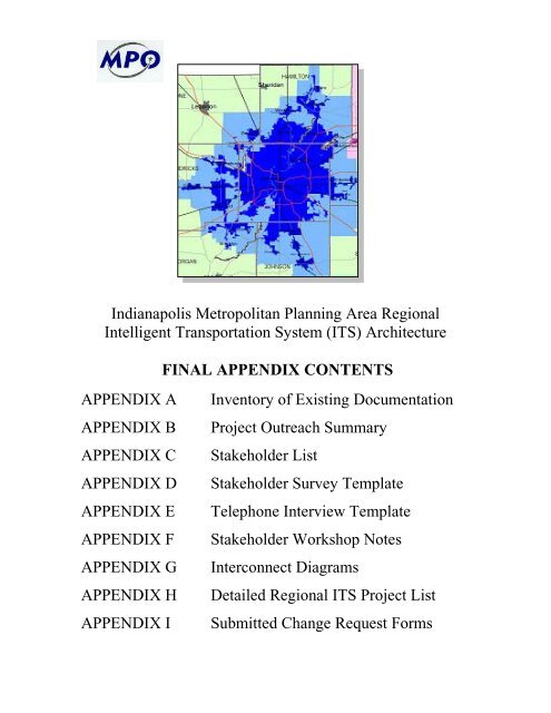
<strong>Indianapolis</strong> <strong>Metropolitan</strong> <strong>Planning</strong> Area Regional<br />
Intelligent Transportation System (<strong>ITS</strong>) Architecture<br />
FINAL APPENDIX CONTENTS<br />
APPENDIX A<br />
APPENDIX B<br />
APPENDIX C<br />
APPENDIX D<br />
APPENDIX E<br />
APPENDIX F<br />
APPENDIX G<br />
APPENDIX H<br />
APPENDIX I<br />
Inventory of Existing Documentation<br />
Project Outreach Summary<br />
Stakeholder List<br />
Stakeholder Survey Template<br />
Telephone Interview Template<br />
Stakeholder Workshop Notes<br />
Interconnect Diagrams<br />
Detailed Regional <strong>ITS</strong> Project List<br />
Submitted Change Request Forms
<strong>Indianapolis</strong> <strong>Metropolitan</strong> <strong>Planning</strong> Area Regional<br />
Intelligent Transportation System (<strong>ITS</strong>) Architecture<br />
FINAL APPENDIX A<br />
Inventory of Existing Documentation<br />
June 2005<br />
Prepared By<br />
for<br />
<strong>Indianapolis</strong> <strong>Metropolitan</strong> <strong>Planning</strong> <strong>Organization</strong>
Table of Contents<br />
1.0 Introduction .................................................................................................................... A-2<br />
2.0 Key Documents .............................................................................................................. A-2<br />
2.1 <strong>Indianapolis</strong> Area <strong>ITS</strong> Early Deployment Plan A-2<br />
2.2 Congestion Management System Process Report A-3<br />
2.3 TrafficWise Documentation A-4<br />
2.4 Tracking the Deployment of the Integrated <strong>Metropolitan</strong> Intelligent Transportation<br />
Systems Infrastructure in <strong>Indianapolis</strong>: FY2002 Results A-4<br />
2.5 <strong>Indianapolis</strong> Regional Transportation Plan for 2025 A-5<br />
2.6 <strong>Indianapolis</strong> Regional Transportation Improvement Program, 2004-2007 A-5<br />
2.7 Statewide Transportation Improvement Plan, 2004-2006 A-6<br />
2.8 DiRecTionS Region-Wide Rapid Transit System Study A-7<br />
2.9 The 2004 Urban Mobility Report A-7<br />
2.10 Indiana <strong>ITS</strong> Strategic Plan, Preliminary Draft V1.1 A-7<br />
2.11 Indiana Statewide <strong>ITS</strong> Architecture, Draft A-8<br />
3.0 Previous <strong>ITS</strong> Architecture Efforts .................................................................................. A-8<br />
<strong>Indianapolis</strong> Regional Intelligent Transportation System (<strong>ITS</strong>) Architecture A-1<br />
FINAL Appendix A – Inventory of Existing Documentation
1.0 Introduction<br />
Intelligent transportation systems (<strong>ITS</strong>) have been applied throughout the greater <strong>Indianapolis</strong><br />
area for many years to promote the safe and efficient travel of motorists, transit riders, and cargo.<br />
A number of key documents prepared by various transportation agencies in the region have<br />
guided the planning, deployment, and operation of these intelligent transportation systems. This<br />
memorandum describes the inventory work performed as part of the <strong>Indianapolis</strong> <strong>ITS</strong><br />
Architecture Project, providing summaries of key <strong>ITS</strong>-related documents.<br />
2.0 Key Documents<br />
In order to fully assess the status of <strong>ITS</strong> in the greater <strong>Indianapolis</strong> area, a number of documents<br />
were collected from various transportation agencies. These include:<br />
• <strong>Indianapolis</strong> Area <strong>ITS</strong> Early Deployment Plan (INDOT, 1996)<br />
• Congestion Management System Process Report (<strong>Indianapolis</strong> MPO, 1996)<br />
• TrafficWise Documentation<br />
o Concept of Operations Document (INDOT, 2000)<br />
o Communications Plan Document (INDOT, 2000)<br />
o <strong>Indianapolis</strong> ATMS Operations Plan Document (INDOT, 2000)<br />
o TrafficWise Traffic Management Center Maintenance Plan (INDOT, 2000)<br />
• Tracking the Deployment of the Integrated <strong>Metropolitan</strong> Intelligent Transportation<br />
Systems Infrastructure in <strong>Indianapolis</strong>: FY2002 Results (FHWA, 2003)*<br />
• <strong>Indianapolis</strong> Regional Transportation Plan for 2025 (<strong>Indianapolis</strong> MPO, 2001)*<br />
• <strong>Indianapolis</strong> Regional Transportation Improvement Program, 2004-2006 (<strong>Indianapolis</strong><br />
MPO, 2004)*<br />
• Statewide Transportation Improvement Plan, 2004-2006 (INDOT, 2004)*<br />
• DiRecTionS Region-Wide Rapid Transit System Study (<strong>Indianapolis</strong> MPO, 2004)<br />
• The 2004 Urban Mobility Report (Texas Transportation Institute, 2004)*<br />
• Indiana Statewide <strong>ITS</strong> Strategic Plan, Preliminary Draft V1.1 (INDOT, March 2005)<br />
• Indiana Statewide <strong>ITS</strong> Architecture, Draft (INDOT, March 2005)<br />
* updated annually<br />
Summaries of each of these documents, highlighting the <strong>ITS</strong> aspects contained in each, are listed<br />
below.<br />
2.1 <strong>Indianapolis</strong> Area <strong>ITS</strong> Early Deployment Plan<br />
Completed in 1996, the <strong>ITS</strong> Early Deployment Plan (EDP) for <strong>Indianapolis</strong> provides direction for<br />
the planning, design, deployment, and operation of <strong>ITS</strong> projects in the region. Development of<br />
the EDP was led by the Indiana Department of Transportation (INDOT) and a wide range of<br />
stakeholders, including the Federal Highway Administration, the City of <strong>Indianapolis</strong>, the<br />
<strong>Indianapolis</strong> <strong>Metropolitan</strong> <strong>Planning</strong> <strong>Organization</strong> (MPO), IndyGo (METRO Bus), and various<br />
surrounding municipalities and counties. The EDP report serves as a starting point for the<br />
creation of the <strong>Indianapolis</strong> <strong>ITS</strong> Architecture by identifying applicable components of the<br />
National <strong>ITS</strong> Architecture.<br />
<strong>Indianapolis</strong> Regional Intelligent Transportation System (<strong>ITS</strong>) Architecture A-2<br />
FINAL Appendix A – Inventory of Existing Documentation
The <strong>ITS</strong> Vision for <strong>Indianapolis</strong>, as defined in the EDP, calls for<br />
“enhanced transportation productivity, mobility, efficiency and safety within the region<br />
with a reduction in energy use and improvement in the environment through the use of<br />
cost effective <strong>ITS</strong> technologies and systems.” 1<br />
This vision statement, along with the goals and objectives identified in the EDP and listed below,<br />
serve as a starting point for defining the direction of the <strong>Indianapolis</strong> <strong>ITS</strong> Architecture.<br />
• Improve productivity,<br />
• Improve safety,<br />
• Reduce energy use and negative environmental impact,<br />
• Improve mobility and accessibility,<br />
• Increase efficiency, and<br />
• Create a state of the art <strong>ITS</strong> for the region.<br />
The EDP report, which focused on the Northeast Corridor (an area bounded by Keystone Avenue<br />
on the west, US 36 (Pendleton Pike) on the south, and SR 37/I-69 interchange on the north),<br />
describes over 70 <strong>ITS</strong> projects to be deployed over a 20-year period. These projects are grouped<br />
under the following six Program Areas:<br />
1. Multi-Modal Traveler Information Systems<br />
2. Freeway Management System<br />
3. Traffic Signal Control Systems<br />
4. Transit Management Systems<br />
5. Public-Private Partnerships<br />
6. Technical and <strong>Planning</strong> Support<br />
The EDP provides a description for each Program Area, as well as a rationale and expected<br />
results for the Program Area. Proposed individual projects are then listed for each Program Area,<br />
with anticipated implementation timeframes. Each project is summarized by listing a project<br />
objective, current conditions, a project scope, location, potential technologies, a project<br />
administrator, time frame, budget, staffing recommendations, and a sponsor. 2<br />
2.2 Congestion Management System Process Report<br />
Published by the <strong>Indianapolis</strong> MPO in 1996, the Congestion Management System (CMS) Process<br />
Report builds upon regional transportation planning efforts to help identify potential strategies to<br />
reduce congestion and promote the mobility of travelers and goods. Development of the CMS<br />
Process Report consisted of nine steps, as identified in the Statewide CMS Work Plan:<br />
1. Definition of targeted CMS network and components,<br />
2. Establishment of suitable performance measures,<br />
3. Establishment of performance objectives and standards,<br />
4. Establishment of program data collections and system monitoring,<br />
5. Identification of roadway and transit system deficiencies,<br />
6. Analysis and evaluation of possible congestion mitigation strategies,<br />
7. Implementation of strategies,<br />
1 <strong>Indianapolis</strong> Area <strong>ITS</strong> Early Deployment Plan, Indiana Department of Transportation, 1996.<br />
2 <strong>Indianapolis</strong> Area <strong>ITS</strong> Early Deployment Plan, Indiana Department of Transportation, 1996.<br />
<strong>Indianapolis</strong> Regional Intelligent Transportation System (<strong>ITS</strong>) Architecture A-3<br />
FINAL Appendix A – Inventory of Existing Documentation
8. Evaluation of the effectiveness of implemented strategies, and<br />
9. Establishment of a process to periodically update the CMS. 3<br />
Recommendations from the <strong>Indianapolis</strong> CMS Process Report include a number of <strong>ITS</strong> strategies,<br />
such as public transit enhancements, high-occupancy vehicle (HOV) lanes, intersection operation<br />
improvements including signalization modifications, freeway operations and management,<br />
incident management, automated toll collection, advanced traveler information systems,<br />
commercial vehicle operation improvements, and advanced vehicle control systems.<br />
2.3 TrafficWise Documentation<br />
TrafficWise is the intelligent transportation system for the State of Indiana, whose mission is to<br />
make driving easier and safer for motorists in Indiana, especially in highly traveled metropolitan<br />
areas. Operated from traffic management centers (TMC) located in Gary and <strong>Indianapolis</strong>,<br />
TrafficWise encompasses the traffic monitoring, incident detection and response, and traveler<br />
information functions of INDOT. The TrafficWise system consists of vehicle sensors and<br />
cameras to monitor traffic and detect incidents, dynamic message signs and highway advisory<br />
radio to alert motorists of current travel conditions, a real-time interactive website to provide pretrip<br />
traffic information, and communications infrastructure to link all of these systems to the<br />
traffic management centers where system data is collected and disseminated. 4<br />
TrafficWise program documentation consists of the following (all published by INDOT in 2000):<br />
• Concept of Operations Document – defines the functions, processes, and interactions that<br />
occur within the TrafficWise system.<br />
• Communications Plan Document – defines the necessary strategies and processes to<br />
support the communications requirements of the TrafficWise system.<br />
• <strong>Indianapolis</strong> ATMS Operations Plan Document – describes the necessary guidelines,<br />
procedures, legislation, and activities of the <strong>Indianapolis</strong> TMC.<br />
• TrafficWise Traffic Management Center Maintenance Plan – outlines the proper<br />
procedures, as well as roles and responsibilities, for maintenance of TMC components.<br />
Together these documents describe the operational aspects of the TrafficWise program, including<br />
those within the City of <strong>Indianapolis</strong>.<br />
2.4 Tracking the Deployment of the Integrated <strong>Metropolitan</strong> Intelligent Transportation<br />
Systems Infrastructure in <strong>Indianapolis</strong>: FY2002 Results<br />
In January of 1996, the Secretary of Transportation set a goal for the deployment of integrated<br />
metropolitan <strong>ITS</strong> in the largest 75 cities of the country within ten years. Since 1997, the United<br />
States Department of Transportation (USDOT) has tracked the development of intelligent<br />
transportation systems in these larger metropolitan areas by surveying representatives of these<br />
cities. The survey focuses on the nine components of the <strong>Metropolitan</strong> <strong>ITS</strong> Infrastructure:<br />
• Freeway management,<br />
• Incident management,<br />
• Arterial management,<br />
• Emergency management,<br />
3 Congestion Management System Process Report, <strong>Indianapolis</strong> MPO, 1996.<br />
4 www.trafficwise.org<br />
<strong>Indianapolis</strong> Regional Intelligent Transportation System (<strong>ITS</strong>) Architecture A-4<br />
FINAL Appendix A – Inventory of Existing Documentation
• Transit management,<br />
• Electronic toll collection,<br />
• Electronic fare payment,<br />
• Highway-rail intersections, and<br />
• Regional multimodal traveler information.<br />
The Integrated <strong>Metropolitan</strong> <strong>ITS</strong> tracking survey was last completed for <strong>Indianapolis</strong> in 2002.<br />
The results of the survey show high levels of metropolitan <strong>ITS</strong> deployment opportunity in the<br />
areas of incident management, arterial management, emergency management, and electronic fare<br />
payment. The survey results show high levels of metropolitan <strong>ITS</strong> integration in the areas of<br />
incident management, emergency management, transit management, and electronic fare payment.<br />
The remaining <strong>Indianapolis</strong> <strong>ITS</strong> areas show moderate or low levels of deployment opportunity<br />
and integration based on the survey responses. 5 Overall, the level of integrated metropolitan<br />
intelligent transportation systems for <strong>Indianapolis</strong> is rated as low by the USDOT. 6<br />
2.5 <strong>Indianapolis</strong> Regional Transportation Plan for 2025<br />
The <strong>Indianapolis</strong> Regional Transportation Plan (RTP) provides direction for the development of<br />
the transportation system of the <strong>Indianapolis</strong> metropolitan planning area (MPA). The MPA for<br />
<strong>Indianapolis</strong> includes all of Marion County and portions of Hamilton, Boone, Hendricks,<br />
Johnson, and Hancock counties. Following the guidelines of the Transportation Equity Act for<br />
the 21 st Century (TEA-21), the <strong>Indianapolis</strong> RTP serves as a plan for integrated regional<br />
transportation systems, including <strong>ITS</strong>.<br />
The identified goals of the <strong>Indianapolis</strong> RTP are:<br />
• Goal 1 – Preserve existing transportation facilities and seek to maximize the return on<br />
transportation investments.<br />
• Goal 2 – Provide for the safe and efficient movement of people and goods.<br />
• Goal 3 – Ensure the coordination of transportation plans with the overall regional social,<br />
environmental, and land-use goals.<br />
• Goal 4 – Provide for the essential mobility needs of all citizens.<br />
Along with those included in the EDP, these goals will provide a starting point for the<br />
development of goals and objectives for the <strong>Indianapolis</strong> <strong>ITS</strong> Architecture.<br />
2.6 <strong>Indianapolis</strong> Regional Transportation Improvement Program, 2004-2007<br />
While the RTP uses a 25-year horizon, the <strong>Indianapolis</strong> Regional Transportation Improvement<br />
Plan (IRTIP) focuses on transportation system enhancements over the next three years – projects<br />
that are funded and programmed for construction. This reduced timeframe allows the IRTIP to<br />
address proposed transportation projects in greater detail.<br />
Proposed projects are organized into several different categories in the IRTIP. <strong>ITS</strong> projects in the<br />
IRTIP fall under the following categories:<br />
• Public Transportation (IPTC/IndyGo) – radio system upgrade, automatic vehicle location<br />
system, passenger counting system, real-time transit traveler information system, a<br />
5 Tracking the Deployment of the Integrated <strong>Metropolitan</strong> Intelligent Transportation Systems Infrastructure in <strong>Indianapolis</strong>: FY2002<br />
Results, FHWA, 2003.<br />
6 Deploying the Integrated <strong>Metropolitan</strong> Intelligent Transportation Systems Infrastructure: FY2003 Report, FHWA, 2003.<br />
<strong>Indianapolis</strong> Regional Intelligent Transportation System (<strong>ITS</strong>) Architecture A-5<br />
FINAL Appendix A – Inventory of Existing Documentation
Downtown Transit Center, scheduling software purchase, and the Commuter Choice Van<br />
Pool project.<br />
• INDOT – new or modernized traffic signal and flashers, traffic signal interconnect<br />
projects, freeway traffic monitoring projects, and at-grade rail crossing improvements.<br />
• Rail/Highway Protection Safety – at-grade rail crossing improvements (INDOT).<br />
• Local Jurisdiction (<strong>Indianapolis</strong> Department of Public Works) – new or modernized<br />
traffic signals and traffic signal interconnect projects. 7<br />
2.7 Statewide Transportation Improvement Plan, 2004-2006<br />
INDOT has cited intelligent transportation systems in its Statewide Transportation Improvement<br />
Plan (STIP) as a way of using technology to combat congestion and reduce pollution. This is<br />
done by providing motorists with congestion information, allowing them to make informed<br />
decisions about their travel plans. The STIP lists Northwest Indiana, Louisville, Evansville, and<br />
<strong>Indianapolis</strong> as the key areas for investment in <strong>ITS</strong> around the state. The STIP includes a number<br />
of projects that include <strong>ITS</strong> components, including the I-465 Corridor <strong>ITS</strong>.<br />
A summary of <strong>ITS</strong> projects from the RTP, IRTIP, and STIP is provided below. These and other<br />
potential <strong>ITS</strong> projects will be discussed further in subsequent sections of the <strong>Indianapolis</strong> <strong>ITS</strong><br />
Architecture documentation.<br />
<strong>Indianapolis</strong> Regional <strong>ITS</strong> Architecture<br />
Projects Inventory<br />
Stakeholder Project Funding Source Agency Timeframe Source<br />
INDOT <strong>Indianapolis</strong> Subdistrict Various signal interconnect projects INDOT Ongoing<br />
Signals, new/modernized:<br />
IM$, STP,<br />
Maintenance INDOT 2004-2025<br />
IRTIP (A1,<br />
A2), RTP,<br />
STIP<br />
<strong>ITS</strong> traffic monitoring system on I-465 from I-65 to W. 86th St. IM$ INDOT 2004<br />
IRTIP (A2),<br />
STIP<br />
Intersection/interchange improvements (including signals or<br />
flashers): STP INDOT 2004-2007 IRTIP, STIP<br />
Road reconstruction/added travel lanes (including signals) IM, IM$, STP INDOT 2004-2007<br />
IRTIP (A1,<br />
A2), STIP<br />
Various rail grade crossings (CSX), including Shortridge Rd. INDOT 2004-05 IRTIP (A2)<br />
<strong>Indianapolis</strong> Dept. of Public Works Various signal interconnect projects: CMAQ DPW 2004-2007 IRTIP (A1, A2)<br />
Signals, new/modernized: CMAQ DPW, INDOT 2004-2005 IRTIP (A1,A2)<br />
<strong>Indianapolis</strong> Public Transportation<br />
Corp./IndyGo Downtown Transit Center (multimodal) 5309, STP IndyGO 2004-06 IRTIP<br />
Commuter Choice/Van Pool CMAQ IndyGO 2004-06 IRTIP<br />
Funding Acronymns<br />
CMAQ - Congestion Management and Air Quality<br />
IM, IM$ - Interstate Maintenance<br />
STP - Surface Transportation Program<br />
5309 - Federal Transit Section 5309, 49 U.S.C. S 5309<br />
Source Acronymns<br />
IRTIP - <strong>Indianapolis</strong> Regional Transportation Improvement Plan, 2004-2006 (A1 and A2 represent amendments # 1 and #2)<br />
RTP - <strong>Indianapolis</strong> Regional Transportation Plan for 2025<br />
STIP - Statewide Transportation Improvement Plan<br />
7 <strong>Indianapolis</strong> Regional Transportation Improvement Program, 2004-2007, <strong>Indianapolis</strong> MPO, 2004.<br />
<strong>Indianapolis</strong> Regional Intelligent Transportation System (<strong>ITS</strong>) Architecture A-6<br />
FINAL Appendix A – Inventory of Existing Documentation
2.8 DiRecTionS Region-Wide Rapid Transit System Study<br />
The DiRecTionS Region-Wide Rapid Transit System (RTS) Study is a comprehensive<br />
investigation into the merits of deploying rapid transit (e.g., light rail) for travelers in the greater<br />
<strong>Indianapolis</strong> area, particularly the Northeast Corridor. This ongoing study will analyze potential<br />
corridors, assess current transit operations, and estimate potential costs. It is anticipated that <strong>ITS</strong><br />
will be an integral part of the rapid transit system that is ultimately deployed.<br />
2.9 The 2004 Urban Mobility Report<br />
Each year the Texas Transportation Institute produces its Mobility Report as a summary of the<br />
overall congestion levels in metropolitan areas around the country. The intent of the document is<br />
to highlight congestion problem areas and to recommend solutions to reduce travel delay. In<br />
2004, some of the recommended solutions include <strong>ITS</strong> initiatives like ramp metering, freeway<br />
incident management, arterial traffic signal coordination, arterial street access control, and above<br />
all increased distribution of information to travelers. The 2004 Mobility Report estimates that<br />
applying these solutions in major metropolitan areas would reduce delay by hundreds of millions<br />
of hours and would save of billions of dollars across the country. 8<br />
In <strong>Indianapolis</strong>, the Mobility Report estimates that annual delay (extra travel time during peak<br />
periods) for an individual traveler is 37 hours (based on 2002 data). 9 While this value is<br />
considered average for metropolitan areas of similar size in the United States, such delay results<br />
in increased fuel costs and pollution levels. In February of 2004, the Indiana Office of Air<br />
Quality recommended that Marion County be designated a Non-Attainment Area by the United<br />
States Environmental Protection Agency due to measured levels of fine particular matter.<br />
Pollution will continue to be a concern for <strong>Indianapolis</strong> as congestion levels rise.<br />
2.10 Indiana <strong>ITS</strong> Strategic Plan, Preliminary Draft V1.1<br />
The Indiana <strong>ITS</strong> Strategic Plan identifies <strong>ITS</strong> needs for the State of Indiana and outlines the<br />
prioritized strategies that INDOT recommends to address those needs. The strategies are<br />
introduced first through the identification of recommended National <strong>ITS</strong> Architecture ‘market<br />
packages,’ and then through a comprehensive listing of planned <strong>ITS</strong> initiatives for the entire State<br />
of Indiana over the next 20 years. This project list includes project type, location, timeframe, and<br />
estimated cost for each project. <strong>ITS</strong> projects in Indiana will fall under seven deployment types:<br />
• Full Advanced Traffic Management Systems (ATMS)<br />
• Closed Circuit Television (CCTV) Cameras<br />
• Permanent Overhead Dynamic Message Signs (DMS)<br />
• Static / Dynamic Travel Time Signs (TTS)<br />
• Hoosier Helper Freeway Service Patrol (FSP)<br />
• Reference Markers (1/10, 2/10, and 1/2 Mile Reference Markers)<br />
• Fiber Optic Deployment<br />
The <strong>Indianapolis</strong> Region is identified as the priority location for major <strong>ITS</strong> deployments in the<br />
near term (2005-2008), with a number of planned <strong>ITS</strong> projects under each deployment type<br />
scheduled to occur within the <strong>Indianapolis</strong> <strong>Metropolitan</strong> <strong>Planning</strong> Area.<br />
8 The 2004 Urban Mobility Report, Texas Transportation Institute, 2004.<br />
9 The 2004 Urban Mobility Report, Texas Transportation Institute, 2004.<br />
<strong>Indianapolis</strong> Regional Intelligent Transportation System (<strong>ITS</strong>) Architecture A-7<br />
FINAL Appendix A – Inventory of Existing Documentation
2.11 Indiana Statewide <strong>ITS</strong> Architecture, Draft<br />
Developed concurrently with the Indiana <strong>ITS</strong> Strategic Plan and this <strong>Indianapolis</strong> Regional <strong>ITS</strong><br />
Architecture, the Indiana Statewide <strong>ITS</strong> Architecture is a tool for planning, deploying, and<br />
integrating transportation systems throughout the state. While the <strong>Indianapolis</strong> <strong>ITS</strong> Architecture<br />
focuses on the <strong>Indianapolis</strong> Region, the Statewide Architecture has been developed to include all<br />
modes of transportation and all roads throughout the state, focusing on statewide and interstate<br />
systems like commercial vehicle operations and the Gateway Traveler Information System. A<br />
goal of the Statewide Architecture is to provide “a vision of how each transportation agency’s<br />
systems will work together in the future to share information and resources in an effort to provide<br />
a safer, more efficient, and more effective transportation system for travelers in the state.”<br />
It is important to note that the naming conventions and other related parameters of the<br />
<strong>Indianapolis</strong> <strong>ITS</strong> Architecture have been closely coordinated with the Indiana Statewide <strong>ITS</strong><br />
Architecture to promote interoperability and consistency between the two.<br />
3.0 Previous <strong>ITS</strong> Architecture Efforts<br />
Building upon the <strong>Indianapolis</strong> Area <strong>ITS</strong> Early Deployment Plan, a pair of <strong>ITS</strong> workshops were<br />
held in 2000 and 2001 to bring together stakeholders from key transportation agencies in the<br />
region. These “Tier I” and “Tier II” workshops provided the stakeholders with an introduction to<br />
<strong>ITS</strong>, and then encouraged their participation in the initial steps of architecture development.<br />
Findings from the Tier II workshop were collected and recorded using Turbo Architecture, a<br />
software tool sponsored by the FHWA for <strong>ITS</strong> architecture development.<br />
Results from the Tier I and Tier II workshops provide a bridge between the <strong>Indianapolis</strong> <strong>ITS</strong><br />
Early Deployment Plan and the <strong>Indianapolis</strong> <strong>ITS</strong> Architecture. The stakeholders, systems,<br />
services, interconnections, and standards identified during all previous <strong>ITS</strong> architecture efforts<br />
provide a starting point for current inventory tasks. Below is a listing of the stakeholders<br />
identified during the Tier I and Tier II efforts.<br />
<strong>Indianapolis</strong> Regional Intelligent Transportation System (<strong>ITS</strong>) Architecture A-8<br />
FINAL Appendix A – Inventory of Existing Documentation
• Adjoining Counties<br />
• City of Beech Grove<br />
• City of <strong>Indianapolis</strong><br />
• City of Lawrence<br />
• City of Southport<br />
• Clarian Health Partners<br />
• Commercial Vehicle Operators<br />
• County/Township Fire Departments<br />
• Event Promoters<br />
• Indiana Bureau of Motor Vehicles<br />
• Indiana Dept of Environmental Management<br />
• Indiana Dept of Revenue<br />
• Indiana Dept of Transportation<br />
• Indiana State Emergency Management Agency<br />
• Indiana State Police<br />
• Indiana State Police Commercial Vehicle Enforcement Division<br />
• <strong>Indianapolis</strong> Airport Authority<br />
• <strong>Indianapolis</strong> Downtown Inc.<br />
• <strong>Indianapolis</strong> Fire Department<br />
• <strong>Indianapolis</strong> Motor Speedway (IMS)<br />
• <strong>Indianapolis</strong> MPO<br />
• <strong>Indianapolis</strong> Police Department<br />
• <strong>Indianapolis</strong> Public Transportation Corporation (IndyGo)<br />
• INDOT, KYTC, ODOT<br />
• Major Employers<br />
• Marion County Sheriff,<br />
• Marion County Sheriffs Department<br />
• Media<br />
• <strong>Metropolitan</strong> Emergency Communications Agency<br />
• Indiana University/Purdue University at <strong>Indianapolis</strong> (IUPUI)<br />
• Rail and Bus Operators<br />
• Special Event Sponsors<br />
• Suburban Municipalities<br />
• Towing and Recovery Operators<br />
• Town of Speedway<br />
• Travelers<br />
• US Military<br />
• Utility Companies<br />
• Weather Services<br />
<strong>Indianapolis</strong> Regional Intelligent Transportation System (<strong>ITS</strong>) Architecture A-9<br />
FINAL Appendix A – Inventory of Existing Documentation
<strong>Indianapolis</strong> <strong>Metropolitan</strong> <strong>Planning</strong> Area Regional<br />
Intelligent Transportation System (<strong>ITS</strong>) Architecture<br />
FINAL APPENDIX B<br />
Project Outreach<br />
June 2005<br />
Prepared By<br />
for<br />
<strong>Indianapolis</strong> <strong>Metropolitan</strong> <strong>Planning</strong> <strong>Organization</strong>
Table of Contents<br />
1.0 Introduction .................................................................................................................... B-2<br />
2.0 Stakeholders ................................................................................................................... B-2<br />
3.0 Outreach Methods .......................................................................................................... B-3<br />
3.1 Meetings ..................................................................................................................... B-3<br />
3.2 Surveys ....................................................................................................................... B-3<br />
3.3 Interviews ................................................................................................................... B-4<br />
3.4 Workshop ................................................................................................................... B-5<br />
<strong>Indianapolis</strong> Regional Intelligent Transportation System (<strong>ITS</strong>) Architecture B - 1<br />
FINAL Appendix B – Project Outreach
1.0 Introduction<br />
In order to create a comprehensive <strong>ITS</strong> architecture for the <strong>Indianapolis</strong> region, a broad range of<br />
stakeholders were identified and invited to participate in the development process. This<br />
memorandum describes the outreach steps that were conducted to seek input from these<br />
stakeholders and summarizes the results of this outreach effort.<br />
2.0 Stakeholders<br />
Without the ongoing and active participation of stakeholders throughout the development process,<br />
an <strong>ITS</strong> architecture will not effectively serve the traveling public. The “Regional <strong>ITS</strong><br />
Architecture Guidance Document” produced by the Federal Highway Administration (FHWA),<br />
provides recommendations for the many potential <strong>ITS</strong> stakeholders in a region. These include the<br />
following stakeholder groups, with regional stakeholders listed for each:<br />
Transportation Agencies:<br />
Transit Agencies:<br />
<strong>Planning</strong> <strong>Organization</strong>s:<br />
Public Safety Agencies:<br />
Activity Centers:<br />
Fleet Operators:<br />
The Private Sector:<br />
Other Agencies:<br />
Federal Highway Administration (FHWA)<br />
Indiana Department of Transportation (INDOT)<br />
<strong>Indianapolis</strong> Department of Public Works (DPW)<br />
Suburban municipality street departments/departments of public<br />
works (DPW)<br />
Surrounding county highway departments<br />
<strong>Indianapolis</strong> Public Transportation Corporation (IPTC)/IndyGo<br />
<strong>Indianapolis</strong> <strong>Metropolitan</strong> <strong>Planning</strong> <strong>Organization</strong> (MPO)<br />
Madison County Council of Governments<br />
Ambulance/Emergency Medical Services<br />
Indiana Counterterrorism and Security Council (CTASC)<br />
Indiana State Police (ISP)<br />
<strong>Indianapolis</strong> Emergency Management Agency<br />
<strong>Indianapolis</strong> Police/Fire/emergency medical services (EMS)<br />
Marion County Sheriff<br />
<strong>Metropolitan</strong> Emergency Communications Agency (MECA)<br />
Suburban municipality police/fire/emergency medical services<br />
(EMS)<br />
Surrounding county sheriffs<br />
<strong>Indianapolis</strong> Airport Authority<br />
<strong>Indianapolis</strong> Motor Speedway<br />
RCA Dome<br />
Indiana Motor Truck Association<br />
<strong>ITS</strong> Maintenance Contractors<br />
Eli Lilly<br />
Indiana University/Purdue University <strong>Indianapolis</strong> (IUPUI)<br />
<strong>Indianapolis</strong> Downtown, Inc.<br />
<strong>Indianapolis</strong> Public Schools<br />
Purdue University<br />
Appendix C provides a comprehensive listing of all of the project stakeholders and primary<br />
contacts for each agency/organization.<br />
<strong>Indianapolis</strong> Regional Intelligent Transportation System (<strong>ITS</strong>) Architecture B - 2<br />
FINAL Appendix B – Project Outreach
It is important to note that many of these stakeholders have also been involved in previous <strong>ITS</strong><br />
planning in <strong>Indianapolis</strong>, particularly during the development of the <strong>Indianapolis</strong> <strong>ITS</strong> Early<br />
Deployment Plan and the “Tier I” and “Tier II” workshops held in 2000 and 2001, respectively<br />
(See Appendix A).<br />
3.0 Outreach Methods<br />
Three primary outreach methods were used to encourage stakeholder participation. These include<br />
surveys, one-on-one telephone interviews, and a stakeholder workshop. During each of these<br />
activities, stakeholders were introduced to intelligent transportation systems and <strong>ITS</strong> architecture,<br />
and provided an overview of the <strong>Indianapolis</strong> <strong>ITS</strong> Architecture Project.<br />
2.12 Meetings<br />
Throughout the project, periodic meetings have also been held between the Project Team and key<br />
stakeholders. On September 9 th , 2004, members of the National <strong>ITS</strong> Architecture Development<br />
Team gave a one-day introductory seminar on the regional <strong>ITS</strong> architecture development process<br />
at the INDOT Traffic Management Center. Using examples from the region, the instructors led<br />
key stakeholders through the process that would be used to create the <strong>Indianapolis</strong> Regional <strong>ITS</strong><br />
Architecture. The following stakeholder agencies attended this seminar:<br />
• Federal Highway Administration (FHWA) – Dennis Lee and Mac Lister<br />
• Indiana Department of Transportation (INDOT) – Meggan Simpson and Jay Wasson<br />
• Indiana State Police – Lt. Bradley S. Scully<br />
• <strong>Indianapolis</strong> Department of Public Works – Nathan Sheets<br />
• <strong>Indianapolis</strong> <strong>Metropolitan</strong> <strong>Planning</strong> <strong>Organization</strong> (MPO) – Swenson Yang<br />
• <strong>Indianapolis</strong> Police Department – Mike Woida<br />
• IndyGo – Bruce Behncke<br />
On November 15 th , 2004, the Project Team facilitated a formal project kickoff meeting at the<br />
<strong>Indianapolis</strong> MPO offices. This meeting included an overview of the project including the<br />
project need, the scope of work, and a description of the anticipated results of the project. The<br />
meeting concluded with a question-and-answer session. The following stakeholder agencies<br />
attended the project kickoff meeting:<br />
• Federal Highway Administration (FHWA) – Dennis Lee and Karen Stippich<br />
• Indiana Department of Transportation (INDOT) – Meggan Simpson<br />
• Indiana State Police – Maj. Thomas Melville<br />
• <strong>Indianapolis</strong> Department of Public Works – Nathan Sheets<br />
• <strong>Indianapolis</strong> <strong>Metropolitan</strong> <strong>Planning</strong> <strong>Organization</strong> (MPO) – Phil Roth and Heather<br />
Stouder<br />
• <strong>Indianapolis</strong> Fire Department – Maj. James Turner<br />
• IndyGo – Annette Darrow<br />
2.13 Surveys<br />
Surveys are an effective way to solicit specific information from a large number of stakeholders<br />
simultaneously. As the initial data gathering step, surveys act as a way to make stakeholders<br />
aware of the project and encourage their participation. For the <strong>Indianapolis</strong> <strong>ITS</strong> Architecture,<br />
over 80 surveys were distributed to the stakeholders listed in Appendix C. The sixteen-page<br />
survey was based upon the ‘Interview’ questions associated with the Turbo Architecture®<br />
<strong>Indianapolis</strong> Regional Intelligent Transportation System (<strong>ITS</strong>) Architecture B - 3<br />
FINAL Appendix B – Project Outreach
Software tool, as well as more subjective questions that were intended to lead to discussion in<br />
later steps in the architecture development process.<br />
Overall, survey response was approximately 15%. The following stakeholders provided<br />
completed surveys:<br />
• Counterterrorism and Security<br />
Council (CTASC)<br />
• Town of Fishers<br />
• Hamilton County<br />
• Hancock County<br />
• Indiana State Police<br />
• <strong>Indianapolis</strong> Downtown, Inc.<br />
• Indiana Department of Transportation<br />
(INDOT)<br />
• <strong>Indianapolis</strong> Department of Public<br />
Works (DPW)<br />
• <strong>Indianapolis</strong> Public Transportation<br />
Corporation (IPTC)/IndyGo<br />
• James H. Drew Corporation<br />
• Johnson County <strong>Planning</strong> and Zoning<br />
• Rural-Metro Ambulance<br />
The information contained in the returned surveys provided a starting point for the development<br />
of the architecture documentation and the Turbo Architecture database for <strong>Indianapolis</strong>, as well as<br />
additional subject matter for the telephone interviews.<br />
The stakeholder survey template is located in Appendix D.<br />
2.14 Interviews<br />
To elaborate on the information provided in the stakeholder surveys, a limited number of<br />
telephone interviews were conducted with the following key stakeholders:<br />
• Counterterrorism and Security<br />
Council (CTASC)<br />
• CSX Railroad<br />
• Eli Lilly<br />
• Indiana Department of<br />
Transportation (INDOT) <strong>ITS</strong><br />
Program Office<br />
• Indiana Department of<br />
Transportation (INDOT) Traffic<br />
Management Center<br />
• Indiana State Police<br />
• <strong>Indianapolis</strong> Airport Authority<br />
• <strong>Indianapolis</strong> Department of Public<br />
Works (DPW) (Engineering)<br />
• <strong>Indianapolis</strong> Department of Public<br />
Works (DPW) (Operations)<br />
• <strong>Indianapolis</strong> Downtown, Inc.<br />
• <strong>Indianapolis</strong> <strong>Metropolitan</strong> <strong>Planning</strong><br />
<strong>Organization</strong> (MPO)<br />
• <strong>Indianapolis</strong> Motor Speedway<br />
• <strong>Indianapolis</strong> Police Department<br />
• <strong>Indianapolis</strong> Public Schools Police<br />
• <strong>Indianapolis</strong> Public Transportation<br />
Corporation (IPTC)/IndyGo<br />
• <strong>Metropolitan</strong> Emergency<br />
Communications Agency (MECA)<br />
• Rural-Metro Ambulance<br />
• Regional Transportation Authority<br />
(RTA)<br />
These interviews provided the opportunity to delve into issues raised during previous<br />
correspondence with key stakeholders and to clarify information collected. In addition, these<br />
interviews served as a forum for key stakeholders to identify the challenges that their agencies<br />
face and the plans they have for the future.<br />
The telephone interview template can be found in Appendix E.<br />
<strong>Indianapolis</strong> Regional Intelligent Transportation System (<strong>ITS</strong>) Architecture B - 4<br />
FINAL Appendix B – Project Outreach
2.15 Workshop<br />
On February 8, 2005, a stakeholder workshop was held at the INDOT Traffic Management<br />
Center at 21 st Street and Post Road in <strong>Indianapolis</strong>. Each of the stakeholders listed in Appendix C<br />
were invited to attend this workshop, with the following agencies being represented:<br />
• Federal Highway Administration (FHWA) – Dennis Lee, Karen Stippich, and Shandrian<br />
Jarvis<br />
• Hamilton County – Brad Davis<br />
• HNTB Corporation – Brian Burkhard<br />
• Indiana Department of Transportation (INDOT) – Mark Newland and Meggan Simpson<br />
• Indiana Motor Truck Association – Tisha Eder<br />
• Indiana State Police – Cpt. Guy Boruff and Maj. Thomas Melville<br />
• <strong>Indianapolis</strong> Department of Public Works – Nathan Sheets<br />
• <strong>Indianapolis</strong> Fire Department – Chief Joe Krebsbach<br />
• <strong>Indianapolis</strong> <strong>Metropolitan</strong> <strong>Planning</strong> <strong>Organization</strong> (MPO) – Swenson Yang and Phil Roth<br />
• Madison County Council of Governments – Jerry Bridges and Peter Mitchell<br />
• RCA Dome – Kevin Deane<br />
• Town of Fishers – Drew Williams<br />
The workshop began with an overview of<br />
<strong>ITS</strong> and the architecture development<br />
process, as well as status updates on the<br />
Indiana Statewide and nearby regional<br />
<strong>ITS</strong> architectures. Next, the attendees<br />
participated in a visioning exercise, the<br />
identification of <strong>ITS</strong> goals and objectives,<br />
and a review of the <strong>ITS</strong> systems and<br />
services identified during initial project<br />
outreach. In the afternoon, the attendees<br />
formed “breakout” groups to discuss their<br />
organizations’ roles and responsibilities in<br />
three theoretical operational scenarios.<br />
Detailed minutes from the stakeholder<br />
workshop can be found in Appendix F.<br />
Figure 1 Feb. 8 th , 2005 Stakeholder Workshop<br />
<strong>Indianapolis</strong> Regional Intelligent Transportation System (<strong>ITS</strong>) Architecture B - 5<br />
FINAL Appendix B – Project Outreach
<strong>Indianapolis</strong> <strong>Metropolitan</strong> <strong>Planning</strong> Area Regional<br />
Intelligent Transportation System (<strong>ITS</strong>) Architecture<br />
FINAL APPENDIX C<br />
Stakeholder List<br />
November 2011<br />
Originally Prepared By<br />
And Updated by Justin Stuehrenberg<br />
for<br />
<strong>Indianapolis</strong> <strong>Metropolitan</strong> <strong>Planning</strong> <strong>Organization</strong>
<strong>Indianapolis</strong> Regional <strong>ITS</strong> Architecture Stakeholder List (2011)<br />
Stakeholder Name<br />
Boone Co. Highway<br />
Engineer<br />
Hamilton Co. Highway<br />
Engineer<br />
Hancock Co. Highway<br />
Engineer<br />
Hendricks Co. Highway<br />
Engineer<br />
Johnson Co. Highway<br />
Engineer<br />
Morgan Co. Highway<br />
Engineer<br />
Shelby Co. Highway<br />
Engineer<br />
Stakeholder<br />
Address<br />
Stakeholder<br />
Contact Person<br />
Adjoining Counties<br />
Contact Person's<br />
Telephone No.<br />
Contact Person's Email<br />
Address<br />
1955 <strong>Indianapolis</strong> Ave Ross Snider 317-544-4996 rsnider@usiconsultants.com<br />
1700 S. 10th Street,<br />
Noblesville 46060<br />
921 W. Osage St, Greenfield,<br />
IN 46140<br />
355 South Washington<br />
Street<br />
1051 Hospital Rd,<br />
Franklin 46131<br />
Brad Davis 317-773-7770 bradley.davis@hamiltoncounty.in.gov<br />
Joe Copeland 317-477-1130 jcopeland@hancockcoingov.org<br />
John Ayers 317-745-9236 jayers@co.hendricks.in.us<br />
Mike Pelham 317-346-4360 mpelham@co.johnson.in.us<br />
5400 Blue Bluff Road Larry Smith 317-831-7989 lsmith@morgancoin.us<br />
25 W Polk St.Rm. 206 Kem Anderson 317-392-6330 kanderson@co.shelby.in.us<br />
Adjoining Municipalities<br />
Comments<br />
Madison Co. not in MPO<br />
jurisdiction<br />
Highway superintendent, not<br />
engineer<br />
Avon Town Engineer 6570 E US Highway 36 Nicole Mueller 317-826-7278 nmueller@schneidercorp.com<br />
Beech Grove<br />
3417 S. Sherman Dr,<br />
Trent Newport 317-780-1555 x3 tnewport@crossroadengineers.com<br />
City Engineer<br />
Beech Grove, IN 46107<br />
Brownsburg Town<br />
80 East Vermont Street Dale Cheatham 317-852-1120 dcheatham@brownsburg.org<br />
Manager<br />
9001 E 59th Street,<br />
Lawrence City Engineer<br />
Jerry Wilkey 317-545-5566 jwilkey@cityoflawrence.org<br />
46216<br />
Speedway<br />
111 Monument circle Ste<br />
John Myers 317-636-4682 x5272 jwmyers@hntb.com<br />
Town Engineer<br />
1200, 46204-5178<br />
1 Civic Square, Carmel, IN<br />
Carmel City Engineer<br />
Mike McBride 317-571-2441 mmcbride@carmel.in.gov<br />
46032<br />
1 Municipal Dr. Fishers<br />
Fishers Town Engineer<br />
Jeff Heiking 317-595-3162 heiking@fishers.in.us<br />
46038<br />
44 N Jackson St,<br />
Franklin City Engineer<br />
Todd Wilkerson 317-736-3631 twilkerson@franklin-in.gov<br />
Franklin. 46131<br />
Greenwood<br />
225 S Emerson, Ste A,<br />
Mark Richards 317-887-5230 richardma@greenwood.in.gov<br />
City Engineer<br />
Greenwood, 46143<br />
Madison County Council of 16 E. 9 th St, Anderson, IN<br />
Jerry Bridges 765-641-9482 jbridges@mccog.net<br />
Governments<br />
46016<br />
Noblesville<br />
14701 Cumberland Rd<br />
John Beery 317-776-6330 jbeery@noblesville.in.us<br />
City Engineer<br />
Ste 300, Noblesville<br />
Westfield<br />
2728 E.171st St,<br />
Neil VanTrees 317-804-3136 nvantrees@westfield.in.gov<br />
Lance Lantz 317-873-4544 llantz@zionsville-in.gov<br />
Don Mcgillem 317-839-2561 x250 dmcgillem@town.plainfield.in.us<br />
Town Engineer<br />
Plainfield<br />
Westfield 46074<br />
206 W Main St.<br />
Zionsville<br />
Town Engineer<br />
1075 Parkway Dr, Zionsville,<br />
Plainfield 46168<br />
Town Engineer<br />
IN 46077
Stakeholder Name<br />
Stakeholder<br />
Address<br />
Stakeholder<br />
Contact Person<br />
Contact Person's<br />
Telephone No.<br />
Contact Person's Email<br />
Address<br />
Comments<br />
Ambulance/Emergency Services<br />
Clarian Health Partners 1701 N, Senate Avenue Glenn Pope 317-962-8146 gpope@clarian.org<br />
Rural/Metro Ambulance 3969 Meadows Drive Kelly Thomas 317-955-3549 kelly_thomas@rmetro.com<br />
Wishard Health Services<br />
CIRTA Director<br />
1001 W 10th Street, IN<br />
46202<br />
Karl Brady 317-630-6111 karl.brady@wishard.edu<br />
Central Indiana Regional Transportation Authority (CIRTA)<br />
320 N. Meridian, Ste 406, IN<br />
46204<br />
Ehren Bingaman 317-327-7588 ehren.bingaman@indy.gov<br />
Commercial Vehicle Operators<br />
Federal Express<br />
Indiana Motor Truck<br />
Association<br />
1 N Capitol Ste 460, IN<br />
46204<br />
Gary Langston,<br />
President<br />
317-630-4682 gary.langston@imtaonline.net<br />
United Parcel Service<br />
Indiana Black Expo<br />
Indiana Sports<br />
Corporation<br />
<strong>Indianapolis</strong> Convention<br />
and Visitors Association<br />
3145 Meridian,<br />
<strong>Indianapolis</strong>, 46208<br />
201 S Capitol, Ste 1200,<br />
46225<br />
100 South Capitol Ave<br />
<strong>Indianapolis</strong>, 46225<br />
Event Promoters/Special Events<br />
Elizabeth Hart,<br />
Communications<br />
Allison Melangton, VP<br />
of Event<br />
Bill Stewart, Director<br />
of Security<br />
317-925-2702 ehart@indianablackexpo.com<br />
317-237-5000<br />
allison.melangton@indianasportscorp.<br />
com<br />
317-262-3470 bill.stewart@icclos.com<br />
<strong>Indianapolis</strong> 500 Festival Lindsey Hendren 317-614-6130 lhendren@500festival.com<br />
<strong>Indianapolis</strong> Downtown,<br />
Inc.<br />
<strong>Indianapolis</strong> Motor<br />
Speedway<br />
NCAA Headquarters<br />
1 11 Monument Circle,<br />
ste 1900 , 46204<br />
4790 W 16th Street, IN<br />
46222<br />
P O Box 6222 Indiana<br />
46206<br />
Fred Laughlin 317-237-2222 fred@indydt.com<br />
Jim Campbell, Public<br />
Safety Director<br />
317-492-6534 jcampbell@brickyard.com<br />
Amy Hockaday 317-917-6344 ahockaday@ncaa.org
Stakeholder Name<br />
Stakeholder<br />
Address<br />
Stakeholder<br />
Contact Person<br />
Contact Person's<br />
Telephone No.<br />
Contact Person's Email<br />
Address<br />
Comments<br />
Federal Department of Transportation<br />
Federal Highway<br />
Administration<br />
575 N. Penn. Rm 254<br />
46204<br />
Karen Stippich 317-226-7122 Karen.Stippich@fhwa.dot.gov<br />
State of Indiana<br />
Bureau of Motor Vehicles<br />
Department of<br />
Environmental Mgmt<br />
Department of Natural<br />
Resources<br />
Department of<br />
Transportation<br />
<strong>Indianapolis</strong> Dept. of<br />
Public Works<br />
<strong>Indianapolis</strong> MPO<br />
<strong>Indianapolis</strong> Regional<br />
Transportation Council<br />
<strong>Indianapolis</strong> Public<br />
Transportation Corp.<br />
<strong>Indianapolis</strong> Airport<br />
Authority<br />
<strong>Indianapolis</strong> Public<br />
Schools <strong>Planning</strong><br />
IGCN 100 N Senate<br />
Avenue, 46204<br />
402 W. Washington, Rm<br />
W298<br />
100 N. Senate Ave., Rm<br />
N925<br />
<strong>Indianapolis</strong>, IN 46204<br />
7100 E. Troy<br />
<strong>Indianapolis</strong>, IN 46239<br />
1200 S. Madison Ave, Inpls<br />
46204<br />
1501W. Washington<br />
Street, Indpls 46222<br />
2500 S High School Rd,<br />
IN 46241<br />
Sarah Meyer,<br />
Director of Public<br />
Lorell Pritt, Assistant<br />
to the Commissioner<br />
317-232-1936 smeyer@bmv.in.gov<br />
317-232-5914 lpritt@bmv.in.gov<br />
Max Michael 317-308-3049 MMICHAEL@idem.IN.gov<br />
Doug Wickersham,<br />
Facility Mgr - State<br />
Ryan Gallagher, <strong>ITS</strong><br />
Program Director<br />
317-591-0904 DWickersham@dnr.IN.gov State Parks (Fort Harrison)<br />
317-899-8620 RGALLAGHER@indot.IN.gov<br />
Steve Wurtz 317-899-8615 SWURTZ@indot.IN.gov<br />
Dwayne Myers,<br />
Greenfield District<br />
City of <strong>Indianapolis</strong><br />
317-467-3465 DMYERS@indot.IN.gov<br />
Nathan Sheets 317-327-8481 nathan.sheets@indy.gov<br />
Ben Smith 317-327-3140 benjamin.smith@indy.gov<br />
Steve Pruitt,<br />
Operations<br />
317-327-2484 steve.pruitt@indy.gov<br />
Mike Dearing 317-327-5139 michael.dearing@indy.gov<br />
Phillip Roth 317-327-5149 philip.roth@indy.gov<br />
Greg Ballard, Chair,<br />
<strong>Indianapolis</strong> Mayor<br />
Brent Humphress 317-614-9319 bhumphress@indygo.net<br />
Trevor Ocock, Chief<br />
Operating Officer<br />
John Clark, CEO<br />
Steve Summers,<br />
Ass't Fire Chief<br />
Bill Reardon, Airport<br />
Police Chief<br />
317-614-9211 tocock@indygo.net<br />
317-487-5272 ssummers@indianapolisairport.com<br />
317-487-5385 breardon@indianapolisairport.com<br />
1129 E 16th St, 46202 Tricia Frye 317-226-4554 fryet@ips.k12.in.us
Stakeholder Name<br />
Stakeholder<br />
Address<br />
Stakeholder<br />
Contact Person<br />
Contact Person's<br />
Telephone No.<br />
Contact Person's Email<br />
Address<br />
Comments<br />
Major Employers<br />
American United Life<br />
Insurance Co.<br />
Anthem Insurance Co.<br />
One American Square<br />
120 Monument Circle,<br />
46204<br />
Cindy, Public<br />
Relations<br />
David Henry, Sr<br />
Procurement<br />
317-285-1877<br />
317-488-6232 david.henry@anthem.com<br />
Butler University<br />
Eli Lilly & Co. Linus Horcher 317-276-3750 horcher_linus_h_m@lilly.com<br />
IUPUI<br />
Brady McManama,<br />
Transportation<br />
317-274-1808 bmcmanam@iupui.edu<br />
Purdue University Prof. Darcy Bullock 765-494-2226 darcy@ecn.purdue.edu<br />
Roche Diagnostics 9115 Hague Rd Bldg W Dan Balascio 317-521-3157 dan.balascio@roche.com<br />
Not in MPO jurisdiction, but<br />
heavily involved in Indy <strong>ITS</strong><br />
Media Services<br />
Metro Traffic<br />
WISH-TV<br />
WRTV-TV<br />
WTHR-TV 1000 N. Meridian St. Theresa Wells-Ditton 317-655-5794 twells-ditton@wthr.com<br />
WXIN-TV<br />
National Weather Service
Stakeholder Name<br />
Stakeholder<br />
Address<br />
Stakeholder<br />
Contact Person<br />
Contact Person's<br />
Telephone No.<br />
Contact Person's Email<br />
Address<br />
Comments<br />
Public Safety Agencies<br />
Indiana State Police<br />
Indiana National Guard<br />
IGCN-100 N. Senate<br />
Ave. 46204<br />
Brent Johnson 317-232-8307 bjohnson@isp.in.gov<br />
Major Jeff Walker 317-615-7431 jwalker@isp.in.gov<br />
Lt. Pat Warczynski 317-899-8577 pwarczynski@isp.in.gov<br />
Mike Garvey 317-232-3983 mgarvey@dhs.IN.gov<br />
<strong>Indianapolis</strong> - Marion<br />
County Emergency<br />
<strong>Indianapolis</strong> <strong>Metropolitan</strong><br />
Police Department<br />
Marion County Sherrif's<br />
Department<br />
<strong>Indianapolis</strong> Fire<br />
Department<br />
<strong>Metropolitan</strong> Emergency<br />
Communications Agency<br />
Carmel Fire Department<br />
Carmel Police Department<br />
Fishers Fire Department<br />
555 N. New Jersey St.<br />
46204<br />
Gary Coons, Chief 317-327-7503 gary.coons@indy.gov<br />
Officer Mike Woida 317-327-3093 w4042@indygov.org<br />
Lt. Colonel Louie<br />
Dezelan<br />
317-327-1504 Lisa Jakson, assistant<br />
Chief Rich Longerich 317-327-6054 l1197@indygov.org<br />
Chief Joe Krebsbach,<br />
Comm.<br />
James Turner,<br />
Operations<br />
317-327-6877 k0826@indygov.org<br />
317-327-6074 T6389@indygov.org<br />
47 S. State Ave. Jim Cutrell 317-327-5511 Jim.Cutrell@indy.gov<br />
2 Civic Square, Carmel,<br />
46032<br />
3 Civic Square<br />
2 Municipal Dr , Fishers<br />
46038<br />
Keith Smith, Chief 317-571-2600 ksmith@carmel.in.gov<br />
Tim J. Green,<br />
Police Chief<br />
317-571-2500 tgreen@carmel.in.gov<br />
Brian Lott 317-595-3200 lottb@fishers.in.us<br />
Fishers Police Department 4 Municipal Dr, Fishers George Kehl 317-595-3303 kehlg@fishers.in.us<br />
Franklin Fire Department<br />
Franklin Police<br />
Department<br />
Greenwood Fire<br />
Department<br />
Greenwood Police<br />
Department<br />
Lawrence Fire<br />
Department<br />
Lawrence Police<br />
Department<br />
Noblesville Fire<br />
Department<br />
Noblesville Police<br />
Department<br />
1701 N. Main Street,<br />
Franklin, 46131<br />
1 Caisson Dr, Franklin<br />
46131<br />
155 E. Main st. Greenwood,<br />
IN 46143<br />
186 Surina Way,<br />
Greenwood, IN 46143<br />
4450 McCoy, Indpls, IN<br />
Jim Reese<br />
888-736-<br />
3650 ext. 2220<br />
jreese@franklin-in.gov<br />
John Borges 317-736-3670 jborges@franklin-in.gov<br />
Steve Dhondt 317-887-5226 dhondts@greenwood.in.gov<br />
Richard McQueary 317-887-5210 mcquearr@greenwood.in.gov<br />
Jeff Williams, Deputy<br />
Chief<br />
4455 McCoy, Indpls, IN James Vaughn 317-549-6404<br />
135 S. 9th Street,<br />
Noblesville, 46060<br />
135 S. 9th Street,<br />
Noblesville, 46060<br />
317-547-4371 jwilliams@cityoflawrence.org<br />
Ken Gilliam 317-776-6336 klgilliam@noblesville.in.us<br />
Kevin Jowitt 317-776-6340 kjowitt@noblesville.in.us<br />
includes Twp. Fire depts., Beech<br />
Grove, Lawrence, Speedway
Stakeholder Name<br />
Stakeholder<br />
Address<br />
Stakeholder<br />
Contact Person<br />
Contact Person's<br />
Telephone No.<br />
Contact Person's Email<br />
Address<br />
Comments<br />
Private <strong>ITS</strong> Engineering Firms<br />
Blalock & Brown<br />
445 N. Penn Ste 811<br />
46204<br />
Judie Carmichael<br />
Brown<br />
317-453-2026 jbrown@blalock-and-brown.com<br />
HNTB Brian Burkhard 312-030-9119 bburkhard@hntb.com<br />
Justin Stuehrenberg Justin Stuehrenberg 317-937-8882 justin.stu@gmail.com<br />
Private <strong>ITS</strong> Maintenance Contractors<br />
The Hoosier Co. Bryan Linenberg 317-340-9339 blinenberg@hoosierco.com<br />
James H. Drew Corp. Ken Oyler, President 317-223-1354 koyler@jameshdrew.com<br />
DeVane Brothers<br />
Railroad Agencies<br />
Amtrak<br />
350 S. Illinois Street<br />
CSX Jacksonville, FL Edward Cook 904-381-2212 ed_cook@csx.com<br />
Hoosier Heritage Port<br />
Authority<br />
Dennis Wall 317-773-6000 State Fair Train<br />
Towing Operators<br />
Inter-State Towing 301 S. Kitley, IN 46259 Brian Meyer 317-359-9611 bmeyer2@unitedroadtowing.com<br />
Utility Companies<br />
Water & Sewer covered by DPW<br />
AES Ipalco<br />
Citizens Gas and Coke<br />
Utility<br />
SBC Ameritech<br />
Mark Ryan 317-927-4661 mryan@cgcu.com<br />
<strong>Indianapolis</strong> Regional Intelligent Transportation System (<strong>ITS</strong>) Architecture C - 1<br />
FINAL Appendix C – Stakeholder List
<strong>Indianapolis</strong> <strong>Metropolitan</strong> <strong>Planning</strong> Area Regional<br />
Intelligent Transportation System (<strong>ITS</strong>) Architecture<br />
FINAL APPENDIX D<br />
Stakeholder Survey Template<br />
June 2005<br />
Prepared By<br />
for<br />
<strong>Indianapolis</strong> <strong>Metropolitan</strong> <strong>Planning</strong> <strong>Organization</strong>
INDIANAPOLIS REGIONAL <strong>ITS</strong> ARCHITECTURE<br />
TECHNICAL ASSISTANCE PROJECT<br />
Stakeholder Survey<br />
Intelligent Transportation Systems (<strong>ITS</strong>) are one of the tools that transportation agencies,<br />
organizations, and operators can use to improve the operations, management, and performance of<br />
the transportation network in the <strong>Indianapolis</strong> area. As a key transportation stakeholder we are<br />
seeking to gather information from you concerning:<br />
• the functions or activities that your agency performs<br />
• the systems that your agency currently operates or plans to operate<br />
• the information shared or exchanged between your agency and other agencies<br />
Please complete and return the attached survey to provide key information on transportation<br />
needs, issues, and services in your organization and your region, as well as your views on the<br />
current and anticipated use of transportation technologies to address these needs. Your answers<br />
to the survey questions should be based on your knowledge and experience to minimize the need<br />
for additional digging and research. The survey is designed to take 30 minutes or less to<br />
complete. Your input is critical to effectively guide and support the successful development and<br />
implementation of <strong>ITS</strong> initiatives in the <strong>Indianapolis</strong> region and throughout Indiana.<br />
This survey is organized into topical areas: Top Issues/Services, Your <strong>Organization</strong>/Agency,<br />
Traveler Information, Roadway Operations, Transit Operations, Incident/Emergency<br />
Management, and Commercial Vehicle Operations. Please complete the sections that you feel<br />
apply to your organization or agency. The information you provide will help to develop a<br />
framework (blueprint) for organizing, planning, designing, deploying, and operating <strong>ITS</strong> projects,<br />
systems, strategies, and services. The framework will guide the future direction of integrated<br />
transportation systems. This survey will also help the <strong>Indianapolis</strong> Department of <strong>Metropolitan</strong><br />
Development update earlier inventories of <strong>ITS</strong> facilities and provide critical data for the<br />
development of the <strong>ITS</strong> activities.<br />
The <strong>Indianapolis</strong> Department of <strong>Metropolitan</strong> Development (MPO) has contracted with the<br />
consulting team of Edwards and Kelcey (EK) and Blalock and Brown to develop the Regional<br />
<strong>ITS</strong> Architecture for the <strong>Indianapolis</strong> area. If you have any questions, please feel free to contact<br />
either Sweson Yang, MPO Chief Planner, at (317) 327-5137, or David Henkel, EK Project<br />
Manager, at (317) 636-1552.<br />
Please email or fax this completed questionnaire to David Henkel of Edwards and Kelcey at<br />
dhenkel@ekmail.com , (fax (317) 636-1345) no later than:<br />
Friday, December 10, 2004<br />
Please note that space has been provided at the end of the Your <strong>Organization</strong>/Agency questions<br />
for you to provide additional information and/or comments.<br />
Thank you in advance for your time and cooperation in this important initiative.<br />
2
INDIANAPOLIS REGIONAL <strong>ITS</strong> ARCHITECTURE<br />
TECHNICAL ASSISTANCE PROJECT<br />
Before completing this survey, please provide the following information:<br />
Name: _________________________________________________________________<br />
Title: __________________________________________________________________<br />
<strong>Organization</strong>: ___________________________________________________________<br />
Address: _______________________________________________________________<br />
Phone: _________________________________________________________________<br />
Fax: ___________________________________________________________________<br />
E-mail: ________________________________________________________________<br />
Definitions<br />
Traffic Incident/Emergency Management<br />
A system that enables responders to quickly identify crashes/breakdowns and ensure agency coordination so<br />
that the closest available and most appropriate emergency unit can be dispatched to minimize clean-up and<br />
medical response time.<br />
Freeway Management<br />
Freeway management systems provide information to motorists, detect problems for increased capacity and<br />
flow, and minimize congestion from crashes.<br />
Arterial (Non-Freeway) Traffic Management<br />
Systems that monitor traffic flow on arterial street and non-freeway rural roadway systems, provide<br />
information to the traveling public, and implement signal timing plans in order to optimize the progression<br />
of traffic, including railroad crossing coordination.<br />
Public Transportation Management<br />
Systems that allow new ways of electronic monitoring and management of transit fleets and parking<br />
facilities through advanced locating devices and public information systems.<br />
Commercial Vehicle Operations<br />
Systems that support administrative functions for commercial vehicle operations, including credentialing,<br />
taxing, and enforcement of safety regulations, as well as oversize/overweight and HAZMAT permitting and<br />
detection.<br />
Transportation Security<br />
Systems that detect, respond to, and recover from threats against the surface transportation system and<br />
infrastructure.<br />
3
INDIANAPOLIS REGIONAL <strong>ITS</strong> ARCHITECTURE<br />
TECHNICAL ASSISTANCE PROJECT<br />
Top Issues/Services<br />
1. Please identify the top issues related to the local transportation network by ranking the items<br />
below from 1 to 12 with 1 being the most critical issue.<br />
___ Unfamiliar Users<br />
___ Road Construction<br />
___ Emergency Inter-Agency<br />
Coordination<br />
___ Transit Facilities<br />
___ Weather Condition Info<br />
___ Transportation Security<br />
___ Commercial Vehicle Operations<br />
___ Special Event Traffic<br />
Management, i.e. Tourism<br />
___ Emergency Response Time<br />
___ Road Condition Info – Traveler<br />
___ Urban Congestion/Signal<br />
Operations<br />
___ Other ___________________________________________________________<br />
2. Please identify the top services for mitigating the most critical transportation issues<br />
identified above. Rank the items below from 1 to 10 with 1 being the most critical<br />
service.<br />
___ HAZMAT Incident Response<br />
___<br />
Incident Management<br />
___ Emergency Vehicle<br />
Management<br />
___ Highway-Rail Intersection<br />
Enhancements<br />
___ Traffic Control Enhancements<br />
(e.g., Communications,<br />
Pre-emption)<br />
___<br />
___<br />
___<br />
Pre-trip Traveler Information<br />
Commercial Vehicle Operations<br />
En-Route Driver Information<br />
___ Public Transportation<br />
Operations<br />
___ Other ___________________________________________________________<br />
4
Your <strong>Organization</strong>/Agency<br />
INDIANAPOLIS REGIONAL <strong>ITS</strong> ARCHITECTURE<br />
TECHNICAL ASSISTANCE PROJECT<br />
1. What are the primary goals and objectives of your organization or agency as it<br />
relates to the transportation network?<br />
________________________________________________________________________<br />
________________________________________________________________________<br />
________________________________________________________________________<br />
________________________________________________________________________<br />
2. Is your organization or agency currently carrying out any major projects,<br />
including but not limited to operations center construction, highway<br />
improvements, vehicle procurement, communications infrastructure, etc.<br />
___YES<br />
___NO<br />
If YES, please describe the project(s) and/or provide project name(s) and available<br />
documentation source(s).<br />
________________________________________________________________________<br />
________________________________________________________________________<br />
________________________________________________________________________<br />
________________________________________________________________________<br />
3. Within the next ten years, is your organization or agency planning or has funding<br />
been programmed for any major projects, including but not limited to operations<br />
center construction, highway improvements, vehicle procurement,<br />
communications infrastructure, etc.<br />
___YES<br />
___NO<br />
If YES, please describe the project(s) and/or provide project name(s) and available<br />
documentation source(s).<br />
Continue Communications Project partner with INDOT to upgrade district facilities.<br />
________________________________________________________________________<br />
________________________________________________________________________<br />
________________________________________________________________________<br />
________________________________________________________________________
INDIANAPOLIS REGIONAL <strong>ITS</strong> ARCHITECTURE<br />
TECHNICAL ASSISTANCE PROJECT<br />
4. Does your organization or agency exchange voice or data information (such as by<br />
telephone or fax) with any of the following types of organizations/agencies?<br />
Please circle all that apply and list the appropriate organizations/agencies by<br />
name.<br />
Incident/Emergency __________________________________________________<br />
____________________________________________________________________<br />
Freeway __________________________________________________________<br />
____________________________________________________________________<br />
Public Transportation _________________________________________________<br />
____________________________________________________________________<br />
Arterial or Non-Freeway ______________________________________________<br />
____________________________________________________________________<br />
Commercial Vehicle __________________________________________________<br />
____________________________________________________________________<br />
Traveler Information _________________________________________________<br />
____________________________________________________________________<br />
5. What specific types of information do you share with these<br />
organizations/agencies?<br />
Incident/Emergency____________________________________________________<br />
____________________________________________________________________<br />
Freeway_____________________________________________________________<br />
____________________________________________________________________<br />
Public Transportation___________________________________________________<br />
____________________________________________________________________<br />
Arterial or Non-Freeway ________________________________________________<br />
____________________________________________________________________<br />
Commercial Vehicle ___________________________________________________<br />
____________________________________________________________________<br />
Traveler Information ___________________________________________________<br />
____________________________________________________________________
INDIANAPOLIS REGIONAL <strong>ITS</strong> ARCHITECTURE<br />
TECHNICAL ASSISTANCE PROJECT<br />
6. Please list any current partnerships, agreements, or memoranda of understanding that<br />
your organization or agency has in place with any other organizations/agencies (e.g.,<br />
maintenance of traffic signals, data sharing, media agreements).<br />
______________________________________________________________________<br />
______________________________________________________________________<br />
______________________________________________________________________<br />
______________________________________________________________________<br />
7. Does your organization or agency have (or plan to have) a vehicle fleet?<br />
If NO, skip to question #11.<br />
___YES ___NO ___PLANNED<br />
If YES:<br />
How many vehicles?<br />
What is the primary function?<br />
Secondary function?<br />
________<br />
______________________________<br />
______________________________<br />
8. Does your organization or agency provide (or plan to provide) maintenance of the<br />
vehicles in your fleet?<br />
___YES ___NO ___PLANNED<br />
9. Does your organization or agency use (or plan to use) vehicle maintenance scheduling<br />
software to manage both routine and corrective maintenance activities on vehicles?<br />
___YES ___NO ___PLANNED<br />
10. Does your organization or agency use (or plan to use) an Automated Vehicle Location<br />
(AVL) system?<br />
___YES ___NO ___PLANNED<br />
11. Does your organization or agency operate or maintain (or plan to operate or<br />
maintain) a dispatch facility?<br />
___YES<br />
___NO<br />
If NO, skip to question # 13.<br />
If YES, what are the hours of operation? __________________________<br />
If YES, how do your dispatchers communicate with the vehicle operators?<br />
________________________________________________________________________<br />
________________________________________________________________________<br />
________________________________________________________________________
INDIANAPOLIS REGIONAL <strong>ITS</strong> ARCHITECTURE<br />
TECHNICAL ASSISTANCE PROJECT<br />
12. Does your organization or agency currently perform (or plan to perform) Computer<br />
Aided Dispatch (CAD) of your vehicles?<br />
___YES ___NO ___PLANNED<br />
13. Does your organization or agency use Geographic Information Systems (GIS)?<br />
___YES<br />
___NO<br />
If YES, what types of information are GIS used for?<br />
________________________________________________________________________<br />
________________________________________________________________________<br />
14. What type of radio communications system, if any, does your organization or<br />
agency currently operate?<br />
________________________________________________________________________<br />
_______________________________________________________________________<br />
15. Who in your organization or agency oversees your communications systems?<br />
________________________________________________________________________<br />
________________________________________________________________________<br />
16. Based on your understanding of technology in transportation, what opportunities do you<br />
see for the application of <strong>ITS</strong> technologies in your area?<br />
________________________________________________________________________<br />
________________________________________________________________________<br />
________________________________________________________________________<br />
________________________________________________________________________<br />
________________________________________________________________________
Additional Information / Comments<br />
INDIANAPOLIS REGIONAL <strong>ITS</strong> ARCHITECTURE<br />
TECHNICAL ASSISTANCE PROJECT<br />
______________________________________________________________________________<br />
______________________________________________________________________________<br />
______________________________________________________________________________<br />
______________________________________________________________________________<br />
______________________________________________________________________________<br />
______________________________________________________________________________<br />
______________________________________________________________________________<br />
______________________________________________________________________________<br />
______________________________________________________________________________<br />
______________________________________________________________________________<br />
______________________________________________________________________________
INDIANAPOLIS REGIONAL <strong>ITS</strong> ARCHITECTURE<br />
TECHNICAL ASSISTANCE PROJECT<br />
Traveler Information<br />
1. Does your organization or agency receive (or plan to receive) information from the<br />
National Weather Service?<br />
___YES ___NO ___PLANNED<br />
2. Does your organization or agency receive (or plan to receive) surface transportation<br />
specific weather information from a private weather information service?<br />
___YES ___NO ___PLANNED<br />
3. Does your organization or agency use (or plan to use) any of the following real-time<br />
traffic data collection technologies?<br />
___VEHICLE DETECTORS<br />
___VIDEO DETECTION<br />
___VEHICLE PROBE READERS<br />
___SURVEILLANCE CAMERAS<br />
___ROAD WEATHER INFORMATION SYSTEMS<br />
___OVERHEIGHT VEHICLE DETECTION<br />
___OTHER________________________________________________<br />
4. Does your organization or agency process and store (or plan to process and store)<br />
collected traffic data for use in operations or for dissemination to the traveling public?<br />
___YES ___NO ___PLANNED
INDIANAPOLIS REGIONAL <strong>ITS</strong> ARCHITECTURE<br />
TECHNICAL ASSISTANCE PROJECT<br />
5. Does your organization or agency disseminate (or plan to disseminate) traffic, transit, or<br />
weather condition information in any of the following ways?<br />
___TV/RADIO<br />
___INTERNET<br />
___KIOSKS<br />
___HIGHWAY ADVISORY RADIO<br />
___511 OR OTHER TELEPHONE<br />
___DYNAMIC MESSAGE SIGNS<br />
___PAGERS or PDAs<br />
___E-MAIL<br />
___ROUTE GUIDANCE<br />
___PERSONALIZED TRAFFIC INFO<br />
___OTHER________________________________<br />
6. Do you feel that your organization or agency collects transportation information that<br />
could be included in a statewide traveler information outlet, like an Internet website or<br />
511 Traveler Info?<br />
___YES<br />
___NO<br />
If YES, please describe the information below.<br />
_______________________________________________________________________<br />
_______________________________________________________________________<br />
_______________________________________________________________________
Roadway Operations<br />
INDIANAPOLIS REGIONAL <strong>ITS</strong> ARCHITECTURE<br />
TECHNICAL ASSISTANCE PROJECT<br />
1. Does your organization or agency use (or plan to use) environmental data or information<br />
to detect environmental hazards such as icy road conditions, high winds, or dense fog?<br />
___YES ___NO ___PLANNED<br />
If YES, at how many locations? _____<br />
2. Does your organization or agency detect and verify (or plan to detect and verify) traffic<br />
incidents?<br />
___YES ___NO ___PLANNED<br />
3. Does your organization or agency control (or plan to control) any signalized<br />
intersections?<br />
If NO, skip to question # 5.<br />
___YES ___NO ___PLANNED<br />
If YES, how many intersections? _____<br />
If YES, do any of your signalized intersections have:<br />
___SIGNAL PRE-EMPTION<br />
___TRANSIT PRIORITY<br />
___CLOSED LOOP OPERATION<br />
___ADAPTIVE TRAFFIC CONTROL<br />
___WIRELESS COMMUNICATIONS<br />
___OTHER______________________<br />
4. Does your organization or agency have (or plan to have) any signalized intersections that<br />
are interconnected with active railroad crossing devices?<br />
___YES ___NO ___PLANNED<br />
If YES, how many intersections? _____
INDIANAPOLIS REGIONAL <strong>ITS</strong> ARCHITECTURE<br />
TECHNICAL ASSISTANCE PROJECT<br />
5. Does your organization or agency monitor highway-rail intersections with any of the<br />
following technologies?<br />
___VEHICLE DETECTORS<br />
___VIDEO DETECTION<br />
___TRAIN ARRIVAL PREDICTION<br />
___ELECTRONIC TRAFFIC VIOLATOR DEVICES<br />
___OTHER ______________________________________________<br />
6. Does your organization or agency operate (or plan to add) lane control devices<br />
(e.g., changeable overhead directional arrows) on the freeways?<br />
___YES ___NO ___PLANNED<br />
7. Does your organization or agency manage (or plan to manage) automatic or<br />
remotely controlled gates or barriers that control access to roadway segments<br />
including ramps and traffic lanes?<br />
___YES ___NO ___PLANNED<br />
8. Does your organization or agency provide or support (or plan to provide or<br />
support) on-going operations and maintenance activities?<br />
___YES ___NO ___PLANNED<br />
9. Does your organization or agency perform (or plan to perform) winter maintenance<br />
activities?<br />
___YES ___NO ___PLANNED<br />
10. Does your organization or agency have (or plan to have) any roadway deicing systems?<br />
___YES ___NO ___PLANNED
INDIANAPOLIS REGIONAL <strong>ITS</strong> ARCHITECTURE<br />
TECHNICAL ASSISTANCE PROJECT<br />
11. Does your organization or agency manage roadway work zone activities?<br />
___YES<br />
___NO<br />
If YES, please identify below the devices or systems currently deployed or planned for<br />
work zone monitoring.<br />
___DYNAMIC MESSAGE SIGNS<br />
___CLOSED CIRCUIT TELEVISION<br />
___VEHICLE SPEED MONITORING ___WORK ZONE INTRUSIONS<br />
___OTHER_____________________________________________________
INDIANAPOLIS REGIONAL <strong>ITS</strong> ARCHITECTURE<br />
TECHNICAL ASSISTANCE PROJECT<br />
Transit Operations<br />
1. What types of transit services does your organization or agency operate?<br />
___FIXED ROUTE<br />
___RAIL<br />
___DEMAND RESPONSIVE (PARATRANSIT)<br />
___OTHER _____________________________<br />
2. Does your organization or agency provide (or plan to provide) dynamic transit<br />
information at stops or parking facilities?<br />
___YES ___NO ___PLANNED<br />
3. Does your organization or agency have (or plan to have) security monitoring systems onboard<br />
transit vehicles?<br />
___YES ___NO ___PLANNED<br />
4. Does your organization or agency perform security monitoring (or plan to monitor) nonpublic<br />
areas (e.g. transit yards or other infrastructure)?<br />
___YES ___NO ___PLANNED<br />
5. Does your organization or agency provide transit trip planning in any of the following<br />
ways?<br />
___INTERNET ___E-MAIL<br />
___KIOSKS<br />
___OTHER _____________________________<br />
6. Does your organization or agency have (or plan to have) an Electronic Fare Payment<br />
System (smart card, swipe card, credit card, etc.)?<br />
___YES ___NO ___PLANNED
Incident/Emergency Management<br />
INDIANAPOLIS REGIONAL <strong>ITS</strong> ARCHITECTURE<br />
TECHNICAL ASSISTANCE PROJECT<br />
1. Does your organization or agency use (or plan to use) mobile data terminals (MDT)?<br />
___YES ___NO ___PLANNED<br />
2. Does your organization or agency use (or plan to use) emergency vehicle pre-emption at<br />
any signalized intersections?<br />
___YES ___NO ___PLANNED<br />
3. Does your organization or agency participate (or plan to participate) in any kind of<br />
incident management program or coordination activities (such as major incident<br />
debriefing, tabletop exercises, etc.)?<br />
___YES ___NO ___PLANNED<br />
4. Does your organization or agency monitor (or plan to monitor) the transportation<br />
infrastructure (e.g., bridges, tunnels, and management centers) for potential threats using<br />
sensors and surveillance equipment?<br />
___YES ___NO ___PLANNED<br />
5. Does your organization or agency monitor (or plan to monitor) public travel-related areas<br />
such as transit stations, transit stops, rest stops, and kiosk locations for potential threats<br />
using sensors and surveillance equipment?<br />
___YES ___NO ___PLANNED<br />
6. Does your organization or agency use (or plan to use) driver and traveler information<br />
systems to alert the public in emergency situations such as child abductions, severe<br />
weather events, civil emergencies, and other situations that pose a threat to life and<br />
property?<br />
___YES ___NO ___PLANNED
INDIANAPOLIS REGIONAL <strong>ITS</strong> ARCHITECTURE<br />
TECHNICAL ASSISTANCE PROJECT<br />
7. Does your organization or agency monitor (or plan to monitor) and detect potential,<br />
looming, and actual disasters including natural disasters and technological and man-made<br />
disasters (hazardous materials incidents, nuclear, chemical, biological, and radiological<br />
attacks) and notify all responding agencies of detected emergencies?<br />
___YES ___NO ___PLANNED<br />
8. Does your organization or agency support (or plan to support) disaster response and<br />
recovery, including coordination of emergency response plans and resources, damage<br />
assessment, service restoration, and transition back to normal operation?<br />
___YES ___NO ___PLANNED<br />
9. Does your organization or agency support (or plan to support) evacuation of the general<br />
public from a disaster area and manage subsequent reentry to the disaster area using<br />
transportation resources?<br />
___YES ___NO ___PLANNED<br />
10. Does your organization or agency provide (or plan to provide) disaster-related traveler<br />
information to the general public, regarding evacuation and reentry information and other<br />
information concerning the operation and availability of the transportation system during<br />
a disaster?<br />
___YES ___NO ___PLANNED
Commercial Vehicle Operations<br />
INDIANAPOLIS REGIONAL <strong>ITS</strong> ARCHITECTURE<br />
TECHNICAL ASSISTANCE PROJECT<br />
1. Does your organization or agency perform (or plan to perform) electronic credential<br />
administrative services for commercial vehicles?<br />
___YES ___NO ___PLANNED<br />
2. Does your organization or agency participate (or plan to participate) in roadside<br />
commercial vehicle inspection?<br />
___YES ___NO ___PLANNED<br />
If NO, no further responses are required in this section.<br />
3. Does your organization or agency perform (or plan to perform) electronic screening?<br />
___YES ___NO ___PLANNED<br />
4. Does your organization or agency exchange (or plan to exchange) safety and/or security<br />
information?<br />
___YES ___NO ___PLANNED<br />
5. Does your organization or agency participate (or plan to participate) in high speed weighin-motion<br />
services?<br />
___YES ___NO ___PLANNED<br />
6. Does your organization or agency participate (or plan to participate) in HAZMAT<br />
detection?<br />
___YES ___NO ___PLANNED
<strong>Indianapolis</strong> <strong>Metropolitan</strong> <strong>Planning</strong> Area Regional<br />
Intelligent Transportation System (<strong>ITS</strong>) Architecture<br />
FINAL APPENDIX E<br />
Telephone Interview Template<br />
June 2005<br />
Prepared By<br />
for<br />
<strong>Indianapolis</strong> <strong>Metropolitan</strong> <strong>Planning</strong> <strong>Organization</strong>
Name:<br />
Agency:<br />
Job Title:<br />
“Thank for taking the time today to participate in this telephone interview. As part of this project,<br />
it is crucial that we contact key stakeholders to gain a comprehensive understanding of the<br />
<strong>Indianapolis</strong> transportation network.”<br />
Provide overview of <strong>ITS</strong>/<strong>ITS</strong> architecture/the project, answer any questions.<br />
If they did not return a survey, go through appropriate survey questions.<br />
After the survey questions (or if they already returned a survey), use the following to elaborate on<br />
their answers:<br />
1. From your agency’s perspective, what do you feel are the most overall pressing needs or<br />
most critical areas that need attention in the next 5 to 10 years?<br />
2. From your agency’s perspective, what services do you provide to the public (relate to <strong>ITS</strong>)?<br />
What roles and responsibilities do your agency have to the public?<br />
3. What systems do you have that provide these systems (define ‘system,’ use <strong>ITS</strong> examples)?<br />
4. Are plans in place to enhance these current systems or add new systems (projects)?<br />
5. With what other agencies do you coordinate to perform these services? What data is<br />
communicated to and from these agencies?<br />
6. Do you have any agreements with these other agencies (who, what type, timeframe)?<br />
Differentiate between existing, planned, future for all items.<br />
Provide info on Feb. 8 th Stakeholder Workshop.<br />
AD – Archived Data Management<br />
APTS – Advanced Public Transportation<br />
ATIS – Traveler Information<br />
ATMS – Traffic Management<br />
CVO – Commercial Vehicle Operations<br />
EM – Emergency Management<br />
MCO – Maintenance and Construction Management
<strong>Indianapolis</strong> <strong>Metropolitan</strong> <strong>Planning</strong> Area Regional<br />
Intelligent Transportation System (<strong>ITS</strong>) Architecture<br />
FINAL APPENDIX F<br />
Stakeholder Workshop Notes<br />
June 2005<br />
Prepared By<br />
for<br />
<strong>Indianapolis</strong> <strong>Metropolitan</strong> <strong>Planning</strong> <strong>Organization</strong>
WORKSHOP NOTES<br />
DATE:<br />
LOCATION:<br />
ORIGINATED BY: Dave Henkel<br />
RECORDED BY:<br />
PARTICIPANTS:<br />
SUBJECT:<br />
Tuesday, February 8, 2005, 8:30 am – 3:30 pm<br />
<strong>Indianapolis</strong> Traffic Management Center, Conference Rooms A & C<br />
Matt Letourneau<br />
See attached list.<br />
<strong>Indianapolis</strong> <strong>ITS</strong> Architecture Stakeholder Workshop<br />
Welcome and Introductions<br />
<strong>Indianapolis</strong> MPO Project Manager Sweson Yang welcomed the attendees and thanked them<br />
for their participation. He emphasized that the <strong>Indianapolis</strong> <strong>Metropolitan</strong> <strong>Planning</strong> <strong>Organization</strong><br />
(MPO) should serve as a forum to discuss common transportation issues between agencies and<br />
highlighted intelligent transportation systems (<strong>ITS</strong>) as a tool that all transportation stakeholders<br />
in the region can use to address the challenges they face.<br />
Overview of <strong>ITS</strong>, the Architecture Process, and the Statewide <strong>ITS</strong> Architecture<br />
Dave Henkel of Edwards and Kelcey (EK) led introductions around the room and went through<br />
the agenda. Gary Rylander (EK) followed with an overview of <strong>ITS</strong> and a discussion of the<br />
reasons for developing an <strong>ITS</strong> architecture. Meggan Simpson of the Indiana Department of<br />
Transportation (INDOT) <strong>ITS</strong> Program Office provided an update on the Indiana Statewide <strong>ITS</strong><br />
Architecture. Ms. Simpson noted that the Statewide Architecture would address broader,<br />
statewide transportation elements and services, including commercial vehicle operations.<br />
Dennis Lee of the Federal Highway Administration (FHWA) described current parallel <strong>ITS</strong><br />
architecture efforts in other metropolitan areas of Indiana.<br />
Matt Letourneau (EK) led the participants through the day’s tasks, which are based on the<br />
FHWA’s six-step process for developing a regional <strong>ITS</strong> architecture:<br />
• Step #1 – Get Started (identify need, define region, identify stakeholders, identify<br />
champions)<br />
• Step #2 – Gather Data (inventory systems, determine needs and services, develop<br />
operational concept, define functional requirements)<br />
• Step #3 – Define Interfaces (identify interconnects, define information flows)<br />
222 E. Ohio Street<br />
Suite 400<br />
<strong>Indianapolis</strong>, IN 46204-2156<br />
Voice 317.636.1552<br />
Fax 317.636.1345<br />
www.ekcorp.com<br />
Any comments or corrections to the meeting notes, please contact:<br />
Dave Henkel at 317-636-1552 or by e-mail at dhenkel@ekmail.com<br />
L:\TRANS\60 <strong>ITS</strong> and Studies\<strong>ITS</strong> 2011\Final <strong>ITS</strong> Doc 2-1-12\Indy <strong>ITS</strong> Architectu
WORKSHOP NOTES<br />
PAGE 2 OF 7<br />
• Step #4 – Implementation (define project sequencing, develop list of agency<br />
agreements, identify <strong>ITS</strong> standards)<br />
• Step #5 – Use the Regional Architecture<br />
• Step #6 – Maintain the Regional Architecture<br />
<strong>ITS</strong> Architecture Development Process Step #1 – Get Started/Project Update<br />
Using examples from the <strong>Indianapolis</strong> Early Deployment Plan (EDP) and from the United States<br />
Department of Transportation (USDOT), Mr. Henkel led the group in a visioning exercise. The<br />
attendees considered a number of critical transportation issues identified in the EDP and based<br />
on the collective experience of the project team. Each transportation issue was defined,<br />
discussed, and compared. It was noted that many of the issues are interrelated, and that<br />
addressing one issue may lead to improvements in other areas. The attendees also discussed<br />
similarities between some of the identified issues and defined distinctions between them, such<br />
as ‘safety’ (local issue, such as traffic incident response) and ‘security’ (large scale issue, such<br />
as disaster warning systems).<br />
After discussion, the identified issues were prioritized through a voting process. The prioritized<br />
list of issues is as follows:<br />
1. Safety (9 votes)<br />
2. Efficiency (9 votes)<br />
3. Interagency communication (7 votes)<br />
4. Security (6 votes)<br />
5. Traveler Information (6 votes)<br />
6. Mobility (5 votes)<br />
7. Integration of systems/services (4 votes)<br />
8. Improvement in the environment (4 votes)<br />
9. Productivity (3 votes)<br />
10. Maintenance and construction (3 votes)<br />
11. Transportation data (1 vote)<br />
12. Energy reduction (0 votes)<br />
These prioritized issues will serve as the basis for the development of <strong>ITS</strong> goals and objectives<br />
for the region.<br />
The top issues were then used to construct an <strong>ITS</strong> vision statement for <strong>Indianapolis</strong>. An initial<br />
vision statement, based on the EDP vision, was created:<br />
“enhanced transportation efficiency, safety, and security within the region with an<br />
improvement in interagency communication and traveler information through the<br />
use of cost effective <strong>ITS</strong> technologies and systems.”
WORKSHOP NOTES<br />
PAGE 3 OF 7<br />
Further discussion turned to the issues of economic development, social justice, and<br />
environmental concerns. As a result, the vision statement was reconfigured as follows:<br />
“to enhance the sharing of information to maximize the efficiency, safety, and<br />
security of the transportation system and to encourage modal integration and<br />
consumer choices, promote economic development, and improve social and<br />
environmental quality.”<br />
Next, Mr. Henkel presented details of the <strong>Indianapolis</strong> <strong>ITS</strong> architecture that had been previously<br />
defined, including the different architecture development roles, the geographic boundary of the<br />
architecture, the level of detail addressed in the architecture, the timeframe of the architecture,<br />
and the list of identified stakeholders. The attendees were encouraged to provide names and<br />
contact information for any stakeholders not yet included in the project.<br />
<strong>ITS</strong> Architecture Development Process Step #2 – Gather Data<br />
Through surveys and telephone interviews, the project team had developed a listing of <strong>ITS</strong><br />
systems and services in the <strong>Indianapolis</strong> region. This information was entered into Turbo<br />
Architecture® software where it could be expanded and customized. Mr. Letourneau used the<br />
Turbo Architecture screens to lead the attendees through the identified <strong>ITS</strong> systems and<br />
services, providing explanations and descriptions of each. Attendees were asked to provide<br />
additional <strong>ITS</strong> elements and services for inclusion in the architecture. The following items were<br />
discussed during the <strong>ITS</strong> systems inventory:<br />
• The Convention Center uses both permanent and portable information kiosks.<br />
• The RCA Dome has a command center that is used by multiple agencies during events.<br />
• The <strong>Indianapolis</strong> Airport has an internal police and fire department.<br />
• <strong>Indianapolis</strong> Fire and Police house their dispatching functions within the <strong>Metropolitan</strong><br />
Emergency Communications Agency (MECA) building, but MECA does not perform<br />
dispatching duties. MECA does provide all communications equipment and the<br />
communications network.<br />
• Counties bordering Marion County are included in the architecture as “Surrounding<br />
Counties.”<br />
• Hoosier Helpers vehicles in <strong>Indianapolis</strong> will soon be able to access vehicle data and<br />
video from highway cameras.<br />
• Indiana State Police (ISP) provides weather and incident information to travelers through<br />
a telephone hotline and the ISP website.<br />
• Commercial vehicle operations will be included in the Indiana Statewide <strong>ITS</strong> Architecture<br />
and not in the <strong>Indianapolis</strong> Regional <strong>ITS</strong> Architecture.
WORKSHOP NOTES<br />
PAGE 4 OF 7<br />
• A suggestion was made to include taxi services in the architecture.<br />
• Township fire dispatch is via IFD. Beech Grove, Lawrence, Speedway and the Airport<br />
are separate.<br />
• Maintenance requests are routed from the mayor’s office to the Department of Public<br />
Works (DPW).<br />
• FedEx and other major employers could be included in the architecture.<br />
• School systems (IPS/Townships) should be included as <strong>ITS</strong> stakeholders.<br />
• The Avon Rail Yard (CSX) should be included in the architecture.<br />
The following issues were raised during the <strong>ITS</strong> services inventory (designations refer to the<br />
National <strong>ITS</strong> Architecture ‘market packages’):<br />
• ATMS01 – the <strong>Indianapolis</strong> Airport has surveillance cameras for both security and traffic<br />
management.<br />
• ATMS07 – INDOT and the <strong>Indianapolis</strong> DPW coordinate the operation of traffic signals<br />
in adjacent closed loop systems.<br />
• ATMS09 – INDOT and the <strong>Indianapolis</strong> DPW plan to use traffic data for planning<br />
purposes.<br />
• ATMS11 – INDOT and the <strong>Indianapolis</strong> DPW do not use road weather information<br />
systems (RWIS) for emissions management.<br />
• ATMS12 – Hoosier Helpers may fall under this market package, which describes the<br />
functions of a mobile traffic management center.<br />
• ATMS16 – <strong>Indianapolis</strong> Downtown, Inc. provides parking data for travelers.<br />
• ATMS19 – speed enforcement data is not provided to law enforcement in Johnson<br />
County.<br />
• MC01 – the <strong>Indianapolis</strong> DPW will have the ability to track maintenance vehicles using<br />
automated vehicle locationing (AVL) in the future.<br />
• MC05 – INDOT is considering automatic deicing systems for the future.<br />
• MC09 – work zone safety monitoring is not done at INDOT or DPW.<br />
• CVO06 – INDOT has weigh-in-motion stations within the metropolitan planning area.<br />
• CVO10 – INDOT performs HAZMAT management tasks.<br />
• EM03 – emergency services in the region to not have dedicated communications lines<br />
with driver mayday systems, like OnStar.<br />
Operational Scenarios<br />
In order to further identify stakeholder roles and responsibilities, the attendees formed three<br />
groups, each to discuss a different operational scenario. During the resulting discussions, the<br />
attendees explained how each of their agencies would participate in the response to these<br />
scenarios, what other agencies they would talk to, and what information would be exchanged.<br />
Key points for each scenario are summarized below:
WORKSHOP NOTES<br />
PAGE 5 OF 7<br />
Group #1 – Bomb threat at the RCA Dome<br />
• Dome Control, the internal emergency management, would respond to the incident from<br />
its Emergency Command Center. Dome Control would contact other agencies, such as:<br />
<strong>Indianapolis</strong> Police Department (IPD), <strong>Indianapolis</strong> Fire Department (IFD), <strong>Indianapolis</strong><br />
DPW, FBI, CSX Rail, ISP, and emergency medical services (EMS), through the use of<br />
900 MHz radios and telephone.<br />
• Upon receiving the call, Dome Control would enact its emergency response plan and<br />
investigate.<br />
• Dome Control has pre-planned messages that it would disseminate to evacuate the<br />
building.<br />
• Dome Control would contact INDOT to facilitate evacuation.<br />
• The media would be informed of the situation through radio scanners.<br />
• IPD would provide on-site traffic control.<br />
Group #2 – HAZMAT rollover at the I-65/70 North Split<br />
• ISP and INDOT would work together to detect and respond to the incident.<br />
• ISP and INDOT would use the Advanced Traveler Information System (ATIS), an<br />
automated paging system. ATIS includes contact lists that would be used depending on<br />
the particular type of incident.<br />
• A number of agencies would be involved in a HAZMAT spill, such as: IFD (HAZMAT<br />
Team), IPD, Emergency Management, Environmental Management, and DPW; Marion<br />
County Sheriff; EMS, public officials, and schools.<br />
• Most agencies have 800 MHz radios, and use mutual aid channels to communicate.<br />
• Dispatch centers coordinate incident communications, and then relay appropriate<br />
channel to field units.<br />
• CHEMTREK, a national chemical database, would be consulted to determine response.<br />
• An overall command post would be set up to manage the incident.<br />
• There are many HAZMAT teams in the region, but some surrounding counties only have<br />
one. Mutual aid agreements help to provide necessary response.<br />
• Computer-aided dispatch helps to identify incident jurisdiction.<br />
Group #3 – Tornado approaching the <strong>Indianapolis</strong> Motor Speedway (IMS)<br />
• The National Weather Service would send out an “all points bulletin” to dispatch<br />
facilities.<br />
• The IMS Emergency Operations Center (EOC) would direct response activities. All<br />
participating agencies would be represented in the EOC, including: INDOT (Hoosier<br />
Helpers), IPD, IFD, Marion County Sheriff, ISP, and Speedway Police. EMS would also<br />
be notified. The Statewide Emergency Management Agency would be notified when<br />
local response options had been exhausted.
WORKSHOP NOTES<br />
PAGE 6 OF 7<br />
• Emergency Management would also be involved, and would activate emergency siren.<br />
• Traffic routes could be altered for the evacuation (ISP, IPD, Marion County decision).<br />
• The <strong>Indianapolis</strong> DPW would be notified of power outage repairs and would perform<br />
building inspections after the storm passes.<br />
Conclusion<br />
Mr. Lee explained the review and approval process for the <strong>Indianapolis</strong> <strong>ITS</strong> Architecture, citing<br />
the April 8 th , 2005 deadline for architecture completion (to receive federal funding from the<br />
National Highway Trust Fund). The architecture will be submitted to both the FHWA and the<br />
<strong>Indianapolis</strong> MPO. The FHWA will review the architecture and provide comments, but will not<br />
officially approve the architecture. Phil Roth of the <strong>Indianapolis</strong> MPO, explained that his<br />
agency, specifically the <strong>Indianapolis</strong> Regional Transportation Council (IRTC) Technical<br />
Committee, will be responsible for approving the architecture.<br />
Mr. Yang concluded the workshop by describing air quality requirements that will take effect for<br />
the region over the course of the next four years and how <strong>ITS</strong> projects will need to observe<br />
these requirements.<br />
The workshop concluded at 3:30 pm.
WORKSHOP NOTES<br />
PAGE 7 OF 7<br />
PARTICIPANTS: Phil Roth <strong>Indianapolis</strong> MPO<br />
Sweson Yang<br />
<strong>Indianapolis</strong> MPO<br />
Dennis Lee<br />
Federal Highway Administration<br />
Karen Stippich Federal Highway Administration<br />
Shandrian Jarvis Federal Highway Administration<br />
Drew Williams<br />
Town of Fishers<br />
Brad Davis<br />
Hamilton County<br />
Brian Burkhard HNTB Corporation<br />
Mark Newland<br />
INDOT<br />
Meggan Simpson INDOT<br />
Tisha Eder<br />
Indiana Motor Truck Association<br />
Nathan Sheets <strong>Indianapolis</strong> DPW<br />
Chief Joe Krebsbach <strong>Indianapolis</strong> Fire Department<br />
Cpt. Guy Boruff Indiana State Police<br />
Maj. Thomas Melville Indiana State Police<br />
Jerry Bridges<br />
Madison County Council of Governments<br />
Peter Mitchell<br />
Madison County Council of Governments<br />
Kevin Deane<br />
RCA Dome<br />
Dave Henkel<br />
Edwards and Kelcey<br />
Matt Letourneau Edwards and Kelcey<br />
Gary Rylander Edwards and Kelcey<br />
Judy Carmichael-Brown Blalock and Brown
<strong>Indianapolis</strong> <strong>Metropolitan</strong> <strong>Planning</strong> Area Regional<br />
Intelligent Transportation System (<strong>ITS</strong>) Architecture<br />
FINAL APPENDIX G<br />
Interconnect Diagrams<br />
February 2012<br />
Originally Prepared By<br />
Updated by Justin Stuehrenberg<br />
for<br />
<strong>Indianapolis</strong> <strong>Metropolitan</strong> <strong>Planning</strong> <strong>Organization</strong>
511 Traveler Information<br />
<strong>Indianapolis</strong> Regional Intelligent Transportation System (<strong>ITS</strong>) Architecture G - 1<br />
FINAL Appendix G – Interconnect Diagrams
Ambulance Dispatch<br />
<strong>Indianapolis</strong> Regional Intelligent Transportation System (<strong>ITS</strong>) Architecture G - 2<br />
FINAL Appendix G – Interconnect Diagrams
Ambulance Vehicles<br />
<strong>Indianapolis</strong> Regional Intelligent Transportation System (<strong>ITS</strong>) Architecture G - 3<br />
FINAL Appendix G – Interconnect Diagrams
Avon CSX Rail Yard<br />
<strong>Indianapolis</strong> Regional Intelligent Transportation System (<strong>ITS</strong>) Architecture G - 4<br />
FINAL Appendix G – Interconnect Diagrams
Beech Grove Roadside Equipment<br />
<strong>Indianapolis</strong> Regional Intelligent Transportation System (<strong>ITS</strong>) Architecture G - 5<br />
FINAL Appendix G – Interconnect Diagrams
Beech Grove Public Safety<br />
<strong>Indianapolis</strong> Regional Intelligent Transportation System (<strong>ITS</strong>) Architecture G - 6<br />
FINAL Appendix G – Interconnect Diagrams
Beech Grove Public Works<br />
<strong>Indianapolis</strong> Regional Intelligent Transportation System (<strong>ITS</strong>) Architecture G - 7<br />
FINAL Appendix G – Interconnect Diagrams
Beech Grove Vehicles<br />
<strong>Indianapolis</strong> Regional Intelligent Transportation System (<strong>ITS</strong>) Architecture G - 8<br />
FINAL Appendix G – Interconnect Diagrams
CICS Website<br />
<strong>Indianapolis</strong> Regional Intelligent Transportation System (<strong>ITS</strong>) Architecture G - 9<br />
FINAL Appendix G – Interconnect Diagrams
Clarian People Mover<br />
<strong>Indianapolis</strong> Regional Intelligent Transportation System (<strong>ITS</strong>) Architecture G - 10<br />
FINAL Appendix G – Interconnect Diagrams
Convention Center Kiosks<br />
<strong>Indianapolis</strong> Regional Intelligent Transportation System (<strong>ITS</strong>) Architecture G - 11<br />
FINAL Appendix G – Interconnect Diagrams
Downtown Event Promoter<br />
<strong>Indianapolis</strong> Regional Intelligent Transportation System (<strong>ITS</strong>) Architecture G - 12<br />
FINAL Appendix G – Interconnect Diagrams
Emergency Operations Center<br />
<strong>Indianapolis</strong> Regional Intelligent Transportation System (<strong>ITS</strong>) Architecture G - 13<br />
FINAL Appendix G – Interconnect Diagrams
Event Promoters<br />
<strong>Indianapolis</strong> Regional Intelligent Transportation System (<strong>ITS</strong>) Architecture G - 14<br />
FINAL Appendix G – Interconnect Diagrams
IMPD Dispatch<br />
<strong>Indianapolis</strong> Regional Intelligent Transportation System (<strong>ITS</strong>) Architecture G - 15<br />
FINAL Appendix G – Interconnect Diagrams
IMPD Emergency Vehicles<br />
<strong>Indianapolis</strong> Regional Intelligent Transportation System (<strong>ITS</strong>) Architecture G - 16<br />
FINAL Appendix G – Interconnect Diagrams
IMPD Security Monitoring Field Equipment<br />
<strong>Indianapolis</strong> Regional Intelligent Transportation System (<strong>ITS</strong>) Architecture G - 17<br />
FINAL Appendix G – Interconnect Diagrams
IMS Command Center<br />
<strong>Indianapolis</strong> Regional Intelligent Transportation System (<strong>ITS</strong>) Architecture G - 18<br />
FINAL Appendix G – Interconnect Diagrams
Indiana Intelligence Fusion Center<br />
<strong>Indianapolis</strong> Regional Intelligent Transportation System (<strong>ITS</strong>) Architecture G - 19<br />
FINAL Appendix G – Interconnect Diagrams
<strong>Indianapolis</strong> Airport Emergency Vehicles<br />
<strong>Indianapolis</strong> Regional Intelligent Transportation System (<strong>ITS</strong>) Architecture G - 20<br />
FINAL Appendix G – Interconnect Diagrams
<strong>Indianapolis</strong> Airport Field Devices<br />
<strong>Indianapolis</strong> Regional Intelligent Transportation System (<strong>ITS</strong>) Architecture G - 21<br />
FINAL Appendix G – Interconnect Diagrams
<strong>Indianapolis</strong> Airport Maintenance Vehicles<br />
<strong>Indianapolis</strong> Regional Intelligent Transportation System (<strong>ITS</strong>) Architecture G - 22<br />
FINAL Appendix G – Interconnect Diagrams
<strong>Indianapolis</strong> Airport Management Systems<br />
<strong>Indianapolis</strong> Regional Intelligent Transportation System (<strong>ITS</strong>) Architecture G - 23<br />
FINAL Appendix G – Interconnect Diagrams
<strong>Indianapolis</strong> Airport Parking Systems<br />
<strong>Indianapolis</strong> Regional Intelligent Transportation System (<strong>ITS</strong>) Architecture G - 24<br />
FINAL Appendix G – Interconnect Diagrams
<strong>Indianapolis</strong> DPW Roadside Equipment<br />
<strong>Indianapolis</strong> Regional Intelligent Transportation System (<strong>ITS</strong>) Architecture G - 25<br />
FINAL Appendix G – Interconnect Diagrams
<strong>Indianapolis</strong> DPW Operations Center<br />
<strong>Indianapolis</strong> Regional Intelligent Transportation System (<strong>ITS</strong>) Architecture G - 26<br />
FINAL Appendix G – Interconnect Diagrams
<strong>Indianapolis</strong> DPW Vehicles<br />
<strong>Indianapolis</strong> Regional Intelligent Transportation System (<strong>ITS</strong>) Architecture G - 27<br />
FINAL Appendix G – Interconnect Diagrams
<strong>Indianapolis</strong> Fire Communications Center<br />
<strong>Indianapolis</strong> Regional Intelligent Transportation System (<strong>ITS</strong>) Architecture G - 28<br />
FINAL Appendix G – Interconnect Diagrams
<strong>Indianapolis</strong> Fire Department Emergency Vehicles<br />
<strong>Indianapolis</strong> Regional Intelligent Transportation System (<strong>ITS</strong>) Architecture G - 29<br />
FINAL Appendix G – Interconnect Diagrams
<strong>Indianapolis</strong> MPO<br />
<strong>Indianapolis</strong> Regional Intelligent Transportation System (<strong>ITS</strong>) Architecture G - 30<br />
FINAL Appendix G – Interconnect Diagrams
INDOT Arterial Traffic Management Roadside Equipment<br />
<strong>Indianapolis</strong> Regional Intelligent Transportation System (<strong>ITS</strong>) Architecture G - 31<br />
FINAL Appendix G – Interconnect Diagrams
INDOT Arterial Traffic Management System<br />
<strong>Indianapolis</strong> Regional Intelligent Transportation System (<strong>ITS</strong>) Architecture G - 32<br />
FINAL Appendix G – Interconnect Diagrams
INDOT Hoosier Helper Vehicles<br />
<strong>Indianapolis</strong> Regional Intelligent Transportation System (<strong>ITS</strong>) Architecture G - 33<br />
FINAL Appendix G – Interconnect Diagrams
INDOT <strong>Indianapolis</strong> TMC<br />
<strong>Indianapolis</strong> Regional Intelligent Transportation System (<strong>ITS</strong>) Architecture G - 34<br />
FINAL Appendix G – Interconnect Diagrams
INDOT <strong>Indianapolis</strong> TMC Roadside Equipment<br />
<strong>Indianapolis</strong> Regional Intelligent Transportation System (<strong>ITS</strong>) Architecture G - 35<br />
FINAL Appendix G – Interconnect Diagrams
INDOT Infrastructure Inventory System<br />
<strong>Indianapolis</strong> Regional Intelligent Transportation System (<strong>ITS</strong>) Architecture G - 36<br />
FINAL Appendix G – Interconnect Diagrams
INDOT MCO Field Devices<br />
<strong>Indianapolis</strong> Regional Intelligent Transportation System (<strong>ITS</strong>) Architecture G - 37<br />
FINAL Appendix G – Interconnect Diagrams
INDOT MCO Management<br />
<strong>Indianapolis</strong> Regional Intelligent Transportation System (<strong>ITS</strong>) Architecture G - 38<br />
FINAL Appendix G – Interconnect Diagrams
INDOT MCO Vehicles<br />
<strong>Indianapolis</strong> Regional Intelligent Transportation System (<strong>ITS</strong>) Architecture G - 39<br />
FINAL Appendix G – Interconnect Diagrams
INDOT Security Monitoring Field Equipment<br />
<strong>Indianapolis</strong> Regional Intelligent Transportation System (<strong>ITS</strong>) Architecture G - 40<br />
FINAL Appendix G – Interconnect Diagrams
IndyGo Operations Center<br />
<strong>Indianapolis</strong> Regional Intelligent Transportation System (<strong>ITS</strong>) Architecture G - 41<br />
FINAL Appendix G – Interconnect Diagrams
IndyGo Security Monitoring Field Equipment<br />
<strong>Indianapolis</strong> Regional Intelligent Transportation System (<strong>ITS</strong>) Architecture G - 42<br />
FINAL Appendix G – Interconnect Diagrams
IndyGo Transit Displays<br />
<strong>Indianapolis</strong> Regional Intelligent Transportation System (<strong>ITS</strong>) Architecture G - 43<br />
FINAL Appendix G – Interconnect Diagrams
IndyGo Transit Vehicles<br />
<strong>Indianapolis</strong> Regional Intelligent Transportation System (<strong>ITS</strong>) Architecture G - 44<br />
FINAL Appendix G – Interconnect Diagrams
IndyGo Traveler Card<br />
<strong>Indianapolis</strong> Regional Intelligent Transportation System (<strong>ITS</strong>) Architecture G - 45<br />
FINAL Appendix G – Interconnect Diagrams
IndyGo Website<br />
<strong>Indianapolis</strong> Regional Intelligent Transportation System (<strong>ITS</strong>) Architecture G - 46<br />
FINAL Appendix G – Interconnect Diagrams
ISP Dispatch<br />
<strong>Indianapolis</strong> Regional Intelligent Transportation System (<strong>ITS</strong>) Architecture G - 47<br />
FINAL Appendix G – Interconnect Diagrams
ISP Emergency Vehicles<br />
<strong>Indianapolis</strong> Regional Intelligent Transportation System (<strong>ITS</strong>) Architecture G - 48<br />
FINAL Appendix G – Interconnect Diagrams
<strong>ITS</strong> Maintenance Contractor<br />
<strong>Indianapolis</strong> Regional Intelligent Transportation System (<strong>ITS</strong>) Architecture G - 49<br />
FINAL Appendix G – Interconnect Diagrams
Lawrence Roadside Equipment<br />
<strong>Indianapolis</strong> Regional Intelligent Transportation System (<strong>ITS</strong>) Architecture G - 50<br />
FINAL Appendix G – Interconnect Diagrams
Lawrence Public Safety<br />
<strong>Indianapolis</strong> Regional Intelligent Transportation System (<strong>ITS</strong>) Architecture G - 51<br />
FINAL Appendix G – Interconnect Diagrams
Lawrence Public Works/Street Department<br />
<strong>Indianapolis</strong> Regional Intelligent Transportation System (<strong>ITS</strong>) Architecture G - 52<br />
FINAL Appendix G – Interconnect Diagrams
Lawrence Vehicles<br />
<strong>Indianapolis</strong> Regional Intelligent Transportation System (<strong>ITS</strong>) Architecture G - 53<br />
FINAL Appendix G – Interconnect Diagrams
Lucas Oil Stadium Command Center<br />
<strong>Indianapolis</strong> Regional Intelligent Transportation System (<strong>ITS</strong>) Architecture G - 54<br />
FINAL Appendix G – Interconnect Diagrams
Major Employer Emergency Vehicles<br />
<strong>Indianapolis</strong> Regional Intelligent Transportation System (<strong>ITS</strong>) Architecture G - 55<br />
FINAL Appendix G – Interconnect Diagrams
Major Employer Management Systems<br />
<strong>Indianapolis</strong> Regional Intelligent Transportation System (<strong>ITS</strong>) Architecture G - 56<br />
FINAL Appendix G – Interconnect Diagrams
MECA System<br />
<strong>Indianapolis</strong> Regional Intelligent Transportation System (<strong>ITS</strong>) Architecture G - 57<br />
FINAL Appendix G – Interconnect Diagrams
Media<br />
<strong>Indianapolis</strong> Regional Intelligent Transportation System (<strong>ITS</strong>) Architecture G - 58<br />
FINAL Appendix G – Interconnect Diagrams
Private Towing Companies<br />
<strong>Indianapolis</strong> Regional Intelligent Transportation System (<strong>ITS</strong>) Architecture G - 59<br />
FINAL Appendix G – Interconnect Diagrams
RWIS Sensors<br />
<strong>Indianapolis</strong> Regional Intelligent Transportation System (<strong>ITS</strong>) Architecture G - 60<br />
FINAL Appendix G – Interconnect Diagrams
School Buses<br />
<strong>Indianapolis</strong> Regional Intelligent Transportation System (<strong>ITS</strong>) Architecture G - 61<br />
FINAL Appendix G – Interconnect Diagrams
School Police Departments<br />
<strong>Indianapolis</strong> Regional Intelligent Transportation System (<strong>ITS</strong>) Architecture G - 62<br />
FINAL Appendix G – Interconnect Diagrams
Speedway Roadside Equipment<br />
<strong>Indianapolis</strong> Regional Intelligent Transportation System (<strong>ITS</strong>) Architecture G - 63<br />
FINAL Appendix G – Interconnect Diagrams
Speedway Public Safety<br />
<strong>Indianapolis</strong> Regional Intelligent Transportation System (<strong>ITS</strong>) Architecture G - 64<br />
FINAL Appendix G – Interconnect Diagrams
Speedway Public Works<br />
<strong>Indianapolis</strong> Regional Intelligent Transportation System (<strong>ITS</strong>) Architecture G - 65<br />
FINAL Appendix G – Interconnect Diagrams
Speedway Vehicles<br />
<strong>Indianapolis</strong> Regional Intelligent Transportation System (<strong>ITS</strong>) Architecture G - 66<br />
FINAL Appendix G – Interconnect Diagrams
Suburban Municipality Emergency Dispatch<br />
<strong>Indianapolis</strong> Regional Intelligent Transportation System (<strong>ITS</strong>) Architecture G - 67<br />
FINAL Appendix G – Interconnect Diagrams
Suburban Municipality Emergency Vehicles<br />
<strong>Indianapolis</strong> Regional Intelligent Transportation System (<strong>ITS</strong>) Architecture G - 68<br />
FINAL Appendix G – Interconnect Diagrams
Suburban Municipality Street Department Roadside Equipment<br />
<strong>Indianapolis</strong> Regional Intelligent Transportation System (<strong>ITS</strong>) Architecture G - 69<br />
FINAL Appendix G – Interconnect Diagrams
Suburban Municipality Street Department Dispatch<br />
<strong>Indianapolis</strong> Regional Intelligent Transportation System (<strong>ITS</strong>) Architecture G - 70<br />
FINAL Appendix G – Interconnect Diagrams
Suburban Municipality Street Department Vehicles<br />
<strong>Indianapolis</strong> Regional Intelligent Transportation System (<strong>ITS</strong>) Architecture G - 71<br />
FINAL Appendix G – Interconnect Diagrams
Surface Transportation Weather Service<br />
<strong>Indianapolis</strong> Regional Intelligent Transportation System (<strong>ITS</strong>) Architecture G - 72<br />
FINAL Appendix G – Interconnect Diagrams
Surrounding County Highway Roadside Equipment<br />
<strong>Indianapolis</strong> Regional Intelligent Transportation System (<strong>ITS</strong>) Architecture G - 73<br />
FINAL Appendix G – Interconnect Diagrams
Surrounding County Highway Dispatch<br />
<strong>Indianapolis</strong> Regional Intelligent Transportation System (<strong>ITS</strong>) Architecture G - 74<br />
FINAL Appendix G – Interconnect Diagrams
Surrounding County Highway Vehicles<br />
<strong>Indianapolis</strong> Regional Intelligent Transportation System (<strong>ITS</strong>) Architecture G - 75<br />
FINAL Appendix G – Interconnect Diagrams
Surrounding County Highway Security Monitoring Field Equipment<br />
<strong>Indianapolis</strong> Regional Intelligent Transportation System (<strong>ITS</strong>) Architecture G - 76<br />
FINAL Appendix G – Interconnect Diagrams
Surrounding County Sheriff Communications Center<br />
<strong>Indianapolis</strong> Regional Intelligent Transportation System (<strong>ITS</strong>) Architecture G - 77<br />
FINAL Appendix G – Interconnect Diagrams
Surrounding County Sheriff Emergency Vehicles<br />
<strong>Indianapolis</strong> Regional Intelligent Transportation System (<strong>ITS</strong>) Architecture G - 78<br />
FINAL Appendix G – Interconnect Diagrams
Taxi Services<br />
<strong>Indianapolis</strong> Regional Intelligent Transportation System (<strong>ITS</strong>) Architecture G - 79<br />
FINAL Appendix G – Interconnect Diagrams
Traffic Data Archive<br />
<strong>Indianapolis</strong> Regional Intelligent Transportation System (<strong>ITS</strong>) Architecture G - 80<br />
FINAL Appendix G – Interconnect Diagrams
TrafficWise Website<br />
<strong>Indianapolis</strong> Regional Intelligent Transportation System (<strong>ITS</strong>) Architecture G - 81<br />
FINAL Appendix G – Interconnect Diagrams
User Personal Computing Devices<br />
<strong>Indianapolis</strong> Regional Intelligent Transportation System (<strong>ITS</strong>) Architecture G - 82<br />
FINAL Appendix G – Interconnect Diagrams
Utility Emergency Repair/Response<br />
<strong>Indianapolis</strong> Regional Intelligent Transportation System (<strong>ITS</strong>) Architecture G - 83<br />
FINAL Appendix G – Interconnect Diagrams
Vehicles<br />
<strong>Indianapolis</strong> Regional Intelligent Transportation System (<strong>ITS</strong>) Architecture G - 84<br />
FINAL Appendix G – Interconnect Diagrams
Weather Services<br />
<strong>Indianapolis</strong> Regional Intelligent Transportation System (<strong>ITS</strong>) Architecture G - 85<br />
FINAL Appendix G – Interconnect Diagrams
<strong>Indianapolis</strong> <strong>Metropolitan</strong> <strong>Planning</strong> Area Regional<br />
Intelligent Transportation System (<strong>ITS</strong>) Architecture<br />
FINAL APPENDIX H<br />
Detailed Regional <strong>ITS</strong> Project List<br />
November 2011<br />
Originally Prepared By<br />
Updated by Justin Stuehrenberg<br />
for<br />
<strong>Indianapolis</strong> <strong>Metropolitan</strong> <strong>Planning</strong> <strong>Organization</strong>
This appendix contains a table with a comprehensive listing of planned <strong>ITS</strong> projects for the region from<br />
2011-2021. Included in the table are the applicable stakeholder, the funding source, the year of planned<br />
deployment, the originating planning document, and the deployment coordination requirements for each<br />
project. A description of each column heading in the table is as follows:<br />
• Stakeholder: The stakeholder responsible for implementation and maintenance of the project.<br />
• Project: A general description of the project.<br />
• Funding Source: Project funding source, with acronyms described as follows: STP = Surface<br />
Transportation Program, IM/IM$ = Interstate Maintenance, CMAQ = Congestion Mitigation and<br />
Air Quality, 5309 = Federal Transit Section 5309. If column is left blank, funding source is<br />
unknown.<br />
• Agency: Agency responsible for project funding. If column is left blank, the responsible funding<br />
agency is unknown.<br />
• Timeframe: Year(s) in which project is expected to be implemented. For the expansion of<br />
Freeway Service Patrols, the exact year of implementation is not known based on funding and<br />
freeway segment level of service criteria. For the light rail system, the project is not yet<br />
developed to the point of being able to determine an approximate implementation date.<br />
• Source: Document from which project information was obtained, with acronyms described as<br />
follows:<br />
o IRTIP = <strong>Indianapolis</strong> Regional Transportation Improvement Plan, 2012-2016 (Updated<br />
August 17, 2011)<br />
o <strong>ITS</strong>SP = Indiana Department of Transportation <strong>ITS</strong> Strategic Deployment Plan<br />
o survey = stakeholder survey response<br />
o interview = stakeholder telephone interview response<br />
• Deployment Coordination: Indicates how project is to be coordinated (i.e. coordinate with<br />
roadway projects in the vicinity) or if another project needs to be completed beforehand (i.e.<br />
vehicle detection must be in place prior to installation of Travel Time Signs).<br />
<strong>Indianapolis</strong> Regional Intelligent Transportation System (<strong>ITS</strong>) Architecture H-1<br />
FINAL Appendix H – Detailed Regional <strong>ITS</strong> Project List
Source: INDOT <strong>ITS</strong> Strategic Deployment Plan, ATMS in <strong>Indianapolis</strong> Region<br />
<strong>Indianapolis</strong> Regional Intelligent Transportation System (<strong>ITS</strong>) Architecture H-2<br />
FINAL Appendix H – Detailed Regional <strong>ITS</strong> Project List
<strong>Indianapolis</strong> Regional Intelligent Transportation System (<strong>ITS</strong>) Architecture H-3<br />
FINAL Appendix H – Detailed Regional <strong>ITS</strong> Project List
<strong>Indianapolis</strong> Regional Intelligent Transportation System (<strong>ITS</strong>) Architecture H-4<br />
FINAL Appendix H – Detailed Regional <strong>ITS</strong> Project List
<strong>Indianapolis</strong> Regional Intelligent Transportation System (<strong>ITS</strong>) Architecture H-5<br />
FINAL Appendix H – Detailed Regional <strong>ITS</strong> Project List
<strong>Indianapolis</strong> Regional Intelligent Transportation System (<strong>ITS</strong>) Architecture H-6<br />
FINAL Appendix H – Detailed Regional <strong>ITS</strong> Project List
<strong>Indianapolis</strong> Regional Intelligent Transportation System (<strong>ITS</strong>) Architecture H-7<br />
FINAL Appendix H – Detailed Regional <strong>ITS</strong> Project List
Source: IndyGo<br />
2012_Replace/Upgrade Facility Phone System,<br />
2012/2013_IT Disaster Recovery solution for IT Systems and Infrastructure (voice & data),<br />
2013/2014_Upgrade Fleet Management system/ERP System,<br />
2012/2013_Upgrade Fixed Route Scheduling Software,<br />
2016_Upgrade/Replace On-board surveillance system,<br />
2012-2014_AVL Enhancements including sharing “Real Time” AVL information, Traffic Signal Priority,<br />
2012-2014_Interactive Voice Response solution (Phone, Web, Text, etc.),<br />
2012/2013_Upgrade Facility Paging System,<br />
2014/2015_Inside Vehicle Tracking<br />
<strong>Indianapolis</strong> Regional Intelligent Transportation System (<strong>ITS</strong>) Architecture H-8<br />
FINAL Appendix H – Detailed Regional <strong>ITS</strong> Project List
<strong>Indianapolis</strong> <strong>Metropolitan</strong> <strong>Planning</strong> Area Regional<br />
Intelligent Transportation System (<strong>ITS</strong>) Architecture<br />
FINAL APPENDIX I<br />
Submitted Change Request Forms<br />
November 2011<br />
Originally Prepared By<br />
Updated by Justin Stuehrenberg<br />
for<br />
<strong>Indianapolis</strong> <strong>Metropolitan</strong> <strong>Planning</strong> <strong>Organization</strong>
<strong>Indianapolis</strong> Regional <strong>ITS</strong> Architecture Change Request Form<br />
Change Identification: IndyGo<br />
Request<br />
Date:<br />
August 15, 2011<br />
2008 – Upgraded Fixed Route voice radios to MECA’s System 2 800MHz digital<br />
Change Description system, 2009 – Upgraded Paratransit voice radios to MECA’s System 2 800MHz<br />
(describe affected digital system, 2009 – CAD/AVL Installed, 2009 – Paratransit scheduling software<br />
architecture elements): upgraded/installed, 2010 – Online Trip Planner installed, 2010 – Upgraded facility<br />
surveillance and access software, 2011 – Upgraded IndyGo.nete website.<br />
Rationale for Change: Provide implementation dates for completed IndyGo <strong>ITS</strong> projects.<br />
Request Originator<br />
Contact Information:<br />
Name: Brent Humphress, Wayne Oteham, Annette Darrow<br />
Agency: IndyGo<br />
Address: 1501W. Washington St., <strong>Indianapolis</strong>, IN 46222<br />
Change Number*:<br />
Telephone: (317) 614-9319<br />
Fax: NA<br />
Email: bhumphress@indygo.net<br />
To be filled out by Architecture Maintainer<br />
Change Decision: Accept Reject Defer<br />
Decision Comments:<br />
Decision Date:<br />
Architecture<br />
Components Affected:<br />
Change Type: Minor<br />
Major<br />
* XX-YY, where XX = year and YY = chronological value, e.g., the first change request<br />
of 2006 would be '06-01'<br />
<strong>Indianapolis</strong> Regional Intelligent Transportation System (<strong>ITS</strong>) Architecture I-1<br />
FINAL Appendix I – Submitted Change Request Forms
<strong>Indianapolis</strong> Regional <strong>ITS</strong> Architecture Change Request Form<br />
Change Identification: IndyGo<br />
Request<br />
Date:<br />
August 19, 2011<br />
2012_Replace/Upgrade Facility Phone System, 2012/2013_IT Disaster Recovery<br />
solution for IT Systems and Infrastructure (voice & data), 2013/2014_Upgrade Fleet<br />
Change Description Management system/ERP System, 2012/2013_Upgrade Fixed Route Scheduling<br />
(describe affected Software, 2016_Upgrade/Replace On-board surveillance system, 2012-2014_AVL<br />
architecture elements): Enhancements including sharing “Real Time” AVL information, Traffic Signal<br />
Priority, 2012-2014_Interactive Voice Response solution (Phone, Web, Text, etc.),<br />
2012/2013_Upgrade Facility Paging System, 2014/2015_Inside Vehicle Tracking<br />
Rationale for Change:<br />
Provide list of New/Future IndyGo <strong>ITS</strong> Projects that need to be added to<br />
the <strong>ITS</strong> Architecture, and their estimated implementation year.<br />
Request Originator<br />
Contact Information:<br />
Name: Brent Humphress, Wayne Oteham, Annette Darrow<br />
Agency: IndyGo<br />
Address: 1501W. Washington St., <strong>Indianapolis</strong>, IN 46222<br />
Change Number*:<br />
Telephone: (317) 614-9319<br />
Fax: NA<br />
Email: bhumphress@indygo.net<br />
To be filled out by Architecture Maintainer<br />
Change Decision: Accept Reject Defer<br />
Decision Comments:<br />
Decision Date:<br />
Architecture<br />
Components Affected:<br />
Change Type: Minor<br />
Major<br />
* XX-YY, where XX = year and YY = chronological value, e.g., the first change request<br />
of 2006 would be '06-01'<br />
<strong>Indianapolis</strong> Regional Intelligent Transportation System (<strong>ITS</strong>) Architecture I-2<br />
FINAL Appendix I – Submitted Change Request Forms
<strong>Indianapolis</strong> Regional <strong>ITS</strong> Architecture Change Request Form<br />
* XX-YY, where XX = year and YY = chronological value, e.g., the first change request<br />
of 2006 would be '06-01'<br />
<strong>Indianapolis</strong> Regional Intelligent Transportation System (<strong>ITS</strong>) Architecture I-3<br />
FINAL Appendix I – Submitted Change Request Forms