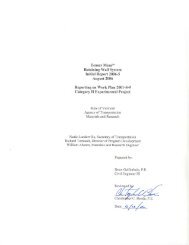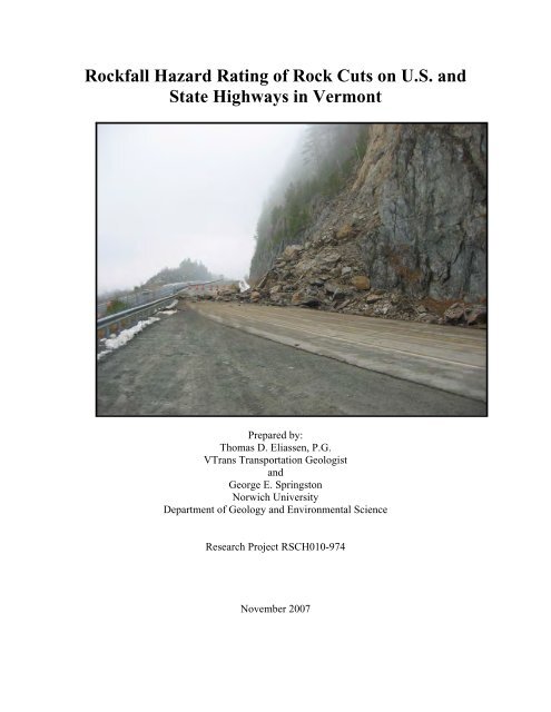
Rockfall Hazard Rating of Rock Cuts on U.S. and State Highways in ...
Rockfall Hazard Rating of Rock Cuts on U.S. and State Highways in ...
Rockfall Hazard Rating of Rock Cuts on U.S. and State Highways in ...

You also want an ePaper? Increase the reach of your titles
YUMPU automatically turns print PDFs into web optimized ePapers that Google loves.
<str<strong>on</strong>g><str<strong>on</strong>g>Rock</str<strong>on</strong>g>fall</str<strong>on</strong>g> <str<strong>on</strong>g>Hazard</str<strong>on</strong>g> <str<strong>on</strong>g>Rat<strong>in</strong>g</str<strong>on</strong>g> <str<strong>on</strong>g>of</str<strong>on</strong>g> <str<strong>on</strong>g>Rock</str<strong>on</strong>g> <str<strong>on</strong>g>Cuts</str<strong>on</strong>g> <strong>on</strong> U.S. <strong>and</strong><br />
<strong>State</strong> <strong>Highways</strong> <strong>in</strong> Verm<strong>on</strong>t<br />
Prepared by:<br />
Thomas D. Eliassen, P.G.<br />
VTrans Transportati<strong>on</strong> Geologist<br />
<strong>and</strong><br />
George E. Spr<strong>in</strong>gst<strong>on</strong><br />
Norwich University<br />
Department <str<strong>on</strong>g>of</str<strong>on</strong>g> Geology <strong>and</strong> Envir<strong>on</strong>mental Science<br />
Research Project RSCH010-974<br />
November 2007
1. Report No.<br />
2007-16<br />
2. Government Accessi<strong>on</strong> No. 3. Recipient's Catalog No.<br />
4. Title <strong>and</strong> Subtitle<br />
ROCKFALL HAZARD RATING OF ROCK CUTS ON U.S.<br />
AND STATE HIGHWAYS IN VERMONT<br />
7. Author(s)<br />
THOMAS D. ELIASSEN AND GEORGE E. SPRINGSTON<br />
5. Report Date<br />
November 13, 2007<br />
6. Perform<strong>in</strong>g Organizati<strong>on</strong> Code<br />
8. Perform<strong>in</strong>g Organizati<strong>on</strong> Report<br />
No.<br />
9. Perform<strong>in</strong>g Organizati<strong>on</strong> Name <strong>and</strong> Address<br />
VERMONT AGENCY OF TRANSPORTATION<br />
1 NATIONAL LIFE DRIVE<br />
MONTPELIER, VERMONT 05633<br />
12. Sp<strong>on</strong>sor<strong>in</strong>g Agency Name <strong>and</strong> Address<br />
VERMONT AGENCY OF TRANSPORTATION<br />
1 NATIONAL LIFE DRIVE<br />
MONTPELIER, VERMONT 05633<br />
10. Work Unit No.<br />
11. C<strong>on</strong>tract or Grant No.<br />
RSCH010-974<br />
13. Type <str<strong>on</strong>g>of</str<strong>on</strong>g> Report <strong>and</strong> Period<br />
Covered<br />
14. Sp<strong>on</strong>sor<strong>in</strong>g Agency Code<br />
15. Supplementary Notes<br />
16. Abstract<br />
Highway c<strong>on</strong>structi<strong>on</strong> across the rugged topography <str<strong>on</strong>g>of</str<strong>on</strong>g> Verm<strong>on</strong>t has required the excavati<strong>on</strong> <str<strong>on</strong>g>of</str<strong>on</strong>g> numerous rock cuts, many <str<strong>on</strong>g>of</str<strong>on</strong>g> which extend<br />
for over <strong>on</strong>e thous<strong>and</strong> feet <strong>and</strong> are comm<strong>on</strong>ly fifty to over <strong>on</strong>e hundred feet <strong>in</strong> height. Each year, the comb<strong>in</strong>ati<strong>on</strong> <str<strong>on</strong>g>of</str<strong>on</strong>g> steep slopes, adverse<br />
geologic structures, <strong>and</strong> <strong>on</strong>go<strong>in</strong>g weather<strong>in</strong>g processes leads to rockfall events. As those reach<strong>in</strong>g the highway may pose a hazard to<br />
travelers <strong>and</strong> are very expensive to clean up, a rockfall hazard rat<strong>in</strong>g system has been developed to enable the Verm<strong>on</strong>t Agency <str<strong>on</strong>g>of</str<strong>on</strong>g><br />
Transportati<strong>on</strong> (VTrans) to prioritize limited program <strong>and</strong> ma<strong>in</strong>tenance funds to address these hazards. The system is modified from <strong>on</strong>e<br />
developed by the Federal Highway Adm<strong>in</strong>istrati<strong>on</strong> (FHWA) <strong>and</strong> other DOTs.<br />
A prelim<strong>in</strong>ary field survey <str<strong>on</strong>g>of</str<strong>on</strong>g> all Interstate, U.S., <strong>and</strong> <strong>State</strong> highways <strong>in</strong> Verm<strong>on</strong>t identified over 3,600 rock cuts greater than five feet <strong>in</strong><br />
height. Based <strong>on</strong> roadway <strong>and</strong> geological characteristics <strong>and</strong> known rockfall history, 76% were ranked as low hazard (rockfall not likely),<br />
8% as moderate (slight chance <str<strong>on</strong>g>of</str<strong>on</strong>g> rockfall that reaches road), 10% as elevated (rockfall possible <strong>and</strong> may reach road), 2% as significant<br />
(rockfall likely <strong>and</strong> may reach road), <strong>and</strong> 4% as high (rockfall expected to occur <strong>and</strong> to reach road).<br />
Detailed rat<strong>in</strong>gs <str<strong>on</strong>g>of</str<strong>on</strong>g> “A” ranked high hazard cuts have been completed based <strong>on</strong> height <strong>and</strong> length <str<strong>on</strong>g>of</str<strong>on</strong>g> rock slope, ditch effectiveness, speed<br />
limit, traffic count, sight distance, road width, water/ice c<strong>on</strong>diti<strong>on</strong>s, known rockfall history, <strong>and</strong> geologic factors. Geologic factors <strong>in</strong>clude<br />
rock type, disc<strong>on</strong>t<strong>in</strong>uity characteristics (orientati<strong>on</strong>, length, spac<strong>in</strong>g, openness, roughness, wetness, <strong>and</strong> <strong>in</strong>fill<strong>in</strong>g <str<strong>on</strong>g>of</str<strong>on</strong>g> jo<strong>in</strong>ts <strong>and</strong> faults), block<br />
size, <strong>and</strong> volume <str<strong>on</strong>g>of</str<strong>on</strong>g> rockfall. Field work <strong>in</strong>cluded slope pr<str<strong>on</strong>g>of</str<strong>on</strong>g>iles <strong>and</strong> prelim<strong>in</strong>ary remediati<strong>on</strong> estimates.<br />
Data for the high hazard rock slopes was entered <strong>in</strong>to spreadsheets <strong>in</strong> the field, transferred to a database <strong>and</strong> <strong>in</strong>corporated <strong>in</strong>to a GIS based<br />
system. A scor<strong>in</strong>g scheme modified from the FHWA system was used to produce a numerical estimate <str<strong>on</strong>g>of</str<strong>on</strong>g> the overall hazard posed by each<br />
slope. High hazard slopes will be periodically resurveyed by VTrans to track deteriorati<strong>on</strong> <strong>and</strong> emerg<strong>in</strong>g hazards.<br />
17. Key Words<br />
<str<strong>on</strong>g><str<strong>on</strong>g>Rock</str<strong>on</strong>g>fall</str<strong>on</strong>g> <str<strong>on</strong>g>Hazard</str<strong>on</strong>g> <str<strong>on</strong>g>Rat<strong>in</strong>g</str<strong>on</strong>g> System, RHRS,<br />
<str<strong>on</strong>g><str<strong>on</strong>g>Rock</str<strong>on</strong>g>fall</str<strong>on</strong>g>, Safety, Mitigati<strong>on</strong>, <str<strong>on</strong>g>Rock</str<strong>on</strong>g> Slope<br />
Stability, <str<strong>on</strong>g>Hazard</str<strong>on</strong>g>, Verm<strong>on</strong>t<br />
18. Distributi<strong>on</strong> <strong>State</strong>ment<br />
No Restricti<strong>on</strong>s<br />
19. Security Classif. (<str<strong>on</strong>g>of</str<strong>on</strong>g> this report) 20. Security Classif. (<str<strong>on</strong>g>of</str<strong>on</strong>g> this page) 21. No.<str<strong>on</strong>g>of</str<strong>on</strong>g> Pages<br />
31<br />
22. Price<br />
i
DISCLAIMER<br />
The c<strong>on</strong>tents <str<strong>on</strong>g>of</str<strong>on</strong>g> this report reflect the views <str<strong>on</strong>g>of</str<strong>on</strong>g> the authors who are resp<strong>on</strong>sible for the<br />
facts <strong>and</strong> the accuracy <str<strong>on</strong>g>of</str<strong>on</strong>g> the data presented here<strong>in</strong>. The c<strong>on</strong>tents do not necessarily<br />
reflect the <str<strong>on</strong>g>of</str<strong>on</strong>g>ficial views or policies <str<strong>on</strong>g>of</str<strong>on</strong>g> the Verm<strong>on</strong>t Agency <str<strong>on</strong>g>of</str<strong>on</strong>g> Transportati<strong>on</strong> or the<br />
Federal Highway Adm<strong>in</strong>istrati<strong>on</strong> at the time <str<strong>on</strong>g>of</str<strong>on</strong>g> this publicati<strong>on</strong>. This report does not<br />
c<strong>on</strong>stitute a st<strong>and</strong>ard, specificati<strong>on</strong> or regulati<strong>on</strong>.<br />
ACKNOWLEDGEMENT<br />
This project was approved by the Verm<strong>on</strong>t Agency <str<strong>on</strong>g>of</str<strong>on</strong>g> Transportati<strong>on</strong> Research Advisory<br />
Council <strong>and</strong> was funded as part <str<strong>on</strong>g>of</str<strong>on</strong>g> the <strong>State</strong> Plann<strong>in</strong>g <strong>and</strong> Research, Research <strong>and</strong><br />
Development Work Program <strong>in</strong> cooperati<strong>on</strong> with the Federal Highway Adm<strong>in</strong>istrati<strong>on</strong>.<br />
The authors would like to thank The Verm<strong>on</strong>t Geological Survey for assistance <strong>in</strong> the<br />
collecti<strong>on</strong> <strong>and</strong> compilati<strong>on</strong> <str<strong>on</strong>g>of</str<strong>on</strong>g> the volumes <str<strong>on</strong>g>of</str<strong>on</strong>g> data it took to develop this database,<br />
VTrans summer <strong>in</strong>tern Nicole Crum for her assistance <strong>in</strong> develop<strong>in</strong>g the RHRS database,<br />
Stephanie Magnan <strong>and</strong> Rick Scott <str<strong>on</strong>g>of</str<strong>on</strong>g> VTrans for their help <strong>and</strong> guidance for organizati<strong>on</strong><br />
<str<strong>on</strong>g>of</str<strong>on</strong>g> the database <strong>and</strong> GIS capabilities, <strong>and</strong> each <str<strong>on</strong>g>of</str<strong>on</strong>g> the VTrans Ma<strong>in</strong>tenance Districts for<br />
their <strong>in</strong>put <strong>and</strong> underst<strong>and</strong><strong>in</strong>g <str<strong>on</strong>g>of</str<strong>on</strong>g> the historical occurrence <str<strong>on</strong>g>of</str<strong>on</strong>g> rockfalls <strong>in</strong> the <strong>State</strong> <str<strong>on</strong>g>of</str<strong>on</strong>g><br />
Verm<strong>on</strong>t.<br />
ii
TABLE OF CONTENTS<br />
ABSTRACT .................................................................................................................................................. 1<br />
INTRODUCTION ........................................................................................................................................ 1<br />
ROCK SLOPE INVESTIGATIVE HISTORY.......................................................................................... 3<br />
GEOLOGIC SETTING ............................................................................................................................... 4<br />
OBJECTIVE AND SCOPE ......................................................................................................................... 6<br />
METHODOLOGY....................................................................................................................................... 7<br />
DEVELOPMENT OF ELECTRONIC DATABASE STRUCTURE ...................................................... 7<br />
TRAINING OF INDIVIDUALS IN RHRS RANKING/RATING<br />
METHODS.................................................................................................................................................... 7<br />
PRELIMINARY RANKING AND FIELD CRITERIA ........................................................................... 8<br />
DETAILED RATING ................................................................................................................................ 10<br />
GENERAL CUT INFORMATION FORM..................................................................................................... 10<br />
ROADWAY INFORMATION FORM............................................................................................................ 11<br />
SLOPE INFORMATION FORM .................................................................................................................. 12<br />
GEOLOGIC INFORMATION FORM ........................................................................................................... 13<br />
HISTORICAL INFORMATION FORM ........................................................................................................ 16<br />
MITIGATION OPTIONS FORM ................................................................................................................. 17<br />
DATA MANAGEMENT AND REPORTING......................................................................................... 17<br />
PRELIMINARY RANKING......................................................................................................................... 17<br />
DETAILED RATING.................................................................................................................................. 18<br />
RHRS SCORING PROCESS....................................................................................................................... 19<br />
DEVELOPMENT OF PRELIMINARY MITIGATION ALTERNATIVES AND COST ESTIMATES .................... 26<br />
GEOSPATIAL DATA MANAGEMENT........................................................................................................ 27<br />
CONCLUSION........................................................................................................................................... 30<br />
REFERENCES ........................................................................................................................................... 31<br />
FIGURE 1 ROCKFALL ON VT ROUTE 5A IN WESTMORE, VERMONT.......................................................... 2<br />
FIGURE 2 GENERALIZED GEOLOGIC BEDROCK MAP OF THE STATE OF VERMONT.................................. 4<br />
FIGURE 3 VERMONT PHYSIOGRAPHIC PROVINCES. .................................................................................... 5<br />
FIGURE 4 PRELIMINARY RANKING WORKSHEET........................................................................................ 8<br />
FIGURE 5 PROFILE OF ROCK CUT 0010 ..................................................................................................... 13<br />
FIGURE 6 STEREOGRAPHIC PROJECTION TECHNIQUE (MODIFIED FROM WATTS 2003). ....................... 15<br />
FIGURE 7 MARKLAND TEST PLOT SHOWING POTENTIAL PLANE, WEDGE AND TOPPLING FAILURES...... 16<br />
FIGURE 8 GRAPHICAL DEPICTION OF RHRS RANKING ............................................................................ 17<br />
FIGURE 9 EXAMPLE MICROSOFT ACCESS INPUT FORM ............................................................................ 18<br />
FIGURE 10 COMPLETED RHRS SCORING FORM FOR CUT 0001............................................................... 19<br />
FIGURE 11 DISTRIBUTION OF RHRS TOTAL SCORES ............................................................................... 24<br />
FIGURE 12 DISTRIBUTION OF ROCK CUTS................................................................................................. 28<br />
FIGURE 13 ROCK CUTS IN MONTPELIER AREA......................................................................................... 29<br />
TABLE 1 DISCONTINUITY PROPERTIES....................................................................................................... 14<br />
TABLE 2 NUMERICAL DISTRIBUTION OF RHRS RANKING........................................................................ 18<br />
TABLE 3 LIST OF A RANKED ROCK CUTS.................................................................................................. 26<br />
APPENDIX A<br />
APPENDIX B<br />
APPENDIX C<br />
Prelim<strong>in</strong>ary Rank<strong>in</strong>g Sheets - All <str<strong>on</strong>g>Rock</str<strong>on</strong>g> <str<strong>on</strong>g>Cuts</str<strong>on</strong>g><br />
Summary List <str<strong>on</strong>g>of</str<strong>on</strong>g> “A” Ranked <str<strong>on</strong>g>Rock</str<strong>on</strong>g> <str<strong>on</strong>g>Cuts</str<strong>on</strong>g><br />
Summary Sheets <strong>and</strong> Prelim<strong>in</strong>ary Cost Estimati<strong>on</strong> – <str<strong>on</strong>g>Rock</str<strong>on</strong>g> <str<strong>on</strong>g>Cuts</str<strong>on</strong>g> Rated With Scores<br />
Greater Than 500<br />
iii
ABSTRACT<br />
Highway c<strong>on</strong>structi<strong>on</strong> across the rugged topography <str<strong>on</strong>g>of</str<strong>on</strong>g> Verm<strong>on</strong>t has required the<br />
excavati<strong>on</strong> <str<strong>on</strong>g>of</str<strong>on</strong>g> numerous rock cuts, many <str<strong>on</strong>g>of</str<strong>on</strong>g> which extend for over <strong>on</strong>e thous<strong>and</strong> feet <strong>and</strong><br />
are comm<strong>on</strong>ly fifty to over <strong>on</strong>e hundred feet <strong>in</strong> height. Each year, the comb<strong>in</strong>ati<strong>on</strong> <str<strong>on</strong>g>of</str<strong>on</strong>g><br />
steep slopes, adverse geologic structures, <strong>and</strong> <strong>on</strong>go<strong>in</strong>g weather<strong>in</strong>g processes leads to<br />
rockfall events. As rock reach<strong>in</strong>g the highway may pose a hazard to travelers <strong>and</strong> are<br />
very expensive to clean up, a rockfall hazard rat<strong>in</strong>g system has been developed to enable<br />
the Verm<strong>on</strong>t Agency <str<strong>on</strong>g>of</str<strong>on</strong>g> Transportati<strong>on</strong> (VTrans) to prioritize limited program <strong>and</strong><br />
ma<strong>in</strong>tenance funds to address these hazards. The system is modified from <strong>on</strong>e developed<br />
by the Federal Highway Adm<strong>in</strong>istrati<strong>on</strong> (FHWA) <strong>and</strong> other DOTs.<br />
A prelim<strong>in</strong>ary field survey <str<strong>on</strong>g>of</str<strong>on</strong>g> all Interstate, U.S., <strong>and</strong> <strong>State</strong> highways <strong>in</strong> Verm<strong>on</strong>t<br />
identified over 3,600 rock cuts greater than five feet <strong>in</strong> height. Based <strong>on</strong> roadway <strong>and</strong><br />
geological characteristics <strong>and</strong> known rockfall history, 76% were ranked as low hazard<br />
(rockfall not likely), 8% as moderate (slight chance <str<strong>on</strong>g>of</str<strong>on</strong>g> rockfall that reaches road), 10%<br />
as elevated (rockfall possible <strong>and</strong> may reach road), 2% as significant (rockfall likely <strong>and</strong><br />
may reach road), <strong>and</strong> 4% as high (rockfall expected to occur <strong>and</strong> to reach road).<br />
Detailed rat<strong>in</strong>gs <str<strong>on</strong>g>of</str<strong>on</strong>g> “A” ranked high hazard cuts have been completed based <strong>on</strong> height<br />
<strong>and</strong> length <str<strong>on</strong>g>of</str<strong>on</strong>g> rock slope, ditch effectiveness, speed limit, traffic count, sight distance,<br />
road width, water/ice c<strong>on</strong>diti<strong>on</strong>s, known rockfall history, <strong>and</strong> geologic factors. Geologic<br />
factors <strong>in</strong>clude rock type, disc<strong>on</strong>t<strong>in</strong>uity characteristics (orientati<strong>on</strong>, length, spac<strong>in</strong>g,<br />
openness, roughness, wetness, <strong>and</strong> <strong>in</strong>fill<strong>in</strong>g <str<strong>on</strong>g>of</str<strong>on</strong>g> jo<strong>in</strong>ts <strong>and</strong> faults), block size, <strong>and</strong> volume <str<strong>on</strong>g>of</str<strong>on</strong>g><br />
rockfall. Field work <strong>in</strong>cluded slope pr<str<strong>on</strong>g>of</str<strong>on</strong>g>iles <strong>and</strong> prelim<strong>in</strong>ary remediati<strong>on</strong> estimates.<br />
Data for the high hazard rock slopes was entered <strong>in</strong>to spreadsheets <strong>in</strong> the field,<br />
transferred to a database <strong>and</strong> <strong>in</strong>corporated <strong>in</strong>to a GIS based system. A scor<strong>in</strong>g scheme<br />
modified from the FHWA system was used to produce a numerical estimate <str<strong>on</strong>g>of</str<strong>on</strong>g> the overall<br />
hazard posed by each slope. High hazard slopes will be periodically resurveyed by<br />
VTrans to track deteriorati<strong>on</strong> <strong>and</strong> emerg<strong>in</strong>g hazards.<br />
INTRODUCTION<br />
Verm<strong>on</strong>t, as its very name implies, is a mounta<strong>in</strong>ous state. Verm<strong>on</strong>t’s highways traverse<br />
some topographically challeng<strong>in</strong>g terra<strong>in</strong> that, <strong>in</strong> many cases, required the c<strong>on</strong>structi<strong>on</strong> <str<strong>on</strong>g>of</str<strong>on</strong>g><br />
significant rock cuts. Many <str<strong>on</strong>g>of</str<strong>on</strong>g> the <strong>State</strong>’s rock cuts were c<strong>on</strong>structed us<strong>in</strong>g unc<strong>on</strong>trolled<br />
blast<strong>in</strong>g techniques result<strong>in</strong>g <strong>in</strong> slopes that are uneven <strong>and</strong> c<strong>on</strong>ta<strong>in</strong> numerous weak areas.<br />
Even slopes cut utiliz<strong>in</strong>g newer pre-split blast<strong>in</strong>g techniques deteriorate over time as a<br />
c<strong>on</strong>sequence <str<strong>on</strong>g>of</str<strong>on</strong>g> Verm<strong>on</strong>t’s harsh northern climate. This climate is typified by periods <str<strong>on</strong>g>of</str<strong>on</strong>g><br />
significant precipitati<strong>on</strong> events <strong>and</strong> very cold temperatures dur<strong>in</strong>g the w<strong>in</strong>ter m<strong>on</strong>ths<br />
result<strong>in</strong>g <strong>in</strong> numerous freeze-thaw cycles that act to deteriorate Verm<strong>on</strong>t’s ag<strong>in</strong>g rock<br />
cuts <strong>and</strong>, c<strong>on</strong>sequently, areas <str<strong>on</strong>g>of</str<strong>on</strong>g> high risk for rockfalls develop.<br />
1
<str<strong>on</strong>g>Rock</str<strong>on</strong>g> slopes al<strong>on</strong>g Verm<strong>on</strong>t’s highways were designed <strong>and</strong> c<strong>on</strong>structed by the Agency <str<strong>on</strong>g>of</str<strong>on</strong>g><br />
Transportati<strong>on</strong> (VTrans) <strong>and</strong>, just like bridges, pavements, <strong>and</strong> other transportati<strong>on</strong><br />
<strong>in</strong>frastructure, these cuts require ma<strong>in</strong>tenance to allow them to perform as designed.<br />
Bridges are <strong>in</strong>spected <strong>on</strong> a regular basis <strong>and</strong> well planned ma<strong>in</strong>tenance programs exist to<br />
properly ma<strong>in</strong>ta<strong>in</strong> these structures. The bridge <strong>in</strong>specti<strong>on</strong> program also allows VTrans to<br />
prioritize enhancements designed to make these structures safer for the travel<strong>in</strong>g public.<br />
A similar program would benefit Verm<strong>on</strong>t’s ag<strong>in</strong>g rock cuts.<br />
As rockfalls occur, VTrans is <str<strong>on</strong>g>of</str<strong>on</strong>g>ten faced with correct<strong>in</strong>g these problems <strong>on</strong>-the-fly <strong>and</strong><br />
without specific budgets to pay for the work. Funds end up com<strong>in</strong>g from <strong>in</strong>dividual<br />
Ma<strong>in</strong>tenance District budgets that are usually stra<strong>in</strong>ed to beg<strong>in</strong> with. As a result,<br />
temporary soluti<strong>on</strong>s are <str<strong>on</strong>g>of</str<strong>on</strong>g>ten accepted <strong>in</strong> attempts to keep expenses low. This m<strong>in</strong>imal<br />
effort may <str<strong>on</strong>g>of</str<strong>on</strong>g>fer risk reducti<strong>on</strong> <strong>in</strong> the short term, however with<strong>in</strong> a few years the risk has<br />
<strong>in</strong>creased aga<strong>in</strong> as the slope c<strong>on</strong>t<strong>in</strong>ues to degrade. In <strong>in</strong>stances where extensive<br />
remediati<strong>on</strong> may be required, lack <str<strong>on</strong>g>of</str<strong>on</strong>g> fund<strong>in</strong>g <str<strong>on</strong>g>of</str<strong>on</strong>g>ten results <strong>in</strong> delayed acti<strong>on</strong>.<br />
Deferred ma<strong>in</strong>tenance <strong>on</strong> these particular assets al<strong>on</strong>g VTrans right <str<strong>on</strong>g>of</str<strong>on</strong>g> ways can result <strong>in</strong><br />
rockfalls <strong>and</strong> c<strong>on</strong>sequent hazards. <str<strong>on</strong>g>Rock</str<strong>on</strong>g>s can fall <strong>on</strong>to highways (Figure 1) <strong>and</strong> it is the<br />
<strong>State</strong>’s goal to assure the travel<strong>in</strong>g public is protected resp<strong>on</strong>sibly. The Agency has<br />
embarked <strong>on</strong> a comprehensive evaluati<strong>on</strong> <str<strong>on</strong>g>of</str<strong>on</strong>g> all rock cuts al<strong>on</strong>g <strong>State</strong>, Interstate, <strong>and</strong> U.S.<br />
highways so that it may effectively identify appropriate mitigative measures for<br />
potentially dangerous slopes. This has been accomplished through a numerical rat<strong>in</strong>g<br />
system that has allowed the <strong>State</strong> to prioritize slopes <strong>and</strong> allocate limited funds <strong>in</strong> a<br />
resp<strong>on</strong>sible manner.<br />
Figure 1 <str<strong>on</strong>g><str<strong>on</strong>g>Rock</str<strong>on</strong>g>fall</str<strong>on</strong>g> <strong>on</strong> VT Route 5A <strong>in</strong> Westmore, Verm<strong>on</strong>t<br />
The <str<strong>on</strong>g><str<strong>on</strong>g>Rock</str<strong>on</strong>g>fall</str<strong>on</strong>g> <str<strong>on</strong>g>Hazard</str<strong>on</strong>g> <str<strong>on</strong>g>Rat<strong>in</strong>g</str<strong>on</strong>g> System (RHRS), developed by the Federal Highway<br />
Adm<strong>in</strong>istrati<strong>on</strong> (FHWA) <strong>and</strong> Oreg<strong>on</strong> DOT is recognized as the st<strong>and</strong>ard by which other<br />
states <strong>and</strong> foreign countries have been rank<strong>in</strong>g their slopes. The purpose <str<strong>on</strong>g>of</str<strong>on</strong>g> the RHRS<br />
system is to provide a prioritizati<strong>on</strong> for the prudent allocati<strong>on</strong> <str<strong>on</strong>g>of</str<strong>on</strong>g> available fund<strong>in</strong>g to<br />
address the potentially most dangerous highway rock faces. In many cases, the system<br />
2
has been modified to reflect c<strong>on</strong>diti<strong>on</strong>s unique or more representative <str<strong>on</strong>g>of</str<strong>on</strong>g> geographic,<br />
geologic or traffic c<strong>on</strong>diti<strong>on</strong>s. In an <strong>in</strong>formal survey <str<strong>on</strong>g>of</str<strong>on</strong>g> other states, it was found that 20<br />
states have performed some variant <str<strong>on</strong>g>of</str<strong>on</strong>g> the FHWA/Oreg<strong>on</strong> rockfall rat<strong>in</strong>g system, have<br />
established a data base <str<strong>on</strong>g>of</str<strong>on</strong>g> rock cuts, <strong>and</strong> m<strong>on</strong>itor these slopes <strong>on</strong> some sort <str<strong>on</strong>g>of</str<strong>on</strong>g> regular<br />
basis. Border<strong>in</strong>g states New York <strong>and</strong> New Hampshire have such programs. Canada,<br />
Japan, Switzerl<strong>and</strong>, Italy, <strong>and</strong> the United K<strong>in</strong>gdom have also established similar<br />
programs.<br />
ROCK SLOPE INVESTIGATIVE HISTORY<br />
In 1977, former Verm<strong>on</strong>t Chief Transportati<strong>on</strong> Geologist Frank Lanza <strong>and</strong> then <strong>State</strong><br />
Geologist Charles Ratte c<strong>on</strong>ducted a Phase I study <str<strong>on</strong>g>of</str<strong>on</strong>g> potential rock slide <strong>and</strong> rock fall<br />
areas al<strong>on</strong>g Verm<strong>on</strong>t’s Interstate highway system. In their study, they identified 160<br />
locati<strong>on</strong>s that were ranked from 1 to 10. In their rank<strong>in</strong>g system, 1 signified a cut with<br />
“low” potential for rockfall while a rank<strong>in</strong>g <str<strong>on</strong>g>of</str<strong>on</strong>g> 10 signified a cut with a “high” potential.<br />
Their report was used by the Agency <strong>in</strong> identify<strong>in</strong>g potential rock slope remediati<strong>on</strong><br />
locati<strong>on</strong>s <strong>in</strong> a number <str<strong>on</strong>g>of</str<strong>on</strong>g> Interstate Safety projects c<strong>on</strong>ducted <strong>in</strong> the early 1990’s that<br />
c<strong>on</strong>sisted <str<strong>on</strong>g>of</str<strong>on</strong>g> cutt<strong>in</strong>g back rock slopes 30 feet from the roadway to create wider clear<br />
z<strong>on</strong>es. The study also helped <strong>in</strong> later slope rank<strong>in</strong>g efforts <strong>on</strong> other Interstate Safety<br />
projects currently <strong>in</strong> design. Although somewhat crude by current st<strong>and</strong>ards <str<strong>on</strong>g>of</str<strong>on</strong>g> rock<br />
slope rank<strong>in</strong>g schemes, the Lanza/Ratte study proved very helpful <strong>in</strong> prioritiz<strong>in</strong>g rockfall<br />
locati<strong>on</strong>s <strong>on</strong> Verm<strong>on</strong>t’s Interstates.<br />
In 1995, work was <strong>in</strong>itiated by the Agency’s former geologist Alan McBean to identify<br />
rock cuts <strong>on</strong> <strong>State</strong> <strong>and</strong> U.S. highways that posed potential rockfall risks. This work<br />
followed the FHWA/Oreg<strong>on</strong> DOT system <strong>and</strong> although that study was not fully<br />
completed, about 360 potentially dangerous rock cuts were identified.<br />
Subsequently, <strong>in</strong> the 1990’s rock slopes al<strong>on</strong>g Interstate 91 from Hartford, Verm<strong>on</strong>t to<br />
the Canadian border <strong>and</strong> rock slopes <strong>on</strong> Interstate 93 were evaluated by a c<strong>on</strong>sultant as<br />
part <str<strong>on</strong>g>of</str<strong>on</strong>g> a number <str<strong>on</strong>g>of</str<strong>on</strong>g> Interstate safety projects. These slopes were ranked <strong>and</strong> rated us<strong>in</strong>g<br />
the FHWA/Oreg<strong>on</strong> DOT system. In additi<strong>on</strong>, the current VTrans geologist Thomas<br />
Eliassen evaluated slopes al<strong>on</strong>g Interstate 89 from Hartford to Royalt<strong>on</strong> <strong>in</strong> the 1990’s.<br />
With<strong>in</strong> the recent past, rockfall remediati<strong>on</strong> at two sites <strong>in</strong> Verm<strong>on</strong>t has cost the <strong>State</strong><br />
approximately $500,000. One site scheduled for remediati<strong>on</strong> <strong>in</strong> 2007-2008 <strong>in</strong> southern<br />
Verm<strong>on</strong>t is expected to cost over 2 milli<strong>on</strong> dollars to mitigate.<br />
By catalog<strong>in</strong>g <strong>and</strong> rank<strong>in</strong>g sites by the degree <str<strong>on</strong>g>of</str<strong>on</strong>g> risk posed, VTrans can better identify<br />
which slopes require attenti<strong>on</strong> <strong>and</strong> prospective remediati<strong>on</strong> alternatives. In additi<strong>on</strong>,<br />
associated costs can be estimated for remedial measures. In that way, the Agency can<br />
advise the Adm<strong>in</strong>istrati<strong>on</strong> <strong>and</strong> Legislature <str<strong>on</strong>g>of</str<strong>on</strong>g> the potential hazards associated with highrank<strong>in</strong>g<br />
locati<strong>on</strong>s <strong>and</strong> justify fund<strong>in</strong>g to make these locati<strong>on</strong>s safer.<br />
3
GEOLOGIC SETTING<br />
The bedrock <str<strong>on</strong>g>of</str<strong>on</strong>g> Verm<strong>on</strong>t c<strong>on</strong>sists <str<strong>on</strong>g>of</str<strong>on</strong>g> north-south belts <str<strong>on</strong>g>of</str<strong>on</strong>g> sedimentary <strong>and</strong> metamorphic<br />
rocks, with scattered igneous <strong>in</strong>trusi<strong>on</strong>s <strong>in</strong> the northeastern porti<strong>on</strong> <str<strong>on</strong>g>of</str<strong>on</strong>g> the state. A<br />
generalized geologic map is shown <strong>in</strong> Figure 2.<br />
Figure 2 Generalized Geologic Bedrock Map <str<strong>on</strong>g>of</str<strong>on</strong>g> the <strong>State</strong> <str<strong>on</strong>g>of</str<strong>on</strong>g> Verm<strong>on</strong>t<br />
Based <strong>on</strong> the bedrock compositi<strong>on</strong> <strong>and</strong> topography, the state can be subdivided <strong>in</strong>to<br />
several physiographic prov<strong>in</strong>ces (Figure 3):<br />
4
Figure 3 Verm<strong>on</strong>t Physiographic Prov<strong>in</strong>ces.<br />
The Champla<strong>in</strong> Valley c<strong>on</strong>sists <str<strong>on</strong>g>of</str<strong>on</strong>g> low-ly<strong>in</strong>g terra<strong>in</strong> underla<strong>in</strong> by Cambrian to Ordovician<br />
s<strong>and</strong>st<strong>on</strong>e, shale <strong>and</strong> carb<strong>on</strong>ate, some <str<strong>on</strong>g>of</str<strong>on</strong>g> which are weakly metamorphosed. The<br />
predom<strong>in</strong>ant bedd<strong>in</strong>g <strong>in</strong> these rocks is comm<strong>on</strong>ly shallow-dipp<strong>in</strong>g, <strong>and</strong> the high hazard<br />
rock slopes are <str<strong>on</strong>g>of</str<strong>on</strong>g>ten characterized by plane <strong>and</strong> wedge failures.<br />
The Verm<strong>on</strong>t Valley <str<strong>on</strong>g>of</str<strong>on</strong>g> southwestern Verm<strong>on</strong>t is narrow lowl<strong>and</strong> between the Tac<strong>on</strong>ic<br />
Mounta<strong>in</strong>s <strong>and</strong> the Green Mounta<strong>in</strong>s. It is underla<strong>in</strong> by Cambrian to Ordovician marble<br />
<strong>and</strong> quartzite. Wedge failures <strong>and</strong> planar block slides are the most comm<strong>on</strong> modes <str<strong>on</strong>g>of</str<strong>on</strong>g><br />
failure <strong>in</strong> this prov<strong>in</strong>ce.<br />
In the Tac<strong>on</strong>ic Mounta<strong>in</strong>s <str<strong>on</strong>g>of</str<strong>on</strong>g> southwestern Verm<strong>on</strong>t the underly<strong>in</strong>g rocks are mostly slate<br />
<strong>and</strong> argillite with lesser amounts <str<strong>on</strong>g>of</str<strong>on</strong>g> s<strong>and</strong>st<strong>on</strong>e <strong>and</strong> carb<strong>on</strong>ate. Although metamorphic<br />
grades are low, the str<strong>on</strong>g, <strong>and</strong> comm<strong>on</strong>ly steeply-dipp<strong>in</strong>g slatey cleavage results <strong>in</strong><br />
severe planar slides <strong>and</strong> topples at the high hazard sites.<br />
5
The Green Mounta<strong>in</strong>s prov<strong>in</strong>ce c<strong>on</strong>ta<strong>in</strong>s Verm<strong>on</strong>t’s highest peaks <strong>and</strong> c<strong>on</strong>sists <str<strong>on</strong>g>of</str<strong>on</strong>g><br />
erosi<strong>on</strong>- resistant low-to medium-grade metamorphic rocks <str<strong>on</strong>g>of</str<strong>on</strong>g> widely vary<strong>in</strong>g ages (Late<br />
Precambrian to Ordovician.) <str<strong>on</strong>g>Rock</str<strong>on</strong>g> types <strong>in</strong>clude gneiss, schist, amphibolite, quartzite,<br />
marble, greenst<strong>on</strong>e <strong>and</strong> ultramafics. A large percentage <str<strong>on</strong>g>of</str<strong>on</strong>g> the high hazard sites <strong>in</strong> this<br />
prov<strong>in</strong>ce exhibit toppl<strong>in</strong>g failure features as well as plane failures.<br />
The rocks <str<strong>on</strong>g>of</str<strong>on</strong>g> the Verm<strong>on</strong>t Piedm<strong>on</strong>t c<strong>on</strong>sist <str<strong>on</strong>g>of</str<strong>on</strong>g> low-to medium-grade Silurian to<br />
Dev<strong>on</strong>ian metamorphic rocks <strong>and</strong> scattered granitic <strong>in</strong>trusi<strong>on</strong>s. The most comm<strong>on</strong> rock<br />
types are impure marble (calcareous granulite), phyllite, schist, quartzite <strong>and</strong> amphibolite.<br />
<str<strong>on</strong>g>Rock</str<strong>on</strong>g> slope failure types <strong>in</strong> this prov<strong>in</strong>ce are comm<strong>on</strong>ly toppl<strong>in</strong>g, plane, <strong>and</strong> wedge<br />
failures. The abundant failures al<strong>on</strong>g I-91 are comm<strong>on</strong>ly the result <str<strong>on</strong>g>of</str<strong>on</strong>g> highway cuts that<br />
run parallel to the steeply dipp<strong>in</strong>g foliati<strong>on</strong>.<br />
The Northeastern Highl<strong>and</strong>s are underla<strong>in</strong> by Dev<strong>on</strong>ian granitic bodies <strong>and</strong> c<strong>on</strong>t<strong>in</strong>uati<strong>on</strong>s<br />
<str<strong>on</strong>g>of</str<strong>on</strong>g> the metamorphic rocks <str<strong>on</strong>g>of</str<strong>on</strong>g> the Verm<strong>on</strong>t Piedm<strong>on</strong>t. The high rockfall hazards <strong>in</strong> this<br />
prov<strong>in</strong>ce are limited to the falls <strong>and</strong> slides <strong>on</strong>to Route 5A <strong>in</strong> Westmore from the south<br />
face <str<strong>on</strong>g>of</str<strong>on</strong>g> Mount Pisgah.<br />
OBJECTIVE AND SCOPE<br />
The objective <str<strong>on</strong>g>of</str<strong>on</strong>g> this project was to develop a rock cut data base <strong>and</strong> c<strong>on</strong>duct a <str<strong>on</strong>g><str<strong>on</strong>g>Rock</str<strong>on</strong>g>fall</str<strong>on</strong>g><br />
<str<strong>on</strong>g>Hazard</str<strong>on</strong>g> <str<strong>on</strong>g>Rat<strong>in</strong>g</str<strong>on</strong>g> System survey for U.S. <strong>and</strong> <strong>State</strong> highways with<strong>in</strong> Verm<strong>on</strong>t. The RHRS<br />
survey was modified from the orig<strong>in</strong>al FHWA system based <strong>on</strong> c<strong>on</strong>diti<strong>on</strong>s unique to<br />
Verm<strong>on</strong>t. The <strong>in</strong>formati<strong>on</strong> collected for the project was gathered us<strong>in</strong>g electr<strong>on</strong>ic data<br />
storage <strong>in</strong> the field, <strong>and</strong> subsequent <strong>in</strong>corporati<strong>on</strong> <strong>in</strong>to a Geographic Informati<strong>on</strong> System<br />
(GIS). At each potential rockfall site the <strong>in</strong>vestigators exam<strong>in</strong>ed the geology, road<br />
geometrics, traffic characteristics, <strong>and</strong> rockfall/ma<strong>in</strong>tenance history.<br />
Generally, the project was organized <strong>in</strong>to the follow<strong>in</strong>g tasks:<br />
• Incorporati<strong>on</strong> <str<strong>on</strong>g>of</str<strong>on</strong>g> previously identified ranked/rated sites <strong>in</strong>to a database<br />
(Micros<str<strong>on</strong>g>of</str<strong>on</strong>g>t Access) that would be l<strong>in</strong>ked to a GIS system,<br />
• C<strong>on</strong>duct field verificati<strong>on</strong> <str<strong>on</strong>g>of</str<strong>on</strong>g> previously identified sites <strong>and</strong> identify additi<strong>on</strong>al<br />
sites where warranted,<br />
• Interview Ma<strong>in</strong>tenance District pers<strong>on</strong>nel <strong>and</strong> collect historical <strong>in</strong>formati<strong>on</strong><br />
regard<strong>in</strong>g rockfalls <strong>and</strong> ma<strong>in</strong>tenance issues related to each slope,<br />
• Perform detailed surveys <str<strong>on</strong>g>of</str<strong>on</strong>g> selected cuts <strong>and</strong> update rat<strong>in</strong>g analyses,<br />
• Prepare detailed reports, <strong>in</strong>clud<strong>in</strong>g cost estimates for remediati<strong>on</strong> <str<strong>on</strong>g>of</str<strong>on</strong>g> the highest<br />
rated slopes recommended for earliest attenti<strong>on</strong>,<br />
• Incorporate the database <strong>in</strong>to a GIS system compatible with GIS st<strong>and</strong>ards used<br />
by the <strong>State</strong> <str<strong>on</strong>g>of</str<strong>on</strong>g> Verm<strong>on</strong>t, <strong>and</strong><br />
• Establish a schedule for the re-<strong>in</strong>specti<strong>on</strong> <str<strong>on</strong>g>of</str<strong>on</strong>g> potentially hazardous slopes <strong>and</strong><br />
identify <strong>and</strong> implement modificati<strong>on</strong>s to the RHRS system if warranted.<br />
6
METHODOLOGY<br />
The Verm<strong>on</strong>t <str<strong>on</strong>g><str<strong>on</strong>g>Rock</str<strong>on</strong>g>fall</str<strong>on</strong>g> <str<strong>on</strong>g>Hazard</str<strong>on</strong>g> <str<strong>on</strong>g>Rat<strong>in</strong>g</str<strong>on</strong>g> project was performed <strong>in</strong> general accordance with<br />
procedures outl<strong>in</strong>ed <strong>and</strong> discussed <strong>in</strong> FHWA publicati<strong>on</strong>s FHWA SA-93-057 (<str<strong>on</strong>g><str<strong>on</strong>g>Rock</str<strong>on</strong>g>fall</str<strong>on</strong>g><br />
<str<strong>on</strong>g>Hazard</str<strong>on</strong>g> <str<strong>on</strong>g>Rat<strong>in</strong>g</str<strong>on</strong>g> System Participant’s Manual) <strong>and</strong> FHWA SA-93-085 (<str<strong>on</strong>g><str<strong>on</strong>g>Rock</str<strong>on</strong>g>fall</str<strong>on</strong>g> <str<strong>on</strong>g>Hazard</str<strong>on</strong>g><br />
Mitigati<strong>on</strong> Methods Participant Workbook). Verm<strong>on</strong>t’s project also benefited from<br />
techniques used by other <strong>State</strong>s. This methodology <strong>in</strong>volved gather<strong>in</strong>g previously<br />
collected <strong>in</strong>formati<strong>on</strong> <strong>on</strong> known problem slopes, a prelim<strong>in</strong>ary survey <str<strong>on</strong>g>of</str<strong>on</strong>g> all rock cuts <strong>and</strong><br />
exposures close to roadways <strong>on</strong> all Verm<strong>on</strong>t <strong>State</strong> <strong>and</strong> U.S. highways, detailed<br />
measurements <strong>and</strong> roadway <strong>in</strong>formati<strong>on</strong> <strong>on</strong> cuts ranked high <strong>on</strong> the system hierarchy<br />
(“A” ranked), evaluati<strong>on</strong> <str<strong>on</strong>g>of</str<strong>on</strong>g> a subset <str<strong>on</strong>g>of</str<strong>on</strong>g> the “A” ranked cuts <strong>and</strong> subsequent rat<strong>in</strong>g <str<strong>on</strong>g>of</str<strong>on</strong>g> each<br />
cut <strong>on</strong> a numerical system, estimati<strong>on</strong> <str<strong>on</strong>g>of</str<strong>on</strong>g> work required to mitigate rockfall hazards at<br />
each “A” ranked cuts with scores <str<strong>on</strong>g>of</str<strong>on</strong>g> 500 <strong>and</strong> greater, <strong>in</strong>corporati<strong>on</strong> <str<strong>on</strong>g>of</str<strong>on</strong>g> geospatial<br />
<strong>in</strong>formati<strong>on</strong> <strong>on</strong> each cut, <strong>and</strong> development <str<strong>on</strong>g>of</str<strong>on</strong>g> a ma<strong>in</strong>tenance plan that would allow for the<br />
c<strong>on</strong>t<strong>in</strong>ued m<strong>on</strong>itor<strong>in</strong>g <str<strong>on</strong>g>of</str<strong>on</strong>g> cut c<strong>on</strong>diti<strong>on</strong>s to identify if acti<strong>on</strong> would be necessary to<br />
mitigate cuts <strong>in</strong> the future. The project was completed <strong>in</strong> five steps.<br />
DEVELOPMENT OF ELECTRONIC DATABASE STRUCTURE<br />
Dur<strong>in</strong>g this step, various opti<strong>on</strong>s for electr<strong>on</strong>ic collecti<strong>on</strong> <str<strong>on</strong>g>of</str<strong>on</strong>g> field data were evaluated.<br />
Potential opti<strong>on</strong>s c<strong>on</strong>sidered were Pers<strong>on</strong>al Digital Assistant (PDA) devices with <strong>in</strong>put<br />
form similar to those used by the <strong>State</strong> <str<strong>on</strong>g>of</str<strong>on</strong>g> Tennessee <strong>in</strong> their RHRS study, Micros<str<strong>on</strong>g>of</str<strong>on</strong>g>t<br />
Excel spreadsheets <strong>and</strong> direct <strong>in</strong>put <strong>in</strong>to Micros<str<strong>on</strong>g>of</str<strong>on</strong>g>t Access both rely<strong>in</strong>g <strong>on</strong> portable<br />
pers<strong>on</strong>al computers. A comb<strong>in</strong>ati<strong>on</strong> <str<strong>on</strong>g>of</str<strong>on</strong>g> Excel <strong>and</strong> Access <strong>in</strong>put were used for this project.<br />
Because there were few people gather<strong>in</strong>g project <strong>in</strong>formati<strong>on</strong> (<strong>on</strong>e lead <strong>in</strong>vestigator, <strong>on</strong>e<br />
senior <strong>in</strong>vestigator <strong>and</strong> two field <strong>in</strong>vestigators) this simple method <str<strong>on</strong>g>of</str<strong>on</strong>g> data compilati<strong>on</strong><br />
proved both adequate <strong>and</strong> accurate.<br />
TRAINING OF INDIVIDUALS IN RHRS RANKING/RATING<br />
METHODS<br />
The authors believe that although the RHRS process appears <strong>on</strong> the surface <strong>on</strong>ly to<br />
require the simple collecti<strong>on</strong> <str<strong>on</strong>g>of</str<strong>on</strong>g> field data necessary for <strong>in</strong>put, it is imperative that<br />
pr<str<strong>on</strong>g>of</str<strong>on</strong>g>essi<strong>on</strong>al judgment be applied by <strong>in</strong>dividuals that have the necessary eng<strong>in</strong>eer<strong>in</strong>g<br />
geologic experience.<br />
The lead <strong>in</strong>vestigator was an experienced geologist with over 29 years <str<strong>on</strong>g>of</str<strong>on</strong>g> pr<str<strong>on</strong>g>of</str<strong>on</strong>g>essi<strong>on</strong>al<br />
experience, 11 <str<strong>on</strong>g>of</str<strong>on</strong>g> which <strong>in</strong>cluded evaluat<strong>in</strong>g rock slope stability issues. The senior<br />
<strong>in</strong>vestigator has been practic<strong>in</strong>g geology for 24 years <strong>and</strong> has c<strong>on</strong>ducted numerous<br />
<strong>in</strong>vestigati<strong>on</strong>s <strong>and</strong> mapp<strong>in</strong>g projects <strong>in</strong> Verm<strong>on</strong>t. Collecti<strong>on</strong> <str<strong>on</strong>g>of</str<strong>on</strong>g> field data for the<br />
prelim<strong>in</strong>ary rank<strong>in</strong>g porti<strong>on</strong> <str<strong>on</strong>g>of</str<strong>on</strong>g> the project c<strong>on</strong>sisted <str<strong>on</strong>g>of</str<strong>on</strong>g> 2 two pers<strong>on</strong> teams (<strong>on</strong>e senior<br />
geologist <strong>and</strong> <strong>on</strong>e junior geologist). Dur<strong>in</strong>g the detailed “A” cut data collecti<strong>on</strong> phase,<br />
field data was collected generally by a three pers<strong>on</strong> crew.<br />
7
The lead <strong>and</strong> senior <strong>in</strong>vestigators attended the NHI <str<strong>on</strong>g>Rock</str<strong>on</strong>g> Slopes tra<strong>in</strong><strong>in</strong>g course No.<br />
13235 – Module 5 presented <strong>in</strong> 2005 <strong>in</strong> C<strong>on</strong>cord, New Hampshire by Duncan Wiley <strong>and</strong><br />
Norm Norrish <str<strong>on</strong>g>of</str<strong>on</strong>g> Wyllie & Norrish <str<strong>on</strong>g>Rock</str<strong>on</strong>g> Eng<strong>in</strong>eers. The lead <strong>and</strong> senior <strong>in</strong>vestigators <strong>in</strong><br />
turn tra<strong>in</strong>ed the other <strong>in</strong>dividuals work<strong>in</strong>g <strong>on</strong> the project so that all data was collected <strong>in</strong> a<br />
c<strong>on</strong>sistent manner.<br />
PRELIMINARY RANKING AND FIELD CRITERIA<br />
A crew <str<strong>on</strong>g>of</str<strong>on</strong>g> two geologists methodically traveled all <strong>State</strong> <strong>and</strong> U.S. highways <strong>and</strong> stopped<br />
at each rock cut that was greater than five feet high. One pers<strong>on</strong> drove the vehicle while<br />
the other recorded their observati<strong>on</strong>s <strong>on</strong> a prelim<strong>in</strong>ary rank<strong>in</strong>g worksheet (Figure 4).<br />
PRELIMINARY ROCK HAZARD RANKING DATA SHEET<br />
District: _____________ Observer: _________________________________ Date: _________________<br />
DISTRICT<br />
SITE #<br />
HIGHWAY<br />
MILE MARKER<br />
TRAVEL DIR<br />
CUT LOCATION<br />
HEIGHT<br />
DITCH<br />
SLOPE TYPE<br />
RECENT<br />
ROCKFALL?<br />
WATER/ICE?<br />
RANKING<br />
PHOTO?<br />
RETURN?<br />
COMMENTS<br />
Notes: Travel Directi<strong>on</strong>: NB/SB/EB/WB. Cut NB/SB/EB/WB or median. Heights <strong>in</strong> feet. Ditch: good/ moderate/ limited/ n<strong>on</strong>e.<br />
Slope Type: blasted rock/ natural rock/ soil/ soil with boulders. Recent <str<strong>on</strong>g><str<strong>on</strong>g>Rock</str<strong>on</strong>g>fall</str<strong>on</strong>g>: yes/no. Water/Ice: yes/no.<str<strong>on</strong>g>Rat<strong>in</strong>g</str<strong>on</strong>g>: A/B+/B/B-/C. Photos: list numbers. Return: yes/no.<br />
Figure 4 Prelim<strong>in</strong>ary Rank<strong>in</strong>g Worksheet<br />
At each locati<strong>on</strong> the follow<strong>in</strong>g <strong>in</strong>formati<strong>on</strong>/observati<strong>on</strong>s were noted:<br />
VTrans Ma<strong>in</strong>tenance District – Verm<strong>on</strong>t is about 9,600 square miles <strong>in</strong> size with its<br />
length <str<strong>on</strong>g>of</str<strong>on</strong>g> 159 miles <strong>and</strong> it’s width <str<strong>on</strong>g>of</str<strong>on</strong>g> 91 miles at its northern border with Canada <strong>and</strong> 41<br />
miles at the southern border with the <strong>State</strong> <str<strong>on</strong>g>of</str<strong>on</strong>g> Massachusetts. The Agency <str<strong>on</strong>g>of</str<strong>on</strong>g><br />
Transportati<strong>on</strong> is divided <strong>in</strong>to 9 Ma<strong>in</strong>tenance Districts. RHRS Field crews collected rock<br />
cut <strong>in</strong>formati<strong>on</strong> <strong>on</strong> a District by District basis, dur<strong>in</strong>g survey operati<strong>on</strong>s.<br />
8
Unique <str<strong>on</strong>g>Rock</str<strong>on</strong>g> Cut Number – Each rock cut was ultimately assigned a unique number.<br />
Initially, s<strong>in</strong>ce there were two field crews operat<strong>in</strong>g at the same time, each crew was<br />
assign<strong>in</strong>g numbers to the rock cuts sequentially with<strong>in</strong> each District as they catalogued<br />
each cut. Underst<strong>and</strong>ably, because these two crews were work<strong>in</strong>g <strong>in</strong>dependently, these<br />
numbers were not unique <strong>and</strong> as a result each day’s entries were re-numbered <strong>in</strong> the<br />
<str<strong>on</strong>g>of</str<strong>on</strong>g>fice.<br />
Highway Designati<strong>on</strong> – This study <strong>in</strong>cluded <strong>on</strong>ly <strong>State</strong> <strong>and</strong> U.S. highways.<br />
Mile Marker (Center <str<strong>on</strong>g>of</str<strong>on</strong>g> Cut) – S<strong>in</strong>ce some cuts are somewhat disc<strong>on</strong>t<strong>in</strong>uous (secti<strong>on</strong>s <str<strong>on</strong>g>of</str<strong>on</strong>g><br />
rock exposure followed by soil covered <strong>and</strong>/or vegetated secti<strong>on</strong>s), it was determ<strong>in</strong>ed to<br />
refer to the center <str<strong>on</strong>g>of</str<strong>on</strong>g> the cut for mile marker measurements.<br />
Latitude <strong>and</strong> L<strong>on</strong>gitude (Center <str<strong>on</strong>g>of</str<strong>on</strong>g> Cut) – Geographic coord<strong>in</strong>ates were recorded at the<br />
center <str<strong>on</strong>g>of</str<strong>on</strong>g> each cut. Both Magellan <strong>and</strong> Garm<strong>in</strong> recreati<strong>on</strong>al grade GPS receivers were<br />
used. It should be noted that after collect<strong>in</strong>g all cut locati<strong>on</strong>s (over 3,600 <str<strong>on</strong>g>of</str<strong>on</strong>g> them), it was<br />
decided <strong>in</strong> a few locati<strong>on</strong>s to comb<strong>in</strong>e <strong>in</strong>dividual cuts <strong>in</strong>to a “cut z<strong>on</strong>e” for evaluati<strong>on</strong><br />
purposes.<br />
Travel Directi<strong>on</strong> (NB, SB, EB, <strong>and</strong> WB) – This designati<strong>on</strong> identifies which side <str<strong>on</strong>g>of</str<strong>on</strong>g> the<br />
highway the cut is <strong>on</strong> <strong>in</strong> relati<strong>on</strong> to the travel directi<strong>on</strong> <str<strong>on</strong>g>of</str<strong>on</strong>g> the survey vehicle.<br />
Locati<strong>on</strong> <str<strong>on</strong>g>of</str<strong>on</strong>g> cut (Right or Left <str<strong>on</strong>g>of</str<strong>on</strong>g> travel directi<strong>on</strong> or Median if <strong>on</strong> divided roadway) –<br />
Most cuts are designated to be <strong>on</strong> the right however some cuts may be <strong>on</strong> the left side <str<strong>on</strong>g>of</str<strong>on</strong>g><br />
the travel<strong>in</strong>g directi<strong>on</strong> such as through cuts located <strong>on</strong> Interstate entrance/exit ramps. For<br />
Divided highways with medians the use <str<strong>on</strong>g>of</str<strong>on</strong>g> median for cut locati<strong>on</strong> was used.<br />
Height <str<strong>on</strong>g>of</str<strong>on</strong>g> cut (estimated) – Dur<strong>in</strong>g the prelim<strong>in</strong>ary survey rock cut heights from the base<br />
<str<strong>on</strong>g>of</str<strong>on</strong>g> the cut to the crest were estimated. These height estimates were made without the aid<br />
<str<strong>on</strong>g>of</str<strong>on</strong>g> <strong>in</strong>struments <strong>and</strong> therefore should be c<strong>on</strong>sidered approximati<strong>on</strong>s.<br />
Catchment ditch effectiveness (Good, Moderate, Little, N<strong>on</strong>e) – Dur<strong>in</strong>g the prelim<strong>in</strong>ary<br />
rank<strong>in</strong>g task <str<strong>on</strong>g>of</str<strong>on</strong>g> this project each cut catchment ditch was assigned a designati<strong>on</strong><br />
reflect<strong>in</strong>g the scorer’s assessment as to the ability <str<strong>on</strong>g>of</str<strong>on</strong>g> the ditch to catch <strong>and</strong> reta<strong>in</strong> fallen<br />
rock.<br />
Slope Type (Natural rock exposure or rock cut) – This parameter was recorded but was<br />
not used <strong>in</strong> the detailed rat<strong>in</strong>g for scor<strong>in</strong>g purposes.<br />
Recent <str<strong>on</strong>g><str<strong>on</strong>g>Rock</str<strong>on</strong>g>fall</str<strong>on</strong>g> (Yes or No) - Recent evidence <str<strong>on</strong>g>of</str<strong>on</strong>g> rockfall at each cut locati<strong>on</strong> was noted.<br />
This helped <strong>in</strong> flagg<strong>in</strong>g cuts that c<strong>on</strong>t<strong>in</strong>ually shed rock.<br />
Water/Ice (Yes or No) – Water <strong>and</strong> ice <strong>on</strong> <strong>and</strong> <strong>in</strong> the slope are major drivers <str<strong>on</strong>g>of</str<strong>on</strong>g> the<br />
weather<strong>in</strong>g process <strong>and</strong> its presence is important to the evaluati<strong>on</strong> <str<strong>on</strong>g>of</str<strong>on</strong>g> the stability <str<strong>on</strong>g>of</str<strong>on</strong>g> the<br />
cut.<br />
Rank<strong>in</strong>g (A, B or C) – C<strong>on</strong>sistent with FHWA/Oreg<strong>on</strong> RHRS, each cut was assigned a<br />
degree <str<strong>on</strong>g>of</str<strong>on</strong>g> rockfall hazard with A represent<strong>in</strong>g a high hazard potential cut while C ranked<br />
9
cuts represent cuts that are believed to represent no hazard. For this study, the authors<br />
further ref<strong>in</strong>ed the rank<strong>in</strong>g <strong>in</strong>to the follow<strong>in</strong>g:<br />
A (High) = <str<strong>on</strong>g><str<strong>on</strong>g>Rock</str<strong>on</strong>g>fall</str<strong>on</strong>g> is expected to occur <strong>and</strong> reach roadway,<br />
B+ (Significant) = <str<strong>on</strong>g><str<strong>on</strong>g>Rock</str<strong>on</strong>g>fall</str<strong>on</strong>g> is likely to occur <strong>and</strong> reach roadway,<br />
B (Elevated) = <str<strong>on</strong>g><str<strong>on</strong>g>Rock</str<strong>on</strong>g>fall</str<strong>on</strong>g> is possible at this locati<strong>on</strong> <strong>and</strong> may reach roadway,<br />
B- (Moderate) = <str<strong>on</strong>g><str<strong>on</strong>g>Rock</str<strong>on</strong>g>fall</str<strong>on</strong>g> is unlikely to occur, however there is a slight chance<br />
if rockfalls do occur rock may reach roadway,<br />
C (Low) = <str<strong>on</strong>g><str<strong>on</strong>g>Rock</str<strong>on</strong>g>fall</str<strong>on</strong>g> potential is not likely to occur.<br />
Photo (Identify any photos taken) – Photographs were taken dur<strong>in</strong>g the prelim<strong>in</strong>ary task<br />
<strong>on</strong>ly when it was helpful to relate cut c<strong>on</strong>diti<strong>on</strong>s to others <strong>in</strong> the study.<br />
Return (Yes or No) (Should the geologist return to this locati<strong>on</strong> to collect additi<strong>on</strong>al<br />
<strong>in</strong>formati<strong>on</strong>?) – This category was not used as it became quite clear that a return to the<br />
cut would be necessary if the cut ranked as an A cut.<br />
Comments – The surveyor was provided a column to enter any comments about the cut<br />
that would assist <strong>in</strong> evaluati<strong>on</strong>.<br />
The two pers<strong>on</strong> crew collected data <strong>on</strong> a VTrans District by District basis. This allowed<br />
the crew to take advantage <str<strong>on</strong>g>of</str<strong>on</strong>g> overnight stays <strong>in</strong> some <str<strong>on</strong>g>of</str<strong>on</strong>g> the more distant locati<strong>on</strong>s <strong>and</strong><br />
also allowed for an orderly compilati<strong>on</strong> <str<strong>on</strong>g>of</str<strong>on</strong>g> the data. After each Ma<strong>in</strong>tenance District was<br />
completed, the data was checked for accuracy <strong>and</strong> <strong>in</strong>put <strong>in</strong>to a Micros<str<strong>on</strong>g>of</str<strong>on</strong>g>t Access<br />
database. A total <str<strong>on</strong>g>of</str<strong>on</strong>g> 3,664 rock cuts were catalogued. Appendix A lists all rock cuts <strong>and</strong><br />
corresp<strong>on</strong>d<strong>in</strong>g prelim<strong>in</strong>ary rank<strong>in</strong>g.<br />
DETAILED RATING<br />
After all rock cuts were entered <strong>in</strong>to the database, each <strong>on</strong>e was evaluated <strong>and</strong> those cuts<br />
that were ranked “A” were chosen to undergo a more detailed evaluati<strong>on</strong>. A total <str<strong>on</strong>g>of</str<strong>on</strong>g> 145<br />
“A” cuts were identified. Most <str<strong>on</strong>g>of</str<strong>on</strong>g> the <strong>in</strong>formati<strong>on</strong> was collected dur<strong>in</strong>g the prelim<strong>in</strong>ary<br />
rat<strong>in</strong>g process for use <strong>in</strong> this analysis. When necessary supplemental data was collected,<br />
detailed evaluati<strong>on</strong>s <str<strong>on</strong>g>of</str<strong>on</strong>g> these cuts were performed us<strong>in</strong>g specific rat<strong>in</strong>g criteria <strong>and</strong><br />
weight<strong>in</strong>gs. Data <strong>on</strong> six categories were collected <strong>and</strong> entered <strong>in</strong> Micros<str<strong>on</strong>g>of</str<strong>on</strong>g>t Access forms<br />
designed for the project.<br />
General Cut Informati<strong>on</strong> Form<br />
The General Informati<strong>on</strong> form c<strong>on</strong>ta<strong>in</strong>s data gathered dur<strong>in</strong>g the prelim<strong>in</strong>ary rank<strong>in</strong>g<br />
activities. These <strong>in</strong>clude the unique cut number, VTrans Ma<strong>in</strong>tenance District number<br />
where the cut is located, township where the rock cut occurs, the <str<strong>on</strong>g>of</str<strong>on</strong>g>ficial designati<strong>on</strong> for<br />
the highway, township mile marker to the center <str<strong>on</strong>g>of</str<strong>on</strong>g> the cut, the locati<strong>on</strong> <str<strong>on</strong>g>of</str<strong>on</strong>g> the cut <strong>in</strong><br />
reference to the directi<strong>on</strong> <str<strong>on</strong>g>of</str<strong>on</strong>g> travel, reference to the side <str<strong>on</strong>g>of</str<strong>on</strong>g> the roadway the cut is located,<br />
10
an <strong>in</strong>dicati<strong>on</strong> if there is evidence <str<strong>on</strong>g>of</str<strong>on</strong>g> recent rockfall, whether water or ice was present <strong>on</strong><br />
the slope, <strong>and</strong> geographic coord<strong>in</strong>ates.<br />
Dur<strong>in</strong>g the detailed porti<strong>on</strong> <str<strong>on</strong>g>of</str<strong>on</strong>g> the study the rank<strong>in</strong>g assigned dur<strong>in</strong>g the prelim<strong>in</strong>ary<br />
survey was re-assessed <strong>and</strong>, where warranted, cuts were downgraded to either B or C<br />
rank<strong>in</strong>g. The date <str<strong>on</strong>g>of</str<strong>on</strong>g> the latest <strong>in</strong>specti<strong>on</strong> <str<strong>on</strong>g>of</str<strong>on</strong>g> the rock cut was entered <strong>and</strong> <strong>in</strong>itials <str<strong>on</strong>g>of</str<strong>on</strong>g> the<br />
<strong>in</strong>dividual(s) who last <strong>in</strong>spected the cut were recorded.<br />
Digital photographs were taken. A m<strong>in</strong>imum <str<strong>on</strong>g>of</str<strong>on</strong>g> three photos were taken <str<strong>on</strong>g>of</str<strong>on</strong>g> each A<br />
ranked cut. Photos were taken from vantage po<strong>in</strong>ts as <strong>on</strong>e approached the cut <strong>on</strong> the<br />
roadway, another <strong>on</strong>e taken <str<strong>on</strong>g>of</str<strong>on</strong>g> the cut as <strong>on</strong>e passes the cut <strong>and</strong> another <strong>on</strong>e head <strong>on</strong> if<br />
possible. The <strong>in</strong>vestigators also entered any comments they may have had such as<br />
logistic limitati<strong>on</strong>s, the presence <str<strong>on</strong>g>of</str<strong>on</strong>g> utilities <strong>in</strong> the area or any other <strong>in</strong>formati<strong>on</strong> that<br />
would assist <strong>in</strong> the evaluati<strong>on</strong> <strong>and</strong> remediati<strong>on</strong> <str<strong>on</strong>g>of</str<strong>on</strong>g> the cut.<br />
Roadway Informati<strong>on</strong> Form<br />
Measured Sight Distance was recorded at each cut. Measurements were recorded<br />
utiliz<strong>in</strong>g a measur<strong>in</strong>g wheel <strong>and</strong> a 6-<strong>in</strong>ch tall piece <str<strong>on</strong>g>of</str<strong>on</strong>g> orange traffic c<strong>on</strong>e. The c<strong>on</strong>e was<br />
placed al<strong>on</strong>g the edge <str<strong>on</strong>g>of</str<strong>on</strong>g> travel lane at a po<strong>in</strong>t that would result <strong>in</strong> the shortest sight<br />
distance for each cut. Although at most sites the shortest distance was <strong>in</strong> the adjacent<br />
lane, <strong>in</strong> a few <strong>in</strong>stances sight distance was shorter for traffic approach<strong>in</strong>g the cut <strong>in</strong> the far<br />
lane. The <strong>in</strong>vestigator then would walk back to a po<strong>in</strong>t al<strong>on</strong>g the roadway where the c<strong>on</strong>e<br />
disappeared from view <strong>and</strong> measure <str<strong>on</strong>g>of</str<strong>on</strong>g>f the distance to the c<strong>on</strong>e.<br />
The Average Annual Daily Traffic (AADT) count was obta<strong>in</strong>ed from VTrans traffic<br />
count data from 2004.<br />
The posted speed limit for each cut was identified by compar<strong>in</strong>g the locati<strong>on</strong> <str<strong>on</strong>g>of</str<strong>on</strong>g> each cut<br />
with <strong>in</strong>ternal VTrans GIS compiled posted speed limit data. This was c<strong>on</strong>firmed <strong>in</strong> the<br />
field by not<strong>in</strong>g the nearest appropriate posted speed limit.<br />
The width <str<strong>on</strong>g>of</str<strong>on</strong>g> paved roadway (<strong>in</strong>clud<strong>in</strong>g any paved shoulder) was measured utiliz<strong>in</strong>g<br />
either a measur<strong>in</strong>g wheel or the use <str<strong>on</strong>g>of</str<strong>on</strong>g> a reflector <strong>and</strong> h<strong>and</strong> held laser measur<strong>in</strong>g device.<br />
The distance from the toe <str<strong>on</strong>g>of</str<strong>on</strong>g> the slope to the edge <str<strong>on</strong>g>of</str<strong>on</strong>g> pavement was measured by st<strong>and</strong><strong>in</strong>g<br />
at the edge <str<strong>on</strong>g>of</str<strong>on</strong>g> pavement <strong>and</strong> shoot<strong>in</strong>g the toe <str<strong>on</strong>g>of</str<strong>on</strong>g> the slope with the laser measur<strong>in</strong>g device.<br />
Ditch Effectiveness was re-evaluated at each cut <strong>and</strong> a determ<strong>in</strong>ati<strong>on</strong> <str<strong>on</strong>g>of</str<strong>on</strong>g> ditch<br />
effectiveness was assigned. If a ditch appeared to be wide <strong>and</strong> deep, it was assigned an<br />
effectiveness <str<strong>on</strong>g>of</str<strong>on</strong>g> good. Narrow <strong>and</strong>/or shallow ditches were designated moderate <strong>and</strong><br />
very narrow/deep ditches assigned the designati<strong>on</strong> little. In <strong>in</strong>stances where the toe <str<strong>on</strong>g>of</str<strong>on</strong>g> the<br />
slope term<strong>in</strong>ated very near the roadway a designati<strong>on</strong> <str<strong>on</strong>g>of</str<strong>on</strong>g> n<strong>on</strong>e was assigned.<br />
11
Slope Informati<strong>on</strong> Form<br />
<str<strong>on</strong>g>Rock</str<strong>on</strong>g> cut heights were measured directly utiliz<strong>in</strong>g a Laser Technology Inc. Impulse 200<br />
LR laser rangef<strong>in</strong>der with Slope Pr<str<strong>on</strong>g>of</str<strong>on</strong>g>il<strong>in</strong>g s<str<strong>on</strong>g>of</str<strong>on</strong>g>tware. Most cut heights were measured<br />
from toe <str<strong>on</strong>g>of</str<strong>on</strong>g> cut to top <str<strong>on</strong>g>of</str<strong>on</strong>g> c<strong>on</strong>structed cut. If the <strong>in</strong>vestigator determ<strong>in</strong>ed that the upper<br />
slope c<strong>on</strong>tributed greatly to the rock slope <strong>in</strong>stability the full height from toe <str<strong>on</strong>g>of</str<strong>on</strong>g> slope to<br />
top <str<strong>on</strong>g>of</str<strong>on</strong>g> natural slope was recorded.<br />
The length <str<strong>on</strong>g>of</str<strong>on</strong>g> each cut was measured utiliz<strong>in</strong>g a measurement wheel. At some cut<br />
locati<strong>on</strong>s rock exposures were <strong>in</strong>ter-dispersed with soil covered slopes. In these <strong>in</strong>stances<br />
the total length <str<strong>on</strong>g>of</str<strong>on</strong>g> the slope was determ<strong>in</strong>ed to be from the beg<strong>in</strong>n<strong>in</strong>g <str<strong>on</strong>g>of</str<strong>on</strong>g> the first<br />
occurrence <str<strong>on</strong>g>of</str<strong>on</strong>g> rock <strong>and</strong> the end <str<strong>on</strong>g>of</str<strong>on</strong>g> the cut was determ<strong>in</strong>ed to be the last occurrence <str<strong>on</strong>g>of</str<strong>on</strong>g><br />
exposed rock. Generally, if the distance between rock exposures exceeded 500 feet each<br />
exposure was counted as a separate rock cut.<br />
The angle <str<strong>on</strong>g>of</str<strong>on</strong>g> the natural slope above the cut porti<strong>on</strong> (upper slope angle) was estimated<br />
utiliz<strong>in</strong>g best judgment <strong>in</strong> the field. (Dur<strong>in</strong>g the data reducti<strong>on</strong> phase upper slope angles<br />
for cuts that rated above 500 were estimated us<strong>in</strong>g measurements taken from USGS<br />
topographic c<strong>on</strong>tour maps).<br />
If half-barrel casts were observed <strong>on</strong> the cut it was noted. Half-barrel casts refer to the<br />
porti<strong>on</strong> <str<strong>on</strong>g>of</str<strong>on</strong>g> the blast drill hole left <strong>on</strong> the slope after blast<strong>in</strong>g. The presence <str<strong>on</strong>g>of</str<strong>on</strong>g> these casts<br />
<strong>on</strong> the slope helps <strong>in</strong> evaluat<strong>in</strong>g how much weather<strong>in</strong>g <strong>and</strong> rockfall has occurred over the<br />
years the cut has been <strong>in</strong> existence provid<strong>in</strong>g the cut was c<strong>on</strong>structed utiliz<strong>in</strong>g presplit<br />
blast<strong>in</strong>g techniques.<br />
The overall moisture c<strong>on</strong>diti<strong>on</strong> <str<strong>on</strong>g>of</str<strong>on</strong>g> the slope was noted <strong>and</strong> used <strong>in</strong> evaluat<strong>in</strong>g the potential<br />
for future rockfalls. Slopes were designated either dry, damp, seepage, flow or heavy<br />
flow.<br />
The occurrence <str<strong>on</strong>g>of</str<strong>on</strong>g> overhang<strong>in</strong>g rock <strong>on</strong> the slope face was noted. Input <strong>in</strong>to the slope<br />
<strong>in</strong>formati<strong>on</strong> form was designated n<strong>on</strong>e, possible, overhangs or large overhangs. It was<br />
also noted whether these overhangs posed an immediate threat.<br />
12
Pr<str<strong>on</strong>g>of</str<strong>on</strong>g>iles <str<strong>on</strong>g>of</str<strong>on</strong>g> all “A” ranked cuts were recorded utiliz<strong>in</strong>g the laser pr<str<strong>on</strong>g>of</str<strong>on</strong>g>iler <strong>and</strong> slope<br />
pr<str<strong>on</strong>g>of</str<strong>on</strong>g>il<strong>in</strong>g s<str<strong>on</strong>g>of</str<strong>on</strong>g>tware. Figure 5 presents a plot <str<strong>on</strong>g>of</str<strong>on</strong>g> <strong>on</strong>e <str<strong>on</strong>g>of</str<strong>on</strong>g> the cut slope pr<str<strong>on</strong>g>of</str<strong>on</strong>g>iles. Pr<str<strong>on</strong>g>of</str<strong>on</strong>g>iles were<br />
made at porti<strong>on</strong>s <str<strong>on</strong>g>of</str<strong>on</strong>g> the cut that were representative <str<strong>on</strong>g>of</str<strong>on</strong>g> the geometry <str<strong>on</strong>g>of</str<strong>on</strong>g> the cut.<br />
Figure 5 Pr<str<strong>on</strong>g>of</str<strong>on</strong>g>ile <str<strong>on</strong>g>of</str<strong>on</strong>g> <str<strong>on</strong>g>Rock</str<strong>on</strong>g> Cut 0010<br />
Geologic Informati<strong>on</strong> Form<br />
Geologic <strong>in</strong>formati<strong>on</strong> at each cut locati<strong>on</strong> was gathered by tak<strong>in</strong>g direct measurements<br />
<strong>and</strong> mak<strong>in</strong>g observati<strong>on</strong>s al<strong>on</strong>g the face <strong>and</strong> top <str<strong>on</strong>g>of</str<strong>on</strong>g> each cut. The dip directi<strong>on</strong> <strong>and</strong> dip<br />
angle <str<strong>on</strong>g>of</str<strong>on</strong>g> each “A” cut was measured utiliz<strong>in</strong>g a brunt<strong>on</strong> pocket transit. These<br />
measurements were made at various locati<strong>on</strong>s al<strong>on</strong>g the cut if the directi<strong>on</strong> <strong>and</strong>/or dip<br />
were observed to be significantly different due to the alignment <str<strong>on</strong>g>of</str<strong>on</strong>g> the roadway.<br />
At each cut, the specific rock types present were noted. Physical characteristics <str<strong>on</strong>g>of</str<strong>on</strong>g><br />
various rock types have a bear<strong>in</strong>g <strong>on</strong> the potential for the rock mass to become unstable.<br />
These physical characteristics were c<strong>on</strong>sidered <strong>in</strong> develop<strong>in</strong>g the geologic score.<br />
13
Properties <str<strong>on</strong>g>of</str<strong>on</strong>g> disc<strong>on</strong>t<strong>in</strong>uities at each measurement locati<strong>on</strong> were recorded. Table 1 lists<br />
the properties recorded.<br />
Table 1 Disc<strong>on</strong>t<strong>in</strong>uity properties<br />
DISCONTINUITY PROPERTIES<br />
TYPE PERSISTANCE INFILLING<br />
BLOCK SIZE<br />
(Ft.)<br />
Fault Z<strong>on</strong>e Short Clean 1<br />
Fault Moderate Surface Sta<strong>in</strong> 2<br />
Jo<strong>in</strong>t L<strong>on</strong>g Penetrative Sta<strong>in</strong><strong>in</strong>g 3<br />
Cleavage C<strong>on</strong>t<strong>in</strong>uous Clay >4<br />
Schistosity<br />
Paste<br />
Shear APERATURE Breccia WATER<br />
Fissure Tight M<strong>in</strong>eral (Specify <strong>in</strong> Notes) Dry<br />
Tensi<strong>on</strong> Crack Slightly Open Cemented Damp<br />
Foliati<strong>on</strong> Open soil Seepage<br />
Bedd<strong>in</strong>g Wide Flow<br />
Ve<strong>in</strong> SHAPE Heavy Flow<br />
Dike ROUGHNESS Planar Wet<br />
Sill Smooth Uneven Very wet<br />
Unspecified Slickensided Wavy<br />
Moderately<br />
Rough Curved FAILURE TYPE<br />
BLOCK<br />
GEOMETRY Rough Irregular Plane<br />
Block<br />
Wedge<br />
Tabular<br />
Topple<br />
Platy<br />
Ravel<strong>in</strong>g<br />
The geometry <str<strong>on</strong>g>of</str<strong>on</strong>g> <strong>in</strong>dividual rock blocks at each cut was noted. Blocks were designated<br />
blocky, tabular or platy. The shape <str<strong>on</strong>g>of</str<strong>on</strong>g> rock blocks may c<strong>on</strong>trol the type <str<strong>on</strong>g>of</str<strong>on</strong>g> potential<br />
failure present <strong>on</strong> the slope, or its mobility characteristics.<br />
The types <str<strong>on</strong>g>of</str<strong>on</strong>g> rock slope failures present <strong>on</strong> the cut were identified (wedge, plane, ravel<strong>in</strong>g<br />
or toppl<strong>in</strong>g). This helped <strong>in</strong> evaluat<strong>in</strong>g specific potential failure locati<strong>on</strong>s <strong>and</strong><br />
development <str<strong>on</strong>g>of</str<strong>on</strong>g> potential mitigati<strong>on</strong> alternatives.<br />
Dip <strong>and</strong> dip directi<strong>on</strong> measurements <str<strong>on</strong>g>of</str<strong>on</strong>g> select disc<strong>on</strong>t<strong>in</strong>uities <strong>in</strong> the cut were measured<br />
utiliz<strong>in</strong>g a brunt<strong>on</strong> pocket transit. Pr<str<strong>on</strong>g>of</str<strong>on</strong>g>essi<strong>on</strong>al judgment was used here <strong>and</strong><br />
disc<strong>on</strong>t<strong>in</strong>uities that were judged as the most likely to produce rockfalls were targeted.<br />
The number <str<strong>on</strong>g>of</str<strong>on</strong>g> measurement locati<strong>on</strong>s for each cut was dependent up<strong>on</strong> a number <str<strong>on</strong>g>of</str<strong>on</strong>g><br />
c<strong>on</strong>diti<strong>on</strong>s such as total length <str<strong>on</strong>g>of</str<strong>on</strong>g> the cut, differ<strong>in</strong>g geologic structures, cut orientati<strong>on</strong> or<br />
other c<strong>on</strong>diti<strong>on</strong>s. At some cuts, three or four measurements provided enough <strong>in</strong>formati<strong>on</strong><br />
to adequately determ<strong>in</strong>e the orientati<strong>on</strong>s that c<strong>on</strong>trol slope stability while other l<strong>on</strong>g or<br />
14
geologically complex cuts required over thirty measurements. These measurements were<br />
not meant to be used <strong>in</strong> statistical analysis but rather to provide a means <str<strong>on</strong>g>of</str<strong>on</strong>g> identify<strong>in</strong>g<br />
k<strong>in</strong>ematic mechanisms for possible rockfall.<br />
The dip/dip directi<strong>on</strong> measurements at various locati<strong>on</strong>s at each “A” ranked cut were<br />
plotted <strong>on</strong> stere<strong>on</strong>ets utiliz<strong>in</strong>g ROCKPACK III (Watts, 2003) s<str<strong>on</strong>g>of</str<strong>on</strong>g>tware stereographic<br />
analysis s<str<strong>on</strong>g>of</str<strong>on</strong>g>tware. Stereographic analysis allows <strong>in</strong>vestigators to visualize <strong>and</strong> measure<br />
disc<strong>on</strong>t<strong>in</strong>uities <strong>in</strong> three-dimensi<strong>on</strong>s by projecti<strong>on</strong> disc<strong>on</strong>t<strong>in</strong>uity planes through a sphere<br />
<strong>and</strong> observ<strong>in</strong>g the trace <str<strong>on</strong>g>of</str<strong>on</strong>g> the l<strong>in</strong>e <str<strong>on</strong>g>of</str<strong>on</strong>g> <strong>in</strong>tersecti<strong>on</strong> <str<strong>on</strong>g>of</str<strong>on</strong>g> the plane <strong>and</strong> sphere. This trace<br />
results <strong>in</strong> a “great circle” as viewed <strong>on</strong> the lower half <str<strong>on</strong>g>of</str<strong>on</strong>g> the sphere (Figure 6).<br />
Figure 6 Stereographic Projecti<strong>on</strong> Technique (Modified from Watts 2003).<br />
<str<strong>on</strong>g>Rock</str<strong>on</strong>g>-slope stability analysis utiliz<strong>in</strong>g the Markl<strong>and</strong> Test Plot method was used to assess<br />
the potential for toppl<strong>in</strong>g, planar, or wedge slid<strong>in</strong>g al<strong>on</strong>g the identified disc<strong>on</strong>t<strong>in</strong>uities.<br />
Markl<strong>and</strong> test plots show the disc<strong>on</strong>t<strong>in</strong>uities <strong>in</strong> relati<strong>on</strong> to potential toppl<strong>in</strong>g, wedge <strong>and</strong><br />
planar slid<strong>in</strong>g surfaces <strong>on</strong> a lower hemisphere stere<strong>on</strong>et projecti<strong>on</strong>. The slope face is<br />
shown as a great circle <strong>and</strong> the assumed fricti<strong>on</strong> angle is represented by an <strong>in</strong>terior circle.<br />
Based <strong>on</strong> disc<strong>on</strong>t<strong>in</strong>uity roughness <strong>and</strong> other properties <str<strong>on</strong>g>of</str<strong>on</strong>g> the rock, fricti<strong>on</strong> angles <strong>in</strong> the<br />
range <str<strong>on</strong>g>of</str<strong>on</strong>g> 30 to 35-degrees were used. If disc<strong>on</strong>t<strong>in</strong>uity dip vectors plot with<strong>in</strong> the shaded<br />
areas <str<strong>on</strong>g>of</str<strong>on</strong>g> the test plot, failure al<strong>on</strong>g the disc<strong>on</strong>t<strong>in</strong>uity is k<strong>in</strong>ematicaly possible.<br />
Figure 7 presents an example <str<strong>on</strong>g>of</str<strong>on</strong>g> stere<strong>on</strong>et presentati<strong>on</strong>s <str<strong>on</strong>g>of</str<strong>on</strong>g> disc<strong>on</strong>t<strong>in</strong>uity data collected<br />
from <strong>on</strong>e <str<strong>on</strong>g>of</str<strong>on</strong>g> the cuts. In this example, the slope face dips at an angle <str<strong>on</strong>g>of</str<strong>on</strong>g> 86-degrees<br />
toward 107-degrees (azimuth). An assumed fricti<strong>on</strong> angle <str<strong>on</strong>g>of</str<strong>on</strong>g> 35-degrees was used <strong>in</strong> this<br />
example. Three disc<strong>on</strong>t<strong>in</strong>uity group<strong>in</strong>gs are apparent. One group<strong>in</strong>g dips about 45-<br />
degrees toward 115-degrees, <strong>on</strong>e dips about 56-degrees <strong>in</strong> the directi<strong>on</strong> <str<strong>on</strong>g>of</str<strong>on</strong>g> 287-degrees<br />
<strong>and</strong> <strong>on</strong>e dips almost vertical <strong>in</strong> the directi<strong>on</strong> <str<strong>on</strong>g>of</str<strong>on</strong>g> 30-degrees. The dip vectors <str<strong>on</strong>g>of</str<strong>on</strong>g> the first<br />
group occur with<strong>in</strong> the crescent shaped shaded area <strong>in</strong>dicat<strong>in</strong>g that planar failure is<br />
possible. The dip vectors <str<strong>on</strong>g>of</str<strong>on</strong>g> the sec<strong>on</strong>d group occur with<strong>in</strong> the triangular shaded area<br />
<strong>in</strong>dicat<strong>in</strong>g that toppl<strong>in</strong>g failure is possible. Although the dip vectors <str<strong>on</strong>g>of</str<strong>on</strong>g> the third group<strong>in</strong>g<br />
do not occur with<strong>in</strong> the shaded area, the <strong>in</strong>tersecti<strong>on</strong> <str<strong>on</strong>g>of</str<strong>on</strong>g> this group<strong>in</strong>gs great circles with<br />
great circles <str<strong>on</strong>g>of</str<strong>on</strong>g> the first group<strong>in</strong>g <strong>in</strong>dicate that wedge failure <strong>in</strong> the directi<strong>on</strong> <str<strong>on</strong>g>of</str<strong>on</strong>g> 115-<br />
degrees is possible.<br />
15
Utiliz<strong>in</strong>g the Markl<strong>and</strong> Test Plot method, slope stability was evaluated for all “A” ranked<br />
cuts. The results were used to characterize the geologic c<strong>on</strong>diti<strong>on</strong>s <str<strong>on</strong>g>of</str<strong>on</strong>g> the slope <strong>and</strong><br />
formulate a geologic score to be used <strong>in</strong> the rat<strong>in</strong>g system.<br />
Figure 7 Markl<strong>and</strong> Test Plot show<strong>in</strong>g potential plane, wedge <strong>and</strong> toppl<strong>in</strong>g failures.<br />
Historical Informati<strong>on</strong> Form<br />
Many <str<strong>on</strong>g>of</str<strong>on</strong>g> Verm<strong>on</strong>t’s Interstate rock cuts were c<strong>on</strong>structed between the mid 50’s <strong>and</strong> the<br />
mid 80’s. <str<strong>on</strong>g>Rock</str<strong>on</strong>g> cuts <strong>on</strong> <strong>State</strong> <strong>and</strong> U.S. highways are even older. As a result <str<strong>on</strong>g>of</str<strong>on</strong>g> exposure<br />
to the elements <strong>and</strong> Verm<strong>on</strong>t’s harsh weather, rock cuts have underg<strong>on</strong>e numerous<br />
freeze-thaw cycles that have led to rockfalls over the years. In an attempt to evaluate the<br />
potential for future rockfalls, an underst<strong>and</strong><strong>in</strong>g <str<strong>on</strong>g>of</str<strong>on</strong>g> the history <str<strong>on</strong>g>of</str<strong>on</strong>g> rockfall events is<br />
paramount. Each <str<strong>on</strong>g>of</str<strong>on</strong>g> the n<strong>in</strong>e Ma<strong>in</strong>tenance Districts were c<strong>on</strong>sulted <strong>and</strong> a questi<strong>on</strong>naire<br />
similar to the <strong>on</strong>e the <strong>State</strong> <str<strong>on</strong>g>of</str<strong>on</strong>g> M<strong>on</strong>tana used <strong>in</strong> their RHRS study was used to document<br />
rockfall history.<br />
Area Supervisors with<strong>in</strong> each District were shown the <strong>in</strong>formati<strong>on</strong> gathered dur<strong>in</strong>g the<br />
prelim<strong>in</strong>ary rank<strong>in</strong>g porti<strong>on</strong> <str<strong>on</strong>g>of</str<strong>on</strong>g> the project. Each Supervisor was asked to compare this<br />
list with rock cuts with<strong>in</strong> their jurisdicti<strong>on</strong> that historically exhibit rockfalls. They were<br />
also asked to identify cuts they felt posed a significant risk to the travel<strong>in</strong>g public. On the<br />
basis <str<strong>on</strong>g>of</str<strong>on</strong>g> these <strong>in</strong>terviews a few rock cuts previously ranked B or C were upgraded to A.<br />
16
Mitigati<strong>on</strong> Opti<strong>on</strong>s Form<br />
A Micros<str<strong>on</strong>g>of</str<strong>on</strong>g>t Access form was also developed for <strong>in</strong>put <str<strong>on</strong>g>of</str<strong>on</strong>g> potential mitigati<strong>on</strong> techniques<br />
that may be c<strong>on</strong>sidered for each cut. Projecti<strong>on</strong>s for the time necessary to c<strong>on</strong>duct the<br />
mitigati<strong>on</strong> opti<strong>on</strong>s were also estimated. This form also c<strong>on</strong>ta<strong>in</strong>ed <strong>in</strong>put areas where the<br />
<strong>in</strong>vestigator could <strong>in</strong>dicate important site c<strong>on</strong>diti<strong>on</strong>s, traffic c<strong>on</strong>trol opti<strong>on</strong>s <strong>and</strong> possible<br />
detour alternatives.<br />
DATA MANAGEMENT AND REPORTING<br />
Prelim<strong>in</strong>ary Rank<strong>in</strong>g<br />
Informati<strong>on</strong> collected dur<strong>in</strong>g the prelim<strong>in</strong>ary rank<strong>in</strong>g porti<strong>on</strong> <str<strong>on</strong>g>of</str<strong>on</strong>g> the project was checked<br />
for accuracy <strong>and</strong> problems such as duplicati<strong>on</strong> <str<strong>on</strong>g>of</str<strong>on</strong>g> data. The results were evaluated <strong>and</strong> a<br />
count <str<strong>on</strong>g>of</str<strong>on</strong>g> A, B <strong>and</strong> C ranked cuts was completed. Based <strong>on</strong> the rank<strong>in</strong>g, a total <str<strong>on</strong>g>of</str<strong>on</strong>g> 3,636<br />
rock cuts with heights over 5-feet were identified. Of these, 150 cuts were ranked as A<br />
(High potential for rockfall to occur <strong>and</strong> reach roadway), 687 as B+/B/B- (Significant to<br />
moderate potential) <strong>and</strong> 2,799 as C (Low potential). Figure 8 <strong>and</strong> Table 2 show the<br />
distributi<strong>on</strong> <str<strong>on</strong>g>of</str<strong>on</strong>g> ranked cuts evaluated dur<strong>in</strong>g this study. Appendix A c<strong>on</strong>ta<strong>in</strong>s a summary<br />
list<strong>in</strong>g <str<strong>on</strong>g>of</str<strong>on</strong>g> all cuts evaluated dur<strong>in</strong>g this study. It should be noted that dur<strong>in</strong>g the detailed<br />
rat<strong>in</strong>g porti<strong>on</strong> <str<strong>on</strong>g>of</str<strong>on</strong>g> the project some cuts were re-ranked or several cuts comb<strong>in</strong>ed <strong>in</strong>to more<br />
manageable cut locati<strong>on</strong> areas <strong>and</strong> as such these numbers may differ slightly from the<br />
f<strong>in</strong>al rank<strong>in</strong>g count.<br />
RHRS PRELIMINARY RANKING<br />
4%<br />
2%<br />
76%<br />
10%<br />
8%<br />
High A<br />
Significant B+<br />
Elevated B<br />
Moderate B-<br />
Low C<br />
Figure 8 Graphical depicti<strong>on</strong> <str<strong>on</strong>g>of</str<strong>on</strong>g> RHRS Rank<strong>in</strong>g<br />
17
Table 2 Numerical distributi<strong>on</strong> <str<strong>on</strong>g>of</str<strong>on</strong>g> RHRS Rank<strong>in</strong>g<br />
Detailed <str<strong>on</strong>g>Rat<strong>in</strong>g</str<strong>on</strong>g><br />
All <strong>in</strong>formati<strong>on</strong> gathered <strong>in</strong> the field from A ranked slopes <strong>and</strong> from VTrans (such as<br />
AADT, Posted Speed Limits, Township Mile Marker Locati<strong>on</strong>s, etc.) were <strong>in</strong>corporated<br />
<strong>in</strong>to a Micros<str<strong>on</strong>g>of</str<strong>on</strong>g>t Access database. The database organizati<strong>on</strong> <strong>in</strong>cluded forms for the <strong>in</strong>put<br />
<str<strong>on</strong>g>of</str<strong>on</strong>g> general rock cut locati<strong>on</strong> <strong>in</strong>formati<strong>on</strong>, roadway <strong>in</strong>formati<strong>on</strong>, slope <strong>in</strong>formati<strong>on</strong>,<br />
geologic <strong>in</strong>formati<strong>on</strong>, historical <strong>in</strong>formati<strong>on</strong>, mitigati<strong>on</strong> alternative, <strong>and</strong> a form used to<br />
calculate the RHRS score. An example <str<strong>on</strong>g>of</str<strong>on</strong>g> <strong>on</strong>e <str<strong>on</strong>g>of</str<strong>on</strong>g> the forms is presented as Figure 9.<br />
Figure 9 Example Micros<str<strong>on</strong>g>of</str<strong>on</strong>g>t Access <strong>in</strong>put form<br />
18
RHRS scor<strong>in</strong>g process<br />
A RHRS total score was developed for each <str<strong>on</strong>g>of</str<strong>on</strong>g> the “A” ranked rock cuts. Scor<strong>in</strong>g was<br />
accomplished by assign<strong>in</strong>g score values to various criteria. An example <str<strong>on</strong>g>of</str<strong>on</strong>g> a completed<br />
RHRS Score form is presented as Figure 10.<br />
Figure 10 Completed RHRS Scor<strong>in</strong>g form for Cut 0001<br />
Most <str<strong>on</strong>g>of</str<strong>on</strong>g> the scor<strong>in</strong>g calculati<strong>on</strong>s were based <strong>on</strong> those presented <strong>in</strong> FHWA publicati<strong>on</strong>s<br />
FHWA SA-93-057 (<str<strong>on</strong>g><str<strong>on</strong>g>Rock</str<strong>on</strong>g>fall</str<strong>on</strong>g> <str<strong>on</strong>g>Hazard</str<strong>on</strong>g> <str<strong>on</strong>g>Rat<strong>in</strong>g</str<strong>on</strong>g> System Participant’s Manual) <strong>and</strong> FHWA<br />
SA-93-085 (<str<strong>on</strong>g><str<strong>on</strong>g>Rock</str<strong>on</strong>g>fall</str<strong>on</strong>g> <str<strong>on</strong>g>Hazard</str<strong>on</strong>g> Mitigati<strong>on</strong> Methods Participant Workbook). The follow<strong>in</strong>g<br />
presents a discussi<strong>on</strong> <str<strong>on</strong>g>of</str<strong>on</strong>g> the scor<strong>in</strong>g methods used:<br />
Slope Height Score – It is <strong>in</strong>tuitive that the higher the rock cut, the greater the potential<br />
rock fall<strong>in</strong>g from the cut may end up reach<strong>in</strong>g the roadway. Therefore, scor<strong>in</strong>g for slope<br />
height was calculated us<strong>in</strong>g the formula<br />
⎛ X ⎞<br />
⎜ ⎟<br />
⎝ ⎠<br />
= 3<br />
25<br />
Height Score<br />
eq. (1)<br />
Where x represents the height <str<strong>on</strong>g>of</str<strong>on</strong>g> the slope. This allows for a scale that <strong>in</strong>creases<br />
exp<strong>on</strong>entially as the height <strong>in</strong>creases above 25 feet.<br />
Paved Width Score – The paved width <str<strong>on</strong>g>of</str<strong>on</strong>g> the roadway (<strong>in</strong>clud<strong>in</strong>g paved shoulder when<br />
present) was calculated assum<strong>in</strong>g that the wider the roadway the more room a driver has<br />
to avoid rock that has reached the roadway. Wide pavement widths should allow the<br />
driver a better chance to avoid a rock <strong>in</strong> the roadway. An exp<strong>on</strong>ential formula was used<br />
⎛ 52−X<br />
⎞<br />
⎜ ⎟<br />
⎝ 8 ⎠<br />
Paved Width Score = 3<br />
eq. (2)<br />
19
Where the variable x was the roadway width <strong>in</strong> feet. The formula presumes that a three<br />
lane roadway with shoulders provides adequate room for evasive acti<strong>on</strong>.<br />
Toe-to-Pavement Score – The <strong>in</strong>vestigators felt that rely<strong>in</strong>g <strong>on</strong> ditch effectiveness al<strong>on</strong>e<br />
would not necessarily characterize the potential for rock to reach the roadway <strong>and</strong> as such<br />
the distance from toe <str<strong>on</strong>g>of</str<strong>on</strong>g> slope to edge <str<strong>on</strong>g>of</str<strong>on</strong>g> pavement was <strong>in</strong>corporated <strong>in</strong>to the evaluati<strong>on</strong>.<br />
If the distance was less than 6 feet, a score <str<strong>on</strong>g>of</str<strong>on</strong>g> 81 was assigned. If the distance was<br />
between 6 <strong>and</strong> 11 feet it was assigned a score <str<strong>on</strong>g>of</str<strong>on</strong>g> 27. A distance between 11 <strong>and</strong> 21<br />
resulted <strong>in</strong> a score <str<strong>on</strong>g>of</str<strong>on</strong>g> 9 be<strong>in</strong>g assigned <strong>and</strong> if the distance was over 20 feet, a score <str<strong>on</strong>g>of</str<strong>on</strong>g> 3<br />
was assigned.<br />
Ditch Geometric Score – Scores for ditch geometry (ditch effectiveness) were assigned<br />
based <strong>on</strong> observati<strong>on</strong>s <str<strong>on</strong>g>of</str<strong>on</strong>g> ditch width, depth, shape <strong>and</strong> other properties that would have a<br />
bear<strong>in</strong>g <strong>on</strong> the ditches ability to c<strong>on</strong>ta<strong>in</strong> fallen rock. Specific measurements <str<strong>on</strong>g>of</str<strong>on</strong>g> these<br />
parameters were not made <strong>in</strong> the field <strong>and</strong> therefore the score is somewhat subjective.<br />
Effectiveness was assigned scores as follows:<br />
GOOD = 3<br />
MODERATE = 9<br />
LIMITED = 27<br />
NONE = 81<br />
Most rockfall occurrences expected to be c<strong>on</strong>ta<strong>in</strong>ed <strong>in</strong> ditch. Ditch<br />
width <strong>and</strong> depth generally appear greater than expected rock<br />
block(s) size <strong>and</strong> volume.<br />
Ditch expected to c<strong>on</strong>ta<strong>in</strong> rockfalls <str<strong>on</strong>g>of</str<strong>on</strong>g> moderate volume, but<br />
height, shape or size <str<strong>on</strong>g>of</str<strong>on</strong>g> rock materials raise c<strong>on</strong>cern for transport<br />
<strong>in</strong>to roadway.<br />
Limited ditches appear to be <strong>in</strong>adequate <strong>in</strong> c<strong>on</strong>ta<strong>in</strong><strong>in</strong>g rockfalls.<br />
Either the toe <str<strong>on</strong>g>of</str<strong>on</strong>g> the rock cut is immediately adjacent to the<br />
roadway or there is a narrow flat ground surface at the toe <str<strong>on</strong>g>of</str<strong>on</strong>g> cut or<br />
the ground surface slopes up from the roadway to toe <str<strong>on</strong>g>of</str<strong>on</strong>g> cut.<br />
20
Overhang Score – The presence <str<strong>on</strong>g>of</str<strong>on</strong>g> overhang<strong>in</strong>g rock blocks <strong>on</strong> the cut face were assigned<br />
scores based <strong>on</strong> the size <strong>and</strong> magnitude <str<strong>on</strong>g>of</str<strong>on</strong>g> rock protrud<strong>in</strong>g from the cut surface. S<strong>in</strong>ce<br />
overhang<strong>in</strong>g blocks are unsupported al<strong>on</strong>g porti<strong>on</strong>s <str<strong>on</strong>g>of</str<strong>on</strong>g> its surface, potential<br />
disc<strong>on</strong>t<strong>in</strong>uities <strong>in</strong> the slope could provide release surfaces result<strong>in</strong>g <strong>in</strong> rockfalls. The<br />
number <strong>and</strong> magnitude <str<strong>on</strong>g>of</str<strong>on</strong>g> overhangs <strong>on</strong> a slope can have a significant impact <strong>on</strong> the<br />
slopes score.<br />
NO OVERHANGS = 3<br />
POSSIBLE OVERHANGS = 9<br />
OVERHANGS = 27<br />
LARGE OVERHANGS = 81<br />
No overhang<strong>in</strong>g blocks were observed <strong>on</strong> the slope.<br />
Although no apparent overhang<strong>in</strong>g blocks were<br />
observed, the geologic character <str<strong>on</strong>g>of</str<strong>on</strong>g> the slope could<br />
result <strong>in</strong> the development <str<strong>on</strong>g>of</str<strong>on</strong>g> overhangs.<br />
Specific overhang<strong>in</strong>g blocks were observed <strong>on</strong> the<br />
slope.<br />
A score <str<strong>on</strong>g>of</str<strong>on</strong>g> 81 was developed for the presence <str<strong>on</strong>g>of</str<strong>on</strong>g><br />
large blocks <strong>on</strong> the slope that might overwhelm the<br />
ditch capacity <strong>in</strong> the case <str<strong>on</strong>g>of</str<strong>on</strong>g> a rockfall.<br />
<str<strong>on</strong>g>Rock</str<strong>on</strong>g> Reach Roadway Score – Dur<strong>in</strong>g <strong>in</strong>terviews with ma<strong>in</strong>tenance staff, it was asked if<br />
fall<strong>in</strong>g rock has reached the roadway <strong>in</strong> the past. The <strong>in</strong>vestigators felt that the historical<br />
occurrence <str<strong>on</strong>g>of</str<strong>on</strong>g> rock <strong>in</strong> roadway is a good <strong>in</strong>dicator for the potential for future rockfalls to<br />
reach the roadway <strong>and</strong> as such this criteri<strong>on</strong> was added to the scor<strong>in</strong>g scheme. The score<br />
was assigned 81 if there was a history <str<strong>on</strong>g>of</str<strong>on</strong>g> rock fall<strong>in</strong>g <strong>on</strong>to the roadway <strong>and</strong> 0 if no such<br />
history exists. In additi<strong>on</strong>, a scor<strong>in</strong>g scheme was also used to characterize the frequency<br />
<str<strong>on</strong>g>of</str<strong>on</strong>g> rockfall as reported by ma<strong>in</strong>tenance pers<strong>on</strong>nel. This score ranged from 0 for no<br />
observed history to 81 for cuts that c<strong>on</strong>stantly shed rock.<br />
Average Vehicle Risk (AVR) – The Average Vehicle Risk associated with impact<strong>in</strong>g (or<br />
be<strong>in</strong>g impacted) by fallen rock can be looked at as a functi<strong>on</strong> <str<strong>on</strong>g>of</str<strong>on</strong>g> the Average Annual<br />
Daily Traffic count, length <str<strong>on</strong>g>of</str<strong>on</strong>g> the rock cut <strong>and</strong> speed the vehicle may be travel<strong>in</strong>g. The<br />
score was calculated us<strong>in</strong>g the formula:<br />
(AADT/24)*(Slope Length / 5280)*100<br />
AVR% = eq. (3)<br />
Posted Speed Limit<br />
⎛ AVR% ⎞<br />
⎜ ⎟<br />
⎝ 25 ⎠<br />
AVR SCORE = 3<br />
eq. (4)<br />
21
Where slope length is <strong>in</strong> feet <strong>and</strong> posted speed limit is <strong>in</strong> miles-per-hour. The maximum<br />
score assigned any AVR% was 100.<br />
Percent Decisi<strong>on</strong> Sight Distance (PDSD) – The percent decisi<strong>on</strong> sight distance compares<br />
the amount <str<strong>on</strong>g>of</str<strong>on</strong>g> sight distance available through a rock slope secti<strong>on</strong> to the decisi<strong>on</strong> sight<br />
distance amount prescribed by AASHTO. This was calculated as:<br />
Measured Sight Distance<br />
PDSD% = *100<br />
eq. (5)<br />
AASHTO DSD<br />
Where measured sight distance is <strong>in</strong> feet <strong>and</strong> AASHTO DSD is <strong>in</strong> feet based <strong>on</strong> vehicle<br />
speed <strong>in</strong> miles-per-hour.<br />
AASHTO values were represented by:<br />
Speed Limit = 40 then DSD = 600<br />
45 then DSD = 675<br />
50 then DSD = 750<br />
55 then DSD = 875<br />
60 then DSD = 1,000<br />
65 then DSD = 1,015<br />
The follow<strong>in</strong>g exp<strong>on</strong>ential formula was used:<br />
⎛ 120−X<br />
⎞<br />
⎜ ⎟<br />
⎝ 20 ⎠<br />
PDSD Score = 3<br />
eq. (6)<br />
Where the variable x was the calculated PDSD <strong>in</strong> feet. This formula presumes that a<br />
driver that sees a possible impediment <strong>in</strong> the roadway from a l<strong>on</strong>g distance away would<br />
have limited exposure to the hazard. The formula results <strong>in</strong> a m<strong>in</strong>imum value <strong>in</strong> all<br />
locati<strong>on</strong>s meet<strong>in</strong>g the Design Sight Distance.<br />
Traffic C<strong>on</strong>trol Score – At each A cut locati<strong>on</strong> the c<strong>on</strong>sequences <str<strong>on</strong>g>of</str<strong>on</strong>g> possible rockfalls <strong>on</strong><br />
traffic was c<strong>on</strong>sidered. A scor<strong>in</strong>g scheme was developed. If no disrupti<strong>on</strong> to traffic is<br />
expected then a score <str<strong>on</strong>g>of</str<strong>on</strong>g> 0 was assigned. If the shoulder <str<strong>on</strong>g>of</str<strong>on</strong>g> the roadway would have to<br />
be closed a score <str<strong>on</strong>g>of</str<strong>on</strong>g> 3 was assigned. One lane closure <strong>on</strong> a two lane highway was<br />
assigned a score <str<strong>on</strong>g>of</str<strong>on</strong>g> 9. If the roadway would have to be closed <strong>and</strong> an easy detour was<br />
available a score <str<strong>on</strong>g>of</str<strong>on</strong>g> 27 was assigned <strong>and</strong> if a l<strong>on</strong>g detour was <strong>in</strong>dicated a score <str<strong>on</strong>g>of</str<strong>on</strong>g> 81 was<br />
assigned.<br />
Block Size Score – The maximum expected block size (l<strong>on</strong>gest dimensi<strong>on</strong>) dur<strong>in</strong>g<br />
potential rockfall events was estimated at each cut <strong>and</strong> a score was assigned as 1ft. = 3,<br />
2ft. = 9, 3ft. = 27 <strong>and</strong> 4ft. or greater = 81.<br />
Block Shape Score – The shape <str<strong>on</strong>g>of</str<strong>on</strong>g> rock blocks at each cut were noted <strong>and</strong> a scor<strong>in</strong>g<br />
scheme developed with the expectati<strong>on</strong> that tabular blocks would tend not to travel very<br />
far when compared to rounded blocks. Scores given range from a value <str<strong>on</strong>g>of</str<strong>on</strong>g> 5 for tabular<br />
blocks to 40 for rounded blocks.<br />
22
Geologic Factor Score – A score for geologic character was assigned. S<strong>in</strong>ce the geologic<br />
character at any particular rock cut locati<strong>on</strong> could be very complex, the <strong>in</strong>vestigators<br />
thought it best to develop scor<strong>in</strong>g based not <strong>on</strong>ly <strong>on</strong> <strong>in</strong>put <strong>in</strong>to the data forms but also <strong>on</strong><br />
sound pr<str<strong>on</strong>g>of</str<strong>on</strong>g>essi<strong>on</strong>al judgment developed from the evaluati<strong>on</strong> <str<strong>on</strong>g>of</str<strong>on</strong>g> all <str<strong>on</strong>g>of</str<strong>on</strong>g> the geologic<br />
<strong>in</strong>formati<strong>on</strong> gathered. The use <str<strong>on</strong>g>of</str<strong>on</strong>g> stere<strong>on</strong>et analyses (Markl<strong>and</strong> Test Plot technique) was<br />
used to identify potential failure types. Scores ranged from a value <str<strong>on</strong>g>of</str<strong>on</strong>g> 3 if there were no<br />
obvious unfavorable orientati<strong>on</strong>s <str<strong>on</strong>g>of</str<strong>on</strong>g> disc<strong>on</strong>t<strong>in</strong>uities <strong>on</strong> the slope <strong>and</strong> the rock was <strong>in</strong><br />
sound c<strong>on</strong>diti<strong>on</strong> to a score <str<strong>on</strong>g>of</str<strong>on</strong>g> 81 where the cut was obviously deteriorated, c<strong>on</strong>ta<strong>in</strong>ed a lot<br />
<str<strong>on</strong>g>of</str<strong>on</strong>g> moisture, exhibited dilated jo<strong>in</strong>t<strong>in</strong>g <strong>and</strong> showed many unfavorable disc<strong>on</strong>t<strong>in</strong>uities <strong>on</strong><br />
the slope.<br />
Moisture C<strong>on</strong>diti<strong>on</strong> Score – As <strong>in</strong>dicated earlier, moisture <strong>on</strong>/<strong>in</strong> the slope can act to<br />
accelerate the weather<strong>in</strong>g process <strong>and</strong> freeze-thaw cycles can act to pry rock blocks from<br />
the slope. Moisture c<strong>on</strong>diti<strong>on</strong>s rang<strong>in</strong>g from dry to heavy flow were assigned score<br />
values <str<strong>on</strong>g>of</str<strong>on</strong>g> 3, 9, 27 <strong>and</strong> 81 depend<strong>in</strong>g <strong>on</strong> the c<strong>on</strong>diti<strong>on</strong>s observed.<br />
<str<strong>on</strong>g><str<strong>on</strong>g>Rock</str<strong>on</strong>g>fall</str<strong>on</strong>g> History Score – Based <strong>on</strong> <strong>in</strong>formati<strong>on</strong> gathered from each <str<strong>on</strong>g>of</str<strong>on</strong>g> the VTrans<br />
Ma<strong>in</strong>tenance District <str<strong>on</strong>g>of</str<strong>on</strong>g>fices, the frequency <str<strong>on</strong>g>of</str<strong>on</strong>g> rockfalls at each A ranked cut was<br />
assessed. <str<strong>on</strong>g>Rock</str<strong>on</strong>g> cuts that c<strong>on</strong>t<strong>in</strong>ually shed rocks <strong>in</strong>crease the chances <str<strong>on</strong>g>of</str<strong>on</strong>g> rock reach<strong>in</strong>g the<br />
roadway. If the District reported that there have never been <strong>in</strong>stances <str<strong>on</strong>g>of</str<strong>on</strong>g> rockfalls at a cut<br />
then a score <str<strong>on</strong>g>of</str<strong>on</strong>g> 0 was assigned. If <strong>on</strong>ly a few occurrences were reported than a score <str<strong>on</strong>g>of</str<strong>on</strong>g> 3<br />
was assigned. Occasi<strong>on</strong>al rockfalls resulted <strong>in</strong> a score <str<strong>on</strong>g>of</str<strong>on</strong>g> 9, many rockfalls were scored<br />
as 27 <strong>and</strong> rock cuts that c<strong>on</strong>t<strong>in</strong>ually experience rockfalls was assigned a score <str<strong>on</strong>g>of</str<strong>on</strong>g> 81.<br />
Accident History – F<strong>in</strong>ally, a score relat<strong>in</strong>g to the occurrence <str<strong>on</strong>g>of</str<strong>on</strong>g> accidents associated to<br />
rockfalls was assigned. No accidents scored 0 while <strong>on</strong>e accident scored 3, two scored 9,<br />
3 scored 27 <strong>and</strong> over 3 accidents scored 81.<br />
23
Scores from all criteria listed above were added <strong>and</strong> the result<strong>in</strong>g number was determ<strong>in</strong>ed<br />
the Total RHRS score. Total scores from all A ranked cuts ranged from 71 to 1,064 with<br />
the majority <str<strong>on</strong>g>of</str<strong>on</strong>g> scores <strong>in</strong> the 200 to 600 range (see Figure 11). A list summariz<strong>in</strong>g all A<br />
ranked cuts is presented as Appendix B.<br />
50<br />
DISTRIBUTION OF RHRS TOTAL SCORES<br />
40<br />
Number <str<strong>on</strong>g>of</str<strong>on</strong>g> <str<strong>on</strong>g>Rock</str<strong>on</strong>g> <str<strong>on</strong>g>Cuts</str<strong>on</strong>g><br />
30<br />
20<br />
10<br />
0<br />
0 100 200 300 400 500 600 700 800 900 1000 1100<br />
<str<strong>on</strong>g><str<strong>on</strong>g>Rock</str<strong>on</strong>g>fall</str<strong>on</strong>g> <str<strong>on</strong>g>Hazard</str<strong>on</strong>g> <str<strong>on</strong>g>Rat<strong>in</strong>g</str<strong>on</strong>g> Total Score<br />
Figure 11 Distributi<strong>on</strong> <str<strong>on</strong>g>of</str<strong>on</strong>g> RHRS Total Scores<br />
Table 3 presented below lists all A ranked cuts identified <strong>in</strong> this study. List<strong>in</strong>g is by<br />
<str<strong>on</strong>g><str<strong>on</strong>g>Rock</str<strong>on</strong>g>fall</str<strong>on</strong>g> <str<strong>on</strong>g>Hazard</str<strong>on</strong>g> <str<strong>on</strong>g>Rat<strong>in</strong>g</str<strong>on</strong>g> Score <strong>in</strong> descend<strong>in</strong>g order.<br />
CUT<br />
NO.<br />
DISTRICT HIGHWAY MILE<br />
MARKER<br />
TOWNSHIP LOCATION DIRECTION RHRS<br />
TOTAL<br />
SCORE<br />
0150 9 VT-5A 001.84 WESTMORE RIGHT NB 1064<br />
0176 8 VT-108 001.08 CAMBRIDGE RIGHT & LEFT NB & SB 983<br />
0129 7 US-5 006.15 FAIRLEE RIGHT SB 865<br />
0082 6 VT-17 002.31 BUELS GORE RIGHT EB 755<br />
0099 6 I-89 055.11 MIDDLESEX RIGHT NB 641<br />
0013 2 VT-30 004.15 TOWNSHEND RIGHT WB 637<br />
0142 8 I-89 107.74 GEORGIA RIGHT NB 621<br />
0112 6 VT-100 002.84 STOWE RIGHT NB 595<br />
0147 9 US-5 003.35 COVENTRY RIGHT SB 595<br />
0022 3 VT-103 008.33 CHESTER RIGHT NB 585<br />
0046 4 VT-100 005.89 GRANVILLE RIGHT SB 574<br />
0008 2 VT-30 000.21 DUMMERSTON RIGHT EB 568<br />
0062 4 I-89 021.77 ROYALTON RIGHT SB 568<br />
0178 8 VT-108 001.75 CAMBRIDGE RIGHT NB 563<br />
0039 4 I-91 089.52 FAIRLEE RIGHT SB 562<br />
0009 2 I-91 034.94 ROCKINGHAM RIGHT NB 561<br />
0119 7 US-5 004.21 BARNET RIGHT SB 550<br />
0049 4 VT-100 006.35 GRANVILLE RIGHT SB 547<br />
0079 6 I-89 051.98 BERLIN RIGHT NB 540<br />
0075 6 VT-12 002.86 BERLIN RIGHT SB 538<br />
0108 6 VT-12A 001.88 NORTHFIELD RIGHT SB 534<br />
0120 7 I-91 117.00 BARNET RIGHT SB 533<br />
0016 3 US-7 003.30 BRANDON RIGHT SB 530<br />
0105 6 I-89 MONTPELIER INT. 8 RAMP B RIGHT NB 525<br />
0136 7 I-91 ST. JOHNSBURY INT. 19 RAMP C RIGHT NB 520<br />
0029 3 VT-100A 000.11 PLYMOUTH RIGHT NB 515<br />
0054 4 I-91 071.59 HARTFORD MEDIAN NB 515<br />
0002 1 VT-9 002.93 WOODFORD RIGHT WB 512<br />
0098 6 VT-12 002.55 MIDDLESEX RIGHT SB 506<br />
0213 4 VT-107 002.04 STOCKBRIDGE RIGHT EB 505<br />
24
CUT<br />
NO.<br />
DISTRICT HIGHWAY MILE<br />
MARKER<br />
TOWNSHIP LOCATION DIRECTION RHRS<br />
TOTAL<br />
SCORE<br />
0187 2 VT-30 004.28 DUMMERSTON RIGHT EB 503<br />
0050 4 VT-100 006.47 GRANVILLE RIGHT SB 501<br />
0107 6 VT-100B 000.44 MORETOWN RIGHT SB 501<br />
0159 4 I-91 056.06 WINDSOR RIGHT SB 501<br />
0006 2 VT-9 001.39 BRATTLEBORO RIGHT WB 500<br />
0011 2 I-91 036.25 ROCKINGHAM RIGHT SB 496<br />
0033 3 VT-140 002.45 WALLINGFORD RIGHT EB 496<br />
0127 7 I-91 BARNET INT. 18 RAMP A RIGHT SB 494<br />
0024 3 VT-30 003.08 HUBBARDTON RIGHT SB 494<br />
0070 5 VT-17 002.09 BRISTOL RIGHT WB 486<br />
0092 6 VT-17 001.19 FAYSTON RIGHT EB 486<br />
0118 6 VT-12 000.53 WORCESTER RIGHT SB 486<br />
0091 6 VT-17 001.10 FAYSTON RIGHT EB 483<br />
1931 5 VT-125 000.19 RIPTON RIGHT EB 481<br />
0086 6 VT-17 002.48 BUELS GORE RIGHT EB 470<br />
0110 6 I-89 073.67 RICHMOND MEDIAN SB 469<br />
0124 7 I-91 122.24 BARNET RIGHT SB 469<br />
0073 5 VT-125 002.21 CORNWALL RIGHT WB 467<br />
0036 3 VT-30 004.94 WELLS RIGHT NB 458<br />
0090 6 VT-100 001.78 DUXBURY RIGHT NB 458<br />
0037 3 US-4 013.51 WEST RUTLAND RIGHT EB 451<br />
0144 8 I-89 102.42 MILTON RIGHT NB 448<br />
0104 6 I-89 054.08 MONTPELIER RIGHT NB 447<br />
0057 4 I-91 HARTFORD INT. 11 RAMP B RIGHT SB 445<br />
0064 4 I-89 012.94 SHARON RIGHT NB 445<br />
0109 6 I-89 073.67 RICHMOND RIGHT SB 444<br />
0004 2 VT-9 000.07 BRATTLEBORO RIGHT WB 439<br />
0115 6 US-2 000.67 WATERBURY RIGHT WB 437<br />
0010 2 I-91 034.96 ROCKINGHAM RIGHT SB 436<br />
0058 4 US-5 002.60 NORWICH RIGHT SB 436<br />
0087 6 VT-17 002.55 BUELS GORE RIGHT WB 436<br />
0060 4 I-91 077.29 NORWICH RIGHT SB 435<br />
0003 1 VT-9 003.59 WOODFORD RIGHT WB 430<br />
0044 4 VT-100 004.46 GRANVILLE RIGHT SB 427<br />
0100 6 I-89 055.17 MIDDLESEX RIGHT NB 424<br />
0102 6 I-89 055.42 MIDDLESEX RIGHT NB 424<br />
0133 7 I-91 114.62 RYEGATE RIGHT NB 423<br />
0080 6 US-2 005.66 BOLTON RIGHT WB 421<br />
0135 7 I-91 129.30 ST. JOHNSBURY RIGHT SB 421<br />
0117 6 I-89 041.18 WILLIAMSTOWN RIGHT NB 420<br />
0125 7 I-91 122.82 BARNET RIGHT SB 420<br />
1933 5 VT-125 000.32 RIPTON RIGHT EB 418<br />
0017 3 VT-100A 000.23 BRIDGEWATER RIGHT SB 412<br />
0052 4 I-89 005.53 HARTFORD RIGHT SB 412<br />
0158 4 I-91 095.87 FAIRLEE MEDIAN NB 409<br />
0254 4 VT-107 002.04 STOCKBRIDGE RIGHT EB 407<br />
0047 4 VT-100 005.97 GRANVILLE RIGHT SB 404<br />
0005 2 VT-9 000.35 BRATTLEBORO RIGHT WB 401<br />
0059 4 US-5 003.51 NORWICH RIGHT SB 398<br />
0055 4 I-91 071.61 HARTFORD RIGHT NB 397<br />
0116 6 VT-100 000.55 WATERBURY RIGHT SB 396<br />
0149 9 VT-105 003.66 JAY RIGHT WB 396<br />
0160 6 I-89 054.61 MIDDLESEX RIGHT NB 394<br />
0114 6 VT-100 003.00 WARREN RIGHT NB 384<br />
0071 5 I-89 096.67 COLCHESTER RIGHT SB 383<br />
1937 5 VT-125 001.00 RIPTON RIGHT EB 381<br />
0053 4 I-91 071.26 HARTFORD RIGHT SB 380<br />
0139 7 I-93 003.11 WATERFORD RIGHT NB 379<br />
0088 6 VT-17 002.72 BUELS GORE RIGHT WB 376<br />
0067 4 US-5 006.59 THETFORD RIGHT SB 372<br />
0032 3 US-7 003.11 WALLINGFORD RIGHT SB 369<br />
0140 7 I-93 006.09 WATERFORD RIGHT NB 368<br />
0252 2 VT-30 005.17 TOWNSHEND RIGHT WB 368<br />
0123 7 I-91 122.15 BARNET MEDIAN NB 367<br />
0121 7 I-91 121.65 BARNET MEDIAN NB 365<br />
0056 4 I-91 071.63 HARTFORD RIGHT SB 357<br />
0253 4 I-91 095.87 FAIRLEE RIGHT SB 356<br />
0063 4 I-89 012.62 SHARON RIGHT NB 354<br />
0069 4 VT-44 003.14 WINDSOR RIGHT WB 352<br />
0074 5 I-89 080.07 WILLISTON RIGHT NB 352<br />
0068 4 I-91 086.68 THETFORD RIGHT SB 350<br />
0182 1 VT-346 002.27 POWNAL RIGHT WB 350<br />
0076 6 VT-12 003.00 BERLIN RIGHT SB 346<br />
0040 4 I-91 089.78 FAIRLEE RIGHT SB 335<br />
0012 2 I-91 037.61 ROCKINGHAM RIGHT SB 331<br />
0137 7 I-91 ST. JOHNSBURY INT. 19 RAMP D LEFT SB 322<br />
0038 4 US-4 002.57 BRIDGEWATER RIGHT EB 314<br />
0141 7 I-93 006.11 WATERFORD MEDIAN NB 314<br />
0051 4 I-89 005.47 HARTFORD MEDIAN NB 313<br />
0138 7 I-93 001.80 WATERFORD RIGHT NB 310<br />
0027 3 US-4 002.30 MENDON RIGHT EB 305<br />
0202 3 VT-103 003.49 SHREWSBURY RIGHT NB 305<br />
25
CUT<br />
NO.<br />
DISTRICT HIGHWAY MILE<br />
MARKER<br />
TOWNSHIP LOCATION DIRECTION RHRS<br />
TOTAL<br />
SCORE<br />
0072 5 VT-74 000.13 CORNWALL RIGHT WB 303<br />
0025 3 VT-30 003.79 HUBBARDTON RIGHT NB 298<br />
0180 1 US-7 004.59 DORSET RIGHT NB 296<br />
0193 2 VT-30 005.00 TOWNSHEND RIGHT WB 294<br />
0019 3 US-4 003.86 CASTLETON RIGHT WB 288<br />
0015 2 I-91 047.58 WEATHERSFIELD RIGHT SB 283<br />
0094 6 US-2 003.53 MIDDLESEX RIGHT WB 283<br />
0021 3 VT-103 000.82 CAVENDISH RIGHT NB 277<br />
0113 6 VT-100 003.60 WAITSFIELD RIGHT SB 277<br />
0045 4 VT-100 005.45 GRANVILLE RIGHT SB 272<br />
0161 6 I-89 064.90 WATERBURY RIGHT NB 270<br />
0111 6 I-89 073.76 RICHMOND MEDIAN NB 268<br />
0187 2 VT-30 004.28 DUMMERSTON RIGHT EB 268<br />
0095 6 US-2 004.14 MIDDLESEX RIGHT WB 261<br />
0132 7 I-91 137.52 LYNDON RIGHT SB 259<br />
0026 3 VT-30 003.94 HUBBARDTON RIGHT NB 254<br />
0077 6 VT-12 003.40 BERLIN RIGHT SB 238<br />
0131 7 I-91 136.68 LYNDON RIGHT NB 226<br />
0222 6 US-2 004.58 MIDDLESEX RIGHT WB 224<br />
0122 7 I-91 122.12 BARNET RIGHT NB 216<br />
0061 4 VT-106 007.04 READING RIGHT NB 211<br />
0162 7 I-91 116.93 RYEGATE RIGHT NB 195<br />
0134 7 I-91 128.35 ST. JOHNSBURY RIGHT NB 181<br />
0030 3 VT-3 000.49 PROCTOR RIGHT NB 115<br />
0031 3 VT-3 001.62 RUTLAND TOWN RIGHT NB 71<br />
Table 3 List <str<strong>on</strong>g>of</str<strong>on</strong>g> A Ranked <str<strong>on</strong>g>Rock</str<strong>on</strong>g> <str<strong>on</strong>g>Cuts</str<strong>on</strong>g>.<br />
A more detailed list <str<strong>on</strong>g>of</str<strong>on</strong>g> A ranked cuts is presented as Appendix B.<br />
<str<strong>on</strong>g>Rat<strong>in</strong>g</str<strong>on</strong>g> numbers reported <strong>in</strong> this study are dependent <strong>on</strong> specific categories chosen by the<br />
authors <strong>and</strong> should not be compared directly with rat<strong>in</strong>g values <strong>in</strong> rockfall hazard<br />
programs <str<strong>on</strong>g>of</str<strong>on</strong>g> other <strong>State</strong>s. Verm<strong>on</strong>t’s RHRS added six additi<strong>on</strong>al categories over the<br />
Oreg<strong>on</strong> system. These categories <strong>in</strong>cluded scores for the follow<strong>in</strong>g:<br />
• Distance from the toe <str<strong>on</strong>g>of</str<strong>on</strong>g> the slope to pavement,<br />
• Presence <str<strong>on</strong>g>of</str<strong>on</strong>g> overhangs <strong>on</strong> the slope,<br />
• <str<strong>on</strong>g><str<strong>on</strong>g>Rock</str<strong>on</strong>g>fall</str<strong>on</strong>g>s reach<strong>in</strong>g the roadway <strong>in</strong> the past,<br />
• Predom<strong>in</strong>ant shape <str<strong>on</strong>g>of</str<strong>on</strong>g> rock blocks <strong>on</strong> the slope,<br />
• History <str<strong>on</strong>g>of</str<strong>on</strong>g> accidents at the locati<strong>on</strong> <strong>and</strong><br />
• Impact <str<strong>on</strong>g>of</str<strong>on</strong>g> traffic c<strong>on</strong>trol associated with mitigative measures.<br />
It should be noted that rat<strong>in</strong>g was c<strong>on</strong>ducted based <strong>on</strong> specific characteristics associated<br />
with rockfall at each locati<strong>on</strong> <strong>and</strong> does not purport to supply risk assessment at a network<br />
level.<br />
Development <str<strong>on</strong>g>of</str<strong>on</strong>g> Prelim<strong>in</strong>ary Mitigati<strong>on</strong> Alternatives <strong>and</strong> Cost Estimates<br />
Four <str<strong>on</strong>g>of</str<strong>on</strong>g> the highest scor<strong>in</strong>g locati<strong>on</strong>s (scores over 700) are locati<strong>on</strong>s where the rock<br />
exposures are located well out <str<strong>on</strong>g>of</str<strong>on</strong>g> the highway right-<str<strong>on</strong>g>of</str<strong>on</strong>g>-way <strong>and</strong> because <str<strong>on</strong>g>of</str<strong>on</strong>g> natural<br />
resource issues <strong>and</strong> budgetary c<strong>on</strong>siderati<strong>on</strong>s (potential remediati<strong>on</strong> at these locati<strong>on</strong>s<br />
would be expected to be <strong>in</strong> the order <str<strong>on</strong>g>of</str<strong>on</strong>g> $10s <str<strong>on</strong>g>of</str<strong>on</strong>g> milli<strong>on</strong> dollars <strong>in</strong> cost each), additi<strong>on</strong>al<br />
26
<strong>in</strong>vestigati<strong>on</strong> would be necessary to allow mitigati<strong>on</strong> plann<strong>in</strong>g. It should be noted that<br />
these four areas are natural rock outcrops that were not cut for roadways.<br />
In order to allow a manageable number <str<strong>on</strong>g>of</str<strong>on</strong>g> mitigati<strong>on</strong> evaluati<strong>on</strong>s Summary sheets were<br />
developed for rock cuts that had RHRS Total scores between 500 <strong>and</strong> 700. These<br />
summary sheets are presented as Appendix C. Each sheet presents general cut<br />
<strong>in</strong>formati<strong>on</strong>, a photograph <str<strong>on</strong>g>of</str<strong>on</strong>g> the cut, descripti<strong>on</strong>s <str<strong>on</strong>g>of</str<strong>on</strong>g> the cut, mitigative opti<strong>on</strong>s<br />
c<strong>on</strong>sidered, gross cost estimates to mitigate the hazard <strong>and</strong> cost/score ratio numbers. For<br />
each <str<strong>on</strong>g>of</str<strong>on</strong>g> the cuts, alternative mitigati<strong>on</strong> methods were c<strong>on</strong>sidered <strong>and</strong> where appropriate,<br />
cost estimates for more than <strong>on</strong>e method was prepared. Mitigati<strong>on</strong> strategies ranged from<br />
relatively <strong>in</strong>expensive mach<strong>in</strong>e scal<strong>in</strong>g <str<strong>on</strong>g>of</str<strong>on</strong>g> small low slopes to extensive rock blast<strong>in</strong>g<br />
<strong>in</strong>volv<strong>in</strong>g lay<strong>in</strong>g slopes back to shallower angles. Much <str<strong>on</strong>g>of</str<strong>on</strong>g> the scal<strong>in</strong>g, rock bolt<strong>in</strong>g <strong>and</strong><br />
shotcret<strong>in</strong>g would occur high-up <strong>on</strong> slopes that could not be accessed by heavy<br />
equipment. In these <strong>in</strong>stances cost estimates based <strong>on</strong> typical high-scal<strong>in</strong>g specialty<br />
c<strong>on</strong>tractor fees were <strong>in</strong>corporated. Where possible, if multiple cuts selected for<br />
remediati<strong>on</strong> are located <strong>in</strong> the same general area, cost sav<strong>in</strong>gs could be realized by<br />
comb<strong>in</strong><strong>in</strong>g them <strong>in</strong>to <strong>on</strong>e c<strong>on</strong>structi<strong>on</strong> c<strong>on</strong>tract.<br />
Cost/Score ratios were calculated <strong>and</strong> corresp<strong>on</strong>d<strong>in</strong>g values listed <strong>on</strong> each Summary<br />
Sheet. Low ratios <strong>in</strong>dicate a greater reducti<strong>on</strong> <strong>in</strong> hazard for the amount <str<strong>on</strong>g>of</str<strong>on</strong>g> dollars<br />
required to remediate a site. This ratio will allow planners to focus their efforts <strong>on</strong> slopes<br />
that show the best “bang for the buck”. Values calculated ranged from 28 for a simple<br />
mach<strong>in</strong>e scal<strong>in</strong>g project <strong>on</strong> VT-100B <strong>in</strong> Moretown, VT to 3,164 <strong>on</strong> a large site <strong>on</strong><br />
Interstate 91 <strong>in</strong> W<strong>in</strong>dsor, VT that would require extensive high scal<strong>in</strong>g, trim blast<strong>in</strong>g <strong>and</strong><br />
pattern bolt<strong>in</strong>g. Interest<strong>in</strong>gly, both sites (at opposite ends <str<strong>on</strong>g>of</str<strong>on</strong>g> the cost/score range) had<br />
identical RHRS scores <str<strong>on</strong>g>of</str<strong>on</strong>g> 501.<br />
One cut (Number 0001) located at Interchange 2 <str<strong>on</strong>g>of</str<strong>on</strong>g> U.S.-7 <strong>in</strong> Benn<strong>in</strong>gt<strong>on</strong> is presently<br />
undergo<strong>in</strong>g mitigati<strong>on</strong> by lay<strong>in</strong>g the slope back <strong>on</strong> a 1V:1.5H slope. It is expected that<br />
this cut will be re-ranked as a category “C” cut <strong>and</strong> therefore a summary sheet was not<br />
prepared as part <str<strong>on</strong>g>of</str<strong>on</strong>g> this study.<br />
Summary sheets <strong>and</strong> mitigati<strong>on</strong> evaluati<strong>on</strong>s were not prepared for lower rated cuts as part<br />
<str<strong>on</strong>g>of</str<strong>on</strong>g> this report. These will be prepared <strong>in</strong> the future as time <strong>and</strong> budget c<strong>on</strong>siderati<strong>on</strong>s<br />
allow.<br />
Geospatial Data Management<br />
The geographic locati<strong>on</strong>s <str<strong>on</strong>g>of</str<strong>on</strong>g> all cuts evaluated for this study were <strong>in</strong>corporated <strong>in</strong>to a<br />
shape file that can be brought <strong>in</strong>to any GIS applicati<strong>on</strong> that accepts this type <str<strong>on</strong>g>of</str<strong>on</strong>g> file.<br />
Figure 12 shows the distributi<strong>on</strong> <str<strong>on</strong>g>of</str<strong>on</strong>g> cuts throughout the <strong>State</strong> with A-ranked cuts shown<br />
by red stars. Figure 13 shows rock cuts <strong>in</strong> the M<strong>on</strong>tpelier area.<br />
VTrans is <strong>in</strong>corporat<strong>in</strong>g all data collected from this study <strong>in</strong>to an <strong>in</strong>teractive geographic<br />
applicati<strong>on</strong> that will allow VTrans Design, Operati<strong>on</strong>s <strong>and</strong> Ma<strong>in</strong>tenance pers<strong>on</strong>nel access<br />
to this <strong>in</strong>formati<strong>on</strong>. The repository for this <strong>in</strong>formati<strong>on</strong> is the VTrans Informati<strong>on</strong> Portal<br />
for Enterprise Resources (VIPER). VIPER is <strong>in</strong>tended to be the jump <str<strong>on</strong>g>of</str<strong>on</strong>g>f po<strong>in</strong>t to<br />
27
Agency resources that are available through a web browser <strong>on</strong> the Agency Intranet. It is<br />
planned to organize this geographical database so that any Agency representative can<br />
click <strong>on</strong> a desired locati<strong>on</strong> <strong>on</strong> the map to br<strong>in</strong>g up <strong>in</strong>formati<strong>on</strong> <strong>on</strong> specific rock cuts <strong>in</strong><br />
their area <str<strong>on</strong>g>of</str<strong>on</strong>g> <strong>in</strong>terest. In additi<strong>on</strong>, <strong>on</strong> each A Ranked cut, the user could click <strong>on</strong> l<strong>in</strong>ks to<br />
photos taken <strong>and</strong> other ancillary <strong>in</strong>formati<strong>on</strong> regard<strong>in</strong>g the cut.<br />
Figure 12 Distributi<strong>on</strong> <str<strong>on</strong>g>of</str<strong>on</strong>g> <str<strong>on</strong>g>Rock</str<strong>on</strong>g> <str<strong>on</strong>g>Cuts</str<strong>on</strong>g><br />
28
Figure 13 <str<strong>on</strong>g>Rock</str<strong>on</strong>g> <str<strong>on</strong>g>Cuts</str<strong>on</strong>g> <strong>in</strong> M<strong>on</strong>tpelier Area<br />
29
CONCLUSION<br />
In resp<strong>on</strong>se to <strong>in</strong>creas<strong>in</strong>g rockfalls due to the ag<strong>in</strong>g <str<strong>on</strong>g>of</str<strong>on</strong>g> rock cuts <strong>on</strong> Verm<strong>on</strong>t’s <strong>State</strong> <strong>and</strong><br />
U.S. highways, a <str<strong>on</strong>g><str<strong>on</strong>g>Rock</str<strong>on</strong>g>fall</str<strong>on</strong>g> <str<strong>on</strong>g>Hazard</str<strong>on</strong>g> <str<strong>on</strong>g>Rat<strong>in</strong>g</str<strong>on</strong>g> System was developed. The system was<br />
designed to provide plann<strong>in</strong>g, design, <strong>and</strong> operati<strong>on</strong> divisi<strong>on</strong>s with<strong>in</strong> VTrans with a<br />
mean<strong>in</strong>gful tool to identify <strong>and</strong> prioritize rock slope mitigati<strong>on</strong> opti<strong>on</strong>s. In additi<strong>on</strong>, this<br />
study will serve to br<strong>in</strong>g awareness to the c<strong>on</strong>diti<strong>on</strong> <str<strong>on</strong>g>of</str<strong>on</strong>g> Verm<strong>on</strong>t’s ag<strong>in</strong>g rock cuts. This<br />
knowledge will provide the basis to set aside the ec<strong>on</strong>omic resources needed to make<br />
hazardous slopes safer.<br />
This study was <strong>in</strong>itiated with a rockfall potential survey <str<strong>on</strong>g>of</str<strong>on</strong>g> all rock cuts above 10 feet <strong>in</strong><br />
height <strong>on</strong> all Verm<strong>on</strong>t <strong>and</strong> U.S. highways. These cuts were quickly evaluated <strong>and</strong><br />
assigned to <strong>on</strong>e <str<strong>on</strong>g>of</str<strong>on</strong>g> three categories (A, B <strong>and</strong> C). “A” ranked cuts present a high<br />
potential for rockfall to occur <strong>and</strong> for that rock to reach the roadway. “B” ranked cuts<br />
<strong>in</strong>dicate cuts that have less <str<strong>on</strong>g>of</str<strong>on</strong>g> a chance <str<strong>on</strong>g>of</str<strong>on</strong>g> impact<strong>in</strong>g the roadway <strong>and</strong> “C” ranked cuts<br />
that do not appear to represent a potential hazard. Up<strong>on</strong> completi<strong>on</strong> <str<strong>on</strong>g>of</str<strong>on</strong>g> this first phase <str<strong>on</strong>g>of</str<strong>on</strong>g><br />
the study 150 “A” cuts, 687 “B” cuts <strong>and</strong> 2,799 “C” ranked cuts were identified.<br />
Detailed rat<strong>in</strong>gs <str<strong>on</strong>g>of</str<strong>on</strong>g> the “A” ranked cuts were then performed where general rock cut<br />
locati<strong>on</strong> <strong>in</strong>formati<strong>on</strong>, roadway <strong>in</strong>formati<strong>on</strong>, slope <strong>in</strong>formati<strong>on</strong>, geologic <strong>in</strong>formati<strong>on</strong>,<br />
historical <strong>in</strong>formati<strong>on</strong> <strong>and</strong> mitigati<strong>on</strong> alternative <strong>in</strong>formati<strong>on</strong> was collected. This<br />
<strong>in</strong>formati<strong>on</strong> was then evaluated <strong>and</strong> assigned scores that represent associated hazard<br />
potential <strong>and</strong> is expressed as a RHRS score. This score allows the users <str<strong>on</strong>g>of</str<strong>on</strong>g> this study to<br />
prioritize cuts by degree <str<strong>on</strong>g>of</str<strong>on</strong>g> hazard potential. After an <strong>in</strong>tense data collect<strong>in</strong>g process 145<br />
cuts were assigned RHRS scores. The result<strong>in</strong>g scores ranged from 71 to 1,064 with the<br />
bulk <str<strong>on</strong>g>of</str<strong>on</strong>g> the scores <strong>in</strong> the 200 to 600 range.<br />
In an attempt to provide planners with prelim<strong>in</strong>ary estimates for some <str<strong>on</strong>g>of</str<strong>on</strong>g> the highest rated<br />
cuts, summary sheets were developed for rock cuts that had RHRS total scores between<br />
500 <strong>and</strong> 700. Each sheet presents general cut <strong>in</strong>formati<strong>on</strong>, a photograph <str<strong>on</strong>g>of</str<strong>on</strong>g> the cut,<br />
descripti<strong>on</strong>s <str<strong>on</strong>g>of</str<strong>on</strong>g> the cut, mitigative opti<strong>on</strong>s c<strong>on</strong>sidered <strong>and</strong> gross cost estimates to mitigate<br />
the hazard. C<strong>on</strong>servative estimates for mitigati<strong>on</strong> <str<strong>on</strong>g>of</str<strong>on</strong>g> the 33 cuts that scored with<strong>in</strong> that<br />
range approach $10 TO $14 milli<strong>on</strong> dollars depend<strong>in</strong>g up<strong>on</strong> which mitigati<strong>on</strong> opti<strong>on</strong> is<br />
chosen.<br />
Geographic coord<strong>in</strong>ates <str<strong>on</strong>g>of</str<strong>on</strong>g> all cuts identified <strong>in</strong> the study are be<strong>in</strong>g <strong>in</strong>corporated <strong>in</strong>to a<br />
VTrans mapp<strong>in</strong>g applicati<strong>on</strong> that will allow specific cuts to be identified with associated<br />
<strong>in</strong>formati<strong>on</strong> that was collected dur<strong>in</strong>g the study. The publicati<strong>on</strong> <str<strong>on</strong>g>of</str<strong>on</strong>g> this <strong>in</strong>formati<strong>on</strong><br />
furthers public awareness <strong>and</strong> safety which are pr<strong>in</strong>cipal Agency objectives.<br />
The RHRS is a dynamic system that will undergo edits as rock cuts are mitigated,<br />
c<strong>on</strong>diti<strong>on</strong>s deteriorate or other parameters change over time. It is planned that all “A”<br />
ranked cuts will be visited <strong>on</strong> a bi-yearly basis <strong>and</strong> re-evaluated for rockfall potential. A<br />
schedule <str<strong>on</strong>g>of</str<strong>on</strong>g> <strong>on</strong>ce every 5 years is planned for all “B” ranked cuts. Unless asked to by the<br />
operati<strong>on</strong> districts, “C” ranked cuts will not be re-evaluated.<br />
30
REFERENCES<br />
Fish, Marc <strong>and</strong> Lane, Richard, GIS <strong>and</strong> the New Hampshire <str<strong>on</strong>g>Rock</str<strong>on</strong>g> Cut Management System.<br />
FHWA-NH-RD-12323V, New Hampshire Department <str<strong>on</strong>g>of</str<strong>on</strong>g> Transportati<strong>on</strong> Bureau <str<strong>on</strong>g>of</str<strong>on</strong>g> Materials <strong>and</strong><br />
Research, June 2002.<br />
Geotechnical Eng<strong>in</strong>eer<strong>in</strong>g Bureau. <str<strong>on</strong>g>Rock</str<strong>on</strong>g> Slope <str<strong>on</strong>g>Rat<strong>in</strong>g</str<strong>on</strong>g> Procedure, Geotechnical Eng<strong>in</strong>eer<strong>in</strong>g<br />
Manual GEM-15. New York Department <str<strong>on</strong>g>of</str<strong>on</strong>g> Transportati<strong>on</strong>, June 1996.<br />
Hopk<strong>in</strong>s, Tommy C., Beckman, T<strong>on</strong>y L., Sun, Liecheng, Butcher, Barry, Highway <str<strong>on</strong>g>Rock</str<strong>on</strong>g> Slope<br />
Management Program, Research Report KTC-03-06/SPR-177-98-1F, Kentucky Transportati<strong>on</strong><br />
Center, College <str<strong>on</strong>g>of</str<strong>on</strong>g> Eng<strong>in</strong>eer<strong>in</strong>g, University <str<strong>on</strong>g>of</str<strong>on</strong>g> Kentucky. February 2003.<br />
Hoppe, Edward J., <strong>and</strong> Whitehouse, Derek H., Implementati<strong>on</strong> <str<strong>on</strong>g>of</str<strong>on</strong>g> the <str<strong>on</strong>g>Rock</str<strong>on</strong>g> Slope Management<br />
Project at the Virg<strong>in</strong>ia Department <str<strong>on</strong>g>of</str<strong>on</strong>g> Transportati<strong>on</strong>, Report No. VTRC 06-R23, Virg<strong>in</strong>ia<br />
Transportati<strong>on</strong> Research Council, June 2006.<br />
Pack, Robert T., Boie, Ken, Utah <str<strong>on</strong>g><str<strong>on</strong>g>Rock</str<strong>on</strong>g>fall</str<strong>on</strong>g> <str<strong>on</strong>g>Hazard</str<strong>on</strong>g>s Inventory Phase I, Report No. UT – 03.01,<br />
Utah <strong>State</strong> University, Department <str<strong>on</strong>g>of</str<strong>on</strong>g> Civil <strong>and</strong> Envir<strong>on</strong>mental Eng<strong>in</strong>eer<strong>in</strong>g, April 2002.<br />
Pack, Robert T., Boie, Ken, Mather, St<strong>on</strong>ey, Farrell, Jamie, Udot <str<strong>on</strong>g><str<strong>on</strong>g>Rock</str<strong>on</strong>g>fall</str<strong>on</strong>g> <str<strong>on</strong>g>Hazard</str<strong>on</strong>g> <str<strong>on</strong>g>Rat<strong>in</strong>g</str<strong>on</strong>g> System:<br />
F<strong>in</strong>al Report And User’s Manual, Report No. UT-06.07, Utah <strong>State</strong> University, Department <str<strong>on</strong>g>of</str<strong>on</strong>g><br />
Civil <strong>and</strong> Envir<strong>on</strong>mental Eng<strong>in</strong>eer<strong>in</strong>g, January 2006.<br />
Piers<strong>on</strong>, L.A., Davis, S.A., <strong>and</strong> Van Vickle, R. <str<strong>on</strong>g><str<strong>on</strong>g>Rock</str<strong>on</strong>g>fall</str<strong>on</strong>g> <str<strong>on</strong>g>Hazard</str<strong>on</strong>g> <str<strong>on</strong>g>Rat<strong>in</strong>g</str<strong>on</strong>g> System Participant’s<br />
Manual. FHWA, U.S. Department <str<strong>on</strong>g>of</str<strong>on</strong>g> Transportati<strong>on</strong>, November 1993.<br />
Piers<strong>on</strong>, Lawrence A., Beckstr<strong>and</strong>, Darren L., Black, Brent A., <str<strong>on</strong>g><str<strong>on</strong>g>Rock</str<strong>on</strong>g>fall</str<strong>on</strong>g> <str<strong>on</strong>g>Hazard</str<strong>on</strong>g> Classificati<strong>on</strong><br />
<strong>and</strong> Mitigati<strong>on</strong> System, FHWA/MT-05-011/8176, L<strong>and</strong>slide Technology for M<strong>on</strong>tana<br />
Department <str<strong>on</strong>g>of</str<strong>on</strong>g> Transportati<strong>on</strong>, September 2005.<br />
Rose, Brett T., Tennessee <str<strong>on</strong>g><str<strong>on</strong>g>Rock</str<strong>on</strong>g>fall</str<strong>on</strong>g> Management System, Dissertati<strong>on</strong> submitted to the faculty <str<strong>on</strong>g>of</str<strong>on</strong>g><br />
Virg<strong>in</strong>ia Polytechnic Institute <strong>and</strong> <strong>State</strong> University <strong>in</strong> partial fulfillment <str<strong>on</strong>g>of</str<strong>on</strong>g> the requirements for<br />
the degree <str<strong>on</strong>g>of</str<strong>on</strong>g> Doctor <str<strong>on</strong>g>of</str<strong>on</strong>g> Philosophy In Civil Eng<strong>in</strong>eer<strong>in</strong>g, September 25, 2005.<br />
Watts, C. F., User's Manual <str<strong>on</strong>g>Rock</str<strong>on</strong>g>pack III for W<strong>in</strong>dows, <str<strong>on</strong>g>Rock</str<strong>on</strong>g> Slope Stability Computerized<br />
Analysis Package, Part One - Stere<strong>on</strong>et Analyses, C.F. Watts & Associates, 2003.<br />
31
APPENDIX A<br />
PRELIMINARY RANKING<br />
SHEETS<br />
ALL ROCK CUTS
PRELIMINARY ROCKFALL HAZARD RANKING<br />
CUT<br />
NO. DISTRICT TOWNSHIP HIGHWAY MM<br />
TRAVEL<br />
DIRECTION<br />
CUT<br />
LOCATION<br />
RECENT<br />
AADT 2004 HEIGHT DITCH ROCKFALL? WATER/ICE<br />
PRELIM<br />
RANKING LATITUDE LONGITUDE NORTHING EASTING<br />
1 1 BENNINGTON US-7 0.29 NB INT. 2 RAMP F RIGHT 80 G Y N A 42.92166 -73.20334 47078.89 442578.26<br />
2 1 WOODFORD VT-9 2.93 WB RIGHT 3700 60 M Y Y A 42.87867 -73.11626 42247.69 449652.14<br />
3 1 WOODFORD VT-9 3.59 WB RIGHT 3700 30 L Y Y A 42.87787 -73.1048 42152.57 450587.86<br />
259 1 ARLINGTON VT-313 5.26 WB RIGHT 15 N B 43.08136 -73.1773 64802.6 444847.46<br />
260 1 ARLINGTON VT-313 5.45 WB RIGHT 20 N B 43.08044 -73.17393 64698.89 445120.31<br />
264 1 ARLINGTON VT-313 7.01 EB RIGHT 25 G Y N B 43.05491 -73.15607 61851.01 446552.82<br />
266 1 ARLINGTON VT-313 7.88 EB RIGHT 35 G Y N B 43.05326 -73.13946 61656.64 447904.82<br />
268 1 BENNINGTON US-7 0.16 NB INT. 2 RAMP E RIGHT 45 G Y N B 42.92174 -73.20371 47088.74 442548.38<br />
298 1 PAWLET VT-30 2.57 NB RIGHT 15 N N N B 43.34702 -73.17834 94317.11 445001.85<br />
306 1 POWNAL US-7 1.37 NB RIGHT 30 M N N B 42.75647 -73.23094 28748.01 440165.39<br />
307 1 POWNAL US-7 2.58 NB RIGHT 25 M N N B 42.77292 -73.23777 30580.56 439622.36<br />
310 1 POWNAL US-7 3.15 NB RIGHT 40 G Y Y B 42.78028 -73.24274 31401.33 439222.76<br />
321 1 POWNAL VT-346 2.26 EB RIGHT 20 N N N B 42.79022 -73.25498 32515.17 438231.59<br />
255 1 ARLINGTON VT-313 1.30 WB RIGHT 15 L B- 43.10251 -73.24112 67196.46 439671.13<br />
274 1 BENNINGTON VT-279 0.59 EB RIGHT 50 G N N B- 42.89804 -73.26684 44500.94 437369.95<br />
282 1 DOVER VT-100 4.23 SB RIGHT 15 G N N B- 42.97201 -72.88788 52505.18 468358.41<br />
284 1 HALIFAX VT-8 0.25 NB RIGHT 30 L Y N B- 42.73717 -72.72467 26369.52 481603.22<br />
285 1 HALIFAX VT-8 0.25 NB RIGHT 30 L Y N B- 42.73717 -72.72467 26369.52 481603.22<br />
289 1 HALIFAX VT-8 3.40 NB RIGHT 15 L N Y B- 42.76304 -72.7712 29254.35 477802.16<br />
290 1 HALIFAX VT-8 5.36 SB RIGHT 5 N N N B- 42.77302 -72.8015 30371.23 475325.81<br />
294 1 MOUNT TABOR US-7 1.60 SB RIGHT 12 N N Y B- 43.32782 -72.99159 92077.25 460130.38<br />
299 1 PAWLET VT-30 4.51 NB RIGHT 10 M N N B- 43.3712 -73.18739 97009.22 444290.2<br />
301 1 PAWLET VT-30 5.42 NB RIGHT 10 L N N B- 43.37609 -73.20401 97563.8 442947.81<br />
309 1 POWNAL US-7 2.81 NB RIGHT 17 G N Y B- 42.77537 -73.23956 30854.22 439478.51<br />
311 1 POWNAL US-7 3.52 NB RIGHT 18 M N N B- 42.78568 -73.24153 32000.18 439327.05<br />
315 1 POWNAL US-7 6.19 SB RIGHT 25 N N N B- 42.81415 -73.2135 35143.43 441647.5<br />
318 1 POWNAL VT-346 1.05 WB RIGHT 15 N N N B- 42.7759 -73.24188 30914.8 439288.78<br />
319 1 POWNAL VT-346 1.33 WB RIGHT 20 N N N B- 42.77954 -73.2444 31320.21 439086.04<br />
322 1 POWNAL VT-346 2.48 WB RIGHT 20 N N N B- 42.79286 -73.25682 32809.46 438083.16<br />
325 1 READSBORO VT-100 3.28 SB RIGHT 15 G N N B- 42.81663 -72.97441 35280.65 461202.48<br />
326 1 READSBORO VT-100 3.48 SB RIGHT 18 G N Y B- 42.8141 -72.97313 34999.26 461305.78<br />
327 1 READSBORO VT-100 3.72 SB RIGHT 10 M N N B- 42.81055 -72.97248 34605.34 461356.47<br />
329 1 READSBORO VT-100 4.27 SB RIGHT 15 G N Y B- 42.80282 -72.97388 33746.94 461237.54<br />
334 1 READSBORO VT-100 5.75 SB RIGHT 50+ M N N B- 42.78477 -72.96005 31735.76 462357.5<br />
335 1 READSBORO VT-100 5.94 SB RIGHT 15 M N Y B- 42.78194 -72.95993 31420.91 462365.87<br />
336 1 READSBORO VT-100 6.81 SB RIGHT 15 L N Y B- 42.7741 -72.95175 30546.2 463030.45<br />
337 1 READSBORO VT-100 6.89 SB RIGHT 12 N N N B- 42.77314 -72.95067 30439.81 463118.37<br />
338 1 READSBORO VT-100 7.23 NB RIGHT 15 N N N B- 42.77113 -72.94391 30213.7 463670.26<br />
339 1 READSBORO VT-100 7.28 NB RIGHT 10 L N N B- 42.77113 -72.94277 30212.36 463763.26<br />
340 1 READSBORO VT-100 7.37 NB RIGHT 10 L N N B- 42.77064 -72.94121 30157.34 463890.86<br />
352 1 SEARSBURG VT-9 4.75 WB RIGHT 20 G Y Y B- 42.87349 -72.94017 41582.19 464035.5<br />
364 1 WHITINGHAM VT-100 6.72 SB RIGHT 15 L N Y B- 42.78867 -72.83516 32120.74 472578.36<br />
365 1 WHITINGHAM VT-100 8.25 SB RIGHT 20 M N Y B- 42.80244 -72.82909 33648.54 473080.81<br />
375 1 WILMINGTON VT-100 2.65 NB RIGHT 10 L N N B- 42.86955 -72.86861 41116.96 469881.06<br />
368 1 WILMINGTON VT-9 0.18 WB RIGHT 20 G N N B- 42.87132 -72.91992 41333.23 465689.1<br />
370 1 WILMINGTON VT-9 1.09 WB RIGHT 25 G N N B- 42.87001 -72.90543 41181.03 466872.2<br />
371 1 WILMINGTON VT-9 1.09 EB RIGHT 25 G N N B- 42.8699 -72.90537 41168.88 466876.85<br />
383 1 WOODFORD VT-9 0.12 WB RIGHT 12 M Y N B- 42.88431 -73.14809 42894.35 447056.82<br />
180 1 DORSET US-7 4.59 NB RIGHT 4600 50 G Y Y B+ 43.27517 -73.00346 86233.8 459132.33<br />
182 1 POWNAL VT-346 2.27 WB RIGHT 2000 30 N Y N B+ 42.79032 -73.25483 32525.85 438243.87<br />
179 1 DORSET US-7 1.67 SB RIGHT 5800 40 M Y Y B+ 43.2338 -73.01101 81641.82 458491.56<br />
183 1 WOODFORD VT-9 2.93 EB RIGHT 3700 20 L N N B+ 42.87867 -73.1168 42247.79 449608.09<br />
181 1 MANCHESTER US-7 7.38 NB RIGHT 2700 35 G Y Y B+ 43.20908 -73.00965 78894.84 458585.6<br />
256 1 ARLINGTON VT-313 2.49 WB RIGHT
CUT<br />
NO. DISTRICT TOWNSHIP HIGHWAY MM<br />
TRAVEL<br />
DIRECTION<br />
CUT<br />
LOCATION<br />
RECENT<br />
AADT 2004 HEIGHT DITCH ROCKFALL? WATER/ICE<br />
PRELIM<br />
RANKING LATITUDE LONGITUDE NORTHING EASTING<br />
265 1 ARLINGTON VT-313 7.87 WB RIGHT 20 G N N C 43.05354 -73.13951 61687.78 447900.74<br />
267 1 BENNINGTON US-7 0.10 SB RIGHT 4 N N N C 42.83888 -73.19903 37881.17 442853.29<br />
269 1 BENNINGTON US-7 4.51 NB RIGHT 15 G Y N C 42.89929 -73.19951 44591.62 442869.77<br />
270 1 BENNINGTON US-7 5.56 SB RIGHT 5 G N N C 42.91174 -73.2088 45981.17 442122.88<br />
271 1 BENNINGTON US-7 5.93 SB RIGHT 5 G N N C 42.91815 -73.20849 46693.48 442154.44<br />
272 1 BENNINGTON US-7 7.14 NB RIGHT 8 G N N C 42.92908 -73.19401 47897.07 443346.3<br />
273 1 BENNINGTON US-7 7.15 SB RIGHT 10 G N N C 42.92939 -73.19549 47932.66 443226.29<br />
275 1 BENNINGTON VT-7A 1.47 SB RIGHT 4 N N N C 42.91127 -73.21152 45930.42 441900.7<br />
276 1 BENNINGTON VT-7A 1.48 NB RIGHT 5 L N N C 42.91124 -73.21126 45926.81 441921.59<br />
277 1 DORSET US-7 0.20 NB RIGHT 15 G Y Y C 43.21401 -73.0083 79441.62 458698.23<br />
278 1 DORSET US-7 0.51 NB RIGHT 25 G Y Y C 43.21829 -73.00667 79916.55 458833.62<br />
279 1 DORSET VT-30 0.36 SB RIGHT 5 G N N C 43.21723 -73.07034 79831.92 453659.79<br />
280 1 DORSET VT-30 0.45 SB RIGHT 3 G N N C 43.21839 -73.07101 79961.27 453605.97<br />
281 1 DOVER VT-100 3.69 NB RIGHT 5 G N N C 42.96451 -72.88613 51672.03 468497.58<br />
283 1 DOVER VT-100 4.93 SB RIGHT 6 G N N C 42.98234 -72.8888 53653.86 468288.74<br />
286 1 HALIFAX VT-8 1.29 NB RIGHT 15 G N N C 42.74526 -72.73986 27272.01 480361.58<br />
287 1 HALIFAX VT-8 1.76 NB RIGHT 4 M N N C 42.74708 -72.74828 27475.42 479673.05<br />
288 1 HALIFAX VT-8 2.00 NB RIGHT 8 M N N C 42.74972 -72.75165 27769.42 479398.1<br />
291 1 MANCHESTER US-7 7.18 NB RIGHT 20 G Y Y C 43.20635 -73.00988 78591.58 458564.45<br />
382 1 MANCHESTER VT-30 1.11 SB RIGHT 5 L N N C 43.18944 -73.05621 76736.94 454787.43<br />
292 1 MANCHESTER VT-7A 0.18 SB RIGHT 15 G C 43.12133 -73.10206 69196.68 451005.83<br />
293 1 MOUNT TABOR US-7 0.48 SB RIGHT 30 G Y Y C 43.31213 -72.99299 90335.55 460006.72<br />
295 1 MOUNT TABOR US-7 1.65 SB RIGHT 8 G N N C 43.32885 -72.99176 92191.78 460117.28<br />
296 1 MOUNT TABOR US-7 3.95 NB RIGHT 5 G N N C 43.36139 -72.9916 95807.52 460151.46<br />
297 1 MOUNT TABOR US-7 3.96 SB RIGHT 25 G N N C 43.36135 -72.99189 95803.21 460128.33<br />
300 1 PAWLET VT-30 5.41 SB RIGHT 10 L N N C 43.37587 -73.20397 97538.7 442951.05<br />
302 1 PAWLET VT-30 5.51 NB RIGHT 9 M N N C 43.37706 -73.20489 97671.84 442877.59<br />
303 1 PAWLET VT-30 5.76 NB RIGHT 10 G N N C 43.38054 -73.20343 98057.47 442999.22<br />
304 1 POWNAL US-7 0.27 NB RIGHT 8 M N N C 42.74873 -73.21416 27876.77 441532.03<br />
305 1 POWNAL US-7 1.25 NB RIGHT 8 N N N C 42.75561 -73.22956 28651.15 440277.54<br />
308 1 POWNAL US-7 2.59 SB RIGHT 15 G N N C 42.77291 -73.23816 30579.51 439590.31<br />
312 1 POWNAL US-7 3.92 NB RIGHT 5 G N Y C 42.78986 -73.23653 32461.13 439740.42<br />
313 1 POWNAL US-7 4.55 NB RIGHT 15 G N N C 42.79277 -73.22493 32776.63 440692.47<br />
314 1 POWNAL US-7 5.70 SB RIGHT 10 N N N C 42.80787 -73.21784 34448.75 441286.7<br />
316 1 POWNAL US-7 6.75 NB RIGHT 20 G N N C 42.82087 -73.20949 35887.4 441981.64<br />
317 1 POWNAL US-7 7.57 NB RIGHT 5 N N N C 42.83202 -73.2012 37119.72 442670.25<br />
320 1 POWNAL VT-346 1.72 WB RIGHT 10 N N N C 42.78469 -73.2481 31895.65 438788.61<br />
323 1 READSBORO VT-100 2.60 SB RIGHT 4 G N N C 42.8241 -72.9832 36114.8 460488.92<br />
324 1 READSBORO VT-100 3.05 SB RIGHT 8 G N N C 42.81892 -72.97758 35536.67 460945.25<br />
328 1 READSBORO VT-100 4.27 NB RIGHT 6 G N N C 42.80288 -72.97364 33753.69 461257.38<br />
330 1 READSBORO VT-100 4.42 SB RIGHT 5 G N N C 42.80081 -72.97247 33522.77 461351.8<br />
331 1 READSBORO VT-100 4.56 SB RIGHT 3 G N N C 42.79921 -72.97098 33343.97 461472.39<br />
332 1 READSBORO VT-100 5.07 NB RIGHT 8 M N N C 42.79339 -72.96488 32694.64 461967.6<br />
333 1 READSBORO VT-100 5.17 NB RIGHT 6 L N N C 42.79219 -72.96374 32561.3 462060.67<br />
341 1 SEARSBURG VT-8 2.07 SB RIGHT 10 N N N C 42.88668 -72.973 43062.48 461361.98<br />
342 1 SEARSBURG VT-9 0.31 EB RIGHT 6 G N N C 42.89131 -73.00465 43591.54 458779.17<br />
343 1 SEARSBURG VT-9 1.09 EB RIGHT 6 L N N C 42.89452 -72.99037 43941.12 459947.63<br />
344 1 SEARSBURG VT-9 1.52 EB RIGHT 6 G N N C 42.89532 -72.98233 44026.2 460605.34<br />
345 1 SEARSBURG VT-9 1.59 EB RIGHT 6 G N N C 42.89511 -72.98093 44002.09 460719.2<br />
346 1 SEARSBURG VT-9 1.61 EB RIGHT 7 G N N C 42.89501 -72.98027 43991.3 460773.01<br />
347 1 SEARSBURG VT-9 1.80 WB RIGHT 8 G N N C 42.89513 -72.97661 44002.12 461071.86<br />
348 1 SEARSBURG VT-9 2.88 EB RIGHT 12 G N Y C 42.89528 -72.95787 44010.84 462602.49<br />
349 1 SEARSBURG VT-9 3.69 EB RIGHT 12 G N N C 42.88535 -72.94945 42903.79 463285.01<br />
350 1 SEARSBURG VT-9 4.25 EB RIGHT 8 G N N C 42.87814 -72.94487 42100.48 463654.18<br />
351 1 SEARSBURG VT-9 4.53 WB RIGHT 15 G N N C 42.87461 -72.9448 41708.44 463658.37<br />
353 1 SHAFTSBURY US-7 2.09 SB RIGHT 15 G Y N C 42.95929 -73.16878 51236.81 445433.11<br />
354 1 STRATTON VT-100 0.22 SB RIGHT 3 L N N C 42.99458 -72.88818 55013.08 468346.16<br />
355 1 STRATTON VT-100 0.55 NB RIGHT 5 N N N C 42.99932 -72.88667 55539.17 468471.19<br />
356 1 STRATTON VT-100 0.56 SB RIGHT 5 N N N C 42.99931 -72.88698 55537.92 468446.14<br />
357 1 STRATTON VT-100 0.63 SB RIGHT 5 N N N C 43.00054 -72.88629 55673.84 468503.02<br />
358 1 WHITINGHAM VT-100 1.89 SB RIGHT 8 N N N C 42.76609 -72.89599 29633.97 467589.84<br />
359 1 WHITINGHAM VT-100 2.18 SB RIGHT 8 N N N C 42.76999 -72.89405 30066.62 467750.05<br />
360 1 WHITINGHAM VT-100 2.27 SB RIGHT 6 N N N C 42.77083 -72.89399 30159.05 467755.59<br />
361 1 WHITINGHAM VT-100 3.73 NB RIGHT 4 N N N C 42.78992 -72.8899 32278.62 468099.95<br />
Page 2 <str<strong>on</strong>g>of</str<strong>on</strong>g> 58
CUT<br />
NO. DISTRICT TOWNSHIP HIGHWAY MM<br />
TRAVEL<br />
DIRECTION<br />
CUT<br />
LOCATION<br />
RECENT<br />
AADT 2004 HEIGHT DITCH ROCKFALL? WATER/ICE<br />
PRELIM<br />
RANKING LATITUDE LONGITUDE NORTHING EASTING<br />
362 1 WHITINGHAM VT-100 4.83 NB RIGHT 5 N N N C 42.78996 -72.86984 32275.64 469741.49<br />
363 1 WHITINGHAM VT-100 5.30 NB RIGHT 8 N N N C 42.7875 -72.86214 32000.15 470370.36<br />
366 1 WHITINGHAM VT-100 8.40 SB RIGHT 10 G N N C 42.80343 -72.83165 33759.4 472871.64<br />
367 1 WHITINGHAM VT-100 8.52 SB RIGHT 8 M N N C 42.80471 -72.83321 33901.99 472744.46<br />
373 1 WILMINGTON VT-100 1.38 NB RIGHT 4 M N N C 42.84677 -72.85933 38582.17 470627.99<br />
374 1 WILMINGTON VT-100 1.40 SB RIGHT 6 M N N C 42.84678 -72.85967 38584.25 470600.65<br />
376 1 WILMINGTON VT-100 3.57 NB RIGHT 5 M N N C 42.88021 -72.86347 42298.6 470306.1<br />
377 1 WILMINGTON VT-100 5.54 SB RIGHT 10 L N N C 42.90504 -72.85176 45053.15 471274.35<br />
378 1 WILMINGTON VT-100 5.79 SB RIGHT 3 N N N C 42.9077 -72.84836 45347.05 471552.56<br />
369 1 WILMINGTON VT-9 0.60 WB RIGHT 15 G N N C 42.87043 -72.91421 41231.98 466155.55<br />
372 1 WILMINGTON VT-9 1.50 WB RIGHT 6 G N N C 42.87273 -72.89864 41481.01 467428.74<br />
379 1 WINHALL VT-11 1.80 WB RIGHT 5 M N N C 43.20686 -72.98623 78637.02 460486.68<br />
380 1 WINHALL VT-11 1.91 WB RIGHT 6 M N N C 43.20704 -72.98429 78656.52 460644.48<br />
381 1 WINHALL VT-11 2.70 EB RIGHT 10 M N N C 43.20662 -72.96892 78602.58 461893.83<br />
4 2 BRATTLEBORO VT-9 0.07 WB RIGHT 4600 10 N Y N A 42.87641 -72.67676 41828.25 485558.87<br />
5 2 BRATTLEBORO VT-9 0.35 WB RIGHT 4600 20 N Y N A 42.8757 -72.67245 41747.73 485910.21<br />
6 2 BRATTLEBORO VT-9 1.39 WB RIGHT 4600 50 M Y Y A 42.87098 -72.65544 41221.05 487299.27<br />
8 2 DUMMERSTON VT-30 0.21 EB RIGHT 6100 30 G Y N A 42.90018 -72.60131 44458.15 491726.05<br />
9 2 ROCKINGHAM I-91 34.94 NB RIGHT 13200 50 G Y N A 43.17507 -72.46247 74991.42 503051.31<br />
10 2 ROCKINGHAM I-91 34.96 SB RIGHT 13200 40 L Y N A 43.17506 -72.4631 74990.12 502999.82<br />
11 2 ROCKINGHAM I-91 36.25 SB RIGHT 13200 40 M Y N A 43.19234 -72.45927 76909.87 503310.97<br />
12 2 ROCKINGHAM I-91 37.61 SB RIGHT 13200 20 L Y N A 43.21145 -72.45401 79033.33 503736.72<br />
13 2 TOWNSHEND VT-30 4.15 WB RIGHT 3800 50 N Y Y A 43.0546 -72.70138 61627.09 483594.52<br />
15 2 WEATHERSFIELD I-91 47.58 SB RIGHT 10500 25 G Y N A 43.34964 -72.41982 94387.71 506500.34<br />
14 2 TOWNSHEND VT-30 5.67 EB RIGHT 3800 20 L Y Y A 43.07379 -72.70526 63759.26 483283.27<br />
7 2 CHESTER VT-11 1.65 NB RIGHT 4200 25 N Y N A 43.26361 -72.65406 84838.59 487492.26<br />
252 2 TOWNSHEND VT-30 5.17 WB RIGHT 40 L Y Y B 43.06748 -72.70178 63058.15 483564.87<br />
415 2 BRATTLEBORO I-91 NB INT. 2 RAMP B RIGHT 30 L Y N B 42.85517 -72.57964 39455.74 493490.67<br />
416 2 BRATTLEBORO I-91 SB INT. 3 RAMP B RIGHT 30 L Y N B 42.88728 -72.56036 43021.96 495069.06<br />
387 2 BRATTLEBORO US-5 0.63 SB RIGHT 15 N N N B 42.83222 -72.56974 36906.1 494297.88<br />
431 2 CAVENDISH VT-131 4.22 NB RIGHT 20 L Y N B 43.40569 -72.58557 100615.04 493068.74<br />
434 2 CAVENDISH VT-131 6.84 NB RIGHT 25 L N N B 43.39277 -72.5525 99177.25 495746.65<br />
461 2 DUMMERSTON I-91 12.52 SB RIGHT 30 N Y N B 42.89499 -72.546 43877.25 496242.88<br />
451 2 DUMMERSTON US-5 4.19 SB RIGHT 18 G Y N B 42.95305 -72.53598 50326.81 497063.74<br />
536 2 JAMAICA VT-100 0.44 NB RIGHT 15 N Y N B 43.05744 -72.78341 61961.36 476913.1<br />
518 2 JAMAICA VT-30 0.43 WB RIGHT 20 M Y N B 43.07591 -72.72909 64000.41 481343.48<br />
523 2 JAMAICA VT-30 4.26 WB RIGHT 15 N Y N B 43.09774 -72.78595 66439.83 476721.2<br />
538 2 LONDONDERRY VT-11 6.05 NB RIGHT 20 L N N B 43.21427 -72.74925 79376.1 479747.56<br />
547 2 MARLBORO VT-9 1.26 WB RIGHT 18 N N N B 42.85953 -72.78771 39978.01 476487.61<br />
608 2 ROCKINGHAM I-91 32.86 SB RIGHT 40 M N N B 43.14738 -72.47509 71914.98 502026.49<br />
611 2 ROCKINGHAM I-91 33.40 NB RIGHT 20 L N N B 43.15512 -72.47241 72774.97 502244.16<br />
624 2 ROCKINGHAM I-91 36.72 SB RIGHT 25 G Y N B 43.19916 -72.45612 77668.26 503566.59<br />
635 2 ROCKINGHAM I-91 37.56 SB MEDIAN 20 G Y N B 43.21103 -72.45378 78986.22 503756.07<br />
580 2 ROCKINGHAM US-5 2.02 SB RIGHT 20 N Y N B 43.15013 -72.45874 72220.91 503355.69<br />
582 2 ROCKINGHAM US-5 3.64 SB RIGHT 20 M N N B 43.17339 -72.45897 74805.28 503335.83<br />
583 2 ROCKINGHAM US-5 3.86 SB RIGHT 30 M Y N B 43.17643 -72.4595 75142.84 503292.59<br />
588 2 ROCKINGHAM US-5 5.34 SB RIGHT 15 L Y Y B 43.19247 -72.45097 76925.02 503985.33<br />
643 2 ROCKINGHAM VT-103 0.65 SB RIGHT 20 G Y N B 43.18045 -72.47123 75588.49 502338.81<br />
666 2 SPRINGFIELD I-91 39.72 NB RIGHT 20 M Y N B 43.2412 -72.44779 82338.93 504240.49<br />
669 2 SPRINGFIELD I-91 39.99 SB RIGHT 25 G Y N B 43.24541 -72.44867 82805.92 504168.47<br />
672 2 SPRINGFIELD I-91 40.73 SB RIGHT 30 M Y Y B 43.25464 -72.44093 83832.43 504796.9<br />
646 2 SPRINGFIELD US-5 0.11 SB RIGHT 20 L Y N B 43.23488 -72.43859 81636.35 504988.21<br />
651 2 SPRINGFIELD US-5 4.66 SB RIGHT 20 M Y Y B 43.28032 -72.41346 86687.13 507024.15<br />
655 2 SPRINGFIELD VT-11 7.20 SB RIGHT 25 G Y Y B 43.27038 -72.45392 85579.59 503740.36<br />
698 2 TOWNSHEND VT-30 3.33 WB RIGHT 15 N N N B 43.0455 -72.69153 60614.34 484394.38<br />
699 2 TOWNSHEND VT-30 3.50 WB RIGHT 8 N N N B 43.04718 -72.69395 60800.9 484197.44<br />
701 2 TOWNSHEND VT-30 3.68 WB RIGHT 20 N N Y B 43.04936 -72.69612 61043.46 484021.71<br />
706 2 TOWNSHEND VT-30 5.17 WB RIGHT 20 L N N B 43.06725 -72.70125 63032.08 483608.02<br />
710 2 VERNON I-91 4.35 NB RIGHT 30 M Y N B 42.79244 -72.56079 32486.94 495026.31<br />
707 2 VERNON US-5 0.11 SB RIGHT 20 L Y N B 42.79978 -72.56243 33302.4 494893.07<br />
742 2 WEATHERSFIELD I-91 49.56 SB RIGHT 20 G Y N B 43.3778 -72.42245 97515.15 506284.67<br />
753 2 WEATHERSFIELD I-91 50.80 SB RIGHT 20 G N N B 43.3949 -72.41523 99415.52 506867.57<br />
763 2 WEATHERSFIELD I-91 52.61 NB MEDIAN 25 M N N B 43.41957 -72.4113 102157.32 507183.41<br />
726 2 WEATHERSFIELD I-91 SB INT. 8 RAMP B RIGHT 25 G N N B 43.40302 -72.41514 100318.32 506874.08<br />
Page 3 <str<strong>on</strong>g>of</str<strong>on</strong>g> 58
CUT<br />
NO. DISTRICT TOWNSHIP HIGHWAY MM<br />
TRAVEL<br />
DIRECTION<br />
CUT<br />
LOCATION<br />
RECENT<br />
AADT 2004 HEIGHT DITCH ROCKFALL? WATER/ICE<br />
PRELIM<br />
RANKING LATITUDE LONGITUDE NORTHING EASTING<br />
732 2 WEATHERSFIELD US-5 2.32 SB RIGHT 25 M N N B 43.36856 -72.41595 96489.24 506812.37<br />
769 2 WEATHERSFIELD VT-106 3.72 NB RIGHT 15 L N N B 43.39205 -72.51366 99095.72 498893.42<br />
794 2 WESTON VT-100 5.32 NB RIGHT 15 L N N B 43.32053 -72.7843 91189.34 476939.29<br />
401 2 BRATTLEBORO I-91 6.83 NB RIGHT 15 M Y N B- 42.82669 -72.56538 36291.15 494654<br />
417 2 BRATTLEBORO I-91 SB INT. 1 RAMP B RIGHT 15 L Y N B- 42.83659 -72.5681 37391.14 494432.72<br />
418 2 BRATTLEBORO I-91 NB INT. 2 RAMP A LEFT 15 M N N B- 42.85619 -72.58014 39570 493450.05<br />
386 2 BRATTLEBORO US-5 0.41 SB RIGHT 8 N N N B- 42.83047 -72.57336 36712.11 494001.54<br />
429 2 BRATTLEBORO VT-142 2.04 SB RIGHT 25 N N N B- 42.8496 -72.55566 38835.62 495450.32<br />
390 2 BRATTLEBORO VT-9 4.01 EB RIGHT 15 N N N B- 42.86275 -72.60769 40300.57 491199.93<br />
432 2 CAVENDISH VT-131 5.60 NB RIGHT 15 L Y N B- 43.39408 -72.56787 99323.19 494501.55<br />
441 2 CHESTER VT-103 7.26 NB RIGHT 20 M N N B- 43.31911 -72.60834 90998.6 491211.82<br />
436 2 CHESTER VT-11 2.80 NB RIGHT 15 N N N B- 43.26392 -72.63363 84869.35 489150.61<br />
462 2 DUMMERSTON I-91 13.14 NB RIGHT 25 N N N B- 42.90099 -72.53726 44543.34 496956.76<br />
463 2 DUMMERSTON I-91 13.16 SB RIGHT 30 M Y N B- 42.9015 -72.53766 44601.01 496924.49<br />
465 2 DUMMERSTON I-91 17.02 SB RIGHT 30 G Y N B- 42.95321 -72.53584 50344.93 497075.84<br />
444 2 DUMMERSTON US-5 0.35 NB RIGHT 15 N N N B- 42.90195 -72.55077 44651.29 495854.03<br />
446 2 DUMMERSTON US-5 0.58 SB RIGHT 15 N N N B- 42.90511 -72.54883 45001.86 496012.71<br />
450 2 DUMMERSTON US-5 2.42 SB RIGHT 15 N N N B- 42.92746 -72.53762 47484.79 496928.86<br />
454 2 DUMMERSTON VT-30 0.01 EB RIGHT 15 G Y Y B- 42.89763 -72.59848 44174.43 491957.05<br />
455 2 DUMMERSTON VT-30 0.10 EB RIGHT 20 G N N B- 42.8987 -72.59978 44293.84 491850.6<br />
457 2 DUMMERSTON VT-30 2.00 EB RIGHT 15 G N Y B- 42.92239 -72.61536 46927.1 490581.62<br />
460 2 DUMMERSTON VT-30 4.96 EB RIGHT 15 G N Y B- 42.94707 -72.63836 49671.66 488708.67<br />
494 2 GUILFORD US-5 4.33 SB RIGHT 10 N N N B- 42.79034 -72.56566 32254.15 494628.24<br />
520 2 JAMAICA VT-30 1.82 WB RIGHT 18 G N N B- 43.08397 -72.75316 64901.52 479385.56<br />
521 2 JAMAICA VT-30 3.74 EB RIGHT 8 N N N B- 43.10006 -72.7769 66695.14 477458.73<br />
561 2 NEWFANE VT-30 1.17 EB RIGHT 15 G Y Y B- 42.96154 -72.65193 51280.75 487603.89<br />
604 2 ROCKINGHAM I-91 32.39 SB RIGHT 40 G Y N B- 43.14087 -72.4762 71191.84 501936.21<br />
619 2 ROCKINGHAM I-91 36.33 SB MEDIAN 40 G Y N B- 43.19414 -72.45778 77109.49 503431.55<br />
638 2 ROCKINGHAM I-91 38.33 SB RIGHT 25 M Y N B- 43.22232 -72.45402 80240.17 503735.39<br />
641 2 ROCKINGHAM I-91 39.07 SB RIGHT 20 G N N B- 43.23184 -72.44899 81298.89 504143.3<br />
579 2 ROCKINGHAM US-5 1.79 SB RIGHT 20 N N N B- 43.14672 -72.45872 71842.05 503357.88<br />
587 2 ROCKINGHAM US-5 5.14 SB RIGHT 5 N N N B- 43.18978 -72.45043 76625.56 504029.68<br />
595 2 ROCKINGHAM US-5 8.67 SB RIGHT 15 M N N B- 43.23083 -72.43759 81186.5 505069.63<br />
596 2 ROCKINGHAM US-5 8.79 SB RIGHT 10 M N N B- 43.23244 -72.43782 81365.92 505050.48<br />
671 2 SPRINGFIELD I-91 40.60 SB RIGHT 20 G Y N B- 43.25295 -72.44243 83644.29 504675.2<br />
650 2 SPRINGFIELD US-5 3.86 SB RIGHT 15 N N N B- 43.26954 -72.41772 85489.06 506679.51<br />
700 2 TOWNSHEND VT-30 3.58 WB RIGHT 20 L N N B- 43.04808 -72.69514 60901.7 484100.89<br />
704 2 TOWNSHEND VT-30 4.44 WB RIGHT 15 L N N B- 43.05859 -72.69985 62069.91 483720.25<br />
705 2 TOWNSHEND VT-30 5.00 EB RIGHT 15 L N N B- 43.06575 -72.69893 62865.17 483796.62<br />
719 2 VERNON VT-142 7.38 SB RIGHT 20 G Y Y B- 42.80627 -72.54183 34021.49 496578.59<br />
721 2 VERNON VT-142 7.57 SB RIGHT 20 G Y Y B- 42.80873 -72.54359 34295.31 496434.9<br />
723 2 VERNON VT-142 7.72 SB RIGHT 10 N N N B- 42.81085 -72.54479 34530.62 496336.52<br />
724 2 VERNON VT-142 7.83 SB RIGHT 15 N N N B- 42.81201 -72.54579 34659.25 496255.35<br />
749 2 WEATHERSFIELD I-91 50.25 SB RIGHT 25 G Y N B- 43.38705 -72.41678 98543.33 506742.89<br />
751 2 WEATHERSFIELD I-91 50.40 NB RIGHT 15 G Y N B- 43.38889 -72.41541 98747.75 506853.29<br />
752 2 WEATHERSFIELD I-91 50.40 NB MEDIAN 20 G Y N B- 43.38892 -72.41562 98751.11 506836.33<br />
727 2 WEATHERSFIELD I-91 SB INT. 8 RAMP B LEFT 25 G N N B- 43.40281 -72.41497 100295.09 506887.56<br />
730 2 WEATHERSFIELD US-5 1.70 SB RIGHT 15 L Y N B- 43.36119 -72.41026 95671.01 507273.86<br />
731 2 WEATHERSFIELD US-5 2.22 SB RIGHT 15 M N N B- 43.36695 -72.41593 96310.79 506814.27<br />
733 2 WEATHERSFIELD US-5 2.86 SB RIGHT 15 M N N B- 43.37629 -72.41734 97348.71 506698.53<br />
770 2 WEATHERSFIELD VT-131 1.58 NB RIGHT 15 L N N B- 43.40068 -72.50959 100054.46 499223.27<br />
187 2 DUMMERSTON VT-30 4.28 EB RIGHT 7100 45 M Y Y B+ 42.9487 -72.62518 49850.37 489784.82<br />
193 2 TOWNSHEND VT-30 5.00 WB RIGHT 3800 25 L N Y B+ 43.06582 -72.69867 62872.73 483818.11<br />
184 2 BRATTLEBORO VT-9 1.37 EB RIGHT 4600 40 G Y N B+ 42.87073 -72.6555 41193.48 487294.05<br />
185 2 CAVENDISH VT-131 3.81 NB RIGHT 1900 15 L Y Y B+ 43.40119 -72.5889 100114.84 492798.6<br />
186 2 DUMMERSTON VT-30 1.82 EB RIGHT 6900 35 G Y Y B+ 42.91884 -72.61535 46532.96 490581.86<br />
188 2 PUTNEY I-91 19.86 SB RIGHT 13300 30 N Y N B+ 42.97195 -72.48929 52425.54 500873.87<br />
189 2 PUTNEY I-91 20.36 SB RIGHT 13300 30 N Y N B+ 42.97776 -72.48341 53071.09 501353.5<br />
190 2 SPRINGFIELD US-5 4.38 SB RIGHT 690 35 M Y N B+ 43.27641 -72.41398 86251.86 506982.17<br />
191 2 SPRINGFIELD US-5 6.66 SB RIGHT 690 25 L Y N B+ 43.30643 -72.40027 89589.17 508091.25<br />
192 2 SPRINGFIELD US-5 6.94 SB RIGHT 690 20 N Y N B+ 43.31029 -72.39864 90017.74 508223.13<br />
194 2 TOWNSHEND VT-30 5.52 WB RIGHT 3800 20 L Y Y B+ 43.0715 -72.70511 63505.44 483294.83<br />
196 2 WEATHERSFIELD I-91 50.00 SB RIGHT 10500 30 G Y N B+ 43.38284 -72.41931 98075.78 506538.15<br />
197 2 WEATHERSFIELD I-91 50.35 SB RIGHT 10500 25 G Y N B+ 43.38781 -72.41649 98628.44 506766.34<br />
Page 4 <str<strong>on</strong>g>of</str<strong>on</strong>g> 58
CUT<br />
NO. DISTRICT TOWNSHIP HIGHWAY MM<br />
TRAVEL<br />
DIRECTION<br />
CUT<br />
LOCATION<br />
RECENT<br />
AADT 2004 HEIGHT DITCH ROCKFALL? WATER/ICE<br />
PRELIM<br />
RANKING LATITUDE LONGITUDE NORTHING EASTING<br />
195 2 WEATHERSFIELD US-5 2.53 SB RIGHT 1500 20 L Y N B+ 43.37161 -72.41613 96828 506796.86<br />
397 2 BRATTLEBORO I-91 6.70 SB MEDIAN 10 G N N C 42.82449 -72.5675 36047.1 494480.63<br />
398 2 BRATTLEBORO I-91 6.70 SB RIGHT 15 G N N C 42.82449 -72.56783 36046.9 494453.61<br />
399 2 BRATTLEBORO I-91 6.75 NB MEDIAN 10 G N N C 42.826 -72.56613 36214.94 494592.72<br />
400 2 BRATTLEBORO I-91 6.79 NB MEDIAN 10 G N N C 42.82649 -72.56578 36269.11 494621.34<br />
402 2 BRATTLEBORO I-91 6.85 SB MEDIAN 10 G N N C 42.82631 -72.56605 36249.62 494599.67<br />
403 2 BRATTLEBORO I-91 6.95 NB MEDIAN 10 G N N C 42.82831 -72.56493 36471.1 494691.35<br />
404 2 BRATTLEBORO I-91 7.01 SB MEDIAN 10 G N N C 42.82858 -72.56501 36501.19 494684.16<br />
405 2 BRATTLEBORO I-91 7.57 SB MEDIAN 10 G N N C 42.83649 -72.56748 37380.57 494483.28<br />
406 2 BRATTLEBORO I-91 7.60 SB RIGHT 15 G N N C 42.83726 -72.56827 37465.51 494418.77<br />
407 2 BRATTLEBORO I-91 7.66 NB RIGHT G N N C 42.8372 -72.56757 37458.81 494475.59<br />
408 2 BRATTLEBORO I-91 7.78 NB MEDIAN 10 G N N C 42.83936 -72.56933 37699.12 494332.67<br />
409 2 BRATTLEBORO I-91 7.84 SB RIGHT 15 G Y N C 42.84005 -72.57024 37776.23 494257.84<br />
410 2 BRATTLEBORO I-91 8.40 SB RIGHT 15 G N N C 42.84668 -72.57612 38512.71 493777.52<br />
411 2 BRATTLEBORO I-91 9.13 NB RIGHT 20 G N N C 42.85602 -72.58054 39550.89 493417.32<br />
412 2 BRATTLEBORO I-91 9.42 SB RIGHT G N N C 42.86062 -72.58128 40061.64 493357.33<br />
413 2 BRATTLEBORO I-91 9.57 NB RIGHT 10 G N N C 42.86269 -72.58032 40291.55 493436.31<br />
414 2 BRATTLEBORO I-91 12.48 NB RIGHT G N N C 42.89454 -72.54593 43828.16 496248.28<br />
419 2 BRATTLEBORO I-91 SB INT. 1 RAMP B RIGHT 12 L N N C 42.83424 -72.56797 37130.76 494443<br />
420 2 BRATTLEBORO I-91 SB INT. 1 RAMP B LEFT 12 G N N C 42.83442 -72.56784 37150.45 494453.59<br />
421 2 BRATTLEBORO I-91 SB INT. 1 RAMP B LEFT 10 L N N C 42.83637 -72.56803 37366.98 494438.01<br />
422 2 BRATTLEBORO I-91 NB INT. 1 RAMP H LEFT 15 M N N C 42.83712 -72.5671 37449.74 494514.49<br />
423 2 BRATTLEBORO I-91 NB INT. 1 RAMP H RIGHT 10 G N N C 42.83734 -72.56707 37474.66 494517.23<br />
424 2 BRATTLEBORO I-91 SB INT. 2 RAMP D RIGHT L N N C 42.85543 -72.58176 39484.88 493317.46<br />
425 2 BRATTLEBORO I-91 SB INT. 3 RAMP B RIGHT 20 L N N C 42.88811 -72.55777 43114.2 495280.72<br />
384 2 BRATTLEBORO US-5 0.03 SB RIGHT 5 M N N C 42.83367 -72.56811 37067.27 494431.45<br />
385 2 BRATTLEBORO US-5 0.10 SB RIGHT 5 N N N C 42.82606 -72.57405 36221.85 493945.23<br />
388 2 BRATTLEBORO US-5 3.02 NB RIGHT 5 N N N C 42.86313 -72.55676 40339.47 495361.6<br />
389 2 BRATTLEBORO US-5 3.41 NB RIGHT 15 N N N C 42.86852 -72.55707 40937.29 495337.04<br />
426 2 BRATTLEBORO VT-142 0.36 SB RIGHT 5 N N N C 42.82857 -72.55092 36500.01 495836.23<br />
427 2 BRATTLEBORO VT-142 0.59 SB RIGHT 15 M N N C 42.83174 -72.55345 36851.68 495630.28<br />
428 2 BRATTLEBORO VT-142 0.66 SB RIGHT 5 N N N C 42.83286 -72.55359 36976.32 495618.64<br />
394 2 BRATTLEBORO VT-30 1.09 EB RIGHT 10 G N N C 42.87099 -72.56938 41212.74 494330.74<br />
395 2 BRATTLEBORO VT-30 2.16 EB RIGHT 15 G N N C 42.88048 -72.58043 42267.63 493428.91<br />
396 2 BRATTLEBORO VT-30 10.51 EB RIGHT 10 G N Y C 42.87368 -72.57119 41512.23 494183.61<br />
391 2 BRATTLEBORO VT-9 5.74 WB RIGHT 10 N N N C 42.85042 -72.58145 38928.74 493342.9<br />
392 2 BRATTLEBORO VT-9 6.50 WB RIGHT 10 N N N C 42.85242 -72.56696 39149.96 494527.39<br />
393 2 BRATTLEBORO VT-9 7.18 EB RIGHT 15 G N N C 42.88393 -72.55272 42649.16 495692.91<br />
430 2 CAVENDISH VT-131 1.76 NB RIGHT 10 N N N C 43.3831 -72.61452 98107.35 490720.56<br />
433 2 CAVENDISH VT-131 6.24 NB RIGHT 20 L N N C 43.38943 -72.56025 98806.68 495118.33<br />
435 2 CHESTER VT-10 1.75 WB RIGHT 15 G N N C 43.32593 -72.57371 91752.35 494021.64<br />
439 2 CHESTER VT-103 6.41 NB RIGHT 10 G N N C 43.3074 -72.60477 89697.38 491499.83<br />
440 2 CHESTER VT-103 6.52 NB RIGHT 10 L N N C 43.30897 -72.60466 89871.13 491508.82<br />
437 2 CHESTER VT-11 3.85 NB RIGHT 10 N N N C 43.26873 -72.61823 85402.46 490401.84<br />
438 2 CHESTER VT-11 7.85 NB RIGHT 12 G N N C 43.28276 -72.55625 86955.43 495434.22<br />
464 2 DUMMERSTON I-91 16.99 NB MEDIAN G N N C 42.95256 -72.53581 50272.45 497078.07<br />
466 2 DUMMERSTON I-91 17.39 SB RIGHT 10 G N N C 42.95755 -72.53208 50826.83 497382.34<br />
442 2 DUMMERSTON US-5 0.06 NB RIGHT 10 N N N C 42.89766 -72.55081 44174.1 495850.46<br />
443 2 DUMMERSTON US-5 0.22 NB RIGHT 15 M N N C 42.89988 -72.55079 44420.6 495851.58<br />
445 2 DUMMERSTON US-5 0.48 NB RIGHT 10 M N N C 42.90397 -72.54998 44875.52 495918.65<br />
447 2 DUMMERSTON US-5 1.25 SB RIGHT 10 N N N C 42.91156 -72.54007 45718.56 496728.08<br />
448 2 DUMMERSTON US-5 1.33 NB RIGHT 5 N N N C 42.91273 -72.539 45848.45 496815.42<br />
449 2 DUMMERSTON US-5 1.40 SB RIGHT 5 N N N C 42.91365 -72.53849 45949.98 496856.98<br />
452 2 DUMMERSTON US-5 4.33 SB RIGHT 10 G N N C 42.95503 -72.53459 50547.23 497177.32<br />
453 2 DUMMERSTON US-5 4.55 SB RIGHT 10 G N N C 42.95813 -72.53308 50891.35 497301.29<br />
456 2 DUMMERSTON VT-30 1.67 EB RIGHT 20 G N Y C 42.91753 -72.61469 46387.2 490636.11<br />
458 2 DUMMERSTON VT-30 3.22 EB RIGHT 15 G N N C 42.93853 -72.61457 48719.2 490648.71<br />
459 2 DUMMERSTON VT-30 3.41 EB RIGHT 5 G N N C 42.94115 -72.61574 49010.58 490553.79<br />
500 2 GUILFORD I-91 0.19 NB RIGHT G N N C 42.73278 -72.56919 25859.29 494334.35<br />
501 2 GUILFORD I-91 0.23 NB MEDIAN 10 G N N C 43.40611 -72.41402 100661.25 506964.68<br />
502 2 GUILFORD I-91 0.60 NB RIGHT 10 G N N C 42.73869 -72.56776 26516.4 494452.01<br />
503 2 GUILFORD I-91 0.85 SB MEDIAN G N N C 42.7425 -72.56724 26938.89 494494.44<br />
504 2 GUILFORD I-91 0.86 NB MEDIAN G N N C 42.74241 -72.56711 26929.32 494505.25<br />
505 2 GUILFORD I-91 1.10 NB RIGHT 10 G N N C 42.74572 -72.56606 27297.38 494591.14<br />
Page 5 <str<strong>on</strong>g>of</str<strong>on</strong>g> 58
CUT<br />
NO. DISTRICT TOWNSHIP HIGHWAY MM<br />
TRAVEL<br />
DIRECTION<br />
CUT<br />
LOCATION<br />
RECENT<br />
AADT 2004 HEIGHT DITCH ROCKFALL? WATER/ICE<br />
PRELIM<br />
RANKING LATITUDE LONGITUDE NORTHING EASTING<br />
506 2 GUILFORD I-91 1.43 NB RIGHT 15 G N N C 42.75041 -72.56619 27818.38 494581.42<br />
507 2 GUILFORD I-91 1.67 NB RIGHT 30 G Y N C 42.75377 -72.5661 28191.58 494588.88<br />
508 2 GUILFORD I-91 1.70 SB MEDIAN 10 G N N C 42.75481 -72.56629 28306.55 494573.38<br />
509 2 GUILFORD I-91 1.72 NB MEDIAN 10 G N N C 42.7546 -72.56595 28283.24 494601.6<br />
510 2 GUILFORD I-91 1.81 SB MEDIAN 10 G N N C 42.75652 -72.56595 28496.34 494601.57<br />
511 2 GUILFORD I-91 1.82 SB RIGHT 10 G N N C 42.75654 -72.56621 28498.65 494579.76<br />
512 2 GUILFORD I-91 1.86 NB MEDIAN 10 G N N C 42.75636 -72.56578 28478.88 494615.39<br />
513 2 GUILFORD I-91 2.17 NB RIGHT G N N C 42.76078 -72.56469 28969.38 494704.95<br />
514 2 GUILFORD I-91 4.95 SB RIGHT 10 G N N C 42.80092 -72.56271 33428.75 494870.12<br />
515 2 GUILFORD I-91 5.02 NB RIGHT 10 G N N C 42.80223 -72.56255 33574.51 494883.51<br />
516 2 GUILFORD I-91 5.04 SB RIGHT G N N C 42.80208 -72.56307 33557.67 494840.93<br />
467 2 GUILFORD US-5 0.30 SB RIGHT 5 L N N C 42.73462 -72.57204 26064.08 494101.09<br />
468 2 GUILFORD US-5 0.39 SB RIGHT 5 L N N C 42.73597 -72.57191 26214.13 494111.22<br />
469 2 GUILFORD US-5 0.43 SB RIGHT 6 L N N C 42.73642 -72.57186 26264 494115.91<br />
470 2 GUILFORD US-5 0.46 SB RIGHT 5 L N N C 42.73686 -72.57191 26313.42 494111.54<br />
471 2 GUILFORD US-5 1.21 SB RIGHT 5 L N N C 42.74682 -72.56956 27419.14 494304.59<br />
472 2 GUILFORD US-5 1.32 SB RIGHT 5 L N N C 42.7483 -72.56952 27583.97 494308.12<br />
473 2 GUILFORD US-5 1.42 SB RIGHT 8 M N N C 42.74969 -72.56957 27737.94 494304.23<br />
474 2 GUILFORD US-5 1.57 SB RIGHT 3 M N N C 42.75176 -72.56938 27968.7 494320.32<br />
475 2 GUILFORD US-5 1.72 NB RIGHT 4 G N N C 42.75386 -72.56881 28201.91 494366.63<br />
476 2 GUILFORD US-5 1.96 NB RIGHT 6 L N N C 42.75729 -72.56907 28582.5 494345.7<br />
477 2 GUILFORD US-5 2.08 NB RIGHT 8 L N N C 42.75892 -72.56884 28763.64 494365.19<br />
478 2 GUILFORD US-5 2.12 SB RIGHT 3 M N N C 42.75956 -72.56897 28834.65 494354.37<br />
479 2 GUILFORD US-5 2.39 NB RIGHT 10 M N N C 42.76367 -72.56867 29291.08 494379.57<br />
480 2 GUILFORD US-5 2.50 NB RIGHT 8 M N N C 42.76531 -72.56809 29473.79 494427.25<br />
481 2 GUILFORD US-5 2.55 NB RIGHT 4 G N N C 42.76604 -72.56772 29554.22 494457.73<br />
482 2 GUILFORD US-5 2.58 NB RIGHT 4 G N N C 42.76638 -72.56757 29591.76 494469.61<br />
483 2 GUILFORD US-5 2.64 NB RIGHT 6 G N N C 42.76728 -72.56736 29692.37 494486.54<br />
484 2 GUILFORD US-5 2.70 SB RIGHT 4 L N N C 42.76818 -72.5674 29792.04 494483.87<br />
485 2 GUILFORD US-5 3.06 NB RIGHT 3 G N N C 42.77368 -72.56641 30403.27 494565.03<br />
486 2 GUILFORD US-5 3.26 SB RIGHT 6 M N N C 42.776 -72.5683 30660.74 494411.14<br />
487 2 GUILFORD US-5 3.49 SB RIGHT 20 G N N C 42.77907 -72.57036 31001.8 494242.65<br />
488 2 GUILFORD US-5 3.58 SB RIGHT 10 G N N C 42.7804 -72.57028 31150.06 494248.96<br />
489 2 GUILFORD US-5 3.68 SB RIGHT 10 G N N C 42.7818 -72.57001 31305.59 494271.51<br />
490 2 GUILFORD US-5 3.78 SB RIGHT 10 L N N C 42.78318 -72.56979 31458.53 494289.71<br />
491 2 GUILFORD US-5 3.87 SB RIGHT 3 L N N C 42.78446 -72.56953 31600.63 494310.71<br />
492 2 GUILFORD US-5 3.89 SB RIGHT 10 N N N C 42.78487 -72.56948 31645.9 494314.73<br />
493 2 GUILFORD US-5 4.19 SB RIGHT 5 G N N C 42.78862 -72.56648 32062.26 494560.49<br />
498 2 GUILFORD US-5 4.83 SB RIGHT 8 G N N C 42.7972 -72.56363 33015.69 494794.92<br />
499 2 GUILFORD US-5 4.92 SB RIGHT 8 M N N C 42.80205 -72.56336 33554.39 494817.54<br />
535 2 JAMAICA VT-100 0.36 NB RIGHT 10 N N N C 43.05649 -72.7844 61857.01 476831.72<br />
517 2 JAMAICA VT-30 0.38 WB RIGHT 8 M N N C 43.07623 -72.72836 64035.58 481402.66<br />
519 2 JAMAICA VT-30 0.43 EB RIGHT 6 G N N C 43.07575 -72.729 63982.18 481350.94<br />
522 2 JAMAICA VT-30 4.09 WB RIGHT 5 N N N C 43.09893 -72.78345 66570.89 476925.47<br />
524 2 JAMAICA VT-30 5.39 WB EB 6 L N N C 43.11159 -72.79922 67981.49 475646.53<br />
525 2 JAMAICA VT-30 5.73 EB RIGHT 3 M N N C 43.11482 -72.80278 68341.28 475357.87<br />
526 2 JAMAICA VT-30 5.81 EB RIGHT 8 L N N C 43.11603 -72.80343 68476.78 475305.78<br />
527 2 JAMAICA VT-30 5.81 WB RIGHT 4 L N N C 43.11602 -72.80319 68475.21 475324.75<br />
528 2 JAMAICA VT-30 6.32 EB RIGHT 8 M N N C 43.12141 -72.80972 69076.25 474795.55<br />
529 2 JAMAICA VT-30 6.94 EB RIGHT 6 N N N C 43.12998 -72.81387 70029.09 474461.59<br />
530 2 JAMAICA VT-30 7.41 WB RIGHT 4 N N N C 43.13468 -72.81985 70553.54 473976.86<br />
531 2 JAMAICA VT-30 7.56 WB RIGHT 4 N N N C 43.13626 -72.82215 70729.88 473790.44<br />
532 2 JAMAICA VT-30 7.63 WB RIGHT 4 N N N C 43.13721 -72.82284 70834.93 473735.19<br />
533 2 JAMAICA VT-30 8.17 EB RIGHT 8 L N N C 43.14321 -72.82854 71503.85 473273.58<br />
534 2 JAMAICA VT-30 9.05 SB RIGHT 5 L N N C 43.14584 -72.84555 71801.18 471891<br />
539 2 LONDONDERRY VT-100 0.50 NB RIGHT 5 L N N C 43.16618 -72.83595 74057.81 472681.45<br />
540 2 LONDONDERRY VT-100 0.62 SB RIGHT 8 M N N C 43.16795 -72.83493 74253.72 472765.07<br />
537 2 LONDONDERRY VT-11 1.64 NB RIGHT 10 L N N C 43.22857 -72.81998 80984.05 474006.4<br />
541 2 MARLBORO VT-9 0.42 EB RIGHT 5 G N N C 42.85455 -72.79864 39427.35 475592.29<br />
542 2 MARLBORO VT-9 0.58 EB RIGHT 5 G N N C 42.85295 -72.7955 39249.23 475848.39<br />
543 2 MARLBORO VT-9 0.60 WB RIGHT 6 L N N C 42.8529 -72.79387 39243.28 475981.42<br />
544 2 MARLBORO VT-9 0.81 WB RIGHT 6 G N N C 42.8544 -72.79248 39409.38 476095.78<br />
545 2 MARLBORO VT-9 0.98 WB RIGHT 10 L N N C 42.85614 -72.79011 39601.39 476289.66<br />
546 2 MARLBORO VT-9 1.06 EB RIGHT 10 L N N C 42.85678 -72.78882 39672.77 476395.5<br />
Page 6 <str<strong>on</strong>g>of</str<strong>on</strong>g> 58
CUT<br />
NO. DISTRICT TOWNSHIP HIGHWAY MM<br />
TRAVEL<br />
DIRECTION<br />
CUT<br />
LOCATION<br />
RECENT<br />
AADT 2004 HEIGHT DITCH ROCKFALL? WATER/ICE<br />
PRELIM<br />
RANKING LATITUDE LONGITUDE NORTHING EASTING<br />
548 2 MARLBORO VT-9 1.77 WB RIGHT 15 L N N C 42.86549 -72.78121 40638.34 477020.76<br />
549 2 MARLBORO VT-9 2.79 WB RIGHT 10 L N N C 42.85967 -72.76776 39987.99 478117.43<br />
550 2 MARLBORO VT-9 2.81 EB RIGHT 10 L N N C 42.85971 -72.76746 39991.89 478142.48<br />
551 2 MARLBORO VT-9 3.21 WB RIGHT 18 G N N C 42.86269 -72.76079 40322.03 478688.63<br />
552 2 MARLBORO VT-9 3.21 EB RIGHT 25 G N N C 42.86238 -72.76062 40287.38 478702.58<br />
553 2 MARLBORO VT-9 3.74 EB RIGHT 15 G N N C 42.86392 -72.75055 40455.85 479525.79<br />
554 2 MARLBORO VT-9 3.75 WB RIGHT 5 G N N C 42.86409 -72.75081 40474.98 479504.3<br />
555 2 MARLBORO VT-9 4.17 EB RIGHT 5 G N N C 42.86363 -72.74301 40421.15 480141.41<br />
556 2 MARLBORO VT-9 4.42 WB RIGHT 18 G N N C 42.86361 -72.73854 40417.9 480506.79<br />
557 2 MARLBORO VT-9 4.57 WB RIGHT 25 G N N C 42.86502 -72.73591 40574.41 480722.44<br />
558 2 MARLBORO VT-9 4.87 EB RIGHT 10 L N N C 42.86724 -72.73083 40820.11 481138.28<br />
559 2 MARLBORO VT-9 6.06 WB RIGHT 5 N N N C 42.87294 -72.71345 41448.74 482559.64<br />
560 2 MARLBORO VT-9 7.93 WB RIGHT 8 N N N C 42.87658 -72.68492 41848.38 484892.01<br />
562 2 NEWFANE VT-30 1.33 EB RIGHT 12 G N N C 42.96397 -72.65306 51550.86 487512.88<br />
563 2 NEWFANE VT-30 1.42 EB RIGHT 10 G N N C 42.96517 -72.65436 51684.73 487406.8<br />
564 2 NEWFANE VT-30 4.26 EB RIGHT 5 N N N C 43.00272 -72.64313 55854.5 488329.84<br />
565 2 NEWFANE VT-30 4.39 EB RIGHT 8 N N N C 43.00436 -72.64414 56036.68 488247.78<br />
572 2 PUTNEY I-91 20.17 SB RIGHT 20 G N N C 42.97564 -72.4855 52836.23 501182.95<br />
573 2 PUTNEY I-91 21.76 SB RIGHT 15 G N N C 42.99635 -72.47309 55136.91 502194.38<br />
574 2 PUTNEY I-91 21.79 NB RIGHT 20 G N N C 42.99622 -72.47233 55121.86 502255.99<br />
575 2 PUTNEY I-91 22.28 SB RIGHT 5 G N N C 43.00269 -72.46839 55840.97 502577.14<br />
576 2 PUTNEY I-91 22.40 NB RIGHT G N N C 43.00428 -72.46791 56017.36 502616.75<br />
577 2 PUTNEY I-91 22.41 SB RIGHT 10 G N N C 43.00419 -72.46839 56007.48 502577.51<br />
578 2 PUTNEY I-91 22.52 NB RIGHT G N N C 43.00572 -72.46834 56177.45 502581.51<br />
566 2 PUTNEY US-5 3.28 NB RIGHT 25 G Y N C 43.00005 -72.48652 55547.24 501099.39<br />
567 2 PUTNEY US-5 3.29 SB RIGHT 30 G Y N C 42.99983 -72.48659 55523.55 501093.46<br />
568 2 PUTNEY US-5 3.53 SB RIGHT 10 N Y N C 42.99787 -72.4823 55305.78 501443.41<br />
569 2 PUTNEY US-5 3.60 SB RIGHT 10 N N N C 42.99716 -72.48133 55226.88 501522.78<br />
570 2 PUTNEY US-5 3.67 SB RIGHT 8 N N N C 42.99663 -72.48028 55167.42 501608.21<br />
571 2 PUTNEY US-5 3.75 SB RIGHT 10 N N N C 42.99667 -72.47893 55172.19 501718.48<br />
598 2 ROCKINGHAM I-91 31.33 SB MEDIAN 15 M N N C 43.12646 -72.47224 69590.85 502258.87<br />
599 2 ROCKINGHAM I-91 31.40 NB RIGHT 15 G N N C 43.12707 -72.47166 69658.28 502306.17<br />
600 2 ROCKINGHAM I-91 31.50 NB RIGHT G N N C 43.12821 -72.47223 69784.7 502259.93<br />
601 2 ROCKINGHAM I-91 32.10 NB RIGHT 10 G N N C 43.13672 -72.47603 70730.19 501950.04<br />
602 2 ROCKINGHAM I-91 32.20 SB RIGHT 10 G N N C 43.13788 -72.47728 70859.81 501848.59<br />
603 2 ROCKINGHAM I-91 32.35 NB RIGHT 40 G N N C 43.14045 -72.4752 71145.29 502017.45<br />
605 2 ROCKINGHAM I-91 32.73 SB RIGHT 15 G N N C 43.14577 -72.47498 71735.69 502034.87<br />
606 2 ROCKINGHAM I-91 32.79 NB MEDIAN 15 G Y N C 43.14663 -72.47452 71831.82 502072.96<br />
607 2 ROCKINGHAM I-91 32.86 SB MEDIAN 10 G N N C 43.14735 -72.47485 71911.5 502046.09<br />
609 2 ROCKINGHAM I-91 32.91 NB RIGHT 10 G N N C 43.14866 -72.47448 72056.82 502075.68<br />
610 2 ROCKINGHAM I-91 33.39 SB MEDIAN 10 L N N C 43.15532 -72.4727 72796.52 502220.08<br />
612 2 ROCKINGHAM I-91 33.41 NB MEDIAN 10 G N N C 43.15512 -72.4727 72774.69 502220.15<br />
613 2 ROCKINGHAM I-91 33.69 SB RIGHT 10 L N N C 43.15867 -72.46869 73168.64 502545.98<br />
614 2 ROCKINGHAM I-91 33.87 SB RIGHT 20 M N N C 43.16041 -72.46617 73362.97 502751.51<br />
615 2 ROCKINGHAM I-91 34.11 SB RIGHT 10 M N N C 43.1633 -72.46355 73683.95 502963.79<br />
616 2 ROCKINGHAM I-91 34.25 SB RIGHT 5 M N N C 43.16516 -72.46274 73890.65 503029.58<br />
617 2 ROCKINGHAM I-91 34.79 NB MEDIAN 10 G N N C 43.17296 -72.46253 74756.56 503046.57<br />
618 2 ROCKINGHAM I-91 34.84 SB MEDIAN 10 G N N C 43.17367 -72.46273 74835.58 503030.02<br />
620 2 ROCKINGHAM I-91 36.35 NB MEDIAN 15 G N N C 43.19425 -72.45613 77122.7 503565.39<br />
621 2 ROCKINGHAM I-91 36.41 NB RIGHT G N N C 43.19501 -72.45562 77206.48 503606.9<br />
622 2 ROCKINGHAM I-91 36.51 NB MEDIAN 10 G N N C 43.19643 -72.45553 77364.3 503614.62<br />
623 2 ROCKINGHAM I-91 36.60 SB RIGHT 15 G Y N C 43.19786 -72.45615 77522.84 503564.05<br />
625 2 ROCKINGHAM I-91 36.76 NB MEDIAN 10 G N N C 43.19989 -72.45569 77748.79 503601.1<br />
626 2 ROCKINGHAM I-91 37.07 NB RIGHT 10 G N N C 43.20447 -72.45631 78257.46 503550.29<br />
627 2 ROCKINGHAM I-91 37.25 NB RIGHT 10 G N N C 43.20686 -72.45529 78523.04 503633.25<br />
628 2 ROCKINGHAM I-91 37.26 NB MEDIAN 10 G N N C 43.20726 -72.4552 78567.84 503640.59<br />
629 2 ROCKINGHAM I-91 37.27 SB MEDIAN 10 G N N C 43.20737 -72.45556 78579.59 503611.67<br />
630 2 ROCKINGHAM I-91 37.33 SB RIGHT 15 G Y N C 43.20825 -72.45539 78677.13 503624.72<br />
631 2 ROCKINGHAM I-91 37.44 NB RIGHT 15 G N N C 43.20944 -72.45331 78810.33 503793.88<br />
632 2 ROCKINGHAM I-91 37.45 SB MEDIAN 10 G N N C 43.2097 -72.45435 78838.51 503709.92<br />
633 2 ROCKINGHAM I-91 37.48 SB RIGHT 20 G N N C 43.20987 -72.45459 78858.07 503689.75<br />
634 2 ROCKINGHAM I-91 37.56 NB MEDIAN 15 G Y N C 43.21096 -72.45308 78978.8 503812.92<br />
636 2 ROCKINGHAM I-91 38.27 SB MEDIAN 5 G N N C 43.22123 -72.45397 80119.6 503739.31<br />
637 2 ROCKINGHAM I-91 38.28 NB MEDIAN 10 G N N C 43.22141 -72.4538 80139.89 503753.6<br />
Page 7 <str<strong>on</strong>g>of</str<strong>on</strong>g> 58
CUT<br />
NO. DISTRICT TOWNSHIP HIGHWAY MM<br />
TRAVEL<br />
DIRECTION<br />
CUT<br />
LOCATION<br />
RECENT<br />
AADT 2004 HEIGHT DITCH ROCKFALL? WATER/ICE<br />
PRELIM<br />
RANKING LATITUDE LONGITUDE NORTHING EASTING<br />
639 2 ROCKINGHAM I-91 38.97 NB RIGHT 15 G N N C 43.23082 -72.4491 81184.77 504134.94<br />
640 2 ROCKINGHAM I-91 39.06 SB MEDIAN 8 G N N C 43.23195 -72.44864 81310.26 504172.09<br />
642 2 ROCKINGHAM I-91 39.07 NB MEDIAN 10 G N N C 43.23215 -72.4483 81332.88 504199.39<br />
581 2 ROCKINGHAM US-5 2.17 SB RIGHT 10 M N N C 43.15238 -72.45891 72470.27 503342<br />
584 2 ROCKINGHAM US-5 4.23 SB RIGHT 5 N N N C 43.18171 -72.46077 75729.08 503189.17<br />
585 2 ROCKINGHAM US-5 4.25 NB RIGHT 10 N N N C 43.18164 -72.46057 75720.75 503205.9<br />
586 2 ROCKINGHAM US-5 4.43 SB RIGHT 10 N N N C 43.18327 -72.45722 75902.01 503477.73<br />
589 2 ROCKINGHAM US-5 5.41 SB RIGHT 10 G N N C 43.19333 -72.45147 77020.73 503944.25<br />
590 2 ROCKINGHAM US-5 5.78 SB RIGHT 10 G N N C 43.19864 -72.45258 77610.13 503854.42<br />
591 2 ROCKINGHAM US-5 7.29 SB RIGHT 10 M N N C 43.21972 -72.45185 79952.38 503912.06<br />
592 2 ROCKINGHAM US-5 7.49 SB RIGHT 10 G N N C 43.22263 -72.45241 80275.2 503866.06<br />
593 2 ROCKINGHAM US-5 7.92 SB RIGHT 15 G N N C 43.22278 -72.4452 80292.63 504452.51<br />
594 2 ROCKINGHAM US-5 8.50 SB RIGHT 25 G Y N C 43.22844 -72.43724 80921.05 505098.28<br />
597 2 ROCKINGHAM US-5 8.85 SB RIGHT 8 G N N C 43.23319 -72.43823 81449.27 505017.84<br />
644 2 ROCKINGHAM VT-103 0.85 SB RIGHT 10 G N N C 43.18202 -72.4739 75763.47 502121.97<br />
645 2 ROCKINGHAM VT-103 1.31 SB RIGHT 5 G N N C 43.1865 -72.48101 76260.79 501543.83<br />
661 2 SPRINGFIELD I-91 39.20 SB RIGHT 10 G N N C 43.23378 -72.44811 81514.4 504215.16<br />
662 2 SPRINGFIELD I-91 39.23 NB RIGHT 15 G N N C 43.23434 -72.4472 81576.28 504288.7<br />
663 2 SPRINGFIELD I-91 39.26 SB MEDIAN 10 G N N C 43.23463 -72.44774 81608.26 504245.27<br />
664 2 SPRINGFIELD I-91 39.32 SB RIGHT 8 G N N C 43.23538 -72.44806 81691.65 504219.29<br />
665 2 SPRINGFIELD I-91 39.67 SB MEDIAN 15 G N N C 43.24067 -72.44832 82279.82 504197.34<br />
667 2 SPRINGFIELD I-91 39.95 SB MEDIAN 10 G N N C 43.24484 -72.44853 82743.02 504180.33<br />
668 2 SPRINGFIELD I-91 39.97 NB RIGHT 10 G N N C 43.24484 -72.44744 82743.19 504268.58<br />
670 2 SPRINGFIELD I-91 40.10 NB RIGHT 15 G N N C 43.24629 -72.44662 82904.25 504335.41<br />
673 2 SPRINGFIELD I-91 40.74 NB MEDIAN 10 G N N C 43.25438 -72.44068 83803.1 504816.44<br />
674 2 SPRINGFIELD I-91 40.78 SB MEDIAN 5 G N N C 43.25445 -72.44083 83811.09 504804.81<br />
675 2 SPRINGFIELD I-91 43.17 SB MEDIAN 15 G N N C 43.28641 -72.42817 87362.49 505829.68<br />
676 2 SPRINGFIELD I-91 43.19 NB MEDIAN 15 G N N C 43.28652 -72.42773 87374.55 505865.56<br />
677 2 SPRINGFIELD I-91 43.40 SB MEDIAN 10 G N N C 43.29005 -72.42763 87766.13 505873.4<br />
678 2 SPRINGFIELD I-91 43.43 NB RIGHT 20 G N N C 43.29044 -72.42699 87810.48 505925.09<br />
679 2 SPRINGFIELD I-91 43.43 NB MEDIAN 10 G N N C 43.29029 -72.42732 87793.27 505898.57<br />
680 2 SPRINGFIELD I-91 43.54 NB RIGHT 25 G N N C 43.29207 -72.42682 87991.23 505938.5<br />
681 2 SPRINGFIELD I-91 43.55 NB MEDIAN 10 G N N C 43.29198 -72.42711 87980.75 505914.77<br />
682 2 SPRINGFIELD I-91 43.55 SB MEDIAN 20 G N N C 43.29199 -72.42754 87982.02 505880.01<br />
683 2 SPRINGFIELD I-91 44.00 NB RIGHT 15 G N N C 43.29882 -72.42593 88740.9 506010.44<br />
684 2 SPRINGFIELD I-91 44.44 NB RIGHT 10 G N N C 43.30463 -72.42299 89386.73 506247.96<br />
685 2 SPRINGFIELD I-91 44.44 NB MEDIAN 10 G N N C 43.30475 -72.42322 89400.16 506229.65<br />
686 2 SPRINGFIELD I-91 44.44 SB RIGHT 20 G N N C 43.30453 -72.4241 89375.49 506157.71<br />
687 2 SPRINGFIELD I-91 44.57 SB RIGHT 20 G N N C 43.30603 -72.42314 89542.08 506236.23<br />
688 2 SPRINGFIELD I-91 44.88 NB RIGHT 30 G N N C 43.31094 -72.42144 90088 506373.2<br />
689 2 SPRINGFIELD I-91 44.88 NB MEDIAN 10 G N N C 43.31103 -72.42174 90097.77 506348.83<br />
690 2 SPRINGFIELD I-91 44.92 SB MEDIAN 15 G N N C 43.31111 -72.42188 90106.49 506337.63<br />
691 2 SPRINGFIELD I-91 45.42 SB RIGHT 5 G N N C 43.31861 -72.42099 90940.4 506409.19<br />
692 2 SPRINGFIELD I-91 45.46 NB RIGHT 15 G N N C 43.31946 -72.42002 91034.72 506487.75<br />
693 2 SPRINGFIELD I-91 45.46 NB MEDIAN 10 G N N C 43.31919 -72.42036 91004.55 506459.84<br />
694 2 SPRINGFIELD I-91 45.48 SB MEDIAN 15 G N N C 43.31938 -72.42068 91025.67 506434.41<br />
695 2 SPRINGFIELD I-91 46.10 NB MEDIAN 10 G N N C 43.32874 -72.41919 92065.05 506553.99<br />
647 2 SPRINGFIELD US-5 1.18 SB RIGHT 10 G N N C 43.24954 -72.44073 83265.7 504813.1<br />
648 2 SPRINGFIELD US-5 1.88 SB RIGHT 8 G N N C 43.25986 -72.43967 84411.7 504898.39<br />
649 2 SPRINGFIELD US-5 3.63 SB RIGHT 15 N N N C 43.26749 -72.42081 85260.48 506429.03<br />
652 2 SPRINGFIELD US-5 4.97 SB RIGHT 15 M Y N C 43.28485 -72.41395 87190.11 506983.66<br />
653 2 SPRINGFIELD US-5 6.20 SB RIGHT 30 G Y N C 43.3002 -72.40375 88896.52 507809.62<br />
654 2 SPRINGFIELD VT-10 0.74 WB RIGHT 10 G N N C 43.33679 -72.53301 92957.63 497323.41<br />
696 2 SPRINGFIELD VT-106 0.10 NB RIGHT 6 N N N C 43.30571 -72.49377 89504.27 500505.23<br />
656 2 SPRINGFIELD VT-11 7.29 NB RIGHT 8 G N N C 43.27051 -72.45223 85594.6 503878.35<br />
657 2 SPRINGFIELD VT-11 7.35 SB RIGHT 25 G N N C 43.27015 -72.45064 85554.76 504007.25<br />
658 2 SPRINGFIELD VT-11 7.69 SB RIGHT 20 G Y N C 43.26793 -72.44545 85307.66 504428.79<br />
659 2 SPRINGFIELD VT-11 7.91 NB RIGHT 30 G N N C 43.26573 -72.44243 85063.69 504673.61<br />
660 2 SPRINGFIELD VT-11 8.12 NB RIGHT 25 G Y N C 43.26489 -72.43824 84971.34 505013.86<br />
697 2 TOWNSHEND VT-30 2.23 WB RIGHT 15 L N N C 43.04617 -72.67143 60685.18 486032.07<br />
702 2 TOWNSHEND VT-30 3.97 WB RIGHT 10 N N N C 43.05299 -72.69885 61447.89 483799.83<br />
703 2 TOWNSHEND VT-30 4.27 WB RIGHT 15 N N N C 43.05643 -72.70161 61830.66 483576.54<br />
708 2 VERNON I-91 2.53 NB RIGHT 10 G N N C 42.76593 -72.56308 29541.65 494836.96<br />
709 2 VERNON I-91 2.91 SB RIGHT 10 G N N C 42.77204 -72.56189 30220.22 494935.27<br />
Page 8 <str<strong>on</strong>g>of</str<strong>on</strong>g> 58
CUT<br />
NO. DISTRICT TOWNSHIP HIGHWAY MM<br />
TRAVEL<br />
DIRECTION<br />
CUT<br />
LOCATION<br />
RECENT<br />
AADT 2004 HEIGHT DITCH ROCKFALL? WATER/ICE<br />
PRELIM<br />
RANKING LATITUDE LONGITUDE NORTHING EASTING<br />
711 2 VERNON I-91 4.61 SB RIGHT 15 G N N C 42.79605 -72.56192 32887.7 494934.1<br />
712 2 VERNON I-91 4.72 SB RIGHT G N N C 42.79759 -72.56212 33059.22 494918.18<br />
713 2 VERNON I-91 4.83 SB RIGHT 10 G N N C 42.79904 -72.56238 33219.91 494896.94<br />
714 2 VERNON I-91 4.90 NB RIGHT 10 G N N C 42.80061 -72.562 33394.13 494928.18<br />
715 2 VERNON VT-142 0.16 SB RIGHT 5 N N N C 42.72866 -72.46662 25400.32 502733.5<br />
716 2 VERNON VT-142 3.10 NB RIGHT 5 L N N C 42.76102 -72.4979 28994.23 500171.98<br />
717 2 VERNON VT-142 4.28 SB RIGHT 10 L N N C 42.76666 -72.51752 29621.07 498565.76<br />
718 2 VERNON VT-142 7.27 SB RIGHT 15 G N N C 42.8051 -72.54062 33892.15 496677.87<br />
720 2 VERNON VT-142 7.44 SB RIGHT 15 G N N C 42.80691 -72.54265 34093.61 496511.9<br />
722 2 VERNON VT-142 7.65 SB RIGHT 5 N N N C 42.80974 -72.5442 34407.68 496385.18<br />
725 2 VERNON VT-142 7.97 SB RIGHT 5 N N N C 42.81401 -72.54682 34882.15 496170.8<br />
735 2 WEATHERSFIELD I-91 46.64 NB RIGHT G N N C 43.34228 -72.4191 93569.59 506559.57<br />
736 2 WEATHERSFIELD I-91 46.64 NB MEDIAN 10 G N N C 43.34218 -72.41945 93558.44 506531.22<br />
737 2 WEATHERSFIELD I-91 46.80 NB MEDIAN 10 G N N C 43.34994 -72.41959 94421.09 506518.82<br />
738 2 WEATHERSFIELD I-91 47.22 SB RIGHT 15 G N N C 43.34445 -72.41958 93811.32 506520.61<br />
739 2 WEATHERSFIELD I-91 47.59 SB MEDIAN 5 G N N C 43.34983 -72.41969 94408.28 506511.45<br />
740 2 WEATHERSFIELD I-91 49.33 NB RIGHT 15 G Y N C 43.37445 -72.4226 97143.57 506272.38<br />
741 2 WEATHERSFIELD I-91 49.54 SB MEDIAN 15 G N N C 43.37752 -72.42231 97484.3 506295.99<br />
743 2 WEATHERSFIELD I-91 49.61 NB RIGHT 10 G N N C 43.3784 -72.42054 97582.55 506439.44<br />
744 2 WEATHERSFIELD I-91 49.69 NB MEDIAN 10 G N N C 43.37947 -72.42028 97701.39 506459.78<br />
745 2 WEATHERSFIELD I-91 49.78 SB RIGHT 15 G N N C 43.38061 -72.42073 97827.74 506423.64<br />
746 2 WEATHERSFIELD I-91 49.85 SB RIGHT 20 G N N C 43.38169 -72.42002 97948.08 506480.59<br />
747 2 WEATHERSFIELD I-91 50.09 SB RIGHT 25 G N N C 43.38496 -72.41791 98311.41 506651.52<br />
750 2 WEATHERSFIELD I-91 50.38 SB MEDIAN 15 G N N C 43.38886 -72.41587 98744.57 506816.33<br />
754 2 WEATHERSFIELD I-91 50.91 SB RIGHT 10 G N N C 43.39655 -72.41505 99599.68 506881.86<br />
755 2 WEATHERSFIELD I-91 51.68 SB RIGHT 15 G N N C 43.40681 -72.41434 100739.29 506938.35<br />
756 2 WEATHERSFIELD I-91 51.82 SB RIGHT 10 G N N C 43.40871 -72.41449 100949.91 506925.8<br />
757 2 WEATHERSFIELD I-91 51.91 SB RIGHT 15 G N N C 43.41006 -72.41479 101100.18 506901.42<br />
759 2 WEATHERSFIELD I-91 52.41 SB RIGHT 10 G N N C 43.41738 -72.41449 101913.89 506924.61<br />
760 2 WEATHERSFIELD I-91 52.52 SB RIGHT 10 G N N C 43.41872 -72.41309 102062.04 507038.13<br />
761 2 WEATHERSFIELD I-91 52.61 SB MEDIAN 10 G N N C 43.41975 -72.41149 102176.62 507167.78<br />
762 2 WEATHERSFIELD I-91 52.61 NB RIGHT 20 M N N C 43.41935 -72.41116 102132.95 507194.33<br />
764 2 WEATHERSFIELD I-91 52.67 SB RIGHT 10 G N N C 43.42026 -72.4112 102233.86 507190.9<br />
765 2 WEATHERSFIELD I-91 52.98 SB RIGHT 15 G N N C 43.42377 -72.40695 102624.2 507534.39<br />
728 2 WEATHERSFIELD I-91 SB INT. 8 RAMP A LEFT 10 G N N C 43.40194 -72.41489 100198.53 506894.62<br />
729 2 WEATHERSFIELD I-91 SB INT. 8 RAMP A RIGHT 10 G N N C 43.40184 -72.41502 100186.51 506883.8<br />
734 2 WEATHERSFIELD US-5 3.09 SB RIGHT 20 L N N C 43.3797 -72.41693 97727.57 506731.63<br />
766 2 WEATHERSFIELD VT-106 0.86 NB RIGHT 12 N N N C 43.35554 -72.52255 95040.46 498171.9<br />
767 2 WEATHERSFIELD VT-106 3.19 NB RIGHT 15 L N N C 43.38436 -72.51227 98242.07 499005.95<br />
768 2 WEATHERSFIELD VT-106 3.41 NB RIGHT 8 L N N C 43.38741 -72.51354 98580.75 498902.53<br />
771 2 WEATHERSFIELD VT-131 2.00 NB RIGHT 10 N N N C 43.40613 -72.50592 100659.8 499520.16<br />
772 2 WEATHERSFIELD VT-131 2.18 SB RIGHT 20 N N N C 43.40824 -72.50397 100894.66 499678.11<br />
773 2 WEATHERSFIELD VT-131 3.25 NB RIGHT 8 G N N C 43.41891 -72.49339 102079.43 500535.62<br />
774 2 WEATHERSFIELD VT-131 4.23 SB RIGHT 10 G Y N C 43.4271 -72.48061 102990.4 501570.32<br />
775 2 WEATHERSFIELD VT-131 4.24 NB RIGHT 6 G N N C 43.42726 -72.4805 103007.25 501579.08<br />
776 2 WEATHERSFIELD VT-131 6.91 NB RIGHT 10 N N N C 43.40664 -72.43667 100718.8 505129.24<br />
777 2 WEATHERSFIELD VT-131 8.13 SB RIGHT 10 G N N C 43.40306 -72.41459 100322.64 506918.62<br />
778 2 WEATHERSFIELD VT-131 8.14 NB RIGHT 20 G N N C 43.40255 -72.41414 100265.4 506955.25<br />
779 2 WEATHERSFIELD VT-131 8.16 SB RIGHT 20 G N N C 43.4022 -72.41461 100227.12 506917.11<br />
780 2 WEATHERSFIELD VT-131 8.16 NB RIGHT 25 G N N C 43.4034 -72.4141 100360.82 506957.9<br />
781 2 WESTMINSTER I-91 24.56 SB RIGHT 5 G N N C 43.03477 -72.46932 59404.88 502500.39<br />
782 2 WESTMINSTER I-91 25.04 SB RIGHT 10 G N N C 43.04169 -72.46956 60174.04 502479.95<br />
783 2 WESTMINSTER I-91 26.79 SB RIGHT 15 G N N C 43.06779 -72.47023 63073.2 502424.55<br />
784 2 WESTMINSTER I-91 26.85 NB RIGHT 10 G N N C 43.06772 -72.46968 63065.62 502469.63<br />
785 2 WESTMINSTER I-91 27.50 SB RIGHT 15 G N N C 43.07846 -72.46473 64258.94 502872.22<br />
786 2 WESTMINSTER I-91 27.66 SB RIGHT 15 G N N C 43.08091 -72.46336 64530.49 502983.85<br />
787 2 WESTMINSTER I-91 27.89 SB RIGHT 15 G N N C 43.08434 -72.46139 64912.28 503143.93<br />
788 2 WESTMINSTER I-91 28.01 SB RIGHT 20 G Y N C 43.086 -72.46038 65096.91 503225.75<br />
789 2 WESTMINSTER I-91 29.51 SB RIGHT 25 G Y N C 43.10402 -72.45487 67098.27 503673.75<br />
790 2 WESTMINSTER I-91 29.64 NB RIGHT M N N C 43.1057 -72.45456 67285.09 503698.78<br />
792 2 WESTMINSTER I-91 SB INT. 5 RAMP B LEFT 15 G N N C 43.09158 -72.45651 65716.97 503541.03<br />
793 2 WESTMINSTER I-91 SB INT. 5 RAMP B RIGHT 20 G N N C 43.09213 -72.45634 65778.02 503554.76<br />
795 2 WESTON VT-100 5.33 SB RIGHT 5 L N N C 43.32063 -72.78459 91200.36 476916.32<br />
748 2 WEATHERSFIELD I-91 50.19 NB RIGHT 35 G Y N C 43.38608 -72.41649 98436.37 506766.07<br />
Page 9 <str<strong>on</strong>g>of</str<strong>on</strong>g> 58
CUT<br />
NO. DISTRICT TOWNSHIP HIGHWAY MM<br />
TRAVEL<br />
DIRECTION<br />
CUT<br />
LOCATION<br />
RECENT<br />
AADT 2004 HEIGHT DITCH ROCKFALL? WATER/ICE<br />
PRELIM<br />
RANKING LATITUDE LONGITUDE NORTHING EASTING<br />
758 2 WEATHERSFIELD I-91 52.34 NB RIGHT 20 M N N C 43.41613 -72.41456 101774.96 506919.62<br />
791 2 WESTMINSTER I-91 31.25 NB RIGHT 15 G Y N C 43.12498 -72.46985 69426.82 502453.31<br />
495 2 GUILFORD US-5 4.53 SB RIGHT 6 M N N C 42.79289 -72.56451 32536.8 494722.53<br />
496 2 GUILFORD US-5 4.62 SB RIGHT 10 M N N C 42.79429 -72.56415 32691.76 494751.56<br />
497 2 GUILFORD US-5 4.74 SB RIGHT 10 G N N C 42.79578 -72.56369 32857.81 494789.3<br />
16 3 BRANDON US-7 3.30 SB RIGHT 8000 20 L Y N A 43.79337 -73.07904 143845.62 453398.53<br />
17 3 BRIDGEWATER VT-100A 0.23 SB RIGHT 820 30 L Y Y A 43.57165 -72.67608 119064.53 485776.42<br />
19 3 CASTLETON US-4 3.86 WB RIGHT 9700 35 G Y N A 43.61019 -73.23693 123595.27 440509.89<br />
20 3 CAVENDISH VT-103 0.74 SB RIGHT 5500 35 M Y N A 43.35769 -72.63371 95287.2 489161.39<br />
21 3 CAVENDISH VT-103 0.82 NB RIGHT 5500 35 L Y N A 43.35939 -72.63411 95476.58 489128.63<br />
22 3 CHESTER VT-103 8.33 NB RIGHT 6700 85 G Y N A 43.33083 -72.61428 92300.37 490731.66<br />
24 3 HUBBARDTON VT-30 3.08 SB RIGHT 1600 25 L Y N A 43.72258 -73.18418 136044.65 444871.33<br />
25 3 HUBBARDTON VT-30 3.79 NB RIGHT 1600 40 M N N A 43.7322 -73.18046 137111.34 445180.24<br />
26 3 HUBBARDTON VT-30 3.94 NB RIGHT 1600 25 M Y N A 43.73435 -73.18014 137350.44 445207.42<br />
27 3 MENDON US-4 2.30 EB RIGHT 11400 35 G Y Y A 43.64883 -72.90696 127703.95 467168.92<br />
28 3 PLYMOUTH VT-100 7.63 NB RIGHT 1200 60 M Y N A 43.55874 -72.75989 117647.71 479002.49<br />
29 3 PLYMOUTH VT-100A 0.11 NB RIGHT 930 60 L N N A 43.53037 -72.73629 114489.96 480899.83<br />
30 3 PROCTOR VT-3 0.49 NB RIGHT 3600 60 G Y N A 43.63113 -73.03378 125795.21 456924.33<br />
31 3 RUTLAND TOWN VT-3 1.62 NB RIGHT 3600 30 G Y N A 43.62456 -73.02726 125062.21 457446<br />
32 3 WALLINGFORD US-7 3.11 SB RIGHT 5000 50 G Y N A 43.44029 -72.9894 104570.97 460381.75<br />
33 3 WALLINGFORD VT-140 2.45 EB RIGHT 1100 30 M Y N A 43.45617 -72.9377 106312.45 464575.7<br />
36 3 WELLS VT-30 4.94 NB RIGHT 1800 30 L Y N A 43.46204 -73.20541 107113.6 442915.21<br />
37 3 WEST RUTLAND US-4 13.51 EB RIGHT 14200 25 G Y Y A 43.59962 -73.05882 122308.65 454880.67<br />
18 3 CASTLETON US-4 3.75 WB RIGHT 9700 35 G Y N A 43.60912 -73.23858 123477.19 440375.59<br />
34 3 WELLS VT-30 4.19 NB RIGHT 1800 15 L Y N A 43.45156 -73.20394 105947.58 443023.98<br />
35 3 WELLS VT-30 4.31 NB RIGHT 1800 10 M Y N A 43.45321 -73.20427 106131.03 442998.74<br />
23 3 HUBBARDTON VT-30 3.02 SB RIGHT 1600 35 L Y N 43.72168 -73.18459 135944.99 444837.75<br />
812 3 BRANDON VT-73 4.22 EB RIGHT 15 M Y Y B 43.81027 -73.07567 145721.32 453682.39<br />
830 3 CASTLETON US-4 3.58 WB RIGHT 20 G Y N B 43.60739 -73.24146 123286.63 440141.92<br />
833 3 CASTLETON US-4 3.74 EB MEDIAN 25 G Y N B 43.60823 -73.23885 123378.55 440353.44<br />
851 3 CASTLETON US-4 5.97 WB RIGHT 20 G Y N B 43.62114 -73.1987 124784.96 443606.62<br />
858 3 CASTLETON US-4 7.24 WB RIGHT 60 G Y N B 43.61743 -73.17715 124357.94 445342.58<br />
861 3 CASTLETON US-4 8.44 EB MEDIAN 20 G Y N B 43.61498 -73.15191 124069.47 447377.36<br />
863 3 CASTLETON US-4 8.48 WB RIGHT 40 G Y N B 43.61512 -73.151 124084.92 447451.64<br />
864 3 CASTLETON US-4 8.65 WB RIGHT 25 G Y N B 43.61492 -73.14727 124059.58 447752.11<br />
868 3 CASTLETON US-4 8.87 WB RIGHT 35 G Y N B 43.61557 -73.14239 124128.74 448146.86<br />
878 3 CASTLETON VT-30 5.10 NB RIGHT 20 M Y N B 43.65859 -73.19062 128939.62 444293.65<br />
886 3 CAVENDISH VT-103 0.55 NB RIGHT 25 M N N B 43.35511 -72.63208 95000.62 489292.62<br />
887 3 CAVENDISH VT-103 0.92 NB RIGHT 40 M N N B 43.36048 -72.63383 95597.14 489151.42<br />
888 3 CAVENDISH VT-103 1.15 NB RIGHT 30 M N N B 43.36348 -72.63442 95930.16 489104.49<br />
913 3 CLARENDON VT-133 0.03 SB RIGHT 15 L N N B 43.55198 -73.03769 117004.64 456552.21<br />
941 3 GOSHEN VT-73 0.62 WB RIGHT 15 G Y N B 43.84344 -73.01793 149376.33 458351.55<br />
946 3 GOSHEN VT-73 3.43 EB RIGHT 20 G N N B 43.83985 -72.96709 148952.54 462437.33<br />
954 3 HUBBARDTON VT-30 2.23 NB RIGHT 25 G Y N B 43.7102 -73.18449 134669.89 444835.22<br />
972 3 IRA VT-133 1.18 SB RIGHT 10 G N N B 43.51098 -73.07346 112468.12 453630.26<br />
978 3 IRA VT-133 4.42 SB RIGHT 15 G N Y B 43.5478 -73.04309 116542.39 456112.82<br />
981 3 KILLINGTON US-4 4.02 EB RIGHT 30 G N N B 43.66093 -72.77611 129005.44 477729.3<br />
988 3 LEICESTER US-7 3.00 NB RIGHT 30 G Y N B 43.88723 -73.10458 154288.37 451418.84<br />
993 3 LUDLOW VT-100 8.09 SB RIGHT
CUT<br />
NO. DISTRICT TOWNSHIP HIGHWAY MM<br />
TRAVEL<br />
DIRECTION<br />
CUT<br />
LOCATION<br />
RECENT<br />
AADT 2004 HEIGHT DITCH ROCKFALL? WATER/ICE<br />
PRELIM<br />
RANKING LATITUDE LONGITUDE NORTHING EASTING<br />
805 3 BRANDON US-7 2.35 NB RIGHT 50 G N N B- 43.7854 -73.06532 142952.88 454496.33<br />
815 3 BRANDON VT-73 6.48 EB RIGHT 25 M N N B- 43.8326 -73.04412 148185.31 456237.12<br />
822 3 BRIDGEWATER VT-100A 0.59 SB RIGHT 15 G N Y B- 43.57256 -72.67108 119164.53 486180.39<br />
837 3 CASTLETON US-4 4.00 WB RIGHT 40 G Y N B- 43.6112 -73.23453 123704.95 440705.09<br />
903 3 CLARENDON US-7 1.00 SB RIGHT 20 G Y N B- 43.50946 -72.96763 112246.01 462187.07<br />
908 3 CLARENDON US-7 1.50 NB RIGHT 15 G N N B- 43.51651 -72.96736 113029.17 462213.01<br />
943 3 GOSHEN VT-73 3.02 WB RIGHT 35 G N N B- 43.84233 -72.97377 149231.54 461901.41<br />
955 3 HUBBARDTON VT-30 2.94 SB RIGHT 30 M N N B- 43.72042 -73.18472 135805.38 444825.85<br />
959 3 HUBBARDTON VT-30 3.72 NB RIGHT 20 G N N B- 43.73121 -73.18047 137001.45 445178.45<br />
966 3 IRA US-4 10.35 WB RIGHT 20 G Y N B- 43.61415 -73.11163 123952.19 450628.11<br />
967 3 IRA US-4 10.62 WB RIGHT 30 G Y N B- 43.61393 -73.10544 123923.97 451128.2<br />
1014 3 MOUNT HOLLY VT-155 0.52 NB RIGHT 15 G N N B- 43.37407 -72.78742 97138 476706.67<br />
1022 3 MOUNT HOLLY VT-155 1.39 NB RIGHT 15 G N N B- 43.38243 -72.79925 98070.18 475751.37<br />
1027 3 MOUNT HOLLY VT-155 6.95 NB RIGHT 10 G Y N B- 43.44067 -72.86426 104561.68 470511.84<br />
1086 3 POULTNEY VT-30 0.20 NB RIGHT 10 L N N B- 43.46711 -73.20471 107676.37 442976.1<br />
1098 3 POULTNEY VT-31 0.15 SB RIGHT 15 L N N B- 43.46438 -73.2434 107400.03 439843.31<br />
1108 3 PROCTOR VT-3 1.71 NB RIGHT 20 G Y N B- 43.64864 -73.03312 127740.9 456990.41<br />
1116 3 RUTLAND TOWN VT-3 0.92 NB RIGHT 20 G Y N B- 43.61648 -73.01993 124161.37 458032.33<br />
1143 3 SUDBURY VT-30 4.61 NB RIGHT 15 M N N B- 43.81357 -73.19768 146163.55 443869.09<br />
1173 3 WALLINGFORD VT-140 2.97 WB RIGHT 15 L Y N B- 43.45857 -72.92904 106575.22 465278.48<br />
1178 3 WELLS VT-30 4.16 NB RIGHT
CUT<br />
NO. DISTRICT TOWNSHIP HIGHWAY MM<br />
TRAVEL<br />
DIRECTION<br />
CUT<br />
LOCATION<br />
RECENT<br />
AADT 2004 HEIGHT DITCH ROCKFALL? WATER/ICE<br />
PRELIM<br />
RANKING LATITUDE LONGITUDE NORTHING EASTING<br />
836 3 CASTLETON US-4 3.97 EB RIGHT 15 G N N C 43.6107 -73.23472 123649.77 440688.86<br />
838 3 CASTLETON US-4 4.63 WB RIGHT 10 G N N C 43.61356 -73.22281 123959.47 441652.95<br />
839 3 CASTLETON US-4 4.69 WB MEDIAN
CUT<br />
NO. DISTRICT TOWNSHIP HIGHWAY MM<br />
TRAVEL<br />
DIRECTION<br />
CUT<br />
LOCATION<br />
RECENT<br />
AADT 2004 HEIGHT DITCH ROCKFALL? WATER/ICE<br />
PRELIM<br />
RANKING LATITUDE LONGITUDE NORTHING EASTING<br />
914 3 CLARENDON VT-133 0.13 SB RIGHT 10 G N N C 43.55298 -73.03704 117114.46 456605.56<br />
915 3 CLARENDON VT-133 0.71 SB RIGHT 10 G N N C 43.56135 -73.03427 118043.29 456835.69<br />
916 3 CLARENDON VT-133 1.14 SB RIGHT
CUT<br />
NO. DISTRICT TOWNSHIP HIGHWAY MM<br />
TRAVEL<br />
DIRECTION<br />
CUT<br />
LOCATION<br />
RECENT<br />
AADT 2004 HEIGHT DITCH ROCKFALL? WATER/ICE<br />
PRELIM<br />
RANKING LATITUDE LONGITUDE NORTHING EASTING<br />
990 3 LUDLOW VT-100 1.82 NB RIGHT 20 M N N C 43.3552 -72.72433 95026.12 481814.13<br />
991 3 LUDLOW VT-100 4.01 SB RIGHT 10 G N N C 43.38317 -72.71112 98130.95 482893.4<br />
992 3 LUDLOW VT-100 4.33 SB RIGHT
CUT<br />
NO. DISTRICT TOWNSHIP HIGHWAY MM<br />
TRAVEL<br />
DIRECTION<br />
CUT<br />
LOCATION<br />
RECENT<br />
AADT 2004 HEIGHT DITCH ROCKFALL? WATER/ICE<br />
PRELIM<br />
RANKING LATITUDE LONGITUDE NORTHING EASTING<br />
1060 3 PLYMOUTH VT-100 7.40 SB RIGHT 20 G N N C 43.55618 -72.75722 117362.83 479216.91<br />
1061 3 PLYMOUTH VT-100 7.56 NB RIGHT
CUT<br />
NO. DISTRICT TOWNSHIP HIGHWAY MM<br />
TRAVEL<br />
DIRECTION<br />
CUT<br />
LOCATION<br />
RECENT<br />
AADT 2004 HEIGHT DITCH ROCKFALL? WATER/ICE<br />
PRELIM<br />
RANKING LATITUDE LONGITUDE NORTHING EASTING<br />
1130 3 STOCKBRIDGE VT-100 0.20 SB RIGHT
CUT<br />
NO. DISTRICT TOWNSHIP HIGHWAY MM<br />
TRAVEL<br />
DIRECTION<br />
CUT<br />
LOCATION<br />
RECENT<br />
AADT 2004 HEIGHT DITCH ROCKFALL? WATER/ICE<br />
PRELIM<br />
RANKING LATITUDE LONGITUDE NORTHING EASTING<br />
1209 3 WEST RUTLAND US-4 13.91 EB RIGHT 20 G Y N C 43.59428 -73.05585 121713.89 455116.57<br />
1210 3 WEST RUTLAND US-4 13.94 WB MEDIAN 10 G N N C 43.59423 -73.05531 121707.45 455160.04<br />
1212 3 WEST RUTLAND US-4 15.18 EB RIGHT 40 G Y Y C 43.58943 -73.034 121163.49 456877.02<br />
1213 3 WEST RUTLAND US-4 15.20 WB RIGHT 10 G N N C 43.58993 -73.03375 121218.65 456897.48<br />
1214 3 WEST RUTLAND VT-133 0.62 SB RIGHT
CUT<br />
NO. DISTRICT TOWNSHIP HIGHWAY MM<br />
TRAVEL<br />
DIRECTION<br />
CUT<br />
LOCATION<br />
RECENT<br />
AADT 2004 HEIGHT DITCH ROCKFALL? WATER/ICE<br />
PRELIM<br />
RANKING LATITUDE LONGITUDE NORTHING EASTING<br />
1342 4 GRANVILLE VT-100 6.14 SB RIGHT 20 N N N B 44.02193 -72.84043 169132.92 472706.48<br />
1343 4 GRANVILLE VT-100 8.43 NB RIGHT 25 M N N B 44.05094 -72.83155 172353.32 473431.19<br />
1344 4 GRANVILLE VT-100 8.45 NB RIGHT 15 L N N B 44.0512 -72.8319 172382.64 473403.79<br />
1347 4 GRANVILLE VT-100 9.00 SB RIGHT 15 N N N B 44.05666 -72.83943 172991.46 472802.81<br />
1350 4 GRANVILLE VT-100 9.14 SB RIGHT 25 L Y Y B 44.0571 -72.84214 173041.6 472585.85<br />
1371 4 HANCOCK VT-125 2.52 WB RIGHT 25 N Y N B 43.92633 -72.93176 158546 465328.91<br />
1405 4 HARTFORD I-89 1.42 SB RIGHT 25 M Y N B 43.64958 -72.34691 127718.73 512350.22<br />
1416 4 HARTFORD I-89 7.16 NB MEDIAN 20 G Y N B 43.70782 -72.41372 134181.53 506953.68<br />
1430 4 HARTFORD I-91 69.26 SB MEDIAN 15 M Y N B 43.63751 -72.33881 126379.07 513006.55<br />
1431 4 HARTFORD I-91 69.39 SB RIGHT 30 M Y N B 43.63927 -72.33874 126574.6 513011.63<br />
1433 4 HARTFORD I-91 70.73 SB RIGHT B 43.65175 -72.33272 127961.91 513494.4<br />
1438 4 HARTFORD I-91 71.62 SB MEDIAN B 43.66135 -72.32122 129030.3 514419.83<br />
1439 4 HARTFORD I-91 73.84 NB MEDIAN B 43.69235 -72.31096 132476.41 515239.91<br />
1440 4 HARTFORD I-91 73.89 NB RIGHT B 43.69319 -72.31055 132569.45 515272.73<br />
1441 4 HARTFORD I-91 NB INT. 10 RAMP D RIGHT 80 G Y N B 43.63621 -72.33663 126234.95 513182.79<br />
1442 4 HARTFORD I-91 NB INT. 10 RAMP D LEFT 60 G Y N B 43.63642 -72.33679 126258.36 513169.5<br />
1443 4 HARTFORD I-91 SB INT. 10 RAMP E LEFT 40 G Y N B 43.63753 -72.33923 126380.37 512972.13<br />
1444 4 HARTFORD I-91 SB INT. 10 RAMP C RIGHT 50 G Y N B 43.63941 -72.34097 126589.23 512831.51<br />
1446 4 HARTFORD I-91 SB INT. 13 RAMP D RIGHT B 43.70848 -72.30547 134269.63 515678.1<br />
1447 4 HARTFORD I-91 SB INT. 10 RAMP F RIGHT 40 G Y N B 43.63849 -72.33992 126487.5 512917<br />
1450 4 HARTFORD I-91 SB INT. 10 RAMP C LEFT 70 G Y N B 43.63811 -72.33888 126445.86 513000.56<br />
1451 4 HARTFORD I-91 SB INT. 10 RAMP C RIGHT 70 G Y N B 43.63812 -72.33773 126447.15 513093.31<br />
1780 4 HARTFORD I-91 SB INT. 13 RAMP D RIGHT B 43.70887 -72.30371 134313.36 515819.5<br />
1392 4 HARTFORD VT-14 1.91 NB RIGHT 30 M N N B 43.6651 -72.35182 129442.38 511950.84<br />
1393 4 HARTFORD VT-14 1.99 NB RIGHT 35 L N N B 43.66574 -72.35304 129512.47 511852.74<br />
1398 4 HARTFORD VT-14 3.92 NB RIGHT 20 L N N B 43.67703 -72.38742 130763.33 509078.31<br />
1399 4 HARTFORD VT-14 4.15 NB RIGHT 20 L N N B 43.67961 -72.3903 131049.84 508845.44<br />
1473 4 HARTLAND I-91 65.53 SB RIGHT 30 G Y Y B 43.58815 -72.36302 120891.4 511061.96<br />
1477 4 HARTLAND I-91 67.19 SB RIGHT 40 G Y N B 43.60613 -72.34195 122891.88 512759.39<br />
1478 4 HARTLAND I-91 67.34 NB RIGHT 35 M Y N B 43.60846 -72.34236 123151.15 512725.7<br />
1487 4 NORWICH I-91 76.46 SB RIGHT B 43.72549 -72.2874 136162.3 517129.56<br />
1491 4 NORWICH I-91 77.33 NB MEDIAN B 43.73312 -72.27598 137012.82 518047.45<br />
1497 4 NORWICH I-91 77.49 NB MEDIAN B 43.73556 -72.27386 137284.75 518217.7<br />
1523 4 RANDOLPH I-89 27.38 SB RIGHT 25 G Y N B 43.89468 -72.61699 154945.1 490600.49<br />
1542 4 RANDOLPH I-89 29.46 SB RIGHT 25 M N N B 43.92413 -72.61636 158217.29 490655.98<br />
1544 4 RANDOLPH I-89 32.70 SB RIGHT 25 G Y N B 43.97036 -72.62617 163354.64 489875.83<br />
1550 4 RANDOLPH I-89 33.99 SB MEDIAN 25 G Y N B 43.98921 -72.62758 165449.26 489765.57<br />
1566 4 READING VT-106 5.42 SB RIGHT 15 G N N B 43.51354 -72.54859 112594.44 496071.52<br />
1589 4 ROCHESTER VT-73 8.14 WB RIGHT 50 M N N B 43.85799 -72.81685 150910.63 474527.13<br />
1610 4 ROYALTON I-89 17.37 NB RIGHT 60 G Y N B 43.80635 -72.51605 145125.24 498708.15<br />
1614 4 ROYALTON I-89 18.54 SB RIGHT 30 G Y Y B 43.82087 -72.52766 146738.8 497774.7<br />
1623 4 ROYALTON VT-110 0.53 NB RIGHT 20 G N N B 43.83063 -72.51475 147823 498813.84<br />
1601 4 ROYALTON VT-14 3.17 NB RIGHT 20 L N N B 43.82674 -72.53393 147390.87 497270.8<br />
1640 4 SHARON I-89 8.73 NB LEFT 15 M N N B 43.7273 -72.42747 136344.35 505843.92<br />
1641 4 SHARON I-89 8.73 SB MEDIAN 35 L N N B 43.72714 -72.42819 136327.24 505785.47<br />
1642 4 SHARON I-89 8.75 SB RIGHT 20 G N N B 43.72707 -72.42837 136318.43 505771.46<br />
1651 4 SHARON I-89 11.10 NB RIGHT 80 G N N B 43.7556 -72.44646 139487.82 504312.02<br />
1653 4 SHARON I-89 11.10 SB MEDIAN 25 L N N B 43.75563 -72.44731 139490.61 504243.12<br />
1678 4 STOCKBRIDGE VT-100 2.30 SB RIGHT 20 M N N B 43.77657 -72.75719 141848.53 479295.06<br />
1690 4 STOCKBRIDGE VT-107 4.00 EB RIGHT 25 N N N B 43.77386 -72.70378 141535.37 483593.99<br />
1700 4 THETFORD I-91 82.52 SB RIGHT B 43.79049 -72.21465 143402.67 522966.51<br />
1707 4 THETFORD I-91 85.82 SB RIGHT B 43.83487 -72.20579 148335.62 523661.69<br />
1736 4 WEST FAIRLEE VT-244 0.76 WB RIGHT 15 L Y N B 43.89243 -72.22018 154727.05 522483.24<br />
1755 4 WINDSOR I-91 55.52 SB RIGHT 50 G Y N B 43.45904 -72.40612 106542.45 507597.42<br />
1774 4 WINDSOR I-91 58.59 SB RIGHT 20 M Y N B 43.50318 -72.40918 111445.75 507344.39<br />
1220 4 BARNARD VT-12 3.17 NB RIGHT 15 L Y N B- 43.70613 -72.61862 133996.83 490439.43<br />
1241 4 BETHEL I-89 24.66 NB RIGHT 20 G Y N B- 43.85637 -72.60645 150687.68 491441.82<br />
1229 4 BETHEL VT-12 5.89 SB RIGHT 15 L N N B- 43.88051 -72.64647 153374.88 488228.87<br />
1299 4 BRIDGEWATER US-4 6.61 WB RIGHT 15 L N N B- 43.58847 -72.63765 120927.06 488883.92<br />
1346 4 GRANVILLE VT-100 8.86 SB RIGHT 15 L Y N B- 44.05561 -72.8374 172875.12 472964.98<br />
1410 4 HARTFORD I-89 3.88 SB RIGHT 25 G N Y B- 43.66636 -72.38517 129577.52 509260.82<br />
1414 4 HARTFORD I-89 7.15 SB MEDIAN 25 M N N B- 43.70777 -72.41387 134175.33 506942.09<br />
1415 4 HARTFORD I-89 7.15 SB RIGHT 15 M N N B- 43.70768 -72.41407 134165.78 506925.45<br />
1421 4 HARTFORD I-89 8.16 NB RIGHT 20 G N N B- 43.72476 -72.42161 136062.8 506316.28<br />
Page 18 <str<strong>on</strong>g>of</str<strong>on</strong>g> 58
CUT<br />
NO. DISTRICT TOWNSHIP HIGHWAY MM<br />
TRAVEL<br />
DIRECTION<br />
CUT<br />
LOCATION<br />
RECENT<br />
AADT 2004 HEIGHT DITCH ROCKFALL? WATER/ICE<br />
PRELIM<br />
RANKING LATITUDE LONGITUDE NORTHING EASTING<br />
1531 4 RANDOLPH I-89 28.01 SB RIGHT 25 G N N B- 43.9045 -72.6149 156036.31 490769.54<br />
1539 4 RANDOLPH I-89 28.76 SB RIGHT 20 G N N B- 43.91383 -72.61365 157072.95 490871.9<br />
1608 4 ROYALTON I-89 16.40 SB RIGHT 35 G N Y B- 43.79412 -72.50526 143766.37 499576.93<br />
1611 4 ROYALTON I-89 17.54 SB RIGHT 40 G N N B- 43.80814 -72.51822 145323.74 498534.26<br />
1616 4 ROYALTON I-89 19.03 SB RIGHT 25 G N N B- 43.8225 -72.53593 146919.76 497110.04<br />
1619 4 ROYALTON I-89 19.31 SB RIGHT 25 G N N B- 43.81961 -72.5397 146598.94 496806.58<br />
1622 4 ROYALTON I-89 23.54 SB RIGHT 20 G N N B- 43.84229 -72.59609 149122.09 492272.79<br />
1649 4 SHARON I-89 9.43 SB MEDIAN 15 G Y N B- 43.73395 -72.4325 137083.03 505438.14<br />
1658 4 SHARON I-89 12.16 SB MEDIAN 20 L N N B- 43.77055 -72.44544 141148.77 504393.01<br />
1661 4 SHARON I-89 12.64 SB MEDIAN 20 L N N B- 43.77736 -72.44461 141905.78 504459.3<br />
1675 4 SHARON I-89 NB INT. 2 RAMP D RIGHT 25 G N N B- 43.7869 -72.45316 142965.33 503769.86<br />
1686 4 STOCKBRIDGE VT-107 1.78 EB RIGHT 20 M Y Y B- 43.75899 -72.73671 139890.08 480938.45<br />
1687 4 STOCKBRIDGE VT-107 1.84 EB RIGHT 20 G Y Y B- 43.75888 -72.73545 139877.54 481039.82<br />
1688 4 STOCKBRIDGE VT-107 2.57 EB RIGHT 20 N N N B- 43.75969 -72.72198 139964.05 482124.63<br />
1760 4 WINDSOR I-91 56.53 SB RIGHT 25 G N N B- 43.47305 -72.40654 108099.39 507561.51<br />
1763 4 WINDSOR I-91 56.81 SB RIGHT 25 G Y N B- 43.47734 -72.40661 108575.1 507555.62<br />
1769 4 WINDSOR I-91 57.94 NB MEDIAN 15 M Y N B- 43.49404 -72.40889 110430.77 507369.52<br />
1775 4 WINDSOR I-91 58.73 NB RIGHT 15 G Y N B- 43.50527 -72.40732 111678.91 507494.77<br />
210 4 ROCHESTER VT-100 0.47 NB RIGHT 2600 30 N N Y B+ 43.81077 -72.78382 145654.99 477164.36<br />
213 4 STOCKBRIDGE VT-107 2.04 EB RIGHT 2400 15 L N N B+ 43.75859 -72.73154 139844.31 481354.45<br />
254 4 STOCKBRIDGE VT-107 2.04 EB RIGHT B+ 43.75859 -72.73154 139844.31 481354.45<br />
205 4 BRAINTREE VT-12A 6.58 SB RIGHT 520 25 L Y N B+ 44.00206 -72.75336 166900.42 479680.74<br />
206 4 HARTFORD I-91 SB INT. 10 RAMP E RIGHT 100 G Y N B+ 43.63796 -72.34009 126428.57 512903<br />
208 4 RANDOLPH I-89 33.89 NB RIGHT 14400 30 G Y N B+ 43.98751 -72.62513 165259.78 489962.09<br />
207 4 RANDOLPH VT-14 1.92 SB RIGHT 830 20 N N N B+ 43.90069 -72.56922 155609.03 494438.87<br />
209 4 READING VT-106 5.24 SB RIGHT 1300 10 G N N B+ 43.51115 -72.54979 112329.09 495974.33<br />
211 4 SHARON I-89 12.16 SB RIGHT 17800 35 M Y N B+ 43.77044 -72.44569 141136.21 504372.63<br />
212 4 SHARON I-89 15.30 SB RIGHT 14600 40 M Y Y B+ 43.78414 -72.48839 142657.27 500934.8<br />
1627 4 ROYALTON VT-110 1.42 NB RIGHT 20 G Y Y C 43.84152 -72.51248 149031.9 498996.48<br />
1217 4 BARNARD VT-12 1.91 NB RIGHT 10 G N N C 43.69232 -72.60947 132461.79 491174.87<br />
1221 4 BARNARD VT-12 3.19 SB RIGHT 12 M Y N C 43.70715 -72.61903 134109.71 490406.86<br />
1222 4 BARNARD VT-12 3.32 NB RIGHT 6 M N N C 43.70901 -72.61906 134316.42 490404.29<br />
1223 4 BARNARD VT-12 3.37 SB RIGHT 10 L N N C 43.70911 -72.61945 134327.85 490373.22<br />
1224 4 BARNARD VT-12 7.09 SB RIGHT 10 G N N C 43.75865 -72.6337 139833.24 489233.37<br />
1225 4 BARNARD VT-12 9.32 NB RIGHT 6 M N N C 43.78779 -72.64498 143073.33 488331<br />
1234 4 BETHEL I-89 23.80 NB RIGHT 20 G N N C 43.84527 -72.59745 149453.34 492163.9<br />
1236 4 BETHEL I-89 24.42 NB RIGHT 10 G N N C 43.85295 -72.60499 150307.43 491558.41<br />
1237 4 BETHEL I-89 24.49 SB MEDIAN 10 G N N C 43.85414 -72.60658 150440.17 491431<br />
1238 4 BETHEL I-89 24.57 NB RIGHT 15 G N N C 43.85493 -72.60619 150527.93 491462.85<br />
1239 4 BETHEL I-89 24.58 SB MEDIAN
CUT<br />
NO. DISTRICT TOWNSHIP HIGHWAY MM<br />
TRAVEL<br />
DIRECTION<br />
CUT<br />
LOCATION<br />
RECENT<br />
AADT 2004 HEIGHT DITCH ROCKFALL? WATER/ICE<br />
PRELIM<br />
RANKING LATITUDE LONGITUDE NORTHING EASTING<br />
1266 4 BETHEL VT-107 0.64 EB RIGHT 6 N N N C 43.80439 -72.665 144920.29 486723.22<br />
1267 4 BETHEL VT-107 1.21 EB RIGHT 10 G N N C 43.80952 -72.65658 145488.66 487401.56<br />
1268 4 BETHEL VT-107 1.29 EB RIGHT 10 G N N C 43.80959 -72.65499 145496.65 487529.87<br />
1269 4 BETHEL VT-107 3.58 WB RIGHT 5 L N N C 43.82601 -72.62799 147317.36 489705.02<br />
1270 4 BETHEL VT-107 3.75 WB RIGHT 12 L N N C 43.82552 -72.62475 147261.98 489965.21<br />
1271 4 BETHEL VT-107 3.85 WB RIGHT 8 L N N C 43.82564 -72.62266 147275.63 490133.17<br />
1226 4 BETHEL VT-12 2.36 NB RIGHT 10 G N N C 43.81499 -72.63639 146093.9 489027.22<br />
1228 4 BETHEL VT-12 5.75 SB RIGHT 8 N N N C 43.87821 -72.64661 153119.55 488217.44<br />
1231 4 BETHEL VT-12 6.65 SB RIGHT 8 N N N C 43.89054 -72.64885 154489.03 488039.57<br />
1232 4 BETHEL VT-12 6.74 SB RIGHT 12 N N N C 43.89161 -72.64956 154608.9 487983.2<br />
1233 4 BETHEL VT-12 6.98 SB RIGHT 12 N N N C 43.89467 -72.65197 154949.31 487789.67<br />
1272 4 BRAINTREE VT-12A 0.22 NB RIGHT 25 L N N C 43.93131 -72.69152 159026.55 484621.48<br />
1273 4 BRAINTREE VT-12A 0.80 NB RIGHT 15 N N N C 43.93433 -72.70219 159364.27 483765.52<br />
1274 4 BRAINTREE VT-12A 1.52 NB RIGHT 10 L N N C 43.94349 -72.7085 160382.57 483261.94<br />
1275 4 BRAINTREE VT-12A 2.35 NB RIGHT 25 L N N C 43.95173 -72.72011 161300.49 482332.06<br />
1276 4 BRAINTREE VT-12A 3.03 NB RIGHT 15 G N N C 43.95771 -72.7295 161967.7 481579.89<br />
1277 4 BRAINTREE VT-12A 5.21 SB RIGHT 12 G N N C 43.98223 -72.75176 164697.31 479801.85<br />
1278 4 BRAINTREE VT-12A 5.86 SB RIGHT 15 G N N C 43.99199 -72.75264 165781.32 479734.43<br />
1279 4 BRAINTREE VT-12A 6.06 SB RIGHT 20 G N N C 43.99435 -72.75239 166043.74 479755.92<br />
1280 4 BRAINTREE VT-12A 6.44 SB RIGHT 10 G N N C 44.0005 -72.75311 166727.37 479699.93<br />
1281 4 BRAINTREE VT-12A 6.55 SB RIGHT 8 G N Y C 44.00172 -72.75332 166862.48 479683.18<br />
1282 4 BRAINTREE VT-12A 6.64 SB RIGHT 20 G N N C 44.00287 -72.75357 166990.97 479663.68<br />
1283 4 BRAINTREE VT-12A 6.96 SB RIGHT 6 G N N C 44.00744 -72.75459 167499.17 479583.83<br />
1284 4 BRIDGEWATER US-4 0.51 WB RIGHT 15 G N N C 43.6027 -72.74072 122526.51 480565.26<br />
1285 4 BRIDGEWATER US-4 1.55 EB RIGHT 20 G N N C 43.60032 -72.723 122258.69 481995.41<br />
1286 4 BRIDGEWATER US-4 1.71 WB RIGHT 10 G N N C 43.59903 -72.72037 122114.31 482206.78<br />
1287 4 BRIDGEWATER US-4 1.79 WB RIGHT 6 G N N C 43.59901 -72.71939 122112.51 482286.17<br />
1288 4 BRIDGEWATER US-4 2.15 WB RIGHT 8 G N N C 43.59879 -72.71169 122086.4 482908.15<br />
1289 4 BRIDGEWATER US-4 2.27 WB RIGHT 10 G N N C 43.59698 -72.70967 121885.1 483069.96<br />
1291 4 BRIDGEWATER US-4 2.64 EB RIGHT 20 G N N C 43.5935 -72.70506 121496.68 483441.93<br />
1292 4 BRIDGEWATER US-4 3.31 WB RIGHT 10 G N N C 43.59494 -72.69357 121654.58 484369.75<br />
1293 4 BRIDGEWATER US-4 3.80 WB RIGHT 15 G N N C 43.5969 -72.68594 121871.38 484986.18<br />
1294 4 BRIDGEWATER US-4 3.93 WB RIGHT 10 G N N C 43.59797 -72.6844 121990.04 485111.25<br />
1295 4 BRIDGEWATER US-4 4.25 WB RIGHT 20 G N N C 43.59761 -72.67806 121948.79 485623.08<br />
1296 4 BRIDGEWATER US-4 4.44 WB RIGHT 20 G N N C 43.59778 -72.67472 121966.75 485892.37<br />
1297 4 BRIDGEWATER US-4 4.59 EB RIGHT 20 G N N C 43.59825 -72.67154 122018.08 486149.11<br />
1300 4 CHELSEA VT-110 0.14 SB RIGHT 4 N N N C 43.95287 -72.4636 161404.83 502921.49<br />
1301 4 CHELSEA VT-110 1.10 SB RIGHT 15 N N N C 43.96631 -72.46192 162898.06 503056.01<br />
1302 4 CHELSEA VT-110 1.78 SB RIGHT 8 N N N C 43.97311 -72.45218 163653.83 503837.17<br />
1303 4 CHELSEA VT-110 2.09 SB RIGHT 10 N N N C 43.97693 -72.4488 164078.63 504107.88<br />
1304 4 CHELSEA VT-110 2.21 SB RIGHT 6 N N N C 43.97801 -72.44785 164198.58 504184.55<br />
1305 4 CHELSEA VT-110 2.24 SB RIGHT 8 N N N C 43.97879 -72.44765 164285.45 504200.11<br />
1306 4 CHELSEA VT-110 4.65 SB RIGHT 12 N N N C 44.00848 -72.4607 167583.56 503151.59<br />
1307 4 CHELSEA VT-110 5.34 SB RIGHT 15 L N N C 44.01731 -72.46545 168564.83 502770.3<br />
1308 4 CHELSEA VT-110 6.87 NB RIGHT 10 N N N C 44.03956 -72.47396 171035.99 502087.17<br />
1309 4 CHELSEA VT-113 0.37 EB RIGHT 8 N N N C 43.98906 -72.4403 165426.26 504789.36<br />
1310 4 CHELSEA VT-113 2.08 EB RIGHT 10 L N N C 43.99084 -72.4107 165626.21 507163.28<br />
1311 4 CHELSEA VT-113 2.13 EB RIGHT 6 L N N C 43.99088 -72.40954 165631.68 507256.22<br />
1314 4 FAIRLEE I-91 92.11 SB RIGHT C 43.9098 -72.14227 156680.66 528734.18<br />
1315 4 FAIRLEE I-91 93.34 NB MEDIAN C 43.92471 -72.13295 158340.49 529475.57<br />
1316 4 FAIRLEE I-91 93.55 NB MEDIAN C 43.92677 -72.13336 158569.56 529441.51<br />
1318 4 FAIRLEE I-91 94.15 NB RIGHT C 43.93546 -72.13317 159535.37 529452.75<br />
1319 4 FAIRLEE I-91 94.17 SB MEDIAN C 43.93573 -72.13383 159564.99 529399.63<br />
1320 4 FAIRLEE I-91 94.18 SB RIGHT C 43.93572 -72.13421 159563.89 529369.59<br />
1321 4 FAIRLEE I-91 94.47 SB RIGHT C 43.93963 -72.13335 159997.94 529436.75<br />
1323 4 FAIRLEE I-91 94.89 SB RIGHT C 43.9449 -72.13309 160583.49 529454.48<br />
1325 4 FAIRLEE I-91 95.44 NB MEDIAN C 43.95377 -72.12982 161570.85 529712.44<br />
1326 4 FAIRLEE I-91 95.47 NB RIGHT C 43.95337 -72.12949 161526.02 529739.09<br />
1328 4 FAIRLEE I-91 95.84 NB RIGHT C 43.95899 -72.12874 162151.38 529797.05<br />
1329 4 FAIRLEE I-91 95.88 SB MEDIAN C 43.96016 -72.12949 162280.25 529735.94<br />
1330 4 FAIRLEE I-91 95.99 SB RIGHT C 43.96004 -72.12983 162267.08 529708.53<br />
1331 4 FAIRLEE I-91 96.03 NB MEDIAN C 43.96412 -72.12782 162721.31 529868.33<br />
1332 4 FAIRLEE I-91 SB INT. 15 RAMP C RIGHT C 43.90671 -72.1508 156334.3 528050.56<br />
1333 4 GRANVILLE VT-100 0.22 SB RIGHT 10 G N N C 43.94742 -72.84092 160854.44 472632.62<br />
Page 20 <str<strong>on</strong>g>of</str<strong>on</strong>g> 58
CUT<br />
NO. DISTRICT TOWNSHIP HIGHWAY MM<br />
TRAVEL<br />
DIRECTION<br />
CUT<br />
LOCATION<br />
RECENT<br />
AADT 2004 HEIGHT DITCH ROCKFALL? WATER/ICE<br />
PRELIM<br />
RANKING LATITUDE LONGITUDE NORTHING EASTING<br />
1334 4 GRANVILLE VT-100 3.12 SB RIGHT 15 M N N C 43.98678 -72.84914 165230.47 471991.4<br />
1335 4 GRANVILLE VT-100 3.21 SB RIGHT 20 L N N C 43.98786 -72.85008 165351.48 471916.85<br />
1345 4 GRANVILLE VT-100 8.76 SB RIGHT 10 G N N C 44.05455 -72.83578 172756.28 473093.96<br />
1348 4 GRANVILLE VT-100 9.06 NB RIGHT 10 L N N C 44.0571 -72.84069 173041.12 472701.91<br />
1349 4 GRANVILLE VT-100 9.09 SB RIGHT 12 L N N C 44.057 -72.84117 173030.78 472662.93<br />
1351 4 GRANVILLE VT-100 9.47 SB RIGHT 8 G N N C 44.0594 -72.84808 173298.73 472110.57<br />
1352 4 GRANVILLE VT-100 9.62 SB RIGHT 10 G N N C 44.06056 -72.85062 173429.45 471907.99<br />
1353 4 GRANVILLE VT-100 9.64 NB RIGHT 5 G N N C 44.06087 -72.85089 173463.84 471886.01<br />
1354 4 GRANVILLE VT-12A 0.06 SB RIGHT 6 G N N C 44.01156 -72.75546 167956.11 479515.3<br />
1355 4 GRANVILLE VT-12A 0.21 SB RIGHT 6 G N N C 44.01372 -72.75598 168196.84 479474<br />
1356 4 GRANVILLE VT-12A 0.27 SB RIGHT 6 M N N C 44.01428 -72.75641 168258.74 479439.67<br />
1357 4 GRANVILLE VT-12A 0.31 SB RIGHT 8 M N N C 44.01474 -72.75686 168310.47 479404.3<br />
1358 4 GRANVILLE VT-12A 0.77 SB RIGHT 10 G N N C 44.02106 -72.76023 169013.88 479136.38<br />
1359 4 GRANVILLE VT-12A 1.00 SB RIGHT 6 G N N C 44.02455 -72.75991 169400.65 479163<br />
1360 4 GRANVILLE VT-12A 1.10 SB RIGHT 4 M N N C 44.02595 -72.7595 169556.77 479196.45<br />
1361 4 GRANVILLE VT-12A 1.19 SB RIGHT 12 G N N C 44.02717 -72.75934 169692.51 479209.23<br />
1362 4 GRANVILLE VT-12A 1.39 SB RIGHT 8 L N N C 44.03006 -72.75867 170013.4 479264.48<br />
1363 4 GRANVILLE VT-12A 1.51 SB RIGHT 10 L N N C 44.03168 -72.75742 170192.51 479365.32<br />
1364 4 GRANVILLE VT-12A 1.56 SB RIGHT 10 L N N C 44.03219 -72.7567 170249.42 479423.17<br />
1365 4 HANCOCK VT-100 1.30 SB RIGHT 15 G N N C 43.9276 -72.84094 158652.66 472621.87<br />
1366 4 HANCOCK VT-100 1.88 SB RIGHT 10 L N N C 43.93571 -72.8423 159553.81 472516.78<br />
1367 4 HANCOCK VT-100 2.28 SB RIGHT 10 G N N C 43.94168 -72.84163 160217.85 472573.01<br />
1368 4 HANCOCK VT-125 1.46 WB RIGHT 10 L N N C 43.93227 -72.94653 159212.19 464145.84<br />
1369 4 HANCOCK VT-125 1.47 EB RIGHT 10 G N N C 43.93216 -72.94675 159199.51 464128.11<br />
1370 4 HANCOCK VT-125 1.59 WB RIGHT 12 G N N C 43.93045 -72.94658 159009.98 464140.76<br />
1372 4 HANCOCK VT-125 4.22 EB RIGHT 10 G N N C 43.92913 -72.89858 158843.83 467994.63<br />
1373 4 HANCOCK VT-125 4.29 EB RIGHT 6 G N N C 43.92929 -72.897 158861.14 468121.86<br />
1374 4 HANCOCK VT-125 4.41 EB RIGHT 12 G N N C 43.92913 -72.89374 158841.37 468383.06<br />
1375 4 HANCOCK VT-125 6.93 WB RIGHT 6 G N N C 43.92785 -72.84782 158682.49 472070.23<br />
1403 4 HARTFORD I-89 0.29 SB RIGHT 10 G N N C 43.6372 -72.33452 126345.25 513352.84<br />
1404 4 HARTFORD I-89 0.85 SB RIGHT 10 G N N C 43.64239 -72.34276 126920 512686.75<br />
1406 4 HARTFORD I-89 1.89 NB MEDIAN 15 M Y N C 43.6559 -72.34928 128420.23 512157.94<br />
1407 4 HARTFORD I-89 1.92 SB RIGHT 25 G N N C 43.65525 -72.34957 128347.86 512134.24<br />
1408 4 HARTFORD I-89 3.87 SB MEDIAN 10 M N N C 43.66644 -72.38503 129587.19 509272.12<br />
1409 4 HARTFORD I-89 3.87 NB MEDIAN 10 M N N C 43.66633 -72.3847 129574.11 509299.18<br />
1411 4 HARTFORD I-89 5.09 SB RIGHT 10 G N N C 43.68027 -72.4001 131121.54 508055.3<br />
1412 4 HARTFORD I-89 5.53 SB MEDIAN 10 M N N C 43.68626 -72.40293 131786.43 507826.26<br />
1413 4 HARTFORD I-89 7.07 SB RIGHT
CUT<br />
NO. DISTRICT TOWNSHIP HIGHWAY MM<br />
TRAVEL<br />
DIRECTION<br />
CUT<br />
LOCATION<br />
RECENT<br />
AADT 2004 HEIGHT DITCH ROCKFALL? WATER/ICE<br />
PRELIM<br />
RANKING LATITUDE LONGITUDE NORTHING EASTING<br />
1382 4 HARTFORD US-4 8.62 EB RIGHT 15 M N N C 43.65725 -72.3412 128571.35 512809.13<br />
1383 4 HARTFORD US-4 8.69 EB RIGHT 6 G N N C 43.65709 -72.33983 128553.9 512919.57<br />
1384 4 HARTFORD US-4 9.04 EB RIGHT 20 G N N C 43.65495 -72.33343 128317.27 513436.71<br />
1385 4 HARTFORD US-4 9.13 EB RIGHT 20 G N N C 43.65422 -72.33224 128236.63 513533.14<br />
1386 4 HARTFORD US-5 1.28 NB RIGHT 10 N N N C 43.62949 -72.35077 125485.48 512042.77<br />
1387 4 HARTFORD US-5 1.46 SB RIGHT 8 N N N C 43.63101 -72.35005 125654.63 512101.02<br />
1388 4 HARTFORD US-5 2.39 SB RIGHT 6 G N N C 43.64388 -72.34608 127085.24 512418.54<br />
1389 4 HARTFORD US-5 6.07 SB RIGHT 20 G N N C 43.6788 -72.31058 130970.89 515273.71<br />
1452 4 HARTFORD VT-106 3.49 SB RIGHT 6 L N N C 43.57137 -72.51651 119018.29 498666.01<br />
1453 4 HARTFORD VT-106 3.62 SB RIGHT 8 L N N C 43.57308 -72.51632 119208 498681.64<br />
1454 4 HARTFORD VT-106 4.69 SB RIGHT 6 N N N C 43.58816 -72.51557 120883.23 498742.55<br />
1455 4 HARTFORD VT-106 5.18 SB RIGHT 6 N N N C 43.59435 -72.51738 121571.53 498596.73<br />
1456 4 HARTFORD VT-106 5.25 SB RIGHT 6 L N N C 43.59511 -72.51762 121655.71 498576.93<br />
1457 4 HARTFORD VT-106 6.01 SB RIGHT 6 L N N C 43.6059 -72.51702 122854.63 498626.24<br />
1458 4 HARTFORD VT-106 6.30 SB RIGHT 8 L N N C 43.61014 -72.51671 123325.89 498650.7<br />
1459 4 HARTFORD VT-106 6.69 SB RIGHT 10 G N N C 43.61627 -72.51671 124006.87 498651.07<br />
1460 4 HARTFORD VT-106 6.84 SB RIGHT 4 G N N C 43.61842 -72.51702 124244.91 498626.18<br />
1390 4 HARTFORD VT-14 0.78 NB RIGHT 6 L N N C 43.65736 -72.33235 128585.5 513523.13<br />
1391 4 HARTFORD VT-14 1.70 NB RIGHT 20 L N N C 43.66304 -72.34872 129214.18 512201.91<br />
1394 4 HARTFORD VT-14 2.06 NB RIGHT 6 G N N C 43.66623 -72.35434 129567.33 511747.45<br />
1395 4 HARTFORD VT-14 2.51 NB RIGHT 15 L N N C 43.6683 -72.3624 129796.31 511097.63<br />
1396 4 HARTFORD VT-14 2.71 NB RIGHT 10 L N N C 43.66925 -72.36639 129901.35 510774.92<br />
1397 4 HARTFORD VT-14 3.76 NB RIGHT 8 G N N C 43.67559 -72.38495 130602.98 509277.9<br />
1400 4 HARTFORD VT-14 5.64 NB RIGHT 8 L N N C 43.69794 -72.40436 133084.46 507709.18<br />
1401 4 HARTFORD VT-14 5.78 NB RIGHT 15 L N N C 43.69988 -72.40497 133299.52 507660.16<br />
1402 4 HARTFORD VT-14 7.42 NB RIGHT 6 G N N C 43.71992 -72.41881 135525.04 506542.24<br />
1468 4 HARTLAND I-91 64.02 SB RIGHT
CUT<br />
NO. DISTRICT TOWNSHIP HIGHWAY MM<br />
TRAVEL<br />
DIRECTION<br />
CUT<br />
LOCATION<br />
RECENT<br />
AADT 2004 HEIGHT DITCH ROCKFALL? WATER/ICE<br />
PRELIM<br />
RANKING LATITUDE LONGITUDE NORTHING EASTING<br />
1520 4 RANDOLPH I-89 27.20 NB RIGHT 20 G N N C 43.89261 -72.61612 154714.81 490670.34<br />
1521 4 RANDOLPH I-89 27.29 NB MEDIAN
CUT<br />
NO. DISTRICT TOWNSHIP HIGHWAY MM<br />
TRAVEL<br />
DIRECTION<br />
CUT<br />
LOCATION<br />
RECENT<br />
AADT 2004 HEIGHT DITCH ROCKFALL? WATER/ICE<br />
PRELIM<br />
RANKING LATITUDE LONGITUDE NORTHING EASTING<br />
1576 4 READING VT-106 6.82 NB RIGHT 10 M N N C 43.53275 -72.55563 114728.66 495503.7<br />
1577 4 READING VT-106 7.01 NB RIGHT 10 M N N C 43.53531 -72.5548 115013.61 495570.45<br />
1590 4 ROCHESTER VT-100 0.26 NB RIGHT 6 M N N C 43.8077 -72.78533 145314.75 477041.95<br />
1591 4 ROCHESTER VT-100 2.83 NB RIGHT 12 G N N C 43.8426 -72.79778 149194.99 476054.32<br />
1593 4 ROCHESTER VT-100 4.32 NB RIGHT 10 N N N C 43.86115 -72.81052 151260.19 475037.65<br />
1594 4 ROCHESTER VT-100 6.23 NB RIGHT 15 G N N C 43.88651 -72.81224 154078.13 474909.81<br />
1578 4 ROCHESTER VT-73 0.17 EB RIGHT 15 G N N C 43.84096 -72.96051 149073.27 462966.97<br />
1579 4 ROCHESTER VT-73 0.94 WB RIGHT 10 G N N C 43.84058 -72.94503 149023.87 464211.76<br />
1580 4 ROCHESTER VT-73 1.65 EB RIGHT 8 G N N C 43.84403 -72.93188 149402.3 465271.11<br />
1581 4 ROCHESTER VT-73 2.47 EB RIGHT 15 G N N C 43.85273 -72.9199 150363.57 466239.52<br />
1582 4 ROCHESTER VT-73 2.87 EB RIGHT 12 G N N C 43.85344 -72.91204 150438.72 466871.86<br />
1583 4 ROCHESTER VT-73 3.05 EB RIGHT 6 G N N C 43.85298 -72.90842 150386.62 467162.38<br />
1584 4 ROCHESTER VT-73 3.20 EB RIGHT 10 G N N C 43.85248 -72.90564 150329.78 467385.89<br />
1585 4 ROCHESTER VT-73 3.31 EB RIGHT 20 G N N C 43.85179 -72.90404 150252.52 467514.04<br />
1586 4 ROCHESTER VT-73 3.44 EB RIGHT 6 G N N C 43.85196 -72.90133 150270.44 467732.28<br />
1587 4 ROCHESTER VT-73 5.05 EB RIGHT 10 G N N C 43.85776 -72.87004 150902.69 470251.05<br />
1588 4 ROCHESTER VT-73 6.60 EB RIGHT 6 M N N C 43.84929 -72.84403 149953.08 472337.7<br />
1607 4 ROYALTON I-89 16.38 NB RIGHT 20 G N N C 43.79435 -72.50475 143791.13 499617.46<br />
1609 4 ROYALTON I-89 16.58 SB RIGHT
CUT<br />
NO. DISTRICT TOWNSHIP HIGHWAY MM<br />
TRAVEL<br />
DIRECTION<br />
CUT<br />
LOCATION<br />
RECENT<br />
AADT 2004 HEIGHT DITCH ROCKFALL? WATER/ICE<br />
PRELIM<br />
RANKING LATITUDE LONGITUDE NORTHING EASTING<br />
1666 4 SHARON I-89 13.81 NB RIGHT 10 G N N C 43.78542 -72.45974 142800.04 503240.55<br />
1667 4 SHARON I-89 14.14 NB RIGHT 50 G N N C 43.78378 -72.46604 142617.43 502733.48<br />
1668 4 SHARON I-89 14.18 SB RIGHT 30 G N N C 43.78326 -72.46639 142560.14 502705.44<br />
1669 4 SHARON I-89 14.32 SB RIGHT
CUT<br />
NO. DISTRICT TOWNSHIP HIGHWAY MM<br />
TRAVEL<br />
DIRECTION<br />
CUT<br />
LOCATION<br />
RECENT<br />
AADT 2004 HEIGHT DITCH ROCKFALL? WATER/ICE<br />
PRELIM<br />
RANKING LATITUDE LONGITUDE NORTHING EASTING<br />
1732 4 WEATHERSFIELD VT-106 5.12 SB RIGHT 10 N N N C 43.41173 -72.51323 101282.35 498928.48<br />
1733 4 WEST FAIRLEE VT-113 0.23 EB RIGHT 8 G N N C 43.93314 -72.26733 159237.89 518681.63<br />
1734 4 WEST FAIRLEE VT-113 0.85 EB RIGHT 10 L N N C 43.92471 -72.2658 158302.35 518807.58<br />
1735 4 WEST FAIRLEE VT-113 1.08 EB RIGHT 5 G N N C 43.92176 -72.26392 157974.05 518959.53<br />
1737 4 WEST FAIRLEE VT-244 1.16 WB RIGHT 8 G N N C 43.89724 -72.21578 155261.85 522834.61<br />
1738 4 WEST FAIRLEE VT-244 1.31 WB RIGHT 4 G N N C 43.89924 -72.21463 155484.67 522926.13<br />
1739 4 WEST WINDSOR VT-44 0.53 WB RIGHT 6 L N N C 43.46473 -72.52373 107170.79 498080.13<br />
1740 4 WEST WINDSOR VT-44 1.81 WB RIGHT 6 N N N C 43.45372 -72.50594 105947.1 499519.25<br />
1749 4 WINDSOR I-91 55.26 NB MEDIAN 15 G N N C 43.45552 -72.40678 106150.88 507544.35<br />
1750 4 WINDSOR I-91 55.26 NB RIGHT 10 G N N C 43.45515 -72.40663 106110.35 507557.07<br />
1751 4 WINDSOR I-91 55.31 SB MEDIAN 15 G N N C 43.45576 -72.40691 106178.24 507533.82<br />
1752 4 WINDSOR I-91 55.48 NB MEDIAN 10 G N N C 43.45853 -72.4059 106485.67 507615.27<br />
1753 4 WINDSOR I-91 55.48 NB RIGHT 15 G N N C 43.45849 -72.40565 106481.13 507635.84<br />
1754 4 WINDSOR I-91 55.49 SB MEDIAN
CUT<br />
NO. DISTRICT TOWNSHIP HIGHWAY MM<br />
TRAVEL<br />
DIRECTION<br />
CUT<br />
LOCATION<br />
RECENT<br />
AADT 2004 HEIGHT DITCH ROCKFALL? WATER/ICE<br />
PRELIM<br />
RANKING LATITUDE LONGITUDE NORTHING EASTING<br />
1827 5 COLCHESTER I-89 93.84 NB RIGHT 20 G Y N B- 44.53582 -73.19734 226413.44 444577.06<br />
1861 5 CORNWALL VT-125 2.18 EB RIGHT 25 M Y N B- 43.99978 -73.22352 166870.83 441971.11<br />
1879 5 HINESBURG VT-116 3.75 NB RIGHT 40 G N N B- 44.3232 -73.0987 202725.82 452243.61<br />
1922 5 RICHMOND I-89 76.56 NB RIGHT 40 G Y N B- 44.40437 -72.98824 211686.34 461108.09<br />
1928 5 RICHMOND I-89 78.91 SB RIGHT 30 G Y N B- 44.422 -73.01977 213661.55 458609.39<br />
1942 5 SHELBURNE US-7 2.69 SB RIGHT 25 N N B- 44.39049 -73.22234 210282.15 442447.4<br />
1963 5 ST. GEORGE VT-116 0.56 NB RIGHT 15 L N N B- 44.372 -73.13137 208167.76 449679.43<br />
1964 5 ST. GEORGE VT-116 0.78 NB RIGHT 25 L N N B- 44.37451 -73.1342 208448.63 449455.96<br />
1972 5 STARKSBORO VT-17 4.55 EB RIGHT 10 G N N B- 44.20448 -72.96458 189465.58 462867.12<br />
1988 5 WILLISTON I-89 79.64 SB RIGHT 30 G Y N B- 44.42547 -73.03353 214053.73 457516.16<br />
1990 5 WILLISTON I-89 80.08 NB MEDIAN 35 G Y N B- 44.43095 -73.03838 214665.8 457133.57<br />
1994 5 WILLISTON I-89 82.77 SB RIGHT 40 G N N B- 44.43678 -73.09127 215341.74 452927.42<br />
214 5 BRISTOL VT-17 2.04 WB RIGHT 1600 20 M Y N B+ 44.16239 -73.02242 184816.04 458214.52<br />
215 5 COLCHESTER I-89 95.90 SB RIGHT 30400 20 G Y N B+ 44.56225 -73.17958 229338.76 446012.78<br />
216 5 CORNWALL VT-125 2.16 WB RIGHT 2300 15 L Y N B+ 44.00018 -73.22348 166914.5 441974.55<br />
217 5 WILLISTON I-89 80.10 SB RIGHT 28600 40 G Y Y B+ 44.43072 -73.03872 214640.35 457106.84<br />
1781 5 ADDISON VT-17 10.89 WB RIGHT
CUT<br />
NO. DISTRICT TOWNSHIP HIGHWAY MM<br />
TRAVEL<br />
DIRECTION<br />
CUT<br />
LOCATION<br />
RECENT<br />
AADT 2004 HEIGHT DITCH ROCKFALL? WATER/ICE<br />
PRELIM<br />
RANKING LATITUDE LONGITUDE NORTHING EASTING<br />
1833 5 COLCHESTER I-89 94.61 SB MEDIAN 25 G N N C 44.54617 -73.19299 227560.98 444932.27<br />
1834 5 COLCHESTER I-89 94.62 SB RIGHT 25 G Y N C 44.54632 -73.19311 227577.41 444922.99<br />
1835 5 COLCHESTER I-89 94.85 NB RIGHT 15 G Y N C 44.54864 -73.18861 227832.07 445282.82<br />
1836 5 COLCHESTER I-89 94.87 SB MEDIAN
CUT<br />
NO. DISTRICT TOWNSHIP HIGHWAY MM<br />
TRAVEL<br />
DIRECTION<br />
CUT<br />
LOCATION<br />
RECENT<br />
AADT 2004 HEIGHT DITCH ROCKFALL? WATER/ICE<br />
PRELIM<br />
RANKING LATITUDE LONGITUDE NORTHING EASTING<br />
1906 5 NEW HAVEN VT-17 5.51 EB RIGHT 10 N N N C 44.12539 -73.14086 180772.59 448709.14<br />
1907 5 PANTON VT-22A 0.33 NB RIGHT 10 G N N C 44.12442 -73.29216 180770.35 436598.97<br />
1916 5 RICHMOND I-89 76.01 NB RIGHT 20 G N N C 44.39937 -72.97983 211127.58 461775.45<br />
1917 5 RICHMOND I-89 76.12 NB RIGHT 20 G N N C 44.40008 -72.98212 211207.61 461592.78<br />
1918 5 RICHMOND I-89 76.19 NB RIGHT 15 G N N C 44.40051 -72.98327 211255.4 461502.03<br />
1919 5 RICHMOND I-89 76.31 NB RIGHT 15 G Y N C 44.40152 -72.98522 211368.24 461347.26<br />
1920 5 RICHMOND I-89 76.42 NB RIGHT 20 G N N C 44.40259 -72.98669 211487.97 461230.94<br />
1921 5 RICHMOND I-89 76.52 NB MEDIAN 10 G N N C 44.40368 -72.98798 211610.2 461128.51<br />
1923 5 RICHMOND I-89 76.57 SB MEDIAN 10 M N N C 44.40419 -72.9886 211667.52 461079.78<br />
1924 5 RICHMOND I-89 76.84 NB RIGHT
CUT<br />
NO. DISTRICT TOWNSHIP HIGHWAY MM<br />
TRAVEL<br />
DIRECTION<br />
CUT<br />
LOCATION<br />
RECENT<br />
AADT 2004 HEIGHT DITCH ROCKFALL? WATER/ICE<br />
PRELIM<br />
RANKING LATITUDE LONGITUDE NORTHING EASTING<br />
1983 5 UNDERHILL VT-15 3.22 EB RIGHT 10 M N N C 44.57015 -72.94134 230087.21 464943.4<br />
1984 5 UNDERHILL VT-15 3.41 WB RIGHT 15 G N N C 44.57276 -72.94185 230376.64 464904.9<br />
1985 5 WALTHAM US-7 0.71 SB RIGHT
CUT<br />
NO. DISTRICT TOWNSHIP HIGHWAY MM<br />
TRAVEL<br />
DIRECTION<br />
CUT<br />
LOCATION<br />
RECENT<br />
AADT 2004 HEIGHT DITCH ROCKFALL? WATER/ICE<br />
PRELIM<br />
RANKING LATITUDE LONGITUDE NORTHING EASTING<br />
2017 6 BERLIN US-2 1.04 EB RIGHT 30 G Y N B 44.23717 -72.52488 192992.88 498012.59<br />
2018 6 BERLIN US-2 1.30 EB RIGHT 20 M Y N B 44.23963 -72.52157 193266.46 498277.03<br />
2019 6 BERLIN VT-12 0.01 NB RIGHT 10 N N N B 44.17547 -72.64407 186146.91 488479.49<br />
2020 6 BERLIN VT-12 1.25 NB RIGHT 10 N Y N B 44.19119 -72.63912 187892.84 488878.21<br />
2025 6 BERLIN VT-62 1.66 EB RIGHT 20 G N N B 44.22156 -72.55606 191259.61 495520.31<br />
2070 6 BOLTON I-89 67.79 SB RIGHT 30 L N N B 44.36005 -72.82582 206698 474026.73<br />
2075 6 BOLTON I-89 70.90 SB RIGHT 40 G N N B 44.37467 -72.88478 208342.65 469334.26<br />
2076 6 BOLTON I-89 70.91 NB RIGHT 60 G Y N B 44.37508 -72.88451 208388.43 469356.05<br />
2089 6 BOLTON I-89 73.27 NB RIGHT 70 G Y Y B 44.38348 -72.93043 209339.72 465701.5<br />
2063 6 BOLTON US-2 1.60 WB RIGHT 20 M Y N B 44.37741 -72.90215 208654.02 467951.64<br />
2065 6 BOLTON US-2 3.15 WB RIGHT 25 L N N B 44.37159 -72.87332 207995.83 470246.39<br />
2116 6 BROOKFIELD I-89 36.75 SB MEDIAN 20 G Y N B 44.02866 -72.61715 169831.43 490608.45<br />
2093 6 BROOKFIELD VT-12 3.14 SB RIGHT 8 N N N B 44.04792 -72.64441 171974.6 488427.34<br />
2094 6 BROOKFIELD VT-12 3.27 SB RIGHT 8 N Y N B 44.04963 -72.64366 172165.18 488487.99<br />
2098 6 BROOKFIELD VT-12 3.87 NB RIGHT 10 N N N B 44.05742 -72.63901 173029.87 488861.44<br />
2154 6 BUELS GORE VT-17 1.50 WB RIGHT 10 M Y N B 44.21688 -72.94082 190832.18 464773.71<br />
2155 6 BUELS GORE VT-17 1.54 WB RIGHT 20 L N N B 44.21657 -72.94026 190797.99 464818.49<br />
2161 6 BUELS GORE VT-17 1.95 WB RIGHT 15 M N N B 44.21506 -72.938 190629.28 464997.79<br />
2164 6 BUELS GORE VT-17 2.06 WB RIGHT 20 L N N B 44.21418 -72.93622 190530.65 465139.76<br />
2166 6 BUELS GORE VT-17 2.26 EB RIGHT 15 L Y N B 44.21181 -72.93598 190266.87 465157.65<br />
2168 6 BUELS GORE VT-17 2.69 EB RIGHT 15 L N N B 44.20923 -72.92977 189977.95 465652.05<br />
2198 6 FAYSTON VT-17 0.57 WB RIGHT 8 L Y N B 44.20619 -72.92163 189636.27 466301.13<br />
2203 6 HARDWICK VT-15 0.16 WB RIGHT 15 L Y N B 44.52307 -72.41689 224764.38 506606.6<br />
2241 6 MIDDLESEX I-89 55.51 SB RIGHT 25 M N N B 44.27126 -72.63503 196788.85 489219.33<br />
2243 6 MIDDLESEX I-89 55.58 SB MEDIAN 15 L N N B 44.27179 -72.63602 196848.59 489140.29<br />
2244 6 MIDDLESEX I-89 55.95 NB RIGHT 30 M Y N B 44.27617 -72.64871 197336.81 488128.64<br />
2254 6 MIDDLESEX I-89 60.15 NB RIGHT 40 M N N B 44.31502 -72.7002 201662.31 484028.47<br />
2222 6 MIDDLESEX US-2 4.45 EB RIGHT 20 G N N B 44.27002 -72.63011 196650.43 489612.19<br />
2223 6 MIDDLESEX US-2 4.66 WB RIGHT 25 M N N B 44.26869 -72.62607 196502.6 489934.29<br />
2226 6 MIDDLESEX VT-12 2.88 SB RIGHT 20 L N N B 44.34211 -72.56626 204654.87 494716.45<br />
2227 6 MIDDLESEX VT-12 2.95 NB RIGHT 18 L N N B 44.34225 -72.56603 204670.33 494734.62<br />
2277 6 MONTPELIER I-89 53.28 NB RIGHT 20 M Y N B 44.25485 -72.59886 194962.18 492105.25<br />
2279 6 MONTPELIER I-89 53.57 NB RIGHT 35 M N N B 44.25853 -72.60135 195370.59 491906.4<br />
2286 6 MONTPELIER I-89 53.72 SB RIGHT 25 M Y N B 44.26 -72.60361 195534.8 491726.75<br />
2287 6 MONTPELIER I-89 NB INT. 8 RAMP A RIGHT 50 G Y N B 44.25232 -72.59461 194680.83 492444.41<br />
2289 6 MONTPELIER I-89 SB INT. 8 RAMP D RIGHT 20 L Y N B 44.25071 -72.59549 194501.52 492373.88<br />
2269 6 MONTPELIER US-2 1.77 EB RIGHT 20 L N N B 44.26007 -72.58447 195540.52 493254.9<br />
2270 6 MONTPELIER US-2 2.04 EB RIGHT 15 L N N B 44.25895 -72.5798 195416.15 493627.93<br />
2291 6 MONTPELIER US-302 0.12 WB RIGHT 20 N N N B 44.24473 -72.55084 193834.18 495939.62<br />
2271 6 MONTPELIER VT-12 0.83 SB RIGHT 15 N N N B 44.25581 -72.5788 195067.09 493707.21<br />
2292 6 MORETOWN US-2 1.43 EB RIGHT 20 N N N B 44.31476 -72.72552 201638.9 482008.55<br />
2297 6 MORETOWN VT-100B 0.74 NB RIGHT 10 L N N B 44.24645 -72.76557 194057.92 478788.41<br />
2319 6 NORTHFIELD VT-12 5.34 NB RIGHT 15 N N N B 44.16538 -72.65545 185027.75 487567.21<br />
2328 6 NORTHFIELD VT-12A 2.78 NB RIGHT 12 N Y N B 44.11638 -72.67702 179586.76 485830.02<br />
2323 6 NORTHFIELD VT-64 0.89 WB RIGHT 20 G Y N B 44.1185 -72.64103 179816.63 488711.42<br />
2336 6 RICHMOND I-89 73.76 NB RIGHT 60 G N N B 44.38782 -72.93805 209824.9 465096.72<br />
2337 6 RICHMOND I-89 73.83 NB RIGHT 50 G Y N B 44.38834 -72.93893 209883.1 465026.5<br />
2339 6 RICHMOND I-89 73.85 SB RIGHT 60 G N N B 44.3871 -72.93945 209745.58 464985<br />
2358 6 STOWE VT-100 1.09 SB RIGHT 15 L N N B 44.43913 -72.70941 215454.71 483329.36<br />
2359 6 STOWE VT-100 1.13 NB RIGHT 8 L N N B 44.43906 -72.70918 215447.32 483347.05<br />
2361 6 STOWE VT-100 3.06 NB RIGHT 20 L N N B 44.46297 -72.68996 218100.21 484883.75<br />
2362 6 STOWE VT-108 1.20 SB RIGHT 20 N N N B 44.47483 -72.70188 219419.62 483938.31<br />
2365 6 STOWE VT-108 3.02 NB RIGHT 12 L N N B 44.48529 -72.72813 220587.74 481853.39<br />
2369 6 WAITSFIELD VT-100 4.50 SB RIGHT 25 L N N B 44.20055 -72.81386 188971.34 474912.42<br />
2382 6 WARREN VT-100 3.18 NB RIGHT 20 L N N B 44.10437 -72.86022 178300.32 471159.91<br />
2385 6 WARREN VT-100 3.70 SB RIGHT 15 G N N B 44.11152 -72.85791 179094.18 471348.14<br />
2407 6 WATERBURY I-89 60.97 SB MEDIAN 20 L N N B 44.31463 -72.71708 201622.61 482681.68<br />
2409 6 WATERBURY I-89 61.24 NB RIGHT 30 M N Y B 44.31665 -72.72149 201847.37 482330.9<br />
2425 6 WATERBURY I-89 63.85 NB RIGHT 35 M Y N B 44.34401 -72.75286 204894.68 479837.14<br />
2429 6 WATERBURY I-89 64.90 NB MEDIAN 25300 30 M N N B 44.34986 -72.77159 205550.18 478345.62<br />
2431 6 WATERBURY I-89 65.01 NB RIGHT 25 M N N B 44.35102 -72.7731 205679.62 478225.88<br />
2436 6 WATERBURY I-89 65.57 NB RIGHT 60 G Y N B 44.35382 -72.78351 205992.65 477397.45<br />
2400 6 WATERBURY US-2 1.04 WB RIGHT 40 G Y Y B 44.36205 -72.80528 206913.65 475664.99<br />
2402 6 WATERBURY US-2 3.28 WB RIGHT 10 N N N B 44.3453 -72.76675 205041.67 478730.24<br />
Page 31 <str<strong>on</strong>g>of</str<strong>on</strong>g> 58
CUT<br />
NO. DISTRICT TOWNSHIP HIGHWAY MM<br />
TRAVEL<br />
DIRECTION<br />
CUT<br />
LOCATION<br />
RECENT<br />
AADT 2004 HEIGHT DITCH ROCKFALL? WATER/ICE<br />
PRELIM<br />
RANKING LATITUDE LONGITUDE NORTHING EASTING<br />
2403 6 WATERBURY US-2 3.37 WB RIGHT 10 N N N B 44.3446 -72.76528 204963.43 478846.8<br />
2454 6 WATERBURY VT-100 0.55 NB RIGHT 25 G Y N B 44.34396 -72.74929 204889.05 480122.15<br />
2458 6 WATERBURY VT-100 2.59 NB RIGHT 15 L N N B 44.36844 -72.72846 207603.62 481790.66<br />
2459 6 WATERBURY VT-100 3.03 NB RIGHT 20 L N N B 44.37442 -72.72629 208268.22 481965.02<br />
2475 6 WILLIAMSTOWN I-89 41.10 SB RIGHT 35 G Y N B 44.08994 -72.61381 176640.44 490886.19<br />
2476 6 WILLIAMSTOWN I-89 41.14 SB MEDIAN 20 G Y N B 44.09034 -72.6133 176683.94 490926.54<br />
2489 6 WILLIAMSTOWN I-89 44.12 SB MEDIAN 30 G Y N B 44.13142 -72.60121 181247.81 491900.21<br />
2491 6 WILLIAMSTOWN I-89 44.58 NB RIGHT 25 G Y N B 44.13787 -72.59873 181963.92 492100<br />
2506 6 WOLCOTT VT-15 5.26 EB RIGHT 12 N Y N B 44.53662 -72.44624 226267.36 504272.99<br />
2509 6 WOLCOTT VT-15 6.30 WB RIGHT 20 N N N B 44.53315 -72.42709 225882.69 505795.15<br />
2523 6 WORCESTER VT-12 3.05 SB RIGHT 20 L N N B 44.3913 -72.5565 210119.74 495498.71<br />
2527 6 WORCESTER VT-12 4.25 SB RIGHT 20 L Y N B 44.40735 -72.54885 211902.9 496109.31<br />
2528 6 WORCESTER VT-12 4.62 NB RIGHT 15 L N N B 44.41208 -72.54892 212429.27 496103.82<br />
2536 6 WORCESTER VT-12 6.01 SB RIGHT 10 M N N B 44.42756 -72.53406 214148.81 497288.05<br />
2538 6 WORCESTER VT-12 6.35 NB RIGHT 15 G Y N B 44.43164 -72.53392 214602.16 497299.4<br />
2004 6 BARRE CITY VT-14 0.52 NB RIGHT 20 N N N B- 44.18832 -72.49851 187564.37 500119.26<br />
2005 6 BARRE CITY VT-14 1.93 NB RIGHT 12 N Y N B- 44.21122 -72.49763 190109.65 500189.67<br />
2036 6 BERLIN I-89 47.56 NB MEDIAN 30 G N N B- 44.17315 -72.5758 185882.32 493937.94<br />
2059 6 BERLIN I-89 SB INT. 8 RAMP D RIGHT 30 G Y N B- 44.2159 -72.58524 190632.66 493188.61<br />
2078 6 BOLTON I-89 71.67 NB RIGHT 50 G N N B- 44.37849 -72.89897 208773.01 468205.52<br />
2081 6 BOLTON I-89 71.85 SB MEDIAN 25 G N N B- 44.37826 -72.9028 208748.17 467899.81<br />
2082 6 BOLTON I-89 71.86 NB RIGHT 40 G N N B- 44.37907 -72.9026 208838.62 467916.49<br />
2117 6 BROOKFIELD I-89 37.04 SB MEDIAN 15 G N N B- 44.03264 -72.6158 170274.12 490717.2<br />
2194 6 ELMORE VT-12 2.81 NB RIGHT 18 G Y N B- 44.48716 -72.52449 220770.83 498051.88<br />
2196 6 FAYSTON VT-17 0.04 EB RIGHT 12 L N Y B- 44.20801 -72.92863 189841.7 465742.67<br />
2197 6 FAYSTON VT-17 0.43 EB RIGHT 15 L N N B- 44.20478 -72.92191 189479.83 466277.71<br />
2201 6 FAYSTON VT-17 1.72 WB RIGHT 12 N N N B- 44.20371 -72.90848 189355.65 467351.03<br />
2232 6 MIDDLESEX I-89 55.00 NB RIGHT 15 G N N B- 44.26814 -72.62627 196441.46 489918.2<br />
2234 6 MIDDLESEX I-89 55.17 SB MEDIAN 15 L N N B- 44.26901 -72.62902 196538.87 489699.13<br />
2242 6 MIDDLESEX I-89 55.52 SB MEDIAN 15 L N N B- 44.27145 -72.63501 196810.17 489221.39<br />
2257 6 MIDDLESEX I-89 60.16 SB RIGHT 25 M Y N B- 44.31479 -72.70093 201636.88 483970.37<br />
2258 6 MIDDLESEX I-89 60.50 NB RIGHT 60 G N Y B- 44.31587 -72.70713 201758.52 483476.13<br />
2261 6 MIDDLESEX I-89 60.52 SB RIGHT 25 M N N B- 44.31549 -72.70779 201716.05 483422.84<br />
2263 6 MIDDLESEX I-89 60.79 SB RIGHT 30 M N N B- 44.31446 -72.71301 201602.31 483006.36<br />
2264 6 MIDDLESEX I-89 60.79 NB RIGHT 60 G Y N B- 44.31486 -72.71304 201646.53 483004.4<br />
2272 6 MONTPELIER VT-12 1.89 SB RIGHT 15 N N N B- 44.27047 -72.57112 196695.18 494322.12<br />
2324 6 NORTHFIELD I-89 44.66 SB MEDIAN 20 G Y N B- 44.13921 -72.59999 182113.1 491999.63<br />
2338 6 RICHMOND I-89 73.83 NB MEDIAN 45 G N N B- 44.38808 -72.93916 209855.2 465007.91<br />
2340 6 RICHMOND I-89 73.85 SB MEDIAN 60 G N N B- 44.38738 -72.93961 209777 464971.95<br />
2344 6 ROXBURY VT-64 0.59 NB RIGHT 20 L N N B- 44.08066 -72.65056 175613.01 487941.15<br />
2393 6 WASHINGTON VT-110 0.87 NB RIGHT 15 N Y Y B- 44.05258 -72.4711 172482.57 502315.62<br />
2415 6 WATERBURY I-89 61.73 NB RIGHT 25 M N N B- 44.32142 -72.72879 202378.86 481749.74<br />
2422 6 WATERBURY I-89 63.45 SB RIGHT 40 M N Y B- 44.34004 -72.74801 204452.4 480222.7<br />
2423 6 WATERBURY I-89 63.73 NB RIGHT 25 M Y N B- 44.34305 -72.75157 204787.73 479940.21<br />
2426 6 WATERBURY I-89 64.05 NB RIGHT 30 M Y N B- 44.34507 -72.7564 205014.07 479555.76<br />
2432 6 WATERBURY I-89 65.08 NB RIGHT 25 G N N B- 44.35168 -72.77449 205753.32 478115.58<br />
2438 6 WATERBURY I-89 65.63 NB RIGHT 50 G N Y B- 44.35432 -72.78465 206048.58 477306.62<br />
2440 6 WATERBURY I-89 65.68 SB MEDIAN 15 M N N B- 44.35436 -72.78551 206053.85 477238.19<br />
2443 6 WATERBURY I-89 66.21 NB RIGHT 40 G N N B- 44.35906 -72.79471 206578.34 476505.96<br />
2446 6 WATERBURY I-89 67.31 SB RIGHT 25 L N N B- 44.36046 -72.8164 206740 474778.02<br />
2477 6 WILLIAMSTOWN I-89 41.18 NB MEDIAN 20 G Y N B- 44.09012 -72.61306 176660.29 490946.2<br />
2495 6 WILLIAMSTOWN I-89 46.00 NB RIGHT 25 G Y N B- 44.15604 -72.58555 183982.04 493156.63<br />
2508 6 WOLCOTT VT-15 5.64 WB RIGHT 15 N N N B- 44.53387 -72.44091 225962.33 504696.72<br />
2514 6 WOODBURY VT-14 2.93 NB RIGHT 12 N N N B- 44.43053 -72.41382 214481.28 506861.55<br />
2519 6 WOODBURY VT-14 3.98 NB RIGHT 18 N N N B- 44.44518 -72.4158 216108.72 506702.55<br />
2525 6 WORCESTER VT-12 4.06 SB RIGHT 15 L N N B- 44.40473 -72.54981 211612.66 496032<br />
2535 6 WORCESTER VT-12 6.00 NB RIGHT 15 M N N B- 44.42737 -72.53395 214126.83 497296.59<br />
2539 6 WORCESTER VT-12 6.96 NB RIGHT 15 M Y N B- 44.43971 -72.5374 215498.63 497022.86<br />
222 6 MIDDLESEX US-2 4.58 WB RIGHT 3600 45 L Y N B+ 44.26917 -72.62769 196555.97 489805.12<br />
230 6 WORCESTER VT-12 5.37 NB RIGHT 1100 20 L Y N B+ 44.42156 -72.54236 213482.27 496626.72<br />
219 6 BERLIN I-89 52.63 NB RIGHT 21500 45 M Y N B+ 44.24821 -72.59118 194223.57 492717.31<br />
218 6 BERLIN US-2 0.97 EB RIGHT 8800 30 M Y Y B+ 44.2372 -72.52619 192996.19 497908.23<br />
220 6 BOLTON US-2 4.85 WB RIGHT 2800 35 G N N B+ 44.36304 -72.84113 207035.34 472807.38<br />
221 6 ELMORE VT-12 1.32 NB RIGHT 1100 25 M Y N B+ 44.46765 -72.53639 218603.3 497104.36<br />
Page 32 <str<strong>on</strong>g>of</str<strong>on</strong>g> 58
CUT<br />
NO. DISTRICT TOWNSHIP HIGHWAY MM<br />
TRAVEL<br />
DIRECTION<br />
CUT<br />
LOCATION<br />
RECENT<br />
AADT 2004 HEIGHT DITCH ROCKFALL? WATER/ICE<br />
PRELIM<br />
RANKING LATITUDE LONGITUDE NORTHING EASTING<br />
223 6 NORTHFIELD VT-12 0.97 SB RIGHT 1100 20 L Y N B+ 44.10616 -72.64468 178446.48 488416.99<br />
224 6 ROXBURY VT-12 1.46 NB RIGHT 1100 30 L N N B+ 44.09283 -72.64766 176965.19 488175.55<br />
225 6 WATERBURY I-89 61.42 NB RIGHT 23700 40 M N N B+ 44.31821 -72.72463 202021.94 482080.22<br />
226 6 WATERBURY I-89 64.48 NB RIGHT 25300 45 G Y N B+ 44.34552 -72.76513 205065.65 478859.21<br />
227 6 WATERBURY I-89 64.91 SB MEDIAN 25300 15 L N N B+ 44.3498 -72.7717 205543.69 478337.19<br />
228 6 WATERBURY VT-100 1.48 SB RIGHT 15000 25 N N N B+ 44.3538 -72.737 205979.28 481104.77<br />
229 6 WOLCOTT VT-15 4.79 WB RIGHT 4700 45 G Y Y B+ 44.54095 -72.45345 226748.77 503699.28<br />
2006 6 BARRE CITY VT-62 0.84 EB RIGHT 20 G N N C 44.20724 -72.51927 189667.06 498459.48<br />
2014 6 BARRE TOWN US-302 0.59 WB RIGHT 8 N N N C 44.17989 -72.47494 186627.8 502003.63<br />
2015 6 BARRE TOWN US-302 0.67 WB RIGHT 8 N N N C 44.17923 -72.47348 186555.35 502120.65<br />
2007 6 BARRE TOWN VT-14 3.08 NB RIGHT 6 N N N C 44.22202 -72.48973 191309.75 500820.63<br />
2008 6 BARRE TOWN VT-63 0.18 WB RIGHT 10 G N N C 44.16487 -72.55469 184960.43 495625.83<br />
2009 6 BARRE TOWN VT-63 0.55 EB RIGHT 15 G N N C 44.16486 -72.54735 184958.92 496213.26<br />
2010 6 BARRE TOWN VT-63 0.57 WB RIGHT 25 G N N C 44.16501 -72.54747 184976.07 496203.08<br />
2011 6 BARRE TOWN VT-63 0.83 EB RIGHT 15 G Y N C 44.16541 -72.54183 185020.02 496654.22<br />
2012 6 BARRE TOWN VT-63 0.84 WB RIGHT 15 G N N C 44.16563 -72.54177 185044.79 496659.58<br />
2013 6 BARRE TOWN VT-63 1.60 WB RIGHT 25 G Y N C 44.16547 -72.52942 185026.55 497647.28<br />
2060 6 BERLIN HOSPITAL 2.09 SB RIGHT 20 G N N C 44.23039 -72.55553 192240.59 495563.49<br />
2029 6 BERLIN I-89 46.42 NB RIGHT 10 G N N C 44.16141 -72.58127 184578.1 493499.59<br />
2030 6 BERLIN I-89 46.49 SB MEDIAN 10 G N N C 44.16223 -72.58153 184668.84 493478.47<br />
2031 6 BERLIN I-89 46.72 NB MEDIAN 20 G N N C 44.16529 -72.57877 185008.45 493699.68<br />
2032 6 BERLIN I-89 46.89 SB MEDIAN 15 G N N C 44.16671 -72.57825 185166.73 493741.56<br />
2033 6 BERLIN I-89 47.37 NB RIGHT 15 G Y N C 44.17234 -72.57557 185792.23 493956.38<br />
2034 6 BERLIN I-89 47.37 NB MEDIAN 25 G N N C 44.17236 -72.57584 185794.64 493934.67<br />
2035 6 BERLIN I-89 47.51 SB RIGHT 20 G Y N C 44.17273 -72.57686 185835.36 493853.18<br />
2038 6 BERLIN I-89 47.96 NB MEDIAN 15 G N N C 44.17864 -72.57513 186491.99 493992.78<br />
2039 6 BERLIN I-89 48.02 NB MEDIAN 15 G N N C 44.17959 -72.57567 186597.66 493949.48<br />
2040 6 BERLIN I-89 50.06 NB RIGHT 10 G N N C 44.21233 -72.58263 190235.72 493396.73<br />
2041 6 BERLIN I-89 50.11 NB RIGHT 10 G N N C 44.21306 -72.58286 190316.6 493378.04<br />
2042 6 BERLIN I-89 50.75 SB RIGHT 25 G Y N C 44.22226 -72.58547 191339.76 493170.63<br />
2043 6 BERLIN I-89 50.80 NB RIGHT 20 G N N C 44.22306 -72.58502 191427.82 493206.83<br />
2044 6 BERLIN I-89 50.82 SB RIGHT 10 G N N C 44.22325 -72.58573 191449.06 493149.77<br />
2045 6 BERLIN I-89 51.19 NB RIGHT 25 G N N C 44.22881 -72.586 192067.08 493128.76<br />
2046 6 BERLIN I-89 51.28 SB MEDIAN 15 G Y N C 44.23 -72.5865 192199.4 493089.04<br />
2047 6 BERLIN I-89 51.38 NB RIGHT 15 G Y N C 44.23153 -72.58553 192369.06 493166.74<br />
2048 6 BERLIN I-89 52.00 NB MEDIAN 10 G Y N C 44.24035 -72.58534 193348.94 493183.2<br />
2049 6 BERLIN I-89 52.04 SB MEDIAN 20 G Y N C 44.24049 -72.58559 193365.56 493163.26<br />
2050 6 BERLIN I-89 52.09 SB RIGHT 25 G Y N C 44.24146 -72.58618 193472.98 493116.09<br />
2051 6 BERLIN I-89 52.69 SB RIGHT 15 G N N C 44.24801 -72.5919 194200.9 492659.86<br />
2052 6 BERLIN I-89 NB INT. 7 RAMP D RIGHT 30 G N N C 44.21753 -72.58569 190813.87 493152.59<br />
2053 6 BERLIN I-89 NB INT. 6 RAMP A LEFT 15 G N N C 44.16718 -72.57702 185218.55 493839.73<br />
2054 6 BERLIN I-89 SB INT. 7 RAMP C LEFT 15 G N N C 44.21864 -72.58557 190937.38 493162.41<br />
2055 6 BERLIN I-89 NB INT. 6 RAMP A RIGHT 20 G Y N C 44.16708 -72.57674 185207.56 493862.88<br />
2056 6 BERLIN I-89 NB INT. 7 RAMP A RIGHT 15 G N N C 44.2146 -72.58209 190487.95 493440.24<br />
2057 6 BERLIN I-89 SB INT. 7 RAMP C RIGHT 25 G Y N C 44.21804 -72.58607 190871 493122.3<br />
2058 6 BERLIN I-89 NB INT. 7 RAMP D LEFT 10 G N N C 44.21684 -72.58586 190736.88 493138.71<br />
2016 6 BERLIN US-2 0.67 EB RIGHT 30 G N N C 44.23938 -72.53136 193238.64 497495.2<br />
2021 6 BERLIN VT-12 1.48 NB RIGHT 20 M N N C 44.19402 -72.63587 188206.64 489138.37<br />
2022 6 BERLIN VT-12 3.44 SB RIGHT 5 M N N C 44.21652 -72.62583 190705.9 489944.49<br />
2023 6 BERLIN VT-12 3.61 SB RIGHT 10 N N N C 44.21892 -72.62514 190972.51 490000.51<br />
2024 6 BERLIN VT-12 4.75 SB RIGHT 8 L N N C 44.22974 -72.61026 192173.34 491190.9<br />
2026 6 BERLIN VT-63 0.33 WB RIGHT 10 G N N C 44.16763 -72.57053 185267.93 494359.18<br />
2027 6 BERLIN VT-63 0.64 WB RIGHT 15 G N N C 44.16749 -72.56435 185252.02 494853.85<br />
2028 6 BERLIN VT-63 0.65 EB RIGHT 15 G Y N C 44.16717 -72.56425 185216.87 494861.69<br />
2071 6 BOLTON I-89 68.63 SB RIGHT 20 L N N C 44.36278 -72.8421 207006.64 472730.23<br />
2072 6 BOLTON I-89 69.50 NB MEDIAN 15 M N N C 44.36738 -72.85872 207523.11 471407.81<br />
2073 6 BOLTON I-89 69.53 SB MEDIAN 10 M N N C 44.36735 -72.8588 207520.57 471401.34<br />
2074 6 BOLTON I-89 69.53 SB RIGHT 20 M Y N C 44.36722 -72.85897 207505.46 471387.81<br />
2077 6 BOLTON I-89 71.64 SB MEDIAN
CUT<br />
NO. DISTRICT TOWNSHIP HIGHWAY MM<br />
TRAVEL<br />
DIRECTION<br />
CUT<br />
LOCATION<br />
RECENT<br />
AADT 2004 HEIGHT DITCH ROCKFALL? WATER/ICE<br />
PRELIM<br />
RANKING LATITUDE LONGITUDE NORTHING EASTING<br />
2086 6 BOLTON I-89 72.63 NB MEDIAN 10 G N N C 44.3814 -72.91878 209103.92 466628.49<br />
2087 6 BOLTON I-89 72.65 SB MEDIAN 15 G N N C 44.38109 -72.91813 209068.68 466680.24<br />
2088 6 BOLTON I-89 73.27 SB MEDIAN 30 G N N C 44.3829 -72.93088 209275.99 465664.75<br />
2090 6 BOLTON I-89 73.27 NB MEDIAN 25 G N N C 44.38329 -72.93068 209318.34 465680.84<br />
2061 6 BOLTON US-2 0.02 WB RIGHT 6 N N N C 44.3824 -72.93263 209220.75 465525.01<br />
2062 6 BOLTON US-2 1.23 WB RIGHT 10 G N N C 44.37883 -72.90921 208814.81 467389.42<br />
2064 6 BOLTON US-2 3.08 WB RIGHT 15 N N C 44.37207 -72.87457 208050.6 470146.4<br />
2066 6 BOLTON US-2 3.22 WB RIGHT 15 M N N C 44.37136 -72.87186 207969.75 470361.95<br />
2067 6 BOLTON US-2 3.92 WB RIGHT 10 G N N C 44.3677 -72.85821 207558.41 471448.32<br />
2068 6 BOLTON US-2 3.94 WB RIGHT 15 G N N C 44.36761 -72.85764 207548.67 471493.6<br />
2069 6 BOLTON US-2 5.40 WB RIGHT 15 M N N C 44.36172 -72.82992 206884.96 473700.32<br />
2110 6 BROOKFIELD I-89 35.29 NB MEDIAN
CUT<br />
NO. DISTRICT TOWNSHIP HIGHWAY MM<br />
TRAVEL<br />
DIRECTION<br />
CUT<br />
LOCATION<br />
RECENT<br />
AADT 2004 HEIGHT DITCH ROCKFALL? WATER/ICE<br />
PRELIM<br />
RANKING LATITUDE LONGITUDE NORTHING EASTING<br />
2149 6 BUELS GORE VT-17 0.54 EB RIGHT 10 G N N C 44.21681 -72.95696 190831.38 463484.26<br />
2150 6 BUELS GORE VT-17 0.58 EB RIGHT 10 L N N C 44.21716 -72.9564 190870.21 463529.26<br />
2151 6 BUELS GORE VT-17 0.70 EB RIGHT 10 M N N C 44.21783 -72.9546 190943.9 463673.22<br />
2152 6 BUELS GORE VT-17 1.05 WB RIGHT 10 M N N C 44.21962 -72.94875 191140.92 464142.07<br />
2153 6 BUELS GORE VT-17 1.17 WB RIGHT 10 G N N C 44.21868 -72.94694 191035.45 464285.55<br />
2156 6 BUELS GORE VT-17 1.56 WB RIGHT 25 M Y N C 44.21626 -72.94019 190763.81 464823.95<br />
2157 6 BUELS GORE VT-17 1.82 EB RIGHT 15 G N N C 44.21471 -72.94056 190591.67 464793.28<br />
2158 6 BUELS GORE VT-17 1.83 EB RIGHT 10 L N N C 44.21469 -72.94027 190589.08 464816.77<br />
2159 6 BUELS GORE VT-17 1.87 EB RIGHT
CUT<br />
NO. DISTRICT TOWNSHIP HIGHWAY MM<br />
TRAVEL<br />
DIRECTION<br />
CUT<br />
LOCATION<br />
RECENT<br />
AADT 2004 HEIGHT DITCH ROCKFALL? WATER/ICE<br />
PRELIM<br />
RANKING LATITUDE LONGITUDE NORTHING EASTING<br />
2237 6 MIDDLESEX I-89 55.23 NB RIGHT 15 G N N C 44.27028 -72.63138 196679.44 489510.91<br />
2238 6 MIDDLESEX I-89 55.23 SB MEDIAN 15 M N N C 44.26945 -72.63012 196587.26 489611.37<br />
2239 6 MIDDLESEX I-89 55.36 NB MEDIAN 15 G N N C 44.27142 -72.63468 196807.22 489247.26<br />
2240 6 MIDDLESEX I-89 55.42 NB MEDIAN 10 G N N C 44.27189 -72.63594 196859.5 489147.33<br />
2245 6 MIDDLESEX I-89 55.96 NB MEDIAN 10 G N N C 44.27592 -72.64857 197309.19 488139.76<br />
2246 6 MIDDLESEX I-89 55.99 NB RIGHT 20 G Y N C 44.27649 -72.64967 197372.12 488051.53<br />
2247 6 MIDDLESEX I-89 55.99 NB MEDIAN 10 G N N C 44.2764 -72.64999 197363.02 488025.96<br />
2248 6 MIDDLESEX I-89 56.24 SB MEDIAN
CUT<br />
NO. DISTRICT TOWNSHIP HIGHWAY MM<br />
TRAVEL<br />
DIRECTION<br />
CUT<br />
LOCATION<br />
RECENT<br />
AADT 2004 HEIGHT DITCH ROCKFALL? WATER/ICE<br />
PRELIM<br />
RANKING LATITUDE LONGITUDE NORTHING EASTING<br />
2317 6 NORTHFIELD VT-12 1.56 NB RIGHT 15 L N N C 44.11274 -72.65146 179178.61 487875.45<br />
2318 6 NORTHFIELD VT-12 4.50 SB RIGHT 10 N N N C 44.1535 -72.65641 183707.85 487487.98<br />
2325 6 NORTHFIELD VT-12A 0.53 SB RIGHT 15 G Y N C 44.11821 -72.716 179797.34 482710.74<br />
2326 6 NORTHFIELD VT-12A 0.99 SB RIGHT 10 N N N C 44.1166 -72.70725 179617.04 483410.3<br />
2327 6 NORTHFIELD VT-12A 2.67 NB RIGHT 15 N Y N C 44.11505 -72.6785 179439.2 485711.54<br />
2329 6 NORTHFIELD VT-12A 3.59 NB RIGHT 10 M Y N C 44.12273 -72.665 180289.67 486793.75<br />
2330 6 NORTHFIELD VT-12A 3.79 NB RIGHT 5 M N N C 44.12549 -72.66344 180596.58 486919.14<br />
2320 6 NORTHFIELD VT-64 0.06 WB RIGHT 25 G N N C 44.11869 -72.65485 179840.01 487605.2<br />
2321 6 NORTHFIELD VT-64 0.33 WB RIGHT 35 M Y N C 44.11641 -72.65101 179585.97 487911.96<br />
2322 6 NORTHFIELD VT-64 0.41 EB RIGHT 30 G Y N C 44.11574 -72.64994 179511.25 487997.64<br />
2333 6 RICHMOND I-89 73.38 SB MEDIAN 15 G N N C 44.3835 -72.93284 209343.33 465508.93<br />
2334 6 RICHMOND I-89 73.66 NB RIGHT 30 G Y N C 44.38666 -72.9364 209695.3 465227.05<br />
2335 6 RICHMOND I-89 73.67 NB MEDIAN 30 G N N C 44.3866 -72.93668 209688.82 465204.8<br />
2331 6 RICHMOND US-2 6.01 WB RIGHT 10 N N N C 44.38513 -72.93962 209527.15 464969.74<br />
2332 6 RICHMOND US-2 6.22 WB RIGHT 20 G N N C 44.38325 -72.93638 209317.11 465226.71<br />
2341 6 ROXBURY VT-12 0.03 SB RIGHT 10 L N N C 44.07628 -72.64301 175126 488544.44<br />
2342 6 ROXBURY VT-12 0.13 NB RIGHT 18 M N N C 44.07657 -72.64491 175158.18 488392.73<br />
2343 6 ROXBURY VT-12 0.13 NB RIGHT 10 M N N C 44.0766 -72.64497 175162.16 488388.26<br />
2345 6 ROXBURY VT-12A 0.07 SB RIGHT 8 G N N C 44.03482 -72.7557 170540.51 479504.12<br />
2346 6 ROXBURY VT-12A 0.36 SB RIGHT 5 G N N C 44.03847 -72.75226 170945.7 479780.96<br />
2347 6 ROXBURY VT-12A 0.81 NB RIGHT 25 M N N C 44.0413 -72.7449 171257.96 480371.58<br />
2348 6 ROXBURY VT-12A 1.08 NB RIGHT 5 G N N C 44.0442 -72.74246 171580.6 480567.98<br />
2349 6 ROXBURY VT-12A 1.51 NB RIGHT 20 G N N C 44.05035 -72.74371 172263.57 480470.58<br />
2350 6 ROXBURY VT-12A 2.14 NB RIGHT 10 G N N C 44.05921 -72.74253 173247.28 480567.79<br />
2351 6 ROXBURY VT-12A 2.67 NB RIGHT 8 G N N C 44.06666 -72.74464 174076.21 480401.14<br />
2352 6 ROXBURY VT-12A 3.57 NB RIGHT 8 G N N C 44.07733 -72.73851 175260.26 480895.43<br />
2353 6 ROXBURY VT-12A 3.61 SB RIGHT 5 G N N C 44.07779 -72.73848 175311.52 480898.41<br />
2354 6 ROXBURY VT-12A 3.74 NB RIGHT 8 G N N C 44.07968 -72.7378 175521.57 480953.17<br />
2355 6 ROXBURY VT-12A 3.79 SB RIGHT 15 G N N C 44.0804 -72.7378 175600.6 480953.18<br />
2356 6 ROXBURY VT-12A 4.11 NB RIGHT 15 G N N C 44.08478 -72.73604 176087.89 481095.82<br />
2357 6 ROXBURY VT-12A 5.95 SB RIGHT 5 M N N C 44.11064 -72.72675 178958.41 481847.38<br />
2360 6 STOWE VT-100 2.34 SB RIGHT 10 N N N C 44.45408 -72.69639 217113.46 484369.7<br />
2363 6 STOWE VT-108 1.32 SB RIGHT 10 M N N C 44.47424 -72.70369 219354.4 483794.38<br />
2364 6 STOWE VT-108 2.41 NB RIGHT 10 L N N C 44.47767 -72.7225 219739.42 482298.42<br />
2366 6 WAITSFIELD VT-100 0.74 NB RIGHT 5 N N N C 44.15657 -72.83541 184091.33 473169.57<br />
2367 6 WAITSFIELD VT-100 3.09 NB RIGHT 6 M N N C 44.18633 -72.83349 187397.25 473336.75<br />
2368 6 WAITSFIELD VT-100 3.10 SB RIGHT 6 L N N C 44.18641 -72.83364 187406.88 473324.8<br />
2370 6 WAITSFIELD VT-100 5.35 NB RIGHT 5 N N N C 44.20777 -72.80101 189769.54 475942.77<br />
2371 6 WAITSFIELD VT-100 5.64 SB RIGHT 8 N N N C 44.21113 -72.7975 190142 476224.05<br />
2372 6 WAITSFIELD VT-100 6.87 NB RIGHT 5 M N N C 44.2262 -72.78642 191813.29 477115.42<br />
2373 6 WARREN VT-100 0.08 NB RIGHT 10 M N N C 44.06231 -72.85254 173624.32 471754.71<br />
2374 6 WARREN VT-100 0.73 SB RIGHT 20 G N N C 44.06983 -72.85901 174462 471239.88<br />
2375 6 WARREN VT-100 0.84 SB RIGHT 15 G N N C 44.07121 -72.85963 174614.95 471190.65<br />
2376 6 WARREN VT-100 1.14 SB RIGHT 6 N Y N C 44.07528 -72.85985 175067.27 471175.13<br />
2377 6 WARREN VT-100 1.29 SB RIGHT 15 G N N C 44.07731 -72.85932 175293.32 471218.45<br />
2378 6 WARREN VT-100 1.67 SB RIGHT 10 G N N C 44.08312 -72.85942 175938.56 471213.8<br />
2379 6 WARREN VT-100 1.67 NB RIGHT 15 L N N C 44.08318 -72.85948 175945.26 471209.05<br />
2380 6 WARREN VT-100 1.86 NB RIGHT 12 G N N C 44.08573 -72.86109 176228.87 471081.35<br />
2381 6 WARREN VT-100 1.92 NB RIGHT 25 L N N C 44.0865 -72.86151 176314.85 471048.22<br />
2383 6 WARREN VT-100 3.25 NB RIGHT 20 G N N C 44.10535 -72.86005 178408.48 471174.33<br />
2384 6 WARREN VT-100 3.53 SB RIGHT 15 G N N C 44.10928 -72.85869 178845.34 471285.08<br />
2386 6 WARREN VT-100 3.84 SB RIGHT 8 M N N C 44.11349 -72.85762 179312.28 471372.54<br />
2387 6 WARREN VT-100 3.84 NB RIGHT 8 G N N C 44.11357 -72.85763 179321.23 471371.72<br />
2388 6 WARREN VT-100 3.97 SB RIGHT 15 M N N C 44.11537 -72.85804 179521.18 471339.86<br />
2389 6 WARREN VT-100 4.26 SB RIGHT 20 M N N C 44.11953 -72.85686 179983.1 471436.12<br />
2390 6 WARREN VT-100 4.29 NB RIGHT 5 M N N C 44.11972 -72.85633 180004.69 471478.57<br />
2391 6 WARREN VT-100 4.86 SB RIGHT 10 L N N C 44.12686 -72.85143 180796.27 471874.28<br />
2392 6 WARREN VT-100 5.97 NB RIGHT 8 N N N C 44.1418 -72.8434 182453.25 472523.88<br />
2394 6 WASHINGTON VT-110 1.03 NB RIGHT 10 L N N C 44.05343 -72.46845 172577.4 502528.17<br />
2395 6 WASHINGTON VT-110 1.17 NB RIGHT 15 N Y N C 44.0548 -72.46655 172729.66 502680.02<br />
2396 6 WASHINGTON VT-110 1.29 NB RIGHT 15 N Y N C 44.0563 -72.46538 172895.93 502773.62<br />
2397 6 WASHINGTON VT-110 3.71 NB RIGHT 10 N N N C 44.08817 -72.4596 176437.26 503235.02<br />
2405 6 WATERBURY I-89 60.97 NB RIGHT 40 G N N C 44.31484 -72.71675 201645.51 482707.76<br />
2406 6 WATERBURY I-89 60.97 NB MEDIAN 20 M N N C 44.31471 -72.71694 201630.94 482693.31<br />
Page 37 <str<strong>on</strong>g>of</str<strong>on</strong>g> 58
CUT<br />
NO. DISTRICT TOWNSHIP HIGHWAY MM<br />
TRAVEL<br />
DIRECTION<br />
CUT<br />
LOCATION<br />
RECENT<br />
AADT 2004 HEIGHT DITCH ROCKFALL? WATER/ICE<br />
PRELIM<br />
RANKING LATITUDE LONGITUDE NORTHING EASTING<br />
2408 6 WATERBURY I-89 60.98 SB RIGHT 15 M N N C 44.3145 -72.71714 201608.46 482676.89<br />
2410 6 WATERBURY I-89 61.24 NB MEDIAN 10 M N N C 44.31653 -72.72163 201834.83 482319.24<br />
2411 6 WATERBURY I-89 61.24 SB MEDIAN 15 M N N C 44.31638 -72.72163 201817.57 482319.21<br />
2412 6 WATERBURY I-89 61.42 NB MEDIAN 25 L N N C 44.31819 -72.72492 202019.74 482057.6<br />
2413 6 WATERBURY I-89 61.44 SB MEDIAN 25 L N N C 44.31814 -72.72506 202013.71 482046.36<br />
2414 6 WATERBURY I-89 61.44 SB RIGHT 15 G N N C 44.31806 -72.72517 202004.76 482037.37<br />
2416 6 WATERBURY I-89 61.73 NB MEDIAN 10 G N N C 44.32157 -72.72926 202396.01 481712.25<br />
2417 6 WATERBURY I-89 61.80 SB MEDIAN 10 G N N C 44.3218 -72.72973 202421.79 481674.87<br />
2418 6 WATERBURY I-89 61.82 SB RIGHT 10 G N N C 44.32199 -72.73022 202443.07 481635.48<br />
2419 6 WATERBURY I-89 62.56 SB RIGHT 10 G N N C 44.32802 -72.74228 203115.7 480675.38<br />
2420 6 WATERBURY I-89 62.58 NB RIGHT 35 G N Y C 44.32892 -72.74255 203216.18 480654.27<br />
2421 6 WATERBURY I-89 62.62 SB RIGHT 15 G N N C 44.3287 -72.74309 203192.09 480611.57<br />
2424 6 WATERBURY I-89 63.85 SB MEDIAN 10 M N N C 44.3436 -72.75308 204849.09 479820.02<br />
2427 6 WATERBURY I-89 64.10 SB MEDIAN 10 G N N C 44.34479 -72.75695 204982.72 479511.81<br />
2428 6 WATERBURY I-89 64.38 NB RIGHT 10 G N N C 44.34514 -72.76323 205023.19 479010.9<br />
2430 6 WATERBURY I-89 65.01 NB MEDIAN
CUT<br />
NO. DISTRICT TOWNSHIP HIGHWAY MM<br />
TRAVEL<br />
DIRECTION<br />
CUT<br />
LOCATION<br />
RECENT<br />
AADT 2004 HEIGHT DITCH ROCKFALL? WATER/ICE<br />
PRELIM<br />
RANKING LATITUDE LONGITUDE NORTHING EASTING<br />
2466 6 WILLIAMSTOWN VT-14 0.94 NB RIGHT 10 L N N C 44.08392 -72.56991 175966.85 494401.28<br />
2467 6 WILLIAMSTOWN VT-14 1.06 SB RIGHT 10 N N N C 44.08487 -72.56782 176072.16 494567.98<br />
2468 6 WILLIAMSTOWN VT-14 1.75 SB RIGHT 6 N N N C 44.08685 -72.55457 176291.91 495629.35<br />
2469 6 WILLIAMSTOWN VT-14 2.39 SB RIGHT 10 M N N C 44.0945 -72.54949 177141.17 496036.86<br />
2470 6 WILLIAMSTOWN VT-14 2.63 SB RIGHT 8 M N N C 44.09789 -72.54796 177518.43 496160.01<br />
2471 6 WILLIAMSTOWN VT-14 5.71 SB RIGHT 10 N N N C 44.13797 -72.53161 181970.28 497470.75<br />
2472 6 WILLIAMSTOWN VT-64 1.67 WB RIGHT 5 M N N C 44.11082 -72.58254 178956.51 493392.31<br />
2498 6 WOLCOTT VT-15 0.36 WB RIGHT 15 N N N C 44.5707 -72.52041 230053.84 498378.96<br />
2499 6 WOLCOTT VT-15 0.67 WB RIGHT 12 M N N C 44.57343 -72.51511 230356.1 498799.58<br />
2500 6 WOLCOTT VT-15 3.30 WB RIGHT 25 M N N C 44.55256 -72.47501 228038.2 501985.68<br />
2501 6 WOLCOTT VT-15 3.32 EB RIGHT 12 N N N C 44.55245 -72.47461 228025.52 502017.39<br />
2502 6 WOLCOTT VT-15 3.39 WB RIGHT 10 M N N C 44.55253 -72.47298 228034.63 502147.18<br />
2503 6 WOLCOTT VT-15 5.14 EB RIGHT 15 N N N C 44.53784 -72.44783 226403.3 504145.93<br />
2504 6 WOLCOTT VT-15 5.14 EB RIGHT 15 N N N C 44.53777 -72.44775 226395.09 504152.68<br />
2505 6 WOLCOTT VT-15 5.25 WB RIGHT 10 N N N C 44.53682 -72.44621 226290.12 504275.42<br />
2507 6 WOLCOTT VT-15 5.37 EB RIGHT 12 N N N C 44.53538 -72.44463 226129.89 504400.4<br />
2510 6 WOLCOTT VT-15 6.61 WB RIGHT 10 N N N C 44.52963 -72.42368 225492.34 506066.53<br />
2511 6 WOLCOTT VT-15 6.69 WB RIGHT 25 G N N C 44.52881 -72.42231 225401.29 506175.11<br />
2512 6 WOODBURY VT-14 2.50 SB RIGHT 10 M N N C 44.42439 -72.41221 213798.83 506990.7<br />
2513 6 WOODBURY VT-14 2.77 NB RIGHT 15 M N N C 44.42825 -72.41283 214227.92 506941.19<br />
2515 6 WOODBURY VT-14 2.95 SB RIGHT 6 L N N C 44.43063 -72.41411 214492.92 506838.79<br />
2516 6 WOODBURY VT-14 3.10 SB RIGHT 8 N N N C 44.43311 -72.41395 214768.46 506851.1<br />
2517 6 WOODBURY VT-14 3.12 NB RIGHT 6 L N N C 44.43304 -72.41371 214760.68 506869.85<br />
2518 6 WOODBURY VT-14 3.32 NB RIGHT 10 M N N C 44.43583 -72.41285 215070.77 506938.14<br />
2520 6 WOODBURY VT-14 4.09 NB RIGHT 15 L N N C 44.44672 -72.41618 216280.2 506672.12<br />
2521 6 WOODBURY VT-14 4.59 NB RIGHT 6 M N N C 44.45353 -72.41982 217036.6 506381.64<br />
2522 6 WORCESTER VT-12 2.65 SB RIGHT 10 N N N C 44.38609 -72.55377 209540.72 495715.39<br />
2524 6 WORCESTER VT-12 3.37 SB RIGHT 10 G N N C 44.3959 -72.5563 210630.88 495514.56<br />
2526 6 WORCESTER VT-12 4.23 NB RIGHT 15 M N N C 44.40701 -72.54885 211865.87 496108.72<br />
2529 6 WORCESTER VT-12 4.72 SB RIGHT 10 G N N C 44.41376 -72.54869 212615.77 496122.23<br />
2530 6 WORCESTER VT-12 4.74 NB RIGHT 10 G N N C 44.41394 -72.54835 212635.38 496148.98<br />
2531 6 WORCESTER VT-12 4.94 NB RIGHT 10 M N N C 44.4163 -72.54585 212897.26 496348.78<br />
2532 6 WORCESTER VT-12 4.96 SB RIGHT 12 G Y N C 44.41641 -72.54609 212910.07 496329.28<br />
2533 6 WORCESTER VT-12 5.28 NB RIGHT 10 L N N C 44.42042 -72.54301 213355.18 496574.82<br />
2534 6 WORCESTER VT-12 5.64 NB RIGHT 8 L N N C 44.42417 -72.53893 213771.92 496899.71<br />
2537 6 WORCESTER VT-12 6.21 NB RIGHT 10 G N N C 44.42999 -72.53302 214418.59 497371.26<br />
2540 6 WORCESTER VT-12 7.18 NB RIGHT 10 G N N C 44.44199 -72.54139 215751.97 496704.86<br />
2541 6 WORCESTER VT-12 7.19 SB RIGHT 15 G N N C 44.44185 -72.54156 215736.34 496691.19<br />
2542 6 WORCESTER VT-12 7.47 SB RIGHT 15 G N N C 44.44596 -72.54492 216193.35 496424.08<br />
2543 6 WORCESTER VT-12 7.70 SB RIGHT 15 G Y N C 44.44966 -72.54593 216604.73 496344.29<br />
120 7 BARNET I-91 117.00 SB RIGHT 4900 A 44.25245 -72.06197 194784.03 534982.28<br />
121 7 BARNET I-91 121.65 NB MEDIAN 5900 A 44.30598 -72.03727 200742.97 536921.1<br />
122 7 BARNET I-91 122.12 NB RIGHT 5900 A 44.31247 -72.03447 201464.84 537140.6<br />
123 7 BARNET I-91 122.15 NB MEDIAN 5900 A 44.31284 -72.03483 201505.45 537111.23<br />
124 7 BARNET I-91 122.24 SB RIGHT 5900 A 44.31364 -72.0367 201593.95 536962.02<br />
125 7 BARNET I-91 122.82 SB RIGHT 5900 A 44.32195 -72.03911 202516.14 536764.31<br />
127 7 BARNET I-91 SB INT. 18 RAMP A RIGHT A 44.29853 -72.05895 199905.09 535195.81<br />
119 7 BARNET US-5 4.21 SB RIGHT 850 50 G Y N A 44.30656 -72.03781 200806.82 536878<br />
129 7 FAIRLEE US-5 6.15 SB RIGHT 2800 100 N Y N A 43.94567 -72.11951 160674.7 530544.54<br />
131 7 LYNDON I-91 136.68 NB RIGHT 11000 A 44.5112 -72.00991 223558.82 538967.98<br />
132 7 LYNDON I-91 137.52 SB RIGHT 5700 A 44.52215 -72.00906 224775.96 539027.84<br />
133 7 RYEGATE I-91 114.62 NB RIGHT 4900 A 44.2194 -72.06681 191109.53 534615.38<br />
134 7 ST. JOHNSBURY I-91 128.35 NB RIGHT 8200 A 44.39759 -72.01779 210930.76 538415.47<br />
135 7 ST. JOHNSBURY I-91 129.30 SB RIGHT 9300 A 44.40984 -72.02722 212287.98 537656.72<br />
136 7 ST. JOHNSBURY I-91 NB INT. 19 RAMP C RIGHT A 44.39808 -72.01733 210985.21 538452.17<br />
137 7 ST. JOHNSBURY I-91 SB INT. 19 RAMP D LEFT A 44.39804 -72.0196 210979.85 538271.45<br />
138 7 WATERFORD I-93 1.80 NB RIGHT 5700 A 44.3673 -71.9026 207625.85 547617.01<br />
139 7 WATERFORD I-93 3.11 NB RIGHT 5700 A 44.38087 -71.92084 209123.28 546152.51<br />
140 7 WATERFORD I-93 6.09 NB RIGHT 5700 A 44.41937 -71.93176 213395.07 545252.34<br />
141 7 WATERFORD I-93 6.11 NB MEDIAN 5700 A 44.41931 -71.93218 213387.89 545219.45<br />
126 7 BARNET I-91 123.85 NB RIGHT 5900 A 44.33582 -72.03296 204059.97 537246.47<br />
128 7 BARNET I-91 SB INT. 18 RAMP A LEFT A 44.29876 -72.05858 199931.04 535225.43<br />
130 7 FAIRLEE US-5 6.30 SB RIGHT 2800 60 L N N A 43.94768 -72.1183 160897.66 530640.78<br />
162 7 RYEGATE I-91 116.93 NB RIGHT 4900 A 44.25148 -72.06095 194676.79 535064.27<br />
Page 39 <str<strong>on</strong>g>of</str<strong>on</strong>g> 58
CUT<br />
NO. DISTRICT TOWNSHIP HIGHWAY MM<br />
TRAVEL<br />
DIRECTION<br />
CUT<br />
LOCATION<br />
RECENT<br />
AADT 2004 HEIGHT DITCH ROCKFALL? WATER/ICE<br />
PRELIM<br />
RANKING LATITUDE LONGITUDE NORTHING EASTING<br />
2574 7 BARNET I-91 117.82 SB RIGHT B 44.26324 -72.06855 195979.51 534450.27<br />
2582 7 BARNET I-91 121.56 SB MEDIAN B 44.30458 -72.03858 200586.63 536817.29<br />
2584 7 BARNET I-91 122.03 SB RIGHT B 44.31092 -72.03565 201292.15 537047.13<br />
2585 7 BARNET I-91 122.07 SB MEDIAN B 44.31148 -72.03547 201354.74 537061.44<br />
2586 7 BARNET I-91 122.14 SB MEDIAN B 44.31267 -72.03586 201486.5 537029.68<br />
2589 7 BARNET I-91 122.44 SB RIGHT B 44.31646 -72.03829 201906.89 536833.37<br />
2592 7 BARNET I-91 122.99 SB RIGHT B 44.3244 -72.03979 202787.86 536708.83<br />
2594 7 BARNET I-91 123.15 SB MEDIAN B 44.32689 -72.03979 203064.98 536707.17<br />
2601 7 BARNET I-91 SB INT. 18 RAMP B LEFT B 44.29983 -72.05732 200050.22 535325.09<br />
2550 7 BARNET US-5 3.78 SB RIGHT 30 G Y N B 44.30162 -72.04239 200255.46 536515.35<br />
2634 7 BRADFORD I-91 96.53 NB MEDIAN B 43.96983 -72.12564 163356.84 530040.32<br />
2635 7 BRADFORD I-91 96.61 SB RIGHT B 43.97085 -72.1264 163470.04 529978.3<br />
2606 7 BRADFORD US-5 4.76 SB RIGHT 20 L N N B 44.01853 -72.09891 168778.01 532159.08<br />
2686 7 LYNDON I-91 135.94 SB RIGHT B 44.50247 -72.01954 222583.67 538208.07<br />
2687 7 LYNDON I-91 136.18 NB RIGHT B 44.50512 -72.01554 222880.11 538524.33<br />
2688 7 LYNDON I-91 136.19 NB MEDIAN B 44.50498 -72.01607 222864.62 538481.94<br />
2691 7 LYNDON I-91 136.88 NB RIGHT B 44.51362 -72.00806 223827.79 539113.3<br />
2695 7 LYNDON I-91 137.61 SB RIGHT B 44.52337 -72.00974 224911.12 538973.01<br />
2698 7 LYNDON I-91 138.15 SB RIGHT B 44.53001 -72.01517 225646.4 538537.38<br />
2712 7 LYNDON I-91 139.53 NB MEDIAN B 44.54764 -72.02719 227599.96 537570.06<br />
2713 7 LYNDON I-91 139.54 NB RIGHT B 44.54773 -72.02688 227609.96 537595.05<br />
2716 7 LYNDON I-91 140.41 NB RIGHT 25 G Y Y B 44.56056 -72.02808 229034.5 537491.02<br />
2733 7 LYNDON I-91 142.60 SB MEDIAN 25 G Y N B 44.58159 -72.05961 231357.27 534974<br />
2759 7 NEWBURY I-91 103.69 NB RIGHT B 44.06829 -72.1097 174302.55 531267.34<br />
2760 7 NEWBURY I-91 103.72 SB RIGHT B 44.06877 -72.11133 174355.15 531136.82<br />
2785 7 NEWBURY US-302 4.33 EB RIGHT 25 L N N B 44.15235 -72.0518 183665.29 535854.84<br />
2794 7 RYEGATE I-91 111.15 NB RIGHT B 44.1707 -72.08233 185691.37 533402.02<br />
2803 7 RYEGATE I-91 115.05 SB RIGHT B 44.22569 -72.06797 191807.27 534518.79<br />
2804 7 RYEGATE I-91 116.57 SB RIGHT B 44.24657 -72.06256 194130.16 534938.81<br />
2791 7 RYEGATE US-5 6.89 SB RIGHT 35 G N N B 44.24883 -72.05661 194384.19 535412.23<br />
2815 7 SHEFFIELD I-91 144.31 SB MEDIAN 30 G Y N B 44.59321 -72.09103 232635.63 532472.4<br />
2819 7 SHEFFIELD I-91 144.45 SB MEDIAN 35 G Y N B 44.5939 -72.09261 232712.23 532346.37<br />
2823 7 SHEFFIELD I-91 144.65 NB RIGHT 30 G Y Y B 44.59596 -72.09544 232939.41 532120.89<br />
2834 7 SHEFFIELD I-91 146.36 NB RIGHT 20 G N N B 44.61411 -72.11823 234948 530301.95<br />
2841 7 SHEFFIELD I-91 147.56 NB RIGHT 35 G Y Y B 44.62964 -72.12878 236669.84 529456.59<br />
2842 7 SHEFFIELD I-91 147.59 SB MEDIAN 25 G Y N B 44.62986 -72.12969 236693.19 529384.05<br />
2845 7 SHEFFIELD I-91 147.77 SB RIGHT 25 G Y N B 44.63238 -72.13029 236973.65 529335.48<br />
2851 7 SHEFFIELD I-91 148.68 SB MEDIAN 25 G Y N B 44.64551 -72.13271 238431.75 529136.37<br />
2852 7 SHEFFIELD I-91 148.75 NB RIGHT 25 G Y N B 44.64681 -72.13166 238576.93 529219.4<br />
2857 7 SHEFFIELD I-91 149.20 NB RIGHT 20 G Y N B 44.65328 -72.13305 239295.04 529105.52<br />
2858 7 SHEFFIELD I-91 149.39 NB RIGHT 20 G Y N B 44.65604 -72.1335 239601.63 529068.97<br />
2880 7 ST. JOHNSBURY I-91 128.40 SB RIGHT B 44.39832 -72.01871 211011.58 538341.92<br />
2881 7 ST. JOHNSBURY I-91 129.28 SB MEDIAN B 44.40966 -72.02673 212267.3 537695.86<br />
2882 7 ST. JOHNSBURY I-91 129.29 NB MEDIAN B 44.40984 -72.0264 212287.8 537721.73<br />
2884 7 ST. JOHNSBURY I-91 129.44 SB RIGHT B 44.41151 -72.02863 212472.75 537543.06<br />
2886 7 ST. JOHNSBURY I-91 129.65 SB RIGHT B 44.41417 -72.03089 212766.91 537361.85<br />
2895 7 ST. JOHNSBURY I-91 131.79 NB MEDIAN B 44.44397 -72.02411 216081.09 537882.36<br />
2897 7 ST. JOHNSBURY I-91 131.89 NB MEDIAN B 44.44528 -72.02383 216227.1 537903.53<br />
2900 7 ST. JOHNSBURY I-91 132.57 NB MEDIAN B 44.45421 -72.0244 217218.8 537852.86<br />
2903 7 ST. JOHNSBURY I-91 132.72 NB MEDIAN B 44.45641 -72.02418 217463.24 537868.28<br />
2909 7 ST. JOHNSBURY I-91 134.26 SB RIGHT B 44.47862 -72.02391 219932.07 537875.77<br />
2910 7 ST. JOHNSBURY I-91 134.27 NB RIGHT B 44.47848 -72.02282 219916.41 537962.34<br />
2911 7 ST. JOHNSBURY I-91 134.28 NB MEDIAN B 44.47869 -72.02299 219939.44 537948.71<br />
2912 7 ST. JOHNSBURY I-91 134.30 SB MEDIAN B 44.47904 -72.02351 219978.76 537907.35<br />
2919 7 ST. JOHNSBURY I-91 NB INT. 21 RAMP F RIGHT B 44.4289 -72.03156 214403.55 537298.7<br />
2920 7 ST. JOHNSBURY I-91 NB INT. 21 RAMP F RIGHT B 44.42656 -72.03058 214143.51 537378.53<br />
2922 7 ST. JOHNSBURY I-91 SB INT. 21 RAMP A RIGHT B 44.42717 -72.03624 214208.95 536927.43<br />
2923 7 ST. JOHNSBURY I-91 SB INT. 22 RAMP C RIGHT B 44.45732 -72.02499 217564.64 537803.42<br />
2925 7 ST. JOHNSBURY I-91 SB INT. 19 RAMP D RIGHT B 44.39763 -72.01972 210934.67 538262.14<br />
2871 7 ST. JOHNSBURY US-2 2.64 NB RIGHT 20 L N N B 44.42999 -72.01811 214531.14 538369.36<br />
2938 7 WATERFORD I-91 126.88 NB RIGHT B 44.37702 -72.02004 208644.31 538249.89<br />
2940 7 WATERFORD I-91 127.87 NB RIGHT B 44.39101 -72.01701 210200.34 538481.86<br />
2942 7 WATERFORD I-91 127.99 NB RIGHT B 44.39283 -72.01677 210402.76 538499.92<br />
2945 7 WATERFORD I-93 2.26 SB MEDIAN B 44.37301 -71.90805 208256.69 547177.91<br />
Page 40 <str<strong>on</strong>g>of</str<strong>on</strong>g> 58
CUT<br />
NO. DISTRICT TOWNSHIP HIGHWAY MM<br />
TRAVEL<br />
DIRECTION<br />
CUT<br />
LOCATION<br />
RECENT<br />
AADT 2004 HEIGHT DITCH ROCKFALL? WATER/ICE<br />
PRELIM<br />
RANKING LATITUDE LONGITUDE NORTHING EASTING<br />
2946 7 WATERFORD I-93 2.27 NB RIGHT B 44.37346 -71.90745 208307.2 547225.68<br />
2959 7 WATERFORD I-93 6.62 SB RIGHT B 44.42478 -71.93981 213991.38 544607.27<br />
2962 7 WATERFORD I-93 6.97 SB RIGHT B 44.42772 -71.94486 214315.8 544203.11<br />
2964 7 WATERFORD I-93 7.41 NB RIGHT B 44.42715 -71.9536 214247.32 543507.32<br />
2966 7 WATERFORD I-93 7.43 NB RIGHT B 44.42636 -71.95428 214158.89 543453.59<br />
2970 7 WATERFORD I-93 9.41 NB RIGHT B 44.41221 -71.98788 212569.9 540788.37<br />
2971 7 WATERFORD I-93 9.42 SB RIGHT B 44.4112 -71.98808 212457.65 540772.72<br />
2974 7 WATERFORD I-93 10.32 NB RIGHT B 44.40522 -72.00319 211785.09 539573.4<br />
2976 7 WATERFORD I-93 10.88 NB RIGHT B 44.39972 -72.01141 211169.8 538922.17<br />
2595 7 BARNET I-91 123.16 NB MEDIAN B- 44.32693 -72.03959 203069.75 536722.76<br />
2549 7 BARNET US-5 3.69 SB RIGHT 25 G Y N B- 44.30101 -72.04451 200186.43 536346.63<br />
2551 7 BARNET US-5 4.07 SB RIGHT 40 G Y N B- 44.30477 -72.03906 200607.12 536779.31<br />
2556 7 BARNET US-5 5.10 SB RIGHT 20 L Y N B- 44.31853 -72.03778 202136.95 536872.29<br />
2566 7 BARNET US-5 7.95 SB RIGHT 12 N N N B- 44.35742 -72.0468 206454.01 536129<br />
2632 7 BRADFORD I-91 96.23 SB RIGHT B- 43.96567 -72.12789 162892.95 529861.55<br />
2637 7 BRADFORD I-91 96.70 NB MEDIAN B- 43.97242 -72.12565 163644.25 530037.71<br />
2755 7 NEWBURY US-5 8.39 SB RIGHT 20 G N N B- 44.13918 -72.0423 182206.06 536623.2<br />
2756 7 NEWBURY US-5 8.74 SB RIGHT 25 G Y N B- 44.14408 -72.043 182750.32 536563.93<br />
2796 7 RYEGATE I-91 111.57 NB MEDIAN B- 44.17663 -72.08059 186351.51 533538.51<br />
2797 7 RYEGATE I-91 111.58 NB RIGHT B- 44.17668 -72.08033 186357.41 533559.02<br />
2798 7 RYEGATE I-91 111.58 SB RIGHT B- 44.17669 -72.08105 186357.38 533501.29<br />
2921 7 ST. JOHNSBURY I-91 NB INT. 19 RAMP C LEFT B- 44.39787 -72.0174 210961.77 538446.2<br />
2982 7 WHEELOCK I-91 143.76 NB RIGHT 25 G Y Y B- 44.58936 -72.0799 232212.62 533358.45<br />
231 7 BRADFORD I-91 98.20 NB MEDIAN 5400 B+ 43.99174 -72.13442 165787.41 529324.59<br />
232 7 BRADFORD I-91 98.27 SB RIGHT 5400 B+ 43.99282 -72.13448 165907.98 529319.39<br />
233 7 LYNDON I-91 141.70 NB RIGHT 5000 25 G Y N B+ 44.57476 -72.04444 230605.09 536182.73<br />
234 7 LYNDON I-91 142.55 NB RIGHT 5000 35 G Y Y B+ 44.58182 -72.05826 231384.26 535081.1<br />
235 7 SHEFFIELD I-91 144.41 NB RIGHT 5000 50 G Y Y B+ 44.594 -72.09142 232723.85 532441.17<br />
236 7 SHEFFIELD I-91 147.68 SB MEDIAN 5000 35 G Y N B+ 44.63106 -72.12983 236827.42 529372.08<br />
237 7 SHEFFIELD I-91 147.71 NB RIGHT 5000 35 G Y Y B+ 44.63175 -72.1291 236904.26 529429.82<br />
238 7 WATERFORD I-91 127.63 NB RIGHT 5900 B+ 44.38766 -72.01753 209827.84 538442.94<br />
239 7 WHEELOCK I-91 143.22 NB RIGHT 5000 30 G Y Y B+ 44.58534 -72.07067 231769.85 534093<br />
2571 7 BARNET I-91 117.65 SB RIGHT C 44.26101 -72.0674 195733.07 534543.78<br />
2572 7 BARNET I-91 117.69 NB RIGHT C 44.26145 -72.06656 195782.04 534610.17<br />
2573 7 BARNET I-91 117.81 SB MEDIAN C 44.26313 -72.06817 195967.61 534481.04<br />
2575 7 BARNET I-91 117.83 NB MEDIAN C 44.26339 -72.06801 195996.72 534493.06<br />
2576 7 BARNET I-91 117.85 NB RIGHT C 44.26367 -72.06783 196027.72 534507.96<br />
2577 7 BARNET I-91 118.68 SB RIGHT C 44.27534 -72.07272 197322.27 534110.67<br />
2578 7 BARNET I-91 120.35 NB RIGHT C 44.29766 -72.0578 199808.85 535288.36<br />
2579 7 BARNET I-91 120.98 NB RIGHT C 44.30019 -72.04635 200094.84 536200.41<br />
2580 7 BARNET I-91 121.06 SB RIGHT C 44.30063 -72.04572 200143.77 536249.96<br />
2581 7 BARNET I-91 121.35 NB RIGHT C 44.30217 -72.03968 200317.65 536731.05<br />
2583 7 BARNET I-91 121.90 SB RIGHT C 44.3092 -72.03585 201101 537032.12<br />
2587 7 BARNET I-91 122.22 SB MEDIAN C 44.31381 -72.03649 201613 536978.3<br />
2588 7 BARNET I-91 122.40 SB MEDIAN C 44.31599 -72.03771 201854.51 536880.03<br />
2590 7 BARNET I-91 122.70 SB MEDIAN C 44.32015 -72.03871 202316.05 536797.5<br />
2591 7 BARNET I-91 122.98 NB RIGHT C 44.32434 -72.03911 202782.1 536762.8<br />
2593 7 BARNET I-91 123.15 NB RIGHT C 44.32666 -72.03938 203039.17 536739.88<br />
2596 7 BARNET I-91 124.39 NB RIGHT C 44.34334 -72.03215 204896.37 537305.93<br />
2597 7 BARNET I-91 124.98 SB RIGHT C 44.35167 -72.03614 205819.87 536982.92<br />
2598 7 BARNET I-91 125.28 NB RIGHT C 44.35611 -72.03322 206314.43 537212.99<br />
2599 7 BARNET I-91 125.45 NB RIGHT C 44.35852 -72.03222 206582.32 537290.54<br />
2600 7 BARNET I-91 125.98 SB MEDIAN C 44.36573 -72.03062 207384.79 537413.55<br />
2602 7 BARNET I-91 SB INT. 18 RAMP B RIGHT C 44.29994 -72.05761 200062.68 535302.16<br />
2544 7 BARNET US-5 2.45 SB RIGHT 6 G N N C 44.28734 -72.05945 198661.51 535162.39<br />
2545 7 BARNET US-5 2.94 SB RIGHT 20 L N N C 44.2931 -72.05432 199303.77 535568.56<br />
2546 7 BARNET US-5 3.50 SB RIGHT 20 L N N C 44.29901 -72.04667 199964.09 536175.21<br />
2547 7 BARNET US-5 3.65 SB RIGHT 15 G N N C 44.30083 -72.04489 200166.59 536316.32<br />
2548 7 BARNET US-5 3.67 NB RIGHT 15 G N N C 44.30091 -72.04425 200176.04 536367.71<br />
2552 7 BARNET US-5 4.42 NB RIGHT 15 G N N C 44.30938 -72.03569 201120.83 537045.36<br />
2553 7 BARNET US-5 4.67 SB RIGHT 20 G N N C 44.31267 -72.03541 201486.96 537065.45<br />
2554 7 BARNET US-5 4.86 SB RIGHT 20 G N N C 44.31508 -72.03681 201753.49 536952.37<br />
2555 7 BARNET US-5 4.96 SB RIGHT 20 M N N C 44.31651 -72.03737 201912.69 536906.92<br />
2557 7 BARNET US-5 5.16 SB RIGHT 20 N N N C 44.31936 -72.03732 202229.09 536908.72<br />
Page 41 <str<strong>on</strong>g>of</str<strong>on</strong>g> 58
CUT<br />
NO. DISTRICT TOWNSHIP HIGHWAY MM<br />
TRAVEL<br />
DIRECTION<br />
CUT<br />
LOCATION<br />
RECENT<br />
AADT 2004 HEIGHT DITCH ROCKFALL? WATER/ICE<br />
PRELIM<br />
RANKING LATITUDE LONGITUDE NORTHING EASTING<br />
2558 7 BARNET US-5 5.75 SB RIGHT 35 M N N C 44.3274 -72.03954 203121.98 536726.79<br />
2559 7 BARNET US-5 6.45 SB RIGHT 10 N N N C 44.33672 -72.04254 204155.67 536481.55<br />
2560 7 BARNET US-5 6.91 SB RIGHT 15 N N N C 44.34337 -72.04352 204893.71 536399.15<br />
2561 7 BARNET US-5 7.07 SB RIGHT 10 N N N C 44.34562 -72.04458 205144.21 536313.51<br />
2562 7 BARNET US-5 7.39 SB RIGHT 15 N N N C 44.34962 -72.04733 205586.48 536092.04<br />
2563 7 BARNET US-5 7.42 SB RIGHT 15 N N N C 44.35007 -72.04713 205637.54 536107.52<br />
2564 7 BARNET US-5 7.73 SB RIGHT 5 N N N C 44.3545 -72.0465 206129.08 536155.32<br />
2565 7 BARNET US-5 7.84 NB RIGHT 8 L N N C 44.35639 -72.0467 206339.01 536138.11<br />
2567 7 BARNET US-5 8.30 SB RIGHT 8 L N N C 44.36262 -72.04475 207032.54 536289.35<br />
2568 7 BARNET US-5 8.54 SB RIGHT 6 L N N C 44.36504 -72.04142 207303.28 536553.47<br />
2569 7 BARNET US-5 9.20 SB RIGHT 15 L N N C 44.37227 -72.03533 208108.86 537034.07<br />
2570 7 BARNET US-5 9.86 SB RIGHT 8 M N N C 44.37836 -72.02694 208789.55 537698.79<br />
2631 7 BRADFORD I-91 96.21 NB MEDIAN C 43.96554 -72.12717 162878.99 529919.32<br />
2633 7 BRADFORD I-91 96.38 SB RIGHT C 43.96758 -72.12701 163105.99 529931.65<br />
2636 7 BRADFORD I-91 96.64 SB MEDIAN C 43.97128 -72.12607 163517.38 530005.27<br />
2638 7 BRADFORD I-91 96.72 NB RIGHT C 43.97258 -72.1253 163662.02 530065.68<br />
2639 7 BRADFORD I-91 98.15 NB RIGHT C 43.99119 -72.13429 165726.42 529335.26<br />
2640 7 BRADFORD I-91 98.27 SB MEDIAN C 43.99245 -72.13442 165866.99 529324.54<br />
2641 7 BRADFORD I-91 98.79 SB RIGHT C 43.99996 -72.1306 166702.45 529626.77<br />
2642 7 BRADFORD I-91 99.83 NB MEDIAN C 44.01388 -72.12196 168251.85 530312.74<br />
2643 7 BRADFORD I-91 99.84 SB MEDIAN C 44.01398 -72.12241 168263.61 530276.9<br />
2644 7 BRADFORD I-91 99.86 SB RIGHT C 44.01457 -72.12236 168328.25 530280.3<br />
2645 7 BRADFORD I-91 100.60 SB MEDIAN C 44.02473 -72.11647 169459.92 530748<br />
2646 7 BRADFORD I-91 100.61 SB RIGHT C 44.02482 -72.11674 169469.17 530726.18<br />
2647 7 BRADFORD I-91 100.62 NB MEDIAN C 44.02479 -72.11593 169466.27 530791.08<br />
2648 7 BRADFORD I-91 100.62 NB RIGHT C 44.02468 -72.11563 169454.56 530814.73<br />
2603 7 BRADFORD US-5 4.10 SB RIGHT 15 G N N C 44.01139 -72.1071 167980.92 531505.8<br />
2604 7 BRADFORD US-5 4.10 NB RIGHT 10 G N N C 44.01136 -72.10687 167977.57 531524.25<br />
2605 7 BRADFORD US-5 4.27 NB RIGHT 10 G N N C 44.01378 -72.10595 168246.64 531596.62<br />
2607 7 BRADFORD VT-25 1.65 SB RIGHT 20 G N N C 43.98582 -72.14153 165126.91 528757.3<br />
2608 7 BRADFORD VT-25 1.66 NB RIGHT 8 G N N C 43.98604 -72.14155 165151.74 528755.54<br />
2609 7 BRADFORD VT-25 1.99 SB RIGHT 6 G N N C 43.98744 -72.14709 165305.23 528310.22<br />
2610 7 BRADFORD VT-25 2.39 NB RIGHT 12 N N N C 43.9909 -72.15294 165688.26 527839.97<br />
2611 7 BRADFORD VT-25 2.43 SB RIGHT 10 G N N C 43.99117 -72.15338 165717.65 527804.21<br />
2612 7 BRADFORD VT-25 2.51 SB RIGHT 8 G N N C 43.99194 -72.1543 165802.72 527729.94<br />
2613 7 BRADFORD VT-25 2.71 SB RIGHT 15 M N N C 43.99509 -72.1559 166152.34 527600.29<br />
2614 7 BRADFORD VT-25 3.66 SB RIGHT 8 M N N C 44.00682 -72.16519 167452.4 526850.05<br />
2615 7 BRADFORD VT-25 3.97 NB RIGHT 10 G N N C 44.01051 -72.16844 167861.87 526587.81<br />
2616 7 BRADFORD VT-25 4.25 NB RIGHT 15 G N N C 44.0143 -72.17047 168282.25 526423.36<br />
2617 7 BRADFORD VT-25 4.36 NB RIGHT 20 G N N C 44.01565 -72.17068 168432.32 526405.61<br />
2618 7 BRADFORD VT-25 4.42 NB RIGHT 20 G N N C 44.01646 -72.171 168521.8 526379.78<br />
2619 7 BRADFORD VT-25 4.62 NB RIGHT 20 N N N C 44.01894 -72.17303 168796.97 526216.04<br />
2620 7 BRADFORD VT-25 4.75 NB RIGHT 15 L N N C 44.02083 -72.17334 169006.4 526190.1<br />
2621 7 BRADFORD VT-25 4.83 NB RIGHT 8 N N N C 44.02196 -72.1739 169131.82 526144.73<br />
2622 7 BRADFORD VT-25 4.99 NB RIGHT 6 G N N C 44.02416 -72.17451 169375.83 526095.09<br />
2623 7 BRADFORD VT-25 5.11 NB RIGHT 8 N N N C 44.02579 -72.17538 169557.57 526024.66<br />
2624 7 BRADFORD VT-25 5.36 NB RIGHT 10 N N N C 44.02807 -72.17866 169809.3 525760.53<br />
2625 7 BRADFORD VT-25 5.40 NB RIGHT 10 L N N C 44.02836 -72.17944 169841.79 525698.05<br />
2626 7 BRADFORD VT-25 5.49 NB RIGHT 8 M N N C 44.02864 -72.18114 169871.58 525561<br />
2627 7 BRADFORD VT-25 5.97 NB RIGHT 4 M N N C 44.03007 -72.18996 170028.57 524853.29<br />
2628 7 BRADFORD VT-25 6.12 NB RIGHT 15 G N N C 44.0314 -72.19214 170175.6 524678.18<br />
2629 7 BRADFORD VT-25 6.18 NB RIGHT 20 G N N C 44.03169 -72.19339 170206.78 524577.96<br />
2630 7 BRADFORD VT-25 6.29 NB RIGHT 6 L N N C 44.03298 -72.19487 170350.25 524459.01<br />
2649 7 BRADFORD VT-25B 0.09 EB RIGHT 10 M N N C 43.98717 -72.14089 165278.03 528807.7<br />
2650 7 BRADFORD VT-25B 0.44 WB RIGHT 15 G N N C 43.98785 -72.13413 165355.08 529350.31<br />
2651 7 BURKE US-5 4.23 NB RIGHT 20 L N N C 44.64172 -71.98245 238074.76 541059.3<br />
2652 7 CONCORD US-2 0.86 WB RIGHT 10 L N N C 44.43768 -71.90923 215442.11 547031.79<br />
2653 7 CONCORD US-2 2.52 WB RIGHT 6 M N N C 44.43065 -71.88173 214677.1 549226.89<br />
2654 7 CORINTH VT-25 1.95 SB RIGHT 6 M N N C 44.05902 -72.2311 173233.35 521544.96<br />
2655 7 CORINTH VT-25 3.04 SB RIGHT 6 M N N C 44.06927 -72.24693 174367.71 520273.03<br />
2656 7 DANVILLE US-2 2.58 WB RIGHT 5 G N N C 44.40982 -72.17672 212227.37 525748.63<br />
2657 7 DANVILLE US-2 2.63 EB RIGHT 5 G N N C 44.40978 -72.17569 212222.99 525831.35<br />
2658 7 DANVILLE US-2 2.69 EB RIGHT 5 G N N C 44.40999 -72.1745 212247.22 525925.79<br />
2659 7 DANVILLE US-2 5.86 WB RIGHT 15 G N N C 44.42272 -72.11658 213681.8 530532.57<br />
Page 42 <str<strong>on</strong>g>of</str<strong>on</strong>g> 58
CUT<br />
NO. DISTRICT TOWNSHIP HIGHWAY MM<br />
TRAVEL<br />
DIRECTION<br />
CUT<br />
LOCATION<br />
RECENT<br />
AADT 2004 HEIGHT DITCH ROCKFALL? WATER/ICE<br />
PRELIM<br />
RANKING LATITUDE LONGITUDE NORTHING EASTING<br />
2660 7 DANVILLE US-2 5.89 EB RIGHT 15 G N N C 44.42267 -72.11585 213676 530590.2<br />
2661 7 DANVILLE US-2 6.15 EB RIGHT 20 G N N C 44.42466 -72.11172 213899.26 530918<br />
2662 7 DANVILLE US-2 7.05 WB RIGHT 25 G N N C 44.43181 -72.09675 214699.58 532106.44<br />
2663 7 DANVILLE US-2 7.07 EB RIGHT 20 G N N C 44.43174 -72.09607 214691.54 532160.69<br />
2664 7 DANVILLE US-2 7.48 WB RIGHT 20 G N N C 44.43353 -72.08792 214893.2 532808.99<br />
2665 7 DANVILLE US-2 7.49 EB RIGHT 15 G N N C 44.43343 -72.08754 214882.7 532838.86<br />
2666 7 DANVILLE US-2 7.60 EB RIGHT 10 G N N C 44.43383 -72.08557 214928.2 532995.81<br />
2667 7 DANVILLE US-2 7.63 WB RIGHT 10 G N N C 44.43398 -72.08552 214944.75 532999.25<br />
2668 7 DANVILLE VT-15 0.01 WB RIGHT 5 M N N C 44.42248 -72.21829 213622.25 522433.44<br />
2669 7 DANVILLE VT-15 0.30 WB RIGHT 8 N N N C 44.41838 -72.21717 213166.4 522524.01<br />
2670 7 DANVILLE VT-2B 1.38 WB RIGHT 5 G N N C 44.43184 -72.06612 214714.52 534545.14<br />
2671 7 FAIRLEE US-5 0.47 NB RIGHT 15 L N N C 43.88067 -72.17708 153432.68 525950.72<br />
2672 7 FAIRLEE US-5 5.44 SB RIGHT 10 L N N C 43.93552 -72.12005 159546.14 530506.18<br />
2673 7 GLOVER VT-122 1.21 NB RIGHT 8 L N N C 44.68733 -72.18415 243061.28 525038.15<br />
2676 7 GROTON US-302 0.15 WB RIGHT 20 M N N C 44.18582 -72.2966 187307.39 516262.31<br />
2677 7 GROTON US-302 7.22 WB RIGHT 15 G N N C 44.20693 -72.18241 189681.89 525383.23<br />
2674 7 GROTON VT-232 1.63 SB RIGHT 15 G N N C 44.24047 -72.23812 193392.65 520918.81<br />
2675 7 GROTON VT-232 1.82 SB RIGHT 20 M N N C 44.24184 -72.24147 193543.87 520650.18<br />
2678 7 GUILDHALL VT-102 3.73 SB RIGHT 20 G N N C 44.54582 -71.58446 227696.54 572753.21<br />
2679 7 HARDWICK VT-15 0.29 EB RIGHT 6 G N Y C 44.481 -72.30229 220104.69 515728.68<br />
2680 7 HARDWICK VT-15 3.35 WB RIGHT 10 G N N C 44.45334 -72.2575 217040.41 519300.96<br />
2681 7 HARDWICK VT-15 7.19 EB RIGHT 5 G N N C 44.48423 -72.30559 220463.01 515465.31<br />
2689 7 LYNDON I-91 136.47 NB RIGHT C 44.50842 -72.01216 223248.76 538790.61<br />
2690 7 LYNDON I-91 136.53 SB RIGHT C 44.50875 -72.01267 223284.71 538749.8<br />
2692 7 LYNDON I-91 136.88 SB RIGHT C 44.51346 -72.00906 223809.86 539033.82<br />
2693 7 LYNDON I-91 136.93 NB RIGHT C 44.51425 -72.0075 223898.2 539157.09<br />
2694 7 LYNDON I-91 137.58 NB RIGHT C 44.52261 -72.00853 224827.29 539069.71<br />
2696 7 LYNDON I-91 137.68 SB RIGHT C 44.52446 -72.01029 225031.41 538928.89<br />
2697 7 LYNDON I-91 138.15 NB MEDIAN C 44.53015 -72.01442 225661.73 538596.71<br />
2699 7 LYNDON I-91 138.15 SB MEDIAN C 44.52993 -72.01472 225637.31 538573.1<br />
2700 7 LYNDON I-91 138.16 NB RIGHT C 44.53025 -72.01413 225673.74 538619.95<br />
2701 7 LYNDON I-91 138.39 SB RIGHT C 44.53285 -72.0177 225960.85 538334.34<br />
2702 7 LYNDON I-91 138.68 SB RIGHT C 44.53707 -72.01936 226428.94 538199.38<br />
2703 7 LYNDON I-91 138.92 SB RIGHT C 44.53991 -72.02067 226743.32 538093.15<br />
2704 7 LYNDON I-91 138.94 NB MEDIAN C 44.5405 -72.02035 226809.49 538118.95<br />
2705 7 LYNDON I-91 138.95 NB RIGHT C 44.54077 -72.02013 226839.13 538135.67<br />
2706 7 LYNDON I-91 139.14 SB RIGHT C 44.54273 -72.02329 227055.22 537883.27<br />
2707 7 LYNDON I-91 139.35 NB MEDIAN C 44.5453 -72.02495 227340.27 537750.26<br />
2708 7 LYNDON I-91 139.35 SB RIGHT C 44.54507 -72.0252 227315.2 537729.96<br />
2709 7 LYNDON I-91 139.45 NB MEDIAN C 44.54657 -72.02616 227481.23 537652.71<br />
2710 7 LYNDON I-91 139.50 SB RIGHT C 44.54713 -72.02763 227542.11 537535.72<br />
2711 7 LYNDON I-91 139.51 SB MEDIAN C 44.54725 -72.02735 227555.79 537558.15<br />
2714 7 LYNDON I-91 139.58 SB RIGHT C 44.54802 -72.0283 227641.19 537481.98<br />
2715 7 LYNDON I-91 140.39 NB MEDIAN 15 G N N C 44.56024 -72.02845 228998.73 537461.81<br />
2717 7 LYNDON I-91 140.43 SB MEDIAN 25 G N N C 44.56051 -72.02904 229028.61 537415.07<br />
2718 7 LYNDON I-91 140.53 SB RIGHT 15 G N N C 44.56189 -72.02991 229182.19 537344.76<br />
2719 7 LYNDON I-91 140.55 SB MEDIAN 20 G Y N C 44.56206 -72.02978 229200.74 537355.27<br />
2720 7 LYNDON I-91 140.57 NB MEDIAN 20 G Y N C 44.56297 -72.02934 229302.15 537389.72<br />
2721 7 LYNDON I-91 140.59 NB RIGHT 15 G N N C 44.56301 -72.02899 229306.13 537417.35<br />
2722 7 LYNDON I-91 140.82 NB MEDIAN 10 G N N C 44.56597 -72.03188 229633.79 537186.16<br />
2723 7 LYNDON I-91 140.84 NB RIGHT 20 G N N C 44.56624 -72.03177 229663.72 537194.23<br />
2724 7 LYNDON I-91 141.64 SB RIGHT 25 G Y N C 44.57318 -72.04409 230429.76 536211.46<br />
2725 7 LYNDON I-91 141.64 SB MEDIAN 20 G Y N C 44.57339 -72.04386 230453.11 536229.43<br />
2726 7 LYNDON I-91 141.68 NB MEDIAN 10 G N N C 44.57445 -72.04434 230570.58 536191.24<br />
2727 7 LYNDON I-91 141.73 SB RIGHT 15 G N N C 44.57426 -72.04553 230549.71 536096.29<br />
2728 7 LYNDON I-91 141.75 SB MEDIAN 10 G N N C 44.5746 -72.04552 230586.52 536097.21<br />
2729 7 LYNDON I-91 141.78 SB MEDIAN 10 G N N C 44.57501 -72.04616 230632.66 536046.49<br />
2730 7 LYNDON I-91 141.85 NB RIGHT 10 G N N C 44.57618 -72.04641 230761.87 536025.58<br />
2731 7 LYNDON I-91 141.88 SB RIGHT 15 G N N C 44.5758 -72.04762 230719.16 535929.87<br />
2732 7 LYNDON I-91 142.01 NB RIGHT 10 G Y Y C 44.57775 -72.04882 230935.08 535832.98<br />
2734 7 LYNDON I-91 NB INT. 23 RAMP C RIGHT C 44.51561 -72.00618 224050.65 539261.35<br />
2682 7 LYNDON US-5 0.48 SB RIGHT 6 N N N C 44.50407 -72.00785 222766.6 539136.39<br />
2683 7 LYNDON US-5 0.71 NB RIGHT 5 M N N C 44.50704 -72.00981 223095.89 538978.57<br />
2684 7 LYNDON US-5 0.88 NB RIGHT 6 L N N C 44.509 -72.0113 223313.54 538858.98<br />
Page 43 <str<strong>on</strong>g>of</str<strong>on</strong>g> 58
CUT<br />
NO. DISTRICT TOWNSHIP HIGHWAY MM<br />
TRAVEL<br />
DIRECTION<br />
CUT<br />
LOCATION<br />
RECENT<br />
AADT 2004 HEIGHT DITCH ROCKFALL? WATER/ICE<br />
PRELIM<br />
RANKING LATITUDE LONGITUDE NORTHING EASTING<br />
2685 7 LYNDON US-5 1.07 NB RIGHT 15 L N N C 44.51221 -72.01139 223670.46 538849.56<br />
2735 7 LYNDON VT-114 3.40 NB RIGHT 10 L N N C 44.57392 -71.95024 230558.3 543665.6<br />
2736 7 LYNDON VT-122 3.00 NB RIGHT 5 G N N C 44.56742 -72.04241 229790.71 536348.57<br />
2737 7 MAIDSTONE VT-102 1.39 SB RIGHT 6 G N N C 44.58753 -71.5488 232363.12 575533<br />
2738 7 MAIDSTONE VT-102 2.09 SB RIGHT 20 G N N C 44.59385 -71.55697 233058.29 574876.09<br />
2739 7 MAIDSTONE VT-102 4.61 SB RIGHT 25 G N N C 44.62575 -71.55618 236603.24 574897.71<br />
2740 7 MAIDSTONE VT-102 5.04 SB RIGHT 10 G N N C 44.63168 -71.55929 237259.55 574642.74<br />
2741 7 MAIDSTONE VT-102 5.21 SB RIGHT 10 G N N C 44.634 -71.56041 237516.43 574551.18<br />
2742 7 MAIDSTONE VT-102 5.26 SB RIGHT 10 G N N C 44.6345 -71.56108 237571.68 574497.68<br />
2743 7 MAIDSTONE VT-102 5.49 SB RIGHT 20 G N N C 44.63693 -71.56458 237838.11 574216.52<br />
2744 7 MAIDSTONE VT-102 5.93 SB RIGHT 4 G N N C 44.64336 -71.56777 238549.4 573955.66<br />
2757 7 NEWBURY I-91 103.67 SB MEDIAN C 44.06813 -72.11068 174284.14 531189.13<br />
2758 7 NEWBURY I-91 103.68 NB MEDIAN C 44.06811 -72.1101 174282.52 531235.41<br />
2761 7 NEWBURY I-91 105.72 SB RIGHT C 44.09779 -72.11071 177579.32 531171.39<br />
2762 7 NEWBURY I-91 105.75 SB MEDIAN C 44.09811 -72.11044 177614.99 531192.67<br />
2763 7 NEWBURY I-91 106.05 NB RIGHT C 44.1024 -72.10866 178092.54 531333.01<br />
2764 7 NEWBURY I-91 106.10 SB MEDIAN C 44.10324 -72.10924 178185.3 531285.48<br />
2765 7 NEWBURY I-91 106.10 SB RIGHT C 44.10398 -72.10938 178267.72 531273.94<br />
2766 7 NEWBURY I-91 106.34 NB RIGHT C 44.10676 -72.10766 178577.17 531410.16<br />
2767 7 NEWBURY I-91 106.40 SB MEDIAN C 44.10759 -72.10834 178669.56 531355.83<br />
2768 7 NEWBURY I-91 106.53 NB RIGHT C 44.10945 -72.10703 178876.8 531459.64<br />
2769 7 NEWBURY I-91 106.67 NB MEDIAN C 44.11144 -72.10696 179097.22 531464.44<br />
2770 7 NEWBURY I-91 106.69 SB MEDIAN C 44.1115 -72.10739 179104.6 531429.78<br />
2771 7 NEWBURY I-91 106.72 SB RIGHT C 44.11224 -72.10753 179186.35 531418.26<br />
2772 7 NEWBURY I-91 109.60 SB RIGHT C 44.15082 -72.0969 183476.87 532248.32<br />
2773 7 NEWBURY I-91 110.93 NB RIGHT C 44.16754 -72.08307 185340.19 533344.92<br />
2774 7 NEWBURY US-302 1.28 EB RIGHT 10 G N N C 44.16651 -72.09636 185220.41 532282.59<br />
2775 7 NEWBURY US-302 1.57 WB RIGHT 6 G N N C 44.16311 -72.09274 184844.64 532573.81<br />
2776 7 NEWBURY US-302 2.52 EB RIGHT 6 G N N C 44.15196 -72.08517 183608.9 533186.01<br />
2777 7 NEWBURY US-302 2.80 EB RIGHT 10 G N N C 44.15287 -72.07935 183711.45 533650.85<br />
2778 7 NEWBURY US-302 3.19 EB RIGHT 15 G N N C 44.15165 -72.07196 183578.93 534242.39<br />
2779 7 NEWBURY US-302 3.26 EB RIGHT 15 G N N C 44.15113 -72.07059 183522.27 534352.37<br />
2780 7 NEWBURY US-302 3.43 EB RIGHT 8 G N N C 44.15038 -72.06724 183440.5 534621.37<br />
2781 7 NEWBURY US-302 3.67 EB RIGHT 15 G N N C 44.14864 -72.06322 183248.47 534943.31<br />
2782 7 NEWBURY US-302 3.81 EB RIGHT 10 G N N C 44.14831 -72.06036 183213.37 535172.75<br />
2783 7 NEWBURY US-302 3.85 EB RIGHT 5 G N N C 44.14855 -72.0595 183240.56 535241.7<br />
2784 7 NEWBURY US-302 4.09 EB RIGHT 25 G N N C 44.15031 -72.05546 183437.8 535563.38<br />
2786 7 NEWBURY US-302 4.45 EB RIGHT 20 G N N C 44.15333 -72.04984 183775.22 536010.88<br />
2787 7 NEWBURY US-302 4.59 EB RIGHT 15 N N N C 44.15413 -72.04779 183865.16 536175.11<br />
2745 7 NEWBURY US-5 1.12 SB RIGHT 15 L N N C 44.04687 -72.07914 171933.75 533728.18<br />
2746 7 NEWBURY US-5 3.14 SB RIGHT 3 N N N C 44.07051 -72.05788 174569.29 535417.23<br />
2747 7 NEWBURY US-5 5.98 SB RIGHT 15 G N N C 44.10665 -72.05603 178586.16 535544.42<br />
2748 7 NEWBURY US-5 6.60 SB RIGHT 15 G N N C 44.11543 -72.05468 179562.65 535647.14<br />
2749 7 NEWBURY US-5 6.63 NB RIGHT 15 G N N C 44.1155 -72.05443 179569.79 535666.99<br />
2750 7 NEWBURY US-5 6.80 NB RIGHT 10 G N N C 44.11824 -72.05408 179874.5 535693.18<br />
2751 7 NEWBURY US-5 6.87 SB RIGHT 30 G N N C 44.11935 -72.0541 179998.02 535690.6<br />
2752 7 NEWBURY US-5 7.67 SB RIGHT 15 G N N C 44.12968 -72.04669 181149.2 536277.89<br />
2753 7 NEWBURY US-5 8.14 SB RIGHT 10 G N N C 44.13559 -72.04291 181807.74 536576.41<br />
2754 7 NEWBURY US-5 8.27 SB RIGHT 10 G N N C 44.13743 -72.04259 182011.72 536600.74<br />
2793 7 RYEGATE I-91 111.04 NB RIGHT C 44.16914 -72.0827 185517.87 533373.45<br />
2795 7 RYEGATE I-91 111.56 SB MEDIAN C 44.17633 -72.081 186317.62 533505.87<br />
2799 7 RYEGATE I-91 114.02 SB RIGHT C 44.21063 -72.06832 190134.43 534499.38<br />
2800 7 RYEGATE I-91 114.04 NB MEDIAN C 44.21082 -72.0674 190156.08 534573.24<br />
2801 7 RYEGATE I-91 115.02 SB MEDIAN C 44.22505 -72.06753 191737.15 534554.14<br />
2802 7 RYEGATE I-91 115.05 NB MEDIAN C 44.22542 -72.06702 191777.69 534594.43<br />
2805 7 RYEGATE I-91 116.58 NB RIGHT C 44.24646 -72.06197 194118.67 534985.48<br />
2806 7 RYEGATE I-91 116.81 SB RIGHT C 44.24983 -72.06161 194493.27 535012.18<br />
2807 7 RYEGATE I-91 116.98 SB MEDIAN C 44.2523 -72.06154 194767.42 535016.77<br />
2808 7 RYEGATE I-91 117.03 NB MEDIAN C 44.25284 -72.06151 194827.34 535018.34<br />
2809 7 RYEGATE I-91 SB INT. 17 RAMP D RIGHT C 44.15892 -72.09011 184379.72 532787.03<br />
2810 7 RYEGATE US-302 0.43 WB RIGHT 20 G N N C 44.2024 -72.16289 189184.18 526944.88<br />
2811 7 RYEGATE US-302 0.60 WB RIGHT 25 G N N C 44.20048 -72.16071 188971.56 527120.34<br />
2812 7 RYEGATE US-302 0.81 WB RIGHT 20 G N N C 44.19795 -72.15823 188691.55 527319.5<br />
2813 7 RYEGATE US-302 1.75 EB RIGHT 10 M N N C 44.18948 -72.14563 187754.3 528331.24<br />
Page 44 <str<strong>on</strong>g>of</str<strong>on</strong>g> 58
CUT<br />
NO. DISTRICT TOWNSHIP HIGHWAY MM<br />
TRAVEL<br />
DIRECTION<br />
CUT<br />
LOCATION<br />
RECENT<br />
AADT 2004 HEIGHT DITCH ROCKFALL? WATER/ICE<br />
PRELIM<br />
RANKING LATITUDE LONGITUDE NORTHING EASTING<br />
2814 7 RYEGATE US-302 2.92 EB RIGHT 20 G N N C 44.18449 -72.12374 187208.02 530083.83<br />
2788 7 RYEGATE US-5 0.45 SB RIGHT 6 M N N C 44.16259 -72.04924 184804.63 536053.45<br />
2789 7 RYEGATE US-5 0.67 SB RIGHT 15 M N N C 44.16465 -72.05155 185032.02 535867.65<br />
2790 7 RYEGATE US-5 2.59 SB RIGHT 8 L N N C 44.18692 -72.06492 187501.26 534785.39<br />
2792 7 RYEGATE US-5 6.95 NB RIGHT 20 G N N C 44.25026 -72.05659 194542.79 535413.22<br />
2816 7 SHEFFIELD I-91 144.31 SB RIGHT 20 G N N C 44.59272 -72.09061 232581.34 532506.04<br />
2817 7 SHEFFIELD I-91 144.32 NB MEDIAN 15 G Y N C 44.59333 -72.09063 232649.68 532504.07<br />
2818 7 SHEFFIELD I-91 144.45 NB MEDIAN 15 G N N C 44.59418 -72.09249 232743.29 532355.52<br />
2820 7 SHEFFIELD I-91 144.45 SB RIGHT 10 G N N C 44.5937 -72.09285 232689.8 532327.68<br />
2821 7 SHEFFIELD I-91 144.57 SB MEDIAN 25 G Y N C 44.59474 -72.09464 232804.02 532184.46<br />
2822 7 SHEFFIELD I-91 144.58 NB MEDIAN 15 G N N C 44.59512 -72.09441 232846.81 532202.99<br />
2824 7 SHEFFIELD I-91 144.66 NB MEDIAN 15 G N N C 44.59576 -72.09577 232917.73 532094.8<br />
2825 7 SHEFFIELD I-91 145.10 SB MEDIAN 15 G Y N C 44.59864 -72.10376 233233.81 531458.49<br />
2826 7 SHEFFIELD I-91 145.10 NB MEDIAN 20 G N N C 44.59946 -72.10342 233325.52 531484.88<br />
2828 7 SHEFFIELD I-91 145.21 SB MEDIAN 15 G Y N C 44.5997 -72.10561 233351.63 531311.04<br />
2829 7 SHEFFIELD I-91 146.20 NB RIGHT 25 G N N C 44.61202 -72.11691 234715.84 530407.45<br />
2830 7 SHEFFIELD I-91 146.21 NB MEDIAN 10 G N N C 44.61223 -72.11737 234739 530371.17<br />
2831 7 SHEFFIELD I-91 146.23 SB MEDIAN 15 G N N C 44.61197 -72.11768 234710.24 530346.57<br />
2832 7 SHEFFIELD I-91 146.30 NB MEDIAN 10 G N N C 44.61321 -72.11805 234847.88 530316.31<br />
2833 7 SHEFFIELD I-91 146.31 SB MEDIAN 20 G Y N C 44.61311 -72.11843 234836.01 530286.19<br />
2835 7 SHEFFIELD I-91 146.37 NB MEDIAN 10 G N N C 44.61434 -72.11874 234973.03 530260.97<br />
2836 7 SHEFFIELD I-91 146.41 SB MEDIAN 20 G N N C 44.6142 -72.11913 234957.3 530230.09<br />
2837 7 SHEFFIELD I-91 147.21 NB RIGHT 15 G N N C 44.62486 -72.12616 236139.41 529666.38<br />
2838 7 SHEFFIELD I-91 147.22 SB MEDIAN 20 G N N C 44.62472 -72.12701 236123.08 529599.76<br />
2839 7 SHEFFIELD I-91 147.23 NB MEDIAN 10 G N N C 44.62495 -72.12662 236149.46 529630.06<br />
2840 7 SHEFFIELD I-91 147.56 NB MEDIAN 15 G N N C 44.62963 -72.12907 236668.69 529433.62<br />
2843 7 SHEFFIELD I-91 147.64 SB RIGHT 15 G Y N C 44.63044 -72.13006 236757.68 529354.13<br />
2844 7 SHEFFIELD I-91 147.71 NB MEDIAN 15 G N N C 44.63178 -72.12951 236906.61 529397.18<br />
2846 7 SHEFFIELD I-91 147.84 SB RIGHT 10 G N N C 44.63349 -72.13035 237097.33 529329.94<br />
2847 7 SHEFFIELD I-91 147.87 SB MEDIAN 25 G Y N C 44.63392 -72.13015 237144.94 529345.49<br />
2848 7 SHEFFIELD I-91 147.87 NB MEDIAN 10 G N N C 44.63421 -72.12984 237177.07 529369.89<br />
2849 7 SHEFFIELD I-91 148.04 NB RIGHT 10 G N N C 44.63667 -72.1298 237450.33 529371.57<br />
2850 7 SHEFFIELD I-91 148.60 NB RIGHT 10 G N N C 44.64478 -72.13123 238350.84 529254.69<br />
2853 7 SHEFFIELD I-91 148.75 NB MEDIAN 15 G N N C 44.6468 -72.13201 238575.79 529191.36<br />
2854 7 SHEFFIELD I-91 148.76 SB MEDIAN 10 G N N C 44.64677 -72.13315 238571.77 529101.34<br />
2855 7 SHEFFIELD I-91 148.97 NB RIGHT 10 G Y N C 44.65009 -72.13237 238940.39 529161.26<br />
2856 7 SHEFFIELD I-91 149.14 SB MEDIAN 10 G N N C 44.65217 -72.13456 239171.2 528986.62<br />
2859 7 SHEFFIELD I-91 149.40 SB MEDIAN 20 G N N C 44.65603 -72.13497 239600.1 528952.5<br />
2860 7 SHEFFIELD I-91 150.05 SB MEDIAN 15 G Y N C 44.6654 -72.13357 240641.32 529058.11<br />
2861 7 SHEFFIELD I-91 150.13 NB RIGHT 15 G Y N C 44.66673 -72.13216 240789.81 529169.55<br />
2862 7 SHEFFIELD I-91 150.18 SB MEDIAN 10 G N N C 44.66722 -72.13327 240844.09 529081.63<br />
2863 7 SHEFFIELD VT-122 0.13 NB RIGHT 4 M N N C 44.59189 -72.09307 232487.98 532310.94<br />
2864 7 SHEFFIELD VT-122 2.52 SB RIGHT 5 G Y N C 44.61566 -72.12326 235117.82 529901.42<br />
2865 7 SHEFFIELD VT-122 3.33 NB RIGHT 8 G N N C 44.62489 -72.13043 236141.36 529327.98<br />
2866 7 SHEFFIELD VT-122 6.05 NB RIGHT 4 G N N C 44.65528 -72.16209 239507.71 526801.71<br />
2883 7 ST. JOHNSBURY I-91 129.30 NB RIGHT C 44.41025 -72.02649 212333.05 537714.61<br />
2885 7 ST. JOHNSBURY I-91 129.64 NB MEDIAN C 44.41423 -72.03041 212773.96 537399.49<br />
2887 7 ST. JOHNSBURY I-91 129.74 SB RIGHT C 44.41535 -72.0315 212897.75 537312.05<br />
2888 7 ST. JOHNSBURY I-91 129.88 SB RIGHT C 44.4176 -72.032 213147.52 537271.26<br />
2889 7 ST. JOHNSBURY I-91 131.20 NB RIGHT C 44.43595 -72.03027 215187.74 537397.16<br />
2890 7 ST. JOHNSBURY I-91 131.28 SB RIGHT C 44.43675 -72.03005 215276.58 537414.32<br />
2891 7 ST. JOHNSBURY I-91 131.40 SB RIGHT C 44.43814 -72.02822 215431.47 537559.14<br />
2892 7 ST. JOHNSBURY I-91 131.48 NB RIGHT C 44.43871 -72.02684 215495.24 537668.52<br />
2893 7 ST. JOHNSBURY I-91 131.48 SB RIGHT C 44.43893 -72.02737 215519.81 537626.03<br />
2894 7 ST. JOHNSBURY I-91 131.60 NB RIGHT C 44.4405 -72.02548 215695.59 537775.24<br />
2896 7 ST. JOHNSBURY I-91 131.86 NB RIGHT C 44.44404 -72.02376 216089.14 537909.74<br />
2898 7 ST. JOHNSBURY I-91 131.90 SB MEDIAN C 44.44422 -72.0243 216109.17 537866.83<br />
2899 7 ST. JOHNSBURY I-91 132.00 SB MEDIAN C 44.44598 -72.02434 216304.03 537862.31<br />
2901 7 ST. JOHNSBURY I-91 132.60 NB RIGHT C 44.45433 -72.02415 217232.44 537872.56<br />
2902 7 ST. JOHNSBURY I-91 132.61 NB MEDIAN C 44.45525 -72.02436 217334.04 537854.68<br />
2904 7 ST. JOHNSBURY I-91 133.30 SB RIGHT C 44.46473 -72.02465 218388.08 537826.13<br />
2905 7 ST. JOHNSBURY I-91 133.31 SB MEDIAN C 44.46463 -72.02429 218377.26 537854.18<br />
2906 7 ST. JOHNSBURY I-91 133.40 SB RIGHT C 44.46623 -72.02476 218554.7 537815.89<br />
2907 7 ST. JOHNSBURY I-91 133.59 NB MEDIAN C 44.46884 -72.0244 218845.01 537842.8<br />
Page 45 <str<strong>on</strong>g>of</str<strong>on</strong>g> 58
CUT<br />
NO. DISTRICT TOWNSHIP HIGHWAY MM<br />
TRAVEL<br />
DIRECTION<br />
CUT<br />
LOCATION<br />
RECENT<br />
AADT 2004 HEIGHT DITCH ROCKFALL? WATER/ICE<br />
PRELIM<br />
RANKING LATITUDE LONGITUDE NORTHING EASTING<br />
2908 7 ST. JOHNSBURY I-91 133.60 SB RIGHT C 44.46902 -72.02531 218863.88 537770.24<br />
2913 7 ST. JOHNSBURY I-91 134.38 SB RIGHT C 44.48021 -72.02344 220108.05 537911.87<br />
2914 7 ST. JOHNSBURY I-91 135.45 NB MEDIAN C 44.49558 -72.02123 221817.91 538077.73<br />
2915 7 ST. JOHNSBURY I-91 135.55 SB RIGHT C 44.4972 -72.02237 221996.99 537986.56<br />
2916 7 ST. JOHNSBURY I-91 135.61 NB MEDIAN C 44.49777 -72.02069 222060.77 538119.24<br />
2917 7 ST. JOHNSBURY I-91 135.63 SB RIGHT C 44.49835 -72.02201 222125.24 538013.97<br />
2918 7 ST. JOHNSBURY I-91 135.67 NB MEDIAN C 44.49866 -72.02038 222159.85 538143.86<br />
2924 7 ST. JOHNSBURY I-91 SB INT. 22 RAMP D RIGHT C 44.45286 -72.02574 217068.54 537746.51<br />
2867 7 ST. JOHNSBURY US-2 0.77 EB RIGHT 20 G N N C 44.44242 -72.04569 215898.94 536164.95<br />
2868 7 ST. JOHNSBURY US-2 0.94 EB RIGHT 20 G Y N C 44.44087 -72.04376 215727.91 536320.02<br />
2869 7 ST. JOHNSBURY US-2 2.16 WB RIGHT 40 G N N C 44.42742 -72.03176 214238.81 537283.66<br />
2870 7 ST. JOHNSBURY US-2 2.42 WB RIGHT 40 G N N C 44.42265 -72.02991 213710 537434.04<br />
2872 7 ST. JOHNSBURY US-2 8.23 WB RIGHT 6 N N N C 44.44656 -71.94416 216409.11 544244.25<br />
2873 7 ST. JOHNSBURY US-5 5.09 SB RIGHT 8 G N N C 44.42155 -71.98571 213608.73 540954.44<br />
2874 7 ST. JOHNSBURY US-5 5.18 SB RIGHT 8 G N N C 44.42163 -71.98404 213617.88 541087.16<br />
2875 7 ST. JOHNSBURY US-5 5.24 SB RIGHT 6 G N N C 44.42182 -71.98289 213640.21 541178.68<br />
2876 7 ST. JOHNSBURY US-5 5.31 SB RIGHT 18 G N N C 44.4223 -71.98183 213693.66 541263.38<br />
2877 7 ST. JOHNSBURY US-5 6.36 SB RIGHT 15 L N N C 44.48156 -72.01446 220263.07 538625.91<br />
2878 7 ST. JOHNSBURY US-5 6.80 SB RIGHT 15 M N N C 44.48719 -72.00996 220890.85 538979.96<br />
2879 7 ST. JOHNSBURY US-5 7.01 SB RIGHT 15 G N N C 44.48921 -72.00669 221116.74 539238.34<br />
2926 7 ST. JOHNSBURY VT-2B 0.62 WB RIGHT 4 G N N C 44.42685 -72.04449 214169.89 536270.64<br />
2927 7 SUTTON US-5 3.88 NB RIGHT 8 G N N C 44.68158 -72.03457 242479.55 536899.36<br />
2928 7 SUTTON US-5 5.77 NB RIGHT 5 L N N C 44.69356 -72.06475 243797.04 534499.42<br />
2929 7 SUTTON US-5 5.85 NB RIGHT 5 G N N C 44.69398 -72.06627 243844.08 534378.83<br />
2930 7 SUTTON VT-5A 2.39 NB RIGHT 5 G N N C 44.68176 -71.99532 242518 540010.9<br />
2931 7 TOPSHAM VT-25 3.09 SB RIGHT 6 G N N C 44.09851 -72.3119 177602.61 515061.08<br />
2936 7 WATERFORD I-91 126.75 SB MEDIAN C 44.3757 -72.02203 208496.57 538092.37<br />
2937 7 WATERFORD I-91 126.85 NB MEDIAN C 44.37584 -72.0211 208511.9 538165.9<br />
2939 7 WATERFORD I-91 127.33 NB RIGHT C 44.38289 -72.01816 209297.08 538395.94<br />
2941 7 WATERFORD I-91 127.96 NB RIGHT C 44.39188 -72.01689 210296.69 538491.24<br />
2943 7 WATERFORD I-93 1.75 SB MEDIAN C 44.36665 -71.90329 207552.66 547562.84<br />
2944 7 WATERFORD I-93 1.78 NB MEDIAN C 44.36701 -71.90289 207592.53 547594.12<br />
2947 7 WATERFORD I-93 2.27 NB MEDIAN C 44.37328 -71.90778 208287.07 547199.52<br />
2948 7 WATERFORD I-93 2.57 SB RIGHT C 44.37602 -71.91251 208588.22 546819.92<br />
2949 7 WATERFORD I-93 2.95 NB RIGHT C 44.37941 -71.91845 208962.2 546343.73<br />
2950 7 WATERFORD I-93 3.09 SB RIGHT C 44.38035 -71.92114 209064.72 546128.75<br />
2951 7 WATERFORD I-93 3.33 NB RIGHT C 44.38371 -71.92274 209437.21 545998.43<br />
2952 7 WATERFORD I-93 3.43 NB RIGHT C 44.38503 -71.92281 209583.8 545992.07<br />
2953 7 WATERFORD I-93 5.22 SB RIGHT C 44.41013 -71.92161 212373.29 546068.05<br />
2954 7 WATERFORD I-93 5.40 SB RIGHT C 44.41249 -71.92317 212635.09 545941.74<br />
2955 7 WATERFORD I-93 5.42 SB MEDIAN C 44.41266 -71.9229 212654.47 545963.08<br />
2956 7 WATERFORD I-93 6.07 SB RIGHT C 44.41877 -71.93244 213327.32 545198.77<br />
2957 7 WATERFORD I-93 6.08 SB MEDIAN C 44.41899 -71.93241 213351.65 545201.17<br />
2958 7 WATERFORD I-93 6.62 NB RIGHT C 44.42502 -71.9391 214018.47 544663.82<br />
2960 7 WATERFORD I-93 6.74 SB RIGHT C 44.42608 -71.94134 214135.03 544484.47<br />
2961 7 WATERFORD I-93 6.91 NB RIGHT C 44.42778 -71.94337 214323.11 544321.47<br />
2963 7 WATERFORD I-93 7.10 SB RIGHT C 44.42805 -71.94719 214350.37 544017.31<br />
2965 7 WATERFORD I-93 7.41 NB MEDIAN C 44.42642 -71.95398 214166.01 543477.78<br />
2967 7 WATERFORD I-93 7.55 NB RIGHT C 44.42557 -71.95567 214070.43 543344.02<br />
2968 7 WATERFORD I-93 8.18 SB RIGHT C 44.4206 -71.96601 213513.47 542524.39<br />
2969 7 WATERFORD I-93 8.28 SB RIGHT C 44.4203 -71.96818 213478.96 542351.79<br />
2972 7 WATERFORD I-93 9.53 NB RIGHT C 44.41065 -71.98963 212394.89 540649.91<br />
2973 7 WATERFORD I-93 9.82 SB RIGHT C 44.40678 -71.99325 211963.22 540364.5<br />
2975 7 WATERFORD I-93 10.60 NB RIGHT C 44.40264 -72.00779 211496.59 539208.97<br />
2977 7 WATERFORD I-93 10.93 NB RIGHT C 44.39878 -72.01311 211064.75 538787.52<br />
2986 7 WATERFORD VT-18 0.02 NB RIGHT 10 G N N C 44.4265 -71.95753 214172.54 543194.66<br />
2932 7 WATERFORD VT-18 2.97 SB RIGHT 15 G N N C 44.37705 -71.91511 208701.72 546611.72<br />
2933 7 WATERFORD VT-18 6.04 NB RIGHT 12 M N N C 44.41498 -71.9367 212904.16 544862.52<br />
2934 7 WATERFORD VT-18 6.17 NB RIGHT 10 L N N C 44.41689 -71.9369 213116.09 544844.92<br />
2935 7 WATERFORD VT-18 6.40 NB RIGHT 6 M N N C 44.42008 -71.93744 213470.51 544799.86<br />
2978 7 WHEELOCK I-91 142.77 NB RIGHT 10 G N N C 44.5828 -72.06238 231491.15 534753.27<br />
2979 7 WHEELOCK I-91 143.20 SB MEDIAN 20 G Y N C 44.58492 -72.07086 231722.9 534078.6<br />
2980 7 WHEELOCK I-91 143.56 NB RIGHT 10 G N N C 44.58814 -72.07671 232078.36 533612.2<br />
2981 7 WHEELOCK I-91 143.75 SB MEDIAN 10 G N N C 44.58894 -72.08072 232166.03 533292.94<br />
Page 46 <str<strong>on</strong>g>of</str<strong>on</strong>g> 58
CUT<br />
NO. DISTRICT TOWNSHIP HIGHWAY MM<br />
TRAVEL<br />
DIRECTION<br />
CUT<br />
LOCATION<br />
RECENT<br />
AADT 2004 HEIGHT DITCH ROCKFALL? WATER/ICE<br />
PRELIM<br />
RANKING LATITUDE LONGITUDE NORTHING EASTING<br />
2983 7 WHEELOCK I-91 143.76 NB MEDIAN 10 G N N C 44.58918 -72.08037 232191.88 533320.56<br />
2984 7 WHEELOCK I-91 143.89 NB RIGHT 15 G N N C 44.59022 -72.08234 232307.08 533163.65<br />
2985 7 WHEELOCK VT-122 1.43 NB RIGHT 15 L Y N C 44.58891 -72.08932 232158.77 532610.18<br />
2827 7 SHEFFIELD I-91 145.10 NB RIGHT 25 G N N C+ 44.59964 -72.10317 233345.93 531504.51<br />
142 8 GEORGIA I-89 107.74 NB RIGHT 16800 40 G Y N A 44.70943 -73.08761 245636.73 453436.69<br />
144 8 MILTON I-89 102.42 NB RIGHT 20100 70 M Y N A 44.64804 -73.14007 238845.93 449225.92<br />
143 8 GEORGIA I-89 107.86 SB MEDIAN 16800 30 G Y N A 44.71114 -73.08725 245827.19 453466.85<br />
176 8 CAMBRIDGE VT-108 1.08 1600 A 44.55611 -72.79472 228474.34 476584.25<br />
178 8 CAMBRIDGE VT-108 1.75 NB RIGHT 1600 50 G Y Y A 44.56197 -72.78598 229122.88 477280.99<br />
163 8 CAMBRIDGE VT-108 0.46 1600 44.54867 -72.79431 227646.8 476613.94<br />
164 8 CAMBRIDGE VT-108 0.56 1600 44.54976 -72.79523 227768.91 476541.67<br />
165 8 CAMBRIDGE VT-108 0.58 1600 44.54997 -72.7956 227791.68 476511.72<br />
166 8 CAMBRIDGE VT-108 0.61 1600 44.55042 -72.79607 227842.23 476475.05<br />
167 8 CAMBRIDGE VT-108 0.64 1600 44.55082 -72.79648 227886.32 476442.28<br />
168 8 CAMBRIDGE VT-108 0.69 1600 44.55147 -72.79691 227959.29 476408.21<br />
169 8 CAMBRIDGE VT-108 0.74 1600 44.55202 -72.79679 228020.52 476418.59<br />
170 8 CAMBRIDGE VT-108 0.82 1600 44.55303 -72.79693 228132.24 476407.56<br />
171 8 CAMBRIDGE VT-108 0.84 1600 44.55339 -72.79688 228172.51 476411.72<br />
172 8 CAMBRIDGE VT-108 0.90 1600 44.5539 -72.79661 228229.11 476433.7<br />
173 8 CAMBRIDGE VT-108 0.92 1600 44.55431 -72.79627 228275.08 476460.79<br />
174 8 CAMBRIDGE VT-108 0.96 1600 44.5548 -72.79609 228328.69 476475.22<br />
175 8 CAMBRIDGE VT-108 0.98 1600 44.55503 -72.79582 228354.18 476496.86<br />
177 8 CAMBRIDGE VT-108 1.15 1600 44.5568 -72.79358 228550.56 476675.29<br />
3011 8 BELVIDERE VT-118 2.41 SB RIGHT 25 M N N B 44.79266 -72.62129 254724.83 490402.39<br />
3041 8 CAMBRIDGE VT-108 1.33 NB RIGHT 30 N Y N B 44.55731 -72.79023 228605.98 476941.81<br />
3058 8 CAMBRIDGE VT-109 0.97 SB RIGHT 40 M N N B 44.65528 -72.81054 239499.03 475369.65<br />
3063 8 COLCHESTER US-2 0.14 EB RIGHT 50 G Y N B 44.60147 -73.20384 233712.96 444123.23<br />
3065 8 COLCHESTER US-2 0.48 WB RIGHT 30 G N N B 44.59825 -73.19847 233351.5 444545.94<br />
3068 8 COLCHESTER US-2 0.57 WB RIGHT 30 G Y N B 44.59745 -73.19702 233261.63 444660.3<br />
3070 8 COLCHESTER US-2 1.34 EB RIGHT 35 G Y N B 44.59275 -73.1816 232729.41 445880.85<br />
3128 8 FAIRFAX VT-104 3.53 SB RIGHT 25 G N N B 44.65006 -72.98962 238988.4 461162.11<br />
3147 8 FAIRFIELD VT-36 8.20 WB RIGHT 30 M N N B 44.79417 -72.87886 254955.14 470022.55<br />
3151 8 FLETCHER VT-108 0.52 NB RIGHT 50 G N N B 44.70986 -72.83663 245571.36 473324.89<br />
3171 8 GEORGIA I-89 106.80 NB RIGHT 25 G Y N B 44.7014 -73.09795 244750.26 452611.15<br />
3175 8 GEORGIA I-89 107.85 SB RIGHT 40 G Y N B 44.71101 -73.08758 245812.34 453440.62<br />
3215 8 HIGHGATE I-89 127.18 NB RIGHT 20 M Y Y B 44.97562 -73.10202 275225.84 452514.4<br />
3216 8 HIGHGATE I-89 128.15 NB RIGHT 15 G Y N B 44.9858 -73.08851 276348.63 453587.96<br />
3220 8 HIGHGATE I-89 128.85 SB RIGHT 20 L Y Y B 44.9953 -73.08603 277403.61 453791.19<br />
3229 8 JOHNSON VT-15 3.53 WB RIGHT 25 M N N B 44.63628 -72.69009 237357.96 484917.99<br />
3251 8 MILTON I-89 101.94 NB RIGHT 65 G Y N B 44.64104 -73.13934 238067.74 449278.24<br />
3238 8 MILTON US-2 3.39 WB RIGHT 45 G Y N B 44.60748 -73.20654 234382.83 443914.48<br />
3243 8 MILTON US-7 5.53 SB RIGHT 25 M N N B 44.64654 -73.11652 238664.98 451092.98<br />
3262 8 MONTGOMERY VT-118 2.19 NB RIGHT 15 G Y N B 44.82862 -72.60952 258719.88 491339.29<br />
3269 8 MONTGOMERY VT-118 9.80 NB RIGHT 20 M N N B 44.91199 -72.6657 267991.3 486915.76<br />
3327 8 SWANTON I-89 121.70 SB MEDIAN 30 G Y N B 44.89962 -73.09382 266775.36 453099.35<br />
3331 8 SWANTON I-89 122.04 NB RIGHT 20 M Y N B 44.90457 -73.09657 267326.66 452886.02<br />
3002 8 BAKERSFIELD VT-108 4.16 SB RIGHT 10 G N N B- 44.78889 -72.79955 254342.37 476295.34<br />
3003 8 BAKERSFIELD VT-108 4.28 SB RIGHT 10 M Y N B- 44.7907 -72.79868 254543.72 476365.67<br />
3042 8 CAMBRIDGE VT-108 1.56 NB RIGHT 20 G Y N B- 44.55969 -72.78727 228870.21 477177.96<br />
3111 8 EDEN VT-118 4.62 SB RIGHT 15 M N N B- 44.76367 -72.58598 251499.66 493193.22<br />
3217 8 HIGHGATE I-89 128.75 NB RIGHT 15 G Y N B- 44.99366 -73.08517 277220.22 453857.62<br />
3252 8 MILTON I-89 101.94 NB MEDIAN 15 M N N B- 44.64119 -73.13952 238084.49 449263.86<br />
3253 8 MILTON I-89 101.98 SB MEDIAN 15 M N N B- 44.64142 -73.13965 238110.36 449254.21<br />
3255 8 MILTON I-89 102.42 SB MEDIAN 10 M Y N B- 44.64793 -73.1404 238834.92 449199.73<br />
3274 8 NORTH HERO US-2 4.76 WB RIGHT 15 G Y N B- 44.8262 -73.27677 258738.43 438571.63<br />
3287 8 SOUTH HERO US-2 2.09 EB RIGHT 30 G Y N B- 44.65156 -73.31717 239363.68 435181.62<br />
3326 8 SWANTON I-89 121.65 NB MEDIAN 20 G N N B- 44.89946 -73.0931 266756.66 453155.91<br />
3329 8 SWANTON I-89 121.78 NB RIGHT 20 G Y N B- 44.90104 -73.09394 266932.78 453090.62<br />
3346 8 UNDERHILL VT-15 4.53 WB RIGHT 15 M N N B- 44.58885 -72.93853 232163.86 465177.8<br />
3348 8 UNDERHILL VT-15 4.75 WB RIGHT 15 M N N B- 44.5918 -72.93782 232490.67 465236.09<br />
3360 8 WESTFORD VT-128 1.56 NB RIGHT 10 G N N B- 44.58054 -73.01795 231276.86 458866.12<br />
240 8 CAMBRIDGE VT-108 1.29 NB RIGHT 1600 25 G Y Y B+ 44.55735 -72.79109 228611.14 476873.31<br />
241 8 GEORGIA I-89 107.82 NB MEDIAN 16800 30 G Y N B+ 44.7106 -73.08722 245766.45 453468.34<br />
242 8 MILTON US-2 3.39 EB RIGHT 10800 40 G Y N B+ 44.60724 -73.20682 234356.71 443892.1<br />
Page 47 <str<strong>on</strong>g>of</str<strong>on</strong>g> 58
CUT<br />
NO. DISTRICT TOWNSHIP HIGHWAY MM<br />
TRAVEL<br />
DIRECTION<br />
CUT<br />
LOCATION<br />
RECENT<br />
AADT 2004 HEIGHT DITCH ROCKFALL? WATER/ICE<br />
PRELIM<br />
RANKING LATITUDE LONGITUDE NORTHING EASTING<br />
243 8 SHELDON VT-78 0.13 WB RIGHT 1800 20 M Y N B+ 44.92291 -72.96647 269297.1 463172.13<br />
2987 8 ALBURG US-2 8.79 EB RIGHT
CUT<br />
NO. DISTRICT TOWNSHIP HIGHWAY MM<br />
TRAVEL<br />
DIRECTION<br />
CUT<br />
LOCATION<br />
RECENT<br />
AADT 2004 HEIGHT DITCH ROCKFALL? WATER/ICE<br />
PRELIM<br />
RANKING LATITUDE LONGITUDE NORTHING EASTING<br />
3032 8 CAMBRIDGE VT-15 7.09 EB RIGHT
CUT<br />
NO. DISTRICT TOWNSHIP HIGHWAY MM<br />
TRAVEL<br />
DIRECTION<br />
CUT<br />
LOCATION<br />
RECENT<br />
AADT 2004 HEIGHT DITCH ROCKFALL? WATER/ICE<br />
PRELIM<br />
RANKING LATITUDE LONGITUDE NORTHING EASTING<br />
3125 8 FAIRFAX VT-104 1.78 SB RIGHT
CUT<br />
NO. DISTRICT TOWNSHIP HIGHWAY MM<br />
TRAVEL<br />
DIRECTION<br />
CUT<br />
LOCATION<br />
RECENT<br />
AADT 2004 HEIGHT DITCH ROCKFALL? WATER/ICE<br />
PRELIM<br />
RANKING LATITUDE LONGITUDE NORTHING EASTING<br />
3194 8 GRAND ISLE VT-314 1.73 SB RIGHT 10 G N N C 44.70184 -73.34553 244973.72 432990.39<br />
3195 8 GRAND ISLE VT-314 1.73 NB RIGHT
CUT<br />
NO. DISTRICT TOWNSHIP HIGHWAY MM<br />
TRAVEL<br />
DIRECTION<br />
CUT<br />
LOCATION<br />
RECENT<br />
AADT 2004 HEIGHT DITCH ROCKFALL? WATER/ICE<br />
PRELIM<br />
RANKING LATITUDE LONGITUDE NORTHING EASTING<br />
3271 8 MONTGOMERY VT-242 0.56 EB RIGHT
CUT<br />
NO. DISTRICT TOWNSHIP HIGHWAY MM<br />
TRAVEL<br />
DIRECTION<br />
CUT<br />
LOCATION<br />
RECENT<br />
AADT 2004 HEIGHT DITCH ROCKFALL? WATER/ICE<br />
PRELIM<br />
RANKING LATITUDE LONGITUDE NORTHING EASTING<br />
3341 8 SWANTON VT-207 3.37 NB RIGHT 10 M N N C 44.89259 -73.06737 265979.33 455182.79<br />
3342 8 SWANTON VT-207 3.37 SB RIGHT
CUT<br />
NO. DISTRICT TOWNSHIP HIGHWAY MM<br />
TRAVEL<br />
DIRECTION<br />
CUT<br />
LOCATION<br />
RECENT<br />
AADT 2004 HEIGHT DITCH ROCKFALL? WATER/ICE<br />
PRELIM<br />
RANKING LATITUDE LONGITUDE NORTHING EASTING<br />
3474 9 CRAFTSBURY VT-14 1.38 SB RIGHT 15 M Y N B- 44.62349 -72.37052 235926.85 510275.03<br />
3477 9 CRAFTSBURY VT-14 5.78 NB RIGHT 10 G N N B- 44.67383 -72.40471 241517.21 507555.6<br />
3484 9 DERBY I-91 168.34 SB MEDIAN 20 G Y N B- 44.89909 -72.17618 266595.98 525576.13<br />
3494 9 DERBY I-91 170.92 NB RIGHT 45 G Y N B- 44.93425 -72.16643 270506.52 526330.11<br />
3495 9 DERBY I-91 170.93 NB MEDIAN 20 G N N B- 44.93443 -72.16667 270526.01 526310.7<br />
3605 9 LOWELL VT-100 6.87 NB RIGHT 25 G Y N B- 44.83268 -72.43228 259166.67 505354.59<br />
244 9 CANAAN VT-114 5.43 SB RIGHT 960 20 L Y N B+ 45.00916 -71.58744 279182.15 571938.77<br />
245 9 DERBY I-91 173.23 NB RIGHT 3500 30 M Y N B+ 44.96326 -72.14568 273736.25 527953.63<br />
247 9 IRASBURG I-91 162.95 SB RIGHT 5700 25 G Y N B+ 44.82768 -72.20306 258651.79 523481.66<br />
246 9 IRASBURG VT-58 6.48 WB RIGHT 2300 30 M N N B+ 44.80887 -72.2167 256557.54 522411.04<br />
248 9 JAY VT-105 2.12 EB RIGHT 620 20 G N Y B+ 44.97342 -72.52108 274805.35 498337.27<br />
249 9 JAY VT-105 3.92 WB RIGHT 620 20 G Y N B+ 44.99078 -72.50027 276734.13 499979.05<br />
250 9 WESTMORE VT-5A 3.14 NB RIGHT 860 30 L N Y B+ 44.73692 -72.04497 248624.65 536039.99<br />
251 9 WESTMORE VT-5A 5.44 NB RIGHT 860 15 N Y N B+ 44.76871 -72.05301 252153.04 535383.87<br />
3380 9 BARTON I-91 154.40 NB RIGHT 15 G N N C 44.71507 -72.17339 246147.75 525878.94<br />
3381 9 BARTON I-91 154.53 NB RIGHT 15 G N N C 44.71668 -72.17453 246326.35 525787.63<br />
3383 9 BARTON I-91 156.85 SB RIGHT 20 G Y N C 44.7468 -72.19054 249667.77 524506.67<br />
3384 9 BARTON I-91 159.09 NB MEDIAN 20 G Y N C 44.77305 -72.21432 252578.1 522613.2<br />
3385 9 BARTON I-91 159.10 SB RIGHT 30 G N Y C 44.77316 -72.21507 252590.07 522553.89<br />
3386 9 BARTON I-91 159.10 SB MEDIAN 20 G N N C 44.77323 -72.2148 252598.26 522575.09<br />
3387 9 BARTON I-91 159.12 NB RIGHT 25 G N N C 44.77354 -72.2141 252632.47 522630.3<br />
3388 9 BARTON I-91 160.51 NB RIGHT 15 G N N C 44.79374 -72.21541 254877.06 522518.36<br />
3389 9 BARTON I-91 160.52 NB MEDIAN 10 G N N C 44.79379 -72.21574 254882.12 522492.19<br />
3392 9 BARTON I-91 161.24 SB MEDIAN 20 G N N C 44.80411 -72.21366 256030.26 522652.87<br />
3394 9 BARTON I-91 NB INT. 26 RAMP C RIGHT 10 G N N C 44.80768 -72.20941 256427.85 522988.1<br />
3366 9 BARTON US-5 1.13 NB RIGHT 8 G N N C 44.70665 -72.11568 245231.76 530455.58<br />
3367 9 BARTON US-5 1.61 NB RIGHT 5 G N N C 44.71164 -72.1224 245783.55 529920.36<br />
3368 9 BARTON US-5 6.44 NB RIGHT 8 N N N C 44.75798 -72.191 250909.88 524465.45<br />
3369 9 BARTON US-5 6.93 SB RIGHT 15 G N N C 44.76177 -72.1987 251329.78 523854.02<br />
3370 9 BARTON US-5 7.30 NB RIGHT 10 G N N C 44.76411 -72.20427 251587.41 523412.12<br />
3371 9 BARTON US-5 7.72 SB RIGHT 4 G N N C 44.76957 -72.20734 252193.56 523166.67<br />
3372 9 BARTON US-5 9.41 SB RIGHT 8 N N N C 44.7933 -72.21317 254829.37 522696.02<br />
3373 9 BARTON US-5 10.18 SB RIGHT 6 G N N C 44.80351 -72.20878 255964.4 523039.13<br />
3374 9 BARTON US-5 10.27 SB RIGHT 6 G N N C 44.80474 -72.20827 256101.11 523078.91<br />
3375 9 BARTON US-5 10.45 SB RIGHT 10 G N N C 44.80701 -72.20772 256354.17 523121.83<br />
3376 9 BARTON VT-58 10.48 WB RIGHT 12 G N N C 44.80781 -72.20787 256443.1 523109.68<br />
3377 9 BARTON VT-58 10.49 WB RIGHT 10 G N N C 44.80766 -72.20821 256425.57 523083.08<br />
3378 9 BARTON VT-58 10.59 WB RIGHT 6 G N N C 44.8069 -72.20986 256340.74 522952.86<br />
3379 9 BARTON VT-58 10.59 WB RIGHT 10 G N N C 44.80683 -72.20992 256333.8 522947.93<br />
3395 9 BLOOMFIELD VT-102 2.04 SB RIGHT 6 G N N C 44.76909 -71.60662 252487.29 570719.69<br />
3396 9 BLOOMFIELD VT-102 3.87 SB RIGHT 3 G N N C 44.78793 -71.58217 254601.52 572631.89<br />
3397 9 BLOOMFIELD VT-105 3.52 WB RIGHT 10 G N N C 44.75976 -71.64233 251419.87 567904.34<br />
3398 9 BRIGHTON VT-105 5.20 EB RIGHT 12 G N N C 44.8156 -71.86573 257462.69 550168.43<br />
3399 9 BRIGHTON VT-105 6.59 WB RIGHT 10 G N N C 44.8032 -71.84547 256097.29 551782.31<br />
3400 9 BRIGHTON VT-105 7.41 WB RIGHT 10 G N N C 44.79375 -71.83589 255053.68 552548.62<br />
3401 9 BRIGHTON VT-114 0.95 SB RIGHT 6 G N N C 44.75266 -71.88901 250454.83 548379.67<br />
3402 9 BROWNINGTON VT-5A 1.35 SB RIGHT 6 G N N C 44.80446 -72.08487 256112.74 532841.81<br />
3403 9 BRUNSWICK VT-102 0.25 SB RIGHT 10 G N N C 44.66564 -71.59301 241002.58 571925.48<br />
3405 9 BRUNSWICK VT-102 6.68 SB RIGHT 6 G N N C 44.7438 -71.63098 249655.62 568821.61<br />
3406 9 CANAAN VT-102 2.68 SB RIGHT 6 G N N C 44.94525 -71.52632 272135.19 576842.32<br />
3407 9 CANAAN VT-102 4.61 SB RIGHT 5 G N N C 44.97066 -71.52747 274958.17 576717.46<br />
3408 9 CANAAN VT-102 4.91 SB RIGHT 6 G N N C 44.9724 -71.53265 275146.25 576306.62<br />
3409 9 CANAAN VT-114 0.33 SB RIGHT 5 G N N C 45.00545 -71.68641 278686.17 564140.8<br />
3410 9 CANAAN VT-114 0.75 SB RIGHT 6 G N N C 45.00194 -71.52565 278436.22 576818.84<br />
3411 9 CANAAN VT-114 1.07 NB RIGHT 10 G N N C 45.00597 -71.67166 278755.6 565302.61<br />
3412 9 CANAAN VT-114 1.17 NB RIGHT 5 G N N C 45.00623 -71.66969 278785.8 565457.53<br />
3413 9 CANAAN VT-114 1.62 SB RIGHT 8 G N N C 45.0058 -71.66039 278745.67 566191.38<br />
3414 9 CANAAN VT-114 1.68 NB RIGHT 8 G N N C 45.00572 -71.65919 278738.47 566285.93<br />
3415 9 CANAAN VT-114 2.33 SB RIGHT 5 G N N C 45.00605 -71.64591 278786.24 567332.88<br />
3416 9 CANAAN VT-114 3.38 NB RIGHT 10 G N N C 45.01046 -71.62592 279293.02 568903.68<br />
3417 9 CANAAN VT-114 3.44 NB RIGHT 8 G N N C 45.01042 -71.62494 279288.54 568981.07<br />
3419 9 CANAAN VT-114 5.62 NB RIGHT 8 M N N C 45.00954 -71.58273 279228.16 572309.4<br />
3420 9 CANAAN VT-114 5.97 NB RIGHT 6 G N N C 45.00893 -71.57604 279166.79 572837.52<br />
3421 9 CANAAN VT-114 6.26 NB RIGHT 8 G N N C 45.00897 -71.57012 279176.3 573303.94<br />
Page 54 <str<strong>on</strong>g>of</str<strong>on</strong>g> 58
CUT<br />
NO. DISTRICT TOWNSHIP HIGHWAY MM<br />
TRAVEL<br />
DIRECTION<br />
CUT<br />
LOCATION<br />
RECENT<br />
AADT 2004 HEIGHT DITCH ROCKFALL? WATER/ICE<br />
PRELIM<br />
RANKING LATITUDE LONGITUDE NORTHING EASTING<br />
3422 9 CANAAN VT-114 6.49 NB RIGHT 10 G N N C 45.0097 -71.56578 279261.04 573645.2<br />
3423 9 CHARLESTON VT-105 3.05 WB RIGHT 5 M N N C 44.87238 -72.05038 263675.04 535528.53<br />
3424 9 CHARLESTON VT-105 3.17 WB RIGHT 10 G N N C 44.87079 -72.04942 263498.22 535605.06<br />
3425 9 CHARLESTON VT-105 3.58 WB RIGHT 15 G N N C 44.86594 -72.04453 262961.84 535994.77<br />
3426 9 CHARLESTON VT-105 5.94 WB RIGHT 10 N N N C 44.84337 -72.01096 260469.57 538662.41<br />
3427 9 CHARLESTON VT-105 6.82 WB RIGHT 6 N N N C 44.83864 -71.99427 259952.14 539985.39<br />
3428 9 CHARLESTON VT-105 7.21 WB RIGHT 6 G N N C 44.83788 -71.9868 259870.34 540576.8<br />
3429 9 CHARLESTON VT-105 7.38 WB RIGHT 6 G N N C 44.83667 -71.98397 259737.41 540801.46<br />
3430 9 CHARLESTON VT-105 8.05 WB RIGHT 10 L N N C 44.82906 -71.97639 258895.56 541405.81<br />
3431 9 CHARLESTON VT-5A 1.25 SB RIGHT 4 G N N C 44.85116 -72.05484 261315.04 535189.29<br />
3432 9 CHARLESTON VT-5A 1.66 SB RIGHT 8 G N N C 44.89109 -72.05655 265751.91 535029.28<br />
3433 9 CHARLESTON VT-5A 1.67 SB RIGHT 4 G N N C 44.85715 -72.05185 261981.61 535421.7<br />
3434 9 CHARLESTON VT-5A 1.85 NB RIGHT 4 L N N C 44.88836 -72.05668 265447.52 535020.93<br />
3435 9 CHARLESTON VT-5A 1.94 SB RIGHT 6 N N N C 44.88715 -72.05669 265313.54 535021.1<br />
3436 9 CHARLESTON VT-5A 2.04 SB RIGHT 6 G N N C 44.86195 -72.05198 262514.88 535408.54<br />
3437 9 CHARLESTON VT-5A 2.28 SB RIGHT 8 G N N C 44.8648 -72.05468 262830.8 535193.33<br />
3455 9 COVENTRY I-91 165.72 SB RIGHT
CUT<br />
NO. DISTRICT TOWNSHIP HIGHWAY MM<br />
TRAVEL<br />
DIRECTION<br />
CUT<br />
LOCATION<br />
RECENT<br />
AADT 2004 HEIGHT DITCH ROCKFALL? WATER/ICE<br />
PRELIM<br />
RANKING LATITUDE LONGITUDE NORTHING EASTING<br />
3501 9 DERBY I-91 174.03 SB RIGHT 10 G Y N C 44.97149 -72.13308 274655.34 528943.78<br />
3502 9 DERBY I-91 175.09 SB RIGHT 15 G Y N C 44.98108 -72.11651 275727.17 530245.92<br />
3503 9 DERBY I-91 175.90 NB RIGHT 15 G Y N C 44.98861 -72.10411 276568.55 531219.75<br />
3504 9 DERBY I-91 175.96 SB RIGHT 15 G Y N C 44.98974 -72.10412 276694.68 531218.17<br />
3506 9 DERBY I-91 176.19 SB MEDIAN 10 G N N C 44.99276 -72.10258 277030.68 531338.11<br />
3507 9 DERBY I-91 176.20 NB RIGHT 15 G Y N C 44.99278 -72.10186 277032.88 531394.99<br />
3509 9 DERBY I-91 176.43 SB RIGHT 15 G Y N C 44.99621 -72.10236 277414.79 531353.61<br />
3510 9 DERBY I-91 176.88 NB RIGHT 10 G N N C 45.0012 -72.09611 277971.23 531843.71<br />
3511 9 DERBY I-91 176.97 NB RIGHT 10 G N N C 45.00173 -72.09436 278030.75 531981.3<br />
3512 9 DERBY I-91 176.99 SB RIGHT 15 G Y N C 45.00214 -72.09473 278076.4 531951.56<br />
3514 9 DERBY I-91 NB INT. 27 RAMP A LEFT 15 G N N C 44.92339 -72.17078 269297.69 525991.38<br />
3515 9 DERBY I-91 NB INT. 27 RAMP B RIGHT 15 G N N C 44.92355 -72.17032 269315.77 526027.86<br />
3516 9 DERBY I-91 NB INT. 27 RAMP B LEFT 15 G N N C 44.9235 -72.17065 269309.6 526001.77<br />
3480 9 DERBY US-5 4.01 NB RIGHT 4 N N N C 44.9803 -72.11161 275643.11 530632.76<br />
3481 9 DERBY US-5 4.45 NB RIGHT 10 G N N C 44.98559 -72.10675 276232.55 531013.2<br />
3482 9 DERBY US-5 4.52 NB RIGHT 10 G N N C 44.98676 -72.10639 276362.53 531040.78<br />
3517 9 EDEN VT-100 5.42 SB RIGHT 10 M N N C 44.72469 -72.50365 247164.22 499710.77<br />
3518 9 EDEN VT-100 5.60 NB RIGHT 5 G N N C 44.72664 -72.50122 247380.85 499903.27<br />
3519 9 EDEN VT-100 6.96 NB RIGHT 20 G N N C 44.73247 -72.47508 248029.11 501973.96<br />
3520 9 EDEN VT-100 7.09 NB RIGHT 10 G N N C 44.73325 -72.47266 248115.78 502165.69<br />
3521 9 EDEN VT-100 7.20 SB RIGHT 5 G N N C 44.7343 -72.47135 248233.25 502269.2<br />
3522 9 EDEN VT-100 7.40 NB RIGHT 8 G N N C 44.73696 -72.46948 248528.28 502417.02<br />
3523 9 EDEN VT-100 7.50 NB RIGHT 6 G N N C 44.73815 -72.46832 248660.56 502509.13<br />
3524 9 EDEN VT-100 7.56 NB RIGHT 8 M N N C 44.73879 -72.46743 248731.53 502579.21<br />
3525 9 EDEN VT-100 7.58 SB RIGHT 10 G N N C 44.73912 -72.46756 248769.16 502569.32<br />
3526 9 FERDINAND VT-105 2.01 WB RIGHT 6 G N N C 44.78017 -71.76445 253593.3 558215.4<br />
3530 9 GLOVER I-91 152.74 SB MEDIAN 10 G N N C 44.70205 -72.14738 244709.39 527945.81<br />
3531 9 GLOVER I-91 152.92 NB MEDIAN 20 G N Y C 44.70361 -72.14863 244882.14 527846.14<br />
3532 9 GLOVER I-91 153.16 SB RIGHT 10 G N N C 44.70572 -72.15426 245114.4 527398.58<br />
3533 9 GLOVER I-91 153.39 SB RIGHT 10 G Y Y C 44.70721 -72.15835 245278.78 527073.78<br />
3534 9 GLOVER I-91 153.39 SB MEDIAN 15 G N N C 44.70738 -72.1582 245298.37 527086.06<br />
3535 9 GLOVER I-91 153.50 NB RIGHT 25 G Y Y C 44.70832 -72.15828 245402.06 527079.02<br />
3536 9 GLOVER I-91 153.50 NB MEDIAN 15 G N N C 44.7079 -72.15832 245356.15 527075.61<br />
3527 9 GLOVER VT-16 0.98 SB RIGHT 4 G N N C 44.6403 -72.2067 237829.02 523269.15<br />
3528 9 GLOVER VT-16 2.38 NB RIGHT 6 G N N C 44.65806 -72.1981 239805.36 523944.5<br />
3529 9 GLOVER VT-16 5.51 NB RIGHT 6 G N N C 44.70095 -72.18927 244574.14 524626.15<br />
3537 9 GREENSBORO VT-14 0.73 SB RIGHT 10 G N N C 44.58968 -72.35924 232172.1 511177.26<br />
3538 9 GREENSBORO VT-14 0.87 SB RIGHT 4 G N N C 44.59183 -72.35897 232410.62 511197.92<br />
3539 9 GREENSBORO VT-14 1.20 SB RIGHT 8 M N N C 44.59654 -72.35777 232934.1 511292.14<br />
3540 9 GREENSBORO VT-14 1.60 SB RIGHT 10 G N N C 44.60196 -72.35841 233536.96 511240.88<br />
3541 9 GREENSBORO VT-14 1.88 SB RIGHT 8 M N N C 44.606 -72.35864 233985.89 511221.69<br />
3542 9 GREENSBORO VT-16 3.03 SB RIGHT 5 G N N C 44.58282 -72.24075 231433.13 520587.96<br />
3543 9 HARDWICK VT-14 2.48 SB RIGHT 6 M N N C 44.52993 -72.37399 225530.35 510015.79<br />
3544 9 HARDWICK VT-14 3.53 NB RIGHT 6 M N N C 44.54489 -72.37324 227192.46 510073.43<br />
3545 9 HARDWICK VT-14 4.02 NB RIGHT 10 M N N C 44.55143 -72.36989 227920.1 510338.39<br />
3547 9 HARDWICK VT-14 4.49 NB RIGHT 15 M N N C 44.55831 -72.36876 228684.41 510426.67<br />
3548 9 HARDWICK VT-14 4.52 NB RIGHT 10 G N N C 44.55888 -72.36866 228747.61 510434.58<br />
3549 9 HARDWICK VT-14 4.71 NB RIGHT 4 G N N C 44.56157 -72.36753 229047.62 510523.76<br />
3550 9 HARDWICK VT-14 5.03 NB RIGHT 10 G N N C 44.56593 -72.36667 229531.32 510591.46<br />
3551 9 HARDWICK VT-14 5.12 NB RIGHT 10 G N N C 44.56726 -72.36627 229679.65 510623.24<br />
3552 9 HARDWICK VT-14 5.21 NB RIGHT 15 G Y N C 44.56848 -72.36622 229815.53 510626.58<br />
3553 9 HARDWICK VT-14 5.45 NB RIGHT 8 G N N C 44.57194 -72.36512 230199.54 510713.11<br />
3554 9 HARDWICK VT-16 3.70 SB RIGHT 6 N N N C 44.53627 -72.27532 226252.32 517857.1<br />
3569 9 IRASBURG I-91 162.69 NB RIGHT
CUT<br />
NO. DISTRICT TOWNSHIP HIGHWAY MM<br />
TRAVEL<br />
DIRECTION<br />
CUT<br />
LOCATION<br />
RECENT<br />
AADT 2004 HEIGHT DITCH ROCKFALL? WATER/ICE<br />
PRELIM<br />
RANKING LATITUDE LONGITUDE NORTHING EASTING<br />
3567 9 IRASBURG VT-58 5.34 WB RIGHT 3 G N N C 44.80547 -72.23851 256174.25 520686.49<br />
3568 9 IRASBURG VT-58 5.81 WB RIGHT 6 G N N C 44.80582 -72.22945 256215.76 521403.05<br />
3571 9 JAY VT-105 1.23 EB RIGHT 10 G N N C 44.97838 -72.52909 275356.17 497705.63<br />
3572 9 JAY VT-105 1.69 EB RIGHT 10 G N N C 44.9721 -72.52633 274658.47 497922.85<br />
3573 9 JAY VT-105 1.84 WB RIGHT 5 G N N C 44.97062 -72.52397 274493.88 498108.9<br />
3574 9 JAY VT-105 2.07 EB RIGHT 5 G N N C 44.97274 -72.52144 274729.15 498308.99<br />
3575 9 JAY VT-105 2.13 WB RIGHT 10 G N N C 44.97367 -72.52126 274832.28 498323.19<br />
3576 9 JAY VT-105 2.41 EB RIGHT 12 G N N C 44.97749 -72.51946 275256.68 498464.86<br />
3577 9 JAY VT-105 2.51 EB RIGHT 6 G N N C 44.97885 -72.51901 275408.08 498500.38<br />
3578 9 JAY VT-105 2.61 EB RIGHT 10 G N N C 44.98027 -72.51823 275566.41 498562.01<br />
3580 9 JAY VT-105 2.79 EB RIGHT 4 G N N C 44.98096 -72.51465 275643.11 498844.79<br />
3581 9 JAY VT-105 2.88 EB RIGHT 8 G N N C 44.98169 -72.51316 275723.32 498961.97<br />
3582 9 JAY VT-105 2.94 EB RIGHT 8 G N N C 44.98206 -72.51206 275765.34 499048.82<br />
3583 9 JAY VT-105 3.00 EB RIGHT 10 G N N C 44.98205 -72.51098 275763.87 499133.95<br />
3584 9 JAY VT-105 3.05 EB RIGHT 12 G N N C 44.9819 -72.5099 275746.98 499219.03<br />
3586 9 JAY VT-105 3.43 EB RIGHT 10 G N N C 44.9851 -72.50516 276102.49 499592.69<br />
3589 9 JAY VT-105 3.84 WB RIGHT 20 G N N C 44.99065 -72.50191 276719.82 499849.01<br />
3590 9 JAY VT-105 4.05 WB RIGHT 10 G N N C 44.9898 -72.49826 276625.35 500137.37<br />
3591 9 JAY VT-105 4.17 WB RIGHT 10 G N N C 44.98834 -72.4968 276462.89 500252.67<br />
3592 9 JAY VT-105 4.26 WB RIGHT 10 G N N C 44.98712 -72.49596 276327.46 500318.57<br />
3593 9 JAY VT-105 4.35 WB RIGHT 10 G N N C 44.98613 -72.49497 276216.99 500396.41<br />
3594 9 JAY VT-105 4.47 WB RIGHT 10 G N N C 44.98478 -72.49325 276066.82 500532.68<br />
3595 9 JAY VT-105 4.55 WB RIGHT 20 G N N C 44.98391 -72.49202 275970.63 500629.28<br />
3596 9 JAY VT-105 4.63 WB RIGHT 15 G N N C 44.98316 -72.49094 275886.97 500714.48<br />
3597 9 JAY VT-105 7.15 WB RIGHT 4 G N N C 44.96917 -72.44505 274333.7 504334.82<br />
3598 9 JAY VT-242 3.50 EB RIGHT 4 G N N C 44.94574 -72.44895 271730.05 504028.78<br />
3599 9 LEMINGTON VT-102 5.74 SB RIGHT 20+ G Y N C 44.894 -71.51618 266449.44 577711.31<br />
3600 9 LOWELL VT-100 0.50 NB RIGHT 12 G N N C 44.74613 -72.461 249547.84 503088.67<br />
3601 9 LOWELL VT-100 1.51 NB RIGHT 10 G N N C 44.75979 -72.45709 251065.95 503397.08<br />
3602 9 LOWELL VT-100 1.62 NB RIGHT 10 G N N C 44.76147 -72.45722 251252.17 503387.12<br />
3603 9 LOWELL VT-100 5.37 NB RIGHT 6 G N N C 44.81298 -72.44353 256977.42 504466.82<br />
3604 9 LOWELL VT-100 6.04 NB RIGHT 6 G N N C 44.82202 -72.43933 257981.61 504797.92<br />
3606 9 MORGAN VT-111 0.18 EB RIGHT 6 G N N C 44.92927 -72.06116 269992.65 534642.24<br />
3607 9 MORGAN VT-111 2.25 WB RIGHT 6 L N N C 44.9173 -72.02403 268678.2 537581.62<br />
3608 9 MORGAN VT-111 2.64 WB RIGHT 4 G N N C 44.91454 -72.01737 268374.86 538108.89<br />
3609 9 MORGAN VT-111 3.09 WB RIGHT 5 G N N C 44.91104 -72.0098 267989.1 538709.15<br />
3610 9 MORGAN VT-111 3.19 EB RIGHT 8 G N N C 44.91028 -72.00798 267905.82 538853.19<br />
3611 9 MORGAN VT-111 3.23 WB RIGHT 5 G N N C 44.91015 -72.00721 267891.78 538914.33<br />
3612 9 MORGAN VT-111 3.38 WB RIGHT 8 G N N C 44.90912 -72.00436 267779.29 539140.35<br />
3613 9 MORGAN VT-111 3.45 EB RIGHT 6 G N N C 44.90853 -72.00328 267714.18 539225.91<br />
3614 9 MORGAN VT-111 3.52 WB RIGHT 3 G N N C 44.90817 -72.00197 267674.39 539329.14<br />
3615 9 MORGAN VT-111 3.75 WB RIGHT 12 G N N C 44.90653 -71.99773 267493.95 539665.26<br />
3616 9 MORGAN VT-111 3.93 WB RIGHT 5 G N N C 44.90709 -71.99446 267557.87 539923.27<br />
3617 9 MORGAN VT-111 3.99 WB RIGHT 6 M N N C 44.90738 -71.99325 267590.58 540018.54<br />
3618 9 MORGAN VT-111 4.10 EB RIGHT 15 G N N C 44.90887 -71.99223 267756.49 540098.42<br />
3619 9 MORGAN VT-111 4.13 WB RIGHT 10 G N N C 44.90925 -71.99209 267799.32 540108.84<br />
3620 9 MORGAN VT-111 5.55 WB RIGHT 3 G N N C 44.90096 -71.97494 266886.76 541469.28<br />
3621 9 MORGAN VT-114 1.85 NB RIGHT 10 G N N C 44.87173 -71.90044 263679.14 547377.34<br />
3622 9 NEWARK VT-114 4.94 NB RIGHT 10 L N N C 44.73639 -71.87979 248651.53 549123.5<br />
3623 9 NEWARK VT-114 5.14 NB RIGHT 10 L N N C 44.73878 -71.88139 248916.48 548995.08<br />
3624 9 NEWPORT CITY US-5 0.04 SB RIGHT 5 N N N C 44.92393 -72.22918 269340.81 521380.46<br />
3625 9 NEWPORT CITY US-5 2.78 SB RIGHT 20 G N N C 44.94275 -72.1888 271443.82 524560.35<br />
3626 9 NEWPORT TOWN VT-105 1.85 EB RIGHT 10 G N N C 44.96018 -72.31168 273350.79 514858.38<br />
3627 9 NEWPORT TOWN VT-105 2.42 WB RIGHT 8 G N N C 44.95225 -72.30749 272469.72 515191.11<br />
3628 9 NORTON VT-114 9.47 SB RIGHT 6 G N N C 44.99537 -71.71573 277543.25 561839.7<br />
3629 9 SHEFFIELD I-91 152.22 SB RIGHT 20 G Y N C 44.6954 -72.14214 243972.07 528364.01<br />
3630 9 SHEFFIELD I-91 152.22 SB MEDIAN 15 G N N C 44.69561 -72.14174 243996.1 528395.76<br />
3632 9 SHEFFIELD I-91 152.80 NB MEDIAN 15 G N N C 44.70237 -72.14698 244744.64 527977.29<br />
3633 9 TROY VT-100 1.10 NB RIGHT 15 G N N C 44.90703 -72.39155 267432.52 508564.41<br />
3634 9 TROY VT-100 1.28 NB RIGHT 15 G N N C 44.90876 -72.38906 267625.77 508760.9<br />
3635 9 TROY VT-100 2.54 SB RIGHT 8 G N N C 44.87136 -72.43241 263465.44 505341.29<br />
3636 9 TROY VT-100 2.84 NB RIGHT 8 G N N C 44.91327 -72.35778 268129.9 511230.26<br />
3637 9 TROY VT-101 1.61 SB RIGHT 4 G N N C 44.92861 -72.40853 269828.77 507221.2<br />
3638 9 TROY VT-101 2.97 SB RIGHT 15 G N N C 44.94631 -72.41141 271795.85 506991.01<br />
Page 57 <str<strong>on</strong>g>of</str<strong>on</strong>g> 58
CUT<br />
NO. DISTRICT TOWNSHIP HIGHWAY MM<br />
TRAVEL<br />
DIRECTION<br />
CUT<br />
LOCATION<br />
RECENT<br />
AADT 2004 HEIGHT DITCH ROCKFALL? WATER/ICE<br />
PRELIM<br />
RANKING LATITUDE LONGITUDE NORTHING EASTING<br />
3639 9 WARREN GORE VT-114 0.18 NB RIGHT 5 M N N C 44.89072 -71.89343 265793.07 547914.92<br />
3640 9 WARREN GORE VT-114 1.22 NB RIGHT 5 G N N C 44.90248 -71.88141 267108.14 548855.03<br />
3641 9 WARREN GORE VT-114 3.05 NB RIGHT 12 G N N C 44.92645 -71.86864 269779.37 549842.74<br />
3642 9 WARREN GORE VT-114 3.17 NB RIGHT 10 G N N C 44.9282 -71.86822 269973.23 549874.08<br />
3643 9 WARREN GORE VT-114 3.24 NB RIGHT 10 L N N C 44.92914 -71.86776 270078.89 549909.82<br />
3644 9 WARREN GORE VT-114 3.32 NB RIGHT 15 L N N C 44.93015 -71.86688 270190.8 549978<br />
3645 9 WARREN GORE VT-114 3.38 NB RIGHT 6 M N N C 44.93081 -71.86605 270264.76 550042.92<br />
3646 9 WARREN GORE VT-114 3.53 NB RIGHT 10 M N N C 44.93229 -71.8636 270431.2 550235.52<br />
3647 9 WARREN GORE VT-114 3.87 NB RIGHT 5 G N N C 44.9356 -71.85883 270801.94 550608.88<br />
3648 9 WARREN GORE VT-114 4.05 NB RIGHT 6 G N N C 44.93761 -71.85636 271027.16 550802.22<br />
3649 9 WARREN GORE VT-114 4.32 NB RIGHT 8 G N N C 44.94039 -71.85276 271338.56 551083.93<br />
3650 9 WARREN GORE VT-114 4.50 NB RIGHT 12 L N N C 44.94247 -71.85065 271570.87 551248.52<br />
3651 9 WARREN GORE VT-114 4.54 NB RIGHT 10 L N N C 44.94302 -71.8502 271631.64 551283.41<br />
3652 9 WESTMORE VT-5A 0.86 SB RIGHT 10 G N N C 44.71 -72.02116 245643.68 537943.49<br />
3655 9 WESTMORE VT-5A 2.70 NB RIGHT 15 G N N C 44.73131 -72.04037 248003.1 536408.34<br />
3658 9 WESTMORE VT-5A 3.52 NB RIGHT 10 N N Y C 44.74195 -72.04757 249182.01 535831.4<br />
3659 9 WESTMORE VT-5A 3.55 NB RIGHT 30 G N Y C 44.74238 -72.04774 249229.46 535817.11<br />
3660 9 WESTMORE VT-5A 3.59 NB RIGHT 15 G N N C 44.74295 -72.04804 249293.05 535793.46<br />
3661 9 WESTMORE VT-5A 3.75 NB RIGHT 10 G N N C 44.74522 -72.04904 249545.2 535713.04<br />
3662 9 WESTMORE VT-5A 3.96 NB RIGHT 10 G N N C 44.74785 -72.05115 249836.38 535543.71<br />
3664 9 WESTMORE VT-5A 6.57 SB RIGHT 6 G N N C 44.77979 -72.06797 253378.52 534193.41<br />
NOTES:<br />
Values for AADT are presented <strong>on</strong>ly for "A" ranked cuts.<br />
Informati<strong>on</strong> regard<strong>in</strong>g height, ditch, recent roakfall <strong>and</strong> water/ice are not listed for some rock cut locati<strong>on</strong>s. Prelim<strong>in</strong>ary rank<strong>in</strong>g for these cuts were performed by c<strong>on</strong>sultants <strong>in</strong> the late 1990's <strong>and</strong> this <strong>in</strong>formati<strong>on</strong> was not reported.<br />
Ditch Efficiency: G=Good, M=Moderate, L=Limited <strong>and</strong> N=N<strong>on</strong>e<br />
Page 58 <str<strong>on</strong>g>of</str<strong>on</strong>g> 58
APPENDIX B<br />
SUMMARY LIST OF “A” RANKED<br />
ROCK CUTS
"A" RANKED ROCK CUTS<br />
CUT NUMBER<br />
PRELIMINARY RANKING<br />
FINAL RANKING<br />
DISTRICT<br />
HIGHWAY<br />
TOWN MILE MARKER<br />
TOWNSHIP<br />
CUT LOCATION<br />
TRAVEL DIRECTION<br />
LENGTH (ft.)<br />
AADT<br />
POSTED SPEED LIMIT (mph)<br />
HEIGHT (ft.)<br />
PAVED WIDTH (ft.)<br />
TOE TO PAVEMENT DISTANCE (ft<br />
DITCH EFFECTIVENESS<br />
OVERHANGS<br />
AVR<br />
PDSD<br />
FAILURE TYPE<br />
MOISTURE CONDITION<br />
0150 A A 9 VT-5A 001.84 WESTMORE RIGHT NB 5280 860 50 1000 27 4 NONE LARGE OVERHANGS 72 35 TOPPLE, RAVELING FLOW<br />
0176 A A 8 VT-108 001.08 CAMBRIDGE 4224 1600 40 500 22 0 NONE LARGE OVERHANGS 133 2 PLANE, WEDGE SEEPAGE<br />
TRAFFIC CONTROL<br />
TWO LANE CLOSURE<br />
DIFFICULT DETOUR CONSTANT >3 1064<br />
TWO LANE CLOSURE<br />
DIFFICULT DETOUR MANY NONE 983<br />
ROCKFALL FREQUENCY<br />
ACCIDENT<br />
RHRS TOTAL SCORE<br />
0129 A A 7 US-5 006.15 FAIRLEE RIGHT SB 2100 2800 50 300 26 1 NONE LARGE OVERHANGS 93 19 TOPPLE DRY NO DISRUPTION CONSTANT NONE 865<br />
0082 A A 6 VT-17 002.31 BUELS GORE RIGHT EB 890 910 40 185 32 5 NONE LARGE OVERHANGS 16 56 RAVELING FLOW ONE LANE CLOSURE MANY NONE 755<br />
TWO LANE CLOSURE<br />
0099 A A 6 I-89 055.11 MIDDLESEX RIGHT NB 335 23900 65 55 40 8 LIMITED LARGE OVERHANGS 97 118 TOPPLE DRY DIFFICULT DETOUR CONSTANT 2 641<br />
0013 A A 2 VT-30 004.15 TOWNSHEND RIGHT WB 614 3800 50 78 43 2 NONE OVERHANGS 37 31 WEDGE, PLANE, TOPPLE SEEPAGE SHOULDER CLOSURE CONSTANT 2 637<br />
TWO LANE CLOSURE<br />
0142 A A 8 I-89 107.74 GEORGIA RIGHT NB 2376 16800 65 55 40 18 GOOD LARGE OVERHANGS 485 120 PLANE HEAVY FLOW DIFFICULT DETOUR FEW 1 621<br />
0112 A A 6 VT-100 002.84 STOWE RIGHT NB 334 10400 30 47 36 1 NONE OVERHANGS 91 31 TOPPLE DAMP ONE LANE CLOSURE MANY NONE 595<br />
TWO LANE CLOSURE EASY<br />
0147 A A 9 US-5 003.35 COVENTRY RIGHT SB 320 2900 50 34 29 2 NONE OVERHANGS 15 21 TOPPLE, RAVELING DRY DETOUR FEW NONE 595<br />
0022 A A 3 VT-103 008.33 CHESTER RIGHT NB 1350 6700 50 90 43 13 GOOD LARGE OVERHANGS 143 49 PLANE, WEDGE SEEPAGE ONE LANE CLOSURE OCCASIONAL NONE 585<br />
0046 A A 4 VT-100 005.89 GRANVILLE RIGHT SB 330 1300 50 40 26 3 LIMITED LARGE OVERHANGS 7 41 PLANE, TOPPLE DAMP ONE LANE CLOSURE FEW NONE 574<br />
0008 A A 2 VT-30 000.21 DUMMERSTON RIGHT EB 1355 6100 50 62 44 23 GOOD OVERHANGS 130 100 WEDGE, PLANE FLOW ONE LANE CLOSURE CONSTANT NONE 568<br />
TWO LANE CLOSURE<br />
0062 A A 4 I-89 021.77 ROYALTON RIGHT SB 700 14600 65 57 38 22 GOOD OVERHANGS 124 108 PLANE, WEDGE DAMP DIFFICULT DETOUR CONSTANT NONE 568<br />
0178 A A 8 VT-108 001.75 CAMBRIDGE RIGHT NB 291 1600 40 52 23 9 GOOD OVERHANGS 9 36 TOPPLE, RAVELING FLOW ONE LANE CLOSURE OCCASIONAL NONE 563<br />
0039 A A 4 I-91 089.52 FAIRLEE RIGHT SB 864 10200 65 120 37 23 GOOD OVERHANGS 107 47 TOPPLE DRY ONE LANE CLOSURE OCCASIONAL 1 562<br />
0009 A A 2 I-91 034.94 ROCKINGHAM RIGHT NB 1900 13200 65 65 38 26 MODERATE LARGE OVERHANGS 304 55 WEDGE, PLANE DRY ONE LANE CLOSURE MANY 3 561<br />
0119 A A 7 US-5 004.21 BARNET RIGHT SB 2112 850 50 127 34 25 GOOD LARGE OVERHANGS 28 75 TOPPLE, RAVELING DRY ONE LANE CLOSURE CONSTANT NONE 550<br />
0049 A A 4 VT-100 006.35 GRANVILLE RIGHT SB 625 1300 50 52 27 4 LIMITED LARGE OVERHANGS 13 39 PLANE, RAVELING SEEPAGE ONE LANE CLOSURE FEW NONE 547<br />
0079 A A 6 I-89 051.98 BERLIN RIGHT NB 1500 21500 65 90 39 20 GOOD LARGE OVERHANGS 392 118 PLANE DAMP ONE LANE CLOSURE MANY NONE 540<br />
0075 A A 6 VT-12 002.86 BERLIN RIGHT SB 410 4700 50 32 27 1 NONE OVERHANGS 30 30 TOPPLE DRY ONE LANE CLOSURE OCCASIONAL NONE 538<br />
0108 A A 6 VT-12A 001.88 NORTHFIELD RIGHT SB 119 1800 50 31 26 1 NONE OVERHANGS 3 30 TOPPLE DRY ONE LANE CLOSURE FEW NONE 534<br />
0120 A A 7 I-91 117.00 BARNET RIGHT SB 1320 4900 65 120 38 19 GOOD OVERHANGS 79 77 RAVELING DRY ONE LANE CLOSURE CONSTANT 2 533<br />
0016 A A 3 US-7 003.30 BRANDON RIGHT SB 500 8000 40 20 29 4 NONE OVERHANGS 79 31 PLANE DRY NO DISRUPTION OCCASIONAL NONE 530<br />
TWO LANE CLOSURE<br />
0105 A A 6 I-89 MONTPELIER INT. 8 RAMP B RIGHT NB 675 5300 25 50 22 16 GOOD OVERHANGS 43 16 TOPPLE DRY DIFFICULT DETOUR FEW NONE 525<br />
0001 A A 1 US-7 000.29 BENNINGTON INT. 2 RAMP F RIGHT NB 1347 730 35 80 16 25 GOOD OVERHANGS 14 100 PLANE, WEDGE, RAVELING DRY<br />
TWO LANE CLOSURE EASY<br />
DETOUR CONSTANT NONE 524<br />
0078 A A 6 I-89 046.72 BERLIN RIGHT NB 1700 16100 65 68 40 19 GOOD OVERHANGS 332 100 PLANE DRY<br />
TWO LANE CLOSURE<br />
DIFFICULT DETOUR MANY 1 524<br />
TWO LANE CLOSURE EASY<br />
0136 A A 7 I-91 ST. JOHNSBURY INT. 19 RAMP C RIGHT NB 1300 2400 45 71 25 27 GOOD LARGE OVERHANGS 38 37 WEDGE, TOPPLE, RAVELING SEEPAGE DETOUR CONSTANT NONE 520<br />
0029 A A 3 VT-100A 000.11 PLYMOUTH RIGHT NB 291 930 50 65 27 4 MODERATE NONE 4 39 PLANE SEEPAGE ONE LANE CLOSURE OCCASIONAL NONE 515<br />
0054 A A 4 I-91 071.59 HARTFORD MEDIAN NB 409 20000 55 30 38 8 LIMITED LARGE OVERHANGS 117 77 WEDGE, TOPPLE DRY ONE LANE CLOSURE FEW NONE 515<br />
0002 A A 1 VT-9 002.93 WOODFORD RIGHT WB 670 3700 50 65 47 15 MODERATE LARGE OVERHANGS 39 33 PLANE, WEDGE, RAVELING SEEPAGE ONE LANE CLOSURE OCCASIONAL NONE 512<br />
0098 A A 6 VT-12 002.55 MIDDLESEX RIGHT SB 360 2400 35 30 27 3 LIMITED NONE 19 37 TOPPLE DRY ONE LANE CLOSURE OCCASIONAL NONE 506<br />
0213 B+ A 4 VT-107 002.04 STOCKBRIDGE RIGHT EB 1800 2400 50 15 30 5 LIMITED OVERHANGS 68 53 PLANE SEEPAGE ONE LANE CLOSURE OCCASIONAL NONE 505<br />
0187 B+ A 2 VT-30 004.28 DUMMERSTON RIGHT EB 1400 7100 50 45 41 25 MODERATE LARGE OVERHANGS 157 79 PLANE DAMP ONE LANE CLOSURE MANY NONE 503<br />
Page 1 <str<strong>on</strong>g>of</str<strong>on</strong>g> 5
CUT NUMBER<br />
PRELIMINARY RANKING<br />
FINAL RANKING<br />
DISTRICT<br />
HIGHWAY<br />
TOWN MILE MARKER<br />
TOWNSHIP<br />
CUT LOCATION<br />
TRAVEL DIRECTION<br />
LENGTH (ft.)<br />
AADT<br />
POSTED SPEED LIMIT (mph)<br />
HEIGHT (ft.)<br />
PAVED WIDTH (ft.)<br />
TOE TO PAVEMENT DISTANCE (ft<br />
DITCH EFFECTIVENESS<br />
OVERHANGS<br />
AVR<br />
PDSD<br />
FAILURE TYPE<br />
MOISTURE CONDITION<br />
TRAFFIC CONTROL<br />
ROCKFALL FREQUENCY<br />
ACCIDENT<br />
RHRS TOTAL SCORE<br />
0050 A A 4 VT-100 006.47 GRANVILLE RIGHT SB 180 1300 50 42 27 3 LIMITED OVERHANGS 4 20 PLANE, RAVELING SEEPAGE ONE LANE CLOSURE FEW NONE 501<br />
0107 A A 6 VT-100B 000.44 MORETOWN RIGHT SB 175 3400 30 26 30 3 LIMITED OVERHANGS 16 96 RAVELING DRY STOP AND GO CONSTANT NONE 501<br />
TWO LANE CLOSURE<br />
0159 A A 4 I-91 056.06 WINDSOR RIGHT SB 5280 15600 65 70 40 24 GOOD NONE 1000 108 PLANE DRY DIFFICULT DETOUR MANY >3 501<br />
0006 A A 2 VT-9 001.39 BRATTLEBORO RIGHT WB 1195 4600 50 80 49 25 GOOD LARGE OVERHANGS 87 51 WEDGE, PLANE FLOW ONE LANE CLOSURE OCCASIONAL NONE 500<br />
0011 A A 2 I-91 036.25 ROCKINGHAM RIGHT SB 1225 13200 65 60 38 18 GOOD OVERHANGS 196 51 PLANE, TOPPLING DRY ONE LANE CLOSURE OCCASIONAL >3 496<br />
0033 A A 3 VT-140 002.45 WALLINGFORD RIGHT EB 325 1100 40 37 28 9 LIMITED OVERHANGS 7 25 WEDGE, PLANE FLOW ONE LANE CLOSURE FEW NONE 496<br />
TWO LANE CLOSURE EASY<br />
0127 A A 7 I-91 BARNET INT. 18 RAMP A RIGHT SB 1050 250 35 120 25 18 GOOD OVERHANGS 3 20 PLANE DRY DETOUR OCCASIONAL NONE 494<br />
0024 A A 3 VT-30 003.08 HUBBARDTON RIGHT SB 550 1600 50 30 22 7 LIMITED POSSIBLE OVERHANGS 14 41 PLANE DAMP ONE LANE CLOSURE CONSTANT NONE 494<br />
0070 A A 5 VT-17 002.09 BRISTOL RIGHT WB 573 1600 50 47 27 6 LIMITED OVERHANGS 14 19 TOPPLE DAMP ONE LANE CLOSURE FEW NONE 486<br />
0092 A A 6 VT-17 001.19 FAYSTON RIGHT EB 95 910 40 31 30 4 NONE POSSIBLE OVERHANGS 2 30 PLANE, TOPPLE DAMP ONE LANE CLOSURE OCCASIONAL NONE 486<br />
0118 A A 6 VT-12 000.53 WORCESTER RIGHT SB 742 1100 40 30 29 8 LIMITED OVERHANGS 16 38 TOPPLE DRY ONE LANE CLOSURE MANY NONE 486<br />
0091 A A 6 VT-17 001.10 FAYSTON RIGHT EB 174 910 40 18 46 2 NONE LARGE OVERHANGS 3 12 PLANE DAMP ONE LANE CLOSURE OCCASIONAL NONE 483<br />
1931 B A 5 VT-125 000.19 RIPTON RIGHT EB 290 2300 40 60 25 5 LIMITED OVERHANGS 13 32 RAVELING FLOW ONE LANE CLOSURE OCCASIONAL NONE 481<br />
0086 A A 6 VT-17 002.48 BUELS GORE RIGHT EB 430 910 40 55 32 6 LIMITED LARGE OVERHANGS 8 34 TOPPLE SEEPAGE ONE LANE CLOSURE OCCASIONAL NONE 470<br />
0110 A A 6 I-89 073.67 RICHMOND MEDIAN SB 450 25300 65 105 38 24 GOOD OVERHANGS 138 50 RAVELING, PLANE DAMP ONE LANE CLOSURE FEW NONE 469<br />
0124 A A 7 I-91 122.24 BARNET RIGHT SB 1690 5900 65 58 39 17 GOOD OVERHANGS 121 57 WEDGE, TOPPLE, RAVELING FLOW ONE LANE CLOSURE MANY NONE 469<br />
0073 A A 5 VT-125 002.21 CORNWALL RIGHT WB 484 2300 50 22 25 7 GOOD OVERHANGS 18 25 TOPPLE, RAVELING DRY ONE LANE CLOSURE OCCASIONAL NONE 467<br />
0036 A A 3 VT-30 004.94 WELLS RIGHT NB 1450 1800 40 68 25 4 LIMITED OVERHANGS 51 48 TOPPLE DRY ONE LANE CLOSURE MANY NONE 458<br />
0090 A A 6 VT-100 001.78 DUXBURY RIGHT NB 335 4100 50 35 25 14 MODERATE LARGE OVERHANGS 22 30 TOPPLE DAMP ONE LANE CLOSURE FEW NONE 458<br />
0037 A A 3 US-4 013.51 WEST RUTLAND RIGHT EB 5000 14200 65 35 38 14 GOOD OVERHANGS 862 80 PLANE FLOW ONE LANE CLOSURE MANY 1 451<br />
0144 A A 8 I-89 102.42 MILTON RIGHT NB 750 20100 65 70 39 17 MODERATE LARGE OVERHANGS 183 77 TOPPLE DAMP ONE LANE CLOSURE FEW NONE 448<br />
TWO LANE CLOSURE<br />
0104 A A 6 I-89 054.08 MONTPELIER RIGHT NB 250 23900 65 34 39 7 LIMITED LARGE OVERHANGS 73 92 TOPPLE, PLANE SEEPAGE DIFFICULT DETOUR FEW NONE 447<br />
TWO LANE CLOSURE EASY<br />
0057 A A 4 I-91 HARTFORD INT. 11 RAMP B RIGHT SB 630 1700 30 30 20 13 GOOD OVERHANGS 15 27 WEDGE FLOW DETOUR OCCASIONAL NONE 445<br />
0064 A A 4 I-89 012.94 SHARON RIGHT NB 1100 17800 65 60 37 21 GOOD OVERHANGS 238 108 WEDGE, PLANE SEEPAGE ONE LANE CLOSURE OCCASIONAL NONE 445<br />
0109 A A 6 I-89 073.67 RICHMOND RIGHT SB 355 25300 65 100 38 22 GOOD OVERHANGS 109 50 RAVELING DRY ONE LANE CLOSURE FEW NONE 444<br />
0004 A A 2 VT-9 000.07 BRATTLEBORO RIGHT WB 765 4600 50 22 32 3 NONE NONE 56 17 WEDGE, TOPPLE SEEPAGE ONE LANE CLOSURE OCCASIONAL NONE 439<br />
0115 A A 6 US-2 000.67 WATERBURY RIGHT WB 395 2800 50 180 33 21 GOOD OVERHANGS 17 79 RAVELING FLOW STOP AND GO MANY NONE 437<br />
0010 A A 2 I-91 034.96 ROCKINGHAM RIGHT SB 2000 13200 65 75 40 18 MODERATE OVERHANGS 321 53 WEDGE, PLANE DRY ONE LANE CLOSURE OCCASIONAL 2 436<br />
0058 A A 4 US-5 002.60 NORWICH RIGHT SB 626 1700 40 45 30 5 LIMITED OVERHANGS 21 49 PLANE, TOPPLE DAMP ONE LANE CLOSURE OCCASIONAL 1 436<br />
0087 A A 6 VT-17 002.55 BUELS GORE RIGHT WB 200 910 40 50 33 10 LIMITED LARGE OVERHANGS 4 20 RAVELING DRY ONE LANE CLOSURE FEW NONE 436<br />
0060 A A 4 I-91 077.29 NORWICH RIGHT SB 1345 12800 65 76 39 24 GOOD LARGE OVERHANGS 209 74 PLANE, RAVELING SEEPAGE ONE LANE CLOSURE FEW NONE 435<br />
0003 A A 1 VT-9 003.59 WOODFORD RIGHT WB 343 3700 50 42 44 14 LIMITED OVERHANGS 20 42 PLANE, TOPPLE, WEDGE FLOW ONE LANE CLOSURE FEW NONE 430<br />
0044 A A 4 VT-100 004.46 GRANVILLE RIGHT SB 96 1300 50 30 27 3 LIMITED OVERHANGS 2 17 PLANE, RAVELING DAMP ONE LANE CLOSURE FEW NONE 427<br />
0100 A A 6 I-89 055.17 MIDDLESEX RIGHT NB 450 23900 65 54 40 9 LIMITED OVERHANGS 131 51 TOPPLE DRY ONE LANE CLOSURE OCCASIONAL NONE 424<br />
0102 A A 6 I-89 055.42 MIDDLESEX RIGHT NB 950 23900 65 30 38 9 LIMITED LARGE OVERHANGS 276 118 TOPPLE DRY ONE LANE CLOSURE FEW NONE 424<br />
Page 2 <str<strong>on</strong>g>of</str<strong>on</strong>g> 5
CUT NUMBER<br />
PRELIMINARY RANKING<br />
FINAL RANKING<br />
DISTRICT<br />
HIGHWAY<br />
TOWN MILE MARKER<br />
TOWNSHIP<br />
CUT LOCATION<br />
TRAVEL DIRECTION<br />
LENGTH (ft.)<br />
AADT<br />
POSTED SPEED LIMIT (mph)<br />
HEIGHT (ft.)<br />
PAVED WIDTH (ft.)<br />
TOE TO PAVEMENT DISTANCE (ft<br />
DITCH EFFECTIVENESS<br />
OVERHANGS<br />
AVR<br />
PDSD<br />
FAILURE TYPE<br />
MOISTURE CONDITION<br />
0133 A A 7 I-91 114.62 RYEGATE RIGHT NB 900 4900 65 55 38 15 GOOD OVERHANGS 54 118 PLANE DRY<br />
0080 A A 6 US-2 005.66 BOLTON RIGHT WB 500 2800 50 105 34 19 MODERATE POSSIBLE OVERHANGS 22 88 RAVELING FLOW<br />
TRAFFIC CONTROL<br />
TWO LANE CLOSURE<br />
DIFFICULT DETOUR MANY NONE 423<br />
TWO LANE CLOSURE<br />
DIFFICULT DETOUR FEW NONE 421<br />
ROCKFALL FREQUENCY<br />
ACCIDENT<br />
RHRS TOTAL SCORE<br />
0135 A A 7 I-91 129.30 ST. JOHNSBURY RIGHT SB 1056 9300 65 70 37 22 GOOD OVERHANGS 119 56 WEDGE, PLANE, RAVELING SEEPAGE ONE LANE CLOSURE CONSTANT NONE 421<br />
0117 A A 6 I-89 041.18 WILLIAMSTOWN RIGHT NB 1500 14400 65 35 41 23 GOOD LARGE OVERHANGS 262 63 PLANE DRY ONE LANE CLOSURE MANY NONE 420<br />
0125 A A 7 I-91 122.82 BARNET RIGHT SB 1426 5900 65 69 39 22 GOOD LARGE OVERHANGS 102 94 PLANE, RAVELING DRY ONE LANE CLOSURE FEW 2 420<br />
1933 B A 5 VT-125 000.32 RIPTON RIGHT EB 235 2300 40 35 25 2 LIMITED OVERHANGS 11 23 TOPPLE DAMP ONE LANE CLOSURE OCCASIONAL NONE 418<br />
0017 A A 3 VT-100A 000.23 BRIDGEWATER RIGHT SB 150 820 50 30 27 2 LIMITED OVERHANGS 2 73 TOPPLE FLOW ONE LANE CLOSURE FEW NONE 412<br />
0052 A A 4 I-89 005.53 HARTFORD RIGHT SB 1005 17800 65 50 38 22 GOOD LARGE OVERHANGS 217 108 WEDGE, PLANE FLOW ONE LANE CLOSURE OCCASIONAL NONE 412<br />
TWO LANE CLOSURE<br />
0158 A A 4 I-91 095.87 FAIRLEE MEDIAN NB 1170 8100 65 63 37 24 GOOD OVERHANGS 115 99 PLANE, TOPPLE DRY DIFFICULT DETOUR FEW NONE 409<br />
0254 B+ A 4 VT-107 002.04 STOCKBRIDGE RIGHT EB 300 2400 50 20 30 4 NONE OVERHANGS 11 53 PLANE SEEPAGE ONE LANE CLOSURE OCCASIONAL NONE 407<br />
0047 A A 4 VT-100 005.97 GRANVILLE RIGHT SB 200 1300 50 52 27 6 LIMITED LARGE OVERHANGS 4 63 PLANE, TOPPLE DRY ONE LANE CLOSURE FEW NONE 404<br />
0005 A A 2 VT-9 000.35 BRATTLEBORO RIGHT WB 373 4600 50 23 32 4 NONE NONE 27 29 PLANE DRY ONE LANE CLOSURE OCCASIONAL NONE 401<br />
0059 A A 4 US-5 003.51 NORWICH RIGHT SB 840 1700 50 95 27 3 LIMITED OVERHANGS 23 69 TOPPLE, PLANE SEEPAGE ONE LANE CLOSURE FEW NONE 398<br />
0055 A A 4 I-91 071.61 HARTFORD RIGHT NB 1414 20000 55 65 38 18 GOOD OVERHANGS 406 87 RAVELING DRY ONE LANE CLOSURE MANY NONE 397<br />
0116 A A 6 VT-100 000.55 WATERBURY RIGHT SB 728 13200 40 34 28 6 MODERATE OVERHANGS 190 62 PLANE DRY ONE LANE CLOSURE FEW NONE 396<br />
TWO LANE CLOSURE EASY<br />
0149 A A 9 VT-105 003.66 JAY RIGHT WB 461 620 50 30 25 7 GOOD OVERHANGS 5 38 PLANE DRY DETOUR OCCASIONAL NONE 396<br />
0160 A A 6 I-89 054.61 MIDDLESEX RIGHT NB 1400 23900 65 40 39 8 LIMITED OVERHANGS 406 208 TOPPLE DRY ONE LANE CLOSURE MANY NONE 394<br />
0114 A A 6 VT-100 003.00 WARREN RIGHT NB 228 1500 50 20 27 5 LIMITED POSSIBLE OVERHANGS 5 49 TOPPLE DAMP ONE LANE CLOSURE FEW NONE 384<br />
0071 A A 5 I-89 096.67 COLCHESTER RIGHT SB 280 30400 65 30 38 15 GOOD LARGE OVERHANGS 103 108 PLANE DRY STOP AND GO OCCASIONAL NONE 383<br />
1937 B A 5 VT-125 001.00 RIPTON RIGHT EB 100 2300 40 20 25 2 NONE OVERHANGS 5 11 RAVELING DRY ONE LANE CLOSURE NONE NONE 381<br />
0053 A A 4 I-91 071.26 HARTFORD RIGHT SB 1000 20000 55 42 39 16 MODERATE OVERHANGS 287 73 WEDGE DRY ONE LANE CLOSURE OCCASIONAL NONE 380<br />
0139 A A 7 I-93 003.11 WATERFORD RIGHT NB 1162 5700 65 48 38 19 MODERATE LARGE OVERHANGS 80 62 WEDGE, RAVELING DAMP ONE LANE CLOSURE MANY NONE 379<br />
0088 A A 6 VT-17 002.72 BUELS GORE RIGHT WB 200 910 40 14 31 6 LIMITED LARGE OVERHANGS 4 32 PLANE DRY ONE LANE CLOSURE NONE NONE 376<br />
TWO LANE CLOSURE EASY<br />
0067 A A 4 US-5 006.59 THETFORD RIGHT SB 178 1700 50 38 28 6 LIMITED OVERHANGS 5 80 TOPPLE DRY DETOUR CONSTANT 1 372<br />
0032 A A 3 US-7 003.11 WALLINGFORD RIGHT SB 773 5000 50 60 40 25 GOOD LARGE OVERHANGS 61 59 TOPPLE DRY NO DISRUPTION MANY NONE 369<br />
0140 A A 7 I-93 006.09 WATERFORD RIGHT NB 1056 5700 65 57 39 17 MODERATE LARGE OVERHANGS 73 61 TOPPLE, PLANE, WEDGE DRY ONE LANE CLOSURE MANY NONE 368<br />
0252 B A 2 VT-30 005.17 TOWNSHEND RIGHT WB 515 3800 50 40 33 9 LIMITED LARGE OVERHANGS 31 51 PLANE, TOPPLE DRY ONE LANE CLOSURE OCCASIONAL 2 368<br />
0123 A A 7 I-91 122.15 BARNET MEDIAN NB 1270 5900 65 86 39 30 GOOD OVERHANGS 91 76 TOPPLE DRY ONE LANE CLOSURE OCCASIONAL 2 367<br />
0121 A A 7 I-91 121.65 BARNET MEDIAN NB 3168 5900 65 55 38 33 GOOD OVERHANGS 227 58 TOPPLE DRY ONE LANE CLOSURE OCCASIONAL NONE 365<br />
0056 A A 4 I-91 071.63 HARTFORD RIGHT SB 467 20000 55 35 38 19 GOOD LARGE OVERHANGS 134 59 WEDGE, TOPPLE DRY ONE LANE CLOSURE FEW NONE 357<br />
0253 B A 4 I-91 095.87 FAIRLEE RIGHT SB 1360 8100 65 62 39 21 GOOD OVERHANGS 134 66 PLANE, TOPPLE DRY ONE LANE CLOSURE OCCASIONAL NONE 356<br />
0063 A A 4 I-89 012.62 SHARON RIGHT NB 800 17800 65 53 37 22 GOOD OVERHANGS 173 108 WEDGE, PLANE FLOW ONE LANE CLOSURE FEW NONE 354<br />
0069 A A 4 VT-44 003.14 WINDSOR RIGHT WB 200 1800 50 40 25 4 NONE NONE 6 67 PLANE DRY ONE LANE CLOSURE 352<br />
0074 A A 5 I-89 080.07 WILLISTON RIGHT NB 585 28600 65 55 38 15 MODERATE LARGE OVERHANGS 203 187 WEDGE, RAVELING, TOPPLE DAMP ONE LANE CLOSURE OCCASIONAL NONE 352<br />
0068 A A 4 I-91 086.68 THETFORD RIGHT SB 875 10200 65 57 38 17 MODERATE OVERHANGS 108 100 TOPPLE DRY ONE LANE CLOSURE OCCASIONAL NONE 350<br />
Page 3 <str<strong>on</strong>g>of</str<strong>on</strong>g> 5
CUT NUMBER<br />
PRELIMINARY RANKING<br />
FINAL RANKING<br />
DISTRICT<br />
HIGHWAY<br />
TOWN MILE MARKER<br />
TOWNSHIP<br />
CUT LOCATION<br />
TRAVEL DIRECTION<br />
LENGTH (ft.)<br />
AADT<br />
POSTED SPEED LIMIT (mph)<br />
HEIGHT (ft.)<br />
PAVED WIDTH (ft.)<br />
TOE TO PAVEMENT DISTANCE (ft<br />
DITCH EFFECTIVENESS<br />
OVERHANGS<br />
AVR<br />
PDSD<br />
FAILURE TYPE<br />
MOISTURE CONDITION<br />
TRAFFIC CONTROL<br />
ROCKFALL FREQUENCY<br />
ACCIDENT<br />
RHRS TOTAL SCORE<br />
0182 B+ A 1 VT-346 002.27 POWNAL RIGHT WB 361 2000 50 47 43 8 LIMITED NONE 11 24 RAVELING, TOPPLE, PLANE SEEPAGE ONE LANE CLOSURE OCCASIONAL NONE 350<br />
0076 A A 6 VT-12 003.00 BERLIN RIGHT SB 277 4700 50 44 26 12 LIMITED POSSIBLE OVERHANGS 21 23 TOPPLE, RAVELING DRY ONE LANE CLOSURE OCCASIONAL NONE 346<br />
0040 A A 4 I-91 089.78 FAIRLEE RIGHT SB 1540 10200 65 90 37 22 GOOD OVERHANGS 191 74 TOPPLE DRY ONE LANE CLOSURE OCCASIONAL NONE 335<br />
0012 A A 2 I-91 037.61 ROCKINGHAM RIGHT SB 798 13200 65 30 38 13 MODERATE OVERHANGS 128 67 PLANE, TOPPLING SEEPAGE ONE LANE CLOSURE FEW NONE 331<br />
0028 A A 3 VT-100 007.63 PLYMOUTH RIGHT NB 307 1200 50 67 28 23 MODERATE POSSIBLE OVERHANGS 6 51 WEDGE,PLANE DRY NO DISRUPTION MANY NONE 330<br />
0020 A A 3 VT-103 000.74 CAVENDISH RIGHT SB 217 5500 50 40 38 9 LIMITED OVERHANGS 19 88 TOPPLE FLOW SHOULDER CLOSURE MANY NONE 324<br />
TWO LANE CLOSURE EASY<br />
0137 A A 7 I-91 ST. JOHNSBURY INT. 19 RAMP D LEFT SB 725 2400 45 65 25 24 GOOD LARGE OVERHANGS 21 34 WEDGE, TOPPLE DRY DETOUR OCCASIONAL NONE 322<br />
0038 A A 4 US-4 002.57 BRIDGEWATER RIGHT EB 485 4500 50 40 40 10 MODERATE OVERHANGS 34 48 TOPPLE, PLANE FLOW ONE LANE CLOSURE FEW NONE 314<br />
0141 A A 7 I-93 006.11 WATERFORD MEDIAN NB 739 5700 65 44 39 27 GOOD LARGE OVERHANGS 51 60 TOPPLE, RAVELING DRY ONE LANE CLOSURE FEW NONE 314<br />
0051 A A 4 I-89 005.47 HARTFORD MEDIAN NB 825 17800 65 15 38 9 LIMITED OVERHANGS 178 246 WEDGE, PLANE DRY ONE LANE CLOSURE FEW NONE 313<br />
0138 A A 7 I-93 001.80 WATERFORD RIGHT NB 975 5700 65 56 43 30 GOOD LARGE OVERHANGS 67 89 WEDGE, RAVELING DAMP ONE LANE CLOSURE FEW NONE 310<br />
0027 A A 3 US-4 002.30 MENDON RIGHT EB 835 11400 50 18 34 10 GOOD OVERHANGS 150 71 PLANE FLOW SHOULDER CLOSURE NONE NONE 305<br />
0202 B+ A 3 VT-103 003.49 SHREWSBURY RIGHT NB 377 6200 50 28 41 7 LIMITED OVERHANGS 37 54 PLANE DRY ONE LANE CLOSURE NONE 305<br />
0072 A A 5 VT-74 000.13 CORNWALL RIGHT WB 110 2900 50 30 24 11 MODERATE OVERHANGS 5 49 RAVELING DRY ONE LANE CLOSURE OCCASIONAL NONE 303<br />
0025 A A 3 VT-30 003.79 HUBBARDTON RIGHT NB 925 1600 50 40 25 7 LIMITED LARGE OVERHANGS 23 40 TOPPLE DRY ONE LANE CLOSURE FEW NONE 298<br />
0180 B+ A 1 US-7 004.59 DORSET RIGHT NB 1025 4600 50 65 44 12 GOOD OVERHANGS 74 128 WEDGE, PLANE, TOPPLE DRY ONE LANE CLOSURE OCCASIONAL NONE 296<br />
0193 B+ A 2 VT-30 005.00 TOWNSHEND RIGHT WB 762 3800 50 65 34 6 LIMITED OVERHANGS 46 58 PLANE FLOW ONE LANE CLOSURE FEW NONE 294<br />
0019 A A 3 US-4 003.86 CASTLETON RIGHT WB 1848 9700 65 50 37 18 GOOD LARGE OVERHANGS 218 100 PLANE DAMP ONE LANE CLOSURE FEW NONE 288<br />
0015 A A 2 I-91 047.58 WEATHERSFIELD RIGHT SB 699 10500 65 50 38 15 GOOD OVERHANGS 89 70 PLANE, WEDGE DAMP ONE LANE CLOSURE OCCASIONAL NONE 283<br />
TWO LANE CLOSURE EASY<br />
0094 A A 6 US-2 003.53 MIDDLESEX RIGHT WB 600 3600 50 35 28 14 MODERATE OVERHANGS 34 120 PLANE, TOPPLE DAMP DETOUR FEW NONE 283<br />
0021 A A 3 VT-103 000.82 CAVENDISH RIGHT NB 290 5500 50 55 37 9 MODERATE OVERHANGS 25 51 WEDGE SEEPAGE ONE LANE CLOSURE FEW NONE 277<br />
0113 A A 6 VT-100 003.60 WAITSFIELD RIGHT SB 140 8600 30 22 28 4 LIMITED OVERHANGS 32 180 PLANE DAMP ONE LANE CLOSURE NONE 277<br />
0045 A A 4 VT-100 005.45 GRANVILLE RIGHT SB 386 1300 50 60 27 6 LIMITED OVERHANGS 8 78 PLANE SEEPAGE NO DISRUPTION NONE 272<br />
0161 A A 6 I-89 064.90 WATERBURY RIGHT NB 161 25300 65 33 40 7 LIMITED OVERHANGS 49 172 WEDGE, TOPPLE DRY SHOULDER CLOSURE FEW NONE 270<br />
0111 A A 6 I-89 073.76 RICHMOND MEDIAN NB 160 25300 65 80 39 24 GOOD OVERHANGS 49 67 RAVELING, WEDGE DRY NO DISRUPTION FEW NONE 268<br />
0187 B+ A 2 VT-30 004.28 DUMMERSTON RIGHT EB 1500 7100 50 25 40 25 GOOD OVERHANGS 168 113 PLANE SEEPAGE ONE LANE CLOSURE OCCASIONAL NONE 268<br />
0095 A A 6 US-2 004.14 MIDDLESEX RIGHT WB 800 3600 50 35 28 11 GOOD OVERHANGS 45 99 RAVELING, TOPPLE DAMP ONE LANE CLOSURE NONE 261<br />
0132 A A 7 I-91 137.52 LYNDON RIGHT SB 1003 5700 65 59 38 20 MODERATE POSSIBLE OVERHANGS 69 83 PLANE DRY ONE LANE CLOSURE OCCASIONAL NONE 259<br />
0026 A A 3 VT-30 003.94 HUBBARDTON RIGHT NB 640 1600 50 20 25 6 LIMITED OVERHANGS 16 83 TOPPLE DRY ONE LANE CLOSURE OCCASIONAL NONE 254<br />
0077 A A 6 VT-12 003.40 BERLIN RIGHT SB 245 4700 50 30 40 9 MODERATE OVERHANGS 18 49 TOPPLE DRY SHOULDER CLOSURE NONE 238<br />
0131 A A 7 I-91 136.68 LYNDON RIGHT NB 370 11000 65 42 38 23 GOOD OVERHANGS 49 62 PLANE SEEPAGE SHOULDER CLOSURE OCCASIONAL NONE 226<br />
0222 B+ A 6 US-2 004.58 MIDDLESEX RIGHT WB 270 3600 50 60 28 13 GOOD OVERHANGS 15 67 RAVELING, TOPPLE DRY ONE LANE CLOSURE FEW NONE 224<br />
0122 A A 7 I-91 122.12 BARNET RIGHT NB 845 5900 65 54 39 21 GOOD OVERHANGS 61 104 PLANE DRY ONE LANE CLOSURE FEW NONE 216<br />
0061 A A 4 VT-106 007.04 READING RIGHT NB 150 1300 50 23 26 6 LIMITED OVERHANGS 3 65 TOPPLE DRY ONE LANE CLOSURE FEW NONE 211<br />
0162 A A 7 I-91 116.93 RYEGATE RIGHT NB 970 4900 65 65 39 22 GOOD OVERHANGS 58 100 PLANE DRY ONE LANE CLOSURE FEW NONE 195<br />
Page 4 <str<strong>on</strong>g>of</str<strong>on</strong>g> 5
CUT NUMBER<br />
PRELIMINARY RANKING<br />
FINAL RANKING<br />
DISTRICT<br />
HIGHWAY<br />
TOWN MILE MARKER<br />
TOWNSHIP<br />
CUT LOCATION<br />
TRAVEL DIRECTION<br />
LENGTH (ft.)<br />
AADT<br />
POSTED SPEED LIMIT (mph)<br />
HEIGHT (ft.)<br />
PAVED WIDTH (ft.)<br />
TOE TO PAVEMENT DISTANCE (ft<br />
DITCH EFFECTIVENESS<br />
OVERHANGS<br />
AVR<br />
PDSD<br />
FAILURE TYPE<br />
MOISTURE CONDITION<br />
TRAFFIC CONTROL<br />
ROCKFALL FREQUENCY<br />
ACCIDENT<br />
RHRS TOTAL SCORE<br />
0134 A A 7 I-91 128.35 ST. JOHNSBURY RIGHT NB 360 8200 65 56 38 23 GOOD OVERHANGS 36 118 WEDGE, TOPPLE DRY<br />
TWO LANE CLOSURE EASY<br />
DETOUR FEW NONE 181<br />
0030 A A 3 VT-3 000.49 PROCTOR RIGHT NB 631 3600 50 60 39 10 GOOD NONE 36 67 PLANE DRY NO DISRUPTION NONE 115<br />
0031 A A 3 VT-3 001.62 RUTLAND TOWN RIGHT NB 165 3600 50 32 40 13 GOOD OVERHANGS 9 133 PLANE DRY NO DISRUPTION NONE 71<br />
Page 5 <str<strong>on</strong>g>of</str<strong>on</strong>g> 5
APPENDIX C<br />
SUMMARY SHEETS AND<br />
PRELIMINARY COST<br />
ESTIMATION<br />
ROCK CUTS RATED<br />
WITH SCORES<br />
GREATER THAN 500
<str<strong>on</strong>g>Rock</str<strong>on</strong>g> Cut Number 0002<br />
Ma<strong>in</strong>tenance District 1<br />
Highway<br />
VT-9<br />
Mile 2.93<br />
Township<br />
Cut Locati<strong>on</strong><br />
Travel Directi<strong>on</strong><br />
WOODFORD<br />
RIGHT<br />
WB<br />
Length (ft) 670<br />
AADT 3700<br />
Posted Speed Limit 50<br />
Date Last Inspected 04/11/2006<br />
Inspectors<br />
TE, GS, GF<br />
Total RHR Score 512<br />
SLOPE DESCRIPTION:<br />
Relatively high rock cut located <strong>on</strong> a sharp curve <strong>in</strong> the roadway. This cut has had problems <strong>in</strong> the past requir<strong>in</strong>g rock slope <strong>in</strong>vestigati<strong>on</strong>s. The<br />
District had wanted <strong>in</strong> the past to cut the slope back (not necessarily <strong>on</strong> a shallower angle) to provide a larger ditch area to accommodate snow<br />
storage dur<strong>in</strong>g w<strong>in</strong>ter plow<strong>in</strong>g. There are large loose blocks <strong>on</strong> this slope especially near the top. The rock cut was c<strong>on</strong>structed with a prom<strong>in</strong>ent<br />
bench approximately half-way up the slope. This bench could help <strong>in</strong> ramp<strong>in</strong>g rock <strong>on</strong>to the highway if rockfalls occurred at the top <str<strong>on</strong>g>of</str<strong>on</strong>g> the slope.<br />
REMEDIATION OPTIONS:<br />
1. Cut the slope back <strong>on</strong> as high <str<strong>on</strong>g>of</str<strong>on</strong>g> an angle as the geology will allow. For c<strong>on</strong>ceptual design estimat<strong>in</strong>g, assume cutt<strong>in</strong>g the slope back 20-feet <strong>on</strong><br />
a 4V:1H slope.<br />
2. Remove loose rock from the slope utiliz<strong>in</strong>g high scal<strong>in</strong>g, mach<strong>in</strong>e scal<strong>in</strong>g <strong>and</strong> trim blast<strong>in</strong>g techniques <strong>and</strong> secure select rock blocks by rock<br />
dowel<strong>in</strong>g.<br />
CONDITIONS:<br />
Roadway is two lane (<strong>on</strong>e each way) with limited shoulder area. VT-9 is a major route <strong>and</strong> prol<strong>on</strong>ged lane closures would not be possible as there<br />
are no other detour routes that could be used. May be able to <strong>in</strong>stall a temporary <str<strong>on</strong>g><str<strong>on</strong>g>Rock</str<strong>on</strong>g>fall</str<strong>on</strong>g> fence at centerl<strong>in</strong>e <strong>and</strong> use eastbound lane for stop <strong>and</strong> go<br />
traffic.<br />
GROSS COST ESTIMATES:<br />
Cost estimates <strong>in</strong>clude Eng<strong>in</strong>eer<strong>in</strong>g Design, C<strong>on</strong>structi<strong>on</strong> Management, Traffic C<strong>on</strong>trol <strong>and</strong> Mobilizati<strong>on</strong>.<br />
OPTION 1<br />
Mitigati<strong>on</strong> Technique Quantity Estimated Cost Cost/Score Ratio<br />
Cut slope back 20-feet <strong>on</strong> a 4:1<br />
slope<br />
30,000 cy $869,000 1,697<br />
OPTION 2:<br />
Mitigati<strong>on</strong> Technique Quantity Estimated Cost Cost/Score Ratio<br />
High Scal<strong>in</strong>g, Trim Blast<strong>in</strong>g <strong>and</strong><br />
Mach<strong>in</strong>e Scal<strong>in</strong>g<br />
Trim Blast<strong>in</strong>g – 100 cy<br />
Scal<strong>in</strong>g - 10 days<br />
Mach<strong>in</strong>e Scal<strong>in</strong>g – 40 hrs.<br />
Temp <str<strong>on</strong>g>Rock</str<strong>on</strong>g> Fence<br />
<str<strong>on</strong>g>Rock</str<strong>on</strong>g> Dowel – 200 ft.<br />
$178,000 348
<str<strong>on</strong>g>Rock</str<strong>on</strong>g> Cut Number 0006<br />
Ma<strong>in</strong>tenance District 2<br />
Highway<br />
VT-9<br />
Mile 1.39<br />
Township<br />
Cut Locati<strong>on</strong><br />
Travel Directi<strong>on</strong><br />
BRATTLEBORO<br />
RIGHT<br />
WB<br />
Length (ft) 1195<br />
AADT 4600<br />
Posted Speed Limit 50<br />
Date Last Inspected 04/17/2006<br />
Inspectors<br />
TE, GS, GF<br />
Total RHR Score 500<br />
SLOPE DESCRIPTION:<br />
This cut is relatively new (c<strong>on</strong>structed <strong>in</strong> the late 80’s). As seen <strong>in</strong> the right (east) porti<strong>on</strong> <str<strong>on</strong>g>of</str<strong>on</strong>g> this photo, a very large block<br />
had slid out <strong>and</strong> l<strong>and</strong>ed <strong>in</strong> the ditch. This block has subsequently been removed. Dur<strong>in</strong>g c<strong>on</strong>structi<strong>on</strong> <str<strong>on</strong>g>of</str<strong>on</strong>g> this cut <strong>in</strong>stability<br />
issues were encountered. Note the area at the top <str<strong>on</strong>g>of</str<strong>on</strong>g> the cut <strong>in</strong> the center <str<strong>on</strong>g>of</str<strong>on</strong>g> the photo. This is an overburden failure that<br />
c<strong>on</strong>t<strong>in</strong>ues to erode.<br />
REMEDIATION OPTIONS:<br />
High scal<strong>in</strong>g <str<strong>on</strong>g>of</str<strong>on</strong>g> loose blocks with spot bolt<strong>in</strong>g. For the soil erosi<strong>on</strong> area, shotcrete with wire mesh should be <strong>in</strong>stalled.<br />
CONDITIONS: This cut is <strong>on</strong> a broad curve. There are wide shoulders <strong>and</strong> ditch area that will allow ample room for the<br />
c<strong>on</strong>tractor.<br />
GROSS COST ESTIMATES:<br />
Cost estimates <strong>in</strong>clude Eng<strong>in</strong>eer<strong>in</strong>g Design, C<strong>on</strong>structi<strong>on</strong> Management, Traffic C<strong>on</strong>trol <strong>and</strong> Mobilizati<strong>on</strong>.<br />
Mitigati<strong>on</strong> Technique Quantity Estimated Cost Cost/Score Ratio<br />
High Scal<strong>in</strong>g, Spot<br />
See Above $217,000 434<br />
Bolt<strong>in</strong>g, Shotcrete.
<str<strong>on</strong>g>Rock</str<strong>on</strong>g> Cut Number 0008<br />
Ma<strong>in</strong>tenance District 2<br />
Highway<br />
VT-30<br />
Mile 0.21<br />
Township<br />
Cut Locati<strong>on</strong><br />
Travel Directi<strong>on</strong><br />
DUMMERSTON<br />
RIGHT<br />
EB<br />
Length (ft) 1355<br />
AADT 6100<br />
Posted Speed Limit 50<br />
Date Last Inspected 04/17/2006<br />
Inspectors<br />
TE, GS, GF<br />
Total RHR Score 568<br />
SLOPE DESCRIPTION:<br />
This slope c<strong>on</strong>sists <str<strong>on</strong>g>of</str<strong>on</strong>g> a rock cut <strong>in</strong> the northern porti<strong>on</strong> <str<strong>on</strong>g>of</str<strong>on</strong>g> its extent <strong>and</strong> soil covered slopes with erosi<strong>on</strong>al features <strong>in</strong> the<br />
central <strong>and</strong> southern parts <str<strong>on</strong>g>of</str<strong>on</strong>g> the slope.<br />
At the northern part <str<strong>on</strong>g>of</str<strong>on</strong>g> this slope there are very large rectangular blocks <str<strong>on</strong>g>of</str<strong>on</strong>g> rock high <strong>on</strong> the slope that are rest<strong>in</strong>g <strong>on</strong><br />
jo<strong>in</strong>t<strong>in</strong>g that dip toward the roadway. Although there is a pretty good ditch here, the size <str<strong>on</strong>g>of</str<strong>on</strong>g> the blocks could overwhelm<br />
any fallout area there may be. It is surpris<strong>in</strong>g that these large blocks have not slid out yet.<br />
There are at least three areas <str<strong>on</strong>g>of</str<strong>on</strong>g> the soil slope where large gulleys have formed. These areas suffer from excessive<br />
cutt<strong>in</strong>g <str<strong>on</strong>g>of</str<strong>on</strong>g> the soils lead<strong>in</strong>g to further <strong>in</strong>stability. In additi<strong>on</strong>, the material cut from the slope has lead to large debris piles<br />
(soil, rocks <strong>and</strong> vegetati<strong>on</strong>) fill<strong>in</strong>g up the ditches.<br />
REMEDIATION OPTIONS:<br />
<str<strong>on</strong>g>Rock</str<strong>on</strong>g> Porti<strong>on</strong> <str<strong>on</strong>g>of</str<strong>on</strong>g> Slope - Remove loose rock from the slope utiliz<strong>in</strong>g high scal<strong>in</strong>g, mach<strong>in</strong>e scal<strong>in</strong>g supplemented with<br />
possible rock dowel<strong>in</strong>g. Soil Porti<strong>on</strong> <str<strong>on</strong>g>of</str<strong>on</strong>g> Slope - Dra<strong>in</strong>age c<strong>on</strong>trol will go a l<strong>on</strong>g way here. Mitigati<strong>on</strong> may <strong>in</strong>clude<br />
prevent<strong>in</strong>g water from enter<strong>in</strong>g the slope or re-rout<strong>in</strong>g the water via pip<strong>in</strong>g or armored c<strong>on</strong>trolled ditch<strong>in</strong>g.<br />
CONDITIONS:<br />
Roadway is two lane (<strong>on</strong>e each way) with wide shoulder areas. Although there should be plenty <str<strong>on</strong>g>of</str<strong>on</strong>g> room to limit traffic to<br />
<strong>on</strong>e lane through here, Upper Dummerst<strong>on</strong> Road parallels VT-30 <strong>and</strong> could be used as a possible detour (3.5 miles).<br />
GROSS COST ESTIMATES:<br />
Cost estimates <strong>in</strong>clude Eng<strong>in</strong>eer<strong>in</strong>g Design, C<strong>on</strong>structi<strong>on</strong> Management, Traffic C<strong>on</strong>trol <strong>and</strong> Mobilizati<strong>on</strong>.<br />
Mitigati<strong>on</strong> Technique Quantity Estimated<br />
Cost<br />
Remove loose rock from the slope 2,000 cy St<strong>on</strong>e Fill Type II<br />
utiliz<strong>in</strong>g high scal<strong>in</strong>g, mach<strong>in</strong>e scal<strong>in</strong>g 200 l<strong>in</strong>ear Ft. <str<strong>on</strong>g>Rock</str<strong>on</strong>g> Dowels<br />
<strong>and</strong> some possible rock dowel<strong>in</strong>g. 14 days High Scal<strong>in</strong>g Crew (3)<br />
Dra<strong>in</strong>age c<strong>on</strong>trol upslope <str<strong>on</strong>g>of</str<strong>on</strong>g> gulleys to 40 hours Excavator, Loader<br />
prevent water from enter<strong>in</strong>g the slope. 1,000 ft. 6-<strong>in</strong>ch Underdra<strong>in</strong><br />
Might <strong>in</strong>clude pip<strong>in</strong>g or armored<br />
c<strong>on</strong>trolled ditch<strong>in</strong>g.<br />
Cost/Score<br />
Ratio<br />
$326,000 574
<str<strong>on</strong>g>Rock</str<strong>on</strong>g> Cut Number 0009<br />
Ma<strong>in</strong>tenance District 2<br />
Highway I-91<br />
Mile 34.94<br />
Township<br />
Cut Locati<strong>on</strong><br />
Travel Directi<strong>on</strong><br />
ROCKINGHAM<br />
RIGHT<br />
NB<br />
Length (ft) 1900<br />
AADT 13200<br />
Posted Speed Limit 65<br />
Date Last Inspected 04/18/2006<br />
Inspectors<br />
TE, GS, GF<br />
Total RHR Score 561<br />
SLOPE DESCRIPTION:<br />
This is a l<strong>on</strong>g high cut that has had a l<strong>on</strong>g history <str<strong>on</strong>g>of</str<strong>on</strong>g> rockfalls. <str<strong>on</strong>g><str<strong>on</strong>g>Rock</str<strong>on</strong>g>fall</str<strong>on</strong>g>s here tend to <strong>in</strong>volve large rectangular blocks <strong>and</strong><br />
although there is a wide catchment ditch, rock does reach the roadway. Its sister cut (<strong>on</strong> the southbound barrel) had<br />
failed <strong>in</strong> 1968 cover<strong>in</strong>g the <strong>in</strong>terstate. The southbound cut was remediated by cutt<strong>in</strong>g the slope back to the resp<strong>on</strong>sible<br />
fault surface. Recommendati<strong>on</strong>s to <strong>in</strong>stall rock fall catchment fenc<strong>in</strong>g <strong>on</strong> the subject northbound cut were made <strong>in</strong> 1990<br />
however this was never c<strong>on</strong>structed. It appears that selective scal<strong>in</strong>g <str<strong>on</strong>g>of</str<strong>on</strong>g> loose blocks was c<strong>on</strong>ducted <strong>in</strong> the early 1990s.<br />
There are a number <str<strong>on</strong>g>of</str<strong>on</strong>g> jo<strong>in</strong>t sets <strong>in</strong> this slope that result <strong>in</strong> many possible failure geometries.<br />
REMEDIATION OPTIONS:<br />
Due to the high number <str<strong>on</strong>g>of</str<strong>on</strong>g> jo<strong>in</strong>t orientati<strong>on</strong>s present, cutt<strong>in</strong>g this slope back <strong>on</strong> a shallower angle is not a cost effective<br />
opti<strong>on</strong> here. High scal<strong>in</strong>g <str<strong>on</strong>g>of</str<strong>on</strong>g> loose blocks with spot bolt<strong>in</strong>g. In additi<strong>on</strong>, a <str<strong>on</strong>g><str<strong>on</strong>g>Rock</str<strong>on</strong>g>fall</str<strong>on</strong>g> catchment fence could be <strong>in</strong>stalled<br />
between the toe <str<strong>on</strong>g>of</str<strong>on</strong>g> the cut <strong>and</strong> the roadway.<br />
CONDITIONS:<br />
There are wide shoulders <strong>and</strong> ditch area that will allow ample room for the c<strong>on</strong>tractor. Closure <str<strong>on</strong>g>of</str<strong>on</strong>g> <strong>on</strong>e lane is possible<br />
here.<br />
GROSS COST ESTIMATES:<br />
Cost estimates <strong>in</strong>clude Eng<strong>in</strong>eer<strong>in</strong>g Design, C<strong>on</strong>structi<strong>on</strong> Management, Traffic C<strong>on</strong>trol <strong>and</strong> Mobilizati<strong>on</strong>.<br />
OPTION 1<br />
Mitigati<strong>on</strong> Technique Quantity Estimated Cost Cost/Score<br />
Ratio<br />
High Scal<strong>in</strong>g, Spot<br />
Bolt<strong>in</strong>g.<br />
60 days High Scal<strong>in</strong>g<br />
750 ln. ft. <str<strong>on</strong>g>Rock</str<strong>on</strong>g> Dowels<br />
$623,000 1,111<br />
OPTION 2<br />
Mitigati<strong>on</strong> Technique Quantity Estimated Cost Cost/Score<br />
Ratio<br />
High Scal<strong>in</strong>g, Spot<br />
Bolt<strong>in</strong>g, <str<strong>on</strong>g>Rock</str<strong>on</strong>g> Fence.<br />
60 days High Scal<strong>in</strong>g<br />
1,000 ft. High Impact <str<strong>on</strong>g>Rock</str<strong>on</strong>g> Fence<br />
750 ln. ft. <str<strong>on</strong>g>Rock</str<strong>on</strong>g> Dowels<br />
$1,337,000 2,383
<str<strong>on</strong>g>Rock</str<strong>on</strong>g> Cut Number 0013<br />
Ma<strong>in</strong>tenance District 2<br />
Highway<br />
VT-30<br />
Mile 4.15<br />
Township<br />
Cut Locati<strong>on</strong><br />
Travel Directi<strong>on</strong><br />
TOWNSHEND<br />
RIGHT<br />
WB<br />
Length (ft) 614<br />
AADT 3800<br />
Posted Speed Limit 50<br />
Date Last Inspected 04/17/2006<br />
Inspectors<br />
TE, GS, GF<br />
Total RHR Score 637<br />
SLOPE DESCRIPTION:<br />
This is a high cut with little to no catchment ditch. The District reports that there are c<strong>on</strong>stant rockfalls here. The face <str<strong>on</strong>g>of</str<strong>on</strong>g><br />
the cut is uneven <strong>in</strong> areas result<strong>in</strong>g <strong>in</strong> possible ramp<strong>in</strong>g <str<strong>on</strong>g>of</str<strong>on</strong>g> rocks toward the roadway.<br />
REMEDIATION OPTIONS:<br />
Removal <str<strong>on</strong>g>of</str<strong>on</strong>g> loose blocks utiliz<strong>in</strong>g high scal<strong>in</strong>g techniques <strong>and</strong> secur<strong>in</strong>g potentially dangerous rock blocks with rock dowels<br />
are the recommended mitigati<strong>on</strong> opti<strong>on</strong>s for this slope.<br />
CONDITIONS:<br />
This cut is <strong>on</strong> a curve that limits sight distance. There is a very wide shoulder here with a pull-<str<strong>on</strong>g>of</str<strong>on</strong>g>f area directly across from<br />
this cut. Traffic could be routed <strong>on</strong>to the shoulder or routed through the pull-<str<strong>on</strong>g>of</str<strong>on</strong>g>f.<br />
GROSS COST ESTIMATES:<br />
Cost estimates <strong>in</strong>clude Eng<strong>in</strong>eer<strong>in</strong>g Design, C<strong>on</strong>structi<strong>on</strong> Management, Traffic C<strong>on</strong>trol <strong>and</strong> Mobilizati<strong>on</strong>.<br />
Mitigati<strong>on</strong> Technique Quantity Estimated<br />
Cost<br />
Cost/Score<br />
Ratio<br />
High Scal<strong>in</strong>g <strong>and</strong> Spot <str<strong>on</strong>g>Rock</str<strong>on</strong>g> Dowel<strong>in</strong>g. 1,000 L<strong>in</strong>. Ft <str<strong>on</strong>g>Rock</str<strong>on</strong>g> Dowel<br />
21 days High Scal<strong>in</strong>g Crew (3) $290,000 455
<str<strong>on</strong>g>Rock</str<strong>on</strong>g> Cut Number 0016<br />
Ma<strong>in</strong>tenance District 3<br />
Highway<br />
US-7<br />
Mile 3.30<br />
Township<br />
Cut Locati<strong>on</strong><br />
Travel Directi<strong>on</strong><br />
BRANDON<br />
RIGHT<br />
SB<br />
Length (ft) 500<br />
AADT 8000<br />
Posted Speed Limit 40<br />
Date Last Inspected 05/02/2006<br />
Inspectors<br />
TE, GS, GF<br />
Total RHR Score 530<br />
SLOPE DESCRIPTION:<br />
This relatively low slope has planar jo<strong>in</strong>t<strong>in</strong>g that dip directly toward the roadway. Any rock that slides <str<strong>on</strong>g>of</str<strong>on</strong>g>f the slope would<br />
l<strong>and</strong> <strong>in</strong> the roadway as there is little to no ditch here.<br />
REMEDIATION OPTIONS:<br />
A planned improvement project for U.S. 7 is currently under design <strong>and</strong> it is planned to totally remove this rock exposure<br />
as part <str<strong>on</strong>g>of</str<strong>on</strong>g> that work.<br />
CONDITIONS: There are no special c<strong>on</strong>diti<strong>on</strong>s noted for this cut.<br />
GROSS COST ESTIMATES:<br />
Cost estimates <strong>in</strong>clude Eng<strong>in</strong>eer<strong>in</strong>g Design, C<strong>on</strong>structi<strong>on</strong> Management, Traffic C<strong>on</strong>trol <strong>and</strong> Mobilizati<strong>on</strong>.<br />
Mitigati<strong>on</strong> Technique Quantity Estimated<br />
Cost<br />
Cost/Score<br />
Ratio<br />
Removal <str<strong>on</strong>g>of</str<strong>on</strong>g> whole slope<br />
55,000 cy <str<strong>on</strong>g>Rock</str<strong>on</strong>g> Removal<br />
$400,000 755
<str<strong>on</strong>g>Rock</str<strong>on</strong>g> Cut Number 0022<br />
Ma<strong>in</strong>tenance District 3<br />
Highway<br />
VT-103<br />
Mile 8.33<br />
Township<br />
Cut Locati<strong>on</strong><br />
Travel Directi<strong>on</strong><br />
CHESTER<br />
RIGHT<br />
NB<br />
Length (ft) 1350<br />
AADT 6700<br />
Posted Speed Limit 50<br />
Date Last Inspected 04/24/2006<br />
Inspectors<br />
TE, GS, GF<br />
Total RHR Score 585<br />
SLOPE DESCRIPTION:<br />
This is a very high (90 foot) cut with very large rectangular to slabby blocks <str<strong>on</strong>g>of</str<strong>on</strong>g> rock that c<strong>on</strong>ta<strong>in</strong>s planar disc<strong>on</strong>t<strong>in</strong>uities that<br />
dip at high angles directly toward the roadway. There has been a history <str<strong>on</strong>g>of</str<strong>on</strong>g> large blocks com<strong>in</strong>g down <strong>and</strong> reach<strong>in</strong>g the<br />
highway. A <str<strong>on</strong>g><str<strong>on</strong>g>Rock</str<strong>on</strong>g>fall</str<strong>on</strong>g> <strong>in</strong> 2006 required mach<strong>in</strong>e scal<strong>in</strong>g. Most <str<strong>on</strong>g>of</str<strong>on</strong>g> the potentially unstable blocks occur <strong>in</strong> the upper porti<strong>on</strong>s<br />
<str<strong>on</strong>g>of</str<strong>on</strong>g> the cut mak<strong>in</strong>g any k<strong>in</strong>d <str<strong>on</strong>g>of</str<strong>on</strong>g> mach<strong>in</strong>e scal<strong>in</strong>g difficult if not impossible. The l<strong>and</strong> rises further up slope <strong>and</strong> as such lay<strong>in</strong>g<br />
the slope back is not an opti<strong>on</strong>.<br />
REMEDIATION OPTIONS:<br />
Remove loose rock from the slope utiliz<strong>in</strong>g high scal<strong>in</strong>g <strong>and</strong> trim blast<strong>in</strong>g. In additi<strong>on</strong>, <strong>in</strong>stall series <str<strong>on</strong>g>of</str<strong>on</strong>g> rock dowels (or rock<br />
bolts) <strong>in</strong> patterns to stabilize identified rock masses.<br />
CONDITIONS:<br />
Roadway is two lane (<strong>on</strong>e each way) with limited shoulder area next to the slope <strong>and</strong> a wide shoulder area outboard <str<strong>on</strong>g>of</str<strong>on</strong>g><br />
the slope. The roadway rises from south to north. Mach<strong>in</strong>e access to the top <str<strong>on</strong>g>of</str<strong>on</strong>g> the slope is not possible. Work should<br />
be able to be c<strong>on</strong>ducted while clos<strong>in</strong>g <strong>on</strong>e lane although detours may be available. A 3 mile detour for smaller vehicles<br />
via Dean Brook Road <strong>and</strong> Cavendish Road is possible <strong>and</strong> for heavier vehicles, an 18 mile detour via VT-10 <strong>and</strong> VT-131<br />
would be necessary.<br />
GROSS COST ESTIMATES:<br />
Cost estimates <strong>in</strong>clude Eng<strong>in</strong>eer<strong>in</strong>g Design, C<strong>on</strong>structi<strong>on</strong> Management, Traffic C<strong>on</strong>trol <strong>and</strong> Mobilizati<strong>on</strong>.<br />
Mitigati<strong>on</strong> Technique Quantity Estimated<br />
Cost<br />
Remove loose rock by high scal<strong>in</strong>g 250 cy. Trim Blast<strong>in</strong>g<br />
<strong>and</strong> trim blast<strong>in</strong>g. Pattern rock bolt<strong>in</strong>g 2,230 L<strong>in</strong>. Ft <str<strong>on</strong>g>Rock</str<strong>on</strong>g> Bolt<strong>in</strong>g<br />
<strong>on</strong> 5-foot pattern.<br />
30 days High Scal<strong>in</strong>g Crew (3)<br />
1,000 ft. Temp. <str<strong>on</strong>g>Rock</str<strong>on</strong>g> Fence<br />
Cost/Score<br />
Ratio<br />
$760,000 1,299
<str<strong>on</strong>g>Rock</str<strong>on</strong>g> Cut Number 0029<br />
Ma<strong>in</strong>tenance District 3<br />
Highway<br />
VT-100A<br />
Mile 0.11<br />
Township<br />
Cut Locati<strong>on</strong><br />
Travel Directi<strong>on</strong><br />
PLYMOUTH<br />
RIGHT<br />
NB<br />
Length (ft) 291<br />
AADT 930<br />
Posted Speed Limit 50<br />
Date Last Inspected 05/01/2006<br />
Inspectors<br />
TE, GF<br />
Total RHR Score 515<br />
SLOPE DESCRIPTION:<br />
This cut is a high cut/natural exposure that sheds large slabs <str<strong>on</strong>g>of</str<strong>on</strong>g> rock al<strong>on</strong>g planes that dip at high angles toward the<br />
roadway. The natural porti<strong>on</strong> <str<strong>on</strong>g>of</str<strong>on</strong>g> this cut is heavily vegetated <strong>and</strong> the slope is very wet. The ditch is moderately wide <strong>and</strong><br />
the toe <str<strong>on</strong>g>of</str<strong>on</strong>g> the rock slope is with<strong>in</strong> 4-feet <str<strong>on</strong>g>of</str<strong>on</strong>g> the pavement.<br />
REMEDIATION OPTIONS:<br />
Remove loose rock from the slope utiliz<strong>in</strong>g high scal<strong>in</strong>g with some pattern rock dowel<strong>in</strong>g.<br />
CONDITIONS:<br />
Roadway narrow here <strong>and</strong> slope is heavily vegetated. There is limited ditch area <strong>and</strong> rock slabs that fall could easily<br />
topple out <strong>on</strong>to the roadway. Mitigati<strong>on</strong> operati<strong>on</strong>s should require <strong>on</strong>ly clos<strong>in</strong>g <strong>on</strong>e lane <strong>and</strong> flagg<strong>in</strong>g <strong>on</strong>e way traffic.<br />
GROSS COST ESTIMATES:<br />
Cost estimates <strong>in</strong>clude Eng<strong>in</strong>eer<strong>in</strong>g Design, C<strong>on</strong>structi<strong>on</strong> Management, Traffic C<strong>on</strong>trol <strong>and</strong> Mobilizati<strong>on</strong>.<br />
Mitigati<strong>on</strong> Technique Quantity Estimated<br />
Cost<br />
Cost/Score<br />
Ratio<br />
Remove loose rock by high scal<strong>in</strong>g<br />
with pattern rock bolt<strong>in</strong>g.<br />
1,800 L<strong>in</strong>. Ft <str<strong>on</strong>g>Rock</str<strong>on</strong>g> Bolt<strong>in</strong>g<br />
30 days High Scal<strong>in</strong>g Crew (3) $476,000 924
<str<strong>on</strong>g>Rock</str<strong>on</strong>g> Cut Number 0039<br />
Ma<strong>in</strong>tenance District 4<br />
Highway I-91<br />
Mile 89.52<br />
Township<br />
Cut Locati<strong>on</strong><br />
Travel Directi<strong>on</strong><br />
FAIRLEE<br />
RIGHT<br />
SB<br />
Length (ft) 864<br />
AADT 10200<br />
Posted Speed Limit 65<br />
Date Last Inspected 05/24/2006<br />
Inspectors<br />
TE, GF, GS, NC<br />
Total RHR Score 562<br />
SLOPE DESCRIPTION:<br />
This slope has been very active shedd<strong>in</strong>g rocks <strong>on</strong> a number <str<strong>on</strong>g>of</str<strong>on</strong>g> occasi<strong>on</strong>s for the past few years. The rock type here is<br />
phyllite that has underg<strong>on</strong>e a number <str<strong>on</strong>g>of</str<strong>on</strong>g> episodes <str<strong>on</strong>g>of</str<strong>on</strong>g> fold<strong>in</strong>g. Because <str<strong>on</strong>g>of</str<strong>on</strong>g> the fold<strong>in</strong>g, various plane <strong>and</strong> toppl<strong>in</strong>g failure<br />
orientati<strong>on</strong>s are present. This cut is <strong>in</strong>cluded <strong>in</strong> a ledge mitigati<strong>on</strong> project al<strong>on</strong>g I-91 from mile marker 69.96 to 110.96<br />
that is currently under design.<br />
REMEDIATION OPTIONS:<br />
Remove loose rock from the slope utiliz<strong>in</strong>g high scal<strong>in</strong>g techniques. Install medium duty rock catchment fence <strong>on</strong> a<br />
porti<strong>on</strong> <str<strong>on</strong>g>of</str<strong>on</strong>g> the northern secti<strong>on</strong> <str<strong>on</strong>g>of</str<strong>on</strong>g> the slope.<br />
CONDITIONS:<br />
Work can be c<strong>on</strong>ducted without clos<strong>in</strong>g barrel by utiliz<strong>in</strong>g a temporary rock catchment fence.<br />
GROSS COST ESTIMATES:<br />
Cost estimates <strong>in</strong>clude Eng<strong>in</strong>eer<strong>in</strong>g Design, C<strong>on</strong>structi<strong>on</strong> Management, Traffic C<strong>on</strong>trol <strong>and</strong> Mobilizati<strong>on</strong>.<br />
Mitigati<strong>on</strong> Technique Quantity Estimated<br />
Cost<br />
High Scal<strong>in</strong>g<br />
21 days High Scal<strong>in</strong>g Crew (3)<br />
<str<strong>on</strong>g>Rock</str<strong>on</strong>g> Fence (Medium)<br />
500 ft. <str<strong>on</strong>g>Rock</str<strong>on</strong>g> Fence (Medium)<br />
1,000 ft. Temp. <str<strong>on</strong>g>Rock</str<strong>on</strong>g> Fence<br />
Cost/Score<br />
Ratio<br />
$466,000 829
<str<strong>on</strong>g>Rock</str<strong>on</strong>g> Cut Number 0046<br />
Ma<strong>in</strong>tenance District 4<br />
Highway<br />
VT-100<br />
Mile 5.89<br />
Township<br />
Cut Locati<strong>on</strong><br />
Travel Directi<strong>on</strong><br />
GRANVILLE<br />
RIGHT<br />
SB<br />
Length (ft) 330<br />
AADT 1300<br />
Posted Speed Limit 50<br />
Date Last Inspected 05/22/2006<br />
Inspectors<br />
TE, GF, GS<br />
Total RHR Score 574<br />
SLOPE DESCRIPTION:<br />
This is a heavily vegetated slope with limited ditch effectiveness. The rock type here is schist with foliati<strong>on</strong> dipp<strong>in</strong>g at high<br />
angles obliquely to the roadway. The roadway is narrow <strong>and</strong> w<strong>in</strong>d<strong>in</strong>g here with little to no ditch. This slope is similar to<br />
<str<strong>on</strong>g>Cuts</str<strong>on</strong>g> 49 <strong>and</strong> 50 <strong>in</strong> the same general area. For cost efficiency, a mitigati<strong>on</strong> c<strong>on</strong>structi<strong>on</strong> c<strong>on</strong>tract could <strong>in</strong>clude those other<br />
locati<strong>on</strong>s under <strong>on</strong>e c<strong>on</strong>tract.<br />
REMEDIATION OPTIONS:<br />
Remove loose rock from the slope utiliz<strong>in</strong>g high scal<strong>in</strong>g <strong>and</strong> mach<strong>in</strong>e scal<strong>in</strong>g techniques. Some trim blast<strong>in</strong>g may be<br />
required.<br />
CONDITIONS:<br />
Traffic c<strong>on</strong>trol may be an issue here because <str<strong>on</strong>g>of</str<strong>on</strong>g> the limited space c<strong>on</strong>diti<strong>on</strong>s.<br />
GROSS COST ESTIMATES:<br />
Cost estimates <strong>in</strong>clude Eng<strong>in</strong>eer<strong>in</strong>g Design, C<strong>on</strong>structi<strong>on</strong> Management, Traffic C<strong>on</strong>trol <strong>and</strong> Mobilizati<strong>on</strong>.<br />
Mitigati<strong>on</strong> Technique Quantity Estimated<br />
Cost<br />
High Scal<strong>in</strong>g<br />
10 days High Scal<strong>in</strong>g Crew (3)<br />
Mach<strong>in</strong>e Scal<strong>in</strong>g<br />
60 hrs. Excavator <strong>and</strong> Loader<br />
Trim Blast<strong>in</strong>g<br />
50 cy. Trim Blast<strong>in</strong>g<br />
Cost/Score<br />
Ratio<br />
$152,000 265
<str<strong>on</strong>g>Rock</str<strong>on</strong>g> Cut Number 0049<br />
Ma<strong>in</strong>tenance District 4<br />
Highway<br />
VT-100<br />
Mile 6.35<br />
Township<br />
Cut Locati<strong>on</strong><br />
Travel Directi<strong>on</strong><br />
GRANVILLE<br />
RIGHT<br />
SB<br />
Length (ft) 625<br />
AADT 1300<br />
Posted Speed Limit 50<br />
Date Last Inspected 07/03/2006<br />
Inspectors<br />
TE, NC<br />
Total RHR Score 547<br />
SLOPE DESCRIPTION:<br />
The roadway is narrow <strong>and</strong> w<strong>in</strong>d<strong>in</strong>g here with little to no ditch. This slope is similar to <str<strong>on</strong>g>Cuts</str<strong>on</strong>g> 46 <strong>and</strong> 50 <strong>in</strong> the same general<br />
area. See the Summary Sheet for Cut number 0046.<br />
REMEDIATION OPTIONS:<br />
Remove loose rock from the slope utiliz<strong>in</strong>g high scal<strong>in</strong>g <strong>and</strong> mach<strong>in</strong>e scal<strong>in</strong>g techniques. Some trim blast<strong>in</strong>g may be<br />
required.<br />
CONDITIONS:<br />
Traffic c<strong>on</strong>trol may be an issue here because <str<strong>on</strong>g>of</str<strong>on</strong>g> the limited space c<strong>on</strong>diti<strong>on</strong>s.<br />
GROSS COST ESTIMATES:<br />
Cost estimates <strong>in</strong>clude Eng<strong>in</strong>eer<strong>in</strong>g Design, C<strong>on</strong>structi<strong>on</strong> Management, Traffic C<strong>on</strong>trol <strong>and</strong> Mobilizati<strong>on</strong>.<br />
Mitigati<strong>on</strong> Technique Quantity Estimated<br />
Cost<br />
High Scal<strong>in</strong>g<br />
10 days High Scal<strong>in</strong>g Crew (3)<br />
Mach<strong>in</strong>e Scal<strong>in</strong>g<br />
60 hrs. Excavator <strong>and</strong> Loader<br />
Trim Blast<strong>in</strong>g<br />
50 cy. Trim Blast<strong>in</strong>g<br />
Cost/Score<br />
Ratio<br />
$152,000 278
<str<strong>on</strong>g>Rock</str<strong>on</strong>g> Cut Number 0050<br />
Ma<strong>in</strong>tenance District 4<br />
Highway<br />
VT-100<br />
Mile 6.47<br />
Township<br />
Cut Locati<strong>on</strong><br />
Travel Directi<strong>on</strong><br />
GRANVILLE<br />
RIGHT<br />
SB<br />
Length (ft) 180<br />
AADT 1300<br />
Posted Speed Limit 50<br />
Date Last Inspected 07/03/2006<br />
Inspectors<br />
TE, NC<br />
Total RHR Score 501<br />
SLOPE DESCRIPTION:<br />
This slope similar to <str<strong>on</strong>g>Cuts</str<strong>on</strong>g> 46 <strong>and</strong> 49 <strong>in</strong> the same general area (See the Summary Sheet for Cut number 0046).<br />
REMEDIATION OPTIONS:<br />
Remove loose rock from the slope utiliz<strong>in</strong>g high scal<strong>in</strong>g <strong>and</strong> mach<strong>in</strong>e scal<strong>in</strong>g techniques. Some trim blast<strong>in</strong>g may be<br />
required.<br />
CONDITIONS:<br />
Traffic c<strong>on</strong>trol may be an issue here because <str<strong>on</strong>g>of</str<strong>on</strong>g> the limited space c<strong>on</strong>diti<strong>on</strong>s.<br />
GROSS COST ESTIMATES:<br />
Cost estimates <strong>in</strong>clude Eng<strong>in</strong>eer<strong>in</strong>g Design, C<strong>on</strong>structi<strong>on</strong> Management, Traffic C<strong>on</strong>trol <strong>and</strong> Mobilizati<strong>on</strong>.<br />
Mitigati<strong>on</strong> Technique Quantity Estimated<br />
Cost<br />
High Scal<strong>in</strong>g<br />
10 days High Scal<strong>in</strong>g Crew (3)<br />
Mach<strong>in</strong>e Scal<strong>in</strong>g<br />
60 hrs. Excavator <strong>and</strong> Loader<br />
Trim Blast<strong>in</strong>g<br />
50 cy. Trim Blast<strong>in</strong>g<br />
Cost/Score<br />
Ratio<br />
$152,000 303
<str<strong>on</strong>g>Rock</str<strong>on</strong>g> Cut Number 0054<br />
Ma<strong>in</strong>tenance District 4<br />
Highway I-91<br />
Mile 71.59<br />
Township<br />
Cut Locati<strong>on</strong><br />
Travel Directi<strong>on</strong><br />
HARTFORD<br />
MEDIAN<br />
NB<br />
Length (ft) 409<br />
AADT 20000<br />
Posted Speed Limit 55<br />
Date Last Inspected 05/30/2006<br />
Inspectors<br />
TE, GF, NC<br />
Total RHR Score 515<br />
SLOPE DESCRIPTION:<br />
There are large rectangular blocks <str<strong>on</strong>g>of</str<strong>on</strong>g> rock <strong>on</strong> the cut that have the potential to slide out <strong>on</strong>to the roadway al<strong>on</strong>g planar<br />
disc<strong>on</strong>t<strong>in</strong>uities. There is little ditch here so any fall<strong>in</strong>g rock could easily impact the roadway. This slope is <strong>in</strong>cluded <strong>in</strong> a<br />
ledge mitigati<strong>on</strong> project <strong>on</strong> I-91 between mile markers 69.96 <strong>and</strong> 110.96 currently under design.<br />
REMEDIATION OPTIONS:<br />
Remove loose rock from the slope utiliz<strong>in</strong>g high scal<strong>in</strong>g <strong>and</strong> possible trim blast<strong>in</strong>g. Mach<strong>in</strong>e scal<strong>in</strong>g may be performed <strong>in</strong><br />
lieu <str<strong>on</strong>g>of</str<strong>on</strong>g> high scal<strong>in</strong>g if this will not disrupt traffic.<br />
CONDITIONS:<br />
Traffic c<strong>on</strong>trol may be an issue here because <str<strong>on</strong>g>of</str<strong>on</strong>g> the limited space c<strong>on</strong>diti<strong>on</strong>s.<br />
GROSS COST ESTIMATES:<br />
Cost estimates <strong>in</strong>clude Eng<strong>in</strong>eer<strong>in</strong>g Design, C<strong>on</strong>structi<strong>on</strong> Management, Traffic C<strong>on</strong>trol <strong>and</strong> Mobilizati<strong>on</strong>.<br />
Mitigati<strong>on</strong> Technique Quantity Estimated<br />
Cost<br />
Cost/Score<br />
Ratio<br />
High Scal<strong>in</strong>g<br />
Mach<strong>in</strong>e Scal<strong>in</strong>g<br />
Trim Blast<strong>in</strong>g<br />
10 days High Scal<strong>in</strong>g Crew (3)<br />
50 cy. Trim Blast<strong>in</strong>g $94,000 183
<str<strong>on</strong>g>Rock</str<strong>on</strong>g> Cut Number 0062<br />
Ma<strong>in</strong>tenance District 4<br />
Highway I-89<br />
Mile 21.77<br />
Township<br />
Cut Locati<strong>on</strong><br />
Travel Directi<strong>on</strong><br />
ROYALTON<br />
RIGHT<br />
SB<br />
Length (ft) 700<br />
AADT 14600<br />
Posted Speed Limit 65<br />
Date Last Inspected 05/10/2006<br />
Inspectors<br />
TE, GS, GF<br />
Total RHR Score 568<br />
SLOPE DESCRIPTION:<br />
This is a very wet slope with some dramatic fold<strong>in</strong>g <str<strong>on</strong>g>of</str<strong>on</strong>g> the rock fabric. Because <str<strong>on</strong>g>of</str<strong>on</strong>g> the folded nature <str<strong>on</strong>g>of</str<strong>on</strong>g> the rock numerous unfavorable orientati<strong>on</strong>s <str<strong>on</strong>g>of</str<strong>on</strong>g><br />
disc<strong>on</strong>t<strong>in</strong>uities will make cutt<strong>in</strong>g the slope difficult while ma<strong>in</strong>ta<strong>in</strong><strong>in</strong>g a stable slope. The District c<strong>on</strong>ducted some mach<strong>in</strong>e scal<strong>in</strong>g a numbers <str<strong>on</strong>g>of</str<strong>on</strong>g> years<br />
ago here after rock let loose from the fold axis <strong>and</strong> spilled out <strong>on</strong>to the highway. The ground surface c<strong>on</strong>t<strong>in</strong>ues to rise steeply above the top <str<strong>on</strong>g>of</str<strong>on</strong>g> the<br />
cut.<br />
REMEDIATION OPTIONS:<br />
1. Cut the slope back <strong>on</strong> a lower angle. For c<strong>on</strong>ceptual design estimat<strong>in</strong>g, assume cutt<strong>in</strong>g the slope back <strong>on</strong> a 1.5V:1H slope. This might<br />
necessitate right <str<strong>on</strong>g>of</str<strong>on</strong>g> way issues.<br />
2. Remove loose rock from the slope utiliz<strong>in</strong>g high scal<strong>in</strong>g, mach<strong>in</strong>e scal<strong>in</strong>g <strong>and</strong> trim blast<strong>in</strong>g techniques. Some pattern dowel<strong>in</strong>g may be<br />
necessary here possibly with some k<strong>in</strong>d <str<strong>on</strong>g>of</str<strong>on</strong>g> reta<strong>in</strong><strong>in</strong>g mesh.<br />
CONDITIONS:<br />
This is Interstate highway with ample shoulder area. Detour possibilities might <strong>in</strong>clude the use <str<strong>on</strong>g>of</str<strong>on</strong>g> crossovers. The slope rises too steeply to allow<br />
equipment access to the top <str<strong>on</strong>g>of</str<strong>on</strong>g> the cut.<br />
GROSS COST ESTIMATES:<br />
Cost estimates <strong>in</strong>clude Eng<strong>in</strong>eer<strong>in</strong>g Design, C<strong>on</strong>structi<strong>on</strong> Management, Traffic C<strong>on</strong>trol <strong>and</strong> Mobilizati<strong>on</strong>.<br />
OPTION 1<br />
Mitigati<strong>on</strong> Technique Quantity Estimated Cost Cost/Score Ratio<br />
Cut slope back <strong>on</strong> a 1.5V:1H<br />
slope<br />
44,000 cy $695,000 1,224<br />
OPTION 2:<br />
Mitigati<strong>on</strong> Technique Quantity Estimated Cost Cost/Score Ratio<br />
High Scal<strong>in</strong>g, Trim Blast<strong>in</strong>g,<br />
<str<strong>on</strong>g>Rock</str<strong>on</strong>g> Dowel<strong>in</strong>g <strong>and</strong> Mach<strong>in</strong>e<br />
Scal<strong>in</strong>g<br />
Trim Blast<strong>in</strong>g – 200 cy<br />
Scal<strong>in</strong>g - 10 days<br />
Mach<strong>in</strong>e Scal<strong>in</strong>g – 24 hrs.<br />
500 ft. <str<strong>on</strong>g>Rock</str<strong>on</strong>g> Dowels<br />
$192,000 338
<str<strong>on</strong>g>Rock</str<strong>on</strong>g> Cut Number 0075<br />
Ma<strong>in</strong>tenance District 6<br />
Highway<br />
VT-12<br />
Mile 2.86<br />
Township<br />
Cut Locati<strong>on</strong><br />
Travel Directi<strong>on</strong><br />
BERLIN<br />
RIGHT<br />
SB<br />
Length (ft) 410<br />
AADT 4700<br />
Posted Speed Limit 50<br />
Date Last Inspected 05/31/2006<br />
Inspectors<br />
GS, GF<br />
Total RHR Score 538<br />
SLOPE DESCRIPTION:<br />
This cut exhibits toppl<strong>in</strong>g failures as the foliati<strong>on</strong> <str<strong>on</strong>g>of</str<strong>on</strong>g> the rock dips <strong>in</strong>to the slope at high angles. There is little to no ditch<br />
here so anyth<strong>in</strong>g that falls would l<strong>and</strong> <strong>in</strong> the roadway.<br />
REMEDIATION OPTIONS:<br />
High scal<strong>in</strong>g <strong>and</strong> pattern bolt<strong>in</strong>g.<br />
CONDITIONS:<br />
Work can be completed with <strong>on</strong>ly clos<strong>in</strong>g <strong>on</strong>e lane.<br />
GROSS COST ESTIMATES:<br />
Cost estimates <strong>in</strong>clude Eng<strong>in</strong>eer<strong>in</strong>g Design, C<strong>on</strong>structi<strong>on</strong> Management, Traffic C<strong>on</strong>trol <strong>and</strong> Mobilizati<strong>on</strong>.<br />
Mitigati<strong>on</strong> Technique Quantity Estimated Cost Ratio<br />
High Scal<strong>in</strong>g, Pattern 10 days High Scal<strong>in</strong>g<br />
$122,000 227<br />
Bolt<strong>in</strong>g.<br />
300 ln. ft. <str<strong>on</strong>g>Rock</str<strong>on</strong>g> Dowels
<str<strong>on</strong>g>Rock</str<strong>on</strong>g> Cut Number 0078<br />
Ma<strong>in</strong>tenance District 6<br />
Highway I-89<br />
Mile 46.72<br />
Township<br />
Cut Locati<strong>on</strong><br />
Travel Directi<strong>on</strong><br />
BERLIN<br />
RIGHT<br />
NB<br />
Length (ft) 1700<br />
AADT 16100<br />
Posted Speed Limit 65<br />
Date Last Inspected 05/30/2006<br />
Inspectors<br />
TE, GS, GF, NC<br />
Total RHR Score 524<br />
SLOPE DESCRIPTION:<br />
This cut has a predom<strong>in</strong>ant jo<strong>in</strong>t set that dips toward the roadway at about 50 degrees.<br />
REMEDIATION OPTIONS:<br />
1. Cut the slope back <strong>on</strong> 1.5V:1H.<br />
2. Remove loose rock from the slope utiliz<strong>in</strong>g high scal<strong>in</strong>g, trim blast<strong>in</strong>g techniques. Also <strong>in</strong>stall a series <str<strong>on</strong>g>of</str<strong>on</strong>g> pattern<br />
bolt<strong>in</strong>g.<br />
CONDITIONS:<br />
If opti<strong>on</strong> 1 is chosen, the northern barrel as well as the exit ramp would need to be closed <strong>and</strong> traffic detoured via<br />
Interchange 5 (although no large trucks would be allowed) or crossovers would need to be c<strong>on</strong>structed to route<br />
northbound traffic <strong>on</strong>to the southbound barrel. Traffic c<strong>on</strong>trol would be very difficult <strong>and</strong> costly if this opti<strong>on</strong> is chosen.<br />
If the sec<strong>on</strong>d opti<strong>on</strong> is chosen, work could be completed with <strong>on</strong>ly clos<strong>in</strong>g <strong>on</strong>e lane <strong>and</strong> periodic stopp<strong>in</strong>g <str<strong>on</strong>g>of</str<strong>on</strong>g> traffic.<br />
GROSS COST ESTIMATES:<br />
Cost estimates <strong>in</strong>clude Eng<strong>in</strong>eer<strong>in</strong>g Design, C<strong>on</strong>structi<strong>on</strong> Management, Traffic C<strong>on</strong>trol <strong>and</strong> Mobilizati<strong>on</strong>.<br />
OPTION 1<br />
Mitigati<strong>on</strong> Technique Quantity Estimated Cost Ratio<br />
Lay slope back <strong>on</strong> 1.5V:1H Solid <str<strong>on</strong>g>Rock</str<strong>on</strong>g> Excavati<strong>on</strong> 55,000 cy $1,470,000 2,805<br />
OPTION 2<br />
Mitigati<strong>on</strong> Technique Quantity Cost Ratio<br />
High Scal<strong>in</strong>g, Trim<br />
Blast<strong>in</strong>g, Pattern Bolt<strong>in</strong>g.<br />
30 days High Scal<strong>in</strong>g<br />
1,500 ln. ft. <str<strong>on</strong>g>Rock</str<strong>on</strong>g> Dowels<br />
1,000 ft. Trim Blast<strong>in</strong>g<br />
$546,000 1,042
<str<strong>on</strong>g>Rock</str<strong>on</strong>g> Cut Number 0079<br />
Ma<strong>in</strong>tenance District 6<br />
Highway I-89<br />
Mile 51.98<br />
Township<br />
Cut Locati<strong>on</strong><br />
Travel Directi<strong>on</strong><br />
BERLIN<br />
RIGHT<br />
NB<br />
Length (ft) 1500<br />
AADT 21500<br />
Posted Speed Limit 65<br />
Date Last Inspected 06/07/2006<br />
Inspectors<br />
TE, GS, GF, NC<br />
Total RHR Score 540<br />
SLOPE DESCRIPTION:<br />
Slope is a l<strong>on</strong>g (1500 foot) relatively high cut. The rock type is phyllite <strong>and</strong> metalimest<strong>on</strong>e. Cleavage with<strong>in</strong> the phyllite<br />
dips at high angles oblique to the cut face. Large slabs have been break<strong>in</strong>g away from the slope (especially near the top<br />
<str<strong>on</strong>g>of</str<strong>on</strong>g> the cut) <strong>and</strong> <strong>in</strong> some <strong>in</strong>stances have ramped out <strong>on</strong>to the Interstate. There is a good size ditch here <strong>and</strong> guardrail<br />
between the roadway <strong>and</strong> the top <str<strong>on</strong>g>of</str<strong>on</strong>g> the ditch.<br />
REMEDIATION OPTIONS:<br />
1. Remove loose rock from the slope utiliz<strong>in</strong>g high scal<strong>in</strong>g techniques.<br />
2. High scal<strong>in</strong>g <str<strong>on</strong>g>of</str<strong>on</strong>g> select areas <strong>and</strong> <strong>in</strong>stall a rock catchment fence immediately beh<strong>in</strong>d the guard rail. A few issues with<br />
this technique <strong>in</strong>clude the flex <str<strong>on</strong>g>of</str<strong>on</strong>g> the fence panels (panels need to flex <strong>in</strong> order to dissipate <str<strong>on</strong>g><str<strong>on</strong>g>Rock</str<strong>on</strong>g>fall</str<strong>on</strong>g> energy) <strong>and</strong> a<br />
fence could h<strong>in</strong>der snow storage from plow<strong>in</strong>g operati<strong>on</strong>s.<br />
CONDITIONS:<br />
This is Interstate with <strong>on</strong>ly 20 feet from the toe <str<strong>on</strong>g>of</str<strong>on</strong>g> rock slope to the edge <str<strong>on</strong>g>of</str<strong>on</strong>g> pavement. In order to keep traffic <strong>on</strong> the<br />
roadway dur<strong>in</strong>g mitigati<strong>on</strong> operati<strong>on</strong>s protective nett<strong>in</strong>g would need to be draped from heavy excavators at the top <str<strong>on</strong>g>of</str<strong>on</strong>g> the<br />
cut <strong>and</strong> perhaps a temporary rock fence could be <strong>in</strong>stalled beh<strong>in</strong>d the guardrail.. As an alternative (although not a real<br />
practical <strong>on</strong>e), a detour could be established between exits 7 <strong>and</strong> 8.<br />
GROSS COST ESTIMATES:<br />
Cost estimates <strong>in</strong>clude Eng<strong>in</strong>eer<strong>in</strong>g Design, C<strong>on</strong>structi<strong>on</strong> Management, Traffic C<strong>on</strong>trol <strong>and</strong> Mobilizati<strong>on</strong>.<br />
OPTION 1<br />
Mitigati<strong>on</strong> Technique Quantity Estimated Cost Ratio<br />
High Scal<strong>in</strong>g 45 days High Scal<strong>in</strong>g $458,000 848<br />
OPTION 2<br />
Mitigati<strong>on</strong> Technique Quantity Cost Ratio<br />
High Scal<strong>in</strong>g, <str<strong>on</strong>g>Rock</str<strong>on</strong>g> Fence 10 days High Scal<strong>in</strong>g<br />
1,000 ft. <str<strong>on</strong>g>Rock</str<strong>on</strong>g> Fence (Medium)<br />
$602,000 1,115
<str<strong>on</strong>g>Rock</str<strong>on</strong>g> Cut Number 0098<br />
Ma<strong>in</strong>tenance District 6<br />
Highway<br />
VT-12<br />
Mile 2.55<br />
Township<br />
Cut Locati<strong>on</strong><br />
Travel Directi<strong>on</strong><br />
MIDDLESEX<br />
RIGHT<br />
SB<br />
Length (ft) 360<br />
AADT 2400<br />
Posted Speed Limit 35<br />
Date Last Inspected 06/05/2006<br />
Inspectors<br />
TE, NC, GF<br />
Total RHR Score 506<br />
SLOPE DESCRIPTION:<br />
Foliati<strong>on</strong> <strong>in</strong> this cut dips at high angles <strong>in</strong>to the slope. Cross jo<strong>in</strong>t<strong>in</strong>g acts to provide release surfaces that allow for toppl<strong>in</strong>g failures. Porti<strong>on</strong>s <str<strong>on</strong>g>of</str<strong>on</strong>g> this<br />
slope are very close to the roadway <strong>and</strong> any fall<strong>in</strong>g rock slabs <str<strong>on</strong>g>of</str<strong>on</strong>g>ten reach the roadway.<br />
REMEDIATION OPTIONS:<br />
Mach<strong>in</strong>e Scal<strong>in</strong>g.<br />
CONDITIONS:<br />
GROSS COST ESTIMATES:<br />
Cost estimates <strong>in</strong>clude Eng<strong>in</strong>eer<strong>in</strong>g Design, C<strong>on</strong>structi<strong>on</strong> Management, Traffic C<strong>on</strong>trol <strong>and</strong> Mobilizati<strong>on</strong>.<br />
Mitigati<strong>on</strong> Technique Quantity Estimated Cost Cost/Score Ratio<br />
Mach<strong>in</strong>e Scal<strong>in</strong>g 24 Hours $15,000 30
<str<strong>on</strong>g>Rock</str<strong>on</strong>g> Cut Number 0099<br />
Ma<strong>in</strong>tenance District 6<br />
Highway I-89<br />
Mile 55.11<br />
Township<br />
Cut Locati<strong>on</strong><br />
Travel Directi<strong>on</strong><br />
BERLIN<br />
RIGHT<br />
NB<br />
Length (ft) 335<br />
AADT 23900<br />
Posted Speed Limit 65<br />
Date Last Inspected 10/26/2006<br />
Inspectors<br />
TE, GS, GF, NC<br />
Total RHR Score 641<br />
SLOPE DESCRIPTION:<br />
This is a slope that was shedd<strong>in</strong>g rocks <strong>on</strong>to the Interstate. There is very little ditch here <strong>and</strong> the distance from the cut<br />
face to U.S.-2 is narrow. Shotcrete <strong>and</strong> dowel<strong>in</strong>g were performed <strong>on</strong> the upper porti<strong>on</strong> <str<strong>on</strong>g>of</str<strong>on</strong>g> the cut <strong>in</strong> October 2006.<br />
REMEDIATION OPTIONS:<br />
Cut top 1/3 <str<strong>on</strong>g>of</str<strong>on</strong>g> slope <str<strong>on</strong>g>of</str<strong>on</strong>g>f at 1V:1H.<br />
CONDITIONS:<br />
This would require re-rout<strong>in</strong>g traffic via a crossover. Traffic <strong>on</strong> US-2 would need to be detoured <strong>on</strong>to I-89. Difficult traffic<br />
c<strong>on</strong>trol. Assume traffic c<strong>on</strong>trol will require 100% <str<strong>on</strong>g>of</str<strong>on</strong>g> c<strong>on</strong>structi<strong>on</strong> costs.<br />
GROSS COST ESTIMATES:<br />
Cost estimates <strong>in</strong>clude Eng<strong>in</strong>eer<strong>in</strong>g Design, C<strong>on</strong>structi<strong>on</strong> Management, Traffic C<strong>on</strong>trol <strong>and</strong> Mobilizati<strong>on</strong>.<br />
Mitigati<strong>on</strong> Technique Quantity Estimated Cost Ratio<br />
Cut top 1/3 <str<strong>on</strong>g>of</str<strong>on</strong>g> slope to 6,500 ft. Solid <str<strong>on</strong>g>Rock</str<strong>on</strong>g> Excavati<strong>on</strong> $357,000 557<br />
1V:1H.
<str<strong>on</strong>g>Rock</str<strong>on</strong>g> Cut Number 0105<br />
Ma<strong>in</strong>tenance District 6<br />
Highway I-89<br />
Mile<br />
Township<br />
INT. 8 RAMP B RIGHT<br />
MONTPELIER<br />
Cut Locati<strong>on</strong><br />
Travel Directi<strong>on</strong><br />
RIGHT<br />
NB<br />
Length (ft) 675<br />
AADT 5300<br />
Posted Speed Limit 25<br />
Date Last Inspected 06/07/2006<br />
Inspectors<br />
TE, GS, GF, NC<br />
Total RHR Score 525<br />
SLOPE DESCRIPTION:<br />
<str<strong>on</strong>g>Rock</str<strong>on</strong>g> <strong>on</strong> this slope dips at high angles <strong>in</strong>to the slope. Planar jo<strong>in</strong>t<strong>in</strong>g dips out <str<strong>on</strong>g>of</str<strong>on</strong>g> the slope toward the roadway at 20 to 40<br />
degrees <strong>and</strong> provide release surfaces for the steeply dipp<strong>in</strong>g rock result<strong>in</strong>g <strong>in</strong> toppl<strong>in</strong>g.<br />
REMEDIATION OPTIONS:<br />
This cut could be mitigated by mach<strong>in</strong>e scal<strong>in</strong>g loose packets <str<strong>on</strong>g>of</str<strong>on</strong>g> rock from the slope <strong>and</strong> pattern bolt<strong>in</strong>g to secure the<br />
rema<strong>in</strong><strong>in</strong>g rock <strong>on</strong> the slope face.<br />
CONDITIONS:<br />
C<strong>on</strong>structi<strong>on</strong> at this locati<strong>on</strong> would <strong>in</strong>volve clos<strong>in</strong>g the entrance ramp to I-89 for a period <str<strong>on</strong>g>of</str<strong>on</strong>g> about two weeks.<br />
GROSS COST ESTIMATES:<br />
Cost estimates <strong>in</strong>clude Eng<strong>in</strong>eer<strong>in</strong>g Design, C<strong>on</strong>structi<strong>on</strong> Management, Traffic C<strong>on</strong>trol <strong>and</strong> Mobilizati<strong>on</strong>.<br />
Mitigati<strong>on</strong> Technique Quantity Estimated<br />
Cost<br />
Cost/Score<br />
Ratio<br />
Mach<strong>in</strong>e Scal<strong>in</strong>g <strong>and</strong> <str<strong>on</strong>g>Rock</str<strong>on</strong>g> Dowel<strong>in</strong>g Two weeks $82,500 157
<str<strong>on</strong>g>Rock</str<strong>on</strong>g> Cut Number 0107<br />
Ma<strong>in</strong>tenance District 6<br />
Highway<br />
VT-100A<br />
Mile 0.44<br />
Township<br />
Cut Locati<strong>on</strong><br />
Travel Directi<strong>on</strong><br />
MORETOWN<br />
RIGHT<br />
SB<br />
Length (ft) 175<br />
AADT 3400<br />
Posted Speed Limit 30<br />
Date Last Inspected 06/01/2006<br />
Inspectors<br />
GS, GF<br />
Total RHR Score 501<br />
SLOPE DESCRIPTION:<br />
This slope is a composite <str<strong>on</strong>g>of</str<strong>on</strong>g> ledge <strong>and</strong> overly<strong>in</strong>g soil with angular boulders. Erosi<strong>on</strong> is tak<strong>in</strong>g place creat<strong>in</strong>g debris c<strong>on</strong>esreach<strong>in</strong>g<br />
road.<br />
REMEDIATION OPTIONS:<br />
Mach<strong>in</strong>e scal<strong>in</strong>g.<br />
CONDITIONS:<br />
The roadway here is narrow. Traffic c<strong>on</strong>trol may c<strong>on</strong>sist <str<strong>on</strong>g>of</str<strong>on</strong>g> block<strong>in</strong>g <str<strong>on</strong>g>of</str<strong>on</strong>g>f the roadway <strong>and</strong> <strong>in</strong>termitt<strong>in</strong>gly lett<strong>in</strong>g traffic pass<br />
or possible detour us<strong>in</strong>g VT-100.<br />
GROSS COST ESTIMATES:<br />
Cost estimates <strong>in</strong>clude Eng<strong>in</strong>eer<strong>in</strong>g Design, C<strong>on</strong>structi<strong>on</strong> Management, Traffic C<strong>on</strong>trol <strong>and</strong> Mobilizati<strong>on</strong>.<br />
Mitigati<strong>on</strong> Technique Quantity Estimated<br />
Cost<br />
Cost/Score<br />
Ratio<br />
Mach<strong>in</strong>e Scal<strong>in</strong>g 24 Hours $14,000 28
<str<strong>on</strong>g>Rock</str<strong>on</strong>g> Cut Number 0108<br />
Ma<strong>in</strong>tenance District 6<br />
Highway<br />
VT-12A<br />
Mile 1.88<br />
Township<br />
Cut Locati<strong>on</strong><br />
Travel Directi<strong>on</strong><br />
NORTHFIELD<br />
RIGHT<br />
SB<br />
Length (ft) 119<br />
AADT 1800<br />
Posted Speed Limit 50<br />
Date Last Inspected 05/31/2006<br />
Inspectors<br />
GS, GF<br />
Total RHR Score 534<br />
SLOPE DESCRIPTION:<br />
Foliati<strong>on</strong> <str<strong>on</strong>g>of</str<strong>on</strong>g> the rock at this locati<strong>on</strong> dips steeply <strong>in</strong>to the cut. Toppl<strong>in</strong>g failure is the predom<strong>in</strong>ant mode <str<strong>on</strong>g>of</str<strong>on</strong>g> failure here <strong>and</strong><br />
s<strong>in</strong>ce there is little to no ditch here any rockfalls would l<strong>and</strong> <strong>in</strong> the roadway.<br />
REMEDIATION OPTIONS:<br />
Remove loose rock from the slope utiliz<strong>in</strong>g high scal<strong>in</strong>g <strong>and</strong> mach<strong>in</strong>e scal<strong>in</strong>g techniques.<br />
CONDITIONS:<br />
One lane closure with stop <strong>and</strong> go traffic is recommended here.<br />
GROSS COST ESTIMATES:<br />
Cost estimates <strong>in</strong>clude Eng<strong>in</strong>eer<strong>in</strong>g Design, C<strong>on</strong>structi<strong>on</strong> Management, Traffic C<strong>on</strong>trol <strong>and</strong> Mobilizati<strong>on</strong>.<br />
Mitigati<strong>on</strong> Technique Quantity Estimated<br />
Cost<br />
High Scal<strong>in</strong>g<br />
Mach<strong>in</strong>e Scal<strong>in</strong>g<br />
5 days High Scal<strong>in</strong>g Crew (3)<br />
16 hrs. Excavator <strong>and</strong> Loader<br />
Cost/Score<br />
Ratio<br />
$52,000 97
<str<strong>on</strong>g>Rock</str<strong>on</strong>g> Cut Number 0112<br />
Ma<strong>in</strong>tenance District 6<br />
Highway<br />
VT-100<br />
Mile 2.84<br />
Township<br />
Cut Locati<strong>on</strong><br />
Travel Directi<strong>on</strong><br />
STOWE<br />
RIGHT<br />
NB<br />
Length (ft) 334<br />
AADT 10400<br />
Posted Speed Limit 30<br />
Date Last Inspected 06/05/2006<br />
Inspectors<br />
TE, GS, NC<br />
Total RHR Score 595<br />
SLOPE DESCRIPTION:<br />
This is a very steep (almost vertical) cut/slope that is heavily vegetated. There is little to no ditch here <strong>and</strong> there is very<br />
poor sight distance. Residential structures are present <strong>on</strong> top <str<strong>on</strong>g>of</str<strong>on</strong>g> slope.<br />
REMEDIATION OPTIONS:<br />
High Scal<strong>in</strong>g <strong>and</strong> <str<strong>on</strong>g>Rock</str<strong>on</strong>g> Dowel<strong>in</strong>g.<br />
CONDITIONS:<br />
Traffic c<strong>on</strong>trol will be challeng<strong>in</strong>g here as there is not much room. The use <str<strong>on</strong>g>of</str<strong>on</strong>g> hang<strong>in</strong>g drape nets <strong>and</strong> temporary rock<br />
fenc<strong>in</strong>g may allow the closure <str<strong>on</strong>g>of</str<strong>on</strong>g> <strong>on</strong>ly <strong>on</strong>e lane. If necessary, it may be possible detour <strong>on</strong> Thomas Lane/Depot Street<br />
North.<br />
GROSS COST ESTIMATES:<br />
Cost estimates <strong>in</strong>clude Eng<strong>in</strong>eer<strong>in</strong>g Design, C<strong>on</strong>structi<strong>on</strong> Management, Traffic C<strong>on</strong>trol <strong>and</strong> Mobilizati<strong>on</strong>.<br />
Mitigati<strong>on</strong> Technique Quantity Estimated<br />
Cost<br />
High Scal<strong>in</strong>g<br />
<str<strong>on</strong>g>Rock</str<strong>on</strong>g> Dowel<strong>in</strong>g<br />
14 days High Scal<strong>in</strong>g Crew (3)<br />
300 l<strong>in</strong>ear ft. <str<strong>on</strong>g>Rock</str<strong>on</strong>g> Dowels<br />
Cost/Score<br />
Ratio<br />
$241,000 405
<str<strong>on</strong>g>Rock</str<strong>on</strong>g> Cut Number 0119<br />
Ma<strong>in</strong>tenance District 7<br />
Highway<br />
US-5<br />
Mile 4.21<br />
Township<br />
Cut Locati<strong>on</strong><br />
Travel Directi<strong>on</strong><br />
BARNET<br />
RIGHT<br />
SB<br />
Length (ft) 2112<br />
AADT 850<br />
Posted Speed Limit 50<br />
Date Last Inspected 07/27/2006<br />
Inspectors<br />
TE, NC<br />
Total RHR Score 550<br />
SLOPE DESCRIPTION:<br />
This slope is a very l<strong>on</strong>g (over 2000 foot) very high rock exposure. The northern porti<strong>on</strong> <str<strong>on</strong>g>of</str<strong>on</strong>g> this rock exposure<br />
experienced a major <str<strong>on</strong>g><str<strong>on</strong>g>Rock</str<strong>on</strong>g>fall</str<strong>on</strong>g> <strong>in</strong> 2002 that covered US-5. The cause <str<strong>on</strong>g>of</str<strong>on</strong>g> the <str<strong>on</strong>g><str<strong>on</strong>g>Rock</str<strong>on</strong>g>fall</str<strong>on</strong>g> was a large column <str<strong>on</strong>g>of</str<strong>on</strong>g> rock that had<br />
toppled away from the slope. High scalers c<strong>on</strong>duct<strong>in</strong>g the mitigati<strong>on</strong> <strong>in</strong> 2002 traversed the length <str<strong>on</strong>g>of</str<strong>on</strong>g> the rock exposure<br />
near the top <strong>and</strong> reported numerous potentially unstable rock masses.<br />
REMEDIATION OPTIONS:<br />
Remove loose rock from the slope utiliz<strong>in</strong>g high scal<strong>in</strong>g techniques <strong>and</strong> <strong>in</strong>stall rock dowels <strong>on</strong> selected rock masses. Trim<br />
blast<strong>in</strong>g could also be used here to remove dangerous overhang<strong>in</strong>g or dilated blocks <str<strong>on</strong>g>of</str<strong>on</strong>g> rock. For estimati<strong>on</strong> purposes<br />
assume 2 m<strong>on</strong>ths <str<strong>on</strong>g>of</str<strong>on</strong>g> scal<strong>in</strong>g <strong>and</strong> the <strong>in</strong>stallati<strong>on</strong> <str<strong>on</strong>g>of</str<strong>on</strong>g> 100 twenty-five foot rock dowels.<br />
CONDITIONS:<br />
The roadway here c<strong>on</strong>sists <str<strong>on</strong>g>of</str<strong>on</strong>g> two lanes (<strong>on</strong>e each directi<strong>on</strong>) with enough room to ma<strong>in</strong>ta<strong>in</strong> <strong>on</strong>e way traffic. Traffic could<br />
be stopped at risky areas <str<strong>on</strong>g>of</str<strong>on</strong>g> the slope. A temporary rock fence should be set up between US-5 <strong>and</strong> the Interstate. Cliffs<br />
<strong>in</strong> this area reportedly c<strong>on</strong>ta<strong>in</strong> nest<strong>in</strong>g peregr<strong>in</strong>e falc<strong>on</strong>s. This may effect the time <str<strong>on</strong>g>of</str<strong>on</strong>g> year work could be performed <strong>on</strong> this<br />
slope.<br />
GROSS COST ESTIMATES:<br />
Cost estimates <strong>in</strong>clude Eng<strong>in</strong>eer<strong>in</strong>g Design, C<strong>on</strong>structi<strong>on</strong> Management, Traffic C<strong>on</strong>trol <strong>and</strong> Mobilizati<strong>on</strong>.<br />
Mitigati<strong>on</strong> Technique Quantity Estimated<br />
Cost<br />
High Scal<strong>in</strong>g<br />
60 days High Scal<strong>in</strong>g Crew (3)<br />
<str<strong>on</strong>g>Rock</str<strong>on</strong>g> Dowel<strong>in</strong>g<br />
2,500 l<strong>in</strong>ear ft. <str<strong>on</strong>g>Rock</str<strong>on</strong>g> Dowels<br />
$839,000<br />
Trim Blast<strong>in</strong>g<br />
Cost/Score<br />
Ratio<br />
1,525
<str<strong>on</strong>g>Rock</str<strong>on</strong>g> Cut Number 0120<br />
Ma<strong>in</strong>tenance District 7<br />
Highway I-91<br />
Mile 117.00<br />
Township<br />
Cut Locati<strong>on</strong><br />
Travel Directi<strong>on</strong><br />
BARNET<br />
RIGHT<br />
SB<br />
Length (ft) 1320<br />
AADT 4900<br />
Posted Speed Limit 65<br />
Date Last Inspected 06/13/2006<br />
Inspectors<br />
TE, NC, GS<br />
Total RHR Score 533<br />
SLOPE DESCRIPTION:<br />
This is a high cut with poor sight distance. There are a number <str<strong>on</strong>g>of</str<strong>on</strong>g> overhang<strong>in</strong>g blocks <strong>on</strong> this slope <strong>and</strong> the District<br />
reports that rockfalls are comm<strong>on</strong> here. This slope is <strong>in</strong>cluded <strong>in</strong> the Ryegate-St. Johnsbury Interstate Safety project<br />
designed between 1997 <strong>and</strong> 2007.<br />
REMEDIATION OPTIONS:<br />
High scal<strong>in</strong>g.<br />
CONDITIONS:<br />
GROSS COST ESTIMATES:<br />
Cost estimates <strong>in</strong>clude Eng<strong>in</strong>eer<strong>in</strong>g Design, C<strong>on</strong>structi<strong>on</strong> Management, Traffic C<strong>on</strong>trol <strong>and</strong> Mobilizati<strong>on</strong>.<br />
Mitigati<strong>on</strong> Technique Quantity Estimated<br />
Cost<br />
Cost/Score<br />
Ratio<br />
High Scal<strong>in</strong>g<br />
<str<strong>on</strong>g>Rock</str<strong>on</strong>g> Dowel<strong>in</strong>g<br />
Trim Blast<strong>in</strong>g<br />
60 days High Scal<strong>in</strong>g Crew (3)<br />
2,500 l<strong>in</strong>ear ft. <str<strong>on</strong>g>Rock</str<strong>on</strong>g> Dowels $83,000 156
<str<strong>on</strong>g>Rock</str<strong>on</strong>g> Cut Number 0136<br />
Ma<strong>in</strong>tenance District 7<br />
Highway I-91<br />
Mile<br />
INT. 19 RAMP C RIGHT<br />
Township<br />
Cut Locati<strong>on</strong><br />
ST. JOHNSBURY<br />
RIGHT<br />
Travel Directi<strong>on</strong><br />
NB<br />
Length (ft) 1300<br />
AADT 2400<br />
Posted Speed Limit 65<br />
Date Last Inspected 06/27/2006<br />
Inspectors<br />
GS, NC<br />
Total RHR Score 520<br />
SLOPE DESCRIPTION:<br />
This cut is <strong>on</strong> the ramp from I-93 to I-91 north at Interchange 19. The rock type here c<strong>on</strong>sists <str<strong>on</strong>g>of</str<strong>on</strong>g> meta-limest<strong>on</strong>e, phyllite<br />
<strong>and</strong> quartzite. Potential wedge, toppl<strong>in</strong>g <strong>and</strong> ravel<strong>in</strong>g failures here have resulted <strong>in</strong> frequent rockfalls that if large enough<br />
<strong>in</strong> volume may overwhelm the capacity <str<strong>on</strong>g>of</str<strong>on</strong>g> the ditch.<br />
REMEDIATION OPTIONS:<br />
High Scal<strong>in</strong>g <strong>and</strong> trim blast<strong>in</strong>g.<br />
CONDITIONS:<br />
The ramp would have to be closed <strong>and</strong> I-93 northbound traffic re-routed <strong>on</strong>to I-93 Exit 1 to US-2 <strong>and</strong> through St.<br />
Johnsbury.<br />
GROSS COST ESTIMATES:<br />
Cost estimates <strong>in</strong>clude Eng<strong>in</strong>eer<strong>in</strong>g Design, C<strong>on</strong>structi<strong>on</strong> Management, Traffic C<strong>on</strong>trol <strong>and</strong> Mobilizati<strong>on</strong>.<br />
Mitigati<strong>on</strong> Technique Quantity Estimated<br />
Cost<br />
Cost/Score<br />
Ratio<br />
High Scal<strong>in</strong>g<br />
Trim Blast<strong>in</strong>g<br />
10 days High Scal<strong>in</strong>g Crew (3)<br />
200 cy Trim Blast<strong>in</strong>g $142,000 273
<str<strong>on</strong>g>Rock</str<strong>on</strong>g> Cut Number 0142<br />
Ma<strong>in</strong>tenance District 8<br />
Highway I-89<br />
Mile 107.74<br />
Township<br />
Cut Locati<strong>on</strong><br />
Travel Directi<strong>on</strong><br />
GEORGIA<br />
RIGHT<br />
NB<br />
Length (ft) 2376<br />
AADT 16800<br />
Posted Speed Limit 65<br />
Date Last Inspected 06/12/2006<br />
Inspectors<br />
TE, GS, NC<br />
Total RHR Score 621<br />
SLOPE DESCRIPTION:<br />
This slope c<strong>on</strong>sists <str<strong>on</strong>g>of</str<strong>on</strong>g> dolomite with major planar jo<strong>in</strong>t<strong>in</strong>g dipp<strong>in</strong>g obliquely toward the roadway at about 45 to 50 degrees.<br />
Water is frequently seen here weep<strong>in</strong>g out <str<strong>on</strong>g>of</str<strong>on</strong>g> disc<strong>on</strong>t<strong>in</strong>uities <strong>on</strong> the cut surface. This cut experienced a major rockfall <strong>in</strong><br />
1974 that covered the northbound lanes.<br />
REMEDIATION OPTIONS:<br />
Opti<strong>on</strong> 1: Cut slope back to 1V:1H.<br />
Opti<strong>on</strong> 2: High Scal<strong>in</strong>g, mach<strong>in</strong>e scal<strong>in</strong>g, rock dowel<strong>in</strong>g <strong>and</strong> trim blast<strong>in</strong>g.<br />
CONDITIONS:<br />
Opti<strong>on</strong> 1 will require barrel closure <strong>and</strong> crossover.<br />
Opti<strong>on</strong> 2 can be performed <strong>on</strong>ly clos<strong>in</strong>g down <strong>on</strong>e lane.<br />
GROSS COST ESTIMATES:<br />
Cost estimates <strong>in</strong>clude Eng<strong>in</strong>eer<strong>in</strong>g Design, C<strong>on</strong>structi<strong>on</strong> Management, Traffic C<strong>on</strong>trol <strong>and</strong> Mobilizati<strong>on</strong>.<br />
OPTION 1<br />
Mitigati<strong>on</strong> Technique Quantity Estimated<br />
Cost<br />
Cut back <strong>on</strong> 1V:1H<br />
50,000 cy Solid <str<strong>on</strong>g>Rock</str<strong>on</strong>g> Excavati<strong>on</strong><br />
OPTION 2<br />
Mitigati<strong>on</strong> Technique Quantity Estimated<br />
Cost<br />
High Scal<strong>in</strong>g<br />
Trim Blast<strong>in</strong>g<br />
Mach<strong>in</strong>e Scal<strong>in</strong>g<br />
<str<strong>on</strong>g>Rock</str<strong>on</strong>g> Dowel<strong>in</strong>g<br />
1,000 cy Trim Blast<strong>in</strong>g<br />
1,500 l<strong>in</strong>ear ft. <str<strong>on</strong>g>Rock</str<strong>on</strong>g> Dowels<br />
60 days High Scal<strong>in</strong>g<br />
80 hrs. Mach<strong>in</strong>e Scal<strong>in</strong>g<br />
Cost/Score<br />
Ratio<br />
$1,410,000 2,271<br />
Cost/Score<br />
Ratio<br />
$867,000 1,396
<str<strong>on</strong>g>Rock</str<strong>on</strong>g> Cut Number 0147<br />
Ma<strong>in</strong>tenance District 9<br />
Highway<br />
US-5<br />
Mile 3.35<br />
Township<br />
Cut Locati<strong>on</strong><br />
Travel Directi<strong>on</strong><br />
COVENTRY<br />
RIGHT<br />
SB<br />
Length (ft) 320<br />
AADT 2900<br />
Posted Speed Limit 50<br />
Date Last Inspected 06/19/2006<br />
Inspectors<br />
GS, GF<br />
Total RHR Score 595<br />
SLOPE DESCRIPTION:<br />
This soil <strong>and</strong> vegetati<strong>on</strong> covered slope lays at a 45-degree angle <strong>and</strong> c<strong>on</strong>t<strong>in</strong>ues at this angle for quite some distance up<br />
the sliope. There is no ditch here <strong>and</strong> there are large overhangs high up <strong>on</strong> the slope. Jo<strong>in</strong>t sets dipp<strong>in</strong>g directly toward<br />
roadway at about 45-degrees provide release surfaces for potential plane <strong>and</strong> wedge failures. In additi<strong>on</strong>, cleavage dips<br />
<strong>in</strong>to the slope at high angles <strong>and</strong> can provide release surfaces that lead to toppl<strong>in</strong>g failures.<br />
REMEDIATION OPTIONS:<br />
High Scal<strong>in</strong>g with spot bolt<strong>in</strong>g.<br />
CONDITIONS:<br />
There appears to be very little to no mach<strong>in</strong>e access opportunities <strong>on</strong> upper slope.<br />
GROSS COST ESTIMATES:<br />
Cost estimates <strong>in</strong>clude Eng<strong>in</strong>eer<strong>in</strong>g Design, C<strong>on</strong>structi<strong>on</strong> Management, Traffic C<strong>on</strong>trol <strong>and</strong> Mobilizati<strong>on</strong>.<br />
Mitigati<strong>on</strong> Technique Quantity Estimated<br />
Cost<br />
Cost/Score<br />
Ratio<br />
High Scal<strong>in</strong>g<br />
<str<strong>on</strong>g>Rock</str<strong>on</strong>g> Dowel<strong>in</strong>g<br />
30 days High Scal<strong>in</strong>g Crew (3)<br />
200 l<strong>in</strong>ear ft. <str<strong>on</strong>g>Rock</str<strong>on</strong>g> Dowels $285,000 479
<str<strong>on</strong>g>Rock</str<strong>on</strong>g> Cut Number 0159<br />
Ma<strong>in</strong>tenance District 4<br />
Highway I-91<br />
Mile 56.06<br />
Township<br />
Cut Locati<strong>on</strong><br />
Travel Directi<strong>on</strong><br />
WINDSOR<br />
RIGHT<br />
SB<br />
Length (ft) 5280<br />
AADT 15600<br />
Posted Speed Limit 65<br />
Date Last Inspected 05/09/2006<br />
Inspectors<br />
TE, GS<br />
Total RHR Score 501<br />
SLOPE DESCRIPTION:<br />
This is a very l<strong>on</strong>g high cut that has well def<strong>in</strong>ed planar jo<strong>in</strong>t<strong>in</strong>g dipp<strong>in</strong>g toward the roadway at about 50 degrees. The cut<br />
was c<strong>on</strong>structed <strong>on</strong> a 70 degree angle <strong>and</strong> large slabs slide out <str<strong>on</strong>g>of</str<strong>on</strong>g> the cut.<br />
REMEDIATION OPTIONS:<br />
Opti<strong>on</strong> 1 - Lay the slope back to 1.5V:1H. The upper slope angle is estimated to be 20 degrees <strong>and</strong> as such, a 50<br />
degree cut would produce a 90 foot high cut. S<strong>in</strong>ce it would be very expensive ($6 milli<strong>on</strong>) <strong>and</strong> not practical to cut all<br />
5,000 feet <str<strong>on</strong>g>of</str<strong>on</strong>g> the slope, for estimate purposes it is assumed that 1,000 feet <str<strong>on</strong>g>of</str<strong>on</strong>g> slope would be laid back.<br />
Opti<strong>on</strong> 2 – High Scal<strong>in</strong>g, Trim Blast<strong>in</strong>g <strong>and</strong> Pattern Bolt<strong>in</strong>g.<br />
CONDITIONS:<br />
Opti<strong>on</strong> 1 would <strong>in</strong>volve a barrel closure <strong>and</strong> the c<strong>on</strong>structi<strong>on</strong> <str<strong>on</strong>g>of</str<strong>on</strong>g> crossovers.<br />
Opti<strong>on</strong> 2 would require <strong>on</strong>e lane closure <strong>and</strong> the use <str<strong>on</strong>g>of</str<strong>on</strong>g> temporary nett<strong>in</strong>g <strong>and</strong> a temporary <str<strong>on</strong>g>Rock</str<strong>on</strong>g> Catchment fence.<br />
GROSS COST ESTIMATES:<br />
Cost estimates <strong>in</strong>clude Eng<strong>in</strong>eer<strong>in</strong>g Design, C<strong>on</strong>structi<strong>on</strong> Management, Traffic C<strong>on</strong>trol <strong>and</strong> Mobilizati<strong>on</strong>.<br />
OPTION 1<br />
Mitigati<strong>on</strong> Technique Quantity Estimated<br />
Cost<br />
Lay 1,000 feet <str<strong>on</strong>g>of</str<strong>on</strong>g> Slope back to<br />
1.5V:1H<br />
57,000 cy <str<strong>on</strong>g>Rock</str<strong>on</strong>g> Removal $1,250,000 2,495<br />
Cost/Score<br />
Ratio<br />
OPTION 2<br />
Mitigati<strong>on</strong> Technique Quantity Cost Cost/Score<br />
Ratio<br />
High Scal<strong>in</strong>g, Trim Blast<strong>in</strong>g <strong>and</strong><br />
Pattern Bolt<strong>in</strong>g.<br />
5,000 cy Trim Blast<strong>in</strong>g<br />
60 days High Scal<strong>in</strong>g<br />
3,000 l<strong>in</strong>. Ft. <str<strong>on</strong>g>Rock</str<strong>on</strong>g> Dowels<br />
$1,585,000 3,164
<str<strong>on</strong>g>Rock</str<strong>on</strong>g> Cut Number 0178<br />
Ma<strong>in</strong>tenance District 8<br />
Highway<br />
VT-108<br />
Mile 1.75<br />
Township<br />
Cut Locati<strong>on</strong><br />
Travel Directi<strong>on</strong><br />
CAMBRIDGE<br />
RIGHT<br />
NB<br />
Length (ft) 291<br />
AADT 1600<br />
Posted Speed Limit 40<br />
Date Last Inspected 06/08/2007<br />
Inspectors<br />
TE, GS<br />
Total RHR Score 563<br />
SLOPE DESCRIPTION:<br />
This is a Natural rock exposure that is heavily vegetated <strong>and</strong> wet. There are a number <str<strong>on</strong>g>of</str<strong>on</strong>g> large detached rock blocks as<br />
well as dilated loose blocks <strong>on</strong> the slope face.<br />
REMEDIATION OPTIONS:<br />
High scal<strong>in</strong>g with possible spot rock dowel<strong>in</strong>g <strong>and</strong> cable lash<strong>in</strong>g.<br />
CONDITIONS:<br />
Traffic c<strong>on</strong>trol can be set up by the closure <str<strong>on</strong>g>of</str<strong>on</strong>g> <strong>on</strong>e lane with stop <strong>and</strong> go traffic. As an alternative, mitigati<strong>on</strong> could be<br />
scheduled at a time <str<strong>on</strong>g>of</str<strong>on</strong>g> the year that this roadway would be closed to traffic (late fall or early spr<strong>in</strong>g).<br />
GROSS COST ESTIMATES:<br />
Cost estimates <strong>in</strong>clude Eng<strong>in</strong>eer<strong>in</strong>g Design, C<strong>on</strong>structi<strong>on</strong> Management, Traffic C<strong>on</strong>trol <strong>and</strong> Mobilizati<strong>on</strong>.<br />
OPTION 1<br />
Mitigati<strong>on</strong> Technique Quantity Estimated<br />
Cost<br />
High Scal<strong>in</strong>g with possible spot <str<strong>on</strong>g>Rock</str<strong>on</strong>g><br />
Dowel<strong>in</strong>g <strong>and</strong> Cable Lash<strong>in</strong>g.<br />
5 days High Scal<strong>in</strong>g<br />
200 l<strong>in</strong>ear feet <str<strong>on</strong>g>Rock</str<strong>on</strong>g> Dowels<br />
500 l<strong>in</strong>ear feet Cable Lash<strong>in</strong>g<br />
$70,000 124<br />
Cost/Score<br />
Ratio
<str<strong>on</strong>g>Rock</str<strong>on</strong>g> Cut Number 0187<br />
Ma<strong>in</strong>tenance District 2<br />
Highway<br />
VT-30<br />
Mile 4.28<br />
Township<br />
Cut Locati<strong>on</strong><br />
Travel Directi<strong>on</strong><br />
DUMMERSTON<br />
RIGHT<br />
EB<br />
Length (ft) 1,400<br />
AADT 7100<br />
Posted Speed Limit 50<br />
Date Last Inspected 07/11/2007<br />
Inspectors<br />
TE<br />
Total RHR Score 503<br />
SLOPE DESCRIPTION:<br />
This is a heavily vegetated slope with predom<strong>in</strong>antly plane type failures. <str<strong>on</strong>g>Rock</str<strong>on</strong>g> is schist with areas that are heavily weathered. The ditch efficiency<br />
here is rated as good to moderately good <strong>and</strong> there have been recent reports by the ma<strong>in</strong>tenance district that rocks have reached the roadway.<br />
REMEDIATION OPTIONS:<br />
This cut is not very high <strong>and</strong> mach<strong>in</strong>e scal<strong>in</strong>g with possible trim blast<strong>in</strong>g <strong>in</strong> spots appears to be the most effective technique for mitigati<strong>on</strong>.<br />
CONDITIONS:<br />
The paved area here is wide (40-feet) <strong>and</strong> it is expected that <strong>on</strong>e-way alternat<strong>in</strong>g traffic could allow work to be completed without much disrupti<strong>on</strong> to<br />
the travel<strong>in</strong>g public.<br />
GROSS COST ESTIMATES: Cost estimates <strong>in</strong>clude Eng<strong>in</strong>eer<strong>in</strong>g Design, C<strong>on</strong>structi<strong>on</strong> Management, Traffic C<strong>on</strong>trol <strong>and</strong> Mobilizati<strong>on</strong>.<br />
Mitigati<strong>on</strong> Technique Quantity Estimated Cost Cost/Score Ratio<br />
Mach<strong>in</strong>e Scal<strong>in</strong>g with some Trim Blast<strong>in</strong>g. 80 Hours Mach<strong>in</strong>e Scal<strong>in</strong>g $55,000 109<br />
100 cy Trim Blast<strong>in</strong>g
<str<strong>on</strong>g>Rock</str<strong>on</strong>g> Cut Number 0213<br />
Ma<strong>in</strong>tenance District 4<br />
Highway<br />
VT-107<br />
Mile 2.04<br />
Township<br />
Cut Locati<strong>on</strong><br />
Travel Directi<strong>on</strong><br />
STOCKBRIDGE<br />
RIGHT<br />
EB<br />
Length (ft) 1800<br />
AADT 2400<br />
Posted Speed Limit 50<br />
Date Last Inspected 05/09/2006<br />
Inspectors<br />
TE, GS<br />
Total RHR Score 505<br />
SLOPE DESCRIPTION:<br />
The cut here is relatively low (15 feet) however the natural slope above it rises at 25 to 40 degrees <strong>and</strong> c<strong>on</strong>t<strong>in</strong>ues for<br />
almost 2,000 feet. The slope is heavily vegetated <strong>and</strong> is very wet with seepage most <str<strong>on</strong>g>of</str<strong>on</strong>g> the year. Wedge failures have<br />
produced gulleys that are eat<strong>in</strong>g <strong>in</strong>to the slope <strong>and</strong> migrat<strong>in</strong>g up slope.<br />
REMEDIATION OPTIONS:<br />
In order to elim<strong>in</strong>ate the formati<strong>on</strong> <str<strong>on</strong>g>of</str<strong>on</strong>g> wedge failures the slope would have to be laid back <strong>on</strong> a 40 degree angle. The<br />
steep l<strong>on</strong>g upper slope precludes this as an opti<strong>on</strong>. Selective mach<strong>in</strong>e scal<strong>in</strong>g, trim blast<strong>in</strong>g, rock dowel<strong>in</strong>g, clear<strong>in</strong>g &<br />
grubb<strong>in</strong>g, ditch<strong>in</strong>g <strong>and</strong> dra<strong>in</strong>age c<strong>on</strong>trol are the most appropriate mitigati<strong>on</strong> techniques.<br />
CONDITIONS:<br />
Roadway is narrow <strong>and</strong> ditch is limited. Traffic c<strong>on</strong>trol could be limited to clos<strong>in</strong>g <strong>on</strong>e lane. In case a detour is needed,<br />
VT-100 <strong>and</strong> Blackmer Road could be used (about a 2 mile detour).<br />
GROSS COST ESTIMATES: Cost estimates <strong>in</strong>clude Eng<strong>in</strong>eer<strong>in</strong>g Design, C<strong>on</strong>structi<strong>on</strong> Management, Traffic C<strong>on</strong>trol <strong>and</strong><br />
Mobilizati<strong>on</strong>.<br />
Mitigati<strong>on</strong> Technique Quantity Estimated<br />
Cost<br />
50 cy Trim Blast<strong>in</strong>g<br />
Selective mach<strong>in</strong>e scal<strong>in</strong>g, trim<br />
100 l<strong>in</strong>ear Ft. <str<strong>on</strong>g>Rock</str<strong>on</strong>g> Dowels<br />
blast<strong>in</strong>g, rock dowel<strong>in</strong>g, clear<strong>in</strong>g &<br />
200 hrs. Excavator, Loader<br />
grubb<strong>in</strong>g, ditch<strong>in</strong>g <strong>and</strong> dra<strong>in</strong>age<br />
200 ft. 6-<strong>in</strong>ch Underdra<strong>in</strong><br />
c<strong>on</strong>trol<br />
200 ft. Dra<strong>in</strong>age holes <strong>in</strong> rock<br />
$178,000 352<br />
Cost/Score<br />
Ratio