Untitled - Vermont AOT Program Development
Untitled - Vermont AOT Program Development
Untitled - Vermont AOT Program Development
- No tags were found...

You also want an ePaper? Increase the reach of your titles
YUMPU automatically turns print PDFs into web optimized ePapers that Google loves.
Table of ContentsExecutive Summary 3Pavement Management HighlightsPaving Mileage Summary 6Paving Accomplishments 7Performance Measures 8-9Recycled-asphalt Pavement 10Network Pavement Structural Types 11Project Prioritization 122012 Planned Paving <strong>Program</strong> 132011 National Highway System (NHS) Pavement Condition 14National Highway System Pavement History 152011 State Highway System Pavement Condition 16State System Pavement History 17Roadway Design Highlights 19-26Traffic & Safety Highlights 27-34Asset Management Highlights 35-42
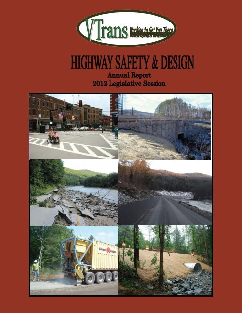
Highway Safety and Design Annual ReportExecutive summary:The Highway Safety and Design Section is responsible for the traffic, safety and roadway conditionsassociated with one of our State’s most valuable assets: 3,200 two-lane miles of state highway. As part ofthis responsibility, the section inventories the associated assets, evaluates conditions, analyzes crashesand ultimately delivers projects to address the needs of the network.During 2011, the program experienced significant achievements in several key areas of the Agency:continued progress towards performance measure goals, delivery of major projects, improvements in thesafety of our highways and fulfilling an important role in the Agency’s response to Tropical Storm Irene.The Section continues to be engaged in the multi-discipline efforts of the Strategic Highway Safety Plan.This collaborative effort has experienced many successes and is making considerable progress in reducinghighway crashes and related fatalities. In 2011, the state of <strong>Vermont</strong> experienced the lowest number offatalities on our highways in 67 years. The Highway Safety and Design Section’s greatest impact onhighway safety is through effective engineering of improvements and projects on State and local highways.Again this year, many of the Section’s initiatives focused on cost effective implementation ofcountermeasures such as signage, rumble strips and pavement markings while incorporating safetyimprovements into all projects.Over the past several years, this section has produced an unprecedented number of highway projects,including; roadway reconstruction, pavement reclamation, resurfacing, intersection reconstruction andpreventive maintenance treatments. For the first time in nearly a decade, the number of miles of highwayrated in very poor condition is at 25%, which is the performance goal for this measure. Achieving thisperformance measure is significant, however, much work remains to be done to manage the condition ofour highway assets.The fiscal year 2013 Governor’s recommended budget for the Paving, Roadway and Traffic and Safetyprograms will fund the continued principles of preventive maintenance, highway safety and major projectswithin the Highway Safety and Design Section. While much has been done to improve the condition of ourhighways and reduce highway crashes, a tremendous opportunity for improvement still exists. TropicalStorm Irene had a considerable impact on <strong>Vermont</strong> and <strong>Vermont</strong>ers. As our state learns through ourcollective response and recovery, so does VTrans. We will rebuild our highway network better than beforeIrene impacted our great State. We will do this by continuing our proven principles of preventivemaintenance and highway safety while reinforcing the lessons and partnerships of the past year.This year’s annual report is broken into four sections; Pavement Management, Roadway, Traffic and Safetyand Asset Management. For further information regarding the VTrans Highway Safety and Design Section,please contact, Kevin Marshia, <strong>Program</strong> Manager at (802) 828-2932 or email kevin.marshia@state.vt.us.Page 3
Pavement ManagementHighlightsBusiness NameHighway Safety and Design2012 Annual Report
Highway Safety and Design Annual ReportPaving Mileage Summary(two-lane miles, rounded to nearest mile)CategoryConstruction SeasonProposed2012 2011 2010 2009 2008 2007 2006 2005 2004Interstate 32 55 53 25 30 24 21 41 59Carried forward from previous year 0 6 0 0 0 12 0 0 0Incomplete, to be carried forward 0 0 6 0 0 0 12 0 0Rutfilling (single lane miles) 0 0 0 0 0 6 12 22 36Surface Treatments 37 44 45 52 21 15 9 0 0State Highway 75 39 87 50 59 68 83 41 51Carried forward from previous year 0 3 27 0 10 0 15 8 0Incomplete, to be carried forward 0 0 3 27 0 10 4 15 8Surface Treatments 85 12 26 7 14 0 0 0 0Class 1 Town Highway 10 6 8 9 4 9 2 0 4Carried forward from previous year 0 1 0 2 0 0 1 0 3Incomplete, to be carried forward 0 0 1 0 2 0 0 1 0State Paving 60 51 84 0 82 0 0 0 0Crack Seal 100 111 82 147 124 77 82 153 150Carried forward from previous year 0 0 0 0 0 0 9 19 25Incomplete, to be carried forward 0 0 0 0 0 0 0 9 19Paving Project Total (items in green) 177 161 259 86 185 113 122 90 117Preventive Maintenance Total (itemsin blue)222 167 153 206 159 98 112 194 211Miles Treated450400350300250200150100500PreventiveMaintenanceClass 1 TownHighwayState PavingState HighwayInterstatePage 6
Page 7
Highway Safety and Design Annual ReportPerformance MeasuresAutomated surveys are conducted annually to determine pavement conditions across the state. Eachsegment of road is rated on a scale of 1 to 100 based on rutting, cracking, and roughness. These are thenweighted by their respective traffic volumes. The VTrans goal for this performance measure is 70.100TRAVEL WEIGHTED AVERAGE NETWORK CONDITION20119080CONDITION INDEX70605040306467 67 686561 6064 65201002003 2004 2005 2006 2007 2008 2009 2010 2011YEARHISTORICPercent of Network in “Very Poor” Condition – While the “Travel Weighted Average Network Condition”graph measures VTran’s performance for the majority of road users, the following graph measures theagency’s performance for all users, including those on low volume roads. The VTran’s goal for thepercentage of roads in very poor condition is no more than 25%.Page 8
Highway Safety and Design Annual Report% Conditions Over Time ‐ Unweighted100%90%25% 27% 30%23%28% 31%80%Percent of Network70%60%50%40%30%33%35%30% 25%23%26%23%20%24%20%23%21%GoodFairPoorVery Poor20%10%0%34%21%28% 25%12% 13%2000 2003 2006 2009 2010 2011YearPavement Condition DescriptionsGood:Like new pavement with few defects perceived by drivers Composite Pavement Condition Index 80-100Fair:Slight rutting, and/or cracking, and/or roughness become noticeable to drivers Composite Pavement Condition Index 65-79Poor:Multiple cracks are apparent, and/or rutting may pull at the wheel, and/or roughnesscauses drivers to make minor correctionsVery Poor: Composite Pavement Condition Index 40-64Significant cracks may cause potholes, and/or rutting pulls at the vehicle, and/orroughness is uncomfortable to occupants. Drivers may need to correct to avoiddefects. Composite Pavement Condition Index 0-39Page 9
Highway Safety and Design Annual Report50Paving <strong>Program</strong> RAP InventoryPercent of Annual Total45403530252015105047.142.141.644.630.415.629.922.920.131.324.324.74.72.23.121.85.10.32011 2010 2009 20086.1Contractor Used in Job Mix Used on Project District MunicipalityDuring the 2008 legislative session, lawmakers challenged the Agency to develop specifications thatwould facilitate the increased use of recycled-asphalt pavement (RAP) in our hot mix asphalt pavements.In concert with that requirement they asked that we also monitor our production and usage of the materialto get a better understanding of its true value. The information compiled since the 2008 seasonclearly indicates VTrans’ commitment over that period to recycling pavement in nearly every project insome capacity. However, we do continue to look for opportunities to place a <strong>Vermont</strong> specific monetaryvalue on this asset. Anecdotally, national opinion puts an in-place value in the range of $1/ton to $40/ton. Taking the liberty to look at it from that perspective indicates the estimated value of the 2011 harvestto be somewhere between $176,100 and $7,044,000, with either figure representing a significantvalue.As indicated above, 176,100 tons of RAP was generated by VTrans’ paving activities during the 2011 constructionseason. During construction activities in 2011, 80,600 tons of RAP was used on these projects,a total equivalent of 46 percent of the amount of RAP generated. This is a slight reduction from previousyears but is attributable to a lack of opportunity for the use of Cold Mix Base material which is generally a100% RAP mixture. Typical rates of RAP used within hot mix produced for VTrans’ projects is between 15and 25%. Overall, the 53,600 tons of RAP used in 2011 mixtures represented an average usage rate of17 percent by weight.Page 10
Highway Safety and Design Annual ReportNetwork Pavement Structural TypesPavement Type DistributionTwo Lane Miles, % of Network MilesThe chart above represents the breakdown of the various pavement structural types a motorist willencounter throughout the Agency’s highway network. This information provides a sense of how thenetwork structures vary, and how that can pose a challenge from a management perspective.Interstate travel provides a motorist the best example of an Engineered pavement/highway.Engineered pavement is designed and constructed from the bottom up with the expectation that ifmaintained properly over time, the pavement will stand up very well to <strong>Vermont</strong>’s harsh climate for40 years or more. About 36 percent of the State’s pavements are Engineered, and it is thesepavements which can be managed the most effectively, both in terms of cost and serviceability.About 55 percent of the network is composed of Non-Engineered pavements. A Non-Engineeredpavement is a structure that has been built-up over the years based on minor treatments andmaintenance activities. The end result is a highway evolving from what may have once been alogging road into what is now a paved roadway. Some of these pavements perform reasonablywell over time. Fortunately, 41 percent of the network’s pavements respond in this manner andare considered Non-Engineered Strong. It is the remaining percent – the 14 percent of the networkthat is Non-Engineered Weak pavements – that pose the greatest challenge to the Agency. Asignificant investment is required to keep these pavements in good condition for a reasonable amount oftime.The last pavement structure classification is Asphalt on Concrete. These comprise 9 percent of thestate highway network pavements, and they are a challenge to manage effectively. Often times theyare discernable to the untrained eye where cracks reflect through the asphalt revealing the slabsbeneath. While strong, problems exist where a lane has been widened beyond the slab’s edgebecause the additional pavement will distress or settle differently creating a poor ride.Unfortunately, these structures are typically maintenance intensive and do not perform well with aconventional resurfacing treatment.Page 11
Highway Safety and Design Annual ReportProject PrioritizationThe chart above illustrates the weighting and scoring of the components built into the PavementManagement Section’s project prioritization system. Below each component is defined in terms of theirrespective characteristics and the effect of the measure on a project’s overall rating. The system wasdeveloped in 2005 and continues to play an integral role in the development of our annual programs.Asset Condition (PCI) Pavement Condition Index Combination of; Ride, Rut, Cracking Scoring structured to recognize need to address roads in very poor conditionsregardless of trafficProject Economics (Benefit Cost) Benefit Cost Ratio Benefit compares condition difference between the selected treatment and doingnothing on the project section over the lifespan of the treatment Benefits are weighted by traffic volume Cost is present value financial cost to the State Measures the “Bang for the buck” amongst candidate projectsRegional Planning Commission (RPC) Rank Regional Importance Allows RPCs to address; socio-economic, cultural/local importance and impact onlocal economy of candidate projects Scoring structure helps create a geographically distributed programPage 12
Page 13
Page 14
Page 15
Page 16
Page 17
Document TitleRoadway DesignHighlightsBusiness NameHighway Safety and Design2012 Annual Report
Highway Safety and Design Annual ReportBennington NH F 019-1(5): Bypass NorthConstruction of the Northern Segment of the BenningtonBypass began in 2007 and continues. The 3.1 milesegment of the new road consists of five separatecontracts and the total construction cost will beapproximately $65M (excluding the new Welcome Center).The first contract was begun in 2007 and was completedon schedule in October 2010.The second and third contracts of this project wereawarded in spring 2008. Both of these contracts arecompleted.The fourth contract was bid and awarded in spring 2009.This contract had a completion date of fall 2011 and wason schedule until Hurricane Irene damaged numerousroads and bridges. The contractor redeployed the staff andequipment to help make emergency repairs to restore thetransportation network and the water supply to Bennington.As a result of the redeployment of equipment and staff, thecontract is now scheduled to be completed in spring 2012.However, because the last contract (discussed below) isnot scheduled to be completed until July 2012, this revisedcompletion date will not impact the opening of the newroadway. This contract includes an unusual intersectiondesign between VT Route 9 and the Bennington Bypass. Itis called a Single Point Urban Interchange (SPUI). A SPUIhas only one signalized intersection that controls themovement of all traffic. The design is more compact thantraditional diamond interchanges which reduces impact onadjacent property owners and is more efficient in movingtraffic on Route 9 since there is only one signalizedintersection instead of two.Finally, the last contract was advertised and bid in thespring of 2010. This contract is underway and is onschedule with a construction completion date of July 2012.Of special interest, this interchange reconstruction includeslighting of the interchange primarily because of theinclusion of the Welcome Center discussed below. Thereare a number of entrance ramps into the Welcome Centerand exit ramps from the Welcome Center in thisinterchange. The complexity of the interchange stronglysuggested the need for lighting during nighttime hours. Tominimize both energy costs and sky glow, Light EmittingDiode (LED) lighting was specified for this location. The LEDlighting is the first use of this energy efficient lighting on aState highway in <strong>Vermont</strong>.This last contract will, among other things, reconstruct theinterchange between US Route 7 and VT Route 279 toaccommodate a Welcome Center. The Welcome Center wasdesigned by a consultant to the Department of Buildingsand General Services (BGS). The Welcome Center projectwas advertised and bids opened on November 23, 2011.The project is funded through an earmark in the FederalTransportation Act (SAFETEA-LU). Work on the WelcomeCenter project is expected to begin in the spring of 2012and be completed by July 2013.When this Segment of the new highway is open to use bythe public, there will be a complete alternate route fortrucks going east or west to use instead of having to drivethrough the congested downtown. Diversion of thesethrough trucks will help decongest Bennington Downtownand make it a more inviting environment for residents andvisitors to the Urban Compact. The new road will maketransportation of goods more efficient, reduce vehicularemissions and improve the safety for users of both theexisting roads and streets in Bennington and on the newalternate route.Bennington Bypass mainline: looking west towards the systeminterchange.Bennington Bypass exit ramp bridge to VT Rt 9.Page 20
Highway Safety and Design Annual ReportBarre City FEGC F 026-1(34): Contract 2Project History: This project, identified as Contract 2, representsthe full reconstruction of downtown Main Streetbeginning at the US 302/VT 62 Interchange andextending southerly for approximately one-halfmile to the City Park. All advanced signalinstallations to support the primary temporarydetour along Maple Avenue/Summer Street/ElmStreet were performed under Contract 1constructed in 2010 and completed in 2011prior to commencement of Contract 2. Projectdevelopment incorporated close coordinationwith City representatives through a ProjectAdvisory Committee.Reconstruction of the US 302/VT62 interchangeDesign Solution:• The approved design includes full depthreconstruction of US 302 (Main Street) includingnew roadway, sewer and water, storm waterdrainage and treatment, sidewalks andstreetscape amenities.Stormwater Treatment Pond adjacent to VT 62 access rampConstruction:• The multi-year project began in July 2011 and isscheduled for substantial completion byNovember 2012. Final paving to restore theSummer Street Detour and LandscapingFeatures are scheduled for completion by July2013. A Web Site has been created andmaintained by the City to update constructionschedules and status at http://wedigbarre.com.Construction Cost:Contract 1 - $1,224,000Contract 2 - $10,616,000Page 21
Highway Safety and Design Annual ReportCabot - Danville FEGC F 028-3(26) C/1US Route 2 ReconstructionNew roadway embankment construction. Top of photo showsexisting US 2 and new GMP penstock.Molly’s Falls Brook concrete box and retaining wall.Project History:This project, identified as Contract 1 of theCabot - Danville corridor, represents the first ofthree segments along US Route 2 to bereconstructed, increasing the existing narrowroadway and shoulders to a full width typicalsection and significantly improving thehorizontal and vertical alignments. It alsoincludes the construction of a wetland mitigationsite in the Town of East Montpelier tocompensate for wetland impacts along theroadway. VTrans instituted many design changes over theyears throughout the project’s development toreduce the footprint through this sensitive areaand conducted an exhaustive search to providethe most environmentally sound area forwetland mitigation.Design Solution:• The new roadway typical section includes 12 foottravel lanes and 8 foot shoulders to satisfy therequirements of the type, speed and trafficdemands of the roadway. It also includes an 11foot eastbound truck lane for 3900 feet, neededdue to the steep grades along this stretch of USRoute 2.• In addition to the full depth reconstruction of theroadbed, extensive drainage and guardrailimprovements are included in the new design.• Of special interest were: a realignment ofapproximately 350 feet of Molly’s Brook; thereplacement of an obsolete concrete culvertwith a new, precast concrete box culvert withmechanically stabilized earth retaining wallsnear the Marshfield Reservoir; and thereplacement of a section of Green MountainPower’s ancient and leaking, wooden penstockunder US Route 2 with a new steel section tomatch that of the rest of the penstock beingreplaced along the roadway concurrently byGreen Mountain Power.Construction:Comprehensive traffic control enhanced safetythroughout the duration of the project.Project Cost: Approximately8,800,000.Construction began in May 2011and anticipated completion by October 2012.Relocation of Molly’s brook.Page 22
Highway Safety and Design Annual ReportMilton IM 089-3(68)Milton – I-89 Emergency Slide RemediationShoulder settlement at the northern slope failure.Soil nail and mesh installation on southern slopeNearly completed southbound lanes in area of the northern slopefailure.Project History:• The Milton slide project was located on I-89 SB inMilton near the Lamoille River; the project wasbrought to Highway, Safety & Design’s attentionthrough the District Needs program. InDecember of 2010 two slide areas, in closevicinity, were noted as needing slope stabilizationas the shoulder at the southern slide wassettling while the shoulder and travel lane at thenorthern slide were settling. Though the project was under development,spring rainfall exacerbated the problem causingboth slide areas to settle further, leaving anunsafe situation for vehicles traveling I-89 SB,and requiring the travel lane to be closed offthroughout both slide areas. This created anemergency situation which allowed for anexpedited design and bid process to stabilize theslopes and rebuild the roadway. Prior to finalizing design and beginningconstruction for the slide stabilizations a detourwas needed to move traffic from the southboundlane to the northbound lane. In order toaccelerate the process, crossovers were designedprior to the stabilization and constructedsimultaneously with the slide stabilization design.Design Solution:• With coordination from the Materials andResearch Section’s Soils and Foundations Unit,separate remediations for each slide weredeveloped. The southern slide stabilizationincorporated a soil nail and stabilizing meshsystem. Approximately 300 20’-long rods weredrilled into the slope and grouted into bedrock,then the stabilizing mesh was pressed tight to theexisting ground surface by bolting it to the soilnails. The northern slide stabilization used threeseparate underdrains to remove subsurfacewater, at a depth of at least 8 feet, one in themedian, one part way down the slope and one atthe toe of the slope.Construction:• The project was programmed in March of 2011and the southbound barrel was opened to trafficon November 14, 2011, designing and buildingthe project in less than 8 months.• Approximate Construction Cost: $1,400,000Page 23
Highway Safety and Design Annual ReportDanville FEGC 028-3(32)Danville Village - US Route 2 ReconstructionWaterline installation.Construction of detention pond.Project History:Upgrades to US Route 2, the primary east-westcorridor in northern <strong>Vermont</strong>, have been underwaysince the late 1970s. The planning and design ofthe one-mile section of this roadway throughDanville Village has been in the works for 25years. In 2000, after the consideration of manyoptions and alternatives, VTrans partnered withthe <strong>Vermont</strong> Arts Council and the Danvillecommunity to develop a context sensitive designmeeting the needs of both the traveling publicpassing through the village and those that live anddo business there.Design Solution:• In order to maintain the village character whileaccommodating over 7000 cars per day, a typicalrural highway design would not work. Being a 50mph highway on either end of the village,measures were needed to provide a safe andattractive environment for residents and businessin the village. This is to be accomplished with anarrower, curbed roadway and with medianislands, ornamental lighting, street trees,sidewalks and crosswalks, artwork, a traffic signaland removal of overhead utilities in the area of thevillage green. Changes in the traffic patternaround the village green and upgrades to thosetown roads are also steps to be taken to achievethat goal. Upgrades to US Route 2 include full roadbedreconstruction and paving, subsurface drainage,stormwater collection and treatment, andmunicipal waterline replacement.Construction:• Construction began in May 2011 and is expectedto be completed in 2013.• Activities accomplished this year includedwaterline replacement, subsurface ledge removal,drainage installation and the construction of thestormwater detention pond.• Estimated Construction Cost = $8,000,000Looking east from the village on US 2.Page 24
Highway Safety and Design Annual ReportBrattleboro STP 2000(24):Project History:Project History:Originally programmed for Scoping in 1996, thisproject received a SAFTEA-LU earmark forimprovements along downtown Main Street.The original scope of the project experiencedvarious challenges in an attempt to balance theneeds of all users in a very busy and historicdowntown urban environment.In 2008, under a revised scope of work, theproject was redirected to include newcoordinated signalization of the existing MainStreet signals and a newly signalized US 5/VT119/VT 142 intersection.New signals at Main St/Elliot St.Design Solution:The approved design included replacing existingsignals along Main Street and new signalizationof the US 5/VT 119/VT 142 intersection(referred to as The Junction).Pre-emptive coordination with the New EnglandCentral Railroad crossing located on VT 119.The new design also included pavementresurfacing, curb and sidewalk improvements aswell as new signs and pavement markings.Construction:New signals at Main St/VT 119/VT 142 intersection.The project was combined with an adjacentVTrans Paving Project (Brattleboro STP 2623(1))that resurface approximately 5 miles of roadwayin Brattleboro and Putney.Combined Project Costs: Approximately$4,700,000Construction began in June 2010 and wassubstantially completed in June 2011.New signals at Main St/High St.Page 25
Highway Safety and Design Annual ReportEast Montpelier STP SCRP(9):Project History:Originally programmed under the Highway Safetyand Design Culvert Rehabilitation <strong>Program</strong>, thisproject included the replacement of anundersized and aging concrete box culvert under<strong>Vermont</strong> Route 14. Trenchless technology wasthe primary replacement treatment underconsideration due to the significant depth of anopen cut excavation combined with heavy trafficvolumes and the need to maintain traffic. The sudden flood event of May 26, 2011destroyed the box culvert and roadway requiringfull road closureInlet headwall footing under construction.Design Solution:Under Emergency Declaration, District Forceschose to oversee replacement of the structure.Alternative design considerations were revisitedwith an emphasis on expeditious constructionthat resulted in additional hydraulic capacity andthe replacement of the structure with a newMetal Pipe Arch.Construction:Inlet headwall completed, roadway under construction.The replacement culvert and reconstructedroadway were completed and traffic restoredwithin two weeks of the storm event. Construction cost: $70,000Outlet cradle and embankment completed.Page 26
Document TitleTraffic & SafetyHighlightsBusiness NameHighway Safety and Design2012 Annual Report
Highway Safety and Design Annual ReportSTRATEGIC HIGHWAY SAFETY PLAN (SHSP)Plan History:The Strategic Highway Safety Plan (SHSP) for <strong>Vermont</strong>was created in December 2006 with one focus inmind: to improve highway safety.The SHSP is a collaborative effort between Stateagencies, local governments and private groups.Employing the SHSP is accomplished by identifyingand implementing achievable and effective education,enforcement, engineering, and emergency responseinitiatives (the four E’s).SHSP Content:The plan consists of 7 critical emphasis areas:SHSP for <strong>Vermont</strong> mission: minimize the occurrence and severity ofcrashes, related human suffering and economic losses on the <strong>Vermont</strong>network.SHSP Organizational ChartKeeping Vehicles on the RoadwayImproving Young Driver SafetyImproving Intersection SafetyIncreasing Seat Belt UseReducing Impaired DrivingCurbing Speeding and Aggressive DrivingDistracted DrivingSHSP Implementation:New SHSP Organizational Chart – major changesinclude a smaller, more manageable SHSP Core Group,the creation of an SHSP Coordinator, as well as SHSPFocus Groups.Page 28The SHSP work groups underwent significantorganizational changes, in order to empower andfocus stakeholders on implementing safety initiativesthat are specific to their area of interest and expertiseSafety data has been a major area of improvement forthe SHSP work groups. A Data Focus Group wasformed, consisting of key individuals from variousagencies and departments across State Government.With the creation of the Data Focus Group relative tosafety data sharing. A comprehensive safety dataquery tool is currently under development, which willbe extremely useful and helpful for safety partners aswe work together to reduce crashes on VT’s highways.Partnerships amongst state agencies, VT Youth SafetyCouncil, law enforcement, insurance companies andothers that has led to effective and efficient use ofresources
Highway Safety and Design Annual ReportHIGHWAY SAFETY IPROVEMENT<strong>Program</strong> History:PROGRAM (HSIP)HSIP Example Project Site – Colchester VT 127/Porters Point/Macrae Road intersection, beforeEach year, the VTrans Safety Section identifiesthe top 50 locations in need of safetyimprovements on the <strong>Vermont</strong> federal aidhighway system. These locations are selectedbased on crash frequency, severity, and trafficvolume.Each summer, the Safety Section holds ameeting at each location. Often times thesemeetings include key town officials, the RegionalPlanning Commission (RPC) or MetropolitanPlanning Organization (MPO), emergencyresponders, and highway engineers.It is at these meetings where information isgathered which aid in VTrans’ safetyimprovement recommendations.Design Solutions:After the 50 locations are reviewed, a report isdrafted specifying the crash history, anecdotalsafety information gathered from the on-sitemeeting, and short and long term recommendedsolutions.Often times the short term solutions are low costsafety improvements such as new signs andlines, guardrail, brush clearing, minorintersection alignment improvements, andsignal head upgrades.safety improvements. Note the old signal heads andspan wire configuration.HSIP Example Project Site – Colchester VT 127/Porters Point/Macrae Road intersection, after safetyimprovements. Note the new signal heads and mastarm configuration.Each year, there are usually 2 - 6 of theselocations programmed as safety projects, andthe long term solutions are implemented. Theseprojects are much more involved and canconsist of roadway realignment, the installationof a roundabout, or new turning lanes.Construction:Each year, $50,000 to $100,000 is spent toimplement the short term improvementsidentified in the HSIP.Page 29
Highway Safety and Design Annual ReportHigh Risk Rural Roads <strong>Program</strong> (HRRR)<strong>Program</strong> History:HRRR example project site, Waterman St., Barre Town, beforeimprovement.The High Risk Rural Roads (HRRR) program wasinitiated in 2008. The purpose of the program isto partner with the Regional PlanningCommissions (RPCs), the Metropolitan PlanningOrganization (MPO), FHWA, and the Towns toimplement low cost safety improvements on allof <strong>Vermont</strong>’s public highwaysBased on crash data and local input, sites areidentified, selected and prioritized by the RPC’s/MPO’s, Towns and VTrans.Each summer, VTrans works closely with theTowns in determining the appropriate safetysolutions at each site.Design Solution:There were 24 sites selected this year.• VTrans contracted these projects, and oversawthe construction operations for the participatingmunicipalities, in order to simplify the processfor them.• Four regional umbrella projects were contracted,implementing low cost safety improvementssuch as new and upgraded signs and lines, andnew guardrail.HRRR example project site, Waterman St., Barre Town, afterimprovement.Construction:The four regional construction projects totalabout $500,000 this year, to install highwaysafety improvements on local roadways.• Work started in spring 2011, and was completedin fall 2011.Page 30
Highway Safety and Design Annual ReportEast Montpelier STPG 028-3(35)Project History:After construction: looking east on US 2 towards Plainfield. NoteVT 114/US 2 90 degree intersection on left.This project is located in East Montpelier at theUS 2, VT 14, and Quaker Hill Rd. intersection.Over the years, this intersection has beenranked on the Agency’s High Crash Location list.Crashes have been primarily due to the skewedalignment of the US 2 & VT 14 intersection.The stop control on US 2 creates extensivequeuing for westbound traffic (traveling towardsMontpelier), especially during the morningcommute hour.Design Solutions: Realign VT 14 such that it intersects with US 2at a 90° angle, and install a traffic signal tocontrol the operation and efficiency of theintersection.During design, VTrans worked closely with theTown of East Montpelier, local businesses, andresidents in the design of new pedestrianfacilities, parking, and the creation of a newvillage green area.After construction: looking west toward Montpelier on US 2.Construction:• This project was substantially constructed in thesummer of 2010, however, paving, sidewalk,and landscaping work was completed in thespring of 2011. Project Cost: Approximately $2,000,000.After construction: looking south on VT 14 towards new US 2/VT14 intersection.Page 31
Highway Safety and Design Annual ReportHyde Park HES 030-2(23)VT 15 & VT 100 Roundabout ProjectProject History:• This project is located at the intersection of VT15, VT 100, & Church St. in the town of HydePark.• Intersection was listed in the top 50 statewidecandidate safety improvement locations in the2001 Highway Safety Improvement <strong>Program</strong>.• In four years, this intersection saw 23 crashes,26% of which resulted in injury.• The major safety concerns observed includeddifficulty for motorists entering VT 15 from VT100 and Church St. due to congestion, shortgaps, and judging approach speeds.During Construction – Installing buried drainage features underand adjacent to the roundabout.Design Solution:• Eliminate the existing stop controlled four-wayintersection, and flashing beacon, and install aroundabout.Construction:• Construction commenced on this project in thespring of 2011. The roundabout wasconstructed and became fully operational in thefall of 2011. Landscaping, turf establishment,and anti-icing pavement treatment will becompleted in the spring of 2012.During Construction – Installing the colored, stamped concretetruck apron. Note the oversized load in the background, and itsability to negotiate the intersection during construction.• Project Cost: Approximately $1,900,000• Work commenced May 2011 and is stillunderway.After Winter Shutdown – looking west across the roundabout.Page 32
Highway Safety and Design Annual ReportMilton STP 5800(2)US 7 & Lake Road Intersection ProjectProject History: This project is located at the intersection of US 7and Lake Road, in the town of Milton.• This intersection improvement was warrantedbecause of safety concerns, as well as trafficcongestion due to left hand turning traffic fromUS 7 onto Lake Road.• In five years, this intersection experienced 22crashesBefore construction: looking north across US 7, up Lake Rd.• The major safety concerns observed includeddifficulty for motorists entering US 2 from LakeRoad due to the skewed intersection alignment,and rear-end or broadside collisions for stoppedor turning traffic onto Lake Road, from US 7.Design Solutions:• Improve the alignment of Lake Road with US 7,such that it’s closer to a 90 degree intersectionangle, install a left turn lane for vehicles turningleft off of US 7 onto Lake Road, and improve thedrainage around the intersection to reduce icebuild-up on the roadway.Construction:During construction: reconstruction of Lake Rd.• Construction commenced on this project in thespring of 2011. The intersection wasreconstructed and became fully operational inthe fall of 2011. Landscaping will be completedin the spring of 2012. Project Cost: Approximately $1,600,000.After winter shutdown: looking north, across US 7, up Lake Rd.Page 33
Highway Safety and Design Annual ReportTRAFFIC OPERATIONS PROJECTSPAVEMENT MARKING PROJECTS:Interstate marking: Annual painting of wornpavement markings.Limited access highways: primarily repainting, butalso included segments of recessed durablemarkings. The purpose of recessing is to get betterlongevity and visibility, especially in the wintermonths. Putting the pavement markings in arecessed groove protects it from snow plows andnormal traffic wear. The project also included 10miles of new centerline rumble stripes on US 7 fromBrandon to Middlebury, to improve safety bydecreasing lane departure crashes. Short segmentsof centerline rumble stripes were also included onUS 4 in Fair Haven and US 7 in Bennington wheretwo lane roadways become four lane dividedhighways, to reduce wrong way driving(MUTCD) retro-reflectivity requirements andother required upgrades.• Project-wide sign replacements were alsoincluded on several paving projects, including allClass 1 town highway paving projects.INTERSTATE SIGN PROJECTS:• System-wide upgrade of mile marker signs toreplace small delineator type mile markerplaques with larger green signs at 0.2 mileintervals. This will help drivers identify theirlocation in cases of emergency and improveemergency response times. These signs hadalready been installed in 2010 projects on I-89from Bethel to Highgate, and on I-91 from Derbyto NewportSIGN PROJECTS:State Highway Signs:• 4 regional sign projects totaling 150 milesconstructed in 2011. These consisted of shortersegments along routes that were otherwise ingood shape.• 4 corridor sign projects totaling 83 milesconstructed in 2011. These include 21 miles onUS 5 from Norwich to Fairlee, 26 miles on VT105 from St. Albans to Berkshire, 22 miles onVT 133 from Pawlet to West Rutland, and 14miles on VT 106 from Reading toWoodstock. This year signs were included onClass 1 town highway segments within theoverall project limits in order to assist towns withmeeting the Manual on Uniform Traffic DevicesPage 34
Asset ManagementHighlightsHighway Safety and Design2012 Annual ReportOrganization
Highway Safety and Design Annual ReportHighway Safety and Design (HSD) is responsiblefor a number of roadway assets such as roadwaycondition, traffic signals, traffic signs, guardrail,small culverts, roadway lighting, and pavementcondition. The Asset Management Unit (AMU)was formed such that a holistic and integratedapproach to managing these assets could berealized and expanded.Current statewide projects include small culvertinventory and condition assessment, guardrailinventory and assessment, and roadway lightinginventory. Other efforts include sign data review,roadway attribute extraction and Managing Assetsfor Transportation (MATS) support. MATS will be acritical link between various Operations activities onassets and the corresponding asset inventories. Thislink will allow for an efficient flow of data in theasset life cycle. Individuals from IT, Operations andAMU are working collaboratively to integrate assetdata into the Managing Assets for TransportationSystem (MATS).Statewide Small CulvertThe Statewide Small Culvert Inventory (SSCI) is aneffort to collect store and serve data regarding allstate owned, small culverts less than 72” indiameter and the associated hydraulic treatments.The inventory of these structures records locationdata, assesses their structural condition and localsite conditions in order to help prioritize repairs,replacements or other maintenance activities. As acentrally stored digital inventory, this data isdesigned to be served to multiple units/divisions formultiple uses. It will be maintained through reinspectionand the capture of activities in theexisting business process to ensure the inventory iskept current. The SSCI provides the geospatialbaseline that will allow for better recording,prioritization and planning in order to effectivelymanage our existing drainage assets agency wide.The 2011 field season saw an additional 1500 smallculverts and 500 drop inlets assessed and located.To date the Statewide Small Culvert Inventory hasassessed over 16,000 culverts and 11,000 dropinlets along the I89, I91, I93, US4, US7, VT9 andDistrict 5, Middlesex Garage routes.2011 saw the SSCI project participate in thedevelopment of Agency Resource Grade GlobalPositioning System (GPS) guidelines. This documentcan be found at http://www.aot.state.vt.us/documents/rGPSspecs.pdf.Statewide Guardrail InventoryThe Statewide Guardrail Inventory (SGI) is an effortundertaken to locate and catalog all of the runs ofguardrail, assess their condition and identify criticalruns in order to prioritize repairs and replacements.The 2011 field season say over 1000 miles ofguardrail assessed and inventoried. The intent of theStatewide Guardrail Inventory (SGI) is to provide theframework for continued monitoring and conditionassessments of all state owned runs of guardrail.The SGI has been designed to record location data,guardrail and end treatment type, and conditionassessment. This data will then be integrated intothe Managing Assets for Transportation System(MATS) used by the Operations Division. This criticallink will ensure that any repairs or maintenance workwill be associated with a specific run of guardrailsand will in turn keep the inventory current. Thissystem will be used as a tool to prioritize anddevelop rehabilitation and replacement projects, inan effort to maintain our existing assets.Statewide Road Data InventoryRoadway data is housed in many different sectionsand in several different forms. This effort consist ofextracting, organizing and collecting this data suchthat it can be utilized efficiently.Efforts include collecting over a dozen differentattributes for the roadway inventory, such as lanewidth, basic shoulder information, turning lane andmedian information over 89 miles of roadway.Future maintenance will be accomplished through As-Built Plans. This data is utilized by many differentsections; Route Logs, Pavement Design, SafetyPage 36
Highway Safety and Design Annual ReportAnalyst, HPMS, Sufficiency, so having this data up todate is crucial to the Agency business process.Statewide Sign InventoryThe AMU is responsible for managing the traffic signdatabase consisting of over 71,730 active records.Sign data comes from many sources but the primaryones are project plans, work orders and knockdownforms. This data is key to ensuring the State canmeet the new federal retroreflectivity requirements,Other work includes a Statewide Sign CorridorReview , sign data flow reviews and work with the TriState Team in developing a tri-state signperformance measure. The Tri State effort, in part, isan effort between Maine, New Hampshire and<strong>Vermont</strong> in developing standardized performancemeasures to assist in communications withrespective stakeholders as well as the developmentof MATS.Traffic signs managed by VTrans are found oninterstate, US routes, <strong>Vermont</strong> routes and statenamed routes. The map on page 44 shows the 2011sign distribution and average age on the Statehighway System. The map of page 45 shows theStatewide Sigh Corridor Review.Statewide Lighting InventoryThis is an effort that has collected 1016 lightingpoints and associated attributes. One of the waysthis information will be utilized is to determine whereenergy efficiency can be realized by various bulbreplacements. The map on page 45 shows theroadway lighting statewide distribution.Statewide SignalVTrans is responsible for 154 traffic signals. VTransTraffic Shop and Traffic Design work very closely andcould benefit from sharing information. This pastyear saw signal data that was maintained in severallocations moved to the Digital Print Room (DPR)such that both groups could share the data.Examples of data moved are: inventory photos,traffic diagrams, plans and signal timing diagrams.Page 37
Page 38
Page 39
Page 40
Page 41
Page 42