Jublains anglais:Mise en page 1.qxd
Jublains anglais:Mise en page 1.qxd
Jublains anglais:Mise en page 1.qxd

You also want an ePaper? Increase the reach of your titles
YUMPU automatically turns print PDFs into web optimized ePapers that Google loves.
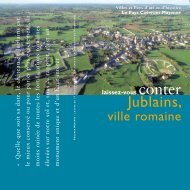
Towns and regions of art and historyThe Region Coëvrons-May<strong>en</strong>neWhatever its date may be, the castle of <strong>Jublains</strong> isthe best preserved or to speak more exactly, theless ruined of all the roman fortifications erectedon our soil and, in this respect, it’s a unique anda highly interesting monum<strong>en</strong>t.Prosper Mérimée / Letter from the 11 th of october 1837 (Archives de la Direction du Patrimoine)discover thestoryof<strong>Jublains</strong>,roman town
A granite plateau<strong>Jublains</strong>, roman townLocated at 35 km north from Laval, <strong>Jublains</strong> was in theAntiquity, Noviodunum, Diablintes’ capital.On the border of a plateau<strong>Jublains</strong> is at the southeast corner ofa round summit plateau. Situated inchange of incline, the site dominatesthe Évron basin from 40 m.The horizon is closed to the east and tothe southeast by a chain of high hills ofwhich the highest are the Montaigu,the Mont Rochard and the hillock ofSainte-Suzanne. A modest valley,occupied by the Moulin Neuf stream,separates the town from the village ofDoucé, at 1,3 km. The North andthe West have no visibility from thesummit of the plateau.A granite undergroundThe antique town lays on a graniteground. This large grained graniteprovided most of the materials forthe building of walls and ways. Someclay and sand deposits are in the plain,until the Bias stream. The Gallo-romanalso used a clear grey coarse grainedsandstone for most of the constructions.It was used for columns and the baseof the great wall of the fortress. At the<strong>en</strong>d of the 19 th c<strong>en</strong>tury, the op<strong>en</strong>ing ofa quarry at Pierre-Aiguë, on the districtof Sainte-Gemmes-le-Robert, allowedto determine its origin. Some traces ofan anci<strong>en</strong>t exploitation, as some abandonedcolumn shafts, were discoveredthere.Map of the Gaul. 1590.This map from Abraham Ortelius tries to locate thegallish people named in the antic texts. It still has a lot ofmistakes. It sites the Diablintes in the Finistère.Diablinte coin.(Archaeological museum of <strong>Jublains</strong>)
Childr<strong>en</strong> before the fortress.(Baron de Wismes’ <strong>en</strong>graving. 1862)Birth and decline of a townThe birth of NoviodunumBefore the conquest of the Gaul bythe Romans, the territory of <strong>Jublains</strong>belonged to the Diablintes, one of theethnic groups of the Aulerque’s nation,which spreads out from the Seine to theMassif Armoricain. From the 4 thc<strong>en</strong>tury B. C., the Gallic had edified asanctuary at <strong>Jublains</strong>, at the northernextremity of the antique town.On the eve of the conquest, a fewhouses settled nearby but the word“town” cannot be employed yet. Theurbanisation of the site began aroundthe beginning of our era, particularlyfrom the Tiberius’ reign (14-37 A.D.).The town took the name ofNoviodunum (“New Town”) as craftsm<strong>en</strong>settled in. At the beginning, thedwellings were scattered, without aprevious urban plan.The capital of a cityThe Gaul was organised by the emperorAugustus (27 B. C.-14 A. D.) in cities;kind of self-governing micro-statescorresponding to the main Gallicpeople area. Noviodunum became themain town of the Diablintes’ city,which streched over two thirds of theMay<strong>en</strong>ne and the south of the Ornedepartm<strong>en</strong>ts. The councillors met at theforum, the heart ofthe town. One ofthese local notables;Orgétorix, offered atheatre to his city.years 260-285. The Gaul was periodicallyinvaded by Germans. Somepeasants revolted against the taxpressure. A fortified building, settledclose to <strong>Jublains</strong>, was surrounded by anearth<strong>en</strong> rampart. It became th<strong>en</strong> a realfortress by the construction of an outerstony wall, remained unfinished. Butthe town was declining. It lost its positionof capital during the 5 th c<strong>en</strong>tury, asthe Diablintes’ city was incorporatedinto the C<strong>en</strong>omans’ one: that is theorigin of the Maine, whose capital wasLe Mans. In the early Middle Ages,some quarters became cemeteries.Nevertheless, the town subsisted untilthe Carolingian period. It vanished atthe beginning of the 10 th c<strong>en</strong>tury, as anew power place asserted itself, 10 kmfurther: at May<strong>en</strong>ne, where a palacereused the stones picked up in <strong>Jublains</strong>.JugsMural fragm<strong>en</strong>t from the temple. Pigeon.A vanished capitalIn the 3 rd c<strong>en</strong>tury,the Roman empirewas faced with acrisis which reacheda peak during the
NoviodunumThe first town developed itselfin an anarchic manner. Th<strong>en</strong>,it transformed at the <strong>en</strong>d of the1 st c<strong>en</strong>tury A. D. and adoptedall the urban principles and theequipm<strong>en</strong>t of the Roman cities.An antique urbanism exampleThe urban projectIn the second half of the 1 st c<strong>en</strong>turyA. D. the inhabitants undertook somegreat work whichchanged the aspect ofthe town. They startedin replacing the oldGallic temple by amonum<strong>en</strong>t in stonearound 66-68. Thetheatre took place atthe southern border,on the side of the plateau,800 m furtherfrom the temple.Betwe<strong>en</strong> these twomonum<strong>en</strong>ts the streetsadopted a geometricnetwork covering 25ha and dividing thespace into rectangularislands. Two othersmonum<strong>en</strong>ts are on th<strong>en</strong>orth-south axis ofthe town: the forumand the baths. A fortified buildingwas built at the borders of the town.The urban project was realised in itsbroad lines but never utterly finished.
The fortressThe Gallo-roman fortress is the largest andthe best conserved monum<strong>en</strong>t, but alsoa real riddle concerning its functions.1645723An <strong>en</strong>igmatic monum<strong>en</strong>tA composite monum<strong>en</strong>tThis fortified set was not built in onetime. It results from the addition ofthree fitted together elem<strong>en</strong>ts; a c<strong>en</strong>tralbuilding, th<strong>en</strong>, an earth<strong>en</strong> rampartpreceded by a gap and a surroundingwall. Its function might have evolvedduring these transformations.The c<strong>en</strong>tral building 1Maybe built around 200 A. D., thec<strong>en</strong>tral building is a large room witha c<strong>en</strong>tral yard 4 , <strong>en</strong>dowed with a floorand 4 square towers at its corners 5 .It is accompanied by two small bathsbuildings 6 7 . The thickness of thewalls and the locking system of thedoors by wood<strong>en</strong> boards give adef<strong>en</strong>sive character to the edifice.The archaeologists have not agreed yetto consider this edifice as civil warehouseor as a fort. Some rec<strong>en</strong>t studieshint that there was a military pres<strong>en</strong>cein the region from the 1 st c<strong>en</strong>tury A. D.The earth<strong>en</strong> rampart 2Initially <strong>en</strong>dowed with a large gap,it was realised around 290, in a contextof troubles. The multiplication ofburied treasures of this period provethe fears of populations concerningthe invasion rumours, the piracy actsalong the Channel or the peasantrevolts.The stone rampart 3The Roman Empire recovered itself,under the emperor Diocleti<strong>en</strong>’s reign.He reorganized it in instituting theTetrarch (two Supremes to govern theOccid<strong>en</strong>t, two others to govern theOri<strong>en</strong>t). It coincided with the beginningof the construction of the outer wall,around 295. It may aim at turning thesite into a real fortress for the resupplyingof the camps which settled onthe Channel coasts in order to struggleagainst Saxon pirates. Yet, owing toa changing of project, the work wasgiv<strong>en</strong> up before the completion of thewall. The fortress was deserted in the4 th c<strong>en</strong>tury A. D. whereas <strong>Jublains</strong> wasirremediably declining.
The bathsBuilt during the transformationof the town, they are nowadayslocated under the church.The theatreIt marked the southern limit ofthe town. Two buildings succeededthemselves on this place.The heat and the coldFrom the baths…The baths were built about the <strong>en</strong>d ofthe 1 st c<strong>en</strong>tury. They are settled in anisland, in the main axis of the town;their building thus succeeded to thesetting up of the urban plan. Strikingmonum<strong>en</strong>t of the town and symbol ofthe Romanization, they were a place ofhygi<strong>en</strong>e, sport and therapy but alsoa civic and cultural life one. The monum<strong>en</strong>talset was delimited by a portico,shops and rooms of various functions;reading, fight training etc. The bathsbuilding was in the middle of this set.The bather came in by a small yard.He left his clothes in the cloakroomand crossed the cold and warm roomsto perspire in the sweat room andwashed himself in the hot baths.Finally, he came back on his steps tobathe in the cold baths. The successionof cold and hot baths results of a use ofbaths definitively established around 80A. D.… To the churchAfter 350, Christianity spreads out intothe West, in the towns first. About the5 th c<strong>en</strong>tury, the Noviodunum baths,unused, were converted into churches.In pulling down the partitions and fillingup the basins, the faithful got al<strong>en</strong>gth<strong>en</strong>ed room fitted to their liturgicalneeds instead of the pagan templewhich had never be<strong>en</strong> aimed at greetinga faithful assembly. Modified duringc<strong>en</strong>turies, the church kept its Galloromanmasonries of several meters highuntil 1877, where it was utterly reconstructed.Thus, the base of the walls andthe concave parts, basins or hypocaust(heating by the soil system), are theonly remnants of the roman building.Two theatres1112836475 510964 3127891011The Orgétorix’s gift to his cityThe theatre is on the southern side ofthe plateau on which the town stretchedout. It thus b<strong>en</strong>efits from th<strong>en</strong>atural slope, completed on its sidesby cuts in order the spectators to dominatethe sc<strong>en</strong>e. An inscription, exhibitedin the museum revealed that thistheatre was offered to the town by aperson: Orgétorix, surely a richDiablinte, member of the Decurionorder, who ruled the city. The antiqu<strong>en</strong>otables justified their power in offeringsome pres<strong>en</strong>ts to the community.With its elliptic shape, Orgétorix’s theatre distinguishes itself from theclassical Roman models, notably bythe lack of the stage wall, replaced bya small semi-circular building. It ischaracteristic of a few monum<strong>en</strong>tsbuilt in Gaul on the 1 st c<strong>en</strong>tury A. D.Cold baths roomFirst state of the cold bathsLater state of the cold bathsAnnexe basinWarm roomHypocaust supportsRemnant of the overhanging soilSweat roomEarly Middle Ages tombConstructions under the squareHot baths room
The templeIn 66-68 A. D. its reconstructionwas the starting point of theurban landscape transformation.The second theatreAt a remained unknown date (maybethe second half of the 2 nd c<strong>en</strong>tury), thetheatre was rebuilt at the same place.Larger than the preceding one, the newbuilding adopted a semi-circular form.It also comprises a wide area surroundedby a wood<strong>en</strong> f<strong>en</strong>ce and destined tothe shows. This ones might have evolved:beside stage repres<strong>en</strong>tations, somegladiators fights, hunts etc. developedthemselves.123456789Outlines of the second theatreOutlines of the first theatreCorridor access of the vomitoriumPlace of the tiersEntertainm<strong>en</strong>t area of the second theatreOrchestra of the first theatreIron Age steleStage building of the first theatreSouth-east corner of the second theatre(best preserved part)A gallo-roman templeThe sanctuary of the cityIts reconstruction began about 66-68and pursued until the 120 years.Located at the doors of the town,this wide proportioned monum<strong>en</strong>twas the Diablintes’ sanctuary:here was practised the main cult ofthe city maybe associated with theimperial cult.A local goddess in a classical templeThe outer wall (or peribolus) is asquare of 78 m side. Inside, 4 porticoesconstitute a kind of cloister surroundingthe sacred area where the temple whichsheltered the divine statue, is situated.Of peripteral* plan, it rises on apodium and adopts the Corinthianorder. Some fragm<strong>en</strong>ts of a statue werefound. They repres<strong>en</strong>t the MotherGoddess under the shape of a womansat down in an armchair. This divinitybelongs to the Celtic pantheon but wassurely assimilated to a Latin goddessduring the Gallo-roman period.12345678910PeribolusWestern <strong>en</strong>tranceInner porticoTemplePodium structureStaircaseShellBuilding for ablutionsHalf-circular basinEastern <strong>en</strong>trance31*Peripteral:the cella (room) sheltering241045the statue is surroundedby a colonnade gallery onits four sides.569213767988
Let’s tell you the story of Coëvrons-May<strong>en</strong>ne, a region of art andhistory ...... in the company of a guide-lecturer autorised by the ministeryof culture.The guide will welcome you. He knows all about Coëvrons-May<strong>en</strong>ne and will give you the vital elem<strong>en</strong>ts required to understandthe scale of a landscape, the story of the region in its differ<strong>en</strong>tareas. The guide is there for your b<strong>en</strong>efit, feel free to ask anyquestions you may have.The heritage mediation serviceruns the region of art and history Coëvrons-May<strong>en</strong>ne. It organisesev<strong>en</strong>ts throughout the year for individuals and groups (adults andschool childr<strong>en</strong>) .If you are with a groupCoëvrons-May<strong>en</strong>ne offers visits throughout the year subject toreservation.Informations:Region of art and history1, Fouquet de la Var<strong>en</strong>ne street53270 SAINTE-SUZANNEtél. 02 43 58 13 00email :coevrons-may<strong>en</strong>ne@cg53.frCoëvron-May<strong>en</strong>ne is part of the national network of towns and regionsof art and historyThe architecture and heritage division of the ministry of cultureand communication attributes the name of “towns and regions ofart and history” to local communities which promote their heritage.It guarantees the skills of guide-lecturers and promoters ofheritage and the quality of their activities. From anci<strong>en</strong>t remains toXXI st c<strong>en</strong>tury architecture, the towns and regions pres<strong>en</strong>t theirheritage in all its diversity. A network of 146 towns and regions iscurr<strong>en</strong>tly in exist<strong>en</strong>ce throughout France.Cov. Aerial view of <strong>Jublains</strong>, Bearded God.Museum of <strong>Jublains</strong>13, Libération street53160 JUBLAINStél. 02 43 58 13 20email :musee.jublains@cg53.frgraphics conception : CG53 Patrimony service from LM Communiquer.Photos : CG 53, Bertrand Bouflet.Nearby sites,Laval, Le Mans, Angers, Vitré, Fougères, Nantes, Guérande,Font<strong>en</strong>ay-le-Comte and Saumur have be<strong>en</strong> granted the name“town of art and history”; the Perche Sarthois et the Vallée duLoir have be<strong>en</strong> granted the name “region of art and history”.