flood hazard betwee marsa alam - ras ba as, red sea, egypt abstract ...
flood hazard betwee marsa alam - ras ba as, red sea, egypt abstract ...
flood hazard betwee marsa alam - ras ba as, red sea, egypt abstract ...

You also want an ePaper? Increase the reach of your titles
YUMPU automatically turns print PDFs into web optimized ePapers that Google loves.
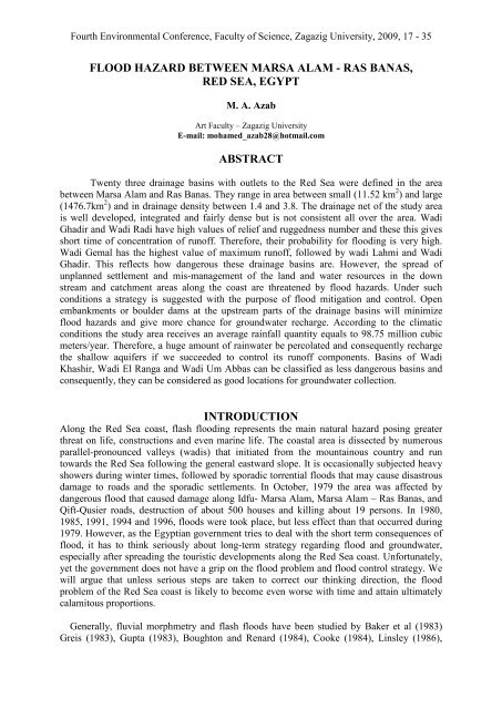
Fourth Environmental Conference, Faculty of Science, Zagazig University, 2009, 17 - 35FLOOD HAZARD BETWEE MARSA ALAM - RAS BAAS,RED SEA, EGYPTM. A. AzabArt Faculty – Zagazig UniversityE-mail: mohamed_azab28@hotmail.comABSTRACTTwenty three drainage <strong>ba</strong>sins with outlets to the Red Sea were defined in the area<strong>betwee</strong>n Marsa Alam and R<strong>as</strong> Ban<strong>as</strong>. They range in area <strong>betwee</strong>n small (11.52 km 2 ) and large(1476.7km 2 ) and in drainage density <strong>betwee</strong>n 1.4 and 3.8. The drainage net of the study areais well developed, integrated and fairly dense but is not consistent all over the area. WadiGhadir and Wadi Radi have high values of relief and ruggedness number and these this givesshort time of concentration of runoff. Therefore, their pro<strong>ba</strong>bility for <strong>flood</strong>ing is very high.Wadi Gemal h<strong>as</strong> the highest value of maximum runoff, followed by wadi Lahmi and WadiGhadir. This reflects how dangerous these drainage <strong>ba</strong>sins are. However, the spread ofunplanned settlement and mis-management of the land and water resources in the downstream and catchment are<strong>as</strong> along the co<strong>as</strong>t are threatened by <strong>flood</strong> <strong>hazard</strong>s. Under suchconditions a strategy is suggested with the purpose of <strong>flood</strong> mitigation and control. Openem<strong>ba</strong>nkments or boulder dams at the upstream parts of the drainage <strong>ba</strong>sins will minimize<strong>flood</strong> <strong>hazard</strong>s and give more chance for groundwater recharge. According to the climaticconditions the study area receives an average rainfall quantity equals to 98.75 million cubicmeters/year. Therefore, a huge amount of rainwater be percolated and consequently rechargethe shallow aquifers if we succeeded to control its runoff components. B<strong>as</strong>ins of WadiKh<strong>as</strong>hir, Wadi El Ranga and Wadi Um Ab<strong>ba</strong>s can be cl<strong>as</strong>sified <strong>as</strong> less dangerous <strong>ba</strong>sins andconsequently, they can be conside<strong>red</strong> <strong>as</strong> good locations for groundwater collection.ITRODUCTIOAlong the Red Sea co<strong>as</strong>t, fl<strong>as</strong>h <strong>flood</strong>ing represents the main natural <strong>hazard</strong> posing greaterthreat on life, constructions and even marine life. The co<strong>as</strong>tal area is dissected by numerousparallel-pronounced valleys (wadis) that initiated from the mountainous country and runtowards the Red Sea following the general e<strong>as</strong>tward slope. It is occ<strong>as</strong>ionally subjected heavyshowers during winter times, followed by sporadic torrential <strong>flood</strong>s that may cause dis<strong>as</strong>trousdamage to roads and the sporadic settlements. In October, 1979 the area w<strong>as</strong> affected bydangerous <strong>flood</strong> that caused damage along Idfu- Marsa Alam, Marsa Alam – R<strong>as</strong> Ban<strong>as</strong>, andQift-Qusier roads, destruction of about 500 houses and killing about 19 persons. In 1980,1985, 1991, 1994 and 1996, <strong>flood</strong>s were took place, but less effect than that occur<strong>red</strong> during1979. However, <strong>as</strong> the Egyptian government tries to deal with the short term consequences of<strong>flood</strong>, it h<strong>as</strong> to think seriously about long-term strategy regarding <strong>flood</strong> and groundwater,especially after spreading the touristic developments along the Red Sea co<strong>as</strong>t. Unfortunately,yet the government does not have a grip on the <strong>flood</strong> problem and <strong>flood</strong> control strategy. Wewill argue that unless serious steps are taken to correct our thinking direction, the <strong>flood</strong>problem of the Red Sea co<strong>as</strong>t is likely to become even worse with time and attain ultimatelyc<strong>alam</strong>itous proportions.Generally, fluvial morphmetry and fl<strong>as</strong>h <strong>flood</strong>s have been studied by Baker et al (1983)Greis (1983), Gupta (1983), Boughton and Renard (1984), Cooke (1984), Linsley (1986),
18M. A. AzabBaker and Pickup (1987), Cunnane (1987), Klemes (1987), T<strong>as</strong>ker (1987), Patton (1988) andSummerfield (1991). Moreover, studies in fluvial geomorphology and morphometry of some<strong>flood</strong> vulnerable are<strong>as</strong> of Egypt such <strong>as</strong> Sinai and the E<strong>as</strong>tern Desert and have receivedparticulars consideration by some workers (e.g. Mo<strong>ba</strong>rek et al. 1981; EI K<strong>as</strong>s<strong>as</strong> and ElRakaiby 1983; Salem 1985; El Shamy 1985, Schick and Lekach 1987; Saleh 1989 a, b, c; ElRakaiby 1989; EI Etr and Ashmawy 1993; Ashmawy 1993; Yahia et al. 1999 a, b; EI-Etr etal. 1999; Ashmawy et al. 2000; Ashmawy 2001,2002 and Kamh 2002).The study area is located in the central E<strong>as</strong>tern Desert of Egypt and lies entirely within thecatchment area of the Red Sea. It is bounded from the e<strong>as</strong>t by the Red Sea and from the westby the River Nile-Red Sea water divide, and is limited by maximum latitudes 24° and 25° N(Fig. 1). It is of elongated and covers an area of about 6000 km2.Geomorphological studies may give information about the are<strong>as</strong> affected by <strong>flood</strong>ing.Studying the morphometric parameters of drainage <strong>ba</strong>sins is very important for determinationof the intensity of <strong>flood</strong>s, and provides suitable solutions for avoiding or <strong>red</strong>ucing <strong>as</strong> much <strong>as</strong>possible, <strong>hazard</strong>s that occur, in addition to incre<strong>as</strong>ing groundwater recharge. The study of thehydro-geochemical characters of groundwater in Wadi EI-Gemal <strong>ba</strong>sin (at the middle part ofthe study area) is important for domestic, livestock and irrigation uses. Beside deciphering thedifferent landforms and the drainage courses and their <strong>ba</strong>sins, this study helps to define thelocations and distribution of the Plio-Quaternary fans of pro<strong>ba</strong>bly great importance to thegroundwater recharge.Methods Of StudyQualitative and quantitative geomorphic analyses of the drainage <strong>ba</strong>sins in the area <strong>betwee</strong>nMarsa Alam and R<strong>as</strong> Ban<strong>as</strong> were me<strong>as</strong>u<strong>red</strong> and analyzed for fl<strong>as</strong>h <strong>flood</strong> (Fig. 1).These parameters give a better understanding for surface water potentialities in the definedhydrographic <strong>ba</strong>sins. Drainage networks of each drainage <strong>ba</strong>sin were delineated from photomosaic(1 :50,000), topographic maps (24 maps at scale 1 :50,000) and landsat images ofscale 1:50.000, <strong>as</strong> well <strong>as</strong>, field observations. Twenty-three drainage <strong>ba</strong>sins were defined andmapped.The geomorphological parameters of each <strong>ba</strong>sin were defined in terms of stream order,bifurcation ratio (Horton 1945 and Strahler 1952), <strong>ba</strong>sin shape (Miller 1953 and Schumm1956), sinuosity (Mueller 1968), relief ratio (Schumm 1956.) and ruggedness number (Melton1957). The rainfall and surface runoff were defined according to the equation given by Ball(1937).Topography And GeomorphologyThe study area comprises essentially high and rugged mountains, built up of a seriesmountain our range, more or less coherently trending parallel to the co<strong>as</strong>t and interrupted by anumber of detached m<strong>as</strong>ses and peaks (Fig. 2). The high peaks are concentrated in thesouthwestern corner where they rise to elevations up to 1975m (Ga<strong>ba</strong>1 Hamata). The RiverNile-Red Sea water divide runs over the high peaks of the Red Sea Mountains with anaverage elevation of 650m. A large number of wadis initiate from the mountainous terraindissecting the area and run toward the Red Sea following the general e<strong>as</strong>tward slope. They aremostly oriented E-W, WNW-ENE, NNW-SSE and NE-NW. The main wadis are veryimportant sutable are<strong>as</strong> for extending net of roads crossing the area and <strong>as</strong> the main arteriesfor groundwater. Slope gradient is mostly steep in the upper reaches of drainageways andtends to be gentle to the e<strong>as</strong>t.
FLOOD HAZARD BETWEE MARSA ALAM - RAS BAAS 19Fig. (1) Location Map of the Study AreaThe Red Sea high mountains form the <strong>ba</strong>ckbone of the E<strong>as</strong>tern Desert and extend parallelto and at a relatively short distance from the co<strong>as</strong>t. They are flanked to the north and west byintensively dissected sedimentary plateaux. In the meantime, they do not form a continuousrange, but rather a series of mountain groups disposed in a linear direction approximating thatof the co<strong>as</strong>t, with some detached m<strong>as</strong>ses and peaks. The elongated m<strong>as</strong>sive block ofultramafic rocks forms the highest mountainous in the area and the watershed that separates<strong>betwee</strong>n the Nile and the Red Sea <strong>ba</strong>sins. However,the co<strong>as</strong>tal hilly area and the lower mountains form conspicuous topographical features<strong>betwee</strong>n the co<strong>as</strong>t and the main Red Sea mountains. The granitoid rocks forming low tomoderate relief but the gabbroic ones forming relatively higher hills.The co<strong>as</strong>tal plain is a low topographic feature of a variable width ranging <strong>betwee</strong>n 0.6km inthe north (Wadi Ghadir) to more than 12km in the south at Hamata. Sedimentary depositesextending from the piedmont to the Red Sea co<strong>as</strong>t, comprise alluvial fans, wadis and littoral(reef) deposits. Modem fringing coral reef (50-100m wide) is extended along the co<strong>as</strong>t. Coralreefs disappear at the mouth of some wadis <strong>as</strong> a result of sediment (sand and pebbles)accumulation during <strong>flood</strong>s. However, the co<strong>as</strong>tal line character by presence of em<strong>ba</strong>yment(<strong>marsa</strong>s).Several terrace steps were formed in alluvial fans, sometimes occur <strong>as</strong> a single featureflanking the sides of the wadis but on occ<strong>as</strong>ions they may be arranged in vertical successionsforming flights along the sides of the wadi channels. They were recorded along the co<strong>as</strong>t ofthe Red Sea and the Gulfs of Suez and Aqa<strong>ba</strong> and were conside<strong>red</strong> to be closely related to thePlio-Pleistocene peripheral uplift of the hinterland are<strong>as</strong> (Sellwood and Netherwood 1984).
20M. A. AzabFig. (2) Topography of the study area (<strong>ba</strong>sed on Egyptian MilitarySurvey topographic map 1986 at scale (1 : 250000).Geomorphic Characteristics of the Plio-Quaternary Alluvial Fans:From north to south, there are six major fans in the study area: Samadi, Nakari, Khalilate EIBahri, Rimarim, Kh<strong>as</strong>hir and R<strong>as</strong> Ban<strong>as</strong>. They range in area <strong>betwee</strong>n 10km 2 (Khalilate EIBahri) and 190km 2 (Kh<strong>as</strong>hir), and their altitudes range <strong>betwee</strong>n 79m a.s.l (Khalilate El Bahri)and 172m a.s.l (Nakari). The lower limit of the studied fans varies from 6.0 m a.s.1 (WadiSamadi) to 10.0m a.s.l (Wadi Rimarim). The apex of fan area are arranged adjacent to alongthe main faulted boundary extending at the mountain front h<strong>as</strong> relatively higher slope. Itvaries from 5° (Wadi Rimarim) to 16° (Wadi Nakari). The middle fan are<strong>as</strong> one of gentleinclination, and varies from 3° at Wadi Gemal and R<strong>as</strong> Ban<strong>as</strong> to 8° at Khalilate EI Bahri. Thelower fan h<strong>as</strong> a slope of less than 2°.These fans are drained by number of channels originating from the high relief mountain.These channels are generally parallel at the lower and middle parts of the fan zone. They arehigher dissected and have deep gullies in their lower parts. Most extensive terraces withdifferent levels are developed around the channels of these fans.Drainage CharacteristicsThe study area represents a part of the Red Sea drainage submega<strong>ba</strong>sin (El Shazly et al.1991). The water divide follows the high peaks of the Red Sea Mountains. It is crooked andtrends roughly in a NNW direction parallel to the regional trend of the Red Sea. The finalshaping of the drainage network is an outcome of the l<strong>as</strong>t fluvial periods. The present dryvalleys and tributaries were already engraved during these fluvial periods. They are now filledwith surficial deposits of gravels, sands and clays. Twenty three drainage <strong>ba</strong>sins with outletsto the Red Sea were defined and sorted out, area-wise into three distinct categories (large>
FLOOD HAZARD BETWEE MARSA ALAM - RAS BAAS 21200 km 2 , medium 200-60km 2 , and small
22M. A. AzabFig. (4) Drainage net of the area <strong>betwee</strong>n Wadi Samadi and Wadi Sherm LuliFig. (5) Drainage networks of the area <strong>betwee</strong>n Wadi Um Ab<strong>ba</strong>s and Wadi Qulan
FLOOD HAZARD BETWEE MARSA ALAM - RAS BAAS 23Fig. (6) Drainage networks of the area <strong>betwee</strong>n Wadi Radi and R<strong>as</strong> Ban<strong>as</strong>.Drainage B<strong>as</strong>in MorphometryQuantitative analysis of hydrographic <strong>ba</strong>sin can be achieved through me<strong>as</strong>uring thegeomorphological parameters including stream order (U), bifurcation ratio (Rb), streamfrequency (F) and drainage density (D).Stream Orders (U) of the studied <strong>ba</strong>sins range <strong>betwee</strong>n 7 (Wadi EI Gemal and Wadi Ghadir)and 4 (Wadi Samadi, Wadi Nakari Wadi Khalilate El Bahri, Wadi Khalilate EI Qibli, WadiUm Dahise, Wadi Urn Ghazal, Wadi Stayai, Wadi Kirah EI Hertawi and Wadi Um Rimarim).(Table 1).Bifurcation Ratio (Rb) defined <strong>as</strong> the ratio <strong>betwee</strong>n the number of stream order (Nu) to thenumber of the next order (Nu+1)(Horton 1945). B<strong>as</strong>ins with low Rb values tend to produce <strong>as</strong>harp peak flow while the high Rb reflects low extended peak flow. The estimated Rb valuesof the studied <strong>ba</strong>sins (Table 1) ranges <strong>betwee</strong>n 2.82 and 4.85. Low values were recorded forWadi Satayia, Wadi Khalilate El Bahri, Wadi KhaIilate El QibIi, Wadi Sharm Luli, WadiGhadir and Wadi Um Ab<strong>ba</strong>s, and high values were recorded for Wadi Samadi, Wadi Nakari,Wadi Ranga, Wadi Radi, Wadi Um Rimarim, Wadi Kirah EI Hertawi, Wadi Lahmi and WadiQulan. The variation in Rb values reflects the difference in stages of geomorphic developmentand topographic variations. B<strong>as</strong>ins of high bifurcation ratio are elongate in shape and permitthe p<strong>as</strong>sage of runoff over an extended period of time to feed the groundwater. B<strong>as</strong>ins of lowbifurcation ratio are circular in shape and allow the runoff to p<strong>as</strong>s in a short time (Saad et al.1980).Drainage Density (D) reflects the effectiveness of the surface water flow,<strong>as</strong> well <strong>as</strong>, theinfiltration capacity. It is a function of slope, rock resistance, rock' permeability, andvegetation cover. In the study area, the drainage density (1.4-5.02) is a direct expression ofrelief <strong>as</strong> the vegetation is not represented and the rocks are more or less impermeable andresistant. Drainage density is low in Wadi Samadi, Wadi Um Ab<strong>ba</strong>s, Wadi Abu Ghusun,Wadi Ranga, Wadi Kh<strong>as</strong>hir, Wadi Lahmi and Wadi Sataiya, and high in Wadi Khalilate El
24M. A. AzabQibli, Wadi Sharm Faquri, Wadi Erier, Wadi Qulan, Wadi Radi and Wadi .Kirah El Hertawi.Drainage density is the most important me<strong>as</strong>ure of the areal <strong>as</strong>pects of the <strong>ba</strong>sins because itsimplications for runoff (Chorley 1971) and climate (Gregory 1976). Drainage density tends tobe high in semi-arid regions and in humid regions (Gregory 1976).Stream Frequency (f) is defined <strong>as</strong> the ratio of the total number of stream segments of allorders in each <strong>ba</strong>sin to the total area of the respective <strong>ba</strong>sin Horton (1954).Physiographic etwork ParametersDetermination of physiographic parameters such <strong>as</strong> <strong>ba</strong>sin shape, relief, slope sinuosity is of agreat importance <strong>as</strong> a reconnaissance tool to delineate the rainfall/runoff relationship and to<strong>as</strong>sess the surface water capacity of any hydrographic <strong>ba</strong>sin.B<strong>as</strong>in Shape controls the stream discharge from a watershed. It is numeri expressed in theform of circularity and elongation ratios. Circularity ratio (Rc) is the rati the <strong>ba</strong>sin area to thearea of a circle with the same perimeter <strong>as</strong> the <strong>ba</strong>sin (Miller 19 Elongation ratio (Re) is theratio of the diameter of a circle equal in area to the <strong>ba</strong>sin to maximum <strong>ba</strong>sin length (Schumm1956). Rc values range <strong>betwee</strong>n 0.33 and 0.98 while values range <strong>betwee</strong>n 0.39 and 0.97(Table 2). B<strong>as</strong>ins of high Rc (Wadi Samadi, Wadi Ab<strong>ba</strong>s, Wadi Sharm Luli, Wadi Dahise,Wadi EI Hertawi, Wadi Kh<strong>as</strong>hir, Wadi Um Rimari Wadi Ghadir and Wadi Khalilate EI Qibli)yield favorable conditions for shortest runoff give chance to form highly peaked <strong>flood</strong>s.Relief Ratio <strong>as</strong> expressed by Schumm (I956) is the ratio <strong>betwee</strong>n Rand L, where is theelevation difference <strong>betwee</strong>n the <strong>ba</strong>sin mouth and the highest point on the b perimeter, and Lis the maximum length of the <strong>ba</strong>sin, me<strong>as</strong>u<strong>red</strong> in the same units <strong>as</strong> R alan line essential1yparal1el to the principal channel. It is an expression of the drainage <strong>ba</strong>sin reli in a twodimensionalform, elevation and distance, and correlates better with hydrologi characteristics.B<strong>as</strong>ins with more or less unifOlm slopes result in significant relationshi <strong>betwee</strong>n relief ratioand hydrologic vaJiables such <strong>as</strong> runoff and sediment yield. The small the relief ratio, themore is the annual sediment yield and hence more dangerous durin <strong>flood</strong>ing. In theinvestigated area, the relief ratios are low (Wadi Samadi, Wadi Sharm Faqu . Wadi UmRimarim, Wadi Qulan and Wadi Satiya) and high (Wadi Ranga, Wadi Abu Ghusu and WadiKh<strong>as</strong>hir) (Table 2).Ruggedness umber is the product of drainage density and <strong>ba</strong>sin relief (Strahle1958). The incre<strong>as</strong>e of the runoff discharge is the result of the incre<strong>as</strong>ed relief and drainagedensity. In the studied area, the ruggedness number ranges from 4366 (Wadi Radi) to 365(Wadi Satayia) (Table 2). Accordingly, the pro<strong>ba</strong>bilities offload occurrence along the streamsof Wadi Ghadir, Wadi Erier, Wadi Gemal, Wadi Abu Ghusun, Wadi Ranga, Wadi Radi, WadiKh<strong>as</strong>hir and Wadi Lahmi are higher than those of the other streams. This means that the timerequi<strong>red</strong> for the runoff to flow from the highest distal ridge to the mouth (concentration time)of these streams is much shorter than that requi<strong>red</strong> for the other streams.Slope Index is the quotient of the elevation difference <strong>betwee</strong>n <strong>ba</strong>sin divide (<strong>ba</strong>sin relief) andoutlet and the main channel length (Taylor and Schwarz 1952). The main streams of WadiGemal, Wadi Qulan, Wadi Um RimaJim, Wadi Satayia and Wadi Sharm Luli are moresteeper than the that of Wadi Ghadir, Wadi Khalilate EI Qibli, Wadi Abu Ghusun, WadiRanga, Wadi Kh<strong>as</strong>hir and Wadi Urn Ghazal (Table 2). On the other hand, the upstream partsof some wadis are steeper than downstream ones and consequently, they are more favorable toyield <strong>flood</strong>s, while the lower parts are suitable to store ground water.Sinuosity is defined <strong>as</strong> the ratio of the valley length to the shortest distance <strong>betwee</strong>n mouthand source of stream (Mueller 1968). The estimated ratios indicate that streams ofWadi Ghadir, Wadi Gemal, Wadi Lahmi, Wadi Shmm Luli and Wadi Um Dahise are more
FLOOD HAZARD BETWEE MARSA ALAM - RAS BAAS 25sinuous than the others in the area (Table 2). The straight shape of the streams of Wadi UmTende<strong>ba</strong>, Wadi Khalilate El Qibli, Wadi Ranga, Wadi Qulan, Wadi Radi and Wadi UmRimarim is favorable to yield <strong>flood</strong>s, but the other physiographic parameters tend to decre<strong>as</strong>ethis effect.Main Characteristics Of The Most Significant B<strong>as</strong>ins: Detailed study w<strong>as</strong> carried out onselected eight <strong>ba</strong>sins. The selection w<strong>as</strong> <strong>ba</strong>sed on <strong>ba</strong>sin shape and size, relief and gradient,rock type, geological structure and fl<strong>as</strong>h <strong>flood</strong> vulnerability. Accordingly, Wadi Ghadir, WadiErier, Wadi Gemal, Wadi Um Ab<strong>ba</strong>s, Wadi Abu Ghusun, Wadi Ranga, Wadi Kh<strong>as</strong>hir, andWadi Lahmi <strong>ba</strong>sins were chosen. Rocks exposed in these <strong>ba</strong>sins belong mainly to thePrecambrian <strong>ba</strong>sement complex and the structures are mainly faults. Sediments andsedimentary rocks occupy the lower part of these <strong>ba</strong>sins. Their lithologies favou<strong>red</strong> lateralerosion of the main channel, and the development of an alluvial bed through which the streamflows.Wadi Ghadir B<strong>as</strong>in is fan shaped, reaches seventh order and h<strong>as</strong> an area of about 555km 2(Table 3). The <strong>ba</strong>sin is characterized by rugged mountainous of high relief (up to 1366 m)with very steep slopes, particularly along and near the water divide. It is <strong>as</strong>ymmetric, withlarge catchment area, and discharge on the southern side of the trunk Wadi. Wadi Ghadir isthe main channel of <strong>ba</strong>sin, its flows. Segmental changes in wadi width are agree to change inrock type. Due to the effect of structures (mainly faults) the large tributaries are possesseslineament characters. The short distance <strong>betwee</strong>n the head and the mouth of the main channel,ruggedness of relief and steepness of slope are factors that tend to decre<strong>as</strong>e the time of runoff,and consequently incre<strong>as</strong>e its velocity. This, in turn, incre<strong>as</strong>es the fl<strong>as</strong>h <strong>flood</strong> potentiality. The<strong>ba</strong>sin mouth is crossed by a short segment of the Red Sea co<strong>as</strong>tal road, which is stronglyvulnerable to <strong>flood</strong>ing.Wadi Erier B<strong>as</strong>in of the sixth order, and h<strong>as</strong> an area of about 261km2. It is roughlytriangular shape, dense with variable angles of juncture. Its pattern is dendritic to subdendriticin parts and parallel to subparallel in others. Wadi Erier flows W-E, and its large tributariesare mostly oriented NNW, NNE to N. Substantial segments of these channels are controlledby faults. The <strong>ba</strong>sin is characterized by steep slope in the upper reaches of the main wadi andits large tributaries. This is mainly <strong>as</strong>cribed to relief ruggedness (up to 771 m high), slopesteepness (due to faulting) and to its lithologic characteristics (in decre<strong>as</strong>ing order ofsignificance). Only small outcrops of Neogene and Quaternary sediments are exposed near themouth of the main wadi. Local fans are common at the foot slopes of the mountains. A smallpart of the Red Sea co<strong>as</strong>tal road is crossing the <strong>ba</strong>sin mouth area. This part of the road isstrongly vulnerable to torrential <strong>flood</strong>s. Besides, the settlements of Marsa Alam are stronglyvulnerable to torrential <strong>flood</strong>s (ex. the fl<strong>as</strong>h <strong>flood</strong> on November 1991, 2-3 November 1994and November 1996).
26M. A. AzaboI234567891011121314151617181920212223Table (3) Estimated rain fall and runoff quantities in the studied drainage <strong>ba</strong>sinsB<strong>as</strong>in name Area Annual Max. run off Max. run off in(Km 2 ) rainfallquantityin one day(l0m 3 )one day (l0m 3 ) Min. run off inone day (l0m 3 )W.SamadiW.Um Tundi<strong>ba</strong>W. AmboutW. NakariW. GhadirW. Khalilat El BahriW. Khalilat El QibliW. Sharm FaguriW. ErirW. El-GemalW. Sherm LuliW. Um DihesiW. Um Ab<strong>ba</strong>sW. Abu GhusunW. RangaW. QulanW. RadiW. Um RimarimW. Kh<strong>as</strong>hirW. LahmiW. Um GhazalW. HirtawyW. Sataiya63.2667.0790.4748.34554.2413.2811.5273.05261.321476.66337.97495.29309.6357.33156.7748.83464.01967.0816.4237.2139.0660.1524.121.11.171.570.849.640.230.21.274.5525.75.98.625.3912.730.858.0716.830.290.650.681.080.4298.784.054.295.793.0935.470.850.744.6816.7294.5121.6331.719.823.6710.033.1329.761.891.052.382.53.851.54363.082.662.823.82.0323.280.560.483.0710.9862.0214.1920.8132.416.582.0519.4940.620.691.561.642.531.01238.270.240.250.340.182.080.050.040.270.985.541.271.861.160.210.590.181.743.630.060.140.150.0230.0921.073Wadi Gemal B<strong>as</strong>in occupies a rather large area (about 1477 km 2 ) and its main trunk wadi<strong>as</strong>sumes a seventh order. The drainage net is well developed, integrated, dense, oriented andh<strong>as</strong> variable angles of juncture (Fig. 7). The <strong>ba</strong>sin drains high mountains with steep slopesand elevations up to 1508 m. The significant large channels are mostly arranged in parallel tosubparallel patterns with dendritic to subdendritic tributaries. Trellis and subtrellis drainagepatterns are locally developed. The main wadi is oriented NNW in the upper part, EW in themiddle part and NE near its the mouth. Its large tributaries are mostly directed NW and NNE,mostly due to fault control. It is characterised by low (Rb), low drainage density and nearlycircle shape. Metamorphic rocks, met<strong>as</strong>ediments and granites are the most widespreadlithologic units exposed in this <strong>ba</strong>sin. Neogene sedimentary rocks and Quaternary sedimentswith local fans are located at the mouth of the m<strong>as</strong>ter wadi. The main trunk wadi at the lowerpart is narrow. This indicates a high potential for <strong>flood</strong> <strong>hazard</strong>s at the upper reaches of the<strong>ba</strong>sin and the downstream part of the trunk wadi. The <strong>ba</strong>sin mouth is crossed by a shortsegment of the Red Sea co<strong>as</strong>tal road.
FLOOD HAZARD BETWEE MARSA ALAM - RAS BAAS 27Fig. (7) Drainage network of Wadi Gemal area (Ashmawy 2001).Wadi Um Ab<strong>ba</strong>s <strong>ba</strong>sin is of sixth order and h<strong>as</strong> an area of about 338km.It is roughlyrectangular, well integrated, relatively dense, and h<strong>as</strong> variable angles of juncture. Its pattern isdenderitic to subdenderitic in the upper part and parallel to subparallel in the middle part. Thetrunk wadi (Um Ab<strong>ba</strong>s) flows N, NE in the upper and lower parts to N, NW in its middle part.Its large tributaries are oriented N, NW, NNE, E-W to N. substantial segments of thesechannels are guided by faults. The lithology is dominated by <strong>ba</strong>sement (granitic rocks), whileoutcrops of Neogene and Quaternary sediments are exposed near the middle part and at themouth of the waid. The <strong>ba</strong>sin is characterized by middle drainage denisity, middle relief (upto 748 m high), high contribution for groundwater and cl<strong>as</strong>sified <strong>as</strong> middle dangerous <strong>ba</strong>sin.Its shape is nearly circular and reflects the most favorable conditions for the short runoffdistance.Wadi Abu Ghusun B<strong>as</strong>in is fan shaped of sixth order and h<strong>as</strong> an area of about 495km. The<strong>ba</strong>sin is characterized by rugged mountainous relief (up to 1468 m high) with very steepslopes particularly along and near the water divide. Wadi Abu Ghusun is the main channel,which flows NW to NE at the upper part and W-E, NW to NE at the lower part toward theRed <strong>sea</strong>. The long tributaries are clearly oriented and run NE and SE. The change of wadisegments in width, degree of channel incision and channel trends is generally due to thestructural control (mainly faults) and/ or to change in rock type. The large channels are mostlyarranged in parallel to subparallel patterns with dendritic to subdendritic arrangement for thesmaller tributaries. The lithology is dominated by <strong>ba</strong>sement rocks (granites and metavolcanicrocks) in the upper and middle parts. Towards the outlet, a few outcrops of Neogene andQuaternary sediments are exposed. This <strong>ba</strong>sin h<strong>as</strong> low bifurcation ratio, nearly circular inshape. Ruggedness of relief and slope steepness are factors which tend to decre<strong>as</strong>e the time of
28M. A. Azabrunoff and consequently incre<strong>as</strong>e its velocity. These parameters incre<strong>as</strong>e the fl<strong>as</strong>h <strong>flood</strong>potentiality.Wadi El Ranga B<strong>as</strong>in is fifth order and h<strong>as</strong> an area of about 310 km2. It is relatively den<strong>sea</strong>nd h<strong>as</strong> variable angles of juncture. Its drainage network pattern is denderitic to subdenddriticin parts and parallel to subparallel in others. The trunk wadi (wadi Ranga) flows NNE, NNWand E-W substantial segments of the main channel and large tributaries are guided by faults.Lithology is dominated by <strong>ba</strong>sement rocks with only small outcrops of Neogene andQuaternary sediments exposed near the mouth. This <strong>ba</strong>sin is characterized by ruggedmountainous relief (up to 1976 m high), low bifurcation ratio and very steep slope in theupper and middle reaches, which indicates high potential for <strong>flood</strong> <strong>hazard</strong>s at these parts.Wadi Kh<strong>as</strong>hir B<strong>as</strong>in is a sixth order and occupies an area of 464 km 2 . Its drainage net iswell developed, relatively dense and h<strong>as</strong> variable angles of juncture. The <strong>ba</strong>sin drains highmountains (up to 1658 m high) with very steep slopes. The relatively large channels arearranged in parallel pattern. Trellis pattern is also developed. Wadi Kh<strong>as</strong>hir is oriented E-W inthe upper part and NE in the middle and lower pat1s. Large tributaries are mostly directed EWand NE and less significantly at north. Metavolcanics, met<strong>as</strong>ediments and granites are thewidespread lithologic units exposed in the middle and upper parts. Neogene and Quaternarysediments are exposed at the mouth towards the Red Sea. Local fans are common at the footslops of the mountainous relief. The <strong>ba</strong>sin is characterized by very steep slope and low valuesof Rb in the upper part which leading to produce high peak flow. It is also characterized bylow drainage density and low stream frequency, which tends to produce moderate <strong>flood</strong>intensity especially, along the permeable downstream part. The <strong>ba</strong>sin tends to be elongated inshape and therefore, can be cl<strong>as</strong>sified <strong>as</strong> a low danger <strong>ba</strong>sin. Consequently, it is conside<strong>red</strong> <strong>as</strong>a good location for groundwater harvesting.Wadi Lahmi B<strong>as</strong>in is of sixth order and h<strong>as</strong> an area of about 967km 2 (Table 3). It is roughlyrectangular, well integrated; dense and h<strong>as</strong> variable angles of juncture. Its drainage patternsare trellis to sub trellis, radial in parts, and sub parallel in others. The trunk wadi (WadiLahmi) flows NNE to W-E and again NNE. Its large tributaries are mostly oriented E-W,NNW and NNE. Substantial segments of these channels are controlled by faults. Lithology isdominated by <strong>ba</strong>sement rocks with small outcrops of Neogene and Quaternary sedimentsexposed near the mouth. This <strong>ba</strong>sin is characterised by rugged mountainous relief (up to 1590m high), steep slope, low bifurcation ratio and circular shape. This indicates that there is ahigh potential for <strong>flood</strong> <strong>hazard</strong>s at the upper reaches of the <strong>ba</strong>sin and the downstream part ofthe trunk wadi.Rainfall And Surface RunoffThe study area is characterized by arid climate and dominated by hot temperatures, rainlesssummer and mild winter. The average annual precipitation rate is about 17.4 mm(meteorological stations of R<strong>as</strong> Ban<strong>as</strong>). Most of precipitation occurs <strong>as</strong> heavy showers withshort duration, results in fl<strong>as</strong>h <strong>flood</strong>s during the winter se<strong>as</strong>on <strong>betwee</strong>n October and February.The maximum amount of precipitation recorded in one day w<strong>as</strong> 64 mm (24 November 1966).The monthly mean temperature varies <strong>betwee</strong>n 24-38 °C during summer and 12-26 °C duringwinter. The relative humidity varies <strong>betwee</strong>n 28% in summer and 59% in winter. The averageevaporation, transpiration varies <strong>betwee</strong>n 8.7 mm/day in winter and 28 mm/day in summer.According to the above-mentioned climatic parameters, the study area receives an averagerainfall quantity equals to 98.75 million cubic meters/year (Table 3). It is a huge amount ofdownstream outlet. However, a considerable amount will be evaporated.
FLOOD HAZARD BETWEE MARSA ALAM - RAS BAAS 29The exposed maximum volume of runoff (V) can be calculated according to the equationdeveloped by Ball (1937) <strong>as</strong> follows V=750A (R-8) m 3 . V, the average weighted maximumvolume of runoff in the <strong>ba</strong>sin can reach up to 238.27 million m 3 (Table3). The minimumrunoff on the hydrographic <strong>ba</strong>sins of south Marsa Alam is expected to be 21.28 millionm 3 /day; Table 3; if the rainfall in one storm exceeds 13 mm/day (R<strong>as</strong> Ban<strong>as</strong> meteralogicalstation).Fl<strong>as</strong>h Flood VulnerabilityThe occ<strong>as</strong>ional heavy showers along the <strong>ba</strong>sement highland during winter in the present timemaintain short period <strong>flood</strong>s. In fact, desert <strong>flood</strong>s are inherently of low duration (few hours tosome days) and are commonly characterized by sharp peak of discharges. Peak of duration isvariable and may be in the range of 10-30 min. Torrential <strong>flood</strong>s cause serious desertproblems and excessive life and property losses, especially along the co<strong>as</strong>t. They may hamperdevelopment and resource exploitation activities. Although their influence is locally verysignificant, sporadic fluvial (fl<strong>as</strong>h <strong>flood</strong>) processes have not been conside<strong>red</strong> in the way thatthey should be during planning of new settlements and also in the major developmentprojects. The study area includes sector of the Red Sea co<strong>as</strong>tal road parallel to the shoreline.Substantial parts of this high-way are crossed from west to e<strong>as</strong>t by the lower reaches of theRed Sea drainage <strong>ba</strong>sins and consequently subjected to fl<strong>as</strong>h <strong>flood</strong> <strong>hazard</strong>s (Fig. 8).Vulnerability is differentiated into three categories: slight, moderate and high. This<strong>as</strong>sessment w<strong>as</strong> <strong>ba</strong>sed on detailed analyses of satellite images (scale, 1: 50.000), topographicmaps and morphometeric characteristics of the effected drainage <strong>ba</strong>sins. Flood <strong>hazard</strong> doesnot only affect the traffic ability of these roads but extends also to existing and planned ur<strong>ba</strong>nsites and development projects along and close to them. It also affects the marine life at themouth of wadis, coral reef is completely absent in the torrent p<strong>as</strong>s way and starts to appearonly on the margins of sharms which incre<strong>as</strong>e in density and size <strong>sea</strong>wards (Mansour 1999).The present <strong>as</strong>sessment of fl<strong>as</strong>h <strong>flood</strong> vulnerability of the drainage <strong>ba</strong>sins in the study areahelps in the selection of the most suitable sites for developmental land use (e.g, establishmentof touristic villages), particularly along the Red Sea co<strong>as</strong>tal zone (Fig. 10). These sites we<strong>red</strong>istinguished into 4 divisions from A (the le<strong>as</strong>t suitable) to D (the best suitable sites). Cl<strong>as</strong>s Dsites are commonly situated in the interspaces <strong>betwee</strong>n the drainage <strong>ba</strong>sin outlets.Fig. (8) Fl<strong>as</strong>h <strong>flood</strong> vulnerable sites along Marsa Alam-Bernice co<strong>as</strong>tal highway
30M. A. AzabFig. (9) Developmental land use Assessment along the co<strong>as</strong>tal zoneof the Red Sea. Assessment <strong>as</strong> evaluated on a scale of 4 divisions(A throught D), D for the best sites and A for le<strong>as</strong>t sutiable sites.Mitigation Of Fl<strong>as</strong>h Flood HazardsThe spread of unplanned settlement and mis-management of the land and water resources inthe downstream are<strong>as</strong> along the co<strong>as</strong>t will be responsible for the <strong>flood</strong> damages. The <strong>flood</strong><strong>hazard</strong> risk depends upon exposure to <strong>flood</strong>s, which h<strong>as</strong> to be me<strong>as</strong>u<strong>red</strong> in terms of populationand land use activities (Chan and Parker1996) and the demands on natural resources exertedin either an unsustainable or sustainable manner (Woube 1999). In thinking about the <strong>flood</strong>problem, the volume of fresh water lost in the <strong>sea</strong> needs to be taken into account. This wateris urgently needed for the development projects in the area. Flood also helps in recharginggroundwater aquifers. To avoid or alleviate fl<strong>as</strong>h <strong>flood</strong> damages and possibly to aid inexploitation of <strong>flood</strong>water for recharging shallow aquifers the following preventive andcontrol me<strong>as</strong>ures should be conside<strong>red</strong>. These me<strong>as</strong>ures can be summarized <strong>as</strong> follows:-1- Construction of successive incomplete rocky dams using the available locale materials atle<strong>as</strong>t along the elongated main course of large wadis <strong>as</strong> Wadi Gemal, Wadi Lahmi and WadiErier (EI Shamy 1992).2- Construction of some loose boulder dams along the small tIibutaries of the main wadis todecre<strong>as</strong>e the velocity of <strong>flood</strong> waters and incre<strong>as</strong>e their percolation into the wadi bed ( EIShamy 1992 ).3- Using the artificial recharge techniques may offer an important method for waterconservation to <strong>red</strong>uce the effect of evaporation in the area of study. Also, the onstruction ofsubsurface dams may create subsurface reservoirs (Hanson and Nilsson 1986).4- Decre<strong>as</strong>e the elevation of the dual caring road and the main paved road to a lower level
FLOOD HAZARD BETWEE MARSA ALAM - RAS BAAS 31than the level of the crossing wadis floor in the narrow sectors to allow water flow directlyover these roads.COCLUSIOMorphometric parameters of most drainage <strong>ba</strong>sins in the area <strong>betwee</strong>n Marsa Alam and R<strong>as</strong>Ban<strong>as</strong> indicate low bifurcation ratio, and high values of drainage densities and frequenciesleading to the high possibilities for fl<strong>as</strong>h <strong>flood</strong>s and low contribution for groundwaterrecharge. However, drainage <strong>ba</strong>sins of Wadi Samadi, Wadi Gemal, Wadi Um Ab<strong>ba</strong>s, WadiAbu Ghusun, Wadi Um Rimarim, Wadi Lahmi and Wadi Staiya are characterized by widedrainage channels and low density and thus their contribution to groundwater recharge isexpected to be high. Drainage <strong>ba</strong>sins of Wadi Samadi, Wadi Ghadir, Wadi Sharm Luli, WadiUrn Ab<strong>ba</strong>s and Wadi Khalilate EI Qibili are nearly circular in shape and thus reflect the mostfavourable conditions for the shortest runoff distance. The other drainage <strong>ba</strong>sins have lowelongation ratio and were cl<strong>as</strong>sified <strong>as</strong> less dangerous <strong>ba</strong>sins. Pro<strong>ba</strong>bility of fl<strong>as</strong>h <strong>flood</strong>ing isvery high for drainage <strong>ba</strong>sins of Wadi Radi, Wadi Ghadir, Wadi Ranga due to their highvalues of relief and ruggedness numbers. Wadi Gemal and Wadi Lahmi have the highestvalues of maximum runoff, which reflects the dangerous of their drainage <strong>ba</strong>sins. Under suchconditions, the construction of alternative <strong>ba</strong>rriers of boulder dams at the upstream parts of thedrainage <strong>ba</strong>sins will minimize <strong>flood</strong>ing <strong>hazard</strong>s and give more chance for groundwaterrecharge. The majority of wadis that display abnormal geomorphic features are related to thepresence of structural lines rather than any other surface or lithological features. To mitigatethe fl<strong>as</strong>h <strong>flood</strong> <strong>hazard</strong>s and to incre<strong>as</strong>e the groundwater recharge, precautionary me<strong>as</strong>uresneed to be taken into consideration at le<strong>as</strong>t at the high risk sites.REFERECESAshmawy, M. H., 1993: Assessment of fl<strong>as</strong>h <strong>flood</strong> potential of the Red Sea drainage <strong>ba</strong>sinsalong the Qena-Safaga highway, E<strong>as</strong>tern Desert, Egypt. ITC Journal 1994-2, pp.119-128, Netherlands.Ashmawy, M. H.; Swedan, A. H. and Abdel Fattah, T.,2000: Fl<strong>as</strong>h <strong>flood</strong> <strong>hazard</strong>s ofdrainage <strong>ba</strong>sins of Sir" Peninsula, Egypt. Ann. Geol. Surv. Egypt, V. XXIII , pp.467-489.Ashmawy, M. H., 2001: Fl<strong>as</strong>h <strong>flood</strong> potential of Wadi Al Gemal catchment area southE<strong>as</strong>tern Desert, Egypt. M. R C. Ain Shams Univ. Ser., V. 15, pp. 79-93.Ashmawy, M. H., 2002: Surface runoff potentiality and <strong>hazard</strong>s of drainage <strong>ba</strong>sins alongthe e<strong>as</strong>tern side of the Nile Valley <strong>betwee</strong>n Asyut and Al-Minya, Egypt. Egypt. J. Geol., V.46/1 , pp. 283-300.Baker, V.R; Kochel, R.C.; Patton, P.C. and Pickup, G., 1983: Paleohydrologic analysis ofHolocene <strong>flood</strong> slack water sediments: Spec. Pub. Int. Assoc. Sed. V. 6, pp. 229-239.Baker, V.R and Pickup, G., 1987: Flood geomorphology of Katherine Gorge. NorthernTerritory, Australia. Geol. Soc. Am. Bull. V. 98, pp. 635-646.Ball, J., 1937: The water supply of Mersa Matruh: Survey and mines deposits. Paper No. 43,Cairo, 41 p.Boughton, W.C. and Renard, K.G., 1984: Flood frequency characteristics of some Arizonawatersheds. Water Rescuer. Bull. V. 20 (5), pp. 761-769.Chan, .W. and Parker, D., 1996: Response to dynamic <strong>flood</strong> <strong>hazard</strong> factors in PeninsularMalaysia: Geographical Journal, V.162(3), pp. 313-325.Chorley, RJ., 1971: The drainage <strong>ba</strong>sin <strong>as</strong> a fundamental geomorphic unit. In: Chorley, R.
FLOOD HAZARD BETWEE MARSA ALAM - RAS BAAS 33M., 1987: Pan fraction crustal evolution in the Nubian Sediment of Northe<strong>as</strong>tAfrica. In : A Kroner (Ed.) proterozic Lithospheric evolution Mid-term Report ofworking group 3 of the international lithospere project. Am. Geophys. Union,Geodynamic Sec., V. 17: pp. 237-257.Linsley, R.K., 1986: Flood estimates. how good are they? Water Resour. Res., 22, pp. 159.164.Mansour, A.M., 1999: Changes of sediment nature by environmental imacts, Sharm AbuMakhadeg area, Red Sea, Egypt. Sedimentology of Egypt. V. 7, pp. 2536.Melton, M.A., 1957: An analysis of the relation among elements of climate, surfaceproperties and geomorphology. Technical Office of National Re<strong>sea</strong>rch, project NRColumbia University. pp 389-642.Miller, V.C., 1953: A quantitative geomorphic study of drainage <strong>ba</strong>sin characteristics in theClinch Mountain area; Virginia and Tennessee, Project NR3 P9-042, Tech Rept. 3,Columbia Univ., Geology Dept., ONR, Geography Branch, New York, 30p.Mo<strong>ba</strong>rek, I.E:-; Salem, M.H. and Dorrah, H.T., 1981: Fl<strong>as</strong>h <strong>flood</strong>s <strong>hazard</strong> prevention inUpper Egypt villages: C<strong>as</strong>e study of Aulad S<strong>alam</strong>a Villages. Cairo Univ. / MIT,(TPP).Mueller, J.E., 1968: An Introduction to the hydraulic and topographic sinuosity indexes:Ann. Ass. Am. Geol, V. 58, pp. 371-385.ational Academy of Science, 1974: Substances in water for livestock and poultry U.S.Environmental protection Agency. W<strong>as</strong>hington. D.C.Omara, S.M.; Philobbos, E.R. and Hanaa, S.S., 1973: Contribution to theGeomorphology and Geology of the area e<strong>as</strong>t of Mini a: Bull Soc. Geogr.Egypt, pp. 125-147.Patton, P.c., 1988: Drainage <strong>ba</strong>sin morphmetry and <strong>flood</strong>s. In : Baker, V.R., Kochel, R.c. andPatton, P.C. (Eds): Flood Geomorphology, John Wiley and Sons, New York, p.51-64.Saleh, A.S., 1989a: Geomorphological effects of a torrential <strong>flood</strong>s in Wadi EI-Atfeehy, theE<strong>as</strong>tem Desert of Egypt: Bull. Soc. Geogr. Egypt (in press).Saleh, A.S., 1989b: Natural <strong>hazard</strong>s on the e<strong>as</strong>tern sector of Nuwei<strong>ba</strong>. Tunnel nationalhighway, Sinai, a geomorphologic study (in arabic). Soc. Geogr. Egypt, Tom- V. 62,pp. 143-176.Saleh, A.S., 1989c: Fl<strong>as</strong>h <strong>flood</strong> in Deserts. A geomorphic study of desert wadis: specialstudies series. Inst. of Arab studies and Re<strong>sea</strong>rch, 51, Cairo, 93p. (In Arabic).Salem, M.H., 1985: Collapse of Khuzam Bridge, Qena Governorate, <strong>as</strong> a result of April,1985 fl<strong>as</strong>h <strong>flood</strong> Technical report: Dev. Res. And Tech. Plan; Center, Cairo Univ.Schick, A.P. and Lekach, J., 1987: A high magnitude <strong>flood</strong> in the Sinai Desert. In : Mayer,L. and N<strong>as</strong>h, D. (Eds) : Cat<strong>as</strong>trophic <strong>flood</strong>ing. Allen and Unwin, Winchester,M<strong>as</strong>sachussettes, pp. 381-410.Schumm, S.A, 1956: Evolution of drainage systems and slopes in <strong>ba</strong>dlands at PerthAmboy, New Jersey: Geol. Soc. Am. Bull., V. 67, pp. 596-646.Sellwood, B. w. and etherwood, R.E., 1984: Facies evolution in the Gulf of Suez area:Sedimentation history <strong>as</strong> an indicator of rift initiation and development: ModemGeol., V. 9, pp. 43-69.Strahler, A., 1952: Hypsometric (area altitude) analysis of erosional topography: Geol.Soc. Am. Bull., V. 63, pp. 1117-1142.Summerfield, M.A, 1991: Glo<strong>ba</strong>l geomorphology: An introduction to the study oflandforms. Longman, 537 p.
34M. A. AzabT<strong>as</strong>ker, G.D., 1987: Regional analysis of <strong>flood</strong> frequencies. In :Singh, V.P (Ed): Regional<strong>flood</strong> frequency analysis. D. Reidal, Boston, pp. 1-9TaylorYehia, M.A.; Ashmawy, M.H.; EI-Etr, H.A.; Abdel Monsef, H.; El Shamy, I.Z.; Herm<strong>as</strong>,E.A.; Hegazy, M.. and H<strong>as</strong>san, S.M., 1999a: Fl<strong>as</strong>h <strong>flood</strong>ing threat to the Red Seaco<strong>as</strong>tal towns of Safaga, Quseir and Marsa Alam, Egypt. Egypt. J. Remote Sensingand Space Sciences, V. 2, pp. 69-86.Yehia, M.A; Ashmawy, M.H. and EI-Etr, H.A., 1999b: Fl<strong>as</strong>h <strong>flood</strong>ing threat to the RedSea co<strong>as</strong>tal towns of R<strong>as</strong> Gharib and Hurghada, Egypt. Egypt. J. Remote Sensingand Space Sciences, V. 2, pp. 87-106.Woube, M., 1999: Flooding and sustainable land-water management in the lower BaroAkoboriver <strong>ba</strong>sin, Ethiopia: Applied Geography, V. 19, pp. 235-251.
FLOOD HAZARD BETWEE MARSA ALAM - RAS BAAS 35مخاطر الفيضانات بين مرسى علممحافظة البحر األحمر– ورأس بناس– مصرالملخص العربيھناك ٢٣ حوض تصريف تصرف مياھھا على البحر األحمر مابين مرسى علم ورأسبناس بمعدل مساحات لكل حوض من األصغر ٥٢و١١ كم ٢ إلى األكبر بمساحة ١٤٧٦كم٢ وبكثافة تصريف تتراوح من ٤و١ إلى ٨و٣ م/ث. فنجد أن وادي غادير ووادي راضىلھم أعلى قيم في التضاريس وھذا يعطيھم أقل وقت في تركيز مياه األمطار بينما نجد أنوادي الجمال تسقط عليھم أعلى قيمة من معدل األمطار يليه وادي لحم ثم وادي غادير وھذايعكس مقدار المخاطر في ھذه األودية.ولذلك فإن المنشآت والقرى السياحية التي تنشأ بدون تنظيم في مواجھة مصبات تلك األودية،تحت ھذه الظروف يجب أن توضع إستراتيجية ھدفھا التحكم وتخفيف مخاطر الفيضاناتوذلك إقامة السدود عند األجزاء األولى من منابع األودية للتقليل من حدة اندفاع المياه وتقليلمسارھا.وبناءاً على الظروف المناخية للمنطقة نجد أن متوسط سقوط األمطار يساوى٧٥و٩٨ مليونمتر مكعب في السنة ومن أجل ذلك علينا استغالل كمية المياه ھذه في تغذية الخزاناتاألرضية الموجودة بالمنطقة ومن النظر على أحوال المنطقة نجد أن حوض وادي خاشيرووادي رانجار ووادي أم عباس تصنف على أنھا أحواض تصريف أقل خطورة نسبياً.