GEOINTELLIGENCE Jan jan - – feb Feb 2013 2012year. The lightweight and easy toimplement OGC Open GeoSMSStandard facilitates interoperabilitybetween mobile applications andthe rapidly expanding world ofgeospatial applications and servicesthat implement OGC standardservice interfaces, encodings andbest practices.OGC Open GeoSMS is a very simplestandard, but it can become a veryimportant standard in the largerframework of standards thatsupport information flow duringa crisis – such as standards forregistering geospatial informationsources, protecting locationprivacy, allowing access to locationdata, accessing sensor feeds, andsupporting logistics.Members of the Open GeoSMSdevelopment team, working asGeoThings 4 , provide Android andiOS apps that, for example, enableUshahidi users to send OGC OpenGeoSMS formated messages asincident reports 5 . The Android appsupports photo sync to enable auser to submit a report first, andthen sync their photo with thereport when sufficient wirelessbandwidth is available 6 . Another oftheir apps, ‘Find Me Maybe,’ enablesusers to submit Open GeoSMS poststo Facebook or Twitter, which ishelpful when there is limited accessto mobile Inter<strong>net</strong> during a disaster 7 .A similar free app supports the USFederal Emergency ManagementAgency (FEMA) message service 8 .Another disaster management appfrom GeoThings attaches a satelliteimage based on a location providedby an Open GeoSMS query.As Iqbal Quadir noted, “connectivityequals productivity.” As theGeoThings apps demonstrate,because Open GeoSMS is an OGCstandard, it is part of an openstandards infrastructure thatprovides connectivity betweenmany geospatial resources. Thisopenness greatly multiplies thestandard’s utility.A message delivered via Open>GeoSMS indicates to a server orclient that it is encoded using thewell-known Open GeoSMS interface,and thus the location and relatedinformation can be easily translatedinto the OGC Geography MarkupLanguage (GML). GML is a robustand rich specification that enablesencoding and communication ofany geospatial content. Both anOGC standard and an ISO standard,GML has been harmonised witha variety of other internationalstandards. It has been broadlyimplemented in both proprietaryand open source applications. Allthe major GIS vendors support theability to generate and ingest GMLdocuments.In addition to the 39 standardsthat the OGC has provided so farto the world community, the OGCworks with OASIS, IETF and manyother standards developmentorganisations to make geospatialinformation and services anintegral and fluid part of the world’sinformation infrastructure. Suchliaison work is critically importantin providing a comprehensiveinteroperability platform forlocation communication, and for arange of important community usesincluding emergency response anddisaster management.Emergency and disastermanagement - OGC plays anactive role in the OASIS EmergencyManagement Technical Committee,which works to advance thefields of incident and emergencypreparedness and response.This committee developed theCommon Alerting Protocol (CAP)and Emergency Data ExchangeLanguage (EDXL) OASIS Standards.OGC members helped define a GMLapplication for use in CAP and EDXL,as well as in other specificationsunder development, includingthe Hospital Availability Exchange(HAVE). CAP has rapidly become thealerting protocol that almost allcrisis and disaster managers areusing or migrating towards. OpenGeoSMS works with CAP.Aviation information management- GML is part of AIXM (www.aixm.aero), the international standard forthe representation and exchange ofAeronautical Information Services(AIS) data. GML is also part of WXXM,the Weather Information ExchangeModel, which has been proposedas a standard for the exchange ofaeronautical weather information inthe context of a global interoperableAir Transport System.Information security - The recentlyapproved OGC GeoXACML standardrepresents a spatial extensionof the XACML (eXtensible AccessControl Markup Language) OASISStandard. GeoXACML providesfor interoperable exchange ofgeospatial information accessrights. It also provides a standardpolicy language to declare andenforce such access rights in aflexible way.Harnessing sensor assets - TheOGC’s Sensor Web Enablement(SWE) standards reference CAPand other relevant OASIS alertingstandards including the OASISWeb Services Notification (WS-N)and Asynchronous Service AccessProtocol (ASAP) specifications.The OGC works with OASIS toharmonise these standards withSWE specifications. SWE standardsprovide a way to harness thevast array of sensors, fixed andmobile, that can significantlyimprove situational awareness40
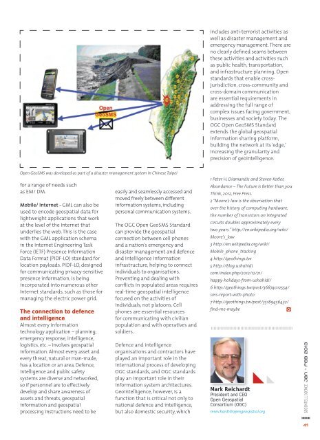
includes anti-terrorist activities aswell as disaster management andemergency management. There areno clearly defined seams betweenthese activities and activities suchas public health, transportation,and infrastructure planning. Openstandards that enable crossjurisdiction,cross-community andcross-domain communicationare essential requirements inaddressing the full range ofcomplex issues facing government,businesses and society today. TheOGC Open GeoSMS Standardextends the global geospatialinformation sharing platform,building the <strong>net</strong>work at its ‘edge,’increasing the granularity andprecision of geointelligence.Open GeoSMS was developed as part of a disaster management system in Chinese Taipeifor a range of needs suchas EM/ DM.Mobile/ Inter<strong>net</strong> - GML can also beused to encode geospatial data forlightweight applications that workat the level of the Inter<strong>net</strong> thatunderlies the web. This is the casewith the GML application schemain the Inter<strong>net</strong> Engineering TaskForce (IETF) Presence InformationData Format (PIDF-LO) standard forlocation payloads. PIDF-LO, designedfor communicating privacy-sensitivepresence information, is beingincorporated into numerous otherInter<strong>net</strong> standards, such as those formanaging the electric power grid.The connection to defenceand intelligenceAlmost every informationtechnology application – planning,emergency response, intelligence,logistics, etc. – involves geospatialinformation. Almost every asset andevery threat, natural or man-made,has a location or an area. Defence,intelligence and public safetysystems are diverse and <strong>net</strong>worked,so if personnel are to effectivelydevelop and share awareness ofassets and threats, geospatialinformation and geospatialprocessing instructions need to beeasily and seamlessly accessed andmoved freely between differentinformation systems, includingpersonal communication systems.The OGC Open GeoSMS Standardcan provide the geospatialconnection between cell phonesand a nation’s emergency anddisaster management and defenceand intelligence informationinfrastructure, helping to connectindividuals to organisations.Preventing and dealing withconflicts in populated areas requiresreal-time geospatial intelligencefocused on the activities ofindividuals, not platoons. Cellphones are essential resourcesfor communicating with civilianpopulation and with operatives andsoldiers.Defence and intelligenceorganisations and contractors haveplayed an important role in theinternational process of developingOGC standards, and OGC standardsplay an important role in theirinformation system architectures.Geointelligence, however, is afunction that is critical not only tonational defence and intelligence,but also domestic security, which1 Peter H. Diamandis and Steven Kotler,Abundance – The Future is Better than youThink, 2012, Free Press.2 “Moore’s law is the observation thatover the history of computing hardware,the number of transistors on integratedcircuits doubles approximately everytwo years.” http://en.wikipedia.org/wiki/Moore’s_law3 http://en.wikipedia.org/wiki/Mobile_phone_tracking4 http://geothings.tw5 http://blog.ushahidi.com/index.php/2012/12/21/happy-holidays-from-ushahidi/6 http://geothings.tw/post/36874012554/sms-report-with-photo7 http://geothings.tw/post/35189456432/find-me-maybeMark ReichardtPresident and CEOOpen GeospatialConsortium (OGC)mreichardt@opengeospatial.orgGEOINTELLIGENCE jan - feb 201341