Visit of Inspection - Meetings, agendas, and minutes - Rotherham ...
Visit of Inspection - Meetings, agendas, and minutes - Rotherham ...
Visit of Inspection - Meetings, agendas, and minutes - Rotherham ...
Create successful ePaper yourself
Turn your PDF publications into a flip-book with our unique Google optimized e-Paper software.
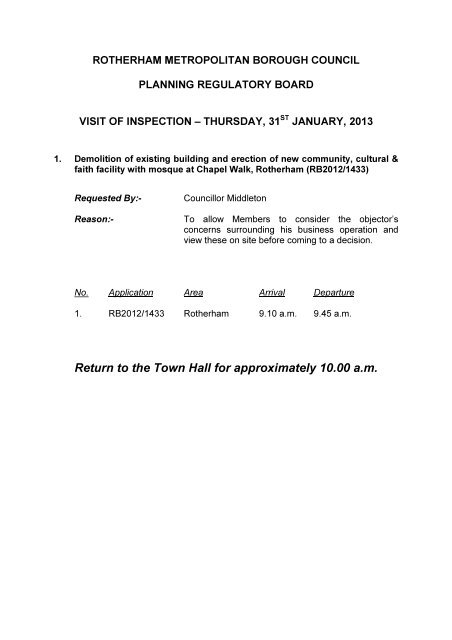
ROTHERHAM METROPOLITAN BOROUGH COUNCILPLANNING REGULATORY BOARDVISIT OF INSPECTION – THURSDAY, 31 ST JANUARY, 20131. Demolition <strong>of</strong> existing building <strong>and</strong> erection <strong>of</strong> new community, cultural &faith facility with mosque at Chapel Walk, <strong>Rotherham</strong> (RB2012/1433)Requested By:-Reason:-Councillor MiddletonTo allow Members to consider the objector’sconcerns surrounding his business operation <strong>and</strong>view these on site before coming to a decision.No. Application Area Arrival Departure1. RB2012/1433 <strong>Rotherham</strong> 9.10 a.m. 9.45 a.m.Return to the Town Hall for approximately 10.00 a.m.
SITE VISIT NO. 1 (Approximate time on site – 9.10 a.m.)Application Number RB2012/1433Proposal <strong>and</strong> Demolition <strong>of</strong> existing building <strong>and</strong> erection <strong>of</strong> new community,Locationcultural & faith facility with mosque at Chapel Walk, <strong>Rotherham</strong>Recommendation Grant subject to conditionsSite Description & LocationThis application relates to the site <strong>of</strong> the existing Chapel Walk Mosque <strong>of</strong>f CentenaryWay <strong>and</strong> covers an area <strong>of</strong> 717 square metres.The existing Mosque building is a two storey structure <strong>of</strong> a simple <strong>and</strong> relativelytraditional design clad in white render. The building lies on a relatively prominent sitebetween Chapel Walk, Hall Street <strong>and</strong> Centenary Way <strong>and</strong> also benefits from a carpark on the opposite side <strong>of</strong> Chapel Walk.The existing subway under Centenary Way has an access directly to the north <strong>of</strong> theapplication site which currently benefits from shrub planting <strong>and</strong> l<strong>and</strong>scaping on theslopes. Hall Street (a small leg <strong>of</strong>f Chapel Walk) lies directly to the south <strong>of</strong> the site.
Chapel Walk <strong>and</strong> Hall Street are predominantly characterised by industrial premiseswith the exception <strong>of</strong> the Mosque <strong>and</strong> there are a number <strong>of</strong> large utilitarian industrialbuildings to the east <strong>and</strong> south.There are a number <strong>of</strong> trees on the frontage <strong>of</strong> Centenary Way which currentlyprovide for some screening <strong>of</strong> the existing building.The site slopes gently from north-west to south-east.Background1984/1648 – First floor extension to form ladies room – GrantedProposalThis is an application by the <strong>Rotherham</strong> Mosque Trust for the demolition <strong>of</strong> theexisting building <strong>and</strong> erection <strong>of</strong> a new community, cultural <strong>and</strong> faith facility withMosque.The building provides meeting rooms, community services, lifestyle advice, IT suite<strong>and</strong> Study Area/Library <strong>and</strong> Mosque. The proposed development also results in arealignment <strong>of</strong> the access to the adjacent subwayThe following list <strong>of</strong> accommodation (per floor) is provided in the Design <strong>and</strong> AccessStatement:Ground FloorEntrance lobby <strong>and</strong> lift (ladies entrance)Ladies Toilet <strong>and</strong> showerFemale alutionsMulti-purpose HallKitchen AreaServery/Dining AreaEntrance lobby <strong>and</strong> lift (Main Entrance)Male Toilets <strong>and</strong> showersMale AblutionsFirst FloorFuneral/body wash roomDisabled toiletEntrance Lobby (Community Entrance)Library, IT Centre <strong>and</strong> Study Suite [82sqm]ToiletsAblution spacesMain Prayer Hall [292sqm]Prayer Hall Terrace [44.4sqm]Imam’s room [26.5sqm]
Second FloorCommunity Room [82sqm]Mosque Office [18sqm]Third FloorMezzanine Prayer Hall – LadiesToiletsAblution spacesLadies Break out area & facilitiesAtrium BalconyCommunity RoomThe main entrance to the mosque is on Hall Street (as per the existing building). Aseparate ladies entrance to the east side <strong>of</strong> the building is also proposed with afurther separate entrance for community use on Hall Street which will enable themosque element <strong>of</strong> the building to the closed when not in use.The design <strong>of</strong> the mosque is that <strong>of</strong> traditional Islamic architecture; the designincorporates significant areas <strong>of</strong> glazing with windows proposed to all sides <strong>of</strong> themosque. A traditional ‘Iwan’ (Persian) entrance feature is proposed on Hall Street.The building also incorporates a large Minaret tower which is iconic <strong>of</strong> Islamicarchitecture <strong>and</strong> a dome on the ro<strong>of</strong> to be GRP clad in metal. The building itself isstepped in height with the entrance feature being the tallest element. In terms <strong>of</strong>heights, the building (to the tallest part) is 15.6 metres in height, to the dome on thero<strong>of</strong> is 22.8 metres in height with the minaret tower being 33 metres.The minaret is proposed to have a metal capping piece. The drawings do indicate anintegrated LCD information screen around the top. However, these screens willrequire separate advertisement consent <strong>and</strong> are not therefore being considered aspart <strong>of</strong> this application.In terms <strong>of</strong> materials, the majority <strong>of</strong> the external façade is proposed to be clad inporcelain ceramic tiles <strong>and</strong> a grey brick plinth is proposed to sit under the tiles atground level. In addition it is proposed to install photovoltaic panels on the ro<strong>of</strong>behind the parapet walls.External lighting <strong>of</strong> the building is proposed in a mix <strong>of</strong> both up <strong>and</strong> down lighting onthe facades <strong>of</strong> the building particularly to highlight certain features.The existing car park to the building is proposed to be retained with the addition <strong>of</strong>bicycle parking near the entrance to the Mosque. The supporting Design <strong>and</strong> AccessStatement indicates that there are currently 33 car parking spaces provided but withmanaged car parking (an attendant) this could extend to 43 parking spaces.Boundary treatment is proposed to comprise <strong>of</strong> a dwarf wall <strong>and</strong> railings to an overallheight <strong>of</strong> 1.8 metres.
Alterations are proposed to the existing turning head on Hall Street with threebollards proposed in the area <strong>of</strong> the turning head in the interest <strong>of</strong> pedestrian safety.In terms <strong>of</strong> capacity, a total <strong>of</strong> 459 persons would be able to use the building at anyone time <strong>and</strong> in terms <strong>of</strong> opening hours it is proposed that the Mosque will be open 7days per week between the hours <strong>of</strong> 7am <strong>and</strong> 9pm in the Winter <strong>and</strong> 4am <strong>and</strong> 11pmin the Summer. The community use is proposed to be open as per the Mosque butwith an additional 1 hour in the evening (i.e. 10pm in Winter <strong>and</strong> midnight in theSummer).Amended plans have been received as part <strong>of</strong> the application which include:• A Stage 1 Road Safety Audit;• The existing 3 car parking spaces in front <strong>of</strong> the Mosque will be removed t<strong>of</strong>acilitate a better access to the site opposite;• Amended site plan to indicate the extent <strong>of</strong> highway boundary particularly inrelation to bin storage areas <strong>and</strong> kerbing arrangements;• Highlight <strong>of</strong> disabled car parking bays in the existing Mosque car park;• Inclusion <strong>of</strong> a dropped crossing from the car park to the Mosque;• Replacement <strong>of</strong> proposed paladin fencing with a dwarf wall <strong>and</strong> railings to aheight <strong>of</strong> 1.8 metres.The following documents have been submitted in support <strong>of</strong> the planning application:Design <strong>and</strong> Access Statement;Transport Statement <strong>and</strong> Travel PlanRoad Safety AuditTree ReportBat SurveyFlood Risk InformationDevelopment Plan Allocation <strong>and</strong> Policy01 UDP PoliciesThe site is allocated as a Mixed Use Area (MU20) in the Unitary DevelopmentPlan. The UDP sets out the following uses as being acceptable in principle in thisMixed Use Area: A1, A3, B1, C1, D1 <strong>and</strong> D2.Policy EC5 ‘Mixed Use Areas’Policy ENV3.1 ‘Development <strong>and</strong> the Environment’Policy ENV3.2 ‘Minimising the Impact <strong>of</strong> Development’Policy ENV3.4 ‘Trees, Woodl<strong>and</strong> <strong>and</strong> Hedgerows’Policy ENV3.7 ‘Control <strong>of</strong> Pollution’Policy T6 ‘Location <strong>and</strong> Layout <strong>of</strong> Development’Policy CR1 ‘Community <strong>and</strong> Social Provision’Other Material Considerations
National Planning Policy Framework: The NPPF came into effect on March 27 th 2012<strong>and</strong> replaced all previous Government Planning Policy Guidance (PPGs) <strong>and</strong> most <strong>of</strong>the Planning Policy Statements (PPSs) that existed. It states that “Development thatis sustainable should go ahead, without delay – a presumption in favour <strong>of</strong>sustainable development that is the basis for every plan, <strong>and</strong> every decision.The NPPF notes that for 12 months from the day <strong>of</strong> publication, decision-takers maycontinue to give full weight to relevant policies adopted since 2004 even if there is alimited degree <strong>of</strong> conflict with this Framework. The <strong>Rotherham</strong> Unitary DevelopmentPlan was adopted prior to this in June 1999. Under such circumstances the NPPFstates that “due weight should be given to relevant policies in existing plansaccording to their degree <strong>of</strong> consistency with this framework (the closer the policiesin the plan to the policies in the Framework, the greater the weight that may begiven).”The Unitary Development Plan policies referred to above are consistent with theNPPF <strong>and</strong> have been given due weight in the determination <strong>of</strong> this application.PublicityThe application has been advertised by way <strong>of</strong> site notice, letters to neighbouringproperties <strong>and</strong> press notice. Two letters <strong>of</strong> objection has been received. One letter ison behalf <strong>of</strong> Simms Wood Yard. The grounds are as follows:• This is a non industrial use within an industrial area <strong>and</strong> significant weightshould be given to any adverse impact that the proposed development wouldhave on the operation <strong>of</strong> long established businesses;• There is no objection in principle to the redevelopment <strong>and</strong> expansion <strong>of</strong> thecultural <strong>and</strong> faith facilities, however the proposed development is notappropriate in this particular location;• The grounds <strong>of</strong> objection relate to the adverse impacts that the scale <strong>and</strong> form<strong>of</strong> the development would have on the adjacent highway <strong>of</strong> Hall Street whichserves as the main vehicular entrance to the Simms Wood Yard;• The proposed development involves building on l<strong>and</strong> which is adoptedhighway (comprising the turning head opposite the main entrance to SimmsWood Yard). Whilst the applicant proposes a revised head at the end <strong>of</strong> HallStreet, this would be significantly less effective than that which currently exists<strong>and</strong> would not be a full turning head. The revised turning head would not beuseable for large articulated vehicles which need to access Simms Wood Yardat all times <strong>and</strong> this would result in arrangements which are more dangerousthat those which currently exist;• The removal <strong>of</strong> the essential portion <strong>of</strong> the turning head referred to wouldmake access <strong>and</strong> egress to the site very difficult;• Safety for pedestrians is a key element <strong>of</strong> the concerns raised in particular asthe new centre would have capacity for up to 459 visitors;• There is currently a general parking problem in the vicinity <strong>of</strong> the Mosque <strong>and</strong>at busy times the parking is not confined to formal car parks. Cars arefrequently parked in a manner which obstructs access to the Yard;• The existing provision <strong>of</strong> formal car parking spaces on Hall Street does causeoperational difficulties <strong>and</strong> should be relocated to the south side <strong>of</strong> the site;
• If planning permission is granted, there will be significant adverseconsequences for the viability <strong>of</strong> my clients business at Simms Wood withpotential job losses.Since the application has been deferred by Members an additional letter has beenreceived from a local resident which raises the following comments:• The proposed mosque is much larger than the one which currently exists onsite;• This area is already adequately served by Mosques. There is a Mosque innearby College Road <strong>and</strong> a Mosque on Holmes Lane, Masbrough. Neither <strong>of</strong>these buildings has any parking facilities <strong>and</strong> the people attending them parkon the nearby streets, thus making parking for residents very difficult at times.• With the new Council <strong>of</strong>fices <strong>and</strong> the new football stadium already causingparking in this area to be less available for the residents, this building is goingto accommodate larger attendances the lack <strong>of</strong> parking in this area should begiven serious consideration. As most <strong>of</strong> the people attending do not live in thearea I feel that the needs <strong>of</strong> the local residents should be considered beforenon-residents who have no connection to the area particularly, when the areais already adequately served with mosques.ConsultationsYorkshire Water - no objections subject to conditions;Streetpride (Ecologist) - no objections subject to conditions;Streetpride (Trees <strong>and</strong> Woodl<strong>and</strong>s) – Unable to support the application due to theadverse impact it will be likely to have on local amenity due to the loss <strong>of</strong> trees on theboundary with Centenary Way;Streetpride (L<strong>and</strong>scape) – no objections;Streetpride (Transportation) – no objections subject to conditions.AppraisalWhere an application is made to a local planning authority for planningpermission…..In dealing with such an application the authority shall have regard to -(a) the provisions <strong>of</strong> the development plan, so far as material to the application,(b) any local finance considerations, so far as material to the application, <strong>and</strong>(c) any other material considerations. - S. 70 (2) TCPA ‘90.If regard is to be had to the development plan for the purpose <strong>of</strong> any determination tobe made under the planning Acts the determination must be made in accordancewith the plan unless material considerations indicate otherwise - S.38 (6) PCPA2004.The main considerations in the determination <strong>of</strong> this application are:
PrincipleVisual Impact <strong>and</strong> DesignHighwaysImpact on Trees <strong>and</strong> L<strong>and</strong>scapingEcology <strong>and</strong> BiodiversityPrincipleIn terms <strong>of</strong> Local Planning Policy the application site is allocated as a Mixed UseArea in the Unitary Development Plan. UDP Policy EC5 ‘Mixed Use Areas’ statesthat: “Within Mixed Use Areas shown on the Proposals Map, a variety <strong>of</strong> l<strong>and</strong> useswill be acceptable; the particular uses appropriate to each area <strong>and</strong> any limitations orrequirements pertaining to these uses or their location being set out in Chapter 7 <strong>of</strong>this Written Statement.”The uses identified as being acceptable in principle include Use Class D1 (NonResidential Institutions) within which the proposed development falls.Paragraph 70 <strong>of</strong> the NPPF states that:“To deliver the social, recreational <strong>and</strong> cultural facilities <strong>and</strong> services the communityneeds, planning policies <strong>and</strong> decisions should:plan positively for the provision <strong>and</strong> use <strong>of</strong> shared space, community facilities (suchas local shops, meeting places, sports venues, cultural buildings, public houses <strong>and</strong>places <strong>of</strong> worship) <strong>and</strong> other local services to enhance the sustainability <strong>of</strong>communities <strong>and</strong> residential environments…”In addition, UPD Policy CR1 encourages the provision <strong>of</strong> community <strong>and</strong> socialfacilities in the borough. The application site is currently occupied by the existingChapel Walk Mosque <strong>and</strong> the use <strong>of</strong> the site for a Mosque <strong>and</strong> associated facilities isalready established. Its expansion is considered to meet the aims <strong>of</strong> the NPPF <strong>and</strong>UDP to provide an extended <strong>and</strong> enhanced place <strong>of</strong> worship, community facility <strong>and</strong>meeting place to enhance the sustainability <strong>of</strong> the local community.Visual Impact <strong>and</strong> DesignParagraph 56 <strong>of</strong> the NPPF refers to good design <strong>and</strong> states that:“The Government attaches great importance to the design <strong>of</strong> the built environment.Good design is a key aspect <strong>of</strong> sustainable development, is indivisible from goodplanning, <strong>and</strong> should contribute positively to making places better for people.”Paragraph 61 goes on to identify that: “Although visual appearance <strong>and</strong> thearchitecture <strong>of</strong> individual buildings are very important factors, securing high quality<strong>and</strong> inclusive design goes beyond aesthetic considerations. Therefore, planningpolicies <strong>and</strong> decisions should address the connections between people <strong>and</strong> places<strong>and</strong> the integration <strong>of</strong> new development into the natural, built <strong>and</strong> historicenvironment.”
In terms <strong>of</strong> local policy, UDP Policy ENV3.1 sets out the aims to promote gooddesign in new developments:“Development will be required to make a positive contribution to the environment byachieving an appropriate st<strong>and</strong>ard <strong>of</strong> design having regard to architectural style,relationship to the locality, scale, density, height, massing, quality <strong>of</strong> materials, sitefeatures, local vernacular characteristics, screening <strong>and</strong> l<strong>and</strong>scaping, together withregard to the security <strong>of</strong> ultimate users <strong>and</strong> their property.”The existing building is a relatively modest structure <strong>of</strong> traditional design whichoccupies a prominent position adjacent to Centenary Way (one <strong>of</strong> the main routesinto <strong>Rotherham</strong> town centre). The site also lies adjacent to an existing industrialestate <strong>and</strong> although the area is identified for a mix <strong>of</strong> uses, the majority <strong>of</strong>surrounding buildings are within industrial use. In context, the main town centretownscape lies to the east <strong>and</strong> at a higher level. The site is clearly visible fromCentenary Way on the approach into the town centre although there are a number <strong>of</strong>existing trees on the site frontage which provide some s<strong>of</strong>tening <strong>of</strong> the existingbuilding.The proposed building is three storeys in height <strong>and</strong> also has a considerably largerfootprint than the existing building which brings it closer to Centenary Way <strong>and</strong> HallStreet than the existing building. The height <strong>of</strong> the main building is proposed to be15.6 metres with the height to the top <strong>of</strong> the dome being 22.8 metres. This isconsidered to form the main massing <strong>of</strong> the building although it should beacknowledged that the overall height <strong>of</strong> the minaret tower is 33 metres. By way <strong>of</strong>comparison, the existing building is 10.6 metres in height <strong>and</strong> the All Saints ChurchSpire is approximately 57 metres in height.As set out above, the design <strong>of</strong> the mosque is that <strong>of</strong> traditional Islamic architecturewith large areas <strong>of</strong> glazing <strong>and</strong> external materials comprising <strong>of</strong> cladding in porcelaintiles. The building also incorporates a large Minaret tower which is iconic <strong>of</strong> Islamicarchitecture <strong>and</strong> a dome on the ro<strong>of</strong> to be GRP clad in metal. The proposed minarethas a metal capping piece <strong>and</strong> integrated LCD information screens around the top(although this element which will be considered as part <strong>of</strong> a separate application foradvertisement consent).It is without doubt that such a substantial building in this prominent location will behighly visible <strong>and</strong> in terms <strong>of</strong> the character <strong>of</strong> the area there are currently no othersignificant buildings <strong>of</strong> Islamic architecture. Indeed, the character <strong>of</strong> this particulararea is one <strong>of</strong> industrial buildings constructed <strong>of</strong> a mix <strong>of</strong> materials includingbrickwork <strong>and</strong> metal cladding. In terms <strong>of</strong> the wider impact <strong>of</strong> the proposeddevelopment, a comparative heights plan has been submitted with the application toshow the development in the context <strong>of</strong> the wider townscape <strong>and</strong> in particular theimpact upon the Listed All Saints Church. As All Saints Church is Listed, majordevelopments in its vicinity should be considered in the light <strong>of</strong> their effect on itssetting.In terms <strong>of</strong> the impact <strong>of</strong> the development, the building is <strong>of</strong> a significant scale <strong>and</strong>mass <strong>and</strong> will therefore have an impact on the visual amenity <strong>of</strong> the surrounding
area. The development is considered to be <strong>of</strong> a high quality <strong>and</strong> uses materialswhich are reflective <strong>of</strong> its Islamic architectural style. Views from Centenary Way willbe altered by the development but it is considered that the impact <strong>of</strong> the building,given its high quality, will be positive <strong>and</strong> provide the appropriate focus required for acommunity building. The development is also considered to form a strongarchitectural feature at one <strong>of</strong> the key gateways into the town centre.The proposed minaret tower will become a l<strong>and</strong>mark, however as high qualitymaterials <strong>and</strong> detailing are used for these elements it will add to the varietyexperienced within the existing skyline.Clearly the proposed dome <strong>and</strong> minaret would appear different to the more domesticVictorian <strong>and</strong> Edwardian architecture in the surrounding locality. Nevertheless, thereare examples <strong>of</strong> other buildings with towers <strong>and</strong> steeples, including nearby churches.Whilst the impact upon the street scene would be pronounced it would not beunacceptably harmful to the streetscene generally. The impact on the townscape<strong>and</strong> in particular the Listed All Saints Church is considered to be acceptable <strong>and</strong>taking account <strong>of</strong> the drawing showing the comparative heights <strong>of</strong> the two buildings,the Listed All Saints Church will remain as a dominant feature when viewed frommost surrounding st<strong>and</strong>points due to its position on higher l<strong>and</strong> <strong>and</strong> its overall heightmeaning that its setting should not be affected in a negative manner.In terms <strong>of</strong> boundary treatment, the plan originally submitted indicated that a paladinfence would be erected along the boundary with Centenary Way <strong>and</strong> concerns havebeen expressed regarding the use <strong>of</strong> such an industrial style fence adjacent to thel<strong>and</strong>mark building. Amended details have now been received to indicate that theboundary treatment will comprise <strong>of</strong> a dwarf wall <strong>and</strong> railings to a total height <strong>of</strong> 1.8metres. This boundary treatment is considered to be suitable subject to detaileddesign which is recommended as a condition.HighwaysParagraph 32 <strong>of</strong> the NPPF states that:“All developments that generate significant amounts <strong>of</strong> movement should besupported by a Transport Statement or Transport Assessment. Plans <strong>and</strong> decisionsshould take account <strong>of</strong> whether:● the opportunities for sustainable transport modes have been taken up dependingon the nature <strong>and</strong> location <strong>of</strong> the site, to reduce the need for major transportinfrastructure;● safe <strong>and</strong> suitable access to the site can be achieved for all people; <strong>and</strong>● improvements can be undertaken within the transport network that cost effectivelylimit the significant impacts <strong>of</strong> the development.Development should only be prevented or refused on transport grounds where theresidual cumulative impacts <strong>of</strong> development are severe.”In addition UDP Policy T6 refers to the location <strong>and</strong> layout <strong>of</strong> development <strong>and</strong>requires regard to be had to the increasing desirability <strong>of</strong> reducing travel dem<strong>and</strong>.
In this instance, the main highway related issues are: the likely impact <strong>of</strong> theproposed Mosque in terms <strong>of</strong> frequency <strong>and</strong> number <strong>of</strong> vehicular movements to <strong>and</strong>from the site; whether the level <strong>of</strong> parking provided is satisfactory <strong>and</strong> the impactupon on-street parking in surrounding streets.The vehicular access to the site is as existing, via Chapel Walk <strong>and</strong> the existing carpark on the opposite side <strong>of</strong> the road is proposed to be retained as existing (with theexception <strong>of</strong> marking out <strong>of</strong> accessible parking spaces).In general terms the Transport Statement submitted in support <strong>of</strong> the applicationindicates that the application site lies in a sustainable location with good access to arange <strong>of</strong> transport modes. It states that the peak time at the centre is the FridayJumu’ah Prayer which attracts a large number <strong>of</strong> worshipers to the site; this singleperiod is considered to be out <strong>of</strong> peak hours <strong>and</strong> therefore the impact on the localnetwork would be negligible. Bearing in mind that the proposal is largely a rebuilding<strong>of</strong> an existing facility on the same site, most <strong>of</strong> the trips generated by the new facilitywill be existing trips. Any additional trips will be relatively small in number.Accordingly the development will have no net adverse impact on the overall networkas the majority <strong>of</strong> trips are existing <strong>and</strong> any additional trips related to some <strong>of</strong> theintended ancillary uses will be insignificant in their impact on the local highwaynetwork.The Travel Plan submitted in support <strong>of</strong> the application details information from aTravel Survey <strong>and</strong> this sets out the following results:• 67% <strong>of</strong> respondents are in the age range 16 – 50 <strong>and</strong> only 12% stated theywere affected by any disabilities. 70% <strong>of</strong> respondents visit the Mosque lessthan 5 times a week, while 52% only visit once per week.• Approximately 30% <strong>of</strong> respondents live within a 15-20 minute walk <strong>of</strong> theMosque. The remaining respondents live further afield <strong>and</strong> the topographyalong with distance present potential barriers to walking. 10% <strong>of</strong> respondentsstated they would walk to the Mosque <strong>and</strong> already do so at times. 93% <strong>of</strong>respondents stated they would look to car share as a passenger if their regularmode was not available.• 73% <strong>of</strong> respondents would consider car sharing (taking/as passenger) <strong>and</strong>27% stated they already car share at times. 57% <strong>of</strong> respondents stated theywould consider car sharing if help was available to assist with finding carsharepartners. While 15% said they would be encouraged by a guaranteed lifthome if their driver let them down <strong>and</strong> 12% said they would be encouraged byreserved car parking spaces for car sharers.The main recommendation <strong>of</strong> the Travel Plan is to provide a specific leaflet <strong>and</strong>poster to promote the measures within the travel plan during construction <strong>of</strong> the newMosque building. The leaflet will give details on walking, bus, car sharing <strong>and</strong> cyclingwhilst also including details <strong>of</strong> suitable parking areas for those who rely solely on cartravel. This will be made available to all visitors within the reception area at thetemporary accommodation <strong>and</strong> will be h<strong>and</strong>ed out one month before constructionbegins.
As part <strong>of</strong> the redevelopment, it is also proposed to re-align the turning headarrangements at the end <strong>of</strong> Hall Street to facilitate the use <strong>of</strong> l<strong>and</strong> for the newcommunity, cultural <strong>and</strong> faith facility.With regards to the objection received from the adjacent business at Simms WoodYard, the revised turning area is designed to accommodate the movements <strong>of</strong>vehicles at Simms Wood <strong>and</strong> the Mosque. An AutoTRACK simulation s<strong>of</strong>tware hasbeen used to track the manoeuvres <strong>of</strong> vehicles into the adjacent vehicle maintenanceyard <strong>and</strong> this indicates that the vehicles will be able to access the gate on Hall Streetwithout detriment. In addition, 3 on street parking spaces on Hall Street will beremoved which should assist in facilitating the access into the adjacent site.It is acknowledged that at present the access into the Simms Wood Yard site, viaHall Street involves complicated reversing manoevres <strong>and</strong> the site cannot beaccessed/egressed in a forward gear. Whilst the proposed development will notimprove this situation, the submitted information indicates that the situation will not beworsened <strong>and</strong> therefore a refusal on these grounds is not considered to be justified.Both the Travel Plan <strong>and</strong> Transport Statement have been audited by the Council <strong>and</strong>the findings are concurred with. In addition a Road Safety Audit has beencommissioned with regards the main access to the building <strong>and</strong> its proximity to themovement <strong>of</strong> large articulated vehicles on Hall Street/Chapel Walk. This hashighlighted the need to remove the current on street car parking bays (3 No.) in HallStreet so as to help access / egress to/from the haulage yard. Existing No Waiting atAny Time restrictions should be extended <strong>and</strong> the Traffic Regulation Order updatedas necessary. Measures to prevent large articulated vehicles from encroaching ontothe footway adjacent the proposed building are intended. The Safety Audit did nothighlight any other concerns.Impact on trees <strong>and</strong> l<strong>and</strong>scapingUDP Policy ENV3.4 refers to Trees, Woodl<strong>and</strong>s <strong>and</strong> Hedgerows <strong>and</strong> states that:“The Council will seek to promote <strong>and</strong> enhance tree, woodl<strong>and</strong> <strong>and</strong> hedgerowcoverage throughout the Borough.”The proposed development involves the loss <strong>of</strong> 6 trees, 5 are on the boundary withCentenary Way <strong>and</strong> one on the corner <strong>of</strong> Hall Street/Chapel Walk. The submittedTree Survey indicates that these trees are predominantly Lime or Silver Birch treeswith the exception <strong>of</strong> one Cypress. The Lime <strong>and</strong> Silver Birch trees on the boundarywith Centenary Way are identified as being semi-mature trees with a long lifeexpectancy <strong>and</strong> it is the loss <strong>of</strong> these trees which raises specific concern.The Council’s Aboriculturalist has objected to the loss <strong>of</strong> the trees on the groundsthat they provide valuable amenity on Centenary Way <strong>and</strong> also act as a filter topollution from the road.The applicant is aware <strong>of</strong> the concerns raised <strong>and</strong> consideration has been given toreplacement <strong>of</strong> the trees to be lost, however, due to the proximity <strong>of</strong> the building toCentenary Way it is not feasible on both highway safety grounds <strong>and</strong> practicality to
provide replacement trees on the frontage (adjacent to Centenary Way).Furthermore, the importance <strong>of</strong> the trees is based on their amenity in their currentlocation <strong>and</strong> whilst consideration has been given to providing replacements <strong>of</strong>f site, itis not considered appropriate in this instance as this would not mitigate against theloss <strong>of</strong> these particular trees.The loss <strong>of</strong> the trees is regrettable <strong>and</strong> the decision as to whether the benefits <strong>of</strong> theproposed development outweigh the harm caused is balanced. Although there are anumber <strong>of</strong> other trees along Centenary Way it is acknowledged that the loss <strong>of</strong> the 5Lime/Silver Birch trees will result in a loss <strong>of</strong> amenity in the form <strong>of</strong> trees. However,the proposed site is constrained in terms <strong>of</strong> its floor area <strong>and</strong> in visual amenity termsit is not considered to be acceptable to make the building any higher than alreadyproposed. In addition, whilst the development results in the loss <strong>of</strong> 5 trees alongCentenary Way there are a number <strong>of</strong> other trees along Centenary Way which wouldbe unaffected by the proposed development. In this instance the proposeddevelopment is considered to be <strong>of</strong> a high quality <strong>and</strong> its visual dominance <strong>and</strong>striking appearance are intentional, particularly to provide an architectural focus onCentenary Way. For this reason, the benefits <strong>of</strong> the redevelopment <strong>of</strong> the site toallow a high quality building are considered to outweigh the harm resulting from theloss <strong>of</strong> the 5 trees.The proposed development also results in a realignment <strong>of</strong> the access to theadjacent subway <strong>and</strong> in this regard alterations to the l<strong>and</strong>scaping <strong>of</strong> the banking areproposed. This l<strong>and</strong>scaping replaces those shrubs <strong>and</strong> plants which are to be lost asa result <strong>of</strong> the development <strong>and</strong> this part <strong>of</strong> the proposal is considered to beacceptable.Ecology <strong>and</strong> biodiversityThe NPPF recommends that new opportunities for biodiversity are taken indevelopments. In this instance a Bat Survey has been submitted in support <strong>of</strong> theapplication. The survey <strong>and</strong> impact assessment methodologies used are consideredto be appropriate <strong>and</strong> the results <strong>of</strong> the survey work are accepted. The existingbuilding was noted as having no evidence <strong>of</strong> bat use <strong>and</strong> low potential for providingroosting opportunities. The proposed development site also includes some trees <strong>and</strong>although the bat survey report does not specifically note assessment <strong>of</strong> these treesfor use by bats the emergence survey work should have picked up any presence.The removal <strong>of</strong> a number <strong>of</strong> mature trees is considered to be a minor negative impacton the biodiversity interest <strong>of</strong> the site; the l<strong>and</strong>scape proposals received illustrated alimited area for new planting <strong>and</strong> the area <strong>of</strong> s<strong>of</strong>t l<strong>and</strong>scaping is considered toprovide a useful route to achieving biodiversity gain. A condition is thereforerecommended to ensure that some biodiversity gain is achieved on site.ConclusionIn conclusion, the proposal would create a satisfactory form <strong>of</strong> development that,subject to conditions, is acceptable given its overall design <strong>and</strong> the implications forthe visual amenity <strong>of</strong> the locality in terms <strong>of</strong> the scale, mass <strong>and</strong> architectural style <strong>of</strong>the mosque in its context. The site is considered to be in a sustainable location <strong>and</strong>
the impact <strong>of</strong> the development in terms <strong>of</strong> the alterations to the public highway <strong>and</strong>the provision <strong>of</strong> parking <strong>and</strong> access to other facilities is acceptable in highway terms.Whilst the loss <strong>of</strong> trees on Centenary Way is regrettable <strong>and</strong> it is noted that there is alack <strong>of</strong> opportunity for replacement planting it is not considered that a refusal couldbe justified given the presence <strong>of</strong> a significant number <strong>of</strong> substantial trees in the area<strong>and</strong> the high quality nature <strong>of</strong> the development.The application is therefore recommended for approval subject to the followingconditions.Conditions01The development hereby permitted shall be commenced before the expiration <strong>of</strong>three years from the date <strong>of</strong> this permission.ReasonIn order to comply with the requirements <strong>of</strong> the Town <strong>and</strong> Country Planning Act 1990.02Notwithst<strong>and</strong>ing the details <strong>of</strong> any external materials that have been submitted withthe application, samples <strong>of</strong> all external materials shall be submitted to <strong>and</strong> beapproved in writing by the Local Planning Authority before development iscommenced. Any materials that may be agreed shall be used in the implementation<strong>of</strong> the development unless otherwise agreed in writing with the Local PlanningAuthority.ReasonTo ensure that appropriate materials are used in the construction <strong>of</strong> the developmentin the interests <strong>of</strong> visual amenity <strong>and</strong> in accordance with UDP Policy ENV3.1‘Development <strong>and</strong> the Environment’.03The permission hereby granted shall relate to the area shown outlined in red on theapproved site plan <strong>and</strong> the development shall only take place in accordance with thesubmitted details <strong>and</strong> specifications as shown on the approved plans.2010-109*-PL-006H - Amended Site Layout PlanL3615/03 -Amended L<strong>and</strong>scape Plan2010-109-PL-101A2010-109-PL-011A2010-109-PL-012A2010-109-PL-013AReasonTo define the permission <strong>and</strong> for the avoidance <strong>of</strong> doubt.04No work or storage on the site shall commence until all the trees/shrubs to beretained have been protected by the erection <strong>of</strong> a strong durable 2.30 metre highbarrier fence in accordance with BS 5837:2012 Trees in Relation to Design,
Demolition <strong>and</strong> Construction - Recommendations This shall be positioned inaccordance with details to be submitted to <strong>and</strong> approved by the Local PlanningAuthority. The protective fencing shall be properly maintained <strong>and</strong> shall not beremoved without the written approval <strong>of</strong> the Local Planning Authority until thedevelopment is completed. There shall be no alterations in ground levels, fires, use<strong>of</strong> plant, storage, mixing or stockpiling <strong>of</strong> materials within the fenced areas.ReasonTo ensure the trees/shrubs are protected during the construction <strong>of</strong> the developmentin the interests <strong>of</strong> amenity <strong>and</strong> in accordance with UDP Policies ENV3 ‘BoroughL<strong>and</strong>scape’, ENV3.1 ‘Development <strong>and</strong> the Environment’, ENV3.2 ‘Minimising theImpact <strong>of</strong> Development’ <strong>and</strong> ENV3.4 ‘Trees, Woodl<strong>and</strong>s <strong>and</strong> Hedgerows’.05No development shall take place until there has been submitted to <strong>and</strong> approved inwriting by the Local Planning Authority a plan indicating the positions, design,materials <strong>and</strong> type <strong>of</strong> boundary treatment to be erected. The boundary treatmentshall be completed before the completion <strong>of</strong> the development.ReasonIn the interests <strong>of</strong> the visual amenity <strong>of</strong> the area <strong>and</strong> in accordance with UDP PolicyENV3.1 ‘Development <strong>and</strong> the Environment’.06Any plants or trees which within a period <strong>of</strong> 5 years from completion <strong>of</strong> planting die,are removed or damaged, or that fail to thrive shall be replaced. Assessment <strong>of</strong>requirements for replacement planting shall be carried out on an annual basis inSeptember <strong>of</strong> each year <strong>and</strong> any defective work or materials discovered shall berectified before 31st December <strong>of</strong> that year.ReasonTo ensure that there is a well laid out scheme <strong>of</strong> healthy trees <strong>and</strong> shrubs in theinterests <strong>of</strong> amenity <strong>and</strong> in accordance with UDP Policies ENV3 ‘BoroughL<strong>and</strong>scape’, ENV3.1 ‘Development <strong>and</strong> the Environment’, ENV3.2 ‘Minimising theImpact <strong>of</strong> Development’ <strong>and</strong> ENV3.4 ‘Trees, Woodl<strong>and</strong>s <strong>and</strong> Hedgerows’.07Prior to the commencement <strong>of</strong> development, details <strong>of</strong> how biodiversity on the sitecan be enhanced shall be submitted to <strong>and</strong> approved in writing by the Local PlanningAuthority. The approved measures shall be incorporated into the development <strong>and</strong>retained in perpetuity.ReasonIn the interests <strong>of</strong> biodiversity08The site shall be developed with separate systems <strong>of</strong> drainage for foul <strong>and</strong> surfacewater on <strong>and</strong> <strong>of</strong>f site.Reason:
In the interest <strong>of</strong> satisfactory <strong>and</strong> sustainable drainage09No development shall take place until details <strong>of</strong> the proposed means <strong>of</strong> disposal <strong>of</strong>foul <strong>and</strong> surface water drainage, including details <strong>of</strong> any balancing works <strong>and</strong> <strong>of</strong>f -siteworks, have been submitted to <strong>and</strong> approved by the local planning authority.Reason: To ensure that the development can be properly drained.10Unless otherwise approved in writing by the local planning authority, there shall be nopiped discharge <strong>of</strong> surface water from the development prior to the completion <strong>of</strong> theapproved surface water drainage works <strong>and</strong> no buildings shall be occupied orbrought into use prior to completion <strong>of</strong> the approved foul drainage works.Reason:To ensure that no foul or surface water discharges take place until proper provisionhas been made for their disposal.11No development shall take place until full engineering details <strong>of</strong> the proposedalterations to the turning area at Hall Street <strong>and</strong> the realignment <strong>of</strong> the Chapel Walkapproach to the pedestrian / cycle subway under A630 Centenary Way, indicated indraft form on plan reference 2010-109 PL-006G Revision H, have been submitted to<strong>and</strong> approved in writing by the Local Planning Authority, <strong>and</strong> the approved detailsshall be implemented prior to the demolition <strong>of</strong> the existing building .ReasonIn the interests <strong>of</strong> highway safety.12Before the development is brought into use the car parking area shown on thesubmitted plan shall be provided, marked out <strong>and</strong> thereafter maintained for carparking.ReasonTo ensure the provision <strong>of</strong> satisfactory parking spaces <strong>and</strong> avoid the necessity for theparking <strong>of</strong> vehicles on the highway in the interests <strong>of</strong> road safety.13Prior to the commencement <strong>of</strong> development, a Construction Traffic ManagementPlan, including details <strong>of</strong> the method <strong>of</strong> demolition, shall be submitted to <strong>and</strong>approved by the Local Planning Authority <strong>and</strong> the measures contained therein shallbe implemented during the construction <strong>and</strong> demolition phase.ReasonIn the interests <strong>of</strong> highway safety.
14The measures contained within the travel plan dated the 27 th July 2012 shall be fullyimplemented during the lifetime <strong>of</strong> the development. The Local Planning Authorityshall be informed <strong>of</strong> <strong>and</strong> give prior approval in writing to any subsequentimprovements or modifications to the Travel Plan following submission <strong>of</strong> progressperformance reports as time tabled in the monitoring strategy. For further informationplease contact the Transportation Unit (01709) 822186.ReasonIn order to promote sustainable transport choices.InformativesWildlife LegislationThe protection afforded to protected sites <strong>and</strong> species under UK <strong>and</strong> EU legislation isirrespective <strong>of</strong> the planning system <strong>and</strong> the applicant should therefore ensure thatany activity undertaken, regardless <strong>of</strong> the need for any planning consent, complieswith the appropriate wildlife legislation. If any protected species are found on the sitethen work should halt <strong>and</strong> an appropriately qualified ecologist consulted.The main piece <strong>of</strong> legislation relating to nature conservation in Great Britain is theWildlife <strong>and</strong> Countryside Act 1981. This Act is supplemented by the Conservation <strong>of</strong>Habitats <strong>and</strong> Species Regulations 2010 (Habitat Regulations), the Countryside <strong>and</strong>Rights <strong>of</strong> Way (CRoW) Act 2000 (in Engl<strong>and</strong> <strong>and</strong> Wales) <strong>and</strong> the NaturalEnvironment <strong>and</strong> Rural Communities (NERC) Act 2006 (in Engl<strong>and</strong> <strong>and</strong> Wales).All species <strong>of</strong> bats <strong>and</strong> their roosts are protected by UK <strong>and</strong> European legislation.Roosts are equally protected whether bats are present or not.The Great Crested Newt is protected by UK <strong>and</strong> European legislation. Thelegislation covers all life stages; eggs, tadpoles <strong>and</strong> adult newts are all equallycovered.Otters <strong>and</strong> their holts, including hovers <strong>and</strong> couches, which are otter resting placesabove ground, are protected by UK <strong>and</strong> European legislation.Water Vole are protected against killing, injuring or taking; possession or control;damage or destruction <strong>of</strong> its places <strong>of</strong> shelter, or disturbance while such animals areoccupying places <strong>of</strong> shelter.All birds, their nests <strong>and</strong> eggs are protected by UK law <strong>and</strong> it is an <strong>of</strong>fence, withcertain exceptions, to kill, injure or take any wild bird, to take, damage or destroy thenest <strong>of</strong> any wild bird while it is in use or being built, <strong>and</strong> to take or destroy the egg <strong>of</strong>any wild bird. Certain species receive increased protection making it an <strong>of</strong>fence todisturb any wild bird listed on Schedule 1 while it is nest building or is at (or near) anest with eggs or young; or disturb the dependant young <strong>of</strong> such a bird.
Badgers <strong>and</strong> their setts are protected under the Protection <strong>of</strong> Badgers Act 1992,which makes it illegal to kill, injure or take badgers or to interfere with a badger sett.Interference with a sett includes blocking tunnels or damaging the sett in any way.The information provided is a summary only; for definitive information, primarysources should be consulted.Road closuresThe proposed development requires the Stopping-Up <strong>of</strong> part <strong>of</strong> the public highway.To apply for a Stopping-Up Order, it will be necessary to make an application underSection 247 <strong>of</strong> the Town <strong>and</strong> Country Planning Act to:The National Transport Casework Team,Department for Transport,2nd Floor,Lancaster House,Hampshire Court,Newcastle Business Park,Newcastle upon Tyne,NE4 7YH.


