

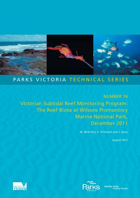
the reef biota at Wilsons promontory marine national - Parks Victoria
the reef biota at Wilsons promontory marine national - Parks Victoria
the reef biota at Wilsons promontory marine national - Parks Victoria
- No tags were found...

Create successful ePaper yourself
Turn your PDF publications into a flip-book with our unique Google optimized e-Paper software.
parks victoria technical seriesNumber 74<strong>Victoria</strong>n Subtidal Reef Monitoring Program:The Reef Biota <strong>at</strong> <strong>Wilsons</strong> PromontoryMarine N<strong>at</strong>ional Park,December 2011M. McArthur, K. Pritchard and S. DavisAugust 2012
<strong>Parks</strong> <strong>Victoria</strong> Technical Series #74SRMP <strong>Wilsons</strong> Promontory MNPCONTENTSEXECUTIVE SUMMARYiiCONTENTSivINDEX OF FIGURES AND TABLESvi1 INTRODUCTION 11.1 Subtidal Reef Ecosystems of <strong>Victoria</strong> 11.2 Subtidal Reef Monitoring Program 61.2.1 Objectives 61.2.2 Monitoring Protocols and Loc<strong>at</strong>ions 81.3 Monitoring <strong>at</strong> <strong>Wilsons</strong> Promontory 81.3.1 Marine <strong>Parks</strong> and Marine Reserves 81.3.2 <strong>Wilsons</strong> Promontory Marine N<strong>at</strong>ional Park 91.4 Subtidal Reef Monitoring <strong>at</strong> <strong>Wilsons</strong> Promontory 92 METHODS 122.1 Site Selection and Survey Times 122.1.1 Survey Times 162.2 Census method 172.2.1 Transect layout 172.2.2 Survey Design 172.2.3 Method 1 – Mobile Fishes and Cephalopods 182.2.4 Method 2 – Invertebr<strong>at</strong>es and Cryptic Fishes 182.2.5 Method 3 – Macroalgae 192.2.6 Method 4 – Macrocystis 192.2.7 Method 5 – Fish Stereo Video 202.3 D<strong>at</strong>a Analysis – Condition indic<strong>at</strong>ors 242.3.1 Approach 242.3.2 Biodiversity 252.3.3 Ecosystem Functional Components 262.3.4 Introduced Species 272.3.5 Clim<strong>at</strong>e Change 282.3.6 Fishing 293 RESULTS 313.1 Macroalgae 313.1.1 Macroalgal Community Structure 313.1.2 Macroalgal Species Richness and Diversity 323.1.3 Common Algal Species 373.2 Invertebr<strong>at</strong>es 403.2.1 Invertebr<strong>at</strong>e Community Structure 403.2.2 Invertebr<strong>at</strong>e Species Richness and Diversity 40iv
<strong>Parks</strong> <strong>Victoria</strong> Technical Series #74SRMP <strong>Wilsons</strong> Promontory MNP3.2.3 Common Invertebr<strong>at</strong>e Species 453.3 Fishes 483.3.1 Fish Community Structure 483.3.2 Fish Species Richness and Diversity 483.3.3 Common Fish Species 533.4 Ecosystem Components 573.4.1 Habit<strong>at</strong> and Production 573.4.2 Invertebr<strong>at</strong>e Groups 573.4.3 Fish Groups 623.4.4 Sediment Cover 643.5 Introduced Species 643.6 Clim<strong>at</strong>e Change 643.6.1 Algal Bioregional Affinities 643.6.2 Invertebr<strong>at</strong>e Bioregional Affinities 663.6.3 Fish Bioregional Affinities 693.6.4 Macrocystis pyrifera 713.6.5 Centrostephanus rodgersii 713.6.6 Durvillaea pot<strong>at</strong>orum 713.7 Fishing 713.7.1 Abalone 713.7.2 Rock Lobster 733.7.3 Fishes 734 ACKNOWLEDGEMENTS 825 REFERENCES 836 APPENDIX – SITE SELECTION 86v
<strong>Parks</strong> <strong>Victoria</strong> Technical Series #74SRMP <strong>Wilsons</strong> Promontory MNPINDEX OF FIGURES AND TABLESFIGURESFigure 1.1. Examples of species of macroalgae found on <strong>Victoria</strong>n subtidal <strong>reef</strong>s. 3Figure 1.2. Examples of species of invertebr<strong>at</strong>es and cryptic fish found on <strong>Victoria</strong>n subtidal<strong>reef</strong>s. 4Figure 1.3. Examples of fish species found on <strong>Victoria</strong>n subtidal <strong>reef</strong>s. 5Figure 1.4. An example plot depicting change in an environmental, popul<strong>at</strong>ion or communityvariable over time (days, months or years) and potential p<strong>at</strong>terns from isol<strong>at</strong>edobserv<strong>at</strong>ions. 7Figure 1.5. Previous <strong>marine</strong> protected areas <strong>at</strong> <strong>Wilsons</strong> Promontory (1986-2002): (blue)<strong>Wilsons</strong> Promontory Marine Park; (pink) Western and Eastern Protection Zones;and (yellow) <strong>Wilsons</strong> Promontory Marine Reserve. The sou<strong>the</strong>rn, eastern andisland boundaries are not to scale, being only 300 m from <strong>the</strong> shore (exagger<strong>at</strong>edhere for clarity). 10Figure 1.6. <strong>Wilsons</strong> Promontory <strong>marine</strong> protected areas: <strong>Wilsons</strong> Promontory MarineN<strong>at</strong>ional Park; <strong>Wilsons</strong> Promontory Marine Park and <strong>Wilsons</strong> Promontory MarineReserve. 11Figure 2.1. Loc<strong>at</strong>ion of monitoring sites <strong>at</strong> <strong>Wilsons</strong> Promontory. The <strong>Wilsons</strong> PromontoryMarine N<strong>at</strong>ional Park boundary is outlined in grey. Core monitoring sites aremarked in red. 13Figure 2.2 School of butterfly perch Caesioperca lepidoptera <strong>at</strong> East Landing, <strong>Wilsons</strong>Promontory. 14Figure 2.3 Biologist-diver with transect line. 18Figure 2.4 The cover of macrophytes is measured by <strong>the</strong> number of points intersecting eachspecies on <strong>the</strong> quadr<strong>at</strong> grid. 19Figure 3.1. Three-dimensional MDS plot of algal assemblage structure for sites <strong>at</strong> <strong>Wilsons</strong>Promontory. Black symbols indic<strong>at</strong>e <strong>the</strong> first survey <strong>at</strong> th<strong>at</strong> site. Kruskal stress =0.16. 33Figure 3.2. Control charts of algal assemblage structure inside and outside <strong>Wilsons</strong>Promontory Marine N<strong>at</strong>ional Park. Grey lines indic<strong>at</strong>e 50th and 90th percentiles.35Figure 3.3. Algal species diversity indic<strong>at</strong>ors (± Standard Error) inside and outside WilsonPromontory Marine N<strong>at</strong>ional Park. 36Figure 3.4. Percent cover (± Standard Error) of dominant algal species inside and outside <strong>the</strong><strong>Wilsons</strong> Promontory Marine N<strong>at</strong>ional Park. 37vi
<strong>Parks</strong> <strong>Victoria</strong> Technical Series #74SRMP <strong>Wilsons</strong> Promontory MNPFigure 3.5. Three-dimensional MDS plot of motile invertebr<strong>at</strong>e assemblage structure for sites<strong>at</strong> <strong>Wilsons</strong> Promontory. Black symbols indic<strong>at</strong>e <strong>the</strong> first survey <strong>at</strong> th<strong>at</strong> site. Kruskalstress = 0.17. 41Figure 3.6. Control charts of motile invertebr<strong>at</strong>e assemblage structure inside and outside<strong>Wilsons</strong> Promontory Marine N<strong>at</strong>ional Park. Grey lines indic<strong>at</strong>e 50th and 90thpercentiles. 43Figure 3.7. Motile invertebr<strong>at</strong>e species diversity indic<strong>at</strong>ors (± Standard Error) inside andoutside Wilson Promontory Marine N<strong>at</strong>ional Park. 44Figure 3.8 Mean abundance (± Standard Error) of dominant motile invertebr<strong>at</strong>e speciesinside and outside <strong>the</strong> <strong>Wilsons</strong> Promontory Marine N<strong>at</strong>ional Park. 46Figure 3.9. Three-dimensional MDS plot of fish assemblage structure for sites <strong>at</strong> <strong>Wilsons</strong>Promontory. Black symbols indic<strong>at</strong>e <strong>the</strong> first survey <strong>at</strong> th<strong>at</strong> site. Kruskal stress =0.19. 49Figure 3.10. Control charts of fish assemblage structure inside and outside <strong>Wilsons</strong>Promontory Marine N<strong>at</strong>ional Park. Grey lines indic<strong>at</strong>e 50th and 90th percentiles.51Figure 3.11. Fish species diversity indic<strong>at</strong>ors (± Standard Error) inside and outside WilsonPromontory Marine N<strong>at</strong>ional Park. 52Figure 3.12. Mean abundance (± Standard Error) of dominant fish species inside and outside<strong>the</strong> <strong>Wilsons</strong> Promontory Marine N<strong>at</strong>ional Park. 54Figure 3.13. Old wife Enoplosus arm<strong>at</strong>us above canopy of Ecklonia radi<strong>at</strong>a, North AnserIsland (Site 3113), <strong>Wilsons</strong> Promontory. 56Figure 3.14. Seaweed functional groups (mean ± Standard Error) inside and outside <strong>the</strong><strong>Wilsons</strong> Promontory Marine N<strong>at</strong>ional Park. 58Figure 3.15. Invertebr<strong>at</strong>e functional groups (mean ± Standard Error) inside and outside <strong>the</strong><strong>Wilsons</strong> Promontory Marine N<strong>at</strong>ional Park. 60Figure 3.16. Fish functional groups (mean ± Standard Error) inside and outside <strong>the</strong> <strong>Wilsons</strong>Promontory Marine N<strong>at</strong>ional Park. 62Figure 3.17 Mean percent cover (± Standard Error) of sand inside and outside <strong>the</strong> <strong>Wilsons</strong>Promontory Marine N<strong>at</strong>ional Park. 64Figure 3.18. Richness and abundance (mean ± Standard Error) of Maugean algae speciesinside and outside <strong>the</strong> <strong>Wilsons</strong> Promontory Marine N<strong>at</strong>ional Park. 65Figure 3.19. Richness and abundance (mean ± Standard Error) of Maugean invertebr<strong>at</strong>especies inside and outside <strong>the</strong> <strong>Wilsons</strong> Promontory Marine N<strong>at</strong>ional Park. 66Figure 3.20. Richness and abundance (mean ± Standard Error) of Western invertebr<strong>at</strong>especies inside and outside <strong>the</strong> <strong>Wilsons</strong> Promontory Marine N<strong>at</strong>ional Park. 67vii
<strong>Parks</strong> <strong>Victoria</strong> Technical Series #74SRMP <strong>Wilsons</strong> Promontory MNPFigure 3.21. Richness and abundance (mean ± Standard Error) of Eastern invertebr<strong>at</strong>especies inside and outside <strong>the</strong> <strong>Wilsons</strong> Promontory Marine N<strong>at</strong>ional Park. 68Figure 3.22. Richness and abundance (mean ± Standard Error) of Maugean fish speciesinside and outside <strong>the</strong> <strong>Wilsons</strong> Promontory Marine N<strong>at</strong>ional Park. 69Figure 3.23. Richness and abundance (mean ± Standard Error) of Eastern fish speciesinside and outside <strong>the</strong> <strong>Wilsons</strong> Promontory Marine N<strong>at</strong>ional Park. 70Figure 3.24. Size structure of blacklip abalone Haliotis rubra <strong>at</strong> <strong>Wilsons</strong> Promontory MarineN<strong>at</strong>ional Park and reference sites. 72Figure 3.25. Density (± Standard Error) of sou<strong>the</strong>rn rock lobster, Jasus edwardsii, inside andoutside <strong>the</strong> <strong>Wilsons</strong> Promontory Marine N<strong>at</strong>ional Park. 73Figure 3.26. Fish size (± Standard Error) spectra inside and outside <strong>the</strong> <strong>Wilsons</strong> PromontoryMarine N<strong>at</strong>ional Park. 74Figure 3.27. Density (± Standard Error) of fished fish species inside and outside <strong>the</strong> <strong>Wilsons</strong>Promontory Marine N<strong>at</strong>ional Park. 75Figure 3.28. Biomass (± Standard Error) of fished species inside and outside <strong>the</strong> <strong>Wilsons</strong>Promontory Marine N<strong>at</strong>ional Park. 76Figure 3.29. Abundance (± Standard Error) of different size classes of fishes <strong>at</strong> <strong>Wilsons</strong>Promontory Marine N<strong>at</strong>ional Park and reference sites. 77Figure 3.30. Size structure of blue thro<strong>at</strong> wrasse, Notolabrus tetricus <strong>at</strong> <strong>Wilsons</strong> PromontoryMarine N<strong>at</strong>ional Park and reference sites. 78Figure 3.31. Size structure of purple wrasse, Notolabrus fucicola <strong>at</strong> <strong>Wilsons</strong> PromontoryMarine N<strong>at</strong>ional Park and reference sites. 79Figure 3.32. Size structure of all fishes <strong>at</strong> <strong>Wilsons</strong> Promontory Marine N<strong>at</strong>ional Park andreference sites. 80Figure 3.33. Mean size (± Standard Error) of common fishes, <strong>at</strong> <strong>Wilsons</strong> Promontory MarineN<strong>at</strong>ional Park and reference sites. 81viii
<strong>Parks</strong> <strong>Victoria</strong> Technical Series #74SRMP <strong>Wilsons</strong> Promontory MNPINDEX OF TABLESTable 2.1. Physical descriptions of sites <strong>at</strong> <strong>Wilsons</strong> Promontory. 14Table 2.2. Survey times for monitoring <strong>at</strong> <strong>Wilsons</strong> Promontory. 16Table 2.3. Mobile fish (Method 1) taxa censused in central <strong>Victoria</strong>. 21Table 2.4. Invertebr<strong>at</strong>e and cryptic fish (Method 2) taxa censused in central <strong>Victoria</strong>. 22Table 2.5. Macroalgae (Method 3) taxa censused in Central <strong>Victoria</strong>. 23ix
<strong>Parks</strong> <strong>Victoria</strong> Technical Series #74SRMP <strong>Wilsons</strong> Promontory MNP1. INTRODUCTION1.1. Subtidal Reef Ecosystems of <strong>Victoria</strong>Shallow <strong>reef</strong> habit<strong>at</strong>s cover extensive areas along <strong>the</strong> <strong>Victoria</strong>n coast. The majority of <strong>reef</strong>sin this area are exposed to strong winds, currents and large swell. A prominent biologicalcomponent of <strong>Victoria</strong>n shallow <strong>reef</strong>s is kelp and o<strong>the</strong>r seaweeds (Figure 1.1). Largespecies, such as <strong>the</strong> common kelp Ecklonia radi<strong>at</strong>a and crayweed Phyllospora comosa, areusually present along <strong>the</strong> open coast in dense stands. The production r<strong>at</strong>es of denseseaweed beds are equivalent to <strong>the</strong> most productive habit<strong>at</strong>s in <strong>the</strong> world, includinggrasslands and seagrass beds, with approxim<strong>at</strong>ely 2 kg of plant m<strong>at</strong>erial produced persquare metre of seafloor per year. These stands typically have 10 - 30 kg of plant m<strong>at</strong>erialper square metre. The biomass of seaweeds is substantially gre<strong>at</strong>er where giant speciessuch as string kelp Macrocystis pyrifera and bull kelp Durvillaea pot<strong>at</strong>orum occur.Seaweeds provide important habit<strong>at</strong> structure for o<strong>the</strong>r organisms on <strong>the</strong> <strong>reef</strong>. This habit<strong>at</strong>structure varies considerably, depending on <strong>the</strong> type of seaweed species present. Tallvertical structures in <strong>the</strong> w<strong>at</strong>er column are formed by M. pyrifera, which sometimes forms adense layer of fronds flo<strong>at</strong>ing on <strong>the</strong> w<strong>at</strong>er surface. O<strong>the</strong>r species with large, stalk-like stipes,such as E. radi<strong>at</strong>a, P. comosa and D. pot<strong>at</strong>orum, form a canopy 0.5 - 2 m above <strong>the</strong> rockysubstr<strong>at</strong>um. Lower layers of structure are formed by: foliose macroalgae typically 10 - 30 cmhigh, such as <strong>the</strong> green Caulerpa and <strong>the</strong> red Plocamium species; turfs (to 10 cm high) ofred algae species, such as Pterocladia capillacea; and hard encrusting layers of pinkcoralline algae. The n<strong>at</strong>ure and composition of <strong>the</strong>se structural layers varies considerablywithin and between <strong>reef</strong>s, depending on <strong>the</strong> biogeographic region, depth, exposure to swelland waves, currents, temper<strong>at</strong>ure range, w<strong>at</strong>er clarity and <strong>the</strong> presence or absence ofdeposited sand.Grazing and pred<strong>at</strong>ory motile invertebr<strong>at</strong>es are prominent animal inhabitants of <strong>the</strong> <strong>reef</strong>(Figure 1.2). Common grazers include blacklip and greenlip abalone Haliotis rubra andHaliotis laevig<strong>at</strong>a, warrener Turbo undul<strong>at</strong>us and sea urchins Heliocidaris erythrogramma,Holopneustes spp. and Amblypneustes spp.. These species can influence <strong>the</strong> growth andsurvival of habit<strong>at</strong> forming organisms. For example, sponges and foliose seaweeds are oftenprevented from growing on encrusting coralline algae surfaces through <strong>the</strong> grazing actions ofabalone and sea urchins. Pred<strong>at</strong>ory invertebr<strong>at</strong>es include dogwhelks Dic<strong>at</strong>hais orbita,sou<strong>the</strong>rn rock lobster Jasus edwardsii, octopus Octopus maorum and a wide variety of seastar species. O<strong>the</strong>r large <strong>reef</strong> invertebr<strong>at</strong>es include motile filter feeding animals such asfea<strong>the</strong>r stars Comanthus trichoptera and sessile (<strong>at</strong>tached) species such as sponges, corals,bryozoans, hydroids and ascidians.1
<strong>Parks</strong> <strong>Victoria</strong> Technical Series #74SRMP <strong>Wilsons</strong> Promontory MNPFishes are also a prominent component of <strong>reef</strong> ecosystems, in terms of both biomass andecological function (Figure 1.3). Reef fish assemblages include roaming pred<strong>at</strong>ors such asblue thro<strong>at</strong> wrasse Notolabrus tetricus, herbivores such as herring cale Odax cyanomelas,planktivores such as sea sweep Scorpis aequipinnis and picker-feeders such as six-spinedlea<strong>the</strong>rjacket Meuschenia freycineti. The type and abundance of each fish species variesconsiderably depending on exposure to swell and waves, depth, currents, <strong>reef</strong> structure,seaweed habit<strong>at</strong> structure and many o<strong>the</strong>r ecological variables. Many fish species play asubstantial ecological role in <strong>the</strong> functioning and shaping of <strong>the</strong> ecosystem. For example, <strong>the</strong>feeding activities of fishes such as scalyfin Parma victoriae and magpie morwongCheilodactylus nigripes promote <strong>the</strong> form<strong>at</strong>ion of open algal turf areas, free of larger canopyformingseaweeds.Although <strong>the</strong> biomass and <strong>the</strong> primary and secondary productivity of shallow <strong>reef</strong>ecosystems in <strong>Victoria</strong> are domin<strong>at</strong>ed by seaweeds, motile invertebr<strong>at</strong>es and fishes, <strong>the</strong>reare many o<strong>the</strong>r important biological components to <strong>the</strong> <strong>reef</strong> ecosystem. These include smallspecies of crustaceans and molluscs from 0.1 to 10 mm in size (mesoinvertebr<strong>at</strong>es),occupying various niches as grazers, pred<strong>at</strong>ors or foragers. At <strong>the</strong> microscopic level, films ofmicroalgae and bacteria on <strong>the</strong> <strong>reef</strong> surface are also important.<strong>Victoria</strong>’s shallow <strong>reef</strong>s are a very important component of <strong>the</strong> <strong>marine</strong> environment becauseof <strong>the</strong>ir high biological complexity, species diversity and productivity. Subtidal <strong>reef</strong> habit<strong>at</strong>salso have important social and cultural values, which incorpor<strong>at</strong>e aes<strong>the</strong>tic, recre<strong>at</strong>ional,commercial and historical aspects. Shallow subtidal <strong>reef</strong>s also have significant economicvalue, through commercial fishing of <strong>reef</strong> species such as wrasses, morwong, rock lobster,abalone and sea urchins, as well as recre<strong>at</strong>ional fishing, diving and o<strong>the</strong>r tourism activities.2
<strong>Parks</strong> <strong>Victoria</strong> Technical Series #74SRMP <strong>Wilsons</strong> Promontory MNPGreen algae Caulerpa flexilisEncrusting coralline algae <strong>at</strong> <strong>the</strong> base ofcrayweed Phyllospora comosa holdfastRed coralline algae Ballia callitrichaThallose red algae Haliptilon roseumCrayweed Phyllospora comosa canopyCommon kelp Ecklonia radi<strong>at</strong>a canopyFigure 1.1. Examples of species of macroalgae found on <strong>Victoria</strong>n subtidal <strong>reef</strong>s.3
<strong>Parks</strong> <strong>Victoria</strong> Technical Series #74SRMP <strong>Wilsons</strong> Promontory MNPSou<strong>the</strong>rn rock-lobster Jasus edwardsiiRed bait crab Plagusia chabrusBlacklip abalone Haliotis rubraFea<strong>the</strong>r star Comanthus trichopteraNectria ocell<strong>at</strong>aCommon sea urchinHeliocidaris erythrogrammaFromia polyporaRed velvet fish Gn<strong>at</strong>hanocanthus goetzeeiFigure 1.2. Examples of species of invertebr<strong>at</strong>es and cryptic fish found on <strong>Victoria</strong>n subtidal <strong>reef</strong>s.4
<strong>Parks</strong> <strong>Victoria</strong> Technical Series #74SRMP <strong>Wilsons</strong> Promontory MNPSea sweep Scorpis aequipinnis, andbutterfly perch Caesioperca lepidopteraScalyfin Parma victoriaeBlue-thro<strong>at</strong>ed wrasseNotolabrus tetricus (male)Six-spined lea<strong>the</strong>rjacketMeuschenia freycineti (male)Magpie morwongCheilodactylus nigripesOld-wife Enoplosus arm<strong>at</strong>usFigure 1.3. Examples of fish species found on <strong>Victoria</strong>n subtidal <strong>reef</strong>s.5
<strong>Parks</strong> <strong>Victoria</strong> Technical Series #74SRMP <strong>Wilsons</strong> Promontory MNP1.2. Subtidal Reef Monitoring Program1.2.1. ObjectivesAn important aspect of <strong>the</strong> management and conserv<strong>at</strong>ion of <strong>Victoria</strong>n <strong>marine</strong> n<strong>at</strong>uralresources and assets is assessing <strong>the</strong> condition of <strong>the</strong> ecosystem and how this changes overtime. Combined with an understanding of ecosystem processes, this inform<strong>at</strong>ion can be usedto manage any thre<strong>at</strong>s or pressures on <strong>the</strong> environment to ensure ecosystem sustainability.Consequently, <strong>the</strong> <strong>Victoria</strong>n Government has established a long-term Subtidal ReefMonitoring Program (SRMP). The primary objective of <strong>the</strong> SRMP is to provide inform<strong>at</strong>ion on<strong>the</strong> st<strong>at</strong>us of <strong>Victoria</strong>n <strong>reef</strong> flora and fauna (focussing on macroalgae, macroinvertebr<strong>at</strong>esand fish). This includes monitoring <strong>the</strong> n<strong>at</strong>ure and magnitude of trends in speciesabundances, species diversity and community structure. This is achieved through regularsurveys <strong>at</strong> loc<strong>at</strong>ions throughout <strong>Victoria</strong>, encompassing both represent<strong>at</strong>ive and uniquehabit<strong>at</strong>s and communities.Inform<strong>at</strong>ion from <strong>the</strong> SRMP allows managers to better understand and interpret long-termchanges in <strong>the</strong> popul<strong>at</strong>ion and community dynamics of <strong>Victoria</strong>’s <strong>reef</strong> flora and fauna. As alonger time series of d<strong>at</strong>a are collected, <strong>the</strong> SRMP will allow managers to:• compare changes in <strong>the</strong> st<strong>at</strong>us of species popul<strong>at</strong>ions and biological communitiesbetween highly protected <strong>marine</strong> n<strong>at</strong>ional parks and <strong>marine</strong> sanctuaries and o<strong>the</strong>r<strong>Victoria</strong>n <strong>reef</strong> areas (e.g. Edgar and Barrett 1997, 1999);• determine associ<strong>at</strong>ions between species and between species and environmentalparameters (e.g. depth, exposure, <strong>reef</strong> topography) and assess how <strong>the</strong>seassoci<strong>at</strong>ions vary through space and time (e.g. Edgar et al. 1997; Dayton et al. 1998;Edmunds, Roob and Ferns 2000);• provide benchmarks for assessing <strong>the</strong> effectiveness of management actions, inaccordance with intern<strong>at</strong>ional best practice for quality environmental managementsystems (Holling 1978; Meredith 1997); and• determine <strong>the</strong> responses of species and communities to unforeseen andunpredictable events such as <strong>marine</strong> pest invasions, mass mortality events, oil spills,severe storm events and clim<strong>at</strong>e change (e.g. Ebeling et al. 1985; Edgar 1998; Roobet al. 2000; Swe<strong>at</strong>man et al. 2003).A monitoring survey gives an estim<strong>at</strong>e of popul<strong>at</strong>ion abundance and community structure <strong>at</strong>a small window in time. P<strong>at</strong>terns seen in d<strong>at</strong>a from periodic surveys are unlikely to exactlym<strong>at</strong>ch changes in <strong>the</strong> real popul<strong>at</strong>ions over time or definitively predict <strong>the</strong> size and n<strong>at</strong>ure offuture vari<strong>at</strong>ion. Plots of changes over time are unlikely to m<strong>at</strong>ch <strong>the</strong> changes in realpopul<strong>at</strong>ions because changes over shorter time periods and actual minima and maxima may6
<strong>Parks</strong> <strong>Victoria</strong> Technical Series #74SRMP <strong>Wilsons</strong> Promontory MNPnot be adequ<strong>at</strong>ely sampled (e.g. Figure 1.4). Fur<strong>the</strong>rmore, because <strong>the</strong> n<strong>at</strong>ure andmagnitude of environmental vari<strong>at</strong>ion is different over different time scales, vari<strong>at</strong>ion overlong periods may not be adequ<strong>at</strong>ely predicted from shorter-term d<strong>at</strong>a. Sources ofenvironmental vari<strong>at</strong>ion can oper<strong>at</strong>e <strong>at</strong> <strong>the</strong> scale of months (e.g. seasonal vari<strong>at</strong>ion,harvesting), years (e.g. el Niño), decades (e.g. pollution, extreme storm events) or evencenturies (e.g. tsunamis, global warming). O<strong>the</strong>r studies indic<strong>at</strong>e this monitoring program willbegin to adequ<strong>at</strong>ely reflect average trends and p<strong>at</strong>terns as <strong>the</strong> surveys continue over longerperiods (multiple years to decades). Results of this monitoring need to be interpreted within<strong>the</strong> context of <strong>the</strong> monitoring frequency and dur<strong>at</strong>ion.ParameterTimeFigure 1.4. An example plot depicting change in an environmental, popul<strong>at</strong>ion or community variableover time (days, months or years) and potential p<strong>at</strong>terns from isol<strong>at</strong>ed observ<strong>at</strong>ions.7
<strong>Parks</strong> <strong>Victoria</strong> Technical Series #74SRMP <strong>Wilsons</strong> Promontory MNP1.2.2. Monitoring Protocols and Loc<strong>at</strong>ionsThe SRMP uses standardised underw<strong>at</strong>er visual census methods based on an approachdeveloped and applied in Tasmania by Edgar and Barrett (1997). Details of standardoper<strong>at</strong>ional procedures and quality control protocols for <strong>Victoria</strong>’s SRMP are described inEdmunds and Hart (2003).The SRMP was initi<strong>at</strong>ed in May 1998 with 15 sites established on subtidal <strong>reef</strong> habit<strong>at</strong>s in <strong>the</strong>vicinity of Port Phillip Heads Marine N<strong>at</strong>ional Park. In 1999 <strong>the</strong> SRMP was expanded to <strong>reef</strong>sin <strong>the</strong> vicinity of <strong>the</strong> Bunurong Marine N<strong>at</strong>ional Park, Phillip Island and <strong>Wilsons</strong> PromontoryMarine N<strong>at</strong>ional Park.In 2003 and 2004, <strong>the</strong> Subtidal Reef Monitoring Program was expanded to include MarineN<strong>at</strong>ional <strong>Parks</strong> and Marine Sanctuaries throughout <strong>Victoria</strong>.1.3. Monitoring <strong>at</strong> <strong>Wilsons</strong> Promontory1.3.1. Marine <strong>Parks</strong> and Marine ReservesPrior to <strong>the</strong> declar<strong>at</strong>ion of <strong>the</strong> <strong>Wilsons</strong> Promontory Marine N<strong>at</strong>ional Park, <strong>the</strong> coast of <strong>Wilsons</strong>Promontory formed part of <strong>the</strong> South Gippsland Marine and Coastal <strong>Parks</strong>, declared in 1986.There were three types of conserv<strong>at</strong>ion zone: <strong>Wilsons</strong> Promontory Marine Park along <strong>the</strong>northwest and north east coasts; Western and Eastern Protection Zones <strong>at</strong> Norman Bay andRefuge Cove; and <strong>Wilsons</strong> Promontory Marine Reserve along <strong>the</strong> sou<strong>the</strong>rn coast (CFL 1989;O’Toole and Turner 1990; Figure 1.5). The western boundary of <strong>the</strong> Marine Park extendedfrom Shallow Inlet out to Shellback Island, and <strong>the</strong>n in a line joining <strong>the</strong> headlands to justbefore Norman Point.The Marine Reserve encompassed a 300 m wide band along <strong>the</strong> sou<strong>the</strong>rn shore, fromNorman Point to Refuge Cove. The eastern part of <strong>the</strong> Marine Park continued northwardfrom Refuge Cove, also with <strong>the</strong> boundary 300 m from <strong>the</strong> shore (Figure 1.5).Recre<strong>at</strong>ional fishing was allowed in <strong>the</strong> Marine Park zone, however spearfishing, and <strong>the</strong>collection of abalone were not allowed on scuba and <strong>the</strong>re was a rock lobster bag limit of oneper day. Recre<strong>at</strong>ional fishers could only line fish in <strong>the</strong> Protection Zones and no fishing wasallowed in <strong>the</strong> Marine Reserve. Commercial fishing was allowed throughout <strong>the</strong> <strong>Wilsons</strong>Promontory conserv<strong>at</strong>ion areas, with <strong>the</strong> principal <strong>reef</strong> fisheries being for rock lobster,abalone and live wrasse/morwong.The intertidal zone of <strong>the</strong> <strong>Wilsons</strong> Promontory coast was wholly protected as part of <strong>the</strong><strong>Wilsons</strong> Promontory N<strong>at</strong>ional Park. The N<strong>at</strong>ional Park was declared in 1898, with <strong>the</strong>intertidal zone being added to <strong>the</strong> Park in 1965 (Ivanovici 1984).8
<strong>Parks</strong> <strong>Victoria</strong> Technical Series #74SRMP <strong>Wilsons</strong> Promontory MNP1.3.2. <strong>Wilsons</strong> Promontory Marine N<strong>at</strong>ional ParkFollowing proposals from <strong>the</strong> Environment Conserv<strong>at</strong>ion Council (ECC 1999; 2000), <strong>the</strong><strong>Wilsons</strong> Promontory Marine N<strong>at</strong>ional Park was declared on 16 November 2002 (Figure 1.6).The Marine N<strong>at</strong>ional Park overlays <strong>the</strong> pre-existing <strong>Wilsons</strong> Promontory Marine Reserve(except for <strong>the</strong> islands of <strong>the</strong> Glennie Group, and coasts north of Cape Wellington). Theboundaries of <strong>the</strong> Marine N<strong>at</strong>ional Park extend fur<strong>the</strong>r offshore to fully encompass <strong>the</strong>islands of <strong>the</strong> Anser Group and W<strong>at</strong>tle Island. Reef habit<strong>at</strong>s within <strong>the</strong> Marine N<strong>at</strong>ional Parkinclude sheltered and exposed granite habit<strong>at</strong>s with a variety of smooth bedrock, rubble,boulder, bombie and pinnacle type structures.The level of protection for <strong>marine</strong> environments within <strong>the</strong> Marine N<strong>at</strong>ional Park has beenextended to restrict all forms of recre<strong>at</strong>ional and commercial fishing. Recre<strong>at</strong>ional line fishing,and commercial fishing is only permitted in <strong>the</strong> Marine and Coastal Park or Marine Reserveareas.1.4. Subtidal Reef Monitoring <strong>at</strong> <strong>Wilsons</strong> PromontoryThis report provides a description of <strong>the</strong> monitoring program <strong>at</strong> <strong>Wilsons</strong> Promontory andresults from eleven surveys, incorpor<strong>at</strong>ing <strong>Wilsons</strong> Promontory Marine N<strong>at</strong>ional Park and <strong>the</strong>adjacent conserv<strong>at</strong>ion areas. The objectives of this report were to:• provide an overview of <strong>the</strong> methods used for SRMP;• provide general descriptions of <strong>the</strong> biological communities and species popul<strong>at</strong>ions <strong>at</strong>each monitoring site up to December 2011;• describe changes and trends th<strong>at</strong> have occurred over <strong>the</strong> monitoring period;• identify any unusual biological phenomena such as interesting or unique communitiesor species;• identify any introduced species <strong>at</strong> <strong>the</strong> monitoring loc<strong>at</strong>ions; and• report on trends in selected ecosystem st<strong>at</strong>us indic<strong>at</strong>ors.9
<strong>Parks</strong> <strong>Victoria</strong> Technical Series #74SRMP <strong>Wilsons</strong> Promontory MNPShellback Is<strong>Wilsons</strong>Promontory<strong>Wilsons</strong>PromontoryTongue PtEasternNorman IsLeonard PtPillar PtWesternProtection ZoneNorman Pt<strong>Wilsons</strong>PromontoryProtectionZoneRefugeCoveGre<strong>at</strong>Oberon PtW<strong>at</strong>erlooCapeW<strong>at</strong>erloo PtGlennieSea EagleFenwick BightAnserAnser IsW<strong>at</strong>tle IsEast LandingSou<strong>the</strong>ast Pt<strong>Wilsons</strong> PromontoryMarine Reserve0 2 4 kmForty FootRocksFigure 1.5. Previous <strong>marine</strong> protected areas <strong>at</strong> <strong>Wilsons</strong> Promontory (1986 - 2002): (blue) <strong>Wilsons</strong>Promontory Marine Park; (pink) Western and Eastern Protection Zones; and (yellow) <strong>Wilsons</strong>Promontory Marine Reserve. The sou<strong>the</strong>rn, eastern and island boundaries are not to scale, being only300 m from <strong>the</strong> shore (exagger<strong>at</strong>ed here for clarity).10
<strong>Parks</strong> <strong>Victoria</strong> Technical Series #74SRMP <strong>Wilsons</strong> Promontory MNPFigure 1.6. <strong>Wilsons</strong> Promontory <strong>marine</strong> protected areas: <strong>Wilsons</strong> Promontory Marine N<strong>at</strong>ional Park;<strong>Wilsons</strong> Promontory Marine Park and <strong>Wilsons</strong> Promontory Marine Reserve.11
<strong>Parks</strong> <strong>Victoria</strong> Technical Series #74SRMP <strong>Wilsons</strong> Promontory MNP2. METHODS2.1. Site Selection and Survey TimesDuring <strong>the</strong> first survey <strong>at</strong> <strong>Wilsons</strong> Promontory, every effort was made to survey as many sitesas possible, with <strong>the</strong> intention of sampling a surplus of sites. The benefits of this were to:provide <strong>the</strong> most comprehensive description of <strong>the</strong> <strong>marine</strong> flora and fauna around <strong>the</strong>Promontory; enable selection of <strong>the</strong> most appropri<strong>at</strong>e sites for <strong>the</strong> long-term monitoringprogram; and safeguard <strong>the</strong> monitoring design against possible boundary changes before<strong>the</strong> sanctuary zone was declared. Additional field assistance was provided by Dr NevilleBarrett and Alistair Morton from <strong>the</strong> Tasmanian Aquaculture and Fisheries Institute, and <strong>the</strong>sea conditions enabled <strong>the</strong> census of three sites a day, for much of <strong>the</strong> excursion.Consequently, twenty-eight sites were sampled between 30 November and 9 December1999.The sites were loc<strong>at</strong>ed in four general regions around <strong>the</strong> Promontory: northwest referencearea, north of <strong>the</strong> Marine N<strong>at</strong>ional Park; western Marine N<strong>at</strong>ional Park; eastern MarineN<strong>at</strong>ional Park; and nor<strong>the</strong>ast reference area (Figure 2.3; Table 2.1). Three island sites weresampled outside <strong>the</strong> proposed sanctuary, on Shellback and Norman Islands, and three inside<strong>the</strong> proposed sanctuary, on Gre<strong>at</strong> Glennie and Anser Islands. The sites encompassed <strong>the</strong>full range of <strong>reef</strong> habit<strong>at</strong>s present <strong>at</strong> <strong>the</strong> Promontory, including sub-maximally exposed sites<strong>at</strong> Norman Island, Gre<strong>at</strong> Glennie Island and Sea Eagle Bay, to rel<strong>at</strong>ively sheltered habit<strong>at</strong>s <strong>at</strong>north Shellback Island, Gre<strong>at</strong> Glennie Island, W<strong>at</strong>erloo Bay and The H<strong>at</strong> north of SealersCove; Figure 2.1). The <strong>reef</strong> structures varied from steep plunging or stepped <strong>reef</strong>s, to moregently sloping (but high relief) boulder and bombie fields, to rel<strong>at</strong>ively fl<strong>at</strong> bedrock and rubble<strong>reef</strong>s. A brief description of each site is provided in Table 2.1.A set of 20 core monitoring sites were selected as a subset <strong>the</strong> initial monitoring sites (Figure2.1; Appendix A).12
<strong>Parks</strong> <strong>Victoria</strong> Technical Series #74SRMP <strong>Wilsons</strong> Promontory MNP1Shellback Is2Tongue PtThe H<strong>at</strong>2834Norman Is5Leonard Pt6Pillar PtNorman Pt7<strong>Wilsons</strong>PromontorySealers Cove27Horn Pt26Refuge25242322Gre<strong>at</strong>910Oberon Pt820W<strong>at</strong>erloo19W<strong>at</strong>erloo Pt21Cape11AnserAnser Is1312Sea Eagle14W<strong>at</strong>tle Is15South PtRoaring Meg1618Fenwick BightEast Landing17Sou<strong>the</strong>ast Pt<strong>Wilsons</strong> Promontory MarineN<strong>at</strong>ional Park0 2 4 kmForty FootRocksFigure 2.1. Loc<strong>at</strong>ion of monitoring sites <strong>at</strong> <strong>Wilsons</strong> Promontory. The <strong>Wilsons</strong> Promontory MarineN<strong>at</strong>ional Park boundary is outlined in grey. Core monitoring sites are marked in red.13
<strong>Parks</strong> <strong>Victoria</strong> Technical Series #74SRMP <strong>Wilsons</strong> Promontory MNPTable 2.1. Physical descriptions of sites <strong>at</strong> <strong>Wilsons</strong> Promontory: (A) aspect; (Exp) exposure ranking;and (CI) complexity index. The exposure and <strong>reef</strong> complexity indices follow those used by Edgar(1981; see Table footnotes). Legend: (RZ) Reference zone; (MNP) Marine N<strong>at</strong>ional Park.Site A (° T) Exp* CI † Depth Substr<strong>at</strong>um Description(m)Northwest RZ1 North Shellback Is 350 6 1.5 10 Bedrock with small boulder clusters and rubble.2 North Tongue Pt 340 5 1.5 10 Bedrock and boulder fields 0.5-2 m.3 North Norman Is 285 3 1.5 104 West Norman Is 270 3 3 10Steep bedrock with deep gullies and 5-10 mdrop-offs, boulders to west.Medium to large boulders 1-4 m, interspersedby slab <strong>reef</strong>.5 Leonard Pt 240 4 3.5 10 Large boulders 1-4 m, bombies, slab <strong>reef</strong>.6 Pillar Pt 195 4 4 10 Large boulders 1-3 m, occasional tall bombies.Southwest MNP7 South Norman Pt 145 5 2.5 10 Boulder field 1-3 m.8 Oberon Pt 330 5 2 10 Boulder field 1-2 m and irregular bedrock9 East Glennie Is 45 5 1.5 10 Steeply sloping slab with occasional bombies.10 West Glennie Is 250 3 4 1011 North of Sea Eagle 240 3 3 10Boulders 5-10 m across, deep crevicesbetween, smaller boulders to north.Boulders 1 m, some larger outcrops,moder<strong>at</strong>ely high relief.12 Sea Eagle Bay 24 4 3 10 Boulder field 1-2 m, occasional 3-5 m bombies.13 North Anser Is 15 4 1.5 10Sou<strong>the</strong>ast MNPSteeply sloping bedrock with occasionalbombies.14 South Pt 180 3 3 10 Boulder field 1-3 m with 3-5 m bombies.15 Roaring Meg Bight 120 3 3 1016 West Landing 150 3 3 1017 East landing 55 4 2.5 1018 Fenwick Pt 35 5 3.5 10Steeply sloping fractured bedrock with somelarge boulders.Large boulders 2-4 m, large interstitial space,occasional bombies.Rock slab stepping and sloping steeply, somebombies.Boulders 2-4 m interspersed by bombies 3-4 m,smaller boulders to west19 W<strong>at</strong>erloo Pt 90 5 3 10 Slab <strong>reef</strong>, some boulder fields 2-3 m20 Central W<strong>at</strong>erloo 130 5 2.5 10 Low boulders interspersed with bombies 3-5 m.21 North W<strong>at</strong>erloo 180 4 3.5 10 Reef slabs, stepping 3-4 m, large bombies.Nor<strong>the</strong>ast RZ22 Cape Wellington 65 5 2.5 1023 Bareback Bay 100 5 2 10Sloping smooth bedrock with ledges,interspersed with boulder fields 2-4 m.Fl<strong>at</strong> bedrock, occasional bombies, to boulderfield in west.24 South Refuge 180 5 3 10 Boulders 2-3 m, bombies 3-5 m, fl<strong>at</strong> bedrock.25 North Refuge 135 5 2 1026 Horn Bay 150 5 2.5 10Sloping bedrock with occasional cracks andoverhangs.Fl<strong>at</strong> bedrock, small boulders 1-3 m interspersedby bombies14
<strong>Parks</strong> <strong>Victoria</strong> Technical Series #74SRMP <strong>Wilsons</strong> Promontory MNPTable 2.1 (continued). Physical descriptions of sites <strong>at</strong> <strong>Wilsons</strong> Promontory: (A) aspect; (Exp)exposure ranking; and (CI) complexity index. The exposure and <strong>reef</strong> complexity indices follow thoseused by Edgar (1981; see Table footnotes). Legend: (RZ) Reference zone; (MNP) Marine N<strong>at</strong>ionalPark.Site A (°T) Exp CI † DepthSubstr<strong>at</strong>um Description(m)27 North Horn Pt 20 6 2.5 10 Mostly boulder field 0.5-2 m, some slab <strong>reef</strong>.28 The H<strong>at</strong> 90 6 2 10 Boulder field 1-2 m.* Exp = Exposure Index:1 maximal3 submaximal5 moder<strong>at</strong>e7 sheltered open coast9 sheltered bays† CI = Complexity Index1 fl<strong>at</strong> rock substr<strong>at</strong>um with low relief, brokenoccasionally by crevices and ledges2 boulders or bedrock of moder<strong>at</strong>e relief (0.5 m),ledges and crevices common3 moder<strong>at</strong>ely high relief (1-2 m) substr<strong>at</strong>um withledges and crevices common4 highly structured, high relief (> 2 m) with highinterstitial volumeFigure 2.2. School of butterfly perch Caesioperca lepidoptera <strong>at</strong> East Landing, <strong>Wilsons</strong> Promontory.15
<strong>Parks</strong> <strong>Victoria</strong> Technical Series #74SRMP <strong>Wilsons</strong> Promontory MNP2.1.1. Survey TimesThe survey periods are outlined in Table 2.2. The survey frequency was biannual for <strong>the</strong> firstseven surveys, from November 2001 to November 2002. The eighth survey, August 2004,had persistent large swell from <strong>the</strong> south west which prevented Site 4 from being surveyed.All 20 core sites were surveyed during <strong>the</strong> ninth survey in early March 2005 and tenth surveyin l<strong>at</strong>e June 2006. There was a delay in completing <strong>the</strong> eleventh survey in December 2010,with bad visibility restricting diving <strong>at</strong> <strong>the</strong> eastern reference sites until March and April 2011.Table 2.2. Survey times for monitoring <strong>at</strong> <strong>Wilsons</strong> Promontory.Survey Season Survey Period1 Early summer 1999 30 Nov to 9 Dec 19992 Early winter 2000 16-20 May and 11-15 Jun 20003 Early summer 2000 13-17 Nov and 25-29 Nov 20004 Early winter 2001 30 Apr to 4 May and 25-27 May 20015 Early summer 2001 30 Nov to 3 Dec and 14-16 Dec 20016 Early winter 2002 26-30 May and 4-6 June 20027 Early summer 2002 5-15 November 20028 Winter 2004 21-28 August 20049 L<strong>at</strong>e Summer 2005 2-10 March 200510 Winter 2006 19-28 June 200611 Early summer 2010 4-9 Dec 2010, 9 Mar 2011 and 24 Apr201112 Early summer 2011 29 Nov - 5 Dec 201116
<strong>Parks</strong> <strong>Victoria</strong> Technical Series #74SRMP <strong>Wilsons</strong> Promontory MNP2.2. Census method2.2.1. Transect layoutThe visual census methods of Edgar and Barrett (1997, 1999; Edgar et al. 1997) are used forthis monitoring program. These are non-destructive and provide quantit<strong>at</strong>ive d<strong>at</strong>a on a largenumber of species and <strong>the</strong> structure of <strong>the</strong> <strong>reef</strong> communities. The Edgar-Barrett method isalso used in Tasmania, New South Wales, South Australia and Western Australia. Theadoption of this method in <strong>Victoria</strong> provides a system<strong>at</strong>ic and comparable approach tomonitoring <strong>reef</strong>s in sou<strong>the</strong>rn Australia. The survey methods include practical and safetyconsider<strong>at</strong>ions for scientific divers and are designed to maximise <strong>the</strong> d<strong>at</strong>a returns per divertime underw<strong>at</strong>er. The surveys in <strong>Victoria</strong> are in accordance with a standard oper<strong>at</strong>ionalprocedure to ensure long-term integrity and quality of <strong>the</strong> d<strong>at</strong>a (Edmunds and Hart 2003).At most monitoring loc<strong>at</strong>ions in <strong>Victoria</strong>, surveying along <strong>the</strong> 5 m depth contour is consideredoptimal because diving times are not limited by decompression schedules and <strong>the</strong>se <strong>reef</strong>sare of interest to n<strong>at</strong>ural resource managers. However <strong>the</strong> actual area th<strong>at</strong> can be surveyedvaries with <strong>reef</strong> extent, geomorphology and exposure. All Monitoring sites in <strong>the</strong> <strong>Wilsons</strong>Promontory region are positioned on <strong>the</strong> 10 metre contour.2.2.2. Survey DesignEach site was loc<strong>at</strong>ed using differential GPS and marked with a buoy or <strong>the</strong> bo<strong>at</strong> anchor. A100 m numbered and weighted transect line was run along <strong>the</strong> appropri<strong>at</strong>e depth contourei<strong>the</strong>r side of <strong>the</strong> central marker (Figure 2.3). The resulting 200 m of line was divided intofour contiguous 50 m sections (T1 to T4). The orient<strong>at</strong>ion of transect was <strong>the</strong> same for eachsurvey, with T1 generally toward <strong>the</strong> north or east (i.e. anticlockwise along <strong>the</strong> open coast).For each transect line, four different census methods were used to obtain adequ<strong>at</strong>edescriptive inform<strong>at</strong>ion on <strong>reef</strong> communities <strong>at</strong> different sp<strong>at</strong>ial scales. These involved <strong>the</strong>census of: (1) <strong>the</strong> abundance and size structure of large fishes; (2) <strong>the</strong> abundance of crypticfishes and benthic invertebr<strong>at</strong>es; (3) <strong>the</strong> percent cover of macroalgae and sessileinvertebr<strong>at</strong>es; and (4) <strong>the</strong> density of string-kelp Macrocystis pyrifera plants (where present).In 2010, a new diver-oper<strong>at</strong>ed stereo video method (Method 5) was implemented as a trial toassess its efficacy for monitoring fish diversity, abundances and sizes. The stereo videosystem enables precise measurements of fish lengths and sample volume or area for densityestim<strong>at</strong>es (Harvey et al. 2001a, 2001b, 2002a, 2002b; Harmen et al. 2003; Westera et al.2003; W<strong>at</strong>son et al. 2010).17
<strong>Parks</strong> <strong>Victoria</strong> Technical Series #74SRMP <strong>Wilsons</strong> Promontory MNPThe depth, horizontal visibility, sea st<strong>at</strong>e and cloud cover were recorded for each site.Horizontal visibility was gauged by <strong>the</strong> distance along <strong>the</strong> transect line to detect a 100 mmlong fish. All field observ<strong>at</strong>ions were recorded on underw<strong>at</strong>er paper.Figure 2.3. Biologist-diver with transect line.2.2.3. Method 1 – Mobile Fishes and CephalopodsThe densities of mobile large fishes and cephalopods were estim<strong>at</strong>ed by a diver swimmingup one side of each of a 50 m section of <strong>the</strong> transect, and <strong>the</strong>n back along <strong>the</strong> o<strong>the</strong>r side.The dominant fish species observed are listed in Table 2.3. The diver recorded <strong>the</strong> numberand estim<strong>at</strong>ed size-class of fish, within 5 m of each side of <strong>the</strong> line (50 x 10 m area). Thefollowing size-classes of fish were used: 25, 50, 75, 100, 125, 150, 200, 250, 300, 350, 375,400, 500, 625, 750, 875 and 1000+ mm. Each diver had size-marks on an underw<strong>at</strong>er sl<strong>at</strong>eto enable calibr<strong>at</strong>ion of <strong>the</strong>ir size estim<strong>at</strong>es. Four 10 x 50 m sections of <strong>the</strong> 200 m transectwere censused for mobile fish <strong>at</strong> each site. The d<strong>at</strong>a for easily sexed species were recordedsepar<strong>at</strong>ely for males and female/juveniles. Such species include <strong>the</strong> blue-thro<strong>at</strong>ed wrasseNotolabrus tetricus, herring cale Odax cyanomelas, barber perch Caesioperca rasor, rosywrasse Pseudolabrus rubicundus and some lea<strong>the</strong>rjackets.2.2.4. Method 2 – Invertebr<strong>at</strong>es and Cryptic FishesCryptic fishes and motile megafaunal invertebr<strong>at</strong>es (e.g. large molluscs, echinoderms,crustaceans) were counted along <strong>the</strong> transect lines used for <strong>the</strong> fish survey. A diver countedanimals within 1 m of one side of <strong>the</strong> line (a total of four 1 x 50 m sections of <strong>the</strong> 200 mtransect). A known arm span of <strong>the</strong> diver was used to standardise <strong>the</strong> 1 m distance. Thedominant observed species are listed in Table 2.4. Where possible, <strong>the</strong> maximum length of18
<strong>Parks</strong> <strong>Victoria</strong> Technical Series #74SRMP <strong>Wilsons</strong> Promontory MNPabalone and <strong>the</strong> carapace length of rock lobsters were measured in situ using Verniercallipers and <strong>the</strong> sex of rock lobsters was recorded. Selected specimens were photographedor collected for identific<strong>at</strong>ion and preserv<strong>at</strong>ion in a reference collection.2.2.5. Method 3 – MacroalgaeThe area covered by macrophyte species was quantified by placing a 0.25 m 2 quadr<strong>at</strong> <strong>at</strong>10 m intervals along <strong>the</strong> transect line and determining <strong>the</strong> percent cover of all macrophytespecies (Figure 2.4). The quadr<strong>at</strong> was divided into a grid of 7 x 7 perpendicular wires, with 49wire intersections and one quadr<strong>at</strong> corner making up 50 points. Cover is estim<strong>at</strong>ed bycounting <strong>the</strong> number of points covering a species (1.25 m 2 every 10 m along a 200 mtransect line). The dominant observed seaweed species are listed in Table 2.5. Macroalgaeand seagrass (Method 3) taxa censused in central <strong>Victoria</strong>.Selected specimens were photographed or collected for identific<strong>at</strong>ion and preserv<strong>at</strong>ion in areference collection.Figure 2.4. The cover of macrophytes is measured by <strong>the</strong> number of points intersecting each specieson <strong>the</strong> quadr<strong>at</strong> grid.2.2.6. Method 4 – MacrocystisWhere present, <strong>the</strong> density of string kelp Macrocystis pyrifera was estim<strong>at</strong>ed. Whileswimming along <strong>the</strong> transect line between quadr<strong>at</strong> positions for Method 3, a diver counted all19
<strong>Parks</strong> <strong>Victoria</strong> Technical Series #74SRMP <strong>Wilsons</strong> Promontory MNP2.2.7. Method 5 – Fish Stereo VideoA diver oper<strong>at</strong>ed stereo video system (DOVS; SeaGIS design) was used to supplement <strong>the</strong>diver UVC fish surveys. The videos were Canon HG21 handycams recording to SD card in1080p form<strong>at</strong>. The cameras were calibr<strong>at</strong>ed in a pool before and after <strong>the</strong> excursion using aSeaGIS calibr<strong>at</strong>ion cube and SeaGIS CAL software for calibr<strong>at</strong>ion of internal and externalcamera parameters. The cameras were mounted permanently to a diver frame. A flashingLED mounted on a pole in front of both frames was used for synchronis<strong>at</strong>ion of pairedimages from each camera.The stereo camera system was oper<strong>at</strong>ed by <strong>the</strong> diver who did <strong>the</strong> UVC fish survey <strong>at</strong> <strong>the</strong>same time (Method 1). The stereo camera frame had <strong>the</strong> underw<strong>at</strong>er UVC sl<strong>at</strong>e mounted onit for <strong>the</strong> simultaneous observ<strong>at</strong>ions. The camera system was pointed parallel with <strong>the</strong>transect line with <strong>the</strong> diver swimming 2.5 m to one side of <strong>the</strong> transect and <strong>the</strong>n returning on<strong>the</strong> o<strong>the</strong>r side of <strong>the</strong> transect, 2.5 m from <strong>the</strong> transect line. The camera unit was tiltedvertically (up or down) according to <strong>the</strong> fish seen to ensure adequ<strong>at</strong>e footage for sizemeasurements. L<strong>at</strong>eral movement of <strong>the</strong> unit was minimised. The survey speed was 10 mper minute (0.16 m s -1 ).In <strong>the</strong> labor<strong>at</strong>ory, <strong>the</strong> stereo video footage was converted from MTS to AVI form<strong>at</strong>. TheSeaGIS EventMeasure and PhotoMeasure software were <strong>the</strong>n used for extracting andrecording fish density and fish length estim<strong>at</strong>es from <strong>the</strong> stereo video footage. Measured fishwere those without body flexure and orient<strong>at</strong>ed transverse to <strong>the</strong> camera, as well as with <strong>the</strong>measurement points visible. Standard lengths (SL) were measured (tip of snout to end ofcaudal fin ray). The original video footage and frames used for fish length measurementswere archived. The results of this method were archived for future analysis and were notreported here.21
<strong>Parks</strong> <strong>Victoria</strong> Technical Series #74SRMP <strong>Wilsons</strong> Promontory MNPTable 2.3. Mobile fish (Method 1) taxa censused in central <strong>Victoria</strong>.Method 1 Method 1 Method 1 Method 1Cephalopoda Mobile Fishes (cont.) Mobile Fishes (cont.) Mobile Fishes (cont.)Sepia apamaTrachinopscaudimacul<strong>at</strong>usAplodactylus arctidensSiphonogn<strong>at</strong>husbeddomeiSepioteuthis australis Vincentia conspersa Cheilodactylus nigripes Neoodax balte<strong>at</strong>usMobile Sharks and RaysDinolestes lewiniCheilodactylusspectabilisHaletta semifasci<strong>at</strong>aHeterodontusportusjacksoniCephaloscyllium l<strong>at</strong>icepsTrachurus declivisPseudocaranxgeorgianusNemadactylusmacropterusNemadactylus douglasiCristiceps aurantiacusThyristes <strong>at</strong>unMyliob<strong>at</strong>is australis Pseudocaranx wrightii Dactylophora nigricans Acanthaluteres vittigerUrolophus paucimacul<strong>at</strong>us Arripis georgiana L<strong>at</strong>ridopsis forsteriBrachaluteresjacksonianusMobile Bony Fishes Upeneichthys vlaminghii Ophthalmolepis lineol<strong>at</strong>a Scobinichthys granul<strong>at</strong>usEngraulis australis Pempheris multiradi<strong>at</strong>a Dotalabrus aurantiacus Meuschenia australisAulopus purpuriss<strong>at</strong>us Girella tricuspid<strong>at</strong>a Eupetrichthys angustipes Meuschenia flavoline<strong>at</strong>aSynodus varieg<strong>at</strong>us Girella elev<strong>at</strong>a Notolabrus tetricus Meuschenia freycinetiLotella rhacina Girella zebra Notolabrus fucicola Meuschenia galiiPseudophycis bachus Kyphosus sydneyanus Pseudolabrus rubicundus Meuschenia hippocrepisPseudophycis barb<strong>at</strong>a Scorpis aequipinnis Pictilabrus l<strong>at</strong>iclavius Meuschenia scaberGenypterus tigerinus Scorpis lineol<strong>at</strong>a Odax acroptilus Eubalichthys gunniiPhyllopteryx taeniol<strong>at</strong>us Atypichthys strig<strong>at</strong>us Odax cyanomelas Aracana auritaHelicolenus percoides Tilodon sexfasci<strong>at</strong>us Siphonogn<strong>at</strong>hus caninus Aracana orn<strong>at</strong>aAetapcus macul<strong>at</strong>usEnoplosus arm<strong>at</strong>usSiphonogn<strong>at</strong>hus<strong>at</strong>tenu<strong>at</strong>usTetractenos glaberPl<strong>at</strong>ycephalus bassensisPentaceropsisrecurvirostrisSiphonogn<strong>at</strong>hus radi<strong>at</strong>usDiodon nich<strong>the</strong>merusCaesioperca lepidopteraParma victoriaeSiphonogn<strong>at</strong>hustanyourusArctocephalus pusillusCaesioperca rasorParma microlepisSphyraenanovaehollandiaeChromis hypsilepis22
<strong>Parks</strong> <strong>Victoria</strong> Technical Series #74SRMP <strong>Wilsons</strong> Promontory MNPTable 2.4. Invertebr<strong>at</strong>e and cryptic fish (Method 2) taxa censused in central <strong>Victoria</strong>.Method 2 Method 2 Method 2 Method 2Crustacea Mollusca (cont.) Cephalopoda Echinoderm<strong>at</strong>a (cont.)Jasus edwardsii Cabestana spengleri Octopus sp. Holopneustes infl<strong>at</strong>usPaguristes frontalis Cym<strong>at</strong>ium par<strong>the</strong>nopeum Echinoderm<strong>at</strong>aStrigopagurus strigimanus Dic<strong>at</strong>hais orbita Comanthus trichopteraHolopneustespurpurascensHeliocidariserythrogrammaPagurid unidentified Pleuroploca australasia Comanthus tasmaniae Neothyonidium sppNectocarcinustuberculosusPenion mandarinus Tosia australis Australostichopus mollisPlagusia chabrus Penion maxima Tosia magnificaPetrocheles australiensis Conus anemone Pentagonaster dubeni Cryptic FishesMollusca Amoria undul<strong>at</strong>a Nectria ocell<strong>at</strong>a Parascyllium variol<strong>at</strong>umHaliotis rubra Cymbiola magnifica Nectria macrobrachia Conger verreauxiHaliotis laevig<strong>at</strong>a Sagaminopteron orn<strong>at</strong>um Nectria multispina Pseudophycis barb<strong>at</strong>aHaliotis scalaris Nudibranch un ID Nectria wilsoni Par<strong>at</strong>rachichthys trailliScutus antipodes Tambja verconis Petricia vernicina Helicolenus percoidesClanculus und<strong>at</strong>us Neodoris chrysoderma Fromia polypora Scorpaena papillosaCalliostoma armill<strong>at</strong>aCer<strong>at</strong>osomabrevicaud<strong>at</strong>umPlectaster decanusCalliostoma ciliaris Chromodoris tinctoria Echinaster arcyst<strong>at</strong>usPhasianotrochus eximiusChromodoristasmaniensisPseudonepanthi<strong>at</strong>roughtoniPhasianella australis Chromodoris splendida Meridiastra gunniiAetapcus macul<strong>at</strong>usGn<strong>at</strong>hanacanthusgoetzeeiBovichtus angustifronsParablenniustasmanianusPhasianella ventricosa Digidentis perplexa Coscinasterias muric<strong>at</strong>a Trinorfolkia clarkeiTurbo undul<strong>at</strong>us Hypselodoris bennetti Uniophora granifera Forsterygion variumAstralium tentoriformis Mesopeplum tasmanicum Goniocidaris tubariaNotocypraea angust<strong>at</strong>aCharoniarubicundaCabestana tabul<strong>at</strong>alampasMimachlamys asperrimusCentrostephanusrodgersiiHeteroclinusperspicill<strong>at</strong>usHeteroclinus tristisOstrea angasi Amblypneustes spp Heteroclinus johnstoniHolopneustesporosissimus23
<strong>Parks</strong> <strong>Victoria</strong> Technical Series #74SRMP <strong>Wilsons</strong> Promontory MNPTable 2.5. Macroalgae and seagrass (Method 3) taxa censused in central <strong>Victoria</strong>.Method 3 Method 3 Method 3 Method 3Chlorophyta (green algae) Phaeophyta (cont.) Rhodophyta (red algae) Rhodophyta (cont.)Chaetomorpha sp. Zonaria turneriana Gelidium asperum Melanthalia obtus<strong>at</strong>aAbjohnia laetevirens Lobophora varieg<strong>at</strong>a Gelidium australe Melanthalia abscissaCladophora spp Glossophora nigricans Gelidium spp Melanthalia concinnaCaulerpa scalpelliformis Carpomitra cost<strong>at</strong>a Pterocladia lucida Polyopes constrictusCaulerpa trifaria Perithalia cord<strong>at</strong>a Pterocladia capillacea Halymenia planaCaulerpa brownii Bellotia eriophorum Pterocladiella capillaceaThamnocloniumdichotomumCaulerpa obscura Ecklonia radi<strong>at</strong>a Asparagopsis arm<strong>at</strong>a Plocamium angustumCaulerpa flexilis Macrocystis angustifolia Delisea pulchra Plocamium cost<strong>at</strong>umC. flexilis var. muelleri Durvillaea pot<strong>at</strong>orum Ptilonia australasica Plocamium p<strong>at</strong>agi<strong>at</strong>umCaulerpa gemin<strong>at</strong>aCaulerpa annul<strong>at</strong>aXiphophorachondrophyllaPhyllospora comosaAsparagopsis sppMetamastophoraflabell<strong>at</strong>aPlocamium mertensiiPlocamium dil<strong>at</strong><strong>at</strong>umCaulerpa cactoides Seirococcus axillaris Amphiroa anceps Plocamium preissianumCaulerpa vesiculifera Scaberia agardhii Corallina officinalis Plocamium cartilagineumCaulerpa simpliciusculaCaulocystiscephalornithosArthrocardia wardiiPlocamium leptophyllumCodium lucasi Acrocarpia panicul<strong>at</strong>a Haliptilon roseum Rhodymenia australisCodium pomoides Cystophora pl<strong>at</strong>ylobium Cheilosporum sagitt<strong>at</strong>um Rhodymenia obtusaCodium spp Cystophora moniliformis Metagoniolithon radi<strong>at</strong>um Rhodymenia prolificansPhaeophyta (brown algae) Cystophora monilifera Encrusting corallines Rhodymenia sppHalopteris spp Cystophora expansa Callophyllis lambertii Cordylecladia furcell<strong>at</strong>aDictyota spp Cystophora siliquosa Callophyllis rangiferina Ballia callitrichaDictyota diemensis Cystophora retroflexa Nizymenia australis Euptilota articul<strong>at</strong>aDictyota dichotoma Cystophora subfarcin<strong>at</strong>a Sonderopelta coriacea Hemineura frondosaDilophus margin<strong>at</strong>usPachydictyon panicul<strong>at</strong>umCarpoglossum confluensSargassum decipiensPeyssonelianovaehollandiaeSonderopelta/PeyssoneliaDictymenia harveyanaLaurencia filiformisLobospira bicuspid<strong>at</strong>a Sargassum sonderi Phacelocarpus al<strong>at</strong>us Laurencia sppDictyopteris acrostichoidesSargassum variansPhacelocarpuspeperocarpusEchinothamnion sp.Chlanidophora microphylla Sargassum verruculosum Callophycus laxus Echinothamnion hystrixDistromium flabell<strong>at</strong>um Sargassum fallax Areschougia congesta Filamentous red algaeDistromium spp Sargassum vestitum Areschougia spp O<strong>the</strong>r thallose red algaHomeostrichus sinclairii Sargassum lacerifolium Acrotylus australis MagnoliophytaHomeostrichus olsenii Sargassum spinuligerum Curdiea angust<strong>at</strong>a Halophila australisZonaria angust<strong>at</strong>a Sargassum spp Amphibolis antarcticaZonaria spiralisBrown algae unidentified24
<strong>Parks</strong> <strong>Victoria</strong> Technical Series #74SRMP <strong>Wilsons</strong> Promontory MNP2.3. D<strong>at</strong>a Analysis – Condition indic<strong>at</strong>ors2.3.1. ApproachReef quality indic<strong>at</strong>ors were developed to encompass key fe<strong>at</strong>ures of MNP performanceassessment and management interest. The selection of indic<strong>at</strong>ors for <strong>reef</strong> ecosystemmanagement were reviewed by (Turner et al. 2006) and fur<strong>the</strong>r <strong>the</strong>oretical and fieldconsider<strong>at</strong>ions are provided by Thrush et al. (2009). Both reviews suggest a variety ofindic<strong>at</strong>ors, of both ecosystem structure and function, should be used. Rapport (1992) notedth<strong>at</strong> stressors causing adverse changes in an ecosystem stand out beyond <strong>the</strong> n<strong>at</strong>ural rangeof variability observed in a system in ‘good health’. Adverse changes to an ecosysteminclude:• a shift to smaller organisms;• reduced diversity with loss of sensitive species;• increased dominance by weedy and exotic species;• shortened food chain lengths;• altered energy flows and nutrient cycling;• increased disease prevalence; and• reduced stability/increased variability (Rapport et al. 1995).A suite of indic<strong>at</strong>ors was developed for <strong>the</strong> Tasmanian <strong>reef</strong> monitoring program, which uses<strong>the</strong> same Edgar-Barrett underw<strong>at</strong>er visual census methods (Stuart-Smith et al. 2008). Theindic<strong>at</strong>ors are grouped into <strong>the</strong> general c<strong>at</strong>egories: biodiversity; ecosystem functions;introduced pests, clim<strong>at</strong>e change and fishing. The Stuart-Smith indic<strong>at</strong>ors were followed andadapted for <strong>the</strong> <strong>Victoria</strong>n SRMP. These indices are consistent with <strong>the</strong> reviews mentionedabove. Key adapt<strong>at</strong>ions were <strong>the</strong> use of absolute values ra<strong>the</strong>r than proportions, as <strong>the</strong><strong>Victoria</strong>n d<strong>at</strong>a had considerable concurrent vari<strong>at</strong>ion in <strong>the</strong> numer<strong>at</strong>or and denomin<strong>at</strong>or ofmany indices, making proportional indices difficult to interpret. The Stewart-Smith approachfor examining community changes was extended by using <strong>the</strong> multivari<strong>at</strong>e control chartingmethod of Anderson and Thompson (2004).The indic<strong>at</strong>ors were calcul<strong>at</strong>ed separ<strong>at</strong>ely for <strong>the</strong> three survey components, fishes,invertebr<strong>at</strong>es and algae.The indic<strong>at</strong>ors presented in this report provide a basis for assessment and fur<strong>the</strong>r refinementof indic<strong>at</strong>ors for <strong>marine</strong> protected area performance assessment and management.25
<strong>Parks</strong> <strong>Victoria</strong> Technical Series #74SRMP <strong>Wilsons</strong> Promontory MNP2.3.2. BiodiversityCommunity StructureCommunity structure is a multivari<strong>at</strong>e function of both <strong>the</strong> type of species present and <strong>the</strong>abundance of each species. The community structure between pairs of samples wascompared using <strong>the</strong> Bray-Curtis dissimilarity coefficient. This index compares <strong>the</strong> abundanceof each species between two samples to give a single value of <strong>the</strong> difference between <strong>the</strong>samples, expressed as a percentage (Faith et al. 1987; Clarke 1993).Following Swe<strong>at</strong>man (2000), <strong>the</strong> count d<strong>at</strong>a were log transformed and percent cover valueswere transformed using <strong>the</strong> empirical logit transform<strong>at</strong>ion (McCullagh and Nelder 1989).The hyper-dimensional inform<strong>at</strong>ion in <strong>the</strong> dissimilarity m<strong>at</strong>rix was simplified and depictedusing non-metric multidimensional scaling (MDS; Clarke 1993). This ordin<strong>at</strong>ion method finds<strong>the</strong> represent<strong>at</strong>ion in fewer dimensions th<strong>at</strong> best depicts <strong>the</strong> actual p<strong>at</strong>terns in <strong>the</strong> hyperdimensionald<strong>at</strong>a (i.e. reduces <strong>the</strong> number of dimensions while depicting <strong>the</strong> salientrel<strong>at</strong>ionships between <strong>the</strong> samples). The MDS results were <strong>the</strong>n depicted graphically to showdifferences between <strong>the</strong> replic<strong>at</strong>es <strong>at</strong> each loc<strong>at</strong>ion. The distance between points on <strong>the</strong>MDS plot is represent<strong>at</strong>ive of <strong>the</strong> rel<strong>at</strong>ive difference in community structure.Kruskal stress is an indic<strong>at</strong>or st<strong>at</strong>istic calcul<strong>at</strong>ed during <strong>the</strong> ordin<strong>at</strong>ion process and indic<strong>at</strong>es<strong>the</strong> degree of disparity between <strong>the</strong> reduced dimensional d<strong>at</strong>a set and <strong>the</strong> original hyperdimensionald<strong>at</strong>a set. A guide to interpreting <strong>the</strong> Kruskal stress indic<strong>at</strong>or is given by Clarke(1993): (< 0.1) a good ordin<strong>at</strong>ion with no real risk of drawing false inferences; (< 0.2) canlead to a usable picture, although for values <strong>at</strong> <strong>the</strong> upper end of this range <strong>the</strong>re is potentialto mislead; and (> 0.2) likely to yield plots which can be dangerous to interpret. Theseguidelines are simplistic and increasing stress is correl<strong>at</strong>ed with increasing numbers ofsamples. Where high stress was encountered with a two-dimensional d<strong>at</strong>a set, threedimensionalsolutions were sort to ensure adequ<strong>at</strong>e represent<strong>at</strong>ion of <strong>the</strong> higher-dimensionalp<strong>at</strong>terns.Trends in Community StructureMultivari<strong>at</strong>e control charting was used to examine <strong>the</strong> degree of changes in communitystructure over time. Two criteria were assessed, <strong>the</strong> first being <strong>the</strong> devi<strong>at</strong>ion in communitystructure <strong>at</strong> a time t from <strong>the</strong> centroid of baseline community structures. This criterion is moresensitive to <strong>the</strong> detection of gradual changes over time away from <strong>the</strong> baseline conditions. Inthis case, <strong>the</strong> first seven baseline surveys were used for <strong>the</strong> baseline centroid. The secondcriterion was <strong>the</strong> devi<strong>at</strong>ion in community structure <strong>at</strong> time t to <strong>the</strong> centroid of all previoustimes. This criterion is more sensitive <strong>at</strong> detecting abrupt or pulse changes.Control charts were prepared for each site as well as on a regional basis for combined sitesinside <strong>the</strong> <strong>marine</strong> protected area and for reference sites. The regional analysis used average26
<strong>Parks</strong> <strong>Victoria</strong> Technical Series #74SRMP <strong>Wilsons</strong> Promontory MNPspecies abundances across sites within each region. The analysis used <strong>the</strong> methods ofAnderson and Thompson (2004) and calcul<strong>at</strong>ions were done using <strong>the</strong> softwareControlChart.exe (Anderson 2008). The analysis used <strong>the</strong> Bray-Curtis dissimilarity coefficientand <strong>the</strong> same d<strong>at</strong>a transform<strong>at</strong>ions described above. Bootstrapping was used to providecontrol-chart limits for identifying changes th<strong>at</strong> are ‘out of <strong>the</strong> ordinary’. In this case, a 90thpercentile st<strong>at</strong>istic was calcul<strong>at</strong>ed from 10 000 bootstrap samples as a provisional limit ortrigger line. The 50th percentile was also presented to assist in interpreting <strong>the</strong> control charts.Species DiversityThe total number of individuals, N, was calcul<strong>at</strong>ed as <strong>the</strong> sum of <strong>the</strong> abundance of allindividuals across species.Species richness, S, was given as <strong>the</strong> number of species observed <strong>at</strong> each site. Cryptic,pelagic and non-resident <strong>reef</strong> fishes were not included.Species diversity, as a measure of <strong>the</strong> distribution of individuals among <strong>the</strong> species, wasindic<strong>at</strong>ed using Hill’s N 2 st<strong>at</strong>istic (which is equivalent to <strong>the</strong> reciprocal of Simpson’s index). Ingeneral, Hills N 2 gives an indic<strong>at</strong>ion of <strong>the</strong> number of dominant species within a community.Hills N 2 provides more weighting for common species, in contrast to indices such as <strong>the</strong>Shannon-Weiner Index (Krebs 1999), which weights <strong>the</strong> rarer species.The diversity st<strong>at</strong>istics were averaged across sites for <strong>the</strong> <strong>marine</strong> protected area andreference regions.Abundances of Selected SpeciesMean abundance of selected species were plotted over time for <strong>the</strong> <strong>marine</strong> protected areaand reference regions. The species presented included abundant or common species as wellas any with unusual changes over time.2.3.3. Ecosystem Functional ComponentsPlant Habit<strong>at</strong> and ProductionBiogenic habit<strong>at</strong> and standing stocks of primary producers was indic<strong>at</strong>ed by <strong>the</strong> pooledabundances of macrophyte groups:• crustose coralline algae;• canopy browns – defined here as Ecklonia radi<strong>at</strong>a, Undaria pinn<strong>at</strong>ifida, Lessoniacorrug<strong>at</strong>a, Macrocystis pyrifera, Durvillaea pot<strong>at</strong>orum, Phyllospora comosa,Seirococcus axillaris, Acrocarpia panicul<strong>at</strong>a, Cystophora pl<strong>at</strong>ylobium, C. moniliformis,C. pectin<strong>at</strong>a, C. monilifera, C. retorta and C. retroflexa;• smaller browns (all o<strong>the</strong>r brown species except Ectocarpales);27
<strong>Parks</strong> <strong>Victoria</strong> Technical Series #74SRMP <strong>Wilsons</strong> Promontory MNP• erect coralline algae;• thallose red algae (except filamentous species);• green algae; and• seagrass Amphibolis antarctica.Invertebr<strong>at</strong>e GroupsThe abundances of invertebr<strong>at</strong>es were pooled into <strong>the</strong> functional groups:• grazers and habit<strong>at</strong> modifiers, including gastropods and sea urchins;• filter feeders, including fanworms and fea<strong>the</strong>r stars;• pred<strong>at</strong>ors, including gastropods, crabs and lobsters but excluding seastars; and• seastars, which are mostly pred<strong>at</strong>ors, although Meridiastra gunnii may also be adetritus feeder.Fish GroupsThe abundances of fishes were also pooled into trophic groups:• herbivores and omnivorous grazers;• foraging pred<strong>at</strong>ors, including pickers and foragers of st<strong>at</strong>ionary, benthic prey such asamphipods, crabs and gastropods;• hunter pred<strong>at</strong>ors, including fishes th<strong>at</strong> hunt mobile prey, particularly o<strong>the</strong>r fishes, aschasers and ambushers; and• planktivores, including feeders of zooplankton and small fish in <strong>the</strong> w<strong>at</strong>er column.Sediment CoverThe percentage cover of sand and sediment on <strong>the</strong> survey transect (using Method 3) is <strong>the</strong>only relevant abiotic parameter measured for <strong>the</strong> SRMP. This index may indic<strong>at</strong>e changes inhydrodynamic or coastal processes.2.3.4. Introduced SpeciesThe st<strong>at</strong>us of introduced species is initially reported as presence-absence of species. Wherea species is established and <strong>the</strong> SRMP measures <strong>the</strong> abundance of th<strong>at</strong> species, indic<strong>at</strong>orsof st<strong>at</strong>us are:• number of introduced species;• total abundance of introduced species; and• where <strong>the</strong> d<strong>at</strong>a are suitable, time series of abundance of selected introduced species– noting <strong>the</strong> timing of surveys may influence <strong>the</strong> time series.28
<strong>Parks</strong> <strong>Victoria</strong> Technical Series #74SRMP <strong>Wilsons</strong> Promontory MNP2.3.5. Clim<strong>at</strong>e ChangeSpecies CompositionClim<strong>at</strong>e change is likely to cause changes to current strengths and circul<strong>at</strong>ion p<strong>at</strong>terns whichaffect both <strong>the</strong> ambient temper<strong>at</strong>ure regime and <strong>the</strong> dispersion and recruitment of propagulesor larvae. In <strong>Victoria</strong>, <strong>the</strong>re may be increased incursions of <strong>the</strong> East Australia Current intoeastern <strong>Victoria</strong> and <strong>the</strong> South Australia Current into western <strong>Victoria</strong> and Bass Strait.Biological responses to such changes are potentially indic<strong>at</strong>ed by biogeographical changesin <strong>the</strong> species composition, toward th<strong>at</strong> of adjacent, warmer bioregions. For this analysis,each species was assigned a nominal geographical range:• coldw<strong>at</strong>er species, reflecting <strong>the</strong> ‘Maugean’ province, from approxim<strong>at</strong>ely KangarooIsland in South Australia, around Tasmania and into sou<strong>the</strong>rn New South Wales;• western species, reflecting <strong>the</strong> ‘Flindersian’ province, from sou<strong>the</strong>rn WesternAustralia, along <strong>the</strong> Gre<strong>at</strong> Australian Bight and South Australia to western <strong>Victoria</strong>;• eastern species, reflecting <strong>the</strong> ‘Peronian’ province, encompassing New South Walesand into eastern <strong>Victoria</strong>;• sou<strong>the</strong>rn species, including species ranging widely along <strong>the</strong> sou<strong>the</strong>rn Australiancoast; and• nor<strong>the</strong>rn species, including warm temper<strong>at</strong>e and tropical species in Western Australiaand New South Wales and northward.The number of species and total number of individuals was calcul<strong>at</strong>ed for <strong>the</strong> coldw<strong>at</strong>er,western and eastern groups.Macrocystis pyriferaThe string kelp Macrocystis pyrifera, which includes <strong>the</strong> former species M. angustifolia(Macaya and Zuccarello 2010), is considered potentially vulnerable to clim<strong>at</strong>e changethrough reduced nutrient supply from drought and nutrient poorer warmer w<strong>at</strong>ers (Edyvane2003). The mean abundance of M. pyrifera was plotted using densities from Method 4, orcover estim<strong>at</strong>es from Method 4 where density d<strong>at</strong>a were unavailable. M. pyrifera providesconsiderable vertical structure to <strong>reef</strong> habit<strong>at</strong>s and can also <strong>at</strong>tenu<strong>at</strong>e w<strong>at</strong>er currents andwave motion. The loss of M. pyrifera habit<strong>at</strong>s may reflect ecosystem functional changes.Centrostephanus rodgersiiThe range of <strong>the</strong> long-spined sea urchin, Centrostephanus rodgersii, has increasedconspicuously over <strong>the</strong> past decades (Johnson et al. 2005). This grazing species can causeconsiderable habit<strong>at</strong> modific<strong>at</strong>ion, decreasing seaweed canopy cover and increasing <strong>the</strong>area of ‘urchin barrens’. Abundances are determined using Method 2 and average29
<strong>Parks</strong> <strong>Victoria</strong> Technical Series #74SRMP <strong>Wilsons</strong> Promontory MNPabundances are plotted through time. The abundance of C. rodgersii are also influenced byinteractions with abalone as competitors for crevice space, Abalone divers may periodically‘cull’ urchins within a <strong>reef</strong> p<strong>at</strong>ch and <strong>the</strong> species is also of interest to urchin harvesters.Durvillaea pot<strong>at</strong>orumThe bull kelp Durvillaea pot<strong>at</strong>orum is a coldw<strong>at</strong>er species th<strong>at</strong> is likely to be vulnerable toincreased ambient temper<strong>at</strong>ures. There is anecdotal evidence of a retraction of <strong>the</strong> nor<strong>the</strong>rndistribution down <strong>the</strong> New South Wales coast by approxim<strong>at</strong>ely 80 km. Most of <strong>the</strong> SRMPsites specifically avoid D. pot<strong>at</strong>orum habit<strong>at</strong>s as <strong>the</strong>se occur on highly wave-affected andturbulent <strong>reef</strong>s. Some sites contain D. pot<strong>at</strong>orum stands, providing limited d<strong>at</strong>a on popul<strong>at</strong>ionst<strong>at</strong>us. Durvillaea pot<strong>at</strong>orum is potentially two species, having genetically andmorphologically distinct eastern and western forms (Fraser et al. 2009).2.3.6. FishingAbaloneIndic<strong>at</strong>ors of altered popul<strong>at</strong>ion structure from harvesting pressure on abalone were meandensity and <strong>the</strong> proportion of legal sized individuals. The size-frequency histograms werealso examined. The indic<strong>at</strong>ors were calcul<strong>at</strong>ed for <strong>the</strong> blacklip abalone, Haliotis rubra, inmost regions and for <strong>the</strong> greenlip abalone, H. laevig<strong>at</strong>a, where present in suitable densities(in central and western <strong>Victoria</strong>).Rock LobsterThe sou<strong>the</strong>rn rock lobster, Jasus edwardsii, is present throughout <strong>Victoria</strong> and <strong>the</strong> easternrock lobster, Jasus verreauxi, is present in <strong>the</strong> Twofold Shelf region. The SRMP transectsgenerally did not traverse rock lobster microhabit<strong>at</strong>s, however abundances and sizes arereported for suitable d<strong>at</strong>a.FishesPotential fishing impacts or recovery of fishing impacts within <strong>marine</strong> protected areas wereindic<strong>at</strong>ed by:• abundances of selected fished species;• mean size and size-frequency histograms of selected fished species;• total abundance of fishes > 200 mm length, this being <strong>the</strong> approxim<strong>at</strong>e legal minimumsize for most fished species;• biomass of fishes > 200 mm length, calcul<strong>at</strong>ed using length-weight rel<strong>at</strong>ionships; and• parameters of <strong>the</strong> size-spectra of all fishes.The size spectrum of all fishes <strong>at</strong> a site was first centred and linearised. Size frequencies foreach field size class were aggreg<strong>at</strong>ed into classes centred on 87.5 mm (classes 1-6), 20030
<strong>Parks</strong> <strong>Victoria</strong> Technical Series #74SRMP <strong>Wilsons</strong> Promontory MNPmm (class 7); 275 mm (classes 8-9); 356.25 mm (classes 10-11); 400 mm (class 12); 500mm (class 13); 625 mm (class 14); and 750+ mm (class 15). The frequencies and sizeclasses were log e (x +1) and <strong>the</strong> size classes e centred by subtracting <strong>the</strong> mean. Linearregression was used to estim<strong>at</strong>e <strong>the</strong> slope and intercept (which is also <strong>the</strong> half-height of <strong>the</strong>slope) of <strong>the</strong> log-transformed spectrum.Biomass was calcul<strong>at</strong>ed for selected species ≥ 300 mm. Lengths were converted to weightsusing published conversion factors for <strong>the</strong> power rel<strong>at</strong>ionship: weight(grams)=a xLength(cm)b. The weight estim<strong>at</strong>ions used <strong>the</strong> coefficients compiled by Lyle and Campbell(1999). The selected species were <strong>the</strong> most common species under heaviest fishingpressure (where present):• banded morwong Cheilodactylus spectabilis (a = 0.0629, b = 2.881);• bastard trumpeter L<strong>at</strong>ridopsis forsteri (a = 0.0487, b = 3.14);• blue thro<strong>at</strong>ed wrasse Notolabrus tetricus (a = 0.0539, b = 2.17);• purple wrasse Notolabrus fucicola (a = 0.0539, b = 2.17);• crimson banded wrasse Notolabrus gymnogenis (a = 0.0539, b = 2.17); and• eastern blue groper Achoerodus viridis (a = 0.0539, b = 2.17).31
<strong>Parks</strong> <strong>Victoria</strong> Technical Series #74SRMP <strong>Wilsons</strong> Promontory MNP3. RESULTS3.1. Macroalgae3.1.1. Macroalgal Community StructureThe majority of algal assemblages <strong>at</strong> <strong>Wilsons</strong> Promontory are domin<strong>at</strong>ed by Phyllosporacomosa (> 30 % cover), with assemblages <strong>at</strong> a few sites domin<strong>at</strong>ed by a combin<strong>at</strong>ion ofEcklonia radi<strong>at</strong>a and Seirococcus axillaris. The understorey associ<strong>at</strong>ed with this canopy wassparse cover of thallose red algae, with much of <strong>the</strong> underlying rock covered by encrustingcorallines. Common understorey species included Phacelocarpus peperocarpus, Plocamiumangustum, Plocamium dil<strong>at</strong><strong>at</strong>um, Pterocladia lucida, Ballia callitricha, Haliptilon roseum andMelanthalia obtus<strong>at</strong>a.Phyllospora assemblages were present <strong>at</strong> <strong>the</strong> most exposed sites, particularly on <strong>the</strong>western and sou<strong>the</strong>rn coasts of <strong>the</strong> Promontory. Ecklonia radi<strong>at</strong>a was <strong>the</strong> dominant canopyspecies in less exposed sites.Pillar Point (3106) had a canopy almost exclusively composed of Phyllospora, but wasnotably different from o<strong>the</strong>r Phyllospora assemblages in having very low percentage coveralgal understorey and high numbers of sessile invertebr<strong>at</strong>es. This <strong>reef</strong> community is possiblyinfluenced by freshw<strong>at</strong>er flows from Tidal River, on <strong>the</strong> south side of Pillar Point.Ecklonia radi<strong>at</strong>a and Seirococcus axillaris were <strong>the</strong> dominant canopy cover species <strong>at</strong>moder<strong>at</strong>ely exposed to sheltered sites. Phyllospora comosa was sometimes present <strong>at</strong> <strong>the</strong>sesites, but contributed less than 20 % to canopy cover. Thallose understorey algae were agre<strong>at</strong>er component of <strong>the</strong> Ecklonia-Seirococcus assemblages, with 50-70 % cover comparedwith less than 30 % cover in <strong>the</strong> Phyllospora assemblages. As with <strong>the</strong> Phyllosporaassemblages, Phacelocarpus peperocarpus, Melanthalia obtus<strong>at</strong>a, Plocamium angustumand Pterocladia lucida were common understorey species. However, Ballia callitricha and <strong>the</strong>erect coralline Haliptilon roseum were generally reduced in abundance in <strong>the</strong> Ecklonia-Seirococcus assemblages, with smaller brown species more prevalent. These brown speciesincluded Sargassum verruculosum, Sargassum sonderi, Perithalia cord<strong>at</strong>a and Acrocarpiapanicul<strong>at</strong>a.Algal community structure appeared largely stable over time, with differences in betweensites generally being preserved through time (Figure 3.1a-d). The gre<strong>at</strong>est vari<strong>at</strong>ion overtime was in <strong>the</strong> northwestern reference zone, particularly <strong>at</strong> Pillar Point and East GlennieIsland (Figure 3.1c). The crayweed Phyllospora domin<strong>at</strong>ed assemblages in <strong>the</strong> southwestand sou<strong>the</strong>ast tended to have smaller temporal vari<strong>at</strong>ion than <strong>the</strong> o<strong>the</strong>r assemblages.The multivari<strong>at</strong>e control charts indic<strong>at</strong>ed <strong>the</strong>re were some sites th<strong>at</strong> trended in communitystructure away from <strong>the</strong> baseline period conditions. These sites were predominantly32
<strong>Parks</strong> <strong>Victoria</strong> Technical Series #74SRMP <strong>Wilsons</strong> Promontory MNPreference areas sites: Pillar Point, North Tongue Point, North Refuge and North Horn Point(Figure 3.2a). The combined site d<strong>at</strong>a also indic<strong>at</strong>ed a shift in community structure in <strong>the</strong>reference areas by <strong>the</strong> 2011 survey.The control charts comparing each survey with <strong>the</strong> centroid of all prior times suggested <strong>the</strong>rewere some pulses in community structure change in <strong>the</strong> periods 2001-2002, 2005 and 2011,within both <strong>the</strong> reference and protected areas (Figure 3.2a).3.1.2. Macroalgal Species Richness and DiversityAbundance of macroalgae and algal species richness remained high throughout <strong>the</strong>monitoring period <strong>at</strong> all reference and MNP sites (Figure 3.3a-b). Algal diversity followedsimilar p<strong>at</strong>terns of change over time in both protected and reference areas. The referenceareas had consistently higher species richness and diversity (Figure 3.3c). Species richnesswas lowest <strong>at</strong> <strong>the</strong> exposed western and south-western sites such as Pillar Point (site 6),Norman Point (site 7) and Sea Eagle Bay (Site 12), all of which are domin<strong>at</strong>ed by aPhyllospora comosa canopy, with a reduced cover of understorey species. In contrast, <strong>the</strong>species richness and diversity was markedly higher <strong>at</strong> <strong>the</strong> more sheltered sites such asShellback Island (Site 1), Fenwick Bight (Site 18), Bareback Bay (Site 23) and North HornPoint (Site 27) with canopies having a gre<strong>at</strong>er predominance of Ecklonia radi<strong>at</strong>a andSeirococcus axillaris (Sites 1, 18, 23, and 27).33
<strong>Parks</strong> <strong>Victoria</strong> Technical Series #74SRMP <strong>Wilsons</strong> Promontory MNPa. Algae - MPA Westmpa - 7 South Norman Ptmpa - 8 Oberon Ptmpa - 11 North of Sea Eagle Baympa - 12 Sea Eagle Baympa - 13 North Anser Isb. Algae - MPA Eastmpa - 15 Roaring Meg Bightmpa - 17 East landingmpa - 18 Fenwick Ptmpa - 20 Central W<strong>at</strong>erloo Baympa - 21 North W<strong>at</strong>erloo BayFigure 3.1. Three-dimensional MDS plot of algal assemblage structure for sites <strong>at</strong> <strong>Wilsons</strong>Promontory. Black symbols indic<strong>at</strong>e <strong>the</strong> first survey. Kruskal stress = 0.16.34
<strong>Parks</strong> <strong>Victoria</strong> Technical Series #74SRMP <strong>Wilsons</strong> Promontory MNPc. Algae - Reference Westref - 1 North Shellback Isref - 2 North Tongue Ptref - 4 West Norman Isref - 6 Pillar Ptref - 9 East Glennie Isd. Algae - Reference Eastref - 22 North Cape Wellingtonref - 23 Bareback Bayref - 24 South Refugeref - 25 North Refugeref - 27 North Horn PtFigure 3.1 (continued). Three-dimensional MDS plot of algal assemblage structure for sites <strong>at</strong> <strong>Wilsons</strong>Promontory. Black symbols indic<strong>at</strong>e <strong>the</strong> first survey. Kruskal stress = 0.16.35
<strong>Parks</strong> <strong>Victoria</strong> Technical Series #74SRMP <strong>Wilsons</strong> Promontory MNPControl Chart - Algaea. MPA Sites - Baseline Centroidb. MPA Sites - Prior Times CentroidDevi<strong>at</strong>ion10 20 30 40 50Devi<strong>at</strong>ion10 20 30 40 502000 2002 2004 2006 2008 2010 20122000 2002 2004 2006 2008 2010 2012c. Reference Sites - Baseline Centroidd. Reference Sites - Prior Times CentroidDevi<strong>at</strong>ion10 20 30 40 50Devi<strong>at</strong>ion10 20 30 40 502000 2002 2004 2006 2008 2010 20122000 2002 2004 2006 2008 2010 2012e. Regions - Baseline Centroidf. Regions - Prior Times CentroidDevi<strong>at</strong>ion10 20 30 40 50Devi<strong>at</strong>ion10 20 30 40 502000 2002 2004 2006 2008 2010 2012Year2000 2002 2004 2006 2008 2010 2012Yearmpa - 7 South Norman Ptmpa - 8 Oberon Ptmpa - 11 North of Sea Eagle Baympa - 12 Sea Eagle Baympa - 13 North Anser Ismpa - 15 Roaring Meg Bightmpa - 17 East landingmpa - 18 Fenw ick Ptmpa - 20 Central W<strong>at</strong>erloo Baympa - 21 North W<strong>at</strong>erloo Bayregion - MPAregion - Referenceref - 1 North Shellback Isref - 2 North Tongue Ptref - 4 West Norman Isref - 6 Pillar Ptref - 9 East Glennie Isref - 22 North Cape Wellingtonref - 23 Bareback Bayref - 24 South Refugeref - 25 North Refugeref - 27 North Horn PtFigure 3.2. Control charts of algal assemblage structure inside and outside <strong>Wilsons</strong> PromontoryMarine N<strong>at</strong>ional Park. Grey lines indic<strong>at</strong>e 50th and 90th percentiles.36
<strong>Parks</strong> <strong>Victoria</strong> Technical Series #74SRMP <strong>Wilsons</strong> Promontory MNPAlgal Abundance IndexCover Index0 500 1000 1500MPArefa.2000 2002 2004 2006 2008 2010 2012YearAlgal Species RichnessNo. Species0 5 10 20 30MPArefb.2000 2002 2004 2006 2008 2010 2012YearAlgal Diversityc.Hills N 20 2 4 6MPAref2000 2002 2004 2006 2008 2010 2012YearFigure 3.3. Algal species diversity indic<strong>at</strong>ors (mean ± standard error) inside and outside WilsonPromontory Marine N<strong>at</strong>ional Park.37
<strong>Parks</strong> <strong>Victoria</strong> Technical Series #74SRMP <strong>Wilsons</strong> Promontory MNP3.1.3. Common Algal SpeciesThe mean percentage cover of Ecklonia radi<strong>at</strong>a and Phyllospora comosa changed rel<strong>at</strong>ivelylittle between surveys to 2011 (Figure 3.4a-b). The mean cover of P. comosa wasconsistently higher <strong>at</strong> <strong>the</strong> more exposed MNP sites. The cover of Haliptilon roseum wasrel<strong>at</strong>ively low <strong>at</strong> all sites <strong>at</strong> <strong>Wilsons</strong> Promontory, however <strong>the</strong>re was a notable increasingtrend from 2004 to 2010, with a subsequent abrupt decline to 2011 (Figure 3.4c).Phacelocarpus peperocarpos cover remained rel<strong>at</strong>ively stable throughout <strong>the</strong> monitoringperiod (Figure 3.4d). Plocamium angustum abundance was rel<strong>at</strong>ively stable within <strong>the</strong><strong>marine</strong> protected area and more variable in <strong>the</strong> reference area (Figure 3.4e). Seirococcusaxillaris cover was rel<strong>at</strong>ively stable during <strong>the</strong> baseline survey period and more variablebetween times from 2004 to 2011 (Figure 3.4f).Ecklonia radi<strong>at</strong>a CoverCover (%)0 10 20 30MPArefa.2000 2002 2004 2006 2008 2010 2012YearPhyllospora comosa CoverCover (%)0 10 30 50MPArefb.2000 2002 2004 2006 2008 2010 2012YearFigure 3.4. Percent cover (mean ± standard error) of dominant algal species inside and outside <strong>the</strong><strong>Wilsons</strong> Promontory Marine N<strong>at</strong>ional Park.38
<strong>Parks</strong> <strong>Victoria</strong> Technical Series #74SRMP <strong>Wilsons</strong> Promontory MNPHaliptilon roseum CoverCover (%)0 1 2 3 4MPArefc.2000 2002 2004 2006 2008 2010 2012YearPhacelocarpus peperocarpos CoverCover (%)0 2 4 6 8MPArefd.2000 2002 2004 2006 2008 2010 2012YearFigure 3.4 (continued). Percent cover (mean ± standard error) of dominant algal species inside andoutside <strong>the</strong> <strong>Wilsons</strong> Promontory Marine N<strong>at</strong>ional Park.39
<strong>Parks</strong> <strong>Victoria</strong> Technical Series #74SRMP <strong>Wilsons</strong> Promontory MNPPlocamium angustum CoverCover (%)0 1 2 3 4 5MPArefe.2000 2002 2004 2006 2008 2010 2012YearSeirococcus axillaris CoverCover (%)0 2 4 6 8MPAreff.2000 2002 2004 2006 2008 2010 2012YearFigure 3.4 (continued) Percent cover (mean ± standard error) of dominant algal species inside andoutside <strong>the</strong> <strong>Wilsons</strong> Promontory Marine N<strong>at</strong>ional Park.40
<strong>Parks</strong> <strong>Victoria</strong> Technical Series #74SRMP <strong>Wilsons</strong> Promontory MNP3.2. Invertebr<strong>at</strong>es3.2.1. Invertebr<strong>at</strong>e Community StructureThe invertebr<strong>at</strong>e assemblages <strong>at</strong> <strong>Wilsons</strong> Promontory had both north/south and east/westdifferences in community structure. The north/south differences correl<strong>at</strong>e with exposuredifferences, <strong>the</strong> sou<strong>the</strong>rn region of <strong>the</strong> Promontory being more exposed than <strong>the</strong> nor<strong>the</strong>rnregions. Assemblage structure <strong>at</strong> <strong>the</strong> more sheltered sites consisted of a high abundance of<strong>the</strong> sea urchin Heliocidaris erythrogramma and moder<strong>at</strong>e abundances of blacklip abaloneHaliotis rubra and <strong>the</strong> fea<strong>the</strong>rstar Cenolia trichoptera. The sea stars Nectria ocell<strong>at</strong>a, Nectriamacrobrachia and Plectaster decanus were also common.At more exposed sites, Haliotis rubra were more abundant and Heliocidaris erythrogrammawere less abundant than <strong>at</strong> less exposed sites. Cenolia trichoptera and Nectria ocell<strong>at</strong>a weregenerally in similar abundances between exposed and moder<strong>at</strong>ely sheltered sites, butNectria macrobrachia and Plectaster decanus were less abundant than <strong>at</strong> <strong>the</strong> less exposedsites. The warrener Turbo undul<strong>at</strong>us tended to be more abundant <strong>at</strong> <strong>the</strong> exposed sites.The sou<strong>the</strong>rn, <strong>marine</strong> protected area sites were rel<strong>at</strong>ively similar to each o<strong>the</strong>r andoverlapped in community structure with vari<strong>at</strong>ions over time. The eastern and westernreference sites tended to be distinct from each o<strong>the</strong>r over time, with little overlap betweentimes compared with <strong>the</strong> sou<strong>the</strong>rn sites (Figure 3.5a-d).The multivari<strong>at</strong>e control charts indic<strong>at</strong>ed <strong>the</strong>re were differences in invertebr<strong>at</strong>e communitystructure between <strong>the</strong> baseline period and <strong>the</strong> recent 2010 and 2011 surveys (Figure 3.6a, c,e). The control charts comparing each survey with <strong>the</strong> centroid of all previous surveysindic<strong>at</strong>ed <strong>the</strong>re were more rapid or spikes of community change in 2002, 2005, 2010 and2011 (Figure 3.6b, d, f).3.2.2. Invertebr<strong>at</strong>e Species Richness and DiversityThe mean number of invertebr<strong>at</strong>e individuals per site was rel<strong>at</strong>ively high in all areas during<strong>the</strong> baseline period. There was also a notable seasonal fluctu<strong>at</strong>ion between <strong>the</strong> summer andwinter surveys (Figure 3.7a). The number of total individuals declined markedly in bothprotected and reference areas in 2002. Although <strong>the</strong>re have been fluctu<strong>at</strong>ions since <strong>the</strong>n,numbers have remained on average half th<strong>at</strong> of <strong>the</strong> initial baseline period (Figure 3.7a). Thisdecline was driven by a variety of common species (described in <strong>the</strong> following section).Species richness was very similar between <strong>the</strong> protected and reference areas <strong>at</strong> all times.There was some vari<strong>at</strong>ion over time with no marked trends or changes (Figure 3.7b). Therewere no marked changes in species diversity over time for ei<strong>the</strong>r <strong>the</strong> protected or referenceareas, with a slight elev<strong>at</strong>ion occurring within <strong>the</strong> MNP during 2010 (Figure 3.7c).41
<strong>Parks</strong> <strong>Victoria</strong> Technical Series #74SRMP <strong>Wilsons</strong> Promontory MNPa. Invertebr<strong>at</strong>es - MPA Westmpa - 7 South Norman Ptmpa - 8 Oberon Ptmpa - 11 North of Sea Eagle Baympa - 12 Sea Eagle Baympa - 13 North Anser Isb. Invertebr<strong>at</strong>es - MPA Eastmpa - 15 Roaring Meg Bightmpa - 17 East landingmpa - 18 Fenwick Ptmpa - 20 Central W<strong>at</strong>erloo Baympa - 21 North W<strong>at</strong>erloo BayFigure 3.5. Three-dimensional MDS plot of motile invertebr<strong>at</strong>e assemblage structure for sites <strong>at</strong><strong>Wilsons</strong> Promontory. Black symbols indic<strong>at</strong>e <strong>the</strong> first survey. Kruskal stress = 0.17.42
<strong>Parks</strong> <strong>Victoria</strong> Technical Series #74SRMP <strong>Wilsons</strong> Promontory MNPc. Invertebr<strong>at</strong>es - Reference Westref - 1 North Shellback Isref - 2 North Tongue Ptref - 4 West Norman Isref - 6 Pillar Ptref - 9 East Glennie Isd. Invertebr<strong>at</strong>es - Reference Eastref - 22 North Cape Wellingtonref - 23 Bareback Bayref - 24 South Refugeref - 25 North Refugeref - 27 North Horn PtFigure 3.5 (continued) Three-dimensional MDS plot of motile invertebr<strong>at</strong>e assemblage structure forsites <strong>at</strong> <strong>Wilsons</strong> Promontory. Black symbols indic<strong>at</strong>e <strong>the</strong> first survey. Kruskal stress = 0.17.43
<strong>Parks</strong> <strong>Victoria</strong> Technical Series #74SRMP <strong>Wilsons</strong> Promontory MNPControl Chart - Invertebr<strong>at</strong>esa. MPA Sites - Baseline Centroidb. MPA Sites - Prior Times CentroidDevi<strong>at</strong>ion10 20 30 40 50Devi<strong>at</strong>ion10 20 30 40 502000 2002 2004 2006 2008 2010 20122000 2002 2004 2006 2008 2010 2012c. Reference Sites - Baseline Centroidd. Reference Sites - Prior Times CentroidDevi<strong>at</strong>ion10 20 30 40 50Devi<strong>at</strong>ion10 20 30 40 502000 2002 2004 2006 2008 2010 20122000 2002 2004 2006 2008 2010 2012e. Regions - Baseline Centroidf. Regions - Prior Times CentroidDevi<strong>at</strong>ion10 20 30 40 50Devi<strong>at</strong>ion10 20 30 40 502000 2002 2004 2006 2008 2010 2012Year2000 2002 2004 2006 2008 2010 2012Yearmpa - 7 South Norman Ptmpa - 8 Oberon Ptmpa - 11 North of Sea Eagle Baympa - 12 Sea Eagle Baympa - 13 North Anser Ismpa - 15 Roaring Meg Bightmpa - 17 East landingmpa - 18 Fenw ick Ptmpa - 20 Central W<strong>at</strong>erloo Baympa - 21 North W<strong>at</strong>erloo Bayregion - MPAregion - Referenceref - 1 North Shellback Isref - 2 North Tongue Ptref - 4 West Norman Isref - 6 Pillar Ptref - 9 East Glennie Isref - 22 North Cape Wellingtonref - 23 Bareback Bayref - 24 South Refugeref - 25 North Refugeref - 27 North Horn PtFigure 3.6. Control charts of motile invertebr<strong>at</strong>e assemblage structure inside and outside <strong>Wilsons</strong>Promontory Marine N<strong>at</strong>ional Park. Grey lines indic<strong>at</strong>e 50th and 90th percentiles.44
<strong>Parks</strong> <strong>Victoria</strong> Technical Series #74SRMP <strong>Wilsons</strong> Promontory MNPInvertebr<strong>at</strong>e Total IndividualsCount0 100 200 300 400MPArefa.2000 2002 2004 2006 2008 2010 2012YearInvertebr<strong>at</strong>e Species RichnessNo. Species0 5 10 15 20MPArefb.2000 2002 2004 2006 2008 2010 2012YearInvertebr<strong>at</strong>e DiversityHills N 20 1 2 3 4MPArefc.2000 2002 2004 2006 2008 2010 2012YearFigure 3.7. Motile invertebr<strong>at</strong>e species diversity indic<strong>at</strong>ors (mean ± standard error) inside and outsideWilson Promontory Marine N<strong>at</strong>ional Park.45
<strong>Parks</strong> <strong>Victoria</strong> Technical Series #74SRMP <strong>Wilsons</strong> Promontory MNP3.2.3. Common Invertebr<strong>at</strong>e SpeciesDensity of blacklip abalone Haliotis rubra was generally higher inside <strong>the</strong> MNP than <strong>at</strong>reference sites throughout <strong>the</strong> monitoring period (Figure 3.8a). Conversely, <strong>the</strong> density of <strong>the</strong>fea<strong>the</strong>rstar Comanthus trichoptera was consistently higher within <strong>the</strong> reference areascompared with <strong>the</strong> MNP (Figure 3.8c).The abundances of <strong>the</strong> three most common species, black lip abalone Haliotis rubra, seaurchin Heliocidaris erythrogramma and fea<strong>the</strong>r star Comanthus trichoptera, had remarkablysimilar trends and changes over <strong>the</strong> monitoring period. Densities of <strong>the</strong>se three species wererel<strong>at</strong>ively high between 2000 and 2002, followed by a rel<strong>at</strong>ively rapid decline in l<strong>at</strong>e 2002.Simultaneous fluctu<strong>at</strong>ions followed, with peaks in 2004 and 2006 (Figure 3.8a, b, c). Similarchanges in abundance were apparent for <strong>the</strong> seastars Meridiastra gunnii, Nectriamacrobrachia and Nectria ocell<strong>at</strong>a. The density of Meridiastra gunnii was not markedlyhigher during <strong>the</strong> baseline period, as it was for <strong>the</strong> o<strong>the</strong>r invertebr<strong>at</strong>e species (Figure 3.8 e,f).Haliotis rubra were highly abundant <strong>at</strong> Norman Point inside <strong>the</strong> park, including aggreg<strong>at</strong>ionson open rock faces outside crevices. The densities <strong>at</strong> Norman Point in 2011 were not as highas those previously recorded <strong>the</strong>re during <strong>the</strong> baseline period. No scars th<strong>at</strong> would indic<strong>at</strong>epoaching were apparent. Abalone abundances remained low <strong>at</strong> Roaring Meg from 2005 to2011, where <strong>the</strong>y were once moder<strong>at</strong>ely abundant.46
<strong>Parks</strong> <strong>Victoria</strong> Technical Series #74SRMP <strong>Wilsons</strong> Promontory MNPHaliotis rubraDensity (per 200 m 2 )0 50 100 150 200MPArefa.2000 2002 2004 2006 2008 2010 2012YearHeliocidaris erythrogrammaDensity (per 200 m 2 )0 50 100 150 200MPArefb.2000 2002 2004 2006 2008 2010 2012YearComanthus trichopteraDensity (per 200 m 2 )0 10 30 50 70MPArefc.2000 2002 2004 2006 2008 2010 2012YearFigure 3.8 Abundance (mean ± standard error) of dominant motile invertebr<strong>at</strong>e species inside andoutside <strong>the</strong> <strong>Wilsons</strong> Promontory Marine N<strong>at</strong>ional Park.47
<strong>Parks</strong> <strong>Victoria</strong> Technical Series #74SRMP <strong>Wilsons</strong> Promontory MNPMeridiastra gunniiDensity (per 200 m 2 )0 10 20 30 40 50MPArefd.2000 2002 2004 2006 2008 2010 2012YearNectria macrobranchiaDensity (per 200 m 2 )0 2 4 6 8 10MPArefe.2000 2002 2004 2006 2008 2010 2012YearFigure 3.8 (continued). Abundance (mean ± standard error) of dominant motile invertebr<strong>at</strong>e speciesinside and outside <strong>the</strong> <strong>Wilsons</strong> Promontory Marine N<strong>at</strong>ional Park.48
<strong>Parks</strong> <strong>Victoria</strong> Technical Series #74SRMP <strong>Wilsons</strong> Promontory MNP3.3. Fishes3.3.1. Fish Community StructureThe predominant fish species <strong>at</strong> <strong>Wilsons</strong> Promontory were: barber perch Caesioperca rasor;blue-thro<strong>at</strong>ed wrasse Notolabrus tetricus; purple wrasse Notolabrus fucicola; sou<strong>the</strong>rnhulafish Trachinops caudimacul<strong>at</strong>us; silver sweep Scorpis lineol<strong>at</strong>a; and magpie perchCheilodactylus nigripes. O<strong>the</strong>r common species included: toothbrush lea<strong>the</strong>rjacketAcanthaluteres vittiger; herring cale Odax cyanomelas; butterfly perch Caesiopercalepidoptera; sea sweep Scorpis aequipinnis; and mado Atypichthys strig<strong>at</strong>us.The MDS ordin<strong>at</strong>ion for fishes indic<strong>at</strong>ed regional differences in fish assemblages with bothnorth-south (sheltered/exposed) and east/west affinities in assemblage structure (Figure 3.9a-d). Differences between <strong>the</strong> western and eastern sites were largely because ofhigher abundances of Odax cyanomelas, Trachinops caudimacul<strong>at</strong>us, Notolabrus fucicola,Dinolestes lewini, Scorpis aequipinnis, Pictilabrus l<strong>at</strong>iclavius, Meuschenia freycineti andGirella zebra in <strong>the</strong> west and higher abundances of Scorpis lineol<strong>at</strong>a and Atypichthysstrig<strong>at</strong>us in <strong>the</strong> east. Notolabrus fucicola and Caesioperca rasor also tended to be higher inabundance <strong>at</strong> <strong>the</strong> sou<strong>the</strong>rn, more exposed sites. As with algal and invertebr<strong>at</strong>e communities,<strong>the</strong> gre<strong>at</strong>est dissimilarity between sites was measured in <strong>the</strong> western reference zone (Figure3.9c).The multivari<strong>at</strong>e control charts for comparing trends over time rel<strong>at</strong>ive to baseline conditionsindic<strong>at</strong>ed considerable differences <strong>at</strong> many sites during 2010, both inside and outside <strong>the</strong>MNP, with a subsequent return to baseline conditions during 2011 (Figure 3.9a, c, e). This change was also reflected in <strong>the</strong> comparison of each survey with allprior times, which also indic<strong>at</strong>ed pulse changes 2010. There was also a strong pulse-changeinside and outside <strong>the</strong> MNP in 2004 (Figure 3.9b, d, f).3.3.2. Fish Species Richness and DiversityThe fish community changes in 2004 and 2010 were also reflected in <strong>the</strong> total number of fishindividuals and species richness st<strong>at</strong>istics. For both of <strong>the</strong>se st<strong>at</strong>istics, <strong>the</strong>re was a steadydecline from <strong>the</strong> start of monitoring in 2000 to a minimum in 2004, followed by a strong peakin 2005 with ano<strong>the</strong>r steady decline to 2010 (Figure 3.11a and b). Fish species diversityremained rel<strong>at</strong>ively similar <strong>at</strong> both <strong>the</strong> reference and protected areas from 2000 to 2006, witha subsequent decline inside <strong>the</strong> MNP in 2010 and 2011 (Figure 3.11c). The decline indiversity without a decline in species richness indic<strong>at</strong>es an increased dominance of somespecies, however this was not clearly evident in <strong>the</strong> more common species abundances.49
<strong>Parks</strong> <strong>Victoria</strong> Technical Series #74SRMP <strong>Wilsons</strong> Promontory MNPa. Fishes - MPA Westmpa - 7 South Norman Ptmpa - 8 Oberon Ptmpa - 11 North of Sea Eagle Baympa - 12 Sea Eagle Baympa - 13 North Anser Isb. Fishes - MPA Eastmpa - 15 Roaring Meg Bightmpa - 17 East landingmpa - 18 Fenwick Ptmpa - 20 Central W<strong>at</strong>erloo Baympa - 21 North W<strong>at</strong>erloo BayFigure 3.9. Three-dimensional MDS plot of fish assemblage structure for sites <strong>at</strong> <strong>Wilsons</strong> Promontory.Black symbols indic<strong>at</strong>e <strong>the</strong> first survey. Kruskal stress = 0.19.50
<strong>Parks</strong> <strong>Victoria</strong> Technical Series #74SRMP <strong>Wilsons</strong> Promontory MNPc. Fishes - Reference Westref - 1 North Shellback Isref - 2 North Tongue Ptref - 4 West Norman Isref - 6 Pillar Ptref - 9 East Glennie Isd. Fishes - Reference Eastref - 22 North Cape Wellingtonref - 23 Bareback Bayref - 24 South Refugeref - 25 North Refugeref - 27 North Horn PtFigure 3.9 (continued). Three-dimensional MDS plot of fish assemblage structure for sites <strong>at</strong> <strong>Wilsons</strong>Promontory. Black symbols indic<strong>at</strong>e <strong>the</strong> first survey. Kruskal stress = 0.19.51
<strong>Parks</strong> <strong>Victoria</strong> Technical Series #74SRMP <strong>Wilsons</strong> Promontory MNPControl Chart - Fishesa. MPA Sites - Baseline Centroidb. MPA Sites - Prior Times CentroidDevi<strong>at</strong>ion10 20 30 40 50Devi<strong>at</strong>ion10 20 30 40 502000 2002 2004 2006 2008 2010 20122000 2002 2004 2006 2008 2010 2012c. Reference Sites - Baseline Centroidd. Reference Sites - Prior Times CentroidDevi<strong>at</strong>ion10 20 30 40 50Devi<strong>at</strong>ion10 20 30 40 502000 2002 2004 2006 2008 2010 20122000 2002 2004 2006 2008 2010 2012e. Regions - Baseline Centroidf. Regions - Prior Times CentroidDevi<strong>at</strong>ion10 20 30 40 50Devi<strong>at</strong>ion10 20 30 40 502000 2002 2004 2006 2008 2010 2012Year2000 2002 2004 2006 2008 2010 2012Yearmpa - 7 South Norman Ptmpa - 8 Oberon Ptmpa - 11 North of Sea Eagle Baympa - 12 Sea Eagle Baympa - 13 North Anser Ismpa - 15 Roaring Meg Bightmpa - 17 East landingmpa - 18 Fenw ick Ptmpa - 20 Central W<strong>at</strong>erloo Baympa - 21 North W<strong>at</strong>erloo Bayregion - MPAregion - Referenceref - 1 North Shellback Isref - 2 North Tongue Ptref - 4 West Norman Isref - 6 Pillar Ptref - 9 East Glennie Isref - 22 North Cape Wellingtonref - 23 Bareback Bayref - 24 South Refugeref - 25 North Refugeref - 27 North Horn PtFigure 3.10. Control charts of fish assemblage structure inside and outside <strong>Wilsons</strong> PromontoryMarine N<strong>at</strong>ional Park. Grey lines indic<strong>at</strong>e 50th and 90th percentiles.52
<strong>Parks</strong> <strong>Victoria</strong> Technical Series #74SRMP <strong>Wilsons</strong> Promontory MNPFish Total IndividualsCount0 100 200 300 400MPArefa.2000 2002 2004 2006 2008 2010 2012YearFish Species RichnessNo. Species0 5 10 15 20MPArefb.2000 2002 2004 2006 2008 2010 2012YearFish DiversityHills N 20 2 4 6MPArefc.2000 2002 2004 2006 2008 2010 2012YearFigure 3.11. Fish species diversity indic<strong>at</strong>ors (mean ± standard error) inside and outside WilsonPromontory Marine N<strong>at</strong>ional Park.53
<strong>Parks</strong> <strong>Victoria</strong> Technical Series #74SRMP <strong>Wilsons</strong> Promontory MNP3.3.3. Common Fish SpeciesThe mean density of blue thro<strong>at</strong> wrasse Notolabrus tetricus and purple wrasse Notolabrusfucicola followed similar p<strong>at</strong>terns of vari<strong>at</strong>ion over time. The N. tetricus popul<strong>at</strong>ion wasgenerally <strong>at</strong> least twice th<strong>at</strong> of <strong>the</strong> N. fucicola (Figure 3.12a-b). Both popul<strong>at</strong>ions had aseasonal fluctu<strong>at</strong>ions and an overall decrease in abundance to a minimum in 2005 and asubsequent peak in 2006. The abundances of N. fucicola were very low during <strong>the</strong> 2010 and2011 surveys, both inside and outside <strong>the</strong> MNP (Figure 3.12a-b).The butterfly perch Caesioperca lepidoptera was rel<strong>at</strong>ively low in abundance until 2004,although <strong>the</strong>re were dense aggreg<strong>at</strong>ions <strong>at</strong> some sites. From 2005, <strong>the</strong>re was a large,sustained increase in density within <strong>the</strong> MNP (Figure 3.12c). The barber perch Caesiopercarasor densities were similar inside and outside <strong>the</strong> MNP during all surveys. There was asteep declining trend from 2000 to 2004, followed by a sharp increase in 2005 and moregradual declines <strong>the</strong>reafter (Figure 3.12d).O<strong>the</strong>r fish species also had a distinct minimum abundance in 2004 followed by a rapidincrease in 2005 or 2006. These included sea sweep Scorpis aequipinnis, magpie morwongCheilodactylus nigripes and old wives Enoplosus arm<strong>at</strong>us (Figure 3.12e, f, g).An aggreg<strong>at</strong>ion of old wife Enoplosus arm<strong>at</strong>us was consistently observed on transects 1 and2 <strong>at</strong> Oberon Point, for all 12 surveys.A historically heavily fished species, <strong>the</strong> long snout boarfish Pentaceropsis recurvirostris,was more noticeably present by divers in 2011 than in previous years, although mostobserv<strong>at</strong>ions occurred off transect. Seadragons Phyllopteryx taeniol<strong>at</strong>us were observed <strong>at</strong>Tongue Point in 2000 and 2011.The site <strong>at</strong> Shellback Island was established near a small seal haulout, initially occupied byonly several seals <strong>at</strong> a time. In December 2011, <strong>the</strong>re were a substantial number of pups andadult seals, indic<strong>at</strong>ing <strong>the</strong> haulout is now a breeding colony.54
<strong>Parks</strong> <strong>Victoria</strong> Technical Series #74SRMP <strong>Wilsons</strong> Promontory MNPNotolabrus tetricusDensity (per 2000 m 2 )0 20 40 60MPArefa.2000 2002 2004 2006 2008 2010 2012YearNotolabrus fucicolaDensity (per 2000 m 2 )0 10 20 30MPArefb.2000 2002 2004 2006 2008 2010 2012YearCaesioperca lepidopteraDensity (per 2000 m 2 )0 10 30 50 70MPArefc.2000 2002 2004 2006 2008 2010 2012YearFigure 3.12. Abundance (mean ± standard error) of dominant fish species inside and outside <strong>the</strong><strong>Wilsons</strong> Promontory Marine N<strong>at</strong>ional Park.55
<strong>Parks</strong> <strong>Victoria</strong> Technical Series #74SRMP <strong>Wilsons</strong> Promontory MNPCaesioperca rasorDensity (per 2000 m 2 )0 50 100 150 200MPArefd.2000 2002 2004 2006 2008 2010 2012YearScorpis aequipinnisDensity (per 2000 m 2 )0 5 10 15 20 25MPArefe.2000 2002 2004 2006 2008 2010 2012YearCheilodactylus nigripesDensity (per 2000 m 2 )0 2 4 6 8 10MPAreff.2000 2002 2004 2006 2008 2010 2012YearFigure 3.12 (continued). Abundance (mean ± standard error) of dominant fish species inside andoutside <strong>the</strong> <strong>Wilsons</strong> Promontory Marine N<strong>at</strong>ional Park.56
<strong>Parks</strong> <strong>Victoria</strong> Technical Series #74SRMP <strong>Wilsons</strong> Promontory MNPEnoplosus arm<strong>at</strong>usDensity (per 2000 m 2 )0 10 20 30 40MPAref g.2000 2002 2004 2006 2008 2010 2012YearFigure 3.12 (continued). Abundance (mean ± standard error) of dominant fish species inside andoutside <strong>the</strong> <strong>Wilsons</strong> Promontory Marine N<strong>at</strong>ional Park.Figure 3.13. Old wife Enoplosus arm<strong>at</strong>us above canopy of Ecklonia radi<strong>at</strong>a, North Anser Island (Site3113), <strong>Wilsons</strong> Promontory.57
<strong>Parks</strong> <strong>Victoria</strong> Technical Series #74SRMP <strong>Wilsons</strong> Promontory MNP3.4. Ecosystem Components3.4.1. Habit<strong>at</strong> and ProductionThe cover of crustose coralline algae and canopy brown algae varied little over <strong>the</strong>monitoring period and were more dominant inside <strong>the</strong> MNP (Figure 3.14a, b). Smaller brownseaweeds were consistently more abundant in <strong>the</strong> more sheltered reference areas, withchanges over time mirrored inside and outside <strong>the</strong> MNP (Figure 3.14c).Thallose red algae had a very strong seasonal signal during <strong>the</strong> initial six-monthly samplingfrequency. The range over <strong>the</strong> monitoring period was generally between 15-20 % cover,Trends were similar inside and outside <strong>the</strong> MNP (Figure 3.14d).The erect coralline and green algae have generally remained between 2-4 % cover for <strong>the</strong>monitoring period (Figure 3.14e-f).3.4.2. Invertebr<strong>at</strong>e GroupsDensity of invertebr<strong>at</strong>e grazing taxa were generally higher inside <strong>the</strong> MNP than in <strong>the</strong>reference area during all surveys (Figure 3.15a). As noted above for abalone and seaurchins, <strong>the</strong> densities of invertebr<strong>at</strong>e grazers declined rapidly <strong>at</strong> <strong>the</strong> end of <strong>the</strong> baselinemonitoring period, with a gradual decline <strong>the</strong>reafter.Invertebr<strong>at</strong>e filter feeders were more abundant in <strong>the</strong> reference areas, consistent with agre<strong>at</strong>er prevalence of suitable crevice habit<strong>at</strong>. Filter feeders also declined during <strong>the</strong> baselinemonitoring period, followed by rel<strong>at</strong>ively unchanging abundances (Figure 3.15b). Invertebr<strong>at</strong>epred<strong>at</strong>or density increased to a peak in <strong>the</strong> baseline period <strong>the</strong>n remained rel<strong>at</strong>ively lowsince 2003 (Figure 3.15c). This p<strong>at</strong>tern was somewh<strong>at</strong> reflected in total seastar density(Figure 3.15d).58
<strong>Parks</strong> <strong>Victoria</strong> Technical Series #74SRMP <strong>Wilsons</strong> Promontory MNPCrustose Coralline AlgaeCover (%)0 5 10 20 30MPArefa.2000 2002 2004 2006 2008 2010 2012YearCanopy BrownsCover (%)0 20 40 60 80MPArefb.2000 2002 2004 2006 2008 2010 2012YearSmaller BrownsCover (%)0 5 10 15 20MPArefc.2000 2002 2004 2006 2008 2010 2012YearFigure 3.14. Seaweed functional groups (mean ± standard error) inside and outside <strong>the</strong> <strong>Wilsons</strong>Promontory Marine N<strong>at</strong>ional Park.59
<strong>Parks</strong> <strong>Victoria</strong> Technical Series #74SRMP <strong>Wilsons</strong> Promontory MNPThallose Red AlgaeCover (%)0 5 10 15 20 25MPArefd.2000 2002 2004 2006 2008 2010 2012YearErect Coralline AlgaeCover (%)0 2 4 6 8MPArefe.2000 2002 2004 2006 2008 2010 2012YearGreen AlgaeCover (%)0 2 4 6 8MPAreff.2000 2002 2004 2006 2008 2010 2012YearFigure 3.14 (continued). Seaweed functional groups (mean ± standard error) inside and outside <strong>the</strong><strong>Wilsons</strong> Promontory Marine N<strong>at</strong>ional Park.60
<strong>Parks</strong> <strong>Victoria</strong> Technical Series #74SRMP <strong>Wilsons</strong> Promontory MNPInvertebr<strong>at</strong>e GrazersDensity (per 200 m 2 )0 50 150 250 350MPArefa.2000 2002 2004 2006 2008 2010 2012YearInvertebr<strong>at</strong>e Filter FeedersDensity (per 200 m 2 )0 20 40 60MPArefb.2000 2002 2004 2006 2008 2010 2012YearInvertebr<strong>at</strong>e Pred<strong>at</strong>orsDensity (per 200 m 2 )0 5 10 15MPArefc.2000 2002 2004 2006 2008 2010 2012YearFigure 3.15. Invertebr<strong>at</strong>e functional groups (mean ± standard error) inside and outside <strong>the</strong> <strong>Wilsons</strong>Promontory Marine N<strong>at</strong>ional Park.61
<strong>Parks</strong> <strong>Victoria</strong> Technical Series #74SRMP <strong>Wilsons</strong> Promontory MNPSeastarsDensity (per 200 m 2 )0 20 40 60 80MPAref d.2000 2002 2004 2006 2008 2010 2012YearFigure 3.15 (continued). Invertebr<strong>at</strong>e functional groups (mean ± standard error) inside and outside<strong>the</strong> <strong>Wilsons</strong> Promontory Marine N<strong>at</strong>ional Park.62
<strong>Parks</strong> <strong>Victoria</strong> Technical Series #74SRMP <strong>Wilsons</strong> Promontory MNP3.4.3. Fish GroupsFish grazer, forager and planktivore densities followed similar p<strong>at</strong>terns over time, with allthree groups having a general decreasing trend during <strong>the</strong> baseline period, a peak in 2004 or2005 and subsequent decline to rel<strong>at</strong>ively low abundances in 2010 and 2011 (Figure 3.16ac).Fish hunter densities were higher in <strong>the</strong> reference areas during <strong>the</strong> baseline periodhowever <strong>the</strong>re were no apparent trends inside <strong>the</strong> MNP (Figure 3.16d).Fish GrazersDensity (per 2000 m 2 )0 10 30 50 70MPArefa.2000 2002 2004 2006 2008 2010 2012YearFish ForagersDensity (per 2000 m 2 )0 50 100 150 200MPArefb.2000 2002 2004 2006 2008 2010 2012YearFigure 3.16. Fish functional groups (mean ± standard error) inside and outside <strong>the</strong> <strong>Wilsons</strong>Promontory Marine N<strong>at</strong>ional Park.63
<strong>Parks</strong> <strong>Victoria</strong> Technical Series #74SRMP <strong>Wilsons</strong> Promontory MNPFish PlanktivoresDensity (per 2000 m 2 )0 50 150 250MPArefc.2000 2002 2004 2006 2008 2010 2012YearFish HuntersDensity (per 2000 m 2 )0 20 40 60MPAref d.2000 2002 2004 2006 2008 2010 2012YearFigure 3.16 (continued). Fish functional groups (mean ± standard error) inside and outside <strong>the</strong><strong>Wilsons</strong> Promontory Marine N<strong>at</strong>ional Park.64
<strong>Parks</strong> <strong>Victoria</strong> Technical Series #74SRMP <strong>Wilsons</strong> Promontory MNP3.4.4. Sediment CoverThe percent cover of sediment was very low both in <strong>the</strong> MNP and reference areas <strong>at</strong> alltimes (Figure 3.17).Sediment CoverCover (%)0.0 1.0 2.0MPAref2000 2002 2004 2006 2008 2010 2012YearFigure 3.17 Percent cover (mean ± standard error) of sand inside and outside <strong>the</strong> <strong>Wilsons</strong> PromontoryMarine N<strong>at</strong>ional Park.3.5. Introduced SpeciesNo introduced algae, invertebr<strong>at</strong>e or fish taxa have been recorded <strong>at</strong> <strong>Wilsons</strong> Promontory <strong>at</strong><strong>the</strong> SRMP monitoring sites.3.6. Clim<strong>at</strong>e Change3.6.1. Algal Bioregional AffinitiesThe majority of <strong>Wilsons</strong> Promontory algal richness and abundance was composed ofFlindersian, i.e. western and sou<strong>the</strong>rn, species (Figure 3.18). The species specific to <strong>the</strong>eastern region have not been observed <strong>at</strong> any <strong>Wilsons</strong> Promontory sites since 2002.65
<strong>Parks</strong> <strong>Victoria</strong> Technical Series #74SRMP <strong>Wilsons</strong> Promontory MNPMaugean Algal SpeciesNo. Species0 1 2 3 4 5 6 7MPArefa2000 2002 2004 2006 2008 2010 2012YearMaugean Algal AbundancePoints Index0 200 400 600MPArefb.2000 2002 2004 2006 2008 2010 2012YearFigure 3.18. Richness and abundance (mean ± standard error) of Maugean algae species inside andoutside <strong>the</strong> <strong>Wilsons</strong> Promontory Marine N<strong>at</strong>ional Park.66
<strong>Parks</strong> <strong>Victoria</strong> Technical Series #74SRMP <strong>Wilsons</strong> Promontory MNP3.6.2. Invertebr<strong>at</strong>e Bioregional AffinitiesInvertebr<strong>at</strong>e faunas <strong>at</strong> all sites were composed primarily of a mixture of Maugean andwestern bioregion species (Figure 3.19 and 3.21). Smaller contributions to invertebr<strong>at</strong>erichness and abundance values were made by eastern bioregion species (Figure 3.20a-b).Maugean Invertebr<strong>at</strong>e SpeciesNo. Species0.0 0.4 0.8 1.2MPArefa.2000 2002 2004 2006 2008 2010 2012YearMaugean Invertebr<strong>at</strong>e AbundanceDensity (per 200 m 2 )0.0 1.0 2.0 3.0MPArefb.2000 2002 2004 2006 2008 2010 2012YearFigure 3.19. Richness and abundance (mean ± standard error) of Maugean invertebr<strong>at</strong>e speciesinside and outside <strong>the</strong> <strong>Wilsons</strong> Promontory Marine N<strong>at</strong>ional Park.67
<strong>Parks</strong> <strong>Victoria</strong> Technical Series #74SRMP <strong>Wilsons</strong> Promontory MNPWestern Invertebr<strong>at</strong>e SpeciesNo. Species0.0 0.1 0.2 0.3MPArefa.2000 2002 2004 2006 2008 2010 2012YearWestern Invertebr<strong>at</strong>e AbundanceDensity (per 200 m 2 )0.0 0.5 1.0 1.5MPArefb.2000 2002 2004 2006 2008 2010 2012YearFigure 3.20. Richness and abundance (mean ± standard error) of Western invertebr<strong>at</strong>e species insideand outside <strong>the</strong> <strong>Wilsons</strong> Promontory Marine N<strong>at</strong>ional Park.68
<strong>Parks</strong> <strong>Victoria</strong> Technical Series #74SRMP <strong>Wilsons</strong> Promontory MNPEastern Invertebr<strong>at</strong>e SpeciesNo. Species0.0 0.5 1.0 1.5MPArefa.2000 2002 2004 2006 2008 2010 2012YearEastern Invertebr<strong>at</strong>e AbundanceDensity (per 200 m 2 )0 2 4 6 8 10MPArefb.2000 2002 2004 2006 2008 2010 2012YearFigure 3.21. Richness and abundance (mean ± Standard error) of Eastern invertebr<strong>at</strong>e species insideand outside <strong>the</strong> <strong>Wilsons</strong> Promontory Marine N<strong>at</strong>ional Park.69
<strong>Parks</strong> <strong>Victoria</strong> Technical Series #74SRMP <strong>Wilsons</strong> Promontory MNP3.6.3. Fish Bioregional AffinitiesFish communities around <strong>Wilsons</strong> Promontory were domin<strong>at</strong>ed by Flindersian and Maugeanspecies (Figure 3.21 and 3.22). Eastern bioregion species were represented in low numbersand abundances (Figure 3.23). There were no marked changes of fish bioregional affinities.Maugean Fish SpeciesNo. Species0 1 2 3 4 5MPArefa.2000 2002 2004 2006 2008 2010 2012YearMaugean Fish AbundanceDensity (per 2000 m 2 )0 20 40 60 80 120MPArefb.2000 2002 2004 2006 2008 2010 2012YearFigure 3.22. Richness and abundance (mean ± Standard error) of Maugean fish species inside andoutside <strong>the</strong> <strong>Wilsons</strong> Promontory Marine N<strong>at</strong>ional Park.70
<strong>Parks</strong> <strong>Victoria</strong> Technical Series #74SRMP <strong>Wilsons</strong> Promontory MNPEastern Fish SpeciesNo. Species0.0 0.5 1.0 1.5 2.0 2.5MPArefa.2000 2002 2004 2006 2008 2010 2012YearEastern Fish AbundanceDensity (per 2000 m 2 )0 20 40 60 80 120MPArefb.2000 2002 2004 2006 2008 2010 2012YearFigure 3.23. Richness and abundance (mean ± standard error) of Eastern fish species inside andoutside <strong>the</strong> <strong>Wilsons</strong> Promontory Marine N<strong>at</strong>ional Park.71
<strong>Parks</strong> <strong>Victoria</strong> Technical Series #74SRMP <strong>Wilsons</strong> Promontory MNP3.6.4. Macrocystis pyriferaThe string kelp Macrocystis pyrifera was only present on one occasion in <strong>the</strong> baseline period,in very low densities <strong>at</strong> W<strong>at</strong>erloo Bay, inside <strong>the</strong> MNP. Macrocystis pyrifera has not beenobserved in subsequent surveys.3.6.5. Centrostephanus rodgersiiAt high densities, C. rodgersii causes community shifts from macrophyte domin<strong>at</strong>ed <strong>reef</strong>s tourchin barrens (Andrew and Underwood 1993). This species is of particular interest as it hasincreased its range down <strong>the</strong> east coast of Australia to Tasmania in recent years, causingmajor changes in macrophyte <strong>reef</strong> communities.Centrostephanus rodgersii was observed <strong>at</strong> East Landing (Site 3017) in 2002. It wasobserved <strong>at</strong> Glennie Island (Site 3009) in 2004. During <strong>the</strong> 2010 survey, it was observed <strong>at</strong>two sites in W<strong>at</strong>erloo Bay (Site 3020 and Site 3021) in densities of 5 individuals 200 m -2transect. No Centrostephanus rodgersii was observed during <strong>the</strong> survey.3.6.6. Durvillaea pot<strong>at</strong>orumThe bull kelp Durvillaea pot<strong>at</strong>orum was only present <strong>at</strong> one reference site, Pillar Point, during<strong>the</strong> first survey and has not been observed in subsequent surveys.3.7. Fishing3.7.1. AbaloneDuring <strong>the</strong> 2010 survey, <strong>the</strong> mean size of blacklip abalone Haliotis rubra was in <strong>the</strong> low endof <strong>the</strong> historical range, but had increased in both <strong>the</strong> MNP and reference areas by <strong>the</strong>December 2011 survey (Figure 3.24a). The proportion of legal size abalone in both areaswas <strong>at</strong> record low values for both <strong>the</strong> MNP and <strong>the</strong> reference areas in 2010, but hadincreased by 2011 (Figure 3.24b). The size class structure was slightly different betweeninside and outside <strong>the</strong> MNP, with higher abundances of 80-90 and 120-130 mm size classesinside <strong>the</strong> MNP (Figure 3.24c).72
<strong>Parks</strong> <strong>Victoria</strong> Technical Series #74SRMP <strong>Wilsons</strong> Promontory MNPHaliotis rubra Mean SizeLength (mm)60 70 80 90 100MPArefa.2000 2002 2004 2006 2008 2010 2012YearProportion of Legal Sized AbaloneProportion (%)0 10 20 30 40 50MPArefb.2000 2002 2004 2006 2008 2010 2012YearMPAReferencec.Density0.0200.0150.010Density0.0200.0150.0100.0050.0000.0050.00060 80 100 120 140 160Length (mm)60 80 100 120 140 160Length (mm)Figure 3.24. Size structure of blacklip abalone Haliotis rubra <strong>at</strong> <strong>Wilsons</strong> Promontory Marine N<strong>at</strong>ionalPark and reference sites.73
<strong>Parks</strong> <strong>Victoria</strong> Technical Series #74SRMP <strong>Wilsons</strong> Promontory MNP3.7.2. Rock LobsterThe densities of sou<strong>the</strong>rn rock lobster Jasus edwardsii was low <strong>at</strong> all sites throughout <strong>the</strong>monitoring program (Figure 3.25).Jasus edwardsiiDensity (per 200 m 2 )0.0 0.5 1.0 1.5MPAref2000 2002 2004 2006 2008 2010 2012YearFigure 3.25. Density (mean ± standard error) of sou<strong>the</strong>rn rock lobster, Jasus edwardsii, inside andoutside <strong>the</strong> <strong>Wilsons</strong> Promontory Marine N<strong>at</strong>ional Park.3.7.3. FishesThe fish size spectrum slope and intercept for <strong>the</strong> MNP and reference sites have beenrel<strong>at</strong>ively consistent throughout <strong>the</strong> monitoring period. There was peak in <strong>the</strong> intercept in2005, reflecting <strong>the</strong> peaks in abundances of different species (Figure 3.26).The density and biomass of all fished species and fishes over 200 mm decreased during <strong>the</strong>baseline period, with densities remaining low <strong>the</strong>reafter. There was a peak in abundance ofsmaller fished species in 2006 (Figure 3.27 and Figure 3.28).The density and biomass and fished species > 200 mm, and <strong>the</strong> density of all fishesremained low in both areas between <strong>the</strong> two most recent surveys (Figure 3.27b, Figure 3.28band Figure 3.29b). The density of all fish species had a marked decline during <strong>the</strong> baselineperiod with a sharp increase in 2005 and 2006 with a more gradual decline to 2011 (Figure3.29a). The density of larger fishes did not have a prominent 2005-2006 peak as with <strong>the</strong>total fish density.The mean size of <strong>the</strong> blue thro<strong>at</strong> wrasse Notolabrus tetricus has decreased over time, in <strong>the</strong>order of 30-50 mm. The MNP popul<strong>at</strong>ion was consistently larger in size than th<strong>at</strong> for <strong>the</strong>reference areas (Figure 3.30). Notolabrus tetricus Size frequency histograms are very similarfor both <strong>the</strong> MNP and <strong>the</strong> reference area.74
<strong>Parks</strong> <strong>Victoria</strong> Technical Series #74SRMP <strong>Wilsons</strong> Promontory MNPThe purple wrasse Notolabrus fucicola popul<strong>at</strong>ions were similar in size inside and outside <strong>the</strong>MNP, with only slight changes since 2002 (Figure 3.31).In December 2011, <strong>the</strong> size class structure of all fish inside <strong>the</strong> MNP had a gre<strong>at</strong>erdominance of fishes in 100-110 mm size class than in <strong>the</strong> reference areas (Figure 3.32).Mean sizes of sen<strong>at</strong>or wrasse Pictilabrus l<strong>at</strong>iclavius and magpie morwong Cheilodactylusnigripes did not change substantially over <strong>the</strong> monitoring period, with both inside and outside<strong>the</strong> MNP remaining within <strong>the</strong> same size class (Figure 3.33a, b).Mean size of six spine lea<strong>the</strong>rjackets Meuschenia freycineti was quite variable (200-400mm), however densities for mean size estim<strong>at</strong>ion also varied considerably between surveys(Figure 3.33c).Fish Size Spectrum InterceptSpectrum intercept0 1 2 3 4 5MPArefa.2000 2002 2004 2006 2008 2010 2012Year75
<strong>Parks</strong> <strong>Victoria</strong> Technical Series #74SRMP <strong>Wilsons</strong> Promontory MNPFish Size Spectrum SlopeSpectrum slope-3 -2 -1 0 1MPAref b.2000 2002 2004 2006 2008 2010 2012YearFigure 3.26. Fish size (mean ± standard error) spectra inside and outside <strong>the</strong> <strong>Wilsons</strong> PromontoryMarine N<strong>at</strong>ional Park.76
<strong>Parks</strong> <strong>Victoria</strong> Technical Series #74SRMP <strong>Wilsons</strong> Promontory MNPDensity of Fished Species - TotalDensity (per 2000 m 2 )0 20 40 60 80MPArefa.2000 2002 2004 2006 2008 2010 2012YearDensity of Fished Species - over 200 mmDensity (per 2000 m 2 )0 10 20 30 40 50 60MPArefb.2000 2002 2004 2006 2008 2010 2012YearFigure 3.27. Density (mean ± standard error) of fished fish species inside and outside <strong>the</strong> <strong>Wilsons</strong>Promontory Marine N<strong>at</strong>ional Park.77
<strong>Parks</strong> <strong>Victoria</strong> Technical Series #74SRMP <strong>Wilsons</strong> Promontory MNPBiomass of Fished Species - TotalBiomass (kg)0 10 20 30MPArefa.2000 2002 2004 2006 2008 2010 2012YearBiomass of Fished Species - over 200 mmBiomass (kg)0 5 10 20 30MPArefb.2000 2002 2004 2006 2008 2010 2012YearFigure 3.28. Biomass (mean ± standard error) of fished species inside and outside <strong>the</strong> <strong>Wilsons</strong>Promontory Marine N<strong>at</strong>ional Park.78
<strong>Parks</strong> <strong>Victoria</strong> Technical Series #74SRMP <strong>Wilsons</strong> Promontory MNPDensity of All FishesDensity (per 2000 m 2 )0 100 200 300 400MPArefa.2000 2002 2004 2006 2008 2010 2012YearDensity of Fishes - over 200 mmDensity (per 2000 m 2 )0 50 100 150MPArefb.2000 2002 2004 2006 2008 2010 2012YearFigure 3.29. Abundance (mean ± standard error) of different size classes of fishes <strong>at</strong> <strong>Wilsons</strong>Promontory Marine N<strong>at</strong>ional Park and reference sites.79
<strong>Parks</strong> <strong>Victoria</strong> Technical Series #74SRMP <strong>Wilsons</strong> Promontory MNPNotolabrus tetricus Mean SizeLength (mm)0 50 100 200MPAref2000 2002 2004 2006 2008 2010 2012YearMPAReference0.0080.008Density0.0060.004Density0.0060.0040.0020.0000.0020.000100 200 300 400 500Length (mm)100 200 300 400 500Length (mm)Figure 3.30. Size structure of blue thro<strong>at</strong> wrasse, Notolabrus tetricus <strong>at</strong> <strong>Wilsons</strong> Promontory MarineN<strong>at</strong>ional Park and reference sites.80
<strong>Parks</strong> <strong>Victoria</strong> Technical Series #74SRMP <strong>Wilsons</strong> Promontory MNPNotolabrus fucicola Mean SizeLength (mm)0 50 150 250MPAref2000 2002 2004 2006 2008 2010 2012YearMPAReferenceDensity0.0080.0060.0040.002Density0.0080.0060.0040.0020.0000.000100 200 300 400 500Length (mm)100 200 300 400 500Length (mm)Figure 3.31. Size structure of purple wrasse, Notolabrus fucicola <strong>at</strong> <strong>Wilsons</strong> Promontory MarineN<strong>at</strong>ional Park and reference sites.81
<strong>Parks</strong> <strong>Victoria</strong> Technical Series #74SRMP <strong>Wilsons</strong> Promontory MNPMPAReferenceDensity0.0140.0120.0100.0080.0060.0040.0020.000Density0.0080.0060.0040.0020.000100 200 300 400 500Length (mm)100 200 300 400 500Length (mm)Figure 3.32. Size structure of all fishes <strong>at</strong> <strong>Wilsons</strong> Promontory Marine N<strong>at</strong>ional Park and referencesites.82
<strong>Parks</strong> <strong>Victoria</strong> Technical Series #74SRMP <strong>Wilsons</strong> Promontory MNPPictilabrus l<strong>at</strong>iclavius Mean SizeLength (mm)0 50 100 200MPArefa.2000 2002 2004 2006 2008 2010 2012YearCheilodactylus nigripes Mean SizeLength (mm)0 100 200 300MPArefb.2000 2002 2004 2006 2008 2010 2012YearMeuschenia freycinetti Mean SizeLength (mm)0 100 300 500MPArefc.2000 2002 2004 2006 2008 2010 2012YearFigure 3.33. Sizes (mean ± standard error) of common fishes, <strong>at</strong> <strong>Wilsons</strong> Promontory Marine N<strong>at</strong>ionalPark and reference sites.83
<strong>Parks</strong> <strong>Victoria</strong> Technical Series #74SRMP <strong>Wilsons</strong> Promontory MNP4. ACKNOWLEDGEMENTSThis project was initially funded by <strong>the</strong> Department of Sustainability and Environment(formerly Department of N<strong>at</strong>ural Resources and Environment) and subsequently by <strong>Parks</strong><strong>Victoria</strong>. Supervision was by Dr Steffan Howe. Scientific divers for <strong>the</strong> last survey includedM<strong>at</strong>t Edmunds, K<strong>at</strong>e Pritchard, Shaun Davis, David Donnelly, Al Smith, Hugh Brown andM<strong>at</strong>t McArthur. Field support was kindly provided by Chris Pike and Danny Palmer (MVEastern Voyager), and N<strong>at</strong>han Hamilton and Mark Pritchard (Divers’ Attendants).84
<strong>Parks</strong> <strong>Victoria</strong> Technical Series #74SRMP <strong>Wilsons</strong> Promontory MNP5. REFERENCESAnderson M. J. (2008) ControlChart: a FORTRAN computer program for calcul<strong>at</strong>ing controlcharts for multivari<strong>at</strong>e response d<strong>at</strong>a through time, based on a chosen resemblancemeasure. Department of St<strong>at</strong>istics, University of Auckland, New Zealand.Anderson M. J. and Thompson A. A. (2004) Multivari<strong>at</strong>e control charts for ecological andenvironmental monitoring. Ecological Applic<strong>at</strong>ions 14, 1921-1935.Andrew N. L. and Underwood A. J. (1993) Density-Dependent foraging in <strong>the</strong> sea-urchinCentrostephanus rodgersii on shallow subtidal <strong>reef</strong>s in New-South-Wales, Australia. MarineEcology Progress Series 99, 89-98Clarke K. R. (1993) Non-parametric multivari<strong>at</strong>e analyses of changes in community structure.Australian Journal of Ecology 18, 117-143.Conserv<strong>at</strong>ion Forests and Lands (1989) <strong>Victoria</strong>’s Marine <strong>Parks</strong> and Reserves. Protecting<strong>the</strong> Treasure of Ocean and Shoreline. Government Printer, Melbourne.Dayton P. K., Tegner M. J., Edwards P. B. and Riser K. L. (1998) Sliding baselines, ghosts,and reduced expect<strong>at</strong>ions in kelp forest communities. Ecological Applic<strong>at</strong>ions 8, 309-322.Ebeling A. W., Laur D. R. and Rowley R. J. (1985) Severe storm disturbances and reversalof community structure in a sou<strong>the</strong>rn California kelp forest. Marine Biology 84, 287-294.Edgar G. J. (1981) An initial survey of potential <strong>marine</strong> reserves in Tasmania. OccasionalPaper No. 4. N<strong>at</strong>ional <strong>Parks</strong> and Wildlife Service Tasmania, Hobart.Edgar G. J. (1998) Impact on and recovery of subtidal <strong>reef</strong>s. In: Iron Barron Oil Spill, July1995: Long Term Environmental Impact and Recovery. Tasmanian Department of PrimaryIndustries and Environment, Hobart, pp 273-293.Edgar G. J., Barrett N. S. (1997) Short term monitoring of biotic change in Tasmanian <strong>marine</strong>reserves. Journal of Experimental Marine Biology and Ecology 213, 261-279.Edgar G. J. and Barrett N. S. (1999) Effects of <strong>the</strong> declar<strong>at</strong>ion of <strong>marine</strong> reserves onTasmanian <strong>reef</strong> fishes, invertebr<strong>at</strong>es and plants. Journal of Experimental Marine Biology andEcology 242, 107-144.Edgar G. J., Moverly J., Barrett N. S., Peters D., and Reed C. (1997) The conserv<strong>at</strong>ionrel<strong>at</strong>edbenefits of a system<strong>at</strong>ic <strong>marine</strong> biological sampling program: <strong>the</strong> Tasmanian <strong>reef</strong>bioregionalis<strong>at</strong>ion as a case study. Biological Conserv<strong>at</strong>ion 79, 227-240.Edmunds M. and Hart S. (2003). <strong>Parks</strong> <strong>Victoria</strong> Standard Oper<strong>at</strong>ing Procedure: BiologicalMonitoring of Subtidal Reefs. <strong>Parks</strong> <strong>Victoria</strong> Technical Series No. 9. <strong>Parks</strong> <strong>Victoria</strong>,Melbourne.Edmunds E., Roob R. and Ferns L. (2000a) Marine Biogeography of <strong>the</strong> Central <strong>Victoria</strong> andFlinders Bioregions – a Preliminary Analysis of Reef Flora and Fauna. In: L. W. Ferns and D.Hough (eds). Environmental Inventory of <strong>Victoria</strong>’s Marine Ecosystems Stage 3 (Volume 2).<strong>Parks</strong>, Flora and Fauna Division, Department of N<strong>at</strong>ural Resources and Environment, EastMelbourne. Australia.Environment Conserv<strong>at</strong>ion Council (1999) Marine, Coastal and Estuarine Investig<strong>at</strong>ion:Interim Report. Environment Conserv<strong>at</strong>ion Council, Melbourne.Environment Conserv<strong>at</strong>ion Council (2000) Marine, Coastal and Estuarine Investig<strong>at</strong>ion: FinalReport. Environment Conserv<strong>at</strong>ion Council, Melbourne.Edyvane K. (2003) Conserv<strong>at</strong>ion, Monitoring and Recovery of Thre<strong>at</strong>ened Giant Kelp(Macrocystis pyrifera) beds in Tasmania – Final Report. Report to Environment Australia(Marine Species Protection Program), Tasmanian Department of Primary Industries, W<strong>at</strong>erand Environment, Hobart.Faith D., Minchin P. and Belbin L. (1987) Compositional dissimilarity as a robust measure ofecological distance. Veget<strong>at</strong>ion 69, 57-68.85
<strong>Parks</strong> <strong>Victoria</strong> Technical Series #74SRMP <strong>Wilsons</strong> Promontory MNPHolling C. S. (1978) Adaptive Environmental Assessment and Management. Wiley,Chichester.Fraser C. I. , Spencer H. G. and W<strong>at</strong>ers J. M. (2009) Glacial oceanographic contrasts explainphylogeography of Australian bull kelp. Molecular Ecology 18, 2287-2296.Harmen N., Harvey E. and Kendrick G. (2003). Differences in fish assemblages fromdifferent <strong>reef</strong> habit<strong>at</strong>s in Hamelin Bay, south-western Australia. Marine and Freshw<strong>at</strong>erResearch 54, 177-184.Harvey E. S., Fletcher D. and Shortis M. R. (2001a). A comparison of <strong>the</strong> precision andaccuracy of estim<strong>at</strong>es of <strong>reef</strong>-fish lengths made by divers and a stereo-video system.Fisheries Bulletin 99, 63-71.Harvey E. S., Fletcher D. and Shortis M. R. (2001b). Improving <strong>the</strong> st<strong>at</strong>istical power of visuallength estim<strong>at</strong>es of <strong>reef</strong> fish: A comparison of estim<strong>at</strong>es determined visually by divers wi<strong>the</strong>stim<strong>at</strong>es produced by a stereo-video system. Fisheries Bulletin 99, 72-80.Harvey E. S., Fletcher D. and Shortis M. R. (2002b). Estim<strong>at</strong>ion of <strong>reef</strong> fish length by diversand by stereo-video. A first comparison of <strong>the</strong> accuracy and precision in <strong>the</strong> field on livingfish under oper<strong>at</strong>ional conditions. Fisheries Research 57, 257-267.Harvey E. S., Shortis M. R., Stadler M. and Cappo M. (2002a). A comparison of <strong>the</strong> accuracyand precision of digital and analogue stereo-video systems. Marine Technology SocietyJournal 36, 38-49.Holling C. S. (1978) Adaptive Environmental Assessment and Management. Wiley,Chichester.Ivanovici A. (Editor) (1984). Inventory of Declared Marine and Estuarine Protected Areas inAustralian W<strong>at</strong>ers, Volumes 1 and 2. Australian N<strong>at</strong>ional <strong>Parks</strong> and Wildlife Service, SpecialPublic<strong>at</strong>ion 12.Krebs C. J. (1999) Ecological Methodology, Second Edition. Benjamin/Cummings, MenloPark.Lyle J. M. and Campbell D. A. (1999). Species and Size Composition of Recre<strong>at</strong>ionalC<strong>at</strong>ches, with Particular Reference to Licensed Fishing Methods. Final Report to <strong>the</strong> MarineRecre<strong>at</strong>ional Fishery Advisory Committee. Tasmania Aquaculture and Fisheries Institute,Hobart.Johnson C., Ling S., Ross J., Shepherd S. and Miller K. (2005) Establishment of <strong>the</strong> Long-Spined Sea Urchin (Centrostephanus rodgersii) in Tasmania: First Assessment of PotentialThre<strong>at</strong>s to Fisheries. FRDC Project No 2001/044. Tasmanian Aquaculture and FisheriesInstitute, Hobart.Macaya E. C. and Zuccarello G. C. (2010) DNA barcoding and genetic divergence in <strong>the</strong>giant kelp Macrocystis (Laminariales). Journal of Phycology, published online: May 13 20105:00pm, DOI: 10.1111/j.1529-8817.2010.00845.McCullagh P. and Nelder J. A. (1989) Generalized Linear Models, Second Edition.Monographs on St<strong>at</strong>istics and Applied Probability 37. Chapman and Hall, London.Meredith C. (1997) Best Practice in Performance Reporting in N<strong>at</strong>ural ResourceManagement. Department of N<strong>at</strong>ural Resources and Environment, Melbourne.O’Toole M. and Turner M. (1990) Down Under <strong>at</strong> <strong>the</strong> Prom. Field N<strong>at</strong>uralists Club of <strong>Victoria</strong>and Department of Conserv<strong>at</strong>ion and Environment, Melbourne.Rapport D. J. (1992) Evalu<strong>at</strong>ing ecosystem health. Journal of Aqu<strong>at</strong>ic Ecosystem Health 1,15-24.Roob R., Edmunds M. and Ball D. (2000) <strong>Victoria</strong>n Oil Spill Response Atlas: Biologicalresources. Macroalgal Communities in Central <strong>Victoria</strong>. Unpublished report to AustralianMarine Safety Authority, Australian Marine Ecology Report No. 109, Melbourne.86
<strong>Parks</strong> <strong>Victoria</strong> Technical Series #74SRMP <strong>Wilsons</strong> Promontory MNPStuart-Smith R., Barrett N., Crawford C., Edgar G. and Frusher S. (2008) Condition of RockyReef Communities: A Key Marine Habit<strong>at</strong> around Tasmania. NRM/NHT Final Report.Tasmanian Aquaculture and Fisheries Institute, Hobart.Swe<strong>at</strong>man H., Abdo D., Burgess S., Cheal A., Coleman G., Delean S., Emslie M., Miller I.,Osborne K., Oxley W., Page C. and Thompson A. 2003. Long-term Monitoring of <strong>the</strong> Gre<strong>at</strong>Barrier Reef. St<strong>at</strong>us Report Number 6. Australian Institute of Marine Science, Townsville.Thrush S. F., Hewitt J. E., Dayton P. K., Coco G., Lohrer A. M., Norkko A., Norkko J. andChiantore M. (2009) Forecasting <strong>the</strong> limits of resilience: integr<strong>at</strong>ing empirical research with<strong>the</strong>ory. Proceedings of <strong>the</strong> Royal Society B 276, 3209-3217.Turner D. J., Kildea T. N., Murray-Jones S. (2006) Examining <strong>the</strong> health of subtidal <strong>reef</strong>environments in South Australia, Part 1: Background review and r<strong>at</strong>ionale for <strong>the</strong>development of <strong>the</strong> monitoring program. South Australian Research and DevelopmentInstitute (Aqu<strong>at</strong>ic Sciences), Adelaide. 62 pp. SARDI Public<strong>at</strong>ion Number RD03/0252-3.W<strong>at</strong>son D. L., Harvey E. S., Fitzp<strong>at</strong>rick B. M., Langlois T. J. and Shedrawi G. (2010)Assessing <strong>reef</strong> fish assemblage structure: how do different stereo-video techniquescompare? Marine Biology 157, 1237-1250.Westera M., Lavery P. and Hyndes P. (2003) Differences in recre<strong>at</strong>ionally targeted fishesbetween protected and fished areas of a coral <strong>reef</strong> <strong>marine</strong> park. Journal of ExperimentalMarine Biology and Ecology 294, 145-168.87
<strong>Parks</strong> <strong>Victoria</strong> Technical Series #74SRMP <strong>Wilsons</strong> Promontory MNP6. APPENDIX – SITE SELECTIONThe monitoring program uses repe<strong>at</strong>ed measurements of sites fixed in space. A st<strong>at</strong>isticalconsequence of this design is th<strong>at</strong> all sites must be sampled during each survey period. The28 sites established in November 1999 were too numerous to reliably sample during eachsurvey, especially in winter when <strong>the</strong> wea<strong>the</strong>r and shorter daylight period is less suitable fordiving. Therefore, it was necessary to select a sub-set of core monitoring sites th<strong>at</strong> aretargeted for sampling during each excursion (with as many o<strong>the</strong>r sites as possible also beingsampled).Analyses from <strong>the</strong> first survey in November 1999 identified floral and faunal assemblageshad both north-south and east-west differences (Edmunds et al. 1999). Consequently, <strong>the</strong>original sites were divided into four groups:1. western reference, northwest coast;2. western Marine N<strong>at</strong>ional Park, southwest coast;3. eastern Marine N<strong>at</strong>ional Park, sou<strong>the</strong>ast coast; and4. eastern reference, nor<strong>the</strong>ast coast.A total sample of twenty sites was considered a logistically achievable minimum number ofsites to be sampled during each excursion. This would provide five sites within each of <strong>the</strong>four quadrants.Prior to <strong>the</strong> second survey in winter 2000, a sub-set of <strong>the</strong> 28 sites were selected as coremonitoring sites. This selection process was based on sanctuary boundaries proposed by <strong>the</strong>Environment Conserv<strong>at</strong>ion Council in 1999. However, <strong>the</strong>se boundaries were altered for <strong>the</strong>final proposals released in 2000, which excluded <strong>the</strong> Glennie Group from <strong>the</strong> sanctuary zone(ECC 2000). The selection of core monitoring sites were revised, as described below.The sub-set of sites were selected according <strong>the</strong> criteria:• sites are accessible for diving under average or usual wea<strong>the</strong>r conditions over a tenday excursion period;• <strong>biota</strong> <strong>at</strong> each site are represent<strong>at</strong>ive of <strong>the</strong> sub-region; and• <strong>biota</strong> are as similar as possible between sites inside and outside <strong>the</strong> proposedprotected area.Three sites (3103, 3116 and 3128) were excluded as core-monitoring sites based on <strong>the</strong>irsuitability for diving. North Norman Point (Site 3103) is near vertical and swell prone, makingit very difficult for divers to work <strong>at</strong> in even low swell and sea conditions. West of WestLanding (Site 3116) is highly exposed to <strong>the</strong> prevailing north-westerly to sou<strong>the</strong>rly wea<strong>the</strong>rand seas, and is particularly prone to high winds funnelling down <strong>the</strong> hills above <strong>the</strong> bay88
<strong>Parks</strong> <strong>Victoria</strong> Technical Series #74SRMP <strong>Wilsons</strong> Promontory MNP(note: strong north-westerly winds funnel around <strong>the</strong> sou<strong>the</strong>rn tip of <strong>the</strong> Promontory, affectingsou<strong>the</strong>rn sites as well). These presumptions were confirmed during <strong>the</strong> second survey, whennone of <strong>the</strong>se sites could be surveyed. The H<strong>at</strong> (Site 3128) was excluded as it is prone tobad visibility from sediment-laden w<strong>at</strong>er moving down <strong>the</strong> coast from Corner Inlet.Six sites (3101, 3106, 3107, 3121, 3122, 3127) were included as core monitoring sites toenable an examin<strong>at</strong>ion of boundary effects, and biological trends with distance from <strong>the</strong>boundary. Sites 3106, 3107, 3121 and 3122 are loc<strong>at</strong>ed ei<strong>the</strong>r side of <strong>the</strong> western andeastern boundaries respectively and sites 3101 and 3127 are <strong>the</strong> fur<strong>the</strong>r-most referencesites from <strong>the</strong> sanctuary area. Site 3101 (Shellback Island) was also included because it hasa rel<strong>at</strong>ively high algal and fish species richness, making it an interesting site to monitor in itsown right.With <strong>the</strong> above exclusion/inclusion limit<strong>at</strong>ions, <strong>the</strong>re were 400 possible combin<strong>at</strong>ions of 20sites (with five in each quadrant) th<strong>at</strong> could be selected for core monitoring. An optimalcombin<strong>at</strong>ion of sites was selected based on differences in algal, fish and invertebr<strong>at</strong>eassemblage structure. M<strong>at</strong>rices of differences in community composition between each sitewere calcul<strong>at</strong>ed using <strong>the</strong> Bray-Curtis dissimilarity coefficient (with <strong>the</strong> m<strong>at</strong>rices for fish,invertebr<strong>at</strong>es and algae combined using <strong>the</strong> average B-C value for each site-comparison).Using <strong>the</strong> Bray-Curtis coefficient, st<strong>at</strong>istics calcul<strong>at</strong>ed for each possible site combin<strong>at</strong>ionwere:• average difference between sites within proposed reference zones (i.e. withinreference zone vari<strong>at</strong>ion, BC within reference );• comparison of within-zone vari<strong>at</strong>ions (|BC within sanctuary - BC within reference |);• average difference between sites within all groups (i.e. total within vari<strong>at</strong>ion, BC within );• average difference between sites from different zones (i.e. total between vari<strong>at</strong>ion,BC between ); and• difference in community structure between sanctuary and reference zones (|BC between- BC within |).The comparison of within-zone vari<strong>at</strong>ions, |BCwithin sanctuary - BCwithin| reference is akinto a measure of heterogeneity of variance (in community structure) between <strong>the</strong> sanctuaryand reference sites. Heterogeneity of vari<strong>at</strong>ion between <strong>the</strong> two groups being compared(sanctuary and reference sites) can confound <strong>the</strong> ability to detect changes, and should<strong>the</strong>refore be minimised where possible. The st<strong>at</strong>istic |BCbetween - BCwithin| is a measure of<strong>the</strong> rel<strong>at</strong>ive difference in community structure between sanctuary and reference zones.Changes rel<strong>at</strong>ed to <strong>the</strong> implement<strong>at</strong>ion of sanctuaries are easier to detect if baseline (before)differences between <strong>the</strong> sanctuary and reference zones are small. Consequently, <strong>the</strong> optimal89
<strong>Parks</strong> <strong>Victoria</strong> Technical Series #74SRMP <strong>Wilsons</strong> Promontory MNPcombin<strong>at</strong>ion of sites was selected whereby both |BC within sanctuary - BC within reference | and |BC between- BC within | were minimised.The heterogeneity of variance in community structure within <strong>the</strong> park and reference zones(|BC within park - BC within reference |), and difference in community structure (|BC between - BC within |) weresomewh<strong>at</strong> correl<strong>at</strong>ed, with a higher degree of heterogenity of variances associ<strong>at</strong>ed inincreased apparent differences in community structure (Figure 6.1). The different sitecombin<strong>at</strong>ions had a gre<strong>at</strong>er affect on heterogeneity of variances (range of 7 %) than betweenzone differences in community structure (range of 2.1 %; Figure 6.1; Table 6.1). Areasonable degree of heterogeneity of community vari<strong>at</strong>ion was detected, with <strong>the</strong> referencezone having gre<strong>at</strong>er between-site vari<strong>at</strong>ion than <strong>the</strong> park (Table 6.1). This will have to beexamined carefully during st<strong>at</strong>istical analysis, as such sp<strong>at</strong>ial confounding increasing <strong>the</strong>chance of incorrectly detecting a change (false positive or Type I error). The selected optimalsite combin<strong>at</strong>ion excluded Sites 10, 19 and 26, in addition to <strong>the</strong> sites excluded before <strong>the</strong>analysis (Sites 3, 16 and 28).In summary, <strong>the</strong> sites selected for core monitoring were:• Sites 3101, 3102, 3104, 3106 and 3109, western reference;• Sites 3107, 3108, 3111, 3112 and 3113, western park;• Sites 3115, 3117, 3118, 3120 and 3121, eastern park; and• Sites 3122, 3123, 3124, 3125 and 3127, eastern reference.This represents a slight change from <strong>the</strong> core monitoring sites selected prior to <strong>the</strong>Environment Conserv<strong>at</strong>ion Council 2000 proposals. This change will have to be taken intoaccount during analysis of <strong>the</strong> long-term, fixed site monitoring d<strong>at</strong>a (probably necessit<strong>at</strong>ing<strong>the</strong> inclusion of surrog<strong>at</strong>e d<strong>at</strong>a).90
<strong>Parks</strong> <strong>Victoria</strong> Technical Series #74SRMP <strong>Wilsons</strong> Promontory MNPTotal within group - Total between group (%BC)2.52.01.51.00.5Selected SiteCombin<strong>at</strong>ion0.06 8 10 12 14 16Within sanctuary - Within reference (%BC)Figure 6.1. Plot for selecting an optimal set of core monitoring sites <strong>at</strong> <strong>Wilsons</strong> Promontory.Indices of within-area and between-area differences in community structure were plotted foreach of 400 possible site combin<strong>at</strong>ions (see text and Table 2.2 for fur<strong>the</strong>r details ofcalcul<strong>at</strong>ions). Optimal combin<strong>at</strong>ions have similar vari<strong>at</strong>ions between sites within <strong>the</strong> park andreference areas (Within park – Within reference is minimised) and similar communitystructure between park and reference areas (Within – Between is minimised). The sitecombin<strong>at</strong>ion for <strong>the</strong> point circled on <strong>the</strong> graph was selected as for <strong>the</strong> <strong>Wilsons</strong> Promontorymonitoring program.91
<strong>Parks</strong> <strong>Victoria</strong> Technical Series #74SRMP <strong>Wilsons</strong> Promontory MNPTable 6.1. Indices for selecting an optimal set of core monitoring sites <strong>at</strong> <strong>Wilsons</strong>Promontory. Values given are average Bray-Curtis coefficients of difference in communitystructure for: (BCS) between sites within <strong>the</strong> park; (BCR) between sites within <strong>the</strong> referencearea; (BCW) all within-area differences between sites; (BCB) all between-zone differencesbetween sites (see text for fur<strong>the</strong>r explan<strong>at</strong>ion of calcul<strong>at</strong>ions). Optimal combin<strong>at</strong>ions havesimilar vari<strong>at</strong>ions between sites within <strong>the</strong> park and reference areas (|BCR-BCS| isminimised) and similar community structure between park and reference areas (|BCB-BCW|is minimised). The first ten of 400 possible combin<strong>at</strong>ions with lowest values for |BCR-BCS|are listed, along with minimum, mean and maximum values. The combin<strong>at</strong>ion shown in boldwas selected as for <strong>the</strong> <strong>Wilsons</strong> Promontory monitoring program.Site excluded BC S BC R |BC R - BC S | BC W BC B |BC B - BC W |3 5 10 14 16 19 23 28 37.82 45.61 7.78 41.71 42.30 0.593 5 10 14 16 19 24 28 37.82 45.75 7.93 41.79 42.81 1.033 5 10 14 16 19 25 28 37.82 45.84 8.02 41.83 42.12 0.293 5 10 14 16 19 26 28 37.82 45.84 8.02 41.83 42.04 0.213 9 10 14 16 19 23 28 37.82 46.17 8.35 42.00 42.79 0.793 9 10 14 16 19 25 28 37.82 46.38 8.56 42.10 42.61 0.503 9 10 14 16 19 26 28 37.82 46.44 8.62 42.13 42.53 0.403 4 10 14 16 19 23 28 37.82 46.48 8.65 42.15 42.68 0.533 9 10 14 16 19 24 28 37.82 46.51 8.68 42.16 43.30 1.133 5 10 14 16 17 23 28 36.91 45.61 8.70 41.26 41.97 0.71St<strong>at</strong>istics for All Combin<strong>at</strong>ionsMinimum 33.56 45.61 7.78 39.58 40.73 0.01Average 35.81 47.15 11.34 41.54 42.15 0.67Maximum 37.82 48.47 14.91 43.43 43.74 2.1492
<strong>Parks</strong> <strong>Victoria</strong> is responsible for managing <strong>the</strong> <strong>Victoria</strong>n protectedarea network, which ranges from wilderness areas to metropolitanparks and includes both <strong>marine</strong> and terrestrial components.Our role is to protect <strong>the</strong> n<strong>at</strong>ural and cultural values of <strong>the</strong> parksand o<strong>the</strong>r assets we manage, while providing a gre<strong>at</strong> range ofoutdoor opportunities for all <strong>Victoria</strong>ns and visitors.A broad range of environmental research and monitoring activitiessupported by <strong>Parks</strong> <strong>Victoria</strong> provides inform<strong>at</strong>ion to enhance parkmanagement decisions. This Technical Series highlights some of<strong>the</strong> environmental research and monitoring activities done within<strong>Victoria</strong>’s protected area network.Healthy <strong>Parks</strong> Healthy PeopleFor more inform<strong>at</strong>ion contact <strong>the</strong> <strong>Parks</strong> <strong>Victoria</strong> Inform<strong>at</strong>ion Centreon 13 1963, or visit www.parkweb.vic.gov.au


