Burma Development 1953 Vol1 Part11.pdf - Nathan Associates
Burma Development 1953 Vol1 Part11.pdf - Nathan Associates
Burma Development 1953 Vol1 Part11.pdf - Nathan Associates
- No tags were found...
You also want an ePaper? Increase the reach of your titles
YUMPU automatically turns print PDFs into web optimized ePapers that Google loves.
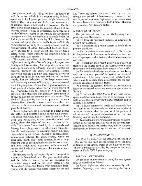
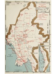
At present, and this will go on into the future asweU, the motor vehicle is a transport entity in itself,operating to haul passengers and freight between allparts of the Union and with little or no recourse to,or reliance upon, other modes of transport. On theother hand, it has aided in the re-estabhshment of theraUroad freight traffic, so completely paralyzed as aresult of the destruction of the war and the subsequentinsurgent activities, and serves as a valuable feeder forRailways, especially in replacing links destroyed bythe war and upon which the traffic is not sufficientlyre-estabhshed to justify the relaying of track and thereconstruction of other demolished facilities. Simi¬larly, though to a lesser extent, the motor truckbrings much freight traffic to the shipping points inthe river transport system.The secondary effect of the river systems uponhighways is really the effect of topography upon anyfacility which is essentially laid at grade and can crosswater gaps only vrith difficulty and at a substantialexpense. Through the years, for example, severalfairly well-planned and built local highway networkshave grown up in <strong>Burma</strong>, east and west of the Irra¬waddy. But the existence of the large watercourseand the consequent cost of bridging it, have preventedthe joining together of these local highway systems toform parts of a larger whole. In the whole length ofthe Irrawaddy, only the bridge at Ava afforded acrossing. This structure was partially demolished in1942, and has not yet been put back into service. Thiskind of discontinuity and interruption to the con¬tinuous flow of traffic is costly, and is another hin¬drance to the commercial, economic and culturalgrowth of <strong>Burma</strong>.Topography, too, has determined to a large degreethe nature and general outline of the road system.The main highways. Routes I and II between Ran¬goon and Mandalay, extend generally north andsouth, along the edges of the level portion of themain "land mass," as defined by the Irrawaddy andSittang Rivers. In general, the other main routes fol¬low the watercourses in reaching higher altitudes,especially in upper <strong>Burma</strong>. The lack of adequate inter¬connections between the main routes, which areessentiaUy north and south arteries, is to a largemeasure due to the mountain ranges between them,and over which road alignments with reasonablegrades and horizontal curvature characteristics can¬not be laid.<strong>Burma</strong>, nationally and especially as to transport, isa nearly self-contained unit. The great central valleyand the delta in lower <strong>Burma</strong> are encircled bymountain ranges and by the Shan Plateau. This"horseshoe" keeps the Union from significant inter¬course with its neighboring states, except by sea andHIGHWAYS 357air. There are almost no open routes by land, al¬though the growth of inter-country commerce willone day cause important highway arteries to be openedbetween <strong>Burma</strong> and Yunnan, Indo-China, Thailandand probably Pakistan and India.3. PURPOSES OF REPORTThe purposes of this report on the highway trans¬port system of <strong>Burma</strong> are:(a) To trace its historical features, as affecting itspresent development.(b) To examine the present system to establish itspresent condition.(c) To study the entire network and to discover itsinadequacies as to location, methods of constructionand of upkeep in order that any shortcomings may becorrected.(d) To establish the present density and pattern oftraffic on the several parts of the system, to determinethe present and anticipated future needs of the traffic.(e) To examine the design requirements now beingused on the several parts of the system, as measuredagainst current highway engineering practices else¬where, and to modify these as necessary for the pres¬ent and anticipated needs of traffic.(/) To study the need for, and costs of, mechanizinghighway construction and maintenance operations in<strong>Burma</strong>.(g) To review the 1907 Motor Code, with subse¬quent modifications, to determine its adequacy in thelight of modern highway traffic and practices and tomodify it as needed.(h) To study commercial traffic and economic fac¬tors, and to make comparisons with other modes oftransport in order that the process of integration ofall modes of transport as envisioned in the pre¬liminary report may be facilitated.(/) To develop an improvement program, with pro¬posals as to the sequence in which the several com¬ponent parts should be carried out, and to comparethe benefits to be derived against the cost of the work.B. CLASSIFICATIONThe 1950 51 Report of the Department, issued in<strong>1953</strong>, carries the most recent figures as to the totalmileages in the several parts of the highway system.The total mileage is classified by categories and roadtypes in Table XVI 1 (see next page).1. POLITICAL CATEGORIESOn the basis of governmental units, the road systemmay be classified as follows:(fl) Union highways, which are occasionally caUednational highways, are roads connecting the district


