

2014_01
2014_01
2014_01

You also want an ePaper? Increase the reach of your titles
YUMPU automatically turns print PDFs into web optimized ePapers that Google loves.
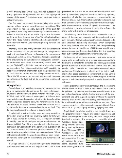
a force tracking tool. While FBCB2 has had success in theArmy, operations in Afghanistan and Iraq have highlightedseveral of the system’s limitations when employed in tacticalenvironments.The first was the system’s interoperability with similarsystems utilized by other armed forces of the military. Thiswas evident in Iraq, especially during the initial push forBaghdad as both Army and Marine Corps elements were involvedin combat operations in the city. As the Army waspushing north on the west side of the Tigris/Euphrates RiverValley the FBCB2 failed to identify and exchange digital informationwith Marine Corp elements pushing north on theeast side.Internally within the Army, different units task organizedunder other units can also pose challenges for the system aseach unit may have different configurations for the system’ssetup, such as its hard drive. This in itself requires additionaltime and planning for a unit to ensure the systems can communicatewith each other. Furthermore, several units stillrely on SINCGARS or EPLRS to share data with other userson the system. This reliance restricts the unit’s capability toreceive and transmit information over long distances dueto constraints of terrain and line of sight communication.These FBCB2 systems can support platoon and companyoperations on flat land but fail to account for terrain anddistance.Google EarthOverall there is no base line or common operating procedurefor every system to operate so that each system communicateseffortlessly with other systems. Although CPOF,DCGS-A, and FBCB2 were all developed for different reasonsand developed separately with the intention of makingthem compatible at some point, the Army missed its mark.The software for these systems, which was written exclusivelyfor the Army’s use, was poorly designed and built. Thefix then is software, the software is Google Earth.Google Earth is a virtual globe, map, and geographical informationprogram that was originally called EarthViewer3D. It was created by Keyhole, Inc., a company partiallyfunded by the Central Intelligence Agency and acquired byGoogle in 2004. One of the primary benefits of using a programsuch as Google Earth is the commercial availability ofthe product and the development process inherent in softwarethat is so widely available to a mass audience. Whensoftware is subject to the widest possible user base, the requirementsleveraged on the software are numerous andvaried.In Google Earth’s case, map and imagery data effectivelycombines with GPS latitude and longitude data. That is thenpresented to the user in an aesthetic manner while constantlymaintaining program metadata and map updates,regardless of whether the computers is connected to theInternet or not. Live streams of situational overlay data canthen combine with vehicle movement information and providea near-real-time picture of a given environment. Thestreamlining comes from having to make the software domany tasks with a finite set of resources.The efficiency comes from the need to have the componentsof the program integrate well internally and externallythrough effective and compartmentalized source codeand simplified data-basing interfaces. When computershave only a certain amount of battery life, CPU processingpower, Random Access Memory (RAM) space, graphics processingpower, and Internet bandwidth, this is a dauntingtask, but one that Google Earth performs very well.Furthermore, all of these resource constraints are whatArmy units are subject to on a regular basis. Automationshardware is consistently outdated and lacking processingpower. Bandwidth is often limited in remote sites. But theneed to collect, compile, and share information with a unitand among friendly forces is a basic need for battle trackingin a fast-paced operational environment. Google Earth’sability to do this better than any current program of recordsystem is its inherent origin as publicly available and usablesoftware.Such a program quickly evolves through the mechanismsstated above, to reach a level of effectiveness that cannotbe achieved by software and hardware combinations thatare isolated and used only by limited segments of the governmentand DOD. A good example of this is the currentinability of all the ABCS to consistently and effectively interfacewith each other without an exorbitant amount of resources,as well as civilian contractor support. Google Earthworks on a 7 year old laptop with only 2 gigabyte of RAM.Google Earth is available on all levels of classified systems.The program does not require any special equipment; justabout any computer in the Army can have Google Earthinstalled in minutes. The program is compatible with allWindows based operatingsystems currentlybeing used by the Armyfrom Windows 2000 toWindows 7 and evenLinux. Users do not requiremorethan 8 hoursof training to understandadvanced functionsof Google Earth. ItsGoogle Earth integrated into GPS unit of 2<strong>01</strong>1Audi A8.14 Military Intelligence