TEACHING SUPPORT DOCUMENT - OceanWatch Australia
TEACHING SUPPORT DOCUMENT - OceanWatch Australia
TEACHING SUPPORT DOCUMENT - OceanWatch Australia

Create successful ePaper yourself
Turn your PDF publications into a flip-book with our unique Google optimized e-Paper software.
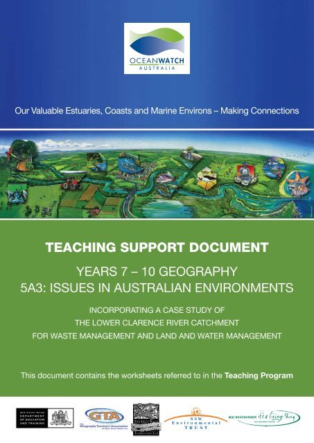
Our Valuable Estuaries, Coasts and Marine Environs – Making Connections<strong>TEACHING</strong> <strong>SUPPORT</strong> <strong>DOCUMENT</strong>YEARS 7 – 10 GEOGRAPHY5A3: ISSUES IN AUSTRALIAN ENVIRONMENTSINCORPORATING A CASE STUDY OFTHE LOWER CLARENCE RIVER CATCHMENTFOR WASTE MANAGEMENT AND LAND AND WATER MANAGEMENTThis document contains the worksheets referred to in the Teaching Program
Our Valuable Estuaries, Coast and Marine Environs – Making ConnectionsTeaching Support DocumentYears 7-10 Geography: 5A3: Issues in <strong>Australia</strong>n EnvironmentsIncorporating a Case Study of the Lower Clarence River CatchmentFor Waste Management and Land and Water Management© <strong>OceanWatch</strong> <strong>Australia</strong> Ltd, 2008All rights reserved around the world. This publication is subject to copyright and may not be reproduced, in whole or in part, in anymanner (other than for bona fide educational purposes and in accordance with the Copyright Act) without the prior written consentfrom the publisher.ISBN: 978-0-9757286-3-5OCEANWATCH AUSTRALIA LTDLocked Bag 247Pyrmont NSW 2009AUSTRALIAwww.oceanwatch.org.au<strong>OceanWatch</strong> <strong>Australia</strong> is a national environmental, not-for-profit company that works to achieve sustainability in the <strong>Australia</strong>n seafoodindustry through protecting and enhancing fish habitats, improving water quality and advancing the sustainability of fisheries throughaction based partnerships with the <strong>Australia</strong>n seafood industry, government, natural resource managers, private enterprise and thecommunity.This project has been assisted by the New South Wales Government through itsEnvironmental TrustEducational contentTeacher’s program, support material and broadsheet developed by:Lorraine Chaffer, Gorokan High SchoolSue Field, Education ConsultantFact sheets developed by:Lorraine Chaffer, Gorokan High SchoolMolino Stewart Pty LtdPoster developed by:<strong>OceanWatch</strong> <strong>Australia</strong>Graphic design by:David ApplebySteering CommitteeAnissa Lawrence/ Monique Needham, <strong>OceanWatch</strong> <strong>Australia</strong>John Gore / Pauline Sheppard, NSW Department of Education and TrainingSue Field, NSW Geography Teachers’ Association IncTrevor Daly, NSW Department of Primary IndustriesJohn McGuren, NSW Commercial Fishermen’s Cooperative AssociationMick O’Connor, Ballina High SchoolMichelle Perry, Southern Rivers Catchment Management AuthorityAcknowledgementsWe would like to sincerely thank all those who assisted in turning a concept into reality with this education resource including NorthernRivers Catchment Management Authority (Joelle Bridger, Nigel Blake), Clarence Valley Council (Peter Wilson, Suzanne Lynch), thoseinvolved in peer review, particularly NSW Department of Primary Industries (Sarah Fairfull) and NSW Department of Environment andClimate Change (Kerryn Stephens) and all those who contributed photos to the resource. We would also like to thank all the teachersfrom Maclean High School, South Grafton High School and Grafton High School who participated in the workshop to steer theresource development process.
<strong>SUPPORT</strong> <strong>DOCUMENT</strong>YEARS 7 – 10 GEOGRAPHY5A3: ISSUES IN AUSTRALIAN ENVIRONMENTSINCORPORATING A CASE STUDY OFTHE LOWER CLARENCE RIVER CATCHMENTFOR WASTE MANAGEMENT AND LAND AND WATER MANAGEMENTThis document contains the worksheets referred to in the Teaching ProgramOUR VALUABLE ESTUARIES, COAST AND MARINE ENVIRONS-MAKING CONNECTIONS 1
TASK 1: OVERVIEW OF ISSUES: WORKSHEET 1NATURE OF ISSUESGEOGRAPHICALPROCESSESGROUPS AFFECTEDWASTE MANAGEMENTLAND & WATER MANAGEMENTCOASTAL MANAGEMENT2 OUR VALUABLE ESTUARIES, COAST AND MARINE ENVIRONS-MAKING CONNECTIONS
NATURE OF ISSUESGEOGRAPHICALPROCESSESGROUPS AFFECTEDURBAN GROWTHAIR QUALITYSPATIAL INEQUALITYThere would be inequality in income betweenthe following locations.1. Rural and urban – across <strong>Australia</strong> ruralincomes are lower than urban incomes.2. Within the urban areas there areinequalities. Waterside and hillside suburbsusually house wealthier residents while poorerresidents locate in outer suburbs, those subjectto flooding or in less attractive locations.These spatial inequalities in income createinequalities in access to information technology(the IT divide) health care and education whichin turn affects employment and quality of life.Drought has reduced ruralincomes in recent years andled to a decline in some ruraltowns.Globalisation has resultedin a loss of unskilled jobs inmanufacturing.Mechanisation andrestructuring of farms hasled to job losses in ruralareas.Rural – urban migration tolarge cities has increasedcreated more job losses.Business people andresidents in smaller countrytowns.Indigenous peopleUnskilled workers.OUR VALUABLE ESTUARIES, COAST AND MARINE ENVIRONS-MAKING CONNECTIONS 3
TASK 1: OVERVIEW OF ISSUES: WORKSHEET 2What are the main characteristics of aquatic habitats in estuaries?Which activities most threaten water quality and aquatic habitats of estuaries and marine environmentsand how?How important are the commercial and recreational fishing industries to the economy?What are the consequences of the loss of aquatic habitats and deterioration of water quality for estuarineand marine fishing industries?4 OUR VALUABLE ESTUARIES, COAST AND MARINE ENVIRONS-MAKING CONNECTIONS
TASK 1: SPATIAL INEQUALITY: sample newspaper articleNATURE OF THE ISSUESpatial inequality is about where inequalities occur and the reasons for them. Inequalities can be shownby looking at figures for income, health, education levels, and access to the internet. The poor in <strong>Australia</strong>include a high proportion of people over 65, indigenous <strong>Australia</strong>ns, single parent families, unskilled youthand unemployed migrants from non English speaking backgrounds. These groups tend to be located in lessaffluent suburbs.PROCESSESIn <strong>Australia</strong>, globalisation has created an economy based on “new jobs” in information technology andbusiness services and a loss of manufacturing jobs. There are fewer opportunities for unskilled workers.The benefits of globalisation are concentrated in large cities especially Sydney.Lack of opportunities in rural towns has increased rural – urban migration into <strong>Australia</strong>’s large cities.CASE STUDY: INCOME INEQUALITYStatistics continue to show a large gap between the incomes of those living in the capital cities and thoseliving in the rest of <strong>Australia</strong>. In the 1990s, the incomes of city residents increased at about double therate of those living in major urban centres and regional and rural towns. For example this is highlighted inthe table below. The table shows the higher % of people on higher incomes living in cities compared toother areas.Table: Proportion of households with income in given ranges, by region, 1996Income groupCapital cities(%)Major urbanareas (%)Regionaltowns (%)Rural towns(%)Low (Under $15,600 p.a.) 20 25 26.7 30 22.1Lower Middle ($15,600-36,400p.a.) 30.8 34.7 37.6 40.8 39.9Upper Middle ($36,400-78,000 p.a.) 35.4 31.7 29.2 25.2 29.4High ( Over $78,000 p.a.) 13.9 8.6 6.5 4.1 7.4Rural areas(not towns) (%)Source: Lloyd, R, Harding, A and Hellwig, O, ‘Regional Divide? A Study of Incomes in Regional <strong>Australia</strong>’,Discussion Paper No. 51, National Centre for Social and Economic Modelling, September 2000.ImpactsLower income earners tend to live in areas with less access to transport, services and jobs, leading to acycle of poverty that often passes through generations. They experience higher infant mortality rates andlower life expectancy.Possible Individual responsesAn unskilled young person might seek job training through community based programs that are free or lowcost. Another individual might respond by becoming involved in criminal activity.Group responses:A community group might provide educational opportunities such as Mission <strong>Australia</strong>’s Indigenous YouthMobility program in the Northern Territory which gives young people access to training and employment.Welfare groups might respond with food, clothing and housing assistance.Federal, State and Local Governments have responded to this issue in many ways. Some examples are:• The provision of education institutions in outer suburbs such as the University of Western Sydney.(State).• Income support for the unemployed (Federal).• Rent assistance to allow the poor to rent privately (Federal).• Local government incentives to attract business into outer suburbs and create job opportunities.OUR VALUABLE ESTUARIES, COAST AND MARINE ENVIRONS-MAKING CONNECTIONS 5
TASK 2: WASTE MANAGEMENT: WORKSHEET 1Waste sources identified from the posterMaclean landuse mapLEGENDIdentify the waste issues for the Lower Clarence River Catchment6 OUR VALUABLE ESTUARIES, COAST AND MARINE ENVIRONS-MAKING CONNECTIONS
Geographical features that could impact on waste managementTopography: Cross sectionCross Section: Hill behind MacleanHeightMetres1cm to 10mGR 200420 GR 230420At what locations might these features createwaste management issues?Gradient = Vertical riseGradientHorizontal distanceLocal relief: Highest point minus lowest pointTopographyDensity: Buildings per square kmBuilding densityOUR VALUABLE ESTUARIES, COAST AND MARINE ENVIRONS-MAKING CONNECTIONS 7
TASK 2: WASTE MANAGEMENT: WORKSHEET 2ORGANISATION SHEET and CHECKLIST FOR YOUR LESSONScope of lessonWhat is the issue about?Main ideasBriefly outline the issueCompleted(Tick)Where in the Lower Clarence River Catchment isthe issue located?LocationConstruct a simple mapDo I have a map?How will I produce my own map?Collect digital images to teach the students aboutthe location and the nature of the issueWhat photographs can I find?What are the main impacts of this issue on theLower Clarence River Catchment and differentgroups in the valley e.g. fishermen, tourists,farmers, businesses?GroupsImpacts8 OUR VALUABLE ESTUARIES, COAST AND MARINE ENVIRONS-MAKING CONNECTIONS
Scope of lessonWhat perceptions might different groups have onthe issue?Main ideasGroupsCompleted(Tick)You might interview your friends at school to see iftheir perceptions differ and whyHow will I find out the perceptions?What does sustainability mean?DefinitionHow does this issue impact on sustainability in theLower Clarence River Catchment?How does my issue reduce sustainability?What will happen if the issue is not addressed?What will be the consequences of doing nothing aboutthe issue?OUR VALUABLE ESTUARIES, COAST AND MARINE ENVIRONS-MAKING CONNECTIONS 9
Scope of lessonWhat groups are involved in decision making aboutthis issue?How are these decisions made?What is the role of government in this process?Main ideasCompleted(Tick)What have individuals, groups and governmentsdone to a respond to and manage the issue?Individuals Groups GovernmentsHave the strategies implemented so far beensuccessful?Are there any other strategies that might promotesustainability, social justice and equity?Suggestedstrategies forpromotingsustainabilitySuggestedstrategies forsocial justiceSuggestedstrategies forequity10 OUR VALUABLE ESTUARIES, COAST AND MARINE ENVIRONS-MAKING CONNECTIONS
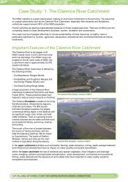
TASK 3: LAND AND WATER MANAGEMENT:Lower Clarence River Catchment Study AreaThis map shows the entire catchment area of the Clarence River and its tributaries.This resource concentrates on the waste, land and water management issues in the Lower Clarence RiverCatchment.FROM:“Pathways to a Living Estuary”Clarence Valley Management PlanClarence Valley CouncilOUR VALUABLE ESTUARIES, COAST AND MARINE ENVIRONS-MAKING CONNECTIONS 11
TASK 3: LAND AND WATER MANAGEMENT:WORKSHEET 1RESEARCH ACTION PLANRequirement Details TickFour broad focus questionsThese must cover:• Geographical processes occurringat the site, for example, flooding,erosion, siltation, pollution,urbanisation, resource depletion,habitat destruction, drought, floodmitigation, waste disposal.• Individual, group and governmentresponses to the issue.• Management processes andstrategies implemented tomanage the issue, especiallythose promoting social justice andequity, and an evaluation of theirsuccess.• Perceptions of different groups ona land/water management issue.1.2.3.4.The types of primary and secondarydata required to answer the focusquestionsPrimary data requiredSecondary data required12 OUR VALUABLE ESTUARIES, COAST AND MARINE ENVIRONS-MAKING CONNECTIONS
Requirement Details TickHow data (research and methodology)is going to be collected and theequipment that is neededPrimary research methodologies(this may have already been done in the class fieldwork task)Equipment neededHow the data collected is going to beprocessed and analysed(graphs, tables, maps, sketches,photographs etc)List methods used to process dataProvide the following informationabout the area being studied:How will a map of the area be produced?• a map of the area (rememberB.O.L.T.S.)• photographs or field sketches ofthe site to illustrate–– the water quality issue(s);or–– management strategies.What photographs need to be obtained?A reference to the significance ofthis issue for the sustainability of thesite and for industries dependanton water quality such as fishing,tourism, agriculture, aquaculture andrecreation.How does the issue affect sustainability?OUR VALUABLE ESTUARIES, COAST AND MARINE ENVIRONS-MAKING CONNECTIONS 13
Requirement Details TickPresent the information as amultimedia presentation. For example:––––––––a websitea PowerPoint presentationan oral report using overheadtransparenciesa documentary presentation onvideo /DVD.How will the information collected be presented?What resources are needed to complete the presentation?Seek the teacher’s comment beforeproceeding with the final presentation.TEACHER COMMENT14 OUR VALUABLE ESTUARIES, COAST AND MARINE ENVIRONS-MAKING CONNECTIONS
TASK 3: LAND AND WATER MANAGEMENT:WORKSHEET 2CHECKLIST FOR FIELDWORKRequirement Details CompletedDraw a sketch map of the site(s).Name and locate the siteOn the map include a compass withboth cardinal points and bearings.Make line drawings or takephotographs of:––––the issues being observed;and/ormanagement strategiesimplemented.Which method was used?List the issues observedList the management strategies observedConstruct a transect diagram to showchanges in vegetation or landuseacross one location.What does the transect show?Use practical methodologies such asmeasuring (eg water quality testing),estimating (eg size of structures,amount of cleared land), quadrats, linetransects, observing and recording,conducting surveys or questionaries ofrelevant stakeholders.List methodologies usedOUR VALUABLE ESTUARIES, COAST AND MARINE ENVIRONS-MAKING CONNECTIONS 15
Requirement Details CompletedDetermine the impact of the issue ondifferent groupsGroupsImpactsDetermine the perceptions of thesegroups on the issue. Interviews withstakeholders should be considered.GroupsPerceptionsConsider the impacts of climatechange on the siteList possible impactsConsider the impacts of dam buildingon the site.List possible impacts16 OUR VALUABLE ESTUARIES, COAST AND MARINE ENVIRONS-MAKING CONNECTIONS
TASK 3: LAND AND WATER MANAGEMENT: Potential Fieldwork Sites ForThe Lower Clarence River CatchmentSITE 1: Clarence River Fisherman’s Co-operative MacleanAt this site students can observe the following features relevant to land and water management:• floodplain/wetland drainage;• modified floodgates;• sewerage treatment plant drains into wetlands;• sports grounds;• levees;• fishing boats;• tourist activities; and• wetland drainage.SITE 2: Swan CreekAt this site students can observe the following features relevant to land and water management:• floodgates and penstocks;• riparian zone; and• modifications to floodgates to allow fish to migrate upstream.SITE 3: Hickey IslandAt this site students can observe the following features relevant to land and water management:• threatened species;• saltmarsh;• different riparian vegetation zones;• unauthorised tracks;• beach erosion;• the marina with boats and the wake created by vessels;• oyster farming impacts;• stormwater; and• tourist impacts.AT THESE SITES students could do any of following activities:• draw a map;• take photographs or draw field sketches;• test water quality;• measure dimensions of drains and levees;• do a vegetation transect (line transect or quadrant study);• observe and explain what impact human modifications have on land and water;• consider the impact of building a dam upstream on this site;• consider the impact climate change may have on this site; and• consider the impact of human modifications to the environment on downstream ecosystems and thefishing industry.OUR VALUABLE ESTUARIES, COAST AND MARINE ENVIRONS-MAKING CONNECTIONS 17
To determine different perceptions on a water issue students could interview representatives from any ofthese groups in relation to the recent dam proposal as an organised part of the fieldwork.• The Clarence River Professional Fisherman’s Association.• Clarence River Recreational Fishing Representatives.• The Clarence Valley Council.• Clarence Valley Chambers of Commerce.• Clarence Valley Cane Growers Association.• Clarence Valley Climate Change Group.• Environment Centre.• Landcare Organisation.• Energy Supplier.• Transport Company.18 OUR VALUABLE ESTUARIES, COAST AND MARINE ENVIRONS-MAKING CONNECTIONS
GLOSSARYacid sulphate soilagriculturealgal bloomanoxicaquacultureaquaticbenthicbiodiversitybrackishbufferbycatchcatchmentcatchment managementcoastcontaminantcrustaceancumulativedamdegradationdegradedetritusdissolved oxygendownstreamdredgeecological sustainable developmentecosystemeffluentendangeredentericenvironmenterosionestuaryAcid sulfate soils are naturally occurring soils and sediments containing sulfide minerals,predominantly pyrite (an iron sulfide). Left undisturbed, these soils are not acidic. However bydraining, excavating or exposing these soils by lowering the water table, the sulfides will reactwith oxygen in the air to form sulfuric acid.Subsequent flushing or flooding of these dried out soils releases acid and heavy metals intowaterways causing harm and even death of plants and animals in the river and estuaries andcorrosion of concrete and steel building structures.Cultivating the land to grow crops or raise stock for food, feed, fibre, fuel, or otheruseful products.An explosion of algae populations often due to increased nutrient loads.Without oxygen.The farming or cultivation of fish, other animals, or plants, in water.Living or growing in or on the water. A term relating to water and water environments.Features at the bottom of water bodies – often referred to fish species that live on the bottomof the ocean, rivers and lakes.Biodiversity means the range of different native animals, birds, fish present in a particular area.Slightly salty.An area of land between two conflicting land uses.Non target species that are caught when fishing (commercial or recreational) or species thatcannot be sold or taken as recreational catch.The area of land that drains into a system of rivers, creeks or streams. This area of land isusually bounded by mountain ridges or steep terrain.When land and water resources are managed on a catchment wide basis ratherthan separately.The seaward limit of land including a transition zone between the marine and landenvironments and includes beaches, cliffs, sand dunes and estuaries.Substances not naturally present in the environment or present in elevated amounts that cannegatively affect the environment.An aquatic animal that has a hard external skeleton and jointed appendages such as lobsters,prawns and crabs.Increasing by successive addition.A structure built across a watercourse such as a river to hold back water.When the quality of something is reduced. For example, land and water degradation results inpoorer quality resources.To cause a decline in the quality.Fallen organic material such as leaves or twigs.The amount of oxygen dissolved in water.Towards the direction that a stream is flowing.Removal of sediment from the bottom of a waterbody.Ecologically sustainable development refers to ‘Sustainable development that meets the needsof the present without compromising the ability of future generations to meet their own needs.’(Brundtland Report: Our Common Future).A community of interacting plants and animals and the non living environment in which theyare found.Wastewater, treated or untreated, that flows out of a treatment plant, sewer, orindustrial outfall.Any species in danger of extinction throughout all or a significant part of its range/habitat.Originating from the intestines.All external conditions and influences considered together that affect the development andsurvival of an organism. The biophysical surroundings and the community in which people live.Wearing away of the land by the action of water, ice or wind.An estuary is where the river mouth meets the sea and forms special habitats for plants,animals and fish and shellfish.OUR VALUABLE ESTUARIES, COAST AND MARINE ENVIRONS-MAKING CONNECTIONS 19
eutrophicationfaunafertiliserflood mitigationfloodgatefloodplaingeographical processesgross pollutant trapgroundwaterhabitathorticulturehydrologyhypoxicimperviousintegrated catchment managementirrigationlakelegislationleveeLower Clarence River Catchmentmangrovemarinemarine protected areasmarshmitigationnatural resourcesnearshorenursery groundnutrientsoceanoxidationpathogensperceptionspesticideplantation forestryThe nutrient enrichment of water and / or land that can lead to toxic algal blooms and loss ofdissolved oxygen leaving water which cannot support much life.AnimalsSubstance added to the soil to increase its productivity.Flood mitigation includes a range of measures designed to reduce the impact of floodwaters;like floodgates, dams, detention basins, levees and widening and deepening water channels.A gate designed to control water or restrain a water outburst.The low lying, relatively flat land within the catchment, next to a stream or a river that iscovered with water during a flood.Those biophysical and human actions that bring about changes to environments.Devices used to prevent large items polluting waterways.Water that flows beneath the land surface, for example, within rock, fractures or other cavitiesin the ground.The place where a plant or animal species naturally lives and grows.Commercial cultivation of fruits, vegetables and flowers.The science of water relating to its occurrence, properties, distribution, circulation andtransport.Too little oxygen.Unable to be penetrated.The sustainable and balanced use of all land, water and biological resources in a catchment.Application of water (or wastewater) to land areas to supply the water and sometimes nutrientneeds of plants.A body of fresh or salt water that is usually entirely surrounded by land, however coastal lakesoften have a permanent or temporary connection to the seaLaws created by an act of parliament.An artificial bank that protects land from flooding.The catchment below Copmanhurst where the estuary begins (that is, the tidal limit ofthe river).Mangroves grow along the shorelines of many NSW estuaries in areas subject to regulartidal inundation. Two most common species are grey mangrove (Avicennia marina) and rivermangrove (Aegiceras cornicalatum).Of or relating to the sea or ocean.Marine Protected Areas are areas of land and sea that are protected and maintainedto preserve the natural habitats and biodiversity of the area. These are like marine‘national parks’.A wetland where the dominant vegetation is non-woody plants, such as salt grasses andsedges.Mitigation means to make something less harsh, severe or to reduce its impact.Resources from the natural environment eg. Soils, forests, rivers, fish,From the swash zone seaward to just beyond the breaking waves where the depth is too greatfor wave action to be felt on the seabed.Areas where fish and other aquatic animals breed and raise their young.Elements and chemicals, such as nitrogen and phosphorus, that are essential to plant growth.Low levels of nitrogen or phosphorus may limit plant growth in surface waters; high levels maycause excess plant and phytoplankton growth.The great body of salt water which occupies two-thirds of the surface of the Earth. It surroundthe great land masses called continents.Combining a substance with oxygen (usually the air).Disease causing organisms.Different ways of viewing things.A chemical substance that kills harmful organisms and is used to control pests, such asinsects, weeds or microorganisms.Logging of areas where trees are continually artificially replanted.20 OUR VALUABLE ESTUARIES, COAST AND MARINE ENVIRONS-MAKING CONNECTIONS
pollutionred spot diseasereservoirresourceriparian zoneriverrunoffsalinityseagrasssedimentsedimentationsewageseweragesewerage treatment plantsiltationsnagsstockstormwatersustainabilitysustainableswampterrestrialtidal flushingtidal limitupstreamwater qualitywater tableweirwetlandsThe presence of a substance in the environment that, because of its chemical compositionor quantity, prevents the functioning of natural processes and produces undesirableenvironmental and health effects.Infection of exposed flesh (of a fish) with a fungus usually associated with acidic conditionsand or heavy metal toxicity.A pond, lake, or basin, either natural or artificial, for the storage, regulation, and controlof water.A material, substance or place that is found in nature and is used by humans (oil, natural gas,beaches, forests, etc.).The riparian zone is the area of vegetation that runs along the edge of a river, stream or nearan estuary, lake, mangrove, saltmarsh or coastal inlet.Large, natural stream of water that empties into a large body of water such as a lake orthe ocean.Water that flows over the land surface into a waterbody.A term referring to the salt content in soil or water.A unique group of specialised marine plants. They have evolved from land plants and areadapted to living and reproducing entirely within sea water. Seagrasses occur in shelteredareas and shallow waters, growing in soft sediments such as sand or mud.Fine soil or mineral particles that settle to the bottom of the water or are suspended in it.Sedimentation is where a lot of dirt or silt and other material is washed into waterways,clogging the natural flow and affecting the habitat and water quality. When sediment settlesover seagrass beds it can block out the sunlight to the seagrass and kill it. Seagrass is veryimportant habitat for fish and crustaceans.The waste and wastewater produced by residential, commercial and industrial sources anddischarged into sewers - from toilets, showers, kitchens sinks and laundries.System of pipes to transport sewage to the place of disposal or treatment.Facility designed to receive the wastewater from domestic sources and to remove materialsthat damage water quality and threaten public health and safety when discharged intoreceiving streams or bodies of water.The accumulation of sediments transported by water.Logs or branches in a stream.Animals kept for use or profit.Water (typically rain water) collected from roof tops, footpaths, roads, etc, together withanything that the water picks up such as rubbish, plastic bags, animal droppings, chemicalsfrom detergents, fertilisers, oil, organics including leaves and lawn clippings.When resources are used in such a way that they will still be available in the future and in acondition that allows future generations to benefit from them.An activity or process that able to be continued indefinitely.A type of wetland that is dominated by woody vegetation and does not accumulate appreciablepeat deposits. Swamps may be fresh water or saltwater and tidal or nontidal.A term relating to the earth or land.The time required to remove or reduce any dissolved or suspended contaminant through tidalaction in an estuary.The upstream limit of an estuary, at which point the water no longer responds to the oceantide.In the direction away from the flow of a river or steam.Water quality refers to the chemical, biological and physical characteristics of water.The level below the earth’s surface at which the ground becomes saturated with waterStructure across the width of a waterway to hold back or divert the flow.Areas, such as swamps and marshes, estuaries, that are covered with fresh, brackish or salinewater (surface water or groundwater) for periods of time long enough to support vegetation oraquatic life that thrives in these saturated soil conditions.OUR VALUABLE ESTUARIES, COAST AND MARINE ENVIRONS-MAKING CONNECTIONS 21