Surat Gas Project EIS - Agriculture Impact Assessment - Arrow Energy
Surat Gas Project EIS - Agriculture Impact Assessment - Arrow Energy
Surat Gas Project EIS - Agriculture Impact Assessment - Arrow Energy
You also want an ePaper? Increase the reach of your titles
YUMPU automatically turns print PDFs into web optimized ePapers that Google loves.
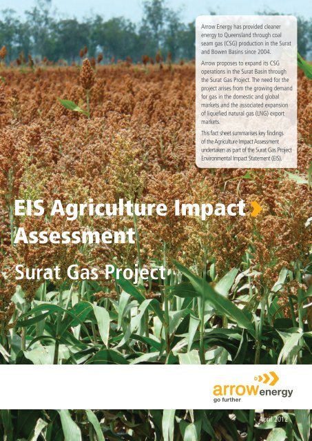
<strong>Arrow</strong> <strong>Energy</strong> has provided cleanerenergy to Queensland through coalseam gas (CSG) production in the <strong>Surat</strong>and Bowen Basins since 2004.<strong>Arrow</strong> proposes to expand its CSGoperations in the <strong>Surat</strong> Basin throughthe <strong>Surat</strong> <strong>Gas</strong> <strong>Project</strong>. The need for theproject arises from the growing demandfor gas in the domestic and globalmarkets and the associated expansionof liquefied natural gas (LNG) exportmarkets.This fact sheet summarises key findingsof the <strong>Agriculture</strong> <strong>Impact</strong> <strong>Assessment</strong>undertaken as part of the <strong>Surat</strong> <strong>Gas</strong> <strong>Project</strong>Environmental <strong>Impact</strong> Statement (<strong>EIS</strong>).<strong>EIS</strong> <strong>Agriculture</strong> <strong>Impact</strong><strong>Assessment</strong><strong>Surat</strong> <strong>Gas</strong> <strong>Project</strong>April 2012
IntroductionA temperate climate, rich soils and gentlyundulating terrain are the attributes that attractedearly settlers to the Darling Downs. Extensivepastoral leases taken out by the early settlers havebeen transformed into highly productive agriculturalunits that specialise in beef cattle, sheep and lambs,and cereal and non-cereal crops.Seasonal and storm-event flooding of theCondamine, Balonne, Dawson, Weir, MacIntyreand Moonie Rivers results in expansive overlandflows that are important in replenishing soil waterwhich sustains summer and winter cropping cycles.Summer crops are preferred as rainfall is morereliable. Lower evaporation in winter and milderconditions are conducive to a range of winter crops.The variability of the Australian climate, in whichdrought is an enduring feature of weather patterns,exposes agricultural production reliant on surfacewater to long periods of reduced or no production.The Darling Downs is not immune to drought andits effects. Access to groundwater has reducedthe severity of drought and variations in seasonalrainfall on agricultural enterprises. This importantresource is drawn from the vast alluvial bedsassociated with the Condamine River and fromaquifers associated with the coal seams of theWalloon Coal Measures and deeper aquifers of theGreat Artesian Basin.The <strong>Agriculture</strong> <strong>Impact</strong> <strong>Assessment</strong> undertakenas part of the <strong>Arrow</strong> <strong>Energy</strong> <strong>Surat</strong> <strong>Gas</strong> <strong>Project</strong> <strong>EIS</strong>found the region is renowned for its black soils andcracking clays (Vertosols and Dermosols) whosemacro and micro-pore connections are importantfor water storage and fertility. Cultivation methodshave evolved around minimising compaction ofthese soils, as compaction and inversion affect theirintrinsic properties and crop yields.The Darling Downs is an important centre ofeconomic activity in Queensland and in Australia,contributing about 5 per cent to the Gross StateProduct and 1 per cent to the Gross NationalProduct in 2009/10. In 2009/10, agriculturerepresented approximately 9 per cent of the GrossRegional Product, a reduction from previous yearsdue mainly to the expansion of mining and oil andgas industries in the region. In 2006, agriculturecontributed $1.7 billion to the regional economyand remains an important industry in the region.Farming enterprises and operationsCompetition from imports and the higher costsof production (labour and materials) have forcedagricultural enterprises of the Darling Downs tointroduce efficiencies to remain competitive. Thishas resulted in intensive farming operations andintensively farmed land.Intensively farmed land and/or Strategic CroppingLand sits over approximately 15 per cent of <strong>Arrow</strong>’stenements in Queensland and New South Wales.Feed lots, piggeries and poultry farms are intensivefarming operations that have evolved to introducethe required efficiencies and economies of scale.Horticulture, orchards, vineyards and agro-forestryare further examples of intensive farming operationsthat have established in the Darling Downs andBroadacre cropping on black soils<strong>EIS</strong> <strong>Agriculture</strong> <strong>Impact</strong> <strong>Assessment</strong> 1
Production well on cultivated landoverland flood flows created by raised formationsof access tracks or poorly reinstated pipeline rightsof ways can reduce water infiltration and result inerosion and loss of topsoil.Inappropriately sited infrastructure affectsmachinery operations by introducing additionalheadlands and cultivation islands, contributing toreduced yields and compaction of soils. It can alsonecessitate rearrangement of farm infrastructureincluding irrigation channels and equipment (e.g.lateral and centre-pivot booms). Figure 1 (pg 2)shows the impact of poorly sited production wellsand gathering systems in cultivation paddocks.The coordination of CSG activities on farmsintroduces management overheads that do notcurrently exist. Construction, operation andmaintenance, and decommissioning activities needto be integrated with cropping and breeding cycles,and with farm development plans. The planningand execution of aerial spraying is one suchexample. Another is the management of fallowpaddocks when the cropping cycle might not alignwith the production well drilling program.The control and management of access to farms,and the inconvenience caused by CSG activities onfarms affects amenity including industrialisationof the rural landscape and landowner wellbeingderived from the lifestyle, as well as the safety andsecurity of families and farm workers.Potential extent of impact onagricultural landIt is estimated 2-3 per cent of land associated witha traditional 160-acre (65-ha) production spacingwill be temporarily disturbed by installation ofproduction wells and gas and water gatheringsystems. While the construction right of way orcorridor for gathering systems will be rehabilitatedand returned to agricultural production followinginstallation of the pipelines, the operational areaof a production well (approximately 10 m by10 m or 0.1 ha) will not be rehabilitated untilthe well is decommissioned. During the life of awell, workovers are required every 2-4 years tomaintain the well. An area similar to that requiredto establish the well (approximately 0.5 ha) isrequired for workovers. The temporary workarea is rehabilitated following establishment andworkovers.Construction corridors for medium pressurepipelines are typically 25 m wide. The corridor isrehabilitated following installation of the pipeline.Production facilities require substantially largerareas of land for longer periods. The land requiredfor the facilities ranges from 0.5 ha for a fieldcompression facility to 220 ha for an integrated<strong>EIS</strong> <strong>Agriculture</strong> <strong>Impact</strong> <strong>Assessment</strong> 3
processing facility which incorporates gasprocessing and compression, power generation andwater treatment and storage infrastructure.<strong>Arrow</strong> will seek to purchase land required forproduction facilities including sufficient land fortemporary accommodation camps at integratedprocessing facilities.Potential extent of impact on GQALand Strategic Cropping LandThe fertility of soils in the Darling Downs andagricultural productivity of the region has beenrecognised in planning policies and legislationaimed to protect the land from the impacts ofdevelopment to ensure its productivity into thefuture.Figure 2 Potential impacts of siting productionwells and gathering systems in cultivation paddocks<strong>Arrow</strong>, as a result of consultation with landowners andcollaboration with the <strong>Arrow</strong> Intensively Farmed LandCommittee (AIFLC), has analysed CSG well placementand drawn up a draft conceptual development plan forwhere wells could be best placed on intensively farmedland.<strong>Arrow</strong> recognises traditional grid spacing of CSG wellsis impractical on intensively farmed land and <strong>Arrow</strong>’sintention is to work with individual landowners tomaximise flexibility when determining the location of CSGwells and gathering systems.Figure 3 Mitigating potential impacts of sitingproduction wells and gathering systems in cultivationpaddocksCSG wells can better coexist on intensively farmed landif located along the boundary of a property, aligned toaccess tracks/road reserves or outside cultivation areas.Also preferable is to locate CSG wells and associatedinfrastructure in headland areas or in the corners ofcultivated areas.It is also conceptually possible to remove wells to mitigateimpact on farm workability, however it may mean <strong>Arrow</strong>will need to be on a property for longer to extracteconomic quantities of CSG.Approximately 1kmLEGENDCSG wellDamThe Figures above are based on a typical intensively farmed property’slayout and is indicative only of the flexible approach <strong>Arrow</strong> intends totake with regards to CSG well/infrastructure placement on intensivelyfarmed land.Access trackGathering lineCultivation paddockIt does not represent what <strong>Arrow</strong> intends to do on every property.<strong>Arrow</strong> will work with individual landowners when analysing CSGfield design to determine suitable options for each individual farmingenterprise.<strong>EIS</strong> <strong>Agriculture</strong> <strong>Impact</strong> <strong>Assessment</strong> 4
the particular farming practices and propertyspecificdevelopment and farming plans. Consultlandowners on the location of infrastructure andon construction methods to reduce overall impactsto the farming operation, including capital andoperating costs and productivity.2. Intensive Farming Operations. Avoidinfrastructure and associated farm managementareas of intensive farming operations, includingpiggeries, feedlots, vineyards, orchards,horticultural enterprises, poultry farms and smalllotplantations. Maintain a minimum separation(at least or nominally 200 m) between animalenclosures and production wells and facilities toensure biosecurity or animal health, as agreed withlandowners or landholders.3. Production Facility Site Selection. Site productionfacilities, electricity substations and associatedaccess tracks to avoid or reduce loss of cultivationareas and irrigation infrastructure. <strong>Arrow</strong> hascommitted to ensuring dams for CSG water andbrine are not constructed on intensively farmedland as per commitment C092.4. Medium-pressure Pipelines. Route mediumpressurepipelines along boundary fences, parallelto the direction of cultivation or soil conservationstructures, or in the lowest quality soils to reduceimpacts on cultivation and irrigation systems.5. Cultivation Paddocks. Minimise the introductionof additional headlands in cultivation paddocks.6. Controlled Traffic Operations. Minimise the lossof productive land in controlled traffic paddocks.7. Soil Conservation Structures. Maintain theoperation and effectiveness of soil conservationstructures.8. Spray Irrigation. Locate wells, gathering lines andassociated access tracks in a manner that does notsignificantly interfere with swept paths (effectivecoverage) of centre-pivot and lateral and lowpressureboom irrigators.9. Surface Irrigation. Maintain the integrity andefficiency of surface irrigation systems.10. Cropping Cycles. Maximise the opportunity toschedule development and routine maintenanceactivities, particularly drilling and construction withthe cropping cycle (i.e. with fallow periods).11. Access Track Design. Develop constructionmethods and design access tracks in cultivationpaddocks to maintain the existing hydrologic andhydraulic regime of the site. Evaluate the materialused in construction of the access tracks forpotential impacts to the farming operations (e.g.gravel above a certain size can cause damage tomachinery).12. Wellpad Design. Minimise disturbance andtemporary loss of productive land associated withdrilling wells, particularly from workspace creep,by agreeing on the layout of the drill pad andassociated work areas with the landowner subjectto any safety requirements.To understand and demonstrate how CSGinfrastructure can be sited to reduce impacts onintensively farmed land, <strong>Arrow</strong> is undertaking threecase studies on dryland and irrigated broadacrecropping farms.The initial study has shown that the typical gridarrangement of wells can be varied to remove wellsfrom paddocks and that the number of wells canbe reduced, further lessening the impact on theproperty. Figure 3 (pg 4) shows how the number ofproduction wells can be reduced and reconfiguredto achieve the same production from the typicalgrid pattern. Reducing the number of wellsextends the time required to extract the economicquantities of CSG and each landowner will needto consider whether more wells and a shorterproduction period or fewer wells and a longerproduction period is preferable.Construction activities will be managed through theimplementation of industry-proven environmentalmanagement measures including the measuresrecommended by Gilbert & Sutherland, theconsultants commissioned to provide advice onagriculture and potential impacts of CSG activitieson agricultural operations, and codes of practicesuch as the Australian Pipeline Industry AssociationCode of Environmental Practice.Black soils and their intrinsic properties poseparticular challenges for rehabilitation. <strong>Arrow</strong> hascommenced a series of trials on intensively farmedland designed to understand and document themethods required to successfully rehabilitate blacksoils.<strong>EIS</strong> <strong>Agriculture</strong> <strong>Impact</strong> <strong>Assessment</strong> 6
In addition to the above, these include:• Developing and testing procedures forexploration chip and core drilling activities.• Using surface tanks to manage drilling mudsduring the drilling activities to eliminate theneed to excavate pits.• Developing techniques for reinstating surfaceprofiles and rehabilitating pipeline corridorThe case studies are being developed in consultationwith the <strong>Arrow</strong> Intensiveily Farmed Land Committee(AIFLC). The AIFLC is one of the forums throughwhich <strong>Arrow</strong> consults with the farming communityon issues associated with CSG development.Other forums include the <strong>Arrow</strong> <strong>Surat</strong> CommunityReference Group, CSG Engagement Group,irrigator groups and <strong>Arrow</strong>’s ongoing communityconsultation.Potential residual impactsThe extent to which disturbed land can berehabilitated will determine the degree of residualimpact on agricultural land. The factors that willdetermine the extent and severity of any residualimpact are:• The hydrologic regime and drainage patternsof the disturbed land and surrounding area;i.e. can the predisturbance drainage patternsbe reinstated or replicated to ensure a stablelandform that does not alter overland flowbehaviour or cause erosion?• The type and properties of the disturbed soils;i.e. can the soil profile, small and large poreconnections, soil organic matter, soil chemistryand biological function be reinstated?• The predisturbance land use and productivity;i.e. can the former land use and productivity bereinstated?The techniques, effort and investment required toachieve successful rehabilitation and reinstatementof former land use and productivity vary dependingon the type and location of infrastructure –production wells, gathering systems, pipelines andproduction facilities.Where land cannot be rehabilitated to its formeruse, the residual impacts will be addressed incompensation. Compensation will consider theextent to which use and productivity has beendiminished. For example, land occupied byproduction facilities might be suitable for grazingbut not cropping. Site selection is the most effectiveway of reducing this potential residual impact.<strong>Arrow</strong> will target low value agricultural land inpreference to high value agricultural land whensiting production facilities.Further reading<strong>Surat</strong> <strong>Gas</strong> <strong>Project</strong> ElS:• Volume 1, Chapter 13, <strong>Agriculture</strong>.• Volume 4, Appendix F, Agricultural Report.For more informationFor persons or groups with special communicationneeds or persons requiring further informationabout the <strong>Agriculture</strong> <strong>Impact</strong> <strong>Assessment</strong>, pleaseeither contact <strong>Arrow</strong> directly or view the <strong>Surat</strong> <strong>Gas</strong><strong>Project</strong> <strong>EIS</strong> in any of its various media forms (i.e.online book format, downloadable PDFs, DVD orhard copy) via the following:Telephone: freecall 1800 038 856Email: suratgas@arrowenergy.com.auVisit (for both the online book format anddownloadable PDFs): www.arrowenergy.com.auFind out more online @www.arrowenergy.com.auBRISBANE DALBY MORANBAH GLADSTONEAE_058_02_12<strong>EIS</strong> <strong>Agriculture</strong> <strong>Impact</strong> <strong>Assessment</strong> 7


