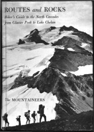
- Page 1 and 2:
IHiker's Guide to th~ .North, Carca
- Page 3 and 4:
', 4>ri V» ''^TB-~N *,^%r ^f • J
- Page 5 and 6:
—for there is no opiate like Alpi
- Page 7 and 8:
© 1965 by The MountaineersTHE MOUN
- Page 9 and 10:
VIFOREWORDmeasure to the progress,
- Page 11 and 12:
PREFACEAs geologists for the United
- Page 13 and 14:
CONTENTSForewordPrefaceIntroduction
- Page 15 and 16:
INTRODUCTIONThe SettingGeneral Char
- Page 17 and 18:
INTRODUCTION 3drops may fall on Lak
- Page 19 and 20:
INTRODUCTION 5for experienced backp
- Page 21 and 22:
INTRODUCTION 7eering, The Freedom o
- Page 23 and 24:
INTRODUCTIONWilderness Management.
- Page 25:
I2I°!5' Generalized from mappingby
- Page 28 and 29:
12 ROUTES AND ROCKSheld together in
- Page 30 and 31:
14 ROUTES AND ROCKSsize; the rock s
- Page 32 and 33:
l6ROUTES AND ROCKSvolcanic rocks, h
- Page 34 and 35:
WESTERN GATEWAYSTHE roads that lead
- Page 36 and 37:
2OROUTES AND ROCKSROAD along which
- Page 38 and 39:
22 ROUTES AND ROCKSare characterist
- Page 40 and 41:
24 ROUTES AND ROCKSsteep snow slope
- Page 42 and 43:
26 ROUTES AND ROCKSthe main ridge.
- Page 44 and 45:
ROUTES AND ROCKSstay above the thic
- Page 46 and 47:
3OROUTES AND ROCKSthe western valle
- Page 48 and 49:
32 ROUTES AND ROCKSFresh rock slide
- Page 50 and 51:
O73s
- Page 52 and 53:
36 ROUTES AND ROCKSTrail can be fou
- Page 54 and 55:
38 ROUTES AND ROCKSbasins carved ou
- Page 56 and 57:
4OROUTES AND ROCKS1.8) the trail cr
- Page 58 and 59:
42 ROUTES AND ROCKSbridge a "trail
- Page 60 and 61:
44 ROUTES AND ROCKS10.7 Creek and t
- Page 62 and 63:
ROUTES AND ROCKSSUIATTLE PASS TRAIL
- Page 64 and 65:
48 ROUTES AND ROCKS7.5 makes a shor
- Page 66 and 67:
50 ROUTES AND ROCKSFrom the junctio
- Page 68 and 69:
52 ROUTES AND ROCKS[27] Note the bi
- Page 70 and 71:
54ROUTES AND ROCKSLavcTf lows in an
- Page 72 and 73:
56 ROUTES AND ROCKSTRIAD CREEK TRAI
- Page 74 and 75:
58 ROUTES AND ROCKSBeyond its junct
- Page 76 and 77:
6oROUTES AND ROCKSsnow-filled slots
- Page 78 and 79:
62 ROUTES AND ROCKSWhite Chuck Rive
- Page 80 and 81:
64 ROUTES AND ROCKS0.0 After leavin
- Page 82 and 83:
66 ROUTES AND ROCKSreaches Kennedy
- Page 84 and 85:
68 ROUTES AND ROCKSA few hundred ya
- Page 86 and 87:
O ROUTES AND ROCKSarea, crawl north
- Page 88 and 89:
72 ROUTES AND ROCKS0.0 Across the b
- Page 90 and 91:
74 ROUTES AND ROCKS[42] These grave
- Page 92 and 93:
76 ROUTES AND ROCKSViews to the wes
- Page 94 and 95:
78 ROUTES AND ROCKSWhite Chuck Glac
- Page 96 and 97:
8OROUTES AND ROCKSThe broad shoulde
- Page 98 and 99:
82 ROUTES AND ROCKS(6350). Work alo
- Page 100 and 101:
ROUTES AND ROCKSfa
- Page 102 and 103:
86 ROUTES AND ROCKS0.0 2000-0.0) on
- Page 104 and 105:
ROUTES AND ROCKSBLUE LAKES TRAILMai
- Page 106 and 107:
ROUTES AND ROCKS[54] O H the long t
- Page 108 and 109:
ROUTES AND ROCKSa point where the e
- Page 110 and 111:
EASTERN GATEWAYSThe approach to the
- Page 112 and 113:
96 ROUTES AND ROCKSINDIAN CREEK TRA
- Page 114 and 115:
98 ROUTES AND ROCKS[58] These meado
- Page 116 and 117:
1OOROUTES AND ROCKSford to the Indi
- Page 118 and 119: 1O2ROUTES AND ROCKSof the SAUK TRAI
- Page 120 and 121: 104 ROUTES AND ROCKSMaking a geolog
- Page 122 and 123: 1O6ROUTES AND ROCKS[67] South of th
- Page 124 and 125: 1O8ROUTES AND ROCKSand traverse up
- Page 126 and 127: 11OROUTES AND ROCKSmeadows, circumv
- Page 128 and 129: 112 ROUTES AND ROCKSgullied pumice,
- Page 130 and 131: ROUTES AND ROCKSalong the ridge to
- Page 132: n6ROUTES AND ROCKSmay be difficult
- Page 135 and 136: 3. Mountain goats near Disappointme
- Page 137 and 138: 5. Upper Suiattle River and Glacier
- Page 139 and 140: 7. Rocks and authors. (Bob and Ira
- Page 141 and 142: WHITE RIVER 117of pressure as overl
- Page 143 and 144: WHITE RIVER 119To continue on to th
- Page 145 and 146: WHITE RIVER 121the Foam Creek cirqu
- Page 147 and 148: CHIWAWA RIVER 123the ROCK CREEK GUA
- Page 149 and 150: CHIWAWA RIVER 125Mountains. The mai
- Page 151 and 152: CHIWAWA RIVER 127LITTLE GIANT TRAIL
- Page 153 and 154: CHIWAWA RIVER12Qbe seen beyond Trin
- Page 155 and 156: CHIWAWA RIVER 131Descend steep heat
- Page 157 and 158: CHIWAWA RIVER 133PHELPS RIDGE TRAIL
- Page 159 and 160: CHIWAWA RIVER 135fork of the Chiwaw
- Page 161 and 162: CHIWAWA RIVER 137toms. The ramparts
- Page 163 and 164: CHIWAWA RIVER 139dampened by mists
- Page 165 and 166: ENTIAT RIVER 141ENTIAT RIVER ROAD (
- Page 167: ENTIAT RIVER 143rubble to the junct
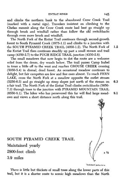
- Page 171 and 172: ENTIAT RIVER 147where it may be har
- Page 173 and 174: ENTTAT RIVER 149tread hard to follo
- Page 175 and 176: ENTLAT RIVER 151haps intruded durin
- Page 177 and 178: ENTIAT RIVER 153bank; this is a tim
- Page 179 and 180: ENTIAT RIVER 155Here is a trail cre
- Page 181 and 182: ENTIAT RIVER 1$7very gentle and lon
- Page 183 and 184: ENTIAT RIVER 159The route climbs in
- Page 185 and 186: ENTIAT RIVERbluffs. The hazy blue r
- Page 187 and 188: ENTIAT RIVER 163spot rewards both h
- Page 189 and 190: Lower Ice Lake
- Page 191 and 192: LAKE CHELAN 167Main Street; the boa
- Page 193 and 194: LAKE CHELAN 169prearrangement. The
- Page 195 and 196: LAKE CHELAN 17!the creek and buried
- Page 197 and 198: LAKE CHELAN 1/3ie lodge burned. Acr
- Page 199 and 200: LAKE CHELANTo find the trail again,
- Page 201 and 202: LAKE CHELAN 1/7SUMMIT TRAILMaintain
- Page 203 and 204: LAKE CHELAN 1?9splendid. The HORSES
- Page 205 and 206: LAKE CHELANPURPLE CREEK TRAILMainta
- Page 207 and 208: LAKE CHELAN 183suddenly expands. Th
- Page 209 and 210: LAKE CHELANDOMKE MOUNTAIN TRAILMain
- Page 211 and 212: LAKE CHELAN i8 748). Above the last
- Page 213 and 214: LAKE CHELAN 189The hornblende in th
- Page 215 and 216: LAKE CHELAN 101COPPER CREEK HIGH RO
- Page 217 and 218: LAKE CHELAN1Q3west side of the two
- Page 219 and 220:
LAKE CHELAN(3350-0.0). It follows a
- Page 221 and 222:
LAKE CHELANslopes on switchbacks to
- Page 223 and 224:
LAKE CHELAN 199against the white gr
- Page 225 and 226:
2O2, ROUTES AND ROCKSby people pers
- Page 227 and 228:
204 ROUTES AND ROCKSSurvey offices
- Page 229 and 230:
APPENDIXMOUNTAIN CLIMBINGMost summi
- Page 231 and 232:
2O8ROUTES AND ROCKSpermits traversi
- Page 233 and 234:
21OROUTES AND ROCKSup this trail, t
- Page 235 and 236:
212 ROUTES AND ROCKShigh on the rid
- Page 237 and 238:
214 ROUTES AND ROCKSleft branch of
- Page 239 and 240:
2l6ROUTES AND ROCKSabove. An easier
- Page 241 and 242:
2l8ROUTES AND ROCKSSeven Fingered J
- Page 243 and 244:
INDEXBoldface type locates a defini
- Page 245 and 246:
INDEX 223Cascade Crest Trail, 5buil
- Page 247 and 248:
INDEX 225Ermine Glacier, see Vista
- Page 249 and 250:
Grey Peak, 178Grou Camp, H6, 155Gro
- Page 251 and 252:
INDEX 229LucerneMountain, L3, 189qu
- Page 253 and 254:
Papoose Creek Trail, 96, 97Pargeter
- Page 255 and 256:
INDEX 233shelters (Forest Service a
- Page 257 and 258:
INDEXRidge, 96, 97Trail, 89, 90, 97