Urban Design Guidelines - Town of Caledon
Urban Design Guidelines - Town of Caledon
Urban Design Guidelines - Town of Caledon
- No tags were found...
Create successful ePaper yourself
Turn your PDF publications into a flip-book with our unique Google optimized e-Paper software.
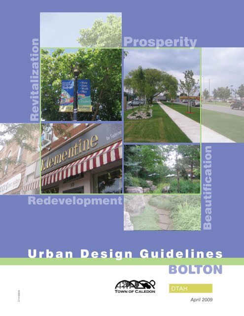
RevitalizationProsperityBoltonRedevelopmentBeautificationU r b a n D e s i g n G u i d e l i n e sBoltonD14-08034April 2009
Table <strong>of</strong> ContentsIntroduction 1<strong>Urban</strong> <strong>Design</strong> Context 31.1 Historical Context 31.2 Development Character Zones 51.3 Topography 91.4 Open Space Network 111.5 Pedestrian and Cycling Network 131.6 Road Network 151.7 Transportation and Transit 171.8 Gateways 19i<strong>Urban</strong> <strong>Design</strong> <strong>Guidelines</strong> 212.1 Historic Core 212.1.1 Key Objectives 212.1.2 Streetscape 232.1.3 Façade Improvements 292.1.4 Built Form 312.1.5 Public Open Spaces 332.1.6 Parking 342.1.7 Albion-Bolton Fairgrounds and Community Centre 352.1.8 Heritage Conservation 36TABLE OF CONTENTSFINAL Bolton CIP <strong>Urban</strong> <strong>Design</strong> <strong>Guidelines</strong> | April 2009
BOLTON2.2 Regional Road 50 Commercial Corridor 392.2.1 Streetscape 412.2.2 Built Form 472.2.3 Parking 492.2.4 Site Access 492.2.5 Landscape 512.2.6 Signage 532.3 Industrial Area 532.3.1 Road Network and Streetscape 542.3.2 Landscape 552.3.3 Stormwater Management 572.3.4 Green Building 59ii<strong>Town</strong> <strong>of</strong> <strong>Caledon</strong>
IntroductionIn June <strong>of</strong> 2008, the <strong>Town</strong> <strong>of</strong> <strong>Caledon</strong> retained MMMGroup Limited (MMM) and du Toit Allsopp Hillier (DTAH)to develop a Community Improvement Plan (CIP) and<strong>Urban</strong> <strong>Design</strong> <strong>Guidelines</strong> (UDG) for the community <strong>of</strong>Bolton.As stated in the CIP, the Bolton Community ImprovementPlan provides a framework that guides communityimprovement in Bolton, through the identification<strong>of</strong> a Municipal Leadership Strategy and Programs,and Financial Incentive Programs. This companiondocument, the Bolton <strong>Urban</strong> <strong>Design</strong> <strong>Guidelines</strong>, providesadditional guidance for community improvement byidentifying design principles and guidelines with respectto streetscape, built form, site access, signage, andopen spaces.This document is divided into two sections:COMMUNITY IMPROVEMENT PROJECT AREA, dividedinto three precincts: Bolton Core, Regional Road 50Commercial Corridor and Industrial Area1■Section One - <strong>Urban</strong> design context describingthe ‘big picture’ in terms <strong>of</strong> Bolton’s history,development character, topography, open spaceand movement networks; and■Section Two - <strong>Urban</strong> design guidelines for each <strong>of</strong>the three precincts in the Community ImprovementProject Area: Bolton Historic Core, Regional Road50 Commercial Corridor and the Industrial Area.INTRODUCTIONFINAL Bolton CIP <strong>Urban</strong> <strong>Design</strong> <strong>Guidelines</strong> | April 2009
BOLTONMAP OF BOLTON, Chronological sequence <strong>of</strong> growth: 1859, 1877, 1980, 1989, 1999 and 2007.1859187719801989199920072 <strong>Town</strong> <strong>of</strong> <strong>Caledon</strong>
SECTION ONESection OneURBAN DESIGN CONTEXT1.1 Historical ContextBolton was settled in 1822 around a saw and gristmill built by James and George Bolton. The villagecommercial area developed around the mill butit eventually moved to its current location at theintersection <strong>of</strong> King and Queen Streets.By 1840, the village “consisted <strong>of</strong> 14 houses, 2 stores,blacksmiths, shoemakers, a tailor, a hotel, distilleryand tannery as well as the mill.” (André Scheinman,Envision-the Hough group, <strong>Town</strong> <strong>of</strong> <strong>Caledon</strong>: CulturalHeritage Landscapes Phase 2: Inventory Report, July2006)The village grew through the mid 19th Century in partdue to the wheat boom generated by the Crimean War(1854-56). With the end <strong>of</strong> the war, the introduction <strong>of</strong> therailway in the 1870s and the inheritance laws in place atthe time, many <strong>of</strong> Bolton’s residents migrated to majorurban centres in Ontario and to the West <strong>of</strong> Canada. Thesize <strong>of</strong> Bolton remained relatively the same until the end<strong>of</strong> the II World War.The chronological sequence <strong>of</strong> growth starts in 1859,date <strong>of</strong> the first map available, and ends in 2007, date<strong>of</strong> the most recent aerial photograph. There is a 100-year gap between 1877 and 1980 due to the lack <strong>of</strong>available information. This analytical sequence highlightsthe contrast between a very compact 19th Centurypicturesque village set by the Humber River, and a late20th Century rapidly expanding urban settlement. In thelast 30 years Bolton has seen its residential zones fillin with low-density single family housing, as well as therapid expansion <strong>of</strong> its industrial lands. This study is anopportunity to reflect on the potential for intensificationwithin the current urban area, and the introduction <strong>of</strong> amix <strong>of</strong> land uses in areas that are underutilized or vacant.URBAN DESIGN CONTEXTFINAL Bolton CIP <strong>Urban</strong> <strong>Design</strong> <strong>Guidelines</strong> | April 2009
BOLTON1859 MAP OF BOLTON4 <strong>Town</strong> <strong>of</strong> <strong>Caledon</strong>
Context1.2 Development Character ZonesBolton has a clear pattern <strong>of</strong> development. The 19thCentury Historic Core (Development Character Zone1) is nested in the Humber River valley and anchoredby a small but charming Commercial Downtown(Development Character Zone 1a) at the intersection<strong>of</strong> Queen and King Streets. Surrounding the Core andoccupying the higher and flatter ground, there are fourlarge residential areas composed <strong>of</strong> mostly single-familyhousing built over the past 40 years. Steep woodedslopes, public parks and school grounds contain thesenodes <strong>of</strong> development.5Small pockets <strong>of</strong> old farm houses or single-family homes(Development Character Zone 3) are still visible here andthere. These are the last vestiges <strong>of</strong> rural land uses withinthe urban area. The largest grouping, between RR50 andAlbion-Vaughan Road, has the potential to become azone for residential intensification.The Albion-Bolton Fairgrounds and Community Centre(Development Character Zone 4), located a short 10 minwalk from Downtown, is a very important cultural andrecreational hub for the residents <strong>of</strong> Bolton. It housesthe library, a hockey arena, squash courts, and meetingspaces, as well as outdoor space for seasonal fairs.URBAN DESIGN CONTEXTFINAL Bolton CIP <strong>Urban</strong> <strong>Design</strong> <strong>Guidelines</strong> | April 2009
BOLTONDEVELOPMENT CHARACTER ZONESKEY1 Historic Core1aCommercial Downtown2 Post-war Neighbourhoods3 Rural Residential Lots4 Albion-Bolton Fair Groundsand Community Centre5 Highway Commercial5a5b5cSouth Hill Commercial AreaShopping Centre AreaHighway Commercial Areaunder development6 Large Industrial Lots withLandscape Buffer7 Street-Related OlderIndustrial Area8 Industrial with Large OpenStorage Area9 Recent Prestige IndustrialArea6 <strong>Town</strong> <strong>of</strong> <strong>Caledon</strong>
Along Queen Street/Regional Road 50, south <strong>of</strong> theHistoric Core, there is a long stretch <strong>of</strong> typical highwaycommercial development (Development Character Zone5). A closer look reveals the strip to be composed <strong>of</strong>three zones:5a – South Hill Commercial Area , the older commercialarea located north <strong>of</strong> the railway;The older industrial area (7) is a dense grouping <strong>of</strong> smalllots with warehouses or <strong>of</strong>fice buildings facing the street.Many <strong>of</strong> the buildings in this area are in poor condition,especially in the oldest part on Healey Drive andHardwick Road. The streetscape is green but lacking inlarge trees.5b – “New Format” Shopping Centre Area composed <strong>of</strong>“big box” retail stores such as Walmart and HomeDepot; and5c – Highway Commercial Area which is in transition butfilling in rapidly with new stores, car dealerships, etc.7The area south <strong>of</strong> the railway is occupied by industrialuses <strong>of</strong> differing character.The Husky and Mars Properties (Development CharacterZone 6) are large industrial facilities surrounded by welllandscaped grounds. Husky is a good local example<strong>of</strong> how to site a large plant in an urban setting in anenvironmentally conscious way. The plant is set closeto the rail tracks but well accessed from the street, theparking areas are surrounded by dense vegetationproviding screening from the street, and there is aninternal network <strong>of</strong> sidewalks and paths for pedestriansand cyclists.URBAN DESIGN CONTEXTFINAL Bolton CIP <strong>Urban</strong> <strong>Design</strong> <strong>Guidelines</strong> | April 2009
BOLTONTOPOGRAPHYLEGENDElevation260mHUMBER RIVER, the river isconcealed by dense vegetationand hidden from the life <strong>of</strong> Bolton.8 <strong>Town</strong> <strong>of</strong> <strong>Caledon</strong>
1.3 TopographyOne <strong>of</strong> Bolton’s most memorable aspects is itstopography. Even the casual passer-by driving alongRegional Road 50 will remember driving down the hilland entering Bolton’s picturesque downtown. This feeling<strong>of</strong> being “in a bowl” is unique and should be protected.It is important to maintain the views <strong>of</strong> the forested hillsaround the historic core, and to enhance the reason forthis dramatic landscape, the Humber River.properties are surrounded by tall fences but few havelandscape screening.The newest additions to the industrial area are locatedon the northwest corner <strong>of</strong> RR50 and Mayfield Road, andalong Parr Boulevard (Development Character Zone 9).These very large warehouses or <strong>of</strong>fice buildings are veryvisible from the street and would benefit from a denselytreed landscape.Great opportunities exist in opening up the views tothe river by clearing some <strong>of</strong> the lower vegetation atkey points along the shoreline. Seeding groundcoversin some areas could improve the potential for leisure,recreational and cultural activities by the river.9The counterpoint to the valley is the flatter groundoccupied by the industrial lands and the highwaycorridor south <strong>of</strong> the railway. Without the hills, this arealacks visual interest and spatial containment. The image<strong>of</strong> the industrial zone would benefit from additional treecover and more visible and lush stormwater features.Some lots have a high proportion <strong>of</strong> the land occupiedby open storage (Development Character Zone 8). MostURBAN DESIGN CONTEXTFINAL Bolton CIP <strong>Urban</strong> <strong>Design</strong> <strong>Guidelines</strong> | April 2009
BOLTONOPEN SPACE NETWORK1999 AERIAL PHOTO, the industrial area beforedevelopment shows a dense pattern <strong>of</strong> swalesdraining towards the Humber River10 <strong>Town</strong> <strong>of</strong> <strong>Caledon</strong>
1.4 Open Space NetworkThe network <strong>of</strong> green open spaces follows the HumberRiver and its secondary streams. The river runsdiagonally to the northern part <strong>of</strong> Bolton, distinguishingthe historic core from the North Hill residential area. Inthe downtown the valley is very narrow and discreet, butthe secondary streams and ravines are still apparent andimportant links between the various residential areas. Inthe same way, the spaces along the river by the historiccore have the potential to become significant greenpublic spaces, as discussed under “Topography”.HUMBER RIVER WATERSHED,Bolton highlighted in yellow (Source: TRCA website)11On the other hand, the area south <strong>of</strong> the railway appearsto be separate from the river’s drainage basin, whenin fact it is very much a part <strong>of</strong> the Humber watershed.Older aerial photos show that there used to be a series<strong>of</strong> drainage lines which now have either been paved overor diverted to stormwater retention ponds. A StormwaterManagement Study <strong>of</strong> the industrial area, done inpartnership with the Toronto and Region ConservationAuthority, would be important to understand the currentimpact <strong>of</strong> development and to suggest ways to improvethe quality and quantity <strong>of</strong> the stormwater drainingtowards the Humber.The open spaces indicated in the diagram on thepreceding page are a compilation <strong>of</strong> <strong>Town</strong> lands, TRCAlands, and private lands under the EnvironmentalPolicy Area designation in the Official Plan (due to theirsignificance in the Humber River valley).The <strong>Town</strong> is encouraged to preserve and enhance theseopen spaces and linkages.URBAN DESIGN CONTEXTFINAL Bolton CIP <strong>Urban</strong> <strong>Design</strong> <strong>Guidelines</strong> | April 2009
BOLTONPEDESTRIAN NETWORK (based on the <strong>Town</strong> <strong>of</strong> <strong>Caledon</strong>Bolton Pedestrian Network Map)Existing PathwaysPotential PathwaysExisting Humber River Heritage Trail12 <strong>Town</strong> <strong>of</strong> <strong>Caledon</strong>
1.5 Pedestrian and Cycling NetworkPedestrian NetworkThe pedestrian network illustrated in the diagram on thepreceding page is based on the <strong>Town</strong> <strong>of</strong> <strong>Caledon</strong> BoltonPedestrian Network map. It includes existing sidewalksand trails (as shown in the 2007 aerial photo), and thesegments <strong>of</strong> pathways needed to complete the network.The diagram reveals that:■ There is a much denser network <strong>of</strong> existingpathways to the north <strong>of</strong> the railway;■ It is possible to walk within each neighbourhoodbut difficult to find direct routes to walk betweenadjacent neighbourhoods;Bolton is connected to the <strong>Caledon</strong> Trailway and theTransCanada Trail by the Humber River Heritage Trail.This hiking trail starts at the Albion-Vaughan Road andruns along the north side <strong>of</strong> the river for most <strong>of</strong> the way.The <strong>Town</strong> has planned improvements to the sectionthrough Mill Park, which will accommodate bicycles.Cycling NetworkBicycles are designated as a vehicle under the Province<strong>of</strong> Ontario’s Highway traffic Act and when operatingwithin the public roadway, must comply with thesame regulations as automobiles. Both the Ministry <strong>of</strong>Transportation and the Transportation Association <strong>of</strong>Canada have established design standards for inroadbicycle facilities.13■ Regional Road 50 is the only north-south streetconnecting the two sides <strong>of</strong> the railway that hassome sidewalks, but these are not continuous; andthat■ The bridge over the rail tracks does not haveappropriate sidewalks to enable a safe andcomfortable pedestrian crossing <strong>of</strong> the tracks.These observations demonstrate the need to investin new sidewalks and trails especially south <strong>of</strong> therailway. It also highlights the need to invest in a newpathway on the east side <strong>of</strong> the bridge connecting theexisting sidewalks north and south <strong>of</strong> the tracks. A morecomplete network will encourage pedestrian movementand give the community alternatives to vehicular traffic.Currently Bolton has no designated cycling routesor paths. A <strong>Town</strong>-led study <strong>of</strong> the needs and wants<strong>of</strong> cyclists, in concert with the Region’s ActiveTransportation Study (presently underway) will beimportant to define a comprehensive cycling network.URBAN DESIGN CONTEXTFINAL Bolton CIP <strong>Urban</strong> <strong>Design</strong> <strong>Guidelines</strong> | April 2009
BOLTONROAD NETWORK14 <strong>Town</strong> <strong>of</strong> <strong>Caledon</strong>
1.6 Road NetworkBolton’s road network lacks connectivity. King Street isthe only east-west through street, and Coleraine Drive,Regional Road 50 and Albion-Vaughan Road are theonly north-south connections. Similarly, the pattern <strong>of</strong>residential streets has been laid out in clusters and lackscontinuity, and in the industrial area the road patternis incomplete. The reasons for the current road layoutappear to be:■The steep slopes <strong>of</strong> the Humber River valley;QUEEN STREET, Use <strong>of</strong> the Public Right-Of-Way15■The railway, which requires the construction <strong>of</strong>bridges or underpasses;■The land ownership, especially in the southern part<strong>of</strong> the industrial area; and■ The suburban type <strong>of</strong> street network design whichminimizes the number <strong>of</strong> connections between localand arterial roads.One <strong>of</strong> the biggest challenges to the creation <strong>of</strong> a safeand comfortable pedestrian environment along RegionalRoad 50/Queen Street is the high level <strong>of</strong> vehicular traffic.This is especially evident in the historic core where theambient noise makes it difficult to carry a conversation.Ways to improve the current conditions are discussedunder “Transportation and Transit.”REGIONAL ROAD 50, Use <strong>of</strong> the Public Right-Of-WayURBAN DESIGN CONTEXTFINAL Bolton CIP <strong>Urban</strong> <strong>Design</strong> <strong>Guidelines</strong> | April 2009
BOLTONTRANSPORTATION AND TRANSITMOVEONTARIO, In theMoveOntario 2020 Plan, Bolton isshown as the destination <strong>of</strong> a newGO commuter rail line.Potential RoadsPotential Service LanewaysExisting Bus Routes16 <strong>Town</strong> <strong>of</strong> <strong>Caledon</strong>Potential GO Train Line
1.7 Transportation and TransitAn important step towards reducing the amount <strong>of</strong>through traffic on Regional Road 50 is the construction <strong>of</strong>the Bolton Arterial Road (BAR) slated for completion by2012. The BAR is effectively an improved Coleraine Drivebetween Mayfield Road and King Street West, which willbridge over the Humber River and link to Regional Road50 north <strong>of</strong> Columbia Way. Construction has started nextto Mayfield Road and is advancing north.Recognizing land ownership constraints, other potentialimprovements to the road network might include:■ Road connection between Simpson Road andColeraine Drive;■ The extension <strong>of</strong> Simpson Road, Nixon Road andSimona Drive, to allow access to the undevelopedlots in the industrial area and establish a coherentnetwork <strong>of</strong> streets; and■ The construction <strong>of</strong> service laneways in the areabetween Albion-Vaughan Road and Regional Road50, south <strong>of</strong> Industrial Road, when the time is rightfor redeveloping these underutilized lands.Transit service in Bolton is limited. GO Transit runs sixbuses per day to/from Malton GO Station, and two busesto/from Toronto via Nobleton and Kleinburg. The points<strong>of</strong> departure/arrival are at Regional Road 50 at ColumbiaWay, and Albion-Vaughan Road at Industrial Road. Thereare bus stops on Regional Road 50 at Allan Drive andat Mill Street, and a future stop at a commuter parkinglot on the southwest corner <strong>of</strong> Regional Road 50 andMayfield Road expected to be completed by the fall <strong>of</strong>2009.In June <strong>of</strong> 2007, the Province <strong>of</strong> Ontario announcedMoveOntario 2020, “a 12-year building plan that willdeliver 52 Rapid Transit initiatives in the GTA andHamilton.” Project 15 is a new GO commuter rail linefrom Union Station to Bolton, which will require anagreement with Canadian Pacific Railway for sharingthe use <strong>of</strong> the tracks and the construction <strong>of</strong> a newtrain station in Bolton. Earlier studies have suggestedthat the best location for the station is on a triangularproperty just west <strong>of</strong> Coleraine Drive, south <strong>of</strong> the tracks.This location was deemed preferable due to the flattopography, the length <strong>of</strong> the adjacent rail track, and thefact that it is currently undeveloped. The project will besubject to further study before a decision is made.From an urban design perspective, the location <strong>of</strong> thetrain station at the edge <strong>of</strong> town is a missed opportunity.The new regional transit authority, Metrolinx, states inits March 2008 Green Paper #7 on Transit that “it isimportant to ensure that land uses around stations canserve as origins and destinations <strong>of</strong> trips. A line fromnowhere to nowhere does not serve any purpose. Areasaround major transit stations should include compact,walkable, mixed-use developments with densities thatsupport transit use, in both directions in which the lineruns throughout the day.” (Metrolinx, Development <strong>of</strong> aRegional Transportation Plan for the Greater Toronto andHamilton Area, Green Paper #7 – Transit, March 2008.)A more centrally located transit station could be animportant step towards introducing higher density mixeduse development within the current urban area.17URBAN DESIGN CONTEXTFINAL Bolton CIP <strong>Urban</strong> <strong>Design</strong> <strong>Guidelines</strong> | April 2009
BOLTONPOTENTIAL GATEWAYS1. GATEWAYPRECEDENT, <strong>Design</strong>Concept for aGateway in Torontoby &Co.2. GATEWAYPRECEDENT,Sculpture by RichardSerra that reveals thetopography3&4. HERITAGESIGN, in <strong>Caledon</strong>18 <strong>Town</strong> <strong>of</strong> <strong>Caledon</strong>
1.8 GatewaysThe purpose <strong>of</strong> a gateway is to mark the arrival to aunique place, in this case the settlement <strong>of</strong> Bolton, andto reinforce a sense <strong>of</strong> community identity and pride <strong>of</strong>place. Gateways can either be elements <strong>of</strong> structure ora landscape feature. Both can be effective and can alsopotentially incorporate signage and way-finding.In addition to the existing signs marking the arrival tothe settlement <strong>of</strong> Bolton, it seems logical to contemplatepotential gateway locations Regional Road 50 at MayfieldRoad and at three main entry points into the core <strong>of</strong>Bolton.2- From the north located just north <strong>of</strong> the river on theslope <strong>of</strong> the road coming down to the core. It seemslike a natural spot to mark the entrance into the historiccore. A landscape or public art element which mightdemonstrate the unique topographic condition <strong>of</strong> thisentry point might be considered;3 and 4 – Similarly, east and west gateway points alongKing Street could be considered that mark the entry tothe historic core. Elements <strong>of</strong> landscape, signage andpossibly public art could be combined to mark one’sarrival.191- From the south at the intersection <strong>of</strong> Regional Road50 and Mayfield Road, a very important and activeentry point from the south which could be marked by acombination <strong>of</strong> architectural treatment <strong>of</strong> the immediatedevelopment, a strong and dense landscape treatmentor a large public art element;URBAN DESIGN CONTEXTFINAL Bolton CIP <strong>Urban</strong> <strong>Design</strong> <strong>Guidelines</strong> | April 2009
BOLTON20 <strong>Town</strong> <strong>of</strong> <strong>Caledon</strong>
SECTION TWOSection TwoURBAN DESIGN GUIDELINESThe purpose <strong>of</strong> these guidelines is to:■ Identify design principles and guidelines withrespect to built form, façades, streetscape, andopen spaces, etc.;■ Provide eligibility criteria for CIP’s Financial IncentivePrograms, with respect to design;■ Provide the <strong>Town</strong> with a tool for the review andevaluation <strong>of</strong> applications for Financial IncentivePrograms and supporting materials; and■ Educate property and business owners about the<strong>Town</strong>’s principles and guidelines for design;They build on existing guidelines prepared in 2002 bythe <strong>Town</strong> <strong>of</strong> <strong>Caledon</strong>, namely the Bolton-Regional Road50 (RR50): Landscape Plan Master Plan, the <strong>Town</strong> <strong>of</strong><strong>Caledon</strong> Industrial/Commercial <strong>Design</strong> <strong>Guidelines</strong> andthe South Bolton: Shopping Centre <strong>Design</strong> <strong>Guidelines</strong>.2.1 Historic Core2.1.1. Key ObjectivesThe historic core <strong>of</strong> Bolton is a compact set <strong>of</strong> urbanblocks that has survived a series <strong>of</strong> floods and severalfires over the past 180 years, and can still be recognizedas the old village <strong>of</strong> Bolton. At this moment in time,it would benefit from building renovation and infilldevelopment that is respectful <strong>of</strong> its historic character,more residents to support the local economy, and acohesive and attractive streetscape that is a joy toinhabit. The diagram on the following page summarizesthe recommended improvements to the core.URBAN DESIGN GUIDELINESFINAL Bolton CIP <strong>Urban</strong> <strong>Design</strong> <strong>Guidelines</strong> | April 2009
BOLTONPLAN OF POTENTIAL IMPROVEMENTS IN THE BOLTON COREMill ParkFireHallRoyalCourtyardsALBION - BOLTONFAIRGROUNDS22 <strong>Town</strong> <strong>of</strong> <strong>Caledon</strong>
<strong>Guidelines</strong>The guidelines for the Bolton Core are intended toaddress the following key objectives:■■■■■Preserve and highlight unique character <strong>of</strong> thehistoric core <strong>of</strong> Bolton;Reinforce the identity <strong>of</strong> the area as a predominantlylow rise main street retail area;Expand and improve the streetscape and openspaces to create a beautiful place and enhanceaccessibility;Encourage revitalization <strong>of</strong> underused sites; andProtect surrounding established residential areas.2.1.2. StreetscapeThe streetscapes in the Core should reinforcethe historic character <strong>of</strong> the old village <strong>of</strong> Bolton.They should have a sense <strong>of</strong> unity derived froma consistent use <strong>of</strong> colours, textures and shapesin paving, street furniture, lighting, signage,planting and other elements. The three parts <strong>of</strong>the pedestrian realm: furniture/planting zone,walking zone and store extension zone shouldhave a uniform treatment.Background - The <strong>Town</strong> <strong>of</strong> <strong>Caledon</strong> and the BIA haveinvested in the streetscape <strong>of</strong> the core by using a family<strong>of</strong> street furniture (street lights, litter containers, flowerpots, etc.) and upgrading the sidewalks. These are stepsin the right direction that should be encouraged andreinforced. However, more can be done to improve thestreetscape not only <strong>of</strong> Queen and King Streets, but also<strong>of</strong> Chapel, Elm, Mill, Ann, Sterne, Temperance and WillowStreets.PARTS OF PEDESTRIAN REALM, well distinguished oneast side <strong>of</strong> Queen Street23URBAN DESIGN GUIDELINESFINAL Bolton CIP <strong>Urban</strong> <strong>Design</strong> <strong>Guidelines</strong> | April 2009
BOLTONEXISTING STREETSCAPE OF QUEEN STREETPOTENTIAL STREETSCAPE OF QUEEN STREET24 <strong>Town</strong> <strong>of</strong> <strong>Caledon</strong>
EXISTING PLANTING, Street Trees,Flower Pots and Hanging Baskets<strong>Guidelines</strong>These guidelines are divided in the following themes:paving; planting; street furniture, lighting and signage;and public art and screening.PavingPlanting■■■In the event that the <strong>Town</strong> chooses to invest in acomprehensive streetscape strategy for the Core,consider the implementation <strong>of</strong> a new designstandard for the sidewalk paving that distinguishesthe furniture/planting zone with a material otherthan the current coloured stamped concrete. Thismaterial is difficult to replicate when repairs areneeded and does not enhance the historic character<strong>of</strong> the building facades;Acknowledge the mobility needs <strong>of</strong> older adults andpeople with disabilities by implementing barrier-freesidewalks, lower curbs at intersections and universalaccess to ground floor retail wherever possible. Thewalking zone should remain clear <strong>of</strong> free standingelements; andDifferentiate crosswalks from the road surface withsmooth concrete or paint.The current sidewalk widths in downtown streets arevery narrow to allow the growth <strong>of</strong> large trees. However,the importance <strong>of</strong> trees and planting in the streetscapecannot be overstated. Great trees make great streets.■ All the existing trees that are in good health shouldbe retained and well maintained;■ Wherever possible, plant additional trees tocomplete one row <strong>of</strong> trees on each side <strong>of</strong> the street,preferably planted at grade. On streets other thanQueen, add more trees or other plantings on frontyards if there is space available;■ Use innovative techniques when reconstructing aroad or sidewalk to improve street tree root growth;■ Avoid using tree containers except on Queen Street.Replace the existing tree containers with new onesthat are complementary to the existing family <strong>of</strong>street furniture; and■ Continue the use <strong>of</strong> hanging baskets and tallmovable planters during the warm season for addedcolour. Planters should be carefully located so thatthey do not interfere with sight lines;25URBAN DESIGN GUIDELINESFINAL Bolton CIP <strong>Urban</strong> <strong>Design</strong> <strong>Guidelines</strong> | April 2009
BOLTONSIGNAGE PRECEDENT,CreemoreStreet furniture, Lighting and SignageStreet furniture, lighting and signage make an essentialcontribution to the streetscape by providing a consistentand unified appearance. The <strong>Town</strong> <strong>of</strong> <strong>Caledon</strong> and theBolton Core Business Improvement Association havealready recognized its importance by investing in newstreet lights, litter containers, banners, flower containers,etc. in priority areas such as Queen, King and a fewother streets.EXISTING STREET LIGHT■■Extend the use <strong>of</strong> the same family <strong>of</strong> street furnitureto the sections that are unfurnished. Consideradding other elements that match the currentheritage theme such as: benches, outdoor caféfurniture, bollards, bike racks, bus shelter andnewspaper holders;Add signage and wayfinding that is consistent withthe heritage theme, including street signs, parkingsigns and information kiosks;EXISTING LITTERCONTAINERBENCHPRECEDENT,Kingston■■■Encourage all business and commercial landowners to use the selected family <strong>of</strong> street furniture;While advertising on street furniture is <strong>of</strong>ten usedto defray the costs <strong>of</strong> the hardware, this should becarefully considered not to overwhelm the visualcharacteristics <strong>of</strong> the furniture;Many <strong>of</strong> these furnishings tend to be clustered atstreet corners adding to street congestion. Whenpossible, locate these elements away from thestreet corner, particularly news boxes. As well,provision within new building redevelopment for littercontainers, telephones and mailboxes should beconsidered and encouraged; and26 <strong>Town</strong> <strong>of</strong> <strong>Caledon</strong>■Minimize the number <strong>of</strong> freestanding traffic signs.
Public Art and ScreeningPublic art plays an important role in the interpretation <strong>of</strong>the history, the people and the character <strong>of</strong> a place. Itcan have a variety <strong>of</strong> expressions, from 2-dimensionalmurals and pavement to 3-dimensional sculptures,gates, seating or fencing. The introduction <strong>of</strong> art works inthe public realm should be encouraged, in a way that issensitive to the site and enhances the historic core.The use <strong>of</strong> fencing, hedges or planted screens should beencouraged to hide the view <strong>of</strong> side and backyards frompublic streets.EXISTING MURAL,Queen StreetMURALPRECEDENT,Gravenhurst27EXISTING FENCEAND PLANTING,Queen StreetPUBLIC ARTPRECEDENT,OrangevilleURBAN DESIGN GUIDELINESFINAL Bolton CIP <strong>Urban</strong> <strong>Design</strong> <strong>Guidelines</strong> | April 2009
BOLTONFACADE IMPROVEMENT, Assessment (above) and Proposal (below)(Source: Province <strong>of</strong> Ontario, Ministry <strong>of</strong> Municipal Affairs Community Planning Wing, <strong>Design</strong> for CommercialFacade Improvements by Roger du Toit Architects and Research and Special Projects Branch, 1985)28 <strong>Town</strong> <strong>of</strong> <strong>Caledon</strong>
EXISTING IMPROVED FACADE,Queen Street2.1.3. Façade ImprovementThe façades <strong>of</strong> commercial and mixed usebuildings should complement the character <strong>of</strong>historic core, with particular attention paid tooverall scale, the nature <strong>of</strong> window openings,material selection, integration <strong>of</strong> signageand lighting. Building style could includecontemporary treatment respectful <strong>of</strong> thehistoric character <strong>of</strong> the core.Background – Some commercial buildings alongQueen Street have recently been renovated. These kinds<strong>of</strong> initiatives are very good and should be encouraged.However, many other buildings have had poor upkeepingover the years, or have been repeatedly altered in a waythat hides the original façade.<strong>Guidelines</strong>■■■Maintain original façade components and materialswherever possible. If components are damaged,repair is visually and economically preferable toreplacement;If replacement is required, replicate original partsand materials;If replication is not possible, substitute with materialssimilar to the colour, texture, dimensions, proportionand design <strong>of</strong> the original;■■If major work like expansion or subdivision is to bedone, do not irrevocably change the original building(s). Leave as much <strong>of</strong> the original as possible,working around it rather than removing it. This willalso leave more options open in the future;An attractive, well maintained façade is the mosteffective form <strong>of</strong> store identification and advertising.Improperly located signs, which are excessive inscale and poorly maintained, are visible in manyfacades in the core:• Remove all large, projecting signage.Remove all other overly large andinappropriately located signage.• Use no more than one large sign perstorefront. It should be flat and located onthe signboard above the entrance. Signagelettering should be simple and straightforward. If more signs are needed, use nomore than 2 additional small signs.29URBAN DESIGN GUIDELINESFINAL Bolton CIP <strong>Urban</strong> <strong>Design</strong> <strong>Guidelines</strong> | April 2009
ELM ST.MILL ST.BOLTONBOLTON CORE BUILT FORM GUIDELINESTERNE ST.QUEEN ST. N.TEMPERANCE ST.ANN ST.CHAPEL ST.KING ST. W.KING ST. E.QUEEN ST. S.WILLOW ST.30 <strong>Town</strong> <strong>of</strong> <strong>Caledon</strong>
OLD PHOTO OF QUEENSTREET, looking north2.1.4. Built FormQueen Street should have a continuous buildingfrontage, with retail on the ground floor. Otherstreets should have an intermittent buildingfrontage with ground floor uses that animatethe street. New infill development should berespectful <strong>of</strong> the scale and character <strong>of</strong> theexisting historic buildings.Background - Queen Street originally had a continuousbuilding frontage along the west side. Two fires havecreated a gap in the urban fabric which has sincebeen occupied by a drive through and surface parking.Drive-throughs are no longer allowed in the core. Thesouth side <strong>of</strong> King Street, east <strong>of</strong> Queen Street, is largelyoccupied by surface parking needed for the RoyalCourtyards. Secondary streets such as Chapel, Mill, Elm,Ann, Temperance, Sterne and Willow Streets also haveunderutilized and vacant properties with redevelopmentpotential. The full infill development capacity and parkingneeds in the core should be subject to a comprehensivestudy.<strong>Guidelines</strong>Street Character Types - The intention is to encouragetwo types <strong>of</strong> street characteristics in the core.■‘Continuous’ building frontages, typical to atraditional main street, will be encouraged alongQueen Street in the commercial core. These portions<strong>of</strong> the street are characterized by having buildingfrontages occupying at least 80% <strong>of</strong> the street linewith no setbacks. New buildings should generallyalign with traditional street frontages where possible,except where a widening is desired to create a moregenerous sidewalk zone;POTENTIAL BUILT FORM ONQUEEN STREET31URBAN DESIGN GUIDELINESFINAL Bolton CIP <strong>Urban</strong> <strong>Design</strong> <strong>Guidelines</strong> | April 2009
BOLTON■‘Intermittent’ street wall conditions will beacknowledged on the streets adjacent to the primarystreets <strong>of</strong> the core reflecting the historic patternhere <strong>of</strong> more substantial front yard setbacks andlandscaped areas and a less regular street pattern.This condition applies to all streets other thanQueen Street. These streets (or portions <strong>of</strong> street)are characterized by having building frontagesoccupying at least 65% <strong>of</strong> the street line within thesetback zone defined <strong>of</strong> 0 to 5 metre back from thepublic right-<strong>of</strong>-way.INFILL DEVELOPMENT PRECEDENT, TorontoPotential Infill Development - There are a few keypotential redevelopment areas which combined candramatically improve the image <strong>of</strong> the historic core,as well as other individual underutilized lots withredevelopment potential. The key areas are the TimHortons site, the parking lot <strong>of</strong> the Royal Courtyards, themunicipal parking lot, the Fire Hall, the properties on thesouth side <strong>of</strong> Willow Street, and those between Mill andElm Streets.These guidelines should be followed when planning aredevelopment:32 <strong>Town</strong> <strong>of</strong> <strong>Caledon</strong>■■■■■■Protect all designated heritage buildings andbuildings <strong>of</strong> heritage value;Protect existing stable residential neighbourhoods;Development should be low to mid-rise;Assign public uses at grade to help animate thestreet. If located within the continuous buildingfrontage zone, the ground floor use should be retail;Maintain the basic height and width <strong>of</strong> storefrontsprevalent in the area;Flood pro<strong>of</strong> the lower levels <strong>of</strong> the building if locatedwithin the floodplain.
2.1.5. Public Open SpacesThe historic core should have well designedpublic spaces where people can gather.Background – Currently the opportunities to enjoythe Humber River are to walk along the Humber RiverHeritage Trail in Mill Park and to gather at the newlybuilt public space on the east side <strong>of</strong> Queen Street byMill Street. The <strong>Town</strong> is planning another small park tothe west side <strong>of</strong> Queen Street which will be built onceproperty ownership issues are cleared.33<strong>Guidelines</strong>HERITAGE TRAIL IN MILL PARK will be improved toaccommodate bicycles.Invest in the creation and/or improvement <strong>of</strong> public openspaces in the core such as:■ A potential larger civic gathering place at the corner<strong>of</strong> Queen and Mill Streets by the river;■ A walking trail along the south shore <strong>of</strong> HumberRiver, between Ann and Mill Streets; and■ An improved Mill Park so that it can accommodateoutdoor events such as music festivals.URBAN DESIGN GUIDELINESFINAL Bolton CIP <strong>Urban</strong> <strong>Design</strong> <strong>Guidelines</strong> | April 2009
BOLTONEXISTINGMUNICIPALPARKING LOTON STERNESTREET, landscapescreening alongSterne Street wouldimprove the image<strong>of</strong> the street2.1.6. ParkingAdequate amount <strong>of</strong> parking should be providedto support the economic health and stability <strong>of</strong>the businesses in the core. Parking should haveclear and coordinated signage, and adequatelighting.<strong>Guidelines</strong>PARKING SIGNAGEPRECEDENT, Kitchener(Credit: EntroCommunications)PARKING SIGNAGEPRECEDENT, Kitchener(Credit: EntroCommunications)■■■■■The existing parking resources should primarilyserve the existing services and retail in the core;Commuter parking should be strongly discouraged,and alternatives provide elsewhere in Bolton;Introduce clear signage to guide residents andvisitors to encourage the full use <strong>of</strong> availableparking;In case <strong>of</strong> redevelopment <strong>of</strong> an existing surface lot toan above-grade parking structure, keep the structureout-<strong>of</strong>-sight from the public realm by adding a retailfrontage, a façade treatment that matches adjacentstorefronts or landscape screening; andConsider using greenro<strong>of</strong> technologies to improvethe quality <strong>of</strong> stormwater run<strong>of</strong>f and to increase thearea <strong>of</strong> green space in the Core.34 <strong>Town</strong> <strong>of</strong> <strong>Caledon</strong>
2.1.7. Albion-Bolton Fairgrounds andCommunity CentreAs an important cultural and recreational hubin Bolton, the Albion-Bolton Fairgrounds andCommunity Centre should have improvedparking facilities and be fully accessible bypedestrians and cyclists.EXISTINGPHOTO OFALBION-BOLTONFAIRGROUNDSBackground - The Fairgrounds and Community Centrehouse the library, a hockey arena, squash courts, andmeeting spaces, as well as outdoor space for seasonalfairs. While the facility is located a short 10 min walksouth <strong>of</strong> the core, most people access it by car.35<strong>Guidelines</strong>■ Improve the surface and lighting <strong>of</strong> the parking lot;■ Improve vehicle entrances and circulation for timeswith and without outdoor events;■ Improve pedestrian access from Queen Street/Regional Road 50 by allowing direct access betweenthe building entrance and the sidewalk;■ Provide end-<strong>of</strong>-trip facilities for cyclists;■ Add landscape screening along the back side <strong>of</strong> thebuilding facing RR50; and■ Identify the building entrances more clearly throughsignage and lighting.POTENTIAL IMPROVEMENT TO FAIRGROUNDSURBAN DESIGN GUIDELINESFINAL Bolton CIP <strong>Urban</strong> <strong>Design</strong> <strong>Guidelines</strong> | April 2009
BOLTONEXISTING DESIGNATED HERITAGE PROPERTIES IN THEBOLTON CORE2.1.8. Heritage ConservationThe <strong>Town</strong> <strong>of</strong> <strong>Caledon</strong> should take leadershipto protect and enhance the special character<strong>of</strong> groups <strong>of</strong> properties in the historic core<strong>of</strong> Bolton, established by the overall heritagequality <strong>of</strong> buildings, streets and open spaces asseen together.There are currently 13 designated heritage properties inthe Historic Core <strong>of</strong> Bolton:1. Laurel Hill Cemetery: 203 Queen Street North;2. Steel Truss Bridge over Humber River on GlasgowRoad (outside CIPA);3. Shore-Nease House: 34 Temperance Street;4. True Blue Masonic Lodge: 16 Nancy Street;5. Goodfellow-Natress-Potts House: 25 Nancy Street;6. Smith-Schaefer-Potts House: 31 Nancy Street;7. Joseph Watson House: 45 Nancy Street;8. Guardhouse-Goodfellow House: 83 King Street East;9. McFall House: 97 King Street East;10. Lambert Bolton House: 65 James Street (outsideCIPA);11. Shields-Gillander Property: 65 Sneath Road (outsideCIPA); and12. Steel Truss Bridge over Humber River on SneathRoad (outside CIPA).36 <strong>Town</strong> <strong>of</strong> <strong>Caledon</strong>
A further property, the Charles Bolton House at 159Victoria (13), has been nominated for designation butthe process is not yet complete. Most <strong>of</strong> the designatedproperties are houses except for the True Blue MasonicLodge, the Laurel Hill Cemetery and the two steel trussbridges over the Humber River.The <strong>Town</strong> <strong>of</strong> <strong>Caledon</strong> has sponsored two studies whichmake recommendations for heritage conservationdistrict(s) in Bolton. These are the Draft Built HeritageInventory and the Cultural Heritage Landscape Inventory(Phase 2). There are also currently two financial incentiveprograms available to designated properties in the town,including: a Matching Grant Program (for residentialand institutional properties) that is managed by the <strong>Town</strong><strong>of</strong> <strong>Caledon</strong> and a Heritage Tax Rebate Program (forcommercial and industrial properties) that is managed bythe <strong>Caledon</strong> Heritage Foundation.SHORE-NEASE HOUSE,this residencelocated on 34TemperanceStreet is adesignatedheritage propertyMR. SUBBUILDING,which used to bethe TelephoneExchange is agood candidatefor façadeimprovementOLDTELEPHONEEXCHANGE, atQueen and SterneStreets37URBAN DESIGN GUIDELINESFINAL Bolton CIP <strong>Urban</strong> <strong>Design</strong> <strong>Guidelines</strong> | April 2009
BOLTONELEMENTS OF A COMPLETE STREET(Source: Omaha Streetscape Handbook)KEY1 Bus Stop2 Street Trees (shade)3 Coordinated Street Furniture4 Planters5 Median Refuge6 Pedestrian Crosswalk7 Colocating Signs8 Bicycle Lane9 Public Art10 Pedestrian Lighting11 On-street Parking38 <strong>Town</strong> <strong>of</strong> <strong>Caledon</strong>
2.2. Regional Road 50 CommercialCorridor“The image <strong>of</strong> a city is reflected in its streets,from the fixtures that light them to the sidewalksthat frame them. Coordinating the features andcomponents <strong>of</strong> the streetscape help define an area’scharacter and create a distinctive sense <strong>of</strong> place.Without coherence, these same components clashwith one another, producing visual noise that wearson both residents and visitors. Streets define how acity presents itself to the public. An attractive andcohesive streetscape is a vital part a city’s physicalappeal.” (Omaha Streetscape Handbook)The Regional Road 50 corridor faces similar challengesto other highway corridors. It has the same cardealerships and chain stores as in other small towns inOntario, flanked by large areas <strong>of</strong> parking and marked bya collection <strong>of</strong> signs competing for one’s attention.The intention is to create a ‘complete’ street, one thataccommodates the needs <strong>of</strong> pedestrians, transit users,cyclists as well as private automobile use. The followingguidelines point to the completion <strong>of</strong> the pedestriannetwork, the future addition <strong>of</strong> bike lanes, the reduction<strong>of</strong> the number <strong>of</strong> access points by adding servicelaneways, and the reduction <strong>of</strong> the roadway width wherepossible.In terms <strong>of</strong> streetscape, Regional Road 50 has thepotential to become a ‘green avenue’ that is flankedby large trees and continuous sidewalks. This intentis achievable through a concerted effort between theRegion <strong>of</strong> Peel and the <strong>Town</strong> <strong>of</strong> <strong>Caledon</strong> in the planning,design, construction and maintenance <strong>of</strong> the avenue.Ultimately the purpose is to enable the right-<strong>of</strong>-way todevelop independently from the surrounding built form,allowing for a unified vision <strong>of</strong> the public realm to beimplemented as soon as possible, with the full build-out<strong>of</strong> residential and/or commercial density evolving overtime.In terms <strong>of</strong> built form, the intent is to encourage astronger building edge along the whole corridor bylocating surface parking on the side or rear <strong>of</strong> buildings.Mixed use development is encouraged in the South HillCommercial Area, especially in the section between AllanDrive and Queensgate Boulevard where it is possible toincrementally create a more pedestrian-friendly ‘MainStreet’ with grade-related uses facing both sides <strong>of</strong> thestreet.The diagrams on the following page summarize therecommended improvements to the two areas <strong>of</strong>RR50: the South Hill Commercial Area and the HighwayCommercial Area.39URBAN DESIGN GUIDELINESFINAL Bolton CIP <strong>Urban</strong> <strong>Design</strong> <strong>Guidelines</strong> | April 2009
BOLTONHIGHWAY COMMERCIAL AREA, Potential KeyImprovementsSOUTH HILL COMMERCIAL AREA, Potential KeyImprovements40 <strong>Town</strong> <strong>of</strong> <strong>Caledon</strong>
2.2.1. StreetscapeAs the main north-south spine <strong>of</strong> Bolton,Regional Road 50 should be a well designedstreetscape with a rhythmic and logical use <strong>of</strong>trees, furniture, lighting, paving and planting. Itshould have attractive and durable materials,and have consistent landscape maintenance.The construction <strong>of</strong> the streetscape shouldbe independent from the redevelopment <strong>of</strong>adjacent private properties.Background - The dimensions <strong>of</strong> Regional Road 50right-<strong>of</strong>-way (ROW) vary considerably between WilliamStreet (by the Albion-Bolton Fairgrounds) and MayfieldRoad. In the South Hill Commercial Area, north <strong>of</strong> therailway, the ROW is an average <strong>of</strong> 37 metres, exceptalong the Husky property where it is 45 metres wide.The roadway is divided into four lanes with an additionalcentral turning lane, occupying 50% <strong>of</strong> the ROW. South<strong>of</strong> the railway, the ROW width varies between 40 and 45metres and has a similar five-lane cross-section. Alongthe entire corridor, the sidewalks are discontinuous butmore frequent along the east side <strong>of</strong> the road.41REGIONAL ROAD 50, looking south in the South Hill Commercial Area.URBAN DESIGN GUIDELINESFINAL Bolton CIP <strong>Urban</strong> <strong>Design</strong> <strong>Guidelines</strong> | April 2009
BOLTON<strong>Guidelines</strong>The key improvements to the streetscape in the SouthHill Commercial Area are:■■■■■Continuous sidewalks (1.5 metres minimum) on bothsides <strong>of</strong> the street, except along the Husky propertyfrontage;Double-row <strong>of</strong> large trees on either side <strong>of</strong> the street,planted in the public right-<strong>of</strong>-way;Grassed boulevard with tall grasses or shrubs at theedge <strong>of</strong> parking lots for visual screening;Repaved or painted crosswalks at key intersections;Long term addition <strong>of</strong> bike lanes.EXISTING STREETSCAPE, South Hill Commercial AreaPOTENTIAL STREETSCAPE, South Hill Commercial Area42 <strong>Town</strong> <strong>of</strong> <strong>Caledon</strong>
The key improvements to the streetscape in the HighwayCommercial Area are:■ Continuous sidewalks (1.5 metres minimum) oneither sides <strong>of</strong> the street;■ Double-row <strong>of</strong> large trees on both sides <strong>of</strong> thestreet: one row planted in the public right-<strong>of</strong>-way andthe other in the 3.0 m setback if there is no spaceavailable in the ROW;■■■■■Covered drainage swales;Grassed boulevard with tall grasses or shrubs at theedge <strong>of</strong> parking lots for visual screening;Repaved or painted crosswalks at key intersections;Long term replacement <strong>of</strong> utility poles withunderground utility channel; andLong term addition <strong>of</strong> bike lanes.■Roadway width reduction wherever possible;43EXISTING STREETSCAPE, Highway Commercial AreaPOTENTIAL STREETSCAPE, Highway Commercial AreaURBAN DESIGN GUIDELINESFINAL Bolton CIP <strong>Urban</strong> <strong>Design</strong> <strong>Guidelines</strong> | April 2009
BOLTONPavingThe Bolton-Regional Road 50 (RR50): Landscape PlanMaster Plan makes specific suggestions regardingpaving materials and colours which should be followed:stamped coloured concrete on the maintenance stripand on crosswalks at signalized intersections; andsmooth concrete on sidewalks. Please refer to theseguidelines for specific crosswalk treatments.Sidewalks should have a minimum width <strong>of</strong> 1.5 metres. Iflocated next to a building, the extended paved area canaccommodate street furniture or plantings, or be filledwith functional elements that are directly related to theadjacent buildings and their uses (sidewalk cafe seating,further plantings, etc.). This zone should be designed forthe barrier-free movement <strong>of</strong> pedestrians and be clear <strong>of</strong>permanent and temporary objects.Street FurnitureStreet furniture should be located between the sidewalkand the roadway. Maintaining consistent standards forthe design and placement <strong>of</strong> street furniture includingtransit shelters, lighting, litter containers, and bicycleracks, will help to define the identity <strong>of</strong> the street. Thetheme <strong>of</strong> the family <strong>of</strong> street furniture should have acontemporary design appearance.BRIDGE PRECEDENT, Hamilton,showing a generous sidewalk along avehicular bridge crossing the railwayStreet Trees/LandscapingThe inclusion <strong>of</strong> large street trees and other plantingwithin the public right-<strong>of</strong>-way benefits the pedestrianexperience by enhancing and unifying the image <strong>of</strong> thestreet, providing shade and creating a buffer betweenthe walking zone and the roadway.44 <strong>Town</strong> <strong>of</strong> <strong>Caledon</strong>
EXISTING STREETSCAPE IMPROVEMENTSON ALLAN DRIVE, at Regional Road 50They also have numerous environmental benefits by,among others, reducing the urban heat island effect andcapturing carbon dioxide.■ Landscaping should be selected to provide physicalcomfort and visual interest to the streetscape;■ Typically street trees should be located in a doublerow, one between the sidewalk and the roadway andanother at the back <strong>of</strong> the sidewalk;■ Plant materials should be compatible in type andscale with the adjacent land uses and buildings;■ Plant materials/species and planting infrastructureshould be coordinated along the length <strong>of</strong> thecorridor to provide visual continuity to the entirestreet;■ Selected plant species should be suited to theclimate <strong>of</strong> Bolton, able to grow within the physicalspace allotted them (both horizontally and vertically),and resistant to damage by salt or other mineralscommon to urban streets in Canada;■ Maintain and protect existing mature trees wherepossible, including setting back or notching builtformto accommodate mature trees deemed to be <strong>of</strong>significance;■ Invest in the investigation and implementation <strong>of</strong>planting technologies that improve the sustainability<strong>of</strong> trees in urban settings; and■ Consider the development <strong>of</strong> Street TreePreservation and Planting <strong>Guidelines</strong> to be appliedon public and private projects.BicyclesIn the future, bicycle lanes should be accommodatedalong the Regional Road 50 in a safe and appealingmanner so that bicycle use is encouraged.Street ParkingThe provision for street parking encourages pedestrianactivity within the boulevard while creating a physicalbarrier between the travel lanes and the sidewalk.Street parking is not currently proposed within thesections shown. Street parking could be accommodatedwithin the curb-side lane on either side <strong>of</strong> the street ifother traffic calming measures are in place to reduce theneed for through-traffic lanes to one in either direction,and could be implemented during <strong>of</strong>f-peak hours onlywith specific signage in place.Pedestrian Linkage over Rail TracksThe bridge on Regional Road 50 needs a new pedestrianlinkage to connect the residential neighbourhoodsnorth <strong>of</strong> the rail tracks to the commercial areas to thesouth. This linkage could potentially take the form <strong>of</strong> acantilevered sidewalk added onto the bridge structure,with generous width and lighting to make it safe andcomfortable for pedestrians. The east side <strong>of</strong> the bridgewould be a more adequate location for the linkagebecause it would connect to existing sidewalks leadingup to the bridge.45URBAN DESIGN GUIDELINESFINAL Bolton CIP <strong>Urban</strong> <strong>Design</strong> <strong>Guidelines</strong> | April 2009
BOLTONEXISTING BUILT FORM GUIDELINE (Source: <strong>Town</strong> <strong>of</strong><strong>Caledon</strong> Industrial/Commercial <strong>Design</strong> <strong>Guidelines</strong>)BUILT FORM GUIDELINE, South Hill Commercial AreaBUILT FORM GUIDELINE, Highway Commercial Area46 <strong>Town</strong> <strong>of</strong> <strong>Caledon</strong>
2.2.2. Built FormRegional Road 50 should have a stronger spatialdefinition generated through building edges,appropriate walls, hedges, and tree canopies.The buildings and the landscape should bemore prominent than large parking areas.<strong>Guidelines</strong>South Hill Commercial AreaThe built form along Regional Road 50 in the South HillCommercial Area is intended to transform, in the longterm, from a low-rise to a mid-rise scale and mixed-usein character. All parking should be located at the rear orside <strong>of</strong> the property.Highway Commercial AreaThe built-form along Regional Road 50 in the HighwayCommercial Area, south <strong>of</strong> the railway, is intended toremain as a low-rise scale and commercial in character.An intermittent street frontage is desirable along thelength <strong>of</strong> RR50, with vehicular access drives limitedwherever possible and replaced by service lanewaysalong the rear property line <strong>of</strong> development properties.It is suggested that a minimum <strong>of</strong> 50% <strong>of</strong> the street wallbe occupied by building frontages, within a buildingfrontage zone <strong>of</strong> 0 – 6 metres from the public right-<strong>of</strong>way.47An intermittent street wall is desirable along the length<strong>of</strong> RR50, with vehicular access drives limited whereverpossible and replaced by separate service lanewaysalong the rear property line <strong>of</strong> development properties.It is suggested that a minimum <strong>of</strong> 65% <strong>of</strong> the street wallbe occupied by building frontages, within a buildingfrontage zone <strong>of</strong> 0 – 6 metres from the public right-<strong>of</strong>way.When adjacent to residential uses, the rear-yardsetback should be defined by a 45 degree angularplane restriction from rear lot line <strong>of</strong> adjacent existingresidential neighbourhood.STREETSCAPE AND BUILT FORM PRECEDENT,Queensway in TorontoURBAN DESIGN GUIDELINESFINAL Bolton CIP <strong>Urban</strong> <strong>Design</strong> <strong>Guidelines</strong> | April 2009
BOLTONPARKING AND BUILT FORM GUIDELINE for Highway Commercial Area. No 3 metre setback in South HillCommercial Area (Modified diagram based on <strong>Town</strong> <strong>of</strong> <strong>Caledon</strong> Industrial/Commercial <strong>Design</strong> <strong>Guidelines</strong>)PARKING AND SERVICING GUIDELINEEXISTING PHOTO ON RR50, lowhedging is an effective way to visuallyseparate parking from the street.48 <strong>Town</strong> <strong>of</strong> <strong>Caledon</strong>
2.2.3. Parking2.2.4. Site AccessParking areas should be located at the sideand/or rear <strong>of</strong> the building, and be sub-dividedby planting and pathways.<strong>Guidelines</strong>Vehicular access points <strong>of</strong>f Regional Road50 should be consolidated wherever possibleto minimize conflicts with pedestrians andcyclists, and to enable the implementation <strong>of</strong> acontinuous streetscape.■■■■The preferred location <strong>of</strong> main parking areas is atthe side and/or rear <strong>of</strong> the building. Locating mainparking areas between the building and the streetshould not be permitted;Where parking areas are visible from the street,buffer landscaping and screening features shouldbe provided such as tree planting, hedges, tallgrasses, low walls and decorative fencing;Large parking areas should be broken into smallerblocks defined by landscaping and pedestrianwalkways;Stormwater management features such as bioswalesshould be an integral part <strong>of</strong> the design <strong>of</strong>large parking areas.■■■■Whenever feasible, access points should beconsolidated to reduce the number <strong>of</strong> driveways onthe street;Service laneways should be encouraged whenaccess from the side or back <strong>of</strong> properties is limited;Site access to corner lots should not be locatedclose to the intersection;Driveway entrances should be aligned with accesspoints on the opposite side <strong>of</strong> the street.ACCESS CONSOLIDATION GUIDELINE (Source:<strong>Town</strong> <strong>of</strong> <strong>Caledon</strong> Industrial/Commercial <strong>Design</strong><strong>Guidelines</strong>)49URBAN DESIGN GUIDELINESFINAL Bolton CIP <strong>Urban</strong> <strong>Design</strong> <strong>Guidelines</strong> | April 2009
BOLTONLANDSCAPE AROUND PARKING LOT, precedent inTorontoPEDESTRIAN CONNECTION TO TRANSIT STOP,precedent in TorontoLANDSCAPE AROUND PARKING LOT,precedent in Toronto50 <strong>Town</strong> <strong>of</strong> <strong>Caledon</strong>
2.2.5. LandscapePrivate areas, including parking lots, visible fromthe public realm should be landscaped and wellmaintained.<strong>Guidelines</strong>Landowners are encouraged to:■Increase the area <strong>of</strong> green space and the number <strong>of</strong>trees in their properties;51■Subdivide parking lots into small blocks, definedby landscaping such as rows <strong>of</strong> trees, masses <strong>of</strong>shrubs, low walls, decorative fencing or low hedges;■■■■Use native plantings to minimize irrigation andmaintenance needs. Use alternatives to sod suchas native ground covers or drought-resistant lawntypes;Use irrigation systems such as SMART WateringSystems that use weather information to assesswhen to irrigate;Provide pedestrian linkages between;• parking areas and the building;• parking areas and transit stops oradjacent sidewalk;• buildings on adjacent lots;Combine signage with the building façade tominimize freestanding signs.SIGNAGE COMBINED WITH THEFAÇADE(source: www.greenscreen.com)URBAN DESIGN GUIDELINESFINAL Bolton CIP <strong>Urban</strong> <strong>Design</strong> <strong>Guidelines</strong> | April 2009
BOLTONWALL SIGNAGE PRECEDENT, VancouverEXISTING SUCCESSFUL STORE IDENTIFICATION,Shopping Centre Area on RR5052 <strong>Town</strong> <strong>of</strong> <strong>Caledon</strong>
2.2.6. SignageSignage should be clear, attractive and scaledto its intended users. Signs should not createvisual clutter on the street.Background - The streetscape <strong>of</strong> RR50 is visuallycluttered by a variety <strong>of</strong> signs. The most common onesare directional signs, ground signs, wall signs andmobile signs.<strong>Guidelines</strong>■■■■Directional signs should be scaled to the speed atwhich they will be viewed. Their size should be assmall as possible;Freestanding ground signs should be consolidatedwherever possible;Wall signs should be designed in coordination withother adjacent walls signs;Mobile signs should not be permitted.2.3. Industrial AreaThe industrial area is very large and holds a variety <strong>of</strong>conditions depending on the level <strong>of</strong> landscape andbuilding maintenance, visibility <strong>of</strong> open storage andamount <strong>of</strong> parking visible from the public realm. It hassome properties with well greened front yards and otherswith poorly kept gardens, buildings and driveways.The general purpose <strong>of</strong> these guidelines is to create aplace that is both functional and attractive. This areawould benefit from improved landscapes facing thepublic realm; additional screening <strong>of</strong> open storage;the application <strong>of</strong> innovative stormwater managementpractices; the construction <strong>of</strong> environmentallysustainable buildings; and the continued application <strong>of</strong>the guidelines stated in the <strong>Town</strong> <strong>of</strong> <strong>Caledon</strong> Industrial/Commercial <strong>Design</strong> <strong>Guidelines</strong>.53URBAN DESIGN GUIDELINESFINAL Bolton CIP <strong>Urban</strong> <strong>Design</strong> <strong>Guidelines</strong> | April 2009
2.3.2. LandscapePrivate spaces visible from the public realmshould be green and well maintained. Openstorage should not be visible from the street.GREEN FENCINGPRECEDENT FOR OPENSTORAGE AREAS (source:www.greenscreen.com).<strong>Guidelines</strong>Landowners are encouraged to:■■Increase the area <strong>of</strong> green space and the number <strong>of</strong>trees in their properties, and protect existing maturetrees;Use native plantings to minimize irrigation andmaintenance needs. Use alternatives to sod suchas native ground covers or drought-resistant lawntypes;GOODPEDESTRIANCONNECTIONSAT MARS55■■■Use fences, hedges and screens with vines orclimbers to hide open storage from view, and usetaller shrubs and trees to frame the view <strong>of</strong> thebuildings;Combine signage with the building to minimizefreestanding signs and enhance the buildingfacades. Use signage to clarify the hierarchy <strong>of</strong>entrances i.e. more prominent sign next to the mainentrance;Provide pedestrian linkages between:• parking areas and the building;• the main building and transit stops oradjacent sidewalks;• buildings on adjacent lots the building andoutdoor amenity areas;■EXISTING OUTDOOR AMENITYAT HUSKYProvide outdoor amenity areas such as wellfurnished eating areas, and playing fields andwalking trails for active recreation.URBAN DESIGN GUIDELINESFINAL Bolton CIP <strong>Urban</strong> <strong>Design</strong> <strong>Guidelines</strong> | April 2009
BOLTONHONDA’S NEW PLANT, MARKHAM, ONTARIO, the parking is sub-divided by rows<strong>of</strong> trees along bi<strong>of</strong>ilter swales. These swales filter stormwater and facilitate infiltration,promoting groundwater recharge and reducing the temperature <strong>of</strong> treatedstormwater that is discharged from the system.(Credit: Schollen & Company, Sabourin & Kimble)56 <strong>Town</strong> <strong>of</strong> <strong>Caledon</strong>BIOSWALE, the bioswale slows downthe flow <strong>of</strong> stormwater and improves itsquality. (Credit: Schollen & Company,Sabourin & Kimble)
2.3.3. Stormwater ManagementStormwater management should be an integralpart <strong>of</strong> the site planning <strong>of</strong> any new developmentor redevelopment in the industrial area.Emphasis should be put on the application <strong>of</strong>innovative technologies such as bio-swales,greenro<strong>of</strong>s, rainwater harvesting and reuse, etc.Background - The goal <strong>of</strong> stormwater managementis to mimic the water drainage patterns to those predevelopment,when rainwater infiltrated into the groundand would only run overland towards creeks and streamsafter the soil was saturated. Industrial properties havelarge areas <strong>of</strong> paved surface that do not allow for thiskind <strong>of</strong> slow infiltration to happen, thus accelerating theflow <strong>of</strong> water clouded with sediments, oils and othercontaminants.The older part <strong>of</strong> the industrial area was developed ata time when there were few to no requirements to dealwith stormwater run<strong>of</strong>f. As a result, most stormwaterrun<strong>of</strong>f from this area is likely being channeled throughstorm sewer pipes and quickly delivered to creeksor streams without any treatment. Bolton’s locationat the headwaters <strong>of</strong> the Humber River means thatany increase in the amount <strong>of</strong> stormwater will havecompounded effects downstream.The newer part <strong>of</strong> the industrial area has been subject tomore rigorous requirements for managing stormwater.In this area, developers have included retention pondsand open water channels that slow down the flow <strong>of</strong>rainwater, in event <strong>of</strong> a storm, and also improve itsquality.<strong>Guidelines</strong>The <strong>Town</strong> may want to initiate a Stormwater ManagementPlan for the Industrial area to have better understanding<strong>of</strong> the quality and quantity <strong>of</strong> stormwater flows from thewhole area.Individual landowners are encouraged to:■ Reduce the quantity <strong>of</strong> stormwater flows to publicinfrastructure;■ Improve the quality <strong>of</strong> stormwater flows to publicinfrastructure or adjacent properties;■ Incorporate green technologies such as greenro<strong>of</strong>s,permeable pavement, bi<strong>of</strong>ilter swales, rainwaterharvesting, erosion and sediment control ponds,bioretention systems, ro<strong>of</strong> run<strong>of</strong>f infiltration andexfiltration systems etc. as an integral part <strong>of</strong> the siteplan for their property;■ Combine stormwater features such as wetponds with other outdoor amenities for employeeenjoyment; and■ Increase the tree canopy on their properties.Resourceswww.sustainabletechnologies.ca57URBAN DESIGN GUIDELINESFINAL Bolton CIP <strong>Urban</strong> <strong>Design</strong> <strong>Guidelines</strong> | April 2009
BOLTONEXISTING GREEN DEVELOPMENT PROGRAM, criteria and benefits58 <strong>Town</strong> <strong>of</strong> <strong>Caledon</strong>
2.3.4. Green BuildingNew and retr<strong>of</strong>itted buildings should be moreenergy efficient, use less potable water andgenerate less waste than conventional buildings.Background - The <strong>Town</strong> has a Green DevelopmentProgram that provides municipal development chargediscounts for new green commercial and industrialbuildings. The eligible green technologies are: asolar hot water system, transpired solar collectors, asolar photovoltaic system, permeable pavement, andstormwater cistern. LEED Certification by the CanadaGreen Building Council will also enable developers tohave development charge discounts from 20% to 27.5%.master plan could enable potential developers to buyproperty strategically, (i.e., according to the potentialsharing <strong>of</strong> energy between neighbours, as opposedto simply following conventional criteria for real estateacquisition). Ultimately the idea is to position Bolton’sindustrial area as a desirable location for progressiveand environmentally conscious entrepreneurs.59<strong>Guidelines</strong>Much <strong>of</strong> the industrial area has already been developed,which means that the current Green DevelopmentProgram does not apply unless the existing buildingis replaced by a new structure. To complement it, theCIP includes a specific Energy Efficiency Retr<strong>of</strong>it GrantProgram to promote the retr<strong>of</strong>it <strong>of</strong> existing buildings tobecome more energy efficient.A long-term progressive measure would be to developa comprehensive sustainability master plan for theindustrial area that would analyze the current energy andwater inputs and outputs <strong>of</strong> each facility, and explorethe possibility <strong>of</strong> transferring energy and water betweenproperties. For example, a facility that refrigeratesgoods produces heat (in the refrigeration process) thatcould be reused by an adjacent facility. This kind <strong>of</strong>URBAN DESIGN GUIDELINESFINAL Bolton CIP <strong>Urban</strong> <strong>Design</strong> <strong>Guidelines</strong> | April 2009


