Proceedings with Extended Abstracts (single PDF file) - Radio ...
Proceedings with Extended Abstracts (single PDF file) - Radio ...
Proceedings with Extended Abstracts (single PDF file) - Radio ...
- No tags were found...

Create successful ePaper yourself
Turn your PDF publications into a flip-book with our unique Google optimized e-Paper software.
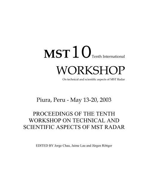
MST10Tenth InternationalWORKSHOPOn technical and scientific aspects of MST RadarPiura, Peru - May 13-20, 2003PROCEEDINGS OF THE TENTHWORKSHOP ON TECHNICAL ANDSCIENTIFIC ASPECTS OF MST RADAREDITED BY Jorge Chau, Jaime Lau and Jürgen Röttger
AcknowledgmentsThe organizing committee thanks the support provided by:• Scientific Committee on Solar-Terrestrial Physics (SCOSTEP)• International Union of <strong>Radio</strong> Science (URSI)• National Science Foundation (NSF), USA• Atmospheric Radar System (ATRAD), Australia• Genesys Software, Australia• Modular antenna radar designs of Canada (MARDOC), Canada• Consejo Nacional de Ciencia y Tecnología (CONCYTEC), PerúThe International Steering Group of MST10 is conformed by: J. Röttger (Chair,Germany), J. Chau (Peru), S. Fukao (Japan), E. Kudeki (USA), and R. Woodman (Peru).Adherent to the International Steering Group are the Chairpersons of the MST RadarPermanent Working Groups: P. Chilson (USA), D. Holdsworth (Australia), G. Nastrom(USA), P.B. Rao (India), and M. Yamamoto (Japan).Honorary Members of the International Steering Group are: M.F. Larsen (USA),C.H. Liu (Taiwan), A.P. Mitra (India).The National Organizing Committee of MST10 consists of: R. Woodman (Chair,Instituto Geofísico del Perú -IGP-), J. Chau (Jicamarca <strong>Radio</strong> Observatory –JRO/IGP-),Antonio Mabres (Universidad de Piura –UDEP-) and Martin Sarango (JRO-IGP).The Local Organizing Committee of MST10 consists of: Rodolfo Rodriguez (Chair,UDEP), William Ipanaque (UDEP), and Sergio Balarezo (UDEP).The Program Committee, besides members of International Steering Committee, includethe topical Conveners K. Gage (USA), W. Hocking (Canada), D. Hysell (USA), H. Luce(France), A. Muschinski (USA), R. Palmer (USA), I. Reid (Australia), D. Riggin (USA),and D. Thorsen (USA).PUBLISHED BY<strong>Radio</strong> Observatorio de Jicamarca, Lima, PeruUniversidad de Piura, Piura, PeruDecember 2003Copies and CDs can be requested to mst10@jro.igp.gob.peEdited Jorge Chau, Jaime Lau and Jürgen Röttger
MST 10 Group PictureMay 15 th , 2003 - Piura PeruCourtesy of Koko Zavala, Oficina deInformación, UDEP.
Most countries are based on institutions, not nationalities.1 Jenn-Shyong Chen (Taiwan)2 Peter Hoffmann (Germany)3 Iain Reid (Australia)4 Raymond Morris (Australia)5 Arturo Peña (Cuba)6 Danny Scipión (Peru)7 James Avery (USA)8 Denise Thorsen (USA)9 Marius Zecha (Germany)10 Christos Haldoupis(Greece)11 Ralph Latteck (Germany)12 Yves Barbin (France)13 Jean-Luc Caccia (France)14 Richard Ney (France)15 Eric Boyer (France)16 Jorge Chocos (Peru)17 Alexander Praskovsky(USA)18 Catherine Gaffard (UK)19 Richard Wilson (France)20 Hubert Luce (France)21 Anna Hocking (Canada)22 Wayne Hocking (Canada)23 Aditi Kolatkar (USA)24 Jun-ichi Furumoto (Japan)25 Jann-Yenq 'Tiger' Liu(Taiwan)26 Chung Chen (Taiwan)27 Yen-Hsyang Chu (Taiwan)28 David Hysell (USA)29 Gerald Lehmacher (USA)30 Mrs. Van Zandt(companion, USA)31 Chris Meek (Canada)32 Mrs. Bénech (companion,France)33 Bruno Bénech (France)34 Thomas Van Zandt (USA)35 Susumu Saito (Japan)36 Werner Singer (Germany)37 Brian Fuller (Australia)38 Christopher Lucas(Australia)39 Siegfried Vogt (Germany)40 Eddy Hermawan(Indonesia)41 Raj Kumar Choudhary(Canada)42 Nikolai Gavrilov (Russia)43 Martin Sarango (Peru)44 Francis Dalaudier (France)45 Toru Sato (Japan)46 Jürgen Röttger (Germany)47 Donald Farley (USA)48 Ronald Woodman (Peru)49 Eleanor Praskovskaya(USA)50 Corinne Morse (USA)51 Noriyuki Kawano (Japan)52 D. Narayana Rao (India)53 Kenneth Gage (USA)54 David Hooper (UK)55 Tatsuhiro Yokoyama(Japan)56 Mrudula G (India)57 Richard Doviak (USA)58 Adrian McDonald (NewZealand)59 Michihiro Teshiba (Japan)60 Otto Castillo (Peru)61 Paul Johnston (USA)62 Brenton Vandepeer(Australia)63 Elias Lau (USA)64 Ken Takahashi (Peru)65 Robert Silva (Australia)66 Glenn Hussey (Canada)67 Frank Lind (USA)68 Ramsey Gitany(companion, France)69 Jorge Chau (Peru)70 Erhan Kudeki (USA)71 Shoichiro Fukao (Japan)72 Hasan Bahcivan (USA)73 Jose Fernandez (USA)74 Julio Urbina (USA)75 Robert Palmer (USA)76 Yoshiaki Shibagaki (Japan)77 Bok-Haeng Heo (SouthKorea)78 Monique Petitdidier(France)79 Gernot Hassenpflug (Japan)80 David Fritts (USA)81 Karanam Kishore Kumar(India)82 Philipp Currier (France)83 John Sahr (USA)84 Ben Balsley (USA)85 Dennis Riggin (USA)86 Cesar La Hoz (Norway)87 Gabriel Michhue (Peru)88 Hiroyuki Hashiguchi(Japan)89 Tadahiko Ogawa (Japan)90 Masaki Tsutsumi (Japan)91 Yasuko Umemoto (Japan)92 Jaime Lau (support, Peru)93 Toyoshi Shimomai (Japan)94 Paco Lopez Dekker (USA)95 Rodolfo Rodriguez (Peru)96 Wilmer Pulache (Peru)97 Leonardo Fernandez (Cuba)98 Wallace Clark (USA)99 Marco Milla (Peru)100 Pablo Reyes (Peru)
TENTH INTERNATIONAL WORKSHOP ON TECHNICAL ANDSCIENTIFIC ASPECTS OF MST RADAR - MST10FIRST ANNOUNCEMENTPiura, PeruMay 20-27, 2003 (or May 13-20, 2003, tbd)The international workshop on MST radar, held about every 2-3 years, is a major eventgathering together experts from all over the world, engaged in research and developmentof radar techniques to study the mesosphere, stratosphere, troposphere (MST). It offersalso excellent opportunities to young scientists, research students and also new entrants tothe field for close interactions <strong>with</strong> the experts on all technical and scientific aspects ofMST radar techniques.The tenth MST radar workshop - MST10 -, as the previous MST workshops, will focuson the following topics• Radar scattering processes in the neutral atmosphere• D, E, and F region coherent scattering (PMSE, Es, EEJ, ESF)• Winds, waves and turbulence in the lower and middle atmosphere• Meteorological phenomena and applications.• Operational aspects and recent system developmentsAs a new approach, the workshop MST10 will consist of two major parts:• Standard workshop papers presented orally or as posters (4 days), and• A brain-storming meeting (1.5 days) <strong>with</strong> the aim to highlight open questions andpotential solutions, to produce proposals for innovative approaches, define new programsand prepare recommendations.The latter bases on the Permanent Working Groups of the MST radar community on:(1) System Calibrations and Definitions,(2) Data Analysis, Validation and Parameter Deduction Methods(3) Accuracies and Requirements for Meteorological Applications(4) International Collaborations.The workshop MST10 will be held at the wonderful campus of the Universidad de Piura(UDEP, http://www.udep.edu.pe) in northern Peru. This site is known due to its operationof ST and boundary layer radars, which are part of the activities of the Instituto Geofísicodel Peru, operating the Jicamarca <strong>Radio</strong> Observatory (JRO), in collaboration <strong>with</strong>international institutions like the University of Colorado (via CIRES) and NOAA (via theAeronomy Lab). Included in the workshop activities are site-seeing tours and a visit ofthe Jicamarca <strong>Radio</strong> Observatory (http://jro.igp.gob.pe) in Lima.The International Steering Group of MST10 consists of: J. Roettger (Chair, Germany), J.Chau (Peru), S. Fukao (Japan), E. Kudeki (USA), and R. Woodman (Peru). Adherent tothe International Steering Group are the Chairpersons of the MST Radar Permanenti
Working Groups: P. Chilson (USA), D. Holdsworth (Australia), G. Nastrom (USA), P.B.Rao (India), and M. Yamamoto (Japan).Honorary Members of the Steering Group are: M.F. Larsen (USA), C.H. Liu (Taiwan),A.P. Mitra (India).The National Organizing Committee of MST10 consists of: R. Woodman (Chair, IGP), J.Chau (ROJ-IGP), Antonio Mabres (UDEP) and M. Sarango (Ciencia Internacional).The Local Organizing Committee of MST10 consists of: Rodolfo Rodriguez (Chair),William Ipanaque, and Sergio Balarezo.The Scientific and Technical Program Committee will be established before thecirculation of the Second CircularThe Tenth International Workshop on Technical and Scientific Aspects of MST Radar -MST10 - is an activity sponsored by the Scientific Committee on Solar TerrestrialPhysics (SCOSTEP), the Instituto Geofísico del Peru (IGP) and the Universidad de Piura(UDEP). Further sponsors, such as URSI, Ciencia Internacional, and other agencies andfoundations are expected.If you are interested in attending the MST10 and like to receive the Second Circular ofMST10 please send an e-mail to: mst10@jro.igp.gob.peby August 15, 2002, including in your message1. Your name and affiliation2. Full mailing address3. Telephone and fax numbers including the international code4. e-mail address5. An indication whether you are planning to present paper(s)6. Potential topic of your paper(s)ii
Table of ContentsPREFACE ...........................................................................................................................11REPORTS ...........................................................................................................................18REPORT ON SESSION I.1 ............................................................................................................... 18REPORT ON SESSION I.2 ............................................................................................................... 20REPORT ON SESSION I.3 ............................................................................................................... 23REPORT ON SESSION I.4 ............................................................................................................... 27REPORT ON SESSION I.5 ............................................................................................................... 30REPORT ON SESSION II ................................................................................................................. 31REPORT ON THE THIRD INTERNATIONAL SCHOOL ON ATMOSPHERIC RADAR – ISAR-3– HELD AT THE ABDUS SALAM INTERNATIONAL CENTER FOR THEORETICALPHYSICS IN TRIESTE, ITALY, 25 NOVEMBER – 13 DECEMBER 2002................................... 34RESOLUTIONS .................................................................................................................36RESOLUTION on Coordinated Hemisperic and Interhemispheric Observations of Polar MesosphereSummer Echoes (PMSE).................................................................................................................... 36RESOLUTION on Educational Issues ............................................................................................... 37RESOLUTION on a Network on Tropical Radars............................................................................. 39RESOLUTION on E-Region.............................................................................................................. 40SESSION I.1: RADAR SCATTERING PROCESSES IN THE NEUTRALATMOSPHERE..................................................................................................................41I.1.3 RETRIEVAL OF ATMOSPHERIC STATIC STABILITY FROM MST RADAR RETURNSIGNAL, D. A. Hooper, J. Arvelius and K. Stebel............................................................................. 42I.1.524 TROPOPAUSE EROSION BY MOUNTAIN WAVE BREAKING, D. A. Hooper and E.Pavelin................................................................................................................................................ 461
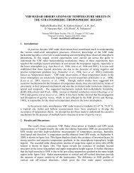
I.1.12 COHERENT RADAR IMAGING AND THE EFFECTS OF REFLECTIVITY FIELDVARIATIONS AND BIOLOGICAL CLUTTER, B. L. Cheong, M. W. Hoffman, R. D. Palmer, H.Tong, V. Tellabati, S. J. Frasier and F. J. López Dekker ................................................................... 50I.1.9 ABOUT MULTIPLE LAYERING AND ASPECT SENSITIVITY OF POLAR MESOSPHERESUMMER ECHOES, J. Röttger ........................................................................................................ 54I.1.4 ASPECT SENSITIVE CHARACTERISTICS OF RADAR BACKSCATTERERS AT VHF:STUDIES USING SIMULTANEOUS OBSERVATIONS OF GADANKI MST RADAR AND GPSSONDE, A. K. Ghosh, Siddarth Shankar Das, A. K. Patra, D. Narayana Rao, V. K. Anandan and A.R. Jain ................................................................................................................................................ 58I.1.10 HIGH-RESOLUTION ATMOSPHERIC PROFILING USING SIMULTANEOUSMULTIPLE RECEIVERS AND MULTIPLE FREQUENCIES, T.-Y. Yu and W. O.J. Brown ......... 62I.1.501 ATMOSPHERIC REFRACTIVITY PROFILES OVER PIURA ST RADAR, R. Rodríguez,F. Sosa and M. Carrión...................................................................................................................... 66I.1.505 VHF-RADAR OBSERVATIONS OF TEMPERATURE SHEETS IN THESTRATOSPHERIC-TROPOSPHERIC REGION, Siddarth Shankar Das, K. Kishore Kumar, A. R.Jain, D. Narayana Rao, A. K. Ghosh and K. Nakamura .................................................................... 70SESSION I.2: D, E AND F REGION COHERENT SCATTERING ............................75I.2.1 RECENT OBSERVATIONS OF E REGION FIELD-ALIGNED IRREGULARITIES AT LOWLATITUDES, J. L. Chau, D. L. Hysell and M. A. Milla.................................................................... 76I.2.5 THE ROLE OF UNSTABLE SPORADIC-E LAYERS IN THE GENERATION OFMIDLATITUDE SPREAD-F, C. Haldoupis, M. C. Kelley, G. C. Hussey and S. Shalimov.............. 86I.2.6 STUDY OF A LOW E-REGION QUASI-PERIODIC EVENT FROM CAMP SANTIAGO,PUERTO RICO, J. Urbina, E Kudeki and S. J. Franke..................................................................... 90I.2.10 INTERFEROMETER OBSERVATIONS OF THE BEHAVIOR OF E-REGIONIRREGULARITIES IN THE MID-LATITUDE WITH THE CHUNG-LI VHF RADAR, C. L. Chenand C. J. Pan...................................................................................................................................... 94I.2.12 IN BEAM RADAR IMAGING OF IONOSPHERIC IRREGULARITIES, D. L. Hysell, M. F.Larsen and J. L. Chau ........................................................................................................................ 982
I.2.18 FURTHER OBSERVATIONS OF PMSE IN ANTARCTICA, M. F. Sarango, R. F.Woodman, L. A. Flores and S. Villegas............................................................................................ 102I.2.20 EISCAT AND SOUSY SVALBARD RADAR OBSERVATIONS OF PMSE –DIFFERENCES AND SIMILARITIES, J. Röttger, K. Kubo and S. Fukao.................................... 106I.2.21 PHASE DIFFUSION FORMULATION OF TURBULENT SCATTER SPECTRA, H.Bahcivan and D. L. Hysell................................................................................................................ 110I.2.501 MORPHOLOGICAL STUDY OF THE FIELD-ALIGNED E-LAYER IRREGULARITIESOBSERVED BY THE GADANKI VHF RADAR, C. J. Pan and P. B. Rao .................................. 114I.2.502 CONTINUOUS WAVE INTERFEROMETER OBSERVATIONS OF MIDLATITUDE EREGION BACKSCATTER, C. Haldoupis, A. Bourdillon, A. Kamburelis, G. C. Hussey, and J. A.Koehler............................................................................................................................................. 118I.2.506 HF DIGISONDE AND MF RADAR MEASUREMENTS OF E-REGION BRAGGSCATTER DOPPLER SPECTRAL BANDS UNDER THE SOUTHERN POLAR CUSP, R. J.Morris, D. P. Monselesan, D. A. Holdsworth, P. L. Dyson, M. R. Hyde and D. J. Murphy............. 122I.2.507 ROCKET OBSERVATION OF ELECTRIC FIELD CONDUCTED IN THE SEEK-2, T.Yokoyama, M. Yamamoto, S. Fukao and R. F. Pfaff ........................................................................ 126I.2.510 MULTITAPER SPECTRAL ANALYSIS OF ATMOSPHERIC RADAR SIGNALS, V. K.Anandan, T. Rajalakshmi, G. Ramachandra Reddy and C. J. Pan .................................................. 130I.2.512 OBSERVATIONS OF METEOR-HEAD ECHOES USING THE JICAMARCA 50 MHZRADAR IN INTERFEROMETER MODE, J. L. Chau, R. F. Woodman, and M. A. Milla............. 134I.2.517 RANGE IMAGING OBSERVATIONS OF PMSE USING THE EISCAT VHF RADAR:PHASE CALIBRATION AND FIRST RESULTS, J. R. Fernandez, R. D. Palmer, P. B. Chilson, I.Häggström and M. T. Rietveld ........................................................................................................ 138I.2.520 PMSE, NLC AND TEMPERATURE OBSERVATION DURING THE ROMA-2001CAMPAIGN, M. Zecha, J. Röttger, F. Lübken, J. Höffner, C. Fricke-Begemann and A. Müllemann.......................................................................................................................................................... 142I.2.521 RESULTS OF SEVERAL YEARS MSE OBSERVATION AT KÜHLUNGSBORN (54°N),M. Zecha, J. Bremer and P. Hoffmann............................................................................................. 1463
SESSION I.3: WINDS, WAVES AND TURBULENCE IN THE LOWER ANDMIDDLE ATMOSPHERE AND THE LOWER THERMOSPHERE........................151I.3.3 WIND AND TURBULENCE MEASUREMENTS BY THE MIDDLE AND UPPERATMOSPHERE RADAR USING UCAR-STARS METHOD, A. Praskovsky, E. Praskovskaya, G.Hassenpflug, M. Yamamoto and S. Fukao........................................................................................ 152I.3.4 STANDARD DEVIATIONS OF CORRELATION LENGTHS IN SPACED ANTENNAOBSERVATIONS USING THE MU RADAR, G. Hassenpflug, M. Yamamoto S. Fukao ............. 156I.3.9 OBSERVATIONS OF THE QUASI 2-DAY WAVES IN THE MESOPAUSE OVERWUHAN, CHINA, J. Xiong, W. Wei, B. Ning and L. Liu................................................................ 160I.3.10 SPORADIC E LAYER DEPENDENCE ON PLANETARY WAVES. AN EVENT STUDYSHOWING AN INDIRECT RELATIONSHIP TROUGH MODULATED ATMOSPHERIC TIDES,C. Haldoupis and D. Pancheva ........................................................................................................ 164I.3.11 RADAR, OPTICAL AND SATELLITE STUDIES OF CLIMATOLOGY AND EFFECTS OFATMOSPHERIC GRAVITY WAVES AND TURBULENCE, N. M. Gavrilov............................. 168I.3.13 STUDIES ON ATMOSPHERIC GRAVITY WAVE ACTIVITY IN THE TROPOSPHEREAND LOWER STRATOSPHERE OVER A TROPICAL STATION AT GADANKI, D. NarayanaRao, I. V. Subba Reddy, A. Narendra Babu, M. Venkat Ratnam and S. Vijaya Bhaskara Rao ........ 177I.3.16 STUDIES ON WINDS AND MOMENTUM FLUXES USING UHF RADAROBSERVATION OVER GADANKI (13.5°N, 79.2°E), D. Narayana Rao, B. Vasantha, N.V.P.Kiran Kumar and I.V. Subba Reddy................................................................................................. 181I.3.19 DEEP PENETRATIVE CONVECTION AND GENERATION OF WAVE OSCILLATIONOBSERVED WITH THE CHUNG-LI VHF RADAR, J. Röttger, M. L. Hsu, W. C. Tsai, C. J. Panand J. Wu.......................................................................................................................................... 185I.3.22 A BRIEF OVERVIEW OF GRAVITY WAVE BREAKING THEORY, G. P. Klaassen .... 189I.3.25 TURBULENT DIFFUSIVITY INFERRED FROM MST RADAR MEASUREMENTS: AREVIEW, R. Wilson......................................................................................................................... 194I.3.26 SIMULTANEOUS OBSERVATIONS OF ATMOSPHERIC TURBULENCE IN THELOWER STRATOSPHERE FROM BALLOON SOUNDINGS AND ST RADARMEASUREMENTS, R. Wilson and F. Dalaudier ........................................................................... 2044
I.3.27 NEW MST RADAR METHODS FOR MEASURING THE TURBULENT KINETICENERGY DENSITY, T. E. VanZandt, G. D. Nastrom, J.-I. Furumoto, W. L. Clark and T. Tsuda 208I.3.28 MEASUREMENTS OF ATMOSPHERIC TURBULENCE WITH THE DUAL-BEAMWIDTH METHOD USING THE MST RADAR AT GADANKI, INDIA, G. D. Nastrom, P.B. Rao and V. Sivakumar.................................................................................................................. 210I.3.33 FAST AND ACCURATE CALCULATION OF SPECTRAL BEAM-BROADENING FORTURBULENCE STUDIES, W. Hocking ......................................................................................... 214I.3.34 POSSIBLE CROSS-TROPOPAUSE TRANSPORT PROCESSES IN THE TROPICS, M. K.Yamamoto, M. Fujiwara and S. Fukao............................................................................................. 218I.3.39 UPPER MESOSPHERE TEMPERATURE CHANGES OBSERVED IN PMSE ANDINCOHERENT SCATTER DURING A STRONG POLAR CAP ABSORPTION EVENT, K. Kubo,J. Röttger and S. Fukao.................................................................................................................... 222I.3.30 TURBULENCE STUDIES USING UHF RADAR OBSERVATIONS OVER GADANKI(13.5°N, 79.2°E), D. Narayana Rao, B. Vasantha, N.V.P. Kiran Kumar and I.V. Subba Reddy..... 226I.3.501 WIND MEASUREMENTS BY THE CHUNG-LI RADAR IN THE PRESENCE OFSTRONG CLUTTER AND HARD TARGETS, E. Praskovskaya, A. Praskovsky, J.-S. Chen and Y.-H. Chu .............................................................................................................................................. 230I.3.504 MU RADAR ESTIMATION OF DOWNWARD TURBULENT OZONE FLUXES NEARTHE TROPOPAUSE, N. M. Gavrilov and S. Fukao ....................................................................... 234I.3.505 LARGE VELOCITIES MEASURED AT MF AND HEIGHTS ABOVE 100KM: REAL ORSPURIOUS?, C. Meek and A. Manson ............................................................................................ 238I.3.508 LIDAR OBSERVATIONS OF MIDDLE ATMOSPHERIC GRAVITY WAVE ACTIVITYOVER A LOW LATITUDE, V. Sivakumar and P. B. Rao.............................................................. 241I.3.509 APPLICATION OF THE DUAL-BEAMWIDTH METHOD TO A NARROW BEAM MFRADAR FOR ESTIMATION OF TURBULENT SPECTRAL WIDTH, R. Latteck, W. Singer and N.Engler............................................................................................................................................... 245I.3.511 MONSOON LOW LEVEL JET OBSERVATIONS OVER GADANKI, K. Madhu ChandraReddy, D. Narayana Rao, A. R. Jain and Y. Ohno ........................................................................... 2495
SESSION I.4: METEOROLOGICAL PHENOMENA AND APPLICATIONS .......253I.4.3 MESOSCALE ALPINE PROGRAMME (MAP): SYNERGIES BETWEEN WINDPROFILERS AND DOPPLER WEATHER RADARS, M. Petitdidier, V. Klaus and P. Tabary ... 254I.4.4 OBSERVATIONS OF TYPHOON 9426 (ORCHID) WITH THE MU RADAR: MESO-α-SCALE KINEMATIC STRUCTURE AND MESO-β・γ-SCALE PRECIPITATING CLOUDS, Y.Shibagaki, M. D. Yamanaka, M. Kita-Fukase, H. Hashiguchi, Y. Maekawa and S. Fukao ............. 258I.4.6 RANGE, RESOLUTION, AND SAMPLING, P. Johnston, L. Hartten, D. Carter and K. Gage.......................................................................................................................................................... 262I.4.16 AN OBSERVATIONAL STUDY ON INTRASEASONAL VARIATIONS WITHEQUATORIAL ATMOSPHERE RADAR(EAR) IN WEST SUMATERA, INDONESIA, H.Hashiguchi, T. H. Seto, S. Fukao, M. K. Yamamoto, M. Fujiwara, T. Horinouchi, M. Yamamoto, M.Muzirwan and M. Kartasasmita....................................................................................................... 266I.4.9 A COMPREHENSIVE STUDY ON TROPICAL MESOSCALE CONVECTIVE SYSTEMSUSING VHF AND UHF RADARS OVER A TROPICAL STATION, K. Kishore Kumar and A. R.Jain................................................................................................................................................... 270I.4.10 VHF RADAR REFLECTIVITY, VERTICAL VELOCITIES AND RAINFALL RATEDURING TYPHOON PASSAGES OVER TAIWAN, C. J. Pan, M. L. Hsu, L. J. Chung, J. Röttgerand J. Wu.......................................................................................................................................... 274I.4.12 DERIVING DROP SIZE DISTRIBUTION FROM VHF AND UHF RADAR SPECTRA, N.V. P. Kiran Kumar and D. Narayana Rao........................................................................................ 278I.4.14 DIAGNOSTIC STUDY OF TROPICAL PRECIPITATING CLOUD SYSTEMS USINGWIND PROFILERS AT GADANKI, INDIA, K. Krishna Reddy, T. Kozu, M. Thurai, Y. Ohno, K.Nakamura, A. R. Jain and D. Narayana Rao ................................................................................... 282I.4.17 TROPOSPHERIC WIND MEASUREMENTS WITH THE PIURA BOUNDARY LAYERRADAR DURING EXTREME RAINFALL EVENTS IN 2002, K. Takahashi.............................. 286I.4.18 FOEHN IN THE RHINE VALLEY AS SEEN BY A WIND-PROFILER-RASS SYSTEMAND COMPARISON WITH THE NONHYDROSTATIC MODEL MESO-NH, S. Vogt and G.Jaubert.............................................................................................................................................. 2906
I.4.19 STUDY OF A MESOSCALE LAND-TO-SEA LOW-LEVEL JET WITH A NETWORK OFUHF WIND PROFILERS: CASES OF THE MISTRAL WIND, V. Guénard, J-L. Caccia, B. Bénech,B. Campistron and P. Drobinski ...................................................................................................... 294I.4.21 WIND PROFILER AND TOWER OBSERVATIONS OF A GRAVITY CURRENT AND ARELATED SOLITARY WAVE, A. Adachi, W. Clark, K. Gage and T. Kobayashi........................ 298I.4.22 TOWARDS THE ADVANCED MEASUREMENTS OF ATMOSPHERIC TURBULENCEBY SPACED ANTENNA RADARS, A. Praskovsky and E. Praskovskaya.................................... 302I.4.23 THE INCLINATION OF REFLECTIVITY STRATIFICATIONS, J. Röttger..................... 306I.4.24 DETERMINATION OF THE TURBULENT FLUXES OF MOMENTUM AND VIRTUALSENSIBLE HEAT WITH AN UHF RASS PROFILER. COMPARISON WITH IN SITUMEASUREMENTS, B. Bénech, F Girard-Ardhuin, B. Campistron, F. Saïd, F. Lohou, and V.Puygrenier........................................................................................................................................ 310I.4.504 RADAR OBSERVATIONS OF TROPICAL PRECIPITATION SYSTEMS ATKOTOTABANG, WEST SUMATERA, Y. Shibagaki, T. Kozu, T. Shimomai, Y. Fujiyoshi, S. Mori,M. K. Yamamoto, H. Hashiguchi, S. Fukao and M.D. Yamanaka.................................................... 314I.4.506 RAIN DROP SIZE DISTRIBUTION OVER GADANKI, INDIA DURING SOUTHWESTAND NORTHEAST MONSOON, K.Krishna Reddy, T. Kozu, T.Narayana Rao, K. Nakamura andD.Narayana Rao............................................................................................................................... 318I.4.509 WIND PROFILER FOR MONITORING OF MEIYU PRECIPITATION IN THEDOWNSTREAM OF YANGTZE RIVER, K. Krishna Reddy, B. Geng, H. Yamada and H. Uyeda.......................................................................................................................................................... 322I.4.514 TROPOSPHERIC WINDS MEASURED WITH THE PIURA ST RADAR: NORMAL VS.“EL NIÑO 1997-98” CONDITIONS, L. A. Flores, J. La Madrid and J. L. Chau........................... 326I.4.515 AN INVESTIGATION OF OZONE AND PLANETARY BOUNDARY LAYERDYNAMICS OVER GADANKI, INDIA, K.Krishna Reddy, S. Lal, T. Kozu, K. Nakamura, Y. Ohno,M. Naja and D.Narayana Rao.......................................................................................................... 330I.4.519 THE SIGNATURE OF MID-LATITUDE CONVECTION OBSERVED BY MST RADAR,D. A. Hooper, H. J. Reid and E. Pavelin.......................................................................................... 334I.4.520 PRELIMINARY OBSERVATIONS OF CONVECTIVE BOUNDARY LAYER OVERGADANKI (13.5°N, 79.2°E) USING UHF WIND PROFILER, K. Kishore Kumar and A. R. Jain3387
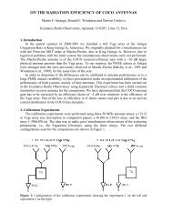
I.4.521 STUDIES ON MOMENTUM FLUXES USING MST RADAR WINDS OBSERVED ATGADANKI (13.5°N, 79.2° E), INDIA, Narayana Rao, I. V. Subba Reddy, P. Kishore, S. P.Namboothiri, K. Igarashi, K. Krishna Reddy and S. V. Bhaskara Rao ............................................ 342I.4.522 ESTIMATION OF THE TROPOPAUSE HEIGHT USING THE VERTICAL ECHO PEAKAND ASPECT SENSITIVITY CHARACTERISTICS OF A VHF RADAR, B.-H. Heo, K.-E. Kim,B. Campistron and V. Klaus............................................................................................................. 346SESSION I.5: OPERATIONAL ASPECTS AND RECENT SYSTEMDEVELOPMENTS...........................................................................................................351I.5.1 THE WIND PROFILER NETWORK OF THE JAPAN METEOROLOGICAL AGENCY, M.Ishihara, S. Fukao and H. Hashiguchi ............................................................................................. 352I.5.3 FIRST RESULTS OF THE BOUNDARY LAYER AND TROPOSPHERIC RADARSYSTEMS FOR ENSO STUDIES IN NORTHERN PERU, D. Scipión, J. L. Chau and L. A. Flores.......................................................................................................................................................... 357I.5.5 MOVEABLE UHF/S-BAND PROFILER/DISDROMETER SYSTEMS AS A CALIBRATIONSTANDARD IN RAINY PLACES, W. Clark, K. Gage, C. Williams, P. Johnston and D. Carter . 361I.5.7 TOWARD A MULTISENSOR GROUND BASED REMOTE SENSING STATION, C.Gaffard, T. Hewison and J. Nash ..................................................................................................... 365I.5..506 DEVELOPMENT OF A DIGITAL RECEIVER FOR THE JICAMARCAOBSERVATORY RADARS, G. Michhue and R. Woodman .......................................................... 369I.5.9 ELECTRONIC DIGITAL BEAMFORMING IMPLEMENTATION FOR RADARS, R. Ney, S.Bonaimé, F. Dolon, J. J. Berthelier, R. Clairquin, D. Nevejans, C. Duvanaud and A. D’Hermies . 373I.5.11 ON-LINE ADAPTIVE DC-GROUND-CLUTTER REMOVAL, J. Röttger ........................ 377I.5.513 ON THE RADIATION EFFICIENCY OF COCO ANTENNAS, M. F. Sarango, R. F.Woodman and D. Córdova............................................................................................................... 381I.5.15 A NEW NARROW BEAM MF RADAR AT 3 MHZ FOR STUDIES OF THE HIGH-LATITUDE MIDDLE ATMOSPHERE: SYSTEM DESCRIPTION AND FIRST RESULTS , W.Singer, R. Latteck, D. A. Holdsworth and T. Kristiansen................................................................. 385I.5.501 ANTENNA BEAM VERIFICATION USING COSMIC NOISE, T. K. Carey-Smith, A. J.McDonald, W. J. Baggaley, R. G. Bennett, G. J. Fraser and G. E. Plank........................................ 3918
I.5.502 AN ATTEMPT TO CALIBRATE THE UHF STRATO-TROPOSPHERIC RADAR ATARECIBO USING NEXRAD AND DISDROMETER DATA, P. Kafando and M. Petitdidier..... 395I.5.516 QUALITY CONTROL FOR DOPPLER WIND PROFILERS USING NIMA, C. S. Morse,R. K. Goodrich, L. B. Cornman, and S. A. Cohn.............................................................................. 399I.5.518 SOUSY RADAR AT JICAMARCA: SYSTEM DESCRIPTION, R. F. Woodman, O.Castillo, G. Michhue, P. Reyes, and S. Villegas............................................................................... 403I.5.519 THE EQUATORIAL ATMOSPHERE RADAR: SYSTEM AND NEW RESULTS, S.Fukao, H. Hashiguchi, and M. K. Yamamoto................................................................................... 407I.5.521 VHF ATMOSPHERIC AND METEOR RADAR INSTALLATION AT DAVIS,ANTARCTICA: PRELIMINARY OBSERVATIONS, R. J. Morris, D. J. Murphy, I. M. Reid, and R.A. Vincent ......................................................................................................................................... 411I.5.522 VORTICAL MOTIONS OBSERVED WITH THE NEW MCGILL VHF RADAR ANDASSOCIATED DYNAMICAL CHARACTERISTICS, E. F. Campos and W. K. Hocking............ 415I.5.523 A NEW MINIRADAR TO INVESTIGATE URBAN CANOPY: CURIE CANOPY URBANRADAR FOR INVESTIGATION OF EXCHANGES, A. Weill, C. Legac, R. Ney and L. Chardenal.......................................................................................................................................................... 419SESSION PWG 1: SYSTEM CALIBRATIONS AND DEFINITIONS......................423SESSION PWG 2: DATA ANALYSIS, VALIDATION AND PARAMETERDEDUCTION METHODS ..............................................................................................425PWG2 PARAMETRIC ESTIMATION OF SPECTRAL MOMENTS OF OVERLAPPEDWEATHER DOPPLER ECHOES BY THE USE OF HIGH-RESOLUTION ALGORITHMS, E.Boyer, M. Petitdidier and P. Larzabal ............................................................................................. 426SESSION PWG 3: ACCURACIES AND REQUIREMENTS FORMETEOROLOGICAL APPLICATIONS .....................................................................431SESSION PWG 4: INTERNATIONAL COLLABORATIONS..................................433SESSION II.E: NOVEL PERSPECTIVES AND UNSOLVED ISSUES....................435II.E.1 AN ADAPTIVE CLUTTER REJECTION SCHEME FOR MST RADARS, T. Sato and K.Kamio ............................................................................................................................................... 4369
II.E.2 THREE-METRE-SCALE TURBULENCE ANISOTROPY AS A PRECURSOR TO RAIN, A.Hocking and W. Hocking.................................................................................................................. 444II.E.3 WHAT IS THE FUTURE OF THE MULTI-FREQUENCY TECHNIQUES?, H. Luce ...... 448II.E.5 WHAT IS TURBULENCE SEEN BY VHF RADAR?, J. Röttger ....................................... 449II.E.7 APPLICATIONS OF A WORLD-WIDE NETWORK OF MESOSPHERIC RADARS, WITHSPECIAL EMPHASIS ON THE COLUMBIA SPACE SHUTTLE DISASTER, W. K. Hocking, S. J.Franke, N. Mitchell, D. Pancheva, P. Batista, B. Clemesha, B. Fuller, B. Vandepeer, T. Nakamura,T. Tsudd and J. MacDougall ............................................................................................................ 460II.E.8 THE STRUCTURE FUNCTION-BASED APPROACH TO DATA ANALYSIS FORSPACED ANTENNA RADARS: A COMPARISON WITH TRADITIONAL TECHNIQUES, A.Praskovsky and E. Praskovskaya ..................................................................................................... 461II.E.9 VHF PARASITIC RADAR INTERFEROMETRY FOR MST ZENITH SOUNDING, J. Sahr.......................................................................................................................................................... 471Participants List................................................................................................................481Authors Index ...................................................................................................................48710
PrefaceMST10The Tenth International Workshop on Technical and Scientific Aspects of MST Radar -MST10 - was held 13-20 May 2003 at the campus of the Universidad de Piura in northernPeru. These international workshops are held every 2-3 years and comprise major eventsgathering together experts from all over the world, engaged in research and development ofradar techniques to study the mesosphere, stratosphere and troposphere (MST). It includesalso ionospheric coherent scatter radars and planetary boundary layer radars. It offersexcellent opportunities to young scientists, research students and also new entrants to thefield for close interactions <strong>with</strong> the well-known experts on all technical and scientificaspects of MST radar methods.As a new approach, the workshop consisted of two major parts: (Section I) standardworkshop papers presented orally or as posters, and (Section II) a brain-storming session<strong>with</strong> the aim to highlight open questions and potential solutions, to produce proposals forinnovative approaches, define new programs and prepare recommendations and resolutions.UDEP Campus. MST10 Panel to the left.(courtesy of F. Lind)UDEP’s MST Radar. (courtesy of T. Shimomai)The Universidad de Piura (UDEP) is known in radar circles due to its operation of ST andboundary layer radars, which are part of the activities of the Instituto Geofisico del Peru(IGP), operating the Jicamarca <strong>Radio</strong> Observatory (JRO), in collaboration <strong>with</strong> institutionslike the University of Colorado (via CIRES) and NOAA (via the Aeronomy Laboratory).Sponsors of MST10 were the Scientific Committee on Solar Terrestrial Physics(SCOSTEP), the International Union of <strong>Radio</strong> Science (URSI), the National ScienceFoundation (NSF) of USA, Consejo National de Ciencia y Technología (CONCYTEC) ofPeru and various research and development companies.11
The International Steering Committee of MST10 consisted of J. Röttger (Chair, Germany),J. Chau (Peru), S. Fukao (Japan), E. Kudeki (USA), and R. Woodman (Peru). Adherent tothe International Steering Committee were the Chairpersons of the MST Radar PermanentWorking Groups P. Chilson (USA), D. Holdsworth (Australia), G. Nastrom (USA), P.B.Rao (India), and M. Yamamoto (Japan). Honorary Members of the Steering Committeewere M.F. Larsen (USA), C.H. Liu (Taiwan), A.P. Mitra (India). The National OrganizingCommittee of MST10 consisted of: R. Woodman (Chair, IGP), J. Chau (JRO-IGP),Antonio Mabres (UDEP) and M. Sarango (Ciencia Internacional). The Local OrganizingCommittee consisted of Rodolfo Rodriguez (Chair), William Ipanaque, and SergioBalarezo. Session conveners and session chair persons were drawn from the internationalscientific community.The workshop was opened on Tuesdaymorning, 13 May 2003, in the presence ofthe President of the Piura region, Dr. CésarTrelles, the President of UDEP, Dr. AntonioAbruña, the Dean of the Faculty ofEngineering of UDEP, Dr. Sergio Balarezo,the President of the Instituto Geofisico delPerú, Dr. R.F. Woodman and the Chairmanof the German Embassy and the Consulatein Piura were represented by R. Niemannand J. M. Irazola.Participants were from 17 countries from allcontinents. A total of 175 abstracts had beensubmitted, and 109 oral papers (24 thereofinvited) and 66 poster papers wereOpening Ceremony.From l to r: Ronald Woodman, César Trelles,Antonio Abruña, Juergen Roettger and SergioBalarezo (courtesy of G. Hassenpflug)presented. A tour of the university institutes and facilities as well as the radar systems tookplace on Thursday afternoon, which was followed by an outing to a nearby horse farm.During the get-together on Monday evening and the workshop dinner on Thursday eveningthe workshop participants enjoyed north Peruvian-style folklore, and an extended tour tookplace on Sunday to visit the famous historical site of Sipan in the northern Peru region.Public lectures at the university were givenby R.F. Woodman on “Space explorationfrom the ground: Peruvian contributions tohuman knowledge“, and by B.B. Balsley on“A half century of cooperation <strong>with</strong> myPeruvian colleagues”. During the workshopdinner D.T. Farley spoke about his longlastingexperience <strong>with</strong> Jicamarca andcorresponding episodes and adventures.Ben Balsley giving his public lecture. (courtesy ofJ. Zavala)The hotel facilities were excellent, in shortwalkingdistance to the university campus,12
and the local organizing committee, supported by Jicamarca personnel and universitystudents, kept track of the very pleasant and highly functional workshop performance.Session I.1 was on radar scatteringprocesses in the neutral atmosphere(convened by H. Luce and A. Muschinski).This session dealt <strong>with</strong> observational andtheoretical investigations (1) on how toseparate the effects of different scatteringmechanisms in the same data set, and on (2)radar echo characteristics in different radarconfigurations and their interpretations arepresented. Emphasis of the papers wasplaced on contributions that discuss newobservations (e.g., multi-beam, multifrequency,multi-receiver, and/or multiregimeradar observations, also intercomparisons<strong>with</strong> in situ measurements) onthe basis of innovative, first-principle theoretical analysis. Invited talks were given by D.Fritts on direct numerical simulations of turbulence and radar backscatter, and by F.Dalaudier on combined radar and balloon observations. B. Balsley’s kite observations,which show very thin structures in the lower troposphere point into the direction ofunderstanding the highly specular radar returns as well.Yen-Hsyang Chu during Session I.2. (courtesy of J.Zavala)Session I.1 first speech by David Fritts.(courtesy of J. Zavala)Session I.2 was on D-, E-, and F-regioncoherent scattering (convened by D. Hyselland R.D. Palmer). It was devoted to thetheory and observation of coherent scatterfrom ionospheric irregularities at alllatitudes. Papers were presented. pertainingto such mature fields of study as the auroraland equatorial electrojets, PMSE, sporadicE-layers, and equatorial spread-F. Recentand planned campaigns like SEEK II,C/NOFS, and CIELO attest to the fact thatnumerous problems remain unsolved inthese areas. In addition, papers on emergingareas of research were given, includinglong-lived meteor trails, 150 km echoes,daytime spread-F, and mid-latitude spread-F. Novel experimental techniques such aspassive radar, networked radar, radar imaging, and coherent scatter Faraday rotation maypromote rapid progress in the areas outlined above. Reports describing new experimentalradar techniques were given also in section II. Invited papers were given by E. Kudeki on150-km echoes, J. Chau on E region studies at low-latitudes,W. Singer et al. on PMSE, F. Lind on E region irregularities at high latitudes, and S. Fukaoon the SEEK-2 campaign. Due to short-notice travel cancellation P. Chilson could not givehis invited talk on PMSE.13
Session I.3 on winds, waves and turbulence in the lower and middle atmosphere and thelower thermosphere was convened by W.K. Hocking and M.F. Larsen. This sessionexamined recent developments of studies and observations of dynamics in the middleatmosphere and lower thermosphere. Topics of particular interest included wave-waveinteraction, wave sources and generation mechanisms, wave deposition processes, nonlinearinteractions, wave propagation studies, turbulence anisotropy and turbulent transportprocesses. Correlations of wave events as a function of height, and multi-instrument studieswere presented, and inter-comparisons ofdifferent techniques were considered to beimportant. One area of special interest wasstudies of wave velocity amplitudes andvariability in the region above 90 kmaltitude, <strong>with</strong> particular interest indetermining the frequency of occurrence oflarge amplitude events and large windvelocities (up to 100 m/s and higher) in thisregion. D. Fritts gave the invitedpresentation of P. Franke, who could notattend. This talk expanded the directnumerical simulation of turbulent structures.Investigations on gravity wave break downand the different kinds of instabilities doneShoichiro Fukao during Session I.3.by G. Klaassen were presented by W. Hocking. The invited review on turbulent diffusivitywas presented by R. Wilson, and N. Gavrilov gave an invited talk on gravity wave andturbulence studies and drew attention on the possible relation of middle atmosphere gravitywave activity to El Nino.K. Gage and D. Riggin convened SessionI.4 on meteorological phenomena andapplications.It was concerned <strong>with</strong> recent developmentsin Doppler radar profiling in the lowerneutral atmosphere, especially studies oflower atmospheric phenomena made <strong>with</strong>pro<strong>file</strong>rs in combination <strong>with</strong> otherinstruments during field campaigns. Topicsof interest included the assimilation ofpro<strong>file</strong>r data in meteorological models,quality control of pro<strong>file</strong>r data, operationalnetworks of pro<strong>file</strong>rs and the impact ofK. Krishna Reddy during Session I.4. pro<strong>file</strong>r data on forecasting. Of specialinterest were studies that demonstrate theutility of profiling for quantifying the vertical structure of turbulence, humidity, cloud andprecipitation fields including drop size distributions and their variability. The invited talkswere given by K. Gage (on behalf of S. Koch) on mesoscale analysis and prediction usingwind pro<strong>file</strong>r data and by C. Williams and K. Gage on rain drop size distributions deducedfrom pro<strong>file</strong>r observations.14
The operational aspects and recent system developments were handled in Session I.5,which was convened by I. Reid and D. Thorsen. The focus was on aspects related to thetechnical performance of radar systems and multi-instrument measurements. Paperspertaining to all aspects of technical performance of current and/or proposed facilities,including the unique problems associated <strong>with</strong> operation of remote stations were included.These aspects related as well to pros and cons of system configurations and measurementmethods. It was addressed how multi-instruments can be used together to augmentscientific research as well as how measurements from diverse instruments (includingmodels) may be appropriately compared.Short reports and summary presentations on the Permanent Working Groups (PWGs)activities were presented at the beginning of the second workshop week. These PWGs deal<strong>with</strong> (1) system calibration and definitions, (2) data analysis, validation, and parameterreduction methods, (3) accuracies and requirements for meteorological applications, and (4)international collaborations and education.This was followed by Section II on “Novel perspectives and unsolved issues”. Tostimulate brain storming in this section, several invited talks were presented. T. Sato and K.Kamino introduced an adaptive clutter rejection scheme for MST radars, W. Hockingevaluated diagnostic capabilities of measurements of backscatter anisotropy, H. Lucereviewed the future of the multi-frequency techniques, J. Röttger asked what is turbulenceseen by VHF radars, W. Hocking et al. reported about potential applications of a worldwidenetwork of mesospheric radars <strong>with</strong> special emphasis on the Columbia space shuttledisaster, A. and E. Praskovsky presented a structure-function-based approach to dataanalysis for spaced antenna radars, and J. Sahr proposed VHF parasitic radar interferometryfor MST zenith sounding. These presentations lead to distinct lively discussions. Thesewere summarized in the final plenary session together <strong>with</strong> reports on the oral postersessions prepared by the chairpersons.The Plenary and Closing Session was heldon Tuesday afternoon and chaired by J.Röttger. It included discussions of thehighlights presented in the oral and posterworkshop papers of Section I and inparticular important issues and questionsraised in the presentations of Section II.The written reports of the session convenersand chairpersons formed a suitable input forthe final discussions, which concentrated ontopics such as (to mention just a few):Identification of backscattering mechanism Poster Session I. (courtesy of T. Shimomai)by statistical analysis and the DirectNumerical Simulation. Here the questionswere how DNS can model turbulence decay and how one can expand the modeling formultiple gravity waves and their breaking. The question on the realistic meaning of theeffective diffusivity and turbulence energy dissipation rate remains to be studied. A15
dominant item seems to be the contributions of ST radars for the studies of stratospheretroposphereexchange. Interesting and not yet solved topics are the scattering mechanism ofpolar mesosphere summer echoes, their structure and inter-hemispheric difference, thecreation and propagation of gravity waves from low altitudes to higher altitudes in themesosphere and lower thermosphere, and their momentum and energy dissipation. Also theE- and F-region irregularities, leading to coherent scatter, are still a relevant item and openquestions were summarized, such as their generation mechanisms and their relation tocoupling <strong>with</strong> above (electric fields) and below (gravity waves and tides).Several approaches are in use to analyze and interpret spaced antenna and interferometerobservations and the pros and cons are disputed. Imaging techniques are highlights of therecent developments to understand the structure and dynamics of the atmosphere. Apromising idea is to apply the parasitic radar method for lower atmosphere studies.Combination <strong>with</strong> other techniques, such as the application aspects of the wind pro<strong>file</strong>rs,providing data for improving forecasting and modeling, are a most recognized spin-off ofthe MST radar technique.The activities of the Permanent Working Groups were evaluated and it was resolved thatthese groups, which are mostly dormant between workshops, should become part of adiscussion group on topical issues, which should be introduced and handled via the internet.The present workshop homepage http://jro.igp.gob.pe/mst10 forms a suitable forum for thispurpose.The normal abstracts of all papers werepublished by the local organizers in theabstract proceedings. <strong>Extended</strong> abstractswill be published on CD-ROM and ashardcopy, as usual, in the final workshopproceedings. An editorial team at theJicamarca Radar Observatory takes care ofthis duty, supported by the steeringcommittee. Full manuscripts can besubmitted for potential publication in aspecial MST radar issue of the journalAnnales Geophysicae. These manuscriptsundergo the standard refereeing procedure,where the guest editors are D. Hooper andD.N. Rao. A call for papers has beendistributed to all, who had submittedabstracts for MST10.Coffee Break.From l to r: Jürgen Röttger, Yen-Hsyang Chuand Daggumati Narayana Rao (courtesy of J.Zavala)Several proposals for resolutions were discussed. The one on educational issues aimstowards continuing and expanding the international radar schools, such as ISAR, but alsosupporting the tendencies for establishing regular schools on national levels as well asforming permanent departments on atmospheric radar at universities and other institutions.Concentrated efforts should be undertaken, supported by a resolution, to understand thehemispheric difference and frequency dependence of PMSE using calibrated radar systems.16
To improve the understanding of dynamical processes in low latitudes, special campaignsand in particular a tropical network of radars on a global scale was proposed and is laiddown in a resolution. In general it was felt that the MST radar technique, although basicallymature, still expects further and deeper understanding of the atmosphere by introducingnew techniques, establishing new observation sites and upgrading existing facilities.Another resolution covers research requirements to understand mid-latitude E-regionirregularities. These resolutions will be published in the final proceedings and submitted tothe sponsoring organizations as well as other governing agencies.The character of the workshop was discussed and it was felt that the addition of a brainstorming section to foster new directions has raised the quality of the MST radar workshop.It was decided to continue <strong>with</strong> these workshops, and also keep the time frame of 8 days,not starting on Monday and including one weekend. Invitations to hold the next workshop -MST11 - were received from Australia, Germany and India. It was noted that Australia hadtwice been candidate before, but the final decision was postponed to allow moreinformation of the community about the possible venue.The workshop was closed on Tuesday afternoon leaving in the minds of the participantsproper updates on scientific research and technical developments, potential approaches ofopen questions, views into a promising future and most delightful impressions on theUniversity of Piura and the appreciation of the whole-hearted contributions by the membersof the local organizing committee.Those, who were still present after the workshop had the chance to see the tropical sunset atthe nearby ocean front of Colan, - an ultimate finale of a successful workshop onatmospheric research. Our sincere particular thanks for the most efficient performance ofMST10 are directed to the sponsors, the University of Piura and the staff of the localorganizing committee.Jürgen Röttger and Jorge ChauMST10 initialization meeting, May 2002. From l. to r.:Rodolfo Rodriguez, Jürgen Röttger, Erhan Kudeki, KokiChau and Antonio Mabres. (courtesy of J. Röttger)The beautiful sunset at Colan. (courtesy of J.Röttger)17
Report on Session I.1 “Radar scattering processes in the neutralatmosphere”Conveners: H. Luce and A. MuschinskiAbstract of session: Unambiguous retrieval of atmospheric parameters related toturbulence, waves, hydrometeors, etc, from MST radar measurements is still challengingand sometimes impossible. This difficulty is in part due to the nature of the specificinversion problem, in part due to our still insufficient knowledge on the relevantbackscattering mechanisms and their relative importance. This session was thus devoted torecent approaches (sophisticated radar observations, intercomparisons <strong>with</strong> in situmeasurements and numerical simulation results) used for improving our understanding onthese processes.Eight papers were presented in the Session I.1 chaired by M. Petitdidier, W. Singer and H.Luce. The two first presentations were invited talks prepared by D. Fritts of ColoradoResearch Associates (USA) and F. Dalaudier of Service d’Aéronomie (CNRS, France).These talks emphasized the importance of numerical simulations and in situ observations,respectively, for the interpretation of MST radar echoes. D. Fritts presented results of 3DDNS of turbulence generation by KHI and gravity wave breaking. These simulationsclearly demonstrate the generation of thin structures at the edges of a mixing layer. Thesestructures are characterized by strong thermal and velocity gradients and are quite similar tothose shown by F. Dalaudier observed experimentally in the shear of a jet-stream usinghigh-resolution temperature measurements. The simulation results were strongly debated,in particular, the importance of the initial conditions used (very small Ri number) and ofestablishing energy budget and the interaction of the mixing layer <strong>with</strong> other possibleprocesses (such as waves) in its surroundings which could affect the mixing evolution. F.Dalaudier reviewed recent observations by balloon and radar techniques. After a presentionof the measurement techniques and results <strong>with</strong> the CIRES TLS (Tethered Lifting System)and MUTSI experiment, he mainly emphasized the constraints and interpretationdifficulties when comparing atmospheric parameters measured by radars and balloons.Finally, these two talks stressed the importance of MST radar experiments coordinated <strong>with</strong>numerical simulations and in situ observations for a better understanding of the atmosphericdynamics at small scales. More thorough intercomparisons are needed and the creation of aworking group on this topic could help to the development of common projects.D. Hooper (<strong>with</strong> J. Arvelius, K. Stebel and E. Pavelin) gave two talks showing thepossibility to retrieve static stability from MST radar returns and an application of theproposed approach to tropopause erosion by mountain wave breaking. A thorough analysisshowed interesting potential of the method based on N 2 estimation from vertical echopower. The observed desagreements mainly resulted from important balloon drifts andhorizontal inhomogeneities of the temperature field due to mountain waves. N 2 radarestimates were then used for calculating Ri number from the sole radar measurements andthen analysing an event of moutain wave breaking around the tropopause level. The Rinumber is an important (but not sufficient) parameter for identifying the nature of the radarechoes. Another approach from MST radar data was presented by A. McDonald by usingstatistics of the I and Q components of the received signals.18
Improving MST radar resolution by using various imaging techniques may be anothercomplementary approach for a better understanding of radar backscattering processes. R.Palmer (<strong>with</strong> H. Tong, V. Tellabati, B. Cheong and M. Hoffman) presented two talks aboutradar imaging technique developments on a turbulent eddy 915 MHz pro<strong>file</strong>r. Simulationsand applications were discussed. Horizontal maps of the wind field and reflectivitystructures obtained <strong>with</strong> a sophisticated Capon beamforming method applied on datacollected from 90 independent receivers were shown. The authors demonstrated thecapabilities of the proposed coherent radar imaging, not only for turbulence studies, butalso for attenuating airplane interferences. Horizontal maps of echo power using a multibeamapproach are also of great importance for our purpose. Recent papers by R.Worthington et al. were a clear demonstration of their potentials by identifying a systematicskew of the horizontal echo power distribution related to the direction of the wind shear, asrecalled by F. Dalaudier. Such a kind of information is crucial for interpreting radar echoes.Unfortunately, a review on the topic was not available because R. Worthington was unableto attend the workshop.Aspect sensitivity (i.e. the enhancement of echo power in vertical direction <strong>with</strong> respect tooblique echo power) was discussed by the invited papers and by J. Röttger <strong>with</strong>in thestudies of the PMSE layering. PMSE are indeed often aspect sensitive. Double-layerstructures are usual but multiple layering structures can also be observed. They mayindicate a complex mechanism of interactions between waves and turbulence.19
Report on Session I.2 “D, E and F Region Coherent Scattering”Conveners: D. Hysell and R. PalmerAbstract: This session was devoted to theory and observations of coherent scatter fromionospheric irregularities at all latitudes. Reports pertaining to mature fields of study likethe auroral and equatorial electrojets, PMSE, sporadic E layers, and equatorial spread Fwere solicited. Recent and planned campaigns like SEEK II and EQUIS II attest to the factthat numerous problems remain unsolved in these areas. In addition, reports on emergingareas of research including long-lived meteor trails, 150 km echoes, daytime spread F, andmidlatitude spread F were sought. Also welcome were papers on new radar techniques thatcan promote rapid progress in these areas such as passive radar, distributed radar, andaperture synthesis imaging.Despite the breadth of the solicitation, most of the papers submitted to this session fell intoone of two categories: low- and mid-latitude E region irregularities and PMSE, indicatingwhere community interest is currently focused. The session was accordingly divided intotwo parts. The main findings of the respective parts are summarized below.E region irregularities: The first part of Session I.2 was chaired by D. Hysell and T. Ogawa.It opened <strong>with</strong> an invited presentation by J. Chau, D. Hysell, and M. Mila contrasting themorphology and climatology of E region echoes received at equatorial and mid latitudestations: Jicamarca and Piura. Much of the discussion concerned counter electrojetconditions which, although never observed prior to June, 2000 at Jicamarca, have beenobserved on seven occasions since. The observations revealed that counter electrojetirregularities appear only when large reversed zonal electric fields exist and that theirDoppler shifts obey a cosine dependence on zenith angle much like ordinary type 2 echoes.S. Fukao next presented an invited paper by M. Yamamoto and S. Fukao summarizingpreliminary results from the SEEK II rocket campaign conducted in Japan in August, 2002.Rockets launched during the campaign encountered multiple, steep, patchy sporadic Elayers <strong>with</strong> intense electric fields approaching 10 mV/m and embedded in sheared neutralflow. In a paper by S. Saito, S. Fukao, R. T. Tsunoda, et al., radar interferometry showedthat the quasiperiodic (QP) echoes detected during SEEK II arrived from localized, discretescattering patches drifting southwestward and maintaining altitude as they drifted. Thispicture was consistent <strong>with</strong> the one presented by G. C. Hussey, C. Haldoupis, and A.Bourdillon et al. who combined azimuth-time-intensity observations from the Valensoleradar in France <strong>with</strong> soundings from a CADI ionosonde to measure the wind-induced driftsof the sporadic E layer patches. In the invited presentation by C. Haldoupis, M. Kelley, G.Hussey, et al. that followed, the current status of mid-latitude sporadic E layer irregularitieswas summarized, and accumulating evidence of a connection to midlatitude spread F wasemphasized. C. Haldoupis argued that the intense polarization electric fields generated bypatchy sporadic E layers are, ultimately, the cause of F region upwelling and structuring.This novel concept led to a discussion of the roles of the E and F regions as sources andsinks of ionospheric instability. The subsequent paper by J. Urbina, E. Kudeki, and S.Franke discriminated between unstructured scattering layers and QP echoes at mid20
latitudes, arguing that the former can be explained in terms of a secondary wave gradientdrift mechanism and, occasionally, by neutral atmospheric turbulence.The first presentation of the second day of the session was an invited paper by E. Kudekiwho addressed the enigmatic echoes detected at equatorial latitudes and ~150 kilometeraltitudes during the daytime. These echoes are very aspect sensitive and exhibit virtually nozonal structuring, suggesting a possible role for meridionally propagating gravity waves inforcing their characteristic periodicity. Next, D. Farley presented results from F. Lu, D.Farley, and W. E. Swartz concerning the aspect sensitivity of equatorial electrojetirregularities. In their experiments, type 2 echoes exhibited relatively uniform RMS aspectwidths between about 0.2°-0.25° and decreasing <strong>with</strong> altitude while strong type 1 echoeshad considerably smaller widths approaching 0.1°. The type 2 widths were smaller thanthose reported by Kudeki and Farley, [1989], a fact Farley attributed to recentimprovements to the experimental apparatus and configuration at Jicamarca. A paper by J.Y. Liu, C. C. Hsiao, S. Fukao, et al. then compared plasma densities measured by the MUradar and <strong>with</strong> a collocated sounder and endeavored to extract gravity wave parametersfrom the measurements. The paper by C. L. Chen and C. J. Pan that followed returned thesession to the topic of mid-latitude sporadic E layers <strong>with</strong> a discussion of QP echoesobserved <strong>with</strong> the Chung Li radar. Using interferometry, they associated the echoes <strong>with</strong>drifting quasi-point targets, reverberating the theme from the previous day's session. On thebasis of data from the Gadanki radar in India, the next paper by R. K. Choudhary, J. P. St.Maurice, L. Kagan, et al. parsed sporadic E layer echoes into two varieties arriving fromabove and below 110 km altitude, respectively. The dichotomy was reminiscent of the oneproposed earlier by J. Urbina et al. However, the assignment of irregularity altitude on thebasis of range alone was challenged in the paper by D. L. Hysell, M. F. Larsen, and J. L.Chau which introduced aperture synthesis imaging to the session. Common volumeimaging radar experiments <strong>with</strong> Arecibo again indicated that QP echoes arise frompolarized, patchy sporadic E layers drifting horizontally and descending slowly. On severaloccasions, radar imaging also revealed large-scale electrostatic waves propagating to thesouthwest in the E region over Arecibo, further highlighting the importance of E/F regioncoupling. The paper by Y. H. Chu and C. Y. Wang that followed analyzed beambroadening effects associated <strong>with</strong> spectral measurements of sporadic E layer echoes usinga formalism similar to that applied to MST radar data. Finally, the first portion of sessionI.2 concluded <strong>with</strong> an invited presentation by F. D. Lind, J. C. Foster, and P. E. Erickson.This paper described observations of auroral-zone Farley-Buneman waves made through asidelobe of the Millstone Hill radar as incoherent scatter drifts were measured through themain beam on a common flux tube. Such experiments directly address the saturationmechanism of Farley Buneman waves. The paper concluded <strong>with</strong> an ambitious proposal todeploy a multi-purpose passive coherent scatter radar network over North America.PMSE: The last part of Session I.2 was devoted to studies of coherent echoes from thesummer mesopause region and was chaired by R. Palmer and M. Sarango. The first paperwas an invited contribution by M. Rapp, F. Lübken, and W. Singer. Dr. Singer presentedthe paper where the underlying cause of Polar Mesosphere Summer Echoes (PMSE) wasinvestigated. In particular, the source of electron density irregularities at scales of λ/2 wasscrutinized. Important characteristics of PMSE were presented including layering andobserved differences in upper and lower regions of PMSE. The role of charged ice particles21
22in the reduction of electron diffusivity and the resulting intense radar echoes waselucidated. The second paper by P. Hoffmann, M. Rapp, R. Lattech, and A. Serafimovichwas presented by Dr. Hoffmann and dealt <strong>with</strong> a thorough statistical study of the multiplelayering structure often seen in PMSE. It was shown that approximately 30% of PMSEobservations exhibit a double layer structure. An interesting question was raised as to thecause of the multiple layering. Two competing theories are either gravity wave inducedlayering or layering caused by Kelvin-Helmholtz Instabilities (KHI). An open question iswhether KHI can explain layering of more than two layers. The next paper by J. Chen, P.Hoffman, and M. Zecha was presented by Dr. Chen and emphasized the differencesbetween the aspect sensitivity of the upper and lower portions of a PMSE layer. Coherentradar imaging methods were used to investigate this interesting characteristic of PMSE.Dr. Sarango presented the next paper by M. Sarango, R. Woodman, and L. Flores, whichoutlined differences between southern and northern hemisphere PMSE. Several causes ofthe observed differences were investigated including instrumental, longitudinal, andpossible annual variations. The study emphasized the need for system calibration. T.Ogawa next presented an overview of HF SuperDARN radars and their use for PMSEobservations. Scale differences were discussed for the diverse and numerous observationsof PMSE. The next paper by J.Röttger, K. Kubo, and S. Fukao was presented by J. Röttgerand focused on need for large Schmidt numbers for the existence of turbulence at shorterwavelengths, such as those of the EISCAT radar. After a vigorous discussion, J. Röttgeragain pointed out the need of calibration for comparison of multiple wavelengthobservations. His final suggestion was that scientists not use signal-to-noise ratio (SNR) forcomparisons. The final paper of the session was by H. Bahcivan and D. Hysell andintroduced an intriguing new understanding of coherent scattering from the perspective ofphase diffusion.
Report on Session I.3 “Winds, Waves and Turbulence in theLower and Middle Atmosphere and the Lower Thermosphere”Conveners: W. Hocking and M.LarsenSection I.3 was a well attended session, having 26 oral presentations and 7 posters. Topicswere diverse and innovative, covering the accuracy and reliability of wind measurements,new radar methods for wind determination, the dynamics of gravity wave propagation andbreakdown, and methods for using radar to measure the strength of atmospheric turbulence,among others.Wind Measurement Techniques.The first few talks concentrated on the methods of wind measurement Holdsworth and Reiddiscussed the relationship between true and apparent Full Correlation Analysis windvelocities, relative to the IDI (Imaging Doppler Interferometer) method. Theory predictsthat the IDI values should compare best <strong>with</strong> the apparent velocity, but studies suggest thatthe IDI method often is similar to the true velocity. The reason for this is still a puzzle.Doviak presented a detailed analysis of the errors implicit in the FCA technique, andadvanced the notion that the best FCA methods were often those based on the assumptionon Gaussian correlation functions, rather than the more general assumption that the crosscorrelationfunction and auto-correlation functions should have similar forms. Praskovskyet al. presented an alternative form of spaced antenna analysis, based on a structure functionapproach rather than a correlation function approach. Although both functions contain thesame information, it is presented in a different way, and these authors felt that the requisiteinformation for optimal analysis is best presented by the structure function approach.However, the method uses total powers, rather than complex data, and as such is somewhatmore susceptible to RF interference. This paper was accompanied by a poster paper(I.3.501) which elaborated on the details of the method. Hassenpflug et al. presented erroranalyses associated <strong>with</strong> determination of correlation length scales using spaced antennatechniques. This parameter is important because it relates to the aspect-sensitivity of thescatterers, and therefore to the degree of anisotropy of atmospheric turbulence at the scalesof the order of half the radar wavelength.Experimental Wind Comparisons.The session then took a more experimental bias, <strong>with</strong> results of experimental studies ofwind motions being presented by Franke et al. (presented by Hocking) and Hoffman et al.The first showed excellent agreement between meteor winds and lidar winds determined atMauii, and especially noted the frequent existence of wind speeds up to 100 m/s and moreat heights above 90 km. The second paper (Hoffman et al.) studied stratosphericmesosphericinteractions using wind data, especially in regard to stratospheric warmings.Longitudinal variations in mean wind characteristics were noted. A related paper, paperI.3.40, which occurred later in the proceedings, also examined meteor wind and spacedantenna MF winds and noted good correlation between the two techniques. Another related23
paper was a poster paper, I.3.305, given by Meek, who examined the distribution of largewind speeds measured by FCA methods in the upper atmosphere. Traditionally thesewinds are rejected in FCA analysis, but Meek wondered about the fact that they could bereal, and possibly the radar was able to see through the E-region to higher heights onoccasion.Haldoupis and Pancheva, in a departure from studies exclusively of the neutral atmosphere,examined the impact of neutral winds on determination of sporadic E layers in theionosphere. Evidence for strong planetary wave modulation was especially noted. Nonlinearinteractions were also investigated.Gravity Waves.The session then turned to discussions about gravity waves. It began <strong>with</strong> an overview byGavrilov, who discussed a variety of measurements by both radar and non-radar techniques.A possible correlation between El Nino and gravity wave activity in the upper atmospherewas noted. Pavelin and Whiteway looked at the importance of mountain waves, and howthey interact <strong>with</strong> other waves. One wave could often act to produce a critical layer foranother wave. A series of papers then followed relating to gravity wave observations <strong>with</strong>the Indian MST radar, including papers by Rao, Reddy, Kamala, Kumar and colleagues.Roettger et al. examined relationships between deep convection and wave generation <strong>with</strong>the Chung-Li radar. A potential relationship <strong>with</strong> ionospheric spread-F was noted.One paper also examined lidar observations of gravity waves (I.3.508), and Riggin andZhou discussed measurements of gravity wave momentum fluxes using a dual beam radarat Arecibo (poster paper I.3.502).Interaction between Turbulence and <strong>Radio</strong> Waves.The topic of discussion then turned to turbulence. To begin, two presentations were givenrelating directly to the relationship between radio waves and turbulence. David Fritts gavea presentation on behalf of Patricia Franke which showed how a computer model was to beused to simulate radio wave scatter from turbulence. Turbulence would be generated downto scales of about 10 metres or less, and then a realistic radio-wave spectrum was to be“transmitted” into the region, and radio backscatter was to be recorded. Use of a PML(perfectly matched layer) at the top of the model, to produce spurious radiowavereflections, was discussed.Following this, Kudeki discussed how he had used high resolution radar observations tostudy fine scale structure of turbulent layers. This was paper I.3.37, which was given out oforder, but fitted into the program better at this point. Then Lehmacher et al. (paper I.3.24)presented a follow-up paper which also looked at fine-scale structure in the mesosphere at150 meter resolution.24
Turbulence.The session then moved into studies of the fundamentals of turbulence. Wilson gave a verythorough review of the various modes of diffusion in the atmosphere, examining items likemixing efficiency, kinetic and potential deposition, and modes of diffusion. He alsoconsidered a variety of radar methods for measuring these parameters. Wilson andDalaudier then demonstrated the information that could be deduced by combining radar andin-situ balloon observations of turbulent layers.Klaassen had been invited to give a presentation on the modes of breakdown of gravitywaves, but could not attend. However, Hocking gave a brief review of his work in a latersession, (section II), and we mention it here for completeness. Recent references ofKlaassen’s, which in turn reference his earlier work, are Sonmor and Klaassen, “Toward aunified theory of gravity wave stability”, J. Atmos Sci., p2655, 1997, and Yau, Klaassenand Sonmor, “Principal instabilities of large amplitude inertio-gravity waves”, Physics ofFluids, in press.Several papers discussed the relationship between spectral width and turbulencemeasurements. Van Zandt and colleagues considered new methods for determining thestrength of turbulence by using dual beams <strong>with</strong> different widths and different azimuthangles, and Nastrom (presented by Van Zandt) discussed use of the Indian MST radar atGadanki to determine strengths. The meaning of “negative” energy dissipation rates wasalso a concern to Van Zandt. In a paper somewhat later in the session, Hocking describedhow current methods for determination of non-turbulent spectral beam-broadening can beimproved using full numerical integrals, and showed how these could be performed veryquickly on a modern computer, therefore possibly reducing some of the complicationswhich Van Zandt had been concerned about when he introduced the dual beam-widthprocedure. In a poster paper, Latteck et al. (I.3.509) compared standard and dual beammethods for determination of turbulence strengths made <strong>with</strong> an MF radar. Melnikov, Fangand Doviak noted that meteorologists rarely use spectral widths from radar data, andsuggested that it is a resource which should be better employed in the future. Examplesinclude the observation that the spectral width is often quite wide on the leading edge ofsquall lines, an observation which could be better employed in forecasting andidentification.Several papers dealt <strong>with</strong> measurements of vertical diffusion. Hermawan and Tsudaestimated vertical diffusion coefficients <strong>with</strong> the MU radar and RASS, and particularlynoted the effect of variations in the Brunt-Vaisala frequency on estimation of energydissipation rates and diffusion coefficients. Fukao et al studied cross-tropopause transportby turbulent processes, and Gavrilov and Fukao, in a poster paper (I.3.504) discusseddownward turbulent transport of ozone from the stratosphere to the troposphere.Hashiguchi et al., in another poster paper, discussed tropopause processes measured <strong>with</strong>the EAR radar in Indonesia.Finally, some papers relating to temperature measurements were presented. Kubo et al.discussed temperature and PMSE changes during a strong polar cap absorption event,Holdsworth et al. discussed comparisons between meteor radar temperatures and winds25
<strong>with</strong> other techniques, and Singer et al., compared meteor temperatures to OH, lidar androcket measurements of temperature.ConclusionIn general, the papers were well presented, informative, and challenging. New ideas weresuggested, and it is clear that much has been learnt, and yet still much needs to be done, inthese various areas.26
Report on Session I.4 “Meteorological Phenomena andApplications”Conveners: K. Gage and D. RigginAbstract of Session: This session was concerned <strong>with</strong> recent developments in Doppler radarprofiling in the lower neutral atmosphere, especially studies of lower atmosphericphenomena made <strong>with</strong> pro<strong>file</strong>rs in combination <strong>with</strong> other instruments during fieldcampaigns. Topics included the assimilation of pro<strong>file</strong>r data in meteorological models,quality control of pro<strong>file</strong>r data, operational networks of pro<strong>file</strong>rs and the impact of pro<strong>file</strong>rdata on forecasting. Of special interest were studies that demonstrated the utility ofprofiling for quantifying the vertical structure of turbulence, humidity, cloud andprecipitation fields including drop size distributions and their variability.Five papers were presented in the first part of Session 1.4 which was chaired by Prof. D.N.Rao and Dr. K.S. Gage. The first paper was an invited presentation prepared by Dr. SteveKoch of the NOAA Forecast System Laboratory in Boulder, Colorado, USA. Dr. Koch wasunable to attend the meeting but he had prepared a power point presentation which wasgiven by Ken Gage. Ken emphasized the parts of the presentation that documented thevalue of the NOAA pro<strong>file</strong>r network to forecasters. Ken also showed the results of studiesdocumenting the impact of NPN pro<strong>file</strong>r winds on the NOAA Rapid Update Cycle (RUC)mesoscale model. He noted the results that demonstrated the substantial contribution ofpro<strong>file</strong>r winds to the RUC model and the fact that pro<strong>file</strong>r winds complemented ACARSwinds. Following the presentation there was considerable discussion about the assimilationof pro<strong>file</strong>r winds into meteorological models. The second paper was presented by MoniquePetitdidier <strong>with</strong> co-authors V. Klaus and P. Tabary. The presentation showed thecontribution of pro<strong>file</strong>r wind measurements to the MESOSCALE ALPINE PROGRAM(MAP). Dr. Petitdidier focused on the contribution of pro<strong>file</strong>rs to the interpretation of thewind field analyzed from multiple scanning Doppler radars. The third presentation wasgiven by Y. Shibagaki <strong>with</strong> co-authors M. Yamanaka, M. Fukase et al. Dr. Shibagakishowed observations of winds and precipitating cloud structures observed by the MU radarduring Typhoon Orchid. He showed evidence for a field of outward propagating gravitywaves. The next paper was presented by Paul Johnston <strong>with</strong> co-authors L. Hartten, D.Carter and K. Gage. Mr Johnston showed that winds obtained by Pacific wind pro<strong>file</strong>rsshowed small systematic biases which were attributed to sampling issues related to a nonuniformgradient of reflectivity and different sampling volumes of collocated pro<strong>file</strong>rs. Mr.Johnston stressed the importance of using short pulses to resolve lower troposphericreflectivity structure as much as possible. The final paper of this part of the session waspresented by Dr. Hashiguchi <strong>with</strong> colleagues T. Seto, S. Fukao et al. Dr. Hashiguchidiscussed the importance of intraseasonal variability in the context of observations beingmade <strong>with</strong> the new EQUATORIAL ATMOSPHERE RADAR (EAR) near Bukkittingi, onthe island of Sumatra in Indonesia.The second part of Session 1.4 was chaired by Dr. Dennis Riggin and Dr. D.N. Rao. Dr. K.Kishore Kumar <strong>with</strong> co-author A. Jain presented observations made <strong>with</strong> VHF and UHF27
adars at the site of the Indian MST radar at Gadanki. The observation showed precipitationstructure seen in both the Indian MST radar and the Lower Atmospheric Wind Pro<strong>file</strong>r(LAWP). Vertical velocity and turbulence structure was shown in addition to reflectivity.J. Röttger made a presentation on behalf of C. Pan, M. Hsu and L. Chung who could notattend the meeting. The observations from the Chung-Li radar on Taiwan showed VHFradar reflectivity and rainfall rate during a Typhoon passage. The third paper was an invitedpaper by Dr. C. Williams and K. Gage. This work was concerned <strong>with</strong> pro<strong>file</strong>r retrievals ofdrop-size distributions. Dr. Gage presented pro<strong>file</strong>r observations that focussed on thevertical structure of convective and stratiform systems. Precipitation parameters such asreflectivity, rain rate and drop diameter have been retrieved using boundary layer radarsalone. The drop-size retrieval methodology was applied to observations taken over manymonths at Kwajalein. The results were summarized statistically and showed a very differentbehavior for convective precipitation compared to stratiform precipitation. Prof. D. N. Rao<strong>with</strong> co-authors K. Kumar and V. S. Reddy et al. presented DSD retrievals obtained usingthe collocated VHF and UHF pro<strong>file</strong>rs at Gadanki. Christopher Lukas presented work usingan FFT-based deconvolution which seems to have a 10-35% relative error in DSD retrieval<strong>with</strong> less error on the larger drop end. The methodology uses an exponential distributionand the results are calibrated <strong>with</strong> rain gages. Dr. Krishna Reddy <strong>with</strong> co-authors T. Kozuand Y. Ohno presented climatological studies of DSD obtained from several locations. Dr.T. Shimomai <strong>with</strong> co-authors T. Kozu, H. Hashiguchi, F. Renggonno and S. Fukaopresented retrievals of drop-size distributions obtain using the EAR in Indonesia. J.Furomoto <strong>with</strong> co-authors K. Kurimoto and T. Tsuda presented new results on the retrievalof humidity pro<strong>file</strong>s using MU Radar and RASS. Considerable progress was reported onthe ability to retrieve humidity pro<strong>file</strong>s from radar reflectivity and to use GPS precipitablewater as a constraint influencing the choice of sign of the gradient of reflectivity.The third part of Session 1.4 was held on Saturday morning. The session was chaired byDr. K. Gage. The first presentation was made by K. Takahashi who talked about Piura windmeasurements and the relationship between sea breeze circulations and the occurrence ofextreme precipitation events. Most heavy rain events are initiated in the afternoon. Dr. S.Vogt <strong>with</strong> co-author G. Jaubert presented results of the use of a wind pro<strong>file</strong>r-RASS duringthe MAP campaign. The work concerned the occurrence of Foehn winds and the use of thepro<strong>file</strong>r equipped <strong>with</strong> RASS to study the Foehn circulation. Dr. J. Caccia <strong>with</strong> colleaguesV. Guenard, B. Benech et al. presented the results of another study related to the MAPcampaign. Caccia and colleagues studied the Mistral <strong>with</strong> a network of UHF wind pro<strong>file</strong>rs.The occurrence of the Mistral is related to topography and the presence of an inversion. Theauthors reported a large diurnal variation in the Mistral. Dr. P. Hoffmann <strong>with</strong> colleaguesD. Peters, A. Serafimovich and Volker Lehmann presented examples of radar observationsof inertia-gravity waves observed over northern Germany. The inertia-gravity waves hadvertical wavelengths of 2-3 km and horizontal wavelengths on the order of 1000km. Theoccurrence of these waves was discussed in relation to jet streams.Mr. Wallace Clark <strong>with</strong> co-authors A. Adachi and K. Gage et al. presented the results of astudy of a gravity current and solitary wave observed at MRI using a wind pro<strong>file</strong>r and ameteorological tower. The gravity current was initiated as part of nocturnal katabatic flowassociated <strong>with</strong> the terrain to the west of the MRI pro<strong>file</strong>r and tower. Dr. A. Praskovsky andE. Praskovskya presented a paper on first results of measurements of atmosphericturbulence <strong>with</strong> spaced antenna profiling radars. The observations were from the NCAR28
Multiple Antenna Profiling Radar (MAPR) and used the novel UCAR-STARS method ofretrieving horizontal velocities and turbulence characteristics observed by MAPR. JürgenRöttger reviewed our current understanding of inclined layers and their implications forvertical velocity measurement. He suggested three scenarios for the tilted layer structureand its relationship to ‘horizontal’ velocities and isentropic surfaces. He tentativelyconcluded that it was likely that horizontal motions follow isentropic surfaces whilescattering layers are not aligned <strong>with</strong> the isentropic surfaces. Dr. Röttger stressed, however,that more research is needed to substantiate these tentative conclusions.Session 1.4 contained a number of novel results and demonstrated the overall progressbeing made in the meteorological application of profiling radars. In follow-up discussionsissues concerned <strong>with</strong> assimilation of data into models and vertical velocity measurementwere extensively discussed. Assimilation of data into models is seen to be a critical issuefor the future for radar observations to achieve their full potential utility to themeteorological community. Further research on vertical velocities is needed to understandfully what is being measured especially in complex terrain where isentropic layers can betilted substantially by mountain lee waves. Furthermore there is a need to assess morecompletely the precision of measurements of quantities related to turbulence such as eddydissipation and diffusion.29
Report on Session I.5 “Operational aspects and recent systemdevelopments”Conveners: I. Reid and D. ThorsenA total of eleven oral and fifteen poster presentations were given. A wide range of topicswere covered, showing a mature but active area, <strong>with</strong> the emergence of operationalnetworks being a highlight. New systems continue to be produced, and existing systems tobe upgraded. New analysis techniques continue to be applied to existing systems, resultingin access to new parameters. Status reports on the meteorological networks in Japan(WINDAS) and Europe (CWINDE) were provided. It was noted that the future of the USPro<strong>file</strong>r Network was uncertain. New radars in Indonesia (the EAR VHF Radar), Norway(the SAURA HF Radar), Antarctica (the Davis Station VHF Radar), Canada (the McGillVHF Radar), Peru (the SOUSY VHF Radar at Jicarmarca, and two new VHF BLT systemsfor ENSO Studies) and France (the CURIE X-Band FMCW Miniradar) were described.New applications of existing radars including the application of the SuperDARN type radarto meteor studies, and of MF radars to meteor work, were outlined by Masaki Tsutsumi.Updates on existing facilities, including a report on the first decade of operation of theIndian MST radar, and a description of the NERC Radar Facility at Aberystwyth, wereprovided. The reapplication of the DAE technique at MF for estimation of electrondensities in the ionospheric D-region was described in a paper by Rupa Vuthaluru.Descriptions of new sub-system developments were provided. These included new digitalreceivers (Woodman and Michhue), electronic beamforming (Net et al.), and on-lineadaptive DC-clutter removal (Röttger). Calibration of radar systems using disdrometers wasdescribed by Clark et al., and by Petitdidier and Kafando.30
Report on Session II “Novel Perspectives and Unsolved Issues”Conveners: P. Chilson, S. Fukao & J. RöttgerFor the first time we had arranged for a special section of the MST radar workshop, whichshould deal <strong>with</strong> novel perspectives and unsolved issues, to be discussed in form of a brainstorming session. There were seven invited keynote papers, which were arranged tostimulate discussions and conclusions about future research using MST and related radarsystems. Unfortunately, not all the invitees could attend MST-10, so we missed somerelevant personal input (such as Andreas Muschinski on range imaging), but tried to makeup for these by recollecting the work of those not present. Of course, also all the otherpapers presented in the MST-10 section I in the first week were essential input to this finalsession of MST10.Ground-clutter elimination is a very essential requirement for system functionality andreliability. When strong echoes occur from short ranges, these could mask the desiredechoes from the atmosphere. Toru Sato, co-authored by Kazunori Kamio, presented a newapproach introducing an adaptive system, which makes use of the angle of arrivalinformation and cancels unwanted signals from directions of clutter and interference. Thisinformation can be obtained by using an additional small receiving antenna sub-array, setup close to the main antenna array. This method has the further advantage that it does notchange the main beam characteristics, which usually occurs in common systems, which usetapering for sidelobe cancellation or suppression, resulting in unwanted gain reduction.Digital receivers allow this new method to be performed on-line and can be added toexisting systems. Promising initial test results were presented.Wayne Hocking, co-authored by Anna Hocking, presented a paper demonstrating that onecan use measurements of anisotropy of radar signals to diagnose and forecast theoccurrence of precipitation. It was possible to show that this applies for rainfall, byintroducing an isotropy index and a precipitation index. They reported that the former isoften a precursor of the latter and thus, can frequently be used to forecast rainfall. Thisnovel finding can be essential in meteorological applications and needs further attention.Hubert Luce critically analysed the commonly applied frequency domain interferometry(FDI) technique, in particular the applications of multi-frequency range imaging. Heinquired whether such images can be a signature of the real atmosphere structure andwhether one should introduce new filtering and other methods for processing the data.Actually, all the processing methods presented until now are based on methods previouslydeveloped in spectral analysis. On the one hand, the non parametric or filter bank methods(such as Fourier's and Capon's methods) do not use a priori information on the verticaldistribution of the atmospheric scatterers but in practice do not seem to give much moreaccurate results than dual FDI processing, at least at VHF. On the other hand, theparametric methods used for spectral line analyses, such as MUSIC or Min-Norm methods,may offer much better resolution than the non parametric methods but only in the casewhere the data indeed satisfy the hypotheses (i.e., for our application, very thin - almostdiscrete layers <strong>with</strong>in the radar beam). As input to the brain storming discussions, he31
equested more investigations on the properties of the range imaging processing, which areregarded necessary before finally reliable applications can be expected to studyatmospheric processes.Jürgen Röttger asked what is turbulence seen by VHF radar. This paper was regarded as afollow-on of the paper by W. Hocking and J. Röttger during MST-9. It recollected the veryearly, partially forgotten, work done as early as in the 1960’s on scattering and reflection ofelectro-magnetic waves from rough surfaces. Most of the present VHF radar echoes can bedescribed as resulting from this mechanism. He also introduced a new approach to analyseVHF radar data in combined spatial-domain frequency-domain measurements (SDI-FDI).This approach just analyses raw data <strong>with</strong>out any assumptions for applying mathematicalmethods and allows most pictorial descriptions the microstructure of VHF radar echoes.There exist limits, though, on the three-dimensional spatial resolution, which are intrinsic tothe used instruments and applied methods. This newly presented technique anyhow seemsto be a means for improved understanding of the echoing irregularities and discriminatingbetween the two (unnatural) extremes, scattering from pure turbulence and specular-typereflection from stratified refractivity gradients. This means that all observational evidencepoints to phenomena, which are existing between these extreme limits.Wayne Hocking, co-authored by S. Franke, N. Mitchell, D. Pancheva, P. Batista, B.Clemesha, B. Fuller, B. Vandepeer, T. Nakamura, T. Tsuda and J. MacDougall, reportedabout a recent global analysis of the mesospheric wind field observed by radars during theSpace Shuttle Columbia accident. He showed that an unusually strong 2-day wave existedwhich, together <strong>with</strong> a strong diurnal tide in the mesosphere, created a strong wind shear at60 to 65 km altitude. Whether such observations can be of use for applications andforecasting middle atmospheric winds was discussed.A new approach to analyse spaced antenna data was presented by Alexander Praskovsky,co-authored by Eleanor Praskovskaya. Instead using correlation function or spectrumanalysis they implemented the structure function alternatively. They claimed the advantageof this method, which can track the diffraction pattern and higher order moments ofturbulence parameters by evaluating the rate of pattern changes <strong>with</strong> a higher temporalresolution than the traditional techniques. They also argue that there would be an advantageto use overlapping receiving antennas, which gains signal-to-noise ratio and thus accuracy.Characteristics of the scattering medium can be obtained <strong>with</strong> other assumptions than theearly standard techniques. It is assumed that this new structure-function based techniquecan properly complement the commonly used ones.Basing on the earlier work using existing commercial FM-radio transmitters to do passiveradar observations of ionospheric irregularities, John Sahr presented a paper <strong>with</strong> ideas howto implement this technique for neutral atmosphere studies, which could be a superbalternative to high-power MST radars. Such a system would include a network ofdistributed receivers separated by some hundred kilometer. Since the cross section ofscatterers in the neutral atmosphere is much smaller than of those in the ionosphere, largerreceiving antennas have to be used, and higher synchronization accuracy is needed becausethe scattering is more coherent than that from the ionosphere. There is a requirement toseparate ground clutter from the desired forward scatter. The receiving systems,32
synchronized by GPS and connected via internet, are inexpensive and can be operatedunattended. This visionary system will have that obvious advantage of not needing atransmitter, but John Sahr questioned whether such passive radar systems can offer thesame resolution and sensitivity as conventional MST radars. It is regarded most valuableanyhow to follow up this new possibility basing on the experience of running ionosphericpassive radars and active MST radars.These presentations, the corresponding lively discussions and additional issues, which wereraised during the workshop, were the basis for the formulation of the following resolutions.33
Report on theThird International School on Atmospheric Radar – ISAR-3 –held at the Abdus Salam International Center for TheoreticalPhysics in Trieste, Italy, 25 November – 13 December 2002Jürgen RöttgerThis school was the third in its role following ISAR-1 in 1988 in Kyoto, Japan, and ISAR-2in 1995 in Hilton Head, USA. These schools are part of the activities in the scientific andengineering community using radars for studies of the Earth’s atmosphere and ionosphere.In particular the mesosphere-stratosphere-troposphere (MST) radars have become majorresearch tools in these applications. A proper knowledge of the basic methods, properanalysis, validation and interpretation of the acquired data, basing on the main theoreticalbackground of atmospheric physics, informatics and technology is demanded for suchefficient applications. The school ISAR-3 was particularly held for the purpose of trainingyoung researchers and students, who are active in or have proven relations to this area, orcould certify a solid interest and a sound perspective on this research and this technique.The school covered the main subjects of fundamentals of atmospheric radar, hardware andbasics of signal acquisition, data analysis and special applications such as interferometry,scattering of radar waves, atmospheric winds waves and turbulence, meteorology of thetroposphere and the stratosphere, the mesosphere and the aeronomy of the lowerionosphere. Besides lectures also interactive computer training was applied, intense groupand individual discussions were held, and the participants were given opportunity to presentshort papers on their own research or education.The school ISAR-3 was held at the excellent premises of the Abdus Salam InternationalCenter for Theoretical Physics (ICTP), which also provided the majority of funding forthese school activities. Additionally the ISAR-3 was sponsored and funded by the ScientificCommittee on Solar Terrestrial Physics (SCOSTEP) and the International Union of <strong>Radio</strong>Science (URSI). From a total of 140 applicants 28 participants were selected. These werefrom 17, mostly developing, countries.The lecturers, well known as researchers in the MST radar field, were Prof. P. Chilson,USA, Prof. S. Fukao, Japan, Prof. W. Hocking, Canada, Prof. R. Palmer, USA, Prof. S.Radicella, Italy, Prof. D.N. Rao, India, and Prof. J. Röttger, Germany. The latter three actedas school directors.Our thanks are directed to ICTP for providing the funding, facilities, housing, food, administrationand school secretariat as well as outstanding computing support and well-equippedlecture and training halls. This helped very impressively to hold the ISAR-3 in a verysuitable environment and most pleasant atmosphere.34
The highly positive response of the students of ISAR-3 on the performance of this schooland the obvious great demand for this kind of education and training let us hope that wemay have ISAR-4 at the same place in 2004 or 2005.35
10th International Workshop on Technical and Scientific Aspects of MST RadarMST10held at the University of Piura in Peru, 13-20 May 2003Plenary Session MST10:ResolutionCOORDINATED HEMISPERIC AND INTERHEMISPHERIC OBSERVATIONSOF POLAR MESOSPHERE SUMMER ECHOES (PMSE)Considering:a) That the geographic distribution of the strength of PMSE is a constraint in anyproposed physical model,b) That some current reported strengths do not conform <strong>with</strong> their expectedbehavior,c) That existing observations have not been made at simultaneous times orequivalent periods,d) That systems use different antenna sizes, shapes and processing algorithms,It is resolved:a) That simultaneous observations be performed <strong>with</strong> identical (or as similar aspossible) antennas, and processing algorithms.b) When simultaneous observations are not possible, as it is the case when differenthemispheres are involved, they should be performed in the same seasonalperiods. At least one of the radars should have a long inter-annual record, or berun simultaneously <strong>with</strong> one that does, to discriminate against inter-annualvariations.c) That standard calibration methods should be developed, adoptedand implemented.36
10th International Workshop on Technical and Scientific Aspects of MST RadarMST10held at the University of Piura in Peru, 13-20 May 2003Plenary Session MST10:RESOLUTION ON EDUCATIONAL ISSUESConsidering the facts that:Meteorological phenomena are paramount to understand climate and weather, and researchon these phenomena is growing on a worldwide scale. This includes observations,simulations and models on global, regional and local scales.Particular research tools in this area are atmospheric radars, such as the mesospherestratosphere-troposphere(MST) radars. Scientists from many countries of the world areworking in this field and are congregating regularly in international workshops andconferences.A multitude of master and doctor students have been educated in this field and are nowworking in high level positions of universities, meteorological agencies and researchinstitutes.Regular international and national schools on atmospheric radars have been performed,which showed the demand to educate students, newcomers to the field, engineers andyoung scientists.Noting thatThere is a demand to continue these kind of schools, and also expand them into morepermanent educational institutions, which would allow deeper understanding and assuringwell trained experts to return to their home country where they can become leaders inresearch, development and operational meteorology.It is resolved by the MST radar community that(1) All efforts should be undertaken that national and international schools should becontinued on a regular base at international centers, and where possible expanded.(2) Wherever possible, regular courses on radar meteorology should be given at universitiesand research institutes.(3) Preferably, special departments or sub-divisions should be formed at universities andresearch institutes <strong>with</strong> the emphasis on radar meteorology.37
Proposals for the implementation of this resolution:(1) ISARThe radar schools (International Schools on Atmospheric Radar - ISAR) held at theInternational Abdus Salam Center for Theoretical Physics in Trieste, Italy, had been verysuccessful and there is a great demand of students and new scientists and engineersapplying for participation.That International Center for Theoretical Physics has excellent facilities to perform schoolsand attract high-level lecturers and students from all over the world.It shall be applied that the next International Schools of Atmospheric Radar shouldpreferably be held at this center.(2) OTCFThere are known plans of the Japanese government to establish a Graduate University inOkinawa (an archipelago located in southern Japan) <strong>with</strong> international participation.The Graduate University in Okinawa should host a department on meteorology including adivision on atmospheric radar. The region of Okinawa is of particular importance being inthe area of passages of heavy typhoons and in the region where the continental climate ofEastern China interacts <strong>with</strong> maritime climate of the Pacific,This would allow to establish a center of research and education in this field in the WesternPacific region. Distinguished lecturers can be collected from Japan and from abroad.Students can be attracted in particular from the East Asia and Pacific area.A kernel to establish such a division is seen to be the already existing Okinawa TyphoonCenter Forum (OTCF). This facilitates the establishment of such an educational center.It is decided thatThe permanent MST radar working group on education and training, which was formed bythe international community of MST radar research, should take action in order to assurethe continuation of the schools in Trieste and the formation of an educational center inOkinawa.38
10th International Workshop on Technical and Scientific Aspects of MST RadarMST10held at the University of Piura in Peru, 13-20 May 2003Plenary Session:RESOLUTION ON A NETWORK ON TROPICAL RADARSConsidering thatIt had been very successful to operate the Transpacific Pro<strong>file</strong>r Network for studies oftropical meteorology and ocean-atmosphere interaction.Studies of the climatology of tropical waves, tropical convection etc. can most effectivelybe performed by combined observations of the tropical atmosphere along and close to theequator. There is a need to study equatorial atmosphere waves, semi-annual, annual andquasi-biannual oscillations, as well as the Walker circulation and the triggering ofequatorial spread-F by gravity waves created by tropical convection, etc.Several radars exist in the tropics, such as the Equatorial Atmosphere Radar EAR inIndonesia, he Natioal MST Radar Facility NMRF in India, the Jicamarca <strong>Radio</strong>Observatory in Peru, the Arecibo Observatory in Puerto Rico and others, which can observewind pro<strong>file</strong>s up to the middle atmosphere.It is resolved thatRadar facilities should be re-established or upgraded to allow such needed longer-termobservations.Additional radars should be established to fill the gaps along the near-equator region.Coordination in dedicated campaigns should be arranged such that these radars can beoperated in a tropical network, including such radar system in Pohnpei, Biak, ChristmasIsland, Darwin, Bukittinggi, Gadanki, Jicamarca, Piura, etc.Corresponding persons should be elected to assure such network establishments and thecombination of the collected data for suitable scientific evaluation.The scientific terms and applicational requirements for these operations should be workedout by the group of these persons in order to prepare proposals to national and internationalfunding agencies.39
10th International Workshop on Technical and Scientific Aspects of MST RadarMST10held at the University of Piura in Peru, 13-20 May 2003Plenary Session:RESOLUTION ON E-REGIONConsidering that:a) Theoretical understanding of mid-latitude E region plasma irregularities remainscontroversial,b) The phenomenon appears to be an intriguing example of plasma-neutral coupling atmultiple scales,c) Recent radar imaging work shows a great potential for resolving the unsettled questions,It is resolved that:1) Further multi-instrument campaigns including multiple-receiver radar radar imagingsystems should be organized to study the mid-latitude E-region,2) Funding agencies and international organizations provide support for such campaigns aswell as efforts to develop multiple-receiver capabilities at existing and new radar sites.40
Session I.1: Radar scattering processes in theneutral atmosphereThe following three main scattering mechanisms are important for atmosphericradars operating in the UHF/VHF regime: (1) Rayleigh scatter from hydrometeors, insects,etc.; (2) Bragg scatter from turbulent refractive-index fluctuations; (3) Fresnel scatter fromrefractive-index interfaces that are thin compared to the radar wavelength. Often, more thanone of these three scattering mechanisms is relevant to a given observed data set, whichmay make the unambiguous retrieval of meteorological observables difficult, sometimesimpossible. For example, the backscattered power may no longer be interpreted as beingrelated to turbulence characteristics if Rayleigh scatter or Fresnel scatter contributes to, oreven dominates the observed backscattered power.In this session, observational and theoretical investigations (1) on how to separatethe effects of different scattering mechanisms in the same data set, and on (2) radar echocharacteristics in different radar configurations and their interpretations are presented.Emphasis will be placed on contributions that discuss new observations (e.g., multi-beam,multi-frequency, multi-receiver, and/or multi-regime radar observations, alsointercomparisons <strong>with</strong> in situ measurements) on the basis of innovative, first-principletheoretical analysis.Conveners:H. Luce and A. Muschinski41
RETRIEVAL OF ATMOSPHERIC STATIC STABILITY FROM MSTRADAR RETURN SIGNALDavid A Hooper 1,2 , Johan Arvelius 1 and Kerstin Stebel 1,31 Swedish Institute of Space Physics, Box 812, 981 28, Kiruna, SWEDEN2 now at Rutherford Appleton Laboratory, Chilton, Didcot, OX11 0QX, UK3 now at Norwegian Institute for Air Research, NO-9296, Tromsø, NORWAY1. IntroductionThe vertical gradient of potential temperature gives a measure of the atmosphere's staticstability, i.e. of its resistance to vertical motions. It is conveniently quantified in terms of thesquare of the Brunt-Väisälä frequency, ω B 2 (rad 2 s -2 ):g ∂θ⎛ ∂ lnθ⎞(1)2ωB= = g⎜⎟θ ∂z⎝ ∂z⎠where θ (K) is potential temperature [= T(1000/p) 2/7 ], T (K) is absolute temperature, p (hPa)is pressure, g (m s -2 ) is gravitational acceleration and z (m) is altitude. Perturbations of ω B2values are commonly seen in association <strong>with</strong> a variety of atmospheric phenomena includingfronts, gravity waves and turbulence. Moreover, the variations of ω B 2 as a function of altitudehave an effect on both gravity wave propagation and turbulence generation. Routinelyderived pro<strong>file</strong>s of this parameter will therefore have a number of uses.The purpose of this paper is to describe a method of retrieving pro<strong>file</strong>s of ω B 2 based on theMST radar return signal power, P, for a vertically directed beam. This method has much incommon <strong>with</strong> that described by Gage and Green (1982). Data are considered fromobservations made by the ESRAD MST radar (Chilson et al., 1999), which is located atEsrange, the Swedish Space Corporation's rocket range in northern Sweden (67.9°N, 21.1°E).Comparisons are made between values of ω B 2 derived from the retrieval method and thosederived from measurements made by 221 radiosondes launched from the same site during thewinters of 1996/1997 to 1999/2000. In deriving the radiosonde values of ω B 2 using Equation1, gradients of potential temperature are evaluated over a vertical interval of 300 m andsubsequently transferred to a vertical grid, between 1.0 and 15.7 km altitude at 300 mintervals, so as to correspond to the radar measurements.2. MethodIt has long been appreciated that perturbations of P and ω B 2 are closely related. The theory ofFresnel scatter (Gage et al., 1981) gives a direct relationship between the two throughconsideration of the mean vertical gradient of generalised potential refractive index, M(Ottersten, 1969). The latter is often conveniently approximated by the dry term, M D :M D= −77.6× 10⁻⁶ p ∂ lnθ(2)T ∂zalthough the full term additionally depends on the both the specific humidity, q (g kg -1 ), andits vertical gradient:42
⎡7800 ∂q⎤(3)⎢ 15500q⎥M = M ⎢ + −T ∂zD1⎥⎢ T ∂ lnθ⎥⎢⎣∂z⎥⎦It can be seen that the dry approximation is valid when the second and third terms in thesquare brackets of Equation 3 are significantly less than 1; this is typically assumed to be thecase above the first few kilometres of the atmosphere. This assumption will be examined ingreater detail shortly. For the time being the humidity contributions will be ignored entirely.It will be recognised that the p/T term in Equation 2 is proportional to density, which can beapproximated as ρ 0 exp(-z/ H ) where ρ 0 (hPa) is the pressure at mean sea level and H (m) isthe mean scale height across the considered altitude range. For the data considered in presentinvestigation, the value of H, which is given by RT/g, where R is the gas constant for dry air,is typically around 8 km at an altitude of 1 km and decreases to around 6 km at thetropopause level; it remains approximately constant at this value between the tropopause andan altitude of 15.7 km. A mean value of 6.71 km is calculated over all data points. Assumingρ 0 = 1000 hPa, the observed and assumed values of density are typically <strong>with</strong>in 10% of eachother at all altitudes <strong>with</strong>in the range 1.0 - 15.7 km.Combining the expectation that P ∝ M 2 /z 2 (Gage et al., 1981) <strong>with</strong> Equation 2, andsubstituting for Equation 1, gives:P ∝2[ exp( −z/ H ) ω ]z22Bwhich can be rearranged in order to define a radar factor r B 2 :r2 = z exp( z / H km P(5)B km km)where the altitude above mean sea level, z km , and the mean scale height, H km , are both givenin units of kilometres, such that the following linear relationship is expected:3. Resultsω y(6)2 2B= g0rB+Figure 1(left panel) shows the relationship between radar-derived values of r 2B andradiosonde-derived values of ω 2 B . The plot area is divided into a 100 by 100 grid, <strong>with</strong>divisions of 0.1×10 -4 rad 2 s -2 along the y-axis and 0.1×10 3 arbitrary r 2 B units along the x-axis;the grey scale represents the number of data points falling <strong>with</strong>in each cell. There is clearly ahigh degree of correlation between the two sets of values and two distinct clusters of datapoints can be seen; those <strong>with</strong> small values of ω 2B and of r 2 B , which correspond totropospheric measurements, and those <strong>with</strong> larger values of both, which correspond to lowerstratospheric measurements. There is, nevertheless, considerable scatter around theseclusters.Much of this scatter, for the tropospheric measurements, can be accounted for by the fact thatthe humidity contributions to M have been ignored in the retrieval model. The values of r B2are, in fact, overestimated by a factor |M/M D |, i.e. by the modulus of the square bracket in0(4)43
Equation 3. The validity of the retrieval algorithm is therefore limited to those altitudes atwhich the humidity contributions to M can be ignored. Since the necessary information isavailable from the radiosonde measurements, humidity-corrected values of radar-derived r B 2 ,i.e. |M/M D | × r B 2 , are shown in Figure 1(right panel). Clearly the oversimplification accountsmany of the largest deviations from a linear relationship associated <strong>with</strong> small values ofradiosonde-derived ω B 2 .Figure 1: The relationship between radiosonde-derived values of ω B 2 and radar-derivedvalues of r B 2 (left panel), and humidity-corrected r B 2 (right panel).The best fit between radiosonde-derived values of ω B 2 and humidity corrected radar-derivedvalues of r B 2 is found following the method of Hocking et al. (2001). The lines <strong>with</strong> gradientsg x and g y shown in Figure 1(right panel) represent, respectively, the least squares best fitsfrom the regression of y on x and vice versa. These correspond, respectively, to theassumptions that all of the variability is associated <strong>with</strong> the radiosonde-derived values ofω B 2 ,and that there are no errors associated <strong>with</strong> the humidity corrected radar-derived valuesof r B 2 ,and vice versa. In addition to the fact that there are measurement errors associated <strong>with</strong>both the radar and the radiosondes, each instrument is measuring in different regions of theatmosphere.Despite the fact that the radiosondes are launched from the radar site, they can drift by up to100 km downwind by the time that they reach an altitude of 15.7 km. In one extreme case(not shown) the pro<strong>file</strong>s of radiosonde-derived values of ω B 2 in the lower-stratosphere showlarge perturbations as a function of altitude whereas the pro<strong>file</strong>s of radar-derived r B 2 do not.The perturbations of radiosonde-derived ω B 2 are attributed to mountain wave activity sincethey are anticorrelated <strong>with</strong> large perturbations of the balloon ascent rate. The poorcorrelation between the radar and radiosonde pro<strong>file</strong>s is attributed to the spatially localisednature of mountain wave activity; the radiosonde was 50 km from the radar site by the timethat it reached the tropopause level.Although neither of the lines shown in Figure 1(right panel) represents the best fit betweenthe data, each one represents an extreme of the possible fits. The required best fit liessomewhere between the two. It is speculated that the physical separation between the radarand radiosonde measurements is responsible for a large amount of the scatter seen in Figure1(right panel). The value of g 0 is therefore selected such that the variability associated <strong>with</strong>each parameter is equal, i.e. to the condition σ y = g 0 σ x (= 7.12×10 -5 rad 2 s -2 ) following thenomenclature of Hocking et al. (2001).44
Figure 2 compares pro<strong>file</strong>s of ω B 2 derived from radiosonde data (thick grey lines) and radardata (thick black lines) for 5 individual cases. They are clearly quantitatively andqualitatively well matched. The only significant discrepancies occur in the lower troposphereand, as can be seen from the corresponding pro<strong>file</strong>s of humidity corrected radar-derivedvalues (thin black lines), these can be attributed to the over-simplification of assuming M =M D inherent in the retrieval model. The question remains as to lowest altitude above whichthe assumption that M = M D is always valid. The contributions of the humidity terms to M,for specific pro<strong>file</strong>s, can be significant right the way up to the tropopause level. In general,therefore, the retrieval method can only be assumed to be valid at lower-stratosphericaltitudes. However, under specific circumstances, the retrieval method can be used at some,or all, altitudes below the tropopause.Figure 2: A comparison of pro<strong>file</strong>s of ω B 2 derived from radiosonde data, radar data andhumidity-corrected radar data.ReferencesChilson, P. B., S. Kirkwood, and A. Nilsson, The Esrange MST radar: A brief introductionand procedure for range validation using balloons, <strong>Radio</strong> Sci., 34, 427-436, 1999.Gage, K. S., and J. L. Green, A technique for determining temperature pro<strong>file</strong> from VHFradar observations, J. Appl. Meteorol., 21, 1146-1149, 1982.Gage, K. S., B. B. Balsley, and J. L. Green, Fresnel scattering model for the specular echoesobserved by VHF radar, <strong>Radio</strong> Sci., 16, 1447-1453, 1981.Hocking, W. K., T. Thayaparan, and S. J. Franke, Method for statistical comparison ofgeophysical data by multiple instruments which have differing accuracies, Adv. Space Res.,27, 1089-1098, 2001.Ottersten, H., Mean vertical gradient of potential refractive index in turbulent mixing andradar detection of CAT, <strong>Radio</strong> Sci., 4, 1247-1249, 1969.45
TROPOPAUSE EROSION BY MOUNTAIN WAVE BREAKINGDavid A Hooper 1 and Ed Pavelin 21 Rutherford Appleton Laboratory, Chilton, Didcot, OX11 0QX, UK2 Department of Meteorology, University of Reading, PO Box 243, Reading. RG6 6BB, UKIntroductionThe tropopause represents a boundary between air masses <strong>with</strong> distinct chemical anddynamical properties. Traditionally it has been thought of as a discrete level at which theseproperties change sharply. Although this is often the case, the transition between uppertroposphericand lower-stratospheric characteristics can also be much more gradual (Hooperand Arvelius, 2000). Under such circumstances it is more appropriate to think of thetropopause as a region which can have a vertical extent of up to several kilometres. Thecurrent study demonstrates that turbulent mixing, caused by gravity wave breaking, is one ofthe mechanisms which can lead to a broadening of the tropopause region. A case study ispresented for observations made by the UK Natural Environment Research Council MSTradar at Aberystwyth.Case Study of 18th July 2001MST radar data for the altitude region 8 - 12 km on 18th July 2001 are shown in Figure 1.The crosses superimposed on each panel indicate the altitude of the tropopause derived fromthe vertical beam signal power (top panel) using an objective algorithm (Hooper andArvelius, 2000); a sharpness value (second panel) of 3 corresponds to a definite tropopause(and a narrow tropopause region), a value of 0 to an indefinite tropopause (and a broadregion), and intermediate values to intermediate sharpnesses (and depths of region). As willbe shown shortly, the changes in sharpness are more significant than those of altitude. Thevertical beam radial velocity fluctuations seen between 0600 and 1500 UT (third panel) areattributed to mountain wave activity corresponding to low-level winds (not shown) from thenorth-east (Prichard et al., 1995). Enhanced values of the beam broadening corrected verticalbeam spectral widths (fourth panel) indicate that moderate turbulence coincides <strong>with</strong> themaximum altitude reached by the mountain wave activity. This is particularly clear at around9.5 km altitude between 0600 and 1100 UT, but can still be seen, to a lesser extent, as themaximum altitude drops from around 9.5 km, at 1330 UT, to below 8 km, at 1500 UT.The fact that the mountain wave activity is not able to propagate beyond the tropopause levelis attributed to critical level absorption in the upper troposphere (Worthington and Thomas,1996). For a mountain wave, a critical level corresponds to an altitude at which thecomponent of the horizontal wind parallel to the low-level (wave generating) wind hasreduced to zero. A mountain wave cannot propagate above a critical level but will dissipateall of its energy at this level through turbulent mixing. It can be seen that the maximumaltitude reached by the mountain wave activity corresponds closely to that at which the windspeed (fifth panel) first drops to zero. The existence of a critical level can be demonstratedmore explicitly by considering the normalised projected wind (sixth panel). This is thenormalised dot product of the wind vector at each level <strong>with</strong> that at the lowest level observedby the radar (1.7 km), i.e. the cosine of the angle between the wind vectors. The maximumaltitude reached by the mountain wave activity corresponds closely to that at which thisfactor first drops to zero.46
Figure 1: Data from the MST radar at Aberystwyth for 18 th July 2001.Turbulent mixing across a vertical gradient of a conservative passive tracer, such as potentialtemperature or ozone concentration, will generate irregularities of that tracer over acontinuous range of scale sizes. The magnitude of the irregularities will depend on both theinitial vertical gradient of the tracer and on the strength of the turbulence (Ottersten, 1969).However, if turbulent activity continues for a sufficient length of time, the distribution of thetracer is expected to become more homogeneous across the depth of layer, <strong>with</strong> sharp tracergradients occurring at the layer boundaries (Browning and Watkins, 1970). As might47
therefore be expected, a slight reduction in tropopause sharpness coincides <strong>with</strong> the period oftropopause level turbulence between 0600 and 1100 UT. The broadening of the tropopauseregion is apparent from the more gradual overall increase in signal power, <strong>with</strong> increasingaltitude, than occurs either before of after this period. Moreover, careful examination willreveal that the signal power, <strong>with</strong>in the region of enhanced corrected spectral widths, istypically reduced <strong>with</strong> respect to the layers immediately above and below it; this isparticularly clear between 0600 and 0900 UT.Figure 2: Data from the MST radar at Aberystwyth for 18 th July 2001.The breaking of mountain waves is not the only dynamical feature which is affecting thestructure of the tropopause during this time. Careful examination of the plot of correctedspectral widths will reveal the presence of a narrow layer of very mildly enhanced values ataround 10.8 km altitude and between 0600 and 1200 UT; the mildly enhanced values spreadover a broader region between 0900 and 1200 UT and span the gap between the layer at 10.8km and the region of significantly enhanced values below 10 km. Although such smallvalues, by themselves, do not give very convincing evidence for the existence of turbulence,attention is drawn to the corresponding plot of aspect sensitivity, i.e. the ratio of the signalpower for a vertically directed beam to that for a beam directed 6° off-vertical, shown inFigure 2(top panel). Although the aspect sensitivity is typically large in the lowerstratosphere (> 10 dB), Hooper and Thomas (1998) showed that it could drop close to zerowhere turbulence of at least moderate intensity was occurring. The pattern of low aspectsensitivity in the lower stratosphere suggests that mild turbulence is even more widely spreadthan indicated by the corrected spectral width values. This inference is corroborated by thehigh degree of correlation between the low values of aspect sensitivity and the high values ofvertical wind shear, Figure 2(second panel), the latter indicating the regions which have thehighest likelihood of supporting turbulence generation through shear instability. Aquantitative measure of this likelihood is given by the gradient Richardson number, Ri:48
Ri =shear2ωB22⎛ ∂u⎞ ⎛ ∂v⎞⎜ ⎟ + ⎜ ⎟⎝ ∂z⎠ ⎝ ∂z=⎠g ∂θθ ∂z2where ω B (rad s -1 ) is the Brunt-Väisälä frequency, u and v (m s -1 ) are, respectively, the zonaland meridional components of the horizontal wind vector, z (m) is the altitude, g (m s -2 ) is thegravitational acceleration, and θ (K) is the potential temperature. The condition Ri < 0.25must be met in order to generate turbulence, although once turbulence is initiated it is thoughtthat Ri < 1 is sufficient for it to be maintained (Woods, 1969). Since ω B 2 can be retrievedfrom the radar return signal power (Hooper et al., 2003), Ri for tropopause altitudes andabove can be calculated entirely from MST radar data. Although a full ω B 2 calibration has notyet been carried out for the Aberystwyth radar, the condition Ri < 1 is met for the shear layers(but not shown) using approximate ω B 2 calibration values.The shear layers are associated <strong>with</strong> inertia-gravity wave activity, which is clearly apparent inthe plots of wind speed and normalised projected wind shown in Figure 1. The sharpness ofthe tropopause is therefore eroded by a combination of mountain wave breaking from belowand inertia-gravity wave breaking from above. Assuming that the altitudes of the staticstability and chemical tropopause levels are coincident prior to the onset of turbulence, themixing is expected to give rise to exchange of upper tropospheric and lower stratospheric air.ReferencesBrowning, K. A., and C. D. Watkins, Observations of clear air turbulence by high powerradar, Nature, 227, 260-263, 1970.Hooper, D. A., and J. Arvelius, Monitoring of the Arctic winter tropopause: A comparison ofradiosonde, ozonesonde and MST radar observations, in <strong>Proceedings</strong> of the NinthInternational Workshop on Technical and Scientific Aspects of MST Radar, 385-388, Sci.Comm. on Sol.-Terr. Phys. Secr., Boulder, Colorado, 2000.Hooper, D. A., and L. Thomas, Complementary criteria for identifying regions of intenseatmospheric turbulence using lower VHF radar, J. Atmos. Sol.-Terr. Phys, 60, 59-61, 1998.Hooper, D. A., J. Arvelius, and K. Stebel, Retrieval of atmospheric static stability from MSTradar return signal power, in <strong>Proceedings</strong> of the Tenth International Workshop on Technicaland Scientific Aspects of MST Radar, 2003.Ottersten, H., Atmospheric structure and radar backscattering in clear air, <strong>Radio</strong> Sci., 4, 1179-1193, 1969.Prichard, I. T., L. Thomas, and R. M. Worthington, The characteristics of mountain wavesobserved by radar near the west coast of Wales, Ann. Geophys., 13, 757-767, 1995.Woods, J. D., On Richardson's number as a criterion for laminar-turbulent-laminar transitionin the ocean and atmosphere, <strong>Radio</strong> Sci., 4, 1289-1298, 1969.Worthington, R. M., and L. Thomas, Radar measurements of critical-layer absorption inmountain waves, Q. J. R. Meteorol. Soc., 122, 1263-1282, 1996.49
COHERENT RADAR IMAGING AND THE EFFECTS OFREFLECTIVITY FIELD VARIATIONS AND BIOLOGICALCLUTTERB. L. Cheong 1 , M. W. Hoffman 1 , R. D. Palmer 1 , H. Tong 1 , V. Tellabati 1S. J. Frasier 2 and F. J. López-Dekker 21 University of Nebraska-Lincoln, U.S.A. 2 University of Massachusetts, Amherst, U.S.A.1. INTRODUCTIONThis brief article highlights the progress of simulation studies of the Turbulent Eddy Pro<strong>file</strong>r(TEP) ½ using a standard configuration and a new proposed array configuration. Variations onthe reflectivity field were found to have systematic bias on the radar imaging process using thetraditional Fourier method. By using the adaptive Capon method, the bias from the reflectivityvariations were significantly reduced. In addition, a study of the effects of biological clutterin the antenna sidelobes was conducted. Most cases of biological clutter occur from targetsin the sidelobes of the antenna. ¾ With a subtle change to the TEP array, it is possible touse the Capon beamforming method to virtually eliminate the effects of biological targets inthe antenna sidelobes on wind field estimates. It should be noted that the proposed arrayconfiguration does not have this beneficial effect using standard Fourier beamforming.2. EFFECTS OF REFLECTIVITY VARIATIONS ON RADAR IMAGINGOne of the main goals of this experiment is to study the variations of the reflectivity distributionon the imaging process. The numerical simulation presented uses a modified version of themethod of Holdsworth and Reid ¿ <strong>with</strong> a simple reflectivity pattern shown in Figure 1. AMeridional (deg)1050−5−10−10 −5 0 5 10Zonal (deg)Gain (dB)0−5−10−15Figure 1. Model reflectivity used in the simulation is a map <strong>with</strong> two bivariate Gaussian functions centered at (2 Æ ,4 Æ )and (-6 Æ ,-4 Æ ). A uniform horizontal wind from ¾ Æ at 25 ms ½ and a turbulent wind field of ¦½ ms ½ were used in thesimulation.50uniform horizontal wind (25 ms ½ at 45 Æ azimuth) and a turbulent wind field of ¦ 1ms½across the entire imaging region were used in this simulation. By using radar imaging <strong>with</strong>TEP, it is possible to reconstruct the reflectivity and wind fields <strong>with</strong>in the beam of the radar.The left panel of Figure 2 shows two reconstructed images using Fourier and Capon beamforming. An interesting feature is observed near the valley between the two reflectivity peaks.Note the systematic over and under estimation compared to the known actual horizontal velocityindicated by the <strong>single</strong> arrow in the upper right corner of each frame. Variations in thereflectivity pattern along the direction of the wind are accompanied by either systematic increases,decreases, or rotations in horizontal wind vector estimates. It appears that the variationis more significant in the case of the Fourier estimators than it is for the Capon estimates. Theright panel of Figure 2 illustrates the effects of reflectivity variations on the estimates of radialvelocity and Figure 3 illustrates the deterministic bias on the radial velocity estimates based onour theoretical argument.
Meridional (deg)1050−5−10Echo Power ( dB )Capon302520ε = 7.930ε = 5.50315−10 −5 0 5 10 −10 −5 0 5 10Zonal (deg)FourierAverage SNR = 3 dBTrueReflectivityHorizontal Windθ oReceiveBeam Patternθ o ReflectivityθFigure 2. The left panel shows the images obtained after processing the signals from the simulation. The datasetsare processed <strong>with</strong> both the Fourier and Capon methods. The right panel is a graphical illustration of the effects ofreflectivity variation along the wind directions. The shaded regions show the weighting effects of radial velocities. Inthis example, the radial velocities are under and over weighted on the right and left of Ó, respectively. This weightingdepends on the reflectivity variations, the wind direction and the antenna beam pattern and contritubes a deterministicbias to the radial velocity estimates.10Reflectivity( dB )010Simulation, v r, est.( ms −1 )6410Reflectivity( dB )010Simulation, v r, est.( ms −1 )64Meridional (deg)50−5−10−5−1050−5−1020−2−4Meridional (deg)50−5−10−5−1050−5−1020−2−4−10 −5 0 5 10−15−10 −5 0 5 10−6−10 −5 0 5 10−15−10 −5 0 5 10−6Error: v r− v r, est.( ms −1 )2Reflectivity bias error( ms −1 )2Error: v r− v r, est.( ms −1 )2Reflectivity bias error( ms −1 )2Meridional (deg)1050−5−1010−11050−5−1010−1Meridional (deg)1050−5−1010−11050−5−1010−1−10 −5 0 5 10Zonal (deg)−2−10 −5 0 5 10Zonal (deg)−2−10 −5 0 5 10Zonal (deg)−2−10 −5 0 5 10Zonal (deg)−2Figure 3. These plots show the effects of reflectivity variations for two cases <strong>with</strong> different wind directions. The upperleft panel is the true reflectivity <strong>with</strong> horizontal wind as indicated. The upper right panel is the radial velocity estimate.The lower two panels show the radial velocity estimate error (left) and the predicted bias obtained using the knownwind field, the known reflectivity, and the Fourier beampattern.3. OPTIMAL SUBARRAY DESIGNA simple Gaussian reflectivity field pattern is used in this part of the experiment. The maingoal of this experiment is to address the bird clutter rejection issue; the model reflectivity isirrelevant. For the first few frames of the simulation, the bird moves through the main lobe ofthe antenna. Subsequently, the bird moves through a grating lobe. No known method is availableto eliminate the bird echo from the main lobe. However, the proposed array configurationshown in Figure 4 (left panel) can significantly reduce the effect of the bird as it progressesthrough the grating lobes. The quality of the wind field estimates using the original TEP arrayand proposed array configuration will be compared. Initially, the three subarrays were designedto allow spatial smoothing to mitigate the clutter. However, it was later discovered thatimaging using the Capon beamforming method outperformed the spatial averaging method.The results in this report show the performance of the newly configured array using the Caponbeamforming method. A statistical search was performed in order to find the optimal arrayconfiguration. Figure 4 shows the new array configuration <strong>with</strong> three hexagonal subarrays andthe array response of the system. The right panel shows the total beampattern of the system<strong>with</strong> nulls in the centers of each grating lobe allowing the mitigation of clutter effects.One of the main goals of the TEP system is to estimate the three-dimensional wind field<strong>with</strong> high angular resolution. The proposed array configuration greatly benefits this goal byvirtually eliminating the effects of grating lobe echoes in the wind field estimates. Figure 551
0.65 d = 1.0730 λ = 0.3518mArray ResponseGain (dB)0d = 1.6507 λ = 0.5412 m0.8660 d = 1.4295 λ= 0.4682 mMeridional (deg)−60−3003060−5−10−15−200.5629 d = 0.9292 λ = 0.3047 m−60 −30 0 30 60Zonal (deg)−25Figure 4. The proposed TEP subarray array configuration. Subarrays are designed to mimic the original TEP configuration.Note that three subarrays are used which have a slightly different spacing from the original element spacing.TEP Configuration, Capon Method, Average SNR = 3 dB(1) Rec. 1−5(4) Rec. 16−20 (7) Rec. 31−35 (10) Rec. 46−50 (13) Rec. 61−65Meridional (deg)1050−5−10(16) Rec. 76−80(19) Rec. 91−95(22) Rec. 106−110(25) Rec. 121−125(28) Rec. 136−140Meridional (deg)1050−5−10−10 −5 0 5 10Zonal (deg)−10 −5 0 5 10Zonal (deg)−10 −5 0 5 10Zonal (deg)−10 −5 0 5 10Zonal (deg)−10 −5 0 5 10Zonal (deg)14 16 18 20 22 24 26 28Echo Power ( dB )Figure 5. A uniform wind field is simulated <strong>with</strong> original TEP array. This series of images show the power distributionobtained using Capon beamforming method <strong>with</strong> the original TEP array. Using the original TEP configuration, it canbe seen that there is a bird flying across the main imaged region in frames 1-7. As the bird continues to fly, it passesthrough a grating lobe toward the north and is seen as an angularly aliased signal in the maps (frames 10-28).52
Subarray Configuration, Capon Method, Average SNR = 3 dB(1) Rec. 1−5(4) Rec. 16−20 (7) Rec. 31−35 (10) Rec. 46−50 (13) Rec. 61−65Meridional (deg)1050−5−10(16) Rec. 76−80(19) Rec. 91−95(22) Rec. 106−110(25) Rec. 121−125(28) Rec. 136−140Meridional (deg)1050−5−10−10 −5 0 5 10Zonal (deg)−10 −5 0 5 10Zonal (deg)−10 −5 0 5 10Zonal (deg)−10 −5 0 5 10Zonal (deg)−10 −5 0 5 10Zonal (deg)14 16 18 20 22 24 26 28Echo Power ( dB )Figure 6. Same as Figure 5, except using the proposed subarray configuration. As the bird flies through the main beamit is seen in the image (frames 1-7) as in the original TEP array configuration. However, as the bird passes through thegrating lobe its returned power is significantly reduced and unique beampattern of the subarray configuration mitigatesthe interference of the bird clutter in the wind estimation procedure.shows a series of images of echo power and wind field estimates for a bird flying across themain imaging region using the original TEP array. As the bird continues, it flies across thegrating lobe of the array and is seen as an aliased signal in the images and appears as a movingdistortion in the wind field.For the optimized array configuration, the results are significantly different and are providedin Figure 6. Note that the frame is indicated by the number in parenthesis. During frames 1-7,the bird flies across the main lobe and is seen as an ordinary scatterer <strong>with</strong> strong reflectivity.However, the grating lobe interference from the bird is significantly reduced in the subarrayconfiguration providing a more accurate wind field map compared to the original TEP configuration.In frames 10-28, however, the bird echo is angularly aliased into the observed image.By using the proposed subarray configuration (refer to Figure 6), a strong returned signal canbe seen as the bird moves across the main imaging area. However, during frames 10-28, thebird echo power is greatly reduced and is undetectable. The unique grating lobe structure,caused by the array design, produces significantly higher quality wind field images. Given thefact that a majority of bird echoes occur from sidelobe/grating lobe echoes, the proposed arraydesign warrants further study and experimentation.REFERENCES1. J. B. Mead, G. Hopcraft, S. J. Frasier, B. D. Pollard, C. D. Cherry, D. H. Schaubert, and R. E. McIntosh, “Avolume-imaging radar wind pro<strong>file</strong>r for atmospheric boundary layer turbulence studies,” J. Atmos. OceanicTechnol. 15, pp. 849–859, 1998.2. J. M. Wilczak, R. G. Strauch, F. M. Ralph, B. L. Weber, D. A. Merritt, J. R. Jordan, D. E. Wolfe, L. K. Lewis,D. B. Wuertz, J. E. Gaynor, S. A. McLaughlin, R. R. Rogers, A. C. Riddle, and T. S. Dye, “Contaminationof wind pro<strong>file</strong>r data by migrating birds: Characteristics of corrupted data and potential solutions,” J. Atmos.Oceanic Technol. 12, pp. 449–467, 1995.3. D. A. Holdsworth and I. M. Reid, “A simple model of atmospheric radar backscatter: Description and applicationto the full correlation analysis of spaced antenna data,” <strong>Radio</strong> Sci. 30, pp. 1263–1280, 1995.4. R. D. Palmer, S. Gopalam, T. Yu, and S. Fukao, “Coherent radar imaging using capon’s method,” <strong>Radio</strong> Sci.33, pp. 1585–1598, 1998.53
ABOUT MULTIPLE LAYERING ANDASPECT SENSITIVITY OF POLAR MESOSPHERE SUMMER ECHOESJ. RöttgerMax-Planck-Institut, 37191 Katlenburg-Lindau, GermanyIt is frequently noticed that the Polar Mesosphere Summer Echoes (PMSE) are occurring in adouble-layer structure as reported by Röttger (1994), Rüster et al. (2001) and other authors.Although this seems to be dominating on the average if one averages the power pro<strong>file</strong>s, asshown in the upper panel of Fig. 1, we can show that multiple layering is the most commonstatus, but is usually eliminated by averaging over too long time periods. The separation ofsuch persistent sheet-like layers can be as small as one kilometer or less. These thin sheets areexplained to occur in regions of lowered temperature due to long-period gravity waves(Röttger, 1994), where heavy ions and ice particle can be formed. These interact <strong>with</strong> theionospheric plasma and cause sheet-like PMSE irregularities. Here we show some evidentexamples and propose how the PMSE irregularities can be created and make a suggestion toexplain the PMSE aspect sensitivity, which is observed frequently in the lower PMSE heights.Scatter plot of PMS E (+ noi se) powerHTI of PM SEAverage powerMaxi ma ofPMS ESeparationof PMS E15 :16 21 :59Fig. 1 Typical PMSE plots covering the period of 6.74 hours and altitudes between 80 kmand 91 km. These observations were done <strong>with</strong> the SOUSY Svalbard Radar (Röttger, 2001).on 7 June 2001, 15:16-21:59 UT. The upper panel shows the scatter plot of the signal plusnoise power in linear units; the second panel is a common height-time intensity (HTI) plot,the third panel shows the maxima of layers and the lower panel their height-normalizedposition. The right-hand-side shows the averages over the given period.To avoid averaging as it is done in the upper panels of Figs. 1 and 2, we have introduced anew method, namely finding the peak (maximum in power) of the thin sheet-like layer. This isplotted in the center panels of Figs. 1 and 2 and we notice that it clearly enhances the sheetlikestructure of PMSE. Taking the height of the lowest layer as reference, we have a possibilityto measure the distance between the sheet-like layers, namely their separations, shown inthe lower panels of Figs. 1 and 2. The right-hand-side plots show the corresponding averages.We recognize that the average power shows the often-referred double peak (Rüster et al.,2001) but tends to smears out the fine structure, which we still recognize when applying themaxima-selection procedures. In particular, Fig. 2 shows that there are more than two layers.This can be shown for almost all observations of PMSE. Although we have analyzed onlydata from observations <strong>with</strong> the SOUSY Svalbard Radar, we assume that this multiply layeredstructure <strong>with</strong> vertical separations of some kilometer is universal for all PMSE observations.54
Fig. 2 PMSE plot (SOUSY Svalbard Radar, 17 June, 17:21 UT,to 18 June, 00:04 UT, 2001) showing multiple layering of thin sheets.Regardless of the scattering mechanism causing the PMSE, there must be a reason why thecorresponding irregularities occur in thin sheets. Röttger (1991) had discussed the possibilitiesand summarized that “the physical mechanisms leading to PMC (Polar Mesospheric Clouds)and NLC (Noctilucent Clouds) on the one hand and PMSE on the other are surely somewhatdifferent, but they must be undoubtedly related”. During the past years this has been provedby many experiments and theoretical work (e.g., Rapp et al., 2003), which cannot be summarizedin this extended abstract. Röttger (1994) also suggested that cooling in certain phases ofgravity waves is a likely mechanism to create heavy ions being responsible for PMSEirregularities. Ice particles and aerosols are now believed to interact <strong>with</strong> the ionosphericplasma and this results in PMSE as well. Ice particles form when a certain water vapor saturationtemperature is reached, and this cooling can be achieved by gravity wave modulation ofthe mean background temperature pro<strong>file</strong> as sketched in Fig. 3. The cool regions occur quasiperiodically<strong>with</strong> height. We recognize this in the PMSE plots of Fig. 2.It is argued that verticaltemperature variations dueto long period waves causethese sheets in PMSEIn the stratosphere theyincrease the verticalgradient of potentialtemperature, whichenhances the reflectivityFig. 3 A simple model how a gravity wave can cause temperature variationsof the mean temperature pro<strong>file</strong> of the mesopause region resulting in local regionsof cooling where in turn ice particles and PMSE irregularities form.Gravity waves propagate vertically and horizontally as sketched in Fig. 4. This means thatthese cool regions (where conditions for PMSE can be formed) move up or down on the meanpro<strong>file</strong>, depending on the gravity wave and background parameters. Longer period waveswould remain fairly persistent at certain altitudes, whereas shorter-period waves and interactionof waves which each other would result in quite some variability, as we can see in theplots of Figs. 1 and 2. As Röttger (1994) suggested, there can even be steepening of gravitywaves and this in turn could explain the very thin sheets of PMSE, which we often observe.55
Fig. 4 Schematic drawing of the horizontal and vertical velocity and temperaturevariations due to gravity waves. Left: vertical velocity; right: temperature pro<strong>file</strong>s at locationX 0 of a gravity wave during steepening (dashed are cooled regions). The arrows in the centrepanel show the airflow and the inclined lines show the isentropes (from Röttger, 1991).Charge redistribution causinginitial PMSE in in a sheet-like layer layerHomogeneousdistribution offrozen-ininhomogeneitiesLife-time > 10 secvery weakfluctuationsIsolated patchesof quasirandomlydistributedirregularities inturbulentbackgroundlifetime < 10secIceparticles,heavyionsPMSESheetperturbationLayerPerturbed PMSE layerwaveturbulenceStabilizing PMSE layer andtransition into fossil turbulence-- fossil plasma irregularities --Positivecorrelation ofcross section andcoherenceNegativecorrelation ofcross-sectionand coherencewide layerstrongfluctuationsThinning layersheet <strong>with</strong> weakfluctuationsFig. 5 Block diagram of the life history of Polar Mesosphere Summer Echoes.In the left- and right-hand margin boxes the signal characteristics are summarized,which characterize PMSE in the different development phases shown here.56
VHF radar interferometry had shown that PMSE irregularities can be accepted as passive tracersof dynamical processes in the mesopause region. Many observational features cannotprove that these dynamical processes, such as active turbulence, are the immediate cause ofPMSE. However, initial, even very weak, disturbances in the neutral atmosphere can translateinto disturbances in the ionospheric plasma (Schmidt number effect), and the correspondingcharge redistribution strongly increases the radar scatter cross section. The life cycle thencould be as shown in Fig. 5. A sheet-like PMSE irregularity structure is disturbed by atmosphericwaves and turbulence, which decays into fossil turbulence and fossil plasmairregularities remain. In the presence of ice particles (as described before) or any otherparticles of larger size than the common molecules in the mesosphere, the scatter cross sectionof these irregularities is further enhanced, which in turn causes sheet-like PMSE structures.These do not show any signs of active turbulence unless they are disturbed again by wavesbreaking into active turbulence. This is a repetitive process and can explain the life history ofPolar Mesosphere Summer Echoes.Many observations show that the lower PMSEregion is frequently aspect-sensitive. An explanationfor this anisotropic scattering is not knownyet. It is not immediately conceivable that thescattering structures in the electron gas, whichoriginally result from irregularities in the neutralgas, are horizontally elongated at the short Braggscale of MST VHF radars, namely a few meters.It is proposed here (sketched in Fig. 6) that somehorizontal structuring of the scattering medium atthese scales can result from polarization electricfields, which are generated by different chargingof heavy ions (NLC ice particles) of differentsizes. It is known that the larger ice particles arefalling faster than smaller ones, and that theselarge particles accumulate in the lower heights ofPMSE and NLC. Larger particles can attract orcarry a larger charge number. Consequently avertical electric field is established, and the equipotentialsurfaces are horizontally extended,which in turn would cause aspect sensitive scatter.Fig. 6 Sketch showing the verticaldistribution of charged particles. In summary we note that the Polar MesosphereSummer Echoes are resulting from the interplay of neutral dynamical (temperature),aeronomical (chemistry) and electro-dynamical (charge redistribution) processes. The neutraldynamical processes are not dominantly active turbulence resulting from wave breaking.References:Rapp, M., F.-J. Lübken, and T. Blix, The role of charged ice particles in the creation of PMSE:A review of recent developments, Adv. Space Res., 31(9), 2033-2043, 2003.Röttger, J., Middle atmospheric and lower thermosphere processes at high latitudes studied<strong>with</strong> the EISCAT radars, J. Atmos. Terr. Phys., 56(9), 1173-1195, 1994.Röttger, J., Observations of the polar D-region and the mesosphere <strong>with</strong> the EISCATSvalbard Radar and the SOUSY Svalbard Radar, Mem. Nat. Inst. Pol. Res., 54, 9-20, 2001.Rüster, R., J. Röttger, G. Schmidt, P. Czechowsky, and J. Klostermeyer, Observations ofMesospheric Summer Echoes at VHF in the Polar Cap Region, Geoph. Res. Lett., 28(8),1471-1474, 2001.57
ASPECT SENSITIVE CHARACTERISTICS OF RADARBACKSCATTERERS AT VHF: STUDIES USING SIMULTANEOUSOBSERVATIONS OF GADANKI MST RADAR AND GPS SONDEIntroductionA.K.Ghosh, Siddarth Shankar Das, A.K.Patra, D.Narayana RaoV.K.Anandan and A.R.JainNational MST Radar Facility, P.B.No-123, Tirupati-517502, A.P., Indiae-mail: asish_gh@rediffmail.comStudy of aspect sensitivity at VHF in the lower atmosphere is of significant interest to theradar community, as it is important to understand the characteristics of the radar backscatterer forbetter interpretation of the spectral parameters, which represent a number of atmosphericparameters. The shape and the generation mechanisms of scattering refractive irregularities, atvarious height levels in troposphere and lower stratosphere (up to 25 km) region, are still yet tobe fully understood. There are two main causative mechanisms for aspect sensitivity of radarbackscattering: (i) specular reflectors and (ii) anisotropic refractive index irregularities (Gageand Green, 1978; Doviak and Zrnic, 1984; Hocking and Hamza, 1997). The contribution of eachof these mechanisms at various height levels, however, could not be well determined due to lackof simultaneous high resolution radar and in-situ measurements of background atmosphericparameters. In this context, any measurement made simultaneously using radar and highresolution in-situ measurements of the background atmospheric parameters are of significantvalue. In this paper, an attempt is made to understand the origin of the aspect sensitivitycharacteristics of the radar backscatterers at VHF using simultaneous MST radar and GPS sonde(Vaisala type) observations carried out from radar site, Gadanki (13.5 o N, 79.2 o E), duringSeptember-October 2002.Results and DiscussionFigure 1 shows the height pro<strong>file</strong>s of the echo power for the different beam zenith angles(0°, 6°, 9°, 12° and 15°) in E-W and N-S plane for 25 September (top panel) and 8 October(bottom panel) 2002. The vertical and horizontal arrows in each panel represent the noise level ofradar observations and the height of the tropical tropopause obtained from GPS sonderespectively. On 25 September there appears to be two distinct regions where the observed radarechoes are aspect sensitive, one in height region of 7-11.5 km and other one above 15 km in boththe planes (E-W and N-S). The received echo powers at higher beam angles (>9°) are almostequal. On 8 October, in contrast to that of 25 September, the observed echo powers do not appearto be aspect sensitive anywhere below 18 km. However, above 18 km, the observed echo powersare highly aspect sensitive. The height pro<strong>file</strong>s of echo power on 25 September show a clearwave modulation <strong>with</strong> vertical wavelength of 1-2 km. Similar signature, however, are not presentin the case of 8 October. To understand the difference of the aspect sensitivity as a function ofheight for the two days, the background atmospheric parameters viz. square of Brunt-Vaislafrequency (N 2 ) from GPS sonde and square of vertical shears of horizontal wind speed fromradar and Richardson number (Ri) from both GPS sonde and radar are plotted in Figure 2. Thenegative values of N 2 in this figure indicate regions of convective instability, and the values ofRi (0-0.25) indicate the regions of dynamic instability, the conditions that can give rise to58
turbulence. From Figures 1 and 2, it can be seen that wherever N 2 is high, wind shear is low, andRi is high, the power difference between different beam zenith angles is high. This is morespecific for lower beam zenith angle, indicating that the aspect sensitivity is caused by thethermal stable structures of the atmosphere (Luce et al. [2001] and Jain et al. [2001]). FromFigures 1 and 2, it can also be observed that wherever N 2 is low or negative in spite of windshear being either high or low, the echo powers for all the beam zenith angles are the same,indicating that the regions are highly turbulent and atmosphere is well mixed. For understandingthe characteristics of the backscatterers the parameter θ s (aspect angle) pro<strong>file</strong>s are estimatedusing the observed echo power for beam combinations (0˚, 6˚), (0˚, 9˚) and (0˚, 12˚) and (0˚, 15˚)for both the planes (E-W and N-S) observed on both the days and are presented in Figure 3. Thefigure shows that in some height regions θ s could not be computed since Power of smaller beamzenith angle is less than that of higher beam zenith angle. This type of situation could arise dueto the passage of atmospheric waves over the radar site, which could cause fluctuations invertical and oblique beam echo power [Hobbs and Reid, 2000]. Figure 3 shows that whereveraspect sensitivity is high (low) θ s is small (large) indicating that the backscatterers areanisotropic (isotropic) in nature.20161225 September 2002E-W PlaneN-S Plane0 o6 o9 o12 o15 oNoise levelNoise level8Height (km)4201608 October 200212Noise levelNoise level8410 -2 10 0 10 2 10 4Echo Power (Arbitrary Unit)10 -2 10 0 10 2 10 4Figure 1: Height pro<strong>file</strong>s of radar echo power for different beam positions in E-W and N-S planesfor 25 September and 8 October 2002. The vertical and horizontal arrows in each panel representthe noise level of radar observations and the height of the tropical tropopause reported by GPSsonde observations respectively59
2025 September 20021612842008 October 200216Height (km)1284-1.0 -0.5 0.0 0.5 1.0 1.5 2.0N 2 (10 -3 rad 2 S -2 )0.0 0.1 0.2 0.3 0.4 0.5Shear 2 (S -2 )0 2 4 6RiFigure 2: Height pro<strong>file</strong>s of square of Brunt-Vaisala frequency (N 2 ) from GPS sonde, the squareof the vertical shear of horizontal wind speed (shear 2 ) from radar and Richardson number (Ri)using GPS sonde and radar observations.2025 September 2002E-W PlaneN-S Plane16128(0 o ,6 o )(0 o ,9 o )(0 o ,12 o )(0 o ,15 o )42008 October 2002Height (km)1612840 10 20 30 40 50 60Aspect angle (degree)0 10 20 30 40 50 60Figure3: Height pro<strong>file</strong>s of θ s for various beam combinations in E-W and N-S planes for25 September and 8 October 2002. Each of these beam combinations use zenith beam as reference.60
SummaryFrom the aspect sensitivity measurements presented here the following points can be brought out(i) While the height region of 16-20 km is in general, aspect sensitive, the aspectsensitivity characteristics of the region below depends on the background atmosphericconditions.(ii) The height pro<strong>file</strong>s of θ s reveal that in the regions of high aspect sensitivity the radarbackscatterers are highly anisotropic in nature and wherever aspect sensitivity is lessthe backscatterers are isotropic in nature.(iii) The layers of enhanced atmospheric stability (N 2 ) and low wind shear are found to bethe cause of enhanced aspect sensitivity especially in the upper troposphere and lowerstratospheric regions [Luce et al, 2001].ReferencesDoviak, R.J., and D. Zrinc, Reflection and scatter formula for anisotropically turbulent air,<strong>Radio</strong> Sci., 19, 325-336, 1984.Gage, K. S., and J. L. Green, Evidence for specular reflection from monostatic VHF radarobservations of the stratosphere, <strong>Radio</strong> Sci., 13, 991-1001, 1978.Hobbs, B.G., and I. M. Reid, Evidence of tilted layers in angle of arrival and Doppler beamsteering power measurements, <strong>Radio</strong> Sci., 35, 983-997, 2000.Hocking, W.K., and A. M. Hamza, A Quantitative measure of the degree of anisotropy ofturbulence in terms of atmospheric parameters, <strong>with</strong> particular relevance to radar studies,J.Atmos. Solar Terr. Phys., 59, 1011-1020, 1997.Jain. A.R., Y.Jaya Rao, and N.S. Mydhili, Height-time-structure of VHF backscatter from stableand turbulently mixed atmosphere layers at tropical latitudes, J.Atmos. Solar-Terr. Phys., 63,1455-1463, 2001.Luce, H., M. Crochet, and F. Dalaudier, Temperature sheets and aspect sensitive radar echoes,Ann. Geophysicae., 19, 899-920, 2001.61
HIGH-RESOLUTION ATMOSPHERIC PROFILING USINGSIMULTANEOUS MULTIPLE RECEIVERS AND MULTIPLEFREQUENCIESTian-You Yu 1 and William O.J. Brown 21 School of Electrical and Computer Engineering, University of Oklahoma,Norman, Oklahoma 73019, USA2 Atmospheric Technology Division, National Center for Atmospheric Research,Boulder, Colorado 80307, USA1 IntroductionRange imaging (RIM) has been recently developed to improve the range resolutionof pulse radar by transmitting a set of slightly shifted frequencies [Palmer etal., 1999]. The capability of RIM for making high resolution observations of thebackscatter pro<strong>file</strong> of atmospheric structures have been demonstrated by severalauthors [e.g., Palmer et al., 1999; Chilson et al., 2003]. However, no Doppler informationof these structures was shown. Therefore, one of the goals for this workis to demonstrate application of RIM to obtain high-resolution pro<strong>file</strong> of radialvelocity.Furthermore, measuring horizontal wind at the same resolution as the resolutionof echo power and radial velocity in RIM is of primary interest. A newtechnique, based on a hybrid use of RIM and spaced antenna (RIM-SA), is developedto improve the range resolution of horizontal wind measurements. As aresult, RIM-SA has the potential to resolve not only fine reflectivity structures,but also fine-scale wind shears.2 Theory of RIM-SA62In order to implement RIM-SA technique, a minimum of three spatially separatedreceivers and two shifted transmitting frequencies are needed. The radar beampoints vertically for both transmitting and receiving in a RIM-SA configurationand typically, multiple frequencies are transmitted on a pulse-by-pulse basis. RIM-SA exploits the concept of RIM to generate synthesized time series at severalsubgates <strong>with</strong>in one range gate for each receiver independently. A high-resolutionpro<strong>file</strong> of wind field is estimated using a SA algorithm on synthesized time seriesdata from spaced receivers at every subgate.In general, signals from M frequencies and N receivers are considered. Lets ij (t) represent the signals from the ith receiver and the jth transmitting frequencyat a given gate. In RIM, only signals from M frequencies at a given receiver i areof interest. The synthesized signals y i (r I , t) at range r I and receiver i are definedas a weighted summation of signals from M frequencies and the i receiver [Palmeret al., 1999].y i (r I , t) = w(r I ) † s i (t) (1)where the column vector s i (t) consists signals from M frequencies, the dagger is aHermitian operator, and the column vector w(r I ) represents a weighting function.The complex weighting function is designed to modulate signals from M differentfrequencies to create a constructive interference at a given range r I . In thiswork, the Capon weighting function was employed because it can provide betterresolution than the Fourier weighting function [Palmer et al., 1999].In previous work, the range brightness was estimated using the correlation matrixmade up by s i (t) (e.g., (2) in Palmer et al. [1999]); Therefore, no synthesizedsignals (1) were needed. The range brightness represents backscattered power at
a specific range. In this work, synthesized time series are generated by selectingappropriate ranges r I (subgates) in the weighting function of (1). The synthesizedtime series inherit the high resolution provided by RIM and therefore, they canbe thought of as signals obtained by a conventional <strong>single</strong>-frequency system operatingin a high-resolution mode. A Doppler spectrum can be estimated at eachsubgate by squaring the time-frequency Fourier transform of y i (t). Echo power,mean radial velocity, and spectrum width can be obtained by estimating the firstthree moments of a spectrum [Woodman, 1985].The same procedure (1) is implemented independently for N receivers. Consequently,‘Full Correlation Analysis” (FCA) [Briggs, 1984] is applied to synthesizedsignals at subgates. A range distribution of horizontal wind <strong>with</strong>in the radarvolume can be obtained. This hybrid use of RIM and SA, is termed RIM-SA.3 Experimental ResultsAn experiment designed to test and verify high-resolution techniques was conductedon April 27, 2002 using multiple antenna pro<strong>file</strong>r radar (MAPR) of NationalCenter for Atmospheric Research (NCAR). The MAPR antenna has an apertureof 2 m by 2 m which is divided into four panels for receiving. MAPR can transmita maximum of four frequencies generated by independent frequency synthesizers.Detail descriptions of MAPR are provided in Cohn et al. [1997] and Cohn et al.[2001]. During the experiment, MAPR was located in the compound outside theNCAR Foothills Laboratory in Boulder, Colorado, and operated at two modesfrom 00 UTC to 03 UTC. In the first mode, a <strong>single</strong> frequency of 915 MHz anda range resolution of 100 m were used. The data collected in the first mode wereprocessed using a standard FCA to produce pro<strong>file</strong>s of echo power, vertical andhorizontal winds. Since MAPR has shown its robust and reliable measurementsin this mode [Cohn et al., 1997; Cohn et al., 2001], these 100-m-resolution pro<strong>file</strong>swould be considered as a reference. This mode is termed standard mode. In thesecond mode, a coarse range resolution of 300 m and four frequencies of 914.667,915.000, 916.000, and 916.667 MHz were used, and this mode is defined as RIM-SAmode. Signals from four frequencies and four receivers were RIM-SA processed toproduce echo power and wind field every 100 m <strong>with</strong>in the 300 m range gate. Thetwo modes were alternated every two minutes throughout the experiment. Thepro<strong>file</strong>s obtained using RIM-SA are compared <strong>with</strong> those pro<strong>file</strong>s obtained in standardmode. 50% oversampling in range was employed in RIM-SA mode in orderto mitigate errors toward boundaries of the gate.Mean pro<strong>file</strong> of echo power and three-dimensional wind over a 3-hour periodare presented in Figure 1. Results from standard and Capon RIM-SA modesat 100-m resolution are denoted by the solid line and dashed line <strong>with</strong> circles,respectively. Note that Capon results were produced from observations made at300 m resolution. The results suggest that a pro<strong>file</strong> at 100 m resolution can beobtained using a 300 m pulse and multiple frequencies.Scattering diagrams of results obtained by standard FCA and RIM-SA areshown in Figure 2 for the Capon method. Each data point is an average over 10-minperiod. Results from standard mode and Capon RIM-FCA analysis are denotedby subscript of S100 and C, respectively. There is a good correlation betweenstandard FCA and RIM-SA results for estimations of echo power (approximately0.66) and wind field (above 0.7). For three wind components, the results obtainedby Capon method are similar and are consistent <strong>with</strong> results of 100 m standardmode. These results have demonstrated that pro<strong>file</strong>s of echo power and threedimensionalwind fields can be obtained in a spatial scale finer than the range gateusing RIM-SA.63
44(b) W4StandardRIM−SA(c) U4(d) V3.53.53.53.53333Height (km)2.52.52.52.522221.51.51.51.51(a) P 0−5 0 520 40 60 80dB1ms −11−20 0 20ms −11−20 0 20ms −1Figure 1: Mean pro<strong>file</strong> of (a) echo power, (b) vertical velocity, (c) zonalvelocity, and (d) meridional velocity over a 3-hour period.4 ConclusionsA novel approach of high-resolution profiling is presented which applies FCA onsynthesized time series generated by RIM. The applications of RIM-SA in theboundary layer and lower troposphere are demonstrated using the NCAR MAPRsystem. A RIM-SA experiment was conducted on April, 27, 2002. High-resolutionpro<strong>file</strong>s using RIM-SA are shown to be consistent <strong>with</strong> pro<strong>file</strong>s measured using a<strong>single</strong> frequency and short pulse. Furthermore, good agreement between RIM-SAwinds and in situ winds measured by a radiosonde is shown in Yu and Brown[2003].AcknowledgmentsSome work was done when T.-Y. Y was a postdoc at ASP/ATD NCAR. NCARis sponsored by the National Science Foundation. W.O.J.B. and MAPR receivedsupport from the the Environmental Meteorology Program of the Department ofEnergy under the VTMX (Vertical Transport and MiXing) program.References[1] B. Briggs. The analysis of spaced sensor records by correlation techniques. InMAP Handbook, volume 13, pages 166–186. SCOSTEP Secretariat, Universityof Illinois, 1406 W. Green St., Urbana, IL 61801, 1984.64
P C(dB)(a) Echo Power60504030200.7031010 20 30 40 50 60P S100(dB)(c) Zonal Velocity30W C(ms −1 )2(b) Vertical Velocity0−2−40.897−6−6 −4 −2 0 2W S100(ms −1 )(d) Meridional Velocity302020U C(ms −1 )10V C(ms −1 )10000.735−10−10 0 10 20 30U S100(ms −1 )0.93−10−10 0 10 20 30V S100(ms −1 )Figure 2: Scatter plots of (a) echo power, (b) vertical velocity, (c) zonalvelocity, and (d) meridional velocity for data at altitudes between 0.5 kmand 4.0 km over three hours. The x and y axes represent results from 100 mstandard mode and Fourier RIM-SA mode, respectively. The correlationcoefficient is indicated on the lower right of each plot[2] P. B. Chilson, T.-Y. Yu, R. G. Strauch, A. Muschinski, and R. D. Palmer. Implementationof range imaging on the platteville 915-MHz tropospheric pro<strong>file</strong>r.J. Atmos. Oceanic Technol., 20:987–996, 2003.[3] S. A. Cohn, W. O. J. Brown, C. L. Martin, M. S. Susedik, G. Maclean, andD. B. Parson. Clear air boundary layer spaced antenna wind measurement <strong>with</strong>the multiple antenna pro<strong>file</strong>r (MAPR). Ann. Geophy., 19:845–854, 2001.[4] S. A. Cohn, C. L. Holloway, S. P. Oncley, R. J. Doviak, and R. J. Lataitis.Validation of a UHF spaced antenna wind pro<strong>file</strong>r for high-resolution boundarylayer observations. <strong>Radio</strong> Sci., 32:1279–1296, 1997.[5] R. D. Palmer, T.-Y. Yu, and P. B. Chilson. Range imaging using frequencydiversity. <strong>Radio</strong> Sci., 34:1485–1496, 1999.[6] R. F. Woodman. Spectral moment estimation in MST radars. <strong>Radio</strong> Sci.,20:1185–1195, 1985.[7] T.-Y. Yu and W. O. J. Brown. High-resolution atmospheric profiling usingcombined spaced antenna and range imaging techniques. <strong>Radio</strong> Sci., submitted,2003.65
ATMOSPHERIC REFRACTIVITY PROFILES OVER PIURA ST RADARRodolfo Rodríguez, Freddy Sosa and Miguel CarriónUniversidad de Piura, Piura - Peru1. AbstractThe Piura 50-MHz ST radar is part of the Trans-Pacific Pro<strong>file</strong>r Network (TPPN) thatmonitors the atmospheric dynamics along the Equatorial Pacific Ocean. This system is inoperation since 1989 and it is located in the northern coast of Peru, (05˚ S, 80˚ W) one of thecontinental regions most affected by climatic anomalies due to the El Niño-Southern Oscillation(ENSO) phenomenon. In order to complement the atmospheric observations of wind pro<strong>file</strong>s<strong>with</strong> this radar, meteorological balloon launchings have been made to gather temperature,humidity and pressure pro<strong>file</strong>s. From these data we have deduced the first atmosphericrefractivity pro<strong>file</strong>s that the Piura radar system operates under. Characteristics and variability ofthese pro<strong>file</strong>s are shown in this work.2. IntroductionIt is well known that the macroscopic changes of radio refractive index (η) in space causerefraction or reflection and that microscopic changes cause scattering (Sato, 1989). Also, it iswidely accepted that major contributions to η at frequencies of HF through UHF bands in thetroposphere and stratosphere can be expressed approximately as (e.g., Balsley and Gage, 1980):−5−17.76x10p 3.75x10eη −1=+Equation 12T Twhere η is the refraction index, e is the vapor pressure (mB), T is the temperature (K) and p theatmospheric pressure (mB). Since in the atmosphere η is just little greater than 1 and itsvariations are very small, it is convenient to use the refractivity (N) defined as:56 77.6 p 3.75x10eN = ( η −1)x10= +Equation 22T TThe first term of Equations 1 and 2 is function of p and T and it corresponds to the contributionof the dry air. The second term is function of e and T which corresponds to the contribution ofthe water vapor in the low and medium atmosphere (Kingsley and Quegan, 1992).In this work we have applied these formulas to get the first refractivity pro<strong>file</strong>s over the Piura STradar site.3. Piura siteThe Piura ST radar is located in the oriental end of the Trans-Pacific Pro<strong>file</strong>r Network(TPPN). Like all the radars of this chain, this one is located near the equatorial line, (05˚S,80˚W), however, unlike the others, it is the only one situated in continental area. Piura is the66
most occidental area of South America and very sensible to the El Niño Southern Oscillation(ENSO) phenomenon.The Piura ST radar operates since 1989 (e.g., Gage et al., 1991). Since then, frequentlaunches of meteorological balloons have been done from this site to complement the windpro<strong>file</strong> observations. These soundings were carried out almost daily during the 1997-1998 ENSOphenomenon. The gathered data was used to obtain the refractive properties of the loweratmosphere including the boundary layer.4. MethodologyFigure1. Location and picture of the Piura ST radarThe meteorological soundings were made using a launch system provided by the NOAAAeronomy Laboratory in Boulder, CO. This system consists of a radiosonde and a receiver. Thetransmitter part uses a 403.5 Mhz Vaisala radiosonde which is lifted by a 200 gr. balloon filled<strong>with</strong> helium gas, while the receiver part uses a 403.5 MHz receiver, an omni-directional antennaand a portable personal computer. The computer is programmed using the PC-TALK softwarefor reception and recording data. The recorded data are: time (t), Temperature (T), humidtemperature (T w ) and atmospheric pressure (p).According to Equations 1 and 2, the necessary data to evaluate the refraction index aretemperature (T), vapor pressure ( e ) and the atmospheric pressure (p). Vapor pressure is deducedbased on the data of temperature (T), relative humidity (HR) and humid temperature (T w ). Height(h) is calculated based on the hydrostatic balance equation.RT ⎛ p ⎞h = ln ⎜ 2⎟Equation 3g ⎝ p1 ⎠Figure 2 shows the relationship between the recorded data (T, T w , p) to get the vaporpressure ( e ) and to use them in the refractivity equation (Equation 2). To read the recorded dataand apply this relationship, an IDL (Interactive Dates Language) program was coded.67
Figure2. Block diagram showing the relationship between root data, vapor pressure and the refractivity equation5. Results and discussionFigure 3 shows three examples of the pro<strong>file</strong>s obtained for temperature, relative humidity,atmospheric pressure and refractivity between 0 to about 12 km height.July 01, 1997 April, 02, 1996 August 23, 1995Figure3. Three pro<strong>file</strong>s of Temperature, Relative Humidity, Atmospheric Pressure and Refractivity. The Refractivity pro<strong>file</strong>s show thecontribution of dry air (red line) and humidity (green line)68The pro<strong>file</strong>s of refractivity are the first ones obtained for the Piura area and they agree<strong>with</strong> the typical variation that has been reported by Sato (1989). Refractivity due to dry air isalways bigger than one due to water vapor. The contribution to the pro<strong>file</strong> of refractivity of thedry air has an almost exponential variation while water vapor is only important until a certainheight (about 8 km). It seems that water vapor has a higher contribution for refractivity inboundary layer heights (0 to 2 km) and then decays until about 8 km where its contribution isalmost neglected.These results can be used to estimate the change of refractive index <strong>with</strong> height, knownas the refractive gradient dN/dh which causes radio signals bent downwards (Kingsley and
Quegan, 1992). It should be useful to study the radio-propagation in the atmosphere of northernPeru and to simulate the Piura ST radar echoes using the radar equation.6. AcknowledgementsThe authors want to express their gratefulness to National Oceanic and AtmosphericAdministration (NOAA) Aeronomy Laboratory and to Cooperative Institute for Research inEnvironmental Sciences (CIRES) in Boulder, Colorado, USA, which supported the installationand operation of the Piura ST radar and supplied equipment for meteorological sounding.7. ReferencesBalsley, B. B. and K. S. Gage, The MST radar technique: Potential for middle atmosphericstudies, Pure Appl.. Geophys., 118, 452-493, 1980.Gage et al., Wind pro<strong>file</strong>r-related research in the Tropical Pacific, JGR, Vol. 96, Supplement, pp3209-3220, 1991.Kingsley S. and S. Quegan, Understanding radar systems, McGraw-Hill Book Company, 1992Tapley T. D. and Waylen P. R., Spatial variability of annual precipitation and ENSO events inwestern Peru, Hydrological Sciences, 35, 4, pp 429-446, 1990.Sato T., Radar principles, Handbook for MAP, ICSU-SCOSTEP, Vol.30, 1989.69
VHF-RADAR OBSERVATIONS OF TEMPERATURE SHEETS INTHE STRATOSPHERIC-TROPOSPHERIC REGION1. Introduction:Siddarth Shankar Das 1 , K. Kishore Kumar 1 , A. R. Jain 1 ,D. Narayana Rao 1 , A.K.Ghosh 1 , K. Nakamura 21 National MST Radar Facility, P.B.123, Tirupati-517502. India.2 Nagoya University, Nagoya-464-8601, Japan.E-mail : dassiddhu@rediffmail.comIn past two decades VHF radar observations have contributed much in understandingthe various small-scale atmospheric processes. However, knowledge of the VHF radarbackscattering plays a vital role in understanding and interpreting these observed atmosphericphenomena. In this regard, several experiments were carried out across the globe tounderstand the VHF radar backscattering mechanisms. Many of these experiments havereported the multiple layered structures at and around the tropopause regions, especially inthe lower stratosphere [e.g. Jaya Rao et al., 1994, Jain et al., 1994 and 2001]. It is now wellestablished that these layered structures are due to the presence of strong negative andpositive temperature gradients [e.g. Dalaudier et al., 1994, Luce et al., 2001], commonlyknown as ‘temperature sheets’. VHF radar observations of these temperature sheets in thelower stratosphere are extensively reported by several researchers [Dalaudier et al., 1994],[Luce et al., 2001, Jayarao, et al., 1994]. Though, earlier studies have suggested fewcausative mechanisms for the formation of temperature sheets, they are restricted by means ofuncertainty in their proposed mechanism and also due to limited radar resolutions (interms ofspatial and temporal). The suggested mechanisms include Kelvin-Helmholtz Instability,(KHI) [Muschinski and Wode, 1998], viscous or thermal conductive waves [Hockings et al.1991] and gravity waves [Luce et al., 2001]. It has been further showed that the propagationand dissipation of gravity waves, which in turn affected by the KHI [Frittis and Rastogi,1985], is responsible for the observed temperature sheets in the lower stratosphere.In the present study, simultaneous VHF radar located at Gadanki (13.47 o N, 79.18 o E,a tropical site, India) and balloon measurements have been employed to divulge theoccurrence of temperature sheets. An attempt has also been made to understand the causativemechanism for the presence of multiple layers structure in terms of gravity waves.2. Results and Discussions:The results from concurrent VHF Radar observations at Gadanki and GPS sondemeasurements at Tirupati (nearby the radar site) during September 2000 are presented here.GPS sondes provides high-resolutions measurements of temperature, pressure, humidity,wind speed and direction. A temperature pro<strong>file</strong> obtained from GPS sonde, on September 4,2000, is shown in figure 1(a). This figure displays clearly the existence of inversion layers, bystrong positive and negative temperature gradients in the stratospheric-tropospheric heightregions. The recorded radar observations interms of range-time signal to noise ratio (SNR)section is shown in figure 1(b). This figure reveals the existence of multiple layeredstructures in the lower stratosphere and upper troposphere height regions. It further illustratesthat the high intensity in SNR is due to the prevailing temperature gradient at the same heightregion (refer figure 1(a)). Radar measurements at vertical and off-vertical directions providethe measure of aspect sensitivity of the backscatters. The difference in SNR pro<strong>file</strong>s ofvertical and off-vertical directions, which gives the first order aspect sensitivity70
measurements, is shown in figure 1(c). From this figure high aspect sensitivity can be noticedaround the temperature sheets, which in turn confirms the layered structure of thebackscatters.In order to know the vertical wave length of temperature and SNR perturbations,wave analysis have been carried out and is shown in figure 2. As there was no continuousradar observations, the wave anlysis is done in height domain only to find out the verticalwavelenth of the observed perturbations. Both SNR and temperature show a peak inamplitude at the vertical wavelength of 1.6 km. This suggests that the modulation oftemperature is due to the propagation of atmospheric waves, which in turn reflects in theSNR observations. As mentioned earlier,due to the lack of continuous observations (bothtemperature and radar intensity), wave periodicities are not estimated.Realizing the importance of these studies a comprehensive campaign is carried out tofurther understand the existence of temperature sheets. During this campaign, we found asimilar kind of structure as discussed above on September 25, 2002. On this day, continuousradar observations were taken for a period of 12 hours <strong>with</strong> time and height resolutions of7min and 150 m respectively. The radar observations are also supported by the simultaneousGPS measurements at the radar site. Figure 3(a) shows the height pro<strong>file</strong> of temperature,which is revealing the prominent temperature structures in the lower stratosphere.September 4, 2000SNR (dB)(a) (b) (c)Figure 1. (a) Height pro<strong>file</strong> of temperature derived from GPS-Sonde measurements, (b)Height-Time-SNR section obtained from Gadanki VHF radar and (c) height pro<strong>file</strong> of SNRdifference between vertical and off-vertical (10°) beam directions on September 4, 2000.September 4, 2000Figure 2. Vertical wave number spectra of temperature and SNR obtained on September 42000 (arrow indicates the dominant wave number)71
Continuous radar observations have been used to obtain the zonal, meridional andvertical velocities [Anandan et al., 1997]. The time series data of zonal, meridional andvertical velocity perturbations are further subjected to Fourier analysis to get the powerspectra of the velocity perturbations. Figure 3 (b) shows the power spectra of zonal windperturbations on September 25, 2002. From this figure it can be noticed that the oscillation<strong>with</strong> a time period of ~82.4 min is dominant at most of the heights, especially in the lowerstratosphere. Moreover, it shows peak amplitudes in the lower stratosphere. But, it has beenobserved that the wave amplitudes are relatively weaker in the meridional and verticalvelocities (figures are not shown). The direction of horizontal propagation of gravity waves inthe troposphere are uniform in all directions whereas it will be eastward in the lowerstratosphere. This may be the reason for observed enhancement in the zonal windperturbations in the lower stratosphere [Tsuda et al., 1994].Generally, the gravity waves transport energy and momentum from lower atmosphereto middle atmosphere. Often, these waves break wherever it encounters the dynamic andconvective instabilities. When these waves break they deposit the momentum and energy inthat region, which are very crucial for understanding the wave interaction <strong>with</strong> the large-scaleenvironment. In the present study the temperature and wind field observations clearly showsthe modulation of respective fields by the gravity waves. A thorough study is underway toreveal the gravity wave breaking and their consequences in the lower stratosphere.(a)Figure 3. (a) Height pro<strong>file</strong> of temperature derived from GPS-sonde measurement and (b)the spectra at different height levels for zonal wind perturbations on September 25, 2002which shows the dominant time period of 82.4 min (period =412/5) corresponding to 5 thharmonic number. The total period of observations corresponds to ~412 min.3. Concluding remarks:The existence of layered structures in the stratospheric-tropospheric height regionusing VHF radar observations are presented in this paper. The enhanced radar reflectivitylayers associated <strong>with</strong> high aspect sensitivity are observed in the same height region, whichare attributed to the presence of temperature gradients. The spectral analysis revealed thevertical wavelength of ~1.6 km indicating the perturbation of temperature by the propagatinggravity waves. For the same kind of structure, on the other day, the periodicity of thepropagating waves is found to be 82.4 min. These wave oscillations are more prominentlyseen in the zonal winds, which have shown the peak amplitudes in the lower stratosphere.(b)72
The present observations thus emphasize the gravity waves as an important source for theobserved temperature sheets in the lower stratosphere. However, further observations andevidences are required to shed more light on to this aspect.Acknowledgement:The authorities of Hydrospheric-Atmospheric Research Center, Nagoya University,Nagoya, Japan and S. V. University, Tirupati, India are acknowledge for their cooperation forlaunching GPS sondes from Tirupati, India during September 2000. We are also thankful toProf. G.S. Bhatt (Indian institute of Sciences, Bangalore) for his support in conducting theGPS sonde campaign from NMRF, Gadanki during September-October 2002. One of theauthors, SSD, is thankful to Indian Space Research Organisation (ISRO) for proving thefellowship and facility during the study.References:Anandan, V.K., P. Balmuralidhar, P.B. Rao and A. R. Jain, A method for adaptive momentsestimation technique applied to MST radar echoes, Progress in electromagnetic researchsymposium, Telecommunication research center, City University of Hongkong, Vol.2,pp. 670, 1997.Dalaudier, Francis, Claude Sidi, Michel Crochet and Jean Vernin, Direct Evidence of“Sheets” in the Atmosphere Temperature Field, J. Atmos. Sciences, 51, 237, 1994.Fritts,D.C. and P.K.Rastogi, Convection and dynamical instabilities due to gravity wavesmotions in the lower and middle atmosphere : theory and observations, <strong>Radio</strong> Sci.,20,1247-1277, 1985.Hocking, W.K., Fukao, S., M.Yamamoto., T. Tsuda and S. Kato., Viscosity waves andthermal-conduction waves as a cause of “specular” reflectors in radar studies of theatmosphere, <strong>Radio</strong> Sci., 26, 1281-1303, 1991.Jain, A.R., Jaya Rao Y., P.B.Rao., G. Viswanathan., S.H.Damle., P. Balamuralidharan andAnil Kulakarni, Preliminary observations using ST mode of Indian MST Radar :Detection of the signature of Tropopause, J. Atoms. and Terr. Phy, 56, 1157-1162, 1994.Jain. A.R., Y.Jaya Rao, and N.S. Mydhili, Height-time-structure of VHF backscatter fromstable and turbulently mixed atmosphere layers at tropical latitudes, J.Atmos. Solar-Terr.Phys., 63,1455-1463, 2001.Jayarao, Y., A.R.Jain., V.K.Anandan., P.B.Rao., G.Viswanathan and R. Aravindan, Someobservations of tropical tropopause using ST mode of the Indian MST radar : Multiplestable layer structure, Indian J <strong>Radio</strong> and Space Phy, 23, 75-85, 1994.Luce, H., M.Crochet and F. Dalaudier, Temperature sheets and aspect sensitive radar echoes,Annales Geophysicae, 19, 899-920, 2001.Muschinski Andreas and Wode Christian., First In situ evidence for Coexisting Submetertemperature and humidity Sheets in the Lower free Troposphere., J. Atmos. Sciences., 55,2893-2906, 1998.Tsuda Toshitaka, Yasuhiro Murayama, Harsono Wiryosumarto., <strong>Radio</strong>sonde observations ofequatorial atmosphere dynamics over Indonesia. 2. Characteristics of gravity waves., J.Geophy. Res, 99, 10507-10516, 1994.73
Session I.2: D, E and F Region Coherent ScatteringThis session will be devoted the theory and observation of coherent scatter fromionospheric irregularities at all latitudes. We solicit reports pertaining to such mature fieldsof study as the auroral and equatorial electrojets, PMSE, sporadic E layers, and equatorialspread F. Recent and planned campaigns like SEEK II, C/NOFS, and CIELO attest to thefact that numerous problems remain unsolved in these areas. In addition, we invite reportson emerging areas of research including long-lived meteor trails, 150 km echoes, daytimespread F, and midlatitude spread F, about which relatively little is known. Novelexperimental techniques such as passive radar, networked radar, radar imaging, andcoherent scatter Faraday rotation may promote rapid progress in the areas outlined above,and we therefore invite reports describing new experimental radar techniques.Conveners:D. Hysell and R. Palmer75
RECENT OBSERVATIONS OF E REGION FIELD-ALIGNEDIRREGULARITIES AT LOW LATITUDESJ. L. Chau 1,2 , D. L. Hysell 3 , and M. A. Milla 11 <strong>Radio</strong> Observatorio de Jicamarca, Instituto Geofísico del Perú, Lima2Laboratorio de Física, Universidad de Piura, Piura, Perú3Department of Earth and Atmospheric Sciences, Cornell University, Ithaca, New York, USA1. IntroductionIn this work we present a summary of recent observations made of E region fieldaligned irregularities at low latitudes, particularly those from the Jicamarca <strong>Radio</strong>Observatory (~1 o N dip latitude) and those from the Piura VHF radar (~7 o N dip latitude) bothlocated in Peru. Although the observations at Jicamarca, under the magnetic equator, insidethe equatorial electrojet (EEJ) region, started more than 40 years ago, there have been veryfew of them (few hundred hours a year) until the JULIA (Jicamarca unattended long-terminvestigations of the atmosphere) system started few years ago. Nowadays we are observingmore than 4000 hours per year.In the case of the Piura radar, which was originally conceived as a wind pro<strong>file</strong>r, wehave also started the E-region observations on campaign basis [Woodman et al., 1999; Chauand Woodman, 1999] by pointing perpendicular to the magnetic field, i.e., 14 o N off vertical.Since January 2000, a special observing mode has been added to the normal operations of thePiura radar to get quasi continuous measurements of the E-region every 11 minutes [Chau etal., 2002]It is important to mention that observations of E-region irregularities started duringthe International Geophysical Year (IGY) in 1957. At that time measurements wereconducted using bistatic configurations shown in Figure 1. Measurements were conducted atthe magnetic equator (over Huancayo), 5 o North (over Trujillo), and 5 o S (over Arequipa).The main conclusions relevant to this work are (a) E-region echoes were stronger during theday at the magnetic Equator and at 5 o S; (b) E-region scatter signals at 5 o N were weaker thanthose at the magnetic equator and 5 o S, independent of season, and absent, most of the time,during the day [Cohen and Bowles, 1963]. The locations of the Jicamarca and Piura radarsare indicated in the Figure 1 for reference.First we will describe the different E region observing modes currently available atJicamarca including preliminary statistics based on JULIA observations. Then we describethe observations <strong>with</strong> the Piura radar along <strong>with</strong> recent statistics. Finally we summarize themain characteristics of the EEJ and Piura E region irregularities, and different parameters thatcan be derived from those observations at Jicamarca and Piura2. Jicamarca E region modesThe main operating mode at Jicamarca is the Incoherent Scatter Radar (ISR) modethat allows the measurements of densities, temperatures, compositions and drifts of theionosphere [e.g., Farley, 1991; Kudeki et al., 1999]. Due to the presence of strongirregularities at E region heights, i.e., EEJ [e.g., Farley, 1985], the ISR measurements are notpossible at those heights. Given this limitation, in recent years, a number of observing modeshas been implemented at Jicamarca to try to derive the state parameters of the ionosphere(e.g., density pro<strong>file</strong>s, electric fields) from observing the E region irregularities. These modescan be classified as (a) interferometer, (b) oblique, (c) bistatic, and (d) imaging modes.76
JROPiuraFigure 1. Experimental configurations for E and F region irregularities during the International GeophysicalYear (IGY) in 1957. The Jicamarca and Piura radars are indicated as a reference. Adapted from Cohen andBowles [1963]2.1 Interferometer modeRadar interferometry was pioneered by Farley et al., [1981] at Jicamarca and sincethen it has been applied to study most field-aligned irregularities at different latitudes. AtJicamarca, the north and south quarters are used for transmission while the East and Westquarters are both used for reception independently. From the coherence, a measure of thewidth of irregularities is obtained, while the angle of arrival is obtained from the phase of thecross-correlation between receiving antennas. The main products of this mode are: (a)Signal-to-noise ratio (SNR), (b) Vertical drift (from Doppler velocity), and (c) Zonal driftfrom tracking the angle of arrival as a function of time [e.g., Kudeki et al., 1982]. In Figure 2,we show a typical example of measurements conducted almost continuously at nighttime.The poor range resolution is because F region irregularities are also being observed.2.2 Oblique modeThe oblique mode observations were introduced by Balsley [1969] using the so-calledmattress antennas at Jicamarca. The basic idea is to point <strong>with</strong> small antennas either to theEast or West of the Jicamarca and then derived electric fields and neutral winds from theDoppler velocities measured at different ranges [e.g., Balsley, 1969; Balsley et al., 1976].Recently the technique has been improved significantly. Using wide beams <strong>with</strong> smallCOCO antennas in addition to proper weighting functions, Hysell and Burcham [2000] havebeen able to obtain reasonable electric fields from the type II Doppler shifts. In addition, byusing narrow beams <strong>with</strong> a relatively long array of Yagi antennas and <strong>with</strong> the help of athree-dimensional electrostatic model, zonal wind pro<strong>file</strong>s at E-region heights could beobtained from the type II Doppler shift pro<strong>file</strong>s [Hysell et al., 2002].In Figure 3, we show typical spectrograms of oblique observations using wide beams(top row) and narrow beams (bottom row). A two-Gaussian function is fitted to the77
measured spectra in order to separate the type I and type II contributions. Type I Dopplershifts are indicated <strong>with</strong> yellow curves, while type II <strong>with</strong> black curves.2.3 Bistatic modeThe bistatic mode was developed by Hysell and Chau [2001] using small antennamodules for transmission and reception. The transmitting array was located ~200 km south ofJicamarca (Paracas) while the receiving system was located at Jicamarca. On reception twoorthogonal polarizations were used in order to measure the Faraday rotation of the signal dueto the changes in density in the connecting path. In this case, we took advantage of the strongEEJ echoes as targets for sampling the E region ionosphere. In Figure 4, we show thepreliminary density pro<strong>file</strong>s obtained <strong>with</strong> this technique. For comparison a density pro<strong>file</strong>from a rocket measurement is also shown (left). The first observations were conducted justfew days for testing. Continuous measurements are scheduled to start by the end of 2003.78Figure 2. Example of interferometry measurements of nighttime E-region irregularities over Jicamarca, SNR,vertical drift, and zonal drift.2.4 Imaging modeRadar imaging is an extension of radar interferometry and was first introduced byKudeki and Sürücü [1991] to study the E region irregularities. Since then, the technique hasbeen improved significantly and is now being used successfully to study E and F regionirregularities at Jicamarca [e.g., Hysell and Chau, 2002; Hysell and Woodman, 1997]. Thetechnique makes use of many receiving antennas. At Jicamarca 6 antennas <strong>with</strong> nonredundantspacing have been used to study the field-aligned irregularities. Since magneticfield is almost horizontal, only a two-dimensional approach is needed (East-West vs.
altitude). In Figure 5 there is an example of the typical range-time intensity (RTI) plot, usedby most radars, of nighttime E region irregularities (left) and an image for the time indicatedby the vertical red line (right). The image shows the structures inside the illuminated beam.Doppler velocity is color coded where pure colors represent very narrow spectral widths (red:away from the radar, green: around zero, blue: towards the radar) while whitish colorsrepresent very wide spectral widths. The intensity is proportional to the SNR. This is a newway of looking at irregularities, so major efforts are being conducted to improve theunderstanding of the scattering mechanisms and to extract state parameters (e.g., winds,electric fields)Figure 3. Examples of spectrograms from oblique observations of EEJ using wide beams (top) and narrowbeams (bottom). The type I and type II Doppler shifts are indicated <strong>with</strong> yellow and black curves, respectively.3. JULIA observationsAs we mentioned in the Introduction, the observations of field-aligned irregularities,E-region irregularities in particular, are being performed more frequently at Jicamarca byusing small transmitter units and small antenna arrays (JULIA concept). Figure 6, shows anexample of the latest observing modes using the JULIA system. Between 1830 and 0600 Eand F region irregularities are observed in interferometer mode (range scale on the left).Using the range scale on the right, oblique modes are used between 0600 and 0900 andbetween 1600 and 1830 using narrow (top) and wide (bottom) beams. Between 0900 and1600 a narrow oblique beam mode (top) is used for observing the EEJ, while the mainJicamarca antenna is used for observing the 150-km echoes [e.g., Kudeki and Fawcett, 1993](bottom).Besides getting the day-to-day as well as seasonal variability of these irregularities,the main products of these observations can be summarized a follows: vertical and zonal79
drifts at E and F regions heights between 1830 and 0600 LT, E-region zonal wind pro<strong>file</strong>sand electric fields between 0600 and 1830. These observations started in 1996, and since thenwe have been increasing the number of observing hours every year. In 2002, we haveobserved close to 5000 hours on these JULIA modes.Figure 4. Examples of E-region density pro<strong>file</strong>s obtained <strong>with</strong> a bistatic system (right). The left panel shows oneof the few density pro<strong>file</strong>s measured <strong>with</strong> rockets (from Pfaff et al. [1987]).Figure 5. Example of nighttime E-region irregularities (a) RTI and (b) Image cut for the time indicated <strong>with</strong> thevertical red line. The image represents the structures inside the beam where the velocity has been color-coded.The intensity of the colors is proportional to the SNR.Figure 7 show the occurrence statistics of nighttime E-region irregularities for 2002as function of time of the day, and day of the year. The number of events (days) used to getthese statistics are indicated below. Between February and March there were not too manyobservations. Although we need more years to derive strong conclusions, it appears that thenighttime equatorial E-region irregularities occur more frequently during the local summerand before sunrise.80
Figure 6. Example of JULIA observing mode (see text for details).Figure 7. Statistical occurrence of nighttime E-region irregularities in 2002 as function of time of the day andday of the year. The number of events used for each period is indicated below.4. Piura E region observationsPiura E region observations started in 1991. Since then intermittent measurementshave been conducted on campaign basis. Figure 8 shows an example of SNR, Dopplervelocity, and spectral width measurements. The main results derived from these intermittentobservations are that Piura E region irregularities [Woodman et al., 1999]:81
• Are characterized by type II echoes, i.e., generated by a gradient drift instability.• Occur mainly at night.• Occur in two distinct ranges, the upper echoes and lower echoes. Upper echoespresent a patchy structure, wide spectral width and positive Doppler shift. Lowerechoes are more continuous, have narrow spectral width and their Doppler velocitiesvaries around zero.Figure 8. Example of nighttime E-region observations over Piura. SNR, Doppler velocity, and spectral width.82From the continuous measurements, we are able to obtain important statistics aboutthese echoes. For example, in Figure 9 we show the percentage of occurrence of these echoesfor the last three years for the upper (top) and lower (bottom) echoes as function of seasonand time of the day. It is clear that these echoes occur mainly at night. Moreover, as in thecase of mid-latitude E-region echoes, at Piura the occurrence is higher during the summer(southern hemisphere). Note that Piura is located in the northern magnetic hemisphere but inthe southern geographic hemisphere.In addition, we are trying to derive electric fields and meridional winds from theDoppler information. The Doppler is basically a combination of the projected meridionalwind and the ExB drifts. At lower altitudes where collisions dominate, the Doppler will be
mainly given by the meridional wind. On the other hand, at higher altitudes (above 105 km)the Doppler is given by the ExB drift. In Figure 10 we show the mean Doppler shifts for theupper and lower region for different seasons. In the upper region, the Doppler velocity isconsistently positive (i.e., towards the radar) consistent <strong>with</strong> the ExB drifts measured atJicamarca. The lower region Doppler velocities show a predominant annual variability [Chauet al., 2002]. We expect to improve these crude estimates <strong>with</strong> proper modeling and comparethem to other independent measurements.Figure 9. Percentage of occurrence of Piura E-region echoes for the upper and lower echoes between January2000 and May 2003.5. SummaryObservations are being carried out very frequently of E region irregularities under theEEJ region (Jicamarca) and outside the EEJ region (Piura). The main characteristics of theEEJ echoes are:• They occur during day and night, but are stronger during the day.• Spectral characteristics are of type I (very narrow spectra and high Dopplervelocities) and type II (wide spectra) echoes.• They are stronger and more frequent during the summer, based on 2002 observations.Piura echoes are also more frequent and stronger during local summer but they occur mainlyat night and present only type 2 echoes.As we pointed out, a major effort is being placed to deriver ionospheric parameters atE region heights from the observations of these irregularities. Among other parameterscurrently under development, from Jicamarca EEJ echoes it is possible to get (a) zonal windpro<strong>file</strong>s, (b) electric fields, (c) density pro<strong>file</strong>s, and perhaps (d) temperatures. Moreover, EEjechoes could be used for wireless communications purposes (see Sarango et al. this issue)83
The main parameters that could be obtained from Piura E region measurements are(a) nighttime meridional winds from lower echoes, (b) nighttime electric fields from upperechoes.AcknowledgementsThe Jicamarca <strong>Radio</strong> Observatory is operated by the Instituto Geofísico del Perú, <strong>with</strong>support from the NSF Cooperative Agreement ATM-9911209 through Cornell University.The Piura wind pro<strong>file</strong>r is operated by Laboratorio de Física of Universidad de Piura, Perú,<strong>with</strong> support from NOAA and from the National Science Foundation (NSF) underagreements ATM-9214657, ATM-9614613. The ionospheric observations have beenpartially supported from NSF agreements ATM-9813910.Figure 10. Doppler velocity statistics from Piura E region echoes for the upper and lower echoes betweenJanuary 2000 and May 2003.BibliographyBalsley, B. B., Nighttime electric fields and vertical ionospheric drifts near the magneticEquator, J. Geophys. Res., 74, 1213-1217, 1969.Balsley, B. B., B. G. Fejer, and D. T. Farley, Radar measurements of neutral winds andtemperatures in the equatorial E region, J. Geophys. Res., 81, 1457-1459, 1976.Chau, J. L. and R. F. Woodman, Low-latitude quasiperiodic echoes observed <strong>with</strong> the PiuraVHF radar in the E-region, Geophys. Res. Lett., 26, 2167–2170, 1999.Chau, J. L., R. F. Woodman, L. A. Flores, Statistical characteristics of low-latitudeionospheric field-aligned irregularities obtained <strong>with</strong> the Piura VHF radar, AnnalesGeophysicae, 20, 1203-1212, 2002.84
Cohen, R. and K. L. Bowles, Ionospheric VHF scattering near the magnetic equator duringthe International Geophysical Year, J. Res. Natl. Bur. Stand. U. S., Sect. D, 67, 459–480,1963.Farley, D. T., H. M. Ierkic, and B. G. Fejer, Radar interferometry: A new technique forstudying plasma turbulence in the ionosphere, J. Geophys. Res., 86, 1467–1472, 1981.Farley, D. T., Theory of equatorial electrojet plasma waves: New developments and currentstatus, J. Atmos. Terr. Phys., 47, 729–744, 1985.Farley, D.T., Early incoherent scatter observations at Jicamarca, J. Atmos. Terr. Phys., 53,665-675, 1991.Hysell, D. L. and R. F. Woodman, Imaging coherent backscatter radar observations oftopside equatorial spread F, <strong>Radio</strong> Sci., 32, 2309–2320, 1997.Hysell, D. L., and J. Burcham, Ionospheric electric field estimates from radar observations ofthe equatorial electrojet, J. Geophys. Res., 105, 2443-2460, 2000.Hysell, D. L. and J. L. Chau, Inferring E-region electron density pro<strong>file</strong>s at Jicamarca fromcoherent scatter, J. Geophys. Res., 106, 30 371–30 380, 2001.Hysell, D. L., J. L. Chau, and C. G. Fesen, Effects of large horizontal winds on the equatorialelectrojet, J. Geophys. Res., 107, 10.1029/2001JA000217, 2002.Kudeki, E., D. T. Farley, and B. G. Fejer, Long wavelength irregularities in the equatorialelectrojet, Geophys. Res. Lett., 9, 684–687, 1982.Kudeki, E. and F. Sürücü, Radar interferometric imaging of field aligned plasmairregularities in the equatorial electrojet, Geophys. Res. Lett., 18, 41–44, 1991.Kudeki, E. and C.D Fawcett, High resolution observations of 150 Km echoes at Jicamarca,Geophys. Res. Lett., 20, 1987-1990, 1993.Kudeki, E., S. Bhattacharyya, R. F. Woodman, A new approach in incoherent scatter F-region E x B drift measurements at Jicamarca, J. Geophys. Res., 104, 28145-28162,1999.Pfaff, R. F., M. C. Kelley, E. Kudeki, B. G. Fejer, and K. D. Baker, Electric field and plasmadensity measurements in the strongly driven daytime equatorial electrojet, 1, Theunstable layer and gradient drift waves, J. Geophys. Res., 92, 13 578–13 596, 1987.Sarango, M., J. Chocos, and R. F. Woodman, Point-to-point VHF communications via theequatorial electrojet, this issue.Woodman, R. F., J. L. Chau, F. Aquino, R. R. Rodriguez, and L. A. Flores, Low-latitudefield-aligned irregularities observed in the E-region <strong>with</strong> the Piura VHF radar: Firstresults, <strong>Radio</strong> Sci., 34, 983–990, 1999.85
THE ROLE OF UNSTABLE SPORADIC-E LAYERS IN THEGENERATION OF MIDLATITUDE SPREAD-FC. Haldoupis 1 , M. C. Kelley 2 , G. C. Hussey 3 , and S. Shalimov 41: Physics Department, University of Crete, Iraklion, Crete, Greece2: School of Electrical and Computer Engineering, Cornell University, Ithaca, NY. USA3: Institute of Space and Atmospheric Studies, University of Saskatchewan, Saskatoon, Canada4: The Institute of Physics of the Earth, Moscow, Russia.1. IntroductionMid-latitude spread-F is identified in the ionograms by the multiplicity and height spreading ofthe F region trace, caused by strong undulations and irregular plasma structuring in the Fregion electron density. Many of these disturbances are attributed to the passage of large-scaleatmospheric gravity waves which can impose a wavelike altitude modulation in the F layer[Bowman, 1990], but also to electrodynamic forces and large-scale plasma instabilities [Kelleyand Fukao, 1991]. The latter applies in particular to mesoscale spread-F <strong>with</strong> scales from a fewtens to many tens of kilometres, which occurs overwhelmingly in the summer nighttime.Incoherent scatter radar (ISR) measurements from Arecibo, coherent-backscatter of aspectsensitiveF region irregularities, and airglow imaging observations, established a key propertyof the phenomenon, namely that it relates of plasma regions characterized by rapid turbulentupwelling and abrupt plasma uplifts. An uplift in the F region can be caused by upward andnorthward ExB plasma drifts driven by an eastward electric field and/or a meridionalsouthward wind. The rapid upwelling of meter-scale irregularities observed by Fukao et al.[1991], which can be accounted for only in terms of ExB plasma motions, and the largeelectric fields inside spread-F measured by Behnke [1979] and inferred by Swartz et al. [2002],imply that these uplifts are caused by eastward electric fields rather than southward winds.In this paper, we postulate that the eastward electric fields required for the F region uplifts, andtherefore the generation of spread-F, are mapped up along the field lines from <strong>with</strong>in stronglyunstable sporadic E layers (E s ). This interpretation emerged from our present understanding ofthe unstable patchy E s and from growing evidence for a link between mesoscale spread-F andunstable sporadic E. Here we present a new mechanism for spread-F generation in which thekey role is played by polarization electric fields set up <strong>with</strong>in westward-drifting E s plasmapatches and mapping up to F region. More details can be found in a paper by Haldoupis et al[2003] and a companion one by Kelley et al. [2003], both being in press in J.G.R.2. Unstable Sporadic E Layers and Connection to Spread-FThe term “unstable E s ” refers to the situation when midlatitude sporadic E is destabilised by thegradient-drift and/or the Farley plasma instabilities, which leads to the generation of aspectsensitiveplasma irregularities that can scatter radio waves. The E s -related echoes are found topossess mostly negative-mean Doppler shifts corresponding to northward and upward (away)velocities <strong>with</strong> magnitudes usually less than 100 m/s but also at times well above this limit,sometimes even exceeding 300 m/s [e.g., see Haldoupis et al., 1997; Swartz et al., 2002]. Sincethe echoes are due to ExB drifting irregularities, the observed velocities are attributable toenhanced eastward electric fields of several mV/m, well above the ambient dynamo fields atmidlatitude.Many radar studies show E s echoes to associate <strong>with</strong> unstable plasma regions or structures,presumably patches of sporadic E, which drift across the radar field of view <strong>with</strong> the neutralwind. The zonal scale lengths of these patches were found to extend from a few km to many86
tens of km (mostly between 20 and 100 km) and to drift westward prior to 0200 h local time<strong>with</strong> the neutral wind and speeds ranging from about 30 to 150 m/s. The inferred largewestward winds during unstable E s can help set up strong eastward polarization fields inside aplasma patch which then can drive the gradient-drift instability, and even the Farley ( modifiedtwo-stream) instability. The existence of such fields is now understood in terms of apolarization process proposed by Haldoupis et al. [1997], which is the same as that at themagnetic equator but <strong>with</strong> the geometry turned on its side. This requires a sporadic E plasmapatch <strong>with</strong> sharp, horizontal conductivity gradients at its edges that play the same role thatvertical gradients play at the magnetic equator. In the presence of an ambient meridional field,a much stronger zonal field will build up inside the patch to maintain divergence-free currentflow, just as a vertical polarization field builds up at the equator (which actually drives theequatorial electrojet) so that the vertical Hall and Pedersen currents nearly cancel.Many studies show that unstable E s associates <strong>with</strong> “spread E s ” which refers to patchy andspatially structured sporadic E rather than to continuous blanketing-type layers. This implies anelectrodynamic link between unstable E s and spread-F, given the close relationship betweenspread E s and spread-F reported in several ionosonde studies {e.g., see Bowman, 1990).Following suggestions that spread-F occurs in conjunction <strong>with</strong> unstable Es, we consideredtesting this theory by revisiting an older data set comprised of common-volume observations of50-MHz Doppler backscatter and ionosonde recordings carried out over the southern AegeanSea during summer 1996. The experiment included the Sporadic E SCATter experiment(SESCAT), a 50-MHz continuous-wave Doppler radar located on the northern coastline ofCrete that was capable of observing coherent echoes from a fixed E region area about 160 kmto the north, and a Canadian Advanced Digital Ionosonde (CADI) that was placed beneath theSESCAT field of view on the island of Milos. For the purposes of this work, we have tried acomparison between CADI spread-F and SESCAT observations. Since midlatitude backscatteris strictly a nighttime phenomenon, we considered only the 10-hour period from 1900 to 0500LT when vertical incidence ionograms were recorded every 2 minutes. The idea was to inspectthe data using quick-look plots and search for a relationship between the two phenomena.Surprisingly, we found a one-to-one relation in the occurrence of strong to moderate SESCATechoes and CADI spread-F. During nights <strong>with</strong> a few short lived, low-intensity echoes or noechoes at all, spread-F was absent in the measured ionograms. The inspection of the two datasets indeed suggests a connection between the two phenomena. A quantitative analysisbetween the occurrence of the two phenomena, that is, the unstable E s and spread-F, led to agood degree of correlation signified by a linear correlation coefficient near 0.8.3. A New Mechanism for Generating Mesoscale Spread-FBased on the SESCAT/CADI comparisons and published results elsewhere, we conclude thatthere must be a connection between mesoscale spread-F and unstable sporadic E. We postulatethat this relation is sustained through electrical coupling of the two ionospheric regions, whichallows mapping of electric fields up (down) the Earth's magnetic-field lines. Next, weintroduce a new idea which can serve as a mechanism for generating mesoscale spread-F atmidlatitude, as illustrated in Figure 1.The schematic in Figure 1 shows highly conducting sporadic-E patches of metallic-ion plasma<strong>with</strong> abrupt boundaries drifting <strong>with</strong> the neutral wind in the nighttime E region. In therectangular coordinate system, x is pointing horizontally to the east, y is perpendicular to themagnetic field pointing southward and downward, and z is along B. For simplicity, we ignoreany bulk meridional motions and assume that the patches are drifting westward, as suggestedby experiment. In accordance <strong>with</strong> the Haldoupis et al. [1997] polarisation mechanism, thetotal meridional field E y = E y 0 + U x xB, can drive stronger eastward polarization fields, E x p ≅87
(σ H / σ P )E y (where σ H and σ P are the Hall and Pedersen conductivities inside the Es patch, <strong>with</strong>a ratio σ H / σ P ≥ 10). E p x in turn can cause strong northward and upward Hall electron driftswhich, in conjunction <strong>with</strong> ambient meridional density gradients, can destabilize the plasma,even at times they might be strong enough to excite the Farley instability. In addition, they mayalso polarize the patch in the meridional direction, as shown in Figure 1, <strong>with</strong> a secondarypolarization field E py acting to reduce E p x . A steady state prevails when divergence-freeconditions are established inside the patch through field-aligned current closures. The closuredetails, which depend upon the ionospheric conductivities and the patch dimensions, aredescribed by Shalimov et al. [1998]. Finally, as shown in Figure 1, a westward electric fieldmay also set in inside regions of low electron density as a result of the oppositely chargededges of neighboring E s patches.Figure 1. A new mechanism for generation of mesoscale Spread-F at midlatitudeNext, we postulate that the electric fields inside sporadic-E plasma patches map up along thefield lines to F region altitudes. The effectiveness of mapping depends on the zonal extent ofthe E s patch, l x , and Farley's mapping factor, (σ 0 /σ P ) 1/2 , where σ 0 is the parallel or specificconductivity and σ P is the Pedersen conductivity. So, the mapping distance along B is l z = l x (σ 0/σ P ) 1/2 . If we adopt a rather conservative value near 10 for (σ 0 /σ P ) 1/2 , as suggested by Swartzet al. [2002], then l x needs to be greater than about 15 km for the polarization fields, E p x , tomap to F region altitudes higher than 250 km. These scale sizes are below the mean zonalextents measured for unstable E s layers in various midatitude radar studies, thus we concludethat many of the E s patches are sufficiently large for their polarization fields to map up to Fregion altitudes. Note that the typical zonal E s scales measured by the Valensole radar in thesouth of France range from between 20 and more than 100 km, which seem to compare well<strong>with</strong> the spread-F azimuthal scales measured, for example, by Fukao et al. [1991].The eastward fields mapped to the F region will act upon the magnetized plasma and thusimpact upward and northward ExB drifts, causing F region uplifts and, therefore, spread-F. Ifwe take a magnetic dip angle of about 50 0 and consider an eastward E x p field of 5 mV/m, thiswill cause a northward and upward ExB drift of about 110 m/s to act upon an F region volumeand thereby produce a vertical plasma uplift of 60 km in about 10 minutes. For a largereastward electric field of 12 mV/m, the northward and upward drifts will be 250 m/s, and an Fregion uplift of 60 km will form in only 4 minutes. These estimates are in agreement <strong>with</strong> themeasurements of Behnke [1979] and Swartz et al. [2002], who quoted uplifts of 30 to 100 km,and also <strong>with</strong> the large negative (away) Doppler velocities measured by Fukao et al. [1991].88
The remarkable observations of Fukao et al. [1991] showed that the spread-F plasma patches,dominated by negative (away) Doppler velocities, often displayed at their edges positive(toward) Doppler velocities, which implies southward and downward ExB plasma motionsthere. On rare occasions, the same experiments detected F region patches of scatter <strong>with</strong>negative (away) Doppler motions alternating <strong>with</strong> patches of backscatter having positive(toward) Doppler velocities. These Doppler-polarity reversals in the spread-F plasma structuresmay also be understood in terms of the conceptual model shown in Figure 1. The reason mightbe that the electric fields in the low-conductivity areas between sequential E s patches reversepolarity and point westward. These fields appear because of opposite-polarity charge buildup atthe neighboring edges of sequential E s patches. If these westward fields also map up the fieldlines to the F region at times, then they can cause southward and downward plasma drifts andthus explain the positive (toward) Doppler motions of Fukao et al. [1991] quite nicely.In summary, the proposed new mechanism seems to be capable of explaining keyobservational properties of mid-latitude spread-F at the mesoscale and has the advantage ofhaving a simple physical base, in accord <strong>with</strong> existing experimental evidence and knowledge.On the other hand, we wish to stress that the proposed mechanism may not be capable ofexplaining all forms of spread-F, and more testing and research is necessary.4. AcknowledgementsThis work was made possible <strong>with</strong> support from the European Office of Aerospace Researchand Development (EOARD), Air Force Office of Scientific Research, Air Force ResearchLaboratory, under contracts F61775-01-WE004 and FA8655-03-1-3028 to C. Haldoupis.5. ReferencesBehnke, R. A., F layer height bands in the nocturnal ionosphere over Arecibo, Geophys. Res.,84, 974, 1979.Bowman, G. G., A review of some recent work on mid-latitude spread-F occurrence asdetected by ionosondes, J. Geomag. Geolectr., 42, 109, 1990.Fukao, S., M. C. Kelley, T. Shirakawa, T. Takami, M. Yamamoto, T. Tsuda, and S. Kato,Turbulent upwelling of the mid-latitude ionosphere. 1. Observational results by the MU radar,J. Geophys. Res., 96, 3725, 1991.Haldoupis, C., D. T. Farley, and K. Schlegel, Type-1 echoes from the mid-latitude E-regionionosphere, Ann. Geophys., 15, 908, 1997.Kelley, M. C., and S. Fukao, Turbulent upwelling of the midlatitude ionosphere. 2. Theoreticalframework, J. Geophys. Res., 96, 3747, 1991.Shalimov, S., C. Haldoupis, and K. Schlegel, Large polarization electric fields associated <strong>with</strong>midlatitude sporadic E, J. Geophys. Res., 103, 11,617, 1998.Swartz, W. E., S. C. Collins, M. C. Kelley, J. J. Makela, E. Kudeki, S. Franke, J. Urbina, N.Aponte, S. Gonzalez, M. P. Siltzer, and J. S. Friedman, First observations of an F regionturbulent upwelling coincident <strong>with</strong> severe E region plasma and neutral atmosphereperturbations, J. Atmos. Solar-Terr. Phys., 64, 1545, 2002.89
STUDY OF A LOW E-REGION QUASI-PERIODIC EVENTFROM CAMP SANTIAGO, PUERTO RICOJulio Urbina 1 , Erhan Kudeki 2 , and Steven J. Franke 21 Donaghey College of Information Science and Systems Engineering, University of Arkansas, USA2 Department of Electrical and Computer Engineering, University of Illinois, Urbana, Illinois, USA1 IntroductionRecent papers by Patra et al.[2002], Pan andRao[2002], Rao et al.[2000], and Urbina et al.[2000]).describe quasi-periodic VHF radar backscatter fromlower E-region plasma irregularities detected at anumber of low and mid-latitude radar sites. Thisnewly discovered class of VHF radar echoes is observedbelow 100 km altitude and is referred toas “LQP” to distinguish it from better known QP(quasi-periodic) radar signatures detected at upperE-region heights [e.g., Yamamoto et al.[2001]]. Atpresent there is considerable uncertainty about thegeneration mechanisms of LQP as well as the interpretationof LQP data sets. Uncertainties indata interpretation mostly originate from potentialrange/height ambiguities and/or the lack of knowledgeabout the background ionosphere where LQPirregularities grow.The purpose of this paper is to offer an in depth discussionof a multi-sensor data set collected duringan LQP event in an attempt to address some of thedifficulties just mentioned. The event, first reportedin Urbina et al.[2000], was observed <strong>with</strong> a 50 MHzradar interferometer (RI) operated from Camp Santiago,Puerto Rico, while simultaneous electron densitymeasurements were being conducted nearby in the E-region <strong>with</strong> the 430 MHz Arecibo incoherent scatterradar (ISR). Figures 1 and 2, discussed in detail inSection 2, show some aspects of the experiment geometryas well as ISR and RI observations. The discussionin Section 2 is focused on the information extractedfrom different sensors and Section 3 exploresthe relationship between different sensor outputs. AnLQP backscattering scenario compatible <strong>with</strong> all theobservations is constructed and discussed in Section4. It is shown that the observed event could not havebeen initiated by a gradient-drift plasma instability20.5019.50-68 -67 -66 -6518.50TA17.50Figure 1: A map showing the Coqui 2 experiment geometryat E-region heights: Solid line segments indicatethe geographical coordinates (longitude and latitude)where the viewing directions from the CampSantiago (S) system cross the Earth’s magnetic fieldat an angle of 90 o at radar ranges 120, 130, 140, ...,200 km and between the first nulls of the gain patternsof the transmitting antenna. The dashed contoursdepict the geographical coordinates of perpendicularityat 90, 95, 100, ..., 140 km altitudes.process despite the presence of sharp gradients in thebackground electron distribution.2 Multi-sensor observations ofan LQP eventThe location of the 50 MHz Camp Santiago radar interferometer(RI) is marked <strong>with</strong> an “S” in Figure 1.As discussed in detail in [?] the interferometer consistedof two antenna arrays <strong>with</strong> a 50 m east-westSR90
map in Figure 2b (and Figure 3a) is labeled as “altitude”,the measurement of backscattered power is infact performed as a function of radar range, i.e., theradial distance of scattering targets from the radarantenna. The altitudes marked on the vertical axiswere derived from radar range assuming that radartargets at 50 MHz are perfectly field aligned 3 m(Bragg scale) density waves propagating perpendicularto the geomagnetic field ⃗ B. Since Bragg scaledensity waves responsible for coherent backscatter at50 MHz are known to be field aligned [e.g., Huanget al.[1995]], the labeling shown in Figure 2b is welljustified and facilitates straightforward comparisonsof ISR and RI data shown in Figures 2a and 2b. Forinstance, the mean altitude of the LQP layer in Figure2b, z ≈ 93 km, coincides very closely <strong>with</strong> thealtitude of density filaments seen in Figure 2a.In further comparisons of Figures 2a and b we alsoneed to take into account the height resolutions ofISR and RI data. The ISR data were collected <strong>with</strong>a range resolution of 150 m which is also the effectiveheight resolution in Figure 2a since the ISRbeam was pointed in the vertical direction. RI measurementswere conducted using an antenna beam<strong>with</strong> θ = 49 o zenith angle and 1.05 km transmitterpulse lengths yielding an effective height resolution of1.05 cos 49 o ≈ 0.69 km for Figure 2a. assuming thatfield aligned target hypothesis is perfectly valid. Noticethat the height resolution in Figure 2b, ∼ 700 m(or more if waves are not perfectly field aligned), iscoarser than few hundred meter vertical extents of thetopside density structures seen in Figure 2a. Thereforewe cannot expect to see the structures of Figure2a repeated in Figure 2b. The question is then, whatis the cause of the LQP structures seen in Figures 2band 3a? This will be addressed in the next section.3 Data interpretationRejecting the possibility that quasi-periodic fluctuationsportrayed in Figures 2a and b are uncorrelated— i.e., independent phenomena taking place at twodifferent locations — we will describe in this section aradar backscattering scenario that explains the LQPsignatures shown in Figure 2b. One reason why wethink the structures are correlated is the fact thatISR filaments disappear at a later time than RI structures— that ordering is consistent (causal!) <strong>with</strong>∼100 m/s westward drift inferred from interferometrydata. Furthermore, at the given drift speed the ∼65km distance between the observation volumes is only∼11 minutes apart in time, which is shorter than theoverall duration of the LQP event. Most importantly,however, we have seen such a large number of unstructuredlayers during the measurement campaigndescribed in Urbina et al.[2000] that when exceptionsoccur simultaneously in both ISR and RI data <strong>with</strong>very closely matching periodicities we can’t help butthink that the exceptions are not coincidental.We envision a horizontally extended tidal ion layer[e.g., Urbina et al.[2000]] centered about 92.5 km altitude<strong>with</strong> a rippled topside boundary. The topsideripple is periodic, has a ∼7 km periodicity in southwestdirection, and travels in the same direction <strong>with</strong>∼70 m/s speed. As the ripples pass through the verticalpointed Arecibo beam quasi-periodic topside filamentsof Figure 2a are measured <strong>with</strong> ∼100 s period.We also envision that the rippled surface “carries”localized regions of enhanced Bragg scale waves in away that reconciles the common periodicities of Figures2a and b. In other words a specific phase of theperiodic ripple structure is unstable for the Braggscale density waves observed by the RI system.The periodic ripple structure described above willhave ∼100 m/s trace velocity and ∼10 km apparentwavelength measured in southward as well aswestward directions. These numbers agree <strong>with</strong> uand λ x estimates obtained from interferometry dataconcerning the east-west dynamics of scattering regions.They are also compatible <strong>with</strong> north-southdynamics of the scattering regions as follows: Asthe topside ripples travel in the southwest directionthrough ∼northward pointed beam of the RI system(see Figure 1) the radar range to the ripples<strong>with</strong>in the beam will decrease at a rate proportionalto the southward trace speed. Using a north-southtrace velocity v = −100m/s we find that range willchange at a rate drdt= v sin θ ≈ −100 sin 49o ≈ −75m/s. This range rate applies to the ripples as wellas any other quantity phase locked to the rippledsurface including the localized regions of enhancedBragg scale waves. Since the vertical axis of thepower map in Figure 2b is in effect z ≡ r cos θ, itfollows that dzdt= drdtcos θ ≈ −75 cos 49o ≈ −50m/s, which is approximately the observed slope ofdescending LQP structures shown in Figure 2b (aswell as Figure 3a). Likewise, an apparent horizontalwavelength of λ y ≈ 10 km in north-south directiontranslates into an equivalent “vertical wavelength”of λ z = λ y cos θ sin θ ≈ 5 km which matches quiteclosely the vertical separations of neighboring structuresin Figure 2b. In above calculations θ = 49 o correspondsto the observation zenith angle of E-regionreturns as illustrated in Figure 4.92
100 m/syrFigure 4: Geometry of the RI system sensitive toBragg scale irregularities confined to a very narrowlayer centered about altitude z.Figure 4 illustrates the geometry pertinent for theRI system responding to Bragg scale irregularitiesconfined to a very narrow (sub-resolution) altitudelayer centered about some z. If Bragg scale irregularities<strong>with</strong>in the layer are strictly field alignedthen backscattering will only be possible in directionθ corresponding to a magnetic “aspect angle”of α = 0 o zand a unique target rangecos θ . Otherwise,i.e., if irregularities <strong>with</strong> non-zero α can exist <strong>with</strong>inthe same layer, backscattered echoes will arrive fromzranges between r min =cos(θ−α) and r zmax =cos(θ+α) .From earlier studies of magnetic aspect sensitivity ofmid-latitude E-region echoes reported in Huang etal.[1995] we know that rms spread of aspect angleα can be as large as 0.2 o at about ∼101 km altitudeand even larger at lower heights. By using z= 93 km and α = 0.8 o , as well as θ = 49 o , we findthat ∆r ≡ r max − r min ≈ 4.5 km, or, equivalently,∆z = ∆r cos θ ≈ 3 km, which is close to the observedheight extent of LQP structures in Figures2b and 3a. Thus we find ourselves in a position toexplain the LQP radar data of Figures 2 and 3 asfollows: Due to physical mechanisms to be speculatedabout in the next section, regions of enhancedand nearly field-aligned Bragg scale (3 m) waves wereformed and traveled <strong>with</strong>in a periodic structure <strong>with</strong>a ∼7 km horizontal wavelength and ∼70 m/s velocityin ∼southwest direction (or more precisely, a6.25 km wave <strong>with</strong> 62.5 m/s velocity along a bearing51 o south of west if we are more careful <strong>with</strong>the data). Backscattering from these regions wasdetectible (above the noise floor) up to a magneticaspect angle of ±0.8 o as they transited the northlooking radar beam at a fixed altitude of ∼93 km.αθzWestward component of the motion of scattering regions<strong>with</strong>in each gated radar scattering volume accountsfor the quasi-periodic phase streaks of Figures3b and c. Southward displacements of localized scatteringregions register as descending power structuresof Figures 2b and 3a given the height/range ambiguityinherent in power maps. In summary, some of theoutcomes of this explanation are:1. Velocities and scales inferred from power mapsshown in Figures 2b and 3a are related to meridionaldynamics of localized scattering regions,2. Bragg scale irregularities responsible for coherentradar backscatter are observed over a finiterange of aspect angles and the aspect sensitivitydecreases <strong>with</strong> decreasing altitude,3. Large scale density perturbation that organizesthe Bragg scale regions is characterized by anaspect angle of about 30 o , indicating that thedensity filaments of Figure 2a are not at all fieldaligned.4 ReferencesHuang, C. M., E. Kudeki, S. J. Franke, C. H. Liu andJ. Rottger, Brightness distribution of mid-latitude E-region echoes detected at the Chung-Li VHF radar,Journ. Geophys. Res., 100, 14,703, 1995.Larsen, M. F., A shear instability mechanism forquasi-periodic radar echoes, J. Geophys. Res., 11,41–44, 1999.Pan, C. J., and P. B. Rao, Low altitude quasi-periodicradar echoes observed by the Gadanki VHF radarGeophys. Res. Lett., 29, 25-1, 2002.Patra, A. K., S. Sripathi, V. S. Kumar, and P. B.Rao, Evidence of kilometer-scale waves in the lowere region from high resolution vhf radar observationsover Gadanki, Geophys. Res. Lett., 29, 13,340, 2002.Rao, P. B., M. Yamamoto, A. Uchida, I. Hassenpflug,and S. Fukao, Mu radar observations of kilometerscalewaves in the midlatitude lower e-region, Geophys.Res. Lett., 27, 3667–3670, 2000.Urbina, J., E. Kudeki, S. J. Franke, S. A. Gonzalez,Q. Zhou, and S. Collins, 50 mhz radar observationsof mid-latitude e-region irregularities at camp santiago,puerto rico, Geophys. Res. Lett., 27, 2853–2856,2000.Yamamoto, M., S. Fukao, R. F. Woodman, T. Ogawa,T. Tsuda, and S. Kato, Mid-latitude e region fieldalignedirregularities observed <strong>with</strong> the mu radar, J.Geophys. Res., 96, 15,943–15,949, 1991.93
INTERFEROMETER OBSERVATIONS OF THE BEHAVIOR OF E-REGION IRREGULARITIES IN THE MID-LATITUDE WITH THECHUNG-LI VHF RADARC. L. Chen and C. J. PanInstitute of Space Science, National Central University, Chung-Li, 32054, TaiwanEmail:s9643001@cc.ncu.edu.twAbstractThis paper presents observations of mid-latitude E-region irregularities <strong>with</strong> the 52-MHz Chung-Li VHF radar. The observations were carried out in interferometer mode to findout the behavior of these irregularities over time and space. The Range-Time-Intensity (RTI)plot obtained through power spectral analysis reveals the quasi-periodic (QP) structure of thebackscattered echoes <strong>with</strong> different striations. Interferometer analysis of the observation forfinding three-dimensional structure of the QP echoes shows that the different striations existalmost at same altitudes between 98 and 100 km till the echoes disappear. It is also observedthe existence of multiple QP echoes visible at a time and exists at different range gates. Thestriations presented here show the characteristics of type-II echoes having negative slope. Thestudy also gives a mathematical model for the motion of the echoes in three-dimensionalplane.IntroductionThe occurrence of the QP echoes at mid-latitude was first observed <strong>with</strong> the middleand upper atmosphere (MU) radar in Japan (Yamamoto el al., 1991) and later from otherlatitudes also. The generation of these echoes explained in terms of atmospheric gravitywaves modulating the sporadic E layers in such a way so as to make them non-locallyunstable to gradient drift process (Woodman et al., 1991; Tsunoda et al., 1994). RecentlyLarsen (2000) proposed neutral wind shear instability to explain the spatial and temporalperiodicities associated <strong>with</strong> QP echoes.There are studies related to E-region echoes using interferometer techniques (Farleyand Ierkic, 1981). These techniques extensively used to study the three-dimensional structureand behavior of the echoes. The three dimensional observations <strong>with</strong> 30 MHz radar (Hyselland Brucham, 2000) shows the QP echoes can be called as quasi-point target scatterersdrifting through the radar beam at approximately constant altitude. This paper presentsinterferometer observation is carried out using 52 MHz Chung-Li VHF radar (24.9°N, 121°E),to understand the characteristics and behavior of the QP echoes.Observation and ResultsThe Chung-Li VHF radar consists of three identical antennas, transmitter and receivermodules. We operated the Chung-Li VHF radar in the nighttime between 1800 to 0600 hrs LTfrom July 3-11 during 2000. The radar is operated <strong>with</strong> 4 μs pulse width (corresponding torange resolution of 600 m), inter-pulse period (IPP) of 1200 µs, coherent integration of fourinter-pulse periods and <strong>with</strong> an observation window of 120.6 Km to 144 Km. To obtain theRTI map and range rate, 64-point fast Fourier transform (FFT) was utilized to compute theDoppler spectra of the echoes for each range gate of individual channel. Pronounced Esechoes were observed only in the period from 18:00 LT on July 3 to 06:00 LT July 4.To obtain three-dimensional structure, complex normalized cross-spectral analysis iscarried out. Cross spectrum of the echoes received by a pair of antenna modulus 1 and 2 isgiven by (Farley et al., 1981),∗V1( ω)V2( ω)i∆φ12( ω )S12( ω)== S1 / 21 / 2 12( ω)e , (1)22V ( ω)V ( ω)1294
Where the notations carry same meaning as in Farley et al. (1981). The magnitude orcoherence⏐S 12 (ω)⏐in (1) represents the measure of the localization of the targets in theechoing region, while the phase ∆φ 12 (ω) of S 12 (ω) is the averaged phase difference of theradar echoes received by the separated antenna modulus 1 and 2. In the similar waycoherence and phase can be obtained from other module pairs 2 and 3 & 3 and 1 also.The complex normalized cross spectrum is computed in accordance <strong>with</strong> (1), isensemble averaged over 50 times (around 20 sec) to obtain coherence and phase. For thereliability of the estimate, the data were selected if the coherence is greater than 0.8. In orderto apply radar interferometry, let z represents local zenith direction <strong>with</strong> the origin of thereference of coordinate system at the phase center of array 2. With this definition, y is toward17 degree north by west and x is the axis normal to y and z. From the cross spectra computedfrom three antenna arrays, we can estimate the azimuth and elevation of the backscatter ineach range gate. With the help of observed phase differences ∆φ 12 (ω) and ∆φ 23 (ω), theelevation angle θ(ω) and azimuth angle φ(ω) of target can be derived as following (Wang andChu, 2001):−1d12∆φ23( ω)+ 2πm+ ∆Ψ23φ(ω)= tan [tan β + ()] − β , (2)d23cosβ ∆φ12( ω)+ 2πn+ ∆Ψ12− 1 ∆φ23( ω)+ 2πm+ ∆Ψ23θ ( ω)= cos [] , (3)kd23sinφwhere k=2π/λ is the wave number, λ is the radar wave length), m and n are, respectively, theinterferometry lobe numbers in vertical and azimuth directions resulting from grating lobeeffect of interferometer, and ∆ψ 12 (ω) and ∆ψ 23 (ω) represent the system phase biases forantenna pairs 2-3 and 2-1. β is the angle difference between antenna pairs from right angletriangle. From simple geometry, we have x = r cosθ sinφ, y = r cosθ cosφ, z = r sinθ, wherer indicate range, the elevation angle θ and azimuth angle φ that can be obtained fromformulas (2) and (3).Figure 1 shows the RTI plot obtained from backscattered signals detected <strong>with</strong> array 1.The results presented here are selected from 1820 to 1833 LT. Multiplicity of QP echoes, <strong>with</strong>up to four echoes being visible <strong>with</strong> in the scattering volume at a time. The simultaneouspresence of multiple of QP echoes up to 8 to 9 striations are also reported else where( Tsunoda et al.,1999; Hysell and Burcham, 2000).Figure 1. RTI plot at 1820-1833 LT on July, 2000. The numbers indicate QP echoes occur in the 13 minutes.From the figure 1 it is clear that echoes varying <strong>with</strong> time for different striations, <strong>with</strong>negative slope representing the propagation is towards the radar. Interferometry data containsinformation about the spatial structure of the irregularities underlying the QP echoes. Thishelps to derive the 3-dimensional information of the backscatter in each range gate and thetime history about the spatial variation of the QP echoes.In Figure 2 we presented the eighth striation such that the conclusive results are therepresentative case of the observations of Chung-Li VHF radar. The first two panels are range95
vs. x and y axes respectively. The third panel displays x-y plane projected motion. Thebottom panel is altitude vs. x-axis. Time variation is from left column to right column. Itsrange distribution shows from 134 down to 126 km (the extent is about 8 or 9 km). Viewingsequences of columns (corresponding to time variation) reveals that the eighth striationdrifted southeast and reside at the altitude between 98 and 100 km. Similar characteristics isobserved in all striations of QP echoes. In order to show the detailed altitude behavior of theQP echoes more clearly, ten striations were plotted together in Figure 3. When plasmairregularities drifted into the radar scattering volume, they reside in approximately constantaltitude between 98 and 100 km. Similar observations were made by Hysell and Burcham(2000) but between altitudes 95 to 120km.18:27:018:27:2018:27:4018:28:018:28:2018:28:4018:29:018:29:20Range (km)134131128-20 -15 -10X (km)-20 -15 -10X (km)-20 -15 -10X (km)-20 -15 -10X (km)-20 -15 -10X (km)-20 -15 -10X (km)-20 -15 -10X (km)-20 -15 -10X (km)Range (km)13413112879 83 87Y (km)79 83 87Y (km)79 83 87Y (km)79 83 87Y (km)79 83 87Y (km)79 83 87Y (km)79 83 87Y (km)79 83 87Y (km)87Y (km)8379-20 -15 -10X (km)-20 -15 -10X (km)-20 -15 -10X (km)-20 -15 -10X (km)-20 -15 -10X (km)-20 -15 -10X (km)-20 -15 -10X (km)-20 -15 -10X (km)Altitude(km)1009896-20 -15 -10X (km)-20 -15 -10X (km)-20 -15 -10X (km)-20 -15 -10X (km)-20 -15 -10X (km)-20 -15 -10X (km)-20 -15 -10X (km)-20 -15 -10X (km)Figure 2. Series of three-dimensional distribution of the eighth striation of QP echoes at 18:27:00-18:29:20.07/03/2000 18:20:40-18:32:20100Altitude(km)9896Figure 3. Altitude variations <strong>with</strong> respect to time of the ten striations shown in Figure 2. It shows average altitudes only.From the above observations, we propose an interpretation of the striations of the QPechoes as they are the traces of the quasi-point targets drift across the radar scattering volume<strong>with</strong> constant velocity and altitude, that is to say it moves as a plane motion as displayed inFigure 4.We propose a mathematical model for obtaining the range rate of the echoes in threedimensionalplane. Suppose the coordinate of the target is P(x, y, z), horizontal velocitydx dy2 2 2U = ( , ,0) , R = x + y + z .dt dtWhere x = Rcosθsinϕ, y = Rcosθcosϕ, z = Rsinθ, θ and ϕ are elevation and azimuth anglesrespectively.Then we obtain the range rate18:20 18:22 18:24 18:26 18:28 18:30 18:32Time ( LT )dRdxdy= cos θ sinφ+ cosθcosφ. (4)dtdtdt96
Where dx/dt and dy/dt are the velocity projections of the target in the x and y planerespectively. The range of elevations and azimuths for the experiment lies between48 o o o≤ θ ≤ 53 , −15≤ φ ≤ 5 respectively, or in other words cosθ sinφ≤ 0. 18 and0.58≤ cosθcosφ≤ 0.67 . Figure 5 presents the correlation of the estimated range rates from theobservation and that of obtained from the model (4). The result shows very good agreementbetween observation and estimated values <strong>with</strong> the correlation coefficient near to 0.8.-15 Estimated cor=0.81-25-35-45-55Figure 4. Left plot display range time plot for astriation. Right plot is the counterpart of simplegeometry of quasi-point target’s plane motion at aconstant altitude <strong>with</strong> a fixed velocity.-65 -55 -45 -35 -25 -15ConclusionWe now summarize the three dimensional behaviors of the QP echoes revealed by theinterferometry observations. The echo patches were localized. These echoes drifting throughthe radar beam around 98 and 100 km altitudes. Although, there were four striations beingobserved by the radar at one time, but three-dimensional structures of the QP echoesdisplayed in different range gate as it is viewed in RTI plot revealed that they resided atapproximately constant altitude, and were shown at different region on the horizontal plane.So, the results suggest that the three dimensional behavior of the QP echoes frominterferometry data prefer to interpret as quasi-point target scatterers. Range rate estimationthrough the model also shows good agreement <strong>with</strong> observation.References:Farley, D.T., Ierkic, H.M., Fejer, B.G., Radar Interferometry: a new technique for studyingplasma turbulence in the ionosphere, J. Geophys. Res.,86, 1467-1472,1981.Hysell, D.L., and J.D. Burcham, The 30-MHz radar interferometer studies of midlatitude Eregion irregularities, J. Geophys. Res.,105, 12797-12812,2000.Larsen, M.F., A shear instability seeding mechanism for quasiperiodic radar echoes, J.Geophys. Res.,105, 24931-24940,2000.Tsunoda, R.T., S. Fukao, and M. Yamamoto, On the origin of qsasi-periodic radar backscatterfrom midlatitude sporadic E, <strong>Radio</strong> Sci., 29, 349-365,1994.Tsunoda, R.T., J.J. Buoncore, A. Saito, T. Kishimoto, S. Fukao, and M. Yamamoto, Firstobservations of quasiperiodic radar echoes from Standford, California, Geophys. Res.Lett., 26, 995-998,1999.Wang, C.Y. and Y.H. Chu, Interferometry investigations of blob-like sporadic E plasmairregularity using the Chung-Li VHF radar, J. Atmos. Solar-Terr. Phys.,63,123-133,2001.Woodman, R.T., M. Yamamoto, S. Fukao, Gravity wave modulation of gradient driftinstabilities in mid-latitude sporadic E irregularities, Geophys. Res. Lett., 18, 1197-1200,1991.Yamamoto, M.,S. Fukao, R.F. Woodman, T. Ogawa, T. Tsuda, and S. Kato, Midlatitude Eregion field-aligned irregularities observed <strong>with</strong> the MU radar, J. Geophys. Res.,96,15943-15949,1991.-65Figure 5. Correlation of the range rates usingobservation and model based estimation for tenstriations.97
98IN BEAM RADAR IMAGING OFIONOSPHERIC IRREGULARITIESD. L. Hysell , M. F. Larsen ¡ , and J. L. Chau ¢(1) Earth and Atmospheric Sciences, CornellUniversity, Ithaca, New York USA(2) Department of Physics, ClemsonUniversity, Clemson, South Carolina USA(3) Jicamarca <strong>Radio</strong> Observatory, Lima, PeruSynthetic aperture imaging was introducedto the radar community at Jicamarca byKudeki and Sürücü (1991) who used it to observeprimary plasma waves in the equatorialelectrojet for the first time. In the years since,high-resolution observations of E and F regionplasma irregularities at Jicamarca havebeen made <strong>with</strong> a growing number of interferometrybaselines (Hysell, 2000; Hysell andChau, 2002). Radar imaging has also beenimplemented at the Piura MST radar and theMU radar in Japan for studies of midlatitudesporadic E layers and neutral atmosphericturbulence (Chau et al., 2003; Hysell et al.,2002). Presently, it is being utilized at theHigh Latitude Monitoring Station (HLMS)in Anchorage to monitor 30 MHz backscatterfrom the auroral electrojet on a campaignbasis. Wherever radar systems <strong>with</strong> multiplereceivers are available, aperture synthesisimaging can be used to produce unambiguous,high-resolution images of the radarbackscatter from the illuminated volume <strong>with</strong>minimal reliance on assumptions about thescatterers present and the data quality.It is well known that interferometry usinga <strong>single</strong> antenna baseline yields two momentsof the radio brightness distribution, the distributionof received power versus bearing (Farleyet al., 1981). Interferometry <strong>with</strong> multiplebaselines yields multiple moments, andthe totality of these moments can be invertedto reconstruct the brightness distribution versusazimuth and zenith angle. The inversionessentially amounts to performing a Fouriertransform of the interferometry cross-spectraor visibility (Thompson, 1986). However,since the cross-spectra are inevitably sampledincompletely due to the limited number of interferometrybaselines available, and in viewof the presence of statistical fluctuations inthe data, the inversion is underdetermined andill-conditioned must be performed using statisticalinverse methods to achieve satisfactoryresults (Jaynes, 1982).For imaging work at Jicamarca, we employedthe MAXent algorithm pioneered forapplications in radio astronomy and motivatedby the “first principle of data reduction”[Ables, 1974, p. 383]: “The result of anytransformation imposed on the experimentaldata shall incorporate and be consistent<strong>with</strong> all relevant data and be maximally noncommittal<strong>with</strong> regard to unavailable data.”The transformation from the visibility to thebrightness spectrum that adheres to this philosophyis the one which maximizes the “entropy”of the map in the information theorysense. Shannon and Weaver (1949) definedentropy as a measure of the uncertainty associated<strong>with</strong> a probability distribution function;the greater the entropy of a proposition,the greater the number of questions thatmust be asked to ascertain if the propositionis true. Choosing a proposition (or an image)<strong>with</strong> less than the maximum entropy impliesthat the analyst knows the answers andis therefore only warranted if existing datasupport the departure. Jaynes’ principle thensays that maximizing the entropy of an imagewhile maintaining consistency <strong>with</strong> the measurementsin a chi-squared sense is the wayto obey Ables’ principle.In the case of aperture synthesis imaging,the image <strong>with</strong> the highest entropy isthe one least committal to unmeasured data.Not only is it the most likely brightness spectrum,it is the one near which most otherpossible spectra are concentrated in solutionspace. To choose a spectrum <strong>with</strong> lower entropywould be to ignore the majority of possibleoutcomes of the inversion problem andfocus on a less likely subclass of solutions,an unwarranted step unless the data supportit. By merely formulating the problem interms of entropy, we exclude from the solutionspace images <strong>with</strong> negative componentswhich are obviously unsuitable. The
non-negativity of the image is prior informationwhich, when incorporated into the imageinversion along <strong>with</strong> any other informationavailable, permits finer resolution thanthe Nyquist sampling theorem would otherwiseallow. A compelling discussion of therationale for the MaxEnt along these lines hasbeen given by Jaynes (1982). Other reviewsof the MaxEnt principle have been given byJaynes (1985), Daniell (1991), and Skilling(1991). The computational algorithm we followin our radar work has been described byHysell and Woodman (1997). It requires theanalyst to supply all available radar interferometriccross-spectra along <strong>with</strong> estimates ofthe error covariances. Our problem differsfrom the one in radio astronomy mainly inthat radar range gating adds the third dimensionto the images. In addition, the time evolutionof the scattering medium in the radarcase can be evaluated by comparing imagesfrom successive data integrations.What follows are three examples of radarimages drawn from low-, middle-, and highlatitudeexperiments. They illustrate the efficacyof radar imaging in situations where anunambiguous or high-definition determinationof the target bearing is essential. At Jicamarca,high-resolution images are necessaryfor observing the fine structure in equatorialspread F flows. In mid-latitude experimentsconducted in the Caribbean, radar imagingallowed unambiguous common-volume radarexperiments to be performed in conjunction<strong>with</strong> operations at Arecibo. Radar imagery ofauroral zone irregularities can be compareddirectly <strong>with</strong> in situ measurements made byrockets whose tracks can be followed in theradar images.At Jicamarca, imaging has become an integralpart of research into equatorial spreadF. In postsunset F region imaging experiments,we observe the growth and evolutionof large-scale plasma depletions and radarplumes as thin, precursor scattering layersevolve into full-blown ESF events (Hysell,2000). An example of a fully developed radarplume is shown in Figure 1. The brightness ofeach pixel represents the signal-to-noise ratioon a log scale, the hue represents the firstFigure 1: Radar image of plasma irregularitiesin a radar plume during a fully developedESF event over Jicamarca.moment Doppler velocity (red shifted echoesare red, blue shifted are blue), and the saturationrepresents the spectral half width (purecolors are spectrally narrow, pastel colors arebroad.)Notice the serpentine, branched, fractalquality of the plume in the image. Thestructuring is mainly due to secondary, winddriven gradient drift instabilities that formonce the plume has developed. Animatedsequences of images like this one elucidatethe evolution of the underlying instability,the background flow surrounding the plume,and the dynamics of the plume once fullyevolved. The two-dimensional images arespatially and temporally unambiguous andare directly comparable to numerical simulations.Figure 2 presents an example of mid-99
Figure 2: Radar image of coherent E region echoes received over Arecibo at 0039 UT by aportable 30 MHz radar imager deployed on St. Croix.100latitude E layer quasiperiodic (QP) echoes.While QP echoes mainly arrive from patchy,drifting sporadic E layers, they sometimesappear instead to be organized along wavefronts.In Figure 2, a large-scale wave <strong>with</strong>wavefronts running from northwest to southeastis shown. The wavelength is about 30km, and the period is about 10 min. Animatedsequences of images confirm that thewave propagates to the southwest. Dopplershifts alternate from large positive to negativevalues. These are the line of sight phasespeeds of the small-scale irregularities observedfrom St. Croix. We expect these phasespeeds to be mainly indicative of polarizationelectric fields in the direction normal toboth the radar line of sight and to the geomagneticfield. That is, northeastward andupward or southwestward and downward, approximatelynormal to the wavefronts in Figure2. Overall, the images suggest a largescaleelectrostatic wave moving through theregion.Finally, Figure 3 shows an image ofechoes from the auroral electrojet during atime when rockets launched from the PokerFlat research range were in flight. Each pixelin the image represents a complete DopplerFigure 3: Radar image of auroral E region coherentbackscatter. The “P” and “A” charactersrepresent Poker Flat and Arctic Village,respectively. Anchorage, the site of the radar,is off the bottom edge of the image. The ovalsare the loci of perpendicularity at different Eregion altitudes.
spectrum corresponding to the backscatterfrom Farley-Buneman waves. Note that themain transmitting antenna beam for the radarwas directed toward Arctic Village, explainingwhy the image peripheries are mainlydark. Backscatter is received from those regionswhere the threshold condition for instabilityis satisfied. For the most part, the individualDoppler spectra contain combinationsof type 1 and type 2 echoes. Abrupt changesin image brightness, hue and saturation fromrange to range and azimuth to azimuth signalchanges in the convection electric fieldmagnitude and/or direction. The scale sizesof these variations are kilometric and are invisibleto other ground-based instruments.Animated sequences of auroral electrojetimages spaced in time by a few seconds conveya sense of the rapid evolution of the radaraurora and the underlying convection patternat intermediate and small scales. Fine timeresolution as well as spatial resolution is evidentlynecessary to compute accurate convectionpatterns and derived quantities like Jouleheating rates if the results are to remain uncontaminatedby coarse averaging.ReferencesAbles, J. G., Maximum entropy spectral analysis,Astron. Astrophys. Suppl. Ser., 15,383, 1974.Chau, J. L., D. Scipion, and L. A. Flores,Interferometric observations of E regionfield-aligned irregularities <strong>with</strong> the PiuraVHF radar, paper presented at the IUGG2003 meeting, June 30 – July 11, Sapporo,Japan, 2003.Daniell, G. J., Of maps and monkeys. InBuck, B., and V. A. Macaulay, editors,Maximum Entropy in Action, chapter 1,pages 1–18. Clarendon, Oxford, 1991.Farley, D. T., H. M. Ierkic, and B. G. Fejer,Radar interferometry: A new techniquefor studying plasma turbulence in the ionosphere,J. Geophys. Res., 86, 1467, 1981.Hysell, D. L., A review and synthesis ofplasma irregularities in equatorial spreadF, J. Atmos. Sol. Terr. Phys., 62, 1037,2000.Hysell, D. L., and J. L. Chau, Imaging radarobservations and nonlocal theory of largescalewaves in the equatorial electrojet,Ann. Geophys., 20, 1167, 2002.Hysell, D. L., and R. F. Woodman, Imagingcoherent backscatter radar observations oftopside equatorial spread F, <strong>Radio</strong> Sci., 32,2309, 1997.Hysell, D. L., M. Yamamoto, and S. Fukao,Imaging radar observations and theory oftype I and type II quasiperiodic echoes, J.Geophys. Res., 107, 1360, 2002.Jaynes, E. T., On the rationale of maximumentropymethods, Proc. IEEE, 70, 939,1982.Jaynes, E. T., Where do we go from here? InSmith, C. R., and W. T. Grandy, Jr., editors,Maximum-Entropy and Bayesian Methodsin Inverse Problems, pp. 21-58. D. Reidel,Dordrecht, 1985.Kudeki, E., and F. Sürücü, Radar interferometricimaging of field-aligned plasmairregularities in the equatorial electrojet,Geophys. Res. Lett., 18, 41, 1991.Shannon, C. E., and W. Weaver, The MathematicalTheory of Communication, Univ.of Ill. Press, Urbana, 1949.Skilling, J., Fundamentals of MaxEnt in dataanalysis. In Buck, B., and V. A. Macaulay,editors, Maximum Entropy in Action, chapter2, pages 19–40. Clarendon, Oxford,1991.Thompson, A. R., Interferometry and Synthesisin <strong>Radio</strong> Astronomy, John Wiley, NewYork, 1986.101
FURTHER OBSERVATIONS OF PMSE IN ANTARCTICAMartin F. Sarango 1 , Ronald F. Woodman 1 , Luis A. Flores 2 and Santos Villegas 11. Jicamarca <strong>Radio</strong> Observatory, Apartado 13-0207, Lima 13, Peru2. Universidad de Piura, Laboratorio de Fisica y Meteorologia, Apartado 353, Piura, Peru1. IntroductionHere we present and analyze PMSE data from the 2001 Antarctic summer campaign.Observations were performed at the Artigas Uruguayan Station using a 15m x 15m Yagiarray. We compare the Artigas results <strong>with</strong> those obtained in our previous Antarctic summercampaigns (published or reported at MST conferences). Previously we had used the Machu-Picchu Station radar using a 50m x 50m COCO array. Machu-Picchu and Artigas stations areseparated 30 Km, both located on King George Is. in Antarctica.A strong difference in the magnitude of PMSE between the 2001 and the previouscampaigns can be observed for the whole season. Furthermore, it is surprising and intriguingthat the ~10 dB smaller Yagi array at Artigas (225 m 2 ) detected stronger echoes than theCOCO array at Machu-Picchu (2500 m 2 ). Although a Yagi array can be more efficient than aCOCO array of similar dimensions, we have found from calibration experiments that this isnot enough to explain such a discrepancy (see companion paper). After reviewing thealternatives to explain these differences, we conclude that there is evidence that the intensitydifference is due to annual variability in the scattering phenomena2. The Machu-Picchu and Artigas radar facilitiesThe MST radar facility located at the Machu-Picchu Peruvian Station, in Antarctica(62°06’S, 58°28’W), was used by the Peruvian Atmospheric Research Group in collaboration<strong>with</strong> the University of Colorado at Boulder, to make the first PMSE measurements in theSouthern Hemisphere (1994). Results from the 94-99 PMSE observation campaigns havebeen published or reported in the literature (Balsley et al., 1995 and Woodman et al., 1999).Among the contributions of Machu-Picchu radar, we can mention the conclusions concerningthe existence of an Arctic-Antarctic inter-hemispheric asymmetry in PMSE intensity.Motivated by these findings, a new VHF radar was installed by the same research groupnearby the Artigas Uruguayan site (62°11’S 58°54’W) in December, 2000. This radar wasused to perform PMSE observations during the 2000-2001 austral summer.102Figure 1: (left) MST radar antenna (2,500m2 COCO array) located at Machu-Picchu PeruvianStation, Antarctica. (right) 4x4 Yagi array (225m2) during the test stage at Jicamarca <strong>Radio</strong>Observatory in Lima, Peru. It was installed nearby Artigas Station in Antarctica, in December, 2000.
The Artigas and Machu-Picchu Stations are located some 30 Km apart, both on KingGeorge Island. The COCO antenna array used at Machu-Picchu (2500m2) and the Yagi arrayused at Artigas (225m2) are shown in Figure 1.3. Mesospheric observations at Artigas Station in AntarcticaDuring the 2000-2001 austral summer, Tropospheric-Stratospheric as well asMesospheric observations were carried out using a VHF radar installed at Artigas Station inAntarctica. These observations provided 51 days of measurements during the appearance ofpolar mesospheric summer echoes (PMSE). A typical RTI report from this radar is shown inFigure 2.Figure 2: Range-time-intensity plot for the mesospheric region observed by the Artigasradar, December 26, 2000. A typical layered-PMSE event was registered during this day.4. Comparison of PMSE intensities from Machu-Picchu’98 and Artigas’2001 campaignsFigure 3 shows the almost-continuous 50-day records of maximum power levels,observed at any PMSE altitude, for the Machu-Picchu’98 (left) and Artigas’2001 (right)campaigns. Evident from this figure is a strong difference in the magnitude of PMSEbetween the two campaigns; which can be observed for the whole season. What is surprisingand intriguing is that the smaller Yagi array used at Artigas (225m2) detected about ~11 dBstronger echoes than the COCO array at Machu-Picchu (2500m2). There are two alternativesto explain the difference between the Machu-Picchu’98 and Artigas’2001 campaigns:1) unexpected Machu-Picchu poor performance characteristics of the COCO array that havenot been accounted for; or2) an inter-annual variability in the scattering phenomena (i.e., PMSE).Arguments against the first alternative:a) we have analyzed Stratosphere-Troposphere power data from Machu-Picchu and Artigasand have found that echo strengths are very similar for the two radars;b) the results are similar for the four different antenna systems that we have used at Machu-Picchu; i.e., the three original pointing directions installed in 1993 and the new verticalarray installed in 1998; andc) we have found from calibration experiments that a COCO array is ~2.2 dB less efficientthan a Yagi array (see companion paper.) However, this is not enough to explain an 11dBdiscrepancy in the PMSE intensity.103
104Figure 3: Almost-continuous 50-day records of maximum power levels, observed at any PMSE altitude, for the Machu-Picchu’98 (left) and Artigas’2001(right) campaigns, both starting a few days before the Summer Solstice. Evident in this picture is a strong difference in the magnitude of PMSE between thetwo campaigns that can be observed for the whole season. What is surprising and intriguing is that the smaller Yagi array used at Artigas (225m2) detectedstronger echoes than the COCO array at Machu-Picchu (2500m2).
Arguments against the second alternative are:a) Machu-Picchu observations from 1993 to 1999 do not show significant echo strengthdifferences between campaigns; andb) annual variations in PMSE have not been reported from the Poker Flat data base (B.Balsley personal communications)Arguments in favor of the annual variability alternative:a) The results from Svalbard radar in the Northern hemisphere (K. Kubo personalcommunications, 2002), that report a ~10 dB stronger reflectivity from the 2000 PMSEseason <strong>with</strong> respect to the 1999 and 2001 seasons;b) Other evidence of long-term variation of mean yearly occurrence of PMSE has beenpublished by Bremer et al., 2003, for the Alomar SOUSY (1994-1997) and ALWIN(1999-2001) radars; andc) Additional interesting results have been reported by Huaman et al., 2001, from ResoluteBay radar (75N, 95W). Despite its higher latitude, the observed PMSE intensities areweaker than those from Poker Flat. Is this due to annual variability of PMSE?5. Conclusions• PMSE have been observed almost every day <strong>with</strong>in a 50-day period, centered on January5 th , 2001, using a small (4x4) yagi array installed at Artigas Station in Antarctica.• The PMSE observed at Artigas are ~11dB stronger than those from our previousAntarctic campaigns.• Although there are antenna differences between campaigns, there is evidence that theintensity difference is due to annual variability in the scattering phenomena.• A 4x4 Yagi array plus a 25 KW transmitter are sufficiently sensitive to obtain PMSE.And since it is an antenna design that many stations already have or could easilyimplement, it could be used for comparisons of the strength of the PMSE at differentlatitudes and longitudes.Acknowledgments: The VHF radar at the Peruvian Antarctic Station “Machu-Picchu” is an importantpart of the Peruvian research activities in Antarctica. We would like to acknowledge the financial andlogistic support received from the Instituto Antartico Peruano (INANPE, ex-CONAAN), the ConsejoNacional de Ciencia y Tecnologia del Peru (CONCYTEC), and the National Science Foundation. Ourspecial thanks to Instituto Antartico Uruguayo and the 2000-2001 crew at Artigas Station.ReferencesBalsley, B.B., R.F. Woodman, M. Sarango, R. Rodriguez, J. Urbina, E. Ragaini, J. Carey, M.Huaman, and A. Giraldez, On the lack of southern hemisphere polar mesospheresummer echoes, J. Geophys. Res., 100(D6), 11685-11693, 1995Bremer, J., P. Hoffmann, R. Latteck, and W. Singer, Seasonal and long-term variations ofPMSE from VHF radar observations at Andenes, Norway, J. Geophys. Res., 108(D8),8438, doi:10.1029/2002JD002369, 2003Huaman, Mercedes M., Michael C. Kelley, Wayne K. Hocking and Ronald F. Woodman,Polar mesosphere summer echo studies at 51.5 MHz at Resolute Bay, Canada:comparison <strong>with</strong> Poker Flat results, <strong>Radio</strong> Sci., 36(6), 1823-1837, 2001Sarango, M.F., R.F. Woodman and D. Cordova, On the radiation efficiency of COCOantennas, in this volume, 2004Woodman, R.F., B.B. Balsley, F. Aquino, L. Flores, E. Vasquez, M. Sarango, M. Huaman,and H. Soldi, First observations of polar mesosphere summer echoes in Antarctica, J.Geophys. Res., 104(A10), 22577-22590, 1999105
EISCAT AND SOUSY SVALBARD RADAR OBSERVATIONSOF PMSE – DIFFERENCES AND SIMILARITIESJ. Röttger 1 , K. Kubo 2 and S. Fukao 21Max-Planck-Institut, 37191 Katlenburg-Lindau, Germany2<strong>Radio</strong> Science Center for Space and Atmosphere, Uji, Kyoto, JapanThe EISCAT Svalbard Radar (ESR) operates on 500 MHz; collocated (at a distance of 1.5 km)<strong>with</strong> it is the SOUSY Svalbard Radar (SSR), which operates on 53.5 MHz. We have usedboth radars during PMSE coherent scatter conditions, where the ESR can also detectincoherent scatter and thus allows to estimate the electron density. We describe observationsof incoherent and coherent scatter during two observing periods in summer 1999 and 2000.As described in Röttger (2000) well calibrated signal power was obtained <strong>with</strong> both radars,from which we deduced the radar reflectivity. Estimating the turbulence dissipation rate fromthe narrow beam observations of PMSE <strong>with</strong> the ESR, using the estimate of the electrondensity and the radar reflectivity on both frequencies we can obtain estimates of the Schmidtnumber by comparing our observational results <strong>with</strong> the models. Schmidt numbers of at least100 are necessary to obtain the measured radar reflectivities, which basically support themodels, which claim that the inertial-viscous subrange in the electron gas can extend down tosmall scales of some ten centimeters (namely, the Bragg scale of the ESR).EISCAT Svalbard Radar incoherent scatter and PMSEFig. 1 Incoherent scatter (above 90 km) and coherent scatter (at 87.9 km)from Polar Mesosphere Summer Echoes (PMSE) observed <strong>with</strong> the500 MHz EISCAT Svalbard Radar. The upper plots show the height-timeintensity (left) and pro<strong>file</strong> of scatter (+ noise) amplitude on the right-handside. The lower 6 plots show the dynamic spectra (left) and spectra scatterplots (right). See Röttger (2000) for details.106
Extension of the Kolmogorov spectrumdue to the presence of aerosol particles?Fig. 2 Schematics of Kolmogorov spectrum showing the transition from turbulent or laminarmotions in the inertial-convective subrange into thermal motions at higher spatial wavenumbersk in the viscous-diffusive subrange. Coherent scatter occurs when irregularities ofrefractive index exist at small wavenumbers in the inertial subrange. Incoherent scatter occursin the ionosphere when only thermal motions of neutrals, ions and electrons exist far beyondthe viscous-diffusive subrange. This subrange can be extended into higher spatial wavenumbersof the electron gas when heavy charged particles exist in the ionospheric plasma,which reduce the diffusivity of the electrons. Then coherent scatter can even occur at highspatial wavenumbers, i.e. at higher radar frequencies. The two arrows point to estimates ofradar reflectivity in the D-region for incoherent scatter and coherent scatter (adapted from theWoodman and Guillen paper, 1972), which can merge under such conditions (l.-h. panel).No cooling but PMSEcontamination !(decrease inspectrum width)Fig. 3 Spectra of scatter signals observed as function of height in the mesosphere <strong>with</strong> theESR on 500 MHz. The enhanced signal around 85 km is caused by coherent scatter fromPMSE irregularities which is superimposed on the incoherent scatter, which dominates belowand above this altitude. The coherent scatter spectrum is narrower than the incoherent scatterspectrum, which could be interpreted to result from a cooler medium if one would disregardthe fact that these are PMSE caused by reduced electron diffusivity.107
Fig. 4 Spectra of PMSE measured at the almostthe same time in the same range gates<strong>with</strong> the SSR (left side) and the ESR (rightside) on 53.5 MHz and 500 MHz, respectively.In the upper range gate thecorresponding width in fluctuating velocityunits is about equal, whereas this is not thecase in the lower range gate 86.1 km. In thelower two range gates spectra on 500 MHzare extremely narrow, and the spectrum on53.5 MHz show several spikes. This seems toindicate that thescattering medium or the coherentscattering process is different on thetwo spatial scales of 0.3 cm and 3.8 m,respectively. We also notice that the noiselevel on 500 MHz is much higher than theone on 53.5 MHz. This provides a gross estimate of the scatter cross section, which is muchsmaller on 500 MHz than on 53.5 MHz. A quantitative estimate of scatter cross section andSchmidt number was deduced by Röttger et al. (2000). In Fig. 5 we show the results of suchdeductions which first of all need the radar reflectivity on both frequencies, which is obtainedfrom the signal power, the turbulence energy dissipation from the spectrum width of thenarrow-beam ESR spectra (assuming a reasonable BV frequency) and the electron densityfrom the ESR incoherent scatter as well. Schmidt numbers as high as 100 are needed, if wecan assume that the scattering mechanism is the same on both radar wavelengths.Recognizing the results shown in Figs. 6 and 7, this may be questioned.Fig. 5 Models of radar volume reflectivity as function of spatial wavenumberk for different Schmidt numbers, which are determined by theelectron diffusivity and reflectivity values measured on 53.5 MHz <strong>with</strong> theSSR and on 500 MHz <strong>with</strong> the ESR (see Röttger, 2000, for details andreferences).108
volumeESRvolumeSSRSSR SSRESR ESRSSR SSRESR ESRFig 6 shows dynamic spectra observed on 53.5 MHz <strong>with</strong> 300 m range resolution (markedSSR) and on 500 MHz <strong>with</strong> 900 m range resolution (marked ESR). We note first of all thatthe signals on both frequencies show similar mean Doppler shifts, but different spectrumwidths and quite different appearance. The former is caused by beam-broadening of the 53.5MHz signal (beam widths are 1.6° and 5° respectively as indicated in the upper panel). Bothradar volumes are different in width and range, which, however, cannot explain the obviousdifference in appearance of the PMSE on both frequencies.SSR15.07.00ESRHigh N ePMSE on 53.5 MHz (SSR) and electron density measured on 500MHz (ESR). The next day electron density got weaker and PMSEoccurred on 500 MHz, and 53.5 MHz PMSE got strongerSSR16.07.00ESRLow N eIn Fig. 7 the signal power observed on 53.5 MHz (SSR) and on 500 MHz (ESR) are shown asfunction of height and time. The upper panels observed during high electron density N e showweak PMSE on 53.5 MHz and no PMSE on 500 MHz, whereas the lower panels show weakelectron density, much stronger PMSE on 53.5 MHz and sporadic, but fairly strong PMSE on500 MHz. An explanation can be given by the theoretical contention that the electrondiffusion coefficient is inversely proportional to the electron density (i.e. Schmidt number issmall for high electron densities). All this needs further investigations.Reference: Röttger, J., First D-region incoherent scatter and PMSE observations <strong>with</strong> theEISCAT Svalbard Radar (500 MHz) and comparison <strong>with</strong> PMSE observed <strong>with</strong> thecollocated SOUSY Svalbard Radar (53.5 MHz), Proc. 9 th Worksh. Techn. Sci. Asp. MSTRadar, 129-132, 2000.109
PHASE DIFFUSION FORMULATION OF TURBULENT SCATTERSPECTRAHasan Bahcivan 1David L. Hysell 21 Department of Electrical and Computer Engineering, Cornell University, Ithaca, NY2 Department of Earth and Atmospheric Sciences, Cornell University, Ithaca, NYAbstractCoherent radiowave backscattering from plasma irregularities in the ionosphere providesinformation on the characteristic motion of the scatterers. The average trajectory of aparticle in the scattering medium represents diffusion and what a radar at a certaindiagnostic wavenumber measures is defined as phase diffusion. While we cannot obtainthe extended diffusion observations <strong>with</strong> a radar, the phase diffusion manifests itself asthe relaxation function of the backscattered field. In an attempt to understand theturbulent scattering processes, the characteristic relaxation of the backscattered signal canbe understood as the scattered field from a spontaneous fluctuation undergoing turbulentand thermal mixing. In this extended abstract, we suggest a relationship between thedecay function in a subsiding turbulence and the backscatter spectral observations fromdriven steady-state turbulent plasmas. Finally, we provide a range of anomalous spectrabased on different diffusion schemes modeled using random walk concepts, which couldprovide a framework for investigating anomalous scattering processes.IntroductionRefractive index fluctuations associated <strong>with</strong> plasma turbulence in the ionosphere givesrise to coherent scattering of radiowaves. Just like density fluctuations in the neutralatmosphere create refractive index fluctuations, electron density fluctuations are thesource of the scattered field from the ionosphere. The density fluctuations in a mediumare a result of certain characteristic motion of scatterers, where a stochastic model candescribe the characteristic motion. The average trajectory of a particle in the scatteringmedium is termed “diffusion”, which reflects, to a certain degree, underlying physicalprocesses.In the radiowave backscattering, the diffusion quantity we are concerned about is thecomplex amplitude of the scattered field. This quantity represents the motion of scatterersin a restricted space, called “phase space”. Therefore, the diffusional spread of thisquantity cannot go on indefinitely. When observed at a fixed wavenumber in k -space,the motion of particles can be visualized as a mixing event. For example, consider inertialrange turbulence where energy cascades toward higher wavenumbers. When such systemis closed, all the energy will eventually be dissipated due to molecular viscosity ordiffusion. The coherent scattered field of a particular wavelength in the inertial range willeventually vanish in the absence of processes creating the density irregularities.How do the time behavior of the observed complex amplitude of the scatter field, assuperposition of the fields from each scatterer, relate to the stochastic motion of110
individual particles in a statistical flow? A detailed investigation on the diffusionalrelaxation of quantities based on several random walk models was made available byTalkner [4]. We think that this diffusional relaxation behavior of characteristic functionswill provide an important framework for obtaining a theoretically strong formulation ofthe backscatter spectra from steady-state turbulent mediums.In the next section, we start by a definition of the characteristic function and explain thebasis how it can be related to the scattered field amplitude. Next, we describe phaserelaxation function and how it can be identified as the generalized susceptibility of thefluctuation-dissipation theorem. Then, a simple relation is obtained to connect the spectraof the scattered field from steady-state fluctuations to the phase relaxation function.Finally, we will show several random walk models that may result in anomalous spectra.Phase diffusionThe characteristic function is defined as the time behavior of phase density for awavenumber k,∫ ∞ −∞ikxφ ( k,t)= dxe ρ(x,t)(1)where x is the extended space variable along the radar line of sight. If the observationpoint is far from the whole scattering system the characteristic function yields thecomplex amplitude of the scattered field for an incident electromagnetic wave <strong>with</strong>wavenumber k/2 at time t. The halving of the wavenumber comes from the Braggcondition. Hereinafter, we will refer to φ( , t)as the phase relaxation function, wherekBis the Bragg wavenumber.k BRandom walk concept comes here in modeling turbulent scattering processes so that theobserved backscatter spectra can be related to the phase relaxation function. If a randomwalk model is successful in modeling a turbulent process, the radar backscatter spectrawill have an analytical solution through the corresponding phase relaxation function. Onesimilar study by Balescu [1] shows that the modelling of anomalous diffusion influctuating magnetic fields by continuous time random walks is successful to a certaindegree. While the physical meaning of a random walk model is beyond the scope of ourdiscussion here, we find it useful here to show that such modeling has significantimplication in interpreting coherent radar spectra.Connection between the phase relaxation function and the steady-state turbulenceWe have discussed that the characteristic function at half the electromagneticwavenumber yields the measured scattered field. Consider for example an inertial rangeturbulence where energy is cascading from lower wavenumbers to higher wavenumbersand that we are scattering from this turbulent flow at the Bragg wavenumber k B. Wedefine that in the absence of energy input from scales larger than kB, the system is in astate of subsiding turbulence. This is the state where the complex amplitude of thescattered field will decay toward zero. Our main assumption will be that this form of thedecay curve of the scattered field is the phase relaxation function.We now consider that the turbulent system is in the steady state and responding an111
externally perturbing generalized force of time f (t). In this system, the time correlationof the scattered field of the stationary nature will be,Φ ( t , t')= Φ(t − t')= A(t)A * ( t')(2)where A(t)is the complex amplitude of the scattered field at time t . We now make theassumption that the phase relaxation function can be taken as the generalizedsusceptibility function, α ( t)= φ(kB, t), of the fluctuation-dissipation theorem and that thescattered field is the linearized response of the system to the generalized force f (t),∫ ∞A ( t)= α(τ ) f ( t −τ)(3)0The above relation can also be expressed in terms of the Fourier components of the forceand the fluctuation,A ( ω)= α(ω)f ( ω)(4)where the generalized susceptibility is obtained as,∞∫0iωtα ( ω)= φ(k , t)e(5)BHaving specified this function, the behavior of the system under a given perturbation iscompletely determined [2,3].What we see in Eq. 2 is the radar backscatter autocorrelation function. The radarbackscatter spectra can be obtained by a Fourier Transform operation on theautocorrelation function. From the classical limit of the fluctuation dissipation theorem,the backscatter spectrum Φ(ω) can be related to the imaginary part of the generalizedsusceptibility function as [2],2T''Φ ( ω)= α ( ω)(6)ω''where α is the imaginary part of the generalized susceptance. T in the above equationcan be related to the mean square of the scattered field by,T α ωA tdωπ ∫ ∞ ''2 2 ( )( ) =(7)0ωThese formulae can be viewed as the equation for fluctuations of the scattered fieldA(t)from a closed system in equilibrium and under the action of a random force. Theformulation of the above thermodynamic fluctuation theory is valid for fluctuations ofarbitrary size [2,3]. The absence of restrictions on the permissible values of the scatteredfield amplitude allows us to apply the fluctuation-dissipation theorem to weak incoherentor Thompson scattering as well as strong coherent scattering.112
Anomalous spectraTalkner [4] studied the phase relaxation functions for several random walk models. Welist in Table 1, several of those <strong>with</strong> a range of relaxation from algebraic to faster thanexponential. The model parameters associated <strong>with</strong> each curve can be chosen to fit thecorresponding spectra (evaluated analytically or numerically) to the experimental spectra.Random walk model α (t)Condition/Form2Processes <strong>with</strong> independent increments − 2k 2B tFractional Brownian motionLevy processesContinuous random walks <strong>with</strong> long rests and short jumpsContinuous random walks <strong>with</strong> short rests and arbitrary jumpse σeete2σ = γ + iβ2 2 γ−σk B t 0 < γ < 2γ γβ−( σk) t−α− f ( k ) tB0 < γ < 20 < γβ < 2ConclusionWe have investigated how the stochastic motion of one scatterer can be related to thescattered field spectra. We have shown that if a successful stochastic description ofparticle movements can be found, the backscatter spectra can be related to thecorresponding phase relaxation function of the stochastic or diffusion model. It wasshown that such connection could be established by invoking the fluctuation- dissipationtheorem and using the phase relaxation function in place of the generalized susceptance.While all these depends on finding a valid random walk model, we believe that once suchmodeling is successful, corresponding diffusional relaxation functions will have directand analytical correspondence to the radiowave backscatter spectra from turbulentmediums. We have presented several cases where the spectral density could display awide range of anomalous behavior from Lorentzian to Gaussian and sometimes slowerthan Lorentzian. While the rich spectral possibilities one may obtain from differentrandom walk models look promising, the most fundamental question remaining is thevalidity of the random walk model. It has to physically make sense. Nevertheless, webelieve that the theoretical connection between the spectral density of the scattered fieldfrom steady-state high-order statistical flows and the phase relaxation function establishesa sound framework for interpreting coherent backscatter spectra from refractive indexfluctuations in a scattering medium.References[1] R. Balescu, Anomalous transport in turbulent plasmas and continuous time random walks,Phys. Rev. E 51, 4807–4822, 1995[2] Herbert B. Callen and Richard F. Greene, On a theorem of irreversible thermodynamics, Phys.Rev. 86, 702–710, 1952[3] L. D. Landau, E. M. Lifshitz, Statistical physics 3 rd edition Part 1,Nauka, Moskow, 377,1976[4] P. Talkner, Anomalous diffusion and phase relaxation, Phys. Rev. E, 64,061101-1, 2001113
MORPHOLOGICAL STUDY OF THE FIELD-ALIGNED E-LAYERIRREGULARITIES OBSERVED BY THE GADANKI VHF RADARC. J. Pan 1 and P.B.Rao 21. Institute of Space Science, National Central University, Chung-Li, 32054,Taiwancjpan@jupiter.ss.ncu.edu.tw2. National MST Radar Facility, Tirupati-517502, IndiaAbstract.We report the Field-aligned irregularities observed at the low latitude Sporadic E layer(Es) <strong>with</strong> the Indian Gadanki (13.5 deg N, 79.2 deg E ; geomagnetic latitude 6.3 deg N) VHFradar. We operated the radar on the nights (18 to 06 LT) of June 17-20, July 15-18, andAugust 19-22 during 1998; on the nights of August 5-12 and August 16-19 during 1999. Onthe other hand, daytime (09 to 18 LT) observations were carried out on June 15-18, July13-16, and August 17-20 during 1998. The total observation periods are 161 hours for thenighttime and are 68 hours for the daytime observation. The percentage of occurrence of Eregion echoes during the daytime and nighttime is studies. The histograms of the mean radialvelocity and the spectral width of the echoes at three different regions classified according tothe occurrence study are shown.IntroductionInteresting investigation of the FAI in nighttime sporadic-E layers reported byYamamoto et al. [1991] <strong>with</strong> the MU radar (34.9 N, 136.1 E) in Japan has become one of themost important features in the mid-latitude ionosphere. By operating the radar <strong>with</strong> 600-mrange resolution, they found that the FAI displayed different morphologies when viewed inheight-time-intensity plots. "Quasi-periodic" (QP) echoes were found to occur during thepost-sunset period while "continuous" echoes were found to occur in the post-sunrise period.There are two main explanations so far have been proposed. The first one from Woodman etal. [1991] suggested that existing sporadic E (Es) layers could be modulated in altitude by apassing atmospheric gravity wave (AGW) through ion drag along geomagnetic field lines.The second was proposed by Tsunoda et al. [1994] and relied on the electric field andionization effects. An intensive effort to obtain more detailed information associated <strong>with</strong>sporadic E layers and quasi-periodic structures was the Sporadic E Experiment over Kyushu(SEEK) carried out in southern Japan in 1996 [see, Fukao et al., 1998, and other papers inthat issue]. The SEEK II campaign is also carried out in the summer of 2002 after thesuccessful SEEK campaign.We present the FAI radar echoes from the India, which is the most southern station,for the QP studies in the Asian sector updated. Moreover, given the similar dip angles overthe Gadanki/India radar and the Piura/Peru radar, it provides a chance for the longitudinalcomparison.Experimental set-up and data processingThe MST radar at Gadanki is a coherent pulse Doppler radar operating at 53 MHz<strong>with</strong> a peak power aperture product of 3 x 10 10 Wm 2 . The antenna system occupying an areaof 130m * 130m is a phased array of 32 * 32 three element Yagi antennas consisting of twoorthogonal sets, one for each polarization (magnetic EW and NS). It generates a radiationpattern <strong>with</strong> a main beam of 2.8 deg (half-power full-width), gain of 36 dB and first sidelobelevel of -20 dB. The main beam can be positioned at any look angle <strong>with</strong>in ± 20 deg off zenithin two principal planes. A detailed description of the Gadanki radar can be found in Rao et al.[1995].114
To observe the E region FAI echoes, the antenna beam was positioned at 13 deg duemagnetic north from vertical so as to look transverse to the magnetic field in the meridianplane. The observation range was from 84 to 144 km to cover the interesting Low altitude QP(LQP) echoes and the normal QP echoes at higher altitudes. The range resolution is 600meters; time resolution is 15 seconds (2.5 s for <strong>single</strong> spectrum including processing time),Doppler velocity window of -354 to 354 m/s and resolution of 5.5 m/s. The spectral moments,providing information on the total signal power, weighted mean Doppler velocity and spectralwidth, are computed using the expressions given by Woodman [1985].Data presentationBy summarizing the main results of the early observation we find that: (1) QP echoesappeared during most of the nighttime from the altitudes between 102 and 116 km, (2) theLow-altitude QP (LQP) echoes occurred both during daytime and nighttime and are confinedto a slowly descending layer <strong>with</strong> a thickness of about 2-4 km in the height range of 90-100km, and (3) two to three layered structures of continuous nature existed during both daytimeand nighttime [Choudhary and Mahajan; 1999; Pan and Rao; 2002]To show the morphological characteristics of the field-aligned E layer irregularitiesover Gadanki, we present statistical results of the radar echoes obtained <strong>with</strong> a 15-day dataset gathered in 1998 and 1999. Both the daytime (09 to 18 LT) as well as the nighttime (18 to06 LT) observations has been implemented.Figure 1 and 2 show the percentage of occurrence of E region echoes during thedaytime and nighttime, respectively. The threshold value of the signal-to-noise ratio is –6 dBand the time-range resolution bin is 15 min x 1.2 km. As we can see from the Figure 1, mostof the daytime E-region echoes appear at the ranges below 100 km and there is no echodetected above the range of 110 km. Since those irregularities present the QP (which is theso-called LQP echoes) and the continuous features, we further separate them into twocategories. For the daytime LQP echoes, the percentage of occurrence is about 69 %. 63% ofthem occurred at the ranges between 98 and 100 km and 34% of them at 95 to 97 km ranges.The period of the daytime LQP echoes categorize at ~2 minutes (72%), at ~5 minutes (23%)and at 60 to 90 seconds (8%). The layered structures confined QP and continuous echoes arealmost horizontally distributed. By examining the Figure 1, we find that the occurrence of thenoontime (11 to 14LT) E-region echoes were less than the other periods.Figure 2 is the percentage of occurrence of E region echoes during the 18 to 08 LTperiod. We notice that there are two regions <strong>with</strong> significant occurrence percentage: onebelow 100kmFigure 1. The percentage of the daytime E-region echoes.Figure 2. The percentage of the nighttime E-region echoes.ranges that is similar to the daytime echoes and the other between 105 to 120 km ranges.Usually multi-layers exist at the upper region during the nighttime and get transformed intoQP echoes [Choudhary and Mahajan, 1999]. The characteristics of the QP echoes observed at115
the upper region are similar to those observed at other radars [Yamamoto et al, 1991; Pan etal., 1998; Tsunoda et al., 1998] and the maximum occurrence period is between 23 and 05LT.The lower region echoes consists of QP and continuous features just like thoseobserved in the daytime ones. Again, we find that there is 45 % characterized QP featuresthat is the night LQP echoes [Pan and Rao, 2002]. The occurrence ranges of the night timeLQP echoes are slightly lower than the daytime LQP echoes. We note that 57 % of themappeared between 95 to 97 km ranges, 24 % between 92 and 94 km ranges and 13 % of themoccurred at other ranges. The periodicity features are similar to those of the daytime LQPechoes that the majority is around 2 minutes period. Unlike the horizontally distributeddaytime LQP echoes, most of the nighttime LQP present significant descending rate <strong>with</strong>about 1.5 km/hour.Figure 3 presents the histograms of the mean radial velocity of the echoes for threecategories: (left) daytime echoes at 90-110 km ranges (central) nighttime echoes at 90 to 105km ranges, and (right) nighttime echoes at 105 to 140 km ranges. We notice the figure 3presents wider ranges of value from the left to the right plots. The mean radial velocities atthe lower E region vary between –30 and +30 m/s for daytime and –50 to +50 m/s during thenighttime and the values may vary from –100 to +100 m/s during the nighttime upper Eregion. Furthermore, the mean radial velocities of the lower E region echoes are close to zerofor both daytime and nighttime but a downward velocity is noticed at the upper E region.Figure 4 shows the histograms of the spectral widths of the similar regions as inFigure 3. It is clearly shown in Figure 4 that the daytime and the nighttime (for both upperand lower regions) echo present different distributions. The mean spectral widths in thedaytime lower E region present a bell shape distribution <strong>with</strong> the mean value of about 30 m/s.On the other hand, nighttime echoes are non-symmetric and are wider than those detected inthe daytime. The majority of the spectral width in the lower region is narrower (about 50 to60 m/s) than the one in the upper region (about 70 m/s).Figure 3. The histograms of the mean radial velocity of the echoes.Figure 4. The histograms of the spectral widths of the echoes.Summary and DiscussionsOver all, the following characteristics of the E region FAI observed by the Gadankiradar based on this data set are notified:(1) There are two echoing regions: the lower region between 90 and 100 km ranges and theupper region between 105 and 120 km ranges.(2) Echoes observed in both the upper and lower regions are similar to type 2 echoes reportedby other radars in the mid-latitudes.(3) Echoes of the lower region may occur in daytime as well as in nighttime. Although thereis an observation break between 06 and 09 LT, noontime (11 to 14 LT) seems to be theminimum period of occurrence. QP echoes are commonly detected at the lower region no116
matter daytime or nighttime and are the so-called “LQP echoes”.(4) The spectral characteristics of the lower region echoes differ from daytime and nighttime.The mean Doppler velocities are more variant than those of the daytime and the spectralwidths are broader in the nighttime.(5) The upper region echoes appeared only in the nighttime <strong>with</strong> a maximum period between23 and 05 LT. Typical QP echoes detected here are similar to those observed atmid-latitudes.(6) Unlike the value close to zero of the mean radial velocities of the lower E region echoes,a downward velocity is noticed at the upper E region. Both the mean Doppler velocitiesand the spectral widths are found larger than those of the lower regions.Concluding remarksBy examining the 15-day data set gathered in the summer of 1998 and 1999, wepresent the morphological features of the E region FAI observed by the Gadanki radar. Wealso compare the features of the FAI echoes between Gadanki and Piura radars since thegeomagnetic latitude of these two radars are close. Although the morphological distributionand spectral characteristics are very similar for those FAI echoes, daytime echoes and theLQP echoes are rarely reported by Piura. It is suggested that the neutral winds may play arole in this discrepancy since those echoes usually occur at the altitudes below 100 km. It willbe very interesting to study how the neutral winds affect the lower region FAI echoes in thecoming communication.References:Chau, J.L. and R.F. Woodman, Low-latitude quasiperiodic echoes observed <strong>with</strong> the PiuraVHF radar in the E region, Geophys. Res. Lett, 26, 2167-2170, 1999.Choudhary,R.K., and K.K.Mahajan, Tropical E region field aligned irregularities:Simultaneous observations of continuous and QP echoes, J. Geophys. Res., 104, 2613-2619,1999.Fukao, S., M. Yamamoto, R.T.Tsunoda, H. Hayakawa,and T. Mukai, The SEEK (Sporadic EExperiment over Kyushu)campaign, Geophys. Res. Lett, 25, 1761-1764, 1998.Pan, C.J., and P.B.Rao, Low altitude quasi-periodic radar echoes observed by the GadankiVHF radar, Geophys. Res. Lett, 29, 25-1, 2002.Rao P B , A R Jain , P Kishore, P Balamuralidhar, S H Damle and G Viswanathan, IndianMST radar, 1, System description and sample wind measurements in ST mode, <strong>Radio</strong> Sci.,30, 1125, 1995.Tsunoda, R.T., S. Fukao, and M. Yamamoto, On the origin of quasi-periodic radarbackscatter from midlatitude sporadic E, <strong>Radio</strong> Sci, 29, 349-365, 1994.Woodman, R.F., M. Yamamoto, and S. Fukao, Gravity wave modulations of gradient driftinstabilities in midlatitude sporadic-E irregularities, Geophys. Res. Lett., 18, 1197-1200,1991.Yamamoto, M., S. Fukao, R.F. Woodman, T. Ogawa, T. Tsuda, and S. Kato, MidlatitudeE-region field aligned irregularities observed <strong>with</strong> the MU radar, J. Geophys. Res., 96,15943-15949, 1991Woodman R F, Spectral moment estimation in MST radars, <strong>Radio</strong> Sci.,20, 1185, 1985.117
CONTINUOUS WAVE INTERFEROMETER OBSERVATIONSOF MIDLATITUDE E REGION BACKSCATTERC. Haldoupis 1 , A. Bourdillon 2 , A. Kamburelis 1 , G. C. Hussey 3 , and J. A. Koehler 31: Physics Department, University of Crete, Iraklion, Crete, Greece2: Institut d'Electronique et de Télécommunications de Rennes, Université de Rennes 1, France3: Institute of Space and Atmospheric Studies, University of Saskatchewan, Saskatoon, Canada1. IntroductionIonospheric radio interferometry was first introduced by Woodman [1971] in equatorialelectrojet studies in order to determine the magnetic field inclination over Jicamarca, Peru. Itwas based on cross-correlation interferometry used in radio astronomy to determine the angularposition and size of radio noise sources. Ionospheric interferometry was further developed byFarley et al. [1981] and applied to studies of equatorial electrojet and spread F irregularities.Since its development, backscatter interferometry has become a powerful tool for studyingplasma turbulence and instabilities in the E region. First, this technique was applied in studiesof the equatorial electrojet, using the capabilities of the large Jicamarca radar array (e.g.,Farley et al., 1981; Kudeki et al., 1982) and later in radio auroral studies. At midlatitude,where coherent backscatter of radio waves comes from unstable sporadic E layers, thetechnique was applied first by Riggin et al. [1986] using the Cornell University Portable RadarInterferometer (CUPRI). Recently multi-line interferometry and in-beam radar imagingtechniques has been developed for studying fine structures inside large scale plasma waves inthe nighttime equatorial spread F and electrojet echoes, and to investigate quasiperiodic (QP)echoes at midlatitude (e.g., see Hysell et al., 2002, and more relevant references therein).In the following, we first describe a midlatitude E region continuous wave (CW) radiointerferometer experiment and then present examples of some first results. This work iscontinuation of research carried out the last decade in Greece, which led to a number of newfindings, the most important being the detection at midlatitude of the Farley instability (Schlegel and Haldoupis, 1994) and the introduction of a new polarisation mechanism for itsexplanation (Haldoupis et al., 1997).2. SESCAT InterferometerHere we describe in brief the upgrade of SESCAT, the 50 MHz CW Sporadic E SCATterexperiment located in the island of Crete, Greece, into a <strong>single</strong>-line azimuthal interferometer.Note that SESCAT is not a pulsed radar, but a continuous wave bistatic Doppler system thatobserves a fixed scattering volume <strong>with</strong> excellent temporal and Doppler spectrum resolution.The SESCAT experiment, which is described in detail by Haldoupis and Schlegel [1993], hadits observing capacity considerably enhanced when operated as an interferometer. As such, ithas become very useful for the study of microstructure and short scale dynamics in localisedand strongly unstable scattering regions located <strong>with</strong>in sporadic E layers.118To upgrade SESCAT into an interferometer a new receiver system was built that consisted oftwo identical superheterodyne receiver units. In order for the receivers to be phase-coherent,both were driven by a <strong>single</strong> ultra stable oven-controlled crystal oscillator operating at exactly1 kHz below the transmitted frequency. This shift relative to the transmitted frequency isnecessary for CW radars in order for both positive and negative Doppler shifts to be measuredand, as such, for the full Doppler spectrum to be determined. The two antennas required forinterferometry were simply provided by splitting the existing receiving array of four Yagis into
two sub-arrays, each sub-array made up from two adjacent <strong>single</strong> Yagi antennas. In this way anapproximately east-west antenna baseline of 16 m was formed that turned SESCAT into anazimuthal interferometer. In this configuration, the beamwidth for each receiving array nowbecomes about 12 degrees from the 8 degrees it was for the 4 Yagi array, which increased the3-dB zonal extent of the scattering region to about 40 km at a range of 185 km. The outputaudio frequency signals of both receivers were digitised and processed on site by using twoidentical DSP (digital signal processor) units but run by the same clock, housed in a Pentiumclasspersonal computer. Highly efficient software, partly written in assembly language andpartly in C++, allowed for fast Fourier transformations and subsequent power spectrum andcross spectrum calculations to be performed in real time. The configuration, in block diagramform, of SESCAT interferometer is summarised in Figure 1.Figure 1. The SESCAT InterferometerFigure 2. Region mean size for different radar rangesFigure 2 (above left) shows the scattering source mean sizes as a function of the measuredcross spectrum coherencies, in line <strong>with</strong> the interferometer theory of Farley et al. [1981]. Thescatter source mean size is computed in Figure 2 for three radar ranges in order to also estimatethe anticipated errors due to range uncertainties, which are inherent in a CW bistatic radar. Thesolid line curve is for the most likely range of 185 km that corresponds to exact perpendicularityat E region altitudes near 105 km, the altitude usually assumed to be optimal for plasmainstability excitation. In addition, also shown in Figure 2 are the corresponding curves for theranges of 170 km (dashed curve) and 210 km (dotted curve), which represent the lower andupper range limit, respectively. As seen, the maximum errors anticipated in source mean sizebecause of uncertainties in SESCAT range are not larger 10 %.3. Examples of ObservationsHere we present only a couple of interferometric observations which, although they tend toexemplify somewhat our data base, they are by no means exhaustive. The interferometryrecords are characterised by a great variety of “signatures” reflecting the complexity ofinstability mechanisms and dynamics in the scattering medium, and provide information whichgoes undetected in the Doppler spectrum alone.119
Figure 3 shows a rather typical example of SESCAT interferometric observations. TheDoppler spectrogram in the upper panel starts <strong>with</strong> a burst of strong scatter having broadspectra which identify <strong>with</strong> type 2 echoes. This is followed by some weaker bursts <strong>with</strong> narrowspectra near zero Doppler shift accompanied by a narrow spectral band of a faint scatter atlarge negative velocities, presumably of type 1. The latter is depicted much more clearly in thecoherency plot which shows the weak type 1 echoes to originate from localised regions atdifferent azimuths relative to the low velocity echoes. The cross phase changes <strong>with</strong> time,dΦ/dt, show that all regions undergo a bulk motion to the west. A detailed analysis reveals thefollowing: 1) What we identify as type 2 echoes are often structured in Doppler velocity, <strong>with</strong>positive and negative Doppler bands coming from zonally adjacent echoing regions separatedby a few km. Both Doppler bands move as an entity, however across the radar beam <strong>with</strong> aspeed near 50 m/s which means they associate <strong>with</strong> one and the same scattering region. Thispicture seems to be in contradiction <strong>with</strong> the notion of isotropic (Sudan-like) turbulenceapplying for type 2 echoes. 2) The type 1 echoes, due to Farley’s instability, show no structureacross their Doppler band and come from the same region, which in this event has a zonalextent of ~10 km and traverses across the radar beam to the west <strong>with</strong> a speed nearing 120 m/s.Figure 3. SESCAT Interferometric observations of type 1 and type 2 echoesFigure 4 shows Doppler spectra and cross-spectral spectrograms for a typical example ofquasiperiodic (QP) echoes having on the average a period of about 8 minutes. As seen QP arebasically coming from a sequence of unstable plasma patches (or clouds) that move across theradar beam. The systematic phase change for each drifting plasma patch shown in the lowerpanel, corresponds to a westward near 110 to 120 m/s for the sequential scatter regionstraversing across the field of view, apparently, <strong>with</strong> the neutral wind.Figure 4. SESCAT interferometer observations of quasiperiodic echoes120
4. SummaryHere we describe a radio interferometric experiment and present examples of midlatitude Eregion backscatter observations. These were obtained <strong>with</strong> SESCAT (Sporadic E SCATterexperiment), a bistatic 50 MHz continuous wave (CW) Doppler radar located on the island ofCrete, Greece, which was operated as a <strong>single</strong> (east-west) baseline interferometer. Theinterferometric observations reveal that the aspect sensitive area viewed by the radar oftencontains a few zonally located backscatter regions, presumably blobs or patches of unstableplasma, which drift across the radar field-of-view <strong>with</strong> the neutral wind. On average, theseechoing regions have mean zonal scales ranging from a few kilometers to a few tens ofkilometers and drift <strong>with</strong> westward speeds mostly between 20 and 100 m/s, and occasionallyup to 150 m/s. The cross-spectral analysis shows that midlatitude type 1 echoes (Farley waves)occur much more frequently than has been previously assumed and they originate in <strong>single</strong> andlocalized areas of elevated electric fields. On the other hand, typical bursts of type 2 echoesare often found to result from two adjacent regions in azimuth undergoing the same bulkmotion westwards but producing scatter of opposite Doppler polarity, a fact that contradicts thenotion of isotropic turbulence to which type 2 echoes are attributed. Finally, quasiperiodic(QP) echoes are observed simply to be due to sequential unstable plasma patches or blobswhich traverse across the radar field-of-view, sometimes in a wave-like fashion. For more onthe SESCAT interferometer and its results see recent paper by Haldoupis et al. [2003] (Ann.Geophys., 21, 1589, 2003)5. AcknowledgementsThis work was made possible <strong>with</strong> support from the European Office of Aerospace Researchand Development (EOARD), Air Force Office of Scientific Research, Air Force ResearchLaboratory, under contracts F61775-01-WE004 and FA8655-03-1-3028 to C. Haldoupis.6. ReferencesFarley, D. T., H. M. Ierkic, and B. G. Fejer, Radar interferometry: A new technique forstudying plasma turbulence in the ionosphere, J. Geophys. Res., 86, 1467, 1981.Haldoupis, C., and K. Schlegel, A 50 MHz radio experiment for mid-latitude E-region coherentbackscatter studies. System description and first results, <strong>Radio</strong> Science, 28, 959, 1993.Haldoupis, C., D.T. Farley, and K. Schlegel, Type 1 radar echoes from the midlatitude Eregion, Ann. Geophys., 28, 908, 1997.Hysell, D. L. M. Yamamoto, and S. Fukao, Imaging radar observations and theory of type Iand type II quasiperiodic echoes, J. Geophys. Res., 107, 1360, 2002.Kudeki, E., D. T. Farley, and B. G. Fejer, Long wavelength irregularities in the equatorialelectrojet, Geophys. Res. Lett., 9, 684, 1982.Riggin, D., W. E. Swartz, J. Providakes, and D. T. Farley, Radar studies of long-wavelengthwaves associated <strong>with</strong> mid-latitude sporadic E layers, J. Geophys. Res., 91, 8011, 1986.Schlegel, K. and C. Haldoupis, Observation of the modified two-stream plasma instability inthe mid-latitude E-region ionosphere, J. Geophys. Res., 99, 6219, 1994.Woodman, R. F., Inclination of the geomagnetic field measured by incoherent scatter, J.Geophys. Res., 76, 178, 1971.121
HF DIGISONDE AND MF RADAR MEASUREMENTS OF E-REGIONBRAGG SCATTER DOPPLER SPECTRAL BANDS UNDER THESOUTHERN POLAR CUSPR. J. Morris 1 , D. P. Monselesan 1,2 , D. A. Holdsworth 3 , P. L. Dyson 4 , M. R. Hyde 1,2 , andD. J. Murphy 11 Australian Antarctic Division, Kingston 7050, Tasmania, Australia2 IPS <strong>Radio</strong> and Space Services, Haymarket, NSW 1240, Australia3 Atmospheric Radar Systems, Thebarton 5031, South Australia, Australia4 La Trobe University, Bundoora 3083, Victoria, AustraliaIntroductionThis paper presents new observations of Bragg scatter events in the high-latitude E-regionionosphere using HF digisonde and MF radar. The digisonde transmitted in a swept-frequencymode from 1.2 to 2.7 MHz while the MF radar transmitted at a <strong>single</strong> frequency at 1.94 MHz.The two independent instruments were programmed to record E-region backscatter. Resultsfrom spectral signal analyses show evidence of Doppler spectral bands in the respective HFdigisonde and MF radar data. The backscattered signals observed from these different radartechniques at two Antarctic stations appear to originate from the same E-region heights.Moreover there is a remarkable tendency for such spectral bands to occur during intervals ofionosphere slant Es condition (SEC) <strong>with</strong> lacuna. Independent MF radar observations fromDavis (78.0°E, 68.6°S geographic, 74.6°S magnetic) during 2001 and 2003, and HF digisondeobservations from Casey (66.3°E, 110.5°S geographic, 80.4°S magnetic) during 1996, arepresented. The instrumentation used at the Australian Antarctic stations and in this study isbriefly discussed in Morris et al. (1995). The plausibility of these spectral band events beingrelated to E-region ionosphere plasma instability processes will be discussed.ObservationsA comprehensive account of digisonde observations of E-region Bragg scatter spectralsignatures observed at Casey during 1996 is in preparation by Monselesan et al. (2003).Observations show that during summer months at solar cycle minimum, F-region lacuna andslant-Es conditions (SEC) are a common feature of daytime ionograms recorded around localmagnetic noon at Casey. Digital ionosonde measurements of drift velocity height pro<strong>file</strong>sshow that the occurrence of lacuna prevents the determination of F-region drift velocities, andalso affects E-region drift velocity measurements. Unique E-region spectral features revealedas intervals of Bragg scatter superimposed on typical background E-region reflection wereobserved in ionosonde Doppler spectral measurements during intense lacuna conditions.Daytime E-region Doppler spectra recorded at carrier frequencies from 1.6 to 2.7 MHz, belowthe E-region critical frequency f o E, have two side-peaks corresponding to Bragg scatter atapproximately ±1-2 Hz symmetrically located on each side of a central-peak corresponding tonear-zenith total reflections. Both E- and F-region DPS ionospheric drift velocities are usuallycomputed for a refractive index of n=1. Monselesan et al. (2003) show that for mean spectralsignatures of ±1.0 Hz at 2-MHz and echoes coming from 30° zenith angles ( n=0.5 at 110-kmgroup range), that V i ≅ 425 m/s which corresponds to the side-peaks in the Doppler spectra (asshown in the Figure 1) or possibly equivalent to the irregularity phase velocity, which is nearthe ion-acoustic speed Cs expected in the polar E-region ionosphere.122
Figure 1. E-region DPS4 spectra, riometer absorption and fluxgate magnetic signatures during threesuccessive SEC/lacuna events on 30 December 1996 at Casey.Figure 1 illustrates typical DPS4 E-region Bragg spectral signatures during three successiveSEC/lacunae events on 30 December 1996 at Casey, starting at 03:00, 03:45 and 07:45 UTrespectively. The top window summarizes 12 hours of E-region drift spectra recorded on thecentral antenna of our four-antenna array interferometer. The middle window displays thecorresponding quiet-day curve (QDC) of the co-located 30-MHz riometer (thick line) together<strong>with</strong> absorption dB values (thin line). The bottom window shows coincident fluxgatemagnetometer horizontal ∆H and declination ∆D components. ∆D is measured positiveeastwards from geographic north. Geomagnetic perturbations are produced by ionospheric E-region currents mainly driven by omnipresent magnetospheric convection electric fields in thepolar cap and modulated by ionospheric conductivities and thermospheric neutral winds. Thecoincident ionospheric absorption and magnetic deflections <strong>with</strong> the Doppler spectral sidepeaksduring SEC/lacuna are suggestive of a relationship <strong>with</strong> E-region ionosphericirregularities. We also note that Davis and Casey can be located beneath the polar cusp andpolar cap during sunspot minimum as a function of dipole tilt and the level of magneticactivity. Thus particles including ionic atoms and molecules (i.e. O + and NO + ) can gain directentry to the E-region that could contribute to the generation mechanism for ionosphericirregularities.The lacuna phenomenon (Piggott and Rawer, 1978) manifests itself by the partial or total, butsudden, disappearance of normal ionogram traces. The affected portions start at the end of theE-region trace, where retarded echoes are usually missing (E-F lacuna), and can extend toboth the F1- and F2 layers (F1 and F2 lacuna). Figure 2 shows the diurnal and seasonaloccurrence distributions for SEC/lacuna as scaled from Casey DPS ionogram records for1996, and clearly illustrates a summer daytime maximum in occurrence consistent <strong>with</strong>observations from the polar cusp station Dumont d’Urville as reported by Cartron and Vila(1994).123
Figure 2. Diurnal occurrence distribution forlacuna and SEC observed at Casey forDecember 1996 (top). Seasonal occurrencedistribution for lacuna observed at Caseybetween July 1996 and June 1997 (bottom).Following on from the Casey HFdigisonde study by Monselesan et al.(2003) we then conducted highresolutionE-region measurements usingthe MF radar located at Davis, to seewhether these spectral signatures wereevident during lacuna conditions (asscaled from the IPS <strong>Radio</strong> and SpaceServices 5D ionosonde ionograms). Remarkably we also observed the occurrence of Braggscatter spectral side-peak events at 1.94 MHz as shown in Figure 3 for 23 February 2001. Thisevent has similar structure and characteristics to the events detected using a digisondescanning in the 1.6 to 2.7 MHz range at Casey during 1996 as shown in Figure 1.Figure 3. MF radar Bragg spectralsignatures during a lacuna event on 23February 2001 at Davis.E-region drift velocities (see Monselesan et al., 2003).DiscussionIt is important to note thaterroneous E-region drift velocitiesresult when Doppler sortedinterferometry (DSI) techniques areapplied to DPS drift data duringintervals where Bragg backscatteror spectral bands occur in the highlatitudeionosphere. These eventsappear to be linked <strong>with</strong> SEC andlacuna conditions. Thus the velocitycontribution derived from the sidepeaksor Bragg backscatter echoesmust be removed from the datawhen determining the backgroundTsunoda et al. (1997) recorded similar spectra <strong>with</strong> the continuous-wave 12.3-MHz radar HF-OSCAR located at Søndre Strømfjord in Greenland. These authors concluded that the spectrawere produced by the modified two-stream instability, given their narrow spectral widths andpeak Doppler velocities comparable to the ion-acoustic speed at around 95-km altitude.Previous SEC/lacuna studies have been linked to E-region two-stream plasma instabilityprocesses (Haldoupis et al., 1993). Ionospheric absorption and associated E-region currentstudies on events similar to our observations as presented in Figure 1 were also linked to twostreamplasma wave instability processes (i.e. Schlegel and St-Maurice, 1981). We interpretthe velocities derived from the side-peaks on the Doppler spectra, as irregularities phasevelocities triggered primarily by two-stream instabilities, possibly influenced by gradient drift124
effects. It is therefore plausible that the Bragg scatter events reported in this paper might alsobe linked to the generation of E-region irregularities explained in terms of coherent scattersfrom electron density irregularities generated by the modified two-stream (Farley, 1963;Buneman, 1963) and the gradient-drift (Maeda et al., 1963) plasma instabilities. However thispreliminary interpretation is largely based on previous work discussing SEC/lacuna events,and additional observational parameters (i.e. flow, aspect angle and echo strength) are neededto substantiate this view.ConclusionsWe have shown that interesting E-region Doppler spectral signatures evolve <strong>with</strong> nearsymmetrical side-peaks during SEC and lacuna conditions, in the vicinity of the southerndayside polar cusp region, at solar cycle minimum. These Bragg scatter events were observedusing both HF and MF radar techniques at two polar stations – although not simultaneously.Our observations are considered in context <strong>with</strong> independent studies of SEC and lacunaconditions, and studies of Bragg scatter in the E-region. We need to undertake simultaneousHF digisonde and MF radar E-region observations from Davis, Antarctica to confirm that theBragg scatter spectral signatures reported are related. We suggest that these events may berelated to E-region irregularities generated by plasma instability processes. Further research isrequired to unravel the Bragg scatter source region and generation mechanism in order todevelop a theoretical understanding of this interesting high latitude E-region phenomenon.AcknowledgmentsThe Australian Research Council and the Australian Antarctic Science Advisory Committeesupported the installation and operation of the DPS-4 Digisonde at Casey station,Antarctica. We thank Australian National Antarctic Research Expeditions (ANARE)members who contributed to the project, especially Dr. Anthony Breed and Dr. DarrynSchneider who conducted the 1996-1997 summer drift campaign at Casey. We thank JudyWhelan for her assistance <strong>with</strong> the preparation of the figures.ReferencesBuneman, O., Excitation of field aligned sound waves by electron streams, Phys. Rev. Lett., 10, 285,1963.Cartron, S., and Vila, P., Polar lacuna on ionograms. I: Brief morphology, Ann. Geophys., 12, 355,1994.Farley, D. T., A plasma instability resulting in field-aligned irregularities in the ionosphere, J.Geophys. Res., 68, 6083, 1963.Haldoupis, C., K. Schlegel, and E. Nielsen, Some observations of radio auroral backscatter at 140MHz during E-region electron gas heating, Ann. Geophys., 11, 283, 1993.Maeda, K., T. Tsuda, and H. Maeda, Theoretical interpretation of the equatorial sporadic E layers,Phys. Rev. Lett., 11, 406, 1963.Monselesan, D. P., R. J. Morris, P. L. Dyson, and M. R. Hyde, Polar cap digital ionosondeobservations of E-region Bragg scatter during intense lacuna conditions: implications for drift velocitydetermination, submitted to J. Geophys. Res., (2003).Morris, R. J., D. P. Monselesan, and A. R. Klekociuk, Australian Antarctic research - A new direction,Adv. Space, Res., 16(5), 151, 1995.Piggott, W. R., and K. Rawer, U.R.S.I. Handbook of Ionogram Interpretation and Reduction, Revisionof Chapters 1 to 4, Report UAG-23A, World Data Center A for Solar-Terrestrial Physics, 1978.Schlegel, K., and J. P. St.-Maurice, Anomalous heating of the polar E region by unstable plasmawaves 1. Observations, J. Geophys. Res., 86, 1447, 1981.Tsunoda, R. T., J. K. Olesen, and P. Stauning, Radar evidence for a new low-frequency crossed-fieldplasma instability in the polar mesopause region: A case study, Geophys. Res. Lett., 24, 1215, 1997.125
ROCKET OBSERVATION OF ELECTRIC FIELDCONDUCTED IN THE SEEK-2T. Yokoyama 1 , M. Yamamoto 1 , S. Fukao 1 , R. F. Pfaff 21<strong>Radio</strong> Science Center for Space and AtmosphereKyoto University, Uji, Kyoto, Japan2NASA/Goddard Space Flight Center, Greenbelt, MD, USA1. INTRODUCTIONQuasi-periodic (QP) echoes associated <strong>with</strong> a sporadic-E (Es) layer in the midlatitudeE-region have been intensively studied since the first discovery <strong>with</strong> the MU radar [Yamamotoet al., 1991]. In order to investigate the mechanism for the generation of QP echoes, the SEEK(Sporadic-E Experiment over Kyushu) campaign was conducted in 1996 [e.g., Fukao et al.,1998] in which two sounding rockets were launched from Kagoshima Space Center (KSC) inUchinoura, Japan. A double-probe electric field sensor was loaded on the S-310-25 rocketwhich was launched at 23:00 LT on August 26, 1996. The detected electric field revealedcomplex electrodynamics that intense DC electric fields of 20 mV/m associated <strong>with</strong> narrowplasma density depletions, and a sinusoidal variation of ±3 mV/m between 130-170 km [Pfaffet al., 1998]. The mechanism to generate such a large polarization electric field has been oneof the important subjects associated <strong>with</strong> the QP echoes since the SEEK campaign.In 2002, the SEEK--2 campaign was conducted as a succeeding project of the SEEKcampaign. An electric field detector (EFD) was boarded on the S-310-31 rocket that deploysorthogonal double probes of 4.0 m tip-to-tip length from a rocket body. Four spherical sensorsof 44.5 mm in diameter are attached on the tip of each probe to measure potentials <strong>with</strong> highimpedance (>10 12 Ω) pre-amplifiers. The potential differences along the main diagonal axeswere obtained in 1600 Hz sampling <strong>with</strong> 16-bit onboard A/D converters. The S-310-31 rocketwas launched at 23:24 LT on August 3, 2002 from KSC and reached an apogee of 152 km at194 s after liftoff. All instruments boarded on the rocket worked successfully.2. OBSERVATIONAL RESULTSFigure 1 shows the derived electric field during the upleg; the zonal component is shown inpanel (a), the meridional component in (b), the magnitude in (c), and the direction of vectorsin (d). Below 108 km, electric fields fluctuate strongly <strong>with</strong> an amplitude of less than 10mV/m in each component which should be associated <strong>with</strong> Es layers and plasma irregularities.The fluctuation of electric fields is strongest from 95 to 102 km in which the direction isgenerally northwestward. The amplitude is relatively small from 102 to 106 km, and theintense peaks appear around 107 km. Above 108 km, on the other hand, such strongfluctuations disappear and 10 km-scale wavelike vertical structure remains up to the apogee<strong>with</strong> an amplitude of less than 5 mV/m. The direction of electric fields is mainly southward orsouthwestward but suddenly change to northeastward at 115, 128, and 139 km. They rotateclockwise <strong>with</strong> altitude from northeast to southwest and change to northeast again. Compared<strong>with</strong> the electric field measured in SEEK campaign, the major characteristics of strongfluctuations in lower altitudes and large scale structures in higher altitudes are quite similar.However, the magnitude of electric field in SEEK is nearly twice as SEEK-2 and strongfluctuations appeared up to 130 km. One possibility of this difference is solar activity (low in126
1996 and high in 2002). The electric field observed during the downleg is shown in Figure 2.The electric field seems to have a offset directed to westward <strong>with</strong> an amplitude of 2 to 3mV/m. A similar offset during the downleg is also found in the SEEK observation. The reasonof the offset is not clear, but the wake of the rocket may cause this type of offset because thewake is larger during the downleg than the upleg and the nearly eastward rocket trajectoryproduce the wake at the west side of the rocket. Except the offset, 10 km-scale modulation ofelectric field was still observed above 110 km, and the peak of the magnitude exists at 103 km.The results below 100 km are not reliable because of the unstable rocket attitude.(a) (b) (c) (d)Figure 1. Electric field measured by EFD during the upleg.(a) (b) (c) (d)Figure 2. Electric field measured by EFD during the downleg.3. NUMERICAL SIMULATIONYokoyama et al. [2003a, b] showed <strong>with</strong> 2-D and 3-D numerical simulation models thatintense polarization electric fields can be generated in association <strong>with</strong> inhomogeneous Eslayer. One of the results is shown in Figure 3. The plasma cloud that has a Gaussiandistribution in the meridional plane <strong>with</strong> a maximum density of 4 x 10 5 cm -3 is assumed at 100km. The half width of the distribution is 3.3 km and the zonal elongation is 15 km. Ahorizontal Es layer <strong>with</strong> a maximum density of 1.1 x 10 5 cm -3 is assumed at the same altitude.The conductivity integrated over the F-region is added at the top boundary. As an externalforce, we apply a southward neutral wind which has a Gaussian distribution <strong>with</strong> themaximum amplitude of 70 m/s at 100 km. In response to the southward neutral wind,polarization electric fields of northward/upward direction are generated to maintain the127
current continuity and map along the geomagnetic field. An ambient zonal electric field playsthe same role as the meridional neutral wind. The amplitudes are 5.3 and 3.2 mV/m onhorizontal and meridional-vertical planes, respectively. The polarization electric fields driveeastward Hall current <strong>with</strong>in the plasma cloud. Since conductivity sharply drops at both edgesof the cloud, the eastern edge become positively charged and the western edge negatively. Atboth edges of the cloud, the current is connected <strong>with</strong> field-aligned currents that aredownward at the western edge and upward at the eastern edge. Around the center of theplasma cloud, the field-aligned current also flows in and out but the amplitude is smaller. As aresult, the current circuit is established between the plasma cloud in the lower E-region andthe upper boundary, that is, the equivalent F-region. After 60 s, field-aligned plasma structuresare formed, especially at the eastern and western edge of the plasma cloud.(a)(b)(b)(d)Figure 3. Results of numerical simulation for generation of polarization electric fields.4. CONCLUSIONSWe have studied electric fields in the ionospheric E-region by the rocket observation and thenumerical simulation. When Es layers have inhomogeneous structures, polarization electricfields can be generated by ambient electric fields or neutral winds. The generated polarization128
electric fields map along the geomagnetic field and produce field-aligned plasma densitystructures up to 120 km. 10 km-scale vertical modulation of the electric field observed <strong>with</strong>the rocket may be due to the horizontal structure of inhomogeneous Es layer. The Hallcurrents driven by the polarization electric field <strong>with</strong>in the Es layer flow up to the F-region asfield-aligned currents which couple both regions. The coupling between the E- and theF-region, and between the ionosphere and the neutral atmosphere will be future works.REFERENCEFukao, S., M. Yamamoto, R. T. Tsunoda, H. Hayakawa, and T. Mukai, The SEEK (Sporadic-EExperiment over Kyushu) campaign, Geophys. Res. Lett., 25, 1761-1764, 1998.Pfaff, R., M. Yamamoto, P. Marionni, H. Mori, and S. Fukao, Electric field measurementsabove and <strong>with</strong>in a sporadic-E layer, Geophys. Res. Lett., 25, 1769-1772, 1998.Yamamoto, M., S. Fukao, R. F. Woodman, T. Ogawa, T. Tsuda, and S. Kato, Midlatitude Eregion field-aligned irregularities observed <strong>with</strong> the MU radar, J. Geophys. Res., 96,15,943-15,949, 1991.Yokoyama, T., M. Yamamoto, and S. Fukao, Computer simulation of polarization electricfields as a source of midlatitude field-aligned irregularities, J. Geophys. Res., 108(A2),1054, doi:10.1029/2002JA009513, 2003a.Yokoyama, T., M. Yamamoto, S. Fukao, and R. B. Cosgrove, 3-D simulation on generation ofpolarization electric field in the midlatitude E-region ionosphere, J. Geophys. Res., in press,2003b.129
MULTITAPER SPECTRAL ANALYSIS OF ATMOSPHERIC RADARSIGNALSV.K.Anandan (1)* , T. Rajalakshmi (2) , G. Ramachandra Reddy (2) , C.J.Pan (1)(1) Institute of Space Science, National Central University, Chung-Li, 32054, TaiwanEmail: anandanvk@hotmail.com*On leave from National MST Radar Facility, Gadanki, India(2) Department of EEE, SV University, Tirupati, AP, India, 517 502AbstractMultitaper spectral analysis using sinusoidal tapers has been carried out on backscatteredsignals received from the troposphere and lower stratosphere by the Gadankimesosphere-stratosphere-troposphere (MST) radar under various conditions. The sine tapershave much narrower main lobe and much higher side lobes. Thus they achieve a smaller biasdue to smoothing by the main lobe, but at the expense of side lobe suppression. The analysisis carried out on different data sets. Comparison of study is made <strong>with</strong> <strong>single</strong> taper tounderstand the relative merits of the processing under the scheme. The result shows thatmultitaper analysis gives better signal to noise ratio or higher detectability. The signals arebetter identified in the multitaper analysis in both sets of data. The spectral analysis throughmultitaper and <strong>single</strong>-taper is subjected to study of consistency in measurements. Resultshows that multitaper is having very low variance compared to <strong>single</strong> taper estimators.IntroductionTapering is another name for the data windowing operation in the time domain. Singletaper smoothed spectrum estimates are plagued by a trade-off between the variance of theestimate and the bias caused by spectral leakage [Park et al., 1987]. Applying a taper toreduce bias, discards data, increasing the variance of the estimate. Using a taper alsounevenly samples the record. Single-taper estimators, which are less affected by leakage, notonly have increased variance but also can misrepresent the spectra of non-stationary data. Soas long as only a <strong>single</strong> data taper is used, there will be a trade-off between the resistance tospectral leakage and the variance of a spectral estimate.Thomson [1982] introduced the multitaper spectral analysis technique and applicationfound in various scientific fields[Park et al., 1987]. First, the data are multiplied by not one,but several leakage-resistant tapers. This yields several tapered time series from one record.Taking the DFTs of each of these time series, several “eigen spectra” are produced whichare averaged to form a <strong>single</strong> spectral estimate. The central premise of this multitaperapproach is that if the data tapers are properly designed orthogonal functions, then, undermild conditions, the spectral estimates would be independent of each other at everyfrequency. Averaging would reduce the variance while proper design of full - length windowswould reduce bias and loss of resolution.Reidel and Siderenko [1995] proposed a set of orthonormal taper, which containharmonically related sinusoidal tapers. These tapers are called sinusoidal tapers or minimumbias tapers. The discrete analogs of the continuous time minimum bias tapers are calledsinusoidal tapers. The n th sinusoidal taper is given by2 ⎛ πkn⎞v k( n)= sin⎜⎟ ; n = 1,2,…,N ; k=1,2,…,K (1)N + 1 ⎝ N + 1⎠Identifying the signal and computing the three low order spectral moments is centralto the problem of extracting information from the Doppler spectrum of the Mesosphere-Stratosphere-Troposphere (MST) radar signal. The straightforward method of analyzing theMST radar spectral data is based on identifying the most prominent peak of the Dopplerspectrum for each range gate and computing the three low order spectral moments using theexpressions given by Woodman [1985]. Since MST radar signals are characterized by rapidlyfalling signal-to-noise ratio (SNR), the identification of atmospheric signals and in a weak130
SNR condition is always difficult and leading to erroneous estimation of moments. Todemonstrate the capability and advantageous of this method, analysis is carried out <strong>with</strong>multitaper spectral estimate on MST radar signals.Observation and ResultsMST radar at Gadanki (13.5°N, 79.2°E) is operated on 11 April and 10 May 2002<strong>with</strong> 6 beam directions (Zenith-X, Zenith-Y in vertical and East, West, North, South direction<strong>with</strong> 10 deg from vertical) in high-resolution mode to receive the atmospheric data. This datais subjected to the analysis based on multitaper and normal windowing (rectangular) spectralestimation. For multitaper spectral estimation 3 rd order taper is used, which is found to beoptimum in this case. After removing the noise [Hildebrand and Sekhon, 1974], the firstthree order moments are estimated from the spectrum using the expressions given byWoodman [1985].Figure 1a1 and 1a2 shows the power spectrum obtained using multi taper andrectangular window on 10 May 2002. This day, the radar echoes were reasonably strong andable to see the data up to 23 km in the case of multi taper spectral estimate and up to 22 Kmin the case of rectangular window method. Figure 1b1 and 1b2 shows the data on 11April2002, analyzed <strong>with</strong> the multi taper and rectangular window respectively. This day the radarechoes were very weak and trace is visible only up to 20 Km <strong>with</strong> intermittent breaks. In bothcases the multitaper based power spectrum is better visible. In multitaper spectrum the noisefluctuations are very less and the echoes are less compared to that of power spectrumobtained through rectangular window. This shows that multitaper spectral estimation isworking in a higher SNR regime and the signal detectability is improved by this method. Themethod is applied to data obtained through other beam directions also. Similar result isobserved in all cases.Figure 1 power spectrum obtained through (a1)Multitaper order-3, (a2) rectangular window on 10May2002, (b1) same as that of (a1) but on 11 April 2002, 9b2) same as that of (a2) but on 11April 2002The above data further analyzed to estimate the first three order moments such aspower (SNR), Doppler and Doppler width. Figure 2a1 and 2a2 shows the mean Dopplerobtained from the power spectrum for the west beam on 10 May <strong>with</strong> Multitaper andrectangular window respectively. The mean Doppler is obtained from 15 minutes observation131
( 5 frames). The standard deviation is plotted over the mean pro<strong>file</strong>. The result shows that theconsistency in estimation and low variance through multitaper spectral estimation than thatFigure 2 Mean Doppler <strong>with</strong> standard deviation obtained through (a1) Multitaper order-3 (a2) Rectangular windowfor west beam on 10May 2002of conventional method. Figure 3a and 3b shows the SNR plot of Doppler pro<strong>file</strong> <strong>with</strong>multitaper (solid line) and rectangular window (dot line) for west and Zenith beamrespectively. The multitaper based spectral analysis method gives higher SNR of the order of1- 4dB than that of rectangular window based method. This is due to the fact that in themultitaper spectral analysis noise fluctuation are reduced and there by enhanced SNR.Figure-3 SNR pro<strong>file</strong>s obtained through multitaper and rectangular window on 10 May 2002 (a) West beam (b)Zenith-X beam.Atmospheric signals are highly contaminated <strong>with</strong> noise and are often difficult todetect the signal from the background noise. Since multitaper spectral estimation reducesvariances of noise the method yield better estimates during such environment. Figure 4a and4b shows the power spectrum plot of a weak region between 17.55 to 18.30 Km ofatmosphere obtained through multitaper and rectangular window method respectively. It isclear from the plots that the echoes are well defined in multitaper spectral estimate than thatof other method. The ambiguity in identifying the echoes is very less in the case multitapermethod. The result also shows that the spectral peak and the valley point (area under thespectrum) are easy to identify there by better estimation of signals. Due to this obviousreason the spectral width measured by this method is generally higher than that ofconventional method. Figure 5a and 5b shows the Doppler width obtained through multitaperand rectangular window for west and Zenith-X beam respectively. Multitaper spectralestimate always shows higher Doppler width in all beams. Since the valley point of signalpeaks is able to identify correctly in multitaper spectral estimate this estimation may be moreaccurate. The Doppler width is one of the important parameter for studying the turbulenceand dynamics of the atmosphere, the improvement in measuring the Doppler Width is distinctadvantage in this method. The analysis is carried out on all beams and similar result isobtained.132
Figure-4 Power spectrum plots of a weak SNR region obtained through (a) multitaper (b) rectangular windowFigure-5 Doppler width pro<strong>file</strong> obtained through multitaper and rectangular window based method for (a) westbeam (b) Zenith-X beamConclusionWith the above analysis we conclude that multitaper analysis gives a better visibletrace and also the tracking of the Doppler echoes up to a height of 23km is achieved where asrectangular analysis could trace up 20 Km <strong>with</strong> less variance. An improvement of 1-4 dB inthe SNR is achieved <strong>with</strong> multi taper analysis leading to a better detectability. Theconsistency of the Doppler trace obtained through multi taper analysis is seen to be superiorto that of the rectangular analysis. Multitaper analysis is able to produce high-resolutionobservation points in time. Multitaper analysis generally shows higher Doppler width thanthat of <strong>single</strong> taper analysis. Since the signal boundaries are clearly defined in the case ofmultitaper estimation the Doppler width measured expected to be higher. So, the result showsthat multitaper analysis gives distinct advantage over conventional method of spectralanalysis.References:Hildebrand, P.H., and R.S.Sekhon, Objective determination of the noise level in Dopplerspectra, J.Appl.Meterol.,13, 808-811, 1974.Park Jeffrey, C.R. Lindberg and Frank L. Venron III, Multitaper Spectral Analysis of HighFrequency Seismograms, Journal of Geophysical Research, Vol.92, No. B12, November10,1987.Reidel Kurt.S., and Alexander Siderenko, Minimum Bias Multiple Taper Spectral Estimation,IEEE Transactions on Signal Processing, Vol.43, No.1, January 1995.Thomson.D.J., Spectrum estimation and harmonic analysis, IEEE proc., 70, 1055-1096, 1982.Woodman, R.F., Spectral moments estimation in MST radars, <strong>Radio</strong> Sci., 20, 1185-1195,1985.133
OBSERVATIONS OF METEOR-HEAD ECHOES USING THEJICAMARCA 50 MHZ RADAR IN INTERFEROMETER MODEJ. L. Chau, R. F. Woodman, and M. A. Milla<strong>Radio</strong> Observatorio de Jicamarca, Instituto Geofísico del Perú, Lima1. IntroductionHigh-power large-aperture radars frequently detect very fast meteor head echoes <strong>with</strong>a range-rate velocity which follows the meteoroid as it travels through the upper atmosphere.Although meteor ``head echoes'' were first observed in the late 1940s, this topic has becomean area of interest only recently as scientists have focused more intensely on the importanceand usefulness of meteors [e.g., Janches et al., 2003, and reference therein]. Head echomeasurements accurately give radial velocities (toward the radar) and altitude ranges ofdeposition. Measurements are also provided for, <strong>with</strong> varying degrees of accuracy, transversevelocities, deceleration rates, and signal strengths as a function of altitude. The powerfulnarrow-beam radars which measure head echoes detect far smaller meteors than do classicalmeteor radars [e.g., Elford, 2001]. The use of these radars allows us to study the populationof meteors which probably contributes the most material to the Earth’s upper atmosphere.One of the main drivers for the increasing interest on meteor studies has been thepresence in recent years of spectacular Leonid meteor showers. At Jicamarca that was not anexception and meteor observations, particularly of head echoes, have been carried out sinceNovember 1998.Meteor studies have been particularly difficult over Jicamarca due to the presence ofvery strong equatorial electrojet (EEJ) echoes [Farley, 1985] and non-specular trail echoes[Chapin and Kudeki, 1994]. This geophysical ``clutter'' (for meteor head echo studies) occurat similar altitudes where most head echoes are expected (between 90 and 120 kms).Nonetheless, <strong>with</strong> the recent improvements of our acquisition systems, we have started thehead echo observations around sunrise times when EEJ are expected to be weaker orsporadic.Figure 1. Range-time intensity plot of meteor echoes. The meteor-head are represented by the vertical graystriations (~1 per second). Examples of long-lived meteor trails occur around 0659 and 0706 LTIn Figure 1, we show an example where meteor head echoes are observed at the sametime when long-lived meteor trail echoes are present (around 0659 and 0706). All thestriations in light gray represent head echoes (~1 head-echo per second). Although in thiswork we discuss the head echo results, the long-lived [Chapin and Kudeki, 1994] and thenon-specular [Dyrud et al., 2002] meteor trails are being studied independently (M.Oppenheim personal communication).134
As we show below, Jicamarca offers unique observations to the world-wide effort ofimproving the understanding of meteors. It has the lowest frequency of all the high-powerlarge-aperture radars (50 Mhz), it is located under the magnetic equator and it is able tomeasure the three dimensional vector of head echoes by operating in the interferometricmode [Woodman, 1971]. The MU radar [Sato et al., 2000] and the ALTAIR radar [Close etal., 2002] are also able to determine the three dimensional vector velocity.2. Experimental SetupMeteor-head observations have been made using the large Jicamarca array(~300mx300m) for transmission and all four quarter sections for reception (~75mx75m), inboth cases using the same linear polarization. The antennas were phased to point on-axis, i.e.,-1.46 o off-vertical in the y direction (see Figure 2).Figure 2. (a) Antenna configuration for interferometric observations of meteors, note that the East-Westbaseline is rotated ~51.06 o respect to the x axes. Simplified geometry of a meteor trajectory respect to theilluminated beam: (b) altitudinal and (c) angular views.Although complex voltages (raw data) from four quarters were recorded, we onlyneed the information of three non-collinear antennas in order to locate the meteors inside thetransmitting beam. For the results we present in this work, we have used quarters A, C, and Dto get the direction cosines of meteors respect to the x and y axis. Note that the East-Westbaseline is rotated ~51.06 o respect to the x axes. Figures 2b and 2c show a simplified diagramof a meteor trajectory inside the illuminated beam as a function of altitude and for an angularview, respectively. The actual transmitting half-power beam width is ~1 o . Although thetransmitting beam width is very narrow for most observations at Jicamarca, it is wide enoughto detect meteors coming from a wide range of elevation angles.As it was mentioned in the introduction meteor-head echoes come from altitudeswhere strong geophysical ``clutter'' due to EEJ and meteor trail echoes occur. Therefore aspecial observing mode is needed to try to overcome this clutter. The main parameters of thisobserving mode are IPP of 200 kms, pulse width of 9.75 kms (using 13-bit Barker code),sampling range of 0.75 kms, initial sampling range at 70 kms, and transmitter peak power of2 MW.3. Technique DescriptionOnce the raw data has been recorded, we proceed to obtain the parameters of meteorheadechoes. We have divided our processing technique in three different stages: (a) raw datadecoding, (b) signal statistics and meteor detection, and (c) meteor characterization. In thecase of meteor-head echo observations the decoding is not only use for improving the rangeresolution but also for estimating the meteor radial velocities. In order to accomplish properdecoding, for each raw-data pro<strong>file</strong> at time t, we have iteratively searched for the Dopplervelocity that optimizes the decoded power pro<strong>file</strong>. Furthermore, we have used a second filter135
on the decoded raw data pro<strong>file</strong>s to decrease further the peak to side-lobe levels (from -22 dBto less than -32 dB) at the expense of spreading the side-lobe contamination into moreranges. This second filter is needed in order improve the discrimination between head andtrail echoes.Once the Doppler velocity for optimum decoding is found, the raw voltages for eachof the channels are decoded and signal statistics are recorded. Then we proceed by findingthe range where the power is highest for each pro<strong>file</strong>. Working <strong>with</strong> the ``peak'' signalstatistics is much faster, allowing us to test and implement robust algorithms for meteorcharacterization. We have been able to measure directly, the initial range, the range coverage,signal-to-noise ratio, radial velocities (using three methods), and duration of the meteor,radial decelerations, and azimuth of meteor trajectory. In addition, we are able to derive theabsolute velocities and decelerations, and elevation angles.3. ResultsOur observations have been mainly conducted around Leonid meteor showers since1998. However we have recently started observations at different seasons. Statistically, weare observing similar characteristics during Leonid and non-Leonid events in velocity,deceleration and altitude distributions. In Figure 3, we show examples of where meteors arecoming from during a Leonid (left) and non-Leonid (right) event. The sky maps show theprojected Ecliptic plane (solid black curve), some constellations for reference, and theEarth’s Apex (thick star) for the given time. Each meteor observed around 0700 LT arerepresented <strong>with</strong> circles. The absolute velocity is color-coded and the size is proportional tothe signal-to-noise ratio (SNR).1364. Summary and ConclusionsAs it has been shown in previous sections, we have successfully implemented atechnique to observe and characterize meteor head echoes at equatorial latitudes. The use ofthe large power-aperture capabilities at Jicamarca has allowed us to observe a high rate ofmeteors (more than 3000 per hour) in the small volume subtended by the 1 o antenna-beam.Moreover, using interferometry, we have been able to characterize the three-dimensionalcomponents of meteor velocities in the Earth's frame of reference.Our results do not show any evidence of the Leonid meteor showers, in agreement toresult reported by other large power-aperture radars. We have shown that meteor parametersduring both Leonid and non-Leonid events are statistically similar (range of occurrence,velocity distribution, deceleration distribution, origin). Apparently, we detect only the verysmall sporadic meteors, which are much more abundant than the larger meteors associated tomajor meteor showers and which seldom cross the 1 o antenna beam.Besides providing meteor-head observations at a unique frequency (50 MHz) andlocation (equatorial latitudes), our results are particularly important for the 3Dcharacterization of meteor heads. We have shown, at different seasons that the velocitydistribution of meteors respect to the Earth's frame of reference is clustered around the EarthApex, <strong>with</strong>in ±18 o transverse to the Ecliptic and narrow (±8.5 o ) in heliocentric longitude inthe Ecliptic plane. A change to a solar inertial frame of reference, roughly double the widthsof these distributions, since most of the meteors have a relative velocity which is about twicethe orbital velocity of the Earth. The velocity representation in heliocentric coordinatesincluding the gravitational attraction as well as its orbital distribution will be left for a futureeffort.So far, our observations have been concentrated around sunrise time when the EEJare expected to be weak. In the future, we plan to extend our observations to other times,
particularly during daytime counter electrojet conditions when EEJ are also expected to beweak. Moreover, we plan to continue improving the technique in order to get better timecoverage as well as more precise parameters.More results are presented and discussed in detail by Chau and Woodman [2003].AcknowledgementsThe Jicamarca <strong>Radio</strong> Observatory is operated by the Instituto Geofísico del Perú, <strong>with</strong>support from the NSF Cooperative Agreement ATM-9911209 through Cornell University.Figure 3. Sky maps representing where meteors are coming from for a Leonid (left) and non-Leonid (right)events, around 0700 LT. Each meteor is represented <strong>with</strong> circles, the absolute velocity is color-coded and thesize is proportional to SNR.BibliographyChau, J. L. and R. F. Woodman, Observations of meteor-head echoes using the JicamarcaVHF radar in interferometer mode, Atmos. Chem. Phys., submitted, 2003.Chapin, E. and E. Kudeki, Radar interferometric imaging studies of long-duration meteorechoes observed at Jicamarca, J. Geophys. Res., 99, 8937-8949, 1994.Close, S., S. M. Hunt, F. M. McKeen, and M. J. Minardi, Characterization of Leonid meteorhead echo data collected using the VHF-UHF advanced research rpjects agency longrangetracking and instrumentation radar (ALTAIR), <strong>Radio</strong> Sci., 37,10.1029/2000RS002602, 2002.Dyrud, L. P., M. Oppeneheim, S. Close, and S. Hunt, Interpretation of non-specular radarmeteor trails, Geophys. Res. Lett., 10.1029/2002GL015 953, 2002.Elford, W. G., Novel applications of MST radars in meteor studies, J. Atmos. Sol. Terr.Phys., 63, 143–153, 2001.Farley, D. T., Theory of equatorial electrojet plasma waves: New developments and currentstatus, J. Atmos. Sol. Terr. Phys., 729–744, 1985.Janches, D., M. C. Nolan, D. D. Meisel, J. D. Mathews, Q. H. Zhou, and D. E. Moser, On thegeocentric micrometeor velocity distribution, J. Geophys. Res., 108,10.1029/2002JA009789, 2003.Sato, T., T. Nakamura, and K. Nishimura, Orbit determination of meteors using the MUradar, IEICE Trans. Commun., E83-B, 1990–1995, 2000.Woodman, R. F. Inclination of the geomagnetic field measured by an incoherent scattertechnique, J. Geophys. Res., 76, 178-184, 1971.137
RANGE IMAGING OBSERVATIONS OF PMSEUSING THE EISCAT VHF RADAR: PHASECALIBRATION AND FIRST RESULTSJ. R. Fernandez a , R. D. Palmer a , P. B. Chilson b , I. Häggström c , M. T. Rietveld da Department of Electrical Engineering, University of Nebraska, Lincoln, USAb CIRES–University of Colorado and NOAA Environmental Technology Lab., USAc EISCAT Scientific Association, Box 164, S-98123 Kiruna, Swedend Max–Planck-Institut fur Aeronomie, 37191 Katlenburg–Lindau, Germany1 IntroductionIn this work, a novel phase calibration technique for use <strong>with</strong> the multiple-frequencyRange IMaging (RIM) technique is introduced based on genetic algorithms. The methodis used on data collected <strong>with</strong> the European Incoherent SCAtter (EISCAT) VHF radarduring a 2002 experiment <strong>with</strong> the goal of characterizing the vertical structure of PolarMesosphere Summer Echoes (PMSE) over northern Norway. For typical Doppler measurements,the initial phases of the transmitter and receiver are not required to be thesame. The EISCAT receiver systems exploit this fact, allowing a multi-static configuration.However, the RIM method relies on the small phase differences between closelyspaced frequencies. As a result, the high-resolution images produced by the RIM methodcan be significantly degraded if not properly calibrated. The novel method is applied topreliminary data from the EISCAT radar providing first results of RIM images of PMSE.The EISCAT VHF radar has a nominal operating frequency of 224 MHz, but it iscapable of operating at frequencies ranging from 222.4–225.4 MHz in steps of 200 kHz.The 16 frequencies are denoted by F0–F15, respectively. Although more frequencies areavailable, only five receiver boards were available at the time of the experiment. For thepreliminary results presented here, the following frequency combination, F7, F9, F11,F13, and F15 were used, providing a 400 kHz frequency separation.2 Effect of phase errors on range imagingFor notation purposes, the initial phase values for the transmitter and receiver usingfrequency n will be denoted by δT n and δn R , respectively. Assuming a <strong>single</strong> layer locatedat range z I , the returned, coherently detected signal x n can be modeled as the followingx n = Ãne j[wn d t+δn−2kn˜z] + ɛ n (1)where Ãn is the returned amplitude and wdn represents the Doppler frequency for frequencyn. The term δ n = δT n − δn R is the difference in the phase of the transmitter andreceiver, k n is the corresponding wavenumber for frequency n, and ˜z = z I + z 0 is thesum of the layer range (z I ) and the range shift due to the system delay (z 0 ). Finally, ɛ nrepresents the additive white Gaussian noise in each signal <strong>with</strong> zero mean and varianceσ 2 . It should be noted that the phase difference δ n should remain constant throughoutthe experiment.Using the cross-covariance definition between two signals l and m and the FourierRIM power as defined in Palmer et al. [1999], and assuming one layer located at z I , itcan be shown that the Fourier RIM power is given by138P F (r) =N∑(Ã2 i + σ 2 ) + 2i=1N−1∑N∑n=1 m=n+1à n à m cos [2(k n − k m )(r − z I ) + ˆδ nm ] (2)
where ˆδ nm = (δ l − δ m ) − 2z 0 (k l − k m ) represents the phase errors. As seen, these phaseerrors introduce a phase shift for each cosine function in the summation of the Fourierpower <strong>with</strong>in a given range gate. If no errors are present, the cosine functions will bealigned at the imaged range z I and will add coherently.3 Phase calibration using genetic algorithmsThe Genetic algorithm (GA) is a robust optimization technique based on natural evolutionarymechanisms. Introduced by Holland [1975], the first algorithm was called thesimple genetic algorithm (SGA) <strong>with</strong> the goal of obtaining better estimates in global optimizationscenarios. SGA mimics nature’s evolutionary characteristics by manipulatinga given population of possible solutions (individuals), and searching for the best solutionto solve an optimization problem. Basically, SGA operates through the following steps:(1) creation of a population (possible solutions), (2) evaluation of each individual in thepopulation, (3) selection of the best individuals, and (4) genetic manipulation to create anew population. Therefore, after manipulation, a new population is produced <strong>with</strong> moreoptimal genetic characteristics. The SGA repeats the cycle until a certain condition issatisfied. This condition could be, for example, a predefined number of generations orsome desired fitness level.The proposed phase calibration algorithm, based on the SGA approach, is devisedas follows. First, an image of the total echo power is constructed as a function of timeand height. Then a predefined window is chosen as the region surrounding the highestsignal-to-noise ratio (SNR) pixel from the image. In the selected window, the SGA algorithmis applied. For our particular application <strong>with</strong> the EISCAT radar, five frequencieswill be used to implement RIM. Therefore, five unknown phase values φ l (l = 1, · · · , 5)must be estimated. The Fourier RIM power is considered as a fitness function to evaluatenew generations of potential solutions. When the fitness function is called for anevaluation, a unique phase calibration matrix denoted by Φ i for a specific individual i isformed <strong>with</strong> the elements Φ i lm = 〈φi l φim∗ 〉 = e −jδi lm where l and m represent the differentfrequency combinations (l, m = 1, · · · , 5). If δlm i ≈ ˆδ lm i , the Fourier RIM power will bemaximized and the term Φ i lm is chosen so as to cancel the original phase offsets. Then,the calibration operation is simply performed by an element-by-element multiplicationof the contaminated covariance matrix <strong>with</strong> calibration matrix ˆR lm = R lm · Φ i lm at everyevaluation. The selection algorithm assigns high fitness values to individuals that allowthe Fourier RIM power to be maximized. The SGA loop is repeated until a certainnumber of generations is reached. After the SGA process, the optimal phase calibrationmatrix Φ is formed and used to correct the entire original image.4 Experimental resultsFigure 1 shows a comparison of the corrupted Capon RIM power image <strong>with</strong> randomphase errors and the calibrated RIM image after the application of the proposed GAbasedmethod. The vertical white lines at approximately 10:35 UT emphasize the regionto which the calibration procedure was applied. The learning curves from the GA arealso provided in the bottom panels of the figure. Given the large vertical extent of thePMSE layers, any enhancement due to the calibration is difficult to observe.The effect of the GA-based calibration is more easily observed by scrutinizing a smallerregion of the data. Figure 2 provides the echo power, original RIM image, and calibratedRIM image for a 10-min period from 1035–1045 UT at an altitude of approximately85 km. Note the more natural transitions between range gates and finer detail in thecalibrated RIM image. Without calibration, the RIM power centers are distorted andunnaturally contained <strong>with</strong>in each gate. Further, range weighting-function effects can beobserved similar to those reported by Chilson et al. [2003].139
Original RIM Image (dB)60Range (km)8886845550458240Restored RIM Image (dB)60Range (km)8886845550458209:15 09:30 09:45 10:00 10:15 10:30 10:45 11:00 11:15Time (UT)440Total Power3.36 x 1063.343.323.33.28GenerationsΦ (rad)20−2φφ 12 13φ 233.260 10 20 30 40 50 60 70−40 10 20 30 40 50 60 70GenerationsFigure 1: Comparison of corrupted RIM image and phase-calibrated RIM image.85.5Echo Power (dB)60Range (km)85.084.584.05550454085.5Original RIM Image (dB)60Range (km)85.084.555504584.04085.5Restored RIM Image (dB)60Range (km)85.084.555504514084.010:35 10:36 10:37 10:38 10:39 10:40 10:41 10:42 10:43 10:44Time (UT)Figure 2: Smaller region of the overall data set.A specific RIM PMSE case study is depicted in Figure 3. This particular data windowwas chosen since it exhibits significant vertical structure emphasizing the transitionbetween the upper and lower layers. It was taken from the restored RIM image presentedin Figure 1. The radial velocity (vertical), spectral width, and calibrated RIM image areshown for a 35-min period and a 7-km region centered at 85 km.An interesting effect is present in the multiple layers of the overall PMSE structurein that the vertical velocity shows vertical continuity throughout the layers. Therefore,it seems obvious that the multiple layers are dynamically connected, throughout at leastthe vertical flow, even though the echo power shows a distinct separation between thelayers. The spectral width, which is related to aspect sensitivity, exhibits the expectedbehavior where the lower layer at 84 km shows a significantly smaller spectral width thandoes the upper layer. More interestingly, the upper layer at 87 km seems to show a similareffect up to about 0934 UT where the bottom side of the layer has smaller spectral widthmimicking the behavior of the overall layer. The RIM images can be thought of as highresolutionimages of echo power and indicate an almost complete separation between thelayers. The small-scale sub-layers possess a natural oscillation and transition betweenrange gates indicative of gravity waves. The period is approximately 5–10 min <strong>with</strong> directcorrelation <strong>with</strong> the vertical velocity structure. Given the vertical continuity of verticalvelocity and the observed gravity wave activity, the multiple layering structure of the40
PMSE is more easily interpreted as due to gravity wave modulation of the backgroundtemperature pro<strong>file</strong> [Chilson et al., 1997; Rapp et al., 2002]. Generally, we find thatthe GA-based phase calibration method has allowed the calculation of RIM echo powerimages <strong>with</strong> improved resolution and clarity.Radial Velocity (m/s)Range (km)8886848250−5Spectral Width (m/s)6Range (km)88868442820Restored RIM Image (dB)60Range (km)8886845550458209:25 09:30 09:35 09:40 09:45 09:50 09:55 10:00Time (UT)Figure 3: Radial velocity (vertical), spectral width, and calibrated RIM image.5 ConclusionsA novel GA-based phase calibration algorithm for RIM imaging applications has beenpresented. It was shown that this method provides robust initial phase estimation <strong>with</strong>fast convergence rates. The total power over a predefined window in the initial RIM imagewas used as the fitness function. By maximizing this total power as a function of phaseerror, the GA was able to provide convergent phase estimates <strong>with</strong>in 10–20 generations.After obtaining the phase errors based only on the optimization of the predefined window,these errors could be applied to the entire image, reducing the overall computationalburden. Preliminary PMSE images from the application of the RIM technique on theEISCAT radar were presented. Obvious image enhancement was obtained using the GAcalibration method to reveal the fine-scale structure in the PMSE.ReferencesChilson, P. B., P. Czechowsky, J. Klostermeyer, R. Rüster, and G. Schmidt, An investigationof measured temperature pro<strong>file</strong>s and VHF mesosphere summer echoes atmidlatitudes, J. Geophys. Res., 102 (D20), 23,819–23,828, 1997.Chilson, P. B., T.-Y. Yu, R. G. Strauch, A. Muschinski, and R. D. Palmer, Implementationand validation of range imaging on a UHF radar wind pro<strong>file</strong>r, J. Atmos. Ocean.Technol., 20 (7), 987–996, 2003.Holland, J. H., Adaptation in Natural and Artificial Systems, University of MichiganPress, 1975.Palmer, R. D., T.-Y. Yu, and P. B. Chilson, Range imaging using frequency diversity,<strong>Radio</strong> Sci., 34 (6), 1485–1496, 1999.40Rapp, M., F.-J. Lübken, A. Müllemann, G. E. Thomas, and E. J. Jensen, Small-scaletemperature variations in the vicinity of NLC: Experimental and model results, J.Geophys. Res., 107 (D19), 4392,doi:10.1029/2001JD001,241, 2002.141
PMSE, NLC AND TEMPERATURE OBSERVATIONDURING THE ROMA-2001 CAMPAIGNMarius Zecha (1) , Jürgen Röttger (2) , Franz-Josef Lübken (1) , Josef Höffner (1) ,Cord Fricke-Begemann (1) , and Arno Müllemann (1)(1)Leibniz-Institut für Atmosphärenphysik, Kühlungsborn, Germany(2)Max-Planck-Institut für Aeronomie, Katlenburg-Lindau, GermanyMotivationCharacteristics of the polar summer mesosphereTemperature• very low in the upper mesosphere, typically less than 150 K• cold enough for water ice particles to exist (i.e., the degree of saturation is larger thanunity assuming reasonable H 2 O-values)Noctilucent clouds (NLC)• optical phenomenon in the summer sky at latitudes north of 50°N• based on scatter of sunlight by small ice particles, which can only exist close to thevery cold summer mesopause• observable by eyes south of the polar circle soon after sunset, and by lidar/satellitecontinuously and in polar regions tooPolar mesosphere summer echoes (PMSE)• very intense radar echoes• occur only during summer a few kilometers below the mesopause• closely related to charged ice particles which reduce the diffusivity of electrons suchthat very small spatial scale structures in the electron gas can existGoal of the campaign ROMA (Rocket borne Observation in the Middle Atmosphere) in 2001• simultaneous observation of PMSE by radar, NLC by lidar, and temperature bymeteorological rockets• all instruments were located very close together near Longyearbyen (78N/16E) on thenorth polar island Spitsbergen• these are the first combined measurements at these latitudes• the data should allow a detailed study of creation mechanisms of layers near thesummer mesopause, its dependence on the thermal structure and its variation <strong>with</strong>latitude and seasonInstrumentsMeteorological rockets• temperature measurements using the “falling sphere” (FS) techniquePotassium lidar• NLC obsevation by the mobile lidar of the IAP KühlungsbornSOUSY Svalbard Radar• PMSE observation (Röttger, 2001)• operating frequency 53.5 MHz, peak power 70 kW• phased antenna array, 356 <strong>single</strong> Yagis, beam width 4 deg• standard height resolution 300m142
ResultsTemperature climatology• summary of the temperatures from all 25 FS flights (Lübken and Müllemann, 2002)• temperatures are very low (1)• in the lower and higher altitudes possibly some uncertainty in the model/temperaturedata• if saturation S>1 then only in about two-thirds of all cases PMSE detection temperatures can be low enough for ice particles but still no PMSE is presentbecause other processes, such as the creation of small scale fluctuations in the plasma,are missing (Lübken et al., 2002)• there is no apparent correlation between the magnitude of the degree of saturation andthe PMSE strength• in figure 1 an example of simultaneous PMSE observations and temperature measurementson 20 August is shown• the upper panel displays PMSE (up to 35 dB signal to noise ratio) from one hourbefore to one hour after a rocket launch (ROFS15) for temperature measurementsusing “falling spheres”• Lower panels show the close agreement between the height ranges of averaged PMSEoccurrence and super-saturation (left hand panel: pro<strong>file</strong>s of PMSE and S)• temperature pro<strong>file</strong> T ROFS (violet solid line in the right hand panel) crosses thefrostpoint-curve T FROST (blue dashed line) nearly at the boundary of the PMSE layer• atmospheric temperatures are lower than T FROST (gray shaded band) almost in theentire PMSE height range (colored shaded band)143
144Figure 1: Simultaneous temperature measurements and PMSE observationon 20 August 2001 at Spitsbergen
Simultaneous PMSE and NLC observations• figure 2 displays an example of simultaneous PMSE/NLC observations on 6 August• PMSE is shown as color image <strong>with</strong> signal to noise ratios up to 35 dB, NLC is shownas red contour lines.• lower ledges of NLC and PMSE coincide nicely suggestion: the ice particlepopulation creating NLC and PMSE is identical and the particles affect the plasma andare large enough to be detected by lidar (von Zahn and Bremer, 1999)• PMSE extends above the NLC by several kilometres suggestion: there are stillenough ice particles to affect the plasma and to reduce the mobility of the freeelectrons but the particles are too small to be detectable by lidar (smaller than ~20 nm)Figure 2: Simultaneous PMSE and NLC observations on 6 August 2001 at SpitsbergenReferencesLübken, F.-J., Thermal structure of the Arctic summer mesosphere, J. Geophys. Res, 104,9135-9149, 1999Lübken, F.-J., M. Rapp, and P. Hoffmann, Neutral air turbulence and temperatures in thevicinity of polar mesosphere summer echoes, J. Geophys. Res., 107(D15), 4273, doi:10.1029/2001JD000915, 2002Lübken, F.-J., and A. Müllemann, First in-situ temperature measurements in the summermesosphere at very high latitudes (78°N), J. Geophys. Res., 108(D8), 8448, doi:10.1029/2002JD002414, 2003Röttger, J., Observations of the polar D-region and the mesosphere <strong>with</strong> the EISCATSvalbard Radar and the SOUSY Svalbard Radar, Mem. Nat. Inst. Polar Res., 54, 9-20, 2001Rüster, R., J. Röttger, G. Schmidt, P. Czechowsky, and J. Klostermeyer, Observations ofmesospheric summer echoes at VHF in the polar cap region, Geophys. Res. Lett., 28, 1471-1474, 2001von Zahn, U., and J. Bremer, Simultaneous and common-volume observations of noctilucentclouds and polar mesosphere summer echoes, Geophys. Res. Lett., 26, 1521-1524, 1999145
RESULTS OF SEVERAL YEARS MSE OBSERVATION ATKÜHLUNGSBORN (54°N)Marius Zecha, Jürgen Bremer, and Peter HoffmannLeibniz-Institut für Atmosphärenphysik and der Universität RostockD-18225 Kühlungsborn, GermanyIntroductionVery strong echoes from upper mesospheric heights in polar regions are observed by VHFradars for several years. The radar waves are backscattered by irregularities of the refractionindex of half the radar wavelength mainly caused by electron density fluctuations. Such smallirregularities should normally be destroyed at mesospheric heights by viscous forces.Therefore, it is commonly accepted that charged aerosols or ice particles prevent thedestruction of these irregularities by an effective reduction of the electron diffusivity (Cho etal., 1992, Rapp and Lübken, 2003). The good correlation between PMSE and noctilucentclouds (NLC) as found in simultaneous and common volume observations (von Zahn andBremer, 1999) confirm the existence of ice particles during PMSE.Mesosphere summer echoes (MSE) at mid-latitudes are a rare phenomenon in contrast to thecorresponding polar mesosphere summer echoes (PMSE) at arctic latitudes (Bremer et al.,2003, Zecha et al., 2003). Studies of MSE characteristics are therefore more seldom thanstudies of PMSE. Nearly continuous measurements at Kühlungsborn during the summers1998 and 2000 to 2002 gave the chance to study the main properties of MSE on goodstatistical conditions.ExperimentThe MSE observations were performed <strong>with</strong> the 53.5 MHz VHF radar system at Kühlungsborn(54.1°N, 11.8°E) near the Baltic Sea.The essential radar parameters used for mesospheric measurements are listed in the followingtable:operating frequency53.5 MHzpeak power36 (72) kWduty cycle 5%transmitting antenna144 Yagi arrayeff. Antenna area1900 m2receiving antennaarray divisible in 6 subarray a 24 Yagihalf-power beam width 6.0°pulse repetition frequency 1500 Hzpulse length 2 µscode (complementary) 16 bitsampling resolution300 mlength of time series~20 sec146
ResultsSeasonal variationMSE are normally observed at Kühlungsborn between the beginning of June and the middleof August as tagged by the vertical dashed lines in the upper panel of figure 1a. The meandaily occurrence rates show strong day-to-day variations <strong>with</strong> values between 0% and 18%(black bars). The blue dashed curve has been estimated by a polynomial fit through the dailyvalues. The mean occurrence rate of noctilucent clouds at mid-latitudes is markedly smallerthan the occurrence rate of MSE. No more than three events per year have been observed.Furthermore the NLC period characterized by the green horizontal line is limited to the firsthalf of the MSE period only.As demonstrated in the lower panel of the figure the degree of saturation S (derived fromsmoothed and interpolated Kühlungsborn lidar temperature data and a water vapor mixingratio estimated from model calculations) is in general smaller than 1. Therefore, the conditionS>1 as necessary for the existence of ice particles in the mesosphere could only be fulfilledduring gravity wave induced temperature minima.Diurnal variationIn figure 1b the mean diurnal variation of the occurrence rate of MSE is separately shown forthe four years of observation (black curves <strong>with</strong> dots). Normally MSE are observed onlyduring daytime <strong>with</strong> a maximum near noon. The diurnal variation of electron density is alsoshown (solid red curves) for an altitude of 85 km at mid-latitudes after the IRI-95 model(http://nssdc.gsfc.nasa.gov/space/model/models/iri.html). The comparison of the MSEoccurrence rates <strong>with</strong> the electron densities leads to the conclusion that MSE can only beobserved if the electron density is above about 500 el./cm 3 .Fig. 1a: Seasonal variation of MSEFig. 1b: Diurnal variation of MSE147
Height distributionMSE are more or less regularly observed in the summer mesosphere, but their occurrence ratedepends markedly on altitude. The strongest mesosphere summer echoes during the threeyears exceeded more than 20 dB signal to noise ratio (SNR).In figure 2a the height distribution of four-year-mean MSE occurrence is presented for SNRgreater than 0 dB. It shows that MSE layers normally occur in an altitude range between 80km and 90 km <strong>with</strong> a maximum incidence near 85 km. The average occurrence falls rapidlyaway the peak. More than 90 % of MSE occur between 82.5 and 87.5 km. The decrease aboveand below the occurrence maximum is nearly the same.Scatter characteristicsReceived signal power depends linearly on the effective antenna area for a perfect scatteringprocess, and quadratically on the effective antenna area for a plain specular reflection process.If mesosphere echoes were observed at the same location simultaneously <strong>with</strong> differentantenna arrays it can be estimated whether volume scattering or specular partial reflection isresponsible for the echoes (Zecha et al., 2001).The division of the radar array in six subarrays give the feasibility to use the whole antenna<strong>with</strong> 144 Yagis for transmission and receiption on the one hand, and a subarray of 24 Yagisfor simultaneous receiption on the other hand. Both antenna configurations have differenteffective antenna areas, but the same efficiency otherwise. Thus the ratios of received powerhint to plain scattering and reflection processes by values of 3.9 dB and 7.8 dB, respectively.Normally the values are between these extrema. In figure 2b the solid line connects themedian values for each height channel. It is evident that in general the scattering charactergain more and more <strong>with</strong> increasing height.Aspect sensitivityRadar backscatter returns are strongest from the vertical direction and show a pronounceddependency on the zenith angle. Mostly a Gaussian function is assumed and the usualparameter to describe this phenomenon is the half-angular width s . This so called aspectsensitivity can be estimated also <strong>with</strong>out tilting the radar beam but using the characteristics ofthe spatial correlation ellipse of the FCA model (Briggs, 1984) and the radar beam width.Similar to PMSE, mid-latitude mesosphere summer echoes are markedly aspect sensitiv. Thesolid line in figure 2c displays the medians for each height channel. It shows that the aspectsensitivity is very strong especially in the lower part of the MSE layers and becomes smaller<strong>with</strong> increasing height.Turbulence parameterThe temporal characteristics of the scatters can be specified by a fading time which is closelyrelated to the total spectral width. This measured total spectral width is determined byturbulent and nonturbulent processes. However, the nonturbulent contribution can becalculated from horizontal wind speed and the half-power beam width of the effective radarbeam assuming that beam broadening is in general the dominating nonturbulent process(Hocking, 1983). The real values of the resulting spectral width σ fluct due to turbulentprocesses are shown in figure 2d. The solid line connects the medians for each height channel.In general the turbulent character tends slightly upwards <strong>with</strong> increasing height.148
Figure 2: MSE parameters as function of heightAll parameters describing the MSE scattering process support an increasing turbulent andisotropic structure at altitude <strong>with</strong>in the interval of 80 to 90 km.ReferencesBremer, J., P. Hoffmann, R. Latteck, and W. Singer, Seasonal and long-term variations ofPMSE from VHF radar observations at Andenes, Norway, J. Geophys. Res., 108(D8),doi:10.1029/2002JD002369, 2003Briggs, B.B., The analysis of spaced sensor record by correlation techniques, in Handbookfor MAP, Vol. 13, edited by R. A. Vincent, pp. 166-186, SCOSTEP Secr., Univ. of Ill.,Urbana, 1984Cho, J.Y.N., T.M. Hall, and M.C. Kelley. On the role of charged aerosols in polar mesospheresummer echoes, J. Geophys. Res., 97, 875-885, 1992Hocking, W.K., On the extraction of atmospheric turbulence parameters from backscatterDoppler spectra, I, Theory, J. Atmos. Terr. Phys., 45, 89-102, 1983Rapp, M., and F.-J. Lübken, On the nature of PMSE: Electron diffusion in the vicinity ofcharged particles revisited, J. Geophys. Res., 108(D8), 8437, doi: 10.1029/2002JD002857,2003von Zahn, U., and J. Bremer, Simultaneous and common-volume observations of noctilucentclouds and polar mesosphere summer echoes, Geophys. Res. Lett., 26, 1521-1524, 1999Zecha, M. J. Röttger, W. Singer, P. Hoffmann, and D. Keuer, Scattering properties of PMSEirregularities and refinement of velocity estimates, J. Atmos. Solar-Terr. Phys., 63, 201-214,2001Zecha, M., J. Bremer, R. Latteck, W. Singer, and P. Hoffmann, Properties of midlatitudemesosphere summer echoes after three seasons of VHF radar observations at 54°N, J.Geophys. Res., 108(D8), 8439, doi:10.1029/2002JD002442, 2003149
150
Session I.3: Winds, waves and turbulence in thelower and middle atmosphere and the lowerthermosphereThis session will examine recent developments in the areas of studies ofobservations of dynamical motions in the middle atmosphere and lower thermosphere.Topics of particular interest include wave-wave interaction, wave sources and generationmechanisms, wave deposition processes, non-linear interactions, wave propagation studies,turbulence anisotropy and turbulent transport processes, but other papers on related topicswill also be considered. Correlations of wave events as a function of height are also ofinterest. Multi-instrument studies are especially encouraged, and inter-comparisons ofdifferent techniques are considered to be important. One area of special interest is studiesof wave velocity amplitudes and variability in the region above 90 km altitude, <strong>with</strong>particular interest in determining the frequency of occurrence of large amplitude events andlarge wind velocities (up to 100 m/s and higher) in this region.Conveners:W. Hocking and M.Larsen151
WIND AND TURBULENCE MEASUREMENTS BY THE MIDDLEAND UPPER ATMOSPHERE RADAR USING UCAR-STARS METHODAlexander Praskovsky 1 , Eleanor Praskovskaya 2 ,Gernot Hassenpflug 3 , Mamoru Yamamoto 3 , and Shoichiro Fukao 31 National Center for Atmospheric Research, 3450 Mitchell Lane, Boulder, CO 80301, USA2 Colorado Research Associates, 3380 Mitchell Lane, Boulder, CO 80301, USA3 <strong>Radio</strong> Science Center for Space and Atmosphere, Kyoto University, Uji, 611-0011, JapanSpaced antenna (SA) methods for analyzing complex time series of signals from multiplereceivers have become commonly used techniques for measuring parameters of theatmosphere from the lower troposphere up into the ionosphere. The most used methods areFull Correlation Analysis in the time domain, and Full Spectral Analysis in the frequencydomain (Briggs, 1984; and Briggs and Vincent, 1992). A structure function (SF)-basedapproach has been developed recently by Praskovsky and Praskovskaya (2003a, b), and thename UCAR-STARS (University Corporation for Atmospheric Research - STructurefunction Analysis of Received Signals) was coined to describe the data analysis techniquebased on this approach. The goal of this work is to evaluate the potential of STARS formeasuring mean horizontal winds and turbulence characteristics of a scattering medium <strong>with</strong>SA radars. The Middle and Upper Atmosphere radar (MUR) is one of the most powerful andflexible MST radars in the world, which makes it a natural test-bed for the method. TheHolloway and Doviak (HAD) correlation function (CF)-based SA method (Doviak et al.,1996, and Holloway et al., 1997) was chosen from a diversity of existing SA techniques fortesting STARS. Comprehensive description of this work including theoretical comparison ofSTARS and HAD and detailed analysis of experimental results for the MUR is presented inPraskovsky et al. (2003) while only a brief summary is given in this paper.The MUR is located in Shigaraki, Japan (34.85 o N, 136.10 o E) at approximately 1 km abovesea level. It is operated by the <strong>Radio</strong> Science Center for Space and Atmosphere of KyotoUniversity. MUR is an MST Doppler research radar <strong>with</strong> operational frequency 46.5 MHz. Itis an active phased array system, the radar's antenna consists of 475 crossed Yagis <strong>with</strong> theaperture of 8,330 m 2 (103 m in diameter); see Fukao et al. (1985a, b) for details.The data collection for testing UCAR-STARS was executed on 24 - 25 April 2002. Duringthe experiment, the radar was operated for 6.55 min. in the SA mode, then for 58.4 s in theDoppler Beam Swinging (DBS) mode; the sequence was continuously repeated for severalhours for each studied configuration of receiving antennas. Both in DBS and SA modes, afull antenna (475 Yagis) was transmitting at a pulse repetition frequency of 2,500 Hz. Therange resolution and the gate separation were 150 m; 64 gates covered a height z o from 5 kmto 15 km above the radar. In DBS mode, the pulses were transmitted in five directions, andthe full antenna was used to receive the signals. Different configurations of four receiverseach <strong>with</strong> an aperture of approximately 2,330 m 2 (133 Yagis) were studied in SA mode.152The mean horizontal wind speed components U (toward east) and V (toward north) wereretrieved from the MUR signals in the SA mode <strong>with</strong> STARS and HAD methods at the sameaveraging time T av = 78.6 s, which is close to the DBS T av = 58.4 s. A good agreement of theSTARS and HAD-produced mean winds <strong>with</strong> those produced by DBS was found at heightsfrom 5 km to approximately 11 km where signal-to-noise ratio (SNR) is rather high; typicaltime series are shown in Fig. 1. Above 11 km, where the SNR is low, the agreement is quite
poor. It was shown that poor performance of SA and DBS methods at low SNR is due tointermittent non-white noise in the MUR signals of yet unknown origin. This problem can betreated, for example by excluding noisy records from data analysis during incoherentaveraging of records.Figure 1. Time series of the easterly U and northerly V mean wind speed componentson 24 April 2002 at z o = 5.1 km (left column) and 10.05 km (right column).Red crosses, DBS; blue bullets, STARS; green circles, HAD.Figure 2. Time series of turbulence characteristics on 24 April 2002 at z o = 5.4 km (leftcolumn) and 10.35 km (right column). See Figure 1 for the legends.Characteristics of turbulence were retrieved from the MUR signals in SA mode <strong>with</strong> STARSand HAD techniques at the averaging time T av = 78.6 s, while the spectral width wasestimated in DBS mode at T av = 58.4 s. The beam broadening corrections led to numerousnegative values of σw, and the uncorrected spectral width is presented below. Hereafter u, v,and w denote the turbulent velocity components of a scattering medium in the easterly,northerly, and vertical directions, and the standard deviation of the components are denotedas σu, σv, and σw, respectively. The STARS and HAD-produced values of σware in goodagreement although the STARS results are systematically smaller than the HAD results byapproximately 20%; typical time series are shown in Fig. 2. The spectral width is much larger153
than the SA-produced σ w; the latter values are unaffected by the beam broadening. TheSTARS-measured standard deviations σ u, σv, and the horizontal momentum flux uv arealso presented in Fig. 2; these characteristics cannot be measured by other SA techniques.The STARS results show strong anisotropy of turbulence at all studied heights. One shouldnote that, independent of a specific measurement technique, caution is needed in theinterpretation of the radar-produced characteristics of turbulence; e.g., Briggs (1980),Hocking et al. (1989), Doviak et al. (1996), Praskovsky and Praskovskaya (2003a, b).Good agreement between STARS and HAD in measuring the mean winds and intensity ofthe vertical turbulent velocity seems to be expected because the considered SA techniques arerelated to each other. Let us consider the standard complex signals from two receivers E1(t)and E2( t)where t is time. The second order cross CF and SF, respectively, can be defined inthe standard way as follows (Tatarskii, 1971, chap. 1A):* *22C12( τ) = E1 () tE2 ( t+ τ) E1 () tE1() t , D12( τ) = [ S1() t − S2( t+ τ) ] ⎡⎣ S1() t − S1()t ⎤⎦Here S ( t)= E(t)E * ( t)is the instantaneous signal power, τ is the temporal separation, thebrackets denote the ensemble averages, and the superscript * denotes the complexconjugation. The auto CF and SF are particular cases of the cross functions at E1(t)= E2( t).2As shown in Praskovsky et al. (2003), D12 ( τ ) = 2 − 2 C12( τ ) . However, the CF and SFbasedSA techniques are conceptually different in spite of being formally related to eachother for a particular case of the second order functions.CF can be applied to globally statistically stationary random processes while only localstationarity is sufficient for applying SF. Physical processes in the atmosphere are almostnever globally statistically stationary while practically any process can be safely consideredas locally stationary; e.g., Tatarskii (1971, chap. 1A). Only τ → 0 is considered in STARS;the small parameter always simplifies a physical task. In particular, STARS requires asmaller number of less restrictive assumptions for deriving operational equations for σu, σv,σw, and uv than HAD needs for the only characteristic σw.154The major difference between CF and SF-based SA techniques is in the physical conceptunderlying the techniques. As a mathematical tool, the cross-CF describes the similaritybetween signals from two receivers E1(t)and E2( t + τ ) at all temporal separations− ∞ < τ < ∞ . The physical concept underlying all CF-based techniques is the tracking of thediffraction pattern and its changes, hence the tracking of a scattering medium and its changesin the illuminated volume. The cross-SF as a mathematical tool describes the differencebetween the signals S1(t)and S2 ( t + τ ) at very smallτ→ 0 ; the SF-based techniques areintrinsically differential. The physical concept underlying the techniques is the evaluation ofthe rates of spatial and temporal changes in the diffraction pattern, hence evaluation of therates of spatial and temporal changes in a scattering medium in the illuminated volume. Theoptimal spatial and temporal increments for CF methods are therefore much larger than thosesuitable for SF methods, which might lead to the preferential use of one or other method for agiven observed diffraction pattern. Due to this difference, the SF-based methods are morestrongly affected by noise <strong>with</strong> small temporal scales than the CF-based techniques, whilenoise <strong>with</strong> a large temporal scale, such as ground clutter, affects CF more strongly than SF.The difference also leads to slightly smaller values of σ wproduced by STARS than thoseproduced by HAD.
The use of diffraction pattern similarity in CF methods compared to that of rate of temporaland spatial change by SF methods means that only intensity of vertical turbulent velocity σwcan be measured <strong>with</strong> CF-based techniques unless rather restrictive additional assumptionsare employed; e.g., Briggs (1980), Hocking et al. (1989), Doviak et al. (1996). SF-basedtechniques potentially allow the measurement of characteristics of horizontal turbulentvelocity components separately such as σ u, σv, uv , and others (Praskovsky andPraskovskaya, 2003a, b).Therefore, CF and SF-based SA techniques do not compete but rather complement eachother. The UCAR-STARS method could become a useful alternative to the traditional CF andspectra-based data analysis techniques for SA radars.Acknowledgements. NCAR is sponsored by the National Science Foundation (NSF). The first author(AP) was sponsored by the NCAR/RAP Director's fund, and the second author (EP) was sponsored byNSF Grant ATM-0122877. The MU radar belongs to and is operated by the <strong>Radio</strong> Science Center forSpace and Atmosphere (RASC) of Kyoto University. AP and EP were supported by RASC as avisiting professor and a visiting scientist, respectively, during the major part of this research. AP wassupported by the International Centre for Theoretical Physics (Trieste, Italy) as a visiting professorduring part of his work on this paper.REFERENCESBriggs, B. H., Radar observations of atmospheric winds and turbulence: a comparison oftechniques, J. Atmos. And Terr. Phys., 42, 823-833, 1980.Briggs, B. H., The analysis of spaced sensor records by correlation techniques, MAPHandbook, 13, 166-186, 1984.Briggs, B. H., and R. A. Vincent, Spaced-antenna analysis in the frequency domain, <strong>Radio</strong>Sci., 27, 117-129, 1992.Doviak, R. J., R. J. Lataitis, and C. L. Holloway, Cross correlations and cross spectra forspaced antenna wind pro<strong>file</strong>rs, 1, Theoretical analysis, <strong>Radio</strong> Sci., 31, 157-180, 1996.Fukao, S., T. Sato, T. Tsuda, S. Kato, K. Wakasugi, and T. Makihira, The MU radar <strong>with</strong> anactive phased array, 1, Antenna and power amplifiers, <strong>Radio</strong> Sci., 20, 1155-1168, 1985a.Fukao, S., T. Sato, T. Tsuda, S. Kato, K. Wakasugi, and T. Makihira, The MU radar <strong>with</strong> anactive phased array, 2, In-house equipment, <strong>Radio</strong> Sci., 20, 1169-1176, 1985b.Hocking, W. K., P. May, and J. Röttger, Interpretation, reliability, and accuracies ofparameters deduced by the spaced antenna method in middle atmosphere applications,PAGEOPH, 30, 571-604, 1989.Holloway, C. L., R. J. Doviak, S. A. Cohn, R. J. Lataitis, and J. S. Van Baelen, Crosscorrelations and cross spectra for spaced antenna wind pro<strong>file</strong>rs, 2, Algorithms to estimatewind and turbulence, <strong>Radio</strong> Sci., 32, 967-982, 1997.Praskovsky, A. A., and E. A. Praskovskaya, Structure-function-based approach to analyzingreceived signals for spaced antenna radars, <strong>Radio</strong> Sci., 38(4), 7-1 - 7-25, 2003a.Praskovsky, A. A., and E. A. Praskovskaya, Towards the advanced measurements ofatmospheric turbulence by spaced antenna radars, this volume, 2003b.Praskovsky, A. A., E. A. Praskovskaya, G. Hassenpflug, M. Yamamoto, and S. Fukao, Windand turbulence measurements by the Middle and Upper Atmosphere radar: comparison oftechniques, Submitted to Ann. Geophys., MST-10 Special issue, 2003.Tatarskii, V. I., The Effects of the Turbulent Atmosphere on Wave Propagation, UDC551.510, U.S. Dep. of Commerce, Washington, D.C., 1971.155
STANDARD DEVIATIONS OF CORRELATION LENGTHSIN SPACED ANTENNA OBSERVATIONS USING THE MU RADARG. Hassenpflug † M. Yamamoto S. Fukao<strong>Radio</strong> Science Center for Space and Atmosphere, Kyoto University,Gokasho, Uji 611-0011, Japan. † Mailto: gernot@kurasc.kyoto-u.ac.jpIntroductionExpressions for anisotropic correlation scales returned from Bragg scatterers and receivedby receivers in spaced antenna (SA) configuration are given by Holloway et al. [1997a].We obtain expressions for standard deviation (SD) of correlation lengths of anisotropiccorrelation ellipses (see Figure 1(a)). Variance of zero-lag cross correlation coefficients isrequired: we use the expression given in Awe [1964], as well as an expressions based onZhang et al. [2003]. Theoretical SD are compared <strong>with</strong> experimental SD, and show goodagreement. Theoretical expressions can be used to predict expected SD, and to designSA configurations for minimum SD <strong>with</strong>in radar limitations.Theoretical ExpressionsExpressions in Holloway et al. [1997a] hold for case of receiver antenna phase centersequidistant from transmitter antenna phase center. Using variance of cross correlationcoefficients c ij (τ) in Awe [1964], and a new expression for the variance based on Zhanget al. [2003],Var [c ij (0)] = 1 (1 + 2c22M ij (0) − 4c 2 ij(0) exp ( )τp 2 /4τc2 + c2ij (0)c 2 ij(τ p ) ) (1)Iwe obtain by the standard theory of error propagation SD of the ground diffractionpattern scales (ξ x ′, ξ y ′), refractive index perturbation correlation lengths (ρ x ′, ρ y ′), andorientation of the correlation ellipse bearing from north ψ N . Variance given by Awe[1964] is slightly greater than that given by Eqn. 1, as seen in Figure 1(b). τ p is peakcross-correlation lag, τ c is square root of the second central moment of the correlationfunction. M I = T/( √ πτ c ) as defined in Zhang et al. [2003]. Expressions for variance ofξ x ′ and ξ y ′ depend on baseline lengths B ij :Var [ξ x ′] =( ξ3x ′2) 2·3(i≠j)∑i,j=1( 1B 2 ij( ) ξ3 3(i≠j) (Var [ξ y ′] = y ′ ∑ 12·2i,j=1Bij2) 2F 2ij(ξ x ′) Var [c ij]c 2 ij) 2F 2ij(ξ y ′) Var [c ij]c 2 ijwhere F 12 , F 13 , F 23 are parameters related to the SA geometry:(2)(3)156F 12 (ξ x ′) = (1 − cos 2ψ N) cot α 13 cot α 23 + (1 + cos 2ψ N ) − sin 2ψ N (cot α 13 + cot α 23 )sin 2 α 12 (cot α 13 − cot α 12 ) (cot α 23 − cot α 12 )
F 13 (ξ x ′) = (1 − cos 2ψ N) cot α 12 cot α 23 + (1 + cos 2ψ N ) − sin 2ψ N (cot α 12 + cot α 23 )sin 2 α 13 (cot α 12 − cot α 13 ) (cot α 23 − cot α 13 )F 23 (ξ x ′) = (1 − cos 2ψ N) cot α 12 cot α 13 + (1 + cos 2ψ N ) − sin 2ψ N (cot α 12 + cot α 13 )sin 2 α 23 (cot α 12 − cot α 23 ) (cot α 13 − cot α 23 )similarly for F ij (ξ y ′) where terms in psi N change sign. Variance of ψ N is:Var [ψ N ] =3(i≠j) (1 ∑ 1( ) 21− 1 i,j=1Bij2ξ 2 x ′ ξ 2 y ′) 2Pij2 Var [c ij ]c 2 ij(4)whereP 12 = sin 2ψ N (cot α 13 cot α 23 − 1) − cos 2ψ N (cot α 13 + cot α 23 )sin 2 α 12 (cot α 13 − cot α 12 ) (cot α 23 − cot α 12 )P 13 = sin 2ψ N (cot α 12 cot α 23 − 1) − cos 2ψ N (cot α 12 + cot α 23 )sin 2 α 13 (cot α 12 − cot α 13 ) (cot α 23 − cot α 13 )P 23 = sin 2ψ N (cot α 12 cot α 13 − 1) − cos 2ψ N (cot α 12 + cot α 13 )sin 2 α 23 (cot α 12 − cot α 23 ) (cot α 13 − cot α 23 )Variances of refractive index perturbation horizontal correlation lengths are:( 1Var [ρ x ′] =4ξ x ′ρ x ′) 2Var [ξ x ′] (5)and similarly for variance of ρ y ′. Covariance terms Cov[c ij , c ik ] have been neglected,the results in Figure 2 for SA configuration Case 1 [Hassenpflug et al., 2003] show thattheoretical estimates using the given expressions agree well <strong>with</strong> experimental data. θ x ′,θ y ′ are angular aspect sensitivity of the correlation ellipse.(a)yx |(b)Ψ Νy | ρ x|Ψxρ y|Figure 1: (a) Horizontal correlation ellipse parameters, (b) Zero-lag CCF coefficientvariance per Awe, Zhang. Peak CCF coefficient c ij (τ p )=1, τ p is varied to change c ij (0).157
Figure 2: Comparison of experimental SD (+ symbols) <strong>with</strong> theoretical SD (dotted, anddashed lines) for experiment <strong>with</strong> MU radar (Feb. 15, 2000). Experimental mean values(over 1 hour) shown <strong>with</strong> solid lines: ρ x ′, ρ y ′ are major and minor correlation ellipse axes,θ x ′, θ y ′ are the equivalent angular aspect sensitivities.Application to SA Configuration DesignDependence of SD [ρ] on baseline length to ξ ratio is shown for an isotropic case inFigure 3(a), and dependence on correlation-ellipse axis bearing relative to baseline orientationsin Figure 3(b). Dependencies on τ c , T and a h are not shown due to spacelimitations. From expected theoretical SD of correlation-ellipse parameters, SA configurationscan be designed <strong>with</strong>in the limits of the radar’s capabilities to reduce the SD.This improves not only the estimation of correlation ellipse parameters, but also windestimates, since correlation lengths affect the correlation coefficient at the correlation-lagrelating auto- and cross-correlation functions (τ x for Briggs FCA, τ i for the method inHolloway et al. [1997b]).Conclusions158We used the standard theory of error propagation to derive operational expressions for SDof refractive index perturbation correlation ellipse parameters, using the cross correlationmethod from Holloway et al. [1997a] that yielded results compatible <strong>with</strong> experimental
Figure 3: (a) Baseline length dependence of SD [ρ] for isotropic case, (b) dependence onorientation ψ N for anisotropic case <strong>with</strong> SD minima when aligned <strong>with</strong> baselines. SAconfiguration Cases as per Hassenpflug et al. [2003].SDs. We showed the dependence of the theoretical SD on baseline length, and relativeorientation of baselines and correlation ellipse. These dependencies provide a means tooptimize spaced antenna configurations for observations of given ranges of correlationlengths. Correlation lengths directly affect wind estimates through steepening of correlationfunctions as correlation lengths are reduced, hence optimized observations alsoimprove characteristics of wind retrieval by SA methods. SD of wind for anisotropicconditions uses correlation-lags, not only zero-lag coefficients, and is a more complexproblem that is currently under investigation.ReferencesAwe, O., Errors in correlation between time series, J. Atmos. Terr. Phys., 26 , 1239–1255,1964.Hassenpflug, G., P. B. Rao, M. Yamamoto, and S. Fukao, MU radar spaced antenna observations<strong>with</strong> varying apertures : scatterer and antenna contributions to the grounddiffraction pattern, <strong>Radio</strong> Sci., 38 , (9) 1–11, 2003.Holloway, C. L., R. J. Doviak, and S. A. Cohen, Cross correlations of fields scatteredby horizontally anisotropic refractive index irregularities, <strong>Radio</strong> Sci., 32 , 1911–1920,1997a.Holloway, C. L., R. J. Doviak, and S. A. Cohn, Cross correlations and cross spectra forspaced antenna wind pro<strong>file</strong>rs 2. Algorithms to estimate wind and turbulence, <strong>Radio</strong>Sci., 32 , 967–982, 1997b.Zhang, G., R. J. Doviak, J. Vivekanandan, W. O. J. Brown, and S. A. Cohn, Crosscorrelationratio method to estimate cross-beam wind and comparison <strong>with</strong> a fullcorrelation analysis, <strong>Radio</strong> Sci., 38 , (17) 1–14, 2003.159
OBSERVATIONS OF THE QUASI 2-DAY WAVES IN THE MESOPAUSEOVER WUHAN, CHINAJ. Xiong ∗ , W. Wei, B. Ning and L. Liu(Wuhan Institute of Physics and Mathematics, The Chinese Academy of Sciences, Wuhan, China)1. IntroductionNumerous studies of the mesospheric quasi 2-day wave have been conducted in the lasttwo decades. Most measurements by radars suggest the quasi 2-day wave is predominantly asummertime phenomenon (e.g., Thayaparan et al., 1997; Namboothiri et al., 2002). Manyobservations by satellite showed strong occurrence of the quasi 2-day waves (Wu et al.,1993). Those preponderance of observational evidence of a recurrent quasi 2-day oscillationin the middle atmosphere led Salby (1981) to suggest that the disturbance was amanifestation of the third Rossby-gravity normal mode of a windless, isothermal atmosphere.However, Meek et al. (1996) examined the Northern Hemisphere zonal wave number andconcluded that the wave number of that event may sometimes be 4. Plumb (1983) proposedthat 2-day wave observed in summer may be the results of baroclinic instability near thesummer stratospheric wind jet. Although the two theories were supported by observations,there is not consistent explanation for the quasi 2-day wave in the mesosphere and lowerthermosphere. Since the quasi 2-day wave is important to the global dynamics of theatmosphere, further observations and theoretical study are needed.We will report the vertical and temporal structure of quasi 2-day wave observed atWuhan (30.6 o N, 114.5 o N) by a newly established meter radar.2. DataThe Wuhan meteor radar is an all-sky interferometric broadband radar system which hasalmost identical characteristics to the Buckland Park meteor radar in Australia and theSKiYMET radar in Canada (Hocking et al., 2001). The parameters used for routineobservations are shown in Table 1.Table 1 Wuhan Meteor Radar SpecificationsParameterValuePeak power7.5kWFrequency38.5MHzPRF500Hz (Feb. 2002 to Sep. 2002 )1980Hz (From Oct. 2002)Range sampling resolution 2kmThe data from Feb 2002 to Oct 2003 have been used in the present study. The zonal andmeridional winds for every 2h and 2km step are obtained from the measured radial windvelocity. Generally, we chose a time window of 8-day length for deriving quasi 2-day waveparameters, using the harmonic analysis and Lomb-Scargle periodogram methods.160∗ Corresponding author. E-mail address: xjg@wipm.ac.cnThis work is supported by the National Natural Science Foundation of China (No.40174048 and 40134020).
3. ResultsFigure 1 shows the amplitude of quasi 2-day in the zonal and meridional wind,respectively. In the summer of 2002, the 2-day wave is very strong especially in themeridional direction. But in the summer of 2003, the 2-day wave is much weaker than in2002. A very strong quasi 2-day wave can also be seen during the end of Jan and beginningof Feb 2003. Winter data in 2003 shows stronger 2-day wave than summer data in 2003.Figure 1 The amplitude of quasi-2-day waves.Figure 2 is an example of the 2-day wave in winter. The peaks near the frequency0.5(cycles/day) indicate the occurrence of the quasi 2-day wave. In this example, there arestrong 2-day waves in both zonal and meridional directions. The meridional amplitude is alittle larger than the zonal amplitude. The periods of quasi 2-day in different height are notsame, but the period of zonal component increases <strong>with</strong> height while that of meridionalcomponent decreases. The averaged period for all height exceeds 48 hours. The phase shownhere is the phase of wave <strong>with</strong> maximum amplitude in the period from 42 hours to 54 hours.It is difficult to compare phases of wave component <strong>with</strong> different periods. If phases of wave<strong>with</strong> period of 48 hours are computed at different height, we can see the 2-day wavemaximize firstly at higher altitude (not shown here). That means the 2-day wave is generatedbelow 80 km. The vertical wave length is estimated to be 106 km and 102 km for the zonaland meridional components, respectively.Figure 3 is an example in summer. The variations of period and amplitude <strong>with</strong> height arequite different <strong>with</strong> those in winter. The periods are below 48 hours at every height. Themeridional component is much stronger than the zonal component. The ratio of meridional161
amplitude to zonal amplitude exceeds 2. The meridional component observed at Yamagawais generally 40-60% of the zonal component (Namboothiri, et al., 2002). The differencebetween our observations and MF observations at Yamagawa may be due to the interannualFigure 2 The spectra of wind during Jan 28 and Feb 4 2003 and theperiods, phases and amplitudes of quasi-2 day waves.162Figure 3 The spectra of wind during Jun 28 to Jul 4 2002 and theperiods, phases and amplitudes of quasi-2 day waves.
variability.Figure 4 shows the averaged height variations of the mean periods and amplitudes of the2-day wave observed during the summer and the winter. The averaged meridional amplitudein summer is quit larger than that in winter below 95 km. The averaged period in summer issmaller than 48 hours but larger than 48 hours in winter, just as shown in the formerexamples.Figure 4 The averaged amplitudes and periods of quasi-2-day waves from Feb 2002 toOct 2003. Open circles indicate the averaged values in winter and filled circlesindicate the averaged values in summer.4. ConclusionThe present study showed that the quasi 2-day wave is strong in summer and winter 2002,but not strong in summer 2003. The averaged periods in summer is smaller than 48 hours butlarger than 48 hours in winter.ReferencesHocking, W.K., B. Fuller, and B. Vandepeer, Real-time determination of meteor-relatedparameters utilizing modern digital technology. J. Atmos. Sol. Terr. Phys., 63, 155-169,2001.Meek, C.E., et al., Global study of northern hemisphere quasi-2-day wave events in recentsummers near 90 km altitude, J. Atmos. Sol. Terr. Phys., 58, 1401-1411, 1996.Namboothiri, S.P., P. Kishore, and K. Igarashi., Observations of the quasi-2-day in themesosphere and lower thermosphere over Yamagawa and Wakkanai, J. Geophys. Res.,107, 10.1029/2001JD00539, 2002.Plumb, R.A., Baroclinic instability of the summer mesospheric: A mechanism for thequasi-two-day waves?, J. Atmos., Sci., 40, 262-270, 1983.Sably, M.L., The 2-day wave in the middle atmosphere: Observations and theory, J. Geophys.Res., 86, 9654-9660, 1981.Thayaparan, T., W. K. Hocking, and J. MacDougall, Amplitude, phase, and period variationsof quasi 2-day wave in the mesosphere and lower thermosphere over London,Canada(43 o N, 81 o W), during 1993 and 1994, J. Geophys. Res., 102, 9461-9478, 1997.Wu, D.L., P.B. Hays, W.R. Skinner, A.R. Marshall, M.D. Burrage, R.S. Lieberman, and D.A.Ortland, Observations of the quasi-2-day wave from the high resolution Doppler imageron UARS, Geophys. Res. Lett., 20, 2853-2856, 1993.163
SPORADIC E LAYER DEPENDENCE ON PLANETARY WAVES.AN EVENT STUDY SHOWING AN INDIRECT RELATIONSHIPTROUGH MODULATED ATMOSPHERIC TIDESChristos Haldoupis 1 and Dora Pancheva 21: Physics Department, University of Crete, Iraklion, Crete, Greece2: Department of Electronic and Electrical Engineering, University of Bath, Bath, UK1. Introduction.The sporadic E layers (E s ), which are thin layers of dense plasma forming in the midlatitudeE region ionosphere, have been the subject of numerous investigations over many years (e.g.,see review by Mathews, 1998). Their formation is governed by the complexity of neutralwind dynamics in the mesosphere and lower thermosphere (MLT). In particular, the diurnaland semidiurnal tides, and the vertical wind shears carried by them, are of fundamentalimportance to E s , which sometimes are referred to as "tidal ion layers". In addition to theundisputed role of atmospheric tides, recent results suggested that planetary waves (PW) playa role on E s formation as well, a fact that went unnoticed in the long-going research ofsporadic E. The first indirect evidence for a link between E s and PW was provided by fieldalignedbackscatter observations (obtained <strong>with</strong> the MU radar in Japan and the SESCATsystem in Crete, Greece) that showed PW-period like modulations in the occurrence ofmagnetic aspect-sensitive E region radar echoes which relate <strong>with</strong> strong sporadic E layers.Here we combine and summarize the results of two recent studies on the PW - E s relationshippublished in JGR by Haldoupis and Pancheva [2002] (hereafter called Paper A), andPancheva et al. [2003] (Paper B). Paper A provided the first direct evidence in favor of aPW role on E s generation, whereas Paper B showed that planetary waves can affect E sformation indirectly through nonlinear interaction and modulation of the semidiurnal anddiurnal atmospheric tides. Both of these studies relied on a conspicuous PW event thatoccurred in August-September 1993 and detected in MLT ground radar and satellite windmeasurements (e.g., Clark et al., 2002 and references therein). This large scale atmosphericwave was a westward propagating 7-day PW of zonal number S = 1 that lasted for about 25days, seen mostly in the meridional wind <strong>with</strong> peak amplitudes in excess of 15 m/s.2. Direct Evidence for PW Modulation of Sporadic E LayersGiven the dominant 7-day PW event in August-September 1993 and the need to prove (ordisprove) the postulated PW- E s relationship, we obtained from the Colorado World DataCenter mean hourly E s critical frequency (foEs) time series for all the northern hemispheremidlatitude stations. In this respect, we found usable data from 8 stations spanning from 58 o Eto 157 o W, that is, covering about 215 o in longitude around the globe. A first look inspectionof the hourly mean foEs times series has been surprisingly reassuring, as all stations appearedto have recorded a long period modulation in foEs during the 7-day PW occurrence.164To investigate the spectral dynamics of all eight time series we applied wavelet transformtechniques. The wavelet spectrograms showed a dominant 7-day periodicity to be present,from about middle of August and well into September, in all eight ionosonde stations fromthe eastmost Ashkhabad to the westmost Maui. This is illustrated in Figure 1 which showswavelet spectrograms for all eight stations. The foEs wavelike modulation maximizeseverywhere around end of August, very much in agreement <strong>with</strong> the maximum of the 7-dayPW activity observed in the meridional component of the mesospheric neutral wind, asdiscussed by Clark et al. [2002]. We stress that this 7-day periodicity did not relate to aglobal geomagnetic activity, as confirmed from similar 3-hourly Ap wavelet analysis.
Figure 1. Period-time amplitude wavelet spectrograms for the mean hourly foEs time seriesseen simultaneously in all eight ionosonde stations. All stations see a dominant 7-daymodulation during the 2 nd half of August and into September 1993.The observation of the 7-day PW periodicity in foEs over a large latitudinal zone, suggestedan alternative way for computing PW parameters, like the zonal wavenumber and thepropagation properties of the wave. By using 3 independent methods for analysis (for detailssee Paper A) we calculated a 7-day period westward propagating S = 1 wave <strong>with</strong> a zonalphase velocity near 30 m/s which is in good agreement <strong>with</strong> the results of MLT neutral winddata analysis published elsewhere. The present findings provided the first direct evidence,proving that PW play an important role in the physics of midlatitude sporadic E layers.3. Planetary Wave Influence on Sporadic E via Modulation of Atmospheric TidesIn Paper B the investigation of the PW-E s relationship was carried one step further by meansof correlating concurrent mesospheric neutral winds and foEs data from neighboringlocations, in order to understand the physical mechanism behind the PW- E s interaction. Theneutral wind data were hourly means of zonal and meridional winds measured by themedium frequency radar in Saskatoon, Canada (52 o N, 107 o W), and the meteor wind radar inSheffield, UK (52 o N, 2 o W). The wind measurements were compared <strong>with</strong> available foEsobservations made <strong>with</strong> ionosondes located as near to the radars as possible, that is, we usedBoulder, Colorado (40 o N, 105 o W) foEs data for the American sector (Saskatoon), andLannion , France (49 o N, 3 o W) data for the West European sector (Sheffield).For the analysis we have used wavelet transform, digital filtering, and corelloperiodogrampower spectral analysis techniques (for details see Paper B). The wavelet spectrograms of thewind data verified that a 7-day PW dominated the spectrum from about day 235 to 265,having amplitudes near 16 m/s for UK and 10-12 m/s for Saskatoon. The Saskatoon recordsshow that above 97 km the PW amplitude tends to decrease <strong>with</strong> altitude. As discussed in theprevious section the same 7-day periodicity was also present concurrently in the sporadic Ecritical frequency foEs for both stations in Boulder and Lannion.Next, the 7-day (PW) periodicities seen in the meridional wind were compared directly <strong>with</strong>those in foEs keeping in mind of course that these variations were measured at differentaltitude. Based on a detailed analysis (see Paper B) we concluded that for the strong PWevent under consideration there was no convincing evidence in favor of a direct PW role onE s generation. This pointed to the possibility for an indirect PW role, probably through themodulation of atmospheric tides. We arrived at this option because of the nonlinear165
interactions between tides and planetary waves which are known to take place in the middleatmosphere (for relevant references see Paper B), and the conviction that PW modulateupward propagating tides and through them mediate their signatures in the ionosphere. Also,the role of atmospheric tides on E s formation is well established in the physics of midlatitudesporadic E. Driven by these ideas, we investigated if there is any PW modulation present inthe diurnal and semidiurnal tides measured in Saskatoon and Sheffield and examined ifsimilar effects are concurrently evident in the foEs time series. This, if true, would suggest anew mechanism for the observed relationship between PWs and sporadic E layers.The interaction between PW and atmospheric tidal waves is a nonlinear process whichresembles, for example, amplitude modulation (AM) in communication systems. Thus, onewould expect to find two secondary waves having frequencies respectively equal to the sumand difference of the frequencies of the interacting primary (tidal and planetary) waves. Interms of periods, this means for the 7-day PW that the secondary waves must have periods:(a) for the 12-h tide near 11.1 - 11.2 hours and 12.9 - 13 hours, and (b) for the 24-h tide near21.0 and 28.0 hours. In the following we search for such secondary waves in both theSaskatoon and Sheffield semidiurnal and diurnal tides.The analysis (for details see paper B) showed clear evidence of 7-day modulation on both thediurnal and semidiurnal tides, and on the 24- and 12- hour periodicities in the foEs timeseries. As shown in Figure 2, the 7-day tidal modulation was found to be present in bothamplitude spectra of the zonal (left graphs) and meridional (right graphs) winds measured inSaskatoon (upper panels) and in UK (bottom panels). The two arrow pairs in each plotindicate the position in the spectrum of the secondary peaks discussed previously. Asevidenced in Figure 2, in both, the Saskatoon and UK longitudinal sectors the measured tidesare 7-day amplitude modulated, <strong>with</strong> the secondary waves being stronger in the zonalcomponent of the semidiurnal tide and the meridional component of the diurnal tide. Toconfirm these results and locate in time the tidal modulations, wavelet transform analysiswas performed on the time series of the tidal amplitudes, after removing the 7-day PW fromthe data in order to avoid any artificial coupling between the tidal amplitudes and the meanwind (again for details see Paper B). The wavelet spectral analysis confirmed the 7-day PWmodulation detected in the correloperiodograms of Figure 2.166The same 7-day PW modulation was also present in the foEs 12- and 24-hour periodicities. Insearch for the 7-day modulation in foEs we applied the same methodology used in the winddata, and looked for spectral peak pairs about the 12-hour periodicity near 11 and 13 hours,and about the 24-hour periodicity near 21.0 and 28.0 hours. Figure 3 shows the foEsamplitude correloperiodograms for Boulder (top panel) and Lannion (bottom panel). As seen,
the 12-h and 24-h periodicities in foEs are present at both stations, <strong>with</strong> the diurnalperiodicity being dominant. Figure 3 shows clearly that the 24- and 12-hour periodicities infoEs are both also 7-day amplitude modulated. The presence of the 7-day modulation wasalso confirmed by wavelet transform analysis (see again for details Paper B).4. SummaryA large amplitude, 7-day period westward propagating S = 1 planetary wave (PW) has beenreported from ground radar and satellite wind measurements in the mesosphere-lowerthermosphere (MLT) during the second half of August and well into September, 1993.Following recent suggestions that planetary waves might play a role in the formation ofmidlatitude sporadic E layers , we have analyzed, for the period from August 1 to September30, 1993, the sporadic E critical frequency (foEs ) time series from 8 midlatitude ionosondestations covering a longitudinal zone from about 58 0 E to 157 0 W. The analysis revealed thatall 8 station foEs data showed a strong 7-day periodicity, occurring concurrently <strong>with</strong> the 7-day planetary wave reported elsewhere. This provided the first direct proof in favor of a PWrole on E s formation. The PW-E s relationship was investigated further by considering thevariations in the mesospheric neutral wind measured <strong>with</strong> radars in Canada and UK. Ouranalysis showed clearly that E s is affected indirectly by the PW through the action of thediurnal and semidiurnal tides which are strongly modulated by the same PW, apparentlythrough a nonlinear interaction process at altitudes below 100 km. This 7-day PWmodulation was found to be clearly present simultaneously in the amplitude of the zonal 12-hour tidal wind, the meridional 24-hour tidal wind, and in both, the 12-hour and 24-hourperiodicities which existed in the foEs time series. These results suggested an explanation forthe observed relation between sporadic E layers and planetary waves.5. AcknowledgementsThis work was supported by the Greek Secretariat for Research and Technology and theBritish Council in Athens through a Greek-British Collaboration Research grant for 2001-2003. Support was also provided by the European Office of Aerospace Research andDevelopment (EOARD), Air Force office of Scientific Research, Air Force ResearchLaboratory, under contracts F61775-01-WE004 and FA8655-03-1-3028 to C. Haldoupis.We thank H. G. Muller, for providing the Sheffield, and to C. Meek and A. Manson for theSaskatoon, wind data.6. ReferencesClark, R. R., M. D. Burrage, S. J. Franke, A. H. Manson, C. E. Meek, N. J. Mitchell, and H.G. Muller, Observations of 7-day planetary waves <strong>with</strong> MLT radars and UARS/HRDIinstrument, J. Atmos. Sol.-Terr. Phys., 64, 1217, 2002.Haldoupis, C., and D. Pancheva, Planetary waves and midlatitude sporadic E layers: Strongexperimental evidence for a close relationship, J. Geophys. Res., 107, ido10.1029/2001JA000212, 2002.Mathews, J.D. Sporadic E: current views and recent progress, J. Atmos. Sol.-Terr. Phys., 60,413, 1998.Pancheva, D., C. Haldoupis, C. E. Meek, A. H. Manson, and N. Mitchell, Evidence of a rolefor modulated atmospheric tides in the dependence of sporadic E layers on planetary waves,J. Geophys. Res., 108, ido10.1029/ 2002JA009788, 2003.167
RADAR, OPTICAL AND SATELLITE STUDIES OFCLIMATOLOGY AND EFFECTS OF ATMOSPHERIC GRAVITYWAVES AND TURBULENCENikolai M. GavrilovAtmospheric Physics Department, Saint-Petersburg State University, Petrodvorets, St.Petersburg, 198504, Russia, gavrilov@pobox.spbu.ruAbstract. Some results of studies of climatology of internal gravity waves (IGWs) in themiddle and upper atmosphere are presented. MST and MF radars give information aboutseasonal and interannual changes of the mean winds and IGW variances. Low-orbitsatellites receiving GPS signals may give distribution of zones of increased IGW andturbulence intensity and of wave generation. Multi-beam MST radar observations giveinformation about mesoscale nonlinear IGW sources in the tropo-stratosphere. Numericalmodels allow to study sensitivity of general circulation of the middle atmosphere toglobal inhomogeneity of IGW sources observed <strong>with</strong> radars and GPS satellites.1. IntroductionFor better understanding and interpreting, MST radars studies should be completed byother observations <strong>with</strong> various ground-based and satellite techniques and by theoreticalstudies. In this paper, we present a short review of some recent studies of climatology ofinternal gravity waves (IGWs) in Saint-Petersburg University (Russia). These studiesinclude an analysis of seasonal and interannual variations of wind velocity in the middleatmosphere <strong>with</strong> MST and medium frequency (MF) radars, optical observations of shortperiodvariations of night airglows, analysis of global structure of IGWs and their sourcesin the lower and middle atmosphere from the data of low-orbit GPS satellites. Numericalmodeling of IGW spectrum propagation in the atmosphere and study of sensitivity of anumerical model of general circulation of the middle atmosphere to observed horizontalinhomogeneity of IGW distribution at low boundary are discussed.2. Analysis of radar data.In the last years, a considerable progress has been achieved in studies of IGWclimatology <strong>with</strong> radar technique in the atmosphere. A group of Saint-PetersburgUniversity participated in joint analyses of the data from Saskatoon medium frequency(MF) radar [Gavrilov et al., 1995], from Japanese MU radar [Gavrilov et al., 2000], frommulti-year D1 observations of ionospheric drifts at Collm Observatory, Germany[Gavrilov et al., 2001], and from other meteor and MF radars. Recently, an analysis ofseasonal and interannual variations of IGW characteristics at altitudes of 70 – 90 km overHawaii (22° N, 159° W) from the data of MF radar was made [Gavrilov et al., 2003a,b].Hawaii MF radar gives the wind velocity values <strong>with</strong> time step of about 2 min andheight resolution of 2 km. For each altitude, we obtain hourly mean values of zonal andmeridional wind velocity components and their hourly variances. The latter giveinformation about wind perturbations <strong>with</strong> time scales up to 1 hr, which are called as"<strong>with</strong>in hour" (WH) data. Differences of consecutive hourly data give information aboutperturbations <strong>with</strong> periods 1 – 5 hr (HD data). Transmission functions of these numericalfilters are described by Gavrilov et al. [2003a]. After calculating hourly-mean velocitiesand WH and HD perturbations, we calculate monthly mean values taking account ofnumbers, n i , of good velocity measurements during each hour. Obtained monthly meanwinds and variances we use in this paper for the study of seasonal changes of the mean168
winds and variances at altitudes 70 - 90 km. To increase statistical reliability, we use onlyhours <strong>with</strong> n i >N, where N may vary in different kinds of analysis.This method is applied for the analysis of measurements <strong>with</strong> MF radar at Hawaii (22°N, 159° W) during years 1990 - 2000. Figure 1 represents interannual variations of themean wind components. Below altitudes 82 - 85 km, zonal wind has mainly annualvariation <strong>with</strong> the maxima of eastward wind in winter and of westward wind in summer.Above 82 - 85 km, there is a semiannual variation of the mean zonal wind <strong>with</strong> additionalmaximum of eastward wind in summer. Seasonal variations of the mean meridional windin Figure 1 are more complicated and seem to be a superposition of annual andsemiannual harmonics <strong>with</strong> their phases variable in height.Figures 2 and 3 show interannual variations of WH and HD wind variancesrepresenting, probably, the intensity of IGWs <strong>with</strong> periods 0.1 - 1 hr and 1 - 5 hr,respectively. One can see clear seasonal variations of the variances <strong>with</strong> the mainmaximum in winter and a secondary maximum in summer below altitudes 82 - 85 km,which are more noticeable in Figure 2 for WH component. Above these altitudes, there isa tendency to equinox's maxima of IGW activity in Figures 2 and 3. [see Gavrilov et al.,2003a]. Considering absolute values of WH and HD variances in Figures 2 and 3, oneshould keep in mind that these values could be overestimated at lower heights, where wehave larger numbers of data gaps.One of possible reasons of wind variations at MLT could be heating and cooling ofPacific surface water known as the El Nino and La Nina events, respectively. Anindicator of El Nino effects in the atmosphere is the Southern Oscillation Index (SOI)reflecting the surface pressure difference between tropical observation points Tahiti andDarwin. Positive SOI values correspond to La Nina and negative SOI – to El Nino events.Mean Winds over HawaiiHourly N > 8Z,km9070Zonal Wind, m/s25155-5-15-25-35-45Z,km9070Meridional Wind, m/s1990 1995 2000Years840-4-8-12-16-20Fig. 1. Height-Interannual variations of the mean wind components over Hawaii.169
WH Variances over HawaiiHourly N > 8Z,km9070Zonal Wind, m 2 /s 2250200150100500Z,km90Meridional Wind, m 2 /s 2250200150100701990 1995 2000Years500Fig. 2. Height-Interannual variations of WH wind variances <strong>with</strong> time scales 0.1 – 1 hr.HD Variances over HawaiiHourly N > 8Z,km9070Zonal Wind, m 2 /s 2250200150100500Z,km9070Meridional Wind, m 2 /s 2250200150100501990 1995 2000Years0Fig. 3. Height-Interannual variations of HD wind variances <strong>with</strong> time scales 1– 5 hr.Figure 4 shows dependencies of the deviations of monthly mean WH wind variances<strong>with</strong> periods of 0.2 – 1 hr from the mean seasonal variation on respective monthly SOIvalues. Figure 4 reveals WH variance correlation <strong>with</strong> SOI at heights 88 - 92 km, which isbetter in winter than in summer. El Nino events (negative SOI) correspond to the increasein the wind variances. Larger scale wind variances having time scales 1 - 5 hr show170
similar correlation <strong>with</strong> larger magnitudes at negative SOI above altitude 85 km [seeGavrilov et al., 2003b].100v' 2 , m 2 /s 210092 km100v' 2 ,m 2 /s 210092 kmu' 2 , m 2 /s 2 -10000u' 2 ,m 2 /s 2 -10000-100505088 km-100505088 km0000-50-50-50-5050050084 km50050084 km-50-50-50-50505080 km505080 km0000-50-50-50-50505076 km505076 km0000-50-50-40 -20 0 20 SOI -40 -20 0 20 SOIa)-50-50-40 -20 0 20 SOI -40 -20 0 20 SOIb)Fig. 4. Dependence of deviations from average monthly values on Southern OscillationIndex for WH variance in winter (a) and summer (b) for zonal (left plots) and meridional(right plots) components .3. Analysis of nightglow variations.IGWs in the middle and upper atmosphere may produce variations of intensity androtation temperature of nigh airglows, which are widely used for studies of waves in themiddle and upper atmosphere. A method of the analysis of IGW parameters fromobservations of variations of night airglows was developed in St. Petersburg University[Gavrilov et al., 2002]. The method is based on the analysis of simultaneous observationsof variations of intensity and rotation temperature of night airglows measured by scanningspectral devices simultaneously in several points of the sky. The algorithm includespreliminary quality check of experimental data, low and a high-frequency filtering andspectral analysis of variations of characteristics of night airglows in each point at the sky,and also definition of parameters of spectral components.This method was applied for the analysis of results of long-term observations of wavevariations of night airglows of hydroxyl (OH) and molecular oxygen (O 2 ) at altitudesaround 87 and 94 km, respectively, using optical device SATI, which were carried out inShigaraki, Japan (35º N, 136º E) since October 1998. Duration of continuous intervals ofnight measurements varies from 2 up to 12 hours, and the data sampling is about 2minutes.For studying seasonal changes of statistical characteristics, all data are divided intofour groups: winter (from November to February), summer (May – August), spring andautumn (months between mentioned above). Full numbers of clear moonless nights ofobservation for these seasons are of 82, 27, 15 and 16, respectively. In Figure 5, polarhistograms of azimuths of IGW propagation in layers of OH and O 2 airglows are shown.Some dominance of northwest and southern directions for OH emission, and northwestand southeast sectors for O 2 emission in winter is observed. In summer, IGWs propagate,basically, to northern hemisphere. In spring, distribution of IGW azimuths in Figure 5 issimilar to the summer one, and in autumn IGW azimuths have more wide distributionsbasically into northern hemisphere. Analysis reveals maxima of variations of intensityand rotation temperature of nightglow emissions in November - December and theirdecreasing in September – October [see Gavrilov et al., 2002].171
Fig. 5. Azimuths of IGW propagation in Shigaraki from SATI observations.4. GPS/Microlab satellite data analysis.Several recent works were devoted to studies of IGW geographical structure in theatmosphere using satellite-borne remote sensing measurements of the backgrounddynamical structure, planetary scale fluctuations, and mesoscale disturbances. Tsuda et al.[2000] made the first analysis of global morphology of IGW activity in the stratospherefrom GPS/MET data. Alexander et al. (2002) continued this study and showed that theLEO/GPS occultation technique provides important and unique data for studies of theglobal distribution of atmospheric IGWs. Tsuda et al. (2000) and Nastrom et al. (2000)showed good agreement between seasonal variations of IGW variances obtained <strong>with</strong>GPS/MET satellite and <strong>with</strong> Japanese MU radar and a VHF radar in North America.Low-orbit GPS satellite usually provides vertical pro<strong>file</strong>s of radio wave refractionindex at heights 5 – 60 km <strong>with</strong> high resolution in altitude. Generally, refractivity N = (n-1)×10 6 decreases exponentially in altitude. More sensitive to small variations is so called“dry temperature”, T dry , given by the expressionT = 77.6 p / N ,(1)drywhere p is atmospheric pressure. The dry temperature is a good estimation of atmospherictemperature at altitudes 15 – 30 km. Dynamical variations δp and δT of parameters in (1)for small-scale turbulence and low-frequency short internal gravity waves (IGWs) satisfyto the condition |δp/p|
of the refraction index are not equal to that of temperature, but may reflect small- andmesoscale dynamical changes in the atmosphere.Figure 6 reveals zonal mean variances of the refraction index average for entireduration of GPS/MET experiment in 1995 - 1997. At altitudes 15 – 25 km, one can seemaxima at latitudes between -20° and 20° in Figure 6. They may be connected <strong>with</strong> deepconvection in equatorial region. At altitudes 20 – 25 km, one can also see the maxima ofrefraction index variations at high latitudes of northern hemisphere. The variancesincrease at 35 km, and the maxima near the equator appear. At altitudes near 10 km,maxima of the variances are concentrated between latitudes 20° and 60° in both northernand southern hemispheres. These maxima correlate <strong>with</strong> locations of tropospheric jetstreams having maxima at altitudes 10 - 12 km. An analysis [see Gavrilov et al. 2003c]shows smaller variances in the winter troposphere and larger variances in the winterstratosphere. This may reflect seasonal variations of the intensity of wave sources in thelower atmosphere and of filtering of propagating IGWs by background winds andtemperatures in the middle atmosphere.Fig. 6. Zonal mean variances of the refraction index average for entire interval ofGPS/MET experiment in years 1995 - 1997.5. Numerical modeling of atmospheric general circulation.A simplified mathematical models and parameterization of wave thermal anddynamical effects for the inclusion of IGW effects to the numerical models ofatmospheric dynamics were developed. We used a version of COMMA-SPBU model ofgeneral circulation of the middle and upper atmosphere, initially developed in CologneUniversity and then modified in Leipzig University (Germany) [Frohlich et al, 2003] andin Saint-Petersburg State University (Russia). Compared to the other known analogousparameterizations of IGW effects, we took into account horizontal inhomogeneity ofgravity wave sources distributions in accordance <strong>with</strong> GPS satellite observations (seeabove).The subroutines for parameterization of accelerations of the mean flow and heatingrates due to breaking and dissipating IGWs come from simplifications of a numericalmodel of IGW generation and propagations, developed in Saint-Petersburg State173
University [Gavrilov and Fukao, 1999]. In this study, we developed a modification ofLindzen-type parameterization using 200 IGW harmonics covering the ranges of IGWhorizontal phase speeds of 3 - 150 m/s, and eight azimuths of IGW propagation.An analysis of GPS/MET satellite data (see section 4) shows inhomogeneity oflatitude-longitude distributions of IGW intensity, which may be different at differentaltitudes. To incorporate these realistic distributions of IGW intensities into atmosphericgeneral circulation models, we modified the wave parameterizations to be able to specifyboundary conditions for IGW spectrum at any height in the atmosphere. Theparameterization was included into the COMMA-SPBU general circulation model.To study the sensitivity of the general circulation of the middle atmosphere to thelatitudinal distribution of lower atmosphere wave sources, we made calculations <strong>with</strong> theCOMMA-SPBU model for constant values of wave velocity variances at altitude 30 kmand their latitude distributions shown in Figure 7. These distributions reflect the mainstructures of tropo-stratospheric jet streams and convective patterns observed <strong>with</strong>GPS/MET satellite at Figure 6.Fig. 7. Model latitude distributions of IGW variances for July at altitude 30 km reflectingconstant value (dash-dotted line), seasonal variations (long dashes), winter pole maximum(thin solid line), equatorial maximum (thick solid line) and mid-latitude maxima (shortdashes).Figures 8 and 9 present examples of height-latitude distributions of wind andtemperature calculated <strong>with</strong> COMMA-SPBU numerical general circulation model forJuly and, respectively, for homogeneous and inhomogeneous (according to the totallatitude distribution of the IGW intensity from Figure 7). One can see that taking accountof realistic horizontal distribution of IGW activity gives better reversal of generalcirculation above the mesopause. An analysis by Gavrilov et al. (2003d) shows thatstructure of general circulation of the middle atmosphere is most sensitive to the wavevariances in the middle latitudes.174
Fig. 8. Zonal wind (top) and temperature (bottom) calculated <strong>with</strong> COMMA-SPBUgeneral circulation model for horizontally homogeneous distribution of low boundaryIGW variance.Fig. 9. Same as Figure 8, but for low boundary latitude distribution of wave varianceequal to the total of values shown in Figure 7 <strong>with</strong> correction of the global mean IGWvariance to the same value as in Figure 8.175
6. ConclusionIn this paper, some results of studies of climatology of internal gravity waves (IGWs) inthe middle and upper atmosphere are described. MST and MF radars and ground-basedoptical observations give information about seasonal and interannual changes of the meanwinds and IGW variances. Low-orbit satellites receiving GPS signals may givedistribution of zones of increased IGW and turbulence intensity and wave generation.Numerical models allow studying sensitivity of general circulation of the middleatmosphere to global inhomogeneity of IGW sources observed <strong>with</strong> radars and GPSsatellites. Combined radar, optical and satellite measurements are essential for betterunderstanding wave dynamics of the atmosphere.Acknowledgements. This study was partly supported by Russian Basic ResearchFoundation. COMMA core version was provided by the Institute of Geophysics andMeteorology, Cologne University. GPS/MET data had been provided by UCAR troughDrs. C. Rocken and S. Sokolovsky.References.Alexander, M. J., Tsuda, T., Vincent, R. A., 2002. Latitudinal variations observed ingravity waves <strong>with</strong> short vertical wavelengths, J. Atmos. Sci., 59, 1394-1404.Frohlich K. , A. Pogoreltsev, and Ch. Jacobi, Numerical simulation of tides, Rossbyand Kelvin waves <strong>with</strong> the COMMA-LIM model, Adv. Space Res., in press, 2003Gavrilov N. M., A. H. Manson, and C. E. Meek, Climatological monthlycharacteristics of middle atmosphere gravity waves (10 min - 10 hr) during 1979 - 1993 atSaskatoon, Ann. Geophys., 13, 285-295, 1995.Gavrilov, N. M., S. Fukao, and T. Nakamura, Gravity Wave Intensity and MomentumFluxes in the Mesosphere over Shigaraki, Japan (35° N,136° E) During 1986 - 1997,Ann. Geophys., 18, 834 – 843, 2000.Gavrilov, N. M., Ch. Jacobi, and D. Kurschner, Short-period variations of ionosphericdrifts at Collm and their connection <strong>with</strong> the dynamics of the lower and middleatmosphere, Phys. Chem. Earth, C 26, 459-464, 2001.Gavrilov, N. M., K. Shiokawa, and T. Ogawa, Seasonal variations of medium-scalegravity wave parameters in the lower thermosphere obtained from SATI observations atShigaraki, Japan, J. Geophys. Res., D107, 10.1029/2001JD001469, 2002.Gavrilov, N. M., D. M. Riggin and D. C. Fritts, Medium Frequency Radar Studies ofGravity Wave Seasonal Variations over Hawaii (22 N, 160 W), J. Geophys. Res., D109,in press, 2003a.Gavrilov N. M., D. M. Riggin, and D. C. Fritts. Interannual variations of the meanwind and gravity wave variances in the middle atmosphere over Hawaii, J. Atmos. Solar-Terr. Phys., 65, in press, 2003b.Gavrilov, N. M., N. V. Karpova , and Ch. Jacobi. Morphology of atmosphericrefraction index variations at different altitudes from GPS/MET satellite observations, J.Atmos. Solar-Terr. Phys., 65, in press, 2003c.Gavrilov, N. M., A. I. Pogoreltsev, and Ch. Jacobi, Numerical modeling of influenceof inhomogeneous gravity waves on general circulation of the middle atmosphere, Atmos.Oceanic Phys., Izvestia of Russian Acad. Sci., 39, in press, 2003d.Nastrom, G. D., Hansen, A. R., Tsuda, T., Nishida, M., Ware, R., A comparison ofgravity wave energy observed by VHF radar and GPS/MET over central North America,J. Geophys. Res., 105, 4685-4687, 2000.Tsuda, T., Nishida, M., Rocken, C., Ware, R. H., A global morphology of gravitywave activity in the stratosphere revealed by the GPS occultation data (GPS/MET), J.Geophys. Res., 105, 7257-7274, 2000.176
STUDIES ON ATMOSPHERIC GRAVITY WAVE ACTIVITY IN THE TROPOSPHEREAND LOWER STRATOSPHERE OVER A TROPICAL STATION AT GADANKID. Narayana Rao 1 , I.V. Subba Reddy 2 , A. Narendra Babu 2 , M. Venkat Ratnam 3 andS. Vijaya Bhaskara Rao 21 National MST Radar Facility, P.B. No.: 123, Tirupati – 517 502, India2 Department of Physics, Sri Venkateswara University, Tirupati - 517 502, India3 Institute for Meteorology, University of Leipzig, Leipzig D-04103, GermanyEmail: isubbareddy@rediffmail.com,profdnrao2001@yahoo.com, drsvbr@redffmail.comAbstractAtmospheric Gravity waves plays a significant role in controlling middle and upperatmospheric dynamics. Till date, frontal systems, convection, wind shear and topography havebeen thought to be the sources of gravity wave activity in the troposphere. All these studies pointedout that, it is very essential to understand generation, propagation and climatology of gravitywaves. In this regard, several campaigns using Indian MST Radar have been carried out to explorethe gravity wave activity in the troposphere and the lower stratosphere. The signatures of thegravity waves in the wind fields have been studied in the troposphere and lower stratosphere. Thewave activity during pre monsoon, monsoon, post-monsoon and winter seasons have been studied.The large wind fluctuations are more prominent above 10 km during pre monsoon and monsoonseasons. The dominant wave periods and their height pro<strong>file</strong>s of amplitudes are studied. Thevertical wavelength and the propagation direction of gravity waves are determined usinghodograph analysis and the same are presented.IntroductionThe recent theoretical studies on gravity waves have shown the importance of excitationand vertical propagation of gravity waves and their forcing on the large scale circulation andstructure of lower and middle atmosphere. In spite of its importance and significant advancements,very few studies are available in the tropical latitudes. VHF Radar is a promising tool to study suchevents and their dynamical effects because of its high temporal and spatial resolution capabilities.There have been few important observations on the generation of gravity waves due to convectionprocess using VHF Radar [Fritts and Nastrom, 1992 ].Most of the sources for the generation of the gravity waves lie in the troposphere [Frittsand Nastrom, 1992]. Some of the sources have been identified as topography [Nastrom andFritts, 1992], convective and frontal activity [Fritts and Nastrom, 1992] and wind shear [Fritts,1984]. Tsuda et al., [1994] also determined that in the equatorial region, gravity wave generationwas typically associated <strong>with</strong> deep convection. Dhaka et al., [2001], [2002] showed the gravitywaves activities associated <strong>with</strong> convection over a tropical region by using Indian MST Radar.The generation of gravity waves has also been attributed to various instability mechanismsoccurring in the tropospheric region. Kelvin-Helmholtz instability is one such kind. Theseunstable wind shears are common sources of vertically propagating gravity waves in theatmosphere. Jet streams are identified as a source of gravity wave generation [Fritts and Luo,1992]. These waves have typically wave periods of a few tens of minutes <strong>with</strong> a horizontalwavelength of a few tens to a few hundreds of kilometers. Near the jet stream maximum windshears are very high providing conditions favoring the occurrences of shear instability andgeneration of gravity waves. Using radiosonde observations Tsuda et al., [1994] showed that177
178gravity waves were mostly generated in the middle troposphere and that waves which reachedstratosphere were propagating upward.Data BaseIn the present study the VHF Radar at Gadanki (13.48º N, 79.18º E), a tropical station isused to study the gravity wave activity in four typical months representing different seasonsnamely Pre Monsoon (March - May), Monsoon (June - September), Post Monsoon (October -November) and Winter (December-February) seasons. The observations were taken during 09-12 April 2001(Pre Monsoon), 19-22 July 1999, 16-19 July 2001 (Monsoon), 16-19 October2000, 26-29 November 2001 (Post Monsoon), 22-25 January 2002 (Winter). Data is collected forthree days in each season at 1000 -1600 LT, 2000 – 2030 LT, 0030 – 0100 LT, and 0500 – 0530LT on each day. The Radar antenna beam was pointed towards 6 beam directions viz., East,West, North, South inclined at an angle of 10º from the Zenith and along two Vertical beams,one in E-W polarization and the other in the North-South polarization. For all the six beamdirections, mean radial velocities observed in 3.6 min interval provided the original data. Thereceived echo signals were sampled at height resolution of 150 m during 19-22 July 1999, 16-19 July 2001 and 22-25 January 2002 and 300 m height resolution during 16-19 October 2000and 09-12 April 2001.Results and DiscussionsFigure 1 shows the background wind information in different seasons on a typical day. Inpre monsoon season zonal winds are westward from 2 km to 6 km, eastward from 6-15 km andagain westward above 14 km. During Monsoon season because of Jet streams the Zonal winds aremaximum ~ -40 m/s around 17 km and these winds are easterlies above 9 km. During postmonsoon season the zonal winds are almost westward <strong>with</strong> less magnitude compared to otherseasons. In winter season the zonal winds are westward. In pre monsoon season meridional windsare northward up to 16 km and above that these winds are southward. In Monsoon season up to 6km southward and above 6 km northward. During Post monsoon and winter seasons meridionalwinds are towards northward direction. In all the seasons vertical velocities are small <strong>with</strong> upwardand downward oscillations.Figure 2 represents the time series plot of Zonal velocity in different seasons for onetypical day in the troposphere and lower stratosphere during the six-hour period of observationstarting at 1000 hrs LT. Above 10 km the wind disturbances are more prominent and while goingupward the magnitude of the disturbances are more, this will imply wave motions that arevertically propagating and it is evident from the figure that, wave like structure exists in the timeseries <strong>with</strong> a clear phase variation and different characteristic periods and also it is clear that thesource mechanisms are originating in the lower atmosphere. In order to calculate the frequencyspectra of gravity waves the zonal velocities were taken and they were subjected to the FFTanalysis. Figure3 shows frequency spectra for zonal velocity on 18 th July 2001 during 1000-1600hrs observations. From this observations 5 harmonic components were determined and thecorresponding time periods are 2 Hr 20 min, 55-46 min, 20-30 min, 20-15 min and 8 min. Themaximum amplitude of these waves is 3 m/s. According to Tsuda et al., 1994, the periods rangingfrom 5 minutes to 2 hours are mainly due to the large wind shears, which are mainly observedduring jet streams. The observed periods near the jet streams in the present study (around16 –17 km) lie <strong>with</strong>in the periods as reported by Tsuda et al., 1994. Previous studies revealed thatgravity waves of such wave periods exist over this Radar site [Nagpal et al., 1994; Dutta et al.,1999]. During pre monsoon and monsoon season the wave activity is more dominant.Figure 4 represents vertical wavelength and propagation direction of gravity waves areobtained using Hodograph analysis. On 18 Jul 2001 Zonal velocity has been taken on X –axis andMeridional velocity has been taken on Y-axis for hodograph analysis from 10.2 -20.1 km during
1100-1200 hours. From this plot 6.3 km vertical wavelength of waves are dominant <strong>with</strong> clockwisedirection. If the rotation of the waves is in clockwise direction it represents that the waves arepropagated upward. If it is anticlockwise direction, it represents that the waves are propagateddownward. So this plot clearly shows the upward propagating waves means the source region is inthe lower atmosphere. The downward zonal momentum flux shows higher values on 18th July2001. Meridional momentum flux is southward from 7-13.5 km and northward from 13.5-17 km.Zonal and meridional variances are increasing <strong>with</strong> increasing height and reaching maximumvalues at higher heights.ConclusionThe seasonal variation of gravity wave activity in the troposphere and lower stratospherebased on wind velocity observations made <strong>with</strong> the Indian MST Radar for about 3 days in a eachseason, continuously for six hours duration April 2001-2002 January have been analyzed. Bytaking this data we have examined the gravity wave activity in the troposphere and lowerStratosphere. Zonal, Meridional and vertical velocity fields exhibited motions <strong>with</strong> periods rangingfrom a few minutes to hours <strong>with</strong> propagating character.AcknowledgementsThe authors are thankful to the UGC-SVU Center for MST Radar Applications, S.V.University, Tirupati and National MST Radar Facility (NMRF), Gadanki for providing necessaryfacilities to carry out this work. One of the author s I.V. Subba Reddy is thankful to the AdvancedCentre for Atmospheric Sciences, Department of Space, Govt. of India and also to the Council ofScientific and Industrial Research (CSIR) for providing Junior Research Fellowship and SeniorResearch Fellowship respectively.ReferencesDutta G, B.Bapiraju, P.Balasubramanyam, H.Aleem Basha, VHF Radar observations of gravitywaves at a low latitude, Ann. Geophysicae., 17, 1012-1019. 1999Dhaka, S. K, P.K.Devarajan, Y.Shibagaki, R.K.Choudhary, S.Fukao, Indian MST Radarobservations of gravity wave activities associated <strong>with</strong> tropical convection, J. Atmos. Solar-Terr. Phy., 63, 1631-1642, 2001.Dhaka, S. K, R. K.Choudhary, S. Malik, Y.Shibagaki, M. D. Yamanaka, S. Fukao, Observablesignatures of a convectively generated wave field over the tropics using Indian MST radar atGadanki (13.48º N, 79.18º E), Geophys. Res. Lett., Vol. 29, No.18, 2002.Fritts, D.C., M.A. Geller, B.B.Balsley, M.L.Chanin, I.Hirota, J.R.Holton, S. Kato, R.S. Lindzen,M.R.Schoebert, R.A.Vincent and R.F.Woodman, Research Status and recommendations fromthe Alaska Workshop on gravity waves and turbulence in the middle atmosphere, Bull. Am.Meteorol. Soc., 65, 149-159, 1984.Fritts, D. C., and Z.Luo. Gravity wave excitation by geostrophic adjustment of the jet stream.Part I: Two-dimensional; forcing, J. Atmos. Sci., 49, 861-697, 1992.Fritts, D. C., and G. D. Nastrom, Sources of mesoscale variability of gravity waves, II, Frontal,Convective and Jet stream excitation, J. Atmos. Sci., 49, 111-127, 1992Nagpal, O.P., D. Praveen Kumar and S.K. Dhaka., Characteristics of tropospheric gravity wavesby the Indian MST Radar: ST mode operation, Indian J. of <strong>Radio</strong> and Space Physics, 23, 6-11,1994.Nastrom, G.D., and D.C.Fritts, Sources of mesoscale variability of gravity waves, I:Topographic excitation, J. Atmos. Sci., 49, 101-110, 1992.Tsuda, T., Y.Murayama, H.Wiryosumarto, S.B.Harijiono, and S. Kato, <strong>Radio</strong>sonde observationsof equatorial atmosphere dynamics over Indonesia, 2, Characteristics of gravity waves, J.Geophys. Res., 99, 10,507-10,516, 1994179
Height (km)Height (km)09-11 April 200120182018201816161614141412121210101088866644422-16-12-8 -4 0 4 8 12 -5 0 5 10 2 -0.2 -0.1 0.0 0.1 0.2Zonal Velocity(m/s) Meridional Velocity(m/s) Vertical Velocity(m/s)26-28 november 200120182018201816161614141412121210101088866644-10 -5 0 5 -5 0 5 10 15 20 -0.15 4 0.00 0.15Zonal Velocity(m/s) Meridional Velocity(m/s) Vertical Velocity(m/s)Height (km)17-19 July 2001201820182018161616141414121212101010888666444-40 -30-20 -10 0 10 20 -8 -4 0 4 8 -0.6-0.3 0.0 0.3 0.6 0.9Zonal Velocity(m/s) Meridional Velocity(m/s) Vertical Velocity(m/s)Height (km)201816141210864-20-15 -10 -5 0 5Zonal Velocity(m/s)22-24 january 200220201818161614141212101088664-9 -6 -3 0 3 6 9 1215 4 -0.2 -0.1 0.0 0.1 0.2Meridional Velocity(m/s) Vertical Velocity(m/s)Figure 1. Mean vertical pro<strong>file</strong>s of zonal, meridional and vertical velocities during (a)09-11 April 2001, (b)17-19 July 2001, (c)16-18 October 2001, (d)22-24 January 2002. Average for the entire 03 days time period ofobservation from 1000-1600 hours(LT) in each day has been taken.Figure 3. Frequency spectra for zonal velocity ontypical day during 18 th July 2001Figure 2. Represents the time series of zonal, meridional and verticalwind components during 06 hour period of observation on a typical dayin different seasons starting at 1000-1600 LT (local time)..180Figure 5. Momentum flux and variance of wind fluctuations determinedfrom the MST radar data during 1000-1600 LT from 18 th July 2001. Forthis total 06 hours of observations were averaged. Dotted line representsmeridional variance and solid line represents zonal variance.Figure 4. Hodograph for 18 th July 2001 from10.2 -20.1 km at 11-12 hours.
STUDIES ON WINDS AND MOMENTUM FLUXES USING UHF RADAROBSERVATIONS OVER GADANKI (13.5 0 N, 79.2 0 E)D. Narayana Rao 1 , B. Vasantha 2 , N.V.P. Kiran Kumar 2 and I.V. Subba Reddy 21. National MST Radar Facility, P.B. No.: 123, Tirupati – 517 502, India2. Department of Physics, Sri Venkateswara University, Tirupati - 517 502, IndiaEmail: profdnrao2001@yahoo.comABSTRACTWind information obtained from UHF radar observations at Gadanki (13.5 0 N,79.2 0 E) are utilized for the present study. These studies are related to ten clear airecho days in each month for the observation period of one year i.e. from April 1999 toMarch 2000. Diurnal, monthly and seasonal variations of horizontal winds andmomentum fluxes are studied. Zonal winds are found to be westward in summer, postmonsoon and winter seasons, eastward in monsoon season. Meridional winds arefound to be northward in summer and southward in post monsoon and monsoonseasons. Zonal and meridional momentum fluxes show upward around noon time insummer and downward in winter seasons.1. IntroductionThese Doppler radar observations have provided detailed three-dimensionalwind measurements which have enabled large advancement in the understanding ofconvective storms, Planetary Boundary Layer (PBL), frontal surfaces and othermeteorological phenomena (Kropfli and Hildebrand, 1980).Several inter comparisons were made between wind pro<strong>file</strong>s of wind pro<strong>file</strong>rand Doppler radar (Weber and Wuertz,1990; Luce et al., 2001; Krishna Reddy et al.,2000) found good agreement. Radar derived three dimensional wind measurementswere made in the optically clear planetary boundary layer by Kropfli and Hildebrand,(1980) and concluded that wind fluctuations are in good agreement <strong>with</strong> anemometricdata. Kallistratova et al., (2001) have compared turbulent momentum fluxes derivedfrom Sodar and Sonic anemometer measurements and determined turbulent kineticenergy (TKE) from measurements of three wind components by Doppler radar,momentum flux from the density of turbulent kinetic energy. They showed a goodcomparison of the results. Peters and Kirtzel, (1994) have measured momentum fluxin boundary layer and from radar measurements by Kropfli, (1986).2 Data baseThese studies are related to ten clear air echo days in each month for theobservation period of one year. LAWP gives continuous measurement of wind overthe entire diurnal cycle (24 hours). The available data in an hour is averaged torepresent hourly data. So 24-hourly averages are available on all the days. Seasons areclassified as summer (March, April and May), monsoon (June, July, August andSeptember), post- monsoon (October, November and December) and winter (Januaryand February). Diurnal variation of winds and momentum fluxes are representedchoosing a typical day in each season. They are 19 th April 1999 (summer), 11 th July1999 (Monsoon), 24 th November 1999 (Post- monsoon) and 25 th January 2000(Winter). Results and discussion is presented in section 3. Diurnal variation of winds,momentum fluxes in different seasons are presented in section 3.1. Monthly variationof horizontal winds, momentum fluxes, are presented in section 3.2. Summary andresults is presented in section 4.181
1823. Results and discussion3.1 Diurnal variation of horizontal windsFigure 1 (a) shows height- time contour of <strong>single</strong> day observations of zonalwinds in different seasons in the altitude region of 0.6 km to 3.3 km. During summer,zonal winds are eastward (westerlies) up to an altitude of 1.0 km and prevail up to1000 hours LT and then changed to westward (easterlies) over the entire altituderegion and then increasing <strong>with</strong> height. During monsoon season below 2 km altitude,eastward winds of ~ 10 ms -1 are found starting from 0100 hours LT and grow towardsthe day until 1300 hours LT (noon-time). Strong westward winds are found from alower altitude starting from 0000 hours LT to 1200 hours LT of that day, from thenonwards there is a sudden decrease in the magnitude of wind to a value of~5ms -1 . The dominant winds are found to be westward during summer, post- monsoonand winter, whereas eastward in monsoon season.3.2 Diurnal variation of momentum fluxVertical flux of horizontal momentum is calculated using the method given byVincent and Reid, (1983). Figure 2(a) shows diurnal variation of vertical flux of zonalmomentum observed on typical days in different seasons. During summer season,downward flux of westward momentum is showing a maximum negative value of~ 7 m 2 s -2 at around 1000 hours LT and at 1100 hours LT at an altitude of 0.6 km and1.2 km. During monsoon season, at an altitude of 0.9 km, a maximum value ofdownward flux of westward momentum of ~ 22 m 2 s -2 is observed at around 1200hours LT and then decreasing. During post-monsoon, downward flux of westwardmomentum of 5 m 2 s -2 at around 0300 hours LT and 2000 hours LT at an altitude of0.6 km and 1.5 km is observed. During winter season, the downward flux of westwardmomentum of 6 m 2 s -2 around 1400 hours LT at an altitude of 0.6 km is observed.Figure 2(b) shows vertical fluxes of meridional momentum in differentseasons at four altitude regions. During summer season, vertical fluxes are low atearly hours of the day and then increase negatively <strong>with</strong> a maximum downward fluxof southward momentum of 10 m 2 s -2 at around 1100 hours LT at an altitude region of0.6 km and then decreasing towards the night time. Above this altitude a slightly lowvalue of 9m 2 s -2 is observed around 1200 hours LT at an altitude of 0.9 km. Duringmonsoon season, vertical fluxes are increasing up to 0.9 km <strong>with</strong> a maximumdownward flux of southward moment um of 13m 2 s -2 at around 1800 hours LT. Duringthe post- monsoon season fluxes are very much low, slight downward flux ofsouthward momentum of ~1.5 m 2 s -2 is observed around 1200 hours LT at an altitudeof 0.9 km. During winter season, at 0.6 km altitude region, a variation of 7 m 2 s -2 to 9m 2 s -2 in between local time of 0200 hours LT to 1300 hours LT is observed.3.3 Monthly variation of horizontal windsFigures 3 (a) and 3 (b) show height-time contour diagram of monthly averagedclear air days of zonal and meridional winds for a period of one year (April 1999 toMarch 2000). From the figure it is clear that zonal winds are eastward <strong>with</strong> amaximum of ~10 ms -1 in the months of May to September. After September there is achange in the direction from eastward to westward <strong>with</strong> a maximum of 5 ms -1 in themonths of October to January. From figure 3 (b) meridional winds are northward upto an altitude of 1.5 km in the month of June. Above this altitude there is a slightchange in the direction from northward to southward. Southward winds are observedover the entire altitude region from the months of July to January <strong>with</strong> a maximum of6 ms -1 in the months of post-monsoon season.
3.4 Monthly variation of momentum fluxFigures 4 (a) and 4 (b) show monthly variation of vertical flux of zonal andmeridional momentum averaged over ten days from the afternoon hours (1200-1400LT) in a month for a period of one year. From the month of April, flux isdecreasing <strong>with</strong> time and show maximum downward flux of westward momentum ofvalue ~2.0 m 2 s -2 at an altitude of 0.6 km in the month of July. From July it increasesto August <strong>with</strong> altitude. From the month of August it increases <strong>with</strong> altitude, but inthe downward direction. Maximum downward flux of westward momentum isobserved in the month of July and upward flux of eastward momentum of 0.5m 2 s -2 inthe month of April. Figure 4(b) shows maximum downward flux of southwardmomentum of ~1.0 m 2 s -2 in the months of July, August and November.4. Summary and conclusionsDiurnal and seasonal variation of horizontal winds, momentum fluxes arestudied in different seasons using typical clear air days. Seasonal variations arestudied using ten day clear air day averages in each month for a period of one year.Zonal winds are found to be westward in summer, post- monsoon and winter andeastward in monsoon season. Meridional winds are found to be northward in summerand southward in post- monsoon and winter seasons. Diurnal variation of vertical fluxof zonal and meridional momentum indicates maximum downward fluxes in monsoonseason. From the monthly mean values, zonal winds show eastward in pre- monsoonand monsoon seasons and westward in post-monsoon and winter seasons. Momentumfluxes around noon time indicate upward fluxes in summer and downward fluxes inwinter seasons.183
Figure 1. Diurnal variation of height time contour of a) zonal and b)meridional winds observed on typical days: 19mApril 1999(Summer), 11July 1999 (monsoon) 24 November 1999(postmonsoon)and 25 January 2000 ( winter ) in different seasons.Figure 2(a) Diurnal variation of zonal momentum fluxobserved on typical days:19 April99 (summer)11 July99(monsoon),24 November99(post-monsoon) and25 January 2000(winter)in different seasons)Figure 2 (b) Diurnal variation of meridional momentum fluxobserved on typical days:19 April99 (summer)11 July99(monsoon),24 November99(post-monsoon) and 25January 2000(winter)indifferent seasons)Figure 3. Monthly variation of a) zonal and b) meridionalvelocities from April 1999 to March 2000 in the altitude range of0.6 -3.3 km.Figure 4. Monthly variation of a) zonal momentum flux andb)meridional momentum flux averaged over 1200-1400 LT of tenclear air days in a month of year (April 1999-March 2000)184
DEEP PENETRATIVE CONVECTION AND GENERATION OF WAVEOSCILLATION OBSERVED WITH THE CHUNG-LI VHF RADARJ. Röttger 2.1 , M.L. Hsu 1 , W.C. Tsai 1 , C.J. Pan 1 and J. Wu 11 Institute of Space Science, National Central University, Chung-Li, Taiwan2Max-Planck-Institut, 37191 Katlenburg-Lindau, GermanyDuring September and October 2001 three typhoons passed the island of Taiwan. The Chung-LiVHF radar was operated continuously during most of these events, such as in earlier times(Röttger et al., 1991). We will discuss the radar reflectivity structures of these three typhoons inthe companion paper by Pan et al. (this issue), which differ significantly between these typhoons.We often find periodically recurring convection episodes in the meso-beta scale, which reach upto the middle and partially upper troposphere. Additionally the rainfall rate was measured and wecompare this in the companion paper <strong>with</strong> the radar reflectivity and vertical velocity due toconvection, measured <strong>with</strong> the VHF radar.Radial velocity in vertical beamReflectivity in vertical beam1 hFig. 1 Height-time-intensity plots of velocity and radar reflectivity(combination of ‘clear-air’ and precipitation (
attribute this to a strong deep and very localized convection event. It is actually possible to tracethis funnel back to its likely origin height around 6 km by inspecting the reflectivity plot. Withinabout 20 minutes it reached the altitude of 14 km. If this event would have occurred locally overthe radar the convection funnel must have moved upward <strong>with</strong> a velocity of up to 4 m/s. Thereflectivity plot shows that the updraft actually accelerated quickly in its lowest altitudes and thenmoved upward <strong>with</strong> fairly constant velocity.Fig. 2 The funnel event observed <strong>with</strong> the Chung-Li VHF Radar between08:07 and 10:35 LT on 28 September 2001. Left-hand panel: spectral plot asfunction of height at the end of this event (the negative spectra parts below 4 kmare due to precipitation; centre panel: radar reflectivity; right-hand panel: aphoto of an equivalent deep convection event, taken from aircraft.The altitudes around 6 km are about the height were precipitation is formed at about 08:30 LT.This can clearly be determined from the spectra (see example in the left-hand panel of Fig. 2).We can assume that the heat released hereby caused the convection to start. From the inspectionof Doppler spectra we note that actually the precipitation echo formed and separated clearly fromthe air echo around these altitudes. This provides further prove that this strong convection eventwas initiated by heat release during the formation of precipitation. Heated and moist air result inan increase of radar reflectivity, which we observed (see figures).Looking up the temperature pro<strong>file</strong>, measured <strong>with</strong> radiosonde, we recognize that the regionabove about 9 km is getting close to becoming convectively unstable, which must have supportedthe convective process to grow, accelerate and move up to larger altitudes.In Fig. 3 we have shown the height-time-intensity plots of reflectivity, vertical velocity andturbulent velocity. We again note the sudden increase in reflectivity above 6 km around 08:40.This is the birth of the convective cell, which then moved upward. quickly. The radial velocity isshown in the centre panel, which is a good estimate of the vertical velocity. Since its magnitude isfairly large we can neglect a significant leakage of a horizontal component. In the origin region ofthe funnel the vertical velocity is about +1 m/s (upward) and it increases <strong>with</strong>in the funnel tomore than +3 m/s. This is consistent <strong>with</strong> the observed motion of the reflectivity structure (upperpanel in Fig. 3). It is well noticeable that around 09:18 at about 11 km the vertical velocity rapid-186
ly changes direction <strong>with</strong> time <strong>with</strong>in the funnel. We regard this as an overshoot of the deepconvection into a stable region, which resulted in a following downdraft. This sudden downwardvelocity is in the same order of magnitude as the upward velocity. Such an event is known aspenetrative convection and was observed to create gravity waves. We actually recognize a waveoscillation in this event. To clarify this, we have drawn the vertical velocity in the range gate at10.8 km along a line indicating that gate. The maximum upward velocity is +3.5 m/s and themaximum downward velocity –2.5 m/s. We recognize that in this altitude three wave periods atabout 12 minutes did occur. Following the strong up- and downdraft, two of these periodicoscillations <strong>with</strong> an amplitude of 0.5 m/s were superimposed on the mean recovery upward flow.reflectivity“vertical velocity” in one range gateradialvelocity inverticalbeamfluctuatingvelocityFig. 3 Height-time-intensity plots of radar reflectivity, radial velocity in verticalbeam, and fluctuating/turbulent velocity before, during, and after thedeep convection event. The colour scales are yellow (0 dB) to blue (15 dB) forthe reflectivity, blue (+3 m/s) to red (-3 m/s) for radial velocity, and black(< 0.5 m/s) over red (1 m/s) to blue (>3 m/s) for the fluctuating/turbulent velocity.The black line in the centre panel shows the vertical velocity in the rangegate 10.8 km (max. 3.5 m/s upward).Fig. 4 shows the principle of penetrative convection. A funnel or pileus (i.e. a localized upwardreaching convection cell, such as the one depicted in the photos of Fig. 2 and Fig. 4) of hot andmoist air may reach a region of static stability (vertical increase in potential temperature) and,due to its high vertical velocity, penetrate this inversion layer a little until its temperature is equalto its environment. Then the upward motion is reduced and eventually reversed when the air hasadiabatically cooled. This is the initialization of a wave propagating along the surface of constantpotential temperature. The generated atmospheric gravity waves can also propagate upwards andtransport energy and momentum into the middle and upper atmosphere.187
Wavelike oscillation of the stableinterface (tropopause)resulting inpropagating waves (AGWs)Penetrative convectionFig. 4 Schematics of penetration of a pileus (funnel) of hot and moist airthrough an interface (region of high static stability). This penetration cancause atmospheric gravity waves. The right-hand photo shows such a funnelobserved over the Chung-Li VHF Radar.The upper panel of Fig. 3 shows the turbulent velocity, which was extremely strong at about3 m/s (<strong>with</strong> short peaks at 5 m/s) during the updraft of the funnel and slowly decreased thereafterin the downdraft. Because these turbulent velocities are really large and the horizontal wind wassmall (≈ 10 m/s), we can in a first approach neglect the effect of beam-width broadening. Weshould also note that the apparently large turbulent velocities in the region below 6 km are due tospectrum widening by precipitation. This had not been eliminated in these analyses, whichconcentrates on the region above this level. The precipitation also can be noticed in the reflectivityincrease in the upper panel, and in the downward velocity bursts in theConclusionThe Chung-Li VHF Radar showed its capabilities of long runs to study typhoon passages. For thefirst time a clear event of very deep convection was observed when the typhoon Lekima passedTaiwan end of September 2001. This penetrative convection event generated a clear gravity waveoscillation. Besides this presented event, several further high reaching convective updrafts wereobserved during this typhoon passage. We regard these observations as proof that a VHF radar iscapable to properly study convection processes, which can create gravity waves.Reference:Röttger, J., C.J. Pan, C.H. Liu, and S.Y. Su, Wind field and reflectivity variations investigated<strong>with</strong> the Chung-Li VHF Radar during typhoon passage, Proc. Int'l. Conf. Mesoscale Meteor., Met.Soc. ROC and AMS, Taipei, 3-6 Dec. 1991, 737-379, 1991.188
189
190
191
192
193
TURBULENT DIFFUSIVITY INFERRED FROMMST RADAR MEASUREMENTS: A REVIEWWilson, RichardService d’Aéronomie/IPSL, Université P. et M. Curie, Paris, France1 IntroductionThe small scale turbulence in the atmosphere - and ocean - is the sink for mechanical energy,a process inducing irreversible transport of heat, mass and chemical species, as well as theprocess inducing drag on the large scale flow through the Reynolds stress. Evaluating theactual impact of small scale turbulence in the atmosphere - for instance the diffusive properties- is still a challenging question.The main goal of this communication is to review and discuss several aspects of radarmeasurements in turbulence studies, as well as to stress some of the needs for future works.2 Turbulence in a Stratified MediumIn a stratified medium, turbulent fluctuations of velocity induce fluctuations of temperature,concentration, refractive index... Due to gravity, vertical displacements δz are related to availablepotential energy (APE). When considering the energetics of stratified turbulence, twoquantities have thus to be considered: turbulent Kinetic Energy (KE) and APE.KE = 1 2 (u′2 + v ′2 + w ′2 ) and AP E = 1 2 N 2 δz ′2 = 1 θ ′2(1)2 N 2 θwhere N is the Brunt-Väisälä frequency, and θ the potential temperature. Therefore, the dissipationrate of temperature variance ɛ θ , due to thermal conductivity, is related to the the dissipationrate of APE, ɛ p .The equations describing the time evolution for turbulent KE and APE reads (Tennekes andLumley, 1972):ddt KE = P − B −ɛ k + transport terms(2)ddt AP E = B −ɛ p + transport termswhereP = −u ′ w dU ′ and B = − g dzT w′ T ′ = − g T Φ T (3)P is the production term through Reynolds stress acting in a shear, the buoyancy flux B expressesa reversible conversion of KE into APE, B being simply related to the heat flux Φ T . Byassuming spatial homogeneity and stationarity, the transport terms and time-derivatives vanish:ɛ k = P − Bɛ p = Bg 2(4)194
These two last relations are the ones widely used for most turbulence studies.The inertial domain ranges from the viscous scale (10 −2 – 10 m) to the outer scale L m(10 – 1000 m). Typically, turbulent energy lies in the range 10 −2 to 10 J/kg (KE and APE). Thedissipation rates of fluctuations variances σ 2 (velocity, temperature ...) scale as σ 2 N.Two estimates for the turbulent diffusivity have been proposed, either from the dissipationrate of temperature variance (related to the thermal conductivity), or from the KE dissipationrate, by assuming a given efficiency of mixing.Φ T = w ′ T ′ = K θdθdz⎧⎪⎨⎪⎩K θ = ɛ θdθ/dzK θwhere the mixing efficiency γ reads:γ =(= ɛ pN 2 )(Osborn and Cox, 1972)= γ ɛ kN 2 (Lilly et al., 1974)BP − B =2.1 A turbulent diffusivity estimate ?(5)R f1 − R f= ɛ pɛ k(6)An estimation of the mixing properties of turbulence raises several difficulties. The turbulentdiffusivity is likely related to the intensity of turbulence (KE or ɛ k ), but not only:• The diffusivity will depend on that fraction of energy that is not dissipated into heat (i.e.ɛ p rather than ɛ k ). Now, ɛ k is the commonly evaluated turbulent quantity.• The turbulence is intermittent in space and time. An effective diffusivity is likely dependenton the space-time distribution of turbulent events, and not only on the turbulenceintensity.• Some assumptions are likely questionable (local homogeneity, stationarity, constant mixingefficiency, ...)3 Radar measurements of turbulence parametersSeveral scattering mechanisms are important for atmospheric radars operating from the MF tothe UHF bands: Rayleigh scattering from hydro-meteors, insects, etc. . . (UHF); Fresnel scattering,from thin refractive-index interfaces (operating frequencies under about 450 MHz) (e.g.Röttger and Liu, 1978; Gage and Green, 1978); and Bragg scattering induced by refractiveindexfluctuations at λ r /2 (MF to UHF) (Tatarskii, 1961). The Bragg scattering is the relevantprocess for studies of small scale turbulence in the atmosphere. Actually, VHF measurementshave to be obtained from tilted beams, at least 15 ◦ from zenith (e.g. Tsuda et al., 1997). UHFmeasurements are useful if Rayleigh scattering is negligible, i.e. in the UTLS.MST radar measurements consist of backscattered power, Doppler shift and Doppler width(zeroth, first and second moments of the Doppler spectrum). The radial wind velocity, aswell as the velocity variance (provided that the non-fluctuating causes of broadening can beevaluated), are directly estimated, <strong>with</strong>out any calibration. An important point is that theseestimates are both range-and-reflectivity weighted averages. On the other hand, the estimationof reflectivity, and related C 2 n, requires a calibrated radar. Furthermore, the reflectivity estimateis a volume average, a uniform fluctuating field being implicitly assumed.Two methods were proposed for the estimation of turbulence parameters from clear-airradar measurements. Both methods assume that the turbulence is inertial, isotropic, locallyhomogeneous and quasi-stationary.195
• the power method: the two dissipation rates are inferred from the reflectivity, i.e. C 2 n.• the variance method: the KE dissipation rate is inferred from the turbulent KE.3.1 The “power” methodThe received power is related to the atmospheric reflectivity η (m 2 /m 3 ) [Probert-Jones, (1964),Doviak and Zrnic’, (1984)] By assuming that the refractive index irregularities are caused byinertial turbulence (Tatarskii, 1961; Ottersten, 1969b).η = 0.38Cn/λ 2 1/3 where Cn 2 = a 2 ɛ nɛ 1/3(7)kThese assumptions were confirmed by direct reconstructions of radar reflectivity pro<strong>file</strong>s fromhigh resolution in-situ measurements (Luce et al., 1996).Refractive index fluctuations δn are induced by vertical displacements δz, that is δn =Mδz, where M is the gradient of generalised potential refractive index (Tatarskii, 1961; Ottersten,1969b). Cn 2 can therefore be expressed as a function of one or the other dissipationrates:Cn 2 = a ( ) 2 M 2 ɛ pN ɛ 1/3k⎧⎨⎩Cn 2 = γa ( ) 2 M 2 2/3N ɛk(8)Cn 2 = γ 1/3 a ( ) 2 M 2 2/3N ɛ p= F T Cn, 2 where F T is the turbu-The radar estimate of Cn 2 is a volume average, i.e. 〈Cn〉 2 Vlent fraction <strong>with</strong>in the radar sampling volume. Taking into account the turbulent fraction F T(VanZandt et al, 1978, Gage et al, 1980):ɛ k = 1 ( ) 3 ( ) N 1 < C2 3/2n > Ra 3 M γ 3/2 F Tɛ p = 1 a 3 ( NM3.2 The “spectral width” method) 31γ 1/2 ( < C2n > RF T) 3/2(9)The turbulent velocities induce a spectral broadening of the backscattered echo, (e.g. Frisch andClifford, 1974; Sato and Woodman, 1982; Hocking, 1983, 1986; Nastrom and Eaton, 1997).Other non-turbulent processes may also contribute to the observed spectral width: (1) beam andshear broadening and (2) wave and 2D turbulence broadening, The causes of spectral broadeningbeing a priori independent one from the other:∆f 2 = ∆f 2 T + ∆f 2 (B+S) + +∆f 2 W (10)where ∆f (Hz) is the half-power half width of the power spectrum, the subscripts indicatingthe various contributions.• Beam and shear broadening can be evaluated knowing the beam geometry and the mean windpro<strong>file</strong> (e.g. Hocking, 1983, 1997). An alternative method for evaluating the (beam + shear)broadening by using two beam-widths was recently proposed by VanZandt et al. (2002).• The wave contribution can be reduced by short integration time or can be subtracted by usinga wave model (e.g. Nastrom and Eaton, 1997).After corrections, the turbulent velocity variance is simply related to the Doppler width:( ) 2 λrv ′ 2 = ∆fT 2 /(2 ln 2) (11)2Several others methods exist for estimating the turbulent velocity variance, mostly from MFradars (FCA, IDI).196
3.2.1 From v ′2 to ɛ kThe question is now to relate the turbulent KE to dissipation rate ɛ k . Two methods have beenproposed (discussed by Hocking (1999)).• If the radar volume is filled <strong>with</strong> homogeneous isotropic turbulence: (Frisch and Clifford,1974; Gossard and Strauch, 1983).[]ɛ k = 1 3/2v ′2(12)δ 1.35α[1 − β 2 /15]where{ δ = σb ; β 2 ≈ 1 − (σ r /σ b ) 2 if σ r < σ bδ = σ r ; β 2 ≈ 4(1 − (σ b /σ r ) 2 ) if σ b < σ r(13)• If the outer scale of turbulence is much smaller than any scale of the sampled volume : therelations between v ′2 and dissipation rate depends on the outer scale L m (Sato and Woodman,1982; Hocking, 1983; Weinstock, 1978, 1981).ɛ k ≈ 3 ( v ′ 2 ) 3/2/Lm (14)Several definition of such an outer scale exist. A commonly used expression, proposed by Weinstock(1978), relates the outer scale to the buoyancy scale L B : L m ≈ 1.5L B ≈ 3π (ɛ k /N 3 ) 1/2The relationship between turbulent KE and dissipation rate reads:ɛ k ≈ 0.5v ′2 N (15)• It should be noticed that the hypothesis of a constant ratio L m /L B has been questioned byIvey and Imberger (1991); Weinstock (1992); Smyth and Moum (2000). For instance, Weinstock(1992) suggests that the ratio L m /L B varies as a function of Ri: L m /L B ∼ (2Ri) 3/4 .3.3 Local MixingThe heat (or mass) flux can be inferred from the dissipation rates, by assuming homogeneousand steady state turbulence.Kθlocal = γ ɛ kand K localN 2 θ = ɛ p(16)N 2As the dissipations rates, these diffusivity estimates are local quantities, i.e. <strong>with</strong>in theturbulent patches (or weighted averages of local quantities).4 Unknown parametersIn order to infer turbulence parameters from radar measurements, additional terms have to beevaluated, M, N, F T and γ.The Brunt-Väisälä frequency N, and the gradient of generalised potential index M, areusually evaluated from in-situ routine measurements (non co-located). Various evidences however,suggest that such in-situ estimates of gradients is likely dubious (e.g. Dalaudier et al.,2001) due to the large space and time variability of such gradients. Climatological temperatureand pressure can be used if humidity is negligible (e.g. Gage et al., 1980). Co-locatedmeasurements of temperature from RASS or lidar, sometimes possible, are anyway preferable.197
4.1 The mixing efficiency γThe mixing efficiency appears when expressing the dissipation rate, ɛ k , as a function of aquantity related to the turbulent APE, C 2 n (eq. 8) or heat flux (i.e. K θ , eq. 5).• A “canonical” R f = 0.25 gives γ = 1/3 (e.g. Lilly et al., 1974, based on Thorpe (1973)experiments).• Numerous evaluations from measurements in the ocean and lakes, or from laboratoriesexperiments, usually from the ratio ɛ p /ɛ k , (e.g. Rohr et al., 1984; Imberger and Ivey, 1991;Ruddick et al., 1997; St Laurent and Schmitt, 1999). or DNS as well (Itsweire et al., 1993)indicate 0 ≤ γ ≤ 0.2• In situ or radar estimations for the stratosphere give 0.06 ≤ γ ≤ 0.3 (Alisse and Sidi,2000; Dole et al., 2001).• Various expressions for γ can be found in the literature, for instance by writing R f =Ri/P T r (Ri being the gradient Richardson number, P T r the turbulent Prandl number), γ reads:γ = 1P T rP T rRi− Ri(17)• Several authors suggested however that γ should not be treated as a constant (Weinstock,1992; Hocking and Mu, 1997; Gossard et al., 1998; Smyth et al., 2001).4.2 The turbulent fractionAn estimate of the turbulent fraction, F T , appears necessary when expressing the local Cn 2 fromthe volume-averaged reflectivity (eq. 9). As will be further discussed, F T is also a fundamentalquantity when expressing an effective diffusivity from local estimates.• In-situ measurements in the UTLS indicate 0.02 ≤ F T ≤ 0.05 (Lilly et al., 1974)• Radar measurements in the lower stratosphere show 0.05 ≤ F T ≤ 0.2 (Dole et al., 2001).• A parameterisation based on a statistical model for the wind shear (VanZandt et al., 1978)gives 0.03 ≤ F T ≤ 0.1.• A simplified version of this parameterisation suggests F 1/3TN 2 ∼ Const. (Gage et al.,1980).5 Radar observations5.1 Climatologies of turbulence diffusivitySeveral climatologies of turbulence diffusivity inferred from radar measurements are published(Hocking, 1988; Fukao et al., 1994; Kurosaki et al., 1996; Nastrom and Eaton, 1997; Rao et al.,2001). All these climatologies are based on wind variance estimates. The median diffusivityestimates compare very well in the lower stratosphere, Kθlocal ∼ 0.2 − 0.5 m 2 s −1 . Interestingdifferences where observed in the upper troposphere, the turbulent diffusivity being increasing<strong>with</strong> height in one case (Kurosaki et al., 1996), and decreasing for an other case (Nastrom andEaton, 1997). The annual maximum in the UTLS is observed during winter over Shigaraki,during summer at the WSMR, and during the monsoon and post-monsoon months at Bangalore.In the mesosphere, Hocking (1988) does not observe any clear annual variation. Fukao et al.(1994) and Kurosaki et al. (1996) observe a semi-annual variability <strong>with</strong> solstice maxima. Raoet al. (2001) found a maximum of diffusivity around about 75 km, the annual maximum beingobserved during summer.198
5.2 Frequency distributionsSeveral evidences, from radar or in-situ measurements, show that the distribution functions ofdissipations rates - as well as the inferred diffusivity - are (approximately) log-normal (Nastromand Eaton, 1997; Alisse and Sidi, 2000; Dole et al., 2001).5.3 Persistent layers of enhanced reflectivitySeveral authors have reported the existence of persistent layers of enhanced radar reflectivity inthe lower stratosphere (Nastrom and Eaton, 2001; Luce et al., 2002). Intense turbulent eventsin the lower stratosphere were also described from in situ measurements (Pavelin et al., 2002;Luce et al., 2002). Such layers are likely associated <strong>with</strong> intense mixing (K θ ∼ 1 m 2 s −1 inthe lower stratosphere). A climatological study (Nastrom and Eaton, 2001) indicates that theselayers are present about 1−2% of time. The impact on vertical transport has to be evaluated.6 An effective diffusivity: Theoretical and semi-empiricalapproachesThe issue of the effective diffusivity of patchy turbulence was addressed by Garrett (1979);Dewan (1981); Woodman and Rastogi (1984); and Vaneste and Haynes (2000) among others.6.1 Semi-empirical approachesThe question was first to know if intermittent turbulence can be considered as a diffusive process.The response is yes, but in the long-time limit. From a very simple numerical modelDewan (1981) shows that mixing resulting from random layers can be described formally asdiffusion by comparing the results of numerical simulations of random mixing layers to theknown analytical solutions for different cases (initial conditions):K effθ = F Td 28τ m(18)An estimation based on a flux calculation was proposed by Woodman and Rastogi (1984).Considering an arbitrary level z, the flux of a tracer is evaluated across that level by assumingcomplete mixing. The local diffusivity is a function of the layer thickness d and of the life-timeof the patch.Kθ local = < d2 >(19)12TAn extension for sweeping layers is also considered. Woodman and Rastogi (1984) then inferan effective diffusivity pro<strong>file</strong> by combining their flux estimates <strong>with</strong> high resolution radarobservations They obtain Kθeff ∼ 0.2 − 0.3 m 2 s −1 in the UTLS.6.2 A Lagrangian approachA Lagrangian approach was recently proposed by Vaneste and Haynes (2000). They modelthe diffusion process as a continuous-time random walk. At random time, a fluid particleencounters a turbulent patch, it is then vertically displaced. The variance of the displacementσ 2 z is related to the local diffusivity (flux per unit gradient):K localθ= σ2 z2τ m(20)199
where τ m is the mean waiting time between successive encounters.The effective diffusivity will depend on three parameters, (i.e. on the P.D.F. of these quantities):• the height h of the turbulent layers;• the vertical displacement <strong>with</strong>in a turbulent patch of height h (i.e. turbulence intensity);• the waiting time τ m .In the long time limit, they obtain (for complete mixing <strong>with</strong>in the patches , i.e. the Dewan’shypotheses):where H is the height of the considered atmosphere.K effθ = h312Hτ m(21)6.3 An energetic point of viewIt is long time recognised that mixing results in an increase of potential energy (e.g. Thorpe,1973). Winters et al. (1995) showed how to relate the mixing properties of turbulence to theenergy budget. First, following (Lorenz, 1955) they consider the background potential energyof a fixed domain. They show how diapycnal mixing, through destratification, leads to anincrease of that background potential energy: the APE (buoyancy flux) is partly irreversiblyconverted into background potential energy. This is a way to quantify a bulk mixing efficiencyof turbulence (already used in laboratory and numerical experiments) for a considered volume.However, this method cannot be applied directly to the atmosphere, as the density in not aconservative quantity.7 Concluding remarksSince the early developments of the MST radar technique (Woodman and Guillen, 1974) considerableprogresses have been made concerning the physics of measurements (understandingof scattering processes), and signal processing (inference of turbulence parameters). MSTradars allow now fairly consistent and reliable estimations of the energetic parameters of smallscale turbulence: KE and dissipation rates, even though some assumptions might be questioned.Also, MST radar measurements have learned to us a lot about the morphology of atmosphericturbulence. However, if concerned <strong>with</strong> the mixing properties of turbulence, several questionsremains. In the order:• What is the correct expression for the effective diffusivity of intermittent turbulence?Theoretical considerations suggest that an estimator of the effective diffusivity depends on parametersdescribing the space and time characteristics of turbulence events, (i.e. intermittency):height of the layers, waiting-time and turbulence intensity as well.• How to relate the (measured) energetic parameters of turbulence to a local diffusion coefficient?Several hypotheses seems questionable: γ = Const., or L m /L B = Const..• What should (can) we measure <strong>with</strong> MST radars ? It appears that a need exists for highresolution measurements in order to better describe the space and time distribution of turbulentevents. Also, it seems that simultaneous KE and C 2 n estimations are needed as it allows toestimate the mixing efficiency γ.Finally, an energetic approach, such the one proposed by Winters et al. (1995), is likelypromising on the way to estimate the effective diffusivity of small scale turbulence in the atmosphere.200
ReferencesAlisse J.-R. and C. Sidi. Experimental probability density functions of small-scale fluctuationsin the stably stratified atmosphere. J. Fluid. Mech., 402:137–162, 2000.Dalaudier F., H. Luce, and M. Crochet. Mutsi: High resolution balloon measurements andmu radar observations. In <strong>Proceedings</strong> of the 15th ESA symposium on European Rocket andBalloon Programmes and related research, ESA, SP-471, pages 127–130, 2001.Dewan E.M. Turbulent vertical transport due to thin intermittent mixing layers in the stratosphereand other stable fluids. Science, 211:1041–1042, 1981.Dole J., R. Wilson, F. Dalaudier, and C. Sidi. Energetics of small scale turbulence in the lowerstratosphere from high resolution radar measurements. Ann. Geophys., 19:945–952, 2001.Frisch A. S. and S. F. Clifford. A study of convection capped by a stable layer using dopplerradar and acoustic echo sounder. J. Atmos. Sci., 31:1622–1428, 1974.Fukao S., M. Yamanaka, N. Ao, W. Hocking, T. Sato, M. Yamamoto, T. Nakamura, T. Tsuda,and S. Kato. Seasonal variability of vertical diffusivity in the middle atmosphere 1. three-yearobservations by the middle and upper atmosphere radar. J. Geophys. Res., 99:18,973–18,987,1994.Gage K.S. and J.L. Green. Evidence for specular reflection from monostatic vhf radar observationsof the stratosphere. <strong>Radio</strong> Sci., 13:991–1001, 1978.Gage K.S., J.L. Green, and T.E. VanZandt. Use of doppler radar for the measurement ofatmospheric turbulence parameters from the intensity of clear air echo. <strong>Radio</strong> Sci., 15:407–416, 1980.Garrett C. Mixing in the ocean interior. Dyn. Atm. Oceans, 3:239–265, 1979.Gossard E. E. and R. G. Strauch. Doppler radar and weather observations. Elsevier, 1983.Gossard E.E., D.E. Wolfe, K.P. Moran, R.A. Paulus, K.D. Anderson, and L.T. Rogers. Measurementsof clear-air gradients and turbulence properties <strong>with</strong> radar wind pro<strong>file</strong>rs. J. Atmos.Ocean. Tech., 15:321–342, 1998.Hocking W. K. On the extraction of atmospheric turbulence parameter from radar backscatterdoppler spectra - i. theory. J. Atmos Terr. Phys., 45:89–102, 1983.Hocking W. K. Observation and measurements of turbulence in the middle atmosphere <strong>with</strong> avhf radar. J. Atmos. Terr. Phys., 48:655–670, 1986.Hocking W. K. Two years of continuous measurements of turbulence parameters in the uppermesosphere and lower thermosphere made <strong>with</strong> a 2-mhz radar. J. Geophys. Res., 91:2475–2491, 1988.Hocking W. k. An assessment of the capabilities and limitations of radars in measurements ofupper atmosphere turbulence. Adv. Space Res., 17 (11):37–47, 1997.Hocking W. k. The dynamical parameters of turbulence theory as they apply to middle atmospherestudies. Earth Planets Space, 51:525–541, 1999.201
Hocking W. k. and K.L. Mu. Upper and middle tropospheric kinetic energy dissipation ratesfrom measurements of c 2 n - review of theories, in-situ investigations, and experimental studiesusing the buckland park atmospheric radar in australia. J. Atmos. Sol. Terr. Phys., 59:1779–1803, 1997.Imberger J. and G. Ivey. On the nature of turbulence in a stratified fluid. part 2: Applicationsto lakes. J. Phys. Oceanogr., 21:659–680, 1991.Itsweire E.C., J.R. Koseff, D.A. Briggs, and J.H. Ferziger. Turbulence in stratified shear flows:Implications for interpreting shear-indiced mixing in the ocean. J. Phys. Oceanogr., 23:1508–1522, 1993.Ivey G. and J. Imberger. On the nature of turbulence in a stratified fluid. part 1: The energeticsof mixing. J. Phys. Oceanogr., 21:650–658, 1991.Kurosaki S., M. Yamamoto, H. Hashiguchi, T. Sato, and S. Fukao. Vertical eddy diffusivity inthe lower and middle atmosphere: a climatology based on the mu radar observations during1986-1992. J. Atmos. Sol. Terr. Phys., 58:727–734, 1996.Lilly D.K., D.E. Waco, and S.I. Aldefang. Stratospheric mixing estimated from high altitudeturbulence measurements. J. Appl. Meteorol., 13:488–493, 1974.Lorenz E.N. Available potential energy and the maintenance of the general circulation. Tellus,7:157–167, 1955.Luce H., F. Dalaudier, M. Crochet, and C. Sidi. Direct comparison between in situ and vhfand oblique radar measurements of refractive index spectra: a new successful atempt. <strong>Radio</strong>Sci., 31:1487–1500, 1996.Luce H., S. Fukao, F. Dalaudier, and M. Crochet. Strong mixing events observed near thetropopause <strong>with</strong> the mu radar and hight-resolution balloon techniques. J. Atmos. Sci., 59:2885–2896, 2002.Nastrom G.D. and F.D. Eaton. Tubulence eddy dissipation rates from radar observations at5-20 km at white sands missile range, new mexico. J. Geophys. Res, 102:19,495–19,505,1997.Nastrom G.D. and F.D. Eaton. Persistent layers of enhanced c 2 n in the lower stratosphere fromvhf radar observations. <strong>Radio</strong> Sci., 36:137–149, 2001.Ottersten H. Radar backscattering from the turbulent clear atmosphere. <strong>Radio</strong> Sci., 4:1251–1255, 1969b.Pavelin E., J. Whiteway, R. Busen, and J. Hacker. Airborne observations of turbulence, mixing,and gravity waves in the tropopause region. J. Geophys. Res., 107 (D10):4084, 2002.Rao D.N., M.V. Ratnam, T.N. Rao, and S.V.B. Rao. Seasonal variation of vertical eddy diffusivityin the troposphere, lower stratosphere and mesosphere over a tropical station. Ann.Geophys., 19:975–984, 2001.Rohr J.J., E.C. Istweire, and C.W. Van Atta. Mixing efficiency in stably stratified decayingturbulence. Gephys. Astrophys. Fluid. Dyn., 29:221–236, 1984.Ruddick B., D. Walsh, and N. Oakey. Variations in apparent mixing efficiency in the northatlantic central water. J. Phys. Oceanogr., 27:2589–2605, 1997.202
Röttger J. and C.H. Liu. Partial reflection and scattering of vhf radar signals from the clearatmosphere. Gephys. Res. Lett., 5:357–360, 1978.Sato T. and R. F. Woodman. Fine altitude resolution observations of stratospheric turbulentlayers by the arecibo 430 mhz radar. J. Atmos. Sci., 39:2546–2552, 1982.Smyth W.D. and J.N. Moum. Length scales of turbulence in stably stratified turbulence. Phys.Fluids, 12:1327–1342, 2000.Smyth W.D., J.N. Moum, and D.R. Caldwell. The efficiency of mixing in turbulent patches:Inferences from direct simulations and microstructure observations. J. Phys. Oceanogr., 31:1969–1992, 2001.St Laurent L. and R.W. Schmitt. The contribution of salt fingers to vertical mixing in the northatlantic trace release experiment. J. Phys. Oceanogr., 29:1404–1424, 1999.Tatarskii V.I. Wave propagation in a turbulent medium, 1961.Tennekes H. and J Lumley. A first course in Turbulence. MIT Press, 1972.Thorpe S.A. Turbulence in stably stratified fluids: a review of laboratory experiments. Bound.-Layer Meteorol., 5:95–119, 1973.Tsuda T., W.E. Gordon, and H. Saito. Azimuth angle variation of specular reflection echoes inthe lower atmosphere observed <strong>with</strong> the mu radar. J. Atmos. Solar-Terr.. Phys., 59:777–784,1997.Vaneste J. and P.H. Haynes. Intermittent mixing in strongly stratified fluids as a random walk.J. Fluid. Mech., 411:165–185, 2000.VanZandt T.E., W.L. Clarck, K.S. Gage, C.R. Williams, and W.L. Ecklund. A dual-beamwidthradar technique for measuring the turbulent energy dissipation rate ɛ. Gephys. Res. Lett., 29:??–??, 2002.VanZandt T.E., J.L. Green, K.S. Gage, and W.L. Clarck. Vertical pro<strong>file</strong>s of refractivity turbulencestructure constant: comparison of observations by the sunset radar <strong>with</strong> a new theoreticalmodel. <strong>Radio</strong> Sci., 13:819–829, 1978.Weinstock J. On the theory of turbulence in the buyoancy subrange of stably stratified flows.J. Atmos. Sci., 35:634–649, 1978.Weinstock J. Using radar to estimate dissipation rate in thin layer of turbulence. <strong>Radio</strong> Sci.,16:1401–1406, 1981.Weinstock J. Vertical diffusivity and overturning length in stably stratified turbulence. J.Geophys. Res., 97:12,653–12,658, 1992.Winters K.B., P.N. Lombard, J.J. Riley, and E.A. d’Assaro. Available potential energy andmixing in density stratified fluid. J. Fluid. Mech., 289:115–128, 1995.Woodman R. F. and A. Guillen. Radar observations of winds and turbulence in the stratosphereand mesosphere. J. Atmos. Sci., 31:493–505, 1974.Woodman R. F. and P.K. Rastogi. Evaluation of effective eddy diffusive coefficients using radarobservations of turbulence in the stratosphere. Gephys. Res. Lett., 11:243–246, 1984.203
SIMULTANEOUS OBSERVATIONS OFATMOSPHERIC TURBULENCE IN THE LOWERSTRATOSPHERE FROM BALLOON SOUNDINGSAND ST RADAR MEASUREMENTSR. Wilson, F. DalaudierService d’Aéronomie/IPSL1 IntroductionA field campaign combining in-situ and radar measurements, both <strong>with</strong> very high resolution,was conducted during April 1998 in St Santin (south of France). The objectives of this campaignwere:• to validate the radar calibration;• to better understand the “transfer function” of both measurement systems• to characterise the small scale turbulence from simultaneous and independent in-situ andradar observations.2 The data set2.1 The PROUST radarThe PROUST ST radar was a UHF (961 MHz) pulsed Doppler radar allowing very high resolutionmeasurements (Petitdidier et al., 1985; Delage et al., 1996; Dole et al., 2001). The rangeresolution is 30 m, integration time being reduced to 51 s. The beam width is ∼ 0.3 ◦ in the E-Wdirection and 1.1 ◦ in the N-S direction (the stratosphere is in the near field of the antenna). Thelarge Cassegrain antenna (2000 m 2 ) is pointing in the vertical direction only.2.2 The SFT measurementsSeven instrumented balloons were launched from a nearby site, about 30 km East of the radarsite. Every gondola carried a Väisälä RS80G sonde (including a GPS transponder). Threeof the gondolas, referred as SFT (“Structure Fine de Température”) carried high resolutiontemperature and pressure sensors (developed by Service d’Aéronomie). The temperature andpressure pro<strong>file</strong>s have a vertical resolution better than 20 cm. The rms noise of the temperaturedata is ∼ 5 mK rms, slightly varying <strong>with</strong> height.2.3 Inference of turbulence parametersBoth instruments provide informations on the small scale temperature fluctuations:• The radar reflectivity is related to C 2 n, the structure constant of refractive index, by assumingthat the fluctuations are induced by inertial turbulence (isotropic and homogeneous).204
Specular reflection is negligible for that frequency (961 MHz). Rayleigh scattering from waterdrop or particles is also negligible in the stratosphere.• The SFT temperature measurements provide informations for fluctuations larger thanabout 1 m.3 Data processing3.1 Radar dataThe PROUST radar is calibrated from the known cosmic noise: (e.g. VanZandt et al., 1978).(〈Cn〉 2 = 16π2k T N B rr2 S(1)0.38 P t λ 5/3r G B L N coh N code H(2l o /λ r ) ∆r)NSuch a radar equation is very usual except for the H and G B terms. The factor H(2l 0 /λ r )takes into account the departure of the temperature spectrum from the −5/3 power law forscales close to the dissipation scales. (Hill, 1978; VanZandt et al., 2000). As the range ofinterest (11−15 km) is still <strong>with</strong>in the near field of the antenna, the two way gain, G B , has tobe numerically calculated and tabulated.3.2 SFT dataThe temperature fluctuations were partially denoised by using a wavelet decomposition. The“SFT Cn 2 ” is then evaluated from the temperature variance for the scale interval (2 − 5 m), assumedto lie <strong>with</strong>in the inertial subrange. If the Kolmogorov hypotheses of an inertial subrangeapply, the temperature variance can be expressed as a function of Cn 2:The “SFT CT 2 ” estimate reads:var(l 1 , l 2 ) = 0.25C 2 T∫ k1k 2k −5/3 dk (2)CT 2 (l 1 , l 2 ) = 8 (2π)(2/3)var(l 1 , l 2 ) (3)3 l 2/32 − l 2/31For a dry atmosphere, as the lower stratosphere, C 2 T is simply related to C2 n :C 2 n = (0.7710 −6 P T) 2C 2 T (4)The temperature variance is smoothed <strong>with</strong> a 30 m width window (i.e. the radar range resolution)before to be converted into Cn 2. Of course, it should be noticed that C n 2 is evaluatedwhatever are the causes of temperature fluctuations (noise, buoyancy range - in which cases Cn2does not make any sense - or inertial turbulence).4 PROUST/SFT comparisonWhen comparing the processed data sets, we were not abbe to unambiguously identify anyturbulent layer simultaneously sampled by the radar and the SFT sondes. We therefore chooseto compare the statistical properties of the turbulence field as observed from both instruments.• There is a detectability threshold for radar estimates of Cn 2 , this threshold being altitudedependent. In order to compare the two Cn 2 estimates (radar and SFT), we first apply this radarthreshold to the SFT data.205
Altitude (km)1514.51413.51312.51211.511−50 0 50Thorpe Displacement (m)1514.51413.51312.51211.5110 20 40 60L T(z)Figure 1: Left: Thorpe displacement for selected patches. Right: Modulus of the Thorpedisplacement.• As previously mentioned, whatever the nature of the fluctuations, a SFT Cn 2 might be evaluated,though not always meaningful. Prior to compare the two data set, one needs to determineif temperature fluctuations are turbulent or not.• We check for the slope of the spectrum (or the structure function) by comparing the ratio Rof two Cn 2 estimates from partially overlapping scale intervals.R = C2 n(l 1 , l 2 )C 2 n (l 3, l 4 )(5)If R < 0.5 or R > 2, the C 2 n estimates were considered as dubious (i.e. non-turbulent) andeliminated. This criterion was not very selective however (about 20 % of the data were discarded).• A new method for turbulent patch identification from high resolution temperature pro<strong>file</strong> wasrecently proposed Piera et al. (2002):• The method is based an analysis of the Thorpe displacements d T .• The Thorpe displacements are compared to their potential error E dT , such an error beingevaluated from the temperature noise.• A data point is classified as signal if d T > E dT or if d T = 0, and is classified as uncertainotherwise.• A considered range (30 m depth) is retained if the number of signal points exceed thenumber of uncertain points.The Thorpe displacements of the selected turbulent layers are shown in figure (1). The comparisonof distributions of the radar and SFT estimates of Cn 2 are shown in figure (2). Afterpatches selection of the in-situ data, the two distributions compare surprisingly well.5 ConclusionsWe have compared very high-resolution radar (30 m) and in-situ (0.2 m) measurements:• We cannot identify any turbulent layer unambiguously sampled by both instruments.206
−0.5C n2 Distribution (PROUST & SFT)−1−1.5SFTOccurence (%)−2−2.5RADAR−3−3.5−4−18 −17.5 −17 −16.5 −16 −15.52log C 10 nFigure 2: Frequency of occurrence of Cn 2 inferred from the SFT temperature variance (dashedand thin continuous curves) and from the radar data (thick curve). The four curves for the SFTdata were obtained after various selection criterion (see text).• The distributions of the radar and SFT Cn 2 estimates compare well, after thresholding andpatches selection of the SFT data.• Consequently, the radar calibration appears correct.ReferencesDelage, D., Bertin, F., Crémieu, A., Massebeuf, M., Ney, R., and Desautez, A.: Real time dataprocessing algorithms and first results obtained by the PROUST radar in its final configuration,in 7th workshop on technical and scientific aspects of MST - ST radars, edited byC. SCOSTEP secr., Boulder, pp. 209–212, 1996.Dole, J., Wilson, R., Dalaudier, F., and Sidi, C.: Energetics of Small Scale Turbulence in theLower Stratosphere from High Resolution Radar Measurements, Ann. Geophys., 19, 945–952, 2001.Hill, R. J.: Spectra of fluctuations in refractivity, temperature, humidity, and the temperaturehumiditycospectrum in the inertial and dissipation range, <strong>Radio</strong> Sci., 13, 953–961, 1978.Petitdidier, M. D. A., M., G., , and Penazzi, G.: A decoder for a 30 m height resolution STradar, <strong>Radio</strong> Sci., 20, 1141–1145, 1985.Piera, J., Roget, E., and Catalan, J.: Turbulent patch identification in microstructure pro<strong>file</strong>s:A method based on wavelet denoising and Thorpe displacement analysis, J. Atmos. Ocean.Tech., 19 (9), 1390–1402, 2002.VanZandt, T., Green, J., Gage, K., and Clarck, W.: Vertical pro<strong>file</strong>s of refractivity turbulencestructure constant: comparison of observations by the Sunset radar <strong>with</strong> a new theoreticalmodel, <strong>Radio</strong> Sci., 13, 819–829, 1978.VanZandt, T., Clarck, W., Gage, K., Williams, C., and Ecklund, W.: A dual-wavelength radartechnique for measuring the turbulent energy dissipation rate ɛ, Gephys. Res. Lett., 27, 2537–2540, 2000.207
NEW MST RADAR METHODS FOR MEASURING THE TURBULENTKINETIC ENERGY DENSITYT.E. VanZandt * , G.D. Nastrom + , J.-I. Furumoto # , W. L. Clark * , and T. Tsuda #* Aeronomy Laboratory, NOAA, Boulder, Colorado+ St. Cloud State University, St. Cloud, Minnesota# RASC, Kyoto University, Kyoto, Japan1. IntroductionClear-air wind pro<strong>file</strong>r Doppler radars offer the capability to estimate the intensity ofsmall-scale turbulent kinetic energy per unit mass (TKE) over a broad range of altitudes in thetroposphere and lower stratosphere from the width of the observed Doppler spectrum. TheTKE is related to the eddy dissipation rate and the eddy diffusivity. However, the observedspectral widths contain contributions related to the interaction of the radar beam <strong>with</strong> thelarge-scale wind which must be removed. These corrections are usually significant,sometimes being larger than the turbulence contribution to the observed spectral width. Muchof the theory used to estimate the corrections was developed decades ago. An experiment totest the corrections applied to the spectral width was conducted at the highly versatile MUradar in Japan. Essentially simultaneous observations were made using two differentbeamwidths and two different zenith angles <strong>with</strong> oblique beams directed at the four cardinalcompass points during a two-day period of relatively strong winds (peak winds over 50 ms -1 ).Theoretical predictions of changes in spectral width <strong>with</strong> respect to wind speed, azimuth, andaltitude are compared <strong>with</strong> the observations.2. The Experiment‣ Observations were made at the MU Radar (46.5 MHz, λ=6.45 m) from 1700 JST 15March to 1900 JST 17 March 2002‣ Pulse length: 2 µs (300 m range)‣ Zenith angles: 0º, 10º and 20º‣ Azimuths: N, E, S, W‣ Beamwidths: 3.46º and 1.87º (ratio 1.85)‣ Observations at each zenith angle/beamwidth/azimuth took ~55 s, and a full cycle tookabout 4 minutes‣ Altitude range: 5-22 km (5-12 km used in the present study)‣ The median peak wind speed was about 55 m/s‣ Spectral widths were determined by Gaussian fitting3. AnalysisThe traditional theory of the interaction between the beam shape and thebackground winds predicts anisotropy between the spectral widths observed on the zonal (U)2and meridional (V) beams. The observed spectral widths ( σUandσ 2 V) are the sums of theatmospheric turbulence and the effects of beam-, shear-, and wave-broadening. As discussedby VanZandt et al. (2002), σ andσ are given by Eqs. (1) and (2), respectively, where θ is2U2 V208
the beamwidth, α is the zenith angle, u z =dU/dz, v z =dV/dz, and R is the range of the sample2 2volume. The difference, σU-σ V, is given by Eq. (3).Because U >V and |u z |~|v z | for conditions typically found at MU in the uppertroposphere and lower stratosphere, Eq. (3) predicts σ > σ (the final term on the right side2is usually negligible). Nastrom and Tsuda (2001) found that σV> σ 2 Uat MU and at WhiteSands, New Mexico, and that the magnitude of the anisotropy was proportional to themagnitude of U for fixed V. Predictions such as this could be inferred from the recent resultsof Chu (2002), although they did not use observations. Figure 1 shows the results at MU andconfirm the anisotropy is related to zenith angle, as predicted by eq. 3.2 2 2242[ U cos α + V − 2Ucosαsin αuR + sin α( u R)] 2σ22 2 θσU= σturb+zz+wave(1)322 2 θ 2 2 2242σ [ cos 2 cos sin sin ( ) ] 2V= σturb+ V α + U − V α αvzR+ α vzR+ σwave(2)32 22 2 θ sin α 2 22 2 2σ [ 2 cos ( ) sin ( )]2V− σU= U −V+ R α Uuz−Vvz− αRuz− vz(3)34. ReferencesChu, Y.-H., 2002: Beam broadening effect on oblique MST radar Doppler spectrum. J.Atmos. Oceanic Technol., 19, 1955-1967.Nastrom, G.D., and T. Tsuda, 2001: Anisotropy of Doppler spectral parameters in the VHFradar observations at MU and White Sands, Ann. Geophys., 19, 883-888.VanZandt , T.E., G.D. Nastrom, J. Furumoto, T. Tsuda, and W.L.Clark, 2002: A Dual-Beamwidth Method for observing atmospheric turbulence intensity <strong>with</strong> radar, Geophys.Res. Lettr., 29(12), 10.1029/2001GL0142832V2 UFigure 1. Left: Median TKE for observations using the entire antenna: upper (lower) at 20º(10º) zenith angle. Right: Median wind speeds.209
MEASUREMENTS OF ATMOSPHERIC TURBULENCE WITH THEDUAL-BEAMWIDTH METHOD USING THE MST RADAR ATGADANKI, INDIAG. Nastrom * , P.B. Rao + , V. Sivakumar #*St. Cloud State University, St. Cloud, Minnesota 56379 USA+ADCOS-2, National Remote Sensing Agency, Hyderabad 500037 AP India#Universite de la Reunion, Cassin-97715 St. Denis-C9 France1. IntroductionA brief experiment was conducted during April and May, 2002, using the MSTradar at Gadanki (13.47 o N, 79.18 o E) operating at 53 MHz <strong>with</strong> average power apertureproduct of 7x10 8 Wm 2 to test the dual-beamwidth method of estimating the turbulencekinetic energy (TKE) recently introduced by VanZandt et al. (2002). Because thebeamwidth can be modified on only one polarization at a time at Gadanki, an ellipticalbeam was used <strong>with</strong> a modified dual-beamwidth analysis. Estimates of the TKE from thedual-beamwidth method and the traditional method using corrections for beam-, shear-, andwave-braodening are very similar in regions of light winds (~15 ms -1 ) the traditional method often gives TKE0 on the beams parallel to the prevailingwind. It is suggested that the problems <strong>with</strong> the traditional method are due to uncertainty ofthe effective width of the radar beam. The data from May extend over a full diurnal period,and the diurnal range of TKE is found to be about 5 dB below about 12 km and near thetropopause, <strong>with</strong> maximum values during local afternoon.2. DataThe Gadanki radar antenna array consists of 1024 crossed 3-element Yagi antennascovering 130x130 m. Peak transmitted power is 2.5 MW obtained from 32 transmitterseach feeding a sub-array of 32 Yagis. The one-way half-power full beamwidth of the fullantenna is about 2.9 o .During this experiment two beamwidths were interleaved each hour. A narrowbeamwidth (2.9 o ) was obtained using the full antenna. By disconnecting 16 subarrays fromeach polarization of the antenna a second beamwidth was obtained, about 5.8 o (i.e., the ratioof the broad and narrow beams is about 2). Because the broad beam could be formed onlyin one polarization at a time, the resulting beam was elliptical (5.8º by 2.9º degrees) and ourapplication of the dual-beamwidth method accounts for this ellipticity. Our observationalstrategy included a total of 10 beam positions each hour for each beamwidth: vertical andtoward the 4 cardinal directions for 10 o and 15 o zenith angles. Range-resolution was 150 mfrom 3.6 to 24.9 km. Data from the vertical beam are not used in this study.Typically, 6-8 pro<strong>file</strong>s were obtained <strong>with</strong> each beam direction and beamwidth eachhour. Observations were made usually from 1100-1700 local time on 24, 25, 26, 27, and 29April 2002. Another set of observations were taken over a diurnal cycle from 1500 9 May-1500 10 May 2002. Hourly medians are used for the analyses below.210Local weather conditions during late April and early May 2002 were very hot, <strong>with</strong>daily maximum temperatures near 40 o C every day (the sun is directly overhead at noon at
this latitude in late April). Surface winds were generally light and variable. Scatteredcumulus and towering cumulus formed in the afternoon, although no significantprecipitation occurred at the radar site.3. AnalysisThe beam of the Gadanki radar is conical when the full antenna is used. When onlyhalf of the antenna is used for one polarization the beam is elliptical, resembling a fanbeam. Accordingly, an analysis modified from that of VanZandt et al. (2002) must be usedas follows (subscript H applies for the half-antenna and F for the full-antenna):2 2 22 2[ θ ( cos αU+ shear)θ V ] 4 ln 2σ +22obs− H= σt+HF(1)2 22( cos αU+ shear V )/4 ln 2σ (2)22 2obs −F= σt+ θF+where “shear” means the small terms that depend on vertical shear of the horizontal wind.Solving this pair of simultaneous equations givesσ2 2 222 2( θHθF) σobs F− σobs Hθ− F2 2( θ θ ) −14 ln 22 −Vt=H F−(3)The first term on the right of (3) depends only on the observed spectral widths andthe ratio of beamwidths. The second term on the right of (3) requires that we know θ F aswell as V. In principle, the width of the transmitted beam is known and that value of θ Fshould be used whenever the sample volume is uniformly filled <strong>with</strong> turbulence. When thesample volume is not filled, such as when one or more thin horizontal layers of intenseturbulence are present, then the appropriate value for θ F depends on the amount ofbeamfilling, and perhaps other things, and becomes uncertain (e.g., if only a <strong>single</strong> intenselayer is present in the sample volume then the effective beamwidth is less than θ F and itsvalue depends on the location of the intense layer <strong>with</strong>in the sample volume). Theuncertainty of the value of θ F may explain why several past studies have obtained results<strong>with</strong> σ t 2
The upper panels of Fig. 2 show σ t2estimated using (3), called σ t 2 -2BW. Thelower panels show σ t2estimated using traditional beam-, shear-, and wave-corrections,(Atlas, 1964; Hocking, 1985; Nastrom, 1997) called σ t 2 -Trad. Below about 7 km (8 km)during April (May) results from both methods are relatively large, ranging between about0.1 and 0.3 m 2 s -2 , corresponding to the altitudes of active convection. Values for the westbeam are consistently smaller than those from the other beams in April below 6 km; from 6to 7.5 km values for both beams in the zonal plane are smaller than those in the meridionalplane. During May there is no apparent anisotropy at the lower altitudes. Above 7 or 8 kmall values become less than 0.02 m 2 s -2 at all altitudes except in the regions of strong winds(discussed below); the σ t 2 -Trad values are slightly smaller than those for σ t 2 -2BW. Notethat negative values, where the corrections are larger than σ obs 2 , appear in Fig. 2. The Mayresults near 17 km illustrate the differing effects of the correction terms; i.e., for σ t 2 -Tradthe beam-broadening corrections due to the large zonal wind speeds cause values for allfour beams to be negative while for σ t 2 -2BW only the meridional beams’ values arenegative. A similar, but smaller, effect is seen near 18 km during April. σ t 2 -2BW may beexpected to be more reliable as it is not influenced by thin-layer effects or other beamfillingproblems. The curves in Fig. 2 are very similar where the winds are less than about10 m/s.4. ReferencesAtlas, D., Advances in radar meteorology, Adv. Geophys., 10, eds. H. Landsberg and J. vanMieghem, Academic, 317-478, 1964.Hocking, W.K., Measurement of turbulent energy dissipation rates in the middleatmosphere by radar techniques: a review, <strong>Radio</strong> Sci., 20, 1403-1422, 1985.Nastrom, G.D., Doppler radar spectral width broadening due to beamwidth and wind shear.Annales Geophysicae, 15, 786-796, 1997.VanZandt , T.E., G.D. Nastrom, J. Furumoto, T. Tsuda, and W.L.Clark, A Dual-BeamwidthMethod for observing atmospheric turbulence intensity <strong>with</strong> radar, Geophys. Res. Lettr.,29(12), 10.1029/2001GL014283, 2002.212
Fig. 1. Median (upper) winds and (lower) observed spectral widths over all observationstaken at 10º zenith angle during (left) April and (right) May. Dashed vertical lines in thelower panels show the minimum spectral resolution for Doppler half-width.Fig. 2. Median (upper) σ t 2 -2BW and (lower) σ t 2 -Trad over all observations taken at 10ºzenith angle during (left) April and (right) May.213
FAST AND ACCURATE CALCULATION OF SPECTRAL BEAM-BROADENING FOR TURBULENCE STUDIESW.K. HockingDept. of Physics and Astronomy, University of Western Ontario, London, Ontario. Canada.Abstract.A method is described which allows modern VHF radars to be used to quickly and accuratelydetermine spectral beam-broadening, and hence to determine atmospheric turbulencestrengths by spectral width methods. This method is superior to procedures which assumeconstant winds, or assume constant winds plus a linear wind-shear, and can be carried outquickly and efficiently on modern computers.Introduction.For the last 20 years, the techniques for measurement of atmospheric turbulence by spectralwidth methods using windpro<strong>file</strong>r radars have been well known. A very general formalismwas demonstrated by Hocking (1983), which could be applied even for complicated polardiagrams, variable wind speeds, and different pulse lengths. However, despite the generalityof this formula, it has not been properly applied over much of the recent past. Often it isassumed that the wind shows no height variation across the radar pulse, and in other cases itis assumed that the wind varies linearly <strong>with</strong> height. There are many situations in whichneither assumption is valid, and estimates of the broadening due to horizontal motion of thescatterers can be in error. This has been recognized by Nastrom (1997) and VanZandt et al.,(2002), and the latter paper has introduced an alternative “dual beam” method whichsomewhat mitigates inaccuracies in estimates of the beam-broadening effects. However, suchprocedures are still limited in that they do not properly consider the effects of the radar pulselengths, layer thickness, and so forth.Many of problems in estimation of the turbulent energy dissipation rates disappear if thespectral beam-broadening can be properly determined. A very accurate formula which maybe used for this calculation was given by Hocking (1983), and we present it again below,<strong>with</strong> an additional term which we have added to accommodate scatterer anisotropy, viz.P(f) ∝ ∫ P(θ,φ) [σ/r 2 ⊗ g(r) ] exp{ -(sin 2 (θ)/sin2(θ s )} dΩwhere P(f) represents the power spectral density as a function of frequency f, P(θ,φ) is theradar polar diagram, (θ,φ) are the polar coordinates of the scattering point, σ is thebackscatter cross-section for isotropic scatter, g(r) describes the pulse as a function of ranger, θ s is the anisotropy parameter, and dΩ is the solid angle, = sinθ dθ dφ. The symbol ⊗represents a convolution. In addition we may use the extra relation that dΩ = tan(θ)dVdφ/cos(φ –φ 0 ), where V = v r /V mag , φ 0 is the azimuthal direction of the wind, and V mag is thewind speed. The frequency f is found as f = 2/λ v r .The integration actually takes place on contours of constant radial velocity, which aregenerally hyperbolae, as shown in fig. 1. In the case that vertical velocities becomeimportant, these hyperbolae become ellipses at angles close to vertical (e.g., see Chu, 2002)but in the main they are hyperbolae.214
Fig.1. Lines of constant radial velocity at a fixed height H.This function can be accurately calculated, and this was done by Hocking (1983) for onespecific set of polar diagrams. However, the integration is not trivial, requiring (a) anaccurate polar diagram determination, (b) a good representation of the transmitted pulse, (c) aconvolution and (d) integration over (θ,φ) space along the contours shown in fig. 1. Thecomputation can be very time-intensive, and many authors have avoided performing the fullintegration for real-time applications. This has in turn led to occasional poor representationsof the beam-broadened spectral width.However, it is a relatively simple (although lengthy) task to utilize this equation in its mostcomplete form for real-time applications, and the purpose of this paper is to demonstrate thatnot only is this feasible, but in fact it has already been done. Examples are discussed.The Procedure.Fig. 2 shows a typical (non-linear) wind pro<strong>file</strong>, which has been divided into thin layers. Inany realistic situation, the wind is sampled only at discrete range-intervals. Often the wind issampled at a resolution equal to the pulse length, but it is advantageous to sample at higherresolution. In any case, a good estimate of the true wind pro<strong>file</strong> can be obtained byinterpolation using a linear spline in both the north-south and east-west components.Although the optimum interpolation method can be the subject of debate, any reasonablefitting procedure will generally be far superior to assuming a constant wind speed, or usinglinear interpolation. We use a cubic spline. Sample spectra are shown in fig. 2 for layers Aand B. (As a warning, it should be noted that the spectral width does not just depend on thewind speed in the direction of tilt, but rather the total magnitude of the wind speed. Hencealthough the spectrum for layer B has been drawn as a narrow one, in reality it could be aswide as that for A if the wind perpendicular to the page in layer B were large.)In order to accurately determine the spectrum, the key spectral parameters are parameterizedas functions of various variables. We only need to do this for a thin representative sub-layer,like the one labeled as A in fig. 2. For thin layers, the spectrum can be accurately representedas a Gaussian <strong>with</strong> spectral offset (f off ), peak power (P 0 ) and spectral width (f 1/2 ). In realitywe do not determine the frequency spectrum directly, but determine the spectrum of thenormalized radial velocity V = v r /V mag , where v r is the radial velocity seen by the radar andV mag is the speed of the horizontal wind in the layer. Choice of this variable avoids the need215
to perform simulations for a wide variety of V mag values. We actually produce parameters V off(offset), P V0 (peak power) and V 1/2 (half-width). Then it is necessary to perform the integralshown above for a wide variety of different wind speed directions, layer ranges (R), rangeoffsets from the pulse-peak (R-R 0 ), radar pulse lengths, and polar diagram parameters, andproduce empirically fitted functions for each of these dependencies. Often polynomial fits,Gaussians and exponentials are suitable fitting-functions. As an example, sample graphs ofthe dependence of the frequency offset and spectral width as a function of (R-R 0 ) were shownin the insets of figs. 8 and 9 of Hocking (1983). Due to lack of space, we cannot specify thedependencies determined in detail, but all of the variables V off , P V0 and V 1/2 depend on θ t (theradar zenithal tilt angle), V perp /V mag and V par /V mag (normalized components of the windparallel and perpendicular to the azimuthal direction of beam tilt), R, R-R 0 , θ 1/2 (the radarbeam half-power half-width), the sub-layer depth, and θ s .Fig. 2. Diagram showing the dependencies of the spectra produced from thin layers as afunction of various atmospheric and radar parameters.The key parameters V off , V 1/2 and P V0 should be parameterized, and stored as computersubroutines. Sometimes such computer subroutines are called “look-up tables”. Then, forany realistic wind pro<strong>file</strong>, the scattering region can be considered to be composed of manysub-layers, each <strong>with</strong> different wind speeds, as shown in fig. 2. For a VHF radar, a sub-layerdepth of 50 m (less than the normal buoyancy scales for turbulence) might be typical. The“look-up tables” described above can be used to determine appropriate values for V off , V 1/2and P V0 for each sub-layer, and then these can be converted to matching parameters f off , P 0and f 1/2 . Care is required to ensure that an appropriate Jacobian is used in the conversion. Theconversion will be different for each sub-layer, depending on the value of V mag <strong>with</strong>in eachsub-layer. The parameters f off , P 0 and f 1/2 now describe the spectrum as a function of trueDoppler frequency for each sub-layer. Once the parameters P 0 , f off and f 1/2 have been deducedfor each sub-layer, the spectrum can be explicitly calculated as a function of frequency.Then the spectral values from each sub-layer are added together at user-specified frequenciesvarying from some reasonable minimum to a reasonable maximum value, to produce thefinal spectrum. It is quite possible that the resultant spectrum is asymmetric, and largenumbers of numerical experiments have demonstrated that this procedure quite closelyproduces the true spectrum determined from the full integral. Spectral half-power half-widthvalues may now be found by simple search algorithms applied to the final spectrum. Theprocedure properly considers pulse-length dependencies, and anisotropic scatter – factors216
which have not yet been considered in the more simplistic models which have followed theformalism of Hocking (1983). In addition, it is possible to deal <strong>with</strong> layers that only partiallyfill the radar volume, or are offset from R 0 (producing artificial wind shears, as discussed byHocking (1983), and later by May et al., (1988)).When this “look-up table” is used, computational times decrease by over 100 times and more(relative to performing a full integration). Thus the process, which is fast and accurate, can beused in real-time. The procedure is currently used on-line <strong>with</strong> the McGill VHF radar(Campos and Hocking, this issue), and the Clovar radar (Hocking 1997). It was also used byHocking (1988) for MF radar measurements, and also by Hocking et al., (1988). As anexample, fig. 4 shows dissipation rates measured during the passage of the remnants ofHurricane Isabel over the McGill radar between 1200 on 19 Sept. and 1200 on 20 Sept.,2003.Fig. 4. Sample energy dissipation rates measured <strong>with</strong> the McGill VHF radar near Montreal,Canada. Times are UT.References:Campos, E., and W. Hocking, Vortical Motions observed <strong>with</strong> the new McGill VHF radarand associated dynamical characteristics, this issue.Chu, Y.-H, Beam broadening effect on oblique MST radar Doppler spectrum, J. Atmos.Ocean. Tech., 19, 1955, 2002.Hocking, W.K. On the extraction of atmospheric turbulence parameters from radarbackscatter Doppler spectra -I: theory, J. Atmos. Terr. Phys., 45, 89-102, 1983.Hocking, W.K. Two years of continuous measurements of turbulence parameters in the uppermesosphere and ..., J. Geophys. Res., 93, 2475-2491, 1988.Hocking, W., K. Lawry and D. Neudegg, Radar measurements of atmospheric turbulence...,MAP (Middle Atmosphere Program) Handbook,Scostep Secretariat, 27, 443-446, 1989.Hocking, W.K., System design, signal processing procedures and preliminary results for theCanadian (London, Ontario) VHF Atmospheric Radar, <strong>Radio</strong> Sci., 32, 687-706, 1997.May, P.T., S. Fukao, T. Tsuda, T. Sato and S. Kato, The effect of thin scattering layers on thedetermination of wind by Doppler radars, <strong>Radio</strong> Sci., 23, 83-94, 1988Nastrom, G.D., Doppler radar spectral width broadening due to beamwidth and wind shear,Ann. Geophys., 15, 786, 1997.VanZandt, T.E., et al., A dual-beamwidth radar method for measuring atmospheric turbulentkinetic energy density, Geophys. Res. Letts., 29, 10.1029/2001GL014283, 2002.217
POSSIBLE CROSS-TROPOPAUSE TRANSPORTPROCESSES IN THE TROPICSMasayuki K. Yamamoto 1 , Masatomo Fujiwara 2 , and Shoichiro Fukao 11:<strong>Radio</strong> Science Center for Space and Atmosphere, Kyoto University2:Graduate School of Environmental Earth Science, Hokkaido University(e-mail:fukao@kurasc.kyoto-u.ac.jp)IntroductionDynamical, chemical, and radiative couplings between the stratosphere and troposphereare the important processes that control the Earth’s atmosphere, and the tropicaltropopause is the primary region where the tropospheric airmass enters the stratosphere.The VHF radar can directly observe three dimensional winds and turbulent motions <strong>with</strong>a good height and time resolution in the tropopause region. Some VHF radar observationsfor this research have been already performed over the tropical Pacific [Gage etal., 1991]. The Equatorial Atmosphere Radar (EAR) is a 47.0 MHz radar <strong>with</strong> a peakoutput power of 100 kW and a circular array of approximately 110 m in diameter. Itwas installed near Bukittinggi, West Sumatra, Indonesia (0.2 ◦ S, 100.32 ◦ E, 865 m abovesea level) in March 2001. The EAR can observe winds and turbulence <strong>with</strong> a highestvertical and time resolution of 150 m and ∼90 sec in the troposphere and in the lowerstratosphere (2–20 km in altitude) [Fukao et al., 2003]. In the present paper, we willshow the observational result by the EAR in the tropopause region.Turbulence at the tropopause due to Kelvin waveFigure 1 shows the time-altitude plot of the spectral width for the northward beamduring the period of 10–30 November 2001. The broadening effects caused by finite widthof radar beam and vertical wind shear are removed. On 19–20 November, the tropopausejumped up by ∼2 km, and the enhancement of turbulence suddenly appeared in the15–17 km region. The enhancement intermittently continued until 23 November. During12–16 November, the spectral width in the 15.5–17 km region is, on average, 0.46±0.12m s 1 , and during 19–23 November, it is 0.55±0.19 m s 1 <strong>with</strong> seven peaks of 0.8–1.2 ms 1 . The peak turbulence intensities are, therefore, a factor of ∼5 larger in kinetic energyin the quiet periods.Figure 2 shows the time-alitutude plots of potential temperature derived from radiosondesand zonal wind anomaly derived from the EAR. The isentropes near and justabove the tropopause move downward before November 19, and their downward motioncontinued and extended into the region where the turbulence was enhanced. At the sametime, significant zonal wind oscillations <strong>with</strong> the period of ∼13 days are observed in the15.5–18.5 km region (e.g., at 17 km from 11 to 24 November). There characteristicssuggest that the disturbance is induced by an equatorial Kelvin wave.The turbulence in the tropopause region has merged into the turbulence in the 12–15km region around 23 November (Figure 1). The turbulence associated <strong>with</strong> the Kelvinwave may have caused effective and irreversible transport of lower stratospheric airmassdeeply into the troposphere.Kelvin-Helmholtz instability near the tropical tropopauseFigure 3 shows time-altitude cross-sections of vertical wind, zonal echo power imbalance(zonal EPI), zonal wind shear, and Richardson number (Ri). Zonal EPI is definedby the ratio of the echo power in the westward beam to that in the eastward beam. Ri218
is calculated from the radiosonde temperature data and the EAR horizontal wind data.A continuous updraft (>0.025 m s 1 ) is clearly seen in the region 0–1 km above thecold-point tropopause determined by the radiosonde soundings (Figure 3(a)). Temporalvariation of the tropopause height is affected by equatorial Kelvin waves [Fujiwara et al.,2003]. The echo power in the westward beam is continuously stronger than that in theeastward beam in the updraft region (Figure 3(b)). A strong eastward wind shear orwestward wind which decreases <strong>with</strong> altitude from the tropopause (10–50 m s 1 km 1 )is also continuously observed in the same region (Figure 3(c)). Ri is almost continuously< 0.5 and sometimes < 0.25. (Figure 3(d)).KHI is considered to occur frequently, even if observed Ri is > 0.25. One reason is thatRi is not always < 0.25 in all. Another reason is that occurrence and non-occurrence ofKHI recurred, on average, in one hour. The contamination of horizontal wind to verticalwind velocity which is measured in the vertical beam easily occurs, if the echo layer istilted by billows generated by KHI (KH billows). If the layer is tilted by KH billows, theeffective direction of the vertical beam becomes tilted toward the perpendicular axis ofthe refractivity surface, because the effective direction of the radar beam is determinedby the convolution of angle dependence of radar wave scattering <strong>with</strong> the antenna beampattern. Under this condition, the horizontal wind component, which is extremely greaterthan the vertical wind component, contaminates the Doppler shift in the vertical beam.Figure 3(d) shows that Ri is almost continuously < 0.5 in the updraft region due to thestrong zonal wind shear, and the condition for KHI generation is satisfied. The positivevalues of zonal EPI in the updraft region (Figure 3(b)) indicate that the echo layer istilted downward to the west and suggest continuous existence of KH billows under thestrong eastward wind shear (Figure 3(c)). Therefore, the updraft in the region 0–1 kmabove the tropopause is not real nut a spurious one resulting from the contamination ofwestward winds under the condition of the echo layer tilted downward to the west, whichis generated by KH billows. Under this condition, the spurious vertical wind should beupward, which agrees <strong>with</strong> the observed result. These features consistently suggest thatKHI is continuously generated in the TTL.ConclusionIn this paper, we have shown the enchanced turbulence by the Kelvin wave and theKHI occurence, both of which exist in the tropical tropopause region. Existence of KHIaround the tropopause may play a role in tropical stratosphere-troposphere exchange.Further studies on the turbulence in the tropical tropopause layer (TTL) is performedby EAR observations, and will be shown in the near future.ReferencesFujiwara, M., M. K. Yamamoto, H. Hashiguchi, T. Horinouchi, and S. Fukao,Turbulence at the tropopause due to breaking Kelvin waves observed by the EquatorialAtmosphere Radar, Geophys. Res. Lett., 30(4), 1171, doi:10.1029/2002GL016278, 2003.Fukao, S., H. Hashiguchi, M. Yamamoto, T. Tsuda, T. Nakamura, M. K. Yamamoto,T. Sato, M. Hagio, and Y. Yabugaki, The Equatorial Atmosphere Radar (EAR): Systemdescription and first results, <strong>Radio</strong> Sci., 38(3), 1053, doi:10.1029/2002RS002767, 2003.Gage, K. S., B. B. Balsley, W. L. Ecklund, D. A. Carter, and J. R. McAfee, Windpro<strong>file</strong>r-related research in the tropical Pacific, J. Geophys. Res., 96, 3209-3220, 1991.Yamamoto, M. K., M. Fujiwara, T. Horinouchi, H. Hashiguchi, and S. Fukao,Kelvin-Helmholtz instability around the tropical tropopause observed <strong>with</strong> theEquatorial Atmosphere Radar, Geophys. Res. Lett., 30(9), 1476,doi:10.1029/2002GL016685, 2003.219
Figure 1: Time-altitude plot of the spectral width for the northward beam from 10–30November 2001. The location of the tropopause defined by the minimum temperature isindicated by crosses (Fujiwara et al., 2003).Figure 2: Same as Figure 1, but for potential temperature measured by radiosondes (top)and zonal wind anomaly measured by the EAR (eastward positive; bottom left) <strong>with</strong> theaverage pro<strong>file</strong> (bottom right). (Fujiwara et al., 2003).220
Figure 3: Time-altitude cross-sections of (a) vertical wind, (b) zonal echo power imbalance,(c) zonal wind shear, and (d) Richardson number in November 2001. Positivevalues in (b) denote that the echo power is stronger in the westward beam than in theeastward beam. Positive values in (c) denote the eastward wind shear. The tropopausedefined by the temperature minimum is indicated by crosses (Yamamoto et al., 2003).221
UPPER MESOSPHERE TEMPERATURE CHANGES OBSERVEDIN PMSE AND INCOHERENT SCATTER DURING A STRONGPOLAR CAP ABSORPTION EVENTK. Kubo 2 , J. Röttger 1 and S. Fukao 21Max-Planck-Institut, 37191 Katlenburg-Lindau, Germany2<strong>Radio</strong> Science Center for Space and Atmosphere, Uji, Kyoto, JapanMiddle of July 2000 an extremely strong solar proton event happened (named “Bastille II”),which caused major polar cap absorption (PCA) due to the strong increase of D-region electrondensity by high energy particle precipitation. The concurrent ionospheric disturbances led to enhancedelectric fields, which caused an increase of the ion drift and the neutral wind in the lowerthermosphere and possibly the upper mesosphere as well. Through the enhanced ion drag, increasesof ion and neutral temperature are usually resulting, which are also known as Jouleheating. We tried to recognize this in coherent scatter observations of PMSE <strong>with</strong> the SOUSYSvalbard Radar (SSR on 53.5 MHz) and observations of incoherent scatter <strong>with</strong> the EISCATSvalbard Radar (ESR on 500 MHz). We find two independent observations, which indicate apotential temperature increase of the upper mesopause region due to ion heating.During the strongest D-region electron density enhancement (i.e. increase of absorption) werecognized a disappearance of PMSE above 86 km lasting over a fraction of a day. This can beseen in Figure 1.Fig. 1 Five days of observations covering the Bastille II event. In the upperpanel the cosmic noise absorption on 53.5 MHz is shown. The two center panelsshow the K index of Tromsö in northern Norway and the planetary index K p ,respectively. The fourth panel from the top shows the signal strength of PMSEat 89 km, and the lower panel shows the HTI plot of PMSE over the full heightrange and period. The PMSE were observed <strong>with</strong> the SSR on 53.5 MHz.222
Absorption of cosmic noise is caused by the increase of electron density in mesospheric heights(D-region). The enhancement of electron density is due primarily to the ionizing effects of highenergysolar protons down to even low altitudes of the mesosphere. This is called a Polar CapAbsorption (PCA) event, which spreads out all over the polar cap and can last for many hoursand days. We also observed the significant decrease of PMSE intensity during this PCA event,especially at the top of the PMSE layer above 86 km. Figure 1 shows the temporal variations ofnoise absorption, geomagnetic disturbance, PMSE signal power in the altitude of 89 km and HTIplot of PMSE. The drastic noise absorption, i.e. enhanced D-region electron density, occurred on14-16 July during the strong geomagnetic/ionospheric disturbance. Despite the increase inelectron density, the PMSE signal power around 86-90 km was depleted in comparison <strong>with</strong> themean diurnal variation of signal intensity deduced from data sets, recorded before (1-13 July) andafter this event (19-31 of July). The lower part of the PMSE layer below 85 km was not affectedat all in this event. This is in so far surprising, since we expect a decrease in PMSE signalstrength due to the underlying electron density, which causes an absorption of the radar signal aswell. When we consider this absorption and correct the measured signal strength of PMSE, wewould get an enhancement of the scatter cross section over the whole range. However, thereduction in the upper part still exists, although we cannot fully recover the significant reductionof PMSE signal in the heights above 86 km.Fig. 2 Height pro<strong>file</strong>s of measured electron density Ne, heating rate dT/dt,neutral temperature T before and after the Joule heating (dashed lines), andthe limiting water vapor mixing ratio.We may assume that the reduction in PMSE signal power above 86 km during this event resultedfrom a neutral temperature increase by particle heating. To estimate particle heating effect (Banks,1979), we calculate the Joule dissipation rate, which is deduced from the electron density pro<strong>file</strong>obtained <strong>with</strong> concurrent incoherent scatter observations <strong>with</strong> the EISCAT Svalbard Radar. Therequired pro<strong>file</strong>s of mean background neutral temperature, neutral density, the collision- andgyro-frequencies were obtained from models. The ionospheric electric field measurements,needed to calculate the heating rate, were obtained from complementary incoherent scattermeasurements <strong>with</strong> the collocated EISCAT Svalbard Radar This deduction allowed us to determinethe temperature increase (heating rate) <strong>with</strong> time dT/dt.223
Fig. 3 Cumulative heating rate (temperature increase as functionof time) at different altitudes around the mesopause.Fig. 2 shows the results of our deductions: (a) The electron density pro<strong>file</strong> exhibited an increasearound 90 km and significant reduction above 90 km. This result shows a good agreement <strong>with</strong>the numerical estimation of electron density calculated <strong>with</strong> the GEOS satellite data of protonprecipitation (private communication, Rapp 2001).Fig 2 also shows (b) the calculated heating rate as function of altitude, and in Fig. 3 we show theaccumulated neutral heating rate. i.e the temperature increase over a few days. Of course, thisdoes not include any radiation or heat transport, which likely would reduce the temperature increase.We recognize that there is very little heating of a small fraction of one Kelvin around80 km but it gets larger <strong>with</strong> altitude, and it reaches 8 Kelvin at 92.7 km. These calculations arefor fairly high D-region electron densities, which are only observed during strong solar protonevents. Also the ionospheric electric field of 60 mV/m, which was estimated from the ion driftmeasurements <strong>with</strong> the ESR incoherent scatter radar, is fairly high, but representative for thishighly disturbed period.The mean temperature (dashed line in Fig. 2) raised a little due to the heating above 85 km. Wehave also included in Fig. 2 the limiting curves of water vapor mixing ratio as function of altitude.Only in the regions <strong>with</strong> temperatures below these curves ice particles can be formed. In themodel, which we used in Fig. 2, this means between about 82 and 92 km, where we detect thePMSE. The ice particles interact <strong>with</strong> the ionospheric plasma, which results in the formation ofplasma irregularities raising the radar scatter cross section. When the temperature raises, the iceparticles would melt, which in turn will result in a disappearance of the PMSE. At least for thismodel, the peak temperatures do not change sufficiently strong to cause this melting effect. We,thus, cannot provide full prove from these observations that the disappearance of PMSE in theupper heights can be exclusively explained by a neutral temperature increase due to heating.Rapp et al. (2002) had recalled that the ratio of the product of mean charge and number density ofheavy particles to electron density has an influence on electron diffusion and hence a too highelectron density would prevent PMSE.224
Incoherent scatter spectracompared <strong>with</strong> model (T, p, m)modelmeasurement? ?Fig. 4 Plot of incoherent scatter spectra. The solid line gives the half-powerwidth of a fitted Lorentzian, and the dashed lines those from models.There is another method to deduce the neutral temperatures from incoherent scatter radar observations.The spectrum width depends on the ion-neutral collision frequency (related to pressure pand ion mass m) and the temperature T. Larger temperatures result in a larger spectrum width. InFig. 4 we show a 4-minutes average of the spectra as function of the altitudes between 60 km and95 km. The dashed lines are contours for different levels of a model Lorentzian. The lowerhorizontal bar at 78 km denotes a similarity of model and measurement. The upper horizontal barat 86 km shows that the measured spectrum is wider than the model. This is an indication of arise in temperature <strong>with</strong> height, as we would expect from the Joule heating. Care has to be taken,however, when there are heavy ions or ice particles, which cause PMSE. These have a narrowerspectrum than the incoherent scatter spectrum, i.e. could be interpreted as lower temperatures.The observations shown in Fig. 4 are not affected by PMSE. We also have chosen the comparisonlevel at 78 km, where we never detected PMSE. The broad spectra below 65 km, denoted byquestion-marcs, cannot be investigated here; they may be due to a change of ion mass.Since we still assume that the observed temperature increases are too small to explain thedisappearance of PMSE during this strong ionospheric disturbance, we need to search for anothermechanism. Chilson et al. (2000) have observed a significant reduction of scatter cross section ofPMSE during artificial electron heating of the PMSE plasma environment. We suspect that naturalelectron heating, which is quite pronounced during ionospheric disturbances, might haveplayed a role as well. This needs much further investigations.References:Banks, P.M., Joule heating in the high-latitude mesosphere, J. Geophys. Res., 6709-6712, 1979.Chilson, P.B., E. Belova, M.T. Rietveld, S. Kirkwood, and U.P. Hoppe, First artificially inducedmodulation of PMSE using the EISCAT heating facility, Geophys. Res. Lett., 27 , 3801-3804,2000.Rapp.M., J. Gumbel, F.J. Lübken, and R. Latteck, D-region electron number density limits for theexistence of polar mesosphere summer echoes, J. Geophys. Res., 107(D15), doi:10.1029/2001JG000915, 2002.225
Turbulence Studies using UHF radar observations over Gadanki (13.5 0 N, 79.2 0 E)D. Narayana Rao 1 , B. Vasantha 2 , N.V.P. Kiran Kumar 2 and I.V. Subba Reddy 21. National MST Radar Facility, P.B. No.: 123, Tirupati – 517 502, India2. Department of Physics, Sri Venkateswara University, Tirupati - 517 502, IndiaEmail: profdnrao2001@yahoo.comAbstractWind information and Doppler moments obtained from UHF radar observations for aperiod of one year (April 1999-March 2000) are used to study diurnal, monthly and seasonalvariation of turbulence. Turbulence studies are made using Turbulent Kinetic Energy (TKE),spectral widths, Signal to Noise Ratio (SNR) and refractivity structure constant (Cn 2 ). Fromthe diurnal observations TKE is found to be maximum around noon time and minimum in thenight time indicating maximum turbulence in the day time. Spectral widths and SNRobservations indicate the intensity of turbulence and mixing depth (height of the boundarylayer) in different seasons. Peak SNR indicates the evolution of boundary layer representingmixing level depth or turbulent region. Spectral widths and refractivity structure constantshow maximum in summer which show the intensity of turbulence.IntroductionBoundary Layer is that part of the troposphere that is directly influenced by thepresence of earth’s surface and responds to surface forcings <strong>with</strong> a time scale of about anhour or less. These forcings include frictional drag, evaporation and transpiration, heattransfer, pollutant emission and terrain induced flow modification (Stull, 1988). It is alsoreferred to as Atmospheric Boundary Layer (ABL). Atmospheric flows in the PBL areconsidered to be highly turbulent, mainly generated by buoyant convection or vertical shearin the horizontal fields.Turbulent Kinetic Energy (TKE) is one of the most important quantities to study theturbulent boundary layer. Kallistratova et al., (2001) have compared turbulent momentumfluxes derived from Sodar and sonic anemometer measurements and determined turbulentkinetic energy (TKE) from measurements of three wind components by Doppler radar,momentum flux from the density of turbulent kinetic energy. They showed a goodcomparison of the results. Hadi et al., (2000) studied Boundary Layer structure over Gadankiduring pre-monsoon period and concluded that PBL height varies <strong>with</strong> time and local factors,which do not seem to depend on coriolis factor. PBL mixing height is deduced from SNR byAngevine et al., (1998) and from reflectivity by Krishna Reddy et al., (2000) and concludedthat strong SNR is induced mainly by the temperature and humidity gradients at the top ofPBL rather than by turbulence.2. Data baseOne year Lower Atmospheric Wind Pro<strong>file</strong>r (LAWP) observations at Gadanki fromApril 1999 to March 2000 are utilized for the present study. These studies are related to tenclear air echo days in each month for the observation period of one year. LAWP givescontinuous measurement of wind over the entire diurnal cycle (24 hours).The available datain an hour is averaged to represent hourly data. So 24-hourly averages are available on all thedays. Seasons are classified as Summer (March, April and May), Monsoon (June, July,August and September), Post- monsoon (October, November and December) and Winter(January and February). Diurnal variation of studies are represented choosing a typical day ineach season. They are 19 th April 1999 (summer), 11 th July 1999 (Monsoon), 24 th November1999 (Post- monsoon) and 25 th January 2000 (Winter). This paper is organized as follows.Database and analysis are presented in section 2. Results and discussion are presented insection 3. Diurnal variation of turbulent kinetic energy, spectral widths, signal to noise ratioand refractivity structure constant in different seasons are presented in section 3.1. Monthly226
variations of spectral widths, refractivity structure constant are presented in section.3.2.Summary and results are presented in section 4.3. Results and discussion3.1.1 Diurnal variation of Turbulent Kinetic energyTurbulent Kinetic Energy (TKE) per unit mass is defined asTKE 1 '2 '2 '= (2)m 2u + v + wwhere u’ ,v’ and w’ are turbulent portion of the wind in zonal, meridional and verticaldirections respectively (Stull,1988)Figure.1 shows diurnal variation of turbulent kinetic energy per unit mass in differentseasons at four different altitudes. During summer season, a large diurnal variation isobserved from the early morning hours towards noon time and then decreasing towards nighttime. Maximum TKE of 60 m 2 s -2 is observed at around 1100 hours LT at an altitude of 0.6km. Above that altitude TKE is decreasing <strong>with</strong> altitude, indicating maximum turbulence atlower altitude regions around noon time. During monsoon season, TKE is increasing <strong>with</strong>altitude and is maximum of 100 m 2 s -2 around 0600 hours LT at an altitude of 1.5 km, 95 m2 s -2 at 0.90 km around 1500 hours LT , 90 m 2 s -2 at 1.2 km around 1300 hours LT.During post- monsoon season, TKE is increasing <strong>with</strong> altitude up to 1.2 km and thendecreasing slowly <strong>with</strong> altitude. Maximum TKE of 60 m 2 s -2 is found around 1300 hoursLT. In general TKE is maximum around noon time and minimum in the night time indicatingmaximum turbulence occurrence during the day time.3.1. 2.Diurnal variation of Spectral widths and Signal to Noise ratioFigure 2 (a) shows diurnal variation of spectral widths observed on typical days indifferent seasons. During summer season, spectral widths are low before sunrise andincreasing towards noon time and then decreasing till evening and then increase in the nighttime and remain stable for some time. During monsoon spectral width is maximum in theearly morning hours and is decreasing towards night time. During post- monsoon, it isminimum in day time, but maximum in night time. During winter season, spectral widths areminimum compared to all other seasons. Spectral width is maximum in day and night times.From the figure it is observed that spectral widths are maximum around noon time in summerand winter, morning time in monsoon and night time in post-monsoon seasons, indicatingmaximum turbulence at those timings.Figure 2(b) shows diurnal variation of SNR observed on typical days. The growth ofconvective boundary layer, can be identified as strong echo layer rising up quickly in themorning until it reached maximum height around noon. The peak of SNR in summer seasonreveals boundary layer structure. It also indicates the evolution of boundary layerrepresenting mixing level depth or turbulent region. The peak of SNR is low during earlyhours after sunrise and goes on increasing <strong>with</strong> time and attains maximum around noon timeand a sudden fall due to dissipation and again increasing due to inversion. A clear diurnalvariation of boundary layer structure indicated by the peak SNR in summer season <strong>with</strong> amaximum height of ~ 2 km around noon time is observed. In general the height of peak SNR,indicating the convective boundary layer height is about 2 km, and low in other seasons i.e.post- monsoon, monsoon and winter. around noon time is observed. Kunhi Krishnan et al.,(2001) have observed boundary layer structure as a case study (March 19, 1998) overGadanki. They reported that ABL depth indicated by the reflectivity goes up to 1.5 km by12.30 hrs associated <strong>with</strong> trade wind inversion prevailing over Gadanki and clear evolution ofABL is not observed during August due to intermittency of convective activity.3.1.3 Diurnal variation of Refractivity Structure constant227
A clear air radar such as the boundary- layer pro<strong>file</strong>r receives its return signalprimarily from inhomogeneities of the radio refractive index. These inhomogeneities arecharacterized by the refractivity structure constant Cn 2 . The pro<strong>file</strong>r SNR at a given range isproportional to Cn 2 (Wyngard and LeMone, 1980) and Fairall, (1991) showed that Cn 2 peaksat the inversion atop CBL. Therefore a peak in the range corrected SNR indicates the CBLtop and volume reflectivity is given by the relationshipχSNRP α α τ A cost t t e e= η28Π(+ ) K ∆rα rTcTrBnrλ132The refractivity structure constant C ≈ η indicates the strength of turbulence. Figure 3n0.38shows diurnal variation of refractivity structure constant on typical days. During summerseason, turbulence is minimum during early hours. The height up to which turbulent mixingis increasing up to noon time is indicated by an increased structure constant value of -14.2 m-2/3 at 2.2 km at around 1200 hours LT, then it suddenly drops at an hour of 1800 hours LT.This value suddenly attains maximum and remains stable. From the figure it is seen thatturbulence is patchy and intermittent. Vigorous mixing is observed during noon time. Duringmonsoon season, Cn 2 is maximum of ~ 15 m-2/3 during early hours of the day i.e. from 0400hours LT to 1000 hours LT and a sudden drop is observed intermittently. Maximumturbulence is observed at around 2.0 km at 0600 hours LT. After that hour it tends todecrease, indicating less mixing during day time. During post- monsoon season turbulentregions are observed during night time. Low value of Cn 2 of ~ 15.2 m -2/3 are observedduring day time. Maximum value of Cn 2 of ~ 13.2 m -2/3 is observed during night time.3.2 Monthly variation of spectral width and Refractivity Structure ConstantFigures 4(a) and 4(b) show monthly variation of spectral widths and refractivitystructure constant averaged over ten days from afternoon hours (1200-1400LT) in a monthfor a period of one year. From figure (a), it can be seen that the spectral width is maximum inthe month of May at an altitude of 0.6 km, indicating strong turbulence. Spectral widths aredecreasing from the summer months towards winter. Maximum value of 0.55 ms -1 isobserved in summer and minimum of 0.2 ms -1 in winter season. A similar feature is alsoevident from the figure (b) of logarithm of refractivity structure constant. It shows amaximum of -14.8 m -2/3 in summer at an altitude of 0.6 km and then slightly decreasing in thesubsequent seasons and shows a low value of ~-16.25 m -2/3 in winter. It is observed that LogCn 2 value is varying in between the values -14.25 m -2/3 and -16.25 m -2/3 in the mid afternoonhours over the above period.4. Summary and conclusionsDiurnal and seasonal variations of refractivity structure constant are studied indifferent seasons using typical clear air days. Seasonal variation is studied using ten day clearair day averages in each month for a period of one year. Peak SNR represents boundary layerheight. A well defined diurnal variation of boundary layer height is observed in summerseason. It is maximum around 2 km in summer and minimum in winter season, may not bewell defined in monsoon and post- monsoon seasons. From the Turbulent kinetic energyobservations, TKE is found to be maximum around noon time in summer and winter seasons,indicating maximum turbulence. Spectral widths and SNR observations indicate the intensityof turbulence and mixing depth in different seasons. Mixing depth indicated by peak SNR isfound to be maximum around noon time in summer season. Spectral widths and Refractivitystructure constant show maximum in summer and minimum in winter seasons around noontime. Seasonal variation shows similar features of diurnal variations in all the measurements.228
Figure 1. Diurnal variation of Turbulent Kinetic Energyat four different altitudes in four different seasons.Figure 2. Height –time contour diagram of (a) spectralwidth (m/s) b) SNR (dB) observed on typical days 19April 1999 (summer), 11 July 1999 (monsoon), 24Novenber 1999 (post-monsoon),and 25 January 2000(winter) in different seasons.Figure 3. Diurnal variation of refractivitystructure constant in four different seasons.Figure 4. Monthly variation of a) spectral width(m/s) and b) Log Cn2 averaged over 1200-1400LT of ten clear air days in a month of the year(April 1999-March 2000)229
WIND MEASUREMENTS BY THE CHUNG-LI RADARIN THE PRESENCE OF STRONG CLUTTER AND HARD TARGETSEleanor Praskovskaya 1 , Alexander Praskovsky 2 , Jenn-Shyong Chen 3 , and Yen-Hsyang Chu 41 Colorado Research Associates, 3380 Mitchell Lane, Boulder, CO 80301, USA2 National Center for Atmospheric Research, 3450 Mitchell Lane, Boulder, CO 80301, USA3 Chien-Kuo Institute of Technology, Chang-Hua, Taiwan 500, R.O.C. (Taiwan)4 Institute of Space Science, National Central Univ., Chung-Li, Taiwan 320, R.O.C. (Taiwan)The received signals from atmospheric spaced antenna (SA) radars might be contaminated byground clutter and, although less frequently, hard targets. The contamination adverselyaffects the performance of the correlation function (CF)-based data analysis techniques. Letus consider the standard complex signals from two receivers E1(t)and E2( t)where t is time.The second order cross CF is defined as follows (Doviak et al., 1996):**C ( τ ) = E ( t)E ( t + τ ) E ( t)E ( )(1)12 1 21 1tHereafter τ is the temporal separation, the brackets denote the ensemble averages, and thesuperscript * denotes complex conjugation. The auto CF C11(τ ) is a particular case of (1) atE 1(t ) = E ( t)2. The function C ( 12τ ) is not affected by white noise <strong>with</strong> the temporal scaleTn= 0, and C11(τ ) is affected by such noise only at τ = 0. For this reason, white noise in thereceived signals can be easily taken into account in the CF-based techniques such as FullCorrelation Analysis (FCA) and the Holloway – Doviak method; see Briggs (1984), Briggsand Vincent (1992); and Doviak et al. (1996), Holloway et al. (1997), respectively. However,no reliable approach to measuring characteristics of a scattering medium <strong>with</strong> CF-basedtechniques have been yet developed when noise <strong>with</strong> a large scale T ≥ τ , such as groundclutter and hard targets, is present; here τpis a separation where C12 ( τp) has the maximum.The major problem is that such noise affects CF at all separations τ and often cannot bedistinguished from a signal itself.A structure function (SF)-based method UCAR-STARS (University Corporation forAtmospheric Research - STructure function Analysis of Received Signals) has beendeveloped recently by Praskovsky and Praskovskaya (2003a, b). The STARS unique featureis a low sensitivity to noise <strong>with</strong> large temporal scaleT n. This feature was shown theoreticallyin Praskovsky and Praskovskaya (2003a), and demonstrated experimentally for the case ofstrong ground clutter in Praskovsky et al. (2003). The STARS low sensitivity to noise <strong>with</strong>large Tnhas simple physical explanation. The second order cross SF is defined as follows(Tatarskii, 1971, chap. 1A):2D ( τ ) = S ( t)− S ( t + τ ) S ( t)− S ( t(2)[ ] [ ] 212 1 21 1)where S ( t)= E(t)E * ( t)is the instantaneous signal power. The auto SF is a particular case of(2) at S1(t)= S2( t). The increment S1( t)− S2( t + τ ) is a band-pass filter that extractsfluctuations <strong>with</strong> temporal scales around τ . Only small temporal separations τ ≤ 3δtareused in STARS, where δtis the radar inter-sample time interval. It is clear that anycomponent in the received signal <strong>with</strong> a sufficiently large temporal scale T n>> 3δtcannotaffect SF because it is merely filtered by the increment. The objective of this paper is anp230
further experimental test of the STARS low sensitivity to the both ground clutter and hardtargets <strong>with</strong> the Chung-Li radar (CLR).Figure 1. The return signal power during the CLR experiment on 19 June 2002.The CLR is located at the campus of the National Central University (NCU) of Chung-Li,Taiwan at 24.58 o N and 121.0 o E and is operated by the Center for Space and Remote SensingResearch and the Department of Atmospheric Physics of the NCU. CLR is a dual-mode radar<strong>with</strong> the operational frequency 52 MHz; it allows the application of a five-beam DopplerBeam Swinging (DBS) mode as well as a spaced antenna mode <strong>with</strong> three separate antennamodules. Each of these modules consists of 64 Yagis <strong>with</strong> the beam width of a <strong>single</strong> moduleof 7.5 o , and that of the combined three modules of 5 o ; see Röttger et al. (1990) for details.Figure 2. Time series of the easterly U and northerly V mean winds on 19 June 2002at a height above the radar 3.45 km (left column) and 7.05 km (right column).Red crosses, DBS; blue bullets, STARS; green circles, FCA.The data collection for comparing SA techniques <strong>with</strong> DBS was executed on 19 June 2002.The radar was operated 8.2 min. in the SA mode <strong>with</strong> three separate receiving modules, then1.3 min. in the DBS mode <strong>with</strong> only one receiving module; the sequence was continuouslyrepeated for approximately 4.5 hours. Both in DBS and SA modes, the radar pulse repetitionfrequency was 3,333 Hz, and the range resolution and the gate separation were 300 m. At thestandard CLR operations, three modules are used for a transmission. Due to temporal defectsin the radar hardware, only one module was used in the experiment for the transmission inboth DBS and SA modes. The transmitted beam width was about 1.5 times larger, and theside lobes were much wider and stronger than those in the standard operations. Therefore, thereceived signals were more heavily affected by ground clutter and hard targets such asairplanes. CLR is located quite close to the airplane flight routes in the vicinity of the Chan231
Kai Shai airport. The signal power for one receiving module is shown in Fig. 1; the darkvertical strikes at high altitudes are signatures of the airplanes, and those at low altitudesshow intensive ground clutter. Although the analyzed data set is untypical for CLR, it is veryuseful for testing SA data analysis techniques in the adverse measurement conditions.Figure 3. The vertical pro<strong>file</strong>s of the easterly U and northerly V mean winds abovethe CLR on 19 June 2002 at 12:09 UT. Red crosses, DBS; blue bullets, STARS.The mean horizontal wind speed components U (toward east) and V (toward north) wereretrieved from the CLR signals in the SA mode <strong>with</strong> STARS and FCA methods at the sameaveraging time T av = 61.4 s, which is close to the DBS T av = 76.8 s. Three variants of FCA byFooks (1965), Meek et al. (1980), and Briggs (1984) were applied to the data. The best FCAresults using the Briggs (1984) technique are shown in Fig. 2, left column. The ordinate inthis figure is truncated; total scatter of the FCA results exceeds ±100 m/s. The poor FCAperformance for the analyzed data set is expected because CF-based techniques are stronglyaffected by noise <strong>with</strong> a large scale T n. The STARS-produced mean winds are in reasonableagreement <strong>with</strong> those produced by DBS when the latter does not fail. The agreement isillustrated further in Fig. 3; at this time interval DBS retrieved winds at most heights. Onecan see in Figs. 2 and 3 that the DBS performance is quite poor in spite of sufficiently highsignal-to-noise ratio; the latter varied from approximately 0 dB to 15 dB. The poor DBSperformance is expected in the presence of hard targets and strong ground clutter.Figure 4. The contour plots of the STARS-produced mean horizontal wind speed componentsabove CLR on 19 June 2003. Left, U ; right, V .At the same time, STARS produced plausible winds and turbulent intensity (not shown inthis paper) for all studied heights and times. The contour plots of the mean winds are shownin Fig. 4; one can see propagation of gravity waves in vertical and horizontal directions. The232
waves can be observed more clearly in the STARS results than in those produced by DBS;Figs. 2 and 3.The presented results show that DBS and traditional SA techniques failed most of time inretrieving the mean winds in the presence of strong ground clutter and hard targets whileSTARS performance was reasonable during the whole data collection period. The resultsfurther demonstrate that STARS is not very sensitive to noise <strong>with</strong> large temporal scale; seealso Praskovsky et al. (2003). Therefore, the method could be applied efficiently in quiteadverse measurement conditions such as in airports, mountainous areas, and so on. Thisfeature could make the UCAR-STARS technique a useful alternative to the traditional, CFand spectra-based data analysis methods for SA radars.Acknowledgements. The first author (EP) was sponsored by the National Science Foundation (NSF)Grant ATM-0122877. NCAR is sponsored by the NSF.REFERENCESBriggs, B. H., The analysis of spaced sensor records by correlation techniques, MAPHandbook, 13, 166-186, 1984.Briggs, B. H., and R. A. Vincent, Spaced-antenna analysis in the frequency domain, <strong>Radio</strong>Sci., 27, 117-129, 1992.Doviak, R. J., R. J. Lataitis, and C. L. Holloway, Cross correlations and cross spectra forspaced antenna wind pro<strong>file</strong>rs, 1, Theoretical analysis, <strong>Radio</strong> Sci., 31, 157-180, 1996.Fooks, G.F., Ionospheric drift measurements using correlation analysis: method ofcomputation and interpretation of results, J. Atmos. Terr. Phys., 27, 979-989, 1965.Holloway, C. L., R. J. Doviak, S. A. Cohn, R. J. Lataitis, and J. S. Van Baelen, Crosscorrelations and cross spectra for spaced antenna wind pro<strong>file</strong>rs, 2, Algorithms to estimatewind and turbulence, <strong>Radio</strong> Sci., 32, 967-982, 1997.Meek, C.E., A.H. Manson, and J.B. Gregory, An efficient method for analyzing ionosphericdrift data, J. Atmos. Terr. Phys., 42, 835-839, 1980.Praskovsky, A. A., and E. A. Praskovskaya, Structure-function-based approach to analyzingreceived signals for spaced antenna radars, <strong>Radio</strong> Sci., 38(4), 7-1 - 7-25, 2003a.Praskovsky, A. A., and E. A. Praskovskaya, Towards the advanced measurements ofatmospheric turbulence by spaced antenna radars, this volume, 2003b.Praskovsky, A. A., E. A. Praskovskaya, W. O. J. Brown, S. A. Cohn, and S. Oncley,Advanced measurements of atmospheric turbulence <strong>with</strong> a UHF spaced antenna windpro<strong>file</strong>r, Submitted to Ann. Geophys., MST-10 Special issue, 2003.Röttger, J., C. H. Liu, J. C. Chao, A. J. Chen, Y. H. Chu, I.-J. Fu, C. M. Huang, Y. W. Kiang,F. S. Kuo, C. H. Lin, and C. J. Pan, The Chung-Li VHF radar: Technical layout and asummary of initial results, <strong>Radio</strong> Sci, 25, 487-502, 1990.Tatarskii, V. I., The Effects of the Turbulent Atmosphere on Wave Propagation, UDC551.510, U.S. Dep. of Commerce, Washington, D.C., 1971.233
MU RADAR ESTIMATION OF DOWNWARD TURBULENTOZONE FLUXES NEAR THE TROPOPAUSENikolai M. Gavrilov (1) and Shoichiro Fukao (2)(1) Saint-Petersburg State University, Atmospheric Physics Department, Petrodvorets, St.Petersburg, 198504, Russia, gavrilov@pobox.spbu.ru(2) Kyoto University, Center for Atmospheric and Space Research, Uji, Kyoto 611, Japan,fukao@kurasc.kyoto-u.ac.jp1. IntroductionOne of the important problems is the role of gravity waves and turbulence in diffusion ofozone and gas species in the tropo-stratosphere. It is supposed recently that the mainmechanism of the transport of admixtures influencing the ozone layer between thetroposphere and the stratosphere is the general circulation of the atmosphere creating upwardmotions near equator and downward motions at the middle and high latitudes [Holton, 1990].Alternatively, a sharp change of vertical temperature gradient near the tropopause can make asharp increase in the amplitudes of IGWs propagating upwards from the troposphere. It canlead to IGW breaking and to the generation of increased turbulence, which can make themiddle latitude tropopause more transparent for the diffusive transport of the admixtures frombelow. In this paper, we studied this mechanism of IGW and turbulence influence on theatmospheric admixtures transport through the tropopause using a numerical model, whichdescribes IGW propagation and turbulence generation in the non-homogeneous atmosphere.The numerical model described by Gavrilov and Fukao (1999) is used to study thepropagation of IGW harmonics generated by hydrodynamic sources in the atmosphere. Itgives the integral energy characteristics of a spectrum of IGW harmonics <strong>with</strong> variousfrequencies, horizontal phase speeds and directions of propagation. The model includes IGWgeneration on the Earth surface and inside the atmosphere, realistic vertical pro<strong>file</strong>s of themean wind and temperature, IGW dissipation, destruction of waves and generation ofturbulence. The results of numerical calculations are compared <strong>with</strong> the measurements ofparameters of IGWs and turbulence in the tropo-stratosphere <strong>with</strong> Japanese MU radar.2. Numerical simulation of wave induced turbulent diffusivity near the tropopause.Sharp increase of vertical temperature gradient at the tropopause may lead to a sharpincrease in the amplitudes of IGWs propagating upward from the troposphere. Such IGWsmay break and generate increased turbulence, which may make the middle latitude tropopausemore transparent for the diffusive admixtures transport. Such diffusive admixtures transportmay make an alternative to the traditionally assumed circulation <strong>with</strong> upward flux ofatmospheric mass from the troposphere to the stratosphere in the equatorial region and itsdownward flux in the middle and high latitudes. In this study, we made evaluations of therelative importance of this mechanism of IGW and turbulence influence on the admixturestransport through the tropopause using a numerical model, which describes the IGWpropagation and turbulence generation in the inhomogeneous atmosphere.The model calculates the integral characteristics of a spectrum of wave harmonics <strong>with</strong>different frequencies, horizontal phase speeds and directions of propagation. The model isbased on the wave action balance equation for every wave harmonic [see Gavrilov, 1997;Gavrilov and Fukao, 1999]. Calculation of the coefficients of turbulent diffusion produced bybreaking IGWs is made using the model by Gavrilov and Yudin [1992]. Previouslyverifications of the model by Gavrilov and Fukao [1999] showed that the model reproducesthe seasonal cycles of the amplitudes of IGW zonal wind variations having a maximum in234
winter and a minimum in summer near the tropopause. In the mesosphere, the seasonal cyclechanges having the maxima in winter and summer, also minima in equinoxes incorrespondence <strong>with</strong> observations [see Gavrilov and Fukao, 1999].In this study, we calculated vertical pro<strong>file</strong>s of the turbulent diffusion coefficientproduced by a spectrum of breaking IGWs. Specifically, we studied the influence of sharpchanging of vertical temperature gradient on the changes of the conditions of IGWpropagation, increasing their destruction and forming a maximum of the turbulent diffusivitynear the tropopause. The mean pro<strong>file</strong>s of wind and temperature are specified using thestandard atmospheric models MSIS-90 and HWM-93 for the geographic coordinates ofobservation site Shigaraki (Japan), from which we have the MU radar data. Below altitude 30km, we improved the vertical pro<strong>file</strong>s of background wind and temperature from the data ofthe reanalysis of radiosonde measurements at the National Center for Atmospheric Researchof Boulder, USA. Fig. 1 shows the vertical pro<strong>file</strong>s of background temperature and wind forJanuary and July at Shigaraki (Japan).Fig. 1. Vertical pro<strong>file</strong>s of background temperature (left) and zonal(middle) and meridional (right) components of wind velocity atShigaraki for January (solid lines) and July (dashes).Fig. 2 represents the corresponding calculated standard deviations of wind velocityproduced by a spectrum of IGWs in the ranges of periods 0.3 – 6 hours and horizontal phasespeeds 3 – 60 m/s and of the coefficient of turbulent diffusion produced by breaking IGWs.One can see that the IGW intensity and the turbulent diffusivity have maxima at altitudes 15 –20 km, where the tropopause is located at different seasons. The measurements of turbulentdiffusivity <strong>with</strong> the MU radar at Shigaraki show its maxima near the tropopause [Fukao et al.,1994] and our calculated values well enough correspond to the measured ones.Fig. 2. Calculated standard deviation of horizontal wind velocity(left), turbulent diffusivity (middle) and vertical flux of wave energy(right) produced the IGW spectrum for background fields from Fig. 1for Shigaraki in January (solid lines) and July (dashes).In Fig.2, the maxima of IGW amplitudes and turbulence diffusivity in the tropopauseregion are stronger in winter than in summer.235
Characteristics of 0.3 - 6 hr IGWs at Shigarakiz,km Total r.m.s. Amplitude, m/s309206103030Zonal r.m.s. Amplitude, m/s09.0206.0103.0030Meridional r.m.s. Amplitude, m/s0.09.0206.0103.000 3 6 9 12Months of Year0.0Fig. 3. Calculated standard deviations of horizontal wind (top), zonal(middle) and meridional (bottom) wind components produced by theIGW spectrum and calculated for Shigaraki.IGW Energy Characteristics at Shigarakiz,km Turbulent Diffusivity, m2/s30820104030201003020100Zonal Wave Acceleration, m/s2Zonal Wave Momentum Flux, m2/s20 3 6 9 12Months of Year060300-30-600.0-1.5-3.0Fig. 4. Coefficient of turbulent diffusion (top), zonal waveacceleration of the mean flow (middle) and the zonal component ofvertical wave momentum flux (bottom) produced by the IGWspectrum and calculated for the Issyk-Kul station.The presence of turbulence in the atmosphere produces the mixing, which leads, inparticular, to the fluxes of atmospheric admixtures from the troposphere to the stratosphere orback depending on the vertical distribution of the particular admixture. In particular,turbulence may lead to descend of ozone from the stratosphere to the troposphere. Thevertical flux of an admixture can be described by the following formulae:F = −Kncdln c / dz , (1)where K is the turbulent diffusion coefficient; n is the number density of the atmosphere; c isthe mixing ratio of the considered admixture. Using the values of c for the altitudes 12 – 17km from the model of vertical ozone pro<strong>file</strong> [Zuev and Komarov, 1986] for the values of K ~1 – 10 m 2 /s shown in Figures 2 and 4 we may obtain the estimate F ~ (1–10)×10 14 m -2 s -1 . Itis comparable <strong>with</strong> usually assumed downward ozone transport by the general circulation ofthe atmosphere.236
The main recently assumed mechanism of penetration of stratospheric ozone into thetroposphere is its transport by the general atmospheric circulation from equatorial latitudesand descending of the air in the middle latitudes [Holton, 1990]. The mean downward ozoneflux due to the circulation transport is estimated to be about F ~ 7×10 14 м -2 s -1 [Ebel et al.,1993], while the estimations of tropospheric ozone require the fluxes of stratospheric ozone ofthe order of (4-8)×10 14 м -2 s -1 [e.g. Crutzen, 1988]. Comparison of these values <strong>with</strong> theestimations of the ozone diffusion flux obtained above show the comparability of thesevalues. Therefore, the turbulence generation by gravity waves near the tropopause mayproduce substantial transport of ozone from the stratosphere to the troposphere.One can estimate the time scale characteristic for the transport into the troposphere of allstratospheric ozone (in the absence of its sources): τ ~ N/F, where N is the total ozone contentin the atmospheric column above considered altitude. Described above estimations of Ktogether <strong>with</strong> the model of vertical ozone distribution [Zuev and Komarov, 1986] lead to thevalues of τ ~ 0,3 – 3 day -1 . These values show that the changes of IGW intensity andturbulence near the tropopause may relatively fast lead to the changes of stratospheric ozoneconcentration and to a shift in the photochemical equilibrium. Therefore, local enhancementsof IGW intensity and turbulence at tropospheric altitudes over mountains due to theirorographic excitation may lead to the changes in total ozone over mountain regions. This mayexplain observed TO anomalies over mountain regions [Kazimirovsky and Matafonov, 1998].3. ConclusionA numerical simulation was used to verify the hypothesis about the influence of sharpchange of vertical temperature gradient at the tropopause on the increase of the amplitudes ofIGWs propagating upwards from the troposphere. Estimations of vertical ozone flux from thestratosphere to the troposphere are comparable <strong>with</strong> usually supposed ozone downwardtransport <strong>with</strong> the general atmospheric circulation.Acknowlegement. This study was partly supported by the Russian Basic ResearchFoundation and by the International Science and Technology Center.References.Crutzen, P. J., Tropospheric ozone: An overview, In I.S.A Isaken (ed.), TroposphericOzone, D. Reidel Publ. Company, Dordrecht, 3-32, 1988.Ebel, A., H. Elbern, and A. Oberreuter, Stratosphere-troposphere air mass exchange andcross-tropopause fluxes of ozone. In Coupling processes in the lower and middle atmosphere,eds. Thrane, ER. V. et al., Kluner, Dortrecht, pp. 49-65, 1993.Fukao, S., M. D. Yamanaka, N. Ao, W. K. Hocking, T. Sato, M. Yamamoto, T. Nakamura,T. Tsuda, and S. Kato, Seasonal variability of vertical eddy diffusivity in the middleatmosphere, 1. Tree-year observations by the middle and upper atmosphere radar, J. Geophys.Res., 99, 18,973-18,987, 1994.Gavrilov N. M., Parameterization of momentum and energy depositions from gravitywaves generated by tropospheric hydrodynamic sources. Ann. Geophys.,15, 1570-1580, 1997.Gavrilov N. M., Yudin V.A. Model for Coefficients of Turbulence and Effective PrandtlNumber Produced by Breaking Gravity Waves in the upper Atmosphere, J. Geophys. Res.,97, 7619 -7624, 1992.Holton, J. R., On the global exchange of mass between the stratoshere and troposphere, J.Atmos. Sci., 47, 392–395, 1990.Kazimirovsky, E. S., and G. K. Matafonov, Continental scale and orographic structures inthe global distribution of the total ozone, J. Atmos. Solar-Terr. Phys., 60, 993-996, 1998.Zuev, V. E., and V. S. Komarov, Statistical models of temperature and gas components ofthe atmosphere, Hydrometeoizdat Press, Leningrad, 1986.237
LARGE VELOCITIES MEASURED AT MF AND HEIGHTS ABOVE100KM: REAL OR SPURIOUS ?Chris Meek and Alan MansonInstitute of Space and Atmospheric StudiesUniversity of Saskatchewan, CanadaAbstract: The MF data set for Saskatoon has been scanned for large speeds (e.g. greater than150 m/s). These data are not numerous and usually occur at heights greater than we normallyuse. They are usually excluded from most analyses by our upper speed selection limit of170m/s, by rejection of signals above the height of maximum signal (assumed to beobliques), or by our virtual height limit criterion: viz. reject heights greater than 94/105 Kmin summer/winter. The latter is necessary in tidal analysis to insure that the daytime andnighttime data refer to the same real height.Here we look at these large wind values separately, but due to lack of space, we can showonly winter data. In winter they tend to occur in the late afternoon, are not spurious, and alsocontain a tidal signal (in seasonal averages). Data from a separate experiment (a non-coherentsystem run in winter 1987-88) which looked for signal peaks from 70-355 Km virtual height)are used to argue that we can sometimes see through the daytime E-region.Discussion:Figure 1. Sample of the 1987 local signal peak dataFigure 1 shows a sample of the 1987 local signal peak data; the time resolution is ~20 sec.Echoes above the E region are most common around 20-22 UT (mid afternoon). These arenot multiple hop, since otherwise we would see a lower echo as well. Some F-regionsplitting (e.g. day 336/01-03 UT) is seen, probably O and X since the experiment used linearpolarization.238
Figure 2. Statistics of numbers of echoes over a whole winter periodFigure 2 shows statistics of numbers of echoes over whole winter period. On the whole,before 21UT, the high echoes are apparently double hop from a lower height – maybesporadic E. After 21UT the upper echoes do not appear to be double hop. The 'inverted-V'structure in virtual height in early morning and late afternoon is most likely due to the peakE-region plasma frequency, foE, building or decaying respectively past the fixed systemfrequency (2.219MHz), rather than an ascending or descending layer.Figure 3. Winds for a composite winter day (Nov. – Feb.)239
Figure 3 shows winds for a composite winter day (Nov.-Feb.) – the arrows represent anaverage of all 5-minute raw wind vectors <strong>with</strong> speeds greater than 150 m/s and the lines those<strong>with</strong> speeds less than 100 m/s. The former have numbers in the 10s and 20s, while the latterhave numbers in the 100s and 1000s. Individual vectors from the first set often had speeds ashigh as 400-500 m/s.Comparison between the two sets of winds in Figure 3 suggest that, while there are someconsistent differences in direction, these large speeds merely represent the upper end of thespeed distribution, and are not a different phenomenon. The differences in direction could bedue the few isolated events of high winds not matching the long term average direction. Inboth sets there is a significant vector rotation <strong>with</strong> height around noon, which indicates a realchange in height rather than oblique echoes from a total reflection layer. However, theheights still must be assumed to be virtual - i.e. affected by retardation.The clockwise (CW) rotation in time suggests the presence of a 12 hr tide (because the windhas similar directions 12 hours apart) while the rotation in height, also CW <strong>with</strong> increasingheight, is as expected for downward phase propagation. The majority of high speed casesoccur around noon (19 UT).Conclusion: This shows that the spaced antenna MF experiment can measure large speeds -even larger than would be expected, given the experimental parameters, such as antennaspacing (156m), and sample time (0.5s). In most cases the vectors appear to be consistent indirection <strong>with</strong> the all-wind average (not shown). On the whole it appears that the largeheights, nominally above the E region, are probably virtual, and can be attributed toretardation <strong>with</strong>in the E-region.240
LIDAR OBSERVATIONS OF MIDDLE ATMOSPHERIC GRAVITYWAVE ACTIVITY OVER A LOW LATITUDEV. Sivakumar 1,2 and P.B. Rao 31 National MST Radar Facility, Post Box. No: 123, Tirupati-517 502, INDIA.2 Now at Laboratoire de Physique de l’ Atmosphère CNRS -UMR 8105, Université de La Réunion, FRANCE.3 National Remote Sensing Agency, Bala Nagar, Hyderabad-500 037, INDIA.Email: siva@univ-reunion.fr (or) venkatv_siva@rediffmail.com ; rao_pb@nrsa.gov.in1. IntroductionGravity waves (GW) play a major role in transporting momentum and energy fromlower atmosphere to upper atmosphere. These waves, having their source at lower heights,propagate upwards and deposit energy through wave breaking and dissipation processes in themesosphere, thereby significantly altering its thermal structure and wind pattern [Fritts, 1984;Fritts and Rastogi, 1985; Gavrilov et al. 2000]. In recent years, the Rayleigh lidar techniquehas emerged as an effective means to study the GW activity in the middle atmosphere overthe height range of 30-70 km. Using the lidar observations made from two stations, HauteProvence (44°N, 6°E) and Biscarrosse (44°N, 1°W), Chanin and Hauchecorne [1981] andWilson et al. [1990] have made detailed studies on GW activity in the middle atmosphere overthe south of France. They found the GW activity to be maximum during winter and minimumduring summer. The dominant wave periods range from 6 to 8 hrs and vertical wavelengthsfrom 5 to 10 km. The lidar observations over Arecibo (18°N, 66°W) reported by Beatty et al.[1992] have shown increasing GW amplitude <strong>with</strong> increasing wave period and verticalwavelength, their results are also consistent to Gardner et al., [1989] for Urbana (40°N,88°W). The wave periods were found to be in the range of 1½ to 15 hrs and verticalwavelengths in the range of 1-17 km.There have not been any studies similar to the above on gravity waves in the middleatmosphere for low latitudes. The present study aims at delineating the GW characteristics inthe middle atmosphere using the Rayleigh lidar observations made at Gadanki(13.5°N, 79.2°E). The results present case studies which include GW characteristics and theirseasonal differences during summer and winter.2. Observations and Data AnalysisThe lidar observations presented here were made on 240 nights during the periodMarch 1998 to July 2001. Due to the limitation in time period of observations in most of thecases, we are presenting here only two representative cases during summer and winter. Onthe selective days, the data were collected continuously for a period of 4 to 6 hrs on clearnights starting around 2000 LT. The recorded raw data is in the form of photon count pro<strong>file</strong>s<strong>with</strong> a height resolution 300 m and time resolution of 250 s (5000 laser shots were integratedfor one pro<strong>file</strong>). The height range considered for the present study extends from 30 to 70 km,although the data were recorded up to 90 km. The large fluctuations resulting from lowsignal-to-noise ratio at higher heights is the reason for limiting the height coverage for wavestudies to 70 km. The method of deriving the temperature pro<strong>file</strong> from the measured photoncount pro<strong>file</strong> closely follows the method given by Hauchecorne and Chanin [1980].241
3. Results and DiscussionA time sequence of 64 temperature pro<strong>file</strong>s at 250 s interval, covering a height rangeof 30-70 km are presented in figures 1(a) and 1(b) for the nights of 08-09 May 1998 and 27-28 January 1999. These are the running average (4-point in time and 3-point in height)pro<strong>file</strong>s obtained through the analysis. The pro<strong>file</strong>s clearly reveal wave perturbations intemperature in all the four sets. The wave perturbations are characterized by downward phaseprogression, as expected for upward propagating gravity waves. The rate of progression isFigure 1. A time sequence of 64 temperature pro<strong>file</strong>s observed on the nights of 08–09 May 1998 and 27– 28January 1999. The dotted line shows the downward phase propagation in the stratosphere.clearly seen for lower heights (< 50 km), is found to be in the range of ~0.2-0.4 m/s. On thebasis of vertical wavelengths associated <strong>with</strong> these perturbations, can be inferred that theycorrespond to wave periods much larger than the observational time period. The obtainedheight-time variations of the temperature fluctuations, by removing a linear temporal trend ateach height, the wave amplitudes associated <strong>with</strong> the fluctuations are found to increase <strong>with</strong>height. The perturbation amplitudes are of the order of 10-20 K in the mesosphere andconsiderably lower (~5-10 K) in the stratosphere. The quasi-periods, seen more clearly in thecase of 08-09 May 1998, are found to be of the order of 30-40 min. The vertical wavelengthsof these waves are of the order of 5-10 km. For the downward phase progression of 0.2 to 0.4m/s, the wave period would be of the order of ~7 hrs. The wave amplitudes associated <strong>with</strong>these waves are of the order of 10-15 K. The perturbations in the mesosphere also are of thesame order, but these are due to contributions from shorter period gravity waves. The phaseprogression at these heights cannot be seen so clearly as at lower heights due to faster changesassociated <strong>with</strong> the shorter period waves.The frequency and wavenumber power spectra are computed using the time and heightseries of the detrended relative temperature fluctuations, respectively. The temperaturepro<strong>file</strong>s were subjected to four-point running average in time and three-point running averagein height before obtaining the time and height series of the relative temperature fluctuationsfor computing the frequency and wavenumber spectra. Accordingly, the frequency spectracorrespond to the periods ranging about 16 min to 4½ hr and the wavenumber spectra to thewavelengths ranging about 900 m to 38.4 km. The obtained frequency-power spectra for 08-09 May 1998 and 27-28 January 1999 are presented in figures 2(a) and 2(b). For both thecases, the wave activity is highest at mesospheric heights <strong>with</strong> dominant periods covering therange 66 min to 4½ hrs. The GW activity is found to be most intense during summer thanwinter. It is also noted from the figure that the <strong>single</strong> dominant components exist for 08-09May 1998 and multiple components are found for 27-28 January 1999. This seasonaldependence is much different from that of the midlatitudes, where the wave activity wasfound to be highest during winter [e.g., Wilson et al., 1990; Allen and Vincent, 1995]. The242
latitudinal dependence of the seasonal variation of the wave activity similar to that observedhere has been reported earlier [e.g., Fritts and vanZandt, 1993].The wavenumber-power spectra for the same days as of the frequency spectra arepresented in figures 3(a) and 3(b). The dominant components have vertical wavelengths inthe range of about 5-20 km. The most dominant component <strong>with</strong> a wavelength of about20 km is observed during the day of autumn equinox. From the figure (1) and (2), it isFigure 2. Frequency– Power spectra of relative temperature fluctuation as function of height for the casesshown in figure 1.evident that the modes <strong>with</strong> vertical wavelengths greater than 5 km correspond to longerperiod waves (> 4 ½ hrs). These modes <strong>with</strong> low rate of vertical phase propagation are seenclearly at stratospheric heights and were referred to as quasi-stationary modes [Wilson et al.,1990]. The basic characteristics of these modes are found to be similar to that observed overmidlatitudes [Gardner et al., 1989; Wilson et al., 1990; Beatty et al., 1992]. The differencenoted in the seasonal dependence between the larger and shorter period modes need to beconfirmed <strong>with</strong> a larger database than used here.Figure 3. Wavenumber – Power spectra for the 64 vertical pro<strong>file</strong>s of relative temperature fluctuation for thecases shown in figure 1.243
4. SummaryThe high resolution (250s and 300m in time and height) Rayleigh lidar measurementsmade on two representative days during summer and <strong>with</strong>er is presented in this paper. Thelidar observations revealed significant gravity wave activity over the entire observed heightrange of 30-70 km. The wave activity is seen to be distinctly different from stratosphere tomesosphere. From the high-resolution temperature pro<strong>file</strong>s, revealing waves <strong>with</strong> verticalwavelength of the order of 5 – 10 km and downward phase descent of 0.2 – 0.4 ms -1 , it isinferred that long periods (~7 hrs) characterize the wave activity at stratospheric heights.These modes <strong>with</strong> low rate of vertical phase propagation, referred to as quasi-stationarymodes, are found to be similar to that observed over midlatitudes [e.g., Wilson et al., 1990]. Incontrast, the wave activity in the mesosphere is dominated by the relatively shorter periods,covering the observed range of ~16 – 270 min. The gravity wave activity is found to bemaximum during summer and minimum during winter, a behavior much different from that ofmid- and high latitudes where the maximum occurs in winter and minimum in summer.AcknowledgementThe National MST Radar facility (NMRF) is operated by the Department of Space<strong>with</strong> partial support from Council of Scientific & Industrial Research, Government of India.ReferencesAllen, S.J., and R.A.Vincent, Gravity wave activity in the lower atmosphere: Seasonal andlatitudinal variations, J. Geophys. Res., 100, 1327-1350, 1995.Beatty, T.J., C.A. Hostetler, and C.S.Gardner, Lidar observations of gravity waves and theirspectra near the Mesopause and Stratopause at Arecibo, J. Geophys. Res., 49, 472-497, 1992.Chanin, M.L., and A. Hauchecorne, Lidar observation of gravity and tidal waves in thestratosphere and mesosphere, J. Geophys. Res., 86, 9715-9721, 1981.Fritts, D.C., Gravity wave saturation in the middle atmosphere: A review of theory andobservations, Rev. Geophys. Space Phys., 22, 275-308, 1984.Fritts, D.C., and P.K. Rastogi, Convective and dynamical instabilities due to gravity wavemotions in the lower and middle atmosphere: Theory and observations, <strong>Radio</strong> Sci., 20, 1247-1277, 1985.Fritts, D.C., and T.E. vanZandt, Spectral estimates of gravity wave energy and momentumfluxes, 1. Energy dissipation, acceleration, and constraints, J. Atmos. Sci., 50, 3685-3694, 1993.Gardner, C.S., M.S. Miller, and C.H.Liu, Rayleigh lidar observations of gravity wave activityin the upper stratosphere at Urbana, Illonois, J. Atmos. Sci., 46, 1838-1854, 1989.Gavrilov, N.M., S. Fukao, T. Nakamura., Gravity wave intensity and momentum fluxes in themesosphere over Shigaraki, Japan (35°N ; 136°E) during 1987-1997, Ann. Geophys., 18, 834-843, 2000.Hauchecorne, A., and M.L. Chanin, Density and temperature pro<strong>file</strong>s obtained by lidarbetween 35 and 70 km, Geophys. Res. Lett., 7, 565-568, 1980.Wilson, R., A. Hauchecorne and M.L. Chanin, Gravity waves in the middle atmosphereobserved by Rayleigh lidar, Part 2: Climatology, J. Geophys. Res., 96, 5169-5183, 1990.244
APPLICATION OF THE DUAL-BEAMWIDTH METHOD TO ANARROW BEAM MF RADAR FOR ESTIMATION OF TURBULENTSPECTRAL WIDTHAbstractR. Latteck, W. Singer, N. EnglerLeibniz-Institut für Atmosphärenphysik, Schloss-Str. 6D-18225 Kühlungsborn, GermanySpectral widths observed by narrow beam VHF/UHF Doppler radars can be used toestimate turbulent energy dissipation rates. In case of broader beams, the observed spectralwidths have to be corrected for the influence of beam and shear broadening causedby the background wind field. VanZandt et al. (2002) developed a new dual-beamwidthmethod to estimate the turbulent component of spectral width from MST radar observations<strong>with</strong>out additional knowledge of the wind field and tested it successfully for thetroposphere. In summer 2002 a new MF radar was put into operation at Saura on theAndøya island in Norway. The system has high flexibility in antenna beam forming allowingoff-zenith beams <strong>with</strong> different beam widths. Experiments <strong>with</strong> different beamwidths have been carried out <strong>with</strong> the MF radar to test the dual-beam width method atmesospheric altitudes. We compare spectral width estimates from both the <strong>single</strong>-beamwidth and the dual-beam width method on a case study basis.IntroductionThe spectral width σ 2 obs of an observed radar Doppler signal is related to the velocityvariance due to turbulence σ 2 turb what can be used to estimate turbulent energy dissipationrates. If a relative wide radar beam is used σ 2 obs is also influenced by variances due to theinteraction <strong>with</strong> the background wind and shear σ 2 beam+shear and of waves σ 2 wave <strong>with</strong> theradar beam (Hocking, 1983)σobs 2 = σturb 2 + σbeam+shear 2 + σwave 2 (1)σobs 2 = σturb 2 + σcorr 2 (2)which have to be removed from the observed spectral width to get σturb. 2 The standardor traditional <strong>single</strong>-beamwidth method (1BW) consists of estimating σwave, 2 evaluatingσbeam+shear 2 and substracting σcorr 2 from σobs 2 (VanZandt et al., 2002). This traditionalmethod works well as long as the horizontal wind is small enough to let the correctionterm σcorr 2 be smaller then the total observed spectral width σobs. 2 The dual-beam-widthmethod(2BW) considers that the dominant terms in σbeam+shear 2 are proportional to thebeam width θ 2 (Half-Power-Half-Width) what means that σcorr 2 is also approximatelyproportional to θ 2 .Ifσobs 2 is measured simultaneously in nested volumes <strong>with</strong> radar beamscharacterized by a narrow beam width θ n and a wide beam width θ w two simultaneousequations for σobs,n 2 and σobs,w 2 can be solved (VanZandt et al., 2002) what results inσturb 2 = θ2 w · σobs,n 2 − θn 2 · σobs,w2 (3)θw 2 − θn2<strong>with</strong> the advantage, that neither the wind speeds and shears nor the exact pointing angleof the radar beam are required for the correction. The dual-beam width method assumesthat for both beam widths the same fraction of the pulse volume is filled <strong>with</strong> turbulenceand require the beam widths only.245
Figure 1: Left: Principle of nested volume measurements <strong>with</strong> two radar beams characterizedby different beam widths. Right: Slice along the NW-SE axis through the the3D radiation pattern of the Saura MF radar antenna for a narrow (solid line) and wide(dashed line) beam tilted to 17.2 ◦ .System and experiment descriptionIn April 2003 experiments were carried out at the Saura MF radar to test the dual beamwidths method in the mesosphere. This new narrow beam MF radar has been installed atSaura on the Andøya island close to the Andøya Rocket Range as part of the ALOMARobservatory to improve the ground based capabilities for studies of the dynamical structureespecially small scale features and turbulence of the upper mesosphere (Singer et al.,2003). The main feature of the new radar is the transmitting/receiving antenna whichis formed by 29 crossed half-wave dipoles arranged as a Mills-cross. The spacing of thecrossed dipoles is 0.7 wave lengths resulting in a minimum beam width θ =6.6 ◦ (Half-Power-Full-Width, one way). Each dipole is fed by its own phase controlled transceiverunit <strong>with</strong> a peak power of 2 kW what provides a high flexibility in beam forming andpointing. The wide antenna beam <strong>with</strong> a half-power beam width θ w =13.8 ◦ was formedby feeding only half of the crossed dipoles of the Mills-cross. The wider antenna beamhas nearly twice the beam width of the narrow antenna beam and a reduced antennagain due to the less number of used antennas (Figure 1).A sequence of narrow beam and wide beam experiments each pointing interleaved<strong>with</strong> 17.2 ◦ off-zenith towards NW and SE was run on April 24, 2003 to test the dualbeam method. Additionally 4 Doppler beam steering (DBS) experiments <strong>with</strong> narrowbeams at 7.3 ◦ off-zenith provided the horizontal wind information.ResultsDual-beams were formed at 17.2 ◦ zenith angle <strong>with</strong> a minimum of the antenna radiationpattern in vertical direction to reduce possible contaminations by specular reflections.Since the narrow and wide beam experiments used opposite azimuth angels alternatingin the NE-SW plane, the corresponding radial velocities must have opposite signs andcan be used as a quality criterion for the radar meassurements. We chose 3 hours between10:45 UT and 13:55 UT where the radial velocities had opposite signs in the altitude rangebetween 65 and 84 km (Figure 2) for the comparison of both the <strong>single</strong> beamwidth anddual beamwidth methods.246
Figure 2: Mean zonal and meridional winds (left and middle) derived from standard DBSexperiments and radial velocities (right) obtained <strong>with</strong> interleaved oblique narrow beams(HPFW=6.6 ◦ ) at 17.2 ◦ off-zenith angle during dual-beamwidth observation.The mean horizontal winds were less than 10 m/s during the whole experiment periodon April 23, 2003 (Figure 2). Since the velocities were very small the correction term forbeam and shear broadening used in the <strong>single</strong>-beamwidth method was negligible (middlepanel of Figure 3) and σ 2 turb ≈ σ 2 obs .The 3-hour mean pro<strong>file</strong> of σ 2 turb obtained from the dual-beamwidth method shownin Figure 4 depict velocity variances between 5 and about 15 m 2 /s 2 below 78 km wherecontributions from specular reflections should be small or negligible. With a mean Brunt-Vaisala frequency of 0.018 for the altitude range between 65 and 84 km based on a meantemperature pro<strong>file</strong> for April after falling sphere measurements at Andenes (Lübken,1999) these turbulent velocity variances can directly be converted into turbulent kineticenergy dissipation rates. These values between 10 and 60 mW/kg (top axis in the rightpanel of Figure 4) are in reasonable agreement <strong>with</strong> rocket observations during springtransition (Müllemann et al., 2002). The first results of simultaneous 2BW and 1BWobservations during low wind speed conditions are in good agreement. Further tests ofFigure 3: Pro<strong>file</strong>s of the observed spectral widths σ 2 obs (left) from the NW and SE narrowbeam experiments, the correction term σ 2 corr (middle) and the turbulent spectral widthσ 2 turb (right) obtained <strong>with</strong> the <strong>single</strong> beam width method.247
Figure 4: Pro<strong>file</strong>s of the observed spectral widths σ 2 obs (left) from NW/SE narrow (solid)and wide (dashed) beam experiments, the correction term σ 2 corr (middle) and the turbulentspectral width σ 2 turb (right) obtained <strong>with</strong> the dual beam width method (Note:different abscissa scales are used in the middle panels of Figures 3 and 4).the dual-beamwidth method will be done in summer during high wind speeds of thesummer mesospheric jet.AcknowledgmentsThe authors wish to thank the engineers and technicians of the Leibniz-Institut für Atmosphärenphysikand the Andøya Rocket Range for their engagement building up thenew antenna system and installing the radar system. Also, the authors express theirappreciation to the staff of Atmospheric Radar Systems, Australia for their cooperativesupport in solving problems connected <strong>with</strong> remote radar operation and control.ReferencesHocking, W. K., On the extraction of atmospheric turbulence parameters from radarbackscatter Doppler spectra - I. Theory, J. Atmos. Solar Terr. Phys., Vol. 45, No. 2/3,89-102, 1983.Lübken, F.-J., The thermal structure of the Arctic summer mesosphere, J. Geophys. Res.,104, 9135-9149, 1999.Müllemann, A., M. Rapp, F.-J. Lübken, and P. Hoffmann, In situ measurements ofmesospheric turbulence during spring transition of the Arctic mesosphere, Geophys.Res. Lett., Vol. 29, No. 10, 115-1 - 115-4, 2002.Singer, W., R. Latteck, D. A. Holdsworth, and T. Kristiansen, A new narrow beam MFradar at 3 MHz for studies of the high-latitude middle atmosphere: system descriptionand first results, in this issue.VanZandt, T. E., G. D. Nastrom, J. Furumoto, T. Tsuda, and W. L. Clark, A dualbeamwidthradar method for measuring atmospheric turbulent kinetic energy, Geophys.Res. Lett., Vol. 29, No. 12, 13-1 - 13-3, 2002.248
JLKLLK/ILIL6II/G/II/G/LEODFLK/LO/DDKHFLEODFLK/LO/DDKHF/K. Madhu Chandra Reddy, D. Narayana Rao, A.R Jain and Yuichi Ohno 1 ,National MST Radar Facility, Gadanki, IndiaE-mail: madhucomcom@rediffmail.com1 Communications Research Laboratory, Tokyo, Japan.IntroductionAbstractLower Atmospheric Wind Pro<strong>file</strong>r observations of the Low Level Jet (LLJ) over Gadanki(13.5°N, 79.2°E), a tropical station in India, have been discussed. The present study utilizesvertical pro<strong>file</strong>s of wind parameters, such as 3-D wind vectors (U, V and W), horizontalwind speed, wind direction and wind shear, during the years 1998-2000 in the height rangeof 0.6 – 4.0 km to explore the LLJ characteristics. The LLJ statistical characteristics andassociated probable wave and turbulence effects have been investigated.The Low Level Atmospheric Jet is supposed to be a nocturnal phenomenon (Stull,1990). It is well established that a strong cross-equatorial westerly Low Level Jet-stream(LLJ) <strong>with</strong> core around 850 hPa, roughly around 1.5 km above mean sea level (AMSL),exists over the Indian ocean and South Asia during the boreal summer monsoon season, i.e.June to September. Joseph and Raman (1966) established the existence of a westerly lowleveljet stream over peninsular India <strong>with</strong> strong vertical and horizontal wind shears. ThisLLJ over tropical India could have strong link <strong>with</strong> Indian monsoon (Sam and Vittal Murty,2002). This paper concentrates on LLJ observations confined over Gadanki.System description and Data detailsLower Atmospheric Wind Pro<strong>file</strong>r (LAWP) is a UHF coherent, pulsed doppler,phased array radar <strong>with</strong> an effective peak power aperture product of about 1.2 x 10 4 Wm 2 .The radar is operated at a frequency of 1357 MHz and the receiver has a maximum gain of120dB. This radar has been configured to operate in Doppler Beam Swinging (DBS) mode.The antenna beam can be positioned, through electrical phase switching, at three fixedorientations, viz., Zenith, 15°down to East and North. The backscatter echo from three noncoplanarbeam beams are utilized to obtained the three-wind vectors, viz., Zonal (U),Meridonal (V) and vertical (W). The wind pro<strong>file</strong>s obtained by this radar are <strong>single</strong> stationobservations, i.e. above Gadanki. But, on calm fair-weather day, these wind observations maybe representative of a few kilometres over Gadanki. Care has been taken in choosing thecalm and fair-weather times wind data for this study. Vertical pro<strong>file</strong>s of 3-D windcomponents are averaged for every hour, unless otherwise stated, the same is used for thisstudy.Observations and discussionIn order to understand the overall three-year wind speed information, we haveaveraged height pro<strong>file</strong>s of wind speeds for every 5 days. The monthly such wind speedsinformation for the years 1998-2000 is shown in figure 1. It can be seen from this figure thatthe westerlies prevail during May - September and easterlies during other months.249
Figure 1. Wind vector diagram for the monthly horizontal wind speed trends for the years 1998-2000.August'994.84.2Monthly mean diurnal feature of Horizontal windsVh (m/s)20HEIGHT (km)3.63.02.41.815101.250.60July'994.84.220HEIGHT (km)3.63.02.41.81.215105June'99HEIGHT (km)0.64.84.23.63.02.41.81.2020151050.600 1 2 3 4 5 6 7 8 9 1011121314151617181920212223TIME (IST)Figure 2. Mean monthly diurnal features of Horizontal wind contours.Figure 3. All days Monthly Horizontal wind vector diagram for the year 1999.250
The monthly diurnal mean of horizontal wind speeds for the months of June-August isshown as a contour map in figure 2. It can be seen from figure 2 that, in July 1999, the meanwind speeds are high and are in the range of ~ 20 ms -1 . Moreover, the jet appears from 2100– 1000 (LT) around 1.6 ± 0.5 km. During LLJ times, the wind direction is westerly (can beseen from figure 1). LLJ features seem to be diluted in between 1000 and 2200 (LT) and thewind speeds are below 15 ms -1 at these times. In the months of June and August LLJ windspeeds are in the range of ~ 10-15 ms -1 . The mean strong LLJ feature observed in the monthof July is seen to be much more significant than June and August. More or less the samefeatures are observed in 1998 and 2000 as well.The three-year hourly averaged wind observations on fair-weather days show thathorizontal winds are normally below 6-8 ms -1 in the height range of 0.6 – 4.0 km. At LLJtimes, the maximum wind speed (jet streak) is observed to range from 12 to 30 ms -1 . Thesemagnitudes are comparable <strong>with</strong> Great Plains LLJ observations (Yihua Wu and SethuRaman, 1998). The LLJ features have observed to be significantly stronger in the monsoontimes, especially during the months of June-July. Moreover, during the boreal summer(South-West) monsoon time LLJ intensities are stronger and persist for much longer time incomparison to winter (North-East) monsoon. This can be seen from the figure 3, which is anarrow diagrammatic picture of horizontal wind speeds for each day for the months from Mayto September 1999. From figure 3, it is clear that the LLJ core seems to appear around 1.5km. The arrowhead indicated towards east, which confirms that the LLJ direction is mostlywesterly during summer monsoon times. In every year, LLJ seems to be stronger andprominent in the Southwest monsoon time over Gadanki, especially in the months of June–August. This can be observed from figure 3.24 July 1999 02 August 19990000 hrs 2359 hrsFigure4. Range Time section of Horizontal winds from 24 July – 02 August 1999. Every tick mark onabscissa corresponds to 12 hours.From figures 2 & 3 it can be understood that the LLJ features are stronger in themonth of July. Three years of wind data are also revel that frequent strong LLJ has beenobserved during day and night continuously for a few days mostly in July. On such occasionsGadanki LLJ seems to be as similar as East-African (Somalia) jet, which lasts day and nightfor many days (Stull, 1990). So a case study has taken up to understand the wave andturbulence features during the strong LLJ times. For this case study particularly July 1999 ischosen because of availability of simultaneous radiosonde observations at NMRF, Gadanki.Such a typical example can be seen on July 1999 from figure 4. Figure 4 shows the range251
time intensity (RTI) of horizontal wind speeds for 10 days i.e. 24 July – 02 August 1999.Abscissa is time in days; every 41 interval represents a day. Here, the height pro<strong>file</strong>s ofhorizontal winds are averaged for about half an hour to understand the wave and turbulencefeatures at the LLJ times. The vertical extension of LLJ is seen from 0.6 km to even above4.0 km. From these observations, it is understood that the wind directions are relativelyconstant in the jet region but not the wind speeds. The maximum wind speed (jet streak) isobserved to be 30 ms -1 on 27 July 1999. This figure also shows significant information aboutdiurnal variation of LLJ over Gadanki. The axis of the LLJ appears to be shifting up atafternoon times. This may be due the local ground based convective forces. The generation,maintenance and strength of the LLJ are very sensitive to the parameterisation of turbulentmixing in the Boundary layer. Thus, the Turbulent Kinetic Energy (TKE) and the magnitudeof the turbulent fluxes associated <strong>with</strong> LLJ are important and are very interesting to study.SummarySingle station three-year wind information over Gadanki reveals that the winds arestrong and westerly in direction during June–September, boreal summer monsoon period.Low Level Jet features have been most prominently and consistently observed in the monthsof June to August. The strong LLJ features are most significantly seen in the month of July.The observed average LLJ characteristics are summarised as follows:Level of jet 1.6 ± 0.5 kmDirectionWesterly, South westerlyMean wind speeds 20 ms -1Max. wind speed 30 ms -1Diurnal features Maximum during midnight and early morning times and LLJ featureshas been diluting during the day time.Persistence Very steady in direction and variable in speeds.Most of the times, LLJ observed to be prominent in the early morning times. But ithas been observed sometimes, especially in the months of July. The LLJ has been persistingcontinuously day and night and lasts for a few days similar to Somalia (East Africa) Jet, <strong>with</strong>varying core height and intensity. Moreover the depth of the Jet (vertical extent) is more than3 km during on such time. In the afternoon times the axis of the LLJ has shifted to higheraltitudes as compared to the early morning observations.ReferencesJoseph, P. V., and P. L. RamanExistence of low level westerly jet-stream over peninsular India duringJuly. Ind. J. Met. Geophys., 17, 437-471, 1966.Sam, N.V., and K.P.R. Vittal Murty Characteristics of monsoon low-level jet (MLLJ) as an index ofmonsoon activity. Indian Acad. Sci. (Earth Planet. Sci.), 111, No.4, 453-457., 2002.Stull, R.B, An introduction to Boundary Layer Meteorology, Kluwer Academic publication, Boston,500-522, 1990.Yihua WU, and Sathu Raman, The summertime Great Plains low level jet and the effects of its originon moisture transport. Boundary Layer Meteorology, 88, 445-466, 1998.252
Session I.4: Meteorological Phenomena andApplicationsThis session is concerned <strong>with</strong> recent developments in Doppler radar profiling in thelower neutral atmosphere, especially studies of lower atmospheric phenomena made <strong>with</strong>pro<strong>file</strong>rs in combination <strong>with</strong> other instruments during field campaigns. Topics of interestinclude the assimilation of pro<strong>file</strong>r data in meteorological models, quality control ofpro<strong>file</strong>r data, operational networks of pro<strong>file</strong>rs and the impact of pro<strong>file</strong>r data onforecasting. Of special interest are studies that demonstrate the utility of profiling forquantifying the vertical structure of turbulence, humidity, cloud and precipitation fieldsincluding drop size distributions and their variabilityConveners:K. Gage and D. Riggin253
MESOSCALE ALPINE PROGRAMME (MAP):SYNERGIES BETWEEN WIND PROFILERS AND DOPPLERWEATHER RADARSM. Petitdidier 1 , V. Klaus 2 and P. Tabary 3(1) CETP/CNRS, Vélizy, France, monique.petitdidier@cetp.ipsl.fr(2) Meteo France, CNRM/GMEI/STM, Toulouse, France, vladislav.Klaus@meteo.fr(3) Meteo France, DSO/CMR, Trappes, France, pierre.tabary@meteo.frIntroductionDuring the field phase of the Mesoscale Alpine Programme (MAP see Bougeault et al., 2001;Caccia et al., 2001) a number of instruments were deployed in the southern flank of the Alpsin the Lago Maggiore area in order to document atmospheric and hydrological processes. Inparticular the experimental set up included research and operational weather Doppler radarslike the French C-band Ronsard, and Swiss C-band Monte Lema Radar(ML) (5.6GHz). Thisset up provided a coverage of Alpine precipitating systems <strong>with</strong> a unique spatial and temporalresolution. In order to complement those sets of data, a bifrequency UHF/VHF wind pro<strong>file</strong>rwas installed in the area scanned by the weather radars.The signal of weather Doppler radars(WDR) and VHF wind pro<strong>file</strong>rs(WP) are backscatteredby different types of targets, hydrometeors and refractive index inhomogeneities respectively,due to their frequency difference. Their running modes are also different. WDR provide avolume observation of the precipitation system at different elevations and azimuths. Verticalpro<strong>file</strong>s of wind speed and direction are deduced by VAD(Volume Azimuth Display)analysis or Velocity Volume Processing(VVP) methods. Over the past decades, manymethods have been developed to retrieve the three-dimensional wind field from MultipleDoppler observations, at least 2 radars. The main drawback is that those radars provide noinformation where there are no hydrometeors. The VHF WPs, whatever the frequency is,operate <strong>with</strong> antennae oriented in fixed positions, 3 or 5, and provide the wind vector andreflectivity pro<strong>file</strong>s near the vertical direction. One of their drawback is that the observationsprovide a cut of the cloud or meteorological event passing over the radar. If the systemcannot be assumed to be frozen at the observed scale it is difficult to separate spatial and timevariations. One interesting point is: the VHF WP provides a description of the air motioninside the cloud and in its environment.This experiment has been an opportunity to test the complementarity of the two types of dataset. First of all, our interest has been focussed on simultaneous wind measurements, then onreflectivity ones.1-Wind comparisonThe VHF wind pro<strong>file</strong>r provides wind vector every 15mn whatever the weather conditionsduring the MAP experiment. The time resolution of wind pro<strong>file</strong>s deduced from the WDR isthe same.254Validation of a new algorithm for WDROne general problem that occurs in the data processing of WDR observations is the foldingof the Doppler spectrum that leads to erroneous wind values. Wind data coming from WPmay be used as a reference basis to avoid ambiguity in Doppler radial velocities obtained<strong>with</strong> WDRs, or to validate new algorithms. Tabary et Petitdidier (2002) validated a Bayesianwind-pro<strong>file</strong> algorithm. This technique applied to WDR data processing does not require anypreliminary defolding of the radar data. As a consequence this algorithm is well adapted tooperational WDRs. The authors used the wind pro<strong>file</strong>r data to validate this new algorithm.
Integration of the VHF wind pro<strong>file</strong>r data <strong>with</strong>in dual Doppler wind synthesisFrom dual Doppler radar observations, 3D wind field may be retrieved in the commonobserving zone. The retrieving method, used by Petitdidier et al.(2000), was the MANDOP(Multiple ANalytical DOPpler), formerly proposed by Scialom and Lemaître (1990) andadapted to the Alpine case by Tabary and Scialom (2000). This method is based on ananalytical expansion of the wind components along each following axis, east, west, north,south and vertical. The expansion coefficients are retrieved in a minimisation processadjusting the analytical wind components to radial velocities and physical constraints, givenby the anelastic continuity equation and free-slip boundary condition. This method permits toinclude other types of measurements like wind pro<strong>file</strong>r data.Different scenarios were developed to test the impact of the VHF wind components on theretrieved wind fields. The conclusions of this study was the following. The main globalimpact of the WP was very local due to the volume information provided by the WPrelatively to the three-dimensional one observed by the WDR (Fig.1). Nevertheless theimpact became significant and helped better conditioning at the upper boundary level of theretrieved wind field and in a region where the radar beams are nearly collinear.Interpretation of orographic processesDuring the MAP experiment there were 13 days of precipitation over the Lago Maggiorearea. While the general mesoscale flow in the lower troposphere was approaching the Alpinebarrier and rising the foothills, the flow veers and enters in individual river valleys. Thelocations of the VHF wind pro<strong>file</strong>r and the ML WDR, respectively upstream and upslope,permits to determine a veering mean value. The flow is coming from the SouthWest andveers towards the East by 15°. In the upper level, at 5km the direction of the wind is the samefor both radars.2- ReflectivityIn the ML data reduction, an average reflectivity is computed over the VHF and ML radarslocations. Figures 2(a,b,c) present the variation of the radar reflectivites as a function ofaltitude and time. During this period there was a convective activity in this area. Figure 2aand Figure 2b correspond to the reflectivities observed by the ML WDR, respectively overthe ML radar and the WP. The motion of the precipitating system from the WP location tothe ML radar one is observed, as it is expected from the results of the windcomparison(Tabary and Petitdidier, 2002). The enhancement of the WP vertical velocity isconsistent <strong>with</strong> the convective activity observed by the ML WDR above the WP. Thosesimultaneous observations permit to observe the cloud condition above the wind pro<strong>file</strong>r andthen interpret the WP observations.Figure 2c presents in the same range of altitude the relative reflectivity observed by the WP,pointing vertically. The difference of pattern is not so surprising due to the difference of thetargets, hydrometeors for the WDR and refractive index perturbations induced byatmospheric turbulence for the WP.In case of the WDR involved in MAP, the reflectivity is the result of the Rayleighbackscattering by hydrometeors. Those radars carry out observations up to nearly the top ofthe cloud; at higher altitudes the hydrometeors being too scarce.In case of VHF wind pro<strong>file</strong>r, the volume reflectivity depends on the refractive indexgradient squared (M2), Brunt-Väisälä frequency squared, and the turbulence energy rate ε.−6 ⎛⎞=− ⎜d q+ d dq−T P 15500M 7710 lnθlnθ7800⎟⎝ dz T dz T dz ⎠where p, T, q, θ and z are pressure, temperature, specific humidity, potential temperature andheight respectively. M is very dependent on the water vapor amount , q, and its gradient in255
the lower atmosphere. Worthington and Vaughan (1998) found out that M squared insaturated and dry air is weakest. That can explain a WP reflectivity less important around6UTC while a cloud is over the WP. The same phenomena occurs at 12UTC while theradiosounding from Milano Linate observed a very large humidity. A first attempt to use theradiosoundings (RS) of Milano Linate, launched every 6hours and around 50km from the WPsite, has not been very conclusive due to their time resolution, the lack of wind data at12UTC, needed to compute C n 2 and the localization of the cloud system.3- ConclusionDifferent aspects of the synergy between simultaneous measurements of WDR and WP havebeen investigated. They point out the interest to combine WDR and WP observations.Especially from a wind pro<strong>file</strong>r point of view it is important for cloud physics. A quantitativeinterpretation of the VHF reflectivity in during the MAP events is ongoing using other sets ofdata obtained in this area.ReferencesBougeault, P., P. Binder, A. Buzzi, R. Dirks, R. Houze, J.P. Kuettner, R.B. Smith, R.Steinacker, H. Volkert, and all the MAP Scientists, The MAP special observing period. Bull.Meteor. Soc., 82, 433-462, 2001.Caccia, JL., J.P. Aubagnac, G. Béthenod, C. Bourdier, E. Bruzzese, B. Campistron, J.-P.Candusso, G. Cherel, J.-P. Claeyman, J.-L. Conrad, R.Cordesses, P. Currier, S. Derrien, G.Despaux, J. Dole, R. Durbe, J. Fournet-Fayard, A. Frappier, F. Ghio, F. Girard-Ardhuin, S.Jacoby-Koaly, V. Klaus, R. Ney, J.-P. Pagès, M. Petitdidier, Y. Pointin, E. Richard, I.Seloyan, L. Smaïni and R. Wilson.The French ST-Radar Network During MAP:Observational and scientific aspects. Meteorol. Z. , 10, 469-478, 2001Petitdidier, M., P. Tabary, J. Bigorgne, G. Scialom, and V. Klaus, Integration of the VHFwind-pro<strong>file</strong>r data <strong>with</strong>in dual Doppler synthesis, Phys. and Chem. of the Earth, 25, 1195-1199, 2000.Scialom, G., and Y. Lemaître, A new analysis for the retrieval of three-dimensionalmesoscale wind fields from multiple Doppler radar. J. Atmos. Oceanic Technol., 7, 640-655,1990.Tabary P. and M. Petitdidier, Application of a Bayesian Wind-Pro<strong>file</strong> Retrieval Technique toRadar data collected in the Alpine Southern upslope region and comparison <strong>with</strong> upstreamwind pro<strong>file</strong>r measurements, J. Atmos. Oceanic Technol., 19, 875-887, 2002.Tabary, P., and Scialom, G., MANDOP analysis over complex orography in the context ofthe MAP experiment. J. Atmos. Oceanic Technol., 18, 1293-1314, 2001.Worthington, R.M. and G. Vaughan, Effects of humidity, precipitation and severe convectionon VHF vertical-beam echoes. <strong>Proceedings</strong> of the 8th international workshop on Technicaland Scientific aspects of MST/ST radar , pp.69-72, 1998.256
Figure 1 : Map of the Lago Maggiore area : the mountain range is in grey scale accordingto the altitude ; ST : WP, other symbols : WDRs, the curve line delineates the commonarea scanned by Ronsard and ML, the square delineates the retrieval domain when WPdata included(a)(b)(c)Figure 2 : Reflectivity expressed in logarithm units. (a) and (b) correspond to Monte LemaWDR observations above the ML and WP sites ; (c) corresponds to the signal to noiseratio observations of the WP.257
Observations of Typhoon 9426 (Orchid) <strong>with</strong> the MU radar:Meso--scale kinematic structure and meso- -scale precipitating cloudsYoshiaki Shibagaki 1 , Manabu D. Yamanaka 2 , Minori Kita-Fukase 3 , Hiroyuki Hashiguchi 4 ,Yasuyuki Maekawa 1 and Shoichiro Fukao 41: Osaka Electro-Communication University, Osaka 572-8530, Japan2: Graduate School of Science and Technology Kobe University Kobe 657-8501, Japan3: Weather News International company, Chiba 261-0023, Japan4: <strong>Radio</strong> Science Center for Space and Atmosphere, Kyoto University, Kyoto 611-0011, Japan1. IntroductionIn general, a main precipitation system of a tropical cycloneis of meso-scale, and itconsisted of meso--scale precipitation systems (or organized precipitation systems), such asprincipal band, secondary band, connecting band, and an eyewall. Kinematic structures of theprecipitation systems in various scales have been revealed in many observational studies.Since studies covering simultaneously the precipitation systems of different scale were few,however, a general structure of tropical cyclones has not been well understood.On 29-30 September 1994, we successfully observed Typhoon 9426 (Orchid) by the MU(middle and upper atmosphere) radar of the VHF band at Shigaraki, Shiga, Japan (136.10E, 34.85N), the center of which almost passed over the radar site (Fig. 1). This is the firstobservation to continuously obtain information up to the lower stratosphere including theinner core region. The typhoon was also observed by an UHF-band radar called the BoundaryLayer Radar (BLR) at a distance of 65 km southwest from the MU site. The purpose of thepresent paper is to demonstrate the meso--scale wind and precipitation fields, and to clarifymeso-and --scale features of rainbands and the inner core in the typhoon.2. Meso--scale kinematic structure of the typhoonIn front of the typhoon (Fig. 1), the meso--scale wind field is characterized by the low-levelcyclonic wind <strong>with</strong> the maximum and outflow regions tilted outward <strong>with</strong> height. The tiltedoutflow regions may be interpreted as internal gravity waves, proposed as a mechanism of theoutward-propagating rainband in previous studies. The continuous strong updraft occurs<strong>with</strong>in the stationary precipitating cloud through the orographic effect of the higher mountainregion. Meso--scale updrafts appear <strong>with</strong>in the inner cloud and band-shaped cloud at upperlevel. The upper-level clouds seem to contribute to the formation and maintenance of thestratiform precipitation by the seeder-feeder mechanism. In the vicinity of the typhoon center,the tangential wind has the vertical spiral structure for the center, considered as a result fromthe deformation of the center of the decaying typhoon. In the rear of the typhoon <strong>with</strong>out258
precipitating clouds, the cyclonic wind becomes weak, and the outflows and vertical motionsseen in the front are not detected.3. Meso-and --scale features of rainbands and eyewallMeso-and --scale features of the eyewall and wide rainband in the front were examined.In the eyewall, the meso--scale remarkable updraft associated <strong>with</strong> the outflow region,considered to be a part of the vertical circulation, is found in the upper troposhere. Theoutflow region tilted outward originates from the area of maximum radial shear of thelow-level cyclonic wind. It extends to the updraft region <strong>with</strong>in the upper-level band-shapedcloud. The wide rainband is located at the outer edge of the band-shaped cloud, and it lasts inthe development of the cloud. This accompanies the tilted outflow region, the bottom of whichis located at the maximum of the cyclonic wind. The narrow rainband, that had a quit short(1.5 hours) lifetime, was also examined based on the BLR observation. It is accompanied bythe tilted outflow region in its convective portion, but strong cyclonic wind, as seen in the widerainband, is not detected in the bottom of the outflow region. These results suggest that theoutflow <strong>with</strong> the wave-like structure, associated <strong>with</strong> the low-level strong cyclonic wind,contributes to the development and maintenance of the upper-level cloud and rainband.4. ConclusionsA general structure of Typhoon 9426 (Orchid) up to the lower stratosphere including theinner core region was observed by the MU radar in 29-30 September 1994. The kinematicstructure in the front and rear of the typhoon is quite different because of its transition frommature to decaying stages and the asymmetric distribution of cloud and precipitation. A meso--scale wind field and meso-and -scale features of precipitating clouds in the typhoonwere investigated in this study. In the future, we are expecting to use more transportablewind-profiling radars, and to accumulate observational case studies on typhoons.21 LST 29(d)Fig. 1: Horizontal distribution of taller clouds basedon TBB of GMS IR at 21 LST 29.Circle and crossmarks are locations of the MU site and the typhooncenter.259
Inner cloudBand-shaped cloud(a)Eyewall Stationary precipitating cloud Rainbands(b)(c)(d)Fig. 2: Radius-height cross-sections of (a) reflectivity observed by the vertical pointing radar, (b)tangential wind and (c) radial wind relative to the environmental wind and (d) vertical velocityobtained by the MU radar in front of the typhoon. In (c), the outflow regions tilted outward <strong>with</strong>height are shown by solid lines.260
Eyewall(a)(b)(c)(d)Fig. 3: Radius-height cross-sections of (a) reflectivity, (b) tangential wind and (c) radial windrelative to the environmental wind, and (d) vertical velocity in the eyewall. The outflowregion tilted outward <strong>with</strong> height is shown by a solid line.261
RANGE, RESOLUTION, AND SAMPLINGPaul E. Johnston 1,2 , Leslie M. Hartten 1,2 , David A. Carter 2 , and Kenneth S. Gage 21. CIRES/University of Colorado, 216 UCB, Boulder, CO, 80309-0216, USA2. NOAA Aeronomy Laboratory, 325 Broadway, Boulder, CO, 80305-3328, USAFigure 1 shows a nagging problem. This plot of wind speed pro<strong>file</strong>s from ChristmasIsland, Kiribati, shows the results from wind pro<strong>file</strong>rs operating <strong>with</strong> three different pulse lengths.These curves are the average of all available February winds for the years 1994-1996. Twocurves are from a 915-MHz radar, using pulse lengths of 100 m and 500 m. The final curve isfrom a 1000 m long pulse from a 50-MHz radar. There are many measurements represented bythese pro<strong>file</strong>s, and the estimated measurement errors in these pro<strong>file</strong>s are very small. However,the low-level jet has a different magnitude and occurs at a different height in each curve.Figure 1. Mean February wind speed for 1994-1996 at Christmas Island, Kiribati.The 1000-m data are from the 50-MHz radar. The 100-m and 500-m data are fromthe 915-MHz radar. (Adapted from Johnston et al., 2002)262Johnston et al. (2002) discuss why the maxima don’t occur at the same heights whenobserved <strong>with</strong> different pulse lengths. This paper discusses why different pulse lengths don’tobserve the same peak velocity. Many in the pro<strong>file</strong>r community would say that the answer isobvious; the longer pulse lengths average over larger volumes and average out peak velocities.This is a true and qualitative explanation of the observations, but some of the details need to beexamined to present a more complete picture. This is especially true since the data plotted ascontinuous curves in Figure 1 are really discrete points, each representing some volume in space.One classic approach to exploring the range behavior of a radar is to define a rangeweightingfunction, |W(r)| 2 . This is a description of the ranges that contribute to the observedsignal at a given range. It is derived from the time response of the receiver to the transmittedpulse, which is the convolution of the filter response to the transmitted waveform. One commonparameterization is to specify the B 6 - product of the system, where B 6 is the -6 dB (half-voltage)bandwidth of the receiver and - is the pulse length of the transmitted pulse. For a rectangulartransmit pulse and a Gaussian filter response the maximum Signal-to-Noise Ratio, SNR, occursat B 6 -=1.04, called the matched filter condition (Doviak and ZrniA, 1993). Several factorscontribute to the determination of the B 6 - product in a radar. These include maximizing SNR,setting the range over which the samples are independent, hardware implementation, and datastorage and processing limitations. Some Aeronomy Laboratory (AL) radars have B 6 - products
as low as 0.55. The Piura 50-MHz radar has a B 6 -~0.74 in its current configuration.A more general form of the radar equation, (1), shows how the range-weighting functionaffects the data obtained by the radar. In (1), the range-weighting function is shown as a functionof the range from the radar, r 0 , and the distance around this range, r. The received power comesfrom the integration of the product of the reflectivity, (r), and the range-weighting function:r0+ ∆rW ( r0, r)Pr( r0) = ∫ η( r)2dr( 1)0rUsing numerical methods, the range-weighting function, |W(r 0 ,r)| 2 , can be calculated.Figure 2 shows the range-weighting function for a 500 m long transmitted pulse and four valuesof the B 6 - product. The range extent of the volume described by the radar output is determinedby the range-weighting function. A way to summarize this is to define the range resolution of theradar as the distance between the -6 dB points (0.25 relative power level) of the range-weightingfunction. Figure 2 shows that when B 6 - is large, e.g. B 6 -=10.0, the range resolution is 500 m fora 500 m long pulse. The matched-filter case, B 6 -=1.04, gives a resolution of 574 m, B 6 -=0.83gives a resolution of 648 m, and a small B 6 - of 0.55 gives a resolution volume that is 877 mbetween the -6 dB points. In casual discussions, the pro<strong>file</strong>r community describes the rangeresolution only as the pulse length, c-/2.2Figure 2. Range weighting functions for a pulse length of 500 m. Four differentreceiver bandwidths are shown. The horizontal line shows the -6 dB level.Equation 1 shows that the response of the radar to signals in space is controlled (inrange) by the range-weighting function and the reflectivity of the atmosphere. The reflectivityproperties of the atmosphere can cause differences in the location of the maximum velocities, asseen in Figure 1 (Johnston et al., 2002). The range-weighting function shown in Figure 2determines the radial portion of the volume that contributes to the radar data at a given point inspace. The antenna response of the radar determines the tangential, or across beam, dimensionsof the volume.When we sample the continuous signal received by the radar at discrete points, the volumerepresented by each sample is determined by the range-weighting function and the antennaresponse. This sampling of the radar signals has nothing to do <strong>with</strong> the range resolution of theradar. Using the example of a 500-m pulse length and a B 6 - product of 1.04, each data samplewill represent data from a volume that is approximately 574 m deep. The sampling of thereceived signal could be done every 1 m, or every 10 km, and the range represented by eachsample would be a radial distance of 574 m centered at the sample range, assuming uniformreflectivity in the volume (c.f. Johnston et al., 2002).The range-weighting function, which describes the range behavior of a radar, is derivedas the convolution of the transmitted pulse and the receiver impulse response. A different wayto look at the range behavior is to examine the response in the frequency domain, where the rangeresponse can be easily calculated as the product of the transmitted spectrum and the receiver263
frequency response. This calculation gives the curves of Figure 3 for two of the B 6 - values ofFigure 2. It shows that higher resolution requires a larger bandwidth. In this case the -6 dBbandwidth for a 500 m pulse (B 6 -=1.04) is 240 kHz, while for the B 6 -=0.55 case, the -6 dBbandwidth is only 152 kHz.Figure 3. Frequency response of system using 500 m long pulse, <strong>with</strong> two differentB6- products. The box shows the -6 dB points of the matched filter.The Nyquist criterion states that if we want to be able to fully reconstruct this signal, weneed to sample at a rate at least twice the highest frequency in the signal. The choice of themaximum frequency is arbitrary so if one uses the -6 dB frequencies, then this means that thesampling needs to be done at 2*240 kHz, or 480 kHz, or once every 2.1 s (312.5 m). Note thatmany times in the radar community, sampling in range at intervals less than one pulse length isreferred to as “over-sampling”. Many meteorological radars set the sampling equal to the pulselength so that the samples are independent. However, if one uses a Nyquist criterion to determinesample spacing <strong>with</strong> the goal of accurately reproducing the signal as a function of time, or thepro<strong>file</strong> as a function of range, then it would not be unreasonable to use 2 or more samples perpulse length.When looking at time series from a <strong>single</strong> height, it is useful to examine the Dopplerspectrum of the time series. This spectral representation shows how the signal varies asfrequency, or the reciprocal of time. This is the method used by the AL to obtain the wind speedsat each height in order to produce the data in Figure 1. Another time series available from theradar is the range series, showing the atmospheric pro<strong>file</strong> of the received signal. We usuallyconvert the time delay from the radar to the echoing volume to distance from the radar, but it isstill a time series. In a manner analogous to time series spectra, a spatial frequency could bedefined, as the reciprocal of range instead of time. Here we choose not to do this, but to discussspatial frequencies in units of reciprocal length. For example, the 3.3 s long pulse requires a 240kHz bandwidth between the -6 dB points. The reciprocal of 240 kHz is 4.17 s, which has areciprocal scale length of 625 m. This means that spatial features of 625 m or shorter (higherfrequencies) have been attenuated in the signal by more than 0.25 (-6 dB). If we look at the sameatmosphere <strong>with</strong> a B 6 -=0.55 and a 500 m long pulse, the reciprocal scale length is 987 m,reflecting the fact that the receive bandwidth is narrower.The time and frequency domains tell us similar information. In the time domain, wherethe system response is specified by the resolution, we learn about the ranges that contribute tothe data in a sample. In the frequency domain, the reciprocal lengths define the size of thestructures that contribute to the data at a given range. The frequency domain also gives usinformation about how we need to sample our data in range in order to accurately reproduce thedata.Why do we want to be able to accurately reconstruct the range pro<strong>file</strong> of the radar signal?The simple answer is to improve the accuracy and precision of the instrument. If we want to264
place features in the pro<strong>file</strong> <strong>with</strong> more precision than ½ of the range resolution we need to be ableto reconstruct the pro<strong>file</strong>. If we want to be able to report our data at standard heights, insteadof heights determined by the radar hardware, we need to be able to interpolate the data.Interpolation is a reconstruction of the signal followed by re-sampling at the desired ranges. Ifwe want to be able to follow signal attributes in range, we need to make sure we have an accuraterange representation of the signal.In Figure 1, the data were obtained using matched filters (B 6 -=1.04) in all three pulselengths. The range resolutions of the system bandwidths are 115 m for the 100-m long pulse, 574m for the 500-m pulse, and 1148 m for the 1000-m pulse. The 1000-m and 500-m data aresampled twice per pulse length, and the 100-m data are sampled once per pulse length. Figure4 shows part of the data from Figure 1. The range resolution of each mode has been shown asvertical bars at two heights for each pro<strong>file</strong>, so that the volume represented by each sample isclearer. The different attenuation of spatial scales is apparent. The magnitude of the low-leveljet is smaller <strong>with</strong> the longer pulse lengths, as expected, but is not the simple average of theappropriate number of points. For example, the average of the 5 largest, contiguous speeds ofthe 100-m data is 11.4 ms -1 , which is still much larger than the 10.6 ms -1 observed by the 500-mpulse. The differences in spatial averaging by the different pulse lengths do not account for allof the observed differences in the pro<strong>file</strong>s. Future work will be directed towards studying thepossible interactions between atmospheric reflectivity and velocity structures and the rangeresolutioncharacteristics of various pro<strong>file</strong>rs.Figure 4. Details of the mean February wind speed for 1994-1996 at ChristmasIsland, Kiribati. The vertical bars indicate the range resolution of the different pulselengths.Range resolution and data sampling are complex issues. The reflectivity of theatmosphere interacts <strong>with</strong> the radar in a non-linear fashion to produce results that are notstraightforward. When we are interesting in the changes of the signal <strong>with</strong> range, i.e. profiling,special attention needs to be made to the spacing between the samples in range. Careful attentionto these issues is important to help produce better interpretations of the data.REFERENCES:Doviak, R.J., and D.S. ZrniA, Doppler Radar and Weather Observations, Second Edition.Academic Press, 562pp, 1993.Johnston, P.E., L.M. Hartten, C.H. Love, D.A. Carter, and K.S. Gage, Range errors in windprofiling caused by strong reflectivity gradients, Journal of Atmospheric and OceanicTechnology, 19, 934-953, 2002.265
AN OBSERVATIONAL STUDY ON INTRASEASONAL VARIATIONS WITHEQUATORIAL ATMOSPHERE RADAR (EAR) IN WEST SUMATERA, INDONESIAH. Hashiguchi1, T. H. Seto1, S. Fukao1, M. K. Yamamoto1, M. Fujiwara2,T. Horinouchi1, M. Yamamoto1, M. Muzirwan3, and M. Kartasasmita31: <strong>Radio</strong> Science Center for Space and Atmosphere (RASC), Kyoto University, Uji, Kyoto 611-0011, Japan2: Graduate School of Environmental Earth Science, Hokkaido University, Sapporo 060-0810, Japan3: National Institute of Aeronautics and Space (LAPAN), Indonesia1. IntroductionIntraseasonal variation (ISV) has been extensively studied over the past two decades and iswell established as the dominant mode of tropical convective anomalies in the atmosphere. Itis characterized by eastward-propagating tropical convection and circulation anomalies <strong>with</strong> aperiod of between 30 and 60 days (e.g., Madden and Julian, 1994; Rui and Wang, 1990).Many studies have shown that super cloud clusters (SCCs) correlated <strong>with</strong> ISV develop overthe Indian Ocean, and then propagate eastward (e.g., Matthews, 2000). Convective activitiesover Sumatera are heavily influenced by ISV, since that place is located at the eastern edge ofthe Indian Ocean. Hendon and Salby (1994) have shown that convective activities associated<strong>with</strong> ISV are strongest near 100E. On the other hand, Nitta et al. (1992) showed that eastwardpropagating SCCs frequently break-off due to the topographic effect of Sumatera when theypass over it. Therefore, convective activities over Sumatera play an important role in ISVbehavior over the Indonesian maritime continent.A VHF radar is an excellent tool to observe three-dimensional winds in the wholetroposphere (e.g., Larsen and Roettger, 1982; Gage, 1990; Thomas, 1999). In the tropics, VHFradar observations have been performed over the tropical Pacific (e.g., Gage et al., 1991), andin India (Rao et al., 1995). However, observations through the whole troposphere by a VHFradar have never been performed over Sumatera. The Equatorial Atmosphere Radar (EAR),installed near Bukittinggi, West Sumatera, Indonesia (0.20S, 100.32E), can observethree-dimensional winds in the whole troposphere and the lower stratosphere (2-20 km), <strong>with</strong>high time and height resolutions of about 90 sec and 150 m, respectively (Fukao et al., 2003).The EAR has been operated continuously since July 2001. In this paper, we focus on an ISVevent in June 2002, and study its influence on convective activities over Sumatera.2. Eastward-propagating convective systemIn June 2002, an ISV event was observed over the Indian and western Pacific Ocean.Figure 1 shows the time-longitude plot of T BB averaged over 0.1S-0.3S during June 2002.Eastward-propagating super cloud clusters (SCCs) appear over the Indian Ocean (75-85E)during 1-7 June 2002. Then SCCs move eastward, and pass over the radar site (100.32E)during 11-16 June 2002. After passing over Sumatera, the activities of SCCs became weakaround 100-110E, then became active again when they reached the longitude of 135E (during16-21 June 2002).Based on the existence of SCCs relative to the radar site, we divide the observational periodinto 3 periods:266
• Period 1 (June 1-10): SCCs exist on the west side of Sumatera,• Period 2 (June 11-16): SCCs exist over Sumatera,• Period 3 (June 17-30): SCCs exist on the east side of Sumatera.During Period 2, two SCCs pass over Sumatera. The first SCC reaches the radar site on 11June, and the second one exist over the radar site during 14-16 June.Figure 2 shows the time-altitude plot of the EAR zonal wind in June 2002. Zonal wind isaveraged every four hours. Zonal wind at 2-4 km altitude is easterly or weak westerly inPeriods 1 and 2. On 17 June 2002, when SCCs passed over Sumatera, a westerly wind burst<strong>with</strong> amplitude of >10 m s -1 is observed in 2-3 km altitude. After that, westerly wind prevailsin 2-4 km altitude. The tropopause-level Kelvin waves are seen at 16-20 km altitudes, as wasshown in other studies (e.g., Fujiwara and Takahashi, 2001; Fujiwara et al., 2003).Figure 1: Time-longitude plot of T BB averaged over 0.3S-0.1S in June 2002. Horizontal solidline indicates the longitude of the radar site (100.32E).Figure 2: Time-altitude plot of zonal wind observed <strong>with</strong> the EAR in June 2002.267
Low-level zonal wind has a good correlation <strong>with</strong> eastward-propagating SCCs. Namely,when SCCs exist in the west side of or over the EAR site, easterlies or weak westerlies wereobserved in 2-4 km altutude, and conversely after SCCs pass over the EAR site, westerlies areobserved. Anti-correlation between 2-4 km zonal wind and 10-12 km zonal wind are veryclear. Existence of rainfalls in the easterlies and the anti-correlation of zonal winds between inthe lower troposphere and upper troposphere agrees well <strong>with</strong> the structure of the moistKelvin wave shown by Wang (1988).3. Variance of vertical windAs an index of convective activities, we introduce the variance of vertical wind (VVW),which is computed using the vertical wind obtained from the EAR. We confirmed VVWrepresents convective activities by comparing <strong>with</strong> K index derived from radiosonde data.Figure 3 shows the time-altitude plot of daily VVW in June 2002. In Period 1, large VVW(>0.07 m 2 s -2 ) is observed at 2-16 km altitude. On the other hand, large VVW is observed at7-16 km altitude while small VVW (
Sumatera occurs by stratiform clouds which are dominant in this period. That is whyprecipitations on 11 June 2002 are dominated by stratiform precipitating clouds. Convectionsat the end of Period 2 (14-16 June) are shallow because surface convergence moves to the eastof Sumatera. In period 3, convections over Sumatera are suppressed by the strong westerly.High surface pressure enlarges surface divergence at the radar site. No cloud activities occurunder those conditions.AcknowledgmentsThe authors thank Frontier Observation Research System for Global Change (FORSGC), Japan, theIndonesian Agency for the Assessment and Application of Technology (BPPT), Indonesia, and the IndonesianMeteorological and Geophysical Agency (BMG), Indonesia, for providing radiosonde data. The EAR belongs toRASC and is operated by RASC and National Institute of Aeronautics and Space (LAPAN), Indonesia basedupon the agreement between RASC and LAPAN signed on September 8, 2000. They also thank all operatorswho maintain the EAR and BLR. The present study was partially supported by Grant-in-Aid for ScientificResearch on Priority Area-764 of the Ministry of Education, Culture, Sports, Science, and Technology (MEXT)of Japan. The first author is financially supported by Loan Japan Bank for International Cooperation (JBIC) -Science, Technology, and Industrial Development (STAID) Program of Indonesian government.ReferencesFujiwara, M. and M. Takahashi., Role of the equatorial Kelvin wave in stratosphere-troposphere exchange in ageneral circulation model, J. Geophys. Res., 106, 22, 763--22, 780, 2001.Fujiwara, M., M.K. Yamamoto, H. Hashiguchi, T. Horinouchi, and S. Fukao, Turbulence at the tropopause due tobreaking Kelvin wave observed by the Equatorial Atmosphere Radar, Geophys. Res. Lett., 30,doi:10.1029/2002GL016278, 2003.Fukao, S., H. Hashiguchi, M. Yamamoto, T. Tsuda, T. Nakamura, M.K. Yamamoto, T. Sato, M. Hagio, and Y.Yabugaki, The Equatorial Atmosphere Radar (EAR): System description and first results, <strong>Radio</strong> Sci., 38, 1053,doi: 10.1029/2002RS002767, 2003.Gage, K, S., The structure and dynamics of the free atmosphere as observed by VHF/UHF radar, in Radar inMeteorology, edited by D. Atlas, pp. 534-565, American Meteorological Society, 1990.Gage, K. S., B.B. Balsley, W.L. Ecklund, D.A. Carter, and J.R. McAfee, Wind pro<strong>file</strong>r-related research in thetropical Pasific, J. Geophys. Res., 96, 3209-3220, 1991.Hendon, H. H. and M.L. Salby, The life cycle of the Madden-Julian oscillation, J. Atmos. Sci., 51, 2225--2237,1994.Larsen, M. F. and J. Roettger, VHF and UHF doppler radars as tool for synoptic research, Bull. Am. Meteorol.Soc., 63, 996--1008, 1982.Madden, R. A. and P.R. Julian, Observations of the 40-50-day tropical oscillation - A review, Mon. Wea. Rev.,122, 814-837, 1994.Matthews, A. J., Propagation mechanisms for the Madden-Julian oscillation, Quart. J. Roy. Meteor. Soc., 126,2637-2652, 2000.Nitta, Ts., T. Mizuno, and K. Takahashi, Multi-scale convective systems during the initial phase of the 1986/87El Nino, J. Meteor. Soc. Japan, 70, 447-466, 1992.Rao, P. B., A.R. Jain, P. Kishore, P. Balamuralidhar, S.H. Damle, and G. Viswanathan, Indian MST radar 1.System description and sample vector wind measurements in ST mode, <strong>Radio</strong> Sci., 30, 1125-1138, 1995.Rui, H. and B. Wang, Development characteristics and dynamic structure of tropical intraseasonal convectionanomalies, J. Atmos. Sci., 47, 357-379, 1990.Thomas, L., Aplications of the NERC MST radar facility in mesoscale studies, Meteorol. Appl., 6, 133-142,1999.Williams, C.R., W.L. Ecklund, and K.S. Gage, Classification of precipitating clouds in the tropics using915-MHz wind pro<strong>file</strong>rs, J. Atmos. Oceanic Technol., 12, 996-1012, 1995.Wang, B., Dynamics of tropical low-frequency waves: An analysis of the moist Kelvin wave, J. Atmos. Sci., 45,2051-2065, 1988.269
A COMPREHENSIVE STUDY ON TROPICAL MESOSCALE CONVECTIVESYSTEMS USING VHF AND UHF RADARS OVER A TROPICAL STATIONK. Kishore Kumar & A.R. JainNational MST Radar Facility, P.B. 123, Tirupati-517502, India.1. IntroductionA vast majority of recent observational studies of mesoscale systems have beensignifying a renewed interest in tropical mesoscale convective systems (TMCS) and their impacton general atmospheric circulation and hence the global climate. Tropical convection transportsand redistributes the large-scale fields of heat, moisture, mass, radiation and momentumthroughout the atmosphere. The redistribution of various quantities affects the tropospherecomposition and its chemistry, especially the tropospheric air quality. They also alter the flowfields and thermodynamic stratification <strong>with</strong>in the atmosphere such that they affect subsequentconvective activity.Several convection campaigns have been carried out since 1996 at this Radar Facility toexplore the TMCS. All these campaigns have been carried out in two regimes, one in South –West monsoon (June –September) and another in North – East monsoon (October-November).This article presents a summary on the observations of convective systems carried out during theconvection campaigns over Gadanki. VHF and UHF radars observations of TMCS have beenstudied extensively to understand its various aspects. The Height-time sections of echo power(in terms of signal to noise ratio), turbulence intensity (in terms of spectral width) and verticalvelocity of various types of convective systems are discussed. The interesting features like weakecho regions (WER), vertical velocity cores are also discussed. VHF/UHF radar observationshave been used to classify the observed system into convective, transition and stratiform regions.The composite height pro<strong>file</strong>s of vertical velocities in these regions are computed from VHFradar observations for the first time at this latitude. The central objective of this paper is to givean idea of various types of convective systems occurring at this latitude and to study their heighttimestructures.2. DatabaseDuring the campaign periods, all the collocated facilities (VHF radar, UHF radar, OpticalRain Gauge, Disdrometer and Automatic weather Station) available at Gadanki are operated tomonitor the passage of convective systems. For the present study, data collected from threeinstruments viz., VHF radar, UHF radar and disdrometer are used. However, simultaneous VHFand UHF radar observations are available only during August 1997 – September 2001. After thisperiod, due to some technical problems UHF radar is not operated. Disdrometer observations areavailable from September 1997-June 20023. Results and discussionFigure 1 (a) shows typical VHF radar vertical beam power spectrum obtained duringclear-air conditions. This spectrum shows vertical velocities of the order of a few tens of cm/sec.Figures 1(b) and 1(c) show the power spectra obtained during the passage of a deep convectivesystem. The power spectrum shown in the figure 1(b) shows large vertical velocities of the orderof several m/s as indicated by the large Doppler shifts. Another substantial difference in clear airand convective system power spectra is the Doppler widths, which are larger for the spectrumobtained in the convective systems as compared to the clear air spectrum. From figure 1 (c), it is270
very interesting to note the double traces of the echoes in the height region of 2.4 - 4.5 km. Thesetraces correspond to the clear-air and hydrometeors. The extreme right hand side trace is thehydrometeor fall velocity spectrum due to Rayleigh scattering and the other is the clear-airvelocity spectrum due to Bragg scattering. In the present study, only clear-air echoes have beenused to explore the structure of the observed convective systems and enough care has been takento avoid the hydrometeor echoes during the analysis of the present data as suggested byNarayana Rao et al. [1999].Figure 1: Typical VHF radar power spectra obtained in (a) clear-air, (b) and (c) in convectionenvironments on 25 May 2002.Deep convection events are classified into <strong>single</strong> cell, multi cell and super cell events.Out of these, multi cell events are very common at this latitude. Figure 2 shows the typicalheight-time sections of vertical velocities for the <strong>single</strong> cell, multi cell and super cell events asobserved on 25 May 2002, 15 Sep 2001 and 06 June 1996 respectively. The top panel clearlyshows a <strong>single</strong> vertical velocity core <strong>with</strong> a maximum velocity of ~15 m/s during 1430-1450 hrs.The vertical extent of this core is of ~ 8km. This plot reveals the structure of a typical <strong>single</strong> cellconvective system occurring at this latitude. The second kind of deep convective system consistsof multi cells having more than one vertical velocity core as shown in the middle panel of thefigure 2. This panel readily shows three well separated vertical velocity cores <strong>with</strong> differentvertical extents, which make it a multi cell event. It can be noted from this plot that themaximum vertical velocity observed on this day is ~ 10 ms -1 .Most of the height-time sections of vertical velocities of the <strong>single</strong>/multi cell convectivesystems observed in the present dataset show one common feature. The vertical velocity cores inthese systems are accompanied by downdrafts. These upper level downdrafts (well above thefreezing level) adjacent to the updrafts can be attributed to sublimation and condensate loading[Knupp, 1987]. Other possibilities for these downdrafts include a blocking effect [Lemon andDoswell, 1979], but the downdrafts occur on both sides of the upward cores and other studiesshow complicated relationship between the upward and downward cores [Heymsfield and schotz,1985]. These studies suggest that the upper-level cores may be driven, at least in part, bypressure perturbations induced by the strong updrafts. The other category of downdraft, which is271
Figure 2: Height time sections of VHF radar observed vertical velocities (m/s) on (a) 25May 2002 (b) 15 Sep2001 and (c) 06 June 1996.occurring below the freezing level (low level downdraft), is mainly precipitation/evaporativelydriven.The last category under the deep convective systems is the super cell storms, which arevery rare to be observed at this latitude. However, one such system, which closely resembles thistype of storm, has been observed in the present dataset. From the bottom panel of verticalvelocity plot, it is very exciting to note a <strong>single</strong>, steady vertical velocity core of ~10 Km verticaldimension <strong>with</strong> maximum vertical velocity of ~8m/s. This is one of the rare vertical velocitystructures to be observed at this latitude. Under very rare circumstances, when there is both largeCAPE and large vertical shear of large-scale horizontal wind, moist convection may assume theform of a <strong>single</strong>, highly organized, quasi-steady circulation, which is widely known as super cellthunderstorm. Another typical character of these storms is the rotating updrafts. Using thepresent observations, it would not be possible to draw any conclusions on the rotation of theupdrafts.Figure 3 shows the composite height pro<strong>file</strong>s of clear air vertical velocities observed bythe VHF radar in convective, transition and stratiform region of the TMCS. Each deepconvective system is classified into the above mentioned regions and then the vertical velocitiesare averaged in the respective regions. These vertical velocity pro<strong>file</strong>s in the three regions areobtained for the 14 deep convective systems and are averaged to get the composite heightpro<strong>file</strong>s. In the present study, the composite vertical velocity pro<strong>file</strong> of convective region isshowing a peak in the mid troposphere. This represents that the release of latent heat is more atthose height regions. These pro<strong>file</strong>s do give an idea of heating <strong>with</strong>in the convective systems.These vertical velocity pro<strong>file</strong>s are very useful in determining the vertical distribution of diabaticheating in the convective and stratiform regions. These composite vertical velocity heightpro<strong>file</strong>s of convective, transition regions and stratiform regions, which vary from onegeographical location to other, have very special implications in the mesoscale modeling and inthe convective system simulation studies.272
20(a) Convective Region(b) Transition Region(c) Stratiform Region181614Height (km)1210864-1 0 1 2 3 4 5Vertical Velocity (m/s)-1 0 1-1 0 1Figure 3: Composite height pro<strong>file</strong>s of clear air vertical velocities in (a) Convective, (b)Transition and (c) Stratiform regions.4. SummaryThe height-time sections of several convective systems are studied to explore theirreflectivity, turbulence and vertical velocity structure. The deep convective systems areclassified into <strong>single</strong>, multi and super cell systems and height- time sections of the same arediscussed. It is observed that most of the convective systems are multi cell systems at thislatitude. Composite height pro<strong>file</strong>s of vertical velocities in convective, transition and stratiformregion are obtained and the same are compared <strong>with</strong> the pro<strong>file</strong>s obtained at other geographicallocations. Convective region composite vertical velocity pro<strong>file</strong> of this location is found to havesimilarities <strong>with</strong> both middle latitude and other tropical continental MCS. The present stratiformregion pro<strong>file</strong> is consistent <strong>with</strong> other geographical location pro<strong>file</strong>s and the transition regionpro<strong>file</strong>s have shown some dissimilarity in the mid troposphereAcknowledgementsThe National MST Radar Facility (NMRF) is operated as an autonomous facility underDepartment of Space <strong>with</strong> partial support from Council of Scientific and Industrial Research.The authors are grateful to the NMRF technical staff whose dedicated efforts made possible theobservations reported here. UHF radar setup and being operated at NMRF under joint collaborateprogramme between India and Japan.ReferencesHeymsfield, G.M., and S. Schotz, Structure and evolution of a sever squall line over Oklahoma,Mon. Wea. Rev., 113, 1563-1589, 1985.Jorgensen, D.P., and M.A. LeMone, Vertical velocity characteristics of oceanic convection, J.Atmos. Sci., 46, 621-640, 1989.Knupp, K.R., Downdrafts <strong>with</strong>in high plains cumulonimbi. Part I: General kinematic structure, J.Atmos. Sci., 44, 987-1008, 1987.Lemon, L.R., and C.a. Doswell III, Sever thunderstorm evolution and mesocyclone structure asrelated to tornadogenesis, Mon. Wea. Rev., 107, 1184-1197, 1979.Narayana Rao, T., D. N. Rao and S. Raghavan, Tropical precipitating systems observed <strong>with</strong>Indian MST Radar, <strong>Radio</strong> Sci., Vol.34, No: 5, pp.1125-1139, 1999.273
VHF RADAR REFLECTIVITY, VERTICAL VELOCITIES ANDRAINFALL RATE DURING TYPHOON PASSAGES OVER TAIWANC.J. Pan 1 , M.L. Hsu 1 , L.J. Chung 1 , J. Röttger 2,1 and J. Wu 11 Institute of Space Science, National Central University, Chung-Li, Taiwan2Max-Planck-Institut, 37191 Katlenburg-Lindau, GermanyThe Chung-Li VHF radar, located in northern Taiwan, was operated in September and October2001 to study the radar reflectivity and wind field changes during the approach, passage anddeparture of typhoons. The reflectivity is given by humidity and temperature changes eithercaused by turbulence or by stable layering. Additionally the radar observes mean and turbulentvelocities. Other than weather radars, the VHF radars obtain the vertical pro<strong>file</strong> of theseparameters over a fixed location. Besides measuring the horizontal wind, they are particularlysuited to measure the reflectivity and the vertical velocity component. Typhoon studies had alsobeen done earlier <strong>with</strong> VHF radars (e.g., Röttger et al., 1991; Shibagaki et al., 2003).The Chung-Li VHF Radar is a stratosphere-troposphere (ST) radar operating on 52 MHz <strong>with</strong>peak power of 80 kW and an antenna array of 192 Yagis separated into three antenna arrays forreceiving in the spaced antenna mode. For the presented typhoon observations the antennas werepointed vertically. The height resolution was 300 m, and 102 ms coherent integration time wasapplied, which corresponds to a maximum resolvable radial velocity of 14.4 m/s. One recordincluded 256 data points, which were analyzed <strong>with</strong> the complex auto-covariance method,yielding the radar echo power (from which we deduced the relative reflectivity), the mean radialvelocity (which we assumed to represent a reasonable estimate of the vertical velocity) and theturbulent velocity for dwell times of 29 s. This method is very robust <strong>with</strong> respect to low signalto-noiseratios, which usually characterize echoes from the upper parts of the observable range upto 10 km. The determination of the horizontal velocity <strong>with</strong> the spaced antenna method will beperformed in a later study. Here we concentrate on reflectivity and vertical velocity and someprecipitation observations during passages of three typhoons.Two days of VHF radarobservations oftyphoon Nari, which broughttorrential rain and large damageto the island of Taiwanin September 2001Radial velocity in vertical beam19.09.01 20.09.01Reflectivity in vertical beamFig. 1 Typhoon Nari having passed Taiwan on 20 Sep. 2001VHF radar reflectivity and velocity in vertical beam274
Typhoon LekimaFig. 2 Typhoon Lekima passing Taiwan on 28 September 2001VHF radar reflectivity and velocity in vertical beamAfter two days of operation during the departure of typhoon Nari (Fig. 1) the Chung-Li VHFradar was operated continuously over about 130 hours between 24 September 2001, 14 LT(UTC+8), and 30 September 2001, 02 LT, <strong>with</strong> two short interruptions. Fig. 2 shows the radarobservations and a map <strong>with</strong> track of the eye of typhoon Lekima and the location of the Chung-LiVHF Radar. This figure shows the radar reflectivity (lower panel) and mean vertical velocity(upper panel) during this period. On 24 September the eye was about 800 km south of the radar.During this time the troposphere up to about 10 km altitude showed a very enhanced reflectivity,where a separate layer even moved upward to 12 km altitude. The typhoon moved northward thefollowing day and the reflectivity decreased but the convective activity increased. The latter canbe seen in the almost vertical streaks of upward motion (green) at time scales of less than a fewhours, which are dominating against the downward motions (red). On 25 and 26 September,when the typhoon moved further towards the island several broader layers of reflectivity movedupward to the 10 km level. They comprise boundaries of different air. Since they are separated bysome 4 -12 hours, they could be attributed to meso-scale disturbances embedded in the largerscaletyphoon circulation system. Those meso-scale structures can also be seen in the satellitecloud structure records. The reflectivity layer at constant height of about 6-7 km is close to themelting layer where precipitation was formed. We assume that it results from temperaturegradients occurring in such conditions. On 26-27 September precipitation can be recognized inthe velocity plot as an increase of the downward velocity. Between 6 and 7 km the scatter signalfrom precipitation dominates the velocity estimate, which therefore is biased downward (due tothe falling hydrometeors, which scatter the radar signal). We checked the Doppler spectracarefully and notice that only in the regions of strong downward velocity (red) around 7 km thegiven estimate is not representing the vertical air velocity. Thus, on 26-27 September the upwardstreaks above this altitude are clearly showing many events of deep convection. These werereaching altitudes as high as 12 km.In the second part of 27 September, when the typhoon had its closest distance to the radarlocation the mean vertical velocity was fairly small <strong>with</strong>out indications of convection and thereflectivity showed mostly short living layers. When the typhoon was departing, strong275
eflectivity partially reached up to 14 km altitudes. We have analysed this event in the companionpaper by Röttger et al. (2003, this issue), which occurred between 08 and 10 LT on 28 September.Towards the end of the observing period, on the backside of the typhoon, short lived reflectivitylayers <strong>with</strong> upward moving tendencies were observed. This is quite different as compared to theobservations 24-26 September on the front-side of the typhoon.Fig. 3 Radar reflectivity compared <strong>with</strong> precipitation (lower left-hand panel) during passage ofLekima. The strongest rain fall occurred during the quick change of direction and reduction ofwind velocity (second and third left-hand panel from bottom) just after closest approach of thetyphoon eye, but there was no particular structure in the reflectivity. The reflectivity was reachinghigh altitudes of 10 km in the far regions of the typhoon’s eye.spiral bandsUpward moving“mini-fronts” appearas part of the spiralband structure of thetyphoon.Fig. 4 Zooming in to fine structure in the reflectivity shows mini-structures <strong>with</strong> periods of lessthan one hour (each tick-mark in this graph depicts a full hour), which are assumed to be relatedto the spiral structure of typhoons. Records are over 9.5 hours on 25 September 2001 (Lekima).276
Fig. 5 Passage of typhoon Hayan on 14 – 18 October 2001. The upper panel shows meanvertical velocity, the centre panel reflectivity and the lower panel direction and distance to thetyphoon eye. We clearly see that the radar reflectivity is stratified when the typhoon is far away.From the radar. A strong reflectivity band then moves upward to eight kilometres when thetyphoon approaches and falls down again when the typhoon departs.Short conclusions:(1) Spiral bands in the typhoon circulation pattern are not immediately resulting in strong rainfall,whereas this occurs during time of closest approach of the typhoon. These spiral bands have substructures<strong>with</strong> periods (in the Eulerian frame over the fixed radar location).(2) Mean potential refractivity gradient does not reflect the region of strong reflectivity asexpected from theory. Comparison <strong>with</strong> radiosonde data indicates that humidity may play a moreprominent role in the radar reflectivity than replicated in the standard formalism.(3) The observed three typhoon show quite some different features in reflectivity, which needsmore observations and comparisons <strong>with</strong> other meteorological observations.References:Röttger, J., C.J. Pan, C.H. Liu, and S.Y. Su, Wind field and reflectivity variations investigated<strong>with</strong> the Chung-Li VHF Radar during typhoon passage, Proc. Int'l. Conf. Mesoscale Meteor., Met.Soc. ROC and AMS, Taipei, 3-6 Dec. 1991, 737-379, 1991.Shibagaki, Y., M. Yamanaka, M. Kita-Fukase, H. Hashiguchi, Y. Maekawa and S. Fukao, Mesoalpha-scalewind field and precipitating clouds in typhoon 9426 (Orchid) observed by the MUradar, J. Met. Soc. Japan, 81.2, 211-228, 2003.277
DERIVING DROP SIZE DISTRIBUTION FROM VHF AND UHF RADARSPECTRAN.V.P. Kiran Kumar and D. Narayana RaoNational MST Radar Facility, Gadanki, IndiaIntroductionMeasurements of Raindrop size distributions (DSDs) are very important in the studiesof the growth of precipitation, cloud microphysics and for the improvement of radar estimatesof rainfall intensities. DSDs describe the number and size of raindrops in precipitation. Thevertical distribution and time evolution of the DSD provide information about the dynamicalprocess of precipitating clouds. Vertically pointing Doppler radar pro<strong>file</strong>rs operating at veryhigh frequency (VHF) and ultrahigh frequency (UHF) are potential tools for remotelydetermining DSDs. This is because, <strong>with</strong> the help of these radars, we can directly determinethe fall-velocity spectrum of the hydrometeors. If the velocity can be related to the size of thefalling droplets, then the DSDs can be estimated using Doppler radars. And from VHF radarswe can determine the ambient air motions in the precipitating clouds that advect overhead.The ability of wind pro<strong>file</strong>rs (UHF or VHF) to estimate DSDs have beendemonstrated by several investigators using various techniques (Wakasugi et al. 1986;Gossard 1988; Rajopadhyaya et al. 1993). Currier et al. (1992), Maguire and Avery (1994),and Rajopadhyaya et al. (1998) used the vertical air motion information from a VHF pro<strong>file</strong>rto retrieve precipitation characteristics from UHF Doppler spectra. In this present study, weuse this approach to evaluate rain-rate estimation in high and low intensity rain regimes ofprecipitating clouds. The method assumes a DSD shape. A gamma distribution is used in allthe results shown in this paper. A theoretical model is fitted to the radar spectrum and is usedto estimate the size distribution of raindrops. The derived rain rate and water content are thencompared <strong>with</strong> the collocated surface disdrometer values recorded at the pro<strong>file</strong>r site.System Description and Method of Data analysisThe Indian MST Radar, Lower Atmospheric Wind Pro<strong>file</strong>r (LAWP) and disdrometerare located at Gadanki (13.5 0 N, 79.2 0 E), in the southern part of India. The Indian MST Radaroperates at a frequency of 53 MHz <strong>with</strong> a peak power of 2.5 MW. Antenna array consistingof 1024 crossed yagi antennas generates radiation pattern <strong>with</strong> 3 0 half-power beam width. Acomplete description of the system is given by Rao et al. (1995) and Kishore (1995). For thepresent study we have used a 2-µs pulsed and only 12 beam positions (four in 10 0 off-verticaldirections and 8 in vertical direction) corresponding to a range resolution of 300 m and a timeresolution of 58 s.The operating frequency of the LAWP is 1357.5 MHz. The phased antenna arrayconsists of 24 x 24 elements. It transmits a peak power of 1KW. The receiver has a maximumgain of 120dB. This pro<strong>file</strong>r has been configured to operate in Doppler Beam Swinging(DBS) mode. The antenna beam can be positioned, through electrical phase switching, atthree fixed orientations, viz., Zenith, 15°down to East and North. The LAWP is operated intwo modes, low and high mode, alternatively. In the low mode, radar samples are taken up to4.8 km <strong>with</strong> a range resolution of 150 m, while in the high mode the data are collected up to12.3 km <strong>with</strong> a range resolution of 150 m. In the present study we have used only verticalbeam. A Joss-Waldvogel disdrometer used for measuring DSDs at the ground continuouslyand automatically. The surface disdrometer records the number and size of raindrops hitting278
the 50 cm 2 sensor head, enabling the direct calculation of reflectivity, rain rate, water contentand D m .Data observations and discussionsThe observations were made on 22-23 June 2000 and during this period a convectiveprecipitating system passed over observation site. Figure 1 shows the first three moments ofthe Doppler spectra obtained from LAWP during the above period. During 2200-2300 LT thereflectivity (range corrected SNR) exceeds ~80 dB and net upward Doppler velocitiesindicates the convective rain regime. During 2300-0600 LT a well defined bright band near5 km is observed. A significant change in Doppler velocity through the bright-band is seen,which indicates the stratiform rain regime [Williams et al. (1995), Narayana Rao et al.(2001)].The contour plot of spectral width in fig. 1(c), shows a values of 1-1.5 m/s in theregion of high reflectivity, the spectral width of the ice particles above melting level is foundto be less than 1m/s which is less than the spectral width of the echoes from water dropletsduring stratiform rain which is in the range of 1-1.5 m/s.Figure 1(d) shows time plot of rain rate recorded <strong>with</strong> a disdrometer and the rain ratereaches a value of ~70 mm/hr during 2200-2300 LT. However, the rain rate reaches a valueof 1mm/hr and remains almost constant for about 5hours during 2300 to 0500 hours LT.Retrieval Methodology:In this study it is assumed that the DSD can be represented as a gamma function. Theradar reflectivity factor for Rayleigh scatter, Z (mm 6 m -3 ) is proportional to the sixth power ofthe diameter of hydrometers and is expressed as given by (Doviak & Zrnic 1984). Terminalfall velocity of the raindrops is related to its diameter through empirical relation of Beard(1976, 1977). Finally the observed spectrum can be expressed as given by Wakasugi et al.(1986). Which consists of vertical air motion spectrum and fall speed spectrum information.In general it is observed that the observed height and time of the UHF spectrum donot match <strong>with</strong> the corresponding height and time of VHF spectrum. Therefore we have takena mean vertical velocity and spectral width. Important point to be noted is that this retrievalprocess assumes that vertical air motion spectral width of the two pro<strong>file</strong>rs will be the same atboth frequencies, but errors associated <strong>with</strong> this assumption are small Rajopadhyaya (1998).Finally precipitation rate R (mm/hr) and water content (kg/m3) are related to the DSD asgiven by Rajopadhyaya (1998).Results:Clear air information is often very difficult to observe <strong>with</strong> UHF radars and hence forthis reason, the mean velocity and spectral width information obtained from the VHFspectrum is used to identify the position of vertical air motion echo in the UHF spectrum.Thus we can isolate precipitation component of the UHF spectrum fro the clear aircomponent.Inter comparison of rain rate:Inter comparison of rain rates and water content retrieved from UHF radar and thoseobtained by surface disdrometer measurements are made. We have considered the UHF dataabove 1.5 km onwards because the lowest range that can be probed <strong>with</strong> the VHF (MST)radar is 1.5 km and we have taken the spectrum at 1.8 km. Figure 2 shows a plot betweennormalised Doppler spectra and vertical velocity. A least squares fit technique is used toobtain the best possible fit values of the parameters N 0 , µ and γ. We have obtained a good fitof the derived spectra to that of the observed UHF spectra. Figure 3(a) shows a time series ofrainfall rates measured by disdrometer (dashed), rain retrieved (solid) from pro<strong>file</strong>r at 1.8 km.Figure 3(b) is a time series of water content of disdrometer (dashed) rain retrieved (solid)from pro<strong>file</strong>r at 1.8 km. A good comparison is seen between these two. Here we havesampled the disdrometer values according to that of the UHF time resolution. Figures 4 and 5279
show comparison of rain rates at high and low rain rates. At high rain rate some discrepancyis observed and this could be due to time lag between the two instruments or due to the highrain rate Rajopadhyaya et al. (1998) and at low rain rate a comparison is fairly good. Figure 6shows time-height cross section of the retrieved rainfall rate of UHF radar in the high and lowrain rate conditions.Conclusions:Theoretical model spectra of both clear air and precipitation are derived from theobserved spectra. Derived precipitation spectra from UHF radar are in agreement <strong>with</strong> that ofthe observed spectra. Rain rate and water content estimates from UHF radar spectra anddisdrometer are compared. A fairly good comparison is seen between the two and there is adiscrepancy between the two at high rain rates.References:Beard. K.V., 1976: Terminal velocity and shape of cloud and precipitation drops aloft.J. Atmos. Sci., 23, 851-864.Beard. K.V., 1977; Terminal velocity adjustment for cloud and precipitation drops aloft. J.Atmos. Sci., 34, 1293-1298.Currier, P.E., S.K. Avery, B.B. Balsely, K.S. Gage, and W.L. Ecklund, 1992: combined useof 50 MHz and 915 MHz wind pro<strong>file</strong>rs in the estimation of raindrop sizedistributions. Geo-phys.Res. Lett., 19, 1017-1020.Doviak, R.J., and D.S. Zrnic, 1984: Doppler radar and weather observations. Academic Press,458 pp.Gossard, E.E., 1988: Measuring drop-size distributions in cloud <strong>with</strong> a clear-air-sensingDoppler radar. J. Atmos. Oceanic Technol., 5, 640-649.Kishore, P., Atmospheric studies using Indian MST radar – winds and turbulence parameters,Ph. D. thesis, Sri Venkateswara Univ. Tirupati, India, 1995.Maguire, W.B.,II and S.K. Avery, 1994: Retrieval of raindrop size distributions using twoDoppler wind pro<strong>file</strong>rs: Model sensitivity testing. J. Appl. Meteor., 33, 1623-1635.Narayana Rao, T., D. Narayana Rao, K. Mohan and S. Raghavan 2001: Classification oftropical precipitating systems and associated Z-R relationships. J.Geo-phys. Res., 106,17,699-17,771.Rajopadhyaya, D.K., P.T. May and R.A. Vincent, 1993: A general approach to the retrievalof rain drop size distributions from wind pro<strong>file</strong>r Doppler spectra: Modelling results.J. Atmos. Oceanic Technol., 10,710-717.Rajopadhyaya, D.K., P.T. May, R.C. Cifelli, S.K. Avery, C.R. Williams, W.L. Ecklund, andK.S. Gage1998: The effect of vertical air motions on rain rates and median volumediameter determined from combined UHF and VHF wind pro<strong>file</strong>r measurements andcomparisons <strong>with</strong> rain gauge measurements, J. Atmos. Oceanic Technol., 15, 1306-1319.Rao, P.B., A.R. Jain, P. Kishore, P. Balamuralidhar, S.H. Damle, and G.Viswanathan, 1995:Indian MST radar, 1, system description and sample vector wind measurements in STmode, <strong>Radio</strong> Sci.,30,1125-1138.Wakasugi ,K., A. Mizutani, M.Matsuo, S.Fukao, and S. Kato. 1986: A direct method forderiving drop-size distribution and vertical air velocities from VHF Doppler radarspectra. J. Atmos. Oceanic Technol., 3,623-629.Williams, C.R., W.L. Ecklund, and K.S. Gage, 1995: Classification of precipitating clouds inthe tropics using 916-MHz wind pro<strong>file</strong>rs, J. Atmos. Oceanic Technol., 12, 996-1012.280
22 June 2000 23:22:23 - 23:24:20 at 1.8 kmNormalized Doppler Spectrum1.00.80.60.40.20.0Observed SpectrumDerived SpectraN0 = 12828 lambda = 2.63gamma = 1.1-9 -8 -7 -6 -5 -4 -3Vertical Velocity (m/s)Figure 2: Derived Spectra Versus Observed Spectra8 07 0R a in ra te (m m /h r)6 0Rain Rate (mm/hr)5 04 03 02 01 0022:00 23:00 00:00 01:00 02:00 03:00 04:00 05:00 06:00Figure 1: (a) SNR in dB (b) Vertical Velocity (m/s) (c) Spectral width (m/s) Taken from LAWP and (d) Rain rate from Disdrometer5022-23 June 20003.022-23 June 2000 at 1.8 km40302010LAWPDisdrometerLiquid Water content (gm/m 3 )2.52.01.51.00.5DisdrometerLAWP022:00 23:00 00:00 01:00 02:00 03:00 04:00 05:00 06:00Time (LT)Figure 3a : Comparison plot of time series of retrieved rain rate(mm/hr) from LAWP at 1.8 km and Disdrometer on groundobserved on during 22 –23 June 20000.022:00 23:00 00:00 01:00 02:00 03:00 04:00 05:00 06:00Time (LT)Figure 3a : Comparison plot of time series of retrieved Liquid watercontent (gm/m 3 ) from LAWP at 1.8 km and Disdrometer on groundobserved on during 22 –23 June 2000504022-23 June 2000LAWPDisdrometerHigh rain rate2022-23 June 2000Low Rain Rate (mm/hr)LAWPDisdrometer15301020510023:00 23:30 00:00Time (LT)Figure 4: Time series of retrieved rainfall rates from LAWP andin comparison <strong>with</strong> that of the Disdrometer at the time of high rain rate002:00 03:00 04:00 05:00 06:00Time (LT)Figure 5: Time series of retrieved rainfall rates from LAWP andin comparison <strong>with</strong> that of the Disdrometer at the time of low rain rate3.002.001.001.51.00.50.0LTFigure 6: Time series of water content during the period of22 – 23 june 2000281
DIAGNOSTIC STUDY OF TROPICAL PRECIPITATING CLOUDSYSTEMS USING WIND PROFILERS AT GADANKI, INDIAK.Krishna Reddy 1 , Toshiaki Kozu 2 , Merhala Thurai 3 , Yuichi Ohno 3 , Kenji Nakamura 4 , A.R.Jain 5 andD.Narayana Rao 61Frontier Observational Research System for Global Change, 3173-25 Showa-machiKanazawa-ku, Yokohama, Kanagawa 236-0001, Japan2Interdisciplinary Faculty of Science and Engineering, Shimane University, 1060 Nishi-kawatsu,Matsue, Shimane 690-8504, Japan3Communications Research Laboratory, Koganei, Tokyo 184-8795, Japan4Hydrospheric-Atmospheric Research Center, Nagoya University, Furocho, Chikusaku, Nagoya 464-8601, Japan5 National Physical Laboratory, Dr. K.S.Krishnan Marg, New Delhi 110 012, India6 National MST Radar Facility, P.O.Box. 123, Tirupati 517502, India1. IntroductionThe occurrence of deep convection in the tropics plays an important role in the globalcirculation, since it transports heat, water vapor, and so on, from the PBL to the uppertroposphere. The vertical distribution of diabatic heating depends on the vertical structure ofthe convective system; hence it is important to study the vertical structure of the precipitatingclouds occurring in the tropics. An attempt has been made to analyze the measurementsmade during the two field experiments using multiple radar facility at Gadanki (13.5 o N,79.2 o E), tropical India and radiosonde launches to understand the mesoscale convectiveprecipitating cloud systems during South-west (SW: June to September) monsoon and Northeast(NE: October to December) monsoon season (October 1997 to 30 September 2000).The first campaign was organized for nearly one-month, extending from 17 July to 14August 1999. During the second campaign GPS radiosondes were launched from Tirupati(about 40 km to Gadanki) from 28 August to 22 September 2000. The primary scientificobjective of both the campaigns was to understand the organization and evolution of tropicalconvection at Gadanki, inland region and its role in the atmospheric energy and moisturebalance. Observational periods were organized <strong>with</strong> three primary goals in mind: 1)examination of the life cycle of convection from the initiation process in the planetaryboundary layer (PBL) through mesoscale organization of the deep precipitating cloudsystems; 2) classification of vertical structure of precipitating cloud systems; 3) estimation ofvertical pro<strong>file</strong>s of raindrop size distribution; 4) melting layer characterization duringstratiform precipitation. In this presentation, 2 and 4 are documented.The melting layer has recently been assessed, as a possible source of uncertainty inmicrowave rainfall retrievals in stratiform regions (Olson et al. 2001). The characteristics ofthe melting layer are not only important for understanding the microphysical processesinvolved in rainfall mechanism but also necessary for rain retrieval algorithms used for thepresent and future space-borne rain radars such as Tropical Rainfall Measuring Mission(TRMM) precipitating radar (PR) and Global Precipitation Mission (GPM). The currentversion of the TRMM precipitation radar retrieval algorithm (version 6 of 2A25) uses theNon-coalescence–Non-break up (N-N) model described in Awaka et al. (1985). In order toresolve the uncertainty of the bright band model, it is necessary to go back to experimentaldata that can provide some physical constraints. For example, using the wind pro<strong>file</strong>r datataken at Gadanki, India during monsoon seasons, it is possible to retrieve the size distributionof rain below the bright band, and, from this, to draw upwardly both the reflectivity and theDoppler velocity pro<strong>file</strong> in the melting particles region.2822. Results and discussionsObservations at Gadanki site <strong>with</strong> a L-band wind pro<strong>file</strong>r (Reddy., 2003) showed thata pro<strong>file</strong>r is also a useful tool for diagnosing precipitating cloud systems. Figure 1 illustrates
the time-height section of a convective system passing over Gadanki-LAWP on 19September 2000. Figure 1[(a)] shows the equivalent radar reflectivity factor (dBZ). Theraindrop size distribution obtained from the surface-disdrometer is shown in Fig.1(b). Theenvironmental conditions during the second experimental period obtained from Tirupatisounding data are utilized for understanding the local environmental conditions aroundexperimental region. The triangle at the surface in Fig.1(a) indicate the launching time of theradiosonde. The Skew T-log P diagram for sonde launched at 1655 LT is shown in Fig.1(c).The results show a relatively dry surface layer <strong>with</strong> nearly saturated conditions between 850and 450 mb. This layer is also characterized by westerly flow extending from 850 mb to 500mb. Above 500 mb, the flow reverses to easterly/northeasterly. The variability in the flowobserved during experimental period is typical for the area and was opportune for studyingits effect on precipitating cloud system evolution.(a)(a)19 Sept. 2000Pressure, mb(c)(c)19 Sept. 20001700 LTdB Scale (Z and R)6050403020100-10(b)(b)Rain Rate, 10*log10(R)Mean Diameter, mmReflectivity, dBZ16 17 18 19 20 21 22 23 24Local Time, hrsReflectivity, dBZ19 Sept. 20006543210CAPE, J/kgTemperature, deg. C5000(d)40003000(d)200010000240 245 250 255 260 265 270DAY of the Year (2000)Figure 1. (a) LAWP-measured reflectivity. (b) surface-disdrometer–derived reflectivity, rain rate, and massweightedman diameter. (c) Skew T-lop P diagram derived from Tirupati radiosonde observations. (d) Timeseries of CAPE from 28 Aug. to 22 Sept. 2000.Convective Available Potential Energy (CAPE) varied considerably during campaign periodas shown in Fig. 1(d) and the mean CAPE of 1320 J/kg was observed. There was moderateassociation between CAPE and environmental flow. Days <strong>with</strong> a prestorm environment <strong>with</strong>both low CAPE were evident prior to MCS occurring on 25, 26 November, and 1 December1995. These days had lower than average total rain volume and associated total rain affectedareas. Most days produced a prestorm environment at some time exhibiting a combination ofhigh CAPE (07, 16, 17, 18, and 19 September 2000). Suppression or late development ofMCS was sometimes associated <strong>with</strong> overcast conditions or drier air at low levels.Observations during second experimental period indicated dissipation of initial cumulus283
clouds and a failure to develop a significant congests stage until late in the afternoon underthe latter conditions. Drying of the internal boundary layer by free tropospheric entrainmentwas always underway competing <strong>with</strong> the enhancement occurring at the surface throughmoisture fluxes. This process is described later. Strong convergence associated <strong>with</strong> seabreeze “collisions” eventually overcame unfavorable conditions resulting in thunderstormdevelopment on such days.We have tried to examine the accuracy of the so-called non-coalescence – nonbreakup(N-N) melting layer model by fitting the model predictions to the L-band windpro<strong>file</strong>r data taken in Gadanki. Examples for stratified events are shown in Figures 2. Upperplot [Fig.2 (a)] shows the reflectivity data and the middle plot [Fig.2 (b)] shows the Dopplervelocity. In the stratiform region, the ‘bright-band’ in the radar reflectivity seen between 4km- 5 km height represents the melting layer and the height of it depends on the zero degreeisotherm. Almost of the data taken during stratification, show the melting -layer height to bein this region. The melting process could also be visible in the Doppler velocity (along thevertical), which was characterized by a sharp increase in the mean-fall speed of thehydrometeors during the snow-to-rain - transition process. The surface-disdrometer derivedrainfall integral parameters are shown in Fig.2(c). The input to the N-N melting layer modelis either the rain rate or the equivalent radar reflectivity in the rain region just below themelting layer. Assuming a Marshall-Palmer drop size distribution, the measured radarreflectivity just below the melting layer was used to derive N R (D R ) and, using a simple powerlaw formula for the relationship between the velocity and the drop diameter, the model wasevaluated in terms of the radar reflectivity and the Doppler mean velocity. Figure 2(d) showsthe comparisons for 18 May 1999 (2-hr averaged radar reflectivity pro<strong>file</strong>s are compared interms of dBZ/10 in order to use the same x-axis scale as the mean velocity). Such averagingwas considered to be necessary in order to reduce the effect of vertical wind component onthe fall velocity spectra. The spectra so computed are compared <strong>with</strong> the measurements inFigure 2(e). The same air-density corrections and the same velocity-diameter relationshipswere applied as before. The comparisons are shown for three cases (i) the top of the meltinglayer, (ii) the bright-band peak region and (iii) the rain region just below the melting layer. Inall three cases, the N-N model derived spectra agree well <strong>with</strong> the measurements. Thisindicates that the velocity dependence on the diameter of melting snowflakes as well as theempirical elements of the model, namely the height variations of the form factor and thewater content is sufficiently accurate to represent the melting layer characteristics inGadanki, at least at L-band. A previous study conducted in the tropics used long-termmeasurements from an S-band vertically pointing Doppler radar to examine the accuracy ofthe N-N model (Thurai et al 2003). A similar conclusion was drawn from the S-band datataken in Singapore, although the analyses were conducted only in terms of the height pro<strong>file</strong>sof dBZ, Doppler mean and the spectrum width. The current results give further evidence forthe validity of the N-N model for retrieval algorithms for climates affected by monsoonseasons, at least at Rayleigh scattering frequencies.ReferencesAwaka, J., Furuhama,Y., Hoshiyama, M., and Nishitsuji, A., Model calculations of scatteringproperties of spherical bright-band particles made of composite dielectrics. J. <strong>Radio</strong> Res.Lab., 32, 73-87, 1985.Olson, W. S., P.Bauer, N.F.Viltard, D.E. Johnson, W.K. Tao, R. Meneghini, and L.Liao, AMelting-Layer Model for Passive/Active Microwave Remote Sensing Applications. Part I:Model Formulation and Comparison <strong>with</strong> Observations,J. Appl. Meteor.,40,1145-1163, 2001.Reddy, K.K., Diagnostic study on vertical structure of monsoon Precipitating cloud systems,Indian Journal of <strong>Radio</strong> & Space Physics , 32, 198-208, 2003.284
Thurai, M., T.Iguchi,T. Kozu, J.D.Eastment, C.L.Wilson and J. T. Ong, Radar observationsin Singapore and their implications for the TRMM precipitation radar retrieval algorithms,<strong>Radio</strong> Sci., 38, 1086, doi: 10.1029/2002RS002855, 2003.18 May 1999(a)76dBZ/10 - datamean velocity - datadBZ/10 - modelmean velocity - model(d)Height, Km54Radar Reflectivity, dBZ(b)320 2 4 6 8 10Reflectivity,dBZ / Velocity, m/sdB Scale (Z and R)6050403020100-10Doppler Velocity, m/sRain Rate, 10*log10(R)Reflectivity, dBZMean Diameter, mmt0 1 2 3 4Time, hrs LT(c)65Diameter (mm)43210Height, Km765432(e)dBZ/10 - datamean velocity - datadBZ/10 - modelmean velocity - model0 2 4 6 8 10Reflectivity,dBZ / Velocity, m/sFigure 2. Time-height cross section of (a) Reflectivity (dBZ) and (b) Doppler velocity observed by the verticalbeam of the Gadanki LAWP on 17 and 18 May 1999. (c) The 1-min disdrometer-derived rain rate, reflectivityand mean diameter.285
TROPOSPHERIC WIND MEASUREMENTS WITH THE PIURABOUNDARY LAYER RADAR DURING EXTREME RAINFALLEVENTS IN 2002Ken Takahashi G.Centro de Predicción Numérica del Tiempo y ClimaInstituto Geofísico del Perú1. Introduction.The lowlands of Piura, on the northern coast of Peru, are strongly affected by El Niñoevents. Heavy rainfall can occur on this normally arid region when the nearby sea surfacetemperature (SST) is sufficiently high. Woodman [1999] has shown that rainfall can beexpected when SST exceeds a threshold of around 26°C. However, his analysis was done <strong>with</strong>monthly rainfall while heavy rainfall tends to occur in intense discrete events. In this work wetry to determine which conditions favor some days over others <strong>with</strong> the occurrence of heavyrainfall given essentially the same SST conditions.Our study was done for the period of March and April 2002. In this period, SST wasfavorable for rainfall, exceeding 26°C from the end of February to mid April at a locationsouth of Piura (6.5°S, 82.5°W), which Woodman [1999] highlighted as one <strong>with</strong> goodcorrelation <strong>with</strong> rainfall. Pluviometric station and river discharge data corroborate that rainfalldid occur in this period only.Figure 1: Region of study. Terrain elevation (m) is shown in shading, rivers are indicated in blue and datalocations <strong>with</strong> red triangles. River basin boundaries are indicated in green.286
There are two main mechanisms which have been proposed for the genesis of intenseconvective events in Piura (Horel and Cornejo Garrido [1986], Goldberg et al. [1987],Bendix and Bendix [1998]). One involves the thermally driven sea-breeze circulation which,in the afternoon, would bring low level moist air inland and help it rise up the western slopeof the Andes mountains, which is the region of largest anomalous precipitation during ElNiño. The other mechanism requires an extended atmospheric instability and is likely to bemore important during strong El Niño events.2. Data and methodology.We have looked for systematic differences between the circulation in days that hadrainfall and days that didn’t. The data was composited according to instantaneous riverdischarge data (Fig. 2) measured at Puente Ñácara, on Piura River (Fig. 1), which served as agood proxy for rainfall (compare to Fig. 3). To do this, we first made a list of days consideredrainy and days considered dry. For this classification we used the river discharge data as anindicator of rainfall. Days in which the following morning showed a peak in river dischargewere taken as rainy. The magnitude of the peaks had to exceed 500 m 3 /s in order to beconsidered. Conversely, days in which the following morning had discharges below 250 m 3 /sand showed no hint of peaks were taken as dry. The consideration of the discharge data of thefollowing morning instead of the same day was done because of the time delay between thesignal in river discharge and the signal in rainfall, which can be of several hours.Figure 2: Two-hourly instantaneous discharge of Piura river measured at Puente Ñácara (local time).Figure 3: Daily rainfall (mm) measured at three stations. Reports are made at 7 am, negative values indicatemissing data.287
The composites of the local circulation were made from hourly wind pro<strong>file</strong>s from thePiura BLTR (Scipión et al. [this issue]). The synoptic scale circulation composites were madefrom daily averaged NCEP/NCAR Reanalysis data (Kalnay et al. [1996]). The composition ofhourly data was justified as long as the assumption that rainfall in this period had a diurnalvariation locked to the insolation cycle through the sea-breeze circulation mechanism wasdominant. This assumption was supported by the fact that the SST anomalies were moderatein this period and by the observed timing in the river discharge data.3. Results and discussion.The results suggest that, given the favorable SST conditions, specific days are favored<strong>with</strong> rainfall over others through an enhancement of onshore flow near the top of theboundary layer (approximately 1.5 km above the surface) in the morning (Fig. 4, left). A waythe enhanced onshore could favor rainfall is through an associated forced lifting of air parcelsup the western slope of the Andes, which could trigger convection. This forcing would bemore efficient when superimposed on the action of the sea-breeze circulation, which has beeninvoked previously as an important mechanism for the genesis and timing of the rainfall. It isinteresting to note that the meridional wind seems to have little relevance to the occurrence ofrainfall. This sheds new light on the statement by Eguiguren [1894], who said "...it is aconstantly observed fact that it doesn't rain in Piura but when winds blow more or lessstrongly from the northwest". Eguiguren [1894] considered the northerly component of thewind to have the greater relevance to rainfall but in our study we found that the mean windwas essentially from the south and that the westerly component was the most relevant for therain. It would appear that what is important is that the mean wind blows from the highmoisture and heat source, as Woodman [1999] suggested, and that it is through enhancementof the westerly flow that rainfall can be triggered. After the convective systems have formed,they will tend to modify the regional circulation. Above 1.5 km the westerly flow wasprogressively replaced by easterly flow starting near 1.5 km at around noon and extendingfurther up to around 5 km in the evening. We speculate that the progressively higher verticalextension of the westerly wind is due to convective transport of westerly momentum from theboundary layer into the mid-levels.In the period of study, the rainfall events on Piura tended to be clustered in time andthese clusters had a recurrence time of about 10 days. The onshore low-level flowenhancement seems to be related to synoptic scale tropical systems which have similar spatialscales to the 10-day zonal wind oscillations reported in previous works (Wallace and Chang[1969]). Our results also show systematic differences in the circulation associated to thesubtropical high, <strong>with</strong> an enhanced equatorward flow off the Peruvian coast in rainy days. Thespatial scale of the disturbance allows us to associate it to a planetary wave number 5. Sincethese waves also have a period on 10 days (Figueroa [1999]), it is unclear if their phasing<strong>with</strong> the circulation changes over Piura is fortuitous or not. Similar studies of other years areneeded to address this.4. ReferencesBendix, J. and Bendix, A. Climatological aspects of the 1991/1993 El Niño in Ecuador. Bull.Inst. fr. études andines 27, 3, 655-666, 1998Eguiguren, D.V., Las lluvias en Piura. Bol. de la Soc. Geogr. de Lima, 1894.Figueroa, S.N., Estudo dos sistemas de circulação de verão sobre a América do sul e suassimulações com modelos numéricos. Doctoral thesis, INPE, Brasil, 1999.Goldberg, R.A., Tisnado, G. and Scofield, R.A., Characteristics of extreme rainfall events innorth-western Peru during the 1982-1983 El Niño period. J. Geoph. Res. 92, C14, 14225-14241, 1987.288
Horel, J.D. and Cornejo-Garrido, A.G., Convection along the coast of northern Peru during1983: Spatial and temporal variation of clouds and rainfall. Mon. Wea. Rev. 114, 2091-2105,1986.Kalnay and co-authors, The NCEP/NCAR 40-year Reanalysis Project. Bull. Amer. Meteor.Soc. 77, 437-471, 1996.Scipión, D., Chau, J. and Flores, L., First results of the Boundary Layer and TroposphericRadar System for ENSO. This issue.Wallace, J.M. and Chang, C.P., Spectrum analysis of large-scale wave disturbances in thetropics. J. Atmos. Sci. 26, 5, 1010-1025, 1969.Woodman, R., Modelo estadístico de pronóstico de las precipitaciones en la costa norte delPerú. El Fenómeno El Niño. Investigación para una prognosis. 1er encuentro deUniversidades del Pacífico Sur: Memoria 93-108. Piura- Perú, 1999.Figure 4: Diurnal evolution of zonal (left) and meridional wind (right) (m/s) in a) rainy days (top) and b)dry days (middle) and c) the difference between the two (bottom). Only differences that pass a Student ttest at the 95% level are shown. Time is given in UTC (= Local + 5 hours) and height is given in km. Plusand minus signs indicate patches of positive and negative values.289
FOEHN IN THE RHINE VALLEY AS SEEN BY A WIND-PROFILER-RASS SYSTEM AND COMPARISON WITH THE NONHYDROSTATICMODEL MESO-NH.S. Vogt 1 , G. Jaubert 21Siegfried Vogt Institut fuer Meteorologie und Klimaforschung, Forschungszentrum76024 Karlsruhe, Germanysiegfried.vogt@imk.fzk.decorresponding author2Genevieve Jaubert Centre National de Recherches Meteorologiques31057 Toulouse, Francegenevieve.jaubert@meteo.fr1. IntroductionFoehn is the generic name for the strong and turbulent wind, which blows from the crests ofthe mountains towards the lee. This wind brings warm and dry air at the surface. Foehn eventsare quite common on the northern side of the Alps and represent very important phenomenafor the weather forecasting in the Alpine valleys, where a lot of people live.Different conceptual models have been proposed for the Foehn. However, the lack of data inmountainous regions limits the understanding and the validation of the numerical simulationsof the Foehn. The Foehn study in an Alpine valley has been recognized as a major scientificobjective of the Mesoscale Alpine Program (MAP), (Binder et al 1996, Bougeault et al 2001).2. Experimental Design290One of the scientific objectives of MAP addressed the four-dimensional variability of theFoehn flow in the Rhine valley. Of special interest were the investigation of the dynamicalprocesses which determine the spatial extension and the temporal variation of the Foehn. Thefield experiment FORM (Foehn in the Rhine Valley during MAP), dedicated to this objective,was conducted from September 7 th to November 15 th 1999, including 10 intensive observingperiods (IOP). A unique observing network was deployed, for details see Bourgeault et al.,2001. Fig.1 shows the FORM experimental area.One of the two wind pro<strong>file</strong>rs was the wind-temperature Radar (WTR) of our institute. TheWTR is a mobile system, especially designed for probing the lower atmosphere.The WTRworks in two modes: the RASS-mode and the clear-air-mode. In the RASS-mode the WTRrecords the air temperature by detecting the propagation of sound pulses <strong>with</strong> a RADAR. Inthe clear-air-mode the WTR observes the electro-magnetic structure parameter of the2,refractive index C n which in contrast to its acoustic counterpart is mainly dominated bymoisture fluctuations but much less by temperature fluctuations.The WTR has a five-beam geometry <strong>with</strong> two bistatic radiofrequency (rf) and one acoustic(ac) antenna. The rf antenna emits continuous waves that are frequency shifted <strong>with</strong> a sawtooth modulation (FM-CW Doppler Radar) in order to provide a fine range gate resolution.The sound source is not only used to measure the vertical sound velocity and hence thetemperature, but also to estimate the wind components in the so-called RASS-mode. This ispossible because the ac beam is simultaneously shifted in the same four oblique beamdirections like the rf beam. The combination of the RASS mode and the clear air mode allows
estimating two independent and redundant wind pro<strong>file</strong>s. A description of the pro<strong>file</strong>r is givenin Bauer-Pfundstein, 1999.3. Model DesignThe numerical simulation is performed <strong>with</strong> the non-hydrostatic model Meso-NH based onthe anelastic equation system. Two simulations domains are used <strong>with</strong> the two-way interactivegrid-nesting technique of Stein et al. (2000), the horizontal mesh size being 10 km and 2.5km. Domains and physical parametrizations are as described in Lafore et al. 1998, except forthe use of the most recent radiation scheme of ECMWF (Morcrette et al.2001).The simulation starts at 12 UTC November 5 th. It is initialized <strong>with</strong> two mesoscale analyses,performed at the resolution and on the horizontal grid of each of the two nested models, <strong>with</strong>the CANARI/DIAGPACK assimilation system, developed at Meteo-France and based onoptimal interpolation (Calas et al. 2000). Lateral boundary conditions are provided by timespaceinterpolation between operational analyses of the ARPEGE system of Meteo-France,available every 6 hours.4. Experimental Data and Model ResultsThe descending of one strong Foehn in the area of Rankweil from upper layers down to thesurface can be seen best by means of time-height cross sections of wind and temperature.Figs. 2 and 3 are showing the virtual potential temperature and the S-N wind component,respectively measured by the WTR. Strong south wind was detected first at an altitude of 1.2km around midnight November 4 th . It lasted more than 19 h until the Foehn penetrates downto the valley floor. The descending was not uniform but <strong>with</strong> some intermittent periods.Nevertheless an overall descending rate of 33 m/h is estimated. More details of this Foehnevent will be found in Jaubert et al. 2003.Four periods of IOP15 are evident:1. onset of Foehn, heating and eroding of the stagnant cold pool,2. break through of Foehn to the surface,3. intermittence of Foehn,4. arrival of the perturbation and end of Foehn.Fig. 4 is showing simulated potential temperature along a S-N transect in the Rhine valley forfour selected time periods (16, 19, 23 UTC, Nov. 5th and 6 UTC, Nov. 6th). Left hand side ofFig. 4 is a similar viewgraph of the wind parallel to the cross-section and Fig.5 is themodelled air flow near the surface (90 m level). When comparing the depth of the cold airpool for different time periods measured by WTR to the depth simulated by Meso-NH, themodel simulation is very close to the measurements.6. ConclusionThanks to the excellent resolution in time and height of temperature and wind fields measuredby the WTR it is possible to get a very detailed picture of the evolution of this Foehn event.The model simulations are in good agreement <strong>with</strong> the observations. So it will be possible toquantify the physical processes involved in the removal of the cold pool and the instationarynature of the Foehn flow. This will be a significant key to better understanding and, hopefully,to forecast Foehn episodes.291
Literature:Bauer-Pfundstein, M., Bestimmung von Turbulenzparametern und der Schallabsorbtion miteinem Wind-Temperatur-RADAR., Wissenschaftliche Berichte FZKA 6281, 1-152, 1999Binder, P. and Schär (eds.), C., MAP Design Proposal., http://www.map.ethz.ch/proposal.htm,1996.Bougeault, P. Binder, P., Buzzi, A., Dirks, R., Houze, R., Kuettner, J., Smith, R.B.,Steinacker, R., and Volkert, H., The MAP Special Observing Period., Bull. Ameri. Meteor.Soc., 82, 433-462, 2001.Calas, C. Ducrocq, V., and Senesi, S. Mesoscale analyses and diagnostic parameters for deepconvection nowcasting. Meteorol. Appl, 7, 145-161. 2000Jaubert, G., Benech,B., Berger,H., Chimani, B., Flamant, C., Haeberli, C., Nuret, M., andVogt, S. High resolution simulation of the 4D interaction between the Foehn air and thecolder boundary layer: impact of a meso-Beta analysis and validation on a very welldocumented Foehn event (MAP IOP15). ICAM/MAP conference <strong>Extended</strong> abstracts P.419-422 2003Lafore, J.P., Stein, J., Asencio, N., Bougeault, P., Ducrocq, V., Duron, J., Fischer, C., Héreil,P., Mascart, P., Redelsperger, J.L., Richard, E., and Vilà-Guerau de Arellano, J., The Meso-NH atmospheric simulation system. Part I: Adiabatic formulation and control simulations.,Annales Geophysicae, 16, 90-109, 1998.Morcrette, J.J. Mlaver, E.J. Iacomo, M.J. and Clough S.A. Impact of the radiation transferscheme RRTM in the ECMWF forecasting system. ECMWF Newsletter, 91, 2-9. 2001Stein, J., Richard, E., Lafore, J.P., Pinty, J.P., Asencio, N. and Cosma, S., High-resolutionnon-hydrostatic simulations of flash-flood episodes <strong>with</strong> grid-nesting and ice-phaseparametrization., Meteor. Atmos. Phys., 72, 203-221, 2000.Fig. 1 Topography of the FORM experimental area <strong>with</strong> S – N transects used in the modelsimulation., the location of the WTR is near Rankweil292
RASS THETA (K) RASS v-component (m/s)Fig.2 Height-time plot of the virtualpotential temperature measured bythe WTR.Fig.3 Height-time plot of the S-N windcomponent measured by the WTR.Simulated v component(m/s)Fig.4 Simulated potential temperature composite (left) and S-N wind component (right)along the cross-section for selected time periods (16, 19, 23 UTC 99/11/05, 06UTC99/11/06).RASSFig.5 Simulated surface winds (90m level) below 1000m topographic height for selectedtime periods.293
STUDY OF A MESOSCALE LAND-TO-SEA LOW-LEVEL JET WITH ANETWORK OF UHF WIND PROFILERS: CASES OF THE MISTRALWINDV. Guénard 1 , J-L. Caccia 1 , B. Benech 2 , B. Campistron 2 , and P. Drobinski 31 LSEET, CNRS/Université de Toulon, BP132, 83957 La Garde, France2 CRA/LA, CNRS/Obs. Midi-Pyrénées, Campistrous, 65300 Lannemezan, France3 IPSL/SA, CNRS/Université de Paris VI, Jussieu, 75252 Paris Cedex 05, FranceIntroductionThe Mistral is a northerly low-level, orography-induced, cold-air out-break over theGulf of Lions blowing offshore the south-eastern region of France at any season. The climateof this area is under the influence of the Mistral which brings clear sky. It is frequentlyobserved to extend as far as a few hundreds of kilometers from the coast and is one of theprimary cause of storms over the Mediterranean.When a westerly to northerly synoptic flow impinges on the Alpine range, it isdeflected westward by the Coriolis force as well as the pressure build-up on the upstreamedge of the range. As the flow experiences channelling in the Rhône valley separating theFrench Alps, to the east, from the Massif Central, to the west, by a gap of 200 km long and 40km width (see Fig. 1), it is substantially accelerated, giving birth to the Mistral (Pettré, 1982).Although some of the large-scale features of the Mistral are well understood, thus wellforecasted, the mesoscale aspects such as the temporal, vertical and horizontal variabilities,the onset and cessation times are still to be investigated. During MAP (Mesoscale AlpineProgram, fall 1999, see Bougeault et al, 2001) and ESCOMPTE (Expérience sur Site pourCOntraindre les Modèles de Pollution atmosphériques et de Transport d’Emissions, summer2001, see Cros et al, 2003) field experiments, a UHF-wind pro<strong>file</strong>r network has beendeployed in the coastal region of south-eastern France to document the spatial and temporalstructure of the tropospheric flow and in particular some Mistral events (e.g. Drobinski et al,2002). The networking approach combined <strong>with</strong> the high vertical and time resolutions of theUHF-wind pro<strong>file</strong>rs enables the study of the inhomogeneity and unsteadiness aspects of theMistral as well as its interactions <strong>with</strong> the ABL (Atmospheric Boundary Layer). In this paper,we have chosen to present and analyse wind and turbulence data obtained by two UHF-windpro<strong>file</strong>rs during the two extreme Mistral cases (the strongest and the weakest ones, in fall andsummer, respectively) among the seven cases having occurred during MAP (three cases) andESCOMPTE (four cases). Those data are used to: (i) evidence and interpret the temporalvariability, sometimes very fast, of its vertical structure, (ii) describe the role of the upstreamorography, in the fall case, one radar being installed near the Rhône-valley exit and the secondone in the lee of the Alps, and (iii) analyse interactions between the Mistral and thermalcirculations such as land/sea breezes, in the summer case.Brief description of the Mistral meteorological aspectsWesterly to northerly upper-level large-scale flow patterns may lead to Mistral events.They must be associated <strong>with</strong> a Genoa Gulf cyclone in the lee of the Alps that results, atground level, in a north-south negative pressure gradient component allowing the air massesto be channeled and accelerated along the Rhône valley. The Mistral depth observed near thecoast depends on the upstream conditions (wind direction, Froude number, inversion layerheight) determining if the flow passes over or is blocked by the mountains along the lateralsides of the valley. In the second case, the air flow comes from the Rhône valley exit only.294
Surface winds usually range from 10 to 20 m s -1 over land, but situations leading tooffshore winds reaching 30-40 m s -1 are not seldom. Maximum winds are found between 500and 1500 m AGL and range from 20 to 50 m s -1 . All these values clearly show that the Mistralis a low-level jet which can strongly affect the ABL-dynamics. The duration of the Mistraldepends on its synoptic configuration, and ranges from one day to on week or even more inextreme cases.Experimental set-upThe measurements, made using Degréane UHF-wind pro<strong>file</strong>rs (1238 MHz-frequencyand 4 kW-peak power), consist of the time evolution of the vertical pro<strong>file</strong>s of the three windcomponents thanks to one vertical beam and two, or four (depending upon the radar), obliquebeams slanted at an off-zenith angle of 17°, the half power beamwidth being 8.5°. The windvelocity is estimated from the frequency corresponding to the mean Doppler shift obtained inthe radar echo. The pro<strong>file</strong>s presented here are obtained every 15 min from a height of 100-300 m up to 2500-4000 m <strong>with</strong> a vertical resolution of 75-150 m. The turbulent dissipationrate, ε, can also be estimated from the width of the Doppler peak in the power spectral density(Jacoby-Koaly et al, 2002). ε-data are usefull to retrieve the ABL structure but can only becorrectly derived if the wind speeds are lower than 10-15 m s -1 so that ε is only presented forthe weak Mistral event.Two radars are taken into account in our study. During MAP, they were installed at St-Chamas (STC), upstream the Berre pond near Marseilles, and at Toulon (TLN), 90 km to theeast (see Fig. 1). During ESCOMPTE, the STC radar was also used whereas the other radarmoved to Aix-les-Milles (AIX), 25 km to the east (see Fig. 1).Figure 1: Southern France area concerned by our study. The centered encapsulated mapshows the UHF-radar network deployed during ESCOMPTE (STC, MGN, AIX andMRS) and MAP (STC and TLN). The dotted line indicates the Rhône-valley axis. Allthe contour-lines show mountains of heights above 500 m.Experimental results and discussionsFig. 2 shows STC (top panels) and TLN (bottom panels) UHF-pro<strong>file</strong>r observationsmade during the 6-to-8 November 1999 (MAP). Maximum wind speeds of 35 m s -1 at 1300m, on 6 November 2100 UTC, and 30 m s -1 at 1100 m, on 6 November 1900 UTC, areobserved above STC and TLN, respectively. The Mistral wind direction is between NW andN during the whole episode, which is a classical feature.The mechanisms responsible for the temporal evolution of the Mistral verticalstructure (see left and middle panels of Fig.2) have already been identified (Guénard et al,295
2003). They are related to the evolution of the upstream synoptic wind speed and directionconditions during the event, from west to northwest, in the first part of the event, and north, inthe second part. The progressive descent of the upstream inversion layer height (measured byradiosounding at Lyon), associated <strong>with</strong> the the upstream mountain elevation and the strongacceleration of the air masses along the Rhône-valley axis when the synoptic wind direction isnorth, are the causes of the passage from a “deep” to “shallow” Mistral situation. Then, thecessation of the Mistral at TLN, several hours before STC, is due to the blocking of this lowlevelflow by the Alps to the north of TLN (maximum upstream elevation around 3000 m),whereas STC still observed air masses directly exiting from the Rhône valley. This resultillustrates the important role played by the upstream orography to determine wether or not agiven site is under the influence of the Mistral.The vertical velocity field is presented here for the first time. Our results are consistent<strong>with</strong> our basic knowledge of the Mistral, that is, the cold air masses arriving from the northtoward the Mediterranean sea are globally subsident. This is particularly true in Novemberwhere there is no significant ground heating. The right panels of Fig. 2 clearly show such abehaviour, i.e. quasi-systematic negative vertical velocities in the height-time regionconcerned by the Mistral episode <strong>with</strong> maximum values between –1 and –1.5 m s -1 aboveSTC and between –1.5 and –2 m s -1 , above TLN. The values have been temporally smoothedusing a 2h-width moving-averaging window in order to remove short period orographicallyinducedwavesFigure 2: Height-time diagrams of the horizontal wind speed (left panels), wind direction(middle panels) and 2h-averaged vertical velocity (right panels), obtained at STC(upper panels) and TLN (bottom panels), during the 6/8 November Mistral episode..Fig. 3 shows STC (top panels) and AIX (bottom panels) UHF-pro<strong>file</strong>r observationsmade during the 21-to-23 June 2001 (ESCOMPTE). The maximum wind speed values arebetween 12 and 15 m s -1 below 1500 m.This event is a typical summer Mistral event, featured by WNW synoptic upstreamconditions (quasi-stationary during the whole event), weaker wind speeds and interactions<strong>with</strong> thermal circulations. The left panels of Fig. 3 clearly show that the Mistral blows atlower levels during the nights and is “lifted up” during daytimes, especially the afternoonswhere the ground heating is maximum. Right panels of Fig. 3 show the turbulent dissipationrate ε which reveals the installation of the convective boundary layer at the same periodswhere the Mistral is “lifted up”. Moreover, still for the same periods, the near-surface wind is296
weak (maximum of 5 m s -1 ) and the direction reaches WSW (middle panels of Fig. 3). Thisresult is consistent <strong>with</strong> the presence of sea-breeze circulations.Figure 3 : Height-time diagrams of the horizontal wind speed (left panels), wind direction(middle panels) and turbulent dissipation rate (right panels), obtained at STC (upperpanels) and AIX (bottom panels), during the 21/23 June Mistral episode.ConclusionsSome mesoscale and seasonal aspects of the Mistral in coastal area have beeninvestigated for the first time thanks to UHF pro<strong>file</strong>r data. In fall, when the ground is cool, theMistral has a synoptically and orographically forced low-level jet structure. The wind speedcan be strong, the depth strongly depends on the upstream conditions and on the observationsites (wind fields observed above two places 90 km apart may be very different) and the airmasses are globally subsident when approaching the sea. In summer, the Mistral winds areweaker and diurnal variations are observed. During daytimes, the installation of convectiveboundary layer, revealed by the turbulent dissipation rate, and the sea-breeze circulations tendto weaken and “lift up” the Mistral. During nighttimes, because of the ground cooling, theMistral recovers its low-level jet structure.ReferencesBougeault, P., P. Binder, A. Buzzi, R. Dirks, R. Houze, J. Kuettner, R.B. Smith, R.Steinacker, and H. Volkert, The MAP Special Observing Period, Bull. Amer. Meteor. Soc.,82, 433-462, 2001.Cros, B., P. Durand, H. Cachier, P. Dobrinski, E. Fréjafon, C. Kottmeier, P.E. Perros, V.H.Peuch, J.L. Ponche, D. Robin, F. Saïd, G. Toupance, and H. Wortham, The ESCOMPTEProgram: An overview, Atmos. Res., in press, 2003.Drobinski, P., O. Reitebuch, A.M. Dabas, P. Delville, C. Werner, A. Delaval, C. Boitel, H.Hermann, E. Nagel, B. Romand, J. Streicher, S. Bastin, J.L. Caccia, P. Durand, and V.Guénard, Characterization of the 28 June 2001 Mistral event during the ESCOMPTE fieldexperiment, 10 th AMS Conf. on Mountain Meteorology, Park City, Utah, USA, 3-15, 2002..Guénard V., P. Drobinski, J.L. Caccia, B. Campistron, and B. Benech, Experimental study ofthe mesoscale dynamics of the Mistral, Bound.-Layer Meteor., submitted, 2003.Jacoby-Koaly S., B. Campistron, S. Bernard, B. Bénech, F. Ardhuin-Girard, J. Dessens, E.Dupont, and B. Carissimo, Turbulent dissipation rate in the boundary layer via UHF windpro<strong>file</strong>r Doppler spectral width measurements, Bound.-Layer Meteor., 103, 361-389, 2002.Pettré P., On the problem of violent valley wind, J. Atmos. Sci., 39, 542-554, 1982.297
WIND PROFILER AND TOWER OBSERVATIONS OF A GRAVITY CURRENT ANDA RELATED SOLITARY WAVEAhoro Adachi 1,2 , Wallace L. Clark 2 , Kenneth S. Gage 2 and Takahisa Kobayashi 11Meteorological Research Institute, 1-1 Nagamine Tsukuba, Japan2NOAA/Aeronomy Laboratory, 325 Broadway Boulder, Colorado, USA1. IntroductionA UHF wind pro<strong>file</strong>r was originally developed at the NOAA Aeronomy Laboratory (Ecklundet al. 1988) to provide continuous, high-resolution wind measurements in the first few kilometersof the atmosphere. The accuracy of pro<strong>file</strong>rs in measuring horizontal components of windhas been estimated by the comparison <strong>with</strong> radio sondes and/or towers. However, there are fewstudies on estimating the accuracy of pro<strong>file</strong>rs in measuring the vertical component, although ithas a significant influence on the estimation of horizontal wind (Strauch et al. 1987). One of thereasons is that the vertical airflow is not horizontally homogeneous due to convection and/orplumes, which make the comparison difficult. Moreover, the magnitude of the vertical airflowis usually much smaller than that of horizontal airflow and is easily masked by ground clutter.The measurement of vertical airflow is, however, essential to understand the dynamics of mesoscalephenomena, such as mountain wave, gravity current, bore, and the MCS.Gossard et al. (1998) proposed the minimizing the variance of the differences (MVD) methodto estimate vertical component of wind from four oblique radial velocities, which are less sensitiveto ground clutter. They showed that the MVD method can improve the accuracy of RASS.The accuracy of vertical component <strong>with</strong> this method is, however, still unknown. We, therefore,estimate the accuracy of the MVD method by comparing <strong>with</strong> a collocated tower at the periodwhen a gravity current passed over our site <strong>with</strong> strong vertical air motion on Dec. 30, 1997.2982. MethodThe meteorological tower at the MRI (Fig. 1)is 213 m in height and equipped <strong>with</strong> sonic anemometersthat measure wind vectors includingthe vertical components. We used the data recordedat 200 m in height for the comparison.The data were averaged to 2 minutes to match<strong>with</strong> the pro<strong>file</strong>r observation. Our wind pro<strong>file</strong>ris located about 300 m north of the tower. Thepro<strong>file</strong>r was operated in high and low mode. Thebeam sequence was, Vx, SE, SW, NW, NE, Vy,Vxh, SEh and SWh, where h indicates the highmode. We use only the low mode here. The configurationand operation parameters are summarizedin Table 1.The MVD method determines the vertical airmotion that minimizes the variance between thefour horizontal velocity components calculatedfrom four oblique radial velocities. One of theadvantages of this technique is that it does notrely on vertical beam observation, which is noisydue to clutter. This technique is, however, notavailable in rain.Figure 2 shows the time series trace of verticalairflow derived from the tower and the pro<strong>file</strong>r.We plotted the vertical airflow estimated fromthe vertical beam (hereafter referred as VTB) fora reference. The vertical components whose absolutevalues are larger than 0.6 m s -1 are removedfrom the VTB measurement. The difference intime that arises from the distance between thetower and pro<strong>file</strong>r is compensated by using thefront propagation velocity of the gravity current.Tower (213m)WP300mALOMRI<strong>Radio</strong>SondeFig. 1. Picture of Meteorological Research Instituteand Aerological Observatory <strong>with</strong> theirobservational insturuments. WP indicates thelocation of the wind pro<strong>file</strong>r.Frequency1.3575 GHzPeak Power500 WBeam Width 6°Beam elevation 90° and 74.5°Pulth width400 nsFirst Range Gate150 mGate Spacing60 mInter Pulse Period20000 nsTable 1. Parameters of the wind pro<strong>file</strong>r.
The vertical component from the VTB hashigher time resolution (2.5 min.) than thatof the MVD (5 min.). The strong upwardairflow seen at 0100 JST in the tower measurementis caused by the passage of thegravity current front. The VTB methodcould, however, not observe this updraft,because clutter raised noise level around 0m s -1 in the Dopper velocity spectrum. TheMVD method, however, could capture thisupdraft.The spectrum in high mode shows thatthere were small droplets above 3 km after0140 JST. These droplets could be from acloud which produces rain from about 0300JST. The second trip echoes from the dropletswere observed in the spectrum of thelow mode, which masked the echo fromclear air as well as the clutter in the verticalbeam observation. The bias of the VTB seenafter 0140 JST in Fig. 2 could be attributableto the droplets. The MVD has, however,no such bias, because although therewere two peaks in the spectrum of obliquebeams, one from the atmosphere and theother from droplets, the two peaks were quitedifferent in the Doppler velocity. After 0300JST when rain was observed at the surface,however, the echo from the rain masked thatfrom clear air even in the oblique beams andmade it impossible to use the MVD method.Figure 3 indicates the vertical airflow measured<strong>with</strong> the tower versus that from theVTB and the MVD. The data used for theVTB are 0001 – 0137 JST, just before thesecond trip echo began to contaminate thereceived signal. The MVD tends to overestimatevertical airflow and the VTB tends tounderestimate. The correlation coefficientfor the MVD is greater than that of VTB,and bias of the MVD is less than that of theVTB. We concluded that the MVD has abetter accuracy than that of the VTB at lowaltitude. To confirm the reliability of theMVD at high altitude, we analyze the gravitycurrent.Vertical velocity [m s -1 ]Vertical velocity derivedfrom the pro<strong>file</strong>r [m s -1 ]0.60.40.20-0.2-0.4-0.60000 0030 0100 0130 0200 0230 0300Time [JST]Fig. 2. Time series of vertical air motion derivedfrom the tower and the pro<strong>file</strong>r from0000-0300 JST on 30 Dec. 1997.0.60.40.20.0-0.2-0.4VTB (210 m)MVD (203 m)Y v= 0.75X - 0.075, σ v= 0.15Y m= 1.33X - 0.021, σ m= 0.10Corr. σ NVTB 0.49 0.15 36MVD 0.77 0.10 36-0.6-0.6 -0.4 -0.2 0 0.2 0.4 0.6Vertical velocity measured <strong>with</strong> the tower at 200 m[m s -1 ]Fig. 3. Scatter diagram of vertical velocity measured<strong>with</strong> the tower vs that estimated from thewind pro<strong>file</strong>r. The data for the VTB are collected0001 - 0137 JST and for the MVD are 0000 -0251 JST.600Tower (200m)VTB (210 m)MVD (203 m)3. Analysis of the gravity currentWind pro<strong>file</strong>r <strong>with</strong> RASS is one of the besttools to visualize a gravity current, becauseit can observe not only wind but also the temperaturepro<strong>file</strong>. Figure 4 shows the timeheightcross section of horizontal wind andreal temperature derived from the tower (below250 m) and the wind pro<strong>file</strong>r <strong>with</strong> RASS(above 250 m). Time is right to left so thatthe gravity current is moving from right toleft as it would on a map. The wind directionsat low altitude change from NE to NW<strong>with</strong> temperature decrease at 0100 JST, whenthe front of the gravity current passed overHeight [m AGL]400200015 12 09Time [JST]Figure 4: Time-height cross section of wind vectorsand temperature derived from the pro<strong>file</strong>r(above 250 m ) and the tower. Full barb is 5 m s -1 .060300299
300the pro<strong>file</strong>r. This figure clearly depicts thegravity current. The depth of the gravity currentis 100 m –150 m just behind the front.This gravity current has a “nose”, but elevated“head” is obscure. We will refer to this pointlater. Please note that ahead of the front, thereis an inversion layer from the surface whosedepth is about the same as the depth of thegravity current.Figure 5 shows the time-height cross sectionof two-dimensional flow (u, w), where uis front-normal wind and w is the verticalmotion derived from the tower (below 250m) and the pro<strong>file</strong>r (above 250 m) using theMVD method. There are three regions ofwaves. The waves seen after 0120 JST are ina region of Kelvin-Helmholtz waves, supportedby the layer of instability (Ri < 0.25,not shown). The nose of the gravity currentcontains two up-down circulation systemsthat are due to the collision <strong>with</strong> the environmentalwind. This system is similar to simulations(e.g. Jin et al., 1996).This figure alsoshows that there is a strong upward airflowout ahead of the gravity current. This updraftcould be a check for the MVD method.This updraft is trustable because both thetower and the pro<strong>file</strong>r observed it simultaneously.Moreover, the surface measurementrecorded a pressure peak on a pressure trace(Fig. 6). These facts suggest that this updraftis associated <strong>with</strong> a solitary wave. Indeed,Haase and Smith (1989) theoretically showedthat the gravity current head separates fromthe feeder flow to form a solitary wave if thedepth of the inversion layer ahead is almostequal to that of the gravity current. One ofthe characteristics of this updraft is that themaximum w is observed near the top of thisregion. This suggests that this wave was nota KdV (Kortweg-de Vries) but a BDO (Benjamin-Davis-Ono)type of solitary wave.The BDO theory is strictly valid only whenthe upper layer is neutrally stratified. If theupper layer is weakly stratified, then thewaves in the lower layer are no longer trulytrapped. Figure 7 shows the pro<strong>file</strong> of virtualpotential temperature derived from a radiosonde launched from ALO (Fig. 1) at 2030JST on 29 Dec. This figure shows that theatmosphere is nearly stratified from 500 mto 2 km in altitude. Rottman and Einaudi(1993) indicated that the solitary wave canpropagate in nearly stratified atmosphere ifthere is a deep enough region of negative K 2(or even small positive values of K 2 ) abovethe wave. They also proposed that a layer oflow Brunt Väisälä frequency can act as a reflectorof the wave. We, therefore, derive thepro<strong>file</strong> of K 2 and N 2 from pro<strong>file</strong>r and RASSmeasurements to find such wave guide.Height [m AGL]Pressure [hPa]80060040020000200 0130 0100 0030Time [JST]5m/sFig.5. Two-dimentsional flow field deried fromthe wind pro<strong>file</strong>r and the tower. Vertical componentsare magnified by 10 times to horizontalcomponent. Contours <strong>with</strong> gray scale representvertical airflow. The contours of temperaturemeasured <strong>with</strong> the tower are also overlaid forhelp in identifying the gravity current.1017.21017.11017.01016.9Height [km AGL]0100-0.10045 0030Time [JST]0015Fig. 6. Time trace of pressure at the surfacefrom 0015 to 0115 JST on 30 Dec. 1997.2.01.51.00.50.00272 276 280 284 288θv [K]Fig. 7. Pro<strong>file</strong> of virtual potential temperatureθv at 2030 JST on 29 Dec. 1997.0.20.470.20.0640.5m/s
Figure 8 shows the pro<strong>file</strong> of virtual temperature(Tv) at 2030 JST on 29 Dec. and at 0030JST on 30 Dec. derived from the surface measurement,a radio sonde, the tower and RASS.The Tv measured <strong>with</strong> the radio sonde has agood agreement <strong>with</strong> RASS at 2030 JST; theTv from the sonde is almost <strong>with</strong>in the error barof RASS measurement. The bias of the RASSmay be attributable to the increase of Tv <strong>with</strong>time in the observation. Indeed, the Tv at thesurface increased 4 K over four hours. The Tvfrom RASS at 0030 JST has a good agreement<strong>with</strong> the tower measurement at altitude of 150m and 200 m. These results show that the Tvpro<strong>file</strong> measured <strong>with</strong> RASS is trustable.Figure 9 indicates the pro<strong>file</strong> of the square ofthe Scorer parameter derived from the pro<strong>file</strong>rand RASS. The propagation speeds of the solitarywave are assumed to be the same and twotimes as fast as that of the gravity current in thecalculation. This figure shows a region of negativeK 2 is just above the solitary wave.Figure 10 shows the pro<strong>file</strong> of the square ofthe Brunt Väisälä frequency. This figure alsoshows a negative region of N 2 just above thesolitary wave. These facts show that there aresome layers that determine the top of the solitarywave.4. ConclusionThe MVD method has better accuracy than theVTB method. The MVD is less sensitive to theclutter and to the second trip echo. The maximumw seen at the top of solitary wave is notdue to an error of the MVD method but is dueto wave duct for a BDO type of solitary wave.The MVD method is shown to be trustable forvertical airflow analysis.Height [m AGL]Height [m AGL]800600400200<strong>Radio</strong>sonde (2030 JST)RASS (2030 JST)Tower (0030 JST)RASS (0030 JST)Surface (0030 JST)0274 276 278 280 282Tv [K ]Fig. 8. Pro<strong>file</strong> of virtual temperature Τv at 2030JST on 29 Dec. and 0030 JST on 30 Dec. Theerror bars represent 2σ in RASS observation.800600400200Cs = 2CgCs = Cg0-10 -5 0 5 10 15 20K 2 [10 -5 S -2 ]Fig. 9. Pro<strong>file</strong> of the square of the Scorer parameterΚ 2 at 0030 JST on 30 Dec. derived from thepro<strong>file</strong>r <strong>with</strong> RASS. The solid line is for the solitarywave propagating at the same speed as the gravitycurrent, while the dashed line is for two timesfaster than that of the gravity current.ReferenceEcklund, W. L., D. A. Carter and B. B. Balsley,A UHF wind pro<strong>file</strong>r for the boundary layer:Brief description and initial results, J. Atmos.Oceanic Technol., 5, 432-441,1988.Gossard, E. E., D. E. Wolfe, K. P. Moran, R.A. Paulus, K. D. Anderson and L. T. Rogers,Measurement of clear-air gradients and turbulenceproperties <strong>with</strong> radar wind pro<strong>file</strong>rs, J.Atmos. Oceanic Technol., 15, 321-342,1998.Haase, S. P. and R. K. Smith, The numericalsimulation of atmospheric gravity currents. PartII. Environments <strong>with</strong> stable layers, Geophys.Astrophys. Fluid Dynamics, 46, 35-51, 1989.Jin, Y., S. E. Koch, Y.-L. Lin, F. M. Ralph andC. Chen, Numerical simulations of an observedgravity current and gravity waves in an environmentcharacterized by complex stratificationand shear, J. Atmos. Sci., 53, 3570-3588,1996.Rottman, J. W. and F. Einaudi, Solitary wavesin the atmosphere, J. Atmos. Sci., 50, 2116-2136,1993.Height [m AGL]8006004002000-1.0 -0.5 0 0.5 1.0 1.5 2.0N 2 [10 -4 S -2 ]Fig. 10. Pro<strong>file</strong> of the square of the Brunt Väisäläfrequency N 2 at 0030 JST on 30 Dec. derived fromthe pro<strong>file</strong>r <strong>with</strong> RASS.Strauch, R. G., B. L. Weber, A. S. Frisch, C.G. Little, D. A. Merritt, K. P. Moran and D. C.Welsh, The precision and relative accuracy ofpro<strong>file</strong>r wind measurements, J. Atmos. OceanicTechnol., 4, 563-571, 1987.301
TOWARDS THE ADVANCED MEASUREMENTSOF ATMOSPHERIC TURBULENCE BY SPACED ANTENNA RADARSAlexander Praskovsky 1 and Eleanor Praskovskaya 21 National Center for Atmospheric Research, 3450 Mitchell Lane, Boulder, CO 80301, USA2 Colorado Research Associates, 3380 Mitchell Lane, Boulder, CO 80301, USARemote sensing of turbulence is a task of utmost importance for studying the atmosphere.The existing spaced antenna (SA) methods for atmospheric profiling radars produce directlyonly the intensity of the vertical turbulent velocity component while other characteristicssuch as the eddy dissipation rate, turbulent kinetic energy, and others are estimated using theisotropy, the dynamic equilibrium, and other assumptions; e.g., Hocking et al. (1989), Doviaket al. (1996), and references therein. In this paper we consider an application of the structurefunction(SF) based method UCAR-STARS (University Corporation for AtmosphericResearch - STructure function Analysis of Received Signals) to direct measurements of theintensity of three turbulent velocity components and the horizontal shear stress by SA radars.We present a development of the approach by Praskovsky and Praskovskaya (2003) belowreferred to as PP. To evaluate the proposed method, results for the NCAR Multiple AntennaPro<strong>file</strong>r (MAPR) in the atmospheric boundary layer (ABL) at a height of 300 m above theground are compared <strong>with</strong> simultaneous measurements by a sonic anemometer located atop a300-m tower 600 m distant from MAPR.302The transmitter of a SA profiling radar sends pulses of radio waves vertically upwards intothe atmosphere and these are scattered by the refractive index irregularities to form a movingand changing diffraction pattern on the ground. Following PP, the irregularities are referredto as scatterers independent of their physical nature. Each scatterer is characterized by itsrrinstantaneous location xi( t) = { xi( t), yi( t), zi( t)},velocity Wi() t = { Ui(), t Vi(), t Wi()},t andreflectivity ∆ ni( t). Hereafter t is time, i = 1, 2, ..., M, and M is the number of scatterers in theilluminated volume. The geophysical coordinate system <strong>with</strong> z axis directed upwards, x axistowards east, and y axis towards north is used hereafter; the values in the brackets {} denotethe Cartesian components of a vector. The magnitude and phase of the diffraction pattern issampled <strong>with</strong> N ≥ 3 spatially separated receiving antennas <strong>with</strong> the phase centers x rak ,wherek = 1, 2, ..., N denotes the receiver number. Each antenna provides a complex received signalrrI ( xak,, t) + −1 Q( xak,, t)where I and Q are the in-phase and quadrature components of thepure return from the scatterers <strong>with</strong> no noise or clutter. Equations for SF of pure signals canbe used directly in practical measurements while noise can be taken into account whilecalculating the SF (PP, sec. 4). Consider a pair of receivers <strong>with</strong> the phase centers x rak ,andx r am ,, k ≠ m = 1, 2, ..., N. The non-dimensional cross SF of order p ≥ 2 can be defined as:2p /2r r r r p r rDp( ∆ xmk, τ) = ⎡⎣Sx (a, k,) t− Sx (a, k+∆ xmk, t+ τ) ⎤⎦ ⎡Sx (a, k,) t−Sx (a,k,)t ⎤⎣ ⎦(1)r 2 r 2 rwhere Sx (ak ,, t) = I( xak ,, t) + Q( xak,, t)is the instantaneous power of pure received signals;∆ x r = x r −xr is a spatial separation between the antenna centers, τ is a temporalmk am , ak ,separation between the signals, and the brackets denote ensemble averages. The auto SFrDp, auto( xa,k, τ ) is a particular case of (1) at ∆xrmk= 0. SF for any atmospheric profiling radar atτ → 0 and small enough ∆xr mkcan be presented in the following form (PP, sec. 3):
2 3D ( , ) ( ) ( ) ˆ ( ) ˆp∆ xmk τ = ap ∆ xmk + bp ∆ xmk τ + cp ∆ xmkτ + O( τ )r r (2)D x τ d x ˆ τ O τ +p p 1p, auto(k, a, ) =p, auto( a,k) + ( )where ˆ τ = τ / δt,and δ t is the inter-sample time interval. Equations for the coefficients a ,b , pcp,and dp,autoat p = 2 and 4 are presented in PP while only those at p = 2 are consideredbelow. The key assumption for deriving Eqs. (2) is the following: the characteristics of eachscatterer xi( t ), yi(), t zi(), t Ui(), t Vi(), t Wi(), t and ∆ ni( t),i = 1, 2, ..., M, are locally statisticallystationary random processes. Following this assumption, the instantaneous velocity of eachscatterer can be presented as a sum of the mean and turbulent components:{ Ui( t), Vi( t), Wi( t)} = { Ui , Vi , Wi } + { ui( t), vi( t), wi( t)}(3)It is also assumed that the scatterers have a statistically uniform spatial distribution in thehorizontal directions inside the illuminated volume, and that their mean motion is statisticallyhomogeneous, that is: Ui= U and V i= V for i = 1, 2, ..., M. These assumptions aresufficient for deriving equations for estimating the mean horizontal velocities U and Vfrom coefficients a pand bp.To derive equations for estimating turbulence characteristicsfrom coefficients c pand dp, auto,it is further assumed that turbulence is statisticallyp phomogeneous ( w = w ,iuv= uv for i = 1, 2, ..., M, and j = 0, 1, ..., p), andj p−j j p−ji ithe integral scale of wi( t ) is smaller thanσ ror/andσ h. Hereafter σrand σhdenote the radarrange resolution and the linear width of the transmitted beam. The equation for c ( )2∆x rmkwaspreviously presented in a simplified form [PP, Eq. (62)] where intensity of the horizontalturbulent velocity was omitted. The explicit expression for the coefficient is as follows:r⎡2( 2 2 2 4 r2) 2 ( 2 2c)2( x )w γ U V 8π γ xmk Umk u ⎤∆ + ∆ +mkmk2 2r = 32πδt⎢ + −⎥ (4)2 2 2 4 41 −a2( ∆xmk)/2 ⎢ λ α D α D⎥⎢⎣⎥⎦where [PP, Eq. (60)]: ( r2a ) 2 1 exp ( 4)2 2 2 22x ⎡r∆mk= − − πγ ∆xmkαD⎤⎢⎣⎥(5)⎦Here λ is the radar wavelength; D and γ are the transmitting antenna dimensions and antenna2 2factor; α = 1 + ( σh/ σa), and σais the receiver field of view linear width. The values Umkand umk( t ) are the mean and turbulent components for the projection of the instantaneoushorizontal velocity { Ut ( ), Vt ( ),0} of a scattering medium along the baseline ∆xrmk. To deriveEq. (4), it is further assumed that the integral scale of u ( t ) is approximately equal to, orlarger than σh. It follows from Eq. (4) that:r2 2 2 2 2 2 2 2 2d2, auto( xa,k) = 32πδt ⎡ w λ + γ ( U + V ) αD⎤⎢⎣⎥(6)⎦2This equation relates the intensity of the vertical turbulent velocity w to the ``measurable''coefficient d2,autoin Eq. (2) for the auto SF. Combining Eqs. (4) - (6) <strong>with</strong> the standardrelation between the instantaneous values Umk( t ) , Ut (), and Vt () for a baseline{ ∆x, ∆ y ,0} (Doviak and Zrnic, 1993, sec. 9.3), one can derive the following expression:mkmk2 2( ) 2( ) ( )u + U ∆ x + uv + U V ∆x ∆ y + v + V ∆y2 2 2 2mk mk mk mk2 2( )2∆ xmk +∆y rmk ⎡ r c2( ∆x) ⎤mk=2 r2 ⎢d2, auto( xa,k) − r ⎥16ln [ 1 −a2( ∆xmk) / 2]δ t ⎣1 −a2( ∆xmk) / 2 ⎦mkp(7)303
This linear equation relates the intensities of the horizontal turbulent velocities uthe horizontal momentum flux uv to “measurable” parameters a , c , and 2 2d2,auto2,v2, andof auto andcross SF for the received signals. The mean velocities U and V can be estimated from“measurable” coefficients a 2and b2(PP, sec. 3.4). The characteristicscan be estimated uniquely by applying Eq. (7) to the coefficients a 2( x mk),d2, auto( x r a,k) for any three non-parallel baselines ∆xr mkat ( m≠ n)= 1, 2, ..., N.2 2u , v , and uv∆ r c ( ),2∆x rmkandFigure 1. Time series of the turbulence characteristics on 11/16/98 (left column) and11/23/98 (right column) showing STARS (blue bullets) and sonic (red crosses) results.304The NCAR MAPR is a modified version of the commercially available Radian LAP-3000915-MHz boundary layer pro<strong>file</strong>r. Modifications allow this radar to be used as a SA system,<strong>with</strong> the full (four panel) antenna used to transmit and each <strong>single</strong> antenna panel receivingbackscattered energy processed through four independent receiving channels. In November1998, MAPR was operated at the NOAA Boulder Atmospheric Observatory in Erie,Colorado. The experiment included a sonic anemometer atop a 300-m tower, and MAPR waslocated approximately 600 m south of the tower; see Cohn et al. (2001) for details of theexperiment. MAPR received signals in clear-air conditions were analyzed for two timeperiods of about six hours each when signal-to-noise ratio (SNR) was sufficiently high.During the selected periods, SNR after 254 coherent and 7 incoherent integrations varied inthe range of approximately ± 10 dB. The mean horizontal winds U , V , and characteristicsof turbulencew2,u2,2v , and uv were estimated <strong>with</strong> STARS at an averaging timeof Tav= 286 s which is close enough to T av= 5 min. for a sonic anemometer. This paperfocuses on turbulence, and the mean winds are not presented. A detailed comparison of theSTARS and FCA results for U , V , and2w <strong>with</strong> those by a sonic anemometer is
presented in Praskovsky et al. (2003). The STARS and sonic anemometer-producedcharacteristics of turbulence are presented in Fig. 1 whereσ2 φ= φ , φ = u, v, or w, denotethe standard deviation of the turbulent velocity components. The reasonable agreementbetween the anemometer and STARS results indicates a good potential of STARS for2 2measuring u , v , and uv <strong>with</strong> SA profiling radars. These turbulence characteristicscannot be measured <strong>with</strong> existing SA methods; therefore, STARS could become a usefulcomplement to traditional techniques.Two potential developments of the proposed approach are noteworthy. First, only the secondorderturbulence characteristics are presented in this paper. As shown in PP, SF of receivedsignals for any p ≥ 2 can be derived and used for measurements. For example, one canestimate u 3 , v 3 , w 3 2 2 4 4 4 2 2 33, uv , uv,u , v , w , uv , uv , and uv <strong>with</strong> SF atp = 3 and 4 while no other radar technique can provide the moments at p > 2. To measure thehigher-order characteristics, one should derive explicit equations for all coefficients in thepdecomposition (2) for cross SF up to ˆ τ ; the task is conceptually quite straightforward. Thesecond development is the measurement of turbulence above the ABL, and this task is nontrivial.Above the ABL, wave motions (gravity, tidal, and planetary waves) becomedominant, and substantial modifications in deriving equations are needed. In particular,Eq. (3) for the instantaneous velocity should include the wave velocity directly; e.g.,Holdsworth and Reid (1995). One should replace the pure volume-scattering model by acombination of the volume-scattering and partial-reflection models; e.g., Hocking et al.(1989). Detailed measurements of turbulence characteristics together <strong>with</strong> simultaneousmeasurements of wave characteristics in the upper atmosphere by, e.g., MF radars representthe greatest challenge for future developments of the UCAR-STARS method.Acknowledgements. NCAR is sponsored by the National Science Foundation (NSF). The first author(AP) was sponsored by the NCAR/RAP Director's fund, and the second author (EP) was sponsored byNSF Grant ATM-0122877. The authors are deeply grateful to S.A. Cohn and W.O.J. Brown for theMAPR data and valuable comments on the draft, and to S. Oncley for the anemometer results.REFERENCESCohn, S. A, W. O. J. Brown, C. L. Martin, M. S. Susedik, G. Maclean, and D. B. Parsons,Clear air boundary layer spaced antenna wind measurement <strong>with</strong> the multiple antennapro<strong>file</strong>r (MAPR), Ann. Geophys., 19, 845-854, 2001.Doviak, R. J., R. J. Lataitis, and C. L. Holloway, Cross correlations and cross spectra forspaced antenna wind pro<strong>file</strong>rs, 1, Theoretical analysis, <strong>Radio</strong> Sci., 31, 157-180, 1996.Doviak, R. J., and D. S. Zrnic, Doppler Radar and Weather Observation, Academic, SanDiego, Calif., 1993.Hocking, W. K., P. May, and J. Röttger, Interpretation, reliability, and accuracies ofparameters deduced by the spaced antenna method in middle atmosphere applications,PAGEOPH, 30, 571-604, 1989.Holdsworth, D. A., and I. M. Reid, A simple model of atmospheric radar backscatter:Description and application to the full correlation analysis of spaced antenna data, <strong>Radio</strong>Sci., 30, 1263-1280, 1995.Praskovsky, A. A., and E. A. Praskovskaya, Structure-function-based approach to analyzingreceived signals for spaced antenna radars, <strong>Radio</strong> Sci., 38(4), 7-1 - 7-25, 2003.Praskovsky, A. A., E. A. Praskovskaya, W. O. J. Brown, S. A. Cohn, and S. Oncley,Advanced measurements of atmospheric turbulence <strong>with</strong> a UHF wind pro<strong>file</strong>r, Submittedto Ann. Geophys., MST-10 Special Issue, 2003.305
THE INCLINATION OF REFLECTIVITY STRATIFICATIONSJ. RöttgerMax-Planck-Institut, 37191 Katlenburg-Lindau, GermanyIt is commonly known that VHF radars observe thin laminae of refractivity structures (reflectivitystratifications). Spatial interferometry shows that these sheets or laminae are frequentlynot horizontally stratified. This can be particularly pronounced during mountain lee waveevents, but also occur very regularly in synoptic-scale disturbances. We will discuss thedifferent scenarios how these stratifications may be related to the atmospheric flow.In Fig. 1 an example of such a frontal passage, as part of a low pressure region passing Svalbard,is shown, which was described in more detail by Röttger and Trautner (2000). Werecognize the reflectivity enhancement near the tropopause and up to four thin multiplestratifications propagating downward, which are explained by meso-scale variations in thepassing warmfront. The broad tropopause band in the beginning of the period splits into thinsheets after the warmfront had passed. During warmfront passages the warm air flows overcold air. That flow has an upward component and the isentropes, which might be representedby the thin reflectivity sheets, should be inclined along the frontal surface.Fig. 1 Radar reflectivity structure observed <strong>with</strong> the SOUSY Svalbard Radarbetween 13 Nov., 11:04, and 14 Nov. 1999, 07:28 UT, during a frontal passage.The ordinate is altitude in km.Fig. 2 Air flow (from left to right) over a mountain resulting in mountain waves.A radar located in the vicinity of the mountain looks into different phasesof this wave when using the beam swinging method.306
In Fig. 2 a sketch of a mountain lee wave is shown. Here we have to consider three properties,which can yield erroneous velocity estimates: (a) The radar beams point into different phasesof the wave, which means that the generally applied assumption of a homogeneous wind fieldis not applicable; (b) the radial velocity is a composite of the mean horizontal wind velocityand the wave induced fluid velocity, which differs at the three beam directions (c) the reflectivitysurfaces (sheets and laminae) are inclined at different angles due to the mountain wave,which results in differences of the effective pointing angle (aspect sensitivity).Vert.NESWFig. 3 Height-time-velocity plots measured <strong>with</strong> vertical beam (left)and <strong>with</strong> the composition of co-planar NE and SW beam direction (right).The measurements were done over 24 hours <strong>with</strong> the SOUSY Svalbard Radar14 Nov., 07:28, to 15 Nov. 1999, 07:33 UT, during strong mountain wave activity.Fig. 3 shows that these effects have certainly to be taken into account. Whereas in the firsthalf of the observing period the two velocity estimates are about equal, they differ considerablyin the second part of this period. At certain times the velocities even have opposite direction.We clearly attribute this discrepancy in velocity estimates due to the effect of mountainwaves, resulting from properties (a) and (b). Unless one knows more about the waveparameters, the disentangling of horizontal and vertical velocities will be quite uncertain. Thatthere is also an effect of the inclination of reflectivity surfaces (c) was found by Röttger et al.(1990). As shown in Fig. 4, the radial velocity is correlated <strong>with</strong> the inclination angle.Fig. 4 Radial velocity W measured in the vertical beam and simultaneousestimates of the incidence (inclination) angle δ measured <strong>with</strong> the Chung-Li VHF Radar307
Also Larsen and Röttger (1991) had shown that one needs interferometer measurements tocorrect the radial velocity for errors arising from tilted reflectivity structures. Incidence anglemeasurements are needed for this purpose, which can be done by a spaced antenna set up andthe analysis of the phase of the cross correlation functions as sketched in Fig. 5.It was shown that the velocities measured <strong>with</strong> the vertically pointing beam of 5 degreeswidth were mostly not the velocities in true vertical direction, since the real incidence of thesignal was not from the vertical direction. This was attributed to inclined surfaces ofreflectivity. The vertical velocity errors <strong>with</strong>out correcting by the measured incidence angleswere between 5% and 200%. This method is not applicable in the Doppler beam swingtechnique unless the inclinations of the reflectivity structures have amuch larger horizontal extent than illuminatedFig. 5 Principle of phase by the radar beams. This usually is the case formeasurements <strong>with</strong> thesynoptic-scale disturbances but not for mountainspaced antenna technique. waves, which have much shorter scales.In practice, this problem is much more complicated as we will describe in the following bysketching three scenarios considering the inclination of reflectivity structures (so-calledreflectivity sheets or laminae), the position of isentropes and the streamlines of the air flow.Fig. 6 Sketch showing the main quantities in question:The incidence angle δ, which is equivalent to the inclination of athin scattering/reflecting layer (called sheet or laminae, but that also may holdfor thicker layers), the measured radial velocity Vr, the air velocity Uand the isentrope (surface of constant potential temperature Θ) in the x-z plane.In Fig. 6 the scattering/reflecting layer, i.e. a lamina of changes in radar refractivity, isaligned on an isentrope (constant level of potential temperature) and the streamline of airflow<strong>with</strong> velocity U is along the isentrope. For any angle δ, the radial velocity Vr = 0.In Fig. 7 another scenario is sketched, which assumes that the reflectivity layer is not alignedon an isentrope and the streamline of airflow is in the plane of the isentropic surface. Whenthe angle δ 0, the radial velocity Vr 0, and the projection U’ of U along the measuredwave vector direction is the measured radial velocity Vr. The real velocity is U = Vr / sin δ.308
In Fig. 8 the lamina is aligned on the isentrope but the streamline is not parallel to the isentrope.In this case U’ = U sin δ = Vr, but nothing can be said about the real vertical velocity W.reflectivity layerFig. 7 Reflectivity layer noton an isentrope and not alignedon a streamline, which is onthe isentrope.Fig. 8 Reflectivity layer is onisentrope and streamline is notparallel to the isentrope.Which of these scenarios isoccurring in reality determinesthe accuracy of velocity measurements<strong>with</strong> MST radar.New experiments should be performedto discriminate betweenthese possibilities.References:Larsen, M.F., and J. Röttger, VHF radar measurements of in-beam incidence angles andassociated vertical-beam radial velocity corrections, J. Atm. Ocean. Techn., 8, 477-490, 1991.Röttger, J., C.H. Liu, J.K. Chao, A.J. Chen, C.J. Pan and I-J. Fu, Spatial interferometermeasurements <strong>with</strong> the Chung-Li VHF radar, <strong>Radio</strong> Sci., 25, 503-515, 1990.Röttger, J. and J. Trautner, Synoptic and meso-scale disturbances observed in the Arctictroposphere and lower stratosphere <strong>with</strong> the SOUSY Svalbard Radar, Proc. 9 th WorkshopTechn. Scie. Asp. MST Radar, SCOSTEP, 381-384, 2000.309
DETERMINATION OF THE TURBULENT FLUXES OF MOMENTUMAND VIRTUAL SENSIBLE HEAT WITH AN UHF RASS PROFILER.COMPARISON WITH IN SITU MEASUREMENTSB. Bénech, F Girard-Ardhuin, B. Campistron, F. Saïd, F. Lohou, and V. Puygrenier.Laboratoire d'Aérologie, UMR 5560 CNRS/UPS, Observatoire Midi-Pyrénées, Centre deRecherches Atmosphériques, 65300 Lannemezan, France.1. IntroductionUHF wind pro<strong>file</strong>r equipped <strong>with</strong> five antenna has shown to be a very useful tool forthe investigation of the convective Atmospheric Boundary Layer (ABL) <strong>with</strong> a very goodtemporal and vertical resolution. Previous studies have demonstrated its ability to retrieve thewind velocity field and the mixing height. The Doppler spectral width contains anotherimportant information about the fine structure of the atmospheric dynamics, that is theturbulence intensity. For temperature measurements, the UHF pro<strong>file</strong>r is equipped <strong>with</strong> aRASS system using acoustic sources located nearby the UHF antenna. From the verticalvelocity of this ‘acoustic echo’ measured by the UHF radar, air virtual temperature can beinferred. The spectral width of acoustic echo has been little used as thermal turbulentindicator.First, we have investigated one method to evaluate the momentum flux based on fourbeams measurements. The momentum flux is deduced from the combination of the spectralwidth measurements on two pairs of opposite beams. This estimation has been made in theboundary layer during windy and convective conditions. Some comparisons have been made<strong>with</strong> aircraft data during two experiments.Second, we have used two methods to evaluate the vertical virtual sensible heat fluxusing the height of the boundary layer, the temperature, the spectral width of the verticalvelocity. These estimations are compared <strong>with</strong> in situ measurements made on mast and byaircraft during several field campaigns.2. UHF characteristicsThe Degréane UHF-RASS wind pro<strong>file</strong>r is a 1.238 GHz radar, working <strong>with</strong> fivebeams (<strong>with</strong> 17° off-zenith angle) and four acoustic sources, the beamwidth is 8.5°. It giveswind parameters pro<strong>file</strong>s every 5 minutes <strong>with</strong> a 75 m height vertical resolution, from 75 m upto 2 to 3 km, depending on atmospheric conditions. In RASS configuration, the radar providesvirtual temperature pro<strong>file</strong>s up to 1 km. During the experiment <strong>with</strong> RASS system, arepetitive sequence made of 5 minutes of RASS mode followed by 10 minutes of windprofiling was used. At each range gate, an online consensus technique on the Doppler spectraselects the atmospheric peak, from which are inferred (for each beam) the radial velocity,reflectivity and spectral width. The virtual temperature is deduced from the measurement ofthe vertical velocity of the UHF signal backscattered on the acoustic front. The consensusprocessing works over a 30 minute running period for the dynamic and thermal data.3. Mean and turbulent parameters deduced from UHF/RASS pro<strong>file</strong>rThe UHF-RASS provides an overview of the diurnal cycle of mean and turbulentcharacteristics in the ABL through dynamic and thermic measurements. The horizontal windhas been validated on different meteorological conditions by comparison <strong>with</strong> sodar and mastmeasurements (for example, see Jacoby-Koaly et al., 2002). UHF negative vertical velocitybias evidenced by Angevine (1987) in the convective boundary layer has been studied byLothon et al (2002). Figure 1 presents a composite day based on 13 days of measurement of310
Figure 1: composite day (13 days) of the vertical velocity (a) and of the Doppler spectralwidth (b) deduced from the UHF and sodar measurements (200 to 600 m height).vertical velocity (a) and spectral width (b) provided by UHF radar and sodar. Compared <strong>with</strong>sodar data, there is a systematic UHF negative vertical velocity bias during the day time. Butthe spectral widths of the UHF and sodar present nearly the same time variation.Girard et al (2003) has shown the possibility of the RASS technique to investigate thedependence of the Doppler spectral width of the sound velocity <strong>with</strong> the turbulence of themixed layer. The spectral width of the vertical beams of the sound is related to the variance ofradial velocity as: V '2 = ( V ' W ') 222. With V ' = T ' , this expression becomes :r s +422 K 2'2 KV ' r = T'W 2 T'W '42v + + v . This expression shows that the variance of the soundV 2V ssspectra is function of the variance of the virtual temperature (Tv), of the variance of the airvertical velocity (W’) and of the sensible heat flux ( TvW ' ). It is necessary to determine twoterms by others methods to obtain the third. The contribution of the three terms to thetotal variance has been estimated to 20 to 30 % for the variance of virtual temperature,to 40 to 60 % for the variance of vertical velocity: and to 30 to 40 % for the virtualsensible heat flux <strong>with</strong> comparison <strong>with</strong> data in situ obtained on mast.sK44V2sVNormalized height (Z/Zi)1,210,80,60,40,2UHFaircraft00 0,2 0,4 0,6 0,8 1Momentum fluxes (10-2 m2/s2)Figure 2: (a and b)Pro<strong>file</strong>s of the two components of the momentum fluxes deduced fromUHF during TRAC experiment ( 19/06/98). © comparison of the total fluxes <strong>with</strong> the aircraftdata.311
4 Estimation of the momentum fluxesThe momentum fluxes u' w' and v' w'are deduced from the Doppler spectra width ofthe four oblique beams of the UHF pro<strong>file</strong>r. Each components of the momentum fluxes isestimated from the difference of the variances of two pairs of opposite oblique beams:⎛v2v2 ⎞ ⎛ϕ v2v2 ⎞⎛⎜ ' 1 − ' 2 ⎟sin1 − ⎜ ' 3 − ' 4 ⎟sinϕ3v2v2 ⎞ ⎛ϕ v2v2 ⎞⎜ ' 1 − ' 2 ⎟ cos 1 − ⎜ ' 3 − ' 4 ⎟ cosϕ3u'w'=⎝ ⎠ ⎝ ⎠ and v'w'=⎝ ⎠ ⎝ ⎠2sin 2ϕs2sin 2ϕs<strong>with</strong> ϕ I the azimuth angle and ϕ s the elevation angle of the UHF beam. As an example, theestimation of the momentum fluxes, deduced from the UHF measurements made duringTRAC experiment (case of the 19/06/98), is presented in Figure 2 <strong>with</strong> normalized height.Compared to aircraft measurement, there is an underestimation for the UHF method but thetwo vertical evolutions are very similar.5 Estimation of the virtual sensible heat fluxesThe sensible heat fluxes can be deduced from the turbulent kinetic energy equation in usingthe UHF pro<strong>file</strong>r data. The turbulent kinetic equation given below:⎛ ' ' ⎞∂e ct ∂ ⎜ ' ' w P ∂e ct ⎟ ⎛ ' ' u ' ' v ⎞w e ? u w v w ßw'?'ct⎜∂ ∂= −⎟ + v − et z⎜ + + −? 0 z⎟+∂z z,∂ ∂⎝ ∂ ∂⎝⎠⎠for a stationary and horizontally homogeneous flow, becomes:' ' ∂u∂v− (u w + v ' w') + ßw'?'− e = 0 ,∂z∂z1,21UHFaircraftNormalized height (Z/Zi)0,80,60,40,20-10 10 30 50 70 90Sensible heat fluxes (W m-2)Figure 3: sensible heat fluxes deduced from the UHF data and compared <strong>with</strong> theaircraft data: (a) dynamical production term, (b) thermal production term and (c)comparison of the sensible heat fluxes <strong>with</strong> aircraft measurements.The sensible heat flux can be estimated in these cases from the algebric sum (i) of theturbulent dissipation rate deduced from the Doppler spectra of the vertical velocity and (ii) ofthe dynamical production term including the momentum fluxes and the vertical gradient of thehorizontal velocity. Figure 3 presents a vertical pro<strong>file</strong> of the sensible heat fluxes deducedfrom this method and compared <strong>with</strong> the aircraft data. The UHF pro<strong>file</strong> overestimates theaircraft data but maintains the same vertical evolution. This overestimation can be due to theunderestimation of the momentum fluxes presented above.312
virtual sensible heat fluxes ( Wm-2)The sensible heat fluxes can also be estimated from UHF pro<strong>file</strong>r data in using the∂ θ ⎛⎞ wheat equation: ⎜∂ θ ∂ θ ∂'u v ⎟ θ'= − + − ± Q . Without advection, the simplified equation∂tx y⎝ ∂ ∂ ⎠ ∂z( w'θ ') − ( w'θ ')∂θzi 0 ∂θ 1,2( w'θ ')becomes: = −and = 0 <strong>with</strong> an entrainment coefficient∂tz∂tziiequal to 0.2 at the ABL top. Then the sensible heat fluxes can be deduced during convectiveABL (dθ/dt>0):from the heat rate given by the virtual temperature time evolution deducedfrom the UHF/RASS measurement and from Z i deduced from the maximum of reflectivity.3002502001501005001320 3 6 9 12 15 18 21 24Time ( UT)Figure 4: Time evolution of the virtual sensibleheat fluxes deduced from the both methods (1and 2) compared <strong>with</strong> the sonic anemometerresults (3).Figure 4 presents the time evolution of thevirtual sensible heat fluxes deduced from thetwo methods (symbols 1 and 2) <strong>with</strong> the UHFdata taken near 300m height and compared<strong>with</strong> the sensible heat fluxes measured <strong>with</strong>sonic anemometer (black line) at 30 m heightduring a convective day. Compared <strong>with</strong> thesonic anemometer heat fluxes, a correct timeevolution is obtained for the method using theturbulent kinetic equation and more dispersionfor the heat equation method.6 Concluding remarksThis paper has presented some first results about the determination of the turbulentstructure of the ABL <strong>with</strong> a UHF/RASS pro<strong>file</strong>r: (i)-the vertical velocity is found negativeduring the day in the convective ABL and very different from the sodar vertical velocity.During the night, they have similar variations ; (ii) the spectral width of the velocity fromUHF and sodar presents the same diurnal variation; (iii) the spectra width of the UHF verticalvelocity of the echo on the acoustic wave is dependant of T '2 , W '2 and W 'T ' ; (iv) themomentum fluxes deduced from spectra width of the opposite beams are underestimatedcompared to fluxes measured <strong>with</strong> an aircraft; (v) the methods of evaluation of the virtualsensible heat fluxes from the turbulent kinetic and virtual heat equations seems promising in ahomogeneous, <strong>with</strong>out advection and convective ABL.ReferencesAngevine, W. M., A. B. White, S. K. Avery, 1994 : Boundary layer depth and entrainment zonecharacterization <strong>with</strong> a boundary layer pro<strong>file</strong>r, Bound.-Layer Meteor., 68, 375-385.Bok-Haeng Heo et al, 2003: Use of the Doppler Spectral Width to Improve the Estimation of theConvective Boundary Layer Height from UHF wind Pro<strong>file</strong>r Observations, Journ. Atmos. OceanTechn. 20, 408-424.Girard-Ardhuin F. et al, 2003:Remote sensing and surface observations of the response of theatmospheric boundary layer to a solar eclipse. Boundary-Layer Meteorology, l 106, 93-115.Jacoby-Koaly S.et al 2002 : Estimation of the turbulent dissipation rate from the Doppler spectralwidth measured in the Atmospheric Boundary Layer by a UHF wind pro<strong>file</strong>r: comparison <strong>with</strong> insitu aircraft data Atmos. Bound. Layer. 103, 361-389.Lothon, M et al, 2002 : Comparison of radar reflectivity and vertical velocity observed <strong>with</strong> ascannable C-band Doppler radar and two UHF pro<strong>file</strong>rs in the lower troposphere. J. Atmos. Ocean.Technol., 19, 899-910.313
Radar observations of tropical precipitation systems at Kototabang, west SumateraYoshiaki Shibagaki 1 , Toshiaki Kozu 2 , Toyoshi Shimomai 2 , Yasushi Fujiyoshi 3 , Shuichi Mori 4 ,Masayuki Yamamoto 5 , Hiroyuki Hashiguchi 5 , Shoichiro Fukao 5 and Manabu D. Yamanaka 41: Osaka Electro-Communication University, Osaka 572-8530, Japan2: Shimane University, Shimane 690-8504, Japan3: Institute of Low Temperature Science, Hokkaido University, Hokkaido, 060-0808, Japan4: Frontier Observation Research System for Global Change, Tokyo 105-0013, Japan 5: <strong>Radio</strong> Science Center for Space and Atmosphere, Kyoto University, Kyoto 611-0011, Japan1. IntroductionMeteorological satellite observations have revealed the multi-scale structure ofsynoptic-scale cloud system in relation to intraseasonal oscillation (ISO). The cloud systemconsists of several meso-scale cloud clusters and the movement of the cloud system is relatedto the evolution of the meso-scale cloud clusters. However, few observational studies in theevolution of cloud and precipitation system in the ISO have been performed.In the present study, we investigate the behavior and structure of meso-scale cloud clusters,and the features of precipitation systems in the ISO around Kototabang, west SumateraIndonesia, using the equatorial atmosphere radar (EAR), boundary layer radar (BLR) andX-band rain radar. We report preliminary results of the radar observation in November 2002.2. Overview of westward-propagating cloud clustersIn the analysis period, active cloud clusters <strong>with</strong>in a synoptic-scale cloud system arepredominant in and around the Indonesia. These cloud clusters indicate the westwardpropagation about every day. A phase of the synoptic-scale cloud system shifts eastward <strong>with</strong>time. In the whole troposhere, an easterly wind is predominant in this period. The westwardpropagation of the cloud clouds corresponds to the environmental wind direction. We study acase on 10 Nov as an example of the westward-propagating cloud clusters.A meso-scale cloud cluster is traveling from the central Karimantan to west Sumatera on9-10 Nov (Fig. 1). The evolution of the cloud cluster is related to the diurnal variation of thecloud activity over the both Islands. The cloud cluster passes over the west Sumatra during16-22 LST. Figure 2 presents time-height cross-section of vertical velocity observed by theEAR in altitude range of 2-13 km. A remarkable updraft, extending over the whole altituderange, is found in the period of 16-19 LST. An updraft and downdraft extending verticallycoexist in the period of 19-22 LST.314
3. Characteristics of precipitation system <strong>with</strong>in the westward-propagating cloudFigure 3 presents horizontal distribution of 2-km CAPPI echoes at 10-min intervals in theperiod of 16-19 LST. A meso-scale precipitation system consists of several smaller convectioncells. The lifetime of their cells is 30-40 min. It is evident that they propagate westwardaccording to the environmental wind. While the pre-existing cell in the west part of theconvective precipitation decays, new cell forms in the east part of one. As a result, themeso-scale precipitation system propagates eastward. The moving direction is opposite for thecloud system in relation to the environmental wind.A lower-level wind behavior in relation to the evolution of the precipitation system isexamined. Figure 4 presents the time-height cross-section of zonal wind observed by the BLR.When the precipitation system appears around the EAR site, the lower-level zonal windsuddenly changed from easterly to westerly. The westerly wind lasts while the precipitationsystem is passing over the EAR site. The increase of westerly wind component in the earlyevening is confirmed in other days. Thus the low-level westerly wind is considered to be a partof a local circulation around the EAR site. It is also suggested that the formation of the newconvection cells in the precipitation system results in the convergence of this westerly windand the environmental wind.4. ConclusionsWind field and precipitation associated <strong>with</strong> westward-propagating cloud clusters inNovember 2002 is investigated by utilizing the EAR, BLR and rain radar at Kototabang, westSumatera Indonesia. The moving cloud systems are seen <strong>with</strong>in a synoptic-scale cloud systemin relation to the ISO. We mainly study a case on 10 Nov, as an example of thewestward-propagating meso-scale cloud cluster. Convective precipitation system appearswhen the cloud cluster passes around the EAR site. A remarkable updrafts extendingvertically are found in the precipitation system. The precipitation system consists of severalconvection cells. The complicated evolution of the precipitation system is related to theinteraction of the westward-propagating cloud cluster and the local circulation occurringaround the EAR.315
Fig. 1: Movement and structure of meso-scale cloud cluster on 10 Nov 2002. Plus mark is theradar site.Fig. 2: Vertical velocity observed by the EAR on 10 Nov.316
Fig. 3: Horizontal distribution of precipitation system observed by X-band rain radar in theperiod of 1600-1850 LST 10 Nov.Fig. 4: Lower-level zonal wind observed by the BLR on 10 Nov.317
RAIN DROP SIZE DISTRIBUTION OVER GADANKI, INDIA DURINGSOUTHWEST AND NORTHEAST MONSOONK.Krishna Reddy 1 , Toshiaki Kozu 2 , T.Narayana Rao 3 , Kenji Nakamura 3 and D.Narayana Rao 41Frontier Observational Research System for Global Change, 3173-25 Showa-machiKanazawa-ku, Yokohama, Kanagawa 236-0001, Japan2Interdisciplinary Faculty of Science and Engineering, Shimane University, 1060 Nishi-kawatsu, Matsue,Shimane 690-8504, Japan3Hydrospheric-Atmospheric Research Center, Nagoya University, Furocho, Chikusaku, Nagoya 464-8601,Japan4 National MST Radar Facility, P.O.Box. 123, Tirupati – 517502, India1. IntroductionMonsoons are the most complicated yet interesting phenomena as it is associated <strong>with</strong>rain in large areas and can affect 60% of population leaving under its influence. Further, itplays a significant role in modulating global climate. Among these, Indian summer monsoon(or south-west (SW) monsoon) is the most significant one. Numerous reports are available inliterature on the dynamics of the monsoon system (monsoons, 1987 and references therein).Though, the principal rainy season for Indian subcontinent as a whole is the summermonsoon, some parts of India, particularly east coast of south peninsula, gets about 50% ormore of the annual rainfall in post monoon season (so called north-east (NE) monsoon). Thegeneral features of these monsoon systems, mainly large-scale features, are well known andare well documented (please visit IMD website, www.imd.ernet.in). For instance, the onsetof monsoon (1 May for SW monsoon and 20 October for NE monsoon <strong>with</strong> a deviation of aweak on either side), the seasonal rainfall and the diurnal variation of rainfall. However,much is not known about the differences in the microphysics of cloud systems [for ex, thedrop size distribution (DSD)] in these seasons. It is due mainly to lack of suitablemeasurements at these locations. Recently a UHF wind pro<strong>file</strong>r and disdrometer has beeninstalled at Gadanki (13.5 N, 79.2 E), India under Indo-Japanese colloboration program. Itenabled us to study the differences in the microphysics of the cloud systems in SW and NEmonsoon seasons. It forms the crux of the present paper.3182. Data and InstrumentationThe Lower Atmospheric Wind Pro<strong>file</strong>r (LAWP) operates at a frequency of 1.3 GHz islocated at Gadanki, about 120 km from Chennai and about 80 km from the coast, in southernIndia. It has been installed in August 1997 and since then operating continuously byproviding wind and reflectivity information <strong>with</strong> a good height and time resolution. The datacollected between October 1997 and September 2000 has been used for the present study.Complete description of LAWP and initial results can be found in Reddy et al. (2001). Thedisdrometer used in the present study is of impact type, originally developed by Joss andWaldvogel (1969). It is located close to LAWP and provides the DSD at 1 min. intervals.Important rain parameters are derived from the available DSD using standard momentsmethod. The present disdrometer data has been successfully evaluated by comparing <strong>with</strong> thenearby Optical Rain Gauge products (Reddy et al., 2003). Disdrometer has been operatingcontinuously since September 1997, except for few months in 1998 due to malfunctioning ofthe instrument. For the present study, the data collected between September 1997 andDecember 2001 are used. Further, seasons are divided as follows <strong>with</strong> the months May toSeptember comes under southwest monsoon season, while the northeast monsoon comprisingOctober, November and December months.
3. Results and discussionUHF pro<strong>file</strong>r is an excellent instrumentation system for providing continuousmeasurements of wind as shown in Figure 1. It shows time series of wind velocity anddirection for over one year of observations starting from March 1999 to September 2000. Itclearly shows a shift in wind direction from northeasterly to southwesterly in May and againback to northeasterly in late September coinciding <strong>with</strong> the onset of southwest and northeastmonsoon systems. Another noted difference in the wind pattern between these seasons is themagnitude of wind. A strong Low Level Jet (LLJ) apparent at about 2 km <strong>with</strong> peakmagnitude reaching 20 m/s in southwest monsoon season is not seen in northeast monsoonseason.Figure 1. 5 day mean horizontal winds observed from March 1999 to September 2000.Figure 2. Monthly variation of (a) median volume diameter and (b) N 0 .319
Disdrometer has collected 5639, 1584, and 9421 minutes of 1 min. samples of DSDduring the years 1997, 1998 and 1999 respectively. The rain parameters, median volumediameter (D 0 ), rainrate (R) and Reflectivity factor (Z) have been estimated from the DSDusing the standard method (Rao et al. 2002, Reddy et al., 2003). Further, the gammaparameters (shape, slope and the intercept) are derived using the method proposed by Kozuand Nakamura (1991). The data has been grouped into 3 categories based on the magnitudeof R. Monthly variation of D 0 and N 0 has been plotted in Figure 2 (a) and (b), respectively,for all the groups. It is clearly evident from the Figure that D 0 values are higher in SWmonsoon season than in NE monsoon season. On the other hand, obviously, the N 0 shows anopposite trend <strong>with</strong> low values in SW monsoon and high values in NE monsoon. Theobserved trend is similar for all the groups.The estimated R and Z are used to derive the Z-R relationships, which is in the formof Z= 10 a R b , where a is the intercept and b is the slope of the best-fit line on log Z and logRplot. September and December months are chosen to represent SW and NE monsoonseasons. Figure 3(a)-(d) shows the scatter plots of dBR Vs dBZ for all the samples collectedin September and December months for 1997, 1999, 2000 and 2001.Figure 3. Scatter plots of dBR vs dBZ for samples collected in September and December during (a) 1997,(b) 1999, (c) 2000 and (d) 2001.It also includes, straight line fitted to the data, the correlation coefficient, the slopeand the intercept. Further, it can be noted from the Figure that the intercept and the slopes aredifferent for September and December. The variation of a and b against the month are shownin Figure 4. It can be seen from the figure that, the variation of the intercept is similar to thatof D 0 <strong>with</strong> high values in SW monsoon season and low values in NE monsoon season. Onthe other hand, the variation of b is not so significant.320
Figure 4. Monthly variation of slope and intercept parameters.The DSD seems to be distinct in two monsoon seasons. The large median volumediameter (D 0 ) and the intercept parameter (a) in SW monsoon season clearly suggest that thelarge drops are more frequent in this season. It can also be seen from the Figure 3, where Zseems be to more in September than in December for any R. It is plausible as the dependenceof Z on DSD is high (6 th power). The large drops seen in SW monsoon is not unusual as it theseason in which updrafts (convection) are strong because of high ground temperatures. Thesestrong updrafts hold the small drops aloft till they grow bigger enough to overcome theupward force by updrafts. The large D 0 is mainly because of these strong updrafts and alsoevaporation of small drops, which is significant in SW monsoon season.ReferencesJoss, J., and A. Waldvogel, Raindrop size distribution and sampling size errors , J. Atmos.Sci., 26, 566, 1969.Kozu, T., and K. Nakamura, Rainfall parameter estimation from dual-radar measurementscombining reflectivity pro<strong>file</strong> and path-integrated attenuation, J.Atmos. Ocean. Tech., 8, 260,1991.J.S. Fein and P.L. Stephens, Monsoons, Wiley, New York, 1987.Rao, T.N., D.N. Rao, K. Mohan, S. Raghavan, Classification of tropical precipitating systemsand associated Z-R relationships, J.Geophys. Res., 106, 17,699-17,711, 2002.Reddy,K.K., T.Kozu, Y.Ohno, K.Nakamura, P.Srinivasulu, V.K.Anandan, A.R.Jain,P.B.Rao, R.Ranga Rao, G.Viswanthan and D.N.Rao, Gadanki Lower atmospheric windpro<strong>file</strong>r at Gadanki, Tropical India: Initial results, Meteorologische Zeitschrift, 10, 457-468,2001.Reddy, K.K., and T. Kozu, Measurements of raindrop size distribution over Gadanki duringsouth-west and north-east monsoon, Ind. J. Rad. Spa. Phy., 32, 286-295, 2003.321
WIND PROFILER FOR MONITORING OF MEIYU PRECIPITATIONIN THE DOWNSTREAM OF YANGTZE RIVERK.Krishna Reddy 1 , Biao Geng 1 , Hiroyuki Yamada 1 and Hiroshi Uyeda 1,21Frontier Observational Research System for Global Change, 3173-25 Showa-machiKanazawa-ku, Yokohama, Kanagawa 236-0001, Japan2 Hydrospheric-Atmospheric Research Center, Nagoya University, Furocho, Chikusaku, Nagoya 464-8601,Japan1. IntroductionIn the Yangtze River Valley, the rain period from mid-June to mid-July is widelyknown as Meiyu (or Baiu in Japan, Changma in Korea) or Plum rain (Akiyama, 1989). Theseheavy rainfall systems play a major role not only in the energy and water cycle of the Asianmonsoon regions, but also causes flood disasters in the East Asia region. Elucidating thebehavior of the systems is important for understanding and predicting regional climatechanges, as well as global climate changes (Ninomiya, 2000). For the first time loweratmospheric wind pro<strong>file</strong>r (LAWP) <strong>with</strong> radio acoustic sounding system (RASS) was used tostudy the three-dimensional wind field associated <strong>with</strong> mesoscale precipitating cloudsystems. In particular, LAWP can directly measure the vertical wind component <strong>with</strong>in aconvective environment. The objective of this paper is to investigate coherent structures inthe boundary layer and interaction between the boundary layer and clouds observed duringMeiyu seasons.2. Experimental location and data collectionA joint field experiment by the Frontier observational Research System for GlobalChange, Japan and Chinese Academy of Meteorological Sciences (CAMS), China on heavyrainfalls in the downstream of the Yangtze River was conducted during 2001 and 2002.Yangtze RiverDoppler RadarAWSTaihu LakeLAWP AntennaRASS shield322Figure.1 (a) Map showing the topography around experimental site and (b) Lower atmospheric wind pro<strong>file</strong>r<strong>with</strong> radio acoustic sounding system, X-band Doppler radar and automatic weather station at Dongshan, ChinaTo examine the detailed three-dimensional structure of the mesoscale convectivesystems (MCS) in the downstream of the Yangtze River [Fig.1 (a)] an observational networkof meteorological instruments were deployed. Three X-band Doppler radars, a bistatic radar
system <strong>with</strong> two receiving antennae, one lower atmospheric pro<strong>file</strong>r <strong>with</strong> radio acousticsounding system, and three automatic weather stations (AWS) were deployed for theintensive observational period. However, for the present study, the data collected fromLAWP/RASS and AWS were used. The LAWP/RASS was installed [as shown in Figure1(b)] along <strong>with</strong> an automatic weather station (AWS), the Institute of Low TemperatureSciences, Hokkaido Universitys’ Doppler radar and micro rain radar in the premises of theDongshan Meteorological Observatory, Jiangsu province, about 80 km west to Shanghai, PRChina. Dongshan (31 o 4′47″ N; 120 o 26′3″ E) site is ideal because of the surroundingvegetation and some rural houses. The site is in the peninsula of the Taihu Lake, which is thelargest in China about 2425 sq km. About 3 km on the west side of the site there are fewhills of about 200 m high. Two intensive observational campaigns were conducted duringMeiyu period between June and July 2001 and 2002. In this presentation we analysed theLAWP/RASS data from 15 June – 15 July during intensive observation period 2001(hereafter, IOP-2001) and 2002 (hereafter, IOP-2002).3. Results and DiscussionThe weather map remains one of the key tools for the study of atmospheric processesand the prediction of the weather. Regional objective analyses from JMA on 24 June 2001 at0020 LST is shown in Figure 2(d). On 24 June 2001, a medium scale disturbance (Meiyufront) was generated near East China Sea and propagated to south of the wind pro<strong>file</strong>r site.Typhoon Chebi (0102), located at South China Sea was traveling towards northward. FromFig.2(d) it could be noticed that the Meiyu front was stationary around the experimental site.The Tropical Cyclone (0102) Chebi was downgraded from Typhoon and became extratropicallow at 24.8 o N 119.4 o E at Taiwan Strait, moved northward. A time-height crosssectionof reflectivity (SNR) obtained from 23 and 24 June 2001 during Meiyu frontal systemand influence of the Typhoon Chebi (0102) are shown in Figure 2(a). Several different typesTaihu Lakeof the vertical structures are evident in this figure during periods of rainfall recorded at thesurface [Fig.2(c)] by the influence of Typhoon and Meiyu frontal system. Likewise, thebright-band (layer of enhanced reflectivity) near 4.5 km reveals a time-varying intensity andsmall fluctuation in height. During the passage of typhoon Chebi, the heavier rain episodesoccurred between 15:30 hrs and 22:30 hrs on the 23 rd June illustrated a mixture of convection<strong>with</strong> stratiform rain. The Doppler vertical velocity field W d [W d = w + W T , where w isvertical air motion and W T is the particle terminal fall speed] in Fig. 2(b) reveals a largelystratiform structure, <strong>with</strong> primarily – 1 to –2 m/s (downward) velocities characteristic ofsnowfall speeds above the melting region. The LAWP suits for the present study because itcan observe the wind pro<strong>file</strong> preceding to the development of Meiyu precipitation. Vectorsare directed upward for a northward (southerly) component, and towards the right for aneastward (westerly) component. On 23 and 24 June 2001 a mesoscale convective system(MCS) passed over the lower atmospheric wind pro<strong>file</strong>r (LAWP) site. LAWP revealed aneasterly jet stream in the boundary layer bringing a cold air mass from the East China Seaprior to the occurrence of the heavy rainfall about 110 mm <strong>with</strong>in two hours in a limitedarea. The lifting of the unstable air in the vertical column of the atmosphere by the low-levelnortherly inflow and horizontal convergence could aid the rapid development of the MCSand the heavy rainfall. Figure 2(e) demonstrates impressively the response of a threedimensionalboundary-layer wind field of the typhoon and Meiyu frontal mesoscaleconvective system. During the passage of the typhoon (22 and 23 June 2001) thepredominant winds were blowing from easterly or southeasterly and above 1 kmsoutherly/southwesterly winds predominant. Another interesting observation was a lowlevelconvergence on 24 June around 0300 LT during the passage of Meiyu precipitatingclouds system. Surface (AWS) measurements [Fig.2(f)] also show that the low-level flowchanged from northeasterly direction to southwesterly direction.323
(a)(d)23 June 24 June 2001(b)(e)23 June 24 June 2001324504030Rain Rate, mm/hr201000 4 8 12 16 20 24 28 32 36 4023 June 24 June 2001Local Time, hrs(c)030 0 4 8 12 16 20 24 28 32 36Figure2.Time-height section of (a) return power expressed as a signal to noise ratio (SNR, dB), and (b) Dopplervelocity (W d , m/s during the passage of Meiyu/Baiu frontal precipitating cloud systems between 22, 23 and 24June 2001. (c) Time series of Rain rate (mm/hr) obtained from AWS. (d) Time-height pattern of horizontalwinds (zonal-meridional winds) observed during the passage of Meiyu precipitating cloud systems, and (e) and(f) Surface wind speed, direction (g) temperature, H 2 O and Pressure observed from AWS at Dongshan.From the vertical structure of the precipitating cloud systems, we have classified eachpro<strong>file</strong> into convective, transition (mixed convective-stratiform) and stratiform rain based ona modified version of Williams et al. (1995). This algorithm is based on judgment of thepresence of a melting layer and the presence of turbulence or hydrometeors above themelting layer. In order to investigate the diurnal variation of occurrence of each precipitatingcloud type, the data obtained by Dongshan-wind pro<strong>file</strong>r have been analyzed. Althoughrainfall could be observed at any time a day, it is noted that there existed distinct diurnalWind Speed, m/s10864225Temp. & H 2 020151050(f)(g)Wind speedWind directionTemperature (deg. C) Water vapor mixing ratio (g/kg) Pressure (hPa)0 4 8 12 16 20 24 28 32 36 4023 June 24 June 2001Local Time, hrs360300240180120600101010051000995990Wind direction (deg.)Pressure
cycle of precipitation. Figure 3(a) shows the occurrence of diurnal variations of precipitatingclouds observed during IOP-2001 and IOP-2002. Diurnal variation of convection seems tooccur <strong>with</strong>in 19:00–05:00 LT of next day. The occurrence of stratiform clouds wasdifferent from that of Convective clouds. The highest percentage of occurrence appeared inthe evening and nighttime. Figure 3(b) shows the mean monthly boundary layer windsobserved by the LAWP during 2001. Inspecting Figs. 3(a) and 3(b), it is indicated thatoccurrence of convective precipitating cloud systems in the late evening and nighttimecorresponds to the change of low-level wind direction from easterly to southeasterly. Thesephenomena suggest that the locally increasing low-level vertical shear and water vapor15.0Conv.(IOP-2001) Trans.(IOP-2001) Strati.(IOP-2001)Conv.(IOP-2002) Trans.(IOP-2002) Strati.(IOP-2002)Percentage of Occurrence12.09.06.03.00.012:00 AMLocal Time, hrs12:00 AMLocal Time, hrsFigure. 3 (a) Diurnal variation and classification of precipitating cloud systems observed during IOP-2001 and IOP-2002. (b) Diurnal variation of mean horizontal wind speed and direction measured by theLAWP. In (a) & (b) Time runs from right to left.transport would be important for the development of precipitating cloud systems and heavyrainfall in the downstream of the Yangtze River.4. ReferencesAkiyama, T., Large, synoptic and mesoscale variations of the Baiu front during July 1982.Part 1: Cloud features, J. Meteorol. Soc. Japan, 67, 57-81, 1989.Ninomiya, K., Large- and meso-α-scale characteristics of Meiyu/Baiu front associated <strong>with</strong>intense rainfalls in 1-10 July 1991, J. Meteorol. Soc. Japan, 78, 141-157, 2000.Williams, C.R., W.L.Ecklund, and K.S.Gage, Classification of precipitating clouds in thetropics using 915 MHz wind pro<strong>file</strong>rs, J. Atmos.Ocean. Tech., 12, 996-1012, 1995.325
TROPOSPHERIC WINDS MEASURED WITH THE PIURA ST RADAR:NORMAL VS. “EL NIÑO 1997-98” CONDITIONSLuis A. Flores 1 , Jacqueline La Madrid 1 , Jorge L. Chau 21 Laboratorio de Física, Universidad de Piura, Apartado 353, Piura, Peru2 <strong>Radio</strong> Observatorio de Jicamarca, Instituto Geofisico del Perú, Apartado 3747, Lima, PeruAbstract. The Piura ST (Stratosphere-Troposphere) radar was installed by NOAA AeronomyLaboratory in 1989 as part of a Trans-Pacific network of wind pro<strong>file</strong>rs to study the loweratmospheric dynamics associated <strong>with</strong> El Niño phenomenon (Gage et al., 1990). In this workwe summarize the statistical characteristics of the horizontal winds observed over Piurabetween 1991 and 2002. The behaviour of the horizontal wind components are shown anddiscussed as a function of their altitudinal, diurnal and seasonal characteristics. The analysishas been performed for both, normal conditions (periods <strong>with</strong>out El Niño) as well as, for thestrong 1997-98 El Niño event. In addition, the horizontal wind characteristics are shown forthe two seasons prior to the El Niño 1997-98 event. Our results suggest the existence of twopotential precursors in the upper tropospheric horizontal winds when a strong event isinvolved.1. Piura VHF Radar.The Piura VHF radar is located in northern Peru (05°10'S, 80° 38'W) approximately 60 km towest of the Andes. It is a ST (Stratosphere, Troposphere) radar. This radar was installed in1989 measuring at the beginning just the vertical wind (Ragaini and Rodríguez, 1992). InFebruary of 1991 the radar system was upgraded <strong>with</strong> oblique rays (14°S and 14°E) allowingthe measurement of the horizontal wind components. This radar uses a COCO antenna arrayof 100m x 100m (Judasz et al., 1987). More details of the system can be found in Gage et al.[1991].2. Methodology and statistical analysis.We have analysed wind information from February, 1991 to December, 2002 to obtain theseasonal and diurnal characteristics of the horizontal velocity. The seasons considered are (a)Austral summer (21 Dec-20 Mar), (b) Austral autumn (21 Mar-20 Jun), (c) Austral winter (21Jun-22 Sep), and (d) Austral spring (23 Sep-20 Dec). The wind convention is as follows:positive to the east and north for the zonal and meridional wind, respectively.Distribution of frequency We have generated and analysed histograms for the speedcorresponding to several years and to several heights. The characteristics and distribution offrequency are studied for annual periods. Thus we have determined the arithmetic mean,mode, variance, standard deviation, coefficient of asymmetry and coefficient of Kurtosis ofthe horizontal components of wind. Similar analysis we can see in Nastrom et al., 1996.The data collection of zonal and meridional velocity follow a normal distribution. In figures1a and 1b we show histograms of zonal and meridional velocities observed in 1993. Similarresults were obtained for other periods and altitudes.326
Histogram of Zonal Velocityh=5.13 Km - Year 1993Histogram of Maridional Velocityh=5.13 Km - Year 1993frequency600500400300200100avg= -4.27stand. dev=3.600-17.0 -12.0 -7.0 -2.0 3.0 8.0frecuencia700600500400300200avg= -0.44stand. dev=2.781000-11.5 -5.5 0.5 6.5 12.5Figure 1. Annual distribution of (a) zonal and (b) meridional velocity, respectively, for 5.13-kmaltitude.In the table 1 we present a summary of the arithmetic measurements obtained for 1993. Wecan see a good agreement between mean arithmetic, median and mode values for the zonalvelocities. Also, it is necessary to stand out that the moments of superior order like theasymmetry coefficient and the kurtosis are close to zero. These results suggest that the zonaland meridional winds follow a distribution of normal frequency. Similar behaviour has beenobserved in other years.Table 1: Arithmetic measures from 1993Summay of Arithmetic Measurements Year 1993Zonal VelocityHeight (km) 1.77 2.73 3.69 4.65 5.13 5.61 6.09 6.57 7.05 7.53Arithmetic mean -1.070 -2.011 -3.893 -4.557 -4.273 -4.089 -4.039 -3.987 -3.861 -3.716Median -1.010 -1.970 -3.860 -4.520 -4.360 -4.330 -4.290 -4.130 -4.180 -4.000Mode -0.950 -1.770 -4.460 -3.330 -4.790 -5.200 -5.100 -4.340 -4.560 -5.080Standard Deviation 1.840 2.202 3.205 3.747 3.597 3.479 3.508 3.638 3.958 4.185Asymmetry coefficent 0.002 -0.139 -0.142 -0.019 0.104 0.350 0.546 0.526 0.499 0.469Kurtosis 1.814 0.442 0.100 -0.064 0.186 0.576 1.189 1.245 1.402 1.250Total data 8279 8279 8278 8277 8273 8270 8270 8170 7834 7438Meridional VelocityHeight (km) 1.77 2.73 3.69 4.65 5.13 5.61 6.09 6.57 7.05 7.53Arithmetic mean -0.143 0.168 -0.291 -0.467 -0.444 -0.602 -0.812 -0.880 -0.831 -0.712Median -0.060 0.170 -0.380 -0.370 -0.320 -0.560 -0.810 -0.950 -0.990 -0.900Mode 0.410 -1.740 -0.620 -1.090 0.830 0.760 -0.570 -1.770 -2.360 -1.310Standard Deviation 3.263 2.975 2.461 2.718 2.779 2.821 2.903 2.992 3.236 3.411Asymmetry coefficent -0.088 -0.061 0.118 -0.198 -0.304 -0.261 -0.200 0.024 0.181 0.348Kurtosis 0.106 0.430 0.827 0.772 0.623 0.550 0.631 0.521 3.730 0.978Total data 8275 8273 8272 8270 8264 8265 8266 8131 7808 73513. Indicators of El Niño and the Southern Oscillation consideredWe have obtained the seasonal pro<strong>file</strong>s for El Niño and no Niño conditions. To determine ifEl Niño events, we have used standard atmospheric and oceanic indicators. The criteria for ElNiño events werei. That the monthly Southern Oscillation Index (SOI) is smaller than –1. According to theCDB No. 00/08 of CPC-NOAA.ii.That the Superficial Sea Temperature Anomaly (SSTA) is same or bigger than 1 °C in theregions Niño1+2, Niño 3, Niño 4 and Niño 3-4 of the Tropical Pacific. According to theCDB, No. 98/08 of CPC-NOAA based on series 1961-1990 (Smith and Reynolds, 1995).327
iii. That the Superficial Sea Temperature Anomaly (SSTA) in front of Paita (in the north coastof Peru) is bigger than 2º C. According to the data of “Instituto del Mar Peruano”(IMARPE).All of these conditions had to be met at least for three consecutives months.On the basis of the above criteria, we have considered El Niño events:* The summer of 1992 (El Niño 1992).* The period between Winter 1997 and Autumn 1998 (El Niño 1997-98).* Winter and Spring of 2002 (El Niño 2002)The present analysis only shows the results for the event 1997-98 because they were moresignificant. The rest of seasons in the period 1991-2002 were considered as part of the normalconditions.With regard to the summer and autumn of 1997, in spite of being included in normal periods,they have also been analysed separately in search of possible indicators as precursors of “ElNiño” in the high altitude horizontal wind. We have called this period conditions pre-El Niño1997-98.4. Validity of the measurementsThe dependence of the measurements of vertical and horizontal winds as a function of height<strong>with</strong> this type of wind pro<strong>file</strong>r has been proven by means of comparisons made by Christmasisland (2° N, 157° E) wind pro<strong>file</strong>r, <strong>with</strong> the analysis of the NMC and the ECMWFinterpolated for Christmas island (Gage et al., 1988).Comparison data from Piura radar ST vs. data of NCEP-NCAR ReanalysisMaps of zonal, meridional and vertical wind have been made <strong>with</strong> velocities calculated forPiura according to data of Reanalysis (NCEP_NCAR) and those has been compared to thewinds measured by the Piura wind pro<strong>file</strong>r. Both winds are in good agreement, particularlyfor the high altitudes. The best agreement is observed in the zonal component (results notshown here). However details and figures can be found in Flores et al. [2002](a) ZONAL WIND PIURA - WINTERNORMAL CONDITIONS (NC) - EL NIÑO 1992 - EL NIÑO 1997-98108(b) ZONAL WIND PIURA - SUMMERNORMAL CONDITIONS (NC) - EL NIÑO 1992 - EL NIÑO 1997-98108Height (Km)642Height (Km)6420-10.5 -8.5 -6.5 -4.5 -2.5 -0.5 1.5 3.50-10.5 -8.5 -6.5 -4.5 -2.5 -0.5 1.5 3.5u (m/s)u (m/s)1992 1997 1998 NC1992 1997 1998 NCFigure 2. Zonal wind for (a) Winter normal conditions (NC) and “El Niño” conditions, and (b)Summer normal conditions (NC) and “El Niño” conditions. NC are indicated by line <strong>with</strong> error bars.Values for normal conditions are obtained from the 1991-2000 base period seasonal means.328
5. Summary of results and concluding remarksBased on the diurnal analysis under normal conditions we have found that easterlywind prevails during the whole day at all altitudes. The biggest intensities of wind are givenbetween the 0600 and the 1800 hours. The meridional component, on the other hand, there issoutherly wind prevalence between 2 and 5 km during the day, reversing at night. At higheraltitudes (5-10 km) we have observed predominant southerly winds as well as a dailyvariability in the intensity of the wind. This variability can be due to the temperature gradientfrom north to south and the unequal heating between mountains and the Sechura desert. Thespecific causes of this effect will be left for future work.About seasonal analysis in lower troposphere, the meridional wind does not maintain apredominant direction throughout the year. During the winter and the spring the southerlywind dominates all day long. The northerly wind appears only few hours in the afternoon. Onthe other hand, in the summer and autumn, the northerly wind prevails. In the middletroposphere the northerly winds dominates during all seasons and it is maximum at noon. It isnecessary to point out that both the zonal and meridional winds reached their maximumvalues in the winterDuring El Niño 1997-98, in their initial stage we have observed a significant decreaseof easterly wind above 4 km compared to normal periods (see Figure 2a). However, in theirmature and final phase at the same heights we observe a notable increase of the easterly windas height increases. On the other hand, there is an increase in the northerly wind above 4 kmDuring the event 1997-98 in the middle levels the larger differences were observed inintensities of wind along the day, however at lower heights there were significant dailychanges: Reinforcement of the east wind around 0200 and 1000 hours during the mature stageof the event and increasing the variability of meridional wind (approximately 1.5 times more)during the initial stage.We have detected possible precursors of El Niño in the behaviour of the troposphericwind. In the zonal wind there is a strong decrease of the east wind above 4 km., six monthsbefore and during initial stage of "El Niño 1997-98" (Fig. 2b). In addition, there is asignificant decrease of the northerly wind in the meridional wind between 2 and 10 km, butonly during the previous six months to the event 1997-98.More details and figures can be found in Flores et al. [2002]ReferencesFlores L. A., La Madrid J., Chau J. L., Vientos troposféricos observados con el radar VHF enPiura-Perú: condiciones normales versus “El Niño 1997-1998”, Rev. Geof. IPGH, 57, 81-110, 2002.Gage K. S., Balsley B. B., Ecklund W.L., Woodman R. F. and Avery S. K. , Wind-Profilrelatedresearch in the tropical Pacific, J.Geophys. Res., 96(Suplement), 13209-3220, 1991.Gage K. S., McAfee J. R., Colins W. G., Soderman D., Bottger H., Radford A. and Balsley B.B., A comparison of winds observed at Christmas Island using a wind-pro<strong>file</strong>r Dopplerradars <strong>with</strong> NMC and ECMWF analyses, Bull. Am. Meteorol. Soc., 69, 1041-1046, 1988.Judas T. J., Ecklund W. L. And Balsley B. B., The coaxial collinear antenna. Currentdistribution from the cylindrical antenna equation, IEEE Trans. Antennas Propag., 35,327-331, 1987.Nastrom G. D., Clarck W. L., Vanzandt T. E. And Warnock J. M., Seasonal and diurnalchanges in wind variability from Flatland VHF pro<strong>file</strong>r observations, Beitr. Phys.Atmosph., 69(1), 5-12, 1996.Ragaini E., Rodriguez R., Migioramento del progetto di ricerca sull’ indagine troposfericanella regione di Piura, L’ELETTROTENICA, 79(9), 863-869, 1992.Reynolds R. W. and Smith T. S., A high resolution global sea surface temperatureclimatology, J. Climate, 8, 1571-1538, 1995329
AN INVESTIGATION OF OZONE AND PLANETARY BOUNDARYLAYER DYNAMICS OVER GADANKI, INDIAK.Krishna Reddy 1 , Shyam Lal 2 , Toshiaki Kozu 3 , Kenji Nakamura 4 , Yuichi Ohno 5 , Manish Naja 6 andD.Narayana Rao 71Frontier Observational Research System for Global Change, 3173-25 Showa-machi, Kanazawa-ku, Yokohama, Kanagawa236-0001, Japan2 Physical Research Laboratory, Navrangpura, Ahmedabad 380009, India3Interdisciplinary Faculty of Science and Engineering, Shimane University, 1060 Nishi-kawatsu,Matsue, Shimane 690-8504, Japan4Hydrospheric-Atmospheric Research Center, Nagoya University, Furocho, Chikusaku, Nagoya 464-8601, Japan5 Communications Research Laboratory, Koganei, Tokyo 184-8795, Japan6Frontier Research System for Global Change, 3173-25 Showa-machi, Kanazawa-ku, Yokohama, Kanagawa 236-0001,Japan7 National MST Radar Facility, P.O.Box. 123, Tirupati 517502, India1. IntroductionIt is now widely recognized that the dynamics of convective boundary layer (CBL) intropics are very important to understand the global climate, and meteorological now−casting,including the prediction of boundary layer evolution and pollution dispersion. The dailycycle of CBL growth and collapse can be seen clearly in time-height displays of thereflectivity pro<strong>file</strong>s of lower atmospheric wind pro<strong>file</strong>rs (LAWP). There are usually sharpgradients in aerosol concentration and specific humidity through the entrainment zone at theCBL top as cleaner and dryer air from the free atmosphere is entrained and mixed into theaerosol-laden, moisture boundary layer (Cohn and Angevine, 2000). Although ozone in theCBL exists only in the parts per billion (ppb) range, it is an important gas due to its key rolein influencing the oxidation capacity of the lower atmosphere. Several studies have examinedthe impact of the Asian pollutants on other parts of the world (e.g., Jacob et al., 1999). Inspite of the importance of the tropical troposphere, there are no systematic simultaneousmeasurements of surface ozone and its precursor gases over the Indian region (except thoseat Ahmedabad, an urban site) until recent years (Naja and Lal, 1996; Lal et al., 2000). Thetropospheric ozone problem was once thought to be restricted to urban areas, but now it isrecognized that ozone concentrations in rural areas can rival those measured in urban areas.Study of ozone chemistry is important at rural sites because ozone precursors get transportedto there from the near–by urban or industrial areas (Angevine et al. 2003). This paperconcerns an evaluation about the ozone (O 3 ) and CBL dynamics over the tropical rural site atGadanki using UV absorption based analyzer and LAWP for 30 days, during April 1999.2. Observational SiteThe National MST (Mesosphere-Stratosphere Troposphere) Radar Facility (NMRF)at Gadanki (13.5 o N, 79.2 o E, 375 m above sea level) is situated in a rural area of Chittoordistrict (Andhra Pradesh state) in the southern part of India [Figure 1 (a)]. The terrainsurrounding the radar site is illustrated by the three-dimensional contour map in Figure 1(b).The local and general topography is rather complex <strong>with</strong> a number of hills and a veryirregular mix of agricultural, small-scale industrial and rural population centers. There arehills in the northern and southern sides of the observation site <strong>with</strong>in 1 to 10 km distance.The average height of the hills is about 550 m, <strong>with</strong> a maximum height of about 1000 m. Amajor road passes through near the observation site, <strong>with</strong> the usage of a few thousands ofheavy vehicles every day. There is no major industry in the Chittoor district except for fewsmall-scale units at major towns. Tirupati (population about 0.6 million) and Chittoor(population about 0.3 million) are the nearest urban regions about 30 km in Northeast andsouth/southwest to the experimental site. The observation site is about 120 and 200 km from330
the two nearby major cities, Chennai (Madras) to the southeast and Banglore to theSouthwest, respectively.(a)MumbaiNew DelhiHyderabad(b)National MST Radar FacilityGadankiNallamalaHills1000950900850800750700650600550500450400350300250200150BanagaloreChennaiTirupatiFigure 1.(a) Map showing several cities and major towns near by National MST Radar Facility (NMRF) and (b) Three dimensional view of the maintopography around Gadanki (after Reddy et al. 2002).(a)(c)April’99 01 06 11 16 21 26Reflectivity,(SNR), dBOzone(ppbv)80(b)(d)Ozone (ppbv)604020Height, km00 4 8 12 16 20 24Local Time, hrs on 18 Apirl 1999Figure 2. Time-height cross−section of the Gadanki−LAWP Reflectivity (SNR) averaged over 10 min for the vertical beam on clear, sunny day (18 April1999). Diurnal variation of Ozone distributions at Gadanki on (b) 18 April 1999 and (c) for entire month of April 1999. (d) Zonal-meridional windsaveraged every 4-h observed <strong>with</strong> the Gadanki-LAWP from 01 to 30 April 1999 during dry period.331
3. Results and discussionThe LAWP observations [Figure 2(a)] show the top of CBL as a distinctive signaturein a time-height plot of reflectivity. Figure 2(b) shows diurnal variations of ozone observed atGadanki on 18 April 1999. The distribution of ozone in the CBL is irregular due to localizedproduction zones and the dynamic processes of the region. The summer afternoon periodsthat are most conducive to ozone production and also periods of intense convective mixing inthe CBL. Precursor gases are drawn into turbulent eddies from localized sources and fromhorizontally advected sources located near the top of the boundary layer or folded into theboundary layer by meteorological processes. The irregular nature of the summer afternoonozone distribution could observed in vertical pro<strong>file</strong>s and time sequences of ozonemeasurements. At other times of the day, the stable nocturnal boundary layer may exhibitalmost constant ozone values. Ozone can be produced during the day by photo oxidation ofprecursor gases (Crutzen et al., 1999, and references therein). Mixing ratios of ozone startincreasing gradually after sunrise, attaining maximum values during near local noontime.Figure 2(c) shows the diurnal variations of ozone observed at Gadanki from 01-30 April1999 (DOY 90-120). Boundary layer processes and meteorology influences the ozonevariability at rural site, Gadanki. Daytime production of ozone is observed throughout themonth except during cloudy and rain days. At Gadanki, near to the UV analyzer, LAWP isused to obtain three dimensional wind speed measurements up to about 4000 m <strong>with</strong> avertical resolution of 150 m, <strong>with</strong> a precision of 1 m/s for the wind speed and 10 degree forthe wind direction (Reddy et al. 2002). The wind patterns are clearly dominated by thediurnal thermal regime. The daytime winds in the valley were typically from 7 to 10 m/snortheasterly wind regime which developed up to 1800 m between 08:00–09:00 LT (localtime) and 19:00–20:00 LT, while the night time winds are rather weak, 1–2 m/s, blowingfrom the south. A Northeasterly stable wind regime could be noticed [Figure 2(d)] above1500 m msl during one-month observations. Our results indicate that the diurnal cycle ofozone production is controlled by local thermal winds. In the nighttime, for several days (13-15 & 27-30 April 1999) high Ozone concentrations are noticed when the boundary layerwinds are Westerly/northwesterly. Figure 2(c) and (d) show that important aspects of highOzone concentration patterns are due to the local circulations and sensitive to the interactionof synoptic, regional, and local influences.The month of April is dry period/pre-monsoon and also the beginning of summer-hotand very humid in southern India. During this period, maturation of the crops and consequentcessation of evapo-transpiration occur. No measurable rain fell during dry season; so soilmoisture was probably quite low. It is an ideal situation to form the convective boundarylayer at Gadanki region. The depth of the boundary layer is one of the fundamental propertiesthat influences on fluctuating trace gases mixing ratios. The evolution of surface ozone,dynamics and the estimation of the CBL height are shown in Fig.3(a). From the figure it canbe inferred that the surface averaged Ozone and CBL height are reasonably in goodagreement. Fig.3 (c) and (d) one can notice that the boundary layer winds during 27-29 April1999 were strong, a shift in wind direction in the middle of the boundary layer, discernabledespite in mixing height at Gadanki after 1830 LT. The shift to westerly/southwest windssimply results in the ozone transport from nearby city (Bangalore) that is being advectedtowards Gadanki region.The data collected during one-month experiment should prove useful for a wide rangeof modeling and analytical studies. The data are now being analyzed to obtain a detaileddescription and understanding of the nighttime ozone transportation from the urban region.332
Boundary layer height, km32.521.5(a)CBL_heightAverage_ ppbv60 6040Ozone (ppbv)Ozone (ppbv)204020(c)1090April’99 019506100111051611021115261203000 12 24 36 48 60 72April’99 27 28 29160(b)Day of year (April 1999)CBL(d)120Ozone% deviation8040090April’99 0195061001110516110211152612030Day of the year (April 1999)Height, kmApril’99 27 28 29Local Time, hrsFigure 3. (a) Average convective boundary layer heights and (b) averaged surface Ozone ( average over 1200-1500 hrs LT for each day) from 01-30 April1999. (c) Diurnal variation of suface Ozone and (d) horizonal winds observed from 27-29 April 1999.ReferenceAngevine, W.M., A.B.White, C.j.Senff, M.Trainer, R.M.Banta, and M.A.Ayoub, Urban-ruralcontrasts in mixing height and cloudiness over Nashville in 1999, J. Geophy. Res., 108, 4092,doi:10.1029/2001JD001061, 2003.Cohn, S.A., and W.M.Angevine, Boundary layer height entrainment zone thicknessmeasured by Lidars and Wind profiling radars, J. Appl. Meteorol., 39, 1233-1247, 2000.Crutzen, P. J., M. G. Lawrence and U. Poschl, On the background photochemistry oftropospheric ozone, Tellus Ser. A, 51, 123–146, 1999.Jacob, D. J., Logan, J.A., and Murti, P.P., Effect of rising Asian emissions on surface ozonein the United States, Geophys. Res. Lett., 26, 2175–2178, 1999.Lal, S., M.Naja and B.H.Subbaraya, Seasonal variations in surface ozone and its precursorsover an urban site in India, Atmos. Environ., 34, 2713–2724, 2000.Naja, M., and S. Lal, Changes in surface ozone amount and its diurnal and seasonal patterns,from 1954– 1955 to 1991– 1993, measured at Ahmedabad (23 o N), India, Geophys. Res.Lett., 23, 81– 84, 1996.Reddy, K.K., T.Kozu, Y.Ohno, K.Nakamura, A.Higuchi, K.M.C.Reddy, P.Srinivasulu,V.K.Anandan, A.R.Jain, P.B.Rao, R.Ranga Rao, G.Viswanthan, and D.N.Rao, Planetaryboundary layer and precipitation studies using Lower atmospheric wind pro<strong>file</strong>r overTropical India, <strong>Radio</strong> Sci., 37, 14, doi: 10.1029/2000RS002538, 2002.333
THE SIGNATURE OF MID-LATITUDE CONVECTION OBSERVEDBY MST RADARDavid A Hooper 1 , Helen J Reid 2 and Ed Pavelin 31 Rutherford Appleton Laboratory, Chilton, Didcot, OX11 0QX, UK2 Department of Physics, University of Wales Aberystwyth, Ceredigion, SY23 3BZ, UK3 Department of Meteorology, University of Reading, PO Box 243, Reading. RG6 6BB, UKIntroductionFor MST radars operating at mid-latitudes, the magnitude of radial velocities observed by avertically directed beam (henceforth referred to as vertical velocities) is typically no morethan the order of 0.1 m s -1 . Occasional periods characterised by magnitudes of the order of 1m s -1 are usually associated <strong>with</strong> mountain wave activity. Convective events are recognised tobe a source of even more significant vertical velocity activity at equatorial latitudes, wherethe magnitudes can be of the order of 10 m s -1 (Jain et al., 2000). However, mid-latitudeconvection has received relatively little attention. The aim of the current study is to establishthe characteristics of convection as observed by the UK Natural Environment ResearchCouncil MST radar at Aberystwyth (52.4°N). It will be shown that these are not just ofscientific interest but have consequences for data reliability.Case study of 1st March 2003Data from the MST radar at Aberystwyth, and a co-located tipping bucket raingauge, for 1stMarch 2003 are shown in Figure 1. The crosses superimposed on 4 of the panels indicate thealtitude of the tropopause derived from the vertical beam signal power (top panel) using anobjective algorithm (Hooper and Arvelius, 2000). The time-altitude plot of vertical velocity(second panel) indicates that small magnitude fluctuations (< ±0.5 m s -1 ) as functions of bothtime and altitude are present throughout the day; positive vertical velocities correspond toupward movement. These fluctuations are consistent <strong>with</strong> the expectation that the surfacewinds (not shown) of between 5 and 10 m s -1 , which remain approximately south-westerlythroughout the day, will give rise to only weak mountain wave activity (Prichard et al.,1995). The fluctuations are easier to discern in the next panel which shows the time series ofvertical velocity observed at an altitude of 5.1 km. The vertical velocity behaviour around0950, 1310 and 1420 UT clearly does not fit the general pattern. It is not just the extraordinarilylarge peak values which distinguish this vertical velocity activity from thatassociated <strong>with</strong> mountain waves. It is the fact that the vertical velocities, at any givenaltitude, change much more rapidly and erratically as a function of time; there is typicallylittle coherence between the pro<strong>file</strong>s of vertical velocity from one cycle to the next (~2.5minutes).With respect to the Doppler Beam Swinging (DBS) technique, for a radar beam directed at anangle θ from the vertical (6° in this case) and along an azimuth φ, the horizontal componentof velocity along the same azimuth, v H (φ), is given by:vHv( φ)=R( θ , φ)− wcosθsinθ(1)334
Figure 1:Data from the MST radar at Aberystwyth, and a co-located tipping bucketraingauge, for 1 st March 2003.335
where v R (θ,φ) is the radial component of velocity and w is the vertical component of velocity,which is taken as the radial velocity observed by a vertically directed beam. The DBStechnique implicitly assumes that the wind vector is homogeneous across the spatial scaleswhich separate the radar volumes for the different beam pointing directions and <strong>with</strong>in thetime taken to complete a <strong>single</strong> cycle of observation. The value of v H (φ+180°), derived forthe complementary off-vertical beam, is therefore expected to be equal in magnitude andopposite in sign to v H (φ). This redundancy can be exploited by combing the two values as0.5×[v H (φ) - v H (φ+180°)] to give a better estimate of the horizontal component of velocityalong φ and as [v H (φ) + v H (φ+180°)] to give a measure of the reliability of this estimate; asmall value suggest high reliability whereas a large value suggests poor reliability. Thevalues of the complementary beam velocity variability factor shown in the fourth panel ofFigure 1 represent the square root of [v H (φ) + v H (φ+180°)] 2 + [v H (φ+90°) + v H (φ+270°)] 2 .It can be seen that the value of the complementary beam velocity variability factor istypically small, indicating high reliability of the corresponding horizontal velocity estimates.However, it rises to several 10s of m s -1 <strong>with</strong>in specific time-altitude regions, most clearly theone associated <strong>with</strong> the extra-ordinary vertical velocity activity around 1310 UT. This isattributed primarily to the extremely rapid fluctuations of the vertical velocity which violatethe DBS assumption of constancy over the time scale for a <strong>single</strong> cycle of observation (andwhich could also broaden the spectral widths). Changes of a few m s -1 from one cycle to thenext at a particular altitude are not uncommon. As can be see from Equation 1, a change ofjust 1 m s -1 in the vertical velocity has approximately the same effect on v R (6°,φ) as a changeof 10 m s -1 in the component of the horizontal velocity along φ. By contrast, the verticalvelocities associated <strong>with</strong> mountain wave activity change much more slowly and they areassociated <strong>with</strong> small values of the complementary beam velocity variability factor.If attention remains confined to the event around 1310 UT, it can be seen that the extraordinaryvertical velocity activity is accompanied by enhancements in the radar return signalpower and spectral width (corrected for the effects of beam broadening) for the observationsmade by a vertically directed beam. Both of these signatures are consistent <strong>with</strong> the effects ofmoist convection transporting humid air into drier regions of the upper-troposphere andgiving rise to turbulent mixing. More will be said about both of these inferences shortly.Finally, it can be seen that this event is accompanied by reasonably heavy rainfall at thesurface which is again consistent <strong>with</strong> the a convective event.The combination of the above characteristics appears to be a good indicator of the presenceof convective activity and a number of events have been identified in this way. The clarity ofthe enhancement in vertical beam signal power depends largely on the altitude to which theconvection reaches. If the maximum altitude is less than 4 km, below which the signal powersignature of the humidity field is typically already strong, a convection effect can be hard todiscern. In general, both the maximum altitude and the duration of convection events arequite variable; the latter can extend to many hours.Another common characteristic at the lowest altitudes, albeit one which might not be obviousfrom the standard data products, is a contribution of Rayleigh scattering from hydrometeorsto the radar return signals. Figure 2 shows the normalised power spectra for vertical beamobservations made at 1323 UT; these 128 point spectra represent observations made over 22s. The Power Spectral Densities, PSDs, at each range gate are normalised to the peak PSD forthat gate. This is very similar to the pattern seen by Narayana Rao et al. (1999) forconvective precipitation at a tropical location. The bold lines superimposed on Figure 2indicate the limits of the spectral regions identified as containing signal using the standard336
spectral processing. In this particular case the spectral parameters for altitudes below 4 kmrelate to the dominant hydrometeor return, which has a increasing downward velocity <strong>with</strong>decreasing altitude, rather than to the clear air return. Although the clear air return becomesincreasingly dominant <strong>with</strong> increasing altitude in the range 4 - 5 km, the peaks are sonarrowly separated that they are both encompassed in the spectral region identified ascontaining signal. The spectral parameters, under such circumstances, have no simplegeophysical interpretation. The spectral width, in particular, will be abnormally enhanced.Figure 2: Normalised Doppler power spectra for vertical beam observations made at 1323UT on 1 st March 2003.References:Hooper, D. A., and J. Arvelius, Monitoring of the Arctic winter tropopause: A comparison ofradiosonde, ozonesonde and MST radar observations, in <strong>Proceedings</strong> of the NinthInternational Workshop on Technical and Scientific Aspects of MST Radar, 385-388, Sci.Comm. On Sol.-Terr. Phys. Secr., Boulder, Colorado, 2000.Jain, A. R., Y. J. Rao, A. K. Patra, P. B. Rao, G. Viswanathan, and K. Subramanian,Observations of tropical convection events using Indian MST radar: first results, Q. J. R.Meteorol. Soc., 126, 3097-3115, 2000.Narayana Rao, T., D. N. Rao, and S. Raghavan, Tropical precipitating systems observed <strong>with</strong>Indian MST radar, <strong>Radio</strong> Sci., 34, 1125-1139, 1999.Prichard, I. T., L. Thomas, and R. M. Worthington, The characteristics of mountain wavesobserved by radar near the west coast of Wales, Ann. Geophys., 13, 757-767, 1995337
PRELIMINARY OBSERVATIONS OF CONVECTIVE BOUNDARY LAYER OVERGADANKI (13.5 0 N, 79.2 0 E) USING UHF WIND PROFILERK. Kishore Kumar & A.R. JainNational MST Radar Facility, P.O.Box No. 123, Tirupati -517 502, India.1. IntroductionThe development of wind pro<strong>file</strong>rs has revolutionized the boundary layer studies <strong>with</strong>excellent height and temporal resolutions [Balsley and Gage, 1982]. Particularly, the clearair radar wind profiling technology field programs are increasingly taking advantage ofcontinuous wind observations available from these systems. Convective Boundary Layer(CBL) height is one of the important parameters, which can be used to characterize theboundary layer. CBL height also serves as basic scaling parameter for fluxes and variances.Therefore, CBL height measurements are a part of the experiments designed to elucidatebasic boundary layer structure and its behavior. One of the exciting potentials of the windpro<strong>file</strong>r is, its ability to infer the CBL height. The CBL height measurements using the windpro<strong>file</strong>rs are pioneered by white et al. [1991]. The wind pro<strong>file</strong>r observations of rangecorrectedsignal to noise ratio can be used to infer the CBL height. The height pro<strong>file</strong>s of therange corrected signal to noise ratio show a well-defined sharp peak at the CBL top. Thevertical pro<strong>file</strong>s of turbulence refractivity structure parameter (C n 2 ) are also used for thedetermination of CBL height from the wind pro<strong>file</strong>rs. It has been proved that the C n 2 peaks atthe inversion top of a CBL [Wyngaard and LeMone 1980; Fairall, 1991].Even though, considerable amount of work has been reported on CBL, so far there isno work relating the evolution of CBL and convection triggering. In this regard, the presentstudy aims to closely monitor the evolution of CBL prior to convection triggering using UHFwind pro<strong>file</strong>r observations during pre-monsoon and monsoon periods. In particular, this studywas carried out to understand the pre-convective environments in the boundary layer duringthe pre-monsoon and monsoon periods to find out whether there is any precursor before theconvection triggering.2. Experimental set upA convection campaign was carried out during May-August, 1999 employing VHFand UHF radars at National MST radar facility, Gadanki, India to explore the tropicalMesoscale Convective Systems. UHF wind pro<strong>file</strong>r, installed at Gadanki for boundary layerstudies [Krishna Reddy et al., 2001], was operated to study the pre-convective environmentsduring the campaign period. UHF wind pro<strong>file</strong>r was operated continuously round the clock tomonitor the boundary layer dynamics. For the present study, three dimensional wind fieldsand CBL heights are estimated from the UHF wind pro<strong>file</strong>r observations. During thecampaign, from 19 July 1999 to 14 August 1999, radiosonde observations were carried outalong <strong>with</strong> the wind pro<strong>file</strong>r observations. During this period, everyday, a radiosonde wasreleased from the radar site at 1630 LT (LT=UTC+0530). A ground-based collocated opticalrain gauge was also used for the precipitation measurements during the campaign.338
3. Results and discussionIn the present study, the CBL height is estimated from the wind pro<strong>file</strong>r observationsto monitor the evolution of CBL. For the present study, height pro<strong>file</strong> of C n 2 has been used toretrieve the CBL height. Figure 1 shows the height–time sections of radar reflectivity (interms of Signal to Noise Ratio (SNR)) on two typical days. Figure 1 shows the potential ofthe wind pro<strong>file</strong>r to identify the CBL top. A well distinguishable elevated layer of enhancedreflectivity corresponding to the CBL top can be seen from this figure. However, for thepresent study, height pro<strong>file</strong>s of C n2are calculated for every 10 minutes and height at whichC n 2 peaks is noted. Median of these heights over one hour period has been taken as CBLheight for that hour. Figure 2 shows the height pro<strong>file</strong> of virtual potential temperature derivedfrom the radiosonde observations and corresponding C n2pro<strong>file</strong> from the wind pro<strong>file</strong>robservations. These pro<strong>file</strong>s are obtained from the observations made at 1630 LT on 27 th July1999 during the campaign period. A sharp gradient in the virtual potential temperature at 2.7km corresponding to CBL top can be seen from this pro<strong>file</strong>. The height pro<strong>file</strong>s of C n 2 showsa well-defined peak at 2.55 km, which corresponds to the CBL top. Thus, these twoindependent measurements of CBL top are in reasonable agreement. However, the turbulentfluctuations in the CBL height of the order of ± 200 m is expected as reported by Davis et al.[1997] based on lidar observations of CBL. The comparison between the measurements ofCBL height made by the wind pro<strong>file</strong>r and from the radiosonde data during the campaignperiod is shown in figure 3. The good agreement demonstrates that the CBL height can befound accurately from the wind pro<strong>file</strong>r C n 2 measurements.Figure 1: Height-Time section of signal to noise ratio (dB) as observed on 18 March 1999The present observations are categorized as non-precipitating, pre-monsoonconvective and monsoon convective days. Here convective day implies that the precipitationhas taken place during that day, which is subjective. Figure 4 (a) shows the evolution of CBLon four non-precipitating days. This plot readily reveals that on all these days a shallow CBLis forming at morning 0800 hrs and afterwards, the CBL grows steadily and reaching its peakat 1200-1300 hrs and coming down thereafter. The interesting feature observed on these daysis that the CBL is coming down to the lower heights drastically after 1200-1300 hrs. Thishappens when buoyancy flux at the surface decreases rapidly which in turn results in poorsurface forcing and the shallow CBL. Similar results were reported by Grimsdell andAngevine [2002]. Figure 4(b) shows the evolution of CBL on four pre-monsoon convectivedays. On these days, in the morning hours, the CBL shows more or less similar features likethe non-precipitating days.339
43.0Height (km)32CBL height from Wind pro<strong>file</strong>r(Km)2.52.01.51305 310 315 320 -15.5 -15.0 -14.5 -14.0Virtual potential temperature (K)C 2 n(m -2/3 )Figure2: Height pro<strong>file</strong>s of Virtual potential2temperature and C n as observed on 27July1999.1.01.0 1.5 2.0 2.5 3.0CBL h e i g h t f r o m r a d i o s o n d e(Km)Figure 3: Scatter plot of CBLheights derived from the radiosondeand the wind pro<strong>file</strong>r observations.The striking feature in the present case is that the CBL is continuously growing after 1200 hrsalso. The CBL heights are also very high <strong>with</strong> an increasing trend up to 1500 hrs, after whichprecipitation was observed over the wind pro<strong>file</strong>r site. The deepening of the CBL is observedin the late afternoon in the present case, whereas it is observed exactly at the midday on thenon-convective days. Figure 4 (c) shows the evolution of CBL on four convective daysduring the monsoon period. On these days, a different picture has been observed. A shallowCBL confined to ~1.5 km is observed on all the days. It is well known that during themonsoon, boundary layer will be rich in moisture. So, most of the radiation from the surfacewill be utilized for the evaporation process, which results in a shallow CBL. Enhanced soilmoisture probably contributes to increase the latent heat fluxes and thus decreasing thesurface sensible flux locally and suppress the CBL growth, as compared to the deeper CBLthat develops <strong>with</strong> reduced soil moisture level on pre-monsoon days. One more cause for theshallow CBLs during the monsoon days may be due to the increased upper level clouds thatcan reduce the incoming solar radiation. Similar features have been observed on most of thedays in each category during the campaign period.3.02.51 May 19995 May 19996 May 199916May 19997 May 19998 May 19999 May 199910 May 199906 July 199912 July 199902 August 199904 August 1999CBL H e i g h t (Km)2.01.51.00.58 9 10 11 12 13 14 15 16 17 18Local Time (hrs)8 9 10 11 12 13 14 15 16 17 188 9 10 11 12 13 14 15 16 17 18(a) (b) (c)Figure 4: Evolution of CBL on four (a) non-precipitating days, (b) pre-monsoonconvective days and (c) monsoon convective days340
4. SummaryAn attempt has been made to study the evolution of the CBL in non-precipitating, premonsoonand monsoon convective days. A well-distinguishable feature is observed in thepre-convective environments, which can be used as precursor for the convection triggering.In the non-precipitating environments, the CBL has peaked in the mid-day and suddenlydescended to lower altitudes and showed decreasing trend thereafter. In the pre-monsoonconvective environments, the CBL has continued to grow after mid-day also and shallowCBL has been observed during the monsoon convective days. The intriguing result fromthese studies is the distinguishable CBL evolution observed in the pre-convectiveenvironments of pre-monsoon and monsoon periods. These observations are preliminary innature and a detailed study using various boundary layer observational facilities likeautomatic weather station, kytoons and radiation measurements are planed in near future.AcknowledgementsThe National MST Radar Facility (NMRF) is operated as an autonomous facilityunder Department of Space <strong>with</strong> partial support from Council of Scientific and IndustrialResearch. The authors are grateful to the NMRF technical staff whose dedicated efforts madepossible the observations reported here. UHF radar setup and being operated at NMRF underjoint collaborate programme between India and Japan.ReferencesBalsley, B.B., and K.S. Gage, on the use of radars for operational wind profiling, Bull. Amer.Meteorol. Soc. 63, 1009-1018, 1982.Davis, K.J., D.H. Lenschow, S.P. Oncley, C. Kiemle, G. Ehret, A. Giez, and J. Mann, Role ofentrainment in surface-atmosphere interactions over the boreal forest, J. Geophys. Res,102, 29219–29230, 1997.Fairall, C.W., The Humidity and Temperature sensitivity of clear-air radars for the cloud freeconvective boundary layer, J. Appl. Meteorol. 8, 1064-1074, 1991.Grimsdell, A.W., and W.M Angevine, Observations of the afternoon transition of theconvective boundary layer, J. Appl. Meteorol., 41, 3-11, 2002.Krishna Reddy, K., Kozu, T., Ohno, Y., Nakamura, K., Srinivasulu, P., Anandan, V. K., Jain,A.R., Rao, P.B., Ranga Rao, R., Viswanathan, G., and Rao, D.N., Lower atmosphericwind pro<strong>file</strong>r at Gadanki, Tropical India: initial result, Meterologische Zeitschrift, 10,457-466, 2001.White, A.B., Fairall, C.W., and Thompson, D.W., radar observations of humidity variabilityin and above the marine atmospheric boundary layer, J. Atmos. Oceanic. Technol., 8, 639-658, 1991a.Wyngaard, J.C., and M.A. LeMone, Behavior of the refractive index structure parameter inthe entraining convective boundary layer, J. Atmos. Sci., 37,1573-1585, 1980.341
STUDIES ON MOMENTUM FLUXES USING MST RADAR WINDSOBSERVED AT GADANKI (13.5°N, 79.2° E), INDIAD. Narayana Rao 1 , I.V. Subba Reddy 2 , P. Kishore 3 , S.P. Namboothiri 3 , K. Igarashi 3 ,K. Krishna Reddy 4 and S.V. Bhaskara Rao 3 .1 National MST Radar Facility, P.B. No.: 123, Tirupati – 517 502, India2 Department of Physics, Sri Venkateswara University, Tirupati - 517 502, India3 Communications Research Laboratory, 4-2-1 Nukui-kita machi, Kognei-shi Tokyo 184-8795, Japan4 Yokohama Institute of Earth Sciences, Frontier Observational Research System for Global Change(FORSGC), 3173-25, Showa-Machi, Kanazawa – KU, Yokohama, Kanagawa – 236-0001, JapanABSTRACTVHF Doppler radars provide a unique database to estimate vertical flux of horizontal momentumin the troposphere and lower stratosphere. Estimation of the oblique momentum flux involves two methods:1) using three beams – one vertical and two oblique, and 2) using four beams – two pairs of oblique beamssystematically offset from the vertical. The rapid steerability of the Indian MST radar allows to make three –and four beam measurements simultaneously. The momentum fluxes measured by the two methods arealmost the same for wind fluctuations in a fairly long period range (longer than 5 h). We choose frequencybands corresponding to periods of 30 min-2h, 2-8 h, 2-16h and 2-24 h. Vertical pro<strong>file</strong>s of the zonal andMeridional flux in each frequency band were found to be consistent, in general, <strong>with</strong> the total flux. Zonalfluxes were small at lower levels and increasingly negative ( westward) at higher heights. The dominantcontributions to the Meridional flux occur in the lower-frequency band.IntroductionThe importance of gravity wave effects on various dynamical processes has been welldocumented in the upper and middle atmosphere. However, less is known about these waves in thethe lower atmosphere especially in tropics. The upward propagating gravity waves transport energyand momentum in different regions of the atmosphere along <strong>with</strong> their propagation to produceeffects at upper heights [Hines, 1972] indicated that the influence of such waves at upper heightsmight be significant. Most of the theoretical and modeling studies were primarily concentrated onthe effect of gravity waves in the mesosphere and thermosphere, but later it has been found thatthese effects are also important in the troposphere and stratosphere. In early observations it isidentified that for lower heights, the momentum divergence caused by mountain waves [Newton,1971], and the importance of such divergence in the evolution of the general circulation wasemphasized by Lilly [1972]. Furthermore, the lack of height coverage at a given time in aircraftflights is a limitation. Vincent and Reid (1983) presented a technique in which ground-based radarscan be used to measure fluxes directly and this technique has been applied to both mesosphericheights [Vincent and Fritts, 1987; Tsuda et al., 1990] and tropospheric and lower stratosphericlevels [Fritts et al., 1990; Thomas et al ., 1992]. Because of the continuous operation of multipleinstruments, long term studies have been conducted to quantify the variability and latitudinaldifference of gravity wave activity [e.g. Vincent and Fritts, 1987; Manson and Meek, 1993;Vincent, 1994]. It has been found that from theoretical and observational studies that the highfrequency gravity waves <strong>with</strong> small horizontal scales are the majority carriers of momentum. ~70 %of the momentum and the associated zonal drag is due to gravity waves <strong>with</strong> observed periods lessthan one hour [Fritts and Vincent, 1987]. Chang et al., [1997] used ST radar data from ChristmasIsland to study tropospheric gravity waves and they found a broad range of frequency associated<strong>with</strong> gravity wave activity in the troposphere. A method of Vincent and Reid [1983] is used toestimate the vertical flux of zonal and meridional momentum fluxes from the radial velocities intwo orthogonal beams measured by the Indian MST Radar at Gadanki (13.48º N, 79.18º E) ispresented. These flux values are quite well <strong>with</strong> the values obtained from previous observations.342
The purpose of this study is to examine Zonal and Meridional fluxes and their variation <strong>with</strong> bothheight and wave periods, and also to compare fluxes for three and four beam methods.Data BaseIn the present study a VHF Radar at Gadanki (13.48º N, 79.18º E) a tropical station isused to study the gravity wave momentum fluxes in different seasons namely Pre Monsoon (March- May), Monsoon (June - September), Post Monsoon (October - November) and Winter (December-February) seasons. Data is collected continuously for three days in a typical month representing as aseason at 1000 -1600 LT, 2000 – 2030 LT, 0030 – 0100 LT, and 0500 – 0530 LT on each day. Theobservations are taken during 16-19 October 2000, 09-12 April 2001, 16-19 July 2001, 22-25January 2002.Results and DiscussionsIn Figure 1 upper panel shows mean zonal and meridional momentum flux and variance ofwind fluctuations around the mean values during post monsoon season using MST Radar. Theaveraging is made for 3 days i.e.,16- 18 October 2000, for the entire observational period i.e., from1000-1600 LT in each day. Lower panel is the same as above during 09-11 April 2001 representedas during pre monsoon season. All quantities except vertical wind variance are obtained by the fourbeam methods. The positive values of Zonal momentum fluxes indicate Eastward transport ofmomentum and negative values of Zonal momentum fluxes show westward transport ofmomentum. Zonal momentum flux was eastward from 5.5-12.5 km, westward from 12.5-15.5 km.eastward from 15.5 – 18 km and westward above 18 km. This represents that there is a systematicchange in the zonal momentum flux. While going to higher altitudes the magnitude of the zonalmomentum flux is increasing either eastward or westward, this represents that the waves areassumed to be generated in the lower part of the atmosphere and upward propagating waves aredominating and westward momentum fluxes are maximum ~ -0.6 m 2 /s 2 . The positive values ofmeridional momentum fluxes indicate northward transport of momentum and negative values showsouthward transport of momentum. During post monsoon season meridional momentum flux isnorthward from 5 km to 20 km altitude ( +0.4 m 2 /s 2 ). The zonal variance is more than themeridional variance in the altitude range of 12-17.5 km. The lower panel in figure 1 ( during premonsoon season) shows east ward momentum flux (+0.6 m 2 /s 2 ) which is dominating rather than thewestward momentum flux (-0.45 m 2 /s 2 ). The meridional momentum flux is southward and its valueis maximum (-6.5 m 2 /s 2 ) around 11-12 km. In the lower heights up to 10 km the zonal andmeridional variances are small and above 10 km the variances are large.Figure 2 is similar as figure 1 but for monsoon season (upper panel) and winter season(lower panel). In upper panel zonal momentum flux is almost westward, indicating that the westward fluctuations are more rather than the eastward. The meridional momentum flux is southwardup to 7 km, 7- 8.5 km northward, 8.5 - 14.5 km southward and above 14.5 km it is northward. Thezonal and meridional variances are small up to 12 km and above 12 km these variances areincreasing <strong>with</strong> increasing height. Lower panel in figure 2 shows east ward momentum flux up to 7km from 7-11.3 km westward and above 11.3 km it is eastward. The meridional momentum flux isnorthward up to 11 km, southward 11-13 km, northward from 13 – 17 km and southward from 17-19.5 km. Zonal and meridional variances are high above 13 km indicating that the wave activity ismore prominent.Figure 3 shows zonal and meridional momentum flux, calculated using four beam and threebeam method during different seasons. Three and four beam method calculated zonal andmeridional momentum fluxes agree <strong>with</strong>in error bars both in magnitude and trend. During monsoonseason some discrepancy has been observed above 16 km. This may lead to anisotropy of thebackscatters in the atmosphere. During pre monsoon season some discrepancy has been observedbelow 10 km in meridional momentum flux.Figure 4 shows vertical pro<strong>file</strong>s of zonal and meridional momentum flux pro<strong>file</strong>sdetermined by the four- beam method <strong>with</strong> different frequency bands in different seasons viz., pre-343
monsoon, monsoon, post monsoon and winter. The momentum flux for short - period motionsduring 16-18 October 2000 shows direction towards north for meridional momentum flux and eastward direction for zonal momentum flux. For longer-period motions meridional momentum flux istowards north and zonal momentum flux is towards east except in the altitude range of 11-15 km forall the frequency bands. Especially in the lower stratosphere, both long and short-period motions aretowards north and east ward directions. During 09-11 April 2001 zonal momentum flux is towardswestward in the troposphere and lower stratosphere except in the altitude range of ~ 15-16.5 km forboth short and long-period motions (figure not shown). Meridional momentum flux is towardssouthward in the troposphere and lower stratosphere for both short and long-period motions. During17-19 July 2001 zonal momentum flux of short and long-period motions is towards westward,meridional momentum flux is towards northward in the altitude range of ~13-16.7km for both shortand long-period motions(figure not shown). During 22-24 January 2002 zonal momentum flux ofshort and long - period motions are towards east in the altitude range of 11-19 km, meridionalmomentum fluxes are towards south in the altitude range of ~11-19km for both short and longperiodmotions (figure not shown).ConclusionsThe excitation source of the short period gravity waves was suggested to be located nearthe peak of the mean zonal wind. The vertical flux of zonal momentum for waves <strong>with</strong> periods of 2-24 hours showed westward bias in the 14-17 km. while the zonal flux showed no significantseasonal cycle in the middle troposphere implying that the upward propagating gravity waves in thelower stratosphere mostly travelled westward relative to the background wind. The long periodgravity waves which caused these wind fluctuations were generated in the lower troposphere, theobserved results suggest that the horizontal propagation of gravity waves is azimuthally isotropicnear the wave source and the eastward travelling waves seem to be filtered out during their upwardpropagation, which might result in the observed westward bias of momentum flux. The overallresults suggest that, due to their persistent southward direction of propagation, long-period wavesmake a contribution to the momentum flux in the lower stratosphere which is comparable to that ofshort-period waves.AcknowledgementsThe Authors are thankful to National MST Radar Facility (NMRF), Gadanki for providing MST Radar dataduring the campaign period and UGC-SVU center for MST Radar Applications, S. V. University, Tirupati for providingnecessary facilities for carrying out the studies. One of the authors (I. V. Subba Reddy) is thankful to Advanced Centrefor Atmospheric Sciences and CSIR for providing Junior Research Fellowship and Senior Research Fellowshiprespectively.ReferencesChang, J.L., S. K. Avery, A. C. Riddle, First results of tropospheric gravity wave momentum flux measurements overChristmas Island, <strong>Radio</strong> Sci., Vol. 32, No. 2, 727-748, 1997.Fritts, D. C., T. Tsuda, T. E. Vanzandt, S. A. Smith, T. Sato, S. Fukao, S. Kato, Studies of velocity fluctuations in thelower atmosphere using the MU radar. Part II. Momentum fluxes and energy densities, J. Atmos. Sci., 47, 51-66,1990.Fukao, S., T. Sato, T. Tsuda, S. Kato, M. Inaba, I. Kiruna, VHF Doppler radar determination of the momentum flux inthe upper troposphere and lower stratosphere: comparison between the three-and four-beam methods, J.Atmos. Oceanic Technol., 5, 57-69, 1988.Hines, C. O., Momentum deposition by atmospheric waves, and its effects on thermospheric circulation, Space Res.,12, 1157-1161, 1972.Lilly, D. K., Wave momentum flux- G.A.R.P. problem, Bull. Am. Meteorol. Soc., 53, 17-23,1972.Manson, A. H., C. E. Meek, Characteristic of gravity waves (10 min-6 hours) at Saskatoon (52 0 N,107 0 E): observationsby the phase coherent medium frequency radar, J. Geophys. Res., 98, 20,357-20,367, 1993.Newton, C. W., Mountain torques in the global angular momentum balance, J. Atmos. Sci., 28, 623-628, 1971.Thomas, I., I. T. Prichard, I. Astin, Radar observations of an inertia-gravity wave in the troposphere and lowerstratosphere, Ann. Geophysicae, 10, 690-697, 1992.Vincent, R. A., D. C. Fritts, A morphology of gravity waves in the mesosphere and lower thermosphere overAdelaide. Australia, J. Atmos. Sci., 44, 748-760, 1987.Vincent, R. A., I. M. Reid, HF Doppler measurements of mesospheric gravity wave momentum fluxes, J. Atmos.Sci., 40, 1321-1333, 1983.344
Figure1. Three-day average of momentum flux andvariance of wind fluctuations determined from theMST radar data during 1000-1600 LT from 16-18October 2000 (upper panel), 09-11 April 2001(Lower panel). Thick and thin solid lines in third panelof both the lower and upper part shows the zonal andmeridional variances respectivelyFigure 2. Same as figure 1 but for 17-19 July 2001(Upper panel) and 22-24 January 2002 (Lower panel)Figure 3. Momentum flux vertical pro<strong>file</strong>s are determined by the four-beam and three-beammethod using Indian MST radar windsFigure 4. Vertical pro<strong>file</strong>s of zonal and meridional momentum flux determined by the four beam methodfor different frequency bands during 16-19 October 2000. The solid line represents zonal momentum fluxand dotted line represents meridional momentum flux345
ESTIMATION OF THE TROPOPAUSE HEIGHTUSING THE VERTICAL ECHO PEAK AND ASPECT SENSITIVITYCHARACTERISTICS OF A VHF RADARBok-Haeng Heo 1 , Kyung-Eak Kim 2 , Bernard Campistron 3 and Vladislav Klaus 41 Observation Division, Korea Meteorological Administration, Korea2 Department of Astronomy and Atmospheric Sciences, Kyungpook National University, Korea3 Laboratoire d’Aerologie(CNRS), Observatoire Midi-Pyrenees, Université Paul Sabatier, France4 Meteo-France, Laboratoire d’Aerologie (CNRS), France1. IntroductionEnhancement of the vertical echo power of VHF radars often occurs at or above thetropopause height (Gage and Green, 1978; Röttger and Liu, 1978; Green and Gage, 1980;Balsley and Gage, 1981; Gage et al., 1981). The characteristic of vertical echo peaks has beenused to estimate the tropopause. The methods used for the tropopause estimation are specularreflection method (Gage and Green, 1978; Röttger and Liu, 1978; Gage and Green, 1979), Zachsmethod (Westwater et al., 1983), maximum echo power method (Vaughan et al., 1995) andmaximum echo power gradient method (Vaughan et al., 1995).The previous methods require to set up a limit of estimated height interval and are not veryefficient in estimating the tropopause height when there were more than two peaks due to cloudlayer, precipitation layer, or inversion layer in the pro<strong>file</strong> of vertical echo power (Green andGage, 1980).In the present study a new improved method for estimating the tropopause height using VHFradar data was suggested. The method was evaluated by comparing between the tropopauseheights determined from rawinsonde data and radar data.2. Data and instrumentationThe data used in the present study were from two sources: VHF radar observation andrawinsonde data. The VHF radar observation was performed at La Ferté Vidame VHF radarobservatory (0.88°E, 48.62°N) during the period from 0000 UTC 6 to 2400 UTC 9 February1998. The main characteristics of this pro<strong>file</strong>r radar were a 52-MHz transmitted frequency, <strong>with</strong>a 18-kW peak pulse power, an a 1,000-m pulse length. The pro<strong>file</strong>r used five beam positions -one vertical and four oblique - <strong>with</strong> a one-way half-power aperture of 6.5°. The oblique beams,<strong>with</strong> an off-zenith angle of 11.5°, were disposed every 90° in azimuth.The rawinsonde observations were performed two times a day(0000 and 1200 UTC) atTrappes upper-air observatory (2.02°E, 48.77°N).346
3. The improved method to estimate tropopause height from VHF radar dataThe proposed method employs aspect sensitivity characteristics to distinguish the reflectionecho layer due to the tropopause from other peak echo layers, and estimated the tropopauseheight <strong>with</strong>out a limit of estimated height interval. The algorithm follows five steps to find alayer of strongest aspect sensitivity from vertical and oblique echo pro<strong>file</strong>s and then to determinethe tropopause height using maximum echo power gradient method (Fig. 1).Step 1: Differences between vertical and oblique echo powers (SNR V -SNR O ) are calculatedevery range gate.Step 2: Positive SNR V -SNR O value are integrated and the maximum positive layer isdetermined as a layer of strongest aspect sensitivity.Step 3: The height of maximum vertical echo power in the layer is determined as H Pmax .Step 4: The height of the first minimum value in the vertical echo power pro<strong>file</strong> below H Pmaxis denoted H Pmin , provided the power P max -P min1 > 6 dB.Step 5: The height of the maximum vertical echo power gradient between H Pmax and H Pmin isdetermined as tropopause height TP asp .Fig. 1. Schematic depiction of tropopause height estimation from vertical echo pro<strong>file</strong> (SNR V ) ofVHF radar by the improved method. (a) Determination of a layer of strongest aspect sensitivityand peak heights HPmax from vertical echo pro<strong>file</strong>. (b) Determination of TPasp from verticalgradient of vertical echo pro<strong>file</strong>.4. Comparison between tropopause heights estimated from rawinsonde data and VHF radar dataThe tropopause heights estimated by the improved method are shown in Fig. 2a. According tothe power ratio of vertical to oblique echo powers (not shown) and rawinsonde data, there wereno layers of strong aspect sensitivity due to tropopause until 1800 UTC 6, but appeared at about10 km and maintained its heights between 10 and 14 km. The tropopause started to descend at347
0600 UTC 7 and reached approximately 5 km at 2100 UTC 7. A new tropopause appearedbetween 11 and 12 km and maintained its height at about 12 to 13 km and until 1800 UTC 7.The improved method correctly estimated the tropopause heights not only when there weremore than two strong inversion layers due to a tropopause folding between 0600 UTC and 1500UTC 7 but also when there were strong echo peaks due to cloud or precipitation layer below 7km until 0600 UTC 9. The results of the tropopause height derived from the modified methodagreed well <strong>with</strong> the rawinsonde-estimated tropopause heights and also provide reasonablestructure during an event of tropopause folding. This method also gives a good resolution fortropopause height detection.(a)(b)Fig. 2. Time-height cross sections of vertical echo power (SNRv) and the tropopause heights(black dots) estimated by (a) the improved method and (b) the method combined maximum echopower gradient method and the improved method when there is no limit of estimated heightinterval. White dots represent tropopause heights determined from rawinsonde observation.348
But in case of period until 1800 UTC 6 of Fig. 2a, the method erroneously estimatedtropopause heights between approximately 9.5 and 20 km. To improve this disadvantage, themethod combined maximum echo power gradient method was introduced. The maximum echopower method <strong>with</strong>out limit of estimated height applied in case that the power ratio of vertical tooblique echo power was less than 6 dB.The tropopause heights estimated by the method combined maximum echo power gradientmethod are shown in Fig. 2b. The combined method also correctly estimated the tropopauseheight not only when there were more than two strong inversion layers due to a tropopause butalso when there were more than two strong inversion layers due to a tropopause folding.5. ConclusionsIn the present study, an improved method for estimating the tropopause height using VHFradar data was suggested and evaluated by applying to time series of a VHF radar data.The proposed method employed aspect sensitivity characteristics to distinguish the reflectionecho layer due to the tropopause from other peak echo layers, and estimated the tropopauseheight <strong>with</strong>out limit of estimated height interval.The tropopause heights estimated by the method when temperature lapse rate abovetropopause height was more than 6 °Ckm-1 and the tropopause sharpness was classified intointermediate or definite type. The improved method estimated reliably the tropopause heightwhen there were more than two peaks due to cloud layer, precipitation layer, or inversion layer inthe pro<strong>file</strong> of vertical echo power. Therefore, the method is very useful to estimating tropopauseheight when tropopause breaks and slopes during the stratospheric and tropopause exchange.ReferencesBalsley, B. B., and K. S. Gage, On the vertical incidence VHF backscattered power pro<strong>file</strong> fromthe stratosphere, Geophys. Res. Lett., 8, 1173-1175, 1981.Gage, K. S., B. B. Balsley, and J. L. Green, A Fresnel scattering model for the specular echoesobserved by VHF radar, <strong>Radio</strong> Sci., 16, 1447-1453, 1981.Gage, K. S., and J. L. Green, Evidence for specular reflection from monostatic VHF radarobservations of the stratosphere, <strong>Radio</strong> Sci., 13, 991-1001, 1978.Gage, K. S., and J. L. Green, Tropopause detection by partial specular reflection using VHFradar, Science, 203, 1238-1240. 1979.Green, J. L., and K. S. Gage, Observations of stable layers in the troposphere and stratosphereusing VHF radar, <strong>Radio</strong> Sci., 15, 395-406, 1980.Röttger, J., and C. H. Liu, Partial reflection and scattering of VHF radar signals from the clearatmosphere, Geophys. Res. Lett., 5, 357-360, 1978.Vaughan, G., A. Howells, and J. D. Price, Use of MST radars to probe the mesoscale structure ofthe tropopause, Tellus, 47A, 759-765, 1995.Westwater, E. R., M. T. Decker, A. Zachs, and K. S. Gage, Ground-based remote sensing oftemperature pro<strong>file</strong>s by a combination of microwave radiometry and radar, J. ClimateAppl. Meteor., 22, 126-133, 1983349
350
Session I.5: Operational Aspects and RecentSystem DevelopmentsIn this session we seek to focus on aspects related to the technical performance ofradar systems and multi-instrument measurements. We solicit papers pertaining to allaspects of technical performance of current and/or proposed facilities, including the uniqueproblems associated <strong>with</strong> operation of remote stations. These aspects include, but are notlimited to, pros and cons of system configurations and measurement methods. We wouldalso like to address how multi-instruments can be used together to augment scientificresearch as well as how measurements from diverse instruments (including models) may beappropriately compared.Conveners:I. Reid and D. Thorsen351
THE WIND PROFILER NETWORK OFTHE JAPAN METEOROLOGICAL AGENCYMasahito Ishihara1, Shoichiro Fukao2 and Hiroyuki Hashiguchi21Observations Department, Japan Meteorological Agency, Japan2<strong>Radio</strong> Science Center for Space and Atmosphere, Kyoto University, JapanE-Mail : ishihara_masahito@met.kishou.go.jp1. INTRODUCTIONThe Japan Meteorological Agency(JMA) established the operational Wind Pro<strong>file</strong>rNetwork and Data Acquisition System(WINDAS) for the enhancement of capabilityto watch and predict severe weather in Japan.The network consists of thirty-one 1.3GHzwind pro<strong>file</strong>rs which are located across Japanand the Control Center at the JMA headquartersin Tokyo. 25 wind pro<strong>file</strong>rs started to be inoperation in April 2001 and 6 pro<strong>file</strong>rs has beenadded by June 2003.Characteristics and performance of thesystem and effect of the pro<strong>file</strong>r data onnumerical weather prediction of heavy rainfallare presented.2. BACKGROUND AND OBJECTIVESOF WINDASAtmospheric radars originally developedin 1970s for the research of the mesosphere andstratosphere have been extensively applied tooperational use for observations of thetroposphere wind fields since 1990s asdemonstrated by the Wind Pro<strong>file</strong>rDemonstration Network (NOAA, 1994) andCOST74/76 (Oakley et al, 2000). In Japan,more than ten pro<strong>file</strong>rs including the MU(middle and upper atmosphere) radar of KyotoUniversity are being operated for research use.The Meteorological Research Institute (MRI) ofJMA started basic research on wind pro<strong>file</strong>rs in1989. Through the research in MRI andevaluation of pro<strong>file</strong>rs data on the numericalweather prediction (NWP) models, JMAdecided to install an wind pro<strong>file</strong>r network(Ishihara and Goda, 2000). Considering thecost performance and the allocation conditionof radio frequencies in Japan, 1.3GHz windpro<strong>file</strong>rs were selected for the network.The major aim of WINDAS is to obtain initialwind fields for the operational NWP models. Aspecial role given to WINDAS is to improvethe accuracy of the mesoscale model (MSM)for forecasting severe rainfalls, which oftencause heavy damages due to floods andlandslips in Japan. The horizontal grid size of10km in MSM allows prediction weathersystems organized in meso-beta scale which areresponsible for these events. Although windmeasurements using 1.3GHz wind pro<strong>file</strong>rs arerestricted to the middle and lower troposphere,almost all the amount of water vapor isconcentrated in the layers and then streams ofmoist air could be well depicted <strong>with</strong> thepro<strong>file</strong>r data. WINDAS and MSM are the twomajor tools in JMA to predict mesoscale severeweather events.The pro<strong>file</strong>r data have been put onto theGlobal Telecommunication System(GTS) forglobal exchange on an operational basis sinceApril 2002 and are also published in CD-ROMfor general usage.3. SYSTEM AND CHARACTERISTICSOF WINDASAs shown in Figure 1, the locations of31 pro<strong>file</strong>rs were selected giving the highpriority on observations in the middle andwestern Japan where heavy rain storms occuralmost every year. The intervals of windpro<strong>file</strong>r sites are ranged from 67 to 262 km and120 km on average over the four main islandsof Japan.352
The pro<strong>file</strong>rs of WINDAS weredesigned based on the technologies developedby the <strong>Radio</strong> Science Center for Space andAtmosphere(RASC) of the Kyoto Universityand were produced by the Mitsubishi ElectricCorporation. The following points were paidmuch attention : 1)high transmittingpower(1.8kW), 2)high antenna gain(33dB),3)up-to date pulse compression technique (8-bitcoding), 4)intense clutter fences to preventground clutter and interference <strong>with</strong> otherradars, 5)semi-globe radomes against heavysnow accumulation, 6) automated data qualitycontrol, and 7)full remote operation of thepro<strong>file</strong>rs from the headquarters of JMA inTokyo. Table 1 summarizes maincharacteristics of WINDAS.4. SIGNAL/DATA PROCESSINGS ANDDATA QUALITY CONTOROLAt each pro<strong>file</strong>r site, vertical pro<strong>file</strong>s of10-minute averages of spectral moments on thefive beams are measured, and U, V, Wcomponents of wind are sent every hour to theControl Center via the JMA exclusivetelecommunication lines or public digital lines.The computer system of the Control Centermakes quality control, and sends the data to theJMA central computer for numerical predictionsby 20 minutes after each hour.Signal processing as well as data qualitycontrol are the keys to keep pro<strong>file</strong>r data highquality. The specific processes to WINDAS arethe estimation of Doppler spectral momentsusing the Gaussian function fitting (Hashiguchiet al., 1995) and the quadratic surface check forU and V components (Sakota, 1997). Theformer has the advantage of obtaining spectralmoments under the condition of low S/N ratio.The latter has effectively eliminate erroneousdata based on continuity of U or V componentson a time-height cross. One to two percents ofthe total amount of data has been rejected onaverage at the stage of the data quality control.At the early stages of the operation ofWINDAS, ground clutter disturbed the windmeasurement at several pro<strong>file</strong>r sites.Enhancement of the performances of the clutterfences and improvement of the zero-Dopplervelocity rejection in Doppler spectra in the dataprocessing have almost solved the problem.Clutters from aircrafts or side robes of theantenna radiation occasionally appear, but theycause little troubles on the wind measurements.The significant wind measurement errorresults from migrating birds. The erroneousdata appear mostly in the night of spring andautumn under the fair weather conditions aswell as in the pro<strong>file</strong>r networks of U.S. and ofEurope (Wilczak et al,1995 ; Engerbart andGorsdorf 1997). The wind measurementdeviations due to migrating birds extended to 90degree in direction and 10 m/s in speed for themost pronounced case. In October 2001 whenbirds actively migrated over about half of thepro<strong>file</strong>r sites, 12% of the total amount ofWINDAS data were contaminated by birds.Echoes from migrating birds had been rejectedby monitoring spectrum width during December2001 to March 2003. The new algorithm, inwhich Doppler spectra <strong>with</strong> intense signalpower are eliminated before the incoherentintegration, has been developed and wasintroduced in the signal processor of thepro<strong>file</strong>rs in March 2003. The algorithm hasrecovered atmospheric signal from nearly halfof birds-contaminated echoes.5. DATA QUALITY AND IMPACT ONNWP MODELSThe wind pro<strong>file</strong>rs of WINDAS havefour options in vertical resolutions: 100, 200,300 and 600m corresponding to four pulselengths. The longer pulse length has betterheight coverage, but the less vertical resolution.Data availability for each height resolutionexamined prior to the operation. Dataavailabilities of 50% in 100, 200, 300m height353
esolution were 3.0 km, 5.4 km and 6.4 km,respectively. Considering these heightcoverages, we selected the height resolution of300m as the default operation mode inWINDAS. 300m is a sufficient heightresolution for producing initial values of thecurrent NWP models.Signal power of 1.3GHz wind pro<strong>file</strong>rs highlydepends on the amount of water vapor in themiddle and lower troposphere. Figure 2 showsthe monthly total means of height coverage atall the pro<strong>file</strong>r sites from June 2001 to April2002. The height coverages of WINDAS are 6to 7 km in summer and at 3 to 4 km in winterand they have reached the original goal of JMA.The measurement accuracy of WINDASwas evaluated by comparisons <strong>with</strong> the modelforecast winds in June and July 2001. RMSEsof pro<strong>file</strong>r winds from model winds as well asthose between rawinsonde winds are shown inFigure 3. There is no significant differencebetween pro<strong>file</strong>r winds and rawinsonde windsin the RMSEs. This means that the accuracy inthe wind measurement of WINDAS iscomparable to that in rawinsonde observation.The data of WINDAS have been used asan initial value in all the NWP models operatedin JMA since June 2001. The 4-dimensionalvariational data assimilation (4D-VAR) startedto be in operation in MSM in April 2002. 4D-VAR makes the best use of the potential ofpro<strong>file</strong>r data because of the capability ofcontinuous measurement of upper-air winds.Figure 4 illustrates a result of an impactexperiment made by MSM using WINDAS data<strong>with</strong> the 4D-VAR for a severe rain stormoccurred in June 2001 (Tada, 2001, privatecommunications) . The pro<strong>file</strong>r data and the4D-VAR well improved the accuracy of thelocation of the severe rain storm in MSM.6. PERFORMANCE IN OPERATIONIn order to evaluate the reliability of theoperation of WINDAS, the percentage of datareceived in real-time at the Control Center wereexamined. The monthly total means over all thesites have been over 98.8% since May 2001.This indicates that stable operation of thesystem has been accomplished7. CONCLUSIONSJMA has operated the wind pro<strong>file</strong>rnetwork for tow years and the pro<strong>file</strong>r data areeffectively used in real-time for numericalweather prediction. Issues on ground clutterand migrating birds have been practicallysolved. Retrieval of vertical water vapor fromsignal power and spectrum width of pro<strong>file</strong>rswill be one of the future plans.ACKNOWLEDGMENTSWe thank the NOAA Pro<strong>file</strong>r Networkstaff of the Forecast Systems Laboratory ofNOAA for providing useful information onpro<strong>file</strong>r operation. The technical reportspublished by COST74/76 gave us suggestiveinformation. The impact experiments describedin Section 5 was made by the ForecastPrediction division of JMA.REFERENCESEngerbart, D and U. Gorsdorf, 1997 : Effectsand observation of migrating birds on aboundary-layer wind pro<strong>file</strong>r in a easternGermany. <strong>Extended</strong> Abstract of COST-76Pro<strong>file</strong>r Workshop, 227-230.Hashiguchi, H., S. Fukao, T. Tsuda, M. D.Yamanaka, D. L. Tobing, T. Sribimawati, S.W. B. Harijono and H. Wiryosumarto,1995 : Observations of the planetaryboundary layer over equatorial Indonesia<strong>with</strong> an L-band clear-air Doppler radar :Initial results. <strong>Radio</strong> Sci., 30, 1043-1054.Ishihara, M. and H. Goda, 2000 : Operational1.3GHz wind pro<strong>file</strong>r network of JapanMeteorological Agency. Proceeding of theMST and COST76 Workshop. 538-540.354
NOAA, 1994 : Wind pro<strong>file</strong>r assessment reportand recommendations for future use.National Weather Service and the Office ofOceanic and Atmospheric Research. 141p.Oakley, T., J. Nash and M. Turp, 2000 :CWINDE project office networkingEuropean pro<strong>file</strong>rs 1997-2000. Proceedingof the MST and COST76 Workshop. 525-528.Sakota, Y., 1997 : Improvement of the qualitycontrol scheme over six-minute-intervalwind pro<strong>file</strong>r data. <strong>Extended</strong> Abstract ofCOST-76 Pro<strong>file</strong>r Workshop 1997, 243-246.Wilczak J. M., R. G. Strach, F. M. Ralph, B. L.Weber, D. A. Merritt, J. R. Jordan, D. E. Wolfe,L. K. Lewis, D. B. Wuertz, J. E.. Gaynor, S. A.McLaughlin, R. R. Rogers, A. C. Riddle and T.S. Dye,1995 : Contamination of wind pro<strong>file</strong>rdata by migrating birds : characteristics ofcorrupted data and potential solutions. J. Atmos.Oceanic Tech., 12, 449-467.WIND PROFILER SITESCONTROL CENTER(JMA)RADIOSONDE STATIONS0 500 kmFigure 1. The locations of WINDAS and photos of the wind pro<strong>file</strong>r sites and the Control Center.355
Table 1. Characteristcs of wind pro<strong>file</strong>rs of WINDAS.AFrequency1357.5 MHzAntennacoaxial colinear arrays <strong>with</strong> gainof 33dB and size of 4m x 4mPeak Power 1.8 kWBeam width 4 deg.Beam configuration 5 beamsPulse length 0.67, 1.33, 2.00, 4.00 10 -6 sec.PRF5, 10, 15, 20 kHzSide robe level -40dB or -60dB(at elevation angles of 0-10deg)Basic dataDoppler moments every 1minuteDistributed data U,V,W-components of wind,S/N ratio & data quality flag every 10 minutesPressure(hPa)4005006007008009001000WPR (June)TMP (June)WPR (July )TMP (July )0 1 2 3 4 5 6Figure 3. Vertical distributions of RMSEs of pro<strong>file</strong>rwinds (WPR) from winds RMSE(m/s) by mesoscale model(MSM)and those of radiosondes winds (TMP).u-components of winds in June and July 2001 areexamined.HEIGHT(m)9000TotalNonprecipitationUnder precipitation800070006000500040003000200010000J UNE JULY AUG. SEP. OCT. NOV. DEC. JAN. FEB. MAR. APRIL2001 2002Figure2. Monthly total means of height coverage for 25 wind pro<strong>file</strong>rs of WINDAS.(a) (b) (c)135ERR130EWWRRWRWWWWWWWR3-hour rainfall amount (mm)100kmFigure 4. Result of an observing system experiment on comparison between forecasts by the mesoscale model (MSM)and observations for 3-hour rainfall amount. The initial time is 12UTC on 19 June 2001. (a) forecasts from MSM and 4D-VAR <strong>with</strong>out pro<strong>file</strong>r data but radiosonde data, (b) forecasts from MSM and 4D-VAR <strong>with</strong> both pro<strong>file</strong>r data andradiosonde data, and (c) rainfall amount observed by radars and rain gauges during 12 to 15UTC. ‘R’s in (a) and (b)indicate the locations of the radiosonde sites and ‘W’s in (b) the locations of the wind pro<strong>file</strong>r sites.356
FIRST RESULTS OF THE BOUNDARY LAYER AND TROPOSPHERICRADAR SYSTEMS FOR ENSO STUDIES IN NORTHERN PERUD. Scipión 1 , J. Chau 1 , and L. Flores 21 <strong>Radio</strong> Observatorio de Jicamarca, Instituto Geofísico del Perú, Lima2 Laboratorio de Física – Universidad de Piura1. Introduction.The Instituto Geofísico del Perú (IGP) has recently bought <strong>with</strong> the cooperation of theWorld Bank, two new Boundary Layer & Troposphere Radar (BLTR) systems to improve thecapacity for predicting and evaluating the El Niño phenomenon (ENSO) to assist in theprevention and mitigation of disasters in Peru (R. Woodman and P. Lagos, personalcommunication). Both systems have been installed in northern Peru, because this area is one ofthe most sensitive to El Niño phenomenon in the World. In particular, Piura which is a desertlikearea <strong>with</strong> an average annual rainfall of 50 mm, in few months of ENSO becomes a tropicalarea (rainfall of 3000 mm in less than 6 months!). The data from these systems will beincorporated to the regional numerical weather model of IGP.The first system was installed at Universidad de Piura (UDEP) where it complementsthe existing Piura ST system [Gage et al., 1991]. As we will show below, the validation of thenewly installed BLTR system in Piura has been tested against winds obtained wit the ST radarand also against winds obtained from pilot balloons. The ST and BLTR radars operate at49.920 MHz, and we avoid possible interference between both of them by operating the BLTRsystem in slave mode. The second BLTR system was installed ~200 km SE of Piura close toPorcuya. Atmospheric dynamics above this site will be very important because it is located atthe lowest part of the Andes in the northern part of Peru and therefore in the border of thePacific and Atlantic basins.In this work, we will present first results, comparison and statistical studies betweenBLTR, ST and Pilot Balloons of instantaneous data, consensus data, and NCEP Reanalysis dataover UDEP and Porcuya.2. Peruvian Pro<strong>file</strong>rsTable 1 shows the different systems operating in Northern Peru. The ST system wasinstalled in 1989 as part of the Transpacific Pro<strong>file</strong>r Network [e.g., Gage et al., 1991], itoperates at 49.92 MHz and uses the Doppler Beam Swinging (DBS) technique; its rangecoverage is between 2 – 12kms. <strong>with</strong> 1km resolution and it takes 12 minutes to cover all thebeams (north, south, east, west and vertical).Table 1 Wind pro<strong>file</strong>rs in Northern Peru.Location Altitude Type Band Size Peak Power Method PeriodPiura 43m. ST VHF 100m x 100m 30 kW DBS 1989 -Piura 43m. BLT VHF 30m x 30m 12 kW SA 2001 - ?Porcuya 1163m. BLT VHF 30m x 30m 12 kW SA 2002 -357
Figure 1. ST Winds at Piura (18 th Jan 2003). Height resolution (≈1km), range (2-15km).The BLT systems operate in Piura and Porcuya at 49.920MHz using the SpacedAntenna (SA) Technique (e.g., Briggs, 1984), and provide the three components of the wind(zonal, meridional and vertical) every minute. They operate in two modes (low and highmode). In low mode their resolution is 75m., while in high mode is 450m.The Piura system was installed in May 2001 its range coverage in low mode (Figure 2-left) is between 150 m and 3 km, and in high mode between 800 m and 8 km. The Porcuyasystem was installed in June 2002, its range coverage in low mode (Figure 2-right) is between300m up to 4km, and in high mode between 600m to 8km.Figure 2. BLT Systems installed in Piura and Porcuya. Left: Low Mode at Piura (22 ndMarch 2003). Right: Low Mode at Porcuya (29 th April 2003).3. Piura ComparisonIn Piura we have two systems that help us to validate the information collected by theBLT System, the Pilot Balloons and the ST System. The last system operates at the samefrequency as the BLT so we develop a “pulse generator box” to synchronize both systems, theBLT operates in slave mode and reduces its performance because it interferes <strong>with</strong> E-layerobservations [e.g., Chau et al, 2002] (80-120kms.) using the ST system.358
Figure 3. Pulse Design Diagram to synchronize the BLT and ST Systems operating at thesame frequency.For our comparisons we have used hourly averaged data (consensus <strong>file</strong>s) for bothsystems. We have removed data when the SNR is below a given SNR Threshold (0 dB) andwhen outliers are present. In order to identify the outliers we calculate the median and standarddeviation per each height (continuously) for both modes. Those points that are over 1.5standard deviations are outliers. A similar approach has been used by Palo et al. [1995]. Afterwe obtained the averages for each mode, we combined them to obtain a <strong>single</strong> <strong>file</strong> from eachsite, i.e., in the case of Piura below 1.5 km data from the low mode is used, while above 1.5 kmdata from the high mode is used. At Porcuya, we have selected 2.5 km to be the border heightbetween the two modes.Pilot Balloons are launched at Piura almost everyday around 1600 local time, and as wecan see in a qualitative form (Figure 4-left), there is a good agreement between pilot balloonwinds and BLT winds. There is also very good agreement between the hourly winds obtained<strong>with</strong> the BLT and the ST system (Figure 4-right). Since the ST system has a poorer rangeresolution, we have convolved the BLT pro<strong>file</strong>s <strong>with</strong> a 1-km wide function for the comparison.Figure 4. Left: Pilot Balloon, BLT and ST qualitative comparison. Right: BLT vs. STComparison. Zonal Winds at Piura (April 2002). Correlation almost 1, between 2-4kmand 4-6km data.359
In addition, there is an excellent agreement between the radar winds over Piura andwinds obtained from the NCEP Reanalysis model [Kalnat et at., 1996]. In Figure 5 we showNCEP data for every 6 hours while BLT data are shown for every 1 hour for both Piura (left)and Porcuya (right). At Porcuya the agreement is not as good. We think this is because themodel does not have any input data from close by stations and therefore it does not representwell the winds over this part of the Andes. The assimilation of the Porcuya winds will help themodel outputs of the NCEP model around these areas.4. ConclusionsFigure 5. BLT-NCEP Comparison. Left: Piura (Apr, 2002). Right: Porcuya (Dec, 2002)The winds obtained <strong>with</strong> the newly installed BLT system at Piura are in very goodagreement <strong>with</strong> winds obtained <strong>with</strong> the collated ST radar and pilot balloon system. In addition,there is excellent agreement <strong>with</strong> the winds from NCEP Reanalysis model. The discrepancyobserved at Porcuya between the BLT and NCEP could be due the poor representation of thispart of the Andes by the NCEP model. The assimilation of the Porcuya data will help improvethe model outputs.Currently the BLT winds from Piura are available in real time at the IGP web page andat the NOAA Forecast Laboratory web page. Winds from Porcuya are made available via thesame web pages once a month, but we are working on a solution to send them in real timethrough the GOES system.5. BibliographyBriggs, B. H., The analysis of spaced sensor records by correlation techniques, in Handbookfor the Middle Atmospheric Program, pp. 166-186, SCOSTEP Secr. Univ. of Ill., Urbana,1984.Chau, J.L., R.F. Woodman, and L. A. Flores. Statistical characteristics of low-latitudeionospheric field-aligned irregularities obtained <strong>with</strong> the Piura VHF radar, AnnGeophysicae, 20(8), 1203-1212, 2002.Gage, K. S., B. B. Balsley, W.L. Ecklund, D. A. Carter, and J. R. McAfee, Wind pro<strong>file</strong>rrelatedresearch in tropical Pacific, J. Geophys. Res., 96, 3209-3220, 1991.Kalnay et al., The NCEP/NCAR 40-year Reanalysis Project, Bull. Amer. Meteor. Soc. 77, 437-471, 1996Palo, S.E. , J. L. Chang, S. K. Avery, A. C. Riddle, and K. S. Gage, Detection of Outliers inStratospheric / Tropospheric Wind Velocity Estimates, Seventh Workshop on Scientificand Technical Aspects of MST Radar, 237-240, 1996IGP Database : http://jro.igp.gob.pe/database/blt_cns/bltrdata.htmlNOAA Forecast Lab Database: http://www.pro<strong>file</strong>r.noaa.gov/jsp/pro<strong>file</strong>r.jsp?options=full360
MOVEABLE UHF/S-BAND PROFILER/DISDROMETERSYSTEMS AS A CALIBRATION STANDARD IN RAINY PLACESWallace L. Clark 1,2 , Kenneth S. Gage 2 , Christopher R. Williams 1,2 , Paul Johnston 1,2 ,and David Carter 21. CIRES/University of Colorado, Boulder, CO, 80309-0216, USA2. NOAA Aeronomy Laboratory R/AL3, Boulder, Colorado, 80305-3328, USAIntroductionA critically important task for many types of radar work is reflectivity calibration. Theobvious, and probably most thorough, method of calibrating is to find the radar constant bybringing the reflectivity observed from a standard calibration target into agreement <strong>with</strong> thevalue expected. However, the fixed and more or less vertical orientation of pro<strong>file</strong>r/MSTradar beams makes the use of such artificial targets quite difficult. Fortunately, in locationswhere it rains, raindrops can serve as the calibration target. The relation between drop-sizedistribution (DSD) and reflectivity is well developed and may be measured for any givenperiod of time by a collocated surface disdrometer. The near vertical orientation of pro<strong>file</strong>rsand MST radars is nearly optimum for such a comparison, although it is required that a fullyrecovered range gate in the far field of the antenna be less than a few hundred meters abovethe surface. Commercial disdrometers are readily available that are rugged, stable overperiods of years, and thus suitable as a field reference standard. This technique has beenused many times over the years for scanning radar calibration (Joss, J. and Pittini, A., 1991),even though the geometry between scanning radars and a surface disdrometer is generally notso ideal.Since small pro<strong>file</strong>rs (Gage, K. S., Williams, C. R. et al., 2000) such as the AL (NOAAAeronomy Lab) UHF/disdrometer systems are quite moveable, they can serve as travelingreference standards for larger systems for which the low range gate requirement is notfulfilled. When collocated <strong>with</strong> such systems, the calibrated pro<strong>file</strong>r becomes a transferstandard to the larger system provided echoes (clear air or rain) can be simultaneouslyobserved in nearly coincident range gates. Differing sizes of range gates, of course, wouldrequire some more sophisticated analysis.Over the last few years the AL has, along <strong>with</strong> studies of obtaining pro<strong>file</strong>r basedDSDs ( Williams, C. R., Kruger, A. et al., 2000), been field-testing this disdrometer methodof calibrating pro<strong>file</strong>rs during the ground validation campaigns of the NASA/NASDATropical Rainfall Measuring Mission (TRMM). The results of these campaigns suggest thatcalibration accuracies <strong>with</strong>in a dBZ or so are obtainable, and the technique has been used forverification, and in at least one case, correction of scanning radar observations. It has alsobeen found easy and beneficial to use this calibration procedure to monitor the health of radarsystems, thus allowing timely correction of occasional system component failures.Calibration SetupThe inset in Figure 1 shows a sketch, more or less to scale, of the geometricalrelationship of the disdrometer/pro<strong>file</strong>r combination. The rest of the Figure shows an actualfield implementation for calibration of wind-pro<strong>file</strong>rs <strong>with</strong> disdrometers during the TRMM-LBA campaign. In this case there are two pro<strong>file</strong>rs of different wavelengths (10.6 and 32.8361
cm) positioned side by side to allow study of the effects of clear air scatter on the calibration.The details of the pro<strong>file</strong>rs shown are given in Table 1 below.For pure calibration work, only one pro<strong>file</strong>r, of either wavelength, is necessary. The S-band is less sensitive to the clear-air scatter relative to the precipitation signal, and istherefore a better choice if the system is devoted to hydrometeor work, especially for smalldrop-size rain. On the other hand, the longer wavelength system allows some clear-air work.However, even this system is limited in clear air as its sensitivity must be limited to avoidsaturation in the lower range gates during hard rain. These close in range gates are a must forcalibration work in order to ensure that the disdrometer and the radar are observing the samerain and drop-size distribution.TRMM-LBA,Amazonia, , BrazilJanuary-February 1999915 MHz Pro<strong>file</strong>r2835 MHz Pro<strong>file</strong>rJoss WaldvogelDisdrometerFigure 1: A typical configuration for calibration of a pro<strong>file</strong>r by disdrometer. Thesketch in the left panel insert (upper left corner) shows, more or less to scale, thebasic calibration geometry. The Ji Parana, Brazil site photograph shows a typicalsetup, including the clutter shrouds surrounding the antennas for two side-by-sidepro<strong>file</strong>rs of different wavelength, the control building, and the Joss-WaldvogelDisdrometer (Distromet RD80) located a little over 10 m from the pro<strong>file</strong>r antennason a 1 m high tripod. Both pro<strong>file</strong>rs were calibrated using the disdrometer as areference standard, though special care had to be taken <strong>with</strong> the 915 MHz data toensure clear-air echo was not biasing the results. The right panel shows a close upof the disdrometer.The right panel of Figure 1 shows a close up of the JWD (i.e., Joss-WaldvogelDisdrometer). Falling raindrops impact the Styrofoam head, and the momentum transfer isconverted into drop size. The binning of a 60 second sample of these drop sizes forms a dropsize distribution, or DSD. From the definition of the reflectivity factor Z, it is then easy totransform the DSD into the value of Z that a pro<strong>file</strong>r probing the sampling volume of thedisdrometer should see.Statistical Calibration362It cannot be emphasized enough that calibration using DSDs and radar reflectivities isstatistical in nature. A <strong>single</strong> one-minute comparison can be very misleading. This isinherent in the stochastic nature of rainfall (Jameson, A. R. and Kostinski, A. B., 2001), andprecise results require the sampling of very large numbers of drops to achieve stability. Thenature of this problem and its solution is best shown by example. Figure 2 Left shows the
one-minute Z values determined from two disdrometers located one-meter apart at WallopsIsland, Virginia (Dr. Ali Tokay, JCET/ University of Maryland, Baltimore County kindlyprovided this data set). The data were taken in fairly high winds. Although the superimposedtime series from the two disdrometers agree rather well as far as gross trend, the closeexamination of the differences between the observed Z values shows that one minute valuesare actually quite noisy, <strong>with</strong> some simultaneous observations disagreeing by 10 dBZ or so.Nonetheless, the nearly half-day average-difference converges nicely towards zero.Figure 2 Left: Comparison of 12 hours of Z values from two disdrometers placed 1meter apart at Wallops Island, Virginia. Right: Comparison of 1 hour of Z values observedfrom two colocated pro<strong>file</strong>rs during LBA. The tick marks are 10 dBZ apart, <strong>with</strong> thehorizontal line at 0 dBZ. The dots around this line represent the difference between thesimultaneous observations.Performing the same exercise, we see in Figure 2 Right that the 915 and 2835 MHzpro<strong>file</strong>rs also agree nicely in gross trend. Relative to the disdrometer figure, the smallerscatter shown in the difference plot for the two pro<strong>file</strong>rs may be partly due to the largervolumes sampled. However, no firm conclusion should be drawn because the locations andtimes of the two comparisons are very different. In this case, the statistical fluctuations in thepro<strong>file</strong>r Z difference values are small enough that the enhancing effect of clear-air scatter iseasily seen for Z values below, say, 15 dBZ.Figure 3: Scatter plots of (top) Z 2835 vs. Z JWD and (bottom) Z 2835 -Z JWD vs. Z JWD .Both axes range from 0 to 60 dBZ in 10 dBZ increments. The data represent 39days of LBA observations.363
Finally, in Figure 3 we show an example of scatter plots comparing Z observed by the2835 MHz pro<strong>file</strong>r versus that from the JWD. These data comprise all the stratiform eventsobserved during the Brazilian TRMM-LBA campaign (about 2 months). Looking at thelower panel, where the difference in observed Z 2835 - Z JWD is shown, we see that there isapparently still some slight bias from clear-air echo at low Z. More importantly, there is aninteresting change in character of the relationship starting about 30 dBZ, wherein Z JWDappears to get progressively larger than Z 2835 as Z gets larger. This effect remains to beexplained, but has caused us to limit the calibration region to Z values between 15 and 30dBZ. The effect has appeared in all of the pro<strong>file</strong>r systems we have tried, though the samedisdrometer, which has been moved from site to site, has been used in all cases.Table 1.Pro<strong>file</strong>r SpecsConclusionAlthough there was not room to demonstrate them all here, we have the followingfindings. A collocated disdrometer is an effective way to calibrate and check S-band andUHF pro<strong>file</strong>rs. The calibration is statistical and requires at least hours of data to achieve anadequate and reliable precision. This ability to field calibrate small, moveable wind pro<strong>file</strong>rsprovides the opportunity to use such systems as transfer standards to other types of radar orremote sensors.References:Gage, K. S., C. R. Williams, P. E. Johnston, W. L. Ecklund, R. Cifelli, A. Tokay, andD. A. Carter, 2000: Doppler radar pro<strong>file</strong>rs as calibration tools for scanning radars. Journalof Applied Meteorology, 39, 2209-2222.Jameson, A. R. and A. B. Kostinski, 2001: What is a raindrop size distribution?Bulletin of the American Meteorological Society, 82, 1169-1177.Joss, J. and A. Pittini, 1991: Real-Time Estimation of the Vertical Pro<strong>file</strong> of RadarReflectivity to Improve the Measurement of Precipitation in an Alpine Region. Meteorologyand Atmospheric Physics, 47, 61-72.Williams, C. R., A. Kruger, K. S. Gage, A. Tokay, R. Cifelli, W. F. Krajewski, and C.Kummerow, 2000: Comparison of simultaneous rain drop size distributions estimated fromtwo surface disdrometers and a UHF pro<strong>file</strong>s. Geophysical Research Letters, 27, 1763-1766.364
TOWARD A MULTISENSOR GROUND BASED REMOTE SENSINGSTATIONCatherine Gaffard 1 , Tim Hewison, John NashMet OfficeMeteorology Building, PO Box 243, Earley Gate, University of Reading, RG6 6BB, UK1. IntroductionFuture UK operations require several sites using ground based remote sensing techniques toprovide an upper air network <strong>with</strong> better spatial and temporal resolution than currently exists.There is currently a network of 5 wind pro<strong>file</strong>rs that cover the UK and winds areoperationally assimilated in our global and mesoscale model. Our goal is to get a continuousmonitoring of the lowest 3-km of the troposphere to improve the humidity field and theboundary layer description for numerical weather prediction (NWP). We investigate how asynergy between different ground based remote sensing instruments, like wind pro<strong>file</strong>r,radiometer cloud radar and lidar ceilometer could meet our user needs. A 12-channelmicrowave radiometer is being trialed and a low cost cloud radar is under development.A wind pro<strong>file</strong>r and a ceilometer are operationally operated at Camborne in the southwest ofEngland. At present only the wind and the cloud base information obtained from theseinstruments are used operationally. As it will be illustrated in this paper more informationabout the vertical structure of temperature and humidity is available in the return signal of thewind pro<strong>file</strong>r and of the ceilometer. The main cause of wind pro<strong>file</strong>r radar returns is due to aBragg scattering by turbulent inhomogeneities in the refractive index. Therefore there is aclose link between the return signal and the gradient of the temperature and the humiditypro<strong>file</strong>. Some studies (Stankov, 2003,1998) have shown that a wind pro<strong>file</strong>r can be used inassociation <strong>with</strong> other instruments as RASS, radiometer, GPS, humidity pro<strong>file</strong>s could beretrieved at the vertical resolution of the radar.Three intensive observation periods have been conducted, when radiosondes were launchedhourly. These cover three different situations: development of the convective boundary layer,cloud evolution and clear air situation.2. Development of the Convective Boundary Layer Case StudyFigure 1 shows the time-height evolution of the wind pro<strong>file</strong>r signal to noise ratio (SNR).Superimposed in white circles are the cloud bases detected by the ceilometer, which show alot of broken cloud. The cloud base is in the middle of a wide layer of high wind pro<strong>file</strong>rsignal to noise ratio, except for a couple of clouds which are just at the edge of the windpro<strong>file</strong>r signal. For these clouds, the cloud base appears to be more steady. The altitude rangecovered by the wind pro<strong>file</strong>r <strong>with</strong> a high SNR increases from 1000 m at 08:00 to itsmaximum (2150 m) at around 11:30. During this period, the vertical distribution of the strongwind pro<strong>file</strong>r SNR’s and cloud bases become more spread. This is likely to be due to1 Corresponding Author:Catherine Gaffard, catherine.gaffard@metoffice.com, phone: +44 118 937831, fax: +44 118 3788791365
development of convection in air which is nearly saturated as suggested by the radiosondepro<strong>file</strong>s.Above what appears to be the signature of the convective boundary layer, another zone ofenhanced signal is highlighted in red. This line nearly coincides <strong>with</strong> a strong discontinuity inthe refractive index (transition from a humid layer to a dry one associated <strong>with</strong> a temperatureinversion). The time height evolution of the square of the gradient of the potential refractiveindex (Gossard 1998) (dn/dz) 2 in Figure 2 shows this discontinuity clearly. (dn/dz) 2 can’treproduce the signature of the convective boundary layer because turbulence is not taken intoaccount. The turbulence contributes to the width of the Doppler spectra and may be retrievedfrom it, but more signal processing has to be done to make this information accurate(Cornman 1998). It is also possible that microstructures in the temperature and the humiditythat might be associated <strong>with</strong> the cloud exist. These structures are not well represented byradiosonde pro<strong>file</strong>s.Figure 1- signal to noiseratio of wind pro<strong>file</strong>r (dBscale) on 14/5/02 atCamborne. White and bluecircles show cloud basereported by ceilometerFigure 2 - Time-height series ofsquare gradient of the refractiveindex (dB scale) computed fromhourly radiosonde on 14/5/02Figure 3 - Time-height seriesof humidity pro<strong>file</strong> fromradiometer (upper panel) andradiosonde (lower panel),Camborne 14/5/02.With a very coarse vertical resolution, the radiometer (Figure 3) indicates a humid layer <strong>with</strong>clouds. The general evolution of the temperature is also reproduced (Figure 4). A couple ofunrealistic measurements occurred between 10:30 and 12:30. These are likely to be the resultof water deposit on the radiometer window.Figure 4 - Time-height seriesof temperature pro<strong>file</strong> fromradiometer (upper panel) andradiosonde (lower panel),Camborne 14/5/02.Figure 5 - Same as figure 4but for 16/05/03.Figure- 6 Same as figure 3but for 16/05/03.366
3. Cloud Evolution Case StudyOn the 2 nd example of wind pro<strong>file</strong>r data (Figure 7), there is a layer of strong signal between200 m and 600 m, <strong>with</strong> variable structure above. There are two types of cloud base: from08:00 to 11:00 the cloud base is very variable and coincides <strong>with</strong> strong signal, and from12:30 to 15:00 the cloud base is more stable and is located below the enhanced wind pro<strong>file</strong>rsignal. During the morning low stratus broke up into convective cumulus of moderate extent.By the afternoon, an extensive sheet of less convective stratocumulus appears at 1000 m.Figure 7 - Same as figure 1 but for 15/5/02 Figure 8- Same as figure 2 but for 15/5/02The evolution of (dn/dz) 2 shown in Figure 8 is in good agreement the signal to noise ratioevolution above the first layer of strong signal. This seems to suggest that the structures seenby the wind pro<strong>file</strong>r above 600 m are not dominated by convective turbulence. As in theprevious example, the radiometer reproduces the general tendency for the temperature and thehumidity but could not resolve the temperature inversion.4. Clear air situationIn the third case (Figure 9), there is no low-level cloud. Nevertheless the ceilometer indicatesa double layer (Figure 10). The top of the 1 st layer corresponds to a large temperatureinversion. The top of the 2nd layer just fits underneath the local maximum of the wind pro<strong>file</strong>rand corresponds to a strong decrease in the humidity and a weak temperature inversion. These2 layers also reproduce some of the oscillations seen in the wind pro<strong>file</strong>r signal. Aerosolstrapped underneath the temperature inversion backscatter the ceilometer signal. The evolutionof (dn/dz) 2 shown of Figure 11 reproduces the signal to noise ratio. In this case, theradiometer retrieved the temperature inversion correctly and reproduced the oscillation in thehumidity field as shown respectively on Figure 5 and 6.367
Figure 9 - Same as figure 1 butfor 16/5/025. ConclusionFigure 10 - Ceilometer signalaveraged over 5 mn for 16/5/02.Blue curves are temperaturepro<strong>file</strong>s.Figure 11 - Same asfigure 2 but for 16/5/02.The agreement between the gradient of the potential refractive index and the signal to noise israther good despite no correction being applied for turbulence. Collocation <strong>with</strong> theceilometer has allowed us to identify two strengths of convection and confirmed the presenceof a temperature inversion. A collocated cloud radar would allow complete discriminationbetween clear air echo and cloud echo.In the future, we hope to enhance the vertical resolution of the retrievals from ground-basedmicrowave radiometers <strong>with</strong> collocated active instruments, such as wind pro<strong>file</strong>rs by using anestimation of the gradient of the refractive index <strong>with</strong> the radiometer assimilation.BibliographyCornman L. B., R.K.Goodrich, C.S.Morse, and W.L Ecklund,: Fuzzy logic method forimproved moment estimation from Doppler spectra. J. Atmos. Oceanic Technology,15, 1287-1305. 1998Gossard, E. E, D. E. Wolfe, K. P. Moran,R. A. Paulus, K. D. Anderson, and L. T. Rogers:Measurements of clear_air gradients, fluxes and stucture paramaters in elevated layers.J.Appl. Meteor., 21, 211-226 1998.Stankov, B. B., E.E Gossard, B. .l. Weber, R.J. Lataitis, A. B. White, D. E. Wolfe, D. C.Welsh, R. G. Strauch,: Humidity Gradient Pro<strong>file</strong>s from Wind Profiling Radars Using theNOAA/ETL Advanced Signal Processing System (SPS), J. Atmos. Oceanic Technology.,20.2003Stankov B. B.,:Multisensor Retrieval of Atmospheric Properties. Bull. Amer. Meteor. Soc. 79,1835-1854. 1998.Cornman L. B., R.K.Goodrich, C.S.Morse, and W.L Ecklund,: Fuzzy logic method forimproved moment estimation from Doppler spectra. J. Atmos. Oceanic Technology,15, 1287-1305. 1998368
DEVELOPMENT OF A DIGITAL RECEIVER FOR THE JICAMARCAOBSERVATORY RADARSGabriel Michhue and Ronald F. WoodmanJicamarca <strong>Radio</strong> Observatory, Instituto Geofísico del Perú, Lima, PeruThe large proliferation of cellular telephones and services has made available very powerfuldigital receivers at a very economical price. This has open the possibility to modernize thereceivers used at the Jicamarca Observatory, using this technique, for all of the radarscurrently in use at the observatory, including the IS radar, JULIA, the Antarctic MST and theSOUSY radar. The receivers are flexible enough and they could be used for other radioexperiments <strong>with</strong> a simple change of front end and/or receiver local oscillator.The approach taken was to develop our own, but rather than building the receiver using ourown integration of commercially available chips, we have taken advantage of the existence ofcompatible evaluation boards for the 12-bit ADC, sampling at RF frequency speeds, and anevaluation board for the digital receiver proper. This may had not been the propereconomical approach if we were to produce a large number of units, but for a limitedproduction, it has allowed us to reduce the development time and engineering effort. Ourdevelopment effort has been limited to the development of the receivers interface to aNational Instruments PCI PC digital interface and the associated data acquisition software.On figure 1 we show a schematic diagram of the receiving system. In this case we showversion 1, for two receivers; the minimum required for most of the IS experiments. We usean Analog Devices AD6620 Digital receiver evaluation board. This board uses the PCparallel port for receiver configuration setup and for data taking. The low speed of theparallel port is not a limitation for the configuration function but it is too slow for data taking.Fortunately, the board has a direct access to the parallel data output of the digital receiverchip which is connected directly to the PCI interface. Independent configuration of the tworeceivers is performed through the parallel port. This port also allows us to use themanufacturer’s software for receiver evaluation tasks that do not require high speed. In thisversion the two 16-bit data outputs of the two receivers are concatenated to produce 32-bitoutput, which is connected to a National Instruments PCI board through a 64KWord FIFO,which is part of our interface board. We can achieve in this way a maximum throughput of80 Mega samples/sec, much higher than required by the maximum bandwidth (BW) of thetransmitter/antenna and analog receiving front end.The antenna signals are passed through a 25dB gain analog front end <strong>with</strong> a BW of 4MHz.The analog filter has a sharp cut-off and is used to reject any RF interference before thesampling and digital filtering operations. Sampling is performed at 64MHz, which effectivelybeats the 50MHZ signal to an aliased –32 to +32 MHz window <strong>with</strong> a center frequency of14Mhz. Sampling is performed in an AD6640 12-bit analog to digital converter. TheAD6620 digital receiver schematic is shown in figure 2. The 14 MHz is converted there tobase band, it is then filtered and decimated by the three internal filters of the AD6620 unit.The first two cascaded integrated comb (CIC) filters are used to reject further undesiredfrequencies and reduced the sampling rate to a convenient rate (~4MHz). Final hardwarefiltering is performed in the third unit ram coefficient finite impulse response (RCF) filter, aprogrammable 256 register FIR filter which as such has a large flexibility to produce almostany desired BW shape, including exact matched-filters matched to the “square” transmitterwaveform. The 16-bit output of the receiver gives us approximately 90 dB of dynamic range,before incoherent integration, when the receiver scaling is adjusted to give 2 bit RMS noise369
samples. We normally use the three filter stages as fix filters matched to the widest analogsystem BW and perform further filtering in the PC for software convenience, but otherconfigurations are available if desired. When further filtering is performed in the PC, thedynamic range is further enhanced.We use a <strong>single</strong> 64 MHz local oscillator to generate the ADC, digital filter and radarcontroller clock as well as the transmitter excitation frequency. This guarantees thecoherence of the receiver and transmitter frequencies.Following we summarize the digital receiver advantages:• Dynamic range greater than 85dB.• No cross talk.• Perfect coherent quadrature detector.• Exact control of BW shape.o Same in multiple receivers.o Same for I and Q.• Programmable filter and perfect match filter.On version 2 we plan to implement 4 digital receivers <strong>with</strong> a <strong>single</strong> control card. In thisversion the configuration of the receivers is performed using the same PCI card it is used fordata taking. More receivers can be easily implemented by duplicating the system <strong>with</strong>additional interface cards.Illustrative resultsOn figure 3 we show a range time intensity plot showing signals from the equatorialElectrojet, Spread-F and Incoherent-Scatter signals from the F region. On figure 4 we showthe same signals for two different times, this time showing the signal power pro<strong>file</strong> andspectrum for the two receivers (left and right). On figure 5 we show power pro<strong>file</strong>s andspectrum of Electrojet echoes as well as echoes from the 150-km irregularities. Note thelarge dynamic range for all, although we are still not exercising the full dynamic range of thesystem. The radar parameters for the two experiments shown are displayed in Table 1.370
Experiment 1 Experiment 2IPP 999Km 199.8KmTX 40.5Km 9KmN samples 177 200DH 4.5Km 2.25H0 76Km 76KmAntenna setup CP2 CP2Code 1,1,1,1,1,1,-1,-1,1 1Table 1 Experiment parameters.Figure 1 Schematic diagram of the Jicamarca digital receiver system version 1.Figure 2 Block diagram of the Analog Devices AD6620 digital receiver371
Figure 3 RTI Experiment 1Figure 4 Power spectrum Experiment 1372Figure 5 Power spectrum Experiment 2
ELECTRONIC DIGITAL BEAMFORMING IMPLEMENTATION FORRADARSR. NEY, S. BONAIMÉ, F. DOLON , J.J. BERTHELIER,CETP/IPSL, 4 Avenue de Neptune, 94107 Saint-Maur Cedex, Francerichard.ney@cetp.ipsl.frR. CLAIRQUIN, D. NEVEJANSBIRA/IASB, Ringlaan 3, B-1180 Brussels, BelgiumC. DUVANAUDLAII, Université de Poitiers, IUT, 4 Avenue de Varsovie, 16021 Angoulême Cedex, FranceA. D’HERMIESESIEE, Cité Descartes, BP 99, 2 Bld Blaise Pascal, 93162 Noisy-le-Grand Cedex, FranceIntroduction.Beamformers are complex networks used to precisely control the phase and amplitude of RFsignals passing through them. They are used either in the transmission or the receiving modeand even in both modes. In RF transmitting systems for radars, beamformers are employedbetween the RF signal source and the radiating elements to shape the beam illuminating thetarget to be detected. In receiving systems beamformers are employed between the antennaarrays and the receiver to observe a specific region of space.Beamformers can be implemented either <strong>with</strong> analog or digital components. Figure 1illustrates the analog beamforming concept implemented on the Iceland and Kerguelen islandsradars of the SuperDarn network. The beamforming elements are inside the Phasing Matrixbox. Each antenna is associated to a power amplifier. Beamforming is performed in bothtransmitting and receiving mode.16 channelsPHASING MATRIXTo ReceiverFrom RF pulse generatorFigure 1: Analog beamforming on the Super DARN (Dual Auroral Radar Network)radars. Operating frequency band: 8-20 MHz, Frequency Agility capability373
Digital beamforming.The classical papers of Barton (1980) and Steyskal (1987) on digital beamforming describethe complete capabilities of the concept. It was emphasized in the 80’s that the cost of thewhole digital system was beyond the financial capabilities of Research Institutes. Thepermanent decrease of the cost of digital components in one hand and in the other hand theincrease of their performances allow now to many users access to full Digital Beamforming.E=A(t) j(wt-kr)01NVnN+1Down Converter ReceiverADCADCV IN V QN AnalogDigitalYINY’QNComplex Digitalx Weight WNXIN=YIN.WNX’QN=Y’QN.WNDigital Summation∑XX IN , ∑X’ QNFigure 2 (from Steyskal, 1987) : receiving digitalFigure 2 (from Steyskal, 1987) shows a proposed architecture for a digital implementation inthe receiving mode. Each antenna is associated <strong>with</strong> a complete receiver. After demodulationand analog to digital conversion the time series I and Q go through the unit wherebeamformer weights are applied. Finally all the signals from all the antennas are summed up.The GPR of the NetLander mission.A complete GPR (Ground Penetrating Radar) unit has been developed at CETP for theNetLander space mission devoted to the geophysical exploration of Mars (Ney et al 2002,Berthelier et al 2003). The goal of the radar is twofold: subsurface sounding for mainly waterdetection and ionospheric sounding for measurement of the ionospheric critical frequencythought to be around 3 MHz during the day and 0.5 MHz during night. The main constraintwas the limited available 500g mass for the whole radar including antennas. This led to thedevelopment of a very compact unit integrated on two 15x13 cm boards.374
The main element of the unit (figure 3) is a FPGA programmed in VHDL language whichperforms the digital wave generation through a DDS scheme, the full control of the radaroperation and interface <strong>with</strong> a PC and the coherent integrations (up to 2 24 ) of 2500 range gatessignals. The frequency range is 0.2 to 5 MHz and the output peak power is 10W. The receiveris a standard analog unit. For the field tests, the ON/OFF, the data transfer, the controlparameters of the radar, are achieved through a wireless link between the PC and the radar.The data transfer is done according to a MIL STD 1553-like protocol.A digital beamforming implementation.Figure 4 illustrates the concept.Each antenna of an antenna network has to be associated to an electronic unit. Thisarchitecture is very flexible and allows Digital Beamforming for both transmission andreception, or if desired for reception only.This hardware can be applied to many radars in the HF and VHF bands. The analog receivercan be replaced by a digital receiver which implements the ADC at the HF or VHF level,digital demodulation and matched filtering on the I and Q baseband signals.Conclusions.The radar unit developed at CETP allows:• Digital beamforming in the receiving and transmitting modes.• A great number of range gates, a great flexibility (frequency generation, ability tooversampling, large range values for parameters…).• The VHDL program can be implemented in any FPGA.• Practical user interface.• Medium cost.• Extension to VHF frequency range, to higher transmitted power.• Use of digital receiver (better performances and flexibility).These features are likely to promote the use of digital beamforming at MF, HF, VHFfrequencies in several fields such as ionospheric radars, ST radars, oceanographic radars…References.Barton, P., (1980). Digital beam forming for radar. IEE <strong>Proceedings</strong>, Vol. 127, Pt. F, N°4,August, pp. 266-277.Berthelier,J.J., R. Ney, V. Ciarletti, A. Reineix, B. Martinat, M. Hamelin, F. Costard, W.Kofman, P. Paillou, C. Duvanaud, D. Nevejans, W. Kofman, J.G. Trotignon, G. Grandjean,M. Zamora and A. Nagy (2003). GPR, A Ground Penetrating Radar for the NetLandermission. J. Geophys. Res., 108, ( E4), 8027.Ney, R, J.J. Berthelier, V. Ciarletti, B. Martinat, M. Hamelin, M. Rodriguez-Cassola, F.Dolon, S. Bonaimé, A. Reineix, D. Nevejans, C. Duvanaud, F. Costard, and P. Paillou(2002). The Ground Penetrating Radar of the Netlander Misssion. <strong>Proceedings</strong> of the NinthInternational Conference on Ground Penetrating Radar, University of California, SantaBarbara, USA, Apil 29 – May 2, pp. 541-5 46.Steyskal, H. (1987). Digital Beamforming Antennas. Microwave Journal, January 1987, pp.107-124.375
DDSFrequency Range : 0 - 25MHzPulse ModulationCW, Bi - phase, BPSKDACPowerAmplifierF0FPGA0Radar Controlπ/ 2ReceiverDemodulation at FoCoherent Integration sADCADCAcess-point PCMCIAWireless 802.11bFigure 3 : The NetLander GPR radar architectureRADAR-1Wireless802.11bRADAR-2RADAR-NFigure 4: Example of a digital beamforming radar architecture376
.ON-LINE ADAPTIVE DC-GROUND-CLUTTER REMOVALJürgen RöttgerMax-Planck-Institut, 37191 Katlenburg-Lindau, Germany1. SummaryMST radar observations are frequently affected by partially strong clutter echoes from mountainsand other fixed targets. The same holds for and incoherent scatter (IS) radar observations of theD-region. At the EISCAT Svalbard Radar (an incoherent scatter radar for studies of the polar capupper atmosphere and ionosphere) for instance, the ground clutter even extends out to 100 km.This clutter is usually minimized by antenna optimization by means of suppressing horizontalside-lobes. Sato et al. (this issue, 2003) presented a new method suppressing sidelobes digitally.If there is a still remaining DC component, this can be removed by either interpolating the zerofrequencycomponent (not too elegant method, though) in the Doppler spectrum or by the socalledDC subtraction. The former method eliminates a significant part of the signal or may evenfail, when the atmospheric echo has a very narrow Doppler spectrum, comparable to the clutterspectrum. The latter method is usually done off-line on the raw data.Here the design proposal of a simple digital hardware filter is presented, which allows on-lineadaptive narrow-band-pass filtering (notching) for all individual range gates. It can be easilyimplemented into all MST radar systems and, due to its recursive and adaptive design, removesonly a very negligible part of the atmospheric signal. Standard post-detection DC-removalmethods are not required after this real-time on-line filtering.2. The problem and solutionGround clutter is not an unusual phenomenon in many radar applications and there exist severalmethods to eliminate the destructive effect on atmospheric and ionospheric observations. We willnot discuss here the methods used in meteorological radar or MST radar applications, since theseare described in the standard literature. These methods apply also for pulse coding, such ascomplentary codes.The EISCAT radar systems need different applications, when complex auto-covariance functionsare calculated before the ground clutter component is removed. This procedure was successfullyused and is described by Röttger (1992) in EISCAT UHF radar observations of the troposphere.For ionospheric observations again another method has to be applied. This holds in particularwhen phase coding is used and the phase coding sequence changes from pulse to pulse, as it is thecase in alternating codes. However, also effects on simple power pro<strong>file</strong> and long pulse modulationsare obvious. We present here a method, which will allow to reduce the ground clutter bysome orders of magnitude. It will be described here for the most complicated application ofalternating codes in the incoherent scatter application, but the principle is also applicable forother kind of coded and <strong>single</strong> pulse modulations of IS and MST radars.377
Fig. 1 Ground clutter pro<strong>file</strong> of the EISCAT Svalbard RadarFig. 2 A spectrum of an incoherent scatter signal from the D-region recorded<strong>with</strong> complementary coding of the EISCAT Svalbard Radar. The centre line isthe ground clutter exceeding the signal level by more than 30 dB.It is to be noted that this presented method, such as all yet applied methods of clutter removal bysignal processing, requires absolute linearity of receiver and ADC. Such conditions should inmost cases be fulfilled or the system can be improved to allow for these requirements. Thefollowing deliberations hold for mono-static radar measurements, since the ground clutter is not aproblem in bi-static applications, such as the EISCAT UHF system.The upshot of this proposed technique is the fact that the typical signal bandwidth of incoherentscatter signals is much wider than the bandwidth of ground clutter. Although the latter can fade,378
esulting in a widening of the bandwidth, this is still much narrower than the incoherent scattersignal bandwidth.Fig. 1 shows the ground-clutter pro<strong>file</strong> of the EISCAT Svalbard Radar (ESR), which suffersparticularly due to its elevated location. This radar uses incoherent scatter for ionospheric studies.An incoherent scatter spectrum is shown in Fig. 2. For simplicity we chose here the Lorentziantypespectrum of scatter from the D-region. The power in the zero-frequency bin is stronglyenhanced in Fig. 2, which indicates a strong ground clutter component. The same feature alsoapplies for a typical double-humped incoherent scatter spectrum of a signal from the E- or F-region. The typical signal bandwidth of scatter from these altitudes is about 5-10 kHz, and themodulation does at most allow a frequency resolution better than a few hundred Hz (correspondingto a long pulse or coded pulse sequence of 1 ms duration). Typically, the total spectrumwidth can be up to ±25 kHz, corresponding to a code-baud length of 20 µs.The typical bandwidth of ground clutter is not exceeding a few Hz, even if the clutter from longranges is fading. The resolution bandwidth in the ISR applications is in the order of some 100 Hz(or less in the D-region applications), which means that in case of ground-clutter, the entire zerofrequencybin in the signal spectrum is spoiled. Since the signal covers usually covers 10-20frequency bins, this zero-frequency falsification has a substantial effect on the total power and onthe shape of the total spectrum, i.e. on the relevance of the analysed data (mostly the analysiswould not converge in such cases).One method to remove this ground clutter in the zero-frequency bin is to apply a spline interpolationusing the power in the adjacent non-zero frequency bins. However, this is a fairly crudemethod, which still leaves a significant error, particularly when the signal spectrum is even narrowerthan the assumed 10 kHz, i.e. in lower E-region or E-region observations. There are moreelegant and methods, which result in much smaller errors and which we will describe now.Weightingfunctionl = number of range gatesm = number of code sequencesn = number of interpulse periodsFig. 3 Block diagram of a hardware DC-clutter filter379
The signal bandwidth f S in standard ISR applications is typically not narrower than 10 Hz (lowerD-region) or not narrower than about 1000 Hz (E-region). The modulation is usually adapted tocover this bandwidth. We have measured that the bandwidth of ground clutter f C is usually lessthan 0.1 Hz. Thus, the ratio of signal bandwidth and ground clutter bandwidth: Q f = f S / f C > 10.In D- and lower E-region ranges the ratio of signal power P S and clutter power P C:Q P = P S / P C < 0.01Applying a resolution bandwidth f b , adapted to the signal bandwidth f S , can usually lead to majormalfunctions of the analysis, since the ground clutter power will heavily override the signalpower.Usually f C f b ) < f n where f n is the noise bandwidthHowever, the resolution bandwidth f R of any modulation should be adapted to the narrowestbandwidth (i.e., f C ) of the received signals, resulting from the composition of the complex amplitudesa = a S + a C + a n of the IS signal as, the ground clutter a C and the noise a n , in order to optimizethe separation of these three components. In typical ISR applications this would lead to anenormous amount of data to be stored and analyzed, which may be impossible to be performedon-line, even <strong>with</strong> the fastest computer, since all complex samples of each range gate andinterpulse period would have to be treated. A suitable way around this is the so-called DCsubtractionmethod, which is a standard applied in the MST radar applications.Since f C
ON THE RADIATION EFFICIENCY OF COCO ANTENNASMartin F. Sarango, Ronald F. Woodman and Darwin CordovaJicamarca <strong>Radio</strong> Observatory, Apartado 13-0207, Lima 13, Peru1. IntroductionIn the austral summer of 2000-2001 we installed a 4x4 Yagi array at the ArtigasUruguayan Base in King George Is, Antarctica. We originally planned for a simultaneous run<strong>with</strong> the Peruvian MST radar at Machu-Picchu, also at King George Is. However, due tologistical problems <strong>with</strong> the latter system the simultaneous observations were not performed.The Machu-Picchu antenna is of the COCO (coaxial-collinear) type <strong>with</strong> a ~10 dB largerphysical antenna aperture than the Yagi array. To our surprise, the PMSE echoes at Artigaswere stronger than the ones previously observed at Machu-Picchu (Balsley et al., 1995 andWoodman et al., 1999), for the same time of the year.In order to determine if the differences can be attributed to antenna performance or to alarge PMSE annual variability, we have proceeded to make an experimental calibration of theperformance of both systems, mainly of their antennas. This experiment has been carried outat the Jicamarca <strong>Radio</strong> Observatory using equatorial electrojet echoes and a third commontransmitter-receiver antenna for the comparison. We have determined that the COCO antennagain has to be corrected by an efficiency factor of ~2 dB over whatever is the efficiency ofthe Yagi array. Part of the loss in efficiency is of ohmic nature and part is due to an unevencurrent distribution in the COCO line elements.2. Calibration ExperimentsFigure 1: Configuration of the calibration experiments. The left and right panels show the TX andRX configuration respectively.The calibration experiments were performed using three 50 MHz antenna arrays: a 15x15m Yagi array (see description in companion paper); a 12x100 m COCO array; and the JROarray (~300x300 m). The two different configurations used for the comparisons are shown inFigure 1.Experiment #1: Transmission on COCO and Yagi ArraysIn the first configuration/experiment the transmission and reception (RXD) is alternatedbetween the COCO and Yagi arrays, while the JRO array is used as a reference receiving381
system (RXC). This configuration allows evaluating the efficiency of the arrays duringtransmission, as well as the total efficiency for both radar systems.Experiment #2: Reception on COCO and Yagi ArraysThe second configuration/experiment allows evaluating the receiving efficiency of thetwo arrays. As shown in Figure 1, the JRO array is used for transmission and the COCO andYagi arrays are alternated for reception (RXC).The basic idea for the calibration experiments was to make quasi simultaneousobservations of the scattering phenomena; i.e., the Equatorial Electrojet, using the Yagi,COCO, and JRO arrays. The three arrays are used according to the experiment configurationsdescribed above. The effective antenna dimensions for the COCO and Yagi arrays are shownin Table 1.Table 1: COCO and Yagi antenna array dimensionsAntenna array East-West dimension (X) North-South dimension (Y)COCO Array L C,X = 12.0m L C,Y = 100mYagi Array L Y,X = 18.6m L Y,Y = 18.6mAn artist representation of the corresponding antenna patterns for the three arrays isshown in Figure 2. The JRO array is supposed to have a very small radar cross section relatedto the COCO and Yagi antenna patterns. The elements/lines of the Yagi/COCO arrays areoriented in the North-South magnetic direction (Y). The longest dimension of the COCOarray (100m) also corresponds to the Y direction.Figure 2: Artist representation of the antenna patterns and the corresponding pointing directions <strong>with</strong>respect to the Geomagnetic Equator.3. Experiment ResultsSeveral calibration experiments have been performed after the 2000-2001 Antarcticcampaign. The results presented and discussed here correspond to data gathered in December1 st , 2003.The signal power ratios, S C /S Y , for the experiments #1 and #2 are shown in Tables 2 and3 respectively.382
Table 2: Experiment #1 results, Transmission on COCO and Yagi ArraysRX Antenna Array S C /S Y (SNR, dB) S C /S Y (Total Power, dB)COCO / Yagi (RXD) 13.9237 11.1051JRO (RXC) 5.4195 5.6255Table 3: Experiment #2 results, Transmission on JRO ArrayRX Antenna Array S C /S Y (SNR, dB) S C /S Y (Total Power, dB)COCO / Yagi (RXC) 5.9739 5.5257Using the values shown in tables 2 and 3 we can calculate the efficiency ratio betweenthe COCO and Yagi Arrays. If we consider two radar systems that differ only in theirantenna arrays, <strong>with</strong> areas A Y y A C and efficiencies ε Y y ε C , the ratio of received power S C /S Y isgiven by:SSCYG'G'C C C= (1)YV G'V G'YYThe antenna gain, G, for an ideal antenna is proportional to its area. The real gain G’ iscorrected by an efficiency factor (ε), that takes into account: how good is the illumination ofthe area (ε B ); and any Ohmic loss (ε Ω ).Then, we can write,G' Gε= kAεB ε = kAε(2)= ΩSSCY⎛ G'=⎜⎝ G'CY2⎞ ⎛VC⎟⎜⎠ ⎝ VY⎞ ⎛ εCA⎟ =⎜⎠ ⎝ εYACY2⎞ ⎛VC⎟⎜⎠ ⎝ VY⎞⎟⎠(3)If A has a simple geometry, A ~ Ap; and the dispersion media is aspect sensitive, <strong>with</strong>sensitivity angles smaller than the antenna beam-width; and we suppose that δ is the angle inthe Y direction; each scattering volume is given by δ and the inverse of the correspondingantenna dimension in the X direction.VYδ= ;LY , XVCδ= (4)LC,XWe can write:SSCY⎛ ε ⎞⎜ε⎟⎝ Y ⎠2⎛ L⎜⎝ LC C , X C,Y Y , X= (5)Y , XLLY , Y⎞⎟⎠2δ Lδ LC,Xand then,⎡⎛εC⎢⎜⎢⎣⎝ εY2⎞ ⎤ ⎡ S⎟ ⎥ = ⎢⎠ ⎥⎦⎣ SCY⎤ ⎡⎛LC⎥ − ⎢⎜⎢⎦ ⎣⎝LY, Y, Y2⎞ ⎤ ⎡ LC⎟ ⎥ −⎢⎠ ⎥⎦⎣ LY, X, X⎤⎥⎦(6)383
where the [] operator denotes 10*Log10 operation. The Total Power results for RXD in table2 correspond to Transmission and Reception <strong>with</strong> the COCO and Yagi Arrays; i.e., the radarcase. Replacing these results in (6) we obtain:2⎡⎛ε ⎞ ⎤C⎢⎜⎟ ⎥ = 11.1051−14.6+ 1.9 = −1.5949dB⎢ Y⎣⎝ε ⎠ ⎥⎦(7)For the independent Transmission and Reception experiments (RXC in Tables 2 and 3),we must consider the areas only one time in equation (5). The calculated efficiency ratios forthe transmission and reception experiments are -1.67 dB and -1.7743 dB respectively. Theseresults conform very well to the result in (7).Finally, as the insertion loss difference between the COCO and Yagi Arrays was 0.5 dBin favor of the COCO; the total efficiency ratio is -2.0949 dB.4. ConclusionsWe have calculated the total efficiency ratio between COCO and 3-element Yagi array,and found that the COCO antenna gain has to be corrected by an efficiency factor of ~2 dBover whatever is the efficiency of the Yagi array.Acknowledgments: The VHF radar at the Peruvian Antarctic Station “Machu-Picchu” is animportant part of the Peruvian research activities in Antarctica. We would like toacknowledge the support received from the Jicamarca <strong>Radio</strong> Observatory staff.ReferencesBalsley, B.B., R.F. Woodman, M. Sarango, R. Rodriguez, J. Urbina, E. Ragaini, J. Carey, M.Huaman, and A. Giraldez, On the lack of southern hemisphere polar mesospheresummer echoes, J. Geophys. Res., 100(D6), 11685-11693, 1995Woodman, R.F., B.B. Balsley, F. Aquino, L. Flores, E. Vasquez, M. Sarango, M. Huaman,and H. Soldi, First observations of polar mesosphere summer echoes in Antarctica, J.Geophys. Res., 104(A10), 22577-22590, 1999384
A NEW NARROW BEAM MF RADAR AT 3 MHZ FOR STUDIES OFTHE HIGH-LATITUDE MIDDLE ATMOSPHERE: SYSTEMDESCRIPTION AND FIRST RESULTSW. Singer (1) ,R.Latteck (1) ,D.Holdsworth (2) ,T.Kristiansen (3)(1) Leibniz-Institut für Atmosphärenphysik, Schloss-Str. 6, D-18225 Kühlungsborn,Germany(2) Atmospheric Radar Systems, 1/26 Stirling St., Thebarton, SA, 5031, Australia(3) Andøya Rocket Range, Andenes, NorwayAbstractA new narrow beam MF radar operating at 3 MHz <strong>with</strong> Doppler beam swinging andspaced antenna capabilities has been installed close to the Andøya Rocket Range as partof the ALOMAR observatory to improve the ground based capabilities for studies of thedynamical structure (small scale features, turbulence) of the upper mesosphere. Thecharacteristics of radio wave scatterers can be studied now in a wider frequency range bycommon volume observations <strong>with</strong> the ALWIN MST radar at 53.5 MHz (Latteck et al.,1999). The Saura MF radar is a joint experiment of the Andoya Rocket Range, theCommunication Research Laboratory, Tokyo and the IAP. The radar has been developedby Atmospheric Radar Systems (ATRAD). Observations of PMSE signatures at 3 MHzand interleaved Doppler winds and spaced antenna winds using Full Correlation Analysisare presented. First results of interleaved measurements of Doppler and spaced antennawinds, of momentum flux estimates using co-planar beams, of turbulent kinetic energydissipation rates, and signatures of polar mesosphere summer echoes (PMSE) at 3 MHzare discussed.System descriptionThe system operating at 3.17 MHz was put into operation nearby Andenes (Fig. 1) inJuly 2002 applying spaced antenna observations and reached its full Doppler capability inTable 1: Saura MF radarLocation69.30 ◦ N, 16.04 ◦ EFrequency3.17 MHzPeak power transmitter 116 kWPeak power incl. cable loss 40 kWTransceiver modules 62 (each 2 kW)Base band receiver 4Pulse width 7, 10, 13.3 µsRange resolution1, 1.5, 2 kmSampling resolution 1, 1.5, 2 kmPulse repetition frequency max. 200 HzLength of time series min. 60 s Figure 1: Map of the northernpart of the Andøya island/Norway.385
Table 2: Antenna systemTypMills-crossSpacing70 mPolarization circular (O, X)Crossed half wavedipols used on- Transmission 1 ... 29- ReceptionDBS mode 1 ... 26SA mode 4user mode 4Gain19 dBBeam width(HPFW, one way) 6.6 ◦ /13.8 ◦Beam directions- azimuth NW, SE, NE, SW- zenith vertical, 7.3 ◦ , 17.2 ◦Interleaving modes O/X polarizationco-planar beamsFigure 2: Radiation pattern (top view) ofSaura MF radar antenna for a verticallypointed narrow beam.April 2003. Various Doppler beam steering (DBS) techniques as well as spaced antennaapplications can be applied. The main feature of the new radar is the narrow beamtransmitting/receiving antenna which is formed by 29 crossed half-wave dipoles arrangedas a Mills-Cross. The spacing of the crossed dipoles is 0.7 wave lengths resulting in aminimum beam width of 6.6 ◦ (Half-Power-Full-Width, one way). Each dipole is fedby its own transceiver unit <strong>with</strong> a peak power of 2 kW and individually controlled inphase on transmission and reception (Fig. 3). This design provides high flexibility inbeam forming and beam pointing as well as capability forming right and left circularpolarisation (ordinary and extraordinary magneto-ionic component). The IF outputs ofthe two transceivers feeding one crossed dipole are combined into one signal and led toa combining unit of the IF signals. In DBS mode, the IF signals of the seven crosseddipoles of each arm of the Mills cross are combined into one receiver (down converter).386Figure 3: Saura MF radar block diagram
Off-zenith beams towards N, S, E, W and NW, NE, SE, SW at 7.3 ◦ /17.2 ◦ can be formed.Fig. 2 shows the radiation pattern of the vertically pointed narrow Doppler beam. Inaddition, beams <strong>with</strong> different widths at the same pointing angle can be formed. Formultiple receiver applications four independent receiving channels and two additionalcrossed dipole arrangements are available. The parameters of the radar system and ofthe Mills cross antenna are summarized in Tables 1 and 2.Radar experiments and first resultsSpaced antenna experiments can be performed <strong>with</strong> four independent receiving channelseach connected <strong>with</strong> a crossed dipole, two additional cross-dipole arrangements outsidethe Mills cross (see Fig. 3) combined <strong>with</strong> the center antenna and the second antennacross of the south arm provide the classical ”Y” arrangement for spaced antenna observationsusing the Full Correlation Analysis (FCA). In addition one crossed dipole can beselected from each antenna arm for Imaging Doppler Interferometry (IDI) experimentsand for observations of radar backscatter from meteor trails using the so-called user mode.Fig. 4 presents horizontal winds determined from spaced antenna observations <strong>with</strong> thenarrow beam Saura radar and the broad beam ALOMAR MF radar (Singer et al., 1997)together <strong>with</strong> narrow beam Doppler winds. The FCA winds are in reasonable agreement<strong>with</strong> the Doppler winds obtained simultaneously by the Saura radar <strong>with</strong> indication thatthe broad beam FCA winds are slightly underestimated.Figure 4: Comparison of simultaneous, co-located Doppler (short dashed lines) andspaced antenna winds from a narrow beam MF radar (long dashed lines) <strong>with</strong> spacedantenna winds from a wide beam MF radar (solid lines)387
Figure 5: Mean radial velocities and zonal momentum flux obtained <strong>with</strong> interleavedoblique beams (HPFW=6.6 ◦ ) directed towards NW and SE at 17.2 ◦ zenith angle .Doppler beam swinging measurements are possible at various off-zenith directions<strong>with</strong> various beam widths. Two beam widths of 6.6 ◦ and 13.8 ◦ (Half-Power-Full-Width,one way) can be applied. The radar beam can be steered into the vertical direction andtowards 7.2 ◦ and 17.2 ◦ off-zenith at 8 azimuthal directions <strong>with</strong> preference into the directionsNE, SW, NW, and SE <strong>with</strong> the lowest background noise levels. The high flexibilityof Doppler beam swinging experiments allows Doppler wind measurements <strong>with</strong> differentoff-zenith beams, estimation of momentum fluxes and of turbulent spectral widths usingdifferent techniques. Mean radial velocities and fluxes of horizontal momentum obtainedby interleaved beam swinging from data point to data point in the NW-SE plane areshown in Fig. 5. The application of the nested beams technique (VanZandt et al., 2002),Figure 6: Electron densities derived from the Differential Absorbtion Experiment andthe Differential Phase Experiment. Interleaved observations <strong>with</strong> ordinary (O mode) andextra-ordinary (X mode) polarization.388
95ALWIN VHF radar: signal powerdB80Height (km)9085806040Height (km)7500:00 04:00 08:00 12:00 16:00 20:00 00:00Saura MF radar: signal power959085807500:00 04:00 08:00 12:00 16:00Time [UT] (27/07/2002)20:00 00:00dB2080604020Figure 7: Height-time plots of radar echo power observed <strong>with</strong> ALWIN VHF radar(53.5 MHz) and Saura MF radar (3.17 MHz) during the appearance of PMSE in theVHF observation. The PMSE signatures in the VHF range are overlayed to the MFradar echo power.that means soundings <strong>with</strong> a narrow and a broad beam at an off-zenith angle of 17.2 ◦ ,provides estimates of the turbulent kinetic energy dissipation rates comparable to theresults by rocket soundings (Latteck et al., 2003).Radar observations of the mesosphere can be done <strong>with</strong> different polarisations of thetransmitted signal. Interleaved transmission of the ordinary and extraordinary polarisation<strong>with</strong> a change of the polarisation from data point to data point provides differentialabsorption (DAE) and differential phase (DPE) mesasurements resulting in estimates ofthe electron number density (Fig. 6). The electron number density pro<strong>file</strong>s derived <strong>with</strong>the DAE/DPE method are in remarkable good agreement.Narrow beam MF radar observations during the appearance of polar mesospheresummer echoes (PMSE) detected <strong>with</strong> the ALWIN VHF radar show clear signatures ofexcessive signal power at PMSE altitudes during these events (Fig. 7).Summary and outlookThe Saura MF radar was put into operation in July 2002 <strong>with</strong> spaced antenna observationsand reached its full performance for Doppler beam swinging operations in April2003. The new system has high flexibility in forming of Doppler beams <strong>with</strong> various beamwidths at different off-zenith angles and azimuths. Spaced antenna and Doppler beamswinging measurements provide 3D winds, estimates of horizontal momentum fluxes andof turbulent kinetic energy dissipation rates. Height pro<strong>file</strong>s of the electron number densityare obtained from differential absorption and differential phase measurements. TheSaura MF radar, ALWIN MST radar, ALOMAR MF radar, and lidars (ALOMAR RMRlidar, ALOMAR Weber sodium lidar) at the ALOMAR observatory are located <strong>with</strong>indistances by up to 16 km allowing common volume observation in the MF/VHF frequency389
Figure 8: Areas at 85 km altitude illuminated by oblique and vertical beams of ALWINVHF radar (gray), Andenes MF radar (light gray) and Saura MF radar (dark gray).range (Fig. 8, see also Fig. 1). Correlative experiments <strong>with</strong> the co-located radars, lidars,and in-situ measurements from sounding and meteorological rockets launched from theAndoya Rocket Range allow intercomparisons of different remote and in-situ techniquesas well as complementary studies of mesospheric/lower thermospheric processes.AcknowledgmentsThe authors wish to thank the engineers and technicians of the Leibniz-Institut für Atmosphärenphysikand the Andøya Rocket Range for their engagement building up thenew antenna system and installing the radar system. Also, the authors express theirappreciation to the staff of Atmospheric Radar Systems, Australia for their cooperativesupport in solving problems connected <strong>with</strong> remote radar operation and control.ReferencesLatteck, R., W. Singer, and H. Bardey, The ALWIN MST Radar - Technical design andperformances, in Proc. 14th ESA Symp. on European Rocket and Ballon Programmesand Related Research, ed. by B. Kaldeich-Schürmann, vol. SP-437, 179-184, 1999.Latteck, R., W. Singer, and N. Engler, Application of the dual-beam width method to anarrow beam MF radar for estimation of turbulent spectral width, in this issue.Singer, W., D. Keuer, and W. Eriksen, The ALOMAR MF radar: Technical design andfirst results, in Proc. 13th ESA Symp. on European Rocket and Ballon Programmesand Related Research, ed. by B. Kaldeich-Schürmann, vol. SP-397, 101-103, 1997.390VanZandt, T. E., G. D. Nastrom, J. Furumoto, T. Tsuda, and W. L. Clark, A dualbeamwidthradar method for measuring atmospheric turbulent kinetic energy, Geophys.Res. Lett., Vol. 29, No. 12, 13-1 - 13-3, 2002.
ANTENNA BEAM VERIFICATION USING COSMIC NOISET. K. Carey-Smith, A. J. McDonald, W. J. Baggaley, R. G. Bennett,G. J. Fraser and G. E. PlankDepartment of Physics and Astronomy, University of Canterbury,Christchurch, New Zealand.To obtain accurate vertical wind measurements using a VHF radar, the pointing direction ofthe antenna beam must be known precisely. Antenna beam patterns can be investigated usingaircraft, satellites [Sato et al., 1989], the sun [Graf et al., 1971] and extra-solar radio sources[Campistron et al., 2001]. In this study, different methods of beam verification using cosmicnoise sources have been investigated. With data obtained from the new Canterbury UniversityStratosphere Troposphere Atmospheric Radar (CUSTAR) in Christchurch, New Zealand(43 49.5 ¡ S, 172 41.5 ¡ E), the antenna’s pointing direction has been derived by comparison<strong>with</strong> discrete radio sources and also a 45 MHz sky map. The comparison has been performedby fitting Gaussian curves to the individual noise sources and also by performing a crosscorrelationover the whole sky map. The pointing direction of the beam has also been investigatedusing measurements of the vertical velocity. The results indicate that if a sky survey isavailable at a similar frequency and latitude to that of the radar then the optimum method ofverifying the beam pattern is to compare the right ascensions and widths of individual noisesources <strong>with</strong> corresponding peaks in the radar sky noise pro<strong>file</strong>.1 Calculating the sky noiseCUSTAR operates at 42.5 MHz and uses a square antenna array made up of 128 individualelements. The theoretical half-power full-width of the main beam is 6.35 and the largest sidelobeis 13 dB below the main peak. The sky noise measured by the radar was calculated fromthe background noise, which was obtained using the method of Hildebrand and Sekhon [1974].On a typical day, for ranges less than 5 km the background noise is contaminated by instrumentalnoise, mainly due to leakage of the transmitter pulse through to the receiver input.Above 5 km, sky noise becomes the dominant feature. However, enhancements can be observedin this region and are due to other events such as reflections from aircraft. For theCUSTAR data these areas were removed by averaging over the 25 range bins (at each timepoint) that contained the lowest noise level. Approximately half of the total number of binswere used so that the time series is smoothed considerably, while the possibility of includingareas of unwanted noise, such as aircraft reflections, is minimized.2 Comparison <strong>with</strong> discrete radio sourcesThree strong radio sources pass through the beam of the CUSTAR antenna array, these arethe Vela-Puppis region (Vela XYZ), Centaurus A and part of the galactic equator. The galacticequator is a broad ridge of high radio emission so does not have exact coordinates, but391
Figure 1: CUSTAR data (solid line) for (a) Vela XYZ and (b) Centaurus A. The dotted line isthe polynomial fit and the dashed line is the Gaussian plus polynomial fit.Vela XYZ and Centaurus A have relatively small angular sizes, so their positions and widthscan be accurately defined.Sky noise data from the CUSTAR radar was averaged over a 4 month period and the regionsassociated <strong>with</strong> Vela XYZ and Centaurus A are shown by solid lines in Fig. 1. A Gaussian pluspolynomial curve (dashed line) was fitted to these peaks to ascertain the central point and alsothe width of the peak.The differences between the deduced right ascensions and the expected coordinates are64 s ¡ 140 s and 17 s ¡ 73 s for Vela XYZ and Centaurus A, respectively, where the negativesign means that the CUSTAR antenna observed the source earlier than expected. Theuncertainties in these values arise mainly from the spread in the CUSTAR data over the fourmonths that were included in the average, giving each point included in the Gaussian fitting routinea large uncertainty. The widths of the fitted Gaussians can also be compared to the widthsof the radio sources, and these differences came to 2¢ 7 ¡ 1¢ 7 for Vela XYZ and 1¢ 7 ¡ 0¢ 9for Centaurus A.3 Comparison <strong>with</strong> 45 MHz sky mapA 45 MHz sky map was convolved to the theoretical resolution of the CUSTAR antenna [Alvarezet al., 1997]. This is displayed as a solid line in Fig. 2 and the CUSTAR sky noise data isincluded as a dashed line. The three peaks from left to right correspond to Vela XYZ, CentaurusA and the galactic equator. The two data sets agree very well, which is expected becausethey are not only of the same resolution and declination, but also at very similar frequencies.In a similar way to the data shown in Fig. 1, Gaussian curves are fitted to the peaks correspondingto Vela XYZ and to Centaurus A in the sky map data. The differences betweenthe right ascensions are 20 s ¡ 104 s and 66 s ¡ 61 s for Vela XYZ and Centaurus A,respectively. The differences between the widths come to 1¢ 2 ¡ 1¢ 5 for Vela XYZ and1¢ 1 ¡ 0¢ 9 for Centaurus A.These results have similar uncertainty values to those obtained from comparisons <strong>with</strong> discretesources, however the results are in some cases quite different. This demonstrates thelimitation of this method, which arises from the accuracy of the reference source position.However, all the lags calculated are <strong>with</strong>in £ 1 minute (or 0.25 ).392
Figure 2: A 45 MHz reference sky temperature map (solid line) and the calibrated radar temperature(dashed line).The beam direction was also estimated by performing a cross-correlation between the skymap data and radar data (i.e. between the two curves in Fig. 2). This produced a lag of146 s 120 s, which is much greater than any of the previous methods. This deviation maybe due to differences observed on the edges of the galactic equator, where the two curves rise¡at slightly different rates.4 Verification using vertical velocityThe pointing direction of the beam can also be estimated by analysing the long-term mean ofvertical wind velocities measured using the radar. At mid-latitudes, the mean vertical velocityover a period of three or four months should be near zero 1 . This will not be the case, however,if the radar antenna beam is tilted off-vertical, as a component of the horizontal wind, which issignificantly stronger than the vertical wind, will be measured along <strong>with</strong> the vertical wind.Figure 3a contains the mean horizontal wind from September 1 to December 28, 2002,obtained from the NCEP/NCAR reanalysis dataset and shows a westerly flow which reachesa maximum velocity at just above 10 km. The magnitude of the vertical bias, ∆w, producedby a horizontal wind, v, for an off-vertical beam is given by ∆w vsinθ, where θ is the angleoff vertical in the direction of v. The mean vertical velocity as measured by the radar fromSeptember 1 to December 28, 2002, is shown in Fig. 3b (solid line). Also included is theexpected bias caused by the horizontal wind (dashed line) and its uncertainty (dotted line).There is clearly a significant downward vertical velocity in the radar pro<strong>file</strong>, but the features ofthe vertical velocity pro<strong>file</strong> do not match those of the expected bias, in fact, the peaks are inquite different locations. This suggests that the non-zero mean vertical velocity is unlikely tobe caused by horizontal wind contamination.5 ConclusionThis paper has described experiments that were performed to verify the beam pattern of theCUSTAR antenna array. A technique which involved measuring the variation of sky noise over1 Most long-term means measured using existing VHF radars have, however, shown a typical downward verticalvelocity of a few cm s ¡ 1 [e.g. Nastrom and VanZandt, 1994].393
Figure 3: (a) Mean horizontal wind speed and direction from September 2002 to December2002, obtained from NCEP/NCAR reanalysis dataset. (b) Mean vertical wind speed measuredby the radar (solid line) and the expected horizontal contamination (dashed line).the sidereal day was utilized. The results obtained show that the antenna array behaves almostexactly as expected.It was found that the most accurate method of finding the beam pointing direction and beamwidthwas the comparison of individual radio source patterns, as measured by the radar, <strong>with</strong>their expected patterns. It should be noted that excellent sky noise results were obtained whilethe radar was in normal operation, demonstrating the value of this technique, as it can be usedto continuously monitor the antenna beam pattern and also the system stability. The availabilityof both a 45 MHz sky map and high resolution data allowed for independent estimations of thesource locations. The difference in location was comparable to the uncertainty in the radar skynoise data, producing a limitation in accuracy of £ 0¢ 25 .ReferencesAlvarez, H., J. Aparici, J. May, and F. Olmos, A 45-MHz continuum survey of the southernhemisphere, Astron. Astrophys. Suppl. Ser., 124, 315–328, 1997.Campistron, B., G. Despaux, M. Lothon, V. Klaus, Y. Pointin, and M. Mauprivez, A partial 45MHz sky temperature map obtained from the observations of five ST radars, Ann. Geophys.,19, 863–871, 2001.Graf, W., R. N. Bracewell, J. H. Deuter, and J. S. Rutherford, The sun as a test source forboresight calibration of microwave antennas, I.E.E.E. Trans. Antennas. Prop., AP-19, 606–612, 1971.Hildebrand, P. H., and R. S. Sekhon, Objective determination of the noise level in dopplerspectra, J. Appl. Meteorol., 13, 808–811, 1974.Nastrom, G. D., and T. E. VanZandt, Mean vertical motions seen by radar wind pro<strong>file</strong>rs, J.Appl. Meteorol., 33, 984–995, 1994.Sato, T., Y. Inooka, S. Fukao, and S. Kato, Multi-beam pattern measurements of the MU radarantenna by satellite OHZORA, J. Geomag. Geoelectr., 41, 743–751, 1989.394
AN ATTEMPT TO CALIBRATE THE UHF STRATO-TROPOSPHERICRADAR AT ARECIBO USING NEXRAD AND DISDROMETER DATAP. Kafando* and M. PetitdidierCETP/CNRS, Vélizy, France, monique.petitdidier@cetp.ipsl.frOn leave to Ouagadougou University, Burkina Faso (petronille.kafando@univ-ouaga.bf)1- IntroductionDuring the period, September 15th-October 16th 1998, a campaign devoted to thunderstormobservations took place at NAIC, Puerto Rico. Several instruments were deployed on theObservatory site, like a disdrometer. Other instruments, in the eastern part of the island, havebeen operated by the National Weather Service like the rain gauges, radiosondes and theNexRad Radar.The goal of this paper is to present an attempt to calibrate the backscattered signal of theUHF radar. Several studies reported such calibrations. They have been done <strong>with</strong> acollocated disdrometer, reflectivities being compared. The lowest reliable heights are below500m (Gage et al., 2000; William et al., 2000). The ST radar at NAIC observed from alowest altitude around 5.9km, that is above the melting layer (4.8km). As a consequence thecollocated disdrometer cannot be used to calibrate the radar. Another difficulty comes by thefact that the running parameters like the transmitted power and the attenuation, put in ordernot to saturate the receiver, may be changed at any time during the same experiment and arenot recorded <strong>with</strong> the data. Then, an attempt has been done to calibrate the UHF radar atArecibo by using the NexRad radar data located in Cayey (PR). But, one uncertainty may bethe NexRad data calibration. In order to avoid any assumption for the Z-R relationship that itis highly variable during one event, reflectivities are compared. Ulbrich and Lee (1999) haveshown that a systematic offset in radar constant explains the large discrepancies observedwhen rainfall amounts, deduced from NexRad reflectivity, are compared to the rain gaugeones. The authors found an offset around -5.4dB. Then the first step has been to compare theNexRad reflectivity <strong>with</strong> the reflectivity deduced from the disdrometer data. Once this workdone, the comparison between the reflectivity observed by the UHF radar and the NexRadradar is carried out. As the attenuation of the UHF backscattered signal varies as a functionof time to avoid the receiver saturation the gain of the different period has to be evaluatedusing the noise power. Then the backscattered signal is corrected by this factor and thecomparison is done in the common range.2- Data setDuring that period, there were 18 days out of 29 when rain was detected by the disdrometerbut only 7 <strong>with</strong> a rain amount larger than 10mm. Simultaneous measurements of disdrometer,and NexRad Radar occurred only on 3 days, September 18 and 30 and October 15. Amongthese 3 days, on two days only, September 30 and October 15, we have simultaneous ST andNexRad data during the thunderstorm activity. Finally, only on October 15 the UHF radarwas working, on September 30 there was only the VHF radar working.3- NexRad CalibrationCalibration set-upFirst, from the latitude and longitude of each instrument, using different geoide models wecalculate the distance and the azimuth of the disdrometer relatively to the NexRad radar.The distance between NexRad and the disdrometer is found equal to 75978m, <strong>with</strong> an anglebetween both instruments found equal to 289.86°. The final distance and azimuth wereadjusted.395
At this range from the radar, the central beam is a thousand meters above the surface and iswell below the freezing level around 4.8km for all thunderstorms. The beamwidth of theNexRad radar is relatively broad.Disdrometer dataThe data were collected <strong>with</strong> a Disdromet Joss-Waldvogel disdrometer (Joss and Waldvogel,1967). One-minute samples of DSDs were collected for 29 days from September 15 th toOctober 15 th , 1998. Rain was observed on 18 days, and the total number of DSDs equals1298 samples.The JWD records the number of raindrops, nd i , of diameter D i , in each of its 20 diameterchannels, for a one-minute sampling period.From the DSD data the radar reflectivity is deduced:Z=109 ∞∫06D N(D)dDZ is expressed in mm 6 m -3 <strong>with</strong> D, dD in m and N(D) m -4 .The drawback of the instrument is in presence of strong rains.NexRad dataThe Doppler weather radar, NexRad, is installed atop Cerro Baldios, around 8.15 km east ofthe city of Cayey, in the south-western part of the island. The WSR-88D units are powerful10cm wavelength radars <strong>with</strong> approximately 1° beam width by 250m range resolution andvolume scan sampling frequency of 5 or 6mn according to the mode selected (Crum et al.,1993). The discrete values of the elevations provide a relatively poor vertical resolution from1.26 km to 1.76 at 16km. For the elevation greater than 10°, the vertical resolution goes from2.8 to 4km. Just above the disdrometer, the radar beamwidth is about 1.3km.According to the weather conditions, a specific scanning mode is selected. On October 15,the precipitation mode, VCP11, selected consists of volume scans at 14 elevations from 0.4°to 19.5°. The time resolution is 5mn <strong>with</strong> a pulse length of 1.57µs. On September 30, aprecipitation mode, VCP21, was also operating but <strong>with</strong> only 9 elevations. The timeresolution is 6mn.ComparisonFrom the relation (3), the reflectivity is deduced for the three days, September 18 and 30, andOctober 15. Figure 1 presents the variation of the reflectivity, Z d , observed on October 15,superimposed and indicated by a star the values of the NexRad reflectivity, Z Nx .Due the height difference between the disdrometer and the central beam axis above thedisdrometer, i.e. 1050m, the time delay between the precipitation located into the NexRadbeam and the observed one by the disdrometer varies according to the mean diameter from 2to 4mn. Due to the beamwidth that is quasi perpendicular to the cloud and intercepts a rangeof 1.3 km around a mean altitude of 1.4km MSL. the time delay could not be precise.Gage et al. (2000) found a difference of about 2mn between the UHF reflectivity at 327mand the disdrometer one.The first result points out no significant difference between the computed reflectivity and theobserved one by the radar in the event observed. At least, if it exists it will be relativelysmall.4- UHF calibrationCalibration set-upDuring this experiment the measurements were carried out simultaneously at UHF (430MHz)and VHF (46.7MHz) <strong>with</strong> a 2µs pulse, the inter pulse period (IPP) being 1ms. Therelationship to compute the mean height of the first sample or gate takes into account thezenith angle, and various delays (Cho, Private communication, 1994). In UHF, the first gate396
is at 4.7 km, but in the first 4-gates the signal cannot be used. Consequently the lowest usefulgate was at 5.9 km, an altitude that does not allow observation of the melting level, which inthe tropics is typically around 4-4.5 km. The first 50 gates are consecutive and their samplingstarts at 40 µs; the last ten gates correspond to the calibration; the sampling of this groupstarting at 900 µs. The in-phase and in-quadrature data are recorded <strong>with</strong>out any coherentintegration. The UHF radar operated in the near-field. The three-decibel beam radius was0.085° at UHF.During this campaign UHF and/or VHF ST radar observations were carried out. Wegathered data on 11 storm days of UHF and VHF observations from 14:00 AST until 16:00AST, 4 days <strong>with</strong> only the VHF radar and 1 day (October 15) <strong>with</strong> only the UHF radar.UHF dataOn October 15, the thunderstorm activity is important over the observatory. A strong updraftis observed from 20:05 until 20:15 above 5.9km. Due to the lightning activity until 20:40, theattenuation was modified and its variation is clearly detected on the noise level and thecalibration. From the mean values of the noise level a correcting factor is applied to the UHFreflectivity data.Comparison UHF-NexRad dataThe corrected reflectivity of the ST UHF radar is averaged over 1.2km in order to becompared to the reflectivity observed by the NexRad Radar. The altitude chosen was 8kmFrom 19:45 until 20:33 on both curves similar variations are observed <strong>with</strong> more details onthe UHF data plot (Fig.2a). This first attempt points out a time delay between the twopatterns that could be due to a cut in the NexRad data close to the UHF radar but not justabove. The ratio between the peak is different. Further investigations are on going.Discussion and ConclusionIn this paper, we present the first attempt to calibrate the UHF ST radar at NAIC by using ascanning radar, calibration of which is verified by a disdrometer. The calibration of theNexRad radar does not present a noticeable offset. The comparison between the UHF radarand the NexRad needs more investigation at different heights.ReferencesGage, K.S., C.R. Williams, P.E. Johnston, W.L. Ecklund, R. Cifelli, A. Tokay and D.A.Carter, Doppler Radar pro<strong>file</strong>rs and calibration tools for scanning radars. J. Appl. Meteor.,39, 2209-2222, 2000.Petitdidier, M., C.W. Ulbrich, P. Laroche, E.F. Campos, and E. Boyer, TropicalThunderstorm campaign at Arecibo, PR. <strong>Proceedings</strong> of the ninth workshop ontechnical and scientific aspects of MST radar and combined <strong>with</strong> COST-76 finalpro<strong>file</strong>r workshop,. 401-404, 2000.Ulbrich, C.W., and Lee, L.G., Rainfall measurement error by WSR-88D radars due tovariations in Z-R law parameters and the radar constant. J. Atmos. Oceanic Tech., 16, 8,1017- 1024, 1999.Ulbrich, C.W., Petitdidier, M., Campos, E.F., Radar properties of tropical rain found fromdisdrometer data at Arecibo, PR. <strong>Proceedings</strong> of the 29 th International Conference on RadarMeteorology, pp676- 679, 1999.Ulbrich, C.W., and N.E. Miller, Experimental test of the effects of Z-R law variations oncomparison of WSR-88D rainfall amounts <strong>with</strong> surface rain gauge and disdrometer data.Weather and Forecasting, 16, 369-374, 2001Williams, C.R., A. Kruger, K.S. Gage, A. Tokay, R. Cifelli, W.F. Krajewski and C.Kummerow, Comparison of simultaneous rain drop size distributions estimated from twosurface disdrometers and a UHF pro<strong>file</strong>r. Geophys. Res. Lett., 27, 1763-1766, 2000.397
(a)(b)Figure 1: (a) Reflectivity computed from disdrometer data (- and diamonds), and measured byNexRad (*)(b) Reflectivity NexRad data plotted as a function of the reflectivity computed fromdisdrometer data.(a)(b)Figure 2 : (a) UHF signal-to-noise ratio expressed in relative dB, dashed line correctedfrom the attenuation, averaged over 1.2km around 8km.(b) NexRad reflectivity expressed in dBz at 8km. The dashed line is at the time whenthe UHF data started.398
QUALITY CONTROL FOR DOPPLER WIND PROFILERS USINGNIMACorinne S. Morse 1 , Robert K. Goodrich 1, 2 , Larry B. Cornman 1 , and Stephen A. Cohn 11. National Center for Atmospheric Research, P.O. Box 3000, Boulder, Colorado 80307 USA2. Department of Mathematics, University of Colorado, Boulder, Colorado, USAIntroductionThe NCAR Improved Moments Algorithm (NIMA) was developed to support the use ofDoppler wind pro<strong>file</strong>rs for wind hazard detection in an airport environment. (Cornman, et al.,1998; Morse, et al., 2002) In this application, rapidly updated winds are required and thetraditional quality control method of long term moments averaging is not appropriate. Humanexperts can often discern the atmospheric signal in a spectral plot, rejecting clutter and othercontaminants, but this approach is also not practical in a real-time application. NIMAattempts to mimic the performance of the human expert (Cohn, et al., 2001) to detect features<strong>with</strong>in the spectra and identify them as atmospheric, ground clutter, radio-frequencyinterference(RFI), or noise, and to do so in a totally automated fashion.Because each pro<strong>file</strong>r site has some unique characteristics, NIMA was designed to beconfigurable for each application. The default parameters of the NIMA configuration weredeveloped in response to our primary application on three 915 MHz pro<strong>file</strong>rs in Juneau,Alaska. Some other users of NIMA have been able to use these default parameter settings andobtain satisfactory results. Other sites produce spectra <strong>with</strong> significantly differentcharacteristics and tuning has been required to optimize the performance. This posterillustrates one such case for a pro<strong>file</strong>r operating in a very dry climate.NIMA Algorithm OverviewFigure 1. Summary of overall NIMA processing and data flow.399
The overall processing flow of the NIMA algorithm is shown in Figure 1. Some of the majorprocessing steps are illustrated in Figures 2-3 using an example spectrum from the northbeam of the Juneau Lemon Creek pro<strong>file</strong>r containing ground clutter, RFI, and point targetcontaminants. Figure 2 shows the averaged spectra both as stacked spectra and as the spectralintensity contour over Doppler velocity (x) and range (y). Median filtering in velocity andrange mitigates the effects of point target contamination and smoothes the spectral surface tofacilitate mathematical analysis.Figure 2. Stacked spectra (left), equivalent spectral intensity contour <strong>with</strong> POP moments (center), and 2dmedian-filtered spectra (right) from Lemon Creek pro<strong>file</strong>r.Spectral intensity scaling is used to emphasize different parts of the spectral surface. Usingrange-normalized scaling of the 2d median filtered values emphasizes the intensity contour inregions of low signal-to-noise (SNR). Mathematical analysis using equation (1) over a smallregion surrounding each point of the resulting spectral surfaces yields information about thelocal curvatures and gradients of the surface.2 2zxy ( , ) = ax ( − x0) + bx ( −x0)( y− y0) + cy ( − y0) + d( x− x0) + ey ( − y0)+ f (1)A number of these derived fields are calculated and membership maps are used to translateeach into a “Doppler Peak membership field.” Fuzzy logic is then used combine these into acombined Doppler Peak membership field. As illustrated in Figure 3, spectral regions <strong>with</strong>high Doppler peak membership values are grouped into “features” that can be classified aspotentially atmospheric, clutter, and/or RFI. The highest scoring atmospheric feature is usedto identify the spectral points from which to calculate the moments.400Figure 3. Combined Doppler Peak membership field (left), resulting Doppler peak features (center), andNIMA moments overlaid on the 1d (velocity) median-filtered spectra used to calculate the moments (right).Confidence in the moments is shown in the side plot.
The resulting moments are subjected to a continuity test to identify potential bad values.Confidence is estimated for each moment based on SNR, Gaussian fit of the spectral pointsused for the moments, the results of the continuity test, and proximity to contaminants.NIMA Tuning Case Study – January 7, 2003An example of tuning NIMA for a challenging site is given. The 915 MHz 3-beam pro<strong>file</strong>r<strong>with</strong> RASS is located in Dugway, Utah where the climate is very dry, resulting in windpro<strong>file</strong>r spectra that are characterized by very low SNR. RFI and occasional point targetsoften contaminate the spectra. Examples of typical spectra are shown in Figure 4.Figure 4. Examples of typical spectra from the Dugway pro<strong>file</strong>r. Note the low signal to noise at mostrange gates and the RFI-like contamination symmetrically located at roughly ¾ the Nyquist velocity.The 30-minute consensus winds calculated from the POP moments using a constant windmodel are shown in Figure 5. Only at the low ranges are the resulting winds consistent andreasonable. The winds calculated from NIMA moments generated using the default NIMAconfiguration were also unsatisfactory. These included some large wind speeds that changeddirection by 180 degrees between consensus intervals indicating contamination by theapparent symmetric RFI signals at large Doppler velocities. The tuning effort thus focusedon detecting the atmospheric signal in the low SNR regions, identifying the weak RFI signals,and improving the preference for the atmospheric signal over the RFI signals.The Doppler peak detection was tuned to increase the reliance on the curvature fields as theseappeared to have higher skill than the some of the spectral intensity fields and the curvaturemembership maps were modified slightly as well. The overall threshold for Doppler peakswas lowered to allow the detection of the very weak signals.For RFI detection, the site-specific field was utilized to help detect the RFI signals thatappeared consistently in fixed locations. The RFI feature membership maps were modified toallow more tolerance in feature width, width variance, midpoint variance, and intensityvariance as the RFI signals were also contaminated <strong>with</strong> noise.The membership maps for atmospheric feature detection were also modified to account forthe contamination by noise. In particular, the feature SNR and intensity variance mapsrequired tuning. The overall threshold for categorizing a feature as atmospheric was loweredand both the Doppler peak score and feature SNR were de-emphasized while the overlap <strong>with</strong>RFI was given increased weight to help eliminate the RFI contamination.401
The consensus winds from the tuned NIMA moments calculated using a linear wind fieldmodel (Goodrich, et al., 2002) are shown in Figure 5. These winds look more consistent andreasonable up to a range of about 1200 m. Above that range, the calculated winds still appearto be unreliable as corroborated by their low (< 0.2) confidence scores. The NIMA tuningexercise that resulted in this significant improvement of the resulting winds required 1-2 daysof effort.WindConfidence> 0.8> 0.6> 0.4> 0.2
SOUSY RADAR AT JICAMARCA: SYSTEM DESCRIPTIONR.F. Woodman, O. Castillo, G. Micchue, P. Reyes, S. Villegas<strong>Radio</strong> Observatorio de Jicamarca, Instituto Geofisico del PerúThe Max Planck Institute fur Aeronomy has donated the SOUSY radar, to theInstituto Geofisico del Peru. This radar was previously working in the Harzmountains, Germany since 1977. The radar has now been installed at the Jicamarca<strong>Radio</strong> Observatory (JRO) in Lima, Peru (see Figure 1).Figure 1. The Sousy Radar at Jicamarca in the foreground, <strong>with</strong> JRO main antenna inthe center. The trasnmitter and receiver trailers are in between.The main characteristics that differentiate the SOUSY radar from the Jicamarcaradar are: (1) its bandwidth (4 MHz against 700 KHz for the Jicamarca radar) and (2)its steerability. The wider bandwidth allows an altitude resolution of at least 75meters. The Sousy radar is a phased array that allows for a wide and agile steerabilityof its antenna (± 15 o ). In order to satisfy our scientific need, we have redesigned theantenna to have two main positions, zenithal and 15° south.The addition of SOUSY to the JRO would make possible the following number ofnew studies:1. Measurements of meridional winds at ionospheric heights, taking advantage of thelarger zenithal angles that the SOUSY radar can be steered. The meridional windis the only ionospheric parameter of importance that has not been reliablymeasured at Jicamarca.2. High range resolution of Mesospheric, Stratospheric and Tropospheric (MST)measurements, taking advantage of the broad bandwidth of the SOUSY radar andthe possibility of a wide frequency allocation in Peru.3. High–power wide-angle meteor radar interferometric studies. The behavior ofmeteor trails at the equator, because of the Electrojet electrodynamics, is differentthan at other latitudes.In addition, its relative mobility should allow it to be placed, in the future, at otherconvenient locations near the magnetic equator, for instance the Punta Lobos rocket403
anges, at the edges of the Equatorial Electrojet at (± 300 km from magnetic Equator),etc. This in turn will allow us the following experiments:1. Concurrent observations, <strong>with</strong> radar and in situ probes, of the same mesosphericscattering volume probed by rockets launched from the Punta Lobos rocket range.Neutral turbulence in a stratified atmosphere is now being numerically modeled<strong>with</strong> success. Equatorial mesospheric turbulence is the best testing ground forthese simulations since the Reynolds numbers are low and comparable to those ofthe models. What we will learn at equatorial latitudes should benefit ourunderstanding of the more complicated Polar Mesospheric Summer Echoes.2. Concurrent rocket and radar observations of E- and F- region irregularities.Common volume observations have not been done in the past because of thedistance between Jicamarca and Punta Lobos rocket range, and moving theSOUSY radar will solve this problem in future rocket campaigns.3. Measurements of the E-region irregularities at the foot of the field lines passingthrough the “150 km echoes” region above Jicamarca. Such observations mightgive us a clue about the physical mechanism responsible for these irregularities,for which there is as yet no accepted theory. For such measurements we wouldhave to move the radar to location about 300 km north (or south) of Jicamarca, alocation that also happens to be edge of the equatorial electrojet.Some changes have been made to the original design of the SOUSY radar, as wecan see in the block diagrams of Figure 2. As far as the antenna design, we have usedthe same Yagi elements used in the original SOUSY radar but in a 64 m x 64 msquare array (Figure 3) rather than circular. The new antenna is composed of 64 (8 x8) modules. Each module is composed of a 2 x 2 Yagi array, <strong>with</strong> fixed phasing.Each module will have a centrally controlled 3 bit phase shifter allowing arbitraryphasing in λ/8 steps. The square array demanded 60 additional Yagi elements than theoriginal circular design, which were constructed locally using the same design.PC ComputerWindow SamplingDigital ReceiverFrequencyDigitalSynthetizer 53.5 Mhz5.35RF PulseLocal Mhz~ SynthetizerPulseKeying PRPMaster Clock32 Mhz PRP(Keying)Prepulse(PRP)T/RProtection ControlRadar Controller TXLogic(RFC)Sync PulseJRO NEWSYSTEMT/R UnlatchTransmitterFailT/RAntennaf SNCOsin cosFigure 2: (a) Block diagram of the SOUSY radar (b) Block diagram of the digitalreceiverf Tf S=32MHzNCO=10.5MHzf T=53.5MHzADCDIGITAL RECEIVERAD6620CICFILTERFIRFILTERIQThe booms of the Yagis have been bent to allow two main directions (zenithal and15°S off-zenith). The two pointing positions are obtained by flipping the boom upsidedown <strong>with</strong> respect to the other, as we can see in Figure 4. The antenna modulesare phased in accordance to the particular on axis direction, by properly phasing theirelements. We achieve this by interchanging the same set of cables feeding each of thefour Yagis that conform them. In Figure 5 are presented the radiation patterns for thementioned main directions.404
NEControl andcomputer roomCompCoutentrrolRoanomdTrRoanomsmitterTransmitterroomCoaxialCableWSFigure 3. Distribution of the antenna array. The squares represent divide-by-fourpower dividers. Different sizes correspond to different power levels.Figure 4. Two alternatives for mechanical mounting of the Yagis. Left point tozenith, right 15 o S off-zenith.At present, we are operating the antenna in a fixed 15°S off-zenith configuration.Fixed cable sections are used instead of the phase shifters. This will allow us toperform the IS experiment to obtain the meridional projection of the ionosphericwind, one of the experiments of maximum priority, <strong>with</strong>out having to wait until thephase shifters are installed in each of the modulesFor transmission we are using the original SOUSY transmitter in its own trailer<strong>with</strong> no modification [See Czechowsky et al., 1976 and Czechowsky et al., 1984].For the control, signal receiving and processing, we are using a complete new systemsimilar to the one currently being developed for the Jicamarca radar.For the sampling of the received signal and transmitter control we are using thesame design of the radar controller used at Jicamarca (Figure 2(a)). This is a modernversion of the first unit designed and built in the earlier 1970’s. Similar units aredescribed in Tobaja et al. [1978] and Woodman et al. [1980]. In this newconfiguration we are using PLD (Programmable Logic Device) technology, which has405
the advantage of containing controller electronics in a <strong>single</strong> chip and can beupgraded by software.Figure 5. Radiation patterns of Sousy antenna for the 0 o and 15 o South center modes.Phase shifters set for 0 o off-set..For reception we are using the newly designed Jicamarca digital receiving system(Figure 2(b), for details see Micchue and Woodman this issue). In short, it uses theevaluation card of an Analog Devices chip (AD6620) designed mainly for the cellularphone industry. This board uses software developed by the manufacturer to configurethe different chip parameters, such digital filters, NCO (Numeric ControlledOscillator) and digital attenuation. The main advantages compared <strong>with</strong> an analogreceiver are: 1) high sampling rates, 2) higher dynamic range, 3) programmable filters<strong>with</strong> very flexible designs, and 4) an ideal quadrature between real and imaginaryoutputs of the receiver. The output of the receiver is channeled directly to a PCIinterface card working at 80 Mbytes per second. Processing is done on a PC workingunder Windows.ReferencesCzechowsky, P., J. Klostermeyer, J. Röttger, R. Ruster, G. Schmidt, and R. F.Woodman; The SOUSY-VHF radar for tropo-strato-and mesospheric sounding,<strong>Proceedings</strong> of the 17th Conference on Radar Meteorology, pp. 349-353, AmericanMeteorological Society, Boston, Mass. 1976.Czechowsky, P., G. Schmidt, and R. Ruster; The mobile SOUSY Doppler radar:Technical design and first results, <strong>Radio</strong> Sci., 19, 441-450, 1984.Tobaja, E., R.F. Woodman, and D. Haseltine; Synchronous programmable sequencer,S.P.S., Arecibo Observatory, Technical Report, September 1978.Woodman, R. F., R. P. Kugel, and J. Röttger; A coherent integrator-decoderpreprocessor for the SOUSY-VHF-Radar, <strong>Radio</strong> Sci., 15, 233-242, 1980.406
THE EQUATORIAL ATMOSPHERE RADAR:SYSTEM AND NEW RESULTSShoichiro Fukao, Hiroyuki Hashiguchi, and Masayuki K. YamamotoIntroduction<strong>Radio</strong> Science Center for Space and Atmosphere, Kyoto University(e-mail:fukao@kurasc.kyoto-u.ac.jp)The Western Pacific region, called the Indonesian Archipelago, is a center of intenseatmospheric motions that are considered to be closely associated <strong>with</strong> the global atmosphericchange. The world’s most active convective clouds are generated in this region.The mechanisms responsible for these atmospheric changes and fluctuations, however,have not yet been clearly identified because of the sparseness of observational data fromthat region. A VHF Doppler radar <strong>with</strong> an active phased-array antenna system, called theEquatorial Atmosphere Radar (EAR), was established at the equator near Bukittinggi,West Sumatra, Indonesia (0.20 ◦ S, 100.32 ◦ E, 865 m above sea level) in March 2001. Inthis paper, we will describe the outline of the EAR system.The EAR SystemTable 1 shows the specifications of the EAR system. Its operating frequency is 47.0MHz and its bandwidth is 4 MHz. The maximum peak and average radiation powers are100 kW and 5 kW, respectively (the maximum duty ratio is 5%). A subpulse width asshort as 0.5 µs can be accommodated by the 4-MHz bandwidth of the system to satisfythe requirement for a maximum range resolution of 75 m. The nominal one way halfpower antenna beam width is 3.4 ◦ .Figure 1 shows the schematic block diagram of the EAR system. The hardware ofthe EAR consists mainly of five subsystems; the antenna array (ANT), the transmitterand receiver (TRX), the signal modulator and demodulator (SMD), the signal processor(SP), and the host computer (HC). Figure 2 shows the view of the entire EAR antennafield. The EAR uses a circular antenna array, approximately 110 m in diameter, whichconsists of 560 three-element Yagi antennas. Each antenna is driven by a solid-statetransmitter-receiver module. The TRX is composed of a pre-amplifier (Pre-amp), anindoor divider and combiner unit (DCU), 24 outdoor DCUs, and 560 TR modules. Fortransmission, the RF (47.0-MHz) signal from the SMD is amplified by the Pre-amp anddivided equally into 560 signals by the indoor and outdoor DCUs. Each of the 560 signalsis sent at a low power level (0.3 mW or 5 dBm) to a TR module and amplified to thefinal transmitting power level of 180 W (peak; 52.5 dBm).The SMD is composed of a stable local oscillator (STALO) of 37 MHz, a coherentoscillator (COHO) of 10 MHz, two frequency conversion units (one of which forms asuper-heterodyne receiver), a phase detector, two analog-to-digital converters (A/Ds),and a radar controller (RC). The receiver has a wide dynamic range of more than 70dB. The IF (intermediate frequency) transmitter source signal of 10MHz is generated byapplying a specified phase-modulation and pulse-modulation to the COHO signal in themodulator. The source signal is up-converted to the RF transmitted signal of 47.0 MHzby mixing it <strong>with</strong> the STALO signal in the frequency conversion unit. On the other hand,the signal received at 47.0 MHz is down-converted to the IF of 10 MHz in the frequencyconversion unit. The IF signal is subsequently down-converted to a video signal (analogsignal) by COHO and divided into in-phase (I) and quadrature-phase (Q) signals by aphase detector. The I and Q video signals are then converted to 14-bit digital signals by407
A/Ds. All timing signals for EAR operation are generated by the timing generator inthe RC. The RC sends parameters of operation to the receiver and TRX.The SP performs a series of signal processing operations (pulse decoding, coherent integration,fast Fourier transform (FFT), incoherent integration), and sends the processeddata to the host computer (HC). The digitized I and Q signals are stored in the FIFO(First-In/First-Out) memory (double-buffered memory) in the A/Ds. The output is sentto the pulse decoding and coherent integration units <strong>with</strong> header data added. After pulsedecoding the digitized I and Q signals are coherently integrated for each beam and range.The coherent integration unit adds a specified number of I and Q signals and outputs32-bit data to double-buffered memory. The data from the ranges to be processed areselected and sent to the digital signal processing (DSP) unit. The integrated I and Qsignals are stored in the buffered memory of the DSP unit, and rearranged into timeseries at respective ranges. The DSP then performs complex FFT and power spectrumcalculations on these time series. The DSP also performs a specified number of incoherentintegrations of the power spectra. After incoherent integration the power spectra aresent to the HC. The HC sends operating parameters to the RC and controls start/stopof operation of the entire system. It also receives observed data from the SP and storethem to digital data storage (DDS) tape.ConclusionThe EAR has been continuously operated since July 2001, <strong>with</strong> some intermittentshort-term data gaps. The EAR is usually operated <strong>with</strong> a standard observation modeto observe the whole troposphere and the lower troposphere (2–20 km) <strong>with</strong> the time andvertical resolution of ∼90 sec and 150 m, respectively. The equatorial cross-tropopauseprocess is considered to play an important role on global stratosphere-troposphere exchange(STE). Observations by the EAR in the tropical tropopause layer (TTL) havebeen reported [Fujiwara et al., 2003; Yamamoto et al,, 2003]. The EAR is also capable ofviewing the ionosphere in directions perpendicular to the geomagnetic field, and it is thefirst one established in the Indonesian-Thai longitude sector (10.63 ◦ S, 171.93 ◦ E). Studieson field-aligned irregularities (FAIs) in the ionospheric E and F regions also have beenreported [Fukao et al., 2003b]. Additionally, the EAR has the capability to observe thinatmospheric structures by the frequency domain interferometry (FDI) or the frequencydomain interferometric imaging (FII) techniques. Many phenomena that remains to beuncovered in the equatorial atmosphere will be clarified by the EAR.ReferencesFukao, S., H. Hashiguchi, M. Yamamoto, T. Tsuda, T. Nakamura, M. K. Yamamoto,T. Sato, M. Hagio, and Y. Yabugaki, The Equatorial Atmosphere Radar (EAR): Systemdescription and first results, <strong>Radio</strong> Sci., 38(3), 1053, doi:10.1029/2002RS002767, 2003a.Fukao. S., Y. Ozawa, T. Yokoyama, M. Yamamoto, and R. T. Tsunoda, Firstobservations of spatial structure of 3-m-Scale field-aligned irregularities <strong>with</strong> theEquatorial Atmosphere Radar in Indonesia, In revision, J. Geophys. Res., 2003b.Fujiwara, M., M. K. Yamamoto, H. Hashiguchi, T. Horinouchi, and S. Fukao,Turbulence at the tropopause due to breaking Kelvin waves observed by the EquatorialAtmosphere Radar, Geophys. Res. Lett., 30(4), 1171, doi:10.1029/2002GL016278, 2003.Yamamoto, M. K., M. Fujiwara, T. Horinouchi, H. Hashiguchi, and S. Fukao,Kelvin-Helmholtz instability around the tropical tropopause observed <strong>with</strong> theEquatorial Atmosphere Radar, Geophys. Res. Lett., 30(9), 1476,doi:10.1029/2002GL016685, 2003.408
Table 1: Specifications of the EAR system (from Fukao et al., 2003a)ItemSpecificationLocation:0.20 ◦ S, 100.32 ◦ E, 865 m above sea levelGeomagnetic latitude and longitude 10.63 ◦ S, 171.93 ◦ ERadar system:Monostatic pulse Doppler radarOperating frequency:47.0 MHzAntenna: Quasi-circular antenna array of 560 threeelement Yagi antennasAperture:110 m in diameterBeam width:3.4 ◦ (half power width; one way)Beam direction in azimuth: 0–360 ◦ in 0.1 ◦ stepsBeam zenith angle:0–30 ◦ in 0.1 ◦ steps (no grating lobe)Gain:33 dBiTransmitterPeak power:100 kW (sum of all TR modules)Average power:5 kW (max; sum of all TR modules)Number of TR modules:560 units (same as Yagi antennas)Single TR module’s power: 180 W/unitPulse width: 0.5–256 µsIPP:200 µs–10 ms (variable in 200µs steps)ReceiverType:Single super heterodyneNoise figure:5 dB (TR modules)Pulse compression:Barker, complementary and Spano codes (1 to16 bits)Subpulse width:0.5, 1.0, 2.0, 4.0, 8.0, 16.0 µs (variable)Dynamic range:70 dBA/D converter:14 bitsNumber of range gates:256 (max.)409
#1 #2 #3 #24Array Antenna (ANT) 560 Yagis#1 #2 #3 #24#1 #2 #3 #24TRModules modulesTRModulesmodulesTRModules modulesOutdoorDivider and Combiner Divider and Combiner Divider and Combiner#1 #2 #24Divider and CombinerTransmitter and Receiver (TRX)Beam ControlFrequencyConversionPulse codeModulatorRadarControllerSTALO37 MHzCOHO10 MHzCOHOfor RASS10MHz-100HzSignal Modulator and Demodulator(SMD)FrequencyConversionDetectorA/DA/DIndoorHost Computer (HC)Signal Processor (SP)Figure 1: Schematic block diagram of the EAR (from Fukao et al., 2003a).Figure 2: A view of the entire EAR (from Fukao et al., 2003a).410
VHF ATMOSPHERIC AND METEOR RADAR INSTALLATION ATDAVIS, ANTARCTICA: PRELIMINARY OBSERVATIONSR. J. Morris 1 , D. J. Murphy 1 , I. M. Reid 2 , and R. A. Vincent 21 Australian Antarctic Division, Kingston 7050, Tasmania, Australia2 University of Adelaide, Adelaide 5005, South Australia, AustraliaIntroductionA 55 MHz VHF atmospheric radar was commissioned at the high-latitude station Davis(78.0°E, 68.6°S geographic; 74.6°S magnetic), Antarctica during the austral summer of 2002-03. This paper presents an overview of this new facility which has been constructed for theAntarctic environment including, the 12 x 12 array of Yagi antennas, equipment module, andassociated infrastructure. Several aspects of the design tailored for the harsh Antarcticconditions are described. The radar specifications as developed by Atmospheric RadarSystems will be given together <strong>with</strong> an account of the proposed science to be conductedutilizing this new facility. The radar commenced 'spaced antenna' mode observation <strong>with</strong> 20kW of transmitted power from mid February 2003, and is scheduled to be upgraded to 120kW of transmitted power and a beam steering capability from November 2003. Some initialtroposphere and stratosphere region wind observations are presented. The facility includes ameteor radar capability and some preliminary mesosphere region results are also presented.Scientific ObjectivesVHF radars have been used extensively and successfully in the northern hemisphere to studythe dynamics of the Earth's polar atmosphere, however, <strong>with</strong> the exception of a short-termexperiment at South Georgia, they have not been used in the southern polar-regions. VHFradars allow the measurement of wind speeds in the troposphere and lower stratospherethroughout the year and in the mesosphere during daylight hours. They collect data <strong>with</strong> ahigh-time resolution (typically every few minutes) and <strong>with</strong> high-spatial resolution (typicalaltitude ranges of a few hundred metres) and operate stand alone <strong>with</strong> little operatorintervention. As a result, they have played a key role in developing our understanding of theenergy source regions in the lower atmosphere, energy deposition regions higher up, thecoupling between them and the resulting global circulation.The potential of the VHF radar can be demonstrated through consideration of the followingscientific objectives.Investigations of troposphere, stratosphere and mesosphere dynamics:• Gravity waves; climatology; case studies; propagation studies; and estimates ofmomentum flux in these atmospheric regions• Turbulence• MeteorologyStudies of Polar Mesospheric Summer Echoes (PMSEs):• Interhemispheric differences• Morphology and climatology• Links to noctilucent clouds• TheoryMeteor studies:• Mesosphere temperatures and winds411
A detailed account of the science objectives can be found at www.aad.gov.au under AASProject 2325 "VHF radar studies of the Antarctic mesosphere, stratosphere and troposphere"Drs Ray Morris, Damian Murphy, Andrew Klekociuk, Gary Burns, Iain Reid and BobVincent.VHF Radar SpecificationsArray dimensions: 42.43 m x 42.43 mAntennas: 3 element Yagi's <strong>with</strong> a folded dipole driver elementAntenna Grouping: Groups of four adjacent antennas are grouped to form 36 sub-arraysTranceiver: 6 channel fixed frequencyMeteor Capability: The radar can be switched to a 5 antenna meteor array (<strong>with</strong> a separatetransmit antenna)Table 1. Description of the Davis VHF Radar.Frequency55 MHzArray12x12 grid of 3-element Yagi antennas 0.7 Lambda spacingEffective Area of Array 2180 m 2 At 55 MHzOne-way beam width ~ 7 degrees Using whole arrayPeak Power 20 kW (2003) 120 kW (2004) In 6 x 20 kW modulesAverage Power 6 kW 5% Duty cyclePower Aperture Product ~1.5 x 10 7 Wm 2 At peak powerFigure 1. A photograph of the Davis VHF radar installation.Antenna Array Design and ConstructionThe project was assessed under a ‘preliminary environmental assessment’ in compliance <strong>with</strong>the Madrid Protocol for Protection of the Antarctic Environment. Final site selection was412
ased upon a geotechnical engineering assessment to protect the array from possible damagedue to permafrost and annual freeze and thaw cycles. The 3-element Yagi antennas that makeup the array were attached to their vertical 50 mm diameter support posts at varying heightsabove the ground so as to set the plane of their driver elements horizontal. The posts ranged inlength from 2 to 4 metres. The posts were supported at their base by concrete blocks designedto prevent translation and rotation. The strain caused by wind loading on the antennas andposts was taken up by a system of guy ropes. Concrete blocks were placed on small pads ofun-reinforced concrete approximately 800 mm x 800 mm x 250 mm. These provided an evensurface to support the blocks and were oversized to allow the block to be moved into thecorrect position on the pad. The guy system consisted of a network of ropes at the height ofthe top of the poles. After tensioning, the guy ropes were secured to anchor points at the endsof each row and column of antennas. After setting each support post to vertical, the top ofeach post was clamped to an East-West and a North-South aligned guy. The rope used was a‘braid’ made of fibre that has a high strength and a low stretch factor. The radar module haspower and fibre optics communications to the main station network.Radar Operating Schedule for the 2003 Austral Winter <strong>with</strong> Preliminary ObservationsFigure 2. Horizontal windmeasurements in themesosphere and lowerthermosphere obtained <strong>with</strong>the VHF radar operating inmeteor mode.Through the Antarctic winter, the VHF radar schedule emphasises detection of meteor echoesfrom the mesosphere and lower thermosphere. These echoes are to be used, in conjunction<strong>with</strong> other instruments at Davis, for wind and temperature comparisons. However, soundingsof the lower atmosphere are carried out every 12 minutes. The frequency and duration oflower atmospheric soundings was later increased to every 6 minutes for two hour intervalsfollowing ozone-sonde and standard sonde balloon releases.Figure 3. Direction ofarrival for meteordetections on 30 April2003 at Davis.413
Figure 4. Horizontal velocitiesin the troposphere and lowerstratosphere obtained using theDavis VHF radar. One minutelower atmosphere soundings arecarried out at 12 minuteintervals.Figure 5. Average echo powerand signal-to-noise ratio fortropospheric soundings usingthe Davis VHF radar.Davis Station Research FacilityThe VHF Radar is located on the shoreline of Heidemann Bay some 2 km from Davis station,Antarctica (78.0°E, 68.6°S geographic; 74.6°S magnetic). The Australian Antarctic Divisionand the Australian physics community have developed Davis as their primary site for highlatitudemiddle and upper atmospheric physics research. Finally, the science objectives will beaddressed using the suite of instruments at Davis coupled <strong>with</strong> international collaboration.Middle atmospheric experiments include:Rayleigh and Doppler lidar; 2 MHz Medium Frequency Spaced Antenna radar; Czerny-Turner Spectrometer observing OH airglow; Fast Fourier Transform Spectrometer observingOH airglow; Scanning <strong>Radio</strong>meter; and UV Spectrophotometer.Upper atmospheric experiments include:Fabry-Perot Spectrometer; Digital Portable Sounder; Three Field Photometer; Wide AngleTwo Field Photometer; Fluxgate Magnetometer; Induction Magnetometer; IRIS ImagingRiometer; 30 MHz Standard Riometer; All Sky Video Camera; Ionospheric Scintillations;Total Electron Content; and Magnetic Absolutes.AcknowledgmentsWe acknowledge the support of the Australian National Antarctic Research Expeditions (ANARE)expeditioners at Davis during the 2002-03 austral summer. The VHF radar was installed by Space andAtmosphere Science expeditioners – Damian Murphy, Ray Morris, Lloyd Symons, Danny Ratcliffeand Richard Groncki, and Trade expeditioners – Paul Saxby, Alan Taylor and Chris Heath, under thesupervision of Janine Lea. Richard Groncki provided the photograph of the VHF radar at Davis.414
VORTICAL MOTIONS OBSERVED WITH THE NEW MCGILL VHFRADAR AND ASSOCIATED DYNAMICAL CHARACTERISTICSEdwin F. Campos 1 and Wayne Hocking 21. Dept. of Atmospheric & Oceanic Sciences, McGill University, Montreal, Quebec, Canada2. Dept. of Physics, University of Western Ontario, London, Ontario, Canada1. Sensor descriptionThe McGill VHF WindTtracker (Wind and Turbulence tracker) radar is a Windpro<strong>file</strong>rlocated near the city of Montreal, at 45 o 24’33”N, 73 o 56’12”W, at an elevation of 30 m abovesea level. This radar has been operational since the summer of 2002. It operates at afrequency of 52.0 MHz and samples at ranges between 1.5 km and 20.5 km <strong>with</strong> a resolutionof typically 500 m, using better resolution at lower heights and poorer resolution at upperaltitudes. Maximum useful altitudes achieved are typically 14 to 17 km. (A boundary layermode will be added in due course.) The signal processing of this radar is basically the sameas that described in Hocking [1997]. The details are given in Table 1.Table 1. General characteristics of the McGill VHF Wind Pro<strong>file</strong>r.Variable:Description:Frequency [wavelength] 52.0 MHz [5.77 m]Antenna area [cross shaped]2 000 m 2 [100 m long]Peak transmitted power40 kW2-way beam half-width1.6 oOff-vertical angle10.9 oPulse Repetition frequencyNormally operates at 3kHz to 10kHzTime resolution at one heightData recorded at 60 - 100 HzHeight resolution[gradually decreasing <strong>with</strong> height, from 1.5 km]500 m[from 0.5 km to 1 km]Location [Montreal, Canada]45.409 o Latitude North,73.937 o Longitude West2. Winds Validation2.1 Weather S-band radar.The McGill S-band weather radar is located just 2 km from the McGill VHF wind pro<strong>file</strong>r, atan elevation of about 80 m above sea level. It derives operationally (when there isprecipitation) vertical pro<strong>file</strong>s of winds using the Velocity-Azimuth-Display method (VAD,e.g., Doviak and Zrnic 1993, section 9.3.3). To construct each wind pro<strong>file</strong>, the followingconditions are used (see Fig. 1): The VAD method uses 13 elevation angles (Ø between 0.5 oand 14.6 o ) and 360 azimuth angles. For a given elevation and azimuth, the radial direction issampled every 10 km until a range r s is reached. This r s is obtained when the height hreaches 8.5 km or when the horizontal distance d reaches 50 km, whichever occurs first.Thus, the analyzed volumes correspond to h < 8.5 km and d < 50 km. For a particular height,the sampling region is an approximately cylindrical volume of depth equal to the rangeresolution <strong>with</strong> a circular surface of radius d. In the following comparisons, we use onlythose observations that have useful weather-radar echoes in at least 50% of this cylindricalvolume. Measurements were generated every 5 minutes.415
The event of February 4 th , 2003, was chosenbecause it provided widespread precipitationand good height coverage. For this case, Fig. 2compares the VAD wind pro<strong>file</strong>s (averagedover 30 minutes) <strong>with</strong> the VHF winds. Notethat the sampling volumes of the VADobservations are not completely matched to thecorresponding sampling volumes in the VHFobservations. However, the times and heightswere adjusted in order to match both data-sets.Although the speeds in the VAD tend to beless than for the VHF radar, there is no clearbias in the comparison of the wind directions.Fig. 1. VAD Analyses.Fig. 2. VHF and VAD comparison. Left: Wind direction. Right: Wind speed. Upper: scatterplot of VAD winds vs. VHF winds. Bottom: Wind difference as a function of height.2.2 Meteorological numerical model.The numerical model output from the Rapid Update Cycle (RUC, Benjamin et al., 2002)analysis/model system was also used for comparison <strong>with</strong> the VHF winds. The RUC modelhas a horizontal resolution of 20 km, and its vertical resolution corresponds to 18 levels forheights near 16 km or below. A new RUC analysis (0h forecast) is available every hour.416For this comparison, we use 10 different RUC analyses on February 4, 2003 (at 00, 01, 12,13, 14, 17, 18, 19, 21 and 22 UTC). The RUC wind pro<strong>file</strong>s used were obtained by bilinear
interpolation from the original grid points of the model to give conditions over the radar.These RUC data were averaged in height intervals of 0.5 km, in order to match the verticalresolution of the VHF winds. In addition, the VHF data were averaged in time, in order tomatch the 1h temporal resolution of the RUC data. Fig. 3. presents the results of thiscomparison.Fig. 3. VHF and RUC comparisons. Left: Wind direction. Right: Wind speed. Upper: scatterplot of RUC winds vs. VHF winds. Bottom: Wind difference as a function of height.3. Vortical motions.Due to the geographical location of this VHF radar, the sampling of the upper-troposphere,mid-latitude jet stream is quite frequent. Strong vortical motions have been observed duringthese events, and wind directions can often rotate by a full 360 degrees in only a few hours.Such structures can be quite deep, extending several kilometers up in the troposphere.The observations on November 23 rd , 2002, near 6 UTC, are an example of these vorticalmotions. A significant bearing of the wind can be observed through all the troposphere andthe lower stratosphere (Figure 4). This particular situation is associated <strong>with</strong> the passage of afront over the site, as well as an upper tropospheric trough embedded into the jet stream.Although not shown here, this was confirmed by operational analyses from the CanadianMeteorological Centre (CMC-MSC).In addition, comparisons between the vertical pro<strong>file</strong> of winds measured by our VHF radarand computed by the CMC-MSC operational model (i.e., GEM regional, zero hour forecast)were analyzed (not presented here). It is found that the good agreement is lost during theoccurrence of the vortical motion. This suggests the opportunity for data assimilation of VHFwind observations into numerical meteorological models.417
Fig. 4. Vector plot of the evolution of the winds over the McGill radar for 21 to 23November, 2002. Upward is northward, and horizontal towards the right is eastward.Acknowledgments:The GEM data were provided by Tom Robinson, from CMC-MSC. The algorithm of theVAD method used here was developed by Dr. Aldo Bellon, from MRO-McGill. RUC datawas made available by Prof. John Gyakum, from AOS-McGill.References:Benjamin, S.G., J.M Brown, K.J. Brundage, D. Dévényi, G.A. Grell, D. Kim, B.E. Schwartz,T.G. Smirnova, T.L. Smith, S. S.Weygandt, and G.S. Manikin, RUC20 - The 20-km versionof the Rapid Update Cycle. NWS Technical Procedures Bulletin No. 490. [Revised versionavailable at http://ruc.fsl.noaa.gov] 2002.Doviak, R.J., and D.S. Zrnic, Doppler Radar and Weather Observations. 2 nd edition.Academic Press, San Diego, California, USA. 562 pp. 1993.Hocking, W.K., System design, signal processing procedures and preliminary results for theCanadian (London, Ontario) VHF Atmospheric Radar. <strong>Radio</strong> Sci., 32, 687-706, 1997.418
A NEW MINIRADAR TO INVESTIGATE URBAN CANOPY: CURIECANOPY URBAN RADAR FOR INVESTIGATION OF EXCHANGESAlain Weill, Christophe Legac, Richard Ney and Laurent ChardenalCETP 10-12 Avenue de l’Europe 78140, Vélizy, FranceIntroductionInside large cities, air dynamics knowledge is necessary for several kinds ofinvestigations. For example pollution studies have to be connected to the city boundary layerand exchange between the city itself which concerns particularly the city canopy. Howeverdue to traffic, acoustic sounding does not seem to be the most relevant technique. Acousticambient noise mainly related to automobile traffic prevents from using Sodar. More, Sodarnoise itself does not seem to be socially accepted by city inhabitants though as shown byLittle (1972), the acoustic backscattering intensity can be considered as the most efficientinformation to retrieve atmospheric boundary layer turbulence. These considerations indicatean interest to develop an instrument able to give an information equivalent to Sodar but notsensitive to ambient noise and <strong>with</strong> no acoustic noise generation. About Doppler acousticsounders abundant literature has been published, see for example Brown et Hall (1978), Neffand Coulter (1985), Weill et al. (1978), Weill and Lehmann (1990). We therefore decided tostudy the possibility to develop a very cheap low power small radar, to investigate the lowerpart of the urban canopy. The first idea was to work about the feasibility of a small FMCWradar as those designed by Konrad (1970), Richter (191969) or recently Eaton (1995) butthe solution of a pulse system as used by Gossard et al., 1978, Browning (1971) was notexcluded.The aim is to document at least two domains: inside canopy corresponding to aheight range from 20 m up to 100 m (<strong>with</strong> a 20 m gate resolution) and a boundary layerheight domain between 100 m and 500 m (<strong>with</strong> a 50 m gate resolution). The antenna has tobe small, <strong>with</strong> a dish diameter value close to one meter.At first a low power FMCW radar has been evaluated but eliminated due to thedifficulty and high associated cost to limit coupling between transmitter and receiver. Theconcept of a mobile pulse X band radar has then been chosen which involves to solve severalquestions as:ability to perform sounding <strong>with</strong> a first gate close to 20 m heightsystematic elimination of fixed echoes (ground clutter)feasibility of different sounding modes for both domains (20m-100m and 100m-500m) whichcorresponds to what was usually performed by acoustic Doppler sounders in quietatmosphere.The project therefore aims to realize a miniradar prototype able to perform wind profiling inthe lower part of the ABL (Atmospheric Boundary layer) <strong>with</strong> an orientated antenna.We point out different topics from which it is necessary to get knowledge such as buildingvortex documentation, computation of entrainment processes across the canopy top and otherquestions that have to be solved: measurement of wind pro<strong>file</strong>s upon forests, nuclear plantsmonitoring and survey, eolian fields speed limit survey, air-sea interactions study.419
2. The CURIE radar systemThe radar architecture is given on figure 1. The radar frequency is 9.48 GHz and is obtainedby the mixing of a 9.6 GHz phase locked source and a 120 MHz signal generated byfrequency multiplication from a 10 MHz OCXO. The pulse modulation is performed on the120 MHz signal. After mixing and filtering the 9.48 GHz pulse can be phase modulatedbefore amplification. The transmitter is a solid state power amplifier delivering a peak powerof 100 W. The pulse is radiated by a Cassegrain antenna through a circulator acting as a TROCXO10 MHzFrequencymultiplierPowerSplitterSwitch commandSource9.6 GHzPowerSplitter×Cassegrainantenna9.48 GHzPowerAmplifierLNA×AcquisitionBoardPCI / 12 bitsFsampling=5 MHzDemodulatorI&Q120 MHz420Figure 1. Curie radar architecture(Transmit-Receive) switch.The third port of the circulator feeds a LNA (Low Noise Amplifier).After filtering the signalis translated back to the 120 MHz frequency by mixing <strong>with</strong> the 9.6 GHz frequency. The laststages of the receiver are the 120 MHz band-pass filter, amplifier and the complexdemodulator which delivers the I and Q video signals to the sampling and data processingunit. The architecture is rather standard but some features must be emphasized. To obtain auseful first range gate at a height of about 20m a low peak power transmitter has beenselected. The choice between solid state or TWT technology is dictated by cost level whichleads to a 100W peak power solid state amplifier. A specific design is implemented inside thepower amplifier to limit the leakage after the pulse. The side-lobes of the antenna must bevery low to limit the power received from ground clutter. High stable frequency sources andfrequency multiplication techniques are used to yield very low phase noise X band signals.For the data processing a trade-off is made between the number of coherent additions and theFFT-point number.3. First results.The first step was to develop a first realization of the concept to show it was relevant tomake atmospheric sounding for range as low as 30m <strong>with</strong> a 10 watts solid state amplifier.As shown on the following figures (2 a, b, c) during clear air conditions, we can observedifferent kinds of Doppler spectra representative of different kinds of atmospheric activities.Let us point out that the central peak is narrow and peaks of small Doppler shift can beeasily identified. However, several spurious spectral line attributed to power supplies have to
e eliminated to analyze correctly the Doppler shift.a) b) c)Figures 2. a, b, c “Classical” Doppler spectrum corresponding to a) a non – atmosphericecho, b) an atmospheric echo (air velocity of .78 m/s and c) several echoes correspondingprobably to tree leaves clutter..a) b)Figure 3 a) spectrum during precipitation at gate n°1 (25m height) b) at gate n°3 (90 mheight). The two peaks corresponding to precipitation and turbulence are here well separated.The figures 3 a, b show spectrum obtained during precipitation conditions at 25 m and 90mheight respectively taking into account the antenna orientation. On these spectrum two mainspectral parts can be identified: one part related to turbulence and one part related toprecipitation as already observed <strong>with</strong> acoustic sounder (Weill et al., 1986). It can beobserved that at 90 m height the spectrum seems less noisy and a peak associated <strong>with</strong>precipitation is better identifiedConclusions.It is difficult to conclude <strong>with</strong> these limited results, but we think that the CURIE miniradar isnow feasible <strong>with</strong> two height ranges of observation (<strong>with</strong> a 100 W power amplifier). Itremains a lot of questions to be solved and particularly the backscattering intensityinterpretation in case of turbulence since probably as pointed by Kropfli; 1985, packets ofparticles of small dimensions can produce Bragg scattering just as turbulence does.Acknowledgements.The authors wish to thank particularly the CSOA and INSU to help to the development ofCURIE. Special thanks are due to Hervé De Feraudy head of CETP for help and stimulationof this study.421
References.Brown E.H. and F.F. Hall,1978, Advances in atmospheric acoustics. Rev. Geophys.SpacePhys. 16,47-180Browning K.A., 1971, Structure of the atmosphere in the vicinity of large amplitude Kelvin-Helmoltz billows. Q.J.R. Metorol. Soc., 97, 283-299.Eaton F.D., S.A. Mc Laughlin and J.R. Rhines, 1995, a new frequency- modulatedcontinuous wave radar for studying planetary boundary layer morphology, radio Science30(1), 75-88.Gossard E.E., R.B. Chadwick, K.P. Moran, R.G. Strauch, G.E. Morrison and W.C.Campbell, 1978, Observations of winds in the clear atmosphere unsing an FM-CW radar,radio Science, 13(2), 285-289.Konrad, T.G., 1970, The dynamics of the convective process in clear air as seen by radar. J.Atmos. Sci. 27, 1138-1147.Kropfli R.A., 1985, In probing the Atmospheric Boundary Layer, (D.H. Lenschoweditor),Radar probing measurement of the planetary boundary layer: part II scattering byparticles, AMS, 183-199Neff W.D. and R.L. Coulter, 1985: In probing the Atmospheric Boundary Layer, (D.H.Lenschow editor), Acoustic Remote Sensing, AMS, 201-236.Little C.G., 1972, On the detectability of fog, cloud, and snow by acoustic echo soundingmethods. J. Atmos. Sci. 28, 748-755.Richter J.H., 1969, High resolution tropospheric radar sounding, <strong>Radio</strong> Science, 4(12), 1261-1268.Weill A., F. Baudin, J.P. Goutorbe, P. Van Grunderbeeck and P. Leberre, 1978 ,TurbulenceStructure in temperature inversion and in convection fields as observed by Doppler sodar,Boundary layer Meteorol.,15, 375-390.Weill A. and H.R. Lehmann, 1990, Already twenty years of acoustic sounding: someapplications, Zeitschrist für Meteorologie 40 (4) 241-250.Weill A., F. Baudin and C. Klapisz 1986:The CRPE minisodar, Applications inmicrometeorology and in physics of precipitations, Atmos. Res., 20 (2-4), 317-333.422
Session PWG 1: System Calibrations andDefinitionsA proper calibration of UHF/VHF wind pro<strong>file</strong>rs and MST radars is essential for thedetermination of atmospheric backscattering cross sections. Knowledge of the crosssections is used, for example, to obtain absolute radar reflectivities and their variation asfunction of time, location and meteorological condition. The System Calibrations andDefinitions Permanent Working Group has the major task of defining such calibrationprocedures. Invited speakers will provide inputs on such topics as the use of sky maps asmeans of getting antenna efficiencies, the impact of ionospheric absorption on these skymaps, and the use of noise injection from hot loads. These will lead to open discussionsamong participants. Additionally, several definitions and terminologies have beenintroduced into the MST radar and wind profiling community. Based on a summarypresented by the PWG chair persons there will be a debate as to which terms shouldpreferably be used for particular parameters and widely applied methods.Conveners:P. Chilson and J. RöttgerPWG 1 <strong>Abstracts</strong>:J. Röttger MST RADAR CALIBRATION TO OBTAIN ABSOLUTESIGNAL POWER423
424
Session PWG 2: Data Analysis, Validation andParameter Deduction MethodsThis working group will examine signal processing techniques used for MSTradars. Topics of interest include general pre-processing (e.g., interference and clutterremoval, noise level estimation), analysis techniques (e.g. Doppler, full correlation analysis,interferometry) and statistical inversion methods (e.g. maximum-likelihood methods), andpost analysis techniques (e.g. consensus averaging, outlier removal, data quality indicators).Related topics such as parameter comparisons and assimilation of multiple source data intophysical models for "most likely parameter" estimation will be discussed. Invited speakerswill provide presentations on these topics <strong>with</strong> the aim of stimulating discussion on howcurrent techniques may be improved.Conveners:D. Holsworth, M. Yamamoto, and E. KudekiPWG 2 <strong>Abstracts</strong>:W. Hocking PARAMETER COMPARISON METHODS IN GEOPHYSICALSTUDIESC. Meek FULL CORRELATION ANALYSIS: ANALYSIS MODEL,DATA SELECTION, QUALITY INDICATORS FORSASKATOON-TYPE MFR DATAF. Kuo, C. Liu, K. NEW METHODS TO DEDUCE GRAVITY WAVEChen et al.E. Boyer, M.Petitdidier and P.LarzabalPARAMETERS FROM RADAR DATAPARAMETRIC ESTIMATION OF SPECTRAL MOMENTS OFOVERLAPPED WEATHER DOPPLER ECHOES BY THE USEOF HIGH-RESOLUTION425
PARAMETRIC ESTIMATION OF SPECTRAL MOMENTS OFOVERLAPPED WEATHER DOPPLER ECHOES BY THE USE OFHIGH-RESOLUTION ALGORITHMSE. Boyer 1 , M. Petitdidier 2 , and P. Larzabal 1,31 SATIE/ENS Cachan, UMR CNRS 8029, 61 avenue du président Wilson, 94235 Cachan CedexFrance2 CETP 10-12 Avenue de l'Europe78140 Vélizy France3 IUT de Cachan, CRIIP, Université Paris Sud, 9 avenue de la division Leclerc, 94 234 Cachancedex, FranceI- INTRODUCTIONThe purpose of this work is the estimation of the spectral moments of Doppler echoes even in thecase of strongly overlapped echoes. In such cases, Fourier like techniques provide poor resultsbecause of the lack of resolution. Boyer et al.(2001) proposed the MUSIC algorithm for theestimation of the first spectral moment of the echoes and pointed out the very good resolution ofthis estimator in comparison <strong>with</strong> Fourier-like techniques. However, this method doesn’t providethe two other spectral moments of interest for meteorological studies (the zeroth and the secondmoment of the echoes). To fill this lack, we propose the use of Stochastic Maximum Likelihood(SML) for a joint estimation of spectral moments. This method is based on a parametricmodelization of the covariance matrix of the time series.The proposed method is validated on the VHF and UHF times series obtained during Thunderstormobservations at the National Astronomy and Ionosphere Center, Arecibo, PR during September andOctober 1998. The results obtained confirm the great potential of the method. The algorithm isapplied on the UHF time series and the step after consists of determining what echo corresponds tothe wind and the hydrometeor ones. The reconstructed wind and reflectivity pro<strong>file</strong>s are in a fairlygood qualitative agreement <strong>with</strong> the corresponding pro<strong>file</strong>s obtained by the use of a classicalFourier technique based on both VHF and UHF time series.II- PRESENTATION OF THE METHODII.1 signal modelThe SML method is based on following hypotheses:• the N echoes contained in the power spectrum P ( f ) of the time series x(t) are Gaussian:S⎛2 ⎞ 2( ) = ⎜∑ NS i( ) + σn⎟ βi=1P f S f ,⎝⎠<strong>with</strong>2P ⎛ 1 ⎛ ⎞ ⎞if − fiS ( ) = exp− ⎜ ⎟if , (1)σ 2π⎜ 2 ⎝ σ ⎠ ⎟i ⎝i⎠2where σ nis the power of an additive white Gaussian circular noise, β is a Gaussian randomvariable <strong>with</strong> unit standard deviation, and where P i , f i and σ i are the three unknown spectralmoments of the i th Gaussian echo.426
• the time series vectors x(k) of dimension m × 1 obtained from independent recording data is aGaussian stochastic vector <strong>with</strong> mean zero and covariance matrix R x : x∈N ( 0,R x ).It follows that the covariance matrix R x can be written:<strong>with</strong>N( ) ( ) ( 2 *R = ∑ ⎡ . σ ) ( ) ⎤+σ2x= 1⎣Pi A fi BiA fi ⎦ nIiµ , (2)( )( )( 1 2 jπfT i s ...2 jπf m−1T)i sA f = diag e e , (3)i2 −2π σ ( k−l) ( σ ) =22 i 2 TSB 2,kl ie , (4)2where j =−1, I is the identity matrix, T S the pulse repetition time of the radar, (.) * denotes theconjugate transpose and where µ is parameter of dimension 3N + 1 to be estimated:2 2 2µ= ⎡⎣f1 σ1 P1 ... f σ σ ⎤N NPN n⎦. (5)II.2 the SML algorithmThe Maximum Likelihood (ML) estimates ˆµ of µ are calculated as the values of µ thatminimize the negative log-likelihood function L ( µ ),( ( ))µ= ˆ arg min L µ , (6)µ<strong>with</strong>−1L( µ ) = log ( R ( )) + { R ( ) R xµ Trxµx}, (7)and where the notations log () . , . and Tr(.) denote the natural logarithm, the matrix determinantand the trace operator. ˆR xis the sample covariance matrixKˆ 1*Rx= ∑ x( k) x( k). (8)K k = 1The SML algorithm is initialized <strong>with</strong> different values of the parameter vector space and isoptimized <strong>with</strong> a second-order steepest descent method. For more details about that algorithm, seeBoyer et al. (2003).III-EXPERIMENTAL RESULTSFig. 1: MVS estimation of the two echoes <strong>with</strong>UHF data (Nfft=256, Ncoh=8 and Ninc=8)427
Fig. 2: Doppler radial velocity and power of thewind echo and hydrometeor echoa-b-Fig. 3: a- wind echo (from VHF data)b- hydrometeor echo (from UHF data)3428
Fig. 4: reflectivity of the hydrometeor echoFigure 1 presents the results of the MVS reconstruction of UHF spectra of two stronglyoverlapped echoes. The estimated echoes are in perfect adequacy <strong>with</strong> the FFT spectrum(which is not calculated <strong>with</strong> the SML algorithm). Figure 2 presents the velocity andreflectivity fields of both wind and hydrometeor echoes retrieved by the SML algorithm fromonly the UHF data on the 8th October. As the thunderstorm, characterized by a large verticalair-motion, is above the radar the method proposed by Williams et al. (2000) is not efficientbecause not adapted to this case. Then, the vertical velocity is used to separate in UHF data thewind echoes from the hydrometeor ones. In figure 3 and figure 4 are presented the velocity andreflectivity fields retrieved by a "standard" method applied on the UHF and VHF spectra. Thesquares drawn in these figures delineate the zone corresponding to figures 2 obtained <strong>with</strong> theSML algorithm. The agreement is qualitatively fairly good, i.e. the same features are observed.III- CONCLUSION AND PROSPECTIVEThe MVS algorithm appears to be a very attractive method for the estimation of the three spectralmoments of strongly overlapped Gaussian echoes. These first results have to be confirmed by thestudy of other cases and by the comparison of the method applied successively on VHF and UHFdata. This is an ongoing work.ACKNOWLEDGEMENTSThe National Astronomy and Ionospheric Center is operated by Cornell University undercontract <strong>with</strong> the National Science foundation.REFERENCESBoyer E., Petitdidier M., Corneil W., Adnet C. and Larzabal P., Application of model-basedspectral analysis to wind pro<strong>file</strong>r radar observations, Ann. Geophys., 19, 815-824, 2001.Boyer E., Larzabal P., Adnet C. and Petitdidier M.., Parametric Spectral Moments Estimation forWind Profiling Radar, IEEE Trans. On Geosci. and Remote Sens., 41, 1859-1868, 2003.Williams C. R., Ecklund W. L., Johnston P. E. and Gage K. S., Cluster Analysis Techniques toSeparate Air Motion and Hydrometeors in Vertical Incident Pro<strong>file</strong>r Observations, J. Atmos.Oceanic Technol., 17, 949-962, 2000.429
430
Session PWG 3: Accuracies and Requirements forMeteorological ApplicationsObservations from MST radars are finding increased application in meteorology.This workshop will deal <strong>with</strong> the accuracy, precision, and sampling requirements for thoseapplications. Discussions will include known practical or theoretical limitations of thetechnique as applied in various climatic/synoptic settings (such as mid-latitude vs. tropical,tropospheric vs. stratospheric, etc.) and for observation of various meteorological variables(wind, temperature, humidity, precipitation, tropopause height, frontal surfaces, etc.). Othergeneral or specific topics are welcome; please send your suggestions to the conveners.Conveners:G. Nastrom and J. ChauPWG 3 <strong>Abstracts</strong>:P. Johnston PROFILER ACCURACYC. Lucas SOUTHERN HEMISPHERE SYNOPTIC METEOROLOGYK. Takahashi. RADARS AND THEIR APPLICATION TOMETEOROLOGICAL PROBLEMS IN PERUC. Gaffard NETWORKS OF RADARS AND THEIR APPLICATION TOMETEOROLOGICAL PROBLEMSC. La Hoz NEUTRAL WINDS IN THE D-E REGION431
432
Session PWG 4: International CollaborationsThe session on international collaborations would be devoted primarily to four topics ofcurrent interest:• On geographic dependence of Polar Mesospheric Summer Echoes (PMSE) - AnInternational Observing Program. The discussion on this would aim at evolving acoordinated multi-national program for a comparative study of the intensity ofPMSE at different latitudes and longitudes.• International Multi-instrumented Campaigns: Under this the outcome of three majorcampaigns, a. SEEK-2 (Sporadic E Experiment in Kyushu-2), b. MUTSI (MU radarTemperature Sheets and Interferometry) and c. CPEA (Coupling Processes in theEquatorial Atmosphere), would be reviewed and recommendations made forpossible follow-up campaigns.• Multinational Atmospheric radar Projects: Collaborations of developed anddeveloping countries. Two specific topics have been identified for detaileddiscussions under this item: a. TRAINER (TRopical Atmosphere INdonesianEquatorial Radar) - a potential RASC-DLR-LAPAN-ISRO collaborative programand b. ISAR (International Schools on Atmospheric Radar).• Future direction of international collaboration <strong>with</strong> EISCAT. The discussions onthis would be aimed at formulating EISCAT - based collaborative programs onmiddle and lower atmosphere research.Conveners:P.B. Rao, S. Fukao, R. Woodman & J. RöettgerPWG 4 <strong>Abstracts</strong>:S. Fukao AN ONGOING JAPANESE PROJECT: COUPLING PROCESSESIN THE EQUATORIAL ATMOSPHEREJ. Röttger REPORT ON THE THIRD INTERNATIONAL SCHOOL ONATMOSPHERIC RADAR – ISAR3 – HELD INNOVEMBER/DECEMBER AT THE ABDUS SALAMINTERNATIONAL CENTER FOR THEORETICAL PHYSICS INTRIESTE, ITALYD. Narayana Rao TROPICAL NETWORK OF RADARSC. Gaffard NETWORKS OF RADARS AND THEIR APPLICATION TOMETEOROLOGICAL PROBLEMSI. Reid WUHAN MST RADAR433
434
Session II.E: NOVEL PERSPECTIVES ANDUNSOLVED ISSUESA brain-storming session was included in this workshop <strong>with</strong> the aim to highlight openquestions and potential solutions, to produce proposals for innovative approaches, definenew programs and prepare recommendations. To review and outline such researchdirections and to stimulate such discussions the following invited papers were presented".Conveners:P. Chilson, S. Fukao & J. Röttger435
AN ADAPTIVE CLUTTER REJECTION SCHEMEFOR MST RADARSToru SATO and Kazunori KAMIODepartment of Communications and Computer EngineeringGraduate School of Informatics, Kyoto University,Kyoto 606–8501, JapanE-mail: tsato@kuee.kyoto-u.ac.jp1 IntroductionSidelobe cancelling is an important issue in various fields of antenna engineering. In atmosphericradar applications, where a sharp antenna beam is usually configured by a large arrayantenna, strong clutter echoes from surrounding mountains are the major source of interference.A clear advantage of the adaptive antenna is that it makes use of an extra information ofthe direction of arrival in discriminating undesired echoes in contrast to other clutter rejectionschemes based on signal processing of the received echoes, such as adaptive filtering. However,conventional algorithms for the adaptive antenna had a serious defect of distorting the antennamain beam pattern when they are directly applied to atmospheric radars.Original sidelobe canceller by Howells (1965) may cancel the output of the main beamunder extremely strong interference signal. This effect is mitigated by adding a limiter inits feedback loop (Abe et al., 1995), but the threshold should be controlled according to theinterference level. Since the sidelobe canceller is regarded as a type of adaptive antenna, DirectionallyConstrained Minimum Power (DCMP) algorithm (Takao et al., 1976) can be usedto suppress the sidelobe echoes while maintaining the desired signal. The same principle is alsoknown as Minimum Variance Distortionless Response (MVDR) (Haykin, 2001). This idea isfurther utilized in a variety of Generalized Sidelobe Canceling (GSC) algorithms (Griffiths andJim, 1982), which assure the response in the desired direction by controlling the weight of anoutput which does not contain desired signal. Efforts have been made to effectively delete thedesired signal in this output by means of block filters (Fudge and Linebarger, 1996, Chu andFang, 1999, Wang and Fang, 2000).Performance of these algorithms depend on the characteristics of the desired signal, andthe shape of the main beam may be altered when the cancellation is not complete. The mainbeam pattern is an essential design factor in the atmospheric radars since the target is widelydistributed in space, and the ‘desired signal’ is defined as the echoes which return from themain lobe region. A slight change of the shape of the main beam will result in an offset of theestimated wind velocity.Here we introduce a new sidelobe cancelling algorithm (Kamio and Sato, 2003), whichextended DCMP by introducing another constraint on the weight of the receiving array so thatthe main beam pattern of the radar is conserved. We demonstrate its effectiveness by applyingthe technique to actual data taken <strong>with</strong> the MU (Middle and Upper atmosphere) radar. Itsperformance in rejecting the clutter echoes from surrounding mountains is examined, and theoptimum choice of the controlling parameter is discussed <strong>with</strong> actual data as well as numericalconsiderations.436
2 Proposed AlgorithmReceived signal of a phased array is given byÝ Ï À (1)where and Ï are the complex input signal vector and the weight vector, respectively. Theoutput power is expressed in terms of the covariance matrix Ê ÜÜ asÈ ½ ¾ ݾ ℄ ½ ¾ Ï À À Ï ½ ¾ Ï À Ê ÜÜ Ï (2)Principle of DCMP algorithm(Takao et al., 1976) is to minimize the output power underthe constraintÏ À À £ (3)where is the desired direction vector, and À is the constraint. Here we further apply analternate conditionÏ À Ï Í (4)which forces that the norm of the weight should be less than a given value Í, which is set to besufficiently lower than the main lobe level, but not to affect the weight control of the sideloberegion. This second constraint assures that the entire main lobe pattern is not affected by theweight control. Here we call this algorithm as ‘DCMP Constrained Norm’ (DCMP-CN) incontrast to conventional DCMP.The principle of DCMP-CN is thus expressed asÑÒÏÈ ÓÙØ ½ ¾ Ï À Ê ÜÜ Ï×ÙØ ØÓ Ì Ï £ À ² Ï À Ï Í (6)This minimization problem <strong>with</strong> an equality constraint and an inequality condition is solved byusing penalty function method. The cost function is expressed asÉ ´Üµ ´Üµ· ´Ö½´ ´Üµµ ¾ ·ÑÖ·½(5)´ ´Üµµ ¾ µ (7)where ´Üµ is the function to be minimized, ´Üµ ¼ gives an equality constraint, and ´Üµ ¼ gives an inequality constraint. Here ´µ ÑÒ¼ ´ µ¾, Ö is thenumber of equality constraints, and ´Ñ Öµ is the number of inequality constraints.We choose an arbitrary increasing series of the penalty factor which vanishes to ½.For each , we minimize É ´Üµ <strong>with</strong> a non-linear unconstrained optimization algorithm toobtain Ü starting from Ü ½ . This procedure is iterated from Ü ¼ by increasing the penaltyfactor so that Ü converges to the allowed region.The cost function for the current case is given byÉ ´Ï µ ½ ¾ Ï À Ê ÜÜ Ï · Ï À À ¾ ·´Í Ï À Ï µ ¾ ℄ ½ ¾ Ï À Ê ÜÜ Ï · ´Ï À Àµ´ À Ï À £ µ·´Í Ï À Ï µ ¾ ℄ (8)The gradient of É ´Ï µ in terms of the weight vector Ï is given byÖ Û É ´Ï µÊ ÜÜ Ï · ¾´ À Ï À £ µ Ï ´Í Ï À Ï µ ℄ (9)437
Figure 1: Configuration of a high-gain antenna and the sub-array.3 Application to High Gain ArraysHere we consider the application of DCMP-CN to the case of a high-gain antenna array consistingof several hundred elements. In such a case, it is not practical to control all of the elements.Instead, we select several antennas at the outer edge of the array to configure a sub-array, andonly control the weights of its elements as shown in Fig. 1, keeping the weight of the main arrayoutput to 1. In the radar application, the main array is used both for transmission and reception,and the sub-array is used only for reception. This configuration is useful in suppressing theclutter echoes of existing radar by adding several receiving antenna elements. In this case, theoutput power is rewritten asÈ ÓÙØ ½ ¾ Ï À Ê ÜÜ Ï ½ ¾´Ü ½Ü £ ½ · Ï À ¾Ò ¾Ò Ü £ ½ · Ü ½ À ¾ÒÏ ¾Ò · Ï À ¾Ò Ê ÜÜ Ï ¾Ò µ (10)where subscript 1 denotes the output of the main array, and 2 to Ò correspond to sub array.Since the constraints are given only to the sub-array elements, the problem is expressed asÈ ÓÙØ ¾´Ü ½ ½Ü £ ½· Ï¾Ò À ¾Ò Ü £ ½· Ü ½ ¾ÒÏ À ¾Ò · Ï À ¾ÒÊ ÜÜ Ï ¾ÒÑÒÏThe cost function is then given by×ÙØ ØÓ Ì ¾ÒÏ £ ¾Ò À ² Ï À ¾ÒÏ ¾Ò Í (11)É ´Ï µ ½ ¾´Ü ½Ü £ ½ · Ï À ¾Ò ¾Ò Ü £ ½ · Ü ½ À ¾ÒÏ ¾Ò · Ï À ¾Ò Ê ÜÜ Ï ¾Ò µ· ´Ï À ¾Ò ¾Ò Àµ´ À ¾ÒÏ ¾Ò À £ µ·´Í Ï À ¾ÒÏ ¾Ò µ ¾ (12)4 Observations438We applied this algorithm to the data taken <strong>with</strong> the MU (Middle and Upper Atmosphere)radar. It is a large atmospheric radar <strong>with</strong> a flexible active phased array antenna consistingof 475 Yagi-Uda antennas. The antenna array consists of 25 groups of hexagonal sub-array<strong>with</strong> 19 crossed 3-element Yagi antennas. A transmit/receive module is connected to each Yagiantenna. On reception, RF signal of 46.5 MHz is converted to IF of 5 MHz at each module, andthe output of 19 modules are combined at each group. Combined IF signals from 25 groups
N#4E-1-16E1A1#1#2A-1-1C1#3C-1-19Figure 2: Antenna position for observation.are sent to the control building, divided for 4 receiver channels. Each receiver can select andcombine output from 25 groups at an arbitrary selection.We made an experiment making use of this flexibility. Output from all groups except for 3groups at the outer edge of the array is fed to a receiver as shown in Fig. 2. For the rest of 3groups, only one antenna is activated in each group, and connected to three receivers.Observation was made for about two hours of 6:45–7:56 JST and 17:18–18:21 JST on 26December 2002 <strong>with</strong> 1-sec pulse transmissions at 400 sec intervals. The antenna beam wastilted 10 Æ from the zenith, and tropospheric echoes were sampled from 1.5 km to 9.6 km heightregion at 150-m sampling intervals. The received time series was averaged for 19 pulses foreach range gate and recorded for off-line processing.5 Clutter Suppression Using Real DataHere we use the above data to examine the effectiveness of our proposed algorithm. The entireantenna array is regarded as the main antenna, and three antennas connected to other threereceivers constitute the sub-array. The weight of the main channel is fixed, and the complexweight of the output from other three channels are varied so that the clutter echo is suppressed.By controlling the weight of only the sub-array, complexity of the adaptive processing is drasticallyreduced. Also, this system can be easily applied to existing radar systems.The maximum constraint of the weight norm Í is set to 0.5. In generating the covariancematrix Ê ÜÜ , instantaneous samples are averaged <strong>with</strong> a forgetting factor of ¬=0.997, whichis roughly equivalent to take the average of 1,000 samples. The appropriate values of Í isdiscussed in more details in section 6.Fig. 3 shows an example of the echo power spectrum. The spectrum was generated byapplying 128-point FFT to a time series of 9.7 s after coherent integration of 190 pulse samples.No incoherent integration is applied. The vertical scale is in an arbitrary unit, and the galacticbackground noise level is about 100dB. The dashed line shows the original spectrum <strong>with</strong>the main antenna. The sharp spike at zero Doppler velocity is the clutter component, whilea broad peak <strong>with</strong> positive Doppler shift is the desired echo. The solid line shows the result439
1501401302.4kmMainDCMPPower [dB]1201101009080-25 -20 -15 -10 -5 0 5 10 15 20 25Doppler Frequency [m/s]Figure 3: Doppler echo power spectrum at the range of 2.4km processed <strong>with</strong> conventionalDCMP algorithm.1501401302.4kmMainDCMP-CNPower [dB]1201101009080-25 -20 -15 -10 -5 0 5 10 15 20 25Doppler Frequency [m/s]Figure 4: Doppler echo power spectrum at the range of 2.4km processed <strong>with</strong> the proposedDCMP-CN algorithm.440
of conventional DCMP, <strong>with</strong> which the clutter is suppressed <strong>with</strong> a penalty of increased noiselevel.Fig. 4 shows the same spectrum processed <strong>with</strong> the proposed DCMP-CN algorithm. Thesolid line exactly follows the desired signal component by rejecting the clutter componentonly. It should be noted that we assume no information on the echo power spectrum such asthe narrow clutter spectrum. It is therefore possible to cancel not only the DC clutter, but alsoclutters <strong>with</strong> fading as far as its time constant is long enough compared to the time required toobtain the covariance matrix.The increased noise level <strong>with</strong> the conventional algorithm is due to large weight of the subarrayelements, which enhanced the galactic noise level and also atmospheric echoes enteringlow elevation sidelobes, which spreads out in a broad Doppler spectrum. On the other hand, theproposed DCMP-CN algorithm effectively suppresses such increase by controlling the weightof the sub-array elements. This example clearly demonstrates the usefulness of adaptivelycontrolling the antenna pattern <strong>with</strong> a sub-array configuration.It should be noted that the adaptive cancellation needs to be applied separately for differentrange gates and beam directions. In this manner, clutters from various directions canbe suppressed <strong>with</strong> a small number of sub-array elements, as far as they have different rangefrom the radar. As the computational load of the proposed algorithm is very light, more than1,000 time series corresponding to different range gates and beam directions can be handledsimultaneously <strong>with</strong> a personal computer.6 Considerations on the ConstraintsIn the previous section, we set the maximum norm constraint Í to 0.5. Here we examine theappropriate range of this value, and also the relative importance of the norm constraint over thedirectional constraint.The proposed DCMP-CN algorithm has an advantage that the control parameter Í can bechosen regardless to the strength of the desired and undesired signals, since it is determinedsimply by the relative pattern of the main and sub-array antennas. However, there is a certainrange of Í that gives the best performance.If we set Í to a too large value, the DCMP-CN algorithm approaches to DCMP, and thusbecomes unable to suppress the increase of the noise level as shown in Fig. 3. On the otherhand, if we set Í to a too small value, the algorithm may not be able to cancel the cluttercomponent by the combined output of sub-array elements.We first consider a case where the output of a sub-array element is added to that of the mainarray consisting of Å elements. We assume that the sub-array element is the same as that ofthe main array, and the output is in phase for the main beam direction. Also, in Eq. (10) weimplicitly assumed that the output of the sub-array element is normalized to that of the mainarray at the uniform-gain level. At VHF range, where the noise is dominated by the galacticbackground radiation, it is equivalent to normalize them by their noise level.In this case, the signal power after adding the sub-array element increases by ´ÔÅ·½µ ¾times, while the noise level increases by a factor of 2. The gain of the signal-to-noise ratio byadding a sub-array element is thus given by ËÆÊ ´ÔÅ·½µ ¾¾ (13)which is roughly -3dB for a large Å.Next we consider a more general case where the sub-array element has a relative gain of × in the main beam direction of the main-array element, the output power of the sub-array441
SNR Gain[dB]0-0.1-0.2-0.3-0.4-0.5-0.6α=-1α=0α=1-0.70 0.02 0.04 0.06 0.08 0.1 0.12 0.14UFigure 5: SNR loss as a function of constrained norm value Í.element is multiplied by Í before addition, and it may not be in phase <strong>with</strong> the main array. Inthis case, Eq. (13) becomes ËÆÊ ´ÔÅ· « Ô × Íµ ¾½·Í (14)where « takes a value between -1 and 1, and is 1 for the case where two signals are in phase, 0for the orthogonal phase, and -1 for the opposite phase. This situation corresponds to the worstpossible case of the proposed algorithm <strong>with</strong> norm constraint value of Í. Although we haveexamined only the case of one antenna element, Eq. (14) can also be applied to a sub-arrayconsisting of multiple antenna elements, because the norm constraint Í limits the sum of theweight of sub-array elements.In the case shown in Fig. 4, × ½ (0dB) and Í ¼, which gives ËÆÊ of -1.5dB.However, the actual loss is much less than this value as is clear from the figure, because Eq. (14)gives the worst case. Fig. 5 shows ËÆÊ versus Í for the case of Å , assuming the MUradar, and × Í.Apparently, a small constraint is desirable in order to assure a small loss in SNR. If weallow a loss of up to 0.5dB, the norm constraint Í should be set to 0.135, 0.120, and 0.105for the in-phase, orthogonal, and the out-of-phase cases, respectively. As we assumed that theantenna element used for the sub-array has a gain of × Í relative to that for the main-arrayelement, it means that the sub-array element should have a relative gain of -9.2dB in the mainlobe direction for Í ¼½¾. In the case of the MU radar, as a typical example of VHF MSTradars, 3-element Yagi antenna elements <strong>with</strong> an isotropic gain of 7.2dB are pointed to thezenith, and the main lobe is steered in an angular region of 30 Æ from the zenith. An isotropicgain of less than -2dB is easily achieved in this angular region by pointing the same elementto the horizontal direction, for example. If a specially designed antenna element which hasless sensitivity to the main lobe region is used for the sub-array element, a larger value of Íbecomes acceptable.If we apply the proposed DCMP-CN algorithm, the sub-array elements should always bekept in phase <strong>with</strong> the main antenna because of the directional constraint. The orthogonal andthe out-of-phase cases examined above correspond to situations where this constraint is notapplied. Fig. 5 shows that if we remove the directional constraint from the algorithm <strong>with</strong>Í ¼½¾, we further loose about 0.13dB, or 3%, of the sensitivity. The advantage of not442
applying the directional constraint is that a simpler algorithm <strong>with</strong> only the norm constraintcan be used, and that no phase calibration is required for the sub-array elements.7 SummaryIn this paper, we applied an adaptive sidelobe suppression algorithm developed for a high-gainantenna to actual data taken by the MU radar, and confirmed its effectiveness in suppressingthe clutter echoes from mountains.By constraining the weight norm of the sub-array as well as the response of the main antennato the desired direction, good cancellation of undesired signal is achieved <strong>with</strong>out disturbingthe main beam pattern. It should be noted that the proposed algorithm does not requireany knowledge on the input signal spectrum.The proposed method can be easily implemented to existing high-gain antenna systems byadding a small number of receiving antenna elements and a personal computer which performsall necessary computation and control.Considerations are made on the value of the norm constraint Í to achieve the best performance.One of the advantages of the proposed algorithm over other adaptive antenna algorithmsis that the controlling parameter is independent from the strength of the interferencesignal, and depends only on the antenna pattern of the main antenna and the sub-array.ReferencesAbe, K., K. Hirasawa, and H. Watanabe, Radar sidelobe canceller characteristics in high powerinterference, IEICE Trans. Commun., E78-B, 1507–1512, 1995.Chu, Y., and W. Fang, A novel wavelet-based generalized sidelobe canceller, IEEE Trans.Antennas Propagat., 47, 1485–1495, 1999.Fudge, G. L., and D. A. Linebarger, Spatial blocking filter derivative constraints for the generalizedsidelobe canceller and MUSIC, IEEE Trans. Signal Processing, 44, 51–61, 1996.Griffiths, L. J., and C. W. Jim, An alternative approach to linearly constrained adaptive beamforming,IEEE Trans. Antennas Propagat., 30, 27–34, 1982.Haykin, S. S., Adaptive filter theory, 4th Ed., Prentice Hall, New York, 995pp, 2001.Howells, P. W., Intermediate frequency sidelobe canceller, U. S. Patent No.3202990, 1965.Kamio, K., and T. Sato, An adaptive sidelobe cancellation algorithm for high-gain antennaarrays, IEICE Trans. Commun., J86-B, 790–797, 2003 (in Japanese).McWhirter, J.G., Data-domain penalty function algorithm for stabilized adaptive beamforming,IEE Proc. Radar, Sonar Navig., 147, 265–269, 2000.Takao, K., M. Fujita, and T. Nishi, An adaptive antenna array under directional constraint,IEEE Trans. Antennas Propagat., 24, 662–669, 1976.—, and N. Kikuma, Tamed adaptive antenna array, IEEE Trans. Antennas Propagat., 34, 388–394, 1986.Wang, Y., and W. Fang, Wavelet-based broadband beamformers <strong>with</strong> dynamic subband selection,IEICE Trans. Commun., E83-B, 819–826, 2000.Yang, H., and M. A. Ingram, Design of partially adaptive arrays using the singular-value decomposition,IEEE Trans. Antennas Propagat., 45, 843–850, 1997.443
THREE-METRE-SCALE TURBULENCE ANISOTROPY AS APRECURSOR TO RAINAnna Hocking 1 and W.K. Hocking 21. Mardoc Inc., London, Ontario, Canada.2. Dept. of Physics and Astronomy, University of Western Ontario, London, Ontario. Canada.Abstract.It is shown that the anisotropy parameter, θ s , which is often measured <strong>with</strong> VHF radars, canserve as a forecast diagnostic for the occurrence of local liquid precipitation. We demonstratethis effect using VHF and S-band radars at McGill University, near Montreal, QC, Canada,for the months of October and November, 2002. The study is preliminary, and is to beextended to include other months of the year. Current observations suggest that thestatement is true for non-winter months, but is not valid once the precipitation becomespredominantly snow and ice. It is not clear whether this phenomenon is specific to theMcGill site, or can be applied to other locations as well.Introduction.It has long been recognized that atmospheric scatter detected by ~50 MHz VHF windpro<strong>file</strong>rradars is anisotropic in nature, <strong>with</strong> scatter from overhead generally being stronger thanscatter observed when off-vertical beams are used. The phenomenon is especially dominantin the stratosphere (e.g. Liu and Roettger, 1978; Gage and Green, 1978, Tsuda et al., 1986;Hocking et al., 1990). Discussions about this phenomenon often revolve aroundconsideration of specular reflectors, but anisotropic turbulence can also contribute to thedifferences in relative powers. Hocking and Hamza (1997) have discussed the differencesbetween specular reflections and anisotropic turbulence, and described some methods whichcan help distinguish the phenomena.Tropospheric observations of the aspect sensitivity have also been made. The troposphere isgenerally less stable than the stratosphere on average, and it is not unreasonable to supposethat tropospheric aspect sensitivity might be considered to be due mainly to anisotropicturbulence. However, most observations of anisotropy are only made over relatively shorttime frames, since the studies have often been considered to be primarily for curiosity-basedresearch.In this paper, we present data from a VHF ST radar system which routinely measures theaspect-sensitivity on a continuous basis. The radar works at a frequency of 52 MHz, andreceives its greatest scatter from Fourier scales of about 3 metres. This corresponds toturbulent eddies <strong>with</strong> typical depths of the order of 2 to 3 metres (see Hocking (1987), andreferences therein). The radar is located close to a large S-band radar which is sensitive toprecipitation, and the comparisons between the two radars form the basis of this paper.Method.The aspect sensitivity of radar scatter is most simply measured by comparing the signalstrengths determined on an off-vertical bean and a vertical beam. For a very narrow beam,the relative powers are of the formP ratio = exp{ -sin 2 θ/sin 2 (θ s )}444
while for a beam of finite width, the parameter θ s is found according to the expressionθ s = arcsin{√ [sin 2 θ t /{ln(P(0)/ln(P(θ t )} – sin 2 θ 0 ]}where θ t is the tilt of the off-vertical beam, θ 0 is the 1/e half-width of the beam, P(0) andP(θ t ) are the powers received on the vertical and off-vertical beams respectively (e.g.Hocking, 1988; Hooper and Thomas, 1995). The parameter θ s is small when the scatterersare highly stretched horizontally relative to their vertical extent, and θ s is large when thescatterers are close to isotropic. Hocking and Hamza (1997) have described how θ s relates tothe length-to-depth ratio of the scatterers in greater detail.The parameter θ s is a standard output from the McGill VHF windpro<strong>file</strong>r radar. Thisinstrument has been described by Campos and Hocking (this issue). A typical height-timediagram of this parameter is shown in fig. 1. Notice in particular that there are frequentoccurrences where θ s exceeds 20 o . The transition is often quite sharp, changing rapidlybetween values of the order of 9 o or less and values of over 20 o <strong>with</strong>in less than one hour.Fig. 1. θ s parameter plotted vs height and time from 1200 on 15 September to 1200 on17 September, 2003.An S-band Doppler radar operates <strong>with</strong>in close proximity to the windpro<strong>file</strong>r radar. It scansout to distances of typically 240 km, and is very sensitive to the occurrence of precipitation.Early observations suggested that when the radar detected precipitation, the VHF radarshowed its largest values of θ s , indicating greater isotropy. We have therefore carried out adetailed comparison between the θ s parameter measured <strong>with</strong> the VHF radar and theoccurrence of precipitation determined <strong>with</strong> the S-band radar. An example of a typicalprecipitation map seen <strong>with</strong> the S-band radar is shown in fig.2, and this map coincides <strong>with</strong>the occurrence of strong isotropy seen in fig. 1.In order to compare the two radar sets, we decided to develop simple parameters to representeach data type. For the VHF radar, we examined the aspect sensitivity parameter <strong>with</strong>in anygiven hour, and found the percentage of the height range between 1 km and 10 km(approximately the tropopause) in which θ s exceed 20 o . We assigned a value of 1 if thisnumber was less than 25%, 2 if it lay between 25% and 50%, 3 if it lay between 50% and75%, and 4 if it exceeded 75%. This parameter will be referred to as the “isotropy index”.We then performed a 5-point running mean of this parameter, in order to introduce a smalllevel of smoothing. At the same time, we examined the hourly precipitation maps andsearched for signs of precipitation <strong>with</strong>in 200 km of the S-band radar. If precipitation existedin at least 10% of the viewing area, a number 1 was assigned to that hour. If no precipitation445
was present, or precipitation was present in only small quantities, the period was assigned avalue of 0. This parameter is called the precipitation index.Fig. 2. S-band radar map of precipitation, 16 September. 2003, 0600UT.Results.A comparison of these two parameters for the period from Oct. 18 to Nov. 18 is shown in fig.3. It is apparent from this graph that for most of the time frame, incidences of enhancedisotropy correspond to occurrences of precipitation. Vertical broken lines show times whereprecipitation starts shortly after the onset of an increase in θ s to values in excess of 20 o .Fig. 3. Plots of the isotropy index (upper graph) and precipitation index (lower graph) as afunction of time in October and November, 2002. In the upper graph, the solid line shows theraw values of the isotropy index, and the gray shading shows the 5-point running mean.446Fig. 3 shows that if the isotropy index equals 3 or 4, precipitation is generally found. If theprecipitation index is 2, there may be some precipitation (e.g., case C) or there may be none(cases A and B). If the isotropy index is 0, there is no precipitation. Generally the isotropyparameter increases before the precipitation index rises to 1, so that enhanced isotropy is aprecursor to the precipitation. The delay varies between 3 and 12 hours. The incidences ofenhanced θ s often also persist for a short time after the precipitation has disappeared.
In order to make the process more quantitative, we have also calculated the cross-correlationcoefficient between the two parameters, and the results are shown in fig. 4.Fig. 4. Cross-correlation between the isotropy index and the precipitation index.The cross-correlation coefficient at zero lag is 0.656, and it is in fact slightly larger at a lag of3-4 hours, being 0.722 at the peak. Typically there are about 200 points per correlation,although this number varies depending on the degree of overlap of data in the two data sets(in some cases one or other parameter had missing data). The 95% confidence limits on theseestimates are 0.570 and 0.723 at zero lag, and 0.652 and 0.782 at a lag of 3 hours, indicatinga strong correlation. The fact that the cross-correlation function peaks at a temporal lag of 3-4hours arises because the isotropy parameter usually reaches values of 20 o before theprecipitation arrives, as discussed in regard to fig. 3.It therefore appears that the aspect-sensitivity parameter is often a precursor to precipitation.We expect that the reason for this is because much of the non-winter rain arises due toconvection, and we expect enhanced convection to correspond to greater isotropy for theturbulent eddies. We envisage that the convection may encompass a much larger area thanthe precipitation, <strong>with</strong> the region of precipitation embedded inside it. This explains why theenhanced anisotropy precedes the precipitation – it covers a larger area, and so as the regiondrifts across the radars, the outskirts, where there is no precipitation, cross the radars first.We plan to extend this study to cover a longer time-frame.Acknowledgments:We especially acknowledge the support of Prof. Isztar Zawadzki, Director, J.S. MarshallRadar Observatory, Dept. of Atmospheric and Oceanic Sciences, McGill University, Canada.References:Campos, E., and W. Hocking, Vortical Motions observed <strong>with</strong>..., this issue.Gage, K.S., and J.L. Green, Evidence for specular ..., , <strong>Radio</strong> Sci., 13, 991-1001, 1978Hocking W.K. Radar studies of small ..., Advances in Space Res., 7(10), 327-338, 1987.Hocking, W.K. Target Parameter Estimation, MAP Handbook, 30, 228-268, 1989.Hocking, W.K., et al., Aspect sensitivity of stratospheric..., <strong>Radio</strong> Sci., 25, 613-627, 1990Hocking, W.K., and A.M. Hamza, , J. Atmos. Solar Terr. Phys., 59, 1011-1020, 1997.Hooper, D., and L. Thomas, Aspect sensitivity of..., J. Atmos. Terr. Phys., 57, 655-663, 1995.Roettger, J., and C.H.Liu, Partial reflection and..., Geophys. Res. Lett., 5, 357-360, 1978Tsuda, T., et al., MU radar observations of the aspect ..., <strong>Radio</strong> Sci., 21, 971-980, 1986.447
WHAT IS THE FUTURE OF THE MULTI-FREQUENCYTECHNIQUES?Hubert LuceLSEET/Toulon University, FranceSince the radial resolution of MST radars is limited by their pulse length, dual frequencydomaininterferometry (FDI) and multi-FDI (called FII/RIM) techniques have been proposedby different authors and applied to different VHF and UHF radars <strong>with</strong> various highresolutiondata processing methods. Simulations and observations proved in the past thatthese techniques have considerable potentialities for detecting very thin atmosphericstructures, invisible when using the standard mode. Some recent results will be shown.However, can we be confident about the (multi) FDI observations? Especially at VHF, arethe images the signature of real atmospheric structures? Should we introduce new filteringmethods and/or other approaches for processing the data? All the questions will be debatedduring the brain-storming.448
WHAT IS TURBULENCE SEEN BY VHF RADARS ?J. Röttger, Max-Planck-Institut, 37191 Katlenburg-Lindau, GermanyAt the 9 th Workshop on Technical and Scientific Aspects of MST Radar - MST9 - Hockingand Röttger (2001) had reviewed the structure of turbulence in the middle and loweratmosphere seen by and deduced from MF-, HF- and VHF-radars <strong>with</strong> special emphasis onsmall-scale features. Here I want to expand on this by recollecting some more historical ideason scattering and reflection and very initial VHF MST (mesosphere-stratosphere-troposphere)radar observations. I also like to address frequently asked questions, and elaborate on simplenew methods to improve our understanding of these echoes. Here are a few of these questions:(1) Can the ensemble of refractive index irregularities, causing VHF radar echoes, be describedby a Gaussian process ?(2) How much does intermittency, inhomogeneity and anisotropy affect the interpretation ofthe echoes and the deduction of atmospheric parameters ?(3) How coherent are the "scatterers" or “partial reflectors”, which lead to echoes from themesosphere, stratosphere and troposphere ?(4) What is "turbulent" and "non-turbulent" scatter or “specular-type” partial reflection ?(5) How deeply must (can) we investigate the microstructure of scattering/reflection processesto improve our understanding of VHF MST radar echoes and the applied analysis methodsand interpretations ?The first high-resolution spectra of VHF MST radar (Fig. 1) showed that there are strongmonochromatic lines on top of what one may regard as a weak Gaussian background spectrum.This lead to the assumption that partial specular-type reflection would have to be considered,as Atlas (1964) had suggested already. The question then came up: How sharp havethe gradients of radar reflectivity to be to create such strong echoes and what the reason forthese gradients could be. It was also noticed that there exists a high aspect sensitivity (Figs. 2aand 2b), which let conclude that there is a pronounced horizontal stratification of these gradientstructures.Gaussian ?Röttger and Liu, 1978Fig. 1 Spectra of early SOUSY VHF Radar observations,which were not regarded to be of Gaussian shape.449
Following these early observations the two extreme cases, scattering from isotropic turbulenceand partial reflection from steep refractive index gradients, attracted wide attention. Thegoverning parameters, turbulence refractive index structure constant, determining the radarreflectivity η, and the reflection coefficient ρ were treated in many publications (see insetabove). It soon was recognized that the real atmosphere is not behaving properly enough toallow description of the MST VHF radar echoing mechanism by these two parameters. Thewhole issue is much more complicated, and is not even finally solved yet.SOUSY VHF Radar at AreciboFig. 2 (a) The left-side shows echo power differences between vertical and offverticalbeam measured <strong>with</strong> the MU Radar; (b) the right-side shows powerspectra of vertical to 10 degrees off-vertical bema pointing, measured <strong>with</strong> theSOUSY VHF radar at the Arecibo Observatory.It was also shown, that there are very thin layers (then called sheets or laminae) of echo power,which usually cannot be resolved by the best available standard range resolution of 150 m.Fig. 3 shows an example. A technique of pulse scanning and complex de-convolution wasimplemented (Röttger and Schidt, 1979), which allowed to estimate the thickness of sheets;some of these were only several tens meters thin.Intermediate summary: How can these VHF radar observations of thin sheets, which arehighly anisotropic, persistent and not immediately turbulent, and also the broader moreturbulent layers be explained properly by atmospheric processes?450
Enhanced resolution applyingpulse scanning and deconvolution:Normal 150-m resolutionFig. 3 Height-time-intensity plot of radar echoes from the troposphere and lowerstratosphere showing sheets and laminae, which are thinner than 150 m and oftenpersist over many tens of minutes. The arrow in the lower panel points to theheight region 15100-16600 m, which is expanded by pulse scanning yieldingenhanced resolution (upper panel).Already 40 years ago Beckmann and Spizzichino had examined the scattering and reflectionfrom rough surfaces of refractive index in the lower atmosphere. The upper-left inset in Fig. 4shows how they introduced the appearance of stable laminae embedded in a turbulent background.There are different scenarios which could explain these laminae (Röttger, 1980);one of these is the establishment of temperature gradients at the edges of turbulent layers, asoriginally proposed by Bolgiano (1968). This original proposal was the basis for many models,which followed subsequently. The generation of sheet ensembles is sketched in the mainpanel of Fig. 4, which base on the mixing of potential temperature gradient by turbulence.Browning and Watkins (1970) mentioned that stretched filaments and double layers resultfrom Kelvin-Helmhotz-Instability as shown in the upper right-hand panel of Fig.4. Röttger(1987) implemented a scheme on the decay of turbulence into multiple temperature sheets.Modified for VHF radar by Röttger, 1980Fig. 4 Sheets, laminae or stretched filaments in a turbulent background.(Beckmann and Spizzichino, 1963 (upper left); Browning and Watkins, 1970(upper right) and others referenced therein; Peltier et al., 1978; Röttger, 1981).451
In the following (Figs. 5, 6, and 7) we repeat some more models, which all base on theoriginal idea of Bolgiano (1968). We note in all these models that the horizontal dimensionsof refractivity variations are mostly larger than the vertical ones, in particular close to theedges of turbulent layers. The corresponding vertical gradients, which characterize thisstructure, can be quite steep as in-situ temperature measurements have shown (Luce et al.,1995). Nothing is really known about their horizontal extent other than the deduction of scaleestimates, which follow from VHF radar observations. It is prudent that these sheets <strong>with</strong>small vertical extent and much larger horizontal extent, which are corrugated by surroundingturbulence, can be regarded as rough surfaces. Again, Beckmann and Spizzichino (1963) havetreated the corresponding reflection and scattering, which we show in Fig. 8.Hocking, 1987Fig. 5 Refractive index shaping (Hocking, 1987)Woodman and Chu, 1989Fig. 6 A turbulence layer containing large- and small-scale eddies(Woodman and Chu, 1989).From Hocking and Röttger, 2001Fig. 7 Velocity, temperature and refractive index inhomogeneities in a turbulentlayer, proposed by Hocking and Röttger (2001) following Klaasen and Peltier(1985), and Dalaudier and Sidi (1987) and others.452
Beckmann, Spizichino, 1964Fig. 8 Polar diagrams of forward scatter from refractive index surfaces ofdifferent roughness (a) very smooth surface to (d) very rough surface. FromBeckmann and Spizzichino (1964).The models of Beckmann and Spizzichino show the two extremes, namely specular-typereflection and diffuse scattering from a very rough surface. They did their models for obliqueincidence, which we immediately can revert into partial (specular-type) reflection at verticalincidence and monostatic backscatter as well, which determines the signals detected by VHFMST radars. Experience over the past two decades directs us to interpret our observations notin terms of pure backscatter from isotropic homogeneous turbulent refractive index variations,described by a Gaussian process, as is the condition for determining the turbulence refractiveindex structure constant C n 2 , as adequately developed by Ottersten (1969). The following newtype of radar observations and data representation should manifest this presumption.This method bases on the combination of spatial-domain-interferometry(SDI) and frequency-domain-interferometry(FDI), as itwas applied by Röttger (2000) for studyingthe three-dimensional motions of scatteringlocations on lightning channels. These are regardedas small-extent localized radar targets.The standard range gating allows only thelocalization <strong>with</strong>in (the beam width and) therange gate r 0 ± r / 2 (see Fig.9). Additionalspatial-domain-interferometry allows thedetermination of position x 0 * in the horizontalplane, and a simultaneous frequency-domaininterferometryallows to position z 0 * <strong>with</strong>inthe range gate (<strong>with</strong> unknown initial position).Tracking of the target area as function of timeis possible by combining :Fig. 9 Geometry of positions determinedby the SDI and FDI technique.x 1 * = x 0 * + ∆x (from SDI)z 1 * = z 0 * + ∆z (from FDI).This can be extended into the y-plane as well.453
30 secFig. 10 Temporal variation of SDI-FDI-determined parameters: dr = (∆x 2 +∆y 2 + ∆z 2 ) 1/2 = radial distance in the radar range gate volume (at 6.3 ± 0.15 km),am = signal amplitude, ze = zenith incidence angle, az = azimuth incidence angle,vr = radial velocity. These measurements were done <strong>with</strong> the MU radar inOctober 1998 (Röttger et al., 2000). The lower right-hand-side inset shows themodel of scattering/reflecting regions as discussed by Röttger (1998).The combination of the SDI <strong>with</strong> the FDI technique allows three-dimensional tracing of locationsof normal MST radar echoes from the clear and cloudy air as well. Here we have to regard,though, the fact that we do not have a localized (hard) target as in the case of lightningechoes, but a volume (soft) target. This was considered by Röttger (1998), who pointed outthat one can only measure the phase center location and its spatial and temporal variation. Thephase center is the mean location of the vector sum of signals from a certain number of individual,maybe even overlapping, targets in the radar volume. Unless one has a very-high-resolution,large-baseline spaced antenna system (or an extremely narrow antenna beam), whichallows high spatial resolution in the SDI mode, and a very wide frequency range in the FDImode (or a very short pulse allowing range resolutions of some ten meters), one cannot separatethe individual targets. A usual SDI spaced-antenna set-up of 3-4 receiving arrays and alimited number of FDI frequencies then allows to determine only the mean phase center as socalledeffective target location.Fig. 10 shows the temporal variations of the parameters, which can be measured <strong>with</strong> thistechnique. The display is in arbitrary units, since we consider only the mutual variations ofthese parameters. The amplitude variations have the characteristics of beating (superposition)of two signals, i.e. here we observed just two dominating target echo regions. This is a verycommon observation. Several amplitude minima occur when the zenith angle is large, theazimuth angle changes or even jumps, and the radial distance changes as well. This isregarded as additional prove that signals from two dominating regions were beating eachother.To understand more about the scattering-reflection mechanism we regard this techniqueessential, looking into the micro-scale variations of the refractivity structures overhead.454
Fig. 11 Plots of temporal variations of target locations in the horizontal plane(upper circles, which represent about the beam width) and the positions in vertical(z) and horizontal (x) and (y) planes; the color codes indicate negative/positivedr/dt and amplitudes as function of zenith angle, deduced over a period of 30seconds. In the lower part the spectra are shown, which correspond to the otherdisplays above. The vertical scale corresponds to the range resolution of 300 mand the x, and y-scales are determined by the antenna beamwidth.>10 dB0.5 m/saway0 dB0.5 m/stowardsFig. 12 A 30-sec average projection of power and radial velocity of a signal fromone range gate at 6.3 km height into the horizontal plane measured <strong>with</strong> the MUradar <strong>with</strong> the SDI-FDI combination, applying a Fresnel zone filter. The centre isthe vertical direction and the outer scales are determined by the beamwidth(±200m at 6 km height). The upper right-hand corner are NE etc.In Fig. 11 data of this kind are presented in polar plots (upper panels). The left-hand oneshows that dr/dt (i.e. changes in position of the mean scattering center) are depending onazimuth. Also the maximum signal amplitude is close to the vertical direction. The lower lefthandpanels show that the scattering centers are located all over the range gate, and the lowerright-hand panel shows that they are mostly confined to a part of the range gate (about onethird of the range gate width of 300 m). The former is an indication of a “wide layer” and thelatter indicates a “thin layer”, which we also call sheet or lamina. Comparing this thin layerand the instantaneous radial velocities measured by this technique <strong>with</strong> the correspondingDoppler spectra shown in that graph, it is noticed that negative velocities come from one sideof the vertical and positive from the other side. This is an indication that the width of the455
spectrum results mainly from beam width broadening. An explanation of these analyses is,that we observe partial specular-type reflection from rough surfaces of refractivity. Of coursethese may not fill the radar volume, there may be separate centers <strong>with</strong> different cross sectionand different velocity, which then are called individual scatterers, sheets, laminae or stretchedfilaments adding up in the volume. In shorter time-scales than such averages over 30 seconds,individual scatterers (i.e. shorter-lived sheets or filaments (see original suggestion ofBeckmann and Spizzichino, 1967, in Fig. 4) may dominate, which then cause strong spikes inthe Doppler spectra, as regularly observed (Figs. 1 and 11). We note that either the positionsin the range gate volume (Fig. 11) nor the Doppler spectra have a Gaussian shape.Since we know that partial reflection requires the size of the refractivity structure to be in theorder of a Fresnel zone, we have applied a spatial filter to the data points represented in theupper panels (circles) of Fig. 11. This filter has a width of half the first Fresnel zone (150m).The result is shown in Fig. 12. We notice that the power distribution (left-hand panel) is notGaussian. The right hand panel shows the radial velocity for this case. We recognize theopposite signs of velocities in the SW and the NE part of the volume.We should note here that this SDI-FDI method has the advantage to determine the positionsand their variations in the x, y and z-direction <strong>with</strong>in the radar beam. In order to support thisconclusion we have introduced another extension of this new combined SDI-FDI method,which determines the distributions of mean positions <strong>with</strong>in a given time period. As shown inFigs. 13 and 14 the distributions of positions (in vertical direction) are not Gaussian shapedeither. One may argue that long averages may yield Gaussian distributions. However, there isno means to average longer than about 30 seconds, since the mean position changes over thistime scale. We even recognize several peaks in the distributions, i.e. they are not Gaussian.The instantaneous width of these distributions (over 27 seconds) is less than one third of therange gate in the beginning and about half the range gate towards the end of this period. Thiscorresponds to widths much less than 150 m.Whichever method we apply in our analyses, the “width” or “thickness” of such refractivitystructures is just given by the width of the distribution of the average of the locations of individualscatterers (sheets, laminae or whatever we call them). The individual scatterers canhave a much thinner width than this average “thickness”. Thus, the term “thickness”, as commonlyused, is not the thickness of any kind of layer but just the width of the distribution ofphase centers, which change their position <strong>with</strong>in the range gate. VHF radar observations,done so far, cannot say too much about the real “thickness” of refractivity structures.Fig. 13 Temporal variations of distributions of vertical position of scattering centersdeduced by SDI-FDI combination of tropospheric data collected <strong>with</strong> theChung-Li VHF radar. The vertical scale covers the range gate width of 300 m(range gate center is in red color). The individual distributions are obtained from256 samples taken <strong>with</strong>in 27 seconds. The total time span of this graph is 850 seconds.The upper panel shows the distributions in color coding.456
Fig. 14 Distributions of phase centers in vertical direction for range gates 5.0 -6.2 km observed <strong>with</strong> the Chung-Li VHF radar in the combined SDI-FDI method(same procedure as in Fig. 13). The center panels show that the “width” can be as“thin” as some 50-80 m, and that the mean position changes as function of time.The upper and lower panel show much more irregular variations of the positions.This presented SDI-FDI method does not need any assumptions, such as other methods whichare frequently applied for atmospheric radar imaging (e.g., Chilson et al., 2003). It is furtherquite simplistic and yields the maximum, undistorted and unbiased information available fromthese observations. We can well qualify the characteristics of the radar echo, such as meanposition, its variability and variation as function of time, reflectivity and velocity distributions,and the “width” of structures. To quantify these needs careful piece-by-piece interpretation.Another versatile method, pulse scanning, was only applied once (Röttger and Schmidt, 1979).This allows higher resolution than the pulse width by applying complex deconvolution. It wasshown that this yields an almost three times resolution improvement. One can also apply shortcoded pulses, which requires broader-band transmitters and antennas than used so far.Possible answers to the initially asked questions:(1) Most of the echoes detected by VHF MST radars cannot be described by a Gaussianprocess but are often highly deterministic.(2) The morphology of these echoes is extensive, which means that standard analysismethods have to be adopted <strong>with</strong> greatest care.(3) Mostly the spatial and temporal coherency of the echoes cannot be explained byisotropic, homogeneous turbulence.(4) We prefer the quantification into Bragg scatter, Fresnel scatter and Fresnel reflection(Fig. 14, Table 1). Fresnel scatter may most often occur, which is the composite ofspecular-type reflection from several smaller-scale rough sheets or laminae.However,discriminating clearly between these is rather complex still.(5) Apply most unsophisticated analysis methods. Each assumption (how does it replicatenature?) introduces further uncertainties. Nature already confronts us <strong>with</strong> quite someperplexity, which we cannot disentangle by further conjectures.457
.Fig. 15 after Röttger and Larsen (1990). Table 1 after Röttger (1989).Final remarks: Quite some progress has been made over the past two decades in understandingMST VHF radar returns. We were able to show that simplistic assumptions about scatteringand reflection can at most be applied in exceptional cases. What we see is notimmediately convertible into refractivity structure of the atmosphere. We have mostly usedour observations to trace atmospheric structure and dynamics. Combination <strong>with</strong> otherobservations, such as those made in-situ and modeling is highly valuable. One may even haveto do “backward modeling or simulation” by adjusting model parameters in such a way thatthey replicate all the parameters of individual radar observations. The initial observations,interpretations and visions made some 20-40 years ago are still basic and valid. Newapproaches, such as the Direct Numerical Simulation (Fritts, 2003) bring us forward andverify the early visions <strong>with</strong> modern computing techniques.References:Atlas, D., Advances in radar meteorology, Adv. Geophys., Academic Press, 317-478, 1964.Beckmann, P., and A. Spizzichino, The scattering, of electromagnetic waves from roughsurfaces, 418-453, Pergamon Press, 1963.Bolgiano, R., The general theory of turbulence: Turbulence in the atmosphere, in Wind andTurbulence in Stratosphere, Mesosphere and Ionosphere, North Holland Publ., 371-400, 1968.Browning, K.A., and C.D. Watkins, Observations of Clear Air Turbulence by High PowerRadar, Nature, 227, 260-263, 1970.Chilson, P.B., T.Y. Yu, R.G. Strauch, A. Muschinski, and R.D. Palmer, Implementaton andvalidation of range imaging on a UHF radar wind pro<strong>file</strong>r, J. Atmos. Ocean. Tech., 20, 987-996, 2003.Dalaudier, F. and C. Sidi, Evidence and interpretation of spectral gap in the turbulentatmospheric temperature spectra, J. Atmos. Sci., 44, 3121-3126, 1987.Fritts, D., Ímplications of Direct Numerical Simulations of turbulence generation andMorphology for dynamics and radar backscatter, paper presented at 10 th Workshop Techn.Scient. Aspects MST Radar, Piura, 13-20 May 2003.458
Hocking, W.K., Radar studies of small-scale structure in the upper atmosphere and lowerionosphere, Adv. SpaceRes., 7(1), 327-338, 1987.Hocking, W.K., and J. Röttger, The structure of turbulence in the middle and loweratmosphere seen by and deduced from MF-, HF- and VHF-radars <strong>with</strong> special emphasis onsmall-scale features, Ann. Geophys., 19, 933-944.Klaassen, G.P., and W.R. Peltier, Evolution of finite amplitude Kelvi-Helmholz billows intwo spatial dimensions, J. Atmos. Scie., 42, 1321-1339, 1985.Luce, H., Crochet, M., Delaudier, F., and C. Sidi, Interpretation of VHF ST radar verticalechoes from in-situ temperature sheet observations, <strong>Radio</strong> Sci., 30, 1002-1025, 1995.Ottersten, H., Radar backscattering from the turbulent clear air, <strong>Radio</strong> Sci., 4, 1251-1255,1969.Peltier, W.R., J. Halle, and T.L. Clark, Geophys. Astrophys. Fluid Dyn., 10, 53, 1978.Röttger, J., and C.H. Liu, Partial reflection and scattering of VHF radar signals from the clearatmosphere, Geophys. Res. Lett., 5(5), 357-360, 1978.Röttger, J., and G. Schmidt, High-resolution VHF radar sounding of the troposphere andstratosphere, IEEE Trans. Geosci. Electr., GE-17(4), 182-189, 1979.Röttger, J., Structure and dynamics of the stratosphere and mesosphere revealed by VHFradar observations, Pageoph, 118, 494-527, 1980.Röttger, J., The dynamics of stratospheric and mesospheric fine structure investigated <strong>with</strong> anMST VHF radar, Handbook for MAP, 2, 341-350, 1981.Röttger, J., VHF radar measurements of small-scale and meso-scale dynamical processes inthe middle atmosphere, Phil. Trans. Roy. Soc. London, A323, 611-628, 1987.Röttger, J., The interpretation of MST radar echoes: The present knowledge of thescattering/reflection and the irregularity generation mechanism, Handbook for MAP 28, 68-82,1989.Röttger, J., and M.F. Larsen, UHF/VHF radar techniques for atmospheric research and windpro<strong>file</strong>r applications, in Radar in Meteorology, AMS, 235-281, 1990.Röttger, J., A microscopic view on VHF radar returns from the troposphere, Proc. 8 thWorkshop Techn. Scie. Aspects MST Radar, SCOSTEP, 21-24, 1998.Röttger, J., Combined high-time resolution SDI-FDI experiments <strong>with</strong> VHF radars, Proc. 9 thWorkshop Techn. Sci. Aspects MST Radar, SCOSTEP, 47-50, 2000.Woodman, R.F. and Y.H. Chu, Aspect sensitivity measurements of VHF backscatter made<strong>with</strong> the Chung-Li radar: plausible mechanisms, <strong>Radio</strong> Sci., 24, 113-125, 1989.459
APPLICATIONS OF A WORLD-WIDE NETWORK OFMESOSPHERIC RADARS, WITH SPECIAL EMPHASIS ON THECOLUMBIA SPACE SHUTTLE DISASTERW. K. Hocking 1 , S. Franke 2 , N. Mitchell 3 , D. Pancheva 3 , P. Batista 4 , B. Clemesha 4 , B.Fuller 5 , B. Vandepeer 5 , T. Nakamura 6 , T. Tsuda 6 , J. MacDougall 11. University of Western Ontario, Canada.2. University of Illinois, USA.3. Bath University, UK.4. INPE, Brazil.5. Genesis Software Pty. Ltd., Australia.6. RASC, Japan.Dynamical motions in the mesosphere are some of the most intense in the Earth'satmosphere. Gravity waves, tides and planetary waves are in continual complex motion, andhurricane-strength winds exceeding 80 m/s (300 km/hr) are not unusual. Intense turbulencedissipation is not uncommon. The region is, however, often ignored, largely because (i) it ishigh above our heads and (ii) densities are so low that the impact of the motions arediminished compared to interactions in the much more dense troposphere.The region also has the possibility to affect rocket and Shuttle launches, but in general theeffects are not severe because of the diminished densities at these heights. However, extremain dynamical quantities can possibly have an impact. In this talk, we demonstrate the value ofa world-wide network of middle atmosphere radars for understanding this region, and as aparticular example we use data from a network of equatorial radars to reconstruct the windfield experienced by the Space Shuttle Columbia during its final minutes. An important resultis a large wind shear deduced to have occurred at 60 to 65 km altitude over Texas at the timethat Columbia passed through, due to an unfortunate alignment of the 2-day wave and thediurnal tide. The extent to which this may have contributed to the destruction of Columbia isunder investigation.460
THE STRUCTURE FUNCTION-BASED APPROACHTO DATA ANALYSIS FOR SPACED ANTENNA RADARS:A COMPARISON WITH TRADITIONAL TECHNIQUESAlexander Praskovsky 1 and Eleanor Praskovskaya 21 National Center for Atmospheric Research, 3450 Mitchell Lane, Boulder, CO 80501, USA2 Colorado Research Associates, 3380 Mitchell Lane, Boulder, CO 80501, USAINTRODUCTIONDuring the last four decades, spaced antenna (SA) methods for measuring characteristicsof a scattering medium at altitudes from the low troposphere to the high mesosphere andionosphere have become widely used, and a diversity of the methods has been developed; forreviews see, e.g., Hocking et al. (1989), Fukao and Palmer (1991), Palmer (1994), andDoviak et al. (1996). The methods are based on the analysis of cross and auto correlationfunctions (CF) of signals from multiple receiving antennas, and each CF-based method hasits spectral counterpart. For example, Full Spectral Analysis in the frequency domaincorresponds to Full Correlation Analysis (FCA) in the time domain; Briggs and Vincent(1992), and Briggs (1984), respectively. The most advanced CF-based SA techniques wereoriginated by Liu et al. (1990); the Liu et al. theory was generalized and further expanded byDoviak et al. (1996), below referred to as DLH. The technique based on the Doviak et al.theory is referred to below as the Holloway and Doviak (HAD) method; see Holloway et al.(1997b), below referred to as HDC.As emphasized by many authors, e.g., Briggs and Vincent (1992), Sheppard et al. (1993),Hocking et al. (1989), all SA methods are basically similar in that they utilize the same initialinformation: time series of amplitude and phase of signals from several receivers. Themethods differ by: (1) mathematical functions for analyzing multiple signals; (2) parametersof these functions to be estimated; (3) equations for relating these parameters tocharacteristics of the scattering medium; and (4) assumptions which are adopted for derivingthe operational equations. Although basically similar, all methods produce importantinformation about a scattering medium. Multiple signals from several receivers provide anenormous amount of raw information. Each mathematical function (spectrum, CF, wavelet,etc.) extracts only a small part of useful information from multiple random signals; therefore,different techniques do not compete but rather complement each other.A structure function (SF)-based SA method UCAR-STARS (University Corporation forAtmospheric Research -- STructure function Analysis of Received Signals) has beendeveloped recently by Praskovsky and Praskovskaya (2003a, b), below referred to as PPa andPPb. The goal of this paper is to compare STARS to the HAD method. The latter is basicallysimilar to FCA (Holloway et al., 1997a); therefore, the results of a comparison can be appliedto any CF-based SA technique. As shown in PPa, equations for SF of any order p ≥ 2 can bederived and applied to practical measurements. On the contrary, only the second order CFhave been used in SA methods, and spectra are second-order functions as well. To compareSTARS and HAD techniques, cross and auto SF at only p = 2 are considered in this paper.ESTIMATING WIND AND TURBULENCEIn this section we summarize the basic equations for estimating the mean horizontal windsand turbulence characteristics <strong>with</strong> STARS and HAD techniques as well as the assumptions461
which are adopted for deriving the equations. Detailed derivation of the equations anddiscussion of the assumptions can be found in PPa, PPb, and DLH, HDC, respectively.The transmitter of a SA profiling radar sends pulses of radio waves vertically upwardsinto the atmosphere and these are scattered by the refractive index irregularities to form amoving and changing diffraction pattern on the ground. Following PPa, the irregularities arereferred to as scatterers independent of their physical nature. Therefore, the scatterer isdefined as the refractive index irregularity scattering the transmitted waves of a specificfrequency, and it is a property of the atmosphere to which the radar is sensitive. Followingsuch a definition, each scatterer is characterized by its instantaneous locationrrx () t = { x (), t y (), t z ()}, t velocity W() t = { U (), t V(), t W()},t and reflectivity ∆ n ( t).i i i ii i i iHereafter t is time, i = 1, 2, ..., M, and M is the number of scatterers in the illuminatedvolume. The geophysical coordinate system <strong>with</strong> z axis directed upwards, x axis towards east,and y axis towards north is used hereafter; the values in the brackets { } denote the Cartesiancomponents of a vector.The magnitude and phase of the diffraction pattern is sampled <strong>with</strong> N ≥ 3 spatiallyseparated receiving antennas <strong>with</strong> the phase centers x rak ,where k = 1, 2, ..., N denotes thereceiver number. Each antenna provides a complex received signalr r rE( xak ,, t) = I( xak ,, t) + −1 Q( xak,, t)(1)where I and Q are the in-phase and quadrature components of the pure return from thescatterers <strong>with</strong> no noise or clutter. Without loss of generality, one can consider I( x r ak ,=I( x r ak ,= 0; hereafter the brackets denote the ensemble averages. Equations for puresignals can be used directly in practical measurements while noise can be taken into accountwhile calculating SF and CF; see PPa and HDC for details.i462UCAR-STARS: equations and assumptions. Consider a pair of receivers <strong>with</strong> the phasecenters x r ak ,and x r am ,, ( k ≠ m)= 1, 2, ..., N. The non-dimensional second order cross SF canbe defined as (Tatarskii, 1971, chap. 1A):r r r r 2 r r 2D( ∆ xmk, τ) = ⎡⎣Sx (ak ,, t) − Sx (ak ,+∆ xmk, t+ τ) ⎤⎦ ⎡Sx (ak ,, t) − Sx (ak ,, t)⎤⎣ ⎦(2)wherer 2 r 2 rSx (ak ,, t) = I( xak ,, t) + Q( xak,, t)(3)r r ris the instantaneous power of pure received signals; ∆ xmk = xam ,−xak,is a spatial separationbetween the antenna centers, and τ is a temporal separation between the signals. The auto SFrDauto( xa,k, τ ) is a particular case of (1) at ∆xrmk= 0. For any atmospheric profiling radar atτ → 0 and small enough ∆xrmk, SF (2) can be presented in the following form (PPa):r r r r 2 3D( ∆ x , ) ˆ ˆmkτ = d0( ∆ xmk ) + d1( ∆ xmk ) τ + d2( ∆ xmk) τ + O( τ )(4)rr 2 3D ( ˆautoxk, a, τ ) = dauto( xa, k) τ + O( τ )(5)where ˆ τ = τ / δt,and δ t is the inter-sample time interval. Eqs. (4) and (5) were derived inPPa using the only Assumption 1S: the characteristics of each scatterer xi( t ), yi(), t zi(), tUi(), t Vi(), t Wi(), t and ∆ ni( t),i = 1, 2, ..., M, are locally statistically stationary randomprocesses. The term “locally stationary” is used in the paper in the same sense as in a theoryof the fine-scale turbulence, e.g., Monin and Yaglom (1975, sec. 21). It stands for stationarityover a time period which is much smaller than the integral time scale of the random process.Following Assumption 1S, the instantaneous velocity of each scatterer can be presented as asum of the mean and turbulent components:
{ Ui( t), Vi( t), Wi( t)} = { Ui , Vi , Wi } + { ui( t), vi( t), wi( t)}(6)rProjection of the instantaneous velocity Wi( t)on the baseline ∆xrmkcan be defined as follows:r r rU () t = U + u () t = W()t •∆x ∆x(7)( )i, mk i, mk i,mk i mk mkwhere the bullet • denotes a scalar product of two vectors. To derive practically usefulequations for the coefficients d 0and d 1, two more assumptions were adopted in PPa.Assumption 2S: the instantaneous location of all scatterers xi( t ) and yi( t ) in the illuminatedvolume is statistically uniform in any horizontal direction. Assumption 3S: the mean motionof all scatterers in the volume is statistically homogeneous in any horizontal direction, that is,Ui= U , Vi= V , and Uimk,= Umkfor i = 1, 2, …, M. Using Assumptions 1S - 3S,the following equations were derived in PPa:( r2d ) 2 1 exp ( 4)2 2 2 20x ⎡r∆mk= − − πγ ∆xmkαD⎤⎢⎣⎥(8)⎦r 2 2 r 2 2 2 2 r 2 2 2d1( ∆ xmk ) =−⎡⎣32πγ ∆xmk Umk δt αD ⎤⎦exp −4πγ ∆xmkαD(9)( )Hereafter D is the transmitter diameter; α 2 = 1 + ( σ / σ )2a; σ and σ aare the transmittedbeam and the receiver's field of view linear widths; λ is the radar wavelength; and γ is theantenna factor. Combining Eqs. (8) and (9), one can get:r r r rUmk = ⎡⎣∆xmk d1( ∆xmk ) ⎤⎦{ 8δt[ 1 −d0( ∆xmk )/2] ln[ 1 −d0( ∆xmk)/2]}(10)This equation relates the projection of the scattering medium's mean speed Umkon thebaseline ∆xr mkto “measurable” coefficients d 0and d 1in Eq. (4) for cross SF. The meanhorizontal wind speed components U and V can be estimated uniquely by applying Eq.(10) to the coefficients d 0( ∆x r mk) and d 1( ∆x r mk) for any two non-parallel baselines ∆xrmkat( m≠ k)= 1, 2, …, N.To derive practically useful equations for the coefficients d 2and dauto,the followingadditional assumptions were adopted in PPa and PPb. Assumption 4S: turbulent motion of allp pscatterers inside the illuminated volume is statistically homogeneous, that is w = w ,pp j p−j j p−juimk,= umk, uvi i= uv for i = 1, 2, ..., M, and j = 0, 1, ..., p. Assumption 5S: theintegral scale of the vertical turbulent velocity wi( t ) is smaller thanσ ror/and σ , and that ofthe horizontal velocities ui( t ) and vi( t ) is approximately equal to, or larger than σ . UsingAssumptions 1S - 5S, the following equations were derived in PPa and PPb:r⎡2( 2 2 2 4 r2) 2 ( 2 2d)2( x )w γ U V 8π γ xmk Umk u ⎤∆ + ∆ +mkmk2 2r = 32πδt⎢ + −⎥ (11)2 2 2 4 41 −d0( ∆xmk)/2 ⎢ λ α D α D⎥⎢⎣⎥⎦r2 2 2 2 2 2 2 2 2dauto( xa,k) = 32πδt ⎡ w λ + γ ( U + V ) αD⎤⎢⎣⎥(12)⎦Eq. (12) relates the intensity of the vertical turbulent velocity2w to the “measurable”coefficient dautoin Eq. (5) for the auto SF. Using Eqs. (8), (11), and (12), one can derive thefollowing equation (PPb):i463
2 2( ) 2( ) ( )u + U ∆ x + uv + U V ∆x ∆ y + v + V ∆y2 2 2 2mk mk mk mk2 2( )2∆ xmk +∆y rmk ⎡ r c2( ∆x) ⎤mk=2 r2 ⎢d2, auto( xa,k) − r ⎥16ln [ 1 −a2( ∆xmk) / 2]δ t ⎣1 −a2( ∆xmk) / 2 ⎦This linear equation relates three unknown values, the turbulence characteristicsand uv to “measurable” coefficients d 0, d , 2and dautoin Eqs. (4) and (5) for the secondordercross and auto SF. The characteristicsu2u2,(13),2v , and uv can be estimated uniquelyby applying Eq. (13) to the coefficients d 0( ∆x r mk), d ( ),2∆x r mkand dauto( x r a,k) for any threenon-parallel baselines ∆xr mkat ( m≠k)= 1, 2, …, N. Eqs. (2) - (5), (10), (12), and (13) are themajor operational equations for measuring the mean horizontal winds and the second-orderturbulence characteristics <strong>with</strong> the UCAR-STARS method.v2,464HAD: equations and assumptions. The non-dimensional second order cross CF for a pair ofreceivers <strong>with</strong> the phase centers x r ak ,and x r am ,, ( k ≠ m)= 1, 2, ..., N, can be defined as:* *C( ∆ x r mk, τ) = E( x r ak ,,) t E ( x r ak ,+∆ x r mk, t+τ) E( x r ak ,,) t E ( x rak ,,) t (14)rThe auto CF Cauto( xa,k, τ ) is a particular case of (14) at ∆xrmk= 0. Notations in this paperdiffer from those in DLH and HDC to match notations for SF. Following HDC, themagnitude of cross and auto CF can be presented in the form:r r r r 2 3C( ∆ x , ) exp ˆ ˆmkτ =⎣⎡−c0( ∆xmk ) −c1( ∆xmk ) τ −c2( ∆xmk) τ −O( τ ) ⎤⎦ (15)rr 2 3C ( ˆautoxa, k, τ ) = exp ⎡⎣−cauto( xa, k) τ −O( τ ) ⎤⎦(16)where the coefficients are given as follows:( r) 2 2 2 r 2 2 2c0 ∆ xmk= πγ ∆xmkαD(17)r2 2 r2 2c1( ∆ xmk ) =−8πγ ∆xmk Umkδt αD(18)r rc2 ( ∆ xmk ) = cauto ( xa,k)(19)r2 2 2 2 2 2 2 2 2cauto( xa,k) = 8πδt ⎡ w λ + γ ( U + V ) αD⎤⎢⎣⎥(20)⎦Combining Eqs. (17) and (18), one can get:U =− 4 ∆x r δ t c ( ∆x r ) c ( ∆xr )(21)( )[ 1 0 ]mk mk mk mkEquations (21), (19), and (20) relate the mean speed Umkand intensity of the vertical2turbulent velocity w to “measurable” coefficients c 0, c , c , and 1 2cautoin Eqs. (15) and(16) for the second-order cross and auto CF. The characteristics U , V , and2w can beestimated uniquely by applying Eqs. (14) - (16) and (19) - (21) to any two non-parallelbaselines ∆xr mkat ( m≠ k)= 1, 2, …, N.Eqs. (14) - (16) and (19) - (21) are the major operational equations for measuring themean horizontal winds and intensity of the vertical turbulent velocity <strong>with</strong> the HAD method.The assumptions that were adopted for deriving Eqs. (15) - (20) are not listed systematicallyin DLH but rather scattered throughout the paper. Below we try to systemize the assumptionsto the best of our ability as well as present them in the terms of those for STARS whenever ispossible.Assumption 1H: the characteristics of each scatterer xi( t ), yi(), t zi(), t Ui(), t Vi(), t Wi(), tand ∆ n ( t),i = 1, 2, ..., M, are globally statistically stationary random processes; DLH (p.i
161). Assumption 2H: the instantaneous location of all scatterers is statistically uniform inthe illuminated volume; DLH (pp. 158 and 161). Assumption 3H: the mean motion of allscatterers is statistically homogeneous in the illuminated volume; that is, U = U ,Vi= V , and Wi= W (DLH, p. 163). Assumption 4H: the instantaneous reflectivity ofall scatterers is statistically homogeneous in the illuminated volume; DLH (pp. 158 and 161).Assumption 5H: turbulent motion of all scatterers inside the illuminated volume isstatistically homogeneous and isotropic; DLH (p.163 and Sec. 4). Following this assumption,2the turbulence intensity was characterized in DLH and HDC by σt=2w = u 2 = v2shown in DHL (sec. 5.3), σtis related to the spectral width in the Doppler method, therefore,2the measured value in Eq. (19) is w (DHL, p. 169). Assumption 6H: specific functionalform of CF or spectrum for the reflectivity ∆ niof scatterers in the illuminated volume; e.g.,the Gaussian CF <strong>with</strong> the correlation lengths ρ chand ρ czin the horizontal and verticaldirections (DLH, sec. 4), a power law of the Kolmogorov type <strong>with</strong> specified parameters(DHL, sec. 5), or another. Assumption 7H: the vertical correlation length ρczis much smallerthan the range resolution σr. Assumption 8H: specific horizontal correlation length ρch; e.g.,ρch> ρcz(DLH, p. 170), or another.Relations between STARS and HAD. To relate the second order CF and SF, one can apply therstandard set of assumptions about the received signals E( xak,, t); the assumptions arepresented and discussed by Ishimaru (1997, sec. 4-9). Let us consider the in-phase and therrquadrature components I ( xak,, t)and Qx (ak ,, t)in Eq. (1) as two statistically stationary andrindependent Gaussian random processes, and the phase of the signals E( xak,, t)to beruniformly distributed over 2 π . Let us further consider the joint distribution of I ( xak,, t),r r rr rQx (ak ,, t),I( xak,+∆ xmk, t+τ ), and Qx (ak ,+ ∆ xmk, t+τ ) to be Gaussian as well, and theantenna centers to be close to each other. The relevant consequences from these assumptionscan be reproduced from Ishimaru (1997, sec. 4-9) in our notations as follows:r r rS( xak ,, t) = S( xak ,+∆ xmk, t+ τ ) = S(22)r r r r rEx (ak ,, tEx ) (ak ,, t) = Ex (ak ,, tEx ) (ak ,+∆ xmk, t+ τ ) ≈0(23)Using Eqs. (2), (3), (14), (22), and (23), one can derive the following relation between thesecond order CF and SF for received signals (Praskovsky et al., 2003e):r2D( xmk, τ) 2⎡r∆ = 1 − D( ∆xmk, τ)⎤(24)⎣⎦This equation provides a “bridge” between SF and CF-based SA techniques, e.g., directrelations between HAD and STARS. It follows from Eqs. (4) and (5) that:r r r rd0( ∆ xmk ) = D( ∆xmk ,0), d1( ∆ xmk ) = [ ∂D( ∆xmk, τ)∂τ]τ = 0r 2 r 2 r 2 r (25)22 d2 ( ∆ xmk ) = ⎡⎣∂ D( ∆xmk , τ) ∂ τ ⎤⎦ , 2 d (0autoxa, k) = ⎡∂ Dauto( xa,k, τ)∂τ⎤τ= ⎣ ⎦τ=0Combining Eqs. (24), (25), and (15) - (20), one can estimate coefficients d 0, d , d , and 1 2dautousing the cross and auto CF as follows (the estimates are denoted by the tilde):2d% r0( x ) 2⎡rmk1 C( x ,0) ⎤r r∆ = − ∆mk= 2{ 1−exp[ −2 c0( ∆ xmk )]}= d0( ∆xmk)(26)⎣⎦2d% r1( x ) 2 ⎡rmkC( xmk , τ) τ⎤r r r∆ =− ∂ ∆ ∂ = 4 c1( ∆xmk )exp[ −2 c0( ∆ xmk )]= d1( ∆xmk) (27)⎣⎦τ = 0i. As465
d%r( x ) ⎡ rC( x , ) ⎤ 4 ⎡ r rc ( x ) c ( x ) ⎤ rexp 2 c ( x )[ ]2 2 2 22∆mk=− ∂ ∆mkτ ∂ τ =2∆mk−1∆mk−0∆⎣⎦mkτ = 0⎣⎦22 2( πγ ) ( )4 4 δ 2 2 α 4 4 πγ 2 2 α2 2r r r= d ( ∆ x ) + 256 ∆x t u D exp −4∆x Dmk mk mk mkd% r( x ) ⎡ rC ( x , ) ⎤ r r4 c ( x ) d ( x )(29)222auto a, k=−⎢∂auto a, kτ ∂ τ =auto a, k=auto a,k⎣⎥⎦τ= 0where d , d , d , and 0 1 2dautoare given by Eqs. (8), (9), (11), and (12).COMPARISON OF THE TECHNIQUESA good agreement between STARS and CF-based SA techniques FCA and HAD inmeasuring the mean horizontal winds U , V , and intensity of the vertical turbulentvelocity2w(28)was found for the NCAR Multiple Antenna pro<strong>file</strong>r and the Middle and UpperAtmosphere radar, respectively (Praskovsky et al., 2003c, d, e). The agreement seems to beexpected because STARS is related to the CF-based techniques; see the previous section.However, the relations between the SF and CF do not indicate the equivalence betweenSTARS and HAD (or any other) CF-based technique. Below we show that the CF and SFbasedSA techniques are conceptually different in spite of being formally related to eachother for a particular case of the second order functions.CF can be applied only to the globally statistically stationary random processes. Realphysical processes are almost never globally stationary while practically any process can besafely considered as being the locally statistically stationary; e.g., Tatarskii (1971), andMonin and Yaglom (1975). The basic STARS Assumption 1S about a local stationarity ismuch less restrictive than the basic HAD Assumption 1H about a global stationarity. Anotherimportant feature of SF is the presence of a small parameter τ → 0 . The small parameteralways significantly simplifies a physical task by both leading to the asymptotically exactsolutions, and requiring a smaller number of less restrictive assumptions; e.g., Migdal (1977).Indeed, the STARS Assumptions 2S and 3S for estimating the mean horizontal winds are lessrestrictive than the HAD Assumptions 2H - 4H. Furthermore, STARS requires only twoadditional Assumptions 4S and 5S for deriving operational equations for turbulence2 2 2characteristics w , u , v , and uv while HAD requires four much restrictive2additional Assumptions 5H - 8H for estimating the only turbulence characteristic w .CF characterizes fluctuations of a random process at all scales but mainly at the large onesof the order of the process's integral time scale T cor. Fluctuations at large scales are heavilyaffected by external conditions, and the functional form of CF can never be universal; e.g.,Townsend (1956, secs. 1.8, 1.9). In particular, the Gaussian functions (15) and (16) in theHAD technique are merely good approximations near the peak values of the auto and crossCF; in practice the rigorous validity of Eqs. (15) and (16) over a wide range of τ would bemore an exception than a rule. SF characterizes fluctuations at small scales τ
Only the second order SF are considered in this paper. As shown in PPa, SF of anyorder p ≥ 2 can be derived for a pair of received signals and applied to practicalmeasurements while CF at only p = 2 are used in SA techniques. It is important thatequations for SF at p > 2, for example those for estimating the higher-order turbulencecharacteristicsw3 ,u3 ,v3 ,w4,u4,4v , and so on, can be derived using thesame Assumptions 1S - 5S as at p = 2 (PPa). Therefore, SF is a more powerful theoreticaltool than CF which has been well recognized in the turbulence research; e.g., Tatarskii(1971), and Monin and Yaglom (1975).However, the major difference between CF and SF-based SA techniques is not in theabove theoretical details but rather in the physical concept beneath the techniques. The crossr rCF (14) describes the similarity between signals from two receivers Ex (ak ,+∆ xmk, t+τ ) andrE( xak,, t)at all temporal separations −∞< τ
techniques is usually chosen in such a way as to ensure C( ∆x mk,0) ≈ 0.2 - 0.7; e.g., Awe(1964), Vincent (1984), Hocking et al. (1989). The range of temporal separations for fittingEqs. (15) and (16) to experimental data is typically chosen in such a way as to cover CF fromapproximately 0.05, and higher. Tens, or even hundreds of data points including rather largevalues of τ are employed into the fitting. On the contrary, the SF requires as smallseparations as possible to approximate the derivatives. The smaller are τ and ∆xrmk, therr rbetter one can estimate the derivatives ∂S( xak,, t)∂tand ∂S( xak,, t)∂ xak,, and the moreaccurate are the SF-based measurements; see PPa for details. For this reason, only a fewseparations, typically not more that τ = ± δ t,± 2 δ t,and ± 3δt are used in STARS. Therefore,CF and SF-based techniques use the different parts of the functions: those at large and smallseparations, respectively.Utilizing different physical features of the diffraction pattern and using different ranges oftemporal separations, CF and SF-based techniques are differently affected by noise.Theoretically CF are unaffected by white noise (except for the auto CF at zero lag) while arestrongly affected by any noise <strong>with</strong> a finite temporal scale, especially <strong>with</strong> a large one such asground clutter. As any differential values, both auto and cross SF are strongly affected by anynoise <strong>with</strong> a small temporal scale at all lags, in particular by a white noise. On the other hand,SF is not sensitive to noise <strong>with</strong> a large temporal scale such as ground clutter, or hard targets;this STARS feature was found theoretically in PPa (sec. 4), and then demonstratedexperimentally in Praskovskaya et al. (2003) and Praskovsky et al. (2003c). The feature canbe easily understood from the definition of SF, Eq. (2). A statistical difference between twosignals at separation τ cannot “sense” a process <strong>with</strong> a temporal scale T cor>> τ becausesuch a process is merely filtered by the increment.As shown in the previous section, the coefficients d , d , d , and 0 1 2dautoin the cross andauto SF (4) and (5) can be obtained from Eqs. (14) - (20) for the cross and auto CF at τ → 0 .However, Eqs. (11) and (28) for the coefficient d 2( ∆x rmk) and its CF-based estimated% ( )2∆x r2mkdiffer by the term <strong>with</strong> umk. This term describes intensity of the turbulentvelocity along the baseline ∆xrmkand plays a very important role in the STARS method. Itleads to the operational Eq. (13) for estimating intensity of the horizontal turbulent velocitiesand the momentum flux uv . Similar terms at p > 2 would lead to equations for estimating4 4 2 2u , v , uv , and so on. One can see from Eqs. (11) - (13) that measuringcharacteristics of the horizontal turbulent velocities <strong>with</strong> STARS is possible becauser r2d ( ∆x ) ≠ d ( x ). The term umkappears in the derivation of Eq. (11) from Eq. (7) as2 mk auto a,k22imk ,()imk ,22U t = U + uimk ,. From a physical point of view, the term Uimk,() t reflectsrather obvious fact: the rates of spatial and temporal changes in the diffraction pattern along∆x rmkare proportional to the square of the instantaneous velocity component along thebaseline. This can be obtained from simple dimensional considerations, and it is provenrigorously in PPa for any scalar random field. At the same time, the HAD coefficientsc ( )2∆x r mkand cauto( x r a,k) in the cross and auto CF are identical; Eq. (19). It is noteworthy thatEq. (19) is the major operational equation in the FCA technique; Briggs (1984, p. 176). Onecan see that c 2( ∆x r2mk) does not contain umkwhich is quite natural. Cross CF C( ∆x rmk, τ )r rrreveals a statistical similarity between the signals Ex (ak ,+ ∆ xmk, t+τ ) and E( xak,, t); it tracksthe diffraction pattern in its motion from x r r rak ,to x ak ,+ ∆xmk. It is quite obvious that468
fluctuations umk( t ) along the baseline ∆xrmkr rsignals but only make Ex (ak ,+∆ xmk, t+τ )cannot affect the statistical similarity between themore ``blurring'', that is, only the mean speedUmkcan be detected while tracking motion of the pattern as a whole. To get a formal2explanation of the above statement, one should note that the term <strong>with</strong> Umk+ umkin Eq.(11) for d 2( ∆x r mk) is simulated by the term c 2 ( )1∆x rmkin Eq. (28). The latter contains onlyrUmk, Eq. (18). One can obtain from simple dimensional considerations that c 1( ∆x mk) ∝Umk+ umkalthough the last term is zero by definition. This is the place where thehorizontal turbulent velocity formally disappears from the coefficient c 2( ∆x r mk) in Eq. (15)for cross CF.Therefore, the conceptual difference between CF and SF-based approaches to analyzingreceived signals for SA radars, namely tracking the diffraction pattern and evaluating therates of changes in the pattern, respectively, lead to significant practical differences. Inparticular, one can potentially estimate the different order moments of all turbulent velocity2components separately <strong>with</strong> the SF-based SA techniques while only w can be estimated<strong>with</strong> the CF-based techniques. Other characteristics such as the turbulent kinetic energy, eddydissipation rate, and so on can be estimated <strong>with</strong> CF-based techniques only by assuming theisotropy, the dynamic equilibrium, or a specific functional form of the turbulence spectrum,and/or <strong>with</strong> other restrictive assumptions; e.g., Briggs (1980), Hocking (1983a, 1989),Hocking et al. (1989), DLH.One can conclude that CF and SF-based SA techniques do not compete but rathercomplement each other. The UCAR-STARS method could become a useful alternative to thetraditional, CF and spectra-based data analysis techniques for SA radars.Acknowledgements. The NCAR is sponsored by the National Science Foundation (NSF). The firstauthor (AP) was sponsored by the NCAR/RAP Director's fund, and the second author (EP) wassponsored by the NSF Grant ATM-0122877.REFERENCES2Awe, O., Effects of errors in correlation on the analysis of the fading of radio wave,J. Atmos. and Terr. Phys., 26, 1257-1271, 1964.Briggs, B. H., Radar observations of atmospheric winds and turbulence: a comparison oftechniques, J. Atmos. and Terr. Phys., 42, 823-833, 1980.Briggs, B. H., The analysis of spaced sensor records by correlation techniques, MAPHandbook, 13, 166-186, 1984.Briggs, B. H., G. J. Phillips, and D. H. Shinn, The analysis of observations on spacedreceivers of the fading radio signals, Proc. Phys. Soc. London, 63, 106-121, 1950.Briggs, B. H., and R. A. Vincent, Spaced-antenna analysis in the frequency domain,<strong>Radio</strong> Sci., 27, 117-129, 1992.Doviak, R. J., R. J. Lataitis, and C. L. Holloway, Cross correlations and cross spectra forspaced antenna wind pro<strong>file</strong>rs, 1, Theoretical analysis, <strong>Radio</strong> Sci., 31, 157-180, 1996.Fukao, S., and R. D. Palmer, Spatial and frequency domain interferometry using the MUradar: A tutorial and recent developments, J. Geomag. Geoelectr., 43, 645-666, 1991.Hocking, W. K., On the extraction of atmospheric turbulence parameters from radarbackscatter Doppler spectra--I. Theory, J. Atmos. Terr. Phys., 45, 89-102, 1983a.Hocking, W. K., The spaced antenna drift method, MAP Handbook, 9, 171-186, 1983b.Hocking, W. K., Target parameter estimation, MAP Handbook, 30, 228-268, 1989.Hocking, W. K., P. May, and J. Röttger, Interpretation, reliability, and accuracies of469
parameters deduced by the spaced antenna method in middle atmosphere applications,PAGEOPH, 30, 571-604, 1989.Holdsworth, D. A., and I. M. Reid, An investigation of biases in the full correlation analysistechnique, Adv. Space Res., 20, 1269-1272, 1997.Holloway, C. L., R. J. Doviak, and S. A. Cohn, Cross correlations of fields scattered byhorizontally anisotropic refractive index irregularities, <strong>Radio</strong> Sci., 32, 1911-1920, 1997a.Holloway, C. L., R. J. Doviak, S. A. Cohn, R. J. Lataitis, and J. S. Van Baelen, Crosscorrelations and cross spectra for spaced antenna wind pro<strong>file</strong>rs, 2, Algorithms toestimate wind and turbulence, <strong>Radio</strong> Sci., 32, 967-982, 1997b.Ishimaru, A., Wave Propagation and Scattering in Random Media, Oxford Univ. Press,1997.Liu, C. H., J. Röttger, C. J. Pan, and S. J. Franke, A model for spaced antenna observationalmode for MST radars, <strong>Radio</strong> Sci., 25, 551-563, 1990.Meek, C. E., Triangle size effect in spaced antenna wind measurements, <strong>Radio</strong> Sci., 25,641-648, 1980.Migdal, A. B., Qualitative Methods in Quantum Theory, W. A. Benjamin, Inc., 1977.Monin, A. S., and A. M. Yaglom, Statistical Fluid Mechanics: Mechanics of Turbulence,Vol. 2, MIT Press, 1975.Palmer, R. D., Multiple-receiver techniques for atmospheric wind profiling, IEEE Geosci.Remote Sens. Soc. Newsl., 9-17, 1994.Praskovskaya, E. A., A. A. Praskovsky, J.-S. Chen, and Y.-H. Chu, Wind measurements bythe Chung-Li radar in the presence of strong clutter and hard targets, this volume, 2003.Praskovsky, A. A., and E. A. Praskovskaya, Structure-function-based approach to analyzingreceived signals for spaced antenna radars, <strong>Radio</strong> Sci., 38(4), 7-1 - 7-25, 2003a.Praskovsky, A. A., and E. A. Praskovskaya, Towards the advanced measurements ofatmospheric turbulence by spaced antenna radars, this volume, 2003b.Praskovsky, A. A., E. A. Praskovskaya, W. O. J. Brown, S. A. Cohn, and S. Oncley,Advanced measurements of atmospheric turbulence <strong>with</strong> a UHF spaced antenna windpro<strong>file</strong>r, Submitted to Ann. Geophys., MST-10 Special Issue, 2003c.Praskovsky, A. A., E. A. Praskovskaya, G. Hassenpflug, Y. Yamamoto, and S. Fukao, Windand turbulence measurements by the Middle and Upper Atmosphere radar using UCAR-STARS method, this volume, 2003d.Praskovsky, A. A., E. A. Praskovskaya, G. Hassenpflug, Y. Yamamoto, and S. Fukao, Windand turbulence measurements by the Middle and Upper Atmosphere radar: comparison oftechniques, Submitted to Ann. Geophys., MST-10 Special Issue, 2003e.Sheppard, E. L., M. F. Larsen, R. D. Palmer, S. Fukao, M. Yamamoto, T. Tsuda, and S. Kato,A statistical comparison of spaced antenna and spatial interferometry wind estimation,<strong>Radio</strong> Sci., 28, 585-593, 1993.Tatarskii, V. I., The Effects of the Turbulent Atmosphere on Wave Propagation, UDC551.510, U.S. Dep. of Commerce, Washington, D.C., 1971.Townsend, A. A., The Structure of Turbulent Shear Flow, Cambridge Univ. Press, 1956.Vincent, R. A., Relationship of spaced antenna and Doppler techniques for velocitymeasurements, MAP Handbook, 14, 126-130, 1984.470
VHF PARASITIC RADAR INTERFEROMETRYFOR MST ZENITH SOUNDINGJohn D. SahrUniversity of WashingtonDepartment of Electrical EngineeringPaul Allen Center – Room AE100RCampus Box 352500Seattle, WA 98195-2500jdsahr@u.washington.eduAbstractIn this report we describe the technique of parasitic or passiveradar, and how it may be applied to observation of MST targets. Passiveradars carefully observe the scatter of uncooperative, commercialVHF and UHF broadcast services, providing range-Doppler pro<strong>file</strong>swhich are equivalent those of conventional active radars. Althoughpassive radar is not replacement for conventional MST radars, passiveradars offer an inexpensive means to create a large network oflow-cost, unattended instruments, especially for the stratosphere andmesosphere 1 .1 IntroductionFor the past several years, the Manastash Ridge Radar (MRR) has beenmaking high quality range pro<strong>file</strong>s of the Doppler velocity spectra of auroralelectrojet echoes [Lind et al., 1999]. Although data of this kind are notnew, the technique employed at MRR is quite novel: we rely commercialbroadcasts of analog stereo FM near 100 MHz.Although the passive radar transmitters are uncooperative, some emittersprovide two key features: high average power, and low ambiguity waveforms.1 This report will appear in the Technical Reports of the Department of ElectricalEngineering at the University of Washington. You may retrieve this report by searchinghttps://www.ee.washington.edu/techsite/papers/.471
In the case of commercial FM, stations emitting 100 kW ERP are ubiquitous;this power level is comparable to that of incoherent scatter radars! Of coursethe broadcast antenna directivity is much lower than that of ISR or MSTsystems. The second feature is subtle; it is highly likely that efficient communicationsand broadcast signals have excellent range-Doppler ambiguity.Thus it is possible to fully resolve the range of targets consistent <strong>with</strong> thetransmitter bandwidth (as in conventional radar waveforms). It is also possibleto estimate the Doppler power spectrum. For non periodic waveforms(such as FM, and the newer digital modulations used in wireless communicationsand broadcast), these data can be estimated <strong>with</strong>out suffering anyrange or Doppler aliasing. The mathematical basis for these statements hasbeen demonstrated by Sahr and Lind [1997]. Similar efforts using randomwaveforms in active radars were undertaken by Hagfors and Kofman [1991]and Sulzer [1986]. .1.1 Technology AdvancesPassive radar detection algorithms are computationally intensive comparedto those of most conventional radars. Fortunately, recent progress in computinghardware has effectively eliminated this challenge for illuminators <strong>with</strong>effective bandwidth less than about 250 kHz. Morabito and Sahr [2004] arepreparing a report which describes efficient numerical schemes for evaluatingthe range-Doppler pro<strong>file</strong>s.The MRR uses a “distributed” topology, which requires two synchronizationof two receivers separated by 150 km, as well as transport of the datafrom each receiver to the computational detection engine. The former problemhas been solved inexpensively <strong>with</strong> GPS clocks, and the data transportis achieved <strong>with</strong> internet connectivity. A distributed receiver is necessary forMST applications, which will be described below.Although not strictly necessary, modern digital receivers offer very highperformance as well as convenience in synchronization. Their use is stronglyrecommended.1.2 Practical Benefits of Passive RadarBy ceding the operation of a transmitter to others, a number of benefitsaccrue.472
• All the costs of transmitter procurement and operation are eliminated.• A passive system requires no license.• A passive system is inherently much safer than an active radar.• A passive system requires little electric power.• A passive system may require a large antenna, but the antenna neednot bear high power, and needs no T/R switch.• A passive system naturally accomodates unattended operation.1.3 Aerospace DevelopmentPassive radars are naturally stealthy, and their relatively long wavelengthoffers potential utility in detection of low-observable targets. Thus, aerospacefirms and military agencies have been investigating passive radar for manyyears; it is only in recent years that these efforts have begun to appear inopen literature. See Howland [1995] and Griffiths et al. [1992] for priorart in aerospace applications of passive radar, and Port [2003] and Leavitt[1999] for aerospace applications of passive radars in news reports. In thecommercial aerospace arena, commercial products are nearing the marketfrom Lockheed Martin Mission Systems (Silent Sentry TM ) and Roke ManorResearch Ltd. (CELLDAR TM ).2 Manastash Ridge Radar OperationsThe Manastash Ridge Radar consists of two identical receiver systems whichare separated by 150 km and the Cascade Mountains (∼ 2000 m). One receiverat the UW gathers the direct broadcast from transmitters illuminatingthe Seattle area; the second but otherwise identical receiver is significantlyshielded from the transmitter by the mountains, and is exposed to signalsscattered back from the upper atmosphere.A matched filter-based signal processor yields range-Doppler pro<strong>file</strong>s likethose in Fig. 1. The scatter receiver can collect signals on several antennas.When the 16 λ baseline antennas are interferometrically analyzed, thescattering region can be distributed in azimuth as well as range, as in Fig. 2.473
Figure 1: Example of Range-Doppler distribution from the Manastash RidgeRadar. The horizontal axis is range from 0 to 1200 km in 1.5 km increments;the vertical axis is Doppler velocity covering 3000 m/s <strong>with</strong> 12 m/s resolution.The data were collected for 10 seconds at 96.5 MHz.The azimuth resolution is approximately 0.2 ◦ for signals whose signal to noiseration exceeds unity.The MRR operates nearly unattended, automatically acquiring data for10 seconds every 4 minutes, performing the range-Doppler processing, andbuilding a WWW page showing the results 2 .3 Zenith Sounding for MST applicationsThe technique used at MRR can be applied to MS (and perhaps T) targetsby keeping the following issues in mind.MST scatterers are predominantly zenith oriented. This means thatstrong forward scatter bistatic geometries are required for passive radar. Thisgeometry is illustrated in Fig. 3.In strong forward scatter geometry, the range delay to the desired targetis not substantially different from the shortest path from transmitter to receiver.This means that the signal scattered from the target will arrive atthe receiver at very soon after any ground clutter signals. Thus, it is quiteimportant that the direct path be offer significant attenuation. It is alsoimportant that there be little ground clutter on paths off the direct path, asthose signals will arrive at the same time as the desired signal. In Fig. 4 we2 see http:rrsl.ee.washington.edu/Data474
Figure 2: Example of range-azimuth interferometry from Melissa Meyer’sMaster’s thesis [2003]. By computing the passive radar extention to otherwiseconventional interferometric cross-spectra, the scatterer can be located inazimuth and range. In this figure, dark blue is the noise background, <strong>with</strong>light blue, yellow, and red indicating progressively stronger signals. Theresolution in this imate is 1.5 km in range and 1.0 km in azimuth. At 1000km range this corresponds to 0.001 radian, about 0.2 ◦ .plot the additional propagation delay for targets at MST altitude, for severaltransmitter–receiver separation distances.There is an additional challenge. The strong forward scatter path causes“geometric dilution of precision” in range (altitude), as illustrated in Fig. 5.A dilution of precision factor of 10 means that, if the range resolution ofa backscatter radar is 1 km, then in the forward scatter application therange (altitude) resolution would be 10 km. This means that analog FMwaveforms, <strong>with</strong> a bandwidth of 150 kHz and an intrinsic range resolutionof about 1 km, provide little altitude discrimination, and strong coincidence<strong>with</strong> ground clutter. Therefore, much higher bandwidth illuminators wouldbe useful.Digital television, has a bandwidth of about 6 MHz, and an intrinsicrange resolution of about 25 m. Thus a GDOP of 10 produces an altituderesolution of about 250 m, which is quite acceptable.475
scatteringvolumeTXRXFigure 3: Sketch of the forward scattering geometry for passive bistatic MSToperation.Conventional TV broadcasts are ordinarily of little use for atmosphericsounding because the high amplitude sync pulse appears about every 63 µs,resulting in a backscatter range ambiguity of 9.5 km. However the GDOPfactor applies to this, too. Taking a typical GDOP of 10 we observe thatthe altitude ambiguity increases to about 100 km. Although analog TV is“less interesting” as a waveform, it more resembles a simple periodic pulsewaveform, and will be quite simple to detect and proces.The GDOP factor also applies to the effective wavelength sampled (for aBragg-like scattering process). In a conventional backscatter radar, operatingat a frequency of 50 MHz, radio waves are strongly scattered from irregularitieswhose wavelength is about 3 m. However, in a forward scatter system<strong>with</strong> GDOP of 10, the sampled wavelength would be 30 m. Thus, relativelyhigh transmitter frequencies can sample scatterers associated <strong>with</strong> relativelylarge wavelength/small ⃗ k, for which the scattering cross section is still large.Also, it is simpler to build high gain antennas at UHF than VHF, whichmakes it more possible to exclude undesired signals (from ground clutter, orother interferors at other azimuths).476
Target Altitude, km100908070605040302010300 km Ground Range100 km Ground Range200 km Ground Range00 2 4 6 8 10 12 14 16 18 20Excess slant range w.r.t. direct ground path, kmFigure 4: Plot of the excess propagation delay on a forward scatter path vs.altitude of scatter, for several different transmitter–receiver separations.100908070Target Altitude, km60504030300 km Ground Range20200 km Ground Range10100 km Ground Range00 5 10 15 20 25 30 35 40Dilution of Precision in Range (unitless)Figure 5: Sketch of the forward scattering geometry for passive bistatic MSToperation.477
4 Discussion and ConclusionWe have briefly described the circumstances in which one might use transmittersof opportunity to synthesize fairly sensitive MST radars <strong>with</strong> relativelylow cost receive-only systems. This idea is motivated by success in using passiveradar to observe ionospheric turbulence at high latitudes by observingbistatic scatter of commercial FM broadcasts at 100 MHz.Two key experimental issues need to be addressed: the proximity ofground clutter to the desired scatter; and the geometric dilution of precision(GDOP) on the forward scatter path. However, the GDOP provides anopportunity to use higher frequency, UHF television broadcasts, both currentNTSC and future digital waveforms. These signals have very high averagepower and should provide net altitude resolution of about 250 m.Ultimately such systems are unlikely to offer the resolution and sensitivityof conventional active MST systems. However, the low cost, safety, andsimplicity of passive systems may make them very useful for networked coverageover wide areas. As computing becomes larger and internet connectivitybecomes more ubiquitous and faster, the passive or parasitic radar becomesmore and more attractive.AcknowledgementThe author wishes to express his gratitude to the US National ScienceFoundation for its support of this work.478
ReferencesGriffiths, H. D., A. J. Garnett, C. J. Baker, and S. Keaveney, Bistaticradar using satellite-borne illuminators of opportunity, in InternationalConference Radar 92, pp. 276–279, IEE, London, 1992.Hagfors, T., and W. Kofman, Mapping of overspread targets in radarastronomy, <strong>Radio</strong> Sci., 26, 403–416, 1991.Howland, P. E., Passive tracking of airborne targets using only dopplerand doa information, in IEE Colloquiam ’Algorithms for Target Tracking’,vol. 7, p. 1, 1995.Lind, F. D., J. D. Sahr, and D. M. Gidner, First passive radar observationsof auroral E region irregularities, Geophys. Res. Lett., 26, 2155–58, 1999.Meyer, M. G., Passive VHF radar interferometer implementation, observation,and analysis, Master’s thesis, Univ. of Wash., Seattle, 2003.Morabito, A., and J. D. Sahr, Efficient algorithms for estimation of rangedopplerpro<strong>file</strong>s in passive radar observation of deep fluctuating targets,(in preparation), 2004.Sahr, J. D., and F. D. Lind, The Manastash Ridge Radar: A passivebistatic radar for upper atmospheric radio science, <strong>Radio</strong> Sci., 32, 2345–2358, 1997.Sulzer, M. P., A radar technique for high range resolution incoherentscatter autocorrelation function measurements utilizing the full averagepower of klystron radars, <strong>Radio</strong> Sci., 21, 1033–1040, 1986.479
480
Participants ListAvery, James P.University of ColoradoUnited Statesjames.avery@colorado.eduBahcivan, HasanCornell UniversityUnited Stateshb53@ece.cornell.eduBalsley, BenCIRES/University of ColoradoUnited Statesbalsley@cires.colorado.eduBarbin, Yves J.LSEET/CNRSFranceyves.barbin@lseet.univ-tln.frBénech, BrunoObservatoire Midi-PyrénéesFrancebenb@aero.obs-mip.frBoyer, EricENS de CachanFranceeric.boyer@wanadoo.frCaccia, Jean-LucLSEETFrancecaccia@lseet.univ-tln.frCastillo, OttoROJ/IGPPeruocastillo@jro.igp.gob.peChau, Jorge L.ROJ/IGPPerujchau@geo.igp.gob.peChen, Chung L.Institute of Space Science, National CentralUniversityTaiwanharechen@ms46.hinet.netChen, Jenn-ShyongChienkou Institute of TechnologyTaiwanjamse.chen@msa.hinet.netChocos, Jorge A.ROJ/IGPPerujchocos@jro.igp.gob.peChoudhary, Raj KumarUniversity of Western OntarioCanadarajkumar@uwo.caChu, Yen-HsyangNational Central UniversityTaiwanyhchu@jupiter.ss.ncu.edu.twClark, Wallace L.AL/NOAAUnited StatesWallace.L.Clark@noaa.govCurrier, Philipp E.ETS Degreane HorizonFrancecurrier@wanadoo.frDalaudier, FrancisService d’Aéronomie du CNRSFranceFrancis.Dalaudier@aerov.jussieu.frDoviak, Richard J.National Severe Storms Laboratory/NOAAUnited Statesdick.doviak@noaa.govFarley, Donald T.Cornell UniversityUnited Statesdonf@ece.cornell.eduFernandez, Jose R.University of Nebraska-LincolnUnited Statesjose@doppler.unl.edu481
Fernandez, LeonardoCentro Meteorológico Provincial de CamagueyCubaleonardo@met.cmw.inf.cuFlores, Luis A.Universidad de PiuraPerulflores@udep.edu.peFritts, David C.Colorado Research Associates/NWRAUnited Statesdave@cora.nwra.comFukao, ShoichiroRASC, Kyoto UniversityJapanfukao@kurasc.kyoto-u.ac.jpFuller, Brian M.Genesis SoftwareAustraliabfuller@gsoft.com.auFurumoto, Jun-ichiRASC, Kyoto UniversityJapanfurumoto@kurasc.kyoto-u.ac.jpG, MrudulaCochin University of Science and TechnologyIndiagkmrudu@yahoo.comGaffard, CatherineMet OfficeUnited Kingdomcatherine.gaffard@metoffice.comGage, Kenneth S.AL/NOAAUnited StatesKenneth.S.Gage@noaa.govGanoza, Marco A.Gobierno Regional de PiuraPerumage60us@msn.comGavrilov, Nikolai M.Saint-Petersburg State UniversityRussiagavrilov@pobox.spbu.ruHaldoupis, ChristosUniversity of CreteGreecechald@physics.uoc.grHashiguchi, HiroyukiRASC, Kyoto UniversityJapanhasiguti@kurasc.kyoto-u.ac.jpHassenpflug, GernotRASC, Kyoto UniversityJapangernot@kurasc.kyoto-u.ac.jpHeo, Bok-Haeng M.Korea Meteorological AdministrationKoreahappyheo@kma.go.krHermawan, EddyThe Indonesian National Institute of Aeronauticsand Space (LAPAN)Indonesiaeddy_lapan@yahoo.comHocking, AnnaMardoc Inc.Canadamardoc-inc@rogers.comHocking, Wayne K.University of Western OntarioCanadawhocking@uwo.caHoffmann, PeterLeibniz-Institut für Atmosphärenphysik,KühlungsbornGermanyhoffmann@iap-kborn.deHooper, David A.Rutherford Appleton LaboratoryUnited KingdomD.A.Hooper@rl.ac.ukHussey, Glenn C.University of SaskatchewanCanadaGlenn.Hussey@usask.ca482
Hysell, David L.EAS/Cornell UniversityUnited Statesdlh37@cornell.eduJohnston, Paul E.CIRES/NOAAUnited StatesPaul.E.Johnston@noaa.govKawano, NoriyukiRASC, Kyoto UniversityJapankawano@kurasc.kyoto-u.ac.jpKishore Kumar, KaranamNational MST Radar FacilityIndiadilkash_kish@rediffmail.comKolatkar, Aditi B.University of Alaska - FairbanksUnited Statesftabk@uaf.eduKrishna Reddy, K.Frontier Observational Research System forGlobal ChangeJapankkreddy@jamstec.go.jpKudeki, ErhanUniversity of Illinois at Urbana-ChampaignUnited Stateserhan@uiuc.eduLa Hoz, CesarUniversity of TromsoNorwayCesar.La.Hoz@phys.uit.noLatteck, RalphLeibniz-Institut für Atmosphärenphysik,KühlungsbornGermanylatteck@iap-kborn.deLau, Elias M.University of ColoradoUnited StatesElias.Lau@Colorado.eduLehmacher, Gerald A.Clemson UniversityUnited Statesglehmac@clemson.eduLind, Frank D.MIT Haystack ObservatoryUnited Statesflind@haystack.mit.eduLiu, Jann-YenqNational Central UniversityTaiwanjyliu@jupiter.ss.ncu.edu.twLópez Dekker, PacoUniversity of MassachusettsUnited Statespaco@mirsl.ecs.umass.eduLucas, ChristopherUniversity of AdelaideAustraliaclucas@physics.adelaide.edu.auLuce, HubertLSEET/Toulon UniversityFranceluce@lseet.univ-tln.frMcDonald, Adrian J.University of CanterburyNew Zealandadrian.mcdonald@canterbury.ac.nzMeek, Chris E.University of SaskatchewanCanadameek@dansas.usask.caMichhue, Gabriel P.ROJ/IGPPerugmichhue@jro.igp.gob.peMilla, Marco A.ROJ/IGPPerummilla@jro.igp.gob.peMorris, Raymond J.Australian Antarctic DivisionAustraliaray.morris@aad.gov.auMorse, Corinne S.National Center for Atmospheric ResearchUnited Statesmorse@ucar.edu483
Narayana Rao, DaggumatiNational MST Radar FacilityIndiaprofdnrao2001@yahoo.comNastrom, Gregory D.St. Cloud State UniversityUnited Statesnastrom@stcloudstate.eduNey, RichardCETP/CNRS/IPSLFrancerichard.ney@cetp.ipsl.frOgawa, TadahikoNagoya UniversityJapanogawa@stelab.nagoya-u.ac.jpPalmer, Robert D.University of Nebraska-LincolnUnited Statesbpalmer@unl.eduPeña, ArturoCentro Meteorológico Provincial de CamagueyCubaarturo@met.cmw.inf.cuPetitdidier, MoniqueCNRS/CETPFrancemonique.petitdidier@cetp.ipsl.frPraskovskaya, Eleanor A.Colorado Research Associates (CORA)United Statesepraskov@cora.nwra.comPraskovsky, Alexander A.National Center for Atmospheric ResearchUnited Statespraskov@ucar.eduPulache, WilmerSENAMHIPeruwpulache@senamhi.gob.peReid, Iain M.University of AdelaideAustraliaireid@atrad.com.auReyes, Pablo M.ROJ/IGPPerupreyes@jro.igp.gob.peRiggin, DennisColorado Research Associates (CORA)United Statesriggin@colorado-research.comRodriguez, RodolfoUniversidad de PiuraPerurrodrigu@udep.edu.peRöttger, JürgenMax-Planck-Institut für AeronomieGermanyroettger@linmpi.mpg.deSahr, John D.University of WashingtonUnited Statesjdsahr@u.washington.eduSaito, SusumuRASC, Kyoto UniversityJapansusaito@kurasc.kyoto-u.ac.jpSarango, Martin F.ROJ/IGPPerumsarango@jro.igp.gob.peSato, ToruKyoto UniversityJapantsato@kuee.kyoto-u.ac.jpScipión, Danny E.ROJ/IGPPerudscipion@jro.igp.gob.peShibagaki, YoshiakiOsaka Electro-Communication UniversityJapansibagaki@maelab.osakac.ac.jpShimomai, ToyoshiIFSE/Shimane UniversityJapanshimomai@ecs.shimane-u.ac.jp484
Silva, Robert R.ATRADAustraliarsilva@atrad.com.auSinger, WernerLeibniz-Institut für Atmosphärenphysik,KühlungsbornGermanysinger@iap-kborn.deTakahashi, KenInstituto Geofísico del PerúPeruken@atmos.washington.eduTeshiba, MichihiroRASC, Kyoto UniversityJapanteshiba@kurasc.kyoto-u.ac.jpThorsen, DeniseUniversity of Alaska - FairbanksUnited Statesffdt@uaf.eduTsutsumi, MasakiNational Institute of Polar ResearchJapantutumi@nipr.ac.jpUmemoto, YasukoKobe UniversityJapanumemoto@ahs.scitec.kobe-u.ac.jpUrbina, JulioUniversity of Arkansas at Little RockUnited Statesjvurbina@ualr.eduVan Zandt, Thomas E.NOAAUnited Statesvanzandt@al.noaa.govVandepeer, Brenton G.Genesis SoftwareAustraliabvandepe@gsoft.com.auVogt, SiegfriedInstitut für Meteorologie und KlimaforschungGermanysiegfried.vogt@imk.fzk.deWilson, RichardService d'AeronomieFrancerichard.wilson@aero.jussieu.frWoodman, Ronald F.ROJ/IGPPeruronw@geo.igp.gob.peYokoyama, TatsuhiroRASC, Kyoto UniversityJapanyokoyama@kurasc.kyoto-u.ac.jpZecha, MariusLeibniz-Institut für Atmosphärenphysik,KühlungsbornGermanyzecha@iap-kborn.de485
486
AAdachi, A. ........................................................298Anandan, V. K............................................58, 130Arvelius, J...........................................................42BBaggaley, W. J..................................................391Bahcivan, H......................................................110Batista P............................................................460Bénech, B. ................................................294, 310Bennett, R G.....................................................391Berthelier, J. J...................................................373Bhaskara Rao, S. V...........................................342Bonaimé, S. ......................................................373Bourdillon, A....................................................118Boyer, E............................................................426Bremer, J. .........................................................146Brown, W. ..........................................................62CCaccia, J.-L.......................................................294Campistron, B...................................294, 310, 346Campos, E. F. ...................................................415Carey-Smith, T. K. ...........................................391Carrión, M. .........................................................66Carter, D...................................................262, 361Castillo, O.........................................................403Chardenal, L. ....................................................419Chau, J. L. ............................76, 98, 134, 326, 357Chen, C. L. .........................................................94Chen, J.-S. ........................................................230Cheong, B. L. .....................................................50Chilson, P. B.....................................................138Chu, Y.-H. ........................................................230Chung, L. J. ......................................................274Clairquin, R. .....................................................373Clark, W. L.......................................208, 298, 361Clemesha, B. ....................................................460Cohn, S. A. .......................................................399Córdova, D. ......................................................381Cornman, B. .....................................................399DD’Hermies, A. ..................................................373Dalaudier, F......................................................204Das, S. S. ......................................................58, 70Dolon, F............................................................373Drobinski, P......................................................294Duvanaud, C.....................................................373Dyson, P. L.......................................................122EEngler, N. .........................................................245Authors IndexFFernandez, J. R. ............................................... 138Flores, L. A.......................................102, 326, 357Franke, S. J. ............................................... 90, 460Fraser, G. J....................................................... 391Frasier, S. J. ....................................................... 50Fricke-Begemann, C........................................ 142Fujiwara, M. ............................................ 218, 266Fujiyoshi, Y. .................................................... 314Fukao, S...106, 126, 152, 156, 218, 222, 234, 258,266, 314, 352, 407Fuller, B........................................................... 460Furumoto, J.-I.. ................................................ 208GGaffard, C........................................................ 365Gage, K.............................................262, 298, 361Gavrilov, N. M. ....................................... 168, 234Geng, B............................................................ 322Ghosh, A. K................................................. 58, 70Girard-Ardhuin, F............................................ 310Goodrich, R. K. ............................................... 399Guénard, V. ..................................................... 294HHäggström, I. ................................................... 138Haldoupis, C. ......................................86, 118, 164Harten, L.......................................................... 262Hashiguchi, H. ..................258, 266, 314, 352, 407Hassenpflug, G. ....................................... 152, 156Heo, B.-H......................................................... 346Hewison. T. ..................................................... 365Hocking, A. ..................................................... 444Hocking, W. K..........................214, 415, 444, 460Hoffman, M. W. ................................................ 50Hoffmann, F. ................................................... 146Höffner, J......................................................... 142Holdsworth, D. A..................................... 122, 385Hooper, D. A. .......................................42, 46, 334Horinouchi, T. ................................................. 266Hsu, M. L................................................. 185, 274Hussey, G. C.............................................. 86, 118Hyde, M. R. ..................................................... 122Hysell, D. L. .........................................76, 98, 110IIgarashi, K. ...................................................... 342Ishihara, M....................................................... 352JJain, A. R. .....................58, 70, 249, 270, 282, 338Jaubert, G......................................................... 290Johnston, P............................................... 262, 361487
KKafando, P........................................................395Kamburelis, A ..................................................118Kamio, K. .........................................................436Kartasasmita, M................................................266Kelley, M. C. ......................................................86Kim, K. E. ........................................................346Kiran Kumar, N. V. P.......................181, 226, 278Kishore Kumar, K. .............................70, 270, 338Kishore, P.........................................................342Kita-Fukase, M.................................................258Klaassen, G. P. .................................................189Klaus, V....................................................254, 346Kobayashi, T. ...................................................298Koehler, J. A.....................................................118Kozu, T.....................................282, 314, 318, 330Krishna Reddy, K. ............282, 318, 322, 330, 342Kristiansen, T. ..................................................385Kubo, K. ...................................................106, 222Kudeki, E............................................................90LLa Madrid, J. ....................................................326Lal, S. ...............................................................330Larsen, M. F. ......................................................98Larzabal, P........................................................426Latteck, R. ................................................245, 385Legac, C. ..........................................................419Liu, L................................................................160Lohou, F. ..........................................................310López, F. J. .........................................................50Lübken, F. ........................................................142Luce, H.............................................................448MMacDougall, J. .................................................460Madhu Chandra Reddy, K................................249Maekawa, Y. ....................................................258Manson, A. .......................................................238McDonald, A. J. ...............................................391Meek, C. ...........................................................238Michhue, G...............................................369, 403Milla, M. A.................................................76, 134Mitchell, N. ......................................................460Monselesan, D. P..............................................122Mori, S..............................................................314Morris, R. J...............................................122, 411Morse, C. S.......................................................399Müllemann, A...................................................142Murphy, D. J.............................................122, 411Muzirwan, M....................................................266NNaja, M.............................................................330Nakamura, K. .............................70, 282, 318, 330Nakamura, T.................................................... 460Namboothiri, S. P. ........................................... 342Narayana Rao, D..58, 70, 177, 181, 226, 249, 278,282, 318, 330, 342Narayana Rao, T.............................................. 318Narendra Babu, A............................................ 177Nash, J. ............................................................ 365Nastrom, G. D.......................................... 208, 210Nevejans, D. .................................................... 373Ney, R...................................................... 373, 419Ning, B. ........................................................... 160OOhno, Y. ...........................................249, 282, 330PPalmer, R. D. ............................................. 50, 138Pan, C. J..............................94, 114, 130, 185, 274Pancheva, D............................................. 164, 460Patra, A. K. ........................................................ 58Pavelin, E................................................... 46, 334Petitdidier, M....................................254, 395, 426Pfaff, R. F.. ...................................................... 126Plank, G E........................................................ 391Praskovskaya, E........................152, 230, 302, 461Praskovsky, A...........................152, 230, 302, 461Puygrenier, V................................................... 310RRajalakshmi, T................................................. 130Ramachandra Reddy, G................................... 130Rao, P. B...........................................114, 210, 241Reid, H. J. ........................................................ 334Reid, I. M......................................................... 411Reyes, P. .......................................................... 403Rietveld, M. T.................................................. 138Rodríguez, R...................................................... 66Röttger, J....54, 106, 142, 185, 222, 274, 306, 377,449SSahr, J. ............................................................. 471Saïd, F.............................................................. 310Sarango, M. F. ......................................... 102, 381Sato, T. ............................................................ 436Scipión, D........................................................ 357Seto, T. H......................................................... 266Shalimov, S........................................................ 86Shibagaki, Y. ........................................... 258, 314Shimomai, T. ................................................... 314Singer, W................................................. 245, 385Sivakumar, V........................................... 210, 241Sosa, F. .............................................................. 66Stebel, K. ........................................................... 42Subba Reddy, I. V.....................177, 181, 226, 342488
TTabary, P. .........................................................254Takahashi, K.....................................................286Tellabati, V.........................................................50Thurai, M..........................................................282Tong, H...............................................................50Tsai, W. C.........................................................185Tsuda, T....................................................208, 460UUrbina, J. ............................................................90Uyeda, H...........................................................322VVandepeer, B....................................................460VanZandt, T. E.. ...............................................208Vasantha, B. .............................................181, 226Venkat Ratnam, M. ..........................................177Vijaya Bhaskara Rao, S....................................177Villegas, S. ...............................................102, 403Vincent, R. A....................................................411Vogt, S..............................................................290WWei, W............................................................. 160Weill, A. .......................................................... 419Williams, C...................................................... 361Wilson, R................................................. 194, 204Woodman, R. F.................102, 134, 369, 381, 403Wu, J........................................................ 185, 274XXiong, J............................................................ 160YYamada, H....................................................... 322Yamamoto, M...........................126, 152, 156, 266Yamamoto, M. K......................218, 266, 314, 407Yamanaka, M. D...................................... 258, 314Yokoyama, T. .................................................. 126Yu, T.-Y............................................................. 62ZZecha, M.................................................. 142, 146489