

Structural Patch Richness - Cram
Structural Patch Richness - Cram
Structural Patch Richness - Cram
- No tags were found...

Create successful ePaper yourself
Turn your PDF publications into a flip-book with our unique Google optimized e-Paper software.
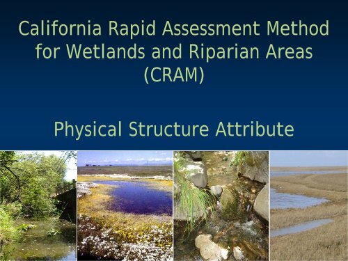
California Rapid Assessment Methodfor Wetlands and Riparian Areas(CRAM)Physical Structure Attribute
Physical Structure Attribute• Considers complexity of form andstructure affecting biodiversity and otherwetland functions• Two metrics:• <strong>Structural</strong> patch richness• Topographic complexity
Physical Structure• Spatial organization of living and nonlivingsurfaces that provide habitat (Maddock1999, Frissell et al. 1986)• Physical conditions indicate capacity of awetland to support flora and fauna
Metric 1: <strong>Structural</strong> <strong>Patch</strong> <strong>Richness</strong>• <strong>Richness</strong> of structural surfaces and features reflectsdiversity of physical processes:• Energy dissipation• Water storage• Groundwater exchange• Flood attenuation• Filtering of pollutants
<strong>Structural</strong> <strong>Patch</strong> <strong>Richness</strong>• Physical complexity promotes ecological complexity adincreases:• Ecological functions• Beneficial uses• Overall condition
<strong>Structural</strong> <strong>Patch</strong> <strong>Richness</strong>• For each wetland type:• Visible patches ofphysical structure• May occur alonghydrologic/moisturegradients• Not all patches areexpected to occur in allwetlands
<strong>Structural</strong> <strong>Patch</strong> <strong>Richness</strong>In-channel barPool inchannelBoulder inchannelRiffle
<strong>Structural</strong> <strong>Patch</strong> <strong>Richness</strong>Variegated ShoreDebris JamUndercut bankHummocks
<strong>Structural</strong> <strong>Patch</strong> <strong>Richness</strong>Soil Cracks
<strong>Structural</strong> <strong>Patch</strong> <strong>Richness</strong>Submerged vegetation
<strong>Structural</strong> <strong>Patch</strong> <strong>Richness</strong>Algal mats
<strong>Structural</strong> <strong>Patch</strong> <strong>Richness</strong>Plant Hummocks
<strong>Structural</strong> <strong>Patch</strong> <strong>Richness</strong>Animal burrows
<strong>Structural</strong> <strong>Patch</strong> <strong>Richness</strong>Secondary ChannelsPannes or pools on floodplainDebris jamShellfish beds
<strong>Structural</strong> <strong>Patch</strong> <strong>Richness</strong>Abundant wrack
<strong>Structural</strong> <strong>Patch</strong> <strong>Richness</strong>Standing snag
Metric 2: Topographic Complexity• Physical, abiotic features and elevation gradients• Micro- and macro-topographic relief
Topographic Complexity• Promotes variable hydroperiods and simultaneous moisturegradients• Promotes ecological complexity• Increases spatial and temporal variability in:• Energy dissipation• surface water storage• groundwater recharge• particulate matter detention• cycling of elements and compounds• habitat dynamics
Indicators of Topographic Complexity
Depressional Topographic Complexity
Topographic ComplexityModerate
Topographic ComplexityLow
Topographic ComplexityMinimal
Estuarine Topographic Complexity
Topographic ComplexityABCD
Riverine Topographic Complexity
Macro-topographic indicators2112Two Benches
Micro-topographic indicatorsPools, pits, bars,debris jamsCobble, bankslumps, tree fallholes
Topographic Complexity11
Topographic Complexity
Thank You


