


You also want an ePaper? Increase the reach of your titles
YUMPU automatically turns print PDFs into web optimized ePapers that Google loves.
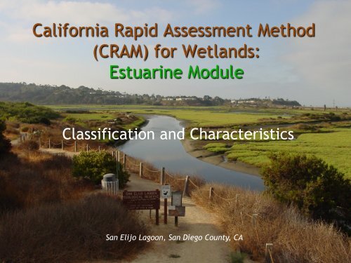
California Rapid Assessment Method<br />
(<strong>CRAM</strong>) for Wetlands:<br />
<strong>Estuarine</strong> <strong>Module</strong><br />
Classification and Characteristics<br />
San Elijo Lagoon, San Diego County, CA
Estuaries<br />
• Terminology<br />
• Tides<br />
• Zonation<br />
• Approaches to Classification<br />
– Geoforms; Ferren et al. (1996)<br />
– <strong>Estuarine</strong> Inventory<br />
– Bar-built Estuaries<br />
– Plant Species, Competition, Physical Stress (Salinity)<br />
– Classification on Natural Closure Patterns:<br />
Templates for Restoration and Management<br />
• Jacobs et al. (2011); SCCWRP TR 619a Revised
Riverine…<br />
No<br />
Is hydrology<br />
fully or partially<br />
tidal for at least<br />
1 month during<br />
most years?<br />
Yes<br />
Flow-through system<br />
with channelized flow<br />
between distinct inlet<br />
and outlet?<br />
No<br />
Yes<br />
Depressional, Playa, Slope,<br />
Lacustrine, Vernal Pool<br />
Identify Wetland Type<br />
Evidence of<br />
strong<br />
freshwater<br />
influence?<br />
Saline<br />
<strong>Estuarine</strong><br />
No<br />
No<br />
Marine<br />
not appropriate for<br />
<strong>CRAM</strong><br />
Yes Is hydrology<br />
<strong>Estuarine</strong><br />
tidal at least 11<br />
months most<br />
years?<br />
Foreshore and<br />
channel banks<br />
dominated by salttolerant<br />
plants?<br />
Yes<br />
Yes<br />
No<br />
Seasonal<br />
<strong>Estuarine</strong><br />
Non-saline<br />
<strong>Estuarine</strong><br />
Field Book Page 4
Seasonal or Non-Saline<br />
<strong>Estuarine</strong>
Wetlands Portal Habitat<br />
Definitions<br />
• <strong>Estuarine</strong>—open water<br />
– The area of open water that is apparent during an average low<br />
tide<br />
– The open water area includes the pannes and ponds on the<br />
vegetated marsh plain. Open water and non-vegetated areas<br />
have less than 5% absolute cover of vegetation.<br />
• <strong>Estuarine</strong>—mudflat<br />
– The area lacking vegetation that exists below the marsh plain<br />
that is exposed during the average low tide<br />
• <strong>Estuarine</strong>—submerged aquatic vegetation<br />
– Some estuarine wetlands have submerged aquatic vegetation,<br />
such as eel grass, that is partially exposed during the average<br />
low tide.<br />
• <strong>Estuarine</strong>—marsh<br />
– The vegetated marsh plain that is above the average high tide
High Marsh<br />
30-70cm range<br />
Sal sub<br />
Consideration of: Elevation / Landscape Position / Species<br />
Zedler et al. (1999) Ecosystems 2:1: 19-35<br />
Marsh Plain<br />
30cm range<br />
Sal pac + 8 other spp.<br />
Cordgrass Habitat<br />
Spa fol
• Diurnal –<br />
– 1 high, 1 low per 24<br />
hrs<br />
• Semidiurnal –<br />
– two highs, two lows<br />
per 24 hrs (equal)<br />
• Mixed Semidiurnal –<br />
– two highs, two lows<br />
per 24 hrs (nonequal)<br />
Tides<br />
“Latency” = delay with respect to time; natural situation due to location<br />
within estuary.
Newport Bay Entrance<br />
Corona del Mar, CA<br />
• 2010-10-18 4:50 AM PDT 1.86 feet Low Tide<br />
• 2010-10-18 11:14 AM PDT 6.37 feet High Tide<br />
• 2010-10-18 6:30 PM PDT -0.53 feet Low Tide<br />
• 2010-10-19 1:02 AM PDT 3.82 feet High Tide<br />
• http://www.mobilegeographics.com:81/locations/4149.html
Santa Ana River Entrance<br />
Newport Beach, CA<br />
• 2010-10-18 6:46 AM PDT 0.39 feet Low Tide<br />
• 2010-10-18 11:41 AM PDT 3.49 feet High Tide<br />
• 2010-10-18 8:22 PM PDT -0.10 feet Low Tide<br />
• 2010-10-19 1:33 AM PDT 2.13 feet High Tide<br />
• http://www.mobilegeographics.com:81/locations/5605.html
<strong>Estuarine</strong> Classification:<br />
Geoforms – Types of Estuaries<br />
• Riverine<br />
– River Mouth Estuary, Drowned River Valley (Coastal Plain Estuary),<br />
Canyon Mouth Estuary, Deltaic Estuary, Salt Wedge Estuary, Tidal<br />
Freshwater Marsh<br />
• Lagoon<br />
– Coastal Lagoon, Slough, Barrier Island Estuary, Bar-built Estuary, Tidal<br />
Inlet<br />
• Embayment<br />
– Open embayment<br />
– Enclosed bay<br />
• Structural Basin Estuaries<br />
– Tectonic activity; Carpinteria Salt Marsh<br />
• Artificial Drain Estuaries<br />
• Fjord<br />
– New Zealand, Norway, Alaska; none in California
Inventory of California’s Estuaries<br />
Geoform Tidal<br />
Connection<br />
No. of Systems<br />
Enclosed Bay Perennial 30<br />
Lagoons Perennial 15<br />
Intermittent 33<br />
Ephemeral 46<br />
River Mouth Perennial 11<br />
Intermittent 270<br />
Total 405
Perennially<br />
Tidal<br />
Ephemeral Tidal (Only open<br />
during extreme storm events)<br />
Intermi/ent Tidal (open 2<br />
weeks-‐ 11 months per year)<br />
Non-‐Bdal (Not known to open)
<strong>Estuarine</strong> Classification<br />
(M. Sutula, SCCWRP)<br />
Geoform Tidal Regime<br />
Enclosed Bay Perennial<br />
Lagoon Perennial<br />
Intermittent<br />
Ephemeral<br />
Permanently closed<br />
River mouth Perennial<br />
Intermittent<br />
Geoform and
<strong>Estuarine</strong> Conceptual Classification<br />
Geoform Surface Water Tidal<br />
Connection<br />
Enclosed<br />
Bays<br />
Lagoons TOTAL<br />
Perennial 29<br />
Perennial<br />
Intermittent/seasonal<br />
Ephemeral<br />
River mouth TOTAL<br />
Permanently closed<br />
Perennial<br />
Intermittent/seasonal<br />
large (>20 m)<br />
small (
California Estuaries/Salt Marshes<br />
• In 2007, a rapid assessment was conducted on a<br />
probability-based sample of the State’s approximately<br />
44,456 acres of perennially tidal salt marshes.<br />
Following are a few of the important findings of this<br />
study:<br />
– 85% of the State’s salt marshes were in good to very good<br />
health; 35% of salt marsh acreage had scores reflecting very<br />
good hydrology and marsh plant community structure; 65% was<br />
found to have large, intact buffers.<br />
– 50 % of acreage scored in the fair to poor category with respect<br />
to their physical structure.<br />
– Salt marsh health generally declined from Northern to Southern<br />
California, consistent with a trend in increasing urbanization<br />
from north to south.<br />
– Dikes and levees were among the most frequent and most<br />
severe physical stressors identified statewide.
Slides adapted from:<br />
Ross Clark & Kevin O’Connor<br />
H20 Conference 2012
Just when you have it all figured out…<br />
• Altered Conditions<br />
– Dikes, levees change<br />
hydrology<br />
– Reduced extent of<br />
tidal action<br />
– Adjacent runoff vs.<br />
tidal influence<br />
– Urban context<br />
– Invasive plants<br />
– Novel habitats


