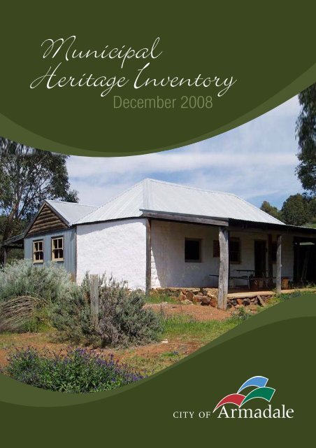
Municipal Heritage Inventory 2008 (PDF 17.5 MB) - City of Armadale
Municipal Heritage Inventory 2008 (PDF 17.5 MB) - City of Armadale
Municipal Heritage Inventory 2008 (PDF 17.5 MB) - City of Armadale

Create successful ePaper yourself
Turn your PDF publications into a flip-book with our unique Google optimized e-Paper software.
2 Andreas Jacobsson and Paul Davidssonflexibility. While allowing themselves to maintain their business independence,SMEs are able to reach otherwise unreachable markets and to take advantage <strong>of</strong>economies <strong>of</strong> scale with the support <strong>of</strong> ICT [5]. After having deployed the Plug andPlay Business s<strong>of</strong>tware, companies are connected to a networked community whereall participants share one common goal; namely to increase business. In that way, thepurpose <strong>of</strong> Plug and Play Business is to stimulate the realization <strong>of</strong> innovationswithout interfering with the individual goals <strong>of</strong> the Plug and Play Businesscompanies. Together with the autonomy, heterogeneity, and possibly conflictinggoals <strong>of</strong> the involved parties <strong>of</strong> a Plug and Play Business community, this requiresICT-solutions that are able to handle dynamically evolving and distributed businesspartnerships and processes that cross the borders <strong>of</strong> various enterprises. Thus, theinteroperability between the information systems <strong>of</strong> the involved enterprises belongsto the technological core <strong>of</strong> the concept <strong>of</strong> Plug and Play Business.This paper partially builds on previous work [10] in which we have made a pro<strong>of</strong><strong>of</strong> concept with regards to interorganizational interoperability <strong>of</strong> enterprise systems.In Carlsson et al. [6], we analyzed the security risks related to such collaboration. Inthis paper, we first describe the concept <strong>of</strong> Plug and Play Business and identify therequirements <strong>of</strong> the supporting s<strong>of</strong>tware. Then we provide a formal model <strong>of</strong> Plugand Play Business, including crucial aspects such as virtual enterprise formation andcollaboration. The lack <strong>of</strong> appropriate theoretic definitions and formal models hasbeen argued to be one <strong>of</strong> the main weaknesses in the area <strong>of</strong> virtual enterprises [2,3].We also review current state <strong>of</strong> the art and identify useful technologies for theimplementation <strong>of</strong> Plug and Play Business s<strong>of</strong>tware. We conclude with somesuggestions for future work. However, we begin by describing the concept <strong>of</strong> Plugand Play Business, its functional requirements, and by exploring its qualityattributes.2 The Concept and Requirements <strong>of</strong> Plug and Play BusinessCentral to Plug and Play Business is the concept <strong>of</strong> virtual enterprises (VE), or moregenerally collaborative networks [2]. A VE is a temporary alliance <strong>of</strong> enterprises thatcome together to share skills or core competencies and resources in order to betterrespond to business opportunities, and whose cooperation is supported by computernetworks [2,4]. Other important concepts for implementing Plug and Play Businessare:• Internet communities: Enterprises dynamically join a Plug and Play Businesscommunity by installing and running the Plug and Play Business s<strong>of</strong>tware and bydescribing and validating the resources <strong>of</strong> the enterprise, e.g., production capacity,distribution network, intellectual capital, etc. The community is dynamic in thesense that enterprises may (in principle) join and leave the community at any time.However, there may be a need for a specific gate-keeper that enhances security byregulating the entering and leaving <strong>of</strong> the community, thus making it a semi-openartificial society [8].• Roles: Each member <strong>of</strong> the Plug and Play Business community plays one or moreroles, e.g., innovator, supplier/provider (<strong>of</strong> goods, services, expertise, etc.),distributor, marketer, financier, seller, etc. The choice <strong>of</strong> role depends on the
<strong>City</strong> <strong>of</strong> <strong>Armadale</strong><strong>Municipal</strong> <strong>Heritage</strong> <strong>Inventory</strong> Review - <strong>2008</strong>Introduction2
<strong>City</strong> <strong>of</strong> <strong>Armadale</strong><strong>Municipal</strong> <strong>Heritage</strong> <strong>Inventory</strong> Review - <strong>2008</strong>IntroductionIntroductionWhat is a <strong>Municipal</strong> <strong>Heritage</strong> <strong>Inventory</strong>?A <strong>Municipal</strong> <strong>Heritage</strong> <strong>Inventory</strong> is a survey <strong>of</strong> heritage places in the <strong>City</strong> <strong>of</strong> <strong>Armadale</strong>. <strong>Heritage</strong>Inventories can assist local governments to determine local conservation policies and provideinformation about local heritage that may be required under a local Town Planning Scheme.Why do we have a <strong>Municipal</strong> <strong>Heritage</strong> <strong>Inventory</strong>?The <strong>Heritage</strong> <strong>of</strong> Western Australia Act 1990 requires all local government authorities in WesternAustralia to compile, and periodically update and review, a <strong>Municipal</strong> <strong>Heritage</strong> <strong>Inventory</strong>.The <strong>City</strong> <strong>of</strong> <strong>Armadale</strong> responded positively to the Act, and by 1995 had compiled the <strong>City</strong> <strong>of</strong> <strong>Armadale</strong><strong>Municipal</strong> <strong>Heritage</strong> <strong>Inventory</strong>. The <strong>Inventory</strong> was prepared by O’Brien Planning Consultants, inconsultation with the <strong>Heritage</strong> Council <strong>of</strong> Western Australia as well as the Community LiaisonCommittee established to participate in the process. In 2005, in accordance with the Act, the <strong>City</strong> <strong>of</strong><strong>Armadale</strong> appointed heritage consultants Palassis Architects to work with the <strong>City</strong> to review andupdate the <strong>Inventory</strong>. The <strong>Armadale</strong> Redevelopment Authority also prepared a Cultural <strong>Heritage</strong>Strategy in 2005 for <strong>Heritage</strong> Places located within areas under the jurisdiction <strong>of</strong> the <strong>Armadale</strong>Redevelopment Authority.The relevant Section (45) <strong>of</strong> the <strong>Heritage</strong> <strong>of</strong> Western Australia Act 1990 states that:1) A local government shall compile and maintain an inventory <strong>of</strong> buildings within its districtwhich in its opinion are, or may become, <strong>of</strong> cultural heritage significance.2) The inventory required by Subsection (1) shall be compiled no later than 4 years from thecommencement <strong>of</strong> this Act and shall be (a) updated annually; and (b) reviewed every 4 yearsafter compilation.3) A local government shall provide the [<strong>Heritage</strong>] Council with a copy <strong>of</strong> the <strong>Inventory</strong>compiled pursuant to this section.4) A local government shall ensure that the inventory required by this section is compiled withproper public consultation.What is the function <strong>of</strong> the Community <strong>Heritage</strong> Advisory Committee (CHAC)?The Community <strong>Heritage</strong> Advisory Committee is an external committee <strong>of</strong> the <strong>City</strong> <strong>of</strong> <strong>Armadale</strong>. Itconsists <strong>of</strong> two <strong>City</strong> councillors, two Officers <strong>of</strong> the Planning Department <strong>of</strong> the <strong>City</strong> <strong>of</strong> <strong>Armadale</strong>, andappointed community representatives, who provide advice to the Council such as:• Updating and revising the <strong>Municipal</strong> <strong>Heritage</strong> <strong>Inventory</strong>;• Examining and assessing properties on the supplementary lists and other suitable propertiesfor possible inclusion in the <strong>Municipal</strong> <strong>Heritage</strong> <strong>Inventory</strong>;• Preparing further documentation to seek listing on the State Register <strong>of</strong> <strong>Heritage</strong> Places forappropriate properties on the <strong>Municipal</strong> <strong>Heritage</strong> <strong>Inventory</strong> which are Management Category‘A’ (highest level <strong>of</strong> protection appropriate); and,• Making submissions to Council on appropriate measures to preserve and protect the heritage<strong>of</strong> the <strong>Armadale</strong> <strong>Municipal</strong>ity, including the education <strong>of</strong> owners and the communitygenerally on heritage conservation, and the designation <strong>of</strong> other heritage precincts whereappropriate.The CHAC has provided invaluable assistance in the review <strong>of</strong> the <strong>Municipal</strong> <strong>Inventory</strong>.What is <strong>Heritage</strong>?The nature <strong>of</strong> heritage <strong>of</strong>ten confuses people, as the word ‘heritage’ has a number <strong>of</strong> meanings.Generally heritage can be defined as:Aspects <strong>of</strong> our past that we value - a site which has played an important part in our history, andbuildings or places which are special because <strong>of</strong> their aesthetic, historic, scientific or socialsignificance – things which we would like future generations to enjoy.3
<strong>City</strong> <strong>of</strong> <strong>Armadale</strong><strong>Municipal</strong> <strong>Heritage</strong> <strong>Inventory</strong> Review - <strong>2008</strong>IntroductionAboriginal <strong>Heritage</strong>The <strong>Municipal</strong> <strong>Heritage</strong> <strong>Inventory</strong> process focuses on events and developments in Western Australianhistory since the arrival <strong>of</strong> European settlers. Whilst this study does provide an overview <strong>of</strong> the cultureand way <strong>of</strong> life <strong>of</strong> the original inhabitants <strong>of</strong> what is now the <strong>City</strong> <strong>of</strong> <strong>Armadale</strong>, it does not attempt torecord the legacy <strong>of</strong> Aboriginal occupation prior to the European settlement <strong>of</strong> the <strong>City</strong>.The oversight <strong>of</strong> the Department <strong>of</strong> Indigenous Affairs and the application <strong>of</strong> the Aboriginal <strong>Heritage</strong>Act 1972 will ensure that significant aspects <strong>of</strong> Aboriginal history and culture, relating to the periodbefore European settlement, are recorded and preserved.The MHI Review does not include indigenous heritage sites as these are administered under separatelegislation and require both specialist archaeological and anthropological skills and cultural sensitivitywhich may preclude the disclosure <strong>of</strong> information to the public.In this study, the overlap between the European settlers and the Aboriginal people in the district will benoted where information is available.ConsultationThe <strong>City</strong> <strong>of</strong> <strong>Armadale</strong> wants its <strong>Municipal</strong> <strong>Heritage</strong> <strong>Inventory</strong> to reflect the views <strong>of</strong> the localcommunity. Public comment is therefore sought throughout the review process so that places <strong>of</strong> valueto the community are included in the <strong>Inventory</strong>.The compilation <strong>of</strong> the <strong>Municipal</strong> <strong>Heritage</strong> <strong>Inventory</strong> is a dynamic process. This edition lays thegroundwork for the ongoing process <strong>of</strong> reviewing and updating the <strong>Inventory</strong> regularly.How do we look after our heritage?The <strong>Heritage</strong> <strong>of</strong> Western Australia Act 1990 does not give any further guidance to Local GovernmentAuthorities as to the management <strong>of</strong> heritage places. However the <strong>Heritage</strong> Council <strong>of</strong> WesternAustralia and the Western Australian <strong>Municipal</strong> Association jointly published a <strong>Heritage</strong> Manual forLocal Government in 1998.In 2002, the Minister for <strong>Heritage</strong> established a <strong>Heritage</strong> Working Party to review possibleimprovements in local heritage protection. The working party recommended changes to the <strong>Heritage</strong>Act, which would include a name change from ‘Local Government <strong>Heritage</strong> <strong>Inventory</strong>’ to ‘Local<strong>Heritage</strong> Survey’. It also recommended that there be a greater commonality <strong>of</strong> standards <strong>of</strong> protectionin local planning schemes.Local governments are responsible for reviewing their town planning schemes and formulating theirown policies to ensure that their valuable heritage assets are conserved for future generations. The <strong>City</strong><strong>of</strong> <strong>Armadale</strong> has provisions within its Town Planning Scheme No.4, which require the heritage values<strong>of</strong> places listed in the MHI to be taken into consideration when new development is proposed. The<strong>City</strong>’s <strong>Heritage</strong> Management Policy PLN 3.8 supplements the provisions <strong>of</strong> the scheme and applies toplaces listed on the <strong>City</strong>’s <strong>Municipal</strong> <strong>Heritage</strong> <strong>Inventory</strong> with a Management Category <strong>of</strong> A+, A and B.The policy may be applied to places listed on the MHI with a Management Category <strong>of</strong> C. Theobjectives <strong>of</strong> the policy are to increase public awareness <strong>of</strong>f the MHI; encourage landowners to addressheritage values <strong>of</strong> places entered in the MHI in their planning for the place; to provide incentives toameliorate the costs <strong>of</strong> heritage retention; and to ensure that due consideration is given to the heritagevalues <strong>of</strong> places entered in the MHI in the planning approvals process.Entry <strong>of</strong> a property into this <strong>Municipal</strong> <strong>Inventory</strong> is recognition <strong>of</strong> the property’s heritage significanceto the community. There is also a requirement for the <strong>Inventory</strong> to be forwarded to the <strong>Heritage</strong>Council <strong>of</strong> Western Australia for public information.What are Management Categories?Management categories recognise the varying degrees <strong>of</strong> importance and intactness <strong>of</strong> heritage places.For example, some places are more important to the community than others. Some buildings havebeen lost over time and only the site remains. Management categories reflect, therefore, the diversity<strong>of</strong> heritage places. As such, they provide guidance to the <strong>City</strong> as to the importance <strong>of</strong> the place andmake recommendations for the level <strong>of</strong> care that should be taken <strong>of</strong> the place.4
<strong>City</strong> <strong>of</strong> <strong>Armadale</strong><strong>Municipal</strong> <strong>Heritage</strong> <strong>Inventory</strong> Review - <strong>2008</strong>IntroductionThe current task <strong>of</strong> reviewing the <strong>Inventory</strong> includes assigning management categories to the identifiedheritage places within the <strong>City</strong> <strong>of</strong> <strong>Armadale</strong>, in accordance with the <strong>Heritage</strong> Council <strong>of</strong> WesternAustralia’s Guidelines for the Compilation <strong>of</strong> <strong>Municipal</strong> Inventories, 1993.The management categories assigned in this <strong>Inventory</strong> are recommendations only.Category A+Already recognised at the highest level – the State Register <strong>of</strong> <strong>Heritage</strong> Places.Development requires consultation with both the <strong>Heritage</strong> Council <strong>of</strong> Western Australiaand the local government authority. Maximum encouragement to the owner should beprovided under the <strong>City</strong> <strong>of</strong> <strong>Armadale</strong>’s Town Planning Scheme to conserve thesignificance <strong>of</strong> the place. Incentives to promote heritage conservation should also beconsidered.Category AWorthy <strong>of</strong> the highest level <strong>of</strong> protection – recommended for entry into the State Register<strong>of</strong> <strong>Heritage</strong> Places.Development would require consultation with the <strong>City</strong> <strong>of</strong> <strong>Armadale</strong>. Maximumencouragement to the owner should be provided under the <strong>City</strong> <strong>of</strong> <strong>Armadale</strong>’s TownPlanning Scheme to conserve the significance <strong>of</strong> the place. A <strong>Heritage</strong> Assessment* andImpact Statement should be undertaken before approval is given for any majorredevelopment. Incentives to promote heritage conservation should also be considered.Category BWorthy <strong>of</strong> a high level <strong>of</strong> protection. Maximum encouragement to the owner should beprovided under the <strong>City</strong> <strong>of</strong> <strong>Armadale</strong>’s Town Planning Scheme to conserve thesignificance <strong>of</strong> the place. A <strong>Heritage</strong> Assessment* and Impact Statement should beundertaken before approval is given for any major redevelopment. Incentives to promoteheritage conservation should also be considered.Category CRetain and Conserve if possible. Endeavour to conserve the significance <strong>of</strong> the placethrough the provisions <strong>of</strong> the Town Planning Scheme.A <strong>Heritage</strong> Assessment* and Impact Statement may be required before approval is givenfor any major redevelopment or demolition. If necessary, record the placephotographically prior to demolition.Category DSignificant, but not essential to an understanding <strong>of</strong> the history <strong>of</strong> the district. Record theplace photographically prior to any major redevelopment or demolition.Category EHistoric site with little or no built features – Recognise, for example, with a plaque, placename, or acknowledge in new urban or architectural design.* Note: The term <strong>Heritage</strong> Assessment , referred to in Category A, B and C, is defined as:A brief, independent evaluation by a heritage architect or heritage consultant. It is not to be confusedwith a <strong>Heritage</strong> Council <strong>Heritage</strong> Assessment or a Conservation Plan, which are more extensive,detailed and costly documents.What is the Thematic Framework and Historical Overview?The Thematic Framework and Historical Overview outlines the history <strong>of</strong> the <strong>City</strong> <strong>of</strong> <strong>Armadale</strong>. The<strong>City</strong> <strong>of</strong> <strong>Armadale</strong> has a unique place in the history <strong>of</strong> Western Australia, as the site <strong>of</strong> some <strong>of</strong> theearliest land grants in the Swan River Colony, as well as the place where mineral exploration started inWestern Australia. In the Colonial period, <strong>Armadale</strong> became the first staging post from Perth for themail cart to Albany, and a number <strong>of</strong> industries developed such as timber milling, mechanised brickmakingand agriculture - with the beginnings <strong>of</strong> a supply industry <strong>of</strong> fruit and vegetables that wouldcontinue until the present day. In the 20 th century, the Hills Water Scheme characterised the5
<strong>City</strong> <strong>of</strong> <strong>Armadale</strong><strong>Municipal</strong> <strong>Heritage</strong> <strong>Inventory</strong> Review - <strong>2008</strong>Introductionexploitation <strong>of</strong> the natural resources in the area, with the establishment <strong>of</strong> the Churchman Brook Dam,the Canning Dam and the Wungong Dam, aimed at addressing chronic water shortages in themetropolitan area. The opportunities created by the hilly bushland and clay soils have continued toassist the development <strong>of</strong> the <strong>City</strong> <strong>of</strong> <strong>Armadale</strong>, with the expansion <strong>of</strong> agriculture, viticulture and thegrowth <strong>of</strong> a tourism industry. During the second half <strong>of</strong> the twentieth century the <strong>Armadale</strong> districtgrew strongly with residential and commercial developments accompanied by a growth in communityinfrastructure. Today the <strong>City</strong> <strong>of</strong> <strong>Armadale</strong> is recognised as a diverse and vibrant community with arich cultural heritage.The historical narrative <strong>of</strong> the <strong>City</strong> <strong>of</strong> <strong>Armadale</strong> has been divided into time periods, which correspondto important developments in the district as outlined below. Important historic themes have beenhighlighted at the beginning <strong>of</strong> each section.Early Colonial Period: 1830-1850Exploration and Settlement- Establishment <strong>of</strong> Kelmscott– Development <strong>of</strong> Agriculture- EarlyMineral Exploration and MiningLate Colonial Period: 1850-1885Convicts Arrive- Construction <strong>of</strong> the Perth to Albany Road – Establishment <strong>of</strong> the NarroginInne- Development <strong>of</strong> a Timber Industry- Further Expansion <strong>of</strong> AgricultureA Period <strong>of</strong> Diversification and Consolidation: 1886-1914Continued Growth <strong>of</strong> the Timber Industry - Construction <strong>of</strong> the Perth to <strong>Armadale</strong> Railway –Expansion <strong>of</strong> Settlement in the Area- Further Expansion <strong>of</strong> Agriculture- Improvements inTransport and Communications- Establishment <strong>of</strong> Community and Religious OrganizationsA Period <strong>of</strong> Relative Prosperity: 1915-1939Improved Transport and Communications – Local Contribution to the War Effort – EconomicDepression and Recovery – Development <strong>of</strong> Araluen by the Y.A.L.- Establishment <strong>of</strong> Communityand OrganizationsThe Second World War and Post-War Expansion: 1940-1960Improved Transport and Communications – Local Contribution to the War Effort – Settlement<strong>of</strong> Migrants in the District – State Brickworks Commences Operation1961-2005Development <strong>of</strong> the District Within the Framework <strong>of</strong> the Metropolitan Region Scheme –Planned Population Growth – Retention <strong>of</strong> Rural Buffer Zones – Building CommunityInfrastructure – State Purchases ‘Araluen’ – Establishment <strong>of</strong> the <strong>Armadale</strong> RedevelopmentAuthorityWhat are the Place Record Forms?Place Record Forms have been compiled for each <strong>of</strong> the places in the <strong>Inventory</strong>. The place record formcontains the following information (if available) about each place:Name – current and other namesLGA Place No. – previous (1995 MHI) place number and newly assigned (2006 MHI) place numberPhotograph – additional photographs (if any) are included at the end <strong>of</strong> the record formLocation – Lot number, street address and suburbLand Title Information – to be completed by the <strong>City</strong>Site Access – note: private properties are not accessible to the publicDescription – architectural style, materials and date <strong>of</strong> constructionUse – past and present usesDescription Notes – brief physical description, including assessment <strong>of</strong> condition, integrity andauthenticity6
<strong>City</strong> <strong>of</strong> <strong>Armadale</strong><strong>Municipal</strong> <strong>Heritage</strong> <strong>Inventory</strong> Review - <strong>2008</strong>IntroductionHistorical Notes – notes on the history <strong>of</strong> the placeSignificance – a brief statement <strong>of</strong> the cultural heritage significance <strong>of</strong> the placeManagement – recommended Management CategoryAssociation – any associations with people <strong>of</strong> historical note<strong>Heritage</strong> Listing – any State or national heritage listingIn some cases, reliable information about a place is limited. If further information becomes available,it should be incorporated in future updates and reviews.How do you find a place in this report?The place record forms are in sequential numerical order with sequential page numbering.To assist the reader in locating a place record form for a particular place in the <strong>Inventory</strong>, there are sixindexes, as follows:1) Place Number IndexThe places are listed by place number in numerical order2) Former Place Number IndexThe places are listed according to the place number assigned to them (if any) in the 1995 MHI3) Place Name IndexThe places are listed by place name in alphabetical order4) Street IndexThe places are listed by street name in alphabetical order5) Suburb IndexThe places are listed according to suburb name in alphabetical order6) Management Category IndexThe places are listed according to recommended management category in numerical order7
<strong>City</strong> <strong>of</strong> <strong>Armadale</strong><strong>Municipal</strong> <strong>Heritage</strong> <strong>Inventory</strong> Review - <strong>2008</strong>Introduction8
<strong>City</strong> <strong>of</strong> <strong>Armadale</strong><strong>Municipal</strong> <strong>Heritage</strong> <strong>Inventory</strong> Review - <strong>2008</strong>MethodologyMethodologyThe BriefThe <strong>City</strong> <strong>of</strong> <strong>Armadale</strong> engaged Palassis Architects to carry out a review <strong>of</strong> the existing <strong>Municipal</strong><strong>Heritage</strong> <strong>Inventory</strong> (February 1995, by O’Brien Planning Consultants) in 2005. This involved a review<strong>of</strong> all the places currently on the <strong>Inventory</strong>, as well as those forming the Supplementary Lists, whichhad been collated by the Community <strong>Heritage</strong> Advisory Committee (CHAC).Study AreaThe area <strong>of</strong> the MHI Review is the entire <strong>Armadale</strong> <strong>Municipal</strong>ity, excluding the areas under theplanning jurisdiction <strong>of</strong> the <strong>Armadale</strong> Redevelopment Authority (ARA), which are subject to a separatestudy conducted during 2004. The Thematic Framework and Historical Overview do, however, referto places in the <strong>City</strong> <strong>of</strong> <strong>Armadale</strong> and the ARA area.In the course <strong>of</strong> reviewing the existing MHI, as well as the various supplementary lists supplied by theCHAC, Palassis Architects visited a number <strong>of</strong> places located in the ARA area. Some <strong>of</strong> these places,such as those in Brookdale (which has only recently come under the ARA), have been referred by the<strong>City</strong> <strong>of</strong> <strong>Armadale</strong> to the <strong>Armadale</strong> Redevelopment Authority for incorporation into an update <strong>of</strong> theirCultural <strong>Heritage</strong> Strategy.Review StrategyThe review <strong>of</strong> the <strong>City</strong> <strong>of</strong> <strong>Armadale</strong>’s <strong>Municipal</strong> <strong>Heritage</strong> <strong>Inventory</strong> has been undertaken in accordancewith the guidelines for the Review <strong>of</strong> <strong>Municipal</strong> <strong>Heritage</strong> Inventories prepared by the <strong>Heritage</strong> Council<strong>of</strong> Western Australia, and the conservation philosophy <strong>of</strong> the Australian ICOMOS Burra Charter,1999.Palassis Architects have reviewed both the format and structure <strong>of</strong> the <strong>City</strong> <strong>of</strong> <strong>Armadale</strong>’s <strong>Municipal</strong><strong>Heritage</strong> <strong>Inventory</strong>, analysing the effectiveness and economy <strong>of</strong> the report layout, as well as the ability<strong>of</strong> users to ‘navigate’ through the document and apply its information for decision-making.The MHI assessment criteria has been reviewed to ensure that the grading system accurately reflectsthe cultural heritage value <strong>of</strong> the listed places, and that the criteria are easily understood by a widerange <strong>of</strong> heritage users.The Management Categories <strong>of</strong> heritage-listed places have been reviewed to ensure that theydemonstrate an understanding <strong>of</strong> the needs <strong>of</strong> property owners and the community as a whole. Thereview has also made some recommendations (refer to Outcomes & Recommendations) to ensure thatthe actions outlined by the different Categories are reflected in the legislative and decision-makingprocesses <strong>of</strong> the <strong>City</strong> council, including the Town Planning Scheme provisions, Redevelopmentschemes, and any design guidelines or planning policies.The information content <strong>of</strong> the MHI has been reviewed entirely, with an emphasis on consolidatingexisting information, checking its accuracy, updating place record forms with any new information,and ensuring this information is easily accessible by way <strong>of</strong> new index systems.Consultation StrategyTo ensure a successful and positive outcome for the 2006 <strong>Municipal</strong> <strong>Heritage</strong> <strong>Inventory</strong>,comprehensive public consultation and liaison with the <strong>City</strong> <strong>of</strong> <strong>Armadale</strong> and the Community <strong>Heritage</strong>Advisory Committee has been undertaken during the Review.In the first instance, stakeholders and property owners were notified <strong>of</strong> the review and invited to makenominations or comment. Advertisements requesting nominations were placed in local newspapersand submissions were received by the <strong>City</strong> <strong>of</strong> <strong>Armadale</strong> from a range <strong>of</strong> interested communitymembers and government agencies. These public nominations complemented those places previouslynominated by the CHAC (documented on the Supplementary lists) and became the basis <strong>of</strong> the 2006MHI Review.The CHAC has also been involved in a consultative role in the preparation <strong>of</strong> the draft MHI, providingclarification and additional information about nominated places where possible, and reviewing the draftThematic Framework & Historical Overview.9
<strong>City</strong> <strong>of</strong> <strong>Armadale</strong><strong>Municipal</strong> <strong>Heritage</strong> <strong>Inventory</strong> Review - <strong>2008</strong>MethodologyThe public submissions period also involved an iterative process with CHAC, Council and landownerswho responded to invitations for on-site visits and/or submission <strong>of</strong> additional information in support<strong>of</strong> changes to the entries.Assessment <strong>of</strong> Newly Nominated PlacesAs well as reviewing the existing places included in the <strong>City</strong> <strong>of</strong> <strong>Armadale</strong>’s 1995 MHI, PalassisArchitects carried out preliminary heritage assessments <strong>of</strong> any newly nominated places, including the148 places on the CHAC’s Supplementary Lists. The assessment process was carried out inaccordance with the guidelines recommended by the <strong>Heritage</strong> Council <strong>of</strong> Western Australia, with theaim <strong>of</strong> determining what places were worthy <strong>of</strong> inclusion on the MHI. The following table details all<strong>of</strong> the places reviewed as part <strong>of</strong> this process and included in the 2006 MHI Review:Dale Cottages (fmr) Lot 55 John St and Deerness Way <strong>Armadale</strong>Dale Lodge No. 107 Railway Avenue <strong>Armadale</strong>Erriton Lodge 208 (Lot 14) Seventh Rd <strong>Armadale</strong>Gwynne Park Forrest Rd <strong>Armadale</strong>Moreton Bay Fig Tree 405 Railway Ave <strong>Armadale</strong>Muckross Tearooms 10 South West Hwy <strong>Armadale</strong>Narrogin Inne 2 South West Hwy <strong>Armadale</strong>Nurse McKimmie-Scott’sResidence1 Little John Rd <strong>Armadale</strong>Oaklands Old Homestead 10 (Lot 68) Benjamin St <strong>Armadale</strong>Pioneer Village & Quarry Lot 100 Albany Hwy <strong>Armadale</strong>William Alderson’s Residence 27A Lensham Place <strong>Armadale</strong>Wirra Willa Gardens 3258 Albany Highway <strong>Armadale</strong>Adderley’s Residence Lot 106 Springfield Rd Bedfordale<strong>Armadale</strong> Settler’s Common Carradine Rd, Canns Rd, Albany Hwy BedfordaleChurchman Brook Dam Churchman Brook Rd BedfordaleElizabethan Village Lot 22 Canns Rd BedfordaleParadise Cottage 248 (Lot 23) Albany Hwy BedfordaleWeelarra Lot 288 Carradine Rd BedfordaleWillow Heights Triton Court BedfordaleWungong Dam Admiral Rd BedfordaleDalton’s Racehorse Stables Arch Eighth Rd BrookdaleForrestdale LakeSouth <strong>of</strong> Forrest Rd and east <strong>of</strong> NicholsonRdForrestdaleHaydock’s Place 62 – 82 Allen Rd ForrestdaleHomesdale Lot 283 Commercial Rd ForrestdaleCanning Contour Channel (fmr)and Two Stone ChimneysPeet Rd, Canning Mills Rd & McNessDriveIllawarra,Roleystone,Kelmscott –MartinAbdulah’s Residence 31 (Lot 38) River Rd KelmscottAlbert Butcher’s Residence 104 River Rd Kelmscott10
<strong>City</strong> <strong>of</strong> <strong>Armadale</strong><strong>Municipal</strong> <strong>Heritage</strong> <strong>Inventory</strong> Review - <strong>2008</strong>MethodologyBetsy Buckingham’s Residence 93 River Rd KelmscottBuckingham Creamery &Residence197 (Lot 35) Brookton Hwy KelmscottButcher Residence & fmr Hospital 24 Brookton Hwy KelmscottButcher’s Residence 112 River Rd KelmscottDr. Streich’s Residence 37 Railway Avenue KelmscottFancote Residence 38 (Lot 49) Fancote St KelmscottResidence, Lot 181 Brookton Hwy 228 Brookton Hwy KelmscottJesse Hammond’s Residence 21 (Lot 85) Ottaway St KelmscottKelmscott AgriculturalShowgroundsCnr River Rd & Orlando StKelmscottKelmscott Congregational Church 17 (Lots 11 & 12) Rundle St KelmscottKelmscott Scout Hall 20 Church St KelmscottKelmscott Primary School Site &Palm TreeLot 30 River RdKelmscottLloyd Hughes’ Residence 158 Clifton St KelmscottMartin’s Cairn Lot 26 Clifton St KelmscottMartin’s Crossing, Road Reserve& RosebushesMartin Street Reserve, between CanningRiver & Clifton StKelmscottMerrifield House 30 (Lot 41) Merrifield St KelmscottMetropolitan Water Supply ‘TheYard’Cnr Church St & Albany HwyKelmscottMigrant Park Reserve 2121 Brookton Hwy KelmscottNissen Hut 2953 (Lot 8) Albany Hwy KelmscottOld Gold Mines Lots 144, 145, 146, 147, 148, 149 & 150Canning Mills RdKelmscottPhil Martin’s Residence 63 River Rd KelmscottPoplar Homestead & Mill SiteCairn222 (Lot 33) Brookton Hwy KelmscottPries Home 44 Mutton Rd KelmscottResidence, 2947 Albany Hwy 2947 (Pt Lot 5) Albany Hwy KelmscottRushton Park Obelisk Memorial Cnr Orlando St & River Rd KelmscottSilas Rundle’s Residence 67 (Lot 40) River Rd KelmscottSpringhill Turner Rd KelmscottSt Mary’s Church Cemetery 6 (Lot 39) River Rd KelmscottStewart Residence 2953 (Lot 8) Albany Hwy KelmscottUllyott Residence 18 Church St KelmscottUren Residence 16 Armitage Rd KelmscottVera Buckingham’s House & Shop 2 Armstrong Rd KelmscottWalter Butcher’s Residence 61 River Rd Kelmscott11
<strong>City</strong> <strong>of</strong> <strong>Armadale</strong><strong>Municipal</strong> <strong>Heritage</strong> <strong>Inventory</strong> Review - <strong>2008</strong>MethodologyCarrigg ResidenceMillar’s Timber Trading CompanyResidence1 CarrigStMt Nasura7 Mader Crescent Mt NasuraPort Jackson Fig Trees Henrietta Avenue Mt Nasura<strong>Armadale</strong> Brickworks Quarry(Fmr)Harrison RdMt RichonCole’s Shaft Lot 49 Summit View Mt RichonRichon Vineyards site Chateau Crt Mt RichonHanbury’s Stone Barn 22 Cassoti Rd KarragullenIllawarra Orchard Lot 499 Illawarra Rd KarragullenKarragullen Hall & Oval Old Station Rd KarragullenAraluen Croyden Rd RoleystoneBangup 283 (Lot 220) Chevin Rd RoleystoneBannow 539 Brookton Hwy RoleystoneButcher’s Barn Lot 123 Stocker Rd RoleystoneCanning Dam & Quarry Lot 348 McNess Drive RoleystoneCross Park Part Lot 100 Jarrah Rd RoleystoneCroyden Court Guesthouse 236 (Lot 12) Croyden Rd RoleystoneDarjeeling 538 Brookton Hwy RoleystoneFirst & Second Roleystone PrimarySchool sitesHolden Rd and Brookton HwyRoleystoneOld Coach Road Where Thompson Rd joins Sounds Rd RoleystoneOld Ford Thompson Rd RoleystoneRoley Pool Collins Rd RoleystoneRoleystone Church Hall 15 Croyden Rd RoleystoneRoleystone Historic Precinct Brookton Hwy & Soldiers Rd RoleystoneRoleystone Theatre Hall Lot 101 Brookton Hwy RoleystoneSparrows Race & Site <strong>of</strong> FirstWater-driven Saw Mill22 Stocker Rd RoleystoneWilliam Buckingham’s Homestead Lot 701 Bristol Rd RoleystoneDawkin’s Place Lot 632 Corrigan Rise Wungong12
<strong>City</strong> <strong>of</strong> <strong>Armadale</strong><strong>Municipal</strong> <strong>Heritage</strong> <strong>Inventory</strong> Review - <strong>2008</strong>MethodologyThe following places were considered for inclusion in the 2006 MHI Review but were notincorporated, because <strong>of</strong> insufficient cultural heritage significance, or a lack <strong>of</strong> physical ordocumentary evidence supporting their significance.Flemattis’ Residence 41 Sixth Rd <strong>Armadale</strong>Kate Wilkinson’s Cottage 16 South West Hwy <strong>Armadale</strong>Anderson’s House 2943 Albany Hwy KelmscottTownsend’s Home 60 Sixth Rd <strong>Armadale</strong>Canningdale Albany Hwy <strong>Armadale</strong>Tognolini’s Residence 3157 Albany Hwy <strong>Armadale</strong>Allen’s Old Homesite Lot 376 Broome St ForrestdaleForrestdale Store Cnr Nicholson & <strong>Armadale</strong> Rds ForrestdaleLot 278/279 Commercial Rd Lot 278/279 Commercial Rd ForrestdaleLot 284 Commercial Rd Lot 284 Commercial Rd ForrestdaleOld Railway Station siteForrestdalePine Trees & Taylor Homestead Lot 21 Nicholson Rd ForrestdaleSkeet’s Old Homesite Lot 5 <strong>Armadale</strong> Rd ForrestdaleThe PinesForrestdaleWaterbank Lot 37 Taylor Rd ForrestdaleDog Rock Brookton Hwy & Valley Side Lane RoleystoneWall Rock Lot 3 Soldiers Rd RoleystoneHillandale (fmr) Lot 96 Raeburn Rd RoleystoneAvemore, Mrs Currie’sResidenceGeorge Davey’s ChickenHatchery (fmr)Lloyd Marshall’s Residence(fmr)Mrs. Frank Green’s Residence(fmr)122 Owtram Rd <strong>Armadale</strong>Albany Hwy<strong>Armadale</strong><strong>Armadale</strong>36 Fourth Rd <strong>Armadale</strong>Saw’s Residence (fmr) Cnr Church Ave & John St <strong>Armadale</strong>William E. Saw Residence South Western Hwy <strong>Armadale</strong>Leonard Saw Residence (fmr) Cnr Hobbs Dve & South Western Hwy <strong>Armadale</strong>Free Reformed Church Fifth Rd <strong>Armadale</strong>Free Reformed School Robinhood Ave <strong>Armadale</strong>Mrs. Salter’s Cottage Lot 18 Carradine Rd BedfordalePrimrose Cottage (fmr) Albany Hwy BedfordaleSerl’s Home Cnr Bedfordale Hill Rd & Albany Hwy BedfordaleBamblett’s Residence (fmr) 2915 Albany Hwy KelmscottBoulder Rock Brookton Hwy Roleystone13
<strong>City</strong> <strong>of</strong> <strong>Armadale</strong><strong>Municipal</strong> <strong>Heritage</strong> <strong>Inventory</strong> Review - <strong>2008</strong>MethodologyIrymple Rd Orchard (fmr) Cnr Irymple Rd & Omeo Rd RoleystoneCottage 40 Fifth Rd <strong>Armadale</strong>Walker’s Residence 74 Lowanna Way <strong>Armadale</strong>Fletcher’s Residence 10 William St <strong>Armadale</strong>Swedish Pre-fabricated House 11 William St <strong>Armadale</strong>Green’s Place 47 Sixth Rd <strong>Armadale</strong>Harold E. Saw Butcher Shop 43 Sixth Rd <strong>Armadale</strong>Marsh Residence (fmr) Cnr William St & Church Ave <strong>Armadale</strong>Chicken Farm & Leonard’sResidence (fmr)<strong>Armadale</strong>-Kelmscott MemorialHospitalPoad StAlbany Hwy<strong>Armadale</strong><strong>Armadale</strong>Drive-In Theatre (fmr) Forrest Rd <strong>Armadale</strong>Allen’s Residence (fmr) Cnr Poad St & Hesketh St <strong>Armadale</strong>Broom Factory (fmr) Sixth Rd <strong>Armadale</strong>Schoenstatt Chapel<strong>Armadale</strong>Runnymede Orchard (fmr) Albany Hwy BedfordaleSite <strong>of</strong> Traveller’s Arms Hotel Albany Hwy BedfordaleFrogmore’s Garage (fmr) 2913 Albany Hwy KelmscottKelmscott AgriculturalShowgrounds HallCnr River Rd & Orlando StKelmscottLinlithgow Homestead 3033 Albany Hwy KelmscottGilwell Scout Camp Area (fmr) Cnr Dyer St & Martin St KelmscottGiglias Residence 61 Westfield Rd KelmscottAgricultural Dept. Building (fmr) Albany Hwy KelmscottPonderosa Snack Bar (fmr) Albany Hwy KelmscottMasters Milk Depot Cnr Champion Dve & Williams Rd KelmscottKelmscott Bus/Train TransferStationStreich AveKelmscottBorello Orchard (fmr) Brookton Hwy RoleystoneRoleystone Shopping Precinct Jarrah Rd RoleystoneEden Homestead Brookton Hwy RoleystoneDale Management Priority Area Dale Rd RoleystoneGibbs Rd Wetland System Gibbs Rd RoleystoneThomas Buckingham’s HouseruinsThompson RdRoleystone14
<strong>City</strong> <strong>of</strong> <strong>Armadale</strong><strong>Municipal</strong> <strong>Heritage</strong> <strong>Inventory</strong> Review - <strong>2008</strong>MethodologyThe following places are located within the <strong>Armadale</strong> Redevelopment Authority Area (ARA) andtherefore not included in this MHI, but were part <strong>of</strong> the 1995 MHI or included in the SupplementaryLists and therefore may be reviewed when the Redevelopment Area is handed back to the <strong>City</strong> <strong>of</strong><strong>Armadale</strong> in a process called ‘normalisation’.Anglican Rectory 108 Jull St <strong>Armadale</strong>Annie Green Residence Cnr John St & Church Ave <strong>Armadale</strong><strong>Armadale</strong> Hall Cnr Jull St & Church Ave <strong>Armadale</strong><strong>Armadale</strong> Primary School Third Rd <strong>Armadale</strong><strong>Armadale</strong> Senior High School South West Hwy <strong>Armadale</strong><strong>Armadale</strong> Pictures & Open AirCinemaCnr Church Ave & Jull St<strong>Armadale</strong>Berry Residence 24 Prospect Rd <strong>Armadale</strong>Congregational Church Minnawarra Precinct, Jull St <strong>Armadale</strong>Congregational Church MissionHall (fmr)Cnr Eleventh Rd & Rowley RdBrookdaleDevereaux Residence Church Ave & Third Rd <strong>Armadale</strong>Dr. Colyer’s Home 36 Jull St <strong>Armadale</strong>Kelmscott Infant Health Centre 2821 Albany Hwy KelmscottGladalan Nursery Gray Rd BrookdaleHeadmaster’s House Third Rd <strong>Armadale</strong>History House Minnawarra Precinct, Jull St <strong>Armadale</strong>John Haynes Dairy 474 Eleventh Rd BrookdaleLannam’s Residence (fmr) Lot 2 Ninth Rd <strong>Armadale</strong>Manse Restaurant 13 Church Ave <strong>Armadale</strong>Maldon 310 Forrest Rd BrookdaleMemorial Park & Trees Cnr Jull St & Orchard St <strong>Armadale</strong>Masonic Hall Cnr Church Ave & Fourth Rd <strong>Armadale</strong>Obelisk Memorial Park Cnr Orchard Ave & Jull St <strong>Armadale</strong>Old Railway Hotel 50 Commerce Ave <strong>Armadale</strong>Old Roads Board Building 142 Jull St <strong>Armadale</strong>Old Shire Council Offices 142 Jull St <strong>Armadale</strong>Old Station Master’s Residence 2793 (Lot 1091) Albany Hwy KelmscottPost Office Building Jull St <strong>Armadale</strong>Primary School Minnawarra Precinct, Jull St <strong>Armadale</strong>Pykes Home 1 Church Ave <strong>Armadale</strong>RSL Hall 1 Commerce Ave <strong>Armadale</strong>Sherwood (Cullen’s Residence) 405 Railway Ave <strong>Armadale</strong>St Francis Xavier Church School& PresbyteryLot 1 South Western Hwy<strong>Armadale</strong>15
<strong>City</strong> <strong>of</strong> <strong>Armadale</strong><strong>Municipal</strong> <strong>Heritage</strong> <strong>Inventory</strong> Review - <strong>2008</strong>MethodologySt Matthew’s Church 108 Jull St <strong>Armadale</strong>State Brickworks Lot 12 South Western Hwy <strong>Armadale</strong>Sugar Gum Trees & MinnawarraParkCnr <strong>Armadale</strong> Rd & Orchard Ave<strong>Armadale</strong>Old Hospital 3 Church Ave <strong>Armadale</strong>Warden Lambert’s Residence Minnawarra Precinct, Jull St <strong>Armadale</strong>Frank Saw’s Home Prospect Rd <strong>Armadale</strong>McWhirter’s Residence Cnr Church Ave & Third Rd <strong>Armadale</strong>Cross Residence (Sunnymead) Church Ave <strong>Armadale</strong>Signal Box Tourist Information Jull St <strong>Armadale</strong>Wattley’s Residence 14 Prospect Rd <strong>Armadale</strong>Administration Precinct <strong>Armadale</strong> Rd, Church Ave, Prospect Rd <strong>Armadale</strong>Minnawarra House Orchard Ave <strong>Armadale</strong>16
<strong>City</strong> <strong>of</strong> <strong>Armadale</strong><strong>Municipal</strong> <strong>Heritage</strong> <strong>Inventory</strong> Review - <strong>2008</strong>Outcomes & RecommendationsOutcomes & RecommendationsEnacting the Management Category RecommendationsThe recommended actions outlined in the different Management Categories are currently reflected inthe legislative and decision-making processes <strong>of</strong> the <strong>City</strong> council. The <strong>City</strong> <strong>of</strong> <strong>Armadale</strong>’s TownPlanning Scheme No.4 requires a proper assessment <strong>of</strong> any development proposal which may alter theheritage values <strong>of</strong> a place listed in the MHI and this requires an application for planning consent.Formulation <strong>of</strong> a Shortlisting ProcessAs part <strong>of</strong> the overall review, Palassis Architects have formulated a streamlined system <strong>of</strong> assessing thepotential heritage significance <strong>of</strong> unlisted places. This process is a simplified version <strong>of</strong> the assessmentcriteria, enabling the <strong>City</strong> (and the CHAC) to sort the large number <strong>of</strong> ‘potential heritage sites’ on theircurrent and future Supplementary Lists by considering places only if they are <strong>of</strong> a certain age ordisplay sufficient evidence in terms <strong>of</strong> aesthetic, historic, social or scientific value. This process willalso act as a record <strong>of</strong> places that have been nominated for inclusion, and their reasons for beingaccepted or rejected.1) Is the place over 60 years <strong>of</strong> age?2) Is the place still extant? Is the physical fabric authentic? Does the physical fabric stillrepresent its original function? Setting? Appearance?3) Does the place have any historic value? Is it associated with significant people or events? Isthere reliable historic information about the place? Is this historic evidence about the placeexisting or can it be documented accurately?4) Does the place have aesthetic, historic, social or scientific significance? Can this besubstantiated with physical and documentary evidence?Places for which each <strong>of</strong> these criteria is true should be incorporated into future nomination lists.This Shortlist Process is intended only for the initial sorting <strong>of</strong> potential heritage places and should notreplace the use <strong>of</strong> detailed assessment criteria to determine whether a place is worthy <strong>of</strong> inclusion onthe MHI.Normalisation <strong>of</strong> the <strong>City</strong> <strong>of</strong> <strong>Armadale</strong>’s and the ARA’s <strong>Heritage</strong> InventoriesDuring the preparation <strong>of</strong> the revised MHI, every effort has been taken to ensure that all nominatedplaces in the study area have been considered in the review. The MHI has also included some placesthat are in the ARA areas but have not been included in their <strong>Heritage</strong> List (such as those places inBrookdale).The <strong>City</strong> <strong>of</strong> <strong>Armadale</strong>’s <strong>Municipal</strong> <strong>Heritage</strong> <strong>Inventory</strong> will eventually be combined with the <strong>Heritage</strong>Strategy/List developed separately by the <strong>Armadale</strong> Redevelopment Authority under their Cultural<strong>Heritage</strong> Strategy. In the meantime, further liaison with the ARA may be necessary as new areas comeunder their planning control, and heritage places come under the planning jurisdiction <strong>of</strong> the ARA.Nomination <strong>of</strong> places for inclusion in the State Register <strong>of</strong> <strong>Heritage</strong> PlacesIn the course <strong>of</strong> the <strong>Municipal</strong> <strong>Heritage</strong> <strong>Inventory</strong> Review, a number <strong>of</strong> places were considered by theCouncil to be worthy <strong>of</strong> referral to the <strong>Heritage</strong> Council <strong>of</strong> Western Australia for consideration forinclusion in the State Register <strong>of</strong> <strong>Heritage</strong> Places. These places only include those which have notalready been referred to the <strong>Heritage</strong> Council (and deemed Below Threshold) and the recommendationis based on available evidence only. The places recommended for referral include:• Canning Dam & Quarry• Residence, 228 Brookton Hwy• Wirra Willa Gardens• Churchman Brook Dam• Martin’s Cairn• Rushton Park Obelisk Memorial17
<strong>City</strong> <strong>of</strong> <strong>Armadale</strong><strong>Municipal</strong> <strong>Heritage</strong> <strong>Inventory</strong> Review - <strong>2008</strong>Outcomes & Recommendations• Port Jackson Fig Trees• Forrestdale LakeThe <strong>City</strong> <strong>of</strong> <strong>Armadale</strong> Council may consider the merits <strong>of</strong> inclusion <strong>of</strong> the above places in the StateRegister <strong>of</strong> <strong>Heritage</strong> Places.18
<strong>City</strong> <strong>of</strong> <strong>Armadale</strong><strong>Municipal</strong> <strong>Heritage</strong> <strong>Inventory</strong> Review - <strong>2008</strong>Historical OverviewChronology <strong>of</strong> the <strong>Armadale</strong> District1830 The Township <strong>of</strong> Kelmscott was gazetted.1846 The Western Australian Mining Company began mining lead and copper deposits at Cole’s Shaft.1849 Joseph Batt built a flourmill on the Neerigen Brook.1851 Following the arrival <strong>of</strong> convicts in Western Australia, work commenced on the Perth to KelmscottRoad.1853 The original Narrogin Inn established at the corner <strong>of</strong> Albany Highway and South West Highway fortravellers venturing southwards towards Albany.1858 First Police Station established in the district at Kelmscott. The police house itself was built in 1860.1866 Thomas Buckingham built the first sawmill in the district at Roleystone.1871 District Road Boards were established in Western Australia.St Mary's Church was built in Kelmscott.1889 Railway line from Perth to <strong>Armadale</strong> was completed.1891 Kelmscott Hall built.1893 Perth-Bunbury railway completed and opened.1894 The Kelmscott Road Board District was established.1897 Mechanics Institute opened in <strong>Armadale</strong>.1897 A new police station was built on the site <strong>of</strong> the old one at Kelmscott1898 Opening <strong>of</strong> the Post and Telegraph Office in <strong>Armadale</strong>.The Kelmscott/<strong>Armadale</strong> Agricultural Society was established.1900 Original <strong>Armadale</strong> Primary School was built.1901 The <strong>Armadale</strong> Progress Association was formed.1902 The <strong>Armadale</strong> brick works was opened.The Railway Hotel opened in <strong>Armadale</strong>.1903 Original Roads Board Office was built in <strong>Armadale</strong>, and meetings <strong>of</strong> the Board shifted to <strong>Armadale</strong>from Kelmscott.Congregational Church built in <strong>Armadale</strong>.Bedfordale Hall opened.1904 The Anglican Church <strong>of</strong> St Matthew opened.1905 The Kelmscott Congregational Church was established.Roleystone School opened.1906 The Canning Mills ceased operations.Fremantle to Jandakot rail line opened.1907 <strong>Armadale</strong> to Fremantle railway line constructed.The Illawarra Orchard Company sent the first shipment <strong>of</strong> Western Australian apples to England.1908 Jull Street (<strong>Armadale</strong>) named after a poll was held.1909 The Township <strong>of</strong> <strong>Armadale</strong> was formally gazetted.The Boy Scouts were established in the district.1910 The Kelmscott Roads Board was renamed the <strong>Armadale</strong> Kelmscott Roads Board.1911 Street lighting was installed in the district.19
<strong>City</strong> <strong>of</strong> <strong>Armadale</strong><strong>Municipal</strong> <strong>Heritage</strong> <strong>Inventory</strong> Review - <strong>2008</strong>Historical OverviewThe <strong>of</strong>ficial opening <strong>of</strong> the <strong>Armadale</strong> Water Supply.1912 Roleystone Progress Association established.Rail line to the Roleystone/Karragullen area was opened.The Roman Catholic Church <strong>of</strong> St Francis Xavier, in <strong>Armadale</strong>, and a Community Church Hall, inRoleystone, were built and consecrated.1913 A small church was built at Wungong.1915 The Karragullen Literary Society was established.1916 <strong>Armadale</strong> War Memorial erected.1920 First Anzac Day ceremony held in <strong>Armadale</strong>.1921 Twenty-eight trees (a memorial to the number <strong>of</strong> local lives lost) were planted in the Fallen SoldiersMemorial Park.A memorial obelisk to commemorate the 12 men from Kelmscott, Karragullen and Roleystone whogave their lives in military service was unveiled in Kelmscott.1922 Roleystone Community Hall built.The second Roleystone Primary School was built on land owned by the Congregational Union.1924 Electric power to the district.A pipe head dam was built across the Wongong Brook.1925 Official opening <strong>of</strong> the (incomplete) Churchman's Brook Dam.Scheme water delivered to Kelmscott.Reliable telephone service set up in district.<strong>Armadale</strong> Golf Club opened.1927 <strong>Armadale</strong> branch <strong>of</strong> the R.S.L. began construction <strong>of</strong> a meeting hall, which opened in 1935.The Muckross Tearooms, later renamed Red Gum Tearooms, were opened and were popular fordances and weddings.1928 Opening <strong>of</strong> the first <strong>Armadale</strong> Kelmscott Hospital.Derry-na-Sura vineyard produced 800.000 gallons <strong>of</strong> wine, the peak <strong>of</strong> its production.1930 Araluen Park was <strong>of</strong>ficially opened.<strong>Armadale</strong> Brickworks ceased operation.1933 The Roleystone Choral and Dramatic Society started1935 <strong>Armadale</strong> Returned Services League meeting hall opened.1936 <strong>Armadale</strong> District Hall replaced the old Mechanics Institute.1940 Official opening <strong>of</strong> Canning Dam.Derry-na-sura was sold for the purposes <strong>of</strong> subdivision.1942 A munitions depot was established at Byford.1949 Roleystone connected to the electrical grid.1950 The State Housing Commission initiated programme <strong>of</strong> construction <strong>of</strong> affordable housing in thedistrict.Gwynne Park Oval was upgraded.1950-52 Construction <strong>of</strong> the <strong>Armadale</strong> State Brickworks on South West Highway.1951 St John Ambulance Association opened <strong>Armadale</strong> Districts Sub-Centre.1952 A new police station and quarters was built at <strong>Armadale</strong>.20
<strong>City</strong> <strong>of</strong> <strong>Armadale</strong><strong>Municipal</strong> <strong>Heritage</strong> <strong>Inventory</strong> Review - <strong>2008</strong>Historical Overview1954-56 Electricity connected to Forrestdale and Bedfordale.1955 Release <strong>of</strong> the Hepburn-Stevenson Report.1956 <strong>Armadale</strong> Roll <strong>of</strong> Honour obelisk moved to the Fallen Soldiers Memorial Park.1957 Opening <strong>of</strong> Dale Cottages Retirement Village - the first retirement village in the <strong>City</strong> <strong>of</strong> <strong>Armadale</strong>.The Kelmscott Public Swimming Pool was opened on 30 November, at an event attended by thePremier, the Hon. A.R.G. Hawke, MLA.Opening <strong>of</strong> <strong>Armadale</strong> High School which replaced <strong>Armadale</strong> District High School.1958 First <strong>Armadale</strong> municipal library opened.Lake Jandakot Sailing Club opened.1960 First Kelmscott library opened.Minnawarra property was chosen as the future site for a civic centre.1961 Following the proclamation <strong>of</strong> the Local Government Act in 1960, the Roads Board was <strong>of</strong>ficiallydesignated the Shire <strong>of</strong> <strong>Armadale</strong> Kelmscott.The population <strong>of</strong> the municipality <strong>of</strong> <strong>Armadale</strong> (including Byford) was around 6,500.Original St Mary-<strong>of</strong>-the-Valley Church in Kelmscott was demolished.1963 A new St Mary-<strong>of</strong>-the-Valley Church was built in Kelmscott.<strong>Armadale</strong> High School expanded to become a Senior High School.1964 Opening <strong>of</strong> the new <strong>Armadale</strong>-Kelmscott Memorial Hospital. The old hospital was used as amaternity wing.1967 The new <strong>Armadale</strong> Kelmscott Council Chambers and Administrative Offices opened in Jull Street.1972 <strong>Armadale</strong> Square Shopping <strong>City</strong> opened.New <strong>Armadale</strong> Library opened in Orchard Avenue.1973 Morgan Park completed.<strong>Armadale</strong> Senior Citizens Centre opened.1974 Creyk Park completed.1976 History House <strong>Municipal</strong> Museum was <strong>of</strong>ficially opened.1977 Byford Ward becomes part <strong>of</strong> the Shire <strong>of</strong> Serpentine Jarrahdale.Opening <strong>of</strong> the Elizabethan (Shakespearean) Village on Canns Road.1978 A new library opened in Kelmscott.1979 Wungong Dam opening.Opening <strong>of</strong> the <strong>Armadale</strong> Recreation Centre.The Town <strong>of</strong> <strong>Armadale</strong> was proclaimed (Kelmscott dropped from name).Population <strong>of</strong> Town <strong>of</strong> <strong>Armadale</strong> reached 35,000.1980 Opening <strong>of</strong> Pioneer World.A third Government High School in the district, Cecil Andrews, was opened in West <strong>Armadale</strong>.<strong>Armadale</strong> Aquatic Centre opened.1980s Flooding in Westfield.1984 <strong>Armadale</strong> Shopping <strong>City</strong> opened.1985 The <strong>City</strong> <strong>of</strong> <strong>Armadale</strong> was proclaimed. <strong>City</strong> adopts slogan, ‘<strong>City</strong> Living, Country Style’.New <strong>Armadale</strong> Council Chambers and Administrative Offices were opened.The Young Australia League sold ‘Araluen’.21
<strong>City</strong> <strong>of</strong> <strong>Armadale</strong><strong>Municipal</strong> <strong>Heritage</strong> <strong>Inventory</strong> Review - <strong>2008</strong>Historical Overview1987 Minnawarra Park was established.1988 New <strong>Armadale</strong> Primary School was opened.The old <strong>Armadale</strong> School and <strong>Armadale</strong> Congregational Church were relocated to Minnawarra Park.1990 Land at ‘Araluen’ was purchased by the State Government.Opening <strong>of</strong> Westfield Library.Roleystone Family Centre opened.<strong>City</strong> population reaches 50,000.1991 Electrification <strong>of</strong> Perth to <strong>Armadale</strong> railway.1992 Flooding in RoleystoneJull Street Mall opened.1994 Centenary celebrations <strong>of</strong>ficially inaugurated and held in River Road hall.Aboriginal Mural Project commenced.2001 The State Government established the <strong>Armadale</strong> Redevelopment Authority.2002 The <strong>Armadale</strong> Redevelopment Authority commenced operations.2004 New Grand Cinema complex opened in <strong>Armadale</strong>.New <strong>Armadale</strong> Railway Station <strong>of</strong>ficially opened.2005 The Tonkin Highway extension to <strong>Armadale</strong> Road opened, providing a direct link southwest fromMills Road East in Martin to Forrestdale.2006 Plans for the new Kelmscott Railway Station unveiled, with construction scheduled to commence in2007.North Forrestdale, a formerly under-utilised rural area is rezoned for urban development, with a highquality residential development proposed to provide for the 25,000 new residents over the next 20years.Wungong Urban Water Master Plan project unveiled to accommodate up to 40 000 people to thesouth-west <strong>of</strong> the <strong>Armadale</strong> town site.2007 Major expansion <strong>of</strong> the <strong>Armadale</strong> Shopping <strong>City</strong> complex opened in Jull Street.Events commenced and swimming beach opened at the Champion Lakes recreation and aquaticdevelopment.<strong>2008</strong> Major development <strong>of</strong> the <strong>Armadale</strong> Central Shopping complex opened in Orchard Avenue.22
<strong>City</strong> <strong>of</strong> <strong>Armadale</strong><strong>Municipal</strong> <strong>Heritage</strong> <strong>Inventory</strong> Review - <strong>2008</strong>Historical OverviewAboriginal History <strong>of</strong> the <strong>Armadale</strong> AreaThe original inhabitants <strong>of</strong> what is now the <strong>City</strong> <strong>of</strong> <strong>Armadale</strong> were part <strong>of</strong> the Nyungar Aboriginal people.Although there is now no easily recoverable historical knowledge available about the <strong>Armadale</strong> Nyungar as aspecific group, something about their culture and way <strong>of</strong> life can be discovered through research into the widerhistory <strong>of</strong> the Swan River and Murray River Nyungar. 1The territory <strong>of</strong> the Nyungar was the southwest corner <strong>of</strong> Western Australia, where the inhabitants shared a distinctsocio-cultural identity before European settlement. Linguistic variation occurred and was a marker <strong>of</strong> different subgroupswithin a larger (Nyungar) collective grouping, although earlier settlers took dialectical division to signifyseparate ‘tribal’ (that is, political) groupings. Along with language, a second shared characteristic <strong>of</strong> the Nyungarwas that, unlike the majority <strong>of</strong> Australian Aboriginals, they did not practice circumcision or sub-incision on theirmale children. The physical rites <strong>of</strong> passage for the Nyungar included boring a hole in the septum <strong>of</strong> the nose, inwhich was placed a bone, and the scarifying <strong>of</strong> the back, chest, arms and legs <strong>of</strong> both males and females.Although it is impossible to be certain, it is likely that the Aboriginal population <strong>of</strong> the Southwest <strong>of</strong> the State wasless than 10,000 at the time <strong>of</strong> European settlement. The various linguistic-territorial groups that occupied thiscountry- numbered at 13 by anthropologist Norman Tindale- subdivided into smaller family-based units, dependingon seasonal conditions. Each Nyungar group had their kaleep, or favoured camping locality, which, for them, held aspecial significance. Beyond this, was a more extensive area over which they hunted and foraged. When food wasless abundant, ‘tribal’ sub-groups fragmented into family units for greater mobility, coming together when specialharvest foods were plentiful. At such times, distant Nyungar groups might also be invited to share the bounty.Some knowledge <strong>of</strong> groups occupying the <strong>Armadale</strong> area can be derived from the investigations <strong>of</strong> early Europeansettlers, for no historical records made by Aboriginal people survive. In 1832, the early settler Robert Lyon, withthe help <strong>of</strong> Yagan, then a prisoner on Carnac Island, compiled a list <strong>of</strong> Aboriginal groups in contact with the SwanRiver settlement. This information was published in the Perth Gazette in 1833. Five years later, FrancisArmstrong, who spoke five Nyungar dialects, recorded the names <strong>of</strong> groups in the Southwest <strong>of</strong> Western Australia.In 1834, the 21-year-old Armstrong had been placed in charge <strong>of</strong> the newly established Aboriginal Institution at thebase <strong>of</strong> Mt Eliza. He was Chief Advisor on Aboriginal Affairs to Governors Stirling and Hutt; he served as theSuperintendent <strong>of</strong> the Native Institution between 1834 and 1838; the <strong>of</strong>ficial Interpreter for Aborigines in theCourts; a teacher in the Perth Aboriginal School (1840-1845); and then became the Moral Superintendent to theAboriginal prisoners on Rottnest Island. In 1871, he held the position <strong>of</strong> Government Interpreter to the NativeTribes <strong>of</strong> Western Australia.According to the account <strong>of</strong> Lyon, the Swan River Nyungars described the coastal region south and east <strong>of</strong> Perth ingeological and botanical divisions. Booyeembara, the portion along the coast, consisted principally <strong>of</strong> limestonerock, and generally supported the Xanthorea, and a few species <strong>of</strong> eucalyptus such as Tuart (E. gomphocephala),Pricklybark (E. todtiana) and Flooded Gum (E. rudis). Running parallel to, and behind this division was Gandoo, asandy terrain rich in Jarrah (E. marginata) and Marri (E. calophylla). Warget, the division behind, and parallel to,Gandoo, stretched along the foothills <strong>of</strong> the Darling Range. The soil here was comprised <strong>of</strong> clay, red loam andalluvial plains, with vegetation <strong>of</strong> Marri (E. calophylla), Flooded Gum (E. rudis) and Wandoo (E. wandoo).Beeloor, the country <strong>of</strong> the Aboriginal leader, Munday, (and now roughly corresponding to the <strong>City</strong> <strong>of</strong> <strong>Armadale</strong>),was bounded on the north by Mandoon (the Helena River); on the east by the Darling Range; by the Swan River tothe west; and on the south, by Dyarlgarro (the Canning River). South <strong>of</strong> this area was Beeliar, Midgegooroo’sterritory; and to the north was Weeip’s territory.Rivers, streams and wetlands within the <strong>City</strong> <strong>of</strong> <strong>Armadale</strong> would have provided a rich food source and abundantfresh water for local Nyungar. The wetlands were a haven for many species <strong>of</strong> waterbird and the surroundingwoodlands abounded with bushbirds. The lakes were rich in invertebrate fauna, amphibians, and the woodlandssupported a great diversity <strong>of</strong> insect and reptile species. Also common in the lakes and wetlands was the longneckedtortoise, and bandicoots, kangaroos and possums were also found in the fringing woodlands.The rivers, streams and wetlands within the <strong>City</strong> <strong>of</strong> <strong>Armadale</strong> are likely to have had particular ethnographicsignificance for Aboriginal people, as sources <strong>of</strong> abundant food throughout the year, as well as places <strong>of</strong> ceremony1Material in this section is derived largely from Neville Green, Broken Spears: Aborigines and Europeans in thesouthwest <strong>of</strong> Australia, Focus Education Services, Perth, 1984; Neville Green, (editor), Nyungar- The People:Aboriginal customs in the southwest <strong>of</strong> Australia, Perth, 1979; Rory O’Connor, et al, Report on an Investigation intoAboriginal Significance <strong>of</strong> Wetlands and Rivers in the Perth-Bunbury Region, Western Australian Water ResourcesCouncil, 1989; and the Perth Gazette, 20 April 1833.23
<strong>City</strong> <strong>of</strong> <strong>Armadale</strong><strong>Municipal</strong> <strong>Heritage</strong> <strong>Inventory</strong> Review - <strong>2008</strong>Historical Overviewand trade. Particularly important wetlands included, Green’s Swamp, the Anstey/Keane Wetland, the Gibbs RoadWetland, Balannup Lake, the Mason Road Swamp, and the Forrestdale Lake.With the coming <strong>of</strong> European settlement in 1829, the way <strong>of</strong> life <strong>of</strong> the Nyungar was irreversibly changed. By theend <strong>of</strong> that first year, the Aboriginal firing <strong>of</strong> the bush to flush out game and the raiding <strong>of</strong> farmer’s food stocks hadroused strong settler opposition. The ensuing Nyungar resistance to expanding settlement in the Swan River Colonyultimately proved futile, however. Apart from their inability to unify politically to organize effective resistance, theNyungar were disadvantaged by their reluctance to adopt the European technology <strong>of</strong> warfare.The basis <strong>of</strong> Nyungar traditions was also undermined as Aborigines were drawn into the political economy <strong>of</strong> settlersociety. As early as 1833, Aboriginal labour was employed in the coastal fishing industry. Towards the end <strong>of</strong> thesecond decade <strong>of</strong> settlement, the Nyungar were also employed in a variety <strong>of</strong> other occupations. They found workin whaling operations on the beach as well as boats’ crew, as domestic servants, farm labourers, guides to surveyorsand explorers, constables and trackers, and as mailmen. By 1848, estimates put the number <strong>of</strong> Aborigines employedby the colonists at 540.Other factors impacting negatively on the Nyungars included the loss <strong>of</strong> traditional food sources due to expansion <strong>of</strong>European settlement, and the devastating effect <strong>of</strong> diseases to which they had no natural immunity. In 1841,influenza killed large numbers <strong>of</strong> Nyungar children and the elderly. In 1848, a whooping cough epidemic had afurther deadly effect on the Aboriginal population. A new influenza epidemic in 1851 also caused a large loss <strong>of</strong>life in Nyungar communities. Major epidemics <strong>of</strong> measles and influenza caused further death and disability in the1880s.By 1900, however, there was the start <strong>of</strong> a gradual increase in the part-Aboriginal population <strong>of</strong> the southwest <strong>of</strong>Western Australia. There was also a steady movement <strong>of</strong> Aboriginal groups from beyond the ‘circumcision line’into the southwest area that was the traditional territory <strong>of</strong> the Nyungar. By the late 20 th century, the Aboriginalpopulation <strong>of</strong> the southwest had recovered to the extent that (in 1984) they were again one <strong>of</strong> the largest identifiableAboriginal populations in Australia, with an estimated 12,000 men, women and children claiming Nyungar descent.Sixty-two significant Nyungar places in the <strong>City</strong> <strong>of</strong> <strong>Armadale</strong> have been listed on the Register <strong>of</strong> Aboriginal Sitesestablished by the Department <strong>of</strong> Indigenous Affairs. The predominant type <strong>of</strong> place <strong>of</strong> Aboriginal significance inthe <strong>City</strong> <strong>of</strong> <strong>Armadale</strong> is an artefact site, <strong>of</strong> which there are forty-four. Other types <strong>of</strong> site are those <strong>of</strong> man-madestructures (1), mythological sites (9), ceremonial sites (1), meeting place (1), hunting place (1), massacre site (1),and camp (1).There are a number <strong>of</strong> Aboriginal place names for the area in and around <strong>Armadale</strong>.Joobaitch the area at the foot <strong>of</strong> the Darling RangesGoolamrup the Kelmscott districtGnangangnarra the <strong>Armadale</strong> districtNeerigen place <strong>of</strong> batsNgowerup in the gorge <strong>of</strong> the CanningBangup the area along Chevin Road, near Henry Buckingham’s propertyBeenyup place <strong>of</strong> waterCooliabra place <strong>of</strong> running waterCardup place <strong>of</strong> the racehorse goannaBangathe area between Guildford and Kelmscott24
<strong>City</strong> <strong>of</strong> <strong>Armadale</strong><strong>Municipal</strong> <strong>Heritage</strong> <strong>Inventory</strong> Review - <strong>2008</strong>Historical OverviewEuropean History Of The <strong>City</strong> Of <strong>Armadale</strong>Early Colonial Period: 1830-1850Exploration and Settlement- Establishment <strong>of</strong> Kelmscott– Development <strong>of</strong> Agriculture- Early Mineral Explorationand MiningOrganized expeditions along the Canning River were first undertaken in 1829, in an effort to locate good landadjacent to a river, these being the main transport routes at the time. Ensign Robert Dale surveyed the town <strong>of</strong>Kelmscott, proclaimed on 6 July 1830 (and named after the Oxfordshire birthplace <strong>of</strong> Archdeacon T. H. Scott), andland was taken up in the area. An early land grant was to (retired) Captain T.T. Ellis, who became the firstgovernment resident in the area. The first building erected in Kelmscott- the Barracks- was on Lot 26 Clifton Street,built sometime prior to April 1831as the residence <strong>of</strong> some 17 soldiers <strong>of</strong> the 63rd Regiment, who had sailed fromEngland in 1829 under the command <strong>of</strong> James Stirling. These troops were stationed at Kelmscott sometime prior toOctober 1830, to provide the settlers' with ‘protection’ from native attacks, and to otherwise maintain law and orderin the community.In addition to the soldiers <strong>of</strong> the 63 rd Regiment- who were relieved by eight men <strong>of</strong> the 21 st Regiment in October1833- the local settlers attempted- unsuccessfully- to establish a Yeomanry Cavalry in late 1831 and in May 1833.In spite <strong>of</strong> the presence <strong>of</strong> the 21 st Regiment soldiers, native raids continued. In July 1837, the Maddington farm <strong>of</strong>J.R. Philips was raided and most <strong>of</strong> his sheep stolen. In December <strong>of</strong> the same year, two young shepherds (9 and 11years <strong>of</strong> age) were attacked and speared minding Phillips’ flock. In mid-1839, 12-year old John Burtenshaw wasattacked and killed, while minding Phillips’ sheep.In 1836, surveyor Alfred Hillman surveyed the track from Perth to Albany. South <strong>of</strong> Kelmscott, the track divided,one branch leading to Pinjarra and Bunbury and the other to Albany. In 1841, a mail service was inaugurated alongthe Perth to Albany route. The first stop for the rider was at the Barracks in Kelmscott, where a fresh horse wasobtained.Unlike other rural areas in W.A., where ad hoc squatting was a common practice in the early phases <strong>of</strong> settlement,Kelmscott's early land-use was circumscribed by Government regulation. These rules covered tree-felling, landclearing, fencing and housing. During this period, settlement was gradual, with stock fencing given priority overhousing. This led to residences being constructed as rough and temporary buildings, using a variety <strong>of</strong> materialsthat were sourced locally. Construction methods included adobe, wattle and daub, or pug. Little <strong>of</strong> the earlyhousing in the Kelmscott/<strong>Armadale</strong> District has survived.At first, settlers in the District had limited contact with the rest <strong>of</strong> the Swan River Colony, due to the difficulty <strong>of</strong>travel on the poor connecting roads. With transport <strong>of</strong> goods and people by river or on horseback, along rough bushtracks, settlers needed to be as self-reliant as possible. To this end, a wide variety <strong>of</strong> crops were cultivated andanimals reared in an area that proved to be agriculturally productive. Stock included beef and dairy cattle, horsesgoats, pigs and poultry. Cereals sown included wheat, oats and barley, while a variety <strong>of</strong> vegetables, includingpotatoes for export, were cultivated. Also planted were orchards <strong>of</strong> fruit trees and grapes for the table and for wine.The role <strong>of</strong> women in the area’s development was also significant, as they were heavily involved in an economicrole in addition to their domestic duties. They helped with farming and other agricultural activities while continuingto raise children with little outside medical or educational support.The relative proximity <strong>of</strong> Kelmscott to both Fremantle and Perth (despite the difficulties <strong>of</strong> travel) also led to asteady stream <strong>of</strong> hopeful settlers in search <strong>of</strong> new economic opportunities, including the mining <strong>of</strong> lead and copperin the 1840s. It was in the <strong>Armadale</strong> district that mineral exploration and the mining industry started in WesternAustralia. The first discovery made in the area was <strong>of</strong> copper and lead ores on the surface <strong>of</strong> land to the north <strong>of</strong>Kelmscott in 1846. In December 1846, the Western Australian Mining Company began mining lead and copperdeposits at a site (Cole’s Shaft) and the shaft was sunk to about 15m in depth. This form <strong>of</strong> primary production was,however, not sustained in the area for more that a few years.As with the rest <strong>of</strong> the Colony, Kelmscott was adversely affected by the economic depression <strong>of</strong> the 1840s. Theproblem <strong>of</strong> a shortage <strong>of</strong> cheap and tractable labour was addressed by the introduction <strong>of</strong> convicts in 1850. Withthis improvement in labour supply, a measure <strong>of</strong> economic prosperity returned.Prominent people in the early colonial period (1830-1850) included:• John Adams- held a large land grant, including much <strong>of</strong> present-today Kelmscott.25
<strong>City</strong> <strong>of</strong> <strong>Armadale</strong><strong>Municipal</strong> <strong>Heritage</strong> <strong>Inventory</strong> Review - <strong>2008</strong>Historical Overview• George Drummond Armstrong (1816-1886) and John Gow Armstrong (1818-1853)- The second and thirdsons <strong>of</strong> Adam Armstrong (who had been the manager <strong>of</strong> the Earl <strong>of</strong> Dalkeith’s Scottish Lowlands estate) arrived inWestern Australia in 1830, along with their widowed father and four siblings. They had originally leasedSerpentine Farm from Thomas Peel, until that property was taken over by Thomas Peel (Junior). The Armstrongbrothers, who had formed a partnership, employed J.W. Gregory to survey Canning Location 22, a fertile flat,downstream from a gorge on the Marshall River. They obtained land in the area <strong>of</strong> Wongong Brook in 1843-44-420 acres, at one pound per acre- which they used for grazing and timber cutting. This property was sold to the Hallfamily in 1847, not long after the Armstrong brothers had established accommodation facilities on the property.• Joseph Batt- Batt (1799-1884) was a tradesman Machine Maker, who arrived in the Swan River Colony fromSomerset in 1838, and opened a flourmill at Guildford in 1843. In 1846, Batt leased land in Belmont, where he wasable to use his skills in fruit growing. In 1849, Batt worked for the Western Australian Mining Company atKelmscott (in an area now described as <strong>Armadale</strong>), and, in the same year, he established a flour gristing mill nearthe Neerigen Brook, on Canning Location 34. At this site, named ‘Paradise’, Batt lived until 1853, when he sold theproperty to his son-in-law, John Boult. Batt later moved to the Serpentine district, where it seems he was involvedin the building <strong>of</strong> a series <strong>of</strong> water mills. He was also involved in bridge construction on the Brunswick, Wokalupand Harvey Rivers.• Charles Blisset Churchman- was the original landholder in the area now known as Roleystone.• Ensign Robert Dale- was an early explorer, who was attached to the 63rd Regiment. He surveyed the Kelmscotttown site and also explored the Beverley and York region, where he discovered sandalwood growing.• Samuel Duffield and Thomas Gillam- These two discovered copper and lead on the surface <strong>of</strong> land to the north<strong>of</strong> Kelmscott. They worked their find as a small private venture.• Captain Theophilus Thomas Ellis- Retired Captain <strong>of</strong> the 14 th Regiment, was the first Government Resident atKelmscott. In 1834, at which time he was the Superintendent <strong>of</strong> Police, he led a party in fighting at the ‘Battle <strong>of</strong>Pinjarra’. In this encounter, Ellis was badly wounded in the temple from a spear delivered from 3 or 4 yards away.He died from the effects <strong>of</strong> this injury after a week or so.• Henry Edward Hall and Sarah Theodosia Hall- Henry (1790-1859) arrived in Western Australia in 1830 withhis wife (and cousin), Sarah (1798-1858), and was granted some 6,700 ha <strong>of</strong> land, on account <strong>of</strong> the considerableassets he brought to the Colony. He settled first at Clarence, then on the Murray, although his farming and grazingthere was not successful. After selling his land and stock, the family relocated to Perth. In 1841, Henry Hall left forEngland, where he remained until 1847. Also in 1847, Hall’s eldest son, Henry Junior, moved to Wongong Farm,which had been developed two years earlier by George and John Armstrong. Between 1852 and 1859, Henry HallJunior and two <strong>of</strong> his brothers sought their fortune on the Victorian goldfields. Henry and Sarah Hall remained atWongong until the death <strong>of</strong> Sarah in 1858. Henry died the following year in Perth. In 1860, wealthy Perth butcher,John Liddelow, purchased the Wongong Farm for £1,050. At this time the Farm included 420 acres <strong>of</strong> ‘excellent’soil, 42 <strong>of</strong> which were under cultivation. 2.25 acres <strong>of</strong> securely fenced land was stocked with a variety <strong>of</strong> fruit treesand 166 yards <strong>of</strong> vines. In addition, there was a ‘commodious’ dwelling, with <strong>of</strong>fices and outbuildings.Other settlers 2 in the Kelmscott and Canning areas in this period included:• Wallace Bickley• Henry Davis• Edward Jones• Thomas Middleton (Junior)• Peter Pegus• John Randell Phillips• Robert Wigan• C.H. Wright• Nathaniel Yule2Information about many <strong>of</strong> these settlers can be found in the early chapters <strong>of</strong> G. McDonald and W.S.Cooper, The Gosnells Story, <strong>City</strong> <strong>of</strong> Gosnells, 1988.26
<strong>City</strong> <strong>of</strong> <strong>Armadale</strong><strong>Municipal</strong> <strong>Heritage</strong> <strong>Inventory</strong> Review - <strong>2008</strong>Historical OverviewLate Colonial Period: 1850-1885Convicts Arrive- Construction <strong>of</strong> the Perth to Albany Road – Establishment <strong>of</strong> the Narrogin Inne- Development <strong>of</strong> aTimber Industry- Further Expansion <strong>of</strong> AgricultureIn 1851, following the introduction <strong>of</strong> convicts to the colony the previous year, work began on the clearing andconstruction <strong>of</strong> the Perth to Albany road. Bridges were constructed in place <strong>of</strong> fords and the road fenced along itslength. The new road did not follow exactly the original track, which had taken the easiest route through the bush.The construction work was carried out under the supervision <strong>of</strong> Henry Vincent. In addition to public works, theintroduction <strong>of</strong> convicts to Western Australia provided the colonists with a cheap and tractable labour force.While working in the district, convict supervisor, Vincent, purchased Canning Location 31. Around 1853, this landwas transferred to Thomas Middleton, who built a wattle and daub thatched ro<strong>of</strong> residence on the site. The housecontaining1 sitting room and 2 bedrooms, exclusive <strong>of</strong> those required for Middleton’s own use- was situated at thejunction <strong>of</strong> the Perth to Albany Road, south <strong>of</strong> Kelmscott, and Middleton provided shelter, rest and refreshment totravellers and their horses. In 1856, with the Albany Road much improved, Thomas Chipper and his brotherRichard started a mail service between Perth and Albany using a spring cart drawn by two horses.That same year, Thomas Saw- who farmed near Wongong Brook in partnership with his brother-in-law, WilliamLacey Gibbs, from 1856 to1866 - applied for a wayside inn licence for Middleton's house, with his brother-in-law,Henry Wrighton Gibbs. Ye Olde Narrogin Inne 3 was named for the district, which, in turn, derived its name fromthe Narrogin (Neerigen) Brook. Saw also asked the government for a reduction in the licence fee, on account <strong>of</strong> thesmall amount <strong>of</strong> traffic that used the road. He improved the building with single (handmade) brick walls and ashingle ro<strong>of</strong>, improvements that were necessary following new licensing laws (passed on 21 June 1856), whichimposed stricter requirements on licensees for accommodation and stabling.Ye Olde Narrogin Inne soon became the first staging post from Perth for the mail cart, in place <strong>of</strong> the Barracks atKelmscott. Fresh horses were provided from Paradise Farm, two miles further along the Albany Road. Malepassengers went inside the Inne, while female passengers and teetotallers took their refreshments under a largeeucalyptus nearby, or on a grassy slope near the Narrogin Brook. This area later became known as ‘Teetotallers'Hall’.Traffic gradually increased along the Albany Road and small roadside stalls selling local produce were establishedaround Ye Olde Narrogin Inne- reinforcing the position <strong>of</strong> <strong>Armadale</strong> as the commercial centre <strong>of</strong> the district- andalong the road through Kelmscott. The improvement <strong>of</strong> roads between Kelmscott and other parts <strong>of</strong> the colony alsohad the consequence <strong>of</strong> encouraging ongoing settlement in the district and the further development <strong>of</strong> commercialagriculture.New settlers included members <strong>of</strong> the Buckingham family (brothers Thomas and John Buckingham, their marriedsister Elizabeth, their spouses and children, who arrived in Western Australia in 1850) who, after settling in theWanneroo district in 1855, moved to Roleystone in 1858; Henry Martin and family, who bought the site <strong>of</strong> theBarracks in 1859; and the Marsh family, who developed Paradise Farm. These families took advantage <strong>of</strong> thebetter roads- though they were still only dirt tracks- and, as markets in Perth and elsewhere became more readilyaccessible, they prospered economically. Not all endeavours were equally promising, however, for dairy farmerscontinued to have difficulties getting their cream, milk and cheese to the markets without spoiling.The Buckingham family’s land holdings at Roleystone were extensive (5,559 acres), but their attempts at grazingand farming there proved largely unsuccessful. Their cattle and horses died from poisoning, both from toxic waterand from some native plants, and wild dogs took other stock. To supplement their farm income, they (and others,such as the Martin family) turned to timber felling, milling and carting. This was the beginning <strong>of</strong> a thriving timberindustry in the district, which continued into the 20th Century.Wandoo (Eucalyptus wandoo) and Jarrah (Eucalyptus marginata) trees were cut for telegraph poles, railwaysleepers, and various other timber products. In addition, members <strong>of</strong> the Buckingham and Martin families cartedsandalwood (Santalum spicatum) to the coast, from areas east <strong>of</strong> the Darling Range, for export to Singapore andChina.To further pr<strong>of</strong>it from the felling <strong>of</strong> local timber, the Buckingham family set up saw pits in the area and wereresponsible for establishing the first water-driven saw mills in the district. These mills were established by Thomas3The place seems to have been known initially as the ‘Narrogin Hotel’, as ‘Ye Olde Narrogin Hotel’ (from1904), and as ‘Ye Olde Narrogin Inne’ from 1910. HCWA Register <strong>of</strong> <strong>Heritage</strong> Places, Ye Olde NarroginInne, p. 6. However, the place had been referred to, at least informally, as ‘Ye Olde Narrogin Inne’ as earlyas 1880.27
<strong>City</strong> <strong>of</strong> <strong>Armadale</strong><strong>Municipal</strong> <strong>Heritage</strong> <strong>Inventory</strong> Review - <strong>2008</strong>Historical OverviewBuckingham, on Canning Location 32 4 during 1865-66, and at ‘Poplar’ (now 222 Brookton Highway) in Kelmscott 5in 1886. Other water-driven sawmills were established by Alexander Buckingham at Kelmscott, on Suburban Lot35 6 (now 121 Buckingham St) in 1875, and by Hugh J. Buckingham, at Roleystone (on Stinton Creek, south <strong>of</strong> theCanning River), in the first decade <strong>of</strong> the 20 th century.The Buckinghams also supplied the local area with finished wood products, such as wagons and carts, as well asc<strong>of</strong>fins. Sawpits expanded throughout Kelmscott and <strong>Armadale</strong> and much <strong>of</strong> the traffic movement through the areawas a result <strong>of</strong> the carting <strong>of</strong> timber.In 1866, Thomas Saw purchased 1,950 acres (790ha) <strong>of</strong> the southeast portion <strong>of</strong> Canning Location 31 from HenryVincent, which included the site <strong>of</strong> Ye Olde Narrogin Inne. He raised a mortgage <strong>of</strong> £300 from Vincent as part <strong>of</strong>the £475 purchase price. The property included the area later to become the town site <strong>of</strong> <strong>Armadale</strong>. By 1868, Sawhad leased out the Inne and was working as a storekeeper in Guildford.In 1871, the <strong>Armadale</strong>-Kelmscott district became part <strong>of</strong> the new-formed Canning Roads Board.On 22 May 1872, a description <strong>of</strong> the Narrogin (<strong>Armadale</strong>) district and Ye Olde Narrogin Inne appeared in theInquirer and Commercial News:Our party arrived at Narrogin on Friday evening. Narrogin ... is not particularly a lively spot. Within an area <strong>of</strong> a dozenmiles, you would not find as many homesteads, and travellers whose viatorial experiences lead them that way are few andfar between. In fact, at the present moment, it is decidedly the day <strong>of</strong> small things with Narrogin, but it can boast <strong>of</strong> acapital Hostelrie, which in accommodation and real comfort is far in advance <strong>of</strong> most <strong>of</strong> our country roadside Inns. Thehouse itself is good and commodious and the view <strong>of</strong> the surrounding country, commanded from the summit <strong>of</strong> theadjacent hills, is exceedingly lovely.By the 1870s, the spring cart used for the mail run had been replaced with a government coach, which carriedpassengers as well as mail. The journey was broken, and refreshments were taken, at Ye Olde Narrogin Inne, for theInne, and a wayside hotel at Kojonup, were the only establishments servicing the mail route. In 1878, the PoliceDepartment was given control <strong>of</strong> the mail service between Perth and Albany with the Police Station at Kelmscott(built in 1860) one <strong>of</strong> the bases for the operation. This new service had eight stopping places on a journey <strong>of</strong> 58hours. Fresh horses were provided at each stop, which were mainly at the Police Stations along the route. In 1881,a coach service between Perth and the Vasse was introduced, and this service also included a lunch stop at Ye OldeNarrogin Inne.People who made a significant contribution to the history <strong>of</strong> the later Colonial period (1850-1885) include:• The Buckingham family- Thomas Buckingham (1808-1879) married Mary Chanter (1814-1875) in 1835, andarrived at Fremantle on the ‘S<strong>of</strong>ia’ in 1850, along with other members <strong>of</strong> the Buckingham family and members <strong>of</strong>the Cockram family, who were related by marriage. Initially, leased Leeder’s Farm, before moving to Wanneroo in1853, and, later, to Gingin. Thomas Buckingham sold these holdings in 1858, and purchased land at Roleystone.Their children were Maria (1836-1919), Thomas (1839-1913), Mary (1841-1913), Alexander (1843-1897), Betsy(1846-1915), Caroline (1849-1915), William (1853-1917), Ellen (1856-1878), John (1858-1947), and Hugh James(1860-1940).John Buckingham (1817-1870) married Mary Jane Webber (b. 1820) in 1842. Their children were William (b.1842), John (b. 1848), Roger (b. 1855), Thomas (b. 1857), and Mary Jane.The Buckingham family was prominent in the early history <strong>of</strong> the Roleystone, <strong>Armadale</strong> and Kelmscott districts,especially in the development <strong>of</strong> the timber industry. In 1871, Thomas Buckingham (Jnr) built a church inKelmscott (later named St Mary-in-the-Valley), although it was not consecrated until 1874. The first school in thearea was conducted in this building in 1882, and the dual use as school and church continued until 1888.• William Butcher (Senior)- Butcher (1829-1908) had arrived in Perth in 1842 as a twelve-year old ‘waif’. Afterworking for some time in the Gingin district, he moved to Kelmscott in the early 1850s with his wife Marian (nee456Located on Sparrow's (later, Butcher's) Race, between Stockers Road and Butcher Road, there was a 400-metre millrace from a dam (which broke three times). At the site, there was also a blacksmith's shop,carpenter's shop, forges, and lathes.The mill was still operating in 1891. A diversion <strong>of</strong> the Canning River was dug with a dry stone wall and thewater held back with a sluice gate until sufficient was available to push a log to the saw. After ThomasBuckingham died, his son Walter installed a steam engine.This sawmill commenced operations on 25th August 1875 and continued to operate until 1954, when it wassold to the State Saw Mills. There was a long channel collecting water from a couple <strong>of</strong> springs and creeksto drive the water wheel. In 1897, after Alexander’s death, two <strong>of</strong> his sons took over operating the mill until1910.28
<strong>City</strong> <strong>of</strong> <strong>Armadale</strong><strong>Municipal</strong> <strong>Heritage</strong> <strong>Inventory</strong> Review - <strong>2008</strong>Historical OverviewHorton, 1830-1905), whom he had married in 1853. He set up as a sandalwood carter, and, in 1859, settled on theWongong Brook.• Samuel Richard Hammersley- The fourth son <strong>of</strong> Edward Hammersley Senior, Samuel (1842-1896) purchasedWongong Farm in 1867. The Hammersley family lived at Wongong Farm for a number <strong>of</strong> years (it was sold in1889) and were actively involved in the Kelmscott community. Edward was a member <strong>of</strong> the Legislative Councilfor Murray-Williams from 1874-1880.• Henry Martin and family- arrived at the Swan River Colony on the 'Simon Taylor' in August 1842, andpurchased Lot 26 (the site <strong>of</strong> the original Barracks <strong>of</strong> the 63 rd and 21 st Regiments) in 1859. Were involved in horsebreeding and timber carting in the <strong>Armadale</strong> district.• Thomas Saw and Family- Saw (1826-1919) arrived with his brother, Henry, at the Swan River settlement in1848. He spent the first years in Perth, marrying Sophie Gibbs in 1852. Four years later he took over an extensivetract <strong>of</strong> land on the Neerigen Brook. With his wife’s eldest brother, Henry Wrighton Gibbs (1834-1893), hedeveloped the Narrogin Inne (which he leased from 1856, and owned from 1866 until 1910), a catalyst for theestablishment <strong>of</strong> the district’s commercial and civic interests in <strong>Armadale</strong>. By 1868, following the death <strong>of</strong> his wife,and his remarriage to his sister-in-law, Elizabeth Gibbs, Saw had leased out the Inne and was working as astorekeeper in Guildford. In 1870, he became the chairman <strong>of</strong> the Guildford Road Board and the Canning RoadBoard in 1875. During the 1880s, he expanded his freehold land along the Wongong Brook.29
<strong>City</strong> <strong>of</strong> <strong>Armadale</strong><strong>Municipal</strong> <strong>Heritage</strong> <strong>Inventory</strong> Review - <strong>2008</strong>Historical OverviewA Period <strong>of</strong> Diversification and Consolidation: 1886-1914Continued Growth <strong>of</strong> the Timber Industry - Construction <strong>of</strong> the Perth to <strong>Armadale</strong> Railway – Expansion <strong>of</strong>Settlement in the Area- Further Expansion <strong>of</strong> Agriculture- Improvements in Transport and Communications-Establishment <strong>of</strong> Community and Religious OrganizationsIn the 1880s, the continued growth <strong>of</strong> the timber industry was an important factor in the growth in the population <strong>of</strong>the district. By 1888, the export trade in timber was rising, with new markets developed in England, in addition tocontinuing exports to South Australia and India. The Western Australian economy also began to grow, with anincreased demand for timber for building following the influx <strong>of</strong> population after gold was discovered at HallsCreek (1885) and at Yilgarn (1888). Timber was also transported to the coast to be used in such building projects asthe Rockingham Jetty (1898) and the bridge over the Canning River at Kelmscott.In 1887, the route for a railway line from Perth to Bunbury was surveyed, and, in the <strong>Armadale</strong> area, passed about750 metres or so west <strong>of</strong> Ye Olde Narrogin Inne. The project was not commenced at this time, however, for theauthority to raise loans was denied by Governor Broome. In the 1880s, ‘An Act to authorize the Construction <strong>of</strong> aRailway from Bayswater to Bunbury’ was passed by the Legislative Council. With completion in August 1893, arailway siding was established in the area, named <strong>Armadale</strong>, for one <strong>of</strong> the two Scottish towns, and a castle, <strong>of</strong> thatname; the name ‘Narrogin’ having already been given to a station on the Great Southern line.Construction <strong>of</strong> the line brought prosperity to the district, as farmers provided produce for the railway constructionworkers and their families, and additional employment was available in providing timber sleepers and quarrying andcarting gravel for ballast. Agricultural production also increased to take advantage <strong>of</strong> easier access to the Perthmarket, due to the railway.The presence <strong>of</strong> the rail line also attracted many new settlers to the district, a situation facilitated by the passage <strong>of</strong>the Homesteads Act (1893) and Agricultural Bank Act (1894). With the expansion <strong>of</strong> settlement in the area, theKelmscott Roads Board District was established in 1894, with the first meeting <strong>of</strong> the Board held at the NarroginInne the following year.The advent <strong>of</strong> the railway impacted adversely, however, on business at the Narrogin Inne, which was at a distancefrom the train line. To improve this situation, Thomas Saw had constructed a rough road from the <strong>Armadale</strong> stationto the Narrogin Inne. He could not, however, halt the continued decline <strong>of</strong> the coach trade. This decline had set ineven before the rail line was opened, with the last full coach run from Perth to Albany made in 1887.In Kelmscott, a similar situation to that <strong>of</strong> <strong>Armadale</strong> developed, where the rail line was also at a distance from theoriginal town centre. In the 1890s, small and medium-sized businesses (such as a new hotel built in 1897/98)opened close to the Kelmscott station, shifting the focus <strong>of</strong> development from the original gazetted townsite alongthe Canning River to the new area.At a time when discoveries <strong>of</strong> gold at Coolgardie and Kalgoorlie provided the basis for expansion <strong>of</strong> the WesternAustralian economy, gold was also discovered at Bedfordale and Wungong. Although these finds proved limited,good clay for bricks and gravel for road building were important resources in the district.In 1898 the <strong>Armadale</strong> Post and Telegraph <strong>of</strong>fice was opened. This expanded the service already provided atKelmscott and Bedfordale, with the post being delivered by horse and cart. A new police station was built in 1897on the site <strong>of</strong> the old one at Kelmscott.A particular problem which arose in this period, <strong>of</strong> an efficient and reliable water supply for <strong>Armadale</strong>-Kelmscott,led district residents to campaign for a local area Roads Board. In 1894, the Kelmscott Road Board was proclaimed,and included the area <strong>of</strong> Roleystone, Bedfordale, <strong>Armadale</strong>, Byford (Beenup) and, what is now, Karragullen. Thecontinuing importance <strong>of</strong> the Narrogin Inne as a centrally located meeting place for the area led to the first meetings<strong>of</strong> the Road Board being held there. Later, the meetings alternated between the Inne and the Kelmscott Hall, indeference to the teetotaller sensibility <strong>of</strong> some Road Board members.The provision <strong>of</strong> educational services was also a major concern in the period. Community halls, which could alsobe used as schools, were the initial solution to this problem. The first built was the Kelmscott Hall (1891), whichwas used as a school from 1892, until a single purpose school was built in 1898. The Mechanics Institute(<strong>Armadale</strong> Hall) was opened in 1897, and used as a school before the building <strong>of</strong> a primary school in the town in1901. The Bedfordale Hall opened around 1902. These district halls were also used for a range <strong>of</strong> other activities,including ‘Glee clubs’, balls, regular weekly dances, and Agricultural Society meetings and shows.The provision <strong>of</strong> medical services locally was also an issue <strong>of</strong> importance for the amenity <strong>of</strong> <strong>Armadale</strong>, as beforethis time, little had been available. This situation improved with the arrival in the district <strong>of</strong> Dr. Roberta Jull, whobecame well known for her health work, particularly with women and children.30
<strong>City</strong> <strong>of</strong> <strong>Armadale</strong><strong>Municipal</strong> <strong>Heritage</strong> <strong>Inventory</strong> Review - <strong>2008</strong>Historical OverviewIn 1898, a Farmers’ and Fruit Growers’ Society was set up in Kelmscott and, in 1901, the <strong>Armadale</strong> ProgressAssociation was formed. Prominent members <strong>of</strong> these civic groups included Martin Jull and Sir Arthur Stepney.These two both made an important contribution to the establishment <strong>of</strong> wine making in Western Australia. MartinJull set up a vineyard in the area and successfully introduced Cabernet Sauvignon and Malbec grape varieties, both<strong>of</strong> which were important to quality wine production for export. Sir Arthur Stepney took over this vineyard in 1899,renaming it Derry Na Sura, (Irish for ‘Valley <strong>of</strong> the Vines’), and continued to expand production for the next fourdecades.In the early 20 th century, the population <strong>of</strong> <strong>Armadale</strong> continued to rise. In 1902, the new-established <strong>Armadale</strong>Brick Works attracted workers to the area, including skilled labourers, as the brick works was the first in the districtto be mechanically operated. In 1906, the Canning Mills closed, with many <strong>of</strong> the workers remaining in the districtand taking up other means <strong>of</strong> livelihood. In 1909, the town <strong>of</strong> <strong>Armadale</strong> was formally gazetted.The State Government drive to encourage British migrants to Western Australia between 1906-1912 also led to thearrival <strong>of</strong> new settlers to the Kelmscott-<strong>Armadale</strong> area. In addition, members <strong>of</strong> the Scari and Saligari familiesmigrated to the Karragullen district from Italy during this period.A larger permanent population in <strong>Armadale</strong>, Kelmscott and Roleystone encouraged farmers and other businesses toinvest in expansion and diversification <strong>of</strong> their enterprises. For example, poultry farming expanded in the area, witha co-operative set up to produce pickled eggs in times <strong>of</strong> glut. Another example <strong>of</strong> a specialist industry was thetapping <strong>of</strong> resin from the Marri tree, with this product exported to Germany. Similarly, orchardists began to planton a larger scale and experiment with new products. Illawarra, run by Thomas Price, trialled Granny Smith applesfrom 1911-12, which were later exported. Figs were also grown on a large scale for jam making. Cereal crops suchas wheat, oats and barley continued to be planted, with the latter sold to Perth brewers.Many <strong>of</strong> the improvements in agriculture at this time were a result <strong>of</strong> an increase in mechanization on farms, forexample, the mechanical harvester and ‘stump-jump’ plough, and the introduction <strong>of</strong> organic and chemicalfertilizers, which increased yields. As part <strong>of</strong> the move towards improving soil fertility, a bone fertiliser factory wasset up at Wungong during this time.Business expanded in the district during this period. In Kelmscott, retailers and service providers were concentratedalong the Albany Highway and near the train station, to benefit from passing trade. In <strong>Armadale</strong>, the Railway Hotelwas built in Jull Street in 1902, diverting trade from the Narrogin Inne because <strong>of</strong> the former establishment’s closeproximity to the <strong>Armadale</strong> station. Commercial travellers also favoured the Railway Hotel because <strong>of</strong> its ‘sampleroom’, where they could display their products. Local residents, however, continued to divide their custom fairlyevenly.Improvements in transport throughout this period had a major impact, with motor vehicles reducing travel time fromPerth and Fremantle. The appearance <strong>of</strong> automobiles in the district led to garages and petrol stations appearingalong the main roads, selling canned petrol and <strong>of</strong>fering basic mechanical services. The horse and cart were still,however, the dominant means <strong>of</strong> private transport until after the First World War.Railway transport also expanded during this time. In 1906, the Fremantle to Jandakot rail line was opened, andextended to <strong>Armadale</strong> in 1907. Improved public transport was also provided to the Roleystone/Karragullen areawith the opening <strong>of</strong> a railway line in 1912.With the expansion <strong>of</strong> ownership <strong>of</strong> automotive transport, there was a corresponding need to improve the district’sroads, particularly in the Hills area. There, the newly formed Roleystone Progress Association (1912) took the lead,when members <strong>of</strong> the group widened the Brookton Highway (with mattock and shovel) when Road Board fundswere not forthcoming.Telecommunication technology also improved rapidly in the early part <strong>of</strong> the 20th Century, to ‘expand the world’ <strong>of</strong><strong>Armadale</strong>/Kelmscott residents. The wireless radio became increasingly widespread in the households <strong>of</strong> the area, asdid telephonic devices.By 1910, members <strong>of</strong> the Kelmscott Road Board recognised the growing importance <strong>of</strong> <strong>Armadale</strong> in relation to thedistrict as a whole, with a change <strong>of</strong> name <strong>of</strong> the organization to the <strong>Armadale</strong> Kelmscott Road Board. Earlier, in1903, meetings <strong>of</strong> the Kelmscott Road Board had shifted permanently to <strong>Armadale</strong>, with the opening <strong>of</strong> the newRoad Board <strong>of</strong>fices in Main Street (later, renamed Jull Street) in that year.The Road Board focused on problems <strong>of</strong> water supply to the district for, although scheme water was piped to thearea in 1910, some outlying areas still relied on dams and watercourses for their supply. The Road Board als<strong>of</strong>ocussed on meeting educational needs, road building, along with the rate collection required to finance thesevarious activities. Educational facilities in the district were mostly single teacher schools, with student populations31
<strong>City</strong> <strong>of</strong> <strong>Armadale</strong><strong>Municipal</strong> <strong>Heritage</strong> <strong>Inventory</strong> Review - <strong>2008</strong>Historical Overviewthat <strong>of</strong>ten fluctuated considerably, so impacting on their viability. An example <strong>of</strong> this was the Roleystone School,opened in 1905, which did not always have the minimum numbers <strong>of</strong> pupils required for the school to remain open.The number <strong>of</strong> community based service organizations also increased considerably in the first part <strong>of</strong> the 20 thCentury. In the area <strong>of</strong> organized religion, a Congregational Church opened in 1903 in <strong>Armadale</strong>, replacing theservices by visiting ministers, held previously in private homes. The following year, the Anglican Church <strong>of</strong> StMatthew was established in <strong>Armadale</strong>, with the Kelmscott Congregational Church opening in 1905. The RomanCatholic Church <strong>of</strong> St Francis Xavier, and a Community Church Hall, was built in <strong>Armadale</strong> in 1912, and a smallchurch was built in 1913 at Wungong. Secular organizations established in this period included, a number <strong>of</strong>sporting clubs, the Boy Scouts (in 1909), and the Karragullen Literary Society, in 1915. The <strong>Armadale</strong>-KelmscottCo-operative Society was also set up in this period, to help agricultural marketing and production.People who made their mark in the period (1886-1914) include:• Thomas and Anham Briggs- Thomas served on the Kelmscott Road Board from 1912 to 1915, and his brother,Anham, from 1909 to 1932.• William Butcher (Senior) and William Butcher (Junior)- Willian (Junior) was elected the first chairman <strong>of</strong> theKelmscott Road Board in 1895. After a few months as chairman, he died <strong>of</strong> typhoid. His father followed aschairman <strong>of</strong> the Road Board until 1899.• Albert Edmund Cockram- Cockram (1870-1943) owned the Wongong Farm- where he built a racecourse- from1897 to 1906. He was the nephew <strong>of</strong> Edward Cockram (1843-1924) who arrived in Western Australia in 1850.• Albert Cornish – Born in Victoria in 1870, moved to Western Australia in 1892, manager <strong>of</strong> the <strong>Armadale</strong>Brickworks from 1902 (until around 1930). First elected to the <strong>Armadale</strong>-Kelmscott Roads Board in1905, amember <strong>of</strong> the <strong>Armadale</strong> Progress Association, a member <strong>of</strong> the Kelmscott and Bedfordale agricultural societies,and a foundation member <strong>of</strong> the <strong>Armadale</strong> Rifle Club.• Ben Cross - established the Runnymede Orchard in Bedfordale, and was a leading citizen <strong>of</strong> the district.• The Fancote family- Charles Fancote (1828-1899) arrived in Western Australia as a convict aboard the‘Ramillies’ in 1854. Born in Smethwick, Staffordshire, he worked as an iron puddler in his hometown. Aftermarrying in 1849, Charles worked as a foreman in an iron foundry in Dumferline, Scotland. In 1852, Fancote wasinvolved in a fight with a fellow worker, which resulted in the death <strong>of</strong> the other. Convicted <strong>of</strong> murder, Fancote wassentenced to death by hanging. After a petition to the Queen by many prominent and ordinary citizens <strong>of</strong>Dumferline and Smethwick, Fancote had his sentence commuted to life imprisonment and transportation to thecolonies for ‘the term <strong>of</strong> his natural life’. After he received a conditional pardon in 1862, Fancote made his way toKelmscott where he found work with the Buckinghams, as a pit sawyer. In 1871, he married Caroline Buckingham,daughter <strong>of</strong> Thomas and Mary Buckingham. Charles and Caroline raised ten children, and through their industry,acquired extensive land holdings around Kelmscott. Later members <strong>of</strong> the Fancote family became prominentcommunity members, who introduced brick making to Kelmscott.• Martin Jull (1862-1918)- Born in Sussex in 1862, he trained in London as a surveyor and assessor and came toWestern Australia in 1886. He initially found a position on the staff <strong>of</strong> the Daily News before becoming adraughtsman with the Public Works Department. After three years in Victoria, he returned to the West in 1891, andtook up the post <strong>of</strong> Chief Clerk <strong>of</strong> the Department <strong>of</strong> Railways and Works, later becoming Under-Secretary forPublic Works.With the great expansion in public works in the 1890s, Jull was heavily involved in the development <strong>of</strong> the railnetwork and the construction <strong>of</strong> both Fremantle Harbour and the Goldfields Water Scheme. During his time asadministrator <strong>of</strong> the Public Works Department, he oversaw its dramatic growth from just 30 staff members to wellover 600. In 1905, with the passing <strong>of</strong> the Public Service Act, Jull was appointed Western Australia’s first PublicService Commissioner, a role involving the classification <strong>of</strong> the Public Service and the drawing up <strong>of</strong> a complete set<strong>of</strong> corresponding regulations.A keen horticulturist, he cultivated an orange orchard and a vineyard at <strong>Armadale</strong>, and introduced the Cabernet-Sauvignon and Malbec grape varieties to W.A. He later brought in a new partner, Sir Arthur Stepney, selling theproperty (Brookside) to him in 1899. Part <strong>of</strong> this land at <strong>Armadale</strong>- renamed Minnawarra by the next owner,‘Warden’ William Lambden Owen- is now the site <strong>of</strong> the Civic Administration Centre.• Dr Roberta Jull (1872-1961)- Born Roberta Henrietta Magaritta Stewart in Scotland, she spent her earlychildhood in Portugal, where her father worked as a minister. She was schooled in London and Scotland, returningto Portugal in her teens to look after her invalid mother, who died in 1890. Roberta enrolled at Glasgow Universityin medicine (as had her brother) and, on graduation, joined her brother’s practice in Perth, Western Australia.There, she became the first women to set up in medical practice. In 1898, she married Martin Jull.32
<strong>City</strong> <strong>of</strong> <strong>Armadale</strong><strong>Municipal</strong> <strong>Heritage</strong> <strong>Inventory</strong> Review - <strong>2008</strong>Historical OverviewShe was particularly active in working with children and, in 1918, she became the first Medical Officer <strong>of</strong> Schoolsin the WA Public Health Department and took a leading part in the infant health movement. She also had a strongpr<strong>of</strong>essional interest in issues related to alcoholism and prostitution. During this time, she was a strong peaceadvocate on behalf <strong>of</strong> the League <strong>of</strong> Nations. Late in her life, she was a broadcaster and writer and was the recipient<strong>of</strong> an honorary doctorate in 1943. In her early years at ‘Brookside’, it is believed she planted lemon-scented gumsin the belief that they helped ward against influenza.• James King – Born in Scotland in 1851, came to Melbourne in 1853, and to Western Australia in 1892. Heopened the Eureka Milling Company in Fremantle, established the Beeda Flour Mills at Beverley (1906), and, from1910, concentrated on his 40-acre orange orchard at Mundijong. On this 140-acre property, he also cultivated 14acres <strong>of</strong> mixed fruit, and cropped 50 acres. Was formerly, the first Mayor <strong>of</strong> Claremont, and, in 1912, was theChairman <strong>of</strong> the <strong>Armadale</strong>-Kelmscott Roads Board.• Joseph Marion – was the proprietor <strong>of</strong> the ‘Slavonian’ vineyard in <strong>Armadale</strong>. Born in Austria in 1836, lived inVictoria from 1865, and moved to Western Australia in 1897. Purchased 60 acres <strong>of</strong> uncleared land at <strong>Armadale</strong> in1901, and produced his first wines in 1905.• Thomas Price- In 1899, Thomas Price moved with his wife Emily Claudia Price (nee Rogers) to Karragullen tobecome manager/partner <strong>of</strong> the ‘Illawarra Orchard’, relocating from the fruit tree nursery and orchard he managed atGuildford for Charles Harper. Price had been born (in 1864) and educated in Shropshire, after which he studiedhorticulture with a large firm <strong>of</strong> London nurserymen. In 1891, he migrated to Western Australia, and settled inGuildford.Around 1900, there were 32 varieties <strong>of</strong> apples planted at ‘Illawarra’, as well as many varieties <strong>of</strong> pears. Inaddition, there were numerous varieties <strong>of</strong> stone and citrus fruits, quinces and persimmons. By 1902, there were 44acres <strong>of</strong> fruit trees at ‘Illawarra’, the majority apples. By 1912, the property comprised 228 acres, <strong>of</strong> which 50 acreshad been brought under cultivation. The annual output in that year had reached 10,000 cases <strong>of</strong> apples and pears.‘Granny Smith’ apples were planted in trial plots in 1911-12, with the area under planting (eventually) the largest inthe State. The first shipment <strong>of</strong> these apples was exported in 1922. There had been earlier exports <strong>of</strong> ‘Illawarra’fruit, with the first trial shipment to London in 1907.• Frederick John Saw – Saw (1859-1938) was a prominent grazier- he owned land on the Wongong Brook- and apoultry farmer, who organised a petition advocating the <strong>Armadale</strong>/Kelmscott Board’s independence from theCanning Roads Board. He was successful with this request, and became secretary <strong>of</strong> the first Kelmscott Road Board(1908-1927).• Sir Arthur Stepney - Stepney was an English baronet, who purchased Martin Jull's 280-acre vineyard in 1899,which he renamed, Derry Na Sura (Gaelic for ‘Valley <strong>of</strong> the Vines’). He established the vineyard as a successfulbusiness, which produced quality export wine for many years. Stepney died in Arizona in 1909.• James William Gifford Turner – Born in England in 1874, arrived in Western Australia in 1895, and farmed onhis father’s property at Beenup. In 1908, he was appointed Secretary to the <strong>Armadale</strong>-Kelmscott Roads Board. In1909, he married Ada Maud Buckingham. He later occupied the post <strong>of</strong> Secretary and Engineer to the <strong>Armadale</strong>Water Board, Secretary to the local board <strong>of</strong> health, Secretary to the <strong>Armadale</strong> Mechanics’ Institute, and Secretary<strong>of</strong> the <strong>Armadale</strong> Rifle Club.• Samuel Turner– served on the Kelmscott Road Board for six years, and as chairman from 1904-1907.33
<strong>City</strong> <strong>of</strong> <strong>Armadale</strong><strong>Municipal</strong> <strong>Heritage</strong> <strong>Inventory</strong> Review - <strong>2008</strong>Historical OverviewA Period <strong>of</strong> Relative Prosperity: 1915-1939Improved Transport and Communications – Local Contribution to the War Effort – Economic Depression andRecovery – Development <strong>of</strong> Araluen by the Y.A.L.- Establishment <strong>of</strong> Community and OrganizationsDuring the 1920s, with improved roads throughout the <strong>Armadale</strong> district, bus and other transport services expanded.In order to supply this road building with construction materials, a blue metal quarry was developed in the Hills andthe demand for locally supplied gravel increased.Communication technology and availability continued to improve rapidly throughout this period. The wirelessbecame ubiquitous in local households by the 1920s. Telephones also eased communication difficulties, with anefficient and reliable telephone service established in 1925.It was also in 1925 that scheme water was delivered to Kelmscott. This together with the supply <strong>of</strong> electricitythroughout most <strong>of</strong> the area (except Roleystone and Bedfordale) the previous year added to the quality <strong>of</strong> life formany residents.World War One had a major impact on the lives <strong>of</strong> the people <strong>of</strong> the <strong>Armadale</strong> district. As in other parts <strong>of</strong>Australia, many <strong>of</strong> the young male members <strong>of</strong> the community lost their lives or sustained permanent injury in theconflict. Their sacrifice was commemorated through the erection <strong>of</strong> an <strong>Armadale</strong> War Memorial in 1916. Furtherto this, in 1921, twenty-eight trees (a memorial to the number <strong>of</strong> local lives lost) were planted in Memorial Park,formerly part <strong>of</strong> the Minnawarra property. In 1921, a memorial obelisk to commemorate the 12 men fromKelmscott, Karragullen and Roleystone who gave their lives in military service was unveiled in Kelmscott.Australia's involvement in the ‘Great War’ also changed the life <strong>of</strong> the district in other ways. The labour shortagethat occurred in many rural districts was eased by the engagement <strong>of</strong> female workers, who took on the duties <strong>of</strong> fruitpicking and other farm chores. Female participation was also essential in the functioning <strong>of</strong> the Red Cross, whichsupplied goods for overseas packages, raised money and entertained wounded or resting soldiers in the area. MountParadise, a residence built in the late 19 th century, was used for Red Cross meetings during wartime.During this time, medical facilities in the area were still based in people's private homes, as was the case <strong>of</strong> NurseMillen (for example), who operated health care services from Hillrise in River Road, Kelmscott. Medicalpractitioners, such as Dr Roberta Jull had a large area <strong>of</strong> practice, attending to patients over a wide area <strong>of</strong> thedistrict. Midwifery was also widely practised throughout the area by experienced, if not formally trained, midwives.Much <strong>of</strong> this practice ceased in 1929, however, when legislation was enacted restricting this service to registerednurses only.By the beginning <strong>of</strong> the 1930s, economic depression impacted on the <strong>Armadale</strong> district, as it did on other parts <strong>of</strong>Australia. <strong>Armadale</strong>/Kelmscott, because <strong>of</strong> its diversity <strong>of</strong> rural, industrial and commercial interests, was affected indivergent ways throughout the district. Falling commodity prices led to an oversupply <strong>of</strong> primary products, which,in turn, led to increased rural unemployment. Derry-na-Sura, and other vineyards, went into decline, as the demandfor wine dropped <strong>of</strong>f. With owners and managers struggling to maintain their primary production properties, theRoleystone and Kelmscott Agricultural Show went into recess. Faced with lower prices during this time, dairyfarmers suspended supply, leading to the establishment <strong>of</strong> the Milk Board.Similarly, a decrease in the demand for building materials affected the viability <strong>of</strong> businesses supplying masonryand timber for construction. Local timber mills and brickworks were impacted negatively, with the <strong>Armadale</strong>Brickworks ceasing operations in 1930, and many timber mills decreasing production or ceasing operationaltogether.There was some paid employment available in the <strong>Armadale</strong>/Kelmscott district, however, connected with the HillsWater Scheme. Otherwise unemployed men worked for sustenance payments, wages below the previouslyallowable rates, on projects such as the construction <strong>of</strong> the Canning Dam. A new organization, the CountryWoman’s Association (CWA) was significant during this time, <strong>of</strong>fering assistance to the worker’s tent community,which had formed in temporary and crude housing near Canning Dam.During the Depression years <strong>of</strong> 1929-32 commercial entertainment also declined, with local cinema shows ceasingaltogether, and dances held only rarely. However, in 1933, the Roleystone Choral and Dramatic Societycommenced, symptomatic <strong>of</strong> an improvement in the possibilities for social life in the area.The year, 1929, was also the beginning <strong>of</strong> a large project that involved many local people in its development-‘Araluen’- the name an Eastern Australian aboriginal word, found in a poem by Henry Kendall, and meaning,‘singing waters'. This place arose from the vision <strong>of</strong> newspaper proprietor, John Joseph ‘Boss’ Simons, who, alongwith architect and planner, Harold ‘Pop’ Boas, was the founder <strong>of</strong> the Young Australia League (Y.A.L.)organization. ‘Araluen’ was established as a holiday camp for the Y.A.L, on 150 acres (60 hectares) <strong>of</strong> deep shadedvalley at Roleystone. Creeks running through the long valley created a cool moist climate, making it an ideal site34
<strong>City</strong> <strong>of</strong> <strong>Armadale</strong><strong>Municipal</strong> <strong>Heritage</strong> <strong>Inventory</strong> Review - <strong>2008</strong>Historical Overviewfor Simons’ dream garden. League members and volunteers created pathways, roads, steps and terraces, andaccommodation structures were designed by leading Perth architect, W.G. Bennett, and built from local stone andtimber. In later years, the League constructed the 'Grove <strong>of</strong> the Unforgotten', dedicated to the 88 Y.A.L. memberswho died in the War, and a rose pergola, in memory <strong>of</strong> Simons' mother.In the 1930s, a number <strong>of</strong> Yugoslavian immigrants moved to the Roleystone area, settling in so-called ‘Slav Gully’and establishing orchards. Many returned to Yugoslavia after the Second World War, in response to Marshall Tito'scall to rebuild their home country. This led to a large exodus <strong>of</strong> people and capital from the Roleystone area.By 1932-33, the State’s economy was improving, leading to new public works and other projects. Newinfrastructure, such as bridges, was built, leading to more efficient transport <strong>of</strong> people and freight. In 1936, the newconstructed <strong>Armadale</strong> District Hall replaced the old Mechanics Institute and. The district was affected adversely,however, by natural events, such as the high winds that damaged Forrestdale in 1934, and again in 1937. Thedistrict also suffered the effects <strong>of</strong> drought in 1938-39, followed by floods in the winter <strong>of</strong> 1940.Increased mechanization <strong>of</strong> agriculture during the later part <strong>of</strong> this period, and particularly the widespread use <strong>of</strong>tractors from the mid-1930s, led to an increase in crop yields. The use <strong>of</strong> horse and bullock teams for carrying,sowing, reaping and tillage declined greatly, leading to the closure <strong>of</strong> blacksmiths and other businesses servicingequine and bovine needs.People prominent in the life <strong>of</strong> the district in this period (1915-1939) included:• The Bettenay and White families- pioneered fruit growing in the Roleystone area and Karragullen as well asengaging in many activities that benefited the local community.• Robert H. Briggs- was a long-time member <strong>of</strong> the <strong>Armadale</strong>-Kelmscott Road Board, from 1918 to 1954. In 1925,at the age <strong>of</strong> 33, he became the youngest ever Road Board chairman, a position he held between 1925-30 and 1933-36.• Betsy Buckingham- who was a teacher at the Kelmscott School for 40 years, dedicated to her job, and who alsobegan a public lending library at the school.• Albert Collins- was one <strong>of</strong> the leading members <strong>of</strong> the Roleystone Progress Association.• Mrs. Saltmer Jobson- founded the Karragullen Literary Society in 1915.• Mary Knuckey- a teacher at the Roleystone School after its reopening in 1911. She also organized music andmany entertainment activities in the local community, and was a founding member <strong>of</strong> the Karragullen LiterarySociety and the Roleystone Theatre group.• Richard Knuckey- was a prominent Roleystone community member. He was the first postman in Roleystone andalso served on the <strong>Armadale</strong>/Kelmscott Road Board, including as Chairman.• George Kersley Martin- in the early 1900s, he cultivated ‘exotic’ fruit and nut crops on a frost-free site he calledMount Orchard.• Edward Parker- was a prominent member <strong>of</strong> the community, involved with the Kelmscott Agricultural Show, theRoleystone Progress Association, the South Suburban Music and Eisteddfod Society, and the Roleystone Choral andDramatic Society.• John Joseph ‘Boss’ Simons- Simons, along with architect and planner, Harold ‘Pop’ Boas, founded the YoungAustralia League (Y.A.L.) organization. Simons established ‘Araluen’ at Roleystone in 1929.• Sam D' Voretsky- introduced many innovative mechanical aids to primary production. He had the firstautomobile in the district, and also the first milking, reaping and binding machines.35
<strong>City</strong> <strong>of</strong> <strong>Armadale</strong><strong>Municipal</strong> <strong>Heritage</strong> <strong>Inventory</strong> Review - <strong>2008</strong>Historical OverviewThe Second World War and Post-War Expansion: 1940-1960Improved Transport and Communications – Local Contribution to the War Effort – Settlement <strong>of</strong> Migrants in theDistrict – State Brickworks Commences OperationThe advent <strong>of</strong> the Second World War did not deplete the civilian labour force in the <strong>Armadale</strong> district to the sameextent as the First World War, but it did contribute to increased demand for primary produce. With increaseddemand, the district benefited economically. Derry-na-sura and other vineyards in the area never fully recoveredfrom the strained economic circumstances <strong>of</strong> the Depression <strong>of</strong> the early 1930s; in 1940, Derry-na-sura was sold, itswine production having ceased the previous year. In 1942, a munitions depot was established at Byford, whichprovided employment for over 100 people during the war years.The War not only impacted on the economy, but it also transformed social relations and other aspects <strong>of</strong> daily life.Air Raid precautions were enforced, A.R.P wardens were appointed, car headlights were dimmed, and buildings andstreetlights were obscured. Community organizations were active in fund raising for the War effort, notably groupssuch as the Red Cross, Missions for Seamen, the Boy Scouts, the Women’s Auxiliary and the Country Women’sAssociation.During the War, a number <strong>of</strong> ‘Displaced Persons’ arrived from the Netherlands East Indies and Malaya as refugees,and were later joined by family members. To provide temporary housing, camps were set up at Roleystone andKelmscott by the Metropolitan Water Supply, who required workers to upgrade the pipe link between the CanningDam and reservoirs in Perth.Other immigrants who settled in the <strong>Armadale</strong> district after the War included people from Italy, Poland, Germany,Latvia and Russia. The Dutch nationals who arrived established the Dutch Reformed Church and school, while theItalians who arrived joined the existing community at Karragullen, including some who arrived as marriage partnersfor single men in the area. Italian was taught at the Karragullen School into the 1990s.Also settling in the <strong>Armadale</strong> district post-War were large numbers <strong>of</strong> British migrants, particularly in the towns <strong>of</strong>Kelmscott and <strong>Armadale</strong>. The numbers <strong>of</strong> migrants in certain areas was so high that they formed the majority <strong>of</strong> thestudent population at some schools. School populations were also augmented by children <strong>of</strong> many different ethnicbackgrounds from the migrant camps in the area.By 1950, a minor housing boom occurred in the area, as the State Housing Commission initiated a constructionprogram <strong>of</strong> affordable, but comfortable dwellings, to counter the acute housing shortage.After the Second World War industrial activity in the district increased, with a State Brickworks commencingexcavation in 1949, and operations commencing in 1952. However, the timber industry was in relative decline, andonly a few mills continued to operate.Motorized transport largely took over the role <strong>of</strong> animals in agricultural production, and also replaced rail transportin some situations. In the immediate post-War period, the Karragullen railway line was closed as this service couldnot compete on a price basis with road transport. Produce could now be moved more quickly and cheaply on thenew all-weather road through Roleystone. Roleystone further benefited with connection to the electrical grid in1946.In the 1950s, a number <strong>of</strong> building projects commenced in the <strong>Armadale</strong> district, with a new police station andquarters built at <strong>Armadale</strong> in 1952, and a public swimming pool opened in Kelmscott in 1956-1957. In 1955construction <strong>of</strong> <strong>Armadale</strong> High School began, in a different location, to replace the existing District High School.The new school was expanded to become a Senior High School by 1963.At the end <strong>of</strong> the 1950s television was introduced to Perth, and despite the effects this seemed to have on the cinemaindustry in Western Australia, in <strong>Armadale</strong> the drive-in remained very popular. Screenings had been taking place inthe <strong>Armadale</strong> Hall since at least 1926, with picture gardens added in 1954 and cinemascope projection in 1958.After the arrival <strong>of</strong> television, the exhibitor (at that time R.R. Perrie) found he was operating the <strong>Armadale</strong>screenings at a loss and ceased operations in 1961. The <strong>Armadale</strong> Drive-in, however, which was built in 1966continued to operate successfully until 1984.People who made a significant contribution in this period included• Nick Borello- who came to the area from Abruzzi (Italy), worked initially as a timber cutter, and then as anorchardist. He was prominent in community affairs, serving on the local hospital board, as well as being a veryactive Progress Association member.• John Joseph ‘Boss’ Simons- his connection with ‘Araluen’ was continuous and passionate from his purchase <strong>of</strong>the land in 1929, until his death in 1948. He is probably best known now as the founder <strong>of</strong> the Young AustraliaLeague, headquartered at the corner <strong>of</strong> Murray and Irwin Streets in Perth. He was also involved in the36
<strong>City</strong> <strong>of</strong> <strong>Armadale</strong><strong>Municipal</strong> <strong>Heritage</strong> <strong>Inventory</strong> Review - <strong>2008</strong>Historical Overviewestablishment <strong>of</strong> Australian Rules Football in Western Australia in the early years <strong>of</strong> the 20 th Century; in politics, asthe Labor member for East Perth from 1929; and as a newspaper proprietor, owner <strong>of</strong> the Daily Mirror and SundayTimes.37
<strong>City</strong> <strong>of</strong> <strong>Armadale</strong><strong>Municipal</strong> <strong>Heritage</strong> <strong>Inventory</strong> Review - <strong>2008</strong>Historical Overview1961-2005Development <strong>of</strong> the District Within the Framework <strong>of</strong> the Metropolitan Region Scheme – Planned PopulationGrowth – Retention <strong>of</strong> Rural Buffer Zones – Building Community Infrastructure – State Purchases ‘Araluen’ –Establishment <strong>of</strong> the <strong>Armadale</strong> Redevelopment AuthorityDuring this period, the <strong>Armadale</strong> district was transformed from a relatively quiet rural community to a largeregional centre, the southeast urban corridor indicated in the Metropolitan Region Scheme. The Hepburn-StevensonReport <strong>of</strong> 1955, which was refined in the 1973 Corridor Plan for Perth, had major implications for the growth <strong>of</strong><strong>Armadale</strong>. In the Corridor Plan, <strong>Armadale</strong> was identified as a future regional centre in the context <strong>of</strong> populationgrowth in the metropolitan area.In 1961, the population <strong>of</strong> the municipality <strong>of</strong> <strong>Armadale</strong> (including Byford) was around 6,500. Thirty years later, ithad grown to 50,000. The 1960s and early 1970s, in particular, was a period <strong>of</strong> rapid growth, boosted by the influx<strong>of</strong> British migrants to the Westfield area. While <strong>Armadale</strong> was expected to serve eventually a regional population<strong>of</strong> about 200,000, the planning strategy for the area involved the retention <strong>of</strong> rural and parkland buffers around, andbetween, areas <strong>of</strong> suburban development.In particular, there was a rural buffer established between the Southeast and Southwest urban corridors <strong>of</strong>metropolitan Perth. One planning innovation in the district was the establishment <strong>of</strong> the first Special Rural Zoneestate in Western Australia, at Bedfordale (the Wallangarra Estate) in 1975. In addition, major parkland reserveshave been established throughout the Hills area, including Settlers Common, Bungendore Park, Wungong Valleyand Araluen. Forrestdale Lake was also protected as an internationally significant water bird sanctuary.To cater for the employment needs <strong>of</strong> a growing population, large-scale service industry estates were established inthe 1960s at Kelmscott and South <strong>Armadale</strong>. More recently, planning for the district has taken place at bothregional and local levels, aimed at achieving a diverse range <strong>of</strong> community goals. These included: developing avariety <strong>of</strong> housing options; creating employment in a range <strong>of</strong> agricultural, secondary and tertiary industries;increasing the commercial infrastructure <strong>of</strong> <strong>Armadale</strong>; providing for educational, environmental, recreational,cultural and tourism needs; and providing efficient transport infrastructure.The continuing urbanization <strong>of</strong> <strong>Armadale</strong> and its surrounding area was accompanied by the establishment <strong>of</strong> variouscommunity support groups and community development projects, as well as expanded commercial development.Such community groups and projects included: ‘Meals on Wheels’; a St John Ambulance sub-centre, set up in 1961;a new St Mary-<strong>of</strong>-the-Valley Church, built in 1963; the <strong>Armadale</strong>/Kelmscott Memorial Hospital, opened in 1964;the building <strong>of</strong> a Free Reformed Church in 1967; the opening <strong>of</strong> a Senior Citizens Centre in 1973; the upgrading <strong>of</strong>the old Roleystone Hall to a theatre in 1976; the opening <strong>of</strong> the History House <strong>Municipal</strong> Museum in the same year;a new Library in Kelmscott, in 1978; the opening <strong>of</strong> the Bibbulman Walk (later, ‘Track’) from Albany to <strong>Armadale</strong>to Kalamunda, in 1979; the completion <strong>of</strong> the Hills Water Scheme, with the construction <strong>of</strong> the Wungong Dam in1979; the opening <strong>of</strong> the Gwynne Park Recreation and Sporting Centre, also in 1979; a third Government HighSchool, Cecil Andrews, was opened in West <strong>Armadale</strong> in 1980; the opening <strong>of</strong> the <strong>Armadale</strong> Aquatic Centre in thesame year; the opening <strong>of</strong> the Roleystone Family Centre in 1990; and the Aboriginal Mural Project, in 1994.Commercial developments included the construction <strong>of</strong> the Kelmscott Village Shopping Centre in 1969; the opening<strong>of</strong> the <strong>Armadale</strong> Shopping Centre in 1972; the Roleystone Shopping Centre, in 1973; the replacement <strong>of</strong> theKelmscott Village Shopping Centre, after it was destroyed by fire, in 1976; the Shakespearean Village, in 1977; theconstruction <strong>of</strong> the <strong>Armadale</strong> Town Shopping Complex, in 1984-85; and the <strong>of</strong>ficial inauguration <strong>of</strong> the Jull StreetMall in 1992.Not all changes in the district were uniformly supported, however. In the late 1950s, the proposed placement <strong>of</strong> theShire <strong>of</strong> <strong>Armadale</strong> Administration Offices in (what would become) Minnawarra Park stirred controversy. By 1960,the issue had been resolved sufficiently for the new <strong>of</strong>fices to be built, in 1967. In 1985, a new <strong>City</strong> <strong>of</strong> <strong>Armadale</strong>Administration building was opened in Minnawarra Park, and, in 1988, the old <strong>Armadale</strong> School (built 1900), and<strong>Armadale</strong> Congregational Church (built 1903), were relocated to the site, to form a ‘History Precinct’, along withthe already-established History House Museum.Another contested development in the district was the sale <strong>of</strong> ‘Araluen’ by the Young Australia League, in 1985.Due to continued opposition to the land being privately owned, and no longer available for public recreation, theState Government purchased the Park in 1990. The Araluen Botanic Park Foundation (Inc.) was incorporated inJuly 1990, with the aim <strong>of</strong> working with the Western Australian Planning Commission to restore the Park to itsformer condition. Since 1995, the Foundation has managed the Park under lease from the Commission. Manyimprovements have been carried out, including the restoration <strong>of</strong> historic structures, the renovation <strong>of</strong> gardens,paths, steps and terraces. In addition, a new capital works programme created a new, grassed central lawn precinct,38
<strong>City</strong> <strong>of</strong> <strong>Armadale</strong><strong>Municipal</strong> <strong>Heritage</strong> <strong>Inventory</strong> Review - <strong>2008</strong>Historical Overviewa new and improved watercourse, and new parking areas. The Foundation has continued its efforts in restoring thePark and its gardens, as well as planning for future improvements.Further development in the same area was also opposed, when plans for the Araluen Country Club Estate and Golfcourse were made public. Of particular public concern was an old mud brick cottage (built in 1878), whichbelonged to William and Sarah Buckingham, early settlers in the Roleystone area. This building was restored bylocal volunteers, with some <strong>of</strong> the funding for the project donated by the Estate developers.A major element <strong>of</strong> the promotion <strong>of</strong> the <strong>City</strong> <strong>of</strong> <strong>Armadale</strong> in recent years has been an emphasis on tourism.Though people have come to the hills for holidays for many years, or on weekend drives to buy fresh fruit andvegetables, a concentration on tourism is a newer development. Some tourism businesses in the area focusedparticularly on the historic aspect <strong>of</strong> <strong>Armadale</strong>’s identity. These included the Shakespearean Village (1977), thePioneer Village (1980), and Waterway Farms and Waterwheel Gallery (1991). In 1980, Pioneer World won the SirDavid Brand Award for ‘excellence in the field <strong>of</strong> tourism’.The importance <strong>of</strong> tourism in the <strong>City</strong> <strong>of</strong> <strong>Armadale</strong>'s future was recognised by the registration <strong>of</strong> the name ‘<strong>Heritage</strong>Country’, for use in the area. The <strong>Heritage</strong> Country Tourist Association, the Historical Society, and other groupsand individuals, worked diligently to highlight the historical aspects <strong>of</strong> the area in an attempt to both develop theregional identity and further enhance tourism.In 2001, the State Government established the <strong>Armadale</strong> Redevelopment Authority (A.R.A.) and began operationson 23 March 2002. Its responsibility was to plan, undertake, promote and coordinate the development andredevelopment <strong>of</strong> land in its redevelopment areas in accordance with the provisions <strong>of</strong> the <strong>Armadale</strong> RedevelopmentAct 2001. The A.R.A. was unique among Redevelopment Authorities in that its Act specifically required it toundertake economic and social development as well as land planning.The A.R.A. had the power to deal in land and other assets, and to undertake works in the redevelopment areas. TheRedevelopment Scheme that was developed included statutory planning provisions for the redevelopment areas, sothat all such development met the Government’s policies and community’s requirements. The proposedrevitalization <strong>of</strong> <strong>Armadale</strong> and Kelmscott was planned to be one <strong>of</strong> Western Australia’s largest and most ambitiousurban renewal projects.The Authority’s vision for the redevelopment <strong>of</strong> <strong>Armadale</strong> was to establish a physical, social and environmentalframework that would enable <strong>Armadale</strong> to build on its existing strengths and assets, and develop the ‘vibrant, multidimensionalplace <strong>of</strong> civic, cultural and economic significance’ that a Strategic Regional Centre should represent.The redevelopment was to draw on and accentuate the points <strong>of</strong> difference that gave <strong>Armadale</strong> its ‘unique beauty,character and identity’, and would deliver ‘outstanding example [s] <strong>of</strong> sustainable urban development’.The A.R.A. was to harness the potential <strong>of</strong> a ‘diverse vibrant community with its own sense <strong>of</strong> place’. As an agencyin the portfolio <strong>of</strong> Planning and Infrastructure, the A.R.A. was to be committed to ‘enriching the quality <strong>of</strong> life forall Western Australians through sustainable communities’. The A.R.A. was to work with the community to ‘deliverintegrated land and transport infrastructure and services for sustainable growth’.In May 2004, the new Grand Cinema complex was opened in <strong>Armadale</strong>, and in November 2004, the new $8.3million <strong>Armadale</strong> Railway Station was <strong>of</strong>ficially opened. The relocated station was designed to replace the outdatedstation facilities, as well as addressing the need for activation <strong>of</strong> the main town mall. Plans for the new KelmscottTrain Station were unveiled in May 2006, with construction expected to be completed in late <strong>2008</strong>.At the beginning <strong>of</strong> April 2005, the first 11 kilometres <strong>of</strong> the new Tonkin Highway extension to <strong>Armadale</strong> Road wasopened, providing a direct link southwest from Mills Road East in Martin to Forrestdale. The construction work,Stage One <strong>of</strong> the $140 million project, also facilitated the development <strong>of</strong> the Forrestdale Business Park and theChampion Lakes precinct along the route. In late 2005, the 7-kilometre Stage Two <strong>of</strong> the Tonkin HighwayExtension Project, continuing the highway to Thomas Road, was opened, at least 12 months ahead <strong>of</strong> schedule.In January 2006 the new North Forrestdale development was <strong>of</strong>ficially announced, with this formerly under-utilisedrural area designated for new high quality residential development in <strong>Armadale</strong>. The development involvedmultiple land owners making a group submission for re-zoning and is expected to allow 25,000 new residents tosettle in the area over the next 20 years.39
Place Name IndexName 2006LGAPlaceNo.Abdulah’sResidenceAdderley’sResidenceAlbert Butcher’sResidence1995LGAPlaceNo.035 31 (Lot 38) RiverRd023 B01 Lot 106Springfield RdAddress Suburb ManagementCategoryKelmscottBedfordale036 K06 104 River Rd Kelmscott BAraluen 075 R01 Croyden Rd Roleystone A+<strong>Armadale</strong>BrickworksQuarry (Fmr)<strong>Armadale</strong> Settler’sCommon001 A03 Harrison Rd Mt Richon A+002 Carradine Rd,Canns Rd, AlbanyHwyBangup 076 R02 283 (Lot 220)Chevin RdBannow 077 539 BrooktonHwyBetsyBuckingham’sResidenceBuckinghamCreamery &ResidenceBedfordaleRoleystoneRoleystone037 93 River Rd Kelmscott D038 K26 197 (Lot 35)Brookton HwyButcher’s Barn 078 Lot 123 StockerRdButcher Residence& fmr HospitalButcher’sResidenceKelmscottRoleystone039 K04 24 Brookton Hwy Kelmscott B040 K05 112 River Rd Kelmscott BCarrigg Residence 072 6 Carrigg Cres Mt Nasura BCanning ContourChannel (fmr) andTwo StoneChimneysCanning Dam &QuarryChurchman BrookDam041 K08 Peet Rd, CanningMills Rd &McNess Drive079 Lot 348 McNessDrive024 Churchman BrookRdCole’s Shaft 003 A37 Lot 49 SummitViewCross Park 080 Part Lot 100Jarrah RdAshendon,Roleystone,Kelmscott –MartinAshendonBedfordaleBCCBCCCA+AAMt Richon A+RoleystoneC
Croyden CourtGuesthouseFirst DuplexCottage at DaleCottagesDale Lodge No.107Dalton’sRacehorse StablesArch081 R04 236 (Lot 12)Croyden RdRoleystone004 A05 Lot 102 John St <strong>Armadale</strong> E005 Railway Avenue <strong>Armadale</strong> C031 Eighth Rd <strong>Armadale</strong> CDarjeeling 082 R05 538 BrooktonHwyDawkin’s Place 006 A35 Lot 632 CorriganRiseDr. Streich’sResidenceElizabethanVillage042 37 RailwayAvenueRoleystoneWungongKelmscott025 B02 Lot 22 Canns Rd Bedfordale DErriton Lodge 007 A08 208 (Lot 14)Seventh RdFancote Residence 043 K09 38 (Lot 49)Fancote StFirst & SecondRoleystonePrimary Schoolsites083 Holden Rd andBrookton HwyForrestdale Lake 032 F02 South <strong>of</strong> ForrestRd and east <strong>of</strong>Nicholson Rd<strong>Armadale</strong>KelmscottRoleystoneForrestdaleGwynne Park 008 Forrest Rd <strong>Armadale</strong> CHanbury’s StoneBarn084 22 Cassoti Rd Karragullen BHaydock’s Place 033 F01 62-82 (Lot 79)Allen RdHomesdale 034 Lot 283Commercial RdIllawarra Orchard 085 R06 Lot 499 IllawarraRdJesse Hammond’sResidenceKarragullen Hall& OvalKelmscottAgriculturalShowgroundsKelmscottCongregationalChurch046 K11 21 (Lot 85)Ottaway StForrestdaleForrestdaleKarragullenKelmscott086 Old Station Rd Karragullen D047 K12 Cnr River Rd &Orlando St048 K07 17 (Lots 11 & 12)Rundle StKelmscottKelmscottBBBCCCEABCBBCB
Kelmscott ScoutHallKelmscott PrimarySchool Site &Palm TreeLloyd Hughes’Residence049 K15 20 Church St Kelmscott B050 K14 Lot 30 River Rd Kelmscott C051 158 Clifton St Kelmscott BMartin’s Cairn 052 K16 Lot 26 Clifton St Kelmscott AMartin’s Crossing,Road Reserve &Rosebushes053 Martin StreetReserve, betweenCanning River &Clifton StMerrifield House 054 K17 30 (Lot 41)Merrifield StMetropolitanWater Supply ‘TheYard’055 Cnr Church St &Albany HwyKelmscottKelmscottKelmscottMigrant Park 056 Reserve 2121 Kelmscott AMillar’s TimberTrading CompanyResidenceMoreton Bay FigTreeMuckrossTearooms073 7 Mader Crescent Mt Nasura C010 405 Railway Ave <strong>Armadale</strong> B011 A16 10 South WestHwyNarrogin Inne 012 A17 2 South WestHwyNurse McKimmie-Scott’s ResidenceOaklands OldHomestead013 A18 1 (Lot 71) LittleJohn Rd014 A19 10 (Lot 68)Benjamin StOld Coach Road 087 R07 Where ThompsonRd joins SoundsRd<strong>Armadale</strong><strong>Armadale</strong><strong>Armadale</strong><strong>Armadale</strong>RoleystoneOld Ford 088 Thompson Rd Roleystone COld Gold Mines 058 K19 Lots 144, 145,146, 147, 148, 149& 150 CanningMills RdParadise Cottage 027 B04 248 (Lot 23)Albany HwyPhil Martin’sResidencePioneer Village &QuarryPoplar Homestead& Mill Site CairnKelmscottBedfordale059 63 River Rd Kelmscott D015 A24 Pioneer Village &Quarry060 K21 222 (Lot 33)Brookton Hwy<strong>Armadale</strong>KelmscottPort Jackson Fig 074 Henrietta Avenue Mt Nasura ABBDBACBEEADB
TreesPries Home 061 44 Mutton Rd Kelmscott CResidence, Lot181 BuckinghamRdResidence, 2947Albany HwyRichon Vineyardssite044 K01 Lot 181Buckingham Rd062 K02 2947 (Pt Lot 5)Albany HwyKelmscottKelmscott019 Chateau Crt Mt Richon BRoley Pool 089 Collins Rd Roleystone BRoleystone ChurchHallRoleystoneHistoric PrecinctRoleystoneTheatre HallRushton ParkObelisk MemorialSilas Rundle’sResidenceSparrows Race &Site <strong>of</strong> FirstWater-driven SawMill090 R08 15 Croyden Rd Roleystone B091 R09 Brookton Hwy &Soldiers Rd092 R10 Lot 101 BrooktonHwy063 K18 Cnr Orlando St &River Rd064 K22 67 (Lot 40) RiverRdRoleystoneRoleystoneKelmscottKelmscott093 22 Stocker Rd Roleystone ESpringhill 065 Turner Rd Kelmscott BSt Mary’s ChurchCemetery066 K23 6 (Lot 39) RiverRdStewart Residence 067 K24 2953 (Lot 8)Albany HwyKelmscottKelmscottUllyott Residence 068 18 Church St Kelmscott DUren Residence 069 K25 16 Armitage Rd Kelmscott BVeraBuckingham’sHouse & ShopWalter Butcher’sResidence070 2 Armstrong Rd Kelmscott B071 K03 61 River Rd Kelmscott BWeelarra 028 Pt Lot 6 CarradineRdWilliamAlderson’sResidenceWilliamBuckingham’sHomestead021 27A LenshamPlaceBedfordale<strong>Armadale</strong>095 R03 Lot 701 Bristol Rd Roleystone A+Willow Heights 029 B05 Triton Court,<strong>Armadale</strong> Settler’sCommonBedfordaleABBBACACCCB
Wirra WillaGardens022 A34 3258 AlbanyHighway<strong>Armadale</strong> A+Wungong Dam 030 Admiral Rd Bedfordale B
Street Name IndexStreetNameSuburb Name 2006LGAPlaceNo.1995LGAPlaceNo.Admiral Rd Bedfordale Wungong Dam 030 BAlbany Hwy <strong>Armadale</strong> Pioneer Village & Quarry 015 A24 DAlbany Hwy <strong>Armadale</strong> Wirra Willa Gardens 022 A34 A+Albany Hwy Bedfordale Paradise Cottage 027 B04 AAlbany Hwy Kelmscott Residence, 2947 AlbanyHwy062 K02 BAlbany Hwy Kelmscott Stewart Residence 067 K24 CAllen Rd Forrestdale Haydock’s Place 033 F01 BArmitage Rd Kelmscott Uren Residence 069 K25 BArmstrong Rd Kelmscott Vera Buckingham’s House& Shop070 BBenjamin St <strong>Armadale</strong> Oaklands Old Homestead 014 A19 BBristol Rd Roleystone William Buckingham’sHomesteadBrookton Hwy Kelmscott Buckingham Creamery &ResidenceBrookton Hwy Kelmscott Butcher Residence & fmrHospital095 R03 A+038 K26 C039 K04 BBrookton Hwy Kelmscott Migrant Park 056 ABrookton Hwy Kelmscott Poplar Homestead & MillSite Cairn060 K21 BBrookton Hwy Roleystone Bannow 077 CBrookton Hwy Roleystone Darjeeling 082 R05 BBrookton Hwy& Soldiers RdRoleystoneRoleystone HistoricPrecinct091 R09 BBrookton Hwy Roleystone Roleystone Theatre Hall 092 R10 BBuckinghamRdCanning MillsRdKelmscott Residence, Lot 181Buckingham Rd044 K01 BKelmscott Old Gold Mines 058 K19 ECanns Rd Bedfordale Elizabethan Village 025 B02 DCarradine Rd Bedfordale Weelarra 028 CCarradine Rd,Canns Rd,Albany HwyBedfordale<strong>Armadale</strong> Settler’sCommon002 CCarrigg St Mt Nasura Carrigg Residence 072 BCassoti Rd Karragullen Hanbury’s Stone Barn 084 BManagementCategory
Chateau Crt Mt Richon Richon Vineyards site 019 BChevin Rd Roleystone Bangup 076 R02 BChurchmanBrook RdBedfordale Churchman Brook Dam 024 AChurch St Kelmscott Kelmscott Scout Hall 049 K15 BChurch St Kelmscott Ullyott Residence 068 DChurch St &Albany HwyKelmscottMetropolitan Water Supply‘The Yard’055 DClifton St Kelmscott Lloyd Hughes’ Residence 051 BClifton St Kelmscott Martin’s Cairn 052 K16 ACollins Rd Roleystone Roley Pool 089 BCommercial Rd Forrestdale Homesdale 034 CCorrigan Rise Wungong Dawkin’s Place 006 A35 BCroyden Rd Roleystone Araluen 075 R01 A+Croyden Rd Roleystone Croyden Court Guesthouse 081 R04 BCroyden Rd Roleystone Roleystone Church Hall 090 R08 BEighth Rd <strong>Armadale</strong> Dalton’s Racehorse StablesArch031 B CFancote St Kelmscott Fancote Residence 043 K09 CForrest Rd <strong>Armadale</strong> Gwynne Park 008 CForrest Rd &east <strong>of</strong>Nicholson RdForrestdale Forrestdale Lake 032 F02 AHarrison Rd Mt Richon <strong>Armadale</strong> BrickworksQuarry (Fmr)HenriettaAvenueHolden Rd andBrookton Hwy001 A03 A+Mt Nasura Port Jackson Fig Trees 074 ARoleystoneFirst & Second RoleystonePrimary School sites083 EIllawarra Rd Karragullen Illawarra Orchard 085 R06 BJarrah Rd Roleystone Cross Park 080 CJohn St <strong>Armadale</strong> First Duplex Cottage atDale CottagesLensham Place <strong>Armadale</strong> William Alderson’sResidenceLittle John Rd <strong>Armadale</strong> Nurse McKimmie-Scott’sResidenceMader Crescent Mt Nasura Millar’s Timber TradingCompany ResidenceMartin StreetReserveKelmscottMartin’s Crossing, RoadReserve & Rosebushes004 A05 E021 C013 A18 C073 C053 BMcNess Drive Roleystone Canning Dam & Quarry 079 AMerrifield St Kelmscott Merrifield House 054 K17 B
Mutton Rd Kelmscott Pries Home 061 COld Station Rd Karragullen Karragullen Hall & Oval 086 DOrlando St &River RdOrlando St &River RdKelmscottKelmscottKelmscott AgriculturalShowgroundsRushton Park ObeliskMemorialOttaway St Kelmscott Jesse Hammond’sResidencePeet Rd,Canning MillsRd & McNessDriveRailwayAvenueAshendon,Roleystone,Kelmscott– MartinCanning Contour Channel(fmr) and Two StoneChimneys047 K12 C063 K18 A046 K11 B041 K08 A+<strong>Armadale</strong> Dale Lodge No. 107 005 CRailway Ave <strong>Armadale</strong> Moreton Bay Fig Tree 010 BRailwayAvenueKelmscott Dr. Streich’s Residence 042 CRiver Rd Kelmscott Abdulah’s Residence 035 BRiver Rd Kelmscott Albert Butcher’s Residence 036 K06 BRiver Rd Kelmscott Betsy Buckingham’sResidence037 DRiver Rd Kelmscott Butcher’s Residence 040 K05 BRiver Rd Kelmscott Kelmscott Primary SchoolSite & Palm Tree050 K14 CRiver Rd Kelmscott Phil Martin’s Residence 059 DRiver Rd Kelmscott Silas Rundle’s Residence 064 K22 CRiver Rd Kelmscott St Mary’s Church Cemetery 066 K23 ARiver Rd Kelmscott Walter Butcher’s Residence 071 K03 BRiver Rd &Orlando StRiver Rd &Orlando StKelmscottKelmscottKelmscott AgriculturalShowgroundsRushton Park ObeliskMemorialRundle St Kelmscott Kelmscott CongregationalChurch047 K12 C063 K18 A048 K07 BSeventh Rd <strong>Armadale</strong> Erriton Lodge 007 A08 CSouth WestHwySouth WestHwy<strong>Armadale</strong> Muckross Tearooms 011 A16 B<strong>Armadale</strong> Narrogin Inne 012 A17 ASpringfield Rd Bedfordale Adderley’s Residence 023 B01 CStocker Rd Roleystone Butcher’s Barn 078 CStocker Rd Roleystone Sparrows Race & Site <strong>of</strong>First Water-driven Saw Mill093 ESummit View Mt Richon Cole’s Shaft 003 A37 A+
Thompson Rdjoins SoundsRdRoleystone Old Coach Road 087 R07 EThompson Rd Roleystone Old Ford 088 CTriton Court,<strong>Armadale</strong>Settler’sCommonBedfordale Willow Heights 029 B05 BTurner Rd Kelmscott Springhill 065 B
Suburb Name IndexSuburb 2006LGAPlaceNo.1995LGAPlaceNo.<strong>Armadale</strong> 004 A05 First Duplex Cottageat Dale CottagesName Address ManagementCategoryLot 102 John St<strong>Armadale</strong> 005 Dale Lodge No. 107 Railway Avenue C<strong>Armadale</strong> 007 A08 Erriton Lodge 208 (Lot 14)Seventh Rd<strong>Armadale</strong> 008 Gwynne Park Forrest Rd C<strong>Armadale</strong> 010 Moreton Bay FigTreeEC405 Railway Ave B<strong>Armadale</strong> 011 A16 Muckross Tearooms 10 South WestHwy<strong>Armadale</strong> 012 A17 Narrogin Inne 2 South WestHwy<strong>Armadale</strong> 013 A18 Nurse McKimmie-Scott’s Residence<strong>Armadale</strong> 014 A19 Oaklands OldHomestead<strong>Armadale</strong> 015 A24 Pioneer World &Quarry<strong>Armadale</strong> 021 William Alderson’sResidence1 (Lot 71) LittleJohn Rd10 (Lot 68)Benjamin StLot 100 AlbanyHwy27A LenshamPlace<strong>Armadale</strong> 022 A34 Wirra Willa Gardens 3258 AlbanyHighway<strong>Armadale</strong> 031 Dalton’s RacehorseStables ArchAshendon,Roleystone,Kelmscott– Martin041 K08 Canning ContourChannel (fmr) andTwo Stone ChimneysBedfordale 002 <strong>Armadale</strong> Settler’sCommonEighth RdPeet Rd, CanningMills Rd &McNess DriveCarradine Rd,Canns Rd,Albany HwyBedfordale 023 B01 Adderley’s Residence Lot 106Springfield RdBedfordale 024 Churchman BrookDamChurchmanBrook RdBedfordale 025 B02 Elizabethan Village Lot 22 Canns Rd DBedfordale 027 B04 Paradise Cottage 248 (Lot 23)Albany HwyBedfordale 028 Weelarra Pt Lot 6Carradine RdBACBDCA+CA+CCAAC
Bedfordale 029 B05 Willow Heights Triton Court,<strong>Armadale</strong>Settler’sCommonBBedfordale 030 Wungong Dam Admiral Rd BForrestdale 032 F02 Forrestdale Lake South <strong>of</strong> ForrestRd and east <strong>of</strong>Nicholson RdForrestdale 033 F01 Haydock’s Place 62-82 (Lot 79)Allen RdForrestdale 034 Homesdale Lot 283Commercial RdKarragullen 084 Hanbury’s StoneBarnABC22 Cassoti Rd BKarragullen 085 R06 Illawarra Orchard Lot 499 IllawarraRdKarragullen 086 Karragullen Hall &OvalOld Station RdKelmscott 035 Abdulah’s Residence 31 (Lot 38) RiverRdKelmscott 036 K06 Albert Butcher’sResidenceKelmscott 037 Betsy Buckingham’sResidenceKelmscott 038 K26 BuckinghamCreamery &ResidenceKelmscott 039 K04 Butcher Residence &fmr HospitalBDB104 River Rd B93 River Rd D197 (Lot 35)Brookton HwyC24 Brookton Hwy BKelmscott 040 K05 Butcher’s Residence 112 River Rd BKelmscott 042 Dr. Streich’sResidence37 RailwayAvenueKelmscott 043 K09 Fancote Residence 38 (Lot 49)Fancote StKelmscott 044 K01 Residence, Lot 181Buckingham RdKelmscott 046 K11 Jesse Hammond’sResidenceKelmscott 047 K12 KelmscottAgriculturalShowgroundsKelmscott 048 K07 KelmscottCongregationalChurchLot 181Buckingham Rd21 (Lot 85)Ottaway StCnr River Rd &Orlando St17 (Lots 11 & 12)Rundle StKelmscott 049 K15 Kelmscott Scout Hall 20 Church St BKelmscott 050 K14 Kelmscott PrimarySchool Site & PalmTreeLot 30 River RdCCABCBC
Kelmscott 051 Lloyd Hughes’Residence158 Clifton St BKelmscott 052 K16 Martin’s Cairn Lot 26 Clifton St AKelmscott 053 Martin’s Crossing,Road Reserve &RosebushesMartin StreetReserve, betweenCanning River &Clifton StKelmscott 054 K17 Merrifield House 30 (Lot 41)Merrifield StKelmscott 055 Metropolitan WaterSupply ‘The Yard’Cnr Church St &Albany HwyKelmscott 056 Migrant Park Reserve 2121Brookton HwyKelmscott 058 K19 Old Gold Mines Lots 144, 145,146, 147, 148,149 & 150Canning Mills RdKelmscott 059 Phil Martin’sResidenceKelmscott 060 K21 Poplar Homestead &Mill Site CairnBBDAE63 River Rd D222 (Lot 33)Brookton HwyKelmscott 061 Pries Home 44 Mutton Rd CKelmscott 062 K02 Residence, 2947Albany HwyKelmscott 063 K18 Rushton Park ObeliskMemorialKelmscott 064 K22 Silas Rundle’sResidence2947 (Pt Lot 5)Albany HwyCnr Orlando St &River Rd67 (Lot 40) RiverRdKelmscott 065 Springhill Turner Rd BKelmscott 066 K23 St Mary’s ChurchCemetery6 (Lot 39) RiverRdKelmscott 067 K24 Stewart Residence 2953 (Lot 8)Albany HwyKelmscott 068 Ullyott Residence 18 Church St DKelmscott 069 K25 Uren Residence 16 Armitage Rd BKelmscott 070 Vera Buckingham’sHouse & ShopKelmscott 071 K03 Walter Butcher’sResidenceBBACAC2 Armstrong Rd B61 River Rd BMt Nasura 072 Carrigg Residence 6 Carrigg St BMt Nasura 073 Millar’s TimberTrading CompanyResidenceMt Nasura 074 Port Jackson FigTrees7 Mader Crescent CHenrietta AvenueMt Richon 001 A03 <strong>Armadale</strong> Brickworks Harrison Rd A+A
Quarry (Fmr)Mt Richon 003 A37 Cole’s Shaft Lot 49 SummitViewMt Richon 019 Richon VineyardssiteChateau CrtRoleystone 075 R01 Araluen Croyden Rd A+Roleystone 076 R02 Bangup 283 (Lot 220)Chevin RdRoleystone 077 Bannow 539 BrooktonHwyRoleystone 078 Butcher’s Barn Lot 123 StockerRdRoleystone 079 Canning Dam &QuarryLot 348 McNessDriveRoleystone 080 Cross Park Part Lot 100Jarrah RdRoleystone 081 R04 Croyden CourtGuesthouse236 (Lot 12)Croyden RdRoleystone 082 R05 Darjeeling 538 BrooktonHwyRoleystone 083 First & SecondRoleystone PrimarySchool sitesHolden Rd andBrookton HwyRoleystone 087 R07 Old Coach Road Where ThompsonRd joins SoundsRdRoleystone 088 Old Ford Thompson Rd CRoleystone 089 Roley Pool Collins Rd BRoleystone 090 R08 Roleystone ChurchHallRoleystone 091 R09 Roleystone HistoricPrecinctRoleystone 092 R10 Roleystone TheatreHallRoleystone 093 Sparrows Race & Site<strong>of</strong> First Water-drivenSaw MillRoleystone 095 R03 WilliamBuckingham’sHomesteadA+BBCCACBBEE15 Croyden Rd BBrookton Hwy &Soldiers RdLot 101 BrooktonHwyBB22 Stocker Rd ELot 701 BristolRdWungong 006 A35 Dawkin’s Place Lot 632 CorriganRiseA+B
LGA Place Number Index2006LGAPlaceNo.1995LGAPlaceNo.001 A03 <strong>Armadale</strong> BrickworksQuarry (Fmr)002 <strong>Armadale</strong> Settler’sCommonName Address Suburb ManagementCategoryHarrison Rd Mt Richon A+Carradine Rd,Canns Rd, AlbanyHwy003 A37 Cole’s Shaft Lot 49 SummitView004 A05 First Duplex Cottageat Dale Cottages)BedfordaleCMt Richon A+Lot 102 John St <strong>Armadale</strong> E005 Dale Lodge No. 107 Railway Avenue <strong>Armadale</strong> C006 A35 Dawkin’s Place Lot 632 CorriganRise007 A08 Erriton Lodge 208 (Lot 14)Seventh RdWungong<strong>Armadale</strong>008 Gwynne Park Forrest Rd <strong>Armadale</strong> C010 A28 Moreton Bay Fig Tree 405 Railway Ave <strong>Armadale</strong> B011 A16 Muckross Tearooms 10 South WestHwy012 A17 Narrogin Inne 2 South WestHwy013 A18 Nurse McKimmie-Scott’s Residence014 A19 Oaklands OldHomestead015 A24 Pioneer Village &Quarry1 (Lot 71) LittleJohn Rd10 (Lot 68)Benjamin StLot 100 AlbanyHwy<strong>Armadale</strong><strong>Armadale</strong><strong>Armadale</strong><strong>Armadale</strong><strong>Armadale</strong>019 Richon Vineyards site Chateau Crt Mt Richon B021 William Alderson’sResidence27A LenshamPlace022 A34 Wirra Willa Gardens 3258 AlbanyHighway023 B01 Adderley’s Residence Lot 106Springfield Rd024 Churchman BrookDamChurchman BrookRd<strong>Armadale</strong>BCBACBDC<strong>Armadale</strong> A+BedfordaleBedfordale025 B02 Elizabethan Village Lot 22 Canns Rd Bedfordale D027 B04 Paradise Cottage 248 (Lot 23)Albany Hwy028 Weelarra Pt Lot 6 CarradineRdBedfordaleBedfordaleCAAC
029 B05 Willow Heights Triton Court,<strong>Armadale</strong> Settler’sCommonBedfordale030 Wungong Dam Admiral Rd Bedfordale B031 Dalton’s RacehorseStables Arch032 F02 Forrestdale Lake South <strong>of</strong> ForrestRd and east <strong>of</strong>Nicholson Rd033 F01 Haydock’s Place 62-82 (Lot 79)Allen Rd034 Homesdale Lot 283Commercial Rd035 Abdulah’s Residence 31 (Lot 38) RiverRd036 K06 Albert Butcher’sResidence037 Betsy Buckingham’sResidence038 K26 BuckinghamCreamery &Residence039 K04 Butcher Residence &fmr HospitalEighth Rd <strong>Armadale</strong> CForrestdaleForrestdaleForrestdaleKelmscott104 River Rd Kelmscott B93 River Rd Kelmscott D197 (Lot 35)Brookton HwyKelmscott24 Brookton Hwy Kelmscott B040 K05 Butcher’s Residence 112 River Rd Kelmscott B041 K08 Canning ContourChannel (fmr) andTwo Stone Chimneys042 Dr. Streich’sResidencePeet Rd, CanningMills Rd &McNess Drive37 RailwayAvenue043 K09 Fancote Residence 38 (Lot 49)Fancote St044 K01 Residence, Lot 181Buckingham Rd046 K11 Jesse Hammond’sResidence047 K12 KelmscottAgriculturalShowgrounds048 K07 KelmscottCongregationalChurchLot 181Buckingham Rd21 (Lot 85)Ottaway StCnr River Rd &Orlando St17 (Lots 11 & 12)Rundle StIllawarra,Roleystone,Kelmscott –MartinKelmscottKelmscottKelmscottKelmscottKelmscottKelmscott049 K15 Kelmscott Scout Hall 20 Church St Kelmscott B050 K14 Kelmscott PrimarySchool Site & PalmTreeLot 30 River Rd Kelmscott C051 Lloyd Hughes’ 158 Clifton St Kelmscott BBABCBCA+CCABCB
Residence052 K16 Martin’s Cairn Lot 26 Clifton St Kelmscott A053 Martin’s Crossing,Road Reserve &RosebushesMartin StreetReserve, betweenCanning River &Clifton St054 K17 Merrifield House 30 (Lot 41)Merrifield St055 Metropolitan WaterSupply ‘The Yard’Cnr Church St &Albany Hwy056 Migrant Park Reserve 2121Brookton Hwy058 K19 Old Gold Mines Lots 144, 145,146, 147, 148, 149& 150 CanningMills Rd059 Phil Martin’sResidence060 K21 Poplar Homestead &Mill Site CairnKelmscottKelmscottKelmscottKelmscottKelmscott63 River Rd Kelmscott D222 (Lot 33)Brookton HwyKelmscott061 Pries Home 44 Mutton Rd Kelmscott C062 K02 Residence, 2947Albany Hwy063 K18 Rushton Park ObeliskMemorial064 K22 Silas Rundle’sResidence2947 (Pt Lot 5)Albany HwyCnr Orlando St &River Rd67 (Lot 40) RiverRdKelmscottKelmscottKelmscott065 Springhill Turner Rd Kelmscott B066 K23 St Mary’s ChurchCemetery6 (Lot 39) RiverRd067 K24 Stewart Residence 2953 (Lot 8)Albany HwyKelmscottKelmscott068 Ullyott Residence 18 Church St Kelmscott D069 K25 Uren Residence 16 Armitage Rd Kelmscott B070 Vera Buckingham’sHouse & Shop071 K03 Walter Butcher’sResidence2 Armstrong Rd Kelmscott B61 River Rd Kelmscott B072 Carrigg Residence 6 Carrigg Cres Mt Nasura B073 Millar’s TimberTrading CompanyResidence074 Port Jackson FigTrees7 Mader Crescent Mt Nasura CHenrietta Avenue Mt Nasura A075 R01 Araluen Croyden Rd Roleystone A+076 R02 Bangup 283 (Lot 220) Roleystone BBBDAEBBACAC
Chevin Rd077 Bannow 539 BrooktonHwy078 Butcher’s Barn Lot 123 StockerRd079 Canning Dam &QuarryLot 348 McNessDrive080 Cross Park Part Lot 100Jarrah Rd081 R04 Croyden CourtGuesthouse236 (Lot 12)Croyden Rd082 R05 Darjeeling 538 BrooktonHwy083 First & SecondRoleystone PrimarySchool sitesHolden Rd andBrookton HwyRoleystoneRoleystoneRoleystoneRoleystoneRoleystoneRoleystoneRoleystone084 Hanbury’s Stone Barn 22 Cassoti Rd Karragullen B085 R06 Illawarra Orchard Lot 499 IllawarraRd086 Karragullen Hall &Oval087 R07 Old Coach Road Where ThompsonRd joins SoundsRdKarragullenOld Station Rd Karragullen DRoleystone088 Old Ford Thompson Rd Roleystone C089 Roley Pool Collins Rd Roleystone B090 R08 Roleystone ChurchHall091 R09 Roleystone HistoricPrecinct092 R10 Roleystone TheatreHall093 Sparrows Race & Site<strong>of</strong> First Water-drivenSaw Mill095 R03 WilliamBuckingham’sHomestead15 Croyden Rd Roleystone BBrookton Hwy &Soldiers RdLot 101 BrooktonHwyRoleystoneRoleystone22 Stocker Rd Roleystone ELot 701 Bristol Rd Roleystone A+CCACBBEBEBB
Management Category IndexManagementCategory2006LGAPlaceNo.1995LGAPlaceNo.A+ 001 A03 <strong>Armadale</strong>Brickworks Quarry(Fmr)Name Address SuburbHarrison RdA+ 003 A37 Cole’s Shaft Lot 49 SummitViewA+ 041 K08 Canning ContourChannel (fmr) andTwo StoneChimneysPeet Rd,Canning MillsRd & McNessDriveMt RichonMt RichonIllawarra,Roleystone,Kelmscott –MartinA+ 075 R01 Araluen Croyden Rd RoleystoneA+ 095 R03 WilliamBuckingham’sHomesteadLot 701 BristolRdA+ 022 A34 Wirra Willa Gardens 3258 AlbanyHighwayA 012 A17 Narrogin Inne 2 South WestHwyA 024 Churchman BrookDamChurchmanBrook RdA 025 Mt Paradise Pt 7 AlbanyHwyA 027 B04 Paradise Cottage 248 (Lot 23)Albany HwyA 032 F02 Forrestdale Lake South <strong>of</strong> ForrestRd and east <strong>of</strong>Nicholson RdA 044 K01 Residence, 228Brookton Hwy228 BrooktonHwyA 052 K16 Martin’s Cairn Lot 26 CliftonStA 056 Migrant Park Reserve 2121Brookton HwyA 063 K18 Rushton ParkObelisk MemorialA 066 K23 St Mary’s ChurchCemeteryA 074 Port Jackson FigTreesA 079 Canning Dam &QuarryCnr Orlando St& River Rd6 (Lot 39) RiverRdHenriettaAvenueLot 348 McNessDriveB 006 A35 Dawkin’s Place Lot 632Corrigan RiseRoleystone<strong>Armadale</strong><strong>Armadale</strong>BedfordaleBedfordaleBedfordaleForrestdaleKelmscottKelmscottKelmscottKelmscottKelmscottMt NasuraRoleystoneWungong
B 010 Moreton Bay FigTree405 RailwayAveB 011 A16 Muckross Tearooms 10 South WestHwyB 014 A19 Oaklands OldHomesteadB 019 Richon Vineyardssite10 (Lot 68)Benjamin StChateau CrtB 029 B05 Willow Heights Triton Court,<strong>Armadale</strong>Settler’sCommon<strong>Armadale</strong><strong>Armadale</strong><strong>Armadale</strong>Mt RichonBedfordaleB 030 Wungong Dam Admiral Rd BedfordaleB 033 F01 Haydock’s Place 62-82 (Lot 79)Allen RdB 035 Abdulah’s Residence 31 (Lot 38)River RdB 036 K06 Albert Butcher’sResidenceB 039 K04 Butcher Residence &fmr HospitalForrestdaleKelmscott104 River Rd Kelmscott24 BrooktonHwyKelmscottB 040 K05 Butcher’s Residence 112 River Rd KelmscottB 046 K11 Jesse Hammond’sResidenceB 048 K07 KelmscottCongregationalChurch21 (Lot 85)Ottaway St17 (Lots 11 &12) Rundle StKelmscottKelmscottB 049 K15 Kelmscott Scout Hall 20 Church St KelmscottB 051 Lloyd Hughes’ResidenceB 053 Martin’s Crossing,Road Reserve &Rosebushes158 Clifton St KelmscottMartin StreetReserve,betweenCanning River& Clifton StB 054 K17 Merrifield House 30 (Lot 41)Merrifield StB 060 K21 Poplar Homestead &Mill Site CairnB 062 K02 Residence, 2947Albany Hwy222 (Lot 33)Brookton Hwy2947 (Pt Lot 5)Albany HwyKelmscottKelmscottKelmscottKelmscottB 065 Springhill Turner Rd KelmscottB 069 K25 Uren Residence 16 Armitage Rd KelmscottB 070 Vera Buckingham’sHouse & ShopB 071 K03 Walter Butcher’sResidence2 Armstrong Rd Kelmscott61 River Rd Kelmscott
B 072 Carrigg Residence 6 Carrigg Cres Mt NasuraB 076 R02 Bangup 283 (Lot 220)Chevin RdB 081 R04 Croyden CourtGuesthouse236 (Lot 12)Croyden RdB 082 R05 Darjeeling 538 BrooktonHwyB 084 Hanbury’s StoneBarnB 085 R06 Illawarra Orchard Lot 499Illawarra RdRoleystoneRoleystoneRoleystone22 Cassoti Rd KarragullenKarragullenB 089 Roley Pool Collins Rd RoleystoneB 090 R08 Roleystone ChurchHallB 091 R09 Roleystone HistoricPrecinctB 092 R10 Roleystone TheatreHallC 002 <strong>Armadale</strong> Settler’sCommonC 031 B Dalton’s RacehorseStables Arch15 Croyden Rd RoleystoneBrookton Hwy& Soldiers RdLot 101Brookton HwyCarradine Rd,Canns Rd,Albany HwyEighth RdC 007 A08 Erriton Lodge 208 (Lot 14)Seventh RdRoleystoneRoleystoneBedfordale<strong>Armadale</strong><strong>Armadale</strong>C 008 Gwynne Park Forrest Rd <strong>Armadale</strong>C 013 A18 Nurse McKimmie-Scott’s ResidenceC 021 William Alderson’sResidenceC 023 B01 Adderley’sResidence1 (Lot 71) LittleJohn Rd27A LenshamPlaceLot 106Springfield RdC 028 Weelarra Pt Lot 6Carradine RdC 034 Homesdale Lot 283Commercial RdC 038 K26 BuckinghamCreamery &ResidenceC 042 Dr. Streich’sResidence197 (Lot 35)Brookton Hwy37 RailwayAvenueC 043 K09 Fancote Residence 38 (Lot 49)Fancote StC 047 K12 KelmscottAgriculturalShowgroundsCnr River Rd &Orlando St<strong>Armadale</strong><strong>Armadale</strong>BedfordaleBedfordaleForrestdaleKelmscottKelmscottKelmscottKelmscott
C 050 K14 Kelmscott PrimarySchool Site & PalmTreeLot 30 River RdKelmscottC 061 Pries Home 44 Mutton Rd KelmscottC 064 K22 Silas Rundle’sResidence67 (Lot 40)River RdC 067 K24 Stewart Residence 2953 (Lot 8)Albany HwyC 073 Millar’s TimberTrading CompanyResidence7 MaderCrescentC 077 Bannow 539 BrooktonHwyC 078 Butcher’s Barn Lot 123 StockerRdC 080 Cross Park Part Lot 100Jarrah RdKelmscottKelmscottMt NasuraRoleystoneRoleystoneRoleystoneC 088 Old Ford Thompson Rd RoleystoneC 005 Dale Lodge No. 107 Railway Avenue <strong>Armadale</strong>D 015 A24 Pioneer Village &QuarryLot 100 AlbanyHwyD 025 B02 Elizabethan Village Lot 22 CannsRdD 037 Betsy Buckingham’sResidenceD 055 Metropolitan WaterSupply ‘The Yard’D 059 Phil Martin’sResidence<strong>Armadale</strong>Bedfordale93 River Rd KelmscottCnr Church St& Albany HwyKelmscott63 River Rd KelmscottD 068 Ullyott Residence 18 Church St KelmscottD 086 Karragullen Hall &OvalE 004 A05 First Duplex Cottageat Dale CottagesOld Station RdLot 102 John StE 058 K19 Old Gold Mines Lots 144, 145,146, 147, 148,149 & 150Canning MillsRdE 083 First & SecondRoleystone PrimarySchool sitesHolden Rd andBrookton HwyE 087 R07 Old Coach Road WhereThompson Rdjoins Sounds RdE 093 Sparrows Race &Site <strong>of</strong> First WaterdrivenSaw MillKarragullen<strong>Armadale</strong>KelmscottRoleystoneRoleystone22 Stocker Rd Roleystone
<strong>City</strong> <strong>of</strong> <strong>Armadale</strong><strong>Municipal</strong> <strong>Heritage</strong> <strong>Inventory</strong> Review – <strong>2008</strong><strong>Armadale</strong> Brickworks Quarry (Fmr)Other Names:Property Identification No.LGA Place No:001 [A03]HCWA Number: 04665LOCATIONStreet NumberLot Number 21 & 96Street NameHarrison RdSuburbMt RichonLAND TITLE INFORMATIONLot 96. Plan 8864, Vol Pt 1301/Folio 739Lot 21, Diagram 90004, Vol 2061/Folio 852SITE ACCESSDESCRIPTIONPlace TypeOther StructureConstruction Date c1901-2Date SourceHCWAConstruction MaterialsArchitectural PeriodUSEOriginal UseINDUSTRIAL / MANUFACTURING - BrickworksPresent UseVACANT / UNUSED1
<strong>City</strong> <strong>of</strong> <strong>Armadale</strong><strong>Municipal</strong> <strong>Heritage</strong> <strong>Inventory</strong> Review – <strong>2008</strong>Other UseDESCRIPTION NOTESConditionIntegrityAuthenticityGoodModerateHighThe <strong>Armadale</strong> Brickworks Quarry (fmr) is sited on the northern side <strong>of</strong> Bedfordale Hill Rd with itsentrance along Harrison Road. It is fully fenced with access at this point. The former shale quarry ischaracterised by a tall and wide expanse <strong>of</strong> exposed bare rubble and rock face, with bush vegetation,including scrub, grass and eucalyptus trees at its base and ridge.HISTORICAL NOTESThe <strong>Armadale</strong> Brickworks was developed in 1902, using the shale from a deposit on the western edge<strong>of</strong> the Darling Range. As this shale was quarried, a large pit was formed, which is still extant. As thedepth <strong>of</strong> the quarry increased, a technique was developed to reach and transport the lower leveldeposits. A tunnel was cut from the bottom <strong>of</strong> the quarry (under the Bunbury Road), through whichshale was transported on rail trucks, to the brickworks below. These trucks were hitched to acontinuous loop <strong>of</strong> cable, which circled around a wheel head in a wooden l<strong>of</strong>t at the kilns. The tunnelis still accessible from Bunbury Road.SIGNIFICANCEHistoric Value:Scientific ValueMANAGEMENTManagement Category A+ASSOCIATIONSAssociationsAssociation TypeHERITAGE LISTINGS<strong>City</strong> <strong>of</strong> <strong>Armadale</strong> <strong>Municipal</strong> <strong>Heritage</strong> <strong>Inventory</strong> 1995<strong>Heritage</strong> Council <strong>of</strong> Western Australia-Permanent Entry 2007This place is associated with the original <strong>Armadale</strong> Brickworks andhas historic value as the shale material from this site was used tomake the bricks, which were used in the construction <strong>of</strong> manyhomes in the area.The place has scientific value as a geological site, and is believed tohave been identified by the Geological Society <strong>of</strong> Australia (WA)in 1979 as one <strong>of</strong> the most significant geological sites in themetropolitan area.2
<strong>City</strong> <strong>of</strong> <strong>Armadale</strong><strong>Municipal</strong> <strong>Heritage</strong> <strong>Inventory</strong> Review – <strong>2008</strong><strong>Armadale</strong> Settler’s CommonOther Names:Charcoal HillProperty Identification No:LGA Place No: 002HCWA Number:LOCATIONStreet NumberLot NumberStreet NameCarradine Road, Canns Road, Albany HighwaySuburbBedfordaleLAND TITLE INFORMATIONReserve Number, Lot/Location Number, Plan/Diagram,Vol/FolioSITE ACCESSDESCRIPTIONPlace TypeHistoric siteConstruction Date 1897; 1912Date SourceConstruction MaterialsArchitectural PeriodUSEOriginal UseINDUSTRIAL /MANUFACTURING -OtherPresent UseSOCIAL RECREATIONAL - OtherOther Use3
<strong>City</strong> <strong>of</strong> <strong>Armadale</strong><strong>Municipal</strong> <strong>Heritage</strong> <strong>Inventory</strong> Review – <strong>2008</strong>DESCRIPTION NOTESConditionIntegrityAuthenticityGoodHighHighThe site covers 383 hectares <strong>of</strong> the Darling Scarp and foothills in a block roughly bounded byCarradine Road, Canns Road and Albany Highway in <strong>Armadale</strong>. The place comprises a combination<strong>of</strong> natural bushland, picnic areas and the remains <strong>of</strong> former gravel pits, as well as Charcoal Hill, locatedat the north-western extreme <strong>of</strong> the site. A number <strong>of</strong> buildings are located <strong>of</strong>f Triton Court, a roadthat branches east <strong>of</strong> Albany Highway, including the Field Study Centre and ‘Willow Heights’ (refer toB05), which was relocated there from a nearby site. BBQ and picnic facilities are also in the vicinity<strong>of</strong> the buildings, overlooking Neerigen Brook.HISTORICAL NOTESWhat is now the <strong>Armadale</strong> Settlers’ Common was gazetted as Reserve 4127 on 18 June 1897 for thepurposes <strong>of</strong> ‘Commonage’. This Reserve was vested in the <strong>Armadale</strong>-Kelmscott Road Board on 2August 1912 with the use amended to ‘Common and Timber for Settlers’. The Road Board <strong>of</strong>ficiallyaccepted control <strong>of</strong> the Common on 28 August <strong>of</strong> the same year.In the course <strong>of</strong> the 20th century, parts <strong>of</strong> the Reserve were used for various purposes including, from1922 until 1971, for the quarrying <strong>of</strong> gravel. In addition, during the Second World War, part <strong>of</strong> theCommon (then in private ownership) was used for charcoal production. Because <strong>of</strong> this, an area in thenorthwest <strong>of</strong> the Common is now known as Charcoal Hill.In 1981, the purpose <strong>of</strong> the reserve was changed to ‘Parks and Recreation’, and with incorporation <strong>of</strong>sections previously in private ownership, was revested in the <strong>Armadale</strong> <strong>City</strong> Council on 8 May 1981.In 1988, the <strong>Armadale</strong> <strong>City</strong> Council established a committee to develop a Management Plan for theCommon. This Advisory Committee first met on 12 April 1989 and has continued with regularmonthly meetings since that time.In that same year, well-known wildlife artist, Margaret Peroni, designed a logo for the reserve. Thisincorporated both floral and avian representations <strong>of</strong> the natural life <strong>of</strong> the Common; the small redfloweredshrub, Wilson's grevillea (Grevillea wilsonii), and the Western Spinebill (Acanthorhynchussuperciliosus). These emblems represented the interconnectedness <strong>of</strong> the biota <strong>of</strong> the Common, withthe use <strong>of</strong> a bird pollinator highlighting the importance <strong>of</strong> vertebrate pollinators in the Northern JarrahForest represented in the <strong>Armadale</strong> region.In 1990, the first Management Plan was published, following extensive public consultation.In early 1993, the <strong>Armadale</strong> Settlers' Common Field Study Centre was opened. Since that time thatsingle structure has grown into a complex <strong>of</strong> buildings and is used by many environmental andcommunity groups throughout the year. The year, 1993, also marked the release <strong>of</strong> a proposal for theestablishment <strong>of</strong> the Darling Range Regional Park.Following staff investigations and community consultation, in 1994, the <strong>City</strong> <strong>of</strong> <strong>Armadale</strong> adopted theWestern Spinebill as the faunal emblem for the municipality.Around this time, the <strong>Armadale</strong> <strong>City</strong> Council also entered into a ten-year lease with the StateGovernment for the Common, with implementation <strong>of</strong> the Management Plan as one <strong>of</strong> the conditions<strong>of</strong> the lease.The Centenary <strong>of</strong> the Common was commemorated with the planting <strong>of</strong> 100 trees in the Settlers' Grovein 1997. Early in the same year, Main Roads (W.A.) began work on the widening <strong>of</strong> Albany Highwaythrough Bedfordale. As this would have meant the destruction <strong>of</strong> the (former) Plymouth BrethrenMeeting Hall- known as ‘Willow Heights’- the building was transported to the <strong>Armadale</strong> Settlers'Common Field Study Centre Complex on 4th October 1997. The next 18 months were spent restoringthe building by re-ro<strong>of</strong>ing, rewiring and painting. ‘Willow Heights’ is now being used as theEducation Centre for the Common.4
<strong>City</strong> <strong>of</strong> <strong>Armadale</strong><strong>Municipal</strong> <strong>Heritage</strong> <strong>Inventory</strong> Review – <strong>2008</strong>SIGNIFICANCEAesthetic Value:Historic Value:Social Value:MANAGEMENTManagement CategoryASSOCIATIONSAssociationsAssociation TypeHERITAGE LISTINGSThe place is an attractive bushland reserve, incorporating walktrails, picnic areas and community buildings in its picturesquesetting.The place has historic value as one <strong>of</strong> only a few remaining publiccommons in Western Australia.The place is valued by the community as a long-standing‘commonage’ - land that has been publicly owned and availablesince 1897 and is currently used for passive bushland recreation.C5
<strong>City</strong> <strong>of</strong> <strong>Armadale</strong><strong>Municipal</strong> <strong>Heritage</strong> <strong>Inventory</strong> Review – <strong>2008</strong>Cole’s ShaftOther Names:Kelmscott Mine, Neerigen Brook Mine, Forbes’Shaft.Property Identification No:LGA Place No:003 [A37]HCWA Number: 15263LOCATIONStreet NumberLot Number Lot 49Street NameReserve 46948, Summit ViewSuburbMt RichonLAND TITLE INFORMATIONReserve No. 46948, Lot 49, Deposited Pln 33541,Vol/Folio LR3130/42SITE ACCESSDESCRIPTIONPlace TypeConstruction Date c.1846 to 1847Date Source HCWA 2005Construction MaterialsMetal, stoneArchitectural PeriodColonialUSEOriginal UseMINING - OtherPresent UseVACANT/UNUSEDOther Use6
<strong>City</strong> <strong>of</strong> <strong>Armadale</strong><strong>Municipal</strong> <strong>Heritage</strong> <strong>Inventory</strong> Review – <strong>2008</strong>unknown. The WA Mining Co. was finally wound up in 1906, after it had been 60 years inunregistered existence.Though there are claims that this former silver/lead mine was WA’s first mining venture in the early1840s, evidence suggests that mining did not begin in earnest until 1869 as part <strong>of</strong> a series <strong>of</strong> othermining leases along this general area <strong>of</strong> the scarp. The mine was worked spasmodically until about1908-09, when the main shaft was over 86 feet deep. Buildings and equipment were removed a fewyears later and in 1976 the mine-shafts were filled in. The area around Cole’s Shaft remainedunworked for many years. In 1999, it was subdivided into residential lots and later sold.SIGNIFICANCEHistoric Value:Scientific ValueRepresentativenessMANAGEMENTManagement Category A+ASSOCIATIONSAssociationsHERITAGE LISTINGSThe place is the earliest mine in the State and many early colonistsincluding Secretary Sholl, and other principals, Shenton, Leake andMarmion were in the committeeThe place is a benchmark site as the first mining shaft to be sunk inWestern Australia. The shaft and surroundings have the potential toyield information through archaeological excavation to yieldinformation regarding early mining practices.The place is representative <strong>of</strong> a number <strong>of</strong> shafts put down in theDarling Range over ensuing years in search <strong>of</strong> lead, copper, silverand gold.Western Australian Mining Company - the first mining company inthe StatePatrick Marmion, Henry Laroche ColeRold Pty Ltd & Dellia Pty LtdHenry Charles Sutherland, William KnightDr Ferdinand von SommerCharles Sholl, George Shenton, George LeakeBartholomew Urban Vigors, Robert Habgood<strong>Heritage</strong> Council Western Australia-Permanent Entry 2003<strong>City</strong> <strong>of</strong> <strong>Armadale</strong> <strong>Municipal</strong> <strong>Heritage</strong> <strong>Inventory</strong> 20038
<strong>City</strong> <strong>of</strong> <strong>Armadale</strong><strong>Municipal</strong> <strong>Heritage</strong> <strong>Inventory</strong> Review – <strong>2008</strong>Site <strong>of</strong> First Duplex Cottage at Dale CottagesOther NamesProperty Identification No.LGA Place No:004 [A05]HCWA Number: 04667LOCATIONStreet NumberLot Number Lot 102Street NameJohn StreetSuburb<strong>Armadale</strong>LAND TITLE INFORMATIONReserve Number, Lot/Location Number, Plan/Diagram,Vol/FolioSITE ACCESSDESCRIPTIONPlace TypeIndividual Building(s) or GroupConstruction Date 1959 (demolished 2003)Date Source ‘History <strong>of</strong> the Dale Cottages’, J.E. Murray, 1990Construction MaterialsBrick and tileArchitectural PeriodPost-WarUSEOriginal UseRESIDENTIAL – Seniors Housing9
<strong>City</strong> <strong>of</strong> <strong>Armadale</strong><strong>Municipal</strong> <strong>Heritage</strong> <strong>Inventory</strong> Review – <strong>2008</strong>Present UseOther UseDESCRIPTION NOTESConditionIntegrityAuthenticityN/AN/AN/AThe site <strong>of</strong> the first Duplex Cottage at Dale Cottages is marked by a recent brick pier that forms part <strong>of</strong>a gate to the retirement village on John Street, <strong>Armadale</strong>. The original plaque that commemorated theopening on 11 October 1959 is attached to the pier. A <strong>City</strong> <strong>of</strong> <strong>Armadale</strong> ‘Historic Site’ plaque is alsoattached to the pier.HISTORICAL NOTESOn 6 August 1956, members <strong>of</strong> the <strong>Armadale</strong> community launched an appeal to finance theconstruction <strong>of</strong> housing for the elderly, the first <strong>of</strong> its kind in the district. The Homes AppealCommittee was firstly chaired by Mr E G McDonald followed by Mr J E Murray and Mr F D Verrillwas the Honorary Secretary. The appeal attracted substantial community donations from a total <strong>of</strong> 720local families as well as local, State and Commonwealth government funding.Five hectares <strong>of</strong> land was acquired for Dale Cottages, which was incorporated in 1957, including twohectares <strong>of</strong> land that had been used to supply gravel for the <strong>Armadale</strong> Brickworks that was donated bythe <strong>Armadale</strong>-Kelmscott Roads Board. After filling the former gravel pit with material from elsewhereon the site, the first Duplex Cottage was constructed to a design by Mr E Burrows, the Health andBuilding Inspector for the Roads Board. It comprised a single-storey face brick duplex with a hipped,tiled ro<strong>of</strong> and brick chimneys to either side. A verandah, under the main ro<strong>of</strong>, addressed the street.The opening in 1959 <strong>of</strong> the first Duplex Cottage was attended by over one hundred local people andvisitors. The first residents were Mrs A W Webster and Mr and Mrs C Bingham.In the 1960, further stages <strong>of</strong> Dale Cottages were constructed and the place has continued to expand toinclude a range <strong>of</strong> facilities for seniors. The first Duplex Cottage was demolished in 2003 and newunits constructed in the location.SIGNIFICANCEHistoric Value:MANAGEMENTManagement CategoryASSOCIATIONSAssociationsAssociation TypeHERITAGE LISTINGS<strong>City</strong> <strong>of</strong> <strong>Armadale</strong> <strong>Municipal</strong> <strong>Heritage</strong> <strong>Inventory</strong> 1995The place marks the site <strong>of</strong> the first Duplex Cottage at DaleCottages retirement village, which was constructed on the site <strong>of</strong>the former gravel pit <strong>of</strong> the <strong>Armadale</strong> Brickworks.The construction <strong>of</strong> the first Duplex Cottage at Dale Cottages wasinstigated by the <strong>Armadale</strong> community, who launched an appeal forits construction and actively supported the organisation. It was thefirst type <strong>of</strong> its kind for the elderly in the <strong>Armadale</strong> area, when itwas opened in 1959.E10
<strong>City</strong> <strong>of</strong> <strong>Armadale</strong><strong>Municipal</strong> <strong>Heritage</strong> <strong>Inventory</strong> Review – <strong>2008</strong>Dale Lodge No. 107Other Names:Buffalo LodgeProperty Identification No:LGA Place No: 005HCWA Number:LOCATIONStreet NumberLot NumberStreet NameRailway AvenueSuburb<strong>Armadale</strong>LAND TITLE INFORMATIONReserve Number, Lot/Location Number, Plan/Diagram,Vol/FolioSITE ACCESSDESCRIPTIONPlace TypeIndividual Building(s) or GroupConstruction Datec. 1950sDate SourceConstruction MaterialsWeatherboard, fibro, asbestosArchitectural PeriodInter-WarOriginal UseSOCIAL/RECREATIONAL – Other Community HallPresent UseSOCIAL/RECREATIONAL – Other Community HallOther UseDESCRIPTION NOTESConditionGood11
<strong>City</strong> <strong>of</strong> <strong>Armadale</strong><strong>Municipal</strong> <strong>Heritage</strong> <strong>Inventory</strong> Review – <strong>2008</strong>IntegrityAuthenticityHighHighThe place comprises a single-storey timber-framed hall building featuring an asbestos gable ro<strong>of</strong> andwalls clad with a combination <strong>of</strong> timber weatherboards and fibro. The building has a simplerectangular plan, with a projecting gabled entry porch, and a lean-to addition to the rear <strong>of</strong> the mainhall. Three-bay louvre windows are arranged regularly along the north and south elevations, alongwith a timber-framed double-door, and a pair <strong>of</strong> unusual timber-framed casement windows which arelocated on the east (front) elevation, either side <strong>of</strong> the enclosed entry porch. A painted sign fixed to thefront <strong>of</strong> the entry porch identifies the place as ‘Dale Lodge No. 107’. The building is painted incontrasting cream and maroon colours. A bituminised carpark is located to the south <strong>of</strong> the building,while a small brick and iron toilet block is located to the north.HISTORICAL NOTESDale Lodge No. 107 was established in the 1950s as the meeting place <strong>of</strong> the Royal Antediluvian Order<strong>of</strong> Buffaloes, a fraternal organization.The Royal Antediluvian Order <strong>of</strong> Buffaloes was established in Britain in 1822 and is now aninternational, non-denominational, non-political organisation whose stated aim is to help those ‘moreunfortunate than ourselves’.SIGNIFICANCEAesthetic Value:Social Value:MANAGEMENTManagement CategoryASSOCIATIONSAssociationsAssociation TypeHERITAGE LISTINGSThe place is a modest hall building located in a mostly residentialstreet, which has landmark qualities due to its prominent locationalong Railway Avenue and distinctive form and colour scheme.The place is valued by the community as a long-standing meetinghall for the Royal Antediluvian Order <strong>of</strong> Buffaloes, and also avenue for social events.C12
<strong>City</strong> <strong>of</strong> <strong>Armadale</strong><strong>Municipal</strong> <strong>Heritage</strong> <strong>Inventory</strong> Review – <strong>2008</strong>Dawkin’s PlaceOther Names:Mrs Ley’s Place, CooliabraProperty Identification No:LGA Place No:006 [A35]HCWA Number: 8775LOCATIONStreet NumberLot Number Lot 632Street NameCorrigan RiseSuburbWungongLAND TITLE INFORMATIONReserve Number, Lot/Location Number, Plan/Diagram,Vol/FolioSITE ACCESSDESCRIPTIONPlace TypeIndividual Building(s) or GroupConstruction DateDate SourceConstruction MaterialsStone, corrugated iron, brickArchitectural PeriodUSEOriginal UseRESIDENTIAL – Single Storey ResidencePresent UseRESIDENTIAL – Single Storey ResidenceOther UseDESCRIPTION NOTESConditionGood13
<strong>City</strong> <strong>of</strong> <strong>Armadale</strong><strong>Municipal</strong> <strong>Heritage</strong> <strong>Inventory</strong> Review – <strong>2008</strong>IntegrityAuthenticityHighHighThe place comprises a single-storey stone building with a hipped corrugated iron ro<strong>of</strong>, incorporating atimber-framed skillion verandah across the front elevation. The building has a simple symmetricalform, with a pair <strong>of</strong> vertically-proportioned windows located either side <strong>of</strong> the central doorway, and apair <strong>of</strong> tall masonry chimneys at each end. The openings are dressed with brick quoins and renderedsills, with timber-framed windows (restoration <strong>of</strong> windows carried out in 1987). The verandah is alsotimber-framed, although it has a concrete floor.The house is set near the top <strong>of</strong> a rise, amongst bushland, with a native garden in the front yard. Asubstantial water pit exists immediately behind the house, and the remains <strong>of</strong> a former rendered brickouthouse is located some distance to the side <strong>of</strong> the house.HISTORICAL NOTESIn the area <strong>of</strong> original ‘Cooliabra’ property <strong>of</strong> Ishmael Rogers. (No reliable historical informationabout this residence.)SIGNIFICANCEAesthetic Value:Social Value:MANAGEMENTManagement CategoryASSOCIATIONSAssociationsAssociation TypeHERITAGE LISTINGSThe place is a simple but attractive cottage constructed using brick,corrugated iron, timber and local stone that has acquired aweathered patina over time which allows it to harmonize with itsbushland setting.The place is valued by the local community as a place purported tobe associated with a range <strong>of</strong> colourful characters that formerlyoccupied the place, and is the setting for many local stories andlegends.BMrs LeyPrevious Owner<strong>City</strong> <strong>of</strong> <strong>Armadale</strong> <strong>Municipal</strong> <strong>Inventory</strong> 199514
<strong>City</strong> <strong>of</strong> <strong>Armadale</strong><strong>Municipal</strong> <strong>Heritage</strong> <strong>Inventory</strong> Review – <strong>2008</strong>Erriton LodgeOther Names:Property Identification No:LGA Place No:007 [A08]HCWA Number: 04668LOCATIONStreet Number 208Lot Number Lot 14Street NameCnr Seventh Rd and Gribble AveSuburb<strong>Armadale</strong>LAND TITLE INFORMATIONReserve Number, Lot/Location Number, Plan/Diagram,Vol/Folio 1456/122SITE ACCESSDESCRIPTIONPlace TypeIndividual Building (s) or GroupConstruction Date 1952Date Source AMHI 1995Construction MaterialsFace brick, terracotta tilesArchitectural PeriodPost WarUSEOriginal UseRESIDENTIAL –Single Storey residencePresent UseRESIDENTIAL – Institutional HousingOher Use15
<strong>City</strong> <strong>of</strong> <strong>Armadale</strong><strong>Municipal</strong> <strong>Heritage</strong> <strong>Inventory</strong> Review – <strong>2008</strong>DESCRIPTION NOTESConditionIntegrityAuthenticityVery goodHighHighThis prominent dwelling is located on a large corner site and is set within landscaped groundssurrounded by low stone fences. The house is set back from the road and comprises a single-storeydwelling with light-coloured brick walls, a hipped tiled ro<strong>of</strong> and large timber-framed casementwindows and French doors. “Erriton Lodge” is inscribed on the main entry wall, near the recessedentry.The garden comprises a large lawn area with formal garden beds, distinctive clipped hedges, andintermittent planting <strong>of</strong> exotic trees and shrubs. A cottage-style garden is located to the rear and side <strong>of</strong>the house, incorporating some garden structures. The property has a circular gravel driveway andornamental steel gates at its entrance.HISTORICAL NOTESThis single-storey brick and tile house was built in 1952 as a private residence and is now used asinstitutional accommodation. The property was named ‘Erriton’, after a winning racehorse, whichcompeted in the 1951 Melbourne Cup and was owned by the original owner <strong>of</strong> the property, R.O.Williams. The house was constructed using local bricks from the State Brickworks at <strong>Armadale</strong>, andtimber from the State Sawmills.SIGNIFICANCEAesthetic Value:Historic Value:MANAGEMENTManagement CategoryASSOCIATIONSAssociationsAssociation TypeHERITAGE LISTINGSThe place is an attractive and well-resolved brick and tile residencedating back from the 1950s, set within well-maintained landscapedgrounds.The residence was constructed with bricks from the StateBrickworks at <strong>Armadale</strong> and timber from the State Sawmills, and isnamed after a winning racehorse.CMr R.O. Williams‘Erriton’ (thoroughbred champion)Previous OwnerOther Association<strong>Armadale</strong> <strong>Municipal</strong> <strong>Heritage</strong> <strong>Inventory</strong> 199516
<strong>City</strong> <strong>of</strong> <strong>Armadale</strong><strong>Municipal</strong> <strong>Heritage</strong> <strong>Inventory</strong> Review – <strong>2008</strong>Other Names:Property Identification No:LGA Place No: 008HCWA Number:Gwynne ParkLOCATIONStreet NumberLot NumberStreet NameForrest RoadSuburb<strong>Armadale</strong>LAND TITLE INFORMATIONReserve Number, Lot/Location Number, Plan/Diagram,Vol/FolioSITE ACCESSDESCRIPTIONPlace TypeUrban ParkConstruction DateDate SourceConstruction MaterialsArchitectural PeriodInter WarUSEOriginal UsePARK RESERVEPresent UsePARK RESERVEOther Use17
<strong>City</strong> <strong>of</strong> <strong>Armadale</strong><strong>Municipal</strong> <strong>Heritage</strong> <strong>Inventory</strong> Review – <strong>2008</strong>DESCRIPTION NOTESConditionIntegrityAuthenticityGoodHighHighThe place comprises a public recreational reserve located in a largely residential area, in the blockbounded by Seventh Road, Forrest Road and Townley Street in <strong>Armadale</strong>. The oval is grassed, withfixtures for a number <strong>of</strong> sports including football goalposts, netball/basketball courts and cricket nets,as well as various storage sheds. The perimeter <strong>of</strong> the reserve is edged with eucalypt trees, including arow <strong>of</strong> impressive trees along Millman Way, a roadway through the reserve that provides access to theBowling Club and Recreation Centre.HISTORICAL NOTESThis sports ground was previously known as the ‘Old Rec’, and had been used for sport and recreationsince the early 20th century. During the years <strong>of</strong> World War One, sports carnivals were held here toraise funds for troop comforts. At these events members <strong>of</strong> the crowd also launched frenzied attackswith sticks on an effigy <strong>of</strong> ‘Kaiser Bill’.The ‘Old Rec’ was later re-named in honour <strong>of</strong> the Gwynne family, early residents <strong>of</strong> the area. In1950, the oval at this site was upgraded, and, in 1979, the Gwynne Park Recreation and SportingCentre was established at this location.SIGNIFICANCEAesthetic Value:Historic Value:Social Value:MANAGEMENTManagement CategoryASSOCIATIONSAssociationsAssociation TypeHERITAGE LISTINGSThe place is an attractive urban park characterised by largeexpanses <strong>of</strong> lawn edged with mature eucalypt trees.The place is associated with the Gwynne family, early residents <strong>of</strong>the area.The place is valued by the community as a public park and as avenue for sporting and social events.C18
<strong>City</strong> <strong>of</strong> <strong>Armadale</strong><strong>Municipal</strong> <strong>Heritage</strong> <strong>Inventory</strong> Review – <strong>2008</strong>Moreton Bay Fig TreeOther Names: Site <strong>of</strong> Cullen’s Residence (also known as‘Sherwood’ and ‘Brookside’)Property Identification No:LGA Place No:010 [A28]HCWA Number:LOCATIONStreet Number 405Lot NumberStreet NameRailway AveSuburb<strong>Armadale</strong>LAND TITLE INFORMATIONReserve Number, Lot/Location Number, Plan/Diagram,Vol/FolioSITE ACCESSDESCRIPTIONPlace TypeSignificant treeConstruction Date c.1900Date Source AMHI 1995Construction MaterialsArchitectural PeriodUSEOriginal UsePresent UseOther Use19
<strong>City</strong> <strong>of</strong> <strong>Armadale</strong><strong>Municipal</strong> <strong>Heritage</strong> <strong>Inventory</strong> Review – <strong>2008</strong>DESCRIPTION NOTESConditionIntegrityAuthenticityFair-goodHighHighThis Moreton Bay Fig tree (Ficus macro-phylla) is located on the former Brookside/Sherwood Estatesite, where it once stood adjacent to the cottage. The tree is a mature and healthy specimen and is <strong>of</strong>considerable height. There is evidence <strong>of</strong> recent heavy-handed pruning to all the major branchesforming the canopy, significantly altering the natural shape <strong>of</strong> the tree.HISTORICAL NOTESThe remaining tree marks the site <strong>of</strong> the former Cullen’s Residence, on a property also known as‘Brookside’ and ‘Sherwood Estate’. The place was owned by H. Dale-Cullen, a prominent citizen inthe <strong>Armadale</strong> community who served on the Roads Board as well as numerous public committees. Hedeveloped an extensive orchard and grazing property along the banks <strong>of</strong> the Neerigen Brook. Hemigrated to <strong>Armadale</strong> from Nottingham and named his property after Sherwood Forest. The propertywas subdivided (c.1925) into house blocks, the name ‘Sherwood Estate’ being applied to the area. Allthe roads/streets <strong>of</strong> this subdivision were given names related to the Robin Hood legend.SIGNIFICANCEAesthetic Value:Historic Value:MANAGEMENTManagement CategoryASSOCIATIONSAssociationsAssociation TypeHERITAGE LISTINGSRegister <strong>of</strong> the National Estate – Indicative PlaceThe tree is a mature and healthy specimen which forms a distinctivelandmark on Railway Avenue.The place is a significant landscape feature that is over 100 yearsold and was originally part <strong>of</strong> the ‘Brookside’ site.B20
<strong>City</strong> <strong>of</strong> <strong>Armadale</strong><strong>Municipal</strong> <strong>Heritage</strong> <strong>Inventory</strong> Review – <strong>2008</strong>Muckross TearoomsOther Names:Muckross HallProperty Identification No:LGA Place No:011 [A16]HCWA Number:LOCATIONStreet Number 10Lot NumberStreet NameSouth West HighwaySuburb<strong>Armadale</strong>LAND TITLE INFORMATIONReserve Number, Lot/Location Number, Plan/Diagram,Vol/FolioSITE ACCESSDESCRIPTIONPlace TypeIndividual Building(s) or groupConstruction Date 1927Date Source AMHI 1995Construction MaterialsTimber weatherboards, corrugated ironArchitectural PeriodInter-WarUSEOriginal UseCOMMERCIAL - OtherPresent UseCOMMERCIAL – Shop/Retail StoreOther UseSOCIAL/RECREATIONAL-Community Hall21
<strong>City</strong> <strong>of</strong> <strong>Armadale</strong><strong>Municipal</strong> <strong>Heritage</strong> <strong>Inventory</strong> Review – <strong>2008</strong>DESCRIPTION NOTESConditionIntegrityAuthenticityFair-GoodHighHighThe place comprises a distinct single-storey timber-framed building, which incorporates a cottage-stylefront with a hall attached to the rear. The front <strong>of</strong> the building has a steeply-pitched hipped ro<strong>of</strong> thatincorporates a distinctive central Dutch gable (plus one to the ridge) and a skillion verandah across thefront elevation. The shopfront includes timber-framed display windows either side <strong>of</strong> the central reentrantdoorway.The hall located to the rear has a steeply-pitched gable ro<strong>of</strong>, and walls clad with painted timberweatherboards and fibrous cement. Due to the slope <strong>of</strong> the site, the hall is raised on timber stumps,with timber battening to the sub-floor area. The hall retains some timber framed doors and windows,but also has some aluminium-framed replacements. A lean-to kitchen is attached to the north side <strong>of</strong>the hall and features an exposed brick chimney on its east wall. Some parts <strong>of</strong> the timber joinery andcladding to the building are in a deteriorated condition, as are the rainwater goods.HISTORICAL NOTESIn 1927, Kate Wilkinson built the Muckross Tearooms on a site adjoining the Narrogin Inne, frontingAlbany Road. In 1933 Kate Wilkinson built the Cottage beside the Tearooms, where she lived and rana guesthouse. (Source: The West Australian Tourist’s Guide and Hotel and Boarding House Directory,1941-42). At the rear <strong>of</strong>f the tearoom was a large hall, which was hired out for social functions. Thehall was a popular venue for dances and wedding receptions, as the Mechanic’s Institute had becometoo small for the growing population <strong>of</strong> the district.SIGNIFICANCEAesthetic Value:Historic Value:Social ValueMANAGEMENTManagement CategoryASSOCIATIONSAssociationsAssociation TypeHERITAGE LISTINGSThe place has aesthetic value as a quaint weatherboard and ironbuilding that features a detailed timber shop-front and distinctivero<strong>of</strong> form.With its distinctive building form and prominent location near theintersection <strong>of</strong> Albany Highway and South West Highway, theplace is a well-known landmark in <strong>Armadale</strong>.The place is one <strong>of</strong> a number <strong>of</strong> similar residences dating from theInter-War and Post-War period which are located on the east side <strong>of</strong>South West Highway, in central <strong>Armadale</strong>.Along with the nearby Narrogin Inne and Kate Wilkinson’sCottage, the place is one <strong>of</strong> a number <strong>of</strong> buildings dating from theearly 20 th century associated with Kate Wilkinson, a well-knownand respected local businesswoman.The place is valued by the community as a long-standing venue forsocial events – operating as both a tearoom and community hall.BKate WilkinsonOriginal ownerRegister <strong>of</strong> the National Estate – Indicative Place<strong>City</strong> <strong>of</strong> <strong>Armadale</strong> MHI 199522
<strong>City</strong> <strong>of</strong> <strong>Armadale</strong><strong>Municipal</strong> <strong>Heritage</strong> <strong>Inventory</strong> Review – <strong>2008</strong>Narrogin InneOther Names:Ye Olde Narrogin InneProperty Identification No:LGA Place No:012 [A17]HCWA Number:LOCATIONStreet Number 2Lot NumberStreet NameSuburb<strong>Armadale</strong>LAND TITLE INFORMATIONSouth West HighwayLot 25 on Strata Plan 10033 and being the whole <strong>of</strong> the land contained in Certificate <strong>of</strong> Title Volume1970 Folio 146 together with that portion <strong>of</strong> common property on Strata Plan 10033 as is defined in<strong>Heritage</strong> Council <strong>of</strong> Western Australia survey drawing No. 00092.SITE ACCESSDESCRIPTIONPlace TypeIndividual Building(s) or groupConstruction Date 1856; 1937; 1979-80; 1999Date SourceConstruction MaterialsArchitectural PeriodUSEOriginal UsePresent UseOther UseHCWA Assessment DocumentationBrick, tile, timberInter-WarCOMMERCIAL – Hotel, Tavern or InnCOMMERCIAL – Hotel, Tavern or Inn23
<strong>City</strong> <strong>of</strong> <strong>Armadale</strong><strong>Municipal</strong> <strong>Heritage</strong> <strong>Inventory</strong> Review – <strong>2008</strong>DESCRIPTION NOTESConditionIntegrityAuthenticityGoodHighHighThe place comprises a distinct two-storey brick and tile hotel building designed in the Inter-War OldEnglish style, exhibiting characteristics typical <strong>of</strong> the style such as a picturesque asymmetrical form,warm-coloured face-brick work contrasted with areas <strong>of</strong> light-coloured smooth walling and decorativetimber panelling. The elevation facing the highway has a wide gable bay with decorative timberpanelling to the upper wall section, and three different sized windows <strong>of</strong> vertical proportion positionedeither side <strong>of</strong> the large brick chimney breast. The chimney is set slightly <strong>of</strong>f-centre and is distinguishedby its stepped form and patterned face-brickwork. A timber-framed two-storey verandah with panelledbalustrades extends to the west <strong>of</strong> the gable bay, located under the main hipped ro<strong>of</strong> form, which wrapsaround the faceted corner, where this portion <strong>of</strong> the building abruptly ends.A single-storey drive-in bottleshop (c. 1960s) comprises the southwest corner <strong>of</strong> the building, and is <strong>of</strong>brick construction with a flat metal ro<strong>of</strong>. A brick garden wall is located along the west boundary andpartly encloses an area in front <strong>of</strong> the building. The rear beer garden is also enclosed with a gardenwall, and features a large under-cover section (1999) with a hipped tile ro<strong>of</strong>.HISTORICAL NOTESNarrogin Inne was designed by architects Eales, Cohen and Fitzhardinge and built by the ToddBrothers in 1937 in the Inter-War Old English style. The building replaced the hotel section <strong>of</strong> an earlysingle-storey inn, originally built in 1856 by Thomas Saw, a farmer in the district near WungongBrook. Following improvements to the road between Perth and Albany, Saw applied for a waysidelicence for Middleton’s house (as it was then known) with his father-in-law, William Gibbs. In theapplication, the house was described as “Situated on the Neerigen Brook at the junction <strong>of</strong> Albany andMurray Roads about 20 miles from Perth and containing 1 sitting room and 2 bedrooms exclusive <strong>of</strong>those required for our own use.” Saw improved the building with single brick walls (the bricks werehandmade on site) and a shingle ro<strong>of</strong>. He named the place Ye Olde Narrogin Inne after the district,which was then known as Narrogin for the Narrogin (Neerigen) Brook.Ye Olde Narrogin Inne soon became the first staging post from Perth for the mail cart, replacing theBarracks at Kelmscott. Fresh horses were provided from Paradise Farm (see Place 027), two milesfurther north along the Albany Road. Traffic gradually increased along the Albany Road and smallstores selling local produce were established around Ye Olde Narrogin Inne, and along the roadthrough to Kelmscott. Ye Old Narrogin Inne established the <strong>Armadale</strong> area as the commercial centre<strong>of</strong> the district.As well as being a popular staging post and wayside hotel, the place also hosted the first meeting <strong>of</strong> theKelmscott Roads Board in 1894. The Duke <strong>of</strong> Gloucester is reputed to have stopped at Ye OldeNarrogin Inne on his way to visit Fairbridge Farm in 1933.Kate Wilkinson purchased Ye Olde Narrogin Inne in 1910, who ran the place until 1919, when MaudMary Kerrigan leased the property. In 1926, James Samuel Devlin, hotelkeeper <strong>of</strong> the Criterion Hotelin Perth, leased the place. In the 1920s, the place was considered a popular honeymoon venue, not to<strong>of</strong>ar out from Perth, in a pleasant area that could be reached by a short train journey.In 1933 the title to Ye Olde Narrogin Inne was acquired by Margaret and William Gaynor. JohnSpencer Kerbey leased the place from 1934, and his wife Myra was recorded as the licencee in 1941-42. In 1947, Margaret Gaynor died and the title passed onto her husband. On his death in 1958, thetitle passed to Myra Kerbey. Owners <strong>of</strong> Ye Olde Narrogin Inne from the 1960s-1990s were A.J.Glanville & Company Pty Ltd (1966-67), the Swan Brewery Company Ltd (1967-77), Takee Pty Ltd(1977-1982), TVW Enterprises Ltd (1982-1993), and Palikar Holdings (1993-1999).In 1937, the older western section <strong>of</strong> Ye Old Narrogin Inne was demolished and a two-storey structurein the Inter-War Old English style was built on the site. The single-storey eastern (1890s) section <strong>of</strong>the place was retained as the accommodation wing. The place underwent refurbishment in 1979-80 as24
<strong>City</strong> <strong>of</strong> <strong>Armadale</strong><strong>Municipal</strong> <strong>Heritage</strong> <strong>Inventory</strong> Review – <strong>2008</strong>part <strong>of</strong> the new Pioneer Village development. In 1999, architectural firm Erwin Biemel & Associateswas engaged by the current owners to upgrade and modernise the facilities.(Source: <strong>Heritage</strong> Council <strong>of</strong> Western Australia Assessment Documentation, #00092 Ye Olde NarroginInne, prepared by Irene Sauman, Historian, and Alan Kelsall, Kelsall Binet Architects, 20/02/2004)SIGNIFICANCEAesthetic Value:Historic Value:Social ValueMANAGEMENTManagement Category A+ASSOCIATIONSAssociationsAssociation TypeHERITAGE LISTINGSThe place has aesthetic value as an outstanding and rare example <strong>of</strong>a building constructed in the Inter-War Old English style, andexhibits detailing consistent with this style including its picturesqueasymmetrical form, warm-coloured face-brickwork and distinctivetimber panelling.With its distinctive building form and prominent location near theintersection <strong>of</strong> Albany Highway and South West Highway, theplace is a well-known landmark in <strong>Armadale</strong>.The place is one <strong>of</strong> a number <strong>of</strong> similar buildings dating from theInter-War and Post-War period which are located on the east side <strong>of</strong>South West Highway, in central <strong>Armadale</strong>.The place is situated on a site at the junction <strong>of</strong> Albany and SouthWestern highways, which has functioned continuously as the site <strong>of</strong>a hotel since at least 1856. The original inn on the site served mailand passenger coach services to Albany and Bunbury prior to theopening <strong>of</strong> the Great Southern (1899) and South Western (1893)railways.The Duke <strong>of</strong> Gloucester is believed to have stopped at the place onhis way to visit Fairbridge Farm in 1933.The place was closely associated with local farmer andbusinessman, Thomas Saw, who was responsible for the 1856buildings and the first wayside inn licence for the place, and whoowned the place until 1910.Along with the nearby Muckross Tearooms and Kate Wilkinson’sCottage, the place is one <strong>of</strong> a number <strong>of</strong> buildings dating from theearly 20 th century associated with Kate Wilkinson, a well-knownand respected local businesswoman.The place is <strong>of</strong> significance to the local community as one <strong>of</strong> theearly stopping places for coaches, and as a venue for socialisationby the local community and travellers from 1856 to the present.The place is valued by the community as a long-standing socialvenue and landmark.Thomas Saw, Kate Wilkinson, Duke <strong>of</strong> GloucesterPrevious owner, previous patronState Register <strong>of</strong> <strong>Heritage</strong> Places – Permanent Entry 20/02/2004National Trust <strong>of</strong> Australia (WA) – Classified 08/06/1998<strong>City</strong> <strong>of</strong> <strong>Armadale</strong> MHI 199525
<strong>City</strong> <strong>of</strong> <strong>Armadale</strong><strong>Municipal</strong> <strong>Heritage</strong> <strong>Inventory</strong> Review – <strong>2008</strong>Nurse McKimmie-Scott’s ResidenceOther Names:Property Identification No:LGA Place No:013 [A18]HCWA Number: 04674LOCATIONStreet Number 1Lot Number Lot 71Street NameLittle John RoadSuburb<strong>Armadale</strong>LAND TITLE INFORMATIONReserve Number, Lot/Location Number, Plan/Diagram,Vol/Folio 1115/66SITE ACCESSDESCRIPTIONPlace TypeIndividual Building(s) or groupConstruction Datec1900Date Source AMHI 1995Construction MaterialsWeatherboard, corrugated ironArchitectural PeriodFederationUSEOriginal UseRESIDENTIAL – Single Storey ResidencePresent UseRESIDENTIAL – Single Storey ResidenceOther Use26
<strong>City</strong> <strong>of</strong> <strong>Armadale</strong><strong>Municipal</strong> <strong>Heritage</strong> <strong>Inventory</strong> Review – <strong>2008</strong>DESCRIPTION NOTESConditionIntegrityAuthenticityGoodModerate-HighModerate-HighThe place comprises a single-storey timber-framed weatherboard bungalow with a hipped corrugatediron ro<strong>of</strong>, a timber-framed verandah to three sides, a face-brick chimney, and timber-framed doors andwindows. The residence is characterised by its simple rectilinear form and timber-framed verandah,which is set down below the line <strong>of</strong> the rest <strong>of</strong> the ro<strong>of</strong> and supported by ornate corner timber bracketsand posts.The house is set within a cottage-style garden featuring garden beds, mature trees, a picket fence and atimber-framed entry canopy.HISTORICAL NOTESBuilt around 1900 and occupied originally by Nurse Scott (nee McKimmie), who provided basicmedical care in nearby areas. In 1908-09, the place was the residence <strong>of</strong> Walter Haynes, the firstRector <strong>of</strong> the Anglican Church in the district.SIGNIFICANCEAesthetic Value:Historic Value:MANAGEMENTManagement CategoryASSOCIATIONSAssociationsHERITAGE LISTINGSThe place is an attractive weatherboard & iron dwelling dating backto the turn <strong>of</strong> the century and exhibits characteristics typical <strong>of</strong> theFederation era including ornate timber detailing, dominant ro<strong>of</strong>forms and a spreading verandah on three sides.the place is one <strong>of</strong> the oldest residences in the area and wasoriginally occupied by Nurse McKimmie Scott, followed by WalterHaynes, the first rector <strong>of</strong> the Anglican Church in the district.CNurse McKimmie Scott – Original ownerWalter Haynes – Previous owner<strong>City</strong> <strong>of</strong> <strong>Armadale</strong> <strong>Municipal</strong> <strong>Heritage</strong> <strong>Inventory</strong> 199527
<strong>City</strong> <strong>of</strong> <strong>Armadale</strong><strong>Municipal</strong> <strong>Heritage</strong> <strong>Inventory</strong> Review – <strong>2008</strong>Oaklands Old HomesteadOther Names:OaklandProperty Identification No:LGA Place No:014 [A19]HCWA Number: 04675LOCATIONStreet Number 10Lot Number Lot 68Street NameBenjamin StreetSuburb<strong>Armadale</strong>LAND TITLE INFORMATIONReserve Number, Lot/Location Number, Plan/Diagram 8298,Vol/Folio 63/97ASITE ACCESSDESCRIPTIONPlace TypeIndividual Building(s) or GroupConstruction Date c.1910Date Source AMHI 1995Construction MaterialsFace brick, corrugated iron ro<strong>of</strong>Architectural PeriodFederationUSEOriginal UseFARMING/PASTORAL - HomesteadPresent UseFARMING/PASTORAL - HomesteadOther Use28
<strong>City</strong> <strong>of</strong> <strong>Armadale</strong><strong>Municipal</strong> <strong>Heritage</strong> <strong>Inventory</strong> Review – <strong>2008</strong>DESCRIPTION NOTESConditionIntegrityAuthenticityVery GoodModerate-HighModerate-HighThe place comprises a distinctive single-storey red brick dwelling designed in the Federation QueenAnne style, with a steeply-pitched hipped ro<strong>of</strong> clad with corrugated iron that features a Dutch gable tothe apex and tall masonry chimneys. The building has a picturesque and symmetrical form, with a pair<strong>of</strong> projecting gable bays located either side <strong>of</strong> the central entry. A bull-nosed verandah surrounds thebuilding on three sides, and is supported by timber posts and ornamental brackets, with timberbalustrading to the front elevation.The house is set in a large garden comprising ornamental trees and shrubs.HISTORICAL NOTESBuilt around 1910 for members <strong>of</strong> the James family. In the period, 1922-40, the surrounding land wascultivated for market gardening, using water drawn from the Neerigen Brook, which passed throughthe property.SIGNIFICANCEAesthetic Value:This place has considerable visual appeal for its pleasingproportions, and fine detailing typical <strong>of</strong> the Federation QueenAnne style.Historic Value: One <strong>of</strong> the States leading market growers lived here from 1922-1940, cultivating large area <strong>of</strong> land around this home.MANAGEMENTManagement CategoryASSOCIATIONSAssociationsAssociation TypeHERITAGE LISTINGSBJames FamilyPrevious Owner<strong>Armadale</strong> <strong>Municipal</strong> <strong>Heritage</strong> <strong>Inventory</strong> 199529
<strong>City</strong> <strong>of</strong> <strong>Armadale</strong><strong>Municipal</strong> <strong>Heritage</strong> <strong>Inventory</strong> Review – <strong>2008</strong>Pioneer Village & QuarryOther Names:Pioneer WorldProperty Identification No:LGA Place No:015 [A24]HCWA Number: 04680LOCATIONStreet NumberLot Number Lot 100Street NameAlbany HighwaySuburb<strong>Armadale</strong>LAND TITLE INFORMATIONReserve Number, Lot/Location Number, Plan/Diagram 8298,Vol/Folio 63/97ASITE ACCESSDESCRIPTIONPlace TypeIndividual Building(s) or GroupConstruction Date1970sDate Source AMHI 1995Construction MaterialsRammed earth, brick, timberArchitectural PeriodLate Twentieth CenturyUSEOriginal UseMINING - OtherPresent UseSOCIAL/RECREATIONAL - OtherOther Use30
<strong>City</strong> <strong>of</strong> <strong>Armadale</strong><strong>Municipal</strong> <strong>Heritage</strong> <strong>Inventory</strong> Review – <strong>2008</strong>DESCRIPTION NOTESConditionIntegrityAuthenticityGoodHighHighThe place comprises a complex <strong>of</strong> single-storey and two-storey buildings, arranged in an informallayout to create a village, with an internal roadway and native garden setting including mature gumtrees and remnants <strong>of</strong> old farm machinery. The main visitor centre is constructed <strong>of</strong> rammed earth, withdistinctive triangular window openings and a timber shingle ro<strong>of</strong> that incorporates a verandahsupported by painted bush poles. The buildings that comprise the remainder <strong>of</strong> the village are mostlyconstructed <strong>of</strong> masonry, with either face-brick, stone or rendered brick walls and corrugated iron ro<strong>of</strong>s.The buildings are designed to resemble Colonial era buildings and incorporate period style detailingincluding timber-framed verandahs, bull-nosed verandahs and timber-framed doors and windows.The area to the rear <strong>of</strong> the site comprises the remains <strong>of</strong> a quarry.HISTORICAL NOTESThe buildings were designed by architects, Hames Sharley, in the 1970s as part <strong>of</strong> a major touristenterprise conceived by local businessman George Doukidis. Along with the Elizabethan Village(Place No. 024), the project represented a major investment in tourism in the district and established anemphasis on ‘heritage qualities’, to complement some <strong>of</strong> the older buildings in the locality.SIGNIFICANCEAesthetic Value:Social Value:MANAGEMENTManagement CategoryASSOCIATIONSAssociationsAssociation TypeHERITAGE LISTINGS<strong>Armadale</strong> <strong>Municipal</strong> <strong>Heritage</strong> <strong>Inventory</strong> 1995This place is an attractive village precinct comprising a range <strong>of</strong>faux Colonial buildings designed with complementary materialsand styles.The place is valued by the community as one <strong>of</strong> the first majorcommercial tourism sites in the locality.DGeorge Doukidis, Hames SharleyEntrepreneur, Architect31
<strong>City</strong> <strong>of</strong> <strong>Armadale</strong><strong>Municipal</strong> <strong>Heritage</strong> <strong>Inventory</strong> Review – <strong>2008</strong>Other Names:Property Identification No:LGA Place No: 019HCWA Number:Richon Vineyards siteLOCATIONStreet NumberLot NumberStreet NameChateau CrtSuburbMt RichonLAND TITLE INFORMATIONReserve 43937, Lot/Location Number, Plan/Diagram,Vol/FolioSITE ACCESSDESCRIPTIONPlace TypeOther structureConstruction Date 1901Date SourceConstruction MaterialsArchitectural PeriodUSEOriginal UseINDUSTRIAL/MANUFACTURING - WineryPresent UseVACANT/UNUSEDOther UseDESCRIPTION NOTESConditionPoor-Fair32
<strong>City</strong> <strong>of</strong> <strong>Armadale</strong><strong>Municipal</strong> <strong>Heritage</strong> <strong>Inventory</strong> Review – <strong>2008</strong>IntegrityAuthenticityLowHighThe place comprises all that remains <strong>of</strong> the former Richon Vineyards, part <strong>of</strong> a broader site that hasbeen subdivided for residential development. The site <strong>of</strong> the former cellar is on a reserve in the centre<strong>of</strong> the subdivision, through which a narrow creek runs and includes the broken remnants <strong>of</strong> a concretefoundation for a wine press, brick rubble from former buildings, and a stone contour channel and damwall used for diverting water, presumably for irrigation.The concrete foundation is now a pile <strong>of</strong> rubble but is distinguished by its laterite pebble aggregatemixed with a large volume <strong>of</strong> cement (as opposed to other broken pieces <strong>of</strong> concrete in the vicinity,which have blue-metal aggregate) and is located to the north <strong>of</strong> the Chateau Court cul-de-sac, near thefence line <strong>of</strong> adjacent residences. Areas <strong>of</strong> brick rubble are located further east, up the rise <strong>of</strong> the creekbed, and include some bricks stamped with ‘Coombe’ (most likely from the Coombe & Co steambrickworks operating in <strong>Armadale</strong> and managed by Albert Cornish 1905-33), and various otherbuilding artefacts such as pieces <strong>of</strong> corrugated iron and sash weights (from windows). At the top <strong>of</strong> therise, a stone dam has been constructed across the creek. A shallow stone-lined channel, approximately1 metre wide, extends north from the dam for approximately 100 metres. Further north, where thereserve nears Treecrest Gardens, a large Plane tree also associated with the Richon property continuesto grow.HISTORICAL NOTESIn 1901, J. Marian, with his nephew Anton, planted a vineyard on the gently sloping hills on the upperside <strong>of</strong> the Bunbury Road. This property was known locally as the ‘Slavonian Vineyard’ and, later, as‘Marian’s Vineyard’. In 1905, the vineyard produced 1,000 gallons <strong>of</strong> wine, increasing to 8,000gallons in 1912. A cellar was built in 1906, but this was destroyed by fire in 1914. However, it wasrebuilt and extended soon after. Richon Vineyards was the name chosen by G.V. McCarthy- whopurchased the property in 1919- after the Richon le Zion (meaning, ‘first in Zion’) vineyard financedby Baron Edmund de Rothschild in (what was then) Palestine.In the former Palestine, commercial wine-production dates from Jewish re-population in the secondhalf <strong>of</strong> the nineteenth century. Small household winepresses were in use to crush grapes bought fromArab vineyards in the surrounding hills. The first European varieties were planted in 1870 at theMikveh Agricultural School, and Baron Rothschild (at that time co-owner <strong>of</strong> Chateau Lafite and asponsor <strong>of</strong> early Jewish pioneer settlement) had high hopes that viticulture would develop in the region,and would provide a viable export industry (<strong>of</strong> kosher wine) to Jews around the world.After the first harvest, Rothschild financed construction <strong>of</strong> two wineries at Richon le Zion (1889) forJudea and Zikhron Ya'akov (1892) for Samaria. Both were equipped with refrigeration, and both arestill fully operational. By the end <strong>of</strong> the 19th century about half <strong>of</strong> Jewish land under cultivation wasvineyard. The subsequent grape glut and wine surplus forced Rothschild to render further financial aidto compensate vineyard owners, who now uprooted vines and planted almonds, olives and citrusgroves.SIGNIFICANCEHistoric Value:Scientific Value:MANAGEMENTManagement CategoryASSOCIATIONSAssociationsAssociation TypeThe place is significant as one <strong>of</strong> the earliest vineyards establishedin the district, and is associated with J. Marian and Anton Marian.The place is important for its potential to yield archaeologicalmaterial and information about the remaining built features thatdemonstrate the function and arrangement <strong>of</strong> the former vineyard.BJ. Marian, Anton Marian, G.V. McCarthyEarly owners33
<strong>City</strong> <strong>of</strong> <strong>Armadale</strong><strong>Municipal</strong> <strong>Heritage</strong> <strong>Inventory</strong> Review – <strong>2008</strong>William Alderson’s ResidenceOther Names:Property Identification No:LGA Place No: 021HCWA Number:LOCATIONStreet Number27ALot NumberStreet NameLensham Place (Previously 165 South West Hwy)Suburb<strong>Armadale</strong>LAND TITLE INFORMATIONReserve Number, Lot/Location Number, Plan/Diagram,Vol/FolioSITE ACCESSDESCRIPTIONPlace TypeIndividual Building or GroupConstruction Date 1937Date SourceConstruction MaterialsCement brick, corrugated ironArchitectural PeriodInter-WarUSEOriginal UseRESIDENTIAL – Single-storey residencePresent UseRESIDENTIAL – Single-storey residenceOther Use34
<strong>City</strong> <strong>of</strong> <strong>Armadale</strong><strong>Municipal</strong> <strong>Heritage</strong> <strong>Inventory</strong> Review – <strong>2008</strong>DESCRIPTION NOTESConditionIntegrityAuthenticityGoodHighHighThe place comprises a single-storey residence with a symmetrical form, characteristic patterned cementbrick walls and a red-painted hipped gable iron ro<strong>of</strong> that incorporates a verandah to all four sides. Theverandah has rendered brick piers and walls forming a balustrade, supporting square timber posts withdecorative brackets and valance. A large portion <strong>of</strong> the verandah has been enclosed withweatherboards and windows, although the original structure appears to be intact.A number <strong>of</strong> mature trees are located within close proximity to the residence, including a large Flametree and numerous gums. The residence also features an early/original free-standing toilet buildinglocated on the south side.Access to the residence is from the west, via Lensham Place, although the place formerly addressedSouth West Highway. A new fence has been constructed around the house lot, with elements <strong>of</strong> thelarger original landholding still extant, including two timber gate posts and a driveway near the SouthWestern Highway boundary, and a row <strong>of</strong> mature fruit trees to the northeast.HISTORICAL NOTESWilliam Alderson was an orchardist who married into the Saw family.SIGNIFICANCEAesthetic Value:Historic Value:MANAGEMENTManagement CategoryASSOCIATIONSAssociationsAssociation TypeHERITAGE LISTINGSThe place is an attractive and representative example <strong>of</strong> a cementbrick residence constructed during the 1930s that features asymmetrical form with a hipped ro<strong>of</strong> that incorporates a verandah.The place is associated with William Alderson, an <strong>Armadale</strong>orchardist who married into the Saw family.CWilliam AldersonOriginal owner35
<strong>City</strong> <strong>of</strong> <strong>Armadale</strong><strong>Municipal</strong> <strong>Heritage</strong> <strong>Inventory</strong> Review – <strong>2008</strong>Wirra Willa GardensOther Names:Katta MiaProperty Identification No:LGA Place No: 022HCWA Number: 04686LOCATIONStreet Number 3258Lot NumberStreet NameAlbany HighwaySuburb<strong>Armadale</strong>LAND TITLE INFORMATIONReserve Number, Lot/Location Number, Plan/Diagram,Vol/FolioSITE ACCESSDESCRIPTIONPlace TypeGardenConstruction Date c.1935Date SourceConstruction MaterialsArchitectural PeriodInter-WarUSEOriginal UseRESIDENTIAL – Single-storey residencePresent UseRESIDENTIAL – Single-storey residenceOther UsePARK/RESERVE36
<strong>City</strong> <strong>of</strong> <strong>Armadale</strong><strong>Municipal</strong> <strong>Heritage</strong> <strong>Inventory</strong> Review – <strong>2008</strong>DESCRIPTION NOTESConditionIntegrityAuthenticityGoodHighHighWirra Willa is located on a steeply sloping site in the foothills <strong>of</strong> the Darling Ranges and comprises asubstantial landscaped garden originally designed in the Paradise Garden style, exhibitingcharacteristics typical <strong>of</strong> the style such as informal planning, a picturesque arrangement <strong>of</strong> both nativeand exotic species, and the use <strong>of</strong> simple structural elements and topography to create effect. Thelandscape is divided into a number <strong>of</strong> smaller spaces, differentiated by plant species and stylisticfeatures such as parterres, fences and archways. The garden has a diversity <strong>of</strong> flora including exoticsfrom America, Africa and Europe such as Golden Ash, Claret Ash, Persimmons, Chorisa, Magnolia,Camellias, Rhododendrons and Azaleas.HISTORICAL NOTES‘Wirra Willa’ (previously known as ‘Katta Mia’) is a 1.4 hectare property (Pt. Location 31, Vol. 1071),that was originally part <strong>of</strong> John Adams’ (1838) 8,000 acre Loc. 31 Canning River grant. Later ownersincluded Henry Vincent, Thomas Middleton, and Thomas Saw (from 1865). In 1906, ‘Wirra Willa’was part <strong>of</strong> a subdivided portion <strong>of</strong> 1919 acres; in 1911, <strong>of</strong> 1862 acres; in 1913, <strong>of</strong> 1902 acres; and, in1914, <strong>of</strong> 1316 acres. In the latter year, the property was transferred to William Edward Saw. In 1916,(what is now) ‘Wirra Willa’ was part <strong>of</strong> a 1100 acre property; in 1926, <strong>of</strong> 280 acres owned by HectorLionel Saw. The latter property was transferred to Arthur Harcourt Mack in 1927. 240 acres <strong>of</strong> thisland was purchased by <strong>Armadale</strong> Quarries in 1934, <strong>of</strong> which 20 acres was transferred to Rhoda MatildaBilling in 1936. A reduced portion <strong>of</strong> this land (3.25 acres) was transferred to Leah Barbara Whiteheadand Evelyn Mabel Broadley in 1940. Leah Whitehead and Evelyn Broadley had already begun todevelop the present garden some five years earlier, while tenants <strong>of</strong> the house on the land. In thisperiod, the property was known as ‘Katta Mia’, or ‘house on the side <strong>of</strong> the hill’.In 1953, the property was transferred to Leah Barbara Whitehead and Violet Lewis and, in thefollowing year, to William and Janet Marsh. In 1961, ‘Katta Mia’ was taken over by James and MaryHargraves. The Marsh and Hargraves families continued to plant mainly European flora, with somenative species. Since taking possession <strong>of</strong> the property in 1977, Ron and Joy Barrett have introducedAmerican and African xerophytic and mesophytic species to the garden, as well as building on theexisting base <strong>of</strong> plantings. The Barretts renamed the property ‘Wirra Willa’, or ‘place <strong>of</strong> green trees’.The garden is now a series <strong>of</strong> ‘gardens within a garden’, having ‘Woodland’, ‘Cottage’, ‘Native Bush’,‘Tropical’, ‘Conifer’, ‘Palm’, ‘Bamboo’ and ‘Fruit and Nut’ themed sections. Parts <strong>of</strong> the garden alsotake advantage <strong>of</strong> the high tree canopy (mainly Eucalyptus rudis and E. marginata species) to provideideal conditions for Azaleas, Rhododendrons and Camellias. A large range <strong>of</strong> bulbs, and a mass <strong>of</strong>other seasonal flowering plants, is also planted throughout the gardens. In addition, the garden sheltersnumerous bird species, which assist with the biological control <strong>of</strong> insect pests. Recently, work hasfocused on ‘stone pitching’ the creek bed, following several summer incidents <strong>of</strong> flooding; theconstruction <strong>of</strong> walking paths; improved plant propagation facilities; and the construction <strong>of</strong> a twostory workshop and <strong>of</strong>fice.Many <strong>of</strong> the plant species found within the garden are otherwise poorly represented in WesternAustralia, as the property’s unique microclimate- a cool southern aspect, constant humidity, and richalluvial soils- protects plants that would otherwise struggle to survive. The property is bordered on itssouthern side by the Neerigen Brook, which provides water to maintain the moist, humid climatenecessary for the survival <strong>of</strong> the garden in summer.Surrounding the property on the eastern, southern, and western sides are <strong>City</strong> <strong>of</strong> <strong>Armadale</strong> reserves,currently managed as spaces for passive recreation. The land to the south <strong>of</strong> ‘Wirra Willa’ is owned byMain Roads (W.A), but maintained as part <strong>of</strong> the <strong>City</strong> <strong>of</strong> <strong>Armadale</strong> reserves. To the west, on the otherside <strong>of</strong> the Albany Highway, is Minnawarra Park, which continues the botanical themes <strong>of</strong> ‘WirraWilla’.‘Wirra Willa’ was included on the Register <strong>of</strong> the National Estate in October 1980 for its significancein demonstrating ‘a 1940s paradise garden style’. It was regarded as ‘aesthetically significant’ for37
<strong>City</strong> <strong>of</strong> <strong>Armadale</strong><strong>Municipal</strong> <strong>Heritage</strong> <strong>Inventory</strong> Review – <strong>2008</strong>‘creating dense green internal scenery with Cathedral-like spaces and as a green haven in an urbanenvironment’. In addition, the garden exhibited ‘a diversity <strong>of</strong> flora, including xerophytic andmesophytic plants, natives and exotics from America, Africa and Europe, all <strong>of</strong> which are uncommonin the Perth Region’.SIGNIFICANCEAesthetic Value:Historic Value:Rarity Value:MANAGEMENTManagement Category A+ASSOCIATIONSAssociationsAssociation TypePrevious OwnersHERITAGE LISTINGS<strong>City</strong> <strong>of</strong> <strong>Armadale</strong> <strong>Municipal</strong> <strong>Heritage</strong> <strong>Inventory</strong> 1995<strong>Heritage</strong> Council <strong>of</strong> Western Australia-Interim Entry <strong>2008</strong>Register <strong>of</strong> the National Estate, 1980The place is an attractive private garden located on a steeplysloping site in the foothills <strong>of</strong> the Darling Ranges, and, with itspicturesque arrangement <strong>of</strong> exotic and native plant species, is animpressive example <strong>of</strong> a 1940s Paradise Garden style.The place was developed and expanded over an 80 year period by anumber <strong>of</strong> different owners, including the original designers, LeahWhitehead and Evelyn Broadhead, as well as the Marsh, Hargravesand Barrett families.The garden contains a significant collection <strong>of</strong> exotic plant speciesthat are rare in Western Australia, but survive by virtue <strong>of</strong> theproperty’s unique microclimate.Leah Whitehead, Evelyn Broadhead, William & Janet Marsh,James & Mary Hargraves, Ron & Joy Barrett38
<strong>City</strong> <strong>of</strong> <strong>Armadale</strong><strong>Municipal</strong> <strong>Heritage</strong> <strong>Inventory</strong> Review – <strong>2008</strong>Other Names:Property Identification No:LGA Place No:023 [B01]HCWA Number: 04690Adderley’s ResidenceLOCATIONStreet NumberLot Number Lot 106Street NameSpringfield RoadSuburbBedfordaleLAND TITLE INFORMATIONReserve Number, Lot/Location Number, Plan/Diagram,Vol/Folio 1422/639SITE ACCESSDESCRIPTIONPlace TypeIndividual Building(s) or GroupConstruction Date c.1910Date Source AMHI 1995Construction MaterialsWeatherboard, asbestos, corrugated ironArchitectural PeriodFederationUSEOriginal UseFARMING / PASTORAL – HomesteadPresent UseRESIDENTIAL – Single Storey ResidenceOther Use39
<strong>City</strong> <strong>of</strong> <strong>Armadale</strong><strong>Municipal</strong> <strong>Heritage</strong> <strong>Inventory</strong> Review – <strong>2008</strong>DESCRIPTION NOTESConditionIntegrityAuthenticityGoodModerate-HighModerateThe residence comprises a timber-framed building clad with compressed fibre-cement sheeting and afeaturing a hipped corrugated iron ro<strong>of</strong>, with a timber-framed verandah across the front elevation,incorporated under the main ro<strong>of</strong>. The building has a simple rectilinear form, with a symmetrical frontfaçade comprising a pair <strong>of</strong> timber-framed multi-paned windows positioned either side <strong>of</strong> the centraldoorway. The iron ro<strong>of</strong> is painted green and features a painted masonry chimney with terracotta pots.The house is located on rising ground overlooking the Neerigen Brook and is sited within largegardens. Trees and a number <strong>of</strong> sheds and garages are also located around the property.HISTORICAL NOTESThere is little reliable historical information about this residence, built around 1910.SIGNIFICANCEAesthetic Value:Social Value:MANAGEMENTManagement CategoryASSOCIATIONSAssociationsAssociation TypeHERITAGE LISTINGSthe place is a modest but attractive example <strong>of</strong> a timber-framedresidence dating from the turn <strong>of</strong> the century, set within a semiruralsetting.the place is recognised as having aesthetic value and has been afavoured subject <strong>of</strong> artists and photographers as evidenced by itsinclusion in the book <strong>of</strong> sketches, “Vanishing Ink”.CAdderleyOriginal Owner<strong>City</strong> <strong>of</strong> <strong>Armadale</strong> <strong>Municipal</strong> <strong>Heritage</strong> <strong>Inventory</strong> 199540
<strong>City</strong> <strong>of</strong> <strong>Armadale</strong><strong>Municipal</strong> <strong>Heritage</strong> <strong>Inventory</strong> Review – <strong>2008</strong>Churchman Brook DamOther Names:Property Identification No:LGA Place No: 024HCWA Number:LOCATIONStreet NumberLot NumberStreet NameChurchman Brook RoadSuburbBedfordaleLAND TITLE INFORMATIONReserve Number, Lot/Location Number, Plan/Diagram,Vol/FolioSITE ACCESSDESCRIPTIONPlace TypeOther TypeConstruction Date 1928Date SourceWater CorporationConstruction MaterialsEarth, rockArchitectural PeriodInter-WarUSEOriginal UseGOVERMENTAL –Reservoir or DamPresent UseGOVERMENTAL –Reservoir or DamOther UseSOCIAL RECREATIONAL - other41
<strong>City</strong> <strong>of</strong> <strong>Armadale</strong><strong>Municipal</strong> <strong>Heritage</strong> <strong>Inventory</strong> Review – <strong>2008</strong>DESCRIPTION NOTESConditionIntegrityAuthenticityVery GoodHighModerateThe site is located in the Churchman Brook valley <strong>of</strong> the Darling Plateau, approximately 5km west <strong>of</strong>the Canning Dam and Reservoir, and is surrounded on all sides by State Forest. The dam itselfcomprises a simple earthfill embankment which runs in a northeast-southwest orientation, retaining thereservoir <strong>of</strong> water which has a catchment area <strong>of</strong> 16km 2 , contained on either side by the valley walls.A concrete spillway extends down the northern face <strong>of</strong> the dam wall, terminating at the valley basewhere landscaped picnic and parking areas have been installed.HISTORICAL NOTESIn the summer <strong>of</strong> 1923, the people <strong>of</strong> Perth were protesting about the city’s inadequate water supplyand in 1924, the Premier, Sir James Mitchell, announced the launch <strong>of</strong> the ‘Hills Scheme’, to solve theproblem <strong>of</strong> chronic water shortages. The scheme involved the construction <strong>of</strong> three reservoirs in theHills to serve the city, and three pipe-head dams to be built as a short term solution.The project began with the construction <strong>of</strong> a reservoir and pipe-head at Churchman Brook, which wasto be completed in two years and would deliver two million gallons <strong>of</strong> water a day. At the same time,pipe-head dams were also built on the upper Canning at Araluen and on Wungong Brook. Workcommenced on the ‘Hills Scheme’ with a pipe-head diversion structure at the Churchman site linked toPerth on 25 February 1925. Churchman Brook Dam, an earthfill embankment dam, was completed in1929, and provided Perth with a substantial portion <strong>of</strong> its ‘Hills’ water supply until 1937.Difficult and isolated working conditions, heavy rainfall and bad roads made the project a challenge forengineers and labourers alike. As with other dam projects in the Hills Scheme, workers lived at the sitein temporary dwellings. In winter, horses that pulled heavy rollers to compact the dam wall, sank up totheir bellies in clay. The reservoir site was cleared by hand by a workforce about to suffer the greaterhardship <strong>of</strong> the Depression years.SIGNIFICANCEAesthetic Value:Historic Value:Social Value:Churchman Brook Dam is a substantial engineering structure setwithin a picturesque valley landscape surrounded by State Forest,and features attractive landscaped areas in front <strong>of</strong> the dam wall.The place was an integral component <strong>of</strong> the 1924 ‘Hills Scheme’,and, along with the other water reservoirs constructed in the DarlingRange catchment area during this time, has continuously suppliedPerth with water since 1929.The place is valued by the community for its historic associations,and, thanks to its scenic qualities, as a place for bushwalking,picnics and social recreation.Representativeness Churchman Brook Dam is representative <strong>of</strong> an earthfillembankment dam, which is created from compacted earth and rockto create an impermeable barrier for the retention <strong>of</strong> water.MANAGEMENTManagement CategoryASSOCIATIONSAssociationsAssociation TypeHERITAGE LISTINGSA42
<strong>City</strong> <strong>of</strong> <strong>Armadale</strong><strong>Municipal</strong> <strong>Heritage</strong> <strong>Inventory</strong> Review – <strong>2008</strong>Elizabethan VillageOther Names:Property Identification No:LGA Place No:025 [B02]HCWA Number: 04691LOCATIONStreet NumberLot Number Lot 22Street NameCanns RdSuburbBedfordaleLAND TITLE INFORMATIONReserve Number, Lot/Location Number, Plan/Diagram 9046,Vol/Folio 177/686SITE ACCESSDESCRIPTIONPlace TypeIndividual Building(s) or GroupConstruction Date 1977Date SourceCouncil recordsConstruction MaterialsBrick, timber, tilesArchitectural PeriodLate Twentieth CenturyUSEOriginal UseSOCIAL/RECREATIONAL - OtherPresent UseSOCIAL/RECREATIONAL - OtherOther Use43
<strong>City</strong> <strong>of</strong> <strong>Armadale</strong><strong>Municipal</strong> <strong>Heritage</strong> <strong>Inventory</strong> Review – <strong>2008</strong>DESCRIPTION NOTESConditionIntegrityAuthenticityVery GoodHighHighThe Elizabethan Village comprises a group <strong>of</strong> buildings designed in the Queen Anne and Old Englishstyle, accurately replicating buildings in the Stratford-on-Avon – notably Anne Hathaway’s Cottage,Cobweb Restaurant and Shakespeare’s birthplace. The buildings are typically constructed with acombination <strong>of</strong> face-brick, rendered brick and timber, replicating the half-timbered effect to the walls,and feature steeply-pitched tiled, thatch or shingled ro<strong>of</strong>s, robust stone chimneys, and timber-framedleadlight windows. The buildings are set in extensive gardens with lawns and mature trees, connectedby a network <strong>of</strong> winding roads designed to replicate the layout <strong>of</strong> a village.HISTORICAL NOTESFaux ‘Elizabethan’ replicas <strong>of</strong> Stratford-on-Avon built in 1977 for tourism purposes.SIGNIFICANCEAesthetic Value:Social Value:MANAGEMENTManagement CategoryASSOCIATIONSAssociationsAssociation TypeHERITAGE LISTINGS<strong>City</strong> <strong>of</strong> <strong>Armadale</strong> <strong>Municipal</strong> <strong>Inventory</strong> 1995An attractive group <strong>of</strong> buildings designed in the Queen Anne andOld English style, set within picturesque landscaped grounds,which combine to produce a pleasing environment.The place is valued by the community as one <strong>of</strong> the first majorcommercial tourism sites in the locality.D44
<strong>City</strong> <strong>of</strong> <strong>Armadale</strong><strong>Municipal</strong> <strong>Heritage</strong> <strong>Inventory</strong> Review – <strong>2008</strong>Paradise CottageOther Names:Property Identification No:LGA Place No:027 [B04]HCWA Number: 4692LOCATIONStreet Number 248Lot Number Lot 23Street NameAlbany HighwaySuburbBedfordaleLAND TITLE INFORMATIONReserve Number, Lot/Location Number, Plan/Diagram D12785, Vol/Folio 1145/67SITE ACCESSDESCRIPTIONPlace TypeIndividual Building(s) or GroupConstruction Date c.1860 to 1950Date Source HCWA 2005Construction MaterialsMasonry, corrugated iron, timberArchitectural PeriodVictorianUSEOriginal UseFARMING/PASTORAL - CottagePresent UseFARMING/PASTORIAL - CottageOther Use45
<strong>City</strong> <strong>of</strong> <strong>Armadale</strong><strong>Municipal</strong> <strong>Heritage</strong> <strong>Inventory</strong> Review – <strong>2008</strong>DESCRIPTION NOTESConditionIntegrityAuthenticityGood-FairModerate-HighModerate-LowParadise Cottage is set down below the road and is located at the end <strong>of</strong> a gravel driveway that runsparallel to Albany Highway. At its entrance is a gravel circular driveway and two timber-framedcarports with the cottage to the right <strong>of</strong> these. The single-storey cottage is typical <strong>of</strong> the Georgian style,with rendered masonry walls and an iron broken-back ro<strong>of</strong> incorporating a verandah. The verandahsare enclosed, apart from small sections on the east and west elevations. The cottage is partiallyconcealed from view by an overgrown garden and the remains <strong>of</strong> an orchard.HISTORICAL NOTESThis was built around 1860 as the home <strong>of</strong> the Marsh family. The area (named ‘Paradise’) wasoriginally settled by the Batt family, who cleared the land for viticulture, dairying, vegetable and fruitgrowing, and also established a flour mill. John Marsh purchased the ‘Paradise’ farm around 1857,where he lived until his accidental death in 1872. ‘Paradise’ farm was then occupied by John Marsh’sson, Edward Wellman Marsh, and his four children. A further seven children were later born at‘Paradise’. In 1905, George Frederick Marsh and Christina Marsh (nee Batt) took over ‘Paradise’,where they remained until the subdivision and sale <strong>of</strong> the property in 1919.SIGNIFICANCEAesthetic Value:Historic Value:Social Value:RepresentativenessRarity:MANAGEMENTManagement CategoryASSOCIATIONSAssociationsAssociation TypeHERITAGE LISTINGSThe place is a modest cottage dating from the 1860s, displayingcharacteristic Victorian Georgian styling, and is set in a domesticgarden with the remains <strong>of</strong> an early orchard.The place is associated with the Marsh Family who were prominentcitizens in <strong>Armadale</strong>.The place is valued as the residence <strong>of</strong> the Marsh family, earlyfarming settlers in the district and the association with the mail andpassenger coached on the Albany Road in the 1870’s and 1880s.The place has the characteristic form <strong>of</strong> the simple VictorianGeorgian style farmhouses commonly built around this era.The place is a rare as an extant simply-designed farmhouse, built inthe first thirty years <strong>of</strong> the establishment <strong>of</strong> the colony anddemonstrates some <strong>of</strong> the characteristics <strong>of</strong> this type <strong>of</strong> building.AMarsh FamilyPrevious Owner<strong>City</strong> <strong>of</strong> <strong>Armadale</strong> <strong>Municipal</strong> <strong>Heritage</strong> <strong>Inventory</strong> 199546
<strong>City</strong> <strong>of</strong> <strong>Armadale</strong><strong>Municipal</strong> <strong>Heritage</strong> <strong>Inventory</strong> Review – <strong>2008</strong>Other Names:Property Identification No:LGA Place No: 028HCWA Number:WeelarraLOCATIONStreet Number 288Lot Number Pt Lot 6Street NameCarradine RoadSuburbBedfordaleLAND TITLE INFORMATIONReserve Number, Lot/Location Number, Plan/Diagram,Vol/FolioSITE ACCESSDESCRIPTIONPlace TypeIndividual Building or Group; GardenConstruction Date c. 1910Date SourceCHACConstruction MaterialsMud-brick, rendered brick, tileArchitectural PeriodFederationUSEOriginal UseRESIDENTIAL – Single-storey residencePresent UseRESIDENTIAL – Single-storey residenceOther Use47
<strong>City</strong> <strong>of</strong> <strong>Armadale</strong><strong>Municipal</strong> <strong>Heritage</strong> <strong>Inventory</strong> Review – <strong>2008</strong>DESCRIPTION NOTESConditionIntegrityAuthenticityGoodHighModerateThe place comprises a single-storey residence set overlooking a landscaped garden, located on a largerural property accessed by a long driveway lined with an avenue <strong>of</strong> mature trees. The recent residentialbuildings to the east <strong>of</strong> the historic homestead, the grazing land and bushland on the property are notincluded in the place.The residence is built on a raised stone foundation and has a rectilinear form with a central entry door,white-painted rendered walls, tiled hipped ro<strong>of</strong> with tall corbelled brick chimneys. The veranda, whichencircles the building under a separate tiled ro<strong>of</strong>, is supported on square timber posts. Changes to theplace that are evident externally comprise rear additions, the concrete verandah floor and recent timberframeddoors and windows in enlarged openings.A brick-edged garden bed is located to the periphery <strong>of</strong> the residence, and numerous trees and shrubsgrow along the verandah edges, including flowering exotics, fruit trees, roses and camellias. A moreformal garden is located to the east <strong>of</strong> the residence and comprises a series <strong>of</strong> stepped terraces, edgedwith low brick retaining walls and garden beds <strong>of</strong> agapanthus. A fountain in a garden pond is thecentrepiece <strong>of</strong> this section <strong>of</strong> garden, which is surrounded by expanses <strong>of</strong> lawn, and enclosed by acollection <strong>of</strong> trees and shrubs.HISTORICAL NOTES‘Weelarra’ was built in c. 1910 as a homestead on a parcel <strong>of</strong> land that was that was originally clearedfor grazing and orchards. Previous occupants are believed to include the Morcombe family in the late1940s and the Blythe family. Following World War Two (c. 1945-48), a memorial fountain andlandscaped gardens were designed by Oliver Dowell who was the foreman gardener at The University<strong>of</strong> Western Australia in the 1930s. Dowell’s father, Joseph Dowell, resided in the <strong>Armadale</strong> districtfrom 1897 until c.1916 and was a well-known local gardener.Recently the owners <strong>of</strong> the property have constructed a new residence on the property and extensivelyrenovated both the historic homestead and the gardens, which had fallen into disrepair. The memorialfountain is no longer extant although some <strong>of</strong> the early plantings remain.SIGNIFICANCEAesthetic Value:Historic Value:MANAGEMENTManagement CategoryASSOCIATIONSAssociationsThe residence is an attractive vernacular homestead with smoothrenderedwalls, which when combined with the hipped tiled ro<strong>of</strong>and encircling verandah, complements the picturesque gardensetting.The homestead represents the settlement <strong>of</strong> the Bedfordale area foragricultural purposes. The memorial fountain (no longer extant)and gardens (recently modified), are believed to have been designedby Oliver Dowell, the foreman gardener at University <strong>of</strong> WesternAustralia in the 1930s and the son <strong>of</strong> a well-known local gardenerJoseph DowellCHERITAGE LISTINGS48
<strong>City</strong> <strong>of</strong> <strong>Armadale</strong><strong>Municipal</strong> <strong>Heritage</strong> <strong>Inventory</strong> Review – <strong>2008</strong>IMAGESFormal Gardens49
<strong>City</strong> <strong>of</strong> <strong>Armadale</strong><strong>Municipal</strong> <strong>Heritage</strong> <strong>Inventory</strong> Review – <strong>2008</strong>Willow HeightsOther Names:Plymouth Brethren ChurchProperty Identification No:LGA Place No:029 [B05]HCWA Number: 04693LOCATIONStreet NumberLot Number(Lot 4&9)Street NameTriton Court, <strong>Armadale</strong> Settlers CommonSuburbBedfordaleLAND TITLE INFORMATIONReserve Number, Lot/Location Number, Plan/Diagram D8929, Vol/Folio1034/942SITE ACCESSDESCRIPTIONPlace TypeIndividual Building(s) or groupConstruction Date 1936Date SourceCHACConstruction MaterialsWeatherboard, timber, ironArchitectural PeriodInter-WarUSEOriginal UseRELIGIOUS – Church, Cathedral or ChapelPresent UseSOCIAL/RECREATIONAL – Other Community Hall/CentreOther UseRESIDENTIAL – Single Storey Residence50
<strong>City</strong> <strong>of</strong> <strong>Armadale</strong><strong>Municipal</strong> <strong>Heritage</strong> <strong>Inventory</strong> Review – <strong>2008</strong>DESCRIPTION NOTESConditionIntegrityAuthenticityGoodModerate-LowModerate-LowThe place comprises a single-storey timber-framed building that is supported on stumps and is cladwith painted timber weatherboards. It features a corrugated iron gable ro<strong>of</strong> (replacing an earlier tiledro<strong>of</strong>) with smaller gables set down below the main ro<strong>of</strong> line on the east and west gable ends. A simpletimber-framed skillion verandah extends across the long elevation and has been partly enclosed withweatherboards. The building has timber-framed doors and windows, each <strong>of</strong> which have been fittedwith aluminium security screens.The building is located in the grounds <strong>of</strong> the <strong>Armadale</strong> Settlers Common, where it is surrounded bymature pine trees and some native bushland, and is adjacent to an established picnic area.HISTORICAL NOTESThis structure was built as a meeting place for members <strong>of</strong> the Exclusive Plymouth Brethren who livedin the Bedfordale area, and is now a private residence. The cost <strong>of</strong> construction was around 200pounds and the builder was Syd Buggins. After another meeting place was established, this propertywas sold in 1953 to the Wilcocksons. In 1997, Main Roads (W.A.) began work on the widening <strong>of</strong>Albany Highway through Bedfordale. As this would have meant the destruction <strong>of</strong> ‘Willow Heights’,the building was transported to the <strong>Armadale</strong> Settlers' Common Field Study Centre Complex on 4thOctober 1997. The next 18 months were spent restoring the building by re-ro<strong>of</strong>ing, rewiring andpainting. ‘Willow Heights’ is now being used as the Education Centre for the Common.SIGNIFICANCEAesthetic Value:Historic Value:Social Value:MANAGEMENTManagement CategoryASSOCIATIONSAssociationsAssociation TypeHERITAGE LISTINGSThe place is a modest but attractive weatherboard building datingfrom the 1930s, which despite numerous changes, retains a sense <strong>of</strong>its original character.The place was originally built by Mr Syd Buggins and was themeeting place <strong>of</strong> the Plymouth Brethren, who lived and worked inthe area.The place is valued by the local community, originally as a venuefor religious congregation, but also more recently, as demonstratedby the community effort involved in the relocation <strong>of</strong> the building.BSyd BugginsBuilder<strong>City</strong> <strong>of</strong> <strong>Armadale</strong> <strong>Municipal</strong> <strong>Heritage</strong> <strong>Inventory</strong> 199551
<strong>City</strong> <strong>of</strong> <strong>Armadale</strong><strong>Municipal</strong> <strong>Heritage</strong> <strong>Inventory</strong> Review – <strong>2008</strong>Other Names:Property Identification No:LGA Place No: 030HCWA Number:Wungong DamLOCATIONStreet NumberLot NumberStreet NameAdmiral RoadSuburbBedfordaleLAND TITLE INFORMATIONReserve Number, Lot/Location Number, Plan/Diagram,Vol/FolioSITE ACCESSDESCRIPTIONPlace TypeOther StructureConstruction Date 1979Date SourceWater CorporationConstruction MaterialsConcreteArchitectural PeriodLate Twentieth CenturyUSEOriginal UseGOVERMENTAL - Reservoir or DamPresent UseGOVERMENTAL – Reservoir or DamOther UseDESCRIPTION NOTESConditionGood52
<strong>City</strong> <strong>of</strong> <strong>Armadale</strong><strong>Municipal</strong> <strong>Heritage</strong> <strong>Inventory</strong> Review – <strong>2008</strong>IntegrityAuthenticityHighHighWungong Dam is located in the Wungong Brook valley <strong>of</strong> the Darling Range, approximately 8kmsouth <strong>of</strong> Churchman Brook Dam, and is surrounded by areas <strong>of</strong> farmland and State Forest inBedfordale. The dam itself comprises an earth core rockfill embankment oriented east-west, with asubstantial concrete-lined spillway chute extending north from the downstream face <strong>of</strong> the dam. Thedam wall is 65 metres high above ground level, and 460 metres in length and features a free-standingconcrete tower which is connected to the dam wall by a steel-framed truss bridge.The place is accessed via Admiral Road, which connects to a number <strong>of</strong> carparks and picnic spotsoverlooking the valley and dam structures.HISTORICAL NOTESIn 1925, a small concrete pipe-head dam was built at Wungong Brook as part <strong>of</strong> the visionary “HillsScheme” to solve the growing city’s problem <strong>of</strong> chronic water shortages. The scheme involved theconstruction <strong>of</strong> three reservoirs in the Darling Range and three pipe-head dams to serve as a short termmeasure.Despite its small size, the Wungong Brook pipe-head dam supplied more water to the metropolitan areathan either Churchman Brook Reservoir or Victoria Reservoir. In a good winter it could supply asmuch as 32 Megalitres a day.Although plans for a larger dam on the site were prepared, these were put aside when it was decidedinstead to build the major Canning Dam in the 1930s. It was not until the 1970s that attention onceagain focused on the water resource potential <strong>of</strong> the Wungong River. Work on the Wungong Dambegan in 1975 and was completed in 1979.The spillway approach channel and right abutment areas at Wungong Dam suffered slope instabilityand landslides, including four in 1977-78 alone, which resulted in delays and extensive remedialmeasures during construction.SIGNIFICANCEAesthetic Value:Historic Value:Social Value:RepresentativenessMANAGEMENTManagement CategoryASSOCIATIONSAssociationsAssociation TypeHERITAGE LISTINGSThe place, including the dam structure and environs, is <strong>of</strong> aestheticsignificance to the community as a destination for picnics andrecreation.The place has historic value as the site <strong>of</strong> the first Wungong pipeheaddam established in 1925, followed by the Wungong Dam in1979, and, along with the other dams located in the Darling Ranges,has continued to provide Perth with its water supply.The place is valued by the community for its historic associations,and, thanks to its scenic qualities, as a place for bushwalking,picnics and social recreation.Wungong Dam is representative <strong>of</strong> an earth and rockfillembankment dam, which is created from compacted earth and rockto create an impermeable barrier for the retention <strong>of</strong> water.B53
<strong>City</strong> <strong>of</strong> <strong>Armadale</strong><strong>Municipal</strong> <strong>Heritage</strong> <strong>Inventory</strong> Review – <strong>2008</strong>Dalton’s Racehorse Stables ArchOther Names:Property Identification No:LGA Place No: 031HCWA Number:LOCATIONStreet NumberLot NumberStreet NameEighth RdSuburb<strong>Armadale</strong>LAND TITLE INFORMATIONReserve Number, Lot/Location Number, Plan/Diagram,Vol/FolioSITE ACCESSDESCRIPTIONPlace TypeOther StructureConstruction Datec.1960sDate SourceConstruction MaterialsBrick, concreteArchitectural PeriodLate Twentieth CenturyUSEOriginal UseFARMING/PASTORAL - StablePresent UseVACANT/UNUSEDOther Use54
<strong>City</strong> <strong>of</strong> <strong>Armadale</strong><strong>Municipal</strong> <strong>Heritage</strong> <strong>Inventory</strong> Review – <strong>2008</strong>DESCRIPTION NOTESConditionIntegrityAuthenticityGoodHighHighThe place comprises a decorative brick gateway structure with brick wings either side <strong>of</strong> a pair <strong>of</strong> brickpiers that support a concrete arched beam. The brickwork to both the piers and wings have simplegeometric patterning created by contrasting slightly-raised darker toned bricks with the red bricksdominating the structure.A number <strong>of</strong> mature deciduous trees are still extant on the site, which has otherwise been entirelycleared.HISTORICAL NOTESThe entry arch is nearly all that remains <strong>of</strong> the former racehorse stables that once occupied this site.SIGNIFICANCEAesthetic Value:Historic Value:MANAGEMENTManagement CategoryASSOCIATIONSAssociationsAssociation TypeHERITAGE LISTINGSThe place is a distinctive and prominent landmark on Eighth Road,with a high degree <strong>of</strong> visibility from <strong>Armadale</strong> Road.C55
<strong>City</strong> <strong>of</strong> <strong>Armadale</strong><strong>Municipal</strong> <strong>Heritage</strong> <strong>Inventory</strong> Review – <strong>2008</strong>Forrestdale LakeOther Names:Jandakot LakeProperty Identification No:LGA Place No:032 [F02]HCWA Number: 04403LOCATIONStreet NumberLot NumberStreet NameSouth <strong>of</strong> Forrest Rd and East <strong>of</strong> Nicholson RdSuburbForrestdaleLAND TITLE INFORMATIONReserve Number A24781, Lot/Location Number 3175SITE ACCESSDESCRIPTIONPlace TypeLandscapeConstruction Date 0Date SourceConstruction MaterialsArchitectural PeriodUSEOriginal UsePARK/RESERVEPresent UsePARK/RESERVEOther Use56
<strong>City</strong> <strong>of</strong> <strong>Armadale</strong><strong>Municipal</strong> <strong>Heritage</strong> <strong>Inventory</strong> Review – <strong>2008</strong>DESCRIPTION NOTESConditionIntegrityAuthenticityVery goodHighHighForrestdale Lake is an A class Nature Reserve located 10kms west <strong>of</strong> <strong>Armadale</strong>, with access <strong>of</strong>fCommercial Road, which bounds its perimeter. The lake covers an area up to 198ha <strong>of</strong> open water,and is surrounded by sedgeland and a low forest <strong>of</strong> swamp paperbacks and banksia woodlands. Thelake is approximately 2m in depth, depending on rainfall.HISTORICAL NOTESThis body <strong>of</strong> water (around 200ha in area) is <strong>of</strong> historical-mythological significance to Aboriginalpeople, and was known as the ‘place <strong>of</strong> the whistling kite’ (Jandakot). The wetland is <strong>of</strong> internationalsignificance, protected by the Ramsar Convention, as an important feeding and resting place forvarious long-range migratory species <strong>of</strong> bird. Lake Forrestdale is also protected as an ‘A’ Class NatureReserve. In addition, for some years from 1957, the Lake Jandakot Sailing Club was based here.This was originally a Rotary Club community service project, part <strong>of</strong> which involved the transportation<strong>of</strong> the old Bedfordale Primary School to the lakeside, where it was reassembled as a clubhouse. As theyachting season opened earlier on the lake than elsewhere, it was well supported by metropolitansailing clubs, even, at one time, being used as a practice venue by Rolly Tasker when training for theFlying Dutchman Class Olympic events.Sundays were a particularly popular time at the Lake, whenthe water was filled with craft <strong>of</strong> various classes, including ‘14-footers’, ‘Veejays’ and ‘Rainbows’, aswell as providing a safe course for young sailors in their ‘pram’ dinghies. Unfortunately, two dry years(with a resulting low water level) and the demolition <strong>of</strong> the clubhouse by strong winds, led to thedemise <strong>of</strong> the club after four or five years.SIGNIFICANCEAesthetic Value:Historic Value:Social Value:The place is an attractive and prominent landscape feature thatmakes a significant contribution to the character <strong>of</strong> the area.The place is significant for its association with the Lake JandakotSailing Club, who ran a yacht club here for several years from1957.The place is valued by the community as a popular educational siteand for bushwalking and bird-watching.The place is valued by local aboriginal communities as it is <strong>of</strong>historical-mythological significance, and was known as the ‘place<strong>of</strong> the whistling kite’ (Jandakot).Scientific Value The place has forestation <strong>of</strong> a variety <strong>of</strong> flora and is home to 72species <strong>of</strong> bird and also the to long range migratory birds, and is awetland <strong>of</strong> international importance.MANAGEMENTManagement CategoryASSOCIATIONSAssociationsAssociation TypeHERITAGE LISTINGS<strong>City</strong> <strong>of</strong> <strong>Armadale</strong> <strong>Municipal</strong> <strong>Heritage</strong> <strong>Inventory</strong> 1995National Trust <strong>of</strong> Australia (WA) 1995Register <strong>of</strong> National Estate – Indicative PlaceA57
<strong>City</strong> <strong>of</strong> <strong>Armadale</strong><strong>Municipal</strong> <strong>Heritage</strong> <strong>Inventory</strong> Review – <strong>2008</strong>Haydock’s PlaceOther Names:Haydock’s Existing HomesiteProperty Identification No:LGA Place No:033 [F01]HCWA Number: 04694LOCATIONStreet Number 62 - 82Lot NumberPt Lot 79BStreet NameAllen RoadSuburbForrestdaleLAND TITLE INFORMATIONReserve Number, Lot/Location Number, Plan/Diagram,Vol/Folio 1173/234SITE ACCESSDESCRIPTIONPlace TypeIndividual Building(s) or GroupConstruction Date c.1900Date Source AMHI 1995Construction MaterialsRendered brick, corrugated ironArchitectural PeriodFederationUSEOriginal UseFARMING/PASTORAL - HomesteadPresent UseRESIDENTIAL – Single Storey ResidenceOther UseDESCRIPTION NOTESConditionGood58
<strong>City</strong> <strong>of</strong> <strong>Armadale</strong><strong>Municipal</strong> <strong>Heritage</strong> <strong>Inventory</strong> Review – <strong>2008</strong>IntegrityAuthenticityModerate - HighHighThe place comprises a single-storey rendered brick and iron cottage, with a simple rectangular plansurrounded by a timber-framed verandah on all four sides. The verandah is incorporated under themain broken-back hipped ro<strong>of</strong> and has been enclosed to the rear with brick, and to the side, withcorrugated iron. The building is modestly detailed, with no gutters to the ro<strong>of</strong>, a simple face-brickchimney, and slender verandah posts. The front elevation features the typical symmetrical arrangement<strong>of</strong> openings, with a pair <strong>of</strong> vertically-proportioned windows located either side <strong>of</strong> the central doorway.The cottage is set in a large yard, bounded by a white-painted timber post and rail fence, and featuringa number <strong>of</strong> mature trees, including a distinctive palm tree located to the west <strong>of</strong> the cottage, and aninformal cottage garden. A simple steel-framed carport has been attached to the eastern side <strong>of</strong> thecottage. A timber-framed shed clad with corrugated iron is located in the paddock to the west <strong>of</strong> thecottage and the remains <strong>of</strong> other former structures are scattered around the property.HISTORICAL NOTESThe oldest extant residence in Forrestdale was built around 1900 by Auguste Moernich, on a propertyused for dairy farming. After Moernich moved to his second property at Westfield Road, on theWongong River, Haydock’s moved into the residence.SIGNIFICANCEAesthetic Value:Historic Value:MANAGEMENTManagement CategoryASSOCIATIONSAssociationsAssociation TypeHERITAGE LISTINGSThe place is a modest but pleasing cottage in its original ruralsetting that dates from the turn <strong>of</strong> the century and is typical <strong>of</strong>buildings <strong>of</strong> its age and type.The place is associated with early dairy operations in theForrestdale area, and is believed to be the only remaining housedating from the turn <strong>of</strong> the century, still intact in the district.BAuguste MoernichOriginal owner<strong>City</strong> <strong>of</strong> <strong>Armadale</strong> <strong>Municipal</strong> <strong>Heritage</strong> <strong>Inventory</strong> 199559
<strong>City</strong> <strong>of</strong> <strong>Armadale</strong><strong>Municipal</strong> <strong>Heritage</strong> <strong>Inventory</strong> Review – <strong>2008</strong>HomesdaleOther Names:Taylor’s Old Home SiteProperty Identification No:LGA Place No: 034HCWA Number:LOCATIONStreet NumberLot Number Lot 283Street NameCommercial RoadSuburbForrestdaleLAND TITLE INFORMATIONReserve Number, Lot/Location Number, Plan/Diagram,Vol/FolioSITE ACCESSDESCRIPTIONPlace TypeIndividual Building(s) or GroupConstruction Date 1949-50Date SourceDavid JamesConstruction MaterialsTimber, fibro, corrugated ironArchitectural PeriodPost-WarUSEOriginal UseFARMING/PASTORAL - HomesteadPresent UseFARMING/PASTORAL - HomesteadOther Use60
<strong>City</strong> <strong>of</strong> <strong>Armadale</strong><strong>Municipal</strong> <strong>Heritage</strong> <strong>Inventory</strong> Review – <strong>2008</strong>DESCRIPTION NOTESConditionIntegrityAuthenticityGoodHighHighThe place comprises a rural property, sign-posted as ‘Homesdale’ on a sign near the front gate, andfeatures a number <strong>of</strong> structures including two residences, a two-storey shed, and an elevated watertank, located on the west side <strong>of</strong> Commercial Road. The main residence is a single-storeyweatherboard house with a hipped corrugated iron ro<strong>of</strong> featuring a central projecting gable bay to thefront elevation, flanked either side by timber-framed skillion verandahs. The verandah on the southside <strong>of</strong> the bay is partly infilled with fibro and weatherboard, while the verandah to the north hasvertical timber balustrades and appears to be part <strong>of</strong> a later addition to the original building form. Thisaddition has a lower-pitched gable ro<strong>of</strong> and fibro-clad walls and is attached to the north side <strong>of</strong> thehouse. The building has timber-framed doors and windows throughout, and an ornate metal awning isfixed over the pair <strong>of</strong> sash windows to the main gable bay.The residence is set in a fenced yard comprising a number <strong>of</strong> mature trees and shrubs. The two-storeyshed is located immediately north <strong>of</strong> the residence, and comprises a rectangular-plan building with amedium-pitched gable ro<strong>of</strong>, and walls clad with vertical sheets <strong>of</strong> corrugated iron, featuring timberframedsash windows to each elevation. The elevated water tank is located to the southwest <strong>of</strong> theshed, and is visible from the main entry driveway, as is the second single-storey residence, located tothe north <strong>of</strong> the shed. This residence has a simple cottage form, with a hipped iron ro<strong>of</strong> incorporating averandah to each side.HISTORICAL NOTESThe original home on the property was built by Mont Alexander Taylor in 1905 and is believed to havecomprised a paperbark hut. The existing house was built by the James’ family and transported to thesite in 1949-50.SIGNIFICANCEAesthetic Value:Historic Value:The main residence is a simple but pleasing example <strong>of</strong> aweatherboard and iron building constructed during the Inter-Warperiod, which retains many <strong>of</strong> its original features, despite evidence<strong>of</strong> extensions.The shed is an unusual structure in terms <strong>of</strong> its scale and type <strong>of</strong>construction, especially in a residential/agricultural context, and is adistinct building element at the place.The place is associated with the Taylor familyMANAGEMENTManagement CategoryASSOCIATIONSAssociationsAssociation TypeHERITAGE LISTINGSCMont Alexander TaylorOriginal owner61
<strong>City</strong> <strong>of</strong> <strong>Armadale</strong><strong>Municipal</strong> <strong>Heritage</strong> <strong>Inventory</strong> Review – <strong>2008</strong>Abdulah’s ResidenceOther Names:Property Identification No:LGA Place No: 035HCWA Number:LOCATIONStreet Number 31Lot Number Lot 38Street NameRiver RoadSuburbKelmscottLAND TITLE INFORMATIONReserve Number, Lot/Location Number, Plan/Diagram,Vol/FolioSITE ACCESSDESCRIPTIONPlace TypeIndividual Building(s) or GroupConstruction Datec.1905-08Date SourceLen Hunt (former owner)Construction MaterialsBrick, iron, timberArchitectural PeriodFederationUSEOriginal UseRESIDENTIAL–Single storey ResidencePresent UseRESIDENTIAL-Single Storey ResidenceOther Use62
<strong>City</strong> <strong>of</strong> <strong>Armadale</strong><strong>Municipal</strong> <strong>Heritage</strong> <strong>Inventory</strong> Review – <strong>2008</strong>DESCRIPTION NOTESConditionIntegrityAuthenticityGoodHighModerateThe place comprises a single-storey rendered brick residence with a hipped iron ro<strong>of</strong> and anasymmetrical form that is characterised by a projecting gable bay and a timber-framed skillionverandah to the front elevation. A rendered brick bay also projects forward from the northeast corner <strong>of</strong>the building, incorporated beneath the skillion verandah ro<strong>of</strong>. The building has vertically-proportionedtimber-framed sash windows, with a timber-framed awning fixed over the pair <strong>of</strong> windows on the gablebay. Other external features include tall masonry chimneys with terracotta pots and timberbargeboards.The house is set behind a rendered masonry pier fence, with timber picket infill and a picket gate. Thefront yard contains a pair <strong>of</strong> mature jacaranda trees, and s simple cottage garden comprisingagapanthus, roses and shrubs.HISTORICAL NOTESThe place is believed to have been originally constructed by the Butcher family, as one <strong>of</strong> numerousresidences built in River Road, Kelmscott during the Federation era. In the 1940s the place wasoccupied by Kelmscott’s colourful Afghan character, Abdulah Harwany, also known as ‘BlackCharlie’, an itinerant horse dealer and poultry farmer. During his residence, it is believed local TommyMartin also occupied the house. In the 1960s, the Cutri family resided there.SIGNIFICANCEAesthetic Value:Historic Value:Social Value:MANAGEMENTManagement CategoryASSOCIATIONSAssociationsAssociation TypeHERITAGE LISTINGSThe place is an attractive Federation-era residence with apicturesque form created by the projecting gable and frontverandah, and combined with its front fence and garden, makes asignificant contribution to the streetscape <strong>of</strong> River Road.The place is one <strong>of</strong> a number <strong>of</strong> residences dating from the earlypart <strong>of</strong> the twentieth century that characterise the old Kelmscotttownsite positioned near the Canning River.The place is one <strong>of</strong> a number <strong>of</strong> former residences believed to beassociated with the Butcher family, located in Kelmscott, whichcombine to form an historic precinct.The place is valued by the local community as a place purported tobe associated with a range <strong>of</strong> colourful characters that formerlyoccupied the place.BAbdulah Harwany, Butcher Family, Tommy Martin, Cutri FamilyFormer residents63
<strong>City</strong> <strong>of</strong> <strong>Armadale</strong><strong>Municipal</strong> <strong>Heritage</strong> <strong>Inventory</strong> Review – <strong>2008</strong>Albert Butcher’s ResidenceOther Names:Property Identification No:LGA Place No:036 [K06]HCWA Number: 04700LOCATIONStreet Number 104Lot NumberStreet NameRiver RoadSuburbKelmscottLAND TITLE INFORMATIONReserve Number, Lot/Location Number, Plan/Diagram,Vol/FolioSITE ACCESSDESCRIPTIONPlace TypeIndividual Building(s) or GroupConstruction Date c.1905Date Source AMHI 1995Construction MaterialsRendered brick, iron, timberArchitectural PeriodFederationUSEOriginal UseRESIDENTIAL –Single storey residencePresent UseRESIDENTIAL – Single storey residenceOther Use64
<strong>City</strong> <strong>of</strong> <strong>Armadale</strong><strong>Municipal</strong> <strong>Heritage</strong> <strong>Inventory</strong> Review – <strong>2008</strong>DESCRIPTION NOTESConditionIntegrityAuthenticityGoodHighModerate-HighThe place comprises a single-storey residence constructed <strong>of</strong> rendered brick with a dual-hipped ro<strong>of</strong>clad in corrugated iron, and vertically-proportioned timber-framed openings, including a prominentsash window to the gable bay which has timber shutters, with a small vent near the gable apex. Thebuilding has an asymmetrical form characterised by a gable bay that projects forward <strong>of</strong> the buildingline, and features a skillion verandah along the front and side elevations.This dwelling is set very close to the front boundary and is partly concealed from the street by arendered brick fence featuring small openings inset with ornate grilles.HISTORICAL NOTESBuilt for Albert Butcher, an important district pioneer, around 1905. Combines with other Butcherfamily houses in Kelmscott to form a non-contiguous historic precinct.SIGNIFICANCEAesthetic Value:Historic Value:MANAGEMENTManagement CategoryASSOCIATIONSAssociationsAssociation TypeHERITAGE LISTINGSThe place is an attractive residence with an asymmetrical formcharacterised by a projecting gable bay and a skillion verandah tothe façade which contributes to the streetscape <strong>of</strong> River Road.The place is one <strong>of</strong> a number <strong>of</strong> residences dating from the earlypart <strong>of</strong> the twentieth century that characterise the old Kelmscotttownsite, positioned near the Canning River.The place was the original home <strong>of</strong> Albert Butcher, a significantpioneer in the district.The place is one <strong>of</strong> a number <strong>of</strong> former residences, associated withthe Butcher family, located in Kelmscott, which combine to forman historic precinct.BAlbert ButcherPrevious Owner<strong>City</strong> <strong>of</strong> <strong>Armadale</strong> <strong>Municipal</strong> <strong>Heritage</strong> <strong>Inventory</strong> 199565
<strong>City</strong> <strong>of</strong> <strong>Armadale</strong><strong>Municipal</strong> <strong>Heritage</strong> <strong>Inventory</strong> Review – <strong>2008</strong>Betsy Buckingham’s ResidenceOther Names:Property Identification No:LGA Place No: 037HCWA Number:LOCATIONStreet Number 93Lot NumberStreet NameRiver RoadSuburbKelmscottLAND TITLE INFORMATIONReserve Number, Lot/Location Number, Plan/Diagram,Vol/FolioSITE ACCESSDESCRIPTIONPlace TypeIndividual Building or GroupConstruction Date 1930Date Source2005 MHI Nomination formConstruction MaterialsTimber, tileArchitectural PeriodInter-WarUSEOriginal UseRESIDENTIAL-Single storey residencePresent UseRESIDENTIAL – Single storey residenceOther Use66
<strong>City</strong> <strong>of</strong> <strong>Armadale</strong><strong>Municipal</strong> <strong>Heritage</strong> <strong>Inventory</strong> Review – <strong>2008</strong>DESCRIPTION NOTESConditionIntegrityAuthenticityGoodHighModerate-HighThe place comprises a single-storey timber-framed residence clad with weatherboards and featuring asimple gable tile ro<strong>of</strong> that incorporates a porch to the front elevation. The porch has square posts and asimple timber balustrade. The building has large timber-framed casement and awning windows and atimber-framed panelled door to the front entry.The residence is set in a simple garden featuring informal garden beds and a number <strong>of</strong> mature treesincluding a large pine tree and numerous palms. The remains <strong>of</strong> a timber picket fence are evident nearthe driveway, but otherwise the front fence comprises a low corrugated fibro fence. A large shed islocated to rear <strong>of</strong> the property.HISTORICAL NOTESThe place was built in 1930 by Ted Thorne and Fred Fancote for Miss Betsy Buckingham, theschoolteacher at Kelmscott Primary School, who taught the Infant’s class for over 40 years. BetsyBuckingham also operated a lending library from the school on Saturday afternoons.The house was later owned by the Macri family.SIGNIFICANCEAesthetic Value:Historic Value:MANAGEMENTManagement CategoryASSOCIATIONSAssociationsAssociation TypeHERITAGE LISTINGSThe place is a modest but attractive weatherboard and tile residencewhich retains its original character and is largely intact.The place is one <strong>of</strong> a number <strong>of</strong> residences dating from the earlypart <strong>of</strong> the twentieth century that characterise the old Kelmscotttownsite positioned near the Canning River.The place is associated with Betsy Buckingham, the school teacherat Kelmscott Primary School for over 40 years.The place is associated with Ted Thorne and Fred Fancote, localbuilders who also constructed other prominent buildings inKelmscott such as Kelmscott Scout Hall (Thorne) and RoleystoneHall (Fancote).DBetsy Buckingham – Original ownerTed Thorne & Fred Fancote - Builders67
<strong>City</strong> <strong>of</strong> <strong>Armadale</strong><strong>Municipal</strong> <strong>Heritage</strong> <strong>Inventory</strong> Review – <strong>2008</strong>Buckingham Creamery & ResidenceOther Names:Pennyroyal CreameryProperty Identification No:LGA Place No:038 [K26]HCWA Number:LOCATIONStreet Number 197Lot Number Lot 35Street NameSuburbLAND TITLE INFORMATIONBrookton HighwayReserve Number, Lot/Location Number, Plan/Diagram,Vol/FolioSITE ACCESSDESCRIPTIONPlace TypeConstruction Date c.1912Date Source AMHI 1995Construction MaterialsArchitectural PeriodUSEOriginal UsePresent UseIndividual Building(s) or GroupTimber weatherboards, Adobe mud brick, corrugated ironFederationINDUSTRIAL/MANUFACTURING–Dairy, Butter or CheeseFactoryRESIDENTIAL – Single Storey ResidenceRESIDENTIAL – Single Storey ResidenceDESCRIPTION NOTESConditionIntegrityAuthenticityGoodModerate-HighHigh68
<strong>City</strong> <strong>of</strong> <strong>Armadale</strong><strong>Municipal</strong> <strong>Heritage</strong> <strong>Inventory</strong> Review – <strong>2008</strong>The place comprises a single-room building constructed with adobe walls and a corrugated iron gablero<strong>of</strong>. The building stands on a plinth <strong>of</strong> local stone, and has a concrete floor. The gable ends areinfilled with timber and fibro, and a small louvred window is located in the upper gable <strong>of</strong> the northelevation. The north elevation also contains another wooden window and a door.The former creamerybuilding is located immediately adjacent to the original single-storey weatherboard residence (c. 1912),but is partly concealed by a tall timber fence and a recently-constructed timber and iron carportstructure.The residence has a distinct cottage form, with a symmetrical front elevation featuring a pair <strong>of</strong> timberframedwindows either side <strong>of</strong> the central doorway. The building has a steeply-pitched hipped ro<strong>of</strong>that incorporates a skillion verandah across the front elevation, and a pair <strong>of</strong> tall masonry chimneyspositioned either side <strong>of</strong> the ridge. The verandah is timber-framed, with vertical timber balustradingand central timber steps. The whole building is raised upon timber stumps, with timber battening to thesubfloor area.HISTORICAL NOTESThis building was likely to have been constructed around the same time as the residence (1912), byFrederick Buckingham, who ran milk cows on the 66-acre property, known as the Pennyroyal Dairy.After Frederick’s death in 1926, the milking herd was substantially reduced in number, sufficient forthe provision <strong>of</strong> small quantities <strong>of</strong> milk, cream and butter for domestic consumption. By 1934, thecreamery building was used mainly for storage.SIGNIFICANCEAesthetic ValueHistoric Value:RarityMANAGEMENTManagement CategoryASSOCIATIONSAssociationsAssociation TypeHERITAGE LISTINGSThe residence is an attractive weatherboard and iron building with adistinct cottage form and exhibits characteristics typical <strong>of</strong> its ageand style, including a symmetrical front elevation, a steeply-pitchedhipped iron ro<strong>of</strong> that incorporates a skillion verandah, and tallmasonry chimneys.The place has historic value as an early purpose-built creamerybuilding, constructed in a vernacular style using adobe brick.The place is associated with the Buckingham family, who wereprominent pioneers in the <strong>Armadale</strong> district and whose efforts andresources contributed to the development <strong>of</strong> the district.The place is believed to be one <strong>of</strong> only a few remaining buildings <strong>of</strong>its type and age still extant in the Metropolitan area.CFrederick BuckinghamBuilder<strong>City</strong> <strong>of</strong> <strong>Armadale</strong> <strong>Municipal</strong> <strong>Heritage</strong> <strong>Inventory</strong> 199569
<strong>City</strong> <strong>of</strong> <strong>Armadale</strong><strong>Municipal</strong> <strong>Heritage</strong> <strong>Inventory</strong> Review – <strong>2008</strong>Butcher Residence & fmr HospitalOther Names:Property Identification No:LGA Place No:039 [K04]HCWA Number: 04698LOCATIONStreet Number 24Lot NumberStreet NameBrookton HighwaySuburbKelmscottLAND TITLE INFORMATIONReserve Number, Lot/Location Number, Plan/Diagram,Vol/FolioSITE ACCESSDESCRIPTIONPlace TypeIndividual Building(s) or GroupConstruction Date c.1900Date Source AMHI 1995Construction MaterialsWeatherboard, corrugated iron, timber, brickArchitectural PeriodFederationUSEOriginal UseHEALTH - HospitalPresent UseRESIDENTIAL – Single storey residenceOther Use70
<strong>City</strong> <strong>of</strong> <strong>Armadale</strong><strong>Municipal</strong> <strong>Heritage</strong> <strong>Inventory</strong> Review – <strong>2008</strong>DESCRIPTION NOTESConditionIntegrityAuthenticityGoodModerate-HighModerateA former cottage, it has an asymmetrical form characterised by a projecting gable bay to the frontfaçade and a verandah along the long axis. This axis is constructed in face brick and has a timberframed bullnosed verandah with is supported by square timber posts and decorative corner brackets.The gable bay wall is constructed in weatherboard and features a green and white panelled gable endwith air vent and timber barge boards. This wall also features a large timber-framed sash window withstained glass sidelights.HISTORICAL NOTESBuilt around 1900 for a member <strong>of</strong> the pioneering Butcher family, the house was originally operated asa private hospital by Nurse Harper from 1912-1920 for maternity patients. After this, the Bromfieldfamily owned the house.SIGNIFICANCEAesthetic Value:Historic Value:MANAGEMENTManagement CategoryASSOCIATIONSAssociationsAssociation TypeHERITAGE LISTINGSThe place is an attractive residence dating from the turn <strong>of</strong> thecentury, featuring an asymmetrical form with a projecting gablebay, clad with timber weatherboards that contrasts with the facebrick walls <strong>of</strong> the main building.The place is one <strong>of</strong> a number <strong>of</strong> residences dating from the earlypart <strong>of</strong> the twentieth century that characterise the old Kelmscotttownsite, positioned near the Canning River.The place operated as a private hospital from 1912-1920 and wasrun by Nurse Harper.The place is one <strong>of</strong> a number <strong>of</strong> former residences associated withthe Butcher family, located in Kelmscott, which combine to forman historic precinct.BNurse Harper, Butcher FamilyOther Association<strong>City</strong> <strong>of</strong> <strong>Armadale</strong> <strong>Municipal</strong> <strong>Heritage</strong> <strong>Inventory</strong> 199571
<strong>City</strong> <strong>of</strong> <strong>Armadale</strong><strong>Municipal</strong> <strong>Heritage</strong> <strong>Inventory</strong> Review – <strong>2008</strong>Butcher’s ResidenceOther Names:‘Novara’Property Identification No:LGA Place No:040 [K05]HCWA Number: 04699LOCATIONStreet Number 112Lot NumberStreet NameRiver RdSuburbKelmscottLAND TITLE INFORMATIONReserve Number, Lot/Location Number, Plan/Diagram,Vol/FolioSITE ACCESSDESCRIPTIONPlace TypeIndividual Building(s) or GroupConstruction Date c.1900Date Source AMHI 1995Construction MaterialsRendered brick, corrugated iron, timberArchitectural PeriodFederationUSEOriginal UseRESIDENTIAL – Single storey residentialPresent UseRESIDENTIAL – Single storey residentialOther Use72
<strong>City</strong> <strong>of</strong> <strong>Armadale</strong><strong>Municipal</strong> <strong>Heritage</strong> <strong>Inventory</strong> Review – <strong>2008</strong>DESCRIPTION NOTESConditionIntegrityAuthenticityGoodHighModerate-HighThe place comprises a single-storey rendered brick building with a dominant broken-back hipped ro<strong>of</strong>clad with corrugated iron and incorporating a timber-framed verandah that surrounds the building onthree sides. The verandah has timber posts and has been enclosed at both ends, with a garageincorporated into the northern end. The building has vertically-proportioned timber-framed windows,and on the front elevation, these are arranged either side <strong>of</strong> the central opening.The residence is located close to the street boundary, but below the street level, and is partly concealedby a front garden.HISTORICAL NOTESAnother <strong>of</strong> the Butcher family houses, this was built around 1900, and an early name-plate suggests thebuilding was known as ‘Novara’. The house was used as a residence by Dr. Benson from 1911-1917,from where he travelled to a room at the Railway Hotel in <strong>Armadale</strong> one day a week, for his medicalpractice. Benson, who had served in the Indian Army, visited his patients throughout the district onhorseback, with his wife acting as his nursing assistant. The place was altered during the early 1960s,with the addition <strong>of</strong> a bathroom, toilet, laundry and sun-room to the rear, and a car port to the front.The works were carried out by George Hicks.SIGNIFICANCEAesthetic Value:Historic Value:MANAGEMENTManagement CategoryASSOCIATIONSAssociationsAssociation TypeHERITAGE LISTINGSThe place is a modest but attractive residence with a distinctsymmetrical form, a steeply-pitched hipped ro<strong>of</strong> and verticallyproportioneddoors and windows, and contributes to the streetscape<strong>of</strong> River Road.The place is one <strong>of</strong> a number <strong>of</strong> residences dating from the earlypart <strong>of</strong> the twentieth century that characterise the old Kelmscotttownsite, positioned near the Canning River.The place is associated with the Butcher family who were importantpioneers <strong>of</strong> the area and the place was also inhabited by a wellknowndoctor in the district.The place is one <strong>of</strong> a number <strong>of</strong> former residences, associated withthe Butcher family, located in Kelmscott, which combine to forman historic precinct.BDr. BensonFormer resident<strong>City</strong> <strong>of</strong> <strong>Armadale</strong> <strong>Municipal</strong> <strong>Heritage</strong> <strong>Inventory</strong> 199573
<strong>City</strong> <strong>of</strong> <strong>Armadale</strong><strong>Municipal</strong> <strong>Heritage</strong> <strong>Inventory</strong> Review – <strong>2008</strong>Canning Contour Channel (fmr) and Two Stone ChimneysOther Names:Property Identification No:LGA Place No:041 [K08]HCWA Number: 03709LOCATIONStreet NumberLot NumberStreet NamePeet Rd, Canning Mills Road and McNess DriveSuburbAshendon, Roleystone, Kelmscott to MartinLAND TITLE INFORMATIONPortion <strong>of</strong> Canning Locations 341 (Plan 5860, 495/16), 342 (Plan 5860, 2184/412), 138 (Plan 5860,2184/413), 670 (Plan 5861, 2184/411), 330 (Plan 5861, 2184/401), 32 (Lot 136 and part Lot 137, Plan2533, 975/85 and Lot 133, Plan 2533, 1005/758). Portion <strong>of</strong> Kelmscott Lots 188, 189, 190, 191, 192 &193 (Plan 5861, 2184/436). Portion <strong>of</strong> Lots 287 (Deposited Plan 245510, 2184/481), Lot 348(Deposited Plan 254944, 711/153), Lot 329 (Deposited Plan 250155, 2079/162), Lot 674 (DepositedPlan 252566, 2079/165) and Portion <strong>of</strong> Reserve 5913.SITE ACCESSDESCRIPTIONPlace TypeConstruction Date 1935 to 1937Date SourceConstruction MaterialsArchitectural PeriodUSEOriginal UseIndividual Building(s) or GroupHCWA Assessment DocumentationTRANSPORT COMMUNICATIONS – Water OtherGOVERMENTAL - Other74
<strong>City</strong> <strong>of</strong> <strong>Armadale</strong><strong>Municipal</strong> <strong>Heritage</strong> <strong>Inventory</strong> Review – <strong>2008</strong>Present UseOther UseDESCRIPTION NOTESConditionIntegrityAuthenticityVACANT/UNUSEDVery Good - PoorModerateHighThe contour channel comprises a series <strong>of</strong> open concrete channels connected with cast iron pipesiphons over the gullies. The channel follows the contours <strong>of</strong> the Darling Scarp between Canning Damand Martin, and is approximately 1.5 metres wide at the base with raking sides at 45º banking up to thenatural ground level. At ground level the channel is approximately 5 metres wide, with an overalldepth <strong>of</strong> approximately 2 metres. Together with the channels, there are two stone chimneys and anumber <strong>of</strong> associated works including stilling ponds, a flow measurement building and flume.HISTORICAL NOTESThe Canning Contour Channel was originally a (16 kilometre long) series <strong>of</strong> water channels connectedby piped sections over gullies, the only contour channel built in Western Australia for the transport <strong>of</strong>potable water. Built between 1935-37 for the Metropolitan Water Supply, Sewerage and DrainageBoard, the Canning Contour Channel had a number <strong>of</strong> associated works such as the ‘stilling’ chambersand the Gosnells Screens (both 1937).The idea <strong>of</strong> an open contour water channel had first been recommended in a 1920 report, as a moreeconomical means <strong>of</strong> conveying potable water, compared to a pipeline. In 1935, E. W. Tindale, theDirector <strong>of</strong> Works for the Canning Dam construction supported this conclusion. He had seen this type<strong>of</strong> delivery system work successfully in Victoria and believed it could also work well in WesternAustralia. The projected cost <strong>of</strong> the Contour Channel and associated pipeline was £155,000. (Theactual cost <strong>of</strong> the work was £125,000.)The Canning Contour Channel construction commenced in June 1935, under the supervision <strong>of</strong> PublicWorks engineers, E.H. Oldham and J.W. Allen. Until its completion in 1937, all water from theCanning Reservoir to Perth was conveyed through a 762mm pipeline from the dam to Kelmscott, and a914mm pipeline from there to the storage reservoir at Mt Eliza in King’s Park. The pipeline toGosnells was only a temporary measure, however. Once the rising dam wall increased the storagecapacity <strong>of</strong> the partly completed reservoir and the volume <strong>of</strong> water available, the water was conveyedthrough the Canning Contour Channel to Gosnells, and by pipeline the rest <strong>of</strong> the way.The new contour channel followed the Canning River Valley for a distance <strong>of</strong> 16kms, to a point in thefoothills above Gosnells. From there, a 1.37m pipe took the water to Cannington, where it connectedwith mains to Fremantle and Mt Eliza. The contour channel walls were constructed <strong>of</strong> concrete, with abase <strong>of</strong> local gravel, and were cut into the sides <strong>of</strong> the hilly terrain. In addition, a number <strong>of</strong> pipedsiphons were used to pass the channel water from one side <strong>of</strong> the valley to the other or to cross underexisting roads. As the channel passed through thick bush and, at times, traversed extremely steep-sidedvalleys and gullies, access was difficult.Due to the difficult terrain, little mechanization was used in the building <strong>of</strong> the contour channel.However, light rail tracks were laid in the completed parts <strong>of</strong> the channel, to take equipment and pipesto the workface. In addition, horses and carts were used to take equipment into the areas that were nottoo steep. Most <strong>of</strong> the construction work was, however, carried out by workmen using the basicimplements <strong>of</strong> picks, shovels and wheelbarrows, and simple pulleys, with block and tackle, were usedto position the cast iron siphon pipes.The workers employed on the construction <strong>of</strong> the channel lived in camps at various places along thechannel. The camps utilized tents, with few permanent built structures, except for some stonechimneys, used to dry the workers’ clothing, when required. The ‘sustenance’ workers involved in theproject were drawn from the large body <strong>of</strong> unemployed men during this period <strong>of</strong> economic depression.However, many <strong>of</strong> the foremen and lead gangers were permanent Water Supply staff. In January 1937,320 men were laid <strong>of</strong>f when the channel and the pipe main were completed.75
<strong>City</strong> <strong>of</strong> <strong>Armadale</strong><strong>Municipal</strong> <strong>Heritage</strong> <strong>Inventory</strong> Review – <strong>2008</strong>Water from the Canning Dam was released into twin (parallel) ‘stilling chambers’, 200m from the dam,then passed through a flow recorder, and afterwards ran over boarded weirs into the concrete-linedopen contour channel to the Gosnells screens. At this point, the water was filtered <strong>of</strong> any pollutingmatter, then piped to Perth. From 1954, the water was also chlorinated at the Gosnells site.The Canning Contour Channel was an integral part <strong>of</strong> the Perth water supply from the time <strong>of</strong> itscompletion until 1975. During the period <strong>of</strong> its operation, the maintenance <strong>of</strong> the contour channel wasa daily task, for up to three gangs <strong>of</strong> workmen. Each day during the summer months, an inspectorwalked the full 16km length to report on its condition. If possible, problems would be dealt with on thespot. Otherwise, the location <strong>of</strong> the problem would be noted, and a team would then go in to fix anyobstructions, or cracks in the concrete walls. Further maintenance work included the removal <strong>of</strong> algae,clearing vegetation from the banks on either side <strong>of</strong> the channel, and checking the stability <strong>of</strong> the landon the high side <strong>of</strong> the channel to prevent rock falls creating obstructions.From its commencement <strong>of</strong> operation, the Canning Contour Channel required constant upkeep tomaintain its efficiency. For example, up to 20% <strong>of</strong> the water flowing along the channel was lost inleakage, with frequent small breaks and cracks requiring regular attention. In addition, when it rainedheavily in the catchment area, dirt, bark, leaves and other matter, would pollute the water. In this case,the Gosnells Screens at the terminus <strong>of</strong> the Canning Contour Channel played an important role incleaning the water before it entered the main pipeline to Perth.This filtering system consisted <strong>of</strong> a battery <strong>of</strong> six fine wire screens, which removed debris, includingthe remains <strong>of</strong> wildlife that became trapped in the swiftly flowing water <strong>of</strong> the channel. Prior to theinstallation <strong>of</strong> the chlorinating plant in 1954, samples <strong>of</strong> water were taken from the screening chamberweekly, and examined in the bacteriological laboratories <strong>of</strong> the Health Department.In 1950, a major disruption to Perth’s water supplies occurred, when a section <strong>of</strong> the contour channelnear Araluen collapsed, and water restrictions had to be imposed on the city. Supplies were restored,by the extension <strong>of</strong> one <strong>of</strong> the existing siphons, to bypass the collapsed section <strong>of</strong> the channel.The Canning Dam was the main source for Perth’s water supply until the completion <strong>of</strong> SerpentineDam in 1961. However, despite the vulnerability <strong>of</strong> Canning Contour Channel to malfunction, it wasnot until the 1973 that an alternative to this method <strong>of</strong> transporting water was introduced. At this time,the construction <strong>of</strong> a tunnel from the Canning Dam to Roleystone was commenced. In 1975, theCanning Contour Channel was decommissioned. On 17 January <strong>of</strong> that year, the newly completedCanning Tunnel was <strong>of</strong>ficially opened, by the Minister for Works and Housing. However, as aprecaution, the Canning Contour Channel continued to be maintained in operational order, and openedto a flow <strong>of</strong> water in the summer for two years after 1975. In 2005, the Canning Contour Channel is nolonger used for the transport <strong>of</strong> water, with the route now used mainly as a walking trail.There are also two stone chimneys along the route <strong>of</strong> Canning Contour Channel, the remnants <strong>of</strong> thecampsites <strong>of</strong> workers on the project. The first chimney is situated 80 metres down a track fromMcNess Drive and 150m from the Canning Contour Channel. The track is one kilometre north <strong>of</strong> thejunction between McNess Drive and the road to the north wall <strong>of</strong> the Canning Dam. The secondchimney is visible from McNess Drive on the right hand side <strong>of</strong> the road whilst travelling north. Thechimney is approximately 2.5kms from the junction <strong>of</strong> McNess Drive and the Canning Dam north wallroad, located in a designated picnic site. There is also a third chimney located on Peet Road, 750mnorth <strong>of</strong> the junction <strong>of</strong> Peet Road and Brookton Hwy. It is on the left hand side <strong>of</strong> the road goingnorth up the hill. It is clearly visible from the road as it is only about five metres from the road edge. Itis opposite the junction <strong>of</strong> Mackie and Peet Roads, Roleystone. This third chimney is not includedwithin the HCWA registered place.SIGNIFICANCEAesthetic Value:Historic Value:The contour channels and associated structures have aesthetic valueas the remains <strong>of</strong> a significant engineering construction thatalthough man-made, sits harmoniously within the naturalenvironment.The place is an important example <strong>of</strong> the original watertransportation system and demonstrates the hard work required <strong>of</strong>the labour force during that time.76
<strong>City</strong> <strong>of</strong> <strong>Armadale</strong><strong>Municipal</strong> <strong>Heritage</strong> <strong>Inventory</strong> Review – <strong>2008</strong>Scientific ValueRaritySocial Value:MANAGEMENTManagement Category A+ASSOCIATIONSAssociationsAssociation TypeHERITAGE LISTINGSThe place is <strong>of</strong> significant value because <strong>of</strong> the potential <strong>of</strong> the siteto contribute to the understanding <strong>of</strong> the water transportationmethod.The place is a rare example <strong>of</strong> a structure that was designed andconstructed between 1935 & 1937 for the transportation <strong>of</strong> water.The continued use <strong>of</strong> parts <strong>of</strong> the channel as a walking path by localresidents reflects its ability to interest people beyond its originalfunction.Collin & Karen OlsenPrevious owner<strong>City</strong> <strong>of</strong> <strong>Armadale</strong> <strong>Municipal</strong> <strong>Heritage</strong> <strong>Inventory</strong> 1995<strong>Heritage</strong> Council <strong>of</strong> Western Australia-Interim Entry 2004The National Trust <strong>of</strong> Australia (WA)-Classified 199577
<strong>City</strong> <strong>of</strong> <strong>Armadale</strong><strong>Municipal</strong> <strong>Heritage</strong> <strong>Inventory</strong> Review – <strong>2008</strong>Dr. Streich’s ResidenceOther Names:Property Identification No:LGA Place No: 042HCWA Number:LOCATIONStreet Number 37Lot NumberStreet NameRailway AvenueSuburbKelmscottLAND TITLE INFORMATIONReserve Number, Lot/Location Number, Plan/Diagram,Vol/FolioSITE ACCESSDESCRIPTIONPlace TypeIndividual Building(s) or GroupConstruction Date c. 1929Date SourceWises Post Office DirectoryConstruction MaterialsBrick, tileArchitectural PeriodInter-WarUSEOriginal UseRESIDENTIAL –Single Storey ResidencePresent UseRESIDENTIAL – Single Storey ResidenceOther Use78
<strong>City</strong> <strong>of</strong> <strong>Armadale</strong><strong>Municipal</strong> <strong>Heritage</strong> <strong>Inventory</strong> Review – <strong>2008</strong>DESCRIPTION NOTESConditionIntegrityAuthenticityGoodHighModerateThe place comprises a single-storey brick and tile residence with a distinct asymmetrical form andmedium-pitched hipped ro<strong>of</strong> featuring wide gables typical <strong>of</strong> the Inter-War California Bungalow style,with a deep-set front verandah supported on robust timber posts with brick piers. The walls are facebrick to sill height, with a rough stucco finish above (except in some areas, which are painted brick),and feature large timber-framed casement windows and French doors. The house is set in a largegarden, behind a high brick wall, which features brick-paved pathways, informal garden beds and anumber <strong>of</strong> mature trees including jacarandas and eucalypts.HISTORICAL NOTESBuilt in the Interwar period (c. 1929) and occupied by Dr. Carl I. Streich until his death in 1956. Thedoctor was a particularly well-liked and respected medical practitioner, who was heavily involved inthe various affairs <strong>of</strong> the <strong>Armadale</strong> district.SIGNIFICANCEAesthetic Value:Social Value:MANAGEMENTManagement CategoryASSOCIATIONSAssociationsAssociation TypeHERITAGE LISTINGSThe place has aesthetic value as an attractive example <strong>of</strong> aresidence constructed in the Inter-War California Bungalow style,featuring prominent ro<strong>of</strong> forms, a deep-set front verandah, andcontrasting brick and stucco walling with timber detailing.The place is associated with Dr. Streich, a well-known and welllikeddoctor who resided and practiced in the <strong>Armadale</strong> area, andwho provided services to many residents in the district.CDr. C.I. StreichFormer resident79
<strong>City</strong> <strong>of</strong> <strong>Armadale</strong><strong>Municipal</strong> <strong>Heritage</strong> <strong>Inventory</strong> Review – <strong>2008</strong>Fancote ResidenceOther Names:Property Identification No:LGA Place No:043 [K09]HCWA Number: 04701LOCATIONStreet Number 38Lot Number Lot 49Street NameFancote StreetSuburbKelmscottLAND TITLE INFORMATIONReserve Number, Lot/Location Number, Plan/Diagram 51954,Vol/Folio 1470/562SITE ACCESSDESCRIPTIONPlace TypeIndividual Building(s) or GroupConstruction Date c.1908Date SourceCHACConstruction MaterialsWeatherboard, corrugated ironArchitectural PeriodFederationUSEOriginal UseRESIDENTIAL – Single storey residencePresent UseRESIDENTIAL – Single storey residenceOther Use80
<strong>City</strong> <strong>of</strong> <strong>Armadale</strong><strong>Municipal</strong> <strong>Heritage</strong> <strong>Inventory</strong> Review – <strong>2008</strong>DESCRIPTION NOTESConditionIntegrityAuthenticityFairHighHighThe place comprises a single-storey timber-framed cottage clad with weatherboards and corrugatediron, set within a large garden featuring mature palms, conifers, flame trees and fruit trees whichconceals views <strong>of</strong> the cottage from the street. It has an asymmetrical form, characterised by aprojecting gable bay to the front façade and features a timber-framed skillion verandah under the maincorrugated iron ro<strong>of</strong>. The building has timber-framed doors and windows and the primary windows areshaded by fixed timber-framed awnings. A fibro-clad lean-to addition is attached to the rear <strong>of</strong> thecottage, while part <strong>of</strong> the front verandah has been enclosed with a solid weatherboard balustrade.HISTORICAL NOTESThis residence was built for Charles Fancote and his family in the period 1895-1900. Charles Fancote(1828-1899) arrived in Western Australia as a convict aboard the ‘Ramillies’ in 1854. Born inSmethwick, Staffordshire, he worked as an iron puddler in his hometown. After marrying in 1849,Charles worked as a foreman in an iron foundry in Dumferline, Scotland. In 1852, Fancote wasinvolved in a fight with a fellow worker, which resulted in the death <strong>of</strong> the other. Convicted <strong>of</strong> murder,Fancote was sentenced to death by hanging. After a petition to the Queen by many prominent andordinary citizens <strong>of</strong> Dumferline and Smethwick, Fancote had his sentence commuted to lifeimprisonment and transportation to the colonies for ‘the term <strong>of</strong> his natural life’. After he received aconditional pardon in 1862, Fancote made his way to Kelmscott where he found work with theBuckinghams, as a pit sawyer.In 1871, he married Caroline Buckingham (1849-1915), daughter <strong>of</strong> Thomas and Mary Buckinghamand moved to Kelmscott the following year. There, they purchased the portion <strong>of</strong> land, which extendedalong the Albany Highway from opposite the present railway station to Church Road, for the amount <strong>of</strong>£2.10.0 an acre. Charles Fancote operated a pit saw, between the present railway station and theHighway, which was used by wood cutters and carters (such as Thomas Buckingham Junior) during theflourishing years <strong>of</strong> the timber industry. Later members <strong>of</strong> the Fancote family became prominentcommunity members, who, along with the Buckingham’s and Hicks’, introduced brick making toKelmscott.SIGNIFICANCEAesthetic Value:Historic Value:MANAGEMENTManagement CategoryASSOCIATIONSAssociationsAssociation TypeHERITAGE LISTINGSThe place is an example <strong>of</strong> an early weatherboard cottageconstructed around 1900 and with its acquired patina and riversidelocation, has aesthetic value.The place is one <strong>of</strong> a number <strong>of</strong> residences dating from the earlypart <strong>of</strong> the twentieth century that characterise the old Kelmscotttownsite, positioned near the Canning River.The place is associated with the Fancote family, prominentcommunity members who as well as being involved in the timberindustry, introduced brick making to Kelmscott.CFancote FamilyPrevious Owner<strong>City</strong> <strong>of</strong> <strong>Armadale</strong> <strong>Municipal</strong> <strong>Heritage</strong> <strong>Inventory</strong> 199581
<strong>City</strong> <strong>of</strong> <strong>Armadale</strong><strong>Municipal</strong> <strong>Heritage</strong> <strong>Inventory</strong> Review – <strong>2008</strong>Residence, Lot 181 Buckingham RoadOther Names:Property Identification No:LGA Place No:044 [K01]HCWA Number: 4695LOCATIONStreet NumberLot Number Lot 181Street NameBuckingham Rd, cnr Mount StSuburbKelmscottLAND TITLE INFORMATIONReserve Number, Lot/Location Number, Plan/Diagram,Vol/FolioSITE ACCESSDESCRIPTIONPlace TypeIndividual Building(s) or GroupConstruction DateUnknownDate SourceConstruction MaterialsStone, brick, timber, corrugated ironArchitectural PeriodColonialUSEOriginal UseRESIDENTIAL – Single Storey ResidencePresent UseRESIDENTIAL – Single Storey residenceOther Use82
<strong>City</strong> <strong>of</strong> <strong>Armadale</strong><strong>Municipal</strong> <strong>Heritage</strong> <strong>Inventory</strong> Review – <strong>2008</strong>DESCRIPTION NOTESConditionIntegrityAuthenticityVery GoodHighHighThis stone and iron dwelling is located in a rural setting on rising land that overlooks the CanningRiver. The house has a simple rectilinear plan surrounded by timber-framed verandahs on all foursides and is characterised by its steeply-pitched broken-back hipped ro<strong>of</strong> that has vented Dutch gablesat its apex and tall masonry chimneys. The walls and plinth to the cottage are constructed withuncoursed random rubble, with face brick quoining to the openings a brick paved verandah floor.Timber-framed windows and French doors open on to the wide verandah, which has square timberposts and timber balustrades.The residence is set back from the roadway, with a gravel driveway winding its way up to the cottagefrom the entry gateway. Two stone and brick piers support a low steel gate at the driveway entrance.HISTORICAL NOTESThis residence is believed to have been built by a farming family from the wheatbelt, who retired inKelmscott in the c.1920s. The house was later occupied for many years by the George family.SIGNIFICANCEAesthetic Value:MANAGEMENTManagement CategoryASSOCIATIONSAssociationsAssociation TypeHERITAGE LISTINGS<strong>City</strong> <strong>of</strong> <strong>Armadale</strong> <strong>Municipal</strong> <strong>Heritage</strong> <strong>Inventory</strong> 1995The building is an attractive and well-resolved homestead featuringa characteristic symmetrical form, with timber framed verandahs t<strong>of</strong>our sides and a dominant ro<strong>of</strong> form.Located on a prominent corner overlooking the Canning River andBuckingham Bridge, the place is a well-known and establishedlandmark on Brookton Highway.A83
<strong>City</strong> <strong>of</strong> <strong>Armadale</strong><strong>Municipal</strong> <strong>Heritage</strong> <strong>Inventory</strong> Review – <strong>2008</strong>Jesse Hammond’s ResidenceOther Names:Property Identification No:LGA Place No:046 [K11]HCWA Number: 04703LOCATIONStreet Number 21Lot Number Lot 85Street NameOttaway StreetSuburbKelmscottLAND TITLE INFORMATIONReserve Number, Lot/Location Number, Plan/Diagram,Vol/Folio 1400/753SITE ACCESSDESCRIPTIONPlace TypeIndividual Building(s) or GroupConstruction Datec.1890, 1900sDate Source AMHI 1995Construction MaterialsBrick, corrugated ironArchitectural PeriodFederationUSEOriginal UseRESIDENTIAL – Single storey residencePresent UseRESIDENTIAL – Single storey residenceOther Use84
<strong>City</strong> <strong>of</strong> <strong>Armadale</strong><strong>Municipal</strong> <strong>Heritage</strong> <strong>Inventory</strong> Review – <strong>2008</strong>DESCRIPTION NOTESConditionIntegrityAuthenticityGoodHighHighThe place comprises a single-storey rendered brick and iron residence located on a corner site andsituated within a large cottage garden, with a row <strong>of</strong> mature flame trees along the street verge. Thebuilding has an asymmetrical form with a roughly ‘J’-shaped plan, encircled by skillion and bull-nosedverandahs to the perimeter. A gable bay projects from the northeast elevation, near the main entry,while two hipped bays project to the southwest. The bull-nosed verandah extends across the northeastand southeast elevations, while the verandah on the southwest and northwest (partly enclosed) sides areincorporated under the main hipped ro<strong>of</strong>. The building has timber-framed sash windows and Frenchdoors that open onto the verandah. The verandah is timber-framed with a concrete floor, and featuresslender square posts and timber balustrades.A substantial brick and iron garage building is located to the southwest <strong>of</strong> the residence, near the corner<strong>of</strong> Ottaway Street and Streich Avenue, which has a simple L-shaped plan and a hipped corrugated ironro<strong>of</strong>. Lean-to additions are attached to the northeast and southwest sides <strong>of</strong> the garage, which opensdirectly onto Ottaway Street.HISTORICAL NOTESThe original garage was the original Hammond residence built around 1890, until the existingresidence adjacent was built in the early 1900s. Jesse Hammond was a builder and contractor who wasapprenticed to Fred Platt and worked with him on the 1874 additions to the Pensioner Barracks, Perth,and also built ‘The Grange’ homestead (1881) in Yardarino (near Dongara). Hammond was also awell-known author, with published writings relating to early building in Perth, exploration and golddiscovery in Western Australia, and aboriginal Australians.SIGNIFICANCEAesthetic Value:Historic Value:MANAGEMENTManagement CategoryASSOCIATIONSAssociationsAssociation TypeHERITAGE LISTINGSThe place is an attractive example <strong>of</strong> a Federation-era dwelling, setwithin attractive landscaped grounds and retaining some originalfeatures including the garage.The place is associated with Jesse Hammond, the builder whoresided in the garage and later in the house. The Hammonds wereresponsible for building a number <strong>of</strong> buildings in the district.BJesse HammondPrevious Owner<strong>City</strong> <strong>of</strong> <strong>Armadale</strong> <strong>Municipal</strong> <strong>Heritage</strong> <strong>Inventory</strong> 199585
<strong>City</strong> <strong>of</strong> <strong>Armadale</strong><strong>Municipal</strong> <strong>Heritage</strong> <strong>Inventory</strong> Review – <strong>2008</strong>Kelmscott Agricultural ShowgroundsOther Names:Property Identification No:LGA Place No:047 [K12]HCWA Number: 04704LOCATIONStreet NumberLot NumberStreet NameCnr River Road and Orlando StreetSuburbKelmscottLAND TITLE INFORMATIONReserve Number, Lot/Location Number, Plan/Diagram,Vol/FolioSITE ACCESSDESCRIPTIONPlace TypeURBAN PARKConstruction Date 1837Date Source AMHI 1995Construction MaterialsArchitectural PeriodColonialUSEOriginal UseSOCIAL RECREATIONAL-OtherPresent UsePARK/RESERVEOther Use86
<strong>City</strong> <strong>of</strong> <strong>Armadale</strong><strong>Municipal</strong> <strong>Heritage</strong> <strong>Inventory</strong> Review – <strong>2008</strong>DESCRIPTION NOTESConditionIntegrityAuthenticityGoodHighModerate-HighThe place comprises a grassed recreation reserve located on the corner <strong>of</strong> Orlando Street and RiverRoad in Kelmscott. Mature Sugar Gum trees are planted around the perimeter <strong>of</strong> the grounds, whichare bounded by chainlink fencing to the street boundaries, and the Canning River to the east. Anumber <strong>of</strong> buildings and facilities are located throughout the reserve, including the bituminised carparkareas <strong>of</strong>f River Road, the Kelmscott Agricultural Hall (1960), the former Kelmscott Swimming Pool(1957), display pavilions associated with the Agricultural Show circuit, as well as a children’splayground and public picnic areas near the rivers edge.HISTORICAL NOTESThis land was surveyed originally in 1837, when the town <strong>of</strong> Kelmscott was gazetted. These grounds,now known as Rushton Park, were the first site <strong>of</strong> the Kelmscott Show, inaugurated on 3 February1897 by the Kelmscott Farmers’ and Fruit Growers’ Society, formed the previous year. At the firstshow were exhibited poultry, fruit and vegetables and home and craft items, and a race- the KelmscottHandicap- was held. Initial success led to the Show being held twice a year, with equestrian ringevents added to the fourth show in October 1898. In addition, log chopping first appeared in February1899, and cattle and pigs were introduced in October 1902.In 1905, Henry Buckingham planted trees on the grounds, which were used as the venue for localschool sports. Two tennis courts were used at the grounds during the 1920s and 1930s, and thePresbyterian Church Youth Groups held Easter camps there during the 1930s.Economic depression in the early 1930s led to the discontinuing <strong>of</strong> the Agricultural Show in 1935,although this recommenced three years later. In 1957, the Kelmscott Swimming Pool was constructedon part <strong>of</strong> the Rushton Park grounds.SIGNIFICANCEAesthetic Value:Historic Value:Social Value:MANAGEMENTManagement CategoryASSOCIATIONSAssociationsAssociation TypeHERITAGE LISTINGSThe place is an attractive urban park, in a prominent location nearthe Canning River, and features significant Sugar Gum treesplanted around its perimeter.The place was the first showground and sportsground in Kelmscottand was the focus <strong>of</strong> social and sporting activities from as early as1897. Trees were planted on the grounds by Henry Buckingham <strong>of</strong>Roleystone.The place is valued by the community as a long-standing andpopular site for social and recreational activities, and as a publicopen space.CHenry BuckinghamOther Association<strong>City</strong> <strong>of</strong> <strong>Armadale</strong> <strong>Municipal</strong> <strong>Heritage</strong> <strong>Inventory</strong> 199587
<strong>City</strong> <strong>of</strong> <strong>Armadale</strong><strong>Municipal</strong> <strong>Heritage</strong> <strong>Inventory</strong> Review – <strong>2008</strong>Kelmscott Congregational ChurchOther Names:Property Identification No:LGA Place No:048 [K07]HCWA Number: 00100LOCATIONStreet Number 17Lot Number Lots 11 & 12Street NameRundle Street (cnr River Road)SuburbKelmscottLAND TITLE INFORMATIONReserve Number, Lot/Location Number, Plan/Diagram,Vol/Folio 1399/36SITE ACCESSDESCRIPTIONPlace TypeIndividual Building(s) or GroupConstruction Date 1905Date SourceFoundation StoneConstruction MaterialsTuck-pointed brick, timber corrugated ironArchitectural PeriodFederationUSEOriginal UseRELIGIOUS – Church, Cathedral or chapelPresent UseRELIGIOUS – Church, Cathedral or chapelOther Use88
<strong>City</strong> <strong>of</strong> <strong>Armadale</strong><strong>Municipal</strong> <strong>Heritage</strong> <strong>Inventory</strong> Review – <strong>2008</strong>DESCRIPTION NOTESConditionIntegrityAuthenticityGoodHighModerate-HighThe place comprises a single-storey brick and iron church building featuring tuck-pointed brickworklaid in English bond to the front elevation (and stretcher bond elsewhere) with contrasting renderedbanding, a steeply-pitched gable ro<strong>of</strong>, and gothic arched windows to the east and west elevations,positioned in the regularly spaced bays formed by the stepped masonry buttresses. The front elevationfeatures a set <strong>of</strong> three arched windows, accentuated by rendered architraves, and simple timberfretwork to the upper gable. A recent brick and iron addition is attached to the front elevation <strong>of</strong> thechurch, enclosing the entry porch. Another lean-to addition is located to the rear <strong>of</strong> the churchbuilding, along with a free-standing ablution block constructed <strong>of</strong> concrete blocks, and a fibro-cladcommunity centre.HISTORICAL NOTESThis building was constructed by John A. Buckingham in 1905, using locally made bricks, and was one<strong>of</strong> a number <strong>of</strong> Congregational churches in the <strong>Armadale</strong> district. (In 1915, there were five churches inthe area, with the first completed in <strong>Armadale</strong> in 1903.) The foundation stone was laid by Mr Jacoby.SIGNIFICANCEAesthetic Value:Historic Value:Social Value:MANAGEMENTManagement CategoryASSOCIATIONSAssociationsAssociation TypeHERITAGE LISTINGSThe place is an attractive example <strong>of</strong> a Federation Gothic stylechurch exhibiting a simple rectangular form with a steeply-pitchedgable ro<strong>of</strong>, stepped buttresses, warm-coloured face brick walls andcontrasting rendered detailing.The place is associated with John Buckingham, who constructed thebuilding using locally made bricks and timber.The place is valued by the community as a long-standing venue forreligious congregation and worship and continues to be used by thelocal religious community.BJohn A BuckinghamMr JacobyOther<strong>City</strong> <strong>of</strong> <strong>Armadale</strong> <strong>Municipal</strong> <strong>Heritage</strong> <strong>Inventory</strong> 199589
<strong>City</strong> <strong>of</strong> <strong>Armadale</strong><strong>Municipal</strong> <strong>Heritage</strong> <strong>Inventory</strong> Review – <strong>2008</strong>Kelmscott Scout HallOther Names:Property Identification No:LGA Place No:049 [K15]HCWA Number: 04707LOCATIONStreet Number 20Lot NumberStreet NameChurch StreetSuburbKelmscottLAND TITLE INFORMATIONReserve Number, Lot/Location Pt Lot 4, Number, Plan/Diagram,Vol/FolioSITE ACCESSDESCRIPTIONPlace TypeSOCIAL RECREATIONAL – Other community Hall/CentreConstruction DateSOCIAL RECREATIONAL – Other Community Hall/CentreDate Source 1920Construction MaterialsFibro, Timber, WeatherboardArchitectural PeriodInter-WarUSEOriginal UseSOCIAL RECREATIONAL – Other Community Hall/CentrePresent UseSOCIAL RECREATIONAL – Other Community Hall/CentreOther Use90
<strong>City</strong> <strong>of</strong> <strong>Armadale</strong><strong>Municipal</strong> <strong>Heritage</strong> <strong>Inventory</strong> Review – <strong>2008</strong>DESCRIPTION NOTESConditionIntegrityAuthenticityGoodModerateModerateThe place comprises a simple rectangular-plan building with a corrugated iron gable ro<strong>of</strong>, a steelframedskillion verandah to two sides, and a lean-to addition attached to the rear. The walls are timberframedand clad in a combination <strong>of</strong> fibro and timber weatherboards, with timber-framed casementwindows to the east and west elevations, and a pair <strong>of</strong> lined timber doors to the south elevation. Thesouth elevation also features timber bargeboards and panelled infill to the upper gable wall, which isadorned with an ornate timber finial.The verandah is a recent addition, as is the landscaped garden setting, which comprises a collection <strong>of</strong>palm trees, conifers and shrubs.HISTORICAL NOTESIn 1917, A. Fancote and F. Donaldson donated the land on which the hall is sited. The hall was erectedin 1920, by local men, Tom Marshall, Ted Thorne and Harvey Smith, at a cost <strong>of</strong> £600.SIGNIFICANCEAesthetic Value:The place has aesthetic value as a modest but distinctive hallbuilding, which by virtue <strong>of</strong> its form, scale and original function,gains prominence in the mostly residential streetscape <strong>of</strong> ChurchStreet.Historic Value: The site <strong>of</strong> the Scout Hall was given to the scout group by A.Fancote and F Donaldson and the hall was constructed in 1920 bythree local men, Tom Marshall, Ted Thorne and Harvey Smith.Social Value:MANAGEMENTManagement CategoryASSOCIATIONSAssociationsAssociation TypeHERITAGE LISTINGSThe place is valued by the community as a long-standing venue formeetings <strong>of</strong> the 1 st Kelmscott Scout Group, and although the groupno longer occupy the site, a plaque installed at the placeacknowledges its value to the community.BMessers Marshall, Thorne & SmithBuilders<strong>City</strong> <strong>of</strong> <strong>Armadale</strong> <strong>Municipal</strong> <strong>Heritage</strong> <strong>Inventory</strong> 199591
<strong>City</strong> <strong>of</strong> <strong>Armadale</strong><strong>Municipal</strong> <strong>Heritage</strong> <strong>Inventory</strong> Review – <strong>2008</strong>Kelmscott Primary School Site & Palm TreeOther Names:Kelmscott State SchoolProperty Identification No:LGA Place No:050 [K14]HCWA Number: 04706LOCATIONStreet NumberLot Number Lot 30Street NameRiver RoadSuburbKelmscottLAND TITLE INFORMATIONReserve Number, Lot/Location 205,208,235, Number, Plan/Diagram,Vol/FolioSITE ACCESSDESCRIPTIONPlace TypeIndividual Building or groupConstruction Date 1898Date SourceHCWAConstruction MaterialsArchitectural Period92
<strong>City</strong> <strong>of</strong> <strong>Armadale</strong><strong>Municipal</strong> <strong>Heritage</strong> <strong>Inventory</strong> Review – <strong>2008</strong>USEOriginal UsePresent UseOther UseDESCRIPTION NOTESConditionIntegrityAuthenticityEDUCATIONAL – Primary SchoolEDUCATIONAL – Primary SchoolGoodHighHighThis Washington Palm (Washingtonia robusta) tree is located within the grounds <strong>of</strong> the KelmscottPrimary School, near the corner <strong>of</strong> River Road and Orlando Street. The tree is approximately 15metres tall and is characterised by its smooth slender trunk and canopy <strong>of</strong> fan-like leaves.HISTORICAL NOTESThis tree (Washingtonia robusta) was planted the day the original school building (no longer extant)opened in 1898.SIGNIFICANCEAesthetic Value:Historic Value:MANAGEMENTManagement CategoryASSOCIATIONSAssociationsAssociation TypeHERITAGE LISTINGS<strong>City</strong> <strong>of</strong> <strong>Armadale</strong> <strong>Municipal</strong> <strong>Heritage</strong> <strong>Inventory</strong> 1995With its distinct form and prominent corner location, theWashington Palm is a well-known local landmark.The tree was planted the same day as the school was opened in1898, and is all that remains <strong>of</strong> the original fabric.C93
<strong>City</strong> <strong>of</strong> <strong>Armadale</strong><strong>Municipal</strong> <strong>Heritage</strong> <strong>Inventory</strong> Review – <strong>2008</strong>Lloyd Hughes’ ResidenceOther Names:Hughes’ HouseProperty Identification No:LGA Place No: 051HCWA Number:LOCATIONStreet NumberLot Number 158Street NameClifton Street (corner <strong>of</strong> Orlando Street)SuburbKelmscottLAND TITLE INFORMATIONReserve Number, Lot/Location Number, Plan/Diagram, Vol/FolioSITE ACCESSDESCRIPTIONPlace TypeIndividual Building or GroupConstruction Datec.1930sDate Source2005 MHI Nomination formConstruction MaterialsBrick, corrugated ironArchitectural PeriodInter-WarUSEOriginal UseRESIDENTIAL – Single-storey residencePresent UseRESIDENTIAL – Single-storey residenceOther Use94
<strong>City</strong> <strong>of</strong> <strong>Armadale</strong><strong>Municipal</strong> <strong>Heritage</strong> <strong>Inventory</strong> Review – <strong>2008</strong>DESCRIPTION NOTESConditionIntegrityAuthenticityGoodHighModerate-HighThe place comprises a single-storey brick and iron residence, located on the eastern corner <strong>of</strong> theintersection <strong>of</strong> Clifton Street and Orlando Streets in Kelmscott. The walls are constructed with‘Byford’ bricks and feature distinctive panels <strong>of</strong> herringbone pattern bricks beneath many <strong>of</strong> theoriginal windows. The building has a sprawling rectilinear form with two street frontages, although theprimary street elevation faces west (Clifton Street) and features a deep colonnaded verandahincorporated under the main hipped ro<strong>of</strong>. The house has timber-framed French doors and sashwindows, as well as more recent casement windows.The residence is set on a large sloping block that features a terraced garden and a number <strong>of</strong> maturetrees including various Flame trees and Ficus. The garden is characterised by the extensive use <strong>of</strong>stone in the garden walls and winding pathways, also laid with stone. The street boundary fences arealso stone, and feature a corner entry with brick piers supporting a wrought iron gate.HISTORICAL NOTESLloyd Hughes, an accountant and secretary <strong>of</strong> the Brickworks, was the most prominent sportsman inthe district. Hughes played ‘A’ grade cricket for East Perth for eleven years, before becoming captain<strong>of</strong> the Kelmscott team. Each year that he captained the team, it won the premiership, with Hugheshimself winning the batting average eight years in succession.Hughes also played League football for Claremont-Cottesloe, and won the Harry Boan Medal for the‘Fairest and Best’ footballer in 1925. He was also an outstanding tennis player who, along with hisbrother (Kent Hughes) became, at one time, the champion men’s double players for the SouthSuburban District.In addition to his playing successes, Lloyd Hughes also helped many local sporting clubs, as well asthe Kelmscott Show, with secretarial duties.SIGNIFICANCEAesthetic Value:Historic Value:MANAGEMENTManagement CategoryASSOCIATIONSAssociationsAssociation TypeHERITAGE LISTINGSThe place is an attractive and substantial brick and iron residencethat is distinguished by its patterned brickwork walls and sprawlingform, which incorporates a colonnaded verandah to the frontelevation.The place is a prominent and well-known landmark with a highdegree <strong>of</strong> visibility from Orlando Street and Clifton Street, andmakes a significant contribution to both streetscapes.The place is the former residence <strong>of</strong> Lloyd Hughes, anaccomplished sportsman and prominent community member.BLloyd HughesOriginal owner & builder95
<strong>City</strong> <strong>of</strong> <strong>Armadale</strong><strong>Municipal</strong> <strong>Heritage</strong> <strong>Inventory</strong> Review – <strong>2008</strong>Martin’s CairnOther Names:Property Identification No:LGA Place No:052 [K16]HCWA Number: 04708LOCATIONStreet NumberLot Number Lot 26Street NameClifton StSuburbKelmscottLAND TITLE INFORMATIONReserve Number, Lot/Location Number, Plan/Diagram,Vol/FolioSITE ACCESSDESCRIPTIONPlace TypeOther StructureConstruction Date 1930Date Source AMHI 1995Construction MaterialsLocal stone, marbleArchitectural PeriodInter-War96
<strong>City</strong> <strong>of</strong> <strong>Armadale</strong><strong>Municipal</strong> <strong>Heritage</strong> <strong>Inventory</strong> Review – <strong>2008</strong>USEOriginal UsePresent UseOther UseDESCRIPTION NOTESConditionIntegrityAuthenticityMONUMENT CEMETRY- Monument CemeteryMONUMENT CEMETRY –Monument CemeteryGoodHighHighThis stone cairn is located on the western side <strong>of</strong> Clifton Street near the edge <strong>of</strong> the footpath andadjacent to a walk trail (refer to #053 Martin’s Crossing, Road Reserve & Rosebushes). It isconstructed using local laterite stone with random rubble coursing. It stands around 1m in height andfeatures a marble plaque commemorating the erection <strong>of</strong> the first house built in Kelmscott by asoldier’s guard that had been in the 63 rd regiment.HISTORICAL NOTESHenry Martin (died 1871) and his family arrived in the Swan River Colony on the 'Simon Taylor' inAugust 1842, and purchased Lot 26 (also Lots 27 and 18) in 1859. There the Martins farmed andraised stock. Later, they were involved in horse breeding and timber carting in the <strong>Armadale</strong> district.In 1930, a cairn <strong>of</strong> local stone was erected by residents <strong>of</strong> the Kelmscott district and members <strong>of</strong> theRoyal Historical Society, to commemorate the centenary <strong>of</strong> the 63 rd Regiment, who, from 1830, hadbeen stationed at the Barracks- the first house in Kelmscott- at this site. The cairn also memorialisedHenry Martin, who resided in this building until the time <strong>of</strong> its demolition. In 1962-63, the cairn wasrebuilt on the roadside, outside the boundary <strong>of</strong> the property, with the Blessing Ceremony conductedby Reverend G.V. Johnson.SIGNIFICANCEAesthetic ValueSocial Value:MANAGEMENTManagement CategoryASSOCIATIONSAssociationsAssociation TypeHERITAGE LISTINGSThe stone memorial is a modest but prominent landmark located ina highly visible position along Clifton Street.The place is valued by the community as a memorial marking theerection <strong>of</strong> the first house built in Kelmscott, as well as the life <strong>of</strong>local pioneer, Henry Martin, who later occupied the house.AMartin FamilyPrevious Owner<strong>City</strong> <strong>of</strong> <strong>Armadale</strong> <strong>Municipal</strong> <strong>Heritage</strong> <strong>Inventory</strong> 199597
<strong>City</strong> <strong>of</strong> <strong>Armadale</strong><strong>Municipal</strong> <strong>Heritage</strong> <strong>Inventory</strong> Review – <strong>2008</strong>Martin’s Crossing, Road Reserve & RosebushesOther Names:Cronin’s Ford, Three Logs, Old Coach RdProperty Identification No:LGA Place No: 053HCWA Number:LOCATIONStreet NumberLot NumberStreet NameSuburbKelmscottLAND TITLE INFORMATIONReserve Number, Lot/Location Number, Plan/Diagram,Vol/FolioSITE ACCESSDESCRIPTIONPlace TypeConstruction DateDate SourceConstruction MaterialsArchitectural PeriodUSEOriginal UsePresent UseOther UseMartin Street Road Reserve, between Canning River and CliftonStreetOther structurec.1842 (ford and road); c.1840-1860 (rosebushes)CHACTimberColonialTRANSPORT/COMMUNICATIONS - Road Bridge98
<strong>City</strong> <strong>of</strong> <strong>Armadale</strong><strong>Municipal</strong> <strong>Heritage</strong> <strong>Inventory</strong> Review – <strong>2008</strong>DESCRIPTION NOTESConditionIntegrityAuthenticityFair-GoodLow-ModerateHigh-ModerateAll that remains <strong>of</strong> the former river crossing is a pair <strong>of</strong> partly submerged logs located in the section <strong>of</strong>the Canning River between River Road and Fancote Street. Although significantly decayed, the logsstill provide limited pedestrian access across the river and connect to an established track that extendsbetween Clifton Street (to the east) and the Canning River (to the west). This track is in the MartinStreet road reserve, and, as well as the bushland that lines both sides <strong>of</strong> the track, a number <strong>of</strong> maturerose bushes extend for approximately 50 metres along the north boundary. The rose bushes areestimated to be 150 years old and are considerably overgrown.HISTORICAL NOTESThe original river crossing over the Canning River in Kelmscott was believed to have been constructedc. 1842, this was used by the stage coaches using Old Coach Road (1830-33), and by spring carts,horse-driven carts and walkers until eventually being replaced by Buckingham Bridge (c. 1892),Orlando Street Bridge (c. 1897) and the Gilwell Street Bridge. The crossing provided access betweenthe orchards, poultry farms and settlements in the Roleystone and Kelmscott districts, and is also saidto have been used by the 63 rd Regiment and the police for access to the Barracks when they were firstbuilt to the northeast <strong>of</strong> this site.SIGNIFICANCEAesthetic Value:Historic Value:MANAGEMENTManagement CategoryASSOCIATIONSAssociationsHERITAGE LISTINGSThe log bridge, walk track and rose bushes combine to produce apleasing environment which incorporates both man-made andnatural structures that are well-worn from use and exposure to theelements.The place has historic value as the remains <strong>of</strong> the former rivercrossing and coach road established in 1830, which providedvaluable access between Kelmscott and Roleystone until the 1890s,and continues to provide pedestrian access across the river forlocals.The rosebushes are believed to have been planted by the Martinfamily and date from the 1840s-1860s, being some <strong>of</strong> the earliestroses established in the area, which are even more remarkable fortheir age and health.BMartin family99
<strong>City</strong> <strong>of</strong> <strong>Armadale</strong><strong>Municipal</strong> <strong>Heritage</strong> <strong>Inventory</strong> Review – <strong>2008</strong>Other Names:LGA Place No:054 [K17]HCWA Number: 04709Merrifield HouseLOCATIONStreet Number 30Lot Number Lot 41Street NameMerrifield StreetSuburbKelmscottLAND TITLE INFORMATIONReserve Number, Lot/Location Number, Plan/Diagram,Vol/Folio 1436/93SITE ACCESSDESCRIPTIONPlace TypeIndividual Building(s) groupConstruction Date c.1913Date Source AMHI 1995Construction MaterialsBrick, corrugated ironArchitectural PeriodFederationUSEOriginal UseRESIDENTIAL – Single storey residencePresent UseRESIDENTIAL – Single storey residenceOther UseDESCRIPTION NOTESConditionGood100
<strong>City</strong> <strong>of</strong> <strong>Armadale</strong><strong>Municipal</strong> <strong>Heritage</strong> <strong>Inventory</strong> Review – <strong>2008</strong>IntegrityAuthenticityHighHighA modest example <strong>of</strong> a Queen Anne style residence, this brick and iron dwelling is set well back fromthe street boundary with a large expanse <strong>of</strong> lawn to the front and tall shrubs concealing most <strong>of</strong> thefront elevation. The building has an asymmetrical form that is characterised by a projecting gable bayto the front façade and a timber-framed bull-nosed verandah that extends across two sides. It has asteeply-pitched gabled hip ro<strong>of</strong>, which combined with a pair <strong>of</strong> face-brick chimneys, creates adominant ro<strong>of</strong> form. The house has timber-framed windows and a timber-framed and panelled frontdoor with stained glass sidelights and fanlight. The verandah is timber-framed, with a timber floor andslender square posts.HISTORICAL NOTESThis house was built for the Pascoe family, operators <strong>of</strong> a bakery in Kelmscott, who resided here fromthe time <strong>of</strong> construction in 1913, until 1993, when the property was sold. The house was named for thefamily <strong>of</strong> Mrs. Pascoe.SIGNIFICANCEAesthetic Value:Historic Value:MANAGEMENTManagement CategoryASSOCIATIONSAssociationsAssociation TypeHERITAGE LISTINGSThe place is a fine example <strong>of</strong> a Federation Queen Anne styleresidence exhibiting a picturesque asymmetrical form, a bull-nosedverandah, and a dominant gabled hip ro<strong>of</strong>.The place was built for the Pascoe family and was namedMerrifield House for the family <strong>of</strong> Mrs. Pascoe.BPascoe FamilyPrevious Owner<strong>City</strong> <strong>of</strong> <strong>Armadale</strong> <strong>Municipal</strong> <strong>Heritage</strong> <strong>Inventory</strong> 1995101
<strong>City</strong> <strong>of</strong> <strong>Armadale</strong><strong>Municipal</strong> <strong>Heritage</strong> <strong>Inventory</strong> Review – <strong>2008</strong>Metropolitan Water Supply ‘The Yard’Other Names:Property Identification No:LGA Place No: 055HCWA Number:LOCATIONStreet NumberLot NumberStreet NameSuburbKelmscottLAND TITLE INFORMATIONCnr Church Street & Albany HighwayReserve Number, Lot/Location Number, Plan/Diagram,Vol/FolioSITE ACCESSDESCRIPTIONPlace TypeConstruction DateDate SourceConstruction MaterialsArchitectural PeriodUSEc. 1920s2005 MHI Nomination formStone, tilesInter-WarOriginal Use TRANSPORT/COMMUNICATION – Office/AdministrationBuilding (Water)Present Use TRANSPORT/COMMUNICATION – Office/AdministrationBuilding (Water)Other Use102
<strong>City</strong> <strong>of</strong> <strong>Armadale</strong><strong>Municipal</strong> <strong>Heritage</strong> <strong>Inventory</strong> Review – <strong>2008</strong>DESCRIPTION NOTESConditionIntegrityAuthenticityGoodHighModerateThe yard consists <strong>of</strong> a number <strong>of</strong> buildings, sheds and equipment areas set behind a fenced area on theeast side <strong>of</strong> Albany Highway. Among the structures is an early building with a simple rectangular formthat is constructed in rough-faced stone with a hipped tiled ro<strong>of</strong>. The walls are painted and featurerendered lintels and sills to the door and window openings. The ro<strong>of</strong> has terracotta accents to the ridgeand exposed eaves.A number <strong>of</strong> raised garden beds containing established roses are located in the vicinity <strong>of</strong> the building,while the majority <strong>of</strong> the mature trees are bottlebrushes.HISTORICAL NOTESThe place is the depot for the workers and engineers <strong>of</strong> the Metropolitan Water Board and wasestablished in the 1920s. The Kelmscott depot co-ordinated the supply <strong>of</strong> the area’s water and is linkedto the reservoirs in the Darling Ranges. The place is also associated with the building and maintenance<strong>of</strong> the Canning contour channels.SIGNIFICANCEAesthetic Value:Historic Value:MANAGEMENTManagement CategoryASSOCIATIONSAssociationsAssociation TypeHERITAGE LISTINGSThe early features <strong>of</strong> ‘The Yard’, including the stone and tilebuilding, the bottlebrushes and the rose gardens are attractiveelements <strong>of</strong> an otherwise purely functional works depot.The place is associated with the development and expansion <strong>of</strong> theMetropolitan Water supply in the Darling Range region during the1920s.D103
<strong>City</strong> <strong>of</strong> <strong>Armadale</strong><strong>Municipal</strong> <strong>Heritage</strong> <strong>Inventory</strong> Review – <strong>2008</strong>Migrant ParkOther Names: Migrant Camp No. 1Property Identification No:LGA Place No: 056HCWA Number:LOCATIONStreet NumberLot NumberStreet NameBrookton HwySuburbKelmscottLAND TITLE INFORMATIONReserve 2121 Brookton HwySITE ACCESSDESCRIPTIONPlace TypeHistoric Site/LandscapeConstruction DateLate 1940sDate SourceKelmscott Migrant Camps History GroupConstruction MaterialsArchitectural PeriodPost-WarUSEOriginal UseTRANSPORT/COMMUNICATION – Housing/Quarters (Water)Present UsePARK/RESERVEOther Use104
<strong>City</strong> <strong>of</strong> <strong>Armadale</strong><strong>Municipal</strong> <strong>Heritage</strong> <strong>Inventory</strong> Review – <strong>2008</strong>DESCRIPTION NOTESConditionIntegrityAuthenticityGoodLow-ModerateModerateThere is little remaining physical evidence <strong>of</strong> the displaced persons camps, apart from a number <strong>of</strong>mature Flame trees (planted around the huts to provide shade) and the remains <strong>of</strong> the concretefoundations from a Nissen Hut.HISTORICAL NOTESHundreds <strong>of</strong> thousands <strong>of</strong> people from Europe came to Australia after World War II as part <strong>of</strong> the UNRefugee Resettlement Scheme which began the Australian government’s massive migration program.Many <strong>of</strong> these new Australians came to Kelmscott to work for the Water Supply Department. Workerswere needed to upgrade the pipe link between the Canning Dam and reservoirs in Perth. Thesemigrants were contracted to the government to work for two years.Whilst the men worked for the Water Supply, many <strong>of</strong> the women found work cleaning houses andpicking fruit in local orchards while the children attended the nearby Kelmscott School. Many <strong>of</strong> themen finished their working lives still employed by the Water Authority, and in some cases, their sonsstill work for the same Authority.The workers were accommodated in Nissen Huts, a pre-fabricated structure distinguished by its curvedro<strong>of</strong> form and metal cladding. Each hut had two bedrooms, a bathroom, kitchen/living area and anexternal toilet. Two sites for housing the workers were selected in the area. Camp No. 1 was locatedon Reserve 2121 on River Road (now the corner <strong>of</strong> Brookton Highway and Bernard Street) andaccommodated 42 Nissen Huts. Camp No. 2 was located on Reserve 30196 in Lefroy Road (nowRoberts Road), and in the grounds <strong>of</strong> the Good Shepherd School, and accommodated approximately 30huts as well as some workshops.Life in the camps <strong>of</strong>fered comfort and stability for the new migrants. The camps received deliveriesfrom the nearby store run by Ron and Vera Buckingham, as well as the local butcher, greengrocer andmilkman. A wash house for laundering clothes was shared between families and vegetables andflowers were planted around the huts. Flame trees were planted around the huts to provide shade andbrighten the area.As migrants became more settled in Western Australia, they aspired to leave the camps, and manyfamilies bought homes in the local area. As the Nissen Huts were vacated they were filled with othermigrant families. Later the camps were used to relieve the shortage <strong>of</strong> public housing caused byservicemen returning from the Second World War and other post-war pressures. In the 1960s theyhoused families waiting for State Housing.SIGNIFICANCEAesthetic Value:Historic Value:Scientific Value:With its mature flame trees and parkland setting, the place hasaesthetic value as an urban park.The place has historic value as the site <strong>of</strong> the camp established bythe Metropolitan Water Supply during the 1940s to house displacedpeople who were contracted by the Government to work onupgrading the pipe link between Canning Dam and the reservoirs inPerth.The place is associated with the many displaced people who begannew lives in the <strong>Armadale</strong>-Kelmscott area under the UN RefugeeResettlement Scheme established after WWII, and who went on tobecome valuable members <strong>of</strong> the local communityThe remaining concrete foundations <strong>of</strong> the former Nissen Huts areall that remains <strong>of</strong> the former Camp No. 1 and have potential toreveal archaeological information about the original layout andcharacteristics <strong>of</strong> the site.105
<strong>City</strong> <strong>of</strong> <strong>Armadale</strong><strong>Municipal</strong> <strong>Heritage</strong> <strong>Inventory</strong> Review – <strong>2008</strong>Social Value:MANAGEMENTManagement CategoryASSOCIATIONSAssociationsAssociation TypeHERITAGE LISTINGSThe place is valued by the local community as the site <strong>of</strong> the firsthomes <strong>of</strong> many displaced people who came to live in theKelmscott-<strong>Armadale</strong> area after WWII, and whose descendants stillremain in the area.AMetropolitan Water Supply106
<strong>City</strong> <strong>of</strong> <strong>Armadale</strong><strong>Municipal</strong> <strong>Heritage</strong> <strong>Inventory</strong> Review – <strong>2008</strong>Old Gold MinesOther Names:Lloyd Hughes Reserve, Miners GullyProperty Identification No:LGA Place No:058 [K19]HCWA Number: 04711LOCATIONStreet NumberLot Number Lots 144, 145, 146, 147, 148, 149 & 150Street NameCanning Mills RoadSuburbKelmscottLAND TITLE INFORMATIONReserve Number 6468, Lot/Location Number, Plan/Diagram,Vol/FolioSITE ACCESSDESCRIPTIONPlace TypeUrban ParkConstruction Date 1846Date Source AMHI 1995Construction MaterialsArchitectural PeriodUSEOriginal UseMINING/OTHERPresent UsePARK/RESERVEOther Use107
<strong>City</strong> <strong>of</strong> <strong>Armadale</strong><strong>Municipal</strong> <strong>Heritage</strong> <strong>Inventory</strong> Review – <strong>2008</strong>DESCRIPTION NOTESConditionIntegrityAuthenticityFairLowModerateThe place comprises a gully set in a bushland reserve that is bounded by Marmion Street, Martin Streetand Canning Mills Road in Kelmscott. The sides <strong>of</strong> the valley are covered with low scrub and bush,with rocky outcrops evident.HISTORICAL NOTESA Government Reserve, this area was mined for gold in 1846, with a company formed for this purpose.As little gold was found, the company ceased exploration by 1848. The location had also been minedfor slate, as it had been noted as early as 1831 by the Government Resident at Kelmscott (CaptainEllis), that this resource was <strong>of</strong> abundance, and high quality, in the area.The Reserve was later named in honour <strong>of</strong> Lloyd Hughes, an accountant and secretary <strong>of</strong> theBrickworks, who was the most prominent sportsman in the district. Hughes played ‘A’ grade cricketfor East Perth for eleven years, before becoming captain <strong>of</strong> the Kelmscott team. Each year that hecaptained the team, it won the premiership, with Hughes himself winning the batting average eightyears in succession.Hughes also played League football for Claremont-Cottesloe, and won the Harry Boan Medal for the‘Fairest and Best’ footballer in 1925. He was also an outstanding tennis player who, along with hisbrother (Kent Hughes) became, at one time, the champion men’s double players for the SouthSuburban District.In addition to his playing successes, Lloyd Hughes also helped many local sporting clubs, as well asthe Kelmscott Show, with secretarial duties.SIGNIFICANCEAesthetic Value:Historic Value:MANAGEMENTManagement CategoryASSOCIATIONSAssociationsAssociation TypeHERITAGE LISTINGSThe place has historic value as one <strong>of</strong> the earliest mining sites in thearea, and is associated with Captain Ellis, who discovered themining deposits at the site.The place has been named after Mr. Lloyd Hughes an accomplishedsportsman and active community member in the Kelmscott district.ELloyd HughesCaptain EllisOther<strong>City</strong> <strong>of</strong> <strong>Armadale</strong> <strong>Municipal</strong> <strong>Heritage</strong> <strong>Inventory</strong> 1995108
<strong>City</strong> <strong>of</strong> <strong>Armadale</strong><strong>Municipal</strong> <strong>Heritage</strong> <strong>Inventory</strong> Review – <strong>2008</strong>Phil Martin’s ResidenceOther Names:Property Identification No:LGA Place No: 059HCWA Number:LOCATIONStreet Number 63Lot NumberStreet NameRiver RoadSuburbKelmscottLAND TITLE INFORMATIONReserve Number, Lot/Location Number, Plan/Diagram,Vol/FolioSITE ACCESSDESCRIPTIONPlace TypeIndividual Building(s) or GroupConstruction Date c. 1915; 1930Date SourceCHACConstruction MaterialsTimber, ironArchitectural PeriodFederationUSEOriginal UseRESIDENTIAL-Single Storey residencePresent UseRESIDENTIAL-Single Storey ResidenceOther Use109
<strong>City</strong> <strong>of</strong> <strong>Armadale</strong><strong>Municipal</strong> <strong>Heritage</strong> <strong>Inventory</strong> Review – <strong>2008</strong>DESCRIPTION NOTESConditionIntegrityAuthenticityFair-GoodHighHighThe place comprises a single-storey timber-framed weatherboard and iron residence with a typicalcottage form, featuring a broken-back gabled hip ro<strong>of</strong> that incorporates a verandah across the frontelevation, and a symmetrical arrangement <strong>of</strong> timber-framed casement windows either side <strong>of</strong> thecentral entry door. The verandah is timber-framed with square posts and a brick-paved floor, andfeatures decorative timber lining to the valances at each end. The building retains its originalcorrugated iron ro<strong>of</strong> cladding, laid in short sheets, as well as a face-brick chimney.The residence is set back from the street boundary, in a large grassed yard that is fenced with a timberand steel-mesh fence. A timber-framed shed clad with fibro and a gable iron ro<strong>of</strong> is located to thenorthwest <strong>of</strong> the residence, with a lean-to patio structure connecting the two buildings.HISTORICAL NOTESWas the residence <strong>of</strong> Phil Martin, who, in the 1940s was a ‘banjolin’ player in the local 6-memberinstrumental group, ‘The Hilarians’, who won the instrumental section <strong>of</strong> the 1946 Eisteddfod. Thegroup also performed at the Roleystone Theatre. Phil Martin was also a highly decorated airman, whoserved during WWII and was awarded the Distinguished Flying Cross (DFC) with bar (added to theribbon for holders <strong>of</strong> the DFC who received a second award).The house was originally located on a property in Turner Road and was constructed c.1915 by PhilMartin’s father, Herbert Martin, with the assistance <strong>of</strong> local builder, Ted Thorne. The house wastransported to its current location c. 1930.SIGNIFICANCEAesthetic Value:Historic Value:MANAGEMENTManagement CategoryASSOCIATIONSAssociationsAssociation TypeHERITAGE LISTINGSThe place has aesthetic value as a modest but attractiveweatherboard and iron residence with a distinctive cottage form andan acquired patina representative <strong>of</strong> its age.The place is one <strong>of</strong> a number <strong>of</strong> residences dating from the earlypart <strong>of</strong> the twentieth century that characterise the old Kelmscotttownsite positioned near the Canning River.The place is associated with Phil Martin, a Kelmscott resident whowas a member <strong>of</strong> the Roleystone Choral & Dramatic Society in the1940s, and a highly decorated airman who served during WWII.DPhil MartinPrevious Occupant110
<strong>City</strong> <strong>of</strong> <strong>Armadale</strong><strong>Municipal</strong> <strong>Heritage</strong> <strong>Inventory</strong> Review – <strong>2008</strong>‘Poplar’ Homestead and Mill Site CairnOther Names:Buckingham Homestead ‘Poplar’ & Mill SiteProperty Identification No:LGA Place No:060 [K21]HCWA Number: 04213LOCATIONStreet Number 222Lot Number Lot 33Street NameBrookton Highway, Cnr Mount StreetSuburbKelmscottLAND TITLE INFORMATIONReserve Number, Lot/Location Number, Plan/Diagram,Vol/FolioSITE ACCESSDESCRIPTIONPlace TypeIndividual Building(s) or GroupConstruction Date 1868, 1929Date Source AMHI 1995Construction MaterialsLocal stone, brick, corrugated ironArchitectural PeriodVictorianUSEOriginal UseRESIDENTIAL – Single Storey ResidencePresent UseRESIDENTIAL – Single Storey ResidenceOther Use111
<strong>City</strong> <strong>of</strong> <strong>Armadale</strong><strong>Municipal</strong> <strong>Heritage</strong> <strong>Inventory</strong> Review – <strong>2008</strong>DESCRIPTION NOTESConditionIntegrityAuthenticityVery GoodModerate-HighModerate-High‘Poplar’ Homestead comprises a single-storey stone and iron cottage, which is set back from the roadsedge, on the side <strong>of</strong> a valley, with the Canning River behind it (to the north). The building has adistinct cottage form with a rectilinear plan, a steeply-pitched hipped ro<strong>of</strong> and a skillion verandahencircling the building on all four sides. The cottage has random rubble stone walls with face-brickquoining to the openings and the corners. The windows are typically timber-framed sashes, while themain entry door, centrally located on the front elevation, is a timber-framed and panelled door withglazed sidelights. The cottage also has a rendered and painted masonry chimney that is fitted with acurved metal hood.The stone and brick walls appear to have been extended (almost seamlessly) beyond what was mostlikely the extent <strong>of</strong> the original cottage to partly enclose the verandahs on the east and west sides, whilethe rear verandah has been partly enclosed with oiled weatherboards (part <strong>of</strong> renovations carried out in2002). A number <strong>of</strong> newer structures are located adjacent to ‘Poplar’, with a timber-framed carportlocated to the southeast, and a substantial single-storey brick and iron residential building attached tothe west.The remains <strong>of</strong> an orchard adjoins the cottage, located to the east, and features very early fruit trees,including a pear tree believed to be over 150 years old. The mill site cairn (dated 1929) is located tothe southeast <strong>of</strong> ‘Poplar’, near the intersection <strong>of</strong> Brookton Highway and Mount Street. The cairnstands approximately 1 metre high, and is constructed in laterite stone with random rubble coursing. Amarble plaque is attached to the face <strong>of</strong> the cairn, commemorating Thomas Buckingham’s waterpoweredmill that was once located in the vicinity.HISTORICAL NOTES‘Poplar’ Homestead was built in 1868 as the residence <strong>of</strong> Thomas (Junior) and Hannah Buckingham on20 acres <strong>of</strong> land acquired at £1 an acre. The house was also used for monthly church services beforeanother site, closer to the main population at Kelmscott, was established. In 1886, a mill (no longerextant) was built on the river, with a water wheel for motive power. The site <strong>of</strong> the former mill hasbeen marked by a cairn <strong>of</strong> local stone.Thomas Buckingham Senior (1808-1879) married Mary Chanter (1814-1875) in 1835, and arrived atFremantle on the ‘Sophia’ in 1850, along with other members <strong>of</strong> the Buckingham family and members<strong>of</strong> the Cockram family, who were related by marriage. Initially, they leased Leeder’s Farm, beforemoving to Wanneroo in 1853, and, later, to Gingin. Thomas Buckingham Senior sold these holdings in1858, and purchased land at Roleystone. Their children were Maria (1836-1919), Thomas Junior(1839-1913), Mary (1841-1913), Alexander (1843-1897), Betsy (1846-1915), Caroline (1849-1915),William (1853-1917), Ellen (1856-1878), John (1858-1947), and Hugh James (1860-1940).Members <strong>of</strong> the Buckingham family were prominent in the early history <strong>of</strong> the Roleystone, <strong>Armadale</strong>and Kelmscott districts, especially in the development <strong>of</strong> the timber industry. In 1871, ThomasBuckingham (Jnr) built a church in Kelmscott (later named St Mary-in-the-Valley), although it was notconsecrated until 1874. The first school in the area was conducted in this building in 1882, and thedual use as school and church continued until 1888.SIGNIFICANCEAesthetic Value:Historic Value:‘Poplar’ is a fine example <strong>of</strong> a stone and iron cottage constructedusing local materials in the Colonial period, with a symmetrical butpicturesque form, set in an attractive rural setting.The place is associated with the prominent Buckingham family,particularly Thomas Buckingham (Jnr) who constructed the houseand also established the water-powered mill formerly located on theproperty.112
<strong>City</strong> <strong>of</strong> <strong>Armadale</strong><strong>Municipal</strong> <strong>Heritage</strong> <strong>Inventory</strong> Review – <strong>2008</strong>Social Value:MANAGEMENTManagement CategoryASSOCIATIONSAssociationsAssociation TypeHERITAGE LISTINGSAs well as being a residence, the place was used for monthly churchservices by locals until another site was established in Kelmscott.The cairn is valued by the community as a memorial to theresources <strong>of</strong> Thomas Buckingham, who established the waterpoweredtimber mill.BThomas BuckinghamOriginal owner<strong>City</strong> <strong>of</strong> <strong>Armadale</strong> <strong>Municipal</strong> <strong>Heritage</strong> <strong>Inventory</strong> 1995113
<strong>City</strong> <strong>of</strong> <strong>Armadale</strong><strong>Municipal</strong> <strong>Heritage</strong> <strong>Inventory</strong> Review – <strong>2008</strong>Other Names:Property Identification No:LGA Place No: 061HCWA Number:Pries HomeLOCATIONStreet Number 44Lot NumberStreet NameMutton RoadSuburbKelmscottLAND TITLE INFORMATIONReserve Number, Lot/Location Number, Plan/Diagram,Vol/FolioSITE ACCESSDESCRIPTIONPlace TypeIndividual Building(s) or groupConstruction Datec.1920sDate Source2005 Nomination formConstruction MaterialsBrick, tiles, timberArchitectural PeriodUSEOriginal UseRESIDENTIAL –Single Storey-ResidencePresent UseRESIDENTIAL – Single Storey ResidenceOther Use114
<strong>City</strong> <strong>of</strong> <strong>Armadale</strong><strong>Municipal</strong> <strong>Heritage</strong> <strong>Inventory</strong> Review – <strong>2008</strong>DESCRIPTION NOTESConditionIntegrityAuthenticityGoodGoodModerateThe place comprises a single-storey brick and tile residence, characterised by it square form andprominent broken-back hipped ro<strong>of</strong>, which incorporates a wide verandah to three sides and featuresthree tall masonry chimneys. The verandah has ornate classical columns and a concrete floor, withgarden beds along its outer edges. A mature Canary Island Date Palm is located in the front yard <strong>of</strong> theproperty, as well as a mature cypress and various other shrubs, which are mostly concealed from theroad by a tall brick boundary fence.HISTORICAL NOTESConstructed in the 1920s and associated with the Pries family. It was sometimes used for churchpicnics and fetes that were held in the beautifully treed gardens.SIGNIFICANCEAesthetic Value:Historic Value:Social Value:MANAGEMENTManagement CategoryASSOCIATIONSAssociationsAssociation TypeHERITAGE LISTINGSThe place is an attractive Federation Bungalow style residencefeaturing a distinctive square form and a prominent broken-backhipped ro<strong>of</strong> that incorporates a wide verandah with classicalcolumns.The place is associated with the Pries family.The place is valued by the community as the former venue forchurch picnics and fetesCPries familyPrevious owners115
<strong>City</strong> <strong>of</strong> <strong>Armadale</strong><strong>Municipal</strong> <strong>Heritage</strong> <strong>Inventory</strong> Review – <strong>2008</strong>Residence, 2947 Albany HighwayOther Names:Property Identification No:LGA Place No:062 [K02]HCWA Number: 04696LOCATIONStreet Number 2947Lot Number Pt Lot 5Street NameAlbany HighwaySuburbKelmscottLAND TITLE INFORMATIONReserve Number, Lot/Location Number, Plan/Diagram,Vol/Folio 1737/597SITE ACCESSDESCRIPTIONPlace TypeIndividual Building or GroupConstruction Datec.1900sDate Source AMHI 1995Construction MaterialsBrick, corrugated ironArchitectural PeriodFederationUSEOriginal UseRESIDENTIAL – Single storey residencePresent UseRESIDENTIAL – Single Storey residenceOther Use116
<strong>City</strong> <strong>of</strong> <strong>Armadale</strong><strong>Municipal</strong> <strong>Heritage</strong> <strong>Inventory</strong> Review – <strong>2008</strong>DESCRIPTION NOTESConditionIntegrityAuthenticityVery GoodHighHighThe place comprises a single-storey brick and iron residence designed in the Federation Queen Annestyle, set within a cottage garden that incorporates mature palms, flame trees and some native trees, andfeaturing a distinct rubble stone wall to the street boundary. The house has a rectilinear form with asteeply-pitched hipped ro<strong>of</strong> and a timber-framed bull-nosed verandah to the front and side elevations.The verandah has square timber posts, with ornate collars, decorative brackets and an ornamentalfrieze. The verandah has a timber floor supported on a brick foundation, with splayed brick steps (notoriginal) providing access to the verandah. The front elevation is arranged symmetrically, with pairs <strong>of</strong>vertically-proportioned sash windows positioned either side <strong>of</strong> the central door way. The front door isa panelled timber door with a glazed fanlight and sidelights. The windows and doors are typicallytimber-framed with rounded heads and rendered sills, weathered outwards.A lean-to addition is visible to the rear <strong>of</strong> the cottage, clad with weatherboards, but very few otherexternal alterations are evident.HISTORICAL NOTESThe house was built for Hugh and Hilda Buckingham c. 1900s, and was later the residence <strong>of</strong> Alfredand Hilda Martin, who resided there in the 1940s and 50s.SIGNIFICANCEAesthetic Value:Historic Value:MANAGEMENTManagement CategoryASSOCIATIONSAssociationsAssociation TypeHERITAGE LISTINGSThe place is an attractive Queen Anne style residence with acharacteristic cottage form featuring warm-coloured face brickworkcontrasting with timber detailing and a hipped iron ro<strong>of</strong>.The place is one <strong>of</strong> a number <strong>of</strong> residences dating back from theturn <strong>of</strong> the century, still extant in this section <strong>of</strong> Albany Highway,which combine to form a remnant streetscape.The place is associated with former residents Hugh and HildaBuckingham, and Alfred and Hilda Martin.BBuckingham family, Martin familyFormer residents<strong>City</strong> <strong>of</strong> <strong>Armadale</strong> <strong>Municipal</strong> <strong>Heritage</strong> <strong>Inventory</strong> 1995117
<strong>City</strong> <strong>of</strong> <strong>Armadale</strong><strong>Municipal</strong> <strong>Heritage</strong> <strong>Inventory</strong> Review – <strong>2008</strong>Rushton Park Obelisk MemorialOther Names:Property Identification No:LGA Place No:063 [K18]HCWA Number: 16613LOCATIONStreet NumberLot NumberStreet NameCnr Orlando Street & River RoadSuburbKelmscottLAND TITLE INFORMATIONReserve Number, Lot/Location Number, Plan/Diagram,Vol/FolioSITE ACCESSDESCRIPTIONPlace TypeOther StructureConstruction Date 1921Date Source AMHI 1995Construction MaterialsStoneArchitectural PeriodUSEOriginal UseMONUMENT CEMETERY- Monument cemeteryPresent UseMONUMENT CEMETERY –Monument CemeteryOther Use118
<strong>City</strong> <strong>of</strong> <strong>Armadale</strong><strong>Municipal</strong> <strong>Heritage</strong> <strong>Inventory</strong> Review – <strong>2008</strong>DESCRIPTION NOTESConditionIntegrityAuthenticityVery GoodHighHighThe obelisk is located at the corner <strong>of</strong> Orlando Street and River Road, adjacent to Rushton Park, and isset within a brick-paved square, bordered by rose bushes. The obelisk is constructed in granite, with theuppermost tapered section formed from honed granite, and the plinth formed with rock-faced graniteblocks. Commemorative information is inscribed onto the four faces <strong>of</strong> the obelisk, with brass plaquesalso attached.HISTORICAL NOTESIn 1916, a memorial obelisk was erected in <strong>Armadale</strong> at the corner <strong>of</strong> Eleventh Avenue and FourthRoad, to honour the sacrifice <strong>of</strong> those who had taken part in the First World War. On 26 April 1920,the first Anzac Day Commemoration Service was held at the memorial in <strong>Armadale</strong>.On 29 May 1921, a similar memorial was dedicated in Kelmscott. This was built in honour <strong>of</strong> theresidents <strong>of</strong> Kelmscott, Karragullen and Roleystone who fought in the First World War, and recordsthe names <strong>of</strong> the twelve men who lost their lives in the conflict.SIGNIFICANCEAesthetic Value:Social Value:MANAGEMENTManagement CategoryASSOCIATIONSAssociationsAssociation TypeHERITAGE LISTINGS<strong>City</strong> <strong>of</strong> <strong>Armadale</strong> <strong>Municipal</strong> <strong>Heritage</strong> <strong>Inventory</strong> 1995With its distinctive form and prominent location, the obelisk is anestablished and well-known local landmark.The place is dedicated to the residents <strong>of</strong> the district who went toWar, and continues to be valued by the community as the focus <strong>of</strong>memorial services.A119
<strong>City</strong> <strong>of</strong> <strong>Armadale</strong><strong>Municipal</strong> <strong>Heritage</strong> <strong>Inventory</strong> Review – <strong>2008</strong>Silas Rundle’s ResidenceOther Names:Property Identification No:LGA Place No:064 [K22]HCWA Number: 04714LOCATIONStreet Number 67Lot Number Lot 40Street NameRiver RoadSuburbKelmscottLAND TITLE INFORMATIONReserve Number, Lot/Location Number, Plan/Diagram,Vol/Folio 1275/919SITE ACCESSDESCRIPTIONPlace TypeIndividual Building(s) or GroupConstruction Date c.1900Date Source AMHI 1995Construction MaterialsRendered brick, local stone, timber, corrugated ironArchitectural PeriodFederationUSEOriginal UseRESIDENTIAL –Single storey ResidencePresent UseRESIDENTIAL Single storey residenceOther Use120
<strong>City</strong> <strong>of</strong> <strong>Armadale</strong><strong>Municipal</strong> <strong>Heritage</strong> <strong>Inventory</strong> Review – <strong>2008</strong>DESCRIPTION NOTESConditionIntegrityAuthenticityVery GoodModerate-HighModerateThe place comprises a single-storey rendered brick building with a rectilinear plan and a prominenthipped iron ro<strong>of</strong> incorporating verandahs on three sides. The verandah is <strong>of</strong> timber construction, withsquare posts and decorative brackets and a brick-paved floor. The front elevation <strong>of</strong> the residence hasvertically-proportioned timber-framed sash windows located either side <strong>of</strong> the central entry door,which is a panelled door with a glazed fanlight.Additions constructed with random rubble stone are attached to the south and west sides <strong>of</strong> the house,underneath the verandahs, and feature timber-framed windows and French doors sympathetic with theoriginal house.The residence is set within an attractive cottage garden, with winding pathways edged by garden bedsand areas <strong>of</strong> lawn. The garden contains a number <strong>of</strong> mature trees including W.A. peppermints and aflame tree.HISTORICAL NOTESThis residence was built around 1900 for Silas Rundle, one <strong>of</strong> the district pioneers, who operated as ablacksmith.SIGNIFICANCEAesthetic Value:Historic Value:MANAGEMENTManagement CategoryASSOCIATIONSAssociationsAssociation TypeHERITAGE LISTINGSThe place is an attractive residence dating from the turn <strong>of</strong> thecentury, with a distinct cottage form that has been extended withsympathetic additions <strong>of</strong> local stone.The place is associated with Silas Rundle, a notable pioneer <strong>of</strong> thedistrict who worked as a blacksmith.CSilas RundleOriginal Owner<strong>City</strong> <strong>of</strong> <strong>Armadale</strong> <strong>Municipal</strong> <strong>Heritage</strong> <strong>Inventory</strong> 1995121
<strong>City</strong> <strong>of</strong> <strong>Armadale</strong><strong>Municipal</strong> <strong>Heritage</strong> <strong>Inventory</strong> Review – <strong>2008</strong>SpringhillOther Names:Cockram’s ResidenceProperty Identification No:LGA Place No: 065HCWA Number: 16232LOCATIONStreet NumberLot NumberStreet NameTurner RoadSuburbKelmscottLAND TITLE INFORMATIONCanning Locations 138 and 139, being all <strong>of</strong> the land in Certificate <strong>of</strong> Title Volume 1067 Folio 675.SITE ACCESSDESCRIPTIONPlace TypeIndividual Building(s) or GroupConstruction Date 1900Date Source HCWA Assessment Documentation – Below Threshold June 2003Construction MaterialsBrick, corrugated ironArchitectural PeriodFederationUSEOriginal UseRESIDENTIAL – Single storey ResidencePresent UseRESIDENTIAL – Single Storey ResidenceOther Use122
<strong>City</strong> <strong>of</strong> <strong>Armadale</strong><strong>Municipal</strong> <strong>Heritage</strong> <strong>Inventory</strong> Review – <strong>2008</strong>DESCRIPTION NOTESConditionIntegrityAuthenticityGoodHighModerateThe place comprises a single-storey brick and iron bungalow style residence constructed in 1900 andfeatures simple massing, broad ro<strong>of</strong> planes and wide verandahs on three sides. The north verandah andthe rear extension are clad with a weatherboard dado and fibro sheets above, while the south and westwalls <strong>of</strong> the rear extension are clad in battened fibro sheets.The residence is situated on a hillside with views across Perth and the Swan Valley, on a propertysurrounded by natural bushland. The house is set within an extensive lawn area that extends in alldirections, including south to Wright’s Creek, which is lined with a number <strong>of</strong> Illawarra Flame Treesand features a timber deck on the bank. A bunya-bunya pine tree is located centrally in the lawn areaand three citrus trees remain in the house garden area on the south side. The site also includes a belowgroundpool, a garage, and a small cedar-clad stable and yard.HISTORICAL NOTESBuilt around 1900 for Edwin and Betsy Cockram (nee Buckingham) who were first cousins. Edwinand Betsy were farmers and orchardists, ran a store, and were proprietors <strong>of</strong> the Cannington Hotel.SIGNIFICANCEAesthetic Value:Historic Value:Social Value:RepresentativenessMANAGEMENTManagement CategoryASSOCIATIONSAssociationsAssociation TypeHERITAGE LISTINGSThe place is a simple fine example <strong>of</strong> a Federation Bungalowresidence, attractively situated in a commanding location at theedge <strong>of</strong> the Darling Scarp, with landscaped surroundscomplimenting the natural bush setting.The place is one <strong>of</strong> the older farm properties in Kelmscott and isone <strong>of</strong> a number <strong>of</strong> citrus orchards established in the area betweenGosnells to <strong>Armadale</strong> between the 1890s and 1930s, which were animportant factor in the development <strong>of</strong> the areaThe place was built for Edwin and Betsy Cockram, farmers,storekeepers and proprietors <strong>of</strong> the Cannington Hotel and keymembers <strong>of</strong> the Cannington and Kelmscott communities from the1880s.The place is valued by the local community for its associations withearly settlement in the district and with the Cockram familyThe place is a good example <strong>of</strong> a Federation Bungalow styledwelling set in a rural landscape.BCockram familyOriginal Owner123
<strong>City</strong> <strong>of</strong> <strong>Armadale</strong><strong>Municipal</strong> <strong>Heritage</strong> <strong>Inventory</strong> Review – <strong>2008</strong>St Mary’s Church CemeteryOther Names:St Mary in the Valley Church & GraveyardProperty Identification No:LGA Place No:066 [K23]HCWA Number: 04715LOCATIONStreet Number 6Lot Number Lot 39Street NameRiver RoadSuburbKelmscottLAND TITLE INFORMATIONLot 39 on Deposited Plan 222701 being the whole <strong>of</strong> the land contained in Certificate <strong>of</strong> Title Volume:11 Folio:130.SITE ACCESSDESCRIPTIONPlace TypeGardenConstruction Date 1875; 1963; 1978Date SourceConstruction MaterialsArchitectural PeriodUSEOriginal UsePresent UseOther UseHCWA Assessment DocumentationColonial; Late 20 th- CenturyMONUMENT - CEMETERYMONUMENT - CEMETERY124
<strong>City</strong> <strong>of</strong> <strong>Armadale</strong><strong>Municipal</strong> <strong>Heritage</strong> <strong>Inventory</strong> Review – <strong>2008</strong>DESCRIPTION NOTESConditionIntegrityAuthenticityGoodHighHighThis church and cemetery is located on the east side <strong>of</strong> River Road near the intersection <strong>of</strong> ChurchStreet in Kelmscott. The grounds are bounded by a metal-framed chain-link fence, with an entry gatedirectly opposite the church building which comprises a pair <strong>of</strong> face-brick piers supporting two ornatemetal gates. Jacaranda trees line both sides <strong>of</strong> the entry driveway, with graves on either side. Thisgrassed cemetery includes over 300 graves dating from 1875-2003, with the graves oriented due eastwest.The graves are set out in ten rows that run parallel to the front boundary, with narrow spacesbetween each plot. Graves are generally marked with headstones, with ornate stone, concrete or ironsurrounds.The church comprises a single-storey brick and tile building with a simple rectilinear form and a gablero<strong>of</strong>, and featuring a three-storey bell tower. There are long narrow evenly spaced windows along thenorth and south elevations. A hall is located to the rear.HISTORICAL NOTESThe land on which the cemetery is located, was granted by the Colonial Government in 1870, for achurch and graveyard, although the title deed to the land was not issued by the Lands Department until1875.In March 1871, J. Welbourne <strong>of</strong> Guildford, drew up plans for a small church (20 feet by 15 feet), StMary’s Church. The church was built by Thomas Buckingham Junior (and a hired mason), for a cost<strong>of</strong> £62, the money being raised by a subscription. Local timber was used, and the hand-made brickscame from a nearby kiln. Although services were held in the church from its completion in August1871, it was not consecrated until 29 March 1874. As Kelmscott had no resident clergyman, servicesat St Mary’s Church were held monthly, with visiting clergy attending.Despite additions carried out in 1896 and 1928, St Mary’s Church was eventually unable toaccommodate the growing congregation and in the 1950s a decision was taken to demolish the oldchurch and replace it with a new building. In 1963, the new St Mary in the Valley Church wasconstructed, not precisely in the location <strong>of</strong> the former church, but slightly to the southeast so that thebuilding was no longer aligned due east-west like the existing graves.The first burial in St Mary’s Church graveyard was Mary Buckingham (nee Chaunter), aged 60, whowas buried on 12 January 1875. Mary’s husband, Thomas Buckingham Snr, and William Martin wereboth buried in 1879. Other well known local pioneers buried in the cemetery include Betsy Cockram(nee Buckingham), Richard Cockram, Thomas Buckingham Jnr, Hannah Buckingham (nee Salter),Charles Fancote, Caroline Fancote (nee Buckingham), George David Batt, David and Mary Ellen Batt,Thomas and Sarah Jane (nee Marsh) James, Ellen Salter (nee Buckingham), and William and MaryAnn (nee Marian) Butcher. The latest burial, in May 2003, was <strong>of</strong> Bessie Spyvee, who was adescendant <strong>of</strong> the Buckingham family.SIGNIFICANCEAesthetic Value:Historic Value:The cemetery has a variety <strong>of</strong> monuments, many <strong>of</strong> which displaycraftsmanship in the disciplines <strong>of</strong> ironwork and stone masonry,and are arranged in ordered rows in an attractive lawn setting.The place is historically important as it provides a record <strong>of</strong> thedevelopment and growth in the region.The place is associated with a number <strong>of</strong> well-known peopleconnected with the history <strong>of</strong> <strong>Armadale</strong> and Kelmscott and is aburial place for many individuals who contributed to thedevelopment <strong>of</strong> the region.125
<strong>City</strong> <strong>of</strong> <strong>Armadale</strong><strong>Municipal</strong> <strong>Heritage</strong> <strong>Inventory</strong> Review – <strong>2008</strong>Social Value:MANAGEMENTManagement CategoryASSOCIATIONSAssociationsAssociation TypeHERITAGE LISTINGS<strong>City</strong> <strong>of</strong> <strong>Armadale</strong> <strong>Municipal</strong> <strong>Heritage</strong> <strong>Inventory</strong> 1995The cemetery is the burial place <strong>of</strong> several hundred people whodied between the 1870s and the present, many having descendentsliving locally who continue to visit the place.The continuous use <strong>of</strong> the cemetery and efforts to maintain andimprove its appearance is evidence <strong>of</strong> its importance to thecommunity’s sense <strong>of</strong> place.<strong>Heritage</strong> Council <strong>of</strong> Western Australia – Below Threshold, May 2004National Trust (WA) – Classified 3/12/1990A126
<strong>City</strong> <strong>of</strong> <strong>Armadale</strong><strong>Municipal</strong> <strong>Heritage</strong> <strong>Inventory</strong> Review – <strong>2008</strong>Stewart ResidenceOther Names:Property Identification No:LGA Place No:067 [K24]HCWA Number: 04716LOCATIONStreet Number 2953Lot Number Lot 8Street NameAlbany HighwaySuburbKelmscottLAND TITLE INFORMATIONReserve Number, Lot/Location Number, Plan/Diagram,Vol/Folio 1287/594SITE ACCESSDESCRIPTIONPlace TypeIndividual Building(s) or GroupConstruction Date 1920Date Source AMHI 1995Construction MaterialsRendered brick, corrugated ironArchitectural PeriodInter-WarUSEOriginal UseRESIDENTIAL – Single storey residencePresent UseRESIDENTIAL – Single storey residenceOther UseHEALTH - Hospital127
<strong>City</strong> <strong>of</strong> <strong>Armadale</strong><strong>Municipal</strong> <strong>Heritage</strong> <strong>Inventory</strong> Review – <strong>2008</strong>DESCRIPTION NOTESConditionIntegrityAuthenticityGoodHighModerate-HighThe place comprises a single-storey rendered brick and iron residence, designed with an asymmetricalform, which is characterised by a steeply-pitched hipped ro<strong>of</strong> featuring twin Dutch gables projecting tothe front elevation, a tall masonry chimney, and a skillion verandah across the front and sideelevations. The verandah has slender steel columns and a concrete floor and is set down below themain ro<strong>of</strong> life. The building has distinct vertically-proportioned windows to the front elevation,arranged in pairs either side <strong>of</strong> the central entry door.HISTORICAL NOTESDate <strong>of</strong> construction was around 1920. Believed to have been used as a maternity hospital in the1920s.SIGNIFICANCEAesthetic Value:MANAGEMENTManagement CategoryASSOCIATIONSAssociationsAssociation TypeHERITAGE LISTINGS<strong>City</strong> <strong>of</strong> <strong>Armadale</strong> <strong>Municipal</strong> <strong>Heritage</strong> <strong>Inventory</strong> 1995The place is an attractive example <strong>of</strong> a residence constructed in the1920s, and, with its asymmetrical form, is a recognisable landmarkon Albany Highway.C128
<strong>City</strong> <strong>of</strong> <strong>Armadale</strong><strong>Municipal</strong> <strong>Heritage</strong> <strong>Inventory</strong> Review – <strong>2008</strong>Ullyott ResidenceOther Names:Property Identification No:LGA Place No: 068HCWA Number:LOCATIONStreet Number 18Lot NumberStreet NameChurch StreetSuburbKelmscottLAND TITLE INFORMATIONReserve Number, Lot/Location Number, Plan/Diagram,Vol/FolioSITE ACCESSDESCRIPTIONPlace TypeIndividual Building(s) or groupConstruction Datec. 1920sDate Source2005 MHI Nomination formConstruction MaterialsWeatherboard, corrugated iron, brickArchitectural PeriodUSEOriginal UseRESIDENTIAL –Single Storey ResidencePresent UseRESIDENTIAL –Single Storey ResidenceOther Use129
<strong>City</strong> <strong>of</strong> <strong>Armadale</strong><strong>Municipal</strong> <strong>Heritage</strong> <strong>Inventory</strong> Review – <strong>2008</strong>DESCRIPTION NOTESConditionIntegrityAuthenticityGoodHighHighThe place comprises a single-storey timber-framed residence clad with weatherboards and featuring ared-painted hipped corrugated iron ro<strong>of</strong> and two face-brick chimneys. The building has anasymmetrical form characterised by a projecting gable bay and a front verandah incorporated under themain ro<strong>of</strong>. As well as the main timber-framed entry door on the front elevation, another door with afixed awning over is located on the east elevation – potentially an entry associated with the enterprises<strong>of</strong> the original occupant who is believed to have sold home-made pies from her house to local workersand school children.The house is set in a simple cottage garden comprising ornamental trees, shrubs and flowers, with agravel driveway along the eastern boundary connecting to an aluminium-clad shed in the rear yard.The front boundary is fenced with a metal-framed mesh fence.HISTORICAL NOTESThe place was built in the 1920s and occupied by Miss Ullyott and her brother Bill. He was a WorldWar I veteran (and is included on the Memorial Obelisk at Rushton Park) while she was known tomake and sell home-made pies. The local school children and workers would put in their lunch ordersbefore work and school and collect them at lunchtime.SIGNIFICANCEAesthetic Value:Social Value:MANAGEMENTManagement CategoryASSOCIATIONSAssociationsAssociation TypeHERITAGE LISTINGSThe place is a modest but attractive weatherboard and iron cottage,which, as well as being typical <strong>of</strong> its age and function, exhibitstraces <strong>of</strong> the original enterprises <strong>of</strong> its first occupants.The place is valued by the community as the former home <strong>of</strong>William Ullyott and his sister, who sold home-made pies from thehouse to local school-children and workers.D130
<strong>City</strong> <strong>of</strong> <strong>Armadale</strong><strong>Municipal</strong> <strong>Heritage</strong> <strong>Inventory</strong> Review – <strong>2008</strong>Uren ResidenceOther Names:Property Identification No:LGA Place No:069 [K25]HCWA Number: 04717LOCATIONStreet Number 16Lot Number Lot 16Street NameArmitage RdSuburbKelmscottLAND TITLE INFORMATIONReserve Number, Lot/Location Number, Plan/Diagram p2649, Vol/Folio 1428/194SITE ACCESSDESCRIPTIONPlace TypeIndividual Building(s) or GroupConstruction Date c.1907Date Source HCWA Assessment Documentation–Below Threshold August 2002Construction MaterialsRendered brick, corrugated ironArchitectural PeriodFederationUSEOriginal UseRESIDENTIAL-Single Storey ResidencePresent UseRESIDENTIAL-Single Storey ResidenceOther Use131
<strong>City</strong> <strong>of</strong> <strong>Armadale</strong><strong>Municipal</strong> <strong>Heritage</strong> <strong>Inventory</strong> Review – <strong>2008</strong>DESCRIPTION NOTESConditionIntegrityAuthenticityGoodHighLowThe place comprises a single-storey rendered brick and iron cottage with a medium-pitched hippedro<strong>of</strong>, a pair <strong>of</strong> masonry chimneys, and a timber-framed bull-nosed verandah across the front elevation.The verandah has turned timber posts and an ornate cast-iron fringe (not original), and a carport <strong>of</strong>similar style has been constructed on the west side <strong>of</strong> the building. The front elevation <strong>of</strong> the cottagehas two vertically-proportioned sash windows positioned either side <strong>of</strong> the central doorway, which hasa timber-framed and panelled door with a glazed fanlight above.The residence is set in a cottage-style garden, and an ornate cast-iron fence and gate forms the frontboundary. A large eucalypt is visible in the rear yard <strong>of</strong> the property.HISTORICAL NOTESIn 1903, Kelmscott state schoolteacher, Ernest Leslie Haynes, purchased Lot 130 from the subdivision<strong>of</strong> part <strong>of</strong> Canning Location 31. Lot 130 comprised approximately nine and half acres. Haynes had theland subdivided into residential size lots, and Lots 14, 15 and 16 were purchased by carpenter,Nicholas Uren in 1905. Uren built a residence in c. 1907 on the central <strong>of</strong> the three lots he owned andis believed to have established a poultry farm on some <strong>of</strong> the vacant land surrounding the place.Nicholas and his wife Grace arrived in Western Australia c.1900 with one <strong>of</strong> their children, Edgar, whowas twenty-three. Prior to arriving in Kelmscott, Nicholas Uren was recorded as a fruit grower atUpper Cardup, Beenup, while his son Edgar was entered as a dairyman. It is not until 1907 thatNicholas Uren is listed in Kelmscott, as a poultry farmer.Nicholas Uren was prominent in the affairs <strong>of</strong> the Kelmscott Congregational Church, established in1905 and was credited as being a lay preacher. Edgar was also involved in church affairs and was a laypreacher during the 1940s in Pingelly and Como and later Albany. The Uren family occupied theresidence until Grace died in 1925, followed by Nicholas in 1927. In 1932 the residence waspurchased by Jolimont grocer William Edwards, who did not occupy the place, but enlarged it with theaddition <strong>of</strong> a third bedroom, laundry and bathroom.Retired labourer Sidney Herbert Stuart and his wife Ethel owned the place from 1958 to 1970, whilefarmer Joseph Bruce Macri owned the property from 1970 to 1977. The Macri family had a presencein <strong>Armadale</strong> and Kelmscott, with a fruit and vegetable shop on Albany Highway, Kelmscott.SIGNIFICANCEAesthetic Value:Historic Value:Social Value:MANAGEMENTManagement CategoryASSOCIATIONSAssociationsAssociation TypeThe place is a modest but pleasing example <strong>of</strong> a brick and ironcottage dating from the turn <strong>of</strong> the century, and makes a significantcontribution to the streetscape.The place is associated with Nicholas Uren who built and occupiedthe house with his wife from 1907-1927, and who, as wellestablishing a poultry farm on the site, was a lay preacher for theCongregational Church in Kelmscott.The place is valued by the local community for its associations withthe early development <strong>of</strong> Kelmscott. This is indicated by theinclusion <strong>of</strong> the place on the <strong>City</strong> <strong>of</strong> <strong>Armadale</strong> <strong>Heritage</strong> <strong>Inventory</strong>BNicholas UrenPrevious Owner132
<strong>City</strong> <strong>of</strong> <strong>Armadale</strong><strong>Municipal</strong> <strong>Heritage</strong> <strong>Inventory</strong> Review – <strong>2008</strong>HERITAGE LISTINGS<strong>City</strong> <strong>of</strong> <strong>Armadale</strong> <strong>Municipal</strong> <strong>Heritage</strong> <strong>Inventory</strong> 1995<strong>Heritage</strong> Council <strong>of</strong> Western Australia – Below Threshold, August 2002133
<strong>City</strong> <strong>of</strong> <strong>Armadale</strong><strong>Municipal</strong> <strong>Heritage</strong> <strong>Inventory</strong> Review – <strong>2008</strong>Vera Buckingham’s House & ShopOther Names:Property Identification No:LGA Place No: 070HCWA Number:LOCATIONStreet Number 2Lot NumberStreet NameArmstrong RoadSuburbKelmscottLAND TITLE INFORMATIONReserve Number, Lot/Location Number, Plan/Diagram,Vol/FolioSITE ACCESSDESCRIPTIONPlace TypeIndividual Building(s) or GroupConstruction Date c.1900; 1943-44Date SourceConstruction MaterialsBrick, timber, ironArchitectural PeriodFederation; Inter-WarUSEOriginal UseRESIDENTIAL – Single-storey residencePresent UseRESIDENTIAL – Single-storey residenceOther UseCOMMERCIAL – Shop/Retail store134
<strong>City</strong> <strong>of</strong> <strong>Armadale</strong><strong>Municipal</strong> <strong>Heritage</strong> <strong>Inventory</strong> Review – <strong>2008</strong>DESCRIPTION NOTESConditionIntegrityAuthenticityGoodModerate-HighHighThe place comprises a single-storey brick and iron residence and attached shop, constructed withdecorative concrete blocks and an iron ro<strong>of</strong>. The building is set back from Brookton Highway, onArmstrong Road, in a garden setting that includes two prominent pine trees to the north <strong>of</strong> theresidence, and a number <strong>of</strong> other trees including Flame trees and conifers.The residence (c.1900) has an asymmetrical form, characterised by a projecting gable bay – to whichthe shop has been attached – a hipped ro<strong>of</strong> clad with red-painted corrugated iron, and a matching bullnosedverandah across two elevations. The verandah has a concrete floor and timber posts, somefeaturing ornate timber brackets, and the northern corner <strong>of</strong> the verandah is enclosed with fibrocladding. The walls to the house are painted brick, with evidence <strong>of</strong> warm-coloured face brick abovethe line <strong>of</strong> the verandah ro<strong>of</strong>. The residence has vertically-proportioned timber-framed windows withdecorative rendered architraves, and a timber-framed and panelled front door with glazed sidelights andfanlight.The shop (c.1930s) is attached to the southeast portion <strong>of</strong> the residence and comprises a rectangularplan building that projects forward <strong>of</strong> the residence and a gabled wing that extends southwards. Themain shop is parapeted and features a cantilevered awning overhanging the shopfront. There are twolarge timber-framed windows either side <strong>of</strong> a pair <strong>of</strong> double doors to the shopfront, and a row <strong>of</strong> largeopenings (now infilled) along the gabled wing. The walls <strong>of</strong> the shop are painted the same creamcolour as the residence, and the corrugated iron ro<strong>of</strong> is also painted matching red.HISTORICAL NOTESThe residence, originally known as ‘Clover’, was constructed ca. 1900 for William Buckingham andlater occupied by his son and daughter-in-law, Ron and Vera Buckingham. In the late 1940s when themigrant camp was built nearby, Ron and Vera Buckingham were approached by the MetropolitanWater Supply and asked to set up a general store to cater for the migrants. At first they tried to operateout <strong>of</strong> the tearooms that they had been running (constructed c.1930), but the building was inadequate soRon, with the help <strong>of</strong> his cousin Arnold Williams, converted the building into a shop (1950) usingbricks that Ron had made. The Buckingham children, Jean, Faye and Maurice, assisted with therunning <strong>of</strong> the shop, and helped their parents service the migrant camps and surrounding district. Theshop closed in 1958 when Faye quit working full-time and got married. (Source: Kelmscott MigrantHistory Group)SIGNIFICANCEAesthetic Value:Historic Value:The residence is an attractive brick and iron building that ischaracterised by its asymmetrical form, its bull-nosed verandah,and original door and window openings. The attached shop,although utilitarian in appearance, complements the scale andappearance <strong>of</strong> the residence and contributes to the aestheticqualities <strong>of</strong> the place.The place is a distinctive brick and iron residence with attachedshop and, combined with its prominent pine trees, forms adistinctive landmark along Brookton Highway.The place is associated with local business owners, Ron and VeraBuckingham, who, along with their children, operated a tearoomand then a shop from the premises that serviced the nearby migrantcamps and surrounding district for over 20 years.The place is associated with the migrant camps that wereestablished by the Metropolitan Water Supply in the Kelmscottdistrict during the late1940s.135
<strong>City</strong> <strong>of</strong> <strong>Armadale</strong><strong>Municipal</strong> <strong>Heritage</strong> <strong>Inventory</strong> Review – <strong>2008</strong>MANAGEMENTManagement CategoryASSOCIATIONSAssociationsAssociation TypeHERITAGE LISTINGSBRon & Vera BuckinghamOriginal owners136
<strong>City</strong> <strong>of</strong> <strong>Armadale</strong><strong>Municipal</strong> <strong>Heritage</strong> <strong>Inventory</strong> Review – <strong>2008</strong>Walter Butcher’s ResidenceOther Names:Property Identification No:LGA Place No:071 [K03]HCWA Number: 04697LOCATIONStreet Number 61Lot NumberStreet NameRiver RdSuburbKelmscottLAND TITLE INFORMATIONReserve Number, Lot/Location Number, Plan/Diagram,Vol/FolioSITE ACCESSDESCRIPTIONPlace TypeIndividual Building(s) or GroupConstruction Date 1916Date Source AMHI 1995Construction MaterialsBrick, corrugated iron, timberArchitectural PeriodFederation/Inter-WarUSEOriginal UseRESIDENTIAL –Single Storey residencePresent UseRESIDENTIAL – Single Storey residenceOther Use137
<strong>City</strong> <strong>of</strong> <strong>Armadale</strong><strong>Municipal</strong> <strong>Heritage</strong> <strong>Inventory</strong> Review – <strong>2008</strong>DESCRIPTION NOTESConditionIntegrityAuthenticityVery GoodHighModerateThe place comprises a single-storey brick and iron residence with a distinctive symmetrical formfeaturing two projecting gable bays positioned either side <strong>of</strong> a recessed entry, and a wide skillionverandah that surrounds the building on all four sides. The building has painted brick walls withrendered quoining to the openings and building edges. The upper gable walls are infilled withhardiplank boards, but retain their original timber bargeboards and fretwork. The verandah has slendertimber posts, supported on steel stirrups, and a concrete floor.The building is partly concealed from River Road by a tall brick boundary fence, although the gablero<strong>of</strong> forms and tall masonry chimneys are highly visible. A large flame tree and other mature trees andshrubs are located within the property and an old timber shed is situated at the rear <strong>of</strong> the property.HISTORICAL NOTESBuilt in 1916 for Walter Butcher, a member <strong>of</strong> a family prominent in the district’s affairs. The propertywas also the residence <strong>of</strong> Step Bamblett, a well-known local bicycle manufacturer and repairer wholived in Kelmscott between 1937-1945. Step’s mother was one <strong>of</strong> William Buckingham’s daughters,while his father, James Henry Carlisle Bamblett, owned and operated Frogmore’s Garage and wasknown to rent his car “for picnics and touring parties”.SIGNIFICANCEAesthetic Value:Historic Value:MANAGEMENTManagement CategoryASSOCIATIONSAssociationsAssociation TypeHERITAGE LISTINGSThe place is a substantial and attractive residence featuring masonrywalls with rendered quoining and a prominent ro<strong>of</strong> form with twingables to the front facade.The place is one <strong>of</strong> a number <strong>of</strong> residences dating from the earlypart <strong>of</strong> the twentieth century that characterise the old Kelmscotttownsite, positioned near the Canning River.The place is one <strong>of</strong> a number <strong>of</strong> former residences, associated withthe Butcher family, located in Kelmscott, which combine to forman historic precinct.The place is associated with well-known local bicycle manufacturerand repairer, Step Bamblett, who lived in the Kelmscott district inthe 1930s and 1940s.BWalter Butcher, Step BamblettFormer residents<strong>City</strong> <strong>of</strong> <strong>Armadale</strong> <strong>Municipal</strong> <strong>Heritage</strong> <strong>Inventory</strong> 1995138
<strong>City</strong> <strong>of</strong> <strong>Armadale</strong><strong>Municipal</strong> <strong>Heritage</strong> <strong>Inventory</strong> Review – <strong>2008</strong>Carrigg ResidenceOther Names:Property Identification No:LGA Place No: 072HCWA Number:LOCATIONStreet Number 6Lot Number 42Street NameCarrigg Crescent (cnr Millen Street)SuburbMt NasuraLAND TITLE INFORMATIONReserve Number, Lot/Location Number, Plan/Diagram,Vol P8996/Folio 85/84ASITE ACCESSDESCRIPTIONPlace TypeIndividual Building(s) or GroupConstruction Date c.1900Date Source2005 MHI Nomination formConstruction MaterialsWeatherboard, iron, timberArchitectural PeriodFederationUSEOriginal UseRESIDENTIAL-Single storey residencePresent UseRESIDENTIAL –Single Storey residenceOther Use139
<strong>City</strong> <strong>of</strong> <strong>Armadale</strong><strong>Municipal</strong> <strong>Heritage</strong> <strong>Inventory</strong> Review – <strong>2008</strong>DESCRIPTION NOTESConditionIntegrityAuthenticityGoodHighHighThe place comprises a single-storey timber-framed residence clad with fibro and weatherboard andfeaturing a hipped corrugated iron ro<strong>of</strong> and a separate skillion verandah to two sides. The verandah istimber-framed, with turned posts, decorative brackets and horizontal timber balustrades, and includestwo trellises at the verandah ends and weatherboard infill to the northwest corner. There is a verandahto the rear, which is incorporated under the main hipped ro<strong>of</strong> and features a Dutch gable and roundconcrete columns. The building has a distinct cottage appearance, with a pair <strong>of</strong> timber-framedcasement windows either side <strong>of</strong> the central entry door, which is a panelled door with glazed sidelightsand fanlight.The residence is set on a large block near the intersection <strong>of</strong> Millen Street and Carrigg Crescent inKelmscott, on a sloping site that incorporates a number <strong>of</strong> early landscape elements including maturejacaranda trees, and a brick and stone fence that incorporates steps up to the verandah.HISTORICAL NOTESThe place was built by Nixon Davis, a builder who had connections with the timber industry downsouth. The Campbell’s and the Scotts’ families where amongst the first to occupy this house, with theCarrigg family living here in the mid 1940s.SIGNIFICANCEAesthetic Value:Historic Value:MANAGEMENTManagement CategoryASSOCIATIONSAssociationsAssociation TypeHERITAGE LISTINGSThe place is an attractive timber-framed and iron cottage with adistinctive cottage form and fine timber detailing to its verandah.The place is one <strong>of</strong> a number <strong>of</strong> residences dating from the earlypart <strong>of</strong> the twentieth century that characterise the old Kelmscotttownsite.The place is associated with the Campbell family and the ScottsfamilyB140
<strong>City</strong> <strong>of</strong> <strong>Armadale</strong><strong>Municipal</strong> <strong>Heritage</strong> <strong>Inventory</strong> Review – <strong>2008</strong>Millar’s Timber Trading Company ResidenceOther Names:Property Identification No:LGA Place No: 073HCWA Number:LOCATIONStreet Number 7Lot NumberStreet NameMader CrescentSuburbMt NasuraLAND TITLE INFORMATIONReserve Number, Lot/Location Number, Plan/Diagram,Vol/FolioSITE ACCESSDESCRIPTIONPlace TypeIndividual Building or groupConstruction Datec.1920sDate SourceConstruction MaterialsTimber, ironArchitectural PeriodInter-WarUSEOriginal UseRESIDENTIAL-Single storey residencePresent UseRESIDENTIAL-Single storey residenceOther Use141
<strong>City</strong> <strong>of</strong> <strong>Armadale</strong><strong>Municipal</strong> <strong>Heritage</strong> <strong>Inventory</strong> Review – <strong>2008</strong>DESCRIPTION NOTESConditionIntegrityAuthenticityGoodHighModerateThe place comprises a substantial single-storey timber-framed residence, which is clad with timberweatherboards and a hipped iron ro<strong>of</strong>. The building has a large rectilinear form with an expansive ro<strong>of</strong>that incorporates a timber-framed verandah across at least three elevations and timber-framed doorsand windows.The building is set below street level, with a picket fence (not original) along the front boundary. Thefront yard incorporates a number <strong>of</strong> mature trees, including Flame trees and a large cottage-stylegarden.HISTORICAL NOTESBuilt from timber by the Millar’s Timber and Trading Company, as a residence, in the 1920s.SIGNIFICANCEAesthetic Value:Historic Value:Social Value:MANAGEMENTManagement CategoryASSOCIATIONSAssociationsAssociation TypeHERITAGE LISTINGSThe place is a substantial weatherboard and iron residence setwithin an attractive cottage garden, which makes a significantcontribution to the streetscape.CMillar’s Timber & Trading Co.142
<strong>City</strong> <strong>of</strong> <strong>Armadale</strong><strong>Municipal</strong> <strong>Heritage</strong> <strong>Inventory</strong> Review – <strong>2008</strong>Port Jackson Fig TreesOther Names:Property Identification No:LGA Place No: 074HCWA Number:LOCATIONStreet NumberLot NumberStreet NameHenrietta AveSuburbMt NasuraLAND TITLE INFORMATIONReserve Number, Lot/Location Number, Plan/Diagram,Vol/FolioSITE ACCESSDESCRIPTIONPlace TypeSignificant TreeConstruction Datec.1890sDate SourceRNEConstruction MaterialsArchitectural PeriodUSEOriginal UsePresent UseOther UseDESCRIPTION NOTESConditionVery Good143
<strong>City</strong> <strong>of</strong> <strong>Armadale</strong><strong>Municipal</strong> <strong>Heritage</strong> <strong>Inventory</strong> Review – <strong>2008</strong>IntegrityAuthenticityHighHighThese Port Jackson Fig trees (Ficus rubiginosa) are situated on parkland on the western side <strong>of</strong> theHenrietta Ave and are wonderful examples <strong>of</strong> this species attaining great dimension in height,circumference and canopy spread.HISTORICAL NOTESThe trees mark the position <strong>of</strong> the Derry Na Sura vineyard which operated from the 1890s to 1940s andwas established by Martin Jull.SIGNIFICANCEAesthetic Value:Historic Value:Social Value:MANAGEMENTManagement CategoryASSOCIATIONSAssociationsAssociation TypeHERITAGE LISTINGSRegister <strong>of</strong> the National Estate – Indicative PlaceThe trees are strong visual elements in the streetscape <strong>of</strong> HenriettaAvenue, and have impressive height, circumference and canopyspread, making them outstanding examples <strong>of</strong> their species.The trees are associated with the Derry Na Sura vineyard whichwas established on this site by Martin and Roberta Jull in the 1890s.A144
<strong>City</strong> <strong>of</strong> <strong>Armadale</strong><strong>Municipal</strong> <strong>Heritage</strong> <strong>Inventory</strong> Review – <strong>2008</strong>AraluenOther Names:Araluen ParkProperty Identification No:LGA Place No:075 [R01]HCWA Number: 03277LOCATIONStreet NumberLot NumberStreet NameCroyden RoadSuburbRoleystoneLAND TITLE INFORMATIONCanning Location 523, being the whole <strong>of</strong> the land comprised in Certificate <strong>of</strong> Title Volume 1747Folio 741.SITE ACCESSDESCRIPTIONPlace TypeConstruction Date 1931Date SourceConstruction MaterialsArchitectural PeriodUSEOriginal UsePresent UseOther UseUrban ParkHCWASOCIAL / RECREATIONAL- OtherPARK / RESERVE145
<strong>City</strong> <strong>of</strong> <strong>Armadale</strong><strong>Municipal</strong> <strong>Heritage</strong> <strong>Inventory</strong> Review – <strong>2008</strong>DESCRIPTION NOTESConditionIntegrityAuthenticityGoodHighHighAraluen comprises a botanic park covering approximately 59 hectares, which straddles the valley <strong>of</strong>Stinton Creek and consists <strong>of</strong> bushland, exotic plantings and a number <strong>of</strong> buildings and built landscapefeatures. The creek within the park flows through a steep valley containing remnants <strong>of</strong> the naturalvegetation. A number <strong>of</strong> timber-framed bridges have been constructed over the creek, to allow visitoraccess throughout the grounds, and the use <strong>of</strong> rough timber and stone is continued throughout the park,in the construction <strong>of</strong> the various pergolas, walkways and buildings. The significant landscapestructures include ‘Bennet Bridge’, ‘The Grove <strong>of</strong> the Unforgotten’ (1933-34), ‘The MackintoshPergola’ (1934), the ‘Memorial Pergola’ (1940), and the ‘Swimming Pool’ (1941) and Pergola (1951).Some <strong>of</strong> the significant buildings include ‘The Round House’ (1931), the ruins <strong>of</strong> ‘ShepherdsonBungalow’ (1931), the ‘Totterdell Bungalow’ (1931), the ruins <strong>of</strong> ‘The Log Cabin’ (1932), ‘The AsproBungalow’ (1932). ‘Chalet Healy’ (1937) and the ‘<strong>City</strong> <strong>of</strong> Brisbane Bungalow’ (1937).Exotic plantings include many ornamental trees, flowers, ferns, conifers and the annual show <strong>of</strong> tulips.HISTORICAL NOTESIn 1929, J.J. (John Joseph) Simons purchased Canning Lot 523 in Roleystone from Hugh Buckinghamfor use as a country retreat for the Young Australia League (Y.A.L.). Simons named the property'Araluen'- an Aboriginal word meaning ‘running waters’- after a poem by Henry Kendall.J.J. (‘Boss’) Simons (1883-1948) was a successful businessman as well as a promoter <strong>of</strong> activities foryoung people. He was the long-time managing director <strong>of</strong> Western Press Ltd., and, with VictorCourtney, had established the weekly Call newspaper in 1918 and the Mirror in 1921. In 1935, hepurchased the Sunday Times. In addition, he was involved with the Western Australian FootballLeague (WAFL) the Australian Natives’ Association (ANA), and the Western Australian TrottingAssociation (WATA). In 1921, he won the Legislative Assembly seat <strong>of</strong> East Perth for the LaborParty. Simons was also an executive member <strong>of</strong> the New Settlers’ League.In 1905, Simons founded the Young Australia Football League to promote Australian Rules footballand sporting tours for boys. This proved so successful that, in 1909, the League was expanded andrenamed the Young Australia League (Y.A.L.), and, after World War One, interstate branches werealso established. The Y.A.L. was promoted as an ‘independent, patriotic, non-political and nonsectarian’organization, whose motto was 'Love, Service and Tolerance'. A major aim was to ‘educateyouth through travel’ and to that end it organized many tours in Australia, Great Britain, and NorthAmerica. It has been estimated that in Simon’s lifetime, 50,000 young people toured with the Y.A.L.Other activities <strong>of</strong> the League included debating, band music, sport and theatrical performances.The work <strong>of</strong> landscaping and constructing the paths and roads began during Easter in 1931 andcontinued for several years. It was largely carried out by working parties <strong>of</strong> Y.A.L boys on weekendsand holidays. Much <strong>of</strong> the stone used to construct the steps and the foundations <strong>of</strong> the buildings islikely to have come from the Canning Dam site, only a few miles away, when the granite rock face inthe valley <strong>of</strong> the Canning River was blasted away.After the Young Australia League acquired ‘Araluen’, well-known architect, William G. Bennett, whohad been a member <strong>of</strong> the League from the age <strong>of</strong> sixteen, was involved in the design <strong>of</strong> many <strong>of</strong> thebuildings established at the site. The first building to be erected was the Roundhouse (used asaccommodation for Y.A.L. boys and <strong>of</strong>ficers), made from the sides <strong>of</strong> barrels, which after itsdestruction by fire, was replaced by the present rectangular stone building in 1931, added to in 1941.Another building designed by Bennett was ‘Chalet Healy’, situated on the site <strong>of</strong> the old BuckinghamMill, and originally built as a 'tea garden' and to provide guest room accommodation. ‘Chalet Healy’was <strong>of</strong>ficially opened by the Lieutenant-Governor, Sir James Mitchell, on 19 June 1937, before acrowd estimated at 200. The ceremony received considerable publicity in the West Australian.In 1932, the Rustic Entrance, a timber archway over the road, was constructed at the southern end <strong>of</strong>Araluen, and, in 1933, work began on the ‘Grove <strong>of</strong> the Unforgotten’ to commemorate Y.A.L. boys146
<strong>City</strong> <strong>of</strong> <strong>Armadale</strong><strong>Municipal</strong> <strong>Heritage</strong> <strong>Inventory</strong> Review – <strong>2008</strong>killed in the Great War. It was originally planned to have 89 steps and the same number <strong>of</strong> pine trees,planted in the shape <strong>of</strong> a lyre, to commemorate the 88 Y.A.L. members, and one for the ‘unknownsoldier’.On Mother’s Day in 1940, the Rose Pergola, designed by Bennett and built by Jack Italiano, wasopened by Lt Governor, Sir James Mitchell, as a memorial to Mrs. Margaret Simons, mother <strong>of</strong> J.J.Simons. In 1941, a natural rock wall swimming pool- popular for many years- was constructed on thecreek at Araluen. A pergola near the pool, with plaques on each <strong>of</strong> the supporting timber pillarscommemorating prominent people associated with the Y.A.L., was built in the 1950s.After Simons’ death in 1948, the running <strong>of</strong> ‘Araluen’ was in the hands <strong>of</strong> the executors <strong>of</strong> his estate,who formed a trust for the site’s management, the following year. By 1962, it was estimated that21,000 youngsters had stayed at Araluen, which continued to be used as a youth camp by the Y.A.L(from the 1950s for both boys and girls) and as a popular public picnic spot.Without the ongoing fundraising and personal financial support <strong>of</strong> J.J. Simons, ‘Araluen’ struggledwith increasing management and maintenance costs, resulting in the decision to log timber growing onthe site. In 1985, with continuing financial difficulties, the Y.A.L. decided to sell part <strong>of</strong> ‘Araluen’.Since that time, it changed hands several times, coming onto the market again in February 1990.There was widespread concern that foreign investors or developers would purchase it, and restrictpublic access to the site or otherwise destroy the heritage value <strong>of</strong> the place. To counter thispossibility, local resident, Noelene Drage, took up an $8,000 option to take the land <strong>of</strong>f the market untilGovernment or public help could be enlisted. On 14 May 1990, 170 people attended a public meeting,at which a steering committee was formed to purchase the property, with the hope <strong>of</strong> Governmentinvolvement in this acquisition. The next month, the Minister for Planning and the Arts, announcedthat the Government would negotiate to buy ‘Araluen’, and vest the property in a suitable body for theongoing maintenance and development <strong>of</strong> the park. The Araluen Botanic Park Foundation, which wasformed as a result <strong>of</strong> the public meeting in May 1990, took over management <strong>of</strong> the site in September1995, under a lease with the Western Australian Planning Commission.SIGNIFICANCEAesthetic Value:Historic Value:Social Value:Representativeness:MANAGEMENTManagement Category A+ASSOCIATIONSAssociationsAraluen is an attractive botanic park, featuring a diverse range <strong>of</strong>exotic plantings, garden structures and buildings, which combinewith the natural bushland setting to produce pleasing environs.The individual buildings make references to domestic craftsmanstylearchitecture popular during the late 1920s and the 1930s, andwith their honest use <strong>of</strong> rustic materials and homely expressions,complement the setting <strong>of</strong> the park.The place is significant for its association with Hugh Buckinghamwho took up the land in 1907, with the Young Australia League andits founder, J.J. Simons, and with various benefactors such as T.V.Healy, who financed development <strong>of</strong> the camp.The place is highly valued by the community, as evidenced by hemany visitors, by the generations <strong>of</strong> young people who havecamped there over the years, and the strong public support whichinfluenced the Government to purchase the park to secure itspreservation.The place is representative <strong>of</strong> parks established in the 1930s forrecreation and holiday accommodation.Hugh Buckingham – original land ownerJ.J. Simons - Founder147
<strong>City</strong> <strong>of</strong> <strong>Armadale</strong><strong>Municipal</strong> <strong>Heritage</strong> <strong>Inventory</strong> Review – <strong>2008</strong>Young Australia LeagueT.V Healey - BenefactorWilliam Bennett - ArchitectHERITAGE LISTINGS<strong>City</strong> <strong>of</strong> <strong>Armadale</strong> <strong>Municipal</strong> <strong>Heritage</strong> <strong>Inventory</strong> 1995<strong>Heritage</strong> Council <strong>of</strong> Western Australia-Permanent Entry 1997Register <strong>of</strong> the National Estate – 1978The National Trust <strong>of</strong> Australia (WA) - 1990148
<strong>City</strong> <strong>of</strong> <strong>Armadale</strong><strong>Municipal</strong> <strong>Heritage</strong> <strong>Inventory</strong> Review – <strong>2008</strong>BangupOther Names:Property Identification No:LGA Place No:076 [R02]HCWA Number: 04718LOCATIONStreet Number 283Lot Number Lot 220Street NameChevin RoadSuburbRoleystoneLAND TITLE INFORMATIONReserve Number, Lot/Location Number, Plan/Diagram,Vol/Folio 1560/239SITE ACCESSDESCRIPTIONPlace TypeIndividual Building(s) or GroupConstruction Date 1904Date Source AMHI 1995Construction MaterialsTimber, corrugated ironArchitectural PeriodFederationUSEOriginal UseFARMING / PASTORAL - HomesteadPresent UseFARMING / PASTORAL - HomesteadOther Use149
<strong>City</strong> <strong>of</strong> <strong>Armadale</strong><strong>Municipal</strong> <strong>Heritage</strong> <strong>Inventory</strong> Review – <strong>2008</strong>DESCRIPTION NOTESConditionIntegrityAuthenticityGoodModerateModerateThe place comprises a single-storey timber-framed weatherboard and iron residence, set below roadlevel amongst mature trees, vegetation and rocks. The building has a sprawling rectilinear form, whichis partly raised on stumps, to accommodate the sloping site, and features a medium-pitched hipped ro<strong>of</strong>and tall masonry chimneys. Timber-framed verandahs encircle the building on all sides, incorporatedunder the main broken-back hipped ro<strong>of</strong>. The verandah has square posts, timber floors, and timbercriss-cross balustrades. A gable bay projects from the south elevation, which features stucco andtimber infill to the upper wall, and a fixed awning over the group <strong>of</strong> timber-framed sash windows tothis bay.A number <strong>of</strong> mature trees are located in close proximity to the residence, including some deciduoustrees and a prominent pine tree near Chevin Road.HISTORICAL NOTESHenry Buckingham built Bangup House in 1904, the year <strong>of</strong> his marriage to Lucy Fancote. Theproperty was later occupied by his daughter, Sybil, and his son-in-law, David Gwynne, until it was soldoutside the family, in 1980. The name ‘Bangup’ was noted by Henry Buckingham in his diary as beingthe Aboriginal place name for the local area and was adopted as the name <strong>of</strong> this orchard property.The Buckingham family was prominent in the early history <strong>of</strong> the Roleystone, <strong>Armadale</strong> andKelmscott districts, especially in the development <strong>of</strong> the timber industry and as orchardists.SIGNIFICANCEAesthetic Value:Historic Value:MANAGEMENTManagement CategoryASSOCIATIONSAssociationsAssociation TypeHERITAGE LISTINGSThe place is an attractive weatherboard and iron homesteadbuilding, located within a rural setting that includes a number <strong>of</strong>mature trees, including a number <strong>of</strong> prominent pine trees alongChevin Road.The place is associated with Henry Buckingham, who, with hisfamily, was a pioneer <strong>of</strong> the Roleystone area from 1856 onwards.BBuckingham FamilyPrevious owner<strong>City</strong> <strong>of</strong> <strong>Armadale</strong> <strong>Municipal</strong> <strong>Heritage</strong> <strong>Inventory</strong> 1995150
<strong>City</strong> <strong>of</strong> <strong>Armadale</strong><strong>Municipal</strong> <strong>Heritage</strong> <strong>Inventory</strong> Review – <strong>2008</strong>Other Names:Property Identification No:LGA Place No: 077HCWA Number:BannowLOCATIONStreet Number 539Lot Number Lot 4Street NameBrookton HighwaySuburbRoleystoneLAND TITLE INFORMATIONReserve Number, Lot/Location Number, Plan/Diagram,Vol D9733/Folio 1744/746SITE ACCESSDESCRIPTIONPlace TypeIndividual Building or GroupConstruction Date c.1940Date Source(CHAC) M. BettenayConstruction MaterialsFace brick, terracotta tilesArchitectural PeriodInter-WarUSEOriginal UseSingle-storey residentialPresent UseSingle-storey residentialOther Use151
<strong>City</strong> <strong>of</strong> <strong>Armadale</strong><strong>Municipal</strong> <strong>Heritage</strong> <strong>Inventory</strong> Review – <strong>2008</strong>DESCRIPTION NOTESConditionIntegrityAuthenticityGoodModerateModerateThe place comprises a single-storey brick cottage with a hipped tile ro<strong>of</strong> that incorporates a timberframedverandah to two sides. The cottage is raised on stumps with timber lattice cladding to theunderfloor area, and a raised verandah with simple timber balustrades. The house has a Dutch gable tothe front elevation and retains timber-framed doors and windows. The house is set within a largelandscaped garden that includes numerous mature deciduous trees.HISTORICAL NOTESWas built c. 1940 for Mrs Rae Welsh. The place was named ‘Bannow’ by the second owner, WilfredBettenay. Wilfred lost his leg in France, during the war, and recuperated in an English hospital calledBannow. When Wilfred was repatriated home, local residents planted an orchard on his land atRoleystone to provide a living for him and his family. Wilfred then named the orchard ‘Bannow’, andwhen he retired, he transferred the name to this house on Brookton Highway.SIGNIFICANCEAesthetic Value:Historic Value:MANAGEMENTManagement CategoryASSOCIATIONSAssociationsAssociation TypeHERITAGE LISTINGSThe place is a simple but attractive weatherboard and iron cottageconstructed in the post-war period, featuring a distinctivesymmetrical form, a wide timber verandah, and timber-frameddoors and windows.The place is associated with the original occupant, Mrs Rae Welsh,and with the Bettenay family, particularly W.G. Bettenay, who isbelieved to have named the place after a hospital in England.C152
<strong>City</strong> <strong>of</strong> <strong>Armadale</strong><strong>Municipal</strong> <strong>Heritage</strong> <strong>Inventory</strong> Review – <strong>2008</strong>Other Names:Property Identification No:LGA Place No: 078HCWA Number:Butcher’s BarnLOCATIONStreet NumberLot Number 123Street NameStocker RoadSuburbRoleystoneLAND TITLE INFORMATIONReserve Number, Lot/Location Number, Plan/Diagram,Vol 1517/Folio 499SITE ACCESSDESCRIPTIONPlace TypeIndividual Building or GroupConstruction DateDate SourceConstruction MaterialsTimber, corrugated ironArchitectural PeriodInter-WarUSEOriginal UseFARMING/PASTORAL – Shed or BarnPresent UseFARMING/PASTORAL – Shed or BarnOther Use153
<strong>City</strong> <strong>of</strong> <strong>Armadale</strong><strong>Municipal</strong> <strong>Heritage</strong> <strong>Inventory</strong> Review – <strong>2008</strong>DESCRIPTION NOTESConditionIntegrityAuthenticityGoodHighHighThis barn is located at the end <strong>of</strong> Stocker Road, past where the road crosses the Canning River, in apublic reserve known as “Churchman’s Bushland”. Timber stockyards, a chute and a ramp are locatedon the western corner <strong>of</strong> the barn, which is set in a large clearing surrounded by bushland.The place comprises a substantial timber-framed barn clad with painted corrugated iron and featuring amain gabled volume with lean-to additions to the northwest and southeast sides. A large sliding door islocated on the northeast elevation, and a number <strong>of</strong> openings are located throughout, typically filledwith timber-framed windows <strong>of</strong> an ad-hoc nature. The interior has a double-height volume, withexposed timber ro<strong>of</strong> and wall framing, and a number <strong>of</strong> large bush poles. A l<strong>of</strong>t is located in thewestern corner <strong>of</strong> the main space, while the northwest wing has a raised timber floor. The main spacehas a cementitious floor which appears to have been built up in a series <strong>of</strong> layers, while the southeastlean-to has an earthen floor.HISTORICAL NOTESThis structure was built by the pioneering Butcher family, from local timber, with iron ro<strong>of</strong>ing.SIGNIFICANCEAesthetic Value:Historic Value:Social Value:MANAGEMENTManagement CategoryASSOCIATIONSAssociationsAssociation TypeHERITAGE LISTINGSThe place is a prominent vernacular-style structure and is visuallypleasing as a rustic building in a rural landscape, surrounded bynative bushland.The place is associated with the Butcher family, who were apioneering family in the district.The place is valued by the community as a well-known locallandmark that marks the beginning <strong>of</strong> a walk-trail throughRoleystone.CButcher Family154
<strong>City</strong> <strong>of</strong> <strong>Armadale</strong><strong>Municipal</strong> <strong>Heritage</strong> <strong>Inventory</strong> Review – <strong>2008</strong>Canning Dam & QuarryOther Names:Canning ReservoirProperty Identification No:LGA Place No: 079HCWA Number: 03830LOCATIONStreet NumberLot Number Lot 348Street NameMcNess DriveSuburbAshendonLAND TITLE INFORMATIONReserve Number, Lot/Location Number, Plan/Diagram DP254944,Vol/Folio 711/153SITE ACCESSDESCRIPTIONPlace TypeOther TypeConstruction Date 1933 to 1998Date SourceRegister <strong>of</strong> the National EstateConstruction MaterialsConcrete, rockArchitectural PeriodInter WarUSEOriginal UseGOVERMENTAL – Reservoir or DamPresent UseGOVERMENTAL – Reservoir or DamOther UseSOCIAL/RECREATIONAL - OtherDESCRIPTION NOTESConditionVery Good155
<strong>City</strong> <strong>of</strong> <strong>Armadale</strong><strong>Municipal</strong> <strong>Heritage</strong> <strong>Inventory</strong> Review – <strong>2008</strong>IntegrityAuthenticityHighHighThe site is situated within the valley <strong>of</strong> the Canning River in the Darling Plateau, approximately 33kilometres south east <strong>of</strong> Perth. The Dam wall is situated in a narrow gorge running east and west, withrock sides sloping upward from the river bed at a slope <strong>of</strong> approximately one in four. Behind the damwall, the south branch <strong>of</strong> the Canning River joins the main stream, with the impounded water forming alake which stretches back in three arms to the east and west.The dam wall is a concrete gravity structure with a curved form constructed on a base foundation <strong>of</strong>rock. The wall consists <strong>of</strong> a series <strong>of</strong> mass concrete monoliths poured in-situ. The structure includes aconcrete road and reinforced concrete balustrades along the top <strong>of</strong> the dam, and a concrete gatehousecentrally located at the top <strong>of</strong> the dam wall on the upstream side. There is also a concrete valve houseat the base <strong>of</strong> the dam on the downstream side. There is a spillway at the southern end <strong>of</strong> the dam wallwith a reinforced concrete training wall downstream <strong>of</strong> the spillway which controls water run-<strong>of</strong>f. Thedam is terminated at each end by concrete piers, which are located either side <strong>of</strong> a roadway, and aconcrete retaining wall on the northern side <strong>of</strong> the dam.A quarry associated with the construction <strong>of</strong> the dam is located 400m downstream from the southernabutment <strong>of</strong> the dam, and comprises a quarry face, approximately 20 metres high, and a large open areain front <strong>of</strong> the quarry face containing some loose remnants <strong>of</strong> equipment and machinery.HISTORICAL NOTESDevelopment <strong>of</strong> the Canning River as a source <strong>of</strong> water supply for Perth was first proposed in a report<strong>of</strong> the first Metropolitan Water Works Board <strong>of</strong> Perth in 1896. Investigation <strong>of</strong> the site began as earlyas 1897, but despite a series <strong>of</strong> recommendations from reports <strong>of</strong> various Inquiries, and extremeshortage <strong>of</strong> water in some years, government funds were not allocated for construction <strong>of</strong> a dam untilthe beginning <strong>of</strong> a 1930s Depression.The Canning River supplied water to Perth from as early as 1924, when a pipehead dam was built nearAraluen, 6km downstream from the present Canning Dam, as part <strong>of</strong> the ‘Hills Scheme’, launched byPremier Sir James Mitchell in 1924 to address Perth’s chronic water shortages.The construction <strong>of</strong> Canning Dam ended a long period during which Perth’s water supply wasgenerally unsatisfactory in quality and in quantity. From the time <strong>of</strong> its construction, until the boomgrowth <strong>of</strong> Perth in the 1960s and the completion <strong>of</strong> Serpentine Dam in 1961, Canning Dam was viewedby the citizens as the primary source <strong>of</strong> the city’s water supply. It still supplies approximately 20% <strong>of</strong>the city’s requirements and therefore plays an extremely important role in the context <strong>of</strong> thedevelopment <strong>of</strong> the city.The construction <strong>of</strong> the dam in the late 1930s provided considerable opportunities for employment at aperiod when the labour market was beginning to recover from the effects <strong>of</strong> the Depression. Some <strong>of</strong>the works carried out under the project used unemployed workers who were registered under thesustenance program. It was a vast undertaking for the period and provided much needed work for 500men and a valuable boost for local industry.The site for Canning Dam was recommended by engineer Thomas Cowley Hodgson, and was designedby Russell John Dumas, who also directed the majority <strong>of</strong> the construction works. Victor CranstonMunt was a hydraulic engineer under Dumas, and an early resident engineer on construction <strong>of</strong> thedam. Donald Campbell Munro was an understudy to Munt and was later also a resident engineer onconstruction <strong>of</strong> the dam.While state <strong>of</strong> the art materials handling methods were used, in some instances, labour savingmachinery worked beside operations intended to maximise the labour content. Sustenance workerswere employed chiefly on site preparation, road construction, foundation excavation clearing timberfrom the reservoir basin, and on some concreting operations including an excavated, concrete linedoutlet channel some 15km long which was constructed entirely by hand. Skilled workers were requiredon the dam for fixing the formwork into which the concrete was poured and these were probablyemployed at normal day labour rates, the main employment method used on the project.Rock for the concrete aggregate was obtained from a quarry about 400m downstream <strong>of</strong> the southernabutment <strong>of</strong> the dam. The rock was crushed and screened to a maximum 75mm size then transported156
<strong>City</strong> <strong>of</strong> <strong>Armadale</strong><strong>Municipal</strong> <strong>Heritage</strong> <strong>Inventory</strong> Review – <strong>2008</strong>by conveyor belts to the concrete mixing plant located close to the southern abutment <strong>of</strong> the dam.Duplicate crushers were used to prevent stoppage <strong>of</strong> output during maintenance times. Swan PortlandCement supplied the cement, while the sand was obtained from a pit located between <strong>Armadale</strong> andKelmscott. Two cables <strong>of</strong> the long chuting system were fixed to two massive steel towers, each 76mhigh. This chuting system and skips were used to distribute the cement to the required positions <strong>of</strong> thewall.The completion <strong>of</strong> the dam in 1940, approximately coinciding with the outbreak <strong>of</strong> World War II, hadthe result <strong>of</strong> reducing the effort taken to clean up at the end <strong>of</strong> the construction period. As a result,elements <strong>of</strong> the construction process that would normally have been removed were left at the site,providing the physical evidence <strong>of</strong> the construction techniques and to some extent the technicalinnovations used on the dam.Several innovative design concepts and construction methods that were new to Australia wereintroduced on the project, while others which were used on the Wellington Dam, were improved uponat the Canning Dam site.These innovations included; the bulk handing <strong>of</strong> cement (instead <strong>of</strong> bagged cement) which was hauledin by rail and transhipped to road trucks for cartage to the dam site; batching the concrete materials byweight instead <strong>of</strong> by volume; using water spraying to obtain a good key for the monolithic concreteblocks in the construction <strong>of</strong> the dam wall; creation <strong>of</strong> a cut-<strong>of</strong>f trench near the upstream face <strong>of</strong> thedam and provision <strong>of</strong> a rock-filled drain downstream to intercept any water seepage between the rockface and the concrete <strong>of</strong> the dam; the inclusion <strong>of</strong> an internal drainage system to relieve internalseepage through the concrete; the use <strong>of</strong> immersion vibrators for the compaction <strong>of</strong> concrete at thedam; the use <strong>of</strong> conveyor belts to convey the crushed aggregate from the crushing plant to the batchingplant 285 metres away; and, the system <strong>of</strong> chuting concrete using two high towers to support thechutes, which had been devised at Wellington Dam, was repeated at Canning Dam on a much largerscale.In 1952 the intake <strong>of</strong> water in Canning Dam was augmented by the diversion <strong>of</strong> a stream, from theadjacent Kangaroo Gully catchment, by means <strong>of</strong> a pipe head dam and contour channel. The KangarooGully Contour Channel is built above the Canning Dam and diverts water into the dam. In the 1970s,the Canning Tunnel was blasted through solid granite from Canning Dam to Roleystone to boost waterflow from the dam. In 1988, work began to strengthen the dam wall to preserve the reservoir for futurewater needs.SIGNIFICANCEAesthetic Value:Historic Value:The place, including the dam structure and environs, is <strong>of</strong> aestheticsignificance to the community as a destination for picnics andrecreation.The dam is <strong>of</strong> aesthetic value for its innovative structural andhydraulic design. The elegant simplicity <strong>of</strong> the curved concretedam wall, and the use <strong>of</strong> simplified neo-classical detailing on thegatehouse and balustrade give the structure visual qualities.The place has historic value as it provided Perth with its watersupply and contributed to the post war development <strong>of</strong> the Statescapital.The place represents a large-scale engineering project constructedin the period before World War II involving the establishment <strong>of</strong> atownsite for workers.The place is associated with a number <strong>of</strong> prominent engineersclosely associated with its design and construction includingRussell John Dumas, Donald Campbell Munro, Victor CranstonMunt, Thomas Cowley Hodgson and Frederick WashingtonLawson.The place is associated with the prominent Western Australianbenefactor Sir Charles McNess, whose financial assistance157
<strong>City</strong> <strong>of</strong> <strong>Armadale</strong><strong>Municipal</strong> <strong>Heritage</strong> <strong>Inventory</strong> Review – <strong>2008</strong>Social Value:Scientific Value:Representativeness:MANAGEMENTManagement CategoryASSOCIATIONSAssociationsHERITAGE LISTINGSRegister <strong>of</strong> the National Estate – Indicative PlaceNational Trust (WA) – Classified 8/06/1998permitted the upgrading <strong>of</strong> public access to the place by the StateGardens Board.Canning Dam can be considered a benchmark site in the history <strong>of</strong>the provision <strong>of</strong> Perth’s water supply and in the history <strong>of</strong> concretegravity dam construction in Western Australia.The dam is <strong>of</strong> social significance for associations with thesustenance work programme in the 1930s. The project was plannedto be labour intensive and as result is associated with a largenumbers <strong>of</strong> Western Australians.The design and construction <strong>of</strong> Canning Dam are <strong>of</strong> scientificsignificance for their innovation and technical achievement.Canning Dam is a fine representative example <strong>of</strong> a concrete gravitydam constructed in the Inter-War period, and it represents a highdegree <strong>of</strong> technical excellence.ARussell John Dumas – EngineerDonald Campbell Munro - EngineerVictor Cranston Munt - EngineerThomas Cowley Hodgson - EngineerFrederick Washington Lawson - EngineerSir Charles McNess - Benefactor158
<strong>City</strong> <strong>of</strong> <strong>Armadale</strong><strong>Municipal</strong> <strong>Heritage</strong> <strong>Inventory</strong> Review – <strong>2008</strong>Other Names:Property Identification No:LGA Place No: 080HCWA Number:Cross ParkLOCATIONStreet NumberLot Number Part Lot 100Street NameJarrah RoadSuburbRoleystoneLAND TITLE INFORMATIONReserve Number, Lot/Location Number, Plan/Diagram,Vol/FolioSITE ACCESSDESCRIPTIONPlace TypeUrban ParkConstruction Date 1962Date Source<strong>City</strong> <strong>of</strong> <strong>Armadale</strong>Construction MaterialsArchitectural PeriodUSEOriginal UsePARK/RESERVEPresent UsePARK/RESERVEOther Use159
<strong>City</strong> <strong>of</strong> <strong>Armadale</strong><strong>Municipal</strong> <strong>Heritage</strong> <strong>Inventory</strong> Review – <strong>2008</strong>DESCRIPTION NOTESConditionIntegrityAuthenticityGoodHighHighThe place comprises a large urban park located on Jarrah Road, near the intersection with WygondaRoad, in Roleystone. A grassed football/cricket oval is at the centre <strong>of</strong> the park, with mature gum treesgrowing in the embankments that surround the oval, and a club pavilion overlooking the oval. Thepark contains a variety <strong>of</strong> other public recreational facilities including cricket nets, tennis courts, andnetball/basketball courts, as well as various buildings and sheds.HISTORICAL NOTESHenry Garry George Vidgen Cross (1883-1923), an early Roleystone orchardist, was the first President<strong>of</strong> the Roleystone Parents & Citizens Association and was also instrumental in obtaining anddeveloping a tract <strong>of</strong> bushland for community use, along Jarrah Road in Roleystone. The land wasnamed Cross Park in his honour in 1962, and a recently installed plaque near the corner <strong>of</strong> Jarrah andWygonda Roads commemorates his contribution to the community.SIGNIFICANCEAesthetic Value:Historic Value:Social Value:MANAGEMENTManagement CategoryASSOCIATIONSAssociationsAssociation TypeHERITAGE LISTINGSThe place is an attractive urban park characterised by largeexpanses <strong>of</strong> lawn edged with mature eucalypt trees on raisedembankments.The place is associated with Henry Cross, an early Roleystoneorchardist, who, as well as being prominent in community affairs,obtained the land for Cross Park, which was later named in hishonour.The place is valued by the community as a public park and as avenue for sporting and social events.CHenry Garry George Vigden Cross160
<strong>City</strong> <strong>of</strong> <strong>Armadale</strong><strong>Municipal</strong> <strong>Heritage</strong> <strong>Inventory</strong> Review – <strong>2008</strong>Croyden Court GuesthouseOther Names:Croyden Court Tearooms, Araluen CottageProperty Identification No:LGA Place No:081 [R04]HCWA Number: 04720LOCATIONStreet Number 236Lot Number Lot 12Street NameCroyden RoadSuburbRoleystoneLAND TITLE INFORMATIONReserve Number, Lot/Location Number, Plan/Diagram,Vol/FolioSITE ACCESSDESCRIPTIONPlace TypeIndividual Building(s) or GroupConstruction Date c. 1926Date SourceWises’ Post Office DirectoryConstruction MaterialsLocal stone, timber, corrugated ironArchitectural PeriodFederationUSEOriginal UseRESIDENTIAL – Single storey ResidencePresent UseRESIDENTIAL – Institutional HousingOther UseDESCRIPTION NOTESConditionVery Good161
<strong>City</strong> <strong>of</strong> <strong>Armadale</strong><strong>Municipal</strong> <strong>Heritage</strong> <strong>Inventory</strong> Review – <strong>2008</strong>IntegrityAuthenticityModerateModerateThe place comprises a single-storey timber-framed building clad with fibro and weatherboards, with ahipped corrugated iron ro<strong>of</strong> that features a Dutch gable and incorporates verandahs to two sides. Theverandah has masonry classical columns supported on a random rubble stone balustrade to the southand west sides, the upper sections <strong>of</strong> which have been enclosed with timber lining and fibro. The stonebalustrade is constructed with local laterite stone and forms a strong contrast to the lightweightmaterials that characterise the rest <strong>of</strong> the building. The verandah enclosure features large timberframedcasement windows with a decorative architrave, and a central timber-framed and panelled entrydoor.The building is set close to Croyden Road, with a carpark located to the east, and gardens along thefront verge.HISTORICAL NOTESJames and Daphne Pound were orchardists who had bought 4ha in Roleystone in 1926 and a further12ha around 1946. In 1937, James and Daphne opened the Croyden Court Tea Rooms, later to becomethe Croyden Court Guest House and Tea Rooms. One <strong>of</strong> the regular customers was Sir JamesMitchell: MLA for Northam, 1905-1933; Premier, 1919-1924, 1930-1933; Lieutenant-Governor, 1933;Governor, 1948-1951.In 1967, James Pound died <strong>of</strong> a heart attack while fighting a fire near the Canning River on CroydenRoad. After this, James’ youngest son, Ray (1932-2005), purchased both the orchard and tea rooms,which he ran until the early 1980s. The building was used as tearooms, as a guesthouse, and arestaurant, until around 1991.SIGNIFICANCEAesthetic Value:Historic Value:MANAGEMENTManagement CategoryASSOCIATIONSAssociationsAssociation TypeHERITAGE LISTINGSThe place is an attractive residence with a distinct homestead formand is constructed in a variety <strong>of</strong> local materials including timberand laterite stone.The place was the former residence <strong>of</strong> Jim Pound, who constructedit c. 1926, and has since been used as tearooms, a restaurant and aguest house.BJames PoundPrevious owner<strong>City</strong> <strong>of</strong> <strong>Armadale</strong> <strong>Municipal</strong> <strong>Heritage</strong> <strong>Inventory</strong> 1995162
<strong>City</strong> <strong>of</strong> <strong>Armadale</strong><strong>Municipal</strong> <strong>Heritage</strong> <strong>Inventory</strong> Review – <strong>2008</strong>DarjeelingOther Names:Property Identification No:LGA Place No:082 [R05]HCWA Number: 03562LOCATIONStreet Number 538Lot Number Lot 22Street NameBrookton HighwaySuburbRoleystoneLAND TITLE INFORMATIONReserve Number, Lot/Location Number, Plan/Diagram DIA 36899,Vol/Folio 1762/614SITE ACCESSDESCRIPTIONPlace TypeIndividual Building(s) or GroupConstruction Date 1925 to 1929Date Source AMHI 1995Construction MaterialsTimber, ironArchitectural PeriodInter-WarUSEOriginal UseRESIDENTIAL – Institutional HousingPresent UseRESIDENTIAL – Single storey residenceOther UseHEALTH – Office or Administration Building163
<strong>City</strong> <strong>of</strong> <strong>Armadale</strong><strong>Municipal</strong> <strong>Heritage</strong> <strong>Inventory</strong> Review – <strong>2008</strong>DESCRIPTION NOTESConditionIntegrityAuthenticityGoodHighModerateThe place comprises a split-level timber-framed weatherboard and iron building, with a distinctsymmetrical form featuring a pair <strong>of</strong> projecting gables either side <strong>of</strong> a central covered verandah, whichis supported by square timber posts. Each gable bay is wide, with decorative timber bargeboards andpanelling typical <strong>of</strong> the Inter-War Old English style <strong>of</strong> architecture. Other distinctive features includethe tall masonry chimneys, the timber-framed multi-paned casement windows, and the timber-framedFrench doors.The building is set below road level, in an attractive cottage garden featuring large areas <strong>of</strong> cobblestonepaving, shrubs, and mature trees. The house and garden are set behind a tall limestone fence thatfeatures a highly ornate steel gate.HISTORICAL NOTESThis building was designed by Subiaco architects, Bownass and West, and was constructed in theperiod 1925-29. It was built for Mrs Dargen, and used initially as a guesthouse. It was used during theSecond World War, as an adjunct children’s home by the Queens Park-based, Sister Kate’s Home (forpart-Aboriginal children). It is also believed that Dr. Noel Colyer (who practiced part-time in<strong>Armadale</strong> from 1947, and full-time there from 1955, as the town’s first permanent resident doctor)practised here twice a week during this period. Later, ‘Darjeerling’ was adapted with a self-containedflat on the lower level. In recent times, the place was restored by owner, Patrick Weir.SIGNIFICANCEAesthetic Value:Historic Value:MANAGEMENTManagement CategoryASSOCIATIONSAssociationsAssociation TypeHERITAGE LISTINGS<strong>City</strong> <strong>of</strong> <strong>Armadale</strong> <strong>Heritage</strong> <strong>Inventory</strong> 1995The National Trust <strong>of</strong> Australia (WA) 1995The place is an attractive weatherboard and iron residence designedin the Inter-War Old English style, featuring a number <strong>of</strong> originaldetails.The place was originally designed as a guesthouse, but was alsoused as an adjunct to Sister Kate’s Home, and later, accommodatedthe town’s first permanent resident doctor.BBownass & West – ArchitectsMrs. Dargen – Original ownerSister Kate’s – Previous occupantDr. Noel Colyer – Previous occupant164
<strong>City</strong> <strong>of</strong> <strong>Armadale</strong><strong>Municipal</strong> <strong>Heritage</strong> <strong>Inventory</strong> Review – <strong>2008</strong>First & Second Roleystone Primary School sitesOther Names:Property Identification No:LGA Place No: 083HCWA Number:LOCATIONStreet NumberLot NumberStreet NameSuburbRoleystoneLAND TITLE INFORMATIONReserve Number, Lot/Location Number, Plan/Diagram,Vol/FolioSITE ACCESSDESCRIPTIONPlace TypeHolden Road (formerly Beverly Road), and corner <strong>of</strong> Holden Roadand Brookton HighwayHistoric siteConstruction Date 1905; 1922Date SourceConstruction MaterialsArchitectural PeriodUSEOriginal UsePresent UseOther UseCHAC - M. BettenayFederation; Inter-WarEDUCATIONAL-Primary SchoolVACANT/UNUSED165
<strong>City</strong> <strong>of</strong> <strong>Armadale</strong><strong>Municipal</strong> <strong>Heritage</strong> <strong>Inventory</strong> Review – <strong>2008</strong>DESCRIPTION NOTESConditionIntegrityAuthenticityThe place comprises two historic sites in close proximity to each other. The earlier site is identified bya timber marker and a plaque, which is part <strong>of</strong> the Old Coach <strong>Heritage</strong> Trail, while the second site hasno remains or identifier.HISTORICAL NOTESThe first primary school in Roleystone was opened in 1905 with Headmaster J. Hilton and comprised aone-roomed jarrah building situated on a steep slope with steps fronting the road. The school closed in1909 as a result <strong>of</strong> low pupil numbers but was re-opened temporarily in 1912 by Miss Mary Parker.The second primary school opened in 1922 and was built on land leased from the CongregationalUnion. The building was extended c. 1945-46 with the enclosure <strong>of</strong> a side verandah to form an extraclassroom. The first teacher at the second Roleystone school was Miss Lillian Parker (sister <strong>of</strong> MaryParker), a London-trained teacher who emigrated to Australia in 1911.SIGNIFICANCEHistoric Value:Social Value:MANAGEMENTManagement CategoryASSOCIATIONSAssociationsAssociation TypeHERITAGE LISTINGSThe two sites have historic value as the locations <strong>of</strong> the first andsecond primary schools established during the early development <strong>of</strong>Roleystone.The places are valued by the local community as the site <strong>of</strong> primaryschool education for many children <strong>of</strong> local pioneering families.E166
<strong>City</strong> <strong>of</strong> <strong>Armadale</strong><strong>Municipal</strong> <strong>Heritage</strong> <strong>Inventory</strong> Review – <strong>2008</strong>Hanbury’s Stone BarnOther Names:Property Identification No:LGA Place No: 084HCWA Number:LOCATIONStreet Number 22Lot Number Lot 380Street NameCassoti RoadSuburbKarragullenLAND TITLE INFORMATIONReserve Number, Lot/Location Number, Plan/Diagram,Vol/FolioSITE ACCESSDESCRIPTIONPlace TypeIndividual Building or GroupConstruction Date c. 1890s-1900Date SourceConstruction MaterialsStone, brick, asbestosArchitectural PeriodColonial?USEOriginal UseFARMING/PASTORAL – Shed or BarnPresent UseFARMING/PASTORAL – Shed or BarnOther Use167
<strong>City</strong> <strong>of</strong> <strong>Armadale</strong><strong>Municipal</strong> <strong>Heritage</strong> <strong>Inventory</strong> Review – <strong>2008</strong>DESCRIPTION NOTESConditionIntegrityAuthenticityGoodHighHigh-ModerateThe place comprises a double-height stone barn with a steeply-pitched gable ro<strong>of</strong> clad with corrugatedasbestos sheeting and featuring wide timber barge-boards to each gable end. The walls are constructedwith local stone and feature face-brick quoining to the openings, which comprise alternating doors andwindows arranged across the east and west elevations, and a large window in the upper gable wall.The barn is one <strong>of</strong> a number <strong>of</strong> substantial shed structures located on this orchard property at the end<strong>of</strong> Cassoti Road in Karragullen and is highly visible from higher vantage points, particularly at theintersection <strong>of</strong> Herbert Road and Cassoti Road.HISTORICAL NOTESThe barn was built by contractors for the Hanbury family, pioneers <strong>of</strong> Karragullen (then known asCanning Mills) in c. 1890s-1900, for their orchard. Mr Hanbury (Snr) died in the 1930s, and his sonClement continued to working as an orchardist.SIGNIFICANCEAesthetic Value:Historic Value:MANAGEMENTManagement CategoryASSOCIATIONSAssociationsAssociation TypeHERITAGE LISTINGSThe barn is a pleasing rural building that combines the qualities <strong>of</strong>its simple functional form with the craftsmanship <strong>of</strong> its masonryconstruction, and is located in a picturesque rural setting.The place is associated with the Hanbury family, pioneers <strong>of</strong> theKarragullen area,BHanbury familyOriginal owners168
<strong>City</strong> <strong>of</strong> <strong>Armadale</strong><strong>Municipal</strong> <strong>Heritage</strong> <strong>Inventory</strong> Review – <strong>2008</strong>Illawarra OrchardOther Names:Illawarra Orchard Co.Property Identification No:LGA Place No:085 [R06]HCWA Number: 04721LOCATIONStreet NumberLot Number Lot 499Street NameIllawarra RdSuburbKarragullenLAND TITLE INFORMATIONReserve Number, Lot/Location Number, Plan/Diagram,Vol/Folio1937/990SITE ACCESSDESCRIPTIONPlace TypeOther StructureConstruction Date 1893Date SourceBattye Cyclopedia <strong>of</strong> Western AustraliaConstruction MaterialsTimber, corrugated iron.Architectural PeriodFederationUSEOriginal UseFARMING/PASTORAL- OtherPresent UseFARMING/PASTORAL - OtherOther Use169
<strong>City</strong> <strong>of</strong> <strong>Armadale</strong><strong>Municipal</strong> <strong>Heritage</strong> <strong>Inventory</strong> Review – <strong>2008</strong>DESCRIPTION NOTESConditionIntegrityAuthenticityGoodModerateModerateThe place comprises the orchard established in the hilly country <strong>of</strong> Karragullen, on a property thatextends along a length <strong>of</strong> Pickering Brook, with a backdrop <strong>of</strong> native jarrah bushland. The orchard islocated at the end <strong>of</strong> Illawarra Road and, is clearly signposted with a recent timber sign, as well as anearly steel-framed agricultural gate bearing its namesake. Along with the groves <strong>of</strong> fruit trees andvineyards, the place also comprises a number <strong>of</strong> timber-framed packing sheds and old houses, mostwith weatherboard cladding and corrugated iron ro<strong>of</strong>s. Two irrigation dams are located at the site, onboth sides <strong>of</strong> the brook that runs through the property.HISTORICAL NOTESThe land on which this orchard was established was selected by Edward Keane in 1891, and soldshortly afterward to Edward Wharton White and Lionel White (the manager <strong>of</strong> the Canning Mills), andE.H. Dean Smith (a well-known Perth architect). Situated at about 1,000 feet above sea level, it is one<strong>of</strong> the most elevated orchards in the State. In 1893, clearing and planting began, Lionel White layingout the initial 12 acres <strong>of</strong> ‘Illawarra’ (named after the White’s family home at Kapunda, SouthAustralia) with a theodolite, supervising extensive underground drainage, and preparing the groundwith a team <strong>of</strong> bullocks and a railway formation plough. An orchardist from Mundaring, Mr. Laufer,planted the first trees.In 1899, Thomas Price moved with his wife Emily Claudia Price (nee Rogers) to Karragullen tobecome manager/partner <strong>of</strong> the ‘Illawarra’ Orchard, relocating from the fruit tree nursery and orchardhe managed at Guildford for Charles Harper. Price had been born (in 1864) and educated inShropshire, after which he studied horticulture with a large firm <strong>of</strong> London nurserymen. In 1891, hemigrated to Western Australia, and settled in Guildford.Around 1900, there were 32 varieties <strong>of</strong> apples planted at ‘Illawarra’, as well as many varieties <strong>of</strong>pears. The five main varieties <strong>of</strong> apples were Dohert’s (or Improved Yates), Jonathons, Cleopatras,Dunn’s Seedlings, and Rokewoods, while in pears, the Bartlett was the most important, followed byGansel’s Bergamot. In addition, there were numerous varieties <strong>of</strong> stone and citrus fruits, quinces andpersimmons. By 1902, there were 44 acres <strong>of</strong> fruit trees at ‘Illawarra’, the majority apples. By 1912,the property comprised 228 acres, <strong>of</strong> which 50 acres had been brought under cultivation. The annualoutput in that year had reached 10,000 cases <strong>of</strong> apples and pears.‘Granny Smith’ apples were planted in trial plots in 1911-12, with the area under planting (eventually)the largest in the State. The first shipment <strong>of</strong> these apples was exported in 1922. There had beenearlier exports <strong>of</strong> ‘Illawarra’ fruit, with the first trial shipment to London in 1907.SIGNIFICANCEHistoric Value:MANAGEMENTManagement CategoryThe place is associated with Thomas Price, a nurseryman and activemember <strong>of</strong> the Executive Council <strong>of</strong> the Western Australian FruitgrowersAssociation, who originally partnered with Charles Harperat ‘Woodbridge Nurseries’, and then went on to run IllawarraOrchard.The place is integral to the development <strong>of</strong> agriculture in the wider<strong>Armadale</strong> district, being the place where Price experimented withvarious fruit species to determine their suitability for the area, andalso implemented new practices and technology to improve the coldstorage <strong>of</strong> the fruit, the control <strong>of</strong> pests, and the irrigation <strong>of</strong> theorchard.B170
<strong>City</strong> <strong>of</strong> <strong>Armadale</strong><strong>Municipal</strong> <strong>Heritage</strong> <strong>Inventory</strong> Review – <strong>2008</strong>ASSOCIATIONSAssociationsAssociation TypeHERITAGE LISTINGSThomas Price<strong>City</strong> <strong>of</strong> <strong>Armadale</strong> <strong>Heritage</strong> <strong>Inventory</strong> 1995Previous Owner171
<strong>City</strong> <strong>of</strong> <strong>Armadale</strong><strong>Municipal</strong> <strong>Heritage</strong> <strong>Inventory</strong> Review – <strong>2008</strong>Karragullen Hall & OvalOther Names:Property Identification No:LGA Place No: 086HCWA Number:LOCATIONStreet NumberLot NumberStreet NameOld Station RoadSuburbKarragullenLAND TITLE INFORMATIONReserve Number, Lot/Location Number, Plan/Diagram,Vol/FolioSITE ACCESSDESCRIPTIONPlace TypeIndividual Building(s) or GroupConstruction Date 1959Date SourceConstruction MaterialsBrick, fibro, weatherboards, corrugated ironArchitectural PeriodInter-WarUSEOriginal UseSOCIAL RECREATIONALPresent UseSOCIAL RECREATIONALOther Use172
<strong>City</strong> <strong>of</strong> <strong>Armadale</strong><strong>Municipal</strong> <strong>Heritage</strong> <strong>Inventory</strong> Review – <strong>2008</strong>DESCRIPTION NOTESConditionIntegrityAuthenticityGoodHighModerateThe place comprises a single-storey timber-framed hall building with a medium-pitched corrugatediron gable ro<strong>of</strong>, and a distinctive brick entry wall inscribed with ‘Karragullen Hall’. A steel-framedentry porch with a skillion ro<strong>of</strong> is located centrally on the front elevation, sheltering the main entrydoors. Aside from the front elevation, the walls are clad with weatherboards and fibro and featurelarge timber-framed windows that have been fitted with aluminium security screens.The hall is located at the northwest side <strong>of</strong> the intersection <strong>of</strong> Old Station Road and Saunders Way,opposite Karragullen Oval. The oval is on a raised embankment and is edged by jarrah forest. Amature pine tree is located near the entry ramp <strong>of</strong>f Saunders Way.HISTORICAL NOTESThe original Karragullen Hall was opened on 18 July 1921. After being transferred to the Roads Boardin 1934, the Hall was extended. In late 1959, a new and larger hall was opened and the original hallwas sold and removed from the site. The Oval is the site <strong>of</strong> the Karragullen Field Days.SIGNIFICANCEHistoric Value:Social Value:MANAGEMENTManagement CategoryASSOCIATIONSAssociationsAssociation TypeHERITAGE LISTINGSThe hall is valued by the local community as a long-standing venuefor social events and functions, while the oval is valued as a publicrecreational reserve.D173
<strong>City</strong> <strong>of</strong> <strong>Armadale</strong><strong>Municipal</strong> <strong>Heritage</strong> <strong>Inventory</strong> Review – <strong>2008</strong>Old Coach RoadOther Names:Sounds Road/Albany HighwayProperty Identification No:LGA Place No:087 [R07]HCWA Number: 08777LOCATIONStreet NumberLot NumberStreet NameOld Coach RoadSuburbRoleystoneLAND TITLE INFORMATIONReserve Number, Lot/Location Number, Plan/Diagram,Vol/Folio 1937/990SITE ACCESSDESCRIPTIONPlace TypeHistoric SiteConstruction Date c.1830Date Source AMHI 1995Construction MaterialsArchitectural PeriodUSEOriginal UseTRANSPORT/COMMUNICATIONS - Road TransportPresent UseTRANSPORT/COMMUNICATIONS – Road TransportOther Use174
<strong>City</strong> <strong>of</strong> <strong>Armadale</strong><strong>Municipal</strong> <strong>Heritage</strong> <strong>Inventory</strong> Review – <strong>2008</strong>DESCRIPTION NOTESConditionIntegrityAuthenticityFairLowModerateTraces <strong>of</strong> the Old Coach Road can still be seen from the ford at the Canning River, throughBuckingham Road, and where Thompson Road joins Sounds Road. The road is generally unsealed,with a compacted gravel finish and is approximately one lane wide, surrounded by bushland on bothsides.HISTORICAL NOTESConstructed around 1830, this was the original road to Albany (King George’s Sound) from Perth,surveyed by the Government Surveyor, Alfred Hillman. Used until 1833, as a route throughKelmscott, Roleystone and Bedfordale.SIGNIFICANCEHistoric Value:MANAGEMENTManagement CategoryASSOCIATIONSAssociationsAssociation TypeHERITAGE LISTINGS<strong>City</strong> <strong>of</strong> <strong>Armadale</strong> <strong>Municipal</strong> <strong>Heritage</strong> <strong>Inventory</strong> 1995The place is the former road from Albany to Perth, which wasestablished in 1830 but was soon replaced with other overlandroutes.E175
<strong>City</strong> <strong>of</strong> <strong>Armadale</strong><strong>Municipal</strong> <strong>Heritage</strong> <strong>Inventory</strong> Review – <strong>2008</strong>Other Names:Property Identification No:LGA Place No: 088HCWA Number:Old FordLOCATIONStreet NumberLot NumberStreet NameThompson RoadSuburbRoleystoneLAND TITLE INFORMATIONReserve Number, Lot/Location Number, Plan/Diagram,Vol/FolioSITE ACCESSDESCRIPTIONPlace TypeOther structureConstruction DateDate SourceConstruction MaterialsTimberArchitectural PeriodColonialUSEOriginal UseTRANSPORT/COMMUNICATIONS - Road BridgePresent UseOther Use176
<strong>City</strong> <strong>of</strong> <strong>Armadale</strong><strong>Municipal</strong> <strong>Heritage</strong> <strong>Inventory</strong> Review – <strong>2008</strong>DESCRIPTION NOTESConditionIntegrityAuthenticityPoorLowModerate-LowThe remains <strong>of</strong> the former ford are believed to be located in the vicinity <strong>of</strong> the present road crossing onThompson Road, which is the only practicable crossing in the area, and comprises a timber andconcrete bridge with a bituminous finish.HISTORICAL NOTESAs with Cronin’s Ford, the Old Ford near Thompson Road was one <strong>of</strong> the early Coach Road rivercrossings.SIGNIFICANCEHistoric Value:MANAGEMENTManagement CategoryASSOCIATIONSAssociationsAssociation TypeHERITAGE LISTINGSThe place has historic value as the site <strong>of</strong> one <strong>of</strong> the early rivercrossings associated with the old Coach Road.C177
<strong>City</strong> <strong>of</strong> <strong>Armadale</strong><strong>Municipal</strong> <strong>Heritage</strong> <strong>Inventory</strong> Review – <strong>2008</strong>Roley PoolOther Names:Roleystone PoolProperty Identification No:LGA Place No: 089HCWA Number:LOCATIONStreet NumberLot NumberStreet NameCollins RoadSuburbRoleystoneLAND TITLE INFORMATIONReserve Number, Lot/Location Number, Plan/Diagram,Vol/FolioSITE ACCESSDESCRIPTIONPlace TypeLandscape featureConstruction DateDate SourceConstruction MaterialsArchitectural Period 0USEOriginal UsePARK RESERVE - OtherPresent UsePARK RESERVE - OtherOther Use178
<strong>City</strong> <strong>of</strong> <strong>Armadale</strong><strong>Municipal</strong> <strong>Heritage</strong> <strong>Inventory</strong> Review – <strong>2008</strong>DESCRIPTION NOTESConditionIntegrityAuthenticityGoodGoodModerate-HighThe place comprises a natural pool formation in the Canning River, located south <strong>of</strong> Collins Road inRoleystone. The pool is set far below road level, in a narrow section <strong>of</strong> valley, and is accessed via along flight <strong>of</strong> stone steps that lead from a gravel parking area to a clearing on the north side <strong>of</strong> the pool.This clearing features picnic structures and a distinctive stone chimney structure, only metres from thewater’s edge. The pool is surrounded by bushland and features smooth rocky outcrops near its edgeand further downstream.HISTORICAL NOTESThis natural pool area was used by the Roleystone Swimming Club, from as early as the 1920s. In1951, the Roads Board purchased the site from the estate <strong>of</strong> John Joseph Simons, for community use.SIGNIFICANCEAesthetic Value:Historic Value:Social Value:MANAGEMENTManagement CategoryASSOCIATIONSAssociationsAssociation TypeHERITAGE LISTINGSThe place is an attractive natural pool formation situated in apicturesque bushland setting, and combined with the modest picnicstructures, creates a pleasing environment.The place was used by the Roleystone Swimming Club as early asthe 1920s.The place is valued by the community as a well-known localswimming hole with associated picnic facilities, that continues to bean important site for public recreational and social activities.B179
<strong>City</strong> <strong>of</strong> <strong>Armadale</strong><strong>Municipal</strong> <strong>Heritage</strong> <strong>Inventory</strong> Review – <strong>2008</strong>Roleystone Church HallOther Names:Roleystone Congregational ChurchProperty Identification No:LGA Place No:090 [R08]HCWA Number: 00102LOCATIONStreet NumberLot Number 15Street NameCroyden Road cnr Brookton HighwaySuburbRoleystoneLAND TITLE INFORMATIONReserve Number, Lot/Location Number, Plan/Diagram,Vol/FolioSITE ACCESSDESCRIPTIONPlace TypeIndividual Building(s) or GroupConstruction Date 1912Date Source AMHI 1995Construction MaterialsTimber, corrugated ironArchitectural PeriodFederationUSEOriginal UseRELIGIOUS – Church HallPresent UseRELIGIOUS – Church HallOther Use180
<strong>City</strong> <strong>of</strong> <strong>Armadale</strong><strong>Municipal</strong> <strong>Heritage</strong> <strong>Inventory</strong> Review – <strong>2008</strong>DESCRIPTION NOTESConditionIntegrityAuthenticityFairHighModerateThe place comprises a simple timber-framed building, clad with weatherboards and featuring adistinctive steeply-pitched gable iron ro<strong>of</strong>, laid in short sheets, with decorative timber bargeboards tothe gable ends. The front (north) elevation features a pair <strong>of</strong> timber-framed sash windows withdecorative architraves, arranged either side <strong>of</strong> the central timber-framed double doors. The doorsfeature a glazed fanlight (infilled with plywood) and are lined with vertical boards. An arched ventedwindow is located in the upper gable wall <strong>of</strong> the north elevation. The side elevations both feature apair <strong>of</strong> timber-framed sashes, while a fibro-clad lean-to extension has been added to the rear elevation.The extension is raised on timber stumps, allowing for the fall <strong>of</strong> the site south towards Canning River,and has timber-framed louvre windows and a flush-panel door.A brick and tile church building is located to the west <strong>of</strong> the hall, which has a backdrop <strong>of</strong> jarrahbushland and is set back slightly from the road.HISTORICAL NOTESIn 1912, the Roleystone Progress Association was formed and, in the same year, through communityeffort, a church-hall was built on land owned by the Congregational Church. On completion, the hallwas consecrated, which meant it could not be used as a venue for entertainment, such as dancing, a use,which some people had thought, was its original purpose.As a result <strong>of</strong> the Hall’s controversial consecration, disunity was created in the community and,practically, Roleystone had not a non-ecclesiastical public venue until a new hall was built in 1922,with funds raised by the Roleystone Progress Association.After disaffiliation from the Congregational Union <strong>of</strong> Western Australia, the Roleystone Church Hallwas moved a short distance to another lot. In recent years, the former Roleystone Church Hall hasbeen used for youth activities.SIGNIFICANCEAesthetic Value:Historic Value:Social Value:MANAGEMENTManagement CategoryASSOCIATIONSAssociationsAssociation TypeHERITAGE LISTINGSThe place is a modest but attractive weatherboard building whichdates from the Federation era and retains its original decorativetimber joinery.The place was the first church built in Roleystone and is associatedwith the Roleystone Progress Association, who campaigned for itsconstruction, and with the Congregational Church, on whose land itwas built.The place is valued by the community as a long-standing venue fora variety <strong>of</strong> functions, which include religious congregations,meetings and youth activities.BRoleystone Progress AssociationRoleystone Congregational Church<strong>City</strong> <strong>of</strong> <strong>Armadale</strong> <strong>Municipal</strong> <strong>Heritage</strong> <strong>Inventory</strong> 1995The National Trust <strong>of</strong> Australia (WA) - Classified 2004181
<strong>City</strong> <strong>of</strong> <strong>Armadale</strong><strong>Municipal</strong> <strong>Heritage</strong> <strong>Inventory</strong> Review – <strong>2008</strong>Roleystone Historic PrecinctOther Names:Roleystone Post Office/Store, Picnic/Flat Rock,Butcher Shop, Co-operative StoreProperty Identification No:LGA Place No:091 [R09]HCWA Number: 04723LOCATIONStreet NumberLot Number Lot 2Street NameOff Brookton Highway & Soldiers RoadSuburbRoleystoneLAND TITLE INFORMATIONReserve Number, Lot/Location Number, Plan/Diagram,Vol/Folio 1186/551SITE ACCESSDESCRIPTIONPlace TypePrecinct or StreetscapeConstruction Date 1921-1940sDate Source AMHI 1995Construction MaterialsTimber, corrugated iron, fibroArchitectural PeriodInter-WarUSEOriginal UseCOMMERCIAL - OtherPresent UseCOMMERCIAL - OtherOther Use182
<strong>City</strong> <strong>of</strong> <strong>Armadale</strong><strong>Municipal</strong> <strong>Heritage</strong> <strong>Inventory</strong> Review – <strong>2008</strong>DESCRIPTION NOTESConditionIntegrityAuthenticityGoodHighModerateThe place comprises a precinct <strong>of</strong> single-storey buildings arranged in an informal cluster near theintersection <strong>of</strong> Brookton Highway and Soldiers Road in Roleystone. The buildings are typically <strong>of</strong>timber-framed construction and are clad in a combination <strong>of</strong> corrugated iron, weatherboards and fibro,with hipped or gabled corrugated iron ro<strong>of</strong>s (painted red) with skillion verandahs to the shopfronts.A grassed picnic area remains near the rocky outcrop known as Flat Rock, which overlooks theCanning River valley, and has been named Smailes Park in memory <strong>of</strong> Ken Smailes (1917-2001). A100 year old plough is incorporated into the landscaping <strong>of</strong> the park.HISTORICAL NOTESThe buildings here- developed in the period 1921 to the 1940s- form a small retail precinct, that wasestablished in the area called Picnic Rock or Flat Rock, a community meeting place from 1900onwards. Snook’s Store commenced in 1921, selling cigarettes, tinned goods and ‘convenience’ foods,adding post <strong>of</strong>fice services in 1928, and petrol bowsers, some time later. Richard Knuckey opened ablacksmith’s shop opposite Snook’s Store in 1921, and in the 1940s, the Co-operative Store andButcher Shop were established close by. In 1956, a drive-in picture theatre was established in this area,which operated until the transfer <strong>of</strong> film equipment to Exmouth in 1967.SIGNIFICANCEAesthetic Value:Historic Value:Social Value:MANAGEMENTManagement CategoryASSOCIATIONSAssociationsAssociation TypeHERITAGE LISTINGS<strong>City</strong> <strong>of</strong> <strong>Armadale</strong> <strong>Municipal</strong> <strong>Heritage</strong> <strong>Inventory</strong> 1995The place is an attractive and distinctive precinct characterised by agroup <strong>of</strong> buildings dating from the Inter-War period that exhibitsimilar architectural details and building materials.The village was established in the area called Flat Rock, acommunity meeting place from 1900 onwards, and the firstRoleystone Post Office and General Store were located here.The place incorporates Smailes Park, which is dedicated to KenSmailes, a well-respected orchardist and farrier from theRoleystone-Karragullen district, and the plough incorporated intothe park once belonged to Smailes and his father, and was used toestablish their orchards in Karragullen.The place is valued by the community as a long-standing andpopular meeting place and commercial area, which dates back tothe 1920s.B183
<strong>City</strong> <strong>of</strong> <strong>Armadale</strong><strong>Municipal</strong> <strong>Heritage</strong> <strong>Inventory</strong> Review – <strong>2008</strong>Roleystone Theatre HallOther Names:Community Hall, Roleystone Hall (fmr)Property Identification No:LGA Place No:092 [R10]HCWA Number: 00101LOCATIONStreet NumberLot Number Lot 101Street NameBrookton HighwaySuburbRoleystoneLAND TITLE INFORMATIONReserve Number, Lot/Location Number, Plan/Diagram D67117,Vol/Folio 1689/192SITE ACCESSDESCRIPTIONPlace TypeConstruction DateDate SourceConstruction MaterialsArchitectural PeriodUSEOriginal UsePresent UseOther UseIndividual Building or Group1922; 1926; late 1940s; 1975-76; 1978; 1980s; 1990sRoleystone Theatre Conservation Plan, Parry & RosenthalArchitects with Annabel Wheal Architect & Julia Ball Historian,September 2000Weatherboard, corrugated ironInter-WarSOCIAL/RECREATIONAL – Other Community Hall CentreSOCIAL/RECREATIONAL – Theatre or Cinema184
<strong>City</strong> <strong>of</strong> <strong>Armadale</strong><strong>Municipal</strong> <strong>Heritage</strong> <strong>Inventory</strong> Review – <strong>2008</strong>DESCRIPTION NOTESConditionIntegrityAuthenticityGoodHighModerateThe original hall (1922) comprises a single-storey timber-framed building with weatherboard claddingand a medium-pitched corrugated iron gable ro<strong>of</strong>. The hall has horizontal timber-framed windows anda pair <strong>of</strong> timber panelled doors on the south elevation, none <strong>of</strong> which are original. An entry extension(post WWII) is attached to the eastern side <strong>of</strong> the original hall, where the current entry stairs arelocated, while the distinctive fly tower (1975-76) is attached to the western side. Both the entry and flytower are timber-framed and clad in weatherboards or hardi-planks, with corrugated iron gable ro<strong>of</strong>s.A number <strong>of</strong> single-storey extensions are located to the rear <strong>of</strong> the original hall and fly-tower, datingfrom the 1970s, 80s and 90s and including the kitchen, toilets, green room, store rooms and Act OneBar. Despite the history <strong>of</strong> additions and alterations, the building presents a unified, if notasymmetrical, form and is characterised by the height <strong>of</strong> the gabled fly tower and the salmon-pinkcolour scheme.HISTORICAL NOTESIn 1912, the Roleystone Progress Association was formed and, in the same year, through communityeffort, a church-hall was built on land owned by the Congregational Church. On completion, the hallwas consecrated, which meant it could not be used as a venue for entertainment, such as dancing, a use,which some people had thought, was its original purpose. As a result <strong>of</strong> the Hall’s controversialconsecration, disunity was created in the community and, practically, Roleystone had not a nonecclesiasticalpublic venue until a new hall was built in 1922, with funds raised by the RoleystoneProgress Association.The new hall was used for as the venue for the Roleystone district’s community, social and culturalevents. The first Roleystone Show, concerts, musical evenings, dances and school concerts were heldthere. It was also used by for the Anglican Sunday School and church services until theCongregational Hall on Brookton Highway was built. In 1933, the Roleystone Choral and DramaticSociety was formed, and the Roleystone Hall became the venue for the group’s many productions.In 1948, the Hall became the venue for Saturday night movie screenings, organized by Colin Hatfield.In addition, within a short time, an open-air movie theatre was set up next to the Hall, with theaudience seated in deck chairs, in an area fenced <strong>of</strong>f from the road.In more recent decades, the Roleystone Hall has been solely occupied by the Roleystone TheatreGroup. The history <strong>of</strong> this society follows.On the 31 March 1967 a meeting was convened in the Roleystone Hall with the purpose <strong>of</strong> reactivatingthe Roleystone Choral and Dramatic Society, which had more or less been moribund sincethe middle <strong>of</strong> the 1960s. While there continued to be a small group <strong>of</strong> theatre enthusiasts resident inRoleystone anxious to re-instate the Society, the main motive to re-form was the establishment <strong>of</strong> theAnnual Roleystone Spring Festival- a week long series <strong>of</strong> activities; cultural, social and sporting,involving the whole community.1970 was to prove a significant year for the Society, which had raised itself from the near oblivion 10years earlier, to become a viable, confident organization, with great expectations <strong>of</strong> a bright andsatisfying future. Around the same time, the question <strong>of</strong> the Society's name was brought up, with somemembers feeling that the existing name was too long and pretentious, and suggesting a number <strong>of</strong>alternatives, including, 'Roleystone Theatre Group'. By 1974, the use <strong>of</strong> the long title on programmeshad ceased, although the <strong>of</strong>ficial name remained.Around this same period, the Society's executive committee was able to convince the Councilauthorities that, if ‘Old Roleystone Hall', (this title came into general use, after the new hall in JarrahRoad opened), should be developed into a ‘proper’ theatre, and so become the permanent home for theSociety's activities, exclusively. With an influx <strong>of</strong> funds under the Commonwealth Government's REDscheme in 1975, the Council was able to commence an ambitious and extensive programme to upgradethe Hall.185
<strong>City</strong> <strong>of</strong> <strong>Armadale</strong><strong>Municipal</strong> <strong>Heritage</strong> <strong>Inventory</strong> Review – <strong>2008</strong>Despite the inconvenience the extension work created- in particular keeping the membership occupiedand satisfied, and finding alternative venues for meeting, play readings and workshopping- the theatregroup was pleased with the development. In mid-1976 a larger, remodelled and restyled, 'RoleystoneTheatre' was re-opened.Further upgrading <strong>of</strong> the Theatre's facilities was still needed, however, and the local Council agreed t<strong>of</strong>und the building <strong>of</strong> a new foyer, a much-needed amenity. This was completed in 1978. Temporaryportable tiered seating was made for the auditorium, new curtains adorned the proscenium, and on thetheatre's lighting system was completely overhauled. In the same year, the need for a storage shed atthe back <strong>of</strong> the theatre to store properties and flats was discussed, finally being built until 1980.Improvements to the building's facilities continued to be a major concern, however. To this end, thefoyer was made more functional by the construction <strong>of</strong> a small kitchen/kiosk extension, also in 1980.A suggestion to construct an orchestra pit was raised in 1982. This meant cutting out the section <strong>of</strong> theflooring immediately in front <strong>of</strong> the stage, and lowering it to ground level (possible, since the buildingwas raised on stumps). Permission to carry out the work was given by the Council and, through thehard work <strong>of</strong> theatre volunteers, the job was completed in late May 1982.Obtaining funds for more extensive improvements to the theatre was an ongoing problem. In 1983, theTheatre executive prepared a submission to the Government Arts Council for $30,000 from LotteryGrants to upgrade the Theatre's facilities. This was to finance major upgrading and reconstruction andwas to be carried out in 3 stages:PHASE I: $10,000 Permanent tiered seat for the auditorium.PHASE II: $11,000 Construction <strong>of</strong> a bio box and new lighting controls.PHASE III: $9,000 Construction <strong>of</strong> a Green Room, with provision for separate male and femaledressing facilities.In November 1983, $9,800 was received from the Lotteries Commission, which enabled work on PhaseI to start. The Theatre group added a further $1,000, to allow the Hall to be jacked up and brickworkplaced, to level the sagging floor, along the south side <strong>of</strong> the auditorium. At the same time, a new exitwas built in the south wall <strong>of</strong> the Theatre, and a brick ramp constructed for improved access.Planning for the construction <strong>of</strong> the bio box began towards the end <strong>of</strong> 1984, and it was completed inMay 1985. Improvements <strong>of</strong> the theatre's lighting and wiring system were undertaken during 1985-1986. In 1986, the Council was able to fund the installation <strong>of</strong> a 24-channel dimmer system.Phase III <strong>of</strong> the Theatre's upgrading was started towards the end <strong>of</strong> 1987. The area between the oldkitchen, the make-up and dressing rooms, and the corrugated shed (which doubled as prop storage anddressing room) was enclosed, to produce a ‘Green Room'. The existing corrugated iron shed was remodelled,and flooring installed, and this became the men's and women's dressing rooms.Incorporation <strong>of</strong> the Society was achieved on 21 November 1985, the process having taken two yearsto complete. In October the following year, the constitution was amended so that the name, the‘Roleystone Choral and Dramatic Society’, was replaced by, the ‘Roleystone Theatre’.The Theatre's executive committee continued planning to improve the facilities and amenities <strong>of</strong> thebuilding. In 1991, the outside toilets at the back <strong>of</strong> the theatre were demolished, and replaced by a newfacility, which included provision for disabled patrons. Around the same time, a new and enlargedkitchen/kiosk area was built <strong>of</strong>f the foyer, and fans and heaters were installed in the auditorium. Soonafter, the ‘Act One Bar’ was opened. In early 1992, the foyer's interior was repainted and the carpetreplaced.Pr<strong>of</strong>its from the shows (in 1991 there were six) were consistently high during this time, and a bankloan <strong>of</strong> $15,000 was raised to fund the building <strong>of</strong> the toilet block and kitchen, with the Council alsoproviding $17,000 in matching funds. The bank loan was repaid within six months.In 1993, a room was constructed to accommodate the Theatre's (now considerable) collection <strong>of</strong>costumes. Plans were also drawn up for the construction <strong>of</strong> a new entrance to the Theatre. In addition,negotiations were commenced with the Council, for a lease, which would give effective responsibilityfor the building, to the Theatre's members.186
<strong>City</strong> <strong>of</strong> <strong>Armadale</strong><strong>Municipal</strong> <strong>Heritage</strong> <strong>Inventory</strong> Review – <strong>2008</strong>In 1993, the Roleystone Theatre celebrated 60 years <strong>of</strong> existence by hosting the State One-Act DramaFestival. Twenty-two amateur theatre groups presented a total <strong>of</strong> thirty-six plays over a 12-nightperiod from 26 September 1993, in a very successful event.SIGNIFICANCEAesthetic Value:Historic Value:Social Value:RarityMANAGEMENTManagement CategoryASSOCIATIONSAssociationsAssociation TypeHERITAGE LISTINGS<strong>City</strong> <strong>of</strong> <strong>Armadale</strong> <strong>Municipal</strong> <strong>Heritage</strong> <strong>Inventory</strong> 1995The National Trust <strong>of</strong> Australia (WA)-1998The style, scale and colour <strong>of</strong> the building, particularly the originalhall and fly tower, coupled with the elevated location andsurrounding bushland, make the place a recognisable landmark.The Roleystone Hall (now Theatre) was typical <strong>of</strong> a communityhall built by community funds and used for a variety <strong>of</strong> socialcommunity events in the early to mid 1900s, particularly thoseconstructed in semi-rural areas.The place is associated with the Roleystone Choral and DramaticSociety, which was formed in 1933 and has used RoleystoneTheatre since that time.The place is associated with John Buckingham and Fred Fancote,who built the original Roleystone Hall and who were bothprominent community members in the districtThe place is valued by the community as a long-standing venue forentertainment and social functions, and continues to be used for thispurpose.The place is one <strong>of</strong> a few small theatre groups to have remainedperforming at its original location since the 1930s and to havepurpose-built areas to facilitate the performance <strong>of</strong> a wider range <strong>of</strong>productions.BRoleystone Choral & Dramatic Society187
<strong>City</strong> <strong>of</strong> <strong>Armadale</strong><strong>Municipal</strong> <strong>Heritage</strong> <strong>Inventory</strong> Review – <strong>2008</strong>Sparrows Race & Site <strong>of</strong> first water-driven Saw MillOther Names:Property Identification No:LGA Place No: 093HCWA Number:LOCATIONStreet Number 22Lot NumberStreet NameStocker RoadSuburbRoleystoneLAND TITLE INFORMATIONReserve Number, Lot/Location Number, Plan/Diagram,Vol/FolioSITE ACCESSDESCRIPTIONPlace TypeOther StructureConstruction Datec.1865-66Date SourceConstruction MaterialsEarth embankmentsArchitectural PeriodColonialUSEOriginal UseFORESTRY – Timber MillPresent UseVACANT/UNUSEDOther Use188
<strong>City</strong> <strong>of</strong> <strong>Armadale</strong><strong>Municipal</strong> <strong>Heritage</strong> <strong>Inventory</strong> Review – <strong>2008</strong>DESCRIPTION NOTESConditionIntegrityAuthenticityPoorLowModerateThe place comprises the remains <strong>of</strong> a millrace and the site <strong>of</strong> a former saw mill near the banks <strong>of</strong> theCanning River, where it passes through a farming property at 22 (formerly No. 1) Stocker Road. Theremains <strong>of</strong> the race are located to the southwest <strong>of</strong> the residence, with the former saw mill site locatedfurther west. Traces <strong>of</strong> the millrace extend for approximately 400 metres parallel to the river andcomprise the mounds and depressions consistent with a shallow channel. The race terminates at thesite <strong>of</strong> the former saw mill, which is distinguished by a clump <strong>of</strong> trees and a scattering <strong>of</strong> large doloritestones in a deep depression.HISTORICAL NOTESIn 1865-66, Thomas Buckingham, and his brother, Alexander, constructed a sawmill on Sparrow’sPaddock using a race to channel water (for motive power) from the nearby Canning River. The venturewas unsuccessful, and the Buckingham family moved down river to build their mill (in 1886) at their‘Poplars’ property at Kelmscott. At the site there was also a blacksmith’s shop, a carpenter’s shop,forges and lathes. Traces <strong>of</strong> the race and mill remain.SIGNIFICANCEHistoric Value:Scientific Value:MANAGEMENTManagement CategoryASSOCIATIONSAssociationsAssociation TypeHERITAGE LISTINGSThe place has historic value as the site <strong>of</strong> the first water-driven sawmill and millrace established in the district by ThomasBuckingham.The place has potential to reveal information about the level <strong>of</strong>technology and innovation used by early pioneers and demonstratestheir early endeavours to establish industry using local resources.EThomas BuckinghamBuilder189
<strong>City</strong> <strong>of</strong> <strong>Armadale</strong><strong>Municipal</strong> <strong>Heritage</strong> <strong>Inventory</strong> Review – <strong>2008</strong>William Buckingham’s HomesteadOther Names:Coolgiebrie, Buckingham’s CottageProperty Identification No:LGA Place No:095 [R03]HCWA Number: 03563LOCATIONStreet NumberLot Number Lot 701Street NameBristol RoadSuburbRoleystoneLAND TITLE INFORMATIONPortion <strong>of</strong> Lot 701 on Plan 19662, being part <strong>of</strong> the land comprised in Certificate <strong>of</strong> Title Volume 1996Folio: 519 together with portion <strong>of</strong> Lot 157 on Plan 19663 being part <strong>of</strong> the land comprised inCertificate <strong>of</strong> Title Volume: 1996 Folio: 517.SITE ACCESSDESCRIPTIONPlace TypeIndividual Building(s) or GroupConstruction Date c.1880; c.1935; c.1960s; c.1999Date Source HCWA Assessment Documentation – 28/11/2003Construction MaterialsArchitectural PeriodUSEOriginal UsePresent UseOther UseAdobe mud brick, timber, corrugated ironColonial; Inter-War; Late 20 th CenturyFARMING/PASTORAL - HomesteadFARMING/PASTORAL - Homestead190
<strong>City</strong> <strong>of</strong> <strong>Armadale</strong><strong>Municipal</strong> <strong>Heritage</strong> <strong>Inventory</strong> Review – <strong>2008</strong>DESCRIPTION NOTESConditionIntegrityAuthenticityGoodLow-ModerateLowThe place comprises a single-storey mud-brick, timber and corrugated iron cottage set within a simplegarden, approximately 150 metres north <strong>of</strong> the 16 th hole at the adjacent Araluen golf course. Thecottage has a rectangular form, with timber-framed verandahs to the north, west and south elevationsconstructed with bush poles and an earthen floor. The walls <strong>of</strong> the cottage are constructed with acombination <strong>of</strong> rendered mud-brick, and timber-framing clad with corrugated iron and vertical jarrahslabs. The mud-brick portion <strong>of</strong> the house has a hipped iron ro<strong>of</strong>, incorporating a lower-pitchedskillion verandah ro<strong>of</strong>, while the timber-framed section has a corrugated iron gable ro<strong>of</strong> and a skillionverandah ro<strong>of</strong>. The cottage has timber-framed sash windows and timber-framed door openings.A Cockscomb Coral Tree (Erythrina crista-galli) is located close to the Homestead and is believed todate from the 1950s.A sheep’s dip is located to the west <strong>of</strong> the house, comprising a ramped U-shaped trough, constructedwith rammed earth and pea gravel, with a stucco finish.HISTORICAL NOTESWilliam Buckingham’s Homestead is associated with the Buckingham family, the first family to settlein the Roleystone district, and who played an important and active role in the agricultural development<strong>of</strong> Perth, with farms, a vineyard and saw mill established in the Roleystone/Kelmscott area.Thomas Buckingham (1808-1879) married Mary Chanter (1814-1875) in 1835, and arrived atFremantle on the ‘S<strong>of</strong>ia’ in 1850, along with other members <strong>of</strong> the Buckingham family and members<strong>of</strong> the Cockram family, who were related by marriage. Initially, Thomas leased Leeder’s Farm, beforemoving to Wanneroo in 1853, and, later, to Gingin. Thomas Buckingham sold these holdings in 1858,and purchased land at Roleystone. Their children were Maria (1836-1919), Thomas (1839-1913),Mary (1841-1913), Alexander (1843-1897), Betsy (1846-1915), Caroline (1849-1915), William (1853-1917), Ellen (1856-1878), John (1858-1947), and Hugh James (1860-1940).The Buckingham family also maintained agricultural and civic interests in Wanneroo, and contributedto the development <strong>of</strong> the Wanneroo district. The Buckingham’s expanded development in Roleystoneand though their agricultural aims were not met, their efforts in the timber industry were prodigious,especially in the mechanization <strong>of</strong> many processes.William Buckingham (1853-1917) purchased the property in Roleystone in 1878, and the mud brickfarmhouse was built soon after. Later the property was leased out and, in 1925, was purchased byDaniel Bevan. Alterations and additions were carried out around 1935, in the 1960s, and in 1999.The Homestead is one <strong>of</strong> the oldest extant buildings in the Roleystone area, and is the only place <strong>of</strong> itstype and period in the Roleystone area. The cottage was constructed over an 80 year period, with theoriginal (c.1880) portion built in mud-brick with a hipped shingle ro<strong>of</strong> and an earthen verandah to allfour sides supported on bush poles. At this stage the cottage had only two rooms, but in the period upto 1935, two more rooms were added, including a new timber-framed weatherboard and fibro-cladkitchen extension with lean-to verandah on the south side, and a room created by enclosing thenortheast corner <strong>of</strong> the verandah. It was also during this period that some <strong>of</strong> the bush poles werereplaced with square posts and the verandah was partly removed and infilled with jarrah slab walls. In1935, corrugated iron cladding replaced the jarrah slab walls and the lean-to was removed from thekitchen extension. Later alterations in the 1960’s included replacing the internal mud brick walls with aconcrete block wall, removing the eastern portion <strong>of</strong> the 1880s verandah and constructing a newtimber-framed ablution area, replacement <strong>of</strong> the original timber floor with concrete, and replacement <strong>of</strong>the earlier windows. In 1999, extensive renovations were carried out to the homestead, with restorationand reproduction <strong>of</strong> the building fabric.SIGNIFICANCEStatement <strong>of</strong> Significance191
<strong>City</strong> <strong>of</strong> <strong>Armadale</strong><strong>Municipal</strong> <strong>Heritage</strong> <strong>Inventory</strong> Review – <strong>2008</strong>Aesthetic ValueHistoric Value:Social Value;Scientific ValueRarityRepresentativenessMANAGEMENTManagement Category A+ASSOCIATIONSAssociationsAssociation TypeHERITAGE LISTINGSWith its mud-brick walls, steeply-pitched ro<strong>of</strong>s and minimalornamentation, the place is a fine example <strong>of</strong> Western Australianvernacular architecture <strong>of</strong> the 1880s, demonstrating the colonialapproach to the design <strong>of</strong> domestic housing.The place is associated with the European settlement <strong>of</strong> southwesternAustralia and the development <strong>of</strong> the Roleystone andKelmscott districts.The place was constructed as the main residence on an extensiveproperty and is associated with the growth <strong>of</strong> the Roleystone districtas an extensive agricultural region.The place is associated with the Buckingham family, the firstfamily to settle in the Roleystone district, and who played animportant and active role in the agricultural development <strong>of</strong> Perth,with farms, a vineyard and sawmill established in theRoleystone/Kelmscott area.The place is highly valued by the community as is demonstrated bythe community effort to lobby and raise funding for its restoration,and contributes to the community’s sense <strong>of</strong> place as one <strong>of</strong> the fewpioneer buildings remaining in the district.The construction <strong>of</strong> the cottage is <strong>of</strong> technical interest, particularlyits ability to display various vernacular materials and techniquesused to build the original cottage and its subsequent extensions.The place is one <strong>of</strong> the oldest extant buildings in the Roleystonearea, and is the only place <strong>of</strong> its type and period in the district.The sheep dip is an unusual construction and, as well as providingevidence <strong>of</strong> a process and form <strong>of</strong> construction that is no longerused, it is a rare structure in the Perth Metropolitan area.The place is representative <strong>of</strong> the type <strong>of</strong> vernacular farm buildingsbuilt by early settlers in the Swan River Colony and reflects theirway <strong>of</strong> life.William Buckingham & SonsPrevious owner<strong>City</strong> <strong>of</strong> <strong>Armadale</strong> <strong>Municipal</strong> <strong>Heritage</strong> <strong>Inventory</strong> 1995<strong>Heritage</strong> Council <strong>of</strong> Western Australia-Permanent Entry-2004192
<strong>City</strong> <strong>of</strong> <strong>Armadale</strong><strong>Municipal</strong> <strong>Heritage</strong> <strong>Inventory</strong> AmendmentsSchedule <strong>of</strong> AmendmentsAmendments to <strong>City</strong> <strong>of</strong> <strong>Armadale</strong> <strong>Municipal</strong> <strong>Heritage</strong> <strong>Inventory</strong> <strong>2008</strong> include the following:Place NamePlace Council Description <strong>of</strong> AmendmentNumber ResolutionConvict Road and 96 D137/12/09 New addition.Culvert<strong>Armadale</strong> District Hall 97 D22/3/12 Previously in the ARA Cultural <strong>Heritage</strong>Strategy.<strong>Armadale</strong> WarMemorial98 D22/3/12 Previously in the ARA Cultural <strong>Heritage</strong>Strategy.<strong>Armadale</strong>Congregational Church99 D22/3/12 Previously in the ARA Cultural <strong>Heritage</strong>Strategy.Memorial Park andTrees100 D22/3/12 Previously in the ARA Cultural <strong>Heritage</strong>Strategy.Old Shire CouncilOffices101 D22/3/12 Previously in the ARA Cultural <strong>Heritage</strong>Strategy.Primary School(Minnawarra Park)102 D22/3/12 Previously in the ARA Cultural <strong>Heritage</strong>Strategy.Sugar Gums andMinnawarra Park103 D22/3/12 Previously in the ARA Cultural <strong>Heritage</strong>Strategy.Anglican Rectory 104 D22/3/12 Previously in the ARA Cultural <strong>Heritage</strong>Strategy.<strong>Armadale</strong> StateBrickworks105 D96/11/10 Previously in the ARA Cultural <strong>Heritage</strong>Strategy.Dr Colyer’s Home 106 D22/3/12 Previously in the ARA Cultural <strong>Heritage</strong>Strategy.Forestry House 107 D96/11/10 Previously in the ARA Cultural <strong>Heritage</strong>Strategy.Old Jarrah Tree 108 D22/3/12 Previously in the ARA Cultural <strong>Heritage</strong>Strategy.The Manse Restaurant 109 D22/3/12 Previously in the ARA Cultural <strong>Heritage</strong>Strategy.Masonic Hall 110 D22/3/12 Previously in the ARA Cultural <strong>Heritage</strong>Strategy.Old Roads BoardBuilding111 D22/3/12 Previously in the ARA Cultural <strong>Heritage</strong>Strategy.Post Office Building 112 D22/3/12 Previously in the ARA Cultural <strong>Heritage</strong>Strategy.St Francis XavierChurch113 D22/3/12 Previously in the ARA Cultural <strong>Heritage</strong>Strategy.St Matthew’s Church 114 D22/3/12 Previously in the ARA Cultural <strong>Heritage</strong>Strategy.<strong>Armadale</strong> to FremantleRailway Line andBridge115 D39/6/12 New addition.1
<strong>City</strong> <strong>of</strong> <strong>Armadale</strong><strong>Municipal</strong> <strong>Heritage</strong> <strong>Inventory</strong> AmendmentsConvict Road and CulvertOther Names:Property Identification No.LGA Place No: 096HCWA Number:LOCATIONStreet NumberLot Number Lot 150 / Reserve 35613Street NameSuburbLAND TITLE INFORMATIONLot 150, Vol 1071/Folio 779Portion Reserve 35613SITE ACCESSDESCRIPTIONPlace TypeConstruction DateDate SourceConstruction MaterialsArchitectural PeriodUSEOriginal UsePresent UseAlbany HwyMt RichonOther Structurec.1853/54<strong>Heritage</strong> Assessment Convict Road & Culvert, Neerigen BrookReserve, <strong>Armadale</strong>, Palassis Architects and Kristy Bizacca, 2009TRANSPORT / COMMUNICATIONS – Other (Road)PARK / RESERVE2
<strong>City</strong> <strong>of</strong> <strong>Armadale</strong><strong>Municipal</strong> <strong>Heritage</strong> <strong>Inventory</strong> AmendmentsOther UseDESCRIPTION NOTESConditionIntegrityAuthenticityPoorModerateModerateConvict Road and Culvert comprises the remains <strong>of</strong> a road in <strong>Armadale</strong> along the banks <strong>of</strong> theNeerigen Brook between Albany Highway to the north and Bedfordale Hill Road to the south. Theroad was originally part <strong>of</strong> the Perth-Albany Highway until a section <strong>of</strong> it was later relocated to theeast, leaving the remnant portion <strong>of</strong> approximately 1200 metres <strong>of</strong> original road. The road wasconstructed in 1853 using convict and ticket-<strong>of</strong>-leave men as labourers, about half <strong>of</strong> whom wereAboriginal. It is currently part <strong>of</strong> the Neerigen Brook Reserve (No. 35613) and Lot 150 AlbanyHighway.Convict Road generally follows the line <strong>of</strong> the Neerigen Brook west <strong>of</strong> Albany Highway. Access tothe road is via a steep embankment at the southern end <strong>of</strong> the site. A public path and small bridgeprovides access to the northern end <strong>of</strong> the road. Part <strong>of</strong> the central section <strong>of</strong> the road is not readilyaccessible to the public because <strong>of</strong> the proximity <strong>of</strong> private properties to the perimeter <strong>of</strong> the reserve.The remnant material <strong>of</strong> the road is a number <strong>of</strong> scattered granite rocks and low embankments. Parts <strong>of</strong>the general position <strong>of</strong> the road are evident where the original sides fall away and by the placement <strong>of</strong>granite rocks; other sections are no longer readily identifiable. The northern-most section <strong>of</strong> the roadappears to have been recently disturbed by earth-moving equipment.The surface <strong>of</strong> Convict Road is overgrown with grass and trees.HISTORICAL NOTESIn late 1851, Superintendent <strong>of</strong> Roads, A. C. Gregory, was tasked with finding a route from Perth toAlbany, which was soon to become the principal port <strong>of</strong> the Swan River Colony. Aboriginal prisonerswere used as labourers for the clearing <strong>of</strong> the road; however, it was not until 1853 that the final routewas decided upon by Gregory and Lieutenant William Crossman <strong>of</strong> the Royal Engineers. Construction<strong>of</strong> the Perth to Albany road by 60 ticket-<strong>of</strong>-leave men and convicts began in 1853 under the supervision<strong>of</strong> Henry Vincent, and by October the road had progressed well past Neerigen Brook. It is not knownexactly when the culvert was built, but an 1862 report states that approximately 543 culverts had beenerected or repaired indicating that it existed by this time. The stretch <strong>of</strong> Albany Highway alongsideNeerigen Brook now lies to the east <strong>of</strong> the original convict-built road and is believed to have beenrealigned in the 1910s/1920s.SIGNIFICANCEAesthetic Value:Historic ValueThe place is significant for its ability to reveal the aestheticcharacteristics <strong>of</strong> a hand-cleared road with granite embankmentsconstructed by ticket-<strong>of</strong>-leave men and convicts in a bushlandsetting.The place makes a contribution to the aesthetic qualities <strong>of</strong> thenatural landscape <strong>of</strong> the Neerigen Brook within the Reserve, locatedwithin dense bushland along the banks <strong>of</strong> the Neerigen Brook, withits remnant stone embankments following the line <strong>of</strong> the brook.The place represents the need for a permanent, overlandcommunication route between Perth; the capital <strong>of</strong> the new SwanRiver Colony, and Albany, which formally became the principalport <strong>of</strong> Western Australia in 1852.The place has associations with Aboriginal prisoners, who wereused as labourers for the clearing and construction <strong>of</strong> thedevelopment <strong>of</strong> the Perth – Albany Road in the early 1850s.3
<strong>City</strong> <strong>of</strong> <strong>Armadale</strong><strong>Municipal</strong> <strong>Heritage</strong> <strong>Inventory</strong> AmendmentsScientific ValueMANAGEMENTManagement CategoryASSOCIATIONSAssociationsAssociation TypeHERITAGE LISTINGSThe place has remnants features <strong>of</strong> the road, which was constructedby ticket-<strong>of</strong>-leave men and convicts in 1853/1854. The building <strong>of</strong>the Perth – Albany Road in this period is representative <strong>of</strong> thenumber <strong>of</strong> public works undertaken by convicts after their arrival inthe Swan River Colony in 1850.The place has associations with Assistant Surveyor Alfred Hillman,Assistant Surveyor D. Smith, Assistant Surveyor A. C. Gregory,Royal Engineer Lieutenant William Crossman and Henry Vincent,Superintendent <strong>of</strong> the Native Establishment (1839 – 1867), who allplayed a role in the surveying and construction <strong>of</strong> the Perth –Albany Road.The place demonstrates the hardships endured by early labourers onroads and other infrastructure in the development <strong>of</strong> WesternAustralia.The place has scientific value as an archaeological research andteaching site that has the potential to reveal wider information aboutconvict and other prisoner built works associated with the surveyand construction <strong>of</strong> roads in Western Australia.AAlfred Hillman, D. Smith, A.C. Gregory, Lieutenant WilliamCrossman, Henry VincentColonial Assistant Surveyors (Hillman, Smith and Gregory), RoyalEngineer (Crossman), and Superintendent <strong>of</strong> the NativeEstablishment (Vincent).4
<strong>City</strong> <strong>of</strong> <strong>Armadale</strong><strong>Municipal</strong> <strong>Heritage</strong> <strong>Inventory</strong> AmendmentsOther Names:Property Identification No.LGA Place No: 097HCWA Number: 04669<strong>Armadale</strong> District Hall<strong>Armadale</strong> HallLOCATIONStreet NumberLot Number Lot 31Street NameJull StreetSuburb<strong>Armadale</strong>LAND TITLE INFORMATIONCertificate <strong>of</strong> Title, Vol 3055, Folio 950SITE ACCESSDESCRIPTIONPlace Type<strong>Municipal</strong> HallConstruction Date 1936Date SourceFoundation stoneConstruction MaterialsBrick walls & tile ro<strong>of</strong>Architectural PeriodInter-War Art Deco5
<strong>City</strong> <strong>of</strong> <strong>Armadale</strong><strong>Municipal</strong> <strong>Heritage</strong> <strong>Inventory</strong> AmendmentsUSEOriginal UsePresent UseOther UseDESCRIPTION NOTESConditionIntegrityAuthenticity<strong>Municipal</strong> HallHallGoodHighHigh to ModerateA substantial painted brick and tile building, the hall has timber floors and incorporates a stage, mainhall, gallery, lesser hall and kitchens. It is located at the corner <strong>of</strong> Jull Street and Church Avenue witha commanding position associated with St Matthew’s Church and the Courthouse on other corners <strong>of</strong>the intersection. The hall is in the Inter-War Art Deco style and above the steps to the main entrance“<strong>Armadale</strong> District Hall” appears in stucco.HISTORICAL NOTESBuilt in 1936, the <strong>Armadale</strong> District Hall symbolised the growing community needs, as it replaced theold Mechanics Institute Hall close by. It was used for community purposes and entertainment,including its use as a cinema until c1958, balls, dances, public meetings, displays, fundraising, weddingreceptions, school concerts and similar events.SIGNIFICANCEAesthetic Value:Historic ValueSocial ValueMANAGEMENTManagement Category A+The <strong>Armadale</strong> District Hall has aesthetic value as a competentlybuilt hall, which displays the characteristics <strong>of</strong> the Inter-War ArtDeco style used to produce a well composed principal elevation andappropriately embellished interior. It has landmark qualities as adistinctive building set in a prominent, lightly raised, open site.The Hall is associated with the development <strong>of</strong> <strong>Armadale</strong> and theimmediate district that evolved out <strong>of</strong> the Depression years. Theestablishment <strong>of</strong> the place in 1936 represents the renewed optimismthat was emerging at the end <strong>of</strong> the Depression. As the secondcommunity hall built in <strong>Armadale</strong>, the <strong>Armadale</strong> District Hall isrepresentative <strong>of</strong> the increase in population and consolidation <strong>of</strong> thedistrict which had occurred in the 1920s and continued followingthe Depression.The hall was designed by eminent Western Australian architecturalfirm Oldham Boas & Ednie-Brown and constructed by wellestablished builders J.B. Hawkins & Son.<strong>Armadale</strong> District Hall is highly valued by the local and regionalcommunities for its social, cultural and aesthetic associations and inparticular for its use as a picture theatre until c1958. This wasillustrated in March 2001, when rallies were staged opposing theredevelopment <strong>of</strong> the site for commercial use.As the district’s community centre since 1936, and the venue forballs, dances, public meetings, displays, fundraising, weddingreceptions, school concerts and similar events, the hall contributesto the local community’s sense <strong>of</strong> place.6
<strong>City</strong> <strong>of</strong> <strong>Armadale</strong><strong>Municipal</strong> <strong>Heritage</strong> <strong>Inventory</strong> AmendmentsASSOCIATIONSAssociationsAssociation TypeHERITAGE LISTINGSOldham Boas & Ednie-Brown (architects)J.B. Hawkins & Son (Builders)Register <strong>of</strong> <strong>Heritage</strong> Places (State - Permanent entry 26/08/2003)<strong>City</strong> <strong>of</strong> <strong>Armadale</strong> MHI 1995<strong>Armadale</strong> Redevelopment Authority Cultural <strong>Heritage</strong> Strategy 20057
<strong>City</strong> <strong>of</strong> <strong>Armadale</strong><strong>Municipal</strong> <strong>Heritage</strong> <strong>Inventory</strong> AmendmentsOther Names:Property Identification No.LGA Place No: 098HCWA Number:<strong>Armadale</strong> Obelisk, Memorial ParkFallen Soldiers Memorial ParkLOCATIONStreet NumberLot Number Lots 9 to 12, and 15 to 19Street NameJull StreetSuburb<strong>Armadale</strong>LAND TITLE INFORMATIONCertificate <strong>of</strong> Title, Vol 1041, Folio 884SITE ACCESSDESCRIPTIONPlace TypeWar Memorial ObeliskConstruction Date 1916, 1956.Date Source MHI 1995 and ARA Cultural <strong>Heritage</strong> Strategy 2005Construction MaterialsBrick and marble with a granite base.Architectural PeriodUSEOriginal UseWar MemorialPresent UseWar MemorialOther Use8
<strong>City</strong> <strong>of</strong> <strong>Armadale</strong><strong>Municipal</strong> <strong>Heritage</strong> <strong>Inventory</strong> AmendmentsDESCRIPTION NOTESConditionIntegrityAuthenticityThe obelisk is made <strong>of</strong> brick with marble tablets on a granite foundation and is surrounded by asurfaced area and open circular rock wall with seating and plaques upon it.HISTORICAL NOTESThe obelisk was originally erected in June 1916 at the corner <strong>of</strong> Eleventh Avenue (now CommerceAvenue) and Fourth Road, <strong>Armadale</strong> and unveiled on 16 December 1916. It is recorded as the oldestobelisk in Australia by the Coastal District Times, May 1956. The obelisk was relocated to MemorialPark in May 1956. In 1990 the marble tablets were replaced and the originals were held in HistoryHouse. The brick obelisk has engraved marble tablets and was surrounded by brick paving and anopen circular wall which has plaques with the names <strong>of</strong> fallen soldiers. The wall was taken down andrebuilt in 2011 and area around the memorial was resurfaced during a redevelopment <strong>of</strong> the MemorialPark.SIGNIFICANCEAesthetic Value:Historic ValueSocial ValueMANAGEMENTManagement CategoryASSOCIATIONSAssociationsAssociation TypeHERITAGE LISTINGS<strong>City</strong> <strong>of</strong> <strong>Armadale</strong> MHI 1995Aesthetic significance as it is located in the park like setting <strong>of</strong>central <strong>Armadale</strong> with mature trees that provide links to <strong>Armadale</strong>’spioneering heritage.Has historic value as the first obelisk in Australia (though originallyerected in a different location) that perpetuates the memory <strong>of</strong><strong>Armadale</strong> residents and adjoining districts that fell during the GreatWar and subsequent conflicts.Very high social significance for the relocated war memorial thatperpetuates the memory <strong>of</strong> residents <strong>of</strong> the district who fell in theGreat War and subsequent conflicts.AReturned ServicemenMilitary Service<strong>Armadale</strong> Redevelopment Authority Cultural <strong>Heritage</strong> Strategy 20059
<strong>City</strong> <strong>of</strong> <strong>Armadale</strong><strong>Municipal</strong> <strong>Heritage</strong> <strong>Inventory</strong> Amendments<strong>Armadale</strong> Congregational ChurchOther Names:Property Identification No.LGA Place No: 099HCWA Number:LOCATIONStreet NumberMinnawarra Historic PrecinctLot NumberStreet NameJull StreetSuburb<strong>Armadale</strong>LAND TITLE INFORMATIONCertificate <strong>of</strong> Title, Volume 1412, Folio 660SITE ACCESSDESCRIPTIONPlace TypeChurchConstruction Date 1903Date SourceChurch PlaqueConstruction MaterialsBrick walls & iron ro<strong>of</strong>Architectural PeriodFederation Gothic style10
<strong>City</strong> <strong>of</strong> <strong>Armadale</strong><strong>Municipal</strong> <strong>Heritage</strong> <strong>Inventory</strong> AmendmentsUSEOriginal UsePresent UseOther UseDESCRIPTION NOTESConditionIntegrityAuthenticityChurchChurch / tourismGoodA single storey face brick and zincalume gabled ro<strong>of</strong> church. The Gothic arched windows have timberframes and rendered sills.HISTORICAL NOTESThe Church now sits in the Minnawarra Historic Precinct but its original location was on the corner <strong>of</strong>Third Road and Church Avenue, <strong>Armadale</strong>. <strong>Armadale</strong>’s first church, it was built in 1903 on landdonated by Thomas Saw. A transept was added c1913 and a porch in the 1940s. The church wasrelocated to the Minnawarra Historic Precinct in 1988.Demolished due to the development <strong>of</strong> a shopping centre, a community committee called “The<strong>Armadale</strong> School and Congregational Church Relocation Trust” was formed in March/April 1987 tosave both buildings. Materials from the demolition <strong>of</strong> the church were bought back from those whohad contracted to buy them and, with a Commonwealth grant and many donors and helpers, the Churchwas permitted to be rebuilt next to History House Museum and vested in the <strong>City</strong> <strong>of</strong> <strong>Armadale</strong>.SIGNIFICANCEAesthetic Value:Historic ValueSocial ValueMANAGEMENTManagement CategoryASSOCIATIONSAssociationsAssociation TypeHERITAGE LISTINGSIt has aesthetic significance as an example <strong>of</strong> a church in theFederation Gothic style dating from the early 1900s.It has historic significance as the first church in <strong>Armadale</strong> and forassociations with the Congregational and subsequently the UnitingChurch.The Church was related to the life <strong>of</strong> the community. It <strong>of</strong>tenserved as an additional classroom for the school throughout its lifeon the original site.Its high social significance is represented by the community projectto relocate the building in the 1980s.A<strong>City</strong> <strong>of</strong> <strong>Armadale</strong> MHI 1995<strong>Armadale</strong> Redevelopment Authority Cultural <strong>Heritage</strong> Strategy 200511
<strong>City</strong> <strong>of</strong> <strong>Armadale</strong><strong>Municipal</strong> <strong>Heritage</strong> <strong>Inventory</strong> Amendments12
<strong>City</strong> <strong>of</strong> <strong>Armadale</strong><strong>Municipal</strong> <strong>Heritage</strong> <strong>Inventory</strong> AmendmentsMemorial Park and TreesOther Names:Fallen Soldiers Memorial ParkProperty Identification No.LGA Place No: 100HCWA Number:LOCATIONStreet NumberLot Number Lots 9 to 12, and 15 to 19Street Name Jull Street, and (prev Neerigen )Suburb<strong>Armadale</strong>LAND TITLE INFORMATIONCertificate <strong>of</strong> Title, Vol 1041, Folio 884SITE ACCESSDESCRIPTIONPlace TypeMemorial park (with trees and obelisk)Construction Date 1920.Date Source MHI 1995 and ARA Cultural <strong>Heritage</strong> Strategy 2005Construction MaterialsArchitectural PeriodUSEOriginal UseParkPresent UseParkOther Use13
<strong>City</strong> <strong>of</strong> <strong>Armadale</strong><strong>Municipal</strong> <strong>Heritage</strong> <strong>Inventory</strong> AmendmentsDESCRIPTION NOTESConditionIntegrityAuthenticityA park featuring grassed and paved areas, trees, a playground and a war memorial obelisk.HISTORICAL NOTESThe park is set in a central location in <strong>Armadale</strong> on land that was previously owned by Martin Jull.The section <strong>of</strong> the property had also been used as a horse paddock and the park was formed as aSoldiers Memorial Park in 1920. Trees were planted in 1921 to form an honour avenue for fallenservice personnel during World War I. The park was transferred in trust from the Memorial ParkBoard to the <strong>Armadale</strong> Kelmscott Road Board on 13 June 1941. The war memorial obelisk was movedto the park in 1956.SIGNIFICANCEAesthetic Value:Historic ValueSocial ValueMANAGEMENTManagement CategoryASSOCIATIONSAssociationsAssociation TypeHERITAGE LISTINGS<strong>City</strong> <strong>of</strong> <strong>Armadale</strong> MHI 1995Aesthetic significance for its Contribution to the park like setting <strong>of</strong>central <strong>Armadale</strong> and the mature trees that provide links to<strong>Armadale</strong>’s pioneering heritage.Associations with Martin Jull’s historic property “Brookside” andthe obelisk that was one <strong>of</strong> the first in Western Australia (thoughoriginally erected in a different location) that perpetuates thememory <strong>of</strong> <strong>Armadale</strong> residents and adjoining districts that fellduring the Great War and subsequent conflicts..Very high social significance for associations with the relocatedwar memorial.AMartin Jull“Brookside”Previous owner <strong>of</strong> the property<strong>Armadale</strong> Redevelopment Authority Cultural <strong>Heritage</strong> Strategy 200514
<strong>City</strong> <strong>of</strong> <strong>Armadale</strong><strong>Municipal</strong> <strong>Heritage</strong> <strong>Inventory</strong> Amendments15
<strong>City</strong> <strong>of</strong> <strong>Armadale</strong><strong>Municipal</strong> <strong>Heritage</strong> <strong>Inventory</strong> AmendmentsOld Shire Council OfficesOther Names:Swan TAFE – <strong>Armadale</strong> Annexe Jull StreetProperty Identification No.LGA Place No: 101HCWA Number:LOCATIONStreet Number 145Lot Number 13Street NameSuburbLAND TITLE INFORMATIONJull Street<strong>Armadale</strong>Certificate <strong>of</strong> Title, Volume 1218, Folio 692SITE ACCESSDESCRIPTIONPlace TypeConstruction Date 1966-67Administrative OfficeDate Source MHI 1995, ARA Cultural <strong>Heritage</strong> Strategy 2005Construction MaterialsArchitectural PeriodBrick and rendered Masonry with deck ro<strong>of</strong> and aluminiumwindows.Late 20 th Century International Style16
<strong>City</strong> <strong>of</strong> <strong>Armadale</strong><strong>Municipal</strong> <strong>Heritage</strong> <strong>Inventory</strong> AmendmentsUSEOriginal UsePresent UseOther UseDESCRIPTION NOTESConditionIntegrityAuthenticityShire Administrative OfficeGovernment Services Administration.GoodGoodGoodA two storey late Twentieth-Century International style light coloured brick and rendered masonrybuilding with aluminium framed windows. The building is constructed in a curved form with a semicirculardriveway in front.HISTORICAL NOTESThe Shire <strong>of</strong>fices building was designed by architects WG Bennett, Allen and Allen in 1965 and<strong>of</strong>ficially opened in 1967. The building is sited on Jull Street opposite the Old Road Board Building.It is sited on the property once owned by Martin Jull and backed by Sugar Gums planted by the Jullfamily. The building is two storey but uses the fall <strong>of</strong> the land to adopt a low pr<strong>of</strong>ile “friendly” qualityby stepping the building down slope away from Jull Street.SIGNIFICANCEAesthetic Value:Historic ValueSocial ValueMANAGEMENTManagement CategoryASSOCIATIONSAssociationsAssociation TypeHERITAGE LISTINGS<strong>City</strong> <strong>of</strong> <strong>Armadale</strong> MHI 1995It has aesthetic significance as a well executed example <strong>of</strong> a publicbuilding in the Late Twentieth Century International style.It reflects the significant expansion <strong>of</strong> the civic administrative role<strong>of</strong> local government in the area, reflecting rapid urbanisation andthe evolution from country village to a metropolitan regional centre.The building has a social significance to the <strong>Armadale</strong> communityrepresenting a stage in the continuing development <strong>of</strong> localgovernment in the <strong>Armadale</strong> area.BLocal GovernmentLocal Government Administration<strong>Armadale</strong> Redevelopment Authority Cultural <strong>Heritage</strong> Strategy 200517
<strong>City</strong> <strong>of</strong> <strong>Armadale</strong><strong>Municipal</strong> <strong>Heritage</strong> <strong>Inventory</strong> Amendments18
<strong>City</strong> <strong>of</strong> <strong>Armadale</strong><strong>Municipal</strong> <strong>Heritage</strong> <strong>Inventory</strong> AmendmentsPrimary SchoolOther Names:<strong>Armadale</strong> Primary School (fmr)Property Identification No.LGA Place No: 102HCWA Number:LOCATIONStreet NumberMinnawarra Historic PrecinctLot NumberStreet NameJull StreetSuburb<strong>Armadale</strong>LAND TITLE INFORMATIONCertificate <strong>of</strong> Title, Volume 1412, Folio 680SITE ACCESSDESCRIPTIONPlace TypePrimary SchoolConstruction Date 1900, 1988Date Source MHI 1995 and ARA Cultural <strong>Heritage</strong> Strategy 2005Construction MaterialsBrick walls & iron ro<strong>of</strong>Architectural PeriodUSEOriginal UsePrimary School19
<strong>City</strong> <strong>of</strong> <strong>Armadale</strong><strong>Municipal</strong> <strong>Heritage</strong> <strong>Inventory</strong> AmendmentsPresent UseOther UseDESCRIPTION NOTESConditionIntegrityAuthenticityTourism / OfficeGoodA single storey face brick former educational building with a rendered band and corrugated iron gabledro<strong>of</strong> with a brick chimney with corbelling. The school has split paned double hung timber framed sashwindows with fanlights on the west side and recent windows on the east side. There is a skillion ro<strong>of</strong>edverandah which is supported by timber posts and balustrades.HISTORICAL NOTESThe school now sits in the Minnawarra Historic Precinct but its original location was on the corner <strong>of</strong>Third Road and Church Avenue, <strong>Armadale</strong>. The one time adjacent old Jarrah tree <strong>of</strong>f Church Avenue,remembered by many children who attended the school, is still part <strong>of</strong> the <strong>Armadale</strong> Shopping <strong>City</strong> carpark.The school, constructed in 1900, was the first built in <strong>Armadale</strong> and was extended by an equivalentsized classroom in 1906. The land it was built upon was donated by Thomas Saw, as was the land forthe nearby Congregational Church (which <strong>of</strong>ten served as an extra classroom for the school throughoutits life on the original site).The need to extend the <strong>Armadale</strong> Shopping <strong>City</strong> resulted in the sale and demolition <strong>of</strong> the <strong>Armadale</strong>Primary School and the building <strong>of</strong> a new school in Carradine Road, <strong>Armadale</strong>. In 1987 a committeecalled “The <strong>Armadale</strong> School and Congregational Church Relocation Trust” was formed to save thePrimary School and Congregational Church buildings. Materials from the demolition <strong>of</strong> the Churchwere bought back from those who had contracted to buy them and with a Commonwealth grant andmany donors and helpers the Church and School were permitted to be built next to the History HouseMuseum and vested in the <strong>City</strong> <strong>of</strong> <strong>Armadale</strong>.Because there was no funding for the school due to unforeseen circumstances, a novel way <strong>of</strong>relocating the building was successfully attempted. With brick moving gear, mobile cranes and trucks,the building was moved intact to its new site in Minnawarra Park – perhaps the first brick building tobe moved on a public road in the southern hemisphere.SIGNIFICANCEAesthetic Value:Historic ValueSocial ValueMANAGEMENTManagement CategoryASSOCIATIONSAssociationsAssociation TypeIt has aesthetic significance as an example <strong>of</strong> a former schoolbuilding dating from the early 1900s with design features typical <strong>of</strong>the period <strong>of</strong> construction.It has historic significance as the first school in <strong>Armadale</strong> andrepresenting the early history <strong>of</strong> settlement <strong>of</strong> the <strong>City</strong>.Of very high social significance as represented by the communityproject to relocate the building is the 1980s.A20
<strong>City</strong> <strong>of</strong> <strong>Armadale</strong><strong>Municipal</strong> <strong>Heritage</strong> <strong>Inventory</strong> AmendmentsHERITAGE LISTINGS<strong>City</strong> <strong>of</strong> <strong>Armadale</strong> MHI 1995<strong>Armadale</strong> Redevelopment Authority Cultural <strong>Heritage</strong> Strategy 200521
<strong>City</strong> <strong>of</strong> <strong>Armadale</strong><strong>Municipal</strong> <strong>Heritage</strong> <strong>Inventory</strong> AmendmentsOther Names:Property Identification No.LGA Place No: 103HCWA Number:Sugar Gums and Minnawarra ParkMinnawarra Park and TreesLOCATIONStreet Number Reserve 50571Lot Number Lots 1, 301 & 523; 99 & 402; 102 & 200; 135Street NameOrchard; <strong>Armadale</strong>; Jull; AlbanySuburb<strong>Armadale</strong>LAND TITLE INFORMATIONCertificates <strong>of</strong> Title, Vol 3159, Folio 558, Vol 3157, Folio 443, Vol 2722, Folio 136;Vol 1218, Folio 692, Vol 2221, Folio 972;Vol 10460, Folio 80300, Vol 1412, Folio 660;SITE ACCESSDESCRIPTIONPlace TypePark with trees and lakeConstruction Date Park and lake1986? Trees 1895 - 1910Date Source MHI 1995 and ARA Cultural <strong>Heritage</strong> Strategy 2005Construction MaterialsArchitectural Period22
<strong>City</strong> <strong>of</strong> <strong>Armadale</strong><strong>Municipal</strong> <strong>Heritage</strong> <strong>Inventory</strong> AmendmentsUSEOriginal UsePresent UseOther UseDESCRIPTION NOTESConditionIntegrityAuthenticityParkParkThe area, bounded by <strong>Armadale</strong> Road to the north, Jull Street to the south, Orchard Avenue to the westand Church Avenue to the east comprises a cultural landscape including significant established trees, agrassed area and the Neerigen Brook (and lake) which is spanned by a timber bridge.HISTORICAL NOTESThe park is set on land that was formerly part <strong>of</strong> Martin Jull’s, and his wife Dr Roberta Jull’s, propertyknown as “Brookside”. It is believed the Sugar Gums were planted by the Julls between about 1895and 1910.The land was later purchased by ‘Warden’ Owen in around 1912 and renamed “Minnawarra”. Theland was purchased by Council in 1958, following a deal <strong>of</strong> controversy over a number <strong>of</strong> years, afterbeing purchased by Fred and Percy James in 1954 and being held in trust with an option for the RoadBoard to purchase.The “new” Council <strong>of</strong>fices were erected on part <strong>of</strong> the land in 1985, History House Museum wasconstructed in 1976 and the Primary School and Congregational Church were relocated to the precinctin 1988. The lake and parklands were constructed in 1985SIGNIFICANCEAesthetic Value:Aesthetic significance for its Contribution to the park like setting <strong>of</strong>central <strong>Armadale</strong> and the mature trees that provide links to<strong>Armadale</strong>’s pioneering heritage.Historic Value Historic associations with Martin Jull’s historic property“Brookside”Social ValueMANAGEMENTManagement CategoryASSOCIATIONSAssociationsAssociation TypeHERITAGE LISTINGS<strong>City</strong> <strong>of</strong> <strong>Armadale</strong> MHI 1995Very high social significance for associations with the relocatedbuildings in the Minnawarra <strong>Heritage</strong> Precinct.Neerigen Brook is identified as a site <strong>of</strong> significance to theAboriginal community.AMartin Jull and “Brookside”‘Warden’ Owen and “Minnawarra”Previous owners <strong>of</strong> the property<strong>Armadale</strong> Redevelopment Authority Cultural <strong>Heritage</strong> Strategy 200523
<strong>City</strong> <strong>of</strong> <strong>Armadale</strong><strong>Municipal</strong> <strong>Heritage</strong> <strong>Inventory</strong> Amendments24
<strong>City</strong> <strong>of</strong> <strong>Armadale</strong><strong>Municipal</strong> <strong>Heritage</strong> <strong>Inventory</strong> AmendmentsOther Names:Property Identification No.LGA Place No: 104HCWA Number:Anglican RectorySt Matthew’s Old Rectory; Anglican Rectory <strong>of</strong> StMatthew’sLOCATIONStreet Number 11Lot Number Lot 16Street NameProspect RoadSuburb<strong>Armadale</strong>LAND TITLE INFORMATIONCertificate <strong>of</strong> Title, Vol 2692, Folio 690SITE ACCESSDESCRIPTIONPlace TypeChurch RectoryConstruction Datec.1909-1910Date SourceConstruction MaterialsBrick walls & iron ro<strong>of</strong>Architectural PeriodChurch Rectory / Federation Arts and Crafts style25
<strong>City</strong> <strong>of</strong> <strong>Armadale</strong><strong>Municipal</strong> <strong>Heritage</strong> <strong>Inventory</strong> AmendmentsUSEOriginal UsePresent UseOther UseDESCRIPTION NOTESConditionIntegrityAuthenticityChurch RectoryOfficesGoodGoodGoodThe building is <strong>of</strong> single-storey brick construction with an iron hipped and gabled ro<strong>of</strong>. There is aprojecting bay which has a weatherboard gable over. The verandah is supported by timber posts andhas a decorative timber frieze. There are three painted brick chimneys with decorative corbelling,windows are timber casement with fanlights extant.HISTORICAL NOTESThe Old Rectory is part <strong>of</strong> an important group <strong>of</strong> early 20 th Century public buildings located in thecentre <strong>of</strong> the <strong>City</strong> <strong>of</strong> <strong>Armadale</strong>, which includes St Matthew’s Church, the Old Congregational ChurchManse, the <strong>Armadale</strong> District Hall, the Old Roads Board Office, the <strong>Armadale</strong> School andCongregational Church which were relocated to Minnawarra Park and the Railway Signal Boxrelocated to the Tourist Information Centre.The red face brickwork and iron building was constructed between 1909 and 1910, shortly after theadjacent Church was consecrated, and is a fine example <strong>of</strong> early church rectory architecture withexcellent architectural proportions and some interesting design. Of particular interest internally are thearched entry hall, the window arrangement <strong>of</strong> the Rector’s <strong>of</strong>fice and the design <strong>of</strong> the skirtings.SIGNIFICANCEAesthetic Value: The building is an excellent example <strong>of</strong> early 20 th CenturyFederation residential/church rectory architecture largely retained inits original condition. Its importance lies in its location relevant tothe adjacent church and other significant central <strong>Armadale</strong>buildings <strong>of</strong> similar age and architectural style.Historic ValueSocial ValueMANAGEMENTManagement Category A+ASSOCIATIONSAssociationsAssociation TypeHERITAGE LISTINGS<strong>City</strong> <strong>of</strong> <strong>Armadale</strong> MHI 1995The Anglican Church Rectory always maintained an important partin the Community’s cultural life with a wide range <strong>of</strong> programmesand representing the role <strong>of</strong> the Anglican clergy in the developing<strong>Armadale</strong> residential area.The building has social value to the past and present residentsassociated with the Anglican Church in <strong>Armadale</strong>.<strong>Armadale</strong> Redevelopment Authority Cultural <strong>Heritage</strong> Strategy 200526
<strong>City</strong> <strong>of</strong> <strong>Armadale</strong><strong>Municipal</strong> <strong>Heritage</strong> <strong>Inventory</strong> Amendments27
<strong>City</strong> <strong>of</strong> <strong>Armadale</strong><strong>Municipal</strong> <strong>Heritage</strong> <strong>Inventory</strong> Amendments<strong>Armadale</strong> State Brickworks (Fmr)Other Names:<strong>Armadale</strong> Brickworks Dust RoomProperty Identification No.LGA Place No: 105HCWA Number: 15829LOCATIONStreet NumberLot Number Lot 12Street NameSuburb<strong>Armadale</strong>LAND TITLE INFORMATIONSouth Western HighwayCertificate <strong>of</strong> Title, Vol 1500, Folio 671SITE ACCESSDESCRIPTIONPlace TypeBrickworks Dust RoomConstruction Date 1949 - 53Date SourceConstruction MaterialsArchitectural PeriodUSEOriginal UsePresent UseOther UseDESCRIPTION NOTESConditionIntegrityAuthenticityARA Assessment DocumentationSteel framed, corrugated asbestos cement claddingMid twentieth century factory designBrickworks. Brick mixing and pressing.GoodModerate to HighHighA steel framed, corrugated asbestos cement clad former industrial facility comprising a dust room andmachine shed designed around five pan mills, elevators, return conveyors and spinners for extractingfine aggregate for brick making, and eight brick presses.The <strong>Armadale</strong> State Brickworks (fmr) is located on the western side <strong>of</strong> the South Western Highwayapproximately five kms south <strong>of</strong> the <strong>Armadale</strong> town centre. The site comprises an area <strong>of</strong>approximately twelve hectares and is currently an operating brick yard and sales centre. The buildingconstructed as part <strong>of</strong> the development <strong>of</strong> the <strong>Armadale</strong> Brickworks No. 2. plant in the 1950s is locatedon the southern section <strong>of</strong> the site and accessed from the main entrance road located adjacent to thesouthern side boundary.The main extant industrial building comprises a large machine shed constructed <strong>of</strong> steel frame cladwith corrugated asbestos cement sheets with a narrow, double volume structure along the eastern endthat comprises the dust room. The dust room is open on the southern end. The ground on which the28
<strong>City</strong> <strong>of</strong> <strong>Armadale</strong><strong>Municipal</strong> <strong>Heritage</strong> <strong>Inventory</strong> Amendmentsbuilding is constructed slopes down from the main road , and therefore the entry to the dust room fromthe east is at ground level, while steps down from the road on the south provide access to the machineshed locate don the lower side <strong>of</strong> the site.The interior <strong>of</strong> the dust room comprises a long narrow space with a high ro<strong>of</strong>. It is linked to theremainder <strong>of</strong> the building by a staircase located approximately in the centre <strong>of</strong> the space. The dustroom contains five sets <strong>of</strong> crushing machines that are spaced equally along the room. The crushingmachine system comprises timber box framed elevators and return conveyors linked to the five Bradleyand Craven pan mills (dating from the 1920s and 1930s) and to the five Monier ‘spinners’ that replacedthe earlier machines in the 1970s. All the machines and associated elements that comprise the fivesystems remain extant. The process produced a large quantity <strong>of</strong> dust, hence the name <strong>of</strong> the dustroom.The adjacent machine shed contains the eight Thos. C. Fawcett brickmaking presses (dating from the1920s). These are arranged in a line parallel to each other along the eastern end <strong>of</strong> the shed. Eachpress has an electrical supply adjacent and all originally had timber tool cupboards. Some <strong>of</strong> thecupboards and other elements are extant while others have been removed in the period since the closure<strong>of</strong> the plant. Some <strong>of</strong> the brick presses have had parts removed, possibly to repair working pressesprior to the closure. Brass tags identifying the presses remain extant.Approximately centrally along the row <strong>of</strong> presses, a steel framed mesh enclosure indicates the formerforeman’s <strong>of</strong>fice. This remains largely as left at the time <strong>of</strong> closure complete with desk, tools and evena pair <strong>of</strong> boots. On the wall at the back <strong>of</strong> the former <strong>of</strong>fice some names have been marked on the walllining.There is a saw tooth ro<strong>of</strong> with skylights over the section <strong>of</strong> the machine shed that contains the brickpresses. The remainder <strong>of</strong> the building previously contained the zig zag kilns (not extant) and a toiletand shower block (extant).HISTORICAL NOTESConstruction <strong>of</strong> the <strong>Armadale</strong> State Brickworks (fmr) began in the early 1950s with part <strong>of</strong> the plantgoing on line in 1953/54. The plans for the No. 2 Pressed Brickworks were drawn by the StateGovernment’s Public Works Department (PWD). Those sections related specifically to the crushingplant and brickmaking operations were done in association with equipment suppliers including RedlerConveyors Ltd from Gloucestershire, England and Thos. C. Fawcett Ltd from Leeds, England. Theplant supplied by the Thos. C. Fawcett engineering company included second-hand patentedbrickmaking and pressing machines dating from the 1920s (still extant, located in the machine shed).The pan mills dating from the 1920s/1930s (located in the dust room) were produced by Englishengineering company Bradley & Craven Ltd, Wakefield.The No. 2 Pressed Brickworks comprised two parts: the dust room in which the primary material wentthrough the crushing process; and, the machine shed in which the brick presses and kilns operated.The zig zag kilns in the No. 2 section <strong>of</strong> the brickworks were demolished in the mid 1980s but it wasnot until the 1990s that brickmaking ceased entirely at the former State Brickworks. The Thos. C.Fawcett brickmaking and pressing machines were used right up to this time.SIGNIFICANCEAesthetic Value:Historic ValueThe <strong>Armadale</strong> State Brickworks (fmr) is a utilitarian example <strong>of</strong> amid twentieth century factory designed around the brickmakingprocess and housing a significant and visually impressive collection<strong>of</strong> machines.The place clearly demonstrates the brickmaking process from thedelivery <strong>of</strong> the primary material through the crushing process to thepressing and drying <strong>of</strong> the bricks. The place has associations withthe development <strong>of</strong> the brickmaking industry in the <strong>Armadale</strong>district dating from 1897 through to the present day.29
<strong>City</strong> <strong>of</strong> <strong>Armadale</strong><strong>Municipal</strong> <strong>Heritage</strong> <strong>Inventory</strong> AmendmentsSocial ValueMANAGEMENTManagement Category A+ASSOCIATIONSAssociationsAssociation TypeHERITAGE LISTINGSThe brick presses manufactured by Thos. C. Fawcett in the 1920shave historic significance as the only known extant examples <strong>of</strong>their type in Australia.The place represents an example <strong>of</strong> an industry established as aresult <strong>of</strong> the Scaddan Labour Government’s Trading Concerns Act<strong>of</strong> 1912.The place was established as a result <strong>of</strong> building material shortagesin the Post World War 2 period.The place has a very high social and historical significance asdemonstrated by the work reunion held in 2002 attended byapproximately 400 people, and by its identification by the <strong>Armadale</strong>& Districts Brickworks Preservation Group and the Institution <strong>of</strong>Engineers (WA Branch) as a site containing equipment worthy <strong>of</strong>preservation.The place has associations with the post war immigration programthrough the employment <strong>of</strong> migrant labour.Thos. C. Fawcett Ltd (Leeds, England)Redler Conveyors Ltd (Gloucestershire, England)Bradley & Craven Ltd (Wakefield, England)Brickmaking equipment manufacturersRegister <strong>of</strong> <strong>Heritage</strong> Places (State - Permanent entry 20/04/2007)<strong>City</strong> <strong>of</strong> <strong>Armadale</strong> MHI 1995<strong>Armadale</strong> Redevelopment Authority Cultural <strong>Heritage</strong> Strategy 2005National Trust <strong>of</strong> Australia (Western Australia)30
<strong>City</strong> <strong>of</strong> <strong>Armadale</strong><strong>Municipal</strong> <strong>Heritage</strong> <strong>Inventory</strong> AmendmentsOther Names:Property Identification No.LGA Place No: 106HCWA Number:Dr Colyer’s HomeLOCATIONStreet Number 36Lot Number 30 & 99Street NameJull StreetSuburb<strong>Armadale</strong>LAND TITLE INFORMATIONCertificate <strong>of</strong> Title Volume 2664, Folio 587, and Volume 2664, Folio 588SITE ACCESSDESCRIPTIONPlace TypeResidence and SurgeryConstruction Date 1950Date Source Dated Plans, MHI 1995, ARA Cultural <strong>Heritage</strong> Strategy 2005Construction MaterialsBrick and TileArchitectural PeriodInter-War Old English styleUSEOriginal UseResidence and SurgeryPresent UseOffices31
<strong>City</strong> <strong>of</strong> <strong>Armadale</strong><strong>Municipal</strong> <strong>Heritage</strong> <strong>Inventory</strong> AmendmentsOther UseDESCRIPTION NOTESConditionIntegrityAuthenticityGoodGoodGoodA substantial brick and tile home characterised by a steep pitched ro<strong>of</strong>, ornate chimney structure andporch/terrace entrance.HISTORICAL NOTESThe house was built for Dr and Mrs Colyer in 1950 and was designed by the architectural firmMarshall Clifton and Leach. Dr Colyer was <strong>Armadale</strong>’s first full time resident doctor.SIGNIFICANCEAesthetic Value:Historic ValueSocial ValueMANAGEMENTManagement CategoryASSOCIATIONSAssociationsAssociation TypeHERITAGE LISTINGS<strong>City</strong> <strong>of</strong> <strong>Armadale</strong> MHI 1995It has aesthetic significance as a fine example <strong>of</strong> a residence in theInter-War Old English style.It has historic significance as an intact example <strong>of</strong> the work <strong>of</strong> thearchitectural firm <strong>of</strong> Marshall Clifton and Leach.The building has a social significance to the <strong>Armadale</strong> communityas the home <strong>of</strong> the town’s first fulltime resident doctor.BMarshall Clifton and Leach<strong>Armadale</strong> Redevelopment Authority Cultural <strong>Heritage</strong> Strategy 2005Classified by the National Trust <strong>of</strong> Australia (WA), June 199832
<strong>City</strong> <strong>of</strong> <strong>Armadale</strong><strong>Municipal</strong> <strong>Heritage</strong> <strong>Inventory</strong> AmendmentsOther Names:Property Identification No.LGA Place No: 107HCWA Number:Forestry HouseMr Harris’s HouseLOCATIONStreet Number 7Lot Number 3537Street NameEcko RoadSuburbMt NasuraLAND TITLE INFORMATIONCertificate <strong>of</strong> Title, Volume 2635, Folio 599SITE ACCESSDESCRIPTIONPlace TypeResidenceConstruction Datec1933Date Source ARA Cultural <strong>Heritage</strong> Strategy 2005Construction MaterialsTimber and IronArchitectural Period Forests Department House (DFO type 2)33
<strong>City</strong> <strong>of</strong> <strong>Armadale</strong><strong>Municipal</strong> <strong>Heritage</strong> <strong>Inventory</strong> AmendmentsUSEOriginal UsePresent UseOther UseDESCRIPTION NOTESConditionIntegrityAuthenticityResidencePoorGoodGoodA typical Forests Department House, identified as an example <strong>of</strong> a DFO type 2, a design commonlyused at the time.HISTORICAL NOTES7 Ecko Road was built as a District Officer’s house. The most significant occupant was Alan CuthbertHarris, who was born in 1904. He completed a Bachelor <strong>of</strong> Science at Adelaide University beforearriving in Perth in 1926. He was a Divisional Officer by 1928 and District Officer at Kelmscott in1933. His career in the Forestry Department spanned many years. He was Conservator <strong>of</strong> Forests inWA from 1954 to 1969.SIGNIFICANCEAesthetic Value:Historic ValueSocial ValueMANAGEMENTManagement CategoryASSOCIATIONSAssociationsAssociation TypeHERITAGE LISTINGSIt has aesthetic significance as an example <strong>of</strong> a typical ForestsDepartment House.It has historic significance as the residence <strong>of</strong> Alan Harris, whobecame Conservator <strong>of</strong> Forests (1954 to 1969).BAlan Harris<strong>Armadale</strong> Redevelopment Authority Cultural <strong>Heritage</strong> Strategy 200534
<strong>City</strong> <strong>of</strong> <strong>Armadale</strong><strong>Municipal</strong> <strong>Heritage</strong> <strong>Inventory</strong> AmendmentsOld Jarrah TreeOther Names:Property Identification No.LGA Place No: 108HCWA Number:P9009LOCATIONStreet Number 206Lot Number Lot 710Street NameJull StreetSuburb<strong>Armadale</strong>LAND TITLE INFORMATIONCertificates <strong>of</strong> Title, Vol 2654, Folio 895SITE ACCESSVia a walkway from Church Avenue.DESCRIPTIONPlace TypeJarrah tree (Eucalyptus marginata).Construction DatePre-European settlement.Date SourceConstruction MaterialsArchitectural Period35
<strong>City</strong> <strong>of</strong> <strong>Armadale</strong><strong>Municipal</strong> <strong>Heritage</strong> <strong>Inventory</strong> AmendmentsUSEOriginal UsePresent UseOther UseDESCRIPTION NOTESConditionIntegrityAuthenticityHISTORICAL NOTESThe tree is less than half its height because <strong>of</strong> lopping. It wasringbarked by vandals in 1997 causing an impact on the tree’sability to sustain and generate growth.The tree stood in the grounds <strong>of</strong> the <strong>Armadale</strong> Primary School and is fondly remembered by manychildren who attended the school.The land on which the tree stood was sold by Thomas Saw, one <strong>of</strong> the earliest settlers in the district, amajor property owner and local benefactor, to the Minister for Education to be used as a school site.The Jarrah tree was the subject <strong>of</strong> a Conservation Order issued on 14 November 1997 after the Ministerfor <strong>Heritage</strong> had received 1,147 submissions in favour <strong>of</strong> conservation.SIGNIFICANCEAesthetic Value:Historic ValueScientific ValueSocial ValueMANAGEMENTManagement Category A+ASSOCIATIONSAssociationsAssociation TypeHERITAGE LISTINGSDespite its reduced circumstances, the Jarrah tree is significant forits landmark quality.The tree reflects the great age <strong>of</strong> this species and is a significantremnant <strong>of</strong> the period prior to European settlement.The girth and age <strong>of</strong> this Eucalyptus marginata make it valuable asa benchmark site with the potential to contribute to future researchon the natural history <strong>of</strong> Western Australia.The Jarrah tree has played a significant role in the playgroundactivities <strong>of</strong> <strong>Armadale</strong> school children from 1904 to 1987 and ishighly valued by the local community. This high public regard isillustrated by efforts <strong>of</strong> community groups to prevent its destructionin 1987 and 1997.The tree contributes to the community’s sense <strong>of</strong> place by providinga physical link with the history <strong>of</strong> the development <strong>of</strong> <strong>Armadale</strong>It forms an integral part <strong>of</strong> the Bicentennial <strong>Heritage</strong> Tree Trail andis included on the Tree Register <strong>of</strong> the National Trust <strong>of</strong> Australia(WA).Thomas SawPrevious owner <strong>of</strong> the property<strong>Heritage</strong> Council <strong>of</strong> Western Australia – Register <strong>of</strong> <strong>Heritage</strong> Places<strong>Armadale</strong> Redevelopment Authority Cultural <strong>Heritage</strong> Strategy 2005National Trust <strong>of</strong> Australia (WA).36
<strong>City</strong> <strong>of</strong> <strong>Armadale</strong><strong>Municipal</strong> <strong>Heritage</strong> <strong>Inventory</strong> AmendmentsOther Names:Property Identification No.LGA Place No: 109HCWA Number:The Manse RestaurantThe ManseLOCATIONStreet Number 31Lot Number 709Street NameChurch AvenueSuburb<strong>Armadale</strong>LAND TITLE INFORMATIONCertificate <strong>of</strong> Title, Volume 2654, Folio 894SITE ACCESSDESCRIPTIONPlace TypeRestaurantConstruction Date 1907Date Source MHI 1995, ARA Cultural <strong>Heritage</strong> Strategy 2005Construction MaterialsBrick and IronArchitectural PeriodFederation Queen Anne styleUSEOriginal UseMansePresent UseRestaurant37
<strong>City</strong> <strong>of</strong> <strong>Armadale</strong><strong>Municipal</strong> <strong>Heritage</strong> <strong>Inventory</strong> AmendmentsOther UseDESCRIPTION NOTESConditionIntegrityAuthenticityA single storey face brick and iron hipped and half timbered gabled ro<strong>of</strong> former Congregational ChurchManse. The façade has English bond tuck pointed brickwork with a rendered band. The droppedverandah (probably not original) is supported by timber posts and there are two brick chimneys withcorbelling.HISTORICAL NOTESOriginally as the Manse, the house had three bedrooms, lounge and kitchen-dining room with theaddition <strong>of</strong> a sleepout. Originally it was a brick and corrugated iron ro<strong>of</strong>ed building with a bull-noseverandah at the front on three sides. Later the verandah was converted to straight corrugated iron. TheManse was built in 1907 adjacent to the Congregational Church which had been built in 1903. Thecongregational Church was relocated to Minnawarra Park in 1988 but the Manse was left in situ and isnow used as a restaurant.The land was probably donated by Mr Saw or Mr Jull and the Manse constructed in 1907. A longsuccession <strong>of</strong> Pastors lived in the Manse over the years. Early photographs show the Manse as aresidence in a bush setting, though accompanied by the church and nearby school.SIGNIFICANCEAesthetic Value:Historic ValueSocial ValueMANAGEMENTManagement CategoryASSOCIATIONSAssociationsAssociation TypeHERITAGE LISTINGS<strong>City</strong> <strong>of</strong> <strong>Armadale</strong> MHI 1995It has aesthetic significance as an example <strong>of</strong> a residence in theFederation Queen Anne style typical <strong>of</strong> homes built in the preWorld War I Period.As the history <strong>of</strong> the Congregational Church closely parallels that <strong>of</strong><strong>Armadale</strong>, so the Manse has played a significant role in <strong>Armadale</strong>’shistory.The building has a social significance to the <strong>Armadale</strong> communityfor its association with the Congregational Church.BCongregational ChurchReligion<strong>Armadale</strong> Redevelopment Authority Cultural <strong>Heritage</strong> Strategy 200538
<strong>City</strong> <strong>of</strong> <strong>Armadale</strong><strong>Municipal</strong> <strong>Heritage</strong> <strong>Inventory</strong> Amendments39
<strong>City</strong> <strong>of</strong> <strong>Armadale</strong><strong>Municipal</strong> <strong>Heritage</strong> <strong>Inventory</strong> AmendmentsMasonic HallOther Names:Church <strong>of</strong> Christ (fmr), Goolamrup LodgeProperty Identification No.LGA Place No: 110HCWA Number:LOCATIONStreet Number 31Lot Number Lot 201Street NameFourth RoadSuburb<strong>Armadale</strong>LAND TITLE INFORMATIONCertificate <strong>of</strong> Title, Vol 1915, Folio 155SITE ACCESSDESCRIPTIONPlace TypeHallConstruction Date 1925/1926Date Source MHI 1995Construction MaterialsBrick & ironArchitectural PeriodInter-War Ecclesiastical buildingUSEOriginal UseChurch40
<strong>City</strong> <strong>of</strong> <strong>Armadale</strong><strong>Municipal</strong> <strong>Heritage</strong> <strong>Inventory</strong> AmendmentsPresent UseOther UseDESCRIPTION NOTESConditionIntegrityAuthenticityHallGoodA single storey face brick and iron gabled ro<strong>of</strong> with addition to the side and rear. The main entrancedoor to the street has been infilled with brickwork. The hall was designed as a typical brick timberframed, corrugated iron ro<strong>of</strong>ed church with lancet windows and buttresses.HISTORICAL NOTESThe original Church <strong>of</strong> Christ was opened on 13 March 1926 by Mr Henry Wright, President <strong>of</strong> theChurch <strong>of</strong> Christ Conference in WA. The building was opened as the Masonic Hall on 28 July 1934.SIGNIFICANCEAesthetic Value:Historic ValueSocial ValueMANAGEMENTManagement CategoryASSOCIATIONSAssociationsAssociation TypeHERITAGE LISTINGS<strong>City</strong> <strong>of</strong> <strong>Armadale</strong> MHI 1995The Masonic Hall has aesthetic value as a modest example <strong>of</strong> anecclesiastical building from the Inter-War period.The Hall has historic significance for associations with the Church<strong>of</strong> Christ and subsequently with the Freemasons.The Hall has social significance for associations with the Church <strong>of</strong>Christ and subsequently with the Freemasons.BChurch <strong>of</strong> ChristFreemasons<strong>Armadale</strong> Redevelopment Authority Cultural <strong>Heritage</strong> Strategy 200541
<strong>City</strong> <strong>of</strong> <strong>Armadale</strong><strong>Municipal</strong> <strong>Heritage</strong> <strong>Inventory</strong> AmendmentsOld Roads Board BuildingOther Names:Property Identification No.LGA Place No: 111HCWA Number:LOCATIONStreet Number 23Lot Number 3512Street NameProspect Road (but facing Jull Street)Suburb<strong>Armadale</strong>LAND TITLE INFORMATIONCertificate <strong>of</strong> Title, Volume 3145, Folio 791SITE ACCESSDESCRIPTIONPlace TypeAdministrative OfficeConstruction Date 1903Date Source MHI 1995, ARA Cultural <strong>Heritage</strong> Strategy 2005Construction MaterialsMasonry and tileArchitectural PeriodFederation Queen Anne Style Administrative Building42
<strong>City</strong> <strong>of</strong> <strong>Armadale</strong><strong>Municipal</strong> <strong>Heritage</strong> <strong>Inventory</strong> AmendmentsUSEOriginal UsePresent UseOther UseDESCRIPTION NOTESConditionIntegrityAuthenticityRoads Board Administrative OfficePolice UsesGoodGoodGoodA single storey rendered masonry building with ashlar effect and a terracotta tiled gabled ro<strong>of</strong>. Thereare two half timbered gables above the projecting entrance which has an arched clear leadlight glazedfanlight and a timber front door. The timber double hung sash windows have metal security screens.The building used to front onto Jull Street but is now set in the Police Station grounds. The buildingwas extended and rendered some time between its construction in 1903 and 1961 (see photographs 41and 42 in First Stage South by Daphne Popham).HISTORICAL NOTESThe Roads Board building, when built in 1903, signified a focus <strong>of</strong> municipal administration in the<strong>Armadale</strong> town centre for the surrounding hinterland. Previously administration was centred more onthe Kelmscott locality and was titled the Kelmscott Roads Board. Construction <strong>of</strong> the Roads Boardbuilding in <strong>Armadale</strong> reflected the change <strong>of</strong> emphasis and relative growth <strong>of</strong> <strong>Armadale</strong>, ultimatelyresulting in the Kelmscott Roads Board being renamed the <strong>Armadale</strong> Kelmscott Roads Board in 1910.SIGNIFICANCEAesthetic Value:Historic ValueSocial ValueMANAGEMENTManagement CategoryASSOCIATIONSAssociationsAssociation TypeHERITAGE LISTINGS<strong>City</strong> <strong>of</strong> <strong>Armadale</strong> MHI 1995It has aesthetic significance as an example <strong>of</strong> a public building inthe Federation Queen Anne style.It reflects the growth <strong>of</strong> <strong>Armadale</strong> and signifies the change <strong>of</strong>emphasis <strong>of</strong> municipal administration from Kelmscott to <strong>Armadale</strong>.The Roads Board was responsible for most transport and civicinfrastructure in the municipality.The building has a social significance to the <strong>Armadale</strong> communityas it reflects the growth <strong>of</strong> <strong>Armadale</strong> and signifies the change <strong>of</strong>emphasis <strong>of</strong> municipal administration from Kelmscott to <strong>Armadale</strong>.ALocal GovernmentLocal Government Administration<strong>Armadale</strong> Redevelopment Authority Cultural <strong>Heritage</strong> Strategy 200543
<strong>City</strong> <strong>of</strong> <strong>Armadale</strong><strong>Municipal</strong> <strong>Heritage</strong> <strong>Inventory</strong> Amendments44
<strong>City</strong> <strong>of</strong> <strong>Armadale</strong><strong>Municipal</strong> <strong>Heritage</strong> <strong>Inventory</strong> AmendmentsPost Office BuildingOther Names:<strong>Armadale</strong> Post OfficeProperty Identification No.LGA Place No: 112HCWA Number:LOCATIONStreet NumberLot Number Lot 1Street NameCommerce AvenueSuburb<strong>Armadale</strong>LAND TITLE INFORMATIONCertificate <strong>of</strong> Title, Vol 1869, Folio 535SITE ACCESSDESCRIPTIONPlace TypePost OfficeConstruction Date 1898Date Source MHI 1995 and ARA Cultural <strong>Heritage</strong> Strategy 2005Construction MaterialsBrick & tileArchitectural PeriodFederation Arts and Crafts45
<strong>City</strong> <strong>of</strong> <strong>Armadale</strong><strong>Municipal</strong> <strong>Heritage</strong> <strong>Inventory</strong> AmendmentsUSEOriginal UsePresent UseOther UseDESCRIPTION NOTESConditionIntegrityAuthenticityPost OfficeOffice and CommercialA single storey painted brick and terracotta tile hipped and gabled ro<strong>of</strong>. The façade now features anarched entrance arcade.HISTORICAL NOTESThe design <strong>of</strong> the Post Office is accredited to George Temple Poole who was chief architect <strong>of</strong> thePublic Works Department from 1885 to 1897. The building contains some <strong>of</strong> the original post <strong>of</strong>ficeand residence fabric dating from 1898 but has undergone a number <strong>of</strong> alterations from the original.The building is no longer used as a post <strong>of</strong>fice but is the headquarters <strong>of</strong> the <strong>Armadale</strong> Region BusinessAssociation. The building is one <strong>of</strong> only five pre- World War I buildings remaining along Jull Street.The building has been a prominent and distinctive feature <strong>of</strong> the streetscape at the western end <strong>of</strong> JullStreet for over a hundred years.SIGNIFICANCEAesthetic Value:Historic ValueSocial ValueMANAGEMENTManagement CategoryASSOCIATIONSAssociationsAssociation TypeHERITAGE LISTINGS<strong>City</strong> <strong>of</strong> <strong>Armadale</strong> MHI 1995The Post Office building has aesthetic significance as a publicbuilding containing some <strong>of</strong> the original features in the FederationArts and Crafts style. It is s landmark in the city <strong>of</strong> <strong>Armadale</strong>The building has historic significance as an example <strong>of</strong> the work <strong>of</strong>the Public Works Department <strong>of</strong> WA under the direction <strong>of</strong> ChiefArchitect George Temple Poole.Social significance representing the provision <strong>of</strong> public facilitiessuch as postal services to <strong>Armadale</strong> from the late 19 th Century.AGeorge Temple PooleChief Architect for the Public Works Department<strong>Armadale</strong> Redevelopment Authority Cultural <strong>Heritage</strong> Strategy 200546
<strong>City</strong> <strong>of</strong> <strong>Armadale</strong><strong>Municipal</strong> <strong>Heritage</strong> <strong>Inventory</strong> Amendments47
<strong>City</strong> <strong>of</strong> <strong>Armadale</strong><strong>Municipal</strong> <strong>Heritage</strong> <strong>Inventory</strong> AmendmentsSt Francis Xavier ChurchOther Names:Property Identification No.LGA Place No: 113HCWA Number:LOCATIONStreet NumberLot Number 1Street NameSouth Western HighwaySuburb<strong>Armadale</strong>LAND TITLE INFORMATIONCertificate <strong>of</strong> Title, Volume 1388, Folio 666SITE ACCESSDESCRIPTIONPlace TypeChurchConstruction Date 1912Date Source MHI 1995Construction MaterialsBrick walls & iron ro<strong>of</strong>Architectural PeriodEcclesiastical styleUSEOriginal UseChurch48
<strong>City</strong> <strong>of</strong> <strong>Armadale</strong><strong>Municipal</strong> <strong>Heritage</strong> <strong>Inventory</strong> AmendmentsPresent UseOther UseDESCRIPTION NOTESConditionIntegrityAuthenticityVacantThe Church is a red brick and iron gabled ro<strong>of</strong>ed building with brick buttresses with rendered capping.HISTORICAL NOTESThe Church was designed by Richard Joseph Dennehy and built on land donated by Kate Wilkinson. Itwas the first Roman Catholic Church constructed in <strong>Armadale</strong>. A sanctuary and confessional wereadded in 1938. The Church was associated with a presbytery (formerly the State School Headmaster’shouse) and a Catholic school, now both demolished. The Church is now not in use as such followingthe sale <strong>of</strong> the land and the construction in 2004 <strong>of</strong> a new church and school on Forrest Road.SIGNIFICANCEAesthetic Value:Historic ValueSocial ValueMANAGEMENTManagement CategoryASSOCIATIONSAssociationsAssociation TypeHERITAGE LISTINGS<strong>City</strong> <strong>of</strong> <strong>Armadale</strong> MHI 1995It has aesthetic significance as an example <strong>of</strong> an ecclesiasticalbuilding.It has historic significance as the first Roman Catholic Church in<strong>Armadale</strong>.The Church has social significance to members <strong>of</strong> the <strong>Armadale</strong>Roman Catholic community from the time it was used as a church.AKate WilkinsonRichard Joseph Dennehy<strong>Armadale</strong> Redevelopment Authority Cultural <strong>Heritage</strong> Strategy 200549
<strong>City</strong> <strong>of</strong> <strong>Armadale</strong><strong>Municipal</strong> <strong>Heritage</strong> <strong>Inventory</strong> Amendments50
<strong>City</strong> <strong>of</strong> <strong>Armadale</strong><strong>Municipal</strong> <strong>Heritage</strong> <strong>Inventory</strong> AmendmentsSt Matthew’s ChurchOther Names:Property Identification No.LGA Place No: 114HCWA Number:LOCATIONStreet Number 108Lot Number 17Street NameJull StreetSuburb<strong>Armadale</strong>LAND TITLE INFORMATIONCertificate <strong>of</strong> Title, Volume 2692, Folio 691SITE ACCESSDESCRIPTIONPlace TypeChurchConstruction Date 1904, 1962Date Source Foundation Stone and MHI 1995Construction MaterialsBrick walls & iron ro<strong>of</strong>Architectural PeriodFederation Gothic styleUSEOriginal UseChurch51
<strong>City</strong> <strong>of</strong> <strong>Armadale</strong><strong>Municipal</strong> <strong>Heritage</strong> <strong>Inventory</strong> AmendmentsPresent UseOther UseDESCRIPTION NOTESConditionIntegrityAuthenticityChurchGoodThe Church is a red brick and iron ro<strong>of</strong>ed building with brick buttresses with rendered capping andrendered reveals to gothic arched stained windows. Brick extensions were added on the eastern side in1962 and differ in form and scale to the church but the original building is clearly discernable.HISTORICAL NOTESThe original Church was built for a cost <strong>of</strong> ₤573. The Anglican Church has always maintained animportant part in the community’s public and spiritual life and continues to maintain a healthyinvolvement as the parish centre <strong>of</strong> the region.SIGNIFICANCEAesthetic Value:Historic ValueSocial ValueMANAGEMENTManagement Category A+ASSOCIATIONSAssociationsIt has aesthetic significance as a fine example <strong>of</strong> a FederationGothic ecclesiastical building.It has historic significance representing the role <strong>of</strong> the AnglicanChurch in the history <strong>of</strong> settlement in <strong>Armadale</strong>.The Church has social significance to members <strong>of</strong> the <strong>Armadale</strong>Anglican community.Association TypeHERITAGE LISTINGS<strong>City</strong> <strong>of</strong> <strong>Armadale</strong> MHI 1995<strong>Armadale</strong> Redevelopment Authority Cultural <strong>Heritage</strong> Strategy 200552
<strong>City</strong> <strong>of</strong> <strong>Armadale</strong><strong>Municipal</strong> <strong>Heritage</strong> <strong>Inventory</strong> Amendments53
<strong>City</strong> <strong>of</strong> <strong>Armadale</strong><strong>Municipal</strong> <strong>Heritage</strong> <strong>Inventory</strong> AmendmentsOther Names:Property Identification No.<strong>Armadale</strong> to Fremantle Railway Line and BridgeLGA Place No: 115HCWA Number:LOCATIONStreet NumberLot NumberStreet Name<strong>Armadale</strong> RoadSuburb<strong>Armadale</strong>, Haynes and ForrestdaleLAND TITLE INFORMATIONLot, Vol /FolioPortion Reserve 27950SITE ACCESSDESCRIPTIONPlace TypeOther StructureConstruction Date c.1907Date Source First Stage South, Daphne Popham 1980.Rail <strong>Heritage</strong> WA.Construction MaterialsArchitectural PeriodUSEOriginal UseTRANSPORT / COMMUNICATIONS – Other (Railway)Present UseRESERVE54
<strong>City</strong> <strong>of</strong> <strong>Armadale</strong><strong>Municipal</strong> <strong>Heritage</strong> <strong>Inventory</strong> AmendmentsOther UseDESCRIPTION NOTESConditionIntegrityAuthenticityPoorModerateModerateIn the 1970’s the alignment <strong>of</strong> this railway was largely intact and the location <strong>of</strong> the sidings readilyvisible. The two railway bridges at <strong>Armadale</strong> (Neerigen Brook) and Westfield (Wungong Brook) werealso still in-situ. The construction <strong>of</strong> <strong>Armadale</strong> Road along the railway reserve has eliminated much <strong>of</strong>this formation. From Forrestdale to Banjup the old railway formation is still largely in place on thesouth side <strong>of</strong> <strong>Armadale</strong> Road, with remains <strong>of</strong> the gravel ballasting extant. There are the remains <strong>of</strong> abridge over the James Drain in Forrestdale between Nicholson and Taylor Roads and a small culvertvisible north <strong>of</strong> Taylor Road.HISTORICAL NOTESThe Jandakot-<strong>Armadale</strong> Railway was constructed by the Railway Construction Branch, Public WorksDepartment (PWD). Work commenced at Jandakot on 20 February 1907 and after a month theforming up <strong>of</strong> the track bed and clearing were well advanced. About 80 men were employed and 1mile <strong>of</strong> rails had been laid. Jandakot had been the terminus <strong>of</strong> the railway since the section fromRobb’s Jetty opened on 1 April 1906.This railway was built to serve the settlers along its route but it was also a short cut for goods, timberand coal to the port <strong>of</strong> Fremantle. Because <strong>of</strong> this heavy goods traffic, the line was built new withheavy rails. The 58lb per yard steel rails were made by Cockerill Ougrée in Liège, Belgium.By the end <strong>of</strong> April 1907 the rails had been laid for 3½ miles. The rails were connected with the SouthWestern Railway at <strong>Armadale</strong> in mid June and it was reported that the PWD had already hauled 100tons <strong>of</strong> local goods using their construction locomotive.The railway was opened for goods and passenger traffic from 15 July 1907, while the <strong>of</strong>ficial openingwas performed by the Minister for Works, James Price, on 22 July 1907. A special train was run for theoccasion from Fremantle through to <strong>Armadale</strong>. At the time <strong>of</strong> the opening there were only twointermediate sidings; No.1 Siding (later Banjupp) and No.2 Siding (later Forrestdale).There were a number <strong>of</strong> sidings and stopping places from Fremantle heading towards <strong>Armadale</strong> alongthe route <strong>of</strong> the railway over the years from 1907 to 1964. These included:“Jandakot : opened with the railway from Robb’s Jetty on 1 April 1906. It was renamed Yangebuppon 1 April 1908, but renamed Jandakot on 14 September 1908. It was still open when the railwayclosed in 1964. It appears that this siding was about 8.9km, as the crow flies, west from the Banjupsiding (and nowadays in the <strong>City</strong> <strong>of</strong> Cockburn).“Banjup : opened with the railway on 15 July 1907 and was known as No.1 Siding. It was namedBanjupp on 1 April 1908 but renamed Banjup in August 1915. It had a public siding, shelter shedand loading ramp. The public siding was removed in April 1952 but the location remained open as apassenger stopping place until eliminated in January 1961. (This siding was located just west <strong>of</strong> theintersection <strong>of</strong> <strong>Armadale</strong> and Liddelow Roads and outside the boundaries <strong>of</strong> <strong>Armadale</strong>).“Taylor’s Crossing : this was a passenger stopping place only, and opened sometime prior to 1922. Itwas originally called Skeet’s Crossing and was renamed Taylor’s Crossing in June 1934. It appearsto have been mainly used by school children. It was eliminated in January 1961. (This locality wasabout 500 metres east <strong>of</strong> the intersection <strong>of</strong> <strong>Armadale</strong> and Taylor Roads).“Pine Tree Crossing : this was also a passenger stopping place only (mainly school children) andopened about 1936-38. It was eliminated in January 1961. (This location is about the intersection <strong>of</strong><strong>Armadale</strong> and Nicholson Roads).“Forrestdale : opened with the railway on 15 July 1907 and was known as No.2 Siding. It was namedJandakot on 1 April 1908, but renamed East Jandakot on 14 September 1908. It was renamed55
<strong>City</strong> <strong>of</strong> <strong>Armadale</strong><strong>Municipal</strong> <strong>Heritage</strong> <strong>Inventory</strong> AmendmentsForrestdale in August 1915. It had a public siding, shelter shed and loading ramp. It was still openwhen the railway closed in 1964. (This siding was located about the intersection <strong>of</strong> <strong>Armadale</strong> andWirin Roads, Forrestdale).“Westfield : this public siding was opened in August 1911 and named Murphy’s Crossing. It wasrenamed Westfield in May 1916. The public siding was removed for a time but was reinstalled inOctober 1923. A shelter shed was provided for passengers and goods. It was still open when therailway closed in 1964. (This siding was just west <strong>of</strong> the current intersection <strong>of</strong> <strong>Armadale</strong> and LakeRoads).In the early 1960’s a new bauxite railway was proposed by Alcoa to run from Mundijong to the DarlingRanges. A new direct route for the bauxite was planned from Mundijong to Kwinana and thiseliminated the need to maintain a parallel railway from <strong>Armadale</strong> to Robbs Jetty. Train services fromBibra Lake to <strong>Armadale</strong> were therefore suspended from 23 January 1964. The last train to run on thisline was an Australian Railway Historical Society tour to <strong>Armadale</strong> on 23 February 1964. This tourwas also a farewell tour for the ‘DS’ class <strong>of</strong> steam locomotives, when DS 371 hauled this train.SIGNIFICANCEHistoric ValueScientific ValueMANAGEMENTManagement CategoryASSOCIATIONSAssociationsAssociation TypeHERITAGE LISTINGSThe place has historic value as the opening <strong>of</strong> the railway fromPerth to <strong>Armadale</strong> had a large impact on the elevation <strong>of</strong> <strong>Armadale</strong>to municipal prominence. The selection <strong>of</strong> <strong>Armadale</strong> as the pointto join the line to Fremantle further opened the district to thetransport <strong>of</strong> its agricultural and timber products and the movement<strong>of</strong> passengers along the <strong>Armadale</strong>-Fremantle route.The place has scientific value as an archaeological research andteaching site that has the potential to reveal wider information aboutrailway works associated with the construction <strong>of</strong> railways inWestern Australia at the start <strong>of</strong> the 20 th Century.A (for the bridge over the James Drain and the formed railway bed100 metres to the east and west <strong>of</strong> the bridge);D (for the rest <strong>of</strong> the portion between Nicholson and Taylor Roads);andE (the remainder <strong>of</strong> the former railway line alignment between theintersection <strong>of</strong> the <strong>Armadale</strong> Perth railway on <strong>Armadale</strong> Road to theborder with the <strong>City</strong> <strong>of</strong> Cockburn).Railway Construction Works Branch, Public Works Department.James Price MLA, Minister for Works (7 May 1906 to 30 June1909).Government construction department, and politician (Minister forWorks).56