
You also want an ePaper? Increase the reach of your titles
YUMPU automatically turns print PDFs into web optimized ePapers that Google loves.
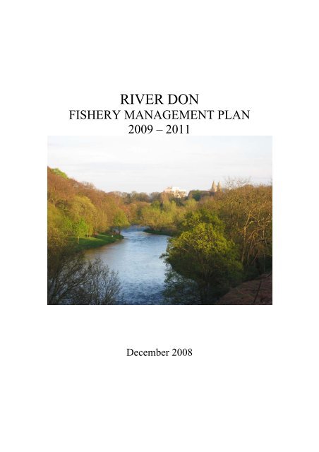
RIVER DONFISHERY MANAGEMENT PLAN2009 – 2011December 2008
CONTENTSPage1. Introduction 11.1 Aims and Objectives 12. The <strong>Don</strong> Catchment 32.1 Fisheries <strong>Management</strong> Infrastructure 32.2 Geology and Hydrology 32.3 Topography 42.4 Climate 42.5 Water Quality 42.6 Land Use 53. Description of Fish Species and Fisheries 73.1 The <strong>Don</strong>’s Fish Stocks 73.1.1 Atlantic Salmon Salmo salar 73.1.2 Brown and Sea Trout Salmo trutta 83.1.3 European Eel Anguilla Anguilla 93.1.4 Lamprey Species 103.1.5 Other Fish Species 103.2 The <strong>Don</strong>’s Fisheries 113.2.1 Salmon <strong>Fishery</strong> 113.2.2 Sea Trout <strong>Fishery</strong> 123.2.3 Brown Trout <strong>Fishery</strong> 133.2.4 Stocked Trout Fisheries 133.2.5 Coarse Species Fisheries 143.3 Stock Enhancement 143.4 Predators and Competing Species 154. <strong>Management</strong> Priorities 164.1 Milestone I 164.2 Milestone II 174.2.1 Habitat Survey 174.2.2 Electric Fishing Surveys 204.2.3 Redd Counts 224.2.4 Genetic Sampling 234.2.5 Impact of Known Obstructions 264.2.6 Catch Returns and Scale Sampling 274.2.7 Evaluation of Hatchery Programme 304.2.8 Timescale for Survey Programme 324.3 Milestone III 334.4 Milestone IV 334.5 Milestone V 33
4.6 Ongoing <strong>Management</strong> 344.6.1 Bailiffing 344.6.2 Education 344.6.3 Pollution Reduction Measures 354.6.4 Establish Biosecurity Measures for Non-Native Invasive Species 354.7 Potential Future Data Collection 355. Staff Structure and Development 366. Budget 367. Review of the <strong>Fishery</strong> <strong>Management</strong> <strong>Plan</strong> 377.1 Annual Review 377.2 Three-Year Review 377.3 Six-Year Review 377.4 River <strong>Don</strong> <strong>Fishery</strong> <strong>Management</strong> <strong>Plan</strong> 2015 to 2021 378. References 38PageFront Cover Photograph: Lower <strong>Don</strong> towards Seaton Park. Jim Kerr.
1. INTRODUCTIONThis fishery management plan sets out a systematic programme to gather current data onthe River <strong>Don</strong> catchment and its fish stocks, with the purpose of providing scientificallyrobust information leading to a better understanding of the fish and fishery and on whichmanagement and the prioritisation of resources can be based.It has been produced by the River <strong>Don</strong> Trust (RDT) with the support of the <strong>Don</strong> DistrictSalmon <strong>Fishery</strong> Board (<strong>Don</strong> DSFB). The RDT is a charity newly established to providescientific research and advice for the management of the fishery and who will carry outthe bulk of the surveying requirements of this plan. The <strong>Don</strong> DSFB is the statutoryauthority established under the Salmon Acts of the 1860s and tasked with the protectionand management of the salmon (and sea trout) fisheries.Rationale behind the planTo this stage information on the condition of the <strong>Don</strong> fishery has been gatheredpiecemeal to address specific management problems, but contemporary data for thewhole of the catchment is lacking. Consequently, this management plan sets out toaddress this through a comprehensive survey programme, in order that futuremanagement decisions are fully informed.1.1 AIMS AND OBJECTIVESScope of the <strong>Don</strong> FMPThe <strong>Don</strong> FMP covers the whole of the River <strong>Don</strong> catchment from its headwaters in theCairngorms National Park between Glen Avon and Cock Bridge, to its mouth at theBridge of <strong>Don</strong>, and including its tributaries (Figure 1.1).Figure 1.1 The River <strong>Don</strong> and Principal Tributaries.40Includes material based on Ordnance Survey 1:50,000 maps with the permission of the controller of HIncludes material based on spatial digital data from the Centre for Ecology and Hydrology. Copyrigh.er Majesty’s Stationery Office. Crown copyright.t CEH.N30River Urie2010Allt nanAigheanMeoirVeannaichWater ofNochtyErnanWaterCock BurnWater ofBuchatStrathdonConrieWaterBurn ofTornahaishKindieBurnNeweWater ofCarvieMossat BurnDeskry WaterTowieBurnGadie Burn800310 20 30 40 50 60 70 80 90EssetBurnAlfordLeochelBurnTough BurnTon BurnHervieBurnInverurieElrick BurnAberdeen1
Salmon, sea trout and brown trout create commercial fisheries on the catchment.Primarily these are in freshwater but there remains a small coastal netting fishery forsalmon and sea trout. In addition non-commercial coarse fish species and species ofconservation importance such as eel and lamprey are also present. An inventory ofcurrent knowledge has previously been prepared for the <strong>Don</strong> fishery and provides moredetailed background to the catchment than is presented here (DDCT, 2008). It identifieda lack of comprehensive information for all fish species on the <strong>Don</strong>: this <strong>Don</strong> FMP seeksto address this with the aim of ensuring the native fish populations and their habitats areconserved and, where possible, improved.Objectives of the <strong>Don</strong> FMPThis FMP sets out a survey programme to systematically collect data on all fish speciesto establish the current status of fish populations and their habitats, determining:• Biodiversity: which fish species are currently present on the catchment• Their distributions across the catchment• The numbers in which they are present• The population structure:are there bottlenecks during production reducing the number of adult fishavailable?, are there sub-species using different parts of the catchment?• The factors which are impacting upon the fish and fisheries• Measures which can be taken to redress these impacts.As a consequence of the survey programme management decisions will be taken basedupon current information and restoration measures prioritised according to urgency andbenefit.DurationThis initial FMP will have a duration of three years, from January 2009, during which themajority of new work on the catchment will focus on data collection and any urgentimprovement works which come to light.The FMP will then be revised on the basis of these findings. This will includeprioritising the management actions identified in balance with their potential benefit tothe fish or fishery, the financial cost of the works and their feasibility. The precautionaryapproach will be applied before investigating any potential to further develop the fishery.The revised <strong>Don</strong> <strong>Fishery</strong> <strong>Management</strong> <strong>Plan</strong> will incorporate the proposed improvementsand establish future monitoring programmes to assess their success covering the periodfrom 2012 to the end of 2014.Other plansThe Scottish Environment Protection Agency (SEPA) is in the process of producing theRiver Basin <strong>Management</strong> <strong>Plan</strong> for carrying out the requirements of the Water FrameworkDirective for Scotland (with the exception of the Solway and Tweed areas). Within thisthe North-East Area <strong>Management</strong> <strong>Plan</strong> will be of relevance to the <strong>Don</strong> catchment andwill be considered when carrying out this Fisheries <strong>Management</strong> <strong>Plan</strong>.2
2 THE DON CATCHMENT2.1 Fisheries <strong>Management</strong> InfrastructureThe <strong>Don</strong> District Salmon <strong>Fishery</strong> Board is the statutory authority established under theSalmon Acts of the 1860s and tasked with the protection and management of salmon (andsea trout) fisheries within its district. Members of the <strong>Don</strong> Board are elected and cooptedin line with the relevant legislation (www.riverdon.org.uk). Three members ofstaff are employed: a river superintendent, a deputy superintendent and a senior bailiff.The River <strong>Don</strong> Trust is newly constituted with aims to provide research and informationto conserve and enhance all species of freshwater fish in the River <strong>Don</strong>. There are sixelected trustees of anglers, proprietors and angling association members, and employedstaff are to be appointed to carry out the research laid out in this plan.The River <strong>Don</strong> Brown Trout Improvement Association (RDBTIA) was formed followingthe establishment in 1990 of the freshwater fish Protection Order covering most of the<strong>Don</strong> mainstem and the lower part of the River Urie. The RDBTIA reports to the ScottishGovernment on behalf of the river owners the level of permit sales and access to theriver.2.2 Geology and HydrologyThe bedrock of the <strong>Don</strong> catchment is dominated by quartz-based acidic rock types and toa lesser extent localised areas of granite, both of which are weathering-resistant.Consequently they introduce relatively low levels of nutrients into the river and offerlittle buffering capacity against acidic rainfall.Some localised areas of the catchment are naturally more nutrient-rich. Basic rock typessuch as the gabbro and allied types underlying the Urie and around Strathdon areimportant for introducing nutrients to the water, as are areas of Old Red Sandstonearound Kildrummy and the limestone and hornblende-schists upstream of Strathdon.Typically much of the water chemistry for the <strong>Don</strong> is reasonably good by northernScottish upland standards.River flows in the mountainous upper <strong>Don</strong> are rapid to rise and fall in response torainfall, although snow melt in the spring has become less influential recently. The lowergradient lands around Alford slow the flow and result in a meandering course aroundKintore and Hatton of Fintray. Two main points of abstraction are present on the river;the two paper mills at Inverurie (NJ 78150 19400) and at Stoneywood (NJ 89800 10950)both of which are recognised pressures identified under the Water Framework Directive(SEPA, 2005).River flows across the catchment reach their lowest levels in the summer months of Julyand August. Overall, the mean monthly flow at Parkhill, the SEPA gauging stationfurthest downstream and approximately 10.5 km from the tidal limit, is 20.54 m 3 /s andthe 95% exceedance flow is 5.3 m 3 /s (Data from D. Fraser, SEPA, and National RiverFlow Archive www.nwl.ac.uk/ih/nrfa).3
2.3 TopographyThe mainstem of the River <strong>Don</strong> extends for approximately 135 km, making it the sixthlongest river in Scotland. The catchment has two distinct topographical areas: themountainous west end and the relatively flat floodplains and farmland betweenKildrummy and the coast.The western tributaries arise in the mountains of the Cairngorms National Park and theLadder Hills. The highest headwater, the Meoir Veannaich on Brown Cow Hill, has anelevation of 810m, whilst other tributaries begin above 600m. In general, steep gradientsare found in the reaches above 400m elevation.Downstream of Strathdon the topography changes and more of the surrounding land islow gradient agricultural land: 67.1% of the catchment lies between 0 and 300m abovesea level. To the east of Kildrummy the land is predominantly below 150m elevation.The gradient increases for the final 8 km or so which historically resulted in the <strong>Don</strong>’suse as a power source for numerous fabric and paper mills. The coastal area of the River<strong>Don</strong> consists of sandy beaches and dunes.2.4 ClimateThe climate of the <strong>Don</strong> catchment is greatly influenced by the presence of the CairngormMountains and Ladder Hills so that the west of the catchment received 1100-1200 mm ofrainfall per year whilst that to the east of Alford received around 800 mm per year(www.nwl.ac.uk/ih/nrfa/spatialinfo/Index/indexNorthScotland.html).Rainfall was measurable (≥ 1mm) for 137 days per year at Craibstone College (gridreference NJ 875 107) on the lower <strong>Don</strong> but colder air temperatures resulted in snowfallin the Cairngorms on average 100 days per year. Thus snowmelt can contribute to riverflow when temperatures at altitude become milder. (www.metoffice.co.uk).2.5 Water QualityThe water quality of the <strong>Don</strong> catchment is subject to a range of diffuse and point sourcepollution pressures. The catchment downstream of grid reference NJ 4019 1488, slightlydownstream of Glenbuchat Castle, lies within the North East Nitrate Vulnerable Zonedesignated under the Nitrates Directive (91/676/EEC) and the Lower <strong>Don</strong> is designated aNutrient Sensitive Area (Eutrophication) under the Urban Wastewater TreatmentDirective (91/271/EEC). Whilst the water quality of the vast majority of the catchmenthas been classified as A2 (Good) or A1 (Excellent) under the water quality classificationpreviously employed by SEPA (SEPA National Water Quality Classification Report2006), parts of the catchment are failing to meet the standards now required through theWater Framework Directive (WFD).Parts of the <strong>Don</strong> catchment were classified as being “at risk” of failing to achieve goodecological status under the WFD. Diffuse inputs of agricultural nutrients have been of4
concern with the Leochel and Esset Burns around Alford, the Burn Hervie, the Urie andLochter Burn, the <strong>Don</strong> downstream of Inverurie and the Tuach and the Blackburn (SEPA,2005). The cumulative effects of this diffuse pollution have resulted in ammonium andnitrite levels failing the guideline standards for salmonid waters (SEPA, 2007a-f). Inaddition point source pollution inputs, primarily from sewage treatment works and papermanufacturing operations, have contributed to a phosphorus level in the river exceedingthe WFD’s good status environmental standard. This has been manifest in the Lower<strong>Don</strong> but is the cumulative effect of treatment plants from Alford and downstream on the<strong>Don</strong> and from Insch and downstream on the Urie.The most recent information on the water quality of the <strong>Don</strong>, published in December2008 as part of SEPA’s Draft River Basin <strong>Management</strong> <strong>Plan</strong>(www.sepa.org.uk/water/river_basin_planning.aspx), describes the water quality for thecatchment as being “moderate” or better, with the exception of the Blacklatch Burn (partof the Suie Burn at Alford) and the Elrick Burn which are both “poor”. Measures alreadybeing taken would therefore appear to be having a positive effect on improving the statusof the <strong>Don</strong> water body.2.6 Land UseIn the mountainous west land use on the <strong>Don</strong> catchment is dominated by moorlandgrazing for deer and sheep and includes the Ladder Hills SAC, a Special Area ofConservation for blanket bog habitat around the headwaters of the Ernan Water andWater of Nochty (www.jncc.gov.uk/ProtectedSites/SACselection/sac.asp?EUCode=UK0030179).Grazing quality improves to grassland in the lower levels of the tributaries and along thevalley around the mainstem of the <strong>Don</strong>. Settlements in this area are small and sparse.Coniferous plantations generally follow the lower slopes of the upper <strong>Don</strong> but are largeraround Strathdon and on areas of higher ground further downstream. Woodlands in thelower catchment are mainly small, mixed woodlands: Paradise and Tilliefoure Woods aredesignated Sites of Special Scientific Interest as upland oak woods.Agriculture dominates the land use downstream of Strathdon and Kildrummy. Thelargest settlements are present in the east and the lower <strong>Don</strong> is under increased pressurefrom urban development which includes Aberdeen Airport and seven sewage treatmentworks.Table 2.1 Land use within the <strong>Don</strong> and Urie catchment.Land Use Coverage (%)Arable and Horticultural 29.4Grassland 28.9Mountain, Heath and Bog 23.4Woodland 15.8Built-up areas 1.2Inland Waters 0.1(CEH Monks Wood’s Land Cover Map 2000 survey:www.nwl.ac.uk/ih/nrfa/spatialinfo/Index/indexNorthScotland.html).5
Adjacent to the <strong>Don</strong> catchment, but not flowing into it, are a series of three lochs, Corby,Lily and Bishop’s Lochs, which are designated as SSSIs for their non-breeding coloniesof greylag geese and for the mesotrophic status of the lochs.Historical land use pressures on the catchment have included a variety of industries at thestart of the twentieth century whose pollution, abstraction and obstruction greatly affectedthe salmon fishing on the river (Calderwood, 1909; DDCT, 2008 and references therein).In the last thirty years cumulative pollution from a number of sources caused thecondition “Pigmented salmon syndrome”, resulting in the death of large numbers ofsalmon over the winter of 1981/1982. Once the cause was established appropriate controlmeasures were applied and no further cases have been reported since 1988 (DDCT, 2008and references therein).6
3. DESCRIPTION OF FISH SPECIES AND FISHERIES3.1 THE DON’S FISH STOCKSData for the distribution and population status for all of the fish species recorded on theRiver <strong>Don</strong> is limited, being either incomplete or out of date; hence it is necessary for thisfisheries management plan to set up a systematic programme of surveys to gather data forall species. What is known is summarised below and is presented in more detail in theprevious inventory of the catchment (DDCT, 2008).Much of the information on the distribution of salmonid species is drawn from the workof the <strong>Don</strong> District Salmon <strong>Fishery</strong> Board, which is mainly restricted to areas wherestocking occurs, and from the PhD study carried out by Shields (1996). Most informationabout the distributions of other fish species is derived from the National BiodiversityNetwork (www.searchnbn.net) and the Database and Atlas of Freshwater Fishes (DAFF),the most recent information being from 2002. This data is external to the RDT and theDDSFB and the purposes for which it was collected, the methods by which it wascollected and any other information other than the presence of the fish species isunknown.3.1.1 Atlantic Salmon Salmo salarThe distribution of Atlantic salmon is believed to extend to all parts of the catchmentaccessible to adult salmon; inaccessible parts include the high gradient upper reaches ofthe western tributaries and areas upstream of dams on the Allt Veannaich (NJ 2184608195) and the Elrick burn (NJ 89465 15430). Man-made obstacles to salmon migrationare also present on the Esset burn (weir at NJ 54763 17950) and Leochel Burn (weir atNJ 55218 15890).The salmon run is structured into multi-sea winter (MSW) and one-sea winter (grilse)components. Spring-running and autumn-running MSW are present within the rod catch.Similar to other Scottish rivers the current run is dominated by late-running salmon andgrilse (Summers, 1990; 1995). Early-running salmon are believed to spawn in the uppercatchment. There are no fish counters present on the <strong>Don</strong> and so no information, otherthan catch numbers, is available on the numbers of adult fish entering the river.The detailed juvenile surveys of Shields in the early 1990s found salmon fry and 1+ parrdensities to be greatest in the upper catchment, with both the mainstem and tributariesbeing used as nursery grounds (Shields, 1996).7
Figure 3.1.1 Distribution of Atlantic Salmon4030SALMONDAFF data pre 2003Shields’ data 1996<strong>Don</strong> DSFB data 2000-2006Other data (see text)2010Includes material based on spatial digital data from the Centre for Ecology and Hydrology. Copyrigh t CEH.8 Includes material based on Ordnance Survey 1:50,000 maps with the permission of the controller of H er Majesty’s Stationery Office. Crown copyright.00310 20 30 40 50 60 70 80 90For reasons of map clarity not all <strong>Don</strong> DSFB electric fishing sites containing juvenile salmon have been illustrated as site locations changed slightly from year to year.Those that are shown include the up-and downstream limits where salmon were found on each tributary fished.3.1.2 Brown and Sea Trout Salmo truttaMigratory sea trout and non-migratory brown trout are members of the same specieswhich have adopted different life styles; brown trout remain resident in freshwaterthroughout their life whilst sea trout migrate to sea after two or more years in the river,returning to freshwater to spawn. Both are present in the <strong>Don</strong>.The distribution of trout extends to all parts of the catchment accessible to adult fish;resident trout populations have been found upstream of the obstacles mentioned abovealthough access for sea trout, like salmon, is obstructed. The detailed juvenile surveys ofShields found trout fry and/or 1+ parr at all 103 study sites spread throughout thecatchment, with the greatest densities in the tributary sites (Shields, 1996).8
Figure 3.1.2 Distribution of Trout4030TROUTDAFF data pre 2003Shields’ data 1996<strong>Don</strong> DSFB data 2000-2006Other data (see text)2010Includes material based on spatial digital data from the Centre for Ecology and Hydrology. Copyrigh t CEH.8 Includes material based on Ordnance Survey 1:50,000 maps with the permission of the controller of H er Majesty’s Stationery Office. Crown copyright.00310 20 30 40 50 60 70 80 90For reasons of map clarity not all <strong>Don</strong> DSFB electric fishing sites containing juvenile trout have b een illustrated as site locations changed slightly from year to year.Those that are shown include the up-and downstream limits where trout were found on each tributary fished.3.1.3 European eel Anguilla AnguillaThe distribution of eels is believed to extend to all suitable areas of the catchment. Thesurveys of the <strong>Don</strong> DSFB have not always recorded their presence but eels have beenobserved widely throughout the catchment (J. Kerr, pers. comm.). Shields (1996)recorded their presence on all of the principal burns downstream of the Water of Nochty,except for the Kindie Burn. No additional information is known about their biologicalcharacteristics or numbers.Figure 3.1.3 Distribution of Eel4030EELDAFF data pre 2003Shields’ data 1996<strong>Don</strong> DSFB data 2000-2006Other data (see text)2010Includes material based on spatial digital data from the Centre for Ecology and Hydrology. Copyrigh t CEH.8 Includes material based on Ordnance Survey 1:50,000 maps with the permission of the controller of H er Majesty’s Stationery Office. Crown copyright.00310 20 30 40 50 60 70 80 909
3.1.4 Lamprey speciesThe adult sea lamprey Petromyzon marinus is occasionally noted in the lowest reaches ofthe <strong>Don</strong>, within 10km of the sea, possibly restricted from further movement upstream bythe remains of weirs in the river. Lampetra species recordings have been morewidespread but the species has only been positively noted as river lamprey (Lampetrafluviatilis) once in the late 1960s or early 1970s in the River Urie around Inverurie(DAFF record). In all other cases the species were either identified as brook lamprey(Lampetra planeri) or not identified beyond being Lampetra. Their presence, but nofurther information, has been recorded on the Fèith Bhàit at the head of the catchmentand many of the tributaries as far as the Elrick Burn (Shields, 1996). The NationalSurvey of Lampreys did not carry out any field work on the River <strong>Don</strong> and it was notedthat new and reliable information is required as the <strong>Don</strong> contains much suitable habitat(ERA, 2004).Figure 3.1.4 Distribution of Brook Lamprey4030BROOK LAMPREY /LAMPETRA sppDAFF data pre 2003Shields’ data 1996<strong>Don</strong> DSFB data 2000-2006Other data (see text)2010Includes material based on spatial digital data from the Centre for Ecology and Hydrology. Copyrigh t CEH.8 Includes material based on Ordnance Survey 1:50,000 maps with the permission of the controller of H er Majesty’s Stationery Office. Crown copyright.00310 20 30 40 50 60 70 80 903.1.5 Other Fish SpeciesThe presence of the following fish species has been recorded in the <strong>Don</strong> catchment. Thelimited information is presented in the previous catchment inventory (DDCT, 2008).Gasterosteus aculeatus Three-spined sticklebackPlatichthys flesus FlounderEsox luciusPikeGobio gobioGudgeonPerca fluviatilis PerchPhoxinus phoxinus MinnowAlosaShad speciesBarbatula barbatula StoneloachOnchorhynchus mykiss Rainbow troutRutilus rutilus Roach10
3.2 THE DON’S FISHERIES3.2.1 Salmon <strong>Fishery</strong>The salmon fishery on the <strong>Don</strong> consists of both a coastal net fishery and an inland rodand line fishery. In common with other Scottish rivers, total catches of MSW salmonfrom both fisheries have declined sharply since 1952 when the reporting of catchesbecame compulsory (Fig. 3.2.1). Spring salmon numbers fell sharply at the beginning ofthis period, whilst later-running MSW catches have declined more slowly. Total grilsecatches peaked in the early 1970s but have since declined. In part the decline is areflection of the decreased netting effort: the in-river net and coble fishery at the Cruivesof <strong>Don</strong> closed in the 1960s and now only four fixed engine stations remain, operatingalong the coast to the north of the estuary at Berryhill, Tarbet Hill, Blackdog and Mennie.In the 1950s the nets accounted for 90% of the total salmon catch, by 1990 this had fallento around 30% and is currently less than 10%. In addition the Autumn run of fish appearsto becoming later and may therefore be less likely to be intercepted during the fishingseason.Number of fish160001400012000100008000600040002000019521956196019641968197219761980198419881992199620002004Spring Salmon Summer Salmon GrilseFigure 3.2.1 Numbers of salmon caught by all methods in the River <strong>Don</strong> District.Data from FRS Montrose: Fisheries statistics collated for the Statistical Bulletin.Angling catches have shown more varied trends amongst components of the salmon run.Spring salmon catches have declined over the period whereas summer salmon and grilserod catches have shown an increasing trend over the last thirty years (Fig. 3.2.2). Since1994 records have included those fish returned to the water: in 2007 these represented79%, 70% and 58% respectively of the spring salmon, summer salmon and grilse catchesreported. The five-year average catches (retained and released) for 2003-2007 are 221spring salmon, 1280 summer salmon and 654 grilse.There are no fish counters present on the river and so the total run of salmon is unknown.Consequently the proportion of the run being caught, or the exploitation rate, is unknown.A voluntary Conservation Code has been promoted on the <strong>Don</strong> since 2002 encouragingcatch and release and setting a seasonal limit on the number of salmon and sea troutwhich can be retained per angler (www.riverdon.org.uk).11
2500200015001000500019521956196019641968197219761980198419881992199620002004Number of fishSpring Salmon Summer Salmon GrilseFigure 3.2.2 Numbers of salmon caught by rod and line (retained and released) in theRiver <strong>Don</strong> District.Data from FRS Montrose: Fisheries statistics collated for the Statistical Bulletin.3.2.2 Sea Trout <strong>Fishery</strong>The numbers of sea trout caught fluctuate greatly from year to year. The overall trend inall method catches has been downward, in part due to the reduction in netting (Figure3.2.3). Sea trout (and finnock) catches by rod and line accounted for 98.5% of the totalcatch in 2007. Of these 70% of the sea trout (207 fish) and 91% of the finnock (32 fish)were returned (Data from FRS Montrose: Fisheries statistics collated for the StatisticalBulletin). As mentioned above sea trout form part of the <strong>Don</strong>’s Conservation Code. Thefive-year average catches (retained and released) are 587 sea trout and 312 finnock*(*data only collected since 2004).Number of fish600050004000300020001000019521956196019641968197219761980198419881992199620002004All methodsRod & LineFigure 3.2.3 Numbers of sea trout caught in the River <strong>Don</strong> District.Data from FRS Montrose: Fisheries statistics collated for the Statistical Bulletin.12
3.2.3 Brown Trout <strong>Fishery</strong>The River <strong>Don</strong> is best known as a wild brown trout river and is reputed to be one of thefinest in Scotland. It is well-known for both the size and quality of its brown trout.There is no legal requirement to report brown trout catch returns and so they are notcollated centrally and remain with individual proprietors. The numbers of brown troutcaught on the Aberdeen and District Angling Association’s waters in the lower river areavailable from 1985 (Figure 3.2.4). This limited amount of information shows that thenumbers caught fluctuate from year to year, but overall catches show a slight upwardtrend. Since 1996 the figures have included the proportion of fish which are returned tothe water; between 1997 and 2006 this averaged 71%.Number of fish7,0006,0005,0004,0003,0002,0001,000019851987198919911993199519971999200120032005RetainedReturned and retainedFigure 3.2.4 Numbers of brown trout caught by rod and line in the ADAA’s waters.The Protection Order has made it easier for anglers to access brown trout fishing butinformation from Aberdeenshire Council, which has fishings at Inverurie, Kintore andAlford, suggests that at best only around 60% of anglers purchasing day permits,including those fishing for salmon and sea trout, submit catch returns. This may in partbe a failure to report blank days but illustrates that for some fishings information isincomplete. Brown trout catches have only been recorded by the Council since 2006 (J.Stevenson, pers. comm.). Consequently, whilst the general impression amongst anglersis that brown trout fishing on the <strong>Don</strong> appears to be doing well, detailed data collectionand analysis is required to assess if this is true.3.2.4 Stocked Trout FisheriesCommercial loch fisheries, principally specialising in rainbow trout have been developedin the <strong>Don</strong> Board’s area since the early 1990s. These include Corby Loch, to the north ofBridge of <strong>Don</strong>, which drains via the Burn of Mundurno to the sea and where rainbowtrout are believed to have successfully spawned (Walker, 2003). For further details seethe previous inventory (DDCT, 2008).13
3.2.5 Coarse Species FisheriesRecognised fisheries for coarse fish species have not been established on the River <strong>Don</strong>and any fishing records remain the property of the individual anglers. This may well be areflection that the coarse fish species present have not become sufficiently establishedthat they could create a sustainable fishery. A concerted effort to collect data on the fishspecies and their abundance would be required before it could be established if there ispotential for any sustainable coarse species fishery on the <strong>Don</strong>, which would be regulatedunder the Protection Order, or whether it remains on a casual, ad hoc, low level. Privateponds where coarse fish are present may be more regulated, but again the information isnot widely available.3.3 STOCK ENHANCEMENTStocking of salmonids has been carried out by the <strong>Don</strong> DSFB since the late 1950s,initially to help overcome the depletion of stocks caused by pollution problems in thelower river. From 2006 the stocking activity has been reduced from 750,000 to 300,000salmon eggs, and approximately 100,000 trout eggs. All were derived from broodstockmigrating to the upper catchment in late October or November and collected at the NeweWeir (NJ 370 120). In the past the resulting progeny have been stocked out mainly as frybut also some as parr. Since 2006 all salmon progeny have been transplanted intoartificial redds as eyed ova and trout were transferred as unfed fry in early spring. This isin order to reduce the extent of hatchery imprinting and use conditions that are as naturalas possible. The locations for stocking out the eggs and fry are determined by the reddcounts and electric fishing from the previous year. Areas which have been naturallyunderused, both on the mainstem and the upper river tributaries, are stocked. Due to theearly stages stocked out it has not been possible to tag or mark the fish to determine theirsurvival to adulthood or their contribution to the rod catch.The hatchery at Newe follows closely the regulations of the Fish Health Inspectorate andis subject to regular checks by SEPA and Fisheries Research Services. Stringent recordson fish movements and mortality rates are maintained and the use of chemical treatmentsis avoided through good practice.Since the 1980s a small number of fish have been introduced yearly into the <strong>Don</strong>originating from outside of the catchment. The Aberdeen and District AnglingAssociation stocks its waters in the lower river annually with around a thousand browntrout of approximately 1 lb, currently sourced from Howietown <strong>Fishery</strong> at Stirling. Since1993 these have made up between 30 and 46% of the brown trout catches reported to theAssociation, as identified from pan jet marks, and averaging 36% (J. Pirie, pers. comm.).14
3.4 PREDATORS AND COMPETING SPECIESFish-predating species on the <strong>Don</strong> include mammals, birds and fish. Common seals,Phoca vitulina, are known to use the <strong>Don</strong> estuary as a haul-out, also taking some largesalmonids, but fewer than the rods (Carter et al., 2001). Individual seals have been culledby the coastal netsmen when they have been a problem. Cormorants, Phalacrocoraxcarbo, are present on the lower river from the autumn through to the late spring.Predation by coarse fish species, such as pike and perch, has not been quantified andmore information is required on their numbers to determine if they are sufficientlyestablished as to have a localised impact.The presence of the American mink (Mustela vison), the Goosander (Mergus mergansera saw-billed duck), and the Grey Heron (Ardea cinerea) is more widespread through thecatchment and so all areas are likely to be predated. Although their impact on thejuvenile population has not been quantified, all typically predate on parr-sized fish andsalmonid species are likely to be most affected as they are the most numerous. Predatorcontrol is not carried out by the <strong>Don</strong> DSFB although individual proprietors may carry outsome mink trapping.15
4. MANAGEMENT PRIORITIESIn order to achieve the aim of understanding and managing the different components ofthe <strong>Don</strong> and its fisheries the management priorities of this plan are aligned to a number ofmilestones. These can be summarised as follows:Milestone IEmploy a suitably qualified Biologist to conduct the surveys described later in thisdocument. This should occur early in 2009.Milestone IIFor the first three years undertake a thorough knowledge-gathering exercise so that thefish populations and the factors which influence them can be understood.Milestone IIIAt the end of 2011 review the survey data gathered to understand the factors affecting thefish populations and prioritise remedies against the detrimental impacts.Milestone IVCommence restoration of the catchment from 2012 onwards and continue to refineknowledge of the catchment through continued research.Milestone VReview success of initial restoration schemes in 2014 and prioritise works for the next sixyear period.4.1 Milestone IThe employment of a Biologist will bring the necessary skills to obtain high qualitysurvey information on the <strong>Don</strong> and the factors affecting the fish. Although this personwill be a RDT employee they will need to work closely with DDSFB personnel so thatthe combined resources of the two organisations can be deployed efficiently. This willrequire good man-management and co-operation between the two organisations.For the purposes of this <strong>Plan</strong> it is scheduled that the Biologist will be employed in early2009: a delay will require that the timetables given later in this document are pushed backaccordingly.16
4.2 Milestone IIThe second milestone is to start to gain an understanding of the fish within the <strong>Don</strong> byestablishing a comprehensive, structured survey plan.The principles guiding the survey plan are:• To establish what species are currently present• To establish where they are found and in what numbers• To find out what factors are impacting on the fish populations• To establish what practical measures can be taken to improve them.Whilst only a limited amount of information can be gained in a three-year period itshould be sufficient to start to prioritise restoration work programmes in an objective andcosted manner, and to guide future research. The first three years of the surveyprogramme are detailed in the following sections.4.2.1 Habitat SurveySurvey purposeA comprehensive habitat survey is an important first step to understanding the <strong>Don</strong>catchment and its problems. Mapping the location, quality and suitability of the habitatfor juvenile fish production and then comparing it with the actual usage, from redd countsand electric fishing surveys, will highlight good areas being under-utilised as well asareas where poor quality habitat is restricting fish production. Data collected in thehabitat survey will feed into many of the other avenues of investigation on the catchmentand so its completion should be the priority of the first year’s survey work.It can be expected from the analysis of diffuse pollution already carried out for the WaterFramework Directive (SEPA, 2005) that there are likely to be watercourses which wouldbenefit from measures to reduce the impact of agricultural pressures. By carrying out acatchment-wide habitat survey the options for habitat improvements, for exampleimproving adult access or reducing instream siltation, can be prioritised to where theywill be of most benefit.Survey methodInitial efforts will be directed at habitat suitability for salmonids, as they form the main<strong>Don</strong> fisheries. Habitat features significant to other species can be noted at the same time,for example suitable nursery areas for lamprey or gravel areas where freshwater pearlmussels are present, and targeted for specific study projects at a later date.From the 1:50,000 scale Ordnance Survey map there are over 1010 km of mainstem andtributary waters of the <strong>Don</strong> catchment which may potentially hold salmonid fish. Tocover these efficiently the walkover survey method of Hendry and Cragg-Hine (1997)described in the SFCC’s Habitat Surveys Training Manual (2007) should be used. This istargeted towards salmonids and provides a means of recording on a map the location of17
instream habitat types suitable for different ages of fish and features of significance aboutthe surrounding riparian zone, for example the condition of the banks, presence ofpollution sources and obstructions to migration.At a survey rate of 8km per day it is estimated that one surveyor will require 7 months tocomplete the survey, with additional time to write up the data and in the event of weatherdelays. However, if the Board’s staff could also be used to carry out the survey thecatchment could be covered more efficiently and, with two teams of two surveyors ableto cover around 16 km a day each, the time for completion of the field work would bereduced to 2 months, suggested to be May and June. Within the team of two thesurveyors cover the river in a leapfrog manner surveying alternate stretches and movingthe vehicle forward to a prearranged site each time a stretch is completed, thereby,whenever road access allows, avoiding the need to double back at the end of the day toreturn to the vehicle.In addition to covering the ground most efficiently, this team coverage can also be usedto record suitable locations for the later electric fishing survey and record informationpertinent to the Health and Safety risk assessment such as mobile phone reception.Completing the survey within one season allows the current situation across thecatchment to be assessed and ensures areas are prioritised correctly. It has the advantagethat plant species can be considered, including invasive species such as Ranunculus,Giant Hogweed and Japanese Knotweed which the <strong>Don</strong> DSFB is developing a controlprogramme for, and assessed in the same growing season. Although Board staff will berequired they will remain a visible presence on the river and can concentrate on surveyingthe mainstem in June when plant species should be growing.If all of the Board staff are not available then use can be made of the seasonal staff that itwill be necessary to employ to help with electric fishing surveys plus one bailiff on arotational basis, leaving two bailiffs for protection duties. Whilst efficient and feasiblethis will result in skills and knowledge leaving the area when the two seasonal staffdepart at the end of their contract. The employment would be likely to cover June andJuly for the habitat survey and August and September for electric fishing.In the event that the habitat survey can not be completed in a single year the catchmentelectric fishing survey should be postponed until it is and electric fishing carried out inthe first year should be restricted to the collection of some of the genetic samples and ifpossible the obstruction impact assessments.The data produced will be analysed by the Biologist and can be incorporated into aGeographical Information System (GIS) to aid interpretation with other data sourcesacross the catchment.Data gathered as part of the <strong>Don</strong> Board’s earlier habitat survey to locate areas forimprovement in the upper catchment can be compared with current data to determine ifareas have deteriorated.18
Outcomes of Habitat SurveyHabitat data collectedLocation, extent and quality of salmonidspawning groundsLocation, extent and quality of salmonidnursery groundsLocate areas of habitat suitable for specieswith distinct requirementsPresence of obstructionsPresence of pollution sourcesPresence of degraded instream habitate.g. dredged burns for agricultural drainagePresence of degraded riparian habitate.g. livestock-poached banksPresence of invasive plant speciesData uses• Estimate potential production• GIS mapping• Interpretation of redd count data• Interpretation of juvenile electricfishing data• Determine likely location of distinctbreeding populations and location ofsampling sites for genetic analysis• Determine scope for gravel cleaninge.g. as a result of instream vegetationand siltation• Determine scope for stocking• Estimate potential juvenile production• GIS mapping• Interpretation of juvenile electricfishing data• Determine scope for stocking• Locate potential Lamprey habitat• Identify areas sensitive to developmente.g. pearl mussel beds• Potential migratory access problems• Effect on fish numbers upstream?• Potential for opening up new nurserygrounds• Effect on fish numbers• Potential for improvement works• Effect on fish numbers• Potential for improvement works• Effect on fish numbers• Potential for improvement works• Effect on fish numbers• Effect on angler access to fishery• Mapping extent of Giant Hogweed,Japanese Knotweed, Ranunculus oncatchment• Potential for control measures19
Lead BodiesScientific research is a core role for the River <strong>Don</strong> Trust and so the RDT will be leadingthe habitat surveys. As discussed there is merit in also training <strong>Don</strong> DSFB staff in themethod so that efficient use of resources can be made.Future WorkAreas of the catchment identified for improvement works, whether instream works, suchas rubble mat addition, or riparian works, such as fencing and buffer strip creation or treeplanting, can be prioritised when the habitat survey has been considered in conjunctionwith electric fishing and other data. This should be based on factors such as thoseconsidered in the River Dee Trust’s 2008 report “Prioritisation of Habitat Restorationbased upon the 1999 River Dee Habitat Survey and Subsequent Updates”:Feasibility of the restoration workSeverity of the impactPotential increase in fish production following restorationImpact on vulnerable components of the fish stock e.g. spring salmonCost of implementing restoration work.Once work has been prioritised detailed surveys of the tributaries in question can becarried out to produce project plans fully costed to the type of improvements required.Application can then be made to the Scottish Rural Development Programme forassistance and consultation with the local landowners to ensure their needs are met.Future revisions of the <strong>Fishery</strong> <strong>Management</strong> <strong>Plan</strong> for the river will encompass these plansand the subsequent monitoring to quantify their success.4.2.2 Electric Fishing SurveysSurvey PurposeWidespread electric fishing is required to establish baseline data as to which species arecurrently present, their abundance and extent across the <strong>Don</strong> catchment. Due to theimportance of the salmonid fisheries on the <strong>Don</strong>, electric fishing will primarily be aimedat these species. Other fish species encountered shall be recorded in full detail in orderthat future investigations can be targeted, perhaps using additional methods. Targeteddata collection on species of conservation importance, such as eels or lampreys may bepossible through collaborations with SNH.Survey MethodElectric fishing on the <strong>Don</strong> catchment will be carried out in accordance with the trainingand methods of the Scottish Fisheries Co-ordination Centre (SFCC).The Time Delineated Method will be used in order that:• The whole of the catchment can be surveyed, including wadeable areas of widemainstem waters• Overall trends in relative fish abundance, rather than exact fish numbers, can bedetermined20
This will allow the greatest amount of information to be gathered from across the entirecatchment in the limited survey season.The habitat survey will provide more detail on how many minor burns are of a size worthelectric fishing, areas of the mainstem <strong>Don</strong> and Urie which are unwadeable and should beexcluded, and the frequency of sites on the mainstem. The findings of the habitat surveywill also be employed to ensure that the full range of habitat types found on the <strong>Don</strong> aresurveyed, including sub-optimal habitat types which may provide an early indication iffish numbers and habitat occupancy falls. Based on the 1:50,000 Ordnance Survey mapthe following number of sites are estimated:1 per 2 km onmainstem <strong>Don</strong> &Urie1 per 2 km ontributariesSite frequency1 per 5 km onmainstem <strong>Don</strong> &Urie1 per 2 km ontributaries79 193 34 193Total number ofsites 272 227Approximatenumber of surveydays30 25N.B. Additional sites are required on four tributaries with obstructions to migration (see section 4.2.5).To establish robust baseline data the sites should all be revisited in each of the three yearsof this plan or at least in the second and third years if completion of the habitat surveytakes up the first year.Outcomes of Electric Fishing SurveyElectric Fishing Data CollectedData UsesFish species present• Which species are present• Distribution across the catchment• Absence may relate to obstructions or otherfeatures in the habitat surveyNumbers and sizes of fish• Relate to abundance at similar sites• Relate to quality of habitat• Poor numbers may indicate pollution orhabitat for improvement• Poor growth may indicate water quality /food resource problemsScale sampling• Missing age classes may indicate pollutionevents, poor spawning yearsSamples for DNA analysis• Fin clip samples from live juvenile salmonto identify distinct sub-populations andmanagement unitsHabitat usage • Highlight areas below carrying capacity –evaluate for improvements / stocking• Identify habitats used by non-salmonids21
Lead BodiesElectric fishing surveys will form a large part of the field work duties for the RDT staffand will require additional trained survey assistants to be employed for the summersurvey season.Future WorkAfter a three-year period of gathering baseline data on the fish populations theinformation gleaned can be used to establish an annual monitoring programme using asmaller, but statistically robust, number of quantitative electric fishing sites which will beable to detect any statistically significant changes in the salmonid fish populations. TheSFCC will be able to provide advice on the number of sites required.4.2.3 Redd CountsSurvey PurposeThe <strong>Don</strong> DSFB carries out annual redd counts on the upper mainstem <strong>Don</strong> between CockBridge and Ardhuncart and between Alford and Kemnay Bridges (approximately 40kmfrom the sea), and on the major tributaries the Nochty, Deskry, Kindie, Buchat andLeochel burns and the River Urie. The surveys are used to highlight areas wherespawning grounds are not being fully used and where there is scope for enhancementstocking.Survey methodRedd counts are carried out from late November until late January, beginning at the topof the catchment and working downstream, by individual surveyors on the tributaries andby pairs of surveyors each covering half the river width on the mainstem. The number oflarge characteristic gravel disturbances believed to have been made by salmon in eachsubsection of the survey stretch is recorded on a single occasion to provide an indicationof spawning usage. It should be borne in mind that individual redds may a) not containany eggs, b) be the result of several females (and males) and that c) individual females(and males) may produce more than one redd: consequently the number of redds is arelative indicator of spawning abundance and not a direct reflection of the number ofspawning fish (Youngson et al., 2007).22
Outcomes of Redd CountsRedd Count Data CollectedNumber of potential salmon spawningreddsData Uses• GIS mapping• Relate to habitat survey – location ofnursery habitat for fry and parr stages• Relate to habitat survey – presence ofimpacting features e.g. affecting adultaccess• Relate to electric fishing data on actualjuvenile production / survivalLocation of poorly used spawning gravels • GIS mapping• Relate to gravel quality e.g. substratecompaction, over-vegetation, nearbyland use• Relate to electric fishing data on actualjuvenile production / survival• Evaluate if preferentially used by trout• Evaluate value of stocking or otherimprovement measures• Combine information with hatcheryevaluation and with genetic mapping todetermine if different sub-populationsof <strong>Don</strong> salmon are being best managedLead BodiesCounts are carried out by the <strong>Don</strong> DSFB bailiffs who have training and experience inidentifying gravel redds. Collaboration with the RDT will allow the count data, habitatand electric fishing data to be effectively combined.4.2.4 Genetic SamplingSurvey PurposeGenetic research shows that in all but the smallest rivers the run of salmon consists of anumber of discrete breeding populations which are reproductively and geneticallydistinct. Understanding the population structure is essential for effective stockmanagement and will allow the conservation of vulnerable components. Samples takenfrom live fish can be used to identify different breeding populations of salmon livingwithin the <strong>Don</strong> catchment and establish, for instance, whether salmon in the mainstem aredistinct from those in a particular tributary and should be managed separately.23
Survey MethodFin clips can be removed from live juvenile salmon during the course of routine electricfishing surveys or from adult salmon captured as broodstock, following the guidelinesproduced co-operatively between <strong>RAFTS</strong> and FRS.Data from the habitat survey will help to determine where the spawning grounds arepresent as discrete stretches on the mainstem and therefore likely to be used by distinctpopulations of salmon. Distinct populations may also occur on tributaries where there isaccess to more than a few kilometres of available habitat; branching in a river systemoften leads to distinct salmon populations. Assuming that this is the case, there may be inthe region of twenty five or more separate spawning populations on the <strong>Don</strong>. Figure4.2.1 shows a preliminary map of the electric fishing locations for sampling the geneticsof juvenile <strong>Don</strong> salmon. This is likely to need refining following the habitat survey andfurther developed each year as information from the genetic analysis becomes available.Sample analysis is to be provided centrally to <strong>RAFTS</strong> members, including the RDT andis supported with funding from the Scottish Government. However analysis is costlytherefore the earliest sites for analysis should include a broad coverage of the catchmentand target areas thought to contribute greatest to the overall stock of salmon, i.e. wheresalmon are abundant. The sampling programme will be ongoing over a number of yearsand samples can be stored for analysis when funds allow.Figure 4.2.1 Preliminary Genetic Sampling Locations40Mainstem sampling pointsTributary sampling points302010Includes material based on spatial digital data from the Centre for Ecology and Hydrology. Copyrigh t CEH.8 Includes material based on Ordnance Survey 1:50,000 maps with the permission of the controller of H er Majesty’s Stationery Office. Crown copyright.00310 20 30 40 50 60 70 80 9024
Outcomes of Genetic SamplingData collectedData UsesGenetic characteristics of <strong>Don</strong> salmon • Combine with habitat data to aididentification of distinct breedingpopulations• GIS mapping of distinct breedingpopulations & management units• Combine with habitat data to determinescale at which habitat improvementswill be effective• Combine with hatchery evaluation todetermine best policy for stockingprogramme e.g. source of broodstockand locations for stocking progeny toprevent mixing different geneticpopulations• Allow restoration targeted towardsvulnerable componentsLead BodiesThe RDT will be the main body carrying out the sampling work associated with juvenilesalmon populations through the routine electric fishing surveys. Samples have beentaken from two locations on the mainstem, Cock Bridge and Ardhuncart, in 2007 withassistance from the <strong>Don</strong> DSFB. Genetic samples can also be taken from adult salmoncaptured at Newe for broodstock. The sampling may provide insight as to whether thebroodstock are from disparate populations destined for a number of the tributariesupstream of Newe, or whether, due to their capture late in the season, they are from atighter group heading for a smaller area of catchment.Future WorkThe sampling network can be revised in conjunction with the guidance from <strong>RAFTS</strong> andFRS following completion of the habitat survey. Combining information from the habitatsurvey and the genetic sampling will help to identify which parts of the river should beconsidered separately for the management of salmon. Future work may involveidentifying separate breeding populations of trout for management purposes.25
4.2.5 Impact of Known ObstructionsSurvey PurposeThe remains of a number of weirs and abstraction points from now defunctmanufacturing industries are still present on the lower <strong>Don</strong>, but have been breached andare not thought to greatly delay fish migration. Four man-made obstructions on thecatchment have been highlighted which shall be evaluated for the impact they have onfish migration and the potential for improving access. They are:Loch dam on the Allt Veannaich (NJ 21851 08190)Weir on the Leochel Burn (NJ 55218 15890)Mill weir on the Esset Burn (NJ 57463 17950) andWeir on the Elrick Burn (NJ 89456 15440).Figure 4.2.2 Location of Known Obstructions to Fish Migration40Obstructions to MigrationN3020EssetBurnInverurieElrick BurnAlfordStrathdon10NeweMeoirVeannaichLeochelBurnAberdeenIncludes material based on spatial digital data from the Centre for Ecology and Hydrology. Copyrigh t CEH.8 Includes material based on Ordnance Survey 1:50,000 maps with the permission of the controller of H er Majesty’s Stationery Office. Crown copyright.00310 20 30 40 50 60 70 80 90Survey MethodThe habitat survey of the <strong>Don</strong> catchment will quantify the amount and quality of potentialfish habitat upstream of these obstructions and will identify any other potential obstaclesto fish migration on the river.Timed electric fishing of a large number of sites both up- and downstream of theobstacles will determine whether they are impassable to migratory fish or whether thereare certain flow conditions under which access is possible. Thirty timed sites above andbelow the obstructions would be preferable, but the length of the tributaries involvedindicates that this is unlikely to be achieved below the obstructions, in which case asmany sites as is practical should be fished below and at least the same number upstreamof the obstruction.26
Outcomes of Obstruction Impact AssessmentData CollectedLocation, type and severity of obstructions– data from habitat surveyImpact on species / populations foundupstream – electric fishing dataData Uses• Correlate with fish numbers / speciesupstream• Assess potential for removal orimproving access• Estimate potential increase in fishproduction with increase in availablehabitat• Quantify severity of obstacle• Consider effect on any previouslyisolated populations upstream ofobstruction if access is improvedLead BodiesAssessment of the obstacles will be carried out in the course of the habitat and electricfishing surveys by the RDT.Future WorkOnce the impact of the obstacles has been assessed the potential benefit, in terms of theadditional fish production, that would arise from improving fish access can be estimatedand weighed against the cost, feasibility and any disadvantages of the works. Applicationcan then be made to funds such as SEPA’s River Restoration Fund for financialassistance with the works.A monitoring programme repeating the detailed electric fishing survey above and belowthe obstacles will be required following any alterations to assess if they have beensuccessful.4.2.6 Catch Returns and Scale SamplingSurvey PurposeCatch returns for salmon and sea trout submitted annually to the Scottish Government aremade publicly available in a summarised form covering the whole of the river anddivided into catches January to April and May to December (presented in section 3.2.1).More information could be gleaned about the adult fish being caught if the individualfisheries on the River <strong>Don</strong> were prepared to make the detailed catches in game booksavailable to the RDT for examination or if they provided monthly catch figures and fishweights. This would allow changing trends to be assessed such as in the time of yearwhen fish are being caught and in the average weights, both for the river as a whole andfor different sub-catchments of the river.There is no legal requirement to submit catches of brown trout and other freshwater fishto the Scottish Government. Under the Protection Order the River <strong>Don</strong> Brown Trout27
Improvement Association collates information on the number of fishing permits sold, butassessing the quantity of fish and their sizes would provide useful information for themanagement of the brown trout fishery and monitoring its performance.A scale sampling programme will allow information to be gathered on growth rates infreshwater, smolt ages and sizes, confirm whether salmon are grilse or multi-sea winterfish, i.e. how long they have spent at sea, the age at maturity for brown and sea trout andthe incidence of repeat spawning.Survey MethodAs a minimum, the <strong>Don</strong> DSFB can ask to receive a monthly breakdown of all the catcheswhich have been submitted to the Scottish Government since 1952, which would providesome indication of how the timing of salmon and sea trout runs for the river as a wholehas changed over that period.To allow different parts of the river to be compared permission will need to be soughtfrom proprietors and angling clubs from a number of representative fisheries on the riverto access their fishing records. From these sources the numbers of fish of each speciescaught and their weights can be examined by month for each year and changing trendsnoted for the whole river and for sub-catchments. It is unlikely that changes in thefishing effort can be fully quantified.If possible the records of the coastal netting stations should be examined for changes inthe time of year salmon and sea trout are entering the river.Brown trout catch records are likely to be less detailed, particularly as many permits aresold as day tickets and casual anglers may be less inclined to report back at the end of aday’s fishing. Following on from the work of Shields (1996), examining the catchrecords will determine if the numbers of brown trout being caught are continuing todecline, whilst the weight of individual fish is increasing through reduced competition forresources. Reporting through the River <strong>Don</strong> Brown Trout Improvement Association as acentral body should be encouraged to improve the understanding of the brown troutfishery and improve its management.Scale sample packets and instructions should be distributed through the fisheries so thatsalmon, sea trout and brown trout samples can be collected. RDT staff should be trainedin reading the scales to determine ages and growth rates as mentioned above. FisheriesResearch Services can provide such training.28
Outcomes of Catch Return and Scale AnalysesData CollectedSpecies, numbers and weights caught bymonthAges and sizes at different stages ofmaturityData Uses• Changes in fish availability to rods /nets (run timing)• Changes in abundance of MSW / grilse• Changes in abundance of sea trout• Changes in abundance of brown trout• Trends in weights• Comparisons between different parts ofcatchment• Indication of vulnerable populations• Smolt ages – changes may indicatechanges in the level of competitionbetween juvenile fish• Confirmation of grilse / MSWidentification• Age at maturity and occurrence ofrepeat spawning in sea trout• Age at maturity and occurrence ofrepeat spawning in brown trout• Ensure conservation measures areprotecting vulnerable parts of fish stock• Scale samples may provide DNAsamples for analysisLead BodiesThe involvement of a number of organisations is required for this data collection: cooperationis required from the fishery owners, the <strong>Don</strong> DSFB and the RDBTIA foraccessing and collating the information, although the bulk of data evaluation will becarried out by the RDT.Future WorkOther fish species are present on the <strong>Don</strong> catchment and little is known about how theirnumbers are changing or whether they can be fished for sustainably. Coarse fish speciesare currently of a lower priority than the salmonids prominent on the river but the RDTshould develop contacts with coarse fish anglers on the <strong>Don</strong> to begin sourcing currentinformation about the species present.29
4.2.7 Evaluation of Hatchery ProgrammeSurvey PurposeThe <strong>Don</strong> DSFB has been operating a hatchery at Newe on the Upper <strong>Don</strong> since the late1960s, initially to help overcome the depletion of stocks caused by pollution problems inthe lower river. Broodstock heading for the upper catchment are intercepted at a singlepoint, the weir at Newe (NJ 370 120), stripped when ready and the fertilised eggs held atthe hatchery. The progeny are stocked out as eyed ova into artificial redds (salmon) ortransplanted as unfed fry (trout) early the following year into areas throughout the uppercatchment which appeared to be underused from the previous year’s redd counts andelectric fishing surveys.The numbers raised in the hatchery have been reduced in recent years from 700,000 to350,000 salmon eggs and 100,000 trout eggs. The hatchery requires regular manpowerthrough maintenance and daily husbandry visits whilst the tanks are in use. A formalappraisal of the stocking programme should lay out the objectives of the stockingprogramme and determine if they are being met. It should take into account the costsincurred in providing the facility and any detrimental impact on the naturally breedingpopulation, and weigh these against any quantifiable benefit arising from the stockingprocedure, e.g. increase in juvenile density compared to non-stocked areas. Furtherconsiderations are reviewed by Youngson (2007).Survey MethodThe hatchery evaluation will involve information gathered from a number of the othersurveys on the catchment, in particular the habitat, electric fishing and genetic samplingsurveys. Three approaches can be taken:1) Habitat units and carrying capacities.From the habitat survey the catchment can be divided into units, for instance individualtributaries, and from the areas of fry habitat and juvenile habitat recorded estimates of thesalmon carrying capacity can be made. Comparing the estimates with the actual numbersrecorded by electric fishing will establish if any tributaries are supporting significantlyless than their carrying capacity and these areas can be considered for continued stockingor for other appropriate improvement measures.2) Electric fishing and juvenile densities.Following on from the first step, the electric fishing data can be examined to determine ifthere is a particular stage at which fish production is failing. For instance, if adequate frynumbers are being produced for the available habitat but parr numbers are poor, stockingwill not increase fish production but other measures such as increasing the number ofrefuges for parr through boulder addition may be more appropriate. Where fry numbersare poor, for example through poor quality spawning grounds, fully costed comparisonscan be made between the hatchery operations and instream improvements to determinethe most appropriate method.30
3) Genetic analysis.Particular groups of fish are genetically suited to particular locations within catchmentsand so natural genetic population structuring should therefore be conserved (Youngson,2007). The migrating adults intercepted at Newe weir may have been destined to spawnin one of a number of tributaries or the mainstem of the <strong>Don</strong> upstream. The resultingprogeny may therefore be more naturally suited to specific parts of the catchment and ifthey are instead stocked somewhere less appropriate survival may be reduced.Comparing the genetic make-up of juvenile populations within different tributaries in theupper catchment will help to establish if the populations are distinct and should beconserved as such.The extensive recording of individual brood fish information required by law during therunning of the hatchery is adhered to by the Board and overseen by the MarineDirectorate. The hatchery facility and procedures can also be reviewed as part of theevaluation to determine whether future investment is required.Outcomes of Hatchery Programme EvaluationData CollectedAvailable habitat and juvenile densitiesGenetic analysisData Uses• Establish where stocking would bebeneficial• Establish if stocking is the most costeffective approach• Determine if population mixing isoccurring• Confirm if brood stock source locationand stocking locations are appropriateLead BodiesThe hatchery operations are managed by the <strong>Don</strong> DSFB. Collaboration with the RDTwill allow the data derived from the habitat, electric fishing and genetic surveys to beeffectively integrated into the evaluation process.Future WorkA revision of the stocking procedure in light of best practice, (FRS, 2003; Youngson,2007) and the evaluation may be necessary. Any stocking which is carried out should bemonitored to ensure it is beneficial, e.g. results in increased numbers of juvenile salmon.31
4.2.8 Timescale for Survey Programme2009 2010 2011 Lead BodyHABITAT SURVEY #Fieldwork* catchment survey** priority improvementsDatabase & reportingApr – Oct * (RDT only)Apr – Jul * (RDT + 3 others)Oct -May, Jun**Mar Oct -May, Jun**Mar Oct -RDTRDT (+DDSFB /assistants)RDTELECTRIC FISHINGFieldworkDatabase & reportingAug - Sep †Oct -Jul - SepMar Oct -Jul - SepMar Oct -RDT (DDSFB)RDTREDD COUNTSNov - Jan Nov - Jan Nov - DDSFBGENETIC SAMPLINGjuvenile sampling (e. fishing) –broodstock -Aug / SepNovJul - SepNovRDTDDSFBOBSTACLE ASSESSMENTFieldworkReportingCATCH RETURNSSCALE SAMPLINGHATCHERYEVALUATIONReportingAug / SepJan, FebAug / SepJan, FebSet up returns collationSet up scale samplingAnalysis Feb, Mar Feb, MarJan, FebRDTDDSFB, RDBTIARDTRDTRDT (DDSFB)REVIEW AND PUBLISHFIRST THREE YEARS’FINDINGS, ESTABLISHNEXT THREE YEARS’WORK PROGRAMMEOct – DecRDT# Two timescales for the catchment’s habitat survey have been included based on a single surveyor or four surveyors.† The widespread electric fishing of the catchment in 2009 is dependent upon the habitat survey having been completed.32
4.3 Milestone IIIAt the end of 2011 a review of the work carried out so far will be necessary. This willreview the survey work carried out in the first three-year phase, evaluate the findingsand any shortcomings, and prioritise improvement works and research programmesfor the next three years.The management targets to have been achieved in the first three-year period aretherefore:• Complete a habitat survey of the entire catchment• Conduct a minimum of two years of initial electric fishing surveys• Relate these surveys to redd counts, the stocking programme and ongoinggenetic results• Establish a robust programme of scale and catch data collation• Identify impacting problems on the catchment and prioritise solutions4.4 Milestone IVSmall-scale habitat improvements, such as the removal of fallen trees preventing adultfish access to spawning burns which have already been identified during the course ofthe Board’s work, can be carried out as and when the current work programme allows.Major habitat restoration works, prioritised at the end of 2011, will be planned indetail and fully costed early in 2012 with a view to beginning improvement works thatyear. This will include detailed surveys to calculate the full extent of work required,such as the length and location of fencing, and site specific requirements, for examplecattle watering points, in conjunction with the landowner. Funding sources such asthe Scottish Rural Development Programme will be approached for financial support.Pre- and post-improvement monitoring of the sites and their surroundings will be builtinto the survey programme. Baseline information on the fish species at theimprovement sites before work commences will be compared with data collected fromthe same sites for the three years following the works.Distinct from the monitoring surveys, the research programme will be refined toinclude a statistically robust series of electric fishing sites to measure changes in thejuvenile salmonid population, whilst specific locations and perhaps other methods canbe targeted to provide further detail on the coarse fish species so far encountered.4.5 Milestone VBy the end of 2014 the data from the monitoring programme will be reviewed todetermine the success, or otherwise, of the restoration works carried out to date.Knowledge and experience gathered will be incorporated into future rounds ofimprovements. At this stage the next Fisheries <strong>Management</strong> <strong>Plan</strong>, prioritising workon the <strong>Don</strong> catchment for the next six years from 2015 to the end of 2020, will beprepared and consulted upon.33
4.6 Ongoing <strong>Management</strong>There are existing management practices being carried out on the <strong>Don</strong> which areindependent of establishing a structured survey programme and which will continuealongside it. These include aspects of the <strong>Don</strong> DSFB’s work and control measuresbeing taken on a wider scale throughout Aberdeenshire to address problems ofagricultural and urban pollution.4.6.1 BailiffingThe <strong>Don</strong> DSFB is responsible for carrying out the statutory duties regarding policingthe river. The patrols carried out are a varying combination of night and day shifts toavoid predictability, extending up through the catchment from the tidal limitdepending upon the time of year and the distribution of migratory fish. All areas ofthe catchment are deemed vulnerable if water levels are low.In addition coastal patrols are carried out to check for gill nets between June andSeptember, and to liaise with the four netting stations to ensure compliance with theweekly closed period.The Board bailiffs also carry out protection duties with regard to brown trout fishing,although there is additional scope for the appointment of fishery wardens under theauspices of the Protection Order.4.6.2 EducationEducation plays an important role in the work of The <strong>Don</strong> DSFB with operations atthe hatchery providing a central focus. Visitors to the facility have ranged fromangling association members, to primary and secondary school pupils, graduatestudents from Aberdeen University and the Strathdon Round Table, promotingawareness and interest in environmental issues on the <strong>Don</strong>.The staff have been carrying out school visits for twenty years, providing primaryschool children with a valuable knowledge and interest in the river. The classes visitthe Board hatchery in January, are given the opportunity to rear eggs to hatching inthe classroom and at a later date observe electric fishing of young fish in the wild. In2008 five schools were involved in the project. Some <strong>Fishery</strong> Boards and Trusts havereceived assistance from Scottish Natural Heritage for their classroom projects(www.snh.org.uk/salmonintheclassroom) and this may be an approach for furtherdevelopment on the <strong>Don</strong>. Links with Aberdeen University can be strengthened andmay provide student assistants for the summer survey season.The on-going training of staff, from the RDT, the Board and all estates involved infisheries management on the <strong>Don</strong>, is paramount in ensuring that survey data iscollected on the catchment to the highest standard and that management practicesemployed are used appropriately and professionally. Close involvement with theScottish Fisheries Co-ordination Centre, the Rivers and Fisheries Trusts of Scotlandand Fisheries Research Services will ensure fisheries management on the <strong>Don</strong> is in34
line with the best practices employed throughout Scotland. This includes providinginformation and facilities for anglers for dealing with matters of national importancesuch as biosecurity measures against Gyrodactylus salaris (see also 4.6.4. below).The information produced by the RDT should be effectively disseminated to all thosewith an interest in the fish and fishery through the production of reports and thewebsite currently under development (www.riverdon.org.uk) to be of greatest value tomanaging the fishery.4.6.3 Pollution Reduction MeasuresAlthough habitat improvement measures can be targeted to intercept pollutants beforethey enter the river and so increase fish productivity, much of the diffuse pollutionentering the watercourse is outwith the control of fishery management bodies.Measures such as the Controlled Activities Regulations, the River Urie EnvironmentalImprovement Action <strong>Plan</strong> and the Nitrate Vulnerable Zone Action Programme beingcarried forward by SEPA and Scottish Water’s improvement measures to reducephosphorus release at a number of sewage treatment works should be fully supported.The RDT welcomes the opportunity to comment on the recently produced (December2008) Draft North East Scotland Area <strong>Management</strong> <strong>Plan</strong>(www.sepa.org.uk/water/river_basin_planning.aspx) in order to ensure wider cooperationin improving and maintaining the good status of the River <strong>Don</strong>, and toensure the actions of this plan make a positive contribution.4.6.4 Establish Biosecurity Measures for Non-Native Invasive SpeciesThe <strong>Don</strong> DSFB is already investigating measures to control the growth of invasivespecies such as Giant Hogweed and Japanese Knotweed on the catchment. In linewith District Boards and Fisheries Trusts throughout Scotland the <strong>Don</strong> DSFB hasadopted a disease prevention policy to reduce the risk of the parasite Gyrodactylussalaris being introduced to Scotland on fishing tackle and equipment that has beenused abroad. The need for further biosecurity measures is being examined centrallyfor fisheries organisations through the Rivers and Fisheries Trusts of Scotland, ofwhich the RDT is a member.4.7 Potential Future Data CollectionThe need for additional lines of information may arise during the course of the initialdata gathering. Data sources for future consideration may include:• Installation of a counter – for instance to quantify the number of migratory adultsreturning to a sub-catchment of the <strong>Don</strong> to determine if the Conservation Codeand current bag limits employed are appropriate to the fish stock• Radio tagging – for instance to follow adult salmon from the Newe weir to theirspawning beds• Invertebrate sampling – to evaluate the invertebrate community present in avariety of locations in the catchment as an indication of the water quality and thefood resource available to juvenile fish and to provide a baseline before habitatimprovements are carried out.35
5. STAFF STRUCTURE AND DEVELOPMENTAs mentioned above the RDT needs to appoint a suitably qualified biologist to carryout this Fisheries <strong>Management</strong> <strong>Plan</strong>. In addition two survey assistants or the use ofone of the Board’s bailiffs and one assistant will be required during the summerseason in order that health and safety requirements are met for carrying out electricfishing surveys. Adequate lone working procedures need to be adopted to ensure staffsafety when covering remote areas during the course of habitat surveys.Continued staff development is essential in ensuring information on the fisheries isgathered and utilised to the highest standard and is seen as paramount to thesuccessful management of the River <strong>Don</strong>. Both the RDT and the <strong>Don</strong> DSFB aremembers of a wider network of fisheries trusts and boards covering the majority ofScotland and co-operating together through the umbrella groups of <strong>RAFTS</strong>, theRivers and Fisheries Trusts of Scotland, and the ASFB, the Association of Salmon<strong>Fishery</strong> Boards. Scientific support to these groups exists through the SFCC, theScottish Fisheries Co-ordination Centre and River <strong>Don</strong> personnel are or will betrained in SFCC field survey methods, with refresher training as appropriate.Training for other disciplines, such as Geographical Information Systems and first aid,or for any other requirement will be sourced from appropriately qualified providers, asand when the need arises.6. BUDGETProjected IncomeA projection of the main sources of income and tentative amounts are shown for theRDT for financial years ending 31 st March. For the financial years covering theperiod of 2009-2011 the income is a conservative estimate. For the sake of compilingthis projection the funds pledged for the first three full years of operation of the RDThave been assumed to continue through into 2012 and 2013. No allowance has beenmade for contract research associated with investigating developments on thecatchment, which may total £5,000 to £10,000 per annum.Income (£1,000s) 2009 2010 2011 2012 2013 2014<strong>Don</strong> DSFB 4.3 17.7 18.4 19.2 20.0 20.8Charitable <strong>Don</strong>ations 6.9 6.9 6.9 7.1 7.2 7.3Grants and Research 17.3 17.3 17.3 17.3 17.3 17.3Investments 2 2 2 2 2 2Total 30.5 43.9 44.6 45.6 46.5 47.4Projected ExpenditureA projection of the main cost elements, apart from the start-up costs and writing ofthis plan, have been apportioned to two categories. For the period 2009 to 2011inclusive 90% of the income is allocated to research and monitoring programmes and10 % to restoration and education. For the year ending 2013 onwards this split isequally divided between the two categories.36
Expenditure (£1,000s) 2009 2010 2011 2012 2013 2014Start-up Costs 6.0 0 0 0 0 0FMP Contract 7.3 0 0 0 0 0Research & Monitoring 14.3 45.3 46.4 47.7 32.2 32.9Restoration &1.6 5.0 5.2 5.3 32.2 32.9EducationTotal 29.2 50.3 51.6 53.0 64.4 65.8It can be seen that additional funds will need to be raised to implement improvementson the catchment.7. REVIEW OF THE FISHERY MANAGEMENT PLANThis <strong>Fishery</strong> <strong>Management</strong> <strong>Plan</strong> has a duration of three years covering the initial datagathering phase of work on the River <strong>Don</strong>. The process of reviewing the work shallbe continuous, and not just localised to the period of producing the next three yearimprovements programme or the next six year plan at the end of 2014, and shall allowpractices to be adopted where they are shown to be of benefit to the fish and fishery.The main review points are described below.7.1 Annual ReviewAn annual appraisal of the progress made in implementing the plan will be made inDecember of each year. This will include achievements and the rationale for anydeviation from the plan. The results of this review will be published and madeavailable on the www.riverdon.org.uk website.7.2 Three-Year ReviewA major review of the plan will be conducted in December 2011 to mark the halfwaystage of implementation and examine the progress of the plan in relation to the targetslaid out in section 4.3. This will provide an opportunity to examine the findings todate, to produce the prioritised and budgeted remediation programme, and to lay outresearch priorities for the next three years. The outcome of this review will also bemade public.7.3 Six-Year ReviewThe accomplishments and areas of weakness in implementing the plan will bereviewed in early 2014. This will help to shape future iterations of the plan.7.4 River <strong>Don</strong> <strong>Fishery</strong> <strong>Management</strong> <strong>Plan</strong> 2015 to 2021.Following on from the six-year review of the initial plan the second plan will bewritten and put out to consultation in the late autumn of 2014 before commencing onJanuary 1 st 2015. The document will then continue to be reviewed and updated.37
8. REFERENCESCalderwood, W.L. (1909). The salmon rivers and lochs of Scotland. Edward Arnold, London.Carter, T.J., Pierce, G.J., Hislop, J.R.G, Houseman, J.A. and Boyle, P.R. (2001). Predation by seals onsalmonids in two Scottish estuaries. Fisheries <strong>Management</strong> and Ecology; 8; 207-225.<strong>Don</strong> District Charitable Trust (2008). Fisheries data regarding the area covered by the <strong>Don</strong> and DistrictSalmon <strong>Fishery</strong> Board. Contract FRS/0020. 86pp.Ecological Research Associates (2004). National Survey of Lamprey. Commissioned report for SNH.FRS (2003) To stock or not? Scottish Fisheries Information Pamphlet No 22. 2003. 30ppHendry, K. & Cragg-Hine, D. (1997). Restoration of Riverine Salmon Habitats: A Guidance Manual.R&D Technical Report W44. Environment Agency, Bristol. Pdf available from publications cataloguehttp://publications.environment-agency.gov.uk/River Dee Trust (2008). Prioritisation of Habitat Restoration based upon the 1999 River Dee HabitatSurvey and Subsequent Updates. River Dee Trust, Dinnet, Aberdeenshire. 41pp.SEPA (2005). Scotland River Basin District. Characterisation and impacts analyses required byArticle 5 of the Water Framework Directive. Summary Report. 76pp.SEPA (2006). National Water Quality Classification 2006. 21pp.www.sepa.org.uk/pdf/data/classification/water_qual_class_2006.pdfSEPA (2007a). Catchment Pollution reduction programme under Directive 78/659/EEC on the qualityof freshwaters needing protection or improvement in order to support fish life.www.sepa.org.uk/data/fish/reports/pdf/21.pdfSEPA (2007b). www.sepa.org.uk/pdf/wfd/rbmp/aag/ne/don/don_dyce.pdfSEPA (2007c). www.sepa.org.uk/pdf/wfd/rbmp/aag/ne/don/elrick_burn_ds_Newmachar.pdfSEPA (2007d). www.sepa.org.uk/pdf/wfd/rbmp/aag/ne/don/don_inverurie_dyce.pdfSEPA (2007e). www.sepa.org.uk/pdf/wfd/rbmp/aag/ne/don/black_burn.pdfSEPA (2007f). www.sepa.org.uk/pdf/wfd/rbmp/aag/ne/don/lochter_burn_Kings.pdfScottish Fisheries Co-ordination Centre (2007). Habitat Surveys. Training Course Manual. SFCC,Pitlochry, Perthshire. 64pp.Shields, B.A. (1996). Aspects of the ecology of the brown trout (Salmo trutta L.) in relation tomanagement of the fishery on the River <strong>Don</strong>, Aberdeenshire. PhD thesis. University of Aberdeen.266pp.Summers, D.W. (1990). The <strong>Don</strong> as a Salmon <strong>Fishery</strong>. In: Lower <strong>Don</strong> Symposium, Aberdeen, March1990. Twenty years of pollution control on the Aberdeenshire <strong>Don</strong>. Have we succeeded? North EastRiver Purification Board, Aberdeen. 13pp.Summers, D.W. (1995). Long-term changes in the sea-age at maturity and seasonal time of return ofsalmon, Salmo salar L., to Scottish rivers. Fisheries Ecology and <strong>Management</strong>; 2; 147-156.Walker, A.F. (2003). Status of rainbow trout in Scotland: The results from a questionnaire survey.Scottish Fisheries information pamphlet; No. 23; 28pp.Youngson, A. (2007). Hatchery Work in Support of Salmon Fisheries. Scottish Fisheries ResearchReport, No. 65, 22pp.Youngson, A.F., Maclean, J.C., Bacon, P.J., Godfrey, J.D., Smith, G.W. & Thorley, J.L. (2007).Salmon Assessment in Scotland: Bringing Information Resources into Line with Recent Research onMethods. Scottish Fisheries Research Report, No. 68, 24pp.38