
Create successful ePaper yourself
Turn your PDF publications into a flip-book with our unique Google optimized e-Paper software.
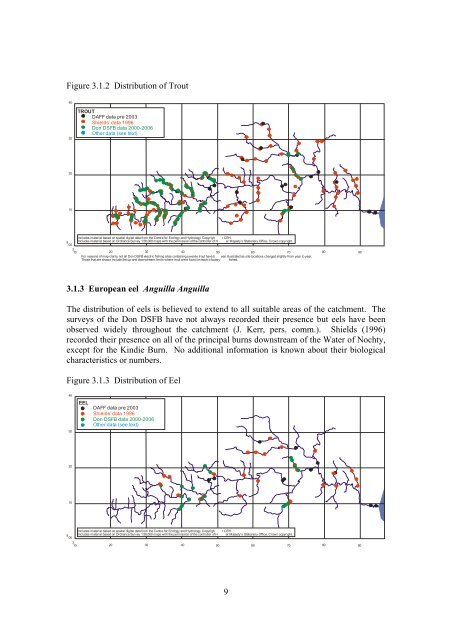
Figure 3.1.2 Distribution of Trout4030TROUTDAFF data pre 2003Shields’ data 1996<strong>Don</strong> DSFB data 2000-2006Other data (see text)2010Includes material based on spatial digital data from the Centre for Ecology and Hydrology. Copyrigh t CEH.8 Includes material based on Ordnance Survey 1:50,000 maps with the permission of the controller of H er Majesty’s Stationery Office. Crown copyright.00310 20 30 40 50 60 70 80 90For reasons of map clarity not all <strong>Don</strong> DSFB electric fishing sites containing juvenile trout have b een illustrated as site locations changed slightly from year to year.Those that are shown include the up-and downstream limits where trout were found on each tributary fished.3.1.3 European eel Anguilla AnguillaThe distribution of eels is believed to extend to all suitable areas of the catchment. Thesurveys of the <strong>Don</strong> DSFB have not always recorded their presence but eels have beenobserved widely throughout the catchment (J. Kerr, pers. comm.). Shields (1996)recorded their presence on all of the principal burns downstream of the Water of Nochty,except for the Kindie Burn. No additional information is known about their biologicalcharacteristics or numbers.Figure 3.1.3 Distribution of Eel4030EELDAFF data pre 2003Shields’ data 1996<strong>Don</strong> DSFB data 2000-2006Other data (see text)2010Includes material based on spatial digital data from the Centre for Ecology and Hydrology. Copyrigh t CEH.8 Includes material based on Ordnance Survey 1:50,000 maps with the permission of the controller of H er Majesty’s Stationery Office. Crown copyright.00310 20 30 40 50 60 70 80 909